The post Coconut Crab: The Monstrous Predator that Might Have Killed Amelia Earhart appeared first on .
]]>
Coconut Crab in Rangiroa. (Yves Picq/Wikimedia Commons)
The Coconut Crab has been branded as “monstrous” by none other than Charles Darwin himself. The sheer size of the creature would classify it as a monster predator, especially considering its oversized, massive claws. The Coconut Crab is primarily found in the Southern Pacific Ocean and is the largest land-living arthropod. Spanning a spectacular width of 3 feet from leg to leg, and boasting a weight of nearly 9 pounds, it is a species of terrestrial hermit crab that is extremely territorial in nature. They do not like other animals encroaching on their territory for any kind of interaction. A true marvel of nature, the Coconut Crab is able to carry about 6 times its own weight. The species is also commonly known as the “Robber Crab” or the “Palm Thief”. It is also speculated that this humongous crustacean is the reason behind Amelia Earhart’s mysterious death.
Anatomy and super strength
The Coconut Crab, like other crabs, is a decapod- meaning that the crustacean has ten legs. Among these, its front-most legs have massive claws called the “Chelae”. These claws are commonly known as pincers and exhibit enough strength to rip open an entire coconut, thus giving the Coconut Crab its name. There are some rumours that speculate the ability of this crab to tear a human apart, limb to limb.

A coconut crab clinging to a coconut. (fearlessRich/Wikimedia Commons)
Scientifically known as the Birgus Latro, as a juvenile, this crab lives mostly in a borrowed snail shell. Born in the sea, while they transition to land, the crabs live in shells which they outgrow quite soon and develop a tough exterior. This tough exterior, the exoskeleton, is developed by re-calcification, this reinforces the tissues of an animal with calcium. Without the shell to limit its growth, the crab expands exponentially and grows up to a monstrous size.
Predatory skills
The claws are not the only feature that makes the Coconut Crab different from other crustaceans. It is uniquely skilled, along with having the force of a lion’s jaw in its pincers. Among its myriad skill-set, is being able to climb up trees with absolute ease to attack birds that are perched on the branches. Scientist Mark Laidre has described the Coconut Crab’s attack as “ pretty gruesome”.
The typical prey of the Coconut Crab has developed a sense of acute fear and seldom dares to venture near the crab’s home. Birds on low lying branches are generally targeted at night by these ghastly predators. They grab the birds by their wings and break their bone, thus rendering them incapable of flying. Ultimately, the prey becomes food for the crab. Their sense of smell is another feature that helps the Coconut Crab to locate its prey, even in dark areas or at night.
Dietary habits
As implied by its name, the main constituent of the Coconut Crab’s diet is coconuts. However, that is not all that the crab’s diet is limited to; in fact, it is known to eat almost anything- including its own flesh and skin. It eats tropical plants, dead plants, decaying and dead animals, birds, pigs. They tend to partake in cannibalistic practices- eating corpses of dead Coconut Crabs. Eating its own skin is a process in itself while moulting. During moulting, the old, dead skin falls off the crab’s body, and they consume it by chewing it whole.
Hideouts of the coconut crab
The Coconut Crab is found primarily in parts of the Pacific Islands and coasts of the Indian Ocean. They are extremely private creatures and live in burrows dug out in the sand on the beaches. Sometimes they also live under the roots of palm trees, which provides a cool atmosphere to be buried in. Not only does the species live in isolation from other creatures, but it also does not allow their own kind to encroach on their territory.

A juvenile Coconut Crab in a coconut shell. (Drew Avery/Wikimedia Commons)
Reproduction
There are special appendages attached to the abdomen of a female Coconut Crab in which she carries the eggs after mating with her male counterpart. It is necessary for the crabs to live near the sea so that from time to time they can moisten the eggs for proper nutrition and growth. Once the young come out of their eggs, they are left to fend for themselves, growing into fierce independence right from birth.
Amelia Earhart’s gruesome death
Humans are the natural enemies of any predator. Encroaching on the Coconut Crab’s territory is rather risky since the predator is antisocial by nature. Locals in the Pacific islands, where the crabs are usually found, have had their fair share of gruesome encounters with the Coconut Crab. Among the reports of the many humans who might have succumbed to the Coconut Crab’s attack, Amelia Earhart is possibly the most well-known.
During her final flight, Amelia Earhart may have crash-landed on one of these Pacific Islands- severely injured, and left bleeding on the beach. Amelia, in such a condition, would have been a vulnerable prey to any predator, especially the Coconut Crab. According to the team of researchers who found a fractured skull, attributed to Amelia Earhart on the Nikumaroro Islands, the victim was bludgeoned to death by the vicious Coconut Crabs. They concluded that Amelia was possibly torn apart and feasted upon. Experiments on the very same beach with a pig carcass was conducted, yielding gruesome results, as the researchers watched the carcass being torn apart by a large number of these predators.
Rapidly decreasing population of the coconut crab
While it is commonly believed that the International Union for Conservation of Nature has listed the crab as endangered; the Coconut Crab is in fact listed as ‘data deficient’ since scientists do not really know much about the biology of the crab, or their typical breeding grounds. Despite being a fearsome predator, the Coconut Crab is frequently preyed upon by humans, as they are considered to be a delicacy. In the Pacific Islands, the crab is feasted upon, even though many hunters have reportedly lost their limbs while looking for a coconut crab. Although each crab can live for about 40 years, human activities have led to their habitat being plundered, resulting in early deaths and a rapid decline in their population.
Enjoyed this article? Also, check out “An Up-Close and Personal Encounter with the Alien-Like Pacific Barreleye Fish“.
For more unusual stories & intriguing news follow STSTW Media on Instagram and Facebook. Also, join our live chat discussion on Twitter.
Do you have a story/photo for us?
We welcome your contribution at [email protected]. Please include your name, city, state, and country.
Fact Analysis:
STSTW Media strives to deliver accurate information through careful research. However, things can go wrong. If you find the above article inaccurate or biased, please let us know at [email protected].
RELATED
 March 16, 2019 An Up-Close and Personal Encounter with the Alien-Like Pacific Barreleye Fish
 October 4, 2019 The Extraordinary Exocoetidae – The Flying Fish of the Tropics and Subtropics
 March 2, 2019 Wave Rock: Where a Massive Prehistoric Wave, Just About to Break, is Etched Permanently in Stone
 September 11, 2018 Cave of the Crystals: A Geological Wonder with Giant Shimmering Crystals
The post Coconut Crab: The Monstrous Predator that Might Have Killed Amelia Earhart appeared first on .
]]>The post Kardashev Scale: Measuring a Civilization’s Level of Technology and Its Potential to Advance appeared first on .
]]> Famous astronomer Carl Sagan commented we are in a period of “… technological adolescence.” At this period in time, humans have existed only 0.0015% of the total time since the universe was created. That is over 13.8 billion years and counting. It shows how young we are and also illustrates our extreme potential in that we have taken over our planet so quickly. To test and measure this human capacity, in 1964 Soviet and Russian astrophysicist Nikolai Kardashev devised a scale—Kardashev Scale. This would measure our potential and skill to go beyond the realms of our universe and build an alternative life.
It is widely accepted that this potential will increase so much so we will have the power to not only control our own planet but control other astronomical bodies in the universe, and implement and create new ones. Even to the point of creating new or parallel universes, changing reality and time and space as we know it.
Nikolai Kardashev and The Scale He Built
A troubled earlier life during the Russian Revolution–his father was killed and his mother sent to a labour camp–did not affect his ambition and aptitude for astrophysics. Originally looking for extraterrestrial life using cosmic signals, Kardashev created a scale to measure a civilisation’s level of technological advancement based on the amount of energy it can consume.
It is a logarithmic method meaning that the parameters will constantly change, in this case, the amount of energy a civilisation can produce will increase substantially. When the scale was calculated in the 60s for example, Earth was ranked at type I in the chart while now it has been demoted to type 0. Simply, because we have discovered more about the potential energy the universe holds and the amount we can extract from it.
Types of Civilisation
Originally, there were three types formulated by the Russian. Type I, II and III.
The energy level of consumption per year is as follows:
Type I – 10¹⁶W, (10,000,000,000,000,000 Watts)
Type II – 10²⁶W,
Type III – 10³⁶W.
 Type one is considered a Planetary civilisation—the smallest type like Earth. However, as mentioned, Earth has not reached this stage because we still produce most of our energy from dead matter, with renewable power still in its infancy. This is changing but in 2015, nuclear, hydro and sonar energy were only 30% of the total world’s consumption with the planet remaining heavily reliant on fossil fuels. Earth consumed only 17.35 Terawatts of energy or 17350000000000 Watts, a far cry from 10¹⁶W. For reaching Type I, we will need to harness all available energy from our nearest host star–the Sun.
Another requisite of Type I is being able to control the geographic phenomena of one’s planet such as weather and volcanos. It sounds unbelievable, but not if you remember the old cliché of technology one hundred years ago compared with today. Famous American-Japanese physicist Michio Kaku believes we will reach Type I in less than two hundred years–barring any apocalyptic events.
Type II is a stellar civilisation, not only using the energy of one’s nearest host star but controls it too. The power achieved could transfer energy anywhere in the solar system, a proposed way of doing so via hypothetical solar-powered satellites called Dyson Sphere–the brainchild of Freeman Dyson. They are commonplace in many Sci-Fi films. Alternatively, nuclear fusion (gaining energy from the heat of reactions) is another process. If so, we could control every planet and asteroid in the galaxy. Michio Kaku believes this is possible in two thousand years max. Reaching this stage would make civilisation immune to extinction on a global scale.
Type III–the galactic civilisation does not bear thinking about. We humans today, with our limited electronic symbiosis, would be a primitive footnote if we made it there. We are talking about the potential to consume energy from our galaxy and other galaxies, harness the power from billions of stars, black holes, the ability to travel anywhere in the universe at high speeds, even in the blink of an eye and the aptitude to change and create galaxies. Simply put, the universe would become our playground. Kaku believes this will take anywhere from 100,000 to one million years.
There are now two more levels proposed, such has been the advances in technology. These are less accepted and are fairly similar to Type III.
Type IV – requires 10⁴⁶W
Type V – “the energy available to this kind of civilization would equal that of all energy available in not just our universe, but in all universes and in all timelines.”
Type IV would result in the complete manipulation of the universe to the point of manipulating space and time. Type V would be similar but not just in our observable universe but anything beyond. Ultimately, creating multiverse, parallel universes, manipulating reality as we know it.
The Future
It’s funny to think all this potential could disintegrate in a split second if our fragile civilisation becomes extinct. It has happened many times in the past, one of the most famous being the disputed Toba Catastrophe. Although it can also be argued that even if our civilisation perished, the laws of the universe would not change so surely the next civilisation be it in one thousand years or one billion could reach these points. To be honest, all of this gives more rise to simulation theory.
Either way, if Michio Kaku is correct, we have a few thousand years to protect ourselves and our planet before science can protect it for us. If our civilisation wants to achieve the impossible, then the race is well and on.
Enjoyed this article? Also, check out “Gliese 581g: A Habitable Exoplanet or Just Another Celestial Object Orbiting a Star?“.
For more unusual stories & intriguing news follow STSTW Media on Instagram and Facebook. Also, join our live chat discussion on Twitter.
Do you have a story/photo for us?
We welcome your contribution at [email protected]. Please include your name, city, state, and country.
Fact Analysis:
STSTW Media strives to deliver accurate information through careful research. However, things can go wrong. If you find the above article inaccurate or biased, please let us know at [email protected].
RELATED
 June 8, 2020 The Secret US Mission to Blow Up the Moon- Project A119
 September 1, 2018 Gliese 581g: A Habitable Exoplanet or Just Another Celestial Object Orbiting a Star?
 May 3, 2019 Voyager Golden Records: A Package for the Extraterrestrial from Planet Earth
 August 29, 2018 1999: Jeanne Menjoulet’s Journey to the Dunes of Dasht-e Kavir
The post Kardashev Scale: Measuring a Civilization’s Level of Technology and Its Potential to Advance appeared first on .
]]>The post Rick Rojatt—The Stuntman Who Became Famous as the Human Fly appeared first on .
]]> While many people crave for fame and fortune, there are some who, having tasted each, prefer to revert to anonymity. Rick Rojatt, The Human Fly, is someone in this category. He appeared seemingly out of nowhere to astound the world with his extraordinary, death-defying stunts and disappeared almost as suddenly and offering no explanation. Throughout his career, he had kept his identity a closely guarded secret, and it has remained so ever since.
Rick Rojatt
In 1976, Joe and Dominique Ramacieri, who were Montreal-based sausage-makers and ran a family business called Roma Foods, decided to expand into show business. They formed the Human Fly Spectaculars, Ltd., and hired a stuntman named Rick Rojatt to perform attention-grabbing stunts. Rick Rojatt always appeared in public in a red felt full-body costume that masked his identity. The suit had white stripes and sequins, and he often wore it with a cape and a helmet. He also carried a sceptre sometimes.
As Rick Rojatt’s popularity grew, the public became interested in his personal life, and he had quite a backstory to impart.
According to what Rick Rojatt told the media, he was a Canadian stuntman from Montreal, Quebec, who went by the professional name ‘The Human Fly’. He claimed to have been active as a stuntman in Hollywood in the 1970s, although the California Union has no record of him in their roster of stunt performers. And, as he always wore a red and white mask to cover his face, nobody ever knew what he looked like.
He did, however, reveal some parts of his personal life in an interview with People magazine. According to him, five years before he emerged into the limelight, he had lost his wife and four-year-old daughter in a horrific car accident in North Carolina, and he had barely survived it himself. It took him four years and 38 operations that involved augmenting his skeleton with 60 percent steel to get back on his feet again.
He had since rebuilt his health by following a strict regimen of rising at 3 a.m. every day and going for a six-mile run. After that, he bathed in an ice cube-filled bath.
His steel-enhanced skeleton, or so he claimed, made him almost indestructible, and that was why he dared to perform his incredible stunts.
In another version of the tale, he claimed he was injured after an angry female gorilla flung him across the enclosure while he was working in the Montreal Zoo.
Rick Rojatt’s Aeroplane Wing Walk
In 1976, when he was 29 years old, Rick Rojatt performed the famous stunt that made him a household name across USA and Canada. He walked over the wings of a Douglas DC-8 airplane that was in mid-flight. His company, the Human Fly Spectaculars, Ltd., made a promotional film of the event called “The Human Fly Challenges the Mojave Skies.”
Wearing a red and white mask, a white cape, and a steel-reinforced jumpsuit, with the UCLA marching band playing in the background, the Human Fly made his appearance at the Mojave, California, airport. He informed the gathered media people that he had prepared for the stunt by practising in a wind tunnel. A crane lifted him on the waiting airplane, and his three assistants strapped his chest and legs onto a steel brace device they had fixed with cables to the plane. To help him breathe while in flight, his nose and mouth had oxygen tubes in them.
Once he was in position, he gave a thumbs-up, and the pilot Clay Lacy took off and flew the four-engine jet plane up to 500 feet at a speed of 280 mph over the Mojave desert. They were in the air for about 20 minutes. As Rick Rojatt walked across the plane’s wing, they got caught in a rainstorm, and, at that speed, the water drops hit him so hard that Rick passed out from the excruciating pain. He had to be hospitalized for two weeks to recover.
He repeated the stunt, however, the following year. The only issue in that instance was that his helmet visor came off during the flight, and he had to squint in the high winds.
Revelling in the publicity from these stunts, Rick Rojatt informed People magazine that he had had no reason to be afraid. He also told them that he was planning on performing more death-defying stunts in the near future. These included sky-diving over the English Channel, jumping into a water tank from the CN Tower in Toronto, and sky-diving over Mount Everest.
The purpose behind these stunts was simple, as his manager explained to the media people. It was to make money.
Rick Rojatt’s Motorbike Jump
One of Rick Rojatt’s to-do items was to beat Evel Knievel’s world record of jumping a motorbike over 13 school buses. In 1977, he announced that he would out-do that feat by driving over 27 vehicles. He intended to jump over 36 of them but was dissuaded from the idea by Ky Michaelson, who fitted out his motorbike for the jump.
The motorbike was a 1977 Harley Davidson XL-1000 Sportster, and Ky Michaelson fitted two hydrogen peroxide rockets, each with a 1500 pound thrust, on top of each other under the fuel tank. With these rocket engines, the motorbike could go over 300 mph.
The stunt took place as a half-time show during a disco concert in Montreal’s Olympic Stadium, featuring Gloria Gaynor and various other performers.
Right before the stunt was to happen, Ky Michaelson took a look at the jumping and landing ramps and noticed that the workmen hadn’t built them to the required specifications. He immediately pointed that out to Rick Rojatt and his team and asked them to call off the jump that night. He also reminded them that Rick Rojatt hadn’t even test-driven the motorbike, and to attempt the stunt in these conditions would be disastrous. They refused to listen, however.
According to Ky Michaelson, Rick Rojatt looked completely drunk or drugged. He asked him how to operate the motorbike and then got on it and took off, with white smoke emitting from the exhaust and the music blaring in the background. As the crowd watched, he soared off the launch point and flew over the buses. He managed to reach the 19th bus, and then the motorbike flipped over and crashed on top of him. After the crash, he and the bike went sliding at high speed over the roofs of the remaining buses and then hurtled down the landing ramp.
A silence enveloped the crowd. Everyone thought Rick Rojatt was dead. Nobody could come out of such a crash unscathed. As it turned out, though, if anyone could survive it, it was Rick Rojatt. He had not only broken Evel Knievel’s world record by jumping over 19 buses, but he had also managed to stay alive too. The stunt cost him a broken ankle and various other injuries, but he was otherwise alright. He even waved to the public as the medics carried him off on a stretcher to the ambulance, his mask still in place to safeguard his anonymity.
However, that was the last time anyone saw him in public as The Human Fly.
Thereafter, Rick Rojatt simply disappeared from the public eye, and no one ever heard from him again.
Rick Rojatt: The Inspiration Behind Marvel Comics’ The Human Fly
After Rick Rojatt became a public celebrity with his airplane walk, Marvel Comics was inspired to base a new character, The Human Fly, on him. They gave him the slogan ‘The wildest superhero ever because he’s real!’ The character had the same fantastic back history as the real Rick Rojatt, performed stunts to give money to children’s charities, fought off villains, and saved children in danger.
Written by Bill Mantlo, with inputs from Marvel’s other writers and editors, the first issue of the comic book came out in 1977. It was a short-lived series, lasting from September 1977 to March 1979, with only 19 issues. However, it was quite popular for a while, and the character received a lot of fan mail. Marvel included it in each comic book under the section titled ‘The Fly Papers’.
The real Rick Rojatt—in costume—helped with the publicity blitz by visiting sick children in hospitals and by being a featured guest at children’s charity events. Along with posing for photographs with his fans and signing autographs at each event, he fought off and defeated villains before they could steal the money, to the cheers of everyone present.
What happened to Rick Rojatt?
After Rick Rojatt’s disappearance, his fans made many attempts to track him down and discover what had happened to him. The Ramacieri brothers were not much help, beyond informing the public that they had hired several stuntmen to perform in costume. They hinted that perhaps Rick Rojatt had switched careers to become a musician. Beyond that, everyone came up against a blank wall. There was no mention of the stuntman in any newspapers, not even in the obituary sections. Rick Rojatt’s exact whereabouts remained unknown.
For more unusual stories & intriguing news follow STSTW Media on Instagram and Facebook. Also, join our live chat discussion on Twitter.
Do you have a story/photo for us?
We welcome your contribution at [email protected]. Please include your name, city, state, and country.
Fact Analysis:
STSTW Media strives to deliver accurate information through careful research. However, things can go wrong. If you find the above article inaccurate or biased, please let us know at [email protected].
RELATED
 October 5, 2019 Jim Corbett: A White Hunter Who Became Saviour of Tigers
 April 8, 2020 Mary Ann Bevan- Story of the World’s “Ugliest Woman” and Her Life with Acromegaly
 March 30, 2020 Dr. William Chester Minor: A Learned Lexicographer or a Meritorious Madman?
 November 8, 2019 Tim Berners-Lee, the Inventor of World Wide Web: A Leader in the Face of a Revolution
The post Rick Rojatt—The Stuntman Who Became Famous as the Human Fly appeared first on .
]]>The post Harlow’s Experiment on Rhesus Monkeys for Maternal Love and Cognitive Development appeared first on .
]]>
Harlow’s Experiment: Rhesus macaques’ Typical response to cloth mother surrogate in fear test. (Harry Harlow)
Psychologists have always pondered over the subject of love. Love may be categorized and characterized in many ways, one of which is maternal love. Harry Harlow was one of the first psychologists to understand the depth of the behavioural characteristics, in this context, exhibited by young rhesus monkeys. The characteristics studied included ‘isolation’, ‘maternal deprivation’, and then the introduction of a maternal figure which directly made way for a study of ‘dependency’.
The research conducted by Harry Harlow and a few other social psychologists proved fruitful and they could make a leap forward in terms of cognitive analysis under emotional duress. The primary objectives of Harlow’s experiment targeted two hypotheses. The first of these involved the replacement of a biological mother with a surrogate, and the second involved the study of the physiological bond between the ‘mother’ and child.
Psychology of attachment
Attachment is an emotional understanding or a bond created in search of a safe place. There are various reactions to attachment exhibited in the different stages of life, and some forms of attachment need not be reciprocated.
Harry Harlow got curious about the mechanism of attachment that a newborn rhesus monkey exhibited towards its mother. The mothers were undoubtedly responsible for most of the care given to a baby monkey, yet there were some questions raised about the severity of the bond between the mother and child.
After Harlow finished conducting his experiments, it suggested quite the opposite of what psychologists had assumed about the infallible bond between mother and child. Newborn monkeys, although dependent on mothers for nutrition, preferred the comfort given by “touch”. Although separation may have had an adverse effect on the monkeys and made them behave differently, the results displayed were similar to human psychology.
Separation from the mother
To initiate the first stage of his experiment, Harlow found it necessary to separate the newborn rhesus monkeys from their mothers and render them isolated. The time for which these monkeys were isolated varied and this provided different results when they were reintroduced to other monkeys.
Since these monkeys had experienced no attachment since birth, they found it difficult to communicate and establish any form of contact. Instead, the isolation proved to have severe and diverse effects on the monkeys that made them aggressive towards other monkeys. Not only that, but it also resulted in stress-induced behaviour and anxiety, which made them rock back and forth while clutching themselves. One of the most severe effects included self-mutilation, i.e. biting themselves, scratching, and tearing off the hair on their body, thus self-harming themselves repeatedly.
The length of isolation was directly proportional to the severity of damage they inflicted on themselves, including the stress and anxiety. Those in isolation for brief periods of time showed signs of recovery and stable mental conditions, while those who were in isolation longer showed no signs of recovery or mental health restoration.
Concept of surrogacy

Wire and cloth mother surrogates for Rhesus monkey. (Harry Harlow)
While some monkeys were completely separated from their mothers, some were placed in certain spaces where they were deceived to think certain inanimate objects adorned with clothing were the maternal figures. Two inanimate objects were placed in the enclosure, one of them was constructed with a heavy wire mesh and the other was constructed out of wood. The heavy wire mesh object had no clothing or any soft texture covering it, while the wood figure had a covering of terry cloth which provided a soft and warm texture.
There were two instances of this experiment. In the first, they marked both the inanimate figures with food supply (that is, they could dispense milk) that left the newborn rhesus monkeys to rationalize and decide which maternal figure they would opt for. In the second, only the metal figure could dispense milk.
Results from the surrogacy experiment
After extensive research on the behaviour of the monkeys, Harlow observed monkeys resorted to being with the object that had a soft texture. The monkeys felt the need for soft touch and warmth so much that even when the cloth-clad wooden figure had no nutrition to offer as the wire mesh figure did; they opted to spend time with the wooden object. It happened so, that as soon as they were done feeding from the surrogate made of mesh, they would retreat to the cloth surrogate and stay with it for the rest of the day until they required to feed again.
Harlow also conducted an experiment where he introduced new and foreign objects into the enclosure. Since they had never interacted with any other object, the baby monkeys resorted to going into the arms of the cloth ‘mother’ and cuddle for security. In the cloth-clad wooden figure’s presence, the baby monkeys were ready to explore and showed signs of development in mental health. This concluded that while nutrition is important, infants focus more on the emotional bond of attachment in the form of touch.
Criticism on Harlow’s study
The sheer separation that Harlow subjected the monkeys to was considered inhumane and cruel. Not only did he deprive the subjects of their mothers, but he also subjected them to conditions of fear and a constant state of depression. These research studies had very limited value since they were conducted to understand the similarities in the working of a human brain.
Most of the monkeys subjected to these experiments not only displayed aggression towards other monkeys but towards their children too. Neurotic behaviour led them to a point where they inflicted damage to their children and continued doing so in a pattern. The research has proved somewhat fruitful in certain areas related to the cognitive abilities of human infants, but it is debatable whether the benefits reaped out of experimentation justifies the treatment the animals underwent.
For more unusual stories & intriguing news follow STSTW Media on Instagram and Facebook. Also, join our live chat discussion on Twitter.
Do you have a story/photo for us?
We welcome your contribution at [email protected]. Please include your name, city, state, and country.
Fact Analysis:
STSTW Media strives to deliver accurate information through careful research. However, things can go wrong. If you find the above article inaccurate or biased, please let us know at [email protected].
RELATED
 April 23, 2019 In Tsarist Russia Members of the Secret Skoptsy Sect Believed in Self-Castration
 May 1, 2020 Mental Health in Times of COVID-19
 August 28, 2018 Can There Be a Better Closure to Old Age than Exile of Ubasute?
 August 15, 2019 Demon Core: The Deadly Plutonium Core That Killed Two Physicists at Los Alamos National Laboratory
The post Harlow’s Experiment on Rhesus Monkeys for Maternal Love and Cognitive Development appeared first on .
]]>The post Six Flags New Orleans: The Theme Park That Was Abandoned after Hurricane Katrina appeared first on .
]]>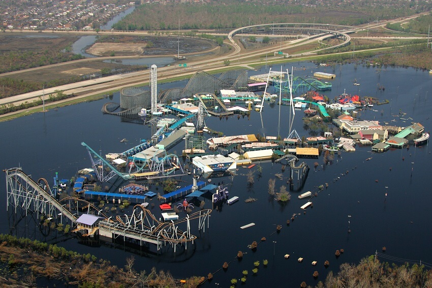
Aerial view of the now-abandoned Six Flags New Orleans theme park. (Chris Woodrich / FEMA Photo Library)
Bounties of nature are blessings. Even the ravages of nature are a blessing, albeit in disguised as a tragedy. So, when New Orleans city of America was hit by Hurricane Katrina, the state administration woke up to its lapses of commission and omission. And realized that it was more of a manmade disaster than a natural calamity. The theme park ‘Six Flags’ built on the sea coast, and ravaged by a hurricane, will now be modelled into a seat of learning about the environment and adventure sports.
The amusement park was hit by Hurricane Katrina
The park was ill-fated right from the beginning. Inaugurated in the year 2000, under the name Jazzland, it went bankrupt in just 2 seasons. Thereafter, in 2003, it was taken on lease by Six Flags, the largest amusement park company in the world. Two years later, in 2005, the park was hit by Hurricane Katrina. Damage caused was huge and irreparable. Hence, the Six Flags was forced to abandon the amusement park.
The tropical cyclone, Katrina, began as a depression over the Bahamas, the island country in the Atlantic Ocean, on 23rd August’ 2005. In the next 2 days, fierce winds blew at 119-154 Km/hr. in Florida, the southernmost state of America. On 27th, the storm intensified in the Gulf of Mexico and became category 3 hurricane with winds blowing at a speed of 185 Km/hr. Very soon, it became the most powerful Atlantic storm ever with winds lashing the Gulf of Mexico with a speed of 275 Km/hr. On 29th August, the hurricane progressed to category 4 in the southeast of New Orleans.


Photos of the abandoned Six Flags New Orleans. (Nathan Hoang / Flickr)
Related: How is the intensity of tropical cyclones estimated?
New Orleans was already flood-prone
Experts had warned much in advance that most of the urban settlement in the city of New Orleans was low lying and prone to flooding. Global warming was causing the sea surface to expand and eat into coastal areas in the course of time. The advice wasn’t taken seriously. Some even believed the city would not be hit by Katrina. But that was not to be, and hell broke loose in the city of New Orleans. New Orleans wasn’t directly hit by Katrina, it was collateral damage that did it in. The 10 inches of attendant rain was too much for the embankment (levee system) put in place to check to the flood of the city’s metropolitan area which was already located below sea level. As the levee system failed, the water of Pontchartrain and Borgne lake rushed in, inundated 20% of the city by the afternoon of 29th August.
Huge loss of life and property in spite of the warning
Mayor of the city, a day earlier, had sounded alert and ordered all inhabitants to move out of the city for safety. About 1.2 million inhabitants followed orders and moved out of the city. But about 10 thousand, willy-nilly, stayed put. And, by 30th of August, 80% of the city was submerged in water. In that situation, the local state administration couldn’t extend the required help to the affected people. With the city’s administrative machinery paralysed, there were instances of looting and arson. People perched on rooftops were salvaged by helicopters. The deluge and its aftermath claimed 1,800 lives. Material damage was to the tune of 160 billion dollars. By far the costliest natural disaster recorded in American history.
The resurrection of the park was impracticable
The Six Flags: New Orleans, situated on low lying 162 acres of land became a ready container for the surge of water flowing from a higher level. The drainage pumps installed in park failed and soon it became a pool of floodwaters, 4-7 feet deep. Material damage was huge. 80% of the park buildings were demolished. Prolonged contact with saltwater corroded the metal of fun gadgets and rides installed in the theme park. Repairing and restructuring the damage was deemed untenable. And the possibility of restarting the amusement park in future was put to rest.


Photos of the abandoned Six Flags New Orleans. (Nathan Hoang / Flickr)
The ruined park became a public nuisance
There are people who revel in exploring the deserted and the abandoned urban sites. It is their way of having a first-hand feel of ruins which were glorious in their heydays. Could the remains of park cater to such people, and become a destination for urban exploration (Urbex)? No. Reason being wanton pilferage, and take-away in the name of souvenir, which would invariably happen in urbex. Also, because the area of the decrepit park isn’t safe for the visitors. It is flushed with wildlife like alligators, snakes, wild hogs, rabbits and insects. For the people living in the neighbourhood, as of now, the park is an eyesore, a festering wound that must be treated as soon as possible.
Is Six Flags New Orleans reopening?
At present, the desolate park is closed for visitors. Entry to the site is declared illegal. In the year 2016, the possibility of reviving the Six Flags Park, and attracting investors for same, was thoroughly explored. But to no avail. Therefore, it was finally decided to remove all traces of what remains on-site as a remnant of the erstwhile Six Flag’s funfair.
Mayor of the city of New Orleans, LaToya Cantrell, declared in May this year that the leftovers of the park would be demolished to clear the ground for another establishment. The exercise would cost 1.3 million dollars to the state exchequer. The evacuated land would be used to establish an institution land for creating awareness about climate change. It would also be a school for zipline courses on adventure sports, and guided tours to the nearby wildlife refuge.
Special thanks to Nathan Hoang from Flickr for releasing the photos of the abandoned theme park in creative commons.
Fact Analysis:
STSTW Media strives to deliver accurate information through careful research. However, things can go wrong. If you find the above article inaccurate or biased, please let us know at [email protected].
RELATED
 February 13, 2020 Hashima Island: A Once Bustling Japanese Metropolis That Now Reminisces Its Hauntingly Tragic Past
 July 2, 2019 Varosha: The Abandoned Luxury Retreat in the Mediterranean
 February 8, 2019 Al ’Ula Town: A Once-Flourishing Oasis That Now Lies in Dust, Hidden from the World
 May 22, 2019 The South China Mall: Why Did the Largest Mall in the World Fail?
The post Six Flags New Orleans: The Theme Park That Was Abandoned after Hurricane Katrina appeared first on .
]]>The post Mammoth Camera: When George Lawrence Built an Enormous Camera for One Particular Picture appeared first on .
]]>
A very large camera called Mammoth Camera designed by George R. Lawrence. (George Raymond Lawrence/Wikimedia Commons)
Ever wondered how photographers managed to get wide-angle shots long before modern-day mobile phones came equipped with panorama picture options? Turns out, George Raymond Lawrence had figured it out way back in the 1900s. A professional photographer and an innovator, Lawrence is credited with designing the world’s largest camera, which weighed more than 1,400 pounds. Called Mammoth Camera, he designed it at the behest of Chicago & Alton Railroad Company to shoot the world’s most beautiful train ever built.
Life of George Raymond Lawrence
Born in Ottawa, Illinois, in February 1868, George Lawrence was the eldest of six children. After completing his education, he moved to Chicago in 1889, where he worked for a carriage manufacturing unit called Abbott Buggy Company. At the factory, Lawrence invented a method to fix iron rims on wooden wheels of carriages, making it easier for trains to run smoothly.
After a brief innovating stint at Abbot Buggy Company, Lawrence looked for other options. He opened up a photo studio with a friend where he began working on crayon enlargements, which were quite a rage amongst the rich during the late 1800s. These photographs were usually retouched monochromatic portraits done in charcoal or pastel, which Lawrence enhanced and enlarged with the help of the new equipment he had purchased.
When in the year 1893, his partner left the studio and Chicago for good, Lawrence learnt the art of developing negatives from a local photographer. Putting this knowledge to good use, he focused his attention solely on photography and its techniques. He perfected the flash photography technique, which until the mid-1890s wasn’t even the trend, thus earning the nickname ‘Flashlight’ Lawrence.
Photography and Other Innovations in the Field
George Lawrence was quite a researcher and trendsetter when it came to photography. He worked hard to come up with newer techniques to shoot the world from a fresh perspective. Before he designed the Mammoth Camera, Lawrence worked on novel ways to click aerial pictures that gave one a surreal feeling. Aerial photography soon became his forte, and he designed large-format cameras to click aerial shots. Lawrence experimented more in this field further. He used telescoping towers to click the bird’s eye view of parks and racetracks, which unfortunately did not turn out the way he wished.
In the year 1901, he designed a customized gas-filled hot-air balloon, to which he attached a fragile cage underneath. He would climb into the cage with his camera for an aerial shot of the city’s urban scenes. Once, while ascending a little over two hundred feet, his cage detached from the balloon, hurling him and his camera towards the ground. A few telephone lines broke his fall, and he survived miraculously. This led him to improvise further. He continued using balloons for a brief period, before bringing in unmanned kites with cameras attached to them to do the job for him.
The arrival of Mammoth Camera
In 1899, the Chicago and Alton Railroad Company decided to run an express service from Chicago in Illinois to St. Louis in Missouri, for which they had built a specially-designed train. Calling it the Alton Limited, this train was considered to be the largest and the finest train in existence. With six Pullman parlour cars extraordinarily customised, the Alton Limited was a train to be looked at both from the outside and the inside, according to the Railway Magazine. Each coach of the train was identical with perfect symmetry and uniformity. All the six cars were of the same height; had the same length and even had every single window looking just the same with the same size, shape and style. Even the coal tender that followed the engine was the same height as that of the cars and the hood of the steam locomotive, too, rose perfectly to a height that matched the coaches.
The railroad company wanted a picture clicked of their prized possession in its entirety, all in one frame. That is when George Raymond Lawrence was asked to step in. The company wanted an eight-feet-long photograph of the Alton Limited, which George Lawrence thought was a mean feat to achieve. He suggested that the train be clicked in sections, which would then be joined together during the printing process. But the company directors wanted a flawless picture of their flawless train. And so Lawrence went on to build the world’s largest photographic device – the Mammoth Camera – only to click a perfect picture of the perfect train.
Specifications of the Mammoth Camera
Built in a record time of two-and-a-half months by camera manufacturer J. A. Anderson, George Lawrence oversaw the camera’s production and design. Costing 5000 USD then (approximately 154,000 USD in today’s times, adjusted for inflation), the Mammoth Camera was finished throughout in natural cherry wood. It weighed around 1400 pounds in total, with the camera weighing 900 pounds and its plate holder weighing 500 pounds. Its lenses were of the Carl Zeiss patent, with one wide-angle lens and one telescopic rectilinear lens. The former lens format gave a five and a half feet equivalent focus and the latter gave a ten-feet equivalent focus, which was also the lens used to click the Alton Limited. The Mammoth had a single 8’x 4.5’ single glass negative, which was almost three times larger than the size of an average plate ever exposed.
At the back of the Mammoth was a small track which was employed to run two focus screens. The bellows had a rubber covering and a quarter-inch thick veneered wooden piece stiffened each of its folds. Approximately forty gallons of glue was used in the construction of the large bellows, which was doubly light-proofed by a heavy, black canvas lining on the inside. The bellows were huge enough to hold six men inside it for its working, while an additional 15 men were required to operate the camera on the outside. A specially designed isochromatic plate was used to conserve the original colour of the Alton Limited in all its glory.
Since Mammoth could not afford to snap-shoot due to its sheer size, an exposure time of two-and-a-half minutes was maintained between shots. While cameras are prone to accumulate dust particles, an ingenious method was used to keep that in check too. The plate holder was put in position and an operator would enter the front board. When the door closed behind him, he would cover the lens with a ruby glass cap and draw a curtain slide to avoid dust entering inside further. He would then clean off the big plate with a camel’s hairbrush in the darkroom and later the slide would close and the operator would come out the same way he went in.
Clicking the Alton Limited with the Mammoth
On a clear morning in 1900, a padded van drove down to Chicago railroad station, from which emerged George Lawrence’s Mammoth Camera. It was then painstakingly transferred on to a flat rail coach and taken down to Brighton Park. There it was positioned in an open field at a vantage point of the Alton Limited, which was stationed further away on the tracks. Operators began assembling the giant camera and after setting the two-and-a-half minutes exposure time, a perfect negative was locked, which finally resulted in the ultimate photograph of the most stunning train to have ever been made.

Alton Railway’s Alton Limited locomotive photographed by George Raymond Lawrence. (George Raymond Lawrence)
Three copies of the huge photograph were later sent as an entry to the 1900 Paris Exposition. But despite George Lawrence winning the prize for World Photographic Excellence, the picture came under the microscope for its authenticity. When Lawrence and the railroad company submitted affidavits to verify the same, the exhibition officials had to believe that the large picture clicked was indeed the work of a single camera.
Built for a specific purpose, George Lawrence did not let Mammoth go so easily and used it occasionally. It was once used to click a very large group photograph, where the expressions of each individual were captured perfectly in one shot. Although towards the late 1910s, George Raymond Lawrence left photography and turned to aviation designing, his craftsmanship and masterpiece still remain legendary.
For more unusual stories & intriguing news follow STSTW Media on Instagram and Facebook. Also, join our live chat discussion on Twitter.
Do you have a story/photo for us?
We welcome your contribution at [email protected]. Please include your name, city, state, and country.
Fact Analysis:
STSTW Media strives to deliver accurate information through careful research. However, things can go wrong. If you find the above article inaccurate or biased, please let us know at [email protected].
RELATED
 February 17, 2020 Sailing Ships: A Brief History Into the Beginning and End of Plain Sailing of the Ancient Boats
 March 4, 2019 Ugly Law: When the US Banned Unsightly Individuals from Coming Out in Public
 November 21, 2018 Futurama – Unveiling the City of the Future at the 1939 New York World’s Fair
 October 7, 2019 Anti Tank Dog: The Soviet ‘Masterplan’ that Backfired to Disastrous Effects
The post Mammoth Camera: When George Lawrence Built an Enormous Camera for One Particular Picture appeared first on .
]]>The post From Local to International Calls-Evolution of Telephone Codes appeared first on .
]]>
Country calling codes map. (Maximilian Dörrbecker/Wikimedia Commons)
Telephone codes were introduced to manage the ever-increasing database of telephones worldwide. Calling codes were simple numbers to begin with. The USA got number 1, Africa 2, Europe 3 and 4. These were further classified depending on their load capacity. So, France and UK got catchy two-digit numbers, 33 and 44 respectively. Smaller countries, like Ireland and Iceland, got 3 digits, 353 and 354 respectively. The objective, as per the Red book (1960) of International Telecommunication Union (ITU), was that the code and the telephone number put together should not exceed 11 digits.
Numbers soon got cluttered and unwieldy
The blue book (1964) divided the world into 9 zones. Zone-1 for North America, Zone 2 for Africa, and Zone 3 and 4, for Europe. One to three-digit codes were allotted to different countries. Subsequently, white book (1968) gave code 37 to East Germany. Trucial states (the tribal states in southeastern Arabia) got 971. Zanzibar (a region of Tanzania) got 252. Turkey, its European code 36 discarded, was shifted to zone 9 (Western Asia and the Middle East), and given a new code 90. The Green Book (1972) shifted many Central American countries from zone 1 (North America) to zone 5 (South America). Tribal states in southeastern Arabia got renamed as ‘United Arab Emirates’ and got 971 as calling code. Ceylon and Rhodesia retained their code, 92 and 263, even as their names got changed to Sri Lanka and Zimbabwe, respectively.
Digital era brought stability in code profiling
The arrival of the personal computer put an end to regular updating of codebooks. The Republic of Upper Volta got a new name – Burkina Faso but retained old code – 226. The Falkland Islands earlier clubbed with Guatemala, got a separate code – 500. North Korea got a new code – 850. As Germany re-united in 1990, united Germany adopted West Germany’s 49, dropping East Germany’s 37. Eritrea separated from Ethiopia (251) in 1993 and got a new code, 291.
The last shuffle of the 20th century was the Middle East
In 1993, Yugoslavia (38), was replaced with Serbia and Montenegro (381), Croatia (384), Slovenia (386), Bosnia (387) and Macedonia (389). In 1995, Vatican City got a separate code 379; earlier it was clubbed with Italy (39). Czechoslovakia (57) was divided into the Czech Republic (420), and Slovakia (421) in 1997. East Timor separated from Indonesia in 1999 and got the code 670. The same year, Palestine got 970, separate from Israel (972).
Today, only 6 countries retain the codes allotted by the Red Book of 1960. The method, as well as madness (politics), have seemingly decided the codes that are functional today.
For more unusual stories & intriguing news follow STSTW Media on Instagram and Facebook. Also, join our live chat discussion on Twitter.
Do you have a story/photo for us?
We welcome your contribution at [email protected]. Please include your name, city, state, and country.
Fact Analysis:
STSTW Media strives to deliver accurate information through careful research. However, things can go wrong. If you find the above article inaccurate or biased, please let us know at [email protected].
RELATED
 September 2, 2020 Sana’a, Yemen: The Cradle of Arabian Ancestry
 October 9, 2018 Llanfairpwllgwyngyll: A Mindless Tongue Twister or a Place in UK?
 April 17, 2020 The Ancient Multistory Underground Cities of Turkey Housed Thousands of People
 January 31, 2019 The Lonely House on Ellidaey Island, Where Nobody is Sure of its Residents
The post From Local to International Calls-Evolution of Telephone Codes appeared first on .
]]>The post Anton LaVey: The Man, The Myth and The Devil appeared first on .
]]>
Anton LaVey. (erico luxero / Flickr)
Anton Szandor LaVey was a man with multiple titles, “The Father of Satanism” and “The Black Pope” are two of the names he’s referred by. An occultist and a self-proclaimed sorcerer, Anton LaVey in 1966 founded a new religion-Satanism, opposing the beliefs and teachings of Abrahamic religions.
The Devil is in the details
Born as Howard Stanton LaVey (on 11th April 1930) to Michael Joseph LaVey and Gertrude Augusta (Coulton) LaVey. While his father hailed from Ohio, his grandparents were from Russia, who immigrated to the US in 1893 and then became naturalized citizens. Soon after he was born, his parents moved to California. Influenced by his mother’s Eastern European origins, Anton became fascinated with obscure naturalistic traditions. He was obsessed with paranormal literature and Gothic novels, including Dracula and Frankenstein. Despite the misconceptions (and a claim made by LaVey himself), he never joined a circus. That said, sessions during the Christian revival meetings were apparently what made him deeply cynical of religion as an institution.
LaVey loved music, trying a variety of musical instruments to eventually settle for the keyboard because of its flexibility and versatility. Anton’s mastery over the instrument allowed him to become an organist in bars and lounges.
The Birth of a New Church
Alongside his musical career, LaVey continued his research on the paranormal. He was very social and charismatic, throwing lavish parties that attracted anthropologists, horror and sci-fi writers, sexologists, and so on.
As his popularity soared, so did the scope for his lectures on the occult. He started amassing more and more disciples. In April 1966, after shaving his own head, Anton LaVey established the Order of Satan, with his painted black Victorian mansion as its headquarters.
Out with the Old Gods, here comes the New
Contrary to popular belief, the church itself was atheistic in nature, since the Order did not worship the literal Satan. Anton was a man who believed in egoism and individualism up to a point that he was an anti-egalitarian. His work was influenced by Nietzsche, Ayn Rand, H. P. Lovecraft and others. He rationalized the use of Satan imagery as a rebellion against Christianity. The occult was like a ‘do-it-yourself god kit’ that provided a much-needed alternative and indulgence. He strongly believed in the indulgence of oneself as long as it doesn’t hurt others.
LaVey was very heavily criticized by conservative society for being a ‘showman’ and a ‘fraud’. When asked for his comment on these criticisms, he simply replied: “Oh! If someone begs to be misused, I will gladly oblige.”
A Cult of Personality
The bulk of information on LaVey is actually missing. From unreliable historians to mystifying himself into a legend, very little is actually known from his early personal life. It seems that with the growing influence of his cult; he did not like to reveal certain aspects of his life. His own biography provides exaggerated or even false information. For example, LaVey claimed he had a brief affair with Marilyn Monroe, back in the day, when she was an unknown dancer at Mayan Theater. However, all the staff including the manager confirmed Monroe was not a dancer there at that point in time.
LaVey also claimed that he was a millionaire and owned obscure property like a 185-foot yacht. However, in reality, he earned around $50,000 a year and was declared bankrupt in the year 1989. His final years were subsidized by California Welfare Aid.
A Family Splinters
LaVey’s aura of obscurity and larger-than-life personality loomed over his disciples. A lot of people were quite unhappy with his rigorously strict management laws (such as membership never exceeding more than 2,000 people). This led to the fractionalization of his church. For instance, The Temple of Set was formed after LaVey abolished the system of regional groups or grottos. He had decided instead to sell priesthoods in the Church of Satan in exchange for cash.
Many also dissented from certain principles of LaVey’s and created their own satanic religions. The Satanic Temple is one of these, and considers itself to be a ‘natural evolution of the satanic thought’. They incorporated ideas such as egalitarianism, social justice and the separation of the Church and the State. The Satanic Temple also criticized the original LaVeyan Satanism for its lack of interventionism and political lobbying. LaVeyan Satanists responded by rejecting them as ‘real Satanists’.
The Legend and his Legacy
On 29th October 1997, Anton LaVey died due to complications stemming from pulmonary oedema. His funeral was held in Colma and he was later cremated. His daughter Karla LaVey declared herself his heir and took Anton’s place as the new High Priestess of the Church of Satan. She announced the same in a press conference while disclosing his death. The controversial and charismatic reputation of Anton LaVey lives on through his legacy- the Church of Satan, which continues to draw people into its fold.
For more unusual stories & intriguing news follow STSTW Media on Instagram and Facebook. Also, join our live chat discussion on Twitter.
Do you have a story/photo for us?
We welcome your contribution at [email protected]. Please include your name, city, state, and country.
Fact Analysis:
STSTW Media strives to deliver accurate information through careful research. However, things can go wrong. If you find the above article inaccurate or biased, please let us know at [email protected].
RELATED
 June 13, 2019 Hetty Green: The Richest American Woman Who Was Known for Her Extreme Miserliness
 June 25, 2020 Why the Apollo 11 Astronauts Went through Customs & Immigration after Entering Earth?
 December 15, 2020 Rick Rojatt—The Stuntman Who Became Famous as the Human Fly
 April 14, 2020 The Lone Empress— The Untold Story of Jayalalithaa, Iron Lady of Indian Politics by Vaasanthi
The post Anton LaVey: The Man, The Myth and The Devil appeared first on .
]]>The post Green Flash: An Incredible Meteorological Phenomenon That Occurs at Sunset and Sunrise appeared first on .
]]>
The stages of green flash. (Brocken Inaglory/Wikimedia Commons)
“It’s said that once you’ve seen a green flash, you’ll never go wrong in matters of the heart.”
Ever since Jules Verne included the green flash phenomenon in his popular science-fiction novels, myths about it have taken off into the wind. Although, it’s a rarity to witness this phenomenon. If you are lucky or quick, you may be able to see a green flash when the sun is setting. Sometimes, it also occurs when the sun is rising or under specific atmospheric conditions when the sun is high in the sky.
The green flash phenomenon
Pilots, when flying westward, have reported seeing the green flash phenomenon at the time of sunset. This phenomenon usually lasts for one to two seconds, however, Polar explorer Adm. Richard Byrd and his crew while on an expedition to Antarctica in 1929 claimed to have seen it for 35 minutes. These sights are easy to see from a mountaintop and when along the seaside due to an unobstructed vision of the horizon.

The sequence of M-Mir green flash phenomenon. (Ityllux/Wikimedia Commons)
Types of green flashes
According to the American Association for the Advancement of Science, green flashes fall in four categories:
Inferior mirage or I-Mir: It occurs when the water surface is warmer than the air right above it. The inferior mirage flash that you see then is oval and flat and lasts around one to two seconds.
Mock mirage or M-Mir: Mock mirage flashes appear higher up in the sky and when the water or earth surface is colder than the air above it. One will see these green flashes as thin strips coming off the sun. They, like Inferior Images, only last for about one to two seconds.
Subduct flash: Subduct flashes are quite rare and occur due to the atmospheric inversion phenomenon during which the sun appears to take on an hourglass shape. It happens when cold air and moisture get trapped near the ground level by a warm air layer. The green subduct flash then appears at the sun’s top region. It lasts for about 15 seconds.
Green ray: A green ray is a comparatively rarer phenomenon. It usually occurs for a second, right after the sun has set, with a green ray emanating up a few degrees from the green flash up. It only occurs if the inferior mirage, mock mirage, and subduct flash are brighter than normal, and the atmospheric conditions are hazy.
Why the green flash phenomenon occurs?
When the light from the sun reaches the earth, its atmosphere acts as a prism and separates the light into different component colours. The colours with shorter wavelengths, such as blue, green, and violet, have stronger refraction than those with longer wavelengths like orange, red, and yellow.

Green flash above the solar disc. (ESO/G. Lombardi)
As the sun dips below the horizon, the atmosphere absorbs the orange, red, and yellow colours and scatters the blue and violet light colours. That leaves the green light colour, and that is why it is visible when the sun is setting or rising. And due to the layering of the atmosphere caused by temperature differences, the green flashes appear as ripples from high elevation points like mountaintops.
Photographs of the green flash phenomenon
The first colour photograph of the green flash phenomenon is from 1960, and a photographer named D.K.J. O’ Connell took it. At the time, he was at the Vatican Observatory to observe the sunset. Since then, various people have managed to photograph or video this phenomenon.
Green & red rims of the sun
Green rims about the sun are more common than green flashes. They are prominent at the time of sunset and sometimes transform into a green flash and back, but are difficult to see with the naked eye. Using a binocular or telescope for viewing is not advisable as they are harmful to eyes. One may see it safely, though, if projected as a magnified image on paper. The green rim grows fainter and is overpowered by the red rim as the sun touches the horizon.

Green & red rim of the setting sun. (Brocken Inaglory/Wikimedia Commons)
The green flash phenomenon in popular culture
As you might expect with one of the many amazing natural occurrences that have intrigued people over the centuries, the green flash phenomenon has figured prominently in popular culture. The famous science-fiction writer, Jules Verne, mentioned the phenomenon in his 1882 novel, The Green Ray, as well as in his 1905 book, The Lighthouse at the End of the World. Other novels that mention it include Victoria Holt’s Pride of the Peacock from 1976, William S. Burroughs’ Cities of the Red Night from 1981, Carl Hiaasen’s Flush from 2005, and Elizabeth Wein’s Code Name Verity from 2012.
Many musicians have also found the green flash to be inspirational. In 1916, Mario Castelnuovo-Tedesco composed II Raggio Verde, op. 9, a piano solo that expounded upon the emotions arising from seeing the phenomenon. Much later, in 1991, Gavin Bryars debuted his orchestral composition, The Green Ray.
The films that feature the green flash phenomenon or use it as a plot device include Pirates of the Caribbean: At World’s End from 2007 and Blue Lagoon: The Awakening from 2012. It also appears in episode 982 of the Pokémon Sun & Moon anime.
So, if you plan on seeing the green flash. Wait for a clear, cloudless, and haze-free day, and keep your eye on the distant horizon. Even if it doesn’t make you an expert in sentimental matters, you will be in the lead when it comes to the meteorological ones.
Caution: Since looking at it with the naked eye is likely to harm the eyesight, one should be precautious and see it through a regular camera or a video camera lens.
For more unusual stories & intriguing news follow STSTW Media on Instagram and Facebook. Also, join our live chat discussion on Twitter.
Do you have a story/photo for us?
We welcome your contribution at [email protected]. Please include your name, city, state, and country.
Fact Analysis:
STSTW Media strives to deliver accurate information through careful research. However, things can go wrong. If you find the above article inaccurate or biased, please let us know at [email protected].
RELATED
 November 13, 2018 Luigi Galvani: The Man Who Fuelled the Idea of Re-Animating Human Corpses
 September 18, 2019 Understanding Day Length Fluctuations – What They Are and What Causes Them
 August 10, 2019 Eigengrau is the Dark Gray Colour That Most People See in the Absence of Light
 April 15, 2019 Vantablack: A Manmade Substance that is Blacker than the Blackest of Black
The post Green Flash: An Incredible Meteorological Phenomenon That Occurs at Sunset and Sunrise appeared first on .
]]>The post Nixon’s Pyramid: The $6 Billion Safeguard Program Which Lasted One Day appeared first on .
]]>
The Pyramid of North Dakota. (Library of Congress)
In the United States, on the border of North Dakota, in a small village called Nekoma (a village that holds around 50 people) near Canada is a $6 Billion construction which was more or less abandoned. This an anti-ballistic missile system (ABM) in the shape of a pyramid, known as the Stanley R. Mickelsen Safeguard Complex, was built as a defence system for US missile silos to protect mainly against the Soviet Empire during the Cold War. They would protect America’s missiles by intercepting any threat which entered Earth’s orbit. There were twelve buildings planned in the 1960s all across the States, but construction did not start until the 1970s.
In 1972, however, President Nixon and Soviet leader Leonid Brezhnev signed the Anti-Ballistic Missile treaty. It meant each country could have two anti-missile centres, but by 1974 another treaty was reached for each country to only have one. This stopped construction of the other eleven before they even started laying bricks. The remaining complex in North Dakota was operational for a mere 24 hours before being the program was cut, the government citing it was too costly to run.

Part of the Stanley R. Mickelsen Safeguard Complex. (Terry Robinson/Flickr)
The workings of the Safeguard Program
Missiles are guided and powered by explosives driven by engines with fuel. They use ‘contact fuses’ to explode on impact. Missiles are classified depending on their range, anything greater than 5,500 km is an intercontinental missile. Most of these missiles are lost by the time it reaches outer space with only the ‘post-boost vehicle’ or ‘re-entry vehicle’ containing a nuclear warhead coming back to the ground.
The Safeguard Program was to protect missile silos holding missiles called LGM-30G Minuteman III. The program was evolved from Nike Zeus, Nike-X & Sentinel anti-ballistic missile systems, yet all were deemed not good enough and so Safeguard was initiated. The missiles in the Safeguard Program included thirty Spartan and sixteen Sprint missiles. There are two types of ballistic missiles–ones that follow a suborbital trajectory and those that travel a distance above the Earth. The Spartan missiles would target those incoming from outside the Earth’s atmosphere and the Sprint missiles–with a smaller range–would operate within. Out with the missiles, the system had a Perimeter Acquisition Radar and Missile Site Radar to detect any threats.
It became operational on the 1st of October 1975, only to be decommissioned the very next day by the House Appropriations Committee and Senate.
War’s an expensive game
The cost breakdown was confusing to say the least. An archived report illustrates this with breakdowns on cryptic deductions. There was $112 million spent in materials, $481 in ‘lost effort’–such as excess equipment and materials, restoration of the site – and $697 in ‘schedule changes’ – noting research and development, procurement and construction. The report makes interesting reading and automatically relates to the idiom ‘more money than sense’ however the minds running this project must have been highly intelligent. It is a staggering amount of money and leaves a lot of unanswered questions.
It is easy to say that allowing the building of this site was madness, but war–needless to say–is a difficult time for the governments involved. It would be nice to say the world is a different place now and maybe it has moved on a bit, but the money spent on fighting is still a staggeringly unjustifiable amount from a pacifist point of view. Yet, just how many programs like Safeguard have been commissioned and decommissioned over the years.
The Stanley R. Mickelsen Safeguard Complex still stands proud today, similar in look at least to the Great Pyramids of Egypt but without the lengthy history.
Enjoyed this article? Also, check out “Project MKUltra: CIA’s Cold War Conspiracy to Secretly Control Human Mind Goes Wrong“.
For more unusual stories & intriguing news follow STSTW Media on Instagram and Facebook. Also, join our live chat discussion on Twitter.
We welcome your contribution at [email protected]. Please include your name, city, state, and country.
Fact Analysis:
STSTW Media strives to deliver accurate information through careful research. However, things can go wrong. If you find the above article inaccurate or biased, please let us know at [email protected].
RELATED
 March 5, 2019 Saint Pierre and Miquelon: A French Territory in North America and the Last Bastillion of New France
 March 10, 2020 World War 2– Direct and Indirect Intervention in World War Two by the United States of America
 March 28, 2019 Fort Montgomery: When North America Made a ‘Monumental’ Mistake on the Other Side of the Border
 October 17, 2018 The Horrors of Hiroshima Bombing: Human Shadow Permanently Etched in Stone
The post Nixon’s Pyramid: The $6 Billion Safeguard Program Which Lasted One Day appeared first on .
]]>The post Betty Robinson: How a Plane Crash Survivor Became the Fastest Woman of Her Time appeared first on .
]]>From catching trains to training for the Olympics

Betty Robinson. (Library of Congress)
Betty Robinson (or as folks would name her ‘the Babe’) was born as Elizabeth M. Robinson on 23rd August 1911 in Robinson, Illinois. Leading a quite generic all-American lifestyle, the turning point in her life was four months before the Amsterdam Olympics when she was trying to catch her local train to the Harvey High School. The assistant track coach of her school, Carlie Prince, saw her sprinting at her top speed and catching up to the train in no time, an impossible feat in his eyes. The very next day, he tests and times her speed around the school corridor and sets up a meet. She was perplexed and confused as she was not even aware that women could race as an athlete at that time. Three weeks later, her ‘meet’ turned out to be a competition between the members of the Illinois Athletic Club.
And she blew everyone away. Untrained and unprepared, Betty finished the race to a close 2nd, almost beating Helen Filkey, the fastest runner of the Club. She was offered to join the Illinois Athletic Club, and she eagerly agreed.
The next few months revealed her to be a powerhouse of talent. She was put through a gruelling regimen to further polish her nascent skills, made to run and caught her train over three times a week. She soon ran for the Olympic trials (the very first for her club) and broke records, even ending up as the finalist in the New Jersey. She nearly beat Etla Cartwright, the top runner from California.
The accident of Betty Robinson
Betty broke local, national and global records in Chicago, including the Amateur Athletic Union, until a stroke of ill-fate hit her. On June 29th 1931, Robinson was travelling with her cousin who recently earned his new pilot license and owned a biplane and sustained a major plane crash. The plane took a major nosedive from a height of 600 meters. Her injuries were very severe, including a broken left arm, mangled left leg, and an eight-inch gash across her forehead, and she instantly slipped into coma. Rescuers thought that she was dead. It was only when the undertaker realized that she was actually alive, that she was then taken to an infirmary in Oak Forest. Betty was in the hospital for three months. A lot of press outlets falsely declared her dead, owing to her long absence and serious injuries. The Evening American wrote,
“Lying almost paralyzed on a cot, Betty Robinson today fought to win the hardest race she ever ran – a race in which the Grim Reaper was pacing her.”
It took another three months before she could get off the wheelchair and another month to get off the crutches. She was not able to walk for the next two years and missed the 1932 Summer Olympics. Recovery didn’t make things any better as her injured leg was a one-half inch shorter than the other and she could barely move her knee to crouch.
However, Betty wanted to win at least another gold medal before she finally retired. During her trials for the 1936 Summer Olympics, she only managed to get the fifth of the six-position relay team. “The doctor said if I hadn’t been in such good condition I wouldn’t have come out of it as well as I did”, quoted Betty.
A fated win
On August 9th, 1936, the finalists of the 4 × 100 metres relay in the 1936 Summer Olympics (Germany), sprinted off to reach their ultimate goal, while Hitler sat on a high pavilion assured that the Germans would prove their physical superiority. The race was nearly at the end and the German team was on the verge of beating the US. An unfortunate incident, where Marie Dollinger dropped her last baton which got her disqualified. Though she broke the record of her sprinting, her mistake cost her the race.
And thus Betty won her gold medal.
Happily ever after?
Betty Robinson continued to make new records in the 50, 60, 70, and 100 yards, and after she retired, was inducted into the United States Track and Field Hall of Fame, and the Helms Hall of Fame, and decided to not to advertise or model. She later became an international coach, timer, traveller, motivational speaker and an advocate for female athleticism. Betty was also a spokesperson for organizations such as the Women’s Athletic Association and the Girl’s Athletic Association. She married Richard S. Schwartz in 1939 (a furniture artist) and had two kids: Richard and Jane.
We may remember her many triumphs of the past, but it is likely that she herself did not. Betty was battling cancer and Alzheimer’s disease for a very long time and eventually succumbed to it on 18th May 1999. She was 87 years old. In 1998, during Olympic memorabilia, Betty Robinson and Alfred Oerter Jr. were supposed to cut the rope together. Robinson, however, snipped the ribbon first. “I’m still the fastest”, she said- a statement that perhaps sums up her brilliant journey.
Enjoyed this article? Also, check out “The One-legged Runner Who Challenged Cancer: Terry Fox“
For more unusual stories & intriguing news follow STSTW Media on Instagram and Facebook. Also, join our live chat discussion on Twitter.
We welcome your contribution at [email protected]. Please include your name, city, state, and country.
Fact Analysis:
STSTW Media strives to deliver accurate information through careful research. However, things can go wrong. If you find the above article inaccurate or biased, please let us know at [email protected].
RELATED
 April 13, 2020 The One-legged Runner Who Challenged Cancer: Terry Fox
 April 18, 2018 The Deadly Premonition of Sugar Ray Robinson that came True, 1947
 July 28, 2019 Iftikhar Ali Khan Pataudi – The Only Cricketer Who Played for Both England and India
- June 13, 2019 Hetty Green: The Richest American Woman Who Was Known for Her Extreme Miserliness
The post Betty Robinson: How a Plane Crash Survivor Became the Fastest Woman of Her Time appeared first on .
]]>The post Market Theater Gum Wall: The Sticky Story of a Wall Decorated in Chewing Gum appeared first on .
]]>
Gum wall, Seattle. (Diego Delso, delso.photo, License CC-BY-SA)
The Pike Place Market in Downtown Seattle, also known as the birthplace of Starbucks, is one of the oldest farmers’ markets in the USA. But today, this is not what brings more curious visitors to this already famous place in Seattle anymore. The Market Theatre Gum Wall has taken over the limelight, ever since impatient patrons started ‘decorating’ the walls with chewing gum thirty years ago. A tourist attraction, with a special marking for it in fold-out maps. This gum wall does not have a long story, unlike its actual length in real life.
Location of the Gum Wall and its origins
In Post Alley, Seattle between the Pike and Union streets, an inconspicuously narrow lane leads into the Market Theater – home to Unexpected Productions. A quirky, fruity fragrance hangs in the air; but even before one could recall the fragrance while looking for the source, a multi-coloured artwork hidden in plain sight, springs before the onlookers, leaving them much in awe and aversion.

Gum Wall closeup. (Ben Curry/Unsplash)
The story of the Gum Wall dates back to 1993 when patrons would wait in line to get their tickets for the improv show and stick their gum blobs to the wall for holding on to their coins. Slowly, coins started disappearing overnight, but the practice of sticking chewed gums stayed on, thus leaving behind a remarkably striking legacy on the wall, coming right out of peoples’ mouths. The Gum Wall has only grown piece by piece ever since the first huge lot of chewing gums left the management and preservation department in a sticky situation. In 1999, it was decided to let the Gum Wall stay for more people to come and ‘stick’ their mark in stone forever.
Dimensions of the Gum Wall and attractions
Oddly satisfying, the colourful Gum Wall is now a tourist attraction, with local and international visitors flocking in the millions to see it in all its bright colours. The peculiar brick wall has become a fascinating piece of artwork, which stretches as wide as 55-feet on both sides of the passageway and is almost 8-feet-high, with each brick holding approximately 150 units of bubblegum on it. Apart from the regular gums, jabbed with finger marks in the centre to press it on, the wall also has self-proclaimed artists putting up their art on display. Right from spelling out names to making elaborate but small portraits, along with the heart-shaped love confessions, everything on the wall is left to the imagination.

The gum wall in post alley. (Calvin Hodgson/Flickr)

Gum wall window. (Ruth Hartnup/Flickr)
Cleaning procedures at the Gum Wall
Fearing that the sugar in the gum would erode the brick wall, authorities undertook a steam cleaning operation in November 2015 to wipe out the last bit of gum.

Cleaning crews taking down the famous gum wall. (Alberto Cruz/Flickr)
It took them 130 hours to remove a little more than 1000 kg of gum, but their efforts went in vain. Bubblegum started appearing again, along with visitors, who missed no opportunity to capture the collective artwork in their cameras.
Enjoyed this article? Also, check out “Sedlec Ossuary: The Famous Bone Church of Kutná Hora in the Czech Republic“.
For more unusual stories & intriguing news follow STSTW Media on Instagram and Facebook. Also, join our live chat discussion on Twitter.
We welcome your contribution at [email protected]. Please include your name, city, state, and country.
Fact Analysis:
STSTW Media strives to deliver accurate information through careful research. However, things can go wrong. If you find the above article inaccurate or biased, please let us know at [email protected].
RELATED
 January 22, 2019 Ämari Pilots’ Cemetery: Where Aircraft Tail Fins Adorn Soviet Pilots’ Tombstones
 November 25, 2018 North Sentinel Island: Home to an Uncontacted, Hostile and Primitive Tribe
 April 5, 2019 Sedlec Ossuary: The Famous Bone Church of Kutná Hora in the Czech Republic
 February 1, 2019 Agbogbloshie: Africa’s Largest Ground for Dumping of Electronic Waste from World Over
The post Market Theater Gum Wall: The Sticky Story of a Wall Decorated in Chewing Gum appeared first on .
]]>The post Sana’a, Yemen: The Cradle of Arabian Ancestry appeared first on .
]]>
View of Sana’a, Yemen. (yeowatzup/Flickr)
The geographical region between Northeast Africa and Southwest Asia is called the Middle East. It is verily called ‘the cradle of human civilization’ as it is the birthplace of the world’s earliest known civilizations. Yemen, with its city of Sana’a, is part of this ‘cradle’.
From 9th century BC to 6th century AD, Yemen saw rise and fall of several civilized states like Sabaean (pre-Islamic south-western Arabia mentioned in the biblical story of King Solomon and Queen Sheba), Awsanian (South Arabia) and Minaean (the ancient Yemenis who lived along the present-day strip of desert called Ramlat Dehem). Thanks to the spice trade, the principal vocation of people, these states were rich and prosperous. No wonder the Romans called them ‘Arabia Felix (Happy Arabia)’.
Sana’a, Yemen

Old Sana’a, Yemen. (Rod Waddington/Flickr)
Excavations reveal that the earliest human settlements in Yemen happened around 5,000 BC. The city of Sana’a is located 2,200 meters above sea level, across the mountains of Yemen. It is the oldest Arabian city, which is consistently inhabited for over 2,500 years. Famed as the heartland of Arabs, its 6,000 residential houses (built before 11th century), 14 hammams (bathhouses) and 103 mosques reflect the ancient Arabic architecture. Well-built mud houses and high rise brick towers on a stone base are signature landmarks. Fired bricks and white gypsum are used in making decorative designs. The overall town planning is thoughtful. The brownish colour of structures merges into the colour of earth and the mountain range. A medley of tall minarets, beautiful gardens, and rest houses adds to the spender of the city.

Sana’a, Yemen. (Antti Salonen/Wikimedia Commons)
Himyarite Kingdom
Himyar kingdom, which lasted from 2nd century BC to 525 AD, was the last pre-Islamic statehood. Sana’a was granted the status of a ‘city’ in 2nd century BC. By 1st century AD, it was a key station on the terrestrial trading routes. From AD 525-75, it was ruled by Abyssinians (ancient Ethiopians) professing the Christian faith. The Christian influence on the city peaked from 527 to 565 AD in tandem with the reign of the Roman Emperor – Justinian.
The Great Mosque, planned & constructed in the lifetime of Prophet Mohammed, in 630 AD, contained several pre-Islamic relics. In the 7th Century, as Sana’a transformed into an Islamic state, the pre-Islamic relics were destroyed. Protection has been extended to the old city of Sana’a through Building law of 2002 and Antiquities Law of 1997. World heritage committee has suggested the building of a buffer zone around the old city.

Inside Sana’a, Yemen. (Rod Waddington/Flickr)
Ottoman Rule
With the occupation of Egypt in the 1st Century BC, Romans made the red sea their principal route for business and trade. This weakened Yemen regimes, which depended principally on the land route for trading. Consequently, the Christian Abyssinians took over Yemen in the 4th and 6th centuries. In the later 6th century, the Sassanids of Persia governed Yemen, and in the 7th century, Yemen was ruled by an Islamic state. Following the rapid spread of Islam from Mecca and Madina–where it originated, Yemen was quick to embrace Islam and spread it into other countries as a front-line soldier.
Ottoman rule, founded by the leader of Turkish tribes at the start of the 13th century, gave a new lease of life to Sana’a. Islamic architecture was revived. It reflected loud and clear in the technique of ‘organizing the spaces’. The city was expanded in a big way, and its scenic landscape was enhanced. The houses and buildings were constructed from the material locally available and ensured living comforts and protection during exigencies. That’s the hallmark of Islamic architecture.
From the mid-17th to mid-19th century, Yemen remained virtually isolated from the rest of the world. In the early 20th century, Yemen was split into two states, north for Ottomans and south for British. Ottomans were forced to flee from Yemen following defeat in World War 1 in 1918 and after a series of upheavals, Yemen Arab Republic was formed in 1962.
The civilizations of Bible and Koran mingle seamlessly in the old city of Sana’a. In 1893, Aden (a port city of Yemen) was occupied by the British. With the end of Ottoman rule in 1918, and British rule in 1967, Yemen became a republic in 1990.
Enjoyed this article? Also, check out “Byblos, Lebanon: A World Heritage Site and the Oldest Continuously Inhabited City in the World“.
For more unusual stories & intriguing news follow STSTW Media on Instagram and Facebook. Also, join our live chat discussion on Twitter.
Do you have a story/photo for us?
We welcome your contribution at [email protected]. Please include your name, city, state, and country.
Fact Analysis:
STSTW Media strives to deliver accurate information through careful research. However, things can go wrong. If you find the above article inaccurate or biased, please let us know at [email protected].
RELATED
 May 27, 2019 Byblos, Lebanon: A World Heritage Site and the Oldest Continuously Inhabited City in the World
 October 11, 2018 Socotra Island of Yemen: The Most Alien-Looking Place on Earth
 June 2, 2019 Yemen’s Ancient Town of Shibam is Also Known As ‘Chicago of the Desert’
 December 5, 2018 Decapitation and Consciousness: How Long Can a Decapitated Head Remain Conscious?
The post Sana’a, Yemen: The Cradle of Arabian Ancestry appeared first on .
]]>The post Ennedi Plateau and Aloba Arch: Home to Exquisite Natural Formations and ‘Extinct’ Animals appeared first on .
]]>

Camels arriving at a waterhole in Ennedi. (Wikimedia Commons)
Sahara’s sandstone bulwark
In the northeast of Chad, the Ennedi Plateau spans over the area of Ennedi Ouest and Ennedi Est. While spanning over a large area of 60,000 square km, its highest point is at 4670 ft. above sea level. The Plateau is not just a simple land structure. It has various undulating landforms like towers, pillars, bridges and arches atop it. The Ennedi Plateau is a sandstone bulwark centred on the town of Fada. It is essentially a dry desert owing to its location in the Sahara region.

Sandstone pinnacles in Ennedi plateau. (David Stanley / Flickr)
Fauna of the Ennedi Plateau
One of the primary reasons for the Ennedi Plateau to be declared as a World Heritage site is the vast diversity of fauna that pre-existed and exists on this massive landform. Crocodiles were abundant in this region, once upon a time, and had certain characteristic features like dwarfism, which occurred because of isolation. Threatened by extinction, only a few of these species still survive in river canyons such as the Guelta d’Archei.
The last lions of Sahara became extinct in the 1940s. It is likely that any surviving animals like the Scimitar Oryx Antelopes and the Sudanese Cheetahs may still be found in the sparsely populated areas of the Ennedi Massif. It is also rumoured that a supposed surviving ‘sabre-tooth cat’, also known as the Ennedi Tiger, maybe living there.
Poaching has been prevalent in the Ennedi Natural and Cultural Reserve which has led to a huge decline in the wildlife in the area considerably. There are one hundred and ninety-nine species of birds that utilise the Ennedi Plateau as a migratory crossroad.
The Aloba Arch
When soft rock material gets eroded away by natural agents like wind or water, they form ‘natural arches’. These agents work on worn out rocks susceptible to swift erosion. Sensitive areas include rocks in caves, coastlines, and also areas which have water running through them. Areas that have low frigid temperatures or high-velocity winds that weaken the rocks are also prone to the formation of natural arches. The Aloba Arch in Africa is an example of such a natural arch. Other famous natural arches can be found in Arch Islands in the Falkland Islands, Natural Bridge in Virginia, USA, Natural Arch in Tirumala, India, and the Arches National Park in Utah in the US.
The Aloba Arch is a natural arch in Chad and is a product of the Ennedi Plateau. Large natural arches are uncommon outside the Colorado Plateau of the United States of America and the southern and western areas of China. The Ennedi Plateau in Chad is situated in the north-eastern region, which is near Sudan and Libya. The geological formation of this plateau is strikingly similar to the Colorado Plateau which is in the southwest of the United States. Perhaps the presence of the Aloba Arch echoes these similarities .

Aloba Arch, Chad. (David Stanley / Flickr)
A massive landform, the Aloba Arch stands tall at a height of 394 ft towering over most natural arches. It also claims the distinction of being the eighth longest natural arch in the world. A two-stage formation took place for the creation of the magnificent Aloba Arch. In the first stage, the upper half of the arch was formed at the end of a fin of a sandstone. The result was a natural ‘buttress type’ arch. The lower part of the arch was formed in a softer layer of sandstone, which was eventually eroded by a stream. Consequently, a type of meandering natural bridge was created. This portion is approximately 150 ft higher than the Rainbow Bridge in Utah.
The native people of Ennedi
The natives of this area are a scarce population of semi-nomads consisting mainly of Muslims speaking the Dazaga dialect. While they live in permanent villages in the rainy season in the months of July-September, they disperse for the dry season. Even after Chad’s independence in 1960, Ennedi remained under the military administration of the French till 1965, as the land was thought to be ‘ungovernable’. The French withdrew thereafter upon being requested by the people of Chad. The plateau is an important resource for the semi-nomadic groups to sustain their livelihood. Their requirements of pastures for the grazing of their cattle, and water, both for themselves and their livestock are met here.

Toubou man, the ethnic group inhabiting northern Chad. (ToubouGa / Wikimedia Commons)
With cooperation, an amazing opportunity presents itself to help conserve this world heritage site to support its people and wildlife. Through constant interaction with the locals, it is possible to deliver effective management, law enforcement, and infrastructure. Even the re-population of several significant animal species that have irreplaceable cultural and natural value, is perhaps possible.
The vandalism of Ennedi cave paintings
The cave paintings here depict animals and communities of people living on the plateau and are one of the largest collections of ancient rock art. This priceless structure has however been systematically defaced by the locals over the years. This act of vandalism has severely mutilated the cave paintings. According to reports by BBC, the locals wrote their names in French and Arabic to deface the paintings.

Rock paintings in Manda Guéli Cave, Ennedi. (David Stanley / Wikimedia Commons)
The cultural minister Mahamat Saleh Haroun refers to the vandalism as a “tragedy”. To assess the damage, experts were sent to the location. According to the UN representative for culture in Chad, Abdel Kerim Adoum Bahar, the paintings can be restored.
Enjoyed this article? Also, check out “Penitentes – The Remarkable Ice Pillars of the Atacama Desert“.
For more unusual stories & intriguing news follow STSTW Media on Instagram and Facebook. Also, join our live chat discussion on Twitter.
Do you have a story/photo for us?
We welcome your contribution at [email protected]. Please include your name, city, state, and country.
Fact Analysis:
STSTW Media strives to deliver accurate information through careful research. However, things can go wrong. If you find the above article inaccurate or biased, please let us know at [email protected].
RELATED
 February 19, 2019 Pontcysyllte Aqueduct: A High-Rise Canal-Connect Made of Cast Iron, an Engineering Marvel
 February 5, 2019 White Sands National Monument: Ace Military Testing Area and an Astounding Tourist Destination
- March 2, 2019 Wave Rock: Where a Massive Prehistoric Wave, Just About to Break, is Etched Permanently in Stone
 April 14, 2019 Fingal’s Cave: The Musical Geometry of Nature’s Domain
The post Ennedi Plateau and Aloba Arch: Home to Exquisite Natural Formations and ‘Extinct’ Animals appeared first on .
]]>The post Whale Temple: Where Vietnamese Worship Whales and Revere their Carcasses appeared first on .
]]>
Whale skeletons at the Van Thui Temple, Vietnam. (Bùi Thụy Đào Nguyên/Wikimedia Commons)
Worshipping of idols and building temples for deities with manmade figures of gods and goddesses, is an important part of some major religions of the world. And there are some temples in the world where the object of worship is real, once part of the living world. In the Southeast Asian country of Vietnam, there are dozens of unusual temples dotting the coastline where beached whales are worshipped and the carcasses of cetaceans that wash up dead on the shores are given a proper burial.
How whale worship came to be in Vietnam
The Socialist Republic of Vietnam has had a long history of land and sea migration, with people mostly coming in from neighbouring China. When China ruled over the country, cultural influences of Cantonese origin rubbed off on the Vietnamese. The Chinese were seafaring people, who mostly undertook voyages for trade, travel and leisure; but the journeys were not as easy and effortless as they are in today’s world. This led to many sailors either getting lost at sea in rough weathers or drowning in the choppy tides. The Chinese believed it was the Goddess of Sea – Mazu, who punished them for their sins. And to avoid facing her wrath, people built temples for Mazu, who sailors would thank upon their safe return to land.
Vietnam picked up worshipping whales from Chinese culture, who as per local legends, consider whales as guardian angels at sea. The whales are worshipped and venerated along the coastal cities, where fishing is an integral part of people’s lives. In the port cities and towns of Binh Thuan Province, Ba Ria-Vung Tau Province and Quang Ngai Province, several temples are built along the shoreline where remains of dead whales are put up on display for worshippers to see. A majority of the people from the ethnic Cham community, residing along the South-western coast of the South China Sea in Vietnam follow the practice of whale worship in these harbour towns.
Along the Vietnamese coastline that stretches for around 3200 kilometres, fishing communities live in large numbers, who depend on sand mining, fishing and allied activities to make a living. These people have taken to worshipping the whales (or any other large fish in general) to appease what they consider as their water god. The Lang Ong Nam Hai Temple, the Lang Tan Temple and the Van Thuy Tu Temple, are some of the very well-known whale shrines that see visitors in the hundreds offering their reverence in piety to the dead whales. Built in the year 1762 to honour the fish god, Van Thuy Tu Temple is believed to be the oldest whale memorial in all of Vietnam.
Legend associated with whale worshipping
Whale worshipping began during the 4th century Cham Dynasty. Legends state that Ca Ong (which colloquially means Lord/King of Whales), was instrumental in saving the lives of sailors who were lost at sea. When the seafarers were caught in a rough storm, Ca Ong guided their fishing boat towards land, bringing them to safety. People also believed that praying to Ca Ong before going fishing would help fishermen bring in a good catch. This tradition continued for a while, until years later, the carcass of Ca Ong washed up on the shore, much to the horror of the locals. Considering it sacred, they brought the dead whale to the village and gave it an elaborate funeral. The locals covered the dead whale in a shroud and buried it out of sheer reverence.
The first person ever to have seen and buried the dead whale was considered Ca Ong’s firstborn, who was tasked with the duty to carry out its funeral rites. He had to go in mourning for a period of three years, which later became the regular custom in Vietnam. This practice soon caught on with the local people, who gave the whale a God-like status, and began bringing dead beached whales to the land, and arranged for its burial ceremony. Sometimes, the entire village comes out to attend the procession.
Funeral rituals at whale temples
Once a whale or a similar big marine animal (including dolphins and porpoises) is washed up on the shore, fishermen pull it back into the sea if the mammal is still alive. But once a dead whale drifts in, fisherfolk wait for the flesh to decompose before bringing the carcass to the shore to bury it as per the exclusive Vietnamese custom. Incense is burnt at the burial site, where the dead cetacean is kept beneath for a period between five to ten years. One is likely to find a graveyard specifically meant to bury dead whales. The body of the mammal is later exhumed to be put up on display in the temples. During this entire process, oil is separated from the tissues of whales and stored in large ceramic containers and the bones are placed in glass chambers for worshipping. The same oil is used to clean the bones annually during the death anniversary of the whales before worshippers can line up to offer their prayers.
A scientific explanation of beached whales
Although the Vietnamese worship whales amid exuberant ceremonies, the phenomenon of whales drifting in on shores is not new. The Vietnamese believe these giant mammals help sailors reach the land safely in rough weathers, but scientists explain that it could actually be the other way round. During a storm, while the tides are choppy, which pose steering problems for vessels on the waves, sea animals like whales, find it difficult to navigate under the water. They look for a hinge on which they can lean to escape the onslaught of the forceful waves. These vessels work as their fulcrums, which lead to both the whale and the vessel to drift towards the shore as a result of strong currents. The exhaustion during the process leads the whales to die of dehydration once they are ashore (although some do manage to go back alive).
Whale temples turned museums
When the world got whiff of the unusual custom of whale worshipping, tourists from across the globe came to see the tradition for themselves, this boosted Vietnam’s tourism. Dozens of whale temples are now open to the public, where the finest whale relics that have been accumulated over hundreds of years. At the Van Thuy Tu Temple, which is also the largest whale temple in Vietnam, there are skeletal remains of more than 500 whales. More than 100-year-old whale skeletons are on display at this temple, which is also home to a 66-feet-long whale skeleton. Other artefacts displayed at this temple are the Nguyen Dynasty (1802-1945) decrees, written by as many as twenty-four former emperors, incense table, an antique bronze bell, terracotta figures and lacquered boards.
The Lang Tan Temple is recognised as a national historic site by Vietnam’s Ministry of Culture, Sports and Tourism. Locals claim the skeleton in the sanctum is the largest in the country, measuring 130 feet, with the head itself being approximately ten feet. This temple in the island of Ly Son undertakes restoration work of the skeletons. Every year, a three-day Cau Ngu Festival is organised to commemorate the King of Whales, which once brought peace and prosperity in Vietnam. Cultural programmes are organised in coastal towns, to make offerings at whale temples, hold prayer meets for the departed souls, and host boat races along with arrangements for music, dance and theatrical performances.
Although eyewitness and local accounts of being saved at sea by these giant mammals are aplenty in Vietnam, the tradition of worshipping whales is unique only to the coastal part of the country. Whether whales actually bring lost sailors to safe grounds or the claim is backed by scientific research, none can tell, but venerating whales in temples is a custom only Vietnam can boast of.
Enjoyed this article? Also, check out “Om Banna: The Motorcycle Temple for Safe Journey“.
For more unusual stories & intriguing news follow STSTW Media on Instagram and Facebook. Also, join our live chat discussion on Twitter.
Do you have a story/photo for us?
We welcome your contribution at [email protected]. Please include your name, city, state, and country.
Fact Analysis:
STSTW Media strives to deliver accurate information through careful research. However, things can go wrong. If you find the above article inaccurate or biased, please let us know at [email protected].
RELATED
 April 16, 2020 Katas Raj Temples- The Oldest Hindu Temple in Pakistan
 June 11, 2019 Raëlism: The UFO Religion That Believes in Extra-Terrestrial Beings Called Elohim
 April 13, 2020 The Deviant Spiritualism of an Indian Tribe That Practices Cannibalism And Necrophilia
 June 20, 2019 Zoroastrianism: The Oldest Monotheistic Faith is Now on the Verge of Extinction
The post Whale Temple: Where Vietnamese Worship Whales and Revere their Carcasses appeared first on .
]]>The post Noor Inayat Khan: Britain’s First Muslim War Heroine appeared first on .
]]>
Noor Inayat Khan. (Imperial War Museums)
In her short lifetime of thirty years, Noor Inayat had many achievements. She was awarded the George Cross, posthumously, for her commendable service in the Special Operations Executive (SOE). The George Cross is said to be the ‘second highest award’ within the United Kingdom honours system.
Early life of Noor Inayat Khan
Noor Inayat Khan was the eldest child, and had three siblings – Vilayat (1916-2004), Hidayat (1917-2016), and Khair-un-Nisa (1919-2011), all of whom were born in London unlike Noor herself. Her parents were often thought to be an unlikely couple. Her father, Inayat Khan, belonged to a noble Indian Muslim family who descended from the lineage of Tipu Sultan, the ruler of Mysore in the 18th century. Inayat Khan lived in Europe as a Sufi teacher and musician. Her mother, Ora Baker was born in Albuquerque and had a half-brother, Pierre Bernard, who was an American yogi. She met Noor’s father in San Francisco via her brother when she attended one of the lectures during Inayat Khan’s visit to the United States. Their son Vilayat later became the leader of the Sufi Order International (founded by Hazrat Inayat Khan).
During the World War I, the family moved to Bloomsbury in London, where Noor Inayat’s siblings were born and she attended nursery in Notting Hill. In 1920 they relocated to France, and began to live in their house ‘Fazal Manzil’, which was located in Suresnes, Paris. However, tragedy struck the family in 1927 with the death of Inayat Khan while he was away on a pilgrimage to India. Noor was only 13 when her father passed away, and she had to shoulder the responsibility of the entire household – her three young siblings, and her mother who was paralysed with sorrow.

Fazal Manzil. (Celette / Wikimedia Commons)
An accomplished young woman
Noor was a highly accomplished young woman, and was described as quiet, shy, dreamy and sensitive as a young girl. From a tender age, she enjoyed writing poems and short stories, and had a flair for music. She pursued a course at the Sorbonne in Child Psychology, and also attended Ecole Normale de Musique de Paris, where she began composing for instruments like the harp and the piano. She began writing stories for children and poems for several magazines and Radio Paris. Noor published her first book in 1939 in London, called ‘Twenty Jataka Tales’ when she was only 25 years old. It was the traditional Buddhist Jataka Tales that inspired her to write this book.
However, in 1940 after the outbreak of the Second World War, the peaceful routine of Noor’s life was disrupted. She lost her family home when the German troops invaded France and the Khan family was forced to flee and escape to London.
Service at the Women’s Auxiliary Air Force (WAAF)
Even though Khan had been greatly influenced by her father’s philosophical teachings and had been brought up on Mahatma Gandhi’s principles of non-violence, she was determined to help defeat the raging Nazism. Her brother Vilayat’s support encouraged her to join the Allied Forces, and she volunteered for the Women’s Auxiliary Air Force (WAAF) in November 1940. Noor qualified as an Aircraftwoman 2nd class, and she was sent to be trained as a wireless operator. Subsequently in June 1941, she was trained at bomber training school. However, she was dissatisfied with the work she was doing and wanted to contribute more to the war efforts. This led her to apply for a transfer within the British forces in a field that would allow her to assist in a more dynamic manner.
Noor’s training at special operations executive (SOE)
In 1942, Noor had been recruited by the Special Operations Executive, which was an ‘underground espionage and sabotage task force’ that had been set up by Winston Churchill, who was the Prime Minister of Britain at the time. In February 1943, Khan was appointed at the Air Ministry, Directorate of Air Intelligence first, and then reassigned to First Aid Nursing Yeomanry (FANY). She was eventually transferred to Wanborough Manor in Surrey near Guildford. Later, she was sent to be trained to be a wireless operator in enemy territory, to Aylesbury, which is the county town of Buckinghamshire.
Previously, female agents had been sent only as couriers, and Khan was the first to be sent as a wireless operator. She had an advantage over the others who had just begun their training as she had received wireless telegraphy training before. Later, she was sent to Beaulieu, for further training with other agents.
Even though she was a quick learner and very precise, her physique and meek manners were considered to be unsuitable for the extremely difficult SOE training. Her trainers mentioned that she was clumsy and very scared of weapons. Her seniors believed that due to her spiritual beliefs she was unable to make quick decisions that were necessary in her field of work. Her trainers also noticed that she often left codebooks lying around and her ‘fist’ (style of tapping keys) was quite heavy as a result of her bloated fingers. During her mock Gestapo interrogation training sessions, Khan would get terrified and often give away personal information. She would get extremely scared and would lose her voice. She would continue to shake and would turn white with fear even after training was over.
Khan’s mission in Paris
Khan worked hard to try and ameliorate her physical fitness, Morse code skills, and she successfully conquered her fear of weapons. Very soon she was selected to go to Paris on her first mission as a covert wireless radio operator. The mission was believed to be highly dangerous as she was supposed to send and receive messages regarding the operations of the enemy while keeping her cover intact from the Gestapo.
The risk of being captured was very high but that did not deter Khan. She was flown into France in 1943 where she posed as a children’s nurse. Her codename was ‘Madeleine’. However, the mission had been sabotaged from the very beginning, and within a week of her arrival, the Gestapo had managed to capture nearly all the SOE operators who were in Paris. Noor was brave and refused to be extracted and continued her mission, and performed the work of six radio operators on her own.
Capture and imprisonment
While it remains uncertain what actually led to the capture, the conjecture is that Khan was betrayed by a double agent named Henri Dericourt, or perhaps Renee Garry, who was the sister of an SOE-F network leader and had been working for the Sicherheitsdienst. They captured her in October 1943, but she put up a lot of resistance. Mere hours after her capture, she attempted to escape from her cell in Paris but she was unsuccessful. During the interrogation sessions, Khan did not reveal any information to the Gestapo. However, they recovered her notebooks in which she had a meticulous record of all the messages that she had sent as an SOE operative. They then used this to send fake messages that led to the deaths of many other SOE agents.
A few weeks later, Noor attempted to escape again and refused to sign a declaration that stated that she would make no further attempts to run away again. She was taken to Germany and placed under solitary confinement, where she was brutally beaten and hardly fed. They kept her shackled and continued to torture her, but Khan refused to give away any information.
Death of Noor Inayat Khan
Khan was transferred to the infamous Dachau concentration camp, along with three other agents, on 13th September 1944. While the other prisoners were immediately killed upon arrival, Noor Inayat Khan was beaten and tortured before finally being shot in the head.
Remembering Noor Inayat Khan
In 1949, she was posthumously awarded both the prestigious George Cross by the British government and the Croix de Guerre by the French government. Her name can also be found on an SOE memorial plaque at Dachau. In February 2019, Noor also became the first woman to be accorded the rare honour of her wartime home in London being given a ‘Blue Plaque’. An unsung hero no more, her bravery and efforts during the war will always be remembered by people all around the world.
Enjoyed this article? Also, check out “A Cross-Dressing Explorer, Isabelle Eberhardt Crossed Geographic and Social Boundaries to Follow Her Heart“.
For more unusual stories & intriguing news follow STSTW Media on Instagram and Facebook. Also, join our live chat discussion on Twitter.
Do you have a story/photo for us?
We welcome your contribution at [email protected]. Please include your name, city, state, and country.
Fact Analysis:
STSTW Media strives to deliver accurate information through careful research. However, things can go wrong. If you find the above article inaccurate or biased, please let us know at [email protected].
RELATED
 February 6, 2019 Tipu’s Tiger: Tipu Sultan’s Macabre 18th Century Mechanical Toy That Doubled Up As a Pipe Organ
- April 14, 2020 The Lone Empress— The Untold Story of Jayalalithaa, Iron Lady of Indian Politics by Vaasanthi
 July 13, 2018 Hanns Scharff: The Extraordinary Interrogation Technique of a Nazi Interrogator
- April 8, 2020 Mary Ann Bevan- Story of the World’s “Ugliest Woman” and Her Life with Acromegaly
The post Noor Inayat Khan: Britain’s First Muslim War Heroine appeared first on .
]]>The post Bathing Machine: Popular Beachside Devices from the 18th Century appeared first on .
]]>
Early 20th century bathing machines in Sestroretsk, Russia. (Wikimedia Commons)
Nowadays, liberation is taken for granted in parts of the world. Places where men and women can openly bathe together on beaches, even sections exist which are permitted for both sexes to bathe nude. Take Spain, for example. In places like this, the fact that single men and women once had to be separated at the beach in the past is hard to imagine, and contractions like a bathing machine likewise. This was the case in the 18th and 19th Century in countries like the United Kingdom during a far more conservative time. For females, to be nude, half-naked, or wearing revealing clothes in public was frowned upon and even illegal in some cases, so a device was created to allow women to change clothes and bathe in complete privacy.

Horsemen moving bathing machine. (Wikimedia Commons)
How did bathing machines work?
During a trip to the beach, people with some money to their names, wishing to have a swim, would consider the use of a bathing machine. Predominantly, bathing machines were wooden cabins on large wheels which would be wheeled into shallow waters either by horses or people, some holiday resorts had rails to assist the vessels. Others could be roped in and out by steam engines. This was from a time when many people could not swim, or many people would be uncomfortable about changing clothes in public, or both. So they would venture to a place to a book a time for a bathing machine, like a doctor’s waiting room with tea and magazines.

A woman leaving the bathing machine. (Wilhelm Dreesen)
And upon their chance to swim, they would enter the cabin on the beach in their day-to-day clothes and change into their bathing attire or less. The cabin would then roll towards the water and submerge. Steps would help the person out of the cabin and into the water, and curtains further gave them privacy. People were employed, called dippers (of the same sex) – to assist the men and women in and out of the cabins or teach them how to swim. A flag would give signals to the dipper and beach. The point of the machine is to give people less chance of being seen naked or in revealing clothing by members of the opposite sex.

Bathing machines in Llandudno, Wales. (National Science and Media Museum)
History of the bathing machine
The origins of the bathing machine can be traced back to the 1750s probably due to the increase of holidaymakers to beaches. This followed many reforms conducive of the Great Bubonic Plague which started to dismantle the European Feudal System. Benjamin Beale is claimed to be the inventor of the machine in 1753. They became popular in the United Kingdom and countries of the British Empire mainly, adhering to conservative British culture with Queen Victoria was a famous user. By the 1900’s, segregation had near enough ended on beaches, people became better swimmers and did not want nor need to queue for bathing cabins. Mobile bathing machines started to simply become stationary changing rooms, some of which can still be seen today.
Enjoyed this article? Also, check out “Yellow Concrete Arrows Are the Last Reminders of Transcontinental Airway System“.
For more unusual stories & intriguing news follow STSTW Media on Instagram and Facebook. Also, join our live chat discussion on Twitter.
Do you have a story/photo for us?
We welcome your contribution at [email protected]. Please include your name, city, state, and country.
Fact Analysis:
STSTW Media strives to deliver accurate information through careful research. However, things can go wrong. If you find the above article inaccurate or biased, please let us know at [email protected].
RELATED
 May 25, 2018 The Time When Men Fought Bears
 May 17, 2019 The History of Breast Tax and the Revolt of Lower Cast Women in 19th Century Travancore
- March 10, 2020 World War 2– Direct and Indirect Intervention in World War Two by the United States of America
 December 4, 2018 The Strange Case of Emperor Norton, the Self-Anointed Monarch of the United States
The post Bathing Machine: Popular Beachside Devices from the 18th Century appeared first on .
]]>The post Mapimi Silent Zone: A Patch in the Mexican Desert where Radio Signals are Inaccessible appeared first on .
]]>
Mapimí Silent Zone. (Cryptocône/Wikimedia Commons)
Located in the Trino Vertex, a few kilometres from the town of San Ignacio of Belize in Mexico is La Zona del Silencio or the Mapimi Silent Zone. It is a quiet desert patch with a strange phenomenon that baffles the mind—telecommunication signals and radio waves cannot be received or sent from here. It derives its name from its neighbours, Bolsón de Mapimi and the Mapimi Biosphere Reserve. Mapimi Silent Zone is a part of the 400,000 hectares Mapimi Biosphere Reserve and is 50 kilometres across.
Mapimi Silent Zone: The various theories

Purple Nopal Cactus. (Laura Wolf / Flickr)
The Mapimi Silent Zone is believed to possess unique magnetic properties because of its iron ore magnetite and uranium deposits. This could also be due to heavy meteorite activity occurring in this place and meteors have shown deep traces of metals. It has been reported that there was a crash of a meteorite in the 1950s which contained an extraordinary crystalline matter estimating to be about 13 billion years old, which is much older than the solar system. Now, it’s debated whether the magnetite and uranium were always present in the zone, or if they resulted from the frequent meteor showers.
The Mapimi Biosphere Reserve meanwhile, has undertaken the research of the strange mutations of plant and animal species found in the area, the purple cactus and the Mapimi tortoise which has been declared a vulnerable species, being the most famous ones. The area has 31 species of plants and nearly 75 species of protected animals.
The anomalies reported
In the 1930s, a famous record-breaking Mexican pilot, Francisco Sarabia Tinoco, was performing test flights in the Mapimi Silent Zone. Apparently, as he flew his plane over this sector, he lost all communication with the base. His compass went haywire, unable to point north, and his systems became unresponsive. At the base, all they could hear was white noise, which indicates a plane crash. However, Francisco seemed to have entered a vacuum, coming out of which he was forced to crash land. This bizarre incident spooked him enough to never fly over the zone again.
In 1964, an engineer with a Mexican petroleum company Pemex experienced radio silence in multiple patches of the desert. Pemex was exploring the desert area to run an oil pipeline to go up to Chihuahua (City in Mexico). Harry de La Peña, a Mexican engineer, was conducting the survey with his team when he discovered that they could not communicate with each other over walkie-talkies in a certain part of the desert. The team also noticed that their radios were only emitting white noise. On asking around, they found out from the nearest town Ceballos that television signals too could not penetrate the zone. Harry called it, ‘The Zone of Silence’. However, when he went back to confirm the radio silence, he discovered that it occurred in another patch of the desert. This gave rise to the speculation that the zone is not a particular area in the desert but one that shifts unpredictably.
On February 8 in 1969 at 1.05 am, the largest meteorite to have ever struck the Earth, Allende crashed to the ground here at a speed of 10 miles per second. Apparently, Mapimi Silent Zone is known for meteorite showers. On July 11 in 1970, the US Air Force and Army were conducting joint testing of a re-entry test vehicle (RTV) Athena in New Mexico. The rocket was launched from the Green River Complex in Utah and was supposed to drop in the White Sands desert in New Mexico. The RTV overshot its destination by 500 miles and crashed in the Zone of Silence. The crash, not intended, was attributed to the malfunctioning of the rocket. The US Air Force obtained permission from the Mexican government for clearing the debris and investigating the cause of the crash. It is then that the scientists confirmed that a certain section of the desert was a dead zone. No form of communication could be established within that zone.
Further research led to the knowledge that the zone had a very powerful magnetic field, almost as strong as the North Pole. There was also a shifting area that prevented the flow of any form of a signal; be it radio, television, shortwave, microwave or satellite signals. The US Air Force also carried back truckloads of the sand for research work./////
Read more: Leh Magnetic Hill- A Stretch of Road Where Laws of Gravity Work Peculiarly
The absurd stories of sightings
Moreover, shortly afterwards, people started reporting strange sightings of UFOs in the Mapimi Silent Zone. In October 1975, a couple narrated an encounter with two unidentified men. Josefina and Ernesto Diaz were in the desert area to collect fossils for further study. They ventured into the zone for picking up sand samples and any unusual rocks that they could find. However, they soon realised that a rainstorm was approaching and to avoid getting stuck in the desert, they drove away. They got into their vehicle and just as they were driving off; it got stuck in the wet sand. As they struggled to lift the vehicle from the swamp like area, they were approached by two men wearing yellow raincoats and caps who offered help. They were instructed by these men to sit inside and press hard on the accelerator as the men attempted to lift the vehicle enough to free it from the sandy swamp. As soon as the vehicle was freed, Ernesto decided to get down to thank the helpful strangers. To both’s bewilderment, the men were nowhere to be seen. Keeping in mind the flat vast land of that area with sparse greenery, there really wasn’t any place that they could have gone to not be visible to others.
Scientists have concluded that the sighting of UFOs and strange people could be a result of hallucinations caused by strong magnetic waves prevalent in the zone.
September 1976 was even more bizarre, with an entire town claiming to have been visited by a UFO. Closer to 9 pm that night, the residents of the town Ceballos reported of a huge rectangular spaceship-like object hovering in the sky above the town. Approximately 300 metres long, it had blinking coloured lights all around the rim and a deep pulsating hum. The dogs of the town were quite agitated with the hovering object and all broke into a continuous howl and bark, simultaneously. The object flew away after a couple of seconds, presumably headed towards the Zone of Silence, as claimed by the spectators.
In the month of November in 1978, journalist Luis Ramirez Reyes was visiting the zone and the nearby biosphere reserve, along with a team, for a story on the peculiar events in the area. Reyes and his photographer drove in a separate car from the rest of the team and after touring for some time in the desert, it was obvious that the two were lost. Reyes saw three men walking along the path and asked his colleague to pull up for directions. His colleague, however, unable to see anyone, kept on driving. A few kilometres ahead, Reyes again saw the same people and this time firmly asked his colleague to stop the car. The trio gave them exact directions on how to reach the biosphere reserve and claimed to have been looking for their lost animals in the desert. Upon reaching the facility, Reyes narrated his encounter and was flabbergasted by the information that the only people in the vicinity for miles were the employees, who were all inside the facility that day.
Conclusion
The most obvious theory is that the high level of magnetism of the zone due to the iron deposits tends to obstruct the functioning of compasses. Also, the fact that the Mapimi Silent Zone is in the middle of nowhere, leads to the conclusion of disruption in signals. However, thanks to the geographical location of the zone, similarities are often drawn with other unexplained phenomena. Comparisons to its similarity to the Bermuda Triangle are simply because La Zona del Silencio is geographically located between the same parallel coordinates. However, sooner or later, we can only hope that the true facts about the existence of this strange land can be explained.
Enjoyed this article? Also, check out “The Incredible Geoglyphs of Peru, the Nazca Lines“.
Fact Analysis:
STSTW Media strives to deliver accurate information through careful research. However, things can go wrong. If you find the above article inaccurate or biased, please let us know at [email protected].
RELATED
 November 20, 2018 The Incredible Geoglyphs of Peru, the Nazca Lines
 August 9, 2018 Unknown Woman of the Seine or L’Inconnue de la Seine: Timeless Model of the CPR Doll
 August 7, 2018 Man in Iron Mask: The Identity of a French Prisoner Who Kept his Face Covered with Iron-Mask
 February 2, 2019 The Ghost Blimp L-8 and the Unexplained Disappearance of the Two US Navy Pilots
The post Mapimi Silent Zone: A Patch in the Mexican Desert where Radio Signals are Inaccessible appeared first on .
]]>The post The Nasir al-Mulk Mosque Hosts a Kaleidoscopic Play of Lights Reflecting the Morning Sun appeared first on .
]]>
The interior of the Nasir-al-Mulk Mosque. (Diego Delso/License CC-BY-SA)
In Shiraz, Iran, the Nasir al-Mulk mosque is a testament of the extremely vibrant culture of this city, which happens to be one of the oldest in southern Iran. This beautiful piece of architecture, also known as the ‘Pink Mosque’, is visited by thousands of people from around the world every year.
The origin of the Nasir al-Mulk mosque
The Nasir al-Mulk Mosque was built between the years 1876 and 1888, under the rule of the Qajar dynasty of Iran. Construction started in the year 1876, under the orders of the Qajar ruler, Mirza Hasan Ali, also known as Nasir al-Mulk, after whom the mosque was named. The mosque was designed by two individuals; Mohammad Hasan-e- Memar and Mohammad Reza Kashi- Paz- e- Shirazi.

The courtyard of the mosque. (Matt Biddulph/Wikimedia Commons)
A mosque of many names
The Nasir al-Mulk is also known as the ‘Pink Mosque’ due to the pinkish rose-coloured tiles of the mosque. However, it is also known by various other names like ‘Rainbow Mosque’, ‘Mosque of Colours’, as well as ‘Kaleidoscope Mosque’, because of the plethora of colours that are reflected when the light hits the stained glass.
The architectural beauty of the mosque
The Nasir al-Mulk mosque has a mesmerising atmosphere that captivates onlookers. This famous mosque has breathtakingly beautiful stained glass windows, and the walls have colourful geometric tiles that are equally stunning. The door at the entrance of the Nasir al-Mulk mosque is embellished with seven colour tiles and is known as the “haft rang”.

The colourful tiles of Nasir al Mulk mosque. (Ninara/Flickr)
The tiles of the mosque are an unusual and dark shade of blue which adds to the exhilarating beauty of the mosque. The best time to visit the mosque is in the morning between 9 am and 11 am, when the light reflects the stained glass windows on the floor of the mosque. The light causes the windows to form beautiful and vibrant coloured patterns on the tiled floors. Other than the phenomenal stained glass windows, the ceiling of the mosque is covered in exotic tiles that are a pinkish rose in colour. There are Persian rugs that cover the floor of the mosque, and the inside of the mosque is polychromatic and visually brilliant to look at.

A panoramic view of the mosque’s interior. (Mohammad Reza Domiri Ganji/Wikimedia Commons)
Koach, who is a Japanese photographer, spoke about the mosque, and its enthralling beauty. He said,
“You can only see the light through the stained glass in the early morning. It was built to catch the morning sun, so that if you visit at noon it will be too late to catch the light.”
The mosque also has an outer portal, though it is rather small, where one can see some admirable muqarnas (a kind of ornamental vaulting structure, usually seen in Islamic architecture). It also consists of an Iwan in the north, which is a vaulted rectangular space and is covered in three sides. Within the mosque, there is a courtyard, with a rectangular pool built in the centre, and is surrounded by various kinds of beautiful flower bushes.
Read more: Mind-blowing photos of Iran from 1999

The vault at Nasir al Mulk. (dynamosquito/Flickr)
The Nair al-Mulk Mosque has two shabestans (an underground space), one on the east and one on the west. The eastern shabestan consists of an altar made up of beautiful tiles and is accompanied by twelve columns and several stained-glassed windows. This structure was typically used during the summers, as it had been built in a way that would keep the interiors cool during very hot days. The niches, or the mihrab of the mosque, have been beautifully adorned, along with the intricate arches that leave visitors stunned.
There is a consonance between the columns, the arches, the muqarnas, as well as the mihrab of the mosque which inspires awe among all visitors alike.
The Nasir al-Mulk mosque is, perhaps, one of the best examples of a blend between both traditional and modern Islamic heritage. The many traditional Islamic features of the mosque include the Panj kaseh-i (five concaves), faience, a central fountain, plaster works, as well as an iwan. However, stained glass windows are a rare occurrence when it comes to traditional mosques.
Nasir al-Mulk a heritage site
The Nasir al-Mulk Mosque, or the Pink Mosque, is one of Iran’s most prestigious heritage sites and most tourists who visit the country make it a point to visit this architectural marvel. The mosque makes for a source of inspiration for travellers, worshippers, and photographers alike. Despite being a huge tourist attraction, the mosque continues to be used for worship as well. It is now under the protection of Nasir al Mulk’s Endowment Foundation and is the pride and joy of Shiraz.
For more unusual stories & intriguing news follow STSTW Media on Instagram and Facebook. Also, join our live chat discussion on Twitter.
Do you have a story/photo for us?
We welcome your contribution at [email protected]. Please include your name, city, state, and country.
Fact Analysis:
STSTW Media strives to deliver accurate information through careful research. However, things can go wrong. If you find the above article inaccurate or biased, please let us know at [email protected].
RELATED
 May 9, 2019 Naqsh-e Rustam: The Incredible Tombs and Rockface Reliefs of the Sassanian Kings
- June 20, 2019 Zoroastrianism: The Oldest Monotheistic Faith is Now on the Verge of Extinction
 December 10, 2019 Loung Pordaeng: The Bespectacled Monk Mummy of Wat Khunaram
- April 13, 2020 The Deviant Spiritualism of an Indian Tribe That Practices Cannibalism And Necrophilia
The post The Nasir al-Mulk Mosque Hosts a Kaleidoscopic Play of Lights Reflecting the Morning Sun appeared first on .
]]>The post Why the Apollo 11 Astronauts Went through Customs & Immigration after Entering Earth? appeared first on .
]]>The return of the Apollo 11 astronauts
On 24 July 1969, Neil Armstrong and his fellow astronauts, Buzz Aldrin and Michael Collins, returned to Earth after completing the Apollo 11 mission. The crew brought their space shuttle down in the Pacific Ocean, 1480 km to the south-west of Hawaii, where the U.S. Navy ship, the USS Hornet, picked them up. It took two days—during which the astronauts remained quarantined in a NASA trailer to prevent the spread of any moon germs and diseases they might have inadvertently brought back. The astronauts emerged from the trailer in biological containment suits and disembarked from the ship and travelled to Houston for a further three weeks’ quarantine.
Going through Customs
According to popular lore, when they got back to the USA, the three astronauts had to go through immigration and fill out customs forms. Not only that, but they had to declare their cargo too. As it turns out, no, this did not happen. The astronauts were not bogged down by any customs paperwork on their return.
Read more: Did Man Really Land on Moon? The Dilemma of Apollo 11’s Missing Tapes
The customs form on the U.S. Customs and Border Protection Service website is authentic, of course, but it was more of a practical joke than a requirement. The Customs Service’s District Director for Hawaii created it, and, although the form gives its filing location as Honolulu Airport, the astronauts signed it with an auto-pen at the NASA headquarters later that year. On the form, the three astronauts listed Cape Kennedy, Florida, as their starting point and mentioned that they visited the moon for a stopover. They also noted moon rocks and moon dust as their space cargo.

The customs-and-immigration form jokingly filled out by Apollo 11 astronauts. (NASA/U.S. Customs and Border Patrol)
Current requirements of astronauts
Currently, it is a regular process for astronauts to go through customs. Not to travel into space, but to reach the training and take-off destinations on Earth from where they can begin their space missions to the International Space Station. Space astronauts train, at present, in the USA, Canada, Europe, Russia, and Japan, and they have to through immigration during the routine flights back and forth.
For more unusual stories & intriguing news follow STSTW Media on Instagram and Facebook. Also, join our live chat discussion on Twitter.
Do you have a story/photo for us?
We welcome your contribution at [email protected]. Please include your name, city, state, and country.
Fact Analysis:
STSTW Media strives to deliver accurate information through careful research. However, things can go wrong. If you find the above article inaccurate or biased, please let us know at [email protected].
RELATED
 October 21, 2018 Did Man Really Land on Moon? The Dilemma of Apollo 11’s Missing Tapes
 June 25, 2018 Laika the Canine Cosmonaut – From the Streets to the Stars
 October 24, 2019 Why Were the Apollo 11 Astronauts Quarantined after Returning from the Moon?
 February 26, 2019 Skylab: The Space Station that Failed in Spite of Brilliant Conception and Brave Execution
The post Why the Apollo 11 Astronauts Went through Customs & Immigration after Entering Earth? appeared first on .
]]>The post Was Atomic Energy Kit the Most Dangerous Toy Ever Made? appeared first on .
]]>
An original Gilbert U-238 Atomic Energy Laboratory kit. The upper left section contains four jars of radioactive samples. (Webms / Wikimedia Commons)
The Atomic Energy Lab Kit or Gilbert U-238 Atomic Energy Lab was the name of the gadget released in 1950. The toy came in an enticing red box similar to the mythic board-game Jumanji but yet held actual, physical danger because the incredible fact about the Atomic Energy Lab Kit is it had actual sources of radiation including Uranium Ores inside. In this period the dangers of radiation were not yet studied, but can you believe a children’s toy held radiation? The toy was pricey at around $50, which in today’s money is over $520.
A. C. Gilbert had previous success with a metal toy construction set called ‘Erector’ which was like Lego but more like Meccano.

Advertisement for Erector Set, circa 1922. (Popular Science Magazine)

The Erector set. (Cullen328/Wikimedia Commons)
Read more: The 19th Century Mechanical Toy—The Creeping Baby Doll
Inside the box of Gilbert U-238 Atomic Energy Lab
An instruction manual, a comic book titled ‘How Dagwood Splits the Atom and a booklet Prospecting for Uranium’ outlined instructions on how to find Uranium. A Geiger counter made it possible to observe Uranium by using a gas-filled tube of inert gas to show particle collisions. A Wilson cloud chamber allowed the gamer to see vapour trails escape from particles.

An assembled Gilbert cloud chamber. (Science History Institute)
A spinthariscope was also included to show scintillation owning to alpha decay. An electroscope was another instrument to measure ionization radiation of the radioactive sources. This was found in alpha, beta or gamma sources, or Uranium ones. Ultimately, owners could source natural Uranium with the kit, for which the US government offered rewards.
The end of the Atomic Age
The toy did not sell well, but this was not due to the dangers of radiation, which were not discovered until later. Only 5,000 units of the toy were made before they discontinued it cited as being too expensive to produce. By the 1970s nuclear power had diminished after notable disasters such as the infamous Chernobyl accident in 1986. Such a toy would not be permitted today in most countries, as while the low radiation emitted would unlikely prove threatening, using it every day could cause problems.
For more unusual stories & intriguing news follow STSTW Media on Instagram and Facebook. Also, join our live chat discussion on Twitter.
Do you have a story/photo for us?
We welcome your contribution at [email protected]. Please include your name, city, state, and country.
Fact Analysis:
STSTW Media strives to deliver accurate information through careful research. However, things can go wrong. If you find the above article inaccurate or biased, please let us know at [email protected].
RELATED
 May 30, 2020 The 19th Century Mechanical Toy—The Creeping Baby Doll
 May 13, 2019 Radar Technology’s Early Detection System Revolutionised the World and Made it a Better Place to Live in
 August 29, 2019 The Manhattan Project: The Making of the First Atomic Bomb
 December 16, 2018 Starfish Prime Nuclear Test – How the United States Detonated Nuclear Weapons at High Altitudes
The post Was Atomic Energy Kit the Most Dangerous Toy Ever Made? appeared first on .
]]>The post Tree of 40 Fruits: A Patchwork Canopy of Myriad Fruits appeared first on .
]]>
Tree of 40 Fruit at Syracuse University campus, United States. (Sam Van Aken/Wikimedia Commons)
A single tree bearing 40 different varieties of fruits sounds like something out of science fiction, or maybe a fantasy novel. Sam Van Aken, an art professor with a penchant for agricultural experiments, has transformed this seemingly “mythical” concept into a tangible reality.
What is a Tree of 40 Fruit?
The Tree of 40 Fruit embodies an entire orchard’s produce under a single canopy. The tree bears forty different types of stone fruits- including popular varieties like cherries, apricots, nectarines. A majority, however, comprises ‘antique’ species that seem to fade from existence, if not already extinct. While in summer the tree is ripe with a plethora of unique fruits, it is truly a sight to behold in spring with its branches blooming into myriad pastel blossoms.

The various fruits of the “Tree of 40 fruit”. (Sam Van Aken/Wikimedia Commons)
What inspired the creation of the Tree of 40 Fruit?
Sam Van Aken envisioned the Tree of 40 Fruit to be a piece of natural art. A sculptor himself, Aken deemed the Tree to be like a sculpture that would evolve itself over time if the transformation based on his grafting process was optimally controlled. The Tree of 40 Fruit was conceptualized by Aken as a conservation project. An orchard renowned for producing various native American and heirloom stone fruits on the verge of existence at the New York State Agricultural Experiment Station was shutting down due to lack of funding when Aken stepped in. He bought the orchard in 2008 and thus began the journey towards creating the Tree of 40 Fruit.
Read more: Meet the Rainbow Colour Eucalyptus Tree—Native to the Philippines, Indonesia and Papua New Guinea
How was the tree created?
Aken conducted his project of creating the Tree of 40 Fruit in the orchard he bought, experimenting with approximately 250 varieties of stone fruit trees he had at his disposal. He used ‘chip grafting’ which entails a small slice of a tree (including a bud) on a single pre-existing tree. Aken had already prepared the tree for this process by conducting a few graftings onto the root system. Once the parent tree had reached the age of two, he proceeded to chip-grafting various species onto the tree branches. Once the vascular systems of the plants fuse, they grow as though a single tree. Limiting himself to exclusively stone fruit trees ensured that the grafts Aken was working with were compatible with each other. In addition, Aken had carefully studied the blooming patterns and fruiting timeline of each species and ensured they worked in cohesion after the grafting process. His meticulous experimentation and research finally culminated after five years when Aken had his Tree of 40 Fruit ready.

Fruits harvested from the “Tree of 40 fruit”. (Sam Van Aken/Wikimedia Commons)
How many such trees exist?
While the first was a massive success, Aken did not limit himself to a single Tree of 40 Fruit. He went on to create 21 other such trees, seven of which are in New York. The rest are distributed across the country in parks or in private collections.
Significance of the Trees of 40 Fruit
“They all maintain their own genetic variety”, Aken says about the various species housed within a single Tree of 40 Fruit. This helps preserve numerous ‘heirloom’ species of stone fruits on the verge of extinction due to not being commercially viable. A conservation effort, Aken has helped preserve the various species in all their uniqueness- whether it is in their appearance or taste and aroma. Though the trees are a spectacle bound to draw the awe of onlookers, Aken has made it clear that none of the fruits from the Trees of 40 Fruit are for commercial production and his art is an attempt at preservation.
For more unusual stories & intriguing news follow STSTW Media on Instagram and Facebook. Also, join our live chat discussion on Twitter.
Do you have a story/photo for us?
We welcome your contribution at [email protected]. Please include your name, city, state, and country.
Fact Analysis:
STSTW Media strives to deliver accurate information through careful research. However, things can go wrong. If you find the above article inaccurate or biased, please let us know at [email protected].
RELATED
 August 30, 2018 Saving the Kakapo – The World’s Strangest Parrot
 April 8, 2019 The Manchineel Tree: One of the Most Toxic and Dangerous Tree in the World
 March 6, 2019 The Silky Anteater: The Nocturnal Dweller of the Tropical Rainforests
 May 16, 2020 Xylaria Polymorpha: A Macabre Mushroom that Resembles a Dead Man’s Fingers
The post Tree of 40 Fruits: A Patchwork Canopy of Myriad Fruits appeared first on .
]]>The post Drinking a Glass of Wine Laced With Snake Blood & Beating Heart of a Freshly Killed Snake appeared first on .
]]>
Snake wine. (Jacek Karczmarczyk/Wikimedia Commons)
Man’s tryst with snakes is as old as 10,000 BCE. Be it in the form of mortal fear, awe, astonishment, or curiosity. That which doesn’t kill us makes us strong, said Friedrich Nietzsche. A serpent with all wherewithal to kill is served to you as a drink. But does it make you strong?
Caters to man’s craving for bizarre
There is a growing concern, worldwide, to conserve wildlife, including endangered snakes. Yet the wild and weird fascinates man in his never-ending search for health and vigour. Wine/alcohol, seasoned with snake flesh, is one of such fascinations. Taking it is justified on the grounds of medicinal properties and a unique flavour.
Hyped as tonic and miracle drug
Like placebo effect of a fake drug, notions and myths about snake wine fuel its market demand. It is touted as a cure for rheumatism, migraine, sciatica and many other ailments. It is also passed as an aphrodisiac – a sexual stimulant. Wildlife being a potential source of disease to humans doesn’t seem to be an issue. The lovers of snake wine go for it, even illegally, come what may.
Made by dropping a snake in alcohol
The procedure to make snake wine is simple. A snake is placed into a glass or china jar filled with rice wine. The snake may be dead or alive. For 5 kg of wine, half a kg of snake flesh used. The snake may be dead or alive. For 5 kg of wine, half a kg of snake flesh is required. The jar is then sealed and stored. Wine is ready in two months’ time. If stored longer, it matures to a better finish.
Another way is a short cut; doesn’t require marinating the snake body. Blood, bile or beating heart of a freshly killed snake is put into a ready-to-drink glass of wine or alcohol. Taken as a one-shot, this is another way to get high on snake spirit.

Other reptiles and arachnids are also used to prepare snake wine. (Kiran Jonnalagadda/Flickr)
Non-poisonous preferred over poisonous species
Poisonous snakes; their flesh, and the poison, are used in traditional Chinese medicine. It is argued that the alcohol content of wine neutralizes poison and makes it safe for the consumer. Yet, it is advisable to use non-poisonous snakes for winemaking. There have been instances of snakes raising the head and biting the unsuspecting handler of the wine jar. Additionally, poisonous snakes are just about 7% of the snake population, and King Cobra is already taken in the IUCN’s red list of threatened species, hence the use of non-poisonous snakes is recommended.

King cobra wine. (Khương Việt Hà/Wikimedia Commons)
Inimical to the welfare of snakes
Even as the killing of snakes is decried world over, snake wine isn’t. It sells well globally and it is here to stay. Till a better sense prevails, and snakes are spared the commercial use they are put to. That alone would signify well for the health of the eco-systems on earth.
For more unusual stories & intriguing news follow STSTW Media on Instagram and Facebook. Also, join our live chat discussion on Twitter.
Do you have a story/photo for us?
We welcome your contribution at [email protected]. Please include your name, city, state, and country.
Fact Analysis:
STSTW Media strives to deliver accurate information through careful research. However, things can go wrong. If you find the above article inaccurate or biased, please let us know at [email protected].
RELATED
 January 10, 2020 Margaret Howe Lovatt: Strange Case of a Male Dolphin Falling in Love with a Young Lady
 November 16, 2018 Water Wives of India: Denganmal in Maharashtra, Where Men Have Multiple Wives to Fetch Water
 July 22, 2019 Akodessawa Fetish Market: The Creepiest Voodoo Market in the World
 July 9, 2019 Rosalia Lombardo: The 8,000 Skeletons, 1,252 Mummies and a Fallen Angel Who Rest Within the Catacombs of Capuchin
The post Drinking a Glass of Wine Laced With Snake Blood & Beating Heart of a Freshly Killed Snake appeared first on .
]]>The post This is the World’s First Apple Computer and It Was Released in 1976 appeared first on .
]]>
Apple I Computer at the Smithsonian Museum. It was assembled entirely in a wooden case by the owner. (Ed Uthman/Flickr)
The Apple Computer I retroactively known as Apple I was the first Apple desktop Computer, which was released by the Apple Computer Company in 1976. Designed and built by Steve ‘Woz’ Wozniak, an electronic engineer and Co-founder of Apple Inc. (as it is now called) along with Steve Jobs. They started the company from Job’s parent’s garage. The idea by Wozniak to sell the computer was financed by Jobs selling his Volkswagen Van (his only means of transport) and Woz selling an important programming calculator for $500. Apple is now the 9th richest company in the world according to Forbes so it appears the sacrifices were warranted.

Advertisement for the Apple I computer. (Apple Computer Company, Palo Alto, CA.)
Read more: The IBM Chess Computer That Beat Chess Grand Master Garry Kasparov in 1997
Apple l: only 200 units in total were produced
After selling their prized possessions, the power of the Apple I computer was first demonstrated and sold in July 1976 at the Homebrew Computer Club in California, USA. A computer store called Byte Shop bought 50 units of the 200 total produced and sold each unit at a price of $666.66, a little over $2,800 in today’s prices.

Apple I was as a bare circuit board to be sold as a kit with no other electronic parts—that people could use to build the computer. (Narnars0/Wikimedia Commons)
Apple I was a circuit board containing over 60 chips. It was not complete with the purchase however, a case, power transformers, power switch, ASCII keyboard and composite video display was needed for it to be a working computer. It had MOS 6502 microprocessors and a primitive 4 KB RAM. Mostly designed as a video game machine, it used the BASIC programming system allowing games to be both programmed and played. The reason Apple I was a success was ease of access- a keyboard and a cheap television were all that was needed to display the functions of the machine. Competing computers would require a lot more hardware. It would be discontinued only one year later due to the success of Apple II.
Apple l today is a much sought-after collector’s item

A working Apple I computer. (Cynde Moya/Wikimedia Commons)
VICE News ran an article and video where a computer historian named Corey Cohen booted up an Apple I made 42 years ago, demonstrating that it still runs perfectly today. Less than 50 exist for Jobs and Wozniak offering trade-ins back in 1977, so only 6 are said to exist in working order. For this reason and due to the success of Apple, they have become a rare and much sought-after collector’s item. For instance, an original Apple I was sold in 1999 for $50,000 at an auction. In 2010 another machine with packaging (including a return label with Steve Jobs parents’ address and a personal letter from Jobs with trouble-shooting attached) reached $210,000. By 2012, the price had hit a staggering $374,500 and $351,276 on two separate auction listings. Then, two years later – $905,000 was bid for the latest Apple I to sell.
Read more: A WWII Era Cipher Machine was the First-Ever Programmable Computer
In today’s world, you are probably never more than 5 feet away from an Apple device with modern computers dominating the globe. It is reported that almost 50% of households in the world have access to a computer–that’s over 3.9 Billion people. This began largely with Apple Inc. and that accomplishment is absolutely incredible, especially if you consider that the work started from a garage by two Californian teenagers.
For more unusual stories & intriguing news follow STSTW Media on Instagram and Facebook. Also, join our live chat discussion on Twitter.
Do you have a story/photo for us?
We welcome your contribution at [email protected]. Please include your name, city, state, and country.
Fact Analysis:
STSTW Media strives to deliver accurate information through careful research. However, things can go wrong. If you find the above article inaccurate or biased, please let us know at [email protected].
RELATED
 January 3, 2019 Deep Blue – The IBM Chess Computer That Beat Chess Grand Master Garry Kasparov in 1997
 May 25, 2019 The Secret Behind the Centennial Light that Continues to Defy Planned Obsolescence
 November 4, 2018 The Turk: 18th Century Automaton Chess Player was a Forerunner of Computer Age
 January 9, 2019 Peacock Clock: An 18th Century Automaton Marvel
The post This is the World’s First Apple Computer and It Was Released in 1976 appeared first on .
]]>The post The Killing of George Floyd and the History of Racial Segregation in America appeared first on .
]]>
George Floyd mural in Mauerpark, Berlin. (Leonhard Lenz/Wikimedia Commons)
On 25th May in Minneapolis, George Floyd was killed after a white police officer pressed a knee into his neck. The video was recorded and circulated on social media, forcing people out of their homes in resistance against the systemic oppression of the black population in the USA. People defied COVID lockdown and quarantine measures demanding an end to racial profiling by the police.
As the protests around the country and the world gained momentum, the man who knelt on Floyd’s neck was arrested on murder charges.
George Floyd’s killing refreshed the memories of police brutality in the past, the killing of Michael Ferguson and Eric Garner in 2014 and the shooting of Ahmaud Arbery, a 25-year-old black man out on a jog in February 2020. These are not a few isolated cases, American history is stained with racial killings rooted in white supremacy.
How it all began
Racism in the USA finds its roots in the 17th century when people from Africa were kidnapped and brought over to the British colonies in America by the Englishmen. They served as cheap and plentiful labour and around 6-7 million Africans were enslaved in America during the 18th century. And thus began the black slavery and degradation of a minority community by the majority.

Slave market in Atlanta Georgia, 1864. (Library of Congress)
People of the Black community were employed as labourers in tobacco, rice, indigo and cotton plantations. They were prohibited from reading, writing lest they opt for careers built for the white community. Their movements and interactions were restricted, and they were circumscribed to certain areas of the town. These areas remained impoverished, depriving them of basic amenities like healthcare, education, etc.
Slavery
After the American Revolution, the colonists in North America felt their oppression was linked to the oppression of the Black population. Their views and opinions were in conflict with those in South America, who heavily relied on Black men and women for heavy labour. This conflicted over enslavement led to the Civil War between North America and South America in 1861, and ended in 1865 leading to the abolishment of slavery.

Scars of a whipped Mississippi slave, photo taken on April 2, 1863. (Mathew Brady)
Civil War
After the Civil War ended,—Jim Crow laws enforced and enacted racial segregation. These laws and black codes, restricted movement of people from the African-American community, forbade them from living in white neighbourhoods. These not only held them from integrating into the community as equals but also marginalized in public schools, hospitals, etc. They weren’t granted the right to vote, and the children of the community were often taken away for slavery.

Halifax County Courthouse in North Carolina. (Library of Congress)

A segregated entrance of movie house in Mississippi Delta, Mississippi. (Library of Congress)

Theatre for colored people. (Dorothea Lange/LOC)
Those who defied these laws were subjected to violence, arrested and even faced death penalties. Crime against the minority increased as a result. It was during this period, a secret society—Ku Klux Klan terrorized and vandalized areas inhabited by the black population.

A sign on a restaurant: “We Cater to White Trade only.” in Lancaster, Ohio, circa 1938. (Ben Shahn/LOC)
Racial segregation was outlawed in 1964 after the landmark Civil Rights Act was passed. Complete integration and acceptance of the black population with the majority was and is still far from reality. Black people are still treated as second-class citizens and even though slave patrol was outlawed, police officers do not hesitate to pull a trigger on a man, woman or even a kid of black community. According to a report, police violence based on racial profiling is one of the leading causes of death for black men in the United States.

Ruby Bridges being escorted from William Frantz Elementary School in New Orleans by U. S. Marshals after a Federal court ordered the desegregation of schools, 1960. (DOJ photographer)
A global organization by the name Black Lives Matter was founded in 2013 to fight the systemic oppression, lynchings and to seek equality, justice and peace for the Black community and to eradicate white supremacy.
Today, protests continue for the seventeenth day after George Floyd’s murder, with many Hollywood celebrities coming out to support the black community.
For more unusual stories & intriguing news follow STSTW Media on Instagram and Facebook. Also, join our live chat discussion on Twitter.
Do you have a story/photo for us?
We welcome your contribution at [email protected]. Please include your name, city, state, and country.
Fact Analysis:
STSTW Media strives to deliver accurate information through careful research. However, things can go wrong. If you find the above article inaccurate or biased, please let us know at [email protected].
RELATED
 September 6, 2019 Development of the Eugenics Movement in the United States
 September 5, 2019 The Great Fire of London: The Blaze That Destroyed 80% of England’s Capital
 May 14, 2020 Twitter Allows Employees to Work from Home Permanently
 November 4, 2020 Mammoth Camera: When George Lawrence Built an Enormous Camera for One Particular Picture
The post The Killing of George Floyd and the History of Racial Segregation in America appeared first on .
]]>The post Flood and Fury- Viju B’s Guide Through Nature’s Rage appeared first on .
]]> In August 2018 Kerala was hit by one of the worst floods the state has seen in hundred years. The state came to a standstill as the floods caused irreparable damage leaving 499 dead, 14 lakh evacuated and about 2.16 lakh houses damaged. Viju B. is a journalist from Kerala and writes on development, ecology and culture. In his book, Flood and Fury: Ecological Devastation of the Western Ghats, he analyses the shifts in the environment and ecosystem that led to the deluge and its after-effects.
Viju B. surveyed the 1600 km length of the Western Ghats around the six states—Gujarat, Maharashtra, Goa, Karnataka, Tamil Nadu and Kerala, to study the implications of human activity and rapid urbanisation in the region. He writes man’s mundane existence and futility of his greed and selfish acts have destroyed the 35% of the original forests.

Aerial photo of 2018 Kerala floods. (Indian Navy/ Wikimedia Commons)
“My Journey along the eco-sensitive districts of the Western Ghats, especially in the backdrop of Kerala floods was intended to look at the big picture of what went wrong and attempt to understand the fragmented social, cultural and ecological links between communities and their immediate environments.”
The Western Ghats or the Sahyadri Ranges is an ecological miracle, older than the Himalayas and the Indian Civilization. These Ghats are the perennial water sources for six states along its length. Any damage to it will leave one-fourth of the Indian population on the brink of death due to thirst and starvation.
The exploitation of the Western Ghats—large scale mining, quarrying, deforestation and mismanaged water resources, has devastatingly impacted the climate and environment of the region. Further, it has also affected the marginalized communities, who are on the front line of these effects. The author argues, it’s high time their voice is heard and their methods—rooted in the wisdom of living with nature, are implemented to save what remains today of this ecological miracle.
“In their dogmas and myths there is always a respect and admiration for nature, which was seen as ‘backward’ in the march of economic progress and prosperity. These communities valued the eco-services provided by the rivers and forests precisely because their own lives depended directly on the existence of these ecosystems.”
In the book, he talks to people from all walks of lives, including people from tribal communities, ecologists, intellectuals, government officials, plantation labourers, migrants, etc. These conversations reaffirm the need to save the ecosystem and give a deep understanding of predicaments and consequences the Western Ghats now face.

Idukki is a district in the Indian state of Kerala. (Bhanu Khan/Pixabay)
In Idukki—a deep gorge in the heart of the southwestern coast known for its cardamom, tea, pepper and coffee plantations; he talked to Bhaskaran, who recalls the days leading up to the historic opening of the Cheruthoni Dam’s gates. The author adds heavy rains in the first week of August, prompted the Kerala State Electricity Board to open the shutters after twenty-six years. People’s joyous celebrations knew no bounds upon witnessing this historic moment.
Bhaskaran adds of the ominous air that loomed over the town despite the celebrations towards which the government had turned a blind eye.
“I felt that something really bad was going to happen on 7 August. The government had overlooked the fact that there was no river near the dam—it was all reclaimed land. In fact, Idukki today is dotted with buildings on steep slopes,”
Flood and Fury by Viju B is a comprehensive, interrogative read looking for a solution to protect the Western Ghats from further incorrigible destruction. He not only reports the climatic and social impacts the region has been subjected to over the years; but also talks about the apathy towards the coastal region by the state bodies and their inefficient measures to halt man-made interventions. And he further emphasizes the importance of the early and quick steps to mitigate these ecological calamities.
RELATED
- April 14, 2020 The Lone Empress— The Untold Story of Jayalalithaa, Iron Lady of Indian Politics by Vaasanthi
 August 9, 2019 Indian Serial Killers and the First Woman to Receive the Death Penalty in Karnataka
 March 13, 2020 Anabel Loyd’s New Book ‘Bahawalpur’ Documents the ‘Rise and Fall of a Glorious British India Princely State
 April 30, 2020 Life and Times of a Policeman as told by Neeraj Kumar
The post Flood and Fury- Viju B’s Guide Through Nature’s Rage appeared first on .
]]>The post The Secret US Mission to Blow Up the Moon- Project A119 appeared first on .
]]> World War II (1945) brought two ideologically opposed nations, America and Russia (the Soviet Union or USSR) to join hands in favour of the allied forces. But their ideological differences made them wary of each other for long. This strained relationship, aptly described as the Cold War, ended only with the total collapse of USSR in 1991. Before the war, both nations tried to intimidate one another. The plan to blow up the moon with an atom bomb was one tactic suggested by both. However, good sense prevailed, and the plan was never executed.
Ideologically opposed USA and USSR
They were also apprehensive of the Soviet Union’s plan of expansion beyond the occupied territories. And on the other hand, Soviets nursed a grudge against America for not having recognized them as part of the international community for long. Russians also took exception to America’s delayed participation in WWII, which cost them millions of lives.
The ill will between the two nations soon galvanised into policy matter. Post World War II, America adopted a policy of ‘containing’ the Soviet Union. There could never be a permanent agreement with Soviets. Hence the best way out was vigilantism to check Russia’s ‘expansive tendencies’. This, for over four decades, remained the undercurrent of the foreign policy of America.
Read more: When the CIA trained cats to spy on the Soviets
Atomic power was a new symbol of military might
The policy of restraining USSR also became a reason for building and storing war weapons. Arms budget of America was increased four-fold, and Americans deemed communist expansion a threat to America and the world.

Atomic bomb test by the United States military at Bikini Atoll. (Victorrocha/Wikimedia Commons)
Hence such expansionism was sought to be curbed with military force. Atomic power, which gave Allied forces victory in WWII, became a symbol of military might. USSR tested atomic explosion in 1949. America retaliated by testing a more powerful hydrogen bomb. USSR responded with a test explosion of improvised and updated weaponry, ‘super bombs’.
Americans and Soviets geared up for nuke challenge
Atomic explosions come with a price tag. The environment gets dangerously polluted with radioactive waste. The fear that these explosions could annihilate the world, like Hiroshima and Nagasaki, grew by the day. Post-WWII Americans built bomb shelters in residential areas. They carried out mock drills in schools and public places for remaining safe in the event of a nuclear holocaust. Both nations implied the Cold War.
Space exploration became part of the Cold War
No wonder the emerging field of ‘Space Exploration‘ too became a bone of contention between these two nations. Soviets led by launching the world’s first artificial satellite, Sputnik, in space on October 4, 1957. The satellite was launched by firing the Russian R-7 intercontinental ballistic missile. America, second in a space race, was rattled—what if R-7 carried a nuclear weapon instead of a satellite? America thus enhanced its surveillance of the Soviet Military.
Communists of America were declared traitors
Apart from external threat, America faced an internal threat too. A report of the HUAC (House Un-American Activities Committee) said that there were groups of communists spread all over America. They were traitors serving the interest of the Soviet Union, not America. Committee’s finding came as a rude shock and course correction was done in a big way. Communist ideologues were denied work. Thousands of state employees were hauled up for investigation. Suspects, including University Professors, were charged with subversive activities and were fired from their jobs. Anti-communist/anti-Soviet sentiment prevailed in every nook and corner the American society.
Read more: The Soviet ‘Masterplan’ to use dogs for bombing German tanks
Interventions and alignments kept the Cold War alive
When North Korea, aided by USSR, invaded South Korea in 1950, it was construed as communist expansion, and America responded by deploying its military force. Korean War ended in a standoff in 1953. But the muscle-flexing of the nations continued unabated. America made West Germany a member of NATO (North Atlantic Treaty Organization) in 1955. Soviet Union countered this with Warsaw Pact, a unified military command of USSR with Albania, Poland, Hungary, Romania, Czechoslovakia, Bulgaria and East Germany.
Cuba became a nuclear flashpoint
America, in 1961, made a discrete but unsuccessful attempt to topple Fidel Castro’s communist rule in Cuba. The very next year, the Soviet Union constructed the base for its nuclear missiles in Cuba. Panicked, America made frantic efforts to avoid a prospective atomic war. A reconnaissance US aircraft that flew over Cuba was shot down. US Navy was put on red alert. This was nearest that the two superpowers could have come to a nuclear flashpoint. However, direct communication between the American President John F. Kennedy and the Soviet Premier Nikita Khrushchev ensued, and peace prevailed. A hotline between the White House and Kremlin for emergency talks was established for good. The two sides agreed to work towards the goal of a nuclear test ban treaty.
Project A119 ticked silently in the background
Even as the aforesaid scenario unfolded, a top-secret space project of America, proposed in 1958, thrived in the backdrop. It was ‘Project A119’, beguilingly called ‘A Study of Lunar Research Flights’. Leonard Reiffel, a physicist who would become Deputy Director of NASA’s Apollo Program, headed the project.

Cover of A Study of Lunar Research Flights. (Armour Research Foundation)
Explosion on the moon was meant to scare the Soviet Union
The US Air Force directed Leonard Reiffel to conceptualize a nuclear explosion on the surface of the moon and work out its immediate (visible) and long-term effects. Reflecting on the proposal, Reiffel, much later in the year 2000, observed that proposal was out and out, a PR exercise. A mushroom cloud was what they wanted to see on the moon, with just one aim, to browbeat Russia in the space race. A visible mushroom cloud on the moon would humble the Soviets and put Americans in a one-up position.
Read more: How Russia’s Space Mirror Experiment Deflects Sunlight to Light up Arctic Region for Brief Period
Secrecy of Project A119 leaked
Reiffel had made a ten-member team for executing Project A119. It included two noted Astronomers, Gerard Kuiper (now considered as the father of modern planetary science) and Carl Sagan (who became a celebrated television personality later on). Even as the project was top-secret, Sagan inadvertently reneged on secrecy. In 1959, while applying for the Miller Institute of Graduate Fellowship, he wrote about his engagement with Project A119. Keay Davidson collected this spec of evidence in the late nineties while writing Sagan’s biography. When the book was released, Reiffel was forced to acknowledge and explain Project A119.
Researchers worked out the details of hitting the moon
Leonard Reiffel worked on the moon bombing project at ARF (Armour Research Foundation), Chicago, from 1958 to 1959. The place is now the Illinois Institute of Technology Research. His research concluded that the moon could indeed be hit within an accuracy of two miles. An intercontinental missile, already launched by the US in 1959, was good enough for it. The light-weight Atom bomb would be a better choice compared to the heavy-weight Hydrogen bomb. If the moon was nuked, dust and gas would rise on the moon surface would be good subjects for study. How the hit would be different for the two sides of the moon, light and the dark was explained.
Before the launch of the atomic warhead, Rieffel explained, three identical instruments must be put on the moon surface. These instruments would measure a slew of parameters at the time of the explosion, and the moments before and after the explosion. These findings would enrich our knowledge of the moon, and its environment, and planet earth. It would also expose any microbes that may live on the moon surface. Thankfully, the idea of nuking the moon with an atomic missile remained limited to a hypothesis and was never implemented.
Controversies around Project A119
When the project information leaked in the late nineties, it attracted wide-ranging public debate. There were speculations that had the explosion been actually carried out, the moon would have been trashed. Reiffel rubbished such claims and said the explosion, at worst, could have created a small crater on the moon. So small that best of the telescope couldn’t make it visible on earth. Reiffel conceded that the contamination of the moon’s environment with radioactive material was a dangerous prospect. Such contamination could thwart research related to the origin of life on earth. Hence, Project A119 was dismissed.
Nuking moon was deemed impracticable
There were other apprehensions as well. Like the possibility of a bomb-carrying missile straying from the path and falling on earth. Also, nuclear device exploding midway, short of reaching the moon. These possibilities may have dampened the enthusiasm of the US Air force, and the space adventure was quietly dropped.
What was USSR’s stand on the moon all this while? Surprisingly, the Soviet Union planned and geared up on similar lines. And accordingly dropped the idea of polluting the moon.
For more unusual stories & intriguing news follow STSTW Media on Instagram and Facebook. Also, join our live chat discussion on Twitter.
Do you have a story/photo for us?
We welcome your contribution at [email protected]. Please include your name, city, state, and country.
Fact Analysis:
STSTW Media strives to deliver accurate information through careful research. However, things can go wrong. If you find the above article inaccurate or biased, please let us know at [email protected].
RELATED
 January 11, 2021 Kardashev Scale: Measuring a Civilization’s Level of Technology and Its Potential to Advance
 May 27, 2020 Bartini Beriev VVA-14: The Cold War Scramble for Arms Gave Birth to an Amphibian Aircraft in Russia
 December 17, 2019 Lost Cosmonauts of USSR: Did the Soviet Union Cover up its Secret Cosmonaut Casualties?
- June 25, 2018 Laika the Canine Cosmonaut – From the Streets to the Stars
The post The Secret US Mission to Blow Up the Moon- Project A119 appeared first on .
]]>The post In the Early Days Samsung Sold Dried Fish & Noodles. Five Companies That Reinvented Themselves appeared first on .
]]>NOKIA

Nokia silk toilet papers. (Andrei!/Flickr)
This popular cell-phone company was a household name in the early 2000s. Though the Nokia Group now manufactures networking gear and software, the company has had a lucrative past that extends beyond the telecom industry. First established as a southern Finland pulp mill in 1865, Nokia had dabbled in most upcoming industries such as electrical power generation and telephones, till they finally settled on the telecom industry in the 1980s.

Nokia mobile phones from the 2000s. (Santeri Viinamäki/Wikimedia Commons)
Through the course of the company’s evolution over 155 years, it has sold everything from toilet paper to car tyres. The Nokia Corporation was reborn in 1967 after Nokia, Kaapelitehdas and Finnish Rubber Works merge to focus on the paper, electronics, rubber, and cable markets together. This gave them a huge scope of operation and in their heydays, Nokia churned out everything from rubber footwear, tyres and toilet paper, to televisions, cables, computers, military equipment, and phones.
NINTENDO
Nintendo Co. Ltd. is one of the most popular video game companies in the world. This Japanese enterprise has made some of the most iconic consoles, such as the GameBoy, Nintendo DS, and Wii, and phenomenal video game franchises including The Legend of Zelda, Animal Crossing, and of course Pokémon, Yet their origin was quite different. This 130-year-old company was set up by Fusajiro Yamauchi as Nintendo Koppai on September 23, 1889.

Nintendo’s first headquarters in Kyoto, Japan in 1889. (株式会社灰孝本店 許諾/Wikimedia Commons)
At its inception, Nintendo sold hand-painted gaming cards called Hanafuda, which became their claim to fame. These cards became a rage through Japan and everyone used them, right from children to the Yakuza (notorious gangsters) and gambling dens.

Hanafuda. (Japanexperterna.se/Wikimedia Commons)
Nintendo’s business boomed owing to their niche playing cards, and they decided to capitalise on this and make plastic-coated cards with Disney characters. This move went in their favour as Nintendo went on to become the biggest playing-card seller in Japan. Over the years, the company has expanded to explore many ventures, including instant ramen noodles and taxi service, before making the gaming industry their sole focus.
Read more: Saudi Aramco, the World’s Most Profitable Company
SONY
Sony is a Japanese-origin multinational brand that is one of the foremost in the consumer and professional electronics industry. This 75-year-old company, set up as Tokyo Tsushin Kenkyujo (Totsuken) by Masaru Ibuka in 1945, began on a different note. A radio repair company in the wake of World War II, Totsuken was not doing very well. Their sudden experiment to make an electric rice cooker was a massive failure even at a testing stage and was never unveiled to the public.

Sony rice cooker. (Cjchunt/Wikimedia Commons)
Tokyo Tsushin Kogyo K.K. or Totsuko, was an attempt to give the failing company a new lease of life through a merger. Totsuko’s target market was the telecommunications industry, and they put great emphasis on research and development. The first official product of the company was a Power Megaphone, and they finally gained momentum with the manufacture of the ‘Soni-Tape’ in 1950, which was Japan’s first recording tape of this kind. Totsuko finally became ‘Sony’ in 1955, when the company explored the international market following the success of many electronic innovations over the years.
IBM
IBM, or International Business Machines Corporation, is one of the largest technology and consulting companies in the world. A multinational company headquartered in the US, IBM finds its roots back to a company founded in 1911 called the Computing-Tabulating-Recording Company (C-T-R), which itself was a merger of three smaller companies.

IBM 1920’s sale catalogue showing clocks, scales and tabulating equipment. (CTR/Wikimedia Commons)
IBM is renowned for being global changemakers with its innovative technology solutions, and it all began with a plethora of machines by C-T-R that focused on collecting, quantifying, and analyzing information. One of C-T-R’s most popular products was a tabulating machine that was used to conduct a population census in multiple countries, including Canada and Russia. Over the course of its evolution through the initial years, C-T-R experimented with a lot of different products, some successful and some sub-par, ranging from meat choppers and bacon slicers to coffee mills and commercial computing scales.
SAMSUNG
Samsung is a South-Korean origin global pioneer in the electronics industry. While they do not have their eggs in one basket, as innovators in the electronics, defence, construction, heavy industry, insurance, and even entertainment industries, this is not a new phenomenon for the business giant.

Samsung trading company in the 1930s. (Wikimedia Commons)
When Samsung was founded by Lee Byung-Chul in 1938, it began as a trading company and grocery store that sold a variety of products- ranging from vegetables and dried fish to their own brand of noodles. After the Korean War, the company built a sugar refinery and the largest woollen mill in the country. Samsung soon diversified into textiles, insurance and retail in quick succession. Today, the company is responsible for producing one-fifth of the gross export from South Korea.
For more unusual stories & intriguing news follow STSTW Media on Instagram and Facebook. Also, join our live chat discussion on Twitter.
Do you have a story/photo for us?
We welcome your contribution at [email protected]. Please include your name, city, state, and country.
Fact Analysis:
STSTW Media strives to deliver accurate information through careful research. However, things can go wrong. If you find the above article inaccurate or biased, please let us know at [email protected].
RELATED
 December 6, 2019 Ross Ulbricht: The Creator of the Booming Dark Net E-Commerce Network
 February 28, 2019 Under the Sea: Do Fishes Dream?
 March 9, 2020 Newly Released Book The Panama Papers Unveil the Indian Side of the Biggest Global Corruption Scandal
 February 26, 2020 Newly Released “From Oberoi to Oyo” – A Close Look into the Revolution of the Indian Hospitality Industry
The post In the Early Days Samsung Sold Dried Fish & Noodles. Five Companies That Reinvented Themselves appeared first on .
]]>The post The Deadly Garden with Over a Hundred Different Varieties of Toxic Plants—The Poison Garden appeared first on .
]]>
The gate of The Poison Garden. (Amanda Slater/Flickr)
One might know the Alnwick Castle for the Harry Potter fame—was used as a location for the famous Hogwarts school in the first two movies. But that’s not the only interesting titbit of the castle in North England, adjacent to it is the Alnwick Garden. It is over 12 acres of land and attracts around 600,000 visitors annually. While in most of the gardens, visitors may be allowed to pluck flowers, here they are prohibited from tasting, touching or even smelling any plant or flower. One might wonder why? The reason lies beyond the iron gates; these gates lead to the Poison Garden, that houses around 100 intoxicating and narcotic plants. Although it is situated in the Alnwick Garden, Poison Garden is open for guided tours only.
The foundation and transformation of the Alnwick Garden

The cascade at the centre of The Alnwick Garden. (TSP/Wikimedia Commons)
The foundation for Alnwick garden was laid back in 1750 by the first Duke of Northumberland and was later developed by his successors until it was closed in 1950 due to the shabby mess it had grown to be. And it remained in those desperate conditions until the 12th Duke and Duchess of Northumberland moved into the castle and the Duchess, Jane Percy, took it upon herself to revamp and redevelop the Alnwick Garden in 1997. She hired Belgian landscape artists Jacques and Peter Wirtz to redo the garden. The garden went under direly needed transformation for four years and was opened to the public in 2001. The transformation took place in phases, and the Poison Garden was completed only in 2005.

The Poison Garden has around 100 toxic, intoxicating, and narcotic plants. (Graeme/Flickr)

Cannabis sativa. (madraban/Flickr)
The idea for the Poison Garden was inspired from the Duchess’ trip to the infamous Medici Poison Garden in Florence, Italy. And it was further cemented by her visit to the largest hospital in medieval Scotland wherein soporific sponges soaked in opium, hemlock and other plant herbs were used to anaesthetize amputees during 15th century surgeries. This reinforced the idea of a Poison Garden with a mission to attract children and to educate them on drug usage.
Plant varieties in the Poison Garden
The Poison Garden has over a hundred different varieties of toxic plants that have been collected from all over the world and replanted there. Strychnos Nux-vomica, a plant native to India, found its place in the garden. Strychnos is a source of alkaloid pesticide strychnine which results in muscular convulsion and even death. The pesticide is present in its bark, seeds and fruits.
Another plant that is exhibited in the garden is the Hemlock plant—Conium Maculatum. It contains coniine and other toxic alkaloids—found in seeds, roots and leaves, and may lead to death on inhalation of the contents. It was the contents of this plant that were used to make a poisonous beverage to kill Socrates.
Other varieties include Ricinus Communis, Foxglove, Atropa Belladonna, Brugmansia, Laburnum, etc. All these plants and trees, upon inhalation, result in intoxication-the least side effect, and visitors often faint while walking around the garden as they inhale the toxic fumes.

Ricinus communis (Castor oil plant). (Alvesgaspar/Wikimedia Commons)
Some of these cause delirium and hallucinations. The seemingly non-toxic of this bunch is the Laburnum, it is also known as a golden chain or golden rain because of the hanging yellow flowers that grow on this tree.

Laburnum or golden chain plant. (fallonrw/Pixabay)
It is predominantly seen in Europe and was grown as a common garden tree until children started falling sick by inhaling the toxic fumes from it. All parts of the tree are toxic and result in nausea, headache, vomiting, convulsions and even death through paralysis.
The Poison Garden, as infamous as it is, is a fascinating exhibit to look at and walkthrough, albeit cautiously. All the grandeur of the Alnwick Castle aside, this garden garners curiosity and interest like nothing else does.
For more unusual stories & intriguing news follow STSTW Media on Instagram and Facebook. Also, join our live chat discussion on Twitter.
Do you have a story/photo for us?
We welcome your contribution at [email protected]. Please include your name, city, state, and country.
Fact Analysis:
STSTW Media strives to deliver accurate information through careful research. However, things can go wrong. If you find the above article inaccurate or biased, please let us know at [email protected].
RELATED
 July 30, 2019 Robert Wadlow: Trials and Tribulations of the World’s Tallest Man
 July 15, 2019 Adalaj Stepwell: A 500-Year-Old Architectural Masterpiece With a Tragic Tale of Unrequited Love, Sacrifice And Loss
- April 8, 2019 The Manchineel Tree: One of the Most Toxic and Dangerous Tree in the World
 July 12, 2018 Tollund Man: Story of a ‘Bog Body’ That Gave us Much Information About the Iron Age
The post The Deadly Garden with Over a Hundred Different Varieties of Toxic Plants—The Poison Garden appeared first on .
]]>The post Wan Hu- The First Astronaut Propelled Into Outer Space? appeared first on .
]]>
Artistic depiction of Wan Hu launching himself into space. (NASA)
It is said the roots of this endeavour began as early as 6000 years BC when ancient cultures were trying to understand the qualities of celestial objects. In China, in an area dominated now by the Gobi desert, Wan Hu put into practice a mission to get closer to the stars. So does this mean his mission to step into outer space was successful?
Read more: Dressmaker Who Jumped off the Eiffel Tower Experimenting with Self-Designed Parachute-Suit
Seeking the stars

Wan-Hoo crater, on the far side of the moon. (NASA)
An obsession with the stars and space is not a modern concept. It has been observed and studied since ancient times in various ancient empires. For example, since the 6th Century BCE in Ancient China astronomical observations were kept. An astronomer called Gan De made a star map as early as the 4th Century BCE. A few centuries later it is reported that Wan Hu looked to get closer than any person had to the sky. Some reports state he lived as early as 2000 BCE while others place him in the Ming Dynasty around the 16th Century ACE.
Wan Hu strapped himself to a bamboo chair with forty-seven gun-powder filled rockets, and a large kite system for movement and to act like a parachute when returning to the ground. Forty-seven assistants used torches to set light to the rockets, which propelled the wannabee astronaut upwards through a cloud of smoke and a massive explosion. It was said that the rockets exploded at various times, yet no remains were found of the chair or of Wan Hu.
Fact or fiction?
Wan Hu is revered in Chinese legend but most believe the story to be fake or allegory such is the ridiculousness and recklessness of the act. If it happened, then the success of even reaching the sky seems impossible. It seems he was a well-educated man, so it is more likely his experiment was a show. A famous US television program set up a recreation of the event to test the hypothesis,
“The television series Myth busters had attempted to recreate… Wan Hu’s flight by using materials which would have been available to him in an episode aired in 2004. In the experiment, the chair naturally exploded on the launch pad, and the crash test dummy showed what would have been… critical burns.”
Whether true or untrue, it becomes part of humanity’s journey to reach outer space. The reason being is that four thousand years later the dream became a reality,
“In 2003, Yang Liwei was launched aboard Shenzhou 5, becoming the first person sent into space by the Chinese space program.”
For more unusual stories & intriguing news follow STSTW Media on Instagram and Facebook. Also, join our live chat discussion on Twitter.
Do you have a story/photo for us?
We welcome your contribution at [email protected]. Please include your name, city, state, and country.
Fact Analysis:
STSTW Media strives to deliver accurate information through careful research. However, things can go wrong. If you find the above article inaccurate or biased, please let us know at [email protected].
RELATED
 April 27, 2020 Tipu Sultan: The Pioneer of Rocket Artillery
- December 17, 2019 Lost Cosmonauts of USSR: Did the Soviet Union Cover up its Secret Cosmonaut Casualties?
 August 25, 2019 Supervoid: A Giant Empty Region of ‘Nothingness’ in the Midst of Our Universe
- June 25, 2018 Laika the Canine Cosmonaut – From the Streets to the Stars
The post Wan Hu- The First Astronaut Propelled Into Outer Space? appeared first on .
]]>The post The Clermont-Ferrand Cathedral: A Beautiful Gothic Structure Made of Black Lava Stone appeared first on .
]]>
Clermont-Ferrand Cathedral. (Fabien1309/Wikimedia Commons)
The Clermont-Ferrand Cathedral, or the Cathédrale Notre-Dame-de-l’Assomption, looks like something out of a dark fairytale. The dark looming structure of this Gothic Cathedral, with its windows ablaze from the stunning medieval stained glass, stands atop a hill and cuts an iconic visage. Built through the 13th and 14th centuries, the Clermont-Ferrand Cathedral is the French National Monument and the seat of the Archbishops of Clermont.
Location
The Clermont-Ferrand Cathedral is located in the town of Clermont-Ferrand in the Auvergne, which is in the south-central region of France. Situated right at the heart of France’s volcanic region, the town of Clermont-Ferrand is surrounded by a chain of dormant volcanoes that is the largest in Europe.

At length it is in known as Cathedral of Our Lady of the Assumption of Clermont-Ferrand. (Fabien1309/Wikimedia Commons)
Built from black lava rocks
The Clermont-Ferrand Cathedral is built entirely using black lava stone and in the Gothic style of architecture. The Cathedral’s twin spires rise to an astounding height of 96.1 meters and overlook the largest dormant volcano of the surrounding range, the Puy-de-Dôme.
The ginormous steeples are perhaps the most dominating feature of not only the cathedral, but the entire town. The Clermont-Ferrand Cathedral also houses a 10th Century crypt, which is the oldest section of the cathedral. Besides the stunning medieval glass painting on the windows that depict the saints and their rise to martyrdom, the complex contains a vast number of Gothic wall paintings which are some best preserved medieval frescoes.

The main entrance of Clermont-Ferrand Cathedral. (Fabien1309/Wikimedia Commons)

Side view of the cathedral. (jean-louis Zimmermann/Flickr)
The nave of the Cathedral is surrounded by columns made of the same black lava stone, lending a sombre atmosphere within. The light through the stained windows pouring into the black cathedral interiors creates a mesmerising chiaroscuro effect. The black stone ceiling soars to 30 metres. An intricate 16th century clock housed within adds another point of interest. The clock chimes as the automatons of the two Roman gods Mars and Faunus beat the head of Saturn, the elderly Lord of Time.
The exterior facade of the Clermont-Ferrand Cathedral displays the quintessential Gargoyles which are integral to cathedral architecture. These Gargoyles help with drainage by pouring out accumulated water through their gaping mouths in case of heavy rain. Next to the Cathedral complex lies the Place de la Victoire, which exhibits the statue of Pope Urban II.
A long story
The Clermont-Ferrand Cathedral, interestingly, is not the only cathedral to have stood on the spot. The building was in fact built atop the remnants of two previous structures. The crypt housed within the Cathedral, as well as various other vestiges of the previous churches, has been seamlessly incorporated into the foundation and structure of the Cathedral. Constructions for the Clermont-Ferrand Cathedral began in 1248, but it was not officially completed until 1908. The Hundred Years’ War (1337-1453) and the French Revolution (1789-1799), and both their far-reaching repercussions hindered the construction process. The completion process could only begin as late as 1866.

The crypt inside Clermont-Ferrand Cathedral was discovered in 1885. (L.Falchero/Le Duc)
The construction of the existent facade of the Clermont-Ferrand Cathedral started in 1246, under the episcopacy of Bishop Hugues de la Tour. A friend of the contemporary monarch King Louis IX, Bishop Hagues was a man of eminence and affluence. The prominent Gothic style of cathedrals from northern France inspired the structure of the Cathedral. Designed by the architect Jean Deschamps, the impact of the cathedrals at Beauvais and Amiens are significant in the designs of the Clermont-Ferrand. Deschamps’ plans did not involve any bracing arches, and the windows were not to take up all the space between the supports. The ribs of the structure drove into the arches, while the flying buttresses projected into the aisles of the Cathedral’s nave. The pillars of the choir-rotunda ingeniously created an elliptical so the light could filter in through the apsidal windows into the sanctuary. Both the choir and the transept of the Clermont-Ferrand Cathedral were completed under the Deschamps’ supervision before the architect finally passed away in 1295.

The interior of Clermont-Ferrand Cathedral. (jean-louis Zimmermann/Flickr)
While its construction was deferred, the Cathedral complex was spared extensive damage during the French Revolution owing to the pleas of a very diplomatic clergyman, Benedictine Verdier-Latour, who argued that the building could serve the people as a gathering spot. He swayed public opinion and the basic structure of the Clermont-Ferrand Cathedral stood the test of time, although its altar, choir, rood screen, and furniture faced the ravages of the Revolution.
For more unusual stories & intriguing news follow STSTW Media on Instagram and Facebook. Also, join our live chat discussion on Twitter.
Do you have a story/photo for us?
We welcome your contribution at [email protected]. Please include your name, city, state, and country.
Fact Analysis:
STSTW Media strives to deliver accurate information through careful research. However, things can go wrong. If you find the above article inaccurate or biased, please let us know at [email protected].
RELATED
 September 24, 2019 The Mahabat Maqbara and the Extraordinary Tomb of Bahar-ud-din Bhar
 November 22, 2018 33 Thomas Street: Windowless Skyscraper in the Midst of Bustling New York City
 December 26, 2018 Moscow State University: An Architectural Marvel
 August 20, 2019 Reynisfjara: The Black Sand Beach that Looks Straight out of a Gothic Novel
The post The Clermont-Ferrand Cathedral: A Beautiful Gothic Structure Made of Black Lava Stone appeared first on .
]]>The post How Trump’s Phony War with Twitter is Going to Affect the Internet appeared first on .
]]>Earlier this week Trump tweeted complaints about mail-in ballots, alleging voter fraud – a familiar Trump falsehood. Twitter attached a label to two of his tweets with links to sources that fact–checked the tweets, showing Trump’s claims were unsubstantiated.
 Trump retaliated with the power of the presidency. On May 28 he made an “Executive Order on Preventing Online Censorship”. The order focuses on an important piece of legislation: section 230 of the Communications Decency Act 1996.

President Trump after signs an executive order on preventing online censorship on May 28, 2020. (The White House)
What is section 230?
Section 230 has been described as “the bedrock of the internet”.
It affects companies that host content on the internet. It provides in part:
(2) Civil liability. No provider or user of an interactive computer service shall be held liable on account of
(A) any action voluntarily taken in good faith to restrict access to or availability of material that the provider or user considers to be obscene, lewd, lascivious, filthy, excessively violent, harassing, or otherwise objectionable, whether or not such material is constitutionally protected; or
(B) any action taken to enable or make available to information content providers or others the technical means to restrict access to material described in paragraph (1).
This means that, generally, the companies behind Google, Facebook, Twitter and other “internet intermediaries” are not liable for the content on their platforms.
For example, if something defamatory is written by a Twitter user, the company Twitter Inc will enjoy a shield from liability in the United States even if the author does not.
Trump’s executive order
Within the US legal system, an executive order is a “signed, written, and published directive from the President of the United States that manages operations of the federal government”. It is not legislation. Under the Constitution of the United States, Congress – the equivalent of our Parliament – has the power to make legislation.
Trump’s executive order claims to protect free speech by narrowing the protection section 230 provides for social media companies.
The text of the order includes the following:
It is the policy of the United States that such a provider [who does not act in “good faith”, but stifles viewpoints with which they disagree] should properly lose the limited liability shield of subparagraph (c)(2)(A) and be exposed to liability like any traditional editor and publisher that is not an online provider …
To advance [this] policy … all executive departments and agencies should ensure that their application of section 230 (c) properly reflects the narrow purpose of the section and take all appropriate actions in this regard.
The order attempts to do a lot of other things too. For example, it calls for the creation of new regulations concerning section 230, and what “taken in good faith” means.
The reaction
Trump’s action has some support. Republican senator Marco Rubio said if social media companies “have now decided to exercise an editorial role like a publisher, then they should no longer be shielded from liability and treated as publishers under the law”.
Critics argue the order threatens, rather than protects, freedom of speech, thus threatening the internet itself.
The status of this order within the American legal system is an issue for American constitutional lawyers. Experts were quick to suggest the order is unconstitutional; it seems contrary to the separation of powers enshrined in the US Constitution (which partly inspired Australia’s Constitution).
Harvard Law School constitutional law professor Laurence Tribe has described the order as “totally absurd and legally illiterate”.
That may be so, but the constitutionality of the order is an issue for the US judiciary. Many judges in the United States were appointed by Trump or his ideological allies.
Even if the order is legally illiterate, it should not be assumed it will lack force.
What this means for Australia
Section 230 is part of US law. It is not in force in Australia. But its effects are felt around the globe.
Social media companies who would otherwise feel safe under section 230 may be more likely to remove content when threatened with legal action.
The order might cause these companies to change their internal policies and practices. If that happens, policy changes could be implemented at a global level.
Compare, for example, what happened when the European Union introduced its General Data Protection Regulation (GDPR). Countless companies in Australia had to ensure they were meeting European standards. US-based tech companies such as Facebook changed their privacy policies and disclosures globally – they did not want to meet two different privacy standards.
If section 230 is diminished, it could also impact Australian litigation by providing another target for people who are hurt by damaging content on social media, or accessible by internet search. When your neighbour defames you on Facebook, for example, you can sue both the neighbour and Facebook.
That was already the law in Australia. But with a toothless section 230, if you win, the judgement could be enforceable in the US.
Currently, suing certain American tech companies is not always a good idea. Even if you win, you may not be able to enforce the Australian judgement overseas. Tech companies are aware of this.
In 2017 litigation, Twitter did not even bother sending anyone to respond to litigation in the Supreme Court of New South Wales involving leaks of confidential information by tweet. When tech companies like Google have responded to Aussie litigation, it might be understood as a weird brand of corporate social responsibility: a way of keeping up appearances in an economy that makes them money.
A big day for ‘social media and fairness’?
When Trump made his order, he called it a big day for “fairness”. This is standard Trump fare. But it should not be dismissed outright.
 As our own Australian Competition and Consumer Commission recognised last year in its Digital Platforms Inquiry, companies such as Twitter have enormous market power. Their exercise of that power does not always benefit society.
In recent years, social media has advanced the goals of terrorists and undermined democracy. So if social media companies can be held legally liable for some of what they cause, it may do some good.
As for Twitter, the inclusion of the fact check links was a good thing. It’s not like they deleted Trump’s tweets. Also, they’re a private company, and Trump is not compelled to use Twitter.
We should support Twitter’s recognition of its moral responsibility for the dissemination of information (and misinformation), while still leaving room for free speech.
Trump’s executive order is legally illiterate spite, but it should prompt us to consider how free we want the internet to be. And we should take that issue more seriously than we take Trump’s order.![]()
Michael Douglas, Senior Lecturer in Law, University of Western Australia
This article is republished from The Conversation under a Creative Commons license. Read the original article.
RELATED
- May 14, 2020 Twitter Allows Employees to Work from Home Permanently
- December 6, 2019 Ross Ulbricht: The Creator of the Booming Dark Net E-Commerce Network
 November 2, 2018 HP Enterprise Creates History as Cloud Computing Experience Reaches Space
 April 28, 2020 Trump Gives Green-Light for Moon-Mining: How Does it Affect Outer Space Politics?
The post How Trump’s Phony War with Twitter is Going to Affect the Internet appeared first on .
]]>The post The 19th Century Mechanical Toy—The Creeping Baby Doll appeared first on .
]]>
Creeping Baby Doll Patent Model at the National Museum of American History. (Smithsonian)
Toys have a great impact on babies and toddlers and their cognitive development. With amusement and play, toys help them recognize and identify texture, colours, shapes and numbers—one of the many positive effects of getting the right toys. But not all toys are amusing, one such toy is the Creeping Baby Doll by Robert J. Clay. The name is a misnomer; the toymaker didn’t mean to fright babies with the doll, but creeping in earlier days meant crawling. This Creeping (crawling) Baby Doll, Clay said, was “a very amusing toy and produced at a small cost”.
Built in the 19th Century, the objective of this toy was to imitate human life and stimulate childhood development. In the 19th Century, crawling was considered unnatural and unfit for a sane human being and was thought to be a morally suspicious act, attributed to insanity and animal life. It was later in the mid-19th Century that crawling was accepted and normalized as a natural stage of development. This toy was built in 1871 to familiarize babies and kids with the concept and to amuse them. But rarely were they amused, the targeted audience—baby girls found them unattractive and scurried far from these mechanical toys.

Creeping Baby Doll. (Smithsonian)
Read more: The Man Who Could Turn His Head Around By 180 Degrees
The patent model of the toy built by Robert J. Clay in 1871 looked forbidding and weighed more than what babies could hold and little girls could carry. This unusual, non-cuddly and non-interactive toy didn’t appeal to the audience but found its market as a novelty. The head, arms and legs of the toy were made with painted plaster; legs and arms were attached to a brass clockwork that would activate the arms and legs to imitate movements of crawling. The doll body had two hidden wheels underneath that would help in moving forward by rolling.
Creeping baby doll patent. (United States Patent and Trademark Office)
Robert J. Clay was granted the patent for the toy on 14th March 1871. Following this, a better and improved version of the Creeping Baby Doll was made by Clay’s employee, George P. Clarke, who received a patent for his model on 29th August 1871. In 1872, Robert J. Clay further improvised the original model and invented the Crying Creeping Baby Doll, that not only crawled but also produced sounds emulating human baby cries.
This mechanical toy, patented by George P. Clarke, is now exhibited in the Smithsonian National Museum of American History.
For more unusual stories & intriguing news follow STSTW Media on Instagram and Facebook. Also, join our live chat discussion on Twitter.
Do you have a story/photo for us?
We welcome your contribution at [email protected]. Please include your name, city, state, and country.
Fact Analysis:
STSTW Media strives to deliver accurate information through careful research. However, things can go wrong. If you find the above article inaccurate or biased, please let us know at [email protected].
RELATED
 December 15, 2018 Ota Benga: Tragic Story of the Last Known Human Exhibit at the New York Zoo
 October 3, 2019 Martin Laurello: The Astounding ‘Human Owl’ Who Could Turn His Head Around By 180 Degrees
 June 28, 2019 Rain of Animals: A Rare Scientific Phenomenon Where Animals Seem to Fall from the Sky Inexplicably
 January 27, 2019 Madagascar Hissing Cockroach: An Unusual Wild Insect That Has Now Replaced Popular House Pets
The post The 19th Century Mechanical Toy—The Creeping Baby Doll appeared first on .
]]>The post A Ballad Of Remittent Fever: Story of early 20th Century Calcutta Tackling a Pandemic appeared first on .
]]>
Anti-cholera vaccination being carried out by Waldemar Mordecai Wolffe Haffkine (1860-1930), Bacteriologist with the Government of India. (Wellcome Library)
I came away from the library, but not without a deeply realized truth—everyone in this family had a distinct task to keep them occupied. My mother, Madhu, Labanya, even little Punya; everyone, in short, except me. Therefore, I would have to step outside the house in search of work. And so, I did.
The educational institution where I had studied medicine had acquired a new name—Carmichael Medical College. By virtue of my status as a doctor with experience in the war, I found it easy to secure a job teaching students and looking after patients. I became busy, going to the hospital every morning and returning in the evening.
The college library was full of books and research papers. In the hours between teaching and examining patients, I would go to the library and read the sanitary commissioner’s reports. Attending to patients and perusing these reports clarified the picture as far as the health of the city’s inhabitants was concerned. Even after all these years, I do not find it cumbersome to recount the details from my memory.
The birth rate in the city was far lower than in the suburbs. Three reasons—males far outnumbered females in the city; there was a much larger number of temporary residents; among migrants, when women became pregnant, they were sent home for childbirth. Most births took place in the seven months between October and April, and, among these, the largest number in January. The five months between May and September had the least births, with June having the lowest numbers.
At every stage from childhood to old age, male deaths were higher than female. This was the conclusion from a study of the records of deaths over the past ten years. January, October, November, and December were the unhealthiest of months; February was the healthiest—such, at least, was the opinion of the sanitary commissioner.
One more observation, my own—just as the suburbs saw many more cases of fever than the city, there was a much higher incidence of cholera, diarrhoea, and dysentery in the city.
One evening I returned home to find my mother in bed.
‘At this hour?’ I was downcast.
‘What is the matter?’
‘Nothing very much,’ my mother said. ‘My throat hurts, I have a body ache too… Labanya was taking care of me, I forced her to go and rest…’
My mother was not one to take to her bed because of aches and pains. Her forehead was hot to the touch. On checking, she turned out to have a fever of a hundred-and-four degrees.
‘The fever is quite high. When did you get it?’
‘This afternoon…nothing to worry about, it always happens when the seasons change.’ Her eyes danced mischievously. ‘I was in need of some love…your father will not worry unless I take to my bed…’
I may have nodded with a smile, but there was no joy in seeing her languishing in bed. I had never known our Amodini debi to feel so sickly only because of a change of season. She was lying there, with one of the two electric lights in the room switched on. Her favourite retainer, whom I addressed as Nirmala mashi, was fanning her. Giving instructions for a cold compress, I went out to the veranda and sat down. The darkness had deepened; there was a carnival of stars in the sky. A full moon was bathing Ayutantric Bhaban generously with its beams. It was a most agreeable sight. Had the circumstances been different, I would have savoured this largesse of nature in solitude, but today I was not prepared for it.
Madhumadhabi, who had gone out to examine patients, returned home, as did my father. Both of them concluded that my mother’s affliction was nothing but a fever caused by a change of season. I was relieved to some extent.
The next morning, when I went into my mother’s room, I received a shock on seeing her. All her natural lustre was gone, sucked away by an ogress from a fairy tale. Her eyes were bloodshot. How had her condition deteriorated to such an extent? I examined her with care, using a stethoscope to gauge her breathing; it did not seem normal. I felt I could hear a rattle in her lungs.
My father came in soon afterwards to find out how my mother was. She had passed stools twice in the meantime. Standing by her bed, he frowned and looked at me.
‘It is not cholera, is it?’
‘It appears to be cholera…what is your opinion?’
I offered him the stethoscope without answering. ‘I hear a sound in the lungs, do you hear it?’
With another look in my direction he engaged himself in examining my mother’s breathing with great concentration. Then he said, ‘Hmm…on the one hand there are signs of cholera…and of bubonic plague on the other…she appears to have contracted both diseases…the lungs sound like a patient of pneumonia…’
Madhumadhabi entered the room. Throwing a glance at her, my father turned towards me. ‘What is your diagnosis?’ His eyes were boring into mine.
All at once it occurred to me what a strange comedy this was; the renowned doctor, Dwarikanath Ghoshal, was seeking my opinion.
I looked at him steadily. ‘This is neither cholera nor plague… this is Spanish flu…’
Lightning struck the room. My father gazed calmly upon my mother before leaving the room. When he returned shortly, it was obvious he was shaken to the core; the colours of life were fading before his very eyes. Even today I have not forgotten what he told me. The legendary medical luminary, Dr Dwarikanath Ghoshal, said, ‘You are probably right…no, no, you are right…go ahead, my son…’ He looked intensely at my mother for some time, a silent gaze that appeared to connect their hearts to each other. A smile of satisfaction appeared on my mother’s lips. My father’s eyes regained their usual meditative look; he left the room yet again.
 Excerpted with permission from A Ballad Of Remittent Fever, Ashoke Mukhopadhyay, translated from the Bengali by Arunava Sinha, Aleph Book Company.
Do you have a story/photo for us?
We welcome your contribution at [email protected]. Please include your name, city, state, and country.
Fact Analysis:
STSTW Media strives to deliver accurate information through careful research. However, things can go wrong. If you find the above article inaccurate or biased, please let us know at [email protected].
RELATED
 October 8, 2018 Great Stink of 1858: When London Crumbled Under an Obsolete Sewage System
- February 26, 2020 Newly Released “From Oberoi to Oyo” – A Close Look into the Revolution of the Indian Hospitality Industry
 April 1, 2020 Going Public: A Guide to the Wild World of Securities and Investments
 April 21, 2020 Saibal Dasgupta on Chinese Art of Trade and What India Can Learn from its Neighbours
The post A Ballad Of Remittent Fever: Story of early 20th Century Calcutta Tackling a Pandemic appeared first on .
]]>The post Bartini Beriev VVA-14: The Cold War Scramble for Arms Gave Birth to an Amphibian Aircraft in Russia appeared first on .
]]>
Bartini Beriev VVA-14 in dilapidated condition. (Alex Beltyukov / Wikimedia Commons)
It takes little to almost nothing for us to take a trip back to the horrific time of the World Wars. Almost all inventions that are used more as a necessity today, either witnessed their inception or their development during the Wars, especially the Second World War. Following the disastrous Second World War, palpating tension between the United States of America and the Soviet Union gave birth to the Cold War. Under these circumstances, the 1970s saw the development of the Bartini Beriev VVA – 14, an in-ground aircraft, created by the Soviet Union.
As President Harry Truman had said in 1945, “We have to get tough with the Russians. They don’t know how to behave. They are like bulls in a China shop…We have got to teach them how to behave.”
The tension between the Soviet Union and the United States of America was a steady reverberating one. This arms race was bringing the world to the brink of mutual destruction for once and for all. The Bartini Beriev VVA-14 was quite an innovation. It had quite a few remarkable features and its capabilities, at the time, seemed endless.
The name says it all
Robert Bartini, the man behind this aircraft, was of Italian origin. The Fascist Revolution in Italy resulted in his immigration to the Soviet Union, to provide his expertise in the field of aviation.
A graduate of Milan Polytechnic Institute and trained in a Roman pilot school, Bartini practiced as an aviation engineer for several projects over the years. He gave birth to the idea of an anti-submarine aircraft in the 1960s. A collaboration with Beriev Design Bureau in the year 1972 finally produced the Bartini Beriev VVA – 14 prototype. The same year witnessed its first flight but it did not reach its full potential.

Bartini Beriev VVA-14. (Aleksander Markin. Александр Маркин / Flickr)
While working on the development of the aircraft, it was decided that the project would reach its completion in three carefully planned and executed phases. The initial phase, the VVA – 14M1, was orchestrated mainly to test and analyse the aerodynamic technology with rigid pontoons. These pontoons were soon replaced with inflatable ones that were attached to the ends of the central wings sections.
The following phase was consecutively named VVA – 14M2. It had been elevated a little higher by adding special advanced features to it. It was now capable of blasting through two engines into the cavity under its wings. These provided the aircraft with a much stronger lift than what was initially constructed. The aircraft now had vertical take-off capabilities, aided by batteries, which could generate enough power to lift the engines.
The final phase of development was quite naturally given the name VVA – 14M3. This was an aircraft that was functionally tested for vertical takeoff capabilities. It was now properly equipped with anti-submarine warfare, magnetic anomaly detection called BOR – 1 MAD and an array of modern equipment.
An aviation breakthrough
One of the most prominent features of the Bartini Beriev VVA – 14 was its ability to take off from water and fly at very high speed over large distances. While high altitude was a prime factor, it was also very important that the aircraft could skilfully fly at a low height, just above the sea surface and while using ground effect.
This project required extensive research. The first test run of the Bartini Beriev VVA-14 was incomplete, but it saw its completion in 1974. By then the inflatable pontoons were installed, thus permitting flotation and water test.

Bartini Beriev VVA-14 front view. (Mike1979 Russia / Wikimedia Commons)
A lot of research and failed tests later, the aircraft was proved to be a grand success, with a hundred and seven trips and a hundred three hours of flight time in its honour. The ultimate aim of the aircraft was to destroy the United States Navy Polaris missile submarines. Amazingly, a three persons’ crew was more than enough for a successful operation.
Amphibious: Cold-blooded beast of steel that functions over water as well
The most unique aspect of this aircraft is its structure. The Bartini Beriev VVA-14 is quite commonly referred to as the “amphibious” aircraft as well. The aircraft’s ability to function over water gives it a few features that might be called ‘amphibian-like’. Its ‘deadly’ nature also lent itself to a pun around the cold-blooded trait of amphibians.
The plane is built with an all-around metal frame that contains a few prominent and characteristic features. It contains a fuselage, central wing, sections with floats, torsion-box central wing, removable wing portions, tail, and a cruising engine’s nacelles over the fuselage.
The side sections of the plane essentially exist to fix the horizontal and vertical tail. The removable wing portions have slats, slotted flaps and ailerons, while the tail came with elevators and rudders. Aerodynamic controls governed the aeroplane above the evolution speed. However, jet vanes were used during vertical takeoff and landing.
History of the Bartini Beriev VVA-14 through the wars of the time
However, this enterprise could not graduate much further beyond the prototype and testing stage, resulting in two remarkable functioning models only. Robert Bartini, whose brainchild was this aircraft, suddenly passed away taking with him, the slow gradual progress of this project as well.
The primary aspect of the aircraft was its “wing – in – ground – effect” to travel with several very useful features. It is quite unfortunate that the aeroplane was never allowed to ripe to its fruition. Failed tests after Bartini’s death drained the Soviets of their motivation, thus, leading to the eventual cancellation of the project. The remaining prototype of the Bartini Beriev VVA-14 is currently installed in the Russian Airforce Museum in Monino, since 1987. Although, it is a significant part of history that remains on display, its dismantled state is quite a sad sight to behold. Nevertheless, history on display is always exciting.
Enjoyed this article? Also, check out “Hughes H-4 Hercules | The Largest Flying Boat That Flew for Only 26 Seconds“.
For more unusual stories & intriguing news follow STSTW Media on Instagram and Facebook. Also, join our live chat discussion on Twitter.
Do you have a story/photo for us?
We welcome your contribution at [email protected]. Please include your name, city, state, and country.
Fact Analysis:
STSTW Media strives to deliver accurate information through careful research. However, things can go wrong. If you find the above article inaccurate or biased, please let us know at [email protected].
RELATED
- October 24, 2019 Why Were the Apollo 11 Astronauts Quarantined after Returning from the Moon?
 March 17, 2019 Duga Radar: Unravelling of the Mystery Behind the Soviet Woodpecker
- June 8, 2020 The Secret US Mission to Blow Up the Moon- Project A119
 May 9, 2018 The Antonov An-225: The Longest and the Heaviest Aircraft Ever Built
The post Bartini Beriev VVA-14: The Cold War Scramble for Arms Gave Birth to an Amphibian Aircraft in Russia appeared first on .
]]>The post A Strange Predatory Link Between Killer Whales and Moose appeared first on .
]]>
A moose swimming at Isle Royale National Park, Michigan. (NPS staff)
Predation and hunting is an important part of the food chain and has a greater impact on the ecosystem. We all know man occupies the top tier as an apex predator, but besides humans, Killer whales are the dominant and powerful apex predators. Killer whales, also known as Bigg’s Orca, named so after Dr Michael Bigg—founder of modern whale research, have a diverse diet, prey and feast on fishes, penguins, seals, whales, such as humpback whales, and sea lions. Even seabirds are often preyed upon by them, besides marine mammals and birds, they feed on moose or elks as they are known in America and Eurasia, respectively.
Both these animals occupy different habitats yet have an interesting predator-prey relationship. Killer whales are widely distributed in oceans and seas and adapt to all types of climate, thus are found around coastal regions of most of the countries. While moose are territorial animals, that live in boreal and mixed forests of Northern Hemisphere, mainly in Canada.

A bull moose swimming across Glenns Lake. Glacier National Park, Montana, United States. (Jeff P/Flickr)

A pod of orcas swims in Glacier Bay. (NPS)
Killer whales, Orcinus Orca, belong to the dolphin family of toothed whales. While moose, Alces Alces belongs to the subfamily of deers. Both these mammals are the largest members of their respective families. Killer Whales have a large dorsal fin and are black and white coloured; moose have a striking appearance—black in colour, have broad and large palmate/dendritic antlers.

Killer whale emerging from water. (Robert Pittman/NOAA)
Bigg’s Orca are carnivores that feed exclusively on marine mammals—their four-inch-long conical 40-56 teeth, make them most feared and invincible predators. Whereas, moose are herbivores feeding on shrubs, tree barks, twigs, leaves, etc.
In summers, moose prefer to feed on aquatic vegetation, and this search for food makes them vulnerable to attacks by marine predators, i.e., Killer Whales. moose are often preyed and hunted by bears, wolves and humans, and although we have tales of Orca feeding on moose, there aren’t any solid pieces of evidence barring one or two. moose when swimming island to island in search of food, often become defenceless and their speed in water is decreased too thus making them a choicest and rare delicacy for the top-tier marine predators.
The killing of moose by Killer Whale is not unfathomable, as the latter is known to feed on anything and everything it lays its teeth on. And rare instances of Killer whales feeding on moose have been reported, but it’s not certain if it feeds on live animals, thus killing them or feed on the carcass floating in the ocean. These reports and speculations are from findings of deer carcasses in the ocean, but the possibilities could vary. There aren’t enough documented evidence to suggest if moose is a part of Killer Whale’s regular diet and if Killer Whale is a natural moose predator, but the possibilities and conjectures make this water mystery a fascinating tale.
For more unusual stories & intriguing news follow STSTW Media on Instagram and Facebook. Also, join our live chat discussion on Twitter.
Do you have a story/photo for us?
We welcome your contribution at [email protected]. Please include your name, city, state, and country.
Fact Analysis:
STSTW Media strives to deliver accurate information through careful research. However, things can go wrong. If you find the above article inaccurate or biased, please let us know at [email protected].
RELATED
- March 16, 2019 An Up-Close and Personal Encounter with the Alien-Like Pacific Barreleye Fish
 June 1, 2019 Sea Cucumber: The Modest Marine that Needs to be Protected
 November 11, 2019 Bristlecone Pine: The Oldest Trees of Our Planet
 December 1, 2018 Mapogo Lions: The Six Legendary Lions That Meant ‘Bloody’ Business in Their Quest for Dominance
The post A Strange Predatory Link Between Killer Whales and Moose appeared first on .
]]>The post Hints from the 1919 Spanish flu might give us a clue on the development of Coronavirus in Australia appeared first on .
]]>
Women wearing protection mask in Queensland during the influenza epidemic, 1919. (National Museum of Australia)
In a remarkable coincidence, the first media reports about Spanish flu and COVID-19 in Australia both occurred on January 25 – exactly 101 years apart.
This is not the only similarity between the two pandemics.
Although history does not repeat, it rhymes. The story of how Australia – and particular the NSW government – handled Spanish flu in 1919 provides some clues about how COVID-19 might play out here in 2020.
Spanish flu arrives
Australia’s first case of Spanish flu was likely admitted to hospital in Melbourne on January 9 1919, though it was not diagnosed as such at the time. Ten days later, there were 50 to 100 cases.
Commonwealth and Victorian health authorities initially believed the outbreak was a local variety of influenza prevalent in late 1918.
Consequently, Victoria delayed until January 28 notifying the Commonwealth, as required by a 1918 federal-state agreement designed to coordinate state responses.
Meanwhile, travellers from Melbourne had carried the disease to NSW. On January 25, Sydney’s newspapers reported that a returned soldier from Melbourne was in hospital at Randwick with suspected pneumonic influenza.
Shutdown circa 1919: libraries, theatres, churches close
It also imposed restrictions on travel from Victoria in breach of the federal-state agreement. Acting quickly, in late January, the NSW government ordered “everyone shall wear a mask,” while all libraries, schools, churches, theatres, public halls, and places of indoor public entertainment in metropolitan Sydney were told to close.

The NSW government quickly imposed restrictions on the population when Spanish flu first arrived. (National Library of Australia)
Thereafter, each state went its own way and the Commonwealth, with few powers and little money compared with today, effectively left them to it.
Generally, the restrictions were received with little demur. But inconsistencies led to complaints, especially from churches and the owners of theatres and racecourses.
People were allowed to ride in crowded public transport to thronged beaches. But masked churchgoers, observing physical distancing, were forbidden to assemble outside for worship.
Later, crowds of spectators would be permitted to watch football matches while racecourses were closed.
Spanish flu subsides
Nevertheless, NSW’s prompt and thorough application of restrictions initially proved successful.
During February, Sydney’s hospital admissions were only 139, while total deaths across the state were 15. By contrast, Victoria, which had taken three weeks before introducing more limited restrictions, recorded 489 deaths.
At the end of February, NSW lifted most restrictions.
Even so, the state government did not escape a political attack. The Labor opposition accused it of overreacting and imposing unnecessary economic and social burdens on people. It was particularly critical that the order requiring mask-wearing was not limited to confined spaces, such as public transport.
There was also debate about the usefulness of closing schools, especially in the metropolitan area.
But then it returns
In mid-March, new cases began to rise. Chastened by the criticism of its earlier measures, the government delayed reimposing restrictions until early April, allowing the virus to take hold.
This led The Catholic Press to declare
the Ministry fiddled for popularity while the country was threatened with this terrible pestilence.
Sydney’s hospital capacity was exceeded and the state’s death toll for April totalled 1,395. Then the numbers began falling again. After ten weeks the epidemic seemed to have run its course, but as May turned to June, new cases appeared.
The resurgence came with a virulence surpassing the worst days of April. This time, notwithstanding a mounting death toll, the NSW cabinet decided against reinstating restrictions, but urged people to impose their own restraints.
The government goes for “burn out”
After two unsuccessful attempts to defeat the epidemic – at great social and economic cost – the government decided to let it take its course.
It hoped the public by now realised the gravity of the danger and that it should be sufficient to warn them to avoid the chances of infection. The Sydney Morning Herald concurred, declaring
there is a stage at which governmental responsibility for the public health ends.
The second wave’s peak arrived in the first week of July, with 850 deaths across NSW and 2,400 for the month. Sydney’s hospital capacity again was exceeded. Then, as in April, the numbers began to decline. In August the epidemic was officially declared over.
Cases continued intermittently for months, but by October, admissions and deaths were in single figures. Like its predecessor, the second wave lasted ten weeks. But this time the epidemic did not return.
More than 12,000 Australians had died.
While Victoria had suffered badly early on compared to NSW, in the end, NSW had more deaths than Victoria – about 6,000 compared to 3,500. The NSW government’s decision not to restore restrictions saw the epidemic “burn out”, but at a terrible cost in lives.
That decision did not cause a ripple of objection. At the NSW state elections in March 1920, Spanish flu was not even a campaign issue.
The lessons of 1919
In many ways we have learned the lessons of 1919.
We have better federal-state coordination, sophisticated testing and contact tracing, staged lifting of restrictions and improved knowledge of virology.
But in other ways we have not learned the lessons.
Despite our increased medical knowledge, we are struggling to find a vaccine and effective treatments. And we are debating the same issues – to mask or not, to close schools or not.
Meanwhile, inconsistencies and mixed messaging undermine confidence that restrictions are necessary.
Yet, we are still to face the most difficult question of all.
The Spanish flu demonstrated that a suppression strategy requires rounds of restrictions and relaxations. And that these involve significant social and economic costs.
With the federal and state governments’ current suppression strategies we are already seeing signs of social and economic stress, and this is just round one.
Would Australians today tolerate a “burn out”?
The Spanish flu experience also showed that a “burn out” strategy is costly in lives – nowadays it would be measured in tens of thousands. Would Australians today abide such an outcome as people did in 1919?
It is not as if Australians back then were more trusting of their political leaders than we are today. In fact, in the wake of the wartime split in the Labor Party and shifting political allegiances, respect for political leaders was at a low ebb in Australia.
A more likely explanation is that people then were prepared to tolerate a death toll that Australians today would find unacceptable. People in 1919 were much more familiar with death from infectious diseases.
Also, they had just emerged from a world war in which 60,000 Australians had died. These days the death of a single soldier in combat prompts national mourning.
Yet, in the absence of an effective vaccine, governments may end up facing a “Sophie’s Choice”: is the community willing and able to sustain repeated and costly disruptions in order to defeat this epidemic or, as the NSW cabinet decided in 1919, is it better to let it run its course notwithstanding the cost in lives?
Jeff Kildea, Adjunct Professor Irish Studies, UNSW
This article is republished from The Conversation under a Creative Commons license. Read the original article.
RELATED
- May 1, 2020 Mental Health in Times of COVID-19
 May 20, 2019 Min Min Light: The Elusive Phantom-Lights of the Australian Outbacks
 May 21, 2020 Yes, we need a global investigation into Covid-19 origin, but not for scoring trivial political points
 September 14, 2018 The Classic Whodunit Mystery of the Marree Man of Outback Australia
The post Hints from the 1919 Spanish flu might give us a clue on the development of Coronavirus in Australia appeared first on .
]]>The post Li Ching-Yuen: An Extraordinary Lifespan of 256 Years, or A Hoax? appeared first on .
]]>An extraordinary life
Li Ching-Yuen was extremely skilful and had mastered Qigong, a Chinese art of breath-control and exercise similar to Tai Chi. He spent most of his life in the mountains and was born in Wanxian Sichuan, where he also breathed his last.
It is believed that Li had picked up advanced reading at a very young age, and was extremely well-educated. By the age of ten, he had travelled to several parts of Asia, including Vietnam, Gansu, Tibet, Shanxi, Manchuria, and Thailand, to gather herbs. He went on to be an acclaimed herbalist, and spent a century gathering and selling herbs. He traded in several essential herbs in Oriental medicine, such as wild ginseng, goji berry, lingzhi, gotu kola, he shou wu, and other Chinese herbs. His own diet consisted primarily of such herbs and rice wine.
Read more: ‘Ape Woman’ Julia Pastrana: The Sad and Short Life of the Ugliest Woman in the World
In 1749 when Li was around 71 years of age, he supposedly relocated to Kai Xian and joined the army under the provincial Commander- in- Chief Yeuh Jong Chyi. He served as a teacher of martial arts and as a tactical advisor in the army.
In 1926, the Chinese Warlord Wu Peifu invited Li to his residence in Beijing, to know his secret of long life. According to General Yang Sen, Li’s visit to Beijing coincides with the time Li was teaching Beijing University’s Meditation Society. Here, he was invited by the famous author and meditation master, Yin Shi Zi.
In 1927, General Yang Sen of the National Revolutionary Army, invited Li to his residence situated in Wan Xian, Sichuan, where one of Li’s earliest known photographs was taken.

Photograph of Li Ching-Yuen taken in 1927. (Wikimedia Commons)
Li is believed to have produced approximately 180 descendants and had 24 wives in his lifetime. When Li died of natural causes on 6th May 1933, in Kai Xian, Sichuan, China, his twenty-fourth wife was only 60 years old.
General Yang Sen’s account of Li Ching-Yuen
After Li Ching-Yuen’s death, General Yang Sen wrote a report about him titled ‘A Factual Account of the 250 Year-Old Good-Luck Man’ (一个250岁长寿老人的真实记载). In his report, the General outlines the probable timeline of Li’s lifespan. In his report, he describes Li as “He has good eyesight and a brisk stride; Li stands seven feet tall, has very long fingernails, and a ruddy complexion.”
According to the General, Li served as a tactical and a topography advisor in the army of General Yu Zhongqi at the age of 51 years. And he retired from his military career at 71 and went to back to his profession as a herbalist, gathering herbs in the Snow Mountain in Sichuan province.
Read more: Pasqual Pinon: The Aberration of Multiple Heads
The secret of a long life
Wu Chung-Chieh, who was a professor at the Chengdu University, had found documents which affirmed that Li had been born in 1677. Owing to his exemplary service in the army, when Li turned 100 years old, the Imperial Government sent him a document congratulating him on his birthday. This was done for Li’s 150th and 200th birthdays as well. According to an article in The New York Times in 1930, Wu found records of the Imperial Chinese Government wishing Li on the latter two of these events.
One of Li’s disciples, Da Liu, a Taijiquan Master recalled Li Ching-Yuen had encountered a 500-year-old hermit in the mountains when he was himself 130 years of age. The hermit taught Li several things, including Baguazhang and Qigong, along with proper breathing instructions, as well as recommendations for an ideal longevity-enhancing diet to be followed. According to Da Liu, Li’s advanced lifespan was because “he performed the exercises every day – regularly, correctly, and with sincerity – for 120 years”. Another one of Li’s pupils said that according to Li, the secret to a long life was to “keep a quiet heart, sit like a tortoise, walk sprightly like a pigeon and sleep like a dog.” An article in The Evening Independent mentioned that Li had apparently found a magical herb when he was in the Yunan Mountains that prevented him from going old.
Li Ching-Yuen’s longevity: is it a Hoax?
However, gerontologists have dismissed these claims owing to the fact that no official documents have been found that would verify Li’s claims to such a long life. Even though there is huge confusion regarding the year of his birth, it is highly unlikely that he could have lived for so long.
The longest verified age of a person has been recorded as that of Jeanne Calment, a supercentenarian, born in February 1875, in Arles, France. Calment had lived for 122 years and 164 days when she finally passed away on 4th August 1997, at Arles. According to records, Jeanne Calment outlived both her daughter, Yvonne, as well as her grandson.
Another recorded supercentenarian is Jiroemon Kimura, a Japanese man who was born in April 1897. He died in June 2013 and was 116 years and 54 days old. Kane Tanaka, yet another Japanese man, is a supercentenarian who is still alive at the age of 117 and was born in 1903.
Although it is possible that Li Ching-Yuen lived a long life—perhaps longer than the longest recorded person. However, it is unlikely that he made it anywhere close to 256.
For more unusual stories & intriguing news follow STSTW Media on Instagram and Facebook. Also, join our live chat discussion on Twitter.
Do you have a story/photo for us?
We welcome your contribution at [email protected]. Please include your name, city, state, and country.
Fact Analysis:
STSTW Media strives to deliver accurate information through careful research. However, things can go wrong. If you find the above article inaccurate or biased, please let us know at [email protected].
RELATED
- November 8, 2019 Tim Berners-Lee, the Inventor of World Wide Web: A Leader in the Face of a Revolution
 July 10, 2018 Sky Burial: The Ritual of Feeding the Dead to the Vultures
 August 10, 2018 Balut: A Filipino Delicacy Not Many Have the Stomach to Digest
 October 18, 2019 Frederick Law Olmsted – Father of American Landscape Architecture
The post Li Ching-Yuen: An Extraordinary Lifespan of 256 Years, or A Hoax? appeared first on .
]]>The post Cyclone Amphan Leaves a Trail of Destruction in West Bengal and Odisha appeared first on .
]]>
Indian States of West Bengal and Odisha on the Eastern coast are hit by one of the worst storms of the Bay of Bengal—cyclone Amphan, leaving a trail of destruction of houses and buildings, uprooting trees and electricity poles, swamping low-lying areas, flooding of Kolkata International Airport and killing 72 in West Bengal. The migrant labourers who lost their sources of livelihood due to the lockdown, now lose their homes in the Cyclonic storm—as the calamity has been described by the Indian Meteorological Department.
Here are nine (8) points on the ongoing Super Cyclone Amphan
- The India Meteorological Department said the extremely severe cyclonic storm crossed the West Bengal-Bangladesh coast between Digha (West Bengal) and Hatiya Islands (Bangladesh) across the Sunderbans (West Bengal) near latitude 21.65N & longitude 88.3E between 3.30 pm and 5.30 pm with wind speeds of 155-165 kmph, gusting to 185 kmph. In Kolkata, wind speeds quickly went from 69 kmph to about 105 kmph a little before 6 pm, and kept increasing in intensity thereafter. The districts of East Midnapore, South 24-Parganas and North 24-Parganas were the worst affected.
- Mamata Banerjee, the Chief Minister of West Bengal, said the impact of the Cyclone is worse than the global pandemic—Coronavirus and the damages in the region could be around Rs 1 lakh crore.
- Weather in various parts of the country has been affected and National Disaster Management Authority (NDMA), on Twitter, advised people against going out until the Government issues all clear messages. Rainfall is expected throughout the Northeast.
Read more: How do we estimate the intensity of tropical cyclones?
- The Indian Met Department issued a warning to western districts of Assam,
“Heavy to very heavy rainfall at isolated places very likely over Dhubri, South Salmara-Mankachar, Goalpara districts in Assam” said a release. “While these western districts are experiencing heavy rainfall and winds, the other parts of the state will have light to moderate rains — expected through the day,” said an official from the IMD.
- Prime Minister of India, Narendra Modi said No stone will be left unturned in helping the affected, tweeted PM Modi and that the central government is closely monitoring the situation to for assistance.

May 20, 2020: Satellite imagery of super cyclonic storm Amphan. (NASA)
- Timely and accurate forecast by the Indian Met Department and rapid response by the NDRF helped in minimising damage to human lives—considering Cyclone Amphan to be the second strongest cyclone, only after 1999 super cyclone of Odisha. National Disaster Response Force (NDRF) personnel reached the majorly impacted areas and began to clear and restore the roads.
- Over five lakhs and two lakh people have been evacuated and placed in shelters in West Bengal and Odisha, respectively.
- UNICEF, said at least 19 million children in Bangladesh and India, are at imminent risk from flash flooding and heavy rainfalls because of the cyclone. It also added the COVID crisis could deepen the humanitarian consequences of the cyclone in both the countries. Evacuees who have moved to crowded temporary shelters would be especially vulnerable to the spread of respiratory diseases like Covid-19, and other infections. “We continue to monitor the situation closely,” UNICEF Regional Director for South Asia Jean Gough was quoted as saying by PTI.
Do you have a story/photo for us?
We welcome your contribution at [email protected]. Please include your name, city, state, and country.
Fact Analysis:
STSTW Media strives to deliver accurate information through careful research. However, things can go wrong. If you find the above article inaccurate or biased, please let us know at [email protected].
RELATED
 November 5, 2018 2004 Indian Ocean Earthquake & Tsunami: Remembering the 230,000 People Killed in Its Wake
 May 8, 2020 Styrene: The Deadly Toxic Fume Behind Vizag Gas Leak Accident
- November 25, 2018 North Sentinel Island: Home to an Uncontacted, Hostile and Primitive Tribe
 February 21, 2020 Horrors of 1971 Bangladesh Genocide Chronicled by Anam Zakaria Through a More Personal Lens
The post Cyclone Amphan Leaves a Trail of Destruction in West Bengal and Odisha appeared first on .
]]>The post Yes, we need a global investigation into Covid-19 origin, but not for scoring trivial political points appeared first on .
]]>
Donald Trump speaking at a political conference in National Harbor, Maryland. (Gage Skidmore / Flickr)
The US government’s call for an international inquiry into the origins of the COVID-19 pandemic has a clear political motive: to shift the blame for its own failure to respond effectively to the epidemic within its own borders.
The finger-pointing by the Trump administration, and by US allies including Australia, has prompted China to refuse to cooperate.
This is unfortunate, because it is in everyone’s interest to work together, not to question China’s handling of the crisis but to discover the factors that cause new infections so we can avert future disasters.
We need to understand how SARS-CoV-2, the coronavirus that causes COVID-19, came into existence, and to look at how and when we might have been able to impede its progress.
This means examining the origins of the virus and the biological and environmental factors that allowed it to become so dangerous. To achieve this, an international, collaborative scientific investigation free from recriminations and narrow political agendas is needed.
What we know so far
Extensive scientific data have shown that SARS-CoV-2 was not deliberately engineered and there was no conspiracy to create an epidemic. It did not originate in or escape from a laboratory, in Wuhan or anywhere. The first human cases of COVID-19 did not come from the Wuhan wet market but from elsewhere in China, possibly outside Hubei province altogether.
In fact, the disease did not “originate” in a market at all, although an important spreading event linked to the Wuhan market did occur that brought it to the attention of Chinese public health authorities.
SARS-CoV-2 almost certainly descended from an animal virus that underwent a series of mutations that made it dangerous to humans. The path to humans probably involved intermediate animal hosts, although which animals remains uncertain.
So here is the most likely sequence of events: a coronavirus in a bat found its way into one or more other animal hosts, possibly including a pangolin or some kind of cat, somewhere in southern China. At that time, the virus could not infect or cause noticeable disease in humans, or else the animals infected had little contact with humans. Over an unknown period of time (possibly decades) the virus mutated in a way that made it highly dangerous and eventually, by chance, a human became infected, probably in about the second week of November 2019.
The new virus was quickly passed on to other people and found its way to Hubei province. On December 10, an infected individual visited the crowded market in Wuhan and was responsible for infecting 21 other people. Over the following two weeks, enough people became sick to alert doctors and public health officials, leading to an announcement on December 31 warning the world of the dangerous new disease. The market was closed the following day and vigorous efforts were made to identify and isolate contacts.
Three weeks later it was clear these measures could not contain the epidemic, and on January 23 Chinese authorities took the brave and unprecedented step of locking down the entire city. This controlled the spread of the virus in China, but it was too late to stop the spread internationally, because by that time the virus was already present in Taiwan, South Korea, Europe and the United States.
What we don’t know yet
What we now have to find out is what happened in the months or years leading up to November 2019 and whether, in retrospect, anything could have been done to prevent the disaster.
It is crucial we understand the evolution of this virus because, as with all human diseases that emerge from animals, it will have occurred as a result of both random biological events and responses to environmental pressures. The virus had to mutate, the original wild animal had to be exposed to other species, and the virus had to spread within that species and undergo further mutations. The animal had to come into close contact with a human who, at the right moment, has to contract the new infection.
Despite the low probability of each individual step, in recent decades a long list of viruses has negotiated this entire pathway, including HIV, SARS, MERS, Ebola, Nipah, Lassa, Zika, Hendra, various types of influenza, and now SARS-CoV-2. This suggests new factors are increasing the chances of exposure, adaptation, infection and spread.
It is likely these factors include population growth, agricultural expansion, the loss of natural wild animal habitat, the loss of traditional food sources, and changing relationships between animal species and between animals and humans. Deforestation and climate change further exacerbate this process, as does increased movement of human populations, through domestic and international travel. The international illegal wildlife trade, inappropriate use of drugs and insecticides, and reluctance of governments to work together make matters even worse.
Knowing exactly how these factors affect the genetics and evolution of viruses will help us find ways to thwart them. We could develop a coordinated early warning system to identify and track potentially dangerous pathogens, and monitor interactions between species that could transmit them. We could preserve native habitats and reduce the pressure on wild animals to enter human habitats in search of food. We could strategically cull animals that act as reservoirs for dangerous viruses.
We could precisely target infection control procedures such as health monitoring and quarantine. We could work together to develop diagnostic tests, new drugs and vaccines. We could develop globally coordinated rapid response plans for when new outbreaks arise.
This process will only work if undertaken with openness, trust, and an acknowledgement that it is in the entire world’s best interest. It will only work if we accept that viruses are not national problems or sovereign responsibilities, but global challenges.
COVID-19 should be a wake-up call that petty recriminations, ideological rivalries and short-sighted political ambitions must be set aside. The countries of the world must encourage China and the United States to raise their sights to the greater challenge and help conduct the investigation we need to avert future disaster.
It is urgent, because the next pandemic may already be incubating somewhere in the world at this very moment.![]()
Paul Komesaroff, Professor of Medicine, Monash University; Ian Kerridge, Professor of Bioethics & Medicine, Sydney Health Ethics, Haematologist/BMT Physician, Royal North Shore Hospital and Director, Praxis Australia, University of Sydney, and Ross Upshur, Professor, Dalla Lana School of Public Health, University of Toronto
This article is republished from The Conversation under a Creative Commons license. Read the original article.
RELATED
The post Yes, we need a global investigation into Covid-19 origin, but not for scoring trivial political points appeared first on .
]]>The post Mehran Karimi Nasseri’s 18 Years Stay at the Airport appeared first on .
]]>
Mehran Karimi Nasseri in 2005. (Saint Martin / Wikimedia Commons)
A man by the name of Mehran Karimi Nasseri, remained an accidental resident of Terminal 1 at the Charles De Gaulle International Airport between August 26, 1988 to July 2006. Nasseri’s actual intention was to head out to the United Kingdom. However, a sad mix of strange refugee laws, and the absence of documentation, left the Iranian displaced at an airport terminal for a very long time. Although Nasseri claimed to be Iranian, he also claimed that he had been exiled from Iran, having lost his Iranian citizenship over a difference in political views. It is because of this claim that he had asked for political asylum from Iran.
It is difficult to understand the advent of his story because Nasseri himself asserted different versions through time. What is undeniably obvious, however, is that for around 18 years, despite having his own assets close by, Mehran Karimi Nasseri lived in the terminal of the Paris airport.
18 years at the Parisian airport terminal
There was nothing special about Mehran Karimi Nasseri’s life before his accidental stay at the Parisian Airport. Born to a middle-class family in 1943 Iran, he had a truly average youth. At the age of 30, he travelled to the United Kingdom to complete his studies at the University of Bradford, which was roughly a 3-year stay.
Nasseri’s mother revealed to him that she was actually not his biological mother and that his biological mother was a Scottish Nurse who had an illicit affair with his father. This made him believe that he was actually a citizen of the United Kingdom and that he might as well apply for British citizenship. While this seemed easy and right out of a movie, it proved to be rather disastrous.
In 1988, Nasseri travelled to London en route from Paris. It is at this point, that Nasseri’s story gets dubious. He claimed that his required documents were in a briefcase that had been stolen when he was on a train in Paris. Consequently, when he reached Heathrow Airport in London, Passport Control deported him back to France due to his lack of documentation. He did not have a passport or a Visa, and according to the law, he was not permitted to be in the UK. On being deported to France, he encountered more trouble at Charles De Gaulle International Airport.
Since he did not have any documentation on him, he was not allowed to leave Charles De Gaulle Airport either. With such a strange event occurring, Nasseri and the people around him assumed that his stay would be extended to a few weeks at the most. Little did he know, he would end up spending 18 years of his life in that airport terminal.
He spent the next 18 years making the airport his home and stayed on a red bench that he made his personal spot. He spent his time reading books and newspapers around the various shops at the terminal. He had his luggage tucked beside him all the time and the airport provided him with basic amenities like bathroom, showers and even laundry. He lived by spending his life savings and managed to survive just fine because whatever he needed was at his disposal and always just a step away.

Mehran Karimi Nasseri in the terminal. (Docpi / Wikimedia Commons)
The terminal
After a few years passed by, a company called Dreamworks Animations made a movie about his tragic story and offered him a payroll of 250,000 dollars. The movie was named “The Terminal” which was directed by Steven Spielberg, and elicited a great response from the audience as well as critics. The movie starred Tom Hanks, Catherine Zeta-Jones, and Stanley Tucci.
Aftermath
While all seemed to work out fine, Belgium claimed to have given Nasseri citizenship 7 years into his stay at the terminal, and France had granted him a residence permit as well. Belgian law states that a refugee who left the country after being accepted could not return, thus Nasseri ended up blacklisted from Belgium. The offers from France and Belgium were refuted by him, claiming that the documents were fake and that he had been granted citizenship by the United Kingdom under the name Sir Alfred Mehran in 1981.
Nasseri’s nationality was listed as Iranian under the new papers he was assigned, which was not necessarily the only reason he refused to accept the helping hand from the other nations. Nasseri insisted and hoped that he could head back to the United Kingdom. Not only did this surprise his lawyer Christian Bourguet; a human rights lawyer, who stayed by his side for 10 years, it also surprised people around the world as to why he did not get up and leave. It would have been practical and the best alternative to staying at an airport. People naturally assumed that he had become delusional and lost his mind. Journalists from all over the world began pouring in and wanted to take interviews of the famed Nasseri, resident of Terminal 1, Charles De Gaulle Airport. Perhaps the theory about Nasseri’s delusions was somewhat true, considering altered versions of the story were told by Nasseri himself. One of the most mind boggling alterations was when he claimed to be Swedish, and also claimed that he had arrived there by a submarine.
Mehran Karimi Nasseri’s departure from terminal 1
His first departure from Charles De Gaulle Airport Terminal 1 in 2006 was not voluntary. He had fallen sick and had to be taken to the hospital because of an unknown ailment. His ailment was never disclosed to the press and he was kept for 6 months for recurring treatments. After his rather long stay at the hospital, he was moved to a hotel near the airport. This was the first time in 18 years that Nasseri had left the airport. Later in 2008, he was granted freedom by the Government of France succeeding which he stayed in the suburbs of Paris, still a homeless, and state-less, man. All the speculation would have been solved if only the thief who stole Nasseri’s passport would have been caught. Or did he truly arrive by a submarine? Perhaps we will never know for sure.
Enjoyed this article? Also, check out “Martin Laurello: The Astounding ‘Human Owl’ Who Could Turn His Head Around By 180 Degrees“.
For more unusual stories & intriguing news follow STSTW Media on Instagram and Facebook. Also, join our live chat discussion on Twitter.
Do you have a story for us?
We welcome your contribution at [email protected]. Please include your name, city, state, and country.
Fact Analysis:
STSTW Media strives to deliver accurate information through careful research. However, things can go wrong. If you find the above article inaccurate or biased, please let us know at [email protected].
RELATED
 September 22, 2019 Leonarda Cianciulli: The Ill-fated Correggio Killer who Made Soap and Cookies of Her Victims
 March 10, 2019 Barra Airport, Scotland: Where Planes Take Off and Land on a Beach
 March 12, 2020 The Quirky Palate and Gourmet Adventures of Charles Darwin
 February 17, 2019 The Catacombs of Paris: A City of the Dead Under the City of Love
The post Mehran Karimi Nasseri’s 18 Years Stay at the Airport appeared first on .
]]>The post The Unknown Fate of Grand Duchess Anastasia of Russia appeared first on .
]]>
Nicholas II of Russia with the family (left to right): Olga, Maria, Nicholas II, Alexandra Fyodorovna, Anastasia, Alexei, and Tatiana. Livadiya, Crimea, 1913. (Boasson and Eggler St. Petersburg Nevsky 24)
In recent years science has become proficient in the field of genetics and can dispel such claimants. However, in past years many famous people who died in peculiar circumstances would likely have people claiming to be them–seeking fortune or fame. This was the case for the Grand Duchess Anastasia Romanov, who went missing at the age of seventeen. She had at least ten women claiming to be her and therefore the beneficiary of the Tsar’s estate.
The situation in Russia
Russia began as a nation as early as 882 ACE during the foundation of the Kievan Rus Empire—a federation of Slavic tribes. A dynastic family called the Romanovs took control in the 1700s and did so until the Russian Revolution in 1917 which brought about a call for communism in the Russian Empire. The last Tsar of Russia—Nicholas II—abdicated to bring an end to the Romanov dynastic rule. This event brought about intense periods of civil war between an aspiring political party called the Bolsheviks and anti-Bolshevik factions, many of whom still favoured the Tsar. The Communist Bolsheviks won, illustrating their victory by killing the Romanov family on the orders of Vladimir Lenin–it is assumed.
The Romanov Dynasty
This family had links all over Europe and married internally to keep the bloodlines strong. Since the time of Michael–the first Romanov Tsar (1596–1645), they transformed Russia into a global power, meaning the age of prosperity for many of its citizens. Anastasia’s father and descendant of Michael–Nicholas II–had a family tree branching the length of Europe. His father was the Tsar of Russia and his mother a Danish princess.
His aunts and uncles included: King Frederick VIII of Denmark, George I of Greece and Queen Alexandra of the United Kingdom. For cousins: German Emperor Wilhelm II, King George V of the UK, the King and Queen of Norway, King Christian X of Denmark and Constantine I of Greece.
Despite this influence and power, by the time of World War One, many citizens of Russia became displeased by the Tsar’s efforts. Some of this stemmed from his wife Alexandra–granddaughter to Queen Victoria of Great Britain. She was born a princess of Hesse and Rhine–a part of Germany, but after several proposals and spouses Alexandra married the Tsar of Russia to become the Empress–or Tsarina–of Russia. She had five children: Anastasia, Olga, Tatiana and Maria, and Alexei. Like Queen Victoria, Alexandra and her son Alexei had haemophilia; an inherited blood disorder, wherein blood doesn’t clot normally. This would contribute to their downfall. And with World War One against Germany, the Russians did not trust Alexandra as Germany was her birthplace.
Tsar Nicholas II left the royal palace in St. Petersburg in 1917 (at the time Petrograd to sound less German) after the Bolshevik forces pressurized the family and regime. They sought to install a communist regime. Nicholas II and his family were arrested and exiled to the Urals by pro-Bolshevik forces under their leader Vladimir Lenin, though it was the decision of the Supreme Council of Russia. Into a town called Yekaterinburg, the Romanovs were transported towards the vast, desolate stretch of Siberia. The Bolsheviks had taken over many government buildings around Russia, as well as a residential mansion–Ipatiev and transformed it into a prison. On the night of July 16, 1918, the whole family was taken to the basement of the aforementioned mansion to be shot.

The basement of the Ipatiev house—the site of execution. (Wikimedia Commons)
The mystery of Anastasia Romanov

Photo of Princess Anastasia Nikolaevna of Russia, with her signature. (Galerie Bassenge/Wikimedia Commons)
Anastasia was born in 1901 near St. Petersburg–at the time the capital of Russia. She was said to have been murdered in the Ipatiev Mansion, but several people came forth claiming to be her years after the event. As not all bodies were found there was much speculation and many conspiracy theories that few members of the royal family escaped. A plausible theory is that because they had sewn jewels into their clothes before the assassination, it protected them. The jewels had deflected the bullets and bayonets from the would-be assassins. When World War One had finished and civil unrest had quietened, several people claimed to be Romanovs. A big reason was the unclaimed inheritance.
Anna Anderson
The most famous of these came to be known as Anna Anderson, who emerged in 1920. She had tried to commit suicide in Berlin, jumping off a bridge into a canal, but her attempt was futile. She was checked in to a mental hospital called the Dalldorf Asylum. The girl had no identity, only occasionally using the names Anderson and Tchaikovsky, yet she spoke very little. She had a foreign accent when she spoke German—presumed as Russian and was called Miss Unknown.

Anna Anderson. (Wikimedia Commons)
Rumours passed in the asylum of her being one of the lost Romanov girls–one of the biggest world stories at the time. For this reason, she was taken in by a Russian emigre called Baron Von Kleist who believed her to be of Romanov descent. After some time, she spoke more and explained that a Bolshevik soldier helped her escape after finding the bodies outside the Ipatiev Mansion. A Colonel who was acting as a communications officer in Budapest confirmed this, establishing that Anastasia had arrived with a man called Alexander Tchaikovsky. They sold her royal jewellery to stay alive in Budapest, but after Tchaikovsky was killed she fled to Berlin in fear. Many would come to visit her, some recognised her as the tsarina, and others did not. She met enough people who had faith in her to survive, the kindness of strangers, or perhaps the agenda of strangers gave her bread and board in many places. For instance, the famous Russian composer Sergei Rachmaninov paid for her hotel stay in the US during one period. The Romanovs had a family doctor who was also executed at the Ipatiev Mansion, but his son survived. His name was Gleb Botkin and he would vouch for Anna as Anastasia for all of his days. He recalled meeting her when they were both children.
It would be her behaviour which made the people who took her in lose patience, alas. She displayed many signs of madness at different times, such as throwing tantrums or running around naked.
When she ran out of supporters in Europe, she moved to the US and stayed with another Russian émigré and supposed cousin–Princess Xenia. She had similar success here as some emigres believed her enough to house her, but most eventually let her go. Her tantrums always led her back to insane asylums. Anna eventually settled with an eccentric American professor and friend of Gleb Botkin called Manahan, where she lived out her days in squalor–even though they were said to have a minor fortune. Botkin was the best man at the wedding in which Anna legally became Anastasia Manahan. It would not settle her down however as she ended up in asylum again. On one occasion Manahan helped her break out, but the police caught them and she was admitted once more. In 1984, she died of falling health.
The truth
There was little transparency during the Soviet Union, so it was not until the dissolution of the Empire neared–the falling of the Iron Curtain–which cleared up matters such as these. A DNA test in 1991 proved that Prince Philip of the UK (grandson of Queen Victoria) was not related to Anna Anderson and therefore she could not be related to the Romanovs. In 1927, a private investigation found her to be Franziska Schanzkowska of Poland, but it could not be proved until a similar DNA match in 1991.
Other imposters included Nadezhda Vasilyeva and Eugenia Smith, but none led as extraordinary life as Franziska Schanzkowska. A film was even made to showcase Schanzkowska’s exploits starring Ingrid Bergman. The life of this woman is hard to wrap one’s head around. It is more eventful than the lives of many thousands of people combined. As with the story, modern science brings the dissolution of much mystery in the world. There is a certain sadness to that, but if justice prevails, then we cannot lament.
The missing Romanovs
On 17th July 1998—the 80th anniversary of their deaths, the remains of Nicholas II, his family and entourage were reinterred in St. Catherine’s Chapel.

The final resting place of the Romanov family at Chapel of St.Catherine The Martyr in St.Petersburg. (Ninara/Flickr)
However, the remains of two Romanovs were never found. But in 2007, archaeologists discovered the remains of two individuals believed to be of Alexei Nikolaevich and the missing daughter—either Anastasia or her older sister Maria. A DNA test was carried out whose results remain inconclusive.
Enjoyed this article? Also, check out “Ivan the Terrible: The First Tsar of Russia and His Reign of Terror“.
For more unusual stories & intriguing news follow STSTW Media on Instagram and Facebook. Also, join our live chat discussion on Twitter.
Do you have a story for us?
We welcome your contribution at [email protected]. Please include your name, city, state, and country.
Fact Analysis:
STSTW Media strives to deliver accurate information through careful research. However, things can go wrong. If you find the above article inaccurate or biased, please let us know at [email protected].
RELATED
 August 3, 2019 Ivan the Terrible: The First Tsar of Russia and His Reign of Terror
 April 21, 2019 Eugen Sandow: The Child Who Became the Father of Bodybuilding
 August 16, 2019 Schwerer Gustav: Why the Largest Artillery Gun Turned Out to Be a Flop During World War II?
 June 28, 2018 Simo Hayha: World’s Deadliest Sniper with 505 Confirmed Kills
The post The Unknown Fate of Grand Duchess Anastasia of Russia appeared first on .
]]>The post Opinion: Muslim Women Have Been Critised for their Face Veils for Years. Now, We’re All Niqabis appeared first on .
]]>
Is a face mask used to help block coronavirus really that different from a niqab? (Ashkan Forouzani/Unsplash)
Grey’s Anatomy, the longest running prime-time medical drama on U.S. television, contains many scenes of doctors and nurses in full gear (hospital scrubs, surgical caps, face masks) around the operating table. As they talk, laugh and argue, close-ups of the actors’ eyes convey concentration and emotion.
These scenes contradict one of the common arguments against face coverings — or more accurately, niqabs worn by some Muslim women — that they are a barrier to communication.
Now that face masks are being used to help fight against the spread of COVID-19, it has caused some to look anew at general discrimination against Muslim women wearing niqabs. And it has got me wondering about Québec’s face-covering ban, which came into law in October 2017 as well as France’s ban which came into law in 2011.
If Canadians, Americans and Europeans can get used to the new ubiquitous face masks, will they also get used to niqabs? Will discrimination against the few women in the West who wear it stop?
History of face politics
The European disapproval of the face veil has a long history, as I learned while researching for my book on Canadian Muslim women and the veil.
Niqab has been seen as both a symbol of cultural threat and also of the silencing of Muslim women. In her book, Western Representations of the Muslim Woman, Moja Kahf traces one of the first discussions of the veil in western fiction to the novel Don Quixote. One of the novel’s characters, Dorotea, asks about a veiled woman who walks into an inn: “Is this lady a Christian or a Moor?” The answer came: “Her dress and her silence make us think she is what we hope she is not.” As this scene from Don Quixote indicates, European women sometimes also covered their faces or hair but when they did so, it was not associated with something negative.
Eventually, the rise of western liberalism, with its prioritization of the individual, capitalism and consumerism led to a new “face politics.” Jenny Edkins, professor of politics at the University of Manchester, studied the rise of a politics centred around this new meaning of the “face,” including the idea that the face “if it can be ‘read’ correctly, may be seen to display the essential nature of the person within.”
The flip side of this new face politics became true as well: concealing the face became something suspicious, as if the person had something they wanted to hide, and prevent others from knowing the real them.
At the same time, we grow up learning our face is something to be manipulated, in the same way actors manipulate their faces to entertain viewers. We learn about “putting on one’s face” with makeup; “facing the world” through our education and personal grit; cultivating “poker face” to deceive people in cards or lying to parents and teachers. We learn how to compose our face so as not to show emotion in the wrong places, like crying at work.
The face is often a mask of our real selves.
Anti-niqab attitudes and hate crimes

Race may be a factor when it comes to the safety of wearing face masks. Here, a couple in Brooklyn, N.Y., during the coronavirus physical distancing. (Julian Wan/Unsplash)
Generally, hate crimes are on the rise in Canada with the highest increases in Ontario and Québec. In Ontario, the increase was tied to hate crimes against Muslims, Black and Jewish populations. In Québec, the increase was the result of crimes against Muslims. According to a recent peer-reviewed study by Sidrah Ahmad, a PhD student at the University of Toronto, a tally of hate crimes in Canada released by Statistics Canada in 2015 noted that Muslim populations had the highest percentage of hate crime victims who were female.
The rise in hate crimes mirrors the opinion of many public leaders who have loudly proclaimed their anti-niqab attitudes. Jason Kenney, the former Canadian Minister of Citizenship, Immigration and Multiculturalism, tried — and failed — to ban niqab in citizenship ceremonies. In 2015 he called the niqab “a tribal cultural practice where women are treated like property and not like human beings.” In the same year, former Prime Minister Stephen Harper called it a dress “rooted in a culture that is anti-women … [and] offensive that someone would hide their identity.”

Polls on attitudes about the niqab have found people have grown increasingly opposed to its presence in Canadian society. (Charles Deluvio/Unsplash)
A 2018 Angus Reid poll found that the majority of Canadians support a ban of niqabs on public employees. These contemporary attempts to unveil Muslim women echo British and French attempts to the same in both colonial and current times.
Medical face veils
In a recent op-ed for the Toronto Star, University of Windsor law student Tasha Stansbury pointed out that in Montréal hospitals, people are being asked to wear surgical masks. They walk in and interact with medical staff without being asked to remove their mask for identity or security purposes.
But a woman wearing a niqab walking into the same hospital would be forced by law to remove it.
A decade ago, U.S. philosophy professor Martha Nussbaum brilliantly exposed the hypocrisy of face veil bans, in an opinion piece for the New York Times. If it is security, she asked, why can we walk into a public building bundled up against the cold with our faces covered in scarves? Why are woolly scarves not seen to hamper reciprocity and good communication between citizens in liberal democracies? She wrote:
“Moreover, many beloved, trusted professionals cover their faces all year round: surgeons, dentists, (American) football players, skiers and skaters … what inspires fear and mistrust in Europe … is not covering per se, but Muslim covering.”

A New York City police officer wears a patriotic face mask. (Julian Aan/Unsplash)
Is a face mask used to help block coronavirus really that different from a niqab?
Both are garments worn for a specific purpose, in a specific place and for a specific time only. It is not worn 24/7. Once the purpose is over, the mask and niqab come off.
The calling of the sacred motivates some to wear the niqab. A highly infectious disease propels many to wear face masks.
If we all start wearing masks does it mean we have succumbed to a form of oppression? Are we submissive? Does it mean we cannot communicate with each other? If we are in Québec, will we be denied employment at a daycare? Refused a government service? Not allowed on the bus?![]()
Katherine Bullock, Lecturer in Islamic Politics, University of Toronto
This article is republished from The Conversation under a Creative Commons license. Read the original article.
RELATED
 October 3, 2018 Suspended Animation: Where Bodily Functions Cease, But an Individual Continues to Live
- June 8, 2020 The Secret US Mission to Blow Up the Moon- Project A119
 July 19, 2019 Amelia Dyer: The Nurse Who Killed Babies for Business
 May 29, 2019 The Rise and Fall of the Victorian Era Creepy Therapeutic Treatment Called Electric Bath
The post Opinion: Muslim Women Have Been Critised for their Face Veils for Years. Now, We’re All Niqabis appeared first on .
]]>The post Xylaria Polymorpha: A Macabre Mushroom that Resembles a Dead Man’s Fingers appeared first on .
]]>
Xylaria polymorpha, commonly known as dead man’s fingers. (Virginia Arboretum / Flickr)
Saprobic fungi grow on and derive its nutrients from dead or decaying plants and tree barks. One such saprobic fungus is the Xylaria Polymorpha that bears an uncanny resemblance to the fingers of a dead charred human and hence acquired the name Dead Man’s Fingers. Typically, a fungus has several stages of growth and ‘mushrooms’ are the reproductive stage of the Xylaria Polymorpha. At this stage, it grows crooked and is yellowish on the tips, much like decaying fingers.

Xylaria polymorpha during its early stage. (AJ Cann / Flickr)
Where can you come across one?
Britain, Ireland and many parts of North America are home to Xylaria polymorpha. The fungus is generally found on the forest floors near remains of dead trees like apple, maple, elm and beech. Several factors contribute to its growth, the most decisive being temperature and moisture. Spring provides optimal balance and temperature for its growth, resulting in big clusters of the fungus around dead tree stumps.

Xylaria Polymorpha growing on a dead tree. (Björn S… / Flickr)
The anatomy of a dead man’s fingers
During its lifespan, it keeps changing its size and colour, which is how it came to be named Xylaria polymorpha, meaning “many shapes”. As mentioned earlier, when young, it exhibits a pale bluish body colour along with a whitish tip. The coating of asexual spores gives its body a blue colour. After it gets a little mature, it attains a brownish-black colour with a coating of sexual, spore-producing, perithecia. It is during this stage that it resembles a dead man’s fingers, often during summer. And as it matures, it can grow up to a length of 14 cm and a thickness of roughly 5.5 cm.
The black coating donned by the mature fungi contains asci, which are essential to the production of the spores. This fungus belongs to the phylum Ascomycota, which is by far the largest section of the fungal kingdom. The spores of these fungi contain guttules—oil like drops and help in reproduction. Each ascus contains 8 spores. Interestingly, despite being a fungus, its texture is like that of wood and is hard.
Read more: Socotra Island of Yemen- The Most Alien-Looking Place on Earth
Why do they look so distinctive?
Wood is mainly composed of cellulose and lignin, with glucans acting as glue. The colours that are displayed by the Xylaria Polymporpha are because of rot fungi. White rot fungi consume or rather digest the lignin and white cellulose remains, hence resulting in the whitish tip during the pre-maturity stage. In the maturity and post-maturity stage, brown rot fungi digest the cellulose and only the brown lignin is remaining, due to which the brown and blackish colouration occurs as it continues to decay. It is precisely due to this appearance and the fact that Xylaria Polymorpha reaches out of the ground that it is called Dead Man’s Fingers. People who are not equipped with information about the fungi can easily mistake it for human fingers sticking out of the ground.
Similar species
There are three species of Xylaria that are so strikingly similar to Xylaria Polymorpha, that they could be wrongly identified and mistaken for Dead Man’s Fingers. Xylaria hypoxylon is a species that resembles the entire anatomy of the Xylaria Polymorpha, except that it is distinctly thinner. On the other hand, Xylaria Longiana is completely identical to Xylaria Polymorpha with the exception of it having smaller spores. There is no other structural difference between the two at all. The differences between some species are so subtle that they cannot be distinguished when we observe them with the naked eye. However, they can be easily segregated based on lab examination of samples of their cultures. Interestingly, this holds true only for the mature mushrooms. At a prematurity stage, the fungi are practically indiscernible even under a microscope.

Xylaria hypoxylon. (James Lindsey / Wikimedia Commons)
Similarities are also observed in the Cordycipitaceae family of mushrooms, but they are identified as parasites. Another group of similar mushrooms is known as Earth Tongue, but they do not form perithecia and are distinguishable from Xylaria Polymorpha on close observation.

Yellow earth tongue. (Bernard Spragg. NZ / Flickr)
Uses of Xylaria polymorpha
Although a lot of mushroom varieties are edible and find their way into various cuisines, the Xylaria polymorpha is inedible when it is mature and may have adverse effects on the human digestive system. There are, however, delicacies that are prepared with shavings of the Xylaria Polymorpha during its premature stage.
The Xylaria Polymorpha has found use in the indigenous Indian medical system of Ayurveda. The powdered fruiting body of the fungus is mixed with sugar and consumed by women after giving birth to promote lactation.
The fruiting body of the fungus is also the source of two polypropionates which have come to be known as xylarinic acids A and B. These acids have anti-fungal properties and helps combat against plant-pathogenic fungi.
Enjoyed this article? Also, check out “The Manchineel Tree: One of the Most Toxic and Dangerous Tree in the World“.
Do you have a story for us?
We welcome your contribution at [email protected]. Please include your name, city, state, and country.
Fact Analysis:
STSTW Media strives to deliver accurate information through careful research. However, things can go wrong. If you find the above article inaccurate or biased, please let us know at [email protected].
RELATED
 July 5, 2019 Rainbow Eucalyptus: A Stunning Demonstration of Nature’s Vibrant Art
- April 8, 2019 The Manchineel Tree: One of the Most Toxic and Dangerous Tree in the World
 June 19, 2020 Tree of 40 Fruits: A Patchwork Canopy of Myriad Fruits
- April 14, 2019 Fingal’s Cave: The Musical Geometry of Nature’s Domain
The post Xylaria Polymorpha: A Macabre Mushroom that Resembles a Dead Man’s Fingers appeared first on .
]]>The post Assateague Island and Its Feral Horses appeared first on .
]]>
The feral horses of Assateague Island. (tramod / Flickr)
The horse is man’s second best friend after the dog. Its majestic looks, heady smell, terrific speed and amazing stamina are matchless. The scale ‘Horse Power’ testifies to the iconic status it holds as a power parameter. Its resilience too is mind-boggling. It can revert back to its pristine wild form (which existed before its domestication in 3000 BC), to become ‘feral’, if driven out from human care.
That’s what happened in the late 17th century. The increasing tax burden on domestic animals forced farmers to abandon their horses. Equine herds were driven to Assateague, a 60 km long barrier island, to live free.
Another view is that a Spanish ship ferrying a herd of horses wrecked at high sea. The horses which swam to safety became the ‘feral’ horses of Assateague Island.
Feral vs wild horse

Przewalski’s horse. (Claudia Feh / Wikimedia Commons)
It is important to note that ‘wild horse‘ is not the same as ‘feral horse’. There is only one truly wild horse in the world at present, it is Przewalski’s horse but recent research has suggested that they too might have been descended from domesticated horses. The rest of the so-called wild, are actually feral horses. Any domestic animal becomes feral when it lives freely in the wild away from the care and protection of human masters. Feral horses are a genre that was ‘pet’ in the past but became wild in the face of harsh circumstances. Interestingly, given a chance, they can switch to domestic use all over again.
The Assateague island
The feral horses of Assateague island are divided into two major groups. One, living on the Maryland side of the island, another on the Virginia side. Maryland herd is monitored by The National Park Services. The herd on the Virginia side is owned and cared for by the Chincoteague Volunteer Fire Department (hence the name Chincoteague ponies for the Virginia herd) who have a grazing permit to keep the horses on the Chincoteague National Wildlife Refuge. While the Refuge and The National Park Services may respond to an emergency in the first place, the call is finally taken by the Chincoteague Volunteer Fire Department. A major tourist attraction, the island is just 3 hour’s drive from Washington DC. It can also be reached from Baltimore, Annapolis, Southern Delaware and Northern Virginia. Its natural beauty, flora and fauna gives the island a place of pride in National Treasures of the United States.
Major tourist attraction
Where wild horses are a treat to watch, tourists are warned to remain at a safe distance. Touching or patting them may provoke them to bite or kick in self-defence. Even feeding the animals is prohibited as human food can make them sick. Hierarchized into groups of two to twelve individuals, called the band, Assateague’s horses roam free eating salty marsh grass that grows on the island. Their big belly and short stature is an adaptation to the retro environment. Ingestion of salty grass compels them to drink more water, hence the huge belly. The harsh environment of the island makes them petite like their distant ancestors. Clearly, a case of devolution, of reverting back in lineage – to their pristine wild forms. Yet, they have the wherewithal to become man’s companion once again, in changed circumstances. To keep their population in check, horses are sold off to private owners. ‘Misty of Chincoteague’, the children’s novel written by Marguerite Henry, describes a local festival called ‘Pony Penning’ wherein young foals of Virginia herd are sold by auction.

Feral horses grazing near the shore of the island. (Bonnie U. Gruenberg / Wikimedia Commons)
Horse population is regulated by the state
Resilient as these robust creatures are, they once again adapt to man’s proximity, when put into urbane conditions. Males are allowed only one breeding; then they are sterilized. This is done to avoid inbreeding and ensure diversity in future generations. The state monitoring restricts the size of the herd to 150 adults so that the natural resources of the island are not threatened. Wild must necessarily be hard on weak and the ailing. So, care is taken not to interfere with nature’s edict of the survival of the fittest. Only token veterinary aid/intervention is provided, like euthanasia for the terminally ill. Sick and weak are allowed to perish so that only the fit survive to live and procreate.

A mother horse with her foal grazing. (NPS photo)
The island is much more than just feral horses
On a positive note, horses are not the only attraction that the island offers to tourists. It is also an ideal destination for the bird watchers. Scenic beach, white sand, blue sea waves, safe campground are other bounties of tourist interest. Island’s neighbourhood offers good opportunities of the sighting of wildlife as well.
Enjoyed this article? Also, check out “Zebroid: Strange Equine Hybrids That Make Their Parentage Shine“.
Do you have a story for us?
We welcome your contribution at [email protected]. Please include your name, city, state, and country.
Fact Analysis:
STSTW Media strives to deliver accurate information through careful research. However, things can go wrong. If you find the above article inaccurate or biased, please let us know at [email protected].
RELATED
 March 30, 2019 Thilafushi: The Good, Bad and Ugly of the Garbage Island of Maldives
- January 31, 2019 The Lonely House on Ellidaey Island, Where Nobody is Sure of its Residents
- January 27, 2019 Madagascar Hissing Cockroach: An Unusual Wild Insect That Has Now Replaced Popular House Pets
 October 28, 2019 Victor of Aveyron – The Feral Boy from France
The post Assateague Island and Its Feral Horses appeared first on .
]]>The post Twitter Allows Employees to Work from Home Permanently appeared first on .
]]>
Twitter on Thursday, 12th May 2020, announced employees can work from home indefinitely. Twitter employees have been working remotely since March in the wake of global lockdown due to COVID-19.
CEO of the social media giant, Jack Dorsey emailed the employees notifying them of the change, and it comes with no loss of pay. In the email, Dorsey said the company wouldn’t likely return to its offices before September, and even after lockdown measures end, employees could continue work from home if they want. This excludes, workers and staff who are required to be physically present in office premises such as those maintaining work servers.
“The past few months have proven we can make that work. So if our employees are in a role and situation that enables them to work from home and they want to continue to do so forever, we will make that happen. If not, our offices will be their warm and welcoming selves, with some additional precautions, when we feel it’s safe to return.”
– read a statement published on the Twitter blog.
This move was preceded with Facebook and Google allowing work from home till the end of the year, although offices are scheduled to reopen in July.
Companies world over are working out of ways to reopen office and make the spaces safe in accordance with the social distancing measures.
Do you have a story for us?
We welcome your contribution at [email protected]. Please include your name, city, state, and country.
Fact Analysis:
STSTW Media strives to deliver accurate information through careful research. However, things can go wrong. If you find the above article inaccurate or biased, please let us know at [email protected].
RELATED
 May 30, 2020 How Trump’s Phony War with Twitter is Going to Affect the Internet
- May 1, 2020 Mental Health in Times of COVID-19
- May 21, 2020 Yes, we need a global investigation into Covid-19 origin, but not for scoring trivial political points
 May 24, 2020 Hints from the 1919 Spanish flu might give us a clue on the development of Coronavirus in Australia
The post Twitter Allows Employees to Work from Home Permanently appeared first on .
]]>The post A Doctor’s Glorious Attempt to Weight Human Soul appeared first on .
]]>
21 Grams Experiment: The New York Times article about the experiment from March 11, 1907. (The New York Times)
IT WAS ON the 10th of April 1901 in Dorchester, Massachusetts when Dr Duncan MacDougall and his team of four other doctors selected six dying patients for an experiment to determine the weight of human soul which leaves the physical body when a man dies. So, logically, a difference of body weight before and after death must be the weight of the soul that departs. Of the six patients picked up by them, five were men and one woman.
The 21 Grams Experiment
The just-about-to-die patient was placed in a specially made Fairbanks weight scales. As the first patient died, the needle of the weighing machine flickered and rested on a lower scale. The loss in weight was estimated to be three-fourths of an ounce or 21 grams.

Dr Duncan MacDougall. (Boston Sunday Post)
A repetition of the experiment with the second patient gave a similar result. Doctors monitoring the experiment made independent observations. Loss of weight in patients was a consistent finding, though the extent of loss varied from one patient to another. The third patient didn’t show any weight loss immediately on demise but showed a minute later. Dr MacDougall blamed the dying man’s phlegmatic temperament for the delayed exit of the soul from the body. The patient, he said, was ‘slow of thought and action’. So, the soul seemingly hung on to him for a minute even after death.
The experiment could only be carried out in four patients. One patient died before being put on weighing scale and in yet another case, the equipment failed. Doctors did their best to ensure that the experiment was conducted fairly and impartially. The weight of air in the lungs, body fluids, water evaporating from the skin; all were taken into account. The weight loss which still remained unaccounted was obviously the weight/mass of the departing soul. Doctors concluded that the average weight loss of each patient was ¾ of an ounce, implying that the human soul weighed 21 grams.
However, no change in weight was observed when Dr MacDougall repeated the experiment on 15 dogs. A physics teacher at Los Angeles, H. Lav. Twing tried the same on mice in 1917. He too didn’t find any change in body weight after their death.
Scepticism and criticism
The scientific world expressed serious doubt on the relevance and authenticity of these experiments. Fellow Massachusetts doctor Augustus P. Clarke said that there is a sudden rise of temperature when death strikes because lungs stop working and their cooling effect on bloodstream goes off. This rise in temperature, he said, caused sweating and loss of moisture by evaporation through the skin surface. Loss of weight upon death, he argued, was because of such sweating and evaporation, and not because of the soul leaving the dead. According to him, the experiment failed with dogs because dogs cool their body by panting and not by sweating. Dr MacDougall countered by saying that death stops blood circulation in the body, so the question of blood rushing to the skin and raising body temperature simply doesn’t arise.
The debate on the subject continued unabated with many questioning the intent, ethics and veracity of such morbid experiments. ‘Which family would offer their dying member as a Guinea pig for scientific study?’ posed sceptics. Experiments failing with animal species implied that animals don’t have a soul. This inference too was questioned.
Though Dr MacDougall announced that he would try to photograph the soul in subsequent experiments, his stand on nature of soul remained ambiguous. He conceded that his experiments were not conclusive and that more such experiments must be conducted to know the truth. That apart, an assumption based on only 4 out of chosen 6 patients couldn’t be rated as a significant finding. The exact time of the patient’s death too couldn’t have been precise and accurate.
MacDouglass passed away in 1920 without any further breakthrough in weighing the human soul leaving a maxim that the human soul weighs 21 grams.
Enjoyed this article? Also, check out “The Rise and Fall of the Victorian Era Creepy Therapeutic Treatment Called Electric Bath“.
Do you have a story for us?
We welcome your contribution at [email protected]. Please include your name, city, state, and country.
Fact Analysis:
STSTW Media strives to deliver accurate information through careful research. However, things can go wrong. If you find the above article inaccurate or biased, please let us know at [email protected].
RELATED
- May 29, 2019 The Rise and Fall of the Victorian Era Creepy Therapeutic Treatment Called Electric Bath
- November 13, 2018 Luigi Galvani: The Man Who Fuelled the Idea of Re-Animating Human Corpses
 May 11, 2019 Iron Lung: The History of the Present Day Breathing Machines
- October 3, 2018 Suspended Animation: Where Bodily Functions Cease, But an Individual Continues to Live
The post A Doctor’s Glorious Attempt to Weight Human Soul appeared first on .
]]>The post Remembering Scarlett the Valiant Cat Who Became a Symbol of Heroism appeared first on .
]]>
Scarlett with her kittens after being rescued. (Scarlett Facebook page / Used with permission)
LOVE THAT KNOWS no bounds and is unconditional is that of a mother’s. It is this love that gives them the power and courage to sacrifice their self for the wellbeing and safety of their children. This emotion is not unique to human beings but is innate to every living being, including animals and birds.
On this Mother’s Day, we commemorate Scarlett, a former stray cat. Her heroic efforts of saving her kittens from the enormous fires made her a household name, and an admired pet. Many non-fiction books, magazine articles and TV shows have given a tribute to her and her heroism.
The unfortunate incident
A stray cat, most probably born in June or July 1995 found shelter in a garage in Brooklyn, New York, with her five kittens. Here, she stayed with them till a fire broke out in the garage in 1996. As the New York Fire Department reached the spot and controlled the blaze and extinguished the fire, one of the firefighters noticed a kitten outside the garage. Her mother, Scarlett had saved her. As the firefighters doused the fire, Scarlett was rescuing her kittens one by one. In the process she sustained major injuries—blisters on her eyes, her hair on her body was almost burned away giving her burnt ears, paws and fur. After rescuing all her five kittens safely, Scarlett fell unconscious outside the garage.

Scarlett at the NSALA, an animal rescue and adoption organization in New York. (Scarlett Facebook page / Used with permission)

Scarlett undergoing treatment at the medical center. (Scarlett Facebook page / Used with permission)
Aftermath
Scarlett along with her children was rushed to North Shore Animal League America, where they were treated. One of the kittens succumbed to a virus after a month. The rest of the family recovered after three months of continuous treatment. Following the recovery, Scarlett and her babies were put for adoption.
The Animal League was flooded with over 7000 applications and inquires. Scarlett and her family had an army of admirers wanting to take them in as a family. Eventually, the kittens had to be divided into two groups, the four of them were adopted by two different families in a pair and Wellen family adopted Scarlett. Karen Wellen had recently lost her own cat to injuries after an accident. This made her more compassionate towards Scarlett and the Animal league found her most suitable for Scarlett.

Scarlette getting adopted. (Scarlett Facebook page / Used with permission)

Scarlette with Karen Wellen, her new owner. (Scarlett Facebook page / Used with permission)
Scarlett required continuous care and treatment for her injuries and heart murmur she developed during her time in the Animal League. In 2007, at the age of 13 (68 in human years), she was diagnosed with inoperable lymphoma and after months of treatment chemotherapy, Scarlett was laid to rest in October 2008 as the family couldn’t see their beloved cat suffer. In the same month, National Geographic Kids’ Magazine enlisted Scarlett as one of their top ten cats.

Scarlette at NSALA office not long after she was diagnosed with lymphoma. (Scarlett Facebook page / Used with permission)
Living with the Wellens, Scarlett received abundant love at home and outside. She continued being in the media limelight and received prestigious honours and titles, made news headlines in various news outlets and also caught Oprah Winfrey’s fancy. The Animal League, a medical centre at which she was a regular visitor, created an animal heroism award in her name.

Scarlette trying to share a meal. (Scarlett Facebook page / Used with permission)

Scarlette resting in a box. (Scarlett Facebook page / Used with permission)

Scarlett taking a nap. (Scarlett Facebook page / Used with permission)

A photo in memory of Scarlett. (Scarlett Facebook page / Used with permission)
Years after her death, Scarlett continues to live in peoples’ heart and a Facebook page created and run by Karen Wellen. To this day, she’s featured and remembered for heroism and her motherly instinct.
Enjoyed this article? Also, check out “Bobbie the Wonder Dog: Uplifting Story of a Separated Dog that Travelled 2500 Miles to Return Home“.
Do you have a story for us?
We welcome your contribution at [email protected]. Please include your name, city, state, and country.
Fact Analysis:
STSTW Media strives to deliver accurate information through careful research. However, things can go wrong. If you find the above article inaccurate or biased, please let us know at [email protected].
RELATED
 December 13, 2018 Captain Jack Bonavita: The One-armed Lion Whisperer
- April 13, 2020 The One-legged Runner Who Challenged Cancer: Terry Fox
 July 5, 2018 Bobbie the Wonder Dog: Uplifting Story of a Separated Dog that Travelled 2500 Miles to Return Home
- January 27, 2019 Madagascar Hissing Cockroach: An Unusual Wild Insect That Has Now Replaced Popular House Pets
The post Remembering Scarlett the Valiant Cat Who Became a Symbol of Heroism appeared first on .
]]>The post Elephant Beach: The Dazzling Sandy Beach in Andaman and Nicobar Islands Perfect for an Exotic Vacation appeared first on .
]]>
Elephant Beach, Andaman and Nicobar Islands, India. (Senorhorst Jahnsen / Flickr)
Elephant Beach is one of the hottest spots on Havelock Island, in Andaman and Nicobar, India. The Elephant Beach is a public beach with bright coral reefs that spans up to a depth of one metre. It is one of the most popular beaches out there that attracts a ton of visitors every year. The sandy white beaches and clear blue-green water make for an ideal location for a variety of water sports. The region also houses mesmerising diverse marine creatures. Sea walking, swimming, snorkelling, kayaking, and bird-watching are some of the fun activities that the Elephant Beach offers its tourists.
Interestingly, the beach got its name as the elephants were the main means of transportation back in the day, and tourists arrived in that exotic manner.
Although there are no elephants to be seen on the island today, elephants are sometimes brought here to visit by a forest officer.
How to get to the Elephant Beach?
Elephant Beach is located very close to Havelock Island, takes about twenty minutes by boat from the docks. To reach Havelock Island, you must first reach Port Blair and then take a ferry boat to Havelock since it does not have an airport. The journey from Port Blair to Havelock Island on the ferry takes about one and a half hours, measuring to seventy kilometers. The journey from here to the Elephant beaches is the bat of an eyelid by boat.
You could also have an amazing therapeutic walk to the beach instead of riding a boat. The path is covered with lush green trees adding to one’s soothing and holistic experience. One can also use a public bus, hire a bike or take an auto to get to the Beach from Havelock today.
Spending a day amidst the white sands and sparkly water
Scuba diving is one of the most sought after activities here, a chance to live and experience the world underwater. When one has had enough of water, there are other beaches around the Elephant Beach to explore such as Kalapather Beach, Radhanagar Brach and Govindnagar Beach.
As much as the beach offers to feed one’s soul, feeding the body could prove to be a task owing to the lack of proper restaurants on the beach. There are a few shacks few and far in between, and small stalls for refreshments and some light snacks. However, though restaurants on Havelock island has a plethora of food options to devour. Tour agencies usually provide packages to tourists.
The last ferry from the beach leaves at around 3:30 pm and the Elephant Beach completely shut down at four ‘o clock. A carefully planned itinerary is essential to spend one whole afternoon to enjoy all the activities the beach has to offer.
When is the ideal time to visit the beach?
The Elephant Beach is blessed with tropical weather all year round. One can, as a result, drop by whenever in the mood for an exotic vacation by the sea. The ideal time to visit Elephant Beach, however, is sometime between November and February. During this time of the year, the sea remains absolutely calm and cool. To enjoy bright and sunny weather there, April and June are the months to visit.
Amenities available
Hospitals are not available on the beach. However, first aid kits are available all over the beach. If travelling through an agency, they will provide any emergency care need. Since the Andaman and Nicobar Islands are within the Indian Union Territory, most Indian networks work just fine. However, there could be a few signal issues as the beach is relatively isolated. Resorts are available in Havelock Island, which is just twenty minutes away from the Elephant Beach.
The cost of the boat ride is dependent on various service providers and the season but usually ranges between rupees 750 to 1250 Indian Rupees. It is crucial to keep in mind that the Elephant Beach is not open throughout the day. It is only open for day trips from around 7 am in the morning, and shuts down entirely by 4 pm.
Enjoyed this article? Also, check out “Barra Airport, Scotland: Where Planes Take Off and Land on a Beach“.
Fact Analysis:
STSTW Media strives to deliver accurate information through careful research. However, things can go wrong. If you find the above article inaccurate or biased, please let us know at [email protected].
RELATED
 July 6, 2019 Playa de Gulpiyuri: The Tiny Beach in the Principality of Asturias in Spain
 December 6, 2018 Cancun Underwater Museum: A Sunken Museum Dedicated to Conserving Marine Life
 May 26, 2019 Neptune Memorial Reef: An Eco-Friendly Underwater Graveyard Off the Florida Coast
- November 25, 2018 North Sentinel Island: Home to an Uncontacted, Hostile and Primitive Tribe
The post Elephant Beach: The Dazzling Sandy Beach in Andaman and Nicobar Islands Perfect for an Exotic Vacation appeared first on .
]]>The post Coronavirus Has Been Found in Sperm Samples During a Clinical Study in China appeared first on .
]]>
Illustration of a human sperm cell. (Pxhere)
We don’t know much about SARS-CoV-2, the virus that causes COVID-19, but we are learning new things about it every day. The latest bit of the jigsaw puzzle comes from a small study conducted in China, which found SARS-CoV-2 RNA (the virus’s genetic code) in the semen of young COVID-19 patients.
The study, published in JAMA Network Open, involved 38 patients undergoing treatment for severe COVID-19 disease at Shangqiu Municipal Hospital in Henan province. Fifteen of the patients provided a semen sample during the acute phase of their illness and 23 shortly after recovering. In four of the 15 patients with acute disease and in two of the 23 recovering patients, SARS-CoV-2 RNA was found in the semen samples.
These new findings differ from the results of an earlier study involving 12 COVID-19 patients and a case report. However, the earlier investigations focused on patients with mild disease after they had recovered, whereas the current study focused on hospitalised patients with severe disease, and all samples in this latest study were taken during disease or very shortly after recovery. In fact, all of the semen samples that were found to have viral RNA in recovering patients were taken at day two and day three after recovery. So the differences between the earlier studies and the current one are probably the result of differences in disease severity and the time of sampling.
Immunoprivileged
The testes, along with the eyes, placenta, foetus and central nervous system, are considered to be “immunoprivileged sites”, which means they are protected from severe inflammation associated with an immune response. This is probably an evolutionary adaptation that protects vital structures. So these are niches where viruses may be protected from the host immune response.
Immunoprivileged sites gained attention as places where viruses can persist after disease recovery during the 2013-16 West African Ebola virus outbreak. Ebola virus remained detectable in the semen of some survivors for more than three years and Ebola virus transmission through sexual intercourse can occur months after the patient has recovered.
We don’t know what the implications of the latest findings are yet. The presence of viral RNA in the patients’ semen does not necessarily indicate the presence of infectious virus. So it will be critical to show whether infectious virus can also be isolated from the semen of SARS-CoV-2 patients and survivors.
If this is possible, the next question will be whether – as the current data suggests – SARS-CoV-2 is predominantly found in the semen of patients with severe disease or whether significant virus levels can also be detected in the semen of patients with mild disease – or, indeed, in the semen of asymptomatic people.
Even if these things are shown, it’s probably of minor concern for virus spreading during acute infection. Given the high contagiousness of SARS-CoV-2 by non-sexual routes, it is difficult to imagine how this could be substantially increased by sexual transmission. The only scenario where sexual transmission of SARS-CoV-2 might be a problem would be if the virus persisted in the testicles for extended periods, and if COVID-19 survivors could sexually transmit the virus after their recovery.
We need more studies to investigate whether this is possible. In the meantime, it would still be sensible for those recovering from COVID-19 to use a condom until further research is done to clarify how long infectious virus stays in semen.![]()
Peter Ellis, Lecturer in Molecular Biology and Reproduction, University of Kent; Mark Wass, Reader in Computational Biology, University of Kent, and Martin Michaelis, Professor of Molecular Medicine, University of Kent
This article is republished from The Conversation under a Creative Commons license. Read the original article.
RELATED
- May 21, 2020 Yes, we need a global investigation into Covid-19 origin, but not for scoring trivial political points
 March 23, 2020 Coronavirus and Other Deadly Outbreaks of the Past
- May 24, 2020 Hints from the 1919 Spanish flu might give us a clue on the development of Coronavirus in Australia
- May 1, 2020 Mental Health in Times of COVID-19
The post Coronavirus Has Been Found in Sperm Samples During a Clinical Study in China appeared first on .
]]>The post Styrene: The Deadly Toxic Fume Behind Vizag Gas Leak Accident appeared first on .
]]>
Photo used for illustration purpose only. (pxfuel)
AROUND 3 AM ON THURSDAY, residents of villages around Visakhapatnam flocked out of their homes looking for safer spaces as the air around them grew pungent and suffocated them. Gas leakage in one of the storage tanks at the LG Polymer plant at Gopalapatnam—outskirts of Visakhapatnam, disrupted everyone’s sleep. The plant reopened for the first time since COVID-19 lockdown.
As the plant activities were being resumed gas spread to around five villages within a radius of 3 kilometres, 11 people including a minor have died and around 1000 people have been reported sick.
The gas leaked—Styrene known as vinylbenzene or cinnamene or ethenylbenzene or phenylethylene is a synthetic hazardous and toxic chemical. Styrene is used manufacturing plastics and plastic-like compounds like polystyrene and resins, rubbers, fibreglass etc. Experts say, negligence before resuming the plant operations along with lack of proper storage, i.e. not at an optimal temperature, could have resulted in the gas leakage.
As people rushed out of their homes and informed the authorities, Police and National Disaster Response Force (NDRF) team started evacuating people to nearby safer villages and those who complained of breathing difficulties, and irritation of the eyes were rushed to the hospitals.
Dangers of Styrene
Styrene, a derivative of benzene is a probable carcinogen, can cause cancer. The effects on the human body depend on the duration of exposure and intensity of inhalation. As per the US-based Environment Protection Agency (EPA), short term effects of the gas include sore eyes, irritation of the skin and mucous membrane resulting in gastrointestinal and upper respiratory tract complaints.
Long term exposure leads to serious multiple complications and could increase the risk of leukaemia and lymphoma, the studies remain inconclusive in regards to styrene and increased cancer risk.
Government efforts to contain the harmful gas
To neutralize the effects of styrene, the state government has airlifted around 500 tonnes of inhibitors like PTBC—Para-tertiary butyl catechol. And water sprinklers have been used to dissipate gas emissions.
Gopalapatnam Police has registered a criminal case against the plant management and the National Green Tribunal has taken cognisance about the case. In addition, Andhra Pradesh High Court has issued notices to both the State and Central governments.
Andhra Pradesh Chief Minister, Y.S Jagan Reddy announced an ex-gratia payment of 1 Crore rupees each to the families of those killed in the tragedy. He also announced 10 lakhs and 25,000 each to those undergoing treatment on ventilator support and those treated as out-patients, respectively. Further, villages that were affected would be paid 10,000 rupees each.
This incident of Vizag gas leak brought back memories of a much more lethal and fatal accident of Bhopal Gas Tragedy of 1984. But this time, we hope proper inquiries are carried out and those responsible for the negligence are tried in all fairness in the courts.
Do you have a story for us?
We welcome your contribution at [email protected]. Please include your name, city, state, and country.
Fact Analysis:
STSTW Media strives to deliver accurate information through careful research. However, things can go wrong. If you find the above article inaccurate or biased, please let us know at [email protected].
RELATED
The post Styrene: The Deadly Toxic Fume Behind Vizag Gas Leak Accident appeared first on .
]]>The post The US Department of Defense Has Released a Footage of UFOs but What Is It Actually? appeared first on .
]]>In the first of its kind of transparency, the Pentagon officially released three videos on 28th April 2020, these videos recorded in 2004 and 2015 captured alien objects. The examination into what they are and where remains incomplete, but the speculations are varied.

A UFO spinning in the air, January 2015. (Via www.sciencealert.com / Department of Defense)
First UFO sighting can be dated back to as early as 1440 BC in ancient Egypt, which was then described as fiery disks floating in the skies. “Aerial battle” was reported in 1561 celestial phenomenon over Nuremberg in the Roman Empire, a similar celestial phenomenon was observed five years later in 1566 in Switzerland. The credibility and factuality of these instances are suspicious. While some modern UFO enthusiasts classify as the battle of extra-terrestrial origin, others debunk these stories and classify them as atmospheric optical phenomena. Whatever the facts may be, one thing is for certain, man has always been intrigued by the aforesaid aerial objects.
Coming to more recent encounters, in 1942, the US army already in a war with Japan was caught off guard with unknown aerial raids. Although it was initially thought to be Japan’s aerial attack, the Japanese denied any such activity. The Battle of Los Angeles, as it is widely known, was the battle US fought with an unknown and unseen enemy. A few years later, it was reported the aerial strikes were the result of a weather balloon crash. Besides this seemingly apocalyptic encounter, the first sound encounter was reported in 1947—a flying saucer—nine shiny flying objects were observed in the sky by the pilot, Kenneth Arnold. After this report, a few more sightings and a crash were described in the same year. The crash—Roswell UFO crash, was later discredited by the United States Air Army Forces as a weather balloon crash again. ET life supporters, for a long time, were sceptical of the Army reports and considered it to be yet another conspiracy to cover up an extra-terrestrial landing.

The McMinnville UFO photographs are considered to the most famous photos of UFO ever taken. It was captured by Paul Trent on a farm near McMinnville, Oregon. (Wikimedia Commons)
The mystery surrounding these aerial objects or phenomenon is yet to be cracked, giving humankind a subject to muse over. The recent videos of unidentified aerial phenomena, UFO in simpler terms, released by the Pentagon once again fanned the imagination and curiosity of the human mind. Two of these videos were leaked in 2017 by the New York Times, but Department of Defense (DOD) remained tight-lipped, although acknowledged the existence of these videos.
The recent release, DOD said, is to clear misconceptions regarding the nature of the videos and speculations if there was more to these videos.
These videos, dating back to 2004 and 2015, are available on Naval Air Systems Command Web Site. The 2004 video recorded an unknown flying object being chased in Southern California by two Navy F/A-18F Super Hornet fighter jets. Upon observing the speed and movement of this oblong object, it was popularly named Tic Tac. It instantaneously changed directions in the sky and according to the official government reports, it descended very rapidly, from 60,000 ft to 50 ft in a matter of seconds. The 2015 videos were recorded on the East Coast of USA. According to the interview given to the New York Times, the navy pilots encountered multiple flying objects in 2014 and 2015, between Virginia and Florida.
In the video, one of the pilots is heard calling them drones—drones that flew against the wind.
As with any UFO, the theories around these objects vary from person to person, those with a keen interest in sci-fi believe in alien activity, while the realists assess atmospheric illusions or secret military drills, satellites and drones. One may conclude these objects to be aircraft or drones, but their movement and speed are unlike any other aircraft. Perhaps could be AI-driven drones, one can never tell, as these objects upon detection scurried away. Their structures and origin are hard to discern from the videos—leaving a lot for human imagination and scientific and conspiracy theories. The truth and purpose of these Unidentified Aerial Phenomena or Unidentified Flying Objects will only be revealed with time.
Click: There is a UFO religion where people believe in extra-terrestrial beings called elohim
Fact Analysis:
STSTW Media strives to deliver accurate information through careful research. However, things can go wrong. If you find the above article inaccurate or biased, please let us know at [email protected].
RELATED
- June 11, 2019 Raëlism: The UFO Religion That Believes in Extra-Terrestrial Beings Called Elohim
 November 27, 2018 Area 51: Is America Really Building UFO’s?
 January 7, 2019 Was Canada’s VZ-9 Avrocar Flying Saucer the UFOs That Were Seen on Earth?
 October 19, 2018 The Mysterious Wow! Signal: Aliens? A Comet? Or Just a Glitch?
The post The US Department of Defense Has Released a Footage of UFOs but What Is It Actually? appeared first on .
]]>The post An Interior Design Masterpiece That Bears Testimony to an Artist’s Strife for Perfection appeared first on .
]]>
The peacock room. (Smithsonian’s Freer and Sackler Galleries / Flickr)
Located in the Freer Gallery of Art in Washington DC, one can visit the Harmony in Blue and Gold: The Peacock Room (commonly referred asThe Peacock Room). Created by James McNeill Whistler and Thomas Jeckyll, The Peacock Room is considered to be one of the most decorative masterpieces. This room is considered to have one of the most richly decorated interiors and is one of the greatest surviving examples of the Anglo-Japanese style. Painted sometime around 1866-77, Whistler used a rich palette of blue-greens with white over-glazing, as well as a metallic gold leaf for the room.
What is ‘The Peacock Room’?
Owned by Frederick Richards Leyland, a British shipping magnate, The Peacock Room was originally designed as a dining room for Leyland’s townhouse located at Kensington, London. Leyland employed the services of the British architect, Richard Norman Shaw, to remodel and redecorate his home. Shaw assigned Thomas Jeckyll, another British architect, to remodel the dining room. Jeckyll specialized in the Anglo-Japanese style, and perceived the dining room as a ‘porcelain room’.
An aesthetic marvel
This room’s intended use was to display Leyland’s collection of exquisite blue-and-white Chinese porcelain, most of which belonged to the Qing dynasty of the Kangxi era. Jeckyll created spindled walnut shelves with very intricate latticework to hold these porcelain pieces on display.

Shelving in The Peacock Room. (Sarah Stierch / CC BY 4.0)
Jeckyll decorated the room with wall hangings from the 16th century of Cuir de Cordoue, which arrived in England as a part of the dowry belonging to Catherine of Aragon. The painted hangings symbolised her union with Henry VIII, and comprised of an open pomegranate and red Tudor roses. For centuries, the hangings could be found on the walls of a house in Norfolk, till Leyland bought them for £1,000.
To the north of the room, the expat artist Whistler’s painting hung, which was the focal point of the room. The subject of the famed painting was Christina Spartali, an Anglo-Greek beauty, whom every artist hoped to have as a muse in her lifetime. The painting is one of Whistler’s greatest works and is aptly titled “The Princess from the Land of Porcelain” while it enjoys its position of honour amidst Leyland’s porcelain collection.

The Princess from the Land of Porcelain by James Abbott McNeill Whistler. (National Endowment for the Humanities / Wikimedia Commons)
A Spontaneous Artistic Marvel

Portrait of Thomas Jeckyll. (Wikimedia Commons)
Jeckyll had nearly completed his work when he suddenly fell ill, and was forced to abandon the project. At the time, Whistler, who was working on the decorations for the entrance hall at Leyland’s house, said he could lend a hand in finishing the work at the dining room. Whistler was concerned that the red roses on the leather hangings were clashing with his painting of ‘The Princess’.
Whistler suggested a minor alteration to the room and wanted to retouch the leather with yellow paint, to which Leyland agreed. He also gave Whistler permission to decorate the wainscoting and the cornice with a “wave pattern” which was derived from Jeckyll’s design of the leaded glass door. After authorising Whistler to make these minor alterations to the dining room, Leyland left for Liverpool for some work.
Instead of making minor alterations like he said he would, Whistler painted the room in vivid colours of blue, green and gold. Whistler said,
“… I just painted on. I went on ―without design or sketch― it grew as I painted. And toward the end I reached such a point of perfection ―putting in every touch with such freedom― … And the harmony in blue and gold developing, you know, I forgot everything in my joy in it.”
Whistler wrote a letter to Leyland, in which he told him that he had a “gorgeous surprise” for him. Leyland was not only surprised, but also shocked at Whistler’s expenditure on embellishments which was approximately $200,000 more than what he expected. Leyland admonished Whistler, and the two had a huge argument until Leyland agreed to pay half the amount.

James McNeill Whistler. (The Metropolitan Museum of Art)
After this, Whistler did some more work on the room. He painted two peacocks on the wall opposite his painting of ‘The Princess’. In the mural, the two birds are seen facing each other, as if they are about to start fighting, and there are silver shillings strewn on the ground around them. Whistler named the mural ‘Art and Money; or, the Story of the Room’. He also went ahead and painted a leather wall which was very expensive, with a coat of Prussian blue paint.

The Peacock Room by Whistler. (Smithsonian’s Freer and Sackler Galleries / Flickr)
‘The Peacock Room’ changing hands
According to Lee Glazer, a curator of American art, after Whistler finished his work in 1877, Leyland threatened him with a horse-whipping if he was seen near the house ever again. However, Leyland kept Whistler’s work.

Frederick Richards Leyland. (John Parsons / Wikimedia Commons)
Leyland passed away in 1892, and a few years later, Charles Lang Freer, a railroad-car manufacturer who was a dedicated collector of Whistler’s works, acquired the ‘Peacock Room’, after having bought ‘The Princess’ earlier.
He had the ‘Peacock Room’ installed in his mansion in Detroit, which provided a setting for Freer’s own vast collection of Asian pottery and stoneware. In 1906, thirteen years prior to his death, Freer left his Whistler collection, including the ‘Peacock Room,’ to the Smithsonian.
“The Peacock Room’ today
After the death of Charles Lang Freer in 1919, the ‘Peacock Room’ was permanently installed in the Freer Gallery of Art in Washington DC, at the Smithsonian. The gallery was first opened to the public in 1923. In 2011, several curators spent months looking through archival photographs of the original installation of the ceramics in Leyland’s home, carrying forward research that a legacy such as this entails. They intended to reinstate it to the original aesthetics it might have presented back in Leyland’s dining room.

The Peacock Room, ca. 1890. (Linda Merrill / Wikimedia Commons)
In January 2016, the ‘Peacock Room’, along with some parts of the gallery, was closed for renovation. It was reopened to the public in the summer of 2017, with its walls lined with 177 quintessential Chinese porcelain pieces in an effort to have it resemble its glory in the 1870s.
Now, the shutters to the ‘Peacock Room’ are only opened once a month, which allows visitors to see the room through a very specific perspective, and makes the sighting that much more exclusive and close to how the artist envisioned it 200 years ago. When the shutters are opened, the room is flooded with natural light which highlights and accentuates the striking blue, green and gold tones in the room. The shutters of the Peacock Room are kept open exclusively on “the third Thursday of each month” from 12 noon to 5:30 pm.

Another side of the wall inside The Peacock Room. (Smithsonian)
Lee Glazer, the Curator of American Art at Smithsonian Institution said,
“The shadows and subtle colours proved a huge problem for the camera… Whistler would have been pleased.”
The wry remark points to the exclusivity of the experience of witnessing the ‘Peacock Room’ in person, and also at the subversive art of its great painter who lost himself in a passionate frenzy while completing room till it matched his ideals of perfection.
Enjoyed this article? Also, check out “The Fascinating ‘Amber Room’: The Fabled ‘Eighth Wonder’ of the World“.
Fact Analysis:
STSTW Media strives to deliver accurate information through careful research. However, things can go wrong. If you find the above article inaccurate or biased, please let us know at [email protected].
RELATED
 March 5, 2020 The Fascinating ‘Amber Room’: The Fabled ‘Eighth Wonder’ of the World
- January 9, 2019 Peacock Clock: An 18th Century Automaton Marvel
 June 26, 2019 The Concorde Jet: The Golden Run and Tragic Fall of the Legendary Aircraft
- November 22, 2018 33 Thomas Street: Windowless Skyscraper in the Midst of Bustling New York City
The post An Interior Design Masterpiece That Bears Testimony to an Artist’s Strife for Perfection appeared first on .
]]>The post Mental Health in Times of COVID-19 appeared first on .
]]>
Photo used for depiction. (Małgorzata / Pixabay)
In February 2020, as the outbreak of coronavirus was declared a pandemic, countries world over came to a halt. As the infection rates increased exponentially and the death toll continued to rise, governments urged their citizens to stay home to control the spread. Bustling cities transformed into ghost towns as people were forced to stay within their homes practising social and physical distancing. While this may help in reducing numbers and controlling the contagion, social distancing and isolation negatively impact the mental health of both people locked in and those working on front lines to save lives. And those already vulnerable are having a difficult time procuring medicines required for their mental health.
With 3,318,428 confirmed cases of COVID-19, including 234,250 deaths, a half third of the world’s population is currently under a massive lockdown. It separates loved ones from their families as travel restrictions have been put in place. While this has separated the elderly from their kids and grandkids, it has also forced women to stay back with abusive partners. Cases of domestic violence have increased since the lockdown globally, and in some countries by 49%. Before the lockdown, the victims would find solace in the outside world through counsellors, family and friends, but the current fight against the pandemic has left them with no regular help.
“Earlier, we used to get 900-1000 calls per day of domestic violence, eve-teasing, molestation and ever since the lockdown we get around 1000-1200 calls per day, mostly of domestic violence” reports India Today.
Mandatory work from home and online classes have majorly upset the routine of millions around the globe. Although people are finding new ways to stay connected, news and uncertainty regarding the situation and lack of outside contact have left people anxious and depressed. Constant news of the crisis and worries of dying family members has surged anxiety in young people. The situation is difficult to grapple with as adults, but even more so for children, as they find comfort in school and friends in times of need; with schools shut, children are having a difficult time coping with the situation.
For healthcare workers, things are not easy either at work or at home. From helplessly fighting to resuscitate their patients to wellness, to being ostracized by the community in fear of being infected, doctors and nurses are subjected to discrimination and harassment in India. There have been multiple reports of paranoid landlords evicting the doctors and police assaulting them while getting to work over the last month.
The paper The Psychological Impact of Quarantine and How to Reduce it published by Lancet studied mental health during the previous SARS epidemic; it highlights the stressors and a wide range of psychological conditions associated with quarantine. From post-traumatic stress symptoms to confusion, anger, depression, stress, insomnia and emotional exhaustion.
The publication also highlights the effects of stigmatization on healthcare workers. “Health-care workers also felt greater stigmatisation than the general public, exhibited more avoidance behaviours after quarantine, reported greater lost income and were consistently more affected psychologically: they reported substantially more anger, annoyance, fear, frustration, guilt, helplessness, isolation, loneliness, nervousness, sadness, worry, and were less happy,” read the paper.
According to this research paper, the psychological detriments and stressors are not limited to the period of quarantine but also post-quarantine. The stressors of post-quarantine include finances and stigma. It is clear from the research, fight against the COVID-19 will end one day but the detrimental impact the disease and the lockdown has on the mental health of millions around the world is long-lasting.
Enjoyed this article? Also, check out “Coronavirus and Other Deadly Outbreaks of the Past“.
Fact Analysis:
STSTW Media strives to deliver accurate information through careful research. However, things can go wrong. If you find the above article inaccurate or biased, please let us know at [email protected].
RELATED
- May 21, 2020 Yes, we need a global investigation into Covid-19 origin, but not for scoring trivial political points
- May 8, 2020 Styrene: The Deadly Toxic Fume Behind Vizag Gas Leak Accident
 April 2, 2020 Infections Caused by COVID-19 Causing Virus Family—Coronaviridae
 March 27, 2020 The Insidious Practice of Bear Bile Farming
The post Mental Health in Times of COVID-19 appeared first on .
]]>The post Life and Times of a Policeman as told by Neeraj Kumar appeared first on .
]]>
Khaki Files- Inside Stories of Police Missions by Neeraj Kumar. (© Penguin Random House India)
Assam-born Sangeeta Barooah Pisharoty became the first ever female journalist from the Northeast to work on the forefront in covering news from the North-eastern states.
Neeraj Kumar is a retired Delhi Police Commissioner and has been greatly acclaimed for his writing in Dial D for Don. A book that gives an insight into the modus operandi of Central Bureau of Investigation against mafia rackets. After his well received first book, he’s back with another bestseller—Khaki Files: Inside Stories of Police Mission. Though the objective of the book— an insight into corruption remains same, this book dwells on police investigations against cases varying from lottery scams to cricket match-fixing scandals and to terrorist attacks.
In 37 years of Indian Police Service, Neeraj Kumar served as a DCP, DGP and CP. The book—Khaki Files is an account of his experiences of three decades. Kumar used this opportunity as a writer to highlight the diligence of the police force in busting criminal activities as he believes police officers carrying out important rackets and probes rarely get recognition.
“We are adept at police-bashing, but always fail to acknowledge their good work. Quite unconsciously, by telling these stories, I strive to bring their good work to the fore, for whatever it is worth.”

Neeraj Kumar as Commissioner of Delhi Police, 2012. (Phronesisindia / Wikimedia Commons)
The first case Kumar recalls is of the lottery scams around the country. A petty worker from Bihar fell into the trap of a deceitful organisation; spent days running to and forth between the bank and organisation to avail his prize money of 51 lakhs. His anxiety led him to the Crime Branch of Delhi, sensing foul play they took matters into their hands. As they started digging deep through the case, multiple people with similar fate came forward, some were scammed by organisations in Manipur and some by those in Andhra Pradesh.
Months of investigation resulted in pinpointing the corruption in the system and involvement of various departments of state government in these scams. Kumar writes around 55,000 crores of people’s money was swindled in the scam across the country.
“The figures were mind-boggling, and with hundreds of lotteries under operation with multiple daily draws in quite a few of them, the Crime Branch was sitting on the tip of an enormous iceberg. There was a lottery scam running across the country, cheating millions of people of their hard-earned money, and the Crime Branch had to do everything it could to stem the rot.”
The police action led the central and state governments to act against the con operators. As desperate times need desperate measures, the lottery operators sought respite in Supreme Court petitioning against the Delhi Police. Kumar writes of the extensive judicial process and the final judgement.
“The court took note of the cases we had investigated and appreciated the pioneering work we had done, much like a sustained campaign. In a far-reaching order, the court put a blanket ban on all private lotteries and declared only those that were run wholly by the government to be legal.”
In one of the subsequent chapters, Neeraj Kumar writes about his experience as a director general of prisons in Delhi. He was posted at the popular and infamous Tihar Jail in 2010. He writes, although the posting came as a shock and was laced with political manoeuvring it turned out to be a fulfilling and memorable tenure.
The author recollects his first few days as the director general and his surveillance of the prisons. He gives us an inside view into the life and strife of the prisoners inside the confinements. Tihar Jail, he writes, is well equipped in refining and reforming the convicts. The jail has its own garment making section and bakery run by the prisoners, the bakery products are sold in the market under the jail’s brand.
He writes, the environment of the jail was different than what he had perceived; the sight of the inmates working industriously baffled him.
“The preconceived notion of a prison, with convicts in their striped black and white uniforms hammering at rocks, controlled by ruthless jail staff, disappeared.”
Neeraj Kumar recognized the inmates working around the prison campus. These were the criminals he had ensured were put behind the bars for their misdoings. One of them, Manjeet Singh, was convicted of murder of an eminent advocate and a dear friend of the writer, Bawa Gurcharan Singh.
On confronting the convict and observing his immaculate behaviour, Kumar says, changed his outlook towards the criminals.
“I had begun to see things ‘from the other side’ and in a very different light. I had realized that there was much more to dealing with criminals than sending them to jail.”
On the whole, Khaki Files: Inside Stories of Police Missions is an autobiographical work. This book penned by Neeraj Kumar, gives us a new perspective of the lives of police personnel, different than the usual perspective depicted in movies. For a collection of true crime stories, Khaki Files a light and engaging read.
RELATED
- April 1, 2020 Going Public: A Guide to the Wild World of Securities and Investments
- March 13, 2020 Anabel Loyd’s New Book ‘Bahawalpur’ Documents the ‘Rise and Fall of a Glorious British India Princely State
- April 14, 2020 The Lone Empress— The Untold Story of Jayalalithaa, Iron Lady of Indian Politics by Vaasanthi
 April 18, 2019 The Devil Behind Dawood Ibrahim
The post Life and Times of a Policeman as told by Neeraj Kumar appeared first on .
]]>The post Trump Gives Green-Light for Moon-Mining: How Does it Affect Outer Space Politics? appeared first on .
]]>
Artistic impression of a future moon colony. (NASA / SAIC / Pat Rawlings)
Amidst the deadly Coronavirus pandemic that has struck the entire world, Donald Trump, the President of the U.S., signed an executive order on April 6 that has a far-reaching impact on international relations and outer space politics. The treaty asserts that the U.S. does not think of space as a “global commons”. Therefore, it shall allow the country to mine lunar resources without requiring an international treaty to permit it. The White House believes that the water, ice and other lunar resources are available for the taking for the country of United States, which will help them in the establishment and consolidation of human presence on the moon.
Benefits of space mining
Sarah Cruddas, a space journalist, believes that mining the Moon would be rather beneficial and will aid humans to go further into space, like Mars, for instance. She also said that the Moon could operate as “an intergalactic petrol station” since it has resources essential for rocket fuel–hydrogen and oxygen. If there was a petrol station in space itself, it would mean that rockets could travel further in space as fuel limitations would no longer be a concern. Cruddas simplifies this idea with an analogy saying,
“It’s like not taking a kitchen sink when you go on holiday. We shouldn’t need to take everything with us when we go into space”.
According to Benjamin Sovacool, a professor of energy policy at the University of Sussex, humankind is aggressively blowing a hole through the resources at our disposal. Professor Sovacool believes that mining on the moon for resources could help in the building of things like electric cars, which would be beneficial in protecting the environment for the long haul. However, he also reiterates that space mining does not provide any short-term solutions in dealing with climate change.
The moon treaty of 1979
The ‘1979 Agreement Governing the Activities of States on the Moon and Other Celestial Bodies’, more commonly referred to as the ‘Moon Treaty of 1979’, stipulates that nations may not mine resources in outer space. However, several space-faring countries of the world including the U.S do not recognise the treaty. Countries that are already engaged in spaceflights or intend to do so have not adopted the Moon Treaty.
In fact, earlier in 1967 a treaty was signed called the ‘1967 Outer Space Treaty’, according to which, the use of lunar resources was allowed. Also, in 2015, Congress passed a law according to which American companies and citizens would be allowed to use moon and asteroid resources.
Though it was agreed that any nation can not claim the moon as their property, but currently it quite resembles maritime laws. Sarah Cruddas says, “If you go there, find it and mine it – it’s yours to keep.”Professor Sovacool explains that the typical argument for space settlement is that it will be our only escape since we will eventually ruin Earth’s ecosystem beyond repair. It is a viewpoint that asserts that the sole way to preserve a future for mankind is by seriously considering space settlement.
What does Trump’s executive order entail?
According to the executive order signed by President Trump, it is made clear that the U.S not only does not see space as a “global commons”, but it also makes things very official. According to administrative sources, the executive order was underway for nearly a year. The order also states that there are commercial partners taking part in an “innovative and sustainable program” which is being led by the U.S in order to “lead the return of humans to the Moon for long-term exploration and utilization.” The treaty states that a logical extension of this plan is to carry out human missions to Mars and other destinations in the long run.
In 2018, NASA, the space agency of the United States, had announced their plans to send astronauts to the moon by 2024, which had last been attempted in1972. NASA’s program for crewed space exploration, also known as ‘Artemis’ plans to send two of their astronauts to the moon by 2024 and aims to “establish a sustainable human presence on and around Earth’s nearest neighbour by 2028”. According to NASA officials, lunar resources, especially the water ice which is said to be found abundantly on the floors of the polar craters, is probably the doorway to the beginning of Artemis’ huge ambitions.
Scott Pace, who is the deputy assistant to Trump, along with being the Executive Secretary of the U.S National Space Council, said: “This executive order establishes U.S. policy toward the recovery and use of space resources, such as water and certain minerals, in order to encourage the commercial development of space.”
Dissenting views and a space race
The U.S has received many dissenting views, one of which belongs to the Russian space agency ‘Roscosmos’ which has condemned the executive order and labelled it colonialism. The deputy director-general of Roscosmos, Sergey Saviliev said, on the matter of international cooperation, “Attempts to expropriate outer space and aggressive plans to actually seize territories of other planets hardly set the countries (on course for) fruitful cooperation.” He proceeded to liken it to and remind us of the impact of British Colonialism specifically, and Colonialism as a concept, and how it has gone down in the annals of history.
However, despite criticising the U.S for its move about mining on the moon, Russia is not too far behind. They have expressed their plans to hopefully establish a permanent base on the moon sometime after 2025 in order to extract Helium.
China too has similar plans as Russia and the U.S with regard to asteroid mining and space explorations. In fact, there are talks that China and Russia may even team up in order to establish a “joint lunar and deep space data centre with hubs in both the countries”.
The ESA, or European Space Agency, has also expressed explicit interest in moon mining.
Trump’s space mission in a nutshell
Trump’s lunar development plans rely heavily on the cooperation between the private sectors and the U.S. Government. The signing of this latest executive order by Donald Trump will quite possibly not only strengthen the position of the U.S on an economical front but also in terms of their military strength. This aggressive encouragement for the activity of moon mining given by Trump may be considered a result of his presidential pursuits. He has consistently shown a very active interest in outer space over the years. He has endeavoured to lift regulations that hindered several mining projects which were given under the presidential rule of Barack Obama. In 2019, the United States became the only country to have an independent space force, cementing the nation’s position as a forerunner in the space race.
Enjoyed this article? Also, check out “A Glimpse into the Exciting World of Space Tourism“.
Fact Analysis:
STSTW Media strives to deliver accurate information through careful research. However, things can go wrong. If you find the above article inaccurate or biased, please let us know at [email protected].
RELATED
- May 21, 2020 Yes, we need a global investigation into Covid-19 origin, but not for scoring trivial political points
 April 30, 2019 A Glimpse into the Exciting World of Space Tourism
- October 24, 2019 Why Were the Apollo 11 Astronauts Quarantined after Returning from the Moon?
- October 21, 2018 Did Man Really Land on Moon? The Dilemma of Apollo 11’s Missing Tapes
The post Trump Gives Green-Light for Moon-Mining: How Does it Affect Outer Space Politics? appeared first on .
]]>The post Tipu Sultan: The Pioneer of Rocket Artillery appeared first on .
]]>
A painting of the battle of Guntur depicting the British confrontation with the Mysorean rockets. (Charles H. Hubbel / Wikimedia Commons)
The 18th Century ruler Tipu Sultan—the Tiger of Mysore or Sher e Mysore is known and admired for his bravery and heroic resistance against the British imperial forces.
The image of Tipu’s Tiger, a wooden toy tiger pinning down an English officer, comes to mind when one thinks of Tipu Sultan. Tiger epitomizes Tipu Sultan and his rule; his throne, weapons and armour were decorated and embellished with tiger figures, while live tigers guarded his palace.
Born in 1750 as Sultan Fateh Ali Sahab Tipu to Hyder Ali—the Sultan of Mysore, he succeeded his father in 1782. Both of them known for nearly bringing the East India Company to ruins made the British empire quaver with fear. Riding on his father’s legacy, and strongly opposing the involvement of foreign rule and rulers, Tipu Sultan arrested the influence of the colonizers in his state.
Along with being a fierce and valiant warrior, Tipu Sultan is also known for the technological and administrative reforms he brought to the Kingdom before and after ascending the throne. Of the many reforms is his expansion of Hyder Ali’s use of rocketry, this led to the invention of early Mysorean rockets, that served as templates for present-day rockets.
Transformation of traditional rockets
Rockets have been used for a long time in wars; the earliest records show the Chinese using rockets to fight the Mongol invaders in 1232 CE, followed by the Arabs, Mughals and even some European rulers. But these rockets were made of bamboos or cardboard and wood. The modernization of rockets was carried out by Hyder Ali and his son Tipu Sultan for fighting the colonial forces.
The Sultan of Mysore, Hyder Ali, innovated the gunpowder rockets to transform basic rockets into lethal weapons. This gunpowder gave the rockets a fierce bursting, a distinct odour and colour, and a terrifying noise.
These rockets were further enhanced by Tipu Sultan’s expertise and ingenuity and were encased in metal with the best mechanical structure. The deployment of rockets shook the British military and paralyzed them with fear in the Battle of Pollilur, during the First Anglo-Mysore War of 1780. Terrified and horrified British labelled the rockets “Flying Plagues”. We see a Mural depicting the victory scene of Mysore in the summer palace of Tipu Sultan at Darya Daulat Bagh in Srirangapatna.
Mysorean rockets were a major shift from Chinese rockets that used bamboos for support. These rockets were the first weaponised metal rockets to be used in war. The iron casing allowed greater compression to the rockets with higher thrust and a larger range of 2.4 km, the farthest at that time. They were then fastened onto swords or poles for stability and better accuracy. The rockets had twin side sharpened blades mounted on them, and when fired in a group, spun and wreaked significant damage against a large army.
Operating the Mysorean rockets
On the military ground were specially trained rocket men or jauk as they were known in the royal court. These rocket men were part of the military since Hyder Ali’s regime and their strength only increased in Tipu Sultan’s time, from 1500 to 5000.

A soldier of Tipu Sultan’s army using his rocket as a flagstaff. (Robert Home / Wikimedia Commons)
The presence of the rocket men in the troops is recorded in Tipu Sultan’s military manual—Fathul Mujahidin. Written under Tipu Sultan’s supervision it outlines the strategies to be employed in the war ground. One of the many important aspects covered in the manual is the usage of rockets in military campaigns. According to the manual, each regiment was to have 200 rocket men. They were assigned the task of operating and launching the rockets at an angle calculated from the diameter of the cylinder and the distance of the target.

Indian soldier of Tipu Sultan’s army igniting the rocket with one hand while lifting the head of it with the other. (Robert Home / Wikimedia Commons)
In addition to the rocketeers, wheeled rocket launchers capable of launching five to ten to rockets simultaneously were used also used.
To further enhance the rocket artillery, Tipu Sultan had set up research facilities—Taramandal Pet at Srirangapatna, Bangalore, Chitraguda and Bidanur. Here, men were trained in calculating the launching angles and distances and experiments were conducted to improve rocket technology.
From Mysore to England
After the defeat and death of Tipu Sultan in the last Anglo-Mysore war of 1799, the British took over his capital at Srirangapatna and seized their armoury. After seizing the armoury, the British studied the rockets and sent many rockets as samples to England. Two of these rockets now displayed in the Royal Museum of Artillery in London.
In England, William Congreve analysed these rockets and employing the techniques of reverse engineering, he studied the details of what made the Mysorean rockets deadly weapons. Studying the recoiling, launching and stability of the rockets, he made a few changes to them and released them as Congreve rockets. These rockets were then used by the British in the Napoleonic wars.
Rocket finds in Shimoga
In 2018, archaeologists excavated a dry well at Nagara Fort in Shimoga—part of the Kingdom of Mysore, to unearth about 1000 corroded rockets of 23-26 cm in size. Archaeologists believe these belong to the 18th Century and must have been stored there during Tipu Sultan’s rule. On digging up the dry wells, the excavators said, the mud smelled of dry ammunition and gunpowder. Each of the rockets and shells discovered was filled with potassium nitrate, charcoal, and magnesium powder said the State Archaeology Department Assistant Director R. Shejeshwara Nayaka.
While there may be contradictory views and debates on the nature of his rule and kingdom, one cannot deny Tipu Sultan the stature of being the pioneer of rocket artillery.
Enjoyed this article? Also, check out “Jack Parsons: The Sex Occultist Who Was Key in Sending America to Space“.
Fact Analysis:
STSTW Media strives to deliver accurate information through careful research. However, things can go wrong. If you find the above article inaccurate or biased, please let us know at [email protected].
RELATED
- February 6, 2019 Tipu’s Tiger: Tipu Sultan’s Macabre 18th Century Mechanical Toy That Doubled Up As a Pipe Organ
 June 4, 2020 Wan Hu- The First Astronaut Propelled Into Outer Space?
 June 19, 2019 Hyderabad State: When Nizams Held Control of an Indian Kingdom During Its Golden Period
 December 19, 2018 Battle of Saragarhi: When 21 Valiant Indian Soldiers Held Their Ground, Fiercely Fighting Against Thousands of Afghans
The post Tipu Sultan: The Pioneer of Rocket Artillery appeared first on .
]]>The post Trigona Spinipes: The Combative Stingless Bee that Lives in Dung appeared first on .
]]>
Trigona spinipes. (José Reynaldo da Fonseca / Wikimedia Commons)
Life cycles of different bees are similar but their lifestyles and feeding mechanisms vary. And while bees are usually known for organized community living and nectar collection, there are bees that defy the norm and do not sting and builds a nest with animal dung. Like, Trigona spinipes, found in Brazil, Paraguay, Argentina, and elsewhere in South America.
Stingless, but not unarmed
Trigona spinipes belongs to the family Apidae. It nests on trees, buildings and other human structures. Inability to sting doesn’t mean inability for self-defence. It can be extremely belligerent and attacks an opponent in a swarm. Shooting into natural openings and hair growth of adversary is a significant offence. Their two mandibles, each having 5 teeth, can inflict a painful bite. The bite, at times, can be so strong that the mandibles can dislodge and prove fatal/suicidal for the bee on the offensive.
Nest and the food source are abridged with odour paths
For gathering food, the stingless bee creates odour-trails. These are zigzag pathways, none going straight from the food source to the nest. Bends on way are meant to mislead an invasive organism, which, otherwise, reach the nest following odour trail. However, the trail is a flawless guide for the friend bees, to move between the food source and the nest. On the flip side, Trigona spinipes too poaches on odour track of other species, to steal from food source of those species.
Literally lives in the trash
They nest at greater heights on vegetation compared to other species. Like any other bee, Trigona spinipes collects into a swarm prior to nest formation. Bifurcation of tree branches is the preferred location. The honeycomb is made up of wax, plant fragments, mud, resins and debris, including dung. Waste material of the bee colony, called scutellum, makes the framework of the bee nest. The length of the nest can vary from 50-60 cm, same for the width. Nest formation is not seasonal, but need-driven. As the honey produced & stored is in a polluted environment—it is unfit for human consumption. Nevertheless, it is used as medicine.

A matured nest of stingless bees Trigona spinipes. The greenish part is a recent addition and is possibly cow or horse dung. (Jorge Stolfi / Wikimedia Commons)
Males are forced into a solitary existence
The life of a bee begins as an egg (3 days duration). Development in the next two stages, larva and pupa, follows a divergent course resulting in the formation of three distinct classes of bee: queen (female), worker (female) and drone (male). The female larvae which are fed a special quality of food, develop into queen bees, others develop into worker bees. The number of worker bees in a colony can vary from 5000 to more than a lakh. Male bees are driven out from the nest. Expelled males (drone) lead a solitary existence (it may last from 4-6 weeks) or join the swarm of worker bees to search for food, and coincidently, find a virgin queen to mate with.
Only one male mates with Trigona spinipes queen
The virgin queen flies out from her parent nest, with a bunch of worker bees, to settle at a new location. The odour of the queen bee attracts males (drone) who lie in wait outside the queen’s new abode. The queen bee flies out to mate. Only one male, out of 30 to 100, from nests scattered far and wide, gets a chance to mate with her. On this count, Trigona spinipes differs from most honeybees which mate with more than one male. After mating, the queen returns to the nest to lay eggs. The eggs that are fertilized by the male, become females (queen bees and worker bees). All unfertilized eggs develop into males.
Queen and worker compete for producing more number of males
The Queen is larger in size and is a prolific egg producer. As head of a nest, she is central to all activities in the honeycomb. The worker bees, being females, also produce eggs, albeit in a limited number. Thus workers and the queen bee become rivals. Unfertilized eggs laid by both of them (queen mates with just one male, so a sizeable part of her eggs remain unfertilized, and workers never mate) develop into male bees (drone). The rivalry goes to the extent that they eat away each other’s unfertilized eggs. Queen tries damage control by placing her unfertilized eggs in the same cell as fertilized ones, to confuse the worker bee. Ostensibly, the queen, as well as the workers have a vested interest in promoting their respective male progeny.
Like most honeybees, Trigona spinipes is a pollinator of agriculture crops, hence farmer’s friend. However, it harms some crops like passion fruit where farmers must guard against it to avoid losses.
Enjoyed this article? Also, check out “Vulturine Parrot: Preserving the Plumes of Pesquet’s Parrots“.
Fact Analysis:
STSTW Media strives to deliver accurate information through careful research. However, things can go wrong. If you find the above article inaccurate or biased, please let us know at [email protected].
RELATED
 September 16, 2019 Maned Wolf: The Existential Crisis of Chrysocyon – the Golden Dog That Looks Like a Fox
- November 11, 2019 Bristlecone Pine: The Oldest Trees of Our Planet
- March 6, 2019 The Silky Anteater: The Nocturnal Dweller of the Tropical Rainforests
 January 31, 2020 Angel Oak: The Magnificent Giant Live Oak of Charleston
The post Trigona Spinipes: The Combative Stingless Bee that Lives in Dung appeared first on .
]]>The post Changing the Skull’s Shape to Adhere to the Community’s Beauty Standards appeared first on .
]]>
Artificial cranial deformation. (Wellcome Collection)
Artificial Cranial Deformation is a body alteration practise that has been a part of a variety of cultures since times immemorial. This practice refers to the intentional alteration or modification of the shape of an individual’s skull. What is interesting about the evolution of this practice is that the cultures it was prominent in were, in fact, all separated by geographical and chronological barriers. The desired shape – which may be conical, rounded or elongated – is brought about by distorting the normal growth of a child’s skull by application of force. In most cultures, the practice of head-binding begins Sat birth – for that is the time when the skull is most pliable. Artificial cranial deformation is very rare today – but it still occurs in places like the Pacific island nation of Vanuatu.
History of Artificial Cranial Deformation
Prehistoric times
Historians believe that artificial cranial deformation existed long before written or recorded history. One of the earliest examples of intentional cranial deformation dates back to the 9th Millennium BC. Remains of such modified skulls were found in the Shanidar Cave of Iraq. These remains were of the proto-Neolithic Homo sapiens component of the human race. In 400 BC, the great Greek physician Hippocrates wrote of the Macrocephali (long-heads), who were named for their head-binding practices. The Macrocephali were an ancient tribe of indigenous Africans or Indians. This is generally considered to be the earliest written record of artificial cranial deformation.
Old world

Deformed skull of a woman from the early 6th century Allemannic culture. (Anagoria / Wikimedia Commons)
The practice of head-binding was very much prevalent among important nomadic groups of the Old World. One of the most notable examples of this is amongst the Huns—nomads and warriors who frequently terrorised the Eastern Roman Empire. Written records and archaeological findings provide considerable evidence that the Huns practised artificial cranial deformation prolifically.
Another notable nomadic group that practised cranial deformation is the Alan group of people. The Alans were an Iranian nomadic demographic that was the ancestors of the Great Vandal Kingdom.
Age of antiquity
In the period of Late Antiquity, artificial cranial deformation was widely performed by a large number of East Germanic tribes. These tribes were descended from the Huns and included the Gepids, the Ostrogoths, the Heruli and the Burgundians. In some tribes like the Burgundians and the Thuringian, only women participated in the practice of head-binding. Evidence of artificial cranial deformation has not been found amongst West Germanic tribes.
The practice of head-binding and cranial deformation was brought to the Middle Eastern region in the 1st century AD by the tribes who created the Kushan Empire. These regions included Bactria and Sogdiana. These areas now comprise modern-day Afghanistan, Iraq and Kazakhstan.
The Americas
Artificial cranial deformation was widely practised by a large number of North and South American native tribes. The practice of head-binding was prevalent in the Mayan and Inca Civilization as well. In North America, the tribes living in the Chinookan and Choctaw regions also practised artificial cranial deformation. A group of Indians, called the Salish people, practised a form of head-binding that made their heads appear rounder. A subgroup of the Salish, the Bitterroot Salish, was referred to as “Flathead Indians”, just because they did not perform this specific custom. Nooksack Indians performed head-binding by strapping an infant’s head to their cradleboard.
Other areas
Artificial cranial deformation was also performed customarily by the Lucayan people of the Bahamas, amongst the indigenous tribes of the islands of Hawaii, Tahiti, Samoa and Paumotu. According to recently unearthed evidence, head-binding was also performed by the Aboriginal Australian Tribes and in the French district of Toulouse well into the 20th century.
The Mangbetu people of Africa too practised head-binding and they stood out to European explorers because of their elongated heads. The Mangbetu continued to practice artificial cranial deformation until the early 1900s when the custom began to die out.
This was mainly due to a medical myth, where parents would tightly bind the heads of newborn babies to prevent accidents. This practice of head-binding resulting in the Toulousain Deformation is called bandeau.

From the Scenes from every land by Grosvenor, Gilbert Hovey, 1875-1966, National Geographic Society (U.S.).
Methods and varieties
As discussed earlier, the practice of artificial cranial deformation usually started right after birth. At this stage, the skull is soft and almost malleable. It is continued regularly for the next few years until the desired shape has been achieved. Different methods of head-binding exist for achieving different skull shapes. The general practice is binding the infant’s head tightly with cloth or planks of wood to coax it into the rounded or elongated shape. Desired shapes include rounded, flattened, elongated and conical.

Artistic depiction of methods that were used by Maya peoples to shape a child’s head. (Fruitpunchline / Wikimedia Commons)
Why was this practised at all?
The motivations behind the practice of artificial cranial deformation have been studied and debated upon by historians all over the world. One of the most widely accepted theories is that it was practised to signify group affiliation or social status. An elongated skull or a rounded skull was considered aesthetically pleasing or desirable in certain cultures. To improve the social prospects of children, they were subjected to this procedure. In Mayan society, having an artificially deformed skull was a symbol of wealth, power and higher social status. In the North American native tribes, having a specifically shaped skull was a way of tribe affiliation or belonging. In France, head-binding was practised as a result of a pseudoscientific notion and medical myth.
Artificial cranial deformation is one of the most interesting phenomena that historians have been studying for a long time. It has been practised since prehistoric times by cultural groups that were widely separated and did not have any common link. However, all of them practised head-binding for the same basic reasons. Even today, in the islands of Vanuatu, individuals with distorted skulls are thought to be more intelligent and spiritually enlightened. Appearance has always been closely linked to social position and privilege and continues to be the same even today. The only difference is that modern-day civilizations have radically different standards of beauty and aesthetics.
Enjoyed this article? Also, check out “Trepanation: Unusual Medical Procedure of Drilling Hole in the Skull“.
Fact Analysis:
STSTW Media strives to deliver accurate information through careful research. However, things can go wrong. If you find the above article inaccurate or biased, please let us know at [email protected].
RELATED
- March 12, 2020 The Quirky Palate and Gourmet Adventures of Charles Darwin
 November 26, 2018 Penitentes – The Remarkable Ice Pillars of the Atacama Desert
 October 12, 2019 Trepanation: Unusual Medical Procedure of Drilling Hole in the Skull
- January 27, 2019 Madagascar Hissing Cockroach: An Unusual Wild Insect That Has Now Replaced Popular House Pets
The post Changing the Skull’s Shape to Adhere to the Community’s Beauty Standards appeared first on .
]]>The post Saibal Dasgupta on Chinese Art of Trade and What India Can Learn from its Neighbours appeared first on .
]]>
A shop in the streets of Hong Kong, Kowloon, China. (Mstyslav Chernov / Wikimedia Commons)
Growth trajectories of India and China as developing nations are fairly similar. But over the years China has thrived to become the next global superpower, and India is yet to accomplish its goal of becoming the next China. Author and journalist, Saibal Dasgupta in his book Running with The Dragon- How India Should Do Business with China gives detailed yet concise knowhow of achieving the decade’s old dream.
Dasgupta has lived in China for years as a correspondent of the Times of India and has studied and explored the Chinese businesses and markets. He has used this knowledge to guide Indian businesses in setting a foothold in China and subsequently in the world. He presents each chapter in the book with case studies relevant to the topic discussed.
The author questions the readers regarding India’s average trade feat in China despite improved bilateral trades. Besides a handful of IT sector companies, Dasgupta writes Indian traders have not made their mark in China’s difficult yet an advantageous market.
“Barring a few companies, there is hardly any Indian brand presence in China. Few Indian firms have considered it worth their while to attempt this transition from presence to brand and most others think this is higher than the Great Wall to surmount.”
To climb this great wall, Dasgupta suggests traders to consider China a partner and not a rival. And emulate the Chinese expertise and approach of industrial trade to make a presence in the global market. Additionally, recommends testing the economic waters in China and acclimatizing with the industrial locale in the cities. Suggests, Indian Firms to make China their main domain by employing Mandarin-speaking staff. This could prove beneficial in the long term in not just setting up their base in China, but also expanding their businesses in neighbouring countries.
“Establishing factories and offices in China and building a team of experienced Chinese staff could help Indian companies reach out to several other countries where Mandarin is spoken and understood such as Vietnam, Indonesia and to some extent Malaysia.”
Dasgupta in his book speaks to businessmen who have learnt the art of Chinese trading and succeeded in making an impact in local markets there. They have established head offices in China rather than working remotely from India, which had negative impacts on their work earlier. These interviews give a clear understanding of trade functioning with advanced Chinese infrastructure and digital ecosystem unlike the difficult conditions back home in India.
“Some of the major challenges that bog down business or frighten investors in India are absent in today’s China although they existed two decades ago. Infrastructure is not a challenge any more. It is not just that transport facilities are easy and fast, but several other systems like payment mechanisms and the system of obtaining government approvals are digitalized and quick.”
Author, also sheds light on the opportunities present in various sectors, be it the healthcare, R&D, education and even the food industry. Education and healthcare, the author thinks, are India’s strong pursuits and thus India, following in the footsteps of educational giant NIIT, can provide cost-efficient educational programmes as alternatives to expensive courses from American-European competitors.
Saibal Dasgupta’s Book Running with The Dragon-How India Should Do Business with China gives a thoroughly researched and analysed insight into the working of China’s industrial market. Giving, an insider’s view into the market, he suggests Indian businessmen take a leaf out of their books and get a strong footing in China similar to their position in India with companies like Haier, Xiaomi etc. It is a well-structured and documented book with lessons for emerging business persons and policy makers. Written in a simple language, it’s an easy to read and understand book suited for anyone interested and not just for the corporate minds.
More about the book:
 Running with the Dragon- How India Should Do Business with China | By Saibal Dasgupta
RELATED
- February 26, 2020 Newly Released “From Oberoi to Oyo” – A Close Look into the Revolution of the Indian Hospitality Industry
- March 9, 2020 Newly Released Book The Panama Papers Unveil the Indian Side of the Biggest Global Corruption Scandal
 May 6, 2019 China’s ‘One Belt, One Road’ – The Economic Project That Might Reshape the World
- February 21, 2020 Horrors of 1971 Bangladesh Genocide Chronicled by Anam Zakaria Through a More Personal Lens
The post Saibal Dasgupta on Chinese Art of Trade and What India Can Learn from its Neighbours appeared first on .
]]>The post The Mysterious Crooked Forest of Poland appeared first on .
]]>
Crooked forest. (7alaskan / Wikimedia Commons)
The Crooked Forest near Gryfino in Western Poland is a bizarre and eerie woodland formed of a dense grove of potbelly shaped pine trees. A profound mystery surrounds the existence of this forest. The town of Gryfino was majorly devastated in the Second World War and the truth of the forest was lost with it.
Notwithstanding the countless diverse theories contemplated throughout the years, nobody genuinely knows what made the trees assume this distinctive shape.
Morphology of the Crooked Forest
This curious cluster of trees comprises of 400 curved pine trees that bend 90-degree towards the North, a few feet above the ground level. It then swerves upwards with a sideway digression.

Crooked pine trees. (maxpixel)
Because of their admirable resilience, the trees continued to thrive. Strangely, the forest also envelopes a more expansive growth of straight developing pine trees bereft of the curve distinctive to their siblings.
It is believed that the trees have been planted sometime around the 1930s. Despite their arched beginnings, all the trees have grown quite tall, mostly touching 50 feet, unbridled by their unique C shaped curves.
It is estimated that they were roughly 7 to 10 years old when they encountered some inexplicable force or damage that incurred their odd trunk curvature. This would have happened before the Second World War reaching Poland.
So what could have engendered these trees to display the freakish “C” shape? Heredity? The weather? The War? Or the Local foresters? Here are some of the widely known speculations behind the crooked forest.
Heavy snowstorm
A somewhat more conceivable, yet at the same time genuinely far-fetched hypothesis is that an enormous and destructive snowstorm could have flattened the trees for a prolonged timeframe.
This coupled with an extended spring melt, might have moulded the trees permanently. When the trees experienced a spurt in growth during the spring, a concrete layer of snow might still have existed on the top of their trunks.
In any case, this theory appears to be unlikely as the Crooked Forest also accommodates regular-shaped pine trees as mentioned before. It would in this way be exceptionally abnormal for a snowstorm to have an impact in just one particular territory of the woodland and leaving the rest unscathed.
Enemy tanks mowing down the forest during Second World War
Another mainstream conjecture is that adversary tanks plundered and ploughed through the budding forest and levelled the trees to such a degree that triggered the unusual curvature while growing.
Similarly, in this case as well, one can debate as to why only this particular stretch got affected. It appears to be highly improbable that the traumatic run over by the tanks would outcome such an oddity with uniform bark-covered bellies.
Gryfino was ravaged during the war. When a new power plant came up in Gryfino in the 1970s the town observed a resurgence. The Crooked Forest is found close to this power plant, called the Dolna Odra power plant. This would adequately explain why the vast majority of the locals do not have the foggiest idea as to why the trees look like this.
Erratic gravitational pull
Some theories surmise that the gravitational force fluctuations or a strange gravitational draw in the area might have caused this phenomenon. Yet there is no evidence to endorse this ludicrous theory. The power of gravity pulls down objects. It does not stretch them sideways.
Genetic disorder

Twisted aspen tree in Saskatchewan, Canada. (Turgan / Wikimedia Commons)
William Remphrey, who was a retired plant scientist from Manitoba University, had discovered a distinctive genetic mutation. This malady caused the striking curvature and drooping of aspen trees in Canada over their years of development, resulting in the formation of twirled and twisted trees.
However, he professed that if the origination of the abnormality of Poland’s Crooked Forest is genetic, he would have expected the curves to extend beyond the base as were observed in the aspen clan. Taking into account the extent to which they are smooth, he stated that some unnatural environmental phantasm might have caused this deformity of sweeping curves.
The man-made angle
The final hypothesis tossed around and appears to have garnered the maximum acceptance is likely the most humdrum of them all. It suggests that the queer curves are nothing but man-made.
This explanation would bode well given the fact that the trees have exhibited a consistent growth. The theory proposes that amid the 1930s, the native farmers took to planting and manipulating the trees to secure their ultimate use as construction materials.
For instance, household items, pieces of furniture or transport carrier building. The foresters might have employed certain tools or techniques to achieve the unmistakable bending.
Oakwood from the territories of Northern Europe was used to manufacture straight and long planking. However, the gnarled Hedgerow Oakwood from England was best utilized as naturally curved timbers to fortify the ship interiors.

Crooked forest trees, Nowe Czarnowo. (Kengi / Wikimedia Commons)
Trees were intentionally bent in specific manners for generating a required arrangement of curved timbers otherwise called the compass timber.
When Poland was invaded during the Second World War, this manufacturing and development activity, in most plausibility would have been disrupted. This kept the farmers from having the capacity to finish their job and deserting the forest, only to be discovered today with its peculiar spectre.
Enjoyed this article? Also, check out “Bristlecone Pine: The Oldest Trees of Our Planet“.
Fact Analysis:
STSTW Media strives to deliver accurate information through careful research. However, things can go wrong. If you find the above article inaccurate or biased, please let us know at [email protected].
RELATED
- November 11, 2019 Bristlecone Pine: The Oldest Trees of Our Planet
 July 31, 2018 The Curse Of The ‘Crying Boy Painting’ That Haunted People During the 80s and Killed Many
 March 29, 2019 The Unsolved Mystery Behind the Devil’s Tramping Ground in North Carolina
 January 13, 2019 Bohemian Grove: A Club for the Rich and Powerful or an All-Male Secret Society?
The post The Mysterious Crooked Forest of Poland appeared first on .
]]>The post The Ancient Multistory Underground Cities of Turkey Housed Thousands of People appeared first on .
]]>
Derinkuyu Underground City in Cappadocia, Turkey. (Nevit Dilmen / Wikimedia Commons)
Located in the Nevşehir Province, in the Derinkuyu district of Turkey, exists one of the oldest underground cities in the world. Extending to a depth of approximately 200 ft, this ancient underground city is believed to have housed upwards of 20,000 people, along with their domestic animals and food storage. Derinkuyu also happens to be one of the largest excavated underground cities in Turkey, amongst the several other complexes that were found underground scattered throughout Cappadocia.
Location
Among the 36 cities that were discovered in Cappadocia, in Central Anatolia, the deepest city is Derinkuyu underground city, while the widest one discovered is the Kaymakli underground city. Derinkuyu is a troglodyte cave city and is located 40 km away from Goreme at an approximate depth of 85 metres. It is considered as one of the many subterranean cities that were carved out of ‘tuff’, a volcanic ash rock.

Kaymakli Underground City in Cappadocia, Turkey. (Nevit Dilmen / Wikimedia Commons)
Who built Derinkuyu?
While it is unanimously accepted that the Hittites were the predominant settlers of the Anatolia region from 1600 BCE to 1200 BCE, archaeologists could not verify precisely when Derinkuyu was built, and by whom. Over time, the Hittite group had scattered to form smaller groups due to several invasions and wars. As a result, the Phrygians were believed to have migrated into and settled in that area from the Balkans.
According to several scholars, if it were to be hypothesized that the Hittites built Derinkuyu, it must have been well before 1200 BCE. The other strand of research has led scholars to believe that the subterranean city of Derinkuyu was built by the Phrygians between 1200 BCE and 800 BCE. These are the only two conjectures to have stood the test of time. This is primarily because all the other groups who dwelled in Cappadocia, including the Persians, Greeks, Macedonians and Syrians, had migrated to the region much later than the estimated period of construction of the underground city. The tunnel system, along with the chapels and churches, may have undergone expansion in the hands of later settlers.
Considering the Cappadocians were a Christian minority, they often faced religious persecution alongside invasions, and had resorted to the underground-city as their haven. Later, during the Byzantine period, when the Arab-Byzantine wars occurred, Derinkuyu was popularly used by the Muslim Arabs for shelter.
One of the earliest written records of underground cities in Cappadocia belongs to a Greek soldier-historian named Xenophon, from 370 BCE. In his work, ‘Anabasis’, he says,
“The houses here were underground, with a mouth like that of a well, but spacious below; and while entrances were tunnelled down for the beasts of burden, the human inhabitants descended by a ladder. In the houses were goats, sheep, cattle, fowls, and their young; and all the animals were reared and took their fodder there in the houses.”
The stunning urban planning of the underground-city
While the underground cities were not built feasibly for long-term underground dwelling, they were capable of withstanding any kind of attack and could house a large number of citizens along with their livestock for a sufficiently long span of time.

Cross section of the underground city. (Wikimedia Commons)
The underground city of Derinkuyu is believed to have over 600 doors that lead into it, some of which have been found hidden within courtyards and residences on the surface. The area primarily comprises of the usual rooms that could be found in an underground city, such as refectories, churches, cellars, wineries, storage rooms and stables, among others. Apart from these typical rooms, the second floor is believed to have had a missionary school housed within a rather large room and had a “barrel vaulted ceiling”. To the left of this missionary school, the city probably had study rooms for the students.

School inside the underground city. (Martijn Munneke / Wikimedia Commons)
The descent from the third and fourth floors was by means of a vertical staircase, which ultimately led into a “cruciform plan church” which was housed on the lowest floor. The underground city also had a 55-metre deep ventilation shaft which perhaps also functioned as a well. In order to protect the city-dwellers from poisoning in case of a raid, not every floor was provided with a water well that went up all the way to the surface. Supposedly, Derinkuyu also has 15,000 other ventilation shafts that were used to provide fresh and clean air in the depths of the underground city.
The city-planning of Derinkuyu was urban in style, and quite possibly, very complex. They had a vast network of passages and tunnels, as well as stepped pits and inclined corridors, which were used to link family rooms and other communal spaces. People were believed to have gathered in these communal spaces to pray, socialise, and work. The underground city did not lack any necessity and had ample provisions for chimneys, wells, stables, water tanks, stores, as well as niches for oil lamps. In fact, the underground city even had isolated designated areas for the dead to be housed, until they could be buried properly according to the prevalent customs.
The underground city was very meticulously planned and had accurately balanced moving stones that looked like ordinary millstones, which were used to block corridors in case the settlement was under attack.

Stones were rolled over to close entrances in case of an attack. (Nevit Dilmen / Wikimedia Commons)
Derinkuyu rediscovered
For a very long time, the underground city of Derinkuyu has remained hidden under rubble. It is only recently, in 1963, when this astounding city was rediscovered and brought to light. During the renovations of his house in Cappadocia, a Turkish man decided to take out a wall in his basement. However, he was surprised to find a secret room behind it. On continuing his digging, he found what seemed to be a labyrinth of thousands of rooms. This led to the discovery of one of the largest underground cities in central Turkey.
Derinkuyu is a hotbed of tourism
Six years after the underground city of Derinkuyu was discovered, it was first opened to the public. Even though approximately only 10 per cent of the entire city is available for public viewing, it is definitely worth a visit.
While visiting Cappadocia, several tourists also take this opportunity to visit two of the largest open-air museums there, as well as the most renowned underground cities- the Goreme Open-Air Museum, the Zelve Open-Air Museum, as well as the Kaymakli underground city, the Ihlara Valley, and the Uchisar.

Steps inside Kaymakli underground city leading different level. (Nevit Dilmen / Wikimedia Commons)
Some of the other tourist attractions around Derinkuyu include Ortahisar, Avanos, Pasabag, Devrent, Hsibektas and Gulsehir. These places are primarily rock-cut castles, valleys, and settlements, whereas Avanos is believed to be the centre of pottery since the age of the Hittites. Cappadocia also has some ancient cave churches in the, as well as Caravanserais, which are 13th-century hotels on the silk road.
Özkonak Underground City: A Sister City
Derinkuyu, however, is not the sole underground city in the Cappadocia region. The Kaymakli and Özkonak are two other sister megalopolis’ that stretches through the depths of this area.
Özkonak Underground City is located under a small village by the same name near Avanos. Akin to Derinkuyu, the Özkonak too was hidden beneath the ravages of time until as recent as 1972, when a farmer accidentally chanced upon it. He was trying to find the cause behind the water for his crops draining underground too soon when he stumbled upon this megalopolis with ten underground levels. Similar to Derinkuyu and Kaymakli, Özkonak too has a labyrinth of underground chambers and an unusually well-engineered water system and network for ventilation. It even had a primitive communication system built across the levels. However, Özkonak differs from the other underground cities due to the ingenious addition of oil holes above all the city entrances. These holes functioned as a defence mechanism by allowing the city-dwellers to pour hot oil over invaders.
Though significantly smaller and less impressive as a structure than Derinkuyu or Kaymakli, Özkonak Underground City still has some amount of tourism centred around it sustained by the overall interest in the Cappadocia region and Derinkuyu.
Enjoyed this article? Also, check out “Photos: Underground Town of Australia, Coober Pedy“.
Fact Analysis:
STSTW Media strives to deliver accurate information through careful research. However, things can go wrong. If you find the above article inaccurate or biased, please let us know at [email protected].
RELATED
 December 28, 2018 Hakan Sukur – The Superstar Striker Exiled by Erdogan
- July 2, 2019 Varosha: The Abandoned Luxury Retreat in the Mediterranean
 July 7, 2018 Doomsday Vault: A Colossal Gene Bank with Over 1 Million Seed Varieties
- October 7, 2019 Anti Tank Dog: The Soviet ‘Masterplan’ that Backfired to Disastrous Effects
The post The Ancient Multistory Underground Cities of Turkey Housed Thousands of People appeared first on .
]]>The post Katas Raj Temples- The Oldest Hindu Temple in Pakistan appeared first on .
]]>
Katas Raj Temples in Katas, Pakistan. (© Mahmood saeed)
Indus valley civilization is one of the ancient civilizations of the world. It extended from present-day northeast Afghanistan to Pakistan and northwest India. Indus Valley civilization holds great importance in Hinduism; it was in this period that Hinduism found its footing and was adopted as the religion of the valley during 2300-1300 CE. Many of temples of the ancient age have been excavated at the civilization sites, of which many are present in Pakistan. Although Pakistan was founded as a predominantly Muslim country after partition, the map of the country is dotted with temples of all ages. One of these temples is the Katas Raj Temple, or Qila Katas as it is locally known.
Location
The town of Kallar Kahar in Chakwal district of Punjab province of Pakistan houses one of the holiest sanctuaries of Hinduism in the Indian subcontinent. The Katas Raj temple is a complex of seven or more temples, collectively known as Satgraha.

Ancient temples around Katas. (Teseum / Wikimedia Commons)
According to the first directorate general of Archaeological Survey of India, Alexander Cunningham, the temples are situated along the foothills of the Salt Range extending from the river Jhelum up till the Indus river.

Katas Raj Temples. (© Mahmood saeed)
Mythological importance
Katas Raj temple is highly revered by Hindus world over. It is believed the pond around which the Katas Temple is built is filled by Lord Shiva’s tears. He is believed to have lived here with his wife Sati, and upon her death, grief stricken Shiva couldn’t hold back his tears. These tears then led to the creation of the Katas Raj pond. This water body is thus said to symbolise his inconsolable and unfathomable grief. The name of the pond and the temple is also derived from a word that conveyed his grief, Alexander Cummingham traced back the origin of word Katas to Katasha, a Sanskrit word for “teary eyes”.

Visitors taking a dip in the pond. (Areesha khalid / Wikimedia Commons)
According to another legend, the Pandava brothers found refuge in the caves near the temple after the eldest Pandav Yudhishtra—King of Indraprastha lost his kingdom to their cousin Duryodhana. This incident is mentioned in the Hindu epic Mahabharata and it refers to Katas Raj as the place where the Pandava brothers settled during their 12 years of exile.
The caves are now restored and preserved by the archaeology department of Pakistan for their historical and religious importance.
Owing to these important stories of the faith, Hindus in large number from both the sides of the border congregate every year at different occasions to pay their respects, especially during Maha Shivratri. Although currently there are no idols placed in the temples, the pilgrims come here to commemorate the sacrifices of Pandava brothers and venerate Lord Shiva’s grief. The sacred lake is held in high regards and it is believed a dip/bath in it helps one attain salvation.

Inside Qila Katas. (Zhyusuf / Wikimedia Commons)

“Shiva lingam” in Katas Raj Temples. (Zhyusuf / Wikimedia Commons)
Historical importance
Besides these important temples, there are hundred other temples scattered around the ancient holy city of Katas. This includes Buddhist stupas, havelis and temples built about 900 years ago during the Buddhist rule and Hindu Shahi dynasty. Many of the small medieval temples have been constructed during the rule of Hindu Shahis— Hindu rulers from Afghanistan, that fled from their hometown and set their base here at Katas and ruled from 850-1026 BCE. Most of these temples are dedicated to Lord Shiva, and others to Lord Hanuman and Ram.
Within the complex are also remnants of an ancient Gurudwara where Guru Nanak took residence while he travelled across the world in the 19th Century.
Besides being a place of veneration, Katas Raj is also believed to be one of the ancient education centres. Recorded as per history in the 11th Century, Al-Biruni—Persian scholar and mathematician from the court of Mahmud Ghaznavi landed in Katas Raj to study Hinduism. He is believed to be the first Muslim scholar to carry out extensive research on Hindusim. To translate and understand the Hindu scripts he learnt Sanskrit at the linguistic university situated in the complex of the temple. And it was here during his stay that he studied the movements of planets and calculated the circumference of the earth. The Katas Raj temple finds a mention in his book Kitab ul Hind, Book of India.
Architecture of the complex
The construction and architecture of the complex reflects the Kashmiri design of Karkota and Varma dynasties. The temples are built on small square platforms and the cornices are formed where these platforms merge with the elevations of sub shrines situated in the complex.

Kashmiri architectural style Hindu temples in Katas. (Guilhem Vellut / Flickr)
The temple entrances are guarded by large wooden doors and some by open arches. The entrances are decorated with floral motifs atypical of Kashmiri style. And the defining characteristics of the temples here are the dentils, trefoil arches, fluted pillars and pointed roofs which are present in most of the temples that are found all along the Salt Range foothills.

Entrance of one of the temple at Katas. (Guilhem Vellut / Flickr)

Arches inside Qila Katas. (Guilhem Vellut / Flickr)
Conservation of the site
Although the complex was neglected in earlier years, the authorities of Punjab Archaeology Department have undertaken the task to preserve and restore the Katas Raj temple. Renovation of the site began in 2006, post L.K. Advani’s trip to the complex in 2005. And as a gesture of goodwill, Pakistan’s high commissioner Abdul Basit sent him a pitcher of water from the holy pond in 2015.
Some temples in the complex are under renovation while those that are well maintained serve as a destination of pilgrimage for Hindus. Katas Raj Temples is enlisted on the World Heritage Site tentative list of UNESCO.
The Katas Raj is a conglomeration of multi-religious and multi-cultural monuments and shrines, and serves as a reminder and testimony of the syncretic nature of Pakistan.
Enjoyed this article? Also, check out “Padmanabhaswamy Temple: The Richest Temple in the World with Gold Worth $22 Billion in Six Vaults“.
Fact Analysis:
STSTW Media strives to deliver accurate information through careful research. However, things can go wrong. If you find the above article inaccurate or biased, please let us know at [email protected].
RELATED
 August 24, 2020 Whale Temple: Where Vietnamese Worship Whales and Revere their Carcasses
 September 3, 2019 Tomb of Bibi Jawindi: On Cross Roads of Islamic Ethos
- March 13, 2020 Anabel Loyd’s New Book ‘Bahawalpur’ Documents the ‘Rise and Fall of a Glorious British India Princely State
 June 14, 2019 Padmanabhaswamy Temple: The Richest Temple in the World with Gold Worth $22 Billion in Six Vaults
The post Katas Raj Temples- The Oldest Hindu Temple in Pakistan appeared first on .
]]>The post The Lone Empress— The Untold Story of Jayalalithaa, Iron Lady of Indian Politics by Vaasanthi appeared first on .
]]>
J. Jayalalithaa. (© Penguin Random House India)
India as a country is known for its reverence and cult following of public figures. Jayalalithaa Jayaraman popularly known as Jayalalithaa is one such flamboyant figure. An actor turned politician, she had an appeal and charm that captivated the hearts and minds of millions in the southern state of Tamil Nadu. Having served as a chief minister of the state six times in a period of fourteen years, Jayalalithaa was fondly referred to as Amma. She enjoyed a monopoly of power in state politics like no one else did and her life story is as fascinating as her personality. In the book The Lone Empress: A Portrait of Jayalalithaa, writer and journalist Vaasanthi looks into her life and tries to document the leader’s struggles on her journey up the ladder of success and fame.
“The story of Jayalalithaa, a former actress—Tamil cinema’s popular glamorous heroine of the early 1970s–turned tough politician—winning the hearts of millions of people, is one of the most extraordinary stories of Indian politics.”
The book begins with the leader’s tumultuous childhood; born in an affluent family in 1948, Jayalalithaa would not see the affluence for too long. Financial constraints over time and the early demise of her father landed the two-year-old Ammu, as she was called, with her mother and brother, at her maternal grandparents’ doorstep in Bangalore. The time she spent with her grandparents had a long lasting impact on Jayalalithaa’s life, writes the author. They continued to live in Bangalore until search for a better life led Veda, the leader’s mother, to Madras (now Chennai).
Her mother, Veda, born in a Brahmin family, was married at the young age of eleven, writes Vaasanthi. Being left alone to fend for herself and her kids, Veda accepted a lucrative offer in the film industry of Madras and became the star Sandhya. This, perhaps, paved a path Jayalalithaa would later embark on.
These chapters give us a personal glimpse into the charismatic leader’s life. From her life as a toddler to her academic brilliance as a school girl, and as daughter of a famed actor, we read through the revered politician’s life stages. Her mother’s fame left a void in her, as all the glory and success came at the cost of family time.
“Waiting for mother became a habit. Along with it grew disappointment and resentment. She hated the sight of film producers and actors who came to the house at odd hours.”
The author has taken the leader’s memoirs as a source to draw an intimate portrait. These memoirs give a peek into Jayalalithaa’s life, from waiting around for her mother to naively helping her senior “friend” from school. In her memoirs, Jayalalithaa writes regarding the latter incident, I realized what the word “betrayal” really meant. This not only gives a personal touch to the book, but also helps us understand the girl she was before becoming a greatly acclaimed actor and highly revered politician.
Having grown up under a film star, Jayalalithaa surprisingly had no inclination towards the film industry. The politician’s friend Srimathi, commenting on her academic choices and ambitions, says she had her eye on medicine or IAS. But, unfortunately, her desire for higher education was never understood. This, remarks Srimathi, was a waste of Jayalalithaa’s talent and intelligence.
Her destiny had different plans for her, and before she could join college, she was drawn into the vortex of film life. Although, she had received a scholarship for her brilliant performance in matriculation exams, she could not manage and balance studies and acting.
“At that point of time, she was extremely busy. She was acting in her first picture with MGR—the man who would irrevocably alter the course of her life, for better or for worse.”
MGR—the megastar and much-loved leader of his days, who would later become a chief minister of the state—mentored Jayalalithaa’s entry into politics. It was during his tenure as a chief minister that Jayalalithaa debuted as a politician in an AIADMK’s party conference in 1982. People gathered expecting to see a star, but were blown away by her fiery and eloquent articulation. MGR leveraged her entry into politics to win over the women voter base.

Jayalalithaa speaking during a conference, circa 1980. (Wikimedia Commons)
“Though women had always been swayed by him, with Jayalalithaa, even greater numbers were drawn to the conference. ‘It was the first time any political party in Tamil Nadu had succeeded in gaining the support of women in such a fashion,’ points out Panrutti Ramachandran, an MGR acolyte.”
In In June 1982, Jayalalithaa officially became a party member of AIADMK. Her move was anticipated with both keenness and hesitation; some thought she’d be a misfit and some knew Jayalalithaa was born to a be leader with her supreme intellect. Always drawn to serving and helping people, Jayalalithaa thought this could be her way to attain her long lost dream, as the time and chance to pursue education and a noble profession was long gone.
“It was her idea of ‘being of service to the people’ that made her think of joining politics, she said.”
The decision to join politics was a goodwilled and highly contemplated one. She knew what her decision would entail, says the author. Vaasanthi, writes about the actor’s pursuit of politics and the changes she had to undergo to de-glamourize her image. Her magnetic presence and appeal gathered large crowds, making the party favourable against the rival DMK.
“When MGR made her the party’s propaganda secretary, Jayalalithaa’s stature and importance grew manifold. She very consciously set about to ‘de-glamourize’ her appearance, perhaps in an attempt to wipe out the stigma attached to her as an actress.”
She worked diligently and did not limit herself to the campaigns, writes the author. She was as fierce behind the scenes as she was on the stage canvassing for her party. Her dedication to undo the lapses and wrongs in the administration of the party was commendable. Senior members of the party felt insecure with her pace and growing stature. And as hate campaigns brewed to malign her working, her fluency in English landed her at the Rajya Sabha as a Member of Parliament. This was just the beginning of her long political career.
The author and journalist Vaasanthi, then discusses about Jayalalithaa’s ordeals as a party member of AIADMK. Her popularity and functioning as an MP ruffled a few feathers in the party and it was soon divided into anti and pro Jayalalithaa houses. This was one of the many hurdles she had to cross to become the leader we know of today.
“Jayalalithaa’s story proves how difficult it is for a woman, facing odds and bereft of political pedigree, to survive in Indian politics. It is also a story, therefore, of how a woman tries to transform herself to survive in a male-dominated society.”
The book The Lone Empress seeks to tell a story of a charismatic leader, a leader adored and revered like no one else before. Vaasanthi, with her gripping style and narrative, hooks the reader till the last page. The much anticipated and waited portrait of Jayalalithaa fully satisfies the reader’s desire to know more about her. Drawing on Jayalalithaa’s memoirs, and interviews with her friends and colleagues, the book makes for an interesting and delicate read.
 The Lone Empress- A Portrait of Jayalalithaa | By Vaasanthi
“My book was a journalist’s attempt to understand the enigmatic persona of the most colourful, dynamic and determined woman politician that Tamil Nadu, nay, India has ever seen. –Vaasanthi”
RELATED
 February 18, 2020 Newly Released In-Depth Biography of the Queen of Indian Cinema- Sridevi
 June 10, 2020 Flood and Fury- Viju B’s Guide Through Nature’s Rage
 April 7, 2020 A Peek Into The Dark Times That Befell Assam and Its Effect on the Modern-Day State
- April 30, 2020 Life and Times of a Policeman as told by Neeraj Kumar
The post The Lone Empress— The Untold Story of Jayalalithaa, Iron Lady of Indian Politics by Vaasanthi appeared first on .
]]>The post The Deviant Spiritualism of an Indian Tribe That Practices Cannibalism And Necrophilia appeared first on .
]]>
An Aghori sadhu. (Aravindan Ganesan / Flickr)
IN ALMOST EVERY religion, there has been some sort of deviancy in beliefs that render these sects of believers as outcasts by society. One such religious sect is the Aghori, who despite some very strange and radical beliefs, fall under the wide umbrella of Hinduism. Although they are a part of the Hindu culture, they have been denounced by every other sect of the Hindu religion. Society has never accepted their extremist beliefs, especially considering that a key part of their religious beliefs is to consume human flesh. What is bizarre is that it is not just fresh human flesh they consume, but they are also known to eat cadavers that would be dug up from graves. They are said to mostly live near Varanasi and are often found near the banks of the Ganges River. Although they have a bizarre lifestyle, there is more to the Aghori sect than just cannibalism.
Religious beliefs
There are some extreme rituals that are followed by the nomadic tribe of India, the Aghoris. These including cannibalism, and adorning their body with jewellery made of human bones and skulls- as ornamentation as well as certain ceremonial purposes. The members of this cult are devout followers of Lord Shiva, who has been depicted as the God of Destruction in the religious texts of Hinduism. Since a lot of their rituals and spiritual beliefs are centered on death, they are often found living near burial grounds or cremation grounds. This leads them to have direct access to the corpses, bones and skulls that they use for their practices. The Aghori Tribe is believed to have certain capabilities that allow them to manipulate people’s minds and cure them of a variety of illnesses, both mental and physical. Some believe that the severe penance of the Aghoris gives them the ability to see into the future.
Read more: North Sentinel Island: Home to an Uncontacted, Hostile and Primitive Tribe
Aghori practices
One of their deviant practices entails that during the course of their rituals while chanting mantras, they offer alcohol and cannabis to please their violent and unrestrained deity, Lord Shiva.

An Aghori smoking chillum (smoking pipe). (Mike Behnken / Flickr)
Another very prominent practice adopted by the Aghoris is to obtain flesh from corpses floating in the Ganges River.
In fact, a lot of people submerge the bodies of their family members inside the water completely so that they can avoid being eaten by the Aghori.
This does not always work since the Aghoris are determined and very often dive deep and scoop the body out of the water in order to complete their rituals. After having successfully obtained a corpse, they consume it under the auspicious light of the new moon and offer their prayers to Lord Shiva.

Moving the dead from Manikarnika Ghat to the River Ganges. (Michal Huniewicz / Wikimedia Commons)
While they follow Lord Shiva, there is another goddess that they offer their prayers to. Goddess Kali, the wild and primal consort of Lord Shiva, according to them demands only three things from the Aghori- meat, alcohol and sex. These demands fall right in line with their usual practices.
Before consuming the cadaver, to please the Goddess, the Aghori indulge in the bizarre and shocking ritual of performing intercourse with the deceased human.
However, this only occurs once they find a suitable corpse that they believe holds the potential to fulfil the Goddess.
The Aghori philosophy
The Aghori are very prominent in their appearance-with the ashes of the dead smeared across their entire body and dressed in black loincloths or robes. Living a more ‘real’ life, free from worldly attachments and conventions, is what they believe in and preach the same. They believe that there should be no taboos or restrictions imposed on people; there should be no limitations on free will and personal liberty. In fact, swearing and cussing are considered quite acceptable and natural within the cult, since they speak whatever comes to their mind.

An Aghori sadhu with ash smeared all over the body. (Bhutri / Wikimedia Commons)
Becoming an Aghori
Becoming an Aghori is not easy since there should be a guru who teaches his pupil perseverance and penance (Tapasya) for twelve long years. The attainment of ‘moksha’, or enlightenment, is the highest achievement within the C, and the Aghori perform rigorous penance, accompanied with meditation, on top of a human corpse.
Demonised perception by mainstream society
Although the rituals performed by the Aghori tribe is highly controversial, there have been several instances where people have confirmed that they are, in fact, very benevolent as human beings. Not only do they honor their practice with a very rigid belief system and code of conduct, but they also honor the dead with equal importance.
Given their unrestrained lifestyle and taboo practices of drug use, necrophilia, and cannibalism, it is but natural that mainstream society steers clear of them. However, based on field reports, not only has the kindness and benevolent nature of the Aghoris been reiterated time and again, they also found out that despite the practice of cannibalism, their belief does not preach hate.

An Aghori sadhu with a human skull, c. 1875. (Wikimedia Commons)
The very famous saying, “Beauty lies in the eye of the beholder”, holds very true for the Aghori cult. Their entire belief is based on finding positivity and light in the darkest of places. Disgust, fear, anger and other such negative emotions hold no place in their spectrum of belief. According to them, all humans are equal and deserve unconditional love and respect.
Cannabis culture
Around the world, cannabis has been considered a recreational drug that gives people a sense of pleasure and helps them relax.
According to their religious beliefs, the Aghori are supposed to consume marijuana on the pretext that it would appease the gods.
Additionally, they have a staunch belief that it helps them concentrate on mantras and perform rigorous yoga in order to honor Lord Shiva. The sect vehemently denies consuming it for mere pleasure, and they assert that it is consumed by them in order to live in the culture of their lord and seek enlightenment in the way that is prescribed to them.
While drug abuse is conventionally frowned upon, and even illegal in most countries—it has never been a problem for the Aghori. Despite their heavy consumption of marijuana, the Aghori exhibit eerie sobriety and calmness. Not only do they never indulge in violence, they never distribute the hashish or weed they consume outside their own tribe.
Enjoyed this article? Also, check out “The Disappearance of Michael Rockefeller: One of the Most Enduring Unsolved Modern Mysteries“.
Do you have a story for us?
We welcome your contribution at [email protected]. Please include your name, city, state, and country.
Fact Analysis:
STSTW Media strives to deliver accurate information through careful research. However, things can go wrong. If you find the above article inaccurate or biased, please let us know at [email protected].
RELATED
 May 27, 2018 1972 Andes Plane Crash- The Descent to Cannibalism
 September 26, 2019 HMS Terror: A British Warship That Was Lost for Over 170 Years
 August 19, 2019 The Bedouin People: A Desert-Dwelling Tribe That Has Preserved Its Age-Old Traditions for Many Centuries
- August 24, 2020 Whale Temple: Where Vietnamese Worship Whales and Revere their Carcasses
The post The Deviant Spiritualism of an Indian Tribe That Practices Cannibalism And Necrophilia appeared first on .
]]>The post The One-legged Runner Who Challenged Cancer: Terry Fox appeared first on .
]]>
Terry Fox along North Park St during 1981 Marathon of Hope. (Ross Dunn / Flickr)
Terry Fox was lucky to be born into a loving, caring family. Fortunate enough to have a teacher who inspired him no-end. But a road accident would bring him face to face with bone cancer, and the flip side of life. Could he do something to fight cancer for self, as well as for other patients? Yes, thought the Canadian athlete, Terry Fox. He would run a marathon to collect money for cancer research. And he ran a great distance, taking an artificial leg in his stride. Lost his life, but won against cancer, in a big way.
A versatile outdoor player
Born on July 28, 1958, Terry Stanley Fox was the second sibling among 3 brothers and 2 sisters. The qualities of head and heart he imbibed from his mother Betty, and father Rolly, set him apart from other children of his age group. School’s basketball coach, Bob McGill saw an immense drive in him and felt Terry would do better as a cross country runner than as a basketball player. Terry agreed in letter and spirit. The switch to running was hard in the beginning. But, true to his nature, Terry persisted and impressed his coach. Nevertheless, his love for basketball sustained even as his coach felt he wasn’t good at this game. Coach suggested yet another switch—wrestling. But basketball remained close to Terry’s heart, and his coach finally allowed him into the game. And as a student of class 8th, he became a formidable basketball player.
Excelled in Basketball
Terry was so possessed with the game that he would attend school even when ill. By the time he was in 10th class, Terry had become a key player of his basketball team. His dedicated attempts, irrespective of victory or defeat, were widely appreciated. In the final year of high school, Terry received the Athlete of the year award. Apart from basketball, Terry made his mark in soccer and rugby as well. In academics too, he showed significant improvement. On joining the University, he opted Kinesiology (the study of human movement) as his major subject and aspired to become a coach, a physical education teacher, like Bob. Praising him, Bob McGill said Terry always obeyed his coach. So much so that if the coach asked him to hit head on the wall, Terry would do it without a second thought.
A road accident changed his life
Terry was 18 years and pursuing University education when he met with a road accident in 1976. He escaped, virtually unharmed but with knee-pain that persisted for a long time. Four months later, in 1977, he went for a medical inspection. The report said it was Osteosarcoma, a bone cancer. From the knee, the cancer was spreading to the rest of his body. To check the spread, the leg was amputated at the thigh region. Before the surgical operation took place, his coach was on his bedside. He showed him an article on Dick Traum, an amputee who ran the New York City Marathon. And Terry got his new assignment.
Planned out Marathon of Hope
The surgery and the 16-month long chemotherapy that followed steeled his resolve to run like Dick Traum. Even after the surgery, he continued playing outdoor games – seated on his wheelchair. The plight of fellow cancer patients shook him to the roots. He would run, long and hard, and raise money for the welfare of cancer patients. The run would be called ‘Marathon of Hope’.
Followed his heart to the last breath
Feats that overshoot the limits of physical endurance have mind power behind them. The mind leads, and the body follows. Thigh cells that were supposed to stop growing at a particular biological age, didn’t. They continued to grow. Following surgery, Terry was supposed to lie low and take precautions, but he didn’t. His passion for games, and outdoors, remained undiminished. Cancer and Terry were so much similar, hence, bound to clash.
Resolved to raise money for cancer research
In 1979, Terry wrote to the Canadian Cancer Society asking for funds. He got funds as well as sponsorship for his fundraising run, the Marathon of Hope. On 12th April 1980, he began his marathon from St. John’s, Newfoundland, the easternmost point of Canada. He had reached there in the company of his friend Doug Alward. Start of the run was sober. No fanfare or celebrations that a Herculean effort of this magnitude verily deserved. A determined Terry bathed his leg in the Atlantic Ocean and began the epic run from the east coast of Canada.
Ran marathon for 143 days
Imagine a person running with just one leg, the other leg is artificial. It can’t be a smooth run. It would be a mix of limp and leap. And that’s what defined Terry’s run on the roads of Maritime Provinces. The staccato run of a human frame, braving elements of nature, was a moving experience for the onlookers. Blood oozed on the stub of his thigh and the consequent pain was writ large on runner’s face.

Terry Fox during his 1980 “Marathon of Hope”. (Jeremy Gilbert / Wikimedia Commons)
It was a poignant sight, and people in hordes gathered on roads to cheer and applaud him. Here was a Samaritan, a cancer survivor, running for the welfare of cancer patients. Terry ran 37.5 km (approximately 23.3 miles) every day, for a total of 143 days, end to end.
Ran to the tipping point, and fell to cancer
After covering a distance of 5,372 km (3,338 miles), Terry couldn’t take it any longer. Cancer had raised its head, again. On September 1, 1980, he was forced to stop running. Cancerous cells had invaded his lungs. He was treated, unsuccessfully, at British Columbia. On June 28, 1981, at the age of 22, he succumbed to cancer. But not before bagging coveted awards and honours: The companion of the Order of Canada, Lou Marsh award for outstanding athletic accomplishment and Canadian of the Year. His dream of raising money for cancer research was also realized.
Terry’s spirit survives his death
As they say: End is the beginning. He raised more than 11 million dollars through his Marathon of Hope. The trail he blazed, is here to stay. Terry fox run is held every year in September, in the memory of the prodigal runner. Similar runs are organized in more than 50 countries. The Terry Fox Foundation has raised over 400 million dollars for cancer research. An internet survey in 1999 named Terry Fox as Canada’s greatest hero. In 2004, Terry was declared second greatest (first being Tommy Douglas) Canadian of all time.
He was courage personified
In death, as in life, Terry Fox symbolises courage in adversity. Many buildings and roads in Canada are named after him. At Port Coquitlam, his home town, a city hall is dedicated to his memory. Theatre, Secondary school, Park, and a library in the town bear the name ‘Terry fox’. Port Coquitlam, the town where Terry got his prosthetic leg and learned to use it, is running a nomination campaign to put a picture of Terry on Canadian currency.
The whole of Canada is Terry Fox’s memorial

Terry Fox memorial in Ottawa, Ontario, Canada. (Alex Guibord / Flickr)
A statue of Terry adorns the space near the Prime Minister’s office. A commemorative one-dollar coin of Canada and a mountain have been named in Terry’s honour. Many believe, Terry could be seen on the Canadian currency soon. As per the norm, only the political luminaries find a place on a currency note. Terry may break this rule. As he broke many, so profusely, during his lifetime.
Enjoyed this article? Also, check out “Bobbie the Wonder Dog: Uplifting Story of a Separated Dog that Travelled 2500 Miles to Return Home“.
Fact Analysis:
STSTW Media strives to deliver accurate information through careful research. However, things can go wrong. If you find the above article inaccurate or biased, please let us know at [email protected].
RELATED
 September 16, 2020 Betty Robinson: How a Plane Crash Survivor Became the Fastest Woman of Her Time
 February 9, 2020 P. T. Barnum: The Colourful Life of the ‘Greatest Showman’ to Have Lived
 September 13, 2019 Osamu Tezuka: The Walt Disney of Japan
 July 25, 2019 Zaha Hadid: The Prominently Leading Woman Architect Who Ruled the Roost in a Man’s World
The post The One-legged Runner Who Challenged Cancer: Terry Fox appeared first on .
]]>The post Mary Ann Bevan- Story of the World’s “Ugliest Woman” and Her Life with Acromegaly appeared first on .
]]>
Mary Ann Bevan. (Wikimedia Commons)
Women across time and geographical boundaries have been stereotyped in their pursuit of physical ideals of beauty. In fact, the adjective ‘feminine’ itself has come to be synonymous with grace and beauty. For a woman to not be ‘feminine’, convention implies, she is not attractive. Mary Ann Bevan was a lady who famously bore the brunt of losing her ‘femininity’ and beauty, but turned the tide and profited from it.
Born in 1874 to a large family in London, Mary Ann was a conventionally attractive and charming young woman and led an ordinary city life. Her empathetic and compassionate nature led her to work as a nurse, which was a rather noble profession. Like any other woman, Mary Ann too dreamed of getting married to a handsome young man, building a family and eventually embracing motherhood. Little did she know, her dreams would come true but at the cost of her beauty. Over the years, Mary Ann Bevan came to be recognized as the world’s ‘Ugliest Woman’.
An unfortunate life
At the age of 29, in 1903, Mary Ann Webster married a handsome young man named Thomas Bevan. Upon her marriage, she came to be known as Mary Ann Bevan and had 4 children with Thomas. She paid a heavy price for Motherhood as she was since struck with one illness after another. Migraines, muscle pains, deteriorating eyesight, and various other problems began to torment her as Mary Ann’s health began to deteriorate. Bad luck followed her persistently through the years, and 11 years after her marriage, her husband passed away and left her as a widow with 4 young children to fend for. Worse still, her husband left her with almost no money to cater to her and her children’s basic needs. However, Mary Ann Bevan rose to the occasion and strove to do anything possible to keep her children well-fed and support them through life.
A strange metamorphosis
As her health deteriorated, her appearance began to change over time. Her basic facial structure metamorphosed in an abnormal manner, making her look more and more masculine by the day. Not only her face but her entire body changed with larger limbs and a larger torso. This was the onset of a rare disease called Acromegaly, which stems from a neuroendocrine disorder. As a consequence of this disorder, there is an increase in growth hormones in the body which leads to the enlargement of soft tissue. It also results in the development of a benign tumour, known as a pituitary adenoma. Though this disorder is now treatable, back in the 20th century, it had no cure.

Photo of Mary Ann Bevan captioned as “the world’s ugliest woman”. (American Philosophical Society)
A stroke of luck
With the passing of her husband, Mary Ann had to look for a job that would pay her enough to sustain her four children and herself. She applied to a number of prospective employers, but was turned away time and again owing to her physical abnormalities. Labelled as a “freak”, she ran out of options for daily jobs and was struggling to make her ends meet.
Out of the blue, Mary Ann came across a contest for the title of the “World’s Ugliest Woman”. Contrary to her rosy dreams as a beautiful young woman, she set forth to participate in this humiliating competition and surprisingly won it. She received a fairly large sum of money as a prize which allowed her to support her family freely for a while. However, her win also led to her being publicized in newspapers and openly mocked and humiliated. As gruelling as it was, she refused to bow down to adversity and chose to look at the silver lining: the tag of a “freak” could be exploited to feed her family. Eventually, Coney Island’s Dreamland Show invited Mary Ann to the United States of America to display her ugly appearance for profit.
Life as a celebrated “freak”
Although people ridiculed her, being at a circus brought Mary Ann Bevan a stable job and significant prosperity. In Coney Island’s Dreamland Show, she found solidarity and a unique kinship in being surrounded by people with unique characteristics. The notable circus ‘displays’ of the time included a bearded woman, Siamese twins, Giant men, Dwarves, all of whom had been labelled as ‘freaks’ by society. She spent the majority of her life working for the circus. She had forsaken her personal dignity to fulfill the needs of her children. Mary Ann Bevan had become a sensation in the circus community, and had come to take pride and ownership in her title as the “World’s Ugliest Woman”. Though she toured extensively around the globe, she returned to Europe only once in her lifetime as part of an exhibition.
Mary Ann Bevan became a source of entertainment for people and her pictures started appearing on postcards and greeting cards as a joke at the expense of her physical appearance. This raised a lot of legitimate concern among people, including her doctor, Harvey Cushing, who appealed to the Time Magazine against the same. There was an influx of demands on humanitarian grounds to stop making public statements and joking about her appearance as she suffered from a dangerous medical condition. As a prognosis of Acromegaly, Mary Ann Bevan died at the age of 59, in 1933. Even as late as 2006, her picture made a re-appearance in birthday cards, published by a company known as Hallmark Cards. At the appeal of several empathetic people and doctors, the company retracted these cards apologizing for having hurt any sentiments. The company claimed they were unaware that her unattractive physical appearance was owing to a fatal disease.
The last days of Mary Ann Bevan
Despite all the ridicule and humiliation, Mary Ann Bevan led a content life since she was able to selflessly provide for her children. Her final request to her children before she passed away was to have her buried in England. As she succumbed to her disorder and passed away, Mary Ann’s children buried her in Brockley Cemetery in England. She still serves as an inspirational figure for those who deal with Acromegaly. Mary Ann Bevan was a true feminist icon who proved that beauty is skin deep, and paved the way for people to accept their appearance and be proud of themselves as they were.
Enjoyed this article? Also, check out “‘Ape Woman’ Julia Pastrana: The Sad and Short Life of the Ugliest Woman in the World“.
Fact Analysis:
STSTW Media strives to deliver accurate information through careful research. However, things can go wrong. If you find the above article inaccurate or biased, please let us know at [email protected].
RELATED
- February 9, 2020 P. T. Barnum: The Colourful Life of the ‘Greatest Showman’ to Have Lived
- July 30, 2019 Robert Wadlow: Trials and Tribulations of the World’s Tallest Man
- October 3, 2019 Martin Laurello: The Astounding ‘Human Owl’ Who Could Turn His Head Around By 180 Degrees
- October 5, 2019 Jim Corbett: A White Hunter Who Became Saviour of Tigers
The post Mary Ann Bevan- Story of the World’s “Ugliest Woman” and Her Life with Acromegaly appeared first on .
]]>The post A Peek Into The Dark Times That Befell Assam and Its Effect on the Modern-Day State appeared first on .
]]>
Assam- The Accord, The Discord. (© Penguin Random House India)
Assam-born Sangeeta Barooah Pisharoty became the first ever female journalist from the Northeast to work on the forefront in covering news from the North-eastern states. Having won several awards for her in-depth reportage over the years on matters related to the states, Sangeeta Barooah Pisharoty turned her attention to penning a book. Assam – The Accord, The Discord is a first-hand account of her own experiences and memories of the signing of the Assam Accord of 1985, which as per her narration, came with its own fair share of negatives.
In her debut book, she mentions how the signing of the Assam Accord left the state in terrible times. The insurgency was at its peak, streets witnessed bloody wars, the political scenario was in disarray. And common people had no choice but to flee Assam in search of a better future. In conversation with Biraj Sarma, one of the key players of the Assam Accord, the author gives a detailed account of the past – the signing of the Memorandum of Settlement (MoS) and how it affected the present – updating of the National Register of Citizens (NRC) and the controversial amendment to the Citizenship Amendment Act.
The Beginning
In the year 1985, when the author was in school, the Punjab Accord had just been signed in July. It was only a matter of time before Assam got its share of the limelight, for which student bodies and local parishads were quite stirred up in the state. Although none knew what the Accord would entail or how it would assure the Assamese regarding preservation and protection of their culture and identity.
When the author met Biraj Sarma, one of the three key signatories of the Assam Accord of August 1985, she realized all the efforts of the students’ agitation – the Assam Movement – were not very easy to come by.

Students rally during the Assam Movement, 1985. (Wikimedia Commons)
A picture on the wall of Sarma’s home, which has now come to be associated with the signing of the MoS, took both the author and Biraj Sarma back in time.
While the then Indian Prime Minister Rajiv Gandhi looked excitedly at the All Assam Students’ Union (AASU) general secretary, receiving the signed copy of the Accord from the Union Home Secretary, members of the All Assam Gana Sangram Parishad (AAGSP), seemingly looked confounded.
Special Indian Air Force planes had picked up members of the AASU and AAGSP from Guwahati a few hours before the Accord was to be signed. Another IAF flight brought in executive members of the student body late in the evening of August 14, 1985.
“On 13 August, all the executive members of AASU and AAGSP were hurriedly summoned to Delhi by the Union home ministry to hold ‘a detailed and broad based discussion on the Assam problem.”
The Disagreement
After the Accord was signed and the signatories returned to the guest house with the final draft, not everything went well between the AASU and AAGSP members. Some disagreed with a particular clause mentioned in the draft. The clause read, in an exclusive provision for the state, it would segregate foreign nationals from Indians living in Assam before March 24, 1971. Although their original demand was 1951, as per the NRC that would determine who the citizens of Assam actually were. Heated argument also ensued amongst the group regarding no clear promise from the central government on scrapping of the Illegal Migrants (Determination Tribunal) (IMDT) Act. However, key AASU members made sure there was no more scope for negotiation.
“[Union home secretary] R.D. Pradhan told us that the government couldn’t scrap an Act passed by Parliament just like that, but it will try to create a political consensus for its removal…”
While deliberations went on and some of the members opposed the final draft. It was said that the central government had agreed to provide an Indian Institute of Technology (IIT) in Guwahati, along with a central university.
“Did we agitate for six years for an IIT and a central university?”
Much later, amidst games of hide and seek, the group went to the Prime Minister’s residence settling for the fact that it was the best possible deal and that there was no more time to waste on this matter.
“…Officials, ‘kept putting pressure’ on them throughout the day on 14 August to somehow arrive at an agreement since Prime Minister Gandhi had decided to announce the Accord in his Independence Day speech at the Red Fort the next morning.”
A Dent in the State
After the Assam Accord was signed and PM addressed the nation the next day, the Assamese felt liberated as the old dream of autonomy and civil liberties over their homeland was achieved. But while many cheered the decision, minority groups rose up in shock and anger.
“…What particularly infuriated them was the Centre’s approval of 1966 as the base year for citizenship enumeration in the state. As per Clause 5 (2) of the Accord, the names of those foreigners who entered Assam after 1 January 1966 and up to 24 March 1971, ‘shall be deleted in accordance with the provisions of the Foreigners’ Act, 1946…”
Seed of Dissent
As minority groups kept protesting, AASU demanded the revaluation of the electoral rolls, which had names of thousands of foreign nationals (of Bangladeshi origin), that they originally wanted to weed out in their demand for revision before the General Elections of 1980. In one of his speeches, the then Chief Election Commissioner (CEC) S. L. Shakhder mentioned how foreign nationals were largely and improperly included in the electoral rolls, particularly in the North East, thereby enraging the people.
“…People of East Bengal lineage – both Hindu and Muslim –they intended to make Assam a part of their extended Bengali homeland by negating local language and culture…”
Another reason for Assam‘s rage was that, while the hill tribes of other north-eastern states were protected under the Constitution, the people of Assam were overlooked. Also, the non-Congress leaders were under the impression—Congress took calculated risks to have a voter base constituting illegal immigrants from the other side of Assam’s border. This led to further issues in the state and discord crept up in the parties.
As the book progresses further, the author narrates Prafulla Kumar Mahanta ‘s journey to becoming the youngest and the most controversial Chief Minister of Assam and how his two tenures resulted in some of the toughest times in the state. Assam – The Accord, The Discord also looks at the six-year-long agitation against illegal immigrants that gave rise to the recent uproar on the NRC in Assam, the essence of which was the deportation of people, who failed to prove their Indian citizenship.
Sangeeta Barooah Pisharoty’s book is a detailed account of what made Assam the state it is today and is a perfect page-turner.
More about the book:
 Assam- The Accord, The Discord | By Sangeeta Barooah Pisharoty
RELATED
- February 21, 2020 Horrors of 1971 Bangladesh Genocide Chronicled by Anam Zakaria Through a More Personal Lens
 March 3, 2020 The Magnificent Diwan- Life Story of the Most Powerful Indian Statesman of the 19th Century by Bakhtiyar K. Dadabhoy
- April 14, 2020 The Lone Empress— The Untold Story of Jayalalithaa, Iron Lady of Indian Politics by Vaasanthi
- March 13, 2020 Anabel Loyd’s New Book ‘Bahawalpur’ Documents the ‘Rise and Fall of a Glorious British India Princely State
The post A Peek Into The Dark Times That Befell Assam and Its Effect on the Modern-Day State appeared first on .
]]>The post Someone Put Up The Statue of Unity for Sale on OLX for ₹30,000 cr to Meet Govt’s Covid-19 Expenses appeared first on .
]]>
The Statue of Unity as seen from the bank of Narmada. (Pradeep717 / Wikimedia Commons)
Statue of Unity, built as a tribute to Sardar Vallabhai Patel—the first Deputy Prime Minister and Home Minister of India—was put up for sale by an unidentified user on OLX.
The statue is located in Gujarat along the banks of river Narmada and is the tallest statue in the world. The cost of construction is approximately 3000 crore rupees. A lot of controversies and protests surrounded the project since it’s initiation in 2013. Funds were raised by the state government, tax money was allocated for building the statue. After years of collecting money and designing, the construction was completed in 2018 and is open to the public since then.

The ad on Olx which since then has been removed.
Amidst, the distressing news of COVID-19, the Statue of Unity gave a reason to be amused. An unidentified person from Gujarat made an advertisement on OLX, an online platform to buy and sell services and goods, to sell the statue. The reason stated for selling was to meet the demands of PPE kits and other equipment by healthcare workers to support them fighting the pandemic. The statue was declared for sale at a whopping cost of 30,000 crores.
Despite being unauthorised to sell government property, the unknown man made the advertisement to mislead people and defame the government, said the chief administrator of the Statue of Unity.
Although the advertisement was removed immediately by the e-portal, a cheating and forgery case has been registered under IPC, Epidemic Diseases Act and Information Technology Act, by the memorial’s authorities.
RELATED
 October 31, 2018 Statue of Unity: India Unveils the Tallest Statue in the World
- May 14, 2020 Twitter Allows Employees to Work from Home Permanently
- May 8, 2020 Styrene: The Deadly Toxic Fume Behind Vizag Gas Leak Accident
- November 2, 2018 HP Enterprise Creates History as Cloud Computing Experience Reaches Space
The post Someone Put Up The Statue of Unity for Sale on OLX for ₹30,000 cr to Meet Govt’s Covid-19 Expenses appeared first on .
]]>The post USNS Comfort: A Ship of Hope Amidst Corona Crisis appeared first on .
]]>
The hospital ship USNS Comfort (T-AH 20). (U.S. Navy photo)
The United States Navy boasts of some of the best and largest ships in the world. One such ship is the USNS Comfort (T-AH-20) which functions as a gigantic floating hospital and is currently stationed in New York City. The USNS Comfort is currently aiding New York City to combat the overcrowding in light of the global pandemic caused by the mutant coronavirus strain, COVID-19. The ship is nearly four decades old but can still house up to 2000 people, including crew and patients.
Interestingly, when the ship was initially constructed, it was to be used as an oil supertanker and was named the SS Rose City. The US Navy had given out a contract to the National Steel and Shipbuilding Company for this ship, along with its sister ship- the USNS Mercy. In 1987, the US Navy purchased both the ships from them to have them deployed.
Structure of the ship
Standing at 100 feet tall, the ship’s height is comparable to that of a ten-storeyed building. It has a deep draft and has the capacity to displace 70,743 tons of water. Over 894 feet long (272 meters), the USNS Comfort areas across a length of approximately 3 football fields. It is so large that, it must often be moored a mile away from the shore at the docking stations in ports.

USNS Comfort being escorted to New York Harbor, March 30, 2020. (U.S. Coast Guard)
A large day-and-night helipad has been provided within to accommodate large military-grade helicopters deployed to pick-up and drop patients during a crisis. The ship’s look, a stark white surface with a number of red crosses, helps to illustrate its purpose and protect the crew and cargo against violent naval attacks or piracy. Patients from the ships docked alongside the USNS Comfort are also allowed in.
Medical facilities within the ship
The USNS Comfort can be completely prepared and crewed in just about five days. The life force of the ship are the 12 operating rooms and 1,000 beds that support the different required levels of care. It houses 500 beds that are allotted for minimal case needs, 400 beds for intermediate cases, 20 designated for surgical recovery, and a further 80 for intensive care patients. The USNS Comfort has the capacity to receive and care for 200 patients every day.

Hospital beds aboard the USNS Comfort. (Ministerio de Defensa del Perú / Flickr)
The ship has a stellar full-scale medical facility that even includes a dental clinic, four x-ray machines, and a CT scanner. A pair of oxygen-producing plants, an optometry lab, and coolers to hold 5,000 units of blood, are integral assets of the ship. The various other onboard services include a satellite lab and a central area for sterile causality receiving. A medical supply department, along with a well-stocked pharmacy, is all included within the hull of this singular vessel. To support the smooth functioning of the medical facility, the ship has a huge laundry operation and its own morgue.

Surgery being carried out aboard the hospital ship USNS Comfort (T-AH 20). (U.S. Navy photo)
A logistical drawback
Despite its humongous size, the USNS Comfort faced major logistical disadvantages since it was not built to be a hospital. This made the process of moving around patients extremely tedious and a lot of additional safety measures had to be put in place to avoid any critical damage to the patients.
A major issue within the ship pertains to patient movement through the ship’s rooms and hallways. Since it was originally built as an oil tanker, the bulkheads used to remove the oil were left in place and the refits did not have hatches between them. The majority of the movement of patients from one part of the ship to another had to be made by moving the patients up to the main deck. They were then moved down again into other parts of the ship. This round-about route owing to the hallways not being effective for patient movement made the process rather cumbersome.
The many relief voyages of USNS Comfort
The USNS Comfort has been deployed for support at disasters and warzones alike, including ‘Operation Desert Storm’, ‘Operation Iraqi Freedom’ and the 2010 Haitian Earthquake. The ship has played an integral role in providing medical aids during all these operations.
1994: An exception to this would include the ship’s role during ‘Operation Uphold Democracy’ in 1994. In this case, when an internal unrest arose in Haiti, the USNS Comfort was sent in not as a hospital, but as a processing centre for the migrants. Civilian personnel were boarded instead of doctors to ID and process the Haitian migrants. Out of the 1,100 people who were processed, 400 were transported to Guantanamo Bay, Cuba, where the ship arrived in the month of June. Later that year, however, the USNS Comfort returned to Haiti as a hospital to receive casualties from the continued unrest and provide medical supplies. The ship finally went back to the homeport in October 1994.
2001: ‘Operation Noble Eagle’ was one of the most important deployments for the USNS Comfort. On September 12, 2001, the ship left for New York owing to the historic terrorist attack on 9/11. At pier 92 in Manhattan, the ship docked itself on September 14. During the stopover, 541 relief workers were treated for their many injuries, including near-fatal respiratory ailments. Navy personnel also provided mental counselling, and the workers were provided services by the local massage therapists. For this outstanding performance, the USNS Comfort received the Navy Unit Commendation medal.
2005: During ‘Joint Task Force Katrina’, the USNS Comfort had to leave Baltimore for the Gulf Coast with a mere two days of preparation to provide aid to those affected by Hurricane Katrina. Across the target sites in Mississippi and New Orleans, the ship treated 2,000 patients and remained in the area for medical aid for seven weeks thereafter. The ship was awarded the National Defence Medal for her impressive and tireless duty.
2007: The ship also ran an American humanitarian mission which commenced in June 2007 and provided access to healthcare for roughly 12 Central American, South American and Caribbean nations. Consequently, the USNS Comfort helped further the President’s agenda to increase Social Justice in the Western Hemisphere. This promoted the goodwill of the US and served the purpose of training their military in medical aid.
A beacon of hope amidst COVID-19 crisis
The USNS Comfort has been deployed on the East Coast with Navy Capt. Patrick Amersbach at the helm to provide hospital relief from the impact of COVID-19. USNS Mercy (T-AH-19), its sister ship, is the headship of this class of hospital ships in non-commissioned service with the United States Navy. Under the command of Navy Capt. John R. Rotruck, Mercy has been deployed to the West Coast of the US. March 27, 2020, marked the arrival of Mercy at Los Angeles Port while Comfort docked at New York City soon after on March 30. The aim of the two ships is to treat patients other than those with COVID-19 through medical and surgical care, freeing up land-based hospitals to deal with the deadly virus.
The two ships, though occupied scantily at the moment, is working to provide support during the pandemic. The staff on board is diligently helping move patients as fast as they can during this global crisis in order to provide medical assistance to those who are in need. In the weeks to come as the number of COVID-19 cases boom exponentially, the USNS Comfort and USNS Mercy could be vital assets that help turn the tide.
Enjoyed this article? Also, check out “MS The World: Life on Board the World’s Largest Residential Cruise Ship“.
Fact Analysis:
STSTW Media strives to deliver accurate information through careful research. However, things can go wrong. If you find the above article inaccurate or biased, please let us know at [email protected].
RELATED
 June 3, 2019 MS The World: Life on Board the World’s Largest Residential Cruise Ship
 September 19, 2019 Sea Shadow (IX-529): The Story of Surreal Stealth Ships Which Defy the Enemy’s Stranglehold and Strike
 May 7, 2019 RP FLIP: Ship Turned Research Platform which Sinks for a Cause
 December 9, 2018 CSCL Globe: The Largest Container Vessel in the World, Until MSC Oscar Usurped its Ranking
The post USNS Comfort: A Ship of Hope Amidst Corona Crisis appeared first on .
]]>The post Infections Caused by COVID-19 Causing Virus Family—Coronaviridae appeared first on .
]]>
Electron microscope image of Novel Coronavirus SARS-CoV-2. (NIH Image Gallery / Flickr)
Infections with coronavirus are more common than we know. Now in news for the COVID-19, coronaviruses are associated with the common cold and other respiratory disorders. These viruses with positive-stranded RNA as their genetic material constitute the taxonomic family Coronaviridae. This family includes subfamilies of viruses that infect mammals, birds and fishes. Coronaviruses infect the epithelial lining of the respiratory tract, resulting in respiratory distress.
Warm-blooded birds like bats serve as definitive hosts of the virus. Severe Acute Respiratory Syndrome (SARS) is one such example wherein bats acted as hosts for the virus SARS-CoV, and COVID-19, caused by the virus SARS-CoV-2, is also likely to have been originated in bats.
Other animals that act as hosts and vectors for coronaviruses include cattle, raccoons, swine, horses, camels etc. The virus is then transmitted to humans through cross-species transmission. Middle Eastern Respiratory Syndrome (MERS) is an example of cross-species transmission of the virus from camels to humans. Coronaviruses thus are classified as zoonotic viruses.
Diseases due to coronaviruses
While birds and animal coronaviruses are responsible for causing epidemical diseases MERS, SARS and the ongoing COVID-19, human coronaviruses—that is viruses that use humans as reservoirs or vectors—are responsible for the common cold and other respiratory diseases, often asymptomatic infections.
Human coronavirus belongs to the genus Alphacoronavirus of subfamily Coronavirinae, Coronaviridae. 30% of mild respiratory tract infections are caused by human coronaviruses. Seasonal outbreaks of Common cold, Influenza-like illness, Croup, Bronchiolitis and Pneumonia are triggered by this family of virus.
Common cold and Influenza-like illness affect the upper respiratory tract and Croup, Bronchiolitis and Pneumonia are infections of the lower respiratory tract.
Symptoms of the infections
These viral infections begin as the virus replicates in the epithelial cells of the nasopharynx, this results in the destruction of epithelial cells lining the tract—ciliated cells and evokes immune responses such as rhinorrhoea (runny nose), pharyngitis, cough, headache and, and mild fever within 2-5 days of infections. These are the symptoms often associated with most of the coronavirus infections.

Illustration of the respiratory epithelium. The highlighted box shows the epithelial lining. (Medical gallery of Blausen Medical 2014)
Further, different infectious diseases are characterised by similar symptoms. For example, a person infected with SARS complains of dry cough, fever above 100 F, malaise, chills and diarrhoea. 30% of patients are disturbed with severe respiratory disturbance—intestinal pneumonia. COVID-19 is also present with these symptoms. Patients with MERS showcased similar indications.
As stated above Common cold is a syndrome of the upper respiratory tract with symptoms like nasal blockage, runny nose, sneezing, cough and sore throat. Sometimes, headaches and body aches that develop after 1-3 days of infection.
Influenza-like illness is a spectrum of upper respiratory tract infections; fever equal or greater than 100 F, cough and sore throat are uncomplicated indications of infection. Malaise, body aches, loss of appetite and nausea are observed 1-4 days after infection and other respiratory signs and symptoms occur on the 5th-7th day of infection.
Bronchiolitis is a common acute viral lower tract infection, the symptoms include rhinorrhoea, cough, tachypnea(rapid breathing), wheezing and increased respiratory efforts in 3-7 days.
Pneumonia is characterized by its high morbidity and mortality rates in children and adults over the age of 75. It is caused due to either direct inhalation of viral load or contiguous spread of the upper respiratory tract. In the latter case, the symptoms include fever, cough and shortness of breath. Common to both are non-respiratory symptoms like fatigue, sweats, headache, nausea and myalgia.
While most of these diseases often affect the adults too, Croup is a childhood disease with distinctive barky cough, inhalation stridor (noisy breathing/wheezing), hoarse voice, respiratory distress with upper airway obstruction at night. As the child grows older, he is often healed off the illness.
Precautions to be observed
As these diseases mainly affect the airway and lungs, and are contagious, maintaining distance with those affected helps to keep infections at bay as these infections are transmitted through aerosols.
• Disinfection of surfaces and objects is really important to avoid chances of surface transmission of the virus.
• Wash hands regularly and maintain personal hygiene.
• Avoid eating raw and uncooked meat, and contact with live animals.
For more information visit the WHO official website.
References:
-Virus Taxonomy: Ninth Report of Internation Committee on Taxonomy of Viruses
-Viruses: From Understanding to Investigations by Susan Payne
-Elsevier’s Integrated Review Immunology and Microbiology (Second Edition)
-Mandell, Douglas, and Bennett’s Principles and Practice of Infectious Diseases
Enjoyed this article? Also, check out “Coronavirus and Other Deadly Outbreaks of the Past“.
Fact Analysis:
STSTW Media strives to deliver accurate information through careful research. However, things can go wrong. If you find the above article inaccurate or biased, please let us know at [email protected].
The post Infections Caused by COVID-19 Causing Virus Family—Coronaviridae appeared first on .
]]>The post Going Public: A Guide to the Wild World of Securities and Investments appeared first on .
]]>
Going Public book cover. (© Penguin Random House India)
Remember the heady days of Harshad Mehta turning share market upside down? His protégé Ketan Parekh following in his footsteps? The stock market crash in the early nineties? Going Public written by Upendra Kumar Sinha, the former chairman of Securities and Exchange Board of India (SEBI) is a window to that period, and much more.
“Since I had a lot of free time on my hands, I prepared a comprehensive evaluation of different interventions and proposed structural changes, which others at this desk had not cared to do in the past.”
As a Managing Director of Bihar State Credit and Investment Corporation Ltd (BICICO), in 1989 and Joint Secretary (Banking) in 2000, U K Sinha got grounded on how public funds were monitored by the state administration. Transformation of ICICI bank into a universal bank was his first landmark achievement. In July 2002, he took over as Joint Secretary – Capital markets. In Oct 2005 he took over as chairman of Unit trust of India Asset management company (UTI AMC), and had a hands on feel of how the mutual fund schemes of UTI, in which investors and reposed great faith, collapse all of a sudden.
“Thus, when the crisis developed in 2001, it came to light that the government had no mechanism for timely and first-hand knowledge.”
The first thing that the author noticed was lackadaisical state control on the regulatory bodies. There was no mechanism in place for a timely warning of a crisis in a financial institution. UTI had strayed into activities inconsistent with its core competence; this couldn’t be spotted in time. So, for better control on the securities market, the SEBI (Securities and Exchange Board of India) Act was amended time and again to plug existing loopholes.
“…destiny had planned my deep and intensive association with UTI in multiple capacities.”
The author’s appointment to UTI AMC and his subsequent joining of SEBI was challenged by a slew of Public Interest litigations (PILs). Petitioners alleged that Mr Sinha was working closely with two finance ministers, and hence couldn’t be trusted to protect the interest of common investors. But the author came clean on all allegations.
“…the general principle of post economic reforms (was) that the government should distance itself from day-to-day running of financial institutions.”
The author feels that financial literacy in India is extremely poor. That’s why a common man can be easily taken for a ride. A multiplicity of regulatory authorities, and jargon of rule book, makes it difficult even for the highly educated to gauge the veracity of saving schemes. Hitches that follow the transfer of power after the general elections add to the burden of regulatory bodies, affecting the common man.
“a statutory SEBI could not be created until 1992. It required a Harshad Mehta scam ……”
The focus of the book is later shifted towards the long drawn out, and yet to be concluded, case of the Sahara group. The group had raised money from the public in gross violation of the law. Following this disclosure, SEBI directed 2 companies of this group to refund the money of around 3 crore investors. With Sahara group defying SEBI directions, the matter went to court. Supreme Court, in 2012, ruled in favour of SEBI.
“During the Ketan Parekh scam, it was discovered that some Indian corporates and operators in the market took their ill-gotten wealth out of the country and used the same money to invest in companies through the PN route, thereby manipulating the market.”
Sahara was asked to deposit related records and documents in 10 days’ time, i.e. by 10th September 2012. These were sent to SEBI office in a truckload on the 10th, at 8 PM. SEBI office had closed by that time, hence the truckload was not received. Dodging tactics of Sahara continued. Their investors were flocking to branch offices, hence they were forced to pay them directly, said the Sahara group. SEBI took exception to this and filed another petition in Supreme Court.
“In the nineties, SEBI was new and still evolving, and relatively inexperienced.”
The unauthorized collection of public money in India was at its peak in 1990. Accordingly, the government, the regulators, geared up for course correction. However, the entire money collected by the unscrupulous houses hasn’t been returned to the investors. This calls for a serious debate on the subject and a pan India drive to educate investors.
The book is a treat for the seasoned investors and a guide for those not-so-well acquainted with share market and the working of the financial institutions.
RELATED
- April 30, 2020 Life and Times of a Policeman as told by Neeraj Kumar
 May 28, 2020 A Ballad Of Remittent Fever: Story of early 20th Century Calcutta Tackling a Pandemic
- April 21, 2020 Saibal Dasgupta on Chinese Art of Trade and What India Can Learn from its Neighbours
- April 14, 2020 The Lone Empress— The Untold Story of Jayalalithaa, Iron Lady of Indian Politics by Vaasanthi
The post Going Public: A Guide to the Wild World of Securities and Investments appeared first on .
]]>The post Dr. William Chester Minor: A Learned Lexicographer or a Meritorious Madman? appeared first on .
]]>
Dr. William Chester Minor. (Wikimedia Commons)
A vocabulary is a literate person’s best friend. And a dictionary keeps a person updated on new words, their meanings and usage, and helps users expand their vocabulary. When one talks of a dictionary, the first name that pops up in mind is the Oxford English Dictionary (OED), one of the most widely accepted wordbooks in the world. But did you ever think about people who came up with comprehensive synonyms for a single word or how they managed to compile all the information in a single book? Well then, here’s an interesting piece of the story about Dr William Chester Minor, an army surgeon, who was one of the top contributors to the Oxford English Dictionary.
The early life of William Chester Minor
William Chester Minor was born in Ceylon (present-day Sri Lanka) on June 22, 1834, to an American missionary couple. When he was three, Minor lost his mother and subsequently, his father remarried. W. C. Minor grew up in a large family with eight half-siblings, one of whom – Thomas T. Minor – went on to become the mayor of Seattle, Washington. When Minor turned fourteen, he started living in New Haven with his uncle in Connecticut, where he studied and supported himself financially. In his late twenties, he graduated with a degree in medicine from the Yale University in 1863, with a specialization in comparative anatomy.
His life in the armed forces
During this period, Civil War was at its peak and young Americans had to enrol themselves in the armed forces to fight for their country. Minor, too, joined the Union Army and served as a surgeon at the Battle of Wilderness, treating wounded soldiers on the war front. Shortly after joining, the horrors of war took a toll on him. Witnessing a large number of deaths and casualties on both sides, and the atrocities on the surviving enemy soldiers, Minor started to develop traumatic symptoms. Performing detailed autopsies on corpses added fuel to the fire and he began experiencing episodes of paranoid schizophrenia. This led him to an unexpected addiction. Minor took a posting in New York and began visiting red-light districts on a frequent basis during the late 1860s.
In 1868, following Minor’s ‘new-found interest’ and his recurrent bouts of psychosis, he was admitted to the Government Hospital for the Insane in Washington DC. His superiors relieved him of all his medical duties and resigned him from his commission. William Chester Minor stayed in the asylum, now known as St. Elizabeth’s Hospital, for two and a half years before he was allowed to walk free, upon some signs of improvement. With the gratuity he had earned from his military service and some family fortune, Minor boarded a ship sailing to London in 1871, hoping the new world would cure him of his mental illness.
Minor commits murder
Upon reaching London, Minor took up residence in a rundown locality in Lambeth, where he had easy access to prostitutes and nearby brothels. A life alone and far away from America did not rid him of his delusions and his mental health was greatly affected. His regular profane activities led him into believing that he was being hounded all the time and that he would eventually be molested or poisoned for his ‘filthy’ behaviour. On the night of February 17, 1872, troubled by his delusions, William Chester Minor thought someone was outside his window trying to break in, and grabbed his pistol and ran out into the streets.
Minor’s paranoiac behaviour cost George Merritt his life, who was on his way to work nightshift and unwittingly crossed paths with the madman. Minor mortally shot Merritt in his neck before the police arrived at the crime scene. The trial that followed was given enough press and it became internationally known as the Lambeth Tragedy, where the extent of Minor’s insanity finally came to light. He was judged not guilty by reason of insanity and was later shifted to Broadmoor, a special asylum for the criminally insane in the village of Crowthorne, Berkshire.
Life in the lunatic asylum
Since Minor had been receiving his army pension, he was allotted two of the more comfortable quarters in the institution, where he spent the next thirty-eight years incarcerated for his mental illness. He spent time painting and playing the flute, but what kept his mind occupied was reading books, which he had brought with him. Oddly enough, the widow of George Merritt had become friends with Minor. He had paid her handsomely for the crime he had committed and she reciprocated by bringing in books for him, which he stored in his personal collection. Minor had acquired so many books over the years that he had converted one of his rooms into a library. When his luxurious activities like painting had been taken away, he turned to books for companionship.
Contribution to the Oxford English Dictionary
Although the idea of publishing a dictionary of English words was first thought of in 1857, it could not be completed for the next seventy years. When Scottish lexicographer and philologist Dr. James Murray assumed editorship of A New English Dictionary on Historical Principles, which went on to become the new Oxford English Dictionary in 1879, he sent out an appeal in newspapers and magazines for volunteers to send in quotations to support each word’s definition. One such paper made its way into Dr. Minor’s hands, who did not let go of the opportunity that he thought would ultimately become his salvation.

Dr. James Murray was a Scottish lexicographer and philologist. (Wikimedia Commons)
William Minor dedicated his life to the cause of the new dictionary and worked tirelessly, compiling quotations and illustrating ways in which a particular word was used. He did this for the next twenty years beginning in the year 1880, and the practice seemed to work for him like therapy. For Dr. James Murray, William Minor had become some sort of an enigma. Nobody knew who this unrelenting contributor was, for Minor never signed his name, but continued to send in quotations without fail. When William Minor did not turn up at the Great Dictionary Dinner event hosted by Dr. Murray, he decided it was time to meet this mystery man.
When Minor met Murray
When Dr. Murray arrived at Broadmoor, he expected the contributor to be a learned man at the institution, who practiced medicine; but was astonished to find William Minor to be an inmate on the other side of the wall. William Chester Minor’s profound knowledge impressed Dr. James Murray and it stoked a lasting friendship between the two men. They continued to keep in touch through correspondence and William Chester Minor contributed as many as ten thousand individual entries that today are part of the Oxford English Dictionary.
Later years and death
Although the work on the dictionary had been working like a panacea for William Chester Minor, his mental condition had only deteriorated further. He kept hallucinating and his life had hit a rock bottom. On the insistence of Winston Churchill, Minor was given permission to go to USA in 1910, where his brother admitted him to St. Elizabeth’s Hospital in Washington DC. In 1919, Minor was transferred to a home for the elderly in Hartford, Connecticut, where his physical health deteriorated with his mental health. In the March of 1920, an eighty-six-year-old William Chester Minor succumbed to pneumonia in the elderly home.
For Dr. William Chester Minor, his mind was the monster, but ironically, it was the same gifted mind that contributed significantly to an international book of learning.
Enjoyed this article? Also, check out “P. T. Barnum: The Colourful Life of the ‘Greatest Showman’ to Have Lived“.
Fact Analysis:
STSTW Media strives to deliver accurate information through careful research. However, things can go wrong. If you find the above article inaccurate or biased, please let us know at [email protected].
RELATED
- November 8, 2019 Tim Berners-Lee, the Inventor of World Wide Web: A Leader in the Face of a Revolution
- June 13, 2019 Hetty Green: The Richest American Woman Who Was Known for Her Extreme Miserliness
- July 13, 2018 Hanns Scharff: The Extraordinary Interrogation Technique of a Nazi Interrogator
- April 14, 2020 The Lone Empress— The Untold Story of Jayalalithaa, Iron Lady of Indian Politics by Vaasanthi
The post Dr. William Chester Minor: A Learned Lexicographer or a Meritorious Madman? appeared first on .
]]>The post The Insidious Practice of Bear Bile Farming appeared first on .
]]>
Bear bile farming: A bear named Elizabeth kept in a small cramped cage so that her bile can be extracted. (Photo by the Asian Animal Protection Network in Huizhou Farm, Vietnam)
Chinese medicine practitioners who follow traditional methods use a digestive fluid called bile, secreted from the liver of a bear. The harvest is usually taken from ‘bile bears’, sometimes known as battery bears. A whopping 12,000 bears are subject to bile farming in South Korea, Laos, Myanmar, China and Vietnam.

Asiatic Black Bear. (Guérin Nicolas / Wikimedia Commons)
UDCA or ursodiol, a secondary acid and metabolic by-product of intestinal bacteria are found in bears- mainly Asiatic black bear, Sun Bear and Brown Bear, although other species are also used. The Giant Panda, also of the bear family, is not used for bile farming since it does not produce UDCA.
The Asiatic Black Bear and the Brown Bear have been listed in the “Red List of Threatened Animals” by the International Union of Conservation for Nature, due to the effect of bile farming on their population. Although hunting was prevalent earlier, it has since been cut down. Factory farming has been adopted since hunting was banned in the 1980s.
Oriental medicine and bear bile
Chinese medicine practitioners were the first to use bile as a medicinal product, and its first-ever documented use was in Tang Ban Cao of the Tang dynasty. There are several techniques employed in bile extraction which are all surgical procedures. According to research conducted by Humane Society of United States, the bile produced by a single bear is about 10-20 ml, twice a day.
Bear bile to treat COVID-19
Although WHO has confirmed there’s no cure for COVID-19, the Chinese government has suggested the use of Tan Re Qing injection—on a list published March 4 by China’s National Health Commission, reports National Geographic. Tan Re Qing contains bear bile composed of high levels of ursodiol, that is believed to pacify and alleviate the symptoms of the novel coronavirus disease.
How is bile farming conducted? – methods of extraction
1. Repeated percutaneous biliary drainage
This is a technique that involves locating the gallbladder through ultrasound imagery. After this, the organ is pierced and the bile is taken out.
2. Permanent implantation
Permanent implantation is a technique in which a tube is surgically inserted into the gall bladder via the abdomen. The tube stays there till the time the bear is subjected to bile farming- which may even be for up to 20 years.
3. Catheterization
This process involves the insertion of a steel or perspex catheter into the gall bladder of the bear. The catheter lies under the skin from the abdomen to the hip, and promotes safety for the person who extracts the bile as it is located at a safe distance from the bear’s head.
4. Full-jacket method
The full-jacket method employs the use of a catheter as well. However, in this case, the catheter is permanently inserted into the animal, and the bile is collected in a plastic bag which is in a metal box worn by the bear. This has been considered one of the most inhumane methods by researchers who visited the bear farms.
5. Free drip method
For the free drip method, a hole is surgically made in the bear’s gall bladder, and the product directly drips out from the organ. This is not by any means a safe method for extracting bear bile, as it leaves the wound open for infection putting the animal’s life at risk.
6. Direct extraction by killing
Finally, the now-banned method for bear bile extraction involves the killing of the bear to directly extract the bile from the bear’s gall bladder.
Atrocities committed during bile farming
Bears are subject to bile extraction right from the age of three, and spans for a duration of five to ten years. An average bear provides 2.2kg of bile over 5 years. While in captivity for bile farming, these bears are kept in cages that are often so small in size that they cannot stand up to their full height nor move back and forth. In other cases, they are kept in crush cages with practically no space at the sides, these cages are used to restrain the bear and hold them steady for bile extraction.

Bile bear kept in a cage for bile extraction. (Asian Animal Protection Network)
Apart from these horrific procedures, bears are also subjected to declawing and removal of their hind teeth so that they cannot harm themselves or mutilate their body parts in any way. These precautions help to avoid any reduction in the quality of the bile product obtained from the bears.
By-products from bile farming
Meat, fur, claws and even bear paws, apart from the bear bile, are a part of the huge industry that involves both legal and illegal trade. According to research conducted in 2015, Malaysia had a majority of medicinal products that contained bear bile. In China, only 7600 bears are officially accounted for in the process of bile farming, but according to the amount of produce that is discovered Chinese officials claim that it is equivalent to the product obtained by the slaughter of 10,000 bears.
In the United States, some parks had bear carcasses lying around which indicated poaching. Later it was discovered that the wild bears were being hunted for bile and a smuggling operation was being conducted by a large organization which led to the death of an approximate of 40,000 bears per year. In Virginia, 52 people were held responsible and were taken into custody by officials for the possession of 300 gall bladders. Raw bile, bile pills and powder are among the most popular products that are a part of the bile farming industry. As astounding as it may seem, the products extracted and sold in the market generates a whopping $2 billion in revenue in a year.

Examples of bear bile products seized by the Hong Kong Government. (U.S. Government Accountability Office / Flickr)
Concerns on bile farming and animal protection organizations
Due to the extensive bile farming activities and poaching, among other illegal activities, the number of bears in the world has drastically deteriorated. In 1994, the Chinese government imposed a number of rules to avoid cruelty in bile farming. They issued a proclamation stating that no external object was to be inserted into the body of a bear. Only bears that met certain criteria were to be used. The criteria set was that the bear should be at least 3 years of age and heavier than 100 kg. It was enforced as a “Technical Code for raising Black Bears” with utmost hygiene and care.
In South Korea, bear farming was declared illegal in the year 1992. However, there was no rule on the killing of bears over the age of ten. Even the Vietnamese government declared bile farming illegal in 2005. Despite the enforcement of such a law, the practice is still prevalent and bear farms continued their work illegally. Bear sanctuaries were opened both in Vietnam and China where over 500 bears were rescued by a charitable organization called Animals Asia.
Enjoyed this article? Also, check out “Tiger Farms: Where a Shady ‘Tiger Conservation Business’ Puts the Entire Feline Population at a Greater Risk“.
Fact Analysis:
STSTW Media strives to deliver accurate information through careful research. However, things can go wrong. If you find the above article inaccurate or biased, please let us know at [email protected].
RELATED
 February 28, 2020 Humanzee: Was Oliver the Chimp a Missing Link Between Humans and Apes?
 August 1, 2019 Tiger Temple: A Clandestine Tiger-Breeding Facility Run by Monks
- May 1, 2020 Mental Health in Times of COVID-19
 August 7, 2019 Ham – The Chimpanzee that Paved Way for Launch of Manned Spacecrafts
The post The Insidious Practice of Bear Bile Farming appeared first on .
]]>The post Sixteen Stormy Days- The Story of the First Amendment to the Constitution of India by Tripurdaman Singh appeared first on .
]]> Amendment to the Constitution of a newly built democracy could be a stride towards advancement or deterioration, depending on the nature of the reform. One such reform was the Land Reform, promised by the freshly formed Government of India to its people. And this is the core issue discussed by Tripurdaman Singh, in his book ‘Sixteen Stormy Days’.
“The amount of freedom of expression that is allowed or indulged in by the press can hardly be exceeded in any country in the world. I shall be quite frank with you. Much that appears because of that freedom seems to me exceedingly dangerous from many points of view. Nevertheless, I have no doubt in my mind that the freedom of the press from the larger point of view, is an essential attribute of the democratic process.” ― Jawaharlal Nehru
Initial hurdle in the implementation of the reform was the delaying of Bihar Land Reforms Act by the judiciary, and another trouble was brewing up. The Zamindari Abolition and Land Reforms Bill were placed in the UP Legislative Assembly on 10 January 1950. It was opposed tooth and nail by the Democratic Party – the splinter group of congress. The Bill was hastily revised and got approved by the President, Dr. Rajendra Prasad, on 24th Jan’ 1950. Congress projected it as a victory for the farming community. But, more than 4000 Zamindars took the matter to court, calling it an infringement on Fundamental Rights.
“The new republican government, much like its colonial predecessor, was finding it excruciatingly difficult to function within constitutional bounds”
The Maharaja of Balrampur and Kapurthala, P R Das, deposed that the ‘state policy’ couldn’t be treated as ‘public purpose’. Nor could the assent of the President change ‘unconstitutional’ to ‘constitutional’. The Allahabad Court ruled that the properties couldn’t be vested in state till disposal of all petitions put up against the ‘Act’. This was a huge setback for the Congress. A meeting of Congress working committee was held on 25th Jan’ 1950 in New Delhi.
“Sardar Patel had interpreted Nehru’s conception of his own role as prime minister to be ‘wholly opposed to a democratic and cabinet system of government’.”
Nehru said that parliament represented the will of people and must have a way unbridled by the press and the Judiciary. Ironically, ‘constitutional validity’ of the proposed law was never challenged by the court. It only pressed for legal procedures to run their course. But Nehru’s view, the slow-moving procedures were a drag on democracy, prevailed. And the task of amending constitution began in right earnest.
“In this way, Mukherjee concluded, the government would be able to both draw up legislation imposing restrictions on fundamental rights, and preclude the need to justify the reasonableness of such legislation before the courts.”
A 14th Feb 1951 press release described it a benign exploratory exercise. Press was playing on falsehood and indecency, Nehru said. Some issues of national importance, he added, aught to be immunized to judicial view. So, Article 13 on fundamental rights, and article 14 on equality before the law, must be fine-tuned in line with social reforms.
“Instead, on 26 January 1951, India awoke to the headline ‘Zamindari Abolition in UP Stayed: Allahabad High Court Issues Injunctions.”
On 12 March 1951, the Patna high court declared Bihar Land Reforms Act as unconstitutional. The Bihar government’s argument that it had the president’s approval, was rejected.
This was another setback that would delay the manifestation of the reform. Ambedkar sympathized with Nehru and felt that amendment could be carried out for speedy execution of state policy. Constitution, finally, would bend to peoples’ will.
“Nehru had been told by several members in no uncertain terms that to attract more people to the Congress, it was imperative that the government implemented the party’s social and economic programmes. Zamindari abolition and land reform were a critical part of this programme, the central pillar of its social and economic agenda.”
The Calcutta high court in the meanwhile ruled that the government must pay for the acquired property as per the existing market rates, and not arbitrarily. Retaining the word ‘reasonable’ in Article 19 was mooted. The word ‘reasonable’, attached to liberties, felt Congress, would be a hurdle as judiciary may have a different view of what is ‘reasonable’.
The book is racy without missing on significant details of the story. Now that India has had a total of 103 amendments to its constitution, it is fascinating to know how the ball was set rolling. Tripurdaman Singh with Sixteen Stormy Days makes the early days of Indian Republic come alive with deep insight. A must-read for intellectuals, as well as the common man.
RELATED
- March 13, 2020 Anabel Loyd’s New Book ‘Bahawalpur’ Documents the ‘Rise and Fall of a Glorious British India Princely State
- March 3, 2020 The Magnificent Diwan- Life Story of the Most Powerful Indian Statesman of the 19th Century by Bakhtiyar K. Dadabhoy
- February 21, 2020 Horrors of 1971 Bangladesh Genocide Chronicled by Anam Zakaria Through a More Personal Lens
- April 7, 2020 A Peek Into The Dark Times That Befell Assam and Its Effect on the Modern-Day State
The post Sixteen Stormy Days- The Story of the First Amendment to the Constitution of India by Tripurdaman Singh appeared first on .
]]>The post Coronavirus and Other Deadly Outbreaks of the Past appeared first on .
]]>
This scanning electron microscope image shows COVID-19 (round blue objects) emerging from the surface of cells cultured in the lab. (NIH Image Gallery / Flickr)
At a global level, all countries are fighting the same monster—COVID-19. COVID-19 is an infectious disease caused by a coronavirus. WHO has declared it a pandemic due to its reckless spread and increased fatality with no cure in sight. The first outbreak was reported in Wuhan City of China in 2019, and since then there have been more than 249,110 confirmed cases over the world. With the highest death toll surge in Italy, Europe has been confirmed as the epicentre of COVID-19.
COVID-19 and its effects
WHO classifies coronaviruses as zoonotic viruses i.e., they are transmitted to humans via infected animals. And further person-person transmission is through air droplets, hence close contact with infected people/carriers is to be avoided.
In its initial stages, it remains asymptomatic for at least 12-14 days. Following the incubation period it affects the respiratory system, starts with flu and when left untreated or in adverse cases causes pneumonia, kidney failure and death. Immunocompromised people i.e., those with a history of chronic diseases such as cardiovascular diseases, cancer, diabetes, pulmonary diseases etc. are at a higher risk along with pregnant women and those above the age of 50.
Tackling the virus
As this is a new viral strain—SARS-CoV-2 and has never been seen before in animals or humans, antiviral drugs are impotent to fight and control the spread. Thus to tackle this deadly disease, the current strategy being used is “prevention is better than cure”.

Ukraine evacuating Ukrainianfrom Wuhan, China. (State Border Guard Service of Ukraine)
Countries have been put on lockdown by the governments, international flights stopped and people suspected to be infected are isolated and others are quarantined for an indefinite future, to contain the disease.
But this is not the first time that the human race has found itself at the centre of a quandary. Every few years, we face this situation; the outbreak of an infectious disease.
What is the difference between a pandemic and an epidemic?
Infectious disease when crosses the baseline number in a community with an increased number of cases and death rates, it is termed as an epidemic. And when an epidemic crosses international borders and infects people in different countries, thereby increasing the mortality rate—it is considered a pandemic. Pandemics are usually caused by novel bacteria or virus that spread rapidly.
In the earlier months of the outbreak, coronavirus was seen as an epidemic in China but with a steep incline in the number of cases in different parts of the world, it has been classified as a pandemic.
Pandemics over the last hundred years

Emergency hospital during the Spanish Flu pandemic, Camp Funston, Kansas. (National Museum of Health and Medicine)
Name: Spanish Flu
Year: 1918-1920
Location: Worldwide
Deaths recorded: 50-100 million
Treatment: Containment
Spanish Flu of 1918-1920, popularly known as the plague of 1918, is the deadliest pandemic in history, killing about 1-3% of the world’s population. In India alone, it resulted in 20 million deaths. The plague was first observed in Europe (according to some sources in Spain and hence the name), America and parts of Asia after World War I, before it spread in the world.
It was caused by the H1N1 influenza virus. And like coronaviruses, influenza viruses also affected the respiratory system and had symptoms typical of flu. This only ceased to affect once those infected were either dead or had developed an immunity towards the virus.
Name: Asian Flu
Year: 1956
Location: East Asia, United Kingdom and the United States
Deaths recorded: 2 million
Treatment: Asian Influenza Vaccine
Another strain of influenza virus that created havoc in the 90s, was the H2N2 subtype that resulted in Asian Flu in 1956. The first outbreak was reported in China and spread through Singapore, Hong Kong to the United States in a span of two-three years. According to WHO the death toll due to the Asian Flu was around 2 million, of which the USA was majorly affected with 69,800 deaths. The Asian Flu was followed by the Hong Kong Flu in 1968, caused by the influenza virus of the H3N2 strain. This influenza resulted in approximately a million deaths worldwide.
Name: 7th Cholera Pandemic
Year: 1961-present
Location: Worldwide
Deaths recorded: 21,000 -143 000 deaths/year
Treatment: Oral Rehydration Solution, antibiotics and oral vaccines
The seventh cholera pandemic started in 1961 in Indonesia, and spread across Asia and subsequently to the rest of the world. Cholera, caused by the bacterium Vibrio Cholerae, has haunted the world since the mid-19th century continues to pose a threat to developing countries even today. The seventh cholera pandemic is caused by a new strain of the bacterium—El Tor. Although the mortality rate has decreased over the years, epidemic outbreaks often reoccur every few years.
Name: HIV/AIDS
Year: 1976-present
Location: Worldwide
Deaths recorded: 36 million
Treatment: Antiretroviral therapy
HIV/AIDS originating in Congo in 1976 is one of the many pandemics the world has tackled. AIDS (Acquired immunodeficiency syndrome) is caused by viruses known as Human-Immunodeficiency Virus belonging to the family of retroviruses. It is transmitted via sexual intimacy, blood transmissions and by sharing syringes/drug injections with an infected person. The global death toll of this infectious disease is 36 million. Although, with advanced treatments and vaccinations, infectious surge and death rate has declined over the years but HIV/AIDS continues to be a looming threat and is still considered a pandemic by the WHO.

U.S. President Gerald Ford receives a swine flu vaccination during the 1976 U.S. outbreak. (Gerald R. Ford Presidential Library: B1874-07A)
Name: Swine Flu
Year: 2009
Location: Worldwide
Deaths recorded: 151,700-575,400
Treatment: Antiviral drugs
In 2009, a new strain of H1N1 influenza virus—Swine Flu virus, caught the world off guard. The first case was reported in April 2009 in the United States. It spread quickly over the world and was declared as a pandemic by WHO in June 2009. This strain primarily affected children and adults who had no immunity to previous influenza viruses and those with pulmonary issues. The total estimation of the deaths caused by Swine Flu varies from 151,700 to 575,400.
In August 2010, WHO declared the end of the pandemic. Although, the seasonal occurrence of Swine Flu is prevalent in certain parts of the world, including India. In 2015, approximately 2000 people died due to Swine Flu in India and a few cases of the flu have been reported in the country in the past few months.
Epidemics of the century
Sporadic occurrence of epidemics has perturbed the mankind for a long time. They take place when the disease-causing infectious agents and susceptible hosts are present in a limited number but above the baseline in a region. Epidemics can be triggered by both natural and man-made factors. With proper steps and measures taken on time, these can often be controlled and further cases can be prevented.
Few of the perilous epidemics in the past hundred years have been discussed below.
Name: Manchurian Plague
Year: 1910
Location: China
Deaths recorded: 600,000
Treatment: Containment
In 1910, China witnessed an unprecedented outbreak of pneumonic plague—Manchurian Plague, in its northeastern part. Manchuria plague was alleged to be transmitted from marmots to humans and later evolved to human-human transmission. To curtail the spreading of the plague, quarantine and isolation techniques were applied. The plague spread sporadically over the neighbouring regions and caused around 600,000 deaths in a matter of a few months. The mortality rate of the plague was 100%.

Smallpox lesions. (George Henry Fox)
Name: Smallpox
Year: 1974
Location: India
Deaths recorded: 20,000
Treatment: Antiviral drugs and vaccination
WHO was nearing the final stages of eradication of smallpox in 1974 when an epidemic in Indian states of Bihar, Uttar Pradesh, West Bengal was recorded. With 1 in 4 cases resulting in death, this had proven fatal to the developing healthcare system of India. More than 30,000 cases were reported in the first five weeks of the outbreak. And approximately 100,000 cases were verified during the Indian smallpox epidemic, with 20,000 deaths. After a year of vigorous steps taken to eradicate smallpox, India was declared smallpox free in 1975.
Name: Ebola
Year: 1976-present
Location: South Sudan and Congo
Deaths recorded: 1590 deaths between 1976-2013
Treatment: Vaccines
In the following year of 1976, one of the deadliest viral diseases was discovered—Ebola virus disease (EVD) or commonly known as Ebola. Two consecutive outbreaks were documented in South Sudan and the Democratic Republic of Congo. The fruit bats act as hosts for the virus and from them, they are transmitted to the human population through direct contact. EVD affects kidneys and liver and proves to be fatal if left untreated.
Since 1976, small outbreaks have been reported in the African continent with the epidemic of 2014-2016 being the most fatal one with more than 11,300 cases globally. It began in Guinea and within weeks crossed the borders and was classified as a global epidemic in a short span of time. The current outbreak in Uganda and Congo has a death toll of 2,253.
Name: SARS
Year: 2003
Location: Asia
Deaths recorded: 800
Treatment: There’s no confirmed treatment as of now, antiviral drugs and steroids are used to subdue the effects.
The first case of coronavirus disease was identified as Severe Acute Respiratory Syndrome (SARS). It is a viral respiratory illness triggered by a virus called SARS associated coronavirus—SARS-CoV derived from bats. It was first identified in Asia in 2003, although the first case of human infection was reported in 2002. SARS spread across 26 countries in one year leaving 800 dead and thousands ill throughout the world. Since then, no cases have been reported.
Name: MERS
Year: 2012
Location: Arabian Peninsula
Deaths recorded: 858 since 2012
Treatment: No specific antiviral treatment has been discovered yet
Another infectious disease caused by the coronavirus is the Middle Eastern Respiratory Syndrome(MERS). This strain of the virus was identified as MERS-CoV and is also known to be derived from bats like its predecessor. Camels acted as a vector for the viral transmission to humans; hence the infection is also called camel flu. The initial occurrence was in Saudi Arabia in 2012, and have been reported in 27 countries since then. The majority of the cases belong to the Arabian Peninsula. Other similar outbreaks in other parts of the world have been reported but the severity has been very low.
What does the future hold?
Although as many as necessary steps are being taken to prevent the spread of coronavirus, it will only flatten the curve and slow the spread. It does not necessarily stop the infection from spreading. Keeping this and the death toll in mind, pharmaceutical companies are in a rush to produce a vaccine. China has shared the viral genome sequence with the rest of the world to ease the production process.
Clinical trials on animals as well as human are being carried out simultaneously to fasten the process and put a stop to the death count.
Getting a vaccine ready is one of the many hurdles crossed. Once the vaccine is produced, the next hurdle will be the large-scale production and distribution across the world.
The route for vaccine production is dreadfully long, until then doctors and researchers hope containment strategies will aid in limiting the chain transmission of the virus.
How is India fighting the pandemic?
India has around 415 confirmed cases of COVID-19 as of 23rd March 2020. To prevent further spread, India has ramped up its efforts. Airports and seaports are facilitated with stringent screening protocols.
The Government of India has banned passengers from 36 countries and has mandatorily quarantined passengers coming from 11 countries.
State governments have taken strict decisions to lockdown the cities and issued notices to shut down educational institutions.
In the upcoming weeks, there’s an underlying threat of the disease reaching its peak. And the only way to halt community transmission is isolation and quarantine.
Adhere to the guidelines issued by the concerned authorities. Protect yourself and others around you by practising social distancing. Follow proper hygienic measures, wash your hands regularly with an alcohol-based sanitizer or a soap. Do not touch your face as eyes, nose and mouth act as entry routes for the virus. Seek medical care if you experience any kind of respiratory discomfort.
Enjoyed this article? Also, check out “The Black Death: When Tens of Millions of Europe’s Population Was Killed by the Bubonic Plague“.
Fact Analysis:
STSTW Media strives to deliver accurate information through careful research. However, things can go wrong. If you find the above article inaccurate or biased, please let us know at [email protected].
RELATED
 May 8, 2020 Coronavirus Has Been Found in Sperm Samples During a Clinical Study in China
- May 21, 2020 Yes, we need a global investigation into Covid-19 origin, but not for scoring trivial political points
- April 2, 2020 Infections Caused by COVID-19 Causing Virus Family—Coronaviridae
 August 30, 2019 The Black Death: When Tens of Millions of Europe’s Population Was Killed by the Bubonic Plague
The post Coronavirus and Other Deadly Outbreaks of the Past appeared first on .
]]>The post Panopticon: The Ultimate Prison Design and the Theory Around It appeared first on .
]]>
Plan of panopticon prison based on Jeremy Bentham’s concept. (The works of Jeremy Bentham vol. IV, 172-3)
In the 18th century, Jeremy Bentham, a theoretical jurist and the earliest expounder of utilitarianism, proposed the concept of the Panopticon. The Panopticon was a type of institutional building designed to permit a single security guard to observe the activity of all convicts, without the convicts being able to detect the surveillance that they are subjected to.
The architectural design of the proposed structure consists of a rotunda- a structure which has a circular shape- constructed with glass windows and walls facing the center. In this concept, every cell has a single convict and each cell faces the center where the guards are positioned in a tower.

Inside the now-abandoned prison building at Presidio Modelo, Isla de Pinos in Cuba. (Friman / Wikimedia Commons)
Due to this genius design, security costs would be minimal and it would also leave the convicts open in terms of vulnerability. This would also promote a general improvement of behaviour among them due to the constant psychological pressure of not knowing when or how they are being observed.
The structure and its conception
The name Panopticon was derived from a famous Greek mythological figure named Argus Panoptes– a mythical all-seeing giant with a hundred eyes. While it is widely known that it was Jeremy Bentham’s genius that led to the conceptualization of the Panopticon, very few know that it was originally his brother’s idea that was materialized.
Bentham’s brother Samuel was employed in Russia at the Krichev estate where the workforce was rather unskilled. To supervise them efficiently, Samuel devised a method of placing a table and chair in the center, while the factory workers did their job and he kept an eye on all of them simultaneously. When Bentham went to visit his brother, he observed this technique of supervision and applied it to architectural design, specifically for prisons. This is how the Panopticon came to be.
Wiley Reveley was the architect who sketched drawings for Bentham and materialized his concept of the Panopticon on paper. A statement was made by Bentham regarding the 1843 plans, which quoted the structure as a “new mode of obtaining power of mind over mind, in quantity hitherto without example”. Although Bentham managed to persuade the Prime Minister, William Pitt the Younger, to allocate funds for a National Penitentiary, it invoked a stream of problems due to which the project was later discarded.
Prisons based on the panopticon
The National Penitentiary in Millbank, Westminster, London opened up in 1821, which later came to be known as Millbank Prison. It was the first prison constructed based on Bentham’s ideology. Millbank Prison was marked as a failure due to a lack of cooperation from the convicts. It became controversial owing to the idea that the facility failed to extract valuable labour out of its resident convicts.

Plan of Millbank Prison. (G.P. Holford / Wikimedia Commons)
A small prison constructed for women in Lancaster, England by Joseph Gandy, was similar to the Panopticon plans that were proposed by Bentham. The K wing in Lancaster Castle Prison also has strikingly similar features to that of the Panopticon.
The Pentonville Prison in London, England was constructed after Bentham’s death in 1832, and it laid the foundation for the construction of 54 other such prisons in Victorian Britain. Joshua Jebb had reiterated the plans, but also proposed a modification- inclusion of radial prison wings with a central tower for the guards. While Bentham’s concept was for constant surveillance, the new plans did not support the idea of constant surveillance.
Cuban President Gerardo Machado made it possible for the Presidio Modelo on Isla de Pinos in Cuba to be constructed which would implement Bentham’s theory right down to the details. Fidel Castro had also been convicted and sent to Presidio Modelo, whereupon his arrival there was a population of 6000 in a mere 4 floors. This contributed to unhealthy conditions and an overpopulated prison.

Presidio Modelo. (Friman / Wikimedia Commons)
Haarlem, Breda and Arnhem penitentiaries in the Netherlands were historical Panopticon prisons. They had strikingly similar features to Bentham’s design, but failed in the aspect that the guards could not completely observe the convicts at all times. There were parts of the cells that could not be seen from certain angles by the guards. In 2006, a new era emerged with the construction of digitally enabled Panopticon prison- Lelystad Prison. Each of the 150 convicts were electronically tagged and a mere 6 guards were required for surveillance rather than the usual 15.
Philosophy of panopticon: modern surveillance and digital panopticon
A French philosopher named Michael Foucault spoke about the Panopticon in his work “Discipline and Punish”. He emphasized the idea of the Panopticon be recognized as a system of power and a tool for political propaganda. Sociologist David Lyon also quoted
“no single metaphor or model is adequate to the task of summing up what is central to contemporary surveillance, but important clues are available in Nineteen Eighty-Four and in Bentham’s Panopticon”.
Another French philosopher Gilles Deleuze observed that the emergence of digital surveillance in schools, hospitals and other such institutions promoted efficient management of production and consumption. Derrick Jensen and George Draffan mentioned Bentham as one of the pioneers of modern surveillance.
The philosophy of Panopticon was applied to new era technology known as Closed Circuit Television Camera or CCTV. A centralized control room enabled security guards to keep an eye on every step of an individual in a crowded area just by sitting in a room. The essence of a digital Panopticon thus came into play in the everyday life of a new age society.
Groundbreaking modern panopticon technology
Internet Of Things (IoT), a rather popular concept in today’s digital world, emphasizes the interconnectivity of objects. Each object is connected to the internet. In fact, smart devices are essentially keeping all-time surveillance on every individual. Apple’s Homekit and Google’s Brillo are among the few devices deeply embedded into a wider array of networks that collect information with every passing moment. This creates a pool of data that is monitored by corporations targeting every individual according to their specific needs. GPS-enabled trackers, smartwatches, smart speakers and even glasses. All these devices communicate constantly giving out every piece of information about us.
While everything about these devices seems to amuse us, they give corporations and governments the power to have all-round surveillance on us. The question arises that with the biased governance in the modern world, isn’t the world becoming Bentham’s idea of the Panopticon? Is there a single moment that we are not being watched?
Enjoyed this article? Also, check out “Wind in the Willows: The Singing Ringing Tree“.
Fact Analysis:
STSTW Media strives to deliver accurate information through careful research. However, things can go wrong. If you find the above article inaccurate or biased, please let us know at [email protected].
RELATED
 June 1, 2020 The Clermont-Ferrand Cathedral: A Beautiful Gothic Structure Made of Black Lava Stone
- April 1, 2020 Going Public: A Guide to the Wild World of Securities and Investments
 December 10, 2018 Nakagin Capsule Tower: A Futuristic Building from the Past, Which Might Just Not See the Future
 May 16, 2019 What is a Micronation? and Some of the Most Popular Micronations in the World
The post Panopticon: The Ultimate Prison Design and the Theory Around It appeared first on .
]]>The post Transylvania: Home to Dracula, the Barbarians and the Path Breaking Architecture appeared first on .
]]>
Transylvania, a historical region in Romania. (Antony Stanley / Flickr)
A geographical region in the Roman Empire (27 BC- 476 AD) was ruled by Hungarians, and the barbarian tribes of Huns (Asian origin) and Saxons (German origin) in the 11th century. It became part of Romania after the First World War, inspired ‘Dracula’ novel in 1897 and saw mutiny in 1989. Thanks to its cultural intermixing, medieval looks and spooky buildings, it’s now a popular tourist destination. We are talking about the Transylvania region of Romania in South-eastern Europe.
A bone of contention for long
Transylvania is surrounded by 3 mountains: Carpathian, Transylvanian Alps and Bihor. The Hungarians (Magyars) conquered it in 1003 AD. Thereafter, for many centuries, it thrived as an autonomous unit, until the invasion of Mongols in 1241. It became independent after Turks defeated Hungary in 1526. In 1566 Hungary was divided between Habsburg (Royal German family) and Turks. That brought Transylvania under Turkish suzerainty. Hungarian revolution of 1848 separated Transylvania from Hungary, but the two became one again in 1867. In World War I, following the defeat of Austria and Hungary, Transylvania got united with Romania. The allied forces recognized the union in 1920. In World War II, Hungary regained a part of Transylvania but ceded it to Romania in 1947. In 1989, they overthrew the communist rule in Romania.
A Christian Knight inspired the novel ‘Dracula’
Throughout these trials, Transylvania, in popular perception, remained a haunted place. A place where the spirits of the dead rose from their graves and sucked the blood of unsuspecting humans. Its creepy image reached a high with Bram Stoker’s novel ‘Dracula’ published in 1897. The novel blazed a trail of horror stories based on Transylvanian folklore.
The word Dracula is derived from ‘son of Dracul’. The phrase implied Vlad the Impaler (real name Vlad Tepes)–son of the 15th-century nobleman Vlad II Dracul. The word Dracul in Romanian means ‘the devil’, which contributed to Vlad’s reputation. Vlad Tepes was the king of Wallachia (now in Romania) and notorious for cruelty to his enemies. He would decapitate, eviscerate, impale and boil alive his enemies to give out a deterrent message. In 1462, when Ottoman (Turkish tribe) invaded Wallachia, he hoisted as many as 20,000 invaders on spear shafts; the stab passing through their body flesh, giving them a painful slow death. As the bodies writhed in pain, Vlad, the ‘son of Dracul’, wined and dined in their midst, even tasted their blood as part of his macabre revelry. This historical account inspired the character Dracula in Bram Stoker’s novel.
The astonishing showcase of medieval town planning
Apart from Vampire stories, Transylvania is known for its unique architecture. There are a good number of villages in Transylvania showcasing Saxon (a German tribe) architecture in full glory. Each village has a church that doubles up as military base (medieval forts of Europe).
Prejmer, a commune of three villages, is home to the most typical and largest fortified church in the region. It is fortified with 10 feet thick and 40 feet high walls. Interiors were designed to serve as food depots during peacetime, and shelter in war condition. Rooms inside were earmarked for every family home in the village, so that in an emergency, all knew which room to move into. People could stay put the church for several weeks, with children continuing with their studies in make-shift school in the same premises. Apart from this, the Saxon forts were also used as hubs of trade and industry in peaceful times. Bran Castle is another popular fort, famed for its creepy looks.

Bran castle. (Nicu hoandra / Wikimedia Commons)
Moving on roads in Transylvania gives you a feeling of travelling back in time. It is a 100-years-back spectacle of dirty roads, horse-driven carts and hoards of sheep being driven to pasture. Transfagarasan road though is an exception. Situated on the Fagaras Mountains, it is an amazing zigzag road, running over a valley, through a 900-meter tunnel, into the forests of Wallachia.

Transfagarasan road with hairpin turns. (Horia Varlan / Wikimedia Commons)
A UNESCO heritage site and architectural landmark
Seven Saxon villages find a place in the list of UNESCO World Heritage Site as milestones of gothic style architecture (13th to 16th century). Gothic architecture was a revolution of sorts as it created a multiple support system for the roof. Earlier, the entire weight of the roof rested on the 4 walls, which had to be commensurately thicker as the size of the building increased. Ribbed vault, flying buttresses and pointed arches were the support systems which took away much of the roof-load from the 4 walls of the building. Thus walls could be kept slim even as the area, and the height of the building increased.
Bermuda Triangle of Romania
Bram Stoker, the author of ‘Dracula’ had described Transylvania as ‘one of the wildest and least-known portions of Europe’. And not without a reason. Hoia-Baciu forest of Transylvania, called the ‘Bermuda Triangle of Romania’, is a weird jungle flush with strange woods.

Hoia Forest. (Cristian Bortes www.eyeem.com/bortescristian / Flickr)
Trees branch out weirdly into intimidating shapes. The tourists report of eerie silence interrupted by sounds of footfalls, with none in sight. Legends say that the forest is possessed by ghosts and evil spirits. A young girl was lost in the forest and returned after 5 years, but could not recall how she lived in the forest. Similarly, a shepherd and his flock of sheep went missing. Tourists have complained of headache and restlessness in Hoia-Baciu. Yet, the forest is a popular hangout for a picnic, adventure, and watching wildlife. Visitors can see wildlife through the hides, specially created for their safety and convenience. The Carpathian Mountains have a good population of wolves, lynx and brown bears. There are a good number of mineral springs where people go for health reasons.
Alcoholic drink is part of the staple diet
Description of Transylvania is incomplete without the mention of a popular drink called Palinka. It’s a brandy distilled from plumes, although drinks made from other fruits as well. It is gulped in one go before taking the main course of the meal. Apart from routine use, Palinca is also taken on special occasions of revelry and celebrations.
Enjoyed this article? Also, check out “Yemen’s Ancient Town of Shibam is Also Known As ‘Chicago of the Desert’“.
Fact Analysis:
STSTW Media strives to deliver accurate information through careful research. However, things can go wrong. If you find the above article inaccurate or biased, please let us know at [email protected].
RELATED
 January 30, 2019 Mt Etna: The Highest Active Volcano in Europe, A Popular Tourist Destination
 December 12, 2019 Rakotzbrücke: ‘The Devil’s Bridge’ which Looks Straight Out of a Fairytale
 October 8, 2019 Bibi ka Maqbara: The Taj of Deccan, Which Like the Original, Tells the Tale of Eternal Love
 September 24, 2018 Cassadaga in Florida: Home to the Largest Psychic Community in the World
The post Transylvania: Home to Dracula, the Barbarians and the Path Breaking Architecture appeared first on .
]]>The post Anabel Loyd’s New Book ‘Bahawalpur’ Documents the ‘Rise and Fall of a Glorious British India Princely State appeared first on .
]]>Conversing with Salahuddin Abbasi, grandson of Bahawalpur’s last ruler, the author brings forth the legends and stories associated with the prosperous kingdom.
Initial setbacks for newly-formed Pakistan
In her book, the author mentions the troubling times that fell on Pakistan, post its traumatic separation from India in 1947. Its coffers ran dry and not enough cash was available to pay the new employees that took positions in offices.
“When the new finance minister arrived in his new office in Karachi, the capital of his new country, on 15 August 1947, he found nothing there except one table. The treasury was almost as bare.”
Although Pakistan was to receive Rs 750 million from New Delhi, it ran into immediate debt with no money to pay its army for months. In desperate times, Muhammad Ali Jinnah turned to the Nizam of Hyderabad for help, who had already loaned him Rs 200 million. Jinnah’s close connection with the Nawab of Bahawalpur further yielded Rs 70 million, as a gift to the new State.
“All the salaries of government departments for one month were also met by Bahawalpur. Given Penderel Moon’s concerns about the Bahawalpur state finances, it seems likely that much of the funding was supplied from the Nawab’s personal wealth, or from the confluence that had been of such concern to the British authorities in the past, where state and royal treasuries merged. For a brief period of independence, Bahawalpur was the gift that kept on giving, until it disappeared.”
Prosperous times during Bahawalpur’s reign
When Jinnah set up the States and Frontier Regions Ministry in 1948, most of the officers serving in bureaucratic positions prior to partition became governors and commissioners of the princely states. But the accession of these feudatory states into new Pakistan and appointing prime ministers was not an easy task.
“The British, we know, had latterly been particularly keen to have a hand on, if not a hand in, appointments in Bahawalpur, to safeguard their financial interest in the state. The Pakistan government equally wished to exercise a level of control over any state.”
There was a tussle between the British and Pakistan to govern over Bahawalpur as it was the proverbial goose that laid golden eggs. When the princely state finally merged into the country, its wealth was spent on good causes. Either Bahawalpur’s treasury or the Nawab himself funded free education, healthcare and scholarships. During Bahawalpur’s blossoming existence, the literacy rate in Pakistan was the highest.

Nawab Mohammad Bahawal Khan Abbasi V Bahadur, the 11th Nawab of Bahawalpur. (Wikimedia Commons)
Tougher times ahead
When the chief secretary to the Government of North-West Frontier Province, Sir John Dring was appointed as prime minister of Bahawalpur, it gave way to chaos. Permanent Secretary at SAFRON, Lt. Shah, expressed his displeasure at Dring’s working in a letter addressed to the Prime Minister of Pakistan, Liaquat Ali Khan. He complained,
“Unfortunately he has still not reconciled himself completely to the fact that the British rule has gone and that we meant to do our work in our own way.”
While Dring was closely attached to the Nawab’s cause, Lt. Shah had his own plans. He wanted the people of Bahawalpur to support the government and thus render the Nawab to a puppet carrying out constitutional duties. State assembly elections in May 1949 in Bahawalpur further pushed the Nawab in the pits. The Muslim League had a clean sweep, which gave the central government easy access to implement reforms in 1951.
“In addition to reiterating the nawab’s role as ruler, the four articles of the agreement limited the money the nawab could withdraw from the state treasury for personal use, required him to provide an inventory of his property to the government, and allowed the royal family to retain their titles in exchange for a government guarantee ‘that the method of appointing the heir to the throne shall be in accordance of the laid down rules and traditions of the State.”
As the book progresses further, Loyd explores Bahawalpur through the standpoint of Sadiq Mohammad Abbasi’s grandson Salahuddin Abbasi, who reminisces the good times he spent with his brother during his formative years.

Sadeq Mohammad Khan V at the age of 15. He became the Nawab of Bahawalpur State at the age of three after his father’s death. (IWM Collections)
“They had their own private room with bathroom and two servants in adjacent accommodation. They were close enough to the swimming pool to sneak out for a cooling swim in the hot weather, and there were Saturday afternoon bicycle excursions to the cinema in Lahore. They enjoyed themselves…”
Salahuddin also narrates the harsh times that befell the kingdom after the last ruler’s demise. And how the government of Pakistan began meddling with its heritage.
“He had grown up the dutiful son of one strong man, later to be used by others whom he had little power to resist. On the contrary, it appeared imperative to work with and for the leaders of his country if he was to save what he could of the Bahawalpur heritage…”
The author also comments how the kingdom was eventually torn between the new ruling forces at the centre,
“Between President Ayub Khan and President Asif Zardari, a lot of the hopes of the people of Pakistan as well as the lifeblood of the former state of Bahawalpur had drained away.”
Anabel Loyd’s ‘Bahawalpur – The Kingdom That Vanished’ gives a detailed account of downfall of a flourishing princely state. She paints a clearer picture of the stressful times in Bahawalpur and Pakistan’s efforts to keep the state’s rich legacy under wraps. Loyd’s thorough research and Abbasi’s personal touch make it an interesting read.
More about the book:

Bahawalpur- The Kingdom that Vanished | By Anabel Loyd
RELATED
- June 19, 2019 Hyderabad State: When Nizams Held Control of an Indian Kingdom During Its Golden Period
- February 21, 2020 Horrors of 1971 Bangladesh Genocide Chronicled by Anam Zakaria Through a More Personal Lens
- March 3, 2020 The Magnificent Diwan- Life Story of the Most Powerful Indian Statesman of the 19th Century by Bakhtiyar K. Dadabhoy
- April 30, 2020 Life and Times of a Policeman as told by Neeraj Kumar
The post Anabel Loyd’s New Book ‘Bahawalpur’ Documents the ‘Rise and Fall of a Glorious British India Princely State appeared first on .
]]>The post The Quirky Palate and Gourmet Adventures of Charles Darwin appeared first on .
]]>
Charles Darwin. (Julia Margaret Cameron / Wikimedia Commons)
Every enthusiast has their own idealistic ways to drive their passion. Among these, scientists are a fairly odd bunch who go to great lengths in search of the elusive solutions they are on the lookout for. Not falling short of eccentric traditions and methods, scientists have even resorted to eating organisms that they have themselves discovered. Charles Darwin, one of the influential figures in science, is one such individual who was quite open about his strange diet. While eating an endangered species might otherwise be absolutely horrifying to the scientific community, eating the organism you have discovered yourself might give you a free pass.
Charles Robert Darwin also conceived the theory of Natural Selection, along with his famed Theory of Evolution, which he came to through a series of detailed investigations in natural sciences. Due to his contributions to shaping our conception of anthropology and the evolution of humankind, Darwin may be regarded as one of the most influential figures in the field of science and has had the honour of being buried in Westminster Abbey.
Dine with Darwin
Charles Darwin’s appreciation for animals and their evolutionary traits is not unnoticed. While they contributed to his scientific discoveries which changed the face of how we perceive evolution, they also contributed to his ghastly appetite. Darwin considered the human palate to be vast and capable of devouring various species of beasts and birds that the world had to offer. According to him, what was unknown to the human palate offered savoury delights along with a fundamental insight into the existence of the beast that was being devoured.
The glutton club
His habit of indulgence was furthered by him being a member of the Glutton Club at Cambridge, where a select group of people shared the same ideology and dared to indulge in the various species of exotic animals. The Glutton Club was short lived. They mostly feasted upon birds and were able to indulge in a few species like hawks, a heron-like wading bird called a Bittern and several other bird species. However, when they came upon a brown owl they lost their appetite stating that it was an indescribable kind of flesh.
A strong will is what makes a scientist devote himself to the journey that has been embarked upon, and this is a major characteristic that has been displayed by Charles Darwin. Despite the dissolution of the Glutton Club, he continued on his culinary adventures.
A culinary adventure aboard the HMS Beagle
While he was in the Galapagos Islands, he tasted several species of iguana. He tasted armadillo which he and several other sailors aboard the HMS Beagle claimed tasted like duck. Not only did he taste the famed ‘Giant Tortoise’, which is now an endangered species in the Galapagos Islands, but he managed to make a savoury delight by frying them. What’s more, is that he made a bold choice and managed to even savour the contents of the tortoise’s bladder. Upon tasting an entire cup, he claimed it was limpid in taste and only slightly bitter. He even dined on something as spectacular as a puma, only to say that the meat of a puma had a taste which was “remarkably like veal”. Among several species of rodents, he consumed a 20 pound rodent, which was believed to be an ‘agouti’, and described it as the best meal he had ever tasted and continued to feast on it.
The unfortunate Christmas day dinner
People make a lot of mistakes and blunders in their lifetime, only to regret it later on. Charles Darwin unknowingly made a terrible mistake that he considered one of the biggest blunders of his life. It was a culinary blunder that came in the form of 1833’s Christmas Day Dinner. Darwin’s team, knowing that he enjoys the unique savoury delights, prepared him a rather special meal that consisted of a Rhea. It is a large flightless bird similar to an Emu that is native to Altiplano and Patagonia in South America. It is known as the lesser Rhea, or Rhea Darwinii which derived its name from Darwin himself. This Rhea was a smaller, much rarer bird than the common Rhea. While Darwin was feasting upon the precious creature, he realized the bird’s importance, as the creature he had been frantically looking for during his entire journey, and immediately stopped his meal and gathered the remaining bits of the bird which included its head, neck, a few feathers and its legs. As scrumptious as the meal was, he instantly regretted it. The value of the bird dawned upon him, due to which he sent the remaining parts of the bird back to England for safekeeping.
Darwin’s Illness: Killer parasite
After leading a rather content life, Darwin succumbed to an illness that gradually took a toll on him and led to his death. He suffered palpitations, vomiting, stomach problems, severe boils and trembling, primarily due to stress from work. The cause of his illness was unknown at first and any attempts at treatment seemed to have no effect. Later on, he was diagnosed with angina pectoris or coronary thrombosis. It was later speculated that he was bitten by the “Kissing Bug” while he was in Mendoza, Argentina in 1835. He exhibited a variety of symptoms including cardiac disease and chronic headaches. Doctors then came to the conclusion that he had what was called the “Chagas Disease”. T.Cruzi is the name of the infecting parasite that got Darwin into this predicament.
He died a happy man on 19 April 1882. His ideas and contributions were revolutionary at the very least. He was honoured with burial at Westminster Abbey close to Sir Isaac Newton and John Herschel. In the end, it all boiled down to contracting a disease from doing what he loved in his quest for scientific discovery.
Enjoyed this article? Also, check out “Tarrare: The Man Who Ate Too Much Yet Stopped at Nothing“.
Fact Analysis:
STSTW Media strives to deliver accurate information through careful research. However, things can go wrong. If you find the above article inaccurate or biased, please let us know at [email protected].
RELATED
- January 10, 2020 Margaret Howe Lovatt: Strange Case of a Male Dolphin Falling in Love with a Young Lady
- October 12, 2019 Trepanation: Unusual Medical Procedure of Drilling Hole in the Skull
 April 23, 2020 Changing the Skull’s Shape to Adhere to the Community’s Beauty Standards
  May 20, 2020 Mehran Karimi Nasseri’s 18 Years Stay at the Airport
The post The Quirky Palate and Gourmet Adventures of Charles Darwin appeared first on .
]]>The post World War 2– Direct and Indirect Intervention in World War Two by the United States of America appeared first on .
]]>The United States of America was a major force in the war but did not join until late in proceedings following a strong non-aggression pact after the devastation of World War I. Their citizens did not want to meddle in European affairs. Expansionism from Japan and Germany changed this however bringing about a need to act but it wasn’t until the Japanese attacked the US Naval fleet on home soil (Pearl Harbour) that the President retaliated. Germany – allies of Japan – declared on the US which meant American soldiers would directly join the fight in Europe also.
Land lease
Before the US even joined the fighting, they intervened. Having strong ties with the Allied Forces (UK, France and Russia) they passed an act which stated,
“… that the U.S. government could lend or lease (rather than sell) war supplies to any nation deemed “vital to the defense of the United States.” Under this policy, the United States was able to supply military aid to its foreign allies during World War II while still remaining officially neutral in the conflict.”
They gave much of this to one of their allies in World War One. At a time when Nazi Germany had overthrown much of France and had almost surrounded the British Isles the US kept the British people fighting. It meant they could keep competing against Germany until the Americans joined the fight.
The Logistics of War
Here are a selection of public domain photographs which show the aid which the US was able to send to the Allied Forces and of course use themselves. The 40’s brought about an economic boom with a wealth of manpower, natural resources and industrial strength.

Assembling the North American B-25 Mitchell at Kansas City, Kansas (USA). (LOC)

Part of the cowling for one of the motors for a B-25 bomber being assembled. (LOC)
The B-25 Bomber (The North American B-25 Mitchel) became one of the most famous aircraft of World War II due to its effectiveness and flexibility. Most notably it was used by the US in retaliation for the Pearl Harbour attacks by Japan but they were also sold to the British and Soviet Air Forces. It was the precursor to the B-29 which would transport and drop the Atom Bombs on Nagasaki and Hiroshima which would effectively signal the end of World War Two.
“It [the B-25] required 8,500 original drawings and 195,000 engineering man-hours to produce the first one, but nearly 10,000 were produced from late 1939, when the contract was awarded to North American Aviation, through 1945.”

Gunnery practice on USS Biloxi (CL-80). (U.S. Navy)
As important as aircraft in World War Two were naval craft. The USS Biloxi – named after a city in Mississippi – was a light cruiser type of battleship. It was built in Virginia by Newport News Shipbuilding and Dry Dock Company. Biloxi was awarded nine Battle Stars for services in the Pacific Campaign during World War II (Between the US and Japan) including the famous battle of Iwo Jima – a small yet important atoll near the Japanese mainland. Despite all of its service, Biloxi never lost a single crew member and only received small damages during a Japanese kamikaze bombardment towards the end of the war. The kamikaze fighter actually hit the deck of the ship but the bomb on board failed to explode.

Launch of USS Lexington (CV-16), 1942. (U.S. Navy)
The USS Lexington was one of the first-ever aircraft carriers built. During the attack on Pearl Harbour the Lexington was further away in the Pacific which was a major mistake on the part of the Japanese army. Lexington would go on to have success in the war including sinking a famous Japanese aircraft carrier called Shoho and raiding several others. After being hit by torpedoes and aircraft bombs the USS Lexington was scuttled – sunk deliberately by its own crew. Its remains are still on the ocean floor not far off the coast of Australia.

Halftrack infantryman with Garand rifle. (Alfred T. Palmer / LOC)
Half-Tracks – as the name suggests – are hybrid tanks with tank tracks at the back and wheels at the front. They make it possible to traverse various terrains at high speeds yet unlike tanks, they provided easier accessibility for transporting troops, if having to make a quick disembarkation for instance.
Alfred Palmer was a famous American photographer, most notably active during the Second World War. While rightly so, the allied soldiers, generals and world leaders gain most of the plaudits for their contributions to the war effort, photographers and videographers played an important role in making sure that the time was chronicled and while never be forgotten.
 Here is a staged photograph of an infantry man with an M1 Garand, a famous semi-automatic rifle at the time of the Second World War. It is immortalised in many video games such as Call of Duty and historic movies. Its bolt-action sound is instantly recognisable and brilliant for dramatic cinematography. The US Army started using it in 1936 after being developed in Springfield, Massachusetts.

Woman workers at the Douglas Aircraft Company Long Beach plant, California. (Alfred T. Palmer / LOC)
While most of the acclaim goes to males in World War Two, the massive contribution made by females largely goes unnoticed. However, 350,000 women served in the Armed Forces alone including pilots, navy and medics. By the end of World War Two, the percentage of female workers in the US rose to 37% and provided a great jump towards equality.

“We Can Do It!” by J. Howard Miller was made as an inspirational image. (National Archives)
For constructing planes alone (a massive factor in winning the war) women took up 65% of these positions compared to 1% before WW2. First Lady at the time, Eleanor Roosevelt encouraged women to sign up, largely inspired by British women doing the same in previous years. Propaganda such as a character called ‘Rosie the Riveter’ illustrated the effect a women could have in the war effort, not just on the front lines. A female Uncle Sam if you will.

An African American mechanic working on motor maintenance section, Ft. Knox, KY. (LOC)
African Americans also had a vital part to play in World War 2. Similar to women, in previous years they were deemed by many sections of society as second-class-citizens but by the 1940s their positions had improved. Again, the war broke more segregation barriers, at least internally. 2.5 million African Americans registered for the war draft and achieved tremendous acclaim for their efforts. For example, Private Ernest A. Jenkins who was awarded the Silver Star for his part in the Liberation of Chateaudun in France. The star was awarded by famous General George S. Patton.

This photo in New Orleans shows an Aviation Machinist, Signalman and two pharmacists at the finale of the Second World War. (U.S. Navy)
Author’s Opinion
These photographs show the incredible logistics behind a war as huge as World War Two. The amount of time, resources and manpower needed as a starting point is absolutely massive in order to keep the armed forces stocked and ready to fight. Even before the US enters World War Two the fact they were supplying the allies such as Britain, France and Russia was an essential assistance. If they did not, perhaps Germany would have broken British resistance and been able to concentrate on the Soviet Union. Similarly, if they did not go to war with Japan, perhaps Japan would have gave the Soviets a bigger fight, which would in turn help Germany.
What these photos do not show is the abhorrent suffering which comes with war. It is a horrible thing. There are a few silver linings however such as the progression in terms of Racial and Sexual equality due to the war effort. This happened in many countries involved. And of course, the many unions created after the war in order to stop the same thing happening again. But it must be repeated that war is a crippling thing.
These photos, but more so photographs which show the sufferings of the war must be displayed to all. Such as the Nazi death camps, the starvation, separation and animalistic instinct which fighting brings. For as writer George Santayana states,
“Those who cannot remember the past are deemed to repeat it.”
Enjoyed this article? Also, check out “Dazzle Camouflage: The Wonder That Worked in World War I“.
Fact Analysis:
STSTW Media strives to deliver accurate information through careful research. However, things can go wrong. If you find the above article inaccurate or biased, please let us know at [email protected].
RELATED
- August 16, 2019 Schwerer Gustav: Why the Largest Artillery Gun Turned Out to Be a Flop During World War II?
- June 28, 2018 Simo Hayha: World’s Deadliest Sniper with 505 Confirmed Kills
- October 7, 2019 Anti Tank Dog: The Soviet ‘Masterplan’ that Backfired to Disastrous Effects
- July 13, 2018 Hanns Scharff: The Extraordinary Interrogation Technique of a Nazi Interrogator
The post World War 2– Direct and Indirect Intervention in World War Two by the United States of America appeared first on .
]]>The post Newly Released Book The Panama Papers Unveil the Indian Side of the Biggest Global Corruption Scandal appeared first on .
]]> Panama Papers was the culmination of a long and international journalistic investigation. In this rare expose, 2.6 terabytes of data of tax evasion by the rich and their illegal accounts to cover up suspicious business dealings were leaked into public forums. By implicating the rich and the famous in India, the disclosures sent shock waves rippling throughout the length and breadth of the country. The reactions of the Indian government and public, plus the actions taken are explored in the book The Panama Papers, by the three senior journalists—Ritu Sarin, Jay Mazoomdaar, and P. Vaidyanathan Iyer—who were at the forefront of bringing this to the eyes of the Indian Public.
The Reaction of the Modi government
The issues of reining in corruption and curtailing black money had stumped previous Indian governments, but there was an expectation that things would be different when Narendra Modi stepped in as Prime Minister.
“On its first day in office and at the very first cabinet meeting on 27 May 2014, the government had announced that it would constitute a Special Investigating Team (SIT) ‘to implement the decision of the Honorable Supreme Court on large amounts of money stashed abroad by evading taxes or generated through unlawful activities’.”
After the Panama Papers were released worldwide on 5 April 2015, the Modi government swung into action to set up an exclusive probe team to trace undisclosed offshore investments. As per a statement issued by the finance ministry, the Multi Agency (MAG) was to include:
“…officers from Investigative Unit of CBDT (Central Board of Direct Taxes), FIU (Financial Intelligence Unit) and FT & TR (Foreign Tax and Tax Research) division and representative of RBI (Reserve Bank of India).”
Meanwhile, the three Indian Express journalists began giving TV interviews—including one to Ravish Kumar—about their nine-month-long investigation. They also conducted an hour-long AMA on Reddit, and, a month later, participated in an off-the-record two-hour event to acquaint 200 of the newspaper’s readers about the Panama Papers. Additionally, separately, they gave talks at student gatherings, plenary sessions, and conferences in India and abroad.
Public reaction was mixed. Many people were outraged and angrily demanded that action be taken against the 500 Indian citizens that the Panama Papers had revealed to have illegal offshore investments. Others received the news with jaded scepticism and said that this government, like the ones before it, would do precisely nothing.
Tax Sleuths Take Action
The book also covers how the tax authorities in India began to investigate and take action against many of the people named in the Panama Papers. They also sent out feelers for international cooperation. On 13 April 2016, director level officer from India’s CBDT attended an OECD (Organization for Economic Cooperation and Development) meeting in Paris.
“At the Paris meet, a coordination plan was formulated under the aegis of the Joint International Tax Shelter Information & Collaboration Network (JITSIC), which itself is tasked with responding to global tax-compliance issues and ensuring fast and effective information exchange between tax administrations.”
The tax sleuths in India sent the named Indians detailed questionnaires about their offshore investments, and then began raiding their residences and offices. They also sent official notices to NRIs named in the investigation and requested tax authorities for information in other countries with whom India had tax treaties. They then filed prosecutions in Indian courts under the Income Tax Act and the Black Money Act provisions.
“…RTI reply received from the Ministry of Finance by Ritu in June 2019 revealed that the ‘undisclosed investments’ traced in the Panama Papers case had gone up to a whopping Rs 1564 crore.”
Nevertheless, many people were left disappointed by the secrecy in the search operations and prosecutions. The income tax department, the Enforcement Directorate (ED), and the MAG did not make any of the names public.
“This, understandably, resulted in questions being asked as to whether the ‘big fish’ named in the Panama Papers had been let off the hook and only the ‘small fry’ were being dragged to court.”
The government prosecuted little-known traders and businessmen in Mumbai, Sikkim, Ahmedabad, West Bengal, and Bengaluru, and that led the Congress and the AAP to accuse the Modi government of being selective in the official probe. They wanted the probe to be monitored by the Supreme Court of India. A lawyer also filed a public interest litigation plea towards this end, but it ended up being dismissed.
“With that, the Panama Papers investigation would remain an internal probe with the identities of those facing the heat and the details of their undisclosed assets known to only a select few.”
However, as the book goes on to detail, the Panama Papers revelations did succeed in showing how the rich and powerful can bypass tax laws or find legal loopholes to avoid taxation. It also states that, ultimately, business transparency will be difficult to achieve without political transparency.
RELATED
- August 9, 2019 Indian Serial Killers and the First Woman to Receive the Death Penalty in Karnataka
- April 18, 2019 The Devil Behind Dawood Ibrahim
- April 21, 2020 Saibal Dasgupta on Chinese Art of Trade and What India Can Learn from its Neighbours
- February 26, 2020 Newly Released “From Oberoi to Oyo” – A Close Look into the Revolution of the Indian Hospitality Industry
The post Newly Released Book The Panama Papers Unveil the Indian Side of the Biggest Global Corruption Scandal appeared first on .
]]>The post Ada Blackjack: The Woman Who Survived Against All Odds in a Freezing Arctic Island appeared first on .
]]>
Ada Blackjack. (Wikimedia Commons)
Ada Blackjack was a 23-year-old Inupiat woman who was stranded on a remote island north of Siberia during a compromised expedition. This is her story of courage, endurance and survival which lasted over two years.
The Blackjacks: Luck was never on their side
At the young age of sixteen, Ada met her husband Jack Blackjack, a local dog musher. The young couple soon gave birth to three children. But as luck would have it, two out of their three offspring did not survive. The pain of losing their children was unbearable, and it soon affected the once happy couple. This was followed with Jack’s abandonment of Ada and their only living child, five-year-old Bennet on the Seward Peninsula in 1921. A destitute Ada, thus, began her journey. She walked about forty miles back to Nome, Alaska, her hometown, with her young son.
When Bennet would get too tired, she carried him. Soon, Bennet got afflicted with tuberculosis, and Ada could not provide enough resources that would nurse him back to health. It was at that time when she heard about an expedition on its way to Wrangel Island looking for a local seamstress fluent in English. Vowing to earn enough for her son, Ada temporarily left her son in an orphanage and joined the expedition.
A doomed enterprise
Wrangel Island is situated in the Arctic Ocean, about a hundred miles north of the Siberian coast, and over two hundred and fifty miles from Alaska. The Island is literally in the middle of nowhere and is enveloped by unbearable cold. The surrounding water is usually frozen most of the year making passage impossible. The island is desolate and of good proportions, which fell in the eye of a Canadian explorer Vilhjalmur Stefansson. He had applied to the Canadian government for possession of the island, but was rejected.
In 1921, he came up with a new plan of claiming the island for Britain. To do that, he planned to send a crew of people to the island to begin preparations. The party included Frederick Maurer, E. Lorne Knight, and Milton Galle. They even considered recruiting an Eskimo family, who would cook and maintain the camp. Although a lot of them were interested, except Ada, nobody showed up. Ada faced a lot of misgivings, which included the fact that she was being accompanied by a party of Alaskan Natives.

Ada Blackjack with the expedition crew. (Internet Archive)
The calm before the storm
On 6th September 1921, the crew set sail with six months of supplies, unaware of the disaster that would ensue. A ten-day journey later, the crew reached Wrangel Island and immediately raised the British flag, claiming the land under King George. Life on the island fell into a routine of hunting, cooking, building furniture, signing each day off with jokes and hymns. They set up meteorological instruments, and all seemed convenient except one aspect- there were not enough animals to hunt and feed on.

The camp at Wrangel Island. (Internet Archive)
The initial plan was that by the upcoming summer a supply ship would replenish their limited supplies. But an icy storm in June froze the ocean around the island, hindering access by ships. Back in Alaska, however, Stefansson could not raise enough money for a relief ship. It was not until August when one, named Teddy Bear, embarked on the journey but was a failure. The men on the island had foresight enough to ration their supplies. They had to relocate because they had used all the surrounding wood, fed on whatever they found, and soon one by one the men began to drop like flies.
The first to succumb to ill health was Knight, whom Blackjack tried to nurse back to health. Meanwhile, on January 29, the others left to find help promising to be back, but they never did. Knight eventually died on June 22nd. “There, with only a dead man as a companion, surrounded by seas of ice, Ada Blackjack wrote the real epic of the North,” reported The World magazine in 1927.
Ada Blackjack: A survivor
It was not until August 1923 when Ada finally saw the light of day. “I must stay alive,” Blackjack recalled later, was the thought which kept her going despite the adversities. She used Knight’s rifle to shoot seals to make shoe soles, read Bible, and walked on the beach to keep going through her day. She was a feeble and shy little woman, terrified of polar bears, but with unimaginable tenacity. In the three months, after the death and disappearance of her companions, she was alone and learnt how to shoot birds, trap white foxes, lookout for polar bears, crafted a skin boat out of driftwood and so much more. She threw herself in the need to survive for her son.

Left: Ada Blackjack standing. Right: Ada removing blubber from a seal. (Internet Archive)
This remarkable story of Ada’s two-year stay in the Arctic is inscribed in time as a book by Jennifer Niven by the name of Ada Blackjack: A true story of survival in the Arctic. The book documents in detail the struggle the crew underwent on the expedition in Wrangel Island due to a wilful negligent venture organized by Stefansson. As it turns out, the island had been under Russian occupation since 1916, all along the time the crew lived there. It is now a Russian wildlife refuge.
Enjoyed this article? Also, check out “Juana Maria: The Isolated Woman of the Remote San Nicolas Island“.
Fact Analysis:
STSTW Media strives to deliver accurate information through careful research. However, things can go wrong. If you find the above article inaccurate or biased, please let us know at [email protected].
RELATED
 April 24, 2018 The Greatest Survivor, Hugh Glass
 December 31, 2018 Juana Maria: The Isolated Woman of the Remote San Nicolas Island
 April 9, 2019 Verkhoyansk: Sitting on Permafrost with a Temperature Range of 105 Degrees Celsius
 November 24, 2018 A Tale of Resilience: Poon Lim, the Chinese Sailor who Survived 133 Days Castaway in the Atlantic Ocean
The post Ada Blackjack: The Woman Who Survived Against All Odds in a Freezing Arctic Island appeared first on .
]]>The post The Fascinating ‘Amber Room’: The Fabled ‘Eighth Wonder’ of the World appeared first on .
]]>
An autochrome of the original Amber room, 1917. (Andrey Andreevich Zest / Wikimedia Commons)
The famous Amber Room, or “Yantarnaya Komnata” as it is known in Russian, was an opulent room made of amber and gold leaf, embellished with mirror panels and semi-precious stones. Amber is a semi-transparent fossilised resin of the coniferous trees often found on the shores of the Baltic Sea. Due to its golden appearance, similar to gold, it was called the “Gold of the North” and was in high demand for making ornamental pieces. Such was the fascination for amber that the 18th century saw sculptors and craftsmen specialising in amber carvings and sculptor techniques. The original Amber Room was designed and constructed in the early 18th century for Frederick I, the first King of Prussia.
The history behind the Amber Room
The Amber Room was a tribute by Frederick I to his second wife, Sophie Charlotte, whom he adored. It is also possible that the very concept originated from Sophie Charlotte who was a connoisseur of arts or, from the chief architect of the court, German Andreas Schlüter, when he found a large collection of amber in the palace storage cellars.
Schlüter specialised in the baroque art of sculpting in which sculptures were elaborate designs of figurines with added elements like concealed lighting or water fountains. The baroque art of sculpting created an ethereal transformative experience for viewers. The Amber Room is, to date, considered the most famous work of architecture by Andreas Schlüter.
Schlüter started working on the detailed design of the room in the year 1701 with another amber specialist, craftsman Gottfried Wolfram of Danish descent from Copenhagen till 1707. Together, they made floor to ceiling panels in amber with gold leaf, mirrors, mosaic and intricate inlay work. They made carvings of nymphs, cupids and angels.
Wolfram constructed 46 enormous panels of fused amber, some 12 feet high. Work continued after that by amber masters Gottfried Turau and Ernst Schacht from the Polish town of Danzig. It was planned for the summer residence of Sophie Charlotte, the Charlottenburg Palace in Berlin, but unfortunately, Sophie passed away on January 21 1705, before the Amber Room could be completed.

A portion of the reconstructed Amber Room. (jeanyfan / Wikimedia Commons)
The completed panels were installed in a room in the Charlottenburg Palace which Frederick I used as his study. The room was also furnished with objects like candelabras, vases, snuff boxes etc. made of amber. It was described by those who saw it, as “standing inside an open jewel box“.
In February 1713, with work still underway on the Amber Room, King Frederick passed away. His son, Frederick William I, succeeded him and ordered for the Amber Room in its incomplete form to be stored in the arsenal in Berlin. He had no inclination of wasting any more time or resources on the humongous Amber Room project.
The amber gift to Russia
In 1716, the Russian Tsar, Peter the Great, visited Berlin and was keen to see the famous Amber Room. Seizing the opportunity to form a formidable alliance, King Frederick William I gifted the Amber Room to the Tsar. The panels were dismantled and packed in 18 large crates to be taken to the summer palace of the Tsar in St. Petersburg, Russia. Peter had planned to create an art chamber with the Amber Room. Sadly, the panels remained in storage as no artisan in Russia was able to put the pieces together to re-create the Amber Room.
After the death of Peter the Great in 1725, it took a while for his daughter Elizabeth to take over the Russian empire as the successor. Elizabeth succeeded the throne in 1741 as the Empress of Russia and in 1743 ordered for the installation of the Amber Room in her winter palace, under the guidance of the Italian court architect, Francesco Bartolomeo Rastrelli. Italian sculptor Alexander Martelli was appointed to work on restoring the amber detailing.
The room designated for the amber panels was not big enough according to the Empress, so she moved it to a hall so big that the original panels were spread out with new amber panels and mirrored pilasters in gilded frames, in between. The height of the walls in the hall was 7.5 metres whereas the amber panels were only 4.75 metres high. Rastrelli added mirrored pilasters to compensate for the height. He filled the spaces with imitation amber and decorated the upper tier with gilded woodcarving.
Maria Theresa Walburga Amalia Christina, the Holy Roman Empress, presented Empress Elizabeth with 4 panels of agate and jasper mosaic in Florentine stone by Guiseppe Dzokki, to illustrate the 5 senses of the human body. These were placed on the 4 largest boards of the room. The new Amber Room was completed by 1745 but, Empress Elizabeth was again, not happy and had it moved 3 more times before making it to the reception hall of foreign dignitaries.
However, due to all the moving around, the amber had started falling off the panels. In 1755, Elizabeth had it moved, yet again, to her mother’s summer home, the Catherine Palace in Tsarskoye Selo near the Baltic Sea. Here, the deteriorating amber panels were replaced with gold foil covered glass due to lack of finances for resourcing amber.
The magnum opus, turning into the ‘8th Wonder of the World’
In 1778, Catherine II also known as Catherine the Great became the Empress of Russia. Having been born in Stettin near the Baltic Sea, she was an expert judge of the precious ‘Gold of the North’. She ordered for 900 pounds of high-quality amber from East Prussia and also hired 4 Polish amber carvers from the Königsberg Guild of traders to make new panels as per the designs of the older ones.
She called upon the famous Italian craftsman, Guiseppe Dzokki to re-construct the 4 Florentine panels with amber mosaic. The panels, 1 for each wall portrayed, “Sight“, “Hearing“, “Taste“, and “Touch and Scent“. After more than 4 years of extensive restoration and change, the final Amber Room was a stunning work of art.
The room had huge floor to ceiling panels of skilfully carved amber, mirrored wall panels and the 4 amber mosaics by Giuseppe Dzokki. The final room had 1,00,000 sections of carved amber panelling arranged in 3 tiers covering a total space of 592 square feet. Pictures made out of semi-precious stones were enclosed in 4 amber panels. A table made out of amber stood proudly in one corner of the room.

The original Amber room hand-coloured photograph. (Branson DeCou / Courtesy Special Collections)
The Amber Room housed the greatest collection of art pieces in amber that could be dated back to the 17th century. The legendary room was referred to as, “The Eighth Wonder of the World“. Notable French poet and art critic, Théophile Gautier saw the room in 1886 and wrote, “Only in The Thousand and One Nights and in magic fairy tales, where the architecture of palaces is trusted to magicians, spirits and genies, one can read about rooms made of diamonds, rubies, jacinth and other jewels…“, aptly describing the magical grandeur of this mesmerizing room. The amber in the room glowed in shades ranging from a dark topaz to a light lemon yellow when seen in the light of 565 candles, reflected in 24 pilasters and 2 large wall mirrors.
The Nazi invasion and the disappearance of the Amber Room
When World War II broke out, valuable artworks and things of historic importance were being evacuated from Tsarskoye Selo to go underground, out of reach of the enemies. The Amber Room, however, was too massive and fragile to be moved. It was instead camouflaged with tapestry, to avoid drawing attention. By the time the Russians made arrangements to sneak the panels to underground storage cellars in Sverdlovsk, it was too late.
On June 22, 1941, German troops captured and cordoned off the city of St. Petersburg; and started plundering the places of importance. In Tsarskoye Selo, they were not deceived by the wallpapered Amber Room and the room was dismantled within 36 hours. Rittmeister Graf Solms-Laubach was in charge of shifting the Amber Room to Germany.
On October 14 in 1941, he sent the packed 27 crates of the Amber Room back to its home, Königsberg in Germany. The Amber Room was set up in the castle museum near the Baltic Sea and was on display there for 2 years. The daily newspaper Königsberger Allgemeine Zeitung reported the opening of an exhibition of the Amber Room on November 13, 1941.
It is alleged that towards the end of 1943, the Amber Room was again dismantled and stored in the cellars of the castle. In August 1944, Germany came under heavy aerial attack by the UK and the Königsberg castle was destroyed. The Soviets attacked Germany and occupied Königsberg on April 9, 1945. The Amber Room, however, could not be found.
Some say it was moved to Wechselburg in Saxony and buried there. Some claim to have seen it loaded onto trains to be taken to an unknown destination, whereas some believe that it was ruined in the bombing attacks of 1944. Then, there are dreamers who believe the legend that the Amber Room has been buried deep under the modern day Kaliningrad (Königsberg) Stadium in Germany. Another theory states that it could be at the bottom of the Baltic Sea where the ship carrying it perhaps sank during the attacks.
Replicating the opulent Amber Room
Whatever the explanation to the whereabouts of the Amber Room, it could never be found again. Though many people embarked on long journeys to search for the room and many alleged to have found proof of its storage, nothing concrete came out of it. In July 1979, the Council of Ministers of Soviet Russia came to a decision to start construction on a replica of the Amber Room.
Under the expert guidance of architect-restorer Alexander Kedrinsky, the replication plans were drawn. A special Tsarkoye Selo Amber Workshop was organised with experts who reconstructed the room from the original photographs available. Organisations that were formed to search for the original Amber Room, had found 2 original elements of the room in Germany, the “Touch and Scent” mosaic and an inlaid wooden commode. These were given to the Catherine Palace workshop in 2000. The cost of this rebuild was $11.35 million, out of which $3.5 million was provided by a German corporation as a symbol of support.
The reconstructed Amber Room was unveiled on May 31 2003, in a grand ceremony marking the 300th year celebrations of St. Petersburg. It was presided over by the Russian President, Vladimir Putin and the German Federal Chancellor, Gerhardt Schroder. The event was attended by several heads of states, including George W. Bush and Tony Blair among others.
Enjoyed this article? Also, check out “Project Riese: Hitler’s Shadowy Incomplete Underground Complex that Remains a Mystery“.
Recommended Visit:
Amber Room | Catherine Palace, Russia
Fact Analysis:
STSTW Media strives to deliver accurate information through careful research. However, things can go wrong. If you find the above article inaccurate or biased, please let us know at [email protected].
RELATED
 May 4, 2020 An Interior Design Masterpiece That Bears Testimony to an Artist’s Strife for Perfection
 March 2, 2020 Kintsukuroi: The Japanese Art of Fixing Pottery Reflects a Much Deeper Philosophy
- January 22, 2019 Ämari Pilots’ Cemetery: Where Aircraft Tail Fins Adorn Soviet Pilots’ Tombstones
- June 14, 2019 Padmanabhaswamy Temple: The Richest Temple in the World with Gold Worth $22 Billion in Six Vaults
The post The Fascinating ‘Amber Room’: The Fabled ‘Eighth Wonder’ of the World appeared first on .
]]>The post The Magnificent Diwan- Life Story of the Most Powerful Indian Statesman of the 19th Century by Bakhtiyar K. Dadabhoy appeared first on .
]]>
Sir Salar Jung. (Wikimedia Commons)
“The Magnificent Diwan” is a story of Mir Turab Ali Khan Bahadur Sir Salar Jung Shuja-ad-Daula Mukhtar-ul-Mulk, widely known as Salar Jung I, Diwan of the Nizam of Hyderabad from 1853-1883. The Biography is authored by Bakhtiyar K. Dadabhoy, as an attempt to interweave Diwan’s political legacy with his personal anecdotes. Salar Jung I played an important role in reforming and rebuilding the Hyderabad state. Thus, he is rightly known as the founder of Hyderabad.
Two of the important events, biographer Dadabhoy discussed in the book, are of the politically ambitious Nizam’s State Railway and the controversy surrounding the visit of Prince Wales to India. Making it an entertaining and interesting read about political manoeuvring and deviousness.
The Nizam’s State Railway
Dadabhoy, writes about Governor of Bombay Sir Bartle Frere’s idea of linking the Great Indian Peninsular Railway via Hyderabad. Thus connecting Hyderabad to Bombay and Madras, and rendering it more accessible in times of need. Although, his ideas were well received by the Secretary of State- Sir Charles Wood; the Governor of Madras- Sir William Denison had his apprehensions.
Meanwhile, The British resident in Hyderabad, Sir George Yule with support from Salar Jung, tried to coerce the viceroy, Lord Elgin, into accepting the proposal of having railway pass through Hyderabad. It would make it easier for the British to move troops and stores from Secunderabad to Madras, Bombay, Poona and Bangalore, he argued. The writer then discusses the nature of apprehensions and what led the Governor of Madras to cave in.
“Wood, for all his reservations, had recognized the value of a line connecting Hyderabad and conceded that such a line would ultimately have to be made. The motivation was almost entirely military, though the economic advantages of connecting Hyderabad with Bombay may have also contributed to the decision.”
As much as Sir John Lawrence, who replaced Lord Elgin as viceroy, agreed to the scheme, the Nizam, Afzal ud Daula, had his doubts. Not so much about the financial aspect—the British wanted him to bear half the cost of building the railway—as the social and political impact the railway line would have on his subjects.
“At first, the nizam was completely opposed to the plan, regarding the railway as the forerunner of undefined evil in spite of Salar Jung’s eloquent championing of the cause.”
He gave permission only after the British government agreed to let him have jurisdiction over the railway in his territory.
The writer then describes how the next few sets of events lead to the foundation of Hyderabad State Railway. And how Nizam was smoothly deceived to bear the complete cost of construction of the railway line.
“Salar Jung watched helplessly as the nizam’s money was used to serve the interests of the British. It would be wrong to say that he cooperated; he merely yielded when left with no choice”
A Storm in an Indian Tea Cup
A little after the muddled proposals for Hyderabad Railways was accept, there brew “A Storm in an Indian Tea Cup” writes Dadabhoy. In 1875, Prince of Wales visit to India stirred up controversy in Hyderabad. The British wanted the young Nizam, Asaf Jah VI, to travel to Bombay to pay his respects to the royal visitor at a planned gathering of Indian princes. Salar Jung staunchly opposed this on grounds of the eight-year-old Nizam’s delicate constitution.
“While the delicate health of the Nizam was a fact, Salar Jung would, in all probability, have opposed the visit in any case because he did not want the Nizam to pay public homage to the Prince of Wales as his suzerain.”
Resenting this defiance, the British resident, Saunders, hinted at forcing the Nizam to attend the Prince of Wales’ gathering in Bombay. Salar Jung then took the unprecedented step of printing and circulating copies of their correspondence. He even sent them to the Prince of Wales to acquaint him with the situation. Fair-minded Englishmen were outraged by the resident’s bullying tactics.
“The Times of India wrote: ‘To threaten a native sovereign with future mischief if he elects for good reason—or even for no reason at all—to remain away, is a coarse and clumsy way of promoting loyalty and affection amongst those who should be the pillars of our Empire of the East.’”
The British government became alarmed that the Prince of Wales might undermine their prestige by visiting Hyderabad and that he would come under the Diwan’s influence.
“Lord Salisbury observed, ‘Nothing is more remarkable than the influence which Salar Jung acquires over Englishmen with whom he came in contact and the fidelity with which they serve him after they have come home.’”
The whole affair turned out to be a diplomatic victory for Salar Jung, as the Bombay Gazette duly noted, comments Dadabhoy.
“He had managed to show both Aitchison and Saunders in a poor light and had the ‘satisfaction of placing the Nizam before the British public in the now familiar character of the persecuted Indian Prince.”
Today, the name Salar Jung is associated with the Salar Jung Museum that houses artefacts and relics collected by Salar Jung III, the last prime minister from the noble family. Not much is known about his predecessor but the state of Hyderabad is as a magnum opus of Salar Jung I. In The Magnificent Diwan, Bakhtiyar K. Dadabhoy elucidates on his excellent administrative skills that lead to rebirth of the glorious kingdom that we have read and heard about.
More about the book:
 The Magnificent Diwan- The Life and Times of Sir Salar Jung I By Bakhtiar K. Dadabhoy
“This book is not merely a chronicle of Salar Jung’s life but also a history of Hyderabad—both social and governmental—and gives the reader an encompassing view of the man and his world, using his life and work to illumine the period.”
RELATED
- February 21, 2020 Horrors of 1971 Bangladesh Genocide Chronicled by Anam Zakaria Through a More Personal Lens
- March 13, 2020 Anabel Loyd’s New Book ‘Bahawalpur’ Documents the ‘Rise and Fall of a Glorious British India Princely State
- April 7, 2020 A Peek Into The Dark Times That Befell Assam and Its Effect on the Modern-Day State
- June 19, 2019 Hyderabad State: When Nizams Held Control of an Indian Kingdom During Its Golden Period
The post The Magnificent Diwan- Life Story of the Most Powerful Indian Statesman of the 19th Century by Bakhtiyar K. Dadabhoy appeared first on .
]]>The post Kintsukuroi: The Japanese Art of Fixing Pottery Reflects a Much Deeper Philosophy appeared first on .
]]>
Kintsugi or Kintsukuroi repair work. (Haragayato / Wikimedia Commons)
Kintsukuroi, which means “golden repair” in Japanese, is the Japanese art of mending broken pottery or ceramics. It is achieved by mending the areas of breakage with lacquer dusted or mixed with powdered gold, silver or platinum. Kintsukuroi is also called kintsugi. Kintsugi is quite akin to the technique of maki-e. The underlying philosophy of kintsugi is that breakage and repair are treated as part of the natural history of an object, instead of something that must be disguised. Cracked or broken ceramic vessels are made immensely beautiful by highlighting the repairs with gold or silver.
The origin of Kintsukuroi
The art of lacquerware has been practised in Japan for hundreds of years. It is one of the best known cultural traditions in the country. Experts in the field are of the opinion that at some point in history, kintsugi must have been combined with maki-e as a replacement for other pottery and ceramic repair techniques. Although kintsugi is practised primarily by Japanese craftsmen, it was also practised widely by craftsmen in Korea, China, and Vietnam.
Kintsukuroi became an important part of Japanese culture after it became closely associated with the ceramic vessels used for the traditional Japanese tea ceremony of chanoyu.
There is a theory that kintsugi as an art form possibly originated when the 15th-century Japanese shogun Ashikaga Yoshimasa sent back a damaged Chinese tea-bowl for repairs. Which was then repaired with ugly metal staples and returned back to China. This prompted Japanese craftsmen to look for more beautiful and aesthetic means of repair.
The collectors were so drawn to the art that they deliberately smashed pottery to repair using kintsugi.

Kintsugi “golden joinery”. (Haragayato / Wikimedia Commons)
The philosophy behind the practice of Kintsukuroi
The philosophy of Kintsukuroi is derived from the Japanese philosophy of wabi-sabi. Wabi-sabi is a world-view that teaches an individual to embrace the flawed and imperfect. It confers with the Buddhist teaching of the ‘three marks of existence’. These are impermanence, suffering, and emptiness. The underlying philosophy is based around the acceptance of the transient and imperfect. The goal is to develop a more heightened idea of beauty where people look much further beyond the surface beauty of an object. In traditional Japanese aesthetics, kintsugi embraces the properties of roughness, asymmetry, simplicity, intimacy, and austerity.
Types of joinery in Kintsukuroi
There are a few major styles or joinery types in Kintsukuroi.
1. Crack Method
Gold dust, resin, and lacquer are used to attach broken pieces with minimal overlap from missing places. In the crack method of kintsugi, the gold lacquer finish highlights the beauty of the piece of ceramic that has been repaired.

A tea bowl repaired with gold lacquer. (Daderot / Wikimedia Commons)
2. Piece Method
The piecing method is used when an entire piece of ceramic is missing and is not available. The gap in the ceramic piece is filled in with a gold-lacquer compound.
3. Joint Call
In this method, a patchwork effect is created by using a similarly shaped but non-matching piece of ceramic from another vessel to replace the gap in another vessel. Using these techniques of Kintsukuroi, craftsmen repair broken ceramic vessels and make them aesthetically pleasing.
Mio Heki – A notable Kintsukuroi artist
Mio Heki, a Japanese artist, is one of the most renowned practitioners of Kintsukuroi today. Heki uses urushi, resin-like sap of the urushi tree, to repair objects. And when exposed to moisture and air, this resin becomes hard and plastic-like. After obtaining a degree in art, Heki was completely enamoured by the art of urushi. For many years, she started taking on temple repair jobs that varied in size and magnitude. On working so closely with lacquer, Mio Heki became a top expert in the field of lacquerware and kintsugi.
Hiko is also known for her charming practice of using only natural products while creating her beautiful masterpieces. Her craft elicits full use of the humid climate of Japan, the richness of the soil of Kyoto and her special handmade tools. All her different spatulas and cabinets are made out of different kinds of wood. As kintsukuroi is very delicate work, each wooden spatula serves a different purpose. As Heki is a master of the art, her deft fingers can quickly repair a broken piece of ceramic using the beautiful method of kintsugi.
Enjoyed this article? Also, check out “Osamu Tezuka: The Walt Disney of Japan“.
Fact Analysis:
STSTW Media strives to deliver accurate information through careful research. However, things can go wrong. If you find the above article inaccurate or biased, please let us know at [email protected].
RELATED
- March 5, 2020 The Fascinating ‘Amber Room’: The Fabled ‘Eighth Wonder’ of the World
- September 16, 2020 Betty Robinson: How a Plane Crash Survivor Became the Fastest Woman of Her Time
 December 20, 2018 The Fascinating Tale of the Lost Treasure of the Beale Ciphers
 July 14, 2019 Unit 731: Gruesome Human-Experimentation To Test Biological And Chemical Warfare In Japan During WWII
The post Kintsukuroi: The Japanese Art of Fixing Pottery Reflects a Much Deeper Philosophy appeared first on .
]]>The post Humanzee: Was Oliver the Chimp a Missing Link Between Humans and Apes? appeared first on .
]]>
Humanzee: Oliver the chimpanzee. (Wikimedia Commons)
Researchers, over the years, have been on the lookout for the link between humans and apes. When Oliver appeared in the public eye, they publicized him as exactly that—a humanzee—a hybrid between a human and a chimpanzee. Were they correct though, or was it a hoax all along?
Oliver was born in 1957 in the Congo region where he was abducted by animal smugglers. They took him to the United States and, here, in 1970 two trainers, Frank and Janet Berger, took him. They brought him up as a human and he lived with them until he was 16 years old.
Oliver- The Humanzee
The Bergers noticed early on that Oliver differed from the other chimpanzees they had, with whom, incidentally, he didn’t get along well; he showed a distinct preference for human companionship. He had a small head and features that were more human-like than chimpanzee-like. Further, he liked to walk upright on two legs, rather than bent over and using the knuckles of his hands as the other chimpanzees did. The Bergers also found him to be remarkably intelligent and easier to train. He even did chores.

As he became sexually mature, however, his behaviour became problematic. He took a fancy to Janet Berger as a mate and began attempting to mate with her. As he was very strong, the situation could have turned dangerous. The Bergers, therefore, decided that he had to go, and sold him to New York attorney Michael Miller.
Miller hoped to make money by exhibiting Oliver and took him on the road to many places, including Japan. Oliver proved to be a hit there. According to newspaper accounts, over 26 million Japanese came to see him.
In 1977, unable to keep him for various reasons, Michael Miller sold Oliver to a theme park owner named Ralph Hefler. He exhibited Oliver in his theme park, the Enchanted Village, and, after that shut down later that year, he took him to his new venture, the Gentle Jungle. While the location of this new theme park changed a few times, Oliver remained a constant feature in it. After it closed in 1982, Oliver went to Ken Decroo’s Wild Animal Training Center in Riverside, California. He remained here until 1985 until an animal trainer, Bill Rivers bought him.
When Bill Rivers found that Oliver did not get along well with his other chimpanzees, he sold him in 1989. Oliver’s new owner was the Buckshire Corporation in Pennsylvania. It was in the business of leasing out animals to research laboratories for scientific and cosmetic testing.
Fortunately for Oliver, because of his human-like qualities, they spared him the horrors of being used in experiments. Although, when they examined him at the facility, the animal caretakers noticed scars and signs that some of his previous owners may have abused him. Oliver didn’t receive much kindness at the Buckshire Corporation either. The company kept him in a small cage where he could not move about freely. He remained there for nine years, and as a result, developed muscular atrophy. The condition made his limbs tremble when he walked.
Animal activists noticed his pitiful condition, and the animal sanctuary, Primarily Primates, petitioned Sharon Hursh, the president of the Buckshire Corporation, in 1996, to do something about him. Hursh ordered Oliver to be shifted to Buckshire’s retirement colony, where 13 chimpanzees already lived.
As Oliver’s trainers found, his behaviour was like a civilized human. He was not aggressive and was, in fact, enthusiastic about helping with chores. If there was a need to transport hay and straw from stalls, he would be ready to move the heavy load in a wheelbarrow. He acquired human traits of enjoying a cup of coffee and even knew how to mix his own whiskey. He often sipped his drink while watching television.
Last Years of Oliver
In 1998, Oliver moved to the Primarily Primate sanctuary in Bexar County, Texas. He lived here in a spacious, open-air cage.
After the merger of Friends of Animals and Primarily Primate, Oliver continued to live in the facility in the company of a gentle female chimpanzee named Raisin. His years in the research lab had taken their toll, and, half-blind and arthritic as he was now, he was unable to put up with the company of younger, rumbustious chimpanzees. His caretakers allowed him to lead an easy-going existence, with recreational activities such as watermelon smashing parties and painting sessions. They put up photos and news articles online to update his fans about his activities.
On 2 June 2012, when he was 55 years old, the caretakers found Oliver dead beside Raisin. They cremated him and spread his ashes on the sanctuary grounds.
Was Oliver Really a Humanzee?
For most of his life, Oliver was sold to the public as a humanzee, and many people believed it too. The possibility of a human and chimpanzee hybrid didn’t seem too ridiculous to them. As there were examples of other inter-species hybrids, such as a mule (a cross between a donkey and a horse), a liger (a cross between a tiger and a lion), and a zorse (a cross between a zebra and a horse).
Some of Oliver’s exhibitors claimed that he had 47 chromosomes. Chimpanzees have 48 chromosomes, and humans have 46 chromosomes. So, that proved that Oliver was a hybrid.
Towards the end of his life, while he was at the Buckshire Corporation, a geneticist from the University of Chicago tested Oliver’s DNA. And published the findings of this genetic testing in the American Journal of Physical Anthropology and finally put to rest the hybrid rumour. Oliver, it turned out, had 48 chromosomes like any other chimpanzee. Furthermore, his mitochondrial DNA matched that of the chimpanzee subspecies that lived in Central Africa, and his ‘human-like features’ were discovered to be common in those chimpanzees as well.
Although, in the end, Oliver didn’t turn out to be a humanzee, his capacity to think and his human-like actions shed an interesting light on animal behaviour.
Enjoyed this article? Also, check out “Zebroid: Strange Equine Hybrids That Make Their Parentage Shine“.
Fact Analysis:
STSTW Media strives to deliver accurate information through careful research. However, things can go wrong. If you find the above article inaccurate or biased, please let us know at [email protected].
RELATED
- March 27, 2020 The Insidious Practice of Bear Bile Farming
- August 1, 2019 Tiger Temple: A Clandestine Tiger-Breeding Facility Run by Monks
- August 7, 2019 Ham – The Chimpanzee that Paved Way for Launch of Manned Spacecrafts
- September 6, 2019 Development of the Eugenics Movement in the United States
The post Humanzee: Was Oliver the Chimp a Missing Link Between Humans and Apes? appeared first on .
]]>The post Newly Released “From Oberoi to Oyo” – A Close Look into the Revolution of the Indian Hospitality Industry appeared first on .
]]>
Oyo hotel in Shenzhen, China. (Jon Russell / Flickr)
Chitra Narayanan, Delhi-based Journalist gives us a well-researched look into the growth and development of the hospitality industry in India in her book, “From Oberoi to Oyo”. Among other things, she describes how OYO startled the industry and became the fastest growing budget hotel operator in the country. She also gives us some industry insights into the viability of loyalty programmes.
The Coming of OYO
OYO’s founder Ritesh Agarwal set up the hotel brand in 2013, when he was only nineteen years old, registering the new business as Oravel Stays Private Limited. Within three years, the company became a force to reckon with. So much so that, in August 2016, Cyrus Mistry, who was then the chairman of the Tata Group, mentioned OYO as a possible threat at the 115th annual general meeting of Indian Hotels Corporation Limited.
With good reason –
“In 2018, it had 4,50,000 rooms globally and a presence in 500 cities and its target of 1 million rooms appeared to be quite achievable. Its valuation was far more than India’s largest hotel company, the over 100-year-old Taj.”
Chitra Narayanan then talks about how Ritesh Agarwal, who hails from a small town in Odisha and is the youngest of four siblings, began his entrepreneurship journey and got funding for the business. She also goes into detail about how OYO has stayed ahead of its competitors due to its effective application of mobile technology, data science, and an innovative business approach that focused on consumer convenience.
To explain it simply, OYO bridged the gap between what the majority of consumers wanted—branded hotels that were both affordable and comfortable—and the millions of small and inexpensive hotels around the country that would benefit from receiving a standardization in quality.
“Basically, OYO went after the millions of small hotels near railway stations, bus stations etc., and renovated and branded them.”
OYO now aims to become a global brand and is rapidly expanding to other countries. It is also branching into allied verticals and new niches. While it may seem that there is no way but up, Narayana sounds a note of caution:
“Relationships are what make and break companies in this industry and OYO has to crack that piece. The other problem with OYO’s model is its basic burger approach of fast food companies may pall soon as diners crave gourmet offerings.”
Winning Customers with the Loyalty Card
The Indian hospitality industry adopted the concept of loyalty programmes from their U.S. counterparts, and different hotels offer different incentives—discounts, gifts, concert tickets, and so on— to customers to make them want to stay with them
“The reason hotels are big on loyalty programmes is simple. For most hotel chains with a strong programme—be it Starwood (now Marriott) or Taj—40–50 per cent of their occupancy comes from their loyalty card members. Year-on-year the growth is 10 per cent.”
Additionally, by investing in loyalty programmes, the hotels can collect behavioural data on their guests. Using this, they can come up with ideas for providing more personalized services. Furthermore, they can keep tabs on changing trends and adapt to those.
“Thanks to technology and the access to information, we are learning what our guests want,’ Bazin said. In the last forty years, people wanted comfort, good bedding, fire security system, a good shower. Today they want emotions, experience, leisure, they want to see objects, they want interesting colours, design, so today hotels are far less standardized than in the past. This is a good thing as it forces hoteliers to be innovative,’ he added.”
Narayanan mentions the affiliations that many hotels have with different airlines to further enhance the customer experience.
She highlights the drawbacks and limitations of loyalty programmes and offers prescriptions for hotels to get better results from them. She also covers how the hotel industry might benefit from blockchain technology.
“Phocuswright, a travel research authority, pointed out blockchain’s potential to improve hotel loyalty programmes and several interesting use cases. The blockchain-ona-blockchain system, data sharing from different places such as customers’ cryptocurrency wallets, will enable a far more complete and authentic profile of guests, giving clues on their purchasing behaviours. It can also enable better cross-promotions.”
As the author points out in this well-written book, the world is changing, and, whether it is domestically or internationally, consumers now have more power than they ever. The hotel industry will have to keep adapting and improving to stay competitive.
 From Oberoi to Oyo | By Chitra Narayanan
Behind the scenes with the movers and shakers of India’s hotel industry
RELATED
- April 21, 2020 Saibal Dasgupta on Chinese Art of Trade and What India Can Learn from its Neighbours
- March 9, 2020 Newly Released Book The Panama Papers Unveil the Indian Side of the Biggest Global Corruption Scandal
- May 28, 2020 A Ballad Of Remittent Fever: Story of early 20th Century Calcutta Tackling a Pandemic
- March 3, 2020 The Magnificent Diwan- Life Story of the Most Powerful Indian Statesman of the 19th Century by Bakhtiyar K. Dadabhoy
The post Newly Released “From Oberoi to Oyo” – A Close Look into the Revolution of the Indian Hospitality Industry appeared first on .
]]>The post Leh Magnetic Hill: A Stretch of Road Where Laws of Gravity Work Peculiarly appeared first on .
]]>
Magnetic Hill in Ladakh. (Rohit Ganda / Flickr)
India is a country that boasts of natural wonders in abundance. One is likely to find an oddity in almost every nook and cranny of the nation. India’s northernmost and newly-formed Union Territory Ladakh is home to one such rare phenomenon. It has not only stumped visitors from all over the world but has also puzzled scientists alike. On average, tourists in thousands, visit The Magnetic Hill in Leh district all year round to experience this thrilling and unique occurrence themselves.
What is Magnetic Hill?
Magnetic hill is also known as Cyclops hill, although the origin of this term remains unknown. It is said to be derived from the eponymous Greek monster with a single, spherical, gigantic eye.
Nothing more than an optical illusion, the Magnetic Hill or Gravity Hill in Leh is a place where the gravitational pull of the Earth works differently as compared to the rest of the world.
Location of the Magnetic Hill
As the name suggests, the Magnetic Hill is a stretch of road in the mountainous Leh-Kargil-Batalik NH1. Located in a remote valley approximately thirty kilometres from Leh, it is positioned around 14,000 feet above sea level, where the gravitational pull of the Earth defies laws of physics.
The Magnetic Hill sits pretty between the longest mountain range in Asia and passes through the Trans-Himalayan region. And is flanked by the Sindhu River on its east making it look like a scene from a fairytale! A picturesque landscape, Magnetic Hill has become a pit-stop for travellers, to soak in the wonders of nature.

Magnetic hill signboard near Magnetic hill in Leh, Ladakh, India. (Ashwin Kumar / Flickr)
The Border Roads Organisation has put up a signboard to help tourists experience the magnetic pull of the region. A horizontal white box is painted in the middle of the road for travellers to park their vehicles in; where it tends to get pulled uphill, despite its ignition turned off. But there is more to this gravity hill than meets the eye. A lot of theories surround this phenomenon associated with the magnetic pull in the locale, leaving its visitors astounded.
Local legends associated with the Magnetic Hill
People living in and around the areas surrounding Ladakh believe this Hill to be the only stairway to heaven. According to local folklore, people who deserve to go to paradise are directly lifted towards the sky while on their way through the hill; and those that did not make it to the list, never get a chance to visit the place. Some even stir up stories of paranormal activity in the area. Tour guides also narrate these legends to pull in more and more crowds, making it an interesting trip.
Scientific Theory explaining the occurrence at Magnetic Hill
While legends are quite popular, one postulated and rational theory suggests a strong magnetic field exists in the particular patch of land, which pulls vehicles towards it. The magnetic energy emitted here affects the vehicles and complicates the navigational equipment of aircraft flying directly over the area. It is said that any aircraft flying over the region starts to experience jerks. In case an aircraft comes within the magnetic range, it is advised to fly at a certain speed and height to avoid accidents. Reportedly the Indian Air Force makes it a point to avoid getting within the vicinity altogether to prevent damages.
The Optical Illusion Theory
Although a great number of people across the globe believe in the magnetic field theory, a lot of other people are convinced Leh’s strange and inexplicable Magnetic Hill is nothing but the work of an optical illusion. Quite contrary to the magnetic field speculation, this theory has managed to find a lot more takers. Attributing to an obstructed horizon from the point of view of a traveller, the downhill slope appears to be uphill. In such a case, a vehicle in neutral gear inside the designated white box appears to move uphill. Although the topography of the surroundings is such that the vehicle actually moves slightly downhill.
Other Magnetic Hills in India and abroad
While the Magnetic Hill in Leh is quite popular, a lot of other places present a strikingly similar gravity-defying experience. The Kawardha Magnetic Hill and Ulta Paani Gravity Hill in Chhattisgarh, along with the Tulsishyam Anti-Gravity Hill and Kalo Dungar Magnetic Hill in Gujarat are places where vehicles seem to roll uphill. Apart from these places in India, the Morgan-Lewis Hill in Barbados, Anti-Gravity Hill in Australia, the Electric Brae in Scotland, Anti-Gravity Hill in Ariccia, Rome, Mt. Penteli in Greece, Mt. Halla in South Korea, Malveira da Serra in Portugal, Gravity Hill in Washington, USA and other magnetic hills in America are some of the places around the world, where gravity plays tricks with an observer’s mind.
In the year 2015, a team of research students from the Rajasthan Institute of Engineering & Technology performed a series of experiments at the Magnetic Hill to debunk the myths associated with it. Although they provided scientific data along with theories nothing came out of it. They tried to prove that there is nothing strange in the area; but in the end, the mystery of the Magnetic Hill and its gravity-defying pull has only deepened further.
Enjoyed this article? Also, check out “Roopkund Lake: What are Hundreds of Bones Doing Around a Lake in Uttarakhand?“
Fact Analysis:
STSTW Media strives to deliver accurate information through careful research. However, things can go wrong. If you find the above article inaccurate or biased, please let us know at [email protected].
RELATED
- November 25, 2018 North Sentinel Island: Home to an Uncontacted, Hostile and Primitive Tribe
 June 21, 2019 Phantom Island: The Islands that Might Have Existed Only in the Imagination
 January 29, 2019 The Egyptian Vultures of Tamil Nadu’s Vedagiriswarar Temple
 January 29, 2020 Roopkund Lake: What are Hundreds of Bones Doing Around a Lake in Uttarakhand?
The post Leh Magnetic Hill: A Stretch of Road Where Laws of Gravity Work Peculiarly appeared first on .
]]>The post The Acoustic Kitty Project: Weird Feline Spies of the ’60s appeared first on .
]]>
Photo of a cat. (Alvesgaspar / Wikimedia Commons)
The Acoustic Kitty Project was a project undertaken by the Central Intelligence Agency to spy on the Soviets during the Cold War. The CIA was tasked by the United States government to obtain and analyze information to avoid threats to National Security. Kitty here indicates a cat, which was trained to spy on enemies and gain intel by listening in on their conversations. Through surgery, the cats would have a recording and transmission device fit into its body which served the purpose of the entire project. While most operations are classified and never reach the public, Acoustic Kitty was open to the public in 2001. The Central Intelligence Agency Directorate of Science and Technology took up this project because they saw a lot of scope in the way animal engineering was advancing. Another advantage was the way cats are mostly undetected by people and can move around without causing any suspicion.
Feline intervention
The CIA observed that cats are virtually undetectable and are present at the oddest locations with absolute ease. The intention to use cats to spy on the Soviets was rather sudden. While on a mission, a few federal agents observed that the place was crawling with cats and this was reported back to the headquarters, after which a plan sprang into action to launch the Acoustic Kitty Project.
The reasons for the Acoustic Kitty Project are obvious; cats are stealthy creatures that go unnoticed. They are also rather curious and sometimes poke where they don’t belong. With the right training, the CIA believed they could extract any required information. So to start with, the CIA hired a veterinary surgeon to perform a procedure on a test cat which involved implanting a small radio transmitter on its back and in its ear canal was a microphone. These two devices needed to be connected somehow, so a wire was placed across its fur along with batteries to power the two devices.
Cats are similar to humans and are able to distinguish between various noises. The CIA believed that it could be possible to train cats to eavesdrop only on selective and relevant conversations, unlike mechanical bugs that record everything in their vicinity.
A learning curve
Any kind of training has its problems, and this particular project had many bumps in its course. The first and foremost issue was the batteries that were put in place to power the devices. Since a cat is rather small in size, only small batteries were used, which didn’t last long enough as it should have. Another issue was the cat’s hunger. It was observed that every time it got hungry, it would avoid the mission at hand and focus on how to get food and stray off the path. Due to this little hitch along the way, the CIA equipped the cat with a wire that sent signals to the cat’s brain or neural system to overrule its hunger impulses, and stay on the mission at hand. Yet another problem was the machinery that was put onto the cat, the CIA needed to maintain its cover so it had to make sure the equipment wasn’t protruding out of the cat’s body. A high-tech listening device was not easy to accomplish due to the lack of sophisticated technology and equipment back in the day. A lot of time was devoted to the Acoustic Kitty Project along with considerable resources that surmounted to huge losses faced by the agency.
It took the CIA five years to complete the project and $20 million which if you account for today with inflation, amounts to nearly $160 million. The Acoustic Kitty was also given the name of a feline-android hybrid or what normal people would call a cyborg cat. After the rather long training process, the Acoustic Kitty was ready to take on its first mission. The mission was to eavesdrop on the conversation of two men sitting in a Soviet compound inside a park located in Washington, D.C. When the agents released the cat to partake in its mission what they expected was simple, that the cat would go along unnoticed and record the conversation of the two individuals in the Soviet compound and return unharmed.
As soon as the cat was released, it darted out across the street and it was abruptly hit by a taxicab and squashed to death. The death of this cat resulted in a loss of 20 million dollars and the project was scrapped by the CIA in 1967. According to a senior fellow at the National Security Archive in Washington, who goes by the name of Jeffrey Richelson, project Acoustic Kitty wouldn’t have survived very long even if the cat would have successfully completed the mission. The costs associated with it were too high and technology came around to be more sophisticated than the feline spies.
Acoustic kitty’s failure
What was initially a heavily redacted memo was now open to the public. The title of the memo was “Views on Trained Cats” and it classified Acoustic Kitty as not a complete failure. Scientists at the time made huge progress in animal engineering. According to the document, the highly trained cats did not serve the purpose of the CIA’s highly specialized needs and was not practical. The program also did not account for environmental and security concerns, if a mission were conducted on unknown grounds.
The memo also specified that the training indicated that the cats could move short distances effectively. This in itself according to them was a scientific achievement. Although this particular project was a failure, animal engineering did not stop. With a joint effort by the Pentagon’s Defense Advanced Research Projects Agency and the University of Berkeley, scientists managed to advance in the animal engineering field and remotely control insects, even something as small as a beetle with the sophisticated technology available. Rest assured, it can be safe to assume that conversations around cats are not dangerous in today’s world.
Enjoyed this article? Also, check out “Project MKUltra: CIA’s Cold War Conspiracy to Secretly Control Human Mind Goes Wrong“.
Fact Analysis:
STSTW Media strives to deliver accurate information through careful research. However, things can go wrong. If you find the above article inaccurate or biased, please let us know at [email protected].
RELATED
 April 28, 2019 Project MKUltra: CIA’s Cold War Conspiracy to Secretly Control Human Mind Goes Wrong
 May 10, 2018 Bloop: Large Mysterious Animal of the Deep Sea? or Ice quakes?
- June 28, 2019 Rain of Animals: A Rare Scientific Phenomenon Where Animals Seem to Fall from the Sky Inexplicably
- January 27, 2019 Madagascar Hissing Cockroach: An Unusual Wild Insect That Has Now Replaced Popular House Pets
The post The Acoustic Kitty Project: Weird Feline Spies of the ’60s appeared first on .
]]>The post Horrors of 1971 Bangladesh Genocide Chronicled by Anam Zakaria Through a More Personal Lens appeared first on .
]]> The year 1971 is of great importance not just for Bangladesh and Pakistan, but also for India. It changed the political climate in the subcontinent for years to come. We have enough political accounts that serve the state narrative of the three nations involved, but very few to document the horrors experienced by civilians. In her book, 1971: A People’s History from Bangladesh, Pakistan and India, Anam Zakaria, oral historian and author explores what it means to belong, drawing on harrowing accounts of lives tangled in the struggle for freedom.
By examining the social narrative, Zakaria creates a kaleidoscopic collage of memories that are haunting, personal and sincere.
Bangladesh didn’t gain Independence at the stroke of midnight like its neighbours; India and Pakistan under the Indian Independence Act of 1947. Partition didn’t give birth to Bangladesh rather it was the war of 1971. The Liberation War as known in Bangladesh, between the two wings of Pakistan; East Pakistan and West Pakistan culminated into dismemberment of the former wing into a new state- Bangladesh; The Country of Bengal.
The fight for liberation officially began in March 1971 as a response to the Operation Searchlight carried out by the military regime of West Pakistan to curb the voices of nationalist Bengali intelligentsia. But the seeds for the movement were sown soon after Partition as the Language Movement. This movement was headed by the intellectuals of the erstwhile East Pakistan rallying against the repression of the cultural and social identity by an authoritarian government.
“The language issue was a catalyst indeed and, in hindsight, is popularly understood to be a major source of rupture.”
In Chapter 5 of the book, Zakaria interviews Bangladeshi academics and historians who lived through the massacre.
“Through the following interviews, this chapter seeks to explore the more personal impact these events had on the lives of East Pakistanis, and the nuanced ways in which they transformed from Pakistanis to Bangladeshis before the latter even took birth.”
One of the interviewees is a historian and writer, Professor Muntassir Mamoon of Dhaka University. Mamoon as a young man in the 1960s closely observed the political shift of powers in the years leading to the war. He talks about incidents that yielded his transformation from a patriotic Pakistani to a supporter and member of the Bangladesh movement. Along with the other writers, Mamoon helped foreign journalists document the carnage as it took place.
“Mamoon had dedicated his life to archiving, writing and teaching about 1971, while also advocating for war crimes trials in Bangladesh. He was committed to ensuring that the memory of 1971 was not forgotten.”
In his efforts to not let the memories of the genocide be erased from the public mind, he founded the genocide and torture archive and museum in Khulna district of Bangladesh. In Mamoon’s museum, one of its kinds in South Asia, are rare collections of photographs, paintings and relics showcasing the horrific realities of the ninth month-long butchery.
“Before we left, Mamoon gave us a tour of the museum, showing us photographs of vultures picking on the bodies of Bengali men and women, images of dead children, their eyes popping out, their legs bitten off by animals.“
Of her tour around the museum, Zakaria comments on drawings by young school students depicting their understanding of the war and the Bengal armed resistance. These drawings evoke strong feelings of loss, pride and victory. Observing this she says Mamoon’s mission to keep the flame of memories burning has been accomplished.
“These were the vivid memories, the photographs, the clothes, the rooms and the spaces, which kept 1971 alive. These were the expressions of the war, the living memory of 1971. There would be no letting go.”
Anam Zakaria as an oral historian undertook great efforts to understand and document the personal narratives and sentiments of the subjects of the 1971 movement. All her efforts helped her deliver a perspective in 1971: A People’s History from Bangladesh, Pakistan and India that is often overshadowed by the state interests.
 1971- A People’s History from Bangladesh, Pakistan and India | By Anam Zakaria
“Through a personal journey, she juxtaposes state narratives with people’s history on the ground, bringing forth the nuanced experiences of those who lived through the war. Using intergenerational interviews, textbook analyses, visits to schools and travels to museums and sites commemorating 1971, Zakaria explores the ways in which 1971 is remembered and forgotten across countries, generations and communities.”
RELATED
- March 3, 2020 The Magnificent Diwan- Life Story of the Most Powerful Indian Statesman of the 19th Century by Bakhtiyar K. Dadabhoy
- March 13, 2020 Anabel Loyd’s New Book ‘Bahawalpur’ Documents the ‘Rise and Fall of a Glorious British India Princely State
- April 7, 2020 A Peek Into The Dark Times That Befell Assam and Its Effect on the Modern-Day State
- September 6, 2019 Development of the Eugenics Movement in the United States
The post Horrors of 1971 Bangladesh Genocide Chronicled by Anam Zakaria Through a More Personal Lens appeared first on .
]]>The post Greenland Shark: The Longest Living Vertebrates to Swim The Arctic Ocean appeared first on .
]]>
A Greenland shark. (NOAA Photo Library / Flickr)
Greenland sharks, also known as sleeper sharks, grey sharks, or gurry sharks have suddenly gained popularity due to their age being discovered a few months ago. They belong to the family ‘Somniosidae’ and are primarily seen in the Arctic and North Pacific Ocean. They thrive in frigid temperatures and are known to migrate to the coldest areas of the water every season. They are the only known shark species that can survive in Arctic water temperatures all year round.
They also prefer deep areas of the sea as they are found at depths between 0 to 2,200 meters from the surface. Due to their huge size, the sharks swim very slowly and have a sluggish metabolism rate, earning them the nickname of sleeper shark. The longest they grow is up to 4 meters. Though currently unknown, if we were to guess we would say that sharks probably have a lifespan similar to our own – around 70 to 100 years.
How old is the Greenland Shark?
Researchers knew for a long time that these sharks were very old, but were unable to figure out the exact age. For certain species of fish, scientists can examine ear bones that have patterns of concentric rings around them. These rings can be counted like the rings in a tree to determine age.
Another method is to use calcified tissue on backbones of fishes like the Great White (Shark). Finally, if none of these methods is viable, scientists count growth rings on the fin spines and vertebrae. Unfortunately, Greenland sharks are extremely soft and have no hard body parts for any tissue deposition. For the longest time researchers were perplexed by the question of estimating the shark’s age.
Concurrently, a physicist by the name of Jan Heinemeier was conducting a research of his own. He figured that there was a way to age animals by the proteins found in the tissue of their eye lens. This protein is very stable and unlike regular protein doesn’t go through any kind of replenishment through the lifetime of an animal. They are present and encased within the eye since birth. He noted that this method would prove extremely useful in the field of forensics but was unaware of researchers’ conundrum surrounding the shark’s age. Heinemeier also helped crack a murder mystery in Germany using results from his study.
Eventually, Heinemeier was contacted by researchers John Steffensen and Julius Nielsen who were already working on figuring out the shark’s age. They collected eye lenses of 28 sharks over a period of 5 years that were caught unintentionally while catching other target fishes. They procured authorization from the Government of Greenland to conduct the research and immediately euthanized sharks after they were caught so as to reduce the pain of death.
These sharks have a unique eye structure wherein the lens keeps growing as the fish grows. Layers of tissue keep getting added to the lens; while scientists can’t count these layers as they would tree rings, they can keep scraping the layers to get to the centre of the lens. Scientists study this eye lens nucleus to estimate the age of the fish.
They concluded that the youngest of these sharks had been alive for at least 272 years or as high as 512 years. While this method isn’t very accurate it does give you a broad range to work with. With a margin of error of 120 years, they concluded that she is probably 400 years old. Even considering just the minimum, she’s still the oldest known vertebrate on Earth. Greenland sharks grow only 1 cm a year and can grow up to 6 meters in length. Given their slow rate of growth they only reach sexual maturity when they are more than 4 meters long, which happens at about 150 years of age.
The reason they live so long is that they grow slowly. They live in waters just a little above freezing which makes their tissues cold. Cold tissues slow down the chemical reactions within the fish including metabolic rates. If the fish’s metabolic rate is lower, their ageing process is slowed down too.
What’s next for the sharks?
While their extreme longevity may be fascinating to some, it is a cause of concern for environmental biologists. They are listed as a near-threatened species of shark. Because they only mature every 150 years, (and) their rate of reproduction is quite slow. However, they are caught by humans at a much faster rate. Since the early 20th century, at least 30,000 were hunted for their liver oil.
People of Iceland still hunt the fish for its meat where it’s being used in Hákari production. Hákari is a traditional Icelandic dish made of fermented fish. By itself, the shark meat is fatal to humans due to high amounts of trimethylamine oxide (TMAO) present in its tissue. TMAO helps sharks survive the frigid water temperatures. It affects humans in a way that is similar to extreme intoxication. The meat is, therefore, dried and then fermented to drain out the poisonous fluids present in its tissue to make it safe for humans.

Greenland shark meat being fermented. (Chris 73 / Wikimedia Commons)
Not all of the hunting is intentional though, a huge amount of sharks are also caught in nets as bycatch while looking for other fish. This is how the researchers were able to study the sharks’ age without causing any more deaths. Global warming is also another cause of concern for the fish. Since they thrive particularly in colder regions like near the Arctic, we need to protect the environment so that it doesn’t become any warmer than it already has. As the environment becomes warmer, the water temperature rises which would make the waters unbearable for the fish.
To preserve the longevity of the shark, we should learn ways to conserve our endangered species and be more aware and critical of actions that cause global warming.
Enjoyed this article? Also, check out “Goblin Shark: The Alien Shark of the Deep Sea, with a Slingshot Mouth“.
Fact Analysis:
STSTW Media strives to deliver accurate information through careful research. However, things can go wrong. If you find the above article inaccurate or biased, please let us know at [email protected].
RELATED
 November 4, 2019 Goblin Shark: The Alien Shark of the Deep Sea, with a Slingshot Mouth
 January 15, 2019 Pink Lakes: Where Rose-Tinted Lakes Surrounded By Lush Greenery Are Truly a Sight to Behold
 February 21, 2019 Lake Baikal: The World’s Deepest Lake That Holds 22-23% of the World’s Freshwater
 August 28, 2019 Hoatzin Reptile Bird: A Dinosaur-Like Bird with the Digestive System of a Cow
The post Greenland Shark: The Longest Living Vertebrates to Swim The Arctic Ocean appeared first on .
]]>The post Bonnie and Clyde: The Infamous Criminal Duo That Terrorised the Midwest in the 1900s appeared first on .
]]>
Photo of Bonnie and Clyde, March 1933. (Library of Congress)
The notoriously popular duo, Bonnie and Clyde, were criminals who operated during the years of the Great Depression. The pair was responsible for several crimes, including countless murders and robberies.
Clyde was responsible for several killings and was wanted for robbery, murder, as well as state charges of kidnapping. Despite Bonnie and Clyde’s activities since 1929, it was only in late 1932, that the FBI, then known as the Bureau of Investigation, first became interested in the duo’s activities.
The origin of ‘Bonnie and Clyde’
The pair first met in January 1930, in Texas, and fell in love. Bonnie, 19, was married to a man who had been imprisoned for murder. While Clyde Champion Barrow 21, was unmarried. Shortly afterwards, he was arrested for a burglary and sent to jail. He tried to escape prison by using a gun, which Bonnie had smuggled to him. However, he was recaptured and sent back to prison. In February 1932, Clyde got out on parole and joined Bonnie as they embarked upon a life of crime.
Bonnie and Clyde were suspects for innumerable criminal activities. In their many years of living a criminal life, they were believed to have committed at least thirteen murders. Clyde was under suspicion for the murder of two police officers in Joplin, a place near Missouri. He was also suspected to have kidnapped two people in rural Louisiana.
The pair was spotted many times and was allegedly connected to multiple bank robberies and automobile thefts. Clyde’s long list of criminal activities kept growing exponentially.
The Barrow Gang and their crime spree
In 1932, after Clyde was released from prison, the pair began traveling. In 1933, Clyde’s brother, Ivan M. “Buck” Barrow was released from the Texas State Prison and was granted a full pardon by the Governor. Buck, and his wife Blanche, joined Bonnie, Clyde, and Jones. The gang carried out several huge robberies and were in the headlines for days. They narrowly escaped encounters with the law several times. However, on July 29, 1933, in Iowa, they were caught in a shootout with the police. During this encounter, Buck Barrow was heavily injured and Blanche was arrested. Later in November 1933, Jones was also taken into custody by the sheriff’s office in Houston.
The same year, on November 22, the sheriff and his deputies of Dallas, Texas set up a trap for the duo. The police tried to catch Bonnie and Clyde near Grand Prairie in Texas, but they escaped. They stole an attorney’s car on the highway which was later found abandoned in Miami, Oklahoma. Later that year, on December 21, they robbed a citizen at Shreveport in Louisiana.
In 1934, on January 16, five prisoners escaped from Eastham State Prison Farm in Waldo, Texas. It was Bonnie and Clyde who helped the prisoners escape. Among the prisoners who escaped, Raymond Hamilton (whose sentence was to be over 200 years in prison) and Henry Methvin of Louisiana were included.
The ambush and death of Bonnie & Clyde
In 1934, Bonnie Parker and Clyde Barrow stole a Ford Fordor Deluxe Sedan, which they subsequently used to roam around all of the Midwest, leaving a trail of murders and robberies in their wake. The car they stole was an extremely popular variant among criminal gangs and gangsters of the era, owing to its inconspicuous and rather common appearance. It also had a V8 engine, and the odds of escaping law enforcers were quite high, as the cars used by the police were relatively much slower.
Their shortcoming, however, was taking the stolen vehicle out of the state they stole it in. As it still retained the original number-plate belonging to that particular state, it attracted quite a bit of attention. It is also important to remember that Bonnie and Clyde were operating during the Great Depression, and people did not really have the money to drive long distances- thereby making the duo’s ‘inconspicuous’ car, rather conspicuous.
The police ambushed the pair at a roadblock in Louisiana after following them. The police feared that issuing any kind of warning to the two would enable them to escape once again. Instead, the officers kept shooting at Bonnie and Clyde trapped within their own vehicle, until all signs of activity ceased. The infamous criminal duo died a desperate death on 23 May 1934, in this police encounter. Even though the two had died, their stolen car continued to go places.
The rendezvous of the death car
Interestingly, even after the duo was eliminated, Bonnie and Clyde’s famous rendezvous car continued to go places. The ‘Death Car’, as it was popularly known, with its bullet holes and blood splatters became a huge tourist attraction. Since then, it was moved around to serve as an attraction at carnivals, flea markets, state fairs, as well as amusement parks.


The car (Ford Deluxe V-8) Bonnie and Clyde died in. (Wikimedia Commons)
For a considerable period of time, the ‘Death Car’ was in Princeton, Massachusetts, at the Museum of Antique Autos. In the 1970s, the car was relocated to a race track in Nevada where people could sit in the car paying a dollar. A decade later, it was moved to a car museum in Las Vegas, and just ten years after, to a casino located near the California-Nevada state line. However, the Death Car was once again reallocated- this time to another casino situated on the other side of the freeway. Since then, Bonnie and Clyde’s infamous get-away car has been spotted in multiple casinos in Iowa, Missouri, and northern Nevada- and a few replicas have also been reported.
Where is the death car now?
In recent years, the real Death Car is parked in Primm, Nevada, at its home casino called ‘Whiskey Pete’s Casino’. It can be found on a carpet which is right next to the cashier’s cage. To vouch for the authenticity of the car it is accompanied by several letters.
The car has been put on display behind glass panels with doors tied and shut to prevent visitors from sitting inside it. The interior of the car is clearly visible, and the exterior- peppered with bullet holes, is quite a sight to behold. Two mannequins on display next to the car, cradle weapons as they strike a pose like Bonnie and Clyde.
Bonnie and Clyde in pop culture
Crime, romance, and a tragic end- the lives of Bonnie and Clyde were practically a recipe for a Hollywood blockbuster. A film titled “Bonnie and Clyde” was made in 1967, directed by Arthur Penn and starring Faye Dunaway and Warren Beatty, that definitely lived up to the expectations. It became a cult classic and turned the crime duo into a pop-culture phenomenon. Serge Gainsbourg and Brigitte Bardot released a duet, “Bonnie and Clyde” romanticizing the life of the pair, in 1968. The song was based on a poem called “The Trail’s End” written by Bonnie a few weeks before her death. This song became the forerunner of many songs to come, by artists ranging from Beyonce and Jay Z to Scarlett Johansson, and stage performances.
Decades after their infamous death, the duo are still alive in pop-culture as the “Romeo and Juliet” of the crime world.
Enjoyed this article? Also, check out “The Story of the Ingenious and Daring Escape from the Alcatraz“.
Fact Analysis:
STSTW Media strives to deliver accurate information through careful research. However, things can go wrong. If you find the above article inaccurate or biased, please let us know at [email protected].
RELATED
 December 22, 2018 Greenbrier Ghost: When Trial Court was Forced to Record a Testimony from a Ghost
 October 2, 2019 Remembering the Bone-Chilling Story of the Missing Sodder Children
 August 21, 2018 Enriqueta Martí: The Vampiress of El Raval
 April 26, 2019 The Story of the Ingenious and Daring Escape from the Alcatraz
The post Bonnie and Clyde: The Infamous Criminal Duo That Terrorised the Midwest in the 1900s appeared first on .
]]>The post Newly Released In-Depth Biography of the Queen of Indian Cinema- Sridevi appeared first on .
]]>
Young Sridevi posing for a photo. (மைதா கோந்து / Flickr)
In his newly released biography of Sridevi—one of the most successful film actresses of the Indian film industry— writer Satyarth Nayak recounts her rise to superstardom in regional film industry along with the Hindi cinema from the 1980s.
Deccan Diva
Nayak traces Sridevi’s life back to the 1980s and her entry into the film industry with a splendid grandeur. She showed off her comedic talent in I. V. Sasi’s Guru (1980) and her flair for drama in Balachander’s Varumayin Niram Sivappu (1980), acting in both films with Kamal Hasan. She also acted in the revenge tale Vishwaroopam (1980) with Sivaji Ganesan and the evergreen classic Johnny (1980) with Rajnikanth.
“Previous generations had seen a sharper demarcation where a Savitri would do serious roles and a B.Saroja Devi would opt for lighter parts. Sridevi now emerged as that single package who could deliver both.”
Additionally, she had 12 Telugu film releases in 1980. These included films with top stars like N.T. Rama Rao, Chiranjeevi and others.
She played her first double role in Telugu cinema with Mosagadu (1980). Chiranjeevi played the villain in this film only because he wanted to work with her. Speaking with the writer, Chiranjeevi recalls his experience of working with the actress.
“My biggest learning from her was discipline. She would never indulge in frivolous talk on the sets or give anyone the scope to be too informal with her. She would come, get ready, do her job and leave…”
Eighteen-year-old Sridevi had a whole slew of successful films in 1981, of which the dramedy Meendum Kokila became a cult classic. She not only won her first Filmfare Award for Best Actress in Tamil for this film, but her performance also brought her to the attention of her future husband Boney Kapoor.
Boney Kapoor reveals: ‘I remember watching Meendum Kokila. Sri was seated in the song wearing the traditional south Indian sari called madisar. I think I fell in love with her then and there.’
Around this time, Sridevi’s parents were seeking a suitable groom for her. Kamal Hasan remembered Sridevi’s mother’s efforts to marry off her daughter.
“Her mother and I would often discuss Sridevi’s marriage options and she would joke with me that maybe I should marry her daughter. I would laugh and retort that if that happens, both Sri and I would drive each other so mad that I will have to send her back to her house the very next day!”
Her lack of formal education and her inability to converse fluently in English unlike her younger sister Srilatha bothered her, Suhasini Maniratnam sheds light on this aspect of her life while talking to the writer.
“Although Sridevi never resented that her sister had mastered the language better than her, she would often feel a little inadequate. Sometimes when Srilatha and I would start conversing in English, Sri would playfully taunt us both saying, “You English girls!” Perhaps one gets a glimpse of that in English Vinglish.”
Her successful run in films continued meanwhile, and she won the Tamil Nadu State Film Award for Best Actress for the masterpiece Moondram Pirai (1982).
Owing to her mass popularity entire towns came to a halt during her shooting appearances. Everyone wanted to have a look at her.
‘Her popularity has to be seen to be believed. Andhra towns like Vijayawada, Rajahmundry and Vishakhapatnam virtually come to a standstill if she happens to be shooting there.”
And her very busy schedule was about to get busier with her re-entry next into Hindi cinema.
Nayak then digs deep into her journey in Bollywood and how she ultimately conquered the hearts of millions.
Bombay Bombshell
Sridevi had acted in a couple of Hindi films—Julie (1975) and Solva Saawan (1979)—but it was with Himmatwala (1983) that she became a nationwide sensation.
“Eminent film critic Mayank Shekhar agrees: ‘There was something visceral about her that cannot be intellectualized. The biggest stars have a cosmic relationship with audiences, and Sridevi had exactly that. She never had to chase the Hindi camera now; the camera had begun chasing her, salivating for another Himmatwala.’”
She then went on to win her first Filmfare Award in Hindi for Best Actress for her role in Sadma (1983). Her talent and professionalism brought her accolades from Javed Akhtar, and new films with top Hindi actors like Amitabh Bacchan, Rajesh Khanna and the rest.
Director Subhash Ghai, with whom she worked in the multi-starrer Karma (1986), was mesmerised with the actress as well.
“Her strength was that she would not only act but also react. Good actors react to everything around them including their co-actors; Sri had that quality… During rehearsals, she would never let you know how she was planning to perform. Just before the scene, she would be sitting quiet. Once the camera rolled, she would suddenly dazzle.”
The media tried to stir up controversy by linking her with some of her co-stars and stressing on her rivalry with Jaya Prada. They also highlighted her close friendships with Rekha and Tina Munim.
Due to the constant media exposure, Sridevi learned to be more guarded in her interviews but otherwise remained unfazed. She was confident of herself as an actress and now commanded Rs. 10 lakhs per film. Filmfare, in their issue of July 1984, declared her to be ‘Unquestionably No.1’. And this legacy of her being the First Female Superstar of Indian cinema came to an abrupt end in 2018 with her sudden demise.
With his book Sridevi-The Eternal Screen Goddess, author and screenwriter Satyarth Nayak gives us an insight into the life of the highly acclaimed and loved, Padma Shree actress.

Sridevi- The Eternal Screen Goddess | By Satyarth Nayak
“If her life played out forever in the limelight, so did her sudden demise in 2018. Charting five decades of her larger-than-life magic, this book celebrates both the phenomenon and the person Sridevi was. This is her journey from child star to one of our greatest movie luminaries who forever changed the narrative of Indian cinema.”
RELATED
- April 14, 2020 The Lone Empress— The Untold Story of Jayalalithaa, Iron Lady of Indian Politics by Vaasanthi
- November 8, 2019 Tim Berners-Lee, the Inventor of World Wide Web: A Leader in the Face of a Revolution
 July 8, 2019 Mae Jemison: The First African-American Woman in Space Had an Illustrious Career from Medicine to Cinema
- April 30, 2020 Life and Times of a Policeman as told by Neeraj Kumar
The post Newly Released In-Depth Biography of the Queen of Indian Cinema- Sridevi appeared first on .
]]>The post Sailing Ships: A Brief History Into the Beginning and End of Plain Sailing of the Ancient Boats appeared first on .
]]>
The U.S. Navy aircraft carrier underway with the Italian Marina Militare training ship Amerigo Vespucci on 12 July 1962. (U.S. Navy)
Man has used wooden rafts to cross rivers since times immemorial. In time, the rafts got upgraded to boats. Then came gigantic sea ships, powered by winds skilfully trapped in fabrics called sails, and the oars operated by human hands. Machines took over later in the 19th century. But, the sails and the oars, remain in reckoning even today. For commerce, adventure sports and the training of defence forces.
Boats evolved hand in hand with human civilization
Existence of water vessels, the boats can be traced as far back in history as 4000 BCE. Herodotus (484-425 BC), the Greek historian wrote about a 2-year sea voyage undertaken by an Egyptian king in 600 BCE. Boats were designed according to their use (business, travel, or battle). Both were rowed, i.e. propelled by human hands, but differed in the way their bodies were constructed. These remained in use for long till cyclonic storms forced the man to trap and use wind power, and ‘sails’ arrived on the scene.

An artistic depiction of a ship using both sail & oar propulsion. (Internet Archive Book Image / Flickr)
Sail and mast were the first improvisations
The sails were pieces of cloth tied to poles in a spread out. These came in the way of winds, and the wind power was used to propel the boat. One combination of cloth and the poles hoisting it made one ‘mast’. The mast generated wind power for propulsion of the ship/boat. Some ships used both sails and oars for propulsion. Hostile winds did intercept the journey, but sails could be moved and rotated to cheat winds and remain going. Merchant ships were better off on sails alone, as space otherwise used to house the rowing crew, was made available for more payload. This ushered an era of the pure ‘sailing’ ships in a big way.
The rig was next development
In time, sails were no more plain sheets of cloth to catch the wind, but skilfully arranged traps which could be used synergistically by trained men. The sails could be manoeuvred to move the boat even against the wind currents. A change in their relative positions ensured tapping the power of flowing air as well as the fierce winds, into the desired direction. Masts attached to ropes and rotating wheels, in an ensemble called rig, made it possible.
Number of masts and shape of sail added to the efficiency
Speed remained a challenge in pure sails. In oared boats, increasing the number of rowing hands was the logical answer for more power and more speed. Could the same be achieved with more number of sails and masts? Yes, by increasing the number of masts, speed of the ship could be increased significantly. Till 1400 BCE, all ships were using a single mast.
In the beginning, the principal sail was square-shaped. It had to be rotated for change in the direction of the journey. Such rotation naturally demanded some free space on the deck. It also demanded a number of men to rotate a large rig manually. So in 1200 BCE, 2 masts were put into use. The front mast was larger and triangular (lateen) and the second – smaller (generally square-shaped), behind the front mast. By 5th century AD, ships had several masts. And sails were oriented in myriad ways for desired travel. The masts were so oriented that winds could be harvested on both sides, front, as well as the backside.
 Oared ships evolved in parallel
Simultaneously with pure sail, oared ships were also evolving. Like, Chinese putting a watertight box long the length of the boat where men could sit comfortably and move oar with more efficiency. Oar-cum-sail models were also in vogue. In these ships, sails could be wrapped to avoid sharp frontal winds and move on pure rowing.
Carvel and clinker constructions were the earliest 2 designs
The reign of Richard I (1189-99) saw 2 kinds of ships: the fighting ship, called galley and propelled by oars. And, merchant ship – the pure sail. The Mediterranean carrack of France was one of the 2 landmark ships of 14th century. It had 3 large masts, hull (boat’s body) made in carvel construction, wooden planks butting against each other to give a smooth surface. And used both square as well as the lateen (triangular) sails. The other ship was double-ended clinker construction (hull made by overlapping wooden planks) with similar sails.
Compass facilitated global travel
By the beginning of the 15th century, ships were using a compass for navigation. Ships, all decked up with sails (3 masts and 6 sails), became common. By the end of this century, Vasco Da Gama and Columbus made their mark in oceanic navigation, and trading became global. By 1425, the payload on a large ship had gone up from 300 tons to 1425 tons.
Ships catered to trade as well as battlefield
Merchant ships had their own armed security to face possible threats in the course of the journey. A ship used for trade during usual days could double up as fighting ship in wartime. In time, trade became a flashpoint for war. The 17th century war between Dutch and English resulted from a trade rivalry. Ship designs were spruced up to for the twin challenge of battle and business. The trading ships were escorted by the well-armed naval ships to protect them from enemies.
Britain became the naval superpower
As the Europeans explored east, they engaged the natives of the coastal region as their business partners. Thus, in places like Calcutta (Kolkata), Madras (Chennai) and Bombay (Mumbai), European settlements were established. The arrangement paid rich dividends to Europeans, churning out profits to the tune of 100% and even more. The 17th century was Holland’s ‘golden century’ and during this very time, England superseded France as ‘Europe’s seat of industry’. As the trade of English grew by leaps and bounds, professional shipbuilders were roped in to upgrade the sea boats. By the 18th century, Britain became the topmost naval power, a status it lost to America in the middle of the 19th century.
American navy became the next superpower
When America became independent in 1783, the British colonies established in America lost business. The American traders geared up to compete with the British East India Company, and the first thing they required was strong and efficient ships. They studied the existing ship models and managed to build better ships at low cost. A number of sails were put up to increase the speed. Thus, they could ferry perishable goods well in time and beat the competition. In the year 1815, the American ships were radially improvised. By the year 1840, the total body weight of ships increased from 500 to 1,200 tons. Ship’s body (hull), earlier, used to be 4 times longer than the size of beam (width of the ship at the widest point). The ratio increased to 51/2 times. The longer ships could travel at a faster speed and returned its cost-prize to the owner in 2 to 3 years. In 1620, the British ship ‘Mayflower’ took 66 days to travel from England to America. The American ship (from Black Ball Lines’ series), covered this distance in just 23 days in 1825. In 1845, the distance was covered in just 14 days.
American ships laid benchmark in sea navigation
The ship ‘Rainbow‘ built in 1845, a clipper ship (synonym for merchant ship), was a milestone in American shipping. It had a slim body sporting a large stretch of sails on 3 masts. Multiple arcs held sails flutter high in the air, some extending well beyond the hull. This enabled the ship to tap wind power for faster speed. More of these ships were built in the following years. Notably, the ‘Witch of Waves‘. Another, ‘Lightening’, covered 436 miles in a day at the speed of 181/2 knots.
Motorised boats didn’t shadow the sail glory
As the era of machine propelled ships began with steamships in the early 1800s; the number of pure sails, pure rowers, and their combos, came down. But their utility has persisted, as exemplified by following two ships.

The ship “Preussen” in full sail. (Allan C. Green)
Preussen: It was a fully rigged (endowed with sails, masts and related operating tool) ship having 5 masts (combo of cloth canvass and hoisting poles) on a 133 meter long steel body and. Built in 1902 by German F. Laeisz shipping company, it was incredibly elegant and smooth sailing, hence called ‘Queen of the Queens of the Seas‘. It was the largest ship of the Flying P-liners group, a genre of ships renowned for cruising speed and reliability. Being fully rigged, it required a trained crew for navigation. With a top speed of 18.5 knots, it travelled from Germany to Chile in 53 days. Unfortunately, it was hit by a British steamer in 1910, and couldn’t be salvaged.

INS Tarangini. (Cruadin / Wikimedia Commons)
INS Tarangini (A75): It is a 3-mast boat built by Goa Shipyard Ltd., and designed by Colin Muddie of UK. The boat carries 20 sails. The name Tarangi is a Hindi word which means ‘wave’. Commissioned in Indian Navy in 1997, it is used mainly for the training of cadets for Indian Navy. It is ideally suited for interface with sea environment, which is a basic drill for a career in Navy.
There are a total of 30 sail ships for naval training all over the world. Tarangini is one of them. It is a hands-on lesson in seamanship and character building for budding mariners. A floating classroom to study wind, weather and choppy sea waves. Apart from the navy, Tarangini also imparts short term courses to cadets from army and air force. From its base port at Kochi, it has sailed around the world, travelling 33,000 nautical miles in the Arabian Sea. The voyage, that touched 18 countries, was undertaken in 2003-04. Apart from that, Tarangini has successfully participated in the global competition of `Tall Ship Races’, in the year 2007, 2011, 2015 and 2018.
Acknowledging the role of Tarangini in manpower development, the Department of Posts had released a postage stamp in on it in 2004.
If old is gold, nothing says it better than sail ships.
Enjoyed this article? Also, check out “History of Lamborghini: Clash Over a 10 Lire Clutch Led to the Birth of Lamborghini Super Sports Car“.
Fact Analysis:
STSTW Media strives to deliver accurate information through careful research. However, things can go wrong. If you find the above article inaccurate or biased, please let us know at [email protected].
RELATED
 October 2, 2018 The US Navy Helicopter 66: The Most Iconic Helicopter in History
 June 4, 2019 Man-lifting Kites: Ancient China to Modern Adventure Sports
 October 17, 2019 Brief History of Cricket: From a Suburban Pastime to a Gentleman’s Game
 September 21, 2018 The Tragedy of the Unsinkable Ship – MV Joyita
The post Sailing Ships: A Brief History Into the Beginning and End of Plain Sailing of the Ancient Boats appeared first on .
]]>The post Hashima Island: A Once Bustling Japanese Metropolis That Now Reminisces Its Hauntingly Tragic Past appeared first on .
]]>
Aerial photo of Hashima Island. (kntrty / Flickr)
History has been witness to a lot of prosperous towns and flourishing cities in the world, which have now been rendered uninhabited. Ghost towns (or cities), as people like to call them, these abandoned places have always left behind tales of tragedy that the modern world finds very intriguing. One such ghost town is located off the Southern Japanese city of Nagasaki called Hashima Island, which is one of the other 505 deserted places in the whole of Nagasaki Prefecture.
General information about Hashima Island
Hashima Island goes by the name Gunkanjima in Japanese language, where gunkan in English translates to ‘battleship’ and jima or shima means ‘island’ in English. The shape of the island, officially called Hashima, resembles the Japanese warship Tosa and so the name gunkan-jima or Battleship Island came to be associated with it. Situated approximately 15 kilometres away from Nagasaki port, Hashima Island has many haunting memories that former residents now have to share with the world. But long before the island wore a deserted look, it was home to some 5,300 odd people, making it one of the most densely populated places in the world at that time. Spreading across 61,000 square metres, the island thrived during the early 1800s, when undersea natural coal reserves were found to be in abundance surrounding the island.

Hashima Island is sometimes also referred to as the warship island. (mahlervv / Panoramio)
Gunkanjima is surrounded by a high-standing, steel reinforced concrete seawall, which protected it (and still does) from the regular, powerful typhoons in the middle of the ocean. The silhouettes of concrete buildings dotting the entire island, which were constructed for families of labourers, give it the look of a warship from a distance. The island measures approximately 480 meters in length and is 150 metres wide. Nature has now taken its course and covered some of the concrete structures, but the dilapidated buildings and belongings of the residents still remain to tell their shocking stories, perhaps best left unheard.

Hashima Island from a different angle. (kntrty / Flickr)
The mining operation at Hashima Island
Although coal was first discovered deep beneath the seabed surrounding Hashima Island in the year 1810, industrial mining began only in the late 1800s. The first inhabitants landed on the isle in 1887 and three years later in 1890, corporate giant Mitsubishi Mining Company purchased the island and took control of it for coal mining purposes. Mitsubishi Corporation’s coal mining operation lasted successfully for more than eight decades, even surviving two major world wars. But soon enough, the coal reserves started to deplete during the 1960s and also due to the rise in the newly-accepted petroleum products, Mitsubishi announced that the mining operation would be closed down. And so in the year 1974, Hashima Island was abandoned with people returning to the mainland one after the other, leaving their belongings as they were where they still lay untouched.
Early occupancy and abandonment of Hashima
Initially, when Mitsubishi started the coal mining process, it began ferrying labourers to the island and back to the mainland. But the daily tiresome procedure gave way to sweeping changes and Mitsubishi Corporation decided to build housing facilities for families of the labourers on the island itself to make it easier and more convenient. Work was in plenty and miners were willing to stay back on the island with their families and so the plan of expansion materialized. A lot of concrete residential places and many industrial buildings quickly started cramming the entire island. Hashima was complete with schools, cinema halls, shops, sports facilities, hospitals, graveyards, temples, swimming pools and even separate playgrounds for children.

Hashima Island. (kanegen / Flickr)
As the company steadily flourished, Mitsubishi not only provided for people’s living but made food, water and electricity available to them at no cost. The residents only had to take turns cleaning and maintaining public places on the island. People had job security and a source of income to run their families and life was easy on the island. But soon it all fell on desperate times. An ordinary high ocean wind would send the residents into periods of misery. They depended on the outside world for everything, right from food, clothing and fresh water to other daily necessities and storms would prevent ships from sailing into the island with supplies. The lack of indigenous vegetation and soil, too, prevented them from growing vegetables on the island, which changed in 1963, when soil was brought in from the mainland and citizens on the island could then cultivate and start eating their own produce.

Abandoned building in Hashima Island. (ajari / Flickr)

Close up photos of the abandoned buildings in Hashima Island. (ajari / Flickr)
The ghost island might now look like it had been in the middle of a catastrophe, but that was never the case. The island was not abandoned overnight but the telltale signs look like it had been emptied all at once. Dusty bicycles still lean against the walls where they were parked inside homes, along with personal pictures on walls, bottles, kitchenware and electrical appliances gather dust as they lay rotting away. At school, stationary and writing equipment lay scattered near the broken desks and benches, all covered in dust. Buildings look like they might crumble anytime, while playgrounds with broken rides seem to wait for children to return. Former residents claim that when Mitsubishi Corporation had decided to shut shop at the island, it had promised the inhabitants work on the mainland, which would be purely based on a first-come-first-serve basis. That is how people left the island with most of their belongings where they were in a bid to get a job closer home in the city.
Controversies surrounding Hashima Island
Hashima Island has become a very famous tourist spot now, but back in the day, it was shrouded in mystery and had a dark past with heartwarming stories. During Mitsubishi’s booming industrial coal mining stint, World War II had broken out and there was no way the company was backing out of such a lucrative deal. With many Japanese youths gone away to join the armed forces against the Allies, Korean and Chinese citizens were brought in on the island in large numbers to fill in for them. These ‘foreign citizens’ were brought in as wartime labourers and forced to work at the undersea coal mines, where they had to endure a lot of hardships.
Former workers, who were very young at that time, say that the conditions in the mines were very exhausting and thegruellingg schedules included them to endure heat, humidity and extreme temperatures inside the excavation sites. The ceilings of digging places hung very low and workers had to bear excruciating pains while they crouched down to mine. The food provided was only two handfuls of poor quality rice balls, which they had to make do with on a double shift. Labourers were sometimes even subjected to beatings in case they tried to relax.

A building in Hashima Island, 1930. (Series of Japanese geography and folk culture: Vol.13)
As per local records, as many as 1,300 Korean and Chinese citizens, who were made to suffer slave labour at the mines, died between 1925 and 1945 due to some or the other tragedy at the island. Some died in underground accidents, others due to illnesses and some more due to malnutrition and exhaustion. Some others even tried in vain to escape by jumping over the seawalls into the ocean below. Former wartime slaves from Korea and China later demanded compensation and reparation charges from Mitsubishi Corporation but the company insisted that all demands had been met by signing of the postwar treaties.
Sightseeing at Hashima Island
After the island was left with nothing but ruins, it was shut down entirely only to reopen to the public officially in the year 2009 as a tourist place. A host of private companies ferry visitors to Hashima Island from Nagasaki Port on a two-way boat trip that takes approximately two hours in total. Sightseers are only allowed to take a 45-minute-long tour on the southern side of the island from three observation decks installed. Tourists are forbidden from straying too close into the ruins for risk of buildings collapsing any time. During rough weathers, landing on the island is not allowed and sometimes, boats do not operate or ferry passengers at all.
UNESCO World Heritage Site
Despite the island’s gloomy past, Japan pushed to include Hashima Island into the list of UNESCO’s World Heritage sites in 2009. It justified that the island marked the country’s industrial revolution but Korea opposed the inclusion stating that the site was nothing more than a disgraceful place where forced labour was carried out. After a lot of pushing and pulling, through a compromise between the two countries, Hashima Island was finally included in the coveted list at a World Heritage Committee in Germany in 2015. It was here that Japan accepted its murky truth and confirmed what Hashima actually faced over all those years.
Recently, the island was featured in the James Bond movie ‘Skyfall’, which brought it into prominence across the world. But the objectionable business that Japan carried out in the name of coal mining still makes people shudder. Those that experienced life on the secluded island for decades might never be able to rub off the haunting memories of their past, but Hashima Island stands in decrepitude, telling the tales of its once successful empire.
Enjoyed this article? Also, check out “Thilafushi: The Good, Bad and Ugly of the Garbage Island of Maldives“.
Fact Analysis:
STSTW Media strives to deliver accurate information through careful research. However, things can go wrong. If you find the above article inaccurate or biased, please let us know at [email protected].
RELATED
- October 17, 2018 The Horrors of Hiroshima Bombing: Human Shadow Permanently Etched in Stone
 July 31, 2018 Seppuku: The Japanese Suicide Ritual, Where Death is Better Than Disgrace
 December 12, 2018 Dhanushkodi: Where a Cyclone Ripped Apart an Entire South Indian Town, Rendering it Uninhabited
- July 14, 2019 Unit 731: Gruesome Human-Experimentation To Test Biological And Chemical Warfare In Japan During WWII
The post Hashima Island: A Once Bustling Japanese Metropolis That Now Reminisces Its Hauntingly Tragic Past appeared first on .
]]>The post P. T. Barnum: The Colourful Life of the ‘Greatest Showman’ to Have Lived appeared first on .
]]>
P. T. Barnum and circus performer General Tom Thumb, circa 1850. (National Portrait Gallery)
Phineas Taylor Barnum, more commonly known as P. T. Barnum, has been hailed as the ‘Greatest Showman’ to have ever lived. Barnum was born on July 5, 1810 in Bethel, Connecticut. He was an American promoter, who became extremely successful when he moved to New York City.
He is famed to have created some of the most popular things like the beauty pageant for babies, the moving billboard, and the outdoor spotlight among other things. He was responsible for the most successful and popular museum and circus during his time. He organized exhibits featuring ‘freaks’ that were a part of his sideshow. These included midgets, giants, women with beards, fat women, a man without a leg, a boy without an arm, and two dwarfs who were from Ohio (famously known as the “Wild Men of Borneo”).
Other than being a brilliant showman, Barnum was also very good at sales and essentially scamming people. He sold tickets to people saying that he was showcasing a mermaid, whereas in reality, it was only a tail of a fish that was attached to the body of a female orangutan with the head of a baboon. He called it the “Feejee Mermaid”, which was only a hoax that he employed to promote his American Museum. The Hollywood blockbuster, “The Greatest Showman Ever”, starring Hugh Jackman is based on the colourful life of Barnum.

Feejee Mermaid at Barnum’s American Museum. (Daderot / Wikimedia Commons)
Early Life of P. T. Barnum: Making of the greatest showman
P. T. Barnum’s father, Philo Barnum, was a man who wore many hats. He was a farmer, grocer, tailor, as well as a tavern keeper. His father had two wives, who bore him a total of ten children. P. T. Barnum was his father’s sixth child by a woman named Irene. Barnum’s grandfather was rather boisterous and occasionally liked to indulge in practical jokes. It was his grandfather’s personality and love for practical jokes that Barnum inculcated, which aided his legendary rise in the show business. Barnum spoke about his grandfather saying that, he “would go farther, wait longer, work harder, and contrive deeper, to carry out a practical joke, than for anything else under heaven”.
P. T. Barnum worked with his father as a farmer till 1825. After his father passed away, Barnum began to work at a general store. He married Charity Hallet in 1829. The two had four daughters, though their youngest daughter died as a child.
The start of his career: The gig that changed his life
In the summer of 1835, when Barnum was only 25 years old he got into the entertainment industry. One of his customers, Coley Bartram, told Barnum about an African American woman named Joice Heth. Bartram was aware of Barnum’s fascination for the ‘rare’ and the ‘strange’. He said that Heth was a “curiosity”, who was allegedly a nurse to the former president of America, George Washington. She was apparently 161 years old.
Barnum went to Philadelphia to see Joice Heth after he also came across a newspaper article, according to which she was “one of the greatest natural curiosities ever witnessed”. Intrigued, Barnum decided to take Heth to New York, to showcase her and earn money. He labelled her as “the greatest curiosity in the world”.

The poster announcing Joice Heth. (J. Booth & Son, 147 Fulton St NY)
However, people’s interest in Heth soon began to fade, and Barnum then took her to New England. He later, spread a rumour saying that she was not human but in fact an automaton. He said, “What purports to be a remarkably old woman is simply a curiously constructed automaton, made up of whalebone, India rubber and numberless springs…”
After Heth died, her autopsy revealed that she could not have been more than 75 to 80 years of age. Barnum was exposed as a hustler. However, he solved this problem by saying that the real Joice Heth was still alive and living in Connecticut. Through this chapter in his life, Barnum wrote, “I had at last found my true vocation.”
Barnum’s American Museum
In 1841, Barnum bought Scudder’s American Museum which was for sale, and he called it “Barnum’s American Museum”. This was his “ladder” to success in the show business. Within the first three years, since Barnum had purchased the museum, he had earned over $100,000. He ran the museum from 1841 to 1868.
Inside his museum, Barnum showcased several “odd” creatures that he took meticulous care to find. He had “giants”, Native Americans, dog shows, the Feejee Mermaid, as well as a working replica of the famous Niagara Falls. In 1842, he found Charles Stratton who was only 25 inches tall and weighed a mere 15 pounds. Stratton was four years old when he met Barnum. Barnum took the opportunity to showcase the boy and advertised him saying, “General Tom Thumb, a dwarf of eleven years of age, just arrived from England.” Stratton’s popularity as ‘General Tom Thumb’ led to a huge travelling tour to Europe where they met Queen Victoria, the monarch of Britain.

P. T. Barnum with General Tom Thumb. (Charles DeForest Fredricks)
In the 1850s, he began managing Jenny Lind, who was called the “Swedish Nightingale”. Barnum told her that she would receive $1000 for each show that she performed in the United States and in Canada. Even though he had never heard the opera singer sing before, he promoted and publicised her shows hoping to improve his image. Lind performed 150 shows, and Barnum earned a profit of more than $500,000.
In 1865, there was a massive fire which destroyed Barnum’s Museum. However, he opened another museum subsequently. Unfortunately, this too burned to the ground due to a fire in March 1868.
The greatest showman and his legacy
In 1871, Barnum started his travelling circus, which later came to be known as the Ringling Bros. and Barnum & Bailey Circus. Initially, after leaving the museum business, Barnum had partnered with Dan Castello and William C. Coup, who were both circus owners. Together they started ‘Barnum’s Grand Travelling Museum, Menagerie, Caravan and Hippodrome’, and Barnum had complete control till 1875. He referred to it as “The Greatest Show on Earth”.
In 1881, he partnered with two circus managers, James A. Bailey and James L. Hutchinson, and the very next year, they introduced an elephant to the circus, from the Zoological Society of London. Jumbo, the elephant was 11.5 feet in height and weighed approximately 6.5 tonnes. Like all of Barnum’s other ‘exhibits’, Jumbo was also a tremendous hit with the audience.
Due to his old age, Barnum gave up the complete control of his circus in 1887. The circus was subsequently renamed as the “Barnum and Bailey Greatest Show on Earth”. He died in Bridgeport, Connecticut, in 1891. Following his death, the rivals of the Barnum and Bailey Show, the Ringling Brothers, bought it. The two were merged to form the ‘Ringling Bros. and Barnum & Bailey Combined Shows’. In May 2017, this legendary circus founded by P. T. Barnum held its last performance, but the gilded appellation of the ‘Greatest Showman’ lives on.
Enjoyed this article? Also, check out “Martin Laurello: The Astounding ‘Human Owl’ Who Could Turn His Head Around By 180 Degrees“.
Fact Analysis:
STSTW Media strives to deliver accurate information through careful research. However, things can go wrong. If you find the above article inaccurate or biased, please let us know at [email protected].
RELATED
- April 8, 2020 Mary Ann Bevan- Story of the World’s “Ugliest Woman” and Her Life with Acromegaly
- October 3, 2019 Martin Laurello: The Astounding ‘Human Owl’ Who Could Turn His Head Around By 180 Degrees
- July 30, 2019 Robert Wadlow: Trials and Tribulations of the World’s Tallest Man
 June 6, 2019 Spaghetti Tree Hoax: When BBC Convinced a Million Viewers That Spaghetti Came from Trees
The post P. T. Barnum: The Colourful Life of the ‘Greatest Showman’ to Have Lived appeared first on .
]]>The post Sleep Paralysis: A Reality Check on the Sleep Induced Immobility appeared first on .
]]>
Artwork of sleep paralysis. (Henry Fuseli / Wikipedia Commons)
When you lie down to sleep on a bed, it’s never an instant switch off. You loll in bed, change sides and wait for the sleep to overtake you. Similarly, you rise from sleep in snatches of wakefulness, and not an instant switch on. But suppose you wake up from sleep and the first thing you notice is that you can’t move your body; you would indeed be terrified. This condition is called sleep paralysis.
The condition was first recognized as caused by the devil
The disorder can be traced back to 2000 BC, and was then recorded as a ‘bad dream’. People from the Mesopotamian to the Roman Empire believed that bad dream was caused by the demon incubus. In Latin, incubus means ‘to-sit-on’. The demon sat on the chest of its victim, gave them terrifying dreams. The hangover of these dreams persisted well into wakefulness, making them unable to get up in first few attempts after waking up.
Subsequently called nightmare
By the late 19th century, this condition came to be known as ‘nightmare’. Temporary immobilisation of body either at the point of sleeping, or waking up. The word ‘mare’ in Old Norse (North Germanic language) means ‘crusher’ and stands for the crushing weight of the demon or ghost who rides on the chest of his victims.
The syndrome is seen more often in people suffering from narcolepsy (excessive sleepiness) and post-traumatic stress disorder (PTSD). It has also been observed in cases of prolonged insomnia, errors of medical anaesthesia, and high-stress levels. As the condition is unpredictable, it leaves a person frightened and shaken to bones.
It is a disconnect of the brain from the body
Except for its fearful and stinging memory, the sleep paralysis is not a malignant condition. In simple words, it is a lack of rapport between the brain and the rest of the body. As one retires to sleep at the end of the day, the nervous system, as well as the muscular system, must lie low to make way for sleep. Brain, accordingly, directs the nervous system to relax muscles and make them inactive. That’s important because the brain continues to function during the sleep and muscles may become active in sync with brain activity. Like, one may not actually get up and start walking if he is dreaming a walk. Incidentally, though, cases of dream-walkers are on record and that too is a condition where the brain and the body are acting at cross purposes. Normally, before deep sleep, the brain takes care to relax the body muscles. Equally, when a man is done with sleep, the brain allows muscles to activate and get going. But somewhere, either the brain miss-commands or the muscles don’t-obey, resulting in sleep paralysis.
Symptoms of sleep paralysis
Three symptoms are indicative of sleep paralysis. One, inability to move or speak on regaining consciousness from a good or bad sleep. Two, a strong feeling that there is some person or thing close to the bed. Three, a choking pressure on the chest. Anyone of these symptoms, or their combinations, are indicative of this condition which is also called parasomnia.
Can’t move muscles
As for the inability to move, it is an indication that the brain and muscles are not on the same page, as they are supposed to be. While going to sleep, muscles relax following the brain command to lie low. On completion of sleep, either the brain missed commanding muscles to activate, or the muscles failed to follow the brain’s order for activation.
The hallucination of something near
Presence of strange person or thing near the bed points to the momentum of bad dream the person had during his sleep time. This points to brain malfunction; inability to comprehend the reality of wakefulness from an illusion of dream sequence.
Unbearable weight on the chest
Pressure on the chest may both be psychological, the fear stemming out of a bad dream, or somatic, i.e. a consequence of ailment or disease the man may be suffering from.
A night terror is different
Sleep paralysis needs to be separated from ‘Night Terror’ which happens when the person is still in deep sleep. Herein, a terrifying dream may so overwhelm a person that he wakes up and tries to save self without realising his whereabouts. This again is a brain-body jam, but of a different kind. Not sleep paralysis.
Sleep is a second stage process
Technically speaking, sleep has two major parts. One, the stage of Non-Rapid Eye Movement (NREM), this is also called quiet sleep. Two, the stage of Rapid Eye Movement (REM), also called the ‘active sleep’ or the ‘paradoxical sleep’. The act of sleeping begins with lying down on the bed, while still conscious of our thoughts and body movements. Then begins the 1st stage of NREM.
Non-Rapid Eye Movement (NREM) stage
The 1st stage of NREM is the window from wakefulness to sleep. Herein, if a person is shaken by someone to get up, he would get up and say he wasn’t sleeping. Then comes the 2nd stage of NREM. Lasting about 20 minutes, this stage is characterized by a fall in awareness of the surroundings and a drop in body temperature. The respiration and the heartbeat get stabilized. In the 3rd stages of NREM, muscles relax, blood pressure comes down, breathing is slow and steady, and the man slips into a deep sleep.
The NREM (Non-Rapid Eye Movement) is a complicated stage in itself as proved by an abnormality called sexsomnia. A person suffering from this condition, if sleeping next to another person, may engage in penetrative sex without being aware of it. Surprisingly, in many cases of such sexual abuse, the accused was let go by the law on the premise that he suffered from sexsomnia and that he was not consciously aware of the abuse that he committed.
Rapid Eye Movement (REM) Stage
The 3rd stage of NREM is followed by REM stage. The REM stage is characterized by the eyes (eyeballs) moving swiftly in their sockets, the body becoming more relaxed and immobilized, peak-dreaming, and brain going in hyper mode. It is also called paradoxical sleep as it has a hyperactive brain presiding over relaxed and inactive body muscles.
Sleep soothes body systems
It goes without saying that sleep is crucially important for health. Importance of sleep hardly needs elucidation. It is a phase of suspended animation in which the brain ensures repair work of the wear and tear in body tissues. But more important than this is the processing of complex thoughts. Hopes, aspirations, fears, setbacks of the individual need sorting so that the person gets up refreshed, physically and mentally. Otherwise, the negative thoughts can harm the person and endanger life.
Sleep balances the conscious and the subconscious mind
It is pertinent to note, that the working of the conscious mind during wakefulness, is just a minuscule of the sum total of our brain activity. A much bigger and potent thought process goes on, insidiously, below this layer of conscious mind. It is called the subconscious mind. Sleep is a bridge between these two minds. Going to sleep literally means slipping into the zone of the subconscious. In a dream one can fly, meet ghosts, do and see impossible; is all thanks to the subconscious mind. Dreams, in a way, are cathartic and act as an outlet for unrealistic and harmful thoughts. Hyperactivity of the brain in the REM phase is actually for striking a healthy balance between these two minds: the conscious and the subconscious.
Lifestyle matters
Imagine a man suffering from some acute or chronic disease. A man taking late nights cups of tea, or intoxicants. In such case sleep would be affected. Brain would face additional task of sorting out man’s complicated emotional inputs. The wrongs of lifestyle may pile up more pressure on the brain than it can handle. This weakens mind-body integrity which may lead to various disorders. Add to this the highly complex nature of sleep itself, and one can understand why sleep paralysis is such an enigma.
No specific treatment for it
Obviously, sleep paralysis is a state of being, and not a disease. Statistically, about 50% of the people suffer from this condition at some stage of their life. Individuals suffering from other physical and mental disorders are more likely to have brush with sleep paralysis. Essentially, it is an overlap of REM sleep with wakefulness. Man does get control of his muscles to post waking up, but after some time gap, not immediately. There is no specific treatment for it. In the past people were treated by bleeding, rubbing of the extremities, and drastic purgatives. Even prayers and exorcism was tried. An 18th-century prescription was to give pinprick or a rude shake to the person. Modern medical treatment is also empirical but care is taken to go to the root of the psychosomatic problems responsible for sleep paralysis.
Enjoyed this article? Also, check out “Under the Sea: Do Fishes Dream?“.
Fact Analysis:
STSTW Media strives to deliver accurate information through careful research. However, things can go wrong. If you find the above article inaccurate or biased, please let us know at [email protected].
RELATED
- August 30, 2019 The Black Death: When Tens of Millions of Europe’s Population Was Killed by the Bubonic Plague
- May 11, 2019 Iron Lung: The History of the Present Day Breathing Machines
- February 28, 2019 Under the Sea: Do Fishes Dream?
 February 9, 2019 Dancing Plague of 1518: When People Nearly Danced to Their Deaths
The post Sleep Paralysis: A Reality Check on the Sleep Induced Immobility appeared first on .
]]>The post Sergei Krikalev: The Time Travelling Cosmonaut appeared first on .
]]>
Sergei Krikalev. (NASA)
We have all read or watched movies about time-travellers; people who travel back in time or into the future by some unexplainable medium or device. For example, various types of ‘Time Machines’ as famous, generic mechanisms which are present in many of these stories. These are either fiction or conspiracy theories of course, but there is another type of time travelling which is very much real. Although it happens in a very much shorter space of time.

A famous time travelling conspiracy photo from the 1940’s (Note the man on the right with futuristic sunglasses, camera and attire.) (www.virtualmuseum.ca)
Time dilation
The factual type of time travel is through the concept of time dilation – a difference of elapsed time between two events. It is an extremely hard thing for us mortals to get our head around – that is, people who are not well versed in the fields of physics and astronomy for instance. This is because Einstein’s theory of relativity plays a part.
In short, when astronauts orbit Earth they are noticeably further from the planet than those who reside on the surface. This means their gravitational time dilation is less because gravity is less and that everything they do is faster (even the clocks run slower on space stations). When they return to Earth they are literally travelling back in time. It is by no means a large number because the time dilation is caused by gravity which is a weak force. (As forces of attraction in the Universe goes). It has been calculated that Russian astronaut Sergei Konstantinovich Krikalev has time travelled the most. Here is a brief summary of how he did so.
Early life of Sergei Krikalev
Sergei Konstantinovich Krikalev was born in Leningrad (what is now St. Petersburg) during the USSR in 1958. He graduated with a mechanical engineering degree and gained employment for a company called NPO Energia who organized manned space flights. Part of his primary work was testing equipment and developing operations. This included a rescue operation when the Salyut 7 Space station had problems in 1985. He would later achieve his dream of becoming a cosmonaut in 1985 and joined the Buran program however it was later cancelled. It would not be long until he would take part in a successful mission.
Missions
In 1988 he was selected for a long-duration flight to join the Mir space station. Soyuz TM-7 launched on November 26 with Krikalev as flight engineer. The team carried out maintenance and also added new equipment to Mir in what is known as an EVA (Extravehicular activity) – moving outside a spacecraft. They also played a Pink Floyd cassette they brought along which is said to be the first music played in space. Soyuz successfully returned to Earth 27, 1989. This would be Krikalev’s first successful mission. In 1991 he returned to Mir and then again in 1992.
His defining mission would come in April 1993 when he was named a Prime Mission Specialist for the STS-60 Discovery. It would be the first joint US/Russian mission and he would partake in many more after this, travelling regularly to the Johnson Space Center in Houston, Texas.
To keep himself amused on his missions Sergei spoke to many amateur radio broadcasters (AKA Ham Radios) as he was something of an enthusiast himself. One such relationship was with Margaret Iaquinto who was a graduate of Boston University in Russian Language. Later in life she moved to Australia becoming a teacher and operated a Ham Radio from her back garden. At one stage they communicated with each other every day for one year, Iaquinto let her children and students speak to Krikalev and other astronauts on board. From Australia they would see the light in the sky from the MIR Space Station. They would later meet in Houston in 1994 at the bequest of Sergei.
She kept him abreast of the situation during the collapse of the Soviet Union as he was in space during the dissolution in 1991. For that reason, he is known by many Russians as the last citizen of the Soviet Union.
Another famous mission was the STS-88 Endeavour launched in 1998. It would be the maiden mission to the ISS (International Space Station) where Krikalev would later live as part of Expedition-1 Crew. They were the first crew to occupy the ISS station.
Record-breaking
2005 would be a record breaking year. Aboard a Soyuz rocket, Krikalev would overtake the record for the total time spent in space. It was formerly held by fellow Russian Sergei Avdeyev with 747.5 days but Krikalev made it to over 803. This is why Sergei Krikalev also holds the record for time-travelling.
“If you add up the accumulated speed cosmonaut Sergei Krikalev has traveled in space – the most of any human with a total time spent in orbit of 803 days 9 hours and 39 minutes – he has actually time-traveled into his own future by 0.02 seconds.”
He would return to Earth with many accolades including: Hero of the Soviet Union, the Order of Lenin, L’Officier de la Legion d’Honneur, Hero of Russia and Space Flight Medals. Moreover, he has an Asteroid 7469 Krikalev named after him.
Although having the record for time dilation, the Russian is third in the list of most time travelled in space behind Gennady Padalka and Yuri Malenchenko. (At STSTW Media we are still researching why their time dilation is not higher but we believe it is to do with speed travelled. If you know please leave a comment or send us an e-mail.)
Life after space
After he retired from space missions Sergei Krikalev decided to pass on his wisdom to younger astronauts becoming the administrator of the Yuri Gagarin Cosmonauts Training Center at RSC Energia, a spacecraft manufacturer. He was made an honourary citizen of Saint Petersburg to add to his many accolades and was selected to be one of the Russian flag carriers at the 2014 Sochi Winter Olympics. He looks back on his career and life with fondness as well as togetherness for the human race as a whole.
“The further you travel, the more you feel part of a big group of people. Travelling outside of Earth, I get this feeling of being part of mankind. So we do not represent only our countries in space; it’s an international adventure. It’s similar to what sailors feel when they are out at sea – if they meet another ship, they probably feel some kind of brotherhood; it doesn’t matter what flag if on the ship. The sea is a hostile environment, so people help each other to fight with nature.”
The future of time travel
While 0.02 seems inconsequential, remember that we are at the very beginning of space travel. In the future this effect will surely enlarge as technology increases and spacecraft can travel faster. This has been proven on space stations and satellites.
“…after 6 months on the ISS, an astronaut has aged less than those on Earth, but only by about 0.007 seconds“. The effects would be greater if we could get the ISS to orbit Earth at near the speed of light (approximately 300,000 km/s), instead of the actual speed of about 7.7 km/s.
There is still much to be achieved in this field and cosmonauts like Sergei Krikalev are pioneers, paving the way for future developments. Dr. J. Richard Gott, a Princeton astrophysicist makes an excellent comparison by stating that,“The astronauts are the Lindberghs of time travel”.
Enjoyed this article? You would also love “The Philadelphia Experiment: When an American Navy ship Supposedly Teleported“.
Fact Analysis:
STSTW Media strives to deliver accurate information through careful research. However, things can go wrong. If you find the above article inaccurate or biased, please let us know at [email protected].
RELATED
 September 27, 2018 Truth Behind The Black Knight Satellite Conspiracy Theory
 December 29, 2018 Vaimanika Shastra – Treatise on Ancient Indian Flying Machines or Pseudoscience?
 January 4, 2019 Ultima Thule: A Snowman-Shaped Celestial Body That is the Farthest Object a Space Probe Has Ever Captured
- December 17, 2019 Lost Cosmonauts of USSR: Did the Soviet Union Cover up its Secret Cosmonaut Casualties?
The post Sergei Krikalev: The Time Travelling Cosmonaut appeared first on .
]]>The post Angel Oak: The Magnificent Giant Live Oak of Charleston appeared first on .
]]>
Angel Oak in Johns Island, South Carolina, US. (Pxhere)
Approximately 4 to 5 centuries ago a majestic tree by the name of the Angel Oak grew in Angel Oak Park near Charleston on Johns Island. The Angel Oak, also a Southern live oak, situated in South Carolina stands tall at 66.5 ft (20 m). The scientific name of this variant of oak is Quercus virginiana.
The Angel Oak, being one of the oldest oaks in Southern Carolina has a circumference of approximately 28 ft (8.5 m) and it produces shade that covers roughly 17,200 square ft. The longest branch of this tree is said to be at least 187 m. The magnificent tree was also registered as the 210th tree by the Live Oak Society.
What’s so angelic about the Angel Oak?
The Angel Oak derives its name from the couple who owned the Angel Estate, Justus and Martha Waight Angel.
According to records of ownership, the tree and the land on which it stands, belonged to Abraham Waight, who was given the land as part of a land grant in 1717. Abraham Wraight was a very rich man, who was also the owner of several plantations. The land had been in the Waight family for many generations and was one of their most valued lands. In 1810, when Martha Waight Tucker married Justus Angel, the estate was a part of their marriage settlement which was a norm in those times. Today, this magnificent tree is the focal point of the Angel Oak Park in South Carolina and is owned by the city of Charleston.
Some people may claim that the Angel Oak is the oldest tree found to the east of the Mississippi River. However, there are many bald cypress trees that can be found throughout North and South Carolina that are estimated to be much older.
Local legends state that appearances of ‘angels’ around the tree that happened to be the ghosts of former slaves adds another layer of meaning to the name of the tree.
Charleston’s iconic Angel Oak tree
In 1989, the Angel Oak was severely damaged during Hurricane Hugo but it has recovered since then and continues to grow. Southern live oaks are said to be native to the lowland country. They are said to grow more outward than upward. However, due to its age, the Angel Oak does both. The branches of the tree extend in all directions, with some going underground and then growing back up above the surface. The tree’s trunk is extremely heavy and large, with some branches dropping to the ground which is a popular trait of extremely old oak trees. Over the years, the Angel Oak has survived rough weather including hurricanes, earthquakes, floods as well as human interference.

The branches of Angel Oak tree. (Chuck Allen / Flickr)
Recently, there was a plan for apartment development near the mighty Angel Oak, which was scrutinised and fought against by South Carolina Coastal Conservation League. They argued that the development of the apartment complex would alter the flow of groundwater to the tree. This would clear the “nearby forests whose root systems” were intertwined with the Angel Oak.
The Angel Oak is also said to have featured prominently in Emily Nelson’s novel “The Heart of a Child”. The area also hosts a number of artistic social events throughout the seasons of spring and summer. In 2000, it was acknowledged as a Millennium Tree, and it was the South Carolina Heritage Tree of the year in 2004.
Why visit the grand Angel Oak of Charleston?
The elegant tree and the surrounding greenery make it a popular and grand venue for several events like professional photo shoots, receptions and weddings. The Angel Oak serves as a magnificent backdrop for almost any occasion. For all the shutterbugs and people who love to be photographed, the Angel Oak provides one of the best photo opportunities. Its position also affords a beautiful panoramic view of the area.
There are also several picnic spots near the precious Angel Oak. Visitors are allowed to have a picnic and enjoy the view under its huge canopy. The entire atmosphere exudes a certain serenity and quiet warmth.
There are a host of local gift shops in and around the area that have photo prints, postcards and other items. If you take a tour around the city, you will notice that most of the small tourist shops are quite vintage in their setting.
Angel Oak under threat
There have been several indirect threats against the Angel Oak, because the trees in the surrounding forest were going to be felled. It affects the tree’s root system and the ecosystem surrounding it. During a torrential downpour, the surrounding trees are what protects the Angel Oak’s root system and prevent heavy erosion of the soil. They provide “shelter from storms” and also provide adequate moisture and drainage. It is absolutely essential, thus, to not only focus on the tree but the protection of its surroundings which sustain it. Before reaching the tree’s roots, bark, and leaves, it filters several harmful pollutants. Consequently, any development around it could be harmful to its survival.

Ferns growing on the angel oak. (Lil Rose / Flickr)
The South Carolina Environmental Law Project and the Lowcountry Open Land Trust deserve much credit for their work. Their efforts are behind the Angel Oak still standing tall and proud today. In order to prevent the limbs from breaking off, adjustments have been made to the ancient tree. Wooden and metal posts have been put up, along with steel wires, to help the larger and more unstable branches.
An Experience to Remember
Located at 3688 Angel Oak Road, it is 12 miles from downtown and is surrounded by unique restaurants nearby. One of the many wonderful restaurants is the ‘Fat Hen’ which has a “French Lowcountry dining experience”. They serve dinner six days a week and are renowned for their scrumptious Sunday brunch. There are several other tasteful restaurants that may be found in Johns Island near the Angel Oak.
Enjoyed this article? Also, check out “The Story of the Last Tree of Ténéré is Short and Sad“.
Fact Analysis:
STSTW Media strives to deliver accurate information through careful research. However, things can go wrong. If you find the above article inaccurate or biased, please let us know at [email protected].
RELATED
- October 11, 2018 Socotra Island of Yemen: The Most Alien-Looking Place on Earth
- March 29, 2019 The Unsolved Mystery Behind the Devil’s Tramping Ground in North Carolina
 April 25, 2020 Trigona Spinipes: The Combative Stingless Bee that Lives in Dung
- August 30, 2018 Saving the Kakapo – The World’s Strangest Parrot
The post Angel Oak: The Magnificent Giant Live Oak of Charleston appeared first on .
]]>The post Roopkund Lake: What are Hundreds of Bones Doing Around a Lake in Uttarakhand? appeared first on .
]]>
Roopkund lake. (Schwiki / Wikimedia Commons)
Roopkund is a glacial lake situated in the Himalayan range in the state of Uttarakhand, India. Also known as the Skeleton Lake, this beautiful Himalayan Lake is very shallow, with a substantial depth of approximately two meters. Owing to its mysterious nature, it is a popular location for trekkers and adventurous tourists.
A ranger belonging to Nanda Devi National Park discovered this lake filled with human remains, in 1942. Whenever the ice melts in this region, bones from hundreds of skeletons become visible on its bed. It is estimated that skeletons of 300 different people have been recuperated from this lake along with objects such as jewellery, wood, and some iron artefacts. A few of the skeletons had flesh still fixed to the bones mainly due to the cold and harsh conditions of the area.
Where did the skeletons in Roopkund come from?
The tales of the Skeleton lake were famous among the locals prior to its discovery. When the ranger’s discovery captured the attention of those who were interested, it raised a lot of unanswered questions. The British Empire speculated that the bodies were of Japanese soldiers, who had been trekking across India during the Second World War.
An investigating squad that was sent to the place at the time of discovery ruled out this possibility based on the fact that the remnants were too ancient to be from the war. Later, a radioactive carbon dating procedure revealed that these bodies were in fact from the mid-ninth century, around 850 AD.

Bones in Roopkund Lake. (Ashokyadav739 / Wikimedia Commons)
The mystery surrounding their death was theorized in 2013 by a few scientists. They speculated that the bodies belonged to two groups, one group was a closely related group, like a family, and the other consisted of unlike people. There was a significant difference in the heights of the bodies of the first group that was estimated to be a family, being much longer than the other group leading to a theory that the shorter group consisted of local people.
A DNA analysis showed that the taller group had origins from Iran and the shorter group, indeed, had local ancestry. This finding suggested that the family were likely to be pilgrims going through the area with the help of local guides when something unfortunate happened to them. The cause of their death had many speculative answers, like a landslide or a mass suicide.
However, a local legend provided details of the remains. According to him, the entourage of King of Kanauj, Raja Jasdhaval and his wife Rani Balampa who was pregnant at that time had set off to Nanda Devi Shrine to attend a festival that is celebrated after every twelve years. As they were on the move, the group was confronted by a strong hail storm. As there was nowhere to seek shelter in the open grounds, the whole group succumbed near the lake.

During summer when the ice begins to melts, bones belonging to hundreds of people become visible on its bed. (Ashokyadav739 / Wikimedia Commons)
Validating the story
Scientific analysis of the bones confirmed the legend’s explanation. The tests revealed that their heads and shoulders were struck with something blunt equal to the size of a cricket ball which cracked their skulls. Hence, it has been deduced that an unexpected hail storm in the area was the cause of their deaths. Their bodies remained frozen in the lake, at an altitude of 16,000 ft, for more than 1200 years until their discovery during the Second World War.

Roopkund lake can be reached after trekking through Bedni Bugyal. (Djds4rce / Wikipedia Commons)
The movement of tourists near the lake has proven to be disruptive to the environment surrounding the lake and the skeletons in them. The Indian Government has taken measures to preserve and protect this area. However, at times, the tourists tend to swipe a bone as a macabre souvenir that has been proven to be a loss this historic site. In order to preserve the bones, 3D scans of the bones are being done to digitally document them.
Enjoyed this article? Also, check out “The Unsolved Mystery Behind the Devil’s Tramping Ground in North Carolina“.
Not Recommended Visit:
Roopkund Lake | Uttarakhand
Fact Analysis:
STSTW Media strives to deliver accurate information through careful research. However, things can go wrong. If you find the above article inaccurate or biased, please let us know at [email protected].
RELATED
 February 25, 2020 Leh Magnetic Hill: A Stretch of Road Where Laws of Gravity Work Peculiarly
 July 10, 2018 Solving the Mystery Behind the ‘Sailing Stones’ of Racetrack Playa
- January 29, 2019 The Egyptian Vultures of Tamil Nadu’s Vedagiriswarar Temple
- October 5, 2019 Jim Corbett: A White Hunter Who Became Saviour of Tigers
The post Roopkund Lake: What are Hundreds of Bones Doing Around a Lake in Uttarakhand? appeared first on .
]]>The post Under ‘Under’, an Underwater Restaurant in Lindesnes, Norway appeared first on .
]]>
Inside ‘under’ restaurant in Lindesnes, Norway. (© Ivar Kvaal)
“semi-submerged beneath the icy waters of the North Atlantic in Lindesnes, guests are invited to dine five and a half meters below the surface – the panoramic view of the ocean floor providing the dramatic backdrop.” – Under
Lindesnes is a municipality, within a county, within a district, on the southern coast of Norway. It faces inwards, towards mainland Europe and Great Britain. The name comes from an Old Norse word meaning the end to perfectly illustrate its location on the most southerly tip of the Scandinavian Peninsula. For sure, Vikings would have inhabited the area in times gone by. In English, this translates to Ness or Naze which describes a series of headlands, or geographical formations jutting out further than the rest of feature. Looking closer, there is nothing truly remarkable about Lindesnes. The geography is spectacular of course but not uncommon in the lands on Scandinavia. The most notable facts would perhaps be that the Noble Peace Prize was designed by a sculptor – Gustav Vigeland – who was once a resident of said municipality. Or maybe, Lindesnes Lighthouse which is the oldest in Norway.
Now a new attraction has opened up, and while at first glance it does not seem so noteworthy, looking closer shows a very thought-provoking concept and design. Eyes will turn to the Norwegian coast predominantly of terms of cuisine but also for architecture and an innovative tourism concept. It is a restaurant constructed under the surface of the ocean with the intention of underwater views. Yet much more than that it looks to integrate and conserve the environment around it. In the current climate, this is especially important.

Top view of the restaurant. (© Andre Martinsen)

From the side. (© Marie Grini / Bo Bedre Norge)

Entrance of the luxury restaurant. (© Ivar Kvaal)
Under is laying claim to being the world’s largest underwater restaurant and the first in Europe. While most similar standing restaurants will have an aquarium within, Under looks out into the actual ocean. The nearest large town is slightly over an hour’s drive away in Kristiansand.
The Chthonic Cuisine
“Fresh ingredients and pure, naked flavors are of utmost importance to us. At the same time, we want to provide a unique dining experience that ushers our guests beyond their comfort zone.”
– Head Chef Nicolai Ellitsgaard
Ellitsgaard utilises local wildlife for the restaurant’s dishes and not just those who dwell underwater. It will mostly include creatures from the ocean but also mammals from the surrounding landscapes inland. At the moment there is but one set menu with the aim of maximising every visitor’s experience. Needless to say, it is not a budget menu due to its location and standards. A typical meal is around 250 Euros with Juice for an extra 80 and Wine for an extra 160. Again, it is not a cheap bottle of wine. They have a head sommelier who carefully selects the wine, based on complementing the servings. Under, can hold a capacity of 100 but usually, 40 people will dine there at a time.

The dining experience at the restaurant. (© Stian Broch)
“We are so fortunate! Not only is the sea filled with a vast amount of delicious fish and countless types of shells, but the beaches here also offer plenty of exciting ingredients such as sea arrow grass, sea rocket and salty sea kale. Furthermore, the local area is known for its bountiful varieties of wild mushrooms and succulent berries…”
This will include local sheep and seabirds that graze nearby.
The Eclectic Experience
“Under aims to provide a journey into the unknown. By welcoming guests to immerse themselves in the Norwegian marine ecosystem, Under provides a new niche for underwater tourism. Each guest will be given a unique opportunity to experience a submerged universe, exploring marine life in ways they otherwise may never see.”

The interior of the restaurant. (© Ivar Kvaal)
Under takes you 5 meters below sea level. Large windows in the dining area mean that no scuba suits or submersibles are required to experience a plethora of organisms interacting underwater. As mentioned, Under is as much a restaurant as a concept, striving to operate as a marine research facility, as well as an ambitious architecture project also. There are imperative when trying to co-exist with the ocean. For instance, the concrete shell of the structure is strong enough and shock-absorbent enough to act as a barrier reef, which will last lifetimes to come and provide a habitat for creatures like limpets. An award-winning architectural company called Snohetta designed the work-of-art. They have made every structure except the shell biodegradable so that the building immediately fuses with the ocean, and does not harm the environment if and when abandoned in the future.

A jellyfish swimming near the window of the restaurant. (© Ivar Kvaal)
“Normal fish species in this area is pollack and cod, colourful wrasses, urchins, crabs, lobsters in gladiator battles, spiny dogfish (i.e. mini sharks) and distinctive seaweed and kelp in the changing seasons.”
The odd seal has also been spotted but this can be detrimental to the viewers as it wards off many smaller organisms. Over time the restaurant is looking to create even more of a show outside the vista. This will be achieved by implementing lights at systematic intervals to attract prey and therefore predators.
The Conscious Concept
Under is an incredible feat of engineering not only in terms of a tourist attraction but for its responsible way of thinking in terms of eco-friendly architecture and local produce. Many restaurants of the past and even today only care about profit margins and not their global footprint. This can be down to the materials and ingredients they use, which are harmful to the environment and even to its consumers. With Under using only products from the surrounding area and with a bio-degradable structure to sell them it is doing little harm to the wider world around it. For those lucky enough to afford a meal in Under they are sure to enjoy a unique experience and can feel no guilt in enjoying it. For the team behind Under they deserve a lot of credit for thinking of the world around them and not only about the money they can potentially make.
For bookings click here.
Enjoyed this article? Also, check out “Dinner in the Sky: The Thrill of Partying in a Crane Lift“
Fact Analysis:
STSTW Media strives to deliver accurate information through careful research. However, things can go wrong. If you find the above article inaccurate or biased, please let us know at [email protected].
RELATED
 November 15, 2019 Digital Beijing Building: The Landmark of 2008 Beijing Olympics is Now a Virtual Museum and Exhibition Centre
  April 29, 2019 McBarge: The Floating Restaurant That McDonald’s Unveiled at the 1986 World Exposition
 February 25, 2019 World Trade Center Transportation Hub: A Spanish Architect’s Expensive Gift of Love to All of New York
 December 18, 2019 Punta del Hidalgo Lighthouse: A Celebration of Modern Architecture and Traditional Utility
The post Under ‘Under’, an Underwater Restaurant in Lindesnes, Norway appeared first on .
]]>The post British Overseas Territories: Modern Remnants of a Colonial Past appeared first on .
]]>
Map showing British Overseas Territories. (Rob984 / Wikimedia Commons)
Accounts of the British Empire’s colonization of numerous countries across the world are endless and legendary. Even today, the British Empire’s jurisdiction and sovereignty extend over fourteen different territories across the world, together constituting the British Overseas Territories or the United Kingdom Overseas Territories. Gibraltar, Bermuda, British Antarctic Territory, and British Indian Ocean Territory are the most prominent, amongst these overseas territories of the British Empire.
The territories were formed either due to not being granted independence since the colonial heydays, or from a consensual and independent decision by vote to remain territories of the United Kingdom. The British overlook the defence and foreign relations aspects of these countries, most of which have their own governing bodies. Nonetheless, respects are paid to the present British monarch as the Head of State.
A brief history of British colonisation and de-colonisation
Plantation is a time-tested method of colonization, dating back to the early 16th century. Establishing a colonial base was done by planting cotton or tobacco on a new or undiscovered area of land, enabling settlers to mark their territories. An unofficial method, but the British utilized this to capture first Newfoundland in Canada, and then following in close succession- North America in 1607, starting with Jamestown in Virginia. The wreckage of Virginia Company’s flagship in 1609 resulted in the occupancy of Bermuda.
Soon there was no stopping the British from practically taking over the world. They reached the zenith of their glory in the year 1920, having acquired about a quarter of the key trade and agricultural locations in the world upon branching into Asia and Africa. It is a rare occurrence to come across places without a history of an encounter with the British. It was not until the mid-19th century to the early 20th century, that the colonized overturned those in power by becoming self-governing bodies and then eventually attaining independence. The earliest to declare themselves free from British Rule were Canada, Australia, New Zealand and South Africa, which started to be referred to as ‘Dominions’, but shortly after the Second World War the rest of the colonies followed suit.
What constitutes British overseas territories?
The British Overseas Territories primarily consist of Island regions on the Caribbean, Atlantic, and Pacific. Anguilla, British Virgin Islands, Montserrat, and the Cayman Islands constitute the Caribbean territories. Bermuda, Falkland Islands, Saint Helena, South Georgia and the South Sandwich Islands, and Turks and Caicos Islands make up the regions in the North and South Atlantic under the British monarchy. British Indian Ocean Territory on the Indian Ocean, Gibraltar in Southern Europe, the Pitcairn Islands on the Pacific Ocean, Sovereign Base Areas of Akrotiri and Dhekelia on the Mediterranean, and British Antarctic Territory in Antarctica are the other regions that constitute the British Overseas Territories.
British overseas territories: an overview
Amidst the mass decolonization of the British Rule some of the colonies remained under British Monarchy, formulating eventually into the British Overseas Territories. Governed by the Crown as the Head of State, currently Queen Elizabeth II, representatives are appointed in each territory to exercise the monarch’s executive power. These representatives are either Governors or Commissioners, depending on the native system of governance. Their responsibility lies in appointing the Head of the Government, politicians in senior posts, cooperating with the UK government, and carrying out ceremonial duties if any.
While legal systems and courts of law within the territories are independent and unique to one another, they are founded upon the judicial system of England. However, smaller territories are benefactors of UK-based lawyers or judges due to their limited resources. Interference of the United Kingdom comes to rescue during serious cases, considering the UK features as one of the most powerful countries in the world, and with an abundance of resources. The British generously and selflessly provide a contribution and helps places that are still reeling from the impact of the colonial period.
Citizenship
The British Overseas Territories lie in a murky category where they are independent in certain areas, and definitely not in some others. While they have independent governing bodies, the residents of these nations do not have a nationality of their own and are possessors of two citizenships- British Overseas Territories Citizenship (BOTC) and British citizenship. The territories are relegated to simply being extensions of the British ‘Empire’ with possible hopes of independence in the future.”
The British overseas territories act (2002)
In 2002, a British Overseas Territories Act was passed by the Parliament of the United Kingdom which made changes to the British Nationality Act (1981), thereby allowing citizens of all the territories to obtain citizenship of Britain. With exception to the people in Gibraltar and Falkland Islands, none of the other citizens of these Overseas Territories benefited from this provision in the past. The passing of the law was a direct result of the end to the British sovereignty over Hong Kong, five years prior to this. Thereafter, Hong Kong proved to have a larger population of British citizens than all the other territories put together.
This Act has opened up various opportunities to the people living in these territories. They not only hold a British passport, they are also not subjected to British Immigration Laws if they chose to travel or reside in the United Kingdom. They can be active members of British society, with the ability to join the police force, the military, and exercise their rights under the Human Rights Act. However, with Britain’s decision to exit the European Union, a debate stirred amongst these Overseas ‘British’ Citizens. The British Overseas Territories Act (2002) enabled them citizenship of the European Union as long as Britain remained a member. Consequently, Brexit plunged them into waves of fear and worry.
A brighter future: co-operation and co-existence
Matters of disputed sovereignty are quite prominent in the Overseas Territories, as is typical of political scenarios. For instance, British Indian Ocean Territory is in a long-standing dispute with Mauritius. Nonetheless, according to the Foreign and Commonwealth Office, Britain’s policy governing the states mainly cover six areas- Defence, Economy, Environment, Betterment of the Government, Welfare and Development of the Communities, and Foreign relations. Britain also quite generously provides financial aid, while maintaining healthy ties by conducting regular meeting with the governing bodies.
Interestingly, while the English language remains of great importance amongst the Overseas citizens, it is not the native vernacular amongst the people. For instance, Greek and Turkish are spoken in Akrotiri and Dhekelia, while the people of Bermuda speak Bermudan English. The currency in use also varies from place to place, but its value is at par with the British Pound. The British Overseas Territories are biodiversity hubs with close to 180 endemic plant species in total. Protection of the environment is a top priority, where both the United Kingdom and local governing bodies have worked in unison. The Local and British Government have, over the years, come to an understanding that has allowed them to optimize the governance of the territories and lead them out of the darker pitfalls of the ‘Colonial’ past.
Enjoyed this article? Also, check out “The Expansion of US Military Bases Overseas and How India Finally Surrenders its Neutrality“.
Fact Analysis:
STSTW Media strives to deliver accurate information through careful research. However, things can go wrong. If you find the above article inaccurate or biased, please let us know at [email protected].
RELATED
 May 8, 2019 The Expansion of US Military Bases Overseas and How India Finally Surrenders its Neutrality
- March 28, 2019 Fort Montgomery: When North America Made a ‘Monumental’ Mistake on the Other Side of the Border
- April 27, 2020 Tipu Sultan: The Pioneer of Rocket Artillery
 July 24, 2019 Ancient Pyramids of Sudan from the Nubian Empire
The post British Overseas Territories: Modern Remnants of a Colonial Past appeared first on .
]]>The post Om Banna: The Motorcycle Temple for Safe Journey appeared first on .
]]>
Om Banna temple in Pali district near Jodhpur, India. (Sentiments777 / Wikimedia Commons)
Trust the state of Rajasthan to give you soulful of the physical and the metaphysical world. Be it a brother-sister saint couple of Jeen Mataji temple at Sikar, or the ghost-ridden Bhangarh fort in Alwar, or the Saint Swaroopnath of Singhana who buried self, while still alive, to atone for having killed a cow inadvertently. The list is long and includes an aficionado of Bullet bike, named Om Banna who died in an accident at Pali. When the bike was lifted to a new location, it came back, mysteriously, to the accident site. Perplexed people in neighbourhood read divine intervention into it and made a temple, with a motorcycle as the presiding deity.
The accident resulted from the fog of the winter morning
It was a cold and foggy morning of 23rd December 1988. Om Singh Rathore, a young man, aged 21 years, decided to meet his friend and went out on his Bullet motorcycle. Heavy fog on way impaired visibility and he collided with a tree on the wayside. The impact was hard and the head injuries killed him on the spot. His bike rolled and fell into a close-by a ditch. Police were informed and the bike was shifted to a police station and rider to a hospital which declared him brought in dead (BID).
Motorcycle mysteriously changed place
On day-2 of the incident, the motorcycle was found missing from the police station. The search conducted led to startling revelation. The two-wheeler, Royal Enfield Bullet, was found lying at the site of the accident. The bike was ferried back to the police station where it was kept with more caution. One, its entire fuel petrol was drained out. Two, it was bound with chains all around. Still, on day third, bike disappeared from the police station. Again, it was found at the same location where the accident happened. This to and fro, say the locals in the area, happened a few times more till the police handed over the bike to the family of diseased.
Bike returned even from its buyer in Gujarat
The bereaved family took possession of the bike and sold it to a man in Gujarat. But the translocation happened yet again. The Bullet bike was spotted at the same place in Rajasthan where the accident happened.
Transmigration of the motorcycle made it an object of worship
The locals of the area concluded that it was no ordinary motorcycle but one with some spiritual force behind it. As such, it was worthy of reverence and even worship. Accordingly, they approached the Banna family and requested that the motorcycle be handed over to them. They would make and temple in the memory of the biker Om Banna, and place the Bullet bike in the sanctum sanctorum of the temple. Events moved fast, and a temple came up close to the tree that felled the biker, leading to his death.
The Bullet Baba temple became hugely popular

Om Banna shrine. (Jonathan Laroche / Flickr)

People burn incense before the effigy Om Singh. (Daniel Villafruela / Wikimedia Commons)
Locals worship the bike and vouch for its spiritual dimension. Like, they say, the engine of a bike comes alive on its own. And then, after sometime, it gets switched off, automatically. Rumours suggest that those who pass by the temple without paying their respect, face a rough journey ahead. Maha Prakrami Singh, the son of the late Om Banna believes that the spirit of his departed father lives with his worldly bike. The spirit, he says is benevolent to bikers passing on the highway, and helps them when they are in any kind of trouble.

The tree that caused Om Banna’s death decorated with various offerings. (Daniel Villafruela. / Wikimedia Commons)
A good number of people visit the temple daily and the ambience inside and outside of the temple is like any holy shrine held in high esteem. Devotee burn incense sticks, offer bangles, flowers and scarves, and distribute sweets.
Located close to National Highway 62, Om Banna temple is approachable via Jodhpur, and through the Railway Junction, Pali.
Enjoyed this article? Also, check out “Karni Mata Temple: Where Thousands of ‘Immortal’ Rodents Roam Free to Bless Visitors with Good Luck“.
Fact Analysis:
STSTW Media strives to deliver accurate information through careful research. However, things can go wrong. If you find the above article inaccurate or biased, please let us know at [email protected].
RELATED
 January 12, 2019 Kumbhalgarh Fort: Not Only China But India Too Has Its Own ‘Great Wall’ Built Centuries Ago
- August 24, 2020 Whale Temple: Where Vietnamese Worship Whales and Revere their Carcasses
- June 20, 2019 Zoroastrianism: The Oldest Monotheistic Faith is Now on the Verge of Extinction
 May 31, 2019 Chand Baori: A Quaint Remnant of the Past
The post Om Banna: The Motorcycle Temple for Safe Journey appeared first on .
]]>The post Incredible Snake Island: One of the Most Uninhabitable Places in the World appeared first on .
]]>
Ilha da Queimada Grande, also known as Snake Island. (Prefeitura de Itanhaém / Flickr)
About 21 miles off the Brazilian coast lies the Ilha da Queimada Grande, also known as Snake Island. It is an island infested with snakes. Snake Island measures around 106 acres, and from sea level, the terrain rises to 676 feet. It has a diverse landscape, with bare rocks near the water and open grasslands and a rainforest higher up. The rainforest makes up around 62 acres of the island. The deforestation at the lower level is due to fires that the locals started in an attempt to clear the rainforest and also to kill off the snakes to start banana plantations.
The plan didn’t work out too well, but the fires and deforestation gave the island its name Queimada Grande. In Portuguese, Queimada Grande roughly translates to Burn Fire or Big Burnt Island.
In 1909, the Brazilian authorities built a lighthouse on the island to direct ships away, and a lighthouse keeper and his family lived on the island for a period. Later, the authorities decided it was far better to automate the lighthouse, and no one has lived on Snake Island ever since.
There is no beach on Ilha da Queimada Grand and accessing the island via the algae-covered rocks is quite difficult. However, as the island is uninhabited and very few people visit, it is not much of an issue. The climate on the island is temperate.
The Snakes on Ilha da Queimada Grande
There are two species of snakes on Ilha da Queimada Grande—the venomous Golden Lanceheads, also known as the Bothrops insularis, and the non-poisonous Dipsas albifrons. However, most people have only heard about the Golden Lanceheads, which are a species of pit vipers.

Bothrops insularis or Golden Lanceheads. (Miguelrangeljr / Wikimedia Commons)
In Brazil, pit vipers are the most dangerous snakes as far as humans are concerned. Over 90% of the fatalities that occur in Brazil due to snake bites are from pit vipers. However, the venom of the Golden Lanceheads is even more potent than that of their mainland cousins as they evolved separately.
Originally, many millions of years ago, Ilha da Queimada Grande was part of the mainland. The rising sea levels, however, cut it off and transformed it into an island. The pit vipers that were on the island now became isolated, and, as there were no predators to cull them, they bred and proliferated.
However, the only prey they had a chance at getting were migratory birds that landed on the island; the local birds were too smart for the snakes. Out of the 41 bird species that visit the island, the snakes are only able to catch and eat the southern house wren (the Troglodytes musculus) and the flycatcher (the Chilean Elaenia).
To catch these birds, the snakes had to develop specific features to survive.
The Golden Lancehead’s venom, for instance, had to be strong enough to stun and kill the birds before they had a chance to escape. Aside from being quick-acting, the venom also burns the flesh around the bitten area. Neither birds nor animals stand a chance once they are bitten by a Golden Lancehead, and that goes for humans as well. There is no guarantee that people will survive a bite from one of these snakes even if they do receive prompt medical attention.
And there are so many Golden Lanceheads on Ilha da Queimada Grande that the chances of getting bitten are high. While the popular notion is that there is one snake in every square meter on the island, the estimates are probably lower. Rather than 430,000 or thereabouts, there are only about 4,000 snakes on the island, and most of these are in the rainforest area.
As the population is small it leads to inbreeding causing genetic defects—such as Golden Lanceheads with two heads. Also, the competition for resources is stiff.
Ilha da Queimada Grande is the only place on earth where Golden Lanceheads exist. These snakes are a critically endangered species and appear both on Brazil’s endangered species list and the Red List of Threatened Species by the IUCN.
Tales of the Deadly Snakes of Snake Island
Rumour has it that once a fisherman decided to stop at the island to pick bananas from the abandoned banana plantations. Coming under attack from the Golden Lanceheads, he had to flee back to his boat. He made it onboard, but, by this time, the venom had spread throughout his body. When people came looking for him a few days later, they found him lying dead in a pool of blood on the boat deck.
Another chilling story is about the fate of the lighthouse keeper and his family. While there is no official confirmation about their fate, the rumour is that one night several Golden Lanceheads slithered in through a window into the family’s dwelling and attacked them. The family panicked and ran from the house towards their boat. However, the snakes in the trees bit them as they fled past. Later, searchers found the dead bodies of the family around the island.
Visiting Snake Island
You’ve probably crossed Ilha da Queimada Grande off your travel itinerary by now. In any case, the Brazilian government does not allow tourists to visit Ilha da Queimada Grande. A board on the island announces that the disembarking is prohibited.
It is both for the protection of the tourists and also to protect the endangered snakes. Only members of the Brazilian Navy, the technicians who carry out maintenance work on the automated lighthouse, and herpetologist and other researchers, who have official permission from the Chico Mendes Institute for Biodiversity Conservation, can visit the island.
The researchers capture the snakes, weigh them, and microchip them for research purposes. The venom has medical uses for treating heart disease, blood circulation issues, blood clots, and cancer according to biologist Marcelo Duarte of the Brazilian Butantan Institute.
Unfortunately, the potential of the venom has brought the Golden Lanceheads to the notice of wildlife smugglers who trap these snakes and sell them illegally. One serpent can go from anywhere between $10,000 to $30,000.
Enjoyed this article? Also, check out “Assateague Island and its Feral Horses“.
Fact Analysis:
STSTW Media strives to deliver accurate information through careful research. However, things can go wrong. If you find the above article inaccurate or biased, please let us know at [email protected].
RELATED
 December 4, 2019 Great Blue Hole: Largest Underwater Sea Hole off the coast of Belize is a Diver’s Paradise
- April 14, 2019 Fingal’s Cave: The Musical Geometry of Nature’s Domain
- December 18, 2019 Punta del Hidalgo Lighthouse: A Celebration of Modern Architecture and Traditional Utility
 July 17, 2019 The Lonar Lake: An Astronomical Marvel
The post Incredible Snake Island: One of the Most Uninhabitable Places in the World appeared first on .
]]>The post Lithopedion: The Extremely Rare Medical Condition of Having a ‘Stone Baby’ appeared first on .
]]>
Lithopedion or stone baby. (National Museum of Health and Medicine / Flickr)
A lithopedion is an extremely rare medical phenomenon which occurs when a foetus dies during an abdominal or ectopic pregnancy. At this stage, the deceased foetus is very large and cannot be reabsorbed by the mother’s body. The mother’s immune system immediately calcifies the foetus on the outside, as part of a foreign object granuloma. The granuloma prevents infection by shielding the mother’s body from the dead tissue of the deceased foetus. The word “lithopedion” comes from the Greek words Lithos (stone) and Pedios (child). The medical condition accompanying the phenomenon is called lithopedia.
Lithopedia generally occurs in the time period between 14 weeks to a pregnancy that has been carried for a full term. It is not uncommon for lithopedion occurrences to remain undiagnosed and undiscovered for very long periods of time – even decades. A lot of the women who were found to be carrying lithopedions had already gone through menopause at the time. The process of detection of a lithopedion is an invasive one – requiring an intensive and thorough X-Ray Analysis. According to one reputed medical report, there have only been 300 known cases of a lithopedion in the world, recorded over 400 years of written medical history. The chance of an abdominal pregnancy is 1 in 11,000 pregnancies. Of these abdominal pregnancies, the probability of a lithopedion is 1.5%. Interestingly, many women carrying a lithopedion have had several successful pregnancies without any complications at all.

A calcified fetus. (National Museum of Health and Medicine / Flickr)
History of lithopedions
The oldest known lithopedion remains was found at an archaeological dig at Bering Sinkhole in Kerr County, Texas. Carbon dating revealed it to date as far back as 1100 BC. Another stone baby was discovered at a Gallo-Roman excavation site in Costebelle, South France. This specimen dated back to the 4th century.
Abu al-Qasim, a Spanish Muslim physician, described the medical condition of lithopedia for the first time in his 10th century medical treatise. In the 18th century Europe, physicians had discovered and documented many instances of lithopedia in sheep and hares. The French surgeon Sauveur Francois Morand described lithopedia to the French Royal Academy of Sciences in 1948. He used lithopedia to demonstrate the similarity in the process of foetal development in all viviparous organisms. The prevention of lithopedia was an argument in favour of the newly discovered medical procedure of caesarean section or c-section.
In 1880, the German physician and scientist Friedrich Kuchenmeister reviewed the 47 documented cases of lithopedia available then and categorised the condition into three sub-groups. When calcification occurs on the placental membrane and not the foetus, it is called a lithokelyphos (stone sheath). When the foetus is fully calcified after entering the abdominal cavity, it is called a lithotecnon (stone child). When both the foetus and the sac are calcified, then it is called a lithokelyphopedion (stone sheath and child).
Pathology
An ectopic pregnancy is a rare complication during pregnancy during which the fertilised egg does not implant inside the uterus and instead does so in the abdominal cavity. Quite naturally, the fertilised egg cannot survive outside the uterus. If allowed to grow, it can cause serious damage to the mother’s health by damaging nearby organs and causing blood loss. In very rare cases, ectopic pregnancies result in the formation of lithopedions. The mother’s immune system treats the baby as a foreign object and attacks it, encasing it in a calciferous substance.
Notable Reported Cases of a Lithopedion
Abulcasis’ lithopedion
The first recorded lithopedion was described by the Spanish Muslim physician Abulcasis who lived in Cordova, the capital city of the Umayyad Caliphate in Spain. The exact date of the pregnancy is unknown, however, Abulcasis made his diagnosis in the late 10th century. The patient was pregnant on two separate occasions but she never gave birth. After a significant amount of time, she developed a large swelling in her navel area which turned into a suppurating wound that would not heal. The bleeding and suppuration continued until Abulcasis surgically removed several foetal bones from the mother’s body. The patient recovered even though the suppuration would not cease.
Colombe Charti
One of the most well-known cases of a lithopedion originates from France in the 16th century. In 1554, Madame Colombe Charti became pregnant for the first time at forty years of age. She went into labour and her contractions stopped, but the baby was never born. Madame Charti lay in bed for the next 3 years recovering from her painful and tiring pregnancy. After she passed away 28 years later, her husband enlisted the services of two surgeons to conduct an autopsy so that he could find out the truth. The physicians discovered a completely formed baby girl. The foetus had grown very advanced as the physicians discovered evidence of hair and even a single tooth. By 1653, this lithopedion was in the possession of King Frederick III of Denmark who allowed the scientist Thomas Bartholin to look at it, but not examine it further.
Marguerite Mathieu
One of the most controversial and well-documented cases of a lithopedion dates back to 1653 in Toulouse, France. Marguerite Mathieu, from the village of Viulas, had given birth to ten children but only three had survived infancy. At the age of 37, she became pregnant again and carried the baby to a full-term and broke her water. However, she never gave birth despite the best efforts of the attending physicians. She suffered from abdominal pain all her life and could only be somewhat comfortable while she was lying down, making her practically bedridden. Her case became very notorious and controversial and people said that her symptoms were due to a spell cast by a rejected midwife who was a witch. After her death, her family conducted an autopsy. The autopsy was conducted by four doctors and three surgeons and it took three days. They found a calcified umbilical cord, a placenta and a fully formed baby boy that almost weighed 4 kilograms. This lithopedion was extensively studied and described by one of the attending doctors, Francois Boyle.
A lithopedion is one of the most wondrous and fascinating medical phenomena. The human body is fascinating and its resilience and adaptability still manage to surprise doctors and researchers who have spent their whole lives studying it. To protect itself from a foreign object competing for resources, the mother’s body takes the necessary steps to protect itself. This eventually results in a petrified stone baby or a lithopedion.
Enjoyed this article? Also, check out “The ‘Immortal’ cells of Henrietta Lacks that Revolutionised Medical Research“.
Fact Analysis:
STSTW Media strives to deliver accurate information through careful research. However, things can go wrong. If you find the above article inaccurate or biased, please let us know at [email protected].
RELATED
 November 17, 2018 Xenotransplantation: Transplanting Vital Organs from Animals into Humans
- May 29, 2019 The Rise and Fall of the Victorian Era Creepy Therapeutic Treatment Called Electric Bath
 May 14, 2019 Burke and Hare: Two Body Snatching Serial Killers Who Sold Corpses for Anatomical Science
- May 11, 2019 Iron Lung: The History of the Present Day Breathing Machines
The post Lithopedion: The Extremely Rare Medical Condition of Having a ‘Stone Baby’ appeared first on .
]]>The post Margaret Howe Lovatt: Strange Case of a Male Dolphin Falling in Love with a Young Lady appeared first on .
]]>
An unidentified woman shaking a dolphin’s hand. Photo used for illustration only. (Florida Memory / Flickr)
Life evolved on earth beginning from a single cell. Then came multicellular organisms. These all reproduced asexually, till extremes of stress arising from environment forced life forms to switch to sexual reproduction. In hard times they reproduced sexually and in normal times asexually. Further on, a big chunk of life graduated to sexual reproduction for all times. But sex generally remained confined to animals of the same species. Any deviation from this remained untenable. But there is a documented case of a sexual relationship between an aquatic mammal and a human. A 23-year-old lady, Margaret Howe Lovatt, deputed to teach the English language to a male dolphin, was forced to put up with latter’s sexual advance.
Interspecies communication was the seed-idea
The story begins with a science fiction “Man and Dolphin” written by a Dr John C. Lilly in 1961. The author, an eccentric neurosurgeon, argued that dolphin had superior brains like humans, and they pined to communicate with humans. The idea appealed to Frank Drake of National Radio Astronomy, West Virginia. Drake, an Astronomer, was searching for extra-terrestrial life by analysing radio waves received from other planets. He arranged state funding for Dr John C. Lilly and encouraged him to conduct scientific experiments to explore the possibility of interspecies communication.
Laboratory was built for human-dolphin interface
Dr Lilly couldn’t have asked for more and established a lab named Dolphin Point. The lab was equipped with a pool for 3 dolphins and a workspace for training and research. The lab attracted the attention of a passer-by young lady named Margaret Howe Lovatt.
Margaret was employed to teach English to dolphin
Margaret grew up on ballads of human-animal camaraderie and was fascinated by the idea of the lab. Dr Lilly had already established that the dolphin brain was 40% bigger than the human brain. That dolphin had a human-like response to pain and anger and could understand human language to a fair degree. Margaret’s interest in the project was viewed favourably by the Director, Gregory Bateson, and she was appointed to teach the English language to a male dolphin named Peter.
The lab was a semi-aquatic building
The Dolphin house was flush with seawater to enable Margaret to live well with Peter and 2 female dolphins. The water on the first floor was shallow for convenience of the interface between Peter – the dolphin, and the lady -. A working desk, hanging from the ceiling, was the dry area the lady could climb to for study and making notes. There was a hanging mattress too, surrounded by shower curtains, where she could retire for rest. Nevertheless, the job assigned to her was tough. Margaret cropped her hair and adjusted to a semi-aquatic living. Virtually cut off from rest of the world, she lived on canned food and focussed 24×7 on completing Peter’s training within the assigned time frame of 10 weeks.
The training program was rigorous
The training schedule of the dolphin began at 8 in the morning. The dolphin was trained to mimic a given set of human sounds. Margaret taught Peter to greet her with the sound of “Hello Margaret”. Sounding “M” was difficult for Peter. Margaret painted her face white and lips black so that her lip movement could be seen by him and he could manoeuvre his blowhole accordingly to mimic a sound. Peter worked equally hard on the sound of M, and finally succeeded by rolling over. So dedicated was the teacher-taught duo that the dolphin succeeded in pronouncing words like we, one, hello, work and play with human approximation. Dedication to assigned job led to mutual admiration, and, finally to love with sexual overtones. The lady though emphasised that sexual attraction was one-sided, from Peter to her, and not the other way round.
Peter grew fond of Margaret
As the rigorous training schedule progressed, the physical, as well as the emotional bonding between the two, grew strong. Margaret and Peter lived, ate and played together. The 22-inch deep water on the first floor permitted the two to come close for work. Gradually, Peter ceased to be all obedient and turned adventurous and naughty. When the lady said “work”, the dolphin countered “play”. The trespassing didn’t stop at that. When Margaret rested on her hanging mattress, Peter splashed water on the shower curtains, calling her down for the company. They played together as a routine in the morning at 10 AM. But Peter, seemingly, demanded more time to play. At 12 PM and 3 PM, Peter was fed on a fish-diet. At the same time, Margaret played with Peter. She would throw the ball, and towels which the dolphin would dutifully chase and bring back. Peter also got hooked to watching television in the company of Margaret. All was going well and Peter was making good progress in learning. Just then, the 6-year-old dolphin and showed signs of sexual maturity. Peter loved rubbing against Margaret and bite gently on her toes. The two slept in close proximity. At times Peter was restless at night, yelling and wriggling in the water around Margaret’s bed, and forcing her to get up early in the morning, ostensibly to feed him.
Fondness grew to possessiveness
As Margaret readied to teach shapes and counting, Peter didn’t seem to care. Like a sulking schoolboy, he didn’t listen to his teacher. Touching by Margaret made him quirky. He yelled just as Margaret opened her mouth to teach. Of all the worlds taught to him, one that he uttered best was “ball”, the symbol of playing and having fun in the water. Peter enjoyed looking at his reflection in the mirror and felt annoyed when Margaret talked on the phone. He grew extremely possessive of her and wanted her uninterrupted attention all the time.
Female dolphins failed to satiate Peter
By the second week, Peter grew fond of Margaret’s physical presence and enjoyed touching her knees, ankles, feet and legs. Though generally docile, at times, he gave her hard push. No more interested to play ball solo, he nudged her in many ways to play with him. The dolphin got sexually aroused several times in her company. This was clear as the light of the day, beyond an iota of doubt. The sexual arousal of dolphin clearly rattled their teacher-taught relationship. Peter was infatuated by his teacher’s physical presence and that showed loud and clear in his behaviour. That was something that Margaret was not prepared for. Dolphin house had a separate pool with 2 female dolphins. And as per the research protocol, a sexually aroused male was to be sent in the pool of the female dolphins. Margaret did just that. When Peter returned to Margaret after a while, he was subdued and gentle. But the attraction towards human anatomy was far from over. In fact, it got accentuated.
Margaret was forced to address dolphin’s sex drive
Peter loved rubbing his mouth on her legs. Margaret rightly concluded that Peter was trying to court her. He was positioning his underbelly and the genital area to where it could be fondled by her. It was a benign invite for sex from a dolphin which could very well be aggressive and demanding for same. Ignoring him could cost Margaret her job. Sending Peter down to female company time and again was eating into her training hours and a sexually agitated dolphin was not receptive for learning. So, in her wisdom, she decided to masturbate the aroused dolphin the hope that a sated dolphin will get back to the training schedule in earnest.
Forced cohabitation became ‘enjoyable’
It was like, she revealed, later on, a forced togetherness turning into an enjoyable togetherness. That, she added, was a very close encounter, not with a dolphin, but a male, Peter. Unfortunately, just as the two made a good company (sexual from point of view of Peter, and “probably sensuous” on Margaret’s part), the experiment had to be stopped for want of funds.
Fund crunch stopped experiment in track
With the experiment ending pre-time, in 6 weeks instead of stipulated 10 weeks, Peter was sent to a different location. There, as per the report of Veterinary Doctor, Peter committed suicide. Dolphin is very much capable of committing suicide by choosing not-to-breathe (its respiratory muscles are under its voluntary control, unlike in humans where these are involuntary and can’t be controlled by will) and drown to death in a pool of water.
Why Peter committed suicide?
So, what killed Peter? Unrequited love for a human female? Or an inability to jell with females of its own species? Or both reasons operating simultaneously?
Was training to communicate with humans a kind of stress, like the one which led to sexual differentiation during evolution? And that stress led to inter-species sexual attraction? Education is stressful even for human children, so surely it couldn’t have been any different for a dolphin. Or, was Peter treated as incompatible by the two female dolphins put in place for the former’s sexual satiation? An element of competition is integral to sexual reproduction. Several males compete to mate with a female and only one, the best of the lot, succeeds in fertilizing the female. As this choice denied to the female dolphins, did they reject Peter sexually? Organs of reproduction in female dolphin are such that a male deemed unsuitable may be entertained only partially, deceptively, without giving it a real chance of fulsome copulation. Could such rejection be the reason for the unnatural attraction of Peter towards a human female? Was the handwork done by Margaret more convenient for Peter than a cumbersome penetration into female dolphins?
This obviously is a grey area for scientific exploration.
Enjoyed this article? Also, check out “Sex in Space – Is It Possible? and Why It is Important“.
Fact Analysis:
STSTW Media strives to deliver accurate information through careful research. However, things can go wrong. If you find the above article inaccurate or biased, please let us know at [email protected].
RELATED
 July 4, 2019 Jack Parsons: The Sex Occultist Who Was Key in Sending America to Space
 June 30, 2018 Moondyne Joe: The Story of the Uncontainable Prisoner
- March 12, 2020 The Quirky Palate and Gourmet Adventures of Charles Darwin
- August 28, 2018 Can There Be a Better Closure to Old Age than Exile of Ubasute?
The post Margaret Howe Lovatt: Strange Case of a Male Dolphin Falling in Love with a Young Lady appeared first on .
]]>The post Why NASA Loves the Super Guppy Aircraft appeared first on .
]]>
Aero Spacelines Super Guppy. (NASA)
The Aero Spacelines Super Guppy is a mammoth and commodious cargo transport aircraft that is used to haul oversized cargo components. Super Guppy is the ideal successor to its erstwhile avatar called Pregnant Guppy.
Aero Spacelines manufactured their first flight Pregnant Guppy in August 1965. The aircraft was named for its striking resemblance to a pregnant guppy fish. The company later released five such flights in two versions. Both the variants were colloquially called the “Super Guppy”.
Features of Super Guppy
The original Super Guppy, aka “SG”, was built straight out of the fuselage of a Boeing C-97 named Turbo Stratocruiser. It was the military edition of the “Stratocruiser” Boeing 377 passenger plane that operated in the 1950s.

Boeing C-97 Stratofreighter. (US Air Force)
The main body of the original aircraft was extended to 141 feet in length. It was inflated to a diameter as big as 25 feet. The inner cargo compartment had a length of 94 feet 6 inches. The fuselage was tapered down to a width that measured 8 feet 9 inches. The nose could open sideways to provide entry to bulky cargos.

1969: Apollo 11 being loaded inside the aircraft. (NASA)
Apart from the modifications carried out in the fuselage, the aircraft was borne with Pratt & Whitney T-34-P-7 turboprop engines for more power efficiency and a longer travel range. It also had remodelled surfaces for its wings and tail. Super Guppy has a maximum payload capacity of 24,494 kilograms and can cruise at a maximum velocity of 300 miles per hour (480 kilometres/hour).
The key differentiator that sets Guppy apart, from other gigantic aircraft is its enormous and extra-wide cargo bay that allows transportation of military jet aircrafts having wingspans up to 7.6-meters. Therefore, although the Super Guppy is now obsolete, its unprecedented and perfect track record has proven its veritable merit.

Northrop T-38 Talon aircraft inside super guppy cargo compartment. (NASA)
Second guppy versions and its enhanced benefits
Super Guppy Turbine (SGT) was the official second variant of the original. It made use of Allison 501-D22C turboprop engines, unlike the first one that was powered with Pratt & Whitney T-34-P-7 turboprop engines. However, in contrast to the original, the 2nd version had the prime segment of its fuselage developed from scratch.
Only the cockpit, main landing gear, wings and tail of the original were retained. The swinged-out nose part, now rotated by 180 degrees, was dispossessed from a Boeing 707.
This slightly lowered the front portion of the aircraft, making the cargo-bay floor more levelled for an easier and streamlined loading mechanism.
It was possible to increase the width of the cargo bay floor to 13 feet. The aircraft was further lengthened to 111 feet 6 inches.
Because of these amendments in design, coupled with a uniquely created atmospheric-pressure-tolerant crew cabin, SGT facilitated a smooth non-interfering higher-altitude cruising. Also, the newly built aircraft could carry more freight up to 24700 kilograms, marginally more than what its predecessors did.
During the initial years of the 1970s, Airbus was using the twin Super Guppy Turbines to move aeroplane parts from local production depots to the central assembly plant in Toulouse.
From 1982 to 1983, two more Super Guppy Turbines were manufactured in France by UTA Industries after Airbus purchased the rights to build the aircraft.
Why was Guppy aircraft so indispensable to NASA?
The Super Guppy had a pivotal role to play in the transportation of crucial components for a lot of NASA’s important missions. President Kennedy was the one, who had announced NASA’s pioneering project to conquer the moon before 1970.
But during the initial phase, the only way, the Apollo rocket stages could be transferred from California to Florida was by shipping the constituent parts with the help of frustratingly slow boats. These used to ply across the Panama Channel. These harrowing journeys used up a lot of travel time which consequently delayed NASA’s plans.
It was NASA who then approached Aero Spacelines to help find them an aircraft solution capable of transporting a huge bulk weighing more than a few thousand kilograms in a single trip. The perfect response came in the year 1962 with the planning and the eventual deployment of Pregnant Guppy that once endured and carried some of the biggest payloads.

Pregnant guppy (1962) ready for its first test flight. (NASA / DFRC)
Since the first version Super Guppy has traversed more than three million kilometres for NASA. It efficiently and safely carried tremendously enormous yet incredibly fragile components and concentrated hardware for NASA’s prominent programs like Apollo, Gemini and Skylab. If not for Guppy, NASA’s endeavour towards sending astronauts to the moon by 1969 would not have fructified.
Still NASA’s favourite even after 53 years
Right up to the present time, NASA has consistently relied on Guppy to deliver gargantuan components meant for use by the International Space Station or other recent extra-terrestrial projects.
Though the original aircraft have now retired, NASA’s superbly improved and modernized Super Guppy (377SGT-F) still conducts flights all across the world. The grand flying machine is even used by different industries to convey massive consignments when not in use by NASA.
Currently, Super Guppy has been utilized for NASA’s ambitious Exploration Mission-1 (EM-1) to transfer the Orion crew module pressure vessel. The module is expected to be launched on board the Space Launch System which till date is the world’s biggest rocket ever built.
The pilot test flight is scheduled to be conducted sometime in 2018. In the course of the actual mission, Orion is believed to be travelling thousands of kilometres, far off the moon.
Current whereabouts of the five Guppies
Variants
1. Aero Spacelines B-377-SG Super Guppy
2. Aero Spacelines B-377-SGT Super Guppy Turbine
Flights
1. Super Guppy N940ns – Statically displayed at the Pima Air & Space Museum in Arizona, US.
2. Super Guppy Turbine F-BTGV – Statically displayed at the British Aviation Heritage Centre, United Kingdom.
3. Super Guppy Turbine F-BPPA – Statically displayed at the Musée Aeronautique Aeroscopia, France.
4. Super Guppy Turbine F-GDSG – Statically displayed at the Hamburg Finkenwerder Airport, Germany.
5. Super Guppy Turbine N941NA – Is currently in service with NASA at the El Paso International Airport in Texas, US.
Super Guppy’s contenders
Since Guppy’s debut in 1965, various other planes have been in the reckoning that could carry unbelievably huge loads. Amusingly, there has been a fierce battle amongst rival aircraft builders since the genesis of Guppy to construct an aircraft with the heaviest cargo payloads. Some of the other prominent planes of Guppy’s ilk are
1. The Antonov 225 Mriya
2. Lockheed C-5M Super Galaxy
3. NASA’s shuttle carrier aircraft
4. The Airbus Beluga
Enjoyed this article? Also, check out “Aerial Refuelling: The Inspiring Account of the KC-135 Stratotanker Military Aircraft“.
Fact Analysis:
STSTW Media strives to deliver accurate information through careful research. However, things can go wrong. If you find the above article inaccurate or biased, please let us know at [email protected].
RELATED
 July 20, 2019 Convair NB-36H: The only American Aircraft to Carry an Operational Nuclear Reactor
 October 4, 2018 Aerial Refuelling: The Inspiring Account of the KC-135 Stratotanker Military Aircraft
 December 2, 2019 Bell Boeing V-22 Osprey: Two-in-One of Helicopter and Airplane
 September 12, 2018 F-82 Twin Mustang Aircraft – The Dual Cockpit Fighter of the Forties
The post Why NASA Loves the Super Guppy Aircraft appeared first on .
]]>The post Australian Bushfires: Deadly Yet an Inextricable Part of the Australian Ecosystem appeared first on .
]]>
Bushfires in Australia. (bert knottenbeld / Flickr)
In Australia, bushfires occur almost every other day and continue with a rapid movement across any terrain. Even though fires may be considered more like a bane than a boon, Australia’s ecosystem has adapted to these bushfires and, in fact, it forms an integral part of its ecosystem. Some bushfires are naturally occurring while some are man-made. Although we have no control over the natural fires that occur, the human population of the region can implement certain safety measures to reduce the damage caused by these bushfires.
What causes the bushfires?
Bushfires spread quite rapidly compared to normal fire, however, it is not as fast as the outbreak of a deadly grassfire. The reason why Bushfires are such a common occurrence in Australia may be attributed to the presence of elements like fallen leaves, barks, and other dry material, that are easily combustible. The weather conditions in Australia are favourable for bushfires, as the scorching heat maintains a constant state of drought in parts of the continent. These factors coupled with strong winds make it just the right combination for the fires to start. While most of the causes are from activities conducted by humans, sometimes the widespread devastation caused by bushfires is triggered by lightning. Emission of greenhouse gases, sparks from power lines, and global warming caused by humans, are other contributing factors to the increasing bushfires in the Australian subcontinent.
Fire ecology of Australia
The Department of Biodiversity, Conservation and Attractions of Western Australia states “Many plants hold their seeds in thick woody fruits or capsules, where they are protected from fire. The heat of the fire assists in opening the capsules, allowing the seeds to be shed within a few days. When the seeds fall to the ground they land in the ash bed, which is high in the nutrients needed for strong seedling growth.”
Bushfires, over the years, have actually become an essential part of the Australian ecosystem. Many of the indigenous flora has evolved to not only survive the flames, but also to benefit from them. The plants have adapted themselves to survive by sporting thick barks, leaf sheaths, below-ground roots, and underground stems. One interesting adaptation is above-ground re-sprouting that uses epicormic buds for reproduction, in the event of a fire. These buds are located below the bark thus ensuring their safety in case of a bushfire. This unique adaptation of fire-activated seeds has helped increase productivity in farms and other forest areas. Once the foliage has been cleared by bushfires, the sunlight falls directly on the soil. This improves soil quality and facilitates improved regeneration of the plants. These plants are termed as “Pyrophytic plants”.

A panoramic photo of a wildlife refuge recovering from forest fire over a period of two years. (U.S. Fish and Wildlife Service Southeast Region)
Fires used by birds and humans
The Australian Aboriginal Lore is a species of bird that has set a precedent for both humans and other birds to draw inspiration. In order to capture their prey, the Australian Aboriginal lore has been using fire for centuries to hunt their prey, following which other species of birds such as the Australian Raptor have also used fire as a means of hunting. Humans have also followed suit and made changes to their ways of farming and clearing out the lands for fresh crops.
Australian Aborigines, or what we call indigenous Australians, have made progress in using pyro-techniques more effectively by understanding how the birds use it to hunt their prey. It is considered a tradition in the indigenous tribe and has been a part of their culture. Some tribes have discontinued the use of pyro-techniques owing to the lack of control they have over the fire. The technique called fire-stick farming, dating back to over 120,000 years ago, had also evolved as a pyro-technique for farming. Though this technique was discontinued by most, officials in Australia are considering using these aboriginal farming techniques to control the fires growing frequency of bushfires, and improve the current condition of land management employed by the modern-day farmers.
Effects of the fires
The air quality of a region is quite a critical factor that governs the over-all health of the populace. The forest fires have ensured that the air quality in Australia is sub-par, which is especially concerning for big cities, like Sydney, that suffer from air quality more than 20 times worse than desirable. Consequently, people suffer from intense respiratory issues and other ailments making their daily life difficult.
A technique called ‘back burning’ has been used to get rid of any vegetation that may serve as fuel for future fires caused by man-made or natural factors. This involves the burning of bushes in a controlled manner which can ideally be put out at any time. Even though the concept was to have controlled bushfire outbreaks, some have spiralled out of control and claimed lives and damaged property.
Among other things, loss of livestock is very common during bushfires.
Bushfires changing the climate?
With the increasing intensity and number of bushfires, it has been established by the Bureau of Meteorology in Victoria that the phenomenon is generating its own weather conditions. This weather incites thunder and lightning which are generating more bushfires as time progresses. The clouds that are forming due to the bushfires are called pyro-cumulonimbus clouds and are also generating smoke-filled air which degrades the general air quality. Due to the sheer intensity of the bushfires and strong winds coupled with the Pyro-cumulonimbus clouds, there have been instances where a fire vortex or fire-tornado is created and causes severe damage to the areas in its path.
The fires are causing so much devastation across Australia at the moment that people are constantly evacuating their homes and taking shelter in public spaces such as beaches and parks that have a wide-open space and are less prone to bushfires. While the bushfires generate their own weather, they are also making the sky look red. People have been asked to be prepared for the worst.
Loss of habitat
While us humans can escape and evacuate promptly when danger strikes, most animals may not be able to do the same and end up getting trapped in the blaze.
Koalas are an integral part of the Australian wildlife and have recently been under threat because of the increasing bushfires occurring in and around Sydney. In one such case, a koala bear had been wandering and found itself trapped in a bushfire. Luckily a woman had spotted that koala bear from far away, the woman rescued the koala from the blaze by covering it with her own shirt. However, unable to recover from the burns the koala later succumbed to burn injuries.
What we can take from this is that humans are not the only ones being affected by the bushfires in Australia. Putting up effective countermeasures will not only help humans but also animals who are extremely helpless in such conditions. While Koalas remain an integral part of Australia’s ecosystem, they are under a massive threat. The Australian Koala Foundation places the death toll of the animal at a thousand and counting. The bushfires have destroyed more than eighty percent of their habitat and have rendered the remaining “functionally extinct” since the koalas only consume parts of the eucalyptus trees, which have been burnt down in the bushfires. Roughly only 43,000 koalas are still left in the wild, and measures need to be taken to safeguard the ecosystem successfully.
Countermeasures for the bushfires
With almost 4 million hectares of land consumed by bushfires and countless lives lost, the Australian Government has made plans to counter the bushfires by deploying naval and air forces to help people evacuate and at the same time assist the firefighters to mitigate the fires. To avoid more sparking of bushfires, certain areas have been cut off from any form of electricity. Scott Morrison, the Australian Prime Minister has pledged to reduce the greenhouse gas emissions down by 26-28% which if followed, will reduce bushfires drastically due to reduced heat conditions. While all that may seem like a plan for the future, the areas that have already been affected are getting support from the government in terms of money, food, fuel, and water. Most importantly, people are being evacuated in an orderly manner to help them escape the rampaging bushfires.
Want to share photos of the Australian bushfire? Email your photos to [email protected].
Enjoyed this article? Also, check out “Forest Fire: Birds Deliberately Setting Forests on Fire to Flush Out Prey“.
Fact Analysis:
STSTW Media strives to deliver accurate information through careful research. However, things can go wrong. If you find the above article inaccurate or biased, please let us know at [email protected].
RELATED
 April 20, 2019 Forest Fire: Birds Deliberately Setting Forests on Fire to Flush Out Prey
 May 10, 2019 The Great Emu War: When Thousands of Emus Evaded Australian Armed Forces and Won the War
- March 2, 2019 Wave Rock: Where a Massive Prehistoric Wave, Just About to Break, is Etched Permanently in Stone
- January 15, 2019 Pink Lakes: Where Rose-Tinted Lakes Surrounded By Lush Greenery Are Truly a Sight to Behold
The post Australian Bushfires: Deadly Yet an Inextricable Part of the Australian Ecosystem appeared first on .
]]>The post Dazzle Camouflage: The Wonder That Worked in World War I appeared first on .
]]>
HMS Kildangan with dazzle camouflage, 1918. (Imperial War Museums)
Dodging the enemy in a battlefield is always a strategy of paramount importance. During World War I, Germany came up with U boat, the submarine, which could move below the surface of the water. The allied ships, which could only surf on the water surface, became their easy target. The heavy-weight smoke bellowing ships could scare hide between the sky above and the water below. Search for their camouflage led to a crazy idea: if you can’t conceal (from the enemy), confuse (the enemy) with paint of colour patterns. The idea, called dazzle camouflage, was instantly adopted. Little thought was given to its on-ground efficacy. But the tactic didn’t last for long.
Conventional camouflage was not tenable for warships
World War I was not the era of guided missiles which can hit moving targets with precision. The naval battle, then, was more about visual acuity and firing on an anticipated point in the distance. The U boats launched by Germany were capable of navigating below the surface of the water and emerge at a firing distance from the ships of allied forces. Something had to be done, quickly, to save allied warships. The general rule of camouflage is to blur the distinction between an object and its surroundings. Like a chameleon turning green in green foliage, and brown in a heap of dried leaves. But this couldn’t apply to ship floating between skyline and the choppy sea waters. Clouds form and disappear, the smoke from chimney leaves a trail which is hard to conceal. Add to this changing colours in the skyline, and it becomes clear that there could be no way out to merge the gross appearance of a boat with the unfolding of colour patterns in its background.
Hiding got reversed to brazen revealing
So, what could be the possible alternative? An out-of-the-box solution came from British marine painter Norman Wilkinson. His take on the problem was simple. Given that concealing of sea vessels was not possible, why not make them more prominent over the surface of the water? Prominence would be imparted by painting the body of the ship with myriad shapes and designs in bright colours. That would surely surprise, if not shock, the enemy. The new image of the ship would be a sharp departure from the image of it in the enemy’s mind. Hence, the opposite side is bound to be overawed with the spectacle. And that’s quite a gain in battle conditions which call for an unwavering concentration and a cool mind. The enemy is momentarily put on the back foot and forced to rethink on the offensive. The idea was called Dazzle camouflage. There are many references of such out-of-the-box fooling tactics in history. Like Horse of Trojan used by the Greeks to enter the city of Troy. The reference of a golden deer in Ramayana. It so enticed Sita that she compelled her husband Ram to get it for her. In fact, winning a battle has always involved conning of the enemy in some way or the other.

Illustration of how a ship would look through a periscope with and without the dazzle camouflage. Dazzle camouflage also made it difficult to estimate a target’s range, speed, and heading.. (Wikimedia Commons)
Dazzle camouflage became an instant rage
The idea of dazzle camouflage was an instant hit and more than 1200 ships were colour painted for security. These included the passenger and merchant ships as well. The sister ship of world fame Titanic, RMS Olympic, was also painted for dazzle camouflage.

RMS Olympic camouflage. (Wikimedia Commons)

HMS Argus (1918).

S.S. Alloway (1918).
The very audacity of the idea was a dampener for the enemy. That is, a ship acquiring a more visible frame, as if to say: here I am, hit me. Understandably, the new look of allied warships challenged the sensibilities of a naval commander. Consequently, they erred in judging the distance of the ship and their gun/cannon fire strayed from the target. An experiment on sailing ships did support the idea to some extent. Some dazzle ships were presented for trial. Gunners were directed to aim at these boats and shoot. The gunners, in some cases, missed the target by as much as 55 degrees. Variegated shapes and patterns on ships were a positive drag on the aiming exercise of the opponent. Hence the boats escaped the enemy onslaught. The target being visibly different from one on which the enemy had practised in mock drills, proved to be an added challenge in the do-or-die battle situations and proved to be a disadvantage for the German Navy. That is, in those days of World War I when weapons were simpler and unsophisticated.

The intended effect of Dazzle Camouflage. (Wikimedia Commons)
Not a sure-shot security feature
On the flip side, dazzle camouflage had its limitations. It wasn’t a foolproof security shield. A mail boat named RMS Leinster, done up in dazzle camouflage, was hit and destroyed by a torpedo. No wonder, the dazzle camouflage became redundant as sophisticated war weapons arrived on the scene during World War II. Reason being that the use of automated guns and ammunitions removed much of human guesswork in the war zone. Nevertheless, the dazzle camouflage is a part of history and a surreal lesson in psychological warfare.
Can be seen in the animal world

A herd of zebras. (Michael Mwakalundwa / Wikimedia Commons)
Dazzle camouflage is very much a part of nature’s order. Zebras are a typical example. A herd of Zebra, from a distance, appears as a pattern of black and white stripes rather than a group of animals herded together. We humans can decipher the nature of this animal group from distance. But a wild predator may only see waves of white and black lines in the animal aggregation and may decide to change track. Thus the dazzle camouflage seems to pre-empt a possible predator attack on Zebras.
Seemingly derived from an art form
The idea of dazzle camouflage ostensibly came from an art form, cubism, invented by Pablo Picasso around 1907-08. Cubism is an exercise in abstracting a known shape and size. Picasso’s painting of human and animal forms, distorted to the hilt and were yet recognizable. Thus black and white geometric distortions, the dazzle camouflage, is a work of art in the same measure as a tool of camouflage in the battlefield of early 20th century.
Has applications in many other fields
Mitch Cope, co-founder Design 99 at Detroit, Michigan, has observed that buildings with design pattern were safer from vandalism as compared to those having no such design. Going by this premise, the Design 99 studio created abstract colour designs on abandoned housed, and claimed that it acted as a deterrent for the vandals and burglars.
So, like signage we see in market place and highways, coloured patterns have an indelible impact on our psyche. That this effect could be extrapolated on to a naval battle in World War I, will remain food for thought for defence experts as well as the professional painters/artists for all times to come.
Enjoyed this article? Also, check out “Ghost Army of 23rd Headquarters Special Troops Dodged Enemy by Fooling and Scooting“.
Fact Analysis:
STSTW Media strives to deliver accurate information through careful research. However, things can go wrong. If you find the above article inaccurate or biased, please let us know at [email protected].
RELATED
- October 7, 2019 Anti Tank Dog: The Soviet ‘Masterplan’ that Backfired to Disastrous Effects
 September 7, 2018 Ghost Army of 23rd Headquarters Special Troops Dodged Enemy by Fooling and Scooting
 September 25, 2018 Manfred von Richthofen: The Flying Ace with the Most Combat Victories
 July 26, 2018 The Story of The Most Inspiring Football Match in History: Christmas Truce of World War I
The post Dazzle Camouflage: The Wonder That Worked in World War I appeared first on .
]]>The post Understanding Dictatorship – Why They Don’t Last and What Are the Early Signs of Dictatorship? appeared first on .
]]>• The democratic type of politics fails at proper governance, to deliver results, and to uphold governmental institutions.
• Too much political, financial, economic, and military power is consolidated in the hands of one person or party.
• The person or party has the fanatical support of a large group of devoted followers.
• The opposition is weak or fragmented and incapable of putting up a fight.
It is simplistic and incorrect to paint all dictators as evil, power-hungry people. Many of them, in fact, are or have been talented, charismatic people who start out with a strong desire to make a difference in their community or their country. They get involved in local and national governmental matters and are often forced into the top position after their country’s controlling institutions fall into disarray.
Why dictatorships do not last?
There is much-translated and much-disseminated Persian adage that states -“This too shall pass”. And that, in brief, is the reason why dictatorships—and many other forms of governments throughout human history—do not last.
Let’s look at some of the reasons:
1. Time, in the long run, is not in the favour of dictators. Few of them have successors as capable and influential as them, with the same public or military support, and, often, once a dictator dies, the dictatorship goes with it.
2. Dictators have to contend with changing circumstances, and the winds that ushered them into power can suddenly change directions and topple them. That may happen due to deteriorating economic conditions within the country and the inability of the dictator to rectify the situation. Or, because the people can no longer tolerate the dictator’s harsh domestic policies. An example of this was the mass public Strike of Fallen Arms in El Salvador in May 1944 that forced the Salvadoran military dictator, Maximiliano Hernández Martínez, to flee the country.
3. The world is an interconnected place, and it is impossible for any nation to exist in a vacuum. The domestic policies that a dictatorship implements and the way it treats its citizens can affect its international political standing as well as its business and economic relations with other countries.
Foreign powers can put pressure on the dictatorship and force it to follow a more rational course. Additionally, the public opinion formed abroad can affect the citizens and fill them with the desire to have the same rights and opportunities themselves, and inspire them to take action to bring about the political and social changes they desire.
4. It is also essential to mention the issue of covert interference on the part of foreign governments in a country’s national affairs. They may fund and support the opposition to the dictator and play a role in bringing about his downfall. Of course, the reason for wanting the dictatorship to topple is not so much a matter of human rights than the more cynical purpose of getting unimpeded access to the nation’s natural resources.
However, if foreign powers consider a dictatorship useful for their agenda, they will support it over the desires of the citizens of that country.
The early signs of a dictatorship
The Athenian statesman, Solon, who lived from 630 BCE to-560 BCE, informed his countrymen of coming despotism in elegiac verse, warning them that their ignorance would lead them into bondage, and they must act to save their democratic institutions before it was too late. His advice, of course, went unheeded. People don’t learn from history, and that is why historical patterns keep repeating.
Here are some early signs of dictatorship:
Controlling the media
Controlling the flow of information in the country is a common method by which the administration can control and shape the social and political narrative. The press may be reduced to little more than a propaganda organ for the administration. Additionally, it may engage in tactics such as attacking the opposition with well-worn terms like anti-nationals or traitors, and it may distort and misreport the news, or blatantly lie.
The journalists and reporters that don’t go along with the official line may stand to lose their jobs or be discredited professionally. In some cases, they may also risk being assaulted. The administration may gradually curb public freedom of expression by harassing, arresting, and imprisoning dissenters.
Rigging the election system
While the party/government may hold elections to keep up a facade of the democratic process, the election outcome may be pre-determined by the rigging of Electronic Voting Machine (also known as EVM) or the manipulation of paper ballots. Sometimes, the government may make threats or offer bribes to get people to vote for particular candidates. It is also possible that it may threaten opposition candidates and force them to step down or be directly or indirectly involved in assassinating them, leaving the field open for the dictatorship.
Browbeating the judicial system
The party/government may bring personal and professional pressure on judges to force them into passing judgments according to its diktat. For example, it may require them to give lenient sentences to party cadres and give clean chits to politicians accused of bribery, extortion, and rape. It may also require them to misuse the legal system to embroil the opposition in real or fabricated legal troubles.
Spying on the population
The party in power may set up surveillance systems to monitor most aspects of the citizens’ public lives, including what they do, where they go, who they interact with, and what they talk about, read, or post on social media. The information may then be used against the citizens if they step out of line or criticize the administration.
Punishments may range from smearing their characters and publicly shaming them to summoning them to the police station to explain themselves. It is possible that the targeted citizens may be accused of offending public sentiments and committing other thought crimes. They may be labelled as anti-national or urban terrorists.
Harassing students and intellectuals
The government may make education expensive, and, at the same time, cause the quality of education to deteriorate. It may keep a close watch on well-known student leaders and on those students that have been determined to be troublemakers or agitators. If there is any trouble, it may arrest these students and quell the rest of the protest.
Intellectuals may receive similar or harsher treatment. The government may place them under house arrest or refuse them permission to address the public.
Suppressing civic rights
Along with spying on them, the government may suppress the civil rights of the citizens. It may ban them from using smartphones, from going online, and from using public facilities. It may freeze their bank accounts and make it difficult for them to hold a job. Additionally, it may ban them from travelling abroad and from having any contact with the media. Furthermore, it may extend such punishments to the friends and families of the offenders in order to create an atmosphere of fear and bring about social ostracization.
Promoting civil unrest
The administration may resort to promoting civil unrest among the citizens in order to prevent a unified opposition against it. For this, it may attempt to pit people against each other on religious, racial, and ideological grounds. It may engage in spreading rumours and announce policies that are likely to provoke certain communities. It may send provocateurs among gathered crowds to incite violence. Sometimes, the government may also stage violent false flag incidents like riots, shootings, and bombings, and put the blame for these events on the public. It may then use the events as a pretext for unleashing the police and the military to curb the protests.
Examples of some lesser-known dictators and their fate:

Kurmanbek Bakiyev. (Steele C. G. Britton, U.S. Air Force)
Name: Kurmanbek Bakiyev
Location: Kyrgyzstan
Ideology: Authoritarian
Reign: 2000-2002 and 2005-2010
Aftermath: After the outbreak of violent protests in Bishkek against his authoritarian policies, corruption, and rising utility costs, Bakiyev fled to Jalal-Abab on 8 April 2010. Although he refused to step down, he could not prevail against the opposition and departed for Kyrgyzstan on 15 April 2010. He remains in exile.

Hideki Tojo. (Wikimedia Commons)
Name: Hideki Tojo
Location: Japan
Ideology: Militarism/Totalitarianism/Fascism
Reign: 1941-1944
Aftermath: Tried by the International Military Tribunal for the Far East and executed by hanging for war crimes on 23 December 1948.

Ferdinand Marcos. (U.S. Army)
Name: Ferdinand Marcos
Location: Philippines
Ideology: Republican Nationalism/Fascism
Reign: 1972-1986
Aftermath: Rigged elections to win against opposition presidential candidate, Corazon Aquino, on 7 February 1986. After the resultant nationwide protests, he fled to Hawaii on 25 February 1986. He remained there in exile until his death on 28 September 1989.

Ion Antonescu. (National Digital Archive)
Name: Ion Antonescu
Location: Romania
Ideology: Fascism
Reign: 1940-1944
Aftermath: Defeated by King Michael’s Coup d’etat in August 1944, charged with war crimes and sentenced to death by the Romanian Communist People’s Court, and executed on 1 June 1946.

Benito Mussolini, the founder of Fascism and Hitler’s World War II ally. (Wikimedia Commons)
Name: Benito Mussolini
Location: Italy
Ideology: Fascism
Reign: 1925-1945
Aftermath: Executed by Italian partisans on 28 April 1943, alongside his long-time mistress, Clara Petacci. Their bodies were desecrated and hung upside down in Milan’s Piazza Loreto.
Benevolent Dictatorship
Benevolent dictatorship, which is also sometimes known as enlightened despotism, is the authoritarian rule of one person or party that seeks to exercise absolute political power to bring about social and economic reforms.
Here are three examples of a benevolent dictatorship.
Sultan Qaboos bin Said of Oman
Sultan Qaboos bin Said of Oman is the longest-reigning ruler in the Middle East. He seized power in Oman on 23 July 1970, after ousting his father, Sultan Said bin Taimur, with the assistance of the British military.
Using oil revenues, he then proceeded to transform Oman from an impoverished state into a modern nation with highly developed infrastructure, healthcare, and education systems.
Lee Kuan Yew of Singapore
Lee Kuan Yew served as the first Prime Minister of Singapore for 30 years, from 1959 to 1990; as a Senior Minister from 1990 to 2004; as a Minister Mentor from 2004 to 2011; and as Member of Parliament for Tanjong Pagar Group Representation Constituency from 2011 to until his death in 2015 at the age of 91. For nearly 56 years, he retained complete parliamentary control of Singapore.
Along with his focus on upholding meritocracy and rooting out corruption, Lee Kuan Yew invited foreign investment, built manufacturing plants, and developed Singapore economically. The country transformed within one generation into a first-world economy.
France-Albert René of Seychelles
France-Albert René, who died on 27 February 2019, served as the second Prime Minister of Seychelles from 1976 to 1977, and, after a coup d’etat, as the second President of Seychelles from 1977 to 2004. Although he stepped down in 2004, he remained the leader of the ruling Seychelles People’s Progressive Front party. During his tenure, due to extensive government funding in education, healthcare, tourism, and fishery, Seychelles became one of the most progressive countries in Africa. It also retained its political stability, despite CIA-funded attempts to topple the government.
Author’s Opinion
It is easy to look back on history and think that will never happen here. However, as history itself proves, dictatorships can happen anywhere there is little civic engagement and much public ignorance.
Enjoyed this article? Also, check out “Ivan the Terrible: The First Tsar of Russia and His Reign of Terror“.
Fact Analysis:
STSTW Media strives to deliver accurate information through careful research. However, things can go wrong. If you find the above article inaccurate or biased, please let us know at [email protected].
RELATED
- May 21, 2020 Yes, we need a global investigation into Covid-19 origin, but not for scoring trivial political points
 August 1, 2018 Super-Trains of the Past: Trains with Jet Engine
- July 13, 2018 Hanns Scharff: The Extraordinary Interrogation Technique of a Nazi Interrogator
- May 16, 2019 What is a Micronation? and Some of the Most Popular Micronations in the World
The post Understanding Dictatorship – Why They Don’t Last and What Are the Early Signs of Dictatorship? appeared first on .
]]>The post Light Pillars, an Insight into Nature’s Spectacular Optical Phenomenon appeared first on .
]]>
Photo of light pillars in Laramie, Wyoming on a cold winter night. (Christoph Geisler / Wikimedia Commons)
We are all well aware of how the harshest conditions like those of the Arctic region present us with some of the most beautiful wonders of nature and some very unusual optical illusions. Some of these illusions and wonders are limited to those regions. But thanks to the unrelenting torture that we have been putting this planet through seems to be altering our weather patterns in a very wrong way.
In the year 2017, we witnessed one of the coldest winters all over North America. While people had to endure the bitter cold, they witnessed a colourful upside. Twitter and Instagram were filled with pictures taken by photographers all over North America of bright colourful light pillars that dazzled people all over the world. The skyward shooting light pillars or poles lit the night sky with colours ranging from yellow, blue, red, green and white.

Photo of light pillars taken in North Bay Ontario. (Timmyjoeelzinga / Wikimedia Commons)
How do Light Pillars occur?
Light pillars or poles are a natural phenomenon caused by the presence of a large number of ice crystals “normally present in high clouds floating in the air close to the ground”. These flattened hexagonal plate-shaped ice crystals which are usually horizontal act as mirrors reflecting the light downwards. They are beams of gathered light from millions of crystals which reflect the incoming beam of light into the eyes or camera to create this illusion.
These are usually seen in regions where the temperatures fall as low as the Arctic region because under normal weather conditions of North America the ice crystals are not present close enough to the ground to form the poles of light. But during the past winters, these were even visible as far south as the state of Ohio, USA when the temperatures hit a record low.
While this might be a sight to behold, there remain some unanswered questions. Is it a precursor to further, drastic climatic change? Should this be taken merely as nature’s marvel? Can we continue to keep our eyes closed towards climate change?
But while we answer these questions and figure out a plan of action to save our planet from further destruction at our own hands, I don’t see any harm in enjoying the beautiful sights that Mother Nature is offering us.
Enjoyed this article? Also, check out “Noctilucent Clouds: Shining in the Summer Twilight Sky”.
Fact Analysis:
STSTW Media strives to deliver accurate information through careful research. However, things can go wrong. If you find the above article inaccurate or biased, please let us know at [email protected].
RELATED
 October 16, 2018 Clear Water Lagoons and Pristine White Sand Dunes of Lençóis Maranhenses National Park
 February 20, 2020 Greenland Shark: The Longest Living Vertebrates to Swim The Arctic Ocean
 June 27, 2019 Traditional Yaodong, Shaanxi Province: The Cave Dwellings in Which Many Chinese People Still Live
- March 16, 2019 An Up-Close and Personal Encounter with the Alien-Like Pacific Barreleye Fish
The post Light Pillars, an Insight into Nature’s Spectacular Optical Phenomenon appeared first on .
]]>The post Stanford Torus & Bernal Sphere: Model Space Colonies for Mankind to Set up Base in Space appeared first on .
]]>
Space colony concepts from the ’70s. (NASA)
A NASA backed study that took place in 1975 gave rise to two space colony form factors- the Bernal Sphere, and the O’Neill Cylinders. A third concept also arose from the same study which was an amalgamation of the first two space colonies to form a doughnut-shaped ring in structure. This concept is known as Stanford Torus, which derives its name from Stanford University where the research was conducted during the 1975 NASA Summer Study. “Torus” in Greek or Latin stands for ‘doughnut’ or ‘bagel’.
A background to space colonization
In 1869, Edward Everett Hale wrote and published “The Brick Moon”, a story about a satellite made of bricks which are sent into space. Though it exists only for navigation reasons, it actually accidentally brings people aboard. After several trials and tribulations, the characters realize that they were in a space station. This was one of the earliest depictions of space travel and a space colony. Space travel has captured our imagination since the dawn of our civilization. From wanting to visit the mighty Gods who ‘live in the heavens’, to the modern desire to go to the moon, it has always been a significant part of literature. But space colonization, in itself, is a very modern concept.
Authors like Robert A. Heinlein and Issac Asimov, and scientists such as Carl Sagan, have all advocated for a unified effort to conquer the stars. Much of the modern idea of space colonialism was first postulated and then published in the year 1975. Stanford University and NASA Space Camp did collaborative research, speculating the future of Space Stations as postulated in Space Settlements: A Design Study. Over nineteen professors across various fields and a few student-volunteers got together for a 10-week program to construct a fairly accurate picture of how humans can, on a large scale, establish their habitat in space.
Stanford Torus
Proposed by NASA, The Stanford Torus is a doughnut-shaped ring that is one mile in diameter and is designed to house over 10,000 people in space. It is designed to be a self-sufficient colony, completely capable of producing food, support manufacturing and enable residential capabilities akin to that on Earth.
The Stanford Torus would rotate at the speed of 1 revolution per minute just to produce a weak artificial gravity. It would require a highly reflective mirror, angled at 45 degrees, to provide sunlight to generate electricity and for agriculture. The estimated energy requirements have been calculated to be as high as 18 kW per person.

An artistic depiction of a Stanford torus’s exterior. (Don Davis / NASA)
Manufacturing the Torus would be a challenge in itself. Since the mass would probably weigh over 10 million tonnes, how would one expect to extract that amount of materials from Earth? The answer is simple: the moon. Futurists predict that the materials would be extracted from our moon, considering that the moon is rich in materials such as aluminium. They also suggested that humans could also smelt those materials through the power of the sun, i.e. solar furnaces. This is a viable option since the sun would be a simple, efficient and nearly limitless source of fuel.
The colony would also need to generate a lot of heat. To provide for that, radiators as large as 900,000m2 would be installed, to generate heat as hot as 280 K. The ring is also connected to a hub via a number of “spokes”, which serve as conduits for people and materials travelling to the hub.
The interior space of the Torus would be used for residential areas, shaped into large “Valleys” having Earth-like features. The Torus would probably look like a long and narrow glacial valley with its residential complex resembling “a bustling suburb”.
Bernal Sphere
The Bernal Sphere was first proposed by an Irish scientist named John Desmond Bernal, through his book ‘The World, the Flesh, & the Devil’ in 1929. There he talks about the future of humankind and its future habitat in space. In his original design, he had imagined a non-rotating shell, 16 km in diameter, capable of holding a population of around 20,000-30,000 people.

An artistic depiction of a Bernal sphere’s exterior. (Rick Guidice / NASA)

The internal view of a Bernal sphere. (Rick Guidice / NASA)
However, the modern conception of the Bernal Sphere comes from Gerard K. O’Neill (who was the technical director in the Stanford-NASA collaboration camp). O’Neill had further expanded on the hypothetical settlement, originally conceived by Bernard, in his book “The High Frontier: Human Colonies in Space”.
O’Neill imagines our sphere into two incarnations:
–Island One: In its first incarnation, Island One, the diameter was decreased to 500m and the shell rotated at 1.6 RPM to produce complete artificial gravity. O’Neill also envisioned that his structure would support populations up to 10,000 people and would have a dedicated agriculture section called “the Crystal Palace”. Like the Torus, it would also use external mirrors to reflect sunlight for both electricity and farming. O’ Neill’s choice of the sphere was aimed towards resolving air pressure and radiation-related issues.
–Island Two: A larger incarnation, Island Two, was to have a spherical diameter over 1.8 km. This Island is, however, designed as a manufacturing space: emphasising less on housing and more on industrial production.
Can space colonies soon be our reality?
There are a lot of problems with the design of either of the two settlements, the Stanford Torus and the Bernal Sphere. The first drawback is the energy requirements. We certainly cannot use exhaustible forms of energy such as fossil fuels as a primary source of energy for these projects. At the same time, secondary renewable sources of energy, such as solar energy, have very low efficiency (as low as 22%). There is also a larger problem: most of the materials involved are required in humongous quantities, and would be impossible to extract from Earth, itself. Even with suggestions such as extracting materials from Mars or Saturn’s moons, the sheer costs of transportation itself would be backbreaking.
One of the potential solutions to this problem is to invest in Green Energy as much as possible. Improving technologies such as solar energy would help us in the long run. Renewable resources could be a really reliable source of energy in the vast emptiness of space.
Arthur C. Clarke once said that ideas pass through three stages:
STEP 1: “Impossible”
STEP 2: “Possible, but not really sustainable in the long run”
STEP 3: “It was a great idea all along.”
The reality of space travel and habitation, however, depends on the economics of the future. If history is the true predictor of the future, then the possibilities are not that far off the mark.
Enjoyed this article? Also, check out “A Glimpse into the Exciting World of Space Tourism“.
Fact Analysis:
STSTW Media strives to deliver accurate information through careful research. However, things can go wrong. If you find the above article inaccurate or biased, please let us know at [email protected].
RELATED
 January 16, 2019 Sex in Space – Is It Possible? and Why It is Important
 February 15, 2019 NASA’s Deep Space Network: How We Communicate with Space Probes Billions of Miles from Earth
- September 27, 2018 Truth Behind The Black Knight Satellite Conspiracy Theory
 March 3, 2019 Space Debris: The Growing Hazard of Man-Made Debris in Space
The post Stanford Torus & Bernal Sphere: Model Space Colonies for Mankind to Set up Base in Space appeared first on .
]]>The post The Superstition Mountains and the Legend of the Lost Dutchman’s Gold Mine appeared first on .
]]>
The praying hand’s formation at the Superstition Mountains range. (Doug Dolde / Wikimedia Commons)
On the east side of Phoenix in Arizona lies the spectacular range of the Superstition Mountains that straddle the Tonto National Forest and the Superstition Wilderness area. They are bound on three sides by U.S. Route 60, Arizona State Route 88, and Arizona State Route 188, and are visible from miles away.
While popular with campers, hikers, and adventure seekers, these mountains are also known for their exceedingly hot summers, freezing winters, harsh winds, unpredictable storms, treacherous terrain, and mysterious happenings. Reports of inexplicable sounds, sightings, and events have led to claims of supernatural beings and even aliens. Combine these with the legends of the indigenous Pima Indians and the mountains live up to their name.
Among the many legends to have emerged from the area, one of the most enduring ones is that of The Lost Dutchman’s Gold Mine. Supposedly a mine with fabulously rich gold deposits. Many people have died trying to find it over the years, and, even with all the modern technology at our disposal today, the exact location of the mine in the vast wilderness still remains an enigma.
The Superstition Mountains
Superstition Mountain has an elevation of 5,024 feet. These steep, jagged volcanic mountains were formed over 29 million years ago and they cover an area of 160,000 acres. As the mountains have a desert climate and few water resources, there is not much vegetation here.
At the low elevations, you will encounter tall saguaro cactus and Ponderosa pines at higher levels, and these are generally near the streams. Animals like deer coyotes, pumas and bobcats live here, existing alongside birds, rodents, snakes, and other reptiles.

Saguaro cactus. (Circe Denyer)
The weather in the Superstition Mountains is notoriously unpredictable, with storms seeming to come out of nowhere and accompanied by abrupt drops in temperatures.
Two prominent landmarks here are the Weaver’s Needle and the Miner’s Needle. These are tall, volcanic formations in the wilderness and are popular as hiking destinations. There are numerous hiking trails that hikers can access from multiple points, one of the more well-known ones being the Peralta Trailhead.

Weaver’s Needle, a peak located in the Superstition Mountains. (Chris J / Flickr)
Legends of the Superstition Mountains
The Pima Indians famously feared the mountain that they knew as Ain-we-gophon (Superstition Mountain). According to their folklore, the mountain guards an ancient storehouse of precious metals and treasures, and anyone who ventures forth to get the treasure is likely to die.
According to the Apaches (North American Indians), the entryway to hell is in the Superstition Mountains. The mountain is also frequented with mysterious sounds that many people have claimed to have heard. The hellhole supposedly also sends out tremendous winds, and these cause the infamous dust storms of the region.
The Superstition Mountains, furthermore, are the abode of the Thunder God, and he causes the frequent regional thunderstorms.
There’s gold in them thar hills
There are many stories about hidden gold in the Superstition Mountains, and these usually mention the Peralta Family.
Don Miguel Peralta was the head of a powerful and wealthy Mexican family from Sonora, and they were either ranchers or operated mines or did both. They either mined or found enormous gold deposits in the Superstition Mountains. The stories differ from here onward.
According to some storytellers, in September 1848, a band of Apaches slaughtered the entire Peralta Family, except one (someone had to live to tell the tale). The Apaches were either enraged over the violation of their sacred mountains or wanted to steal the gold from them. Other storytellers claim that the Peralta Family escaped with gold, but another family died in the massacre. In any case, the event led to the naming of the Massacre Falls after it.
In the version in which the Apaches killed the Peralta Family, the surviving member then went on to get embroiled in a brawl fight years later. Two prospectors saved his life and, in gratitude, he gave them directions to the gold mine, thus setting off a wild goose chase that continues to the present day.
Doctor Abraham Thorne’s visit to the mine
A doctor from Illinois, Doctor Abraham Thorne, provided his service to treat the indigenous people of the Southwest. After he had spent many years in their midst, the Apache Elders decided to reward his selfless service with gold. In the year 1870, with his consent, they blindfolded him and took him on a 20-mile trip to an unknown location piled with gold ore. They removed his blindfold and let him take away as much as he could carry. Thorne sold the ore for $6000 and became a wealthy man.
Later, he remarked that he had noticed a towering rock formation nearby, but otherwise remained clueless about the whereabouts of the place. Many people took the landmark to be the Weaver’s Needle but had no luck finding any gold nuggets in its vicinity.
The Peralta Stone maps
Travis Tumlinson, a policeman, discovered the Peralta Stones on a roadside near the Superstition Mountains in the 1940s. These are rectangular, cross-shaped, and heart-shaped stones with etchings of a horse, a priest, a dagger, a trail, topographic features, and Spanish inscriptions. It is rumoured that if the stones are put together in the right way, they are a map to the Peralta Family’s gold deposits. Nobody has been able to interpret them correctly.

Front View of the Peralta Stones. (Latin Heart Reader / Wikimedia Commons)
The legend of the Lost Dutchman’s Mine
To begin with, there was never any real Dutchman involved with the lost gold mine. The closest approximate was a German miner of the Pennsylvania German community. When they immigrated to Pennsylvania from Deutschland (Germany), the locals mistook Deutsch for Dutch. The newcomers, thus, became the Pennsylvania Dutch.
Two Pennsylvania Dutchmen, Jacob Waltz and Jacob Weiser, were prospecting for gold in the area, when, one night, they happened to save a man’s life in a bar brawl. He turned out to be the surviving Peralta, and, to express his gratitude, he gave them directions to his family’s gold mine in the Superstition Mountains.
The two Jacobs found the gold but refused to tell anyone else where it was. Then the Apaches killed Jacob Weiser, or according to some, Waltz himself did it.
Jacob Waltz took to returning to the mountains only when he needed the gold. He died of pneumonia in 1891 and, according to the three neighbours who cared for him, he left them the box of gold under his bed and directions to the gold mine.
The neighbours—Julia Thomas, Rhinehart Petrasch, and Hermann Petrasch—spent weeks looking for the gold, but failed to find it.
Mysterious disappearances in the Superstition Mountains
The legend of the lost gold continued to attract people, and, in 1932, a veterinarian in the Park Service, Adolph Ruth, decided to go treasure hunting. He had acquired maps that he was sure would lead him straight to the gold. Instead, he went missing and his skull was found 6 months later with two large circular holes. The rest of his remains were found a month later about a mile away.
A note in a bottle found floating down the Salt River said that he needed help on account of his leg and that he had found the Lost Dutchman’s gold mine. To underline his great find, he had also written ‘Veni, Vidi, Vici’ (I came, I saw, and I conquered) in his diary. However, there were no directions to the conquest mentioned in his diary.
Many other mysterious deaths in the Superstition Mountains followed that of Ruth’s in the subsequent years, including two soldiers from the U.S. Army. And, amazingly, a few of these people were also found in the same headless state as Adolph Ruth. The search, nevertheless, still continues.
The Superstition Mountains in popular culture
There have been many books, films, and cartoons about the Lost Gold of the Superstition Mountains. These include Barry Storm’s book Thunder God’s Gold, published in 1945, detailing his own efforts to find the gold, and the Glen Ford and Ida Lupino movie, Lust for Gold, from 1949.
Hanna-Barbara, Jean Giraud, and Don Rosa have incorporated the story in their cartoons. The Lost Dutchman State Park, which opened in 1977 and has the Peralta Trail, is also a nod at the legend.
There is a Superstition Mountain Museum at 4087 N. Apache Trail, Highway 88 in Apache Junction. It is open daily from 9 a.m. to 4 p.m. except on Thanksgiving, Christmas, and New Year.
Fire in the Superstition Mountains
On 8 June 2019, a fire broke out in the Superstitions Wilderness area and soon spread across 26,000 acres. It was the fifth-largest fire in Arizona’s history, it raged for over a month, despite the strenuous containment efforts of over 600 firefighters. Due to the out-of-control fire, the Arizona authorities were forced to close the State Route 88, and, along with it, public access to the Canyon, Apache Lake, Apache Campground, picnic sites, and trailheads.
Fact Analysis:
STSTW Media strives to deliver accurate information through careful research. However, things can go wrong. If you find the above article inaccurate or biased, please let us know at [email protected].
RELATED
 May 1, 2019 Devils Tower in Wyoming: A National Monument and a Geological Wonder
 August 31, 2020 Ennedi Plateau and Aloba Arch: Home to Exquisite Natural Formations and ‘Extinct’ Animals
- April 14, 2019 Fingal’s Cave: The Musical Geometry of Nature’s Domain
 March 23, 2019 The Moeraki Boulders of New Zealand: Naturally Formed Spherical Boulders from the Paleocene Era
The post The Superstition Mountains and the Legend of the Lost Dutchman’s Gold Mine appeared first on .
]]>The post Scaly-foot Gastropod: A Snail with an Iron Armour That Lives Near the Hydrothermal Vents appeared first on .
]]>
Scaly-foot gastropod: Three discovered varieties of C. squamiferum: Kairei, Longqi, Solitaire (left to right). (Chong Chen / Wikimedia Commons)
The scaly-foot snail or scaly-foot gastropod has an ironclad body, with a metal shell wrapped around its delicate interior. Its scientific name is Chrysomallon Squamiferum and is commonly referred to as the “Sea Pangolin”. This species was only recently discovered by researchers in 2003, and they live at astonishing depths of about 9,500 feet, on the seafloor near hydrothermal vents in parts of the Indian Ocean.
The scaly-foot snail has been listed as an endangered species in the Red List by the International Union for Conservation of Nature, owing to human activities like Deep Sea Mining that have contributed to the destruction of its natural habitat. The scaly-foot snail’s habitat also lends itself to the production of high-quality metal ores, as the hydrothermal vents are a rich source for iron sulfides and a lot of other minerals. This encourages deep-sea mining to be conducted on a very large scale.
A coping mechanism for surviving an extreme habitat
With the scaly-foot snail’s habitat located about 1.5 miles below the sea level, the oxygen levels at these depths are rather low. Near the hydrothermal vents, temperatures can go up to 400 degrees Celsius (750 degrees Fahrenheit). These conditions make life here extremely challenging, however, the scaly-foot snail has adapted and survived these conditions owing to its special physiological features.

Scaly-foot gastropod in its natural habitat. (Wikimedia Commons)
The scaly-foot snail has developed a heart that is proportionately much larger compared to the size of its body. In fact, it has the largest heart to body proportion in the entire animal kingdom. The gigantic heart helps in proper blood circulation as well as enhanced oxygen exchange, thus combating the extremely low levels of oxygen.
To withstand the extreme temperature and pressures near the hydrothermal vents, the snail has developed an iron-clad shell. Scientists believe that the shell is produced from the toxic iron sulfides pouring out of the vents with the help of microbes. Its shell is covered in greigite and pyrite. Pyrite is known as “Fool’s Gold” and greigite is magnetic in nature which means the animal would actually get stuck to magnets.
Biological adaptations to fend off marine predators
The scaly-foot snail has a tough exterior and exhibits scales made of calcium carbonate. To combat predators, the ‘weaker’ species tend to adapt. A three-layered shell structure has served adequately for the scaly-foot gastropod. The shell comprises an outer layer- mainly composed of iron sulfide granules which give the shell its metallic covering, a thick organic middle layer, and a calcified inner layer.
Apart from this, the snail also has several energy dissipation mechanisms that help fend off predators. Such mechanisms also protect the shell from cracking when pressure is applied by predators like crabs.
The scaly-foot snail gets its name from the metallic scales present on the lower part of its body. This is also an adaptation to combat venom injected by predators into their delicate bodies. That being said, even if there were no metallic scales on its body, the snail could simply retract when attacked by a predator, and eventually float away due to the volatile nature of hydrothermal vents.
Food habits
The food source of the scaly-foot gastropod mainly comprises of the microbes that react with the chemicals on its shell. These microbes are essentially chemoautotrophic endosymbiotic bacteria that survive on the snail’s body. At the same time, they provide all the nutrition that the scaly-foot snail requires.
Reproductive system and other anatomical features
The scaly-foot snail has been classified as a simultaneous hermaphrodite, meaning it has both female and male reproductive organs. It has a genital opening which is located right beside the mantle edge. Research also shows that it has a non-ganglionated nervous system and, a very simple digestive system. The ctenidium is an important part of the scaly-foot gastropod’s anatomy, housing the blood sinuses. The posterior of the ctenidium contains the rather well-developed and large heart of the snail.
Variations of the scaly-foot snail

Illustration of the two varieties of scaly-foot gastropod. (Rachel Caauwe / Wikimedia Commons)
There are essentially two varieties of the scaly-foot snail, both in roughly the same habitat and under the same conditions. The reason for the differences between the two variants- the black scaly-foot snail and the white scaly-foot snail- arises due to the difference in the bacteria involved that causes the colouration. The Black scaly-foot snail has a certain bacteria which the white supposedly lacks. These bacteria are highly beneficial for the species and help make the iron sulfide shell. Not only that, but it also combats the toxicity from the hydrothermal vents and makes the armour/shell of the snail naturally poisonous. The colouration of each snail also varies depending on the amount of iron near the hydrothermal vent where the snail resides.
Deep-sea mining and its effect on the scaly-foot gastropod
Vacuuming is the process used to collect minerals off the seabed. This deep-sea mining activity has resulted in the destruction of the habitat of the scaly-foot gastropod. The International Seabed Authority (ISA) is developing a few rules and regulations that will be put in place to curb the destruction of the gastropod’s habitat. The 168 member body formed by the United Nations, has a clock ticking till 2020 to put together these new rules. As the demand for rare minerals that support modern technology increases, the deep-sea mining activities also gradually increase to fulfil those requirements. One can only make the activity more sustainable, as completely doing away with it is not an option.
Curbing an environmental disaster
Several experts have stated that there is no substitute for the habitat in which the scaly-foot gastropod thrives. Activist group Greenpeace wants to put a halt to mining activities until the deep ocean is understood better. However, instead of conserving the nature and the snail’s habitat, the International Seabed Authority has been specifically selling off mining contracts and serving the industry to benefit them monetarily.
Many hydrothermal vents are rich in gold, zinc, cobalt, lithium, manganese, and copper that are highly beneficial to the industry. To maximize the output of these metals from the seabed, 500,000 square miles of the seabed floor have been licensed off without caring for the natural habitat of the deep-sea creatures. The scaly-foot snail is only the first creature to be declared endangered due to deep-sea mining. According to scientists, there might be another 14 species of snails and other deep-sea creatures to be added to the IUCN Red List of Endangered Animals, due to mining conducted in these areas. Recently, 28 scientists wrote a letter to the authorities of the ISA requesting a halt to the mining activities, before irreversible damage is done to the seabed. The scaly-foot snail is one of its kind and faces a very big threat to its existence. To sustain this unique species, urgent action needs to be taken to promote its conservation.
Enjoyed this article? Also, check out “Hoosier Cavefish: The Blind Cavefish from Indiana Named after Their NCAA Basketball League“.
Fact Analysis:
STSTW Media strives to deliver accurate information through careful research. However, things can go wrong. If you find the above article inaccurate or biased, please let us know at [email protected].
RELATED
 June 30, 2018 The Near Endangered Honduran White Bat of Central America
- November 11, 2019 Bristlecone Pine: The Oldest Trees of Our Planet
 May 24, 2019 Himalayan Monal: The Nine-Coloured Bird of the Himalayas
- April 14, 2019 Fingal’s Cave: The Musical Geometry of Nature’s Domain
The post Scaly-foot Gastropod: A Snail with an Iron Armour That Lives Near the Hydrothermal Vents appeared first on .
]]>The post After the Discovery of X-Rays Came N-Rays – But Do They Actually Exist? appeared first on .
]]> N-Ray or No Rays
The Parrot and the Carrot we may easily confound,
They’re very much alike in looks and similar in sound.
We recognize the Parrot by his clear articulation,
For Carrots are unable to engage in conversation
–Robert W. Wood
This rhyme was written by a very talented American scientist called Robert W. Wood– a pioneer or optics, infrared and ultraviolet photography. In 1904 he travelled to Nancy, France, after hearing reports relating to the discovery of a new form of electromagnetic radiation – similar to the X-Ray – call the N-Ray. He wanted to see the new rays for himself as he could not create them in his own laboratory.

Prosper-René Blondlot, circa 1910. (Wikimedia Commons)
Intro
In 1895, X-Rays were a momentous discovery in the field of medical science. Their aptitude in radiation therapy, security, as well as the discovery of broken bones and other anomalies created many breakthroughs. Their ability to pass through soft elements to characterise more solid forms was something extremely useful especially in the modern world. Wilhelm Conrad Rontgen was the German who discovered the X-Ray and many scientists tried to replicate his success by studying their conditions and uses. A neighboring Frenchman Prosper-Rene Blondlot believed that he had found a similar type of radiation in 1903 with the self-named N-Ray after his birthplace of Nancy in France.
Biography
Blondlot worked at the University of Nancy in north-east France his whole life. After being inducted into the French Academy of Sciences, his piece de resistance would during the unearthing of X-Rays in which he attempted to polarise – meaning he looked to change or focus the direction of their energy beams. Instead he came across what he thought was a new type of radiation.
Many more types of radiation were being discovered at the beginning of the 20th century such as Alpha, Beta and Gamma rays so another was not disputed especially from a respected scientist. Other students of science were trying to find more properties for the X-Rays themselves but Blondlot went one further by supposedly finding the new ray. Because of his previous accomplishments the scientific community was quick to believe him. The university was a hierarchal system which worked on good relations meaning younger students were quick to agree with their lecturer and mentor.
Discovery of N-Rays and dispute
Blondlot realised that when the N-Rays shone through a prism – a transparent optical element with flat sides refracting lights – they cut out visible light. In this case, he used an aluminium prism. Morever, electrical sparks would grow brighter when exposed to the radition and heat increased the volume of the rays. The Frenchman published his work in Nature – one of the world’s most respected scientific journals. He also reported his findings to the French Academy of Sciences. Hundreds of scientists purported to see the rays also, but the strange thing was that hundreds claimed they could not. The scientific world was in a schism. Blondlot’s response to this was that their eyes were simply not sensitive enough to pick up the mysterious rays.
Blondlot used various techniques to pick out the rays of light. These included variations within electrical sparks and phosphorescent screens. They were reported to go through most substances but not water. Saltwater would naturally emit them however, so the lengths and breadths of the oceans could transmit N-Rays according to Blondlot. He deemed that they could be emitted by elements like fire and the sun. A colleague of his at the University of Nancy, Augustin Charpentier, added to the importance and potential of the rays stating that they could be emitted by animals such as humans, from our nerves and muscles.

Robert Williams Wood. (Wikimedia Commons)
Investigation
It was the afore-mentioned publication Nature who sent the afore-mentioned scientist – Robert W. Wood – to investigate the discovery. Wood was a respected physicist but also an eccentric character. It was said he would go to his local park and confuse strangers by spitting into ponds with a sodium solution meaning the water would burst into yellow flames. But he was one such person who could not detect said N-Rays nor even a whiff of them in private studies. He worked and taught in Baltimore, Maryland in the US yet he flew to France as soon as possible to examine the rays first hand.
Wood and Blondlot met and although being fluent in French as well as German (German being the global language of physics) Wood did not admit he spoke French. This was so he could eavesdrop on the conversations between Blondlot and his assistants. The Frenchman’s main method of observing the N-Ray spectrum was through an aluminum prism. Wood could not see any deviations so when the room went dark for a test the American removed the prism. Blondlot’s readings were exactly the same– as if revised – and so he was caught to be lying.
Public Response
Wood immediately sent a letter to Nature mentioning that the N-Rays were all in the imagination of Blondlot – perhaps being generous as to not call him a fraud straight away. Soon, the scientific community went against Blondlot and his scientific career never recovered. He continued to believe in and promote the existence of N-Rays but allowed no more tests from outsiders. His excuse was that Wood’s imperfect German meant that there were several issues with understanding. It was said he continued to lecture at the University of Nancy and study the N-Rays until his death. Others say he went mad.
Wood did not mention Blondlot’s name in the article but it was clear to those familiar with science who the article was about.
“After spending three hours or more in witnessing various experiments, I am not only unable to report a single observation which appeared to indicate the existence of the rays, but left with a very firm conviction that the few experimenters who have obtained positive results have been in some way deluded,”
No-one will know whether Blondlot was mad, a fraud, or simply mistaken with his findings. Here is a case however which shows the immense strength in having a scientific community who can detect real science or counterfeits. N-Rays were a myth that was put to bed very quickly as opposed to the past, when several fake sciences could be believed for centuries before being debunked. We live in more enlightened times now, thankfully.
Enjoyed this article? Also, check out “Thomas Midgley Jr. – The Scientist Who Almost Destroyed the Planet without Knowing“.
Fact Analysis:
STSTW Media strives to deliver accurate information through careful research. However, things can go wrong. If you find the above article inaccurate or biased, please let us know at [email protected].
RELATED
- December 29, 2018 Vaimanika Shastra – Treatise on Ancient Indian Flying Machines or Pseudoscience?
- May 13, 2019 Radar Technology’s Early Detection System Revolutionised the World and Made it a Better Place to Live in
 June 29, 2018 The Dvorak Technique: The System to Estimate the Intensity of Tropical Cyclones
- April 15, 2019 Vantablack: A Manmade Substance that is Blacker than the Blackest of Black
The post After the Discovery of X-Rays Came N-Rays – But Do They Actually Exist? appeared first on .
]]>The post Bhopal Gas Tragedy: India’s Very Own Chernobyl That Affected Over Half a Million People appeared first on .
]]>
Survivors of Bhopal gas tragedy at Chingari Rehabilitation Centre. (Bhopal Medical Appeal / Flickr)
Why should modern technology go hand in hand with orthodoxy? Because we are too poor to afford a whole lot of automated systems. We have a huge number of unemployed people waiting to be given jobs. But, we must industrialize to become a ‘developed nation’. So we invite a multinational for a project. Pamper it in cocktail circuits. And when it gets going, we put a speed breaker. The multinational is forced to cut cost and go slow. The nose and the eyes of the labour, it is presumed, are enough to detect anything out-of-order. The whole system is forced into lethargy, and the way is crafted for the world’s biggest industrial disaster. That’s the story of the Bhopal gas tragedy that killed 3,500 people within days, but as many as 25,000 people have died from related illnesses and affected more than 500,000 people.
It began with inviting foreign direct investment
The intervening night of 2nd and 3rd December 1984 couldn’t have been more catastrophic. Union Carbide India Limited (UCIL) Bhopal, a subsidiary of Union Carbide Corporation (UCC) of America, released a huge amount of a toxic chemical in the air, accidentally. The chemical, methyl isocyanate (MIC), was stored in a tank in amounts exceeding the regulatory mandate. In the normal course, it would be used in the making of the product, an insecticide, called ‘Sevin’. Sevin was imported to India till the Indian government decided that it must be manufactured within the country. So, UCC was invited to establish a manufacturing unit for the Insecticide at Bhopal.
A sudden policy change was enforced
Accordingly, UCIL, the subsidiary of UCC in India since 1934, acquired land in Bhopal in 1969 for the manufacturing unit of ‘Sevin’. The American Company was directed to raise that at least one-fourth of the venture capital from local shareholders. The government itself had a 22% stake in the company’s subsidiary, Union Carbide India Limited (UCIL).
All was a honeymoon and hunky-dory between UCC and the Government of India till 1973, when a new act FERA [Foreign Exchange Regulation Act] was introduced, which required the dilution of foreign equity from 60 per cent to 40 per cent.
The UCC, which owned a 60 per cent stake in Union Carbide India decided that the company should reduce its investment to the Bhopal plant from $28 million to $20.6 million in order to retain control of its Indian subsidiary, and this meant poor safety standards. They also sought exemption from FERA by proposing to manufacture methyl-isocyanate (MIC) in Bhopal, which was later granted under “strict guidelines” in 1975.

The exterior of Union Carbide pesticide factory. (Bhopal Medical Appeal / Flickr)

Inside the Union Carbide pesticide factory. (Bhopal Medical Appeal / Flickr)
The decade of 1980 was tumultuous for India
The first half of the 1980s was a politically volatile phase for India. The state of Punjab saw terrorism in the name of a separate homeland for Sikhs. Reign of Terror was part of Pakistan’s plan to cut off Punjab from India in the form of a new nation, Khalistan. The Indian government was forced to conduct Operation Blue Star to flush out terrorists from the golden temple in Amritsar. The hurt Sikh sought revenge by assassinating Mrs Indira Gandhi, the then Prime Minister of India, on the morning of 31st October 1984. This was followed by large scale pogrom that selectively killed Sikhs living in Delhi and other Indian cities. And that same year, on the intervening night of 2nd and 3rd December, the toxic gas MIC, leaked from the Bhopal plant, leaving a trail of death, and endless debate on ‘who was responsible’. Given the kind of political scenario prevailing at that point in time, sabotage wasn’t ruled out.
Count down began with indiscriminate cost-cutting
No doubt, someone in the Bhopal factory trespassed on duty. Someone was negligent. Otherwise, the lethal gas wouldn’t have leaked in such amounts as triggered death and incapacitation on a massive scale. But, first thing first. What really set the ball rolling? Doubtless, the cost-cutting exercise. There is a saying that you never know what enough is unless you have had more-than-enough. So, the innocuous and innocent-sounding cut-cost was the first step. It created a system which, over a period of time, became a harbinger of a lackadaisical production house.
Professionalism in the plant was reduced to a charade
As mentioned by The New York Times,
“The seeds of the accident were planted in 1972 when, under Government pressure to reduce imports and loss of foreign exchange, the company proposed to manufacture and store MIC at the plant”
Cost-cutting measures initiated in 1972 implied that technical staff, computers, and modern equipment must be reduced to a minimum. The lowering of standards led to increased employee turnover, and the number of rookie employees sitting on controls.
The workforce at the Bhopal plant had no expertise in sensing danger and tackling it timely. All they tried to do was to work in piecemeal and adhere to rule book as best as they could. In the process, they developed short cuts and go about their job mechanically, without foresight. What happened on 2nd December 1984 was a reflection of this attitude. Stored quantity of methyl isocyanate (MIC), a constituent of the finished product ‘Sevin’, rose to 63 tons. Of this lot, 42 tons were stored in tank number 601. That was full capacity fill even as the rule book said that the tank should never be filled more than half of its total capacity. The excess of MIC, as per the rule, should have been moved to a spare-tank. But, the spare-tank was full too. Workers had inadvertently got used to keeping even the spare tank full. That was a mistake. And there were many more mistakes. Like, all MIC was required to be cooled to a lower temperature. But the refrigerating unit was disbanded as part of the cost-cutting exercise. A scrubber cylinder meant for neutralizing toxic leaks, and a burner for the same purpose were dismantled for servicing.
High employee turnover affected the work culture
Workers on duty had reported leak at 11.30 PM on 2nd December. It was the toxic gas, MIC, starting to leak. In an hour’s time, the leakage became uncontrollable and people living in the vicinity began waking up due to lung distress, burning eyes and vomiting.

Control room safety board inside the abandoned Union Carbide factory. (Bhopal Medical Appeal / Flickr)
Investigations revealed that the Bhopal plant wasn’t able to sell all the Sevin it produced. It was sales deficit since 1982. Ensuing losses forced many highly trained professionals to quit the job and move to more prospective work areas. As plant lost money, management focussed on the economy to the serious detriment to safety norms. The leak, which was misconstrued as water-leak, was the doing of an untrained worker (less paid and hence fitting into cost-cutting exercise). The worker was directed by a trainee supervisor to wash an improperly sealed pipe, an act prohibited by the rule book. Through the defective seal, water seeped into the already overfull tank number 601. The stored MIC reacted with water raising internal pressure to a level where MIC broke through the tank cover. Of the three safety systems installed in the manufacturing unit, one had been taken off for servicing. The remaining two were unable to control the overwhelming leak.

Safety sign inside the now-abandoned factory. (Bhopal Medical Appeal / Flickr)
Even alarm systems were not distinctive
Shakil Qureshi, a MIC supervisor, revealed that the staff was used to defective and unreliable gadgets in the factory. Hence a gadget that worked well, got ignored too. He himself had noticed that pressure in one MIC tank shot up five times in an hour’s time. But didn’t realize it indicated danger. Tragically, the alarm that rang to alert for MIC leak went unnoticed. Reason being the sound of the alarm was no different from other alarms including one used for calling practice drill.
Prudence being the watchword in Bhopal plant, computer systems which could monitor operations, and sound timely warning to attending staff were not installed. Workers can sense irritating leaks using their sense of sight and smell, thought the Indian management. But the UCC manual clearly said, ‘Although the tear gas effect of the vapour is extremely unpleasant, this property cannot be used as a means to alert personnel.’ Budget restrictions reflected on the training of the manpower too. Employees knew they worked in an unsafe environment. In 1983, the number of operators in a shift was reduced from 12 to 6. Kamal K. Pareek, a chemical engineer had remarked in 1971: “(the plant) cannot be run safely with 6 people”. No public relations exercise was ever done to familiarize the city of Bhopal with what the factory was doing. And what possible dangers it posed to life and the environment around it.
Gas-leak created all-around panic
The circumstances were favourable for a tragedy of epic proportions. Panic was naturally the first reaction of workers in attendance at the pesticide factory. There were buses in plant premises which could have ferried them quick and far. But fear was so overwhelming that the vehicles were ignored. Poignantly though, as it emerged later, even running helter-skelter didn’t help. People who stayed put in their home, willingly or helplessly, survived. And those who ran out met toxic clouds on way and died a painful death.
Approximately 40 tonnes of methyl isocyanate, along with other toxic chemicals, got released from the Bhopal factory. The toxic MIC floated at random, killing people in running trains, on roads and wheresoever it could dip or rise with the free-flowing air. Slums and villages near the factory were worst hit. Half of the 8.5 lakh population of Bhopal city coughed, suffered difficult breathing, and itch in eyes and skin. Internal haemorrhages, pneumonia and respiratory failure caused deaths on a large scale.
Doctors panicked
No public alarm was raised by the UCIL. The fatal hit of floating MIC clouds caused mayhem, and people rushed to hospitals in large numbers. Government hospitals, only 2 in number then, neither had the capacity nor the expertise to treat such large number of toxic gas patients. Confusion in the medical circle was so paramount that even routine drug, sodium thiosulphate, wasn’t used in the period it was critically required. Instead, doors of UCC were beaten for medical guidance. A formal guidance was provided, but that was inadequate. The government claimed that the leakage of MIC was stopped in 8 hours. But the effect and after-effects of gas leak remain even to this day, i.e. 35 years after the incident happened. The overall tally of the dead is over 25,000 people. Thousands got deformed as the toxic effect was genetically transmitted to the next generation. Even now, the newborn show tell-tale symptoms of physical and mental deformity.

Birth defects are still reported children in the region. (Bhopal Medical Appeal / Flickr)
Let us look hard on our own selves
Now, let’s separate the grain from the chaff. UCC America and the state of India were pitted against each other in a legal battle. Naturally, both accused each other for the Bhopal tragedy. Warren Anderson voiced sabotage theory which was rebutted by the Indian side. A detailed investigation led to the conviction of some employees in the chain of command and they were punished as per the Indian laws. Compensation, as decided between American and Indian courts, was doled out to victims. Many NGOs worked, and are still working for the rights of the gas affected. And there is a feeling in the Indian camp that justice was delayed, and dispensed in favour of America. But, let us rewind and begin from the very start. UCC was given business opportunity in Bhopal purely on merit as it was already operating in India as Union Carbide India Limited since 1934. The product it was called upon to make-in-India, Sevin, already had a market. Those were the days when the green revolution was at peak and pesticide were deemed indispensable for agricultural crops. And, just when UCC was all geared up to deliver a classy industrial unit, the Indian side said: gear down. We don’t want machines that would make human labour redundant. We have an acute shortage of jobs. We want the Bhopal factory to be a job provider for the local population. And UCC was forced to step back and cut costs ear-marked for computer technology which alone could have ensured safety to the Bhopal plant. Political compulsions of the day came in way of the state of art industrial technology. And, the Bhopal plant became a cross between technique and tradition.

Union Carbide pesticide plant today in Bhopal, India. (Julian Nyča / Wikimedia Commons)
India’s disaster management record is poor
If past is any guide, disaster management or crisis management in India leaves much to be desired. Rhetoric overtakes logical investigation. Political posturing comes into the forefront. If the diagnosis and treatment of the patients remained in suspense for long, we can’t blame America for it. It was natural for India to bay for Anderson’s blood. But let’s not forget, he wasn’t responsible for the cost-cutting drive, nor for the loss of market for Sevin. And let’s not forget that the only consistent finding, the only undisputed finding, in the entire trail of investigation is mismanagement. The emotional quotient of the tragedy shouldn’t blind us to the fact that it was our own policy-making which paved way for a tragedy of this magnitude. Chaos and mayhem that followed the gas leak, didn’t permit a fair and time-bound investigation. In fact, sabotage under those conditions could have very well happened, without leaving any trace for the investigation agencies.

Bhopal gas tragedy memorial statue. (Bhopal Medical Appeal / Flickr)
The Indian and the American judiciary worked in top gear
Judiciary in India, as well as America, have done their part on the issue. UCC paid a compensation of $470 million for the victims in 1989. Politicking on the issue made waves even in 2019 general elections. In the 35 years past this tragedy, political parties have blamed one another for the disaster and siding with the American company. The CEO of Union Carbide and the chairman of UCC, Warren Anderson, was seen as the main villain behind the gas disaster. He died on Sept 29th 2014, without being deported to India to face trial. Many believe he escaped punishment for two reasons. One, protection by the US government. Two, negligence of the Indian government.
Author’s Opinion
So the takeaway from Bhopal disaster is that let’s clean our own house first. Let’s not compromise with professional expertise. Giving jobs to untrained and unqualified people is no way to remove unemployment, or save a business from loss. Politicians shouldn’t play to the gallery in matters of hardcore business. This is the only way out to prevent tragedies, like the Bhopal gas-leak, in future.
You can make a donation to the Bhopal Medical Appeal and help fund the important work taking place at Chingari: bhopal.org/donate/
Also, check out “The Bengal Famine of 1943: The Man-Made Famine That Killed Around 3 Million Indians“.
Fact Analysis:
STSTW Media strives to deliver accurate information through careful research. However, things can go wrong. If you find the above article inaccurate or biased, please let us know at [email protected].
RELATED
 July 4, 2018 India’s Jharia Coalfield, a 100 Years of Simmering Greed
 July 3, 2019 The Bengal Famine of 1943: The Man-Made Famine That Killed Around 3 Million Indians
- July 14, 2019 Unit 731: Gruesome Human-Experimentation To Test Biological And Chemical Warfare In Japan During WWII
- February 21, 2020 Horrors of 1971 Bangladesh Genocide Chronicled by Anam Zakaria Through a More Personal Lens
The post Bhopal Gas Tragedy: India’s Very Own Chernobyl That Affected Over Half a Million People appeared first on .
]]>The post Punta del Hidalgo Lighthouse: A Celebration of Modern Architecture and Traditional Utility appeared first on .
]]>
Punta del Hidalgo Lighthouse. (Inkaroad / Wikimedia Commons)
The Punta del Hidalgo Lighthouse is a very elegant and charmingly constructed lighthouse, with a whiff of that ‘modernity’ which took the world by storm in the twentieth century. Situated on the Northeast coast of Tenerife in the Canary Islands, it is an angular piece of architecture that stretches 50 metres (160 ft) high.
Lighthouses are prominent constructions that stand tall and alone, as answers to prayers for those at sea. Thousands of lighthouses continue to exist around the world, some occupied while some are deserted, but all of them are nestled well in the laces of stories that have been strung around them.
A stairway to heaven
Modern Architecture has a focus on sleek and elegant design without excessive frills. The overall look, even if imaginative and artistically inclined, never sacrifices on utilitarianism. The Punta del Hidalgo reflects these very facets of modern architecture.
The structure is constructed as a unique angular design with unequal, irregular pillars piled up one on top of the other, in ascending order. It is formed on a triangular base, the smallest vortex supporting the lowest, tiniest pillar and so forth.

Lighthouse of Punta del Hidalgo. (Klaus D. Peter, Gummersbach, Germany / Wikimedia Commons)
The smaller pillars combine together to form a large square pillar facing the sea while supporting a small light post. The façade of the Lighthouse is reminiscent of a giant stairway rising towards the sky. The appearance of the lighthouse is striking and prominent to sailors and tourists both, acting as a homing beacon for those at sea. Light from this lighthouse can be seen up to 16 nautical miles in a systematic pattern of two flashes of white light every seven seconds.
A unique traditional structure steeped in modernity
Safety and precaution at sea have always been a huge issue. News of shipwrecks, unforeseen boundaries or rocks crashing onto a ship has consistently resulted in tragedies beyond imagination. Thus came the maritime lighting plan in the 1980s whose aim was to include more lights along the Canary Islands, in an effort to provide as much protection as possible.
The year 1992 witnessed the completion of this iconic structure and within the next two years, it had actively begun operating. The height of the lighthouse is about one hundred and sixty feet, built out of specially reinforced concrete. This special material is made by embedding steel into concrete as a reinforcing element that adds to its tensile strength and ductility. Coloured concrete was also used to provide the structure of the Punta del Hidalgo lighthouse with an elegant white finish.
The lighthouse sisters
Maintained by the Port Authority of the Province of Santa Cruz de Tenerife, Punta del Hidalgo is one of the seven other lighthouses along the coastline of Tenerife. Punta del Hidalgo is accompanied by two other modern sister lighthouses along the edge of the island- Puerto de la Cruz, and Buenavista Lighthouse.
Puerto de la Cruz
The Puerto de la Cruz is another such iconic construction, like the Punta del Hidalgo, which embraces the coast of Tenerife. Part of the same maritime lighting plan, this lighthouse is situated on the southwest of the Punta de Hidalgo. Puerto de la Cruz lighthouse is situated within a seafront car park. It is commonly referred to as a “remarkable modern design” and is built of a metal framework of dark coloured steel. It encircles an exposed flight of stairs that leads to the top of the lighthouse. It is about thirty-one feet above the sea level but stands in contrasting colours from Punta de Hidalgo. The fascinating view from the top to the base of the lighthouse almost brings to mind Hitchcock’s Vertigo.
Buenavista Lighthouse
The structure and facade of the Buenavista lighthouse can be rightly referred to as one of the most elegant and artistically built lighthouses in the world. The Buenavista lighthouse is also known as Punta de Buenavista. It is located on the west of Puerto de la Cruz and has an iconic resemblance to a corkscrew.
The lighthouse was built completely about ten years after the maritime plan was drawn up back in the 1980s. Two concrete towers rise up, one like a square and the other spirals upwards. The spiral staircase leads to the top of the tower which houses a lantern room and galleries. A height of twenty hundred and fifty-three feet above sea level, its light reaches about twenty nautical miles. There is a systematic pattern of about four flashes of light that appear every eleven seconds.

Buenavista Lighthouse. (Dreizung / Wikimedia Commons)
An escapist’s paradise
A lighthouse continues to be a successfully useful navigational aid for maritime purposes. In spite of its traditional use, these modern lighthouses stand apart in terms of their unique visual and structural aesthetic. The Punta del Hidalgo lighthouse is dipped in an overwhelming aura of poise and elegance. The lighthouse, therefore, is a very popular tourist spot for the free-spirited, or the one with a discerning eye for design. It is a relaxing getaway from the chaos and crowd of the city. The lighthouse makes for the perfect backdrop for lazing through the day engrossed in a book, till the sunset bathes the sea in flame-like hues. What’s more, the Punta del Hidalgo forms the ideal backdrop for the vacationing millennial ever in search of an aesthetic Instagram photo. A secret getaway spot nestled at the edge of the Canary Islands, Punta del Hidalgo, has earned its nickname as the ‘beacon of hope’.
Enjoyed this article? Also, check out “Astana: An Ultra Modern Capital City Right in the Middle of Vast Empty Grasslands“.
Fact Analysis:
STSTW Media strives to deliver accurate information through careful research. However, things can go wrong. If you find the above article inaccurate or biased, please let us know at [email protected].
RELATED
 March 22, 2019 Sagrada Familia: An Unfinished, Colossal Spanish Basilica, Under Construction for More than 136 Years
- December 10, 2018 Nakagin Capsule Tower: A Futuristic Building from the Past, Which Might Just Not See the Future
- November 15, 2019 Digital Beijing Building: The Landmark of 2008 Beijing Olympics is Now a Virtual Museum and Exhibition Centre
 June 10, 2019 DC Towers: The Project That Revolutionised the Cityscape Of Vienna
The post Punta del Hidalgo Lighthouse: A Celebration of Modern Architecture and Traditional Utility appeared first on .
]]>The post Lost Cosmonauts of USSR: Did the Soviet Union Cover up its Secret Cosmonaut Casualties? appeared first on .
]]>
Lost Cosmonauts: Soviet cosmonaut Alexey Leonov during the spacewalk, 1965. (Ria Novosti / Science Photo Library)
Today, we realise that USSR’s Yuri Gagarin was the first man to journey into outer space and USA’s Neil Armstrong was the first to set foot on the Moon. However, there are many conspiracy theorists, keep refuting the claims and call these events as a hoax.
Space travels have always come at a great cost, post-WW-II when the Cold War between the Soviet Union and USA was at its peak, both countries were trying their best to be one up on the other in the space race. It is said that during this period there were certain secret Soviet space programs that had gone awry, with cosmonauts never making it back, to either their country or planet.
There are also many conspiracy theories that corroborate the fact that the Soviets had sent cosmonauts in space prior to Gagarin, but they were considered either lost or dead while reentering into the Earth’s atmosphere. It is said that to avoid bad publicity and not lose the space race, the USSR covered up the failed events.
Cosmonaut Ivan Ivanovich
Interestingly, one name that stands out in the list of lost cosmonauts is Ivan Ivanovich, which had fueled the world’s interest in space flights. In March of 1961, the Soviets sent a test flight into outer space with Ivan Ivanovich aboard, along with some reptiles and critters. The manned test flight returned successfully, but when media covered the entire event and spotted the lifeless body of the cosmonaut inside, they began speculating that the Soviet mission had ended in tragedy.
Ivan Ivanovich was in fact, a life-like mannequin placed inside the flight to test whether it could be a success for future programs. Ivan was sent in space again a week later, which set the stage for Gagarin’s grand spaceflight – Vostok 1 – giving USSR an edge over her competitors.

Full body display of Ivan Ivanovich at the National Air and Space Museum. (Eric Long / Smithsonian Institution)
Was Vladimir Ilyushin the first man in space?
Apart from these lost cosmonaut theories, there was one theory, which particularly drew the world’s attention. Vladimir Ilyushin, a test pilot and later Soviet general, was the constant subject of a conspiracy theory, which stated that he was the first man in space rather than Yuri Gagarin. While USA was racing against the USSR to launch their first vehicle in space in the 1960s, it was alleged that Soviets had already sent Ilyushin into space a week before Gagarin. His spaceflight had steered off course and landed in China, where he was held as a prisoner for a year, before being sent back to USSR. It was later assumed that his death in a car crash was only the Soviet Union’s way of covering up the failed launch.
Judica-Cordiglia brothers’ recordings
Among all these allegations, two Italian brothers known as Judica-Cordiglia brothers came forward with startling discoveries. In the late 50s, Achille and Giovanni Battista set up their experimental radio station with homemade equipment on an abandoned German bunker. It had all the necessary listening equipment, which they claimed had picked up radio frequencies from several space missions, which were secretly being carried out by the Soviet Union.
They called the site Torre Bert, from where they started to eavesdrop into the frequencies of the secret Soviet space missions. The twosome claimed to have picked up conversations between the cosmonauts and ground stations that lasted for a few seconds as the space shuttles passed over their city.

The Judica-Cordiglia brothers. (Wikimedia Commons)
As their makeshift radio station grew, the brothers hired more amateur space enthusiasts, who helped them in their endeavour to dig deeper into Soviet Union’s dark secrets. They claimed to have come up with as many as nine recordings, which picked up disaster signals and cosmonauts crying out for help as they re-entered into the Earth’s atmosphere.
Most of the recordings were of labored breathing of cosmonauts, an astronaut dying due to heart failure on one occasion and at one time, a cryptic message had been sent to the ground station. They also claimed to have heard distress signals from astronauts, whose existence was never reported by the Soviets. The brothers’ recordings were more than enough to prove that the Soviet Union had failed miserably in their space venture, resulting in casualties and losing their cosmonauts.
While The US hailed the efforts of the Italian brothers, the USSR rubbished their claims, for they could have possibly brought the country’s space malfunctioning to the fore.
Enjoyed this article? Also, check out “The Soyuz 11 Tragedy – The Death of Three Soviet Cosmonauts in Space“.
Recommended Read:
Starman: The Truth Behind the Legend of Yuri Gagarin | By Piers Bizony
Recommended Visit:
National Air and Space Museum | Washington, D.C., United States of America
Fact Analysis:
STSTW Media strives to deliver accurate information through careful research. However, things can go wrong. If you find the above article inaccurate or biased, please let us know at [email protected].
RELATED
 January 14, 2019 The Soyuz 11 Tragedy – The Death of Three Soviet Cosmonauts in Space
- June 25, 2018 Laika the Canine Cosmonaut – From the Streets to the Stars
- August 7, 2019 Ham – The Chimpanzee that Paved Way for Launch of Manned Spacecrafts
- June 4, 2020 Wan Hu- The First Astronaut Propelled Into Outer Space?
The post Lost Cosmonauts of USSR: Did the Soviet Union Cover up its Secret Cosmonaut Casualties? appeared first on .
]]>The post Vulturine Parrot: Preserving the Plumes of Pesquet’s Parrots appeared first on .
]]>
Pesquet’s Parrot (Psittrichas fulgidus). (Peter Tan / Flickr)
Much of the modern industrial world can be blamed for unbalancing our delicate ecosystem and driving many species to extinction. Less maligned (and rightly so) are the more traditional cultures, living off the land and leaving it as they found it. If largely undisturbed, it will retain the high probability of returning to its original state of Gaia. Yet, there are a few exceptions to this notion, notably in Asia and the central belt of Africa, where poaching has made several species of Pangolin endangered (their scales are said to improve ailments in humans). A similar tragedy is erupting in Papua New Guinea also. One such species that is under threat here is the Vulturine Parrot, another moniker for Pesquet’s Parrot, a fig-eating species who dwells in the nooks and crannies of trees.
The Bird’s Habitat and Diet
Pesquet’s parrots are indigenous to the island of New Guinea, living in hills and mountains at elevations of over 600 meters. Being frugivorous, their favourite food is figs, especially the ones found on Ficus trees but they will consume softer items such as fruits like mangos and bananas. As well as flower blossoms and nectars if necessary. Breeding takes place in the nooks and crannies of hollow trees, where nesting eggs will typically have a maximum incubation time of 30 days.
Traditional garments
Some feathers of these birds are so naturally eye-catching that many natives of the volcanic island will adorn them as part of their attire for special occasions – mostly as a form of hat. They are almost exclusively made of plumage from the bodies of Pesquet’s Parrots among others. The headdresses are called Bilas and are essentially extravagant plumes emanating from the top of a wearer’s head.

A performer from Papua New Guinea wearing a Bilas. (Afrikit / Pixabay)
While the Pesquet’s parrots have mostly black features on most of its body, it is the striking red feathers on its underbelly which is the most sought after. The demand for said feathers is causing an issue. So much so, that the birds in question have been forced onto a path of extinction. Three birds need to be killed in order to make one headdress alone. The animals are selling for a high price.
Conservation of Pesquet’s parrot
Efforts to save the Pesquet’s parrot have fallen on deaf ears, especially in a country where communication is difficult. The flight-path and habitats of the species stretch all across the island which adds to the difficulty. For this reason, instead of saving them, scientists are now proposing that they protect – or rather the wearers – protect the headdresses, so they don’t need to be replaced so frequently. They are seldom adorned – sometimes only once a year for wedding ceremonies – so they should be maintained better is the voice of many activists. Owners are encouraged to wrap them in bamboo sheets or to keep them in sealed storage containers. A conservation-NGO called WCS has even created protection kits which they send out for free to anyone who wants them.

The Pesquet’s Parrot has a featherless face, which was most likely adapted to avoid a sticky face from the fruit’s pulp. (Doug Janson / Wikimedia Commons)
Their ethos remains,
“The PNG [Papua New Guinea] country vision fits within the global vision of WCS [Wildlife Conservationist Society], which “envisions a world where wildlife thrives in healthy lands and seas, valued by societies that embrace and benefit from the diversity and integrity of life on earth.
PNG retains large areas of intact rainforest and globally important wildlife such as the iconic and spectacular Birds of Paradise and the giant flightless Cassowarys, unusual mammals such as Tree Kangaroos and the egg-laying Long-beaked Echidna, and the world’s most diverse coral seas”.”
Substitute feathers are also an option, as is borrowing from relatives and friends. But these techniques are vastly unpopular as it goes against tradition and the mindless momentum of fashion.
A former Miss Papua New Guinea, Grace Nugi’ is now one of the most prominent protesters. She states that these particular feathers were not used until the 1960’s (with any feather being used in the past) therefore it is not a long-held tradition to use the Pesquet anyway. More so, the frequency of festivity has changed, as the younger generations will wear the Bilas at more events than just weddings, such as at graduations.

Pesquet’s parrot perching on a branch. (Greg Hume / Wikimedia Commons)
Author’s opinion
If you handed an image to people, showing the carcasses of Pangolins and Pesquet’s Parrot, most would feel an element of sadness. And this would be heightened, if you explained that these species are being hunted to the edge of extinction for fancy clothes and scientifically-unproved medicines. And yet not many people would change their ways if they were directly involved in the culling of these animals. We see it every day, in every corner of the world, where our indifference towards the suffering of these creatures and our world is staggering. To those who commit the acts, the only explanation for the majority can be that money breeds malice in mankind. The Neanderthals who do not see it a problem should be castigated less as they have no control over their education or DNA. As should those who were born into the world without hope, and desperately need the money.
It seems that NGOs and protesters can only do so much, and in Papua New Guinea – as with the rest of the world – extreme measures will have to be made by governments if we are to have any chance of saving species, saving our world and saving ourselves in the process.
Enjoyed this article? Also, check out “Hoatzin Reptile Bird: A Dinosaur-Like Bird with the Digestive System of a Cow“.
Fact Analysis:
STSTW Media strives to deliver accurate information through careful research. However, things can go wrong. If you find the above article inaccurate or biased, please let us know at [email protected].
RELATED
- August 30, 2018 Saving the Kakapo – The World’s Strangest Parrot
 January 8, 2019 Proboscis Monkey: The Rare Borneo Monkey Species with an Unusually Long Nose to Lure Its Females
 May 26, 2020 A Strange Predatory Link Between Killer Whales and Moose
- April 20, 2019 Forest Fire: Birds Deliberately Setting Forests on Fire to Flush Out Prey
The post Vulturine Parrot: Preserving the Plumes of Pesquet’s Parrots appeared first on .
]]>The post Rakotzbrücke: ‘The Devil’s Bridge’ which Looks Straight Out of a Fairytale appeared first on .
]]>
Rakotzbrücke devil’s bridge. Kromlau, Germany. (A.Landgraf / Wikimedia Commons)
Located in Kromlauer Park, Gablenz, Saxony in Germany, the Rakotzbrücke is also known as the ‘Devil’s Bridge’. In medieval Europe, bridges that were built out of stone or masonry were known as ‘devil’s bridges’ as they had an unusual architectural design and incorporated newly developed technologies that fascinated the contemporary populace. There are many similar Devil’s bridges across Europe, and each of them having a folktale associated with their origin.
The majority of the Devil’s bridges can be found in France (numbering to 40), while the others can be found peppered all over Europe, including in Bulgaria, Switzerland, Estonia, Slovenia, Italy, Romania, United Kingdom, and Spain. The Rakotzbrücke in Germany, however, is one of the most beautiful Devil’s bridges to be found across all of Europe
Origin of the Rakotzbrücke
It is believed that the bridge was built in the year 1860, and was commissioned by a knight named Friedrich Herrmann, who belonged to the local town of Kromlau.
Nestled in the forest of Kromlauer Park, the Rakotzbrücke or the ‘Devil’s Bridge’ is believed to be a miraculous and dangerous marvel that was apparently, according to local folktales, built by Satan himself. The bridge was built using local stones, and completed by hand to form a perfect half-circle. When the water reflects the bridge, it is deceptive as it gives the illusion of a perfect circle upon the stagnant glassy water of the lake.

Rakotzbrücke. (Dirk Förster / Flickr)
According to local legends, the knight who built the bridge called upon the Devil for help. He is believed to have convinced the Devil to help him finish building the bridge, on the condition that the Devil would have the first living thing to cross the bridge for himself. The builders supposedly agreed to this condition and the Devil helped them finish building the bridge. However, they tricked the Devil by making a hen or a goat cross the bridge first, which angered the Devil. The Devil killed the animal before leaving, and the builders were saved. However, one of the legends say that the builder sacrificed himself to the Devil to save the community
Structure of the Rakotzbrücke
The Rakotzbrücke can be found within the Azalea and Rhododendron Park, which is approximately 3.73 miles away from the Germany – Poland border and is 35 metres long. The park is a perfect example of an English garden, containing several water bodies like lakes and ponds, and Gothic architecture. The park is accessible by the public, except for the bridge which is closed, and no one is allowed to cross it to preserve the ancient fragile structure.
Another interesting aspect of the bridge is that the bridge has thin rock spirals on either side, which look like the natural basalt columns that are quite commonly occurring in Germany. The bridge is a perfect mixture of fieldstone and basalt, and is an absolutely stunning and fairytale-esque sight.

Basalt columns on the sides of Rakotzbrücke. (svolks / Wikimedia Commons)
Tourism in Rakotzbrücke
According to most tourists, the best time to visit the Rakotzbrücke is during autumn, when nature is in all its colourful glory. The surrounding landscape has different hues and the view of the bridge is almost surreal.
Summer is not the ideal time to visit the Devil’s bridge, as it remains extremely crowded during this season. During the winters, the sun is not out for too long, and the lake remains frozen, which makes it difficult for people to see any reflections. However, when it begins to get a little warmer, the snow begins to melt and creates shimmering reflections of the bridge on the ice.

Rakotzbrücke without water. (Yvette0010 / Wikimedia Commons)
The popular way to reach the Kromlauer Park that houses the Rakotzbrücke Devil’s Bridge, is via car- amounting to a roughly two-hour drive from Berlin. It must be noted that other than this bridge, there is not much to see in Kromlauer Park. However, this does not typically deter tourists as the drive up to the park, with its spectacular rustic landscape, is worth the effort. However, as there is not much to see in the immediate vicinity other than the bridge itself, tourists typically visit the Rakotzbrücke Devil’s Bridge on their way to the next destination.
Key Destinations Near the Rakotzbrücke
The UNESCO World Heritage Site, the Muskau Park, is located on the border of Germany and Poland, and is another landscaped park. It is rather picturesque with its gardens and the castle, and not too far from there is the quaint town of Görlitz, where one of Wes Anderson’s brilliant movies, ‘The Grand Budapest Hotel’ was shot.

Muskau Park. (Hedwig Storch / Wikimedia Commons)
If one ventures further south, there is a wonderful adventure park called, Kulturinsel Einsiedel, which appeals to children and adults alike. The amusement park has numerous hidden hallways and secret passages, which are rather appealing to an adventurous soul.
Renovation of the Bridge in 2018
The bridge was under renovation through 2018, and according to the locals, it would take a year to complete the re-construction. The bridge, as well as the lake was fenced in for the very same reason. For people who only visit the bridge, it would always be considered to wise to check if it was available for public viewing or not.
Enjoyed this article? Also, check out “Overtoun Bridge: A Mysterious Site from Where Dogs Leap to Their Deaths“.
Fact Analysis:
STSTW Media strives to deliver accurate information through careful research. However, things can go wrong. If you find the above article inaccurate or biased, please let us know at [email protected].
RELATED
 January 17, 2019 Pamban Bridge: A Historic Indian Sea Bridge That Was Built on Modern Principles
 March 17, 2020 Transylvania: Home to Dracula, the Barbarians and the Path Breaking Architecture
- January 22, 2019 Ämari Pilots’ Cemetery: Where Aircraft Tail Fins Adorn Soviet Pilots’ Tombstones
 November 3, 2018 Capilano Suspension Bridge: A 129 Year Old Bridge that Continues to Draw Intrigued Visitors
The post Rakotzbrücke: ‘The Devil’s Bridge’ which Looks Straight Out of a Fairytale appeared first on .
]]>The post Loung Pordaeng: The Bespectacled Monk Mummy of Wat Khunaram appeared first on .
]]>
Loung Pordaeng, the mummified monk. (Christian Haecker / Flickr / Used With Permission)
There are numerous stories of monks predicting their deaths and even instructing their disciples on what to do with them afterwards. These people have been known to embrace death as a part of life, as a final chapter of one book before moving on to another.
Many Buddhist monks moved on from this world while in deep meditation. Buddhism views life as the passage to nirvana on which birth and death are just another stops. It is the religion of seeking enlightenment, which has inspired millions around the world to look for a deeper meaning in everything they do. Buddhist monks around the world are considered experts in the art of meditation and they have never shied away from propagating it to the masses for the betterment of the society.
One such eminent monk was Loung Pordaeng of Thailand. Born in the year 1894 in the city of Koh Samui, he was designated as a monk after he turned 20 years of age as per the customs. After spending a few years in the service of the temple, he disrobed and chose to become a family man.
Once his children had grown up and left the family nest, he decided to go back and devote his life to Buddhism and return to being a monk. He, therefore, returned to the Koh Samui temple and upon his return, he was renamed Phra Kru Samathakittikhun.
He studied the Buddhist scriptures and learned about meditation techniques while living in Bangkok. After his return to Koh Samui, he was chosen to be the abbot in the Wat Khunaram Temple. Loung Pordaeng was an excellent practitioner and teacher of meditation and had acquired a good number of followers.
At the age of 79 years and 8 months, two months before his death he is said to have predicted his fate.

Loung Pordaeng: Closeup shot of the mummified monk. (Christian Haecker / Flickr / Used With Permission)
He asked his disciples to do one of the two things: If his body was to decay, they were to cremate him, but if it was not to decompose, they had to keep him on display in a glass casket for people to see and appreciate the cycle of life. He is believed to have said that this would inspire future generations to follow the teachings of Buddhism and rise above the cycle of life and death and seek enlightenment.

The Wat Khunaram temple of Ko Samui. (Karen Green / Flickr)
In the last week of his life, he fasted and meditated until the moment he passed away in a seated meditative position in 1973 at the age of 79. Loung Pordaeng’s body to this date sits in a glass casket at the Wat Khunaram temple in Koh Samui in the same position in which he had passed away. It hasn’t decomposed despite the hot and humid climate of Koh Samui.
Some people believe it to be no less than a miracle, while others try to attribute this to his slowed-down metabolism resulting from fasting and meditation that he was engaged in days before his death. Whatever the case, Loung Pordaeng still sits there, with sunglasses on his empty eye sockets, proving he knew more about his body and soul than any of us would ever know.
Enjoyed this article? Also, check out “Children of Llullaillaco: Where Young Children Were Sacrificed to the Gods“.
Recommended Visit:
Ko Samui | Thailand
Fact Analysis:
STSTW Media strives to deliver accurate information through careful research. However, things can go wrong. If you find the above article inaccurate or biased, please let us know at [email protected].
RELATED
- June 20, 2019 Zoroastrianism: The Oldest Monotheistic Faith is Now on the Verge of Extinction
- August 24, 2020 Whale Temple: Where Vietnamese Worship Whales and Revere their Carcasses
- June 11, 2019 Raëlism: The UFO Religion That Believes in Extra-Terrestrial Beings Called Elohim
- July 10, 2018 Sky Burial: The Ritual of Feeding the Dead to the Vultures
The post Loung Pordaeng: The Bespectacled Monk Mummy of Wat Khunaram appeared first on .
]]>The post National Highway 44: The Longest National Highway of India from Srinagar to Kanyakumari appeared first on .
]]>
Map of the National Highway 44 in red. (© OpenStreetMap contributors / CC BY-SA)
The National Highway Authority of India (NHAI), established in 1988, was a quiet government department till 1995. Atal Bihari Vajpayee, the- then Prime Minister of India, charged it with his dream project. He wanted India’s primary highway roads enhanced and upgraded. National Highway 44, the longest-running National Highway (NH), part of the 4000 KM North-South Corridor was part of his vision transformed to reality by 2012. And NHAI woke up to a vibrancy that continues even today. The way through was riddled with ups and downs.
Highly criticised road project
Noted journalist Tavleen Singh had harsh opinions about the National Highways Development Project (NHDP). In her article titled ‘Atal Bihari Vajpayee’s dream highway project is a nightmare for taxpayers’, she said Indians were being taken for a ride. That instead of going for expressways, which were need of the hour, the government was going for highways, that too by repairing and conjoining existing old roads. If we squander our limited resources in such patch up work, she argued, how shall we build expressways? It is pertinent to state that expressways cater only to high speed (average 100Kmph) automated vehicles and don’t pass through towns and villages. Highways in India, on the other hand, can barely sustain an average speed of 60Kmph as these brush through towns and villages and must accommodate traffic therefrom.
Highways- vital for the health of the economy
But India being a developing nation, its development plans couldn’t be a photocopy of other nations. Vajpayee knew it only too well and went ahead despite nay-sayers. In the fifty years before him, the road network in the country grew at an abysmally slow speed. Whereas the traffic increased 25 times, roadways grew only 8 times. For the past 2 decades, there was a pressing need to streamline roadways to up the status of the Indian economy.
Modernisation of Indian roads was long overdue. A lion’s share of India’s GDP, 5.5 percent, comes from the transport sector. Eighty percent of goods and the same percentage of people move by roads. Mustering funds and acquiring land for highways was a difficult task. Yet, in a couple of years, 5,400 km of new highways were built, sending clear signals that Vajpayee meant business. His 3 major projects, North-South corridor (NH44), East-West Corridor and the much-publicized Golden Quadrilateral (a highway ring connecting Delhi, Mumbai, Chennai and Kolkata) proved to be a thumping success.
National Highway 44 is the longest merged highway of India
National Highway 44, covering North-South corridor of NHDP, is a 3745 Km stretch. It extends from Srinagar to Kanyakumari and is a fusion of several old highways. Old roads which have gone into its making are NH-1A. (Srinagar), NH-1 (Punjab-Delhi), partly NH-2 (Delhi-Agra), NH-3 (Agra-Gwalior), NH-75 and NH-26 (Jhansi), and NH-7 (via Nagpur, Hyderabad, Bangalore, Madurai, and Tirunelveli). The NH-44 passes through 11 Indian states. An 82 Km length of NH-44 lying between Bengaluru and Krishnagiri is considered a part of the Golden Quadrilateral.
Highways numbered to facilitate navigation
The government of India undertook a major task in 2010 to rationalize numbers allocated to highways. The idea was to make numbers indicative of the geographic location of a particular highway. Going by that assumption, even numbers were assigned to all North-South highways and odd numbers to all East-West highways. For North-South highways, numbers increase as we move from East to West. Thus NH-4 is more towards East of India and NH-44 more to the West. Likewise, for the East-West highways, the numbers increase from North to South; NH-1 is more towards North and NH83, towards South.
Another rule is that all major highways would either be a single-digit or double-digit. Three-digit numbers are reserved for secondary roads or the arterial branches of the main highway. For example, roads branching off from NH-44 would be named as 144, 244, 344 etc. Regarding their approximate geographical location, 144 would be located more towards the north, and 944 more towards the south (1 and 9 both being odd, are assigned to North-South highways as mentioned earlier). Another norm is to suffix A, B, C, D, etc. This is \to indicate further branching of secondary routes. Like, 527A and 966B.
The highway witnessed some national tragedies
A symbol of resurgent India, NH-44 has made news for the wrong reasons too. Rape and murder of Disha, a Veterinary Doctor, in Telangana recently. Her 4 rapists were killed in a police encounter on the same spot close to NH-44, where the lady was raped. The year 2015- 16 saw terror attacks on the security personnel on the J&K highway, claiming 15 lives. Then, in 2003, the murder of Satyendra Dubey made headlines. The young IES officer blew the whistle on some corrupt practices going on in NHAI. He was shot dead, presumably by the road construction mafia. His death forced the Government of India to enact ‘whistleblower protection bill’ to safeguard professionals who expose corruption in their work area.
Vajpayee’s vision is still making waves
The present-day Modi government has taken Vajpayee’s dream to the next higher level, to expressways. Delhi-Meerut, Delhi-Mumbai, Mumbai-Nagpur and Bangalore-Chennai and many other expressways are in the pipeline. Road construction work is being completed at a faster rate. In 2014, roads built per day were a meagre 7 Kilometres. For the year 2017-18, the figure rose to 28 kilometres. The target set to be achieved is 45. A total of 416 projects, worth 3.26 lakh crores are expected to be completed by 2020.
Enjoyed this article? Also, check out “Pan-American Highway: The Longest Road in the World Measuring About 30,000 Kilometres“.
Fact Analysis:
STSTW Media strives to deliver accurate information through careful research. However, things can go wrong. If you find the above article inaccurate or biased, please let us know at [email protected].
RELATED
 November 29, 2019 Pan-American Highway: The Longest Road in the World Measuring About 30,000 Kilometres
 August 18, 2019 The Trans-Alaska Pipeline System – An Engineering Marvel of the 20th Century
 August 14, 2019 Puente Nuevo: The Bridge That Spans Across a Gaping Canyon to Join the City of Ronda
 June 7, 2019 Sewers of Paris: The Massive Underground Sewers That Keep Paris Clean
The post National Highway 44: The Longest National Highway of India from Srinagar to Kanyakumari appeared first on .
]]>The post Ross Ulbricht: The Creator of the Booming Dark Net E-Commerce Network appeared first on .
]]>
Ross Ulbricht. (U.S. Department of Justice; U.S. State Department)
The Internet is at everyone’s fingertips today, but not many know about the extensive ‘dark net’ lurking right under the surface. The Dark Net consists of complex networks that are accessible by unique and exclusive software, which require specific commands and authorizations in order to follow through with the rather unusual communication protocols. These protocols are followed by both the users, as well as the creators, such that people who use the general internet are unable to access the dark web. Originally, the term darknet referred to networks that were undetectable by ARPANET. It was able to retrieve information from the ARPANET but was virtually invisible. The popularity of Dark Net only increased when a paper was published, “The Darknet and the Future of Content Distribution”.
Applications and special browsing facilities like TOR (The Onion Router) were released to allow people to surf the Dark Net anonymously, keeping their identities safe. Since their identities are well protected, most people have consistently used the darknet as a safe house for free speech and expression, but have lately also resorted to illegal activities surrounding narcotics, human trafficking and extreme scamming. One of the masterminds behind the so-called Dark Net sites that boomed the drug trade around the world is Ross Ulbricht.
Ross Ulbricht: The mastermind of darknet e-commerce
Born on March 27, 1984, Ross Ulbricht graduated from high school in 2002, and attended the University of Texas at Dallas. Availing a full academic scholarship, he graduated with a bachelor’s degree in physics in 2006. After the completion of his undergraduate program, he went on to complete his master’s degree from Pennsylvania State University in 2009, specializing in the field of material science engineering and crystallography.
He also developed an interest in libertarian economic theory and was inspired by political philosophies that were described by the likes of Ludwig von Mises and Ron Paul. His thoughts after graduating were to become an entrepreneur, since he found being in a regular 9-to-5 job while being stuck to a desk rather unsatisfactory. His LinkedIn profile stated, “I am creating an economic simulation to give people a first-hand experience of what it would be like to live in a world without the systemic use of force”. He later went on to start a venture by the name of “Good Wagon Books” with his friend Donny Palmertree, building a platform for the online sale of used or second-hand books.
Silk Road e-commerce
Ulbricht’s ideologies and inspirations led to his eventual vision where he wanted to create a system that maintained anonymity. People could buy or sell any goods that they wanted, with absolute freedom as long as it did not prove to be harmful to other people. The name that came to be of this free market was known as Silk Road which employed the use of Tor and Bitcoin. Tor ensures anonymity whereas Bitcoin is the cryptocurrency that is used for transactions on the Dark Net market. Bitcoin wallets usually are linked to the user’s identity. But in some cases, people can avoid linking their identity, which leads to considerable anonymity during the transactions. However, even if people do not link their identity, it does leave a trail on the internet, which if traced leads back to a delivery address and eventually to the user.
Ross William Ulbricht, however, soon became a felon, who was taken into custody on charges of operating a Dark Net market, online drug trade and his genius behind the creation and operation of “Silk Road”. His alias on the internet was “Dread Pirate Roberts”, a character from a novel and film adaptation of “The Princess Bride”. Several other charges were pressed on him by the United States government which included hacking, money laundering and trafficking of fraudulent identity documents. The FBI seized 144,000 Bitcoins from Ross Ulbricht, which is worth 1.05 billion US Dollar as of today.
The arrest of Ross Ulbricht
Gary Alford, an IRS investigator with DEA, was the first to move in on Ross Ulbricht. The link was made by the username ‘altoid’, which Ulbricht used to address a programming query. Following this, he gave his email address which contained sensitive information related to him, including his full name.
Accused of being the mastermind behind the Silk Road website, Ulbricht was arrested by the FBI, at the Glen Park branch of the San Francisco Library. The incident of his arrest was rather dramatic, but it was effective as they managed to get hold of the incriminating evidence from his laptop. Two agents were in the guise of a quarrelling couple and had sufficiently distracted Ulbricht, after which a third agent retrieved the information required from his laptop by handing it over to Thomas Kiernan who then acquired the files by connecting a USB Flash drive in one of the USB ports.
On August 21, 2014, charges were pressed against Ulbricht and a trial was carried out, succeeding which he was sentenced to double life-imprisonment plus forty years. There was no bail amount set for him because he had committed non-bailable offences, and there was absolutely no possibility of parole. During his trial, there were six murder allegations, out of which five were later dismissed due to lack of evidence.
Ulbricht’s appeals and imprisonment
While it is not entirely known that the pseudonym “Dread Pirate Roberts” was used exclusively by Ulbricht, the government seems to have made their decision. Ulbricht’s trials and sentencing gained a lot of momentum and his supporters appealed for him to be set free and have signed several petitions in order to do so. Ulbricht and his lawyers also filed an appeal claiming that the website was supposed to be an online marketplace that was free and not restricting people and their expression of thoughts. His appeal included arguments which claimed that there were discrepancies in the Fourth Amendment regarding the digital age.
This raised a series of questions on the validity of the constitution regarding technology and its proprietary uses. His appeal was rejected by the United States Court of Appeals and he remains incarcerated for the rest of his life. The Dark Net was a multi-million dollar idea that got Ulbricht the prosperity he so desperately wanted, but it also led to his downfall because of the illicit activities that entailed.
There has been activity under the pseudonym Dread Pirate Roberts even after Ulbricht’s incarceration so it has been clearly indicated that he may not be the only one to use “Dread Pirate Roberts” and we will never know whether or not he was the only creator, the only mastermind behind the legendary “Silk Road”.
Link to the petition to free Ross Ulbricht.
Enjoyed this article? Also, check out “Tim Berners-Lee, the Inventor of World Wide Web: A Leader in the Face of a Revolution“.
Fact Analysis:
STSTW Media strives to deliver accurate information through careful research. However, things can go wrong. If you find the above article inaccurate or biased, please let us know at [email protected].
RELATED
- November 8, 2019 Tim Berners-Lee, the Inventor of World Wide Web: A Leader in the Face of a Revolution
- May 30, 2020 How Trump’s Phony War with Twitter is Going to Affect the Internet
 June 6, 2020 In the Early Days Samsung Sold Dried Fish & Noodles. Five Companies That Reinvented Themselves
- May 25, 2019 The Secret Behind the Centennial Light that Continues to Defy Planned Obsolescence
The post Ross Ulbricht: The Creator of the Booming Dark Net E-Commerce Network appeared first on .
]]>The post Great Blue Hole: Largest Underwater Sea Hole off the coast of Belize is a Diver’s Paradise appeared first on .
]]>
Great Blue Hole: The giant submarine sinkhole close to the coast of Belize. (USGS)
The Great Blue Hole is a renowned tourist destination and a world-class attraction for skilled recreational scuba divers. Located in the epicenter of the Lighthouse Reef, a small island around 100 kilometers away from Belize City, the Great Blue Hole is the name given to a large underwater sinkhole situated in the proximity of Belize’s coastal region.
The shape of the hole is circular, and it has an approximate diameter of 300 meters and a depth of 125 meters. Touted to be the world’s largest formation of such kind, it is noted as a component of the Barrier Reef Reserve System and a World Heritage Site, as declared by UNESCO. The development of the atolls is attributed to the settlement of limestone covered ridges in steps which may have begun 70 million years ago.
With the gradual increase in the level of the sea, the coral growth made its way upward creating several layers. Mentions of the atolls were found in records dating back to the 16th century, with the Great Blue Hole being on the receiving end of fame after its investigation by Jacques Cousteau in his ship, Calypso, in the 1970s.
Scuba diving at Great Blue Hole of Belize
The Belize Blue Hole is immensely popular with thousands of Scuba divers. It is a famous dive site, and one of the most beautiful and most advertised locations in Belize. Often described as a “bucket-list tick,” a dive in this sinkhole leaves a very powerful experience behind in the back of the diver’s minds.
Divers can observe the rich marine life in the region consisting of several species of fish, for example, the midnight parrotfish, and Caribbean reef shark. In the words of Ilya Rosado, a blogger, the dive is a wonderful experience but does not paint a colourful one. A dive in the hole has prerequisites which would not allow a new diver. The entire journey lasts approximately a day.

An Ariel photo of the Great Blue Hole from Hodoyoshi-1 satellite. (Axelspace Corporation)

Caye Caulker island is the launch off-site for the Great Blue Hole scuba divers. (Falco Ermert / Flickr)
The descent is in pure darkness, and the colours adopt a gloomy hue with the descent. At some point, the limestone wall becomes the only reference to the diver. Further into the dive, with a tad of luck, divers are able to witness coral reef sharks. The maximum allowed descent depth is around 100 ft, where they can see the incredible stalactites which date back several millennia.
The fame of this Blue Hole can also be attributed to the findings of Jacques Cousteau from the time he explored the hole. He declared it one of the best sites for scuba diving and his exploration provided the checkpoints. These investigations confirmed that the origin of the hole is typical karst limestone formations, which formed before rising in sea level of at least four times.
The ledges which are seen at different depths, such as 21 meters, 49 meters, and 91 meters, prove the existence of different stages. The Hole’s depth was measured by the Cambrian Foundation in 1997 as a part of their expedition. It was close to the initially measured depth (124 m/407 ft) at the deepest point. The name “The Great Blue Hole” is credited to a British diver and author called Ned Middleton, who first used the phrase in his book titled, “Ten Years Underwater”.
Enjoyed this article? Also, check out “The Lonar Lake: An Astronomical Marvel“.
Recommended Read:
1. Lonely Planet Belize (Country Travel Guide) | By Mara Vorhees
2. Ten Years Underwater | By Ned Middleton
Recommended Watch:
Great Blue Hole Of Belize | BBC
Recommended Visit:
The Great Blue Hole | Belize City
Fact Analysis:
STSTW Media strives to deliver accurate information through careful research. However, things can go wrong. If you find the above article inaccurate or biased, please let us know at [email protected].
RELATED
 June 15, 2019 Sarcastic Fringehead: Most Quarrelsome Fish That Has a Big Mouth
 January 18, 2020 Incredible Snake Island: One of the Most Uninhabitable Places in the World
 May 9, 2020 Elephant Beach: The Dazzling Sandy Beach in Andaman and Nicobar Islands Perfect for an Exotic Vacation
 September 19, 2018 Fairy Circles: The Systematic and Symmetrical Circular Arid Grass Formations
The post Great Blue Hole: Largest Underwater Sea Hole off the coast of Belize is a Diver’s Paradise appeared first on .
]]>The post Bell Boeing V-22 Osprey: Two-in-One of Helicopter and Airplane appeared first on .
]]>
Bell Boeing V-22 Osprey. (Airwolfhound / Flickr)
Circa 1980. The American military was in for a serious setback. Operation Eagle claw, launched for release of American hostages in Iran, had to be called off. The inability of helicopters to reach the target in one go, and needing assistance on way, ruined the mission. A freak accident on a stopover killed 8 commandos. The failure raised some serious questions. And the answer was found in Bell Boeing V-22 Osprey, the aircraft which could land and take off like a helicopter, and travel long distances at high speed like an aeroplane.
Tiltrotor is the switch between 2 modes
Quick and precise hit over a long-range is key to the success of military operations. Hence, right since the Second World War, a need was felt for a fusion of helicopter’s vertical lift, and aeroplanes’ horizontal speed. The combo was finally developed by Bell Helicopter, Textron, in the 1950s. Named Bell XV-3, it was an aeroplane with wings having rotating fans/ propellers at the tips. The propellers could tilt 90 digress (tilt-rotor concept) for 2 functional positions. One, vertically upright, like propellers in a helicopter. Two, horizontally, towards the nose of aircraft, like in aeroplanes. Fans were rotated by turboshaft engines located in the belly of aircraft.
In helicopter mode, propellers rotate in the opposite way
In position one, aircraft could lift vertically from the ground to become airborne and land on ground similarly, like a helicopter. In two, the aircraft could moves linearly like an aeroplane. The linear speed in the air was 185 miles an hour, much faster than helicopters of that era. The fans located on wingtips rotated in different directions. That provided stability without the need of a tail fan used in conventional helicopters. Successful in more than 110 transitions from a helicopter to airplane mode, Bell XV-3 was discontinued following one accident. Nevertheless, the success of tilt-rotor for 2-in-1 aircraft was established beyond doubt.
Bell XV-15: Engine and propellers were conjoined in 1977
Bell XV-15 program was picked up in 1977. This time the turboshaft engine and the propeller fan, instead of being located at different places, were merged into one functional unit. The unit was installed on the tip of the fan, and the unit as a whole acted as tilt-rotor. The rotating blades could face forward (like an airplane) or upwards (like a helicopter). It was an improvement over the earlier version in 2 ways. One, tilt-rotating was simplified. Two, more space could be made available for passengers and equipment

Bell XV-15, VTOL. (NASA)
America got serious for Vertical Lift Aircraft
The debacle of Iran Hostage crisis force pentagon to go for long-range transport aircraft which could have taken their commandos up to Tehran in one sortie, without midway halts and refuelling. So, in 1981, Bell Helicopter, Textron, was commissioned to develop Joint Services Advanced Vertical Lift Aircraft (JVX).
In spite of hiccups, programme V-22 remained in force
The contract for JVX was won by Bell-Boeing in 1983 and several varieties of aircraft were produced. These included variants for Marine Corps, Air Force, Navy and Army. On May 23rd, 1988, Bell’s Flight Research Centre produced the first Osprey under the V-22 program. The program though ran into rough weather. The cold war between America and Russia was heading to an end. Consequently, there was a drastic reduction in the defence budget and V-22 faced the brunt of cost-cutting. There were attempts even to close down the programme. But the program survived, in spite of accidents which caused a great loss of men and material.

CV-22 Osprey with rotors facing forward. (Airwolfhound / Wikimedia Commons)
Bell Boeing V-22 Osprey come in several variants
The present-day Osprey is the perfect answer to the failure of Operation Eagle Claw in 1980. Equipped with 2 Rolls Royce Engines, it can carry 24 passengers in addition to 4 crew members internally, and ferry 12,500 pounds in an external slung load (artillery, land vehicles, and supplies) externally. MV-22 variant of it can fly at a speed of 276 miles an hour and cover a range of 230 miles. It can also be refuelled in the air to increase the range. In May 2015, it covered a distance of 2,500 miles, from a Pacific island to Nepal.

MV-22 Osprey after landing on the Japan Maritime Self-Defense Force helicopter destroyer. (U.S. Navy)
More variants are being manufactured
Presently, the number of Ospreys with the US Marine Corps is 360. Air force has 50 and Navy 48. The difference between MV-22 and CV-22 is that the latter’s fuel carrying capacity is 304 gallons more as compared to former. Hence CV-22 can cover a greater distance, albeit at a slower speed. For cargo shipment, the US Navy has ordered for 38 CMV-22Bs, which can travel a greater distance than other variants.
MV-22 and CV-22 have seen action in Iraq, Syria, Africa and Afghanistan. Ospreys, because of tilt-rotor, can’t carry side-mounted weapons like traditional helicopters. Only light machine guns are carried, at the back. Efforts are underway to develop a belly-mounted gun compatible with JVX.
Commercial tilt-rotors will arrive soon
Notwithstanding trials and tribulations, the idea of tilt-rotor, and its manifestation as V-22 Osprey is here to stay. Bell V-280 Valor, another variant of the genre, is slated to replace UH-60 Blackhawk in Army.

Bell V-280 Valor. (Danazar / Wikimedia Commons)
A commercial tilt-rotor, AgustaWestland AW60, is being developed by Leonardo – the aviation giant of Europe.
American Navy shall have an upgraded version, CMV-22Bs very soon, in 2020. Marines and Air force shall work with their present stock for long.
V-22 program, starting from 1980, has come a long way. Ospreys would remain signature combat aircraft of the US military, till at least, the middle of the present century.
Enjoyed this article? Also, check out “F-82 Twin Mustang Aircraft – The Dual Cockpit Fighter of the Forties“
Fact Analysis:
STSTW Media strives to deliver accurate information through careful research. However, things can go wrong. If you find the above article inaccurate or biased, please let us know at [email protected].
RELATED
- October 4, 2018 Aerial Refuelling: The Inspiring Account of the KC-135 Stratotanker Military Aircraft
- September 12, 2018 F-82 Twin Mustang Aircraft – The Dual Cockpit Fighter of the Forties
 January 8, 2020 Why NASA Loves the Super Guppy Aircraft
- July 20, 2019 Convair NB-36H: The only American Aircraft to Carry an Operational Nuclear Reactor
The post Bell Boeing V-22 Osprey: Two-in-One of Helicopter and Airplane appeared first on .
]]>The post Pan-American Highway: The Longest Road in the World Measuring About 30,000 Kilometres appeared first on .
]]>
Pan-American Highway. (A. Duarte / Flickr)
Constructed in the year 1936, the Pan-American Highway is a web of roads stretching across the continents of North and South America. The nomenclature for this particular mode of transport is a representation of the fact that the highway connects almost all of the Pacific coastal countries. According to the Guinness World Records, this highway is the world’s longest motorable road of about forty-eight thousand kilometres, in total length with a break of about one hundred and sixty kilometres which is called the Darién Gap.

Pan-American Highway map. (© Seaweege / Wikimedia Commons)
Pan-American Highway: Bildungsroman
Imagine being on a road trip that is equivalent to living through a time-lapse depicting changing weather conditions. A journey on the Pan-American Highway will allow you to experience exactly this. The highway passes through a diversification of climates and ecological types, including dense forests, arid deserts, barren Tundra regions, mountains, prairies et al. However, some of these places have a chance of being extremely dangerous.
Beginning at Prudhoe Bay in Alaska, North America the highway winds down till Ushuaia, in Argentina. Originally, the concept of connecting the two tips of the Americas witnessed its first proposal in 1889 at the First Pan-American Conference, as a rail road. The idea never saw the light of day, but what did was the highway at the Fifth International Conference of American States in 1923. This eventually resulted in an agreement for the speedy construction of the highway, five years later.
The Darién Gap: A leap of faith
The only flaw in the entire project, which is unavoidable, is the fact that the highway does not have a direct link from Central America to South America. This disruption in the construction is also quite commonly referred to as the Darién Gap. The Darién Gap is a stretch of marshland which terminates the highway at Turbo, Columbia and Yaviza, Panama. The gap is about a hundred and twenty-five miles of dense forests, unruly rivers, low and rugged mountains. Construction through the swamp, marshes and rivers would have been a very expensive project. Although, elimination of this gap is tireless and has had endless effort invested over several years.

Map of Darien Gap. (Milenioscuro / Wikimedia Commons)
Proposal of bridging this gap is a controversial one with constant conflict with environmentalists. The proposal has been acted about a couple of times. Fortunately, though, the environmentalists could hinder progress with evidence of irrevocable environmental damage. The Darién Gap is, quite naturally, an abode for adventurers. Several attempts have been made of driving through this gap, chancing upon more failures that success. The only option, however, that satisfies both conflicting sides is the construction of a ferry link from Columbia to a new ferry port in Panama.
Highway to death
As convenient as such a highway may sound, all is not so well regarding the journey across it, and the entire route contains several challenging sections that require more precaution than one might believe. One of these is popularly known as “Cerro de la Muerte” which literally translates to “Mountain of Death” or “Summit of Death.” The history behind its name is the fact that crossing the mountains from Valle Central is a three or four day trek on foot or on animals. In the past, the mountains witnessed several travellers succumbing to the cold and rain.
The main reason behind the danger of crossing this region via the highway is its sudden elevation. The highway reaches a peak from which two routes break off. One is a hiking trail and the other is a passage for vehicles to pass through. This region is generally considered to be the point of the highest elevation on the Pan-American Highway in Central America with an altitude of ten thousand nine hundred and forty-two feet. At this height, temperatures dip to below freezing point at night, but it is balanced by the shining sun during the day. Susceptibility to sun burns, however, is relatively easy due to the thin air.
Pan-American Highway: Toeing the line
The Pan-American Highway has many such fascinating tales associated with it. Thousands of people are always attempting to drive through this highway only to return with truckloads of memories to cherish. Tim Cahill, a famous travel writer set a record from Ushuaia to Prudhoe Bay in 24 days. He went on to write a book called Road Fever, about his experience.
The Pan-American Highway is a journey of scenic wonder. It is often featured on bucket lists for several people around the world. It is essential that enough research and exhaustive preparation is carried out from beforehand. It is of utmost importance that a map of the entire journey be carried and should be thoroughly read. It is a very long trip and duration varies from traveller to traveller, usually ranging between nine to twenty-four months unless you are Tim Cahill. It is truly a once in a lifetime experience, a chance to drop into countries like it’s the next neighbourhood, overstaying your welcome over a cup of tea or a glass of beer only to hit the next explorable paradise.
Enjoyed this article? Also, check out “China’s ‘One Belt, One Road’ – The Economic Project That Might Reshape the World“.
Fact Analysis:
STSTW Media strives to deliver accurate information through careful research. However, things can go wrong. If you find the above article inaccurate or biased, please let us know at [email protected].
RELATED
 December 8, 2019 National Highway 44: The Longest National Highway of India from Srinagar to Kanyakumari
- August 18, 2019 The Trans-Alaska Pipeline System – An Engineering Marvel of the 20th Century
- February 19, 2019 Pontcysyllte Aqueduct: A High-Rise Canal-Connect Made of Cast Iron, an Engineering Marvel
- June 7, 2019 Sewers of Paris: The Massive Underground Sewers That Keep Paris Clean
The post Pan-American Highway: The Longest Road in the World Measuring About 30,000 Kilometres appeared first on .
]]>The post The Time Pyramid of Wemding: A Pyramid That is Scheduled for Completion in 3183 appeared first on .
]]>
Time pyramid in Wemding, Germany. (JuSt-Wemding / Wikimedia Commons)
The Time Pyramid, known in the German language as Zeitpyramide, is a public artwork project that has been a work-in-progress in the German town of Wemding since 1993. Manfred Laber, a local artist, conceived the idea of building this pyramid to commemorate the 1200th anniversary of the establishment of the town. As per Laber’s plan, the Time Pyramid is going to take another 1200 years to complete. The artist’s hope is that this deliberately long drawn out construction will help the present generation and the future ones to understand the significance of a very long span of time.
The town of Wemding
Wemding is located in Bavaria’s Donau-Ries district, on the edge of a meteorite impact crater formed in the Miocene Age many millions of years ago. Established in 793, it is a charming town with many historic sites. It is well-known for its rose gardens and its fuchsias that make for a beautiful sight in the spring and summer. It is also now known for the Zeitpyramide.
It is perhaps the only town in the world that is building such a pyramid, and the project is likely to bring it more revenue from increased tourism. A foundation based in Wemding is overseeing the building of the Time Pyramid, and the funds for the project have so far come from generous contributions made by local businesses.
The idea behind the Time Pyramid
The premise of the Time Pyramid is that the builders will lay a single concrete block for its structure every ten years. If everything goes according to schedule and if future generations remain cooperative about continuing to work on the project, the pyramid will be completed in 3183.
The concrete blocks for the Time Pyramid

Design of the Time Pyramid. (Cmglee / Wikimedia Commons)
The builders selected concrete blocks as the most cost-effective materials for the construction of the Zeitpyramide. However, it is possible that future generations, if they find it worthwhile to keep building the pyramid, may use stone or other materials not yet known.
Each of the concrete blocks for the Zeitpyramide are to be around 4 feet in length, 4 feet in width, and 6 feet in height. The first block was put in place in 1993, the second in 2003, and the third in 2013. In total, there are to be 120 blocks that will make up the entire pyramid, and each of these blocks weighs several tons.
Possible issues with the completion of the Time Pyramid
While planning to construct a Time Pyramid across a span of 1200 years, the builders, of course, expect the structure to last that long. However, it is essential to consider if the concrete blocks used to build the Time Pyramid will be able to stand the test of time.
Since concrete is a porous material, water can soak through it. Over time, the water seepage will corrode the reinforcing steel bars and meshes used inside in the construction of the concrete blocks. That will result in minor cracks and these will soon expand and may even cause the blocks to break.
The cyclical freezing and thawing that occurs seasonally in the Bavarian region can have a particularly ruinous effect on the concrete. To prevent the concrete blocks from weakening and breaking over time, it may help to an extent to get the blocks specially treated with sealants. They will then be better able to withstand the effects of the weather.
In the construction industry, sealants such as sodium acetate are commonly used to increase the lifespan of concrete blocks. However, few buildings are constructed with the idea of lasting for 1200 years. There is no way of knowing if the currently used concrete sealants will be able to retain their protective capacity for such a long duration. Perhaps, though, there might be better materials in the future that might be used for sealing the concrete blocks. That is, if later builders continue to use concrete as the building material.
The Time Pyramid
The Zeitpyramide is being built on the Robertshöhe hill that is to the north of Wemding. The builders have created a concrete base and the Time Pyramid will come up on this.
While nobody currently alive will be around to see the completed pyramid in 3183, they can still get an idea of what the completed pyramid will look like by seeing the exhibited model of it at the Haus des Gastes in Wemding.
The pyramid will have a base tier and four tiers thereafter. The base tier will have 64 blocks placed in eight rows and eight columns in a 45 feet by 45 feet area. It will take until 2623 to complete the base tier and by this time, Wemding will already have had its bi-millennial anniversary.
The second tier will be completed in 2983 and will have 36 blocks that will be arranged in a 6 by 6 format. These blocks will be placed on top of other blocks. Given how heavy the concrete blocks are, it will be necessary to use a crane to lift them and place them in the right positions.
Comprising of 16 blocks that will be arranged in a 4 by 4 format, the third tier will be completed in 3143. The fourth and final layer, which is to have 4 blocks arranged in a 2 by 2 format, will be done in 3183.
The adjacently placed blocks of the Zeitpyramide will be separated from one another by a distance of two feet. So, close up, visitors will only see stacked concrete blocks. It is only when they step back that they will be able to see the pyramidal shape.
Building pyramids is not a new idea in human history, but the concept of building a Time Pyramid that spans centuries is quite a first. It would be interesting to know what the people of the future think of it.
Enjoyed this article? Also, check out “The Tjentiste War Memorial: A Commemoration of Those That Died in the Battle of Sutjeska“.
Fact Analysis:
STSTW Media strives to deliver accurate information through careful research. However, things can go wrong. If you find the above article inaccurate or biased, please let us know at [email protected].
RELATED
 July 21, 2019 The Tjentiste War Memorial: A Commemoration of Those That Died in the Battle of Sutjeska
 July 27, 2019 Wind in the Willows: The Singing Ringing Tree
 October 16, 2019 Old Man of the Lake: The ‘Stumping’ Story of a Century-Old Log, Bobbing Inexplicably in Oregon’s Crater Lake
 January 19, 2019 The Seven Wonders of the Ancient World and the History Behind It
The post The Time Pyramid of Wemding: A Pyramid That is Scheduled for Completion in 3183 appeared first on .
]]>The post Carl Panzram: The Serial Killer Who Epitomized Evil appeared first on .
]]>
Mug shot of Carl Panzram. (Wikimedia Commons)
Evil is portrayed in myriad shades and description in stories, folklore, films and literature. It is a qualitative trait. Measuring it quantitatively, in terms of less and more, is not tenable. Evil is evil, and that’s it. Yet, could there be something like top-end evil? Or top-end villainy? If yes, then Carl Panzram, the serial killer, could be the answer. His gruesome and brutal ways defy description. Verily the vilest in human history, he didn’t fear God. Never regretted his treacherous trail. Seconds away from death, he spat on hangman’s face and bullied him for being so-damn-slow in hanging him.
A juvenile criminal at eight
Carl Panzram was born on 28th June 1892, at East Grand Forks, Minnesota, America. When he was just a growing child, his father ran away from family. Denied family care, he fell into bad company. When 8 years old, he was tried in Juvenile court for being drunk and delinquent. As he continued with his errant ways, he was sent to the Minnesota State Training School, a centre for reform and rehabilitation. There, he was beaten and raped by some staffers. That hardened him all the more. On 7th July 1905, he set the school on fire and ran away.
Sacked from army
When 15, he lied about his age to get enrolled in the army. Before long he was caught in an act of stealing and sacked. Simultaneously, he was sentenced to hard labour at Leavenworth. His prison sentence was signed by no less a person- William Howard, the then Secretary of War. Later on, when Howard retired as President of the United States, he had another brush with Carl. When he came out of Leavenworth prison, he was a hardened criminal who took vicarious delight in Vandalising the holy Church.
Inspired by the cruelty of Pascual Orozco
After discharge from prison in 1910, he went to Mexico and joined a rebel leader Pascual Orozco. He was privy to mass murder of prisoners by Orozco during Mexican revolution. The sight of this wholesale slaughter conditioned his attitude towards his future victims. With the passage of time he became more and more audacious, gruesome and unrelenting. He picked up the weak, the harmless, the unsuspecting, and killed them like a fun game.
Carl Panzram enjoyed revealing his own crimes
With none to fear, not even God, he went full steam, killing, raping and robbing. In between, he was arrested and jailed, but that was no deterrent. He was chillingly cool and collected in all his villainy. If it was not for his own revelations, we wouldn’t know about most of his crimes. Did he reveal all his misadventures? There is no way of verifying this. There may have been a lot more than what he divulged. The law of the land was generally oblivious to most of his orgies and blood baths.
Even the former president of America was robbed
In August 1920, he broke into the house of William Howard Taft, the former president of America. And came out with substantial money, and a Pistol, the personal weapon of the President. Cash money was used to purchase a Yacht. The watercraft was used for bootlegging, rapes and murder, and the victims were thrown in the sea.
Changed places to avoid arrest
Changing places, by design and default, he arrived at Angola and picked up the thread of serial crimes. Six men were killed and fed to crocodiles. Three boys were sodomised, and one of them murdered. And soon, it was time to move to a different location. His next ground, once again, was his birthplace, America.
Met his nemesis in a robbery case
On reaching America, Carl Panzram stole a boat and faked it as one he owned and destroyed it to escape police hunt. The Police finally nabbed him in 1928. He was arrested in connection with a robbery at Washington DC. Without fear, he not only accepted the crime in question, but went on to reveal the chain of his other crimes, for most of which he was never caught or questioned. His account seemed outlandish to the state officials, and the only cognizance they took was of his robbery at Washington DC. Accordingly, he was sentenced to 25 years imprisonment. It’s while passing this sentence that his deeds got better of him. He battered a prison foreman to death and was officially convicted of murder. This single murder led, he was sentenced to be hanged to death.
Wrote his autobiography before walking to the gallows
During the time he waited for execution, a patronizing jail guard persuaded him to write his autobiography. He agreed and gave horrific details of crimes he committed as well as crimes he planned to commit but couldn’t. The details embodied in the book Panzram: A Journal of Murder are nauseatingly base. Like, his resolve to break all laws made by men, as well as God. Sadistic delight in killing the innocents. His idea of using rectum for carnal pleasures. His abhorrence of vaginal sex and obsession with anal intercourse. His derision for Jesus Christ. Wining and dining and then killing fellow revellers as they slept after the event. Cajoling a 12-year boy to an isolated spot, sodomising him, and then hitting him on head till his brain out from ears. The list is long.
Unrequited plans were equally gruesome
Then, there were crimes he wanted to commit, but couldn’t. Train robbery was one. A bomb was to be planted in the middle of a tunnel. It would blow the train and tunnel would cave in. Loads of sulphur and formaldehyde, strategically placed, would fumigate the passengers to death. For those who survived, Carl Panzram would be ready with his gun at the open end of tunnel, to shoot them dead. He also mooted blowing up a train station in New York and poisoning the water of village Dannemora. The weirdest of all plan was to trigger a war between Britain and the United States. He would somehow sink the British warships in American waters. And that was all required to begin the war. The money looted from train blasts was to be invested in stocks, which, in the event of a war, would go up, and make him a multimillionaire.
Killing, he said, was the only key to reforms
Utterly remorseless and incredibly wayward, Carl Panzram showed no emotion even in face of death. He rebuffed people who intervened to get his sentence commuted. Hanging, he told them, would be good for him. He lived and breathed rape, robbery and murder and remained defiant to the very end. He wished all his sympathizers had just one common neck, which he could grab, and kill them all in one stroke. That was his way of saying thanks to people who wished him well. He never believed in reform. To those who wanted to reform him, he said that the only way to reform people was to kill them.
Consistently cruel up to the end
The cold-blooded murder of 21, more than a hundred sodomy, thousands of robberies and arson; was no big deal for him. His 6 feet, 200 pounds body was a killing machine with brute power. His mind was focussed on death and destruction. Not only for the humans around, but also for his own self. No wonder, his last words to the hangman were, “Hurry it up, you Hoosier bastard! I could hang a dozen men while you’re screwing around!”.
Enjoyed this article? Also, check out “Leonarda Cianciulli: The Ill-fated Correggio Killer who Made Soap and Cookies of Her Victims“.
Fact Analysis:
STSTW Media strives to deliver accurate information through careful research. However, things can go wrong. If you find the above article inaccurate or biased, please let us know at [email protected].
RELATED
- September 22, 2019 Leonarda Cianciulli: The Ill-fated Correggio Killer who Made Soap and Cookies of Her Victims
 April 17, 2019 H. H. Holmes: Life of America’s First Known Deadliest Serial Killer
- July 19, 2019 Amelia Dyer: The Nurse Who Killed Babies for Business
- May 14, 2019 Burke and Hare: Two Body Snatching Serial Killers Who Sold Corpses for Anatomical Science
The post Carl Panzram: The Serial Killer Who Epitomized Evil appeared first on .
]]>The post Aurora Borealis & Aurora Australis: Nature’s Mesmerising Light-Show appeared first on .
]]>
Aurora at Fairbanks, United States. (Tommy Tang / Wikimedia Commons)
Aurora, the goddess of light in Roman mythologies, was also considered to be an embodiment of dawn. It is after her that the French philosopher, Petrus Gassendus, had coined the terms ‘Aurora Borealis’ and ‘Aurora Australis’, way back in the 16th century.
The Latin term ‘Aurora’, means ‘light’, while the terms ‘Borealis’ and ‘Australis’ indicate ‘Northern’ and ‘Southern’ respectively. As the name suggests, Aurora Borealis and Aurora Australis are lights that shine over the polar skies of the northern and southern hemisphere, respectively. They are visible in a specific polar belt in each of the hemispheres and appear as a ripple-like show of fluorescent colours in the dark night sky.
How are Aurora Borealis and Aurora Australis formed?
When there is an onset of storms in the sun’s surface, it releases a vast amount of solar charged particles, some of which tend to travel towards our planet. Once they come in contact with the earth’s atmosphere and magnetic field, a reaction takes place which hypes the atoms present in the scenario and lights them up. This further causes these magical lights to form and take shape.
When do Aurora Borealis and Aurora Australis occur?
Aurora Borealis and Aurora Australis are phenomena that depend entirely on solar activities and therefore aren’t very predictable. One can only be sure of them occurring about two hours before they actually occur. There are a few things that contribute to seeing the best, most beautiful exhibit of these lights, the most prominent one being the solar cycles. The sun has an 11-year cycle. In these 11 years, there are phases where the solar activities are extremely high, and then there are phases where they stoop really low. These changes in solar activity levels affect the formation of the lights drastically. The higher the solar activity, the more charged particles come Earth’s way, and the more intense the formation of lights is. On the other hand, when the situation counteracts and the solar activity is low, there are much lesser charged particles, and the aurora lights are comparatively dull. The year 2014 marked the most glorious of all aurora exhibits in the 11-year tenure of the cycle.

Aurora borealis. (pexels)
It is evident that the lights never stop occurring since there is always some amount of solar activity taking place. However, in order for human eyes to see the phenomena occur, an ideal time and setting is required. The view can, however, be experienced in its true magnificence, only when it is viewed in the dark. This automatically cancels the possibility of watching the aurora during the day. We must keep in mind that in the two poles, the days don’t go through the proper cycle of brightly lit daytime and dark nights. Rather, the duration of the ‘day’ depends entirely on the seasons. As far as the time of the year is concerned, winter is deemed the most ideal time to witness the Aurora Borealis and Aurora Australis. The winter season in the North is from April to August, and in the South, it is March to September.

Aurora from space. (NASA)
Why do we see Aurora Borealis and Aurora Australis only near the poles?
Aurora Borealis can only be seen at very high latitudes, beyond the Arctic Circle in the North. It can be best observed from areas such as Norway, Finland, Iceland, Alaska, Sweden, and even in some parts of Canada. Aurora Australis can be seen in the higher latitudes of the Southern Hemisphere, particularly in Antarctica, and in certain places of New Zealand. The Auroras can’t be seen everywhere, and the reason for the same lies in the way the Earth’s magnetic field acts. Since the magnetic fields of our planet are weaker near the Poles, the solar-charged particles find an easier entrance to the planet’s atmosphere through them. Consequently, the charged particles collide with the particles present in the atmosphere to form these beautiful displays of coloured lights.

Artist rendering of Solar Storm striking earth’s magnetic field. (NASA)
Do Aurora Borealis and Aurora Australis affect the earth in any way?
The solar energy charged particles that enter the earth are foreign materials. When they enter our atmosphere, they expand the same by a tiny margin. This disturbance disrupts the electromagnetic field, and affects the radio waves too, thus disturbing the transmission of information. The solar particles’ magnetic energy, when combined with the Earth’s magnetic energy, holds the potential of disrupting the proper functioning of electrical devices. In extreme cases, the lights might be a sign of the onset of a geomagnetic storm. Although such extremities have not been witnessed of late, and neither do they affect the onlookers as they occur such high up into the atmosphere. Geomagnetic storms hold the potential of wreaking havoc to the technological aspect of our planet, if not the environmental.
Related: What Would Happen if Solar Storm of 1859 Occurred Today?
What would happen if we didn’t have the Aurora lights?
As of yet, there isn’t any research or answers to this question. It will perhaps not affect the world much to not have the Aurora lights flickering above our heads. It would rather lead to the stabilization of the earth’s magnetic field and the atmosphere. Probably the usage of instruments that require electronic, magnetic and radio wave assistance will be easier as well. On the other hand, we will be missing out on nature’s own spectacular light show. The lights also stand as a record of the solar activities and it will become a lot tougher to document the same without the assistance of the Aurora phenomenon. Thus we can conclude, the eradication of this occurrence will perhaps not affect the Earth much. It will, however, conversely affect a lot of research, and there would be one less wonder for us to ponder about!
Aurora lights and mythology
The Aurora lights have had many mythological references and associations since mankind first took note of them. In many indigenous communities, the Northern and Southern lights are taken as the spirits of their ancestors that watch over them. Many believed it carries with it bad omens of some terrible calamity. In Norse mythology, the lights were taken to be proof of the existence of their gods, and were thus of religious importance to the Vikings.
For ages, this natural phenomenon has awed mankind, so much so that it has evolved into a literal hobby for some. Called ‘light chasing’, the activity is quite similar to that of bird watching. Here, however, instead of going to exotic jungles to watch pretty birds, one goes to Arctic countries, and the like to experience the Aurora lights. These lights are at once mysterious, stunningly beautiful, and a scientific marvel, depending on how you perceive them.
Enjoyed this article? Also, check out “Light Pillars, an Insight into Nature’s Spectacular Optical Phenomenon“.
Fact Analysis:
STSTW Media strives to deliver accurate information through careful research. However, things can go wrong. If you find the above article inaccurate or biased, please let us know at [email protected].
RELATED
 August 20, 2018 Noctilucent Clouds: Shining in the Summer Twilight Sky
 November 20, 2019 Solifugae: Unique Creatures That Are Neither True Scorpions Nor True Spiders
 July 29, 2019 Hoosier Cavefish: The Blind Cavefish from Indiana Named after Their NCAA Basketball League
- March 6, 2019 The Silky Anteater: The Nocturnal Dweller of the Tropical Rainforests
The post Aurora Borealis & Aurora Australis: Nature’s Mesmerising Light-Show appeared first on .
]]>The post Solifugae: Unique Creatures That Are Neither True Scorpions Nor True Spiders appeared first on .
]]>
Solifugae: A Sun Spider in Merida, Yucatan, Mexico. (Maximilian Paradiz / Flickr)
Solifugae are strange-looking creatures and, despite many studies, there is still much about their physical attributes and behaviours that we don’t know.
The name solifugae has Latin roots and means those that run away from the sun. It is a reference to their nocturnal habits. The creatures are also known as camel spiders, wind spiders, wind scorpions, sun scorpions, sun spiders, red romans, baardskeerder, and haarskeerders. The last two are Afrikaans terms for beard cutters and hair cutters.
Solifugae: Neither True Scorpions Nor True Spiders
Solifugae look like they might be a cross between spiders and scorpions, but, actually, they are a distinct species with over 1000 varieties in 153 genera. They are members of the Arachnida class and belong to the superorder Haplocnemata; they and the Pseudoscorpiones order are the only teo members of this superorder.
At first glance, though, solifugae do resemble spiders in physical appearance. The brownish-yellow or mottled solifugae body has two tagmata that consist of an abdomen known as opisthosoma and a prosoma, which is a combination of head and thorax and is also known as cephalothorax. There is no third tagma that forms a tail as is the case in scorpions, and they also do not have poison glands to produce venom.
Physical Appearance of Solifugae
The posterior opisthosoma has ten segments and the anterior prosoma has two segments. The prosoma has a prominent, arch-shaped plate—which is why these creatures are also known as camel spiders—and a pair of central simple eyes and a pair of lateral ones. There is no pedicel separating the prosoma and the opisthosoma as there is in spiders. Solifugae also do not have spinnerets like spiders and do not spin webs, and so do not need to have mobile abdomens like spiders do to use for their spinning activities.
There are six pairs of appendages that arise from the somites on the prosoma, but these are not all actual legs.
The first pair are the pedipalps that barely touch the ground while the solifugae are walking or running, and function more like antennae to detect things in their path. The five-segmented pedipalps have adhesive organs that are reversible and are used for climbing, defence, and to catch flying prey.

A sun spider in Circulo Montana, Arizona, USA. (ALAN SCHMIERER / Flickr)
Then there are the conspicuously large, distinctively curved chelicerae. Each of these have two articles that form powerful, crab-like pincers and, depending on the species, have a variable number of teeth. Using these chelicerae, solifugae can cut through hair, feathers, skin, and thin bones. They also use them to make rattling sounds to warn off enemies or attract potential mates.
Only the posterior three appendage pairs are real legs. They are each made up of seven segments. Two of these segments, the coxae and the trochanters, have fan-shaped organs known as malleoli on their undersides. The solifugae can turn the malleoli blades forward and backward, but the exact function of these organs remains unknown. The surmise is they may have a sensory use to detect prey, potential mates, threats, and ground vibrations. The other segmented parts of the real legs are femur, patella, tibia, metatarsus, and tarsus.
Using the real legs, the solifugae can attain speeds of 16 kilometres per hour, probably making them the fastest invertebrates on land.
Since the solifugae don’t have book lungs, they use their tracheal system to breath through three slit pairs that are located on the underside of the opisthosoma. Pseudoscorpiones also have the same breathing system.
Lengthwise, there are size variations in different solifugae species. Some mature specimens can grow up to 12 to 15 centimetres in length, while others are five to seven centimetres and some are under one centimetres.
Regions where Solifugae are found
While it is commonly assumed that solifugae are desert dwellers, they actually occur in a range of environments. Aside from deserts, semi-deserts, and scrubland, they occur in mountains, forests, and grasslands. They generally prefer warm temperate and tropical regions, and are widely found in Africa, Asia, the Americas, and Southern Europe. There are no solifugae in Antarctica, New Zealand, and Australia.
Diet of Solifugae
The diet of the solifugae principally consists of termites, beetles, and other small arthropods. They also feed on small lizards, rodents, snakes, birds, and other creatures. They are fast-moving and ferocious predators and most of them emerge out of their semi-permanent burrow only at night. They locate their preys with the pedipalps and use the chelicerae to grab the prey and cut it to pieces. They then liquefy the prey and use their pharynx to consume it.

The pedipalps of sun spider. (ALAN SCHMIERER / Flickr)
The solifugae are not dangerous to humans. They don’t have any venom to poison you with, and, for all their fabled speed, they are not going to outrun you. However, they can and will inflict painful cuts with their chelicerae if you get too close.
Lifecycle of Solifugae
The sexes are separate in the solifugae, and they reproduce by direct mating or by engaging in indirect sperm transfer. In the latter reproduction method, the male solifugae releases a spermatophore. He then uses his chelicerae turn the female solifugae on her back and inserts the spermatophore into her genital pore.
Since the solifugae are oviparous, the female solifugae will then, after a while, 50 to 200 eggs into a burrow. In some species, the female solifugae will eat extensively and fatten up prior to laying the eggs. She will then stand guard on the eggs and remain there, without eating, until they hatch.
The solifugae develop without metamorphosis. The postembryo that will emerge from the eggs will transform into nymphal instars and then develop into adult solifugae.
They have a lifespan of one to two years.
Enjoyed this article? Also, check out “Insects from Hell: Mecoptera, the Fly with a Scorpion Tail“.
Fact Analysis:
STSTW Media strives to deliver accurate information through careful research. However, things can go wrong. If you find the above article inaccurate or biased, please let us know at [email protected].
RELATED
- September 16, 2019 Maned Wolf: The Existential Crisis of Chrysocyon – the Golden Dog That Looks Like a Fox
- November 4, 2019 Goblin Shark: The Alien Shark of the Deep Sea, with a Slingshot Mouth
- October 4, 2019 The Extraordinary Exocoetidae – The Flying Fish of the Tropics and Subtropics
- April 8, 2019 The Manchineel Tree: One of the Most Toxic and Dangerous Tree in the World
The post Solifugae: Unique Creatures That Are Neither True Scorpions Nor True Spiders appeared first on .
]]>The post Can a Spider Spin Webs on Acid and Other Drugs? appeared first on .
]]>
Spider on drugs: A spiders ability to build web under the influence of various substances. (NASA)
Spiders are the largest group in the arachnid class. All spiders have eight legs, six to eight eyes, spin silk and can be found in six of the seven continents. It is only Antarctica where they are not native but you can guarantee that some scientist has one in a terrarium either for experimentation, or to cover all seven continents. Or both. These organisms have successfully adapted to a wide range of habitats. Those who study them have been trying to gain a deeper understanding and their newly mapped genomes may be the key to unlocking many of the spider’s secrets. A major reason why animals are studied is to find out what would happen if humans were exposed to the same circumstances. Spiders and insects are becoming a gateway for this as testing on larger animals such as mice is being prohibited more and more due to law restrictions based on cruelty.
Webbing information
In order to see how the creatures would react to the narcotics, the spiders were covered in the chemicals to see how their behavior would change and their webs would form. Spider silk is an incredible material made of super-strong protein chains. Millions of years of fierce evolution has unearthed a ruthless animal let alone killing-machine since their genetic emergence from crabs. Their silk is stronger than steel and incredibly tensile beginning internally as a soluble liquid-like form before leaving the spider as a hardened fiber. Scientists are continually trying to source the material in the hope of replicating it. The spun material from the spidery spinnerets would be an extreme money-spinner for companies also.
Spider on drugs: The experiment and results
Hans Peters – A Germany scientist – created a system to record Spiders spinning webs on various substances via their sugar water, most of which illicit. It was more to see how the spiders would react as to any scientific predisposition. These photos became famous none-the-less which gained the attention of some in the scientific sphere. However, it was Peter’s pharmacologist Peter Witt who did most of the practical elements as Peters himself, could ill afford to stay up late and perhaps lost hope in the investigation. Witt hoped the drugs would make the spiders lose track of time anyway as they normally only build webs at night. Hans Peters grew disillusioned with the experiment but Witt was fascinated, making it his primary work.
Science has come on leaps and bounds since this experiment in 1948. Back then they gave spiders samples of urine from people suffering from schizophrenia thinking it would have an effect, which it ultimately did not. In terms of the drugs sprayed, the results are not as obvious as they look as scientific knowledge now denotes that what chemicals do to an arachnid’s brain is likely not the same as humans. LSD, marijuana, benzedrine, sleeping pills and caffeine were tested, and while the webs show that caffeine is the most dangerous of the drugs tested, it may not be the same for humans. It is possibly just an alteration to a spider’s muscle memory as opposed to changes in the brain. Although it is now widely accepted, the dangers of over-caffeinating.
“For instance, naturally occurring amounts of caffeine can kill animals that need a hormone called Octopamine—a category that includes spiders, but not humans. That might help explain why caffeine devastates spider web production.”
One thing the findings definitely show is that for all animals, and for all chemicals, moderation is key.
Enjoyed this article? Also, check out “Luigi Galvani: The Man Who Fuelled the Idea of Re-Animating Human Corpses“.
Fact Analysis:
STSTW Media strives to deliver accurate information through careful research. However, things can go wrong. If you find the above article inaccurate or biased, please let us know at [email protected].
RELATED
- November 13, 2018 Luigi Galvani: The Man Who Fuelled the Idea of Re-Animating Human Corpses
 June 23, 2019 Submarine Communications Cables: All That It Takes to Keep the Internet Up and Running
 August 4, 2018 Biosphere 2: A Self-Sustaining Artificial Ecological System
- April 15, 2019 Vantablack: A Manmade Substance that is Blacker than the Blackest of Black
The post Can a Spider Spin Webs on Acid and Other Drugs? appeared first on .
]]>The post Digital Beijing Building: The Landmark of 2008 Beijing Olympics is Now a Virtual Museum and Exhibition Centre appeared first on .
]]>
Digital Beijing Building. (颐园新居 / Wikimedia Commons)
China is home to a building that represents modern-day technology at its peak. The Beijing Digital Building was borne out of a promise made by the Beijing Municipal Government to present the most technological content in history during the 2008 Beijing Olympics, branding it as a ‘Digital Olympics’. The Beijing Digital Building was to be the symbol of this enterprise.
Location of Digital Beijing Building
The Building’s location was strategically picked so it could be in the same zone as the Olympics Centre, the National Swimming Centre, etc. Located at the north-western intersection of Beichen West and Anxiang North roads on Olympic Green, in the Chaoyang District of Beijing, China, the Digital Beijing Building’s primary purpose was to store information and serve as a control centre during the Beijing Olympics.
Conception
What’s interesting is that to build this architectural marvel, a contest was held to effectively pick from a host of spectacular designs that could have been the “Digital Beijing Building”. Ultimately, it was Pei Zhu whose design was selected from amongst the eight participants in the contest. The work on the building began in 2005, and it was officially completed on November 3, 2007.

Side view of the Digital Beijing Building. (Hat600 / Wikimedia Commons)
While retaining the essence of Chinese heritage and traditional designs, the building also reflects what a futuristic building looks like. Fascinatingly, from the different angles and vantage points, the Digital Beijing Building can be observed both as a circuit board and a bar code.
Overall design
While the design stands unique, it has been compared to Orwell’s Ministry of Truth. While having 2 levels that go underground, it has an elevation of 11 floors above-ground. The four different blocks that constitute the building, when viewed one after another, are reminiscent of symmetrical dominos in a line that could be tipped over. These four blocks appear to be disconnected from each other when viewed aerially, but in reality, it is connected at a large central point that provides passage to people to go from one block to another. The disconnected bit makes it look like a barcode in the sense that there are alternating gaps after each block.
Construction
Chinese philosophy dictates that when there is any kind of progress, the natural realm creates a connection automatically. The progress made can be of any kind, be it physical, technological, or scientific. To reflect this philosophy from the very materials used as building-blocks itself, two relatively advanced materials were used in the construction of the Digital Beijing Building, which were newly developed and had been tested by Zhu earlier for one of his projects. Fibre-reinforced plastic was used for the exteriors, and the material proved to be conducive for use on the inside as well, thus rendering an effect that was strikingly similar to the “urban carpet” which was the mastermind of Zaha Hadid. This would be a “digital carpet” and had enough tensile strength to hold pedestrians walking on bridges made of this material. A part of the exterior was composed of aluminium which was supplied by a local beverage maker and was made to look like stone if viewed from a distance.
Eco-friendly design
The flat roof helps in the collection of rainwater, which is then harvested and passed through filters to be used in the building. An LED lighting system throughout the building equipped with certain advanced features helps in the effective reduction of the quantity of electricity used.
Glass and concrete panels are integrated into the exterior plane of the building, with certain basic metallic shafts in the empty spaces situated between the four blocks. The glass curtain panel reduces the overall energy usage by reducing the intensity of heat that enters the building, thereby reducing the amount of energy that would have otherwise been used for air-conditioning and cooling mechanisms. When the sun sets, the green LED lights, which are set in the grooves of the walls on the east side of the building, are turned on.
The Beijing Digital Building today
Sprawling across an area of 100,000 square meters, and standing tall at 57 meters, the building was used as a data centre during the Olympics, following which it was converted into a virtual museum. The Digital Beijing Building has proved critical to various technological companies for displaying their digital products and services. The philosophy of its creators when the building was first conceptualized was that the Beijing Digital Building would never effectively be ‘complete’. They hoped it would be continuously renovated and improved upon to keep pace with the changing technology and needs of the era.
Enjoyed this article? Also, check out “33 Thomas Street: Windowless Skyscraper in the Midst of Bustling New York City“.
Fact Analysis:
STSTW Media strives to deliver accurate information through careful research. However, things can go wrong. If you find the above article inaccurate or biased, please let us know at [email protected].
RELATED
 September 10, 2019 Amazon Spheres: An Unexpected Rainforest in the Amazon HQ at Seattle
- December 10, 2018 Nakagin Capsule Tower: A Futuristic Building from the Past, Which Might Just Not See the Future
- December 18, 2019 Punta del Hidalgo Lighthouse: A Celebration of Modern Architecture and Traditional Utility
- June 10, 2019 DC Towers: The Project That Revolutionised the Cityscape Of Vienna
The post Digital Beijing Building: The Landmark of 2008 Beijing Olympics is Now a Virtual Museum and Exhibition Centre appeared first on .
]]>The post Bristlecone Pine: The Oldest Trees of Our Planet appeared first on .
]]>
Bristlecone Pine Forest in eastern California. (Rick Goldwaser / Flickr)
Before 2013, the oldest tree identified was Methuselah, a 4845 years old Bristlecone pine (Pinus longaeva), standing high in the White Mountain Ranges of California. But in 2013 researchers at the Tree-Ring Research group identified another P.longaeva, right there in the White Mountains, which was 5062 years old. P.longaeva is considered to be one of the longest living species on earth. The oldest bristlecone pine is also the oldest living individual of any species.
How have bristlecone pine trees managed to survive for so long?
These trees are found to inhabit harsh climatic and environmental conditions. Ironically they cannot easily survive under normal environmental conditions. They are beaten out by other trees and plants for food and survival in unpleasant conditions which makes their cultivation difficult in gardens. They grow in isolated groves mostly in rocky dolomitic soils in areas with practically no rainfall.
Like most trees found at the tree line, these trees tend to have slow growth due to conditions like dry soils, high winds blowing and cold temperatures with short growing seasons. These conditions work in favour of the pines because they eliminate other life-forms and also give their branches and needles the “unique appearance of a long bottle brush”. Their root system is highly branched and shallow and only a few large branches of root hold them down. They can easily survive extreme drought conditions not only because of shallow roots but also because of waxy needles with a thick cuticle that help retain water.
Another reason for their long lives is the extreme durability of their dense and resinous wood. This wood resists invasions by most potential pests and is said to be so strong that even after the tree dies, they stand on their roots for centuries without rotting.

Pinus longaeva during winter in Great Basin National Park, Nevada. (US NPS / Wikimedia Commons)
While they have lived a long life they are not regenerating or reproducing at a rate necessary for their sustenance and have been put International Union for Conservation of Nature (IUCN) red list.
The Bristlecone Pine trees have been blessed with every possible quality that had helped them survive for thousands of years as keepers of our history. Hope they do so for even longer into the future.
Enjoyed this article? Also, check out “The Pando Tree of Utah – The World’s Largest and Oldest Living Organism“.
Recommended Book:
Bristlecone Book: A Natural History of the World’s Oldest Trees | By Ronald M. Lanner
Recommended Visit:
Ancient Bristlecone Pine Forest | California
Fact Analysis:
STSTW Media strives to deliver accurate information through careful research. However, things can go wrong. If you find the above article inaccurate or biased, please let us know at [email protected].
RELATED
 April 20, 2020 The Mysterious Crooked Forest of Poland
 May 23, 2018 Danxia Landform: China’s Rainbow Mountains
- April 25, 2020 Trigona Spinipes: The Combative Stingless Bee that Lives in Dung
- June 15, 2019 Sarcastic Fringehead: Most Quarrelsome Fish That Has a Big Mouth
The post Bristlecone Pine: The Oldest Trees of Our Planet appeared first on .
]]>The post Tim Berners-Lee, the Inventor of World Wide Web: A Leader in the Face of a Revolution appeared first on .
]]>
Sir Tim Berners-Lee. (Paul Clarke / Wikimedia Commons)
Right from our smartphones and computers, today, we have access to endless knowledge, which can create revolutions, connect to people, even save a life- all through the Internet. The sheer power of a few clicks to bring the world at our fingertips was bestowed upon us by the genius Tim Berners-Lee. An English computer scientist and engineer, Berners teaches at the prestigious Massachusetts Institute of Technology, as well as the University of Oxford. He also founded the World Wide Web Consortium, of which he is currently the director.
The World Wide Web, Tim Berners-Lee’s greatest contribution to the world has been a breakthrough discovery for our modern lifestyle and has even earned him a knighthood from the Queen of England for his remarkable work. Information was previously-stored directly on our computers, complicating the act of sharing it or accessing it. The need to overcome this difficulty was the driving force behind this immense breakthrough.
The World Wide Web – The know it all
It is often mistakenly believed that the World Wide Web and the Internet refer to the same thing. The World Wide Web permits access to a world of knowledge in the form of web pages, pictures, videos, movies, and books, including an array of memes among other things. However, this does not equate to the Internet, which is actually the underlying network connection that connects individuals across the world, while at the same time providing the portal to every person to all of the limitless data. The common lingo for the World Wide Web is simply “The Web.”
Formulated in HTML and accessed through HTTP, the World Wide Web is a network of online content. It is almost like a collection of HTML pages that are interlinked with one another, in simplified terms. HTML refers to Hyper Text Mark-up Language and is a form of computer language that is used to create web pages. Whereas, HTTP stands for HyperText Transfer Protocol that determines the distribution and transmission of messages, and the activity to be displayed on the screen as per the commands that were provided.
Tim Berners-Lee: The man behind it
“Sites need to be able to interact in one single, universal space,’’ is what Time Berners-Lee’s aim was when creating this invention that has changed the world. This came to be in the year 1989, first as a proposal, that was quickly followed up with the implementation of a very successful communication between a HyperText Transfer Protocol and server via the internet. Shortly after his graduation, Tim joined CERN as an independent contractor. CERN is a European organisation developed for nuclear research. During his tenure there, he proposed a project that involved the concept of hypertext, a constant process of sharing and updating information among researchers. To support this idea, he built the first prototype: ENQUIRE.
The world was in severe demand for an automated information sharing system, especially between scientists and universities around the world. It was more of an act of desperation that conceived the Web. The original method of retrieving information required one to log in to individual computers that stored it- sometimes requiring you to even learn the program individually designed for the computer. This was definitely a step up; saving time and efforts. Hence, in March 1989 Tim produced the first proposal for this technological breakthrough. It was called Information Management: A Proposal, which was not immediately welcomed on board.
Following shortly, in October 1990 Tim produced three fundamental technologies that form the solid base on which the Web was created. These were; HTML, HTTP, and URI (more commonly referred to as URL). URI is an acronym for Uniform Resource Identifier, or Uniform Resource Locator, which is a unique address used to locate resources on the Web. The end of this year witnessed the creation of the first web page, naming; CERN httpd. The ‘d’ stands for Daemon which was a computer program. By the next year, the first web page was created- info.cern.ch, and soon people outside the CERN family was invited for a test drive.

The world’s first web server was set up on NeXT workstation. It was used by Tim Berners-Lee. (Coolcaesar / Wikimedia Commons)
The World Wide Win
“The fastest growing communications medium of all time, the internet has changed the shape of modern life forever. We can connect with each other instantly, all over the world,” was stated by the British Council as they ranked the World Wide Web to be the best invention to have happened in the longest time. The invention of the Web brought a revolution in terms of accessibility and availability of information, in the past only available from libraries and bookstores. On realising the potential of his creation, Berners acknowledged that one of the main catalysts behind the success of the World Wide Web is the fact that all this information is not proprietary or monetized. In order to secure this principle, Berners founded the World Wide Web Consortium which is an international community that ensures that the Web continues to follow the basic standards, which is termed as ‘Open Web’. The Open Web gives everyone the power to publish all kinds of content on the Web, code, and implement the web standards; and finally, to access or utilize information found online.

Tim Berners-Lee, circa 1990. (ITU Pictures / Flickr)
The Web does not advocate discrimination or decentralisation, which implies that posts on the Web should be completely free of surveillance, censorship, permissions from a central authority and Net Neutrality. The creation of the Web and its standards was not subject to secrecy or privacy. Instead, the codes were written involving a wide range of participation by experts. It is this method of universality amongst the Berners’ team that contributed towards the achievement of this unprecedented success. However, these boundaries keep facing limitations in the fields of politics, scientific research, education and culture. To counteract these problems, Tim founded the World Wide Web Foundation that aims to advance the methods of the Open Web. Although these basic standards continue to face limitations, the principles never waver- keeping the world wide web as a trusted and indispensable part of our modern day-to-day existence.
Enjoyed this article? Also, check out “Submarine Communications Cables: All That It Takes to Keep the Internet Up and Running“.
Fact Analysis:
STSTW Media strives to deliver accurate information through careful research. However, things can go wrong. If you find the above article inaccurate or biased, please let us know at [email protected].
RELATED
- December 6, 2019 Ross Ulbricht: The Creator of the Booming Dark Net E-Commerce Network
 October 14, 2019 Project Loon: A Series of Hot-Air Balloons in the Stratosphere That Bring Connectivity to the Remotest Places
- June 23, 2019 Submarine Communications Cables: All That It Takes to Keep the Internet Up and Running
 December 8, 2018 The Superconducting Super Collider: How the USA Abandoned Its Most Expensive Science Project
The post Tim Berners-Lee, the Inventor of World Wide Web: A Leader in the Face of a Revolution appeared first on .
]]>The post Paranormal Sightings in England: The Brown Lady of Raynham Hall appeared first on .
]]>Raynham Hall
Built in the 17th century by Sir Roger Townshend, his descendants still own and live in this magnificent neoclassical house. While the design of the house was inspired by the work of the architect Inigo Jones, Sir Roger Townshend implemented most of his own architectural ideas. As he incorporated the styles he liked, the house has a unique appearance. The structure is Jacobean and overlaid with classical Georgian style, and the exterior curving gables are inspired by the Dutch-influenced designs of East Anglia.

Raynham Hall in Norfolk, England. (John Fielding / Flickr)
In the 18th century, Charles, the 2nd Viscount Townshend, hired designer William Kent to refurbish the interior with an understated elegance that has made the interior as stunning as the exterior. For all its grandness, though, Raynham Hall is primarily a family home, and many visitors have remarked on its welcoming and harmonious atmosphere. At the same time, the manor is said to be haunted.
The Brown Lady of Raynham Hall
The spectre haunting Raynham Hall is said to be of Dorothy Walpole, the second wife of Charles Townshend, and the sister of Robert Walpole, the first Prime Minister of Great Britain.
Born on 18 September 1686 to a wealthy landowning family, Dorothy Walpole grew up in the family home at Houghton Hall in Norfolk. She fell in love with Charles Townshend, her father’s ward, when she was only 10 or 11 years old. As she was too young, her father forbade the match, and Charles Townshend went on to marry someone else.

Portrait of Lady Dorothy Walpole. (Wikimedia Commons)
Later, after the death of Charles Townshend’s first wife, Dorothy married him in 1713, and the couple had seven children in the course of their 13-year long marriage. Charles Townshend had risen up to be a Whig politician who served for ten years as Secretary of State. He was known to have a violent temper.
As a young woman, Dorothy Walpole had a flirtation or an affair with the notorious philanderer and Whig politician Lord Wharton.
According to rumor, he learned of his wife’s long-ago indiscretions with Lord Wharton much later in their marriage. Incensed at being kept in the dark for so long, he locked her up in her room and refused to let her have any contact with their six surviving children.
The incarcerated Lady Townshend died at the age of 40 on 29 March 1726, reportedly of smallpox. However, there were rumours that Charles Townshend pushed her down the main staircase in a fit of rage, and this is why her ghost appears on this stairway.
Sightings of the Brown Lady of Raynham Hall
The first intimation of a ghost at Raynham Hall came during a Christmas gathering in 1835. Among Lord Charles Townsend’s guests were two men named Colonel Loftus and Mr. Hawkins. As they were returning to their bedrooms after the evening’s festivities, they claimed to have encountered an aristocratic-looking lady in an old-fashioned brown dress on the main stairway. They wouldn’t have thought anything of the encounter, except when the lady looked at them, they saw she had empty eye sockets, and there was an unearthly glow in her face.
Loftus saw her the following evening as well and was struck once more by her empty eyes. He even drew a sketch of the apparition, and that led others to claim they had seen her as well.
A year later, the well-known author Frederick Marryat decided to test the truth of the Christmas ghost sighting and, so, the Townshends accommodated him in the haunted room. For two nights, there was no ghostly activity, and Marryat began to think that perhaps he had been right in his original assumption that the haunting story was nothing more than a gimmick by local smugglers to keep people away from the area.
He changed his mind the following evening.
As he was retiring to bed for the night, Townshend’s two nephews knocked on his door and invited him to come and see their new gun which had just arrived from London. Afterwards, the two young men accompanied Marryat back to his room, joking about protecting him from ghostly apparitions. Right then, they saw a light in the corridor ahead and thought it was one of the guest ladies going to check on their children in the nurseries. Embarrassed to be seen by a lady in just his shirt and trousers, Marryat quickly stepped into a nearby room and waited for the candle-bearer to pass on.
The woman drew closer, and, looking out through the ajar door, Marryat was astonished to see that she was wearing the old-fashioned brown dress that the ghost had reportedly been seen in. His hand went instantly to his revolver, and he opened his mouth to call for the figure to stop right there. At that very instant, the apparition turned and looked directly at him and gave him a ghastly, malicious smile.
Reacting instinctively, Marryat fired his revolver at the ghost. The Brown Lady vanished instantly, to the astonishment of all three men. However, they later found the bullet lodged in the wall of the room across the corridor.
The photograph of the Brown Lady of Raynham Hall
In 1936, a photograph named Captain Hubert C. Provand and his assistant Indre Shira, working for Country Life magazine, arrived at Raynham Hall to photograph the interior. On 19 September 1936, they set up the camera in front of the main stairway and began taking photographs. Just then, Indre Shira noticed something coming down the stairs and realized it was the Brown Lady of Raynham Hall. He quickly alerted Provand to this fact, but the latter was unable to see the ghost. However, acting on Shira’s directions, he turned the camera to where Shira was pointing and took a photo.

The famous photo of Brown Lady of Raynham Hall. (Wikimedia Commons)
When they developed the photograph, it showed a misty apparition coming down the staircase. It is the only known photograph of the Brown Lady of Raynham Hall.
Controversies about the photograph of the Brown Lady of Raynham Hall
The photograph created a sensation when published in Country Life magazine in December 1936 and Life Magazine in January 1937. For many paranormal investigators, it was a vindication of their belief in the existence of supernatural spirits. One of them, an investigator named Harry Price, interviewed Provand and Shira and reported that he found their accounts quite trustworthy.
On the other hand, several photographers and investigators of paranormal activities expressed doubts about the photograph’s authenticity. According to some of them, the luminous blur in the photograph was a simple case of double exposure. Others claimed that it was a case of superimposing an image of the Virgin on a photograph of the stairway.
There have also been doubts about the ghost being of Dorothy Walpole and even on the manner of her death. There are contemporary accounts that refer to her as an elegant, accomplished, and well-liked woman and to Townshend as a man of honour and integrity. The general impression seems to have been that the Townshends had a reasonably amicable marriage. As such, the image of an evil-tempered husband and an abused wife doesn’t quite fit.
Whatever the truth, the legend of the Brown Lady of Raynham Hall persists to the present time.
Enjoyed this article? Also, check out “Helen Duncan: The Last Witch of Scotland“.
Fact Analysis:
STSTW Media strives to deliver accurate information through careful research. However, things can go wrong. If you find the above article inaccurate or biased, please let us know at [email protected].
RELATED
 November 6, 2018 The Haunting Visage of the Belmez Faces: An Anecdote of Lost Souls or Purported Skullduggery?
 August 22, 2019 La Pascualita: An Extremely Well-Preserved Corpse, or an Eerily Life-like Mannequin?
 August 6, 2018 Story of Robert the Doll: The Alleged Haunted Doll That Receives Letters Everyday
 July 11, 2018 Helen Duncan: The Last Witch of Scotland
The post Paranormal Sightings in England: The Brown Lady of Raynham Hall appeared first on .
]]>The post Goblin Shark: The Alien Shark of the Deep Sea, with a Slingshot Mouth appeared first on .
]]>
Head of a goblin shark. (Dianne Bray / Museum Victoria)
Goblin Shark look like an alien, a character straight out of science fiction. Their dead bodies appear frightening, hence the name ‘goblin’. Goblin sharks pose no real threat to humans. Living at the depths of around 4265 feet (1300 m), they are a rare sight. Knowledge about them is limited to their accidental findings in fishing trawls.
First discovered in 1898
The Goblin shark (Mitsukurina owstoni), is also called “living fossil“ as it ceased to evolve some 70 million years ago. It thrived in deep and dark sea floors, like Mariana Trench, for millions of years. It has been caught, accidentally, from myriad regions of Atlantic, Pacific and Indian oceans. Goblin belongs to the shark family mitsukurinidae, which lived in the sea 125 million years ago. It was first noticed in 1898, off the Japan coast, as a surprise finds in a commercial fish load. In Japan, the fish is also called Mitsukuri shark.

Goblin shark or Mitsukurina owstoni. (Justin / Flickr)
Stretchable jaws are the characteristic feature
The goblin shark has a characteristic protrusible mouth. It can stretch its jaw forward to catch its prey and then retract it back under the snout. This act makes the fish look frightening. A long flat nose/snout covers the jaws. The skin is translucent. Hence the blood vessels are visible from outside and the fish appears pink in colour. They can camouflage with ease, as the red colour appears black in the deep sea. That keeps them safe – hidden from their enemies.
Uses mouth like a slingshot to catch prey
In the year 2008 and 2011, divers working with NHK (Naharkatiya), a Japanese television, captured 2 goblins and made live videos. That showcased their unique capacity to unhinge their jaws and stab them forward to catch its prey (Crustaceans, squids and fishes etc). This ‘slingshot feeding’ includes the fish mouth surging ahead of body line at a terrific speed of 3.1 meters per second. That way, the fish gets an instant thrust of 9.4 percent of her body length. If a human swimmer had this ability, his teeth would move a good 7 inches in front of his face. The protrusible jaws compensates for the hard swim in high-pressured deep waters, to overtake a prey swimming at a faster speed. This also ensures surety of kill in a food scarce zone.

A juvenile goblin shark. (Dianne Bray / Museum Victoria)
Photo-sensors on snout search out the prey
The knack of shooting the mouth distinguishes goblin from other sharks. The long snout (rostrum) of the shark carries a special sensor which sense electric fields and helps in locating prey at depths where the sunlight can’t reach, hence visibility is poor. The mouth of the fish has rows of thin and long teeth, some visible even when the jaws are closed. Body length can go up to 10.5 feet (3.2 meters). Notably, half of a whole lot of shark species in general, are less than 3 feet long.

Distribution map for goblin shark. (Yzx / Wikimedia Commons)
Goblin shark reproduction
Goblin shark reproduces via internal fertilization. Post mating, the female retains fertilized eggs in her body. During the gestation period, the developing lives feed on the unfertilized eggs. After birth, the newborn takes to predation. Their uncertain and unreachable location in deep ocean precludes any possibility of catching them commercially or for research. Knowledge about them is based entirely on their accidental capture while hunting for other varieties of fish.
Nevertheless, the existential importance of the deep-sea sharks can’t be denied. Apart from awe inspiration for human creativity, sharks are key to nature’s food chain, ecotourism, and the study of genomes. Life on the seafloor can reveal how it survived the worst of living circumstances. Such a study can open new doors for the survival and the welfare of the human race.
Click here to view the footage of goblin shark.
Enjoyed this article? Also, check out “An Up-Close and Personal Encounter with the Alien-Like Pacific Barreleye Fish“.
Fact Analysis:
STSTW Media strives to deliver accurate information through careful research. However, things can go wrong. If you find the above article inaccurate or biased, please let us know at [email protected].
RELATED
- February 20, 2020 Greenland Shark: The Longest Living Vertebrates to Swim The Arctic Ocean
- October 4, 2019 The Extraordinary Exocoetidae – The Flying Fish of the Tropics and Subtropics
- November 20, 2019 Solifugae: Unique Creatures That Are Neither True Scorpions Nor True Spiders
- September 16, 2019 Maned Wolf: The Existential Crisis of Chrysocyon – the Golden Dog That Looks Like a Fox
The post Goblin Shark: The Alien Shark of the Deep Sea, with a Slingshot Mouth appeared first on .
]]>The post The Great Molasses Flood: A Sticky Disaster appeared first on .
]]>
Great Molasses Flood, 1919. (Boston Public Library / Flickr)
January 15, 1919, witnessed the disruption of hundreds of lives in a matter of a few minutes causing irrevocable damage. A large storage tank of fifty feet height and ninety feet width, filled with 2,300,000 US gallons (8,706,447 litres) of molasses burst open into the streets near Keany Square, at the Purity Distilling Company. With an approximate speed of fifty-six kilometres per hour, the molasses crashed into the lives of hundreds of people at approximately 12:30 pm in the afternoon.

Molasses tank before the disaster. (The Bostonian Society)
Investigations into the matter revealed a much more complex background to what had appeared to be a mere vehicle malfunction. The tank was transporting the molasses to the purity plant which is located in between Willow Street and Evereteze Way in Cambridge. The molasses were required to make alcohol and munitions by the company; United States Industrial Alcohol. Industrial alcohol was in high demand during World War I.
As a result, in order to meet the ever-increasing demand, compromises were made in the business. The by-product of this compromise was inefficient tanks that ultimately caused this horrifying disaster. Since construction was rushed without much attention to detail, the tanks were ill-equipped with transportation of such large amount of molasses. The tanks often made strange noises and leaked molasses on to the streets when in transit. Complaints from employees about potential hazards fell on to deaf ears and complete inconsideration. Nobody seemed to be bothered about the lives that were at risk or the magnitude of the potential disaster.
A reverberating death sentence
It was quite a regular day in Commercial Street (Boston), as claimed by the records when describing the calm before the storm that engulfed the city. Right at the moment, all hell broke loose, it was said that the sound of the pouring sweet syrup was similar to that of gunfire. It made the buildings
“cringe up as though they were made of pasteboard.”
There were three children in close proximity to the tank: Antonio, his sister Marie, and their friend Pasquale, gathering wood for their homes. All these lives came to a roaring halt by the sound of the burst tank bleeding molasses into the streets. A firehouse was completely wiped out by the cascading fifteen-foot wall of syrup. It even managed to hurl a truck into the Boston Harbour. Stephen Puleo in a report in Boston Post explains,
“Molasses, waist deep, covered the street and swirled and bubbled about the wreckage…. Here and there struggled a form—whether it was animal or human being was impossible to tell. Only an upheaval, thrashing about in the sticky mass, showed where any life was…”

Rescue operations at the disaster site. (Wikimedia Commons)
Rescue operations arrived immediately but the molasses made it quite difficult to rescue people. The low temperature in Boston at the time was, unfortunately, conducive to hasten the cooling of the molasses. The victims were trapped and suffocating within the sticky, and quickly solidifying, mass. The first to arrive at the scene were a hundred and sixteen cadets from USS Nantucket, followed closely by the Boston Police, Red Cross, Army and Navy personnel. While some of the nurses dove into the molasses to help the trapped, others tended to the injured, all working tirelessly through the night. Volunteers searched for and tried to rescue victims for about four days straight. Makeshift hospitals were built to swiftly tend to the survivors.

The aftermath of the Great Molasses Flood. (Wikimedia Commons)
The Great Molasses Flood: A bittersweet end
Boston once again returned to its usual state of affairs, though it took time and perseverance. The citizens banded together to clean up the streets using saltwater along with sand, taking weeks of scrubbing. The environmental damage was unimaginable, rendering the Boston Harbour choked up. United States Industrial Alcohol Company was in possession of the Purity Distilling by 1917 making them equally liable to the disaster. Local residents filed a class-action lawsuit against the company which deserves three cheers for being a major milestone that paved the way for modern corporate regulations. The company tried to navigate their way out by blaming the blast on “anarchists” but they failed and were made to shell out about $628,000 in damages—the equivalent of around $8 million today, with compensation of $7,000 to relatives of each victim.
This tragedy has successfully managed to seep into local folklore. A common rumour still prevalent in the region is that the area still smells of molasses, apparently, on hot summer days. Although the residue of the sticky substance has been rubbed into non-existence, spots of molasses can still be seen on a plaque at Commercial Street and Copp’s Hill Terrace that marks the point where the tank had burst apart. It birthed the famous tag line, “Everything a Bostonian touched was sticky.”

Great Molasses Flood plaque near the disaster site. (MLHalsey / Wikimedia Commons)
Thanks to innumerable visitors on-site, they carried the molasses with them everywhere they went. While undoubtedly a horrifying accident, the Great Molasses Flood nevertheless evokes a sense of ludicrousness at the situation.
Enjoyed this article? Also, check out “2004 Indian Ocean Earthquake & Tsunami: Remembering the 230,000 People Killed in Its Wake“.
Fact Analysis:
STSTW Media strives to deliver accurate information through careful research. However, things can go wrong. If you find the above article inaccurate or biased, please let us know at [email protected].
RELATED
- May 8, 2020 Styrene: The Deadly Toxic Fume Behind Vizag Gas Leak Accident
 May 21, 2020 Cyclone Amphan Leaves a Trail of Destruction in West Bengal and Odisha
 October 15, 2019 Deepwater Horizon Oil Spill: The flare Up of the Depleting Fossil Fuel
- September 5, 2019 The Great Fire of London: The Blaze That Destroyed 80% of England’s Capital
The post The Great Molasses Flood: A Sticky Disaster appeared first on .
]]>The post Japanese Kamikaze Pilots: Transcending Life and Death for their Country appeared first on .
]]>
Schoolgirls cheering a Kamikaze pilot with flowers before his final takeoff. (Hayakawa / Wikimedia Commons)
Kamikaze is a Japanese word that loosely translates to ‘divine wind‘ or ‘spirit wind’. The word was used to describe two storms that saved Japan twice from invading Mongol fleets under the fifth Khagan of the Mongol Empire, Kublai Khan. The Mongols invaded Japan twice, in 1274 and 1281, but both the times a typhoon drowned their ships and resulted in deaths of several soldiers. The Mongols never tried to invade Japan again.
Much later during World War II, the word, ‘Kamikaze’ was used to describe pilots of the Japanese Special Attack Units who executed suicide attacks on the Allied Powers. Kamikaze attacks were aircraft loaded with the arsenal to strike American ships.
After Japan lost the Battle of Saipan in July 1944, it was decided drastic measures were to be implemented to defeat the Allied Powers. Vice Admiral Takashiro Ohnishi, the commander of the Japanese First Air Fleet, observed that a plane crashing into a warship would inflict more damage than several planes firing at it. This was then used as a combat tactic to mete out maximum harm to the Allies.
It is also considered that the idea for this attack came from First Lieutenant Fusata Iida’s suicidal plane attack on the Naval Air Station Kaneohe Bay on December 7, 1941. 9 minutes before the Japanese attacked Pearl Harbour in Hawaii, Iida’s plane was hit and he went down with the plane by crashing it into the US Naval Air Station causing severe damage.
The Kamikaze Attacks
The first suicide mission was on October 25, 1944, in the Battle of Leyte. 5 Zero aircrafts flown by the Kamikaze Special Attack Force pilots were escorted by Japanese pilot Hiroyoshi Nishizawa to the aircraft carrier USS St. Lo. It was the first major warship to suffer the wrath of a Kamikaze attack. Enormous fires broke out on the warship as a result, which further led to a massive explosion in the bomb storage of the ship. The damage was done, and the warship sank within an hour.

Preparing Mitsubishi Zero A6M5 fighter aircraft for Kamikaze attacks. (Wikimedia Commons)
USS Essex suffered extensive damage on November 25, 1944, from a Kamikaze crash when it landed among planes ready for takeoff aboard the ship. Apparently, 15 Americans were killed and 44 wounded.
On March 19, 1945, USS Franklin was within 80 km of the Japanese mainland, when a little before dawn, a Japanese aircraft dropped two 250 kg semi-armour-piercing bombs on it. It is unclear whether or not it was a Kamikaze attack. The bombs ignited fires all over the warship, causing the heaviest loss of personnel by any carrier.
During the Invasion of Okinawa from April 1 to June 22, 1945, USS Bunker Hill was hit by 2 Kamikazes one after the other in 30 seconds on May 11, 1945, setting her ablaze. Fatalities were beyond 600 with 393 dead, 264 wounded and 43 missing. This was the second biggest loss of personnel by any warship.

USS Louisville after being attacked by a kamikaze. (U.S. Navy photo 80-G-363217)
The kamikaze effect
A pilot and an Imperial Japanese Navy Admiral, Masafumi Arima is said to have invented the Kamikaze approach. It is said that before attacking a US warship, he took off his rank, badge and other symbols, and told his men that he was not coming back. Though there was no account of damage incurred by any American carriers that day, Arima was never seen again and presumed dead. He was given the rank of Vice Admiral posthumously.
April 6, 1945, is marked as the most historic day of Kamikaze attacks in WWII when more than 350 Kamikaze aircrafts laid the assault on the Allies simultaneously. USS Laffey was attacked by 20 Kamikaze aircraft, all at the same time.
In spite of the relentless efforts and sacrifice of the Japanese Kamikaze pilots, their success rate was estimated to be only 14% to 19%. Even with a low success rate, they were able to inflict substantial damage to the Allied Powers. The fury they unleashed, not only gave them a place in history as Japan’s most dangerous weapons in WWII but also enabled them to successfully sink 47 warships, damage 386 warships, kill approximately 4900 soldiers and injure 4800 others.
The kamikaze pilots
Many Japanese pilots volunteered to become Kamikaze pilots but there were several who did not wish to volunteer and some who did not. Pilots were given a slip of paper with their name written on it with 3 options – willingly volunteer, volunteer, do not volunteer. Due to the fact that the slip to be turned in had their names, many pilots unwillingly volunteered.
There are also stories of those who did not volunteer but were projected as volunteers by their commanding officers. The Kamikaze Pilots were told that their destiny was to save Japan from the enemy just like the Kamikaze typhoons had done centuries ago.
Young students were recruited for this suicide mission, some only 17 years of age. The Pilots underwent 40-50 hours of training, after which they were accompanied by experienced pilots to their targets.

Corporal Yukio Araki (age 17) holding a puppy before his Kamikaze suicide mission. (Wikimedia Commons)
A Kamikaze Pilot had to take a 5 Point Oath as soon as he joined a Special Attack Unit:
1. A soldier must make loyalty to his obligation.
2. A soldier must make propriety his way of life.
3. A soldier must highly esteem military valour.
4. A soldier must have a high regard for righteousness.
5. A soldier must live a simple life.
One of the rituals of a Kamikaze Pilot was to write a letter to his parents which would be sent to them soon after the completion of his mission. One such letter still exists today, written by young Ensign Kiyoshi Ogawa to his parents. Ogawa happened to be piloting the second aircraft that hit USS Bunker Hill causing enough damage for the warship to be out of action for the remaining duration of the war.
The next ritual was wearing the One Thousand Stitch Belt known as Senninbari Haramaki. This belt was made by Japanese women standing in public places, asking a thousand women passing by to place a stitch each on the belt. It was a good luck charm for the Kamikaze Pilots. The final ritual was the consumption of a holy potion which would guide the pilot to his destiny. Finally, the pilot would board his aircraft amidst bombs and take off on a flight of providence.
A befitting coffin
A Kamikaze Pilot’s ride was the Mitsubishi A6M2 designated the official name ‘Zero‘. Almost 30 feet in length with a wingspan of 39 feet, it could fly at a maximum speed of 332 mph. The Zero became a coffin for Kamikaze Pilots, aptly named as they reduced to nothing in their mission to save their country.
Recommended Read:
The Kamikaze Hunters: The Men Who Fought for the Pacific, 1945
Fact Analysis:
STSTW Media strives to deliver accurate information through careful research. However, things can go wrong. If you find the above article inaccurate or biased, please let us know at [email protected].
RELATED
- July 31, 2018 Seppuku: The Japanese Suicide Ritual, Where Death is Better Than Disgrace
- July 14, 2019 Unit 731: Gruesome Human-Experimentation To Test Biological And Chemical Warfare In Japan During WWII
- October 17, 2018 The Horrors of Hiroshima Bombing: Human Shadow Permanently Etched in Stone
- August 28, 2018 Can There Be a Better Closure to Old Age than Exile of Ubasute?
The post Japanese Kamikaze Pilots: Transcending Life and Death for their Country appeared first on .
]]>The post Victor of Aveyron – The Feral Boy from France appeared first on .
]]>
Artwork of Victor of Aveyron. (Gallica Digital Library)
Victor of Aveyron was a feral child discovered in the environs of Saint-Sernin-sur-Rance. While he attracted a lot of public attention at the time, attempts to civilize and integrate him into French society were not successful.
Discovering Victor of Aveyron
In 1794, the woodmen of Aveyron in France noticed a strange boy in the woods near Saint-Sernin-sur-Rance. He wore a ragged shirt and appeared to behave more like a wild animal than a human being, walking on all fours and foraging for food on the ground. The woodmen weren’t able to get near him, but saw him on several occasions during the next four years. In January 1800, they were able to capture him—or he approached them; there are conflicting stories about that—and found him to be completely feral and unaccustomed to being around human beings.
He appeared to be around 12 or 15 years old. Incapable of speech, he could only produce animal-like sounds, and, at first, he also seemed to be deaf. There was no way of knowing who he was or for how long he had been alone in the woods. There was some speculation that he might have been an illegitimate child and that his parents or caretakers had abandoned him on account of his obvious cognitive disabilities.
The authorities in Aveyron placed him in an orphanage and he sparked a great deal of public interest, but it was not easy to care for him. Dubbed the Wolf Child, he disliked being forced to wear clothes and tore them off at every opportunity. Pierre Joseph Bonnaterre, a naturalist, observed his behaviour and noticed that his mood brightened in sunlight. Also, when it snowed, he ran outdoors, tore off his clothes, rolled naked in the snow, and ate it by the handfuls. He appeared to be completely impervious to the cold, and also to the presence of humans, unless they had anything he could eat.
Attempts to rehabilitate Victor
After a few weeks in Aveyron, the authorities decided it might be better for the boy if they sent him to the National Institute of the Deaf in Paris. Although he wasn’t deaf, the experts there might be better able to care for him. There was much public debate at the time about whether it was morally right to try and civilize the boy or let him remain as he was.
At the Institute, the renowned instructor Abbé Roch-Ambroise Cucurron Sicard attempted and failed to instruct the feral boy in even the rudimentary social behaviours. The boy showed no sign of understanding anything he was taught and lacked all reasoning capacity. Doctors examined the boy and found that, while he was healthy and wasn’t deaf, he had faulty eyesight. Moreover, they discovered that he had poor coordination and showed signs of being severely mentally retarded. Declaring the boy to be a congenital idiot, Abbé Sicard washed his hands off him and allowed him to roam unhindered on the Institute’s grounds.
Victor of Aveyron and Itard
A medical student named Jean-Marc Itard took an interest in the young boy and decided to try and help him. He took him into his house, named him Victor, and appointed a woman named Madame Guerin to care for him.
Working tirelessly together, Itard and Madame Guerin attempted to socialize Victor by monitoring his daily activities for the next six years. It was an uphill task. As Itard discovered, Victor could not even differentiate between hot and cold sensations. Just as he rolled in snow without feeling the cold, he could dip his hand in boiling water without flinching to scoop out potatoes.
Itard and Madame Guerin had to use sensory stimulation training to make Victor understand the differences between hot and cold as well as the differences between wet and dry. They also accustomed him to wearing clothes, to eat with a spoon, and to being around people.
Once, to socialize Victor, Itard took him to a dinner gathering at a leading socialite’s home. The party was packed with people eager to see the feral boy, and he more than lived up to their expectations. After stuffing himself at the table and filling his pockets with the delicacies, he slipped away into the garden. Itard and the other noticed his absence only after they heard excited shrieks from the garden.
Running out there, they saw that Victor had shed most of his clothes and was speeding about happily across the lawns. As they watched, he ripped off the last remnant of clothing and clambered up a tree. He then proceeded to leap from tree to tree and ignored all the efforts of the scandalized guests to bring him down. He only came down after a quick-thinking gardener brought out a basket of peaches to tempt him.
Through repeated and patient attempts, however, Victor began to be more sociable around people. He began helping Madame Guerin with tasks around the house. He also showed empathy when her husband died; when he came across her weeping, he attempted to console her.
Along with socializing him, Itard attempted to teach Victor to speak, read, and write. There was a limited success here as well. Victor learned to speak only three works—eau (water), lait (milk), and O Dieu (Oh, God)—but did much better with recognizing shapes and letters. He also began to comprehend gestures, and might have benefited from learning sign language; strangely, Itard did not attempt to teach him that.
Victor’s progress remained limited and Itard attempted to speed things up by subjecting him to electric shocks; it was an accepted form of treatment at the time. Unfortunately, far from improving, Victor became prone to flying into sudden rages and also began to show signs of developing epilepsy.
Coming to the conclusion that there was nothing much he could do to teach Victor, Itard stopped the treatments and the teaching sessions. Leaving him in Madame Guerin’s care, he moved on to work on other research projects. Victor lived with Madame Guerin until his death in 1828. He was 40 years old and had made no further developmental progress.
The idea of the noble savage
In the 18th century, many Europeans thinkers and philosophers began to examine and question the concept of civilization. For various reasons, they assumed that human beings were better off living untrammelled in nature than in the confinements of urban areas. They thought that primitive tribes had fewer social problems and were morally superior to civilized people. The idea of the noble savage captured the public imagination. According to this line of thought, people were born with inherently noble qualities, but it was the nurture they received that led to their moral downfall.
The case of Victor of Aveyron put a spanner in this notion. There was nothing noble about Victor. He was more to be pitied than taken as an emulative example. Most feral children, like Victor and Dina Sanichar from India, grew up neglected and isolated, and miss a critical period of language development that can never be recouped. As they can never overcome their severe developmental issues, these children can never fully integrate into society and few of them live out their full lifespans.
Enjoyed this article? Also, check out “Mowgli was Real: Dina Sanichar, the Indian Boy Raised by Wolves“.
Fact Analysis:
STSTW Media strives to deliver accurate information through careful research. However, things can go wrong. If you find the above article inaccurate or biased, please let us know at [email protected]
RELATED
- January 27, 2019 Madagascar Hissing Cockroach: An Unusual Wild Insect That Has Now Replaced Popular House Pets
 May 15, 2020 Assateague Island and Its Feral Horses
 August 30, 2018 Mowgli was Real: Dina Sanichar, the Indian Boy Raised by Wolves
- August 10, 2018 Balut: A Filipino Delicacy Not Many Have the Stomach to Digest
The post Victor of Aveyron – The Feral Boy from France appeared first on .
]]>The post Why Were the Apollo 11 Astronauts Quarantined after Returning from the Moon? appeared first on .
]]>
President Richard Nixon welcoming the Apollo 11 astronauts while they are quarantined. (GPA Photo Archive / Flickr)
The Cold War was a tense political stalemate that lasted for many years, affecting the lives of millions of people all over the world. The Space Race was a significant element of the Cold War. It was an uncompromising competition played out by the USA and the USSR. In the beginning, the USSR was successful in a lot of space-related achievements. The Soviet cosmonaut Yuri Gagarin became the first human ever to go into space. However, the United States grabbed an enormous advantage on July 20, 1969 when they successfully managed to send astronauts to the moon as part of the Apollo 11 mission.
The Apollo 11 mission
Pre-launch
On July 16, 1969, the Apollo 11 mission was launched from Kennedy Space Center in Florida with the help of a Saturn V rocket. Apollo 11 was the fifth crewed mission of NASA’s ambitious Apollo program. The Apollo 11 spacecraft could be divided into three important parts – the command module (CM), the lunar module (LM) and the service module (SM). The CM had a cabin where the three astronauts would reside and it is the only part which returned to earth. The SM provided the CM and LM with electrical power, propulsion, oxygen and water. This was achieved with the help of revolutionary hydrogen fuel cells. The lunar module (LM) had two stages – one for descent onto the lunar surface and the other for an ascent stage back into the lunar orbit. The crew consisted of Neil Armstrong, Edwin “Buzz” Aldrin, and Michael Collins.
Launch
The launch was viewed by at least a million spectators from the highways and beaches close to Merritt Island. Many dignitaries were present at the launch, including former president Lyndon Johnson and his wife Lady Bird Johnson. On July 19, the Apollo 11 spacecraft passed by the moon and fired its propulsion systems and entered lunar orbit. The Sea of Tranquillity was selected as the landing zone because earlier surveys had established the place as relatively flat and smooth.
Moon landing
The lunar module landed on the lunar surface at 20:17:40 UTC. Consequently, the Apollo 11 mission allowed human beings to set foot on the moon for the first time- with astronaut Neil Armstrong making history as the first man on the moon, soon followed by astronaut Edwin “Buzz” Aldrin.
Ascent into lunar orbit
The lunar module made its ascent and rendezvous with the CM on 21st July 1969.
Apollo 11 Quarantine
After splashdown
The USS Hornet, a US Navy aircraft carrier was selected as the primary recovery and rescue ship for the Apollo 11 mission. The Mobile Quarantine Facility (MQF) was also placed on-board of the recovery ship. At the time, NASA did not know for sure that the conditions on the moon were completely sterile. They considered that there was a chance of the Apollo astronauts bringing back alien pathogens with them from the moon. For this reason, NASA extracted the astronauts and immediately placed them in Biological Isolation Garments (BIGs). Then, they were placed in a life raft.

Apollo 11 crew wearing biological isolation garments while being rescued. (NASA)
In the life raft, the three astronauts were rubbed with sodium hypochlorite (bleach). The Columbia was rubbed down with Betadine so as to remove even the faintest traces of lunar dust. The astronauts were subsequently transported by helicopter to the USS Hornet, which was lowered into the hangar bay via the ship’s elevator. The astronauts walked 30 feet to the MQF. They had to stay in their BIGs until they were safely situated within the MQF. For good measure, the life raft that carried the astronauts was also shot and drowned.

Apollo 11 astronauts exiting the recovery pick up helicopter to board the U.S.S. Hornet aircraft (NASA)

Mobile Quarantine Facility (MQF) being lowered from USS Hornet recovery ship. (NASA)
What is the Mobile Quarantine Facility (MQF)?
The Mobile Quarantine Facility, or the MQF, is a repurposed airstream trailer which was used by NASA for quarantining astronauts returning from the Apollo missions. The astronauts would then begin the three-week process of earth-based quarantine. The MQF also housed an engineer who operated the entire trailer and an in-house physician. While the astronauts were in the MQF aboard the USS Hornet, they were visited by President Nixon. The astronauts were also visited by their wives while they were in the MQF.
After Nixon departed, the Columbia (CM) was lifted by crane and placed next to the MQF. They were both connected by a flexible tunnel so that the astronauts could retrieve the lunar samples, data tapes and photographic film. When the Hornet returned to Pearl Harbour, the entire MQF was airlifted to the Lunar Receiving Laboratory (LRL) situated at the Lyndon B. Johnson Space Center in Houston, Texas.
The Extra-Terrestrial Exposure (ETE) law
The Extra-Terrestrial Exposure Law was the popular name for the set of official regulations adopted by NASA during 1969-1977. As scientists did not exactly know that space and the moon were completely sterile, they did not want the astronauts to bring back any dangerous pathogens. According to this law, the 21-day quarantine process of all moonbound astronauts was made mandatory. In 1977, it was proved beyond any doubt that the moon was completely sterile and NASA removed the Extra-Terrestrial Exposure Law from its set of regulations. Following this, the US Government also removed this law from its federal regulations.
Reason for revocation of the ETE law
The lunar samples brought back during the Apollo 11 mission were analysed thoroughly by scientists at NASA. After extensive testing, it was established without any doubt that the moon was completely sterile and there were no life forms of any kind residing in the lunar samples. The entire reason for the quarantine of the Apollo 11 astronauts was to prevent the spread of “space germs”. Although it can seem preposterous now, it was a necessary precaution that had to be taken for the safety of everyone else.
All three astronauts rode in ticker-tape parades organised in their honour in New York and Chicago on August 13, 1969. On the same day, there was a State Dinner organised in their honour which was attended by members of Congress, foreign dignitaries and important US politicians at the Century Plaza Hotel at Los Angeles. President Richard Nixon and Vice-President Spiro Agnew presented all the three astronauts with the Presidential Medal of Freedom.

Apollo 11 ticker tape parade. (NASA / Bill Taub)
Putting humans on the moon is one of the most significant scientific achievements of the 20th century and it is awe-inspiring. It is also a remarkable endeavour, considering that humans had invented reliable flight technology only fifty years ago.
Fact Analysis:
STSTW Media strives to deliver accurate information through careful research. However, things can go wrong. If you find the above article inaccurate or biased, please let us know at [email protected]
RELATED
- May 27, 2020 Bartini Beriev VVA-14: The Cold War Scramble for Arms Gave Birth to an Amphibian Aircraft in Russia
- February 26, 2019 Skylab: The Space Station that Failed in Spite of Brilliant Conception and Brave Execution
- March 17, 2019 Duga Radar: Unravelling of the Mystery Behind the Soviet Woodpecker
- December 17, 2019 Lost Cosmonauts of USSR: Did the Soviet Union Cover up its Secret Cosmonaut Casualties?
The post Why Were the Apollo 11 Astronauts Quarantined after Returning from the Moon? appeared first on .
]]>The post Golden Bridge: The Connect to the Past and the Future of Vietnam appeared first on .
]]>
Golden Bridge, Vietnam. (Trung Le / Flickr)
Tourism is crucial for the economy of all countries of the world. Vietnam, one of the fastest-growing economies, rides high on tourism which contributes 7.5 percent to its GDP. Golden Bridge in Da Nang city of Central Vietnam is a popular tourist attraction. The bridge got constructed in a record time of one year, and became an instant hit. Opened to the public on June 2018, it’s an architectural marvel, a slice on nature, an emerging national symbol, and a spiritual jaunt rolled into one.
A yellow fabric spread in the hands of God
The golden bridge is a 150 meters long overpass and derives its name from its golden-coloured silhouette. Grossly it looks like 2 hands of a damsel are holding yellow silk between them. The gigantic hand, representing mountain god, hold the bridge up in forested hills of Son village in Hoa Vang district of Da Nang. The bridge offers a fascinating view of mountains and greenery in the distance. Located 1414 meters above the sea level, it provides a breathtaking view of the mountain tops in British Columbia, Canada. Flush with Lobelia Chrysanthemum flowers along the way, the curved bridge is sheer magic to walk on.


The two hands of the golden bridge. (Xiquinho Silva / Flickr)
A favourite of writers, photographers and filmmakers
The golden bridge has received rave reviews from scribes and the travel bloggers. Media generally holds that the bridge may become a new symbol of Vietnam. The experience of crossing the bridge is described by many as crossing the paradise. A popular venue for excursions and events, a fashion shoot was also held on the bridge. The shoot was attended by the leading Vietnamese models. The versatile make and placement of the bridge make it a photographer’s dream place for an intensive and extensive photoshoot from myriad angles.
Prestigious part of Ba Na Hill resorts
The golden bridge is part of Ba Na Hill resorts. The Ba Na Hills used to be the holiday resort of the French rulers in the 20th century. The colonial rule was usurped in 1945, and thereafter, the resort, called French village, turned into ruins. As of now, a replica of the village is constructed in the area for tourist. The visitors can see the area in a cable car. Remnants of colonial time buildings/settlement can also be seen in Hill resort area.
Golden bridge ranks among the world’s top 100 tourist destinations
The Ba Na Hills in Da Nang was already a tourism hub even before the construction of the golden bridge. The bridge added to the popularity of this place. In the present day global trend of erecting uncanny bridges for tourism, the golden bridge has a pride of place. It ranks among the top 100 tourist destinations of the world. Designed by TA Landscape Architecture in Ho Chi Minh city, the bridge is a masterpiece of the genre. The principal architect, Vu Viet Anh, said the bridge was designed to give walkers a feel of ‘moving in the hands of god’.
Close to nature in make
Doubtless, blending with the environment without compromising with tensile strength, is the key feature of the golden bridge. The concrete ‘God Hands’ is built on an iron frame imitating skeleton the human hand. Fibreglass fills up for muscles and skin, and fingers are crafted to look natural fingers of a living human.
A way to sightseeing and excursions
The bridge, a $2 billion architectural marvel, is connecting a link to several seeable destinations. Like, Debay Wine Cellar, the wine store built by the French in 1923. Le Jardin D’Amour Flower Garden, a conglomerate of 9 gardens with exquisite flower varieties. French village, with a vintage of the colonial past. Fantasy Park, the amazing playground for multiple games. And much more.
Enjoyed this article? Also, check out “Capilano Suspension Bridge: A 129-Year-Old Bridge that Continues to Draw Intrigued Visitors“.
Fact Analysis:
STSTW Media strives to deliver accurate information through careful research. However, things can go wrong. If you find the above article inaccurate or biased, please let us know at [email protected]
RELATED
- February 19, 2019 Pontcysyllte Aqueduct: A High-Rise Canal-Connect Made of Cast Iron, an Engineering Marvel
 April 1, 2019 Atlantropa: The Ambitious Idea of Uniting Europe and Africa by Draining the Mediterranean
- December 12, 2019 Rakotzbrücke: ‘The Devil’s Bridge’ which Looks Straight Out of a Fairytale
- December 26, 2018 Moscow State University: An Architectural Marvel
The post Golden Bridge: The Connect to the Past and the Future of Vietnam appeared first on .
]]>The post Frederick Law Olmsted – Father of American Landscape Architecture appeared first on .
]]>
Frederick Law Olmsted. (Wikimedia Commons)
As one of the foremost landscape architects in the United States, Frederick Law Olmsted is often described as the father of American landscape architecture. Together with his partner, Calvert Vaux, he was involved in designing more than 500 iconic parks in the country, including Central Park in New York, the Boston Park System, and the Buffalo Park System.
Frederick Law Olmsted
Although Frederick Law Olmsted later became a towering figure in the landscape design arena, he had no formal training in that sphere. In fact, he did not even attend college. Most of his design learning happened on the job and from his extensive travels around the United States and abroad in Europe and China. He read widely and was influenced by the works of Johann Georg von Zimmermann, John Ruskin, William Gilpin, Humphry Repton, William Shenstone, and many others.
His unique design ideas also came from his intrinsic aesthetic sense and a deep love of nature that he had inherited from his father, John Olmsted. Growing up in Hartford, Connecticut, he had spent many of his childhood holidays travelling with his father in the picturesque locales of the North-eastern United States. Later, as an adult, he travelled in Europe and the formal gardens and parks he saw there made a great impression on him.
What set Olmsted apart from contemporary landscape designers was that he wasn’t merely focused on creating a visually appealing landscape. He wanted to design landscapes that moved the emotions of visitors and provided them with restorative relief. Towards this goal, he applied psychological principles to his landscape design.
Early life and career of Frederick Law Olmsted
Born on 26 April 1822, in Hartford, Connecticut, Frederick Law Olmsted belonged to a well-off, upper-class merchant family. He was a creative, hard-working student and, after graduating in 1838 from Phillips Academy, he intended to attend Yale College. However, his eyesight was affected by sumac poisoning and he had to give up on his college plans. He did attend a few science and engineering lectures at Yale after his eyesight improved, but he never took a formal degree.
For a few years, he tried his hand at different professions. He joined the merchant navy and worked for a year as an apprentice seaman, travelling all the way to China. He next managed a dry goods store for a while in New York. Later, in January 1848, his father helped him acquire a 125-acre farm Staten Island’s southern shore, and he named it Tosomock Farm and settled there until 1855 to practice agriculture.
In 1850, he took six months off to go on a walking tour in Europe with his brother and some other friends. His travels inspired him to write his first book ‘Walks and Talks of an American Farmer in England.’ Published in 1852, the book was well-received, and his descriptive writing skills brought him to the notice of the New York Daily Times.
After his farming enterprise went bust, the newspaper commissioned him to act as their correspondent in the Southern Confederate States. He travelled extensively and sent back insightful accounts of the local culture, farming, horticulture, gardening, and institutionalized slavery in those states. His report led to three books—A Journey in the Seaboard Slave States, published in 1856, A Journey Through Texas, published in 1857, and A Journey in the Back Country in the Winter of 1853-4, published in 1860.
Frederick Law Olmsted’s foray into landscape architectural work
In 1857, Olmsted became the Superintendent of Central Park in New York. He gained this position through the connections he had made while working as a journalist. He formed an acquaintance with the prominent landscape architect, Andrew Jackson Downing, and, through him, met the English architect, Calvert Vaux. Impressed with Olmsted, Vaux asked him to collaborate with him.
Together, they designed a landscape architectural plan called Greensward and submitted it in the Central Park design contest. The selection committee picked their design as the winning choice in 1858.
It was an auspicious start to a successful partnership that lasted until 1872.
Olmsted worked on the Central Project until 1861. At this point, he took leave of absence to serve with the United States Sanitary Commission as executive secretary. In this capacity, he was responsible for treating the Union army soldiers during the American Civil War. He left this position in 1863 to work as a manager at the Mariposa Estate, a gold mining venture near San Francisco in California. After that operation went bust, Olmsted returned to New York to rejoin Calvert Vaux and resume work on landscape design projects.
Between 1865 and 1873, they designed Prospect Park in New York. They also designed the Riverside community in Chicago. Other landscape design works included the park system in Buffalo between 1868 and 1876 and, in 1887, the Niagara Reservation at the Niagara Falls.
In 1883, Olmsted moved his family and his landscape architecture practice to Brookline, Massachusetts. He worked on designing the Emerald Necklace park system in Boston as well as the campuses of Stanford University, Smith College, the University of Chicago, and Wellesley College. He also designed the structures for the 1893 World’s Fair in Chicago and created eye-catching white fairground buildings in the Beaux-Art styles that won him much acclaim.
Frederick Law Olmsted’s landscaping concept
Rather than impose a pre-decided concept on a place, Olmsted was prone to studying the area’s natural features and planning his landscape design around these. All the elements in the landscape had to be subordinate to the whole picture, without standing out just for the sake of it. The plants and trees had to be natural to the region, non-invasive, low-maintenance, and planted in a natural manner. He did not favour ornamental groupings.
Due to this, there was nothing artificial or forced about his designs. Furthermore, thanks to the design simplicity and lack of unnecessary distractions, people didn’t consciously notice the design work. Rather, they felt so naturally immersed in the landscape that the experience was both soothing and restorative. It was exactly the effect he wanted.
The City Beautiful movement
Frederick Law Olmsted was majorly influenced by the City Beautiful movement that swept through US American cities from around 1893 till the Great Depression. The aim of the City Beautiful movement was to correct the damage wrought by the coming of the Industrial Revolution on US American cities.
The rapid growth of industries had led to an influx of workers from rural areas to the cities to work in the factories. That, predictably, created problems like overcrowding, unsanitary conditions, and spread of disease. It also led to civic problems such as social unrest, violence, labor strikes, government corruption, economic depression, and disease.
To address these issues and change the dismal state of the cities, many upper-middle-class women formed civic improvement societies between 1893 and 1899. Assuming that improving the living conditions would improve public morality, they proposed creating orderly cities with adequate water supply, proper sewage systems, and reliable urban transportation. They also wanted the cities to have open green places that would offer psychological relief to the workers who worked long hours indoors in the factories and, moreover, didn’t earn enough to afford vacations to the countryside.
Many US American cities, including Washington D.C., San Francisco, Detroit, Chicago, Denver, and Dallas, adopted the City Beautiful principles in their city planning.
Inspired by the City Beautiful Movement, Frederick Law Olmsted attempted to create soothing, restorative landscapes. As long as he could achieve that purpose, he wasn’t bothered about deviating from the then-prevalent tastes and fashions. It was on account of this originality that his landscape architecture has endured so well over the years.
Frederick Law Olmsted’s last years
His failing health forced Olmsted to retire in 1895 and leave his firm to his sons; their successors kept the firm going until 1980. As his condition deteriorated, Olmsted was admitted to the MacLean Hospital in Waverly, Massachusetts, and spent his last days gazing out on landscaped grounds that he had himself designed. He died on 28 August 1903, aged 81.
Many years after his death, the National Park Service bought Olmsted’s home and office, Fairsted, and turned them into a public museum, the Frederick Law Olmsted National Historic Site. His landscape architectural drawings and plans are at the Olmsted National Historic site, while his other work papers are at the Library of Congress.
Enjoyed this article? Also, check out “Amazon Spheres: An Unexpected Rainforest in the Amazon HQ at Seattle“.
Fact Analysis:
STSTW Media strives to deliver accurate information through careful research. However, things can go wrong. If you find the above article inaccurate or biased, please let us know at [email protected].
RELATED
 August 21, 2020 Noor Inayat Khan: Britain’s First Muslim War Heroine
- March 30, 2020 Dr. William Chester Minor: A Learned Lexicographer or a Meritorious Madman?
- October 5, 2019 Jim Corbett: A White Hunter Who Became Saviour of Tigers
- November 22, 2018 33 Thomas Street: Windowless Skyscraper in the Midst of Bustling New York City
The post Frederick Law Olmsted – Father of American Landscape Architecture appeared first on .
]]>The post Brief History of Cricket: From a Suburban Pastime to a Gentleman’s Game appeared first on .
]]>
A match being played in Sydney Cricket Ground, 1892. (Charles Bayliss / National Library of Australia)
Cricket may be regarded as one of the most favoured team sports in the world. It is a bat-and-ball game played between two teams of eleven players each on a field with a pitch at its centre. The dimensions of the pitch are very specific – it is 22 yards (20.12m) long and 10 feet (3.05m) wide. At each end of the pitch, there is a wicket. A wicket is a set of three wooden stumps and two bails balanced on top of the stumps. The batting side tries to score runs by hitting the balls delivered by the fielding side. The fielding side tries to dismiss the batsmen at the pitch by hitting the stumps or catching the ball. The team which manages to score more runs is the winner of the match. In most official games of cricket, matches are officiated by two field officials known as umpires. It is the umpire’s job to settle all on-field disputes regarding dismissals, runs scored etc.
In recent international matches, the games are also adjudicated by a third umpire and a match referee. There are various formats in the game of cricket, the oldest being Test cricket. In recent years, One Day International (ODI) formats and Twenty20 formats have gained immense popularity.
History of cricket
Cricket is a game with disputed origins. However, most historians and researchers have reached a consensus that cricket was probably created during Saxon or Norman times. According to experts, cricket was invented by children living in the Weald region, an area of South-Eastern England filled with dense woods and clearings. Until the 17th century, cricket was mainly treated as a children’s game. An increasing number of adults started taking up cricket during the early 17th century. The first reference to cricket being played by adults was 1611. In the same year, an old published dictionary defined cricket as a boys’ game. It is also believed that cricket was probably derived from the ancient game of bowls. Interestingly, the 1611 reference to cricket was actually a court case against two men who were prosecuted for playing cricket instead of going to church.

History of the cricket bat. (Wikimedia Commons)
The seventeenth-century
A number of recorded references to cricket continue to appear right until the English Civil War in 1642. These references indicate that cricket had become a popular adult sport and it was being contested by parish teams. It was a popular pastime and was mainly played by villages and church parishes. After the Civil War ended in 1648, the new Puritan government outlawed “unlawful assemblies”, thus effectively banning raucous games such as football and rugby. This new government also forced citizens to undergo a stricter observance of the Sabbath. Since the Sabbath was the only free time available to commoners, the interest and activity in cricket waned during the mid-17th century.
However, the popularity of cricket increased enormously in the exclusive “public schools” such as Winchester School and St Paul’s School. The noble classes started to participate in cricket and adopted it as their own. In 1660, after the Restoration, cricket regained its mass popularity among the common people. It started attracting gamblers and by the end of the 17th century, it had become a significant gambling sport. When Freedom of the Press was granted in 1696, cricket matches started being reported in newspapers. However, until the mid-18th century, press reports focused on the betting rather than the play.
The eighteenth-century
The first county teams were formed after the Restoration and introduced the concept of patronage. Gamblers started to form their own teams in an attempt to strengthen their bets. Members of the nobility started employing “local experts” from villages to strengthen the teams they supported and were patrons of. Some of the notable patrons included the 2nd Duke of Richmond, Sir William Gage and Viscount Alan Brodrick. This was also the time period in which cricket started moving out of England into the colonies of Britain. It was introduced to North America, Canada, West Indies, India and Australia by English colonists. However, cricket never became popular in Canada, where it was only played by the rich British-Canadian elite.
Given the growing influence of gambling, many of the patrons decided to lay down strict and clear rules regarding cricket. This led to the development of many of the basic laws of cricket. This included pitch dimensions, bat and ball, dismissals, boundaries etc. In 1727, the Duke of Richmond and Sir Alan Brodrick drew up the Articles of Agreement to determine the code of practice of each particular game. In 1744, the Laws of Cricket were officially codified and the Laws were updated in 1774 to include new laws such as leg before wicket (lbw), middle stump and maximum bat width. These laws were codified by the “Star and Garter Club” who would eventually go on to establish the Marylebone Cricket Club (MCC) at Lord’s in London.
The nineteenth-century
Cricket underwent a massive reorganisation in the 19th century. The modern-day county clubs were formed, starting with Sussex in 1839. The first “international squad”, called the England-Eleven was created by William Clarke, an English cricketer and team manager. Through a commercial venture, cricket was popularised in districts where the nobility never introduced cricket. This growth in the popularity of cricket was bolstered by the development of a connecting railway network. Cricket spread to the colonies and was instantly popular over there. In 1864, Wisden Cricketers’ Almanack was first published.
The first international matches also started in the 19th century, with the first match being played between the United States and Canada in 1844. In 1877, an England touring team played against two Australian teams. These are now regarded as the original test matches. The tense competition between Australia and England gave rise to The Ashes.
The twentieth century
More and more nations started becoming Test nations, including South Africa, India, West Indies and New Zealand. The Imperial Cricket Conference (ICC) was founded in 1909 by representatives from England, Australia and South Africa. This was eventually renamed to the International Cricket Council in 1989. The first limited-overs match took place in Melbourne in 1971 and was incredibly popular. Following this, the ICC established the Cricket World Cup and the first World Cup was organised in England in 1975.
Cricket today
Cricket is now a massively popular game and evokes strong feelings among spectators and players alike. There is a passionate cricket rivalry that is shared between many countries – the most notable example being the subcontinental nations of India and Pakistan. Countries like Ireland, Afghanistan and Kenya have also started to participate in the Cricket World Cup in earnest. There is also a steep rise in the popularity of Women’s Cricket.
All in all, cricket is a very influential game with a rich history. A good match of cricket is one of the most exciting sights in the world.
Enjoyed this article? Also, check out “Iftikhar Ali Khan Pataudi – The Only Cricketer Who Played for Both England and India“.
Fact Analysis:
STSTW Media strives to deliver accurate information through careful research. However, things can go wrong. If you find the above article inaccurate or biased, please let us know at [email protected].
RELATED
 November 11, 2018 1896 Olympics – Taking a Trip Down The Memory Lane
- February 17, 2020 Sailing Ships: A Brief History Into the Beginning and End of Plain Sailing of the Ancient Boats
 August 11, 2018 Masada in Israel: Did 967 Rebellious Jews Really Commit Mass Suicide Here?
- August 3, 2019 Ivan the Terrible: The First Tsar of Russia and His Reign of Terror
The post Brief History of Cricket: From a Suburban Pastime to a Gentleman’s Game appeared first on .
]]>The post Old Man of the Lake: The ‘Stumping’ Story of a Century-Old Log, Bobbing Inexplicably in Oregon’s Crater Lake appeared first on .
]]>
Old Man of the Lake in Oregon’s Crater Lake. (Markgorzynski / Wikimedia Commons)
A tree stump in Oregon’s Crater Lake has stood right in the middle of the waters, defying the laws of physics for more than a hundred years. Known as the Old Man of the Lake, the stump has baffled visitors and geologists alike regarding its more-than-a-century-old existence.
Legends associated with the formation of Crater Lake
Although it is known that the lake was formed as a result of volcanic activity, locals have a different belief. As per the Native American folklore, a battle of epic proportions was fought between two volcano gods about 7,700 years ago during the night in southern Oregon. The god of the underworld – Llao – fell in love with Loha, the extremely beautiful daughter of a local Klamath chieftain, who turned down his proposal, citing he was ugly to look at. Angered by the refusal and downright humiliation, Llao, standing on the summit of Mount Mazama, spat magma and threw extremely hot steam jets towards the sky. These fell back to the earth in the form of rain, pouring hot lava and fire on the village.
The Klamath chieftain then turned to the god above – Skell – to intervene and save them all. Skell then descended from heaven on California’s Mount Shasta and hurled volcanic ash and fireballs at Llao in retaliation. In the battle that continued for days, he blew up Mount Mazama and drove Llao back into the underground, locking him inside for eternity. To mark his victory over Llao and restore peace in the land, Skell covered the large caldera by filling it with crystal clear waters. That is how Oregon’s Crater Lake came into being as per local legends, which till date is considered sacred.
Location, formation and specifications of the Crater Lake
Known for its intense blue colour and water clarity, the Crater Lake is the deepest lake in the United State measuring a depth of nearly 1,949 feet (594 m). Situated in Klamath County, Oregon, Crater Lake was formed approximately 7,700 years ago, when Mount Mazama collapsed as a result of a volcanic eruption. The crater that formed in the process was almost 2,148-feet deep, and was later partially filled up with water resulting from annual rainfalls and snowfalls in the area. Since water does not flow out of the lake and also because there is an absence of water inlets, which could bring pollutants to fill up the caldera, Crater Lake has some of the purest waters in the world.

Crater lake in Oregon, United States. (Hunter Immel / Wikimedia Commons)
Scientists have measured a record clarity of 175 feet below the surface, which is till where the naked eye can see clearly under the waterline. Due to the low temperature of the water in the volcanic basin and greater levels of dissolved salts present in it, the cold, deep blue water in Crater Lake is slightly alkaline in nature.
The Crater Lake has no native fish, however, seven species of fish were introduced in the lake from 1888 to 1941 of which only kokanee salmon (Oncorhynchus nerka; landlocked sockeye salmon) and rainbow trout thrive today.
Two of the main features of the lake are the volcanic cinder cone in the far west of the lake called Wizard Island and the other is the puzzling Old Man that has been bobbling in different locations in the lake for over a hundred years.
History of the Old Man of the Lake
Apart from the lore and horror stories that are a part of the local culture, one bizarre phenomenon that literally sticks out from the water is the Old Man of the Lake. Standing untethered for more than a hundred years, the hemlock tree stump has gained celebrity status among tourists. Long before Oregon’s Crater Lake became a part of the national park, this unusual deadwood was found floating in a vertical position in the water body and nobody could guess where it came from.
It was initially thought that the Old Man of the lake, could have been vertically wedged between a rock, but it was not.
Trees that float (mostly horizontally) eventually sink to the bottom, however, the Old Man showed no such signs. Instead, it continued staying afloat for decades together, without having any root structure to support itself or any telling marks of decay.
In the year 1902, when Crater Lake achieved the status of a national park, American geologist Joseph Silas Diller was sent to scientifically study the aftereffects of the volcanic event and collect rock samples from the Crater Lake. This is when he first recorded about an unusual bobbing tree stump in the lake, which he had observed six years ago in 1896 and was still afloat in the lake. He noticed that the chunk of wood had moved from its earlier position from where he had first found it.
Specifications of the Old Man of the Lake
Aquatic biologist Scott Girdner ran carbon dating tests on it and found that the stump itself is approximately 450 years old. Measuring thirty feet tall in height, nearly four feet of the Old Man’s upper part sticks out of the water, which remains perpetually dry. The upper part is bleached due to continuous exposure to the sun and has a splintered texture. The part floating above the water is around two feet in diameter and the Old Man is wide and buoyant enough to support the weight of an adult person.

A man standing on the Old Man of the Lake, 1938. (NPS)
The stump keeps moving throughout Crater Lake due to water currents and wind patterns. On particularly windy days, the trunk travels at greater speeds, at a rate of nearly 6 kilometres/day.
How has Old Man of the Lake managed to stay afloat for more than 120 years?
Scientists believe that the lower rate of precipitation and evaporation and the relatively cold water of the lake have preserved the stump, making it possible for the Old Man of the lake to float freely. They also concluded that since the lower part of the tree stump has been in the cold water for over a hundred years, its density has increased, making it buoyant and balanced inside the water. However, there is no concrete data to support these claims.
Superstitions and stories related to the Old Man of the Lake
Along with the mysterious formation of the Crater Lake and the circumstances under which the Old Man ended up vertically in the lake, there are a host of other tales that are associated with the place. People have reported spotting campfires in the dead of the night on the uninhabited Wizard Island. Some even claim to have seen ghostly figures in the lake vicinity. Local people also say that the Old Man represents perfect balance like that between earthly elements – of darkness and light, good and evil, earth and sky, movement and immobility and Llao and Skell. It is also said that the perplexing tree stump possesses otherworldly powers with which it can control the weather. And surprisingly, a team of researchers had to give up on their expedition when the ancient stories appeared to come true.
In the year 1988, a team of scientists was sent on an expedition to study the geothermal activity in the volcanic basin at Crater Lake. A submarine was employed to take the explorers below the surface of the water and carry out their experiments. Known for its ability to travel with the winds and water currents, the team thought that the Old Man might pose serious navigational problems to the vessel, hampering their research. And so to keep it from getting in the way of their study, the team decided to tie it towards the eastern side of the Wizard Island for a few days until work was over.
But as soon as the Old Man stood still, all tied up in the lake, the research team experienced a sudden change in the weather. Oddly enough, the clear skies became dark and hazy and the weather became stormy. This continued on for a while making the team suspicious of the weather situation owing to the behaviour of the Old Man. So long as the dead tree stump was bound, the dark clouds refused to clear out and the team had to free the Old Man eventually. No sooner was the stump untied than the sky became clear and the weather settled, puzzling the researchers even more. The study was ultimately left midway and the Old Man was never bound again.
It is yet to be seen what new facts are unearthed from research works on the stump at Crater Lake, but one thing is clear that the Old Man of the Lake will continue to ‘stump’ people whenever they cross paths with it.
Enjoyed this article? Also, check out “Min Min Light: The Elusive Phantom-Lights of the Australian Outbacks“.
Fact Analysis:
STSTW Media strives to deliver accurate information through careful research. However, things can go wrong. If you find the above article inaccurate or biased, please let us know at [email protected].
RELATED
- April 20, 2020 The Mysterious Crooked Forest of Poland
- September 14, 2018 The Classic Whodunit Mystery of the Marree Man of Outback Australia
- July 17, 2019 The Lonar Lake: An Astronomical Marvel
 November 27, 2019 The Time Pyramid of Wemding: A Pyramid That is Scheduled for Completion in 3183
The post Old Man of the Lake: The ‘Stumping’ Story of a Century-Old Log, Bobbing Inexplicably in Oregon’s Crater Lake appeared first on .
]]>The post Deepwater Horizon Oil Spill: The flare Up of the Depleting Fossil Fuel appeared first on .
]]>
A ship skimming oil after Deepwater Horizon oil spill. (kris krüg / Flickr / CC By 2.0)
Man has used natural gas since 500 B.C, coal as a source of energy since 1000 B.C. and petroleum (crude oil) is being used since 1860. In the pool of energy provided by these fossil fuels, coal’s share, over the past hundred years, has reduced from 96% to 30%. Today, crude oil contributes 39%, coal 33% and natural gas 28% to this pool. Extensive and intensive digging of oil wells in the sea bed (offshore), apart from open land (on-shore), has led to this pattern of power available to mankind. But drilling of oil offshore has the potential to threaten the environment. Deepwater Horizon Oil Spill, the industrial disaster that struck in the Gulf of Mexico, on 20th April, 2010, bears this out.
What caused the Deepwater Horizon oil spill?
Deepwater Horizon was an oil drilling outfit located in Mississippi Canyon, an undersea canyon in the Gulf of Mexico. It was owned by the British Petroleum (BP) and given on lease to a company named Transocean. The oil well lay 4,993 feet (1,522 metres) below the drilling rig. The well ran 18,000 feet deep into the sea bed, to tap on the crude oil stored therein. The oil pool down there was sealed with concrete to be tapped later on, as per need. The seal was imperfect, hence the natural gas sneaked through it, and escaped on to the rig platform, exploding into a fireball.

April 21, 2010: Fire boat response crews trying to control the fire on Deepwater Horizon offshore drilling rig. (US Coast Guard)
The inferno killed 11 workers and injured 17. The fire couldn’t be controlled and by the morning of 22nd, the rig was completely destroyed. The pipeline connected to the well broke away and the fossil fuel broke loose into the seawater. It is believed that more than 60,000 barrels of crude oil flowed out every single day.
Efforts to control the Deepwater Horizon oil spill
The Blowout Preventer (BOP), a specialized valve which was supposed to close the way of crude oil, malfunctioned. Reason being that the pressure of rising oil and gases had bent the conducting pipe. Because of the bend, the blades (blind shear rams) failed to block the pipe, and blow out continued in a big way. An attempt was made to stop the leakage by placing a containment dome over the breached part. But the natural gas reacted with cold water to make gas hydrates – the buoyant molecules which usurped the containment efforts. Efforts to kill the well by injecting heavy mud into the blowout preventer also failed.
Finally, in the month of June, BP took recourse to an apparatus called LMRP (Lower Marine Riser Package) cap. The cap was lowered on top of the Blow out preventer (BOP). Though it was a loose fit, and some fuel continued to escape into the environment, approximately 15,000 barrels of oil could be salvaged into a tanker. Some ancillary measures were also put in place and the total collection was raised to about 25,000 barrels per day.
Plug on leakage was systematically reinforced and perfected
In the following month of July, the LMRP was replaced with a more enduring ‘capping stack’ and the oil leakage stops on July 15, 2010 (after almost 97 days). It was estimated by scientist that 4,900,000 barrels of crude oil had already seeped into the marine surroundings, even as 800,000 barrels was safely collected.

Photo of the oil spill from Deepwater Horizon oil spill. (Petty Officer 1st Class Michael B. Watkins)
In an exercise called static kill, drilling mud was forced into the well through the BOP. The procedure worked because the mud was injected at a much lower pressure compared to the previous.
Come September, full and final sealing of the well, ‘bottom kill’ was carried out. This was done by creating two relief wells (one as a backup unit), which began in the month of May. It ran parallel to the oil well and intersected it at a point. The ‘bottom kill’ was accomplished by injecting cement in the first relief well. A series of safety tests were carried out for 2 days and the oil well was declared killed on September 19, 2010.
Aftermath of the Deepwater Horizon oil spill
The gigantic amount of oil that flowed into the sea called for a massive clean-up exercise. This was done by pumping 1.8 million gallons of ‘oil dispersants’ into the open water. These chemicals emulsified the oil, making it biodegradable. Dispersants were also generously sprayed over the oil slick floating in the sea.

Lockheed C-130 Hercules spraying oil-dispersing chemical into the Gulf of Mexico. (US Air Force)
Efforts were also made to siphon it out of the water bodies. But the clean-up was hard on the beaches of Florida, Alabama and Mississippi where the pollutant made an inseparable mesh with marine vegetation. The exercise, headed by the U.S. Coast Guard, continued up to 2014. Billions of dollars spent in clean up were debited to British Petroleum, Transocean other associated companies.


Oil skimming in progress. (United States Coast Guard)
Government administration stepped into damage control
The Gulf Coast states were naturally hit by the disaster. Large swathes of seawater were rendered unfit for fishing, and many industries were hit. The U.S President, Barack Obama, declared a moratorium on offshore drilling. Though the moratorium was reversed by a district court, close to 12,000 workers were temporarily thrown out of job. Tourism in the area fell sharply. British Petroleum created a corpus of $20 billion and distributed the amount to the victims of the tragedy.
Normalcy was restored in the troubled areas
The wide-ranging control measures finally paid off. By July, fishing was allowed in restricted waters, and by October, most affected areas were declared safe. Moratorium on drilling was lifted pre-time, in mid-October. Though the residual crude oil prevailed in the environment, the fall out was generally controlled.
Law of the land followed its due course
Then followed a protracted course of legal action against the British petroleum. The United States Environmental Protection Agency imposed a ban on BP in 2010 from new government contracts quoting “lack of business integrity”. The bar though was lifted in March 2014. The Transocean paid $1 billion as fine for the breach of Clean Water Act. Civil trial for the case continued till October 2015, when a final settlement of $20.8 billion was announced. This was biggest penalty ever, imposed on a single company by the U.S government.
Devastating effects of oil spill on marine life
The environmental pollution caused by the disaster was more worrisome compared to financial losses. The leaked oil, layered around the body of sea turtles, mammals and birds. Sickness, death and loss of fertility were recorded in whales and dolphins. Feeding on oil proved fatal for birds and bathing in polluted water trashed their thermoregulatory mechanism.

A turtle covered in tar is being rescued. (Louisiana GOHSEP / Flickr)

A brown pelican soaked in oil caused by the Deepwater Horizon oil spill. (Louisiana GOHSEP / Flickr)
30% of the laughing gulls and 12% of the brown pelicans perished in the pollution. A study conducted in 2014 revealed that some 600,000 – 800,000 birds died of the oil toxicity. Animals salvaged from danger zones were medically treated and rehabilitated at different locations.
A satellite tracking study revealed that the oil contamination killed 65,000 turtles in 2010, and 300,000 affected turtles may have migrated to safe regions. Another study in 2014 pointed out that polycyclic aromatic hydrocarbons (PAHs) from the spilled oil led to heart defects in the larvae of many fish species of commercial importance. That apart, flora and fauna from the seaside and the food chain in the area were disturbed irreparably.
Till oil drilling demands peak vigilance
The fossil fuel store of the earth, the non-renewable energy source, may not deplete any time soon. Yet, in 50 or 100 years, it may be sufficiently exhausted to make drilling of oil impossible or financially untenable. Till then the management of oil wells, especially the offshore ones, calls for especial vigil to avoid such disasters in future. This, alongside the encouragement to non-conventional and renewable sources of energy, will ensure that the world continues to get its required supply of energy, in the times to come.
Enjoyed this article? Also, check out “India’s Jharia Coalfield, 100 Years of Simmering Greed“.
Fact Analysis:
STSTW Media strives to deliver accurate information through careful research. However, things can go wrong. If you find the above article inaccurate or biased, please let us know at [email protected].
RELATED
- August 18, 2019 The Trans-Alaska Pipeline System – An Engineering Marvel of the 20th Century
- May 8, 2020 Styrene: The Deadly Toxic Fume Behind Vizag Gas Leak Accident
 September 4, 2019 Saudi Aramco, the World’s Most Profitable Company is a Flag-bearer of Women’s Empowerment & Sustainability
- May 21, 2020 Cyclone Amphan Leaves a Trail of Destruction in West Bengal and Odisha
The post Deepwater Horizon Oil Spill: The flare Up of the Depleting Fossil Fuel appeared first on .
]]>The post Project Loon: A Series of Hot-Air Balloons in the Stratosphere That Bring Connectivity to the Remotest Places appeared first on .
]]>
Project loon high-altitude balloon being released. (Source: Loon)
Project Loon is a project that is undertaken by Google to provide rural and remote areas with internet access. A subordinate company of Alphabet Inc., Loon LLC, was formed to fulfil the task. Loon consists of a large network of balloons that are made to float on the “edge of space”, thereby providing the means of connection for people in the areas of the world that do not have proper or any access to the internet.
The company uses hot air balloons that are placed in the stratosphere at an altitude ranging between 18 km to 25 km. These balloons create a wireless network up in the air which has a speed of up to 4G- LTE. Project Loon was previously a research and development project that had been started by X, which was formerly known as Google X. It later developed into a company of its own, now known as Loon LLC.
Timeline of Project Loon
The idea to start project Loon began in 2008, when Google considered approaching Space Data Corporation to achieve something similar. Space Data Corp. is a company that provides wireless service & solutions for commercial and government users in regions with poor or no wireless coverage. They have previously achieved this by, sending internet-beaming balloon which carries them up to 32 km in the air, helping truckers and oil companies connect in the southern part of the United States. However, this contract between Google and Space Data Corp. did not materialise and Project Loon got delayed.
The project unofficially began in 2011 and started being developed under Google X, when they ran a number of trial runs in Central Valley, California. The project officially began on 14 June, 2013, and was announced as a project by Google.

Loon balloon after launch. (Source: Loon)
Google ran a pilot experiment in Christchurch, Canterbury, New Zealand with 30 antenna-equipped balloons on 16 June, 2013. It was launched in collaboration with the Civil Aviation Authority from the Tekapo area of the South Island. There were at least 50 local families in the Christchurch area who tested the connection.
After the trial run at New Zealand proved to be a success, Google had plans to send 300 balloons up to make a continuous string around various countries.
In May 2014, Astro Teller, the laboratories director of Google X, made an announcement saying that they would be creating a temporary base station which may be leased by mobile operators of the countries. Later that year, from the months of May to June, Google ran tests in Piaui, Brazil, on the loon balloons providing internet access, and had their first LTE experiments as well as the launch near the equator.
Google also partnered with France’s space agency Centre National d’études Spatiales (CNES), on the project in 2014. Over the next few years, they began to develop the project further so they could make the balloons last longer in the stratosphere. The number of days a balloon could survive in the stratosphere increased over a period of time from 50 days, to 130 days, and peaked at 187 days mark.
In 2016, Google also made an announcement saying that they had managed to attain a stable ‘laser connection’ between two balloons which spanned over a distance of 100 km. In the same year, they tested their auto launcher known as “Chicken Little”, at Roosevelt Roads which was an old naval station in Ceiba, Puerto Rico. However, in 2017, after the destruction that Hurricane Maria left in its wake, Google received authorisation to provide Puerto Rico with emergency LTE coverage immediately.
Loon also had a commercial agreement with Telkom Kenya, according to which Loon is supposed to be able to provide connectivity even to the most inaccessible and unserviceable regions of Kenya by 2019.

Loon stratospheric balloon. (Source: Loon)
The Loon balloon
The balloons used by Loon are produced by Raven Aerostar, and are made of polyethylene plastic which is approximately 0.076 mm thick. Each balloon is approximated to be the size of a tennis court, measuring 15 metres across and 12 metres tall, when it is fully inflated.
The balloons are made to withstand the harsh conditions prevalent in the stratosphere, and can survive there for a minimum of 100 days. The balloons can also endure huge fluctuations in temperature ranging from temperatures as low as -90°C to high temperatures right up to150°C.

Google loon balloon (Source: Loon)
The altitude of the stratospheric balloon is controlled by the ballonet, which is a smaller inner balloon. The change in airflow in the ballonet regulates the loon’s altitude.
The balloons consist of four crucial parts – the flight capsule, the solar panels, transceivers, and the parachute. The solar panels keep the equipment powered during the day time, and also charge an onboard battery for night time operation. The flight capsule consists of the system to command and control the balloon. The transceivers are used to transmit internet signals across the network of balloons which is sent down for people to access the internet. The parachute is used for control and descent of the balloon.

Solar panel used on loon balloon. (Source: Loon)
Project Loon in recent times
Project Loon reached a huge milestone in 2019, where Alphabet Inc.’s hot air balloons covered over 40 million kilometres. The balloon also created a record of its flight hours for a total of one million hours.
The loon balloons have automation software that collects data on wind forecast and accordingly builds maps on where it should travel. According to the head of engineering, Salvatore Candido, it is the software that directs and redirects the movements of the balloon and not the team of engineers that monitor them. Candido said,
“The first balloon allowed to fully execute this technique set a flight time record from Puerto Rico to Peru. I had never simultaneously felt smarter and dumber at the same time.”
Enjoyed this article? Also, check out “Submarine Communications Cables: All That It Takes to Keep the Internet Up and Running“.
Fact Analysis:
STSTW Media strives to deliver accurate information through careful research. However, things can go wrong. If you find the above article inaccurate or biased, please let us know at [email protected].
RELATED
 April 18, 2019 Optical Telegraph: Communication Before the Internet
- June 23, 2019 Submarine Communications Cables: All That It Takes to Keep the Internet Up and Running
- November 8, 2019 Tim Berners-Lee, the Inventor of World Wide Web: A Leader in the Face of a Revolution
 February 23, 2019 Project Riese: Hitler’s Shadowy Incomplete Underground Complex that Remains a Mystery
The post Project Loon: A Series of Hot-Air Balloons in the Stratosphere That Bring Connectivity to the Remotest Places appeared first on .
]]>The post Trepanation: Unusual Medical Procedure of Drilling Hole in the Skull appeared first on .
]]>
A painting by Hieronymus Bosch depicting trepanation. (Hieronymus Bosch / Wikimedia Commons)
The world is a bizarre place at times. And that is a severe understatement. For many, they cannot envisage some of the extreme things people do alas people will resort to extreme things when in desperate need. Some of the most pioneering events in the world have come from this precedent after all. Perhaps that was the case for Amanda Feilding, an English woman with a penchant for LSD who drilled a hole into her skull. This procedure is called Trepanation where a hole is made into the top of the head. It is meant to be a way to heal naturally from a variety of different neurological problems. That being said, even with no problems people have ‘Trepanned’ to achieve a heightened mood and state, or to open the mind so to speak.
Popular publication and now TV Channel VICE met Amanda Feilding, the one to have tried Trepanation. She carried out research with her directorship called the Beckley Foundation who experiment with psychedelics such as narcotics. She would later turn to Trepanation, influenced by a Dutch scientist called Bart Huges.
History and benefits of trepanation
An individual preaching something as extrovert as this would need to experience it first hand to be taken seriously. After being unable to find a doctor willing to help, Feilding did so, using an electric drill which required, according to Amanda meticulous planning. She claims that her natural state improved but not massively.
Furthermore, she noticed a great change in one of her friends who had the operation. When once prone to weekly migraines he hasn’t suffered one in thirty years since. It must be mentioned that there is a medical reasoning behind the practice. The skull does not give the brain enough room to fully pulsate which puts a lot of strain on the individual and creates pressure points.
Feilding’s goal is to make the practice legal which began with an attempt to make it available on the NHS – the UK’s National Health Service. However, she later claimed that was more of a publicity stunt. She is looking for more volunteers to experiment on, which would make it more accepted in the medical fields.
Amanda Feilding is far from one of the first humans to try this. The more we learn about history and prehistory the more we uncover what is an ancient practice. It emerged that it dates back to 10,000 BC. Thousands of skulls have been unearthed from a burial site in France dating from 6500 BCE with 40 out of the 120 total recovered skulls there having trepanation holes. The motives then are less known but it seems – as today – the aim was to cure pain as many show injuries or diseases around the holes. Religiously speaking it was also used to cast out the devil or let in light. African tribes today show us a vision of the past in these aspects.

A skull found in Edinburgh showing trepanation. (Wellcome Images)
Modern application of trepanation
In more modern times trepanation spread to the Orient with Tibetan monks and Shivu, the Hindu God who are considered as early practitioners of it. It then continued to Ancient Greece – a cornerstone of civilization where Hippocrates (Greek physician) used it to drain the blood of patients. Also in Rome – another ancient powerhouse – and Greek physical Galen who lived in the Roman Empire. He implemented it in his medical tests to release pressure. It was there it got its name from the Latin verb ‘Borer’ – to bore. That is the most likely reason however an instrument designed to aid Trepanation called ‘Tre Fines’ is another theory, meaning three ends.
Recently with advancements in technology and medicine, the popularity of Trepanning decreased as the high mortality rate put people off the idea. Craniotomy is a similar practice but the part of the bone removed from the skull is replaced once the surgery is complete.
Trepanation tools from the 18th century. (Wellcome Images)
Trepanation is one of the first, if not the first surgical procedure in history. Its success is apparent in several cases but its failures are crucially debilitating to the overall acceptance of the practice. None the less, pioneers like Feilding continue to fight to have it respected. Perhaps this is a case of what was left in the past should remain in the past. On the other side, if you don’t try then you’ll never know as the saying goes. Any volunteers?
Enjoyed this article? Also, check out “Phineas Gage: The Miracle Man with a Hole in his Skull who became a Major Breakthrough for Neuroscience“.
Recommended Read:
1. The Mechanisms of Brainbloodvolume (1964) | By Bart Huges
2. Holes in the Head: The Art and Archaeology of Trepanation in Ancient Peru | By John W. Verano
Recommended Watch:
A Hole in the Head (1998)
Recommended Visit:
International Museum of Surgical Science | Chicago, USA
Fact Analysis:
STSTW Media strives to deliver accurate information through careful research. However, things can go wrong. If you find the above article inaccurate or biased, please let us know at [email protected].
RELATED
- May 29, 2019 The Rise and Fall of the Victorian Era Creepy Therapeutic Treatment Called Electric Bath
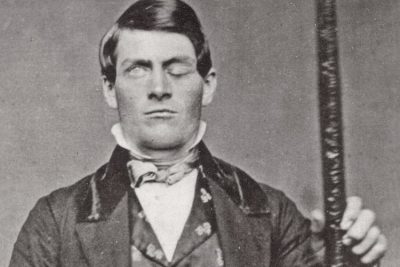 February 20, 2019 Phineas Gage: The Miracle Man with a Hole in his Skull who became a Major Breakthrough for Neuroscience
 October 14, 2018 Pasqual Pinon: The Aberration of Multiple Heads
- July 30, 2019 Robert Wadlow: Trials and Tribulations of the World’s Tallest Man
The post Trepanation: Unusual Medical Procedure of Drilling Hole in the Skull appeared first on .
]]>The post Champawat Tiger: The Killer of 436 Humans is a Case of Animal-Need Pitted against Human-Greed appeared first on .
]]>
The head of Champawat Tiger. (Nihal Neerrad S / Wikimedia Commons)
Today, the Asian Tigers are a threatened species with just about 3200 thriving units. The number was a lakh (hundred thousand) a century back. The most numerous subspecies, Bengal Tigers, is reduced to 2500 and is also endangered according to IUCN. Man’s itch for infrastructure development and professional hunting has led to this drastic depletion. Tigers are not the natural enemies of man, but may turn on him following injury, and the exigencies of living space. The story of the Champawat tiger, a Bengal tigress that killed 436 humans, is a classical example.
The killing started in Nepal and extended to Kumaon
In the 19th century British ruled India, a Bengal tigress in the Himalayan range of Western Nepal turned into a man-eater. A man of Tharu tribe from Rupal village was her first victim. Professional hunters were called and put on the mission to kill the tigress. But the tigress was too swift and cunning to be caught. Next, in an upscale measure, the army was put on job. Army gheraoed the tigress (who, post her death much later, would be named as Champawat Tiger), but she escaped by crossing over to an adjoining habitat.
Kumaon district, across river Sarda, became her new home, and a terror zone for the natives living there. For seven years, the tigress struck men women and children with brazen audacity, even during the day time, if the opportunity presented itself. An estimated 436 humans fell prey to the deviant wild cat.
Only hassled and handicapped tigers attack men
Tigers normally don’t attack humans for food. They do so only in some exceptional circumstances. In the case of Champawat tiger, it was a hunter’s bullet that failed to kill her but smashed her upper and lower right canines. This injury constrained her from catching its natural prey. And the pangs of hunger forced the tigress to an easier catch, the humans. Another contributing factor was the rampant deforestation done by the British government. The exercise done in the name of infrastructure development was a direct infringement on the living space of the wildlife.
Verily, a fight between man and nature
As man was busy asserting his power on nature, the Bengal tigress was out asserting her power on mankind. Best time for the kill was the day time, when men moved out for work. So, most of her attacks occurred during the day. Even those who rested in the 4 walls of their homes, weren’t spared. Human habitation became her food-spread which she walked into whenever hungry.
Surreptitious killings created mayhem
Ferocious canine teeth, brute power and the quick reflexes of a tiger can freeze any human with fear. The ears of a tiger can hear a wide range of frequencies from 0.2 kHz to 100 kHz, they also have a strong sense of smell. Ears can also rotate on base to catch sound from a particular direction. These endowments make the big cat a stealth killer. Time and again skilled hunters, police and military were engaged to kill the tigress, but to no avail. Orthodox and the God-fearing natives even started believing that it was some kind of a curse from the nether world. Gripped with fear, people stopped moving out of homes. Ironically, even homes weren’t safe. The tigress attacked people sleeping in huts, travelling on boats and even those who perched on trees.
Finally, the British administration couldn’t take it any longer. In the year 1907, the deputy commissioner of Nainital, Charles Henry Berthoud, was determined to do ‘something’. He went out to meet his friend, Jim Corbett.
Jim Corbett was tasked to kill the man-eater
Jim Corbett was a renowned hunter and a railroad worker of Irish lineage. Born and brought up in Kumaon hills, he had spent quality time with native hunters of Kaladhungi forests. Killing of a leopard at the age of 10 was his first landmark, and many more would follow. Berthoud wanted Jim to go after the Bengal tigress. Even though Jim had no hands-on experience of dealing with a man-eater, he agreed to give it a try. He didn’t have to wait for long to go ahead on the task. A fresh killing was reported just 5 days later. A woman astride a tree, plucking leaves for fodder, was pounced upon and killed. This happened in a town 60 miles away. Jim packed up, took six natives as helpers, and headed towards the town.
Village Champawat became the name and the nemesis
On reaching the destination, he saw villagers in a state of shock. As for the tigress, there were no signs of her. So, he decided to wait and watch. A nearby village, Champawat, was frequented by the tigress in the past. The village would go on to become the nemesis, as well as the enduring identity of the tigress as ‘Champawat tiger’. On the advice of the villagers, Jim moved towards this village and got the ultimate lead, a yet another kill. A 16-year-old girl was mauled by the tigress and dragged deep into the woods. The trail was marked by fresh blood. Jim followed the trail and found the victim’s skirt in a distant valley. In the near vicinity were seen scattered pieces of bones, and a severed human leg. Warm blood was still oozing from the leg. Obviously, the man-eater was somewhere near. The thought gave him a mix of hope and fear, and an alert Jim spent hours sitting in a hideout, his finger pressed to trigger. But the big cat eluded him, and he was forced to return.
Massive manpower was used in the final assault
On the day next, Jim reached the valley with a team of 300 villagers. The team spread out into a wall that forced Champawat tiger in a direction where Jim lay in wait. The human wall screamed, beat drums and used firearms to intimidate the animal. With a pounding heartbeat and loaded gun, Jim was now ready for a tryst with destiny. A tiger leaping with lightning speed would give him only a couple of seconds to take aim and shoot. Missing the aim would cost him life. So, for him, it was a matter of do-or-die.
The beast fell to the second round of firing
The moment of reckoning finally arrived. Jim saw some stripes emerge out of shadows. It was the tigress. Corbett fired a shot, which missed the mark. He fired again, this time it hit the animal. Third shot too was on target. But high on adrenaline, the big cat still surged for an attack. Out of ammunition, Jim ran for his life. Sprinting across the valley as fast as he could, he took a shotgun from a colleague, ran back to the hit-but-alive tiger, and fired a volley of bullets from 20 feet distance. With that, he called it a day.
Champawat Tiger made a world record
Death of the Bengal tigress was widely celebrated. But, for Jim Corbett, it was a solemn occasion. Death of the tiger weighed heavy on his mind even as there was relief and satisfaction of a job done. Post mortem findings revealed her broken canines, the prime reason for her turning into a man-eater. The tigress entered in Guinness Book of world records for killing the highest number of humans, i.e. 436. It is believed she may have killed more, as many cases may have gone unreported.
Many more man-eaters were put to death
Post the killing of the Champawat tiger, Jim Corbett was engaged in the extermination of other man-eating tigers too. The last man-eater he killed was in the year 1938, at 63 years of age. A celebrity, and bestselling author of 6 books, he was an animal lover and a committed conservationist at heart. The declining number of tiger population perturbed him even during his lifetime. So much so, he devoted the last 2 decades of his life for the protection of tiger species. Corbett national park at Nainital, Uttarakhand, committed to protecting the endangered Bengal tiger, is a fitting tribute to this outstanding naturalist, hunter, and lover of the wildlife.
Jim Corbett rooted for the conservation of wildlife
Tigers are “a large-hearted gentleman with boundless courage”, opined Jim. They turn man-eaters when wounded, and in some exceptional circumstances, he added. From the man-eating tigers in the past, to the threatened-with-extinction tigers at present, the time has come a full circle. The need of the hour is to conserve tigers at all cost. Otherwise, as Jim Corbett rightly said: if the tiger goes extinct, India will be poorer.
Enjoyed this article? Also, check out “Jim Corbett: A White Hunter Who Became Saviour of Tigers“.
Fact Analysis:
STSTW Media strives to deliver accurate information through careful research. However, things can go wrong. If you find the above article inaccurate or biased, please let us know at [email protected].
RELATED
- October 5, 2019 Jim Corbett: A White Hunter Who Became Saviour of Tigers
- August 1, 2019 Tiger Temple: A Clandestine Tiger-Breeding Facility Run by Monks
- July 3, 2019 The Bengal Famine of 1943: The Man-Made Famine That Killed Around 3 Million Indians
- February 6, 2019 Tipu’s Tiger: Tipu Sultan’s Macabre 18th Century Mechanical Toy That Doubled Up As a Pipe Organ
The post Champawat Tiger: The Killer of 436 Humans is a Case of Animal-Need Pitted against Human-Greed appeared first on .
]]>The post Colossus Computer: A WWII Era Cipher Machine was the First-Ever Programmable Computer appeared first on .
]]>
The colossus computer being operated by two Wrens. (The National Archives)
The origin of arguably one of the greatest modern inventions of man remains somewhat unknown to a major section of the world’s populace. We always, however, tend to forget the point of inception for all these geniuses, that is, the Colossus Computer. This was the first-ever programmable computer that was made in the history of technology.
The time of the Second World War witnessed a lot of rapid technological advancements that were necessary for the War. It birthed a number of inventions that are useful even today, while some others have provided the starting point to another major invention. The Colossus Computer was one such invention of the time by British code breakers. Its use was the cryptanalysis of the Lorenz Cipher. A stroke of luck and a group of absolute geniuses with a singular agenda was the formula that brought to life this critical invention.
Colossus computer: The secret of Bletchley Park
The German military used meticulous electronic transmissions to send important messages during the War that were intercepted by the British through two methods. One was the Enigma that used Morse code. The other is the less popular, codename Fish, that used electric teletypewriter technology to transmit messages between Hitler and his army high command in Berlin. Fish was a cipher machine, Lorenz SZ – 40/42, that the British called “Tunny.” In 1942, a lengthy technical battle later, the British code breakers finally succeeded in deciphering Tunny. The Colossus computer was consequently built to perform a fundamental function in this process at electronic speed. Prior to the invention of the Colossus, these British code breakers came out with a similar but much less reliable teleprinter cipher machine.

The Lorenz SZ42 machine. (TedColes / Wikimedia Commons)
Heath Robinson: WW2 codebreaking machine
Max Newman produced the functional specification of Heath Robinson and its engineering design was put together by Frank Morrell. The concept of the machine was brought to life, but the machine was anything but useful. The electromechanical parts were slow and it failed to synchronize the two test- paper tapes. One had the enciphered message, and the other had a part of the keystream of the Lorenz machine. Following this, the Colossus was created by the Department of Communications of British Foreign Office, which used electronic circuits for deciphering messages sent over the radio. The team was lead by Thomas Flowers and Maxwell Newman with important roles by Alan Turing and C. E. Wynn-Williams. The project was carried out in great secrecy at Government Code and Cipher School in Bletchley Park.

Tommy Harold Flowers. (Wikimedia Commons)
Tommy Flowers and his magic beanstalk
Tommy Flowers designed the Colossus. He was initially brought in to design the Heath Robinson’s combining unit but the function of tapes failed to impress him. He then came up with a design of his own that used an electronic analogue of the Lorenz machine and completely rejected the use of tapes. This design was then presented to Maxwell Newman, but the idea of one to two thousand thermionic valves (vacuum tubes) within a single machine was met with scepticism. Consequently, Tommy Flowers’ proposal was rejected.
Several other Robinsons were ordered thereafter. Eventually, persistence on Flowers’ part resulted in the birth of Mark 1 Colossus with advancements to the design. It had a record of one thousand and six hundred thermionic valves.
Colossus: The breakthrough
German operators often used the same wheel settings for two different messages which were famously called ‘depths.’ The interception of this was what pushed the British to the breakthrough they achieved in 1941. The operation of Tunny had an important process which included the operator sending a message of an unenciphered group of twelve letters that informed the receiver the starting position of the twelve letters. As per this, whatever the first letter was, the receiver would set his first psi-wheel position corresponding to the instruction. Two messages with the same indicator were all that the British needed to incur a depth. Since the first was corrupted due to atmospheric noise, the message was resent but with little deviations and abbreviations. An identical message would leave the British none the wiser.
The end: Start of a new beginning
The end of the War was accompanied by orders of Churchill for the destruction or dismantling of the Colossus machines. However, two of the machines were kept aside during the Cold War. Unfortunately, they were met with the same fate when technological advancements outgrew them. In 1991, however, saw the resurrection of the idea of the reinvention of the Colossus by Tony Sale. Thus began the journey of recreating this legendary machine with very limited knowledge about it. In 1996, the first part of the project was put on display in the presence of HRH, the Duke of Kent, and Tommy Flowers. The project reached its completion in 2007 and it was staged in an international Cipher Challenge contest.
As Flowers said,
“…I was told that the secret of Colossus was to be kept indefinitely… I was naturally disappointed. I was in no doubt, once it was a proven success, that Colossus was a historic breakthrough…”
It was perhaps the most heartbreakingly poignant ends that could be given to a “war hero” of the Colossus’ magnificent stature.

The reconstructed version of colossus computer at The National Museum of Computing, Bletchley Park. (TedColes / Wikimedia Commons)
Life has become tenfold simpler than it used to be back in the olden days. Operating a computer today has become child’s play, requiring you to simply open the appropriate program. This was not a possibility with the Colossus, because it was not able to store programs. To make it function as per requirements, modifications to the machine was required that included wiring, switching and plugging meticulously by hand. This entire process was a tiresome and hectic one, with the operators taking up almost three weeks to set up and debug a program. These machines are more famously called “program-controlled” computers. This sets up a comparison with the modern-day computers which are “stored – program” computers. The basic principle of the stored computer is only a thread of a long thought-process pulled out of Turing’s mind, in 1936. It is fascinating how far we have come with technology and how far we are yet to go.
Enjoyed this article? Also, check out “Deep Blue – The IBM Chess Computer that Beat Chess Grand Master Garry Kasparov in 1997“.
Fact Analysis:
STSTW Media strives to deliver accurate information through careful research. However, things can go wrong. If you find the above article inaccurate or biased, please let us know at [email protected].
RELATED
- November 4, 2018 The Turk: 18th Century Automaton Chess Player was a Forerunner of Computer Age
 March 12, 2019 Important New Discovery May Provide Insights into the Construction of the Pyramid of Giza
 April 10, 2019 Euphonia: The Sad Story of Joseph Faber and His Creepy Machine That Made Ghostly Sounds
- February 6, 2019 Tipu’s Tiger: Tipu Sultan’s Macabre 18th Century Mechanical Toy That Doubled Up As a Pipe Organ
The post Colossus Computer: A WWII Era Cipher Machine was the First-Ever Programmable Computer appeared first on .
]]>The post Japan’s Declining Population: A Wonderful Country with a Problematic Future appeared first on .
]]>
Crowd in Tokyo, Japan. (Max Pixel)
Japan is a simply wonderful country. Although being there for only a short time there is no doubt in my mind that this opinion would be echoed by anyone who visits any of Japan’s 6,852 islands. It is a sprawling mountainous state, with rich traditions that integrate with everyday life, respected by a population who pride themselves on courtesy and service, functioning in a uniquely efficient manner. There is unmatched religious harmony from the integration of Shintoism and Buddhism, the third-lowest crime rate in the world as well as spotlessly clean streets (mostly kept that way by the public).
Alas, do people residing in Japan feel the same sentiments about their homeland? And is life there as spotless to locals as it appears to an outsider? Will tourists who visit in another five or ten years have the same experience as today? Does something darker lie beneath the surface of the Land of the Rising Sun, and all that glitters is not gold.
Historically speaking
We are talking about a nation many times isolated from the world in regards to foreign policy. In literal terms also, isolated, due to its geographical location. One who has switched between various socio-political and geo-economical standpoints in relatively recent years – sometimes willingly, other times, forced. From isolationism to modernism and now to consumerism, Japan boasts the 3rd largest GDP (Gross Domestic Product) in the world. This began after World War II when a population boom was encouraged for economic and military development. 8 million babies were born between the years of 1947-49 alone. An economic upsurge developed during the Korean War (1950-53) when Japan was used by competing nations for resources. Industrialisation flourished which brought millions of jobs yet not enough bodies to fill the void,resulting in the government promoting family planning and legalising abortions. The want for technology skyrocketed to help with the modern system and also to export as goods.
Lamentably, Japan is a land left scarred by the Atomic Bomb attacks of World War II. At least 226,000 innocent people died in the four months following and an uncountable number more in the aftermath. This no doubt contributed more to an already homogenous society in which immigration is extremely low. 98.5% of the ethnic population are Japanese and, “Only 2% of the workforce is foreign compared with 17% in America.”
A large majority of this population is elderly and/or retired as the Japanese people boast the second-highest life expectancy in the world (behind Hong-Kong) due to clean living (notably a healthy diet) and health-care. The average life expectancy of a Japanese woman is 87 years old which is of course a positive and impressive statistic in today’s world but one which has created challenges.
Check out the article on Ubasute, a legacy of Japan’s folklore, which literally means ‘abandoning a parent’.
The problem – a demographic time bomb – and how did it happen?
As Business Insider states, ‘Demographic time bombs are hard to diffuse.’ This is the case in the state of Japan where a Demographic Time Bomb has been ticking since the conclusion of World War II. Damning statistics have arisen in which a population of 126 million is set to plummet to 83 million by the end of the century if the current trend does not subdue. It is a precedent that is unmatched in history.
“Population decline is hitting especially hard in rural and regional Japan, due to a high pace of migration to Japan’s cities, as well as rapid ageing. In northern prefectures such as Aomori and Akita the population is falling by more than 1 per cent a year. In some villages almost nobody is under the age of 70….”
Today, the Global Economic Forum reports the birth rate to stand at 1.4.
There is a shortage of births, therefore a shortage of young people and a shortage of workers. Last year, there were 161 jobs for every 100 job-seekers. Contributing to this is a lack of desire to work as well as the amount of robot workers. How did this come to be?
A guide in Japan remarked on Japan being a politically right-wing dream. In this sense the inhabitants are pushing and pulling in the same direction, growing up with the same values. It is extremely difficult to understand why these features – when done so well – cause problems (especially from an outsider) but in one sense it has.The qualities present in the majority of Japanese people are something that is drilled into them from an early age with hard work and long hours. This is transferred from the school to the work place creating a country with one of the longest working days in the developed world. Steps have been taken to stop workers from working too much for instance. It has created somewhat of a dejected workforce in the sense that economic problems have resulted. Such a homogenous and loyal citizenship are perhaps too subservient to demand a change.
One argument is that the people have an extremely proud and responsible mindset, giving the island nation an extremely low crime rate for instance. This responsibility has led to the country having the lowest fertility rate in the world as people are not prepared to risk poverty with children or risk the stress it could present. With long hours in work coupled with a low salary, many couples are not prepared to suffer. Essentially, society became somewhat disillusioned. It contributes to the problem as the population spends less money, primarily due to not having enough expendable income. The possibility to support a family disappears and domestic consumption sinks even further.
“The daily constraints have made for a worrisome trend. Japan has entered a vicious cycle of low fertility and low spending that has led to trillions in lost GDP and a population decline of 1 million people, all within just the past five years. If left unabated, experts forecast severe economic downturn and a breakdown in the fabric of social life.”
It is a frustrating thing, that this has befallen Japan. That the Japanese government and their civilians have done everything to create an almost utopian civilisation with a staggeringly low amount of crime, incredible cleanliness and one of the highest rates of employment. Yet now they have found themselves in a crisis, after maybe asking too much of their beleaguered citizens. So what solution does the Prime Minister Shinzo Abe and his advisors have instore to save Japan?
Solving Japan’s declining population crisis
The Japanese government is discussing a number of methods to improve the birth rate but to do this they first have to tackle the low-employment rate. The first and obvious solution is immigration which would threaten traditional Japanese values. These would be low-skilled immigrants in which, “… Japan’s parliament is debating a bill to allow thousands of… into the country, to work on farms, on building sites and in nursing homes.”
A reverse would be promoting more of the elderly to work by increasing the pension age. Other policies would be directed at women, making it easier for women to work and have children. More woman than ever have chosen the career route in Japan but it still remains a male-dominated society. Free education, day-care and increased maternity leave are some of the projected implementations.These labor and child-care in tandem policies have worked in a town called Nagareyama where,
“As the city’s mayor, Yoshiharu Izaki’s first strategy was to provide an innovative solution to young families’ childcare needs, by setting up a nursery transit service near the main train station.”
That will not be enough for everyone however.
Ultimately, creating a more appealing workplace for both sexes is the key, something which has deterred workers in the past. Automation will be increased even more with robots a constantly willing workforce. These options would mean that the anti-immigration state of mind would persist and remain closed to workers coming into the country. Initially, this would produce a smaller, welfare state forcing Japan to be weaker as a geopolitical force as they lack internal resources, relying on mineral export from abroad. In the long term however, they would use this along with family planning to free up more resources and policies for young couples, in an attempt to stimulate families.
The future
The future of Japan is uncertain due to these alarming demographics and much change will need to take place in a country that has changed in the past – but a long time ago. The government has a big task on their hands and many eyes will focus on Japan to see the outcome of a modern population problem, one which is unparalleled in known history. The focus seems to be on increasing the number of births as opposed to learning to deal with fewer people. For this reason, for the foreseeable future, Japan will hope to be known as the Land of the Rising Sons… and daughters.
Fact Analysis:
STSTW Media strives to deliver accurate information through careful research. However, things can go wrong. If you find the above article inaccurate or biased, please let us know at [email protected].
RELATED
- December 10, 2018 Nakagin Capsule Tower: A Futuristic Building from the Past, Which Might Just Not See the Future
- July 31, 2018 Seppuku: The Japanese Suicide Ritual, Where Death is Better Than Disgrace
- July 14, 2019 Unit 731: Gruesome Human-Experimentation To Test Biological And Chemical Warfare In Japan During WWII
- October 17, 2018 The Horrors of Hiroshima Bombing: Human Shadow Permanently Etched in Stone
The post Japan’s Declining Population: A Wonderful Country with a Problematic Future appeared first on .
]]>The post Bibi ka Maqbara: The Taj of Deccan, Which Like the Original, Tells the Tale of Eternal Love appeared first on .
]]>
Bibi Ka Maqbara. (Abhideo21 / Wikimedia Commons)
Out of the seven wonders of the modern world, India proudly hosts and boasts of the Taj Mahal in the city of Agra. But did you know that there is another lesser-known monument in the country that is a spitting image of the world-famous Taj Mahal? The Bibi Ka Maqbara in Aurangabad bears a striking resemblance to the original ‘love memorial’ as far as its external appearance goes. Not only that, it also has a similar back story, involving a grief-stricken Mughal emperor and his deceased wife at the centre, which has now become a part of all the tales that tour guides narrate on a visit to this place.
Location of Bibi ka Maqbara
Bibi ka Maqbara is situated in Begumpura, just eight kilometres away from the culturally rich and historically important city of Aurangabad in Western Maharashtra. The magnificent doppelganger of the Taj Mahal in all its glory stands testimony to the fact that architecture played a vital role during the Mughal era. Although the city of Aurangabad is more famously known for its 2nd century BCE caves of Ajanta and Ellora, it is also slowly gaining more prominence as a tourist hub, owing to this 16th century Bibi ka Maqbara. Vacationers from all over the world gather at Begumpura to see this glorious memorial, which is also called the Taj Mahal of the Deccan.

Bibi Ka Maqbara Is also called the Dakkhani Taj due to its strong resemblance with Taj Mahal. (Ruqayya noorin / Wikimedia Commons)
History associated with Bibi ka Maqbara
Bibi ka Maqbara, which literally translates to ‘Tomb of the Lady’, was commissioned by the last effective Mughal ruler Aurangzeb in the year 1660. It was erected in fond memory of his first wife Dilras Banu Begum. Princess Dilras Banu was the daughter of Persian Safavid dynasty prince Mirza Badi-uz-Zaman Safavi, who was later named the viceroy of Gujarat. Dilras Banu married Mughal prince Mahi-ud-din, who upon his ascension to the throne became known as Emperor Aurangzeb. Their matrimonial union took place in the year 1637 on May 8, amid much fanfare and grand celebrations in Agra at the residence of Mirza Badi-uz-Zaman Safavi, also titled Shah Nawaz Khan. After the couple’s time in Agra, the imperials returned to Aurangabad in Deccan, where Dilras Banu, who had now become the chief consort of the emperor, bore him five children – three girls and two boys – after almost four-year-gap periods.
Princess Zeb-un-Nissa was the eldest royal daughter, followed by Princess Zinat-un-Nissa and later Princess Zubdat-un-Nissa. Two princes Muhammad Azam Shah and Sultan Muhammad Akbar were born later after the royal daughters. Since these five children were the issues of his first and most beloved wife Empress Dilras Banu, Aurangzeb favoured them more over his other children from other wives. However, on September 11, 1657, after delivering their last son Sultan Muhammad Akbar, Dilras Banu Begum developed infections, from which she never recovered. A month later, on October 8, she died due to the postpartum fever developed during the complicated childbirth. Shortly afterwards, the eldest daughter Princess Zeb-un-Nissa was given the responsibility of looking after the neonate.

Inside Bibi Ka Maqbara. (Dr Murali Mohan Gurram / Wikimedia Commons)
With the sudden demise of his favorite wife at just 35 years of age, the bereaved Aurangzeb set a chain reaction of grief in the family, greatly affecting the elder son Muhammad Azam Shah the most. Three years after Queen Dilras Banu’s demise, in the year 1660 Aurangzeb commissioned the construction of a burial chamber, which would be the final resting place of his wife. Although Aurangzeb is never credited with having built grand structures during his long reign, he made an exception and followed in the footsteps of his father Shah Jahan. In memory of Empress Dilras Banu Begum, who was posthumously given the title Rabia-ud-Daurani, Aurangzeb ordered a mausoleum to be built in Aurangabad, the city named after him. The memorial came to be known as Bibi ka Maqbara, which became the largest monument that Aurangzeb had ever built.
Specifications of Bibi Ka Maqbara
The work on the edifice started in the year 1661 and carried on until 1669, bearing a striking similarity to the famous Taj Mahal, built during Shah Jahan’s reign. Aurangzeb’s mother Empress Mumtaz Mahal had also died during childbirth, much like his wife Dilras Banu; so his father Shah Jahan had built the Taj Mahal as an ode to their love, as Mumtaz’s final resting place. Hoping to rival the Taj, Aurangzeb ordered work on Bibi ka Maqbara to begin just like its more famous and larger, original structure. Attaullah Rashidi, the son of Ustad Ahmad Lahori, the chief designer of the Taj Mahal was hired to work on Bibi ka Maqbara, while Hanspat Rai was the principal engineer, assisting Attaullah in the construction work.
One third in size as compared to the Taj Mahal, Bibi ka Maqbara cost the royal family approximately six hundred and seventy thousand rupees, with necessary construction material coming in from all parts of the country. French jewel merchant and traveler Jean-Baptiste Tavernier during his travels to India, mentioned extensively in his journals about his first-hand account of the material imported for constructing the maqbara. Marble for the monument came in from the mines of Rajasthan, while loads of basaltic rock, sand, limestone and cement (for stucco decorations) were also ordered for its construction.
Built as per the Islamic style of architecture, the construction of Bibi ka Maqbara is based on the Quranic mentions of the four gardens of Paradise. Known as charbagh, the main mausoleum stands at its centre within an area of fifteen thousand square feet in total. The centrally enclosed edifice measures approximately 458 m by 275 m, flanked by axial ponds on its sides. Like the original structure, the Deccani copy is built on a high, square podium, with four minarets on all the four corners surrounding the dome. The main structure can be reached by a flight of steps on three sides just like the Taj.
While Taj Mahal is completely made out of pure white marble, the Taj of the South only has its dome and dado-level walls covered in marble. The rest of the structure above has a fine plaster polish to give it a marble-like appearance. Bibi ka Maqbara, though is not as magnificent as the Taj Mahal, it still is an exquisite piece of Mughal architecture, with a hint of Deccani architecture into its construction. Paler in comparison, Bibi ka Maqbara is almost similar to its forbearer except for one major difference. While the four minarets of the Taj Mahal are shorter than the onion dome, the approximately 72 feet high minarets of Bibi ka Maqbara are taller than the main central dome.
The entire hexagonal complex has its outside walls with arched recesses and bastions, fashioned as per the refined Mughal architecture. The marble on the tomb has intricate lattice screens, while geometric patterns adorn the dome’s canopy on the inside. Floral motifs beautify the interior walls of the structure and foliage designs embellish the exterior part. Finely done brass doors serve as the gateways to the inside of the structure. The entrance is followed by a series of fountains and water channels that are placed alongside the twelve-doored pavilions or baarah daaris.

The interior design inside the tomb. (Abhideo21 / Wikimedia Commons)
Tomb of Queen Dilras Banu Begum
The mortal remains of the late empress of Aurangabad are placed in a grave below the ground level. It is a low-barricaded, simple, octagonal structure, which is enclosed in elaborately designed marble screens on all sides. Stucco paintings and inscriptional Arabic patterns decorate the surrounding of the cenotaph. The underground grave of the empress is covered with a silk cloth, which is open for the tourists to see during visiting hours at Bibi ka Maqbara.

Tomb of Dilras Banu Begum. (Abhideo21 / Wikimedia Commons)
Controversy over ownership of Bibi ka Maqbara
Although the board at the entrance of Bibi ka Maqbara today credits Aurangzeb’s son Muhammad Azam Shah as the builder of the edifice, it was actually Aurangzeb’s original idea. Muhammad Azam Shah would only have been eight years of age when work on the structure began, possibly not sure what all of it actually meant. Azam Shah was only put in charge of overseeing the construction of the monument and its repair work on his father’s instructions later on in his life. While the war for the ascension to the throne of Agra was on between the sons of Shah Jahan (with Aurangzeb winning it), Aurangzeb was mostly away from his seat in the Deccan, leaving the construction work to Azam Shah only for namesake.
Bibi ka Maqbara might not be a world-renowned mausoleum, or might be called the ‘poor man’s Taj’ or even a cheap copy of the monument dedicated to love, but the towering structure in Aurangabad, erected in memory of Aurangzeb’s wife, continues to carry forward a legacy that is left behind by the Mughals in the southern part of the country.
Enjoyed this article? Also, check out “The Mahabat Maqbara and the Extraordinary Tomb of Bahar-ud-din Bhar“.
Fact Analysis:
STSTW Media strives to deliver accurate information through careful research. However, things can go wrong. If you find the above article inaccurate or biased, please let us know at [email protected].
RELATED
- September 24, 2019 The Mahabat Maqbara and the Extraordinary Tomb of Bahar-ud-din Bhar
- July 15, 2019 Adalaj Stepwell: A 500-Year-Old Architectural Masterpiece With a Tragic Tale of Unrequited Love, Sacrifice And Loss
- January 12, 2019 Kumbhalgarh Fort: Not Only China But India Too Has Its Own ‘Great Wall’ Built Centuries Ago
- June 14, 2019 Padmanabhaswamy Temple: The Richest Temple in the World with Gold Worth $22 Billion in Six Vaults
The post Bibi ka Maqbara: The Taj of Deccan, Which Like the Original, Tells the Tale of Eternal Love appeared first on .
]]>The post Anti Tank Dog: The Soviet ‘Masterplan’ that Backfired to Disastrous Effects appeared first on .
]]>
Anti Tank Dog: A war dog approaching a tank. (♪_Lisa_♪ / Flickr)
During the Second World War, the Soviet Union came up with the novel concept of ‘Anti Tank Dog’ or ‘Hundminen’, also commonly known as ‘Dog Mines’. They used dogs, particularly German Shepherds, and attached explosives to their backs. These dogs had been specifically trained to look for food under the German tanks- however; they inadvertently proved to become one of Germany’s greatest weapons during the First World War.
Background
When dogs first began to be employed during the First World War, their tasks were fairly basic. They were deployed primarily for conducting searches, and to warn soldiers about any incoming dangers- such as gas or artillery attacks. It was the Soviets, who first began the use of animal weaponry during the war.
From the 1920s, more emphasis began to be put on dogs, and they began to aid the military. In 1924, a ‘dog training school’ was established in Moscow, as the dogs were intended to be used in a multitude of fields in the war efforts, including communication, search, as well as rescue missions. In order to be able to carry out these nuanced tasks, the dogs needed to be trained by experts. The preferred breed amongst those enrolled in these do training schools, was the German Shepherd.

Soviet military dog training school, 1931. (Wikimedia Commons)
The military also hired police dog trainers, circus trainers, animal scientists, and hunters, to train the dogs already at the training camps that had been set up.
Training the dogs & initial set-backs
The dogs were initially trained to do simple tasks like carrying supplies, tracking mines and rescue missions, which they seemed to have a natural affinity towards. In the early 1930s, the idea to use dogs to behave as anti-tank weapons took shape, and the dogs at training camps subsequently began to be instructed for these new missions.
The initial idea behind the ‘Anti Tank Dog’ was that the dogs would run up to the tanks, with a bomb strapped to them. On reaching the tanks, they were supposed to pull on a belt with their teeth in order to release the bomb, and then quickly return to their handler. The handler would then either detonate the bomb with a remote, or a timer would be set and the bomb would go off at the set time.
Anti tank dog: A novel idea
However, this idea did not work out very well as quite often the dogs would be unable to release the bomb with their teeth. The task proved to be quite harrowing for the poor animals and they would return to their handlers without having released the bomb, and would be severely reprimanded as such a mistake could prove fatal on the battlefield. Another problem the dogs faced that soon became a detriment to the program, was the fact that they had been trained to go under a single tank. When they saw multiple tanks, the dogs would get confused and return to their controllers with the explosives still attached to their backs.
In order to simplify things and combat the shortcomings of the program, the Soviets came up with a new idea. The dogs were trained to find an enemy tank, but this time around, the bombs would explode once they came in contact with their target. The hapless dogs were taught to dive under the tanks of the enemy, while a wooden lever would be sticking out of their harnesses- which on coming in contact with the tank would trigger the explosives and blow up the tank, as well as the carrier-dog to ashes.
The training procedure was inhumane and brutal, with the dogs kept starving, and food was kept under the practice tanks for them, thus conditioning them to believe that all tanks had food under them. To take their training one step forward, typical sounds associated with battle, such as gunfire, were added to the background during their training so that the dogs would get acclimatised, and not get scared in the battlefield.
The backfire of the anti tank dog
By 1941, the dogs began to be used quite commonly during the war, and around 30 canines were deployed at the frontlines of the Eastern Front, when the Germans attacked. However, the masterplan of the Soviets to employ dogs as anti tank weapons backfired miserably due to multiple reasons.
On the battlefield, the animals were being physically shot at and they were definitely not equipped to execute the mission under such circumstances. They refused to dive under the tanks out of fear, and would retreat to the trenches- often detonating the bomb there, inadvertently killing or grievously injuring many of the Soviet soldiers themselves.
Another reason for the failure of Anti Tank Dog was that these animals had been trained with Soviet tanks, whose engines emitted a diesel smell, which the dogs got familiarised with. Instead of diving under German tanks that used petrol, these dogs would often dive under the familiar Soviet tanks in search of ‘food’, once again setting off the bomb, and leading to the death of many Soviets.
Some of the dogs, however, persisted and continued to run beside the tanks until they stopped, but were shot fatally in the process. Out of the 30 dogs from the original pack, only four of them had been able to actually detonate their bombs near German tanks. Six dogs had retreated to the trenches of the Soviets and exploded, and three of them had been shot and were taken away by the Germans.
Some debatable success of the anti tank dogs
The Anti Tank Dogs did, however, have some degree of success during the war. At the Battle of Kursk, sixteen dogs had been deployed, and twelve German tanks were consequently destroyed. This mission by the Anti Tank Dogs is reportedly one of the most successful ‘anti tank’ ventures. The Soviets also said that the Anti Tank Dogs had destroyed a total of 13 tanks at Stalingrad.
According to the Soviet government’s reports, the Anti Tank Dogs had supposedly destroyed approximately 300 tanks. However, this hardly seems believable and was probably fabricated by the Soviets, who were clearly trying to justify the merciless sacrifice of these animals.
The end of the anti tank dog
Even though the use of Anti Tank Dogs had decreased significantly 1942 onwards, dogs were continued to be trained for the purpose up until 1996. Although the Soviets have used Anti Tank Dogs more than any other nation, some other countries like Japan and the United States trained them for use as well.
Even in recent times, around 2007, bombs were attached to dogs, when rebels had tried to use them in a similar manner to the Soviet Anti Tank Dogs, and deploy them during the Iraq War. However, only one incident was reported about a bomb exploding while being attached to a dog. Protests rose all over the world, and many Muslims too expressed their outrage.
Enjoyed this article? Also, check out “Ghost Army of 23rd Headquarters Special Troops Dodged Enemy by Fooling and Scooting“.
Fact Analysis:
STSTW Media strives to deliver accurate information through careful research. However, things can go wrong. If you find the above article inaccurate or biased, please let us know at [email protected].
RELATED
- September 7, 2018 Ghost Army of 23rd Headquarters Special Troops Dodged Enemy by Fooling and Scooting
 January 3, 2020 Dazzle Camouflage: The Wonder That Worked in World War I
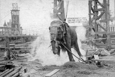 November 2, 2018 The Tale of Topsy the Elephant That was Electrocuted, Poisoned and Strangulated
- June 28, 2018 Simo Hayha: World’s Deadliest Sniper with 505 Confirmed Kills
The post Anti Tank Dog: The Soviet ‘Masterplan’ that Backfired to Disastrous Effects appeared first on .
]]>The post Jim Corbett: A White Hunter Who Became Saviour of Tigers appeared first on .
]]>
Jim Corbett with the freshly killed Tiger of Powalgarh. (Wikimedia Commons)
How many hats can a man wear in a lifetime? A railway employee, a contractor, a hunter, conservationist, family man, author, a celebrity, philanthropist, army officer, photographer. Jim Corbett, the British naturalist, born in colonial India as Edward James Corbett, wore all these hats. Tiger reserve of India, Jim Corbett National park, is a living testimony to this iconic Anglo Indian.
Jim Corbett’s father served at Dehradun and Nainital
Jim Corbett was born on 25th July 1875, at Nainital, in the Kumaon of Himalaya (present Uttarakhand). He was the 8th child of William Christopher Corbett and Mary Jane Corbett (2nd wife). William had married Ann Morrow while serving as Captain in the British army, at Dehradun in 1845. Ann died 2 years later, after giving birth to 3 children. In 1859 William left army service and became a postmaster in Nainital. There he met Mary Jane, a widow with 3 children, and married her. The newlyweds then had 6 children to look after and would be blessed with 8 more in the future.
In 1862, William shifted to Nainital. His sister and her husband died, leaving behind 8 children, of which, 4 would live with the Corbett family. On 21st April 1881, William died of a heart attack, leaving Mary Jane with the charge of 9 children, including the 6-year-old Jim.
Jim left studies to support his large family
Born and brought up in a big joint family, bonhomie and camaraderie came easy to Corbett. He had his schooling at Oak Openings School (now Birla Vidya Mandir, Nainital) but left studies at 18 to shoulder the family responsibilities. In 1892, he obtained a temporary job with the Bengal and North Western Railway as a fuel inspector at Manakpur, Punjab. Later, he became a trans-shipment contractor at Mokameh Ghat in Bihar, overseeing the movement of goods across the Ganges. His dedication to the welfare of his family would keep him from starting one himself, and he remained a bachelor all his life. His elder sister, who too didn’t marry, remained his companion and soulmate.
Served in the army during the world war 1
During the world war 1 he joined the army and commanded a unit of 500 men (Kumaon Labor Corps) in France. Promoted to the rank of major, he commanded the 114th Labour Battalion, in the third Afghan war (1919). For 16 years, from 1920 to 1936, he spent quality time, hunting and tracking in Tanganyika (present-day Tanzania), Africa. By 1930 he grew weary of hunting and found a better calling: shooting animals with 16 mm camera. Photography gave him greater joy than shooting with a firearm. He gave up hunting and took up the cause of conservation of wildlife.
Taking on man-eating tigers became his prime call
The defining part of Corbett’s career as a hunter, began with a Bengal tigress, in 1907. Killing it established his image as a devious hunter, and at the same time kindled in him an appreciation for wildlife. For, he realized that tigers turned man-eater when incapacitated due to injury or old age. The feline had lost two canine teeth to a bullet that failed to kill her. Unable to catch on her natural prey base, the big cat turned to an easier option – killing humans for food. Champawat had claimed 436 human lives and was a reigning terror in Kumaon area in 19th century India. Attempts at containing the cat had failed, and a jittery British government commissioned Jim Corbett into the task. Following a tip-off, he reached the village Champawat and saw remains of a woman victim. A human chain was formed to force the animal to move into anambush. A trap was laid and the tigress was shot down in a daredevil encounter. That was the end of the tigress, posthumously named as the Champawat man-eater.

Jim Corbett with the Leopard of Rudraprayag. (Wikimedia Commons)
Another credit for Jim was Panar Leopard (1910) that killed about 400 people. Jim’s first attempt was an anticipated shot in the dark. The hit animal was tracked in the wood with searchlights and killed in the second attempt.
Talla-Des man-eater that claimed 150 human lives in a span of 2 years, was exterminated it in 1929. Her two grown-up cubs were also killed. The man-eater was spotted through a blood trail leading to a thicket of ferns. Two rounds of bullets fire killed the animal on spot.
Jim Corbett narrates in his book The Jim Corbett Omnibus:
“When I saw the two tigers lying asleep I concluded that the man-eater had found a mate, but later, when my third shot flushed a third tiger, I knew I was dealing with a tigress and her two cubs. Which of the three was the mother and which the cubs it was not possible to say, for all three looked about the same size when I had viewed them over the sights of my rifle….The cubs had died for the sins of their mother.”
Man-eating leopard of Rudraprayag had killed 125 villagers. Leaving human bodies unburied in epidemics had (including Panar leopard) hooked it to the human flesh. Jim eliminated it in the year 1925.
Mohan man-eater, a terror in settlements of Kosi valley was killed in 1929. The tiger was sleeping. For once Jim reflected on ethics of gaming a sleeping life. But the fact of its being a man-eater prevailed.
A group of 3 man-eaters from Kumaon division, reported in 1929, was the next pick. The hunt led to Chowgarh Tigress and her grown-up cub, responsible for 64 killings. Jim began his hunt from Kala Agar forest. In his first attempt, the cub got killed. The thread of the mission was picked up in February 1930. Buffaloes, used as bait attracted 2 tigers and 2 leopards which were not man-eaters but got killed under that impression. The dogged search for the man-eater concluded on 11th April 1930. Jim suddenly found himself dangerously close to the man-eater. The tigress, just 8 feet away, could pounce on him any second. Jim gathered his wits and shot the animal dead. By any reckoning, it was the toughest challenge he faced in his lifetime.
Chukka man-eater was a male Bengal tiger that killed 3 boys of village Thuk in Ladhya Valley in 1937. After repeated attempts, it came under the firing range of Jim, perched on a tree at a strategic location. Two bullets were fired and the animal fell lifeless. This was 2nd last in Corbett’s man-eater kitty. The last one was the Thak man-eater, a Bengal tigress that killed 4 humans in 1938. It fell to Jim’s on 30th November 1938.
His experience as a hunter made him a lover of wildlife
Increasing empathy towards the wild during his hunting days made Corbett a staunch conservationist and he took up the cause of protecting wildlife from human interference. He worked tirelessly to establish Hailey National Park in 1936. The park, a beacon light of conserving forests and the wildlife, was later renamed Ramganga National Park and finally, after his name, as Jim Corbett National Park in 1957. Jim Corbett authored 6 books penning his life experiences and conveying his message of living in harmony with nature.
Jim Corbett National park
Located in scenic surroundings of Himalayan foothills and the Shivaliks, Jim Corbett National Park is a popular tourist destination in India. Spread in an area of 520 square kilometres at Nainital, Uttarakhand, it is home to a wide spectrum of wildlife. Project Tiger, launched in 1973 for the protection of the endangered species of Asian tiger, began from here. It is home to 650 species of birds and 5 species of deer. A good number of otters, crocodiles, elephants, pigs, tigers, leopards, bears and reindeer etc. make it a vibrant exposition of wildlife in its natural surroundings. Visitors to the park, go in a jeep/canter safari to see the wild in its pristine form.
Two houses of the Corbett family are tourist attractions
The winter house of the Corbett family was located in Kaladhungi, a forest area in the Himalayan foothills, popularly called Corbett’s village. The house was converted into a museum in 1967. Another house of Corbett’s, on the slopes of Ayarpatta hill in Nainital, named Gurney house is now owned by Varma-Dalmia family. Visitors to the national park, however, allowed to see this heritage home.
Criticism and controversies
In 1947, Jim Corbett, along with his elder sister, left India for Kenya, where he died at the age of 80. Corbett’s illustrious career has its own share of criticism. Some scholars feel he was just an extension of India’s colonial masters who raised hunting as a popular sport. This led to hunting on a wider scale. A large number of tigers survived a shoddy hunt, to live with injury and incapacitation. Such injured felines, they aver, turned on human beings. And, Jim was strategically positioned as the saviour of the forest dwellers. His positioning as a friend of villagers won the British government the goodwill of the local population. Those were the days of India’s freedom struggle when the colonial rulers were generally doubted by the Indians. Some have accused Jim of exaggeration in his writings. Another criticism is in respect of an Indochinese subspecies of tiger, panther tigris corbetti. The name, it is argued, is not after Jim Corbett as claimed by many. Actually, it is after a Researcher of Natural History, Gordon Barclay Corbet (Jim Corbett has ‘tt’). Jim has also been accused of killing many felines which were not man-eaters, and killing just for sport.
Overall, a perfect gentleman
Nevertheless, his image as one who saved men from tigers, and subsequently tigers from men, survives controversies. Villagers loved him and admired him in spite of being a white man. He is still fondly and reverentially remembered by the inhabitants of the places where he lived and worked. This, coupled with the body of work he gifted to the posterity, will keep Jim Corbett immortal in the annals of history.
Enjoyed this article? Also, check out “Tsavo Man-Eaters: A Pair of Rogue Lions That Killed Nearly 135 People“.
Fact Analysis:
STSTW Media strives to deliver accurate information through careful research. However, things can go wrong. If you find the above article inaccurate or biased, please let us know at [email protected].
RELATED
 October 11, 2019 Champawat Tiger: The Killer of 436 Humans is a Case of Animal-Need Pitted against Human-Greed
- August 1, 2019 Tiger Temple: A Clandestine Tiger-Breeding Facility Run by Monks
- April 8, 2020 Mary Ann Bevan- Story of the World’s “Ugliest Woman” and Her Life with Acromegaly
- April 27, 2020 Tipu Sultan: The Pioneer of Rocket Artillery
The post Jim Corbett: A White Hunter Who Became Saviour of Tigers appeared first on .
]]>The post The Extraordinary Exocoetidae – The Flying Fish of the Tropics and Subtropics appeared first on .
]]>
Flying fish in Lakshadweep. (Mike Prince / Flickr)
Known commonly as flying fish, the Exocoetidae are oceanic fish that are widely found in the tropics and the subtropics. They are renowned for their ability to launch out of the water and glide in the air to escape predators. With their streamlined bodies and wing-like fins, these small fish can cover extensive distances, some of several thousand feet, while they are still air bound.
The Exocoetidae – flying fish
The word Exocoetidae comes from the Greek language and means “to lie down”. The ancient Greeks, who observed the fish leaping out of the water, either assumed that they left the ocean to sleep onshore or used ‘sleep’ as a simile for dying. Many of these flying fish leap so high that they often land on boat decks and, stranded thus, die there.
The Exocoetidae belong to the Actinopterygii Class of the Beloniformes Order and Exocoetoidei Suborder. There are 64 species of them that are grouped in four subfamilies—Exocoetinae, Fodiatorinae, Parexocoetinae, and Cypsellurinae. There are seven genera—Exocoetus, Fodiator, and Parexocoetus under the first three subfamilies, respectively, and Cheilopogon, Cypselurus, Hirundichthys, and Prognichthys under the Cypsellurinae subfamily.
While these fish inhabit all oceanic bodies, they appear to have a marked preference for tropical and subtropical regions. Also, they are mainly found in the epipelagic zone, which is the ocean’s upper layer and which extends down to a depth of around 656 feet. The sunlight that enters the ocean can reach down only as far as this layer, and that is why the epipelagic zone is where most of the marine life generally thrive.
The flying fish feed on plankton and other tiny marine creatures. In turn, they are prey to tuna, marlin, squid, porpoises, dolphins and other marine animals. While they leap out of the water to get away from these predators, it is not a very foolproof method of escape. Seagulls and other marine birds are always on the lookout for the Exocoetidae and swoop down to grab them in mid-air.
Physical features of the Exocoetidae
In size, the Exocoetidae are small, measuring from seven inches to up to 10 inches to 18 inches in length.
The reason the Exocoetidae are able to make such high leaps and glide over long distances is due to morphological features such as broad neural arches, a sturdy and well-developed vertebral column, and enlarged pectoral fins. Some species of flying fish also have enlarged pelvic fins to assist them better in flight. The fish’s torpedo-like body shape is also conducive for flight.

Flying fish mid-flight. (Roshan Kamath / Pexels)
The fish’s ligaments and connective tissues converge into the broad neural arches. These skeletal connections from the cranium to the vertebral column strengthen the vertebral column and confer a rigidity on it that is ultimately beneficial for the fish’s glided flight. It is similar to the aerodynamic principles that make flights possible for planes. With their bodies rigidly held, the Exocoetidae are able to lift out of the water and glide forward in the air faster.
As they glide, they spread their pectoral fins wide and the curved, wing-like shapes of these fins enable to increase their gliding time and also to take advantage of the air drafts created by the oceanic currents.
Do the Exocotidae really fly?
Flying fish don’t actually fly in the way birds do. They cannot flap their pectoral and pelvic fins while in air. What they do is propel themselves out of the water with a powerful leap. To make this leap, the Exocoetidae beats its tail very rapidly from side to side and uses the momentum to thrust out of the water surface. They then spread their pectoral fins wide in the air and use them to glide over the water surface.

Flying fish propelling itself forward by wagging its tail-fin left and right. (NOAA)
With these fins and their streamlined torpedo-like shapes, the Exocoetidae can generally cover distances of around 160 feet at heights of 20 feet over the ocean surface and at speeds of 70 kilometres per hour. If they manage to catch a favourable oceanic updraft, they are able to glide even further. Researchers have observed flying fish gliding for as far as 1300 feet.
There are various reasons why the Exocoetidae make these long glides. It may be to escape predators and, perhaps, also to move to newer feeding grounds in the shortest amount of time.
Flying fish as a delicacy
As mentioned earlier, flying fish are found in tropical and warm subtropical waters. Some of the countries in these regions include India, Bangladesh, Japan, Vietnam, Indonesia, Taiwan, China, Venezuela, and Barbados. In nearly all these countries, the Exocoetidae are fished and considered a culinary delicacy.
Commercial fishermen catch the fish by gillnetting and dipnetting. Some fishermen also catch the Exocoetidae with nets as the fish leap out of the waters. Another way to catch the Exocoetidae is by fishing on moonless nights using lights to attract the fish towards the fishing boats.
The fish is consumed in a variety of ways. In some areas, it is dried to preserve it and the dried fish is then used to make broth. The Japanese use the roe or eggs of the flying fish to make sushi; they call the roe tobiko. In Barbados, the locals use the flying fish to make a dish called cou-cou; it is the country’s national dish.

Fried flying fish served in a Japanese restaurant. (Miya / Wikimedia Commons)
The flying fish is also the national emblem of Barbados, and images of it can be found all over the island. The flying fish was once found so abundantly in the Atlantic Ocean where the island of Barbados is located that the country came to be known as the land of the flying fish. The Exocoetidae migrated regularly between the coral reefs of the Atlantic Ocean and Venezuela’s plankton-rich Orinoco River.
The numbers of Exocoetidae around Barbados have decreased drastically in recent times. Ever since the Bridgetown Habor opened, ship traffic has gone up in the area. The pollution caused by the ship fuel has had a negative impact on the surrounding coral reefs and this, in turn, has affected the fish population. Overfishing is another reason why the ocean waters no longer teem with Exocoetidae. You are more likely to see the fish near Tobago, which is around 220 kilometres away than around Barbados.
Interesting facts about the Exocoetidae
- An ancient species of flying fish, known as Potanichthys xingyiensis, existed during the Middle Triassic Period. That is, it lived sometime between 232 and 242 million years. Researchers, who studied the fossil of the Potanichthys xingyiensis, have concluded that it is not an ancestor of the present-day flying fish. The modern Exocoetidae evolved around 66 million years ago.
- In the early years of the 20th century, between 1900 to the late 1930s, aeronautical engineers studied the shape of the flying fish for possible use in designing aeroplanes.
- Exocet, an anti-ship missile that the French developed in the 1970s, is named after the Exocoetidae. After it is launched underwater, the missile breaks out of the water and glides over the water surface before hitting the target.
- Barbados and Trinidad and Tobago have been at loggerheads over the commercial fishing of the Exocoetidae.
- Flying fish can spend up to 42 seconds gliding in the air. The record for the longest flight is 45 seconds and was done on film by a flying fish off the coast of Yakushima Island in Japan. A Japanese television crew was on hand to record the event. There may be many more record-breakers in the ocean.
Enjoyed this article? Also, check out “Hoosier Cavefish: The Blind Cavefish from Indiana Named after Their NCAA Basketball League“.
Fact Analysis:
STSTW Media strives to deliver accurate information through careful research. However, things can go wrong. If you find the above article inaccurate or biased, please let us know at [email protected].
RELATED
- November 4, 2019 Goblin Shark: The Alien Shark of the Deep Sea, with a Slingshot Mouth
- November 20, 2019 Solifugae: Unique Creatures That Are Neither True Scorpions Nor True Spiders
- September 16, 2019 Maned Wolf: The Existential Crisis of Chrysocyon – the Golden Dog That Looks Like a Fox
- February 21, 2019 Lake Baikal: The World’s Deepest Lake That Holds 22-23% of the World’s Freshwater
The post The Extraordinary Exocoetidae – The Flying Fish of the Tropics and Subtropics appeared first on .
]]>The post Martin Laurello: The Astounding ‘Human Owl’ Who Could Turn His Head Around By 180 Degrees appeared first on .
]]>
Martin Laurello with his head turned at a bar. (Artem Servadze / Wikimedia Commons)
The Life and Times of the Human Owl
Originally from Nuremberg, Germany, Martin Laurello migrated to the United States of America in 1921, along with several other people who suffered from rare conditions like Laurello himself. He was a German- American performer, who was given the stage name of ‘The Human Owl’.
Being able to turn his head around by 180 degrees is not a feat that even Laurello could possibly have achieved overnight. Laurello spent three years practicing to slowly twist his head little by little until he was finally able to achieve this feat. He worked with many performing groups like ‘Ripley’s Believe It Or Not’, ‘Ringling Brothers’, as well as with ‘Barnum and Bailey’. Percilla Berjano, also known as the ‘Monkey Girl’, was Laurello’s fellow performer and spoke out about him, confirming that he “could put his head all the way around.”

Martin Laurello with his head turned 180 degrees around. (Wikimedia Commons)
When Martin Laurello was working at the Bailey Circus he came to be known as ‘Bobby the Boy with the Revolving Head’. He is also believed to have worked at Hubert’s Museum during the winter, which is based in New York City. He also worked with the Ringling Brothers, as well as in Coney Island, after his stint at Hubert’s Museum. In the 1930s, Laurello attracted huge crowds when he was working at ‘Ripley’s Believe It or Not! Odditoriums’.
When Laurello would twist his head, he was not able to breathe. However, he was able to drink. During performances, he would prefer wearing a white shirt, and could walk straight, even when he twisted his head to look backwards.
Personal Life
Very less is known about Martin Laurello’s personal life as there is practically no documentation of it. It is however known that he had abandoned his wife, and she had lodged a complaint against him via telegram. Consequently, the Baltimore police had arrested Laurello.
Martin Joe Laurello and his Pets
Other than being able to rotate his head, Laurello was also known for training various animals, particularly cats and dogs, to perform acrobatics. He would typically begin his act with the animals that he had trained himself. One of his famous acts was one where two cats were made to wear gloves, and would box each other. Laurello also had an act where he would have two dogs engage in a dance routine together. Laurello had a dog named ‘Frisco’ who had been trained to walk only on his hind legs, like a human, and it could even smoke a cigar while carrying an umbrella. It was only after his animals had performed their acts that Laurello would proceed to astonish his audience with his signature act of twisting his head around by 180 degrees, and showcase the anatomical wonder that he was.

A postcard showing Martin Laurello’s pets. (Unknown)
Speculations
Being of German descent, Laurello was supposedly a Nazi supporter and according to his fellow performer Berjano, he “didn’t like the American flag”. His last performance was supposedly in 1945 with Ripley, after which he probably chose to retire. Following his retirement, no one knows what happened to Laurello, according to rumours he passed away in the 1950s.
Enjoyed this article? Also, check out “Leonard Trask: The Man Who Conquered Disability“.
Fact Analysis:
STSTW Media strives to deliver accurate information through careful research. However, things can go wrong. If you find the above article inaccurate or biased, please let us know at [email protected].
RELATED
 March 13, 2019 ‘Ape Woman’ Julia Pastrana: The Sad and Short Life of the Ugliest Woman in the World
- July 30, 2019 Robert Wadlow: Trials and Tribulations of the World’s Tallest Man
- April 8, 2020 Mary Ann Bevan- Story of the World’s “Ugliest Woman” and Her Life with Acromegaly
 September 29, 2019 Chang and Eng Bunker: The Famous Congenitally Fused Twins That Brought the Term ‘Siamese Twins’ in Vogue
The post Martin Laurello: The Astounding ‘Human Owl’ Who Could Turn His Head Around By 180 Degrees appeared first on .
]]>The post Remembering the Bone-Chilling Story of the Missing Sodder Children appeared first on .
]]>
The famous billboard seeking information about the missing Sodder children. (Wikimedia)
There is nothing more chilling than a murder mystery. The reason being, that when a crime is unsolved then automatically the worst case scenarios will reel through a person’s mind. This would have been the torturous case for parents George and Jennie Sodder after five of their children seemed to have miraculously survived a house fire, their remains were never found.
A billboard was erected offering a generous reward for information leading to their recovery. Many people came forward with rumours, some relating to the Sicilian Mafia.
History of Sodder family
The location and background are both essential to the mystery. It occurred on Christmas Eve, 1945 in Fayetteville, West Virginia. Nicknamed ‘The Mountain State’, it is predominantly covered by the Appalachian mountain range. Much of the state was rural with many villages separated from the major towns and cities, located to harvest coal and other fuels.
The father George Sodder, moved to the US from Sicily at 13 years old with his brother. An exact reason was never specified but it was common for Italians to make the move for economic reasons. Eventually launching his own trucking company, George married Jennie and had 10 children settling in Fayetteville, a village with a strong Italian community. It was a community in dispute, however political tensions during World War II and the reign of Benito Mussolini caused division. George Sodder openly criticized the Italian government which made him enemies around town.
Sodder Children disappearance
In the run-up to the fire, some weird things happened. Two months previous, a stranger appeared at the house inquiring about work. He claimed the fuse boxes were unsafe even though George had them checked regularly. Around the same time, another man came to sell insurance. He threatened the family after they declined and quoted George’s dislike for Mussolini in his insults.
Weeks before, the older boys noticed a man in a vehicle parked along the nearest highway, watching them as they walked home from school. Christmas day was hours away – under normal circumstances the happiest time of year for families. 10 PM was the usual bedtime for the kids but they were allowed to stay up late with some early Christmas gifts. So Maurice (14), Martha (12), Louis (9), Jennie (8) and Betty (5) played upstairs while the others went to sleep.
Later, the mother Jennie awoke to a call coming from the office. An unfamiliar female voice asked for an unknown name with much laughter in the background – it was a wrong number. Jennie noticed that the living room lights were still glowing and the curtains were left open. On checking the main door, she found it unlocked – things that the children were meant to take care of. She saw Marion (17) sleeping on the couch in the living room and presumed other kids to be asleep too. She went back to sleep after locking the door, closing the curtains and turning off the lights. Moments later, again she awoke, after hearing a loud bang on the roof.
Shortly after, smoke began to bellow. Instinctively, four of the nine children present escaped to the garden with their parents. The two eldest brothers made it down from the attic but the younger kids a floor below were nowhere to be seen (although their voices were apparently heard). George attempted to get upstairs but the staircase was now alight. He ran for his ladder but it was not in its usual place. He tried to drive either of his two coal trucks to the house to climb atop but neither started, having worked perfectly during the day. One daughter ran to their neighbours to call the Fire Department but none of their phones were working. So a neighbour drove into town to find Fire Chief F.J Morris who set off the alarm.
The house had been completely destroyed in 45 minutes with F.J Morris not arriving until 8 AM (claiming he had to wait for a driver first). By then it was assumed that the five children had died. No remains were found with Morris suggesting the blaze consumed everything and the police deemed it faulty wiring. George and Jennie made the site into a memorial soon after, covering it with dirt and five graves.

The five missing Sodder Children. From left: Maurice, Louis, Martha, Jennie, Betty.
Investigation and leads
As the weeks passed the family began to doubt what happened. They kept wondering how the bodies of five children left no remains behind. A crematorium employee stated that even after bodies are burned for two hours at 2,000 degrees, the bones would still remain. More evidence came to the fore: A telephone repairman told the Sodders that their electricity lines appeared to have been cut, not burned.
An eye-witness came forward and said they saw a man with some car engine removing tools walking through town. They later found a napalm bomb called a ‘Pineapple Bomb’ in the garden area.
Then emerged reports of sightings. A resident of Fayetteville claimed to have seen the missing children exiting the village in a car while the fire was in progress. A woman operating a restaurant in a nearby city served them breakfast the morning after. Another woman met them in a hotel with adults of Italian extraction who kept the kids quiet.
Investigating further, in 1947, George and Jennie the Sodder couple sent a letter to the FBI director J. Edgar Hoover. He agreed to help the family after taking permission from the local authorities but unfortunately, they were declined by the Fayetteville Police and fire department. So they hired a private investigator named C.C. Tinsley.
His investigations revealed that the insurance salesman who threatened George was a member of the jury who declared the Sodder house fire to be accidental. In 1949, the Sodders hired a pathologist to excavate the site. He found human vertebrae but on examination, it showed greater skeletal maturation than the oldest child of 14. He also found an organ but it was tested to be beef liver and untouched by fire. A bizarre rumour was heard about the Fire Chief – Morris. The investigator told that Morris buried it himself hoping that the family would find it and cease their investigation.
A ray of hope
The famous billboard was then put up on Route 16 offering $5,000, later hiked to $10,000, for information. Over the next few years, many people took the opportunity. A letter arrived from a nearby state St. Louis stating that Martha, the eldest girl, was living there in a convent. Another news came from Florida claiming that the children were staying at a relative’s house known to Jennie.
George saw a newspaper photo of school children in New York City, he believed was Betty. Few mentioned incriminating conversations across the US about a Christmas Eve fire in West Virginia. George spent his life travelling the country to investigate but never found anything concrete.
In 1968, more than 20 years after the fire, Jennie received the most compelling piece of evidence that her children were still alive; a letter containing the photo of a man. The cryptic note with it read “Louis Sodder. I love brother Frankie. Ilil Boys. A90132 or 35.” Both zip codes were from Palermo, a city in Sicily, Italy. Once again they hired a private detective and sent him to Italy for further investigations.

Louis Sodder as a child (Left) and the photo that was sent to the Sodder family years later claiming it to be Louis (Right). (Wikimedia Commons)
They never heard from him again. In 1989, 44 years after the incident the billboard was finally put down. The Sodder parents have since died but their children and grandchildren continue the investigation as do many members of the public fascinated by the story. It is the very definition of a mystery because there are no strong theories on why the children were never discovered. Or if they died, why their remains were not found.
Enjoyed this article? Also, check out “Greenbrier Crime: When Trial Court was Forced to Record Version of Ghost from Netherworld”.
Recommended Read:
Sodder Family Tragedy: The Mystery of Five Missing Children | By Douglas MacGowan
Facebook Group:
Sodder Children. What Happened to Them?
Fact Analysis:
STSTW Media strives to deliver accurate information through careful research. However, things can go wrong. If you find the above article inaccurate or biased, please let us know at [email protected].
RELATED
- December 22, 2018 Greenbrier Ghost: When Trial Court was Forced to Record a Testimony from a Ghost
 February 19, 2020 Bonnie and Clyde: The Infamous Criminal Duo That Terrorised the Midwest in the 1900s
 August 6, 2019 The Coimbatore Kidnapping – The Abduction and Murder of Mukta and Ritesh Jain
- August 9, 2019 Indian Serial Killers and the First Woman to Receive the Death Penalty in Karnataka
The post Remembering the Bone-Chilling Story of the Missing Sodder Children appeared first on .
]]>The post Rejected for Paris, Project Plan Voisin is Accepted Part of World Architecture appeared first on .
]]>
Model of Plan Voisin. (SiefkinDR / Wikimedia Commons)
Towns and cities of the past have given way to today’s better planned metropolitan cities. But the change doesn’t come easy. The resistance to change is as tenacious as a desire for change. The transition of Paris – the capital of France, from the 18th century to the present day, is a good example. Napoleon Bonaparte began the process of change. His nephew, Louis-Napoleon Bonaparte carried it forward. Come the year 1920s, and it was time for a Swiss-French Architect, Le Corbusier, to propose Project Plan Voisin. The Plan was opposed tooth and nail and had to be dropped. But the spirit of the project survived and got adopted worldwide. Chandigarh, the wonderfully planned city of India, is one such adoption.

Swiss-born French architect Le Corbusier in Chandigarh, India, 1955. (IISG / Flickr)
Eighteenth-century Paris reeked in filth and foul air
Voltaire (1694-1778) complained that the city roads were narrow and dirty. Houses, he said, were unfit for healthy living. He lamented that public money was wasted on showbiz rather than used for creating civic amenities. Napoleon Bonaparte (1769- 1821) began a major restructuring of Paris, with the construction of a canal for the supply of clean water to the city. His exile to Elba came in the way and he deeply regretted his inability to rebuild Paris. His nephew, Napoleon III wanted Paris to be updated into a beautiful and integrated capital city. For this, he appointed an Administrator named Haussmann in the year 1853. The city must flush with fresh air and open spaces, Napoleon III decreed. Two phases of the job were completed successfully. In the 3rd phase, serious doubts were raised on the working of Haussmann, and he was sacked in 1870. The pending work continued till 1927, by which time, Project Plan Voisin was public.
Plan Voisin was deemed too radical for adoption
Brian child of the prodigal architect, Le Corbusier, Plan Voisin was a revolutionary idea in urban planning. Clearly, ahead of time, the plan met with severe opposition. Tabled in 1925, it envisaged the total replacement of buildings in Central Paris with 18 look alike skyscrapers. Corbusier wanted a radical departure from the norms of the past. This was not granted and the plan was rejected. Subsequently though, it got worldwide acclaim and recognition. A cluster of skyscrapers at La Defence, a business hub in Paris built in 1958, is inspired by Plan Voisin. Ditto for the housing estates in suburbs of Paris, except that it invited contempt for reasons unrelated to the original Plan Voisin.
Dream of a modern city remained unfulfilled
Le Corbusier envisioned 60-story towers in a spread of green, people snacking on terraces in a high-rise, and aeroplanes flying in the background. Height facilitated more light and air into human habitation. Back then, the idea seemed outlandish. But today’s trend for tall buildings all over the world proves Le Corbusier right.
Sceptics argue that dropping the plan was a good idea as today’s most beautiful part of Paris, on the right bank of River Seine, would have been destroyed by the plan. But Marybeth Shaw spoke in favour of the Plan. In the thesis titled “Promoting an Urban Vision: Le Corbusier and the Plan Voisin”, he writes that Central Paris was filthy, overcrowded and disease-prone. Hence, demolishing it was necessary for sanitation and liveability. Le Corbusier’s proposed grid iron construction of 18 glass Towers coupled with green lawns and multi-tiered parks was the perfect answer to this problem. The plan included low rise apartments, roads and airport as well. It was a blueprint of Corbusier’s dream of a modern city.
The momentum of past perceptions weighed heavy on the plan
Expressing surprise over the rejection of Plan Voisin, Nicholas Fox Weber, author of Le Corbusier’s biography, said that the architect was misunderstood. Fears against his plan were imaginary. Rightly so, for the destruction of Paris, which the plan entailed was creative destruction. The old must necessarily give way to the new. Paris of Corbusier’s vision was a city with clean air and ample living space. It was devoid of noise and clutter normally linked with city living. The skyscrapers, tall and lean, looked like standing in the air, detached from the ground below. With vertical housing, huge space was set free for streets, roads and public utilities. That would make Paris a trendsetter in housing for the future. Corbusier argued hard that signature establishments of Paris would be saved and lesser installation relocated, but his plan wasn’t approved.
Plan’s core philosophy equating city to a human body found buyers
Nevertheless, the idea caught the world’s attention. Corbusier’s belief that a city was an equivalent of a living human body and hence should be similarly endowed, found takers. India’s Prime Minister, Jawaharlal Nehru invited him to build the city of Chandigarh. Project Plan Voisin reflects in buildings all over London, Shanghai, Melbourne and Manhattan and in modern cities all over the world.
Plan Voisin was a way out of filthy and polluted living
Le Corbusier saw glaring bankruptcy in civic amenities and living conditions of urbanites and proposed a solution to it. The solution was Project Plan Voisin, named after the carmaker he would partner with if the plan was approved. Modern city buildings subscribe to mixed use, whereas Corbusier advocated strict separation. This difference apart, the impact of Plan Voisin on modern architecture is significant.
If failures are road maps of success, Plan Voisin stands out as a sterling example of it.
Enjoyed this article? Also, check out “The Sewers of Paris: The Massive Underground Sewers That Keep Paris Clean“.
Fact Analysis:
STSTW Media strives to deliver accurate information through careful research. However, things can go wrong. If you find the above article inaccurate or biased, please let us know at [email protected].
RELATED
 September 11, 2019 Maginot Line: The Mark of French Tenacity and Resilience
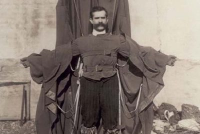 August 26, 2019 Franz Reichelt: Dressmaker Who Jumped off the Eiffel Tower Experimenting with Self-Designed Parachute-Suit
 April 7, 2019 Pere Lachaise Cemetery: Celebrated Parisian Cemetery, Where Millions Visit to Pay Homage
- September 5, 2019 The Great Fire of London: The Blaze That Destroyed 80% of England’s Capital
The post Rejected for Paris, Project Plan Voisin is Accepted Part of World Architecture appeared first on .
]]>The post Tsavo Man-Eaters: A Pair of Rogue Lions That Killed Nearly 135 People appeared first on .
]]>
Oil painting of Tsavo man-eaters by John Banovich. (Banovich Art / Wikimedia Commons)
The Tsavo Man-Eaters were a couple of lions that belonged to the Tsavo region, and were responsible for the death of several construction workers in the area. The pair of man-eating lions were infamous for their characteristic manner of attacking and killing people. They went on to attack and devour approximately 135 people, all of who were working on the Kenya-Uganda Railway, just within the span of a few months- in 1898 from March to December.
History of the Tsavo Man-Eaters
As far as history recalls, Tsavo lions have always been known to be man-eaters. While they are smaller than the Serengeti lions that are found to the west of Mount Kilimanjaro, Tsavo lions are more ferocious and known for their notorious deviancy. They have sparser to practically no manes because of the harsh environment they live in. A pride of Tsavo lions are usually smaller and consist of only one male having breeding rights and about 10 females.
In earlier times, when slave trading roads were developed from Tsavo to get to Mombasa for the Arabian slave caravans, quite often some of the slaves would die or be on the brink of death. In such cases, the slaves would be left behind, and would become prey to scavengers. It is believed that these instances were responsible for giving the Tsavo lions a taste of human flesh, which would later become a serious problem in the 19th century.
Samuel Kasiki, who is the deputy director of the Biodiversity Research and Monitoring, and is associated with the Kenya Wildlife Service said,
“The death rate was high … the bodies of slaves who died or were dying were left… So the lions may have gotten their taste for human flesh by eating the corpses.”
The reign of terror of the Tsavo Man-Eaters
In March 1898, the British Lieutenant Colonel General John Henry Patterson visited Kenya, with several Indian workers accompanying him. He intended to build a bridge over the Tsavo River, which was supposed to be a part of the Kenya- Uganda Railway Project.

Lieutenant-Colonel John Henry Patterson. (Wikimedia Commons)
According to Bruce Patterson (not a relative of John Henry Patterson), who wrote a book called ‘The Lions of Tsavo’, the project was doomed from the start. He wrote in his book, “Few of the men at the railhead knew that the name itself was a warning.” Tsavo meant ‘place of slaughter’ in their native language. It was considered to be a bad omen and was a reference to the several killings by the people of the Masai tribe who would attack tribes that were much weaker than them.
Soon after Lt. Col. Patterson and his workers arrived, it came to their notice that their porter had gone missing. A search was conducted almost immediately when the people came across the devoured and mutilated body of the porter.
In his book “The Man-eaters of Tsavo”, 1907, Lt. Col. Patterson wrote about the terrible sight. He wrote,
“On reaching the spot … a dreadful spectacle presented itself … covered with blood and morsels of flesh and bones”.
This was an account of his first encounter with the Tsavo Man-Eaters. Then and there, he had resolved to rid the region of these vicious creatures no matter the cost.
Patterson had experience hunting tigers back when he was in India, and was well-suited to put a stop to the notorious lions and their activities. He came up with various methods to try and put a stop to the two man-eating Tsavo lions. Patterson put up barriers of thorns, lit bonfires at night, and became extremely vigilant and gave orders for curfews. However, none of it really yielded any results, and almost as though it had provoked the deadly duo, the attacks only got more gruesome.
The lions would attack the camps of the workers at night, and drag them out of their tents to devour them. According to most reports, the ferocious predators were believed to have killed at least 135 people that year. However, the official company reports say that the official number of deaths is close to 40.
One of the people who were working on the railway project wrote, “Hundreds of men fell victims to these savage creatures … left not a trace behind them.” The two lions were named ‘Darkness’ and ‘Ghost’ because of their stealthy nature while hunting their prey at the dark hours of the night.
The end of the Tsavo Man-Eaters

Colonel Patterson with the first of the two Tsavo man-eaters after being shot. (Field Museum / Wikimedia Commons)
Despite all his efforts, it took Lieutenant Colonel Patterson several months to kill the two Tsavo lions that had been on a rampage. Patterson killed the first lion on December 9, 1898, and it took him another three weeks to hunt and kill the second one.

The second Tsavo lion after being shot. (Wikimedia Commons)
Upon the death of the lions, it was found that the two lions had gone rogue and did not belong to any particular pride. Both of them had no manes, and each of them was a little more than nine feet long. However, in comparison to the other lions in the area, the two predators were much larger in size. This may have been due to the excessive amount of food that they had gained access to.
With the looming threat of the lion attacks vanishing, the workers resumed the project and the bridge was completed in February 1899. Patterson was hailed as a hero, and he kept the skin and the skulls of the two lions. He later sold them for $5,000 to the Field Museum of Natural History in Chicago, where they were stuffed and put on display for visitors, and continues to remain there till date.

Tsavo Man-Eater on display in Field Museum of Natural History. (Superx308 / Wikimedia Commons)
Modern research and depiction in popular culture
According to Bruce Patterson, who is a zoologist at the museum in Chicago, several chemical tests have been conducted which revealed that the lions had eaten exclusively human flesh for several months before they had been killed.
However, there is not much difference between the Tsavo lions of present-day and the lions from the 19th century. Patterson said that they attack people for the same reason as before – “our encroachment into what was once the territory of lions.” Modern research has, however, pointed out that the reason behind the man-eating tendencies of the Tsavo Man-Eaters could have been due to their poor dental health. Sporting multiple injuries within their maw, it must have been difficult for them to catch their regular prey in the wild, and thus resorted to pouncing on the much-less-agile and often less alert and readily available humans in their territory.

The skulls of the infamous Tsavo Man-Eaters. (Superx308 / Wikimedia Commons)
The stories of the two Tsavo man-eaters have been the basis for many films including, ‘Men Against the Sun’ (1952), ‘Killers of Kilimanjaro’ (1956), as well as ‘The Ghost and the Darkness’ (1996).
Enjoyed this article? Also, check out “Mapogo Lions: The Six Legendary Lions That Meant ‘Bloody’ Business in Their Quest for Dominance“.
Fact Analysis:
STSTW Media strives to deliver accurate information through careful research. However, things can go wrong. If you find the above article inaccurate or biased, please let us know at [email protected].
Recommended Read:
The Man-Eaters of Tsavo | By John Henry Patterson
RELATED
 August 17, 2019 Euphrates River: A Dying River that Birthed One of the Oldest Civilisations
- January 31, 2020 Angel Oak: The Magnificent Giant Live Oak of Charleston
- September 16, 2019 Maned Wolf: The Existential Crisis of Chrysocyon – the Golden Dog That Looks Like a Fox
- October 11, 2019 Champawat Tiger: The Killer of 436 Humans is a Case of Animal-Need Pitted against Human-Greed
The post Tsavo Man-Eaters: A Pair of Rogue Lions That Killed Nearly 135 People appeared first on .
]]>The post Chang and Eng Bunker: The Famous Congenitally Fused Twins That Brought the Term ‘Siamese Twins’ in Vogue appeared first on .
]]>
Chang and Eng Bunker in a suit. (Wellcome Images)
Called conjoined twins or Siamese twins, the birth of these physically connected set of children is a rare phenomenon; but these have been the subject of discussion whenever a pair is born. Do you know where the term Siamese twins originated? There is an interesting story related to it and the two individuals – Chang and Eng Bunker – have unarguably been the most prominent conjoined twins. Their anomaly has been documented in great detail in many medical records across the globe.
Early life of Chang and Eng Bunker
Born on May 11, in the year 1811, the Bunker brothers came into the world together in modern-day Thailand. This Southeast Asian nation was formerly known as Siam until the late 1930s after monarchy ended in the country. Chang and Eng were born to parents of mixed Chinese, Thai and Malay descent. Their father Ti-eye was a fisherman in Mekong village, while their mother Nook looked after the children. Their mother had named her twin sons in and Jun, which was later, anglicized to Eng and Chang respectively. The twin brothers were born in a very large family with seven other normal siblings, which were nothing like the two of them. Surprisingly, only Chang and Eng were fused together at the chest, which made free movement quite a challenge for them.
Right from the time they were born, they were physically connected together in such a way that they always lay side by side, facing each other. During their childhood days, their mother never treated them differently and brought them up, along with their siblings as normal individuals. That made the Bunker brothers fiercely independent and helped them lead a normal life. Their mother encouraged them to participate in physical activities like running, stretching and swimming, which in turn, would help their connecting cartilage to lengthen. This would allow them to move more freely and walk more easily, while still being joined to each other. And it helped the twins to a great extent. The tissue expanded as the twin brothers grew up and allowed them easy movement, so much so that they could even row a boat together all on their own.
Physical appearance of the Bunker Brothers
Though the twin brothers were attached at the breastbone by a soft tissue, their bodies were distinctively different. Each organ they had was separate and functional in its own way, except for a fused liver. They were connected by a four-inch long connective tissue or cartilage at the sternum, which as infants, held them very close together. The tissue stretched, but it never separated them apart. The cartilage, which ran parallel to their breastbone, was somewhat tubular in shape and the band measured approximately two inches in diameter and eight inches in circumference. The connecting tissue was thick and quite flexible, allowing them a certain amount of freedom. From their own perception point, Chang was the one on the left side and Eng was the one on the right. They stood five feet and two inches tall. Chang was shorter than Eng by an inch and wore heeled footwear to make up for the difference in their height.
Growing up years and anecdotes from the life of the twins
Incidents of twin children being born attached to each other were not new in the world, as many other (lesser-known) conjoined twins were born in the world before the Bunker brothers. But people got curious when it came to Chang and Eng. The news of their birth reached far and wide, evoking all kinds of reactions from the villagers.
In the early years, the birth of twins was believed to bring bad omen and many people wanted the Bunker twins dead. Some also came up with bizarre ideas on ways to separate the two young boys, but they and their mother remained unfazed. When a cholera outburst in Thailand claimed the lives of their father and five of their siblings, Chang and Eng together became the sole breadwinners of the family. Along with their mother, they raised ducks and traded the preserved eggs to run their home, after they ended their stint at a cocoa bean manufacturing unit.
Though like other villagers, King Rama II of Siam was also in favour of putting the twins to death, his successor King Rama III came around to the idea of having them as his personal emissaries. He paid their family handsomely to keep the Bunker brothers for his diplomatic courtroom tasks as his representatives. Soon, their fame spread beyond their little fishing village and Chang and Eng Bunker started to travel as respected citizens. It was on one of their excursions that a Scottish merchant Robert Hunter spotted the twins and convinced King Rama III to allow them to go on an exhibition tour of the United States of America for three years from 1829 to 1831. Abel Coffin, an American sea captain and a friend of Hunter’s joined him in the idea and that is how the Bunkers’ journey into the outside world began.

Chang and Eng, conjoined twins. (Wellcome Images)
The Bunker brothers as oddities
Upon reaching Boston in August of 1829 with Coffin and Hunter, the Bunker brothers were presented at circuses as sideshows and human oddities. In those times, people born with anomalies, birth defects or unusual appearances were either left to die or picked up by road show organizers, who presented them as freaks to make extra cash. And Americans, too, paid to watch two individuals from a far away Asian kingdom, congenitally connected to each other, putting up their antics on display. The Bunker brothers travelled with Hunter and Abel and presented their rare traits to many an audience across many American as well as European countries and received not just a celebrity status and money but also respect. The exhibition of the Bunker brothers was a hot topic of discussion wherever they went, thus eventually giving rise to the term ‘Siamese twins’ (the term later stuck with conjoined twins from any part of the world).
The professional life of the Bunker brothers
Though the Bunker brothers were to return to Siam after three years, they dropped the plan and continued to live in the US, where they could earn enough money for themselves. They worked for Hunter and Coffin for three years and later joined P.T. Barnum’s troupe, where they showcased their strength and dexterity, performing stunts and tricks. The Bunkers also entertained royalty throughout the world in Asia, Europe and America, performing acrobatics and sleight of hands for their regal spectators. Whenever the Bunkers performed their feats, they drew large audiences and their shows ran packed houses. One of their performances and their willingness to settle in the United States also gave them their surname ‘Bunker’, which they borrowed from a spectator, to become naturalized citizens of the country.

Wood engraving of Chang and Eng Bunker by H.S. Miller. (Wellcome Images)
After breaking away from P.T. Barnum, they travelled solo in their early twenties. They performed synchronized backflips and somersaults and presented acts that even normal individuals couldn’t accomplish. They answered the audiences’ curious questions at times and at other times, dismissed the ideas of medical practitioners in the audience that suggested their surgical separation. The twins made a good fortune but soon enough they were tired of their lives on the road and decided to put an end to it all and lead a quiet life in a remote township of Wilkesboro in North Carolina.
Marriage and later life of Chang and Eng
With the money they had saved, the Bunker brothers bought slaves and a two hundred acre land for farming and the lives of the industrious twins as businessmen took off. At 31 years of age, Chang fell in love with Adelaide, one of the daughters of a landowner named David Yates. However, Eng had yet to develop such feelings for any woman. When Chang wished to marry Adelaide, Eng had no choice but to agree to wed Adelaide’s sister Sarah, so that they could settle down together at Mount Airy in North Carolina, without curious eyes prying on them all the time. Yates was reluctant to give away his daughters to the Bunker brothers initially, not because they were conjoined twins but because they were Asians. The marriage of the twins to the Yates sisters in the year 1843 probably became the first ever interracial wedding the state had ever seen.
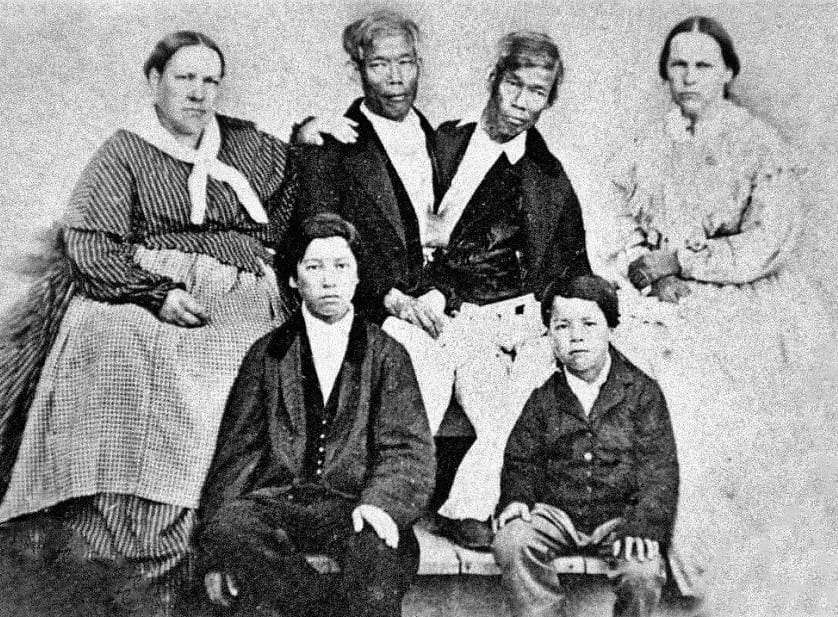
Chang and Eng Bunker with their wives and children. (Mathew Brady)
Though it was not easy for them to lead a normal life as married men, Chang and Eng Bunker were always under the abhorrent eyes of their neighbours, who discussed their sex lives more disapprovingly owing to their rare oddity. Some even went on to call their ways to procreate as incestuous and insulted the couples. Soon, the sisters started quarrelling and grew tired of sleeping in the reinforced bed together, where the twins slept in the middle flanked by their own wives to their sides. That led the Bunker brothers to build another house, close to their first one, where they took turns living in Chang’s home for three days, followed by a trip to Eng’s for the next three days. Between the two, Chang and Eng sired twenty-one children – Chang and Adelaide had ten children and Eng and Sarah had eleven. Though among the twelve daughters and nine sons, none were twins, two children were deaf-mutes and two died before they completed three years of age.
Chang and Eng Bunker with their wives and 18 of their 22 children. (unattributed / Syracuse University)
Death of the Bunker twins
After all the money was exhausted raising families, the Bunker brothers decided to return to show business again, this time with two of their children in tow. However, their magic had started fading away and people across the globe refused to believe the twins could be husbands and fathers. To many people, the idea was appalling and the twins started losing their audience, their fame as well as their money. After performing for more than four decades, the twins couldn’t showcase their oddity anymore, which led Chang to take to drinking heavily. In 1870, he suffered a stroke, which paralyzed the right side of his body, where Eng was attached. Eng nursed his brother back to health, but Chang never fully recovered.
Their life spiralled out of control and only saw a downfall towards the beginning of the 1870s. Work kept lessening; tours had stopped, families were disturbed and the aftermath of the American Civil War had added to their miseries. On January 12, 1874, Chang was stricken with severe bronchitis and complained of stinging chest pains. His condition worsened and he passed away in his sleep in the wee hours of January 17. When Eng woke up, he panicked to see himself attached to his dead twin, while he was still alive. A desperate surgery to separate the dead twin was attempted by calling upon a doctor, but it was too late. By the time the doctor arrived three hours later, Eng had died too.
The bodies were taken to Philadelphia for autopsy, where it was revealed that Chang had died of a clot in his cerebral cavity due to the stroke, while Eng had died of fright. An examination of their connecting cartilage proved that though it was the Bunker brothers’ wish to be separated later in life; it could have been a fateful decision, had they taken it, upon their return to showbiz. The Bunker wives permitted the state to perform a detailed autopsy on the twins, which later revealed that although the twins had separate organs; they shared conjoined hepatic vessels owing to their fused liver. It is doubtful whether doctors could have successfully been able to separate the brothers, without causing the death of one of the twins due to excess blood loss.
Legacy of Chang and Eng Bunker
Chang and Eng Bunker memorial bronze statue in Thailand. (Poakpong / Flickr)
Buried in a common grave at a cemetery in White Plains Baptist Church in Surrey County, the medical marvels and the original Siamese twins, rest peacefully after a fulfilled life of adventure and risks. A plaster cast of their torso is displayed at the Mutter Museum in Philadelphia, Pennsylvania, where people visit in the hundreds to see the rare humans. The twins have close to 1,500 descendants, who earlier lived in secrecy, but have now started to come out at reunions as proud members of the odd yet reputed Bunker family. With their abnormal appearance and their zest for life, the inseparable Bunker brothers left the world awestruck.
Enjoyed this article? Also, check out “The Extraordinary Conjoined Twins: Lazarus and Joannes Baptista Colloredo“.
Fact Analysis:
STSTW Media strives to deliver accurate information through careful research. However, things can go wrong. If you find the above article inaccurate or biased, please let us know at [email protected].
RELATED
 March 18, 2019 The Extraordinary Conjoined Twins: Lazarus and Joannes Baptista Colloredo
 November 28, 2018 Fedor Jeftichew: Jo-Jo the Dog-Faced Human Prodigy
- March 13, 2019 ‘Ape Woman’ Julia Pastrana: The Sad and Short Life of the Ugliest Woman in the World
- October 3, 2019 Martin Laurello: The Astounding ‘Human Owl’ Who Could Turn His Head Around By 180 Degrees
The post Chang and Eng Bunker: The Famous Congenitally Fused Twins That Brought the Term ‘Siamese Twins’ in Vogue appeared first on .
]]>The post With Alternative Systems in the Pipeline, Global Positioning System, GPS is Here to Stay appeared first on .
]]>
A driver using a global positioning system through his phone. (THE COLLAB. / Pexels)
The day: September 1, 1983. A Korean Air Lines Flight 007, taking off from New York City to Seoul, drifts 200 miles away from the flightpath, towards a sensitive Soviet military installation in the Kamchatka Peninsula. Soviet Pilots detect these intrusions and jump into action. KAL 007, the passenger plane, is mistaken for the spy plane and shot down. If only the KAL 007 had the Global Positioning System (GPS), then used exclusively by the U.S. Military, it would have noted the drift and mended direction. And, the tragedy could have been averted. Lest such navigational lapses repeat, America – the owner of GPS, then opened this facility for civil use all over the world.
Backed by solar power and batteries
GPS was conceived as stealth technology for the reconnaissance and surveillance work of the U.S. Defense Forces. Its formation began with the launching of the first GPS satellite into earth’s orbit in 1978. By the year 1994, it became a group of 24 satellites. Presently there are 32 satellites. Each weighs about 2000 pounds and carries a 17 feet expanse of solar panels. Functional life of a satellite is about 10 years and the duds are replaced with new functional units. Powered by solar energy, and on-board back-up batteries, each satellite is able to transmit 50 Watts or less of electromagnetic power. This generates 2 low-power radio signals which travel by the line-of-sight. That means, barring high-density solids like concrete buildings and mountains, the signals pass through all other mediums (plastic, glass, clouds etc.).
Satellite information is decoded by GPS devices
The signal given out by the Satellites is loaded with 3 types of information:
1. Pseudorandom code: It is an identification of the particular satellite which is sending the information. The satellite page on the GPS device being used on earth gives a clear indication of the sender satellite.
2. Ephemeris data: This shows update on functional status and the orbital-position of the satellite.
3. Almanac data: It has orbital and state (health) information of every satellite in the constellation. The GPS almanac also includes necessary data to correct for distortion caused by the ionosphere.
Geographical positioning is determined by trilateration
Each satellite, circumnavigating 12,500 miles (20,117 kilometers) away in space, makes 2 rotations of the earth in a day. The satellite demarcates a circular zone on the GPS device as the area of the user’s probable location. Circular zones, as indicated by a 2nd and 3rd satellites would naturally intersect, and the point of intersection reveals the geographical position in a narrowed down range. Even a 4th satellite may chip in with yet another intersection. More the number of intersections, more pinpoint and accurate the location of the GPS user. If still more number of satellites come in the loop, even 3-D position (longitude, altitude and latitude) can be assessed. This methodology of zeroing on to the exact geographical position is called trilateration.
Notably, GPS device, like smartphones, can only collect data transmitted by the satellites. It can’t send data back to the Satellite, except when it syncs with cell phone towers and internet for better output. The device can, as an exception, send such synced information to the satellite systems.
Capable of doing lot more than just positioning
GPS device doesn’t just stop at finding the subject location. It also reveals the distance to a projected destination, how long it may take to reach there, the speed of the subject, topography of the area being travelled, time of sunrise and sunset, and much more. Thanks to technological up-gradation, more and more sensitive receivers are now available. These have enhanced GPS reception in a big way. Some adjutant systems too, like WAAS (Wide Area Augmentation system) and DGPS (differential GPS), have ensured better results. WAAS accounts for atmospheric variations and the geographical position is homed in by more than 3 meters. The correction ensured by DGPS, (used by the U.S. Coast Guard), is in the range of 1-3 meters. With further research and development, tracking of 20 or more satellites could be a possibility. More the number of satellites engaged, better theresults. However, starting from 2018 the U.S. Coast Guard has slowly started to discontinue the use of DGPS due to the increase in the accuracy of GPS technology.
Can the reading on GPS device go wrong?
Yes. Satellites, apart from expiring in 10-year time, can also be obstructed temporarily. Like, conditions in troposphere (the atmosphere 6-20 KM above the sea level), and ionosphere (1000 KM above the sea level) may cause signals to move slowly. Signals may also bump off some high-density solid on earth and lead to error in positioning.
What if America asserts its ownership of GPS?
By and large, GPS is a freebie from America. That, ironically, is its plus as well as minus. Plus, because it is being used extensively and intensively all over the world. Minus, because nothing really comes for free. On all good things, there is a price tag, overt or covert. Of the two levels of GPS services available, Standard Positioning Service (SPS) is free for use worldwide. The other level, Precise Positioning Service (PPS), is not for all. Its use is limited to American Armed forces, federal agencies and some selected nations. What if America decides to restrict worldwide use of GPS? It would indeed rattle the world, overly dependent on GPS in many ways. Is the world ready to face this eventuality?
World moving in the direction of alternatives
Yes, the world seems to be geared up for GPS road-block. Russia has built its own satellite cluster in space, called GLONASS (Global Navigation Satellite System). Galileo is another system, owned by the European Space Agency. China is busy expanding BeiDou to increase its global coverage. Most gadgets are receptive to GLONASS and GPS, and to some extent to BeiDou. The Indian counterpart is IRNSS (Indian Regional Navigation Satellite System), also called NAVIC. Nevertheless, GPS remains the most widely used system as of now.
In spite of competition, GPS holds ground
Blaine Curcio, founder of Orbital Gateway Consulting, a satellite market research firm opines that the satellite navigation services of the future will divide the world into two camps. One: pro-China. Two: pro-US. The pro-China lobby would include nations sceptical of the service provided by the U.S. and the European Union.
Is there a pressing need for alternative navigation systems?
No, feels Curcio. Rightly so, for more reasons than one. According to Brian Weeden, director of the Secure World Foundation states that- the biggest merit of GPS is its consistency and reliability. Further, he says, establishing a global satellite navigation system and making it trust worthy, like GPS, is a hard job. Add to this the fact that BeiDou would be a two-way transmission. Satellite to device on earth, and from device to the satellite. This 2-way track would need more of spectrum bandwidth and the accuracy of positioning could be compromised.
What has ostensibly annoyed the Western countries is the probable role of BeiDou in China’s plan for a smaller & smarter military. It could be used for precision-guided missiles, reconnaissance, and short messages (the facility lacking with GPS). Doubtless, it would add to the military might of China significantly. Not surprising, considering GPS too was developed for the U.S. Military, and used for the first time in the Gulf War.
Keen contest among the nations of the world would indeed change the present day scenario of the global positioning systems. But it won’t come a day too soon. And GPS is likely to hold ground for pretty long.
Enjoyed this article? Also, check out “Yellow Concrete Arrows Are the Last Reminders of Transcontinental Airway System“.
Fact Analysis:
STSTW Media strives to deliver accurate information through careful research. However, things can go wrong. If you find the above article inaccurate or biased, please let us know at [email protected].
RELATED
 April 2, 2019 Yellow Concrete Arrows Are the Last Reminders of Transcontinental Airway System
- May 13, 2019 Radar Technology’s Early Detection System Revolutionised the World and Made it a Better Place to Live in
 September 10, 2019 John Stapp: The Air Force Pilot who Survived the Fastest Rocket Powered Sled
 October 7, 2018 Tesla Tower: The Tragic Story of Nikola Tesla’s Wardenclyffe Wireless Station
The post With Alternative Systems in the Pipeline, Global Positioning System, GPS is Here to Stay appeared first on .
]]>The post HMS Terror: A British Warship That Was Lost for Over 170 Years appeared first on .
]]>
Engraving of HMS Terror by George Back. (George Back / Wikimedia Commons)
The HMS Terror was built and commissioned in the year 1812 for the British Royal Navy, to serve as a specialized warship and bomb vessel. Although the ship played a major role in the battles of 1812, she commenced her journey as a bomb vessel only in 1813 when Fort McHenry was bombarded in the Battle of Baltimore.
Two decades later, she was transformed into a polar exploration ship. The HMS Terror was a part of George Back’s Arctic expedition from 1836-37, Ross expedition from 1839-1843, and Sir John Franklin’s expedition to force the Northwest Passage in 1845. The Sir John Franklin’s expedition, however, proved to be the HMS Terror’s last voyage as the ship, along with all its crew, as well as the HMS Erebus, got lost in the Arctic waters, never to be found again.
Warship to exploration vessel
After suffering damages in one of the many battles it was deployed in, the HMS Terror was decommissioned as a military vessel in 1828. In the mid-1830s, however, the ship came back into service as it was remodelled into a state of the art exploration vessel, with incomparable features. The British left no expense spared to furnish this exploration vessel- from equipping it with sturdy iron plating around the hull, to including a very powerful propeller. HMS Terror became the first vessel to be equipped with an onboard desalination plant for turning seawater to freshwater. The ship was fully-loaded with rations sufficient — about 32,000 pounds of meat, 1,000 pounds of raisins, 58,000 gallons of pickles, and about 7,650L (2,000 US gal) of liquor for a 134 man strong crew, including the captain of the vessel. Although there were 5 sailors who were honourably discharged and sent back home, it continued sailing through the waters at full speed.
Photo of Sir John Franklin. (Maritim Greenwich Souvenir Guide, London 1993)
Sir John Franklin commandeering over the HMS Terror, and its companionship the HMS Erebus headed the expedition. His second in command, Captain Francis Cozier was in charge of the HMS Terror. Back in 1845, a number of countries sought to establish dominance over new land and sea routes. The Northwest Passage happened to be one of these much sought-after routes, being eyed by multiple nations, including Russia. The two ships, HMS Terror and HMS Erebus, set out to explore this route.

Captain Francis Crozier. (Francis Rawdon Moira Crozier)
Last sightings and cannibalism
The sister vessels HMS Erebus and HMS Terror made certain stops along their way to the Northwest Passage. Among their last stops were Scotland’s Orkney Islands, and Greenland, before the two ships completely disappeared, never to be heard from again. Two whaling ships had last spotted them when the vessels were on their course to Canada’s remote Baffin Island. After a couple of years when they did not return and no contact was made by any of the ship’s crew, search parties were dispatched in order to find them.
Human carcasses and bones were found aboard the shipwreck and scattered around the area where the ship had sunk. Bones were cracked in half according to reports by the local Inuit which led to the presumption that the crew members had resorted to cannibalism for survival. Later in the 1980s and 1990s, remains were found with knife marks on them which indicated dismembering of limbs and the bone marrow of fellow crew members before they were consumed.
Divers and drones
Parks Canada, a Canadian government agency had launched a search expedition for the wreckage in cooperation with the Inuit. Parks Canada archaeologists employed the use of professional divers as well as state of the art drones. Diving did not prove to be especially fruitful, owing to the extreme conditions such as pressure and the freezing temperatures. The use of drones allowed even the most remote areas of the ship, fragile and untouched by humans, to be explored and 3D imaging was used to create a map of the ship. Places like hatchways, crew cabins’ skylights, officers’ mess hall, and the captain’s stateroom were thoroughly looked into for any evidence required to ascertain the reason for sinking.
Eerily enough, all the doors were wide open, but all rooms appear to be unharmed with no signs of violence. Photographs from the wreckage indicated that the ship was in a rather pristine condition, including the condition of the personal belongings of the crew. A letter known as the Victory Point Note was found which had two handwritten messages. The first letter was signed by Franklin, and stated “all well” in May 1847, and the second mentioned that there were two dozen casualties aboard the HMS Terror, including Sir John Franklin in April 1848.
Extraordinary mystery: How did HMS Terror sink?
To this day it remains unknown, why the HMS Terror sank. Despite sustained attempts at researching the wreckage, there was no evidence that could ascertain why either the HMS Terror or the HMS Erebus would sink. They were made to withstand the extreme polar conditions and did so with absolute certainty. Even in the wreckage, all documents, cabinets, drawers etc were in top-notch condition and were in the exact place they were supposed to be in. Lead Archaeologist Ryan Harris said, “I’ve never seen anything like this”.
Three corpses were discovered by American and British search parties in Beechey Island. A 20-year-old was among the three who passed away on January 1, 1846, and was covered in permafrost for nearly 140 years. The autopsy of his malnourished body revealed he suffered from lead poisoning and botulism, which eventually made scientists arrive at the conclusion that the canned food on-board was responsible for causing lead poisoning and botulism amongst the crew.
HMS Terror wreck site & the understanding between Canada and Britain
While the wreckage has been successfully located by officials, its precise location has not been disclosed to prevent it from being looted by sea pirates. As a part of an agreement between Britain and Canada, Britain handed over the wreck of both HMS Erebus and HMS Terror to be placed under the care of the Inuit Heritage Trust, along with most of the artefacts and gold from the ship. Owing to the favourable weather conditions, a number of attempts were made in August 2019 to explore the wreckage further. Due to the layers of silt formed on the wreck which may damage the contents of Captain Francis Crozier’s cabin, Parks Canada is yet to explore that part of the vessel. There is speculation that the Captain’s cabin holds a lot of valuable materials, and also houses the secret behind why the HMS Terror sank.

Dish set from HMS Terror. (Oaktree b / Wikimedia Commons)
The region where the HMS Terror had sunk has been named Terror Bay in its honour. There are no survivor accounts or tangible proof of why the HMS Terror remained in such pristine condition or why it sunk with all its crew members on board. Till future expeditions unearth some new evidence, the HMS terror’s last voyage remains an unexplained mystery.
Trivia: Did you know that the US Presidential office desk is made from a barque-rigged ship called HMS Resolute? HMS Resolute was one among the six ships to be sent out for rescuing Sir John Franklin.
Fact Analysis:
STSTW Media strives to deliver accurate information through careful research. However, things can go wrong. If you find the above article inaccurate or biased, please let us know at [email protected].
RELATED
 July 29, 2018 SS Baychimo: The Phantom Ship That Haunts the Arctic Waters
 March 21, 2019 Andrée’s Arctic Balloon Expedition of 1897: A Peek into the Doomed North Pole Flight
 September 7, 2019 The Disappearance of Michael Rockefeller: One of the Most Enduring Unsolved Modern Mysteries
- April 13, 2020 The Deviant Spiritualism of an Indian Tribe That Practices Cannibalism And Necrophilia
The post HMS Terror: A British Warship That Was Lost for Over 170 Years appeared first on .
]]>The post Nemo 33: Swimming Pool with Oceanic and Underwater Cave Simulations appeared first on .
]]>
Top view of the Nemo 33 swimming pool. (Sergey Markov / Wikimedia Commons)
Anyone who has ever gone deep sea diving knows how brilliant the experience really is. The chance to swim with unique wildlife, see a portion of the earth that not many have the chance of seeing, is definitely something to boast about. While many are captivated by the abundant wonders that lie beneath, there are many that are equally petrified at the thought of taking the leap. But what if I were to tell you that there is a place in the world, where one can go experience a dive without the need to jump into the middle of the ocean? Cue, Nemo 33.
Nestled in the hustle bustle of Brussels, Nemo 33, was designed and built by expert diver John Beernaerts in 2004. It held the record for the being the world’s deepest indoor pool, until being dethroned by the Y-40 in 2014. The construction of the colossal structure took about 7 years to complete, and cost over $3 million to build.
Primarily, the pool was built as a multi-purpose diving instruction complex, complete with all sorts of obstacles and simulations. That said, the pool has now become a popular tourist destination, with many flocking the area for recreational purposes. The pool has also been used multiple times in scores of film productions.

It held the record for the being the world’s deepest indoor pool, until being dethroned by the Y-40 in 2014. (John Greenwood / Wikimedia Commons)
As mentioned above, the core idea of building the pool was to give people an opportunity to experience a dive without actually jumping into the ocean. For this reason, the pool was customised with special areas that simulate being in the sea. At its deepest, the pool extends almost a whopping 34.5 meters into the Earth. In addition to this, the pool also has two large platforms that reach lighter depths of about 5 meters and 10 meters, with built-in cave simulations. Further, the pool has the capacity to hold over 2.5 million litres of filtered spring water.
While this may not be the “complete package” so to speak, it does give novice divers an opportunity to really experience a dive firsthand, especially in a landlocked country like Belgium. One can take the plunge here at very nominal rates, and bring home an experience of a lifetime.
Recommended Visit:
Nemo 33 | Belgium
Fact Analysis:
STSTW Media strives to deliver accurate information through careful research. However, things can go wrong. If you find the above article inaccurate or biased, please let us know at [email protected].
RELATED
- February 21, 2019 Lake Baikal: The World’s Deepest Lake That Holds 22-23% of the World’s Freshwater
 November 1, 2018 Vardzia: The Mesmerising Cave Monastery that Protected Georgians for Decades
- July 6, 2019 Playa de Gulpiyuri: The Tiny Beach in the Principality of Asturias in Spain
 May 2, 2019 What Happens to the Olympic Venues in the Host Countries After the Olympic Games End?
The post Nemo 33: Swimming Pool with Oceanic and Underwater Cave Simulations appeared first on .
]]>The post The Mahabat Maqbara and the Extraordinary Tomb of Bahar-ud-din Bhar appeared first on .
]]>
Mahabat Maqbara Mausoleum. (Kshitij Charania / Wikimedia Commons)
If you visit a busy intersection near the Mahatma Gandhi Road in Junagadh, you will come across the eye-catching architectural marvel known as the Mahabat Maqbara. It is a mausoleum of the sixth Nawab of the erstwhile princely state of Junagadh and one of his high-placed courtiers. However, unlike India’s most famous mausoleum, the Taj Mahal, few people in India or abroad have heard of the Mahabat Maqbara. That ought to change.
The Mahabat Maqbara
The Mahabat Maqbara is a mausoleum complex that comprises of two structures—the imposing Mahabat Maqbara, which was built above the tomb of Nawab Mahabat Khan II of Junagadh, who ruled from 1851 to 1882, and the fantastically eccentric tomb of his Wazir, Bahar-ud-din Bhar Hasainbhai.
Nawab Mahabat Khan II began construction the complex in 1878. The building work of the Mahabat Maqbara took 14 years and was completed by the Nawab’s successor, Nawab Bahadur Khanji in 1892. The tomb of Bahar-ud-din Bhar was completed in 1896.

Tomb of Mahabat Khan. (Bernard Gagnon / Wikipedia Commons)
A brief history of Junagadh
To understand how the Mahabat Maqbara came to be built, let us first take a look at the social and political background of Junagadh. For centuries, the region was under the rule of various medieval dynasties. It became an independent kingdom in 1748, after Mohammad Sher Khan Babi, a Pashtun adventurer from Afghanistan, decided he didn’t want to be a Mughal vassal any longer. He threw over his allegiance to the Mughal governor of the Gujarat subah and declared himself as the ruler of Junagadh. He began ruling over the newly-found kingdom as Nawab Muhammad Bahadur Khanji.
It was the beginning of the Babi Dynasty that ruled over Junagadh until the independence of India in 1947.
In 1807, during the reign of the third Nawab of Junagadh, Nawab Muhammad Hamid Khanji, who ruled from 2 Dec 1774 to 26 Feb 1811, the state became a British Protectorate. After the fourth Nawab of Junagadh, Nawab Muhammad Bahadur Khanji II, began ruling the kingdom, the East India Company arrived at the city gates and took control in 1818.
However, they did not take over the direct administration of the state or of the other princely states in the Saurashtra region of Gujarat but were content to let the Nawabs remain on the throne and rule on their behalf. The subsequent Nawabs of Junagadh became dyed-in-the-wool Anglophiles, adopted European mannerisms, and attempted to incorporate European architecture in the buildings they built.
After the partition of India in 1947, the princely states in the subcontinent were asked to join either India or Pakistan. The 10th and very popular Nawab of Junagadh, Nawab Muhammad Mahabat Khanji III Rasul Khanji, was holidaying in Europe at the time of independence, leaving his Diwan, Shah Nawaz Bhutto, to rule in his absence. Shah Nawaz Bhutto—father of Zulfiqar Ali Bhutto and grandfather of Benazir Bhutto, both of whom served as prime ministers of Pakistan—was inclined towards Mohammad Ali Jinnah, and, on his return from Europe, persuaded the Nawab to accede to Pakistan.

From left-right: Mohammad Rasul Khanji, Nawab of Junagadh (r. 1892-1911), and Bahaduddinbhai Hasainbhai, Wazier. (F. Nelson / British Library)
The Nawab sent an emissary to meet Jinnah on 11 August 1947 and announced the accession on 15 September 1947. The Indian side took exception and pointed out that the state had no common boundary with Pakistan. To this, the Nawab replied that there was a sea route to Pakistan. Unfortunately for him, the predominantly Hindu population of Junagadh also took exception to join Pakistan and revolted. They insisted on holding a plebiscite, and the results showed that the majority of the citizens wanted to join India.
When the Nawab of Junagadh refused and used military force to prevent his vassal principalities, Babariawad and Mangrol, from acceding to India, Sardar Vallabhbhai, the new Deputy Prime Minister of India, sent the Indian Army to seize the territories. The Nawab and his Diwan fled to Pakistan, and Junagadh became part of India.
The architectural specialities of the Mahabat Maqbara
Islamic and European influences shaped the outlook of the Nawabs of Junagadh, and nowhere is this more evident than in the architecture of the Mahabat Maqbara.
While the external and internal structures of the Mahabat Maqbara are clearly Islamic, they are also replete with distinctive Gothic architectural flourishes. Nawab Mahabat Khan II was an admirer of European architecture and the Gothic style was in vogue in Europe when he began building the Mahabat Maqbara. Since he wanted the buildings to exceed the best in Europe, he insisted on a blend of Islamic and Gothic architectural styles.

Front view of Mahabat Maqbara. (Gsuruchi06 / Wikimedia Commons)
The result is quite astounding and awe-inspiring. Even though it is located on a busy intersection, the Mahabat Maqbara complex manages to stand out and make a powerful statement of eccentricity. Both the structures of the Mahabat Maqbara have stately onion domes and attractive silver doors and windows.
The tomb of Nawab Mahabat Khan II has a large onion dome at the top and is surrounded by a cluster of smaller onion domes. There are elaborate carvings on its outer facade as well as on its interior. There are decorative arches and Gothic columns and windows in the French style.
Wazir Bahar-ud-din Bhar Hasainbhai’s tomb has three large onion domes and exterior decorative flourishes. A short flight of steps leads up to a large, Islamic-style door. The structure is surrounded by four minarets, and each of these minarets is encircled from top to bottom with winding staircases on the outside. These add to the unique architectural features of the Mahabat Maqbara complex and are probably the only minars in the country with external stairways. Most minars in India—such as the Qutub Minar—have stairs on the inside.
The current state of the Mahabat Maqbara
After Junagadh became an Indian state, the Mahabat Maqbara and many other heritage buildings came under the purview of the Archaeological Survey of India. It is, therefore, an officially protected building.

A sign by the Archaeological Survey of India. (Subham Chaurasia 1998 / Wikimedia Commons)
Unfortunately, however, the Indian authorities have not been doing enough to actively protect and maintain the Mahabat Maqbara. The complex is, at present, in a sad state of neglect, with grass and plants growing on the structures. Some sections of the buildings are crumbling away, and others are held together tenuously with rusted wires. The window glasses are broken, and birds have nested inside, and the floodlights outside are damaged.
It is possible to go inside and get an idea of the former grandeur. Hopefully, the Indian government and the Archaeological Survey of India will step up to save, renovate, and restore this architecturally unique monument before it is too late.
Enjoyed this article? Also, check out “Tomb of Bibi Jawindi“.
Fact Analysis:
STSTW Media strives to deliver accurate information through careful research. However, things can go wrong. If you find the above article inaccurate or biased, please let us know at [email protected].
RELATED
- October 8, 2019 Bibi ka Maqbara: The Taj of Deccan, Which Like the Original, Tells the Tale of Eternal Love
- June 1, 2020 The Clermont-Ferrand Cathedral: A Beautiful Gothic Structure Made of Black Lava Stone
- July 28, 2019 Iftikhar Ali Khan Pataudi – The Only Cricketer Who Played for Both England and India
- January 12, 2019 Kumbhalgarh Fort: Not Only China But India Too Has Its Own ‘Great Wall’ Built Centuries Ago
The post The Mahabat Maqbara and the Extraordinary Tomb of Bahar-ud-din Bhar appeared first on .
]]>The post The Newby-McMahon Building: A Four-Storey Building That Is ‘the World’s Littlest Skyscraper’ appeared first on .
]]>Growth in the economy encouraged the townspeople to believe in the construction of the skyscraper. The project proposal in 1919 met with next to no negativity, and investors raced to make themselves a part of the game plan that J.D McMahon had put forth. Entirely unaware, they would all be duped and would eventually witness the construction of the world’s littlest skyscraper.

Newby-McMahon Building in Wichita Falls, Texas. (Travis K. Witt / Wikimedia Commons)
The original gameplan
A massive boom in the industry hit the town of Wichita in the 1900s upon the discovery of a petroleum reservoir, which led to a sporadic population explosion, ultimately resulting in an increase in the workforce. McMahon was not the first to propose the idea of constructing an office space for the rapidly growing industry. Earlier in 1906, Augustus Newby, a railwayman had successfully constructed a one-story building that was used as an office space. It was around the corner at the end of a street named “Seventh and La Salle”. However, the Newby building proved to be inadequate to house the workforce it needed to, and had to be reconstructed to accommodate the need for more office space. A one-story building would not be enough for the massive workforce that had moved into the town.
McMahon’s strategy
The idea of a skyscraper in a little town with a mere investment of $200,000 amused investors, but they rushed in to be a part of the project nonetheless. J.D. McMahon was the owner of an oil construction company whose office was in a one-story brick building on the corner of Seventh and La Salle. He then came up with the idea of building a skyscraper in the empty plot next to his office. During the expansion, he had, incidentally, taken no permission from the landowner of the lot and used his own company to build the skyscraper. Little did the investors know that the skyscraper — or so it was called, was just a four-story building. The investors had been successfully duped out of their money by McMahon.

The one-story building next to the Newby-McMahon Building. (Michael Barera / Wikimedia Commons)
How exactly he got investors to sign on papers is another story altogether. Very few people actually pay attention to detail, and as it seems, these investors who believed in McMahon were not one of them. The proposed plan for the building was 480 inches and not 480 feet. They simply failed to notice that the stroke was double and not single. While investors took this to court after the construction was done and they were shocked by the finished product- it eventually yielded nothing as the plans were indeed for 480 inches, which they had all signed off together. As a result, when the elevator company that had been given the contract learned of the proceedings happening in court, they backed out and left the lot with no elevator to scale the floors. An internal stairway was built after several years, which helped to access the other floors. Before that, a ladder was used to climb to the upper floors of the alleged ‘skyscraper’.
The stories behind the Newby-McMahon Building
The multi-story skyscraper, the Newby-McMahon Building, has had multiple ‘stories’ associated with it, post its construction. There has been speculation amongst residents, who stated that the entire structure could be a decoration with just a water tower stored within it. Some residents say that it is a facility where firefighters engage in practice drills to train in their heavy suits. Some even believe that it was used as a place for bootleggers to smuggle during the Prohibition. It was also rumored that the building had been used as a set for a 1950s themed movie. However, most of this can be dismissed as rumours and small-town gossip running wild in Wichita.

Newby-McMahon Building from two angles. (Michael Barera / Wikimedia Commons)
In reality, the four-story building has housed various businesses, although in the initial years after its construction it was left as a vacant lot. This vacancy had been a source of great embarrassment for the investors as well as the locals in the area. After the economy was uplifted post the Great Depression, the Newby-McMahon Building went on to house a barbershop and various local eateries, all of which eventually moved out. A local business that went by the name of Marvin Groves Electric, partnered with a local architecture firm called Bundy, Young, Sims and Potter, and invested $3,748 and restored the structure.
To keep, or not to keep?
There have been several instances where parts of the society living in the area have put forward their views on the matter of the building. Half the people wanted the Newby-McMahon Building to be torn down out of sheer embarrassment, while the other half worked to save it. What we can conclude, is that the building had always been a source of controversy. On several occasions, the building had been scheduled to be demolished, but that kept being postponed until it was eventually given to a local heritage society.
Still standing tall
Years later, after an investment of roughly $250,000, the Newby-McMahon Building now houses an antique store and an artist’s studio, both of which are thriving. Upon the complete restoration of the building, it has also been declared a Texas Historic Landmark. Additionally, the Newby-McMahon Building has also been added to the National Register of Historic Places and is part of the Depot Square Historic District of Wichita Falls.

A Plaque attached to the Newby-McMahon Building. (Solomon Chaim / Wikimedia Commons)
It was given the epithet “World’s littlest skyscraper” as a result of its feature on a television show called ‘Ripley’s Believe it or Not’ where they explained how J.D McMahon had successfully conned the investors of the small town, and was absconding after pocketing a large chunk of the $200,000. In today’s economy, those $200,000 would amount to a whopping 2.7 million USD.
Enjoyed this article? You would also love “Stanley Clifford Weyman Found Adventure in Being a Serial Impostor“.
Fact Analysis:
STSTW Media strives to deliver accurate information through careful research. However, things can go wrong. If you find the above article inaccurate or biased, please let us know at [email protected].
RELATED
 September 17, 2019 Gereja Ayam: The ‘Chicken Church’ of Indonesia Was Meant to Serve As a Prayer House for All Religions
 April 28, 2018 Is the Story of ‘Zana’ the Ape-Woman who could Outrun a Horse True? or a Myth?
 November 30, 2018 Replica Constructions of World-Famous Cities and Towns in China: Tianducheng, Thames Town, and Hallstatt
 February 22, 2020 The Acoustic Kitty Project: Weird Feline Spies of the ’60s
The post The Newby-McMahon Building: A Four-Storey Building That Is ‘the World’s Littlest Skyscraper’ appeared first on .
]]>The post Leonarda Cianciulli: The Ill-fated Correggio Killer who Made Soap and Cookies of Her Victims appeared first on .
]]>
Mugshot of Leonarda Cianciulli. (Wikimedia Commons)
How unlucky can one get? Is life already programmed at birth, or even before it? Is one’s journey in life a foregone conclusion? These questions relate to a girl born to a raped woman, in Italy. The woman married her rapist, but went on to despise her daughter, Leonarda Cianciulli, who grew up to make soap and cookies for a living at Correggio. Highly superstitious about her bad luck, she mixed her trade with a spree of serial killings. Held to account by the law of the land, she spent 30 years in jail, and died in a criminal asylum, doing the remaining part of her sentence.
Leonarda Cianciulli was a neglected child of a raped woman
Born on 18th April 1894, Leonarda, the unwanted child of a raped woman, had a disturbed childhood. Her father, the man who raped her mother (and married her later), died when she was a toddler. Living in extreme poverty, her mother remarried but her financial hardships persisted. A jinxed mother couldn’t care less for her daughter. Leonarda, thus, grew up as a bundle of nerves. So much so, that the girl tried to kill herself on two different occasions.
Riled about her mother’s curse
Stepping into youth from a turbulent childhood brought a new set of problems for Leonarda. Her parents chose a wealthy match for her, but she refused to marry him. Instead, she married a registry office clerk, much older than her age. Then on, she always believed that her marriage was cursed by her mother. Curse mattered to her. Pushed to the wall with hardships since birth, she found succour in soothsayers and fortune-tellers. She realised she was already ill-fated and didn’t want any addition to her woes. So, she feared the curse. Ironically though, her fears came true.

Young Leonarda Cianciulli. (Wikimedia Commons)
Devastated by earthquake
The newlywed Leonarda Cianciulli shifted to Lauria (present-day Potenza) in 1921. Even as she settled down and bore children, financial problems dogged her. Frantic to support her growing family, she ventured into illegal transactions, and was jailed for fraud in 1927. Upon her release from jail, she shifted base to Lacedonia (present-day Avellino) and tried to rebuild her life all over again. But bad luck continued to haunt her. An earthquake in 1930 destroyed her house, and the family was on the streets. Forced to move for survival, they then settled down in Correggio, Reggio Emilia, Italy. Here they found some peace of mind. Leonarda opened a soap shop and became a popular businesswoman.
Tried black magic to solve her problems
By now Leonarda had come a long way. She got pregnant 17 times and had 3 miscarriages. 10 of her children died at various stages of their growing period. Only 4 siblings survived. A staunch believer of astrology, palm reading and fortune telling, she believed her misfortunes were predestined. A fortune-teller had told her that none of her offspring would survive, all would die. Her mother’s curse too rankled her. Could she do something about it, and save the life of her remaining children? To her great concern, her eldest son got enrolled in the Italian army in the wake of ongoing World War 2. Deeply superstitious, she desired to counter the evil spell that killed her children, bode ill for her still alive, and made a mess of her life. Her knowledge of black magic said that the nether world could be appropriated to spare one life in exchange for another. So why not kill an unrelated person to save the life of her dear ones? She did just that, and added her bit of creativity to the macabre slaying of three unsuspecting ladies. She was practising fortune-telling herself, and her victims were beholden to her for solving their problems.
Killed three with astute planning
Her first victim was Faustina Setti, a middle-aged spinster wanting to get married. Leonarda promised her a husband in Pola (present-day Croatia) on condition that latter keeps it a secret. She also got some letters written by her victim. These were welfare intimations which Leonarda would post to the relatives of the victim from Pola. But the victim, Faustina Setti, wasn’t taken to Pola. She was served a spiked drink. When she fell unconscious, Leonarda killed her with an axe, cut the body into pieces and collected blood separately. Body pieces were boiled in caustic soda and made into soap. Coagulated blood was added to cake and served as a snack.
Her second victim, Francesca Soavi, was promised a job at Piacenza. Same modus operandi was followed. The victim was directed to keep the matter a secret and given a bunch of welfare letters which could be posted to her relatives. And then, done to death. In the third victim though, she met her nemesis.
The third victim did her in
Her third victim was Virginia Cacioppo, a 53-year-old ex-opera singer living in penury. She was offered a job in Florence, as secretary to a fictitious theatre personality. Of course, with the same secrecy clause. Virginia too met with the same gory end. Leonarda enjoyed making her soap bars, and edibles and went on record saying Virginia gave her the best output. To her bad luck, Virginia’s sister-in-law had seen her in Leonarda’s company, and concerned at her disappearance, she reported the matter to Police.
Died passing jail term for her crimes
Leonarda Cianciulli was arrested, tried for her crimes, and awarded 30 years’ prison sentence. An additional 3 years’ stay in women’s criminal asylum, after 30 years’ jail term, was also pronounced. During her stay in asylum she suffered from cerebral apoplexy and died on 15th October 1970.
A gypsy had righty prophesied to her that she saw her one hand in prison and another in a criminal asylum.
Enjoyed this article? Then check out “Amelia Dyer: The Nurse Who Killed Babies for Business“.
Fact Analysis:
STSTW Media strives to deliver accurate information through careful research. However, things can go wrong. If you find the above article inaccurate or biased, please let us know at [email protected].
RELATED
- August 9, 2019 Indian Serial Killers and the First Woman to Receive the Death Penalty in Karnataka
 November 25, 2019 Carl Panzram: The Serial Killer Who Epitomized Evil
- July 19, 2019 Amelia Dyer: The Nurse Who Killed Babies for Business
- May 14, 2019 Burke and Hare: Two Body Snatching Serial Killers Who Sold Corpses for Anatomical Science
The post Leonarda Cianciulli: The Ill-fated Correggio Killer who Made Soap and Cookies of Her Victims appeared first on .
]]>The post Batu Caves of Malayasia – The Largest Shrine to Lord Murugan Outside India appeared first on .
]]>
Inside Batu Caves. (Allan Jay Quesada / Wikimedia Commons)
The Batu Caves are amongst the most famous natural attractions in Malaysia, composed entirely of limestone and being home to a diverse range of fauna. Additionally, they are renowned for housing the Batumalai Sri Subramaniar Swamy Devasthanam, a temple dedicated to Lord Murugan, within them. Every year, thousands of Hindu devotees from around Malaysia, India, and the rest of the world visit this temple and particularly during the famous Thaipusam festival in late January or early February.

Inside Batu Caves during Thaipusam. (Dennis Sylvester Hurd / Flickr)
The most famous limestone caves in Malaysia
The Batu Caves are located approximately 12 kilometres to the north of Kuala Lumpur in Gombak district in Selangor in Malaysia. They are over 400 million years old and get their name from the Sungai Batu or Batu River that flows past the hill. For centuries, the indigenous Besisi people used these caves as temporary shelters while they were out hunting in the region. At other times, the caves remained uninhabited and became home to a diverse range of fauna.
In the 1800s, many Chinese arrived to settle and work in Malaysia. Around 1860, some of these workers discovered that there were extensive guano deposits—bird and bat droppings—in the Batu Caves. They began frequenting the caves to collect the guano; they used it as fertilizer in the fields to grow vegetables.
In 1878, the American naturalist, William Temple Hornaday, came upon the Batu Caves while he was out hunting. He was drawn to them by the smell of the guano and, upon going into the caves, was very impressed. He likened the largest cave to a grand cathedral. Around this same time, the British Colonial Authorities also took note and officially recorded the caves.

Steps leading to the inside of the cave. (Jorge Láscar / Flickr)
The Batu Caves Complex
Rising to a height of nearly 100 metres above the ground, the Batu Caves Complex consists of three main caves and several smaller ones. The largest cave is known as Temple Cave and is at the top of the hill and you need to climb up 272 steps to reach it. The other two main caves, the Art Gallery Cave and the Valluvar Kottam Cave or the Museum Cave, are at the base of the hill. There is another cave, known as the Dark Cave, en route to Temple Cave. Then there is a cave known as the Ramayana Cave that lies to the extreme left of the hill’s sheer wall.
Near the cupolas of the Batu Cave Complex, there is an imposing, 140-feet tall statue of Lord Murugan. It is not only the tallest statue of a Hindu deity in Malaysia, but it is also the tallest statue of Lord Murugan in the entire world. It took three years to make and was erected on the site in January 2006.

On the left are the 272 steps leading to the Batu Caves and on the right is the statue of Lord Murugan. (Jorge Láscar / Flickr)
There is another impressive statue, that of Lord Hanuman, the Monkey God and aide of Lord Rama, in front of the Ramayana Cave. This statue is 50-feet tall, and the temple authorities installed it on November 2001.
The Temple Cave
As William Temple Hornaday noticed on his visit, the Temple Cave has a level floor and perpendicular walls and a soaring roof that is open to the sky. It is 50 feet wide and 60 feet high, with the higher point of the roof rising up to 100 feet.
Thambusamy Pillai, an Indian trader of Tamil origin in Malaysia, noticed the vel-like shape of the entrance of the Temple Cave and decided to dedicate a temple to Lord Murugan. In 1891, he installed the murti of Sri Murugan Swami in the Temple Cave. A year later, in 1892, the Thaipusam festival was first celebrated there.
The Temple Cave, also known as Batu Malai Śrī Subramaniar, now houses several ornate Hindu shrines and many of these depict how Lord Murugan’s defeated the demon Soorapadman. The Śrī Maha Mariamman Temple Devasthanam’s management committee handle the temple affairs.
When the Temple Cave was first opened to Hindu devotees, they had to reach it by scrambling up the rocks strewn on the hill. In 1920, the Temple Authorities had wooden steps constructed to make it easier for the pilgrims to reach the temple. Later, they replaced these wooden steps with concrete steps. You can reach this concrete stairway via a zigzag bridge. The stairway has many landings, both to give a breather to the weary and the elderly.
In August 2018, the Temple Authorities had the 272 steps painted in a range of different colours. The striking effect this produced proved popular with visitors, but the Malaysian National Heritage Department took exception as the Temple Authorities had breached the law by not applying for permission prior to renovating the heritage site.

The stunning paint job to the steps leading up to the Batu Caves. (Marco Verch / Flickr)
The Valluvar Kottam, the Art Gallery, and the Ramayana Cave
These caves are well-known for their spectacular murals showing scenes from the Hindu epics, the Ramayan and the Mahabharata. Some of the murals show scenes from the lives of ancient Tamil poets and reproduce their poetic couplets. The murals are lit up with many colorful lights, creating a somewhat psychedelic effect. There are also several statuary exhibits. In the courtyard outside, there is a statue of a five-legged bull that once lived with a herd of cows on the temple grounds.
The Dark Cave
En route to the Temple Cave, there is pristine cave known as the Dark Cave. It leads into a two-kilometre network of relatively untouched caverns that are filled with stalactites and stalagmites. Formed over 2000 years ago, these form intricate formations that make for a dramatic sight. To preserve the cave’s ecology, the Malaysian Nature Society limits the visits to a few guided tours.
Many of the undeveloped limestone caves are home to the Trapdoor or Liphistius batuensis spiders that are on the verge of extinction. Naturalists believe that the only thriving population of these spiders is in the Batu Caves. There are also cockroaches, Eonycteris bats, fruit bats, long-tailed macaques, butterflies, and other diverse fauna in the caves.
The Thaipusam festival
While thousands of people visit the Batu Caves daily, their numbers swell to millions during the Thaipusam festival in late January or early February. During the festival, devotees organize a procession that begins in the evening from the Sri Mariamman Temple in Kuala Lumpur and arrives at the Batu Caves at dawn the following day. Many of the devotees then take a bath in the Sungai Batu river. They carry kavadis filled with milk offerings for the god, and some of these kavadis are huge, weighing more than 100 kilograms.

A devotee carrying kavadi. (nasrul ekram / Flickr)
The kavadis are decorated with colourful flowers and peacock feathers, and the devotees carry them by balancing their ornate wood or steel frameworks on their shoulders. Many devotees pierce their skin, cheeks, and tongue with metal hooks and skewers that extend from these frameworks. They carry the kavadis in this manner all the way up the 272 steps to the Temple Cave. It is a way of showing their devotion to Lord Murugan. Additionally, devotees, who have had their wishes fulfilled by Lord Murugan, show their gratitude by shaving their heads and offering their hair to the god.
Enjoyed this article? You would also love “Cave of the Crystals: A Geological Wonder with Giant Shimmering Crystals“
Fact Analysis:
STSTW Media strives to deliver accurate information through careful research. However, things can go wrong. If you find the above article inaccurate or biased, please let us know at [email protected].
RELATED
- June 14, 2019 Padmanabhaswamy Temple: The Richest Temple in the World with Gold Worth $22 Billion in Six Vaults
 May 12, 2019 Cambodia’s Magnificent Angkor Wat: One of the Largest Religious Monuments in the World
 April 22, 2019 Incredible Ta Prohm: The Ancient Khmer Temple in Cambodia
- July 17, 2019 The Lonar Lake: An Astronomical Marvel
The post Batu Caves of Malayasia – The Largest Shrine to Lord Murugan Outside India appeared first on .
]]>The post ʻOumuamua: A Mysterious Interstellar Rock Discovered in Our Solar System appeared first on .
]]>
An artistic impression of ‘Oumuamua. (European Southern Observatory / M. Kornmesser)
A mystery rock was spotted in our solar system on October 2017, which ended up sparking a lot of questions amongst the scientific community all over the world. This rock has been given the name ʻOumuamua – a Hawaiian word that basically stands for “scout or messenger from the distant past”. Prior to the detection of ʻOumuamua, we were unaware of the presence of any such interstellar objects present in our solar system.
The only feature that marked the rock as something that might belong to our solar system itself, was its composition of minerals and a characteristic reddish hue. Apart from these qualities, it appeared to be a space rock unlike anything ever spotted before. Shaped like a cigar, ʻOumuamua is nearly 400 meters in length. Not only that, the peculiar nature of the rock also includes the characteristic way it moves- spinning its way through space. Researchers say that it may be a ‘planetesimal fragment’, in the sense that during the formation of a planet in another solar system, it got ejected into space as a result of several factors which may include gravity and explosion of gases.
Discovery of the mystery rock
Observed from the Pan-STARRS1 telescope at the University of Hawaii, funded by NASA’s Near-Earth Object Observations program (NEOO), the ʻOumuamua was initially categorized as a comet. Later on, scientists decided it may be an asteroid due to the unusual activity exhibited by the space rock. Prior to this, interstellar objects were just a theory put forward by scientists. The arrival of the ʻOumuamua confirmed these theories that had plagued scientists for years. Observations made by researchers conclude that it is likely that the space rock has traversed its way through space for millions of years before finally entering our Solar System.
After the momentous discovery of the ʻOumuamua was made at the University of Hawaii, several telescopes were used to continue studying the interstellar object further. These included the European Organisation for Astronomical Research’s (ESO’s) Very Large Telescope (VLT) in Chile to measure its brightness, orbit and color. Space telescopes like the Hubble and Spitzer tracked the movement and speed of the interstellar object. The speed of the ʻOumuamua was marked as 98,400 mph (158,360 km/h) relative to the sun.
Peculiar characteristic traits of ʻOumuamua
With the help of images combined with ESO’s telescope and FORS instrument, a team of researchers, led by Karen Meech of Institute of Astronomy in Hawaii, discovered that the brightness factor of the space rock varies by 10 every 7.3 hours as it spins on its axis. This variation is a characteristic of the ʻOumuamua as a result of its peculiar size. The ratio of its length to width varies by a factor of 10 as well. The length to width ratio of typical space rocks tends to vary by 1:3. There is no evidence of any water or ice present on the surface of the rock, no dust present inside or around it, and it is a completely inert object right to its core.

ʻOumuamua’s changing brightness as it rotates. It appears the brightest when its full length is facing towards the Earth. (NASA / JPL-Caltech)
There are four classifications for a space rock with respect to its eccentricity. They could be circular, elliptical, parabolic, or hyperbolic. The ʻOumuamua happens to have a hyperbolic eccentricity. It was observed that most rocks having hyperbolic eccentricities have values greater than 1- typically around 1.0001. Astonishingly, the ʻOumuamua had a measured eccentricity of 1.2.
ʻOumuamua: An alien probe?
The space rock exhibited, interestingly, added acceleration as it reached deeper into our Solar System. Due to this occurrence, the ʻOumuamua was almost classified as an alien probe, being controlled by organisms that were from beyond our known world. However, data indicated that there was no such possibility, since there was no sign of activity on the rock itself. Also, owing to the sheer speed by which it travelled through space, it would be nearly impossible for any organism to exist on it. There was still speculation amongst certain scientific and extra-terrestrial enthusiasts’ fraternities as the extremities an alien organism may survive our beyond what we have been able to ascertain as definite.
The mystery behind the ʻOumuamua’s change in trajectory
Slight deviations noticed in the path of the space rock are not just an effect of gravitational forces, but could also be due to loss in mass. The thrust could have occurred due to the heating up of the surface, which would eventually lead to the formation of a comet tail comprised of several gases. As this did not actually occur, it ended up puzzling scientists till they realized that the Oumuaumua was actually inert in nature. Not only that, there are several other factors, including the rotation period, that come into play.
In the case of loss in mass and formation of a cometary tail, the rotation period around its axis would have varied. Fragmentation of the rock would have caused an abrupt kick in speed, but that did not happen either. Authors Shmuel Bialy and Abraham Loeb suggest that the change in trajectory could be due to solar radiation pressure.
Study of space rocks
Further study of the interstellar rock was declared impossible, due to the lack of adequate technology. No rockets made by humans would be able to catch up with the Oumuaumua. The gravitational net between Jupiter and the Sun hold the possibility to trap interstellar objects entering our Solar System in the future, but this is just a theoretical speculation at the moment.
ʻOumuamua 2.0
Looking forward, the Large Synoptic Survey Telescope will be operational by 2020-2022, and make the study of space rocks much easier.
On August 30th, 2019, Gennady Borisov detected another interstellar object that appeared to be something we might call the ʻOumuamua 2.0. As observed by NASA’s Scout system, it appears to have an unusual orbit, and measurements taken by compiling data provided by the Canada-France-Hawaii Telescope classify the object as an interstellar space rock. Its closest approach would be in the month of December.
Assumptions have been made regarding the trajectory and traits of this rock, and it is under constant observation. Whether a cometary tail will appear, or not, in the course of its path is the question. Bumps in speed have also been kept a look-out for, to confirm the interstellar nature of the rock. If there is no out-gassing, no tail, and no explanation regarding its origin, the nature of the ʻOumuamua 2.0 will be confirmed, and will aid in our study of the increasingly frequent detections of interstellar objects.
Enjoyed this article? You would also love “Truth Behind The Black Knight Satellite Conspiracy Theory“.
Fact Analysis:
STSTW Media strives to deliver accurate information through careful research. However, things can go wrong. If you find the above article inaccurate or biased, please let us know at [email protected].
RELATED
- September 27, 2018 Truth Behind The Black Knight Satellite Conspiracy Theory
 October 30, 2018 Tunguska Event and the Vulnerability of Our Universe
- September 1, 2018 Gliese 581g: A Habitable Exoplanet or Just Another Celestial Object Orbiting a Star?
 July 23, 2019 Pale Blue Dot: The Iconic Photograph Showing How Microscopic But Brilliant Earth Is
The post ʻOumuamua: A Mysterious Interstellar Rock Discovered in Our Solar System appeared first on .
]]>The post Sea Shadow (IX-529): The Story of Surreal Stealth Ships Which Defy the Enemy’s Stranglehold and Strike appeared first on .
]]>
Sea Shadow (IX-529) sailing through Californian waters, 1999. (US Navy)
The element of surprise is crucial to victory in warfare. This can be achieved by escaping the enemy’s vigil. Then only, it is easy to hit the enemy at a chosen time and place. This happened at Pearl Harbour, the U.S Naval base near Hawaii. Japan took America by surprise, destroying 20 ships, 300 planes, killing 2400 and wounding 1000 people. In vengeance, America nuked Japan, and the world changed forever. Warfare too changed radically. Stealth vehicles became the lifeline of the war game. These vehicles could escape the enemy’s IFF (Identification of friend or foe) screening and slip into the enemy’s territory unnoticed. The trend began with radar-defying aircraft. Subsequently, the technology was applied to naval ship- Sea Shadow (IX-529).
The challenge is to neutralize waves which locate movement
The three keynotes of IFF (identification of Friend or Foe) exercise are the sonar (sound navigation and ranging), the radar (radio signals) and the infrared (heat sensors) waves. The stealth ships must escape these three to survive and succeed. Stealth technology is all about facilitating such ‘escape’ and is in great demand worldwide. Reflecting surface of the ship is called the Radar Cross Section (RCS). An effort is made to reduce RCS through shape, design and the painting of Radar Absorbing Materials (RAMs) on the ship body.

Photo of Sea Shadow (IX-529) from above. (U.S. Navy)
The first stealth carrier was an aircraft
The American Aerospace company- the Lockheed, made radar defying fighter plane, F-117 Nighthawk which saw action in the Gulf War of 1991. The outside of the plane was dotted with angular surfaces. Any radiations which fell on these surfaces got scattered in multiple directions. At the same time, radiations also got absorbed into a coat of radar absorbing material (RAM) applied on the plane’s outer surface.
The little amount of radiations or radio waves which got reflected into the enemy radar, don’t suffice for proper identification of the aircraft. So, the aircraft escapes the enemy’s preventive assault on it. If an aircraft could `escape’ thus, why not a naval ship? On this premise was built the Sea Shadow (IX-529) an experimental stealth ship. Though it remained experimental only and wasn’t put into action, it opened the way for an improved version of its class.
From aircraft, the idea was planted on naval ships

F-117 Nighthawk during flight. (Staff Sgt. Aaron Allmon II)
Sea Shadow (IX-529) was built and tested on a submersible ship called Hughes Mining Barge (HMB-1). It was a joint venture of DARPA (Defence Advanced Research Projects Agency), the US Navy and Lockheed. Technically, Sea Shadow was a SWATH ship, i.e. ‘Small Water Plane Area Twin Hull’ ship. Two hulls, instead of a conventional one, were provided for balance and buoyancy. The twin-hull stayed below the water surface. SWATH ships travel at a faster speed, has a higher carrying capacity, but consumes 80% more energy than the single hull types.
Sea Shadow (IX-529) remained a learning exercise
Each of the two hulls of IX-529 had a propeller, a stabilizer and hydrofoils (an arrangement that lifts the hull up to reduce friction when a boat moves at a fast speed). The ship was thus designed to ensure that it remained stable even when the sea was rough with waves reaching up to 18 feet high. Ship’s first trial in 1981 was a failure as it couldn’t dodge the surveillance systems. A course correction was made by repositioning motor propellers and further trials were held in 1985 and 1986. The exercise proved useful for the future endeavours, but Sea Shadow itself could barely reach a functional status. In 1993 it was put up for public viewing. Finally, in 2012, it was sold and dismantled.

Sea Shadow (IX-529), at Hughes Mining Barge before being scrapped. (Stephen Schafer / Wikimedia Commons)
The thread of IX-529 was picked up by USS Arleigh burke ships
In the meanwhile, the first ship of Arleigh Burke-class destroyer was commissioned in America on 4th July 1991. It was another genre of stealth ship equipped with the computer-radar-and-weapon system. It was named after Admiral Arleigh Burke, the Hero of World War II, who later became chief of Naval Operation. The ship was designed for anti-aircraft, as well as anti-submarine action. The hull and the mast of the ship were designed to dodge the enemy radar. It had an all steel construction, an improvement over aluminium-admixture used in earlier versions, as aluminium was vulnerable to fire. Double spaced steel was put in ship’s vital spaces for protection from rocket attacks. Multiple-angle surfaces in place of the vertical surface, and tripod mast in place of the traditional lattice mast; these were the unique features of Arleigh Burke design which made the ship undetectable by anti-ship missiles.
Zumwalt-class destroyer succeeded the Arleigh Burke-class destroyer
Modernization and updating of Arleigh Burke led to a new series of stealth ship, USS Zumwalt (DDG-1000). A game-changer in warfare, Zumwalt had a smooth outer surface with sharp angles. It was so designed that it could easily tear through massive water waves. The hull was wider below the waterline than above it. This effectively diminished the ship’s 190-meter Radar Cross Section (RCS) to that of a small boat. Motors were electrically driven and the exhaust pipe was kept cool. This reduced the chances of infrared and sound waves locating the ship’s position with accuracy. However, by 2008, there were issues related to manufacturing cost and technological integration demanded by the American navy. Hence Zumwalt was laid down, to be taken over by improved editions.

USS Zumwalt (DDG-1000). (SurfaceWarriors / Flickr)
And the story goes on, and on
First developed by the German Navy, the stealth ships have come a long way and are being used by all countries of the world. ‘Visby-Class’ of stealth ships of the Swedish Navy are best of the lot internationally. Other famous names of the genre are British Type 45, India’s Shivalik range, Braunschweig Corvettes of Germany, and Houbei Missile boat of China. Doubtless, best in warfare is a transitory phase, and technological upgradation must go on ceaselessly all the time.
Enjoyed this article? You would also love “Lockheed Blackbird SR-71: The Fastest, High-Altitude Reconnaissance Aircraft in the World“.
Fact Analysis:
STSTW Media strives to deliver accurate information through careful research. However, things can go wrong. If you find the above article inaccurate or biased, please let us know at [email protected].
RELATED
- May 13, 2019 Radar Technology’s Early Detection System Revolutionised the World and Made it a Better Place to Live in
 July 18, 2019 The Philadelphia Experiment: When an American Navy ship Supposedly Teleported
 July 6, 2018 Seawise Giant: The Enormous Vessel That Remains the Biggest Man-Made Ship Ever Built
 April 6, 2020 USNS Comfort: A Ship of Hope Amidst Corona Crisis
The post Sea Shadow (IX-529): The Story of Surreal Stealth Ships Which Defy the Enemy’s Stranglehold and Strike appeared first on .
]]>The post Understanding Day Length Fluctuations – What They Are and What Causes Them appeared first on .
]]>
A graph showing deviation of day length. (Ⅱ Ⅶ Ⅻ / Wikimedia Commons)
Most of us have learned in science class that a day consists of 24 hours. The time taken for Earth to turn once its axis is 23 hours and 56 minutes and 4.0916 seconds, and this can fluctuate too according to how the Earth’s atmospheric and oceanic processes affect its rotation.
Understanding day length fluctuations
The Earth takes to complete one rotation around its axis, but the length of time for this rotation can vary. So, while we think of a day as having 24 hours, this isn’t strictly the case. Some 300 million ago, the spin of the Earth was faster than it is now. If you took a time machine back, you would encounter days that were 21 hours long.
The Earth’s rotation has been gradually slowing over the millennia, and, consequently, the length of day has increased. However, there are other factors like climate, winds, oceanic processes, and atmospheric pressure systems that also affect the rotation of Earth on its axis. According to researchers, winds blowing against mountain ranges can be so strong that they affect the Earth’s rotation and cause day length fluctuations over a period of one year. These fluctuations may increase or decrease the length of the day by a millisecond.
If a day is 23 hours, 56 minutes and 4 seconds long, then how do we correct time?
We don’t. There are two different types of days: a sidereal day and a solar day.
A sidereal day is less than 24 hours, and that is the amount of time that the Earth takes to rotate 360 degrees on its axis. However, that is not the day we measure.
What we measure is the solar day, which is almost 24 hours long. It is the amount of time that the sun takes to move through the sky and end up roughly in the same spot in the sky. Why is the solar day length different than the length of the sidereal day? Well, because the sidereal day only considers the Earth moving around its axis, while the solar day also takes into account the Earth’s rotation around the sun.
Day length research by the University of Liverpool
Researchers from the University of Liverpool, led by Professor Richard Holme from the School of Environmental Sciences, studied fluctuations in day length from 1962 and 2012. Their research covered the fluctuations over one year and fluctuations over 10 years. Along with discovering that the variations in the length of the day were caused by processes in the Earth’s core, they were able to produce a model of the variations in the length of the day. For this model, they took into account the effects of atmospheric and oceanic processes on the Earth’s rotation to come up with time scales longer than a year.
Prior to Professor Holme’s study, which, incidentally, was conducted together with the Universite Paris Diderot, the general explanation about the fluctuations in length of the day was far from satisfactory. Thanks to the study, we now know that there are two key signals generated by the Earth’s core that characterise the variations. First, there is a steady 5.9-year oscillation, and, secondly, there are episodic jumps that occur simultaneously with abrupt changes in the Earth’s magnetic field. The study was published by Nature.
Day length research by NASA
The Atmospheric and Environmental Research Inc.’s scientist David A. Salstein studied wind and satellite data to collate information about day length fluctuations. He discovered that the Earth’s rotation signal is affected by strong changes in the Earth’s atmosphere. These include changes in the atmospheric pressure around the world and the motions of the winds that may be caused by climate cycles such as El Niño that affect global weather patterns.
The winds and air pressure patterns change from year to year, and these annual changes mean that the Earth is subjected to different forces. Now, El Niño can occur every two to seven years, and during the years it does, we experience stronger winds. The Earth slows its rotation around its axis in this period due to these strong winds. Of course, it is a very slight slowing that increases the length of a day by a thousandth of a second.
Newton’s laws of motion and the concept of angular momentum
We can use Newton’s Laws of Motion to understand day length fluctuations. Let’s paraphrase these laws: The first law states that if an object is in constant motion, it will remain in motion like that unless an outside force applies to it. The second explains that force is created from mass and acceleration. The third proclaims that for every action there will be an equal and opposite reaction.
The law of conservation of momentum resulted from the third law. According to this law, when two or more bodies act on each other in a separate system, their total momentum will remain constant. That is, unless an outside force acts on them.
Now, when the Earth spins around its axis, its overall mass and its rotation confer a certain amount of angular momentum on it. An additional force known as torque arises away from the Earth’s rotational axis as a result of surface wind changes and distribution changes in high and low-pressure patterns. The torque affects and changes the Earth’s rotational rate and also the direction of the Earth’s rotational axis.
Since the law of conservation of momentum states that the total momentum remains constant unless an external torque acts on them, the changes in the Earth’s rotation and the atmosphere’s rotation remain linked and the sum of the angular momentum or push of the Earth remains constant.
However, if the atmosphere speeds up due to strong westerly winds, then the Earth’s rotation has to slow down and the length of day will increase. Also, if more atmosphere moves to a lower latitude further from the Earth’s axis of rotation, and the atmospheric pressure increases, it also gains angular momentum and the Earth will slow down as well.
If the total angular momentum is to remain constant, there has to be a balance between the changes in the angular momentum in different regions. Let’s say there is a large atmospheric mass in one hemisphere and a comparatively smaller atmospheric mass in the other hemisphere, then there will be wobble. As per the law of conservation of momentum, the poles will then shift.
Exchange of angular momentum
Regular evaporation and precipitation occurs between the atmosphere and the non-gaseous parts of the Earth and leads to an exchange in angular momentum. A mass of water vapour arises into the atmosphere from the oceans and, in doing so, slows down the Earth’s speed of rotation. When the water vapour returns to the oceans in the form of rain, there is an increase in the Earth’s rotational speed. These changes in rotational speed cause corresponding day length fluctuations.
Fact Analysis:
STSTW Media strives to deliver accurate information through careful research. However, things can go wrong. If you find the above article inaccurate or biased, please let us know at [email protected].
RELATED
- December 29, 2018 Vaimanika Shastra – Treatise on Ancient Indian Flying Machines or Pseudoscience?
 February 11, 2019 Kola Superdeep Borehole: The Deepest Borehole in the World That the Soviets Drilled in the Kola Peninsula
- April 15, 2019 Vantablack: A Manmade Substance that is Blacker than the Blackest of Black
- November 11, 2019 Bristlecone Pine: The Oldest Trees of Our Planet
The post Understanding Day Length Fluctuations – What They Are and What Causes Them appeared first on .
]]>The post Gereja Ayam: The ‘Chicken Church’ of Indonesia Was Meant to Serve As a Prayer House for All Religions appeared first on .
]]>
Gereja Ayam or Indonesia’s Chicken Church. (Matt Smith / Flickr)
Gereja Ayam is a church that had been constructed as a prayer house for all religions. Located in Magelang, in Central Java, Indonesia the structure of the church was essentially supposed to be in the shape of a dove. However, the structure oddly resembles that of a hen or a chicken instead, which led to it being commonly known as the “Chicken Church”.
The inspiration behind the Gereja Ayam
The construction of the building began in the 1990s, and the foundation was laid by Daniel Alamsjah. He claimed that he had been inspired by a dream that he had seen the year before, where he witnessed God, and was guided to build a prayer house. Despite being a Christian, the prayer house that Alamsjah was building was meant to be for people from all faiths to pray or meditate in.
Following his divine instructions, Alamsjah decided to build the church on a forested hill, called Rhema Hill, situated in Magelang. The structure of the church was quite possibly one of the largest buildings to resemble a bird- with a giant head, accompanied by opulent and embellished tail feathers.

Gereja Ayam from behind. (Matt Smith / Flickr)
The dispute-riddled construction of the Gereja Ayam
As soon as Alamsjah began the construction of the Gereja Ayam, he started to face a lot of resistance. The native residents of the area surrounding Magelang were Muslims. They did not try to understand Alamsjah’s vision, and neither did they care that the structure he was building was not just a church, but a common prayer house. The Gereja Ayam would have its doors open for all sects of people- essentially anyone willing to climb up the hill. However, unwilling to understand Alamsjah’s cause or his work, some local residents of the area filed complaints against the construction of the Church. This hampered Alamsjah’s work to a great extent and caused his progress to slow down exponentially.
As funds started to dwindle, by the year 2000, the construction of the prayer house was stopped completely. Since he did not have money at hand, Alamsjah could not even afford a caretaker for the building, and soon the unfinished prayer house began to crumble before the ravages of time.
Why ‘Chicken Church’?
The Gereja Ayam, is a huge towering structure atop a hill, occupying a vast area of land. The area where the prayer house was constructed was a 3,500 square yards plot of land, bought by Alamsjah for 2 million rupiah- approximating to $140.

The crown of Gereja Ayam. (Matt Smith / Flickr)
Alamsjah insisted that the final structure of the Church had to resemble the image he had seen in his prophetic dream as closely as possible. He had planned for the facade of the building to be akin to a dove, with a crown on its head to proclaim its holy nature. The exterior of the structure incorporates a red beak, a white head, and an enormously long and grey body. Unfortunately, the crown reminded people of the crest of a rooster, and not something that could denote the holiness of a dove. At the stage when the construction process was halted, the entire structure seemed to resemble a chicken- thus prompting its nickname, ‘Chicken Church’.
The structure in Alamsjah’s dream inspiration had two floors, with several side rooms that were to serve as private spaces for prayer. The lower floor was supposed to serve as a rehabilitation centre with a juvenile outreach program, among other charitable services. Alamsjah himself said,
“The rehabilitation that happened at this prayer house was for therapy for disabled children, drug addicts, crazy people and disturbed youth who wanted to fight.”
At least 30 local men were provided with employment during the construction of this building.
Gereja Ayam: A major tourist attraction
Magelang, Central Java, has evolved into one of the most popular tourist spots in the country of Indonesia, owing to the location of the famous Borobudur Temple there. The Borobudur Temple was built in the 9th century and now qualifies as a UNESCO World Heritage Site. The Gereja Ayum is just about three miles from this busy temple. In fact, despite being a crumbling structure, the “Chicken Church” of Gereja Ayum owes much of its popularity to its prominent location- allowing people to “accidentally” discover the interesting facade on their way out of the Borobudur Temple.
In 2016, there was a documentary called ‘Into the Inferno’ which had a prominent segment featuring the Gereja Ayam, thus propelling the structure further into the limelight.

Gereja Ayam from the front. (Matt Smith / Flickr)
Now that people have taken cognizance of the existence of the quirky structure and interesting history of the Gereja Ayum, it has become quite the hub for global tourism. As photographs began to go around, word of this interesting structure kept spreading further. Consequently, Alamsjah began to charge a nominal admission fee to allow entry into the church. Though measuring to under a dollar per person, Alamsjah began to amass quite a fortune from this entry fee, owing to the increased footfall at the location. Alamsjah planned to use these funds to re-start the process of building and renovating the Church. In recent years, the ‘Chicken Church’ has become a huge attraction not only amongst tourists, but also couples posing for wedding photographs, and even occasionally people who hope to get married at the Gereja Ayum.
Gereja Ayam today
In August 2019, Alamsjah, who is close to 70 years old now, was finally able to complete constructing certain aspects of the building. He completed the construction of the windows and was also successful in paving the roads.
The prayer rooms that were underground have been remodelled and the grounds that surround the church are being looked after. The place is now more visually stimulating as the inner walls of the rooms have been decorated with paintings and murals by local artists.
Enjoyed this article? You would also love “A Four-Storey Building That Is ‘the World’s Littlest Skyscraper“.
Fact Analysis:
STSTW Media strives to deliver accurate information through careful research. However, things can go wrong. If you find the above article inaccurate or biased, please let us know at [email protected].
RELATED
 September 23, 2019 The Newby-McMahon Building: A Four-Storey Building That Is ‘the World’s Littlest Skyscraper’
- March 22, 2019 Sagrada Familia: An Unfinished, Colossal Spanish Basilica, Under Construction for More than 136 Years
- May 12, 2019 Cambodia’s Magnificent Angkor Wat: One of the Largest Religious Monuments in the World
 April 24, 2018 What is a Life Size Model of Noah’s Ark doing in Kentucky?
The post Gereja Ayam: The ‘Chicken Church’ of Indonesia Was Meant to Serve As a Prayer House for All Religions appeared first on .
]]>The post Maned Wolf: The Existential Crisis of Chrysocyon – the Golden Dog That Looks Like a Fox appeared first on .
]]>
Maned wolf. (Max Pixel)
Listed as near threatened, the maned Wolf (Chrysocyon brachyurus) a carnivore of Canidae family is found in the forests and grasslands of Southern America, Argentina, Brazil, Bolivia, Paraguay, and Peru. It does have a mane but doesn’t look like a wolf. A fox look- alike, it isn’t a fox either. It is a unique creature, just one surviving species of the genus Chrysocyon.

The maned wolf is also known for its disproportionately looking long legs. (Tambako The Jaguar / Flickr)
Their uniqueness is a mixed blessing
A healthy adult can weigh between 20-25 Kg and measure 3 feet high in standing position, the animal has thick red skin loosely attached to the body frame. Long black hair on the nape and back make for a waving hair tuft, hence the name maned wolf. The hair on other parts of the body range from red, yellowish to brown, giving an overall impression of golden colour. Genus Chrysocyon, in the Greek language, means a golden-dog.

A maned wolf at Beardsley Zoo. (Sage Ross / Wikipedia Commons)
Raising of hair gives puffy plumpness to the animal and helps it scare the enemy in crisis situations. Ironically, being the largest sized animal of the Canidae family makes it stand-out and hounded by other members of the family like jackals and stray dogs. Genetic studies have shown that mane wolf descended from a large-bodied mammal the ice age.
Diet of the maned wolf
Maned wolf has a shorttail. The species name brachyurus means ‘short tail’. It measures 25-45 cm and is white-haired towards the distal end. White colour is also around chin and muzzle. A denture is a mix of carnivore and herbivore pattern; sharp canines of the carnivores and flat grinding molars of the herbivores. Animal, thus, is omnivorous. Half of its food intake is animal flesh and other half is fruits and vegetables. It preys on reptiles, small animals and birds- including poultry. It moves cautiously in the long grass and then pounces on prey with agility. A few bites later the prey is swallowed down. Lobeira, an apple-like fruit is animal’s staple food. This fruit also protects it from the kidney worms. Other vegetarian picks include sugarcane, roots, and fruits available in the habitat.

Lobeira, also known as wolf’s plant. (Evaldo Resende / Wikimedia Commons)
Demarcates its living range with excreta-stench
The animal lives solo or in monogamous pairs in about 10 square mile area of its natural habitat. The habitat is open grasslands with or without a sprinkle of trees and bushes. They also thrive well near swamp, rivers and forests. A peculiar stench of their urine and faeces demarcates their territorial holding. Based on the sharp smell of excreta, the other name for the animal is “skunk wolf”. The home-area of the living range is zealously guarded against intruders. They don’t howl like wolves, nor live in packs, but bark loudly to communicate with fellow animals and warn others to keep off their dominion zone. They have sharp ears which can rotate on base to catch sounds coming from different directions.
Good jumper and dodger, but a bad runner
Maned wolf has a peculiar wobbly gait. As it moves, the bodyweight is borne on two legs of the same side. The other two legs move together to create forward motion. Like the undulating move of a giraffe. In full gallop, the stilt-like hind legs are pushed clear ahead of the forelegs. Peculiar configuration of legs enables the animal to jump high and long in a jiffy. However, it is not a good runner and doesn’t chase its prey. Rather, it beguiles and shocks the target with a sudden move. Being a poor runner in a straight line, it is easily hunted down by its enemies. Generally, it gets along well with other species of the habitat. It is shy facing a man, who it would avoid at all cost. The animal has an average life expectancy of about 6.5 years with a maximum lifespan reaching up to 12-15 years.
Killed by man for medicine and mental peace
What has made this docile life near-threatened? One is human greed. Many believe body parts of maned wolf can be used as medicines as well as a good-luck charm. Then, many believe, falsely of course, that they harm their domestic livestock. These assumptions led to their wanton killing. The animal’s inability to reproduce fast and plentifully is another drag. Females have just one oestrus (heat period in which it allows male to mount for sexual reproduction) which lasts for about 5 days. One to five number of babies are delivered after a gestation period of 65 days. Thus one pregnancy adds an average of only 2.5 young ones to the population. Both the male and the female take care of their young ones. After one month of suckling, the newborn live off the food regurgitated from the mother’s mouth.

Young maned wolf playing. (Tambako The Jaguar / Flickr)
Paul Hawken rightly said that whereas the biological diversity is messy and noisy, extinction is silent. The only voice against extinction can be the human voice. And it ought to be raised for this lone surviving species of the golden-dog genus.
Enjoyed this article? You would also love “Hoatzin Reptile Bird: A Dinosaur-Like Bird with the Digestive System of a Cow“.
Special thanks to Tambako The Jaguar for releasing the photos of the maned wolf in creative commons.
Fact Analysis:
STSTW Media strives to deliver accurate information through careful research. However, things can go wrong. If you find the above article inaccurate or biased, please let us know at [email protected].
RELATED
- November 20, 2019 Solifugae: Unique Creatures That Are Neither True Scorpions Nor True Spiders
- November 4, 2019 Goblin Shark: The Alien Shark of the Deep Sea, with a Slingshot Mouth
- October 4, 2019 The Extraordinary Exocoetidae – The Flying Fish of the Tropics and Subtropics
- April 25, 2020 Trigona Spinipes: The Combative Stingless Bee that Lives in Dung
The post Maned Wolf: The Existential Crisis of Chrysocyon – the Golden Dog That Looks Like a Fox appeared first on .
]]>The post Sarah Baartman: Tragic Life and Times of the Enslaved African Woman, Exploited for Her Large Buttocks appeared first on .
]]>
Artwork of Sarah Baartman being used as an exhibit. (A Paris chez Martinet)
It is humiliating to be gawked at. But, it is even more humiliating and infuriating if you are touched, groped, exploited, subjugated, violated, penetrated and destructed under inhumane conditions. That’s exactly what happened to Sarah Baartman some 200 years ago.
Sarah Baartman was born as Sawtche or Ssehura or Saartjie, meaning the diminutive form, in 1789. Being just 4ft 7in tall, she belonged to the Khoikhoi nomadic tribe that lived in the eastern part of the Cape Colony of today’s South Africa.
Sarah’s mother belonged to South Africa’s oldest tribe
The life of Sarah was full of hardships. Her mother died when she was just two-years-old. Her father, who was a cattle driver, died when she was a teenager. Sarah’s mother belonged to the oldest tribe in Southern Africa, Khoi tribe.
Women of that tribe had a lighter skin tone and well-developed hips. In Sarah’s mother’s tribe, developed hips was a sign of beauty at that time.
Khoikhoi tribeswoman had large buttocks
Sarah’s hardships multiplied after she worked as a domestic help in Cape Town in the house of a Dutch Doctor named William Dunlop. Dr Dunlop purchased her from her previous employer, an Afrikaans farmer.
Being a Khoikhoi tribeswoman, by this time Sarah developed large buttocks, which in medical terms is known as steatopygia. It is a state in which a woman or sometimes a man accumulates substantial levels of tissue on the buttocks and thighs.
Such a buildup of fat also extends to the outside and front of the thighs. Thus, producing a curvaceous figure in the tribe’s women. The genetic characteristic of steatopygia can also be found in women of sub-Saharan African origin, pygmies of central Africa and the Onge tribe of the Andaman Islands.
Sarah’s physical condition fascinated Europeans
Sadly, this physical condition made her a cause of fascination to the white European colonizers of the early 19th century. They, thus, made their biggest mistake by racially categorising Sarah or Saartjie Baartman as a sub-human and physically exploiting her.
Doctor Dunlop, who at that time was working for the Royal Navy, used Sarah as his slave and sexual servant in Cape Town for some time. Later in 1810, he and his partner a mixed-race entrepreneur named Hendrik Cesars took her to London. There they changed her name to Sarah or Saartjie.
Dunlop and Cesars organized freak shows
Once in London, Dr Dunlop and Cesars convinced Sarah that she could become rich if she exposed her body. Innocently, she accepted the proposal without hesitation. Then for the next few years, Dunlop and Cesars organized freak shows across England and made her expose across cities in the kingdom as well as the Netherlands.
She was treated like an animal. She walked, stood, sat or danced obediently. The white people saw her with stupefaction, astonishment, disgust and amusement. Both men and women touched her.
Sarah was the testimony of the black race’s inferiority
Meanwhile, scientists and doctors started throwing up all types of theories in explaining Sarah’s anatomy. For them, Sarah was the testimony of Black race’s inferiority and she was a victim of some kind of sickness. Also, as Sarah’s sexual organs were abnormal, the scientists said, she was suffering from macronymphy.
A young Jamaican activist against racism and slavery, Robert Wedderburn, formed a support group for Sarah. He also initiated legal pressures on the British government to put a stop to such freak exhibitions.
In 1814, Cesars took Sarah to Paris
To avoid such pressures, in 1814, Cesars took Sarah to Paris. There she was exposed at various venues including a circus. They called her the Hottentot Venus or Black Venus, which means a Khoikhoi person. Slowly and surely Sarah was forced into prostitution during private gatherings. In such gatherings, she was considered as a true sex object.
Sometime around this period, zoologist and surgeon Georges Cuvier used Sarah as the subject of studies. Georges Cuvier was also the surgeon of Napoleon Bonaparte. The zoology professor was also the administrator of the National Museum of Natural History of France.
Georges Cuvier said Sarah was the missing link between man and animal
According to Georges Cuvier, Sarah was most likely the missing link between man and the animal. Georges Cuvier is believed to have asked permission to formally study the Bushman woman with better precision.
After completing his research, the professor compared the face of Sarah with that of an orangutan and then said her buttocks appeared like female mandrills.
Sarah Baartman’s death
Unfortunately, on 29 December 1815, Sarah Baartman died in Paris at the age of 26. She died poor and of shame and disease. At the time of her death, she had pneumonia and/or syphilis, and also she suffered due to alcoholism. Soon after her death, the professor dissected her body. Before doing so, he made a plaster cast of Sarah’s body.
He then displayed her remains in Paris. In 1817, the professor presented his research work at the Academy of Medicine. According to his study, the black African people were condemned to perpetually inferior.
Until 1975, the genitals, brain, skeleton and a plaster cast of her body were exposed to the general public in Paris. After becoming the president of South Africa in 1994, Nelson Mandela requested the French government to return Sarah’s remains.
The fate of Sarah Baartman’s remains
Sadly, the French government initially declined. Later in March 2002, they accepted the request. On August 9, 2002, Sarah Baartman ’s remains were buried in the area of her birthplace in Eastern Cape about 192 years after she had left her nation.

Sarah Baartman’s burial site. (Leo za1 / Wikimedia Commons)
Over several years many books have been published about Sarah’s treatment and cultural significance. Sarah’s life and times were covered in the 2010 film ‘Black Venus’ and also in the 1998 documentary ‘The Life and Times of Sara Baartman’.
There happen to be many more details about Sarah’s life that continue to be unknown and unconfirmed. People today cannot undo the damage inflicted on Sarah. The least we can do is summon enough courage to speak the naked truth that might comfort her soul. One must remember that she was perhaps the first recorded Black female to be a victim of trafficking.
Enjoyed this article? Also, check out “‘Ape Woman’ Julia Pastrana: The Sad and Short Life of the Ugliest Woman in the World”.
Fact Analysis:
STSTW Media strives to deliver accurate information through careful research. However, things can go wrong. If you find the above article inaccurate or biased, please let us know at [email protected].
RELATED
- March 13, 2019 ‘Ape Woman’ Julia Pastrana: The Sad and Short Life of the Ugliest Woman in the World
- March 27, 2020 The Insidious Practice of Bear Bile Farming
 May 5, 2019 Tristan da Cunha: The Remotest Inhabited Island in the World
 December 25, 2018 Jack the Baboon Once Served as a Railway Employee for 9 Years and Didn’t Commit a Single Mistake
The post Sarah Baartman: Tragic Life and Times of the Enslaved African Woman, Exploited for Her Large Buttocks appeared first on .
]]>The post Osamu Tezuka: The Walt Disney of Japan appeared first on .
]]>
Osamu Tezuka. (Unknown)
Osamu Tezuka, also known as the ‘Walt Disney of Japan’ was a renowned manga craftsman, sketch artist, artist, and filmmaker. He was born on 3rd November 1928, in Toyonaka, Osaka (Japan). His productive yield, spearheading strategies, and creative redefinitions of classifications earned him high accolades and he came to be regarded as the ‘The Father of Manga’.
He is frequently viewed as the Japanese equivalent of Walt Disney, who filled in as a noteworthy inspiration during Tezuka’s developmental years. Tezuka didn’t just change the fate of manga, he practically transformed anime into the global phenomenon that it is today. Tezuka started what was known as the manga insurgency in Japan with his “New Treasure Island” which was distributed in 1947.
Early Life: From being bullied to finding solace in Disney
Tezuka was the oldest child of Yutaka and Fumiko Tezuka. The Tezuka family was prosperous and knowledgeable. While his father Yutaka worked in the executives at Sumitomo Metals, his mother’s family had long served the military. At the age of five, Tezuka’s family moved to the town of Kohama, in Hyogo prefecture (present-day city of Takarazuka). When he was seven, he got admitted to Osaka city Ikeda primary school. Because of his diminutive stature, he was tormented a great deal in school.
Tezuka’s father was a massive fan of comics and enlivened motion pictures, and he would do a private screening of films he purchased at his home. When his father first introduced him to Disney films, he ended up fixated on the movies and started to imitate them. He became huge Disney motion pictures fan himself, seeing the movies on numerous occasions in succession. His favourite Disney film was Bambi, which he watched countless times. His mother was a decent storyteller, and would recount stories to a young Tezuka. This initiation to storytelling at a formative age, later enabled Tezuka to compose story-length funnies, which were as energizing as viewing a motion picture. Tezuka was also fascinated by the works of Suiho Tagawa and Unno Juza.
Becoming the godfather of manga
Throughout his illustrious career, Tezuka was involved in numerous projects which were integral in the Manga revolution in Japan. His amazing yield would bring forth perhaps the most compelling, fruitful, and generally welcomed manga arrangements, including most notably “Jungle Emperor”, “Astro Boy”, “Tetsuwan Atom”, “Black Jack”, “Magma Taishi”, “Mitsume ga tooru” “Message to Adolf”, “Pheonix” and “Buddha“- all of which won several accolades with “Pheonix” being his masterpiece. Throughout his profession, Tezuka made and composed more than 700 manga arrangements- involving 170,000 pages of drawings, and another 200,000 pages of anime storyboards and contents.
Production career: Creating a living picture
Tezuka entered the animation industry in 1961 and founded Mushi Productions. With his initial innovations and experiments, “Astro Boy” was broadcasted in 1963 as the first locally delivered energized program on Japanese TV. The 30-minute program lasted for endless weeks on TV (of which 193 scenes were created) served as a catalyst for the anime wave in Japan. “Astro Boy” wound up one of the best manga and anime establishments and sold more than 100 million copies around the world, making it the tenth-top rated manga arrangement ever. It has been highlighted on various ‘Most Noteworthy Anime Ever’ records and has inspired a slew of creators in their own work. It also became the first Japanese anime series to be broadcast overseas.
“Jungle Emperor” is also a notable mention for becoming the first Japanese animated series to be produced in full colour. In 1968, Osamu Tezuka founded a Japanese animation studio named Tezuka Productions Co. Ltd. The studio is extremely popular for having animated the likes of the “Astro Boy” series, “Marvelous Melmo”, and “Dear Brother”, to name a few.
The Walt Disney of Japan: Influences of Disney in Osamu Tezuka’s works
Osamu Tezuka is not just viewed as a manga artist with one of the most extensive bodies of work, but also as one of the most lauded in the field. His signature style borrowed from Walt Disney, the method of drawing characters with the enormous rounded expressive eyes which tell a story of their own. The Vitalist idea of life left a profound impression on Tezuka as well. The impact of Walt Disney upon Tezuka’s style and creative vision is enormous. Since early on, Tezuka had a resolute dedication to Disney, and even as a grown-up, he continued to watch Bambi on different occasions. The impact of Disney goes further into the topical level by taking references from Bambi into his own work, for instance, in “Jungle Emperor”.
Personal life and interests
In 1959, Tezuka wedded Etsuko Okada at a Takarazuka Hotel. Their child Makoto Tezuka went on to become a movie and anime director. Tezuka also guided some notable personalities such as Shotaro Ishinomori and Go Nagai.
The Japanese artist also had a keen interest in Baseball and authorized the “grown-up” variant of his character Kimba the White Lion as the logo for the Seibu Lions of the Nippon Professional Baseball League. As mentioned previously, he was an avid follower of Walt Disney and in 1964, he got the opportunity to finally meet his idol at the New York World’s Fair. In 1986, Tezuka expressed that Disney needed to enlist him for a potential sci-fi venture. Tezuka was an enthusiast of the Superman franchise and was made a privileged executive of the Superman Fan Club in Japan.
Death and legacy of the “father of manga”
Osamu Tezuka passed away on February 9, 1989, at the age of 60 in Osaka Honshu, leaving behind a legacy that would inspire future artists, filmmakers, and manga-enthusiasts to follow his footsteps. Artists, for example, Akira Toriyama (“Dr. Droop”, “Lady Red”, “Dragon Ball”) have been indebted to Tezuka for stylistic inspiration and motivation for their work.
In 1990, The National Museum of Modern Art in Tokyo organized an open display of Dr. Tezuka’s works in 1990. It was the first-ever for a commercial manga artist. The Japanese government released stamps to commemorate him in 1997. From 2003, the Japanese toy organization Kaiyodo started producing a progression of figurines delineating Tezuka’s art. The impact that Tezuka has left on manga artists is unquestionable, and his contributions in the industry that led to anime and manga becoming the global phenomenon that it is today, is incomparable.
Enjoyed this article? Also, check out “Neuschwanstein Castle: The Iconic Bavarian Castle That Inspired the Disney Castle“
Fact Analysis:
STSTW Media strives to deliver accurate information through careful research. However, things can go wrong. If you find the above article inaccurate or biased, please let us know at [email protected].
RELATED
- July 31, 2018 Seppuku: The Japanese Suicide Ritual, Where Death is Better Than Disgrace
 October 9, 2019 Japan’s Declining Population: A Wonderful Country with a Problematic Future
 October 30, 2019 Japanese Kamikaze Pilots: Transcending Life and Death for their Country
 April 27, 2019 Neuschwanstein Castle: The Story Behind the Iconic Bavarian Castle That Inspired the Disney Castle
The post Osamu Tezuka: The Walt Disney of Japan appeared first on .
]]>The post Gloomy Sunday: The Hungarian Song that Claims its Listeners Lives appeared first on .
]]>
Grave of Rezső Seress, composer of the Hungarian suicide song “Gloomy Sunday”. (Varga József / Wikimedia Commons)
Gloomy Sunday or Szomorú Vasárnap written by composer Rezso Seress and poet László Jávorin 1932, is a song about mortality. In it, the singer asks his dead lover to meet him at his soon-to-be funeral because he can’t bear to stay apart from her any longer; it appears as though the protagonist is completely broken, and wishes to end his life to be with his love. In general, it really is a heartfelt, remorseful song that tends to transport the listener to a rather uncomfortable space. That said, none could have predicted the dark history that was ready to tie itself to the track.

Rezso Seress, composer of Gloomy Sunday. (Wikimedia Commons)
Making of “Gloomy Sunday” the Hungarian Suicide song
As mentioned above, the song is a melancholic lament that many believe was written by László when his then-girlfriend passed away. However, others are inclined to think that this song was initially written by Seress, about war and catastrophe, and was later changed into a heartbreak ballad by Jávor. Whichever the case may be, the song soon came to known as “The Hungarian Suicide Song,” primarily because over the course of a few years more than 18 suicides would have established strong links to it.
That said, it must be noted that when the song first came out, it hardly made any impact on the music scene in Hungary, nor was it linked to any deaths. It was only when a refined version of the song, recorded by Pál Kálmar hit the market in 1936, that things started to go south.
Notable incidents and ban
The first suicide to be tied to the song was that of a Hungarian shoemaker, named Joseph Keller, who quoted lyrics to Gloomy Sunday in the suicide note that was left next to the scene. Thereafter, several bodies were discovered in the Danube river with the sheet music for the song clutched strongly in their hands. Further, two people apparently shot themselves while listening to a band perform the song live. The rest of the suicides linked to the song appear to have been committed by people while listening to it. Soon, the song became a big topic of discussion in the media and the Hungarian government saw no choice but to ban it in the country.
In a rather bizarre way, it only seems fitting, that almost 30 years later, Seress would end his life by suicide; paying the ultimate homage to the deathly legacy of his own song. The grief-stricken composer, fighting a losing battle with depression decided to jump off the highest storey of his apartment building in Budapest in 1968. While he survived the fall, later in the hospital, Seress eventually ended his life by choking himself with a wire. In his suicide note he wrote:
“I stand in the midst of this deadly success as an accused man. This fatal fame hurts me. I cried all of the disappointments of my heart into this song, and it seems that others with feelings like mine have found their own hurt in it.”
While we still can’t particularly comprehend what in the song drove people to end their lives, it seems like this is one urban legend we cannot deny.
For the lyrics of Gloomy Sunday or to listen to the song click here.
Enjoyed this article? Also, check out “Codex Gigas: The Dark Medieval Manuscript Dubbed as “The Devil’s Bible””.
Fact Analysis:
STSTW Media strives to deliver accurate information through careful research. However, things can go wrong. If you find the above article inaccurate or biased, please let us know at [email protected].
RELATED
 April 6, 2019 The Hum: The Mystery Behind a Humming Noise that Can Be Heard Worldwide
- October 16, 2019 Old Man of the Lake: The ‘Stumping’ Story of a Century-Old Log, Bobbing Inexplicably in Oregon’s Crater Lake
 July 30, 2018 Path to Blood and Insanity: Uncovering the Mystery of the Hope Diamond
- July 31, 2018 Seppuku: The Japanese Suicide Ritual, Where Death is Better Than Disgrace
The post Gloomy Sunday: The Hungarian Song that Claims its Listeners Lives appeared first on .
]]>The post Maginot Line: The Mark of French Tenacity and Resilience appeared first on .
]]>
Maginot line in Alsace region, France. (Thilo Parg / Wikimedia Commons / CC BY-SA 3.0)
In great attempts it is glorious even to fail, said Cassius Longinus. The phrase best describes the predicament of France in World War 2. Defeated by Germans in a tooth and nail fight of epic proportions, France surrendered to Nazi forces of Adolf Hitler in 1940. Subjugation lasted till allied forces liberated it from German occupation in 1944. It was a long haul for a militarily deficient France, in which, a defensive wall – Maginot line, constructed along the border, played a key role. It was a saga of astute planning, unflinching courage and exemplary valour. Here is how it unfolded.

André Maginot. (George Grantham Bain collection / Library of Congress)
Similar to the Great Wall of China
Circa 1930. The world was passing through a phase of severe economic depression. Andre’ Maginot, Minister of war, and a disabled veteran of the First World War had a huge responsibility on his shoulders. The responsibility of saving France from Germany – the sworn enemy of France.
A defensive wall, like the great wall of china, was proposed. Wall won’t’s be as long as of china, but it would be fortified with concrete and iron, and would be strategically sited along the border. It would have an underbelly of a military base with all facilities of housing, training and fighting the enemy. The border along the friend countries would be sparsely shielded to project friendly vibes.

A map showing the Maginot line fortification. (Niels Bosboom / Wikimedia Commons)
Security of army personnel was the prime objective
Fortification on the border was a tenable answer to huge loss of life and property suffered on account of repeated invasions of France since ancient times. It was time tested strategy to force the enemy to sideways where it would be trapped and neutralized. Fighting the enemy from permanent trenches, flush with all facilities to thrive, was seen by many as an overly defensive-approach inconsistent with hi-tech warfare of the future. Yet, the proposal was passed. The main reason being the safety of soldiers.
The First World War had claimed the lives of almost 1.4 million in the French army. This was a severe jolt to the French demography and implied huge shortage of future soldiers. Fixed fortification of iron and concrete, it was hoped, would instil a sense of security in soldiers and keep their morale high. Experts warned that in the highly mobile battle scenarios of future, forts would be a drag. But the Government of the day took cognizance of the alarming drop in the human population. Required number of soldiers to defend France would take more than a decade as an entire generation of youth was wiped out in the first World War. Hence the limited size of the army that existed in France had to be guarded zealously and uncompromisingly.
Borrowed name from the chief patron, Andre’ Maginot
The budget required for a continuous, strategically porous defence, was huge. Grossly, the wall would extend from the Mediterranean Sea to the English Channel. It would cost close to 3 billion francs. Andre’ Maginot, the disabled veteran of first world War, then serving as Minister of War, got the proposal passed in the Chamber of Deputies. Hence the protective wall was named the Maginot line. Violation of French territory by the enemy, he argued, would not be allowed at any cost. And the nation, already bankrupt, okayed huge capital for defence fortification, even as the global economic recession made waves.
The wall of concrete fortification was built on the border of France with Luxembourg, Germany, Switzerland and Italy. Border with Belgium was discounted as it was a friendly nation who would call France for help if Germany invaded and the two then would fight the invader together. This, ironically, didn’t happen.
The line was dotted with armoured infantry units
By 1933, construction for the Maginot line was in full swing. Conceived as a defence-in-depth, it was a medley of subways, bunkers, munition hedges, soldier hideouts and shelters. Army pickets were so arranged that the enemy approach could be blocked at multiple levels. Many armoured kiosks could pop-up over the ground, and disappear into the basement on the command of inmate soldiers.


47 mm AC model 1934 cannon, a French anti-tank gun equipped at the Maginot line. (German Federal Archives)

A soldier looking through a periscope in the Fort de Sainghain on the Maginot line, 1939. (Imperial War Museum)
Facilities inside the Maginot line
Behind the primary and secondary rows of defence, was a vibrant underground military base with boarding, lodging, entertainment and training facilities. Community kitchens, Mess halls, hospitals, canteens, mortuary and almost every facility available to civilians over the ground, was made available to the soldiers underground. Electric train, diesel generators, storage for food and ammunition, air conditioning and ventilation systems added to the grandeur of the underground zone. No wonder, adequate provisions and impenetrable security of iron and concrete bunkers boosted the morale of the French army in a big way.

Electrical panels and diesel generators inside Ouvrage Rochonvillers, one of the largest fort of the Maginot line. (Les Bergers des Pierres – Moselle Association)

Internal rail line inside the Maginot line. (© Pascal dihe / https://www.dihe.eu / CC BY-SA 4.0)

Kitchen inside Ouvrage Rochonvillers, Maginot line. (The Shepherds of Stones – Moselle Association)
Some calculations did go wrong
Come 1935 and it was clear that Germany would attack France any day. To the disadvantage of France, regions in the vicinity of two European rivers, Rhine and Saar, became part of Germany. This was not anticipated by France in its fortification drive on borders. Faith in Belgium was another mistake. It was rightly anticipated that Germany would invade France through the Belgium route. It was also hoped that Belgium then, would approach France for a counterattack. But it didn’t happen this way as Belgium declared itself a neutral state. In a damage control exercise, France made frantic efforts to extend Maginot line defences to plug the emerging loopholes. Even Italy became an irritant, and the border with it had to be put on vigil.
German attack overwhelmed France
As France braced up its borders, and stretched the Maginot line in tandem with emerging threats, Germany attacked Poland in 1939. France and Great Britain, going by their treaty obligations to Poland, declared war on Hitler. But the actual war would still take 8 long months. During this time, the two sides remained on red alert, waiting for the other side to attack first. And then, Germany struck all of a sudden as the French procrastinated in their cosy trenches. German Air Force had moved in for a kill. A bomb was dropped on Nancy, the French city. Hit hard, the French army and the British Expediency Force (BEF) were forced to retreat. Holland surrendered to Germany. French and British forces were clearly on the back foot. A small fortification on Maginot line, close to the Sedan town, fell to a determined attack of the German Infantry. Soldiers housed in fortress fought valiantly but lost, and their bunker became their graveyard. The Germans then systematically went about demolishing 6 more targets on the Maginot line.
Some units defied the order to surrender
Reacting to the consistent defeat, the concerned French General – Maxime Weygandordered his troops to withdraw immediately. On the other side, the British army (BEF) too was pushed back by the Germans. The stage was now set for the conquest of Paris. On way, a unit of French soldiers fought bravely. Their concrete fortress was badly damaged in German fire.

The concrete fortification after suffering damage due to enemy attack. (German Federal Archives)
In the night time the damage was repaired and the holed in soldiers readied for another German assault. They refused to lay down arms, even after Paris was taken over by the German army. Enraged Germans surrounded the fortress from all sides and bombed it hard for two hours. Presuming men inside dead or disoriented, Germans neared the target for the final capture. To their horror, soldiers inside the bunker fired with precision, killing or wounding 80 Germans. They came out only upon getting written orders from their superiors, proudly carrying the French Tricolour flag even as they marched to surrender.
Clinching victory was hard for Germans
The remaining French Army along the Maginot line still had a finger on gun-trigger and refused to quit. Their surrender would still take Germans a long haul of artillery shelling. Jules Pelletier, the Commanding Officer of a fort at Hackenberg, announced that he would fight to-the-end. Germans Shelled non-stop for two days but failed to deter him. Disgusted, they moved on to other targets, where too, they faced reverses. It was only when the ceasefire was officially announced that the French defenders came out and walked into the German captivity.
Thus, the Maginot line gave real nightmares to Hitler’s men. If France had not surrendered and commanded its defence forces to lay down arms, the battle would have continued. The French defenders had enough food and ammunition to keep fighting for 3 months. Grit and determination shown by the French army entrenched along the Maginot line was iconic. Their valour was all the more sanguine as it came at a time when the nation’s polity had meekly surrendered to Hitler’s onslaught.
A true memorabilia of French fortitude
Today the Maginot line is a war-ravaged relic keeping alive the memory of French defenders who lived and died for the honour of France in the worst of circumstances. Iron and concrete bunkers damaged in the enemy fire stand as mute testimony to the heroic fight of French soldiers during the Second World War. Many of the battered fortresses have been repaired and renovated for tourist attraction. Visitors are taken on a guided tour of the underground cantonment where the French defenders lived and fought to the hilt for the honour of their motherland. Some fortifications are still being used by the French army. Those that are decrepit and lost to elements still serve to remind us of the men in uniform who in spite of losing a battle, kept their nerve, morale and patriotism intact.
Enjoyed this article? Also, check out “Schwerer Gustav: The Largest Artillery Gun” That Was Built to Destroy the Maginot Line.
Fact Analysis:
STSTW Media strives to deliver accurate information through careful research. However, things can go wrong. If you find the above article inaccurate or biased, please let us know at [email protected].
RELATED
- August 16, 2019 Schwerer Gustav: Why the Largest Artillery Gun Turned Out to Be a Flop During World War II?
 April 13, 2019 Prora: Hitler’s Colossal Resort by the Beach That Never Served Its Purpose
 May 21, 2019 Hindenburg: The Tragic Death of World’s Biggest Commercial Airships
- July 13, 2018 Hanns Scharff: The Extraordinary Interrogation Technique of a Nazi Interrogator
The post Maginot Line: The Mark of French Tenacity and Resilience appeared first on .
]]>The post Amazon Spheres: An Unexpected Rainforest in the Amazon HQ at Seattle appeared first on .
]]>
The exterior of the Amazon Spheres. (Biodin / Wikimedia Commons)
Located on 2111 7th Avenue, in Seattle, Washington are the Amazon Spheres- three spherical orbs that form a part of the Amazon headquarters campus. The Amazon Spheres are an architectural marvel, containing a makeshift replica of the Amazon rainforests with over 40,000 plants, right within a bustling metropolitan.

Amazon Spheres from above. (SounderBruce / Wikimedia Commons)
Amazon.com, Inc. is an American multinational company having global offices in more than 30 countries. It is an e-commerce platform that also deals with artificial intelligence, cloud computing, and digital streaming. It is among one of the Big Four technology companies, a prestigious list which also features Apple, Facebook and Google.
The Amazon Spheres were designed by Naramore, Bain, Brady & Johanson or NBBJ, along with the landscape firm Site Workshop, and the structural engineering firm Magnusson Klemencic Associates. Amazon employees have exclusive access to the spheres as their workspace, but weekly tours enable the public to access the Spheres as well as an exhibit situated on the ground floor.
Construction of the Amazon Spheres: Blueprint to the architectural marvel
Early in 2010, Amazon began to develop their headquarters campus, for which they required a rather large space. They acquired three blocks in the Denny Triangle area in 2012 and started to work on the design. The initial idea was of a six-storey building having a multi-purpose workspace as well as a conference centre. However, this plan was abandoned, and the design was later remodelled to include the spherical conservatory and an artificial rainforest we see today.
In May 2013, the new design for the Amazon HQ was produced, which was being developed by the NBBJ since 2012. This design invoked a mixed reaction from the project design review board of the city, which deemed the project to be “bold”. However, there were several concerns voiced by them regarding access to the public, the lack of cover for protection in case of rain, as well as the tremendous amount of energy that would be required in order to acclimatize the vast area.
The Amazon Spheres incorporated glass “Catalan spheres”, an intricate geometric form, to cocoon the organic forms. This high state-of-the-art design was introduced by NBBJ in August to replace the previously installed steel structures. Approval for this remodelling only arrived in October 2013, from the city’s design review board after some minor changes suggested by the board were made to the understructure.

Amazon spheres under construction. (SounderBruce / Flickr)
The foundation for constructing the Spheres was laid in 2015 and the initial pieces of the Amazonian Spheres, which were made of steel, began taking shape by February 2016. White paint was chosen to be the primary colour on the steel. Later in April, glass panels were placed on top of the steel structures. An Australian tree fern located in the Redmond greenhouse was the first plant that was relocated and planted in the Sphere, in May 2017.
Design of the Spheres
The panels of the three glass orbs are pentagonal hexecontahedron in shape. Interestingly, these panels seem to intersect each other. The resulting form is known as a ‘Catalan sphere’, which is a complex Archimedean solid. The amount of glass and steel used in the structure is nothing short of extraordinary, measuring up to a whopping 2643 panes of glass and 620 short tonnes of steel. This architectural marvel occupies a space equivalent to half a city block, and stands tall with the height of each sphere varying from 80 to 95 ft.
These orbs serve the dual purpose of being a workspace, as well as a relaxation centre in the form of an employee lounge. Varying from three to four storeys in height, the three glass orbs contain at least 40,000 plants, a meeting space, and also surprisingly accommodate retail stores. Located under the Day 1 building on Lenora Street, the headquarters campus of Amazon is a sight to behold.


Inside the Amazon Spheres. (Ashlyn Gehrett / Flickr)
The sphere occupying the majority of the space is located in the very centre. It also boasts of a stairwell shaft wrapped in a “living wall” with 25,000 plants, which also consists of carnivorous species belonging to Asia. The basic facilities like a cafeteria, stairways, elevators, bathrooms, meeting spaces, tables and benches, are all incorporated into the design seamlessly. These meeting spaces, tables and benches can accommodate an astonishing number of 800 people in total.

The “living wall” in Amazon Sphere. (Evan Chakroff / Flickr)
Flora and Fauna within the Amazon Spheres
There is a unique assortment of plants from various countries of the world housed within the Amazon Spheres. The western and eastern orbs are divided into an Old World garden and New World garden, respectively. The Old World garden is located near the Sixth Avenue entrance to the Spheres and is a hub for African and South-east Asian species. On the other hand, the New World garden on Seventh Avenue houses species native to Central and Southern America, and Australia. A full time horticulturalist was employed to maintain the plants over tenure of three years at a greenhouse in Redmond. The orbs maintain a temperature of 72 degrees Fahrenheit and 60% humidity.

The largest inhabitant in the sphere Ficus Rubiginosa being watered by a gentle mist. (SounderBruce / Flickr)
On June 17, the largest tree, a Ficus rubiginosa nicknamed “Rubi”, was placed inside the Spheres with the help of a crane. There is a wooden seating area next to Rubi, which resembles a “bird’s nest” and is placed at the edge of a sort of suspension bridge.

Amazon sphere’s nest. (Ashlyn Gehrett / Flickr)

One of the two corpse flower at Amazon Spheres. (hypothetical_E / Flickr)
Corpse flowers, the largest and smelliest flowers in the world, are extremely rare and bloom only once in 7 years. The Amazon Spheres facility boasts of housing two bloomed Corpse flowers- ‘Morticia’ in October 2018 and ‘Bellatrix’ in June 2019. Considering these flowers stay in bloom for only 48 hours and can measure up to the staggering height of 9 feet, it is but natural that they attracted a huge crowd.
Other plants that are found within the spheres include the staghorn fern, Begonia sizemoreae, Passiflora antioquiensis, peacock plant, and the Coelogyne speciosa (a species of orchid native to Malaysia). Bright coloured flowers line the pathways through the Spheres, and quite often the plants are sprayed with a gentle stream of water.
A lot of thought has gone into creating this remarkable space, there are also several paludariums and terrariums scattered throughout the Spheres. These modified aquariums have both terrestrial as well as aquatic plants and specimens along with several types of fish.
In order to establish a proper conservatory-esque environment, beneficial insects are released inside the Spheres to prevent any bad bugs like aphids from existing. This is absolutely necessary as they cannot spray pesticides around people who work or visit the Spheres.
Bezo’s Balls
These magnificent orbs, also popularly known as “Bezo’s Balls” have often been compared to the Space Needle- built in 1962 for the Century 21 Exposition. According to initial reports, it was supposed that Amazon had spent an estimated USD 4 Billion on the Amazon Spheres project. Amazon later disclosed that the whopping sum was used for the design and construction of the entire Seattle HQ campus, and not just the Spheres. However, Amazon desisted from disclosing the actual figures. The total cost of the improvements made on the block, based on current estimates, measure to around 284 Million USD.
Today, Bezos’ Balls or the Amazon Spheres have become a well-known milestone, as well as a popular spot for tourists in the Denny Triangle area of Seattle. Jeff Bezos, the CEO of Amazon, inaugurated the complex structure officially using an Alexa voice command. The dedication for the Spheres was made on 29th January 2018, by Jeff Bezos, Mayor Jenny Durkan, County Executive Dow Constantine and Governor Jay Inslee. The facility opened to the employees of Amazon the very next day, alongside a public exhibit called the “Understory” that is situated below the Spheres.
Visiting Amazon Spheres
The Amazon headquarters opens its doors to the public once a week, providing them with guided tours and the campus also holds a weekend reservation program that only happens twice in a month. This enables the common people to update themselves with new astounding technology, as well as experience the insides of an architectural marvel such as the Amazon Spheres.
For more details about visiting Amazon Spheres click here.
Enjoyed this article? Also, check out “Biosphere 2: A Self-Sustaining Artificial Ecological System“.
Special thanks to Ashlyn Gehrett for releasing the photos of the Sphere in creative commons.
Fact Analysis:
STSTW Media strives to deliver accurate information through careful research. However, things can go wrong. If you find the above article inaccurate or biased, please let us know at [email protected].
RELATED
- November 15, 2019 Digital Beijing Building: The Landmark of 2008 Beijing Olympics is Now a Virtual Museum and Exhibition Centre
- December 10, 2018 Nakagin Capsule Tower: A Futuristic Building from the Past, Which Might Just Not See the Future
- June 10, 2019 DC Towers: The Project That Revolutionised the Cityscape Of Vienna
- March 22, 2019 Sagrada Familia: An Unfinished, Colossal Spanish Basilica, Under Construction for More than 136 Years
The post Amazon Spheres: An Unexpected Rainforest in the Amazon HQ at Seattle appeared first on .
]]>The post John Stapp: The Air Force Pilot who Survived the Fastest Rocket Powered Sled appeared first on .
]]>
John Stapp being propelled in a rocket-powered sled at Edwards Air Force Base. (USFG / Wikimedia Commons)
Aviation technology had leapt massively in the years succeeding World War II. Thanks to the new streamlined fuselages and more powerful engines, planes had become faster and were capable of flying at much higher altitudes than previously thought. That said, scientists had little knowledge on how these advancements would affect the standard pilot. Faster and higher altitudes meant that pilots, on average, would have to bear significantly higher G-force on ejection, or on crashing. However, while others were worried about the effects, one man – John Paul Stapp – was absolutely fascinated by them.
John Stapp’s curiosity
John Stapp was born in 1910 to Reverend and Mrs. Charles F. Stapp, both of whom were American missionaries that were then stationed in Bahia, Brazil. Soon after, the family moved to Texas. This is where Stapp’s illustrious academic career began. By the age of 34, he had received his bachelor’s degree from the Baylor University, a Ph.D. from the University of Texas in Biophysics and an MD from the University of Minnesota, Twin Cities.
While interning at the Saint Mary’s hospital in Duluth, Minnesota, he decided that he wanted to join the military. On October 5, 1944, Stapp enlisted in the Army Air Corps as a doctor. By 1946, he had been allocated to the Aero Medical Laboratory at the training facility of Wright Field. This is where his curiosity for testing human tolerance really exploded.
In this respect, John Stapp was completely riveted by the ejection seat tests that were being conducted at Wright Field at the time. At the time, many renowned scientists were of the opinion that the body can only withstand a maximum of 18 Gs. However, Stapp did not concur. Testing the limits of human tolerance was to soon become the subject of one of Stapp’s immediate research projects.
Early experiments
Stapp’s first tests began in early April 1947, at a 2,000-foot long course at the Muroc (later renamed Edwards) Air Force Base. To prepare for the experiment, he had powerful rockets added to a sled, codenamed, Gee Whiz. Additionally, at the end of the course, Northrop engineers built in 45-foot long hydraulic brakes. While the rockets would help propel the sled to near crash speeds, the brakes would help create the required G-force.
Essentially, the faster the sled went, the more G-force could be produced. After experimenting with a test dummy dubbed Oscar Eightball, the team was ready to begin human tests. By June 1951, Stapp managed to conduct close to 74 runs at the track. Apart from seven other volunteers, he, himself, was one of the most frequent riders. However, Stapp was not satisfied with the results at Muroc, as it had its limitations.

File photo of John Stapp (Left). An unknown subject being prepared by Stapp and Captain Eli Beeding for a rocket test (Right). (USAF / Wikimedia Commons)
Eventually, he got the opportunity to push things further when he was transferred out of Muroc to the Holloman Air Base in New Mexico. While here, along with Northrop engineers, he built an even more powerful rocket sled. This time, the sled, codenamed Sonic Wind No. 1, was capable of producing speeds of up to 421 miles an hour, with about 27,000 pounds of thrust.
In all, when it stopped, the test subject would be exposed to close to 22 Gs – the highest ever recorded at the time. While the tests went on routinely, with every trial, Stapp tried to up the ante.

Rocket sled built by John Stapp which was code-named Sonic Wind No. 1 in the 1950s. Located at the New Mexico Museum of Space History. (Allens / Wikimedia Commons)
John Stapp becomes the fastest man on earth
On December 10, 1954, John Stapp would record his final run. This time, three additional rockets were added to the propulsion system in order to gain a massive 40,000 pounds of thrust. To minimise the risk of injury, Stapp’s arms and legs were strapped into the sled to ensure little to no movement. Additionally, he was asked to wear a helmet and hold a bite block in his mouth to protect his teeth. In a matter of a few seconds, the nine powerful rockets behind Stapp sprung into action. In about five seconds, the sled had reached a speed of about 630 miles per hour (1013.89 km/hr), or Mach 0.9. And just soon after, the brakes kicked in, and the sled was brought to a complete halt. The rapid deceleration translated to an unfathomable 40 plus Gs! Essentially, this meant that Stapp’s body weighed close to 6,800 pounds as it slammed forward when the sled stopped.
The damage to Stapp’s body was immense. All the blood vessels in his eyes had burst, rendering him momentarily blind. There were fears that he would never regain his eyesight. Additionally, he managed to crack a number of his ribs, while breaking both his wrists. The deceleration had also taken a massive toll on his respiratory and circulatory systems. But despite all that, he was in good spirits at the success of the test. Following the experiment, Time Magazine dubbed him, the “Fastest Man on Earth.”
All in all, John Stapp’s experiments were a huge success. They went on to prove that a pilot ejecting at high speeds and at an altitude of about 35,000 feet, could easily survive, withstanding about 45 G’s of force.
Footage of John Stapp experimenting on the effects of rapid acceleration and deceleration. (Youtube: PublicDomainFootage)
Enjoyed this article? Also, check out “Sergei Krikalev: The Time Travelling Cosmonaut“.
Recommended Read:
Sonic Wind: The Story of John Paul Stapp and How a Renegade Doctor Became the Fastest Man on Earth | By Craig Ryan
Recommended Watch:
Space Men – American Experience | PBS
Recommended Visit:
New Mexico Museum of Space History
Fact Analysis:
STSTW Media strives to deliver accurate information through careful research. However, things can go wrong. If you find the above article inaccurate or biased, please let us know at [email protected].
RELATED
 March 25, 2019 Lockheed Martin F-22 Raptor: A Fifth-Generation Monster in the Sky
- October 30, 2019 Japanese Kamikaze Pilots: Transcending Life and Death for their Country
- May 13, 2019 Radar Technology’s Early Detection System Revolutionised the World and Made it a Better Place to Live in
 September 27, 2019 With Alternative Systems in the Pipeline, Global Positioning System, GPS is Here to Stay
The post John Stapp: The Air Force Pilot who Survived the Fastest Rocket Powered Sled appeared first on .
]]>The post Leonard Trask: The Man Who Conquered Disability appeared first on .
]]>
Leonard Trask – The wonderful invalid. (Wikimedia Commons)
Leonard Trask was born on June 30th, 1805 in Hartford, Maine. His parents were Mr and Mrs Osborn. His father was a farmer, and Leonard Trask followed in his footsteps and was a farmer for a massive chunk of his life. Along with that, he also worked as a brick maker and logger. In the year 1830, he got married to Eunice Knight and together had seven children. The couple owned a farm in Peru, Maine.
His encounter with misfortune
In 1933, tragedy struck. When Leonard Trask was riding his horse, he came across a pig. It got so startled by his presence that it ran between the legs of the horse, causing it to fall and Trask landed on his neck and shoulders. His injuries were so severe that his recovery took months, and even after that, he could not work like before. All he could do was dedicate a couple of hours, before needing to rest again.
Within a year, most of his cattle died because of a disease, and since he was bedridden for such a prolonged duration, his farm had deteriorated. At this point of time, Leonard Trask had no other option but to return to work.
In the year 1834, he started looking for a logger’s job. Most of the time, he was ill and suffering. His neck and back pain had worsened to such an extent that he was almost incapacitated. Despite all the hardships, he tried to work.
Tragedy strikes twice
“A hero is an ordinary individual who finds the strength to persevere and endure in spite of overwhelming obstacles.”
–Christopher Reeve
Every morning, using a rope, he would pull himself out of his bed. Since sitting had become extremely painful, he even started consuming his meals while he was walking. However, in spite of trying his best to make things work, his condition further took a turn to the worse in 1835.
His back had begun to bow whole while his shoulders started curving. And, he continued like this till 1840. That year, he met with another accident where he broke his ribs and collarbones after falling from a stack of hay. This rendered him bedridden again, and he also suffered from a severe fever.
While he was recovering, he snapped his upper spine and this caused his back to bow more critically, and his head started curving more towards his chest. His condition was so dire that the tallest part of his body was now his shoulders.
Once upon a time, the man who stood tall and proud at 6-foot 1 inch was now merely 4 foot 10 inches. His weight had also gone down considerably. His chin almost touched his chest and if he had to see what was in front of him, the only way he could do so was to lean backwards.
A plethora of treatments
“I can’t change the direction of the wind, but I can adjust my sails to always reach my destination.”
–Jimmy Dean
Like any common man, Leonard Trask tried a variety of treatments. In fact, he went to 22 different doctors to help him recover. During this time, he was bled, some treatments had leeches attached to him, his body was stretched and stretched repeatedly, numerous amounts of ointments and tonics were prescribed, but nothing worked.
At this time, he knew he could no longer work in his farm, and thus, Trask started making items that he could sell. He faced constant harassment and attacks due to his deformity.
This wonderful invalid did not give up. He was dignified and refused charity profusely. And, being side-lined was also not an option. Therefore, in order to make money to feed his family, he co-wrote an autobiography, which was called A Brief Historical Sketch Of Life And Sufferings Of Leonard Trask, The Wonderful Invalid. To sell his book for a mere 15 cents, he started travelling. He even worked in a circus as a result of his curiosity. According to The Maine Register for the year 1855, he received a pension of $12 every month because of his unfortunate condition.
Leonard Trask: The wonderful invalid
His book talks about his growing illness and gives us an insight into all the social and psychological aspects that a person goes through regularly due to acute deformity. His accounts describing his illness appears to be the first case of ankylosing spondylitis in American literature.
Strike three
Maybe he was just born with a stroke of bad luck, but in the year 1858, he was thrown out of the coach when it took a sharp turn. This cut him up severely, and a piece of iron went inside his skull. The accident injured him permanently, where his chin was now further pushed towards his chest, which made it difficult for him to breathe.
In the year 1861, on April 13th, his diagnosis of ankylosing spondylitis was confirmed. But sadly, this was after his death. Ankylosing spondylitis is a sporadic form of arthritis where the spine is mainly affected, but other joints can also get harmed. This condition leads to inflammation of the spine joints causing extreme pain and discomfort.
Leonard Trask, despite all his sufferings, was a wonderful invalid. He never gave up, but always tried to make the most in his situation. As the famous quote by Martina Navratilova goes, “Disability is a matter of perception. If you can do just one thing well, you’re needed by someone.”
Enjoyed this article? Also, check out “Stone Man Syndrome: Rare Disease That Immobilises Your Body“.
Fact Analysis:
STSTW Media strives to deliver accurate information through careful research. However, things can go wrong. If you find the above article inaccurate or biased, please let us know at [email protected].
RELATED
 September 28, 2018 Stone Man Syndrome: Rare Disease, Fibrodysplasia Ossificans Progressiva that Immobilises Your Body
 August 3, 2018 Charles Osborne Had Hiccups For 68 Years and It Only Stopped Just Before He Died
- March 18, 2019 The Extraordinary Conjoined Twins: Lazarus and Joannes Baptista Colloredo
- September 29, 2019 Chang and Eng Bunker: The Famous Congenitally Fused Twins That Brought the Term ‘Siamese Twins’ in Vogue
The post Leonard Trask: The Man Who Conquered Disability appeared first on .
]]>The post The Disappearance of Michael Rockefeller: One of the Most Enduring Unsolved Modern Mysteries appeared first on .
]]>
Michael Rockefeller. (HurayforZay / Wikimedia Commons)
Michael Rockefeller was the son of American businessman and future United States Vice-President, Nelson Rockefeller, and was a fourth-generation descendant of the influential and famous Rockefeller family. On 19th November 1961, Michael Rockefeller mysteriously disappeared during an expedition to the Asmat province of Netherlands New Guinea. This region is now a part of the Indonesian province of Papua. His disappearance is one of the most enduring and prominent unsolved mysteries of the 20th century. Michael Rockefeller was neither recovered nor rescued despite an extensive search operation overseen by his father, Nelson Rockefeller.
Michael Rockefeller: An exceptional individual
Michael Rockefeller was the youngest child of Nelson Rockefeller and Mary Todhunter Clark Rockefeller. Rockefeller’s early education was completed at The Buckley School, a premium boarding institution based in upstate New York. After graduating from there, he went on to study at the Phillips Exeter Academy in New Hampshire. Michael Rockefeller was an exceptional student and he was also a student senator and a varsity wrestler. He went on to attend Harvard University and graduated cum laude with a Bachelor of Arts in Economics and History. In 1960, he served in the United States Army as a private for six months.
After his brief military service, he went on an expedition for Harvard’s Peabody Museum of Archaeology and Ethnology to research the Dani tribe of Netherlands, New Guinea in 1960. This expedition produced Dead Birds, a documentary film about the ethnic diversity of the Netherlands-New Guinea people. Rockefeller left this expedition for a brief period, in order to study the Asmat tribe from the southern part of Dutch New Guinea, with a friend. After he returned home from the Peabody Expedition he almost immediately returned to Dutch New Guinea to further study the Asmat people and collect Asmat art.
The disappearance
On November 17, 1961, Michael Rockefeller was 5 kilometres from the New Guinea shore, with the Dutch anthropologist René Wassing, in a pontoon boat. The pontoon boat carrying Rockefeller and Wassing was swamped, and it overturned. René and Michael were set adrift in a dugout canoe that measured up to 40 feet. Their local guides rose to the occasion and tried to swim to their rescue, but were a tad too late. After drifting for some time, Rockefeller abandoned René in the boat and tried to swim to the shore. According to René, Rockefeller had said, “I think I can make it,” before making a break for it. The canoe had drifted away quite a bit, and was now 12 miles (19 km) from the shore. René was rescued the next day, but Michael Rockefeller was never seen again.
Despite an intensive, expensive and lengthy search and rescue effort mounted by Nelson Rockefeller and his considerable resources, Rockefeller’s body was not recovered. At the time, his disappearance was a major news item and can be considered a major point in the popular culture of the 1960s. As the canoe was very far from shore, the most plausible theory about his disappearance is that he succumbed to exhaustion and exposure. This probably led to him drowning.
Speculations about Rockefeller’s disappearance
There is also speculation that Rockefeller might have been attacked and eaten by sharks or saltwater crocodiles. The Betsj River of Western Papua is infested with saltwater crocodiles and sharks, which are hyper carnivorous apex predators. As headhunting and cannibalism were still prevalent in some areas of the Asmat region in 1961, there is also wide speculation that Rockefeller was captured and killed after he arrived onshore.
An American journalist Milt Machlin travelled to the same region in 1969 to investigate Rockefeller’s disappearance. After extensive investigation, he said that there was absolutely no evidence of Rockefeller being held captive or living as a Kurtz-like figure in the jungle. However, he said that there was a lot of circumstantial evidence that pointed to the idea that Rockefeller had been killed.
If Rockefeller had successfully swum to the Asmat shore, he would have arrived at the village of Otsjanep. A few months before his disappearance, several of the village elders had been killed by the imperial Dutch patrol. This provides some rationale that Rockefeller might have been killed by the Asmat people of Otsjanep as retribution. Experts say that the Asmat did not practice headhunting and cannibalism indiscriminately. Instead, the tribe only indulged in such practices for the sake of vengeance or retribution, in a vicious tit-for-tat style. It is actually quite plausible that Michael Rockefeller found himself to be an inadvertent victim of the tribe’s thirst for vengeance.
Discourse about Rockefeller in popular culture
Author Paul Toohey opined that Michael Rockefeller’s mother had solicited the services of a private investigator to investigate Rockefeller’s disappearance, in his book Rocky Goes West. Whether these claims have any truth in them is debatable, but Toohey was certain in the knowledge of the Private Investigator bartering a boat engine with the Asmat tribe, in exchange of the skulls of three men. Toohey believed, these skulls belonged to the only white men who ever fell victim to the tribe. The Investigator thereafter returned to New York and presented the skulls to Mrs Rockefeller as proof of her son’s demise. The veracity of this incident has never been proven but the History Channel reported that Mrs Rockefeller did pay a $250,000 reward to a private investigator for the final proof that her son had expired.
Keep The River On Your Right is an acclaimed documentary film where the anthropologist Tobias Schneebaum alleges that he spoke to Asmat tribesmen who recalled finding Rockefeller washed up on the riverside and eating him. In 2014, the author and investigator Carl Hoffman published a book about his investigation into Rockefeller’s disappearance. During his many visits to the village of Otsjanep, Hoffman heard stories of Rockefeller being captured and killed after washing up on the Asmat shore.
Many of the artefacts and art collected by Rockefeller are now on display at the Metropolitan Museum of Art, which is one of the world’s most renowned art museums located in New York City. His work is under the “Michael C. Rockefeller Wing”. The disappearance of Michael Rockefeller became a major event in the popular culture of the 1960s and the entire 20th century. There have been numerous books, documentaries, comics and films made that chronicle the disappearance and provide theories as to how it might have happened. In 2012, Michael Rockefeller’s twin sister Mary Rockefeller published an autobiography and memoir titled When Grief Calls Forth the Healing.
Enjoyed this article? Also, check out “Bohemian Grove: A Club for the Rich and Powerful or an All-Male Secret Society?“
Fact Analysis:
STSTW Media strives to deliver accurate information through careful research. However, things can go wrong. If you find the above article inaccurate or biased, please let us know at [email protected].
RELATED
- September 26, 2019 HMS Terror: A British Warship That Was Lost for Over 170 Years
- May 9, 2019 Naqsh-e Rustam: The Incredible Tombs and Rockface Reliefs of the Sassanian Kings
- March 21, 2019 Andrée’s Arctic Balloon Expedition of 1897: A Peek into the Doomed North Pole Flight
 November 8, 2018 Voynich Manuscript: An Enduring, Undecipherable Mystery of the Literary World
The post The Disappearance of Michael Rockefeller: One of the Most Enduring Unsolved Modern Mysteries appeared first on .
]]>The post Development of the Eugenics Movement in the United States appeared first on .
]]>
A tool to measure the skull. (Ilya Varlamov / Wikimedia Commons)
Eugenics is about preserving and improving the genetic stock of dominant groups of human beings. It has played a significant role in the history of the United States, causing people to be ill-treated, ostracized, sterilized, and even put to death. The set of beliefs that gave rise to eugenics are still prevalent, although they are now known by other names to give them a more socially acceptable and politically correct veneer.
The origin of eugenics
The idea of eugenics came to the USA from the UK and Europe.

Portrait of Sir Francis Galton. (National Portrait Gallery)
In the 19th century, Charles Darwin’s theory of evolution caused a huge stir around the world. Influenced by this theory, the geneticist Sir Francis Galton—who was Darwin’s cousin—began to consider the Darwinian concept of ‘survival of the fittest’ in the context of human beings. He studied the British upper classes and surmised that they retained their high social positions due to their superior genetic makeup.
It was proof that if mentally and physically superior human beings intermarried with other mentally and physically superior human beings, their progeny would be at an advantage. And, in the long term, it would lead to a race of superior human beings and, thus, fuel the evolution of the human race.
The proponents of such selective breeding had the Anglo-Saxon, Nordic, and Germanic people as their ideal of genetically superior humans. According to them, only such people had the right to breed and multiply and inherit the Earth.
Eugenics movement in the United States
The US American eugenics movement developed from Sir Francis Galton’s notions of biological determination, and it received wide support from the US government, the US corporations, the US academics, and the US public.

A health certificate issued by Kansas state board of health, certifying that the family has passed the fitter families examination and is entitled to be classified in A grade. December 18, 1920. (Chronicling America: Historic American Newspapers. Lib. of Congress)
The Carnegie Institution, the Rockefeller Foundation, the Harriman railroad fortune, and other well-known corporate foundations were at the forefront of supporting the eugenics movement. They funded research and organizations concerned with eugenics.
The immigration restriction league
The Immigration Restriction League was established in 1884 with the aim of barring inferior races from immigrating to the United States and threatening the superior Anglo-Saxon stock. They wanted to establish a literacy test to determine the intelligence levels of potential immigrants, but US Presidents vetoed such literacy immigration bills in 1898, 1913, and 1915. In 1917, however, the US Congress overruled President Wilson’s veto on the bill.
Eugenics associations

A poster advocating Eugenics. (Wikimedia Commons)
The American Breeder’s Association was established under the direction of the biologist Charles B. Davenport in 1906. Their mission stated that they intended to investigate human heredity traits and stress on promoting superior blood and informing the public about the social menace of inferior blood. The inventor Alexander Graham Bell, Stanford president David Starr Jordan, and the botanist Luther Burbank were some of the notable members of the American Breeder’s Association. The Association paired up with the Immigration Restriction League and established a Committee on Eugenics in 1909.
The same year, with funds provided by J. H. Kellogg, the eugenicists established the Race Betterment Foundation in Battle Creek in Michigan in 1906. Five years later, in 1911, Charles B. Davenport and the American Breeder’s Association established the Eugenics Record Office in Cold Spring Harbour with funds provided by the Harriman railroad fortune and the Carnegie Institution. Along with Davenport, leading US Americans like the psychologist Henry H. Goddard, the conservationist Madison Grant, and the sociologist Harry H. Laughlin were involved with the project.
The Eugenics Record Office set about collecting and recording the family pedigree information of US American citizens. They analyzed the data and drew the conclusion that people from socially and economically backward classes produced unfit specimens. To resolve the social problem of these unfit individuals, the leading intellectuals lobbied to the government for various solutions such as restricting immigration, deporting the unfit, sterilizing the unfit, segregating the unfit, and even exterminating the unfit.
The eugenicists thought such drastic methods were perfectly justifiable for the greater good.
Marriage and sterilization laws
In 1896, Connecticut enacted marriage laws that prohibited epileptics, imbeciles, and feeble-minded people from getting married. The following year, in 1897, Michigan attempted to pass a bill proposing compulsory sterilization for the unfit. However, most of the Michigan legislators refused to vote the bill into law. Eight years later, the state legislators of Pennsylvania passed a sterilization law, but the governor vetoed it.
In 1907, the sterilization bill was first passed in Indiana and became law. Legislators enacted the sterilization legislation next in California and Washington. Other US states soon passed similar laws. These laws were supported by the eugenicists for preventing the unfit from procreating.
It wasn’t until 1924 that the Indiana Supreme Court overturned the sterilization bill. However, in that same year, the US Supreme Court declared that the Virginia Sterilization Act of 1924 was constitutional in the Buck v. Bell case; this was a case concerning the forcible sterilization of a young, mentally slow woman. It was in regard to this case that the jurist Oliver Wendell Holmes infamously remarked that three generations of imbeciles were more than enough. The judgment for Buck V. Bell still stands, and Virginia did away with the compulsory sterilization law only in 1974.
Between 1907 and 1963, over 64000 men and women were forcibly sterilized in the United States. Aside from the mentally defective, many of these belonged to colored, Native American, Asian, and other ethnic groups. Most of these were either not told they were being sterilized or were threatened with the loss of welfare benefits if they didn’t submit to being sterilized. In more recent times, there have been instances of forced sterilization in US prisons.
Euthanasia
The Carnegie Institute recommended euthanasia in a report from 1912 for ridding society of its unfit members. They cited the ancient Spartan method of drowning weak children or letting them die of exposure. Some eugenicists like the New York urologist William Robinson suggested gassing people. From the 1930s and onwards, the eugenicists tried to popularize euthanasia by describing it as mercy killing and portraying it in films, magazines, books, and newspapers. The Illinois Homeopathic Medicine Association supported euthanasia and lobbied to make it legal in 1931, and the eugenicists formed the Euthanasia Society of America in 1938.
Various doctors practised euthanasia by medical neglect, by denial of treatment, or by deliberate harm.
In 1915, in Chicago, Dr. Harry Haiselden, who was the chief of the German-American Hospital’s medical staff, decided that a deformed newborn baby boy was not worth saving and refused to perform the operation that might have saved him. At an enquiry held later, Dr. Haiselden insisted he had made the right decision by letting the baby die. He said: “I should have been guilty of a graver crime if I had saved this child’s life. My crime would have been keeping in existence one of nature’s cruellest blunders.”
At the Illinois Institution for the Feebleminded in Lincoln in Illinois, the staff gave the patients tuberculosis-infected milk and around 40% of the patients died as a result.
Unlike sterilization, incarceration, and marriage prohibition, however, the idea of euthanasia did not catch on with the US public.
Public participation in eugenics
Far from scandalizing the public, the idea of eugenics picked up speed. From 1908, state fairs around the United States organized Better Baby contests and, from 1920, Fitter Family contests. Here, doctors examined the contestants and judged them according to standardized physical and intelligence measurements. The winners were held up as ideal examples of the human race.
The Immigration Act passed in 1924, mostly due to the efforts of the eugenicists who were determined to keep out the inferior stock from eastern and southern Europe, China, and Japan. Eugenics also became part of the curriculum in the leading colleges in the United States. There were around 376 courses on eugenics by 1928.
There were very few critics, like the Mendelian scientist Thomas Hunt Morgan, but their criticism was mostly directed towards the methodology followed by the eugenicists rather than the idea of eugenics itself. Fortune magazine conducted a poll in 1937 and discovered that two-thirds of the respondents thought it was okay to sterilize mentally defective people and 63% agreed with the sterilization of criminals. Only about 15% disagreed with these measures.
In modern times, eugenics has reinvented itself. Since it is no longer acceptable to talk about improving the human race, the focus is now on saving the planet by conserving environmental resources and employing various population control methods.
Enjoyed this article? Also, check out “Ugly Law: When the US Banned Unsightly Individuals from Coming Out in Public“.
Fact Analysis:
STSTW Media strives to deliver accurate information through careful research. However, things can go wrong. If you find the above article inaccurate or biased, please let us know at [email protected].
 Recommended Read:
War Against the Weak: Eugenics and America’s Campaign to Create a Master Race | By Edwin Black
Genre:
Non-fiction > History
RELATED
- February 21, 2020 Horrors of 1971 Bangladesh Genocide Chronicled by Anam Zakaria Through a More Personal Lens
- February 28, 2020 Humanzee: Was Oliver the Chimp a Missing Link Between Humans and Apes?
- April 28, 2019 Project MKUltra: CIA’s Cold War Conspiracy to Secretly Control Human Mind Goes Wrong
- December 4, 2018 The Strange Case of Emperor Norton, the Self-Anointed Monarch of the United States
The post Development of the Eugenics Movement in the United States appeared first on .
]]>The post The Great Fire of London: The Blaze That Destroyed 80% of England’s Capital appeared first on .
]]>
A lithographic print of the great fire of London. (Museum of London)
The infamous Black Death or Bubonic Plague of 1346 transformed the social outlook in England so much that by 1665 more and more people inhabited towns and cities, fueled by the industrial revolution sweeping their nations. When another strain of the plague – the Great Plague – struck London in 1665 it did not kill the millions that the plague of 1346 did due to advances in medicine and hygiene, but estimates conclude that at least 100,000 Londoners perished from the disease. Another tragedy would strike only a year later. The Great Fire of London ravaged the city, feeding on vastly wooden constructs which acted as a tinderbox of destruction within a panicking city. A country at war with the Dutch, the French and the Catholics, several theories and conspiracies arose on who was to blame.
Flammable abodes
Safety standards in England at that time were nowhere near as stringent as they are now. In a society so reliant on fire for industry, lighting and insulation among others, cramped wooden houses were a massive safety issue even though most fires were extinguished quickly before spreading. This was warned by many leading figures alas, there were few alternatives as cheap. These mostly residential buildings were primarily made of oak, separated by straw floors and thatched roofs. There was not much open space between buildings in most parts of the city; narrow streets meant that some roofs even touched across streets.
Sunday, 2nd September 1666
September 1666 was an especially warm, dry month. In the east of the city, near London Tower was a bakery which supplied the Royal Navy biscuits. It was located in Fish Yard, just off Pudding Lane. Shortly after midnight on the 2nd of September, the blaze started and spread quickly due to the warm weather making the wood and straw extremely dry.

Samuel Pepys. (National Portrait Gallery)
One of the best accounts of the terror came from famous writer Samuel Pepys, a Member of Parliament and British Navy administrator. His diary is one of the most famous works in English literature, totalling over 1 million words. Pepys climbed to the top of the Tower of London to which he saw his city burning. He spent much of the next week sailing on the River Thames detailing the path of the fire. The Lord Mayor Thomas Bloodworth was called to the district where the fire started. He would not allow the experience firefighters to destroy buildings in the path of the conflagration because he could not find the owners. He feared reparations from the landlords no doubt.
The fire spread with thousands of people trying to escape the vicinity including via the river Thames. Stores of oil and gunpowder on the banks of the river meant this could be perilous also, and when the blaze hit them it turned into chaos.
People lost hope of putting out the fire as gale-force winds gave oxygen to the blaze. Refugees lined the streets making it difficult for fire-fighting carriages to get through. The destruction was so intense that King Charles II sailed into the city and demanded that buildings be torn down to create a fire break.
Monday, 3rd September 1666
The financial district was hit on Monday, destroying the homes of bankers and the Royal Exchange – the city’s center of commerce. Paranoia and blame set in by this point and with the wind starting setting seemingly random buildings alight, foul-play was suspected. Reports came of foreigners whose nations were at war with England feeding the fire. Eyewitness accounts of grenades thrown into buildings. Many French and Dutch nationals living in England were lynched or their stores looted by the blood-hungry mob. In an effort to stop the xenophobic mobs and quench the fire, King Charles gave the command to his experienced brother the Duke of York. He took the army as well as teams of mercenaries to destroy more buildings – creating a break way. They were said to have rescued many foreigners from the mobs.
Tuesday to Sunday
These methods continued on Tuesday but it was also the day of greatest devastation raising the likes of St. Paul’s Cathedral to the ground. Decreased winds and more fire-breaks meant that finally the blaze looked set to quell. By Wednesday the majority of the damage had been done and the blaze was controlled although it took until rainfall on Sunday before the fire was extinguished and until March the following year until no embers reignited.

Model of a 17th-century fire engine. (Steven G. Johnson / Wikimedia Commons)

Illustration of the 17th-century fire engine in use. (Wikipedia Commons)
Great Fire of London: Arson or accident?
Most believe Thomas Farriner, a local baker accidentally started the blaze, or rather, his maid who cleaned the kitchen. He always denied this, stating that the embers in his bakery were safely cleared from the oven as always. Everyone in the house escaped except for the maid who was the first victim. While Thomas Farriner’s household is believed to be behind the accidental fire there have also been a number of theories, some labelled conspiracy theories for their extremity. Not only after the fire but during it did these theories come to light. The main motives being that England was at war with the Dutch and the French.

A plaque in Pudding Lane commemorating the Great Fire. (Ivory / Wikimedia Commons)
A French watchmaker actually admitted to the crime but it was later found out that he wasn’t even in London at the time. The man was considered mentally handicapped but he was hanged before he could be cleared. Nostradamus, a French soothsayer, predicted that a fire would kill many in London in the year 66.
“The blood of the just will be lacking in London,
Burnt up in the fire of ’66:
The ancient Lady will topple from her high place,
Many of the same sect will be killed.”
The Dutch had a reason for revenge also as the English navy burned a Dutch town to the ground in recent years.
More far-fetched beliefs exist such as a group called the Freemasons – a fraternal organisation–wanting to create a new city. Christopher Wren– a highly acclaimed architect -who rebuilt London was a Freemason after all. Others feel it was a strategy from those in high powers to finally rid London of the bubonic plague. The general belief in London at that period was religious of course, with God punishing Londoners for their greed. The church promoted this reasoning by highlighting that the blaze started in Pudding Lane and ended in Pye corner.
The aftermath
Whoever caused the catastrophe, the end of the destruction claimed no less than 13,000 houses. Less than ten deaths were recorded but experts believe thousands perished as the fire reached temperatures as hot as 1,250 degrees Celsius, enough to burn skeletons. Samuel Pepys described a local park called Moorfield, a site where many of the survivors had gathered (80% of London had been made homeless). It was a heartbreaking sight with swathes of suffering and now homeless people. Temporary accommodations were built but many were not adequate meaning even more would perish in the winter. 25% who left the city for new lives would never return.

This painting shows survivors with their cattle near the Old London Bridge. (Museum of London / Wikimedia Commons)
Christopher Wren was in charge of the city’s permanent restoration which provided the blueprints for the foundations of modern London including a new and improved St. Paul’s Cathedral.
If there is a silver lining to be taken from this tragedy is that although the Great Fire was a catastrophe, it did cleanse the city somewhat. A safer London would be built on the ashes and improvements to the squalor living conditions were made. The remnants of the bubonic plague were wiped out but would return – albeit in lesser numbers – in the not-too-distant future. A cure has since been found. A monument to the Great Fire of London still stands near Pudding Lane, close to where the blaze started.

Monument to the Great Fire of London. (Eluveitie / Wikimedia Commons)
While safety standards have improved considerably, a recent blaze in London (2017) killed 72 people in Grenfell Tower, West London, warning that constant precautions have to be taken when constructing and maintaining buildings. Even then, fires can still spark and spread.

Grenfell Tower fire, 14 June 2017. (Natalie Oxford / Wikimedia Commons)
For more detailed information the Telegraph has a timeline of events on the Great Fire of London.
Enjoyed this article? Also, check out “The Black Death: When Tens of Millions of Europe’s Population Was Killed by the Bubonic Plague“.
Fact Analysis:
STSTW Media strives to deliver accurate information through careful research. However, things can go wrong. If you find the above article inaccurate or biased, please let us know at [email protected].
 Recommended Read:
The Ghost Map: The Story of London’s Most Terrifying Epidemic – and How It Changed Science, Cities, and the Modern World | By Steven Johnson
Genre:
Non-fiction > History
RELATED
- October 8, 2018 Great Stink of 1858: When London Crumbled Under an Obsolete Sewage System
- February 21, 2020 Horrors of 1971 Bangladesh Genocide Chronicled by Anam Zakaria Through a More Personal Lens
 June 11, 2020 The Killing of George Floyd and the History of Racial Segregation in America
- May 21, 2020 Cyclone Amphan Leaves a Trail of Destruction in West Bengal and Odisha
The post The Great Fire of London: The Blaze That Destroyed 80% of England’s Capital appeared first on .
]]>The post Saudi Aramco, the World’s Most Profitable Company is a Flag-bearer of Women’s Empowerment & Sustainability appeared first on .
]]>
Saudi Aramco’s headquarters in Dhahran, Saudi Arabia. (Eagleamn / Wikimedia Commons)
Located in Dhahran, Saudi Arabia, is Saudi Aramco, also known as the Saudi Arabian Oil Company is Saudi Arabia’s National Petroleum and Natural Gas Company. It was founded in 1933 and was formerly called the California-Arabian Standard Oil Company, and in 1944 it was known as the Arabian – American Oil Company. However, forty-four years later, in 1988, it came to be known as Saudi Arabian Oil Company or Saudi Aramco.
Saudi Aramco happens to be one of the world’s most profitable companies, according to Bloomberg News that had the opportunity to look at its accounts. Being one of the largest companies in the world in terms of revenue, Saudi Aramco is said to have the second largest daily oil production in the world, as well as the largest crude oil reserves, second only to Venezuela, at approximately 270 billion barrels or more.
In April 2018, Saudi Aramco’s financial data was leaked and analysts at Bloomberg said that the value of the company was at least 1.2 trillion dollars. However, in contradiction to the analysts at Bloomberg, officials at Saudi had estimated the official value of the company to be at least 2 trillion dollars.
Formation of Saudi Aramco
During the First World War, there was a shortage of oil and several American companies had been excluded from Mesopotamia under the “San Remo Petroleum Agreement” of 1920, by the two countries – the United Kingdom and France. However, in 1921, the American secretary of commerce, Herbert Hoover, introduced an “Open Door Policy”.

First oil well in Bahrain, 1931. (Bahraini government)
Among the US companies that had been looking for new sources to obtain oil from abroad, Standard Oil of California (SoCal) was one of them. In May 1932, SoCal hit upon oil in Bahrain through one of its subsidiaries, the Bahrain Petroleum Co. (BAPCO). This incident increased the intrigue revolving around the prospects of oil in the Arabian mainland. However, on 29th May 1933, the government of Saudi Arabia agreed to let SoCal to survey Saudi Arabia for oil, and were granted a concession as opposed to Iraq Petroleum Co. SoCal handed over the concession to California-Arabian Standard Oil (CASOC) which was also one of their subsidiaries.
Having no success with locating oil, in 1936 the Texas Oil Co. (Texaco) bought 50% of the concession. Finally, in 1938, they tasted their first success in Dhahran, where they had their seventh drill site and was called Dammam No.7. It produced over 1500 barrels in one day that gave the company a boost of confidence to continue to grow. In 1944 the name of the company was changed to Arabian American Oil Co. (Aramco), and four years later in 1948, the number of shareholders grew. Standard Oil of New Jersey (also known as Exxon) owned 30% of the company, Socony Vacuum (later known as Mobil) owned 10% of the company whereas Texaco and SoCal each continued to have 30% of the company.

Dammam No. 7, the first commercial well in Saudi Arabia, 1938. (Wikimedia Commons)
Expansion of Aramco
The Gas Initiative was announced in May 2001, by Saudi Arabia and according to the proposal there would be 3 joint ventures with 8 IOCs (International Oil Company) that would be employed for “gas exploration on pure upstream acreage”. The first Core Venture included the regions of South Ghawar and northern Rub’ Al-Khali. The second of these Ventures comprised the Red Sea whereas the third Core Venture included the areas of Shaybah and Kidan. However, in 2003 a partnership was formed between Royal Dutch Shell, Total S.A. and Saudi Aramco in Core Venture 3. Core Venture 1 separated to form three joint ventures where Saudi Aramco held 20% of shares, with Lukoil, Sinopec and Repsol.
In 2004, Aramco had begun to produce at least 8.6 million barrels in one day, and by 2005 they had decided to increase their production and hoped that their capacity would increase to 12.5 million barrels in one day. In order to do so, they launched their five – year plan and doubled their drilling rigs and also increased their refining capacity. In the same year, Saudi Aramco was estimated to have a market value of 781 billion dollars and had established itself as the world’s largest company.
When crude oil prices hiked in June 2008 and exceeded 130 dollars a barrel, Aramco increased their production to 9.7 million barrels per day. However in January 2009, when the prices dropped Aramco announced that they would decrease their production to 7.7 million barrels per day.
Aramco had a turnout of over 400 million scf (standard cubic feet) in one day once it started production from the Karan Gas Field in 2011. In September 2018, the Wall Street Journal stated that Aramco had been thinking about investing 1 billion dollars in international technology firms.
Women’s empowerment
Saudi Aramco has always been aware of the importance of women’s empowerment, and they were one of the first organizations in Saudi Arabia to have hired their first female employee in 1964. Maintaining the ratio of women to men has always been important for the company. Keeping this in mind, Saudi Aramco introduced two programs. The first one was an initiative taken to pay attention to women in business while the second was an initiative that focused primarily on thrusting women into leadership. In the past decade, the organization doubled the women in the workforce. Hiring female engineers has also become one of Saudi Aramco’s priorities, and the company has made special efforts to do so.
Environmental responsibility
For the longest time, concern for the environment has been a Saudi Aramco commitment. In 1963, the company started their very first plan to protect the environment. According to this plan, any form of pollution like air, land, groundwater and land was to be monitored and controlled.
The company has an Environment Protection Department which makes sure that the organization works in an “environmentally responsible” way. Saudi Aramco also promotes recycling programs for paper and printer toner cartridges, as well as several awareness programs. These awareness programs are not only available in company communities, but also community schools. There are many company initiatives, like the Mangrove Seedling Transplantation campaign and cleaning drives for the desert or the beach that have over hundreds of volunteers every year.
The company is also associated with several regional, as well as international, agencies such as Gulf Area Oil Companies Mutual Aid Organization and the International Petroleum Industry Environmental Conservation Association. These associations are a medium of communication between the oil industry and international organizations that discuss several environmental issues.
Enjoyed this article? Also, check out “Vast Oil Reserves Buried Under Rub’ al Khali the Largest Sand Desert in the World“.
Fact Analysis:
STSTW Media strives to deliver accurate information through careful research. However, things can go wrong. If you find the above article inaccurate or biased, please let us know at [email protected].
RELATED
 August 2, 2019 Vast Oil Reserves Buried Under Rub’ al Khali the Largest Sand Desert in the World
- October 15, 2019 Deepwater Horizon Oil Spill: The flare Up of the Depleting Fossil Fuel
- April 21, 2020 Saibal Dasgupta on Chinese Art of Trade and What India Can Learn from its Neighbours
- May 25, 2019 The Secret Behind the Centennial Light that Continues to Defy Planned Obsolescence
The post Saudi Aramco, the World’s Most Profitable Company is a Flag-bearer of Women’s Empowerment & Sustainability appeared first on .
]]>The post Tomb of Bibi Jawindi: On Cross Roads of Islamic Ethos appeared first on .
]]>
Tomb of Bibi Jawindi in Uch Sharif, Punjab, Pakistan. (Usamashahid433 / Wikimedia Commons)
The Tomb of Bibi Jawindi is a 15th-century relic, which as of now lies in dilapidated condition. Title of UNESCO World Heritage Site has been sought for it as it symbolizes the Sufi sect as preached by the woman Saint – Bibi Jawindi.
Bibi Jawandi was the great-granddaughter of the famous Sufi saint Jahaniyan Jahangasht whose spiritual legacy she carried forward with panache. Jahaniyan Jahangasht literally means one who wanders worldwide. That was realistic too as he travelled widely and left a lasting impression on the South Asian Muslim Society. He implored people to follow Sunna (the prophet Muhammad’s way of life) in speech, conduct and action. To go on the Sufi path, he said, one must consume less meat, as that helped win over the man’s lower self. Prayer, he said, could change one’s destiny. Notably, he held the soil of Indian sub-continent in great esteem. The reason he gave was, that this soil had touched the feet of Adam. Grandfather’s ideology became Bibi’s command; she lived it fulsome.
Her tomb is an exquisite Islamic architecture
After Bibi Jawindi died in 1403, Prince Dilshad of Iran got a tomb built in her memory in the year 1493. It could verily be the first love (esoteric love) mausoleum predating the better known Taj Mahal of Agra in India. The tomb of Bibi is located in Uch, Punjab, in the Islamic Republic of Pakistan. Uch was founded as Alexandria by Alexander the Great in 325 BCE. It was a vibrant centre of Sufism during the 13th century Mughal Empire in India. Apart from the tomb of Bibi Jawindi, Uch is also known for the mausoleums of other two Islamic saints – Baha’al-Halim and Jalaluddin Bukhari. Located in close proximity, tombs are masterpieces of Islamic architecture.

Tomb of Bibi Jawindi next to the mausoleums of two saints – Jalaluddin Bukhari & Baha’al-Halim. (Abbrar / Wikimedia Commons)
The tomb of Bibi is eight-sided on the exterior but circular in the interior. Their three tier structure is flush with glazed ceramic ware. The top tier carries a dome. Islamic scriptures mark both the interior as well as the exterior of the mausoleums. Eight tapering towers mark each of the 8 corners of the base tier. White and blue tiles in the shrines are a visual treat. A stretch of common graveyard surrounds these historical shrines of the Sufi divas.

A close up photo of the tomb. (Usman.pg / Wikimedia Commons)
Tombs are in bad shape
The tombs have withered and disintegrated over time from the vagaries of nature. Repair works done till date are inadequate. Hence an appeal has been made to the world community for the conservation and upkeep of these illustrious monuments.

The backside of the tomb. (Kumail Hasan / Wikimedia Commons)
The disintegration of the tomb seems to mirror neglect of the Sufi sect of Islam in general
A small section of Sunni Population, Wahhabis denounce pilgrimage to shrines out-side-of Islamic faith. Professing to uphold puritan Islam, Wahhabis view such pilgrimage against the teachings of Mohammad. So averse are they to idol worship of any kind that they demolished the birthplaces of Prophet Mohammad, and his first wife Khadija. These places, they feared, could become shrines and objects of worship.
Is it possible that shrine of Bibi Jawindi – the diva of inclusive and all-embracing Islam, suffers neglect because of the ideological divide among the Muslims? Is the negligence a reflection of a general disregard for the Sufi cult of Islam? The answer needs a sincere soul searching.
Tomb of Bibi Jawindi: A heritage site status is well deserved
A Sunni Islamic fundamentalist movement, the Taliban, shouldn’t obliterate the memory of the woman Sufi Saint, Bibi Jawindi. The least that can be done in this direction is to restore her tomb to its pristine glory and spread her message into the public domain. It is hoped that tomb’s inclusion into the list of UNESCO world heritage sites would do this job.
Enjoyed this article? Also, check out “Naqsh-e Rustam: The Incredible Tombs and Rockface Reliefs of the Sassanian Kings“.
Fact Analysis:
STSTW Media strives to deliver accurate information through careful research. However, things can go wrong. If you find the above article inaccurate or biased, please let us know at [email protected].
RELATED
- April 16, 2020 Katas Raj Temples- The Oldest Hindu Temple in Pakistan
 June 5, 2019 Wadi-us-Salaam: The World’s Biggest Necropolis that Houses More than Five Million Graves
- March 13, 2020 Anabel Loyd’s New Book ‘Bahawalpur’ Documents the ‘Rise and Fall of a Glorious British India Princely State
 June 3, 2018 Dasht-e Lut: A Martian Terrain and the Hottest Place on Earth
The post Tomb of Bibi Jawindi: On Cross Roads of Islamic Ethos appeared first on .
]]>The post Mansa Musa: The ‘Golden’ Emperor of Mali Who Was Reputedly the Richest Man Ever appeared first on .
]]>
Artistic impression of Mansa Musa and his army. (HistoryNmoor / Wikimedia Commons)
Imagine being so rich in today’s times that the tokens of appreciation and gifts you gave to a country for their generosity could cause an economic meltdown in that nation! Such is the tale of an African king, who lived during the Middle Ages and had so much wealth in gold that none of the richest tech giants, affluent business magnates or monarchs of the modern world could outdo him even today. Mansa Musa I of Mali unarguably remains the richest man of all time to ever live in human history.
Story of Mansa Musa’s life
Although not much is known about his birth, the earliest records state that Musa was born in the year 1280 into a family of emperors. Related to the first muezzin in Islam, Bilal ibn Rabah, Musa was the great grand-nephew and a direct descendant of Sundiata Keita, the founder of the Mali Empire.
He became the tenth king of the present-day West African country of Mali through regency, and his ascension to the throne was not easy. Musa narrated the account of his coronation to a 14th-century Syrian historian Shihab al-Umari, who mentioned it in one of his documents. It is said that when the king before Musa – Mansa Abu Bakr II – renounced his claim to the throne to explore what was west of the Atlantic Ocean in the year 1312, he took along a large fleet of ships and an entourage of slaves with him to satisfy his wanderlust.
But little did anyone know that his second expedition to the edge of the Atlantic would become the last he would ever undertake. He went missing, never to return. Before his voyage, Abu Bakr II had conferred the regency on Musa to make decisions in his stead, until he returned, in the best interest of their kingdom. So when the sultan did not come back from his voyage after a long period of waiting, an urgent need for a Mansa (ethnic West African tribe of Mandinka used the word mansa, which translates to emperor) arose. That is when Musa decided to take over the reins of the Malian kingdom and was coronated as Mansa Musa I.
The flourishing Mali Kingdom under Mansa Musa’s rule
During the mid-1300s, Europe had become cash strapped and impoverished with civil wars breaking out frequently. But the continent of Africa was flourishing and Mansa Musa left no stone unturned to expand the boundaries of his kingdom. Before Mansa Musa came into power, the realm of Mali was already rich in gold supplies. And when he took over in 1312, he became even more powerful and began to conquer the neighbouring territories on the west of the African continent. His kingdom spread a little over than three thousand kilometers and stretched all the way to the coast of the Atlantic Ocean. He seized control over as many as twenty-four African regions, which include the modern-day countries of Mauritania, Niger, Chad Republic, Senegal, Gambia, Burkina Faso and Nigeria and parts of Guinea-Bissau. Documented records state that the Malian Kingdom under Mansa Musa’s rule stood second in size after the great Mongolian Empire.
There was plenty of natural resources in the kingdom and commodities like salt and gold were in high demand worldwide during those days. Renowned Moroccan explorer and scholar Ibn Battuta mentioned in his accounts that only a year of production could yield a tonne of gold in Mali and that is how the empire kept prospering under the reign of Mansa Musa. During Musa’s rule, Mali alone accounted for almost half of the world’s gold. Trade flourished and the historical city of Timbuktu became the most important hub of business during his reign.
Mansa Musa’s historic pilgrimage to Mecca
Mansa Musa was a devout Muslim and in the year 1324, he undertook a trip of over six thousand kilometers to the holy land of Mecca to perform his Hajj and that was when the world came to know of an African king, who was so rich that he made other kings look like paupers. His travel did not come cheap. Mansa Musa travelled for his pilgrimage, spanning the length of the Sahara Desert with a large convoy and a herd of animals that was a sight for the onlookers to behold. Most documents say that he travelled with as many as two hundred thousand men, but the exact numbers have been varying in some accounts.
His retinue included forty thousand soldiers, courtiers, royal officials, entertainers, heralds, twelve thousand slaves and hundreds of camels and horses, along with several flocks of sheep and goats to provide meat on the journey. As many as five hundred servants were in attendance to his senior-most wife. It appeared as if an entire city was on the way to the pilgrimage through the desert. All of Mansa Musa’s courtiers were dressed in fine Persian silks and gold brocade. His slaves wielded gold staffs that weighed approximately 2.7 kilograms each and every single out of the hundreds of camels is said to carry roughly 135 kilograms of pure gold on it.
When Mansa Musa passed through Egypt
While Mansa Musa’s vast caravan was on the way to Mecca, it passed through Egypt’s capital city of Cairo, where such a rare grandeur was on display for the first time ever. It caused mass hysteria, which as per the documents of Shihab al-Umari, eventually led the ruler, al-Malik al-Nasir to summon Mansa Musa. It was mandatory for a visitor to greet the Egyptian sultan by kissing his hands and feet but Musa refused saying he was on his way to perform his Hajj and in no way would he bow down before anybody else but his God. This made the sultan to finally greet him with respect and admiration and the two kings exchanged pleasantries for a while. The Egyptian sultan played the perfect host to Mansa Musa’s entire retinue for a three-month stay.
As the entourage began on their onward journey, Mansa Musa, in a gesture of his humility, gave away gold to people as gifts. He even flooded the markets with gold dinars purchasing local and foreign commodities. Although gold was in short supply in Cairo in those days, Musa’s generous gifts in gold led to the value of bullion dropping very drastically. His well-intentioned donations led to a cash catastrophe. The depreciation of the precious metal caused a massive financial crunch and the gold market crashed. When Mansa Musa returned from his pilgrimage and passed through Cairo again, he tried to help Egypt recover from the meltdown. He took away some of the gold from circulation by borrowing it for an exorbitant interest rate, yet it took a little more than a decade for the desert country to get back on its feet.
Mansa Musa’s significant contribution to Mali
A generous man, offering to charity at every opportunity, Mansa Musa, on his return trip to Mali from Mecca, purchased lands for his men to stay. He acquired lands in Gao, a territory in the Songhai kingdom, where he commissioned the building of mosques, palaces and audience chambers. Apart from wealth and power, he sought knowledge and brought back Islamic scholars and poets to spread the word of God in his kingdom. Mansa Musa also allowed individuals to practice their own faith and never forced his religion on his people nor was he in favour of conversions. As his empire kept expanding with time, he separated all the territories under his rule and divided them into provinces, appointing governors to oversee them, who reported back to him.
From his travel, he also brought back an Andalusian architect named Abu Ishaq Ibrahim Al-Sahili to build study centres and mosques in Timbuktu. This architect from Granada in Spain went on to construct the iconic Djinguereber Mosque in 1327, which is still standing tall and serving its purpose for a little close to seven hundred years. For this masterpiece, Mansa Musa is said to have paid 200 kilograms in gold to Abu Ishaq, which in today’s times would be approximately equal to 8.2 million US dollars.

Djinguereber Mosque. (JM / Flickr)
Mansa Musa urbanized Timbuktu and commissioned construction work of libraries, schools and art centres. He is also credited as the first person to encourage traditional education in West Africa. Timbuktu became an educational center and students from all over the world came to study at Mali during its golden period.
Mansa Musa I of Mali reigned for about 25 years and died in the year 1337, leaving its reins to his son Mansa Maghan I. But the stories of his great fortune still come as a surprise.
Enjoyed this article? Also, check out “Hetty Green: The Richest American Woman Who Was Known for Her Extreme Miserliness“.
Fact Analysis:
STSTW Media strives to deliver accurate information through careful research. However, things can go wrong. If you find the above article inaccurate or biased, please let us know at [email protected].
RELATED
- December 4, 2018 The Strange Case of Emperor Norton, the Self-Anointed Monarch of the United States
 December 3, 2018 Terracotta Army: An Army to Protect the Dead in Their Afterlife
- August 21, 2020 Noor Inayat Khan: Britain’s First Muslim War Heroine
- July 13, 2018 Hanns Scharff: The Extraordinary Interrogation Technique of a Nazi Interrogator
The post Mansa Musa: The ‘Golden’ Emperor of Mali Who Was Reputedly the Richest Man Ever appeared first on .
]]>The post Ice House: Here’s How Our Ancestors Stored Ice appeared first on .
]]>
An ice house in Barony Castle built in the year 1789. (© Copyright Jim Barton)
Way before the invention of the refrigerator, people stored ice all-year-round in special buildings called ice houses. Some of these ice houses were man-made underground chambers that were situated close to natural sources of ice, usually underground lakes. However, most of the ice houses that existed were specially constructed buildings with an exceptional quality of insulation.
During the winters, ice and snow were cut off from rivers and lakes. These blocks of ice were then taken to the ice houses, where they were packed with straw and sawdust, which acted as insulators. The ice would continue to stay frozen for many months – usually an entire year. This stored ice could later be used during the harsh summer months to make ice-cream, cold drinks and sorbet desserts. Despite the various uses of ice houses, its main function was the safe storage of perishable food.

Workers cutting blocks of ice from a frozen lake. (U.S. National Archives and Records Administration)
History of the ice house

Tablet of Zimri-Lim, where it is mentioned about an ice house to be built. (Photo by Jastrow / Wikimedia Commons)
Zimri Lim, the Ruler of Mari, a Northern Mesopotamian town, had sanctioned an ice house to be built aeons ago. This information is recorded in a cuneiform tablet from 1780 BC. Evidence points out that these primordial ice houses were regularly used in 1100 BC as well. Archaeologists have also recovered well-preserved remains of ice pits from China dating back to 700 BC.
During Alexander the Great’s military conquests starting in 336 BC, his soldiers stored ice and snow in pits that they dug in the ground. The Ancient Romans also traded ice during the summer months. This primitive Ice Trade involved snow brought in from the mountains that was stored in straw-covered pits. The snow that was stored in the bottom of the pit was sold at a much higher price than the snow that was skimmed off the top of the pit. The snow in the bottom layer was fresh and pure. It was mostly bought and used by well-to-do citizens of Rome like senators and merchants.
Ice houses in the United Kingdom
According to historians, people living in the United Kingdom were introduced to ice houses in 1660. Although there are various ways of constructing ice houses, British specimens are generally domed and brick-lined. Also, British ice houses had most of their volume safely stored underground. The shape of the ice houses was usually conical or rounded at the bottom, to hold the melted ice. These chambers were also connected to drains, which would then take away the melted water.

The exterior of Harewood House Ice House. (© Copyright John Webb)

The interior of Harewood House Ice House. (© Copyright John Webb)
It is theorised that ice houses in Britain were inspired by travellers who had seen similar construction in Italy, where farmers were known to store ice and snow in pits and cover it with straw. Until the early 1900s, ice was brought into the UK from Scandinavia. Around 1920, the inflow of ice dropped sharply as British factories perfected the manufacturing of artificial ice. Stunning examples of 19th-century ice houses can be seen scattered all over Britain in Bristol, Sussex, Warwickshire etc. The Tugnet Ice House in Spey Bay is the grandest ice house found intact in Britain. It was constructed around 1830 in order to store ice for packing the salmon that was caught in the Spey River.

Tugnet Ice House. (Photo © Anne Burgess)
The Ice Trade
The Ice Trade was a very important component of the economy of the East Coast of the USA during the early 1900s. It was especially very profitable in the New England region, where ice traders made huge amounts of money by transporting ice in straw-packed ships to the Southern states and the Caribbean Islands.

Frederic Tudor. (LOC)
Frederic Tudor, the person who founded the Ice Trade, also founded the Tudor Ice Company. He consequently came to be known as “Boston’s Ice King”. During the winter months, ice and snow were cut from the surface of lakes and shipped to an ice house by sledge. During summer, icemen delivered ice to homes in special vehicles called ice wagons. In homes, ice used to be stored in an icebox, which is a non-mechanical refrigeration device. It can be considered as a significant ancestor of the modern-day refrigerator.
After the invention of the refrigerator, home and business refrigeration became very commonplace. Slowly, the ice industry fell into decline and ice houses began to fall into disuse. In today’s world, most of the ice for household needs can be made inside a refrigerator. Ice for commercial use continues to be manufactured, distributed and sold in giant quantities for industrial purposes.

Young women delivering blocks of ice from an ice wagon, 1918. (U.S. National Archives and Records Administration)
Ice Trade in the Southern States
In the Southern states, notably Texas, ice houses are a cultural tradition. Ice merchants diversified their business and started to sell groceries, beer and soft drinks along with ice. This led to the foundation of early convenience stores. Interestingly, the 7-Eleven chain of convenience stores was also developed by Southland ice traders and manufacturers who operated out of Dallas and San Antonio. The 7-Eleven shops were previously known as the Tote’m Stores. In Texas, most of the old ice houses have now been transformed into chic al fresco bars. In a very interesting turn of events, in Texas, the word “ice house” refers to an establishment that makes most of its income by selling cold beer.
Munford, Inc. was another Southern company that diversified into convenience stores. In the 1970s, they operated a chain of stores called Majik Market. However, the company was sold in 1988 and filed for bankruptcy in 1990.
Using the example of ice houses, one can see how our lives have been simplified by virtue of modern technology. Prior to the invention of refrigeration technology, the consumption of ice was a very cumbersome and expensive process. Now, it is a staple that we do not even afford much consideration.
Yakhchal: The desert fridge

Yakhchāl in a desert, Iran. (Jeanne Menjoulet / Flickr)
Around 400 BC, Persians had invented a cooler that enabled them to store ice year-round. This cooler goes by the name of yakhchāl, which is a Persian word comprising of two words, ‘yakh’ meaning ice, and ‘chāl’ meaning pit. (Check out the full story on Yakhchāl)
The history of icehouses and ice trade in India
India’s tryst with icehouses can be traced back to the baraf khanas– buildings that stored and served ice as far back as the Mughal era. Some of these structures in Indian cities like Delhi, Lucknow, and Jaipur, have stood the test of time and are still open to visitors. The use of ice alcohol, water, and other drinks had become quite prominent in the 19th century, albeit it remained a practice that was restricted within the elite circles.
Ice was an expensive commodity which reached India at a time when the trade was already booming across Europe and America. The first ice imported to India, reportedly, came to Calcutta from Boston after being in transit for over four months. The booming of the ice-trade in India arose more as a convenience than a demand for luxury. During those days, India’s rate of export to the US was much higher than its import rate. Consequently, the ships on the return voyage were never loaded to the full capacity. To bridge the gap and make the business more economical, these ships began to be loaded with ice. This compromise ensured that the shipping of ice was actually quite cheap. That apart, it was soon realized that raw vegetables and fruits could be kept in optimum condition a lot longer if stored in ice while in transit. As a result, the demand for ice skyrocketed.
The American entrepreneur, Frederic Tudor (“Ice King”), built an icehouse in Chennai in 1842. This facility remained operational until 1882 and came to be known as Vivekanandar Illam. Though it closed down after other ways of making ice came into vogue and icehouses became passé, one can still visit the venue to see the remnants of India’s history of icehouses.

Vivekanandar Illam in Chennai, India. (SriniG / Wikimedia Commons)
Fact Analysis:
STSTW Media strives to deliver accurate information through careful research. However, things can go wrong. If you find the above article inaccurate or biased, please let us know at [email protected].
 Recommended Read:
The Ice King: Frederic Tudor and His Circle (Maritime) | by Carl Seaburg & Stanley Paterson
Genre:
Non-fiction > History
RELATED
 September 16, 2018 Yakhchal: The Indigenous Fridge of Middle-East
 July 11, 2019 The Jewel of Manipur: The Loktak Lake is the Only Floating Lake in the World
 June 11, 2020 This is the World’s First Apple Computer and It Was Released in 1976
- October 14, 2019 Project Loon: A Series of Hot-Air Balloons in the Stratosphere That Bring Connectivity to the Remotest Places
The post Ice House: Here’s How Our Ancestors Stored Ice appeared first on .
]]>The post The Black Death: When Tens of Millions of Europe’s Population Was Killed by the Bubonic Plague appeared first on .
]]>
Artwork of black death. (Kupferstichkabinett / Wikimedia Commons)
A cruel fact about life is that diseases exist. Especially infectious, life-threatening variants that once spread can kill millions of people in a short space of time, in very painful circumstances. An example is smallpox which is estimated to have killed between 300-500 million people in the last 12,000 years. Still, no cure exists, but vaccinations are very effective at stemming the development of the disease. Another is bubonic plague, a bacterium-based disease which wreaked havoc in Europe and Asia, most infamously in the year 1346. The devastation was so serious that it became known as the Black Death, with the Latin word for terrible, mistranslated to black. Although for many, both terrible and black perfectly explains the dark situation throughout the Old World at this time.

Plaque in Weymouth, England. (Les Haines / Flickr)
No-one knows for sure how many people the plague killed, even estimates vary from source to source. Some say as high as 60% of Europe at the time which would have been around 50 million victims. The only thing for sure is the Black Death was one of the biggest catastrophes in human history.
The old word and England in 1346
This strain of the bubonic plague began in the year 1346, a period now known as the Late Middle Ages in Europe. To give an idea of what life was like, another name for this time is the Dark Ages – starting after the fall of the Roman Empire. By 1345 however, Europe was beginning to come out of the dark. Inventions came from the ‘Golden Age’ of the Islamic world including clocks, from China – rockets and eyeglasses. Even the ancestors of toilets and factory machines were developed. Important buildings had their foundations in concrete while most were made by wood.
At the period where the Mongols ruled much of Asia, they had four Khanates (a political zone) established after the decline of the Mongol Empire. The infamous Golden Horde Khanate was galloping into European lands set on conquering as far as the eye could see. Revolts were happening in China against the Yuan dynasty, and wars between India’s Vijayanagara Empire and the Muslim Sultanates were taking place. In the center of Eurasia, the Byzantines and the Ottomans struck an alliance after Emir Orhan married a Byzantine princess called Theodora.
In Europe, as with the rest of the world, and as it had been for millennia before, wars and territory changes continued to happen. England was at war with the Dutch, and with the French, during the Hundred Years War campaign over a territory dispute in a region called Guienne.
To have an image of what Europe was like in the 14th Century we can take a look at standard living conditions in England. This was before the outbreak of the bubonic plague, as this changed society in many ways. Much of the European population lived in rural communities. England was a feudal empire meaning the King or Queen gave power to landowners who had serfs – who lived on their land – worked for them. Life for a peasant had not changed much and had been the same for centuries, millennia arguably. Living was tough and sustenance relied on crop rotation. Not a lot of the population lived in towns and cities, only 40,000 people inhabited London compared to over eight million today. Conditions in both settings would have been in a state of squalor, especially by today’s standards. Cramped, dirty, low-light, noisy and living in close quarters with animals, many of which, unwanted pests. As the Church was central in governing much of Europe they took taxes from the peasants, even though because of high illiteracy most of the population could not read the bible. Even books were expensive and were seen as a status symbol. The Islamic and Asian world was more advanced in terms of science and medicine.
Black Death arrives
Europe’s reliance on religion was why when the Black Death came it was considered divine intervention by the majority of England and Christian Europe. In scientific terms however it is called bubonic plague. It is a bacterium called Yersinia pestis which is contracted and spread by rodents predominantly the black rat, an animal that likes to live close to humans as opposed to many other species of rodents and rats. When the plague hits, a contaminated colony of rats dies within two weeks. When the flies have finished eating this colony they move to humans and spread the disease – the biggest killer being the Oriental rat flea. The bite becomes a lymph node around the bite area, which swells, usually in the hip area or neck. There is a short incubation period before the symptoms arise. Within a week of contracting the disease around 80% of victims die.

A hand displaying acral gangrene of the fingers caused by bubonic plague. (Centers for Disease Control and Prevention)
Timeline
The spread of the plague to Europe is illustrated in many writings such as Danse Macabre – a series of allegories representing death and the Middle Ages. This among other sources has allowed historians to trace the route of the bubonic plague.
Many deduct that it began in the Russian Steppe, with others believing, China. Either way, it made it to the Mongols who owned lands around the Crimean Sea at the crossroads of Europe and Asia. This was a major hub where the Mongol Khanates would trade with Europeans. It is said that an attack on an Italian trading post here transferred the plague to mainland Europe when the Italian traders retreated home. Large scale trading routes were already in place by then linking all the powers of Europe and unfortunately spreading diseases also. It came to Constantinople, a busy city, which in turn distributed it around the Middle East and North Africa via Alexandria, another sprawling, metropolitan conurbation. Inland to Europe spread from Marseilles, up through France and down the Iberian Peninsula. It reached England by ship, and Scandinavia by the same means. Down through Germany and Prussia it would even reach Russia, in Novgorod – one of the earliest Russian towns – before infecting Moscow. The plague penetrated the lands of Asia through the notorious Silk Road. It greatly affected China, Persia, Korea, India and the Mongol Empire. Winter and longer distances between tribes would finally end the spread of the almost pandemic – as the conditions were hard conditions for the rats and flies to survive.
Life after the plague in England
Returning to England, the Black Death was estimated to have killed as much as ½ of the population. For this reason it is said to be the beginning of the end to feudalism, which would begin a system more akin to capitalism. Because of the extreme decrease in the rural population, workers gained a rise in power, and had leverage to make demands of the lords. Although the powers-that-be tried to end this wave, by passing laws to limit peasants, including capping wages at rates from before the Plague and making it illegal to refuse work. This did not sit well however, culminating in the Peasant’s Revolt of 1381. Whilst the revolt was quelled and nothing would change too quickly, by the 15th century it is clear to see that the seeds had been planted for revolutions to rise in the future.
The devastating numbers

Mass grave of bubonic plague victims discovered in France. (S. Tzortzis / Wikimedia Commons)
Original research brought the number of deaths at around 20-30% of Europe. However, this mainly came from statistics recording cities and towns. When rural areas were looked at the number was said to have doubled even tripled due to various factors including poverty, and more contact with animals. Some put the number at 50 million which would have been around 60% of Europe.
In Asia, an account from China’s Hebei Province writes that five million died. In total, China’s overall census in 1393 was 65 million – almost half the number from two hundred years previous. The Black Death is believed to have had a massive contribution to this along with famines and wars of course. Particularly affected, were the Mongols, who were said to have first contracted the disease. The Black Death contributed massively to the fall of the Mongol Empire – the second-largest empire the world has ever seen. It is hard for many of us to imagine a world like this but the truth is, over 600 cases of bubonic plague are reported every year. Luckily now, there is a cure to this particular disease.
Enjoyed this article? Also, check out “Dancing Plague of 1518: When People Nearly Danced to Their Deaths“.
Fact Analysis:
STSTW Media strives to deliver accurate information through careful research. However, things can go wrong. If you find the above article inaccurate or biased, please let us know at [email protected].
 Recommended Read:
The Great Mortality: An Intimate History of the Black Death, the Most Devastating Plague of All Time | John Kelly
Genre:
Non-fiction > History
RELATED
 February 6, 2020 Sleep Paralysis: A Reality Check on the Sleep Induced Immobility
- March 23, 2020 Coronavirus and Other Deadly Outbreaks of the Past
 September 8, 2019 Leonard Trask: The Man Who Conquered Disability
- March 18, 2019 The Extraordinary Conjoined Twins: Lazarus and Joannes Baptista Colloredo
The post The Black Death: When Tens of Millions of Europe’s Population Was Killed by the Bubonic Plague appeared first on .
]]>The post The Manhattan Project: The Making of the First Atomic Bomb appeared first on .
]]>
“Fat Man” atomic bomb on a trailer, produce as part of the Manhattan Project. (War Department)
The Manhattan Project was a joint effort between the U.S government and the industrial and scientific organizations during World War II to develop a fully functional atomic weapon. Unlike the region of New York on which the project was named, this controversial creation was actually developed in Los Alamos, New Mexico.
One of the most prominent reasons for the evolution of this project was the fear that German scientists had been working on the development of nuclear technology since the 1930s and Adolf Hitler was in favour of using it.
The declaration of war

Franklin D. Roosevelt, 32nd U.S. President. (FDR Presidential Library & Museum / Flickr)
In the year 1938, the discovery of the nuclear fission by the German chemists Otto Han and Fritz Strassman made an atomic bomb a possibility, at least theoretically.
When the U.S intelligence reported that the scientists working for Hitler were on their way of developing a nuclear weapon, President Franklin. D. Roosevelt set up the agencies that led to the Manhattan Project in the year 1939.
First, Roosevelt formed an Advisory Committee on Uranium, where a highly skilled team of scientists and military officials took it upon themselves to thoroughly research the potential of Uranium as a weapon.
Once the research was concluded, the U.S Navy gave $6000 to Columbia University for research, and a substantial sum was spent by Enrico Fermi and Leo Szilard on the purchase of graphite, which is used as a neutron moderator in nuclear reactors. A team of Columbia professors, including Fermi and Szilard, then created their first nuclear fission reactions.
Later in 1940, the name of the Advisory Committee was changed to the National Defense Research Committee, which in 1941 was renamed to Office of Scientific Research and Development (OSRD), and Fermi was part of it.
The same year, the Pearl Harbour was attacked by the Japanese force, which led to U.S joining the World War II with Great Britain, France, and Russia to fight against the Germans and the Japanese troops.
The birth of the Manhattan Project
In 1942, the OSRD came up with the Manhattan Engineer District in New York City, which was led by U.S Army Colonel Leslie R. Groves.

Enrico Fermi (left) and Leo Szilard (right). (Wikimedia Commons)
At this time, Fermi and Szilard were still very much involved in the research and were concentrating on the nuclear chain reactions. However, instead of Columbia, now the research had shifted to the University of Chicago where the were able to produce Uranium-235 successfully by enriching Uranium.
During the same time, scientists like Glenn Seaborg were able to isolate minute samples of pure plutonium. Plutonium is a radioactive chemical element, which was first produced in 1940 at the University of California, Berkeley. Meanwhile, the Canadian government and its military were conduction nuclear research at various sites in Canada.
Finally, on December 28, 1942, President Roosevelt put all the forces together, naming them the Manhattan Project and their sole purpose was to create nuclear power. Several facilities were set up in remote locations, such as New Mexico, Tennessee, Washington, and even Canada.
Los Alamos Laboratory
In 1943, theoretical physicist J. Robert Oppenheimer was named the director of the Los Alamos laboratory, which was located in New Mexico. At the time, Oppenheimer was already working on the concept of nuclear fission. The inception of the Los Alamos laboratory was called Project Y, and this is where the Manhattan Project bombs were developed and tested.

Seconds after the explosion of ‘Gadget’ over Trinity. (United States Department of Energy)
On July 16, 1945, the scientists from the Los Alamos laboratory detonated a plutonium bomb at their test site in New Mexico. The place was named Trinity by Oppenheimer, and when the bomb finally exploded, it was enveloped by a humongous mushroom cloud, which was almost 40,000 feet wide. The power was equal to 21,000 tons of TNT, and this bomb completely erased the steel tower on which it was placed. This marked the beginning of the atomic age.
The scientists developed two different versions of the bomb. One was a Uranium-based design known as “The Little Boy” and the other a plutonium-based weapon called “The Fat Man.” These bombs played a significant role in ending World War II.
The Potsdam Conference
In 1945, the Germans had undergone significant losses, prompting their surrender. But, the U.S Military was under the impression that the Japanese would fight a bitter fight and not give up so easily.
This called for The Potsdam Conference on July 26, 1945, in Allied-occupied city of Potsdam in Germany. This is where the U.S gave their ultimatum to Japan, asking them to surrender, agreeing to the terms of the or face the consequences.

Prime Minister Winston Churchill, President Harry S. Truman, and Soviet leader Josef Stalin at the Potsdam Conference. (National Archives and Records Administration)
And, one of the clauses of the agreement was for the Japanese to form a new democratic and a “peace-loving government”. However, the ruler of Japan was not in favour of the agreement as there was no role for him in the future.
Hiroshima and Nagasaki
During the same time, the leaders of the Manhattan Project concluded that Hiroshima in Japan was an optimal target as the area was an important military base and also because of its size.
They decided that to ensure that the Japanese surrendered, the technology tested by the Los Alamos scientists in New Mexico was essential here. Although they had no surrender agreement, on August 6, 1945, the Enola Gay bomber plane dropped their untested “Little Boy” approximately 1900 feet above the city.
This led to utter destruction and death. Three days after the first bomb, with still no surrender, “Fat Man” was dropped above Nagasaki on August 9th. On August 14th, 1945, the Japanese finally surrendered.
Enjoyed this article? Also, check out “Demon Core: The Deadly Plutonium Core That Killed Two Physicists at Los Alamos National Laboratory“.
Fact Analysis:
STSTW Media strives to deliver accurate information through careful research. However, things can go wrong. If you find the above article inaccurate or biased, please let us know at [email protected].
 Recommended Read:
The Making of the Atomic Bomb Paperback | By Richard Rhodes
Genre:
Non-fiction > History
RELATED
- July 14, 2019 Unit 731: Gruesome Human-Experimentation To Test Biological And Chemical Warfare In Japan During WWII
- August 15, 2019 Demon Core: The Deadly Plutonium Core That Killed Two Physicists at Los Alamos National Laboratory
- November 21, 2018 Futurama – Unveiling the City of the Future at the 1939 New York World’s Fair
- October 17, 2018 The Horrors of Hiroshima Bombing: Human Shadow Permanently Etched in Stone
The post The Manhattan Project: The Making of the First Atomic Bomb appeared first on .
]]>The post Hoatzin Reptile Bird: A Dinosaur-Like Bird with the Digestive System of a Cow appeared first on .
]]>
Hoatzin in Peru. (Francesco Veronesi / Flickr)
The Hoatzin Reptile Bird or Opisthocomus hoazin is a species of tropical bird that is found exclusively in the mangrove forests and swamps of the Amazon and Orinoco basins in South America. This species is generally found in riparian zones – which are large areas that form the interface between rivers and land.
The reptile bird is the only living member of the genus Opisthocomus. Interestingly, this genus is the only living genus of the family Opisthocomidae. Taxonomists and naturalists have been debating the status of this particular family for decades and thus its classification is still unclear. Colloquial names for the Hoatzin include reptile bird, stinkbird, skunk bird and Canje Pheasant.
Description
The Hoatzin Reptile Bird is roughly the same size as a common pheasant. On average, it is 65 cm long and has a long neck. Like all pheasants, the Hoatzin too has a small head.

Opisthocomus hoazin. (Vince Smith / Flickr)
The bird has a large crest on top of its head which is reddish-brown in colour. This crest is one of its most striking features. Also, the Greek word Opisthocomus means “wearing long hair behind”, which is a clear reference to the bird’s stunning crest. The Hoatzin also has a featherless face and scarlet eyes. It has a long brown tail which is tipped with ochre brown. The underparts of the bird are the same sooty brown colour. The mantle, nape and the wing coverts of the reptile bird are all streaked with the same ochre brown or buff colour.
Characteristics and behaviour
The Hoatzin Reptile Bird is a herbivorous bird and prefers to eat leaves, flowers and fruits. Thus, scientists have classified it as a folivore. Since the Hoatzin lives in a riparian and swampy habitat, it has an ample bounty of food. The bird is known to clamber between branches in search of its food.
The Hoatzin has a very unusual digestive system as it has an enlarged ‘crop’, which is an expanded thin-walled section of the bird’s alimentary canal. The function of this crop is the storage and fermentation of vegetable matter that is ingested by the bird. The digestive system of the Hoatzin Reptile Bird is similar to the one present in ruminant mammals such as cows and goats. The bird has a leathery bump on the bottom of its crop which helps in balancing. Initially, it was assumed that the Hoatzin could eat only arum and mangrove leaves. But gradual observation has shown that these birds also consume the leaves of more than fifty species of Amazonian vegetation. According to a Venezuelan study, the Hoatzin’s diet consists of 82% leaves, 10% flowers and 8% fruits.
The fermentation of vegetable matter in the bird’s body gives the bird its characteristic foul odour. This is the reason behind its colloquial names “Stinkbird” and “Skunk Bird”. This bird is also very noisy and makes a variety of raucous sounds to communicate and mark territory. Hoarse calls, croaks, groans, hisses, and grunts are used by this species to communicate, along with body movements such as spreading of the wings.
Discovery of the Hoatzin
The Hoatzin Reptile Bird was first discovered and described by the German zoologist Phillip Statius Muller in 1776. Professor Muller was a famed naturalist, ornithologist and entomologist who described a large number of undiscovered tropical species. The distinctive nature of the hoatzin has been the cause of many debates regarding its taxonomy, and scientists are divided in opinion regarding its relationship with other avian species.
Its uniqueness has caused scientists to assign the bird its very own family and genus. A genome sequencing study that was published in 2012 placed the Hoatzin as the sister taxon of a clade that also includes cranes (Gruiformes) and plovers (Charadriiformes). Comprehensive genetic research that was conducted in 2015 established that the Hoatzin is the last extant species of a line of avian species that branched off around 64 million years ago. This is the same time-period when the non-avian dinosaurs were killed off in a major extinction event.
Breeding habits
The Hoatzin bird breeds seasonally and generally does so during the monsoon season. As the rainy season occurs at different times in the different parts of South America, they tend to breed according to the season in the region it is residing in. These birds are very sociable and nest in small colonies.

Hoatzins sitting on a branch. (Ricardo Sánchez / Flickr)
The females lay two or three eggs in nests that are placed on trees hanging over the water. Hoatzin chicks are unique because they are born with two claws on each wing. Immediately after birth, the chicks can use these claws to walk around on the branches without falling into the water. The chicks are fed regurgitated fermented vegetable matter by their parents.
Relationship with humans

Hoatzin Bird. (The Next Gen ScientistT / Flickr)
The Hoatzin birds are visually striking and beautiful because of their rich and vivid plumage. Additionally, it is unwary and cannot fly very well. The Hoatzin birds, however, are not hunted for game because of their objectionable odour. Their meat is also said to have a very bad taste. As a result, it is a relatively thriving species as it is usually left alone by humans. At present, the biggest threat to the Hoatzin birds is the loss of habitat caused by the deforestation of the Amazonian rainforest. If the swamps and marshes of South America continue to disappear, the bird could be in a lot more danger.
The Amazonian Basin boasts of some of the richest biodiversity available on the entire planet. The Hoatzin is one of the most interesting endemic species that can be found in these tropical rainforests of South America. The Hoatzin Reptile Bird is also of great taxonomic significance as its taxonomy has been argued and debated by naturalists for many years.
Enjoyed this article? Also, check out “An Up-Close and Personal Encounter with the Alien-Like Pacific Barreleye Fish“.
Fact Analysis:
STSTW Media strives to deliver accurate information through careful research. However, things can go wrong. If you find the above article inaccurate or biased, please let us know at [email protected].
 Recommended Read:
Handbook of the Birds of the World – Volume 16
Genre:
Non-fiction > Nature & Ecology
RELATED
 March 31, 2019 The Cano Cristales: Colombia’s Extraordinary River of Five Colors
 December 14, 2018 Vadoma: Tribe Famous for their Ostrich Foot Syndrome
- April 20, 2019 Forest Fire: Birds Deliberately Setting Forests on Fire to Flush Out Prey
- February 20, 2020 Greenland Shark: The Longest Living Vertebrates to Swim The Arctic Ocean
The post Hoatzin Reptile Bird: A Dinosaur-Like Bird with the Digestive System of a Cow appeared first on .
]]>The post Infinite Monkey Theorem: Can Monkeys Type Up the Entire Works of Shakespeare? appeared first on .
]]>
A chimpanzee sitting in front of a typewriter. (New York Zoological Society)
Imagine a group of monkeys typing away diligently on typewriters. They are typing random letters. If they continue typing random letters in this manner for an infinite amount of time, they may, at some point, end up typing Shakespeare’s complete works or any other literary texts or so the Infinite Monkey Theorem claims.
What is the Infinite Monkey Theorem?
The Infinite Monkey Theorem is an example of testing the limits of probability.
Probability is a mathematical measure for checking how often random phenomena take place. It calculates the likelihood of these events taking place. To get the probability of an event, we can use a quantifying number between zero and one. Here, if the number is zero, the event is unlikely to take place. If it is more than that, the probability of the event taking place will increase.
Generally, in probability, there may be several possible outcomes for an event. It is only by chance that we get the outcome we do.
When you consider a probability theory, you must deal with two types of events. The first event type does not adhere to the rules of the probability theory and is therefore entirely impossible in its context. The second event type follows the rules of the probability theory and is therefore possible. However, in this group, there are some events that occur frequently and some that occur so infrequently that they are almost unlikely to take place. However, even if rare, you cannot rule out their occurrence. They might not happen in a human lifespan, but they could possibly happen in a timespan of a billion and more years.
One well-known example of this is the Infinite Monkey Theorem. Given endless time and typewriters, the monkeys could potentially type up a storm of letter combinations. Here, we must assume that the monkeys will type every single letter of the alphabet and that there will be an even distribution of the typed letters. There would be a higher likelihood then that these letters could potentially form meaningful word sequences.
It might not happen in the first 1000 typed letters, but it could happen after a billion typed letters. And these word sequences could potentially form sentences. The sentences, in turn, could form paragraphs. And, in this way, we could, potentially, have the monkeys type out the entire works of Shakespeare.
The probability of that happening may be so minuscule as to be impossible, but we can’t rule it out.
Implications of the Infinite Monkey Theorem
Considered upfront, the Infinite Monkey Theorem might sound ridiculous, and, of course, nobody is going to be around for infinity to ever verify it. However, it does have some interesting philosophical implications that can alter our scientific outlook.
When we carry out scientific experiments or observations, we rely on the practical results to draw certain conclusions about the matter. But how reliable exactly are these results? Going by the Infinite Monkey Theorem, they are not 100 percent reliable. There are limits that the experiment results cannot overcome. For instance, even if you carry out hundreds of thousands of experiments and don’t get a certain result, it doesn’t mean that the result is completely out of the question. It could possibly occur, given an infinite amount of time. So, basically, you cannot confirm theories with a 100 percent certainty.
Another thing with the Infinite Monkey Theorem is that people often assume that if you have an infinite amount of time to resolve an issue, you will probably be able to do so. That is also not necessarily true. We need to reconsider the assumption that if something continues for infinity, it will eventually produce a result. Even if the event follows all the rules of the probability theory, it doesn’t automatically follow that there will be a tangible result.
Conducting the Infinite Monkey Theorem experiment
While the monkeys in the Infinite Monkey Theorem are just allegorical, Researchers at Plymouth University in England decided to carry out the experiment with actual monkeys. They placed a computer in an enclosure of six Sulawesi crested macaques in the Paignton Zoo in southwest England and waited to see what kind of literature the monkeys would produce. At the start, the monkeys weren’t interested in doing any writing. One male monkey tried to smash the computer with stones. The others defecated and urinated over it. Finally, they poked at the keyboard and were amazed when letters appeared on the screen. They found that so fascinating, it motivated them to get writing.
The monkeys, however, didn’t type random letters. They appeared to type some letters more often than the others, notably the letter S. They also showed a preference for the letters A, J, L, and M. Since there was no chance of the monkeys typing away for an infinite amount of time here, the experiment remained inconclusive. In the given amount of time, however, the monkeys did not write anything from Shakespeare or any other book.
Infinite Monkey Theorem computer experiment
Jesse Anderson, a US American programmer, tested the Infinite Monkey Theorem in 2011 with a software program he wrote to generate random characters. Whenever the characters formed a sentence sequence that matched a sentence from Shakespeare, the program marked it. In this way, it took nearly two months for the program to mark the entire works of Shakespeare.
In conclusion
The mathematician Emile Borel introduced the Infinite Monkey Theorem in his article Mécanique Statistique et Irréversibilité, published in the Journal of Physics in 1913. Later, the astronomer Arthur Eddington popularized it. The theory was mentioned in Russel Maloney’s science fiction short story Inflexible Logic and also in Douglas Adams’s Hitchhiker’s Guide to the Galaxy.
An interesting thing about the Infinite Monkey Theorem is that it restricts itself to an unspecified number of monkeys typing away for an infinite amount of time. According to the theory, this incessant typing alone is enough to create literary works. Which basically means that given enough time and brute force, it is possible to get almost anything done. There is no mention of the intelligence and creativity that, in real life, are necessary factors for creating literary works and other intellectual works of a high order.
Enjoyed this article? Also, check out “Graham’s Number: A Finite Number that Cannot Be Contemplated“.
Fact Analysis:
STSTW Media strives to deliver accurate information through careful research. However, things can go wrong. If you find the above article inaccurate or biased, please let us know at [email protected].
RELATED
 July 27, 2018 Graham’s Number: A Finite Number That Cannot Be Contemplated
- April 7, 2020 A Peek Into The Dark Times That Befell Assam and Its Effect on the Modern-Day State
 January 5, 2020 Australian Bushfires: Deadly Yet an Inextricable Part of the Australian Ecosystem
- September 18, 2019 Understanding Day Length Fluctuations – What They Are and What Causes Them
The post Infinite Monkey Theorem: Can Monkeys Type Up the Entire Works of Shakespeare? appeared first on .
]]>The post Franz Reichelt: Dressmaker Who Jumped off the Eiffel Tower Experimenting with Self-Designed Parachute-Suit appeared first on .
]]>
Franz Reichelt with his designed suit. (Wikimedia Commons)
Franz Reichelt was an Austrian born tailor who owned a successful dressmaking business in the middle of Paris. He was born in Austria in 1879 and moved to France in 1899, eventually obtained French citizenship in 1909. At some point, he got obsessed with the idea of human flight, particularly with the idea of a wearable parachute for pilots.
He started experimenting with several designs of parachute-suit around 1910. The available parachutes at that time were parachutes with a fixed canopy meaning they were designed on rigid frames to stay open even before the jump. Thus, he took it upon himself to develop a suit that pilots could wear that would double as a parachute.
It was supposed to help them get out of crashes uninjured as no such lifeline was available for aeronauts at that time. Reichelt had a few successful trials with dummies that he threw from the 5th floor of his apartment building. Some of these dummies didn’t fall but touched the ground lightly. The task of converting the prototype from these trials into a working and wearable parachute turned out to be a herculean task for him.
The initial design weighed a massive 70 kilograms and was made from 6 square meters of material. He was firm he was on the right path, and he once presented his design to La Ligue Aérienne at the Aéro-Club de France. Unconvinced with the viability of the design of his parachute (citing the weakness of the canopy and the massive size) the club rejected even any possible testings of the suit. The club even tried discouraging Reichelt from spending any more time on his design. Undeterred by the rejection, he kept tinkering with his design and did not give up.

Franz Reichelt posing for a photo with his parachute. (Agence De Presse Meurisse / Wikimedia Commons)
Trials and improvements
A series of unsuccessful experiments employing dummies followed. He was eventually able to reduce the weight of the suit even after doubling the surface area of the material bringing it down to around 25 kilograms.
He is said to have jumped wearing the suit himself from heights of about 8 to 10 meters. One of those trials even led to a fractured leg. After many unsuccessful attempts, Reichelt still refused to see any fault in the design. He was convinced that if the experiments were conducted from higher elevations they definitely would have been successful.
In a bid to try to conduct the trials from a higher elevation, Reichelt started petitioning the authorities for permission to conduct them from the Eiffel Tower. He was granted permission to do so in early February 1912.
The deadly gamble
On the day of the jump viz. February 4, 1912, Franz Reichelt arrived at the Eiffel Tower already dressed in his suit strutting about for cameras of the press. The press wrote about the suit that it was “… only a little more voluminous than ordinary clothing …” (“… un peu plus volumineuse qu’un vêtement ordinaire …”) The extended parachute was described as “a sort of cloak fitted with a vast hood of silk” (“une sorte de manteau, muni d’un très vaste capuchon de soie”). He himself had invited the press to demonstrate his experiment. Little did he know he was giving them an even more compelling story to write.
Before climbing on to the Eiffel Tower, the tailor went around inspecting the arrangements at the site of his experiment, in order to avoid any mishaps. Without anyone’s knowledge, he prepared to make the jump himself. When he stepped on the ledge, friends who accompanied him tried convincing him to first throw a dummy to see if the suit actually works. He wouldn’t hear it. The people representing the city authorities were confused because they were not expecting Reichelt to make the jump himself. Everybody was anxious about this going badly. Even the weather seemed to be giving a warning as the winds started to pick up the pace that cold morning.

Franz falling from the Eiffel Tower. (Agence De Presse Meurisse / Wikimedia Commons)
Death of Franz Reichelt
Franz Reichelt finally stepped off the ledge and just kept plummeting through the air crashing into the frozen ground within a matter of seconds. The parachute never opened. The newsreel from that day showed people looking in horror and shock as the lifeless tailor is carried out of there. The police can be seen measuring the dent he had made on the ground for investigative purposes.

The aftermath of the fatal jump. Police recover the damaged parachute. (Wikimedia Commons)
Had he lived in our day and age where information travels faster than light, he would have known his death was in vain. Just two days prior to Reichelt’s jump, an American parachute enthusiast, by the name Fredrick R. Law, had made a successful jump from the Statue of Liberty with a wearable parachute.
Enjoyed this article? Also, check out “Thomas Midgley Jr. – The Scientist Who Almost Destroyed the Planet without Knowing“.
Fact Analysis:
STSTW Media strives to deliver accurate information through careful research. However, things can go wrong. If you find the above article inaccurate or biased, please let us know at [email protected].
 Recommended Read:
How to Fly a Horse: The Secret History of Creation, Invention, and Discovery | By Kevin Ashton
Genre:
Non-fiction > Science & History
RELATED
 March 24, 2019 Watkin’s Tower: London’s Failed Eiffel Tower
 October 1, 2019 Rejected for Paris, Project Plan Voisin is Accepted Part of World Architecture
- February 17, 2020 Sailing Ships: A Brief History Into the Beginning and End of Plain Sailing of the Ancient Boats
- November 30, 2018 Replica Constructions of World-Famous Cities and Towns in China: Tianducheng, Thames Town, and Hallstatt
The post Franz Reichelt: Dressmaker Who Jumped off the Eiffel Tower Experimenting with Self-Designed Parachute-Suit appeared first on .
]]>The post Supervoid: A Giant Empty Region of ‘Nothingness’ in the Midst of Our Universe appeared first on .
]]>
The circled area is the cold spot, suggesting the presence of a supervoid. (NASA)
From time immemorial there have been abundant discoveries and unsolved questions about the Universe. Starting from the revolutionary Big Bang Theory, to the recent images of black holes, humans, rather scientists, have made remarkable discoveries about the Universe. One of the lesser-known of such marvellous discoveries is perhaps the giant hole that our Universe harbours- the ‘Supervoid.’
The Supervoid is quite literally a giant comic hole in the Universe. It is a region that shrinks everything in and around it, but it lacks the standard features of a conventional black hole. A black hole is a region of space that is created by the curving of the continuum that joins space and time. This phenomenon is typically caused by some gigantic mass. The giant hole, on the other hand, is devoid of all kinds of matter.
An endless abyss
This hole is a giant void, devoid of stars, gas and other usual matter, including the darkness that envelopes the space all around us. “Not only has no one ever found a void this big, but we never even expected to find one this size,” says researcher Lawrence Rudnick of the University of Minnesota.
The hole is nearly 1.8 billion light years across. It is not uncommon to discover voids such as this in our vast Universe- the size of this particular hole, however, is unprecedented. “Supervoids are not entirely empty, they’re under-dense,” stated András Kovács, who is a co-author at the Eötvös Loránd University in Budapest. A very important and characteristic feature of this void is its temperature. As astronomer Carlos Frenk says, “It’s like the Everest of voids.”
Cosmic Microwave Background or CMB can track radiation back to the birth of our Universe. This supervoid can be spotted on the maps of CMB as discovered by NASA’s Wilkinson Microwave Anisotropy Probe (WMAP) in 2004. This observation was later confirmed by ESA’s Planck Satellite. Recently, the Institute for Astronomy at The University of Hawaii has found evidence stating that the density of galaxies in the supervoid is actually much lower than that in the rest of the Universe.
The universe: A perforated ball of cheese
Professor Carlos Frenk, a cosmologist at the University of Durham, acknowledges that the discovery of the “Cold Spot”, as it was dubbed, had raised quite a few eyebrows. The main reason for this- the theories around it all posed a direct challenge to orthodoxy, negating some suppositions made by The Big Bang Theory. However, it was inevitable to go down the rabbit hole and research extensively to find the cause of the ‘cold spots’ and ‘supervoids’.
The Universe is, in fact, dispersed with holes and voids that are nothing but empty spaces, devoid of matter and gravitational pull. Consequently, when a particle of light (a photon) enters this void, it loses its energy but quickly regains some of it on exiting this hole. It is a known fact that the Universe is constantly expanding and changing. It is automatically presupposed that the exiting photon emerges into a medium that is less dense than what it was in when initially entering the void. Hence, the gravitational pull on the photon is a lot less than it was previously.
The photon converts its kinetic energy into a potential gravitational pull as it travels into the centre of the void. In a stationary Universe, the photon is ideally supposed to remain unchanged. But since the Universe is constantly stretching, the photon can no longer regain its original energy or the energy possessed by the other light particles in the Universe. This results in an overall drop in temperature. That is how the “cold spot” within the supervoids come to be. The exiting light from the void has a longer wavelength corresponding to the drop in temperature.
Two sets of data were used and compared to make this discovery. The scientists tested the objects that were found at infrared wavelengths by NASA’s Wide Field Survey Explorer (WISE). These were compared against the colours in visible light measured with the help of the robotic telescope Pan-STARRS1. They made a tomographic map of the galaxies that are present within the cold spot. The sudden drop in the number of galaxies led to the discovery of a region in the Universe that existed when the Universe was 11.1 billion years old.
Supervoid: A hole in the universe
Investigations around the phenomenon of supervoids, particularly this gigantic hole, are ongoing leading to new observations and new questions by the day. The biggest and most important of these issues that have come up is undoubted whether this Supervoid is a rare occurrence, or if there are more such voids out there. The discovery of other similar supervoids will help answer one of the biggest mysteries here- the relationship of the cold spots to the voids. As Dr Roberto Trotta, a cosmologist at Imperial College London said, “Now we have to figure out how does the void itself form. It’s still a rare event.” When scientists from the University of Minnesota discovered this massive hole in the Universe, they termed it as a “supervoid” with regards to the enormous size of it. This was then published in 2007 in The Astrophysical Journal.
Therefore, the Supervoid is simply an area with a lesser matter in comparison to the rest of the Universe. It is an accidental discovery as one might say, with due credits to NASA. There were investigating the spread of radiation as a result of the Big Bang due to the absence of about ten thousand galaxies when they stumbled upon this. Other voids in the Universe have thence made their appearance but none of them amounts to anywhere close to the size of the Supervoid.
Enjoyed this article? Also, check out “Gliese 581g: A Habitable Exoplanet or Just Another Celestial Object Orbiting a Star?“
Fact Analysis:
STSTW Media strives to deliver accurate information through careful research. However, things can go wrong. If you find the above article inaccurate or biased, please let us know at [email protected].
 Recommended Read:
Atlas of Astronomical Discoveries | By Govert Schilling
Genre:
Non-fiction > Space
RELATED
- September 1, 2018 Gliese 581g: A Habitable Exoplanet or Just Another Celestial Object Orbiting a Star?
- June 4, 2020 Wan Hu- The First Astronaut Propelled Into Outer Space?
- January 4, 2019 Ultima Thule: A Snowman-Shaped Celestial Body That is the Farthest Object a Space Probe Has Ever Captured
- November 2, 2018 HP Enterprise Creates History as Cloud Computing Experience Reaches Space
The post Supervoid: A Giant Empty Region of ‘Nothingness’ in the Midst of Our Universe appeared first on .
]]>The post Dinner in the Sky: The Thrill of Partying in a Crane Lift appeared first on .
]]>
People enjoying dinner at Dinner in the Sky restaurant, Latvia. (Kārlis Dambrāns / Flickr)
Food was central to the existence of prehistoric man. From the central position, the food got increasingly marginalized as man became civilized. With the Industrial Revolution 200 years back, food became an industry, and food insecurity became a thing of past. Eating out (of home) became popular and trendy. Food got clubbed with fun, and in time, to adventure. Welcome to a heady combo of food, fun and adventure – Dinner in the Sky, a Belgian based Novelty restaurant.
A delightful mix of food with adventure
Rated as one among the top ten unusual restaurants worldwide, Dinner in the sky (DITS) is an open platform with canopy, offering fun time and dinner 150 feet above the ground. The platform is taken to this height by the arm of a crane machine to which it is suspended by ropes. Launched in 2006, DITS was a business deal between Hakuna Matata (a communications agency covering the food and beverages) and Fun Company (engaged in erecting amusement parks with the help of crane machines). This gave a platform to 22 restaurant owners of Europe to showcase their cooking skills. The extravaganza began in Belgium, but as of now, is franchised to 40 cities worldwide, including Bengaluru in India.

The novelty restaurant being hoisted by a crane. (Alastair Campbell / Flickr)
The joy ride is expensive and subscribes to laid down health parameters
For Eating-in-the-sky, the Enthusiasts must conform to a set of guidelines. They must be above 18 years of age, and in good health. Body height shouldn’t be less than 145 cm, and body weight shouldn’t exceed 150kg. Pregnant ladies, the faint-hearted and those afraid of heights should abstain from the ride. As for tariff, be ready to shell out a princely amount. Take the case of DITS Kuala Lumpur, Malaysia. It offers 3 classes for the aerial dining: economy, business and first-class. The price tags are 88, 136 and 231 USD respectively. For DITS Bengaluru a mocktail session costs 3,999 per person and the cost of dinner is a whopping 6,999 per person.
Seating capacity is limited, it’s only for 22

A worker preparing the table. (Kārlis Dambrāns / Flickr)
On-the-ground, DITS is a rectangular table, braced up for crane-lift. It has a seating arrangement for 22 people who all are strapped well before takeoff. A dedicated team of security staff and chefs accompanies the group. The seats are adjustable to individual needs. One can swivel left and right and relax on an adjustable backrest. To stretch out the legs, there is enough space in front of the seat. A customized footrest is also provided.
Food and drinks at Dinner in the Sky
Food isn’t prepared up in the air. It is prepared on the ground and taken up in ready- to- eat form. The party begins with an appetizer followed by the main dinner, and dessert at the end. After the platform is hoisted up in the air, the food is served to the customers by the on-board chefs. The dining lasts for an hour and 15 minutes, during which a 3-course meal is provided along with and fruit juices and water. There are other attractions too, like the display of fireworks. But most riveting is the swing and swagger of suspension and the all-round spectacle of space therefrom.

A chef preparing food for the diners. (Kārlis Dambrāns / Flickr)

Fine dining at the restaurant. (Kārlis Dambrāns / Flickr)
The revelry is well insured and perfectly safe
The sky event begins with the clients going through the registration process and safety briefing 45 minutes before the take-off. Participants are then secured in their seats with a 3-point safety belt. With safety checks scrupulously carried out, the platform is hoisted up in the air with crane machine. The process is perfectly safe, certified as it is with TUV Rhineland, Germany, the global provider of technical, safety, and certification services. Security on the platform remains in contact with ground staff by way of radio as well as hand signals. Once tied to the seat, safety belts can’t be opened without security help. Toilet facility is available all through the sky time. DITS is not just for dining in the sky, but also for social and business events. An appropriate insurance cover goes with each event and that makes it safe in every which way. Thus, every second of fun and feasting 150 feet above the ground, becomes magical and memorable.
Enjoyed this article? Also, check out “Maharajas’ Express: An Ultra-Luxury Indian Train That Redefines the Experience of Travelling“.
Special thanks to Kārlis Dambrāns for releasing photos of Dinner in the Sky under Creative Commons license.
Fact Analysis:
STSTW Media strives to deliver accurate information through careful research. However, things can go wrong. If you find the above article inaccurate or biased, please let us know at [email protected].
RELATED
 October 9, 2018 Dark Sky Reserve: A Protected Area Free From Artificial Light
- November 3, 2018 Capilano Suspension Bridge: A 129 Year Old Bridge that Continues to Draw Intrigued Visitors
- January 22, 2019 Ämari Pilots’ Cemetery: Where Aircraft Tail Fins Adorn Soviet Pilots’ Tombstones
 January 26, 2019 Astana: An Ultra Modern Capital City Right in the Middle of Vast Empty Grasslands
The post Dinner in the Sky: The Thrill of Partying in a Crane Lift appeared first on .
]]>The post Laszlo Polgar – The Hungarian Psychologist and Educator Who Raised Three Chess Prodigies appeared first on .
]]>
The Polgár sisters with their father Laszlo Polgar. (Tamás Urbán)
The Hungarian psychologist and educator, Laszlo Polgar, is well-known for devising an educational technique for raising child prodigies. He used this technique successfully on his own daughters, Susan, Sofia, and Judit Polgar. The three girls underwent intensive training in chess and became chess grandmasters.
Laszlo Polgar
As an educator, Laszlo Polgar had some definite ideas for teaching children. These ideas took shape while he was still a university student in Hungary. He studied human intelligence and, as part of the course, read the biographies of hundreds of geniuses. He discovered that most of them had begun training in their respective fields from a very young age. From this, he surmised that children needed to begin training intensively in their chosen areas from the age of three years old.
If they did that, it was very likely that they would become prodigies in their fields. Long before he married and had children, he mapped out a plan to raise geniuses. Every healthy child, he believed, could become a prodigy if raised in the right environment and given the proper training. He even wrote a book about it, called Bring Up Genius!
He was determined to put his plan into action with his children, but, of course, he needed a wife first.
When he met his future wife Klara, a Ukrainian teacher of foreign languages, they carried out their courtship via letters. Laszlo wrote to her in detail about how he wanted to teach his future progeny to become geniuses. Klara was on board with the idea. The two then married, began living in Hungary, and went on to have three daughters, Susan, Sofia, and Judit Polgar.
Raising geniuses
After their first daughter, Susan, was born, Laszlo and Klara Polgar considered a range of subjects that they could potentially use for her intensive training. They thought of picking mathematics, foreign languages, and many other topics. It didn’t really matter what the subject was as long as their daughter remained diligent and passionate about training in it.
Four-year-old Susan Polgar picked chess herself. She found an old chess set in their high-rise apartment and was fascinated with the pieces. Her mother found her playing with them, and that evening, when Laszlo Polgar returned from work, Klara asked him to teach Susan to play chess.
It turned out to be an excellent idea. It was easy to measure Susan’s progress in chess, as it is an objective game. So, Susan began learning chess, and, later, after her younger sisters grew up enough to become curious about the game, Laszlo Polgar began teaching them as well.
Susan—and her sisters later—did not attend regular school. Laszlo Polgar got into trouble with the Hungarian authorities over that. Homeschooling was virtually unknown in Communist Hungary at the time, and the school authorities even sent a policeman over to drag Susan to school.
Laszlo, however, remained adamant about teaching his daughters at home. He had a low opinion of the public school system and thought that only mediocre minds could come out of it. If his three daughters were to become geniuses—and he was determined to make them so—he needed to homeschool them. So, he refused to budge from his refusal to send his daughters to the public school and the Hungarian authorities finally agreed to let him teach them at home. The girls only had to go to school once a year for the exams.
The three Polgar girls studied English, German, mathematics, and various other subjects. They also went swimming and played ping-pong. However, their main subject was chess, and they spent nearly five to six hours every day playing the game. The books they read were also mostly about chess. There was no question of the girls idling at home or spending much time playing with their friends outdoors. Their everyday lives revolved almost entirely around chess.
Many people thought that Laszlo Polgar was, perhaps, taking things too far with the chess training. However, the girls never complained or thought that they were being forced to play chess. They loved the game to the point of obsession. Far from forcing them, Laszlo and Klara had to sometimes rein in the girls from playing chess round the clock.
The intensive chess training was not just to make his girls outstanding in chess, but also to ensure that they had successful and happy lives.
Laszlo and Klara worked as a team in teaching their daughters. While Laszlo undertook the chess training, Klara made sure they were well-fed and well-looked-after. Later, when the girls began going abroad for chess tournaments, she handled their travel schedules.
Chess geniuses

Sofia Polgar, Judit Polgar, Susan Polgar, at a public chess event in Central Park, New York. 1988. (R. Cottrell / Wikimedia Commons)
Susan, the eldest Polgar girl, began learning chess when she was only four years old. Just six months later, Laszlo took her to the local chess club, and she proceeded to beat the veteran chess players there.
A few years later, she won Budapest’s girls-under-age-11 tournament. At the age of 16, she appeared on The New York Times front page after winning the New York Open chess competition. In 1991, when she was 21, she became the first woman to win the title of Grandmaster.

16 years old Susan Polgar at OHRA chess festival in Hungary. She was the only female participant. (Sjakkelien Vollebregt / Anefo)
The second girl, Sofia Polgar, also caused a sensation at the New York Open chess competition, winning everything in her section. She was 11 years old at the time, while the youngest, Judit, was nine. Judit wowed all onlooker by playing chess simultaneously with five players and winning all five games.
In 1991, along with her elder sister Susan, 15-year-old Judit also became a Grandmaster. She beat Bobby Fischer’s record, being younger than he had been when he became a Grandmaster. She stopped competing in women’s chess tournaments, as she found it more invigorating to play in men’s tournaments.
A year later, aged 16, Judit Polgar beat 56-year-old Boris Spassky after a 10-game, two-week match and won $110,000 in prize money. Spassky won the last game after 7 1/2 hours, but Judit had already won the match. She won three games, he won two, and the other five were draws. In later years, Judit beat Gary Kasparov, Vishwanathan Anand, and many other top chess players.
While Sofia later left chess-playing and studied fine art and interior design, Susan and Judit are still involved in the world of chess and remain top-ranking players.

Laszlo Polgar and his wife Klara Polgar in 2016. (Susan Polgar / Wikimedia Commons)
So, can anyone really be taught to become a champion?
Yes, according to Laszlo Polgar, if they can have the right environment and if they have the patience and determination to follow the strict training regimen that his daughter did. He was even considering adopting three boys from third World nations to prove his point, but his wife Klara put her foot down. Rearing geniuses, after all, is not an easy task.
Enjoyed this article? Also, check out “Clever Hans: The Einstein Horse That Could do Math“.
Fact Analysis:
STSTW Media strives to deliver accurate information through careful research. However, things can go wrong. If you find the above article inaccurate or biased, please let us know at [email protected].
 Recommended Read:
Bring Up Genius! | By Laszlo Polgar
Genre:
Non-fiction > Psychology
RELATED
- January 3, 2019 Deep Blue – The IBM Chess Computer That Beat Chess Grand Master Garry Kasparov in 1997
 August 21, 2019 Clever Hans: The Einstein Horse That Could do Math
 November 19, 2020 Harlow’s Experiment on Rhesus Monkeys for Maternal Love and Cognitive Development
- May 1, 2020 Mental Health in Times of COVID-19
The post Laszlo Polgar – The Hungarian Psychologist and Educator Who Raised Three Chess Prodigies appeared first on .
]]>The post La Pascualita: An Extremely Well-Preserved Corpse, or an Eerily Life-like Mannequin? appeared first on .
]]>
La Pascualita as displayed in the store. (Joeysodi / Wikimedia Commons)
In late 1920s Mexico, a couple gifted their daughter with what seemed like an ordinary doll at the time. Like every other child, she too outgrew her dolls and abandoned them. However, a decade later the family noticed something strange while cleaning out their attic. They believed that the doll looked somewhat different, as though it had aged. On closer inspection, they noticed that wrinkled had formed on the doll’s forehead and the fingers looked like they had developed nails. According to doll collectors, this may have occurred due to moisture and fluid degradation.
According to the family, the doll was said to have “lived” a life of its own and aged like a real person while it was in the attic. While this terrified them, they also saw this as an opportunity to earn money by selling the doll that was clearly rare. They sold the doll to a clothier, who added many intricate details to the doll and transformed it into a mannequin. While many believed that it was simply a rare and extraordinary doll, some also speculated that it may have been a body that had been embalmed in order to preserve it. The process of mummification was not new and had been practised before this as well. For a doll or a mannequin, it looked very human and realistic. It was this very feature that made the news of La Pascualita spread all over.
Why ‘La Pascualita’?
In the year 1930, news about a life-like mannequin spread like wildfire in the city of Chihuahua. It was impossible for the locals to not notice the impossibly life-like appearance of the mannequin. To add to the eeriness, people soon took notice of the close resemblance it bore to the daughter of the shop owner, Pascuala Esparza.

Close up photo of La Pascualita’s face. (© Kiara Ramirez / Used with permission / Photo has been enhanced)
An urban legend formed around the daughter who died due to the sting of a black spider on her wedding night. Locals claimed that the father turned her body into a mannequin through an embalming fluid, not having the heart to part with their beautiful daughter. The rumours turned into a much more bizarre and supernatural tale, as stories about the mannequin’s eyes ‘following them’ started spreading. Even the employees at the bridal boutique have a hard time dealing with the eerily life-like mannequin’s presence around them. One employee went on record saying:
“Every time I go near Pascualita my hands break out in a sweat. Her hands are very realistic and she even has varicose veins on her legs. I believe she’s a real person.”


Close up photo of La Pascualita’s hand. (© Kiara Ramirez / Used with permission / Photo has been enhanced)
There are a host of other stories and incidents around the mannequin. Word got around that a French magician was so enamoured by La Pascualita’s beauty, he would sneak into the store every night. He apparently brought her back to life, danced with her around the town all through the night, and would return her to her dormant state by morning.
When asked about the multitude of urban legends and horror stories revolving the mannequin, the shopkeeper simply winked and said: “Is it true? I really couldn’t say.”
Myth-busting: Corpse preservation and its logistics
On 21st January 1924, Soviet leader Vladimir Ilyich Lenin died due to complications from a gunshot wound. The original plan was to bury the body, and it was only temporarily embalmed to prevent decomposition until a formal funeral could be arranged. After a four-day-long funeral, during which tens of thousands of mourners would brave freezing temperatures in order to honour his memory, Lenin was to be buried. Four days, however, proved to be insufficient for the massive influx of mourners. After 56 days of indecisiveness, the officials determined to preserve the body permanently.
Today the body of Lenin is preserved by a team known as the ‘Lenin Lab’ that offers its services to various wealthy men and government officials. The process involves removing organs, using fluid to maintain shape, and replacing skin from time to time, all the while keeping the temperatures cool. The only things left of Lenin’s body are his skeleton, muscles, skin, and some connective tissues After a century of preservation, with extreme care and caution, there are still reports of the corpse having his skin leaf off, the left ear being non-existent, and the body having this ‘damp, ghoulish, subterranean stench’. The costs to maintain a body this long: a whopping $197,000 (estimated in 2016).
It requires a lot of time, labour, money and dedication for meticulously preserving bodies after death. Perhaps this is why the notion that a corpse in some Mexico city, with temperatures soaring over 35 degrees, showing no sign of degradation in over 8 decades, sounds highly unlikely. Hence it is only natural to discard the theory of La Pascualita being a ‘mummy’.
La Pascualita: An artistic marvel
The dismissal of the theory that La Pascualita is a preserved corpse does not necessarily diminish the intrigue around the mannequin. La Pascualita is still a well developed, well-crafted piece of art, with detailed skin texture and vein topography. The eyes of the doll are so realistically made, that it speaks volumes of the craftsmanship. The doll’s eyes look eerily human, giving one an uncomfortable feeling as though the doll is constantly staring at them from under its thick glossy lashes.
The unusual human-like appearance of La Pascualita, without the use of wax, is a phenomenal achievement in itself. The biggest tragedy to the story, however, remains that we do not know who originally made this doll. Even the family who donated the doll to the boutique where it remains in exhibition today remains anonymous and thus cannot help trace back to the creator of La Pascualita.
Enjoyed this article? Also, check out “The Count of Morbid Love: Carl Tanzler and the Dead Maria Elena“.
Fact Analysis:
STSTW Media strives to deliver accurate information through careful research. However, things can go wrong. If you find the above article inaccurate or biased, please let us know at [email protected].
RELATED
- July 9, 2019 Rosalia Lombardo: The 8,000 Skeletons, 1,252 Mummies and a Fallen Angel Who Rest Within the Catacombs of Capuchin
 June 16, 2019 Church of the Dead: Home to the Peculiar Mummies of Provincial Italy
- August 6, 2018 Story of Robert the Doll: The Alleged Haunted Doll That Receives Letters Everyday
 November 6, 2019 Paranormal Sightings in England: The Brown Lady of Raynham Hall
The post La Pascualita: An Extremely Well-Preserved Corpse, or an Eerily Life-like Mannequin? appeared first on .
]]>The post Clever Hans: The Einstein Horse That Could do Math appeared first on .
]]>
Clever Hans with his trainer Wilhelm von Osten. (Kryptozoologie / Wikimedia Commons)
We, humans, consider ourselves the smartest of all the species. After all, we have been around for just 0.004% of the earth’s history and still manage to achieve so much. But perhaps we’ve underestimated the other species. Quite commonly, we see the high schoolers struggling with maths often complaining that it is tough and adding to it, what if I told you that there was a horse that had intelligence of a fourteen year old and could do maths?
A horse named Hans became a sensation in Berlin after news spread that he could solve maths problems and perform other tasks that required intellectual intelligence. The owner of the horse, William von Osten, put him on a show in 1891, attracting a multitude of people from across Germany. Osten claimed that he had not only taught the horse to perform basic arithmetic problems of addition, subtraction, division, and multiplication but also comprehend and answers questions regarding date and time.
The horse was asked questions in both written and oral forms, to which he would reply by stamping his foot on the ground. For example, if he was asked 5+2, he would stomp his foot 7 times to answer. ‘A’ was encoded as 1 tap, ‘B’ as two taps and so on.
Clever Hans using a footboard to answer. (Karl Krall / Wikimedia Commons)
Not only this, he could easily tell the asked day of the week, remember and recall people’s name, identify musical intervals and even perform complex calculations such as solving fractions and square roots. The horse answered with an accuracy of approximately 89%. With such accuracy, it took no time for Hans to rise to the world stage.
In 1904, The New York Times covered the “Berlin’s Wonderful Horse”. When asked by the New York Times about how he trained Hans, Osten replied that he gave Hans “animal systematic instruction such as he would give to a child.” Also, he claimed that “the horse has never been used for riding or driving.”
Scepticism and tests
While his talent attracted a lot of appreciation, few people remain sceptical of the fact that the horse really was so smart, they believed that some kind of trick was being used to fool people. Even the scientists, veterinarians, and psychologist were baffled by Hans’ ability. While several tests had been conducted on Hans, the first scientific test was only conducted in 1904 by Professor Carl Stumpf.
Soon, Stumpf concluded that Hans’s ability was a genuine one. In 1907, a committee consisting of 13 scientists assembled. This committee was called “Hans Commission” and was a collaboration project of professor Stumpf and Oskar Pfungst. The re-testing of Hans was done to determine the nature of his ability.
Hans was tested in an organized environment inside a tent. This arrangement allowed him to be tested without any distraction and under desired circumstances. The test was specially designed to reduce the probability of chance and other favourable factors. Numerous questions were asked to Hans by various people.
Also, sometimes the questioners knew the answers and sometimes they didn’t. Moreover, the questioners were placed at varying distances throughout the trails. Pfungst (German biologist) examined the relationship between the questioner and the horse with utmost care and attention, even noting the tiniest of details. He in fact, even role-played as the horse, tapping his right hand to answer the question.
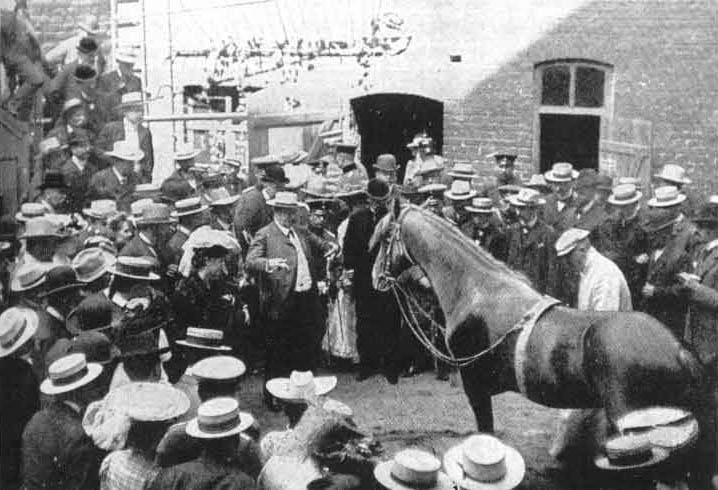
Hans performing midst several spectators. Circa 1904. (Karl Krall / Wikimedia Commons)
Conclusion & Clever Hans effect
The test help drew several conclusions – the horse could only answer correctly if the questioner knew the answer. In case, the questioner was unaware of the answer, Hans’s ability to answer correctly diminished severely. Secondly, Hans needed to maintain in visual contact with the examiner to answer correctly. When he was blinkered, his ability to answer correctly diminished even more.
It was concluded that Hans was responding to the unconscious cues such as increase/decrease in tension, facial expressions and other movements, that the questioner gave out when Hans was about to or had answered correctly. Hans was reading these minute signals to answer even the complex mathematical problems. Today, this phenomenon is known as the “Clever Hans Effect”.
Sadly, in 1909, William von Osten died. After this tragic incident, Hans was claimed by several owners. More disheartening is the fact there is no record of the horse after 1916.
Enjoyed this article? Also, check out “Secretariat: Legendary Horse with Large Heart Gene that Thundered Down the Race Track“.
Fact Analysis:
STSTW Media strives to deliver accurate information through careful research. However, things can go wrong. If you find the above article inaccurate or biased, please let us know at [email protected].
 Recommended Read:
Clever Hans (the Horse of Mr. Von Osten): A Contribution to Experimental Animal and Human Psychology | By Oskar Pfungst
Genre:
Non-fiction > Psychology
RELATED
 August 23, 2019 Laszlo Polgar – The Hungarian Psychologist and Educator Who Raised Three Chess Prodigies
- April 28, 2018 Is the Story of ‘Zana’ the Ape-Woman who could Outrun a Horse True? or a Myth?
 February 7, 2019 Body Worlds Exhibits by Gunther von Hagens: An Exhibition for the Better Understanding of the Human Anatomy
- November 19, 2020 Harlow’s Experiment on Rhesus Monkeys for Maternal Love and Cognitive Development
The post Clever Hans: The Einstein Horse That Could do Math appeared first on .
]]>The post Reynisfjara: The Black Sand Beach that Looks Straight out of a Gothic Novel appeared first on .
]]>
Reynisfjara black-sand beach, Iceland. (Serge / Flickr)
Reynisfjara quite literally means ‘Reynir’s beach’. The Black Sand Beach was named after Reynir, a wealthy man from Norway who had settled in the region back in the 18th century.
Most beaches have white sand, and they are formed due to the corrosion and breaking down of light coloured minerals, rocks, and stones. The beaches form when these tiny sand particles are washed away from the parent rock by the oceans and deposited on the edges over the years. Akin to white sand beaches, black sand beaches actually form in a very similar way, but the source of the sand particles are volcanic rocks. The rivers and streams help in cutting and corroding the volcanic rocks. As they gradually reach the ocean, the strong currents do the rest of the work and granulate them further. The sand grains get sediment on the beach as each wave hits the shore. There are also certain rare instances when the lava directly hits the ocean, and upon the sudden change of temperature, erupt into multiple sharp shards. These shards thereafter go through the same process of granulation and meet their inevitable fate of becoming sand.

A volcanic rock on the beach. (Serge / Flickr)
The sand is almost always pitch black in appearance. This is because of the fact that it is located in one of the wettest and heavy-perspiration areas of Iceland. Since it’s always raining and foggy in the area, the sand doesn’t get a chance to dry up and takes a greyish look to it.

The black sand of Reynisfjara. (Callie Reed / Flickr)
Caves and columns
The beach has multiple facets that add up to its value and appeal. Apart from the beautiful black sand, that contrasts with the pearly foam from the ocean the area is also home to many active and dormant volcanoes. In fact, most of Reynisfjara Beach’s physical attributes are a contribution of these volcanoes itself. One of the most famous and photogenic areas of this beach is the Gardar, an area filled with multiple columns that are closely packed. These structures are mostly made of Basalt and other volcanic rocks. The fractures form as a result of instant cooling down of the magma, as the outside shell cools instantly, but the insides take a much longer time. Upon the gradual cooling of the core, the outside surface becomes ridged and fractured, that give it the appearance of closely packed columns on the sea bed.


Natural pillar-like formation at Reynisfjara. (dconvertini / Flickr)
There are natural caves on the Beach that have been carved out by the sea. The ferocious tides and currents of the Atlantic Ocean managed to corrode the big rocks in such a way that it had formed into beautiful caves.
Fauna at the Reynisfjara
As mentioned previously, Reynisfjara Beach has formed off volcanic ashes and rock particles for the most part, and consequently, there is a scarcity of flora and fauna in this region. There are, however, some traces of animal life in that area. Birds are the most abundant of creatures that live in this area, making nests on the top of the hills. Puffins are quite a common sight in the region. Apart from this, and there is the usual abundance of sea creatures that thrive in the frigid Atlantic waters.
Is the Reynisfjara beach dangerous?
Owing to its geographic location, this Beach has proved fatal to many tourists. The extreme currents and tides of the Atlantic Ocean, coupled with the sudden drop of height, make this an extremely dangerous beach. Tourists are under strict surveillance and have been advised against going too close to the ocean.
Elves and trolls: Folklore around the Reynisfjara
The Reynisfjara Beach with its rare and mesmerizing scenery has left many people awestruck and intrigued, and it is needless to say that there are folklores built around it.
Some of the most interesting ones are those about trolls and elves. It is believed that one time, a few trolls had attempted to pull a ship ashore, but they did not realise that the sun was coming up. Engrossed in trying to pull the ship ashore, they worked till dawn, and the sun came up. As the sun touched their skin, they turned to stones and became the stones that we now see in Gardar. There have been stories built around elves as well, who had somehow turned into the rugged basalt columns on the Beach. These stories have become an intrinsic part of the local folklore and have been passed down the generations.
Filming location
Reynisfjara Beach was used as a filming location in the famous HBO show, Game of Thrones. The world presents us with a host of marvellous natural creations and mesmerising scenes- from the Pink Lake of Australia (Lake Spenser) whose salt content makes it look like it is filled with strawberries, to the Reynisfjara Beach with its inky black sands. The Beach manages to leave all its visitors awestruck, acting as a stunning amphitheatre to host the performance presented by the roaring oceans.
Enjoyed this article? Also, check out “Playa de Gulpiyuri: The Tiny Beach in the Principality of Asturias in Spain.”
Fact Analysis:
STSTW Media strives to deliver accurate information through careful research. However, things can go wrong. If you find the above article inaccurate or biased, please let us know at [email protected].
RELATED
- July 6, 2019 Playa de Gulpiyuri: The Tiny Beach in the Principality of Asturias in Spain
- February 5, 2019 White Sands National Monument: Ace Military Testing Area and an Astounding Tourist Destination
- June 1, 2020 The Clermont-Ferrand Cathedral: A Beautiful Gothic Structure Made of Black Lava Stone
- March 2, 2019 Wave Rock: Where a Massive Prehistoric Wave, Just About to Break, is Etched Permanently in Stone
The post Reynisfjara: The Black Sand Beach that Looks Straight out of a Gothic Novel appeared first on .
]]>The post The Bedouin People: A Desert-Dwelling Tribe That Has Preserved Its Age-Old Traditions for Many Centuries appeared first on .
]]>
A Bedouin tribe along with their camels. (Boston Public Library / Flickr)
Long before the world moved towards modernization, humans lived in different small communities, where they shared the same culture, traditions and way of tribal living amongst themselves. As times changed, these tribals gradually adapted to change and followed the new ways of the world. However, one tribe that is believed to be as old as time and which did not give up its primaeval ways and still continues to lead an ancient life is the Bedouin tribe. Living in the deserts of Saudi Arabia and later spreading into Northern Africa and the Eastern Mediterranean Levant region, the Bedouins are known to have lived as per their olden traditions for over two millennia.
History of the Bedouins
The English word Bedouin comes from the Arabic words badiyat and badawi or bedu, which mean ‘desert’ and ‘people that live in the desert’ respectively. Experts are of the opinion that the term originated from the Arabic word baadiyah or bedaya, which in the English language roughly translates to ‘the beginning’. It is believed that the modern Arabs are descendants of the Bedouin tribe, who had been widely instrumental in spreading their culture in the Arabian regions.
Bedouins are considered to be the original Arabs, who make up the entire modern-day Middle East and some parts of south-western Europe. While most of the Bedouins also follow Christianity, a majority of the tribals practice Islamic traditions. The Bedouins are nomads that wander in the vast desert lands and primarily engage in cattle herding. Divided into three groups as per their customs, some Bedouins herd camels, some tribes raise sheep and goats, while others are herdsmen that practice farming and agriculture.

A Bedouin spearman sitting on an Arabian camel. (Matson (G. Eric and Edith) Photograph Collection)
Considered to have been around since 850 BC, the Bedouins also find a mention in the Holy Quran as Araabs, or predecessors of the Arabs. Originally belonging to the Arabian Peninsula, where the tribe had settled for a very long time, the Bedouins are now mostly found in modern-day countries like Syria, Jordan, Yemen, Egypt, Lebanon, Oman, Palestine, Iran, Iraq, some parts of Turkey and Israel. These tribals started moving out from the dry wastelands for lack of food and water. During the months of winter, when the weather is cold, Bedouins move towards the deserts and then return to their cultivated lands during the summer months. As times are changing, more and more Bedouin youth are giving up their traditional nomad ways of living and moving towards cities for a better future and sustenance. However, these modern youngsters have been organizing and actively taking part in their cultural events on a regular basis during the year to keep in touch with their age-old customs and traditions.

A Bedouin man. (Whiting, J. D., photographer / LOC)
Basically, cattle-herding tribesmen, the people of the Bedouin ethnic group have maintained their rituals of engaging in poetry recitation, traditional music, tribal dance forms like the sword dance and tent-knitting customs. Camel races are organized on special occasions to celebrate a wedding or a festival. In the past, the Bedouins had zero interaction with people belonging to different tribes, except for fellow Bedouins from other clans, until recently when the tradition was done away with. Marriage within the same extended families is permissible in the tribe, with cousins marrying each other most often. The Bedouins follow a patriarchal and patrilineal pattern of family and practice polygamy. More than three or four generations live together as a single unit, where men engage in cattle herding, while women share homely duties. Until recently, meals were shared in a big, single-serving dish by the members of the extended family living under the same roof.

Two Bedouin women using millstone. (Matson (G. Eric and Edith) Photograph Collection)

A Bedouin woman baking bread. (Matson (G. Eric and Edith) Photograph Collection)
Due to the harsh desert life, Bedouin people have adapted themselves to life and are known for their generosity and hospitality that they extend towards others. No traveller that ever comes across a Bedouin tribe is sent away without being fed well. Each Bedouin clan or qaum is at the centre of the society, partaking in various social activities. A collection of several of the people from different qaums together make up a qabila or a tribe. Spread across different desert nations, the government of Jordan strongly acknowledges the fact that the unique identity of their country is because of the major contribution of traditional values of the Bedouins. Though the Jordanian government is doing everything to provide education, healthcare services and settlements to the tribals, the Bedouins prefer to live as nomads like their ancestors did over thousands of years.
Cultural ways of living of the Bedouin tribe
The dromedary camel (Arabian camel) is the most revered animal of the Bedouins, for it can sustain for a very long period of time in the dry region without water, providing easy transportation to the tribals. It is also used for its meat, milk and hide, which is used in weaving the traditional Bedouin tent. Apart from the camel, goats also provide with hair for the large tent, which is known as bait-al-shaar or ‘house of hair’. The sheep provides wool for clothing and is also used as a means of food.

A Bedouin tent. (yeowatzup / Flickr)
The men in the Bedouin tribe wear the traditional galabiya dress, which has now become an indispensable part of Arabic attire. Mostly white in colour, the galabiya is a loose-flowing, long garment, paired with the Arabic kuffiyah (cotton headscarf with an igal or black rope used to tie the scarf) to protect them from the scorching desert sun. The look is completed with a shalwar or baggy-crotched pants, a belt, an abaa or cloak and a furwah or jacket for the cold weather. The attire keeps the body well-aired in the heat. The galabiya that the women wear is mostly a blue or black coloured (though now a lot of other colours are incorporated) cotton gown, with wide and long sleeves, complete with embroidery and hand-crafted decorations all over it. Silk galabiyas are worn on special occasions.

A Bedouin bride and groom in their traditional attire. (Missouri History Museum)

Face veil of Bedouin women. (Jean-Pierre Dalbéra / Flickr)
The women also cover their faces with the traditional yashmak or veil to protect themselves from the desert sand and extreme heat. These usually vibrant red and orange veils also have decorations in the form of multi-coloured beads, pendants, chains and coins. Married Bedouin women wear a heavily-embellished asaba or black-coloured headgear covering their faces to mark their marital status. Typically, a woman’s headcover would often specify which clan she belonged to and where she lived. In addition, the embroidery on the dress and its colour would also indicate whether the woman wearing it was unmarried, widowed, married, or looking for a partner. However, this custom of status distinction by identifying a woman’s dress is now slowly fading away. Bedouin women are also fond of jewellery, which are chunky silver pieces engraved with semi-precious gems like agate, turquoise, carnelian and coral to name a few. Necklaces, rings, nose pins and other pieces of jewellery are usually presented to a woman as her wedding gift.


Bedouin women weaving. (Matson Collection / LOC)
Traditions followed by the Bedouins
Bedouins also take part in poetry recitation or Al-Taghrooda, which is composed and performed by men. Usually riding on camelbacks, Bedouin men chant the generally seven-lined verses of the poem, which they believe, keeps the rider entertained. While travelling, the first verse is recited by the lead singer and another group of Bedouin travellers reply by chanting the verses that follow it. Al-Taghrooda is also performed at special occasions like weddings with improvisations and also while spending time at campfires, where Bedouin qabilas gather for social bonding. Nowadays, women folk also engage in composing and singing poetry while working together in groups. With poetry recitation, the singers convey messages of love towards their kin and oftentimes it also serves as a way to highlight social issues. The UNESCO has listed Al-Taghrooda as a living human heritage, which will serve as a legacy for future generations to come.

A Bedouin wedding procession. (Missouri History Museum)

Male members of the family having a meal together at the wedding of two Bedouins. (Zoltan Kluger / National Photo Collection)
Long before Bedouins opted for a more sedentary lifestyle that is evident today, the ancient nomads believed in ghazw or raiding. These tribesmen would often loot other passing caravans, tribes and settlements while on the move in order to extort compensation for their protection. For a brief period, some Bedouin men also served as bodyguards and worked as mercenaries to make extra income, while at other times, they transported goods and people across the desert as a means of collecting profits.
As the younger generations of Bedouins are opting out of the traditional way of living, different governments of the Middle Eastern countries are doing their bit to modernize the tribe meeting with little success. Though most of the tribals are now also engaging in falconry and horse-breeding, others are raising doves during their leisure time in the hot and arid desert lands. Swinging between urbanization and tradition, change certainly isn’t inevitable for these desert-dwellers.
Enjoyed this article? Also, check out “Vadoma: Tribe Famous for their Ostrich Foot Syndrome“.
Fact Analysis:
STSTW Media strives to deliver accurate information through careful research. However, things can go wrong. If you find the above article inaccurate or biased, please let us know at [email protected].
 Recommended Read:
The Bedouins and the Desert: Aspects of Nomadic Life in the Arab East | By Jibrail S. Jabbur (Author), Suhayl J. Jabbur (Editor), Lawrence I. Conrad (Translator)
Genre:
Non-fiction > History
RELATED
- December 14, 2018 Vadoma: Tribe Famous for their Ostrich Foot Syndrome
- April 13, 2020 The Deviant Spiritualism of an Indian Tribe That Practices Cannibalism And Necrophilia
- August 24, 2020 Whale Temple: Where Vietnamese Worship Whales and Revere their Carcasses
 March 20, 2019 Tower of Silence: Where Zoroastrians Leave their Dead to be Excarnated by Scavenging Birds
The post The Bedouin People: A Desert-Dwelling Tribe That Has Preserved Its Age-Old Traditions for Many Centuries appeared first on .
]]>The post The Trans-Alaska Pipeline System – An Engineering Marvel of the 20th Century appeared first on .
]]>
Photo of Trans-Alaska Pipeline System. (Luca Galuzzi – www.galuzzi.it)
The Trans-Alaska Pipeline System (TAPS) is one of the engineering marvels of the 20th century. It zigzags across 789 miles (1269.77 km) from the rich oil fields in Prudhoe Bay in Alaska to the ice-free port of Valdez. The pipeline makes for a spectacular sight across the ruggedly beautiful Alaskan landscape. It transports nearly 1.8 million barrels of oil every day.

State of Alaska map showing Trans-Alaska pipeline route in red. (Wikimedia Commons)
The Trans-Alaska Pipeline System
Built by the Alyeska Pipeline Service Company—a private consortium made up of four major oil companies—the Trans-Alaska Pipeline System is one of the largest oil pipeline systems in the world. It was built to facilitate the transport of oil from the oil fields in Prudhoe Bay. Oil was first discovered in this area in 1968, and it was the richest oil strike on the American continent.

Discovery of oil at Prudhoe Bay, March 13, 1968. (U.S. Department of Energy)
Building the Trans-Alaska Pipeline System
Before the construction of the Trans-Alaska Pipeline System could begin, it was necessary to build a haul road to transport supplies and other essentials to the construction camps. The workers began building the road in April 1974. The final road was 360-mile long and extra gravel was used in its construction to protect and insulate the permafrost.

Ariel photo of the Trans-Alaska Pipeline Road Construction, 1969. (U.S. Fish and Wildlife Service)
The construction of the Trans-Alaskan Pipeline began on 27 March 1975 with the laying of the first sections of the pipeline. Around 28,000 workers worked in 12-hour shifts for seven days a week to finish it in two years. They completed the work in July 1977. The cost of the project totalled $8 billion.
When building the pipeline, the workers fitted together 70,000 pipe sections. Many of these were buried underground, with an enclosing insulation padding of gravel, and completely covered with dirt. At road crossings, the buried pipeline had refrigeration to prevent the heat of the oil within from thawing the surroundings.
In the region of the permafrost or permanently frozen ground, it was necessary to build the pipeline above the ground. The oil gave out the heat between 65 degrees C and 85 degrees C, and this would have thawed and melted the permafrost. Along with causing an ecological disaster, the permafrost thawing would have led to the pipeline’s buckling and then breaking from the pressure.

Trans-Alaska Pipeline System emerging from the ground on the road between Fairbanks and Anchorage. (Frank Kovalchek / Flickr)
The workers had to set up supports to raise the pipeline above the ground to prevent it from heating the permafrost. In total, the pipeline has 78,000 supports that are 60 feet apart. The height of the supports allows herds of caribou, moose, and other animals to safely pass underneath the pipeline. In this manner, the pipeline does not cause too much environmental interference in the region. There are around 550 wildlife crossings.

A reindeer walking alongside the Trans-Alaska Pipeline System. (Stan Shebs / Wikimedia Commons)
The pipeline traverses across three mountain ranges and 800 rivers, lakes, and streams. It also goes over the tundra and the Arctic forests. The Alyeska Pipeline Service Company built it in a zigzag pattern. That was done to ensure it remained flexible and could withstand the impact of an earthquake.
On 20 June 1977, the first oil was sent through the Trans-Alaska Pipeline System from Prudhoe Bay to Valdez. From the port here, the first tanker departed with the oil on 1 August 1977.
The Exxon Oil Spill

Exxon Valdez oil spill. (NOAA)
Around 11 years after the Trans-Alaska Pipeline System began its operations, there was a major ecological disaster in the region.
The port of Valdez is on a fjord on the east side of Prince William Sound. On 24 March 1989, an Exxon oil tanker ruptured its hull after a collision near the port. Due to this accident, 260,000 to 750,000 barrels of crude oil spilled over into the waters of Prince William Sound. Known as the Exxon-Valdez oil spill, it was the second-largest oil-spill that a U.S. company caused on the American continent. The first-largest oil-spill was the Deepwater Horizon oil spill in the Gulf of Mexico.
The spilled oil spread across the coastline, covering over 1300 miles of it, and affected around 11000 square miles of the ocean. Unfortunately, the clean-up efforts came too late, and the damage to the animal and birdlife in the area was incalculable.
Since this incident, oil tankers have double hulls to prevent any rupturing in the event of a collision.
Interesting facts about the Trans-Alaska Pipeline System
The US Senate voted to build the Trans-Alaska Pipeline System on 17 July 1973. The Trans-Alaska Pipeline Authorization Act passed with the approval of then-Vice President Spiro Agnew.
The oil carrying pipe sections are 48 inches in length.
Every minute, 35,000 gallons (132489.41 liters) of oil flows through one pipe section.
The pipeline transports nearly 1.8 million barrels of oil every day from Prudhoe Bay to Valdez.
Over 17 billion barrels of oil have flowed through the Trans-Alaska Pipeline System since it began operations in 1977.
The Trans-Alaska Pipeline System is owned by BP Pipelines (Alaska), Inc., ConocoPhillips Transportation Alaska, Inc., ExxonMobil Pipeline Company, and Unocal Pipeline Company. BP Pipelines owns 48.441%, ConocoPhillips Transportation Alaska, Inc. owns 29.2086%, ExxonMobil Pipeline Company owns 20.9943%, and Unocal Pipeline Company owns 1.3561%.
The Alyeska Pipeline Service Company operates the Trans-Alaska Pipeline System for the owners.
Around 800 people work for the Alyeska Pipeline Service Company, and the company also employs several hundred contractors. A large percentage of the workforce are Alaskan residents.
The average output in 2016 was 508,446 oil barrels per day. In 2017, it was 527,323 oil barrels per day. In 2018, it was 509,315 oil barrels per day.
In 1988, there were 11 oil pump stations to pump the oil through the Trans-Alaska Pipeline System. Now, since the output has decreased, there are four oil pump stations.
A barrel of oil can take up to two weeks to travel from Prudhoe Bay to Valdez.
The oil pumped through the Trans-Alaska Pipeline System is stored in 14 above-ground crude oil storage tanks at the Valdez Marine Terminal. Every week, three to five tankers load up with oil and depart from Valdez. Since 1977, over 22,000 oil tankers have departed from the port.
Alyeska’s Operations Control Center in Anchorage monitors the pipeline daily. There are three separate leak detection systems with 71 gate valves. In case of an emergency, the Operations Control Center can order a shutdown, and operators can manipulate the valves to stop the flow of oil through the Trans-Alaska Pipeline System in four minutes.
The Trans-Alaska Pipeline System is the most photographed oil pipeline in the world.

The Trans-Alaska Pipeline against a beautiful landscape. (Bureau of Land Management / Flickr)
Of all the domestic oil production in the USA, the Trans-Alaska Pipeline System accounts for around 15%.
Enjoyed this article? Also, check out “The Sewers of Paris: The Massive Underground Sewers That Keep Paris Clean“.
Fact Analysis:
STSTW Media strives to deliver accurate information through careful research. However, things can go wrong. If you find the above article inaccurate or biased, please let us know at [email protected].
 Recommended Read:
The Prize: The Epic Quest for Oil, Money & Power Paperback | By Daniel Yergin
Genre:
Non-fiction > History > Politics
RELATED
- October 15, 2019 Deepwater Horizon Oil Spill: The flare Up of the Depleting Fossil Fuel
- June 7, 2019 Sewers of Paris: The Massive Underground Sewers That Keep Paris Clean
- December 8, 2019 National Highway 44: The Longest National Highway of India from Srinagar to Kanyakumari
- November 29, 2019 Pan-American Highway: The Longest Road in the World Measuring About 30,000 Kilometres
The post The Trans-Alaska Pipeline System – An Engineering Marvel of the 20th Century appeared first on .
]]>The post Euphrates River: A Dying River that Birthed One of the Oldest Civilisations appeared first on .
]]>
The town of Halfefi, a small farming district on the east bank of Euphrates River, Turkey. (Bernard Gagnon / Wikimedia Commons)
The Euphrates River, along with the river Tigris, are the two greatest rivers in an area that was the cradle of ancient Mesopotamian civilization. Together, the two rivers form a great river system in the Middle East. The Euphrates River is one of the most historically important and longest rivers of West Asia.
Origin of name
While there has been a lot of conjecture about the origin of the name of Euphrates, many believe that the name may have actually been of Kurdish origin. The Kurdish word fererehat means “wide flowing water”. A newer derivative of the same is believed to be “Ferat”. Another group of scholars is of the opinion that the word has its origins in Old Persian, where Ufratu means “good to cross over”. The Sumerian and Akkadian names for the Euphrates make the Indo-European etymology uncertain.
The formation and path of the Euphrates River
As mentioned previously, the Euphrates River is the longest river in the south-western region of Asia and covers a length of 2800 km. Along with the Tigris River; these two rivers form the Tigris –Euphrates River System. The river originates in Eastern Turkey where it is formed by the confluence of the rivers Murat and Karasu that are found in the Armenian Highlands. It flows through the Taurus Mountains to the Syrian Plateau and then through western and central Iraq. Here, it joins the Tigris River and continues flowing as the Shatt -Al -Arab, and empties into the Persian Gulf.
Three rivers that rise in the foothills of the Taurus Mountains in Syria, along the Syro–Turkish border, add their water to the Euphrates. They are the Sajur, the Balikh, and the Khabur. Although these rivers comparatively add little water to the river, they are the only natural tributaries of the Euphrates. Once the river enters Iraq, there are only a handful of canals that exist which connect the Euphrates basin and the Tigris basin.
Historical importance

Water wheels of Ajmiyeh, on the Euphrates near Rawa, and Ana, in Mesopotamia (present-day Iraq). Circa 1911. (Gertrude Bell)
Dating from approximately the 4th millennium BC, the Euphrates was the source of water that led to the birth of the first civilization in Sumer. Several ancient cities were located on or near the riverside, including Eridu, Mari, Nippur, Sippar, Shuruppak, Uruk and Ur. It is also one of the two rivers from where Mesopotamia draws its name as the “Land between the Rivers”.
In ancient times, the river valley was heavily irrigated which formed the centres for the Babylonian and Assyrian empires in later years. For several hundreds of years, the Euphrates River formed the eastern limit to the control of Egyptian and Roman Empires, as well as the western regions of the Persian Empire. The Battle of Karbala is said to have taken place in 680 AD near the banks of this river.
After the First World War, the Ottoman Empire was partitioned when the Southwest Asian borders were redrawn in the Treaty of Lausanne (1923). According to this treaty, the three ‘riparian states’ of the Euphrates River, indicating Turkey, France (mandate of Syria) and the United Kingdom (mandate of Iraq), were supposed to reach a mutual conclusion about the use of the water of the river, as well as any constructions of a hydraulic installation. Turkey and Iraq signed an agreement in 1946 which gave Iraq the power to construct dams on Turkish land and control the flow of the Euphrates. The agreement also stated that Turkey had to report Iraq about any hydraulic changes that it made on the river system of the Tigris-Euphrates.
Climate, vegetation and natural history of the Euphrates River
To the north of the Persian Gulf lies the huge floodplain of the Karun, Tigris and Euphrates rivers that have marshes, permanent lakes and forests. The climate in this subtropical area is hot and dry. The areas around the Tigris and the Euphrates are extremely fertile.
There has been a constant decrease in the annual rainfall which determines the type of vegetation that the area can support. The river flows through several vegetation zones that are found in this region. When the Euphrates flows through the southeast Turkish mountains and the foothills in the south, ‘xeric woodland’ is observed. The most plant species include oaks, pistachio trees, rose plants and plum plants. There are several wild varieties of cereals that are found like, oats, rye, emmer wheat and einkorn wheat. To the south of this, the Euphrates flows through a steppe landscape which is characterised by plant species like white wormwood and Chenopodiaceae.
According to research, the Euphrates Valley probably supported a riverine forest, and significant features of this forest comprise of the Oriental plane, the Euphrates poplar, the Tamarisk, the ash and several other wetland plants.
Several animals like the gazelle, onager, and the Arabian ostrich (now extinct) are believed to have been inhabitants of the steppes on the border of the Euphrates valley. The valley itself is believed to have been home to the wild boar. Other animals include the golden jackal, the gray wolf, the red fox, the leopard as well as the lion. In the mountains of southeast Turkey, the Syrian brown bear can also be found.
The Euphrates River in the Bible
According to the Bible, in Genesis 2:14 there are four rivers that flow from the Garden of Eden. The four rivers are the Pishon, the Gihon, the Tigris and the Euphrates. It is believed that the Euphrates River marked one of the boundaries of the “Promised Land” by God to the descendants of Abraham- Jacob, Isaac, and their children. According to the Bible for Hebrews, the Euphrates is simply referred to as “The River”.
Several religious texts have prophecies in them. Similarly, there is a prophecy in the Book of Revelation about the Euphrates River. According to the prophecy, in the ‘near future, the Potamos Euphrates… will dry up in preparation for the Battle of Armageddon’… “And the sixth angel poured out his vial upon the great river Euphrates; and the water thereof was dried up….”
Islamic prophecies about the Euphrates River
Like the Book of Revelation in Christianity, there are Islamic prophecies in some of the hadiths of Prophet Muhammad that also suggest that the Euphrates River will dry up. It also says that once the river dries up, it will reveal unknown treasures that will eventually lead to conflict and war across the world.
The River Euphrates under threat

Tigris-Euphrates Basin in 2006. (NASA)

Tigris-Euphrates Basin in 2009. (NASA)
Due to extreme weather conditions and excessive pollution, there is barely enough water to be able to float a canoe properly. According to the Iraqi River Police, there is garbage in the water which has turned the river a murky green and the waterway sluggish. According to recent satellite study, the Tigris – Euphrates basin has a groundwater depletion rate higher than any other place on the planet, except India. Due to the high rate of global warming in the world, it is believed that an environmental disaster is likely to be encountered as the Euphrates is drying up.
Enjoyed this article? Also, check out “Pamukkale: The Cotton Castle in a Mess of Limestone and Healing Waters“.
Fact Analysis:
STSTW Media strives to deliver accurate information through careful research. However, things can go wrong. If you find the above article inaccurate or biased, please let us know at [email protected].
 Recommended Read:
Euphrates and Tigris, Mesopotamian Ecology and Destiny | By J. Rzóska (Editor)
Genre:
Non-fiction > Life Sciences > Ecology
RELATED
 June 17, 2019 Pamukkale: The Cotton Castle in a Mess of Limestone and Healing Waters
- January 8, 2019 Proboscis Monkey: The Rare Borneo Monkey Species with an Unusually Long Nose to Lure Its Females
 September 30, 2019 Tsavo Man-Eaters: A Pair of Rogue Lions That Killed Nearly 135 People
- January 15, 2019 Pink Lakes: Where Rose-Tinted Lakes Surrounded By Lush Greenery Are Truly a Sight to Behold
The post Euphrates River: A Dying River that Birthed One of the Oldest Civilisations appeared first on .
]]>The post Schwerer Gustav: Why the Largest Artillery Gun Turned Out to Be a Flop During World War II? appeared first on .
]]>
Adolf Hitler (second from right) and generals watching the Schwerer Gustav. (Nazi Germany official press photograph)
Once bitten, twice shy. This was true of Hitler, the infamous dictator of Germany. He served in the army of Bavaria (which became part of Germany in 1919) in World War 1 (1914-1918). When the Allied forces (France, Great Britain, Russia, Japan, Italy, Russia and the United States) defeated Axis powers (Germany, Austria-Hungary, and Turkey), Hitler felt devastated. World War II (1939-45) happened as a natural consequence of World War I. Hitler, by then, became the dictator of Germany, and longed for revenge. He conceived the idea of a really big cannon, Schwerer Gustav. One, that could demolish the Maginot line – a concrete fortification built in France. But the destiny unfolded otherwise. Hitler, and the big gun, both met a tragic end.
Behemoth of a gun
Schwerer Gustav, the Artillery, was a huge cannon designed by the Krupp company, a German steel and arms manufacturer. Work for the fabrication of the big gun began in 1930. The gunfire, ordained Hitler, must have the capacity to rip through 1- meter thick layer of steel, or 7-meters of reinforced concrete. The artillery, when finally commissioned, weighed 1344 tons and fired a 4.8 metric ton projectile at a distance of 48km, with a speed of 820 meters per second. The design of the cannon was approved in 1937. The spring of 1940 was set as the deadline for the rollout. But the deadline couldn’t be kept. In Hitler’s scheme of things, this gun, named Schwerer Gustav, would be the be-all and end-all of his victory in World War II.
Designed and produced by arms manufacturer Gustav Krupp
Hitler invaded Poland in September 1939, this triggered the start of second world war. Schwerer Gustav, the giant cannon couldn’t be delivered on expected time, the spring of 1940. Luckily, the delay was no handicap, because, the war plan was altered in a big way. Maginot Line, which was the reason behind the big gun concept, was ignored. In the changed plan, the Germans invaded France through a different route, i.e. Belgium. By the end of 1940, the cannon was ready. It was test-fired in 1941 in the presence of Hitler. Seen as a gift from Gustav Krupp, the arms manufacturer, the cannon was named Schwerer Gustav. Schwerer in German means ‘heavy/great’. Another gun produced along with it was named Dora.
Schwerer Gustav was used in the war in 1942, with satisfactory results
The big cannon was deployed for action in the siege of Sevastopol, Ukraine, on July 1942. A men-force of 1420 took 3 weeks to assemble the big gun. In ready-to-fire mode, the artillery was 43 meters long and 7 meters wide. The inside diameter of the gun barrel was 80 cm. The axis of the barrel was positioned well over 7.5 meters above the ground base of 4 railway tracks (hence the name railway gun). The gun fired 300 shells on the city of Sevastopol, causing significant damage in the enemy camp. Another remarkable hit was at the undersea ammunition magazine of Soviet Naval base in Severnaya Bay. The ammunition magazine was kept 100 feet below the seafloor and topped over with 30 feet of concrete. Gustav’s 9 fires not only devastated this difficult target but also sank a ship that strayed into the firing range.

The Schwerer Gustav railway gun in the Soviet Union, 1941. (Nazi Germany)
Dora, the sister cannon was deployed against the Stalingrad city in Southern Russia. But as the Russian force closed in, it was hastily withdrawn and wrecked to prevent its use by the enemy.
Massive frame of the cannon was hard to move and operate
The Germans realized soon enough that the mammoth size of artillery made it an easy target for aircraft of the Allied forces. Dedicated railway tracks had to be put up for the movement of the heavyweight Schwerer Gustav. The tracks had to be laid in advance at strategic places in the battle zone. A good length of supplementary track was also required to position the gun for the kill. From the firing position, the cannon could fire only in up and down directions, not sideways. For firing sideways, to the left and the right, a curved extension was mandatory. To operate the gun, a team of 2000 men was required. Most members of the team were engaged in giving air cover to the cannon.

The Schwerer Gustav canon in position to fire. (Nazi Germany)
Assembling the gun into functional form was an arduous task. It took 4 days to assemble the 5 principal components of the artillery, and fit them into working posture. Calibrating the gun also took several hours to complete. Thus, the gun could fire only 14 rounds in a day. The delivery on the battlefield was little compared to the huge operating expenses of the weapon. No wonder, Germans abandoned the Gustav Gun within a year of using it. The gun, verily the largest ever in the history of mankind, was destroyed before the world war ended in the year 1945. This was done to prevent it from falling into enemy hands. Some sources say Russians seized the cannon and disassembled it. Some say Russians took away remnants of the gun already trashed by the Germans.

Men loading shell in Schwerer Gustav. (Nazi Germany)
So, did the big gun make a difference to the outcome of World War II?
Surely not. Built at a whopping cost of 10 million German Reichsmarks, its output, in the overall war scenario, was lacklustre. All it did was to demolish a slew of Polish and Soviet defences. It may have been a psychological boost to Axis forces for some time, and a possibly a fear factor for the Allied forces. But at the end of the day, Gustav gun was more of a liability than an asset. The amount of money spent on its production and operation was too huge for its constrained application and performance.
Hitler, obviously, was so seized by the idea of the mega gun that he thought little about alternatives. Perhaps a more manoeuvrable and manageable weapon system would have been a better choice. Experts believe that the adoption of jet-engine aircraft, rocket technology and nuclear weapons would have stood Germany in better stead. The giant gun was no match to the speedier and more accurate fighter aircraft of the Allied forces. Aircraft could carry bombs and explosives much heavier than Gustav gun could fire.
What if Hitler had planned better, and won World War II? The hypothetical question Keeps doing round time and again. But the fact remains that fate of war rests on tactical planning and easy-to-use weapons. Hitler, seemingly, lost on both these counts. Warfare technology had changed significantly in the decade that fell between the 2 World Wars. Schwerer Gustav, though unique and powerful, was behind the contemporary technology in many ways and hence failed.
Enjoyed this article? Also, check out “Hindenburg: The Tragic Death of World’s Biggest Commercial Airships“.
Fact Analysis:
STSTW Media strives to deliver accurate information through careful research. However, things can go wrong. If you find the above article inaccurate or biased, please let us know at [email protected].
 Recommended Read:
Superguns 1854-1991: Extreme artillery from the Paris Gun and the V-3 to Iraq’s Project Babylon | By by Steven J. Zaloga (Author), Jim Laurier (Illustrator)
Genre:
Non-fiction > History > Military
RELATED
- September 11, 2019 Maginot Line: The Mark of French Tenacity and Resilience
 October 27, 2018 Invasion of Normandy: Largest Amphibious Invasion That Probably Changed the Course of History
- May 21, 2019 Hindenburg: The Tragic Death of World’s Biggest Commercial Airships
- July 13, 2018 Hanns Scharff: The Extraordinary Interrogation Technique of a Nazi Interrogator
The post Schwerer Gustav: Why the Largest Artillery Gun Turned Out to Be a Flop During World War II? appeared first on .
]]>The post Demon Core: The Deadly Plutonium Core That Killed Two Physicists at Los Alamos National Laboratory appeared first on .
]]>
Photos of demon core from a re-creation of the experiment. (United States Department of Energy)
On 6th and 9th August 1945, the United States dropped two atomic bombs, Little Boy and Fat Man, on Hiroshima and Nagasaki, respectively. These bombs had plutonium cores, but it is less known that there was also a third plutonium core meant for a third atomic bomb. The Americans would have dropped it over a third Japanese city if Japan hadn’t surrendered on August 15, 1945. This was the core that came to be known as the Demon Core.
The demon core
The first two plutonium cores caused the deaths of over 200,000 people in Japan and the deaths of many more over the years from the resulting radiation. Strangely enough, though, these cores received no pejorative nicknames. On the other hand, the deaths of two Los Alamos scientists, Harry Daghlian and Louis Slotin, caused the third core to be labelled as the Demon Core; it had originally been known as Rufus. These scientists were part of the Manhattan Project and were involved in the building of the atomic bombs. Their deaths were due to their carelessness and disregard of safety protocols.
There was nothing actually demonic about the Demon Core, except in its intended use in nuclear weapons.
It was merely a 6.2 kilogram, spherical plutonium core that was used in the criticality experiments that the scientists conducted in the Los Alamos laboratory.
The plutonium core
The type of plutonium used to make the core was Pu-239. It is a naturally radioactive substance. That means, its atoms continuously emit neutrons and other particles from their nuclei. The large-sized neutrons collide against other atoms and cause them to split and emit more neutrons. These neutrons then go on to cause more collisions and split more atoms. Usually, however, many of the neutrons fly away without colliding into other Pu-239 atoms. The nuclear chain reaction, therefore, occurs at a very slow rate.
When Pu-239 is used to make nuclear weapons, the weapon-makers try to contain the neutrons within the Pu-239. That causes a continuous and fast nuclear chain reaction that involves splitting trillions upon trillions of atoms. The whole thing soon gets out of control and releases an overwhelming amount of nuclear energy and causes the bomb explosion.
The criticality experiment – tickling the dragon’s tail
After the Japanese surrender in 1945, the plutonium core that was meant for use in a third atomic bomb was turned over to the scientists to use for research purposes. They used it in the criticality experiments, or, what the physicist Richard Feynman called ‘tickling the dragon’s tail’.
These experiments involved monitoring the nuclear chain reaction and measuring the point at which the plutonium would turn supercritical enough to trigger off a dangerous radiation blast. These were very risky experiments that could go wrong at any moment, and the physicists were well-aware of that. Hence the term ‘tickling the dragon’s tail’.
By carrying out the criticality experiments, the physicists wanted to find out how far they could go without triggering a deadly nuclear reaction. It would help them to figure out the critical mass point to successfully detonate an atom bomb. The knowledge would also prevent accidents when assembling bombs or while the plutonium was in storage.
Harry K. Daghlian’s criticality experiment

Harry K, Daghlian Jr. (Wikimedia Commons)
Harry K, Daghlian Jr. was a 24-year-old physicist working at the Los Alamos laboratory. A brilliant young man from Purdue University in Indiana, he had joined the Manhattan Project in 1943 to work on building the atomic bombs.
A week after Japan surrendered, on 21 August 1945, he returned to the lab after dinner at 9:30 p.m. to continue working on a criticality experiment. According to the lab protocols, he was not supposed to work there after hours, and he was not supposed to carry out the experiments without another scientist present. However, on this day, he ignored these rules and the security guard who was present— 29-year-old Private Robert J. Hemmerly—raised no objections.
Daghlian was building a neutron reflector around the plutonium core, using tungsten carbide bricks. Being a very dense metal, tungsten carbide prevents neutrons from flying off. Instead, they are reflected to the plutonium and cause more atoms to split and release yet more neutrons. The rate of atom-splitting will increase if the plutonium core is surrounded by more tungsten carbide and, as a result, the core could go supercritical or out of control. Daghlian wanted a controlled chain reaction that remained below the critical point. There was a Geiger counter to indicate how well the experiment was proceeding.
The experiment involved placing tungsten carbide bricks around the plutonium core. After placing each brick, Daghlian checked the Geiger counter to make sure the resulting nuclear chain reaction wasn’t heading towards supercriticality.
When Daghlian had raised the bricks to around 10 inches about the core base and was about to place yet another brick on the stack, the Geiger counter began ticking faster. The core was heading towards supercriticality. The physicist jerked back the brick he was holding, but, in his haste, it slipped and fell right on top of the plutonium core. Now surrounded by tungsten carbide, the plutonium core went supercritical in an instant. A blue light flashed in the room, and there was a wave of heat. The Geiger counter went wild.

Reflective blocks being placed around a sphere of plutonium. (© Los Alamos National Laboratory)
Panicking, Daghlian grabbed at the fallen brick and dropped it yet again. He then tried to overturn the heavy table and, failing in that, began to hurriedly dissemble the tungsten carbide brick stack. He then removed the fallen brick, experiencing a tingling sensation in his hand as he did so. The nuclear chain reaction stopped, and the Geiger counter fell silent.
The entire incident took place in one minute. In that time, however, he was exposed to neutron and gamma radiation. He also suffered beta burns on his hands. Within hours, he began to show the symptoms of radiation sickness. He was hospitalized at once. In following days, his hands blistered from the radiation burns, and his entire body began to swell up like a balloon. He died 25 days later.

Harry K, Daghlian’s hand after the ill-fated experiment. (U.S.A. – Manhattan Project)
The security guard received a milder radiation dose. He died 33 years later of leukaemia and other complications resulting from the radiation.
Louis Slotin’s criticality experiment
Despite a review of safety procedures after Daghlian’s death, there was a similar accident the following year.
On 21 May 1946, around 3:20 p.m., Louis Slotin, Alvin Graves, and six other scientists were busy conducting a criticality experiment involving the plutonium core and two bowl-like beryllium sections. Like tungsten carbide, beryllium reflects neutrons. Slotin placed one section in a wooden frame on a table and put the plutonium core inside it. He then placed the other beryllium section over the core, making sure it didn’t cover it entirely.
If the neutron-reflecting beryllium hemispheres surrounded the core, it would reach supercriticality. To avoid this scenario, Slotin inserted a flathead screwdriver between them to keep them apart. According to lab protocol, he should have been using shunts to keep the hemispheres apart. Slotin, however, often disregarded the rules. Sometime earlier, the physicist Enrico Fermi had warned him that he would end up killing himself if he wasn’t more careful.
Slotin, however, ignored the advice, and on this day, things went wrong. As Alvin Graves watched the experiment from behind him, the screwdriver slipped from Slotin’s hand. The beryllium hemispheres closed and the Geiger counter went wild as the nuclear chain reaction went supercritical. There was a flash of blue light and a wave of heat.

Slotin accident mock-up. (Los Alamos National Laboratory)
Having seen what had happened to his colleague a year earlier, Louis Slotin knew he was now doomed. He died nine days after his exposure to radiation. Like Daghlian, he allowed the doctors to document his rapid health deterioration.
Safety measures adapted for criticality experiments
After the deaths of the two physicists, the administration at Los Alamos halted further criticality experiments. They also issued a memo to outline safety measures for the future. The memo advised that all further criticality experiments be carried out by remote controls and in separate buildings to reduce the risk of radiation exposure.
End of the demon core
Before Slotin’s accident, the Los Alamos administration intended to include the plutonium core in Operation Crossroads. They would then have detonated it in the series of nuclear tests that the United States carried out at Bikini Atoll in the Marshall Islands. After the accident, however, it was first necessary to let the core to cool down and become less radioactive before anyone could transport it. Then, the United States government cancelled the third nuclear test and no longer required the core.
While the physicists at Los Alamos could have continued using it for their research experiments, nobody was now willing to work with the Demon Core. Therefore, in 1946, the authorities ordered it to be melted and recast. That was duly done, and it was the end of the Demon Core.
Enjoyed this article? Also, check out “The Manhattan Project: The Making of the First Atomic Bomb“.
Fact Analysis:
STSTW Media strives to deliver accurate information through careful research. However, things can go wrong. If you find the above article inaccurate or biased, please let us know at [email protected].
RELATED
- August 16, 2019 Schwerer Gustav: Why the Largest Artillery Gun Turned Out to Be a Flop During World War II?
- October 27, 2018 Invasion of Normandy: Largest Amphibious Invasion That Probably Changed the Course of History
- August 29, 2019 The Manhattan Project: The Making of the First Atomic Bomb
- February 11, 2019 Kola Superdeep Borehole: The Deepest Borehole in the World That the Soviets Drilled in the Kola Peninsula
The post Demon Core: The Deadly Plutonium Core That Killed Two Physicists at Los Alamos National Laboratory appeared first on .
]]>The post Puente Nuevo: The Bridge That Spans Across a Gaping Canyon to Join the City of Ronda appeared first on .
]]>
Puente Nuevo A in Ronda, Spain. (Steven Gerner / Flickr)
Approximately three centuries ago, King Felipe V, the king of Spain had a rather unconventional idea- deciding to build a bridge over the 120 m deep canyon in Ronda, Spain. The Puente Nuevo which translates roughly into “New Bridge” is one of the largest and most recent bridges that span over the 390 ft deep El Tajo canyon. This chasm has the Guadalevin River flowing through it and it divides the city of Ronda, which is in Southern Spain. This mighty bridge was constructed over a span of 34 years.
Why was the Puente Nuevo built?
In the 1700s, the city of Ronda in southern Spain had become extremely overpopulated. It stood on two sides of the deep El Tajo canyon, and there was nothing that allowed them to access the other side. This affected the even distribution of population, and the amenities provided by the city. It was almost although the two sides were two separate cities.
There were two smaller existing bridges, the Puente Romano and the Puente Arabe. They were, however, lower down, and did not directly link the two sides of ‘El Mercadillo’ (the old town) and ‘La Ciudad’ (the new town). The chasm ran between these two divisions. In the 1730s, plans were drawn up to build a new bridge across the El Tajo, which would directly link the two sides of the city and allow ease of movement.
Construction of the Puente Nuevo: a 40-year ordeal
The very first attempt at building a bridge at such a height was not an easy task. Even though the chasm was narrow, it was 390 ft deep.
Two architects, Jose Garcia and Jose Camacho, were chosen to work on this project and they began to work on a single arch design for the bridge in 1735. Despite the fact that they completed the bridge on time, it was not in good shape. The bridge collapsed in 1741 and killed nearly 50 people, mostly citizens of Ronda.
The work on the new bridge began again in 1759 at the same location. The designer of the Puente Nuevo was Domingo Lois de Monteagudo. The chief builder of this bridge was Juan Antonio Diaz Machuca, he invented a system of pulleys and also other heavy equipment for lifting large stones from the floor of the gorge. These stones were quarried and shaped and then brought up as per the requirements of the bridge. De Monteagudo was aware of the previous collapse and came up with a new design that would be sturdier and stronger than the first bridge.
He supervised the construction of the bridge right up to 1778, and by this time the bottom third of the bridge had been completed. However, by 1785, work on the bridge had come to a halt. Pascal Ruiz, who was the administrator of Ronda, called upon the expertise of Jose Martin de Aldehuela, one of Andalucía’s top architects, to complete the bridge. He had an extraordinary design that he used to build on the foundation laid by Lois De Monteagudo, ultimately turning the bridge into a work of art.
The bridge was constructed in three distinctive stages. During the first stage, the foundation of the bridge was built against the bedrock. The first arch that was built served as a foundation for the main arch. This main arch takes the bridge to a height of 90 m. In the final stage of construction, the two top arches and the room in the centre of about 60 square metres was constructed.

The arches of Puente Nuevo. (Keith Roper / Flickr)
Today, the room in the centre contains the interpretation museum of the bridge. It consists of an exhibition that describes the history of the bridge and its construction. The chamber can be entered through a square building that used to be the guardhouse at one time. It is believed that this chamber has served as a prison, and if rumours are to be believed, a torture chamber also.

A view of Puente Nuevo. (Max Pixel)
The Puente Nuevo was finally completed in 1793 and took a grand total of 34 years to build. Its span was approximately 216 feet and an impressive height of 322 feet. The bridge is supported by thick vertical suspensions that are attached to the canyon walls.
A major tourist attraction
The Puente Nuevo divides the city of Ronda, providing one of the best vantage points, and makes for an extremely sought after tourist spot. The bridge is popular not only for the ‘experience’ it entails but also as a great location for photoshoots. Overlooking the beautiful El Tajo gorge, the bridge provides a spectacular view of a sea of white quintessential Andalusian houses and endless fields. The bridge also acts as a marker for two very popular routes- one leading towards the bottom of the gorge, and the other taking you around the chasm so you can view it from multiple angles.
Enjoyed this article? Also, check out “Pontcysyllte Aqueduct: A High-Rise Canal-Connect Made of Cast Iron, an Engineering Marvel“.
Fact Analysis:
STSTW Media strives to deliver accurate information through careful research. However, things can go wrong. If you find the above article inaccurate or biased, please let us know at [email protected].
RELATED
- June 7, 2019 Sewers of Paris: The Massive Underground Sewers That Keep Paris Clean
 June 29, 2018 Armoured Vehicle-Launched Bridge: A Bridge Over Troubled Water and a Real Life Transformers
- December 8, 2019 National Highway 44: The Longest National Highway of India from Srinagar to Kanyakumari
- November 29, 2019 Pan-American Highway: The Longest Road in the World Measuring About 30,000 Kilometres
The post Puente Nuevo: The Bridge That Spans Across a Gaping Canyon to Join the City of Ronda appeared first on .
]]>The post Everything You Need to Know About Spontaneous Human Combustion appeared first on .
]]>
Victim (Helen Conway) of Spontaneous Human Combustion. (Folsomnatural / Flickr)
The phenomenon of Spontaneous Human Combustion (SHC) has been reported as early as 1470 when an Italian knight burst into flames after enjoying some wine. It was completely unexplained then and it seems that over 500 years later we are no more enlightened on the subject. It is so strange in nature that it has never been scientifically proven or unproven but many theories exist.
A victim to SHC is usually found turned to ashes with only limbs such as their feet left behind. Generally, a human body requires a temperature of 1600 Celsius to disintegrate bone – for example during cremation – but the improbable aspect of these cases is that furniture in close proximity to them is usually unaffected, and in some instances, the victim’s clothes. SHC, in essence, is where a person bursts into flames without an external source.
Notable Spontaneous Human Combustion cases
Here are some famous cases within the peculiar history of SHC. The earliest accounts are from a Danish Anatomy expert Thomas Bartholin in his work Historiarum Anatomicarum Rariorum (1641). However, if all fire needs is a human body then its origins can surely trace back to prehistoric times. The works of Bartholin looks into strange occurrences unexplained by medicine which human combustion certainly falls into.
A tale comes from 1470 when he describes an Italian Knight named Polonius Vorstius who was drinking wine with his family. Witnesses saw him burping and then fatally exploding into flames. The author, Bartholin was told of the account from a descendant of Vorstius.
Another comes from the works of a French writer Jonas Dupont – De Incendiis Corporis Humani Spontaneis (1763). He wrote that a resident of Paris – an innkeeper called Nicole Millet – turned to ashes during her sleep. Her husband was actually accused of the murder. Such is the unfathomable scene left when a person combusts. What made the anatomist Dupont conclude that it was neither murder nor accident was the straw mattress – It remained completely unaffected. The Surgeon thought on the same lines of Dupont and stated that it did not have the look of manslaughter. A guest at the public-house also helped with this alibi, luckily for the husband.
Accounts which have followed generally have the same characteristics. Furniture will remain intact as well as the hands and feet of many cadavers. In others, strange remains will be left such as organs, pieces of bone or shrunken skulls. This may well be down to the torso containing the most heat and in many cases, the deceased has been left in a sedentary position. Not every victim will be killed however and some people have survived. Many of these will not have been engulfed in flames but rather have received internal burns. Their internal organs are usually not damaged.
More modern examples include one as recent as 2010 in Galway, Ireland, where only the cinders were found of Michael Flaherty, a 76-year-old man. His entire living room was untouched apart from the ceiling and floor below him which had a sticky, sooty residue. The coroner did not blame his locality to the fireplace but rather to the first official case of SHC. If this has been considered in such a modern, secular society as Ireland it certainly gives more credence to the unexplained phenomenon.
Again in the 1960’s, the death of Dr. John Irving Bentley – a renowned retired physician – drew attention from the media. He was discovered in his Pennsylvania bathroom with only his left leg and foot at the scene next to a pile of ash and his walking cane. Mary Reeser is another famous example. In 1951 the only parts of her found was a foot, a liver attached to a piece of vertebrae and a skull the size of a teacup.
Not all will occur solely in the homestead and some are reported with eye-witnesses who actually saw the incident. Those of which are very scarce in detail, however. All of which do coincide to mention people giving off flames – often blue – from their stomachs and mouths. Many of these have been sensationally fabricated or added to along the lines of Chinese Whispers.
Take the story of Maybelle Andrews which with a simple internet search will describe her turning into flames at a Soho nightclub in front of dozens of party-goers. This seems to have now been debunked. It is from an earlier newspaper article where a lady named Phyllis Newcombe had her arm burned after a fire in an English club. Septicemia later killed her and the myth grew into Maybelle Andrews.
A very recent account with more information comes from Flensburg, Germany in 2015 where a woman burst into flames within a local park. An eyewitness put out the flames with his jacket to save her life. Authorities were quick to point the blame in the direction of two men who were seen to quickly exit the park. Otherwise, to a suicide attempt. With no clear answers however the non-explanation of SHC again rears its mysterious head.
What causes Spontaneous Human Combustion?
It was once thought that human bodies had no flammable substances so only a mass amount of a combustible substance such as ethanol i.e in alcohol could make a person ignite. But scientists have begun to unearth other theories. One of which involves a gas present in all of us known as methane. Once enough of it builds up it can be ignited by certain proteins also present called enzymes.
Another theory goes the way of a static electricity build-up – there are plenty of items after all which can catch fire without any help. If inside a bucket, oily fabrics can capture oxygen which will raise the temperature. Also, bales of hay where bacteria can build up to cause a chemical reaction.
A more popular hypothesis is labelled the “Wick Effect”. As many of the deceased are alcoholics – and many alcoholics are smokers (in past times more so) – if a lit cigarette strikes the skin it can ignite the whole body using fat as a flammable substance but keeping clothing protected. Many of whom also have debilitating diseases or are elderly which makes it harder to move or find help. This also makes the bones burn quicker in terms of diseases such as Osteoporosis. Others who are less believing of spirituality will point to cover-ups due to criminal activities for the main reason behind SHC.
We are still in the dark in terms of Spontaneous Human Combustion (SHC). As even scientists and coroners cannot give definitive answers for any of the deceased. All that can be said is that the human body is an incredible thing with an insurmountable amount of reactions happening every nanosecond. For this reason, it is not beyond the realms of possibility that an internal reaction could cause some widespread damage.
Hopefully, with more research, we can find out more about this peculiar act and save people from future disintegration.
Enjoyed this article? Also, check out “Luigi Galvani: The Man Who Fuelled The Idea Of Re-Animating Human Corpses“.
Recommended Read:
Faith, Madness, and Spontaneous Human Combustion: What Immunology Can Teach Us About Self-Perception | by Gerald N. Callahan
Fact Analysis:
STSTW Media strives to deliver accurate information through careful research. However, things can go wrong. If you find the above article inaccurate or biased, please let us know at [email protected].
RELATED
 August 27, 2018 Solway Firth Spaceman: Did Someone Accidentally Film an Alien on Camera?
- November 13, 2018 Luigi Galvani: The Man Who Fuelled the Idea of Re-Animating Human Corpses
- November 19, 2020 Harlow’s Experiment on Rhesus Monkeys for Maternal Love and Cognitive Development
- September 18, 2019 Understanding Day Length Fluctuations – What They Are and What Causes Them
The post Everything You Need to Know About Spontaneous Human Combustion appeared first on .
]]>The post An Unsolved Historical Mystery – The Lost Roanoke Colony of America appeared first on .
]]>
The word “CROATOAN” carved on a tree trunk. (Wikipedia Commons)
The Lost Roanoke Colony of America remains one of the fascinating mysteries of the continent. Over the years, researchers have suggested various theories to explain the disappearance of the English settlers that had settled on Roanoke Island. However, these theories only raise further questions, and there is no way of really knowing what might have happened to those people.
The first Roanoke Colony of America
In 1584, Queen Elizabeth I ruled over England, and English mariners sailed across the ocean to seek adventure and fortune. At this time, the notion of exploring and settling in the New World took root, and Queen Elizabeth I showed her approval by granting suitable rewards.
Sir Water Raleigh received a charter to settle English people in the Chesapeake Bay, and he dispatched Sir Richard Grenville with a group of settlers. They arrived on Roanoke Island, which is off the coast from present-day North Carolina, and were impressed by the rich natural bounty of the land. Also, the local Indian tribes appeared to be friendly, and there weren’t any impediments in the way of building a permanent base on the island. The men constructed their settlement and prepared to remain there for the long haul.
Unfortunately, they were not prepared to live in harmony with their Native Indian neighbours. In their long history of colonialism, the English have shown a tendency to appropriate the natural resources for themselves and to leave as little as possible for the native people. They followed the same pattern on Roanoke Island. As a result, ill will soon be developed between the settlers and the local Carolina Algonquins. Things escalated to the point that the settlers ended up burning a village of the Carolina Algonquins. The latter stepped up the hostilities, and the settlement failed.
The second Roanoke Colony of America
The second group of settlers, under Sir Ralph Lane, arrived in 1585. The scientist-mathematician, Thomas Harriot, and the artist, John White, were two prominent members of this group.
Thomas Harriot drew maps of Roanoke Island and catalogued the local birds and plants. He also persuaded two Native Indians, Manteo and Wanchese, to teach him their Algonquin language. Meanwhile, John White spent his time drawing and painting the Carolina Algonquin Indians and recording their habits and customs.

Engraving by Theodor de Bry based on the map of the coast of Virginia and North Carolina drawn by John White. (Theodor de Bry / Wikimedia Commons)
As with the first party of settlers, however, the initial enthusiasm of the settlers soon waned. They did not succeed in cultivating the land and ran out of resources they had brought with them. Moreover, they too were unable to retain friendly relations with the Native Indians.
After a year, most of the settlers, including Harriot and White, were ready to throw in the towel and head back to Merrie England. Fortunately for them, Sir Francis Drake, an English naval officer, was returning home from the Caribbean at this time. When he stopped by at Roanoke Island to replenish his ship’s water supplies, he agreed to take the settlers back with him.
Fifteen die-hards decided to remain behind and keep the flag flying, but this turned out to be a terrible decision. By the time the next batch of settlers arrived in 1587, these men were no longer alive. The new arrivals learned from some friendly natives that the men had been attacked and killed by their hostile neighbors.
The third Roanoke Colony of America
The earlier failure to settle on Roanoke Island hadn’t doused John White’s adventurous spirit. Back in England, he set about persuading people to join him to form a new settlement in the New World. His mentor, Sir Walter Raleigh, and Queen Elizabeth I approved of the plan and proclaimed him the new Governor of the still-to-be founded new settlement.
Early in May 1587, John White set sail from England with 115 prospective settlers. Included in this group were his wife Tomasyn, his newlywed daughter Eleanor, and his son-in-law Ananias Dare. Their destination was the Chesapeake Bay, but their ship’s navigator foiled that plan.
He was a Portuguese sailor named Simon Fernandez, whose ill-temper and unpleasant attitude had already created tensions with the passengers; they referred to him as The Swine amongst themselves. When they stopped over for water at Roanoke Island on July 1587 en route to the Chesapeake Bay, he let the passengers disembark there for a rest. However, he then announced that he was not going to proceed to the Chesapeake Bay and refused to let them back on board. He abandoned them and sailed back to England. Thus, they were forced to remain on Roanoke Island.
Settler’s life on Roanoke Island
From the beginning, the settlers made things difficult for themselves. John White’s previous acquaintance, Chief Manteo, told him that the Dasamongueponke and other hostile Indians had treacherously killed the 15 Englishmen that had remained on the island. Since the settlers had arrived too late to do any planting and had a lot of time on their hands, they decided to avenge their compatriots. At dawn, on 8 August 1587, they raided and destroyed what they took to be the Dasamongueponke village. Unfortunately, it turned out to have belonged to a friendly tribe that, for obvious reasons, turned hostile on them from then on.
To make things worse, the settlers soon discovered that their supplies had begun to run out; the supplies were insufficient to begin with and, moreover, with no planting done, a food shortage loomed ahead. Worried about their future on the island, particularly with winter approaching, the settlers held a meeting and decided to appeal to Sir Walter Raleigh for assistance. For this purpose, they decided to send John White back to England.
John White returns to England
John White was not eager to leave his family. His daughter, Eleanor, had just given birth to his granddaughter. Named Virginia Dare, she was the first English child to be born in the New World. Also, he was worried about what would happen to his belongings in his absence. After the settlers assured him that they would care for his property while he was gone, he agreed to take on the mission. He departed for England and had a hard voyage back.
He arrived in England in October 1587 and learned that Queen Elizabeth I had forbidden all English ships from leaving the English shore. An invasion from the Spanish Armada was imminent, and it was crucial to have all available ships at hand to face the attack. That meant that John White couldn’t find a supply ship to sail back to Roanoke Island.
Desperately worried about his family, White finally found two small pinnaces. However, his attempt to sail them across the Atlantic was unsuccessful. First of all, the pinnaces were not suitable for a long ocean journey. Secondly, when they set off, French pirates attacked and looted the pinnaces. In that scuffle, as he later noted himself, John White was unfortunate enough to get shot ‘in the side of the buttoke’. He and his crew somehow managed to escape back to England, but the piracy left him without the resources to begin another journey.
It wasn’t until 1590, with Sir Walter Raleigh’s assistance, that he was able to get two ships, Hopewell and Moonlight, and endure another eventful journey to return to Roanoke Island.
The abandoned settlement on Roanoke Island
After a rough landing, the rescue expedition arrived at the settlement to find it completely abandoned. All the structures had either been taken down or were in a ruined state. The rescuers found the word ‘Croatoan’ carved on a tree trunk in the fort. Other than these, there were no other clues about the whereabouts of the settlers.
Since Croatoan was the name of a friendly tribe from the nearby Hatteras island, the rescuers assumed that perhaps the settlers had moved there to live with them. However, due to bad weather, White and the others couldn’t explore further, and they had to return to England.
Subsequent expeditions to find the lost settlers failed to find any traces of them, and after years of unsuccessful searching, everyone presumed that they had all died. Different theories circulated about how this might have happened. Perhaps they had starved to death or met with an accident in the wilderness. Maybe the hostile tribes had attacked and massacred everyone. Or, they had left to integrate and intermarry with friendly tribes further away.
It was also possible that they had been taken captive by the hostile tribes and sold as slaves. For many years, there were reported sightings of white people in various Native Indian camps, but nobody was ever able to verify if these were true.
In more modern times, researchers have attempted to examine DNA samples taken from local people to discover traces of the white settler of Roanoke Island. However, so far, nobody has been able to find a conclusive answer to the mysterious disappearance of the settlers on Roanoke Island.
Enjoyed this article? Also, check out “The Baffling Oak Island Treasure Trove Mystery“.
Fact Analysis:
STSTW Media strives to deliver accurate information through careful research. However, things can go wrong. If you find the above article inaccurate or biased, please let us know at [email protected].
 Recommended Read:
A Kingdom Strange: The Brief and Tragic History of the Lost Colony of Roanoke | By James Horn
Genre:
Non-fiction > History
RELATED
- March 29, 2019 The Unsolved Mystery Behind the Devil’s Tramping Ground in North Carolina
- May 10, 2018 Bloop: Large Mysterious Animal of the Deep Sea? or Ice quakes?
- July 29, 2018 SS Baychimo: The Phantom Ship That Haunts the Arctic Waters
 August 18, 2018 Krakatoa Volcano: An Earth-Shattering Explosion That Ruptured the Eardrums of Many
The post An Unsolved Historical Mystery – The Lost Roanoke Colony of America appeared first on .
]]>The post Zebroid: Strange Equine Hybrids That Make Their Parentage Shine appeared first on .
]]>
A hebra (a cross between horse stallion and a zebra mare) in zoo Safaripark Stukenbrock, Germany. (Christine und David Schmitt / Flickr)
To understand what a Zebroid is, it is important to have knowledge of Equines. A specific genus of mammals of the family Equidae is referred to as Equus or the Equines. This family comprises of seven different species that include horses, donkeys and zebras. Consequently, a Zebroid is an offspring that results from a cross of a zebra with an equine. There are several types of Zebroids, which include Zonkey and Zorse.
Hybrid names are given as an amalgamation of the sire’s name with that of the dam. A Zonkey is the result of the cross-breeding of a zebra with a donkey. The characteristics of this animal are more akin to that of a donkey than a zebra. A Zorse, on the other hand, is an offspring of a zebra stallion with a horse mare. These hybrids also have different names based on the gender of their parents. They are usually herbivorous animals just like the other Equines.
The zonkey

Zonkey, a hybrid of a zebra father (sire) and a donkey mother. (Ruth Boraggina / Flickr)
A typical characteristic of Zebroids is that their appearance tilts more towards that of an equine rather than the zebra, apart from adopting the stripes. These stripes are generally confined to some parts of the body such as legs or neck. Zonkeys usually tend to have a dorsal stripe and a ventral stripe. They are generally of a similar size to the animals they are bred from- the donkey and zebra. Their colours through the legs and belly usually range between tan, brown, and grey with a lighter underside, making the stripes stand out further. A black mane, large head and ears give the Zonkey a donkey-like appearance.
Although the animals look strikingly similar, the behavioural characteristics of the Zonkey and donkey are not so much so. Donkeys have been domesticated for years by humans, but zebras are more on the wild side. Surprisingly, Zonkeys usually take on the aggression of their zebra parent. Zonkeys, also, are gifted with tremendous strength and stamina. The donkey’s stamina with the zebra’s strength and speed comes to a good combination in their offspring.
The zorse

Zorse, the offspring of a zebra stallion and a horse mare. (Kumana @ Wild Equines / Flickr)
An offspring of a horse with zebra ancestry is known as a Zorse. The offspring is born with some very characteristically distinct features. As is typical of Zebroids, the offspring tends to be more like the equine rather than a zebra. Consequently, a Zorse is more horse-like when it comes to their shape, size, and colour. Zebra stripes are prominent in their legs, neck and head. Zorses tend to have a short and coarse coat of fur, with colours that range between tan, brown and black. A dark mane and tail, a large head with a long muzzle, pricked up ears, and large dark eyes with long eyelashes add to the graceful appearance of the Zorse.
Unlike the Zonkey, Zorses are much more sociable animals, reflective of its parentage. Horses and zebras tend to roam the wild in herds of at least two. They are strong and muscular animals with very short flight response times. Both Horses and Zebras are known to have very good night vision, inherited by the Zorse. In addition to that, they also have a 360-degree range of vision. However, they are encumbered by two blind spots- one is at the tip of their nose, and one immediately behind them. Nonetheless, they have a keen sense of sound and smell. They are usually used as trekking animals, which transport goods and people up the mountains.
Through the stripes of time
In 1815, Lord Morton mated an Equus quagga stallion to a chestnut Arabian mare. This provoked interests amongst geneticists, and research on this kind of cross-breeding began. Charles Darwin left behind four coloured drawings of Zebroids and wrote:
“In Lord Morton’s famous hybrid from a chestnut mare and male quagga, the hybrid, and even the pure offspring subsequently produced from the mare by a black Arabian sire, were much more plainly barred across the legs than is even the pure quagga.”
In his book The Variation of Animals and Plants under Domestication, Darwin delineated a hybrid ass-zebra specimen.
In the 21st century, Zebroid breeding is a fairly common activity. This is mainly done as a supply for riding and draft animals. Zorses are bred in Africa and used when climbing up Mount Kenya. They have excellent resistance to diseases. The first Zorse that ever came to be, according to reports, was in 2001 in England, after a zebra was left in a field with a Shetland pony. The name given to this offspring was Zetland.
Unfortunately, Zebroids are also bred in bulk as attractions for the entertainment industry- whether it is in circuses, cinema, or kept as a spectacle in a zoo. The animals are often exploited for their ‘exotic’ value and are kept in inhumane conditions.
Enjoyed this article? Also, check out “Assateague Island and its Feral Horses“.
Fact Analysis:
STSTW Media strives to deliver accurate information through careful research. However, things can go wrong. If you find the above article inaccurate or biased, please let us know at [email protected].
RELATED
 October 20, 2018 Secretariat Horse: Legendary Equine with Large Heart Gene that Thundered Down the Race Track
- May 15, 2020 Assateague Island and Its Feral Horses
 September 5, 2018 Insects from Hell: Mecoptera, the Fly with a Scorpion Tail
- March 16, 2019 An Up-Close and Personal Encounter with the Alien-Like Pacific Barreleye Fish
The post Zebroid: Strange Equine Hybrids That Make Their Parentage Shine appeared first on .
]]>The post Eigengrau is the Dark Gray Colour That Most People See in the Absence of Light appeared first on .
]]>
Eigengrau vs. the black colour. (Private Detective / Wikimedia Commons)
Scientists believe that Eigengrau is the dark grey colour that human eyes see in perfect darkness and this is said to be the result of visual signals from optic nerves.

Gustav Theodor Fechner. (Wikimedia Commons)
German philosopher and physicist Gustav Theodor Fechner is believed to have investigated and popularized the term Eigengrau. He is also known for his key role in the genesis of the measurement of human perception. Being an early pioneer in experimental psychology, he founded psychophysics and is believed to have inspired most of the 20th-century philosophers and scientists.
What is the darkest colour a human has ever seen? For most people, the obvious answer would be black. More specifically, the blackness of total darkness. After all, black by definition is the absence of light. But total darkness isn’t as far as humans can think.
Paradoxically humans need light to see darkness
Let’s try to understand as to how humans perceive darkness with a little experiment. Pick a black object in front of you and stare at it for about a second. Now close your eyes for a few seconds and allow them to adjust.
You may need to cover your eyes if you are in a bright room or outside. Now open them quickly and look at that black object. Now it may take you a few tries to fully see it, but you’ll soon notice that the black object appears darker than the black of total darkness.
When our eyes are open, the light-sensitive layers of cells at the back of our eyeballs called the retina are bombarded by packets of light energy called photons.
The photons are a kind of elementary particle. Or, perhaps they are the quantum of the electromagnetic field that includes electromagnetic radiation like the light. They are also the force carrier for the electromagnetic force. The photons have zero rest mass. They always move at the speed of light within a vacuum condition.
The photons represent visuals like a trigger nerve impulses on the retina that pass through the optic nerve to the brain and a visual image is formed on the retina.
When we close our eyes or enter total darkness most people see vague grey field usually composed of changing regions of tiny black and white dots.
This colour is called the Eigengrau, a German word that means intrinsic grey. What we are seeing is visual noise and it is the static of our retina.
Photo interceptors in the human retina
The photo interceptors in the human retina come in two types, rods and cones. As per science, rods are said to be responsible for vision at low light levels. This is called scotopic vision. They lack spatial acuity or they build immediate colour and they exist primarily at the outer edges of the retina forming a large part of our peripheral vision.
When photons hit rod cells, a photo-receptive pigment within the cell called Rhodopsin changes its shape. This initiates the process of triggering a nerve impulse. Rhodopsin can also change its shape spontaneously from ambient heat. This triggers a false nerve impulse.
The rate of these false impulses is temperature-dependent, though in humans it averages about once every 100 seconds.
120 million rod cells in the human eye
With over a hundred and twenty million rod cells in the human eye, the cumulative effect of these false triggers follows the visual noise that we see in total darkness.
Because of this intrinsic noise, most of us have experienced true darkness.
The same amount of visual noise is present whether our eyes are or open or closed. But, we don’t see it when we look at the world.
Contrast is more important than absolute brightness
So how can we see an object that is darker than the visual noise if we can’t see the visual noise itself? When our brains process visual information, contrast is more important than absolute brightness. Darkness as we see it is relative to the brightest thing that we are looking at.
The term Eigengrau or Eigenlicht (German and Dutch: own light, brain gray or dark light) dates back to the 19th century. However, it has hardly ever been mentioned in any recent scientific publications.
Eigengrau is professed to be lighter than a black object
Eigengrau is professed to be lighter than a black object when normal lighting conditions exist. That is because; the contrast in light is more significant to the visual system than complete brightness.
Continuous experiments on rod cells of cane toads, scientifically known as Bufo marinus, highlight that the frequency of these impulsive events is temperature-dependent and that means that they are caused by the thermal isomerization of rhodopsin. Scientists believe that Eigengrau can be looked at as both a biological and a psychological phenomenon. Scientists have also determined that different people perceive Eigengrau differently and there are possibly several variations of the ‘Opaque Gray’. Therefore, every individual will have his own appreciation of Eigengrau.
Enjoyed this article? Also, check out “Vantablack: A Manmade Substance that is Blacker than the Blackest of Black“.
Fact Analysis:
STSTW Media strives to deliver accurate information through careful research. However, things can go wrong. If you find the above article inaccurate or biased, please let us know at [email protected].
RELATED
- April 15, 2019 Vantablack: A Manmade Substance that is Blacker than the Blackest of Black
- October 7, 2018 Tesla Tower: The Tragic Story of Nikola Tesla’s Wardenclyffe Wireless Station
- June 23, 2019 Submarine Communications Cables: All That It Takes to Keep the Internet Up and Running
 September 13, 2018 The Ghost Ship, the Flying Dutchman: A Parable or an Illusion, Fata Morgana?
The post Eigengrau is the Dark Gray Colour That Most People See in the Absence of Light appeared first on .
]]>The post Indian Serial Killers and the First Woman to Receive the Death Penalty in Karnataka appeared first on .
]]>Mr. Bhattacharyya thought it was high time they did, and hence this book.
In the introduction, he asks,
“What is it that attracts us to the stories of and the heinous crimes committed by a serial killer?” and “Is it because of a vicarious pleasure that we derive from the macabre methods of these killings?”
“Or maybe something that appeals to our basic, primal instincts. Perhaps we all have a latent serial killer in us…waiting for that push to the dark side.”
K.D.Kempamma
Of the 12 Indian serial killers that Mr. Bhattacharyya profiles, let’s have a look at the life and times of K.D.Kempamma, also known as Cyanide Mallika for reasons that will soon become obvious.
The account begins on 19 October 1999 at the Jalageramma temple in Hoskote, a district in Bangalore Rural. Mamatha Rajan, a vulnerable and troubled 30-year-old woman, visits the temple to seek some mental relief. Here, she meets an older woman, who introduces herself as Lakshmi and proceeds to lend her a sympathetic ear.
‘Sister, whatever seems to be bothering you, you must leave it to god. He challenges us in many ways. He puts obstacles in our path to test our faith. You must never lose hope and faith,’ Lakshmi said calmly. Her words were like a balm to Mamatha’s agitation.
‘How do you know something is troubling me?’ Mamatha asked.
‘I know many things, child.’ Lakshmi raised Mamatha’s chin and continued, ‘Your eyes are sad. And in your heart you carry a great burden. You find it difficult to sleep at night.’
Here, while it may have been apparent that Lakshmi is a manipulator, Mamatha is far too needy for reassurance and fails to find anything fishy about the woman’s behaviour.
Instead, she even asks,
“Are you a saintly woman?”
She is willing to accept spiritual advice from a complete stranger, and agrees to her suggestion that she conduct a mandala puja at her home to get rid of her personal problems.
The Mandala Puja
‘I perform a special mandala puja that will help your prayers reach the gods faster and more efficiently. The puja has the power to make your wishes come true,’ Lakshmi said.
Mandala puja is considered to be the ultimate prescription in Hinduism to transform one’s life for the better. It is usually done to please the favourite deity of the person, whichever god it might be, and thereby be blessed with boons and good tidings.
They agree to perform the mandala puja ten days later on the night of 29 October at Mamatha’s house. However, Lakshmi has a non-negotiable condition.
“But you must send everyone away from your house for at least a couple of days. Remember, no one must know about it or else the prayer will not work.”
Mamatha arranges for her family members to leave the house on that fateful night. She is alone at home, all bedecked in her finery and jewellery, when Lakshmi shows up at the appointed time with all the paraphernalia for the puja.
She then begins the puja in all earnestness, and, after a while of chanting on her own, decides to get the victim involved.
The Cyanide Holy Water
Lakshmi asked Mamatha to close her eyes and pray. Mamatha closed her eyes, her heart exploding with joy and gratitude. Then she heard Lakshmi say: ‘When I give you the holy water, you must swallow it at once or else the prayer will not be complete. Understood?’
Mamatha nodded. Lakshmi pulled back Mamatha’s braid and poured the liquid into her mouth. Then she clamped down on her nose and mouth to prevent her from breathing. As soon as Mamatha gulped down the holy water, which was cyanide, she started gasping for air. She opened her eyes to see Lakshmi’s kind face now contorted into a vicious sneer. Mamatha struggled to free herself from Lakshmi’s death grip, but Lakshmi only tightened her hold. Within moments, life ebbed away from Mamatha.
Lakshmi then strips the dead woman of all her jewellery, stuffs it into her purse, and walks out.
We now learn that she has used many aliases for her murder sprees, including the one that would eventually become the most well-known, Mallika.
Evolution of a Murderess
The author then gives us a brief account of Mallika’s impoverished background in her hometown of Kaggalipura.
‘Tell your mother that I am no longer giving her things on credit!’ the grocer told a ten-year-old Mallika. ‘If she cannot afford to buy rice, she should cook with sawdust!’ The crowd gathered at the shop laughed at her loudly.
Mallika ran as fast as she could, tears streaming down her face, the laughter echoing in her head. She hated her life and she hated poverty. She wanted to be rich.
This explains the main motive that led her down the criminal path.
As she is a Class V drop-out and needs to earn money to survive, she begins working as a maid. She marries Devraj, a tailor who works at the National Institute of Mental Health and Neurosciences in Bengaluru. Marriage does not bring any material benefits, so she begins stealing from her employers and, from there, it is a step down to murdering people.
Fortunately, Mallika is no longer at large. The police nabbed her after her sixth murder and the court sentenced her to death. She was the first women to receive the death penalty in Karnataka. However, that was later commuted to life imprisonment.
She was in the news briefly in 2017 for sharing the cell next to V. K. Sasikala, the convicted money launderer and aide of J. Jayalalithaa, the former Chief Minister of Tamil Nadu. Apparently, Sasikala wasn’t too happy about having her in her vicinity, and so Mallika was moved to another jail. She remains there, at the time of this writing.
To read more about Cyanide Mallik and other Indian serial killers, we recommend the book:
 The Deadly Dozen India’s Most Notorious Serial Killers | By Anirban Bhattacharya
RELATED
- September 22, 2019 Leonarda Cianciulli: The Ill-fated Correggio Killer who Made Soap and Cookies of Her Victims
- March 9, 2020 Newly Released Book The Panama Papers Unveil the Indian Side of the Biggest Global Corruption Scandal
- August 21, 2018 Enriqueta Martí: The Vampiress of El Raval
- June 10, 2020 Flood and Fury- Viju B’s Guide Through Nature’s Rage
The post Indian Serial Killers and the First Woman to Receive the Death Penalty in Karnataka appeared first on .
]]>The post Concrete Bunkers Peppering the Country of Albania Are a Glimpse into Its Communist Past appeared first on .
]]>
Bunkers near the residential area are a common sight in Albania. (Edal Anton Lefterov / Wikimedia Commons)
The concrete bunkers of Albania are an omnipresent entity that can be located all over the country – in the middle of the streets, in the middle of fields and even on people’s lawns. These bunkers or bunkerët were largely constructed between 1960 to 1980. At the time, Albania was ruled by a communist government which was headed by the left-wing ideologue, Enver Hoxha. By 1983, around 175,000 to some 750,000 bunkers had been constructed all over the country. Hoxha’s program of bunkerisation involved constructing bunkers in every nook and cranny of the country of Albania. Bunkers were constructed deep in the Albanian countryside and also right on the pavement of city streets.

A large bunker in the countryside. (David Stanley / Flickr)

Bunkers in Vermosh, a village in Albania. (Sigismund von Dobschütz / Wikimedia Commons)
Although so many bunkers were constructed during Hoxha’s regime, none of them were used for their intended purpose. On the contrary, the process of bunkerisation was an unnecessary drain on the country’s already dwindling economic resources. Constructing the useless bunkers diverted funds away from more pressing needs like Albania’s housing problem and the pitiable condition of Albanian roads. After the collapse of communism in 1990, most of the bunkers were abandoned and now stand derelict and decaying. However, some are being put to good use as animal shelters, shelters for the homeless, cafés and residential projects.
Hoxha’s Regime
Led by Hoxha, Albania withdrew from the Soviet Union after Nikita Khrushchev started the process of De-Stalinization, which was known as the Khrushchev Thaw. The Khrushchev Thaw was a period of the early 1950s where the Soviet Union relaxed censorship, repression and released political prisoners. Enver Hoxha was a hardline Stalinist and his brand of communism was influenced by elements of Maoism as well. In 1968, Hoxha also withdrew Albania from the Warsaw Pact after the Warsaw Pact countries invaded Czechoslovakia. Albania also cut off cordial relations with China after US President Nixon visited China in 1972. Albania was also perpetually in a state of war with Greece. One of the reasons for this hostility was that Greece was a member nation of the North Atlantic Treaty Organisation (NATO) established in 1949. Hoxha was also incredibly critical and hostile towards the communist government established in Yugoslavia by the moderate dictator Josef Broz Tito. As Hoxha was a hardline Stalinist, he accused Tito of maintaining a chauvinistic attitude towards the Party and the State.
Hoxha was also growing increasingly paranoid of Albania being invaded by Yugoslavia, the Warsaw Pact countries or NATO. According to Hoxha, Yugoslavia wanted to invade Albania and make it their 7th province. Also, Hoxha talked about the persecution and imprisonment of ethnic Albanians living in Kosovo. Hoxha introduced a new constitution in 1976 that increased the Labour Party’s stronghold upon the country, the military and also severely limited the ownership of private property. Under Hoxha’s regime, the country sank into a situation marked by paranoia, isolation and economic stagnation.
The process of bunkerisation
Starting in 1967, the Hoxha regime began the process of bunkerisation or bunkerizimi. Hundreds of thousands of bunkers were constructed all over the country. They were built in virtually every location – beaches, mountains, vineyards, pastures, villages, towns, city thoroughfares and even on the manicured lawns of Albania’s best hotel. As discussed earlier, Hoxha was incredibly paranoid about Albania fending off a two-front invasion against Yugoslavia, the Warsaw Pact countries and NATO which would involve a simultaneous attack by eleven enemy airborne divisions. Hoxha implored his citizens to be increasingly vigilant and also took drastic steps so that citizens could be militarised effectively.

A man resting against a typical bunker on the street of Albania. (Jeroenvrp / Wikimedia Commons)

Bunkers in the park. (Meriboo / Wikimedia Commons)

Bunkers in Dhërmi, Albania. (isalea / Flickr)
Hoxha’s role during the Albanian Resistance during World War II now took mythological proportions and was used as a rationale for the excessive militarisation and bunkerisation. The Albanian Resistance’s war strategy was guerrilla warfare based in the mountains where soldiers would stay hidden and raid vulnerable areas in the plains. To protect Albania’s sovereignty, the main intention of the bunkers was to provide defensive positions all over the country where Albanian soldiers could take refuge. The small bunkers were constructed in such a way that they would remain in sight of a much larger command bunker, which would be permanently staffed. Communications would be achieved by radio and visual signals.
Out of the total population of 3 million citizens, Hoxha’s regime effectively militarised 800,000 of them. From a very young age, Albanians were fed propaganda and were taught to be vigilant. From the age of 12, citizens were trained in how to station themselves in the nearest bunkers to fight invading soldiers. Civil defence drills were held regularly – at least twice every month, which would last up to three days.
Construction of the bunkers in Albania
The bunkers were made of concrete, iron and steel and varied in size. There were the smallest bunkers with gun slits that could only fit one or two persons. On the other hand, large underground nuclear bomb shelters were also constructed that would be used by the Party Leadership and bureaucrats.
QZ Bunkers
The most common bunker type is the smallest version, known as the Qender Zjarri or QZ bunkers. It is a small concrete dome set into the ground with a spherical bottom that extends downwards. The components of the QZ bunkers were prefabricated and were then assembled at the designated location. QZ bunkers were generally constructed in groups of 3 and placed in strategic positions all over the Albanian coast, linked to each other by a concrete tunnel. The city of Tirana was heavily guarded, with thousands of bunkers radiating out in fifty concentric circles around the entire city.

Diagram of the “Qender Zjarri” type of bunker. (Elian Stefa, Gyler Mydyti / Wikimedia Commons)
PZ Bunkers
The command-and-control bunkers were known as Pike Zjarri or PZ bunkers. These were much larger and heavier than QZ bunkers, weighing 350-400 tons. These were also prefabricated and assembled on-site. The largest among the PZ bunkers had a diameter of 8 metres.

Diagram of the “Pike Zjarri” type bunker. (Elian Stefa, Gyler Mydyti / Wikimedia Commons)

A PZ bunker converted into a home by a poor family, 1994. (Albinfo / Wikimedia Commons)

Entrance to the PZ bunker. (Dennis Jarvis / Flickr)

The interior of the PZ bunker. (Dennis Jarvis / Flickr)
Special bunkers
Special bunkers were also constructed that were nuclear bomb-proof and were designed to protect Party members and upper-level bureaucrats in the event of an invasion. Near the capital, a 2-mile network of secret tunnels and bunkers was constructed to protect the politicians and the members of the Sigurimi (secret state police).
The process of bunkerisation was incredibly expensive and put a huge dent in Albania’s already weak economy. The country was just recovering from the massive damage it incurred during the Second World War. Hoxha’s paranoia badly affected the lives of 3 million Albanians. Isolation, fear, oppression and paranoia were the ruling tenets during Hoxha’s oppressive rule of forty years. When General Beqir Balluku, the Defence Minister, publicly criticized the bunkerisation program, Hoxha had him arrested, convicted and executed. In present-day Albania, the bunkers are used as pizza ovens, solar heaters, beehives and cafés.
Enjoyed this article? Also, check out “Prora: Hitler’s Colossal Resort by the Beach That Never Served Its Purpose“.
Fact Analysis:
STSTW Media strives to deliver accurate information through careful research. However, things can go wrong. If you find the above article inaccurate or biased, please let us know at [email protected].
 Recommended Read:
Life is War: Surviving Dictatorship in Communist Albania | By Shannon Woodcock
Genre:
Non-fiction > History
RELATED
 July 16, 2019 Communism in Indonesia: The Destruction of the PKI
- September 11, 2019 Maginot Line: The Mark of French Tenacity and Resilience
 March 26, 2019 The Disappearing Aral Sea and its Abandoned Ships
 November 9, 2020 Six Flags New Orleans: The Theme Park That Was Abandoned after Hurricane Katrina
The post Concrete Bunkers Peppering the Country of Albania Are a Glimpse into Its Communist Past appeared first on .
]]>The post Ham – The Chimpanzee that Paved Way for Launch of Manned Spacecrafts appeared first on .
]]>
Ham – the chimpanzee in his biopack couch preparing for the sub-orbital spaceflight. (NASA)
The cold war between America and the Soviet Union (present-day Russia) wasn’t limited to just sea and territorial region. It extended well into space. In the Space Race, Russia took the lead by launching an artificial satellite Sputnik-1 into earth’s orbit in 1957. Later the same year Sputnik-2 was launched with Laika the canine cosmonaut who became the first animal to go into orbit. America in the meanwhile sent fruit flies (1947) and monkey-mice team (1951) into space. Life could survive in space; this was proved beyond doubt. But could life also perform a designated task in space? America sought an answer by sending Ham – the chimpanzee, into space and the answer was ‘yes’. The answer came full 10 weeks ahead of Soviet Astronaut Yuri Gagarin orbiting around the earth on 12th April 1961.
Ham – the chimpanzee was procured and trained for the space mission
Born in African forests of French Cameroons in 1957, Ham was procured and purchased for Holloman Air Force Base, New Mexico, America. It was one in a team of 40 chimpanzees chosen for training at the ‘School for Space Chimps’. The training was a part of NASA’s Project Mercury, which aimed at sending a human being in the space. On Jan 2, 1961, six from these 40 were shortlisted and shifted to Cape Canaveral, Florida for the last round of preparations. They were divided into 2 groups of 3 each, lest illness of anyone spread the infection to all six. The mission would help scientist understand if the human body could perform well at high speed and zero-gravity conditions of space travel.
Trained for responding to coloured light in a preplanned manner
The training schedule established a healthy rapport between the primates and their handlers. The health of chimps was thoroughly monitored. Ham, initially called No. 65, was supervised by a Neuroscientist.

Ham with his trainer at Cape Canaveral, Florida. (NASA on The Commons / Flickr)
The training was about testing a directed response to 3 lights – red, white and blue, kept before the chimps. Each light had a lever below it. The red light was continuously on, and its lever wasn’t supposed to be pulled. The white light was off and would flicker only when the related lever was pulled. The chimps were trained to switch on the white light once every 20 seconds. The blue light shone erratically for 5 seconds during which time the chimps must pull the lever related to blue light. Primates performing as per the directions were rewarded with food bite and water. Derelicts got punished with electric shock in the sole of their feet. Primates were also subjected to simulated microgravity and g-forces to acclimatize them with the space environment.
Ham the astrochimp had two other names before his return from the space mission

A technician displaying all the equipment of Ham the Astrochimp in preparation of the launch. (NASA on The Commons / Flickr)
Mercury Redstone 2 rocket was ready for take-off on 31st January 1961. Which primate would go on a mission was decided on 30th. The decision went in favour of the flamboyant Ham. Another primate (Minnie) was selected as standby. Interestingly, the name Ham was made public only after the successful return of the primate on earth. Before that, No. 65 was made his official name, and for a good reason. The officials felt that if a formal name was announced for the chimpanzee, it could add to bad publicity in case the primate couldn’t return safely from the space. Ham – the chimpanzee had a pet name too, ‘Chop Chop Chang’; that’s how the handlers addressed Ham during his training period.
Preparing for takeoff was elaborately planned

Ham in his spacesuit sitting inside MR-2 capsule prior to its test flight. (NASA)
Nineteen hours before takeoff, the selected primates were given a special diet and placed in their pressurized cabins with biosensors attached to their bodies. Seven and a half hours before takeoff, a chain of pre-launch examinations were conducted. Four hours before the journey, the two were dressed up in spacesuits, positioned in their couches, and taken to a transfer van. In the transfer van, they were provided with environmental control equipment. Two and a half hours before launch, only Ham was boarded into an elevator and ushered into the nosecone of the spacecraft. It would be a sub-orbital spaceflight as spacecraft wouldn’t orbit or circle the earth.
In spite of several problems, the mission was a success
Problems for the mission began right from the start. There was a dip in air pressure, but thanks to the buffer arrangement, Ham remained safe. A technical snag made spacecraft overshoot planned altitude of 115 miles and cover 157 miles. Speed too went on the excessive side. Against the planned speed of 44000 mph, the spacecraft reached a speed of 5,857 mph. Consequently, it landed on earth 422 miles away from the launch site, as against the planned distance of 290 miles. Naturally, salvage operations after the splashdown in the Atlantic Ocean got delayed. However, help reached in the nick of time and Ham escaped death-by-drowning.

Ham being greeted by the commander of the ship after his recovery. (NASA on The Commons / Flickr)
On return to earth, Ham was in high spirits and accepted apple given by the commander of the recovery ship. He also shook hands with the members of the receiving team. But for a little limp in legs, he was in a good physical shape. Flashing of cameras, and the commotion of the Press reporters did irritate him, and it took quite some time to cool him down.

Ham being rewarded with an apple after his successful spaceflight. (NASA)
Ham’s performance in space was on expected lines
Ham’s perform in the total 17 minutes of his journey in space was satisfactory. His reflexes to lights and levers were only a little slower in the space than on earth. Enough hint to the scientific community to go ahead with the manned spacecraft. As mentioned earlier, it was only after the success of the space mission that the name Ham was made public. Ham, the Astrochimp. Ham is the acronym for Holloman Aerospace Medical Center, the laboratory that trained the iconic primate. Coincidently, the-then lab commander was Lieutenant Colonel Hamilton ‘Ha’’ Blackshear.
In life, as well as death, Ham remained a subject of keen scientific exploration
Ham shot to instant fame and was widely covered in media. Till 1980, he lived at Smithsonian’s National Zoo at Washington DC. Then he was shifted to the North Carolina Zoological Park in Asheboro where he died in 1983. Skeleton from Ham – the chimpanzee’s dead body was removed and sent to the Armed Forces Institute of Pathology for studies and investigations. Other remains of the body were buried in Alamogordo, New Mexico, at the International Space Hall of Fame.
Several space programs followed in quick succession
Ham’s space jaunt opened the way for a chain of successful Mercury programs. Alan Shephard, the first American Astronaut was launched into space on May 1961. Enos, another chimpanzee, went into orbital space flight in November 1961 and made 2 full circles around the earth. In February 1962, John Glenn became the first American to orbit around the earth.
Was Ham the chimp subjected to cruelty?
The story doesn’t end here. There is a flip side to it, if a noted Primatologist, Dr. Jane Goodall is to be believed; she perused the photographs of Ham – the chimpanzee taken during 17 minutes of his space flight and after recovery of his capsule from the Atlantic Ocean. The photographs, according to her, were shockingly horrendous. Terror was writ large on the primate’s face. He lived alone in captivity for 20 years after travelling in space and died prematurely at the age of 25.
Goodall criticized NASA’s portrayal of Ham as a hero. Chimp’s pictures given in the media were selective and edited. The animal did go through bouts of extreme pain and distress but such pictures were kept away from the public. She also took exception to remove and exhibit the primate’s skeleton. That, she said, amounted to death-without-dignity.
The use of animals in experiments for the advancement of technology and human welfare will remain a grey area of human endeavour. Nevertheless, the contribution of Ham, the Astrochimp, will remain a milestone and a turning point in the history of Space Science.
Enjoyed this article? Also, check out “Laika the Canine Cosmonaut – From the Streets to the Stars“.
Fact Analysis:
STSTW Media strives to deliver accurate information through careful research. However, things can go wrong. If you find the above article inaccurate or biased, please let us know at [email protected].
 Recommended Read:
Animals in Space: From Research Rockets to the Space Shuttle | By Colin Burgess & Chris Dubbs
Genre:
Non-fiction > Space
RELATED
- June 25, 2018 Laika the Canine Cosmonaut – From the Streets to the Stars
- December 17, 2019 Lost Cosmonauts of USSR: Did the Soviet Union Cover up its Secret Cosmonaut Casualties?
- January 14, 2019 The Soyuz 11 Tragedy – The Death of Three Soviet Cosmonauts in Space
- February 28, 2020 Humanzee: Was Oliver the Chimp a Missing Link Between Humans and Apes?
The post Ham – The Chimpanzee that Paved Way for Launch of Manned Spacecrafts appeared first on .
]]>The post The Coimbatore Kidnapping – The Abduction and Murder of Mukta and Ritesh Jain appeared first on .
]]>The author, Arita Sarkar, is a journalist who has investigated a large number of kidnapping cases around the country. In this book, she gives us the details of ten kidnapping cases that occurred in recent times.
In the excerpt about Mukta and Ritesh Jain from Coimbatore, we realize just how scary it can be to let young children go off on their own. Even in their seemingly safe neighbourhood, only 500 metres from their home, danger can lurk.
The Kidnapped Children – Mukta and Ritesh Jain
The Jain family, who had moved down South from Pali in Rajasthan, lived in Kathan Chetty Lane in Coimbatore and ran a store selling bath and furniture accessories. Rajan and Swati Jain had two children, 11-year-old Mukta and 7-year-old Ritesh, who were in Class VI and Class III, respectively, at Suguna Rip School in the Tatabad area.
As the school was six kilometres away, the Jains had arranged for a school van to pick up and drop off their children. Several other children of the neighbourhood also used this school van service, Surya Cabs. Every morning, at 7:30 a.m., the children walked down the narrow lane from their home to the pickup point in front of the Vinayak Temple on the main Rangai Gowder Street. It was only a short distance of 500 metres and was considered safe enough for the children to go on their own.
On the day that they were kidnapped—29 October 2010—Mukta and Ritesh went as usual to await their school van. However, instead of their regular van, a different vehicle—a white Maruti Omni—arrived to pick them up. A 23-year-old man, Mohan Krishnan, was driving it. Although he was not their regular driver, the children were familiar with him. So, even though the other usual students were not in the vehicle, they didn’t think there was anything strange about the situation. They got in and settled down to be driven to school.
“Instead of driving in the direction of the school, Mohan took the road to Pollachi, a town around 50 kilometres from Coimbatore.
When Mukta and Ritesh realized they were nowhere near their school, they began to panic. They repeatedly asked Mohan where he was taking them and begged to speak to their parents. Soon both were in tears.”
The Kidnappers – Mohan Krishnan and R. Manoharan
Mohan Krishnan hailed from Angalakurichi, a village in the outskirts of Coimbatore. Along with his parents, he had moved to the city in search of employment about seven years earlier. Mohan Krishnan had kept in close touch with his childhood friend, R. Manoharan, and the two of them plotted together to kidnap the Jain children.
“Based on the confessions of the two men, the mahila court’s judgment would later note that the two had chalked out their plan to kidnap the two children five days before abducting them.”
The original plan was to take the kidnapped children to the secluded hilltop Gopalsamy temple in the Western Ghats and to keep them there until their parents paid the ransom. They assumed that they would get the money before the week was up and, in the meantime, nobody would realize where the children were. As the local villagers came to the temple only on Saturdays, it was pretty much deserted at other times.
The Kidnapping Goes Wrong
The two kidnappers had tried to make their heinous plan as foolproof as possible. First, they got the children away without any trouble. Second, they kept them quiet and from attracting the attention of passing motorists by lying that they were taking them to their school picnic. Third, they meant to hide them in the secluded temple until they received the ransom. Fourth, they had decided on calling from a landline to ask for Rs. 20 lakhs, instead of using their mobiles.
“‘They knew that if they made the call from a mobile phone, the police would eventually track their location and find them. They had planned to demand a ransom of Rs 20 lakh. They decided to keep the children somewhere and make the ransom call from a landline,’ said Thiru Kanagasabapathy, the investigating officer.”
What they hadn’t counted on was the now-terrified children becoming hysterical and uncooperative, and their own vicious natures that now eclipsed any remaining remnants of sanity and decency.
They tried to herd the frightened, weeping children along a steep, forested path to the temple, but that did not work out. The children climbed a short distance up the hill and then refused to go beyond that. They said they were too tired and did not want to walk anymore. The kidnappers debated whether they should forcibly drag the children up the hill but decided not to risk anyone hearing their screams and protest.
From Kidnappers to Murderers
So, they got the children back down the hill and into the vehicle and drove off. They were not sure what they were to do next. They didn’t have any other hideout where they could take the children. And it is difficult for two young men to keep two unwilling children—and especially a girl child—in an urban area without arousing the suspicions of the neighbours. And, without a hideout, where were they to keep the children until they received the ransom?
The realization that their kidnapping plan was unravelling put the kidnappers in foul tempers. Not only would they not get the money, but the children would also identify them to the police as well.
Perhaps it was then that they decided to take the step from kidnappers to murderers.
Before that, though, they unleashed their baser instincts on 11-year-old Mukta. Driving to a mango orchard, they forced her little brother into the front seat and threatened him with violence if he turned around. Then the two of them raped her.
“Investigating Officer Thiru said, ‘Mukta was too young to understand what was happening to her. They warned the boy not to turn around as they took turns raping her. Mohan raped her first, while Manoharan kept an eye on the boy and hit him every time he tried to turn his head.’ The postmortem report would later note that Mukta suffered ‘injuries to her vagina and anus due to forcible sexual assault’.”
Keep Your Children Safe
The disturbing incidents in this book will send chills down the spines of readers and should serve as a warning to all parents in India and elsewhere. You never know who may be keeping track of your children’s movements and with what evil intent. Unfortunately, kidnapping is not a crime that it is possible to always foretell or completely stamp out. There will always be greedy, amoral people who can harm your children for their nefarious ends.
And that’s why, you need to be more vigilant about your children’s safety—always know where they are, who they interact with, and what activities they are engaged in, for instance— and take more definitive steps to shield them from harm.
For more, read the book:
 Kidnapped: True Stories of Abduction, Ransom and Revenge | By Arita Sarkar
RELATED
 March 11, 2019 The Tragedy of Jallianwala Bagh
- July 16, 2019 Communism in Indonesia: The Destruction of the PKI
- March 9, 2020 Newly Released Book The Panama Papers Unveil the Indian Side of the Biggest Global Corruption Scandal
 August 22, 2018 Collar Bomb Heist: A Nightmarish Idea That Happens to Find a Page in History
The post The Coimbatore Kidnapping – The Abduction and Murder of Mukta and Ritesh Jain appeared first on .
]]>The post Karni Mata Temple: Where Thousands of ‘Immortal’ Rodents Roam Free to Bless Visitors with Good Luck appeared first on .
]]>
Rats drinking milk at Karni Mata Temple. (Bhups77 / Wikimedia Commons)
Located in Deshnoke, Rajasthan, around 30 km from the city Bikaner, is the extraordinary Shri Manshapurna Temple, commonly known as the Karni Mata Temple. This temple is also famously known as the ‘Temple of Rats’. It is a Hindu temple dedicated to the Hindu goddess Karni Mata who is an incarnation of the Goddess Durga. The Karni Mata Temple houses thousands of rats, and pilgrims from all over the country visit Deshnoke to worship these rodents with exceptionally long tails. These ‘holy’ rats are also known as ‘kabbas’, and aside from pilgrims, this temple also attracts many curious tourists from all over the world.
The legend of Karni Mata
During the 14th century Karni Mata, who was a part of the indigenous Charin clan, lived and performed many miracles during her lifetime. It is believed that she lived till she was 150 years old, and locals believe after her death she metamorphosed into a rat. According to legend, Laxman, the son of Karni Mata, drowned while he was trying to drink water from the Kapil Sarovar in Kolayat Tehsil. Karni Mata implored Yama, the God of Death to bring him back to life. He refused initially, but later relented and said that Karni Mata, being an incarnation of Durga, could restore his life. She did this and also decreed that members of her family would not die. Instead, their dynasty would be reincarnated as rats. Thus, the entire Charin clan believes that when they die, they will be reborn as rats.
The rats inhabiting the Karni Mata temple are revered by the followers of Charin and are believed to be the descendants of Karni Mata and her dynasty. High honour and good karma is said to be bestowed upon those who eat the food that has been gnawed at by the holy rats. If any of the rats are killed, they are immediately replaced by another one made up of solid silver or solid gold.

A man picking prasāda (a religious offering to the deities which is consumed by the worshippers) from a utensil while the rats feed on them. (Schwiki / Wikimedia Commons)
The temple of rats: An architectural marvel
The Karni Mata Temple was completed in the early 20th century by Maharaja Ganga Singh of Bikaner, and is influenced by the Mughal style of architecture. The Temple has solid silver doors and a beautiful facade made of marble to the front of the temple. The temple is also adorned with marble carvings that add to the charm of the structure. The solid silver doors inside the temple were donated by Maharaja Gaj Singh after he visited this magnificent temple he had himself sanctioned.

The entrance of Karni Mata Temple. (Jean-Pierre Dalbéra / Flickr)

Inside the temple. (Jean-Pierre Dalbéra / Flickr)
Across the doorway, there are more silver doors that have panels which depict several legends about the legendary Karni Mata. The image of the goddess is housed within the inner sanctum, along with holy items placed at her feet. There is a 75 cm tall image holding a trident (Trishul) in one of her hands and is surrounded by rats.

The statue of Karni Mata inside the temple. (Jean-Pierre Dalbéra / Flickr)
Her image also has a crown on her head and a garland of flowers around her neck. On either side, images of her sisters are also placed. The temple was beautified further in 1999, under the patronage of Kundanlal Verma who was a part of the Karni Jewellers based in Hyderabad.
White rats: The holiest of the holy rats
Among the many thousands of rats within the temple, there are a few white rats that are considered to be especially auspicious. These white rats are believed to be manifestations of the goddess Karni Mata herself and her sons. The sighting of these white rats is considered to be a special blessing. Visitors compete amongst themselves to try and lure these rodents out of their burrows by offering them food and sweets.
Karni Mata Temple: Daily administration and the bi-annual fair
The Karni Mata Temple is opened up to the pilgrims and tourists in the early hours of the day, around 4 o’clock in the morning. The priests of the temple perform ‘Mangla-Ki-Aarti’ and offer special food known as ‘bhog’ during worship. The devotees that come to the temple make offerings to the holy rats that roam around all over the premises.
Two types of offerings are made, known as ‘dwar bhent’ and ‘kalash bhent’. ‘Dwar bhent’ is an offering that is made to the priests and the workers of the temple. The ‘kalash bhent’, on the other hand, is an offering that is reserved for the maintenance of the temple and its development.
The Karni Mata Fair is held twice a year at the temple and is a major event. The first fair of the year is the larger one and takes place from March to April, i.e., from ‘Chaitra Shukla Ekam’ to ‘Chaitra Shukla Dashmi’.
The second fair of the year in Deshnoke is held in September – October, that is, between the ‘Ashvin Shukla’ to ‘Ashvin Shukla Dashmi’. This time of the year is known as Navratri and is auspicious in the Hindu calendar. Thousands of people travel to the Karni Mata Temple by foot during this season.

Reliefs found on the facade of the temple. (Jean-Pierre Dalbéra / Flickr)
Fascinating facts about the Karni Mata Temple
It is believed that even during the worst of the plague outbreaks, the town of Deshnoke which houses the Karni Mata Temple, is not affected. In fact, several pilgrims that travel to the temple not only go to worship the rodent inhabitants but also to heal their ailments. Devotees believe that these holy rats are endowed with healing powers. Legend claims that the rats living in the temple are immortal and never leave the temple premises. Another strange belief – devotees actually claim that it brings good luck if one of the rats of the temple runs across their feet.
The deteriorating health of rats
While devotees routinely partake on food tasted by the rats, which are deemed holy, there have never been reports of visitors falling sick. On the other hand, news of the rats themselves having health issues is not unheard of. The rats are regularly with way too much human food, including milk and sweets, for their own good. The highly sugary food and drinks have led to the rats ending up with stomach ailments and diabetes. The cumulative effects of these issues eventually leads to a major epidemic among the rats every few years, thus resulting in a horrific number of dead rodents lying around the temple complex. The lowered population of the holy rats of Karni Mata Temple, however, do not stay that way for too long, with the rats multiplying exponentially to reach the original population in no time.
Tourism industry around the Karni Mata Temple
Rajasthan is home to several tourist attractions- populated with renowned heritage forts, several exquisite temples, and offering exotic experiences like camel rides. The Karni Mata Temple holds its own as a marvellous structure with a rich cultural heritage, amidst the overwhelming atmosphere and exotic idiosyncrasies that is characteristic of India.
The best time to visit the Karni Mata Temple is said to be in the March-April or September-October phases when the fairs and festivities are at their best. However, devotees visit the temple throughout the year in order to seek blessings of the goddess and offer ‘bhog’. Tourists, both from around the country and international, come to visit the temple out of curiosity for the strange USP of the Temple of Rats.
Enjoyed this article? Also, check out “The Padmanabhaswamy Temple: The Richest Temple in the World with Gold Worth $22 Billion in Six Vaults“.
Fact Analysis:
STSTW Media strives to deliver accurate information through careful research. However, things can go wrong. If you find the above article inaccurate or biased, please let us know at [email protected].
 Recommended Read:
Guns and Glories: Rajputana Chronicles | By Pratap Singh Mehta
Genre:
Non-fiction > History & Politics
RELATED
- May 31, 2019 Chand Baori: A Quaint Remnant of the Past
- June 14, 2019 Padmanabhaswamy Temple: The Richest Temple in the World with Gold Worth $22 Billion in Six Vaults
- July 15, 2019 Adalaj Stepwell: A 500-Year-Old Architectural Masterpiece With a Tragic Tale of Unrequited Love, Sacrifice And Loss
- April 16, 2020 Katas Raj Temples- The Oldest Hindu Temple in Pakistan
The post Karni Mata Temple: Where Thousands of ‘Immortal’ Rodents Roam Free to Bless Visitors with Good Luck appeared first on .
]]>The post Ivan the Terrible: The First Tsar of Russia and His Reign of Terror appeared first on .
]]>
Painting of Ivan IV Vasilyevich more commonly known as Ivan the Terrible. (Tretyakov Gallery / Wikimedia Commons)
Russia has a fascinating history, akin to the likes of book and television series Game of Thrones in terms of many ruthless families vying for power and promoting their right to rule. One such family was that of Tsar Ivan IV, more commonly known as Ivan the Terrible. To continue the Game of Thrones comparison, he would represent the Mad King, or rather vice versa. Needless to say, it would not be a surprise if Ivan inspired the Mad King character. It must be noted that the moniker Terrible follows a more archaic meaning, as in to evoke terror. As opposed to the more modern meaning, of defective or bad. For Ivan the Terrible evoked terror in many people.
Background
By many accounts, Russian history began in 882 ACE, with the historical state of Kievan Rus initiated in Kiev – the capital of Ukraine – as it still stands today. This is a major reason why political and civil unrest persists between Ukraine and Russia. The Ukrainian governments have even insisted recently that the capital be Latinized and known worldwide as Kyiv (the Ukrainian way) as opposed to Kiev (the Russian translation.) Border disputes and protests still persevere with some Ukrainians wanting to be part of Russia, and some wanting to stay. Not to mention the matter of being a member state of the European Union.
The most accepted theory today is that Rus was created by Vikings, or the Varangians as the Slavic people call them. Widely recognized to be tribes from Sweden were commissioned to sail down the countless rivers snaking from the Baltic Sea into Rus. With the Slavic lands in disarray a Viking king called Oleg came to restore order, taking over and uniting many Slavic and Finnish tribes under one banner. He became ruler of Novgorod (a nearby city) in 879 ACE, succeeding a prince called Rurik, another Viking who had already established control of many regions including Novgorod which he ruled since 862. Oleg seized Kiev three years later in 882 ACE. The seeds had been planted for the Rurik Dynasty to dominate by this point which would last until 1598, compromising Kievan Rus and Muscovy (later named Moscow). It would have many famous and infamous rulers such as Alexander Nevsky, Ivan the Great alongside his cursed grandson Ivan the Terrible.
The early life of Ivan the terrible
Ivan Vasilyevich had a tumultuous early life which could be common for royal children of that time if they did not have strong family connections or if disaster struck. This was the case for young Ivan whose father died of an infected abscess when Ivan was three, and his mother died when he reached eight (many believe she was poisoned by ambitious family members).
Here began accounts and hearsay of Ivan as a disturbed and torturous individual. There are many sources for these but none are confirmed meaning much of it is still conjecture. Alas, based on his future acts there is perhaps a hint of truth in these horrors. He was said to torture animals, throwing them out the windows of the Kremlin. Later in life, there are reports that he used to beat, rape and hunt people. Even gouge out the eyes of talented architects who made beautiful structures for him so they would not be repeated again.
When his father passed Ivan was made the Grand Prince of Moscow yet his mother acted as regent during this time, controlling the nation on behalf of young Ivan. After her death, many Boyars (an elite class of families in high positions) strived for power, reportedly with many of their own interests at heart. At sixteen, in January 1547, Ivan was crowned the Tsar of Russia. He would be the first to hold this position as he created it. Taking the word from the Roman Caesar, the ambitious Ivan IV maintained that Russia would be the Third Rome.
To find a suitor for the young Tsar, at this time it was common to conduct a bride show, with up to 1500 daughters of noble families brought to court for the ruler to choose. Ivan IV chose Anastasia Romanovna – a famous name (Romanov) which would become more famous as it brought an already wealthy and powerful family, into more power and wealth. She held the title of the first Tsarina.
Early tests
In the summer of 1547, months after his coronation a fire would spread through the Russian Capital of Muscovy. In those times most buildings were made from wood which proved highly flammable when such an accident or arson attack occurred. The cause was never established but a political rival of the Tsar’s family – Yuri Glinsky – was accused of starting the blaze to cause upheaval in the Tsar’s kingdom. He was stoned to death. His family would later be removed from the government three years later by the spiritual leader of Russia – St. Macarius Metropolitan, further strengthening the position of Ivan. The Metropolitan is the head bishop, having authority over all bishops of an area such as Muscovy (mostly in Christian, and Orthodox churches) – he was very close to Ivan IV. The church and state continue to operate closely in many countries nowadays, arguably none more so than the Russian Federation.
Ivan set up his own council of advisors from the high-class families of Moscow. His advisors would consort with him regarding policy changes, the main ones being self-government in rural regions, improvements to tax collections and reforms in church and state. He improved the Sudebnik in 1550, a code of nationwide laws first founded by his grandfather. He also enlisted the first Streltsy – a permanent, standing army – who are still employed in the present day. The Moscow Print Yard was set up by Ivan in 1553 which seems an incredible endeavour and advancement. But tell that to the scribes of Moscow who were losing work fast. They tried to burn down the building and extort Russian printers, forcing some to flee the capital.
In terms of Foreign Policy, the Mongol Hordes were the biggest threat to Russia and Europe, made famous by the likes of Attila the Hun. Even after the decline and break-up of the Golden Horse their former lands were split into Khanates which proved rivalrous to Russia. They ruled the lands of Kazan and Astrakhan until Ivan defeated them in battle. One of the most famous structures in the world, let alone Russian, was commissioned with St. Basils Cathedral, to signal these victories and the conquering of the city of Kazan. He would not have the same success against another main rival in Lithuania to the west. Access to the Baltic Sea was demanded but they could not break through the federation of nations protecting it. In terms of trade, Ivan was happy to do business with England, opening up the White Sea port of Arkhangelsk to them. They would persistently maintain a close relationship with Great Britain in the centuries to come.
Ivan’s thirst to conquer the lands of Siberia turned successful when a rich family called the Stroganovs funded the expedition. They hired Yermak Timofeyevich – a Cossack (Eastern Slav) – who brought the stretching steppe under the red of Russia. Of course, much of Siberia was and still is uninhabited; the imperialism was simply in name, with tribes such as the Nogai Horde (a Turkic and Mongol diaspora) pledging allegiance.
Ivan’s secret police
When things started to go wrong for Ivan politically he abdicated in 1564. This was after several pitfalls which when combined plunged Russia into economic disparity. Drought and famine ensued because of defeats in war, invasions by the revenge-seeking Mongols, not to mention sea blockades by rival nations. Even the Ottoman Empire in the south became another thorn in the wilting rose, who would raid Russia for slaves as did the Crimean Khanate. The boyars pleaded for the Tsar to return to Moscow and he did so only after being granted absolute power of the Moscow region, the right to do so becoming known as the Oprichnina. This allowed him to create a secret police-come-bodyguard division known as the Oprichniki to keep the peace and protect his family.
Dressed in all black, riding jet-black horses they terrified the residents of Russia particularly when Ivan started to exhibit signs of madness. His dear wife, Anastasia Romanova was presumed poisoned in 1560 which is said to have been a driving force in the degeneration of the Tsar. Forensic autopsy uncovered a high level of Mercury in her bones (more so than common cures of the time would leave) to possibly prove this. Defection to Lithuania by many of his advisors led to more paranoia and distrust.
A thousand strong at its onset the Opichniki were based in Novgorod. They were headed by a ruthless character called Malyuta Skuratov who even killed a Metropolitan named Phillip on orders from his Tsar. Their wages were more than handsome as they looked to battle corruption and treason among the elite families which Ivan suspected of usurping him. He deliberately picked members from the low classes of Russia and even from other nations meaning they had no links to the Boyars and were loyal to him only. Their banners displayed a severed dog’s head.
A famous text written in Old Russian (used between the 15-20th Century) describes the massacre of Novgorod on orders from Ivan IV who led the battalions with his heir apparent Ivan. He believed conspirators to be rotting the core of the historic city. A plague had already struck the land with hundreds dying daily but more tragedy would arrive. Theorists blame the Oprichniki for taking too much from the peasants, as well as Russia’s doomed wars, including the Livonian War with their old enemy Lithuania among others.
Up to 60,000 people were executed in Novgorod; many tied to carts and wheeled into the Volkhov River for alleging to conspire against the Tsar. Many others were deported. With more research, it seems the numbers were significantly lower but the extermination and even pogroms did occur meaning Ivan’s madness was spiralling out of control.
Ivan the terrible and his son Ivan
By the end of Ivan’s reign, Russia was struggling economically. It would be a prelude to the Time of Troubles which plunged the Rurik Dynasty into disarray by the time Ivan’s son Feodor ascended the throne. Ivan started having vicious outbursts in court. He would imprison and torture countless people he believed to be traitorous, mostly Boyars. This sustained in his private life as accounts tell that he beat-up his daughter-in-law, due to a clothing disagreement. He then killed his son and heir Ivan when confronted about the attack, hitting him with as sceptre yet showing remorse immediately after. But these accounts may be exaggerated again, possibly lies from the elite looking to displace the Tsar. On the other side, Ivan was a devout follower of Orthodoxy, a representative of God – to the point that the punishments he administered were considered just to him if his victims had sinned.

Ivan after he killed his son; painting by Ilya Repin. (Tretyakov Gallery)
Whether true or not, it plunged Russia into uncertainty and jeopardised the Rurik Dynasty. It was said Ivan’s namesake Ivan Ivanovich was the only viable heir as his other son Feodor had mental and physical problems. A regent ruled for Feodor until he passed childless to finally end the Rurik Dynasty in 1598.
The death of the Tsar
On March 18, 1584, Tsar Ivan IV met his end due to a stroke while playing chess. Rumours heightened that a murder was behind it but Soviet scientists who excavated the grave found that Ivan IV died of natural causes.
While Ivan IV had obvious success with political reform and transformed Russia in many ways his psychotic methods (however exaggerated)– even for the time – is why he will never shed the moniker of Ivan the Terrible.
Enjoyed this article? Also, check out “Rasputin, Faith Healer? Or Lustful Charlatan?“.
Fact Analysis:
STSTW Media strives to deliver accurate information through careful research. However, things can go wrong. If you find the above article inaccurate or biased, please let us know at [email protected].
 Recommended Read:
Ivan the Terrible: A Captivating Guide to the First Tsar of Russia and His Impact on Russian History | By Captivating History
Genre:
Non-fiction > History
RELATED
 May 19, 2020 The Unknown Fate of Grand Duchess Anastasia of Russia
- April 27, 2020 Tipu Sultan: The Pioneer of Rocket Artillery
 May 4, 2019 The Extraordinary Journey of the Stone of Scone and the Imperial Coronation Chair
- October 17, 2019 Brief History of Cricket: From a Suburban Pastime to a Gentleman’s Game
The post Ivan the Terrible: The First Tsar of Russia and His Reign of Terror appeared first on .
]]>The post Vast Oil Reserves Buried Under Rub’ al Khali the Largest Sand Desert in the World appeared first on .
]]>
Rub’ al Khali, Oman. (Ulf Rydin / Wikimedia Commons)
Spanning a quarter of the Arabian Peninsula is the world’s largest sand sea and one of the hottest places on earth – Rub’ al Khali or the Empty Quarter.
It is larger than Belgium, Holland and France combined, without a single permanent habitation or point of potable water. Rub’ al Khali is said to be covering a vast area of about 650,000 square km (approximately) in a structural basin. The Empty Quarter is approximately 1200 km long and 650 km wide. The sands straddle the borders of Saudi Arabia, Oman, Yemen, and the United Arab Emirates.

A map showing the extent of Rub’ al Khali. (ThomasPusch / Wikimedia Commons)
Rub’ al Khali has only been crossed a handful of times and rarely has this land or its people been photographed.
Home to an ancient civilization
Archaeologists over the years believed that ʿĀd, an ancient civilization, described in the Qur’an as “Erum of the pillars” is said to be buried under the desert sands. However, it has not yet been discovered.
The rolling dunes and the expensive Rub’ al Khali desert is perhaps the largest continuous sand desert that ever existed in the world. Precipitation here rarely exceeds 35 millimetres a year and regular temperatures hover around 50 degrees Celsius in the vast desert.
The star-shaped dunes at times reach up to 250 metres in height in some parts of the desert. The dunes are interspersed with hardened flat plains, which are remnants of shallow lakes that could have existed thousands of years ago. They were formed by monsoon-like rains and runoffs.
In the west, the elevation of the dunes is more than 610 metres high above the sea level and the sand is soft and fine. In the east, the elevation of the dunes drops to at least 180 metres high. Here, one can find the dunes, sand sheets and sabkhahs (salt flats).

Satellite photo of the desert showing the separation of dunes by white salt flats, known as sabkhas. (Robert Simmon / NASA)
Vast petroleum reserves still present beneath the desert sands
Though being the driest regions in the world, vast petroleum reserves are still present beneath Rub’ al Khali sands. In 1948, the world’s largest conventional oil field, Al-Ghawār, was discovered in the desert’s northeastern part.
Al-Ghawār is roughly located 260 km east of Riyadh and the petroleum field still has tens of billions of barrels of crude oil.
Al-Shaybah is another major oil field and is located southeast near the UAE and Oman. Al-Shaybah still has large reserves of natural gas and is also busy with refinery operations.
Some of the other major sand seas of Saudi Arabia include An Nafud (north), Ad Dahna (east-central) of the Kingdom, and Al Jafurah (east).
Source of the name ‘Rub’ al Khali’
The source of the name ‘Rub’ al Khali’ or ‘Ar Rub al Khali’ is not yet known. The name is believed to translate as “Quarter of Emptiness”. But, it is believed to be an old Arabian name that was used in a book of the famous Arabian seafarer Ibn Majid. The book’s name is ‘Al-Fawa’id fii Osool Ilm al-Bihar wa al-Qa’wahid‘ (Benefits in the origins of Marine Science and Bases).
The name ‘Rub’ al Khali’ was used in the book to refer to some places that were at the edge of Ma’rib and Al Jouf. There are also suggestions that the name was given by some European explorers and orientalists after visiting the area.
Formed during the pluvial (glacial) and inter-pluvial (interglacial) periods
Rub’ al Khali is said to have been formed during the pluvial (glacial) and inter-pluvial (interglacial) periods in the Tertiary and Quaternary (Fourth period of Geologic time).
According to a former Saudi Aramco geologist, Hal McClure, Rub’ al Khali was an alluvial valley, which was created sometime during the Paleocene epoch (over 65 million years ago). The dunes were probably formed sometime during the dry periods of the Pleistocene about two million years ago.

Photo by an astronaut of the dunes at Rub’ al Khali also called the “Empty Quarter” near its southeastern margin, in the Sultanate of Oman. (ISS Expedition 27 crew / NASA Earth Observatory)
Other geologists like John Whitney of the United States Geological Survey feel that the Rub’ al Khali dunes perhaps emerged some 25 million years ago.
They also say that Rub’ al Khali perhaps represents a sedimentary basin, which extends between the Al Hagar Mountains in Oman, Zafar (Dhofar) and the highlands of Hadhramaut. From there the desert touches Sarawat Mountains and the Tuwaiq Mountains that lay in the southwest, and north-northwest regions respectively.
Geologists also believe that there could be two major reasons for the dunes in Rub’ al Khali. Reason one could be the continental sand that is transported by the wadis flowing from Jibal al Hagar (Oman), Hadhramaut, Sarawat and Tuwaiq. The second reason could be the marine sands blown from the waters of Arabian Gulf.
5 types of dunes
Rub’ al Khali or the Empty Quarter could be divided into five sections based on the types of dunes.
Barchan dunes
These are large and high dunes that host moist sabkha. Some of these dunes can reach heights of 200 m. Most of these dunes are located in the northeastern part of the desert.
Star dunes
These dunes have the shapes of steep pyramids and steep tops. They are also formed individually. These dunes can reach heights of 200 m. They are found in the southern and eastern parts of Rub’ al Khali.
Domal dunes
These are high and inter-structured dunes. They are located at the junction of longitudinal dunes, which run in opposite directions. These dunes reach heights of 100 m and can be found in the middle of the harsh desert.
Sand sheets
These are semi-flat or wavelike. They include low sandhills like Al Galdah.
Longitudinal dunes
These form parallel formation and are located between the southwestern and northeastern parts of the desert. They reach heights of up to 100 m. These dunes are majorly found in the western part of the desert.
Plantlife continues to exist in the Empty Quarter
In spite of such harsh conditions there, plant life continues to exist in the Empty Quarter. In some places, the plants or shrubs are good for grazing too. In some other locations in the desert, plants happen to grow a bit thick in spite of scanty rainfall.
Some of the plants in the desert have local names like Al-Ghadha, Al-Abal, As-Shinan, Al-Haram, Al-Andab, Al- Alqa, and Az- Zahar. Such plants are seasonal but resistant to drought for comparatively long periods of time.
Refuge to several animal species
In the past, such vegetation gave refuge to several animal species in the Empty Quarter. Animals like an ostrich, Arabian oryx, and sand tigers were believed to have roamed across the region. Today, however, they are gone due to large-scale hunting and drought.
Intending to protect the desert animals and plants, Saudi Arabia established the National Commission for Wildlife Conservation and Development as a wildlife park. The part is located at ‘Uruq Bani Ma’aridh, which is in the southwestern edge of the desert.
Home to several ancient water sources and wells
The Empty Quarter is home to several ancient water sources and wells, which are plentiful in the northeastern, eastern, and northern parts of the desert.
Some of the important sources of water include:
1. Artesian wells dug by Aramco and having sulfurous water
2. Gorges containing brackish water in the eastern part of the desert
3. Wells with somewhat potable water
Some of the well-known water sources in Rub’ al Khali include B’ir Al Shalfa’a, ‘Ayn Humaidan, B’ir Fadil, B’ir Owbar, B’ir Hadi, Galmat Al Juhaish, B’ir al Towairgiyah, B’ir ath Thuwairah, and Galmat al Harsha’a.
Tribal populations
A large number of tribal populations live in Rub’ al Khali. Some of the tribal populations include the Al-Murrah, Yam, Ad Dawasir, Al Manaheel, Al Say’ar and Ar Raswashid.
The largest settled population centres in Rub’ al Khali and its border are in Al Wadee’ah, Najran, Ash Sharourah, Khabash, Al Akha’sheem, Al Mankhali, Al Hassa, and Tamani, Zalma.
Not an easy task to cross the Empty Quarter
It is not an easy task to enter and cross the Empty Quarter. Very few outsiders managed to do it with the help of experienced tribal guides. Some of the outside explorers were DE Cheeseman in 1923 and Abdullah Philby in 1932. Besides, there was Wilfred Thesiger, also known as Mubarak Bin London in 1945.
Between 1979 and 1982 Saudi Arabia’s Department of Aerial Survey established a Geodetic network that more or less covered most regions of Rub’ al Khali. The production of topographic maps based on aerial photos followed the survey of the entire Empty Quarter.
Enjoyed this article? Also, check out “White Sands National Monument: Ace Military Testing Area and an Astounding Tourist Destination“.
Fact Analysis:
STSTW Media strives to deliver accurate information through careful research. However, things can go wrong. If you find the above article inaccurate or biased, please let us know at [email protected].
![]() Recommended Read:
Recommended Read:
Across the Empty Quarter | By Wilfred Thesiger
Genre:
Non-fiction > Travel Writing
RELATED
- February 5, 2019 White Sands National Monument: Ace Military Testing Area and an Astounding Tourist Destination
 February 10, 2019 Ladakh Beckons You for a Riveting Tour of Nubra Valley
- December 5, 2018 Decapitation and Consciousness: How Long Can a Decapitated Head Remain Conscious?
- February 8, 2019 Al ’Ula Town: A Once-Flourishing Oasis That Now Lies in Dust, Hidden from the World
The post Vast Oil Reserves Buried Under Rub’ al Khali the Largest Sand Desert in the World appeared first on .
]]>The post Tiger Temple: A Clandestine Tiger-Breeding Facility Run by Monks appeared first on .
]]>
A monk walking tigers at the Tiger Temple in Thailand. (Michael Janich / Wikimedia Commons)
The Tiger Temple, also known as Wat Pha Luang Ta Bua Yanasampanno, was a Theravada Buddhist Temple located in Thailand’s Kanchanaburi province. It was established in 1994 as a forest temple and a sanctuary for Indo-Chinese tigers and other wild animals. The temple has been accused of mistreatment, abuse and trafficking of tigers by various animal rights groups since its establishment. Reports also suggest that the Tiger Temple served as a clandestine tiger-breeding facility, which is illegal in Thailand. Also, it violates the CITES (Convention on International Trade in Endangered Species) treaty to which Thailand is a signatory.
The initial success of the Tiger Temple
Initially, the Tiger Temple was a huge success and was internationally lauded because they claimed that the tigers were rescued from poachers. The Tiger Temple proclaimed that it offered a serene and peaceful natural environment for the Tigers to live in, cared for by the Buddhist monks serving the temple. All of these facts led to a massive influx of international and national tourists, who decided that the unique Tiger Temple was a must-visit destination. Also, the Tigers appeared to be increasingly docile and friendly, and the tourists could take photographs with them. Tourists also got the opportunity to cuddle tiger cubs, and nobody seemed to want to miss out on that.

A child sitting on a tiger’s belly while a monk points towards the camera. (Kieran Lamb / Flickr)
Secret investigations
In 2005-2008, a British NGO Care for the Wild International (CWI) conducted undercover investigations into the conditions of tigers at the Tiger Temple. They unearthed ghastly evidence that the Tigers were regularly beaten with wooden sticks and clubs, were kept in unsanitary conditions with inadequate food, and were forced to sit out in the sun for too long. They also reported that when the Tigers were disobedient during photo sessions, the keepers sprayed their faces with urine. In the wild, tigers use urine to mark territory or to show aggression. Using this tactic to force the Tigers into submission was one of many heinous cases of abuse that the Tiger Temple committed. Later, it was theorised that the docility of the tigers was brought about by drugging them.

A monk sitting on a tiger inside the temple. (Kieran Lamb / Flickr)
Further investigations by CWI
In 2008, CWI released a complete report on the ongoing abuse of tigers at the Tiger Temple titled “Exploiting the Tiger”. The investigators found damning evidence of the Temple being used as an illegal breeding and trafficking centre of these endangered tigers. A copy of a contract was also unearthed where the Tiger Temple agreed to send tigers to an illegal tiger farm in Laos. The contract was signed by the tiger farmer, the Abbott (high priest), and a member of the Tiger Temple board. These actions break Thai, Laos and International Law all at the same time. In the name of conservation, tigers at the temple were abused for more than 20 years.
Litigation
In 2010, the Tiger Temple decided to sue Edwin Wiek, the founder of “Wildlife Friends Foundation of Thailand”, a conservation sanctuary located in Hua Hin. They decided to bring forth a defamation case against Edwin, and two others, over comments they made in the Thai Post, a Thai-language daily newspaper in the country. However, this lawsuit came to nothing, and all charges were dropped.
The investigation by the Thai government
After a lot of public outcries, the Thai government finally decided to investigate the reports of mistreatment and animal abuse going on at the Tiger Temple. On 2nd February 2015, Thai Forest officials conducted an official investigation of the Tiger Temple. Initially, they were refused entry and were not permitted to conduct their investigation. The next day, the officials returned with soldiers and a warrant and began to conduct their investigation. They discovered that the Tiger Temple also engaged in the breeding and trafficking of 38 species of protected birds. The forest officials also proceeded to impound the tigers until further investigations were completed.
Cee4Life and National Geographic reports
In early 2016, two reports spanning nine years of undercover investigation and research conducted by the Australian organisation Cee4Life were released to the public. The first Cee4Life report contained CCTV footage, recordings and witness statements regarding the regular unexplained disappearance of tigers from the Tiger Temple facility. The second report contained chilling evidence of the sale of tiger body parts, trafficking, gifting and international transport. Immediately afterwards, National Geographic also released a comprehensive report alleging that the monks at the Tiger Temple were abusing the tigers and were operating for-profit breeding, selling and exploitation business. Following these reports, the Thai government set into motion procedures to shut down the facility for good and to rehabilitate all the tigers and return them to wild. Tigers, being endangered animals, are considered state property in Thailand and breeding them without a permit is a violation of Thai Law.
In May 2016, the Thai forest officials started removing all the tigers from the facility. To their horror, they discovered forty tiger cub corpses preserved in freezers located in the facility. According to veterinarians working with the Forest Department, the tiger cubs had died only a short time before the raid. The temple had not reported any tiger cub births in months. This was the final proof that the Temple was exploiting tigers and breeding them for profit. The Abbott and other board members of the Temple are under investigation for smuggling and animal abuse.
Due to the selfless action of these animal rights activists, the Thai government was able to put a stop to this horrible industry.
Enjoyed this article? Also, check out “Tiger Farms: Where a Shady ‘Tiger Conservation Business’ Puts the Entire Feline Population at a Greater Risk“.
Fact Analysis:
STSTW Media strives to deliver accurate information through careful research. However, things can go wrong. If you find the above article inaccurate or biased, please let us know at [email protected].
 Recommended Read:
Tigers Forever: Saving the World’s Most Endangered Big Cat | By Steve Winter & Sharon Guynup
Genre:
Non-fiction > Nature
RELATED
- October 11, 2019 Champawat Tiger: The Killer of 436 Humans is a Case of Animal-Need Pitted against Human-Greed
- February 28, 2020 Humanzee: Was Oliver the Chimp a Missing Link Between Humans and Apes?
- March 27, 2020 The Insidious Practice of Bear Bile Farming
- October 5, 2019 Jim Corbett: A White Hunter Who Became Saviour of Tigers
The post Tiger Temple: A Clandestine Tiger-Breeding Facility Run by Monks appeared first on .
]]>The post Snakes, Rats, and Unintended Consequences – Understanding the Cobra Effect appeared first on .
]]>
A photo of Cobra. (Luca Boldrini / Flickr)
The cobra effect is a term that is often used in economics and finance to refer to the unintended, unexpected, and unfortunate consequences of an action carried out for a well-meaning purpose or, at least, to bring about an entirely different result.
The origin of the cobra effect
Does it have anything to do with actual snakes? Well, yes, it does. The story goes back to the time when the British ruled the Indian subcontinent, a country famous for its cobra snakes. Unfortunately, the British had no liking for the cobras. They wanted to rule in the capital, Delhi, without having to ever see or encounter these snakes.
To put an end to the deadly menace, the British rulers decided to enlist the help of the local population. The British announced to the locals that they would pay a certain sum of money for each dead cobra that was brought to them as a proof of its death.
The result of this announcement led the Delhiites that had hitherto run in the opposite direction at the sight of a cobra now took to running towards them.
The British were soon inundated with cobra corpses. Months passed and still more kept coming. Who would have imagined that Delhi had so many snakes?
Eventually, the British grew suspicious and sent out people to make discreet inquiries. They discovered from these inquiries that the people of Delhi were a lot more enterprising than the British government had given them credit for.
Once they found that cobras could be a lucrative source of income, they had set up cobra farms to breed them in abundance. Breeding your own cobras was a lot more convenient than having to search for the snakes in the wilderness or in difficult to reach nooks around the city.
Unfortunately for these entrepreneurs, the British government wasn’t thrilled with their business acumen and did not incentivize them further.
The award money for dead cobras was revoked with immediate effect. People arriving with dead cobras were turned away and told never to return again.
That angered the cobra farmers. They had put in so much effort in raising their snakes after all. Was all of that to go for a toss now? The British government remained deaf to their pleas. So, they returned to their farms, took all their cobras, and released them in Delhi.
They made up for the depleted original population of serpents and the city once more became the snake capital of India.
The British found they had only compounded their snake problem while trying to find a solution for it. And this is how the term “cobra effect” was coined.
The French rulers and the Vietnamese rat-catchers
Another popular story about the cobra effect—or, rather, the rat effect in this case—comes from Vietnam when the country was still under the French Colonial rule. The French rulers were annoyed with the over-abundance of rats in Hanoi and, for some reason, they thought it would be a good idea to involve the local population in the culling of the rats. As an incentive, they announced that they would pay a certain sum of money after they had seen the tail of the rat killed.
It turned out to be a popular scheme and, soon, their office was inundated with rat tails. The flood turned into a torrent. The French colonial officers grew sick of seeing rat tails, and, so, they turned their gazes elsewhere—and saw tailless rats scampering about everywhere.
“Mon Dieu!” cried the French officers, as their mental light bulbs lit.
They had been duped by the enterprising Vietnamese rat-catchers. Since there was no business future for them in killing the rats, they had simply cut off their tails and set the rats loose. That way, the rats could continue breeding and produce tailed offspring to keep the money rolling in.
The French shut down the rat-catching scheme as soon as the deception became evident. And, without a financial incentive in catching rats, the rat-catchers turned their attention to other business enterprises. Left unmolested, the rats had the time of their lives. They bred and multiplied, and, once again, overran the offices of the French colonialists. In their attempt to find an effective solution to the rat problem, they had ended up worsening it.
Understanding the Cobra Effect
We all know of Newton’s Third Law, which states that “For every action, there’s an equal and opposite reaction.” Likewise, in the cobra effect, every attempted solution to a problem can bring on a host of unintended and unforeseen consequences.
That’s why decision-makers in finance, economics, and various government services have to take the cobra effect into consideration when they prepare policies of public interest. It can be difficult, however, as it is usually not possible for one person or even a group to consider all the possible scenarios that might arise as a result of a particular decision.
So, rather than unleashing a policy on the public, decisionmakers often find it more prudent to release a part of it, test the reaction to that, and make changes that will make it less likely for people to find something to tamper with. Even so, there is no foolproof defence against the cobra effect.
Enjoyed this article? Also, check out “Laszlo Polgar – The Hungarian Psychologist and Educator Who Raised Three Chess Prodigies“.
Fact Analysis:
STSTW Media strives to deliver accurate information through careful research. However, things can go wrong. If you find the above article inaccurate or biased, please let us know at [email protected].
 Recommended Read:
The Cobra Effect | By Christy Esmahan
Genre:
Fiction > Science fiction
RELATED
- May 1, 2020 Mental Health in Times of COVID-19
- April 21, 2020 Saibal Dasgupta on Chinese Art of Trade and What India Can Learn from its Neighbours
- February 26, 2020 Newly Released “From Oberoi to Oyo” – A Close Look into the Revolution of the Indian Hospitality Industry
- November 19, 2020 Harlow’s Experiment on Rhesus Monkeys for Maternal Love and Cognitive Development
The post Snakes, Rats, and Unintended Consequences – Understanding the Cobra Effect appeared first on .
]]>The post Robert Wadlow: Trials and Tribulations of the World’s Tallest Man appeared first on .
]]>
Robert Wadlow, the tallest person in recorded history. (Paille / Flickr)
God does not play dice with the universe, said Albert Einstein. Yet some humans seem an exception to this rule. Excessively tall, surprisingly short, or grotesque in other ways, they seem to question nature’s wisdom in crafting body shape. The answer lies in the body’s endocrine system which goes haywire for myriad reasons. Robert Wadlow – the tallest man ever, born to Harold Franklin and Addie May at Alton, Illinois, USA; is a good case study.
Born normal, but grew at an alarming rate
Robert was born on 22nd Feb’ 1918, with a normal 4 kg birth weight. It was his weighing 13 kg in 6 months, which alarmed the attending doctors. Then on, there was a rapid increase in his height and weight. Four siblings, younger to him, were all normal. By the age of 8, he was taller than his father. That made him a VIP of sorts. In primary school, he had a custom made table and chair in the classroom. He was a cynosure basketball player. All he had to do to score a basket was stretch his hand up over to the mouth of the net. A cinema hall created a special seating arrangement for him in the front row. It had five-seat space to spread his frame in a relaxed manner.
Malfunction of the pituitary gland caused his condition
But all was not hunky-dory. Behind the veneer of name, fame and revelry, was an anguished soul in an abnormal body frame. Pituitary, the master gland of the endocrine orchestra, was playing a wild tune in his biosystem. When an individual matures (14 to 19 years in males), the growth locus of long bones goes quiescent, and the further growth of the person stops. No such process, technically called ‘epiphyseal closure’ or ‘bone end plate closure’, occurred in Robert’s body. The result, Gigantism – a consistent and unstoppable body growth.
Ventured into show biz to support his parents
His gentleness stemmed from the poignancy of his anatomical and physiological constraints. Help and encouragement from his family and local community notwithstanding, the awe of onlookers often unsettled him. A wave of severe economic depression was lashing the world, and Robert knew how expensive it was for his parents to support his customized living. So, when the Ringing Brothers Barnum and Baily Circus offered him a job, Robert quickly took the opportunity. Even as his parents disapproved a circus job, he joined it and delivered well. Seeing his success, many business houses approached him to promote their product. The International Shoe Company gave him a pair of giant shoes, 37AA and a half size to wear, and took him on a nationwide publicity tour. As he continued to grow, his shoe size would reach 40.
Robert was a great crowd puller. His mild manners and humility earned him the title of ‘Gentleman Giant’. Yet he was ill at ease in public and longed for the safety and comfort of his home in Alton.
Being a giant was no joke
A giant body frame was a liability in many ways. His energy requirement was 8000 calories, more than thrice of an average human adult. His long legs suffered from poor blood circulation and needed brace support for walking. Lack of sensation in the legs was pathological. If a blister formed, he wouldn’t even know about it. And that proved to be his undoing. On July 4, 1940, in a professional appearance, an ill-fitting brace injured his ankle. Injury persisted unnoticed, leading to blister formation and generalized infection. His body temperature shot up to 106 degrees Fahrenheit. A minor surgery and blood transfusion was performed but to no avail. On the next day, 15th July, Robert passed away at the age of 22. His height, measured 18 days before death, pegged at 8 ft. 11.1 In; the tallest human till date.
Robert Wadlow was a darling of his native town
Nature’s perceived aberration, Robert Wadlow was loved and revered by the inhabitants of Alton. More than 40,000 people attended his last rites. Funeral services were attended by 10,000 people, and all businesses in the town remained closed on that day. His coffin, weighing 1000 pounds was carried by 12 pallbearers, and 8 walked along as relievers up to the Alton Cemetery.
A legend in life and beyond
At South Illinois University School of dental medicine, a life-size bronze statue of Robert Wadlow, as well as the bronze model of his chair, is open for public viewing. The memory of Robert is also preserved in the Alton Museum of History and Arts. There, the Photographs and artefacts related to Robert’s life will give you a feel of life that the Giant with a Golden heart lived and suffered.
Enjoyed this article? Also, check out “Pasqual Pinon: The Aberration of Multiple Heads“.
Fact Analysis:
STSTW Media strives to deliver accurate information through careful research. However, things can go wrong. If you find the above article inaccurate or biased, please let us know at [email protected].
Recommended Visit:
Alton Museum of History and Arts | Illinois, USA
 Recommended Read:
Very Special People: The Struggles, Loves and Triumphs of Human Oddities | By Frederick Drimmer
Genre:
Non-fiction > Biography
RELATED
- April 8, 2020 Mary Ann Bevan- Story of the World’s “Ugliest Woman” and Her Life with Acromegaly
- October 3, 2019 Martin Laurello: The Astounding ‘Human Owl’ Who Could Turn His Head Around By 180 Degrees
- February 9, 2020 P. T. Barnum: The Colourful Life of the ‘Greatest Showman’ to Have Lived
- March 18, 2019 The Extraordinary Conjoined Twins: Lazarus and Joannes Baptista Colloredo
The post Robert Wadlow: Trials and Tribulations of the World’s Tallest Man appeared first on .
]]>The post Hoosier Cavefish: The Blind Cavefish from Indiana Named after Their NCAA Basketball League appeared first on .
]]>
Hoosier cavefish. (Wikimedia Commons)
The Hoosier Cavefish or Amblyopsis hoosieri is a species of subterranean blind cavefish that was discovered in 2014. The fish was first found in the southern region of the American state of Indiana. The Hoosier Cavefish is the first new species of amblyopsid cavefish to be discovered in over forty years. Amblyopsidae is a family of small freshwater fishes that can only be found in really dark ecosystems. For example, they are mostly found in caves, swamps and subterranean lakes. Most of the members of this particular family are blind. Some have very primordial eyes that can only detect the difference between darkness and light. The body of this fish is Bibendum shaped and wrinkly.
What does ‘Hoosier’ mean?
The unusual term ‘Hoosier’ is an informal word used to refer to any resident of the state of Indiana. Many consider it to be a bastardization of the phrase – “Who’s there?” probably uttered by Frontier-time Settlers in the region of Indiana. This particular member of the Amblyopsidae family gets its name from the Indiana Hoosiers basketball team, which represents the University of Indiana in the NCAA basketball league. The senior author of the seminal research paper describing the Hoosier Cavefish, Dr Prosanta Chakrabarty, was an avid fan of the team.
Habitat of Hoosier Cavefish
The Hoosier Cavefish is the closest relative of Amblyopsis spelaea, a resident of the Mammoth Cave System in Kentucky, which also happens to be the longest cave system in the world. Interestingly, the two species are separated by the river Ohio, which also separates the states of Kentucky and Indiana. The main difference between A. spelaea and A. hoosieri is in size and vision. The former has a mutation in the gene rhodopsin, which is a significant factor in the development of vision. The Hoosier Cavefish lacks this mutation and is therefore completely blind.
The Hoosier Cavefish is mainly found in caves developed in carbonate rock of the Crawford-Mammoth Cave Uplands in the United States. These subterranean species are distributed among sixty-eight caves and six springs throughout the state of Indiana. The area is bounded by the Ohio River and the Eastern Fork of the White River. Researchers have discovered that the fish is not found in those caves that had been covered in ice during the Pleistocene Period. It is basically found in pools, slow-moving cave runoffs and streams. The Hoosier Cavefish thrives in shallow depths of 10 cm to 2 metres. The Hoosier Cavefish also displays a preference for larger pools with boulders, crevasses and ledges. During high flow conditions, such as during monsoon, the fish choose to seek refuge under ledges, crevices and other breakdown areas.
Unusual physical characteristics

Amblyopsis hoosieri. (ZooKeys)
The Hoosier Cavefish is 6 to 8 cm long and is more robust than its Southern cousin. The head is large, taking up over a fourth of its total length. Its body is flat dorsally; however, it is plump and has rounded fins. The average size of the fins of the Hoosier Cavefish is small. Also, the fins are transparent. Compared to the A. spelaea, this cavefish has smaller mechanosensory neuromasts on its papillae. These neuromasts allow the fish to sense movements in the surrounding waters. Since they are exclusively found in subterranean waters, their surroundings are absolutely dark. The Hoosier Cavefish also carries a fully-formed rhodopsin gene, although it lacks the mutation required for vision. The fish is generally pinkish-white in colour, with traces of red around the gills. The anus of the A. hoosieri is located towards the front of the body, directly behind the gills. The lower jaw of the fish is slightly more elongated than the upper jaw.
How do they reproduce?
The Hoosier Cavefish generally breeds between February and April, when the subterranean water levels are very high. The eggs of the cavefish are brooded in the gill cavity of the females. After the eggs hatch, the females nurse the young for a period of five to six months. After this period, the young Hoosier Cavefish start to demonstrate signs of independence. They reach sexual maturity at three or four years of age. The Hoosier Cavefish is suspected to have a pretty long lifespan of twelve-fifteen years, but some among them may live as long as twenty years.
Dietary habits of the blind fish
The Hoosier Cavefish mainly feeds on crustacean species that are found in abundance in subterranean environments. These include amphipods, copepods and isopods. The cavefish is also known to eat small crayfish when it can find them. Interestingly, in its isolated and small environment, the Hoosier Cavefish is an apex predator.
Conservation status
This unique and interesting species of blind cavefish is actually under threat due to a wide plethora of factors. Sedimentation from agricultural runoff and soil pollution due to the use of pesticides and fertilisers are two major threats stemming from human intervention. Apart from that, human encroachment of protected species habitats, quarrying and mining, and scientific exploitation are a few other threats to the Hoosier Cavefish.
The Hoosier Cavefish is a very precious example of a stygobiotic species and is thus immensely valuable from a scientific point of view. The state of Indiana also has legislation in place to ensure the conservation of these rare Amblyopsidae fishes. The Hoosier Cavefish is classified under “vulnerable” in the ‘IUCN Red List‘. Quarrying is a very significant risk to the cavefish population as many cavefish populations have been completely eliminated. One of the notable places where it is known to occur is in the Spring Mill State Park in Bloomington, Indiana.
This unique and interesting species of fish is a formidable example of how versatile life can be. Life always finds a way – and millions of years of evolution have led to the discovery of some of the most interesting aquatic species on this planet. The Hoosier Cavefish is one of the most monumental discoveries and accomplishments in the field of ichthyology.
Subterranean regions like caves and karsts always have an aura of mystery surrounding them. Life at such lightless, dark depths is considerably deviant from life at the surface. The study of interesting species like the Hoosier Cavefish gives scientists a rare opportunity to understand the delicate balance in biodiversity that exists in these places.
Enjoyed this article? Also, check out “Insects from Hell: Mecoptera, the Fly with a Scorpion Tail“.
Fact Analysis:
STSTW Media strives to deliver accurate information through careful research. However, things can go wrong. If you find the above article inaccurate or biased, please let us know at [email protected].
 Recommended Read:
Life Without Light: A Journey to Earth’s Dark Ecosystems | By Melissa Stewart
Genre:
Non-fiction > Science
RELATED
 November 22, 2019 Aurora Borealis & Aurora Australis: Nature’s Mesmerising Light-Show
- September 5, 2018 Insects from Hell: Mecoptera, the Fly with a Scorpion Tail
- July 11, 2019 The Jewel of Manipur: The Loktak Lake is the Only Floating Lake in the World
- April 14, 2019 Fingal’s Cave: The Musical Geometry of Nature’s Domain
The post Hoosier Cavefish: The Blind Cavefish from Indiana Named after Their NCAA Basketball League appeared first on .
]]>The post Iftikhar Ali Khan Pataudi – The Only Cricketer Who Played for Both England and India appeared first on .
]]>
Iftikhar Ali Khan Pataudi. (Wikimedia Commons)
Much is written about Mansoor Ali Khan Pataudi’s cricketing exploits, but not much is spoken of on his father Mohammad Iftikhar Ali Khan Siddiqui Pataudi. Iftikhar was one of the most talented batsmen who played cricket during the 1930s and 40s with much passion at all levels in England. Much later, he played Test cricket in India.
Sadly, the present generation has hardly heard about Iftikhar, the 8th Nawab of Pataudi. For those who don’t know him, Iftikhar happens to be the grandfather of Hindi film actor Saif Ali Khan, the 10th Nawab of Pataudi.
Iftikhar or the Nawab of Pataudi Sr. was the only Indian cricketer to have ever represented England and later British India in Test cricket during his short Test cricketing stint.
Before Iftikhar’s era
During and before Iftikhar’s era, cricket was the game of the royal families in England and British India. Kings, their princes and other elite people in England and British India used to spend their free time playing the game.
There were a couple of other Indian royals who had represented England in Test cricket before Iftikhar. They were the Jam Saheb of Nawanagar, KS Ranjitsinhji and his nephew KS Duleepsinhji. The first-class cricket tournaments in India, i.e. the Ranji Trophy and the Duleep Trophy, were named in the honour of the two.
Ranjitsinhji represented England in Test cricket
Ranjitsinhji represented England in Test cricket against Australia and played in first-class county cricket during the 1880s and 1890s. Ranjitsinhji never played Test cricket for India. Iftikhar was perhaps the first the only prince to have ever represented both England and India in Test cricket at different times.
Even as Iftikhar was busy playing first-class and Test cricket in England, his contemporary in India was another royal. He was the accidental player Lt. Col. Sir Pusapati Vijay Ananda Gajapathi Raju, the Maharajkumar of Vizianagram or simply Vizzy. Vizzy was a politician first, not-so-sought-after cricketer and a cricket administrator.
Iftikhar was born on May 16, 1910, in Pataudi, Punjab, British India. The Nawab, sometimes also known as IAK Pataudi, was the 8th Nawab of Pataudi. Today, however, the erstwhile and small princely state of Pataudi lies in the present-day state of Haryana.
Iftikhar related to great Urdu poet Mirza Ghalib
Iftikhar was born to Muhammad Ibrahim Ali Khan, the 7th Nawab of Pataudi and Shahar Bano Begum. He was related to well-known historical figures like the greatest Urdu poet Mirza Ghalib and Liaqat Ali Khan, Pakistan’s first prime minister.
During his schooling in India, Iftikhar learnt his basics in cricket from MG Slater, an Oxford University cricketer. Much later and during his early stay in England, Frank Woolley coached the promising lad. In Lahore, Iftikhar went to Chiefs’ College, which was later renamed Aitchison College.
The young Nawab arrived in Britain
In 1926-27, when the young Nawab arrived in Britain for further studies, he joined the Balliol College at Oxford University. While studying at Balliol College, he won the blues in both hockey and cricket for the University.
In 1932, Iftikhar qualified for the Worcestershire team. However, he played just three matches scoring only 65 runs in all the six innings. But in July 1932, he slaughtered Tich Freeman scoring 165 for the Gentlemen at Lord’s. His footwork was superb during the innings.
Iftikhar Ali Khan Pataudi played for England in the now infamous Bodyline series

Photograph of England cricket team 1932–33 where Iftikhar Ali Khan Pataudi can be seen in the back row, third person from the left. (Sydney Mail Special Photographer)
Following which, he bagged a place in the England Test team for the now infamous Bodyline 1932–33 Ashes series Down Under. The same year, Iftikhar was named the Wisden Cricketer of the Year. On his Test debut in Sydney, Iftikhar smashed a century (102) helping England win the Test by 10 wickets.
However, Iftikhar rubbed his captain Douglas Jardine on the wrong side by objecting to the bodyline tactics of Jardine and refused to move to his place in the leg-side field. Seeing this, Jardine is believed to have said His Highness is a conscientious objector.
The clash between Iftikhar and Jardine

Douglas Jardine. (Wikimedia Commons)
A peeved Jardine dropped the Nawab of Pataudi Sr. after the second Test in Melbourne on the pretext that he scored 15 and 5. Iftikhar never played in that series again. Some time by the end of the Bodyline tour, Iftikhar said of Jardine, “I am told he has his good points. In three months I have yet to see them.”
The year 1933 can be considered as the year of Iftikhar as it was the only full season of county cricket for him. In that year, batting spectacularly, Iftikhar plundered Tich Freeman at Worcester and smashed his way to two 200s. That year, he scored 1,749 runs and his average was 49.
In the same year, Iftikhar’s health broke down. He then managed to play just 10 games and recorded his career best batting average of 91.33.
Last played for England in June 1934
In June of 1934, Iftikhar played his third and last Test for England against Australia at Trent Bridge. As his health was failing him, he scored just 12 and 10 in his last appearance for England.
Between 1035 and 1938, the Nawab of Pataudi Sr. played just five times for Worcestershire.
Interestingly, even as he was playing Test cricket for England, the senior Nawab was being considered to lead India’s team in its first Test match against England at Lord’s in 1932. However, he withdrew his name from such a consideration.
Later in 1936, Iftikhar was in fact appointed the captain of the Indian team that was to tour of England. Sadly though, Iftikhar withdrew at the last moment on health grounds. It was during this period in 1939, that Iftikhar got married to Begum Sajida Sultan, second daughter of Hamidullah Khan, who was the last ruling Nawab of Bhopal.
He captained the India team during the tour to England in 1946
In 1946, however, he at last played for India. He captained the India team during the tour to England that year. On the tour, he scored just 55 runs in 5 Test innings with an average of 46.71.
His captaincy was also slammed. In spite of that in 1946/47, Iftikhar was named the Indian Cricketer of the Year. In 1948, when the princely state of Pataudi merged with independent India, Iftikhar worked with the Indian Foreign Office in Delhi.
Iftikhar died young while playing polo in Delhi
In 1952 Iftikhar planned to return to England county cricket and intended to play for Worcestershire. He, however, couldn’t as he died in Delhi following a heart attack while playing a polo match on January 5 that year. He was 41.
Iftikhar left behind his wife Sajida, three daughters and his son Mansoor Ali Khan, who was celebrating his 11th birthday. Iftikhar’s son, Mansoor, later known as Tiger, succeeded him as the 9th Nawab of Pataudi. Later, Tiger went on to serve Indian Test cricket as a successful captain. Bollywood actors Saif Ali Khan and Soha Ali Khan are Iftikhar’s grandchildren.
He was a hockey Olympian too
While writing in Frontline magazine, sportswriter Vijay Lokapally said Iftikhar was a hockey Olympian too. He then wrote that Tiger Pataudi is said to have missed his father’s guidance throughout his life.
In his racy autobiography titled ‘In Tiger’s Tale’, Tiger Pataudi spoke of his father as a man of very strong principles and a person who was used to having his own way. In addition to being a sportsman, Iftikhar Ali Khan was an accomplished speaker.
MCC commissioned the Pataudi Trophy in 2007
The Marylebone Cricket Club (MCC) is said to have commissioned a trophy in Pataudi’s name in 2007 and England and India were to compete for it in a Test series. This was in commemoration of the 75th anniversary of India’s Test debut.
Remembering Iftikhar in his titled ‘The story of Integration of Indian States’, senior Indian Civil Servant VP Menon said the Nawab was a great patriot who unfortunately died young.
To sum up, Iftikhar Ali Khan Pataudi did play a key role during the formative years of the game in India, i.e. in the 1930s and 1940s.
Enjoyed this article? Also, check out “Hakan Sukur – The Superstar Striker Exiled by Erdogan“.
Fact Analysis:
STSTW Media strives to deliver accurate information through careful research. However, things can go wrong. If you find the above article inaccurate or biased, please let us know at [email protected].
 Recommended Read:
Pataudi – Nawab Of Cricket | By Suresh Menon
Genre:
Non-fiction > Biography
RELATED
- December 19, 2018 Battle of Saragarhi: When 21 Valiant Indian Soldiers Held Their Ground, Fiercely Fighting Against Thousands of Afghans
- July 3, 2019 The Bengal Famine of 1943: The Man-Made Famine That Killed Around 3 Million Indians
- March 11, 2019 The Tragedy of Jallianwala Bagh
 April 4, 2019 Maharajas’ Express: An Ultra-Luxury Indian Train That Redefines the Experience of Travelling
The post Iftikhar Ali Khan Pataudi – The Only Cricketer Who Played for Both England and India appeared first on .
]]>The post Wind in the Willows: The Singing Ringing Tree appeared first on .
]]>In the Pennine hills overlooking Burnley, in Lancashire, England, stands a wind-powered sound sculpture called the Singing Ringing Tree. The sculpture is one of the four sculptures in the arts and regeneration project named Panopticons.
Panopticons was started by the East Lancashire Environmental Arts Network and the Mid Pennine Arts, and the structures are meant to provide a comprehensive view across East Lancashire, England, as symbols of the renaissance of the era. The four sculptures were constructed across Blackburn, Burnley, Pendle and Rossendale over a period of six years, starting in 2001. Along with the Singing Ringing Tree, The Atom, Colourfields and Halo were the other three projects.
The panopticon initiative

The Atom in Pendle. (Matthew Hartley / Flickr)
The Atom is an elliptical viewing cocoon-like structure and is set atop the hillside overlooking Wycoller village. Steely grey in colour, the Atom is constructed with ferro-cement and coated in a metallic paint, which gives it a distinctive sheen under the sunlight. A polished silvery steel ball sits in the centre of the elliptical enclosure, much like the nucleus of a metal atom. There are small circular windows placed for viewing across the structure, mimicking the effect of electrons orbiting the nucleus.

Colourfields in Blackburn. (jim walton / Panoramio)
Colourfields, situated in Blackburn, is a former historical site restored to modern art. The Mid Pennine Arts initiative took the cannon battery in Corporation Park and restored it with a candy coloured viewing platform at a raised height, offering visitors a stunning view of the neighbouring towns of Lytham, Southport and Fleetwood.

Halo Panopticon, Haslingden. (Dave Leeming / Flickr)
Halo, much like its name, is a glowing concentric steel lattice 18 metres in diameter at the largest and stands five feet above the ground. In the day, it looks much like a silvery carousel roof, but come dusk, and the Halo is lit up with energy efficient blue LEDs, casting a soft slow across the park it is situated in. To add to its environmental consciousness, the structure is powered by a quiet wind turbine in order to minimise sound pollution, which would otherwise disturb the native fauna in the Granville Park Conservation Area nearby.

Singing Ringing Tree. (Henry Brett / Flickr)
The Singing Ringing Tree is one of the 21 landmarks chosen by the British government as the art pieces that recognise 21st Century British art movements. The Independent and British Airways held the initial public voting, while experts chosen by the government narrowed the list down to 21.
About the sculpture
The Tree is wind-powered and resembles the trunk and branches of a tree and is made of galvanised steel pipes. The three-metre tall structure harnesses the energy of the wind and produces a choral sound which covers a range of octaves. The pipes are of varying lengths to tune their sound. To provide additional tuning, there are narrow slits added to the underside of specific pipes, which provides a discordant melody that adds to the overall choral effect of the sculpture. For this sculpture, award-winning duo Mike Tonkin and Anna Liu, and their firm Tonkin Liu, was commissioned to design it. The site of the sculpture used to be a transmission station – the station building, and the lines were then broken down and recycled to make the sculpture. The Tree brought Tonkin Liu RIBA (Royal Institute of British Architects) National Award for architectural excellence. But the Tree’s curious name isn’t just that.
A curious inspiration
The name is a homage to the 60’s BBC show, The Singing Ringing Tree. Made during the counterculture, flower-power and free love era. The show had psychedelic tones and discordant scores scattered throughout, which is what the sculpture intends to emulate. While the show was initially made for children, The Singing Ringing Tree was deemed too creepy for its target audience. Its myriad cast of a princess, her prince, a six-foot-tall dwarf and talking, magical creatures done in a Brothers Grimm fashion was too off-putting to be a regular feature and was eventually cancelled after three feature-length episodes. To celebrate the sculpture, musician John Keston was commissioned to compose a synthesizer themed piece for The Singing Ringing Tree. The binaural part of the piece was recorded on the sculpture itself over a period of seven days, and it was then combined with a synthesizer track composed by Keston to produce the final product. These recordings are available for public viewing on Keston’s YouTube channel as part of the Mid Pennine Arts initiative.
The Singing Ringing Tree also offers a panoramic view of the Lancashire countryside. It is situated close to the Dunnockshaw Millennium Wood, where many native flora and fauna can be observed. The sculpture also offers a view of Pendle Hill, the Cliviger wind turbines and the town of Burnley, where the Turf Moor football stadium is located.
Enjoyed this article? Also, check out “The Tjentiste War Memorial: A Commemoration of Those That Died in the Battle of Sutjeska“.
Fact Analysis:
STSTW Media strives to deliver accurate information through careful research. However, things can go wrong. If you find the above article inaccurate or biased, please let us know at [email protected].
RELATED
- July 21, 2019 The Tjentiste War Memorial: A Commemoration of Those That Died in the Battle of Sutjeska
 May 30, 2019 Leonardo’s Robot: Leonardo da Vinci’s Mechanical Knight and Other Robots
- November 27, 2019 The Time Pyramid of Wemding: A Pyramid That is Scheduled for Completion in 3183
 June 30, 2019 Peter Jackson’s Hobbiton Movie Set Today – Still a Major Tourist Draw
The post Wind in the Willows: The Singing Ringing Tree appeared first on .
]]>The post The Rock of Gibraltar: Guardians of the Strait of Gibraltar appeared first on .
]]>
Rock of Gibraltar. (Olaf Tausch / Wikimedia Commons)
Throughout history, we have seen places where castles and forts have been built on raised masses of land and they are primarily called a promontory. One such monolithic limestone promontory is “The Rock of Gibraltar”. It is located in Gibraltar, a British Overseas Territory, near the south-western tip of Europe on the Iberian Peninsula. A nature reserve occupies most of the upper territory of the rock, which is home to approximately 300 Barbary Macaques, one of the best known Old-World monkey species.
What piques the interest of archaeologists is the age of the rock-Early Jurassic period but the underlying Dockyard Shale formation is of an unknown age which has kept geologists puzzled for decades. Standing tall at 426m, it also boasts of a cable car at the central peak called Signal Hill and several caves among which some are particularly well known such as St. Michael’s Cave.
Gibraltar’s land and economy
In a referendum in 2000, 98% of residents decided that the land of Gibraltar should remain British. While it is a big rock, it is crammed up in terms of living space and has a mere 30,000 population. 12% of the workforce is dedicated to the online gambling industry which is a booming business in Gibraltar. Moreover, to attract investors, the Chief Minister declared income tax policies that are unparalleled and provide a motive to the common businessman to move their business to Gibraltar.

Gibraltar Candytuft. (Toromedia / Wikimedia Commons)
The Rock is a series of inaccessible cliffs which face the sea and layers of houses occupy the western side of the rock that stretches up to 300 feet. There is a scarcity of water bodies, due to which catchment areas have been made with Sandy Bays that help in rainwater harvesting. The weather is volatile, consisting of hot and humid summers which are rainless and mild winters with steady rain. Strong easterly winds are a normal occurrence over the rock. The vegetation around the rock is unique and comprises of approximately 500 flowering plants. Among these, there is a plant that is indigenous to the rock called the Gibraltar Candytuft. A bird called the Barbary Partridge is indigenous to Gibraltar, among many other common migratory birds that are found in the area.
History of the Rock of Gibraltar and its people
In 711 AD, a Muslim Commander named Tariq Ibn Ziyad claimed the land of Gibraltar and its successive occupants held it as a fortress. In 1462, Muslim rule was forcefully removed by the Spanish and Isabella I annexed Gibraltar to Spain in 1501. During the War of Spanish Succession, the British managed to capture Gibraltar under the leadership of Sir George Rooke and the Spanish eventually surrendered the Rock under The Treaty of Utrecht in 1713. In 1830, it was declared a British Crown Colony after which in 1869, the Suez Canal opened up which was an important route for the British colonies in East Africa and Southern Asia.
Gibraltar was a point of tension between the British and Spanish colonies which came to an end in 2002 after a referendum was passed in which the people of Gibraltar voted for it to be a British sovereign state. Later in 2004, the creation of Trilateral Forum of Dialogue brought together representatives from Spain, Gibraltar and Britain which eased the history of tension between the three.

Aerial photo of the Rock of Gibraltar. (IamRender / Flickr)
People say, beauty always lies on the inside and it holds true for the Rock of Gibraltar. With a channel of tunnels that were used during World War II and what’s more, is that they were created during World War II itself using mere hand tools. About two centuries before the war, there was another network of tunnels called ‘The Great Siege Tunnels’ which were used by the French and Spanish as a stronghold. All of these attractions seem rudimentary when compared to St. Michael’s Cave. It is captivating at first glance and has been converted into an auditorium for tourists to see performances.

St. Michael’s Cave, Gibraltar. (Mike McBey / Flickr)
Pillar of Hercules
There are two pillars that stand tall and protect the entrance to the Strait of Gibraltar- the Abila Mons and the Calpe Mons. The southern pillar, Abila Mons bears acute resemblance to two other pillars around the world, namely, Monte Hacho in Ceuta and Jebel Musa in Morocco. The Northern one, Calpe Mons, stands tall as the unique and famed ‘Rock of Gibraltar’. According to legend, Hercules is said to have used the rocks as pillars to succeed in completing one of his twelve labours, particularly the tenth in which he was required to bring Cattle of Geryon from the far west to Eurystheus which was the extent of his journey to the west.
Beyond the pillar, lay the lost city of Atlantis and according to Renaissance tradition, the Rock had engraved “Ne Plus Ultra “ which meant nothing further beyond. Sailors took this as a warning to not sail beyond this point as they were terrified of the unknown. While being a strategically important landmark, the Rock of Gibraltar has always been associated as a pillar of strength during wars. People have always and will be in awe of the sheer dominating presence of the Rock.
Rock of Gibraltar: Home to ancient life
Neanderthals used to exist here up to 30,000 years ago, or so the scientists thought. According to some research conducted by a group of scientists, a cave located south-east of Gibraltar indicates that Neanderthals inhabited the place up to 24,000 years ago. Another interesting thing about the rock is the species of the monkeys that inhabit it – Barbary Macaques. They are small creatures, one of the Old-World monkey species that are very playful in nature.
The Gibraltar International Airport: Fifth-most ‘extreme’ airport
The Gibraltar International Airport is a unique structure- with a runway owned by the military, but almost exclusively used by civilians travelling to or from Southern Spain. The runway of the airport is intersected by a very prominent road, the Winston Churchill Avenue, which must be blocked off every time an aircraft is taking off or landing.

The runway of Gibraltar International Airport that intersects a busy 4-lane highway. (Mike McBey / Flickr)
The Gibraltar International Airport counts as one of the most dangerous airports in the world, ranked 5th amongst ‘Extreme Airports’ by History TV. The powerful crosswinds around the Rock of Gibraltar and across the Bay region makes landing at this airport extremely difficult, especially during the winters. The airport runway was developed during the Second World War from a pre-existing race-course. The runway was extended with the help of rocks blasted from the Rock itself, thus reclaiming fallow land in the Bay region.
Vacations on the Rock
Several famous actors and musicians have also visited the Rock for a holiday with their loved ones and had quite a run in with the Macaques. While Actor Jason Biggs and his wife were teased by the monkeys, Rolling Stones’ lead guitarist Brian Jones played a little music for the monkeys to which they started swaying. In March 1969, John Lennon and Yoko Ono exchanged vows and got married at Gibraltar under registrar Cecil Wheeler.
Enjoyed this article? Also, check out “Ushuaia: The World’s Southernmost City, Where End is the Beginning“.
Fact Analysis:
STSTW Media strives to deliver accurate information through careful research. However, things can go wrong. If you find the above article inaccurate or biased, please let us know at [email protected].
RELATED
 March 14, 2019 Hochosterwitz Castle: The Medieval Castle in Austria That Remained Impregnable from Enemy Attacks
 September 21, 2019 Batu Caves of Malayasia – The Largest Shrine to Lord Murugan Outside India
 July 28, 2018 Las Lajas Sanctuary: A Church with a Mysterious Mural Nobody Can Explain
 October 22, 2019 Golden Bridge: The Connect to the Past and the Future of Vietnam
The post The Rock of Gibraltar: Guardians of the Strait of Gibraltar appeared first on .
]]>The post Zaha Hadid: The Prominently Leading Woman Architect Who Ruled the Roost in a Man’s World appeared first on .
]]>
Zaha Hadid in 2013. (Dmitry Ternovoy / Wikimedia Commons)
It is said that a woman is the architect of society; but little did they know that one woman would actually go on to become the architect of the world in the truest sense of the word. Dame Zaha Hadid, the celebrated Iraqi-British architect, best remembered for her ideas of deconstructivism and the curves she added to every piece of building she designed across the globe. Though the gifted architect passed away in the year 2016, her work still continues to inspire budding talents that hope to walk in her footsteps someday.
Zaha Hadid’s early life and education
Born in Baghdad, Iraq in 1950, Zaha grew up in a moderate and secular Middle Eastern country, where girls had equal opportunities as boys during those days. The Iraq of her times was neither war-torn nor was it stricken with misery like it is today; instead it had a more Westernized outlook and approach and had an economy that was rapidly growing. During her childhood days, there were a lot of women who had made a name for themselves in different fields of profession, but there was not a single woman architect that Iraq had ever produced. Confident and determined from the very beginning, Zaha had made up her mind to do something that no woman had ever done before. Her influential family, comprising of her father – Muhammad al-Hajj Husayn Hadid – an industrialist, economist and politician par excellence, her mother Wajeeha Sabonji – an artist, and her brother – Foulath Hadid – a prolific writer and expert on Iraqi affairs – strengthened her resolve further to make a mark for herself in whichever field of work she chose.
After she completed her elementary education from boarding schools in England and Switzerland during the late 60s, Zaha enrolled for her mathematics majors in the American University of Beirut. Later in 1972, she moved to London to pursue architecture from the world renowned Architectural Association School of Architecture, where she studied under future great architects like Rem Koolhaas, Bernard Tschumi, Will Alsop and Daniel Libeskind to name a few. Although the 70s was a time when the trend of swinging more towards historicism and post-modern styles of architecture was prevailing, Zaha had her own ideas of design. She was strongly influenced by the work of her professor Koolhaas, who was working on principles of neo-modernity in architectural style during that time. When Zaha graduated in the year 1977, Koolhaas offered her a partnership job at his and Elia Zenghelis’ (Zaha’s another tutor) Office for Metropolitan Architecture (OMA) firm in Rotterdam, in the Netherlands, but her career at the OMA was very short-lived. She had other better and bigger plans.
Zaha Hadid’s career get-going in architecture
Before launching her own brand ‘Zaha Hadid Architects’, Zaha taught at her alma mater for some time, while polishing and honing her own architectural drawing skills in the meanwhile. She emphasized more on the suprematist style, the Russian art movement of the 20s, which focused on geometric forms and patterns using a limited range and blend of colours. She created her own art form, terming it ‘fluid kind of spatiality’, which represented the changeable modern life from her perspective. People in the field had named her ‘the inventor of the 89 degrees’, for she never created anything that stood perpendicular to the ground. Her designs were always less than 90 degrees in one way or the other.

Haydar Aliyev Center in Baku, Azerbaijan designed by Zaha Hadid. (Investigation11111 / Wikimedia Commons)
She had a broader sense of space and she never paid enough attention to minute details first. Zaha’s sense of perception and the way she designed a sketch was mind-bending, as the shapes seemed to morph into something else entirely while one passed through them. She dabbled more in shadow work along with indefinite and mostly confusing design forms. Though Zaha was more into abstract forms of design, something that wasn’t very popular back then, her idea wasn’t very well received in the initial stages of her career.
Modest beginnings in the field of architecture
While Zaha was confident that she would carve a niche for herself in the field of architecture, it took a long time for her drawings to be recognized the world over. Clients willing to invest money in her designs could not fully understand her idea of art; because her architectural drawings, which were well ahead of their time, weren’t functional as far as constructing an actual building based on them was concerned.
In the year 1982, when Zaha won a competition to design a spa called The Peak in Hong Kong, it looked as if her career had received a head start. But it was not the case. The plan was abandoned more quickly than it was taken up. The plan never materialized and it was only when she designed the Vitra Fire Station in Weil am Rhein on the German-French and Swiss border that her hard work had finally been recognized. Though the fire station was later converted into a museum, Zaha had eventually found her true calling.
Zaha Hadid’s work gained momentum
A naturalized citizen of the UK by the late 70s, Zaha began working her way from small edifices in the country to slowly and steadily making waves on the international architectural scene. First building a ski jump in Innsbruck, Austria, between the years 1999 and 2002, which also had a cafe and a panoramic view of the mountains, she worked in the United States, where she had won commissions to design two art museums – a first for a woman in America. Coincidentally, she was competing against her own mentor and dear friend Rem Koolhaas. By the mid 2000s, Zaha had started winning international competitions, which allowed her to convert her unusual architectural drawings into designs for the whole world to see. The Phaeno Science Center in Wolfsburg, Germany, built between 2002 and 2005 was one of her most ambitious projects. Not only was the building functional but it also had space for recreational activities underneath the main structure. The building, which resembles a gigantic ship, is complete with a café, a shop and an entrance to the museum upstairs.

Phaeno Science Center in Wolfsburg, Germany. (maraCZ / Flickr)

The ground floor of the science center. (Spyrosdrakopoulos / Wikimedia Commons)
More notable works of Zaha Hadid
Zaha Hadid’s designs on paper had begun dotting the world in reality, with countless countries having one of her creations in at least one of their cities. She had achieved a celebrity status and her building designs had gained a landmark status by the mid 2000s and that had cemented her position amongst the topmost women in the field. After the Contemporary Arts Center in Cincinnati, USA, another museum project came her way. This time it was in Copenhagen, Denmark, where she designed an extension for the already constructed Ordrupgaard Museum, using only diagonal lines.

Ordrupgaard Museum extension by Zaha Hadid. (jelm6 / Flickr)
During the same years, she won a commission for designing the Administration building of BMW Motors in Leipzig, Germany. The interiors of the first floor, consisting of 30 rooms of the Hotel Puerta America in Madrid, Spain had brought her laurels.
Zaha Hadid’s major architectural ventures
By the late 2000s, Zaha Hadid had begun working on major reputed projects, some of which included the Salerno Maritime Terminal in Italy, the Napoli-Afragola High Speed Train Station in Naples, Italy, a unification of three government buildings including a multimedia library, a public archive and a sports department called Pierres Vives in Montpellier, France and Opera Houses in cities like Guangzhou in China and Dubai in UAE. She designed a private residence in Moscow for a Russian citizen – Vladislav Doronin – called the Capital Hill Residence, which happens to be the first and only private property Zaha ever worked on. In Glasgow, Scotland, she designed the Riverside Glasgow Museum of Transport, which is a striking structure of zigzag lines and patterns.

Inside the Napoli Afragola railway station. (Pivari.com / Wikimedia Commons)

Pierres Vives by Zaha Hadid in Montpellier, France. (Marc Meynadier / Flickr)
Prominent projects and unfinished works
While her adopted home country was set to host the Summer Olympics in 2012, Zaha Hadid designed the Aquatics Centre, which became an icon in itself. Designed like the fluidity of water, in her own words, the London Aquatics Centre became the talk of the town, with even Olympic-winning swimmers praising her work. Zaha Hadid passed away in 2016 in Florida, USA, due to a sudden heart attack at the age of 65 and left some of her work unfinished. The work on Beijing Daxing International Airport in China, currently under construction was taken up by Zaha’s architectural firm, which will also be one of her several other posthumous projects. The Scorpion Tower or the One Thousand Museum in Miami, Florida, which is a residential high-rise condo, will also be completed by her firm post her death. The list also includes the Al Wakrah Stadium, now known as Al Janoub Stadium in Qatar, which will be the venue for the 2022 FIFA World Cup set to be held in the country.

Bridge Pavilion designed by Zaha Hadid for the Expo 2008 in Zaragoza, Spain. (Grez / Wikimedia Commons)
Awards won by Zaha Hadid
While there are a lot of awards that Zaha had won in her long and fruitful career, the high-ranking Pritzker Architecture Prize, which is the Nobel Prize equivalent in architectural parlance, was the one she cherished the most. She also became the first woman to receive the honour of the Pritzker Prize in 2004. Zaha also won the Royal Institute of British Architects (RIBA) European Awards in different years for her diverse construction designs that had been built the world over. For her peculiar projects and architectural designs, Zaha also received UK’s most esteemed architectural award – the Stirling Prize – in two different years. She also became the first and only woman to win the Royal Gold Medal by the RIBA in 2016. She was appointed the Commander of the Order of the British Empire (CBE) in 2002 and made a Dame Commander of the Order of the British Empire (DBE) in 2012 for her services in the field of architecture. Internet giant Google, too, celebrated her achievements with a doodle on its home page in 2017. Several other international awards from different countries were also bestowed upon her for her unrelenting and dedicated service in the field of structural design.

Jockey Club Innovation Tower by Zaha Hadid in Hong Kong. (Iwan Baan / Forgemind ArchiMedia / Flickr)
The dynamic Zaha Hadid became a name that had come to stay in the business. The kind of designs she created in architecture became synonymous with her ideas and it was difficult to push her aside. A woman standing tall like her architectural pieces in a male-dominated field, Zaha has left a huge shoe that will take a long time to be filled. Her work across the world will stand testimony to the fact that even after she passed away, her art will continue to be literally looked up on.
Enjoyed this article? Also, check out “Mae Jemison: The First African-American Woman in Space Had an Illustrious Career from Medicine to Cinema“.
Fact Analysis:
STSTW Media strives to deliver accurate information through careful research. However, things can go wrong. If you find the above article inaccurate or biased, please let us know at [email protected].
RELATED
- December 10, 2018 Nakagin Capsule Tower: A Futuristic Building from the Past, Which Might Just Not See the Future
- June 10, 2019 DC Towers: The Project That Revolutionised the Cityscape Of Vienna
- March 22, 2019 Sagrada Familia: An Unfinished, Colossal Spanish Basilica, Under Construction for More than 136 Years
- September 10, 2019 Amazon Spheres: An Unexpected Rainforest in the Amazon HQ at Seattle
The post Zaha Hadid: The Prominently Leading Woman Architect Who Ruled the Roost in a Man’s World appeared first on .
]]>The post Ancient Pyramids of Sudan from the Nubian Empire appeared first on .
]]>
Nubian pyramids, Meroë. (Christopher Michel / Flickr)
In modern Sudan, Africa lies the remnants of a powerful, ancient civilisation known as Nubia or the Nubian Empire. They are still represented in a series of pyramids known as the Nubian Pyramids of Sudan. Nubia is the oldest known civilization in Africa dating as far back as 2500 BC, home to several empires, the most famous of which being that of the Kingdom of Kush.
Another dominant civilisation in Africa – the Egyptian Empire – lasted for a longer time however and this is a major reason why less is known about the Nubians. There are not as many artefacts nor archaeological sites which have been uncovered. An example of this is in the famous pyramids in Egypt, for example the Great Pyramid of Giza. While Nubia have their own monuments they are not as famous nor as well visited as their neighbours.

The pyramids from a distant. (Valerian Guillot / Flickr)
The Kingdom of Kush
Not to be mistaken with the mountains of Pakistan or Afghanistan, these pyramids are in the ancient city of Meroe, 200km from Khartoum, Sudan. Meroe was the capital of Kush at the time of the construction of the pyramids. They were able to flourish as a civilization especially in times when they were independent from Egypt’s rule and living in relative peace. Economy boomed when this was the case as the Nubians lived off the land and mined many different types of ore, most notably gold. It allowed them to oversee over 200 pyramids alongside palaces with grand, exuberant designs. A prominent feature of the Nubian way of life was their legendary female rulers. This was different to many male-driven, patriarchal societies of the time. It was common for these female rulers to be buried with their bow and arrows, along with intricate stone rings which helped when drawing back the bow.
Kush became so strong that it eventually turned the tables and conquered Egypt under a king called Piye, around 730 BCE. This would start Egypt’s 25th Dynasty of rulers and unlock the mystery of there being Black Pharaohs – as in the colour of their skin – which was shown in many artefacts and writings. This dynasty lasted between c. 770 – 656 BCE and King Piye would be entombed within one of the Nubian Pyramids as tradition dictated. Yet the dynasty was put to an end when assaulted by Assyrians and later Kush was driven into the southern lands to a city called Napata by the time the 26th Dynasty of Egypt occured.
The Pyramids of Sudan

Aerial photo of the pyramids of Sudan. (B N Chagny / Wikimedia Commons)
Over 8,000 miles from the pyramids of Giza in Egypt stands another masterpiece of construction and architecture. Although a UNESCO World Heritage Site they are not so well known compared to other wonders of the world due to their geographical location mainly. The biggest pyramid of Giza is 756 feet while the tallest in Sudan are no more than 90 feet. There are over 350 pyramids in Sudan and most were built anywhere from 720-300 BCE to 350 ACE, over 2,000 years after the miracles in Egypt. The Nubians adopted many aspects of Egyptian life such as language and religion as well as the style of pyramids.
Nubia’s pyramids are different to the iconic ones of Egypt. They more resemble those built in the New Kingdom Period of Egypt (1539-1075 BCE) which was when the Nubians began to strongly assimilate Egyptian culture. The most famous ones are present at the ancient site of Meroe. Every pyramid has steps to the east which lead to the sealed entrances. This is different to the Egyptian temples where the doors face north but the reason why is still to be ascertained.
Egypt’s temples are almost perfectly aligned to the four cardinal points – North, South, East and West. There are several theories existing which believe the Egyptians used the sun and moon to do so, based on the Fall Equinox. This is where the sun lines with the Equator, with the length of day and night being the same for one day. It is not known the reasoning for the positioning of Nubia’s monuments but it is likely something more than meets the eye. Website Live Science explains the theory behind Giza’s positioning.
“The builders of the Great Pyramid of Khufu aligned the great monument to the cardinal points with an accuracy of better than four minutes of arc, or one-fifteenth of one degree,”
But as explained by Live Science, there are not any concrete explanations.
“The Egyptians, unfortunately, left us few clues. No engineering documents or architectural plans have been found that give technical explanations demonstrating how the ancient Egyptians aligned any of their temples or pyramids,”
Inside the sealed entrances are the riches of the deceased as well as the deceased themselves. They rest beneath the pyramids in sepulchral chambers some of which in mummified forms. Many have a wooden coffin with their face painted upon to let visitors in this realm or the next know who lies beneath. Sacrificed animals and slaves lay nearby to assist them in their passage to the afterlife as stated in Egyptian and Nubian religion. Their belongings such as the stone rings mentioned before are with them, many items from trade with the Greek Empire also exist showing that interspersion with Empires outside Africa was flourishing even at this time. Many quotes and images from a famous Egyptian funerary text called The Book of the Dead decorate the insides. Statues have been unearthed, most commonly that of Ba – a human head with the body of the bird who represents the human soul’s mobility after death. Outside, the exterior stones would be set in plaster and painted bright colours, plaster which has since worn away.


The ruins of Temple of Amun in Nubia. (Christopher Michel / Flickr)
The decline of Nubia
The Nubian Empire remained prevalent with the Kingdom of Kush until the infamous Queen Cleopatra’s death in 30 BC – the Queen who had dalliances with Emperors Julius Caesar and Mark Antony – as the Roman Empire took over. This mighty empire would suppress the Nubians as far south as Aswan, in southern Egypt. Meroe would become uninhabited by the 4th century AD but was brought to the attention of archaeologists when an Italian grave robber called Giuseppe Ferlini brought back some artefacts from his missions to steal gold from the tombs. During these raids, he inflicted a massive amount of damage in setting off explosives in 40 of the tombs to gain access. He believed it would not have a lasting effect on the potential historical data or perhaps he did it regardless. Much of his lout was sold to King Ludwig I of Bavaria, Germany; a procurer of riches.
Despite this destruction there is still a massive amount of history buried within the magnificent Nubian Pyramids of Sudan. While many of which are considered too dangerous to examine due to flood waters and fragile foundations, some organisations such as National Geographic have donated money to learn more, and continue to do so.
Below is a brief timeline by National Geographic on the Nubian culture from the period of the Meroe Pyramids.
8th Century B.C.
Construction of the south and west cemeteries [pyramids] begins in Meroë, then the second city of the Kingdom of Kush, whose capital was at Napata.
3rd Century B.C.
As space in Meroë’s south cemetery runs out, expansion begins in the north cemetery of the city’s growing necropolis.
250 B.C.
King Arakamani relocates the royal necropolis from near Napata to Meroë, which becomes the kingdom’s spiritual and political capital.
1st Century A.D.
Queen Amanirenas leads her troops against the Romans. Her successor, Amanishakheto, is buried with costly grave goods.
2nd Century A.D.
Building methods change. The Meroë pyramids are faced with brick instead of stone, and then a layer of plaster, which is painted.
A.D. 350
An invasion by the kingdom of Axum brings Meroë’s dominance to an end. The city and royal necropolis are eventually abandoned.
Enjoyed this article? Also, check out “Important New Discovery May Provide Insights into the Construction of the Pyramid of Giza“.
Fact Analysis:
STSTW Media strives to deliver accurate information through careful research. However, things can go wrong. If you find the above article inaccurate or biased, please let us know at [email protected].
RELATED
- March 12, 2019 Important New Discovery May Provide Insights into the Construction of the Pyramid of Giza
- January 19, 2019 The Seven Wonders of the Ancient World and the History Behind It
 September 23, 2020 Nixon’s Pyramid: The $6 Billion Safeguard Program Which Lasted One Day
 May 7, 2020 The US Department of Defense Has Released a Footage of UFOs but What Is It Actually?
The post Ancient Pyramids of Sudan from the Nubian Empire appeared first on .
]]>The post Pale Blue Dot: The Iconic Photograph Showing How Microscopic But Brilliant Earth Is appeared first on .
]]>The blank space
13.8 billion years ago the Universe was created with a massive Big Bang, and over time Space itself has expanded. Gravitational forces have worked their magic, and the Universe has evolved into its present state. Our planet Earth is in the third position from the Sun, and together with her seven other siblings, forms the solar system. It is important to remember, our solar system is actually just one of the many solar systems in our Milky Way. And the Milky Way in turn, is just one of the innumerable galaxies in the Universe. Astronomers and cosmologists have been on a quest to unravel the eternal mystery presented by Space, since time immemorial. With the advent of modern technology, humankind has made remarkable leaps of success in this regard.
The Pale Blue Dot
Twenty-nine years ago, on 14th February 1990, Voyager 1 spacecraft clicked the first-ever picture of our solar system. Including Neptune, Uranus, Saturn, Jupiter, Earth and Venus, the spacecraft ended up clicking a “family portrait” while turning the spaceship towards the Earth. This was not at all pre-planned. There had been, in fact, a total of 60 frames that the Spaceship had tried to capture, the ‘Pale Blue Dot’ being one of them.
Unfortunately, Mars had little sunlight, Mercury was very close to the sun, and Pluto turned out too dim while the picture was taken. Consequently, they are not visible in the iconic photograph. The picture was taken from a distance of more than 4 billion miles from Earth, at about 32 degrees from the ecliptic. The Earth looks like a mere point of light due to the huge distance between the Planet and the Spaceship.
Coincidentally, Earth lies right at the centre of the scattered light rays, thus resulting from the intense sunlight and the dramatic effect overall. It is one of the most famous photographs of the Earth, although it just appears as a ‘pale blue dot’ that is moving.

Earth as ‘Pale Blue Dot’. (Voyager 1 / NASA)
What is Voyager 1?
The National Aeronautics and Space Administration (NASA) launched Voyager 1, a 722 kg robotic spacecraft on a mission to go into outer space and explore it in, way back in 1977. Voyager 1 was the first spaceship that was able to provide comprehensive images of the two largest planets, (Jupiter and Saturn) and their major moons. This space shuttle is still loitering in the Universe, and it is the first man-made shuttle to leave the solar system and explore beyond. It still receives command and transmits back important data back to the NASA Deep Space Network. When the spacecraft encountered Saturn in 1980, Carl Sagan proposed the idea of the spaceship to take one last picture of the Earth. Although the photograph would not be of much worth to science due to the lack of proximity, it would be meaningful as a perspective on our home in the Universe.
Why so blue?
From outer space, our planet Earth appears to be a blue due to the scattering of the Sunlight in its atmosphere. The wavelength of the blue colour is quite short and scatters to a great extent. This is the same reason why the sky appears blue when we look up from our planet as well! Another factor adding to the blueness of Earth is its huge oceans which also appear blue. From Space, the colour of the planet appears like a ‘pale blue dot’, as opposed to a dark blue one owing to the white light reflected by the clouds combining with the scattered blue light.
Pale Blue Dot by Carl Sagan
The sensation that this picture created is both unusual and difficult to put into words. A book named ‘Pale Blue Dot: A Vision of the Human Future in Space’ was written by Carl Sagan in 1994. In it, he says,
“Look again at the dot. That’s here. That’s home. On it everyone you love, everyone you know, everyone you heard of, every human being who ever was lived out their lives. Every aggregate of our joy and suffering is, thousands of confident religions, ideologies and economic doctrines, every Hero and coward, every creator and destroyer of civilization, every mother, father, hopeful child, inventor and explorer, every teacher of morals, every corrupt politician, every saint and sinner in the history of our species lived here—on a mote of dust suspended in a sunbeam.”
The image of the pale blue dot gives us a perspective of just how insignificant our lives on Earth are when compared to the vast majestic spread of the Cosmos. We think we are very safe here, in our big blue planet, but it is not so. The mundane things of life, ideologies like racism, sexism, imperialism, war and even emotional turmoil are just petty things. They are just momentary glorification of a fraction of a dot. Everything will collapse into ashes if there is a slight distraction in the orbital path of any large heavenly body, and it collides with us. Yet, living in this distinct planet that benefits us with all its wonderful resources, we are misusing them for our trivial interests. It is the only planet known so far to harbour life, and there is no other place for us to set up base in the near future. It is for our own good that we should learn to take care of this place and to think in a wider spectrum.
This underscores our responsibility to deal with each other with more humanity and to preserve our species and our homeland. It is this planet that we call our ‘Home’, which maybe is a mere ‘pale blue dot’ somewhere in the extragalactic nebula, but it is our only home which is long waiting to be cherished.
Enjoyed this article? Also, check out “Gliese 581g: A Habitable Exoplanet or Just Another Celestial Object Orbiting a Star?“
Recommended Read:
Pale Blue Dot: A Vision of the Human Future in Space | By Carl Sagan
Fact Analysis:
STSTW Media strives to deliver accurate information through careful research. However, things can go wrong. If you find the above article inaccurate or biased, please let us know at [email protected].
RELATED
 December 24, 2018 What are Minor Planets and Dwarf Planets?
 August 23, 2018 What Would Happen if Solar Storm of 1859 Occurred Today?
- October 30, 2018 Tunguska Event and the Vulnerability of Our Universe
 March 9, 2019 Space Food: What Do Astronauts Eat Outside the Earth’s Atmosphere?
The post Pale Blue Dot: The Iconic Photograph Showing How Microscopic But Brilliant Earth Is appeared first on .
]]>The post Akodessawa Fetish Market: The Creepiest Voodoo Market in the World appeared first on .
]]>
Akodessawa Fetish Market in Lomé, Togo. (Dominik Schwarz / Wikimedia Commons)
In the West African nations like Benin, Togo and Ghana or in the Caribbean nation of Haiti, Vodoun or Vodou or even Voodoo is thriving.
Vodun means spirit in the Ewe and Fon languages of Africa. The Fon people of Benin or central or southern Togo or even Nigeria and Ghana are said to be practising Voodoo. But Benin is the birthplace and home of voodoo beliefs and culture. Voodoo is formally recognised as a religion in these parts of the world.
Vodun is a distinct form of religion
Vodun is a distinct form of religion when compared to other traditional African religions. It is also the main source of religions having similar names in the African diaspora spread across the Americas, Dominica, Cuba, Brazil, Puerto Rica, and Louisiana.
Lomé, Togo’s capital city is believed to be the birthplace of the world’s largest Voodoo market. Named as the Akodessawa Fetish Market, or Marche des Feticheurs in French language, it is a super supply store for charms, fetishes or a ritual. The market is believed to be the world’s largest Voodoo market. It has annual revenues in the region of $10m.
One can find anything from leopard heads to human skulls in the Akodessawa Fetish Market. One can also find a Vodou (voodoo) priest, who bless and create a fetish or even predict the future. They even make medicines to heal you from any ailment.


Animal skulls at Akodessawa Fetish Market. (Dan Sloan / Flickr)
Benin’s official religion is Vodoun
Though Haiti is considered to be the main stronghold of the Voodoo religion, it actually originated in West African nations. Benin’s official religion is Vodoun and it continues to be the largest religion in the region.
Also, the Beninese own and run the Akodessawa Fetish Market, which is the Mecca to local Vodoun practitioners. It is from here the practitioners travel to all parts of the African continent.
Akodessawa Fetish Market is a hospital and a pharmacy
For believers of Vodoun, the Akodessawa Fetish Market is not only a hospital but also a pharmacy. It is also a place where common people go as they cannot afford traditional treatment or it has failed them.
The Akodessawa Fetish Market is also a place where one can find charms and talismans that are good for treating the common flu or even infertility. The simple idea is to remove black curses.
For a person who practices Voodoo every creature, living or dead, is divine and potent. In the Akodessawa Fetish Market, one can find all the creatures including goats, monkeys, leopards, alligators, gazelles, and many others. They are found in various stages of decay. They are stacked up in chilling piles.


Various types of birds, reptiles and mammals can be found here. (And Sloan / Flickr)
Even though the market is in an outdoor location, it still doesn’t suppress the stench. Tourists, who are not used to the idea of animal sacrifice, find it a jarring place. However, the locals, who practice religion, consider this place as a treasure.
Four kilometres from the centre of Lomé city, the market is open from 8:30 am to 6 pm every day. The market can be accessed by taxi or a taxi-moto. However, tourists need to pay a fee for taking photos.
Togo’s Voodoo has a long tradition
Interestingly, Togo’s Voodoo has a long tradition. It is a recorded fact that centuries ago, West African slaves took their Yoruba gods to the Caribbean and South America.
On reaching the new world, the Yoruba gods got mixed with the saints of Christianity and also the symbols of the Catholic Church. Over a period of time, the meaning of voodoo and the African gods changed.

Voodoo dolls are sold to believers in order to help them perform rituals. (Dan Sloan / Flickr)
Further, when the families of the former slaves returned to West Africa, they developed their own voodoo cult. The fetish with voodoo can be compared to the Orisha of Yoruba. It is an obsession towards God, a human, a plant, an animal or even some material. These were the people who founded the Akodessawa Fetish Market.
Hundreds of tourists roam the market
In the past few years, tourists have discovered the market. As a result, hundreds of them roam the market on any given day today. The basic reason they visit the market is because of their personal problems. Some of their problems include, childlessness, infertility and marathon runners looking for endurance.
There are people ready to treat visitors facing problems. During treatment at the market, the seller of the materials makes three deep cuts either on the person’s chest or his back. During the treatment period, the so-called patient needs to rub himself with a powder that heals.
Enjoyed this article? Also, check out “Agbogbloshie: Africa’s Largest Ground for Dumping of Electronic Waste from World Over“.
Fact Analysis:
STSTW Media strives to deliver accurate information through careful research. However, things can go wrong. If you find the above article inaccurate or biased, please let us know at [email protected].
RELATED
- February 1, 2019 Agbogbloshie: Africa’s Largest Ground for Dumping of Electronic Waste from World Over
- January 27, 2019 Madagascar Hissing Cockroach: An Unusual Wild Insect That Has Now Replaced Popular House Pets
 June 15, 2020 Drinking a Glass of Wine Laced With Snake Blood & Beating Heart of a Freshly Killed Snake
- July 9, 2019 Rosalia Lombardo: The 8,000 Skeletons, 1,252 Mummies and a Fallen Angel Who Rest Within the Catacombs of Capuchin
The post Akodessawa Fetish Market: The Creepiest Voodoo Market in the World appeared first on .
]]>The post The Tjentiste War Memorial: A Commemoration of Those That Died in the Battle of Sutjeska appeared first on .
]]>
Tjentiste War Memorial. (Arman Dzaferagic / Flickr)
If you visit the Sutjeska National Park in Bosnia and Herzegovina, you will come across a strange pair of craggy structure called Tjentiste War Memorial. While these structures meld in well with the surrounding mountainous landscape, they are clearly not organic to it. These manmade concrete sculptures were put in place on the mountainside in the 1970s to commemorate the Yugoslav fighters that died there during the Second World War.
The Tjentiste War Memorial
In the 1960s, 1970s, and 1980s, the socialist government of the former Yugoslavia built a number of war memorials to honour their citizens that had died fighting the German army. The Western media referred to these memorials as spomeniks. The Tjentište war memorial is one of the better known and most recognizable spomeniks.
It is located in the Valley of Heroes in the Sutjeska National Park, which is one of the oldest National Parks in Bosnia and Herzegovina. The Park gets its name from the river Sutjeska which runs through it.
The memorial consists of two huge abstract walls of white-grayish concrete that, from one angle, look like a pair of hands—or a pair of symmetrical wings—opening up towards the sky. You can walk along the path between the sculptures and emerge out to a grassy plateau. Here, there are stone tablets that are engraved with the names of the partisan units that took part in the Battle of Sutjeska in 1943.
Building the Tjentiste War Memorial
The Yugoslav designer, Miodrag Živković, came up with the design concept for the Tjentiste war memorial. The gigantic monument—which stands 19 metres high and is 25 metres wide— is supposed to be an abstract representation of the push the beleaguered Yugoslav partisans made to escape through the surrounding Axis forces.
Although mechanical options were available in the 1970s, Miodrag Živković chose to create the Tjentište war memorial almost entirely by hand. While it was being constructed, he received much support and encouragement from President Josip Broz Tito. As the latter had been personally involved in the Battle of Sutjeska and had seen many of his comrades die in the onslaught, he took a great interest in every aspect of the development of their memorial monument.

Front view of the Tjentište War Memorial. (Thierry Figini / Flickr)
If monetary issues hadn’t thrown a roadblock in the construction, it is possible that the monument would have been even larger than it is at present. Apparently, Miodrag Živković’s original design comprised of a monument that spanned the entire Heroes Valley.
The Tjentište war memorial was officially unveiled on 5 September 1971. At the time, it was only partially completed.
The vandalization of the Tjentiste War Memorial
While the monument we see in the present time is quite impressive, it was even grander when it was first built. There was a stone altar, a memorial house with frescoes, a museum containing the battle memorabilia, sculptures, and other exhibits, a pavilion, and a hotel. However, during the Bosnian War, the Bosnian Serb Army vandalized the memorial complex and destroyed everything except the large concrete monument. They might have destroyed that as well except they ran out of explosives to blow it up.
What the Tjentiste War Memorial commemorates
The Yugoslavian government built the Tjentište war memorial in remembrance of the partisans that died during Operation Fall Schwarz or Case Black, also known as the Battle of the Sutjeska and the Fifth Enemy Offensive. At this time, a huge Axis force made up of 1,27,000 soldiers and 300 aeroplanes, surrounded 18,000 partisans of the People’s Liberation Army near the Sutjeska river in south-eastern Bosnia. The plan was to wipe out the partisans completely. The Axis forces had been ordered to leave no stones unturned, to spare no one, and to let nothing get in the way of that plan.
The Yugoslavian partisans, however, put up a fierce fight and, despite their overwhelming force, the Axis armies failed to wipe them out.
Most of the partisans managed to escape and that helped turn the tide of the battle against Germany. In the process, though, over 7000 nurses, workers, officials, and other civilians lost their lives in the battle.
The Battle of Sutjeska
Not only were the partisans outmatched, but they also had other troubles to contend with. They were beset with typhoid and other medical issues. Furthermore, they were half-starved and were running out of both food and medical supplies.
They had no hope of winning the battle and it is a miracle that they even managed to escape.
Up to the battle of Sutjeska, the Allied governments had supported the Chetniks. That is, the Serbian soldiers that were loyal to the deposed Yugoslavian ruler. However, after seeing how the communists succeeded in evading and escaping from the Axis forces, the Allies switched over to supporting them instead. The surviving communists of the People’s Liberation Army regrouped to continue fighting against the Axis armies. As they now received aid from the Allies, their counteroffensives were now increasingly successful, and they helped put the Axis powers on the back foot. Later, in 1945, they renamed themselves as the Yugoslav People’s Army and carried out brutal reprisals against their fellow citizens.
Now all that remains of the famous battle of Sutjeska are fading memories and the magnificent Tjentište war memorial. It tells us about the people that died there, and its vandalism speaks of the many more that died during the Yugoslavian civil war in the 1990s.
Enjoyed this article? Also, check out “Ämari Pilots’ Cemetery: Where Aircraft Tail Fins Adorn Soviet Pilots’ Tombstones“.
Fact Analysis:
STSTW Media strives to deliver accurate information through careful research. However, things can go wrong. If you find the above article inaccurate or biased, please let us know at [email protected].
RELATED
- November 27, 2019 The Time Pyramid of Wemding: A Pyramid That is Scheduled for Completion in 3183
- July 27, 2019 Wind in the Willows: The Singing Ringing Tree
- December 6, 2018 Cancun Underwater Museum: A Sunken Museum Dedicated to Conserving Marine Life
- May 16, 2019 What is a Micronation? and Some of the Most Popular Micronations in the World
The post The Tjentiste War Memorial: A Commemoration of Those That Died in the Battle of Sutjeska appeared first on .
]]>The post Convair NB-36H: The only American Aircraft to Carry an Operational Nuclear Reactor appeared first on .
]]>
Convair NB-36H Peacemaker accompanied by Boeing B-50 Superfortress. (USAF)
Nicknamed the ‘Crusader’, the Convair NB-36H was created to prove the efficacy of carrying a nuclear reactor by air. The ultimate goal of the program was to create nuclear-powered aircraft with limitless power, dubbed Convair X-6. The Convair NB-36H was initiated into the US Army Air Force under the Aircraft Nuclear Propulsion (ANP) Program.
The NB-36H under the hood
The NB-36H was built using elements from a fleet of the Convair B-36 bomber, which had been destroyed in a tornado, in 1952, in Texas at the Carswell Air Force Base. Interestingly, the NB-36H is an earlier prototype compared to the B-36. However, it was much more cost-effective to use the salvageable parts to overhaul an early prototype as opposed to repairing the damaged fleet.

Convair B-36 bomber. (U.S. Air Force photo)
The NB-36H had a newly designed front compartment. This compartment was heavily coated with lead, and integrated yellow-tinted lead glass on the windows to shield the members of the crew from radiation. Though it was the ultimate goal of the program, the Convair NB-36H was not powered by a nuclear reactor. The reactor could, in fact, be extricated from within the aircraft using a crane, when on the ground. Weighing 35,000 pounds, the air-cooled atomic reactor was of a 1000-kW (or 1 megawatt) design. The bomb bay in the middle of the flight housed the reactor, hung on a hook, for quick loading and unloading. Time is of the essence for nuclear reactors, as they must be stored underground, to prevent accidents, as much as possible. ‘Project Halitosis’, a system for monitoring radioactive gases from nuclear reactors, was in use to ensure safety.
The crew compartment of the Convair NB-36H was located up front in the fuselage nose section. The crew and avionics cabin was lined with lead and rubber, and weighed an incredible 11-ton. The NB-36H, however, could only carry up to five crew members, including the pilot, co-pilot, two nuclear engineers, and a flight engineer. The atomic reactor was placed in the far end of the plane. The length of the aircraft was 49.38m (162 ft 1 in), with a height of 14.23 m (46 ft 8 in). The wingspan of the NB-36H was 70.10 m (230 ft), with a wing area was of 4,770 square feet (443.3 square meters). The loaded weight of the aircraft was 162, 305 kg (357, 500 lb), and the maximum speed which it could achieve in-flight was 676 km/h (420 mph).
The first flight of NB-36H and safety protocols
On 17th September 1955, the Convair NB-36H took off for the first time. The test pilot flying the NB-36H was A. S. Witchell, Jr. The test flights took place in sparsely populated areas and the reactor was only switched on when they were at a very high altitude. On every test flight, a platoon of marines flew in C-97 next to the NB-36. In case of a crash, the platoon of armed marines would parachute down and cover the test aircraft. The Convair NB-36H was a classified project up until late 1955. There was a risk of radioactive contamination in case of a disaster or an accident. A hotline directly to the President’s office was set up in case of an ill-fated crash.
Why was the Convair NB-36H shelved?
Between September 17, 1955, and March 1957, the Convair NB-36H performed 47 test flights. The project covered a whopping total of 215 hours of flight time over Texas and New Mexico. Focus on the development of the NB-36H, however, soon started reducing. The tinted glasses and shielded compartments did protect the crew from dangerous radiations from the nuclear reactor. However, nothing could eliminate the dangers of contamination in case an accident was to occur. This was a major drawback of the project that was brought to light during the test flights. The functional nuclear reactor was removed from within the aircraft, to prevent disaster. The Aircraft Nuclear Propulsion (ANP) program was completely scrapped out in 1961, thus sealing the fate of the Convair NB-36H.

The Convair NB-36H had radiation warning symbol on the tail. (Robert Sullivan / Flickr)
With tensions of the Cold War brewing, the US government wanted to switch gears and fund the development of heavy bomber aircraft with jet engines. The progress of the ANP program was exceedingly slow. Even so, President Dwight Eisenhower continued to fund the project despite not being convinced of the need for this program. By the end of the 1950s, most people saw nuclear-powered planes as a redundant concept owing to the seminal advancements in ballistic missile and supersonic aviation development. The Aircraft Nuclear Propulsion program was finally cancelled by John F. Kennedy in 1961, owing to the ‘remote and dangerous’ nature of the project.
Was the project relevant at all?
Despite the project being shelved quite early on, the Convair NB-36H remains a hallmark project due to the scientific work that had gone on to sustain the project. Procedures of handling liquid metals or fused salts involved in the project were indispensable for NASA when they developed their nuclear reactors and generators. Till date, the Convair NB-36H is the only American aircraft to have carried an operational nuclear reactor.
Enjoyed this article? Also, check out “Lockheed Martin F-22 Raptor: A Fifth-Generation Monster in the Sky“.
Fact Analysis:
STSTW Media strives to deliver accurate information through careful research. However, things can go wrong. If you find the above article inaccurate or biased, please let us know at [email protected].
RELATED
- January 8, 2020 Why NASA Loves the Super Guppy Aircraft
- October 4, 2018 Aerial Refuelling: The Inspiring Account of the KC-135 Stratotanker Military Aircraft
- September 12, 2018 F-82 Twin Mustang Aircraft – The Dual Cockpit Fighter of the Forties
- December 2, 2019 Bell Boeing V-22 Osprey: Two-in-One of Helicopter and Airplane
The post Convair NB-36H: The only American Aircraft to Carry an Operational Nuclear Reactor appeared first on .
]]>The post Amelia Dyer: The Nurse Who Killed Babies for Business appeared first on .
]]>
Amelia Dyer. (Wells Asylum authorities / Wikimedia Commons)
The reign of Queen Victoria of England (1837-1901) is generally seen as the period of all-round peace and progress in British History, except for one blemish. The ruling, that a child born out of wedlock would have no paternal rights. The law was made to discourage illegitimacy. But it ended up putting unwed mothers, and their newborns, on a slippery road. Baby care centers, called baby-farms, sprang up in huge number, promising to bring up such children on a contract fee. Some mothers desired death for baby, setting in motion the practice of killing babies covertly, and showing it as a natural death. Amelia Dyer was one such baby-farmer who was caught, convicted, and sentenced to death.
Eventful childhood, unconventional marriage and career shift from nursing to baby farming
Born in Bristol, England in 1836, Amelia grew up in a well to do family. When she was 10 years old, her mother died following a spell of mental illness. Amelia then moved to live with her aunt. At 24, she married a much older man (59 years old) and thereafter got trained in nursing. She began her nursing career with a midwife, Ellen Danes, who worked as a baby – farmer.
Amelia’s husband, George Thomas, died in 1869 and the charge of raising their young child fell on her. The 1836 act of Parliament absolving men of any accountability towards illegitimate children had left unmarried mothers high and dry. They could either kill their newborn, become prostitutes for survival or seek help from baby farmers. Most turned to baby farms. Widowed Amelia Dyer saw better prospects in baby farming and settled down into this business.
Baby farming was more about disposing of babies than good care of them
The underbelly of baby farming was an open secret. Many ladies would want their child smothered during delivery and shown born-dead. If the midwife didn’t agree to do this, the baby farm was their next choice. At the baby farm, the newborn was ill-treated, doped and starved to death. As greed overtook business, quick death by strangulating and other means became frequent. That spared money that would otherwise be spent on children, howsoever miserly. Dyer took sadistic delight in choking her charge and see them gasp to death. Mothers who really cared for their children were given evasive replies. When pressure from mothers mounted, baby farmers would run away to an undisclosed location.
Cashing in on her image as a female nurse, Amelia Dyer killed babies unchecked
Amelia Dyer’s deceit worked for 30 long years, thanks to her feminine gender and nursing profession. Getting married for a second time and bearing 2 more children didn’t change her ways. She spent time in mental asylum feigning madness, shifted places, and changed names; all to escape the law. But a doctor, in 1879, pinned her down. Alarmed at a number of death certificates she wanted for children in her care, he suspected foul play and reported the matter to Police. Dyer, surprisingly, wasn’t charged for murder. She was only charged for neglecting her duty and sentenced to a 6-month jail term. However, that didn’t deter her. She came out of the jail like a hardened criminal and decided to remain away from doctors in future.
Discarding babies in river Thames proved to be her undoing
A clever and long inning in crime ended in 1896. Dyer was then living with her daughter Polly and son-in-law at Readings, Berkshire. On March 30th, a package was seen floating in river Thames. On inspection, it revealed the corpse of a human baby wrapped in a paper carrying name and address of Mrs. Thomas. That was her identity with respect to her first husband. On given address, the neighbors redirected cops to Kensington Road, Reading, the new address of Dyer.
Search at Dyer’s house revealed incriminating evidence. These included dressmaker’s tape, purchase of baby clothes, ads inviting mothers to baby farm, correspondence related to adoption and mothers inquiring welfare of their wards. There were no dead or living children in the house, but in some corners, the stench of dead bodies prevailed. In the meanwhile, River Thames was extensively searched and many more cadavers recovered.
Accepted her crime in all humility
Stunned Dyer had little to say in her defence. All bodies recovered from the river weren’t her doing, she said. Only those with white tape around the neck were her victims, she blurted. The truth weighed heavy on her mind as her sins stared her in the face. She had taken care to attach weights to bodies trashed in the river. Obviously, weights weren’t heavy enough to sink babies deep. Bodies floated on the surface, and Dyer was fixed. She confessed to her crime and was awarded capital punishment. Convinced that her end was justified, she wrote a detailed confessional statement while interned in jail. When asked about her last-wish as she walked to gallows, she said her confessional statement was enough for her last wish.
Her death restored human rights of the illegitimate children
It was saving grace forAmelia Dyer that her daughter and son-in-law were not convicted along with her. She pleaded vehemently for their release saying she alone, and none else was guilty of killing babies. Two years after her execution though, her daughter Polly’s name surfaced in a case of ‘baby disposal’. But by and large, by then, it was a safer environment for illegitimate children. Local authorities were empowered to monitor baby farms and the adoption laws were made more stringent. By the dawn of the 20th century, the British Parliament was forced to ensure that illegitimate children got financial security and other rights from their biological fathers.
Though Dyer was formally charged with 14 murders, experts believe she killed more than 400 children. And that made her Britain’s most notorious serial killer.
Enjoyed this article? Then check out “Leonarda Cianciulli: The Ill-fated Correggio Killer who Made Soap and Cookies of Her Victims“.
Fact Analysis:
STSTW Media strives to deliver accurate information through careful research. However, things can go wrong. If you find the above article inaccurate or biased, please let us know at [email protected].
RELATED
- May 14, 2019 Burke and Hare: Two Body Snatching Serial Killers Who Sold Corpses for Anatomical Science
- November 25, 2019 Carl Panzram: The Serial Killer Who Epitomized Evil
- April 17, 2019 H. H. Holmes: Life of America’s First Known Deadliest Serial Killer
- September 22, 2019 Leonarda Cianciulli: The Ill-fated Correggio Killer who Made Soap and Cookies of Her Victims
The post Amelia Dyer: The Nurse Who Killed Babies for Business appeared first on .
]]>The post The Philadelphia Experiment: When an American Navy ship Supposedly Teleported appeared first on .
]]>
USS Eldridge, ca. 1944. (National Archives and Records Administration)
In October 1943, the United States Navy is believed to have intentionally teleported the US Navy destroyer escort ‘USS Eldridge’ from Philadelphia to Norfolk and back in a flash. Some people believe the incident was a hoax. Others believed that it was a figment of the imagination of a ravings lunatic.
But, some other continue to believe that the teleporting of the USS Eldridge did occur and feel that there is a large conspiracy around it only to cover it up.
An American legend
Whatever may be the case, the story of the Philadelphia Experiment has become an American legend. So, is it a real story?
The plausibility that the Philadelphia Experiment did happen is backed by the clear public mistrust of the American federal government and the US Defense forces.
The two individual bodies had over years admitted to carrying out innumerable unethical experiments either on their own citizens or on their soldiers.
It is interesting to note that the claims of the experiment’s legitimacy are linked to Albert Einstein and to a secret technology that has a scientific theory. But, it continues to remain out of reach for the scientific community even today.
Einstein’s “unified field theory”
The experiment is believed to be based on Einstein’s “unified field theory” (UFT). The UFT was never proven by Einstein or anybody else. The theory attempts to join together the forces of electromagnetism and gravity into one fundamental field.
The UFT basically explains everything about the very nature of the universe, about human beings, how we are made of and where we come from.
Also that everything is connected. UFT points out that there are infinite beings living in an infinite universe and that we have an infinite relationship with them at all scales and all times. Because everything in this world is connected by space and it goes into the nature of what that space is. How that space is structured? The dynamics in the space. The density of the space. The geometry of the space.
The Philadelphia Experiment
A few weeks later, on October 28 of 1943, the experiment was conducted again. In Norfolk, Virginia, some men aboard the SS Andrew Furuseth are believed to have seen a ship suddenly appear in the water in Norfolk. The disappearance from Philadelphia and then the teleportation to Norfolk are said to be two dissimilar functions of the Philadelphia Experiment.
Meaning, the disappearance may not have been the result of the teleportation. Rather it came before it.
Soon after the USS Eldridge reached Norfolk waters, it is believed that something went strangely wrong. Some of the sailors just vanished during the trip. Some others are believed to have gone mad. Few more kept becoming invisible only to reappear later on.
A different version of the Philadelphia Experiment
As per a different version of the Philadelphia Experiment, the USS Eldridge was fitted with large generators. This was part of a top-secret mission. The idea was to win the Battle of the Atlantic at any cost.
As per rumours aboard the ship, the generators were believed to have been designed to power a new kind of magnetic field. This could make the warship invisible to radar technology of the enemy. It was time to test the system in broad daylight with the full crew on board. The powerful generators were switched on and they hummed into action.
What happened next is said to have baffled scientists and spread rumours for decades.
As per eye-witnesses, an eerie green-blue glow surrounded the hull of the battleship. Then, in an inexplicable manner and instantaneously the Eldridge is said to have vanished into thin air.
Several hours later, reports on the Eldridge briefly appearing in the Norfolk Naval Shipyard and immediately reappearing back at Philadelphia spread far and wide.
As per classified military reports, crew members of the battleship suffered from horrifying burns and even disorientation. Some more were believed to have become fused with the ship.
Either this is a true incident or it could also be a false story.
Carlos Allende claims to be a witness to the experiment
A decade after the experiment is believed to have taken place; the story of the Philadelphia Experiment came to light through a disreputable man called Carlos Allende (pseudonym) or Carl M. Allen.
Writing a detailed description of the experiment in his 50 handwritten letters, Carlos claimed he was a witness aboard the SS Andrew Furuseth when the USS Eldridge got teleported to Norfolk and back.
He mailed his description to the US Navy’s Office of Naval Research and author and amateur astronomer Morris K. Jessup. A year earlier, Jessup had published a book titled “The Case for the UFO”. In his letters, Carlos is said to have criticised Jessup’s understanding of UFT.
Soon after that, common people got hold of it, and the story took off in spite of the several unlikely developments described in Carlos’s letter.
A conspiracy is born
It was Carlos who claimed that the Philadelphia Experiment was made possible by Einstein’s UFT. In order to prove that a UFT existed, Allende is said to have told Jessup in his letters of his eyewitness account of the disappearance of the Eldridge from the Philadelphia in 1943.
Carlos’s letter is said to have explained how the US military used Einstein’s theory to teleport an entire naval destroyer along with its crew. This is the first-ever written statement on the Philadelphia Experiment. Strangely, though, there were no other witnesses of the alleged event.
Jessup is believed to have attempted a investigate Carlos’s claims, but dropped the idea in the late 1950s. Sadly, though, Jessup got badly hurt in a car accident and in 1959 committed suicide. Carlos, however, continued to live until 1994. He never gave up his habit of writing letters to anyone who showed interest in his bizarre tale of the Philadelphia Experiment.
No evidence of teleporting
Like most US Navy ships in war times, The USS Eldridge had a detailed log of where it was positioned in October of 1943. These logs are open to common people to study.
As per the logs, USS Eldridge was not in Philadelphia waters in October of 1943. The SS Andrew Furuseth was also not stationed in Norfolk waters when the Eldridge was there.
Other evidence shows that the experiment did not take place. A man named Lieutenant Junior Grade William S. Dodge, who commanded a Liberty ship at the time of the teleporting experiment, claimed in his letter that neither his crew nor he ever saw any strange developments at Norfolk in Virginia.
Following these developments, the Office of Naval Research, US investigate the issue, but they failed to find any evidence of the experiments in teleportation.
For the American Navy, the Philadelphia Experiment did not happen
It is always interesting or exciting to talk of invisible ships. But the truth is not as we expect. So, as far as the American Navy is concerned, the Philadelphia Experiment did not take place and the teleporting technology does not exist.
However, one cannot put down a good hoax like the Philadelphia Experiment. It has all of the signs of a lie:
1) a single witness, 2) a secret government plot, and 3) pseudoscientific revelations possibly from alien sources.
Interestingly, the World Wide Web is certainly home to dozens of dubious websites that are dedicated to the unknown facts on the Philadelphia Experiment.
Film on Philadelphia Experiment
In 1984, the Philadelphia Experiment was popularised in a bizarre but low-budget film. Later, in 2012 there was a sequel on Syfy channel movie on the subject.
In the 1984 movie titled “The Philadelphia Experiment,” two men on a ship travel forward in time as a result of the experiment. The film, directed by Stewart Raffill, was written by Michael Janover (screenplay) and William Gray (screenplay). Actors Michael Paré, Nancy Allen and Eric Christmas starred in the movie.
The fate of the USS Eldridge
The fate of the USS Eldridge was more or less short-lived. Official records show that in 1951 the ship was given to Greece. There it was renamed as HS Leon. Greece engaged the ship in several Cold War missions. Later, it was decommissioned and sold as scrap. Overall, the ship was in service for 50 years.
Enjoyed this article? Also, check out “Battle of Los Angeles: When the City Fought a Bizarre Battle with Nobody“.
Fact Analysis:
STSTW Media strives to deliver accurate information through careful research. However, things can go wrong. If you find the above article inaccurate or biased, please let us know at [email protected].
RELATED
- September 19, 2019 Sea Shadow (IX-529): The Story of Surreal Stealth Ships Which Defy the Enemy’s Stranglehold and Strike
- February 2, 2019 The Ghost Blimp L-8 and the Unexplained Disappearance of the Two US Navy Pilots
- May 10, 2018 Bloop: Large Mysterious Animal of the Deep Sea? or Ice quakes?
 December 26, 2019 The Superstition Mountains and the Legend of the Lost Dutchman’s Gold Mine
The post The Philadelphia Experiment: When an American Navy ship Supposedly Teleported appeared first on .
]]>The post The Lonar Lake: An Astronomical Marvel appeared first on .
]]>
Lonar lake, Maharashtra. (Praxsans / Wikimedia Commons)
Located in Maharashtra’s Buldhana district at Lonar, is a “saline, soda lake”- the Lonar Lake. It is said to have been created during the Pleistocene Epoch due to the impact of a meteor. It happens to be a hypervelocity impact crater, consisting of basaltic rock on Earth. There are three other known basaltic impact structures like the Lonar crater, which may be found in the south of Brazil.
An overview of the Lonar Sarovar Lake
The Lonar Crater is said to be fifty-two thousand years old. It was formed when a meteor weighing at least 2 million tonnes crashed into the earth at an approximate speed of 90,000 kmph. The crater is 1.8 km wide and 150 m deep. The water in the lake is saline, as well as alkaline and is surrounded by hills that have many fascinating temples. Despite the rarity of this lake, very few people have heard of Lonar Lake apart from the locals of the place and some trekkers.
The Lonar Lake contains various sodas and salts. In times of dry weather, evaporation decreases the level of the water and soda is collected in large quantities. There are two small streams, called “Purna” and “Penganga” that drain into the Lonar Lake. A well having fresh water is also located on the southern side, close to the edge of the water.

Satellite photo of Lonar Lake. (NASA)
Home to diverse flora and fauna
The slopes of hills around the Lonar Lake are covered with trees. The savannah-like area houses teak, bastard teak, the Indian screw tree, and the Pala indigo (also known as dyer’s oleander). The surrounding shrub-savannah contains plants like the Egyptian acacia and Ziziphus spp. Along the shore of the lake, the “non-native Prosopis juliflora” can be seen growing. The alluvial terrace in the northeast along the Dhara River is used for agricultural purposes. Some of the main crops that are cultivated are maize, millet, okra banana, and papaya.

Lonar Crater during monsoon. (V4vjk / Wikimedia Commons)
Lonar Lake has two unmistakeably distinct regions that do not mix. The outer neutral region (pH level of 7) and the inner alkaline region (pH level of 11) each have its own flora and fauna. The lake serves as a haven for a diverse range of plant and animal life. Several resident and migratory birds are found on the lake. This includes the black-winged stilts, brahminy ducks, golden oriole, blue jays, red-wattled lapwings, hoopoes, tailorbirds, magpies and swallows among others.
Several reptiles like the monitor lizard, snakes, and scorpions are also found on the lake. The Lonar Lake is also home to several thousands of peafowls, chinkara, gazelles, langur, mongoose, barking deer and many insects and amphibians.
Lonar Lake has non-symbiotic bacteria that help in nitrogen fixation. Studies have shown microbes like Slackia sp., Actinopolyspora sp., Paracoccus sp., Klebsiella sp., and Halomonas sp. live only in alkaline conditions that have a pH level of 11.
Breathtaking sites around Lonar Lake
There are several places around the Lonar Lake that are visited by tourists throughout the year. The Ajanta and Ellora Caves, for instance, are UNESCO World Heritage Sites. Daulatabad, Khuldabad (also known as the Valley of Saints), the very famous Grishneshwar Temple, and the Pitalkhora caves are other famous spots. However, not many people visit the Lake itself, because not many know about its existence. This beautiful lake is a four-hour drive from the city of Aurangabad. The road has picturesque villages and paddy fields that provide a refreshing change from the dull greyness of the city.
The trek to this marvellous lake is a bit tricky owing to the quicksand on the banks, and the path itself is rather slippery. On your way to the lake through the jungle, you may come across various types of minerals. You could stumble upon ruins of temples which are now home to insects and bats. The forest area near the Lonar Lake is a paradise for nature photographers and those who love birds and ardent bird-watchers.

A temple at the banks of Lonar lake. (Rohanguj2 / Wikimedia Commons)
As mentioned earlier, there are a number of temples surrounding the lake, many of which are in ruins now. There is the Shankar Ganesha Temple which has a notable rectangular idol of Shiva. The Ram Gaya Temple and the Kamalja Devi Temple is full of life during Navratri.
There is a myth about the Dhara or Sita Nahani Temple, which is said to be the place where Sita is said to have bathed. There is nothing remarkable about the architecture, but there is a kund inside the temple. Into this, a perennial freshwater spring flows, that feeds the lake below.
The most significant temple is said to be the Daitya Sudan Temple which is dedicated to Lord Vishnu and is located in the town. Lord Vishnu is said to have slain the demon Lonasura who also lent his name to the village. Locals believe that the crater had been the demon’s den and that the lake had murky water which was a result of the spilt blood of the demon. The temple structure itself is said to be a remnant of the Khajuraho style, with erotic sculptures of couples and ferocious ravaging beasts.
A haven in danger
Unfortunately, this astronomical marvel is facing several environmental as well as anthropological problems that threaten its very existence. The lake’s underground water source has been disturbed by illegal excavation activities that are carried out. Tourist activities also cause severe damage to the surrounding land. The perennial streams, “Dhara” and “Sita Nahani”, are one of the sources of water for the lake. However, these streams are also used for bathing, washing cattle and clothes, and for other domestic uses by the local people, pilgrims and the tourists. The household wastes containing detergents are disposed into this lake.
The agricultural fields surrounding the lake use toxic materials like pesticides and fertilizers that pollute the lake water. The ecosystem of the Lonar Lake is getting damaged because of sewage being dumped into the waterbody. Commercial activities around the lake have also harmed the natural topography of the lake. The increasing pollution has greatly distressed the flora and fauna of the Lonar Sarovar.
Enjoyed this article? Also, check out “The Jewel of Manipur: The Loktak Lake is the Only Floating Lake in the World“.
Fact Analysis:
STSTW Media strives to deliver accurate information through careful research. However, things can go wrong. If you find the above article inaccurate or biased, please let us know at [email protected].
RELATED
- July 11, 2019 The Jewel of Manipur: The Loktak Lake is the Only Floating Lake in the World
 April 9, 2018 Dallol, Ethiopia: Alien World on Earth
- June 14, 2019 Padmanabhaswamy Temple: The Richest Temple in the World with Gold Worth $22 Billion in Six Vaults
- September 21, 2019 Batu Caves of Malayasia – The Largest Shrine to Lord Murugan Outside India
The post The Lonar Lake: An Astronomical Marvel appeared first on .
]]>The post Communism in Indonesia: The Destruction of the PKI appeared first on .
]]>
Mao Zedong, a Chinese communist revolutionary that inspired Maoism on a red flag. (Wikimedia Commons)
Julia Lowell’s book ‘Maoism – A Global History‘, released by Bodley Head, gives us an interesting and impartial look into the legacy of Chairman Mao.

General Suharto in his office. (Presidential Library)
In Chapter 5 ‘The Indonesian Connection’, we take a walk back into one of Indonesia’s most tumultuous years. It was in 1965 that the Indonesian Army, under General Suharto, seized power from President Sukarno and annihilated the PKI, the communist party of Indonesia. Around one million people died in the purge and the incident remains a gaping wound in Indonesian society. Even over 50 years later, Indonesian cannot question the official version of what happened without repercussions.
At the start, we follow an American filmmaker, Joshua Oppenheimer, who is making a film on the event and is interviewing both the perpetrators and the victims. We hear from Inong, an elderly village headman, who speaks openly about his role in the paramilitary death squads and how they tortured and mutilated the victims before killing them. In the course of this monologue, he describes drinking the blood of the people he killed in order to keep from going crazy:
“There’s only one way to avoid it: drink your victims’ blood or go crazy. But if you drink blood you can do anything! Both salty and sweet. Human blood. I know from experience.”
This bloody chapter in Indonesian history resulted from a combination of domestic power struggles, personal vendettas, a conflict between traditional religious beliefs and communist beliefs, and the nefarious interference of the usual suspects in such matters – the US and the UK.
However, let us first take a look at the role of the Communists in the matter.
The PartaiKomuns Indonesia (PKI)
Here are some pertinent points about the PKI:

President Sukarno. (Onbekend / Wikimedia Commons)
• It came into existence in 1920.
• The Soviet Comintern helped bring it into existence.
• It was “the first Communist party in Asia”. It formed a year prior to China’s communist party.
• It participated in the anti-colonial movement against the Dutch occupation of Indonesia and, as a result, was forced to go underground.
• It tried to seize power in East Java in 1948 and was brutally foiled, with tens of thousands of its members and leaders summarily killed.
• Dipa Nusantara Aidit took over the PKI leadership in the 1950s and began to take a more Maoist approach.
• Under Sukarno’s ‘Guided Democracy’ in the 1950s and early 1960s, the PKI flourished. It carried out a large-scale grassroots campaign during this period and gained a strong following in Indonesia. The communists managed to mobilize “tens of millions of Indonesians” in the various social welfare and upliftment schemes and programs that they launched.
• The PKI’s public popularity was why Sukarno allied with it and shielded it from its detractors. He said:
“Can we create unity while bunging twenty per cent, sixteen millions, the Communists, down a mouse-hole? They want me to ride a horse, but insist that they must first chop off one foot of the horse. I cannot and will not ride a three-footed horse.”
• Like Sukarno, the PKI was staunchly against the imperialist meddling of the Western powers in Asia.‘Colonialism and imperialism are living realities in our world,’ he(Sukarno) told a South East Asian audience in 1963. They ‘manipulate conditions in order that our nations can be kept eternally subservient to their selfish interests.’
The Lead-up to the Coup
Encouraged by their grassroots success and inspired by Mao’s much-touted achievements in China, the PKI began to envision a power takeover in Indonesia. However, the Indonesian Military had no liking for the PKI and presented a huge roadblock.
“It reviled PKI not only for its alleged attempt in 1948 to split the nascent Indonesian nation, but also for its imputed atheism, for its subscription to a foreign ideology and purported sponsorship by foreign powers (the Soviet Union and China), and for the challenge that it posed to elites in power since the revolution. Above all, the PKI was a hated competitor because, in its organisation and discipline, it threateningly rivalled the army itself.”
However, the Indonesian Army was guilty itself of what it accused the PKI of. It too received covert assistance from foreign powers. In its case, it was both the USA and the Soviet Union.
To challenge the power of the Army, the PKI decided to form a Fifth Force. That is, a PKI militia made up of workers and peasants. They wanted to, as DN Aidit put it, “‘Ignite the spirit of the wild buffalo!”
As the rift between the PKI and the Indonesian Army widened, there was polarization between the civilian population too.
‘The nation is at boiling point,’ Aidit told his party. ‘Therefore intensify the revolutionary struggle at all points.’
Two events pushed matters towards catastrophe:
• In May 1965, the Indonesian foreign minister, Subandrio, publicized a draft telegram that was supposedly written by the British ambassador, Andrew Gilchrist, and which “alluded to a planned British and American attack on Indonesia assisted by ‘our local army friends’. At a PKI mass rally later, Subhandrio said there were ‘documentary proofs’ of an imminent counter-revolution plotted against Sukarno.
•In August 1965, Sukarno passed out thrice and it was very likely that, with his death, the PKI would lose its shield against the Indonesian Army. The alarmed PKI decided to act first.
The 30 September coup attempt
“On 1 October 1965, Indonesians woke up to an unnerving ten-minute broadcast. It told, in the third person, of a sudden action by the ‘September 30th Movement’. This mysterious organisation had arrested ‘a number of generals’ plotting a CIA-sponsored ‘counterrevolutionary coup’ for the upcoming Armed Forces Day on 5 October.”
Under the PKI’s directions, the following took place:
• Seven teams of soldiers arrested seven anti-PKI army generals—the seventh team bungled and captured an adjutant instead—and executed them at a place called Lubang Buaya.
• The murdered generals were thrown down a well and covered with dirt and vegetation.
The PKI, however, had not considered that there would be a definite lack of support for their coup from Sukarno. They had also not counted on the decisive actions that General Suharto took to put down the coup. Unfortunately for them, they made it easier for him by their utter lack of even the most basic planning and preparations.
“Cutting decisively through the confusion and curious lack of planning and communications displayed by the conspirators, Suharto quickly took control of the situation and appointed himself army commander, sidelining Sukarno. Within twelve hours, he had cleared Merdeka Square of the movement’s forces, before removing the remainder of the conspirators from Halim base. By the early hours of 2 October, the coup’s leaders and their troops, some 4,000 in total, had scattered in many directions. Suharto ordered loyal troops to track them down, but also to capitalise on the failed coup to purge anyone suspected of ‘Communist’ sympathies. The PKI was to be ‘smashed’, ‘crushed’, ‘buried’, ‘annihilated’, ‘wiped out’, ‘exterminated’ and ‘destroyed down to the very roots’.”
As you will read in the book, General Suharto proved to be a man of his words.
For more details, read the book:

Maoism: A Global History | By Julia Lovell
RELATED
 August 8, 2019 Concrete Bunkers Peppering the Country of Albania Are a Glimpse into Its Communist Past
- March 11, 2019 The Tragedy of Jallianwala Bagh
- August 6, 2019 The Coimbatore Kidnapping – The Abduction and Murder of Mukta and Ritesh Jain
- August 3, 2019 Ivan the Terrible: The First Tsar of Russia and His Reign of Terror
The post Communism in Indonesia: The Destruction of the PKI appeared first on .
]]>The post Adalaj Stepwell: A 500-Year-Old Architectural Masterpiece With a Tragic Tale of Unrequited Love, Sacrifice And Loss appeared first on .
]]>
Adalaj Stepwell. (Henry / Flickr)
A stepwell has always held an important position in the history of Indian architecture, with the semi-arid states of Gujarat and Rajasthan occupying top spots, where one is likely to find these in the vicinity. A stepwell, which is also called a baoli or bawdi in Hindi language, formed an integral part of a city’s foundation, providing year-round access to basic water-related needs for locals in the nearby areas. The city of Ahmedabad in Gujarat is home to a renowned stepwell called Adalaj ni vav or Rudabai vav, which is not only an example of fine architecture but is also an ancient yet functional masterpiece in itself.
Adalaj Stepwell history
Initially known as Rudabai ni vav, the Adalaj stepwell came to be known by its current name owing to the quaint village it is situated in. The village of Adalaj is located approximately 20 kilometres on the outskirts of Ahmedabad in Gujarat, which gave the vav (in Gujarati language it means a well, which is accessed through a flight of stairs) its name. Construction work on the magnificent stepwell began during the late 1490s under the supervision of Rana Veer Singh of the Vaghela dynasty, who ruled over a kingdom in Gujarat called Dandai Desh during those times. His little empire was prone to frequent dry spells and insufficient rainwater was the only way in which Dandai Desh could meet the needs.
Rana Veer Singh ordered that a huge well be constructed on the lands nearby that would end their water-related problems once and for all. And so construction work on Adalaj stepwell began, with skilled masons and artisans employed to finish the job for the king.
No sooner did work start on the stepwell than tragedy struck their realm and a war with their neighbouring province broke out. Rana Veer Singh died in the battle, losing his land to a Muslim ruler – Mahmud Begarha, who later rose to prominence as the Sultan of Gujarat during the fifteenth century. After Rana Veer Singh’s passing, his wife, Queen Rudabai decided to complete the work on the stepwell in the fond memory of her late husband, but Dandai Desh’s and Rudabai’s problems had not ended there.
The tragic story associated with the Adalaj stepwell
Queen Rudabai had wanted to jump into her husband’s funeral pyre and commit Sati, but she held back and decided to finish work on the stepwell herself. When Mahmud Begarha, whose actual name was Abul Fateh Nasiruddin Mahmud Shah I, conquered Dandai Desh, he was totally smitten by the beauty of the queen and proposed marriage to her. Queen Rudabai laid out a condition that she would marry him if he allowed work on the stepwell to finish off first. And so under Rudabai’s supervision and on the orders of Mahmud Begarha, construction work on the Adalaj stepwell began again and was completed in the year 1498. The cost of building the vav was an estimated five hundred thousand rupees of that time.
When Mahmud Begarha reminded the queen of the promise she had made to him, she jumped into the waters of the stepwell thus ending her life. Mahmud Begarha did not want to demolish the architectural marvel that he had helped build and decided to keep it intact. It is believed that the six tombs, which one encounters on their way towards the stepwell, are those of the masons who had toiled hard to build the stepwell during Mahmud Begarha’s reign. Legends also state that the queen can be heard weeping at the base of the stepwell on a full moon night.
Specifications of the Adalaj stepwell
The Adalaj stepwell is a square piece of architecture towards the bottom that transforms into an octagonal structure towards the top. Hewn in sandstone and built in brick and mortar, in the Indo-Islamic style of architecture, a colonnade of pillars support the ornate octagonal edifice that descends five stories deep into the underground from top to bottom. Each floor is spacious enough to house a large group of people together at one time. More than five hundred years ago, women would come to fetch water at the stepwell, chat and catch up on their daily lives, along with travellers and pilgrims, who would find a way to rest overnight at the massive stepwell and pray. It doubled up as a resting and trading place and also served ritualistic and practical purposes. Today, tourists gather at the underground level of the Adalaj stepwell to soak in its beauty and splendour.

Inside Adalaj stepwell. (Nandini / Wikimedia Commons)
There are depictions of the day-to-day lives of people on the walls of the stepwell, along with carvings of Jain and Hindu iconography. Fused together with these on the walls are the floral motifs and geometric patterns from Islamic architecture that adorn the entire structure. The amalgamation of Hindu and Muslim designs together in one structure stems from the fact that Rana Veer Singh began work on the stepwell and Mahmud Begarha completed it; each adding his own cultural touch to it. The balconies of Adalaj ni vav are delicately detailed, the pillars or columns on which the structure rests are intricately designed and niches in walls house Hindu deities, which are aesthetically done, adding to the beauty of the already stunning stepwell.

A decorated stone panel of the stepwell. (Itsmalay~commonswiki / Wikimedia Commons)
The Ami Kumbhor, which is also known as the pot that holds the water of life and the Kalpavriksha or tree of life (two important symbols from Hindu mythology) are the main attractions at the Adalaj ni vav, which have been elaborately carved out of a single slab of sandstone in the wall recesses. A few verses in Sanskrit are inscribed on the walls of the first storey, which narrate the tale of Rudabai’s sacrifice and her love for her husband.
The speciality of Adalaj ni vav
Apart from the many special attributes that the water shrine possesses, Adalaj ni vav has the distinction of being the only stepwell in Gujarat, which has three entrance staircases that lead to a stepped corridor. These three entrances converge in the underground pavilion at the first square-shaped storey, which rests just above the circular water tank. The well is connected to an underground aquifer that yields groundwater to the tank regularly. Cross beams run along the entire length of the corridors and passageways to support the structure above. The roof of the corridors has vents that keep the edifice well-lit and properly aerated. Small rooms at each of the landings have oriel windows for proper ventilation. Direct sunlight does not cast on the stairway landings except for a brief period of time during the noon.

The upper storey of the stepwell. (Koshy Koshy / Flickr)
Built as a site where travellers could seek refuge from the harsh sun, Adalaj ni vav provides just that by blocking out the sunlight for the most part of the day. As one descends into the heart of the earth, the air starts to get cooler and the interiors of the stepwell always remain cool with approximately six degrees lesser than the outside temperature. Even though the spiral staircases are narrow and steep, giving a feeling of being confined in a tight space to some, at no point of time does it become darker inside so as to give rise to a problematic situation.
On the upper floors, scores of carved animals are on display, which forms a part of the Hindu mythology, but none looks similar to the other. The stepwell was carefully built more than five centuries ago, keeping in mind the utility that it would serve over a period of time. The artisans’ hard work, expertise and patience were at play while the Adalaj ni vav was under construction and the tragic tale of sacrifice and endless love associated with the stepwell only goes on to show that the country is replete with such masterpieces that are yet to come out of the dark.
Enjoyed this article? Also, check out “Chand Baori: A Quaint Remnant of the Past“.
Fact Analysis:
STSTW Media strives to deliver accurate information through careful research. However, things can go wrong. If you find the above article inaccurate or biased, please let us know at [email protected].
RELATED
- May 31, 2019 Chand Baori: A Quaint Remnant of the Past
- October 8, 2019 Bibi ka Maqbara: The Taj of Deccan, Which Like the Original, Tells the Tale of Eternal Love
- January 12, 2019 Kumbhalgarh Fort: Not Only China But India Too Has Its Own ‘Great Wall’ Built Centuries Ago
 August 5, 2019 Karni Mata Temple: Where Thousands of ‘Immortal’ Rodents Roam Free to Bless Visitors with Good Luck
The post Adalaj Stepwell: A 500-Year-Old Architectural Masterpiece With a Tragic Tale of Unrequited Love, Sacrifice And Loss appeared first on .
]]>The post Unit 731: Gruesome Human-Experimentation To Test Biological And Chemical Warfare In Japan During WWII appeared first on .
]]>
The main building of Unit 731. (Akiyoshi Matsuoka / Wikimedia Commons)

General Shirō Ishii. (Masao Takezawa)
Unit 731 started out as a research unit that investigated the effects of disease and injury based on the army’s fighting ability. Unit 731 was a covert biological and chemical warfare research undertaken by the Japanese Imperial Army. Their mode of research was human experimentation. The incident took place during the second Sino-Japanese war during the Second World War. The aftermath was the birthing of some of the most notorious war crimes in Japan. The Unit was commanded by General Shirō Ishii, a combat medic officer in the Kwantung Army.
Unprecedented ways of Unit 731
It wasn’t until 1984 that Japan finally acknowledged Unit 731 as a real, existing incident in their history. They released a list of survivors but they have tried to keep the episode under wraps as much as possible. There were several means of experimentations including vivisection, germ warfare attacks, frostbite testing and much more. These ‘lab rats’ were referred to as “maruta” which means wooden logs- apparently in an attempt to ease their conscience.
Frostbite testing: The Nightwalkers
Yoshimura Hisato was a physiologist who was assigned to Unit 731. He harboured a special interest in hypothermia whose fruition was seen in the experiments that he carried out. As part of the research, Hisato routinely submerged prisoner’s limbs into tubs of ice for long periods of time until their limbs had completely frozen over. It is said that the arms and legs sounded like a plank of wood when struck by a cane. Immediately after this, Hisato tried on different methods of rapid rewarming. He dipped the limbs in tubs of hot water for a very long time or held it very near to open fire. He even left the patients out overnight to see if the blood would thaw out naturally.
Vivisection: Split into two
Vivisection involves the practice of mutilating bodies without anaesthesia in order to study the operating living system. Thousands of men, women and children- especially Chinese prisoners- were infected with diseases such as the plague and cholera. They were then operated on and had their organs removed to be studied later. These experiments initially began with volunteers from the army itself but as consent flew out the window, the prisoners began to be used instead.
A medical assistant in China during this time narrated one such incident. He revealed:
“I cut him open from the chest to the stomach, and he screamed terribly, and his face was all twisted in agony. He made this unimaginable sound, he was screaming so horribly. But then finally he stopped. This was all in a day’s work for the surgeons, but it really left an impression on me because it was my first time”.
He explained how this practice came to be, and the Chinese were deliberately infected with plague to make plague bombs. Anaesthesia was not used since the chemicals might prevent reactions and hamper the ‘study’.
Weapon testing: To kill or not to kill
Prisoners were used to test out the skill and power of the weapons that were possessed by the Japanese. They were herded together in a firing range and were fired with ammunition such as the Nambu 8mm pistol, bolt-action rifles, machine guns, and grenades. Wound patterns were then compared. Bayonets, swords and knives were also used in this way along with gas chambers especially nerve gas and blister agents. Heavy objects were dropped on the prisoners to test crushing intensity. They were also locked up without food and water with permits to only drink sea water. Different fusions of blood were given to them to see the process of clotting.

An unidentified victim of Unit 731. (Jilin Provincial Archive)
There were innumerable other methods of torture apart from the ones already mentioned. Women were raped and forcefully impregnated, especially the ones who were infected with diseases. Their foetuses were cut open to study the effects. Unit 731 had about eight separate divisions that operated on different categories. They ran their lab at a medical school and research facility in Tokyo but their base was in the Harbin district. A similar establishment as this was the Unit 8604 running in Guangzhou.
Victims: Is surviving a gift or a curse?
Prisoners were also deliberately infected with the disease Syphilis. The effect of the disease was then monitored. No treatment was given to the prisoners. Sometimes these infected prisoners were forced to rape fellow male and female prisoners to monitor the transmission of the disease.
It is believed that a majority of the victims were Chinese, Korean and Soviet. There is, however, speculation about some of them being of American, European, Indian or Australian origins as well. These foreign test subjects were mainly political dissidents, communist sympathizers, ordinary criminals, impoverished civilians, or mentally handicapped.
Why do we not know about Unit 731?
The operations ran until the end of the war. General Ishii wanted to make use of the Unit even during the Pacific War. With the arrival of the Red Army and the occupation of the US, members of Unit 731 deserted their facility. They were surprisingly given war crime immunity by the Americans in return for information on experiments conducted. Not much information is available about this official Unit because the Japanese government never fully acknowledged it. Trickles of information have surfaced from willing former members, eventually accumulating into the sizeable chunk information we now possess about the Unit’s infamous practices.
It is baffling how incidents such are these are brushed under the carpet so easily. While Nazi human experimentation and other similar incidents have come to the forefront, innumerable others still remain in the shadows. The apparent progress of our species has in fact been leading to a humanitarian degeneration. As Edmund Blunden says, gruesome war crimes such as Unit 731 was ‘murder, not only to the troops, but to their singing faiths and hopes.’
Also, check out “1937’s Rape of Nanking is One of the Most Brutal and Forgotten Genocides of 20th Century“.
Fact Analysis:
STSTW Media strives to deliver accurate information through careful research. However, things can go wrong. If you find the above article inaccurate or biased, please let us know at [email protected].
RELATED
- August 29, 2019 The Manhattan Project: The Making of the First Atomic Bomb
- October 17, 2018 The Horrors of Hiroshima Bombing: Human Shadow Permanently Etched in Stone
- October 30, 2019 Japanese Kamikaze Pilots: Transcending Life and Death for their Country
- July 3, 2019 The Bengal Famine of 1943: The Man-Made Famine That Killed Around 3 Million Indians
The post Unit 731: Gruesome Human-Experimentation To Test Biological And Chemical Warfare In Japan During WWII appeared first on .
]]>The post McMurdo Station: The Largest Research Centre in the Antarctic appeared first on .
]]>
McMurdo Station in Antarctica. (Eli Duke / Flickr)
While extensive swathes of Antarctica remain unpopulated, there are several international research stations on the continent that maintain personnel there throughout the year. The United States operates three research facilities under the National Science Foundation’s U.S. Antarctic Program, the largest of which is known as McMurdo Station.
McMurdo Station
This coastal station is located on the southern tip of Ross Island on the bare volcanic rock shore of the McMurdo Sound. It is about 1360 kilometres from the South Pole and about 3864 kilometres to the south of Christchurch, New Zealand. As the largest station in Antarctica, it serves as a starting base for research expeditions headed further inland and provides supplies to the research camps.
The station gets its name from the McMurdo Sound, which, in turn, is named after Archibald McMurdo. He was a lieutenant on the HMS Terror with the ship commander, James Clark Ross, when they first surveyed the area in 1841. Incidentally, Ross Island, which is a part of the New Zealand-claimed Ross Dependency, gets its name from James Clark Ross.
In 1902, Robert Falcon Scott, the famous British explorer, set up the first base camp near the current location of McMurdo Station. The wooden hut that he built—which is named Discovery Hut—still stands along the shore at Hut Point.
When the United States decided to build McMurdo Station in Antarctica, it was meant to be a Naval Air Facility. The U.S. Navy Seabees carried out the construction work from 1955 to 1956, and the station officially opened on 16 February 1956. Later, the United States decided to transform the station into a research centre, and it has operated as such ever since.

Radar and air traffic control equipment near the station. (Jose Lopez / U.S Defence)
Research carried out at the McMurdo Station
The research carried out at McMurdo Station covers multiple scientific disciplines such as geology, geophysics, glacial geology, glaciology, aeronomy, astrophysics, biology, and ecosystems. If you would like more information about the field projects that the McMurdo Station supports in the Antarctic region, please visit the USAP Science Planning Summaries Archives on the Science Support Page.
Additionally, the McMurdo Station also hosts writers and artists as part of the Antarctic Artists and Writers Program.
Life at McMurdo Station
Surrounded by icescapes, with the volcanic Mt Erebus looming in the background, McMurdo Station resembles a frontier town you might encounter in a science-fiction novel.
Helicopters come and go with regularity, and there are over 100 structures ranging from shacks to three-storey buildings across a 4 square kilometre area. These structures include administrative buildings, dormitories, the Albert P. Crary Science and Engineering Centre, repair facilities, a water distillation plant, a power plant, a fuel tank farm, a fire department, a post office, stores, warehouses, clubs, a church, an ice pier, three airfields, and a diving recompression chamber. The power and telephone lines for these buildings are all above the ground, as are the water and sewer connections.

Crary Science and Engineering Center. (Nathan Hoople / National Science Foundation)

U.S. Secretary of State John Kerry with a scientist inside Crary Labs at McMurdo Station on November 12, 2016. (U.S. Department of State / Flickr)
Given the icy landscape of Antarctica, it is necessary to take special care when it comes to waste disposal in order to avoid adversely impacting the environment. McMurdo gets its electricity from three wind turbines, and, to heat the buildings, it reuses the waste heat generated from the desalination plant.
The sewage plant carries out wastewater treatment on the sewage and compresses the resulting solids. They are then dispatched for incineration to the US mainland. Before the sewage plant was built at the McMurdo Station in 2003, the sewage was diluted and drained into the sea.

The wastewater plant. (Eli Duke / Flickr)
When the McMurdo Station opened in 1956, it had a total population of 93, and this was considered a lot back then. At present, the population hovers in the neighbourhood of 1200. That makes it the largest populated station in Antarctica. However, in the winter months—when the temperatures are known to drop to minus 50 degrees Centigrade and the snow can pile up to 1.5 meters—the population dwindles down to around 250 people. They are mainly research scientists and workers that have to remain at the station to look after the regular operations and maintenance of the place.

Food and other necessities being delivered by cargo vessel MV Green Wave to McMurdo Station. (U.S. Navy)

Frozen food warehouse at McMurdo Station. (Eli Duke / Flickr)
So, winter months are quiet, but things can get livelier in the summer. Along with being more populated, the station is largely without snow, and the temperature can rise to plus 8 degrees Centigrade. When the residents are not busy with their research work, they keep themselves entertained by participating in various sports and recreational activities.

Indoor soccer. (Eli Duke / Flickr)
To get around McMurdo Station and its surrounding environs, people generally use snowmobiles and other vehicles. You must drive slowly—on the righthand side of the road—not just on account of the snow, but because the speed limit at the McMurdo Station is 30 kilometres per hour.
Nuclear Station at McMurdo
The US government set up a 1.8-megawatt nuclear power plant on Observation Hill in December 1961. It turned out to be a costly mistake. It encountered several operational problems and required extensive repairs. Ultimately, the US government decided to shut it down in 1972. By then, however, the nuclear reactor – that everyone at the station called Nukey Poo – had contaminated the surrounding soil and turned it radioactive. Several tons of it had to be removed. Now a plaque commemorates the existence of the nuclear plant, and the site is a Historic Site or Monument.
Another, less toxic commemorative memorial on the McMurdo Station is the Richard E. Byrd Historic Site or Monument. The United States designated it as such at the Antarctic Treaty Consultative Meeting. The bronze bust of Richard E. Byrd sits on a black marble base, and the whole thing is kept on a wooden platform. It was unveiled in 1965. The accompanying inscription gives visitors an overview of Byrd’s polar expeditions. Except for pioneers like him, we probably wouldn’t have advanced research centres like the McMurdo Station in the Antarctic region.
Enjoyed this article? Also, check out “Halley Research Station: The First Floating, Relocatable Research Facility in the World“.
Fact Analysis:
STSTW Media strives to deliver accurate information through careful research. However, things can go wrong. If you find the above article inaccurate or biased, please let us know at [email protected].
RELATED
 October 23, 2018 Halley Research Station: The First Floating, Relocatable Research Facility in the World
 July 20, 2018 Iceberg B-15: The Largest Floating Object
- August 4, 2018 Biosphere 2: A Self-Sustaining Artificial Ecological System
 November 18, 2019 Can a Spider Spin Webs on Acid and Other Drugs?
The post McMurdo Station: The Largest Research Centre in the Antarctic appeared first on .
]]>The post The Story of the Last Tree of Ténéré is Short and Sad appeared first on .
]]>
Tree of Ténéré in 1961. (Michel Mazeau / Wikimedia Commons)
The story of the last Tree of Ténéré is short and sad. The tree had roots that ran at least 100 feet deep and was surrounded on all sides by 400 km of nothing, but sand. The Ténéré wastelands of the Sahara were once populated with a rich forest of Acacia trees. But by the 20th century all but one had been wiped out.
A sacred symbol of life in the desert
For at least 300 years, the Tree of Ténéré is believed to have been the most isolated tree on earth. The tree was a kind of miracle. It was also sacred to the people who lived there and it was marked on the caravan routes. It was treated as a sacred symbol of life in the desert.
The Acacia tree is believed to have sprouted when the desert was a hospitable place. For years, it was also the only evidence to a once-greener Sahara. If legends have to be believed, the Ténéré wastelands were once populated with a rich forest of Acacia trees.
In the prehistoric period, the region was said to be a sea floor
During a prehistoric period, known as Carboniferous, the region was said to be a sea floor. Later, it turned into a tropical forest. During this period, dinosaurs are believed to have roamed the region. It was once also the hunting ground of a crocodile-like reptile, sarcosuchus.
Modern humans are said to have inhabited the region of Ténéré until the Paleolithic period some 60,000 years ago. During the Neolithic period, 10,000 years ago, human hunters are said to have created rock engravings and paintings.
But by the 20th century all but one had been wiped out.
A landmark on several European military maps
With hordes of desert explorers chancing upon the hardy tree, the Tree of Ténéré turned out to be quite well known. It was also included as a landmark on several European military maps during the 1930s.
It first gained global prominence in 1939 when a European officer named Michel Lesourd of the Central Service of Saharan Affairs chanced upon the tree. He was so mystified that he wrote that one has to see this tree to believe it. He, however, did not understand as to why camels hadn’t eaten its leaves till now and also as to why the local tribal people had not chopped it down to use it as firewood.
The tree was a tribal order that was respected for generations
He said the Tree of Ténéré was a kind of miracle and also sacred to the people who lived there and it was treated as a sacred symbol of life in the desert. The tree was taboo for the caravanners. For the nomadic Tuareg people the tree was a sacred object that was respected for generations. They never used it for firewood. They even did not allow their camels to graze on it.
Every year the azalai (a semi-annual salt caravan route practised by Tuareg traders) have been gathering around the tree before crossing the Ténéré. The Acacia is either the first or the last landmark for the azalai.
It failed to stand the rest of the 20th century
A French ethnologist of that time, Henri Lhote, said it is an Acacia that is having a degenerative trunk. It was sick or ill in aspect. He, however, noted that the tree has beautiful green leaves with yellow flowers. Thanks to a nearby well the roots of the hardy tree could drink from the water table of at least 100 feet underground. However, it failed to stand the rest of the 20th century.
In 1973, an inebriated Libyan truck driver ran his vehicle into the tree in spite of having another 400 km on either side to go around it. None the less, he broke the tree clean off. In that instant, the last Tree of Ténéré was no more.
With the fall of the loneliest tree in the world, the name now goes to another tree on New Zealand’s sub-antarctic Campbell Island.
Its remains were relocated to the Niger National Museum in Niamey
After the tree was felled, its remains were relocated to the Niger National Museum in Niamey.
In its place, today, there is a kind of weird metal tree. It is being used to mark this spot and honour its existence. The metallic Tree of Ténéré is today a place for an important ceremonial gathering.
Metallic Tree of Ténéré
The tree is located in the Black Rock Desert in Nevada, which is a semi-arid region of lava beds and playa. You can experience the past ritual anew, as the Tree of Ténéré provides a space for contemplation, creativity, community and play to enthusiasts of today.

The metal sculpture honouring the lost Tree of Ténéré. (Holger Reineccius / Wikimedia Commons)
During day time, the Ténéré made of metal and LED bulbs offer shade and adventure. One can climb its highest limbs that are four stories high. During nights, the LEDs that are hidden behind each leaf start to glow. Meanwhile, the treetop of the metal tree turns into the largest interactive light canvas.
When a community of enthusiasts raises its voice and biorhythms, it creates breathtaking colours and beautiful patterns in the canopy.
Enjoyed this article? Also, check out “Bristlecone Pine: The Oldest Trees of Our Planet“.
Fact Analysis:
STSTW Media strives to deliver accurate information through careful research. However, things can go wrong. If you find the above article inaccurate or biased, please let us know at [email protected].
RELATED
- November 11, 2019 Bristlecone Pine: The Oldest Trees of Our Planet
 December 20, 2018 Tana Toraja in Indonesia: The Celebratory Funeral Ceremonies and the Tree of Baby Graves
- July 12, 2018 Tollund Man: Story of a ‘Bog Body’ That Gave us Much Information About the Iron Age
- August 28, 2018 Can There Be a Better Closure to Old Age than Exile of Ubasute?
The post The Story of the Last Tree of Ténéré is Short and Sad appeared first on .
]]>The post The Jewel of Manipur: The Loktak Lake is the Only Floating Lake in the World appeared first on .
]]>
Loktak Lake in Manipur, India. (Sharada Prasad CS / Flickr)
Situated near Moirang in the state of Manipur, India, Loktak Lake is the largest freshwater lake of North-eastern India. The unique phumdis, a heterogeneous mass of vegetation, soil and organic matter at various stages of decomposition found floating over it, characterises the waterbody. Loktak Lake’s claim to fame is its reputation as the only “floating lake” in the world.
An overview of the Loktak Lake
The Lake is located about an hour’s drive away from the capital city of Manipur, Imphal. The Loktak Lake houses more than 700 species of flora and fauna- aquatic as well as on the ground. Whether it is the diversity of migratory birds, or the unique indigenous animals, the natural wildlife of the region is truly astounding.
Loktak Lake was at first deemed as a Wetland of International Importance by the Ramsar Convention of March 23, 1990. The Montreux Record listed the site as a Ramsar site where changes in ecological character have occurred, are occurring or are likely to occur.
Keibul Lamjao National Park, the only floating national park in the world, is located near the Loktak Lake, which makes this belt even more interesting. The endangered brow-antlered deer of Manipur, known as the Sangai, also resides here. This majestic beast is the official animal of the state, and its hooves are perfect for walking on the native phumdis.
Home to diverse flora and fauna
Loktak Lake is a paradise for birds. Out of the 101 species of birds that are found in Loktak, three are globally threatened. Some of the rare birds found are the Common Pochard (vulnerable), Ferruginous Duck (near threatened), Japanese quail (near threatened), and Manipur Bush Quail (endangered). Also found, are the Northern Pintail, Gadwall, Greylag Goose, Red Collared Dove, Sarus Crane, Great White Pelican, Black Kite, Pied Kingfisher and the Oriental Skylark. Some of the gorgeous fauna inhabiting the region includes the Indian python, sambar, barking deer, rhesus monkey, hoolock gibbon, Indian civet, and Temminck’s golden cat.
An approximate of 1,500 tonnes of fish is sourced from the Lake per year. The State Fishery Department introduced several fingerlings of Indian and exotic major carps. The new varieties of fish introduced in the lake include silver carp and grass carp. Old varieties of local fishes like ngamu, ukabi, ngaril, pangba, tharak, and ngashap which were near decline have also been reintroduced into the system.
The lake has a rich biological diversity that includes more than 200 species of macrophytes that survive in water.
Boosting a growing economy
The Loktak Lake region is a source of exotic beauty that has allowed the local tourism industry to thrive. The role of the Lake goes much beyond this, however, and has an important role to play in other aspects of the economy of Manipur as well. It acts as a source of irrigation, drinking water supply, and also provides water for hydropower generation. The Loktak Lake also sustains the livelihood of the fishermen living in the area.

A fisherman out for a catch at the Loktak Lake. (Sudiptorana / Wikimedia Commons)

View of Loktak Lake and Phumdis. (Sharada Prasad CS / Flickr)
Breathtaking sites around the lake
One of the most exotic experiences in the region would be the early morning boat rides deep into the heart of Loktak Lake. Local long-tailed fishing boats are a popular mode of transport that is often let out for tourism purposes as well. Another interesting occurrence in the region is the peculiar mode of travel that often comes as a surprise to tourists- vehicles accommodating at least 4-5 on top of its roof.
The exquisite floating islands housed within the Loktak Lake are made of decomposed biomass. These islands have small huts with thatched roofing which the fishermen use as their homes on a regular basis. These islands embody the essence of the Loktak Lake region and the lifestyle of the inhabitants, thus making for a popular tourist attraction as well.
A haven in danger
The Loktak Lake, like most of nature’s havens, is now endangered due to pollution, decline in diversity of the fauna, and the thinning of phumdis. There has also been a loss of green cover in the area around the catchment. Deforestation and shifting cultivation has hastened the process of soil erosion, thus leading to the shrinkage of the Lake’s perimeter due to siltation.
The thickness of the phumdis has reduced significantly in the Keibul Lamjao National Park, which threatens the Sangai deer. This also affects the migration of fishes from the Chindwin-Irrawaddy River System of Myanmar. There has been a huge decrease in cultivated plantations, as well as major food plants, resulting in starvation of the endangered Sangai deer. Because of the thinning of the phumdis, the hooves of these deer get stuck in the marsh which often causes them to drown. The production of the edible fruit and rhizome of lotus plants has reduced by a huge margin. There has been a degradation of plants due to water pollution as well. The people whose livelihood depends on the selling of edible lotus plant products have greatly suffered from the sudden decline in their growth.
Despite the many threats that the Loktak Lake is currently facing, the locals still regard it as the crowning “jewel” of Manipur. The locals living in the area not only value the lake, but they also see it as a natural treasure. The lake has been home to them and provided them with their means of livelihood. The tourist attraction also adds to the growing economy of the state. However, much needs to be done in order to protect and preserve the Loktak Lake, as well as the sole floating national park across the world- the Keibul Lamjao National Park. If the pollution around the region is not kept in check, this treasure trove housing hundreds of unique flora and fauna will soon be extinct.
Enjoyed this article? Also, check out “The Lonar Lake: An Astronomical Marvel“.
Recommended Visit:
Keibul Lamjao National Park | Manipur, India
Fact Analysis:
STSTW Media strives to deliver accurate information through careful research. However, things can go wrong. If you find the above article inaccurate or biased, please let us know at [email protected].
RELATED
- July 17, 2019 The Lonar Lake: An Astronomical Marvel
 June 25, 2018 Tsingy de Bemaraha National Park: Natural Beauty of Stone Forest in Madagascar
- January 29, 2019 The Egyptian Vultures of Tamil Nadu’s Vedagiriswarar Temple
- October 11, 2019 Champawat Tiger: The Killer of 436 Humans is a Case of Animal-Need Pitted against Human-Greed
The post The Jewel of Manipur: The Loktak Lake is the Only Floating Lake in the World appeared first on .
]]>The post Lockheed Blackbird SR-71: The Fastest, High-Altitude Reconnaissance Aircraft in the World appeared first on .
]]>
Lockheed Blackbird SR-71. (Matt Morgan / Flickr)
Built by Lockheed, to carry out long-range, strategic reconnaissance missions— the SR in SR-71 stands for strategic reconnaissance— the Lockheed Blackbird SR-71 was in operational use from 1964 to 1998. At this point, since the enormous expense of building and maintaining these planes became untenable for the United States government, the Lockheed Blackbird SR-71 was retired from service.
Building a superior spy plane
In late 1957, the CIA and defense contractor Lockheed first discussed the possibility of building an aircraft that was virtually undetectable by radars. The United States could then use this aircraft to spy on its enemies with complete impunity. They decided to call the project Archangel and Lockheed’s Skunk Works Division in Burbank, California, began work on it in 1958.

Clarence “Kelly” Johnson, the designer of SR-71. (SDASM Archives / Flickr)
The head of the Skunk Works Division was an aerospace engineer named Clarence “Kelly” Johnson, and he was the one that came up with the innovative design for the new plane, the A-12. He and the other aerospace engineers took over 10 months and a total of 11 design reiterations to come up with a final design version. The first plane they built was the A-10, but it turned out that its design didn’t render it undetectable on the radar. So, they went back to the drawing board in March 1959 to modify and refine the design and came up with a new A-12 version that had a 90% reduced radar cross-section.
The CIA approved of the new design and gave Lockheed the go-ahead to build the planes. Granted a budget of US$96 million on 11 February 1960, Lockheed began work on building the new A-12 reconnaissance planes. That same year, in 1960, the American pilot, Gary Powers, was famously shot down and captured by the Russians for flying a U-2 spy plane over Russian territory. The lesson the CIA took from this incident was to build faster, more undetectable planes like the A-12 and subsequent SR-71.

Lockheed A-12. (U.S.Air Force)
Lockheed eventually built 13 A-12 planes and the two A-12 variants, the YF-12 interceptors and the M-21 drone carriers. They flew the first A-12 on 25 April 1962 at Nevada’s Groom Lake. It was manned by only one pilot and was equipped with a camera and reconnaissance instruments.
Powered initially by the Pratt & Whitney J75 engine and later the Pratt & Whitney J58 engine, the A-12 surpassed the speed and altitude of the U-2, a reconnaissance plane that Lockheed had previously built for the CIA. Also, the Lockheed A-12 reconnaissance aircraft was the first plane in the world to be built with a reduced radar cross-section. American pilots flew these planes over Vietnam and North Korea. The SR-71 was developed from this design. And it was the development of the far better SR-71, as well as budget concerns, that led to the United States government cancel the manufacturing of more A-12 planes on 28 December 1966.
The Lockheed Blackbird SR-71

SR-71 during flight. (Matt Morgan / Flickr)
Under Clarence “Kelly” Johnson’s direction, Lockheed’s Skunk Works Division built and flew the first SR-71 on 22 December 1964. Design-wise, the plane was a vast improvement on the A-12. To render it undetectable on the radar, the designers equipped it with a light aircraft’s radar cross-section and an anti-radar iron ferrite coating. Furthermore, they built the plane with an aluminium internal airframe, titanium skin, and asbestos and epoxy vertical rudders and edges. This made the SR-71 virtually undetectable on the radars of the day. Or, if the radars did spot it, they took it to be a small and insignificant object. It also helped that the Lockheed SR-71’s entirely black body—which prompted the Blackbird nickname—melded well with dark skies. Furthermore, the plane’s materials allowed it to fly at very high altitudes and, at the same time, withstand the high temperatures that its incredible speed generated. The pilots had to wear specially designed flight suits—the David Clark Company’s Model 1030 pressure suits— to survive the intense pressure at altitudes of 85,000-90,000 feet.

The crew of Lockheed SR-71 in their pressure suits. (Jim Ross / NASA)
Lockheed built 32 SR-71 planes in total. Out of these, the United States Air force lost 12 to accidents. None of the SR-71 planes were ever downed by enemy fire. The SR-71’s capability of flying at high speeds and at high altitudes made it possible for it to fly faster than any surface to air missiles that were fired at it. One plane was almost hit by a missile on 26 August 1981 over the demilitarized zone between North and South Korea but managed to evade and out-fly it.
The SR-71’s speed made it the fastest plane in the world, breaking the record that had previously been held by the Lockheed YF-12.
Retiring the Lockheed Blackbird SR-71
To date, no other aircraft has surpassed the SR-71 in speed. Most people find it surprising that, given the many technological advantages of the Lockheed Blackbird SR-71, that the United States government eventually retired the plane from active service. The government, of course, had valid reasons for doing so.
First of all, with the development of advanced and less expensive satellite technologies as well as swifter missiles by the Russians, the SR-71’s speed was no longer going to render it as invulnerable as it once was thought. Also, it was very expensive to fuel, operate, and carry out the regular maintenance of the SR-71. According to some estimates, if you counted all the costs involved, it cost the United States government about $200,000 to fly the plane for an hour.

An SR-71 that was being used by NASA. (Matt Morgan / Flickr)
Since the expense of maintaining a fleet of SR-71 was untenable, the United States government retired the aircraft in 1990. It was briefly brought back into service between 1995 and 1998 by Congressional order, and NASA used it for research missions in 1999. However, the era of the Lockheed Blackbird S-71 was past and it was soon permanently retired.
Enjoyed this article? Also, check out “Convair NB-36H: The only American Aircraft to Carry an Operational Nuclear Reactor“.
Fact Analysis:
STSTW Media strives to deliver accurate information through careful research. However, things can go wrong. If you find the above article inaccurate or biased, please let us know at [email protected].
RELATED
- March 25, 2019 Lockheed Martin F-22 Raptor: A Fifth-Generation Monster in the Sky
- May 27, 2020 Bartini Beriev VVA-14: The Cold War Scramble for Arms Gave Birth to an Amphibian Aircraft in Russia
- September 12, 2018 F-82 Twin Mustang Aircraft – The Dual Cockpit Fighter of the Forties
- May 21, 2019 Hindenburg: The Tragic Death of World’s Biggest Commercial Airships
The post Lockheed Blackbird SR-71: The Fastest, High-Altitude Reconnaissance Aircraft in the World appeared first on .
]]>The post Rosalia Lombardo: The 8,000 Skeletons, 1,252 Mummies and a Fallen Angel Who Rest Within the Catacombs of Capuchin appeared first on .
]]>
Rosalia Lombardo in her glass coffin. (Sibeaster / Wikimedia Commons)
On the historical island of Sicily sits the Sicilian capital of Palermo, resting on the toe of Italy’s boot-based geographical shape. It is a location rich in history – between Europe and Africa – on the banks of the Tyrrhenian Sea. It was founded in 734 BC by the Phoenician Empire who we have spoken about many times on STSTW Media as one of the defining civilisations of our time. Later it became part of the Roman and Arab Empires before unifying with the modern-day Kingdom of Italy in 1861. A city steeped in religious history; it was also home to a Catholic sect called the Capuchins (An order of friars and one of the main offshoots of the Franciscan order –created by famous religious devout Francis of Assisi). Much of their rules involved living in as much austerity that was practical.
Friars live their lives in servitude to society and the Capuchin friars created a monastery which in due course had the crypts below it excavated in 1599 when the graveyards filled – henceforth known as the Catacombs of the Capuchins. They began to mummify dead friars and before long this technique of preservation after death became a sought after practice for the high classes of Sicily. Their families would continue to fund the monks who cared for the deceased for example with new clothes.
Into the crypts
Palermo is a city with amazing architecture which much of its designs remaining from the Norman and Arab invasions. The Normans were a group from France unified by a famous Viking called Rollo who took over much of Europe. They were famed for their Romanesque architecture, characterized by semi-circular arches.
“The impact of a new culture of Nordic tradition on Sicily in the 11th-12th century led to a new architectural style: Palermo’s Arab-Norman architecture introduced innovative elements from the north of Europe, such as…towers at the sides of façades, within Byzantine layouts, such as the greek-cross plan inscribed in a square, and structural or decorative details of Islamic origin, such as pointed arches…”
Another writer speaks of the temptation and sights that Palermo offers to some famous people of history past,
“A unique cultural heritage that in many centuries has attracted and fascinated onlookers from all over the world, including many intellectuals, poets and writers such as Alexandre Dumas, Mario Praz, Guy de Maupassant, Fanny Lewald and Carlo Levi.”
Its stunning streets and crossroads run to the Capuchin Monastery, another building of fine intricate beauty. However, once down the stairs the scene begins to change to a more basic overlay. For after all, the dead have no need for grand decorations in this realm they leave behind. A multitude of skeletons line the walls in these catacombs to give a more than eerie vibe, and having experienced it for myself a strange sensation runs through as one enters the cold surroundings. Many find it too overwhelming to be underground with what looks like an army of the dead from a horror film, including an Argentinian companion of mine who had to surface for air and rejoin the mortal beings above.
Amazingly, 8000 skeletons (although a more accurate number is said to be closer to 2,000) and around 1250 mummies inhabit the catacombs. All of which would have had a unique story to tell. They are arranged in sections such as religious figures, professions, women, virgins and children.

A corridor of mummies inside the catacombs. (Sibeaster / Wikimedia Commons)
Rosalia Lombardo – The sleeping beauty
One resident was not famous in her short life but became infamous in death. Her name is Rosalia Lombardo who died on November 6th, 1920 with only two summers to her name and remains the youngest on show. (The oldest is a friar from 1599 called Silvestro da Gubbio). Rosalia died due to pneumonia in a region which becomes extremely cold in the winter months. Her father Mario Lombardo was understandably so beset with heartache that he sought out a renowned local embalmer by the name of Alfredo Salafia. He used many modern and original techniques to mummify young Rosalia to perfection.

Rosalia Lombardo. (Sibeaster / Wikimedia Commons)
Concoction of conservation
When reports of Rosalia Lombardo’s eyes opening shocked the local community an Anthropologist called Dario Piombino-Mascali investigated the catacombs. He has worked on many projects in the past including Ötzi – the Tyrolean Iceman from Italy and the Kabayan Mummies also known as the fire mummies of the Philippines. The mystery was soon solved when he observed that a filtration of light from the windows was catching her eye-lens to cause the illusion of life. He also sought the embalmer’s elixir of preservation which has kept her form so perfect even until this day. The embalmer’s relatives gave him several of Alfredo Salafia’s documents.
“Salafia recorded the chemicals he injected into Rosalia’s body: formalin, zinc salts, alcohol, salicylic acid, and glycerin.”
They act as such:
Formalin (formaldehyde and water) – eliminates bacteria
Alcohol – dries the body
Glycerin – keeping the body from becoming too dry
Salicylic acid – to stop the growth of fungi
Zinc salts – to keep a state of preservation
Zinc – to petrify the body
This added to an intricate system of drying rooms within the catacombs which implement pipes to drain any excess water and ultimately keep the bodies of the deceased dry. After which, they were bathed in vinegar and stuffed with hay. Many of the bodies who hang on the walls were protected in cages because some tourists had a kleptomaniacal penchant for taking bones as souvenirs.
In regards to the prized and most adored attraction – Roaslia -a glass case has been added with Nitrogen gas to further stop the process of decay after signs of decomposition began to show in 2009. It is so amazingly well-maintained that even X-rays show the internal organs to be intact.
A memento mori
Life is full of constant reminders that we will one day die. The older we get, the more constant they appear. A visit to the Catacombs of Capuchin is the ultimate reminder – or Memento Mori (in Latin) – that we too will join the endless ranks of the dead alas perhaps in not such a spectacular setting. The beautifully peaceful yet pallid face of the fallen angel Rosalia Lombardo is a chilling aide-mémoire that death can come anytime and to anyone.
Enjoyed this article? Also, check out “Children of Llullaillaco: Where Young Children Were Sacrificed to the Gods“.
Recommended Visit:
Catacombe dei Cappuccini | Palermo, Italy
Fact Analysis:
STSTW Media strives to deliver accurate information through careful research. However, things can go wrong. If you find the above article inaccurate or biased, please let us know at [email protected].
RELATED
- June 16, 2019 Church of the Dead: Home to the Peculiar Mummies of Provincial Italy
- August 22, 2019 La Pascualita: An Extremely Well-Preserved Corpse, or an Eerily Life-like Mannequin?
- August 19, 2019 The Bedouin People: A Desert-Dwelling Tribe That Has Preserved Its Age-Old Traditions for Many Centuries
- January 30, 2019 Mt Etna: The Highest Active Volcano in Europe, A Popular Tourist Destination
The post Rosalia Lombardo: The 8,000 Skeletons, 1,252 Mummies and a Fallen Angel Who Rest Within the Catacombs of Capuchin appeared first on .
]]>The post Mae Jemison: The First African-American Woman in Space Had an Illustrious Career from Medicine to Cinema appeared first on .
]]>
Astronaut Mae Jemison in Spacelab-J. (NASA on The Commons / Flickr)
Born in the state of Alabama in the year 1956, Mae Jemison made history as the first African-American woman to become an astronaut. After her family moved to Chicago when Mae was merely a 3-year-old child, she started developing a keen interest in science. She was greatly influenced by her uncle who first ignited her passion in the field. Mae’s main area of fascination was the vast mystery presented by Space. Her parents never stopped her from being curious, and in fact, supported her. Soon after, she started showing enthusiasm for subjects such as anthropology, astronomy and archaeology, thus widening her interests.
The sky is not the limit
Jemison was only 16 when she enrolled herself at Stanford University on scholarship. She was a determined girl, and her innate genius was evident when she graduated (from) Stanford University with degrees in both chemical engineering and Afro-American Studies. Not being the end of her educational accomplishments, she also enrolled herself at the Cornell Medical College. She graduated with a doctorate in medicine in the year 1981. Apart from her fluency in English, she soon became fluent in 3 other languages, namely, Russian, Japanese and Swahili.
Jemison practised medicine across three continents- North America (Los Angeles, California), Asia (Cambodia) and Africa. She volunteered at a Refugee camp in Cambodia. She also worked with the Peace Corps as a medical officer in West African countries like Sierra Leone and Liberia for over two years.
Working towards the goal
After spending time with the Peace Corps, Mae applied at NASA’s astronaut program upon her return to the United States, to pursue her dreams. She looked up to Sally Ride, who became the first American woman astronaut in space in 1983, as her idol. As fate would have it, the program she applied to was put on hold as a consequence of the explosion of the Challenger in 1986. Jemison was selected for the NASA Astronaut Group 12 after it was re-opened in 1987. She became one of the fifteen candidates that were selected out of a number of roughly two thousand or more applicants. With determination, Jemison completed the program after a year as a mission specialist in 1988.
A dream come true
History was made on September 12th, 1992, when Jemison went aboard the space shuttle Endeavour along with 6 other astronauts. The mission STS-47 carried the astronauts on 126 orbits around the Earth. With the lift-off of this historical mission, Mae Jemison became the first African-American woman astronaut to enter space and orbit the Earth. During her time in space, she also did research and experiments on weightlessness and motion sickness. On September 20th, Endeavour landed at the Kennedy Space Center in Florida. Jemison logged her voyage in space for 190 hours, 30 minutes and 23 seconds.

Mae C. Jemison along with her crew members of STS-47. (NASA)
After space
Mae Jemison resigned from NASA in March 1993, in favour of pursuing her other dreams involving social sciences and technology. She first became a professor teaching environmental studies at Dartmouth College and then a professor at Cornell University. She became the founder of The Jemison Group Inc, her very own consulting firm. The company focuses on young students to develop and find their love for science and advancing technologies in schools worldwide. Jemison’s company also encourages young people to be curious and ask questions. Jemison also founded a science camp called ‘The Earth We Share’ for young high school students. She worked at the World Sickle Cell Foundation from 1990 to 1992 as a member of the Board of Directors. Till date, Jemison supports young people interested in science and education. Jemison’s love and fascination for science, in fact, knowledge in general, is pretty overwhelming. Mae Jemison is now serving as the Principal of the 100 Year Starship Organization.
Jack of all trades, master of many
Besides science and academics, Jemison was a passionate dancer and was in love with the form since the age of 11. She mastered various kinds of dance styles, in particular, African dancing, jazz, modern and ballet. Jemison even tried her luck and auditioned for the lead role of Maria in West Side Story. Unfortunately, she did not get the lead but did make it as a background dancer. She even choreographed a host of dance routines. In 2001, she published her own book called ‘Find Where the Wind Goes: Moments from My life’. The book is mainly targeted at children and tells of her life experiences, starting from her childhood to her tryst in space. It also talks about the discrimination she faced as a student, and how she emerged victorious.
Jemison had always been a huge fan of the American actress Nichelle Nichols. Nichols’ role of Lieutenant Uhura, a communications officer in the Star Trek television series, inspired Mae to dream of space. Inspired, Jemison herself made a cameo in an episode of ‘Star Trek: The Next Generation’ called ‘Second Chances’. Nichelle Nichols even paid a visit to Jemison during the filming of the episode. Jemison also went down in history as the first real female astronaut to appear in a television series.
Mae Jemison – A much-lauded individual
Being the all-rounder she is, Jemison received several awards for various accomplishments. She was awarded the ‘Essence’ Science and Technology Award in 1988. In 1990, she was named the Gamma Sigma Gamma Woman of the Year. She was also awarded Ebony Magazine’s ‘Black Achievement Award’ in 1992. Apart from these, in 1991, Jemison was included in McCall’s ‘10 Outstanding Women for the 90’s’. In 1993, she was welcomed into the fold of the National Women’s Hall of Fame. Dartmouth College, where Jemison was a professor, awarded her the ‘Montgomery Fellowship’.
Mae Jemison believes that space and its resources belong to everyone and not just any particular group. Her admiration for science and her determination to explore an arena unfamiliar to her parents and family was noteworthy. She didn’t give up on her dreams despite the discrimination she faced in academia, and the racial remarks passed by her professors. She was too fixated on her goals and passion to allow circumstances to bring her down. Even today she continues to inspire us to think big, evolve and work harder. Her life is also an inspiration for parents to support their child’s interests, and draw out the best in them. Jemison’s parents gave her leave to dissent, to question, to explore, and develop into her own person. Her life experiences teach us to listen to our inner voice and embark on a journey towards self-discovery and success.
“Pay attention to the world around you and then find the places where you think you’re skilled. Follow your bliss–and bliss doesn’t mean it’s easy!”
—Mae Jemison
Enjoyed this article? Also, check out “Jack Parsons: The Sex Occultist Who Was Key in Sending America to Space“.
Fact Analysis:
STSTW Media strives to deliver accurate information through careful research. However, things can go wrong. If you find the above article inaccurate or biased, please let us know at [email protected].
RELATED
 December 28, 2019 Stanford Torus & Bernal Sphere: Model Space Colonies for Mankind to Set up Base in Space
- July 4, 2019 Jack Parsons: The Sex Occultist Who Was Key in Sending America to Space
- October 21, 2018 Did Man Really Land on Moon? The Dilemma of Apollo 11’s Missing Tapes
- March 3, 2019 Space Debris: The Growing Hazard of Man-Made Debris in Space
The post Mae Jemison: The First African-American Woman in Space Had an Illustrious Career from Medicine to Cinema appeared first on .
]]>The post Commonwealth of Nations Comprises One-Fourth of the World’s Population appeared first on .
]]>
A 1941 Poster depicting seven representatives from the Commonwealth Armed Forces. (Library and Archives Canada, Acc. No. 1983-28-1523)
The Commonwealth of Nations, or simply the Commonwealth, is a political association of 53 member nations that focuses on inter-governmental issues. It has a Secretariat that focuses on non-governmental relations between the different member nations. India is one of the independent member nations of the Commonwealth.
The Commonwealth came into existence in 1949 and since then various independent nations from Africa (19), the Americas (13), Asia (7), Europe (3) and the Pacific (11) have joined the association.
The roots of the Commonwealth
The roots of the Commonwealth, one of the oldest political associations in the world, go back to the British Empire. At one time or the other, some of these nations became self-governing but retained Britain’s monarch as Head of State. For example, Australia and Canada.
However, two of the independent nation members of the Commonwealth, Rwanda and Mozambique, never had any historical ties with the British Empire. Therefore, membership today is based on free and equal voluntary co-operation and nothing else.
The Commonwealth of Nations is 70 years old today. It came into existence following the signing of the London Declaration on 26 April 1949. And as such, various organizations of the Commonwealth are celebrating the 70th Anniversary with a series of events.
To know more on the formation of the Commonwealth of Nations and its impact over the last seven decades, let’s take a peek into its colonial legacy.
Commonwealth of Nations purpose
a. To provide economic assistance among the member countries.
b. To strengthen and promote democracy in the member countries.
c. To safeguard and ensure that human rights are being embraced in the member countries.
The Balfour Declaration in 1926
The origins of the association go back to the signing of the Balfour Declaration in 1926. The Imperial Conference of British Empire leaders had signed and announced the declaration in 1926.
Arthur Balfour had drafted the declaration and it was approved by the other members of the first Inter-Imperial Relations Committee. As Arthur Balfour was the former Prime Minister of the United Kingdom, the declaration was named after him.

Arthur Balfour. (George Grantham Bain)
Other member nations of the committee include the then South Africa Prime Minister J. B. M. Hertzog, Canadian PM William Lyon Mackenzie King, Walter Stanley Monroe of Newfoundland, Joseph Gordon Coates MC* PC of New Zealand, Stanley Melbourne Bruce of Australia, William Thomas Cosgrave of Irish Fine Gael, and Stanley Baldwin of the UK.
As per the declaration, the United Kingdom and its Dominions will be autonomous communities within the British Empire. They will be equal in status with respect to their domestic or external affairs. But they would be united by a common allegiance to the Crown.
In 1931, the Balfour Declaration was adopted into law with the 1931 Statue of Westminster.
The London Declaration in 1949
Later in 1949, the London Declaration was adopted after deliberation for six days in London by the heads of the governments from India, Pakistan, Australia, Ceylon (now Sri Lanka), Britain, New Zealand, South Africa and Canada.
The London Declaration was bold and innovative for the first time. It said the British Crown would be ‘the symbol’ of the Commonwealth. However, India could remove the Crown as their head of state, but recognise it as the head of the Commonwealth.
The Declaration stress on equality and freedom of its member nations in all respects and in the process the prefix British was removed from the title.
Nehru’s role in India joining the Commonwealth
In an article titled ‘India’s membership of the Commonwealth – Nehru’s role’, writer Y Rafeek Ahmed said a political storm arose in India at that time after India decided to join the Commonwealth even after proclaiming itself a republic.
The political storm was expected as the decision came after leading nationalists before independence had denounced and rejected the idea of a Commonwealth, Rafeek Ahmed said. That included Indian National Congress leader Jawaharlal Nehru.
During the 1930s and early 40s, Nehru was one of those leaders who had slammed the British Commonwealth. It was, therefore, simply presumed that Nehru as the first prime minister of an independent India would keep the nation away from the British Commonwealth.
However, thanks to India, the London Declaration once for all ended the British Commonwealth of Nations as the association had to accommodate the constitutional changes in India. Nehru’s India informed to all governments in the Commonwealth that under the new constitution the country would become a sovereign independent republic.
However, the Indian government affirmed its desire to continue its full membership of the Commonwealth. It also said the Crown of England can remain the symbol of the free association of independent countries.
In the 1960s, India pulled away from the Commonwealth of Nations
But, in the 1960s, India started to pull away from the Commonwealth of Nations. At the same time, the whole character of the whole organization transformed due to major developments. During that time, several African countries joined the Commonwealth. At the same time, issues pertaining to South Africa and Rhodesia plagued the Commonwealth.
At this stage, most of the African countries wanted India to aggressively support their continent’s anti-colonial agenda. However, leaders in Indian restrained itself from playing an active role in the African issue. Indian leaders like Indira Gandhi believed India’s involvement may cause resentment among the African nations.
In the 1970s, a shift in India’s foreign policy
In the 1970s, the Indian foreign policy paid more focus on bilateral and/or regional security issues. As a result, the relationship between India and the Commonwealth became lesser and lesser.
However, not so surprisingly, the nature of the Commonwealth started to take on an economic dimension. Over time, this trend increased in its proportion. Also, it was during this period, the Commonwealth’s aid to India almost doubled between 1965 and 1971.
With the end of the Cold War, the 1990s witnessed systemic changes in the preoccupations of India. It shifted its focus on friendly ties with the United States. At the same time, India wanted to expand its economic relations with various trade groups in Asia. As a result, the Indian had little interest in the Commonwealth.
Commonwealth of Nations members
With a view to handle the growing demands from the 53 members of the association, a Commonwealth Secretariat was inaugurated in 1965.
At last count, the following are the member nations of the Commonwealth –
Africa: Botswana, Cameroon, Gambia, The Ghana, Kenya, Kingdom of eSwatini, Lesotho, Malawi, Mauritius, Mozambique, Namibia, Nigeria, Rwanda, Seychelles, Sierra Leone, South Africa, Uganda, United Republic of Tanzania, and Zambia.
Asia: Bangladesh, Brunei Darussalam, India, Malaysia, Pakistan, Singapore and Sri Lanka.
Caribbean and Americas: Antigua and Barbuda, Bahamas, The Barbados, Belize, Canada, Dominica, Grenada, Guyana, Jamaica, Saint Lucia, St Kitts and Nevis, St Vincent and The Grenadines, and Trinidad and Tobago.
Europe: Cyprus, Malta, and United Kingdom.
Pacific: Australia, Fiji, Kiribati, Nauru, New Zealand, Papua New Guinea, Samoa, Solomon Islands, Tonga, Tuvalu, and Vanuatu.
Commonwealth comprises one-fourth of the world’s population
Thus, the Commonwealth of Nations comprises one-fourth of the world’s population. It also extends over all the continents. The Commonwealth nations are, therefore, linked together by ties of common purpose, friendship and common endeavour.
In this connection, there are various Commonwealth organizations to deal with diverse activities like trade negotiations, women’s leadership, small business sector, youth participation and laws.
To handle all these activities and in addition to the Commonwealth Secretariat, there are organizations like the Commonwealth Fund for Technical Co-operation (CFTC) and Commonwealth Foundation.
Commonwealth is a time-tested forum
The Commonwealth is, therefore, a time-tested and a valuable forum on the global stage. As such it has a lot to gain from India’s growing global stature. Sadly though, several political leaders from India have failed to attend Commonwealth’s summits, either deliberately or otherwise.
With several alternative forums address the same values as that of the Commonwealth, it has not found favour with India.
Modi at CHOGM in 2018
It is in this context that in 2017, Prince Charles invited India’s Prime Minister Narendra Modi for the biennial of CHOGM. Because India is a key contributor to the Commonwealth of Nations, the United Kingdom hopes that it will be a valuable partner to Britain.
Modi did attend the meeting. Obviously, this increased India’s diplomatic visibility.
Both England and India are at two divergent stages. At a time when England is trying hard to pull out of the European Union, it is attempting to strengthen its relations with the various members of the Commonwealth, especially India.
While India, though strong on the geopolitical theatre, it is at a crossroads on the economic front. Therefore, both the countries need each other to first stabilize, consolidate and sustain at the same time. In this context, it becomes imperative for both countries to strengthen their relationships.
Key to reinventing the Commonwealth
As academic MS Rajan once said the key to reinventing the Commonwealth lies in the hands of prominent member states to make the organization dynamic and purposeful.
This surely offers India an opportunity. Consequently, India can lead a revitalization process and ensure that the Commonwealth would emerge as a pole in a non-hegemonic order.
Now, with the return of the NDA government at the centre, the Narendra Modi government in India is likely to increase its involvement in the Commonwealth.
Enjoyed this article? Also, check out “The Baltic Way: When Two Million People Formed a Human Chain, Demanding Freedom“.
Fact Analysis:
STSTW Media strives to deliver accurate information through careful research. However, things can go wrong. If you find the above article inaccurate or biased, please let us know at [email protected].
RELATED
 September 8, 2018 Baltic Way: When Two Million People Formed a Human Chain, Demanding Freedom
- May 27, 2019 Byblos, Lebanon: A World Heritage Site and the Oldest Continuously Inhabited City in the World
- February 21, 2020 Horrors of 1971 Bangladesh Genocide Chronicled by Anam Zakaria Through a More Personal Lens
- May 10, 2019 The Great Emu War: When Thousands of Emus Evaded Australian Armed Forces and Won the War
The post Commonwealth of Nations Comprises One-Fourth of the World’s Population appeared first on .
]]>The post Playa de Gulpiyuri: The Tiny Beach in the Principality of Asturias in Spain appeared first on .
]]>Playa de Gulpiyuri beach. (Franciaio / Wikimedia Commons)
There are many extraordinary natural wonders in the world, many of which can make you doubt your own eyes. The Playa de Gulpiyuri in the Principality of Asturias in Spain is one such marvel. To reach it, you must walk through a lush green meadow and then you will stumble upon the tiny, jewel of a beach, with its crystal clear waters and gentle waves. Yes, it is a real beach that experiences high and low tides. The only strange thing about it is that it lies inland, a good distance away from the ocean.
Playa de Gulpiyuri beach
When we think of a beach, what generally comes to mind is a long sandy stretch near an ocean, a lake, or a river. The Playa de Gulpiyuri, however, is different. It is the smallest beach in the world and also the only known inland beach. Moreover, it is unique in being located in the centre of a meadow.
The Cantabrian Sea lies 100 metres away from the shell-shaped, picturesque Playa de Gulpiyuri. Tall limestone cliffs rim the cove and an underground network of caves channel in the seawater from the Cantabrian Sea.
Due to its special geographic features, the Playa de Gulpiyuri is a part of Spain’s Regional Network of Protected Areas. Additionally, the tiny beach is also a designated National Natural Monument in Spain.
Read more: The Unusual Glass Beaches of California and Hawaii
Geographical features of the Playa de Gulpiyuri
In Spanish, Gulpiyuri means water circle. The name probably refers to the semi-circular shape of the flooded sinkhole. According to geologists, this natural sinkhole formed when a cave collapsed inwards. Crystal-clear and ice-cold sea water laps gently from this flooded sinkhole against the yellow sands of the 40 metres long beach. At high tide, the beach becomes visible and it disappears at low tide. It is the only beach of its kind in the world with a fully tidal nature.
The inland beach came into being after the salt from the seawater eroded its way through a limestone cliff. The gradual erosion led to the formation of a series of underground caves aeons ago during the Ice Age. These caves finally connected the Cantabrian Sea—also known as the Bay of Biscay— with the inland Playa de Gulpiyuri and, ever since then, the sea water has been forcing its way to the landlocked little cove.
The water is not deep enough to swim in, but most people will be able to wade in up to knee height. This may be easier said than done, however, as the water is ice-cold throughout the year after coming from the underground caves.
Visiting the Playa de Gulpiyuri
Along with being the smallest beach on the planet, the Playa de Gulpiyuri is also one of the less accessible ones. You’re not going to find this beach without some legwork on your part. However, this hasn’t hampered its popularity with tourists. For obvious reasons, it is on the must-see list of most people visiting the Principality of Asturias.
To reach the Playa de Gulpiyuri by car, you will have to drive along the A8 highway to the village of Naves. The beach is about one kilometre away from Naves. Since you cannot drive right up to the beach, you can either park your car in Naves or in a field located about 1000 metres from the beach. Then you can use your GPS to get to the beach, or, better yet, you can ask the locals for directions. The walk to the beach is rather scenic, so it probably won’t be tiring for most people.
Read more: The Black Sand Beach that Looks Straight out of a Gothic Novel
Information for visitors to the Playa de Gulpiyuri
The Playa de Gulpiyuri is a wonderful place to spend a day with your family and children. Since the water is shallow and the waves are quite gentle, your children can play in relative safety in the water.
Given the remote location of the beach and the lack of any shops or other amenities close by, you should come prepared. Pack and bring your own eatables and water. Also, wear a hat if you don’t want to catch too much sun. There are a few shade-giving spots in the area.
While most people visit the Playa de Gulpiyuri on foot after parking their vehicles close by, there is also another way to reach the beach. You can actually arrive there in a kayak, you will have to undertake the trip at high tide and paddle through the 100 metres of long caves that connect the beach with the Cantabrian Sea.
In addition to the caves at the Playa de Gulpiyuri, there are many other caves worth exploring in the region.
Remotely located and beautiful to behold, it is not surprising that this beach has been consistently voted as one of the best beaches in Spain.
Fact Analysis:
STSTW Media strives to deliver accurate information through careful research. However, things can go wrong. If you find the above article inaccurate or biased, please let us know at [email protected].
RELATED
- August 20, 2019 Reynisfjara: The Black Sand Beach that Looks Straight out of a Gothic Novel
- May 9, 2020 Elephant Beach: The Dazzling Sandy Beach in Andaman and Nicobar Islands Perfect for an Exotic Vacation
- January 15, 2019 Pink Lakes: Where Rose-Tinted Lakes Surrounded By Lush Greenery Are Truly a Sight to Behold
 December 18, 2018 The Unusual Glass Beaches of California and Hawaii
The post Playa de Gulpiyuri: The Tiny Beach in the Principality of Asturias in Spain appeared first on .
]]>The post Rainbow Eucalyptus: A Stunning Demonstration of Nature’s Vibrant Art appeared first on .
]]>
Rainbow Eucalyptus in Garden of Eden Arboretum, Hawaii. (Thomas / Flickr)
The Rainbow Eucalyptus has several names to reflect its myriad hues, also known as the Mindanao gum or Rainbow gum. The scientific name of the plant is Eucalyptus Deglupta, coined by Carl Ludwig Blume. It is a tall, majestic tree with a kaleidoscopic trunk, and is native to the Philippines, Indonesia and Papua New Guinea.
Spectacular as it is, nature has myriad ways of exhibiting her beauty. Sometimes it is through a subtle flower, beautiful in its understatedness, at others, a more vibrant and obvious expression of colour. The Rainbow Eucalyptus is definitely in the latter category, mesmerizing onlookers with its brilliant colouring.
An enchanting tree
The tree earns the ‘rainbow’ nickname because of its periodic change in colours. It sheds the outer layer of its bark, each time revealing a new colour. In its native environment, the tree reaches a massive height of 250 feet. On U.S soil it reaches a mere 100-125 feet, which is still pretty large compared to standard trees. The Rainbow Eucalyptus is unique, considering it is the only variant of the eucalyptus tree found in the Northern Hemisphere. It does not grow in frost-prone climates, thus mostly thriving in Hawaii, southern parts of California, Texas and Florida.
The kaleidoscopic trunk of rainbow eucalyptus tree
Yellow, Green, Orange, Red, Brown, Purple, Maroon and Blue are a few of the colours visible on the tree trunk. While this may sound farfetched, it is an astounding feat of nature that actually exists. In fact, the colours on the trunk are so captivating and bright, they may even look fake or painted on. Sometimes, it also ends up giving a pastel effect. Each tree sheds its skin in a unique manner, ensuring no two trees have the same colouration in any given point in time. The Rainbow Eucalyptus is also referred to as a ‘living work of art’.

A rainbow eucalyptus tree. (Udi h Bauman / Flickr)
The singular features of the tree
As mentioned earlier, the tree reaches a height of 250 feet in its native habitat. Out of its native environment, its growth is stunted to a maximum height of 100-125 feet. The diameter of the trunk varies within 6 to 8 feet (or) 72 to 96 inches. The tree produces both flowers and leaves in abundance. While the flowers are white in colour, the leaves are sufficiently wide and evergreen. The leaves of the Rainbow Eucalyptus have glands which secrete aromatic oils. When these leaves are pressed, they release a relaxing and pleasant scent. However, the quantity of oil produced is less than other eucalyptus trees. This particular variant is thus not used for commercial purposes. The tree is used to produce paper from pulpwood in the Philippines.
The no-petal flowers

Flowers of rainbow eucalyptus. (Forest & Kim Starr)
Although the flowers of the Rainbow Eucalyptus do have stamens and pistils, they lack petals and sepals. The anatomy of the flower is complex and consists of two sets of reproductive organs: stamens being the male reproductive organ and pistils, the female.
Taking up the shape of a capsule, the flower bud has a conical lid called an operculum. With time, the operculum matures and becomes dark and wrinkled. As the bud opens, the stamen expands and pushes the operculum off the top of the capsule. There are several stamens which look like tassels, surrounding the pistil.
The capsule then becomes a woody fruit as soon as pollination and fertilization have been completed, and is referred to as a gumnut. Bees carry out the pollination required by the flowers of the Rainbow Eucalyptus.
Eucalyptus oil and its properties

Leaves of Eucalyptus deglupta. (Forest & Kim Starr)
Long, narrow and having a spear-like shape, the leaves of the plant have a leathery texture and hang from the branches of the tree. The oil produced by these leaves is volatile and aromatic in nature. When several trees grow near each other, they form a thin vapour, almost like a mist, in the surrounding air.
There are several uses of eucalyptus oil which provide a number of health benefits if used with utmost care and precision. The vapour opens airways in breathing problems and is often used in massage treatments for the relaxation of muscles. It is, however essentially toxic and dangerous if used in its raw form. The oil must always be sufficiently diluted with other liquids to make it useful. The key active ingredient is eucalyptol or cineol. A lot is yet to be discovered in the case of medicinal uses of eucalyptus oil.
Why is the Rainbow Eucalyptus a colourful marvel?
After extensive research, a botany professor at Florida International University by the name of David Lee has come to a conclusion about the plant’s colouration.
Each layer of the bark has thin cells that surround it. These are transparent in nature and allow us to observe the chlorophyll produced by these plants during photosynthesis. As time passes, the layer of cells is filled with pigments called tannins. Tannins are primarily brown, red or yellow in colour. However, various combinations of tannins result in the myriad colours that we see on The Rainbow Eucalyptus.
Disadvantages of growing the rainbow eucalyptus
While these trees are mesmerizing and majestic, they also have certain disadvantages to keep in mind when you grow it. They capture a lot of space due to their massive height, and during shedding season, it creates a substantial mess. Its roots may affect buildings and roads, and weaken the underlying foundation.
Another drawback is that the tree does not always grow the colours that are expected of it. The colours often depend on the place where it is grown and the weather in that particular area. Conditions such as temperature, humidity, airflow etc are also major factors that affect the colouration in these trees.
Unique facts about the rainbow eucalyptus
The tree can have a lifespan of 50 – 150 years, growing an average of 3 feet per year and is said to be deer resistant. Koalas mainly feed on eucalyptus leaves, which require a lot of energy to digest. This is why a koala sleeps up to twenty hours a day, with minimal energy expenditure. Interestingly, the shedding that produces the colours in a Rainbow Eucalyptus, is also an effective method for the tree to get rid of parasites.
Enjoyed this article? Also, check out “The Manchineel Tree: One of the Most Toxic and Dangerous Tree in the World“.
Fact Analysis:
STSTW Media strives to deliver accurate information through careful research. However, things can go wrong. If you find the above article inaccurate or biased, please let us know at [email protected].
RELATED
- May 16, 2020 Xylaria Polymorpha: A Macabre Mushroom that Resembles a Dead Man’s Fingers
- April 8, 2019 The Manchineel Tree: One of the Most Toxic and Dangerous Tree in the World
- August 30, 2018 Saving the Kakapo – The World’s Strangest Parrot
- September 11, 2018 Cave of the Crystals: A Geological Wonder with Giant Shimmering Crystals
The post Rainbow Eucalyptus: A Stunning Demonstration of Nature’s Vibrant Art appeared first on .
]]>The post Jack Parsons: The Sex Occultist Who Was Key in Sending America to Space appeared first on .
]]>
Jack Parsons during a murder trial. (Los Angeles Times / Wikimedia Commons)
Very few people across the world know that the space programme of the United States should actually be credited to a Satanist, Jack Parsons, and not Wernher Von Braun. The later was a German-American aerospace engineer and a pioneer of rocket technology in the US. Wernher Von Braun was also a contemporary of Jack Parsons. Strangely though, most people of the later times never heard of Jack Parsons.
Born on October 2, 1914, as Marvel Whiteside Parsons, Jack’s actual name was John Whiteside “Jack” Parsons. His family was a wealthy family in Pasadena.
Jack lived a colourful, but an eventful life for just 37 years. He died on June 17, 1952, in Pasadena.
Interest in science fiction literature
Thanks to his interest in science fiction literature, Jack is said to have developed an interest in rocketry at a very young age. At the same time at the tender age of 13, Jack is said to have first invoked Satan. Simultaneously, by the age of 14 in 1928, he started to indulge in amateur experiments on rockets with the help of his school buddy Edward Forman.
Jack started his initial experiments in the backyard of his house. There he made gunpowder-based rockets.
Most of his experiments ended up as explosions and he used to have fun. Generally, he used to blow up things with fireworks. As a result, he and Forman were considered as crazy guys at school. The two boys were the kind of kids who were trouble at their school all the time. It was also during this period that the two boys experienced spells and incantations.
The ‘Suicide Squad’
Jack and Forman eventually dropped out of high school. In 1929, when the Great Depression crippled the world, the fortunes of Jack’s family nosedived. He had to drop out of Pasadena Junior College and later from Stanford University due to cash crunch.
In that background, the two friends joined a California-based company known as Hercules Powder Company. The company manufactured armaments. While they were at the Hercules Powder Company, Jack became famous across the nation as a rocket expert.
Later, Jack went to CalTech. In 1934, he teamed up with Forman and approached a graduate student named Frank Malina at the California Institute of Technology. The three formed a
Rocket Research Group that was focused on studying rockets and referred themselves as the ‘Suicide Squad’.
The group was known as the Caltech-affiliated Guggenheim Aeronautical Laboratory (GALCIT) RRG. GALCIT chairman Theodore von Kármán supported the activities of the research group.
Jack Parsons (bottom right) and Edward Forman (top right) along with other GALCIT group members. (NASA / JPL)
Even as World War II was coming to an end, the Rocket Research Group came to be known as the Jet Propulsion Laboratory (JPL).
Wernher Von Braun credited Jack with US space programme

Wernher Von Braun. (SDASM Archives / Flickr)
Later, of course, Wernher Von Braun acknowledged Jack’s contribution to jet propulsion and rocket technology. In this connection, Wernher Von Braun credited Jack with inventing the American space programme.
It was Jack who actually created the solid fuels that the US later used in the propulsion Polaris nuclear missiles and in the Apollo space missions, said Wernher Von Braun.
During the 1920s and 1930s, rocket science was largely confined to science fiction. In this background, when engineering professor Robert Goddard suggested that a rocket would one day reach the moon, he was mocked at.
Nevertheless, the Suicide Squad’s Jack was a genius at developing rocket fuels. It was a delicate process involving the mixing of chemicals in the right amounts to avoid explosions. During this period he had developed controllable versions of the rocket fuel. NASA later used them.
Aerojet Engineering Corporation (AEC) established
By the 1940s, Malina approached the National Academy of Sciences (NAS) for funds to do research on ‘jet propulsion’. Flush with funds from NAS, the Suicide Squad established a company called Aerojet Engineering Corporation (AEC) in 1943.
The formation of AEC, more or less, legitimized their work. Thus, the Suicide Squad played a vital role in the founding of Jet Propulsion Laboratory at NASA. JPL is the research centre that has been sending ever since spacecraft into the outer space.
With more government involvement, Jack Parsons and his team experienced greater success. More opportunities opened up for Jack. Following this success, the government agencies had to take a closer look into his personal life that had several shocking covert activities.
Jack was engaging in occult activities
While pioneering scientific developments that later put men on the moon, Jack was engaging in occult activities like the Ordo Templi Orientis (OTO). The notorious British occultist Aleister Crowley was leading OTO at that time.
Across Britain and the US, Crowley was said to be “the wickedest man in the world”. It was at OTO that Jack and others took part in strange occult rituals like eating cakes prepared with menstrual blood.
As his career progressed, Jack’s interest in the occult grew manifold. In the early 1940s, Jack was appointed as the West Coast leader of the OTO.
He pumped in money from his rocketry business into his occult activities. He even purchased a mansion in Pasadena to use as a den of hedonism. This gave him an opportunity to explore sexual adventures. During this period, he slept with his wife Helen’s 17-year-old sister Sara in the form of cult-like orgies.
FBI increased its vigil on Jack Parsons’ nocturnal activities
The US government directed the FBI to increase its vigil on Jack Parsons’ nocturnal activities. The FBI found that Jack’s behaviour became a liability to national security. Therefore, in 1943, Jack was forced to quit Aerojet Company and he was paid off his shares. This clearly shows that Jack was expelled from the field that he had actually helped to grow.
With no work on hand, Jack plunged deeper in the occult. During this period, Jack met science-fiction writer L. Ron Hubbard. Hubbard was on the verge of establishing Scientology.
Hubbard urged Jack to summon a goddess to Earth
He urged Jack to summon a goddess to Earth during an outlandish ritual. The ritual itself involved ritual chanting and drawing occult symbols in the air with swords. Then, dripping animal blood on runes and then masturbating to ‘impregnate’ the magical tablets.
During the late 1940s and on the onset of the Red Scare, Jack came under government scrutiny for involving in “sexual perversion” at the OTO. With no hope of getting a government job, Jack started using his expertise on explosives to work on special effects in the movies.
Jack was 37 years old when he died
In spite of this environment, Jack continued to indulge in reckless backyard experiments on rockets. On June 17 in 1952, Jack got a job to work on explosives for a film project. When he was working for his project, an unplanned detonation destroyed his home laboratory and killed him. Jack was 37 years old when he died.

Police investigating the site where Jack Parsons was killed. (Los Angeles Time)
One of the interesting facts includes Jack’s habit of working by day and involving in dark magic during the night.
On Pasadena’s Millionaire’s Row, he purchased a mansion and welcomed his sex-magic cult with open arms. The mansion turned into a den of hedonism.
Enjoyed this article? Also, check out “Space Burial: Making Skies Our Cemetery“.
Fact Analysis:
STSTW Media strives to deliver accurate information through careful research. However, things can go wrong. If you find the above article inaccurate or biased, please let us know at [email protected].
RELATED
- February 15, 2019 NASA’s Deep Space Network: How We Communicate with Space Probes Billions of Miles from Earth
- January 16, 2019 Sex in Space – Is It Possible? and Why It is Important
- September 27, 2018 Truth Behind The Black Knight Satellite Conspiracy Theory
- December 28, 2019 Stanford Torus & Bernal Sphere: Model Space Colonies for Mankind to Set up Base in Space
The post Jack Parsons: The Sex Occultist Who Was Key in Sending America to Space appeared first on .
]]>The post The Bengal Famine of 1943: The Man-Made Famine That Killed Around 3 Million Indians appeared first on .
]]>
Bengal famine,1943. (Unknown)
Between 1943 and 1944, while the Second World War was at its peak, a terrible famine ravaged Bengal and several other provinces in British India. The British government’s deliberate policies of ignoring the situation and not providing adequate relief measures exacerbated the situation. Over 3 million people died from starvation, disease, and other causes arising from this largely man-made famine.
The Bengal famine of 1943
A traditionally agrarian nation, India has faced famines throughout its long history. You will find mentions of these in many ancient folktales, epics, and other cultural instances. For the most part, these famines occurred due to natural events—lack of sufficient rainfall, a late Monsoon, pest infestation, and so on. Warfare and epidemics also often contributed to the famines.
Local rulers, however, usually managed to keep things from spiralling out of control. They had famine relief measures in place and these prevented mass starvations and deaths. Farmers could count on the rulers’ support in terms of decreased taxes and seed supplies from the state granaries.
To give an example, during the Mughal era, the Mughal emperors charged a 10-15% tax on the peasants. The grain they took from them was stored in the Mughal granary and, in times of difficulties, the government used this grain to sustain the population. So, if crops failed, the peasants always had a safety net they could depend on.
They lost this safety net after the British seized power from the Mughals. First of all, the British raised the taxation to 50%, and their main concern was with amassing a fortune for themselves. The condition of the peasants or the rest of the population didn’t trouble them too much. When the Bengal famine of 1769-1773 occurred, the government provided no relief at all and stood by as around 10 million people died. In fact, the British then proceeded to only increase the taxation to make up for the revenue lost due to the deaths of the farmers. So, in brief, the survivors were practically punished for surviving and had to work twice as hard to pay the taxes that their dead brethren would have paid.
In 1943, the situation wasn’t vastly different.
India was still a largely agrarian economy with the majority of the population living in rural areas. The province of Bengal, in particular, depended on agriculture, and large tracts of it was under rice cultivation. Rice was the principal crop of Bengal—as a government report on the famine later stated, it was a province of rice growers and rice eaters. The farmers grew three crops of rice per year and the winter crop was usually particularly bountiful.
In 1942, however, the winter crop failed, ravaged by a widespread outbreak of brown spot fungal disease. Plentiful rain that year, accompanied by cyclones and storms, contributed to the spread of the fungus. The crop failure was certainly a principal factor leading to the Bengal famine of 1943.
Additionally, the soil fertility was in decline and contributed to poor crop yields.

Vultures feeding on human remains during the famine. (Wallace / Wikimedia Commons)
Other factors contributing to the Bengal famine of 1943
Apart from natural reasons, let’s look at some of the other factors that led to the famine:
Socio-Economic factors
In 1943, Bengal was still a semi-feudal land, but the strictly drawn social boundaries were starting to unravel. The zamindars, who had traditionally been at the top, were losing their power, while the jotedars were gaining ascendency as landowners and usurers. The peasants, meanwhile, toiled on their meagre parcels of land and remained at the bottom of the social order. In fact, many of them saw their situation deteriorate further.
The grinding poverty forced them to take out monetary loans from the jotedars to meet even their basic daily needs. The jotedars charged them high interest rates for these loans, which essentially ensured that the peasants would never be able to repay the loans and would remain forever impoverished and in debt bondage. Many of them forfeited their lands and had to work as landless labourers on other people’s farms.
The peasant class was the worst hit and suffered the most during the Bengal famine of 1943.

A woman aiding a starving man. (Unknown)
The Second World War
The on-going war disrupted communication and transport. The British seized boats and barges that could have been used to transport food and burned them. This was done to prevent these vessels from being captured by the advancing Japanese. However, the policy prevented Indian farmers from transporting their harvest and led to monetary losses. It also prevented food from reaching the starving population.
Furthermore, wartime speculation and hoarding of rice stocks also contributed towards the famine.
The Japanese attack on Burma
In the normal course of things, the British government could have imported rice from neighbouring Burma for Bengal’s starving population. However, the Japanese advance and takeover of Burma prevented that.
The Quit India movement
The Indian National Congress, under Gandhi’s leadership, launched the Quit India Movement in 1942. While it was meant to be a non-violent mass resistance against the British, the arrest of the Congress leadership led to violent incidences throughout the country. Due to the efforts of the Indians to jeopardize the British war effort by sabotaging bridges, factories, trains, and so on, the British adopted a hardened and violent stance towards the population.
Governmental failure
As was the case in the 1700s, the British government followed a callous and unconcerned policy.
It would have been possible to alleviate the plight of the starving people and prevent millions from dying. The harvest in the rest of the country had been good and it would have been possible to send enough rice to Bengal to sustain its population. However, the British were more interested in supporting their war effort than in providing relief to the famine-struck province.

Malnourished orphans that survived the famine. (Bengal Speaks)
The food supplies that could have fed the starving Indian populace were diverted, instead, to feed the civilians in the UK and the British soldiers engaged in the war in other parts of the world.
In the British parliament, Prime Minister Winston Churchill ignored or turned down all official requests to import food to Bengal. He had no liking for Indians and, at one point, declared that it didn’t matter if they died since they seemed to breed like rabbits anyway. He inquired that if the famine was bad as everyone said, why was Gandhi still alive?
The British government also turned down offers from Canada and the USA to send food supplies to Bengal.
When the government did finally stir into action, the relief policies they implemented were inadequate and too late. The government then appointed a famine inquiry commission to investigate why the famine happened and make recommendations to prevent future famines.
The effects of the Bengal famine of 1943
Over three million people died in the famine. People lost their families, their homes, and their livelihoods. Diseases like typhoid, cholera, and malaria took a further toll of the population. Farmlands lay deserted and turned into wastelands. The tragedy rent the entire social fabric of Bengal, and the state took a long time to recover economically. As a result of the British government’s hard-hearted policies, the Indian freedom struggle gained further momentum.
Writer’s Opinion
Let us be clear about the causes of this famine. While natural factors certainly played a role, it was mainly a man-made famine. Except for the British government’s callous to the point of criminal conduct, it could have been possible to stave off the famine and save the millions that died. It is unfortunate that in modern-day India very few still remember this entirely avoidable tragedy.
Also, check out “The History of Breast Tax and the Revolt of Low Cast Women in 19th Century Travancore“.
Fact Analysis:
STSTW Media strives to deliver accurate information through careful research. However, things can go wrong. If you find the above article inaccurate or biased, please let us know at [email protected].
RELATED
- December 19, 2018 Battle of Saragarhi: When 21 Valiant Indian Soldiers Held Their Ground, Fiercely Fighting Against Thousands of Afghans
- July 28, 2019 Iftikhar Ali Khan Pataudi – The Only Cricketer Who Played for Both England and India
- March 11, 2019 The Tragedy of Jallianwala Bagh
- May 17, 2019 The History of Breast Tax and the Revolt of Lower Cast Women in 19th Century Travancore
The post The Bengal Famine of 1943: The Man-Made Famine That Killed Around 3 Million Indians appeared first on .
]]>The post Varosha: The Abandoned Luxury Retreat in the Mediterranean appeared first on .
]]>
Varosha, Famagusta. (Zairon / Wikimedia Commons)
In the abandoned southern side of Cypriot City, Famagusta lies the deserted city of Varosha. It is quite famously known as the ‘Mediterranean’s best-kept secret’, quite an appropriate title taking into account the city’s fascinating history. Once upon a time, Varosha was the place to be for the world’s rich and famous. The splendid beaches and the glitz and glitter of luxury were the hallmarks of this retreat. Long stretches of sand and hundreds of luxurious rooms to pick from, ensured this paradise for the rich never stayed vacant for long. All the big names at the time found themselves in this spectacular resort city; starting from Richard Burton and Brigitte Bardot to Elizabeth Taylor. However, the idyllic business of the luxury retreat came to a halting end with the division of Cyprus in 1974. Left abandoned, the Varosha lies tucked away in its nostalgia and memories.
Varosha today: A real-life dystopia
It has been forty years since the city last heard the carefree giggles of people strolling down the streets, their arms loaded with shopping bags. The city of Varosha has become akin to what dystopic movies try to bring to life on screen. In an interview, Ceren Bogac explained that it felt as though she was neighbours with ghosts while growing up in a house next to Varosha. She describes how the houses had pots, flowers, and curtains but no one lived inside. If a ball ever crossed into the city limits, it was gone forever. It was almost as though the story of “The Boy with the Striped Pajamas” had come true.
Ceren Bogac grew up with haunted memories of the paradise that used to be. This led her to eventually go on to build the Famagusta Ecocity Project along with Vasia Markides. “You’re seeing nature take over. Prickly pear bushes have overrun the entire six square kilometres. There are trees that have sprouted through living rooms. It’s a ghost town…” says Vasia Markides, one of the few inhabitants of the now abandoned city.
Varosha is currently under Turkish forces, and entry to the public is banned with orders to shoot on sight. There are photographs that prove how much of a ghost town the city really is. Other than Turkish soldiers, there are a few adventurous souls who have managed to wander into the city, bringing back anecdotes. There is a car dealership that is still fully stocked with 1974 cars. Window displays have mannequins that are dressed in a fashion that is long gone. Clothes hang on wires, while rotten food is still found in pots. An entire city is left to succumb to the ravages of time.

Abandoned buildings. (Zairon / Wikimedia Commons)
Paradise lost
The city of Varosha had a populace of around thirty-nine thousand people at last count. The prominent John F. Kennedy Avenue housed several well-known hotels including the King George Hotel, and The Grecian Hotel, frequented by celebrities year round. The Argo Hotel was famous as Elizabeth Taylor’s favourite hotel to stay in.
The military combat on 20th July 1974 resulted in a victory for the Turkish army, and the Greek Cypriot army then retreated to Larnaca. Hours before this encounter, the inhabitants of Varosha fled fearing a massacre. All thirty-nine thousand people ran away from their homes with the hope that they could someday return.
As Vasia Markides says, “Anyone who comes from Varosha has a romanticised notion of it.” Survivors tell tales about how they had left pots of food cooking on the stove, and then their entire life came to an abrupt stop. Now peering back from over the fence, this erstwhile paradise has given way to a land of utter ruin.
The UN Security Council Resolution 550 of 1984 had ordered the Turkish Army to hand over Varosha to the administration of the United Nations. They also ordered that the city would be inhabited only by the ones who were forced to abandon their homes to save their lives. The Turkish Army, however, refused to comply and instead uses the city to their advantage to ensure Cyprus abides by their own terms.
The Famagusta ecocity project: An attempt to rebuild
The city of Varosha is currently encircled with a barbed-wire fence, leaving a major section of land out to waste. Vasia Markides, an American-Greek Cypriot hailing from Famagusta, built the Famagusta Ecocity Project together with Bogac. The project aims to reopen the city, while at the same time abiding by the two sides that govern the area.
The ultimate aim of the project is to rebuild Varosha, keeping sustainability in mind, and promote peaceful co-existence between the inhabitants of the place. The base model is of a modern-day ecopolis, and the eventual goal is to make it Europe’s model ecocity. There are three main aims that Markides is striving to achieve- peacebuilding, economic prosperity, and environmental sustainability.

View of Varosha. (A.Savin / Wikimedia Commons)
People from a wide arena of professions are involved in the project, including some of the best architects, economists, urban planners, and conflict-mediation specialists. The best in every imaginable field plays a crucial part in this project, aiming to bring forth nothing but perfection.
Infrastructure within the city remains quite intact. However, nature has taken its course, finding ingrowths amidst the already existing architecture. Drainage systems and transport systems are some of the more vital aspects of the project. Private car – centred Varosha of the past needs to be revamped in the vision of a sustainable and environment-friendly future. With sustainable development as a primary objective, the project naturally incorporates bicycle riding roads, tram lines, and public transport as part of the design revamp.
An important remnant of the past
Varosha’s past is so intrinsically entwined with its essence, a modernised version of the city might lose its ‘soul’. This is a major point to be considered during restoration. A walk down its bylanes is almost a literal walk down memory lane- with the city’s history preserved within every cobblestone and building in sight. The city of Varosha stands as a proud witness to precious history- of culture and violence, opulence and oppression.
Enjoyed this article? Also, check out “Kolmanskop: From Being the Richest Town to Now Being Devoured by the Desert“.
Fact Analysis:
STSTW Media strives to deliver accurate information through careful research. However, things can go wrong. If you find the above article inaccurate or biased, please let us know at [email protected].
RELATED
 February 14, 2019 Kolmanskop: From Being the Richest Town to Now Being Devoured by the Desert
 January 25, 2019 Pripyat, Ukraine: The Thriving Soviet Nuclear City That the Chernobyl Disaster Turned into a Ghost Town Overnight
- April 17, 2020 The Ancient Multistory Underground Cities of Turkey Housed Thousands of People
- December 28, 2018 Hakan Sukur – The Superstar Striker Exiled by Erdogan
The post Varosha: The Abandoned Luxury Retreat in the Mediterranean appeared first on .
]]>The post History of Lamborghini: Clash Over a 10 Lire Clutch Led to the Birth of Lamborghini Super Sports Car appeared first on .
]]>
Ferruccio Lamborghini standing between a Lamborghini car and a tractor. (Unknown)
The supercar named Lamborghini is not only known for its speed, but also for its opulence and grandeur. Lamborghini is also the name of the car and tractor maker Ferruccio Lamborghini.
Ferruccio Lamborghini was an Italian industrialist. He was born on April 28, 1916, to grape farming parents, Antonio Lamborghini and Evelina Lamborghini, in Renazzo of eastern Italy.
Having the mechanical know-how, he established a manufacturing unit in 1948 called Lamborghini Trattori that produced agricultural equipment and tractors. He was manufacturing the tractors with the help of surplus hardware from the Italian military. He was able to do so as Italy was witnessing a post-WWII economic boom.
History of Lamborghini: Ferruccio establishes an oil heater factory
Then sensing the opportunity in oil heating, Ferruccio established an oil heater factory in 1959 and named it Lamborghini Bruciatori. Later, the same company ventured into manufacturing equipment for air conditioning.
Between 1948 and 1959, Ferruccio became a wealthy man thanks to his ventures in the fields of tractors, oil heating and air conditioner parts. A strong-willed, capable and impetuous Ferruccio played a leading role in the foundation of the early phases of his company’s extraordinary history.
A major turning point was a clash with Enzo Ferrari

Enzo Ferrari. (Unknown)
A major turning point came in his life in 1962 when he is said to have had an altercation with the mighty Enzo Ferrari. Starting from being a motor racing driver and entrepreneur in Italy, Enzo established his own super speed racing car Company named Ferrari S.p.A in 1947.
Widely known as “il Commendatore”, Enzo started manufacturing the now world-famous racing cars named Ferrari. Interestingly, during the late 1950s, Ferruccio Lamborghini happened to purchase two Ferraris – a black one for his wife and a white one for him.
It was all about the clutch
The now notorious disagreement between Ferruccio and Enzo was over a troublesome clutch in the Lamborghini-owned Ferrari car. Following the burning of his Ferrari’s clutch, Ferruccio had to repeatedly approach the nearby Ferrari factory for a replacement. After the fourth visit, Ferruccio Lamborghini had enough and decided to replace the faulty clutch at his own tractor company with the assistance of his own head mechanic.
During the disassembling of the Ferrari’s transmission and engine, Ferruccio and his mechanic found that the car’s clutch was identical to the clutch on Lamborghini’s own tractor.
The clutch was a commercial one and could fit any sports car including Maseratis and Ferraris of those days, according to Valentino Balboni, Ferruccio’s subordinate.
This did not go down well with Lamborghini. Balboni said to his boss “when he paid 10 lire for the clutch in his tractor, how can Ferrari make him pay 1000 lire for the same clutch?”
Later, during one of the auto shows, the two titans met and struck up a conversation. After the pleasantries were over, Ferruccio is believed to have Enzo that he is good at building beautiful cars, but with Lamborghini’s tractor parts.
Enzo told Ferruccio he was a tractor driver
An infuriated Enzo is believed to have told Ferruccio he was a tractor driver and a farmer. Ferruccio shouldn’t complain about driving Ferrari cars because they’re the best cars in the world.
An agitated Ferruccio is believed to have replied saying he was a farmer. But he’ll show Enzo how to make a sports car. He then told Enzo that he will manufacture a sports car by himself only to show how a sports car has to be.
Apparently, Ferruccio Lamborghini is said to have shared this story with Balboni a hundred times. Meanwhile, this rivalry between Ferruccio Lamborghini and Enzo Ferrari continued for over five decades beginning from the first Lamborghini 350GT in 1964.
Automobili Ferruccio Lamborghini established in 1963
In 1963, Ferruccio officially established ‘Automobili Ferruccio Lamborghini’ though work began in late 1962. For this purpose, he purchased land to set up an ultramodern factory to make sports car at Sant’Agata Bolognese, near Bologna.
In 1963 itself, Ferruccio introduced his Lamborghini 350 GTV at the Turin Motor Show. The 350 GTV was considered to be a true 12-cylinder master sports car. Later, he produced 120 units of the 400 GT for limited customers.
Lamborghini named his cars after a fighting bull
One interesting fact is that Lamborghini named all his cutting-edge sports cars after a fighting bull. The names were Miura, the Islero, the Espada, and the Jarama.
In the 1970s, Lamborghini retired
After successfully establishing several other companies, Lamborghini sold off most of his shares in 1972 to the Swiss Georges-Henri Rossetti and his friend René Leimer. By late 1970s, he retired to an estate in Umbria. There is indulged in winemaking.
From then till Ferruccio died at his estate in 1993 at the age of 76, the Lamborghini company continued to sports cars like the P250 Urraco, the 400 GT Jarama, the 400 GT Espada and the P400 Miura SV.
Meanwhile, the world was witnessing an oil crisis sparked by the 1973 Arab-Israeli War. Following a fall in petrol supplies, the fuel-guzzling super sports cars were considered as unjustifiable luxury and acceptable.
The company changed many hands
These were extreme conditions dealt Lamborghini a harsh blow. But, the gradually deteriorating sales forced the company to make a cooperative effort in 1976 with BMW. After, unfortunately, facing more complications, the collaboration with BMW evaporated. After changing several other hands, the company finally landed in the hands of Audi on 12 June 1998.
It is interesting to note that India is not a stranger to Lamborghini, which has seen a 60 per cent sales growth in the land of Maruthi’s and Mercedes Benz’s.
India sales up
As per latest reports, globally, Lamborghini sold 5,750 units in 2918 and in the Asia Pacific region the sports car company sold 1,301 units, which are up from 1,000 units in 2017.
Lamborghini expects India to break into the top 15 global markets in the next five years. In 2018 alone, the company sold 45 units in India. Recently, the company launched its new Huracan Evo super sports car priced at Rs 3.73 crore in India, according to Lamborghini India Head Sharad Agarwal.
Enjoyed this article? Also, check out “American Dream Limousine: A Long, Luxury Car That Was Once a Rare Sight to Behold“.
Fact Analysis:
STSTW Media strives to deliver accurate information through careful research. However, things can go wrong. If you find the above article inaccurate or biased, please let us know at [email protected].
RELATED
- June 13, 2019 Hetty Green: The Richest American Woman Who Was Known for Her Extreme Miserliness
- April 1, 2019 Atlantropa: The Ambitious Idea of Uniting Europe and Africa by Draining the Mediterranean
- August 16, 2019 Schwerer Gustav: Why the Largest Artillery Gun Turned Out to Be a Flop During World War II?
 April 16, 2019 How Air India Carried Out the World’s Largest Civilian Evacuation in 1990
The post History of Lamborghini: Clash Over a 10 Lire Clutch Led to the Birth of Lamborghini Super Sports Car appeared first on .
]]>The post Peter Jackson’s Hobbiton Movie Set Today – Still a Major Tourist Draw appeared first on .
]]>
Hobbiton Movie Set near Matamata, New Zealand. (Brian / Flickr)
Long after the release of Peter Jackson’s famous and massively successful ‘The Lord of the Rings’ and ‘The Hobbit’ trilogies, public interest in the movies remains high. As a result, the movie set location has become a tourist attraction. The Hobbiton movie set is situated on a family-owned sheep and cattle farm in New Zealand. Whether you are a fan of the movies or not, it is a very scenic place and one that you will probably find interesting to visit.
The Hobbiton Movie Set
Peter Jackson wanted his movie depictions to remain as true as possible to the descriptions in J.R. Tolkien’s epic ‘The Lord of the Rings’. He, therefore, sent out location scouts all around New Zealand to find an area with a decidedly old-world feel to it. He wanted a place with rolling green hills, magnificent trees, and lush pastures. In order to find just such a place, his location scouts even conducted aerial surveys of the countryside. On one of these aerial searches, they flew over the Alexander family’s land, and Peter Jackson had an immediate ‘A-Ha!’ moment. He knew he had found his Middle-Earth region. It closely resembled J.R. Tolkien’s portrayal of The Shire, and it was just what he had envisaged for his movies.

The middle earth. (David Broad / Panoramio)
The set location is on the vast 1250-acre sheep and cattle farm owned by the Alexander family. The farm is in the agricultural town of Matamata in the Waikato region and is surrounded by the grand spectacle of the towering Kaimai mountain ranges. The Alexanders have been farming in the area since 1978, and their farm includes several thousand sheep that they shear themselves and a few hundred Angus cattle. The main farm income comes from the wool, meat, and beef they sell.
The Alexanders allotted 12 acres of their farm for building the movie set. This area includes a magnificent pine tree, a wonderful lake, and a steep hillside. The towering pine tree became the Party Tree in the movie, and the hillside overlooking it accommodated Bag End. Aside from the scenic beauty of the area, what made it even more perfect for Peter Jackson was the fact that there are no power lines or any other signs of modern life marring the horizon. It is like going back to an unspoiled past era.
The Hobbiton movie set construction and filming
The movie crew began the set construction for ‘The Lord of the Rings’ in March 1999. The work took them nine months and required the assistance of the New Zealand army. Under very tight security and secrecy, the movie crew set up the 39 hobbit holes across the area. These were made using untreated timber and ply as well as polystyrene. Peter Jackson began the filming in December 1999 and wrapped it up three months later.

Hobbiton holes from a distant. (Jackie.lck / Flickr)
Then, in 2009, Peter Jackson and his crew returned to the area to film ‘The Hobbit’ trilogy and, at this time, they rebuilt the set anew. They refurbished the hobbit holes and added five more to bring the total number of hobbit holes to 44. They put in a lot of details this time around. The finished hobbit holes look cosy and lived-in and have charming gardens around their entrances.
The Hobbiton movie set becomes a tourist attraction
After the filming for ‘The Lord of the Rings’ ended in 1999, the crew demolished all but 17 hobbit holes. Even though only plywood frameworks of these remained, they were apparently enough to serve as a tourist attraction. The Hobbiton movie set began welcoming visitors as part of guided tours in 2002.

Hobbiton home. (David Broad / Panoramio)
After Peter Jackson’s crew renovated the set in 2009, it became even more of a tourist draw. Aside from the eye-catching hobbit holes, the Hobbiton movie set has a double arched bridge, a mill, and a Party Tree. Walking through the set can really make you feel like you have been transported right into the movies. The Green Dragon Inn opened in 2012 and soon became a popular venue to end the visit to the Hobbiton movie set.
Hobbiton movie set tour
To reach the town of Matamata, you have to undertake a two-hour drive from Auckland. If you are coming from Taupo or Waitomo, it is a one-and-a-half-hour drive. From Hamilton, Rotorua, and Tauranga, it is a 45-minute drive.
The set is open to visitors from 9 a.m. to 5 p.m. throughout the week. You will need to make a prior reservation, however, and buy tickets online from the Hobbiton movie set website.
You can choose to visit the Hobbiton movie set from Matamata, The Shires Rest, and Rotorua Hobbiton Shop. The Shires Rest at 501 Buckland Road in Matamata is recommended if you’re driving your own vehicle as they offer free parking for the tour duration. If, however, you are going to require transportation to the set and back, you can take a bus from 45 Broadway in Matamata and from the Rotorua Hobbiton Shop at 1235 Fenton Street in Rotorua.

Hobbit movie set sign. (Kigsz / Wikimedia Commons)
After you arrive on the set, an entertaining and knowledgeable guide will show you around the 12-acre area and fill you in on how the movies were made. You will walk past the hobbit holes and the mill and end the tour with a free drink at the atmospheric Green Dragon Inn. The menu at the Inn includes special dishes and beverages, and there is also a gift shop on the set.
You can also take the evening tour. This is highly recommended as it includes a free drink—handcrafted traditional ale, apple cider, and non-alcoholic ginger beer— in a fireside armchair or in the beer garden at the Green Dragon Inn and then a lavish banquet in the Inn’s dining room. Afterwards, you can walk through The Shire village along winding pathways, illuminated by lamps and handheld lanterns, and see the lanterns glowing warmly inside the hobbit holes and their chimneys emitting smoke from the fireplaces within. It leaves you with a very happy, all-is-well-with-the-world feeling.

Inside the Green Dragon Inn. (Pseudopanax / Wikipedia Commons)
You probably wouldn’t mind staying for a few days on the set, but, unfortunately, the management doesn’t allow it. You can only visit for the allotted time—two hours if you choose only the tour and three hours if you choose the tour and meal combination, although it can run to four and a half hours if you’re coming from Rotorua, and four hours for the evening tour. Private tours lasting for two hours for six visitors are also available.
The visit to the Hobbiton movie set may seem a bit pricey, considering the short duration of the visit, but many people consider it worthwhile to see the imaginative set and spend some time in one of New Zealand’s most breathtakingly beautiful regions. Also, the good news is that home-stays are available on many of the nearby farms and, so, you can enjoy more of the stupendous countryside at your own leisure.
Information for visitors to the Hobbiton Movie Set
• Dress appropriately according to the weather and wear comfortable and waterproof walking shoes. If it rains, the guides can provide you with umbrellas.
• Don’t forget to bring your camera along. There are so many photo opportunities here, you will find yourself clicking pictures the entire time.
• You can hire the Green Dragon Inn, the Party Marquee, and Yard Flat for private functions.
Enjoyed this article? Also, check out “Llanfairpwllgwyngyll: A Mindless Tongue Twister or a Place in UK?“
Fact Analysis:
STSTW Media strives to deliver accurate information through careful research. However, things can go wrong. If you find the above article inaccurate or biased, please let us know at [email protected].
RELATED
- September 21, 2019 Batu Caves of Malayasia – The Largest Shrine to Lord Murugan Outside India
- July 27, 2019 Wind in the Willows: The Singing Ringing Tree
- October 9, 2018 Llanfairpwllgwyngyll: A Mindless Tongue Twister or a Place in UK?
- June 14, 2019 Padmanabhaswamy Temple: The Richest Temple in the World with Gold Worth $22 Billion in Six Vaults
The post Peter Jackson’s Hobbiton Movie Set Today – Still a Major Tourist Draw appeared first on .
]]>The post A Cross-Dressing Explorer, Isabelle Eberhardt Crossed Geographic and Social Boundaries to Follow Her Heart appeared first on .
]]>– As stated by Isabelle Eberhardt.

Isabelle Eberhardt. (Adrian Michael / Wikimedia Commons)
Born on 17th February 1877, Isabelle Eberhardt was a Swiss-Russian writer and explorer. The illegitimate daughter of an aristocrat and a Russian anarchist, she left for North Africa to pursue a life of adventure. There, she embraced Islam by joining a mystic sect and became engaged in Algerian politics. She almost survived an assassination attempt, only to finally die in a flash flood. Although she left a number of journals and personal notes behind, the vast majority of her private life remains shrouded in mystery.
Early life: A sheltered yet wholesome childhood

A young Isabelle Eberhardt. (Louis David)
Isabelle Eberhardt was the fifth child of her mother, the widow of a Russian General. She was an illegitimate daughter born out of wedlock between Nathalie Eberhardt de Moerder and the Russian anarchist, Alexander Trophimowsky. Tutor to the Moerder children, he played a paternal role in the lives of young Isabelle and her brother Augustin.
The children were brought up in a villa on the periphery of Geneva, Switzerland. The family lived a reclusive life. Being an anarchist, Alexander Trophimowsky raised the children by imparting them with anarchist values. He taught them myriad languages as well. However, the children were rarely allowed to loiter off the property grounds.
Isabelle Eberhardt was raised more like a boy than a typical girl of the era. From a very young age, she was encouraged to dress in male attire, which complemented her characteristic male persona. Many visitors often mistook Isabelle to be a boy when they saw her dressed up in her usual garb. This trait of Isabelle’s went beyond superficial quirks in her clothing, and she even indulged in stereotypically boyish activities such as chopping wood.
Fascination with faraway lands
From an early age, Isabelle had a great fascination for North Africa. She and her brother had read many Oriental literary works written by Pierre Loti and were eager to visit the Middle East as well. She had even studied the Quran with her father.
Life and travels in the Maghreb
When her mother’s health started deteriorating, she and her mother shifted to Algeria. She travelled under the pseudonym Mahmoud Saadi, an Arabic male student. Her mother soon converted to Islam. Being under a male disguise, gave Eberhardt the privilege to visit places that were otherwise forbidden to women. Going about the town and travelling alone helped her pick up Arabic really fast. Isabelle’s adventures in the Maghreb (north-western Africa) as Mahmoud formed the content of her writing.
After the death of her mother, she joined a protest group against the French colonialists in March 1898. Eberhardt soon became a ferocious voice of dissent against the French colonialism. Ultimately, fearing arrest, she decided to return back to Geneva.
Life back home
Life back home in Geneva was not very pleasant for Isabelle. Soon after her return, her half-brother committed suicide. Following this tragedy, she completely devoted herself to taking care of her terminally ill father. After the death of her father from cancer, she decided to return to Tunisia with very little money left.
The eclectic lifestyle of Isabelle Eberhardt

Isabelle in Arab attire. (Unknown)
Eberhardt was a daring European woman who travelled to Africa disguised as an Arab man, privy to a world and lifestyle inaccessible to most women. Along on her travels, Isabelle brought with her several books, including those of Dostoevsky and Pierre Loti. She read the former’s works over and over again as he was her favourite. At the same time, she declared Pierre Loti to be her role model. She was also greatly influenced by the Russian feminist, Lydia Pachkov. Unable to carry her vast collection of books, Eberhardt tore out her favourite pages to bring along with her to Algeria. She was a polyglot, and by the age of twenty, she could speak Latin, Russian, German, French and Arabic.
Isabelle Eberhardt was raised to be an independent and critical thinker. She defied the typical European conventions and norms to follow her own path. She travelled throughout Morocco and Algeria, living like a nomad. She states that the only way to experience “real freedom” is by being outside one’s comfort zone. She used to frequent coffee houses. Interestingly, she had lost most of her teeth because instead of carrying a toothbrush, she used to carry a gun. The rest of her teeth were black from smoking too much kif. She became extremely thin because of her addiction to narcotics and incessant drinking of alcohol. She barely ate food. All these eccentric habits of hers were met with strong disapproval and also ended up affecting her skills and career as a writer.
Eberhardt: The writer
Isabelle Eberhardt wrote journals for newspapers and articles for magazines. Between 1899-1901, she attempted to launch her career as a writer. She published her first short story, titled Infernalia, in 1895, under the pen name Nicolas Podolinsky. Eberhardt conveyed her resentment towards established gender roles through her fictive protagonists.
Eberhardt’s transvestism
Isabelle Eberhardt was an extremely liberated individual, and actively challenged the established gender roles of her era. With her extremely unique dress style, she displayed the notion that individuals should not be reduced to the binaries of gender. Her provocative choice of fashion compelled others to re-examine and question the set gender dynamics.
Eberhardt’s initiation to spirituality; her married life and final days
Isabelle Eberhardt had many affairs, but she eventually settled down with Slimane Ehnni. He was a Muslim of the Qadriya Sufi order, through whom she herself joined the Order as well. She was drawn into spirituality. Her affiliation with the Qadriya Sufi order was remarkable since she was the first European woman to be allowed into their fold. She was permitted to participate in festivities such as Fantasia. Isabelle was almost assassinated by a member of a rival Islamic order in 1901 when the attacker tried to hit her with a sabre. She was saved at the nick of time by two Qadriya members.
Her relationship with her husband, however, started to deteriorate, and she moved to Ain Sefra. On 21st October 1904, Isabelle Eberhardt died in a flash flood in Ain Sefra. After her body had been recovered, Ain Sefra was searched for her manuscripts. Eberhardt’s self – appointed literary executor, Barrucand published her works posthumously.
Isabelle Eberhardt’s life was one of hardship, poverty and a great adventure. With no place to truly call her own and no confidante, Eberhardt looked to Islam as her only anchor. Without a home base or any worldly ties, she was a nomad on a constant lookout to quench her thirst for adventure. Eberhardt will forever be remembered as a feminist-icon ahead of her time, which crossed borders, both geographic and social, that others could only dream of.
Enjoyed this article? Also, check out “Zaha Hadid: The Prominently Leading Woman Architect Who Ruled the Roost in a Man’s World“.
Fact Analysis:
STSTW Media strives to deliver accurate information through careful research. However, things can go wrong. If you find the above article inaccurate or biased, please let us know at [email protected].
RELATED
- April 14, 2020 The Lone Empress— The Untold Story of Jayalalithaa, Iron Lady of Indian Politics by Vaasanthi
- April 13, 2020 The One-legged Runner Who Challenged Cancer: Terry Fox
 September 2, 2019 Mansa Musa: The ‘Golden’ Emperor of Mali Who Was Reputedly the Richest Man Ever
- July 8, 2019 Mae Jemison: The First African-American Woman in Space Had an Illustrious Career from Medicine to Cinema
The post A Cross-Dressing Explorer, Isabelle Eberhardt Crossed Geographic and Social Boundaries to Follow Her Heart appeared first on .
]]>The post Rain of Animals: A Rare Scientific Phenomenon Where Animals Seem to Fall from the Sky Inexplicably appeared first on .
]]>
An artwork of cats, dogs and pitchfork falling from the sky. (George Cruikshank / National Gallery of Victoria)
Drops of water falling from the skies are normal, also the fall of snow and ice. But if rain, apart from these three, is seen to precipitate animals or parts thereof, it surely isn’t normal. Such cases have been documented in history, as well as in scientific journals. So, these can’t be dismissed as hearsay, conjecture or prank. What is it that defies logic and tempts people to believe that animals can rain just like water drops?
Rain of Animals is part of human history
Animals falling from the sky, like water drops in the rain, are part of human history and folklore. Frogs and fish raining find mention in the works of the Roman writer, Pliny, the Elder. Pictorial depiction of animal rain on rocks has been found in archaeological surveys. Also, on the record are thousands of eyewitness’s accounts testifying to these weird rainfalls in the course of human history. Indeed, the events were scrutinized and many dismissed it as fake. Yet the frenzy persisted, leading to the lasting impression that animals can indeed rain down like drops of water.
Japan, Australia, America, all witnessed fish rain
A report on June 2009 says multiple instances of animal rain happened in the Ishikawa region of Japan. A 55-year-old, standing close to a parking lot in Nanao city, said he heard a loud bang and on rushing in the direction of the sound, he saw dead tadpoles, in their hundreds, lying on the windshield of cars. Likewise, in 2010, live fish fell from the sky on successive nights in Lajamau, Australia. Curiously, the same thing happened in this town, even in the year 1974 and 2004. Fish fall at Marksville, America, as narrated by a wildlife biologist, was more spectacular. He recorded the density of the fall as one fish per square yard and reported that fish fell on roads and housetops. He took care to collect and preserve the fallen fish for public demonstration.
No single explanation answers all queries
Now, a reality check. At the outset, it would be safe to assume that at least some of the stories may have been hyped. Animals dying en-masse, in a group, is a well-known matter of fact. Could animal rains be just that, the deaths in a group? In the year 2011, Black Birds fell in clusters in Arkansas and Louisiana in America, and in Sweden within 5 days of each other. Arkansas, in addition, witnessed a lakh of drum fish die off in a 20-mile stretch. The event was explained thus: the New Year fireworks frightened the roosting birds that then flew erratically with disastrous result. Flying avian may collide with high tension electric wires or be hit by hail or lightning. Sudden panic too can kill birds with cardiac arrest. Regarding drum fish, the incident was linked to some unidentified disease as only one species was involved. However, no single explanation clears all doubts related to events.
Animal rain is part of the human psyche as well
Folklores impact human mind subtly, subconsciously. So, for all such cases, the influence of folklores validating animal rains can’t be overruled. The public mind primed to such stories can’t be rational when the rain of animal is reported from real life. It fits into a pre-set mental frame. Also, man is generally confined to his daily chores and has no time to ‘stand and stare’, to have a fulsome view of the environment he lives in. In effect, he knows little about his natural surroundings.
Maybe the living or dead which one sees spread on the ground in rain or storm, already existed there, hidden somewhere. Seen for the first time, it is erroneously inferred to have ‘rained’ down. In reality, it was relocated to a different, visible place. The dying or died-off organisms already existed in nearby locations, but weren’t observed in normal times. Some exigencies popped them out and bashed them in an unseemly place. Fish, frog, birds and other animals were just lifted from their homes and thrown out in open. This could happen with or without the presence of rains, storms, accidents and disease conditions.
Flying birds may drop their food during the flight
Interestingly, the cases of animal rain keep appearing time and again. And also the speculations and hypothesis about them. Like Indian officials speculating that a flock of migrating pelicans carrying fish in their beaks dropped them while flying, creating an impression of fish rain.
An incident of 3rd March 1876, mentioned in Scientific Americana, is about chunks of meat falling from the sky. The chunks fell in a 100×50 yard area in Kentucky, America and were found to be venison or mutton. The meat shower happened because buzzards, the meat-eating birds, vomited while flying. If one bird in the flock of this species throws out ingested food, other birds disgorge in camaraderie. Thus, pieces of meat fell on the ground.
Whirlwind throwing animals up in the air could be a possibility

Waterspout off the coast of Florida. (NOAA)
French physicist Andre Marie Ampere was the first scientist to go deep into the matter. According to him, gusts of wind carried a bunch of frogs up in the air to great heights. Therefrom, the frogs fell to the ground, like it’s raining. The current hypothesis of ‘waterspouts’ is the probable cause of animal rain vibes in Ampere’s view.
Waterspout, a kind of tornado formed over water bodies, can suck in animals and throw them up in the sky. This, incidentally, explains why most such rains reveal fish and frog only. Other types of tornadoes can verily throw other organisms up in the air, like worms and spiders. But the rain of such organisms is rare. The popular phrase ‘raining cats and dogs’ doesn’t have any scientific basis.
It could be a dislocation on the ground and not rain from above
The mystery remains unsolved. How come only one species is seen involved at a time? It’s either fish or frog. Why not fish and frog, both together? Ideally, a combo is a distinct possibility when airlift happens from a habitat having multiple species. Quantum of airlift from any water body has not been reported or calibrated as yet. As such, waterspout doesn’t explain all about the rain of animals.
Menacing storm, circling winds, heavy rains and hordes of fish flapping in rain were observed in Central America. An investigation by the National Geographic in 1970 revealed that fish which seemingly rained down were blind, uniformly sized and alien to fish living nearby waters. The rained fish, the investigation said, came from underground rivers. How exactly they came over ground from underground, along with the storm every year in the month of August, couldn’t be explained. Albeit one thing is clear. It isn’t a fall from skies, but just a transfer to a new location on the ground.
Rain can be unusual even without the ‘animal’ factor
Bizarre rain can happen even without the ‘animal’ factor as happened in Siberia in January 2007. In a place close to Kazakhstan, where a heavy sandstorm blew a while back, orange coloured snowfall was seen. The investigation revealed that the colour was on account of orange coloured sand mixing with snow. Even red coloured rains are reported, and surprisingly, these predate the ‘animal’ rains. Homer’s epic poem Iliad talks of blood rain. That can be rated poetic imagination, but there are references to red coloured rain even post this seminal literature. The one in Kerala, India, happened between 25th July to 23rd September 2001, when red coloured rain was reported. In bits, the rain was perceived to be of yellow, green and even black colour.
Algae and dust particles may have caused red rain
The red rain was investigated by Centre for Earth Science Studies, Kerala. The red colour was attributed to dust particles, dissolved salts and polluting elements. The dust particle could be from the Sahara Desert or a meteorite. The microorganisms from Africa and South America, algae and other aquatic life could also be responsible for the colour. The Red Rain of Sicily in 1872 was ascribed to meteoric dust and a slew of organic and inorganic compounds. Godfrey Louis and Santhosh Kumar Mahatma Gandhi University, Kerala, contended that red colour of rainwater was on account of alien microbes released from a disintegrating comet, and not because of algae.
Animal rain, it seems, will remain in reckoning even in the times to come.
Enjoyed this article? Also, check out “2006 Sweet Seawater Incident: When the Seawater in Mumbai had Miraculously Turned Sweet“.
Fact Analysis:
STSTW Media strives to deliver accurate information through careful research. However, things can go wrong. If you find the above article inaccurate or biased, please let us know at [email protected].
RELATED
- January 27, 2019 Madagascar Hissing Cockroach: An Unusual Wild Insect That Has Now Replaced Popular House Pets
- February 22, 2020 The Acoustic Kitty Project: Weird Feline Spies of the ’60s
 August 15, 2018 Pep The Dog, Who Was Sentenced to Life in Prison for a Murder He Didn’t Commit
- August 28, 2018 Can There Be a Better Closure to Old Age than Exile of Ubasute?
The post Rain of Animals: A Rare Scientific Phenomenon Where Animals Seem to Fall from the Sky Inexplicably appeared first on .
]]>The post Traditional Yaodong, Shaanxi Province: The Cave Dwellings in Which Many Chinese People Still Live appeared first on .
]]>
Yaodong, traditional cave houses in Shanxi, China. (Meier & Poehlmann / Wikimedia Commons)
Ever wondered what it might feel like to live in a cave? Well, you don’t have to take a time machine back to the prehistoric era. Just head over to Shaanxi province in China and get a first-hand experience. More than 30 million people in China still live in cave dwellings, and it is particularly commonplace in the Shaanxi area. Given the climate of the region—very cold winters and very hot summers — living in caves is ecologically and economically sustainable.
The cave houses in China’s Shaanxi Province

The exterior of the cave house. (Gary Todd / Flickr)
The cave dwellings in Shaanxi province are known as yaodong in the Chinese language. These are man-made caves, not naturally occurring ones, but they do align well with the natural terrain.
The Loess Plateau of Shaanxi is notable for its soft, yellow soil that is relatively easy to excavate. Taking advantage of this, the local people began the practice of excavating caves on the slopes on the hillsides or in the valleys. One of the main advantages of this was that it freed up the level lands for agricultural purposes.
The yaodongs are, on the whole, stable structures, and many of them have withstood earthquakes over the centuries.
The first yaodongs, according to existing Chinese historical records, were built around 4000 years ago in Northern China. The Xia Dynasty, which ruled from 2100 to 1600 BCE, was in power at the time. Yaodongs became more well-designed and widespread during the Ming Dynasty, between 1368 and 1644, and the Qing Dynasty, between 1644 and 1912.
Other types of cave houses in China’s Shaanxi Province
Apart from the caves in the hill or valley slopes, people also build yaodongs in flat areas in square-shaped pits that they first excavate in the ground. The pits may be five to eight meters in depth. The yaodong is excavated in the wall of the pit and the rest of the area is used as a sunken courtyard.

A sunken courtyard type cave dwelling. (Gary Todd / Flickr)
Some people also build stand alone yaodongs. They built an arched framework of stone or bricks and use soil to build a flat, thick roof.
The traditional structure of the Yaodong
The original yaodong consisted of a semi-circular entrance and a single long hall with a width of three to four meters and a depth of six to eight meters. The hall often has a vaulted ceiling and a sleeping platform known as kang. This latter is made from damped earth and it is usually built over the space for the cooking fire.
As the yaodong design developed, people began cutting lateral openings into the excavated caves. In this manner, a single family or an extended family could have a yaodong that consisted of several interconnected rooms. Some yaodongs also comprise of several interconnected stories.

The interior of a yaodong. (Gary Todd / Flickr)
Many yaodongs have yards in front that are surrounded by mud walls. The inhabitants can relax and catch some sun in these yards, raise a small garden, and use it for washing, drying clothes, and cooking.
Traditional yaodongs, while keeping their inhabitants safe from the weather, are often rather primitive. The interior is gloomy as the only source of natural light is from the semi-circular opening in the front. This opening is covered with rice paper or colourful rugs and, so, lets in limited light. For more illumination, the dwellers have to depend on candles or on the hearth fire.
People also have to use external outhouses or do their business in chamber pots and empty these outside later.
These days, only a few yaodongs have retained all their traditional trappings.
Modern Yaodongs
Most people, who still live in yaodongs in Shaanxi province, have modernized their cave dwellings. The yaodongs now have brick and concrete reinforcements, and some may extend outwards with attractive facades. Additionally, these modern yaodongs have indoor plumbing with running water, tiled bathrooms, and well-installed kitchens. They also have electricity and modern appliances like TV, computer, refrigerator, washing machine, air-conditioner, and more. Some of these yaodongs are, in fact, quite on par with many luxury apartments.
Economic and ecological advantage of Yaodongs
The principal advantage of yaodongs is that they suit the climate of Shaanxi province. The thick soil encasing of the yaodongs offers them excellent insulation. The local people call it ‘Dong Nuan Xia Liang.’ In wintertime, the soil retains heat and it is, therefore, warm and cosy inside the cave. On the other hand, in the summertime, the soil cools down and ensures that the cave interior remains bearable. Thanks to this natural insulation, people living in the yaodongs don’t generally need to install coolers or heaters and can thereby save on energy costs.
Furthermore, excavating the caves is inexpensive and the materials used for its further construction —wood, stone, brick, etc —are natural and locally found or locally made.
Famous Chinese people who have lived in caves
Mao Tse-tung
In the 1930s, the Chinese communists carried out their famous retreat, known as the Long March. At the end of it, near Yanan, Mao Tse-tung and his associates lived in yaodongs for quite a while. They even set up the classrooms for their Red Army in the yaodongs. The writer, Edgar Snow, mentions this in his book “Red Star Over China.” According to him, they used stones and bricks to make desks and chairs for the students and clay and limestone for the blackboards and walls.
Xi Jinping
Before he became the President of China and one of the most powerful men in the world, Xi Jinping endured a great many hardships. His father had been one of the leading communist revolutionaries and had also been the Vice Premier of China. However, during the Cultural Revolution in China, his father fell from political grace, and as a result, both the immediate and extended Xi family suffered. Shunned everywhere for being his father’s son, it seemed that Xi Jinping was not going to have a bright future in the CCP in Beijing or elsewhere. His father sent him to Liangjiahe, a remote village in Shaanxi province, and he lived there in a yaodong for seven years.
Tourists can now view the cave in which Xi Jinping lived, but don’t expect to get any juicy gossip. Given the widespread interest in his life, the Chinese government has now instructed the inhabitants of Liangjiahe village to not talk to journalists or outsiders about Xi Jinping’s sojourn there. Even so, some of the elderly villagers have let it be known how impressed they were with the young Xi Jinping—he was only 15 years old when he arrived at the village—and how he lived as well as was possible in a yaodong with almost none of the current modern amenities.
Future of cave houses in China’s Shaanxi Province
The cave houses in Shaanxi province are all in the rural areas. Most of them have been in the same families for generations and it is likely this trend will continue. Economic development in Shaanxi province has enriched many of its inhabitants, so they don’t need to sell their yaodongs and have, in fact, been able to modernize them into luxury dwellings.
However, as more and more people move to the cities for work, education, and other lifestyle reasons, they end up buying or renting apartments there. Many of the rural yaodongs will then be relegated to a weekend or holiday homes. Only some of the older generation will live in them on a full-time basis. These include those who never left their rural homes and those who decided to return after many years of living in urban apartments.
In any case, very few are available for rent or purchase. People prefer to hold on to their traditional homes. Moreover, if any are available, the rents or prices are generally very expensive. Some yaodongs are available for as low as $30 per month, but these are the primitive types without any plumbing and electricity.
Aside from Shaanxi province, you can also see yaodongs in Gansu and Henan provinces.
Enjoyed this article? Also, check out “The South China Mall: Why Did the Largest Mall in the World Fail?“
Fact Analysis:
STSTW Media strives to deliver accurate information through careful research. However, things can go wrong. If you find the above article inaccurate or biased, please let us know at [email protected].
RELATED
- May 22, 2019 The South China Mall: Why Did the Largest Mall in the World Fail?
- December 3, 2018 Terracotta Army: An Army to Protect the Dead in Their Afterlife
 April 6, 2018 Kangbashi, Ordos – Ghost City? Economic Ingenuity? Or Both?
- May 6, 2019 China’s ‘One Belt, One Road’ – The Economic Project That Might Reshape the World
The post Traditional Yaodong, Shaanxi Province: The Cave Dwellings in Which Many Chinese People Still Live appeared first on .
]]>The post The Concorde Jet: The Golden Run and Tragic Fall of the Legendary Aircraft appeared first on .
]]>
The first flight of Concorde Jet in France, 1969. (Fonds André Cros)
Born a symbol of diplomacy and progress, the first supersonic passenger airliner- the iconic Concorde jet died a symbol of complete failure. Some might say, the project was doomed from the start- created after an Anglo-French treaty, where both parties were obliged to make compromises. Costing taxpayers from both nations billions of dollars, the Concorde’s expensive journey from research to manufacture had been one of the primary grievances against it.
Following the crash of Air France Flight 4590, in 2000, it was decided that the Concorde would be taken out of service. Consequently, in 2003 after 27 years of service, the world’s greatest and most famous aircraft was finally grounded. Air France retired their Concords first, and British Airways followed suit, grounding their jets as well.
The Concorde has always been a controversial presence- toeing the line between a graceful design, and a noisy polluting metal monster. However, the debates take a murkier turn when one starts to wonder why the Concorde was taken out of service. Was it because it was a fanciful luxury ride afforded only by the ultra-rich? Or, were the fears over its possible safety hazards mere eyewash, and functional design was retired simply because of the politics surrounding it?
A technological masterpiece
The Concorde jet was undoubtedly a technological masterpiece. The joint-program between England and France that birthed this revolutionary design was in itself quite radical. The Concorde was the first aeroplane with computer-controlled air intakes. This allowed it to slow down the air-flow into the engines to 1,000mph within 4.5 metres of space. Preventing the engines from combusting, this feature was a significant leap in the world of aviation and technological sophistry. Fly-by-wire controls and carbon-filter brakes, now made commonplace by Airbus, were an impressive addition to the innovative design of the Concorde in the 60s. Nicknamed ‘Pocket-Rocket’, the Concorde was extremely compact in size.
Visually distinctive, one could recognise a Concorde simply by its unique ogival wings and long drooping nose. These design elements were, in fact, highly functional. The slender ‘ogival’ wing of the Concorde was a modification of the optimum delta. These wings allowed it to be more efficient at low speeds, especially during landings and take-offs. The dipped nose allowed for a streamlined flight but could be lowered to afford a better field of vision while taking off or touching down. One could then fly long distances safely and in half the time, mirroring the speed of sound. Tourism got a boost like never before- encouraging people to fly across the Atlantic.

British Airways Concorde landing at Schiphol airport, 1982. (Hans van Dijk / Anefo)
These unique and iconic visuals, along with its innovative technology, made the Concord a rage amongst passengers and media alike.
The Concorde’s legendary run
In 1962, Geoffroy de Courcel of France and Julian Amery from the UK came together to sign the Anglo-French supersonic airliner treaty. Consequently, in 1969, the British-built prototype took flight under test-pilot Brian Trubshaw. On October 1, 1969, the first Concorde supersonic jet made its historic take-off.
The commercial flights came around a decade later, on January 21, 1976. The British Airways Concorde and the Air France Concorde took their first commercial flights- from London to Bahrain, and Paris to Rio de Janeiro, respectively. The service flourished between ‘76 and 2000, and the Concorde ferried innumerable aircraft enthusiasts and wealthy travellers.

The passenger section of Concorde. (dschwen / Wikimedia Commons)
In 2000, a tragic crash in Paris killing 113 people, proved to mark the end of the Concorde’s golden career. However, the Concorde managed to recuperate and come back to active service the year after, but it was not the same. An astonishing £71 million was shelled out to improve the safety features of the airline. However, in 2003, both British Airways and Air France decided to pull out the Concorde. In October 2003, the Concorde touched down for the last time.
Why was the Concorde jet really grounded?

The underside of Concorde. (Arpingstone / Wikimedia Commons)
Nobody can deny the technological marvel that the Concorde jet was, however, it was definitely not the most efficient design. After oil prices reached astronomical figures, it was soon realised that fuel-to-speed conversion, which formed the basis of the design, was a major setback. In an age where fuel prices are only ever increasing, the Concorde’s extremely high energy consumption was as unprofitable as could be. The aircraft was also exceedingly noisy.
The Concorde was an iconic design, and it brought along with it the tag of elitism and prestige. This had appealed back in the day to a certain bourgeoisie demographic willing to pay for it. In the economy of the modern world, however, takers for this kind of luxury were few and far in between. Logistically, the Concorde’s antiquated service should have been grounded back in the ‘80s.
Another setback was the extremely low range that the Concorde commuted- barely making it from the UK to US East Coast. It could not even span the rest of the American continent. While a standard Boeing 747 could fly twice as far and carry over 400 passengers, the Concorde’s passenger capacity was a mere 100. At the same time, the Concorde consumed just as much fuel as the Boeing 747.
Thus we can see how it was not just the politics around it, or the tragic crash of 2000, that caused the Concorde to retire. In fact, Air France and British Airways were already in talks to ground the service in phases.
The Concorde was an emotion, not just an aircraft
The Concorde jet, being the icon of progress that it was, had many emotions attached to it. The Apollo 11, that allowed Man to step foot on the Moon, was deemed inferior to the Concorde by Ben Lord (Save Concorde Group). The technological mastery was praised to no ends. Jock Lowe, the longest serving pilot of the Concorde and president of the Royal Aeronautical Society, famously remarked: “no military plane came anywhere close”.
The Concorde was simply not made for the modern cost-conscious world. Its focus on speed and glamour that had once made it soar to its golden heights, were also what cemented its fate in stone. Will the Concorde ever be redesigned to suit modern sensibilities, or will the legendary plane remain an exhibit in museums, is a never-ending discussion. Regardless of its failures, the faith, status and pride associated with this revolutionary airline can never be shaken.
Enjoyed this article? Also, check out “Hughes H-4 Hercules – The Largest Flying Boat That Flew for Only 26 Seconds“.
Fact Analysis:
STSTW Media strives to deliver accurate information through careful research. However, things can go wrong. If you find the above article inaccurate or biased, please let us know at [email protected].
RELATED
- June 4, 2019 Man-lifting Kites: Ancient China to Modern Adventure Sports
- March 25, 2019 Lockheed Martin F-22 Raptor: A Fifth-Generation Monster in the Sky
- September 11, 2019 Maginot Line: The Mark of French Tenacity and Resilience
- April 2, 2019 Yellow Concrete Arrows Are the Last Reminders of Transcontinental Airway System
The post The Concorde Jet: The Golden Run and Tragic Fall of the Legendary Aircraft appeared first on .
]]>The post Bagger 288: One of the Heaviest Land Excavators on Earth appeared first on .
]]>
Bagger 288 (left) next to a CAT wheel loaders (right) at Garzweiler surface mine. (© Raimond Spekking / CC BY-SA 4.0)
If there any vehicle on earth that is heavier than the Eiffel Tower and taller than the Statue of Liberty, then it must be Bagger 288. It is a German-made bucket-wheel excavating mining machine that can claw out an entire city in a matter of hours.
The excavator uses its revolving wheel of 18 buckets as a shovel to shift 8.5 million cubic feet of dirt every day. When it reaches a seam of lignite or brown coal, Bagger 288 can harvest at least 2,65,000 tonnes of fuel every day from open-pit mines.
Surprisingly, though, this behemoth excavator needs just four to five people to operate it.
Bagger 288 has four conveyor belts that receive the overburden of soil and rock from the buckets. Each belt is at least 10.5 feet wide. It is big enough to transport a car with much ease. The conveyor belts then carry the excavated material to their destination.
Bagger 288 weighs 13,000 tons
While excavating the soil or rock, Bagger 288, which weighs 13,000 tons, crawls at a stately 0.4 mph thanks to its 8,600 square feet of the tread. Due to its sheer weight, when Bagger 288 travels on the highway, the road must be fully rebuilt, because, the vehicle’s weight crushes the cement and any other material on its path. After careful planning and preparation, Bagger 288 has also crossed rivers.

The tread of Bagger 288. (Max Pixel)
The excavator gets its electricity feed with the help of 5,600 feet of electrical cables. Each cable’s diameter has the size of a strong man’s arm. At any given time, the cables can use as much juice as required by at least 20,000 people.
Bagger 288 is covered under 88,000 pounds of paint. It includes the two pylons, each at least 148 feet tall and is supported by steel suspension cables that extend to 7,218 feet.
According to Mining Monster magazine, the 71-feet-tall bucket-wheel has the height of a 7-story building. And each of the monstrous structure’s 18 buckets weighs 3492 kg approximately when empty. Also, each bucket can scoop up at least 230 cubic feet of soil. This is sufficient to fill a cargo van.
It is in operation in Germany
Bagger 288, one of the heaviest land excavators in the world today, is in operation at the open pit lignite mine at Garzweiler in North Rhine-Westphalia, Germany.
The $100 million excavator was built by the German company called Krupp. Today the company is known as ThyssenKrupp. Bagger 288 was built for the energy and mining company Rheinbraun. Built in 1978, it is also known as a mobile strip mining machine.

A bucket-wheel excavator at work. (Arcticbear1 / Wikimedia Commons)
Machines like Bagger 288 are used to mine large volumes of minerals and for long periods of time as they are economical and efficient. The bucket wheel excavator can move lignite equivalent to that of 40,000 workers, i.e. 240,000 cubic meters. This is equal to loads of over 10,000 dump trucks.
The excavated lignite is then transported on conveyors and the overburden is then dumped by spreaders.
Takes 3 weeks to travel 22 km
The gigantic bucket wheel excavator is driven by four 840 kW motors and the combined drive power of the buckets is 3,360 kW. It is equivalent to 30 compact cars or more. When the excavator crawls over grass, gravel or soil it leaves tracks that are not deeper than a footprint of a human being. At a speed of 10 metres per minute, Bagger 288 takes at least three weeks to travel a distance of just 22 km.
Earlier, these bucket wheel excavators were mining softer materials like lignite, but today excavate hard rock and they offer an efficient alternative to surface mining machines.
Bagger 288 supersedes NASA’s crawler-transporter
It is interesting to note that Bagger 288 supersedes NASA’s Crawler-Transporter that is used to transport the Space Shuttle and Apollo Saturn V launch vehicle.

Crawler-transporter transporting space shuttle to the launch pad. (NASA)
Owned and operated at present by RWE AG, a large utility company, Bagger 288 is part of a group of same-sized vehicles like Bagger 281, which was built in 1958. In 1975 Bagger 285 was built, in 1976 Bagger 287 was built and in 1995 Bagger 293 was built.
When it comes to moving mountains, RWE Bagger 288 earth digger has no peers. In Rosia Montana, Romania mountains can be moved with similar machines to excavate gold. Rosia Montana Gold, which is a Canadian company, intends to accomplish this with the help of Bagger 288.
In popular culture, Bagger 288 was used in a 2012 movie named ‘Ghost Rider: Spirit of Vengeance’. In the film, the protagonist is made to use the Bagger 288 to threaten his enemies.
Enjoyed this article? Also, check out “CSCL Globe: The Largest Container Vessel in the World, Until MSC Oscar Usurped its Ranking“.
Fact Analysis:
STSTW Media strives to deliver accurate information through careful research. However, things can go wrong. If you find the above article inaccurate or biased, please let us know at [email protected].
RELATED
- December 9, 2018 CSCL Globe: The Largest Container Vessel in the World, Until MSC Oscar Usurped its Ranking
 July 30, 2018 Zinnia, The Prodigal Flower of Bonhomie Between Life in Space and Life on Earth
- November 30, 2018 Replica Constructions of World-Famous Cities and Towns in China: Tianducheng, Thames Town, and Hallstatt
- June 4, 2020 Wan Hu- The First Astronaut Propelled Into Outer Space?
The post Bagger 288: One of the Heaviest Land Excavators on Earth appeared first on .
]]>The post Life of Ishi: The Last Surviving Member of the Yahi Tribe appeared first on .
]]>
Ishi in 1915. (T.T. Waterman: The last wild tribe of California)
Imagine being hunted by people hellbent on killing you and your family, and, therefore, staying hidden for most of your life. And then, after all that, seeing your family and all your friends driven to their deaths, and finding yourself all alone in a hostile world. This, in a nutshell, is the story of Ishi, the Native American who is widely considered to be the last surviving member of the Yahi Tribe.
Ishi, the Native American of the Yahi Tribe
He was born sometime in 1860 or perhaps earlier. There is no exact record of his birth, but the first official record of him is from 1865. Settlers, who claimed that the Yahi were responsible for stealing cattle and killing some settlers at Lower Concow Creek near Oroville, described a young boy that was part of the group.
Shortly afterwards, 16 or 17 so-called Indian fighters attacked the Yahi camp and killed around 40 people in what became known as the Three Knolls Massacre. Some 33 Yahi managed to escape, but half of them were killed later and most of the others shortly thereafter. Ishi and his immediate family, which consisted of his mother, his sister, and his uncle managed to get away.
The background of the Yahi Tribe
The Yahi tribe was an offshoot of the Yana tribe, and, prior to the arrival of the white man, had lived for centuries on their traditional lands near the foothills of Mount Lassen. They were never numerous to begin with. There were around 400 Yahi people and 3000 Yana people before the California Gold Rush.
They moved around the thick forests, hunting deer, fishing for salmon, and foraging for wild vegetables. It wasn’t exactly an idyllic existence though. They had enmities with other native American tribes such as the Wintu, the Nomlaki, and the Maidu. These tribes portrayed them to the white settlers as ferocious and warlike people.
The destruction of the Yahi Tribe

James W. Marshall. (Wikimedia Commons)
In 1848, James W. Marshall first discovered gold in California and that set off the California Gold Rush. By 1849, the area was flooded with prospectors and people of different stripes, all determined to make a fortune. They were a hardened lot, caring only for money and profit. It would not have even occurred to them to have any concern for the native population. When most of the easily found gold had been mined by 1855, the avaricious crowd moved to the hills to look for more.
Their intensive gold mining activities poisoned the streams and depleted the salmon and frightened off the deer. The miners and settlers laid claim on the traditional Yahi lands and began threatening the inhabitants. Their aggression resulted in the California Indian Wars that lasted from 1850 to 1880. Armed with only primitive weapons, the Yahi warriors did not stand a chance against the gun-toting miners and settlers.
Considering the Yahi to be no better than vermin, the newcomers embarked on a killing mission. They hunted them down and slaughtered them.
In this way, the entire Yahi tribe was decimated. Ishi and his family, as mentioned earlier, somehow escaped and hid deep within the forest for the next 40 years.
The plight of Ishi and his Family
Towards the end of 1908, a group of surveyors stumbled upon the little, makeshift village in which Ishi’s family had been living. Ishi was not there then – although, one of the surveyors had seen him fishing the day before and had reported it to the group; they had refused to believe him – but the others, his uncle, sister, and mother were. The uncle and sister ran off to hide in the forest, after covering the mother with skins to hide her; since she was ill and bedridden, it wasn’t possible for her to flee.
The surveyors found her there, trembling with fear. They left her alone but stole everything they could lay their hands on. This included the food and tools that the Yahi needed for their survival. It was a callous act that effectively sentenced the survivors to death. One member of the group later claimed that he had tried to persuade the other to not take these things and to take the ill woman to a hospital, but they had ignored him.
Ishi returned after the surveyors departed and took his mother away, but the shock must have been too much for her—she had already seen white attackers murder her extended family before—and she died shortly afterwards. Ishi never found out what happened to his sister and his uncle. He tried to track them but was unsuccessful. It is probable that they too did not survive.
For the next three years, Ishi lived by himself in the forest in total isolation.
Ishi enters the modern world
On 29 August 1911, the butchers in a slaughterhouse in Oroville, a town near the foothills of Lassen Peak in Northern California, were aroused by the barking and snarling of the dogs outside. Going to check on the commotion, they found that the dogs had cornered a strange, emaciated, middle-aged man. He had burnt hair and was completely naked, except for a worn-out sheet of wagon canvas that was wrapped about his shoulders.
It was Ishi, who, after years of seclusion, had finally been forced by starvation to emerge from the wilderness to forage for food.
There was nothing threatening about him, but, taking him to be a madman, the butchers called the sheriff. The man thus ended up in the local jail. Unable to communicate with him, the sheriff summoned other Native Americans, but they couldn’t talk to him either.
The news of the ‘wild man’ spread around and reached Thomas Waterman, an anthropologist at the University of California, Berkeley. Intrigued, he took a train to Oroville and persuaded the sheriff to release the stranger into his custody. He then brought him back to San Francisco.
Ishi at the University of California
Ishi with anthropologist Alfred L. Kroeber. (Wikimedia Commons)
Thomas Waterman arranged for Ishi to live in an apartment at the University’s Museum of Anthropology. He and his fellow anthropologist, Alfred Kroeber, studied Ishi for the next five years. To enable Ishi to continue to remain at the University, they gave him a post as a janitor and taught him English.
The anthropologists learned much from him regarding the Yahi lifestyle, social relationships, ceremonies, traditions, implements, language, and more. Edward Sapir, a linguist who had studied the dialects of the northern tribes, recorded him for posterity. Regretfully though, as Ishi was growing up, most of the elders had either died or been killed, and so he only had limited knowledge of his own culture.
However, he knew enough to refuse to speak about certain things that were considered taboo in his culture. For instance, he couldn’t speak about the dead. Which was frustrating for the anthropologists as it prevented him from talking in detail about his tribal members and family.
He also could not tell the researchers his real name. In Yahi culture, your name was private information that you couldn’t divulge to strangers. Only another Yahi could tell another person your name. Since all the Yahi were now dead, there was no way for Ishi to tell anyone his name.
The researchers, therefore, called him Ishi for convenience. It means ‘man’ in the Yahi language.
During his five years at the University of California, Yahi contributed a lot to the general understanding of the Yahi culture. He also demonstrated his fire-making and implement-making skills to visitors. Furthermore—although, reluctantly—he took the researchers on a tour of his family’s traditional hunting grounds and showed them the places where they had camped as well as the places where they had died.

Ishi demonstrating his fire making skills. (Saxton T. Pope)
The death of Ishi
Ishi lived for only five more years after he walked down from the mountain into modern civilization. Having lived in isolation for most of his life, he did not have any immunity against the white man’s diseases. He was frequently ill while at the University, and was often in the care of Dr. Saxton T. Pope. He died of tuberculosis, which was then incurable on 25 March 1916.
Aftermath
Despite the fact that Yahi tradition forbade any tampering with the body and before Thomas Waterman could intervene—Alfred Kroeber was away in Europe at the time—the doctors at the University’s medical school carried out an autopsy. Ishi’s brain was removed for preservation and was later discovered to be in the collection of the Smithsonian Museum.
The brain and his ashes were returned to the Yana tribe at the Redding Rancheria – his closest kin – for a proper burial in 2000.
His life has been the subjects of many films and books, including the 1961 ‘Ishi in Two Worlds’ by Alfred Kroeber’s wife, Theodora Kroeber.
More current research suggests that Ishi probably was of mixed-blood origin and certainly not the last of the Yahi as has been widely claimed. Whether that is the case or not, it doesn’t detract from the series of tragedies that marked his entire life.
Enjoyed this article? Also, check out “North Sentinel Island: Home to an Uncontacted, Hostile and Primitive Tribe“.
Recommended Read:
Ishi in Two Worlds | By Theodora Kroeber
Fact Analysis:
STSTW Media strives to deliver accurate information through careful research. However, things can go wrong. If you find the above article inaccurate or biased, please let us know at [email protected].
RELATED
 January 28, 2019 Whipping Boy: When Young Slave Boys Took a Beating for the Mistakes their Masters Had Committed
 September 9, 2018 Human Greed for Power was Responsible for the Near Extinction of Bison during 19th Century
- July 13, 2018 Hanns Scharff: The Extraordinary Interrogation Technique of a Nazi Interrogator
 June 9, 2019 Ayahs’ Home In London: Where Abandoned Indian Nannies Were Sent to Live Out the Rest of Their Days
The post Life of Ishi: The Last Surviving Member of the Yahi Tribe appeared first on .
]]>The post Submarine Communications Cables: All That It Takes to Keep the Internet Up and Running appeared first on .
]]>
Map showing how submarine communications cables are connected across the globe. (networkatlas)
Today, “cloud” is synonymous to everything online in common parlance. However, unbeknownst to us, most of the data we are accessing is shuttling across the world through an intricate network of cables under the ocean. This massive system of Submarine Communications Cable connects every continent, except Antarctica, and carries everything from emails and videos to the most encrypted documents.
Submarine communications cable: what are they?
Submarine Communications Cables are primarily made of strands of glass as thin as a hair, known as fibre optics. Data is transmitted via these cables at the speed of light, through wavelengths, across huge distances without obstruction. Each strand is capable of carrying an enormous amount of information, with over sixty 400 GB per second channels across a single strand of fibre-optic cable. To put it into perspective, each strand is capable of conducting 375 million telephone conversations at the same time.
The number of fibre optic strands within each cable is variable, depending on the distance it needs to cover. A trans-Atlantic cable can have around 4 to 8 strands, whereas a cable spanning the entire continent of Europe would require as much as 200.

Layers of protection for optical fibers that will be submerged in the ocean. (Oona Räisänen / Wikimedia Commons)
Submarine communications cables are very thin, measuring to a maximum diameter of 60mm. They are composed of a copper core that transmits power to signal boosting equipment and a variety of combination steel armour wires. Polyethene insulation waterproofs the cables. According to TeleGeography, there are approximately 420 cables running across the world today, the entire network spanning more than 700,000 miles. These cables might be running across the ocean, or along the coast of a continental shelf. Some cables are lying as deep as the height of Mt. Everest above the ground.
Procedure for installing cables under the sea
The submarine communications cables are generally buried under the sea floor. This is especially true on the shallow region around continental shelves where they might be damaged during fishing, or by ship anchors.
There are multiple methods for installing the cables in this manner, but the most popular one is using a cable plough. Towed by a cable ship, the plough lifts up a section of the seabed, allowing the cable to slide in. The chunk of the seabed is then placed on top of the cable, effectively burying it. The depth at which a cable is buried depends on a lot of conditions, including the texture of the seabed.

Installation of internet cables in progress. (Nc tech3 / Wikimedia Commons)
On a very hard and rocky floor, it is impossible to plough a cable through. In such circumstances, the cable is padded with additional protective layers. Increased armour when constructing the cable, covering it with graded coatings, and polyurethane or concrete casings, etc. is usually the way out. If the cable is laid on the sea floor extremely deep into the ocean, excess padding around the cables is usually not necessary.
Evolution of the submarine communications cable
The modern submarine communications cable network can find its origin in the telegraph system. The first such cable was a trans-Atlantic one between Ireland and Newfoundland that had taken four years to build and was completed in 1858. The first non-test message was a 509-letter message to President James Buchanan from Queen Victoria that took over 17 hours to transmit. It might seem like an eternity compared to today’s emails, but it was much faster than the contemporary alternative- ships. This cable, however, lasted barely a month.
After six years, another line was finally set up across the Atlantic to transmit telegraph messages. Since then, an extensive network of submarine cables has been established across the oceans of the world. These telegraph cables were later linked to telephone cables, and eventually, the fibre optic cables that the Internet depends on were developed.

Submarine cable being installed from Bondi, Sydney to Auckland, New Zealand. (Australian National Maritime Museum on The Commons / Flickr)
Submarine communications cables were originally point-to-point connections. However, the evolution of SBUs, or Submarine Branching Units, allowed a single cable system to serve multiple destinations. Today’s fibre optic cable networks have the fibres arranged in self-healing rings and are sectioned to follow different routes under the ocean. Another kind of network developed is the ‘Mesh Network’ which employs fast switching equipment to transfer services across paths. This is useful as even if a specific path is rendered inoperable, there is a negligible effect on the higher-level protocols. The Mesh System allows for a multitude of available paths between two points, making it unlikely for the entire network to crash at once.
Shark bites to espionage – the various threats to undersea cables
One of the biggest threats to the submarine communications cables is presented by sharks and certain fish. Barracuda, sharks and similar fishes have had a long history of biting these undersea cables, as can be seen from teeth embedded in cable sheaths. This has often led to the cables being seriously damaged, exposing the power conductor within the ripped insulation to the seawater. Communication cables are being modified to overcome this. Google, for instance, has been helping build a kevlar-like protective layer to drive back aquatic creatures. Undersea avalanches have also been known to damage cables. The Newfoundland earthquake in 1929 had triggered a massive undersea avalanche that had destroyed multiple trans-Atlantic cables. The Hengchun earthquake in 2006 had similarly wrecked the cables around Taiwan.
Another major factor that causes cables to malfunction is human error. Ship anchors and fishing trawlers have often damaged submarine communication cables, especially along the continental shelves. This can be devastating for developing nations with few links to the global Internet. Such shipping related disturbances had caused two instances in a single month back in 2012. The damaged cables connecting East Africa to the UAE and Europe affected at least nine countries. Regardless, damages to communication cables have reduced in recent times, since cables are now usually buried under the sea-bed.
During wartime, cables were often intentionally cut off by enemy forces to isolate the region. In fact, fibre-optic cables have always been a vulnerable target for espionage and surveillance efforts. During the Cold War, the NSA-run operation ‘Ivy Bells’ used these cables to tap into Soviet naval bases. Edward Snowden, the infamous NSA whistleblower, had revealed that the NSA still used the fibre-optic cables for global surveillance.
How are these cables repaired?
Submarine communication cables are fixed by bringing the damaged segment to the surface with the help of a grapple. A new segment is fitted in its place. Repaired cables are generally longer and are laid in a U-shape on the ocean-bed. If the cables are close to the surface, they are generally repaired on a submersible. Ports near cable routes often have specialized ships for cable repair on stand-by.

A submarine cable being repaired by a private marine engineering company. (The Castle Group / Wikimedia Commons)
Environmental impact of submarine communications cables
Since the fibre-optic cables used today are extremely small in diameter, they hardly cause any disturbance to the aquatic ecosystem or the sea-bed itself. The only exception is during installation and repairs. Then too, a very small perimeter is affected. Its negligible impact on the environment is recognised by the Joint Nature Conservation Committee (JNCC) and Natural England, the conservation advisors of the UK Government. They have thus allowed cables to be laid even within Marine Conservation Zones.
Global Internet connectivity, that forms the bedrock of progress in the modern world, has submarine communications cables as its veins and arteries. The intricate infrastructure of global communications that countries and economies thrive on, depends entirely on these tiny cables crisscrossing the globe underwater. Eco-friendly, and ever-developing, the submarine communications cables are indispensable in Man’s quest to create a sustainable and progressive future in a busy world.
Enjoyed this article? Also, check out “Optical Telegraph: Communication Before the Internet“.
Recommended Website:
Interactive map of the submarine cable
Fact Analysis:
STSTW Media strives to deliver accurate information through careful research. However, things can go wrong. If you find the above article inaccurate or biased, please let us know at [email protected].
RELATED
- October 14, 2019 Project Loon: A Series of Hot-Air Balloons in the Stratosphere That Bring Connectivity to the Remotest Places
- November 8, 2019 Tim Berners-Lee, the Inventor of World Wide Web: A Leader in the Face of a Revolution
- November 18, 2019 Can a Spider Spin Webs on Acid and Other Drugs?
- June 29, 2018 The Dvorak Technique: The System to Estimate the Intensity of Tropical Cyclones
The post Submarine Communications Cables: All That It Takes to Keep the Internet Up and Running appeared first on .
]]>The post Rape of Nanking is One of the Most Brutal and Forgotten Genocides of 20th Century appeared first on .
]]>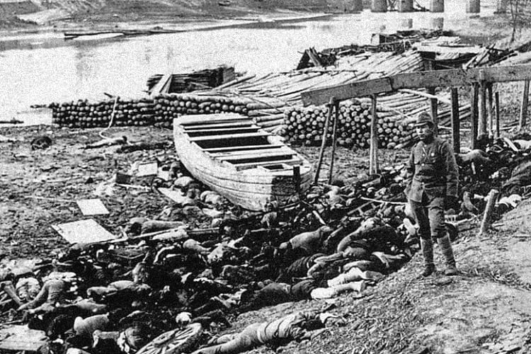
Dead bodies lying on the bank of Qinhuai River during Rape of Nanking Massacre. (Originally Moriyasu Murase)
History is full of Holocaust -i.e., Hitler’s Nazi Germany committed an act of genocide by killing six million Jews across Europe. This happened between the World War II years of 1941 and 1945. But does history speak of the Rape of Nanking in the same breath? Probably, no.
The Rape of Nanking is one of the most brutal acts of 20th-century genocides of world history that took place in December of 1937.
The invading Japanese ran over Nanking, which was the capital of China at that time, butchering at least 300,000 Chinese civilians and raping 20,000 to 80,000 women. All this happened in a matter of just eight weeks.
As part of the sack of Nanking, the Japanese went on to torture hundreds of thousands of civilians in the Chinese capital.
Journalist Iris Chang wrote a book
Disturbed over this genocide, journalist Iris Chang wrote a book in the subject titled ‘The Rape of Nanking: The Forgotten Holocaust of World War II’. It was published by Basic Books.
It is through this book the modern world came to know of the gory details of the Japanese atrocities in Nanking, China. Until then only a handful of survivors and some others knew about the Rape of Nanking.
Iris Chang claims that Nanking was a laboratory for Japanese soldiers, where they were taught to slaughter unarmed and unresisting civilians. Later, the Japanese are said to have used similar tactics elsewhere in Asia.
Japan failed to acknowledge the genocide
Till today, the Japanese have not acknowledged the genocide. Obviously, the Japanese government is therefore yet to pay reparations to the Chinese for its army’s actions.
The Second Sino-Japanese War
The Imperial Japanese Army marched into Nanking in December 1937, at the peak of the second Sino-Japanese war. Nanking was the then Chinese capital city. (Today Nanking is known as Nanjing) As per historical records, the city was virtually undefended. As a result, soldiers of the Imperial Japanese Army swept through the city killing, raping and torturing thousands of civilians.
The city was devastated after a six-week spree of violence. The International Military Tribunal for the Far East concluded that thousands of Chinese women were raped during the first month of the Japanese occupation.
Before the war
Decades before the genocide, tensions were building up between the Japanese Empire and the Republic of China. These tensions had led to the First Sino-Japanese War between the two in 1894 and 1895 over the Korean Peninsula. At that time the Qing Dynasty was ruling over China.
The Japanese Empire feared the Qing Dynasty’s military presence in Korea. It felt whoever held Korea could control Japan. Japan declared a state of war and annexed the Korean Peninsula from China.
Later, the Russo-Japanese War took place from 1904 to 1905. The two empires fought over the Russian influence over the Korean peninsula and Manchuria. The war came to an end following a treaty which gave Japan official control of Korea and South Manchuria.
After the end of World War I, also known as The Great War, the era of prosperity ended the world over including Japan. To prevent mass starvation following the global economic depression, ultra-nationalists forced the Japanese government to conquer newer territories.
It is in this context, Japan declared war against China and started bombing Nanking from August 15, 1937, onwards. As a result, millions of Chinese turned refugees. They fled the city either by land, boat or train.
Japanese troops first attacked Shanghai
At the same time, the Japanese troops first attacked Shanghai before moving on to Nanking. At Shanghai, the Chinese troops gave strong resistance. Both sides suffered heavy casualties. By November, however, the Japanese captured Shanghai.
Even before the Japanese headed towards Nanking, the Chinese government left for relocation. The then president Lin Sen left the city and left its fate John Rabe, who was the head of the Nazi Party in Germany.
John Heinrich Detlef Rabe. (DrSivle / Wikimedia Commons)
Meanwhile, the Japanese army unleashed their acts of crime on their way to Nanking. They started clubbing, bayoneting Chinese citizens and abducting and raping Chinese women and throwing them into sexual slavery.
Safety Zone in Nanking
Worried over atrocities on the Chinese, a handful of Europeans and Americans formed an International Committee to create a Safety Zone in Nanking. The foreigners had decided to stay put in Nanking and help the Chinese.
As part of the Safety Zone, a small portion of the Nanking city was partitioned off. The area of the safety zone was just two and a half square miles. Within the zone, non-Chinese as well as Chinese were off limits to the invading Japanese forces.
Interestingly, John Rabe struck a truce deal with the Japanese for the safety of Chinese soldiers within the Zone. As per the truce, the Japanese Army to also treat the Chinese soldiers as POWs. But, the Japanese put to death thousands of Chinese – soldiers and civilians alike.
Japanese troops attacked Nanking before dawn
On a fateful day, December 13th, 50,000 Japanese troops attacked Nanking before dawn. Even though the 90,000 Chinese troops outnumbered the Japanese, they collapsed after the enemy deceived and killed them across Nanking.
Throughout the siege of Nanking, the Japanese used Chinese soldiers and civilians for bayonet target practice. Though the massacre was carried on for months, the worst atrocities took place in the first eight weeks itself.
During this period, one could see several beheaded corpses of Chinese victims on the shore of the Qinhuai River that passed through Nanking city. According to writer and journalist Iris Chang, during the massacre, the Japanese army officers inculcated the soldiers to kill. This happened throughout Nanking. As a result, the Japanese soldiers brutally killed people.
Chinese women used as ‘comfort women’
The Japanese soldiers indulged in live burials and killing of women after raping them and using them as ‘comfort women’. Almost 50 years later such women broke their silence and asked the Japanese government for financial compensation. It is not known whether they received the compensation or not.
Swiftly, the Japanese took control of the city and also started to regulate the activities inside the safety zone. In spite of their efforts to eliminate the safe zone, the Japanese failed to do so. Eventually, the zone housed almost 700,000 refugees.
Censorship imposed
Meanwhile, the Japanese imposed a state of censorship over the safe zone. They made attempts to cover up atrocities across Nanking, moderated letters, journals, photos and moving images.
Between March and July of 1938, the genocide was over. The Japanese continued to occupy Nanking through World War II and until they surrendered.
International Military Tribunal
Later in December 1946, after a lengthy trial within the International Military Tribunal for the Far East War, Lieutenant General Tani Hisao of Japan was indicted as a war criminal. On March 10, 1947, he was sentenced to death.

Tani Hisao being escorted for his execution, 1947. (Unknown)
At the same time, the Chinese War Crimes Tribunal convicted three other Japanese officers and sentenced them to death. The officers were Captain Tanaka Gunkichi, Lieutenant Noda Tsuyoshi and Lieutenant Mukai Toshiaki.
Meanwhile, the Tokyo War Crimes Trial charged Commander Matsui Iwane as a Class A war criminal. He was indicted on 29 counts. Further, the former Japanese Foreign Minister Hirota and six others were also found guilty as Class A war criminals. They were hanged to death.
Japan destroyed many records
Sadly though, not many records from the Japanese side were available for the war tribunals, because they were destroyed by Japan in 1945. With the result, the prosecutors, as well as the historians, later failed to get accurate details of the Nanking massacre.
In view of these conditions, even today the genocide continuous to remain a contentious political issue between China and Japan. The Japanese government, as well as the civil society to some extent, denies that the 1937 massacre was genocide.
Killing contest held by two Japanese officers during Rape of Nanking
Perhaps, one of the most notorious atrocities committed in Nanking was the killing contest held by two Japanese officers. As news reports of that era indicate, there was a contest between the two officers to see who could kill 100 Chinese first with a sword.
According to unconfirmed news reports, Prince Asaka, who was the Japanese commander at that time, had a role in the Nanking massacre. After the genocide, Nanking took several decades to recover and later grew into a modern industrial city. Today it is home to China’s largest state-owned companies.
Enjoyed this article? Also, check out “Masada, Israel: Did 967 Rebellious Jews Really Commit Mass Suicide Here?“
Recommended Read:
The Rape of Nanking: The Forgotten Holocaust of World War II | By Iris Chang
Fact Analysis:
STSTW Media strives to deliver accurate information through careful research. However, things can go wrong. If you find the above article inaccurate or biased, please let us know at [email protected].
RELATED
- May 21, 2019 Hindenburg: The Tragic Death of World’s Biggest Commercial Airships
- September 11, 2019 Maginot Line: The Mark of French Tenacity and Resilience
- July 13, 2018 Hanns Scharff: The Extraordinary Interrogation Technique of a Nazi Interrogator
- April 13, 2019 Prora: Hitler’s Colossal Resort by the Beach That Never Served Its Purpose
The post Rape of Nanking is One of the Most Brutal and Forgotten Genocides of 20th Century appeared first on .
]]>The post Phantom Island: The Islands that Might Have Existed Only in the Imagination appeared first on .
]]>
An old map showing Bermeja, a phantom island near Mexico. (Tanner, Henry S.)
Phantom islands are islands that once appeared on nautical charts and maps but do not actually exist. There are various reasons for this. Some islands may have been purely mythical creations from old legends. Others may be deliberate fabrications, while others are geographical errors, optical illusions, or lands lost due to natural catastrophes.
Phantom Islands and the age of exploration
The Age of Exploration was a grand period in the history of mankind. The earth and its realms were a mystery to most people back then. There were many things they didn’t understand, and they tried to explain these with legends and fantasies.
As you can imagine, discovering new lands was a big deal in those times. It turned you into a hero overnight. And, if your home country’s reigning royalty didn’t try to steal your thunder, you could even name the new land after yourself. That could ensure your family was set for the next seven generations at least.
Despite such an incentive, comparatively few brave men actually set forth to traverse the vast oceans and make these new discoveries. The rest of the public remained safely at home and eagerly awaited their return and lapped up their tales of exciting adventures and marvellous sights. Naturally, some of these adventurers couldn’t resist playing to the galley and embroidering their trials and escapades to a good extent. In short, they added fuel to the existing legends.
It was easier to tell tall tales than to discover new lands. Often, to keep up and enhance their prestige, many of the voyagers outright lied about coming across an island or two. Travelling across the seemingly unending oceans for months on end was no child’s play. Sometimes you were glad to settle for an island, even if it was only a phantom island. Back then, nobody was going to take the next boat to go verify it after all. Or, if they did, there could always be a reasonable explanation for not finding it. Moreover, they could return with tales of phantom islands of their own.
Phantom Islands and nautical charts
In the Western world, the earliest Greek and Phoenician ocean farers began the practice of mapping the world. Piece by piece they tried to put together an entire picture of the earth. Other ocean farers that followed then made use of these charts to navigate the oceans. Furthermore, they added to them as they came across previously uncharted territories.
As a result of this practice, phantom islands also found their way on nautical charts.
However, all these phantom islands were not fabrications. Some were actual islands, but the voyagers got their geographical locations wrong. Or, they were actual islands that later disappeared into the ocean due to volcanic eruptions, underwater landslides, or some other natural disasters. In some cases, the voyagers mistook sandbars, icebergs, floating pumice from underwater volcanoes, and other debris for islands. In other cases, they didn’t survey the land correctly and mistook land that was actually connected to a larger landmass to be an island. Sometimes, the islands they thought they saw were only mirages or optical illusions.
Apart from the voyagers that reported these islands, nobody else was able to find or reach them again.
Despite this, many of these islands remained put on the nautical charts for many centuries. Even if other people couldn’t find them, they retained the hope they might someday be able to do so.
There are several hundred instances of phantom islands from the ages of antiquity to more modern times.
The last phantom island was Emerald Island, said to be near New Zealand. It even appeared in many atlases until 1987.
Famous Phantom Islands
Mythical Islands
The Greek poets Homer and Horace created poems on mythical islands like the Isles of Blest. Also known as the Fortunate Islands, these were supposedly Utopian islands where hardships were unknown. Of course, no human ship managed to sight, never mind land on, these fabled phantom islands.
Another famous island of legend was Atlantis. Plato mentions its existence and how it ultimately sank under the sea. The legend of Atlantis persists to the present day and many modern underwater explorers have had a go at finding it on the ocean floor. So far, nobody has been able to find anything that we can with a great degree of accuracy assume to have been Atlantis.
Actual Islands that were misidentified or were subject to geographical errors
In the 4th century BCE, Pytheas, an ancient Greek seafarer, arrived on an island he called Thule. Nobody else ever found it, but, since ancient times to the present age, explorers have argued that Thule was either Scandinavia, Iceland, or the Shetland Islands. Some say it didn’t even exist except in its discoverer’s salt-encrusted imagination.
For quite a long while, Pepys Island figured on the charts. Later, explorers discovered that it was not a different place. Just a different name for the Falkland Islands.
When early explorers to the American continent arrived in the Baja California Peninsula, they did not realize that it was connected to the mainland. Instead, they took it to be an island and noted it on the map as such.
Captain James Cook made a similar mistake when he landed on the Banks Peninsula in New Zealand. He mistook the 1150 square kilometres land mass to be a separate island, when, in fact, it is connected to New Zealand’s South Island on its eastern coast.
Islands that only their discoverers found
Ever heard of New South Greenland? It was also known as Morrell’s land after its discoverer, Benjamin Morrell. While captaining the Wasp schooner on a voyage of exploration in Antarctica’s Weddell Sea, he made his discovery in March 1823. According to the account he gave, his schooner sailed along 480 kilometres along the island’s coastline. He gave details of this and also marked the precise coordinates of the land. Nobody doubted his discovery and New South Greenland was duly added to the ever-expanding world nautical chart. However, in the 20th century, voyages to Antarctica proved conclusively that there was no such land. Captain Morrell, it turned out, was just another one in a long line of fabricators.
Islands that might have existed but no longer do
Spanish explorers of the 16th century came across Bermeja Island along the Yucatan peninsula’s north coast. In 1539, Alonso de Santa Cruz included the island in his El Yucatán e Islas Adyacentes. By 1844, however, British cartographers reported it had sunk underwater. There have been various theories about its disappearance. The best one involves the CIA—they sank it to extend the USA’s economic zone.
In 1825, George Norris, a captain of a whaling ship, came across Thompson Island in the South Atlantic Ocean. Another vessel reported sighting the island in 1893. Nobody ever saw it again thereafter. Researchers think it probably sank into the ocean after a volcanic eruption. However, until 1943, the world maps continued to include it.
Writer’s opinion
Phantom islands are a relic of a bygone era when one could cast an eye at the horizon and wonder about magical, mysterious lands that might exist way beyond. We now live in a somewhat more jaded age where some scientists actually think that there is nothing more for us to discover. They talk of ‘settled science’. Well, folks, nothing is that settled. As long as we are alive, there are discoveries to be made, even if only on the personal level.
Enjoyed this article? Also, check out “When Default Becomes De facto: Island of California, the Cartographic Mistake Which Became the Gospel Truth“.
Fact Analysis:
STSTW Media strives to deliver accurate information through careful research. However, things can go wrong. If you find the above article inaccurate or biased, please let us know at [email protected].
RELATED
 September 26, 2018 When Default Becomes De facto: Island of California, the Cartographic Mistake Which Became the Gospel Truth
- February 25, 2020 Leh Magnetic Hill: A Stretch of Road Where Laws of Gravity Work Peculiarly
- July 29, 2018 SS Baychimo: The Phantom Ship That Haunts the Arctic Waters
- December 26, 2019 The Superstition Mountains and the Legend of the Lost Dutchman’s Gold Mine
The post Phantom Island: The Islands that Might Have Existed Only in the Imagination appeared first on .
]]>The post Zoroastrianism: The Oldest Monotheistic Faith is Now on the Verge of Extinction appeared first on .
]]>
Faravahar, a symbol of Zoroastrianism. (Alan / Flickr)
One of the oldest religions in the world, Zoroastrianism has its roots in ancient Persia almost 4000 years ago. It had been the state religion in Persia over three dynasties. However, the Muslim Conquest of the region in the 7th Century AD practically wiped out the faith. Refugees fled to India to escape the persecution. The Zoroastrians today exist as a minority religion in pockets of India and Iran. The oldest monotheistic faith in the world has only about 100,000 to 200,000 practitioners today.
Origin
The name of the religion comes from its founder, Prophet Zarathustra (or Anglicized, Zoroaster). Not much is known about exactly when the Prophet lived. Whatever little is known about his life comes from the collection of Zoroastrian religious scriptures, the Avesta.
Archaeological evidence suggests that Prophet Zoroaster lived sometime between 1500 and 1200 BC. However, some specialists are of the opinion he lived in 6th Century BC as a contemporary of the Persian emperor Cyrus the Great. He was born in a tribe following an ancient polytheistic religion (similar to Hinduism) in north-eastern Iran or south-western Afghanistan. At the age of 30, while engaged in a purification rite, the Prophet had a divine vision. Soon after, Zoroaster began to preach of a single almighty, Ahura Mazda, and thus the Zoroastrian faith was founded.
The remains of a fire temple dating back to 2nd Century BC were discovered in Gonur Tepe, Turkmenistan. This indicates Zoroastrianism was already a well-established religion by this era.
Zoroastrians today
Iranian Zoroastrians
The Muslim Conquest in the 7th Century AD caused the fall of the Sassanian Persian Empire. The Zoroastrians living in Persia were forced to pay a religious tax to their invaders, simply to continue practising their faith. Additional laws were enforced as well, to further oppress them. Eventually, most of them fled to India as refugees. The few who remained converted to Islam. In pockets of Iran, one can still find native Iranian Zoroastrians, but their numbers are few and far between.

A Zoroastrian family in Iran, 1910. (The National Geographic Magazine)
The Parsis of India
The Iranian Zoroastrians who immigrated to India to escape oppression by their Arab overlords came to be known as the ‘Parsi’. Likely, the refugees had sailed across the Arabian Sea to reach Gujarat in western India, sometime around 785-936 AD. The majority of the Parsi community can still be found around this region. They have, over the years, dispersed across India and Pakistan. However, the Parsi still remain an ethnic minority- numbering to only 60,000 in India, and 1,400 in Pakistan.

A Parsi wedding, 1905. (William Thomas Fee / The National Geographic Magazine)
Zoroastrianism Culture & Beliefs
Worship
The chief symbol of Zoroastrianism is fire. It is the holiest element within the religion, and their places of worship are often referred to as fire temples. Every fire temple houses an ‘eternal flame’ on its altar, which burns continuously without extinguishing. The three ancient fire temples, known as the Great Fires, were said to have come directly from Ahura Mazda himself. The Great Fires are the stuff of legends, and despite relentless research, no trace of these temples has been found yet by archaeologists. Apart from fire, the Zoroastrians also consider water to be a sacred element, both being symbols of purity.

A fire temple in Yazd, Iran. (Spekim / Wikimedia Commons)
Burial
The Zoroastrian custom of ‘sky burials’ is unique amongst funeral traditions across the world. Tower of Silence, or Dakhmas, are high, circular, flat-topped towers where the corpses of the dead are traditionally kept. Here they are exposed to the elements- vultures pick the bones clean and the sun bleaches the remains. The bones are then collected and placed inside ossuaries within lime pits. Though sky burials are still practised by some Parsis in India, most Zoroastrians today prefer to bury their dead beneath concrete slabs. In Iran, Dakhmas have been declared illegal since the 1970s. The last functional Tower of Silence is near Mumbai, in India.
For further read: Tower of Silence: Where Zoroastrians Leave their Dead to be Excarnated by Scavenging Birds
Dress
The traditional garb of the ancient Zoroastrians differs a great deal from the modern Parsi costume. The attire of the Parsi community is a blend of their middle-eastern roots and the garb of the Gujarati community they immigrated into. A traditional Parsi costume for a male would consist a long muslin shirt (sudra) and loose cotton trousers. He would also wear a girdle (kusti), a China-silk skull-cap, and a waistcoat made of white cotton or chintz. An angrakha, an unbelted long loose coat, is put on when heading out. A decorated brown turban is also put on top of the skull-cap when outdoors. The Parsi woman has adopted the saree as their garment of choice. A fascination for ornaments and vibrant tasteful clothing characterises the Parsi woman’s appearance.

An illustration of a female (left) and male (right) Parsi traditional dress. (Walters Art Museum)
Food
The traditional Parsi food today is a blend of Iranian and Gujarati flavours, resulting in a sumptuous and unique cuisine. A Parsi lunch on a regular day would include rice, with lentils or a coconut-infused curry. Typical dinners include a meat dish, generally accompanied by potato or vegetable curries. A slightly pungent onion-cucumber salad, kachumbar, usually accompanies these daily meals. Popular dishes include minced lamb in rich tomato gravy, half-fried eggs, and a signature thick mutton stew alongside caramelised rice. The signature alcohol of the Parsi community, though typically drunk by the agrarian communities of old, is toddy made from coconut. The plain but delicious bun maska (bread and butter) with chai is a staple in Parsi cafes along the west coast of India, especially Mumbai. Chicken Farcha and Dhansak are other mouth-watering and delicious traditional Zoroastrian dishes.
Famous Zoroastrians
Parsis minority makes up a sizeable chunk of the influential industrial families in India, including the Tata, Godrej, and Wadia families. One of the most famous practising Zoroastrians in the modern world is Freddie Mercury, the lead singer of the legendary British rock band, Queen. Freddie Mercury was born Farrokh Bulsara, and of Parsi descent. A practising Zoroastrian, Mercury’s funeral was conducted by a Zoroastrian priest in London.
Zoroastrianism in pop culture
The presence of Zoroastrianism in the western hemisphere is negligible. In fact, most Europeans became aware of the Zoroastrian faith only after reading philosopher Friedrich Nietzsche’s novel Thus Spoke Zarathustra in the 19th Century. In the novel, Nietzsche ‘follows’ the Prophet Zoroaster on his travels. A professed atheist, Nietzsche’s work has been regarded as ‘ironic’ due to its religious preoccupation.
In today’s age of post-globalization, practically everything can find a place in pop culture, and anything can serve as inspiration. Religion is not an exception. The Japanese automaker Mazda Motor Corporations derives its name from Ahura Mazda, the supreme ‘God of Light’. The Azor Ahai legend in George R. R. Martin’s high-fantasy series A Song of Ice and Fire, and TV-adaptation Game of Thrones is also inspired. The fire god R’hllor might have been modelled on Ahura Mazda. The warrior demigod Azor Ahai who ‘defeats darkness’ has a resemblance to Zoroastrian legends as well.
Depleting numbers
Apart from their immigrant origins, the primary reason for the low and steadily-depleting numbers of the Zoroastrian community is their exclusivity. The fire temples are strictly out of bounds to outsiders. The community does not permit conversion into their religion. Neither do they accommodate children borne out of intermarriages with other communities, within their folds. As a result, the number of recognised practitioners of Zoroastrianism is steadily decreasing. Their numbers in India itself have halved since the 1940s. The government has launched public campaigns and has been funding fertility clinics to help the Parsi community in India to procreate, and grow. Zoroastrians across the world have a rich and distinctive cultural heritage, which must be preserved and allowed to thrive.
Fact Analysis:
STSTW Media strives to deliver accurate information through careful research. However, things can go wrong. If you find the above article inaccurate or biased, please let us know at [email protected].
RELATED
- June 11, 2019 Raëlism: The UFO Religion That Believes in Extra-Terrestrial Beings Called Elohim
 July 1, 2020 The Nasir al-Mulk Mosque Hosts a Kaleidoscopic Play of Lights Reflecting the Morning Sun
- December 10, 2019 Loung Pordaeng: The Bespectacled Monk Mummy of Wat Khunaram
- August 24, 2020 Whale Temple: Where Vietnamese Worship Whales and Revere their Carcasses
The post Zoroastrianism: The Oldest Monotheistic Faith is Now on the Verge of Extinction appeared first on .
]]>The post Hyderabad State: When Nizams Held Control of an Indian Kingdom During Its Golden Period appeared first on .
]]>
Hyderabad state in 1909. (John George Bartholomew / Imperial Gazetteer of India, 1909)
The first thing that strikes us when we think of the Princely state of Hyderabad is wealth and opulence. At the time of his death, the Seventh Nizam was reported to have been the fifth wealthiest person in the world.
However, there is much more to the Asaf Jahi Nizams than mere wealth and opulence. The Asaf Jahis were one of the bravest warriors and excellent swordsmen of their time.
1655: Ancestors of the Nizams of Hyderabad
One thing, though, is very interesting. Did you know that the ancestors of the Nizams of Hyderabad state originally belonged to the Turkic dynasty from around Samarkand in today’s Uzbekistan? Turkic happens to be a subgroup of the Altaic family of languages that are spoken in the western and central parts of Asia.
The grandfather of the First Nizam was a person named Khwaja Abid who hailed from a village called Aliabad, which was close to Samarkand. In those days the region fell under the kingdom of Bukhara. Khwaja Abid was said to be a learned man, who was well-versed in the warfare techniques.
As per records of that era, Khwaja Abid is believed to have visited the Mughal India in 1655 AD. Shortly after that, he is said to have presented himself before Emperor Shah Jahan. Impressed with his skill sets, the emperor granted him favours and a position in the Imperial service.
Thus began the connection between the Mughals and the later Nizams. This association continued till the end of the Mughal rule.
1657: Nawab Khwaja Abid Siddiqi governor of Ajmer
Later in 1657, Khwaja Abid entered into the Imperial service under Aurangzeb, who was at that time the Viceroy of the Deccan. At that time, Aurangzeb was getting ready to wage a war of succession against his brothers and half brothers.
At such a crucial time, Aurangzeb appointed Khwaja Abid to an important position in the Moghul army. After Aurangzeb became the Mughal Emperor, he gave the governorship of Ajmer. Subsequently, he was made the governor of Multan and was also given the title Kilich Khan.
Khwaja Abid, a.k.a Kilich Khan is believed to have died in 1687 during the siege of Golconda, which was under the control of Qutub Shahi kings. At this stage, Kilich Khan had a grandson named Qamaruddin.
After Aurangzeb’s death in 1707 in Ahmednagar, the Mughal dynasty weakened and limped on for another 150 years. In the backdrop of a weak empire and unsettling political environment, rose the Asaf Jahi dynasty. Not willing to be subedars of a bigger kingdom, the Asaf Jahis made Hyderabad their own.
The Nizam of Hyderabad (1724-1948)
Khaja Abid’s grandson Qamaruddin
It all started with Kilich Khan’s grandson Qamaruddin. During Aurangzeb’s time, at the tender age of just 19, Qamaruddin earned his name as a skilful warrior. At that young age, he was even given the title Chin Qilich Khan or Boy Swordsman.
In 1713, Aurangzeb’s grandson emperor Farrukhsiyar gave the title of Nizam-ul-Mulk Fateh Jung to Qamaruddin. He was then appointed as the subedar of six provinces apart from the Faujdar of Karnatak.
Palace intrigues
Qamaruddin was troubled with palace intrigues thanks to the Sayyid brothers, who were powerful generals in the Mughal Empire. The two generals, alarmed by his rise, conspired against Qamaruddin. After the death of the Sayyads, Qamaruddin, by now fed up with palace intrigues, decided to become the viceroy of the Deccan region.
In a decisive battle with the then Subedar of the Deccan Mubrez Khan, Qamarruddin established his supremacy on the region. He immediately started to strengthen Deccan’s administration and finances.
The 1st Nizam: Mir Qamar-ud-din Khan, Asaf Jah I (1724-1748)

A posthumous portrait of Mir Qamaruddin Khan. (Unknown)
Qamarruddin conferred the title of Asaf Jah
Mughal emperor Muhammed Shah then invited Qamarruddin to Delhi. The emperor then extended an olive leaf and gave the title of Asaf Jah on Qamarruddin. Asaf Jah means equal to Asaf. The Grand Vizier of King Solomon’s court was named Asaf.
Asaf Jahi dynasty ruled Hyderabad from 1724
Though viewed as a subject of the Mughal Empire, in reality, Qamaruddin turned out to be an independent ruler. Thus, the Asaf Jahi dynasty ruled Hyderabad from 1724 till September 1948.
According to legend, before leaving Delhi, Qamaruddin is said to have called on a secret Saint and told him of his wish to leave Delhi and go to Deccan. The Saint is said to have blessed him and asked him to take some bread before embarking on the long journey.
Obeying the Saint’s suggestion, Qamaruddin is said to have taken seven pieces of the blessed bread. What happened next is unclear. However, the Saint is said to have indicated that the Asaf Jah dynasty will continue for seven generations.
Nizam-ul-Mulk Asaf Jah I’s rule
Qamaruddin or Nizam-ul-Mulk Asaf Jah I ruled over Hyderabad state for the next 24 years from 1724. Of course, his major achievement was to lay the foundation of Hyderabad, the princely state. As the head of the judicial, executive and defence department, the Nizam I drafted his own laws and set up his own armies. He also created a new flag for Hyderabad state.

The Asafia flag of Hyderabad state. The script on the top reads Al Azmatulillah meaning “All greatness is for God”. The writing in the middle reads “Nizam-ul-Mulk Asif Jah”. The bottom script reads Ya Uthman which translates to “Oh Uthman”. (Yenemus / Wikimedia Commons)
As part of his other initiatives to strengthen the revenues of the Hyderabad state, he split his state into three parts. This system laid the foundation for the growth of the Muslim nobles as jagirdars, zamindars and Deshmukhs. One of the important noble families was the Paigahs. This system remained unchanged until 1950.
During his 24 years of reign, Nizam I, except for the one year war with the Marathas in 1727, the Nizam I hardly waged a war or a battle. Therefore, the Nizam I is known to have laid a firm foundation for an important Muslim state outside West Asia. At that time, the Hyderabad state was estimated to be as large as France.
At the time of his death in 1748, the Nizam was 76 years old. He was buried at the mazaar of Shaikh Burhan-ud-din Gharib Chisti, Khuldabad. Aurangzeb is also said to have been buried close by.
The 2nd, 3rd & 4th rulers(1748-1762) are not counted among the Asafjahi Nizams by the historians although they were recognised by the Mughal emperors in Delhi.
After the death of Mir Qamarruddin, a power struggle ensued between the sons and grandsons of the Nizam I, British, Marathas and the French. During this unsettling period, three members of the Jung family held the kingdom intact for a period of 14 years.
The 2nd Nizam: Mir Nizam Ali Khan, Asaf Jah II (1762-1803)

Portrait of Mir Nizam Ali Khan. (Unknown)
Mir Ali Khan was coroneted as the Nizam II
In 1762, however, the fourth son of the Nizam, Mir Ali Khan was coroneted as the Nizam II. He came to be known as Nizam Ali Khan Asaf Jah II and went on to rule for the next 42 years till 1803. He was 28 years old when he assumed the title.
His reign was very important because he could not only save his dynasty from threats but also improved the state’s administration. He bought peace with the Marathas. He tied up with France and the British with alliances.
Most importantly, he shifted the capital to the more centrally located Hyderabad from Aurangabad in 1763. This shift proved to be crucial for the benefit of the Asaf Jahi rule. Nizam Ali Khan died in 1803. He was 69.
The 3rd Nizam: Mir Akbar Ali Khan, Asaf Jah III (1803-1829)
Mir Akbar Ali Khan Sikander Jah Asaf Jah III
The next Nizam was Mir Akbar Ali Khan Sikander Jah Asaf Jah III. He ruled from 1803 to 1829. Sikandar Jah can be credited for the new era in the progress of Hyderabad. The city expanded to the north in 1806. The expanded city was named Secunderabad after Sikander Jah. Till then, Secunderabad was known as Lashkar, meaning cantonment. After his death in May 1829, his eldest son named Nawab Farkhunda Ali Khan was coroneted.
The 4th Nizam: Mir Farqunda Ali Khan, Asaf Jah IV (1829-1857)
Mir Farkhunda Ali Khan Nasirud-Daula Asaf Jah IV
Mir Farkhunda Ali Khan Nasirud-Daula Asaf Jah IV ruled from 1829 till 1857. The Hyderabad state was in deep financial turmoil at the time of his coronation. The first act Nizam IV did was to tackle the mounting debt. For this, he ceded several border districts including Berar to the British.
Financial turmoil
To further overcome the financial turmoil, a new model of just revenue administration was introduced. He removed the systems of jagirs, zamindari and deshmukh and introduced the concept of taluqdar.
He divided Hyderabad state into 16 districts. Each district had a taluqdar. This system brought in improved transparency in administration. In this way, Nizam IV safely steered the Hyderabad state through a critical phase. During his reign, Hyderabad prospered with schools, business centres and bridges.
Nizam banned the practice of Sati
One year before his death in May 1857, the Nizam banned the practice of Sati in the kingdom. Thus, Hyderabad became the first princely state in India to do so.
The 5th Nizam: Mir Tahniyath Ali Khan, Asaf Jah V (1857-1869)
Mir Tahniyath Khan Afzal-ud-Daula Asaf Jah V
Sikandar Jah’s son, Mir Tahniyath Khan Afzal-ud-Daula Asaf Jah V, took over the reins from him in 1857 and ruled for just 12 years till 1869. Afzal-ul-Daula can be credited for giving land for the Bombay- Madras railway line, building the Afzalgunj Bridge, mosque and bazaar.
He died at the young age of 42. He was succeeded by his son Nawab Mir Mahbub Ali Khan. The VI Nizam was just about three years old at that time.
The 6th Nizam: Mir Mahbub Ali Khan, Asaf Jah VI (1869-1911)
Mir Mahbub Ali Khan Bahadur Asaf Jah VI

Nizam Mahboob Ali Khan. (Royal Collection Trust)
He became Mir Mahboob Ali Khan Bahadur Asaf Jah VI in 1869 and went on to rule for the next 42 years till 1911.
Till he attained the age of 17 in 1885, the youngest Asaf Jahi ruler’s co-regents Nawab Rasheeduddin Khan, Mir Turab Ali Khan, Sir Salar Jung I and Shams-ul-Umara III oversaw the administration.
Rapid development witnessed
After he assumed his sovereign rights, Nizam VI made rapid development in the fields of railways, revenue system and establishment of silk and cotton mills. Other fields that came under his spotlight include education, judiciary, police, excise, forest and health.
It was during this period, the Nizam’s brother-in-law (Viqar-ul-Umara) is said to have constructed the Falaknuma Palace and gifted it to the Nizam. However, sadly, during his short stay at the palace, the Nizam fell, suffered a paralytic stroke and died at the age of 46.

Falaknuma Palace, 1900. (Collection of Horatio Kitchener)
The 7th Nizam: Mir Osman Ali Khan, Asaf Jah VII (1911-1948)
Mir Osman Ali Khan Bahadur Asaf Jah VII

Mir Osman Ali Khan. (unknown)
On September 12, 1911, the world-famous Mir Osman Ali Khan Bahadur Asaf Jah VII got coroneted as Nizam VII. He was born in 1886. His first act as the Nizam was to abolish capital punishment for civilians. During World War I, he extended military, financial and material support to the British. He established the Osmania University in Hyderabad in 1917.

Osmania University students wearing Deccani sherwani and caps, circa 1939. (Cecil Beaton / Imperial War Museums)
He then separated the executive from the judiciary in 1921. In the rest of India, this was done in 1974. Several public buildings that are functional today were built by him.
Generously donated money to educational institutions
He generously donated money to educational institutions like Aligarh Muslim University, Benaras Hindu University, and Santiniketan. He then gifted away 14,000 acres of land for the Bhoodan Movement in Pochampally near Hyderabad city.
Last Nizam refused to merge Hyderabad state with India
In 1947, India became an independent nation and asked all the princely states to merge with the Union of India. However, the last Nizam Mir Osman Ali Khan refused to merge Hyderabad state with India. He desired to retain Hyderabad as an independent sovereignty.
However, India’s first Home Minister Sardar Vallabhbhai Patel, in no uncertain terms, told the Nizam that India will not tolerate this. After several negotiations, the Indian government signed a standstill agreement with the Nizam in November 1947. India hoped the Nizam will set up a representative government in Hyderabad which will then help in the merger process.
Three crucial developments
But, Mir Osman Ali Khan had different views. With a view to negotiating with the Indian government on his behalf, he engaged British lawyer Sir Walter Monckton. He wanted to buy time through negotiations in order to build up his armed forces to clash with India. In this connection, the Nizam was believed to have been in talks with the Portuguese administration in Goa and also Pakistan.
In June 1948, the last Governor General of India Lord Mountbatten proposed a deal called the Heads of Agreement. As per the deal, Hyderabad was to get the status of an autonomous dominion nation under India. Though India agreed to sign the deal, the Nizam is said to have refused it. On August 27, 1947, the Nizam actually declared he wanted complete independence. Or else, he wanted a dominion status under the British Commonwealth of Nations.
The Nizam is said to have issued a firman that Hyderabad would remain independent. It would not join the Constituent Assembly. Soon after the declaration, Kasim Razvi unfurled the Asafia Flag and exhorted Hyderabadis to defend the state to the last.

Kasim Razvi, the leader of Razakars a private militia that supported the rule of Nizam Osman Ali Khan. (Unknown)
In connection with the issue of joining the Indian Union, Mir Osman Ali Khan is believed to have rejected the advice of his constitutional advisors like Walter Monckton. Walter was a close friend of Lord Louis Mountbatten, who wanted to ensure that Hyderabad held a high status in the Union of India.
Meantime, three crucial developments took place in Hyderabad state. First, Muslim communal organization named Ittihad ul Muslimeen and its paramilitary wing, the Razakars grew by leaps and bounds.

The Razakars of Hyderabad state undergoing military training. (Unknown)
At the same time, The Hyderabad State Congress launched a mass struggle against the Nizam on August 7, 1947. Finally, the peaceful agitation of the Congress against the Nizam turned violent. Meantime, however, a parallel struggle took place. The communist-led peasant movement turned into an armed struggle in the Hyderabad state from 1946 onwards.
This chaos and the unclear negotiations failed to go down well with the Indian Government.
While referring to the idea of an independent Hyderabad state, Sardar Patel reportedly said an ulcer in the heart of India should be surgically removed. This was when he decided to annex Hyderabad. One person who also played a key role in the annexation of Hyderabad was Rao Bahadur Vappala Pangunni Menon, CSI, CIE. This Indian civil servant was simply known as VP Menon.
Operation Polo launched
With no hope of solving the Hyderabad problem until June 1948, an annoyed Patel launched Operation Polo on September 13, 1948. The operation, which was named after the 17 polo fields in the then Hyderabad state, was also referred to as “Operation Caterpillar”. The operation was also referred to as Police Action.
Major General Chaudhuri led 36,000 Indian troops into Hyderabad state in the early hours of September 13 of 1948. Operation Polo was a two-pronged advance. The main force marched along the Sholapur-Hyderabad road, while a smaller diversion marched along the Bezwada-Hyderabad road. Unable to counter the might of the Indian army, the Nizam’s Army surrendered on September 17.
Records show that roughly 32 Indian soldiers were killed and 97 were injured. Meanwhile, 1373 Razakars and 50,000 civilians were killed with some reports suggesting much higher in the five-day “Operation Polo”. Meanwhile, as the Indian government was apprehensive on how the rest of India would react, a state of Emergency was declared. At the time of the formal surrender of Hyderabad, the state had a population of about 1.60 crores.
In November 1948, the last Nizam formally acceded to the Indian Union, thus, bringing the Asaf Jahi dynasty’s rule in Hyderabad to an end after 225 years.
Enjoyed this article? Also, check out “Bibi ka Maqbara: The Taj of Deccan, Which Like the Original, Tells the Tale of Eternal Love“.
Fact Analysis:
STSTW Media strives to deliver accurate information through careful research. However, things can go wrong. If you find the above article inaccurate or biased, please let us know at [email protected].
RELATED
- March 13, 2020 Anabel Loyd’s New Book ‘Bahawalpur’ Documents the ‘Rise and Fall of a Glorious British India Princely State
- March 3, 2020 The Magnificent Diwan- Life Story of the Most Powerful Indian Statesman of the 19th Century by Bakhtiyar K. Dadabhoy
- December 19, 2018 Battle of Saragarhi: When 21 Valiant Indian Soldiers Held Their Ground, Fiercely Fighting Against Thousands of Afghans
- April 27, 2020 Tipu Sultan: The Pioneer of Rocket Artillery
The post Hyderabad State: When Nizams Held Control of an Indian Kingdom During Its Golden Period appeared first on .
]]>The post Bingham Canyon Mine: The Largest Copper Producing Mine in the United States appeared first on .
]]>
Bingham Canyon Mine. (Doc Searls / Flickr)
The Bingham Canyon Mine is an open-pit copper mine in the Oquirrh Mountains to the west of Salt Lake City in Utah in the United States. It is two and a half miles wide and a three-fourths mile deep. These dimensions make it the most extensive man-made excavation in the world. It is so large, in fact, that you can even see it from space.

Bingham Canyon mine from space. (NASA / ISS015-E-29867)
The Bingham Canyon mine
The mine gets its name from two Mormon brothers, Sanford and Thomas Bingham, who grazed their cattle there. Stumbling upon some copper ore in 1848, they were the first to realize the possibilities of mining in the area. However, the Mormon leader, Brigham Young, dissuaded them from carrying out the venture as it was more important for their people to establish a community right then. Bowing to that, they moved on to settle in Weber County. The canyon continued to be known as Bingham Canyon, though.
Mining in the Bingham Canyon mine
Mining operations began in 1863, and, since then, copper, gold, and silver have been the principal metals extracted from the mine. It also yields molybdenum and various other minerals. Around 25% of the total copper produced in the USA comes from the Bingham Canyon Mine. The mine has produced more than 19 million tonnes of copper over the years.
In the 19th century, a number of mining companies staked their claims in the mine. Their ore extractions, however, were mostly small-scale. It wasn’t until 1906 that open-pit mining for large-scale ore extraction commenced.
A township of miners and their families sprung up around the mine along the canyon walls in the 1920s, but it dwindled as the mining operations began using more sophisticated machinery and methods. Moreover, as the mine expanded, it began swallowing up more and more of the surrounding land, including sections of the township. The intensive mining operations resulted in a gigantic pit that is around 970 metres deep, 4 kilometres wide and extending across 7.7 square kilometres.

Inside the mine. (Hermann Luyken / Wikimedia Commons)
Mining Companies in the Bingham Canyon mine
Between 1906 to 1923, some of the mining companies merged and sold their shares to larger mining corporations. For instance, the Utah Copper Company sold 75% of its interest to the Kennecott Copper Corporation.
By the 1970s, the Kennecott Copper Corporation and the Anaconda Minerals Company had acquired all the other mining operations. Sohio took over the Kennecott Copper Corporation in 1981 and stopped open-pit mining operations in 1985. They began mining for gold in Barney’s Canyon the following year. BP Minerals bought the mine assets from Sohio in 1987 and mining operations resumed. The Rio Tinto Group has owned the mine since 1989 and has since spent billions of dollars in modernizing the mine and cleaning up the polluted groundwater.
The landslide at Bingham Canyon mine
After a massive and disastrous landslide on the mine’s northeast wall on 10 April 2013, the mine management closed it to visitors for several years. They worked on reducing the mine’s eastern slope in a bid to prevent any more landslides. The situation is now reasonably under control to allow visitors once again.
Visiting the Bingham Canyon mine
You can visit the mine from 1 April to 31 October—as long as the weather holds up—but it is necessary to make prior reservations and purchase tickets online. The mine donates all the income derived from visitors to various charities and non-profit organizations.
The mine is about an hour’s drive away from Salt Lake City, and you can only enter it via the company’s shuttle bus. The bus takes you on a 15-minute ride up to the top of the mine. As you go up and come back down on the bus, you can watch two videos about the mine and its operations. The videos detail the mine’s history and explain how the miners extract ore from the rock.
From the two observation decks at the top, you can get a fantastic view of the open pit mine and its many ridges. Moreover, you can listen to an audio presentation—available in multiple languages— detailing what is going on down below. There are winding roads looping up along the mine’s perimeter, and slow-moving trucks are the only visible traffic on them.
Situated at an elevation of 6700 feet, the most incredible thing about the mine is its sheer size.
You will probably come away more amazed at its immensity. From a height, the trucks that bear away the extracted ores look quite minuscule. From a close-up view, they are gigantic and capable of carrying 240 to 320 tons of ore. They deliver this to the crusher in the open pit. The machine then pounds it into small pieces. These crushed pieces are then loaded on a conveyor belt that extends for five miles towards the Copperton Concentrator.
Visitors can look at the displayed mining equipment, which includes a truck tire that stands 12.5 feet high and a shovel scoop and a haul truck bed, both so large that you can walk into them. You can also browse through the gift shop at the mountain base and purchase copper jewellery and other items.
In conclusion
The Bingham Canyon mine is an interesting example of how manmade activities can affect the environment. Aside from the gnawing out of an enormous pit in the earth, the mining activities have polluted the groundwater to such an extent that it is likely to remain unusable for a long time to come. On the plus side, the mining activities appear to have discouraged hunting in the area, and that led to a proliferation of wildlife.
Enjoyed this article? Also, check out “Potash Ponds: Where the Vibrant Blue Pools are Quite a Sight in the Red Desert“.
Fact Analysis:
STSTW Media strives to deliver accurate information through careful research. However, things can go wrong. If you find the above article inaccurate or biased, please let us know at [email protected].
RELATED
- February 1, 2019 Agbogbloshie: Africa’s Largest Ground for Dumping of Electronic Waste from World Over
 March 27, 2019 Monowi, Nebraska: A Village in Boyd County, United States with a Population of One
 January 6, 2019 Lake Crescent: Washington State’s Beautiful, Deadly Lake and its History of Chilling, Notable Incidents
 September 15, 2018 Potash Ponds: Where the Vibrant Blue Pools are Quite a Sight in the Red Desert
The post Bingham Canyon Mine: The Largest Copper Producing Mine in the United States appeared first on .
]]>The post Pamukkale: The Cotton Castle in a Mess of Limestone and Healing Waters appeared first on .
]]>
Pamukkale or Cotton Castle. (Antoine Taveneaux / Wikimedia Commons)
She made history with her beauty and brain. And patronizing a place which would become a popular tourist jaunt. Welcome to Cleopatra’s Antique Pool, where the Egyptian Queen, Cleopatra (69-30 BCE), known for her penchant for health and beauty, spent quality time in the hot springs. The pool is one of the 17 water bodies located at Pamukkale (meaning cotton castle) in the Denizli province of the Republic of Turkey. It is a scenic spread of dazzling white calcium carbonate in 8860 ft. X 1,970 ft X 525 ft. Verily called ‘spa town’, Pamukkale is a health cum healing joint in the valley of river Menderes. It is a medley of slabs, pillars and caves made of calcium compounds. The name cotton castle comes from a legend that bales of cotton were spread out to dry in open. But, in time, these mutated to the present day limestones. A tad realistic as the cotton is the principal agriculture crop of the area.

Pamukkale, Turkey. (Katie Hunt / Flickr)
Created by the natural forces of hot water springs and earthquakes
The formation of the cotton castle is a handiwork of 2 elements, water and earth. Hot water springs flow out from bowels of the earth. Their waters are supersaturated with minerals, which precipitate as water spreads on the uneven ground to find its base. The precipitate settles into terrace formations. Carbon-di-oxide (gas) disengages from the mixture and escapes into the open air. Some of the gas is trapped in the mass of precipitate that falls on the wayside, on cliffs and slopes, creating calcium bubbles. From distance, the bubbles look like fluffs of cotton on limestone slabs (travertines) and pillars (stalactites). Amid these white and shining terraces, some caves are also formed in a natural way. The air in the caves is flushed with carbon dioxide and these were used for religious purpose in ancient times.
Pamukkale: A historical site, health resort, and religious hub
The site, back in 190 BC, was a holy city called Hierapolis. It was a place known for sacred rites and spiritual pursuits, as well as for curing of diseases with mineral rich hot water springs. Frequented by the royalty, including the Egyptian Queen Cleopatra, it was famed as the retirement retreat for the Roman Kings. Two massive earthquakes, one in 60 AD and another in 1334 AD ravaged this historic city. Nevertheless, the ruins of the city add to the overall charisma of Pamukkale as a picnic spot. The ruins are a key component of ‘Cotton Castle’ which was declared the world heritage site by UNESCO in 1988. Rubbles of buildings, the sediment of calcium terraces from hot mineral water, collection of spring water in pools of varying depths and size; all added to make natural upheavals into a piece of fine art. Among the relics dotting the cotton castle, Hierapolis theatre with its VIP boxes, 2 tier seating and niche compartments, a devious church, graveyard, city walls and pathways are noteworthy.
Hotels and approach roads planned to protect the site’s natural formation
With the reputation Pamukkale, as an excursion cum historical site spreading far and wide, in the year 1960, hotels and approach roads were built within and outside of it. The construction within was found detrimental to the Travertines and water pools. Hence it was demolished. Further, laws were enacted to ensure that water from pools is not misused by the hotels, but made available of tourist for bathing and excursion.
Surprises galore for the visitors
Karahayit hot spring, another attraction at Pamukkale, is a maze of coloured water. The colour reflected in water is decided by the nature of dissolved oxide in it. Located 5 km away from Pamukkale, the water of these springs may be up to 55° Celsius hot.
A visit to Pamukkale is an out-of-this-world-experience. Trekking barefoot on shining terraces, sitting on the poolside, bathing or simply splashing in mineral water, with temperature ranging upward of 35° Celsius, is a magical feeling. Bathing is generally safe. Water is drowning deep only in some places, and provisions are made to attend to emergencies. The ground can be slippery and limestone can have sharp edges; so caution is advised.
Paraglide for a bird’s eye view
Want to watch the whole thing from the sky? You can, thanks to the paragliding facilities available. A walk through the Pamukkale Nature Park can be your sneak peek into local customs, as the place is popular for its wedding ceremonies. For boating in the lake, and being one with hordes of ducks out there, you can hire a paddle boat and have your heart’s fill.
Enjoyed this article? Also, check out “Clear Water Lagoons and Pristine White Sand Dunes of Lençóis Maranhenses National Park“.
Fact Analysis:
STSTW Media strives to deliver accurate information through careful research. However, things can go wrong. If you find the above article inaccurate or biased, please let us know at [email protected].
RELATED
- August 17, 2019 Euphrates River: A Dying River that Birthed One of the Oldest Civilisations
- October 16, 2018 Clear Water Lagoons and Pristine White Sand Dunes of Lençóis Maranhenses National Park
- February 10, 2019 Ladakh Beckons You for a Riveting Tour of Nubra Valley
- June 19, 2020 Tree of 40 Fruits: A Patchwork Canopy of Myriad Fruits
The post Pamukkale: The Cotton Castle in a Mess of Limestone and Healing Waters appeared first on .
]]>The post Church of the Dead: Home to the Peculiar Mummies of Provincial Italy appeared first on .
]]>
The mummies of the Church of the Dead in Urbania, Italy. (Nalcos980 / Wikimedia Commons)
Urbania, a lively little Italian town, houses one of the most fascinating churches in the world- the Chiesa dei Morti, or Church of the Dead. It looks to be a small nondescript medieval structure from outside. Stepping through the Baroque doorways and entering the chapel, however, reveals another story. Known as the Cemetery of Mummies, the chapel houses a display of eighteen naturally-mummified bodies dating back 400 years. The church is open for visitors to pay their respects at the altar. They can then take a tour of this macabre yet captivating monument.
Church of the Dead: Origin and history

The church from outside. (Diego Baglieri / Wikimedia Commons)
The town of Urbania, then known as Casteldurante, saw the founding of the Brotherhood of the Good Death, or Confraternita della Buona Morte. The noble purpose of this Brotherhood, established in 1567, was to provide an honourable burial to the poor. They provided every service that might be required- ferrying corpses, assisting the dying, paperwork and formalities, giving out alms to the moribund, and so on. The actual burials were conducted in a designated plot behind the church, then known as Cappella Cola.
The Edict of Saint-Cloud, issued by Napoleon Bonaparte in 1804, mandated that all cemeteries be housed outside the town limits due to health concerns. As the cemetery behind the church was being dug up, 18 bodies, all naturally mummified, were recovered intact from the grounds. A hundred skulls were also recovered while exhuming the bodies- though not mummified, but slightly mouldy. These 18 remarkable mummified corpses and the 100 skulls have been on display in a crypt behind the altar since 1833. The church has since been known as the Church of the Dead.
The science behind the phenomenon
The mummies housed within the Church of the Dead are remarkably well-preserved, as can be seen behind the glass displays. Not only are their skeletons intact, but also their skin and internal organs. In some exceptional cases even clothing, hair and genitals are prominently visible behind the display.

Mummies on display. (Ulrichulrich / Wikimedia Commons)
In the 1960s and 70s, anthropologists and biologists finally came to an explanation for this baffling natural phenomenon. Their experiments showed the presence of a special kind of mould in the soil that dried up the corpses. The combination of climatic conditions and these moulds led to all the fluids within the body to be sucked out. The structure remained preserved – thus mummifying the corpse. All the eighteen mummies have similar levels of preservation, and the same red tinge from the clay they were buried in. It is interesting to note, however, that the skulls housed within the same cemetery were not mummified. This is possibly due to the mould not growing adequately or uniformly on them.
This peculiar phenomenon is not exclusive to Urbania. Studies have shown that the region near the towns of Ferentillo and Venzone (both in Italy), also exhibit this phenomenon.
The dead and the tales they tell
The eighteen mummies all stand behind individual glass displays in the crypt, each with their unique and tragic stories to tell. Since the Brotherhood of the Good Death served the dying destitute, these mummies mostly belonged to social outcasts. They were sick and poor people and often died violent deaths. Marks of violence are still evident on their mummified bodies, revealing their causes of death and making each corpse distinct.
One of the mummies, for instance, belongs to a mother who died at childbirth. Her ventral was torn open in the clearly visible shape of a cross. The mummy of a young man, possibly stabbed in a vigil, sports holes where the blade had penetrated him. This particular mummy’s heart is displayed separately, showing the knife wound through it. In displays close by one can find the body of a man hanged to death, and another buried alive. One of the mummies sports signs of Down’s syndrome, while another died from heart failure.
These corpses had all been buried between the 14th and 19th centuries. One of the mummies is said to belong to an 18th century town-baker named Lunano. Another, to a 17th century writer and historian named Sebastiano Macci. A mummy on display even seems to have Mongoloid features. The central position of honour is taken by the mummy of Vincenzo Piccini (Prior of the Brotherhood of Good Death). He can be seen dressed in a white-and-black funeral garb. The mummies of his wife and son are also displayed near him.
Visitors are assigned tour guides who can run them through the stories of each of these eighteen mummies. Renowned for its unique displays, this peculiar but extraordinary monument has been the subject of many a documentary and press feature. All this attention from media has definitely boosted tourism in this small town, also famous for its ceramics and majolica. However, one cannot help but feel as though trespassing on a sacred and secret haven, when inside the church. The desolate Church of the Dead has housed these eighteen mummies and a hundred skulls within its chapel walls for centuries now. They have stood the test of time, privy to endless secrets and tales, waiting to tell those who stop by to pay their respects.
Enjoyed this article? Also, check out “Rosalia Lombardo: The 8,000 Skeletons, 1,252 Mummies and a Fallen Angel Who Rest Within the Catacombs of Capuchin“.
Fact Analysis:
STSTW Media strives to deliver accurate information through careful research. However, things can go wrong. If you find the above article inaccurate or biased, please let us know at [email protected].
RELATED
- April 5, 2019 Sedlec Ossuary: The Famous Bone Church of Kutná Hora in the Czech Republic
 December 30, 2018 Lake Reschen: Italy’s Submerged Lake Reschen
- July 9, 2019 Rosalia Lombardo: The 8,000 Skeletons, 1,252 Mummies and a Fallen Angel Who Rest Within the Catacombs of Capuchin
- August 22, 2019 La Pascualita: An Extremely Well-Preserved Corpse, or an Eerily Life-like Mannequin?
The post Church of the Dead: Home to the Peculiar Mummies of Provincial Italy appeared first on .
]]>The post Sarcastic Fringehead: Most Quarrelsome Fish That Has a Big Mouth appeared first on .
]]>
Sarcastic fringehead (Neoclinus blanchardi) with its mouth open. (Wikistudent348 / Wikimedia Commons)
One of the most quarrelsome fish ever found off the coast of California and Baja California, US, is the foot-long Sarcastic Fringehead. Its scientific term is Neoclinus blanchardi. The fish also falls under the classification of Teleostei: Blenniiformes.
Found mostly in temperate latitudes of the northeast Pacific Ocean, sarcastic fringehead is a small but fascinating fish that belongs to the ‘Family Chaenopsidae’ or simply tube blennies. A blenny is a small tube-like long-bodied scale-less fish found mostly in coral reefs or rocky coastal regions.
Dr Blanchard discovered the species

Sarcastic fringehead. (James Martin / Wikimedia Commons)
According to researchers like Dr SB Blanchard, sarcastic fringehead can mostly be found on an exposed coast, on hard mud bottom or sand below low tide. As per Dr Blanchard’s findings, the sarcastic fringehead is the largest of all fringehead fish.
Such an aggressive fish is partly named after researcher Dr Blanchard, who is said to have discovered the species close to San Diego.
Residing at depth of three to 61 metres, the saltwater fish possess some typical family characteristics. It has a long fin on the back and fringe-like cirri (slender tentacle) on its head. The fin on the back extends from the head to the tail fin.
The dorsal spines of the sarcastic fringehead possess two ocelli or eye-shaped spots. The first can be spotted between the first and second spines. The second can be seen between the 5th and 9th spines. The ocelli are blue with yellow rings.
Displays incredible combative behaviour
The male sarcastic fringehead displays incredible combative behaviour while defending its territory. It mostly lives in tube-like structures created by other sea animals or a burrow. However, it loves to take shelter in an empty snail or seashell. At times, it has been found to live inside a soda bottle.

Sarcastic fringehead emerging from a shell. (Guilhem Vellut / Flickr)
Interestingly, a female sarcastic fringehead lays its eggs in a male’s shelter. They spawn between January and August. In turn, the male protects the eggs from possible predators until they hatch. This kind of sexual selection intensifies male territoriality and the resultant competition.
The eggs that are laid are generally measured 0.9 to 1.5 mm in diameter. Each and every egg contains an oil globule component along with some filaments. These help the eggs to get attached with a nest and also other eggs.
Aggressive turf wars
During such aggressive turf wars, a male sarcastic fringehead opens its rather extremely large mouth to scare off the predators or its territorial rivals.
The bloom of the male sarcastic fringehead’s mouth is intimidating. The size of its mouth is at least four times the size of the mouth when shut. This size of the mouth permits a male to establish its dominance over its smaller rivals.
During aggressive combat conditions, a male sarcastic fringehead thrusts its large mouth at its rival’s mouth. At times the mouths of the two rivals touch one another, in what is known as mouth wrestling. Such a strange and aggressive behaviour can also be termed as ‘gaping display’.
Check out the video: https://youtu.be/BjexNXJYblQ
Typically though, the fish with the smaller mouth surrenders. It escapes from the territory in dispute. This way, the rivals actually do not fight.
Sarcastic fringehead uses colour to communicate
According to marine biologist Watcharapong Hongjamrassilp‘s thesis, the male sarcastic fringehead uses the colourfulness of its mouth to communicate with its rival.
It shows that this extremely temperamental sarcastic fringehead, which is a fiercely territorial creature, aggressively protects its home from intruders of any seizes including humans. In times of danger, apart from displaying its enormous mouth, the sarcastic fringehead snaps its needle-like teeth and jaws for defence.
If and when an intruder advances forward to take up the challenge, only then does it use effectively its teeth. Strangely, for such a quarrelsome creature, the fish has poor eyesight. It cannot see its foe until it dances cheek-in-cheek with the rival.
Feeds on a mass of tiny floating organisms
During some moments of peace, the sarcastic fringehead rests inside its home.
Scientists believe that the sarcastic fringehead feeds on a mass of tiny floating organisms. During the season of squid spawning, this fish devours huge quantities of squid eggs. However, the oversized mouth of the male fish hampers its ability to feed properly.
Interestingly, this species of fish do not have the ability to eat food through a suction process. As per studies, these omnivores fish consume at least 13.6 times its body weight on an annual basis.
Biologists have observed that the brownish-grey coloured sarcastic fringehead lives on for up to six years.
Enjoyed this article? Also, check out “An Up-Close and Personal Encounter with the Alien-Like Pacific Barreleye Fish“.
Fact Analysis:
STSTW Media strives to deliver accurate information through careful research. However, things can go wrong. If you find the above article inaccurate or biased, please let us know at [email protected].
RELATED
- December 4, 2019 Great Blue Hole: Largest Underwater Sea Hole off the coast of Belize is a Diver’s Paradise
- May 26, 2019 Neptune Memorial Reef: An Eco-Friendly Underwater Graveyard Off the Florida Coast
- November 4, 2019 Goblin Shark: The Alien Shark of the Deep Sea, with a Slingshot Mouth
- November 11, 2019 Bristlecone Pine: The Oldest Trees of Our Planet
The post Sarcastic Fringehead: Most Quarrelsome Fish That Has a Big Mouth appeared first on .
]]>The post Padmanabhaswamy Temple: The Richest Temple in the World with Gold Worth $22 Billion in Six Vaults appeared first on .
]]>
Padmanabhaswamy Temple in Kerala, India. (Pranav Yaddanapudi / Flickr)
Dedicated to Lord Vishnu — the Hindu God who is the Protector of the Universe — the Padmanabhaswamy temple is one of 108 main shrines where the Vaishnavities worship. It is also one of the richest temples in the world. The temple has an estimated wealth of over one lakh crore rupees ($22 billion). All the temple’s assets belong to Lord Padmanabhaswamy and a special trust, under the Travancore Royal Family’s chairmanship, manages these assets.
The Padmanabhaswamy Temple
In the temple, the deity is enshrined as Ananthashayi Vishnu. This literally means Vishnu lying in a supine position on the hooded serpent, Anantha Shesha Naga. And it is for this reason that the city in which the Padmanabhaswamy temple is located is called The Sacred Land of Anantha or Thiruvananthapuram. Also known as Trivandrum, the city is the capital of the Southern Indian state of Kerala.
The petition about the Padmanabhaswamy Temple’s wealth
In 2009, T. P. Sundararajan — a retired IPS of the 1964 cadre and, moreover, one who had been part of PM Indira Gandhi’s security staff — became concerned about the wealth of the temple after members of the Travancore Royal family claimed ownership of the temple. He was worried that the royal family would take all of the temple’s wealth into their own possession for their personal use.
As an ardent devotee of Padmanabhaswamy, T. P. Sundararajan took the matter to court. He filed a petition in the Kerala high court asking the state government to take over the management of the temple and its wealth. The royal family challenged this petition and the matter reached the Supreme Court.
In 2011, the Supreme Court stayed the petition to revoke control of the temple from the royal family. The Supreme court formed a seven-member team that included two former high court judges and a top state government official, authorities from the archaeology department and the fire services, and T. P. Sundararajan. The court directed the team to open the vaults where the wealth was stored and inventory it.
The vaults of Padmanabhaswamy Temple
Beneath the temple, there are six underground vaults and their antechambers. It is here that the temple’s management stores the temple’s hoard of gold. They have labelled the vaults A through F. Later, after the court appointed a team to check these vaults, they found that there were two more, previously unaccounted vaults. They labelled them as G and H.
The way to Vault A is through an opening in its granite floor. A granite floor slab must be moved first. There are stairs leading downward underneath. After going down these, the court appointed team found a chamber filled with gold coins, a variety of gold jewellery, and an assortment of precious gems. The treasures also included a diamond-studded gold throne, gold chairs, gem-encrusted gold crowns, gold chains, gold utensils, gold-threaded ceremonial attires, and more.
Nobody knows when Vault B was last opened, since the temple priests and the royal family refuse to say anything about it. The court appointed team encountered first a metal grille door and behind this, they came across a sturdy wooden door. Behind this wooden door, they found an iron door that was jammed shut. Before they could pry it open, the royal family got an injunction from the Supreme Court against opening vault B. Vaults G and H are also supposed to have remained closed for centuries.
Vaults C, D, E, and F are in the custody of two temple priests and they open the vaults at least eight times every year. They take out some of the gold for use on special ceremonial occasions such as temple festivals. Afterwards, they deposit it back into the vaults.
The priests and the Travancore Royal Family have not allowed a full inventory of the vaults so far.
The origins of the Padmanabhaswamy Temple treasures
Most of the temple’s treasures are believed to have been accumulated over a thousand or more years. Ever since the temple was built sometime before the 8th century, devotees have been donating gold and other valuables to the temple. Also, the Kings of the Chera, Pandya, Kolathiri, Pallava, Chola, and many other dynasties made generous gold offerings to the deity.
Furthermore, the Malabar region, known as Tamilakam in previous centuries, once had several major centres of trade and commerce, from Vizhinjam in the South to Mangaluru in the North. Traders from Mesopotamia, Rome, Greece, and other foreign locations regularly came and went. And they also made donations to the Padmanabhaswamy Temple.
Some of the temple’s treasures came from taxes collected by the Travancore Kings as well as from the bounty collected when they conquered other Kingdoms.
When Tipu Sultan invaded neighbouring Kingdoms, the royal families of those Kingdoms took refuge in Thiruvananthapuram. They also placed their wealth for safekeeping in the Padmanabhaswamy temple.
Between 1810 and 1813, Maharani Gowri Lakshmi Bai brought hundreds of temples that were mismanaged under the government control. Some of the wealth in these temples was transferred to the vaults of the Padmanabhaswamy temple.
The ownership of the treasures in the Padmanabhaswamy Temple
According to various Indian Acts and Laws, only the Central government has the right to manage any treasure of heritage value. This does not mean that the government can sell the treasure to make money. It has a constitutional obligation to preserve the treasure.
There are various suggestions floating about on what is to be done with the treasures in the Padmanabhaswamy temple. A scholar suggested that they should be placed in a museum near the temple for the public to view and historians to study. A former Supreme Court justice wants the treasure to be sold to raise money for social activities. Some conservation experts want to move the treasure from Kerala’s tropical climate and high humidity to a protected environment.
Hindu organizations say that the treasure belongs to the temple and should not be moved from its precincts.
Since there are documents that prove that most of the treasures were donated to the temple, neither the government nor the Royal family can lay claim to it. Everything belongs to the temple and to Lord Ananthashayi Vishnu.
Enjoyed this article? Also, check out “Batu Caves of Malayasia – The Largest Shrine to Lord Murugan Outside India“.
Fact Analysis:
STSTW Media strives to deliver accurate information through careful research. However, things can go wrong. If you find the above article inaccurate or biased, please let us know at [email protected].
RELATED
- September 21, 2019 Batu Caves of Malayasia – The Largest Shrine to Lord Murugan Outside India
- May 12, 2019 Cambodia’s Magnificent Angkor Wat: One of the Largest Religious Monuments in the World
- July 17, 2019 The Lonar Lake: An Astronomical Marvel
- April 22, 2019 Incredible Ta Prohm: The Ancient Khmer Temple in Cambodia
The post Padmanabhaswamy Temple: The Richest Temple in the World with Gold Worth $22 Billion in Six Vaults appeared first on .
]]>The post Hetty Green: The Richest American Woman Who Was Known for Her Extreme Miserliness appeared first on .
]]>
Portrait of Hetty Green. (Library of Congress)
At the age of thirteen, Henrietta ‘Hetty’ Howland Robinson was acting as an accountant for her family’s business interests. This was fueled by her Grandfather Gideon Howland becoming blind and having her read the financial newspapers to him, however this was no ordinary family to begin with. It was one who made a great deal of money – modern day millions – primarily in the shipping and whaling industries. They were a well-known Quaker family – a Christian Sect, who were based in Massachusetts, one of the thirteen founding colonies on the North-West US coast.
She was born in 1834, a common time for girls to marry into wealthy families but Hetty was opposed to this tradition as she had a thirst for entrepreneurship, even selling many of the clothes her father had purchased for her to help in finding a suitor.
A head start
Giving her grandfather updates on the financial world is a helpful hand many youngsters would receive but few would have the opportunities Hetty had in terms of education – especially for that time. For instance, she enrolled in a prestigious boarding school called Eliza Wing. This was funded by her family, and her father – who became president of the family whaling company – took her to meet many stockbrokers with him to further her tutoring. Outside of this, her extra-curricular activities involved business-based developments, mainly learning from her father’s everyday life. She would move to New York after attending finishing schools in Massachusetts, seeking a more independent life.
During this time in the city called the Big Apple Hetty would inherit fortunes from her family members including a $8,000 house from her mother and $20,000 from her aunt. (This combined would be almost $800,000 in today’s money). Her father’s death would leave her the equivalent of almost $100,000,000 ($5 million for their time).
Furthermore, she would add to her fortune in winning legal battles from other family wills. She finally found a suitor (on her own time) when she was married to Edward Henry Green, another millionaire, taking his name and having two children called Edward and Sylvia. Albeit she forced him to denounce all rights to her money and inheritance. Edward was happy with this and they would move to London together. Legal trouble with Hetty’s cousins contributed to them leaving America also with several arguments emerging concerning the court battles.
Simple strategies and wearing the ‘pants’ in the relationship
Hetty had a self-confessed simple strategy of buying when prices are low and the items not sought after, storing them, and then selling them when the prices rose.
“I buy when things are low and nobody wants them… I keep them until they go up and people are crazy to get them. That is, I believe, the secret of all successful business.”
This meant she would keep unwanted items in her warehouses until they were wanted again. A seemingly easy algorithm but one which requires a great deal of storage space, which not everyone has. She made $1.25 million profit in her first fiscal year in London mainly on railroad stocks and mortgage bonds.
The Greens moved back to the US after being successful in London but after financial trouble, Hetty bailed out her husband who was $700,000 in debt. She amassed so much money that she became known as the Queen of Wall Street – the famous financial district of New York.

Hetty Green’s residence in Vermont, United States. (Library of Congress)
Miserliness
It is common to hear stories of multi-millionaires who cut corners and are very frugal, leading very simple lives but Hetty Green went far beyond this, if reports are to be believed. Rumours go that she never used hot water or gas heaters. She would eat extremely cheap food, only wear clothes until they were completely worn out and rarely washed to save on soap. She would travel thousands of miles to chase up small debts. Her view would be however that,
“Just because I dress plainly…. They say I am… insane.”
For these reasons, her moniker was changed from the Queen to the Witch of Wall Street. Maybe this affront can be attributed to a male-dominated society at the time alas, in an attempt to scupper competition. As well as the typical media sensationalism.
Possibly these techniques of hers were not just down to money saving. She mentioned that it was boring going out in high society and staying in a fancy, big house all day. That she liked to mingle with other peoples.
“I should get very tired of living in one of the great houses in New York… They don’t have any real pleasure… It’s intercourse with people that I like.”
This can be believed because it was found out that she gave much to charity over the years, all the while in secret. Green was reported to have even bailed out the city of New York on occasions such as the Panic of 1907 where riots occurred because of a crash in the stock exchange.
All of this seems relatively harmless except for the next rumour. Green was spotted in a free clinic when her son suffered a broken leg. Newspapers reported that she was so frugal as to not treat her son’s broken leg privately. His leg did not heal and was amputated later in life. Another reason for this miserliness could be from her religious affiliation.
“I am a Quaker, and I am trying to live up to the tenets of that faith.”
Hetty Green’s legacy
Her son, Edward, spent his life managing several of his mother’s properties in Texas and Chicago then spent time with his mother in her final months. The daughter, Sylvia, took a more traditional route of finding a suitor but her mother deemed them unacceptable thinking they were all gold-diggers. She would accept a man named Wilks who had a small fortune but only after he agreed to sign out of the inheritance as Hetty’s own husband once did. During her later years, Hetty spent time in basic apartments in New York, self-treating a hernia problem before passing away at 81 in her son’s home. The cause of death was apoplexy resulting from a stroke. It was said she suffered several of these in the run up to her death.
Buried in Beaver Falls, Vermont, next to her husband, Hetty Green’s final fortune was between 2.3 and 4.6 billion in today’s worth. It was split between her two children. They were nowhere near as miserly as their mother though as they were more extravagant whilst still being successful, even getting through the Great Depression unscathed financially. On their deaths, Sylvia donated most of her wealth to charities and hospitals. Edward – a collector and innovator – had his estate donated to MIT (the Massachusetts Institute of Technology). Both were buried in Beaver Falls with their parents.
Writer’s opinion
We study many characters on STSTW Media who fall between the fine line of genius and madness. It seems Hetty Green was of the same ilk. An eccentric persona but one with undeniable talent, fortitude and ruthlessness. Different from the classic entrepreneurs of the time who were mainly industrialists, Green moved more in real estate and loaning. More than an entrepreneur she was a feminist who provided a massive leap for females in the business world.
“It is the duty of every woman, I believe, to learn to take care of her own business affairs.” She would remark, “A girl should be brought up as to be able to make her own living…”
Now, in many parts of the world – included where Hetty lived – it is commonplace.
A final note is from Hetty Green’s favourite poem. It is called My Symphony by William Henry Channing and gifts further belief that she wanted to experience segments of a working class life. Perhaps this will illustrate her character more than anything,
To live content with small means; to seek elegance rather than luxury, and refinement rather than fashion; to be worthy, not respectable, and wealthy, not rich; to listen to stars and birds, babes and sages, with open heart; to study hard; to think quietly, act frankly, talk gently, await occasions, hurry never; in a word, to let the spiritual, unbidden and unconscious, grow up through the common — this is my symphony.
Fact Analysis:
STSTW Media strives to deliver accurate information through careful research. However, things can go wrong. If you find the above article inaccurate or biased, please let us know at [email protected].
RELATED
 July 1, 2019 History of Lamborghini: Clash Over a 10 Lire Clutch Led to the Birth of Lamborghini Super Sports Car
- March 30, 2020 Dr. William Chester Minor: A Learned Lexicographer or a Meritorious Madman?
- September 16, 2020 Betty Robinson: How a Plane Crash Survivor Became the Fastest Woman of Her Time
 October 12, 2020 Anton LaVey: The Man, The Myth and The Devil
The post Hetty Green: The Richest American Woman Who Was Known for Her Extreme Miserliness appeared first on .
]]>The post First Snow Goggles Date Back to the Prehistoric Inuits appeared first on .
]]>
An Inuit wearing native snow goggles. ( 2L.T. Burwash / Library and Archives Canada / PA-099362)
Generations of snow-bound Arctic Circle people, including the Inuit, have been protecting their eyes from snow blindness for over 4,000 years with snow goggles. Snow blindness is scientifically known as photokeratitis.
These snow goggles’ protect the eyes from the harmful ultraviolet light that gets amplified after getting reflected off the whiteness of the snowy landscape within the Arctic Circle. Just as bright and sunny days could damage a person’s eyes, even the diffuse light on cloudy days can be equally dangerous.
Photokeratitis problem
Such a condition can cause intense pain. It could take days for the person to recovery. Also, people travelling through white landscapes could face similar serious eye problems.
To overcome this problem, the Inuit people invented the snow goggles solution. The Inuit snow goggles permit people to travel through snow-bound landscapes without facing the photokeratitis problem.
Hand-carved snow goggles
Most of the time, Eskimo hunters were the ones using these hand-carved snow goggles when they stepped out to bring food. They used the snow goggles as they couldn’t take the risk of becoming snow-blind.
Yupik, Inuit, Aleut and various other groups of the Alaskan native people generally wear these snow goggles.

Inuit snow goggles and wooden case. (Wellcome Collection)
According to Danish ophthalmologist Prof. Mogens Norn the Inuit snow goggles do not mist or get ice over like normal goggles or shades do in polar conditions. While assessing the usefulness of the Inuit snow goggles, Prof Norn appreciated their simplicity and stability of use.
The ophthalmologist, however, pointed out that the snow goggles restrict the visual field of the wearer. Also, there was the danger of stumbling, as the person wearing the snow goggles fails to see any depressions in the ground.
Initial snow goggles made of walrus ivory
According to an artist and a craftsman Timo Granzotti the Inuit snow goggles were being made of walrus ivory, caribou antler, bone, or even seashore grass in the past. However, in the late 19th century onwards, material like driftwood was being used to carve out the snow goggles.
An Inuit person generally carves the material to fit his face. He then makes either one or two narrow but horizontal slits on the front side of the material.
The snow goggle is made to tightly fit against the person’s face with the help of a string in order to let only light through the slits. The strings were in the form of braided sinew straps. Sometimes, the Inuit people apply soot to the inside of the goggle to minimize the glare of the light.
Inuit people also rub gunpowder mixed with oil to cut down the outside glare even more.
The narrow slits are basically to reduce the amount of light hitting the eyes and also to maximise visual acuity. The view gets larger with the wider width of the slits.
In different dialects of the Inuit language, the snow goggles are referred to as inukhuk, inuksuk, ilgaak and also iggaak. The last two words are also used for sunglasses. In the Central Yup’ik language snow goggles are known as nigaugek and in Siberian Yupik language, the word for snow goggles is iyegaatek.
Not for fashionable use
These primitive snow goggles or sunglasses were not for fashionable use in the prehistoric times. And, it was not until modern times that Eskimos started to wear fashionable anti-UV rays’ sunglasses.
The Eskimo or the Inuit people should be credited for the first sunglasses in the world. Apparently, legend says, the first snow goggles dated back to a culture called the Old Bering Sea. People of this culture lived somewhere on the west coast of Alaska. They were the ancestors of today’s Inuit people.
Relics of snow goggles at the Canadian Museum of Civilization
Sometime about 800 years ago, the Inuit people of the Thule culture brought these snow goggles to Canada. A relic of the snow goggles from the Thule people era now finds a place in the collection of the Canadian Museum of Civilization. It was crafted out of walrus ivory. It dates back to 1200 AD, according to the museum located in Quebec.
Contrary to popular belief that the Inuit snow goggles are rare, museums across the world believe that they are available in large numbers. The National Museum in Copenhagen, for example, has hundreds of these goggles on display and also in the warehouse.
Enjoyed this article? Also, check out “Andrée’s Arctic Balloon Expedition of 1897: A Peek into the Doomed North Pole Flight“.
Recommended Visit:
Canadian Museum of Civilization | Canada
Fact Analysis:
STSTW Media strives to deliver accurate information through careful research. However, things can go wrong. If you find the above article inaccurate or biased, please let us know at [email protected].
RELATED
- March 21, 2019 Andrée’s Arctic Balloon Expedition of 1897: A Peek into the Doomed North Pole Flight
- June 19, 2019 Hyderabad State: When Nizams Held Control of an Indian Kingdom During Its Golden Period
 December 22, 2019 After the Discovery of X-Rays Came N-Rays – But Do They Actually Exist?
- June 11, 2020 The Killing of George Floyd and the History of Racial Segregation in America
The post First Snow Goggles Date Back to the Prehistoric Inuits appeared first on .
]]>The post Raëlism: The UFO Religion That Believes in Extra-Terrestrial Beings Called Elohim appeared first on .
]]>
The symbol of Raëlism. (Sarang / Wikimedia Commons)
All religions are not formed equal. Some have earthly origins, while others, like Raëlism, come to us from extra-terrestrial sources. The followers of Raëlism believe that all the living beings on earth are the creations of a highly intelligent and advanced race of aliens known as Elohim. They zoom around the earth in their UFOs and keep a watch over us. If we can overcome our baser natures, we may become eligible to become part of the great Elohim civilization on their far away planet.
The UFO religion of Raëlism
Raëlism is not a monotheistic religion. Its followers believe in different Elohim, but since they don’t believe in God, they often call themselves an atheist religion. There is a seven-level clerical hierarchy, and followers must officially renounce their beliefs in all other religions. They must believe, instead, in world peace, non-violence, democracy, and sexual permissiveness.
The founder of Raëlism
Claude Vorilhon, a Frenchman who was born in 1946, is the founder of Raëlism. Before he became a self-made prophet, he worked as a journalist and was also a race-car driver.
When he was 27 years old, on 13 December 1973, he had his first alleged “alien encounter” in the Puy de Lassolas volcano park in France. According to him, he was beamed up to a spaceship belonging to the Elohim. They informed him that he was half-Elohim and gave him the details of the entire history of humankind on earth. They also told him that they had selected him to bring enlightenment to the human race. After that first meeting, he met with them in the park six more times and decided to give up his dual careers and become their full-time representative on earth.
He began calling himself by his Elohim name, Raël, travelled around the world to promote his new religion, and wrote several books about his experiences with the aliens—”The Book Which Tells the Truth”, “Extraterrestrials Took Me to their Planet”, “Intelligent Design”, “Sensual Meditation”, “Geniocracy”, and “Yes To Human Cloning”. He has also appeared on many TV shows, addressed the American Congress, and hobnobbed with international politicians and celebrities.
Raël has been married three times, including to a 16-year old girl.
The beginnings of Raëlism
On 19 September 1974, Claude Vorilhon addressed an audience of 2000 people at a conference in Paris in France. He made a sufficient enough impression to gain 170 adherents for his new faith and went on to form an organization called “Mouvement pour l‘accueil des Elohim, créateurs de l’humanité” (Movement for the Welcoming of the Elohim, Creators of Humanity) or MADECH. Later, in 1976, this became the International Raëlian Movement.
The key tenets of Raëlism
According to Raëlism, there are human-like aliens known as Elohim that came to earth in UFOs from a distant galaxy. They are scientifically and technologically advanced beings, and they created the human race as clones of themselves. We are, in fact, a scientific experiment that they are conducting on earth.
The Elohim have been trying to uplift humanity for centuries. To achieve this goal, they sent enlightened prophets in our midst. All those prophets that started all those other religions—Buddha, Mahavir, Jesus, and so on—they were all sent by the Elohim for our benefit. Apparently, when the Elohim made us, they were not able to create totally non-defective specimens.
The prophets chosen by the Elohim, including Claude Vorilhon, are half-Elohim, the result of the mating of the Elohim with human women.
Raëlism believes in liberal sexual mores and free love for everybody. They call it sex positivity.
Controversies of Raëlism
Sexual parties
Given the free love beliefs of Raëlism, its followers participate in orgies and engage in liberating and non-traditional and non-monogamous sexual acts. According to Raëlism, engaging in free love helps to replenish the brain cells and, thus, expands the human intellect. It is a form of meditation that allows the adherents to communicate with the Elohim. To promote this erotic meditation, Claude Vorilhon has made a point of distributing condoms to school students and encouraging them to engage in masturbation.
White and pink angels
The White Angels and the Pink Angels are young women selected for their extraordinary beauty. The Pink Angels are the elite of the elite. These young ladies take a vow of earthly celibacy that they will hold on to until the Elohim arrive to offer salvation to all of us. So, they don’t engage in physical relationships with anyone, except the founder Claude Vorilhon; he is half-Raël, so that is quite alright. The Pink Angels made a splash in larger human society when they posed with Claude Vorilhon for the porn magazine, Playboy, in October 2004.
Go topless day
The followers of Raëlism believe that the human body is nothing to be ashamed about and that there should be equality between men and women. That means, if men can go topless in public without any qualm, women should be able to do so too. To protest a state law that banned women from exposing their areolae and nipples in public and to create a safe public environment for women wishing to expose their breasts, they announced the Go Topless Day. They arranged a public parade of half-naked women outside the Arizona State University. They also paraded through New York City in 2014. While their cause has garnered some support from the ‘Free the Nipple’ crowd, the larger public doesn’t seem to be falling in line.
Clitoraid
Raëlism is also concerned about other social justice issues in other countries. They have set up an independent organization called Clitoraid in 2006. It is active in Burkina Faso and many other African countries to help victims of female genital mutilation. The doctors and surgeons that work with Clitoraid in these countries use reconstructive surgery to rebuild the clitoris. While this is certainly humanitarian work, the locals in many of the countries have accused the organization of promoting degenerate Western sexual mores alongside.
Human cloning
According to Raëlism, the human gene pool needs purification, and this can happen only through human cloning. The adherents of Raëlism are keeping their fingers crossed that cloning techniques will soon become so advanced that actual human childbearing will become a thing of the past.
In September 2000, the Raëlism organization announced a new upcoming company called Clonaid to work on human cloning. At the press conference, the Angels said they would be willing to act as surrogates for their religion’s cloning venture. In 2003, Clonaid made the startling announcement that they had been successful in cloning the world’s first human clone. However, after causing a stir, the company did not bring forth the proof.
Religious suppression
While advocating sexual liberation, world peace, and democracy, Raëlism is remarkably close-minded about tolerating other religions. The organization demands their followers must renounce all other beliefs. Furthermore, they also want all other religious texts to be censured for failing to live up to their definition of human rights.
The future of Raëlism
There are, reportedly, around 100, 000 adherents of Raëlism in 97 countries around the world, including the United States, Canada, South Korea, and Australia. The United States boasts the largest number of Raëlism followers. Given the adaptability of the religion and the credulity of human beings, it is likely it will continue to find followers and grow.
The Raëlism organization is hoping to build an official embassy in readiness for the arrival of the Elohim and would like some of the leading countries to volunteer land for the purpose.
In conclusion
Many of us associate religions with centuries-old philosophies and ancient prophets or godmen. However, as Raëlism shows, religions can be pretty modern. You too can be the founder of one, if you put your mind to it. The first requisite is coming up with an original philosophy—or having the skill to mix up several existing philosophies to come up with something that sounds new. The second requisite is getting other people to believe in it. If you can get past that barrier and gather followers, you are all set to become a revered prophet. Just like Claude Vorilhon.
Human beings are pliable beings that—with sufficient marketing as well as social and legal coercion— can be made to believe absolutely anything.
Raëlism might have seemed radical in the 1970s, but it comes across as quite tame in comparison to some of the “social justice” issues of the present century. Perhaps those explain why the Elohim haven’t landed yet.
Enjoyed this article? Also, check out “Zoroastrianism: The Oldest Monotheistic Faith is Now on the Verge of Extinction“.
Fact Analysis:
STSTW Media strives to deliver accurate information through careful research. However, things can go wrong. If you find the above article inaccurate or biased, please let us know at [email protected].
RELATED
- May 7, 2020 The US Department of Defense Has Released a Footage of UFOs but What Is It Actually?
- January 7, 2019 Was Canada’s VZ-9 Avrocar Flying Saucer the UFOs That Were Seen on Earth?
- November 27, 2018 Area 51: Is America Really Building UFO’s?
- June 20, 2019 Zoroastrianism: The Oldest Monotheistic Faith is Now on the Verge of Extinction
The post Raëlism: The UFO Religion That Believes in Extra-Terrestrial Beings Called Elohim appeared first on .
]]>The post DC Towers: The Project That Revolutionised the Cityscape Of Vienna appeared first on .
]]>
DC Tower. (Max Pixel)
On an erstwhile municipal garbage dump within Donau-City in Vienna, the UNO-City was built with plans to host the Vienna-Budapest Expo (1995). However, this idea was soon abandoned. Architects Krischanitz and Neumann were commissioned, in 1922, to create an urban design master-plan for this vast area practically lying waste. The DC Towers (or Donau-City Towers) are two high-rise towers, designed by Dominique Perrault Architecture, which represents the last phase of this developmental plan. The entire district is now thoroughly urbanized and functional. The DC Towers serve as the entry gate to Donau City, Vienna.
The vision: DC Towers 1 & 2
The vision behind the Towers was that of a gargantuan monolith split into two uneven halves. The space between would create an arch that leads out to the rest of the district with its undulating modern facades. The Towers are mounted on platforms and slightly slant in towards the river and open up towards the city. The first of the two towers has already been constructed. Its unique undulating façade not only acts as a gateway into a modern townscape but has also become a prominent point-of-interest in the city’s skyline.
DC Tower 1
DC Tower 1 is one of the most prominent landmarks in Donau-City, Vienna, if not in all of Austria. This skyscraper is in itself almost like a functional district, mounted on a platform. The Tower houses offices, apartments, a four-star hotel, restaurants, a sky bar, and a fitness centre. There is also an open space for the public at the base of the tower. The Tower’s undulating façade provides an interesting contrast to the stoic and rigid architecture surrounding it. The folds make the Tower seem fluid and almost malleable. The façade is vested with a unique personality which moulds itself to the changing lights or events. Its steel and glass build again adds a unique texture to the otherwise ‘fluid’ visuals of the DC Tower 1.

The DC Tower 1. (Robert F. Tobler / Wikimedia Commons)
Design and structure
As the associate designer, Gaëlle Lauriot-Prévost, says, the DC Towers are very much tangible and present. The structures are not meant to be hidden or tucked away amidst the urban jungle. It draws the eye and engages the viewer in all its sensual appeal. The exposed concrete framework, stone and metal of the lobbies- all of it reinforces the physicality of the DC Towers.
The spread of the Donau-City is lateral, as is the horizontal nature of the public space under DC Tower 1. The goal of the designers was to amalgamate this quality of its surroundings with the vertical trajectories of the building itself. The façade to the back has achieved this by making the public space rise. Via a series of ‘steps’ from the surrounding esplanade, the public ‘square’ is extended to the platform on which the Tower stands. Evidently, the designers have taken immense care to ensure the structure of the Tower extends seamlessly into its surroundings and is accessible to all.
The other three facades have incorporated 54 metallic umbrellas that rise gradually from the ground. This is aesthetically significant, bringing in a certain softness and element of movement to the structure- tying it together with the cityscape of Vienna. The entire master-plan regarding the area spans decades, and its execution is not even near complete. As a result, there might be further additions to the facade that ties in elements from the neighbouring river bank and urban landscape.

A distant view of DC Tower. (Tilman2007F / Wikimedia Commons)
Eco-friendly measures
The ecological footprint of the Towers is minimal, and it was designed with a variety of eco-friendly measures in place. The office spaces housed within DC Tower have curtain walls made up of three layers of glass to protect against the sun. Openings to provide fresh air and plenty of ventilation are also present. Active floors reducing the volume of air flow to exactly match the thermodynamic heat load are also generously present throughout the building. These help in reducing the overall energy consumption. Recycled water from the Danube River is used for the cooling process involved.
The connected building at the bottom of the Tower has photovoltaic roofing and thermal barrier coatings (TBCs) to insulate it from sustained heat loads. All materials used are thermally insulating and can endure the massive difference in the temperature between the TBC surfaces and the load-bearing alloys. Large square screens, acting as sun-shades, have been provided for passersby to rest. The screen is made of black panels that are perforated and can be put to use as a windbreaker as well. The lower level of the square also has some ancillary umbrellas that can support planting in the future. Plans to include an automatic watering system are also under works.

Completed in the year 2013, it stands 220 m (720 ft) tall. (© CBrug / Flickr)
DC Tower 2 and the impact of the DC Towers project
The first of the two DC Towers, already up and running, has ushered in an era of rapid urbanisation in the city of Vienna. The controlled but sustained development of high-rises and city-planning has resulted in modernising the city. Mixed-use buildings that are economical and contemporary, and high-energy performance and eco-friendly at the same time, have become the norm. DC Tower 2 is still on paper, but we can imagine how it may further influence the urban lifestyle and metropolitan business of Donau-City, Vienna.
Enjoyed this article? Also, check out “Nakagin Capsule Tower: A Futuristic Building from the Past, Which Might Just Not See the Future“.
Fact Analysis:
STSTW Media strives to deliver accurate information through careful research. However, things can go wrong. If you find the above article inaccurate or biased, please let us know at [email protected].
RELATED
- December 10, 2018 Nakagin Capsule Tower: A Futuristic Building from the Past, Which Might Just Not See the Future
- September 10, 2019 Amazon Spheres: An Unexpected Rainforest in the Amazon HQ at Seattle
- March 22, 2019 Sagrada Familia: An Unfinished, Colossal Spanish Basilica, Under Construction for More than 136 Years
- December 26, 2018 Moscow State University: An Architectural Marvel
The post DC Towers: The Project That Revolutionised the Cityscape Of Vienna appeared first on .
]]>The post Ayahs’ Home In London: Where Abandoned Indian Nannies Were Sent to Live Out the Rest of Their Days appeared first on .
]]>
Ayahs’ Home at 26 King Edward Road, UK. (London City Mission magazine)
We heard of a home for the aged or even orphans. But, a home for the ayahs’ of India and that too in London! 194 years back a group of English women formed a committee of women and established a shelter in London. They named it Ayahs’ Home. The basic idea was to extend shelter to the thousands of stranded ayahs from India in England.
Ayahs’ Home established in 1825
Mrs Rogers was believed to have been behind the establishment of the Ayahs’ Home sometime in 1825 in Aldgate, London. This was two years before the beginning of the Victorian Era.
It means, even before the Victorian Era, British merchants, traders and the East India Company officials used to travel to India along with their families. These British families used to have luxurious lives. They were hiring Indian women or girls to care for their children as ayahs, nannies or nursemaids. When Queen Victoria ascended to the British throne, ayahs became a common feature in the English households in India.

Ayahs taking care of young children. (Wikimedia Commons)
1857 sepoy mutiny
After the 1857 sepoy mutiny, came the era of the British civil servants and their wives. In those days, these British wives were addressed as memsahibs. The term ‘mem’ derived from ma’am. The term ‘sahib’ refers to the male form of Sir.
Memsahibs were those who were born in Britain and then shifted to India after marriage. After they had children in India, these memsahibs needed help in the household work. They also needed ayahs to care for their newborn children.
Most of the time, the ayahs were older. At times, widowed. However, they were experienced as they already had children. They knew how to deal with young British kids.
Also, whenever the British families returned to England, these ayahs were picturesque and a common sight on board the ships. Their only job was to entertain and care for their charges during the long and arduous sea journeys.
The era of the travelling ayahs
The ayahs took up these sea journeys in spite of the societal stigma against those travelling overseas. As they were poor and nothing else to lose, they endured the stigma.
So, why did Indian ayahs agree to travel at all? Perhaps, one reason could have been an economic necessity. Another reason may have been the ayah’s devotion to a particular family or a child. Perhaps, some of the ayahs had a sense of adventure in them. Or, maybe even a desire to visit and see Britain.
It is interesting to note that one travelling ayah named Mrs Antony Pareira is believed to have travelled to Britain at least 54 times.
Before Queen Victoria’s reign, ship travel used to take four to six months to Britain from India. Later from 1869 onwards, however, the travel time dropped to three weeks as ships could pass through the Suez Canal.
During these journeys, some British families used to take their own ayahs along with them. While others used to hire ayahs especially for the ship journeys. Therefore, they expected the ayahs to have good sea legs and be trustworthy. Thus began the era of the travelling ayahs.
Travelling ayahs were paid higher wages
Such travelling ayahs were paid higher wages when compared to those ayahs who preferred to stay back in India. The travelling ayahs were also paid extra money to buy warm clothes. After completing their daily chores, the ayahs went ‘on deck’ to sleep during the ship journeys.
After the three-week sailing, when the ships docked in Britain, some British families took their ayahs along with them on their visits. Some other ayahs were sent to the Ayahs’ Home. There, these ayahs waited for their turn to be taken back home by another British family.
Some British families used to abandon ayahs
However, there were several instances where British families used to either abandon or terminate the services of an ayah after returning to England. In quite a few instances, these hapless ayahs were stranded in a strange land without money for a passage back to India.
In 1908, there was one instance when a British employer abandoned an ayah. He had left her at London’s King’s Cross Station with just one Pound Sterling note in her hand.
According to the Ayahs’ Home matron of that time, Mrs Dunn, a British woman brought the ayah from Bombay to England. She released the ayah to Thomas Cook and Son so that the ayah’s employment could be transferred.
The Drummond family of Edinburgh is then said to have employed the ayah and had pledged to take her back to India. However, after two weeks of employment, the Drummond family abandoned the ayah.
The hapless ayah then landed at the office of the Thomas Cook, who sent her to the Ayahs’ Home. On coming to know of this case, Mrs Dunn had succeeded in obtaining compensation from the India Office for the ayah.
The case of ayah Minnie Green
Earlier in September 1892, an ayah from Bangalore named Minnie Green took her British employer and his wife to a British court and won. Minnie Green was her anglicized. In those days, it was the habit of the British to anglicize the names of their servants.
Her journey from Bangalore to London was a traumatic one. During the journey, Minnie Green’s employers were violent and disrespectful towards her, according to the Lloyds Weekly Newspaper. Her employers, Harold and Grace Denton, were coffee planters in India at that time.
By and large, those ayahs whose services were terminated were because they had no formal contract of employment.
Role of British women in extending shelter to ayahs
This is where one should appreciate the role of British women like Mrs Rogers who took it upon themselves to extend shelter to ayahs stranded in England. The Ayahs’ Home also helped the stranded ayahs in finding an alternative employer to return home.
“Symbol of the British Empire”
The Ayahs’ Home thus acted as a transit home as well as an employment agency with the assistance of the India Office in London. It was also considered to be the “Symbol of the British Empire” and a home away from home.
Usually, though, a British employer used to provide a return ticket to the ayah even before reaching England. The employer generally used to surrender the return ticket of the ayah to the Home.
The matron of the Home used to sell the ticket to another British family needing the ayah’s services. Meanwhile, the Home used to spend the money generated from the ticket sale to cover the expenses of the ayah’s board and lodging.
In 1900, the London City Mission (LCM) took charge of the management of the Home with the active support of the Christian Missionaries. And naturally, the Home moved from Aldgate to King Edward’s Road in Hackney, London.

Ayahs’ Home, Hackney. (Wikimedia Commons)
Later in 1921, the Home shifted into more spacious premises on the same road in London. Lady Chelmsford, the wife of the former Viceroy of India had inaugurated the Home at the bigger premises.
According to a research paper titled “Ayahs’ Home”, there were instances when missionaries made attempts to convert the ayahs to Christianity. In this connection, a committee of the LCM frequently held “Foreigners’ Fetes” for the benefit of the transiting ayahs.
On average, the Ayahs’ Home used to take care of 90 to 140 ayahs a year. This information was conveyed to the India Office by a matron named Mrs Dunn in 1910.
Nursemaids from countries like China
Interestingly, some of the transit residents of the Ayahs’ Home included nurse maids from British-dominant countries like China. They too were brought to Britain for similar reasons, i.e. child care during sea journey. They too needed assistance in returning to their homeland.
Generally, the travelling season was between March and November. During this season, the Home was bursting to the seams. However, between November and March, the Home was more or less empty. Also, there were not many ayahs at the Home during World War I as women were denied permission to travel by sea.
“Madrassi ayahs” were highly prized
Till 1947, one set of ayahs were highly prized and they were the highly skilled and sophisticated ayahs from South India. They were generally called as “Madrassi ayahs”. Such ayahs were seasoned travellers. They even advertised their services in newspapers of those days. They were generally clean, honest and capable nurses. They were also very good sailors.
These “Madrassi ayahs” too found shelter at the Ayahs’ Home like any other ayah. Though there are hardly any testimonies from the ayahs, life at the Home happened to be a mix of eastern and western traditions.
Indian food was served and the ayahs were passing their time by either playing pachis or were busy with their embroidery work. Some of them even went on a sightseeing tour around London.
Ayahs’ Home’s income
In addition to earning money through the sale of the return ticket of an ayah to a new employer, the Ayahs’ Home also earned money through public donations and fundraising events. Between November and March, the Home was almost empty and with no funds to keep it alive. During such hard times, the Home’s administrator used to apply to the India Office in London for financial help.
From such busy times of the 1800s and the 1900s, very few know as to what happened to the Ayahs’ Home after 1947. Very few know about the Home today even though it still stands in the heart of London.
The Home’s building in Hackney today is just another number on the street.
Enjoyed this article? Also, check out “The History of Breast Tax and the Revolt of Low Cast Women in 19th Century Travancore“.
Fact Analysis:
STSTW Media strives to deliver accurate information through careful research. However, things can go wrong. If you find the above article inaccurate or biased, please let us know at [email protected].
RELATED
- March 24, 2019 Watkin’s Tower: London’s Failed Eiffel Tower
- May 4, 2019 The Extraordinary Journey of the Stone of Scone and the Imperial Coronation Chair
- April 4, 2019 Maharajas’ Express: An Ultra-Luxury Indian Train That Redefines the Experience of Travelling
- June 19, 2019 Hyderabad State: When Nizams Held Control of an Indian Kingdom During Its Golden Period
The post Ayahs’ Home In London: Where Abandoned Indian Nannies Were Sent to Live Out the Rest of Their Days appeared first on .
]]>The post Pitcairn Island: Unsettling History of the Least Populated Nation on Earth appeared first on .
]]>
View of Pitcairn Island. (Balou46 / Wikimedia Commons)
A ship named HMS Bounty sets sail from England to Tahiti – the largest island of French Polynesia in the South Pacific Ocean. From here it must collect breadfruit saplings, and take them to West Indies for plantations. At Tahiti, they realize that mission is ill-timed and they must camp there for 6 months. Camping is eventful and 47-member crew is ripped with revolt. The captain is forced to leave with a bunch of his followers. Rebels find a hideout in an unpeopled landmass – Pitcairn Island – the present-day British Overseas Territory in the South Pacific and a nation of 40 odd citizens.
Easy and comfortable living at Tahiti Island instigated a revolt
The Royal Society of London had sponsored a small sailing boat named HMS Bounty for Tahiti. The objective was to collect breadfruit plants from Tahiti and take them to West Indies, where these would be grown for food for the slaves. All was well till the ship arrived at Tahiti. There it transpired that breadfruits were in a dormant phase where their transplantation was not possible. So they must wait for about 6-months. The place being idyllic and friendly, so the stay on the island was a blessing in disguise. It offered delicious edibles, liquor and women. Fletcher Christian fell to the charms of a native lady named Mauatua. When the waiting period was over, three members of the crew refused to leave the Island. High-handedness of Captain William Bligh was also a reason behind the revolt spearheaded by Fletcher Christian.
Captain of the ship was humiliated and forced to leave
Rebels refused to obey Captain William Bligh and in a brazen show of defiance, he was roughed up and pushed on a small 23-foot-long boat. Seventeen crewmen sympathetic to him were also forced on the same boat and freed into choppy sea waters. It was a virtual death sentence, as ration on the boat would barely suffice for 5 days. Displaying rare courage and professional acumen, Bligh and his men sailed 3600 miles to reach Timor, West Indies, on 14th June 1789. On March 15, 1790, Bligh was home, in England.
Some mutineers were arrested and 3 of hanged to death
On October 22, 1790, court-martial inquiry was ordered into the rebellion at Tahiti. William Bligh and his accomplice were acquitted of this charge. Bligh was promoted to the post of Captain (hitherto this was his honorary designation). On Nov 7, 1790, a ship – HMS Pandora, commanded by Captain Edward Edwards, was deputed to search for the mutineers and bring them to England. Fourteen rebels were arrested from Tahiti. Unfortunately, on 30th August 1791, the ship met with an accident and sank, killing 31 crew members and 4 prisoners. Court-martial proceedings of the surviving prisoners began on 18th September 1792. Three mutineers were sentenced to death. In the meanwhile, Bligh had sailed back to Tahiti all over again and delivered a consignment of breadfruit plants in West Indies.
Public sympathy for mutineers made waves
Surprisingly, many in public sympathized with mutineers – Christian and his fellow rebels. Arranging cheap food for slaves in the West Indies, they felt, was tantamount to promoting slavery. In those times, liberty was being flagged as more sacrosanct than loyalty to the state. Hence, Bligh was criticized as a blockhead who drove Christian to the brink. Yet, he may not have been so rude or uncaring. Maybe he just got pitted against a mentally weak, lovelorn, and shirker like Fletcher Christian. Despite ups and down in his eventful career, William Bligh made it to the rank of Vice-Admiral of the Blue in the year 1814.
Some rebels took shelter at Pitcairn Island to escape arrest
The rebel group of 16, led by Fletcher Christian had moved from place to place, searching for a safe haven. They knew they would be hounded by the state agencies. The group found refuge in the island of Tubuai, but the place wasn’t fit for colonising. Hence, they sailed back to Tahiti, where the fear of arrest by the British Authorities haunted them. So, Christian along with 8 crew members, 6 Tahitian (natives of Tahiti) men, 12 Tahitian women and a child, searched for a hideout in South Pacific. Sailing 1000 miles east of Tahiti, on 15th January 1790, they found Pitcairn Island. The finding was not entirely an accident. Christian learned about the island from a book, Voyages that lay in the cabin of his boss, Captain William Bligh. Situated between New Zealand and Panama Canal, Pitcairn Island had a rough and unfriendly coast. It indeed proved to be a safe haven for Christian and his group as the island remained out of British reach for long.
American ship spotted Pitcairn Island seeing the smoke of a cooking fire
In the year 1808, an American ship was attracted to Pitcairn Island, thanks to the sight of smoke billowing from cooking fire. Americans rushed in to find a group of women, children and an elderly man. The man was John Adams, the only surviving mutineer of the HMS Bounty. He informed that the ship was burnt down as it could reveal their presence on the island and lead to their arrest. Rest of the mutineers, he added, died of sickness and internal squabbles.

The natives of Pitcairn Island. (Wikimedia Commons)
The British came to the island and found one surviving rebel
A British ship sailed to the island in 1825 and granted state amnesty to John Adams. Women and children living on the island with Adams as the Headman continued living there. Adams died in 1829. The amazing history of the Pitcairn finds a place in several books and films. Mutiny on the Bounty, a 1962 Hollywood film, is classic of the genre.
The UK continues to make efforts to up the sparse population of the island
Presently, just about 40 people live on the Pitcairn Island, and some of them are descendants of the Bounty rebels. In 1855, its population went up to 200, forcing migration as 2 square mile land area of the island couldn’t take them all. The migration happened to Norfolk Island, 4000 miles away. Two years later some 20 people returned to Pitcairn. About half of the population of Norfolk (total population is about 2000) had descended from Fletcher Christian and his rebel colleagues.

A supply ship approaching Pitcairn Island. (Balou46 / Wikimedia Commons)
The Pitcairn Island seems jinxed as few want to settle here, even if the government provides free land for housing. A child abuse case happened here in 2004, in which a man of Fletcher Christian ancestry was involved. The 40 odd people living here depend on government aid for a living. There are no jobs to take up. New Zealand, the nearest business hub, is 3000-miles away. The island boasts of just one General Store, which opens only thrice a week. Availability of electricity, internet, pollution free environment, deep blue coloured drinking water should, hopefully, attract more inhabitants to this serene island.
Enjoyed this article? Also, check out “Tristan da Cunha: The Remotest Inhabited Island in the World“.
Fact Analysis:
STSTW Media strives to deliver accurate information through careful research. However, things can go wrong. If you find the above article inaccurate or biased, please let us know at [email protected].
RELATED
- May 5, 2019 Tristan da Cunha: The Remotest Inhabited Island in the World
 July 23, 2018 Nauru: An 8 Square Mile Island That was Once the World’s Richest Country
 November 14, 2018 Highgate Cemetery: Cemetery Turned Nature Reserve
- January 17, 2019 Pamban Bridge: A Historic Indian Sea Bridge That Was Built on Modern Principles
The post Pitcairn Island: Unsettling History of the Least Populated Nation on Earth appeared first on .
]]>The post Sewers of Paris: The Massive Underground Sewers That Keep Paris Clean appeared first on .
]]>
Sewers of Paris. (Shadowgate / Flickr)
Modern cities have very complex mechanisms in order to function properly and provide their inhabitants with reasonably decent and hygienic living arrangements. The massive underground sewers of Paris play an important role in maintaining civic hygiene. Without them, the city might descend into a cesspit of dirt and disease.
The sewers of Paris
The sewers of Paris are an underground system of drains and waterways that remove waste generated in the city and also bring in supplies of freshwater into the city. These underground sewers exactly replicate the streets overhead. All buildings in the city are connected to the sewers. The waste and wastewater are carried off to treatment plants; they are not directly released into the Seine river.
Paris’s underground sewer system is the biggest in the world. If you stretched out the pipelines, they would cover over 2,100 km. Daily, more than 1.2 million cubic meters of wastewater passes through these sewers.

Musée des Égouts de Paris. (Shadowgate / Flickr)
Why were the Sewers of Paris built?
The sewers of Paris were built to conduct away wastewater and to funnel clean water. The end goal was to make Paris a more liveable city for its citizens. Believe it or not, for quite a long while this wasn’t the case.
On the site where Paris is currently situated, there was once a Roman city name Lutece. If you’ve read the Asterix and Obelix comics, it is frequently mentioned in those stories as Lutetia. Anyhow, the Romans were first-class engineers and knew the importance of drains and sewers for getting rid of waste and wastewater. It was probably bearable to live in Lutece in their time.
Things changed, however, in the Middle Ages. They are also often called the Dark Ages and for good reason. People took to neglecting personal cleanliness and so there was no question of maintaining any civic hygiene. Everyone threw animal and human waste and wastewater into the unpaved streets or directed it into the fields. The situation was further exacerbated by the draining of all the waste ultimately into the Seine river. So, the streets stank, and the river stank, and the people tolerated living in these stinky environs as a fact of life.
They covered their noses and came up with new fashion ideas to combat pollution. Women took to carrying parasols to ward of garbage thrown from overhead windows. Men, meanwhile, adopted the chivalrous habit of walking closer to the street so that they would get landed with the sewage rather than their ladies.
As the population grew, the Parisian authorities tried to combat the waste problem with cesspits and cesspools. An effort was made to collect all the city waste to deposit them in these. However, many people either couldn’t or wouldn’t pay for this service. It was so much easier to empty the chamber pot out the window. Also, neither the cesspits nor the cesspools worked too well. The cesspits turned the soil fetid and the cesspools were difficult and messy to clean routinely.
This general lack of sanitation and cleanliness was common in most medieval European cities, not just Paris. It was one of the main reasons for the frequent epidemic outbreaks that killed thousands upon thousands of people.
Who built the Sewers of Paris?
Phillipe Auguste ruled France from 1180 to 1223. Sickened by the dirty, muddy streets of Paris, he ordered the civic authorities to pave them. While doing so, he also ordered for a drain in the centre of the streets to take away the wastewater. These were the first official drains in Paris. While they were useful to an extent, their open nature made a stink and the spread of disease unavoidable.
As the civic authorities came to realize this, they began to consider the idea of covered drains and then underground sewers to remove the waste and dirty water from the city precincts.
A Parisian provost named Hugues Aubriot built a stone-made sewer with a vault for wastewater in the Rue Montmartre in 1370. This was the first closed drain in Paris. Known as the Menilmontant sewer, it took wastewater from the Seine’s right bank to the Menilmontant brook.
After the first underground sewer was built in 1370, the French government has continually added, expanded, repaired, and modernized the sewers. You could say that they have remained a work in progress over hundreds of years.
Under King Louis XIV and, later, Napoleon Bonaparte, the Parisian authorities built an extensive system of underground sewers. These were bigger to accommodate the waste generated by the city’s growing population. However, the waste still went into the Seine and, as a result, continued to cause diseases like typhoid and cholera.
It became clear that the city needed a better system of sewers. Napoleon I ordered the construction of a 30 km long sewer network. It was vaulted and was the first Parisian sewer built in this manner.
In 1850, Napoleon III and Baron Haussmann, the Prefect for the Seine, began transforming Paris with new, broad boulevards. At this time, they hired Eugene Belgrand, an engineer, to design and oversee the building of new sewers. By 1878, Eugene Belgrand had built a 600 km long new sewer system with one network for drinking water, one network for water for street cleaning, one network for sanitary sewers, and one network for wastewater.
These large-sized, six-feet high drains were made of sandstone and had roads that sewer worker could easily walk on to facilitate sewer-cleaning. Sewer workers used boats to move the sludge in the sewers to barges that then took and deposited it elsewhere. Sometimes the sludge was also removed via manholes.
Belgrand also built a treatment plant to treat the waste. Furthermore, he built aqueducts that brought clean drinking water to the Parisian populace. From 1880 to 1914, more than half of the Parisian buildings were connected to the sewers.
There was a dramatic drop in typhoid and cholera cases in Paris as a result of Belgrand’s new sewer system. The French authorities continued to build this sewer system until 1930. At this point, nearly every Parisian street had a sewer under it. Now, the waste from the sewers was taken to the newly built Acheres treatment plant for industrial sewage treatment.
At one point, gas mains were also installed in the sewers. However, after gas leaks caused explosions inside the sewers, the authorities removed the gas mains.
Modernization of the Sewers of Paris
By 1977, there were 1000 km of new sewers. The Acheres treatment plant became one of the largest of its kind in Europe. The authorities also built other waste treatment plants like Noisy-le-Grand, Valenton, and Colombes.

Sewers under the Boulevard at the end of the 19th century. (Collection personnelle Scanné par Claude Shoshany)
In the 1990s, the then-Mayor of Paris, Jacques Chirac, undertook the modernization of the sewers. The project cost over 152 million euros. The French authorities repaired many of the existing sewers, built some new ones, and installed a computerised waste management system.
The sewers of Paris in literature
One of the most notable mentions of the Parisian sewers occurs in Victor Hugo’s famous novel from 1862 ‘Les Miserables’. Here, the sewers are part of the story and serve as a hideout as well as a getaway place for the main character. Victor Hugo’s portrayal of the sewers is pretty accurate as he got most of his factual information from Emmanuel Bruneseau, a sewer inspector who mapped the sewers.
The sewers also feature in ‘The Underground City,’ the 1958 novel by H. L. Humes, in ‘The Phantom of the Opera’, in ‘Foucault’s Pendulum’ by Umberto Ecco, and in ‘Ratatouille’.
Visiting the sewers of Paris
If you would like to see the sewers of Paris, you can take a guided or self-guided tour of them.
The sewers have been open for public visits since the World Expo held in Paris in 1867. There is now a Paris Sewers Museum from which you can take a stairway down to the sewers. Except for Thursday and Friday, it is open throughout the week from 11 a.m. to 5 p.m.

Paris sewers museum. (Shadowgate / Flickr)
Formerly, tourists could see how the sewers worked by taking a tour via suspended carts, locomotive-drawn carriages, and underground boats. Now you can walk through them and look at historic photographs and old machinery that was once used to clean the sewers. The latter includes large metal balls that water pressure pushed through the sewers to removed clogged debris.
The tour takes about 30 minutes and is, largely, stink-free.
Note: Currently, the sewers museum is closed for renovation until 2020.
Fact Analysis:
STSTW Media strives to deliver accurate information through careful research. However, things can go wrong. If you find the above article inaccurate or biased, please let us know at [email protected].
RELATED
- August 18, 2019 The Trans-Alaska Pipeline System – An Engineering Marvel of the 20th Century
- August 14, 2019 Puente Nuevo: The Bridge That Spans Across a Gaping Canyon to Join the City of Ronda
- November 29, 2019 Pan-American Highway: The Longest Road in the World Measuring About 30,000 Kilometres
- October 8, 2018 Great Stink of 1858: When London Crumbled Under an Obsolete Sewage System
The post Sewers of Paris: The Massive Underground Sewers That Keep Paris Clean appeared first on .
]]>The post Spaghetti Tree Hoax: When BBC Convinced a Million Viewers That Spaghetti Came from Trees appeared first on .
]]>
Spaghetti Tree Hoax: A young woman harvesting spaghetti from a tree. (Robert Couse-Baker / Flickr)
Exactly 62 years ago, British people believed that spaghetti grows on trees. Their belief blossomed after the British Broadcasting Corporation (BBC) aired an authentic-looking serious Panorama 3-minute documentary on the subject.
The documentary created broadcast history by showing farmers in southern Switzerland harvesting a bumper spaghetti crop. To justify their statement, BBC showed news footage of Swiss farmers plucking spaghetti strands from trees.
In her article titled Did You Know: Spaghetti Grows On Trees? Colton Kruse stated that the BBC explained in its documentary the careful process of cultivating spaghetti and harvesting it.
April Fools’ Day hoax
Britishers believed that spaghetti grows on trees in spite of the date – April Fools’ Day. Perhaps for the first time in the history of television history, the idiot box was used to stage an April Fool’s Day hoax.
Writing on the same subject in another article, Colton Kruse said the BBC programme on spaghetti farming in 1957 appeared completely legitimate and credible. Though the British public bought the BBC lie completely, one should be fair to them.
Brits were not familiar with pasta
The Brits of that time were not familiar with pasta. They still felt the aftershocks of food rationing that started during World War II. The local grocery stores were almost empty even as Europe was in the process of rebuilding itself.
For example, Itay’s olive oil was yet to reach the cooking pans of British homes. In those days, olive oil was being sold at chemist shops and it was being used for removing wax from the ear.
The Brits were, in those days, practically ignorant of Italian cuisine. But, when BBC’s “Panorama” programme with its reputation broadcast reliable news, innocent Britons just lapped it up.
News anchor Richard Dimbleby provided voice-over
Editors at the BBC said broadcaster and news anchor Richard Dimbleby’s voice-over was crucial for the success of the programme. Initially, the producers of the programme were scared of asking Richard to take part in the April Fool’s Day stunt. However, after reading the script the highly respected news anchor love the idea and did the programme.
However, with the imagination of the Britons on the rise by the 1960s, thanks to exotic dishes like meatballs and spaghetti, the spaghetti harvest prank got exposed.
Spaghetti Tree Hoax got a huge response
But after April 1, 1957, the Swiss Spaghetti Harvest hoax got a huge response. Hundreds of Britons called the BBC to know how they could grow and harvest spaghetti in their own backyards. In reply to this query, the BBC used to politely reply by saying that a sprig of spaghetti can be placed in a tin of tomato sauce.
Charles de Jaeger gave the original idea
Charles de Jaeger, the BBC cameraman for Panorama programme, was the one who gave the original idea for the spaghetti hoax. Born in Vienna in 1911, De Jaeger earlier worked in Austria as a freelance photographer. He moved to Britain during the 1930s. Initially, he worked for the film unit of General Charles de Gaulle’s Free French Forces. In 1943, he joined the BBC.
De Jaeger was known to be a practical joker. The spaghetti hoax idea actually grew out of a remark of one of his Viennese school teachers. The teacher is believed to have told his class teasingly that spaghetti grows on trees.
After several attempts, de Jaeger sold the idea to his bosses in 1957 during his stint with Panorama programme. The rest is history.
Panorama – BBC’s flagship news programme
The Panorama programme was the BBC’s flagship news programme that boasted of a 10 million viewership. Richard Dimbleby was the programme’s anchor. He was highly revered public figures of Britain in those days. People used to trust every word that Dimbleby used to utter. That is one of the reasons why the spaghetti harvest hoax could fool millions of British viewers.
Meanwhile, with April 1 of 1957 falling on a Monday, de Jaeger felt it was a rare opportunity for the Panorama programme. After Panorama’s editor Michael Peacock liked the idea, he approved the plan and granted a budget of £100 for the hoax programme.
The programme’s shooting location was set near Lake Lugano close to a hotel in Castiglione, Switzerland. It was a perfect setting with evergreen Laurel trees.
Twenty pounds of uncooked homemade spaghetti were hung from the branches to create the effect of spaghetti trees. De Jaeger employed a handful of local girls wearing their national costume to hang the spaghetti on the trees. He then filmed them.
The shooting footage was rent to London. It was edited as a three-minute segment and then music was added to the background. After that Dimbleby’s voice-over was added.
All this as done in secrecy and on April Fool’s Day joke it was broadcast on the Panorama show.
The broadcast showed Dimbleby sitting on the set of Panorama and looking into the camera he read the script without a trace of a smile.
Hundreds of viewers rang up the BBC
Soon after the programme was broadcast, hundreds of viewers rang up the BBC. The callers came up with divergent views and reactions. While some enjoyed the joke, others claimed that spaghetti grew horizontally.
Interestingly, though, at the end of the day, BBC broadcast a statement informing the viewers that it was a hoax.
In spite of the confession, several people were still confused. One person who was fooled included Sir Ian Jacob, who was the director-general of the BBC.
BBC slammed for taking liberties with the trust of viewers
After some days of the broadcast of the hoax, the BBC was criticized for taking liberties with the trust of its viewers. BBC’s Panorama programme later never tried another April Fool’s Day hoax. But strangely, its hoax inspired similar stunts across the world.
For instance, the Melbourne station HSV-7 broadcast a similar segment titled the Australian Spaghetti Crop in 1967. In 1970, the American NBC Evening News, as a sign of paying its tribute to the original hoax, broadcast a segment named the “Dimbleby Pickle Farm”. Some of the other hoaxes include the Pickle Ranch Harvest in May 1978.
Later, a Spaghetti Harvest Haiku was created by the visitors of the Museum of Hoaxes in San Diego, California. The haiku can be checked out at http://hoaxes.org. A person named Alex Boese established the Museum of Hoaxes in 1997 in San Diego as a resource for reporting and discussing hoaxes.
Enjoyed this article? Also, check out “Cardiff Giant: The Colossus That Charmed and Mislead America“.
Fact Analysis:
STSTW Media strives to deliver accurate information through careful research. However, things can go wrong. If you find the above article inaccurate or biased, please let us know at [email protected].
RELATED
 November 23, 2018 Cardiff Giant: The Colossus That Charmed and Mislead America
- February 9, 2020 P. T. Barnum: The Colourful Life of the ‘Greatest Showman’ to Have Lived
- November 6, 2018 The Haunting Visage of the Belmez Faces: An Anecdote of Lost Souls or Purported Skullduggery?
- February 17, 2019 The Catacombs of Paris: A City of the Dead Under the City of Love
The post Spaghetti Tree Hoax: When BBC Convinced a Million Viewers That Spaghetti Came from Trees appeared first on .
]]>The post Wadi-us-Salaam: The World’s Biggest Necropolis that Houses More than Five Million Graves appeared first on .
]]>
Aerial photo of Wadi-us-Salaam. (Sgt. Johnnie French / U.S. Department of Defense)
Situated approximately 180 kilometres in the south of the Iraqi capital of Baghdad, Wadi-us-Salaam, which also means Valley of Peace in Arabic, occupies around 1,500 acres of land in Najaf – considered the third most revered city in Islam. Contrary to the colourful metropolis that looms in the foreground, the mud and clay-built Wadi-us-Salaam has stood silently in the background since ages. The tombs, all tightly packed together in the vast necropolis resemble a crammed city bustling with activity from afar. But a closer look inside the graveyard only paints a gloomier picture, for the place is silent with the dead buried inside it since a very long time.
As per the Shia Muslim beliefs, Abraham (or Prophet Ibrahim in Islamic teachings) purchased land in Wadi-us-Salaam, and he believed that the land was part of paradise, a claim which Imam Ali, too, corroborated after him. Said to be active for more than 1,400 years, Wadi-us-Salaam has seen daily burials since the Parthian Empire, which lasted between 247 BCE and 224 CE. As many as five million dead people (and counting) are buried in the Valley of Peace, which also holds traditional significance to Muslims across the globe. The Shias are of the opinion that Wadi-us-Salaam would be the final destination of the souls of the faithful, no matter where the dead were originally laid to rest. They believe that being buried close to Imam Ali, the son-in-law and first cousin of Prophet Muhammad will lessen their sufferings in the afterlife and on the Day of Judgment, the dead shall be resurrected along with their most venerated religious leader.

Wadi-us-Salaam. (Abdolrahman Rafati / Tasnim News)
Traditions followed at Wadi-us-Salaam
The crypts stretch far and wide in the vast area and the dead population in the gravesite is believed to be more than that of a modern city comparatively. Each year the burial ground witnesses a surge in its number with the deceased buried in layers and layers beneath the earth. Right from honored Islamic prophets to priests, kings and Sultans and Islamic leaders from all walks of life are laid to rest at Wadi-us-Salaam. Since the cemetery is located close to the holy memorial of Imam Ali ibn Abi Talib, many Shia Muslims from all parts of the world request to be buried at the world’s largest burial site. People from far away countries like India, Pakistan, Southeast Asian nations and closer ones like Iran, the Middle Eastern countries and Lebanon to name a few, visit Wadi-us-Salaam to bury their dead there.
Description of graves at Wadi-us-Salaam
Wadi-us-Salaam is said to be the only burial place in the world, which has stuck to the interring customs followed from more than 1,400 years ago. The graves are built using plaster and baked bricks, standing at different heights. The wealthy build large, family-sized tombs that have domes on top, while the sepulchres from eight to nine decades ago can be seen high in the background with rounded off tops. Lower graves and tower-like graves can also be seen dotting the cemetery that stretches into the horizon in Najaf as far as the eyes can see. Some graves are placed in catacombs, buried deep inside the ground that can be accessed only by ladders. Each grave is said to hold as many as fifty bodies. The land on which Valley of Peace is built is so enormous that people sometimes have to use bikes to traverse the maze-like burial site to reach their loved ones buried in the graves. The crypts usually smell of rose water that relatives sprinkle on the tombs when visiting their dead relatives.

A shrine dedicated to Muhammad al-Mahdi among the graves. (Abdolrahman Rafati / Tasnim News)
Rituals followed at Wadi-us-Salaam before burial
The deceased are given a proper burial at the site conforming to the ancient Islamic traditions, which involve a number of rituals. Before a dead is finally laid to rest, the body of the deceased is given a ghusl, or in other words, the body is bathed one last time before it is wrapped in a qafan – the white shroud in which corpses are draped. Funeral prayers of the departed are conducted inside the shrine of Imam Ali, where the body is circumambulated thrice around the mausoleum. Verses from the Holy Quran are recited at the cemetery while lowering the body into the grave, which is said to ease the passing of the dead into the afterlife.

Wadi Al-Salam cemetery in Iraq. (Wurzelgnohm / Wikimedia Commons)
Problems plaguing Wadi-us-Salaam
While the neighbouring countries of Iran and Iraq fell into chaos, with the onset of war in the eighties, the number of deceased buried at Wadi-us-Salaam doubled up very quickly. As many as two hundred and fifty bodies were buried during the Iraq War in a single day. The gravesite was also the scene of severe clashes during the height of the Gulf War of the nineties. The rebels sought refuge in the crowded graveyard and the Iraqi army had to raze the tombs down to the ground to comb for insurgents. Hundreds and thousands of bodies were interred at the gravesite during that time. Now the burial place also has tombs of soldiers that die defending their country.
Also, with Iraq bogged down by conflict in the past decade, the demand in burial sites has considerably shot up. With burial plots now running out at Wadi-us-Salaam, many reported cases of stealing or illegal reselling of the plots have come to light. Also, with the ISIS conflict currently plaguing the country, burial sites for victims have become quite a problem. The prices of burial plots have also risen up in recent times, which haven’t deterred people from burying their dead at the Valley of Peace.
While Wadi-us-Salaam awaits a permanent mention in the list of UNESCO’s World Heritage Site, the ancient and biggest cemetery in the world hasn’t bowed down to the modern ways yet. It stands witness to traditional Islamic rituals that have been upheld since time immemorial and it continues to attract more and more deceased people from all over the world, along with their living relatives that visit in the millions every year.
Enjoyed this article? Also, check out “Pere Lachaise Cemetery: Celebrated Parisian Cemetery, Where Millions Visit to Pay Homage“.
Fact Analysis:
STSTW Media strives to deliver accurate information through careful research. However, things can go wrong. If you find the above article inaccurate or biased, please let us know at [email protected].
RELATED
- April 7, 2019 Pere Lachaise Cemetery: Celebrated Parisian Cemetery, Where Millions Visit to Pay Homage
- May 26, 2019 Neptune Memorial Reef: An Eco-Friendly Underwater Graveyard Off the Florida Coast
- November 14, 2018 Highgate Cemetery: Cemetery Turned Nature Reserve
- September 3, 2019 Tomb of Bibi Jawindi: On Cross Roads of Islamic Ethos
The post Wadi-us-Salaam: The World’s Biggest Necropolis that Houses More than Five Million Graves appeared first on .
]]>The post Man-lifting Kites: Ancient China to Modern Adventure Sports appeared first on .
]]>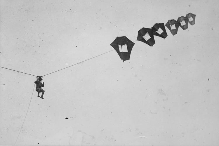
A lieutenant being lifted up in the sky by giant Perkins man-carrying kite. (U.S. National Archives and Records Administration)
Man-lifting kites are, as the name suggests, specially designed kites that can lift humans. Back in the day, when aeroplanes and helicopters were merely the stuff of high-fantasy, these man-lifting kites were the closest that humans could get to their dream of flying. The kites were either used for pleasure and entertainment or more functionally for fast aerial reconnaissance in a battlefield. The man-lifting kites had undergone various stages of development in the past, at the hands of various eminent figures. The 20th-century advent of powered flight, however, put a halt on innovations to these kites.
Man-lifting Kites: An ancient technology
Charting the history of the man-lifting kite takes us back to 6th century China. The records in the Book of Sui tell us of the tyrannical Emperor Wenxuan of Northern Qi. According to the book, he had his prisoners executed by making them attempt to ‘fly’ using bamboo mats while throwing them off a tower. These instances of the man-lifting kite’s use were almost always fatal, except in the case of a prince Yuan Huangtou, as recorded in the Zizhi Tongjian. The prince managed to fly almost 2.5 kilometres from the 33m Golden Phoenix Tower to the Purple Way, where he finally fell.
Another record from the far-east tells us about Ishikawa Goemon, a Japanese thief in the 16th century. He had successfully used the man-lifting kite to steal the golden scales from an ornamental image atop the Nagoya Castle. He had mounted a trapeze attached to the tail of a giant kite, which his accomplices manoeuvred from the ground. In the 17th century, Kawamura Zuiken, a Japanese architect, made use of man-lifting kites to lift his workers during construction.
The most seminal innovation for the man-lifting kite was by George Pocock in 1822. He had initially developed a method of using these kites to lift men to distant hill-tops. In 1822 he revolutionized the arena with his big invention: the kite-drawn buggy. This innovation kindled the interest in further developments to the man-lifting kites and its various utilitarian applications that came about in the 19th century.
Modern development
Baden-Powell’s levitor
Captain B.F.S Baden-Powell, in the early 1890s, designed a hexagonal man-lifting kite, which he named the ‘Levitor’. This was meant for military use for aerial observation, or to lift wireless antenna and other such heavy loads. After George Pocock, the first record of successful use of the man-lifting kite was in 1894, using the Levitor. Baden-Powell had lifted a man 50 feet off the ground using these kites. Since this instance, the Levitor was regularly used to lift men, even up to 100 feet off the ground. It was so successful, that the Levitors were to be used in the Boer War. However, due to the delay in its delivery to South Africa, Baden-Powell’s kites could not be put to use.
Lawrence Hargrave’s box kite
Even before Baden-Powell invented his hexagonal kites, Lawrence Hargrave designed a box-kite in 1885. However, he used this contraption for the first time on 12th November 1894, after Baden-Powell’s revolutionary success. He lifted himself using this kite around 16 feet off the ground from a beach in New South Wales’ Stanwell Park. The entire rig consisted of four box kites that were attached to the ground using piano wires.

Lawrence Hargrave (left) and his associate demonstrating their box kite, 1894. (Wikimedia Commons)
The Bat
In the vein of Baden-Powell’s Levitor, Samuel Cody invented a man-lifting kite for military use. He intended his contraption to be used to observe the enemy forces during the war and named it The Bat. Cody had mounted himself on an early model of the Bat and crossed the English Channel. This garnered much interest from the War Office and he was commissioned to conduct trials through 1904-05. Subsequently, he could lift a test-subject to a record 1.219 metres. The Bat was deployed officially in 1906 and acted as a precursor to the entry of aircraft into the domain. These war-kites would ascend as any other kite would. The descent, however, was in the form of a glider, making it more suitable to violent war-zones. Samuel Cody later modified the Bat into an 8.9kW engine-powered untethered kite.
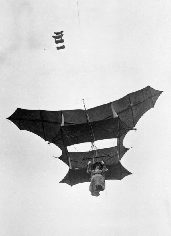
A passenger flying Man-lifter War Kite designed by Samuel Franklin Cody. (Royal Engineers official photographer)
The Hafner Rotachute
The Hafner H.8 Rotachute was designed by Australian engineer Raoul Hafner in the 1940s as an experimental single-place strap-on rotor kite. The Rotachute was intended to be an alternative to conventional parachutes and theoretically, could deploy a soldier accurately in warzones. When hand-launched, these kites tested successful, but there were several issues when dispatched from aircraft, as it ideally would be.

Hafner Rotachute. (Airborne Forces Experimental Establishment)
The Hafner Rotachute underwent up to ten evolutions (till the M.10) in March 1941. The initial Mark 1 had a tubular steel structure, rubber-mounted motor hub, and had a single seat. The Mark 3 version incorporated metal rotor blades. The successfully air-launched M. 10 was a sophisticated design incorporating mass-balanced rotors made of wood, with a rotor-span of 10ft. Despite being a practical design on paper, an occasion to put the Hafner Rotachute to use never came to pass. Around eight of these man-lifting rotor kites were constructed, and they were mostly used to test for future projects, namely the Hafner Rotabuggy.
Hafner Rotabuggy
The Hafner Rotabuggy was developed out of the pre-existing single-seater rotor kite called the Hafner Rotachute, both designed by Raoul Hafner. The Hafner Rotabuggy is also known as the M.L. 10/42 Flying Jeep, or Malcolm Rotaplane. It was originally manufactured as an experimental aeroplane that combines the key features of a Willy MB and a rotor kite. The Rotabuggy was intended to air-drop off-road vehicles.

Hafner Rotabuggy. (Aeroplane and Armament Experimental Establishment)
On November 16, 1942, the Rotabuggy was tested for the first time. However, the Diamond T lorry that was towing the unit was unable to pick up enough speed to launch the Rotabuggy into the air. The lorry was later switched for a supercharged Bentley vehicle, and on November 27, the Rotabuggy finally had a successful takeoff. The Rotabuggy also went through many stages of evolution, just like its predecessor. Stabilizing any vibrations, increasing the highest attainable speed, changing up the towing vehicles, and so on, resulting in a fully functional model. The machine was at its peak when launched by Whitley Haydrian and Airspeed Horsa, and flew at 400 ft-65 mph for over 10 minutes. It all went downhill when the Rotabuggy could not maintain its popularity with the onslaught of gliders in the 21st century. The gliders could transport entire vehicles with ease, and the need for the Rotabuggy had passed. No further models of this hybrid man-lifting kite were created. A duplicate model of the Rotabuggy can still be seen in the Museum of Army Flying in Middle Wallop.
The Rogallo Kite and its significance
Francis Rogallo, an aerospace engineer invented the Rogallo Wing which was developed with the help of wind tunnel testing. These Rogallo Wings were later integrated into man-lifting kites by NASA. These kites were generally propelled by ground or (later) aero vehicles. Similar to Cody’s design, the Rogallo kite also released the passenger into a controlled gliding descent.

Rogallo’s flexible wing. (NASA)
The hang-gliders, developed subsequently, were actually versions of man-lifting kites. They were evolved from the gliding descent employed by the Rogallo Kite and the Bat. While Barry Hill Palmer’s hang gliders (using Rogallo Wings) were thriving, so were other versions made by John Worth, Mike Burns, and James Hobson. Almost all of these versions were in use parallelly in the ’60s till it was standardized later.
John Dickenson used a version of the Rogallo Kite, to tow himself while on a boat in September 1963. These Ski Wing water ski kites also had elements of the Ryan Aeronautical flex-wing aircraft. The stability of this design actually helped popularise the watersport in the ’60s and ’70s.
Alexander Graham Bell’s contribution
Alexander Graham Bell, amongst the plethora of ground-breaking work that he did, also created a tetrahedral man-lifting kite. His design employed sticks arranged into triangular ‘cells’, the overall appearance akin to a honeycomb. Bell’s model soon evolved from a one-cell design to the “Cygnet” model of the early 1900s comprising 3,393 cells. This gigantic kite was used to successfully lift a man 186 ft above sea-level. The success of the Cygnet led to speculation about using it for observation in the Arctic. However, the relevant trials were yielded unsatisfactory results and the plan was shelved.
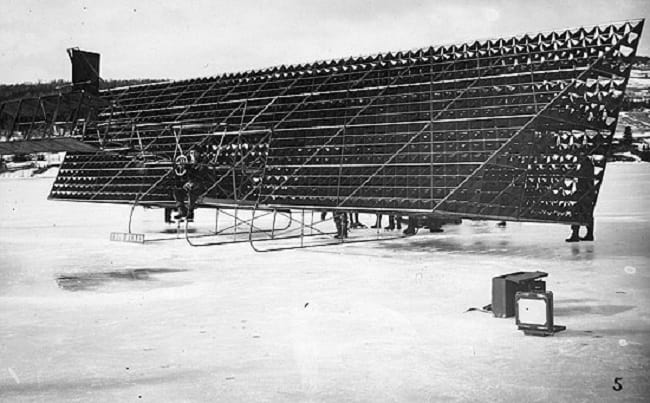
The Cygnet II, designed by Alexander Graham Bell. (SDASM Archives / Flickr)
The decline of the man-lifting kite
The decline of the man-lifting kite started with the advent of powered flight. The contraption still remained in the mainstream for a while, with the design modified to lift heavy weights. However, the Wright Brothers’ first flight in 1903, was a step ahead in the development of cutting-edge aerial transportation. The need for man-lifting kites soon took a backseat. The man-lifting kites that allow un-tethered flight still survive today in the form of hang-gliders and paragliders used for adventure sports.
Enjoyed this article? Also, check out “Franz Reichelt: Dressmaker Who Jumped off the Eiffel Tower Experimenting with Self-Designed Parachute-Suit“.
Fact Analysis:
STSTW Media strives to deliver accurate information through careful research. However, things can go wrong. If you find the above article inaccurate or biased, please let us know at [email protected].
RELATED
- June 26, 2019 The Concorde Jet: The Golden Run and Tragic Fall of the Legendary Aircraft
- December 29, 2018 Vaimanika Shastra – Treatise on Ancient Indian Flying Machines or Pseudoscience?
- September 16, 2018 Yakhchal: The Indigenous Fridge of Middle-East
 January 11, 2019 The Curious Disappearance of the Baghdad Battery: A Parthian Period Relic, An Oopart
The post Man-lifting Kites: Ancient China to Modern Adventure Sports appeared first on .
]]>The post MS The World: Life on Board the World’s Largest Residential Cruise Ship appeared first on .
]]>
MS The World. (Bob Adams / Flickr)
The World is a privately-owned, 644-foot, luxurious, residential ship. It is a floating home with a private veranda from where residents can view constantly changing scenery.
About MS The World
Knut Utstein Kloster first came up with the idea of a residential ship. He is a Norwegian shipping magnate whose family successfully runs various cruise ships. The Swedish company Öresundsvarvet built the ship’s hull in Landskrona, and Mekaniske Verksted of Rissa, Norway, made the other parts. The ship officially launched in March 2002 in Oslo.
Residensea, a business based in Miramar, Florida, USA, operates MS The World, and they have registered the ship in the Bahamas. The ship’s home port is Port Everglades in Fort Lauderdale, Florida.
Alongside Residensea, the ship’s residents are involved in its management. They have an elected board of directors and a number of committees. These decide what types of activities will be available to the residents, the sea and ocean routes the ship is going to follow, in which countries and ports the ship is going to dock and for how long, and how to manage the ship’s finances.
Their responsibilities also include managing over 250 staff members that are necessary for operating and maintaining the ship, providing services such as housekeeping, and managing the other facilities on the ship.

The World cruise liner in Spain. (Rab Lawrence / Flickr)
Residences on MS The World
Residents of the ship enjoy a rich and exclusive lifestyle. There are only 165 individual residences on the ship. These are categorized into four types, ranging in size from 1,350 square feet to 3,200 square feet. Designed in different configurations, the residences and other facilities are spread across 12 decks and are accessed by six elevators.
There are studio residences with one or two bedrooms and a lounge-kitchenette and two-bedroom residences with kitchen and spacious dining area. Also, there are three-bedroom residences with a foyer and gourmet kitchen.
All these residences have stylish and comfortable modern décor that includes en suite bathrooms, spacious living rooms, and verandas. Furthermore, the residences also have all modern amenities like internet and high-quality audio and video systems.
People from over 40 countries own residences on the ship. Some of them live onboard all year round, while some come aboard only for specific durations. Some residents often rent out their residences. At any time, at least 200 people are resident on the ship.
Food and drinks on MS The World
If residents don’t feel like dining in one of the six restaurants on board or cooking a meal themselves, a master chef will prepare one especially for them in the resident’s kitchen. All the chefs on The World can cook a variety of international cuisines with the best ingredients.
When the ship is in port, the kitchen staff visits the local markets to buy fresh and indigenous ingredients. Any of the residents, who are interested in food, can accompany the staff to the local markets to expand their culinary knowledge and to get acquainted with the local food culture. The staff also arranges local dining experiences.
The Beverage Team creates unique cocktails with local fruits and spices, so the cocktail menu changes at practically every port. Residents can drink cocktails in several lounges and bars on board.
The ship also offers an extensive wine list for residents to choose from. The management often invites winemakers on board to discuss the wine production with the ship’s residents and arranges for visits to vineyards for wine-tasting and fine dining. When buying new wines, the staff always considers the wines that the residents prefer.
Onboard activities on MS The World
Since there are plenty of things to do on board, there is little likelihood of the residents getting bored. There are many activity areas and rooms as well as shops on two decks of the ship.
There is a well-stocked grocery store and a boutique for clothes. In addition, residents can get beauty treatments at the health spa and sauna, meditate in the relaxation room, and pray in the religion room Harmony.
There is also a full-size tennis court, a billiard room, a gym, a yoga room, a jogging track, and indoor and outdoor swimming pools. Moreover, there is a golf centre with hi-tech simulators. For those interested in golfing or diving, the ship’s staff can recommend the best courses and dive spots at the places the ship is going to dock.
Residents can watch films in the full-size theatre Colosseo, read books in the library, gamble in the casino, and dance in the nightclub. There is even a theatre for live music performances.
The business room has the usual telecommunication facilities for residents to conduct business meetings. A licensed stockbroker is also available to facilitate stock market transactions.
The ship has a helicopter landing pad for residents who wish to hire a helicopter to transport them when the ship is docked or near land.
In some ports, residents can launch sailboats and kayaks from the ship’s retractable marina deck.
Besides all these activities, residents can take classes to learn languages, dancing, cooking, music, photography, and lots more.
Expeditions from MS The World
The staff arranges expeditions to locations that are likely to provide the residents with new cultural experiences. Residents can get to know diverse biological environments, observe exotic flora and fauna, and learn about local history. Industry experts in these areas help organize these expeditions and give talks on related topics. With this available knowledge, residents find it more fascinating to explore new areas, participate in local festivals, and observe wildlife. Many of the residents maintain blogs about the expeditions as well as life onboard.
Some of The World’s noteworthy expeditions include the Northwest Passage and the Bay of Whales. In 2012, the ship followed the route of Roald Amundsen who, in 1906, was the first sailor to go through what is now called the Northwest Passage from Nome, Alaska, to Nuuk, Greenland. The World is also the first cruise ship to navigate south into the Bay of Whales in the Ross Sea, Antarctica.
For the exclusive group of very rich people who live on the ship, The World is indeed the world where life and business go hand in hand in restful luxury.
Enjoyed this article? Also, check out “Seawise Giant: The Enormous Vessel That Remains the Biggest Man-Made Ship Ever Built“.
Official Website:
The World: Residences at Sea
Fact Analysis:
STSTW Media strives to deliver accurate information through careful research. However, things can go wrong. If you find the above article inaccurate or biased, please let us know at [email protected].
RELATED
- December 9, 2018 CSCL Globe: The Largest Container Vessel in the World, Until MSC Oscar Usurped its Ranking
- July 6, 2018 Seawise Giant: The Enormous Vessel That Remains the Biggest Man-Made Ship Ever Built
- April 6, 2020 USNS Comfort: A Ship of Hope Amidst Corona Crisis
- September 19, 2019 Sea Shadow (IX-529): The Story of Surreal Stealth Ships Which Defy the Enemy’s Stranglehold and Strike
The post MS The World: Life on Board the World’s Largest Residential Cruise Ship appeared first on .
]]>The post Yemen’s Ancient Town of Shibam is Also Known As ‘Chicago of the Desert’ appeared first on .
]]>
The high-rise buildings made of mud-bricks at Shibam. (Jialiang Gao)
Deep in Yemen’s desert valley, lying about 588 km from capital Sana’a, is the over 1700- years-old fortified town called Shibam. In the western world, the town is known as ‘Chicago of the Desert’ or even the ‘Manhattan of the desert’.
Shibam’s tall houses that are made of sun-baked mud bricks impressively raise up to seven storeys out of the edge of the cliff of Wadi Hadramaut. Surrounded by a wall, the 16th-century town is a very old example of a perfect urban planning thanks to its principle of vertical construction.

Shibam surrounded by a wall. (Dan / Flickr)

The mud skyscrapers of Shibam. (Dan / Flickr)
Key caravan halt on the incense and spice route
Shibam, which is an ancient town, is a key caravan halt on the incense and spice route in the southern Arabian plateau. The town, which has a rectangular grid plan of streets and squares, has been built on a rocky terrain above the Wadi bed.
Interestingly, beneath the town lies another settlement that got partially washed away by massive floods sometime in 1533. The original settlement at Shibam belongs to the 13th century. An unnamed castle that belongs to that era still exists in the walled town. There also exists a mosque, simply known as the Friday Mosque which dates back to the 9th to 10th centuries.

The Friday mosque, Shibam. (Dan / Flickr)
The ancient town has its origins in the pre-Islamic period. In 300 AD another city named Shabwa was located further west to Shibam along the wadi. It got destroyed in the floods. Later, when the local traders returned from the Asian markets, they moved the settlement to the present location, i.e. inside the walled town. Since then the new town developed and expanded onto the southern side of the wadi. At this stage, Shibam became the capital of the Hadramaut region.
Commune for warring families
Shibam originally started as a commune for warring families who were seeking prestige, power, and protection from thieves, mainly Bedouin. The idea of tall stacked housing was the architectural norm of the day that solved the problem of becoming weak from attack.
The stacked housing idea is a historical one. It is a fantastic piece of engineering. According to Salma Damluji, the use of sun-dried mud bricks is an important technique that withstands any type of natural climatic challenge. Salma Damluji is an expert on the traditional architecture of Arabia.
Sun-dried mud bricks slow the pace at which the room temperature within the building changes. They are also cheap to produce and are reusable. Interestingly, the mud brick architecture is found across West Asia. Egyptian architect and intellectual Hassan Fathy was one of mud brick architecture’s greatest champions.
Shibam a World Heritage site
Shibam has been designated a UNESCO World Heritage site.
In addition to the mud bricks, other unique features of Shibam include wooden windows. Apart from providing privacy, they also alter the course of Sun glare and provide improved air circulation.
Narrow streets in the town and its open plazas also improve air circulation. The architecture of Shibam, therefore, provides a complete and uniform approach to urban planning.

The narrow streets of Shibam. (Jialiang Gao)
During the 19th century, when spice traders used to return from Asia, the walled town of Shibam was getting regenerated and expanded to form a suburb named al-Sahil. Shibam town and the Wadi Hadramaut are a great example of how humans settled in the area with the help of exciting town planning and unique land use.
Arab’s traditional culture
The local Hadrami urban architecture of the town with its visual impact through design, materials and building techniques is a unique expression of the Arab’s traditional culture.
The land around the walled town is still used for agriculture and generation of mud for construction purpose. As such this is part of an integrated form of the economic process in the region.
The many multi-storeyed buildings in the town with hardly any windows at the ground level are a testimony to its defensive character. But of late, the social and economic changes witnessed the world over are threatening the homogenous society in the ancient town.
Urban planning highlights Hadrami history
Interestingly, the historic town’s exemplary urban planning highlights the important period of Hadrami history between the 16th and 19th centuries.
The town, which is located between two mountains close to the giant flood wadi, is basically isolated and far away from another urban settlement. Shibam, therefore, is preserving the last surviving evidence of a traditional society that is dependent on agriculture.
Threats to the town
The only distressing threat the town faces is the flood. It may happen at any time posing a threat to the authenticity and integrity of the walled old town. In October 2008, the town faced one such disastrous flood.
In order to protect and preserve Shibam’s cultural identity, Yemen has two strong laws, i.e. Antiquities Law (1997) and the building law (2002). Yemen has also come up with a new protection law in the guise of the Historical Cities Preservation Law.

Residents of Shibam playing in Wadi Hadhramaut. (Raphaël Fauveau)
Master Plan for the ancient town
Under the Urban Conservation Plan, Yemeni authorities also developed a city Master Plan for the ancient town. In 1990, established the General Organisation for the Preservation of Historic Cities in Yemen (GOPHCY) to manage and safeguard historic cities in the country.
Meanwhile, to improve Shibam’s overall economic, physical and social conditions a branch of GOPHCY is working with GIZ. The two organisations have managed to benefit local people under the housing rehabilitation programme.
As per a brief of the UNESCO, Shibam is the home of the world’s first multi-storied apartment buildings. It has also become a symbol for the rise, fall and rise of West Asian culture in the isolation of a desert environment.
Enjoyed this article? Also, check out “Kangbashi, Ordos – Ghost City? Economic Ingenuity? Or Both?“.
Fact Analysis:
STSTW Media strives to deliver accurate information through careful research. However, things can go wrong. If you find the above article inaccurate or biased, please let us know at [email protected].
RELATED
- October 11, 2018 Socotra Island of Yemen: The Most Alien-Looking Place on Earth
- September 2, 2020 Sana’a, Yemen: The Cradle of Arabian Ancestry
- April 6, 2018 Kangbashi, Ordos – Ghost City? Economic Ingenuity? Or Both?
 September 6, 2018 Exploring the Enchanting Mont Saint Michel
The post Yemen’s Ancient Town of Shibam is Also Known As ‘Chicago of the Desert’ appeared first on .
]]>The post Sea Cucumber: The Modest Marine that Needs to be Protected appeared first on .
]]>
Thelenota ananas, a steadily decreasing endangered species of sea cucumber. (Aexander Vasenin / Wikimedia Commons)
In nature, there are no superior or inferior life forms. All living creatures are equally important for the environment. A creature that’s meek, easy to hunt, and high on man’s greed list, can go extinct, endangering the host ecosystem. This seems to be happening to some species of sea cucumber. In the Malayan language of Malaysia, Brunei, Singapore, Indonesia and southern Thailand, this marine fish is also known as Trepang.
It’s a cousin of starfish and sea urchins
Sea cucumber is found in the Indo-pacific region of the ocean. That includes parts of Africa, Japan, China, Australia and Mariana Islands. Generally, sea cucumber lives in shallow lagoons, reefs and rubbles, searching food in the sand at the bottom of the ocean. It belongs to a group of marine animals called Echinoderm, and its body size varies from 0.75 inches to 6.5 feet. Starfish and sea urchins are other members of this group.
Typical echinoderms have a radial body symmetry. But the body symmetry of sea cucumber is bilateral, i.e., it has a well defined dorsal and ventral side. Grossly, the body is cucumber-shaped, muscular and flexible. When threatened, it shoots out sticky threads from its body to entangle the enemy. It can mutilate its body and shoot internal organs out through the anus in self-defence. Organs thus wasted in self-defence can regrow, and the organism is once again its normal self.
Conservation efforts ignored in favour of big fishes
The tenacity of this marine animal, however, has failed in the face of human greed. The popularity of sea cucumber, as food and drug in the Asian continent, has led to its indiscriminate fishing. Consequently, many species are on the verge of extinction. But alarm bells don’t seem to be ringing. Maybe conservation is focussed more on sharks, whales and other trendy fish. Some varieties of sea cucumber, in the meanwhile, are exposed to a real threat of extinction.

Elephant Trunkfish (Holothuria fuscopunctata) a least endangered species of sea cucumber. (François Michonneau / Wikimedia Commons)
Keen market demand spelled doom for the sea cucumber
Some species of sea cucumber sells from US$ 10 to US$ 600 per Kg in Hong Kong and China. The cold water variety of it sells for US$ 3,000 per Kg dry matter. Demand for the fish rose with the rising prosperity in China. Consequently, hunt for the sea cucumber intensified in more than 70 countries. Wild Trepang was extensively fished from the seashores of poor countries.
Currently, the International Union for Conservation of Nature (IUCN) deems 7 species of sea cucumbers (from a total of 371 species) as endangered and 9 species are vulnerable. High market demand for sea cucumbers has consistently depleted the population of these hapless creatures. Fishermen were paid well, and in advance, hence they went all out fishing and damaging the marine ecosystem. After tapping the natural habitat of required variety, other virgin waters were searched and exploited to the hilt. Thus, the market demand was met. Marine resource of the economically poor nations was exploited to the detriment of sea cucumber. Hence, the rich countries were advised to help poor nations through means other than poaching on the latter’s wealth of Trepang fish.
Sea cucumbers must survive for the health of marine life
The conservation of the sea cucumber is vital for the health of the marine ecosystem. It scavenges on the sand of the sea floor. Dead organic matter mixed in the sand is used up as food and the ingested sand is expelled through the anus as excreta. The excreta act as food for other sea organisms. The alkalinity of the Trepang excreta reduces pollution-induced acidity of seawater and thereby helps in keeping the marine ecosystem in good shape.
Sea cucumber as food
The existential crisis for some species of sea cucumber hasn’t come a day too soon. The countdown began as early as the 17th Century when Trepang fishing became big business in the islands of South East Asia. Sea cucumber was hugely popular in China as food and as an aphrodisiac. Huge market demand from China made the Makkasar town (Indonesia) a nodal centre for trading in the sea cucumbers.
Catching the sea cucumber is easy; no special skill or gadget is required. A feel with bare feet can locate the muscular creature in shallow waters. It is then taken out either by clutching with bare hands or by aimed stabbing in water. Trepangs were easily impaled using a multi-pronged spear. Weights were attached to spear to make it heavy and fall steadily down in the water and stab sea cucumbers.

Sea cucumber gourmet. (Max Pixel)
The rising demand of sea cucumber in 1980s and 1990s led to the fishing of its deep sea varieties. This is done with the help of compressor diving. A recent report of FAO reveals that major sea cucumber reservoirs worldwide are depleting at an alarming rate. Not surprising, considering that worldwide demand for it, as food and medicine, recorded a sharp increase in the 20th century.
Hopefully, the 21st century should see some positive developments towards conservation of sea cucumbers. Fishing them prudently would obviously be the first and foremost step in this direction. That alone will ensure an adequate supply of sea cucumber for human food, as well as a healthy environment for plants and animals living in seawater.
Enjoyed this article? Also, check out “Proboscis Monkey: The Rare Borneo Monkey Species with an Unusually Long Nose to Lure Its Females“.
Fact Analysis:
STSTW Media strives to deliver accurate information through careful research. However, things can go wrong. If you find the above article inaccurate or biased, please let us know at [email protected].
RELATED
- March 16, 2019 An Up-Close and Personal Encounter with the Alien-Like Pacific Barreleye Fish
- January 8, 2019 Proboscis Monkey: The Rare Borneo Monkey Species with an Unusually Long Nose to Lure Its Females
- November 5, 2018 2004 Indian Ocean Earthquake & Tsunami: Remembering the 230,000 People Killed in Its Wake
- November 4, 2019 Goblin Shark: The Alien Shark of the Deep Sea, with a Slingshot Mouth
The post Sea Cucumber: The Modest Marine that Needs to be Protected appeared first on .
]]>The post Chand Baori: A Quaint Remnant of the Past appeared first on .
]]>
Chand Baori in Rajasthan, India. (Doron / Wikimedia Commons)
Located in the tiny village of Abhaneri in eastern Rajasthan, India, is the deepest stepwell in the world- the Chand Baori. This beautiful structure was built over a thousand years ago by King Chanda in the 9th century. Nobody is quite sure of its exact utility, apart from the obvious water-harvesting. Its location opposite the Harshat Mata Temple has led to the conjecture it might have had religious importance. Though the gigantic structure is not a functional well anymore, it has become a tourist attraction for its fascinating geometry. The stunning historical monument is under the protection of the Archaeological Survey of India (ASI).
What is baori?
The word ‘baori’ or ‘bawdi’ is used to refer to these unique stepwells found exclusively in this part of the world. Stepwells were a very popular method of water harvesting, along with the step-pond, back in the day. The stepwells usually have a very deep and well-rounded bottom to reach the low groundwater levels in the desert. Its narrow shaft is generally protected from direct sunlight by partial roof. A stepwell often developed into a mini-oasis with temples or shelters built into the complex.
The decline in the use of stepwells came about with the British Raj. The British colonists were appalled by the lack of sanitation. The same wells were used for bathing as well as to draw drinking water. Consequently, new stepwells were hardly built, and the existing ones were left to dry and decay. Soon, modern technology replaced the need for stepwells at all.

Inscription by the Archaeological Survey of India at Chand Baori. (Ajay Parikh 103 / Wikimedia Commons)
Structure of Chand Baori
The Chand Baori is a square structure, with each side measuring to 35 metres. From three sides, descend a series of 3,500 slender steps which go down 20 metres to the very bottom. This well has 13 levels and would have provided water year-round despite being located in an arid region. The mathematically precise geometrical structure of the baori is noteworthy, especially in that age. The symmetrically arranged steps create an intricate chiaroscuro effect that looks visually stunning. The stairs taper down to create an almost inverted pyramid shape. Interestingly, the temperature reduces as you go further down. The lower levels of the well are around 5 degrees cooler than the ones above.
The fourth side of the stepwell has a pavilion with a three-storeyed palace. It has intricately carved ‘jharokhas’ or hanging galleries, mounted on pillars, with two small balconies projecting out. This pavilion houses a lot of stunning sculptures as well. Incidentally, the rooms of this palace are inaccessible to tourists. The stairs have railings as well and visitors are not allowed to climb down beyond a point. The entire baori is housed within a rectangular complex, similar to a courtyard.

Chand Baori. (Mukamian98 / Wikimedia Commons)
The history behind Chand Baori
The stunning Chand Baori Complex was built by Raja Chanda of the Gujara Pratihara clan, whom it derives its name from. This clan claims to have descended from Lord Laksmana, the younger brother of Lord Rama. The Baori was built right at the cusp of the Golden era of this clan.
The adjacent Harshat Mata Temple, a shrine to the Goddess of Happiness, provides context to the stepwell’s construction. The baori facilitated the Hindu tradition of washing hands and feet prior to entering a place of worship. The temple itself was razed in the 10th century by Mahmud Ghazni. The ruins still provide an insight into the traditional architecture and sculpting techniques of Ancient India. A rebuilt temple within the complex is now dedicated to Goddess Durga. The complex had a lot of structural additions in the later periods by the Mughals. The compound wall around the baoli, galleries, and cusped arches in the palace on the pavilion are all Mughal structures. These provide a very stark contrast to the sculpting style and trabeated arches used by the Chauhan rulers.

The entrance to Chand Baori. (Mukamian98 / Wikimedia Commons)
Folklore behind Chand Baori stepwell
Apart from its stellar architectural and historical significance, the Chand Baori is also known for the folklore attached to it. Over the years, it has garnered quite the reputation as a haunted spot. The hundreds of shrieking bats inside the well’s shaft only add to the atmosphere. The famously haunted Bhangarh Fort is also on the route to the stepwell, just a few kilometres away. Thus, the Chand Baori has become a popular spot for horror enthusiasts and paranormal researchers. Legend has it that this monumental structure was built over the span of a single night- clearly inhuman feet. The locals put it down to the handiwork of a Djinn. Another lore says that a person going down the stairs cannot use the same steps to climb back up. Seemingly impossible, eyewitness accounts prove it is indeed impossible to climb back up using the same set of slender steps.
The interesting architecture of the Chand Baori has featured in popular movies such as Bhool Bhulaiya in Bollywood and The Dark Knight Rises in Hollywood. Its marvellous geometry has been a part of many notable accounts, such as that of Louis Rousselet, the famous French world traveller, and Morna Livingston, in her book Steps to Water: The Ancient Stepwells of India. Yet, it has hardly found a spot in the annals of history, for posterity to remember it by. The Chand Baori is definitely one of the hidden gems worth checking out in the historic city of Rajasthan, brimming with culture and heritage.
Enjoyed this article? Also, check out “Adalaj Stepwell: A 500-Year-Old Architectural Masterpiece With a Tragic Tale of Unrequited Love, Sacrifice And Loss“.
Fact Analysis:
STSTW Media strives to deliver accurate information through careful research. However, things can go wrong. If you find the above article inaccurate or biased, please let us know at [email protected].
RELATED
- July 15, 2019 Adalaj Stepwell: A 500-Year-Old Architectural Masterpiece With a Tragic Tale of Unrequited Love, Sacrifice And Loss
- August 5, 2019 Karni Mata Temple: Where Thousands of ‘Immortal’ Rodents Roam Free to Bless Visitors with Good Luck
- January 12, 2019 Kumbhalgarh Fort: Not Only China But India Too Has Its Own ‘Great Wall’ Built Centuries Ago
- June 14, 2019 Padmanabhaswamy Temple: The Richest Temple in the World with Gold Worth $22 Billion in Six Vaults
The post Chand Baori: A Quaint Remnant of the Past appeared first on .
]]>The post Leonardo’s Robot: Leonardo da Vinci’s Mechanical Knight and Other Robots appeared first on .
]]>
A recreation of Leonardo’s robot or mechanical knight based on his drawings. (Erik Möller / Wikimedia Commons)
Leonardo da Vinci, one of the greatest geniuses of the Italian Renaissance, designed and constructed a mechanical knight way back in 1495. According to historical sources, this mechanical knight was capable of humanistic movements.
Leonardo da Vinci — Genius of the Italian Renaissance
The Italian Renaissance was one of the greatest epochs in human history. During this period, there were extraordinary developments in art, sculpture, architecture, philosophy, literature, and many other human endeavours.
A rediscovery of Ancient Greek and Roman cultures—from surviving works that Islamic scholars had preserved as well as surviving art and sculptures— influenced and inspired most of the artists, sculptors, architects, writers, philosophers, and other intellectuals. Using the Greek and Roman works as their base, they built further on these to create astonishing masterpieces.
As you might expect, there was no dearth in geniuses engaged in these activities, but Leonardo da Vinci is a personality that still manages to tower over everyone.
In terms of output, he was not actually as prolific as some of his contemporaries. A restless spirit, he had a mind that overflowed with so many ideas that he didn’t have the time to bring them all into fruition. He painted only a few paintings, most of which are now very well-known, like the Monalisa, the Last Supper, and The Virgin and Child with Saint Anne. His fame rests on these as well as on the fact that he was a very multi-faceted man.
Apart from art, he could turn his hand at architecture, mechanics, armaments, and more. His many surviving notebooks are filled with designs and ideas. Some of which were advanced not only for his time but come across as amazing in ours as well.
Leonardo da Vinci’s mechanical knight
In 1957, the researcher Carlo Pedretti discovered some of Leonardo da Vinci’s sketchbooks that contained design notes for a mechanical knight. While there isn’t one single complete drawing of the mechanical knight—if Leonardo da Vinci made a complete drawing, it didn’t survive over the ages—there are many fragmented details of the design in various sketchbooks.
Historical accounts had already mentioned da Vinci’s famous Automa cavaliere that is Automaton knight. However, most people assumed these stories were exaggerated. The discovery of the notebooks proved this was not so.
Leonardo da Vinci designed the mechanical knight to impress his patron Ludovico Sforza, who was the ruler of Milan. In 1495, Ludovico Sforza had a pageant at his court and asked Leonardo da Vinci to oversee all the arrangements of the celebration. The latter, of course, outdid himself when he unveiled his mechanical knight at this gathering. Apparently, it left everyone there thunderstruck. They had never imagined seeing a machine that resembled an anatomically correct knight and, moreover, moved like one too.
Design of Leonardo’s robot
It is well-known that Leonardo da Vinci carried out extensive anatomical research. He even dissected cadavers and made detailed drawings of their interiors. As a result, he developed a deep understanding of the human body. He was able to figure out that it was the muscles that enabled the bones and joints to move.
When he designed his mechanical knight, he made sure it was anatomically correct. The knight has proportionate limbs and joints that follow the Canon of Proportions that Leonardo noted in the Vitruvian Man. Furthermore, he tried to incorporate the way human muscles worked into the design.
Clad in medieval German-Italian armour, Leonardo’s robot could move its arms and raise its own visor and wave its sword. It could also move its jaw and neck. Furthermore, it could sit, stand, lie down, and walk. These robotic movements were very advanced and human-like for that period. In fact, we can say that the mechanical knight was the first humanoid robot that the world ever knew.
How Leonardo’s robot worked
Known as Robot di Leonardo or Automa cavaliere, that is Automaton knight, the machine used two elaborate and connected systems made up of pulleys, cables, gears, and wheels to move. In his article ‘The da Vinci Robot’, Michael Moran tells us that one of these systems was a four-factor one and was used for the movements in the hands, wrists, elbows, and shoulders. Leonardo fitted this cylindrical system into the knight’s chest. The other system was external and tri-factor, and it was used to move the ankles, knees, and hips. All the movements were to the drumbeat.
Modern reconstructions of Leonardo’s robot
In 1996, Mark Rosheim, a modern-day researcher and robotics expert, studied Leonardo’s different design notes for the mechanical knight. Later, in 2002, he used them as blueprints to replicate the mechanical knight. Amazingly, he found that it worked exactly like the historical accounts had said it did.
In addition to creating a model of Leonardo’s robot, Mark Rosheim also used some of his design ideas to build robots for planetary exploration for NASA.
You can find how Rosheim built the mechanical knight as well as other of Leonardo’s robots—a programmable cart, a bell-ringing automaton, and a lion—in his book “Leonardo’s Lost Robots.”
There is also a research group of Leonardo da Vinci aficionados called Leonardo3. They have also engaged in discovering, interpreting, and reconstructing Leonardo da Vinci’s inventions.
Their book “Leonardo da Vinci’s Robots” contains reproductions of Leonardo’s original designs and manuscripts. Further, along with this book, Leonardo3 offers a kit with which you can have a go at building Leonardo da Vinci’s programmable cart yourself.
Other robots designed by Leonardo da Vinci
As mentioned above, Leonardo da Vinci used his engineering skills to design other robots as well. These include a mechanical lion that, like the knight, was capable of movement. It could walk and, supposedly, could also hold and offer flowers. While there are no eye-witness accounts of this lion, Leonardo apparently designed it for Guiliano de Medici to be given as a gift to the King of France. In 2009, the French museum, the Château du Clos Lucé and Parc, built a modern version of this lion.
Leonardo da Vinci was an incredible man for any age. His ideas and designs of robots have considerably aided the development of modern robotics. It is interesting to wonder about the things he might have achieved if he had access to many of our modern conveniences.
Enjoyed this article? Also, check out “The Turk: The 18th Century Automaton Chess Player was a Fore-Runner of Computer Age“.
Fact Analysis:
STSTW Media strives to deliver accurate information through careful research. However, things can go wrong. If you find the above article inaccurate or biased, please let us know at [email protected].
 Recommended Read:
Leonardo’s Lost Robots | By Mark Rosheim
Genre:
Non-fiction > Science
RELATED
- November 4, 2018 The Turk: 18th Century Automaton Chess Player was a Forerunner of Computer Age
- July 27, 2019 Wind in the Willows: The Singing Ringing Tree
- January 9, 2019 Peacock Clock: An 18th Century Automaton Marvel
 February 22, 2019 The Summoning of Demons: The Dangers of Artificial Intelligence
The post Leonardo’s Robot: Leonardo da Vinci’s Mechanical Knight and Other Robots appeared first on .
]]>The post The Rise and Fall of the Victorian Era Creepy Therapeutic Treatment Called Electric Bath appeared first on .
]]>
Representation of high voltage electric bath. (Double-M / Flickr)
In the early to mid-Victorian era, doctors are said to have used electric bath for medical treatment in a big way. For this purpose, a high voltage electrical apparatus was used to pass electricity through a patient’s body to heal certain diseases.
When the apparatus activates energy, it builds up an electric charge inside a patient’s body. The idea was to help cure certain diseases.
Electrify a patient with electrodes and water
Golding Bird. (Associated Medical Journal)
As British doctor Golding Bird once said it was common in the Victorian era to electrify a patient if his ailment refused to yield to any treatment. He then said instead of going through a well-defined system, medical doctors of his era were keener on an electric bath cure.
Dr Bird was known for his work in the medical uses of electricity and the related subject of electrochemistry.
To common people, however, the concept of electrotherapy appears as a creepy therapeutic treatment or even torture. According to medical practitioners of the Victorian era, live metal electrodes inside a small pool can heal a patient. In simple terms, this is known as an electric bath.
People are generally scared of electricity and water mixing together. Though creepy, it appears this method of treatment works.
First recorded medical treatment using electricity
Apparently, in 1767, the first recorded medical treatment using electricity took place in London Middlesex Hospital. A special device was used for treatment. A few years later, St. Bartholomew’s Hospital purchased a similar device for treating patients.
The concept of an electric bath, also known as electrotherapy, is not uncommon in Japan. For centuries, the Japanese have been using this therapy as an alternative treatment method. Called ‘denki buro’, the concept of electrotherapy has become a public bath culture in Japan since the 1920s. Even today, one can find Denkiburo in several Japanese baths.
A Denki buro is a small pool that has live metal electrodes that pass low-powered electric current inside the human body. The electric current stimulates gentle shocks inside the body. This causes the muscles to contract and gives a tingling sensation to the human body.
Benefits of electrotherapy
There are several benefits of electrotherapy. Some of the benefits include relaxation from pains like back, muscle, rheumatism and spondylitis. Though not scientifically proved, the electric bath also provides relief from headaches, migraines and disorders like a nervous breakdown and neuromuscular dysfunction. As the electrical energy from the electrodes stimulates human nerves. It then transmits signals from the affected areas to the brain to scramble or block the pain.

A man undergoing hydroelectric bath to treat his both feet and right arm. (Wellcome Collection)
In order to not get the shock of your life, the amount of electricity that is actually used in electric baths is just enough to stimulate the muscles. Also, there are various factors on which the impact of the stimulation or shock depends on.
Two key factors in electrotherapy
There are two key factors that prompt electricity to either stimulate or shock the patient. Factor one is the mineral composition of the water. Factor two depends on how close the patient gets to the electrodes in the water.
However, generally speaking, the output frequency of the electrodes can be 50Hz to 1kHz and the output voltage can be 3 to 10V. Finally, the output current can be 1 to 10mA.
Franklinization
This kind of electric bath or electrotherapy came to be known as Franklinization in the United States of America, thanks to Benjamin Franklin.
This process of treatment was most popular in the US during the mid 18th and the early 19th centuries. Dr Golding Bird, who was associated with Guy’s Hospital brought the treatment process into the mainstream in the US.
Different type of medical device in the US
In the US, neurologists and other medical practitioners were using a different type of medical device for administering the electric bath. They used a device that was called a frictional electrical machine.
In this process, the patient would sit on a wooden stool, and the two were insulated from the ground with the help of a platform having glass legs. Alternatively, the patient was made to lie down near the device.
Then with the help of direct connection, the patient would then be charged with static electricity. Alternatively, with the help of electrostatic induction system, a large electrode would be held close to the patient’s body.
Such a treatment could extend to several hours, and usually, the electric tension applied to the patient’s body would be 30–50 kV. In this process, the patient would be bathed in electricity in a dark room to avoid extremities to the patient’s hair.
This kind of treatment was causing the patient to turn warm and sweat. His heart rate too shot up considerably, while the patient’s hair usually stands on its end.
Other types of electric bath treatments
There were some other types of electric bath treatments in the medical world. One such type was the galvanic bath treatment. In this treatment, gentle electric waves and water were used together. Doctors used to make the patient lie in the water that was heated up to 34 degrees Celsius. Then the electric waves were gently passed through the patient’s system.
This type of treatment was more useful for ailments like inflammatory arthritis and joint problems.
In some other types of treatments, the patients were given a full body immersed treatment. The patient’s body would be slipped into the water completely. Then there was also the four-chamber galvanic baths system, which supposedly improves blood circulation, minimises pain and benefits rheumatoid arthritis patients.

Hydroelectric bath, 1892. (Wellcome Collection)
Clinics in the US advertised for electric baths
During the 1900s, there were quite a few clinics offering these electric baths in the US. They were even advertising these baths in the form of exciting newspaper advertisements.
One such clinic named Sylvan Electric Baths and located at downtown Brooklyn advertised in 1900 saying its baths were better than hot springs. In the advertisement, the clinic claimed that its electric baths could cure diseases like nervousness, gout, sciatica and rheumatism.
Advertisements that came later even claimed its baths flushed out the toxins from the body by opening up the pores.
By 1915, the Sylvan Electric Bath Company expanded its operations to outlets. Quite a lot of people who frequented these clinic’s baths included women suffering from nervous diseases like hysteria, depression, fainting spells and several other neuroses.
Electric bath treatments did not work always
However, electric bath treatments did not work always. Several deaths were reported from the baths. Some were due to suicides, others due to poor treatment and care. The clinic eventually shut shop in 1933.
In a Research paper, authors AW Beveridge and EB Renvoize said such clinics initially took up electrical bath treatment with great enthusiasm. However, when they failed to produce results, they abandoned the electric bath treatment process.
The use of electrotherapy in medical treatment in the form of electric baths during the 18th, 19th and 20th centuries thus slowly declined and eventually died.
Enjoyed this article? Also, check out “Trepanation: Unusual Medical Procedure of Drilling Hole in the Skull“.
Fact Analysis:
STSTW Media strives to deliver accurate information through careful research. However, things can go wrong. If you find the above article inaccurate or biased, please let us know at [email protected].
RELATED
- October 12, 2019 Trepanation: Unusual Medical Procedure of Drilling Hole in the Skull
 January 15, 2020 Lithopedion: The Extremely Rare Medical Condition of Having a ‘Stone Baby’
- November 17, 2018 Xenotransplantation: Transplanting Vital Organs from Animals into Humans
 May 11, 2020 A Doctor’s Glorious Attempt to Weight Human Soul
The post The Rise and Fall of the Victorian Era Creepy Therapeutic Treatment Called Electric Bath appeared first on .
]]>The post American Dream Limo: A Long, Luxury Car That Was Once a Rare Sight to Behold appeared first on .
]]>
American dream limo. (Courtesy: Jay Ohrberg)
Long ago, when automobiles took to the roads on a commercial basis, they not only made it easier for people to travel from one place to another but it was also a less tiring and more time-saving process. Automobiles became the order of the day and car manufacturers began toying with the idea of bringing changes in the size, shape, design and pattern of the vehicles for more public appeal. Among all the other vehicles that the world had seen, none was as long as the “American Dream”, which was the longest car in the world at one point of time.
History of American Dream limo
Illinois-born Jay Ohrberg, who worked as a truck driver back in the 70’s, was once assigned the task of transporting show cars around North America and Canada for the then five-time American racing champion Craig Breedlove. Jay found out that there was a different set of audience that was in awe of speed cars and had a deep sense of veneration for such vehicles. That fuelled his imagination and gave him the idea of coming up with peculiar designs for building his own show cars. Soon enough he started designing automobiles that were not only strange-looking but were built from things that people would see in their vicinity in their daily lives. His unique car designs were much appreciated by the public, and they brought in the kind of money Jay was looking for, to keep on funding his own designs and custom-making more modified cars and odder-looking designer vehicles.
His stylish cars started to get noticed and eventually Hollywood happened to Jay Ohrberg at the right time. Initially taking it up as a hobby, designing cars for well-known Hollywood production houses became Jay’s passion. The car designer now turned car collector, shifted base to Las Vegas, where he currently owns a shop that deals in such custom-built vehicles. Ohrberg designed a number of automobiles for many popular Hollywood movies and television shows and that prompted him to build a luxury limousine back in the late 80s that would not only go on to stun the world but would also be one of the most unique cars to ever roll.
Specifications of the American Dream
Measuring a whopping one hundred feet in length, the American Dream limo or limousine was built by extensively modifying a golden coloured 1970’s Cadillac Eldorado model, to which more parts were added later on. Ohrberg and his team worked on the sedan by removing its rear seats and working their way by patching up the vehicle with another Cadillac model and joining the two together. Adding twenty-four more wheels, along with its original two front wheels (six in front, eight in the middle and ten at the back), the sedan turned into a 100-feet-long limousine from bumper to bumper. It had seventy-two seats and a host of amenities inside it to boast of. It ran on two motors and had to be driven by two drivers, who had two cabins of their own, one in front and one at the back.

The helipad on the limousine. (Courtesy: Jay Ohrberg)
The American Dream limo interior
When the American Dream limo was complete in the year 1992, it was truly extravagant on the inside. There was a hot tub inside the ultra-luxury car, a putting green (a small part of a golf course), a tanning bed, a plush living room, a Jacuzzi, a swimming pool complete with a diving board, a king-sized water bed, a sun deck, a satellite dish on top and even its own helipad on the backside. A midway detachable panel helped the limousine to be loaded on trailers in two parts in case it needed to be transported from one place to another.

The limousine detached into two parts for being moved. (Courtesy: Jay Ohrberg)
Drawbacks of the American Dream limousine
The comfort car was so long that it could only be driven on a straight path. Owing to its length and its sheer size, it could not negotiate a turn on either side and that is where the two drivers came into picture. It was designed to be detachable in the midsection so that the driver in the back could reverse the vehicle when there was a need for it. Although the car was a limousine, which wasn’t a rare sight in the US, mostly in uptown Hollywood, the American Dream was illegal on the road and did not have permission to be driven publically. It ended up getting leased to a company, which further used the car for promotional purposes.
Last days of the American Dream
After the lease of the luxury limousine ended, it was abandoned in a New Jersey warehouse, where it kept wasting away in solitude in a parking lot. Its body had damaged greatly, windows had been broken, its wheels went missing, its parts had become rusty and moreover, there was no way the car, which once was a rare sight, could be brought back from the brink. Although auctions were held in 2012 to give the car a second chance at life, nothing worthwhile came up due to the damage it had suffered, until two years later when help arrived. In the year 2014, Autoseum Automotive Teaching Museum in New York acquired the American Dream limo, which would help to teach students to build and fix cars that are in such dire conditions.

American Dream limousine in 2014. (Vetatur Fumare / Flickr)
While Jay Ohrberg continues to custom-make and design luxury cars and vehicles for movies and put them on display in his museum, there was no way he could save the one piece of his artwork for the world to see. With plans for an even longer limousine, it is still time to see if it actually materializes. The American Dream had a dream run while it was in working condition on the roads, which earned the vehicle a place in the prestigious Guinness Book of World Records. Until Jay Ohrberg designs the longer one as promised, the American Dream limousine will continue to be remembered as the longest car in the world.
Enjoyed this article? Also, check out “Armoured Vehicle-Launched Bridge: A Bridge Over Troubled Water and a Real-Life Transformers“.
Special thanks to Jay Ohrberg for permitting us to use the photos of American Dream limousine.
Fact Analysis:
STSTW Media strives to deliver accurate information through careful research. However, things can go wrong. If you find the above article inaccurate or biased, please let us know at [email protected].
RELATED
- June 29, 2018 Armoured Vehicle-Launched Bridge: A Bridge Over Troubled Water and a Real Life Transformers
 July 24, 2018 Mine Flail: Triggering Mines to Ensure Safety
- March 5, 2019 Saint Pierre and Miquelon: A French Territory in North America and the Last Bastillion of New France
- September 23, 2020 Nixon’s Pyramid: The $6 Billion Safeguard Program Which Lasted One Day
The post American Dream Limo: A Long, Luxury Car That Was Once a Rare Sight to Behold appeared first on .
]]>The post Byblos, Lebanon: A World Heritage Site and the Oldest Continuously Inhabited City in the World appeared first on .
]]>
Byblos, Lebanon. (Selbst fotografiert / Wikimedia Commons)
Formed in the Levant (Western Asia), the ancient Phoenician civilisation – known internally as Canaan – is one of the foundations of modern civilisation. Despite being extinct, their innovative influence resonates today in all corners of the world. Lisbon and Barcelona are among some of the major cities said to have begun as Phonetician settlements but most certainly they created a civilisation in Carthage, North Africa who would become their descendants.
The Carthaginian Empire expanded across Northern Africa into the Iberian Peninsula of modern Spain. They ventured as far north as the island of Corsica, which brought them into direct contact with the Greek and Roman Empires. Naturally, the diffusion of cultures occurred. The Carthaginians most famously fought a series of wars with the sprawling Roman Empire. These conflicts were called the Punic wars, a Latin term which derived from their word for Phoenician. Carthage and Phoenicia will be familiar to hear but perhaps their history will be less known.
Phoenicians lived in a Thalassocracy – a nation dependent on sea-power – meaning they had a vast navy and very seldom inhabited land areas. For this reason, they brought about huge developments in boat building, nomadic lifestyle and sea warfare. They rose in the Levant, near modern-day Lebanon when the Fertile Crescent was still lush yet soon stretched to Turkey, Israel and Syria. They spoke an ancient Semitic language which became one of the basses for many modern languages today. Basically, they invented the alphabet system used now in most Indo-European countries. In actual fact, the font was first discovered in Byblos, inscribed on a tomb of a Phoenician King called Ahiram. It is called Cuneiform and consisted of 22 letters, which greatly influenced the Greek alphabet that in turn developed Latin and Cyrillic (used in Russia and many Slavic countries).
An example; Christ in Greek, Russian, English script.
Χριστός, Христос, Christ
Prehistory of Byblos
Byblos is located 42km north of Beirut, the capital of Lebanon. There is enough archaeological evidence to suggest that it has been continuously inhabited since early in the Neolithic Age, 7-9,000 years ago depending on which source one draws from. This ranks as one of the highest in the known world. And while other towns are thought to have been continuously inhabited for longer – such as Annaba in Algeria (occupied since the 14th century BCE) – none are historically as important as Byblos. To emphasize this, Byblos has been found in Hieroglyphics within Egyptian writings (notably in the myth of Gods Isis and Osiris) meaning it was a key region during the time of the Pharaohs and the Nile River Valley civilisations. An Egyptian Goddess – Baalat (the Mistress) – is also immortalized in a temple which has stood the test of time. In terms of Phoenician Gods, Baal and Yamm – the gods of the Sky and Sea – played out an epic battle in Byblos. The Akkadian Empire from Mesopotamia also had one of its dialects found in the town, that of Assyrian Cuneiform (the other being Babylonian).
Alexander’s Hellenism, the reach of Rome and the decline of Phoenicia
The Akkadian Empire split into two factions: Assyria and Babylon believed to be due to changing climates and the decay of rain-fed agriculture. It forced the Assyrians to become the dominant force in Phoenicia however they favoured another famous city named Tyre – residents of Tyre would begin the Carthaginian colonies by creating Carthage in modern Tunisia. A number of great Emperors have influenced the control of Byblos including Alexander the Great in his campaign with the Macedon Empire – a Greek state. In the 4th Century BCE, he implemented a Hellenistic period, promoting Greek culture and language after taking over the city. Alexander was notorious as a leader who allowed cultures, languages and religions of the former civilisations to remain and flourish also. Alas, he had an untameable ruthless side also, and that side destroyed much of the city of Tyre and its people in 332 BCE.
Another empire and war general would approach in the Roman conquest during the afore-mentioned Punic Wars. This was in the form of Pompey the Great. By 64 BCE all of Byblos, Tyre and Carthage had been conquered by the Romans. Many historians now agree that the Romans completely wiped out the Carthaginian civilisation after their victory. So extremely so that it has been labelled the Roman Holocaust with tens of thousands being exterminated.
“After sacking the city, the Romans burned it to the ground, leaving not one stone on top of another.”
The Phoenician Empire slowly disintegrated after having so many of its prized assets imperialised. Its remaining lands were given to the legendary Cleopatra of Egypt. To make this even more confusing, even though Cleopatra ruled an Egyptian Empire it was the Ptolemaic Dynasty she inherited which was a Hellenistic (Greek) state. Long after the time of the Pharaohs. This state was set up by a follower of Alexander the Great, a commander called Ptolemy who Cleopatra was a descendant of. Furthermore, Cleopatra had relationships with the Roman Emperors Julius Caesar and Mark Anthony. With her death, Egypt became a province of Rome.
A revolving door of legends
They would do as Romans do following these events to everywhere they ruled, creating straight roads, baths and aqueduct systems among others. When the Roman Empire split into two, the Byzantine Empire (Eastern Roman Empire) controlled the region until the Early Muslim Conquests under another legendary prophet Muhammad, took back Byblos in the 7th Century ACE. During the Crusades, Byblos bounced between the Christians and Muslims. The European Christians built one of the most famous structures – St. John the Baptist Church in the 12th Century to command dominance which still stands today. Another famous leader captured Byblos in 1189. Saladin or An-Nasir Salah ad-Din Yusuf ibn Ayyub to give his full name was part of the Ayyubid dynasty of Egypt (once the Arabs took it back from Rome). An-Nasir Salah ad-Din was gifted to him meaning ‘Mighty defender, the righteousness of faith’. Again Byblos was not used as a major hub mainly because Saladin’s dynasty, as with other Arab factions preferred to use cities more inland.

Saint John Church, Byblos. (Serge Melki / Flickr)

Obelisk Temple, one of the earliest temple in Byblos. (Heretiq / Wikimedia Commons)
There were no more events as significant as these when Byblos passed through the Ottoman Empire, and then the French Mandate following World War I. Its people finally lived in relative peace which was briefly disturbed by the Lebanon War in 2006. French Archaeologists and Egyptologists discovered the site in 1921.
From these waves of occupation, the history of Byblos can be seen from its archaeology: Crusader forts, Roman ruins, Phoenician temples and a Greek necropolis to name a few. Even Neolithic settlement evidence remains. Byblos understandably became a UNESCO World Heritage site in 1984 continues to thrive as a tourist town.

Byblos Port, the oldest port in the world. (Elias zaghrini / Wikimedia Commons)
When was the first civilisation?
There is the famous maxim that the more we find out the less we know. As soon as we believe we have uncovered the roots of civilisation more are exposed. It is commonly agreed that the oldest civilisations began as early as 7,000 BCE (Neolithic) but theories of organised societies have been argued as much as 200,000 years ago. Evidence of this was discovered in Annaba (present-day Algeria), another once Phoenician town.

Byblos Castle. (Peripitus / Wikimedia Commons)
With the timeline of modern human evolution as far back as 1.7 million years ago (at this point in time) is it possible that there were empires as far back as that. Many argue that they had the same brain power so why not? Some even argue that our ancestors, the various genera before modern humans such as the Denisovans had similar brain power so who is to say that before the Homo genus (or outside the Homo genus) there were no civilisations?

A traditional Lebanese house from the 19th century. (Peripitus / Wikimedia Commons)
It is very much possible that those empires have disappeared after time much in the same way that the Phoenician Empire almost did. Or the Indus Valley, Jiahu or Mayans to name a few others. How far are we into the timeline of human civilisation? How long will our empires last? Will evidence remain after we are gone? And for how long?
Enjoyed this article? Also, check out “Yemen’s Ancient Town of Shibam is Also Known As ‘Chicago of the Desert’“.
Fact Analysis:
STSTW Media strives to deliver accurate information through careful research. However, things can go wrong. If you find the above article inaccurate or biased, please let us know at [email protected].
RELATED
- September 2, 2020 Sana’a, Yemen: The Cradle of Arabian Ancestry
- March 10, 2020 World War 2– Direct and Indirect Intervention in World War Two by the United States of America
- September 23, 2020 Nixon’s Pyramid: The $6 Billion Safeguard Program Which Lasted One Day
 July 7, 2019 Commonwealth of Nations Comprises One-Fourth of the World’s Population
The post Byblos, Lebanon: A World Heritage Site and the Oldest Continuously Inhabited City in the World appeared first on .
]]>The post Neptune Memorial Reef: An Eco-Friendly Underwater Graveyard Off the Florida Coast appeared first on .
]]>
Neptune Memorial Reef. (Todd Murray / Flickr)
The Neptune Memorial Reef is both the largest artificial reef in the world and an underwater columbarium. It is a member of the Green Burial Council and provides an alternative to burials on land. Located at a distance of five kilometres from the coast of Key Biscayne in Florida, it is spread over 65,000 square meters and lies under 40 feet of water.
The reef’s inauguration took place in 2007 after it got clearances from various government bodies. As per these clearances, its construction can withstand most natural disasters, and it is not likely to pollute the marine environment of the Florida coast.
A coral reef
A reef is a natural underwater structure formed of sand, rocks, corals, sponges, and other marine materials. It occurs in relatively shallow waters near a landmass. The most common reefs are the handiworks of corals. These marine invertebrate animals live in colonies and secrete calcium carbonate to form exoskeletons. Over the years, as the corals propagate, their hard skeletons create the framework of the reef.
Coral reefs create a protective barrier for coasts, and they also provide food as well as shelter structures for some marine life. By living in the coral reefs, these creatures are better able to protect themselves from predators and bad weather. Furthermore, coral reefs are safe areas for spawning.
The Neptune Memorial Reef
Gary Levine, a diver, came up with the idea of creating an artificial reef to promote marine life and also to serve as a recreational area for divers. He joined the Neptune Society, one of the largest cremation companies in the US, to develop an underwater cremation memorial site.
Usually, people store cremated ashes in urns or spread them over a waterbody or under trees. An underwater cremation site was an unusual proposition. However, it did attract a segment of the population that had a fascination for the ocean and all things marine. They liked the idea of getting themselves memorialized by placing their ashes in a marine environment. Moreover, contributing to the formation of a coral reef in this manner was something they found appealing.

Inside the memorial reef. (Todd Murray / Flickr)
Their families also liked the idea of an eco-friendly memorial site, where, aside from remembering their loved ones, they would be able to observe the fish and other marine creatures on the reef. Some of the family members acquired scuba diving certifications solely for this purpose. Family members, who are unable to dive, can snorkel, swim, or boat over the memorial site to scatter flowers.
Design of the Neptune Memorial Reef
The artist Kim Brandell was given a free hand to conceptualize the Neptune memorial reef. He designed its first phase to look like a sunken city, akin to the Lost City of Atlantis but with a lot of modern design elements. Plans for other phases of the memorial reef, yet to be built, include dance and music themes, with sculptures of dancing figures and musical instruments.

Lion sculpture at the artificial reef. (Todd Murray / Flickr)
The sunken city has two entrance gates made of brass and flanked by bronze lions. From these gates, several paths lead to a central plaza and then diverge from it. These paths pass under 25 feet high archways and have benches for divers on either side. Picket fences and columns, each weighing thousands of pounds and set on equally solid bases, line the pathways.

One of the gates of the underwater graveyard. (Elkman / Wikimedia Commons)
Throughout the area, there are globes and statues of sea creatures, and these are fixed to paver blocks on the ocean bed. Neptune Society plans to install a gigantic statue of the Roman sea god Neptune as well as other sculptures.

A starfish memorial. (Todd Murray / Flickr)
Construction of the Neptune Memorial Reef
All the structures on the site are constructed from brass, bronze, steel, and cement specially made for underwater use. The columns and archways are of concrete-encased steel rods. Installing these monumental structures with boat cranes was a difficult task for commercial divers.
Before the completion of the site, a Category 5 hurricane hit Florida. The storm destroyed some of the structures, and marine engineers had to go back to the drawing board to design even stronger structures.
The Memorials on the Neptune Memorial Reef
For a memorial on the reef, a cremated person’s ashes are mixed with concrete to form 10-pound blocks resembling natural objects and marine life. Family members can choose shapes like seashells, corals, starfish, stingrays, and turtles, and can place tokens of the deceased in the memorial blocks. The deceased individual’s name and details are inscribed on a copper plaque and attached to the concrete block. These blocks are then placed on pavers on the ocean bed or attached to the manmade structures of the reef.
Family members can participate in creating the blocks and placing them on the reef. Although the growing coral will eventually cover the memorial blocks, the reef management will ensure that the plaques will always be visible. Also, they will see to it that the families can visit the memorials without disturbing the marine life and destroying the evolving reef.
Marine Life on the Neptune Memorial Reef
Under advice from marine biologists, the Neptune Society shaped and textured the memorial reef to act as substrates on which coral can form and thrive. Eventually, the coral will create natural reef structures. The bases of the structures were designed to attract benthic animals. These are tiny organisms that survive in the sediments on the ocean bed. Holes and spaces in the structures provide habitats for fish.
The Neptune Memorial Reef has created a thriving marine ecosystem by attracting marine creatures that are indigenous to the Florida coast. The diverse fish species, which have made the reef their home, include Sergeant Majors, Rainbow Parrotfish, Angelfish, Bar Jacks, Atlantic Rays, and Bluehead Wrasse. The artificial reef surfaces have also attracted benthic animals like sponges and hydroids. Divers have also spotted Loggerhead Turtles, Lobsters, Crabs, and some Sea Urchins on the ocean bed. Additionally, they have seen various types of Moray Eels hiding in the crevices of the reef.
With over 14 species of coral now contributing to the building of the reef, the project has become successful in revitalizing the ecology near the Florida coast.
The Neptune Memorial Reef provides a beautiful and meditative environment for people to perform memorial rites for their loved ones. Also, its developing tropical ecosystem, which is now teeming with marine life, is of considerable interest to students, researchers, and scientists. The reef is also becoming a popular destination for tourists who like to scuba dive and explore underwater bioverses.
Enjoyed this article? Also, check out “Cancun Underwater Museum: A Sunken Museum Dedicated to Conserving Marine Life“.
Fact Analysis:
STSTW Media strives to deliver accurate information through careful research. However, things can go wrong. If you find the above article inaccurate or biased, please let us know at [email protected].
RELATED
- November 14, 2018 Highgate Cemetery: Cemetery Turned Nature Reserve
- June 5, 2019 Wadi-us-Salaam: The World’s Biggest Necropolis that Houses More than Five Million Graves
- April 7, 2019 Pere Lachaise Cemetery: Celebrated Parisian Cemetery, Where Millions Visit to Pay Homage
- May 9, 2020 Elephant Beach: The Dazzling Sandy Beach in Andaman and Nicobar Islands Perfect for an Exotic Vacation
The post Neptune Memorial Reef: An Eco-Friendly Underwater Graveyard Off the Florida Coast appeared first on .
]]>The post The Secret Behind the Centennial Light that Continues to Defy Planned Obsolescence appeared first on .
]]>
Livermore’s Centennial Light Bulb defying planned obsolescence. (LPS.1 / Wikimedia Commons)
The Centennial Light, which is the longest-lasting light bulb in the world, is one month short of turning 118-years-old. Located inside the Fire State No 6 in Livermore, California the bulb has been burning since June of 1901.
The Livermore-Pleasanton Fire Department continues to maintain the Centennial Light. In 1901, the bulb was either a 30-watt or a 60-watt one, but today it has become as dim as a 4-watt night bulb.
The longest-burning bulb
The General Electric, The Guinness Book of World Records and even the Ripley’s Believe It or Not!, are said to have recognised the bulb as the longest-burning bulb.
Manufactured by the Shelby Electric Company of Ohio during the 1890s, the hand-blown bulb has a carbon-filament. The person who invented the Centennial Light bulb was a person named Adolphe A. Chaillet.
Generally, an incandescent light bulb functions electrical current passes through a wire filament. When the wire gets hot, it glows and spreads light across the room. The wire filament is placed inside a bulb, which is either a vacuum or filled with some inert gas.
The Centennial Bulb has a carbon filament
In contrast, the Centennial Bulb has a carbon filament. As the bulb gets hotter, it creates a lower electrical resistance. It also has a durable vacuum seal. That is, perhaps, the reason behind its longevity. However, the same factor makes the bulb ineffective.
Also, the carbon-filament bulbs are very sensitive to power fluctuations and, therefore, they are inconsistent and inefficient in comparison to modern light bulbs.
As the Centennial Light bulb was connected to the local power grid, it had no back-up power source. As a result, it faced quite a few power outages.
Human error or intervention
On several other occasions, human error or intervention caused the Centennial Light has been switched off. Otherwise, the bulb neither ceased to brighten up the fire station nor burned out.
Once in 1903, the bulb was removed and shifted to the Fire Station 1 in McLeod area. Again in 1937, when the Fire Station was renovated, the bulb was switched off for seven days.
Again in 1976, the Centennial Light bulb was deprived of electricity for 22 minutes when it was shifted to its present address. On May 20 of 2013, when the UPS failed at its current address, the light in the bulb was off for about 9 hours 30 minutes.

The Centennial Light at Livermore-Pleasanton Fire Department. (John Fink / Flickr)
The mystery behind this time-defying bulb
After the power supply resumed the bulb shined with 60-watt brightness for a few hours. Is there a mystery behind this time-defying bulb? It is not clear as to what did the Shelby Electric Company do to manufacture such time-defying bulbs in 1901.
Writing for Collectors Weekly, writer Hunter Oatman-Stanford confirms that during the early 1900s, electric companies were serving the first homes with electricity.
Explaining on the system in those days, he said power consumers were purchasing all the electrical systems from a regional supplier. He used to handle the installation and upkeep of the equipment and the power supply.
Representatives of the regional supplier replace the bulbs for free if the filament in the bulbs were burned out due to overheating. As this business model was not raking in profits, the electric companies told the consumers to buy and replace their own bulbs.
It was then that the electrical companies started to manufacture cheap bulbs that burn out frequently and earn profits to the companies. By 1910, electrical companies were charging roughly $33 for a lamp that served for 1,500-hours. This is somewhat the same lifespan of today’s luminous bulb.
Planned obsolescence
Such a business model is known as planned obsolescence. In this model, products are designed to have a short expiration time that forces consumers to purchase the product repeatedly. This means that all products are being designed to fail since the 1950s. As a result, consumers appear to have completely accepted the concept of cyclic purchasing.
Under the concept of cyclic purchasing, consumers are embarrassed if they fail to constantly replace their electronic devices or fashion items. The stigma of driving an old car is a big thing in today’s consumer-driven world.
Coming back to the short life span of a light bulb, this concept forces us to assume that this is what the engineers can do at the most. A normal incandescent bulb lasts for 2,000 hours or roughly 83 days if used constantly. In contrast, the LED bulbs last for 50,000 hours or roughly 5.7 years. Once these bulbs expire, they are thrown out as waste.
Planned obsolescence generates huge waste every year
What does this mean? It means that planned obsolescence generates huge waste every year. The waste multiplies over a period of time and poses a threat to the global environment. It is not for nothing that planned obsolescence is slammed.
The Centennial Light is a good reminder that societies that are technologically advanced do not give us access to highly advanced technology.
Why the Centennial Light bulb is so different?
In such a global economic scenario, why the Centennial Light bulb is so different? According to Tom Bramwell, a retired deputy fire chief at Livermore, the Centennial Bulb’s longevity can be attributed to an honest American’s craftsmanship.
The Phoebus Cartel formed
However, in the 1920s, top light bulb producers like General Electric, Osram, and Philips had formed the Phoebus Cartel. They colluded to make fragile light bulbs, stifled innovation and fixed prices.
The cartel standardised a 1,000-hour bulb life and enforced obsolescence and made profits by fleecing the consumers. This is a sure shot case of planned obsolescence that worked for a while.
Apple also came under fire
After World War II the cartel collapsed following the increased competition. In 2017, when Apple, the consumer electronics giant, tried to slow down the batteries of older iPhone models, it was slammed internationally. Apple also came under fire for problems with its MacBook Pro models.
Though planned obsolescence could be okay in some industries, governments and consumers fight back at times. For instances, the French government investigated if Apple wanted to manufacture aged iPhones obsolete. The European Union, meanwhile, ensures that appliance manufacturers make products that meet durability standards.
In spite of these attempts to remove the effects of planned obsolescence, it continues even today as the symbol of corporate greed.
Three types of planned obsolescence strategies
There are broadly three types of planned obsolescence strategies in the consumer product world. Interestingly, planned obsolescence can be a success through unreliable parts, software that fails and clever marketing.
Even as today’s manufacturers and consumers grapple with planned obsolescence, the Centennial Light continues to brighten the Fire Station in the US. It’s a picture of craftsmanship.
In spite of these attempts to remove the effects of planned obsolescence, it continues even today as the symbol of corporate greed.
Enjoyed this article? Also, check out “Snakes, Rats, and Unintended Consequences – Understanding the Cobra Effect“.
Fact Analysis:
STSTW Media strives to deliver accurate information through careful research. However, things can go wrong. If you find the above article inaccurate or biased, please let us know at [email protected].
RELATED
- June 11, 2020 This is the World’s First Apple Computer and It Was Released in 1976
- February 26, 2020 Newly Released “From Oberoi to Oyo” – A Close Look into the Revolution of the Indian Hospitality Industry
- April 21, 2020 Saibal Dasgupta on Chinese Art of Trade and What India Can Learn from its Neighbours
- December 6, 2019 Ross Ulbricht: The Creator of the Booming Dark Net E-Commerce Network
The post The Secret Behind the Centennial Light that Continues to Defy Planned Obsolescence appeared first on .
]]>The post Himalayan Monal: The Nine-Coloured Bird of the Himalayas appeared first on .
]]>
A male Himalayan Monal. (Ajit Hota / Wikimedia Commons)
The Himalayan Monal, also known as the Impeyan Pheasant or Impeyan Monal, is a variety of pheasant found in the hilly forests of the Himalayan region. The scientific name of the bird is Lophophorus impejanus and it belongs to the Phasianidae family of the Galliformes order.
Ecological state
These birds are endemic to a vast belt including, Bhutan, China, Nepal, Pakistan, India (states of Jammu and Kashmir, Himachal Pradesh, Uttaranchal, Sikkim and Arunachal Pradesh), and even Myanmar. The bird is almost extinct in Afghanistan, and their numbers are steadily reducing in other areas due to various anthropological factors. As a result, they have been included in the IUCN Red List of Threatened Species (2016), albeit as a species of ‘Least Concern’ (LC).
Habitat of Himalayan monal
These pheasants are typically found residing in the oak-conifer forests of cool upper temperate regions, such as the Himalayan hills. Their preferred habitat also features rolling grassy slopes and cliffs, and an extensive understory of bamboo and rhododendron. The Himalayan Monal is a high-altitude bird that practices altitudinal migration as the weather changes. In the winter months they come down to 6,500ft. In the summers they move up to 16,000ft, wandering the grassy slopes above the tree-line. In general they maintain an altitude between 2,000 and 4,500m above the sea level.

Himalayan Monal (Lophophorus impejanus). (Koshy Koshy / Flickr)
Behaviour of the Himalayan monal
The Himalayan Monal spends most of its day foraging for insects, berries, shoots, and seeds. These pheasants have heavy bills which they expertly use for digging out subterranean insects and tubers from the slopes as well. Their tolerance to the snow is an added bonus to their lifestyle. The shrill curlew-like whistle of the Himalayan Monal is quite distinctive. These pheasants usually roam single or in pairs, especially during their breeding season between April and August. At other times they might also be spotted in small groups, or large conveys, while practicing communal roosting.
Description
The Himalayan Monal is one of the most stunning pheasants due to its distinctive iridescent metallic-coloured plumage. An average bird would measure to around 70 cm in length and between 4.4-5.2 lbs in weight, and it is considered to be a somewhat large bird. The average female of the species is a tad smaller and lighter than its male counterpart.
Male Himalayan monal pheasant
The Himalayan Monal is also known as the ‘nine-coloured bird’ owing to the iridescent metallic-coloured plumage on the neck and wings of the adult male bird. With a white back and black underparts, the bird exposes a prominent white patch on its rump when in flight. The tail feathers of the male bird are consistently metallic reddish-brown coloured, ending at a darker shade towards the tips. A distinct blue patch around the eyes characterises the species.
Female Himalayan monal pheasant
Though still quite striking in appearance, the females of the species are less brightly plumed. They have a short crest and a white throat. The feathers on the upper parts of the hens are a dappled brownish-black. The tail feathers have are mix of white feathers and a layer with a black and copper splotched appearance. The females also have the characteristic blue patch around the eyes, as do the males.

An adult female Himalayan Monal. (Koshy Koshy / Flickr)
Immatures
The younger birds, including first year males, resemble the females of the species and are not very prominently coloured. The only way to distinguish an immature male from a hen is its black feathers in the breast and neck. The young males also have a slightly larger build.
Housing
Though a large bird, the Himalayan Monal is quite docile and easily trusting, specifically the females of the species. Owing to this, and their remarkable appearance, these birds are quite common in aviculture. As high altitude birds, these pheasants can survive the harshest of cold weathers. However, they must be adequately protected from warm summer conditions since they cannot tolerate high temperatures. Usually these birds are kept in pairs or trios, in well-drained and large aviaries, ideally of a minimum 112 sq. ft. dimension. A well-drained sandy soil is required due to these birds’ propensity for digging through the grass and other greenery.
Breeding
These pheasants attain sexual maturity around the age of 12 to 24 months, and generally start breeding the second year onward. Their breeding season starts around late-April. The male Himalayan Monals fan their tail feathers, bob the crest, and indulge in various bodily displays to attract the hens. Another notable signal is the males calling out throughout the day instead of just in the early mornings. The male birds get territorial and aggressive during breeding season, despite generally being of a genial nature.

Eggs of Himalayan Monal. (Muséum de Toulouse / Wikipedia Commons)
The birds create simple nests under bushes, or on steep cliffs, and are very attentive as parents. The Himalayan Monal generally lays two to five eggs, white or dirty white in colour with brown splotches. The hens must incubate them for an average of 28 days. The male bird usually guards the nest throughout to protect the eggs and fledglings from vicious predatory birds. The young chicks are completely independent by the time they are six months old.
These birds breed in captivity, as well as in they do in nature. Often the breeders separate the fledglings for rearing by hand, and they must be provided with ample space. Heavily susceptible to disease, the chicks should be kept in well-drained aviaries or wire-bottomed cages to minimize exposure to pathogens.
Trivia
Interestingly, the Himalayan Monal is also known as the Impeyan Pheasant, a name derived from that of Lady Impey- the first to keep these exquisite birds in captivity. The Himalayan Monal is the national bird of Nepal, and the state bird of Uttaranchal and Himachal Pradesh in India. The bird has been an intricate part of the local folklore of these regions. Its feathers even formed a part of their traditional headgear (before the criminalization of poaching). Thus we can see its immense cultural significance in these parts and its need for conservation.
Enjoyed this article? Also, check out “Hoatzin Reptile Bird: A Dinosaur-Like Bird with the Digestive System of a Cow“.
Fact Analysis:
STSTW Media strives to deliver accurate information through careful research. However, things can go wrong. If you find the above article inaccurate or biased, please let us know at [email protected].
RELATED
- October 11, 2019 Champawat Tiger: The Killer of 436 Humans is a Case of Animal-Need Pitted against Human-Greed
- March 27, 2020 The Insidious Practice of Bear Bile Farming
- February 10, 2019 Ladakh Beckons You for a Riveting Tour of Nubra Valley
 February 27, 2019 IAF Mirage 2000: The French-Made Fighter Aircraft that Answers India’s Call of Duty
The post Himalayan Monal: The Nine-Coloured Bird of the Himalayas appeared first on .
]]>The post Too Bored to be Normal, Stanley Clifford Weyman Found Adventure in Being a Serial Impostor appeared first on .
]]>
Stanley Clifford Weyman (left) impersonating as a naval officer with Princess Fatima Sultana of Afghanistan and her entourage. (Library of Congress)
Not all people are satisfied with what they are. The idea ‘If I were him’ dogs them perpetually. Some find ways to sublimate their desire through creative activities. Those who don’t, act their thoughts and suffer consequences. Stanley Clifford Weyman was one such want-to-be-someone- else, who acted his thoughts, and became a notorious impersonator. On the flip side, his misadventures earned him admiration too.
The name was part of the game
He was born at Brooklyn, New York, on Nov 25th, 1890, as Stephen Jacob Weinberg. When 21, he dribbled with his own name, shuffled it and moderated it into new formations, to fit his myriad treacheries. So, sometimes he was ‘Swift’, at other times S. Clifford Weinberg, Ethan Allen Weinberg, Sterling C. Wyman, Rodney S. Wyman, Allen Stanley Weyman, C. Sterling Weinberg, Ethan Allen Weinberg, and finally, when 50, Stanley Clifford Weyman. He wasn’t content to be a common man, a Mr Nobody. When impersonating an officer in the French navy, he chose the name ‘Royal St. Cyr’. Strange as it may seem, Stanley made no facial alterations to look different while impersonating.
Couldn’t have fulfilled all his career ambitions, so chose a short cut
As a growing child, Stanley wanted to be a doctor. His poor parents couldn’t afford it. In time, Stanley acted as a doctor for one of his phoney roles. As an attaché of William Gaynor, the Mayor of New York, his deception lasted till the Mayor himself called his bluff. Then he became a bomber pilot of Balkan war who bombed the Sultan of Turkey. And, funnily, honoured by the same Sultan for his bravery.
What made Weyman tick? It was the blitzkrieg of his trickery that worked for him. Rather than facial makeup, he relied on being well dressed for the occasion. He took care to research his role and hence was rarely suspected till much later on. Acting Ethan Allen Weinberg in 1915, he inspected USS Wyoming, an American battleship undergoing repairs on Hudson river. Posing as Consul General for Romania, deputed by the Queen, he fixed a date with Naval Administration on phone. He arrived in Naval Uniform, wearing Admiral’s hat, and received a 21-gun salute at New York Harbour. In full airs of a senior officer, he castigated seeming inconsistencies around. In a bit of an overdrive though, he arranged for a lavish party for officers at Astor hotel. That did him in. The spies zeroed down on him as he was in the midst of a sumptuous meal. He famously lamented missing his sweet dish. He should have been arrested after he had finished his dessert, he remarked in a lighter vein. Naval Officers were aghast, but couldn’t help admiring his grit and ingenuity.
Was humble when caught in the act
No trace of remorse on being caught. No panic, no melodrama, just plain submission to the law of the land. That was the enigmatic Stanley, acting phoney, not for material gains, but just to allay his never-ending itch to be someone else. Itch happened once again in 1921. Princess of Afghanistan, Fatima, came to America for business. Simultaneously, she wanted to meet, Warren G. Harding, the President of America. But because of administrative hiccups, she couldn’t. Enter Stanley, and she could.
Stanley read about Princess Fatima in a newspaper and decided to meet her. The meeting happened in her hotel suite, and Weyman introduced himself as Naval Liaison Officer, an imaginary post. Apologising profusely for the problems she faced, he assured her of arranging her meeting with the President. Princess couldn’t have asked for more and gave him all the money he needed for the job. Then, it was quintessential Weyman on his mission. On 5th July 1921, he escorted Princess Fatima and her group to the White House and introduced her to the honourable President. Event’s group photo carried his picture and that proved to be his undoing. When picture went public, he was recognized, convicted for faking a Naval Officer, and jailed for 2 years.

Stanley Clifford Weyman (left) with Princess Fatima and her three sons. (Library of Congress)
Stanley Clifford Weyman: Earned admiration of even his victims, and tricked to the hilt
Undeterred, Stanley went on to act as a personal physician to Pola Negri, the widow of Rudolph Valentino, the superstar of the silent film era. When exposed, the lady took no offence and refused to take legal action against him, instead, she reportedly said “I don’t care. He is the best doctor I’ve ever had.”
By 1930 his infamy had peaked. That made it difficult for him to con anymore. But he still had wits about himself. When world war 2 broke out, service in the Army was declared compulsory. Stanley came to the rescue of those who were keen to avoid this compulsion. He opened a school to teach them how not-to-be-picked-up-for-army. They should act as mentally challenged, or deaf, he would coach them. Everyone had to imbibe his teachings well. Else, he would disable them for the army – by puncturing their eardrum. The macabre practice came to light in 1943, and Weyman was again in lock up. Clearly, his time was up and over.
Lived his hi-fi dreams but died a common man
The year 1960 saw him in as a real civil employee, a Night Manager at a Motel in Yonkers city, New York. Here, in an incident of robbery, he was shot dead. A man who impersonated a Doctor, Psychiatrist, Naval Officer, Sanitary Expert, Liaison man, diplomat and aviator, all for a personal high – met with a pedestrian end.
Enjoyed this article? Also, check out “The Story of the Ingenious and Daring Escape from the Alcatraz“.
Fact Analysis:
STSTW Media strives to deliver accurate information through careful research. However, things can go wrong. If you find the above article inaccurate or biased, please let us know at [email protected].
RELATED
- April 26, 2019 The Story of the Ingenious and Daring Escape from the Alcatraz
- March 9, 2020 Newly Released Book The Panama Papers Unveil the Indian Side of the Biggest Global Corruption Scandal
- November 25, 2019 Carl Panzram: The Serial Killer Who Epitomized Evil
- September 22, 2019 Leonarda Cianciulli: The Ill-fated Correggio Killer who Made Soap and Cookies of Her Victims
The post Too Bored to be Normal, Stanley Clifford Weyman Found Adventure in Being a Serial Impostor appeared first on .
]]>The post The South China Mall: Why Did the Largest Mall in the World Fail? appeared first on .
]]>
South China Mall. (David290 / Wikimedia Commons)
As China makes its way towards becoming an economic power to reckon with, it is inevitable that it will encounter a few hiccups along the way. One such hiccup was the South China Mall, a massive retail project that failed to live up to its potential.
The South China Mall
When the South China Mall opened in Dongguan in Guangdong Province in China in 2005, the Chinese, as well as the foreign media, celebrated it as the largest mall in the world. With a total building area of 9.6 million square feet and the capacity to host 2350 stores in 7.1 million square feet of this space, it certainly is a behemoth. It is thrice the size of the Mall of America, which is the largest mall in the United States, and was expected to cater to a much larger public. It retained its crown as the largest mall in the world until the Dubai Mall overtook it in terms of area size.
Unfortunately, unlike the Dubai Mall and the Mall of America, the South China Mall has not so far enjoyed the widespread success its developers expected. Despite having pre-leasing agreements with around 1016 stores, the mall opened with only 386 stores. The much-publicized crowd of 200,000 plus people per day never materialized. Over the next ten years, the stores that had leased space in the mall closed or went out of business, and over 99% of the mall space remained empty. It became apparent that the mall was a losing proposition and the Western media began to deride the place as a colossal failure.

An escalator at South China Mall. (Remko Tanis / Flickr)
Building the biggest mall in the world
The South China Mall began as the brainchild of the Chinese millionaire Hu Guirong. Having made a fortune from instant noodles, he decided to take a hugely ambitious foray into the retail business. The mall was his maiden venture. Since he originally came from Dongguan in Guangdong province and had great pride in his hometown, he wanted to build something so big and amazing that it would put the place on the world map and attract people from all parts of China as well as from around the world.

The now abandoned South China Mall. (Milowent / Wikimedia Commons)
His company, Dongguan Sanyuan Yinghui Investment & Development, took out a financing loan of a billion yuan (around $154 million then) from the Agricultural Bank of China for building the mall.
It is very likely that the loan approval was influenced to a great extent by a feasibility study carried out by Guangzhou’s SMR Group. According to this study, the prospective mall was likely to attract over 200,000 customers per day, and more than a few of these would be shoppers from nearby Guangzhou and Shenzhen. Yes, the researchers who conducted the feasibility study appear to have believed that people would come daily from these cities. That they would prefer to shop at the new mall in another city, rather than at the many malls closer to their homes. The study appears to have been based more on wishful thinking than on practical realities.
In any case, the idea of building the largest mall in the world appealed to the Chinese government as well. Once they had made their approval clear, the bank did not bother further about the project’s economic viability. They just made out the loan to Mr.Hu.
Mr. Hu’s company spent over $1.3 billion in constructing the mall. They sent out design experts to malls around the world to review and gather the best building ideas. The final design of the mall included seven international zones where shoppers could experience the thrill of walking through replicas of the European cities of Amsterdam, Rome, Venice, and Paris, not to mention through faux versions the Caribbean and Egypt. To give visitors a European experience, the builders constructed replicas of famous landmarks like the Arc de Triomphe from Paris, a Venetian canal complete with gondolas, and St. Mark’s bell tower from Venice. Then, to amuse the crowds further, they also added a 1,814 feet roller coaster.

The artificial canal outside New South China Mall. (Remko Tanis / Flickr)
Later, in December 2006, when it became more than apparent that the mall was a failure, Mr. Hu sold a 50% controlling interest in the mall to Peking University’s Founder Group. For all practical purposes, this meant the Chinese government had stepped in and taken over to save face. Given the amount of international publicity that the mall’s opening had generated, they couldn’t very well let the mall fail. In September 2007, the Founder Group changed the mall’s name from ‘South China Mall’ to ‘New South China Mall’ and hoped for the best.
If you build it, doesn’t mean they will come
There is a well-known maxim – Build it, and they will come. That hasn’t been true for the New South China Mall in the ten plus years since its opening. The only places in the mall that see a trickle of visitors are a few restaurants like McDonald’s, KFC, Pizza Hut, and Kungfu, the IMAX film theatre, a small amusement park for children, and a former parking area that is now a Go-Kart track.

The empty Teletubbies Amusement Park at the mall. (Remko Tanis / Flickr)
The rest of the mall – almost 99% of it – remains empty, and the security guards discourage people from visiting these unoccupied areas. The available staff is, apparently, unable to keep up the complex maintenance, and much of the infrastructure is deteriorating and crumbling. The snaking canal is growing green with algae growth. Old faded decorations remain in place and add to the overall gloom.

Algae bloom in the artificial canal. (David290 / Wikimedia Commons)
Reasons why the South China Mall failed
While Mr. Hu certainly appears to have had laudable intentions, neither he nor his team seem to have given much thought to various practical aspects regarding the project’s feasibility. For a mall to succeed, it has to be in an area where there are enough consumers, and it must be easy to access. The general public must also find the mall itself simple to navigate. People should be able to move about easily through its various sections without feeling trapped or lost. The New South China Mall scores low of all these aspects.
Let’s consider the issue of demographics
Migrant workers make up a large percentage of the population in Dongguan. They work hard in the nearby factories for average wages of $200 per month and send a good portion of these earnings to their families back home. They have neither the leisure time nor the disposable income to spend in a luxury mall.
Regarding the matter of shoppers visiting from Shenzhen or Guangzhou, that was an unrealistic expectation. There are many large malls in those regions. They, therefore, have no incentive to travel to Dongguan.
Another aspect that the mall developers overlooked is that the Chinese are, in general, savers not spenders. Also, only a minuscule percentage, as compared to the entire population, is wealthy enough to splurge on luxury goods for the snob value.
The issue of location
Built on what was formerly agricultural land in Wanjiang district in Dongguan in Guangdong province, the South China Mall is situated some 55 kilometres away from the city centre in an out of the way location that is not easy to reach. To get there from Dongguan, the city residents must travel for about two hours and, moreover, change a few buses to complete the journey. And after that, since none of the local buses go directly to the mall, they have to get off about one kilometre away and walk for 15 to 20 minutes to get to the mall. The bus fare for this distance is not cheap. Taking a taxi is even more expensive and necessitates paying toll fees to the Dongguan Development Company Limited.
Various journalists and travellers from outside China have found reaching the mall to be a big headache. Doubly so, as the locals were unable to give them the exact directions. For all practical purposes, the largest mall in the world is not even on the radar of most people in Dongguan.
Other issues plaguing the mall
Malls generally rely on big-name stores to act as anchor stores to draw in the crowds. In the case of the South China Mall, while several big-name stores did have a pre-lease agreement with the mall management, they never took up tenancy at the mall. Likewise, Shangri-La Hotels reneged on their promise to open 5-star facilities in the mall complex.
Can the biggest mall in the world resurrect?
Anything’s possible, so who knows? At present, the mall management is concentrating on attracting the local Chinese middle-class, and this might prove to be a more successful strategy.
Enjoyed this article? Also, check out “Kangbashi, Ordos – Ghost City? Economic Ingenuity? Or Both?“.
Fact Analysis:
STSTW Media strives to deliver accurate information through careful research. However, things can go wrong. If you find the above article inaccurate or biased, please let us know at [email protected].
RELATED
- June 27, 2019 Traditional Yaodong, Shaanxi Province: The Cave Dwellings in Which Many Chinese People Still Live
- April 6, 2018 Kangbashi, Ordos – Ghost City? Economic Ingenuity? Or Both?
- May 6, 2019 China’s ‘One Belt, One Road’ – The Economic Project That Might Reshape the World
 June 22, 2019 Rape of Nanking is One of the Most Brutal and Forgotten Genocides of 20th Century
The post The South China Mall: Why Did the Largest Mall in the World Fail? appeared first on .
]]>The post Hindenburg: The Tragic Death of World’s Biggest Commercial Airships appeared first on .
]]>
LZ 129 Hindenburg. (Carlos Stein an seine Mutte)

Paul von Hindenburg. (E. Bieber)
At least 84 years after the world’s first airship flew in France; a massive German passenger airship named LZ 129 Hindenburg flew between Europe and both the Americas. During its roughly 14 months service, it completed at least 62 successful transatlantic flights.
LZ 129 was given the name Hindenburg in remembrance of the late Field Marshal Paul von Hindenburg. He was the President of United Germany from 1925 till 1934.
In 1936 alone, LZ 129 Hindenburg carried over 3,500 passengers during 34 transatlantic flights. In addition, it also carried 29937.096 kg of freight and mail.
Nazi government support, funding
In January 1933, when the Nazi Party came to power, two of Hitler’s ministers saw potential in the airship technology. Propaganda Minister Joseph Goebbels gave 2 million marks to Hugo Eckener to speed up the construction of Hindenburg.
Goebbels arch rival was Hermann Göring, who was the commander-in-chief of the Luftwaffe or the German air force, decided to outdo what his rival did. Hermann went on to give another 9 million marks from the Air Ministry’s coffers to the Zeppelin Company.
However, he slapped come conditions. As a result, the Zeppelin Company was split into two firms in March 1935. The two firms were Luftschiffbau Zeppelin and the Deutsche Zeppelin-Reederei (DZR).
The Luftschiffbau Zeppelin was responsible for the construction of airships, while, DZR, which was half-owned by Lufthansa, was responsible for airship operations.
LZ-129 Hindenburg airship was technologically advanced
When completed in 1936, LZ-129 Hindenburg and its sister ship LZ-130 were considered as the biggest commercial airships ever to fly in the world. It was also the most technologically advanced airship of the time. In terms of size, it was as large as four Goodyear Blimps, advertising airships for Goodyear Company. In spite of the airship’s size, it had a cruise speed of 135 kmph (84 mph).

The dining hall of Hindenburg. (Deutsche Rechspost / Wikipedia Commons)

Travellers looking outside the open window from the Hindenburg during a flight. (Nationaal Archief / Flickr)

The lounge area. (German Federal Archives)

Reading room. (SDASM Archives / Flickr)
Nazi authorities use Hindenburg for propaganda
Sensing Hindenburg’s symbolic value, the Nazi authorities initially used the massive airship for propaganda during events like the Nuremberg Party rally.
The first major flight for Hindenburg, after all the test flights, was the roughly 3-day propaganda flight. The flight was to extend support to Adolf Hitler’s bid to remilitarise the Rhineland. In 1936, when German Boxer Max Schmeling defeated American boxer Joe Louis for the first time, Hitler’s government flew him back on Hindenburg.
Interestingly, on March 23, 1936, the airship carried passengers which included 80 reporters on its short flight.
First commercial transatlantic crossing
Days after the various propaganda flights, Hindenburg went on its first commercial transatlantic crossing. The first commercial flight to America had 50 passengers, including journalists, wealthy travellers, Nazi elite and other celebrities. It is also interesting to note that the first ever Catholic mass took place during the transatlantic flight.
The airship is said to have taken two and a half days to reach North America. This was the fastest mode of transport during those days. Apparently, the fastest ocean liners used to complete the same trip in at least five days.
The price of each one-way ticket for the transatlantic flight was $400 during 1936. In 1937, it was $450. The airship also earned money by carrying freight and mail.
Hindenburg disaster
During 1937, of the 18 planned flights, Hindenburg made six successful flights to America and Brazil. Sadly, however, on May 6, 1937, the airship went up in flames and crashed at Lakehurst in New Jersey.

Hindenburg on fire. (Nationaal Archief / Flickr)
At the time of the crash, instead of shepherding in a new age of airship travel, the Hindenburg instead brought an abrupt end to it. In the process, it made the way for the age of commercial aeroplanes.
Experts confirmed that the cause of Hindenburg’s tragedy was due to the igniting of hydrogen lifting gas.
The tragedy put an end to transatlantic airship flights
At the time of the tragedy, Hindenburg was carrying at least 7,062,000 cubic feet of hydrogen payload. When the German passenger airship turned into a fireball on that fateful day, it took the lives of 35 passengers and crew from a total of 91 members. There was also a ground staff member among the dead. This tragedy brought to an end the era of transatlantic passenger flights.
5 other major airship tragedies
Before this, there were five other major airship tragedies. The first one was that of the British R38 in 1921 and that killed 44 people. The next was the US airship Roma in 1922, in which 34 persons died.
The third was the French Dixmude disaster sometime in 1923 and that killed 52 people. The fourth was the British R101 in 1930, in which 48 people were declared dead. The last was the US Akron tragedy in 1933, where 73 had died.
The 804 feet long Hindenburg is the successor to the astoundingly successful airship Graf Zeppelin. Hindenburg’s diameter was 135.1 feet.
Zeppelin was a viable long-range passenger transportation airship during the interwar period, especially during the 1920s. Following its success, Zeppelin Company and Dr Hugo Eckener were keen to build a new fleet of airships that were designed to ferry passengers across the continents.
During the inter-war years, Dr Hugo Eckener was the manager of Luftschiffbau Zeppelin. He was also the commander of Graf Zeppelin.
The Zeppelin Company is said to have purchased at least 5,000 kg of Duralumin from British R-101 wreckage. Duralumin is made of a strong low-density aluminium alloy that is generally used in building an aircraft. The metal was used to fabricate various components for LZ-129 Hindenburg.
Enjoyed this article? Also, check out “The Ghost Blimp L-8 and the Unexplained Disappearance of the Two US Navy Pilots“.
Fact Analysis:
STSTW Media strives to deliver accurate information through careful research. However, things can go wrong. If you find the above article inaccurate or biased, please let us know at [email protected].
RELATED
- September 11, 2019 Maginot Line: The Mark of French Tenacity and Resilience
- August 16, 2019 Schwerer Gustav: Why the Largest Artillery Gun Turned Out to Be a Flop During World War II?
- April 13, 2019 Prora: Hitler’s Colossal Resort by the Beach That Never Served Its Purpose
- February 2, 2019 The Ghost Blimp L-8 and the Unexplained Disappearance of the Two US Navy Pilots
The post Hindenburg: The Tragic Death of World’s Biggest Commercial Airships appeared first on .
]]>The post Min Min Light: The Elusive Phantom-Lights of the Australian Outbacks appeared first on .
]]>
Min Min light sign in Boulia, Queensland, Australia. (www.gondwananet.com)
The small outback town of Boulia in Queensland, Australia, is home to a peculiar phenomenon that has been spooking trespassers for ages. These sentient ‘ghostly orbs of light’, dubbed Min Min light by the locals, are usually described as about the size of a football, and can grow in size or brightness, as well as alter in colour, while they follow the travellers in their path.
Though these Lights were first documented by Europeans in 1838 (in the book “Six Months in South Australia”) after the colonization of Australia, they have been prominent in Aboriginal lores for aeons before. The cause of this mysterious phenomenon has eluded scientists as well as conspiracy theorists since its discovery.
The Stockman’s report
The origin behind the name of the Min Min Light, revealed in a Sydney Morning Herald article about an eyewitness’ account, is in itself quite interesting. Published on January 25, 1947, the story states the account of a local stockman who claimed he was followed by these lights on his way to Boulia.
The Min Min Hotel, burnt down in 1918, was notorious in the era as a den for modified alcohol and drugs, where a lot of people died over the years in brawls, murdered by robbers, or from the use of drugs and tainted alcohol, and were buried behind the hotel. The graveyard remains to this day.
The Stockman (who gave his story for the article) had passed by the area shortly after the infamous hotel had burnt down, and he witnessed a “strange glow appear right in the middle of the cemetery” which “got bigger, till it was about the size of a watermelon” as quoted to the police. He claimed to have tried to ride away, but kept being pursued by the phantom lights till he arrived at the town boundary. The police had not believed his account, but there have been thousands of alleged sightings since the Stockman’s report. The name of the bewildering ghostly lights stems from this mysterious Min Min Hotel around which the sightings were reported.
Regional folklore
Word about the Min Min Light has been a part of local folklore for centuries before the Stockman’s report. The stories date back so far that it is difficult to ascertain an exact timeline of the sightings, having passed on through the oral traditions of the Aboriginals.
The Aboriginal Australians have always been wary, and have consistently believed that the lights were the spirits of their dead ancestors risen from their graves. This theory got a further boost with the increase in sightings of these phantom lights in the Boulia region after Europeans started killing off the Aborigines. The natives believed their ancestors had risen to avenge the atrocities against the community.
Phantom lights around the world
The Min Min Light have also been reportedly spotted in other regions of Australia such as the Northern Territory, and northern New South Wales. In fact, stories of such phantom lights have cropped up in the folklore of numerous cultures around the world, most notably in the Celtic culture of Ireland, Scotland, and Wales. Popularly known as ‘Will-o’-Wisp’, these orbs appear mostly around bogs and marshes, and believed to be fairies or spirits. The popular Jack-o’-Lantern Halloween decoration stems from this folktale. Other names associated with this phenomenon include ‘fairy lights’, ‘ghost lights’, and ‘ignis fatuus’. Other sightings of this phenomenon include that of ‘Luz Mala’ (‘evil light’) in Southern American countries and the ‘Brujas’ of Mexico (believed to be witch souls), both rural phenomena that are associated with negative superstitions and are part of the local folklore.
Fact or fiction?
The theories about the origin of these mysterious glowing orbs are endless, though none of them are definite. Barring the superstition discussed already, conjectures range from firefly-like bioluminescent insects, to UFOs and aliens, to the result of gaseous releases from the earth, such as those often seen at graveyards.
One of the most popular scientific theories backing the appearance of the Min Min Light is that of the Fata Morgana, hypothesized by Professor Jack Pettigrew, Emeritus Professor of Physiology and Director of the Vision, Touch and Hearing Research Centre at the University of Queensland.
Professor Pettigrew has had multiple encounters with these lights, which he had initially thought to be the planet Venus, or a cat’s glowing eyes, but then carried out extensive research and narrowed it down to a kind of mirage caused by temperature inversions when a layer of dense cold air is trapped under a layer of warm air. He called this optical phenomenon the Fata Morgana and explained that in such situations the light passing through the layers of air undergo steep refraction, making it seem as though the image is floating above the horizon or in front of the person. The Boulia region is especially conducive to this optical illusion because of the gullies and flat surfaces which can effectively trap the cool air.
The Professor backs his theory with an experiment where he recreated the appearance of the Min Min Light: while driving a car for 10kms in the requisite weather conditions with the headlights on, 6 witnesses believed they saw the phantom lights. Well-known Australian scientists such as Dr. Karl Kruszelnicki have vouched for Professor Pettigrew’s research.
The cultural impact of Min Min Light
Though the mystery of the Min Min Light of Boulia seems to be apparently resolved, it will continue to be passed down the generations. Whether it is parents frightening their children with this Bogeyman-like legend, or a reminder of the rich oral traditions of the Aborigines, the Min Min Light have undoubtedly taken on a cultural importance in Australia, featuring in books like those of Mavis Thorpe Clarke’s “The Min Min” (1967) and “Trust the Dream” (2004), and in popular Australian television series like “McLeod’s Daughters” and “Wolf Creek”.
Enjoyed this article? Also, check out “The Classic Whodunit Mystery of the Marree Man of Outback Australia“.
Fact Analysis:
STSTW Media strives to deliver accurate information through careful research. However, things can go wrong. If you find the above article inaccurate or biased, please let us know at [email protected].
RELATED
- September 14, 2018 The Classic Whodunit Mystery of the Marree Man of Outback Australia
- May 24, 2020 Hints from the 1919 Spanish flu might give us a clue on the development of Coronavirus in Australia
 July 21, 2018 Photos: Underground Town of Australia, Coober Pedy
- May 10, 2019 The Great Emu War: When Thousands of Emus Evaded Australian Armed Forces and Won the War
The post Min Min Light: The Elusive Phantom-Lights of the Australian Outbacks appeared first on .
]]>The post Tavira Island in Portugal and the Anchor Graveyard That is a Memorial for a Lost Way of Life appeared first on .
]]>
Anchor graveyard at Tavira Island. (Espen Nordenhaug / Flickr)
Tavira Island is located in the Algarve, the most southern region of Portugal, and it was once home to a tuna fishing community. If you take a walk along the Barril beach on the island, you will come across a poignant reminder of this community — rows of anchors neatly aligned on the sand dunes. This part of the beach is known as the anchor graveyard.
The island is famous for its beaches and is part of the 170 square kilometer Ria Formosa nature park. Just over 37 kilometers away to the west, near Faro, the existence of a couple of tuna fish farms is a reminder that the bluefin tuna once passed through the waters of the Algarve.
The Atlantic bluefin tuna
The tuna is considered a delicacy all over the world on account of its sweet and tender flesh. It is particularly favored for making sushi in Japan.
One of five species of tuna, the Atlantic bluefin tuna is the largest. It can grow to over 13 feet in length, can weigh around 900 kg, and can live for 10 years or more. Furthermore, it can dive to depths of 1600 feet in the ocean, and swim at speeds of 64 kilometers per hour. The Atlantic bluefin tuna prefer to eat pelagic fishes such as sardines and herrings, and invertebrates like squid which they swallow whole.

A freshly caught Atlantic bluefin tuna. (fishWatch)
These fish spend their adult lives in the cooler waters of the Atlantic Ocean and migrate annually to the warmer waters of the Gulf of Mexico and the Mediterranean Sea to spawn. Their migration route to and from the Mediterranean was once close to the coast of the Algarve.
The fishermen of Tavira island usually caught the tuna when it was heading into the Mediterranean since, at this time, its flesh contained more fat. The fat was essential for the tuna to stay warm in the Atlantic. Another reason for the increased fatty content was that the tuna was getting ready to spawn. On its return journey to the Atlantic, the tuna was comparatively thinner.
There are various fishing techniques for catching tuna – purse seining, longlining, pole and line, trolling, and handline. However, the technique that was most commonly used in the Algarve was called Almadraba.
The almadraba fishing technique
The Phoenicians, who settled in Portugal’s coastal areas around 1200 BCE, are believed to have invented the fishing technique called Almadraba to catch tunas and other large fish.
The technique involves laying a maze of wooden frames covered with netting in the path that the migrating tuna are likely to take. These wooden frames need to stand firm against the ocean currents as well as against the wild thrashing of the caught tunas. To accomplish this, the fishermen secure the frames with hundreds of anchors, cables, and buoys. The enclosed paths guide the tuna into a central area. Once the tuna are gathered there, the boats close in and block the paths. The largest fish are then caught by their tails and hauled onto the boats. Once the fishermen are satisfied with the catch, the fishing equipment is gathered up and the small fishes are set free.
Even three thousand years after its invention, the Almadraba still remained the most effective technique for catching fish by the fishermen on Barril Beach.
The fishing community on Barril beach
Between 1841 and 1967, Barril beach was home to around 80 families who depended on tuna fishing for their livelihood. They lived in small, whitewashed cottages during the tuna fishing season from April to September. Like their ancestors, they fished the tuna using the Almadraba fishing technique, employing lots of iron anchors. After catching the tuna and unloading them on the beach, they transported the tuna via the specially built one-kilometer long railway to the village of Pedras D’el Rei.
Unfortunately for the fisherfolk of Barril beach, in the mid-1960s, the tunas changed their migratory path to and from the Mediterranean Sea, moving further away from the Algarve coast. Fishing for tuna became unsustainable and the fishermen had no choice but to seek other means of livelihood. The fishermen never came back to Barril beach, abandoning their cottages and leaving all of their now useless fishing equipment, including the anchors, to rust and decay.

Anchors near the shore of Barril beach. (Pxhere)
The anchor graveyard on Barril beach
Sometime after 1966, people who came to Barril beach noticed that the rusting anchors that had once lain haphazardly all over the beach were now arranged in precise rows in one part of the beach. All the anchors are placed in the same way, on their sides with one hooked end embedded in the sand and the other one stretching above. It is assumed that some of the locals lined up the anchors in this manner, but no one knows who exactly it was and why they did so.
As there has not been any increase in the number of anchors on the beach, no one is transporting anchors from other areas to place them here. The graveyard contains only the two hundred odd anchors that the fishing community abandoned on the beach when they left the area.
While the arrangement of anchors is interesting, it is equally remarkable that no one has stolen them. As rusted and twisted the surfaces of the anchors may be, they are still solid iron and have a lot of value in the scrap metal market. The reason why they remain untouched may perhaps be that the anchor graveyard serves as a memorial to an old way of life to which the people in the area can never return to.
Tourism on Tavira Island
The decline of the traditional fishing industry in the Algarve region coincided with the rise of the tourism industry in the area. The beautiful white sand beaches and the clear sea waters attract a lot of foreign visitors to Tavira Island every year. The cottages of the fishermen have now been converted into shops, restaurants, and beach huts for the tourists who come to spend a leisurely day on the beach. The mini-train that once transported fish now transports visitors to the beach.
As Tavira Island has protected status on account of being part of the Rio Formosa Nature Park, the anchor graveyard is likely to remain preserved as a relic of the historic fishing heritage of the people of the Algarve.
Enjoyed this article? Also, check out “The Unusual Glass Beaches of California and Hawaii“.
Recommended Visit:
Tavira Island | Portugal
Fact Analysis:
STSTW Media strives to deliver accurate information through careful research. However, things can go wrong. If you find the above article inaccurate or biased, please let us know at [email protected].
RELATED
- October 16, 2018 Clear Water Lagoons and Pristine White Sand Dunes of Lençóis Maranhenses National Park
- March 10, 2019 Barra Airport, Scotland: Where Planes Take Off and Land on a Beach
- May 26, 2019 Neptune Memorial Reef: An Eco-Friendly Underwater Graveyard Off the Florida Coast
- December 18, 2018 The Unusual Glass Beaches of California and Hawaii
The post Tavira Island in Portugal and the Anchor Graveyard That is a Memorial for a Lost Way of Life appeared first on .
]]>The post Animal Suicide: Do Animals, Like Humans Resort to Ending their Own Lives? appeared first on .
]]>
Animal Suicide: Kathy, one of the five bottlenose dolphins that were part of a famous television show called Flipper. The dolphin reportedly committed suicide after being depressed for a long time. (1950sUnlimited / Flickr)
Humans commit suicide, is a given. Do nonhuman animals commit suicide? Well, that’s not a given. Generally speaking, it’s a moot point. A human contemplates on past, present and future. He may seek closure in self-inflicted death. Animals, ostensibly, live in present with limited hindsight and foresight. So, why would they want to die? But, the ground realities reveal that suicide could be a way with non-humans as well.
Animal Suicide: Dogs and horses have done it
Man’s best friend, a dog, was in news in 1845, for committing suicide. The Illustrated London News reported that a dog of Newfoundland breed lay low for a couple of days, and then, threw itself in water, attempting to drown. It was rescued. But it rushed once again to deep waters and was rescued yet again. This exercise continued for long. In the long last, dog succeeded in drowning to death, something that he was dead bent to accomplish. Another case of a chain of canine suicides was highlighted by this portal under the head, ‘Overtoun Bridge from where dogs leap to their deaths’. Despite tangible holes in suicide theory, it is hard to ignore that animals too may choose to die, out of their own free will.
Consider man’s second-best friend, horse. Aristotle (384-322 BC), described one which jumped into a gorge and killed self. The horse had unwittingly mated with its biological mother. A case like Oedipus, the mythical king who unwittingly married his biological mother. When the couple realized the truth of their relationship, both were full of remorse. The lady killed self, and Oedipus renounced the world.
Grief/monotonous existence/choice of a less painful death, have triggered animal suicides
The list of suicide-prone animals is long and mindboggling. Dogs prostrating at the graves of their dead masters and dying. A cat, unable to bear the grief of her dead kittens, chooses to die. A herd of cattle, as recently as 2009, jumps off a cliff in Swiss Alps over a period of 3 days. A deer jumps to death over a slope, preferring to die by a bone-crushing fall rather than fall to hunting dogs.
The suicide of a dolphin, star of the 1960 television show, Flipper, made waves. It is believed that the dolphin grew tired of monotonous life and decided to die. Dolphins are an intelligent creature. They have the ability to observe their thought processes and choose one that suits them best at a particular point in time. They are also unique in being voluntary breathers, unlike humans and other animals who are involuntary breathers. Dolphins breath consciously whereas for other life forms breathing is automatic, uncontrolled, reflex action. That means the dolphin may decide not to breathe till it dies from lack of oxygen. Since such observations can’t be reproduced in experimental conditions, it remains a tentative finding. Nevertheless, this self-induced death of a dolphin is a strong argument in favour of animal suicides.
Suicide bombers do exist in the animal kingdom
Further, there are some life forms which act as suicide bombers. The objective though, is not self-centred, as in suicide, but is self-denial for a larger good. For example, the exploding ants of Malaysia. These ants blow their head or abdomen (autothysis) in the face of a threat. The blow scatters a paste which traps and kills the threat. Thus, a suicide/self-sacrifice saves fellow ants from an enemy. A similar defence is characteristic of a termite (Globitermes sulphurous). It catches hold of the intruder/enemy and pumps its (termite’s) abdomen to release glue which spills over both the lives pitted against each other. The glue hardens upon coming in contact with air, killing them both. Likewise, pea aphid blows up its body to scare, even kill a predator, to save its commune. In what’s closest to committing suicide, it may surrender to a natural parasite, the wasp, to lay eggs on its body. Young wasps feed on aphid body, killing it in the process of growing up. A volunteer aphid thus barters its life to buy protection for the rest of the aphid group from wasp attack. Much like the grandma story of a village and a demon. To contain demon to lesser harm, one villager would volunteer to walk to the demon’s cave every day, and offer himself as food to the demon. That would keep the demon in good humour and save the rest of the village from demon’s wrath.
Self-sacrifice could be suicide by default
Consider self-sacrificing crab spider. It feeds her young ones with her unfertilized eggs. The taste of eggs hooks young ones to the taste of their mother’s body. And the mother is devoured, bit by bit, till it goes lifeless. Matriphagy, the act of feeding on mother’s body, is also observed in some species of scorpions, insects and amphibians. This may be a case of maternal care gone awry but does prove that there is a thin line that separates life and death. If self-preservation was a baseline of animal behaviour, as generally believed, such cases of self-denial wouldn’t be seen among animals. Can these instances, be construed to mean suicides?
Man, unlike animals, may philosophise to choose death
Is suicide a consequence of physical factors? If yes, there are parallels between humans and non-humans. Like, the monotony of existence, perceived pain and tragedy, a drug or substance-induced fatal attraction, etc. Risk of suicide goes up significantly in a man living on anti-depressant drugs. That’s a physical factor prompting suicide. But it is well known that metaphysical factors are significant drivers of human suicide. An IAS officer Mukesh Pandey makes a detailed video of him explaining why he is about to commit suicide. The officer isn’t bogged down by any pain or tragedy, but feels, vaguely, that life isn’t worth living. Does such a metaphysical angle apply to animals as well? Can animals contemplate that life isn’t worth living? Well, as of now, we have no way of knowing.
The mystery of dog-suicides in Scotland remains unsolved
For dog suicides at Overtoun Bridge in Scotland, one explanation is that dog being colour-blind, can’t separate bridge from surrounding greenery, and trips in the intervening space. Another view is that the smell of rodents living in the downside of the bridge lured the canine for a fatal jump. No cause-effect relationship has been established till date and dogs leaping to death from bridge remain a mystery. In stressful situations, scorpions sting their own selves and die. Sceptics say that a fearful scorpion goes sting-stabbing recklessly, and swirling at the same time. And, in an error of judgement, stings its own body and dies. A case of self-defence gone haywire. Were the dogs jumping off the Overtoun bridge doing so in some kind of self-defence?
Can one life use another for its own survival?
Could there be something that programmed the canines, in the above example, to go for daredevil jumps? Can a parasite programme the host animal to go daredevil? There is one interesting case. The infection of a protozoan, Toxoplasma gondii, in the brain of rat. It programs rat to go daredevil and for a purpose. The protozoan parasite needs the body of a cat to complete its life cycle. Because it can reproduce sexually only in a cat’s biosystem. So, what does it do to reach to a cat which a normal rat will always avoid? The parasite hijacks the rat’s neuro-mechanism which helps it remain away from the cat. The infected rat, so to say, is reprogrammed to be attracted to a cat. That obviously makes it easy prey for its natural predator, and the parasite thus gains access to the cat’s body. Could there be more such cases of one life driving another to the path of self-destruction?
Overall, suicide in animals remains an enigma
What is crystal clear is this that sentience is part of animal psychology, like it is of a human being. Both are aware of life, pain and crisis situations. Both may choose death over life in a particular set of circumstances. But suicide is not the same thing as dying for one’s community or fellow beings. It ought to be a closure for a suffering or an unacceptable status of life. Such closure is clear in human suicides as it is communicated by the subject before dying or inferable from cogent circumstantial evidences. No such so closure can be inferred in animal suicides as animal-human communication is extremely limited. Moreover, the metaphysical side of suicide makes it a subject beyond the reach of scientific investigation. Therefore, it is hard to prove, as well as to disprove, that animals commit suicide. Doubtless, there are radical differences in the thought process of humans and non-humans. Suicide, seemingly, is not one of those differences. Or, maybe, we should wait till a standard definition of suicide is drafted.
Enjoyed this article? Also, check out “Overtoun Bridge: A Mysterious Site from Where Dogs Leap to Their Deaths“.
Fact Analysis:
STSTW Media strives to deliver accurate information through careful research. However, things can go wrong. If you find the above article inaccurate or biased, please let us know at [email protected].
RELATED
 September 20, 2018 Overtoun Bridge: A Mysterious Site from Where Dogs Leap to Their Deaths
 January 18, 2019 Thich Quang Duc’s Self Immolation – The Vietnamese Buddhist Monk Who Set Himself on Fire
 July 4, 2018 Dr. Robert E. Cornish’s Controversial Experiments to Revive a Dog’s Decapitated Head
- October 3, 2018 Suspended Animation: Where Bodily Functions Cease, But an Individual Continues to Live
The post Animal Suicide: Do Animals, Like Humans Resort to Ending their Own Lives? appeared first on .
]]>The post The History of Breast Tax and the Revolt of Lower Cast Women in 19th Century Travancore appeared first on .
]]>
Censored Photo: A Thiyya/Tiyya family, 1900s. (Edgar Thurston)
Throughout history, kings and governments had imposed some weird taxes. You may have heard of a Bachelor Tax, a Cowardice Tax or even a tax on beards. But have you ever heard of a tax on a woman’s breast? Believe it or not, such a tax was imposed on women of lower caste in Kerala during the early 19th century.
The breast tax or locally known as Mulakkaram, which was prevalent in the Travancore Kingdom, was imposed on Dalit and backward class women. It was especially slapped on Avarna women, who belong to the lower caste.
These women were forced to pay a tax on their breasts if they desired to cover their breasts with an upper cloth. In those days, women of low cast baring their breasts were considered as showing respect to superior castes like the Namboodiris (Brahmins).
During the reign of Balarama Varma I
During the reign of Balarama Varma I (1798–1810), Queen Gowri Lakshmi Bayi (1810–1815) and even Uthradom Thirunal Marthanda Varma II (1846–1860) Breast Tax were prevalent. Both men and women of the lower castes like the Ezhava and Nadar communities were not permitted to cover their chests before members of the upper caste.
As the caste system in Kerala of that time was oppressive, people of the lower castes were not entitled to wear any upper cloths. Upper cloths were a sign of prosperity and wealth in those days.
Writing in his book, ‘Native Life in Travancore’, author Samuel Mateer claimed that lower castes were burdened with taxes and remained in debt and poverty. Whereas, the upper caste people like the brahmins and the Nairs prospered.

A Brahmin family in Kerala, 1902. (Clain and Perl studio, Madras)
Nair women were also not permitted to cover their breasts
According to an article, Travancore officials would visit every house to collect Mulakkaram from any low caste women who passed the puberty age. There also reports that claimed the tax amount depended on the breast size.

Censored Photo: A woman from a lower caste in Kerala. (Edgar Thurston)
However, it is interestingly to note that Nair women were also not permitted to cover their breasts while entering temples or in front of the Brahmins. There was, therefore, all-around oppression of the people of the lower caste in the Kingdom of Travancore.

Nair Women, circa 1914. (Clain and Perl studio, Madras)
Namboodiri women could cover their breasts
In total contrast to the lower caste woman, Namboodiri women could cover their breasts with an upper cloth. These women were, however, mostly confined to the inner rooms of their homes. Hence, they were known as antharjanam.
Namboodiri women could not talk to anybody except to their husbands and immediate families. On a rare occasion, when they are allowed to go out they were to cover their face with a palm umbrella.
Writing a book on Nair women, R Raman Nair and L Sulochana Devi said when a Nair woman with an upper cloth appeared before the Zamorin, her breasts were chopped off. R Raman Nair and L Sulochana Devi’s book is titled “Chattampi Swami: An Intellectual Biography”.
The rise of the Syrian Christian or Roman Catholic communities
The early 19th century also witnessed the rise of the Syrian Christian or Roman Catholic communities. In 1813, during the reign of Queen Gowri Lakshmi Bayi, Colonel John Munro was the Dewan of Travancore court.

Syrian Christian women in Kerala. (Clain and Perl studio, Madras)
In his bid to propagate Christianity and gain the confidence of the Nadars, Colonel Munro proposed a solution to the oppressive Breast Tax. As Dewan, he issued an order saying that if Nadars convert to Christianity their women can cover their breasts with upper cloth.
This order irked the Queen and her court. Their protests went partially unheard. As a result, the Nadar women were since then permitted to wear a long blouse similar to the Syrian Christians and the Muslims.
Converted to Christianity
Later, however, to escape the royal oppression lower caste people increasingly converted to Christianity to lead an honourable life. Since then women Christian converts had the freedom to cover their breasts with kuppayam or outer cloak.
Yet, the upper castes denied permission to Christian Nadar women from wearing an upper-cloth similar to the Nair women. The Nair women had the privilege of wrapping a cloth around their torso in a particular style.
The idea was to retain caste hierarchy
The idea was to retain the hierarchy between the two communities in a distinct manner. But Christian Nadar women rose in protest. They demanded that they are permitted to wear a cloth similar to the Nair women. With the increasing influence of Christianity, resentment started growing against the upper castes. Following which violent clashes took place across the Travancore kingdom.
Channar Revolt
These protests and clashes came to be known as the Channar Revolt or Channar Lahala. The revolt was also known as Maaru Marakkal Samaram. During the violence that followed, low caste women who wore upper cloth or blouse were stripped naked. Churches and houses of low caste people were also raised to the ground.
According to the book “Religion and Social Conflict in South Asia”, following the intervention of the then British governor located at Madras, the Kings of Travancore issued two proclamations. The first was in 1859. It was issued by Maharaja Utram Thirunal. The second was issued by Maharaja Ayilyam Thirunal in 1865.
Proclamations abolished the Breast Tax
Both the proclamations abolished the Breast Tax and lifted all restrictions on wearing the upper cloths. But these proclamations came too late.
The bravery of a low caste woman named Nangeli
Because, in 1803 the bravery of a low caste woman, named Nangeli, turned symbolic of the struggle for the upper cloth. She belonged to a village called Cherthala in central Kerala. In that 19th century year, Nangeli ferociously defied the tax collector, who reached her house to collect the breast tax.
When the tax collector exerted pressure on her, she unflinchingly chopped off her breasts and placed them on a banana leaf in front of the tax collector. She eventually bled to her death. On coming to know of this, Nangeli’s husband too committed suicide.
Later, the land where she stayed was named Mulachiparambu, simply meaning ‘the land of the breasted woman’.
No mention in the official history of Kerala
Though the story of Nangeli’s sacrifice spread across the state, it has no mention in the official history of Kerala.
The upper cloth mutiny can be considered as one of the pioneering struggles for the liberation of women in the whole of Kerala. Writing on the impact of the revolt in his book titled ‘Vaikuntaswamiyum Samoohika Navothanavum’, historian Joy Balan Vlaathangara said this revolt triggered more agitations across the state.
Some of the other agitations were for the right to walk on public roads, entry into temples and against oozhiyam vela (work without pay). As a result, the face of Kerala changed for the better. It is also sad to note that CBSE deleted a section on Kerala’s caste history in its social science textbook.
Also, there is no mention of the breast tax in the book ‘A Hundred Years in Travancore, 1806-1906: A History and Description of the Work Done by the London Missionary Society in Travancore, South India, During the Past Century’. This is a reflection of the official apathy towards a revolt that changed the very caste structure of Kerala today.
Enjoyed this article? Also, check out “In Tsarist Russia Members of the Secret Skoptsy Sect Believed in Self-Castration“.
Fact Analysis:
STSTW Media strives to deliver accurate information through careful research. However, things can go wrong. If you find the above article inaccurate or biased, please let us know at [email protected]
RELATED
- July 3, 2019 The Bengal Famine of 1943: The Man-Made Famine That Killed Around 3 Million Indians
 November 29, 2018 The Morbid History of Death Masks
- October 11, 2019 Champawat Tiger: The Killer of 436 Humans is a Case of Animal-Need Pitted against Human-Greed
 December 11, 2018 Green Boots: Dead Climbers Not Brought Back from Mount Everest Now Serve as Milestones
The post The History of Breast Tax and the Revolt of Lower Cast Women in 19th Century Travancore appeared first on .
]]>The post What is a Micronation? and Some of the Most Popular Micronations in the World appeared first on .
]]>Micronations
A micronation is a small area whose owner or residents have declared it to be an independent nation. That is, independent from the existing country in which the area is located. There are over 400 such micronations across the world. They may have a single resident or many more. They may have their own government and laws. However, they are generally not recognized by any other world government or by any international organizations. That is how they are differentiated from microstates such as Bhutan and Luxembourg, which do have global recognition as independent countries.
There are various reasons why micronations come into existence. Some micronation founders declare themselves independent in protest against unfair government laws. Others may want to create a more just and even utopian society. Some micronations even have historical roots as independent entities. In some cases, the founders are simply acting upon a whimsical urge.
Let’s look at some of the well-known micronations from around the world:
The Republic of Minerva
This micronation was formed on land reclaimed from reefs in the Pacific Ocean. In 1972, the real estate mogul, Michael Oliver, came up with the idea of creating a libertarian society that would be free of all governmental interference. His group built a tower on the reclaimed land, created a flag and currency, and, on the 19th of January, declared the Republic of Minerva to be an independent nation.
It might have been the dawn of a bright new future, except Tonga laid claim over the territory and the libertarians showed no inclination to fight to keep their nation. Since then, various groups have unsuccessfully tried to occupy the reefs, the last time being in 1982. Now, the ocean is claiming back the reefs.
The Principality of Sealand
A pirate radio broadcaster, Paddy Roy Bates, wanted to bypass the British government’s draconian broadcasting restrictions, and, so, he decided to start his own micronation and set up a broadcasting station there. He selected the fort of Roughs Tower for this purpose. The British had built this fort during the Second World War, but they had been forced to abandon it afterwards since they had constructed it 11 kilometres off the UK’s eastern coast in international waters.

Principality of Sealand. (Ryan Lackey / Flickr)
Mr. Bates moved to the fort with his family and some friends in September 1967 and formed the Principality of Sealand. The Bates family, naturally, are the heredity rulers of the micronation. They have a flag, coins, postage stamps, and even issued passports. In 1982, the United Nations Convention on the Law of the Sea extended the limit of national waters to 22 km. This effectively brought Sealand into Britain’s sovereign territory. It is now managed by caretakers of the Bates family. In 2000, HavenCo, an Internet hosting facility, was established there. The micronation has a website and newspaper that keep the world informed of their activities.
The Principality of Seborga
To visit the Principality of Seborga, you will have to head to Liguria in north-western Italy. Unlike most other micronations, Seborga is not a new creation. It has a very interesting history that spans back to several thousands of years. The area once belonged to the Counts of Ventimiglia and then the Benedictine Monastery of Santo Onorato became the new owners. The Monastery’s Abbot had been proclaimed a Prince of the Holy Roman Empire in 1079. The Monastery controlled the area until 1729, which was when they sold it to the Savoy dynasty. The Italian territories were reorganized after the Napoleonic Wars of 1815 and later again after the unification of Italy in 1861. However, Seborga finds no mention in the list of these reorganized territories.

The frontier of Principality of Seborga. (Cnbrb / Wikimedia Commons)
In any case, it got into the limelight in the 1960s. This was when Giorgio Carbone, the head of the local flower growers’ cooperative, convinced the residents that since there were no ownership records for Seborga, they could consider it an independent nation. He was elected as its leader and assumed the title of Giorgio I, Prince of Seborga.
The citizens of Seborga elect a monarch and an advisory council every seven years as per their constitution. Its existence as a principality is a tourist attraction. For all practical purposes, this micronation is just another town in Italy.
The Principality of Hutt River
Spread over an area of 75 square kilometres in the state of Western Australia, this micronation is larger than many countries such as Ireland and Sri Lanka. The area is the Casley family’s farmland, where they primarily grow wheat. In 1970, the government introduced quotas for wheat production which had a negative impact on the Casley farm. So, Leonard Casley decided to secede his land from Australia and became His Royal Highness Prince Leonard I of Hutt.
The principality has a bill of rights, which describes the rights of citizens, and all the usual things that a nation has such as currency, stamps, businesses, taxation, vehicle registrations, and passports. Besides wheat, the micronation exports wildflowers and other produce.
Despite their declaration of independence, the Principality of Hutt River has no legal status as an actual independent entity. The Casley family continues to pay all the local government taxes as mandated in Australia. The attempt at being a micronation, however, brought fame to the Hutt River province, and over 40,000 tourists visit it, giving a boost to the area’s economy.
The Kingdom of Redonda
Located near the Caribbean island of Montserrat, the Kingdom of Redonda is an island kingdom that author Matthew Phipps Sheil established in 1929. It began as a publicity stunt for his horror and science fiction novels, but he claimed to be a descendant of the Kings of Ireland and took his new nation very seriously. He established the tradition of passing on the Kingship of Redonda only to published authors.
His successor, the poet John Gawsworth (Juan I) attempted to sell the title in England. After him came Jon Wynne-Tyson (Juan II), Bob Williamson (King Bob the Bald), and Michael Howorth who is called King Michael the Grey of Redonda. He is a sailor and a magazine writer, writing mainly about travelling, boating, and yachting. He ceremoniously received a gold painted pineapple and sugarcane as symbols of Kingship when he was crowned the King in 2009 by an Archbishop of Antigua.
There is no infrastructure remaining on the island after it was abandoned by the guano and phosphate miners during the First World War. The Government of Antigua and Barbuda indulges the whimsical Kingdom of Redonda to promote it as a sailing destination.
The word micronation was coined in the 1970s to give a name to the rising phenomenon of people proclaiming an area as independent from a ruling country. In recent years, the Internet has enabled many social groups from across the world to form micronations; most of them are virtual and also known as nomadic countries. Whatever form they have, micronations shed an interesting light on what it means to be a nation.
Enjoyed this article? Also, check out “Maunsell Forts: The Forts That Tell the Tale of WWII“.
Fact Analysis:
STSTW Media strives to deliver accurate information through careful research. However, things can go wrong. If you find the above article inaccurate or biased, please let us know at [email protected].
RELATED
- May 31, 2019 Chand Baori: A Quaint Remnant of the Past
- July 21, 2019 The Tjentiste War Memorial: A Commemoration of Those That Died in the Battle of Sutjeska
- August 11, 2018 Masada in Israel: Did 967 Rebellious Jews Really Commit Mass Suicide Here?
- May 20, 2020 Mehran Karimi Nasseri’s 18 Years Stay at the Airport
The post What is a Micronation? and Some of the Most Popular Micronations in the World appeared first on .
]]>The post Old Penn Station: A Colossal Railway Terminal That Was Once a Crown Jewel of New York’s Heritage appeared first on .
]]>
Bird’s eye view of the old Penn Station. (Detroit Publishing Company / LOC)
When the world first got to know that there would be vehicles that would carry a thousand commuters together at one time and that these vehicles would run on tracks instead of roads, it went into a tizzy. Almost every nation followed suit and the world was connected with railroad networks in no time. Soon enough each developed nation (of those times) tried to outdo the other by building railway terminals that would be better than the others. But when Pennsylvania Station in New York City in the United States of America was built between the years 1904 and 1910, it was not just a beautiful monument but it became a moment in history for everyone to hold on to.
History of Penn Station
Earlier until the twentieth century, the railway network of Pennsylvania Railroad, also known as PRR, ended on the western side of the Hudson River and commuters who had to travel further over to Manhattan had to take ferries to cross the Hudson. So PRR decided to construct a railway bridge across the river to ease the commute. But since the project had to be a joint venture between the railroad networks of the states of New York and New Jersey (since it connected both), the latter did not consider the option seriously. The PRR then looked to build a railway tunnel under the river instead, but the stringent laws of the state of New York did not allow steam engines to ply in enclosed spaces for fear of pollution and so the idea did not materialize sooner.
It was only in the year 1903 when the then PRR president Alexander Johnston Cassatt finalized the construction of the Parisian-style electric engine railroad approach to expand the railway network that a green signal was given to the project. Finally, in the year 1904, work on the new railroad expansion project took form and the railway terminal, which would go on to become a feat of engineering started taking shape. Designed by McKim, Mead and White, one of the highest-flying architectural firms in the US during that time, the Pennsylvania Station was built on a sprawling eight-acre piece of land and covered more territory than any other building ever constructed in the world then.
It covered the 31st and 33rd streets of Manhattan and was constructed in less than six years time. It followed the Roman and Greek Doric style of architecture and the entire length of the building was approximately 788 feet, which allowed for sidewalks on both sides of the street. The Pennsylvania Railroad bounded the Seventh and Eighth Avenues completely and its facades were built in a way that it patterned after the grand Caracalla baths and temples of ancient Roman civilization.

The waiting room inside the station. (Library of Congress)

Photo of the waiting room from another angle. (Library of Congress)
Alexander Cassatt, who found inspiration in the Gare d’Orsay station on his visit to the French capital of Paris, wanted his New York Penn Station to be even bigger than the Beaux-Arts styled Parisian building. Working closely with Charles McKim of the McKim, Mead and White firm, Cassatt planned a huge building that would house three floors, have twenty-five tracks for trains and would measure a whopping 1,500 feet in length and 500 feet in width. PRR also proposed for a post office to be constructed across the railway station, which the US government considered with a positive outcome. Lands were purchased and work on one of the biggest railway stations began with excavations and construction starting in full swing.
Although the tunnel project began facing initial hiccups, with many laborers dying, working in extreme conditions and some physical damage to the tunnel, construction on the station building went on without halts. Finally, after all the efforts were put in, work on the enormous Pennsylvania Station was officially finished in August 1910 with all underground tunnels in place.
Two weeks later, on September 8, 1910, a part of the station was opened to the public on an experimental basis and in November the same year, the entire station was declared open and fully operational. Commuters, eager to take the new railroad, turned up in the thousands to try out the new railway network that would finally take them all the way across the Hudson in no time.

The interior of the old Pennsylvania Station. (Library of Congress)

Main Concourse interior. (Cervin Robinson)
Description of the Penn Station
When work on the New York Pennsylvania Station was at its peak in 1908, it was considered a masterpiece that the city would look up to and talk about. The huge, arched glass windows, pink granite and marble columns adorned the building that was set to become one of the largest public spaces ever to be built. An engineering sensation, the Pennsylvania Station was constructed using roughly seventeen million bricks, 27,000 tonnes of steel, 83,000 square feet of skylights to allow daylight inside through the roof windows and some 500,000 cubic feet of coloured granite.
A part of the ceiling of the building was made using glass and wrought-iron and a 150-foot high waiting room could fit nearly three thousand people together at one time. Despite the glass roof, the waiting rooms underneath it were always brightly lit but never sunny. There were electronic ticket counters, a large information booth, small stores and restaurants packed in corners, murals decked the walls, cola vending machines were installed at regular intervals (which also led to free publicity), billboards and a few shopping arcades too were crammed inside some parts of the structure.

Platform hall of the historic reception building, 1911. (Cervin Robinson)
Demolition of the New York Penn Station
The Old Penn Station Terminal not only served the commoners but also the privileged alike once it was fully functionally and running. While there was a surge in the flow of passengers to and fro from Penn Station after World War I ended, it sadly saw a decline after the Second World War came to a close and airplanes started to take to the skies.
By the year 1947, the numbers went down drastically and it became difficult to maintain the grand building, which was already running into financial losses. Add to the woes, the Pennsylvania Railroad gave away the air rights to real estate developers. It was then decided to tear down the great building.

Pennsylvania Station, east facade. (Library of Congress)
In 1962, Irving Felt of the Graham-Paige automobile company purchased the air rights and planned to construct the present-day Madison Square Garden and Penn Plaza at the very place Penn Station once stood overlooking the busy streets. However, the railway network underneath the surface along with the tunnels beneath them were agreed to be left functional and operational. There were large public opposition rallies, international outrage and protests from all walks of life to save the building that became a part of the American heritage, but it was to no avail. Finally, in October 1963, when the first wrecking ball hit the building hard, it was clear that the structure would be taken down eventually.
Even though the New York Penn Station was demolished to make way for the multi-purpose indoor sports arena and the hotels and offices of Penn Plaza, it largely helped in preventing other heritage buildings from biting the dust. The Grand Central Terminal was also about to fall as there was a proposal to demolish it too, but the timely passing of the landmark preservation act – New York City Landmarks Preservation Commission of 1965 – helped other buildings see the future. The commission had come at a great cost but it was too late; and one of the most beautiful train terminals from the past had already ceased to exist by then.
All a part of history now, only the photographs of the mighty Penn Station remain that still adorn the walls of the train tunnels. The New York Pennsylvania Station was once a work of art, a stunning engineering marvel that also made its way into movies and people cherished it for five decades and always felt important while riding the railways beneath it.
Enjoyed this article? Also, check out “Now Forgotten Medical Histories ‒ Railway Surgeries“.
Fact Analysis:
STSTW Media strives to deliver accurate information through careful research. However, things can go wrong. If you find the above article inaccurate or biased, please let us know at [email protected].
RELATED
- September 26, 2018 When Default Becomes De facto: Island of California, the Cartographic Mistake Which Became the Gospel Truth
- March 28, 2019 Fort Montgomery: When North America Made a ‘Monumental’ Mistake on the Other Side of the Border
 October 13, 2018 Now Forgotten Medical Histories of Railway Surgery
- August 1, 2018 Super-Trains of the Past: Trains with Jet Engine
The post Old Penn Station: A Colossal Railway Terminal That Was Once a Crown Jewel of New York’s Heritage appeared first on .
]]>The post Burke and Hare: Two Body Snatching Serial Killers Who Sold Corpses for Anatomical Science appeared first on .
]]>
William Burke (left) and William Hare (right). (Wikimedia Commons)
As hideous a thought it is; corpses can be a lucrative business. And we are not just talking about animal carcasses. The human cadaver trade was more common in the past of course, when medical science was in its infancy but it still transpires today for many reasons, depending on the part of the world. One of the most famous cases of corpse-snatching came from Scotland in the year 1828. Not only were the corpses stolen, but the perpetrators actually killed their victims in order to make money from the remains. Their names are infamous but how did Burke and Hare manage to commit sixteen murders while making a small fortune of cash before they were noticed?
The Setting
In this era, much internal anatomical research was resigned to taking a blade to a dead body. For this reason bodies were sought after by universities and hospitals alike but this could usually be provided in a legal way. For example, the deaths of prisoners, orphans or those who committed suicide was considered just within the Scottish Law system. It became such a successful endeavour in terms of medical enlightenment that there became a shortage of corpses. This eventually led to the term of body-snatching being coined much of which came from grave-digging. It was popular in the capital of Scotland, Edinburgh as it was one of the leading centres of anatomic study at said time. It was also known as ‘Auld Reekie’ [Old Smokey] to illustrate the amount of smoke plumes from the factories propped up by the ongoing industrial revolution. As a leading exponent of the British Empire, Edinburgh was a thriving city in this aspect. A rise of medical studies meant that more corpses were required than were readily available. In turn, this gave rise to some ill-willed people who were tempted by the prices these bodies could fetch – as much as ten pounds in the winter months – a decent sum for that time (a decent weekly wage was one pound). It became such a demand that citizens of Edinburgh started to take measures to stop the bodies of their relatives from being disturbed. Such tactics included protests, employing watchmen at graves and installing protective equipment like grave-cages or stone slabs to cover a mound. It meant that stealing corpses became so difficult that some extremely ill-willed people decided to target the living instead.

Grave cages in a churchyard, Logierait, Scotland. (Judy Willson / Wikimedia Commons)
The resurrection men
Burke and Hare were both called William but they led very different early lives and had very different characters according to reports. William Burke had a middle-class upbringing in Ireland and joined the army in his teens. He moved to Scotland where he took up employment at the Union Canal – a Scottish canal system primarily constructed to bring coal to Edinburgh. His character was judged by many to be jovial but hard working as well as religiously devout too. In 1827 he decided to go north to earn some money during the harvest. This is where he met William Hare, a fellow Irishman who had a clouded yet seemingly dark past. It was said he worked as a labourer and also spent some time on the Union Canal like Burke. Eyewitness reports stated that Hare had a lot of scars and was considered a very temperamental person – especially after a few drinks. When they returned to Edinburgh, Burke took a room at Hare’s lodging house in a street called Tanner’s Close and the pair developed a bad reputation fuelled by a love for the bottle.
A cursed lodging house
Causation paved the way for a truly horrific act. One of the lodgers at the Tanner’s Close Lodging House passed away whilst owning four pounds of rent. He was due to receive some of his army pension when this happened. William Hare decided to sell the body to an anatomist to retrieve the amount owed. They reported the death to the local authorities and while a local church donated a coffin for the burial, the two men hid the body and instead filled the coffin with tree bark. When darkness fell, they took the body to Edinburgh University and found a most willing Dr. Robert Knox, who negotiated the price with other doctors. They apparently hinted at wanting to receive more bodies.

Depiction of Dr. Robert Knox in Surgeons’ Hall Museums, Edinburgh, Scotland. (Kim Traynor / Wikimedia Commons)
The bad doctor
There is the famous epitome of a fine line existing between genius and madman. It seems a touch of this was inherent within an obvious talented doctor who was happy to accept corpses from far from obvious legal circumstances. This was a man who contracted smallpox when young, to the point of disfigurement and blindness in one eye. He served as a physician in the Battle of Waterloo between the British and Napoleon’s French as well as the Cape Frontier War in South Africa, in which the Xhosa Kingdom defended against European forces. After settling in Edinburgh, Knox gained employment at the Royal College of Surgeons and gave lectures using fresh cadavers which drew crowds of fascinated students. With at least two dissections a day he had a pressing need for the dead.
Doing anything for money
Burke and Hare soon turned to murder. Sources differ but it seems they decided to suffocate a lodger who had grown sick with fever. His name was Joseph and another woman tenant Abigail Simpson was killed with a similar method – she came to Edinburgh at times from her local village to sell salt. At that time, asphyxiation was impossible to detect in terms of a post-mortem examination. The next prey was an English seller who contracted jaundice. They used the same method of Hare suffocating while Burke – as the bigger man – lay on the chest to stop the struggle.
People would later call the practice burking. Dr Robert Knox would pay ten pounds for many of these bodies, complimenting them on their freshness according to Burke and Hare’s confession. Yet he never asked any other questions. Some of his colleagues would however, drawing no confessions from the killers. Another – Mary Paterson –had been befriended by the men and spent a day drinking together. They killed her in her sleep. An old lady named Mrs Haldane met the same fate, as did her daughter who spent a night at the lodging house. However, this time it was only Hare who killed her and kept the fee for himself. The relationship of the two men became strained because of this, Dr Knox admitted buying a body from Hare alone – something Hare denied. Burke and Hare ended up in a drunken brawl but continued their illicit business. There were sixteen victims who met their end this way, plied with alcohol and when in the confines of the lodging house they were executed. An old woman and a possibly mentally disabled boy were two murders which truly disturbed Burke he would later say. They used a fish barrel to take the bodies to Knox.
Another chilling story is that when Hare’s horse could not transport the barrel far enough so he shot it dead in their garden. This shows the ruthless, unbalanced side to his nature – if true. Next up would be a lady who came to do laundry. Burke and Hare did the usual of getting their victim drunk and then suffocating them once both parties were inebriated enough. A relative of Burke’s wife came after, then a mentally disable eighteen year old boy called James Wilson. Wilson was well-known among the community because of his handicap. This meant that people noticed he went missing, and some students of Dr Knox believed the cadaver to be his. Knox denied it and began dissecting the body as soon as possible according to reports. The last murder was in October 1828 and the thread began to truly unravel from the most wicked of wool.
An Irish lady named Margaret Docherty was lured to the house. Two other guests saw Burke, Hare and both their wives drinking in high spirits within the common room with Docherty – singing, dancing and all. They had all become extremely careless. Later, they executed Docherty. The next day, the couple called the Grays – who had seen the festivities the day before – felt something wrong in the air. They found Docherty’s body in a bed of straw after surveying the house. The wife of Burke (both wives knew what their husbands were doing) tried to bribe them to keep quiet but they refused and bravely sought the Police. By this time Burke and Hare had taken the body to Knox, but the Police found enough blood in the lodging house to arrest them. Burke would admit to the murders. He confessed to sixteen kills all while being drunk or on opium. He stated that he could not sleep without a bottle of Whiskey next to him.
The Lord Advocate of Edinburgh decided that due to lack of evidence they would need another tactic. He would force a confession from only one man by offering immunity from prison. William Hare sang like a bird against Burke. Knox would not face any charges, as although what he did was abhorrent he did not encourage any murders, nor did he break the law.
The trial of Burke and Hare
The trial would take place on Christmas Eve, 1828. On Christmas day, William Burke was sentenced to death and the judge demanded he be publicly dissected and his skeleton to be displayed. An ironic case of an eye-for-an-eye. Both wives were acquitted for not having anything to do with the murders. After being hounded viciously by angry mobs the Police gave Hare’s wife safe passage back to Ireland, while McDougal (Burke’s spouse) escaped Edinburgh. Nothing was heard of the two women ever again. William Hare escaped to England through hordes of people wanting him trialled or dead. Dr Knox was never charged but he was harassed by the public, although not to the extent of the wives of the killers. Even though the Police told the public that he did not know the bodies had been murdered he lost his job and would struggle to find more work in Scotland. He then so, took a position at a surgery in England.

Death mask of Burke (left) and life mask of Hare (right). (kim traynor / geograph.org.uk)
Aftermath
A new year brought the end to the chaos but not the justice with William Hare walking free. William Burke was hanged in front of a crowd of over 25,000 people. His corpse was dissected in Edinburgh University shortly after and his skeleton remains to this day in the Edinburgh Medical School. New laws were passed to stop corpse-snatching from happening again. Especially after two men from London – known as the London Burkers – attempted the same thing. The Anatomy Act of 1832 meant that bodies could only be dissected if unclaimed after 48 hours. A truly, horrible story it is impossible to fathom the lives these men lead. To kill in the way they did takes a very wicked or disturbed person – even under the influence of narcotics and alcohol. The tale has been immortalised in multiple films, books and theatre shows. It will never be forgotten.
Enjoyed this article? Also, check out “H. H. Holmes: Life of America’s First Known Deadliest Serial Killer“.
Recommended Read:
Burke and Hare: The Year of the Ghouls By Bailey, Brian (2002) | Edinburgh: Mainstream Publishing. ISBN 978-1-84018-575-1.
Fact Analysis:
STSTW Media strives to deliver accurate information through careful research. However, things can go wrong. If you find the above article inaccurate or biased, please let us know at [email protected].
RELATED
- July 19, 2019 Amelia Dyer: The Nurse Who Killed Babies for Business
- April 17, 2019 H. H. Holmes: Life of America’s First Known Deadliest Serial Killer
- November 25, 2019 Carl Panzram: The Serial Killer Who Epitomized Evil
 October 6, 2018 Tiger Farms: Where a Shady ‘Tiger Conservation Business’ Puts the Entire Feline Population at a Greater Risk
The post Burke and Hare: Two Body Snatching Serial Killers Who Sold Corpses for Anatomical Science appeared first on .
]]>The post Radar Technology’s Early Detection System Revolutionised the World and Made it a Better Place to Live in appeared first on .
]]>
VHF Russian mobile air defence radar. (Vitaly V. Kuzmin / Wikimedia Commons)
The concept of sending out pulses of radio waves to detect the presence of an object or measure the distance of the reflected signal is called radar technology. Radar is simply an acronym for Radio Detection And Ranging.
The principle of radar technology is based on an electromagnetic system and it works when energy is radiated into space. It monitors the reflected signal or an echo from an object.
Simply speaking, it works best in the low-frequency range like the microwave, UHF, VHF or HF range. Meaning, it works in frequencies like 1 GHz.
Some of the factors that could affect radar’s performance include maximum power, the sensitivity of the receiver, the pulse width or rate and probably the antenna size.

Sir Robert Alexander Watson-Watt. (UK Gov)
Pioneers in the radar technology
Several engineers and scientists from across the world can be credited for the development of the radar technology system.
One such pioneer in the radar technology was none other than the Scottish scientist Sir Robert Alexander Watson-Watt. The British Royal Air Defense granted him the patent for the radar system in April of 1935.
Sir Watson-Watt became the first person in developing the original and practical radar system, which helped Britain to defend itself during WWII. Sir Watson-Watt’s radar system was able to use radio pulses in detecting planes from as far as 129 km.
Radar network in Britain during WWII
As a result, before WWII even began, the British government established a network of radar stations along the British coast using Sir Watson-Watt’s system. The stations, identified as Chain Home, successfully helped Britain to defend itself against the German planes during WWII.

Chain Home radar, Sussex. (Royal Air Force official photographer)
Sir Watson-Watts’s system depended on long wavelengths, which restricted the ability to accurately pinpoint German aircraft during night attacks. To overcome this anomaly, the British government roped in engineers John Randall and Harry Boot to invent cavity magnetron for developing a shorter wavelength radar system in 1940. Such a radar system happened to be compact and could be installed in planes.
Before that in 1915, Sir Watson-Watt, while working in the Meteorological Office, he developed systems to detect thunderstorms.

Heinrich Rudolf Hertz. (Robert Krewaldt)
Heinrich Hertz
Before that German physicist, Heinrich Hertz was one of the early pioneers in producing and transmitting radio waves in his laboratory. Hertz found that invisible radio waves were one form of electromagnetic radiation. He further detected that while materials just transmit radio waves, while others actually reflect the waves.
The German physicist established this basic principle of the radar system in the late 19th century. Following this discovery, further experiments took place by putting the radio waves to practical use.
Basic radar system

Guglielmo Marconi. (Library of Congress)
For the first time in 1901, Italian physicist Guglielmo Marconi transmitted a wireless radio communication to America. Three years later, German engineer Christian Huelsmeyer developed a basic system that helped trains and boats to use radio waves to prevent collisions during foggy conditions.
In the US and elsewhere, scientific work continued on early radar detection systems for two decades from 1920. However, the technology’s value was felt more in Britain as it effectively used it against the German air attacks.
Since the 1930s, radar technology underwent rapid development to meet both defence and civilian applications. Today, there are nine different types of radar systems in the world today.
Types of radar systems
The types of radar systems include bistatic radar, continuous wave radar, Doppler radar, monopulse radar, passive radar, instrumentation radar, weather radars, mapping radar and navigational radars.
These radars are increasingly being used in applications like air traffic control, remote sensing, weather observation, space surveillance and even planetary observation.
The basic parts of the radar system include a transmitter, an antenna (transducer), duplexer and a receiver.
The transmitter generates a high-power signal, which the antenna radiates into space acting as a transducer. With the help of electromagnetic energy, a duplexer transmits and receives signals from the same antenna.
It is then the receiver amplifies the radar echo. In order to remove the unwanted clutter from the signal, a signal processor separates the signals. Only then can engineers or a computer decide whether a target is present or not.
When the target’s presence is detected, its location can be ascertained and tracked over a period of time.
Radar technology in the digital age
Since the early digital age of 1970s, radar technology made significant advances under the Doppler radar system, which enhanced its ability to spot an aircraft in spite of heavy clutter.
An example of this system is the airborne-warning-and-control-system (AWACS) of the US Air Force. Another example of this principle is its use in spacecraft for the purpose of remote sensing environment.

Boeing E-3 Sentry, an Airborne early warning and control aircraft. (U.S. Air Force photo)
Over the years newer radar methods evolved in the areas of air defence, airborne bomber, and ballistic missile detection.
Some of the key future capabilities of the radar technologies included in the areas of Agile Beam Techniques and faster volume scans.
As the technology evolves, there should be further investigation and analysis of the benefits, risks and costs that can drive the future advanced radar architecture decision.
Enjoyed this article? Also, check out “Lockheed Blackbird SR-71: The Fastest, High-Altitude Reconnaissance Aircraft in the World“.
Fact Analysis:
STSTW Media strives to deliver accurate information through careful research. However, things can go wrong. If you find the above article inaccurate or biased, please let us know at [email protected].
RELATED
- September 19, 2019 Sea Shadow (IX-529): The Story of Surreal Stealth Ships Which Defy the Enemy’s Stranglehold and Strike
- December 22, 2019 After the Discovery of X-Rays Came N-Rays – But Do They Actually Exist?
- September 10, 2019 John Stapp: The Air Force Pilot who Survived the Fastest Rocket Powered Sled
- September 27, 2019 With Alternative Systems in the Pipeline, Global Positioning System, GPS is Here to Stay
The post Radar Technology’s Early Detection System Revolutionised the World and Made it a Better Place to Live in appeared first on .
]]>The post Cambodia’s Magnificent Angkor Wat: One of the Largest Religious Monuments in the World appeared first on .
]]>The capital city, now known as Angkor, is in the northern province of Siem Reap in Cambodia. In the 14th century, as Buddhism caught on in the country, the original Hindu temple was gradually transformed into a Buddhist temple. It is the only temple in Angkor that was not abandoned in the 15th century when King Ponhea Yat moved the capital to Phnom Penh.

The front side of Angkor Wat temple. (Bjørn Christian Tørrissen / Wikimedia Commons)
The construction of Angkor Wat
It took King Suryavarma II 30 years to build the temple, and several thousands of labourers were engaged in working on it at the same time. They used laterite bricks as the base material for the construction of the foundations and the internal structural parts of the temple.
Laterite is a rocky soil that is rich in iron and aluminium. It is mined from areas that are below the water table, and so it is soft and moist in its composition. In such a state, the laterite can easily be cut into blocks. These later harden on exposure to air as this causes the moisture to evaporate, and once they have hardened, they are suitable for use in building work.
For constructing Angkor Wat, the workers laid the laterite bricks without using mortar. Instead, they fixed them together with mortise and tenon joints in some cases, while, in others, they used dovetails and gravity. They then clad the laterite walls with sandstone. Since this is a relatively soft stone, it was possible for the craftsmen to create intricate carvings on it. This Mesozoic sandstone comes from quarries in the Phnom Kulen hills, about 40 km away from the Angkor Wat temple, and the workers transported it to the temple site via canals.
The architecture of Angkor Wat
Spread across an area of around 500 acres, the temple faces towards the west, which is the cardinal direction associated with Lord Vishnu. The architecture of Angkor Wat displays the best of two Khmer styles, the Temple Mountain style and the Gallery style.
The Temple Mountain architectural style shows a representation of Mount Meru, the abode of the gods in Hinduism. The Angkor Wat temple is pyramidal in structure and is made up of several levels, with enclosures and a moat surrounding it; the enclosures represent a chain of mountains, and the moat represents the cosmic ocean. A gallery is a passage running along the walls of enclosures or the temple axes. The gallery may be open on one or both sides. In Angkor Wat, the structure of the temple was buttressed by adding half galleries on one side of the enclosures.

The beautiful architecture of the temple. (Pixabay)
Angkor Wat has three levels. The tower in the centre of the temple rises to 31 metres above the third level. It forms a quincunx with the towers that arise from the four corners of the temple’s second level. The designs of the tops of all the towers resemble lotus buds.
To reach the third level, which is known as Bakan Sanctuary, you have to climb a very steep set of steps.

Steep steps to reach the third level of the temple. (Billbeee / Wikimedia Commons)
Three enclosures of descending heights surround the square of the central temple. These enclosures form interlinked galleries and finally, the outer wall. The latter measures 1025 metres by 800 metres and has entrances on the eastern and western sides. The main entrance is on the western side, and it has a 235 metres wide porch decorated with carvings and sculptures.
There is moat beyond the outer wall, and it surrounds the temple complex in entirety. The moat has a width of 650 feet and is 1.5 kilometres in length and 1.3 kilometres in breadth. It has a depth of 13 feet.
A sandstone causeway, measuring 475 metres in length and 9.5 metres in width, crosses the moat and stretches from the main entrance to the central temple. Balustrades depicting Nagas line this causeway; Nagas are divine half-human, half-snake beings from Hindu mythology.
In the right-hand tower of the temple, there is a 3.25 metres high statue of Vishnu carved from a single block of sandstone. It might be the statue that King Suryavarman II originally installed in the central tower and which, under later rulers, was later shifted when the temple became Buddhist.

Aerial photo of Angkor Wat. (Mark Fischer / Flickr)
The bas reliefs at Angkor Wat
The walls of the temple are adorned with intricate bas reliefs that depict events from the life of King Suryavarman II as well as events from mythological stories from the Hindu epics, Ramayan and Mahabharata.
The scenes from the Ramayan depict the battle of Lanka and the monkey princes Vali and Sugriva. From the Mahabharat, we get scenes from the battle of Kurukshetra between the Pandavas and the Kauravas, and also scenes from the conflict between Lord Krishna and the Asura Bana. Some scenes show Yama, the god of death, and the battle between Vishnu and the Asuras. One of the finest bas relief narrates how the Devas and the Asuras churned the ocean of milk to produce the divine nectar of immortality; Lord Vishnu assumed the form of a gigantic turtle to assist them with the churning.
The bas reliefs in the south gallery show King Suryavarman II engaged in a variety of activities. In one, we see him wearing fine jewellery, seated on elaborately carved furniture in one relief. He is in a forest in another relief, in the company of his attendants, courtiers, noble ladies, and priests. A third relief shows the King is in armour, carrying a weapon, with his well-equipped army around him.
The most famous bas reliefs at Angkor Wat are those of the apsaras wearing elegant clothes and different hairstyles.
The conservation efforts at Angkor Wat
The École Françaised’Extrême-Orient (EFEO) established the Conservation d’ Angkor in 1908 to carry out restoration work at Angkor Wat. In the 1970s, the Cambodian Civil War halted the restoration work at Angkor, and the EFEO disbanded. The Archaeological Survey of India did some restoration work between 1986 and 1992.
After an appeal by King Norodom Sihanouk, UNESCO listed Angkor as a World Heritage site in 1992.
The Cambodian government created the Authority for the Protection of the Site and Management of the Region of Angkor (APSARA) in 1995 for managing and protecting the Angkor Archaeological Park. Since then, Germany, France, China, and Japan also have been involved in various Angkor Wat conservation projects.
Earlier restoration work that made use of cement and chemicals caused some damage to various sandstone surfaces in the temple complex. Some of the damage to the stones is also due to the filamentous cyanobacteria that are prevalent in the area. These cyanobacteria release organic acids that cause the stones to deteriorate. Unfortunately, the cyanobacteria are resistant to dehydration and radiation treatments. So, conservation of the Angkor Wat temple complex continues to be an on-going activity.
Enjoyed this article? Also, check out “Incredible Ta Prohm: The Ancient Khmer Temple in Cambodia“.
Fact Analysis:
STSTW Media strives to deliver accurate information through careful research. However, things can go wrong. If you find the above article inaccurate or biased, please let us know at [email protected].
RELATED
- April 22, 2019 Incredible Ta Prohm: The Ancient Khmer Temple in Cambodia
- June 14, 2019 Padmanabhaswamy Temple: The Richest Temple in the World with Gold Worth $22 Billion in Six Vaults
- September 21, 2019 Batu Caves of Malayasia – The Largest Shrine to Lord Murugan Outside India
- July 17, 2019 The Lonar Lake: An Astronomical Marvel
The post Cambodia’s Magnificent Angkor Wat: One of the Largest Religious Monuments in the World appeared first on .
]]>The post Iron Lung: The History of the Present Day Breathing Machines appeared first on .
]]>
A patient in Iron lung. (Public Health Image Library)
The act of breathing, per se, is a mechanical activity. It begins with the expansion of the chest. Expansion creates negative pressure in the chest cavity, thereby in the lungs located therein. As the air always flows from positive pressure to negative, outside air rushes into the lungs. Then the chest cavity contracts, forcing air out of the lungs. If breathing stops for some reason, and for long, death follows. In such an emergency, a machine intervenes to revive breathing. This machine is called ‘Iron Lung’.
The iron lung machine
The breathing machine is a metal tank that takes in the entire human body except for the head which must be kept out. By creating positive and negative pressures, it forces the chest cavity to breathe-in and breathe-out. Thus the patient with difficult breathing is facilitated to breathe easy (artificial respiration) during the critical period of illness/disability.
How does an iron lung work?
The idea of iron lung became relevant in the year 1670, when John Mayow, an English Physician, gave a practical demo of the process of breathing. He prepared a model of bellows with tugged-in bladders. As the bellows expanded, the bladder within got filled with air. When bellows were compressed, bladders got emptied of air. Breathing, he demonstrated, was based on the process of ‘External Negative Pressure Ventilation (ENPV)’. Similar experiments were repeated by Dr. Woillez in 1876, and Dr. Stewart in 1910, and the principle of ENPV was established beyond doubt.
Used in medical emergencies in 1920
A reference is found to the use of the word ‘Mechanical Pump’ during the poliomyelitis epidemic of 1920. It was a metal box wherein a patient’s body could be laid for artificial respiration. The term ‘Iron Lung’, it seems, was used for the first time for the above said Mechanical Pump.
Based on the principle of ENPV, Philip Drinker and Agassiz Shaw of Harvard created iron lung in 1927. The same year it was used for the patients of polio and chest paralysis at Bellevue Hospital, New York. It was iron boxes with 2 inbuilt vacuum cleaners, capable of creating a regulated push and pull on the chest cavity. Subsequently, John Emerson improvised on it to cut manufacturing costs and increase the working efficiency.
Improvisation continued for long
In the 1920s, iron lungs were tried and tested on cats. Based on these experiments, Dr Philip Drinker and Louis Shaw built a wooden version of the iron lung. It looked like a drawer. The pressure in the drawer was created by the use of syringes. Tried and Tested breathing machine was then used on children suffering from infantile paralysis.
In 1926, Dr. Drinker improvised this wooden contraption by using iron syringes and called it ‘Iron Lung’ on that count. This machine revived a serious case of polio, unable to breathe properly. The patient was revived successfully, but unfortunately, died on account of pneumonia. Another patient put iron lung recovered completely. Thus it was clearly established that iron lung helped a patient significantly. About a thousand iron lungs were being used in America by 1930.
Trials and tribulations
No wonder, in the 1930s, iron lungs were called ‘Drinkers’ as a mark of respect for Dr Philip Drinker for his pioneering work on breathing machines. Industrialists and philanthropists then increasingly came forward to sponsor better and better versions of the iron lung. These included a hinged opening in an iron box, aluminium version and rotating version.

A technician calibrating an iron lung. (Public Health Image Library)
In 1931 Dinker’s design was improved by John Haven Emerson. He provided for the patient’s bed to slide in and out of the iron lung. Also, vents were created on sides to feel the patient’s body without tampering with the air pressure of the machine. Interestingly, Emerson was dragged to court by Drinker for trespassing on his patent. Emerson’s lawyer argued that there was nothing novel in Drinker’s machine and hence, the patent was invalid. Judge not only ruled in favour of Emerson but observed that lifesaving technology must be shared as much as possible.
In 1937, a polio epidemic broke out in Australia. Import of Drinker’s machine from America being prohibitive, Edward Both, Australian biomedical engineer was roped into finding a low priced alternative. He prepared plywood edition of respirators. This design of breathing machine impressed Lord Nuffield, the English Motor manufacturer, immensely. He got about 1700 plywood respirators built in his automobile plant and distributed them free to hospitals worldwide.

A wooden version of iron lung invented by Edward. (South Australian History Network / Flickr)
In 1952, the USA had a record number of 57,628 cases of poliomyelitis (polio). The disease causes muscular paralysis, and if chest muscles are involved, the patient dies on account of the inability to breathe. In such conditions, obviously, the iron lung was indispensable.

Iron lung ward in a hospital in Downey, California, circa 1953. (FDA)
Experience of the iron lung
Its life-saving quotient notwithstanding, the iron lung was anything but a pleasant experience for the patient. That’s understandable as they would be administered medicines and cared for in restricted space that the respirator permitted. Often such intervention called for stopping the machine and forcing patient breath on her/his own with a calculated risk. Monotony was a problem too. The patients were kept in good humour by providing a face mirror, a dangling book that could be read with assistance and an exclusive ward where they could talk to each other while interned in the iron lung. Children were primed for the task by explaining the procedure with the help of a doll.

A woman in an iron lung looking at herself from the mirror. (oakenroad / Flickr)
Weaning from the iron lung was a task too. Full recovery could take up to 2 years during which the patient was carefully watched and assisted with physiotherapy.
Respirators and ventilators are the modern versions of the iron lung
As of now sophisticated machines called respirators and ventilators are in use. Since Polio is generally eradicated, these are used in emergency wards and the intensive care units. And of course, these are patient-friendly and pose no hindrance to ancillary medical care and interventions. Ventilators have become a surgical necessity since the 1950s when muscle relaxants began to be administered along with anaesthesia. Naturally, breathing muscles of the anaesthetized patient went limp and hence ventilators became indispensable for surgery.
External Negative Pressure Ventilation is now replaced with Positive Pressure Ventilation System
Modern ventilators are a system of an electric pump, humidifier and a breathing tube. The tube is put into the patient’s mouth or nose (invasive intervention). The electric pump sucks in outside air, and humidifier adds moisture to this air. Positive pressure generated by machine pushes a fixed amount of air into the lungs for a fixed duration of time. The second step, the exhaling of breath happens in a natural way. This is called Positive Pressure Ventilation system (PPVS). The first PPVS was developed in Copenhagen, Denmark, to address polio outbreak in 1952.
Patient’s blood report is used to orient the machine for desired assistance
How is ventilator geared up to serve a patient? This is done by doing a blood test to know the patient’s metabolic rate, and the oxygen-carbon dioxide ratio required to sustain that rate. The next step is to calculate the amount of air that must be pumped in per minute into the patient’s lungs. When calibrated properly, the machine delivers the right amount of air for breathing-in. As for breathing-out, it happens passively as a natural ‘exhale’ by the patient.
Breathing machines come in wide-ranging varieties
As of now breathing machines are being used extensively and intensively for wide-ranging medical conditions. These include conditions triggered by damage to respiratory centres in the human brain. Damage may happen due to cancer, stroke or head injury. Injury to the spinal cord can paralyse diaphragm, and lead to difficulty in breathing. Many respirators cater specifically to critical cases of muscular atrophy and degeneration.
If a patient must remain on the ventilator for long, then breathing tube is surgically connected to the windpipe, as a passing tube through nose or mouth repeatedly for long can be agonising and injurious. Such cases may even opt for vintage non-invasive machines. The advantage of these respirators is that no tube is required to be fitted to the patient. So, even a layman can use it for a patient resting or convalescing at home. There are smaller handy variants too. These miniature breathers, with fancy name ‘turtle’, can be tied to the patient’s chest to assist breathing.
Enjoyed this article? Also, check out “Xenotransplantation: Transplanting Vital Organs from Animals into Humans“.
Fact Analysis:
STSTW Media strives to deliver accurate information through careful research. However, things can go wrong. If you find the above article inaccurate or biased, please let us know at [email protected].
RELATED
- March 18, 2019 The Extraordinary Conjoined Twins: Lazarus and Joannes Baptista Colloredo
- February 6, 2020 Sleep Paralysis: A Reality Check on the Sleep Induced Immobility
- February 20, 2019 Phineas Gage: The Miracle Man with a Hole in his Skull who became a Major Breakthrough for Neuroscience
- May 29, 2019 The Rise and Fall of the Victorian Era Creepy Therapeutic Treatment Called Electric Bath
The post Iron Lung: The History of the Present Day Breathing Machines appeared first on .
]]>The post The Great Emu War: When Thousands of Emus Evaded Australian Armed Forces and Won the War appeared first on .
]]>Beginning of the Emu War after World War-I
When World War-I had started to gather momentum, a lot of common, working-class Australian men were sent off to fight for their country on the battlefield. These men, who had previously been farmers, goatherds, shepherds, industry workers and the like, returned home after the war ended and tried to lead a normal life. But the government found it difficult to support these soldiers, who had come back in the thousands. So it was decided that these five thousand odd war veterans would each be offered money and allotted a piece of land to cultivate wheat on and raise cattle as part of the soldier settlement scheme.
As it is, most parts of Australia were already facing a drought-like situation with westerners being the worst affected. Add to the misery, these allocated lands in Perth were either not arable or were in such bad shape that it couldn’t be used for wheat cultivation. To make situations even more difficult, The Great Depression of 1929 hit hard on the world and the Australian soldiers-turned-farmers, who were greatly affected, sunk further into financial crises. Wheat prices fell drastically and even the promised but failed government subsidies did not help them in any way. But just when things were beginning to look a wee bit sunny in the year 1932, emus began to migrate in large numbers from central Australia towards the west, in search of water and a better habitat. The flock of these large, flightless birds, which had no less than twenty thousand emus, was ready to run amok and ravage the farmlands as it moved west.
The immediate action plan
Emus, which are the second largest species of flightless birds in the world native to Australia, with a height that can reach up to 1.75 metres on an average, was a preserved species in Australia up until the year 1922. Things took an ugly turn on the 2nd of November 1932, when these migrating emus started destroying standing crops and eating away the newly cultivated wheat, thus forcing farmers, many of whom were former military men, to shoot down these birds. But the number of emus only kept increasing each time and the farmers had to finally request government intervention and military support.
Some war veterans, who had turned to farming, were taken to see the then Australian Defence Minister Sir George Pearce in Canberra, where they relayed their distressing situation to him in person. He agreed to send troops, armed with machine guns to shoot down the marauding birds, hoping it would all end well for the farmers. Major G. P. W. Meredith, of the Seventh Heavy Battery of the Royal Australian Artillery, who was the commanding officer of the Emu War, descended on Campion, a West Australian town close to Perth to fight off the nuisance. But there was more to it than met the eye.
War on the emus

Soldiers using Lewis Machine Gun during the Emu War. (Wazee Digital / Wikimedia Commons)
With two Lewis guns and some ten thousand bullets, soldiers began firing rounds at the emus, which created an almost stampede-like situation in the area on the first day. Out of the fifty birds that were sighted, only some of them could be killed. Major Meredith and his men were unsuccessful on their first day. A handful of birds were killed at the commanding officer’s orders but that was not all. Despite their tight tactical firing, the emus, which had clearly outnumbered the troops, managed to scatter in all directions and there were very few bird casualties. A couple of days later, when more flocks entered the area, soldiers, who staged an ambush this time, opened fire on the giant birds. But the emus outwitted the onslaught of bullets and escaped unhurt even on the carefully planned military attempt. Out of the thousands that were spotted, only a dozen birds were gunned down. The operation, which was already delayed due to rainfall and jammed guns, bore no fruits again.
As the military was involved in the killing of emus in large numbers, the entire operation had garnered quite a lot of media attention. But with poor results and low outcome, there was more negative press coverage, which forced the Australian government to withdraw their troops to Canberra eventually and put an end to the procedure on November 8, 1932. The emus had won their first battle.
Second attempt at killing emus
After the forces retreated, emus continued to return in large flocks to pillage the wheat crops all over again for a couple more days. So on November 13th farmers requested military support yet again, and this time it took the government a little longer than usual to respond. Finally, when the military arrived, with Major G. P. W. Meredith in command once again, they were able to take down approximately fifty birds in their first attempt than they did previously. Over a hundred emus were killed every week, but the sly and quick-on-their-feet birds still dodged the bullets. It reportedly took ten rounds of ammunition on an average to kill one bird at a time, which later the government thought, was a mere waste of time and energy. Although around five hundred emus were shot down when the military returned to Campion, the entire effort was not worth it and the forces were recalled for good this time. And so on December 2, 1932, just a month after it all began, the great Emus had won the war again.

A deceased emu during the war. (Wikimedia Commons)
The aftermath of the War
Although the government provided the locals with limited ammunition to gun down the birds on sight, not many emus were killed during the operation either. Though the emu population had gone down due to the shortage of food and water, this was due to a natural cause. Farmers requested military aid many times again in the years that followed but it was declined by the government every time. Instead, a bounty system had been initiated, wherein more than fifty thousand bounties were claimed in six months in the year 1934 alone.
As word spread across the globe about the killing of the flightless birds in such large numbers, protests to preserve the rare bird species began and the bounty system, too, had to be done away with gradually. Then on, locals began making use of emu-proof barrier fences to keep the birds away from their lands, which is still a very popular method of pest (emus in this case) control in the Australian farms.

Emu Fence. (WA Government)
Despite the Australian government trying to bring down the rare bird species in order to keep a check on them, the emus won both the wars that were waged against them. A failed wildlife management on part of humans was the main reason these wild birds continued to wreak havoc on farms at every seized opportunity. While emus continue to be an integral part of Australia till date, there was once a time in history, when these birds were tough adversaries for humans that stood tall, dodged bullets and came up trumps too.
Enjoyed this article? Also, check out “The Story of The Most Inspiring Football Match in History: Christmas Truce of World War I“.
Fact Analysis:
STSTW Media strives to deliver accurate information through careful research. However, things can go wrong. If you find the above article inaccurate or biased, please let us know at [email protected].
RELATED
- January 5, 2020 Australian Bushfires: Deadly Yet an Inextricable Part of the Australian Ecosystem
- March 2, 2019 Wave Rock: Where a Massive Prehistoric Wave, Just About to Break, is Etched Permanently in Stone
- April 20, 2019 Forest Fire: Birds Deliberately Setting Forests on Fire to Flush Out Prey
- July 26, 2018 The Story of The Most Inspiring Football Match in History: Christmas Truce of World War I
The post The Great Emu War: When Thousands of Emus Evaded Australian Armed Forces and Won the War appeared first on .
]]>The post Naqsh-e Rustam: The Incredible Tombs and Rockface Reliefs of the Sassanian Kings appeared first on .
]]>
Naqsh-e Rustam in Fars Province, Iran. (Diego Delso / License CC-BY-SA)
The area now known as Naqsh-e Rustam has archaeological remains of Iran’s history from around 1000 BCE to 309 CE. Located in the Fars province of Iran, it lies around 12 km to the northwest of Persepolis, which was the capital of the Achaemenid Empire.

Ernst Herzfeld in Iran. (James Henry Breasted, Jr. / Wikimedia Commons)
In the 1930s, the Shah of Iran granted permission to the Oriental Institute at the University of Chicago to excavate the remains of Persepolis and the other areas near it. Ernst Herzfeld led this Persian Expedition and they were the first Westerners to document the major monuments at Naqsh-e Rustam.
Their greatest finds included the famous reliefs of the Sassanian Kings high up on the rockface. The locals had long assumed that one of the carved figures was that of Rustam, one of the heroes from Firdausi’s epic Shahnameh. Going by that, the site had long been known as Naqsh-e Rustam (the carvings of Rustam).
Some archaeologists believe that the use of colours on stone carvings originated with the Iranians. Many of the reliefs and inscriptions at Naqsh-e Rustam are covered with lapis lazuli.
Let’s look at some of the historical periods that covered the Naqsh-e Rustam region:
The Elamite Period
The oldest reliefs at Naqsh-e Rustam were most probably carved around 1000 BCE during the Elamite period. We have very meagre information about this ancient civilization, but we do know, from Mesopotamian accounts, that it existed between 2700 BCE and 539 BCE. When the Sassanians gained ascendency in the region, they destroyed most of the Elamite reliefs by carving right over them.
Only one Elamite carving remains, a figure of a standing man wearing a long ankle length garment and a forward pointing hat on his head. This is the figure that the locals took to be the epic hero Rustam.
The Achaemenid Period
Fire Altars
Before the Zoroastrians developed fire temples, they worshipped at open air fire altars. Two of such altars are located at the western end of Naqsh-e Rustam. The Achaemenians probably constructed these altars sometime between the 6th and 5th century BCE.

The two fire altars at Naqsh-e Rustam. (Arash Zeini / Wikimedia Commons)
Tombs
Of the four famous royal tombs carved high up in the rocky face at Naqshi-e Rustam, archaeologists have only definitively identified the first one as that of Darius I. Famous for extending his empire from Macedonia to the Indus Valley, he lived between 522 BCE and 486 BCE.

Paranomic photo of the four tombs at Naqsh-e Rustam. (Diego Delso / License CC-BY-SA)
While the common assumption is that the three other tombs are of Xerxes (486-465 BCE), Artaxerxes (465-424 BCE) and Darius II (423-404 BCE), there is no definite proof for this.
A fifth unfinished tomb might be either that of Artaxerxes III (425-338 BCE) or of Darius III (c. 336-330 BC), the last King of the Achaemenid Dynasty.
The outer facades of the tombs are shaped like a cross with the tomb entrance located at the centre of the cross. The large panels over the doorways are carved with the images of various incidents from the King’s life. The small chamber inside the tomb contained the sarcophagus in which the royal dead body was placed.

The tombs of Naqsh-e Rustam. (Ziegler175 / Wikimedia Commons)
The tomb of Darius I has the inscription “parsa parsahya puthra ariya ariyachitra.” This statement is a reference to his Zoroastrian ancestry. It informs us that he is a Parsi, he is the son of a Parsi, and that he is also an Aryan and a descendant of an Aryan family.
It is entirely possible that these tombs were filled with an array of expensive items to accompany the Kings into the afterlife. There are, however, no treasures inside these tombs anymore. All the tombs were desecrated and looted by Alexander’s Macedonian soldiers after they defeated the Achaemenians in 490 BCE.
Kaba-e Zartosht
In English, the Kaba-e Zartosht translates to Zarathustra’s Cube or Zarathustra’s Enclosure. As you might expect, it is a solidly square-shaped tower building. Nobody knows exactly who built it and for what purpose. It is possible that either Darius I, Artaxerxes II, or Artaxerxes III constructed it between 521 and 404 BCE. It is a copy of the several decades older Zendān-e Solaymān (Prison of Solomon) tower at Pasargadae, the nearby city which was the capital of King Cyrus.

Kaba-e_Zartosht (left). (Julia Maudlin / Flickr)
The builders used light-coloured limestone to construct the building and fixed the limestone blocks in place with iron clamps. They used darker coloured limestone to build fake, recessed windows in the sides of the building. The lower part of the tower is solid and there is a room in the upper part. A stone staircase leads to the door of the room which faces the cliff.

The front side of Kaba-e Zartosht. (Diego Delso / License CC-BY-SA)
The entire structure is 12.5 metres high and its base measures 7.25 metres on either side.
Nobody, so far, knows the exact purpose of this tower. There have been various theories, of course, putting forth that it might have been a fire temple, a repository of the Zoroastrian holy book Avesta, or a place to hold some royal paraphernalia. The fire temple theory is most likely not correct since the building’s windows are false and there is no outlet for the smoke that would arise from a constantly burning fire.
The Iranian archaeologist, Reza Moradi Ghiasabadi, believes that the Kaba-e Zartosht could have been used to observe the skies to maintain the Iranian calendar.
On the outer side of the building, there are four inscriptions in three languages, cataloguing Sassanid victories. There is a wall around the Kaba-e Zartosht. It appears to be from the Sassanid Period.
The Sassanid Period
Ardeshir I founded the Sassanian empire in 224 CE, and it lasted until the Arab Caliphate overthrew it in 651 CE. The Iranians consider the Sassanid period as one of the most advanced epochs of their long civilization. There are seven large reliefs from this era at Naqsh-e Rustam. They can be seen just above ground level below the Achaemenid tombs.
The first relief depicts Shapur I (241-272 CE) along with his high priest and the defeated Roman emperors Valerian and Philip the Arab.

Relief depicting Shapur I. (Diego Delso / License CC-BY-SA)
The second relief depicts Bahram II (276-293 CE) holding a large sword with the figures of three courtiers on the right and five figures on the left, three of whom are wearing diadems.
There are two reliefs next of Bahram II sitting astride on a horse. In one, he is battling a Roman enemy, who is also on a horse, and in the second, he is pushing another Roman enemy off his horse. The lower part of the second relief shows the King fighting with another enemy, who is on a horse and is wearing an animal-shaped headgear.
King Narseh (293-303 CE) is shown in the fifth relief being given the ring of Kingship by a female figure. This is probably the Goddess Aredvi Sura Anahita or Queen Shapurdukhtak of Sakastan.
The sixth relief depicts Hormizd II (303-309 CE) pushing an enemy off his horse. Above this relief, there is a damaged relief of Shapur II (c. 309-379) and his courtiers.
Naqsh-e Rustam today
Iran’s Cultural Heritage, Tourism and Hand-crafts Organization (CHTHO) opposed the construction of the Shiraz-Isfahan railroad at a distance of 350 metres from the site. Even though the railroad was eventually constructed 1 kilometre away, experts believe that the vibrations emanating from the railroad are responsible for the gradual sinking of the ground at Naqsh-i Rustam.
Enjoyed this article? Also, check out “Al ’Ula Town: A Once-Flourishing Oasis That Now Lies in Dust, Hidden from the World“.
Fact Analysis:
STSTW Media strives to deliver accurate information through careful research. However, things can go wrong. If you find the above article inaccurate or biased, please let us know at [email protected].
RELATED
- July 1, 2020 The Nasir al-Mulk Mosque Hosts a Kaleidoscopic Play of Lights Reflecting the Morning Sun
- September 7, 2019 The Disappearance of Michael Rockefeller: One of the Most Enduring Unsolved Modern Mysteries
- September 26, 2019 HMS Terror: A British Warship That Was Lost for Over 170 Years
- March 21, 2019 Andrée’s Arctic Balloon Expedition of 1897: A Peek into the Doomed North Pole Flight
The post Naqsh-e Rustam: The Incredible Tombs and Rockface Reliefs of the Sassanian Kings appeared first on .
]]>The post The Expansion of US Military Bases Overseas and How India Finally Surrenders its Neutrality appeared first on .
]]>
US military bases around the globe as of 2007. (Tree Sign / Wikipedia Commons)
The United States has a military presence or a base in over 500 locations overseas, according to Pentagon property portfolio. Such sites are said to be spread across 80 to 160 nations.
Meanwhile, documents in the US Department of Defense (DoD) indicate that the US maintains a further 4,000 plus such sites across 50 of its states and at least 8 US territories.
According to reports, there is a long list of locations where the US has its base. Some of them include bases in Djibouti, Peru, Portugal, the UAE, the United Kingdom and on the Indian Ocean island of Diego Garcia.
Undocumented bases
The BSR, however, strangely does not include undocumented bases like al-Tanf in Syria, Iraq, Afghanistan, Niger, Tunisia, Cameroon and Somalia. There are several such undocumented military outposts in Syria itself.
According to a recent Pentagon claim the US has stationed at least 5,200 troops in Iraq and 2,000 troops in Syria at such undocumented bases. Pentagon also claims that such undocumented overseas bases also exist in US territories like Wake Island, American Samoa, U.S. Virgin Islands and Puerto Rico.
A handful of US soldiers are stationed at Akrotiri village on one of the islands of Greece. There are at least 44,000 American soldiers deployed a number of undocumented bases.
Hundreds and thousands of soldiers were housed in most of these undocumented bases in Syria and elsewhere. Military analyst David says that such undocumented overseas bases are a reflection of US’s lack of transparency since World War II.
Post World War II
Post World War II, the whole of Europe got devastated leading to its dependence on the US for the continent’s revival. This led to the expansion of the American military’s overseas footprint. Following which, America emerged as the sole superpower in the world and global super police. To strengthen its presence in Europe, the US entered into bilateral agreements with each and every European country. Establishing a military base in each nation was one of the agreements signed.
Thus began the journey of expansion of US military bases overseas.
US hegemony
Interestingly, before WWII there was no need for the US to establish any military bases overseas. Colonialism took care of that aspect. The US established its hegemony on the Philippines from 1898 to 1946, except for a brief period. It continued to run its naval and military base in that country till 1991.
Post-WWII, the US was successful in peppering the world with military bases. Most of America’s military bases are said to have been built sometime during the Cold War period.
As of today, America has 174 military bases in Germany. Meanwhile, Japan has 113 bases, South Korea has 83 bases, according to Pentagon documents.
Hundreds of US military bases
Hundreds of other US military bases can be found across countries like Aruba, Pakistan, Afghanistan, Iraq, Bahrain, Australia, Bulgaria, Kenya, Qatar, Colombia and several other Asian and African countries.
According to Politico Magazine, the size of these American bases varies. At some locations, they can be termed as ‘massive’ Little Americas. But at some other locations are mere radar facilities.
According to Richard Reeve, a member of the London-based think tank Oxford Research Group, the Obama administration was instrumental in massively expanding the US military presence in Africa.
AFRICOM
Richard confirmed that these bases were designed to permit rapid troop deployment at any location on the Africa continent. According to Pentagon documents, America’s Africa Command, known as AFRICOM, is actually a laboratory for an alternative warfare process.
At the same time, the American overseas military expansion in Asia and Eastern Europe is to exert pressure on China and Russia, explained military analyst Diana Johnstone.
Independent geopolitical analyst Eric Draitser claims that America’s strategy was to weaken Russia’s expanding ties with Europe. He said the idea was to snuff out Russia’s economic and military power with the help of the tactic of encirclement.
In comparison to the US bases, the overseas military presence of nations like Russia, France and Britain simply pales. These three countries combined maintain just about 30 overseas bases, Politico Magazine says.
US defence budget
This America’s military expansionist paradigm comes at a massive expense. As per US defence budget proposals for 2019, the DoD requested for $686.1 Billion. This is more than $74 billion over the 2018 defence budget. However, as per the Rand Survey Report, the annual defence budget hovers around $150 billion, with an annual increase of $20 billion.
The budget covers expenses towards maintaining 2.38 lakh troops, purchasing combat ships, producing more F-35 and F/A-18 aircraft, modernising the nuclear triad and technology innovation.
Giving these details, Lynn Petrovich of the Popular Resistance says these details summarise the latest fiscal expenditure on these US bases overseas.
US bases act as deterrents against enemies
According to Luke Vargas of the Talk Media News, US bases overseas generally act as deterrents against enemies or give an assurance to American allies. The bases are also part of the military supply chain process globally.
What are the consequences of such global deployments? What is the US proposing to accomplish through the overseas bases?
America’s challenge
Basically, America’s challenge is all about deterrence and about pushing for war if necessary. Though both are important, the key factor is basically to deter any possible threat. Take the example of North Korea. Though small, Kim Jong Un’s nation has an unstable nuclear policy and, therefore, a threat to the world.
To deter any possible threat from nations like North Korea, America feels that it is better to station troops close to the danger zone to prevent any crisis. Also, it will be less time consuming and expensive. The presence of military bases can also help in engaging diplomatic dialogue to defuse any crisis, according to Luke Vargas.
Different types of US bases
There are different types of US bases at offshore locations. Some of them are temporary bases like in Honduras. The US establishes a temporary base if any local constitution prohibits the permanent presence of a foreign troop.
There are, however, reports of the involvement of US troops in the 2009 military coup in Honduras.
Another type of a US military base is a cooperative security location like in Burkina Faso. Such a base is called “lily pad”. There are at least 11 such bases in Africa, which host drones, surveillance flights and special operations forces.
The next US rents space from a contractor in a country even though there is no inter-governmental basing agreement. This is something like a US base at U-Tapao Naval Air Base in Thailand. The base played a key role during the Afghanistan and Iraq wars. However, Thailand authorities refuse to accept that there is a US base at U-Tapao.
During the height of the Iraq war, the US had 505 military bases in the troubled country. After the war ended, the US, however, withdrew its troops in 2011. Strangely, when the Trump administration recently requested the Iraqi parliament to keep 58 bases, it was rejected.
Iraq’s President Barham Salih said his country will not allow the US to use its land for attacking neighboring states, according to a New York Times report. He said this proposal is a threat to Iraq’s security and national interests. However, US troops continue to occupy five bases in Iraq.
Similarly, in the 1990s, the Philippines government told the US to withdraw its troops from their bases. This was, perhaps, the first instance where a local government and people had demanded the US to pull out their forces from their land.
Interestingly though since 2002, the US had deployed some troops in the Philippines to assist Filipino forces in their fight against insurgents. Since then the US has been maintaining a handful of lily pads in the Philippines.
Japanese revolt against US bases
In 2015, when the US proposed to relocate one of its bases in Japan to the Henoko coast in Okinawa, local people revolted. Governments and people feel that US military bases are harmful to many countries as they uproot local communities and devastate environment and health.
The US troops had used up uranium deposits in Iraq, dumped poisonous brews in Puerto Rico causing genetic damages to local people.
Sadly though, the US government refuses to be accountable for the harm caused, the British news service claims.
According to Newsclick, the UK feels that the American military base in Britain helps in protecting people from terrorist threats, piracy and organised crime. That is the reason why the UK has permitted the US to establish its military base in Diego Garcia.

US military base at Diego Garcia. (Senior Airman Rebeca M. Luquin / U.S. Air Force)
Diego Garcia
Diego Garcia is part of the Chagos Archipelago in the Indian Ocean, which is claimed by Mauritius. India has always supported Mauritius over its claim on the Chagos archipelago in the Indian Ocean.
Citing the presence of Russia in the Arabian Gulf, the US dismissed the Mauritius claim and India’s backing. The US continues to hold Diego Garcia as the focal point of its economic and foreign policies.
India signs a pact with the US
In spite of its opposition to the American presence in the Indian Ocean, India signed an agreement with the US in 2016. As per the pact, India permits American troops to use IAF and Naval bases for logistic support if it wishes to attack China.
The pact, known as Logistic Exchange Memorandum of Understanding (LEMOA), is a major u-turn under the Modi government. In spite of the Modi government’s repeated denials, LEMOA has compromised India’s sovereignty, independence and neutrality for the first time, the news service reports.
Enjoyed this article? Also, check out “White Sands National Monument: Ace Military Testing Area and an Astounding Tourist Destination“.
Fact Analysis:
STSTW Media strives to deliver accurate information through careful research. However, things can go wrong. If you find the above article inaccurate or biased, please let us know at [email protected].
RELATED
 January 24, 2020 British Overseas Territories: Modern Remnants of a Colonial Past
- December 19, 2018 Battle of Saragarhi: When 21 Valiant Indian Soldiers Held Their Ground, Fiercely Fighting Against Thousands of Afghans
- April 16, 2019 How Air India Carried Out the World’s Largest Civilian Evacuation in 1990
- April 16, 2020 Katas Raj Temples- The Oldest Hindu Temple in Pakistan
The post The Expansion of US Military Bases Overseas and How India Finally Surrenders its Neutrality appeared first on .
]]>The post RP FLIP: Ship Turned Research Platform which Sinks for a Cause appeared first on .
]]>
RP FLIP partially submerged. (John F. Williams / U.S. Navy)
The RP FLIP (FLoating Instrument Platform) is an oceanographic Research Platform (RP) conceived and built by the Marine Physical Laboratory, it is actually a customized float, not a ship. It is owned by the U.S. Office of Naval Research (ONR) and operated by Scripps Institution of Oceanography, La Jolla, California.
Workings of RP FLIP
RP FLIP is a 355-foot-long drift, having a functional laboratory in front and a hollow metallic extension at the back. When the hollow contains air, FLIP floats on water. When air is replaced with water, then it sinks in water, elevating the front part, the laboratory, by a sharp 90 degrees. The research work goes on uninterrupted in this vertical position. Work over, the float returns to the horizontal position, to be towed to a new location for oceanographic study or surveillance.

RP FLIP in a horizontal position. (Office of Naval Research / Flickr)
Interior and exterior is designed for a radical shift in position
Most of the lab’s compartments have two doors, one for the horizontal, and another for the vertical position. Accessories and equipment are so designed to remain functional in changed orientations. Some fixtures are provided in duplicate so that one remains usable, irrespective of the float position. Others are swivel supported for easy manoeuvrability. Of the 2 bathrooms available on the lab, one functions in vertical, and another in horizontal alignment of the Research Platform.
How was the idea of a floating lab conceived?
Two scientists, Dr Fred Fisher and Dr Fred Spiess wanted to study the nature of sound waves in the depths of sea water. Normal ships move up and down, and sideways, on the restless sea surface. Hence, were unfit for such studies. Search for a serene lab on water surface led to the invention of FLIP in 1962. This lab collects weather-related data, studies sound signals, measures temperature, calibrates wave size and density of seawater on a particular location on the sea surface. In order to keep the RP isolated from interfering sounds, no engine or propulsion mechanism has been installed on RP. It is moved to the water surface with the help of outside force. The RP is so designed that it is steadiest and quietest when in the vertical position.

The ship in a vertical position. (Office of Naval Research / Flickr)
A total of 5 crew members and 11 researchers can remain interned on FLIP for a month. When the float switched from the horizontal to the vertical position, a partition in the horizontal position becomes the deck in the vertical position. On this deck, the lab staff huddles up in the switch-over period. When the change is complete, a five storey laboratory, the 55 feet of RP, is seen standing over the sea surface. The 300 feet of RP remains submerged in the water below. Switch in position is a visual delight, and takes about 28 minutes. As seawater fills into the shaft, it dips into the sea at 90-degree angle, jacking up the laboratory by the same degree over the water surface. In the vertical position, all measuring devices work to their optimum capacity. Therefore, the data picked up is reliable.
Contribution of RP FLIP
The subject matters studied by FLIP include sounds of marine life, heat flow between sea and atmosphere, the formation of storms, the impact of earthquakes, and circulation of water in the ocean bed. RP works in deep (more than 2000 fathoms) as well as shallow waters and isn’t ruffled even by an 80-foot wave. A 30- foot wave causes a meagre 3 feet up-down in the vertical lab. Notably, RP FLIP is one and the only research station of its kind. It was renovated in 1995 and has conducted quality research in the marine milieu. It was rested (dry dockings) 4 times since its launch and completed 50 glorious years in 2012.
Flip to vertical and horizontal positions is easy and smooth
From a functional vertical position to the resting horizontal stance, the switch for RP is the converse of the stand-up operation. To begin with, water in the shaft is removed with the help of compressed air. That makes the shaft light, and moves towards the surface of water till it becomes perfectly horizontal, and emerges out of the water. The research lab at the other end automatically slides down to horizontal position. And once again, we have the float, spoon-shaped, bobbling in seawater.

RP FLIP amid transitioning from horizontal to a vertical position. (Office of Naval Research / Flickr)
Enjoyed this article? Also, check out “CSCL Globe: The Largest Container Vessel in the World, Until MSC Oscar Usurped its Ranking“.
Fact Analysis:
STSTW Media strives to deliver accurate information through careful research. However, things can go wrong. If you find the above article inaccurate or biased, please let us know at [email protected].
RELATED
- April 6, 2020 USNS Comfort: A Ship of Hope Amidst Corona Crisis
- June 3, 2019 MS The World: Life on Board the World’s Largest Residential Cruise Ship
- September 19, 2019 Sea Shadow (IX-529): The Story of Surreal Stealth Ships Which Defy the Enemy’s Stranglehold and Strike
- December 9, 2018 CSCL Globe: The Largest Container Vessel in the World, Until MSC Oscar Usurped its Ranking
The post RP FLIP: Ship Turned Research Platform which Sinks for a Cause appeared first on .
]]>The post China’s ‘One Belt, One Road’ – The Economic Project That Might Reshape the World appeared first on .
]]>
China in Red, the members of the Asian Infrastructure Investment Bank in orange. The 6 proposed corridors in black. (Lommes / Wikimedia Commons)
In ancient times, the Silk Road was famous as the trading route along which China carried out extensive commerce with the rest of the world. This is now being revived as the ‘One Belt, One Road’ initiative or, as it is known in some quarters, as the New Silk Road. Passing across land and sea through around seventy countries, this initiative will reinvigorate their economies and bring about a considerable change in global trade. Also, most probably, it will cause a spectacular shift in political power from the West to the East.
“A journey of a thousand miles begins with a single step”, said Confucius a very long time ago.
His native country, China, has already taken that step and are now well on their way towards becoming an economic world power.
Bruno Macaes’ book ‘Road to China takes a look at what is most certainly the most interesting development of the present century—the implementation of China’s Belt and Road Strategy.
“At home the initiative was not called the “New Silk Road,” but “One Belt, One Road.” Its scope was so large that the timeline for its realization had been fixed at more than thirty years, with the first phase of the project to be concluded in 2021 and the project as a whole realized by 2049.”
Hardly a day has gone by in recent times, when the mainstream media as well as the alternative media hasn’t had something to say about China’s growing stature. Quite a bit of it is of the type purposely intended to set alarm bells ringing across the length and breadth of India. And, of course, the pealing is meant to scare everyone in the West as well.
Most of this scaremongering comes to us from the Western media and for obvious reasons. China is shaking up the Occident’s Tree of Accepted Tradition. From the way the geopolitical winds are shifting, it even looks like they might turn it into a Bonsai.
China’s long-term plan of economic cooperation
On March 8, 2015 Foreign Minister Wang Yi dismissed comparisons of the initiative to the US-sponsored Marshall Plan. For one, the Belt and Road was meant to usher in a new model of international relations, not to salvage or reconstruct a crumbling European civilization. Second, it would be “the product of inclusive cooperation, not a tool of geopolitics, and must not be viewed with an outdated Cold War mentality.”
The Chinese keep repeating “inclusive cooperation” and “economic cooperation”in regard to their mammoth project. They have been busy building diplomatic relations in countries across Asia, Africa and Europe that involve “building factories, roads, bridges, ports, airports and other infrastructure as well as electric power grids, telecommunications networks, oil and natural gas pipelines and related projects.”
As per their plan, the ‘One Belt, One Road’ project is going to pass over land and sea through over seventy countries. In all likelihood, it is going to change the economic landscapes of these countries.
“…it will affect every element of global society from shipping to agriculture, digital economy to tourism and politics to culture.”
A win-win situation for both them and China, according to many Chinese and the host country sources.
“Most importantly, it symbolizes a new phase in China’s ambitions as a superpower: to remake the world economy and crown Beijing as the new centre of capitalism and globalization.”
In Pakistan, for instance, the Chinese are constructing fertilizer plants, meat processing plants, and milk processing plants. They are also investing in agriculture with high yield seeds and high-tech irrigation. Furthermore, they mean to develop transport and storage facilities in major Pakistani cities.
Criticism of the One Belt, One Road plan
Detractors, however, point out that the greater focus on developing agriculture in Pakistan might turn out to be detrimental to the country’s industrial development.
Another matter of concern is that a completely market-based approach could undermine the state’s authority in making economic decisions for its citizens. This can hold true not just for Pakistan but also for all other countries involved in the project.
Also, many of these countries do not have the economic resources needed to shore up and sustain the ‘One Belt, One Road’ plan on their own. As a result, they will have to take out massive loans from China.The chances of repaying this kind of debt in entirety are likely to be slim or will take a great number of years.
“In April 2018, Li Ruogu, the former president of the Export- Import Bank of China, argued publicly that most of the countries along the routes of the Belt and Road… are already heavily in debt and need sustainable finance and private investment, he said, adding that the countries’ average liability and debt ratios had reached 35 and 126 per cent, respectively, far above the globally recognized warning lines.”
There are others in China that are not exactly happy with the way their foreign policy is shaping up.
On August 1, as he voiced his criticism of China’s ambitious foreign policy, a retired professor of physics at Shandong University, Sun Wenguang, was seen being taken away by police, while his voice trailed off: “Regular people are poor, let us not throw our money away in Africa. Throwing money around like this does not do any good for our country or our society.”
India’s concerns about the One Belt, One Road initiative
China’s neighbour, India, is not exactly cheering on their ambitions either. They refused to participate in the Belt and Road summit in May 2017that 30 other countries attended in Beijing.
“The journalist Ashok Malik from the Times of India called the boycott the third most significant decision in the history of Indian foreign policy, after the 1971 decision to back the independence of Bangladesh and the 1998 nuclear tests.”
The Chinese ambassador to India tried to convince the Indians to attend by suggesting that they were opening to renaming the China-Pakistan Economic Corridor. India’s issue with this name is that it implicitly denies Indian claims on Pakistan-occupied Kashmir. According to the Chinese ambassador, the renaming would remove this impression.
The Indian authorities didn’t take the bait and announced:
“…in its current form the Belt and Road will create unsustainable burdens of debt, while one of its segments, the economic corridor linking China and Pakistan, goes through the disputed areas of Gilgit and Baltistan in Pakistan-occupied Kashmir and therefore ignores Indian core concerns on sovereignty and territorial integrity.”
On 13 May 2017, the Indian Ministry of External Affairs released the following statement:
“We are of firm belief that connectivity initiatives must be based on universally recognized international norms, good governance, rule of law, openness, transparency and equality. Connectivity initiatives must follow principles of financial responsibility to avoid projects that would create unsustainable debt burden for communities; balanced eco- logical and environmental protection and preservation standards; transparent assessment of project costs; and skill and technology transfer to help long term running and maintenance of the assets created by local communities.”
A month after the Belt and Road summit, China and India faced off in Doklam and the world watched with bemusement as well as amusement as soldiers from the two countries actually engaged in throwing rocks at each other. Of course, it is a bit more civilized than lobbing nuclear missiles at one another, but, still, not behaviour that is going to foster friendliness and goodwill.
This incident, of course, has done nothing to allay India’s concerns about the proliferation of Chinese naval bases in the Indian Ocean.
“By investing in the Iranian port of Chabahar, India may hope to prevent an outcome where it finds itself isolated from the growing economies on its doorstep, but the limited scale of the project offers a vivid contrast to the mammoth scale of the Belt and Road.”
While India does have many legitimate reasons to be wary of Chinese ambitions, it needs to take care that its foreign policy is ruled entirely by its own interests and is not manipulated by Western powers. It should particularly not allow itself to become a battleground in the economic competition between China and the United States.
In conclusion
In his book on the Belt and Road strategy, Bruno Macaes explores—“Will it herald a new set of universal political values, to rival those of the West?”
Despite all the issues and concerns raised by the “New Silk Road”, most people, in India as well as in other parts of the world, probably won’t have a problem if the “new set of universal political values” even entirely replace “those of the West”.
They might even think that its high time such a change happened.
For more details, read the book:
 Belt and Road: A Chinese World Order | By Bruno Macaes
RELATED
- June 22, 2019 Rape of Nanking is One of the Most Brutal and Forgotten Genocides of 20th Century
- May 22, 2019 The South China Mall: Why Did the Largest Mall in the World Fail?
- April 6, 2018 Kangbashi, Ordos – Ghost City? Economic Ingenuity? Or Both?
- April 21, 2020 Saibal Dasgupta on Chinese Art of Trade and What India Can Learn from its Neighbours
The post China’s ‘One Belt, One Road’ – The Economic Project That Might Reshape the World appeared first on .
]]>The post Tristan da Cunha: The Remotest Inhabited Island in the World appeared first on .
]]>
Tristan da Cunha. (Brian Gratwicke / Flickr)
There are some remarkable regions on earth that, despite our multi-connected world, remain more or less untouched. One such place is Tristan da Cunha. Located in the South Atlantic Ocean, it is one of the remotest inhabited islands in the world and belongs to a group of six volcanic islands that are collectively known as the Tristan da Cunha Islands.
The group consists of Tristan da Cunha, Gough Island, Inaccessible Island, Nightingale Island, Middle Island, and Stoltenhoff Island. Of these, only Tristan da Cunha is inhabited. It is 2,816 kilometres from Cape Town in South Africa, 3,360 kilometres from Buenos Aires in South America, and 2,430 kilometres from St. Helena, which governs the islands since they come under British Overseas Territories.
Tristan da Cunha

The approach to the island. (Brian Gratwicke / Flickr)
Ever wondered what it might be like to live far away from civilization as we know it in the middle of a vast ocean? The two hundred plus population of Tristan da Cunha would tell you that it can be tough, with few modern conveniences, but, even so, they would never swap their island life for anything else. They tried it once from 1961 to 1963 and discovered that the outer world cannot hold a candle to Tristan da Cunha.
Edmund Roberts, a 19th century visitor to Tristan da Cunha, on first sighting the island, described how its towering snow-clad mountains lit up in the morning sunlight. Add an emerald green landscape to the picture and you have one of the most beautiful islands on Earth.
Present-day visitors are left similarly awestruck. Even with the homes and structures that make up the island’s only settlement, the place still retains its air of pristine seclusion.
Tristan da Cunha, the principal and only inhabited island, has a main city known as the ‘Edinburgh of the Seven Seas’. It is named after Prince Albert, Duke of Edinburgh, and Queen Victoria’s second son, who visited the island in 1867. The island is more or less circular in shape, with a width of 6 miles, a land area of 38 square miles, and a coastline of 21 miles. There is an active volcano called Queen Mary’s Peak on the island. It was after its eruption in 1961 that the islanders were forced to abandon their homes and head for the United Kingdom. It hasn’t erupted since then.
Gough Island, which is 230 miles away from Tristan da Cunha, has a meteorological station and is otherwise, like the other islands, a haven for the wildlife. Inaccessible Island is 20 miles away, Nightingale Island is 12 miles away, and Middle Island and Stoltenhoff Island lie very close to Nightingale Island.
Discovery of Tristan da Cunha
The Portuguese shipman, Tristão da Cunha, first came upon the island in 1506 but was unable to set foot due to bad weather and accessibility difficulties. The island seems to have sufficiently impressed him to make him name it after himself, Ilha de Tristão da Cunha. It was later mentioned by this name in British Admiralty charts before being Anglicized to Tristan da Cunha.

The main settlements on the remote island. (The Official CTBTO Photostream / Flickr)
In 1520, the Portuguese vessel Lás Rafael, under Captain Ruy Vaz Pereira, stopped at Tristan da Cunha to replenish their water. This would make the Portuguese sailors the first men to set foot on the island. The account is, however, disputed, and a Dutch East India Company ship, the Heemstede, takes official credit for being the first to send men to the island.
On 7 February 1643, the Heemstede, captained by Claes Gerritsz Bierenbroodspot, landed her crew on Tristan da Cunha. The Dutch visited the island four more times for supplies in the next 25 years. They understood the lay of the archipelago from their visits and, in 1656, drew up a rough map of it.
A more thorough charting of the archipelago came about a hundred years later in 1757 when the Heure du Berger, a French corvette, sent its crew to survey the land. Another Frenchman, Louis-Marie Aubert du Petit-Thouars, was the first to study the natural environment of Tristan da Cunha in January 1793.
The first settlement at Tristan da Cunha
The first person to live permanently on the island was Jonathan Lambert of Salem, Massachusetts, United States. He and two other men moved to Tristan da Cunha in December 1810 to start a business selling supplies to passing ships. A third fellow joined them later. Declaring the islands to be his property, Lambert renamed them the Islands of Refreshment. The new name didn’t catch on and Lambert didn’t remain an island owner for too long. Just two years after their arrival, Lambert and two of the men died in a fishing accident. The fourth man, Tommaso Corri, remained alone on the island and wasn’t discovered until a ship stopped by several years afterwards. They offered to take him off the island, but he decided to remain and farm on the island. Facilities are mainly confined to the village and the settlement plain. The most recent additions have been street lighting and solar energy panels.

Residences at Tristan da Cunha. (Spixey / Flickr)
British annexation of Tristan da Cunha
In 1813, the United Kingdom claimed the islands as part of its empire and annexed them in 1816, making them a dependency of the Cape Colony in South Africa. They explained this as a measure to prevent the islands from being used as a base by French Nationalists who wanted to free Napoleon Bonaparte from his imprisonment on Saint Helena. The British occupation was also to prevent the United States from claiming the islands. The United States had used Trista da Cunha as a naval base during their 1812 war against the United Kingdom.
The British stationed a garrison of marines on the island and, soon, a civilian population settled there, numbering in 25 by 1824, with three women and 22 men. US American whalers began using the island as a base for their whaling ventures in the South Atlantic. By 1856, with the addition of drifters and shipwreck survivors, the island’s population grew to 71.
For a while it seemed that the islands might become fully inhabited, but, in 1857, the majority left the island to avoid starvation, leaving on 28 die-hard souls behind. Things deteriorated further in 1869. This was when the Suez Canal opened and, around the same time, coal-powered ships began replacing sailing ships. Seafarers no longer needed to take the long, slow route around the islands from Europe to East Asia or stop at Tristan da Cunha for supplies. As a result, the island soon slipped back into isolation.
When Captain Geroge Nares and his ship, HMS Challenger, visited Tristan da Cunha on a geographic survey mission in 1873, the island’s population consisted of 15 families.
As the islands no longer mattered as a strategic stopover, the UK withdrew its marines and asked the people to evacuate the island as well, warning them they would be on their own if they remained. The people decided to stay despite that. They were virtually cut off from the world from 1909 to 1919. In 1919, a ship stopped by to inform them about what had happened during World War I.
During World War II, there were RAF and Royal Navy posts on the island as a deterrence against German U-boats.
Life on Tristan da Cunha
Today, the entire population of Tristan da Cunha is under 300, and these people are descendants of the original settlers. They are a mix of Caucasian, African, and Asian descent, speak English and have only seven surnames.
The principal occupation is farming, with the locals working on communally-owned land and in settlement gardens. They grow potatoes and other crops and maintain cattle. The number of cattle is strictly regulated to prevent over-grazing and also so that some families don’t become wealthier than others. The community operates on the principles of equality as established by William Glass, the founder of the settlement.

Cows grazing on the island. Each family is restricted to keeping not more than two cows. (Brian Gratwicke / Flickr)
The island does not allow outsiders to buy land on it or to settle on it. Visitors can stay only for short durations. The local council governs the island. There four policemen in the community. The Islanders have one unofficial representative in Birmingham.
At present, the settlement has a school, a post office, a museum, churches of the Anglican and Roman Catholic denominations, and a crayfish canning factory. There is a hospital with one doctor. Other medical professionals visit a few times in a year and stay for a few weeks or months. For more in-depth medical consultations, the doctor consults other doctors over the internet. In emergencies, they ferry patients all the way over to Cape Town.

St Joseph’s Catholic church in Tristan da Cunha. (Brian Gratwicke / Flickr)

Inside St Joseph’s Catholic church. (Brian Gratwicke / Flickr)
They get their electricity from diesel generators and store the diesel in nine 200,000 litres tanks. There is one local bus and a few cars. The single main road that the locals call the MH1 goes from the settlement to the potato patches. The other ‘roads’ on the island are paths, some of them quite precarious ones.
Evacuation of Tristan da Cunha
The Islanders had to evacuate Tristan da Cunha after Queen Mary’s Peak erupted in 1961 and made the settlement inhabitable. The British government resettled the Islanders in England to a great deal of media attention. The island evacuees, however, didn’t like it in England and found it difficult to adjust to modern life, both from having a different dialect and a different way of living. They voted to return to Tristan da Cunha when it became safe to do so in 1963. Except for three people, everyone returned. They did this in two stages, the works returning first to assess the damage and make the repairs and the rest following afterwards. A few years later, 35 people left for Europe. For the most part though, the people of Tristan da Cunha love their island and have no intention of ever leaving. After they returned, they renamed a port Calshot Harbour after the village they had stayed in in the UK.
Wildlife on Tristan da Cunha islands
The Tristan da Cunha has two species of land birds and 13 species of seabirds. These include the Antarctic Terns, the Tristan Wandering albatross, the Yellow-nosed albatross, the sooty albatross, the Inaccessible Island flightless rail, and the Atlantic Petrel; the latter only breeds on these islands. There are also Northern rockhopper penguins and the Sub-Antarctic fur seals.

Inaccessible Island Rail (Atlantisia rogersi). (Brian Gratwicke / Flickr)

Spectacled petrel (Procellaria conspicillata). (Brian Gratwicke / Flickr)
Visiting Tristan da Cunha
You don’t require a visa for Tristan da Cunha, just prior permission from the island Administration and Council. You can get this by contacting them via email and informing them when you plan to visit, why you want to visit, and for how long you want to stay. They will issue you a landing stamp on your passport.
However, actually getting to the island can be difficult. Tristan da Cunha does not have an airstrip, so you can’t reach it by plane. The only way to go there is by boat or ship and that can take six days from Cape Town. However, regular ships head for Tristan da Cunha rather infrequently, about only five or six times a year. Cruise ships stopover in December. Fishing vessels may make more frequent trips.
Enjoyed this article? Also, check out “Kerguelen Islands: The Remotest Place on Earth“.
Special thanks to Brian Gratwicke for releasing all the photos of the island in creative commons.
Fact Analysis:
STSTW Media strives to deliver accurate information through careful research. However, things can go wrong. If you find the above article inaccurate or biased, please let us know at [email protected]
RELATED
 June 8, 2019 Pitcairn Island: Unsettling History of the Least Populated Nation on Earth
- January 30, 2019 Mt Etna: The Highest Active Volcano in Europe, A Popular Tourist Destination
 November 18, 2018 Kerguelen Islands: The Remotest Place on Earth
- July 23, 2018 Nauru: An 8 Square Mile Island That was Once the World’s Richest Country
The post Tristan da Cunha: The Remotest Inhabited Island in the World appeared first on .
]]>The post The Extraordinary Journey of the Stone of Scone and the Imperial Coronation Chair appeared first on .
]]>
Replica of the Stone of Scone. (Aaron Bradley / Flickr)
There are several coronation thrones/chairs across the world. Two of the imperial chairs, i.e. the Sun Throne and the Naderi Throne, belong to Persia (Iran) of the late 18th century. But, the most famous imperial coronation chair, Stone of Scone, belonged to the English kingdoms for over 700 years.
The ancient chair was used during Coronation ceremonies of kings and queens of the English since the beginning of the 14th century.
Placed in St George’s Chapel at Westminster Abbey in London, the Coronation Chair is a beautiful piece of furniture. King Edward I got the imperial oak chair made in 1300 for the purpose of putting the Stone of Scone under it.
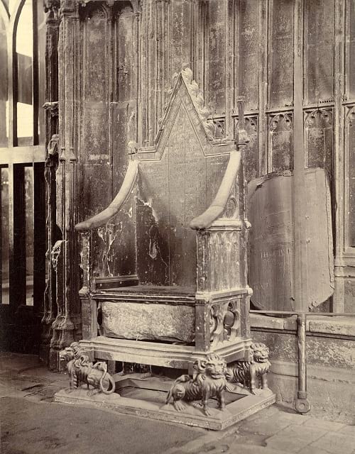
Coronation chair with Stone of Scone. (Cornell University Library / Flickr)
Stone of Scone weighs 152 kg
The king is believed to have plundered Scotland and brought the Stone of Scone in 1296 to England. He told the Abbot of Westminster to ensure full care for the stone. The stone weighing 152 kg is believed to be composed of sandstone.
The magnificent imperial chair was decorated with patterns of animals, foliage and birds. The king’s figure, either that of Edward I or Edward the Confessor, was painted on the chair’s back. The Stone of Scone was placed under the seat.
If some opinions are to be believed, the almost 7 feet tall chair was used in the coronation ceremony of Henry IV in 1399. As per records, it was used in at least 38 coronation ceremonies of reigning British monarchs at the Abbey. Of the 38, 14 ceremonies were for queen consorts.

Coronation of Queen Elizabeth II, 1953. (Biblio Archives / Library Archives from Canada)
Some of those who were coroneted on the chair include William III and Mary II (1689), Oliver Cromwell, and Queen Victoria in 1887.
Read more: The Strange Case of Emperor Norton, the Self-Anointed Monarch of the United States
Protection during World War II
To protect the ancient treasures from heavy bombing during World War II, the chair was shifted to Gloucester Cathedral, while the stone was buried secretly inside the Abbey.
For several centuries, the ancient chair was placed inside the Chapel of St Edward the Confessor. But when the chapel was shut down in 1997, it was shifted and placed on a modern pedestal close to Henry V’s tomb.
During 2010, important conservation work was carried out on the chair with the help of the Hamilton Kerr Institute. However, if rumours are to be believed, the original coronation chair went missing in the 18th century itself.
Legends of the Stone of Scone
According to one legend, Jacob rested his head on the stone at Bethel. There is a reference to the stone in the Genesis. In chapter 28 and verse 18, Jacob used the stone as a pillow.
Another legend says the sons of Jacob took the stone to Egypt. From there, it was believed to have passed on to Spain’s King Gathelus. At about 700 BC, the stone was found in Ireland, where it was kept on a sacred place called Hill of Tara.
The Celtic named the stone as “Lia-Fail”, meaning the “stone of destiny” or the “fatal” stone. Legend says during coronation ceremonies when the Irish kings sat on it the stone released a loud creaking sound.
Founder of the Scottish monarchy
The founder of the Scottish monarchy, Fergus Mor MacEirc received the coronation stone. He was of the royal blood of Ireland. Another king of Scotland, Kenneth MacAlpin is believed to have shifted the stone to the monastery of Scone in Perthshire. All these Scottish rulers were known as the kings of Dalriada.
Therefore, for Scottish people, the stone is an object of veneration. As such, it remained the coronation stone since late 5th century till 1292 AD. All Scottish kings were enthroned on the Stone of Scone atop Moot Hill palace located in a place called Perthshire.
There are no carvings on the megalith stone. It is an oblong block of red sandstone. It measures 400 mm in width and 650 mm in length and is 27 mm depth. There are some chisel marks on it.
Scottish nationalists stole the Stone
On December 25, 1950, Scottish Nationalists are said to have stolen the Stone of Scone. However, in April the following year, authorities recovered it and safely deposited it a vault. Since then the coronation chair and the stone existed separately.

The coronation chair without the stone of scone. (Kjetil Bjørnsrud / Wikimedia Commons)
The UK returns Stone of Scone to Scotland
In a surprise announcement on July 3 of 1996, British Prime Minister John Major declared the Stone of Scone will return to Scotland by that year-end. As promised the stone was handed over to representatives of Historic Scotland on November 13, 1996.
The Stone of Scone was placed in the Edinburgh Castle. With the result, the Coronation Chair today survives without the stone.
According to a legend, when King Edward I of England hammered the Scots in 1296, the monks of Scone had hidden the original stone. The king is believed to have taken a duplicate stone to London.
On display at Edinburgh Castle
A recent myth says the 700-year-old belief that the English monarchs sat on a chair beneath which there was the stone during the coronation is false. In fact, the oak wood seat came much later.
From what we understand till now is that the stone is currently on display at the Edinburgh Castle and it is the pride of Scotland.
Enjoyed this article? Also, check out “The Strange Case of Emperor Norton, the Self-Anointed Monarch of the United States“.
Fact Analysis:
STSTW Media strives to deliver accurate information through careful research. However, things can go wrong. If you find the above article inaccurate or biased, please let us know at [email protected].
RELATED
- June 9, 2019 Ayahs’ Home In London: Where Abandoned Indian Nannies Were Sent to Live Out the Rest of Their Days
- April 27, 2020 Tipu Sultan: The Pioneer of Rocket Artillery
- December 4, 2018 The Strange Case of Emperor Norton, the Self-Anointed Monarch of the United States
- March 24, 2019 Watkin’s Tower: London’s Failed Eiffel Tower
The post The Extraordinary Journey of the Stone of Scone and the Imperial Coronation Chair appeared first on .
]]>The post Voyager Golden Records: A Package for the Extraterrestrial from Planet Earth appeared first on .
]]>
Scientist mounting Golden Records on Voyager spacecraft. (JPL / NASA)
It would be a Red Letter Day if alien life is contacted. Motions have been set in place to make this happen but at the very dawn of space exploration it is thought to be hundreds of thousands of years from happening… if at all.

Carl Sagan. (JPL / NASA)
One such motion took place in 1977 when the Voyager Golden Records were launched into the cosmos, two vinyl records which are aboard two spacecraft which launched under the same name. Within the records is a variety of media based on the history of civilization including sounds and images. It is considered a Time Capsule in the sense that it is more likely that humans from the future rather than aliens will find them. Like a message in a bottle, Astronomer Carl Sagan explains it as sending a “…bottle into the cosmic ocean.”
The two spaceships are not destined for anywhere in particular but the most notable of stars – a Goldilocks zone – known as Gliese 445 will be passed in 40,000 years. Needless to say, it is a mission for the future.
Each record is encased in an aluminium casing with a cartridge to play it and a needle. Also, there are instructions on how to use it.
The two sides of the disc

The Sounds of Earth Record Cover. (NASA on The Commons / Flickr)
Illustrations
• The two circles on the top left show states of the Hydrogen atom and the movement of the proton and electron.
• The Square below is to do with rendering. If the record is correctly rendered then this should match the first image.
• An image frame with vertical lines.
• Vertically staggered lines.
• A diagram illustrating how pictures are made. Showing video signals and binary codes.
• Binary arithmetic explaining how the record should be played.
• Overall play time of record.
• Pulsar map showing the location of our Sun and the frequency of some pulsars.
The information is very technical, related to the actual playing of the record which holds the majority of the content.
There is also a clock – in a sense – electroplated onto the cover of the record. An extremely clever clock built to last billions of years. It is the element Uranium-238 which has a radioactivity of 0.00026 microcuries to be precise. The Uranium will decay to half of its original radioactivity value in 4.5 billion years meaning this can show the time since launch. Because scientifically speaking, Uranium-238 has a half-life of 4.468 billion years.
However, the pulsar map should also be able to show this.
Within the record are images selected by a NASA committee. The aforementioned Carl Sagan chose 115 images in Analog form.
There are some beautiful and bizarre photos on the vinyl. All 116 are in this link.
Also, there are many sounds, music and greetings from fifty-five languages including 5 archaic languages. There is Akkadian, a dead language spoken in the Middle East about six thousand years ago and Wu, a modern Chinese dialect. Here is a translation to English of every greeting:
- Akkadian– “May all be very well”
- Amoy (Min dialect)– “Friends of space, how are you all? Have you eaten yet? Come visit us if you have time.”
- Arabic – “Greetings to our friends in the stars. We wish that we will meet you someday.”
- Aramaic– “Peace”
- Armenian – “To all those who exist in the universe, greetings.”
- Bengali – “Hello! Let there be peace everywhere.”
- Burmese – “Are you well.”
- Cantonese – “Hi. How are you? Wish you peace, health and happiness.”
- Czech – “Dear Friends, we wish you the best.”
- Dutch – “Heartfelt greetings to everyone.”
- English – “Hello from the children of planet Earth.”
- French – “Hello everybody.”
- German – “Heartfelt greetings to all.”
- Greek – “Greetings to you, whoever you are. We come in friendship to those who are friends.”
- Gujarati – “Greetings from a human being of the Earth. Please contact.”
- Hebrew – “Peace.”
- Hindi – “Greetings from the inhabitants of this world.”
- Hittite– “Hail.”
- Hungarian (Magyar) – “We are sending greetings in the Hungarian language to all peace-loving beings in the Universe.”
- Ila (Zambia)
“We wish all of you well.” - Indonesian
“Good night ladies and gentlemen. Goodbye(,) and see you next time.” - Italian – “Many greetings and wishes.”
- Japanese– “Hello? How are you?”
- Kannada (Kanarese)
“Greetings. On behalf of Kannada-speaking people, ‘good wishes.'” - Kechua (Quechua) – “Hello to everybody from this Earth, in Kechua language.”
- Korean– “How are you?”
- Latin– “Greetings to you, whoever you are; we have good will towards you and bring peace across space.”
- Luganda (Ganda) – “Greetings to all peoples of the universe. God give you peace always.”
- Mandarin Chinese– “Hope everyone’s well. We are thinking about you all. Please come here to visit when you have time.”
- Marathi– “Greetings. The people of the Earth send their good wishes.”
- Nepali– “Wishing you a peaceful future from the earthlings.”
- Nguni (Zulu)– “We greet you, great ones. We wish you longevity”
- Nyanja– “How are all you people of other planets?”
- Oriya– “Greetings to the inhabitants of the universe from the third planet Earth of the star Sun.”
- Persian– “Hello to the residents of far skies.”
- Polish– “Welcome, creatures from beyond the outer world.”
- Portuguese– “Peace and happiness to all.”
- Punjabi– “Welcome home. It is a pleasure to receive you.”
- Rajasthani– “Hello to everyone. We are happy here and you be happy there.”
- Romanian – “Greetings to everybody.”
- Russian – “Greetings! I Welcome You!”
- Serbian – “We wish you everything good from our planet.”
- Sinhalese – “Wish You a Long Life.”
- Sotho (Sesotho)– “We greet you, O great ones.”
- Spanish– “Hello and greetings to all.”
- Sumerian – “May all be well.”
- Swedish – “Greetings from a computer programmer in the little university town of Ithaca on the planet Earth”
- Telugu – “Greetings. Best wishes from Telugu-speaking people.”
- Thai – “We in this world send you our goodwill”
- Turkish – “Dear Turkish-speaking friends, may the honors of the morning be upon your heads.”
- Ukrainian – “We are sending greetings from our world, wishing you happiness, goodness, good health and many years.”
- Urdu– “Peace on you. We the inhabitants of this earth send our greetings to you.”
- Vietnamese – “Sincerely send you our friendly greetings.”
- Welsh– “Good health to you now and forever.”
- Wu – “Best wishes to you all.”
There are 90 minutes of music, Eastern and Western classics, as well as traditional songs from all corners of the world, are included. Here is a list of all of the music on the record:
- Bach, Brandenburg Concerto No. 2 in F. First Movement, Munich Bach Orchestra, Karl Richter, conductor. 4:40
- Java, court gamelan, “Kinds of Flowers,” recorded by Robert Brown. 4:43
- Senegal, percussion, recorded by Charles Duvelle. 2:08
- Zaire, Pygmy girls’ initiation song, recorded by Colin Turnbull. 0:56
- Australia, Aborigine songs, “Morning Star” and “Devil Bird,” recorded by Sandra LeBrun Holmes. 1:26
- Mexico, “El Cascabel,” performed by Lorenzo Barcelata and the Mariachi México. 3:14
- “Johnny B. Goode,” written and performed by Chuck Berry. 2:38
- New Guinea, men’s house song, recorded by Robert MacLennan. 1:20
- Japan, shakuhachi, “Tsuru No Sugomori” (“Crane’s Nest,”) performed by Goro Yamaguchi. 4:51
- Bach, “Gavotte en rondeaux” from the Partita No. 3 in E major for Violin, performed by Arthur Grumiaux. 2:55
- Mozart, The Magic Flute, Queen of the Night aria, no. 14. Edda Moser, soprano. Bavarian State Opera, Munich, Wolfgang Sawallisch, conductor. 2:55
- Georgian S.S.R., chorus, “Tchakrulo,” collected by Radio Moscow. 2:18
- Peru, panpipes and drum, collected by Casa de la Cultura, Lima. 0:52
- “Melancholy Blues,” performed by Louis Armstrong and his Hot Seven. 3:05
- Azerbaijan S.S.R., bagpipes, recorded by Radio Moscow. 2:30
- Stravinsky, Rite of Spring, Sacrificial Dance, Columbia Symphony Orchestra, Igor Stravinsky, conductor. 4:35
- Bach, The Well-Tempered Clavier, Book 2, Prelude and Fugue in C, No.1. Glenn Gould, piano. 4:48
- Beethoven, Fifth Symphony, First Movement, the Philharmonia Orchestra, Otto Klemperer, conductor. 7:20
- Bulgaria, “Izlel je Delyo Hagdutin,” sung by Valya Balkanska. 4:59
- Navajo Indians, Night Chant, recorded by Willard Rhodes. 0:57
- Holborne, Paueans, Galliards, Almains and Other Short Aeirs, “The Fairie Round,” performed by David Munrow and the Early Music Consort of London. 1:17
- (The) Solomon Islands, panpipes, collected by the Solomon Islands Broadcasting Service. 1:12
- Peru, wedding song, recorded by John Cohen. 0:38
- China, Ch’in, “Flowing Streams,” performed by Kuan P’ing-hu. 7:37
- India, raga, “Jaat Kahan Ho,” sung by Surshri Kesar Bai Kerkar. 3:30
- “Dark Was the Night,” written and performed by Blind Willie Johnson. 3:15
- Beethoven, String Quartet No. 13 in B flat, Opus 130, Cavatina, performed by Budapest String Quartet. 6:37
A message from the US President at the time Jimmy Carter and UN Secretary are also included. The former President reads:
“This Voyager spacecraft was constructed by the United States of America. We are a community of 240 million human beings among the more than 4 billion who inhabit the planet Earth. We human beings are still divided into nation states, but these states are rapidly becoming a single global civilization.
We cast this message into the cosmos. It is likely to survive a billion years into our future, when our civilization is profoundly altered and the surface of the Earth may be vastly changed. Of the 200 billion stars in the Milky Way galaxy, some–perhaps many–may have inhabited planets and spacefaring civilizations. If one such civilization intercepts Voyager and can understand these recorded contents, here is our message:
This is a present from a small distant world, a token of our sounds, our science, our images, our music, our thoughts, and our feelings. We are attempting to survive our time so we may live into yours. We hope someday, having solved the problems we face, to join a community of galactic civilizations. This record represents our hope and our determination, and our good will in a vast and awesome universe.”
Already by 1990 the Voyagers had gone further than Pluto and ultimately outside our solar system. The mission is extremely romantic and symbolic in the sense that it is extremely hopeful that aliens will be able to decipher it. Even for them to even have the correct anatomy and perceptions to operate the device. At this stage it is perhaps better to view the Golden Records as a Time Capsule rather than an attempt of contacting (the) other life. The director of the project Carl Sagan admits that also. But who knows how the future will pan out.
Enjoyed this article? Also, check out “The Mysterious Wow! Signal: Aliens? A Comet? Or Just a Glitch?“.
Fact Analysis:
STSTW Media strives to deliver accurate information through careful research. However, things can go wrong. If you find the above article inaccurate or biased, please let us know at [email protected].
RELATED
- December 24, 2018 What are Minor Planets and Dwarf Planets?
- October 19, 2018 The Mysterious Wow! Signal: Aliens? A Comet? Or Just a Glitch?
- September 1, 2018 Gliese 581g: A Habitable Exoplanet or Just Another Celestial Object Orbiting a Star?
- July 23, 2019 Pale Blue Dot: The Iconic Photograph Showing How Microscopic But Brilliant Earth Is
The post Voyager Golden Records: A Package for the Extraterrestrial from Planet Earth appeared first on .
]]>The post What Happens to the Olympic Venues in the Host Countries After the Olympic Games End? appeared first on .
]]>
Abandoned swimming pool at Olympic Village Elstal, Germany. (CarlJohanLinell / Flickr)
Olympic games greatly affect the infrastructure of their host cities, and not necessarily always in a positive way. A great deal of expense is involved in building the state-of-the-art stadiums, pools, tracks, and facilities that are required for the attending sports people, their coaches, fans, members of the media, and other visitors. There is no guarantee, however, that the host city will be able to recoup these expenses after the Olympics.
While some of the venues manage to remain in use for the purpose the organizers built them for, others must perforce get repurposed for completely different sports and activities. Some venues even end up being abandoned and it becomes necessary to demolish them.
The Olympic facilities in South Korea
South Korea hosted the Winter Olympics and Paralympics in 2018. In preparation for this event, they built the 35,000-seat Pyeongchang Olympic Stadium at a staggering cost of $100 million. It is located 180 km southeast of the capital city Seoul in PyeongChang. Once the Olympics were over, there was very little possibility that this enormous stadium might host other similar large-scale events. That being the case, there was really no reason to justify expending the amount of money that was needed for its continued maintenance. So, after much deliberation, the authorities demolished it. It had been used only on four or five occasions. When you compare that with the amount spent on it and the amount needed to demolish it, the whole thing doesn’t make much sense from the financial perspective. There are plans now to construct an Olympic memorial hall in its place.
The Olympic facilities in Brazil
Given its long history for hosting international sports events, it was an easy choice for the Olympics Committee to select Rio de Janeiro to host the 2016 Summer Olympics. Brazil set about building nine new venues and seven temporary venues, with most of the sports events taking place at 18 existing venues.
The Maracanã stadium, the second-largest stadium in South America, was the venue for the opening and closing ceremonies of the Olympic Games. The Brazilians built it for the 1950 FIFA World Cup, and it also hosted the 2014 FIFA World Cup. Additionally, it has hosted many other football championships over the years. Refurbished for the Olympics, it fell into a state of disrepair after the games. The sports authorities renovated it later, and it is now mainly used for football matches between the major football clubs in Brazil.
Some of the temporary venues like the Rio Aquatic Centre now lie abandoned. The Olympic Committee billed the Centre as the model of nomadic architecture techniques, and the local government had plans for it. They intended to disassemble the Centre and build it into two community swimming centres, but, apparently, a lack of funds derailed this conversion.
The Olympic facilities in the UK
London is the first city to have hosted three Olympic Games. The first occasion, in 1908, came about because the games could not be held in Rome as planned. Italy could not afford to host the games anymore. The country needed to divert the finances set aside for the games into the more urgent disaster relief operations after the eruption of Mount Vesuvius in 1906. Hence, the pivot to London to host the Olympic Games.
In London, the Olympic Games took place in 13 venues. The hurriedly-built White City Stadium had tracks for athletics events, with a swimming pool and a raised level surface for wrestling and gymnastics in the centre. The stadium later hosted the 1934 British Empire Games, the 1966 FIFA World Cup, and, between 1927 and 1984, it was a venue for greyhound racing. The stadium was demolished in 1985 and, on the demolished grounds, the BBC constructed a collection of buildings called BBC Media Village to house its offices.
The All England Tennis and Lawn Club, which has been in existence since the 1870s, was the venue for tennis, and it continues to host tennis competitions, including the annual Wimbledon Championship.
After the Second World War, the Olympic Games took place in 1948 and, as a nod to all the devastation and the consequent need for financial sobriety, they were dubbed the Austerity Games.
The economic situation, at this point, was not conducive for building any new venues, and, so, most of the events took at Wembley Stadium and the Empire Pool at Wembley Park. All other events took place in 24 sports grounds used by various clubs. The athletes were accommodated in housing complexes in the Wembley area.
The Summer Olympics of 2012 revitalized London’s East End. The sporting complex constructed for the Olympics is now the Queen Elizabeth Olympic Park, and some of the venues here are still very much in use, surrounded by waterways, gardens, and cafes. The buildings constructed to house the athletes in the Olympic village were converted into apartments. In 2016, the renovated Olympic Stadium became the home ground of the West Ham United Football Club.
The Olympic facilities in Russia
Although Sochi already had training centres for aspiring Olympic athletes, the Russian authorities did not think the facilities were fitting enough to host international competitions. Russia, therefore, spent over $51 billion to construct arenas, ice rinks, and ski slopes in Sochi for the 2014 Winter Olympics. The Sochi Olympics have been the most expensive to date, but Sochi hopes to recover almost all the costs by using the venues for future sporting events.
In 2016, the authorities removed the dazzling snowy peaks roof of the Fisht Olympic Stadium in order to fulfil FIFA regulations to host the 2017 Confederations Cup and 2018 World Cup. Fisht Stadium, as it is now known, is the home of PFC Sochi, a Russian professional football club.
The venue of the ice hockey games was the even more dazzling Bolshoy Ice Dome. It has a silver-coloured aluminium panelled roof that is encrusted with 38,000 LED lights. The hockey team HC Sochi is based there, and it is also used as an entertainment centre and concert hall.
The skiing venues at Rosa Khutor were built 2011 and hosted FIS Alpine Ski World Cup before the Olympics. Rosa Khutor Alpine Ski Resort is being promoted as a ski destination for international tourists.
The Olympic facilities in China
The park that China built for the 2008 Summer Olympics in Beijing’s Chaoyang district is called the Olympic Green. Some of the venues like those for hockey and archery competitions have been dismantled, but most of the other venues are still in use and will be hosting the 2022 Winter Olympics. The National Aquatics Centre, popularly known as Water Cube for its unique cuboid bubble architecture, is where the swimming and diving events were held. In 2010, the interior of almost half of the centre was redesigned to create a water park at a cost of 200 million yuan. It is currently Asia’s largest indoor water park.
The Olympic facilities in Greece
While Greece reportedly went way over budget to host the 2004 Summer Olympics, the infrastructure they built at this time has had a positive impact on the city’s public amenities. The Olympic stadium is the home of the Panathinaikos football club. The venues built for various sports still host various sporting competitions for those sports. Some venues have been converted into public parks. The Ano Liosia Olympic Hall, which built for judo and wrestling, is going to house the Hellenic Academy of Culture and Hellenic Digital Archive. The athletes’ village was turned into low-cost housing complexes.
The Olympic facilities in Norway
Lillehammer in Norway hosted the 1994 Winter Olympics and the Winter Youth Olympics in 2016. All the Olympic venues are still in use. The Lysgardsbakkene Ski Jumping Arena is used all months of the year. It is located in the town and it is where the opening ceremony was held. Lillehammer can be considered as a post-Olympic success.
The Olympic facilities in the former Yugoslavia
Most of the 1984 Winter Olympics sites in Sarajevo, Yugoslavia, survived the Bosnian War of 1992-1995. Local sports enthusiasts are assisting the Olympic Committee of Bosnia and Herzegovina to reconstruct and maintain various sports venues such as the graffiti-adorned bobsled course on Mount Trebevic. In 2010, the main stadium was named Juan Antonio Samaranch Olympic Hall after the seventh President of the International Olympic Committee, and it hosted the 2019 European Youth Olympic Winter Festival.

Sarajevo bobsleigh track. (Gabriel Hess / Flickr)

The abandoned bobsled. (Julian Nitzsche / Wikimedia Commons)
Is it really worth the expense to host the Olympic games?
An increasing number of people around the world are beginning to question the wisdom of spending billions on building the multitude of large venues required for the Olympic Games. Many are of the opinion that it is not worth it for the host country to undergo such expense for venues that may have limited or no use in the future. So, the organizers of the Olympic games must come up with workable schemes that can justify this kind of expenditure.
When it is not possible to use the venues for the sports they were built for, the most common re-purposing method so far has been to remodel the venues to use for hosting some other events or for some other purposes. This, however, is not always possible. From both the reconstruction and cost perspectives, it is rather difficult to re-purpose stadiums that are built in circular shapes. Rectangular buildings such as those built for gymnastics and judo are comparatively easier to reuse.
The more economical choice, though, is to construct temporary structures. The most successful re-purposing has been the turning of the Olympic Villages into housing complexes. The best choice is to decide what infrastructure the host city needs and temporarily retrofit that to use for the games.
Olympic parks were mostly built on empty lands just outside the host cities and that made them inconvenient to be reused for everyday city life. Barcelona was able to successfully regenerate its beach culture and downtown industrial areas after using them as venues for the 1992 Summer Olympics. Since then, the trend has been to locate venues in the centre of the host city, creating an infrastructure that can be easily reused for business and other activities.
When it comes to the cost of the Olympic Games, in addition to the sports infrastructure, the host city must also spend money on building or renovating public transportation, roads, railways, airports, hospitals, security, power grid, and other things. Without hosting the Olympics, it may not have been possible to allocate the budget needed for the building all the infrastructure at the same time. This expenditure can be taken as an investment that helps the host city in the long term.
Still, whatever decision is made, it is important to make it very carefully made and long before even thinking of hosting the Olympics.
Enjoyed this article? Also, check out “Dhanushkodi: Where a Cyclone Ripped Apart an Entire South Indian Town, Rendering it Uninhabited“.
Fact Analysis:
STSTW Media strives to deliver accurate information through careful research. However, things can go wrong. If you find the above article inaccurate or biased, please let us know at [email protected].
RELATED
 February 18, 2019 The Ryugyong Hotel of North Korea: The Tallest Unoccupied Building in the World
- December 12, 2018 Dhanushkodi: Where a Cyclone Ripped Apart an Entire South Indian Town, Rendering it Uninhabited
- March 26, 2019 The Disappearing Aral Sea and its Abandoned Ships
 January 10, 2019 AMARG: The US Plane Graveyard Where Aircraft are Stored, Stripped, Repaired, and Restored
The post What Happens to the Olympic Venues in the Host Countries After the Olympic Games End? appeared first on .
]]>The post Devils Tower in Wyoming: A National Monument and a Geological Wonder appeared first on .
]]>
Devils Tower National Monument. (Christen Gobel / Wikimedia Commons)
A film script is a baseline on which location for the shoot is decided. Steven Spielberg did the same. But the location found was so enticing that he discarded the script. And location became a new baseline, for an altogether new story. The result was the blockbuster Hollywood release of 1977, Close Encounters of the Third Kind. The location was a foothill called Devils Tower. But there is more to this giant stub, than what meets the eye on the silver screen. It is a mix of the physical and the metaphysical in Wyoming, America, near river Belle Fourche.
Devils Tower in Wyoming: A national monument
The Devils Tower is 867 feet high. Its top surface measures an acre and a half, and base circumference – about a mile. Declared a National Monument of America in 1906, the tower was held sacrosanct by the Indian tribes of America’s Northern Plains. Several word-of-mouth histories and references testify to its spiritual significance. In Arapahoe, the tower is called ‘Bear’s tipi’. Kiowa, another county, calls it ‘aloft on a rock’ and ‘tree rock’. The Native American tribes have used several expressions like: Bear Lodge, Bear Lodge Butte, Grizzly ear’s Lodge, Mythic-owl mountain, Grey Horn Butte, and Ghost Mountain. As wild bears inhabited the area in the past, the animals’ name became part of the tower’s identity.
The naming exercise was riddled with misinformation
How come Tower got named differently than mentioned in history and legends? The story begins with a geologist, Colonel Richard Irving Dodge, going on a scientific expedition to the Black Hills Region of Wyoming in 1875. He inquired about the tower’s name in the local language and understood the answer as ‘Wakansica’. That, translated into the English language, read ‘The Bad God’s Tower’. It was simplified to ‘Devil’s Tower’.
Now, the question arises about the missing apostrophe in ‘Devil’s Tower’. And why an ungrammatical usage ‘Devils Tower’ remains current? President Theodore Roosevelt had approved the same name as coined by Colonel Dodge, i.e. with-apostrophe Devil’s Tower. But a clerical mistake in the office of the president bypassed apostrophe and posted name as Devils Tower. The mistake was never corrected, so it remained as such. In the meanwhile, another mistake came to light. Colonel Dodge had inadvertently picked up a wrong word for translation. Right word was a similar sounding, but different, Wahanksica, which translates to English as ‘black bear’. This is also corroborated from multiple sources as explained in the foregoing.
Locals, who hold tower sacrosanct, demanded the renaming of ‘Devils Tower’ as ‘Bear Lodge’. Demand was rejected on the ground that a change would confuse people, and harm tourism.
Devils Tower formation
How the tower was formed is equally fascinating. From the earth’s hot inner core, molten rock (magma) keeps moving upwards. It may, or may not, reach to the surface of the earth. One such move happened 50 million years ago, but remained short reaching surface, thanks to a sedimentary rock coming in its way. In course of time, the sedimentary rock withered away, revealing the track followed by the intrusive lava. The magma or lava had cooled down into pillars of hexagonal shape, giving the protruding igneous rock an awesome formation. Grossly, the pillars appear to be hollow, but in reality, these are solid. The rock, light grey to beige coloured, is totally devoid of quartz (a plentiful mineral of the earth – crust).

Devils Tower. (Wikimedia Commons)
A crucible of nature’s bounties, adventure, outing and human faith
Vegetation on Devils Tower is a mix of lichens, moss and grasses. Chipmunks (squirrels) and more than 160 species of birds inhabit the top part of it. The Pine forest and the grasslands in surrounding areas are home to 40 species of mammals. That apart, the region has a vibrant population of amphibians, fishes and reptiles.
The tower is a popular destination for rock climbing. Prominent columns on the shaft are ideal for clutching, tethering and climbing the rock, and have a rocking experience. Five to six thousand rock climbers come here every year, especially in the month of June. That, incidentally, is also the time when people visit the tower for religious rites. In spite of being a tourist hub, Devils Tower retains its past image of a spiritual domain. Rituals of faith are a routine on the tower’s sacred sites, and tourists are advised not to touch objects related to such rituals.
Enjoyed this article? Also, check out “Devils Hole: The Only Wild Habitat in the World Where the Endangered Devils Hole Pupfish Are Found“.
Fact Analysis:
STSTW Media strives to deliver accurate information through careful research. However, things can go wrong. If you find the above article inaccurate or biased, please let us know at [email protected].
RELATED
- August 31, 2020 Ennedi Plateau and Aloba Arch: Home to Exquisite Natural Formations and ‘Extinct’ Animals
- April 14, 2019 Fingal’s Cave: The Musical Geometry of Nature’s Domain
- March 23, 2019 The Moeraki Boulders of New Zealand: Naturally Formed Spherical Boulders from the Paleocene Era
- March 2, 2019 Wave Rock: Where a Massive Prehistoric Wave, Just About to Break, is Etched Permanently in Stone
The post Devils Tower in Wyoming: A National Monument and a Geological Wonder appeared first on .
]]>The post A Glimpse into the Exciting World of Space Tourism appeared first on .
]]>
Artistic impression of Aurora Space Station interior, a concept design of the world’s first luxury space hotel by Orion Span. (© Orion Span)
More than 100 years ago, Russian scientist Konstantin Eduardovich Tsiolkovsky helped the erstwhile USSR’s space programme. Thus, deaf Tsiolkovsky is a pioneer in rocket science.
After years of rejection, Tsiolkovsky became an inspiration to later Soviet scientists in the areas of space travel and space colonization.
During the 19th and early 20th centuries, the idea of space travel was unthinkable except in scientific papers. To make space travel possible, the Soviets developed a spacecraft that flew around the Earth in outer space sometime in 1957. The first living creature to orbit the Earth was Laika, a 2-year-old terrier mutt. The terrier mutt flew into Earth’s orbit and paved the way for modern space exploration.
Commercial activities
In 1961, a 27-year-old Soviet cosmonaut named Yuri Alekseyevich Gagarin became the first human to travel in space aboard spacecraft Vostok 1. Since then humans set their foot on the Moon, sent spacecraft to planets like Jupiter, Saturn, and Pluto and even landed a rover on Mars.
Till recently, all orbital spacecraft with human passengers have been developed as governmental ventures. But in the past few years, private participation has seen significant growth. Corporate entities like Virgin Galactic, SpaceX and Blue Origin have taken quick strides in spacecraft development for commercial activities.
With the result, taking a trip to outer space is no longer the matter of science fiction for humans. However, space travel or space tourism continues to be an expensive affair. But, soon it could become a viable scientific and holiday destination thanks to organizations promoted by Richard Branson, Elon Musk and Jeff Bezos.
These and other companies are today offering to take space tourists for astronomical fares. And, there is no need for such tourists to be savvy with scientific knowledge. They, however, need to undergo fitness tests under and get trained under the guidance of NASA officials before the lift-off.
What is space tourism?
The term refers to travelling into space by humans for leisure or recreational purposes. As of now, there are three types of space tourism, i.e. lunar space tourism, orbital and suborbital tourism.
Lunar space tourism
Elon Musk’s aerospace company SpaceX is planning to send two space tourists around the Moon in its reusable Big Falcon Rocket (Starship). The space travel, known as a Moon Loop, is expected to take place sometime in 2023.
While identifying the passenger on this trip, Elon Musk said Japanese billionaire Yusaku Maezawa is the lucky tourist on the Moon mission. It may be recalled that the last human Moon mission was in 1972 – the Apollo mission.
Orbital space tourism
Till today, the Russian Space Agency is the only organisation to offer orbital space tourism. In all, seven private persons paid their way to take part in orbital space tourism to date. This kind of tourism became possible in 2001 when the Russian company called MirCorp entered into a pact with a US firm named Space Adventures Ltd.
In April 2001, American businessman Dennis Tito flew into space to become the world’s first orbital space tourist. He paid $20 million to the Space Adventures for the flight and a 7-day stay on the International Space Station (ISS).

Dennis Tito (left), Talgat Musabayev (middle), and Yuri Baturin (right), the crew of Soyuz TM-32. (NASA)
Speaking after Dennis’ space journey, President of Space Adventures Tom Shelley said six others spent time on ISS. They included South African computer millionaire Mark Shuttleworth, American businessman Gregory Olsen, and Iranian-born American entrepreneur Anousheh Ansari.
The remaining orbital space tourists were American billionaire Charles Simonyi and American video game developer Richard Garriott. This tourism programme was, however, cancelled in 2010.
Suborbital space tourism
Spacecraft under this category fly up to an altitude of 100–160 km. At that height, passengers experience weightlessness for 3 to 6 minutes and they can get a view of the star field and that of the Earth’s curve.
Till the beginning of 2019, not one suborbital space tourism flight took off in spite of being affordable. The flight cost is projected in the range of $200,000 per passenger. Meanwhile, Virgin Galactic’s spacecraft known as ‘SpaceShipTwo’ is likely to achieve supersonic speed and take its first passengers on suborbital space tourism.
‘SpaceShipTwo’ is expected to be launched from an altitude of 50,000 feet. It is, then, likely to get a forward thrust from a jet aircraft known as WhiteKnightTwo. SpaceShipTwo is scheduled to carry six tourists and to two pilots on the trip. When? Branson is yet to decide the date. It is, however, confirmed is that Branson will be aboard the flight.

SpaceShipTwo. (Virgin Galactic / Mark Greenberg)
Zero gravity
In May 2018, Virgin Galactic’s SpaceShipTwo achieved supersonic speed in its second test run. When humans travel at such speeds, a lot of pressure will be exerted on their bodies. Interestingly though, when humans enter the zero gravity zone there is absolutely no pressure on their bodies making them weightless.
Also in the zero-gravity zones, there is a danger for humans to lose their bone density. Their bones could become brittle and there are chances of their bones breaking when they return to Earth.
Health risks
Similarly, human muscles and heart don’t work as required in zero gravity conditions. They, therefore, turn weak. To counter these and other health issues, NASA prepares the tourist recruits with hard workouts before, during, and after the space journey.
In spite of NASA’s training, experts believe that space tourists should be prepared to accumulate a high dose of radiation during the trip.
In addition to health risks, the tourists should be prepared for an inevitable accident in outer space. If the inevitable happens it will be extremely traumatic to the kith and kin of the tourists. Therefore, space tourism should be bracketed as a dangerous sport.
Space settlement
Al Globus writes in his article titled ‘Space Tourism Leads to Space Settlement’, space tourism could ensure low-cost and safe transportation for space settlements in future. Stating that space tourism could spur the market for cheaper space transport, Al Globus writes space tourism market will become larger than expected.
Futurists are already predicting settlements on Moon, Mars or asteroids. They hope that humans could have larger living spaces, improved resources and energy.
Futurists like Patrick Colins predicted that millions of tourists could fly into space very soon if the travel cost drops to $10,000 per person. Within 25 years from today, they feel orbital tourism will be much cheaper.
Reusable space vehicles
For this to happen, private companies need to manufacture passenger launch vehicles at drop-down prices.
According to Vice-president at Spaceport America Bill Gutman, reusable space vehicles are the key to the future of space tourism. Such vehicles will surely cut down overall manufacturing costs and slash travelling costs.
Cost of space tourism
With space vehicle manufacturing and travelling costs down, the focus of newer entrants will be on positioning space hotels in Earth’s orbit. Russia’s Orbital Technologies has already prepared a blueprint for building a space hotel that can accommodate seven guests. They are also preparing a blueprint for Lunar Colonies with a focus on leisure.
If California-based start-up Orion Span’s plans come true then the company is proposing to position its luxury space hotel in Earth’s orbit by 2021. The affordable orbital leisure destination named “Aurora Station” could begin to accommodate guests by 2022.
Orion Span’s Frank Bunger reveals that it could cost a guest at least $9.5 million for a 12-day stay on Aurora Station. Bunger disclosed that the space hotel, which is being built in the Bay Area, can accommodate two crew members and four guests. Bunger says that if demand grows, additional modules called space condos can be attached to the space hotel.
But with costs still astronomical, what could be the future of space tourism? It could be similar to the history of the airline industry. Initially, only wealthy people, politicians and government officials could afford to fly. With ticket costs crashing and potential passengers growing, the airline industry’s business prospects soared.
Therefore, recognising the imminent potential in space tourism, the government and private sectors should solve the problem of astronomical manufacturing costs and boost space travel.
Enjoyed this article? Also, check out “Space Advertising: The Race to Advertise in Outer Space“.
Reserve Now:
Orion Span
Fact Analysis:
STSTW Media strives to deliver accurate information through careful research. However, things can go wrong. If you find the above article inaccurate or biased, please let us know at [email protected].
RELATED
- February 26, 2019 Skylab: The Space Station that Failed in Spite of Brilliant Conception and Brave Execution
- June 25, 2018 Laika the Canine Cosmonaut – From the Streets to the Stars
- January 14, 2019 The Soyuz 11 Tragedy – The Death of Three Soviet Cosmonauts in Space
- August 7, 2019 Ham – The Chimpanzee that Paved Way for Launch of Manned Spacecrafts
The post A Glimpse into the Exciting World of Space Tourism appeared first on .
]]>The post McBarge: The Floating Restaurant That McDonald’s Unveiled at the 1986 World Exposition appeared first on .
]]>
McBarge. (© Ruth Raymond / Flickr)
In their long history, McDonald’s had two floating restaurants, Riverboat McDonald in St Louis, USA, and Friendship 500 in Vancouver, Canada. They built the Friendship 500, popularly known as the McBarge, for the 1986 World Exposition on Transportation and Communication. The restaurant was on a 57-metre-long barge that McDonald’s moored in False Creek, which was alongside the exposition grounds. The McBarge was one of the five McDonald’s exhibits at the exposition, and they built it at the cost of $8 million.

Riverboat McDonald in St. Louis, 1999. (48states / Wikimedia Commons)
McBarge, the floating restaurant
Robert Allan Ltd., one of Canada’s oldest consulting naval architectural firms, designed the floating restaurant. They built it as a showcase of future technology and architecture, which was the theme of the exposition. To construct the structure, they used porcelain-dipped aluminium panels, steel, and ferrocement on a pontoon barge.
Porcelain panels provide a very durable cladding whose colours and surfaces are more resistant to degradation in harsh environments. Ferrocement is a thin wall reinforced concrete which has low weight and a long lifetime. Pontoons are tubes that contain a lot of reserve buoyancy which enables the construction of large decks on floating vehicles such as flat-bottomed barges.
The McBarge measured 8,600 square feet on the main deck and 6,800 square feet on the top deck and could seat 1,400 people. In addition to creating a futuristic floating restaurant, McDonald’s wanted to create a bistro style place that was both elegant and affordable and would attract young people in droves.
The restaurant’s interior features included potted plants, wooden floors, merlot-coloured accents, and framed art. The hidden kitchen used a conveyor belt to deliver food to the serving counter. The glass panelled dining areas provided panoramic views of Vancouver, and the staff wore blue and white sailor’s uniforms. Millions of people visited the World Exposition between May and October, and the novelty of a floating restaurant ensured that the McBarge was always packed.
After the world exposition
McDonald’s intended to continue using the McBarge as a floating restaurant after the World Exposition ended, but for a variety of reasons, they were unable to do so. The staff left, and the empty barge remained moored where it had been during the Exposition.
In 1988, the Vancouver government sold the Exposition grounds to Lee Ka-Shing, a Hong Kong-based tycoon, and, in 1991, he told McDonald’s to remove the barge from his property. So, McDonald’s relocated the barge to Burrard Inlet, north of Vancouver.
Eight years later, in 1999, they sold the barge to Howard Meakin, a real estate developer famous for redeveloping Gastown, an old area of Vancouver. As Meakin did not wish to scrap the barge, it remained anchored in Burrard Inlet, neglected and rusting. It did briefly receive some publicity in 2003 when Marvel Entertainment and New Line Cinema used the barge as the lair of the Nightstalkers for the film Blade: Trinity.

Photo of McBarge in 2006. (Taz / Flickr)
The McBarge on Facebook
Around 2009, a few local people began a Save the McBarge Facebook group. The group grew to include thousands of members, and they discussed their opinions about what to do about the barge and shared photographs of the barge. Some of the suggestions they put forward were using the barge as a shelter for Vancouver’s homeless people, as part of a university campus, and, more commonly, for the purpose it was designed for, to be used as a restaurant and bar.
Howard Meakin paid no particular attention to the Facebook group since he had neither started it and nor had he solicited their advice. On the other hand, these Facebook discussions about the fate of the McBarge drew a lot of public attention to the barge and, as a result, a lot of people went to see it and trespassed on to the barge out of curiosity. Some of them vandalized the barge and drew graffiti on its walls.

McBarge in 2015. (Daderot / Wikimedia Commons)
Howard Meakin’s plans for the McBarge
In the same year as the Facebook publicity, in 2009, Howard Meakin proposed the idea of making the barge the centrepiece of a waterfront development project on the Fraser River in the city of Mission. Besides restaurants and pubs, the project called “Sturgeon’s on the Fraser” included plans to build a marina and a seaplane terminal to service flights to Victoria and Nanaimo. Although Meakin’s proposal garnered some local support, the Mission city council rejected it citing environmental issues.
For the next 30 years, the barge remained in Burrard Inlet. Then, in 2015, Howard Meakin moved the now dirty and mouldy barge to Maple Ridge in the north-eastern section of Greater Vancouver. He planned on spending $4.5 million to renovate the barge, which would include removing the McDonald’s decor and giving the barge a new built look. He did not, however, give the public specific details about what he intended doing with the barge.
In 2017, Howard Meakin announced plans to use the McBarge as a deep-sea museum. Along with Phil Nuytten, an inventor and president of the Historical Diving Society of Canada, architect David Eaton, and designer Nigel Walker, Meakin spent more than a year working on the project.
To be named Deep Ocean Discovery Centre, the proposed 15,400 square foot museum was going to have a 4-D theatre and educational exhibits showcasing the history and importance of the Pacific Ocean, indigenous ocean technology and new developments, and stories and experiences of navigating the ocean. The museum would also display Nuytten’s vast collection of underwater equipment and other artefacts such as a shark cage.
As restoring and repurposing the McBarge would require a considerable sum of money, Meakin and Nuytten decided to get the Vancouver City Council involved in the project. They hoped that the City Council would give the barge a Historic Place Status. This designation would have made it easier for them to get funding from government grants and sponsorships. Their petition, however, did not receive the requisite number of signatures. They also planned to launch a crowdfunding campaign to raise some money, but they had to cancel the event in October due to bad weather. After 2017, there have been no further announcements regarding the project.
The McBarge, meanwhile, is still docked in Maple Ridge.
Enjoyed this article? Also, check out “Nakagin Capsule Tower: A Futuristic Building from the Past, Which Might Just Not See the Future“.
Fact Analysis:
STSTW Media strives to deliver accurate information through careful research. However, things can go wrong. If you find the above article inaccurate or biased, please let us know at [email protected].
RELATED
- December 10, 2018 Nakagin Capsule Tower: A Futuristic Building from the Past, Which Might Just Not See the Future
 January 26, 2020 Under ‘Under’, an Underwater Restaurant in Lindesnes, Norway
- December 18, 2019 Punta del Hidalgo Lighthouse: A Celebration of Modern Architecture and Traditional Utility
- June 1, 2020 The Clermont-Ferrand Cathedral: A Beautiful Gothic Structure Made of Black Lava Stone
The post McBarge: The Floating Restaurant That McDonald’s Unveiled at the 1986 World Exposition appeared first on .
]]>The post Project MKUltra: CIA’s Cold War Conspiracy to Secretly Control Human Mind Goes Wrong appeared first on .
]]>
Memorandum for the record of Project MKUltra. (Wikimedia Commons)
On April 13 of 1953, the Central Intelligence Agency (CIA) of the United States took up an experiment named Project MKUltra with the help of 150 civilian Americans.
As part of Project MKUltra, the CIA is said to have used certain substances on these civilians to study the impact on their mind. The project, therefore, is known as a mind control programme, according to Brionne Frazier of the website www.thoughtco.com.
The project had no executive sanction and as such, it was clandestine and hence illegal. In fact, the executive had no knowledge of the project until after 20 years. Experiments under Project MKUltra began in 1953 and ended in 1973.
Torture and interrogations
Designed and executed by the CIA’s Scientific Intelligence Division, the experiments on civilians were to identify and create drugs for use in torture and interrogations. The idea was to weaken an individual’s mind and extract confessions from him.
The SID coordinated with the U.S. Army’s Chemical Corps’s Special Operations Division in the highly controversial mind control programme.
Lysergic acid diethylamide, known as LSD, is a hallucinogenic drug. Swiss scientist named Albert Hofmann was the first to synthesize the drug in the 1930s.
Cold War
The CIA got interested in the drug during the Cold War and it used LSD and other drugs in secret experiments as part of its mind control programme. Before that, small doses of LSD were being used for medicinal purposes.
According to a book titled ‘The Interrogation Rooms of the Korean War: The Untold History’, the CIA took up Project MKUltra during the Cold War period. The reason: the US government was afraid of the North Koreans, Soviets and Chinese. The book’s author Monica Kim believes these three nations used mind control tests to brainwash American PoWs in North Korea.
CIA director Allen Dulles
In his desire to retaliate against the North Korean experiments, the then CIA Director Allen Dulles sanctioned funds for Project MKUltra. He wanted to use this covert operation to find new mind control techniques for use against the Soviet bloc. He wanted to control the behaviour of these enemies with the help of drugs and other mind manipulators.
Allen took over as the CIA chief on April 10, 1953, i.e. just days before the launch of Project MKUltra. At that time global tensions were high. Commenting on the state of mind of the GIs returning after the Korean War, the Soviets had played a sinister battle over men’s minds. He said this was a new form of Soviet’s brain warfare. Obviously, his words terrified the American people.
Conspiracy theories
The CIA is plagued with conspiracy theories. While some may be true, most are nothing but wild speculations. Perhaps, Project MKUltra could possibly be an ethically true conspiracy theory. According to Scotty Hendricks of www.bigthink.com, the CIA project had violated the Nuremberg codes and therefore it was illegal.
As part of Project MKUltra experiments, CIA MKUltra manipulated several civilians’ mental state. They used the drugs and chemicals to hypnotise the subjects and deprive them of their sensory perceptions. They even experimented in isolating the subjects and abuse them both verbally and sexually.
Various other forms of torture were also used.
The scale of Project MKUltra experiments
CIA did not concentrate its Project MKUltra experiments in one place. The experiments were across 80 institutions, including 44 universities and colleges. Some of the other institutions were the experiments took place include pharmaceutical companies, hospitals and prisons.
The CIA used these institutions as front organisations. As the experiments were done in secrecy, not many people knew that the CIA was behind them. Only a handful of top officials at these organisations knew of the agency’s role.
In the name of Project MKUltra, the CIA extended funds to universities like Columbia, Stanford and others to study the effects of the drugs. After some tests were done, researchers found that the drugs in question were highly unpredictable and cannot be used in counterintelligence activities.
These researchers used drugs like ecstasy (MDMA), heroin, mescaline, barbiturates, psilocybin and methamphetamine.
Operation Midnight Climax
In addition to experiments in universities and colleges, the CIA tried to lure gullible men safe drug houses with the help of prostitutes. They were then subjected to drug experiments under the now infamous Operation Midnight Climax.
These unsuspecting men were administered LSD in cocktails under a party-like atmosphere. CIA then secretly recorded changes in these men’s behaviour. These gullible men were mostly from cities like New York City, California, Marin County and San Francisco.
Almost all the Project MKUltra experiments were the direction of Sidney Gottlieb, CIA’s expert on chemicals, drugs and poison. Sidney was sure that CIA will succeed in finding the right drug that could alter any mind for the purpose of brain controlling.
Volunteers
However, Sidney slammed the experiments as “useless”. He felt the experiments had failed to produce satisfactory results.
Interestingly, CIA agents experimented with drugging one another at work or at weekend retreats. According to Libby Coleman’s article in www.ozy.com, such CIA LSD trips turned into workplace hazard. They even took the life of at least one person and it was considered as a suicide.
Also, there were some who volunteered for the Project MKUltra experiments. One of them was an author named Ken Kesey. He was a Stanford University student at that time. He later shared his experiences in his book One Flew Over the Cuckoo’s Nest.
There was also speculation that a person known as Unabomber (Ted Kaczynski) was part of the experiments at Harvard University.
Counter-productive
By and large, the Project MKUltra experiments were termed by some as counter-productive. One world famous personality who slammed the CIA experiments was John Lennon. In an interview, John mocked the CIA saying that people forget to thank the agency and the army for introducing LSD to Americans.
He further said, to control people the two organisations invented LSD.
In 1963, a member of CIA’s Inspector General’s staff, John Vance, chanced upon Project MKUltra. Following which the independent audit board of the agency insisted CIA should follow new research ethics guidelines.
Congress investigated Project MKUltra
Then in 1977, Senator Edward Kennedy ensured that the Congress investigated Project MKUltra. Congress interrogated ex-CIA employees on the LSD experiments. The investigation revealed several disturbing facts, including the 1953 suicide of Dr Frank Olson.
Dr Olson was a US Army scientist. He jumped out of a window after consuming LSD. However, during the hearings, the US Congress faced roadblocks. One major problem was the destruction of all key Project MKUltra files except for some.
The surviving 20,000 pages of documents survived as they were misfiled.
Then under the guidance of the Congress, a Church Committee examined the surviving documents. Following which, successive US Presidents Ford, Carter, and Reagan ordered the banning of all future experiments
Project violated the Nuremberg codes
Project MKUltra clearly violated the Nuremberg codes. And the real extent of psychological damage is still impossible to ascertain.
It is interesting to note that there are two Netflix series titled ‘Wormwood’ and ‘Stranger Things’ that deal with issues related to Project MKUltra and other secret CIA programmes.
Project MKUltra is thus a serious thought of what science can do if given a free hand.
Enjoyed this article? Also, check out “Unit 731: Gruesome Human-Experimentation To Test Biological And Chemical Warfare In Japan During WWII“.
Fact Analysis:
STSTW Media strives to deliver accurate information through careful research. However, things can go wrong. If you find the above article inaccurate or biased, please let us know at [email protected].
RELATED
- February 22, 2020 The Acoustic Kitty Project: Weird Feline Spies of the ’60s
 October 29, 2018 Jose Delgado, the Pioneer of Electric Brain Stimulation Tamed a Raging Bull with Radio Control
- July 14, 2019 Unit 731: Gruesome Human-Experimentation To Test Biological And Chemical Warfare In Japan During WWII
- February 28, 2020 Humanzee: Was Oliver the Chimp a Missing Link Between Humans and Apes?
The post Project MKUltra: CIA’s Cold War Conspiracy to Secretly Control Human Mind Goes Wrong appeared first on .
]]>The post Neuschwanstein Castle: The Story Behind the Iconic Bavarian Castle That Inspired the Disney Castle appeared first on .
]]>
Neuschwanstein Castle. (Max Pixel)
An imposing Romanesque structure, Neuschwanstein Castle is one of Germany’s most well-known castles. It stands poised on a hill in the Alpine foothills in Bavaria, 120 kilometres to the south of Munich and above the small village of Hohenschwangau. Built as a private retreat in the 19th century by Ludwig II, the King of Bavaria, it looks like something straight out of a fairy tale. If you have seen Sleeping Beauty’s castle in the Walt Disney film, you will notice the similarity with Neuschwanstein Castle. It was the inspiration for the Disney version.
Ludwig II of Bavaria

Ludwig II of Bavaria. (Wikimedia Commons)
In the mainstream media, Ludwig II is often referred to as the Fairy King — for the fairy tale castle he built — and as the Mad King — a diagnosis made by a so-called doctor, who personally never examined him, and which is quite without merit and most certainly a political gambit on part of his opponents to dethrone him and seize power in Bavaria.
For someone who designed and built an enchanted castle, Ludwig II, unfortunately, did not live an enchanted life.
Growing up, he was not close to either of his parents. He was brought up almost entirely by servants and tutors, and it was a strict, even harsh upbringing. There was none of the personal freedom that most young boys of a similar age might take for granted. After all, he was the heir to the Bavarian throne, and he was never allowed to forget that.
In 1864, after the death of his father King Maximilian II, he ascended the throne of Bavaria. He was only 18 years old at the time, with a shy, reclusive personality that was entirely unsuited for the governing of a nation. He tried not to rock the boat by continuing his father’s policies, but he hated public gatherings and attending to court affairs. As much as possible, he took to avoiding these and began spending more and more of his time engaged in creative pursuits.
Four years after his coronation, in February 1868, Ludwig I died – that is, the new King’s grandfather and the former King of Bavaria, who had, years earlier, refused to become a constitutional monarch and had, therefore, stepped down in favour of his son. The former King’s death meant that the considerable sums of money that had, so far, been spent on his estate could now be diverted to other projects. Ludwig II decided to use the money to finance a private retreat that would exemplify the romantic Medieval architectural style.
Contrary to what some media sources reported, he never used public funds for Neuschwanstein Castle or any of his other building projects. Even so, his ministers were angered by his lavish spending on his personal projects and his lackadaisical participation in the country’s politics. He, however, remained popular with the Bavarian public.
The idea of Neuschwanstein castle
Ludwig II grew up in the family castle, Hohenschwangau Castle. Close by, higher up in the mountains, were the ruins of two medieval castles — Vorderhohenschwangau and Hinterhohenschwangau — that greatly fascinated the young Prince. He often went hiking to the ruins and made several sketches of them. The idea of building a castle here along the medieval lines came to him first during this time.
Later, after he became King, he was able to set this plan into motion.
In a letter to Richard Wagner – the great German musician whose magnificent operas Tannhauser and Lohengrin had also played a pivotal role in inspiring him to build the castle – the King expounded on the beautiful environs near Poliat Gorge. The natural scenery, he assured Wagner, possessed a grandeur that seemed straight out of the mythological realm of his operas.
Designing Neuschwanstein castle
Given his passion for Wagner’s operas, it wasn’t surprising that Ludwig II hired Christian Jank, a stage designer and scene painter, to come up with the designs for the proposed castle. He also hired Eduard Riedel, an architect, to render the architectural drawings. He himself remained involved in every step of designing Neuschwanstein Castle. He rejected designs inspired by the Nuremberg castle and asked that the designers look more toward the Wartburg Castle for inspiration. Furthermore, he demanded that the designers present him with detailed designs and insisted on approving every single design draft. His involvement and tight control on the design drafting process meant that it was eventually his own design that was finalized. The castle that was finally built was more his creation than that of the designers.

The front elevation of the castle. (Max Pixel)
The architecture of Neuschwanstein castle
Ludwig II strove for a medieval effect that was mixed with the latest technical innovations of the 19th century. The castle had flush toilets, advanced kitchen gadgets, and electricity.
While Neuschwanstein Castle is much admired for its combination of Romanesque, Gothic, and Byzantine architectural elements in present times, many of the leading Bavarian architects of the period looked upon it as kitsch.
The construction of Neuschwanstein castle
Neuschwanstein Castle took 14 years to build and, in this period, it provided steady employment to a large portion of the local population. The building work began in 1868 with the demolishment of the ruins of the two medieval castles. While Ludwig II had, earlier on, wanted to incorporate the two castle ruins into the new castle, it soon became clear that this could not be possible for structural reasons.
On 5 September 1869, the builders set the foundation stone and worked on finishing the castle cellar. It took them until 1872 to finish that and it was four years later, in 1876, when they completed the castle’s first floor and the gatehouse. While brick was used as the primary construction material, the castle façade was in rock, sandstone, and white limestone. In 1880, the builders held the castle’s topping out ceremony, and, two years afterwards, a portion of the castle was ready and furnished.

Neuschwanstein Castle during construction. (Johannes Bernhard)
Ludwig II moved into the furnished section of the castle in 1884 and kept an eye on the ongoing work. It wasn’t all a smooth progress. There were accidents in which workmen died and, also, the King had several differences with the builders and changed the overseer a couple of times. For instance, the work began under Eduard Riedel, but the King replaced him with Georg von Dollmann in 1874, and, later, he replaced Dollman with Julius Hoffman.
Interesting aspects of Neuschwanstein castle
At the time Ludwig II moved in, only 14 rooms in the castle were completed and furnished. These included his personal suite on the first floor, the Throne Room, the Singer’s Hall, and the Grotto. All these rooms are decorated with elements from Wagner’s operas.
The finished castle is an asymmetrical, elongated building with towers, balconies, turrets, gables, and roof cornices with pinnacles. The gate building facing the east has a red brick facade and the portions facing the court have yellow limestone facades. There is a moat as would befit a real German Knight’s castle, but the castle fortifications are mostly decorative. There was to be a massive keep in the upper courtyard, but only its foundation was built and the rest of it remained unbuilt upon the King’s death.

Neuschwanstein Castle from another angle. (Rob Faulkner / Flickr)
Death of Ludwig II
In 1886, Ludwig II was arrested in his bedroom at night and taken away forcibly in a carriage to Berg Castle. The next afternoon, he and Dr. Bernhard von Gudden, who had arrested him, went for a stroll on the shores of Lake Starnberg. When they didn’t return, the guards went to look for them and found both men dead in waist-deep water. They both appeared to have been strangled.
To this day, nobody knows exactly what happened, although there are many theories. The most popular one is that the King had arranged an escape with some royalist supporters and this, unfortunately, was foiled. The King’s cousin later reminisced about him and said he was eccentric, not mad, and he should not have been treated the way he was.
He was able to spend only 11 nights in his beloved castle.
Visiting Neuschwanstein castle
You can visit Neuschwanstein Castle throughout the year. In fact, you ought to see it in different seasons to get an idea of how beautiful it looks against the changing landscape. Plenty of people have the same idea, however, so expect a crowd when you visit.
Neuschwanstein Castle allows visitors only as part of a group, and you can choose if it is to be a small group or a large one. The guided tours start from Munich and generally last an entire day. In addition to seeing the grand interior of the castle, you can take in the picturesque landscape and the breath-taking panorama of the Alps.
Enjoyed this article? Also, check out “Hochosterwitz Castle: The Medieval Castle in Austria That Remained Impregnable from Enemy Attacks“.
Fact Analysis:
STSTW Media strives to deliver accurate information through careful research. However, things can go wrong. If you find the above article inaccurate or biased, please let us know at [email protected].
RELATED
- February 23, 2019 Project Riese: Hitler’s Shadowy Incomplete Underground Complex that Remains a Mystery
- September 13, 2019 Osamu Tezuka: The Walt Disney of Japan
- March 14, 2019 Hochosterwitz Castle: The Medieval Castle in Austria That Remained Impregnable from Enemy Attacks
- August 3, 2019 Ivan the Terrible: The First Tsar of Russia and His Reign of Terror
The post Neuschwanstein Castle: The Story Behind the Iconic Bavarian Castle That Inspired the Disney Castle appeared first on .
]]>The post The Story of the Ingenious and Daring Escape from the Alcatraz appeared first on .
]]>
The escapees from Alcatraz prison. (L-R) Frank Morris, Clarence Anglin & John Anglin. (Wikimedia Commons)
It’s about 57 years since the ingenious and daring escape from the Alcatraz, the island prison one mile off the San Francisco Bay.
One of the greatest daring & successful escapes from Alcatraz, known as the ‘Rock’, was that of four inmates. The four included Frank Morris the mastermind, Clarence and John Anglin (both brothers), and Allen West.
Frank was an armed burglar. As a foster child in Washington DC, Frank had become a drug dealer. John and Clarence were from Georgia. They had been robbing banks since they were young adults. Allen stole cars.
Frank shared his daring plan with his co-conspirators. Over the next 6 months, the four men stole spoons, saw blades and an improvised drill to slowly broaden the ventilation ducts in their prison cells.
Working mostly during nights, they executed their escape plan during June of 1962 through the ventilation shaft. Allen couldn’t escape as he was unable to remove the grill covering the ventilation shaft. He was left behind.

Fake head used for escaping. (National Park Service)

The cell from which the inmates escaped. On the bed, a fake head was placed. (Supercarwaar / Wikimedia Commons)
Prison officials detected the escape the next morning. After questioning Allen, prison and police officials found that the three escaped prisoners planned to sail to the inhabited Angel Island close to Alcatraz. Nothing was found on Angel Island except for some shreds of raincoat.
Seen alive
Ever since the now famous escape, there have been rumours about the three being seen at various places over the years.
In 2012, two sisters of the Anglin brothers are said to have claimed that John had made a phone call shortly after escaping from the prison.
Another sibling of the Anglin brothers, Robert is believed to have confessed in 2010 that he had been in contact with his brothers until 1987.
The family of the Anglin brothers believes that the two had gone to Brazil. Fred Brizzi, a family friend, is believed to have met the brothers in 2012. To prove that the Anglin brothers were alive, Fred produced pictures of the two.
In 2011, a man claiming to be Frank Morris’s cousin said he met Frank in San Diego. However, officials refused to accept these claims.
As for Frank, a man claiming to be his cousin came forward in 2011 saying that he had met Frank in San Diego. However, the authenticity of the claim could not be verified.
The history of Alcatraz Federal Penitentiary
In the 30 years of the prison’s history since 1934, only 36 inmates had attempted to escape. Of them, 7 were shot and killed, 5 remained unaccounted, 2 drowned, and the rest got caught.

Alcatraz Federal Penitentiary, 1950. (GOGA Park Archives / Flickr)
The big shot liquor smuggler and the dreaded Al Capone was one of the inmates at Alcatraz in 1930s. Al Capone lived at Alcatraz for 4 and a half years. He was transferred to the Rock in August of 1934 from the US Penitentiary in Atlanta.
Capone’s arrival was the cause of the endless myth called Alcatraz.
Alcatraz escape
For decades, the successful escape stumped the prison and investigating officials. The bodies of the trio were never recovered. This left the officials wondering whether they escaped to their freedom or perished in the choppy San Francisco Bay waters.
In 1979, the FBI officials finally closed its case saying the three inmates met their watery grave in the frigid waters of the Bay.
Whatever may be the fact, in the last 55 years the three men have become folklore spurred by Hollywood film. In the 1979 film ‘Escape from Alcatraz’ Clint Eastwood, Patrick McGoohan and Roberts Blossom essayed the key roles. The film was directed by Don Siegel.
Background
In 1775, Spanish Lieutenant Juan Manuel de Ayala was the first European to sail through the Golden Gate. The Lieutenant named the rock as “La Isla de los Alcatraces”. It means “Island of the Pelicans.” Over the years, the name got corrupted to “Alcatraz.”
The decade long Great Depression turned out to be the worst economic downturn in the history of the United States. As a result of the Great Depression from 1929 until the end of the 1930s, there was rampant unemployment. With a spurt in joblessness, crimes skyrocketed.
A new variety of violent criminals walked the streets of the US raising an alarm from the threatened citizens. To contain crimes and imprison criminals, the US Congress enacted several statutes and gave the federal government more powers over certain criminal offences.
On the advice of the former US Attorney General Homes Cummings, Congress established the US Penitentiary of Alcatraz in 1934. For the next 30 years, Alcatraz was home to America’s most wanted.
Alcatraz was a special penal institution having maximum security and minimum privilege. On average, the number of prisoners in the prison was 260. At times the count went up to 302.
Native American activists
A bunch of Native American activists formed an umbrella organization called “Indians of All Tribes”. In November 1969, they occupied the island and stayed there for about a year and a half. As a result, the Native American issues came to the limelight.
There were many supporters for the Native Americans. However, the occupation ended unglamorously when federal agents forcibly removed the occupiers in June of 1971.

Native Americans at Alcatraz. (GOGA Park Archives / Flickr)
Golden Gate National Recreation Area
Alcatraz Island was turned into a recreation and tourist centre in 1972.
The authorities formed the Golden Gate National Recreation Area on the island and ever since the National Park Service has been administering the island. The general public was allowed to visit the island as tourists.

Bird’s-eye view of the island. (Ralf Baechle / Wikimedia Commons)
Today, being San Francisco’s premier tourist attractions, Alcatraz has attracted over 1.5 million visitors every year.
According to Travelers’ Choice awards, the Alcatraz is the No. 1 landmark in the US. For tourists, Alcatraz Island is home to the first lighthouse on the West Coast. For the birdwatchers, it is a paradise.
In 1986, the island was tagged as the National Historic Landmark.
Enjoyed this article? Also, check out “D.B. Cooper: The Man Who Hijacked a Plane and Got Away“.
Fact Analysis:
STSTW Media strives to deliver accurate information through careful research. However, things can go wrong. If you find the above article inaccurate or biased, please let us know at [email protected].
RELATED
 June 24, 2018 Pretty Boy Floyd: Brief History of the American Bank Robber
 August 17, 2018 The Bizarre Yet Wonderful History of San Francisco’s Cliff House
 May 23, 2019 Too Bored to be Normal, Stanley Clifford Weyman Found Adventure in Being a Serial Impostor
- February 19, 2020 Bonnie and Clyde: The Infamous Criminal Duo That Terrorised the Midwest in the 1900s
The post The Story of the Ingenious and Daring Escape from the Alcatraz appeared first on .
]]>The post The Wallace Line: The Invisible Line of Bio-Diversity in the Indian Ocean appeared first on .
]]>
Wallace Line. (Altaileopard / Wikimedia Commons)
The Wallace Line is an invisible and imaginary line that stretches across the Indonesian islands to demarcate the evolutionary differences of the fauna in that region. It gives us an interesting insight on the biogeographical history of the area.

Alfred Russel Wallace. (London Stereoscopic & Photographic Company)
Alfred Russel Wallace, a 19th-century British naturalist, travelled throughout the Malay Archipelago from 1854 to 1862 in order to study the natural history of that area. While exploring the Indonesian islands, he discovered that the fauna on some of the islands was different from that found to the east of those islands. In fact, the islands such as Sumatra, Borneo, Java, and Bali had animal life that was similar to other parts of Asia. They had tigers, rhinoceroses, tarsiers, and tapirs. On the other hand, the Lombok, Sulawesi, and Timor islands had marsupials, monotremes, tree kangaroos, and racquet-tailed kingfishers that were similar to the animal life in Australia.
The Wallace Line
In 1859, Wallace drew a hypothetical line to demarcate this difference in the fauna. This line started from the Indian Ocean and passed through the Lombok Strait between the islands of Bali and Lombok. It then turned northwards through the Makassar Strait between the islands of Borneo and Sulawesi, passed to the south of the island of Mindanao, and ended in the Philippine sea.
Later, the English biologist Thomas Henry Huxley named this imaginary line the Wallace Line.
The Indonesian islands to the east of the line are referred to as belonging to the biogeographical realm of Wallacea. They are separated from Australia and New Guinea by another imaginary line called Lydekker’s Line, which was delineated by the naturalist Richard Lydekker in 1885. Between these two lines is another line called the Weber Line along which both Asian and Australian fauna and their hybrid species are equally present.
Explanation – The Wallacea biogeographical realm
Starting in the 19th century, European naturalists developed the field of biogeography which is the study of how fauna came to be distributed around the earth over time. Using the presence of fauna as the main indicator, the naturalists divided the earth’s surface into biogeographical realms. Furthermore, they subdivided these realms into ecoregions containing different biomes and habitats. In each realm, the fauna more or less evolved in isolation, completely separated from the fauna of the other realms by natural barriers that prevented them from migrating. The largest natural barriers are the oceans, followed by deserts and mountain ranges. Islands, being isolated, are an easier and more convenient ecosystem for studying biogeography.
Biogeographers use the continental drift theory to explain the distribution of fauna. Until 140 to 175 million years ago, the continents of Asia and Australia were connected. During this period, the indigenous animals could move all across the huge landmass and reproduce. Then the continents started to drift apart, the ocean levels rose up, and the islands of the Malay Archipelago were formed on the continental shelves between the Asian and Australian continents.
A continental shelf is a part of a continent which has sunk under water.
The Sunda Shelf connects Asia with Borneo, Bali, Java, and Sumatra. Australia and New Guinea are connected by the Sahul Shelf to these islands. So, the ocean separated the land masses and this led to the evolution of different animal species on the two continents and on the islands between them over a period of some 50 million years.
During the last ice age, between 70,000 to 40,000 years ago, the ocean levels fell dramatically and opened up land bridges between Asia and the islands and between some of the islands and Australia. At this time, various fauna crossed these land bridges to the islands and roamed across them. However, the ice age soon ended, and the ocean levels rose up to 25 to 125 meters, effectively closing off the land bridges between the islands and the continents. The fauna were thus isolated on the islands that they happened to be on at that time, and, thereafter, they evolved in unique ways by adapting to the environment on these islands. Eventually, they became distinguishably different. These islands form the Wallacea biogeographical realm, and a very large number of endemic species of fauna now live on them.
Wallace’s great discovery
Over 500 islands lie to the east of Bali across the Lombak Strait and these are known to the Indonesians as Nusa Tengagara. From the northern islands of Lombok, Sumbawa, Flores, and Alor, these islands stretch over 1,300 km to the southern islands of Sumba, Savu, Roti, and Timor.
While studying and collecting birds in the area, Wallace noticed that the birds on some of the islands that were close to each other were very different and that the birds on some of the islands that were far from each other were of the same species. This was particularly noticeable on the island of Bali, which had 50 percent different birds from those on the island of Lombok, despite the fact that they were separated by a distance of just 25 km of water. But 97 percent of birds on Bali were present on Java. Also, 75 percent of the birds on Lombok are Asian species, while 14 percent of the birds on Bali are from Australia. Wallace was perplexed by this discovery. What was it that had made the birds that were capable of migrating to and from the islands remained on their respective islands, and why had they evolved in such distinctly different ways over the centuries?
The explanation for this goes back to the ice age when there was a land bridge between Java and Bali, whereas, in the same period, there was a water channel between Bali and Lombok. Some of the birds, being good flyers, crossed the water channel to Lombok and flew further to settle on the eastern islands. Similarly, birds flew from Sumbawa across the Sape Strait to Komodo and from Alor across the Ombai Strait to Timor.
After the ice age ended, when the water channels between the islands deepened and widened, these isolated birds became distinct from those that had remained on Java.
Of the 564 bird species in Nusa Tenggara, 144 are endemic. On the other hand, the island of Sulawesi’s endemic population includes 62 percent of mammals and reptiles, 27 percent of birds, and 76 percent of amphibians. Possums, and marsupials, which are related to kangaroos, crossed the land bridges from Australia to Sulawesi during the ice age. However, these animals could not cross the Makassar Strait to reach Borneo from Sulawesi.
Although there are differences in flora as well along the Wallace Line, they are not as distinctive as the fauna.
Enjoyed this article? Also, check out “Kármán Line: The Hypothetical Line That Delineates the Earth’s Atmosphere from Outer Space“.
Fact Analysis:
STSTW Media strives to deliver accurate information through careful research. However, things can go wrong. If you find the above article inaccurate or biased, please let us know at [email protected].
RELATED
- August 18, 2018 Krakatoa Volcano: An Earth-Shattering Explosion That Ruptured the Eardrums of Many
- January 8, 2019 Proboscis Monkey: The Rare Borneo Monkey Species with an Unusually Long Nose to Lure Its Females
- February 28, 2019 Under the Sea: Do Fishes Dream?
- October 3, 2018 Suspended Animation: Where Bodily Functions Cease, But an Individual Continues to Live
The post The Wallace Line: The Invisible Line of Bio-Diversity in the Indian Ocean appeared first on .
]]>The post Kuldhara, the Abandoned Village of an Aggrieved Indian Community appeared first on .
]]>
Kuldhara village, Rajasthan. (Suryansh Singh / Wikimedia Commons)
Rajasthan, the Indian state with desert land, scrub forests, high rocks and hills, is also the land of the esoteric and the paranormal. Its folklores are flush with stories about ghosts and how the spirits live on to wreak vengeance, even after the physical body dies. Kuldhara, a village in Jaisalmer district is one such story. A prosperous community of this village was forced to leave their village. They did it under duress, with a heavy heart.
History of Kuldhara
The incident happened in 1825. Kuldhara was a stronghold of Paliwal Brahmins who had made their mark in business and agriculture. Even in water-scarce of desert land, they grew wheat and other water-intensive crops. They were good animal raisers and did business with Sindh (now in Pakistan) and other countries through the old silk route. They traded in food grains, poppy, indigo, ivory, and dry fruits on camel back. All was going hunky dory for the community till the Diwan of Jaisalmer, Salim Singh, came on the scene. He was Diwan of Jaisalmer, and a corrupted one. His lecherous gaze fell on the daughter of the village chief. The chief must marry his daughter to him; else face disastrous consequences, by way of punitive taxes.
For Paliwal Brahmins, it was a second major migration
The village chief had a Hobson’s choice. Marry his daughter to a debauch, or suffer a crushing tax burden. A council was held. The council of Kuldhara and neighbouring villages ruled that their daughter wouldn’t be given to a lout who already had 7 wives. Nor would they accept the taxes. They would rather move out with whatever they can carry easily. This was a second such crisis for the community. First happened at their erstwhile abode in Pali, Jodhpur. The king of Jodhpur, envious of their prosperity, increased their tax burden inordinately. That had forced their first migration. Now was the time for the second migration. Their tumultuous history was repeating itself.

Remains of houses in Kuldhara village. (Archan dave / Wikimedia Commons)
They left their homes and cursed village to remain deserted forever
So, on a dark night, there was a mass exodus of about over 1500 people from Kuldhara and adjoining 85 villages. They left their homes, and most of their belongings, and walked out in the wilderness. So discreet was the march that it went unnoticed. It is believed that the community moved to Madhya Pradesh, Uttar Pradesh and Maharashtra. But while departing, they cursed the land they left behind. That it will never be populated. And, whosoever will try to settle here, will suffer their curse.
Most villages around Kuldhara, with their names altered, are colonized now. But Kuldhara and partly Khaba (home to Hindus displaced from Pakistan) still remain desolate.
Haunted looks and an eerie ambience
The curse of the oppressed Brahmins of Kuldhara has worked. There is a prevailing belief that whosoever tried settling in Kuldhara, was rattled by paranormal forces. With sunset, the place is closed for visitors. People in the neighbouring areas believe that supernatural forces descend in the village at the night time. The fact is corroborated by investigation of the paranormal society, New Delhi. Weird sounds, spooky shadows, damage to the parked vehicles and more such bizarre incidents occurred with people staying here beyond the day time.
The area is a promising tourist spot
The deserted sandstone houses of village bespeak of good architectural design. The remnants of 600 living homes, temple, wells, water reservoir, water ponds and public places reveal that the community had an aesthetic sense of living. The site is now supervised by the Archaeological Survey of India. Plans are underway for renovations to make this village visitor – friendly and an enjoyable tourist destination.
Enjoyed this article? Also, check out “Dhanushkodi: Where a Cyclone Ripped Apart an Entire South Indian Town, Rendering it Uninhabited“.
Fact Analysis:
STSTW Media strives to deliver accurate information through careful research. However, things can go wrong. If you find the above article inaccurate or biased, please let us know at [email protected].
RELATED
- December 12, 2018 Dhanushkodi: Where a Cyclone Ripped Apart an Entire South Indian Town, Rendering it Uninhabited
- July 15, 2019 Adalaj Stepwell: A 500-Year-Old Architectural Masterpiece With a Tragic Tale of Unrequited Love, Sacrifice And Loss
- May 31, 2019 Chand Baori: A Quaint Remnant of the Past
- November 16, 2018 Water Wives of India: Denganmal in Maharashtra, Where Men Have Multiple Wives to Fetch Water
The post Kuldhara, the Abandoned Village of an Aggrieved Indian Community appeared first on .
]]>The post In Tsarist Russia Members of the Secret Skoptsy Sect Believed in Self-Castration appeared first on .
]]>
Castrated Skoptsy-man and -woman. (Wikimedia Commons)
In 1772, Christian clergy located in the former Orel Province of Russia came to know of the emergence of a new unorthodox sect in the region. Members of this heretical sect called themselves as Skoptsy or the Self-Castrators.
The unique feature of this sect is to surgically remove all their genital organs or part of them. Both men and women are ordained to go through this gruesome ritual. The word Skoptsy is a derivation of the outdated term ‘oskopit’, which means “to castrate”.
The new sect had separated from another sect called Khlystovshchina (Christ-Faith) or Khristovshchina (People of God). The later sect also had broken away from the Old Believers, a priestless religious community during the 1600s.
The leader of the Skoptsy sect
Interestingly, members of the sect called themselves with names like ‘God’s Lambs’ and ‘White Doves’. The leader of the Skoptsy sect is said to be a runaway peasant named Kondraty Selivanov. Until he joined the sect, Selivanov wandered across the Russian countryside avoiding the imperial authorities.
A woman named Akulina Ivanovna was leading the ship when Selivanov joined the sect. Akulina announced that he was the Son of God. Selivanov had a compelling influence on new converts who were ready to castrate themselves for the sake of salvation and purity. The converts believed Selivanov was the Otetslskupitel, Father-Redeemer.
It is, therefore, surprising that membership of the Skoptsy sect belonged to all classes of the society including civil servants, Nobles, merchants, military officers and finally priests.
The tsarist regime is believed to have found the Skoptsy sect most repugnant as it was an unkindly deviation from Russian institutional Orthodoxy.
Interestingly though, the sect existed till the beginning of the 20th century.
Skoptsy belief
The Skoptsy people believed that originally man and woman, before Adam and Eve, came into existence without the sexual organs. They considered the human genitals as organs of sin. As such, they believed in the practice of castration for gaining religious piety.
Also, they believed that the world would be transformed thanks to the disaster predicting religious communities.
Skoptsy people also believed that the main evil of the world is located in the lepost, which means sex appeal, bodily beauty and human sexuality. Lepost, therefore, is the one that prevents people from communicating with the Almighty. These people further believe that castration is one way of liberating the soul.
It is, however, interesting to note that the Skoptsy people never fully condemn the concept of marriage. Some of the sect members were permitted to have one child.
Dostoyevsky’s novels
While writing on the apocalyptic religions like Skoptsy in his novels, Russian novelist Fyodor Dostoyevsky said such religions can deepen discussions on queer temporality.
In fact, he wrote, the apocalyptic religions may provide a contrasting point to arguments that the future is the realm of an existing reproducing subject in imperial Russia.
Members of sects like that of Skoptsy generally gathered in small secret congregations called “ships”. A preacher, calling himself Christ, led each ship. Each congregation then selected a female sect member as the Mother of God. The sect members gave up sex, profanity and alcohol.
When the activities of the Skoptsy people came into light, a group of powerful Russian officials and the Christian Church ill-treated the sect members.
However, there was no major impact on the sect members, because they spread far and wide through Russia. Most of the Skoptsy people were illiterate provincial peasants. In their heyday, there were lakhs of Skoptsy people in imperial Russia.
Skoptsy people escape trial
But, the powerful leaders and the clergy captured Selivanov and exiled him to Siberia. Later, Russian Emperor Paul released Selivanov. After that Emperor Alexander I gave permission to him to reside in St. Petersburg undisturbed. In 1820, due to old age, Selivanov was taken to the monastery of Suzdal, where he died at the age of 112.
In 1800s several Skoptsy sect members escaped to Romania to avoid trial. In 1930, there were at least 2000 Skoptsy believers in Russia.
The Soviet Russian Skoptsy is believed to have ended in 1962.
Castration widespread across civilisations
It is strange but true that the practice of castration was widespread in quite a few civilisations in the past. As per archaeological records at the Neolithic town of Çatalhöyük, in the southeastern Anatolia region of Turkey, the practice of castration was common in the worship. Such practices took place even during 7500 BC.
It is also believed that Roman followers of Cybele, called the Galli, were also practising self-castration.
Historical records reveal that such practices continued during the Christian times encouraging ascetics like the Origen of Alexandria to castrate self. It is believed, scholar Origen had found scriptural justification in castrating self.
According to him, Matthew’s Gospel, verse 19:12 justified castration.
‘Anti-sexuals’ in Russia
It is believed that there are no more Skoptsy people in Russia or elsewhere. There are, however, some rumours that claim the existence of the sect’s followers in that country. However, an activist names Mirra clarifies that Russia today has at least 2000 ‘anti-sexuals’ and not Skoptsy followers.
Enjoyed this article? Also, check out “Raëlism: The UFO Religion That Believes in Extra-Terrestrial Beings Called Elohim“.
Fact Analysis:
STSTW Media strives to deliver accurate information through careful research. However, things can go wrong. If you find the above article inaccurate or biased, please let us know at [email protected].
RELATED
- November 19, 2020 Harlow’s Experiment on Rhesus Monkeys for Maternal Love and Cognitive Development
- November 29, 2018 The Morbid History of Death Masks
- May 17, 2019 The History of Breast Tax and the Revolt of Lower Cast Women in 19th Century Travancore
 January 1, 2019 The Head Crusher – A Renaissance Torture Device for Slow and Incrementally Agonising Punishment
The post In Tsarist Russia Members of the Secret Skoptsy Sect Believed in Self-Castration appeared first on .
]]>The post Incredible Ta Prohm: The Ancient Khmer Temple in Cambodia appeared first on .
]]>
Temple in Ta Prohm. (© CEphoto, Uwe Aranas / CC-BY-SA-3.0)
One of the most iconic photographs to emerge from Cambodia is that of an ancient temple with huge tree roots draped over it. This is Ta Prohm. In the Khmer language, Ta Prohm means Ancestor Brahma or Eye of Brahma. Dedicated to the mother of the powerful Khmer king, Jayavarman VII, the Ta Prohm temple is in Angkor in the Siem Reap province of Cambodia.
Jayavarman VII, builder of the Ta Prohm temple
Around 1181 A.D., Jayavarman VII (1120-1218) ascended the throne of the Khmer Empire and soon established himself as the most powerful monarch of the dynasty. He ruled for 37 years and was a strict adherent of the Mahayana Buddhist faith. After successfully repulsing the attacks by the Vietnamese Chăm Pa Kingdom between 1171 and 1181, Jayavarman VII began rebuilding his war-ravaged capital Angkor. He embarked on an intensive construction program to erect public buildings and religious monuments that would benefit his subjects.
He built the walled city of Angkor Thom near the ruins of the ancient capital Yaśodharapura and included some of the extant buildings of the earlier period into his palace complex. Amongst the other buildings, he constructed was a Mahayana Buddhist monastery and university to the east of Angkor Thom. The temple of Ta Prohm was consecrated in 1186 and the temple of Preah Khan was consecrated in 1191 to honor his mother Queen Sri Jayarajacudamani and his father King Dharanindravarman II, respectively.

Ta Phrom, Angkor. (Diego Delso / CC-BY-SA-4.0)

Nature taking over the Temple in Ta Prohm. (Diego Delso / CC-BY-SA-4.0)
At this time, Ta Prohm was known as Rajavihara, meaning monastery of the king. For over three centuries, the Khmer rulers continuously added to and expanded the temple complex. The site was a lively cultural centre. Various steles inscribed with Sanskrit inscriptions provide information about life at Ta Prohm temple. Along the date of the temple’s consecration in 1186, the steles detail its inhabitants. Around 12,640 people lived in the temple, including 18 priests, 615 dancers, 2740 officials, and 2202 assistants. There was also a staff of 79,365 to maintain the temple complex.
Towards the end of the 15th century, the Khmer Empire collapsed from a combination of different factors such as internal discord, the rise of Shaivism and Theravada Buddhism, wars with the Thai kings of the Ayutthaya Kingdom, collapse of commerce, neglect of public works, ecological disasters such as flooding, and the plague. Angkor and its temples, except for Angkor Wat, were abandoned. The surrounding jungle soon reclaimed Ta Prohm. Green moss began to creep over the stone walls. Strangler fig, kapok or silk-cotton, banyan, and other trees extended their roots and spread their branches throughout the temple complex.

Roots of Tetrameles nudiflora around the entrance of the temple. (Diego Delso / CC-BY-SA-4.0)
Restoration of the Ta Prohm temple
Ta Prohm was not completely forgotten, of course. Curious locals and intrepid explorers continued visiting it. At the end of the 19th century, the French explorer and artist, Louis Delaporte, popularised Angkor with his illustrations of Khmer architecture and art. This inspired French archaeologists to attempt to restore the magnificent monuments of Angkor. At the beginning of the 20th century, the École Française d’Extrême-Orient led the efforts to conserve and restore the temples of Angkor. They found the intertwined stone and tree structures of Ta Prohm picturesque and decided to leave them as they were.
It was necessary, however, to carry out some restoration work to strengthen the foundations and stop further deterioration of the ruins. To protect the area from waterlogging, they also installed drains.
The Archaeological Survey of India, in partnership with APSARA (Authority for the Protection and Management of Angkor and the Region of Siem Reap), has reconstructed some parts of the temple complex. They cleared paths through the jungle to allow entry from the west side and exit from the east. Some areas of the temple are scattered with the remains of sculptures and balustrades and are impassable. Wooden walkways and platforms with roped railings were installed in the accessible areas to limit damage from visitors.

Ta Prohm, Cambodia. (Diego Delso / CC-BY-SA-4.0)
The architecture of the Ta Prohm temple
Ta Prohm’s architecture is in a flat Khmer style, and the entire temple was built without the use of any type of mortar. The temple complex is set closer to the western side of the enclosure wall and faces towards the east. All the low temple buildings stand on one level. The temple has a central sanctuary which contains the stone statue of the main deity, Prajnaparamita, the personification of wisdom. This deity was supposedly modelled after the king’s mother. The central sanctuary is surrounded by five enclosures that get progressively larger. The outermost enclosure has dimensions measuring 1,959 by 3,281 feet.
There are 260 lesser deities housed in sanctuaries surrounding the central one. The tower of the central sanctuary forms the centre of a quincunx with the corner towers of the first enclosure. The first, second, and third enclosures have galleries. In the third enclosure, there are two temples; the one in the northern side is dedicated to the king’s guru, Jayamangalartha, and, the one in the southern side, to the king’s elder brother. There were moats on both sides of the fourth enclosure. The fifth enclosure is said to have been the site of a town which housed thousands of people who managed and maintained the temple.
In the 13th century, the Khmer rulers enhanced the gopuras – that is, the ornate entrance towers at each of the four sides – with face towers like those at the Bayon temple. The gopuras of all the enclosures are connected by passages leading to the central sanctuary. Most of the buildings in the inner enclosures were later additions. These include dance halls and libraries.
Not many of the stone carvings and bas reliefs at Ta Prohm have survived to this day. The successors of Jayavarman VII did not share his belief in Mahayana Buddhism and had no interest in preserving the artwork at Ta Prohm. Jayavarman VIII, in particular, was notorious for destroying Buddhist relics created during the reign of his predecessors.
Some of the bas reliefs depicting scenes from Buddhist mythology can still be seen on the temple walls. One such scene shows Prince Siddhartha, who eventually became known as the Buddha, departing from his father’s palace to lead a life of asceticism. There are also some remains of stone carvings of female deities, meditating monks, temple guardians, and apsara dancers. Images of the Buddha can be seen in niches along the inner wall of the passage leading to the first enclosure.
The king ordered the construction of 566 clusters of stone houses, 286 brick houses, and 3,140 villages. The details of the temple’s wealth are also impressive. There were 500 kilograms of golden dishes, 35 diamonds, 40,620 pearls, 4,540 precious stones, 876 veils from China, 512 silk beds, and 523 parasols. Some people speculate that this information may have been vastly exaggerated to glorify the king.
The Stegosaurus of Ta Prohm
One rather intriguing thing at Ta Prohm is a wall carving of a Stegosaurus. At least, it looks very much like a Stegosaurus, and that has led quite a few people to conclude that perhaps the stone carver might have seen one alive in the 1180s or earlier. This is a strange logic, as there are also representations of mythical creatures on the temple walls and nobody has yet suggested that the stone carvers saw those live as well. In any case, the carving might very well be that of a rhinoceros or a chameleon.

Carving of an alleged dinosaur at Ta Prohm Temple. (Harald Hoyer / Flickr)
Ta Prohm, the World Heritage Site
UNESCO listed Ta Prohm as a World Heritage site in 1992. Ta Prohm remains one of the most popular temples in Angkor. Visitors are left mesmerised and awestruck by its serene beauty, especially in the early morning light. They are more fascinated by the sight of the majestic Spung trees that continue growing as one with the stone ruins, and this photogenic scenery is the main attraction of this temple.
Enjoyed this article? Also, check out “Batu Caves of Malayasia – The Largest Shrine to Lord Murugan Outside India“.
Fact Analysis:
STSTW Media strives to deliver accurate information through careful research. However, things can go wrong. If you find the above article inaccurate or biased, please let us know at [email protected].
RELATED
- May 12, 2019 Cambodia’s Magnificent Angkor Wat: One of the Largest Religious Monuments in the World
- September 21, 2019 Batu Caves of Malayasia – The Largest Shrine to Lord Murugan Outside India
- June 14, 2019 Padmanabhaswamy Temple: The Richest Temple in the World with Gold Worth $22 Billion in Six Vaults
- July 17, 2019 The Lonar Lake: An Astronomical Marvel
The post Incredible Ta Prohm: The Ancient Khmer Temple in Cambodia appeared first on .
]]>The post Eugen Sandow: The Child Who Became the Father of Bodybuilding appeared first on .
]]>
Eugen Sandow. (Library Of Congress)
Oscar Wilde famously said there were 2 tragedies in a man’s life. One, getting what one wants. Two, not getting what one wants. Eugen Sandow, the charming health coach of the 19th century, suffered both tragedies. He desired a muscular and shapely body, as carved out in Greek and Roman Sculptures. He got it. What he didn’t get was peace in family life. He died prematurely at 58 and was buried anonymously. A fan and an admirer, 77 years later, redeemed him as ‘The Father of Bodybuilding’.
Inspired early in life to have a strong and enviable physique
Eugen Sandow was born in Konigsberg, Prussia (today’s Kaliningrad, Russia) in 1867, as Friederich Wilhelm Mueller. In 1885, he moved out of Prussia to avoid the state enforced military recruitment. He changed his name to Eugen Sandow and became a circus athlete, showing his muscles and physical strength to earn a living. By the age of 19 (year 1886), he was famous for his hair-raising stunts like breaking a chain tied to the chest, backflips, one finger pull-up, etc. That was what he wanted to be, since his childhood. As a child, he had gone to Italy on a trip and he was overawed with Sculptures of Greek and Roman heroes. The superhuman body frames impressed him no end. He even took measurements of the body muscles carved in the marble stone. The measurement served as benchmarks for his own muscle-development. And, he went on to become the first athlete in the world to have his body built to a plan.

Eugen Sandow posing. (Wellcome Collection)
Mesmerized Europe and America with his stunning power feats
Sandow turned his passion for bodybuilding into gainful employment. In 1889, he won a strength competition at London and toured Europe extensively. His muscular profile and physical strength took Europe by storm. He travelled to America in 1893 and staged a memorable performance at the World Columbian Exposition in Chicago. He stood in a black box, body smeared in white powder, looking like a statue in marble. There, he met another strength performer, Milo Steinborn, who could lift an elephant on his back. He liked meeting people of his league and exchanged knowledge on health and vitality. Interrupting his tour of America, he had flown to Europe to marry his lady love. Thereafter, he flew back to America to complete his pending work.

Eugen Sandow being compared to Hercules. (Wellcome Collection)
Appeared in films as well
In 1894, the 27-year-old Sandow starred in a film series produced by Edison Studios. The same year he acted in a commercial film titled ‘Sandow’ which dwelt on his passion for bodybuilding.
More than power play, his posturing and muscle stretch ticked with masses
His stage shows were primarily aimed at displaying the prowess of well-developed muscles. But he noted that it was not the strength quotient alone which appealed to spectators. What amused audience more was the sight of his muscles quiver to his command. Therefore, a demo of muscle flexing by body postures became the highlight of his shows which were called ‘Muscle Display Performances’. This paved the way for posturing and muscle flexing as practiced by the present day bodybuilders.

Eugen Sandow flexing his triceps (left) and biceps (right). (Wellcome Collection)
A rare combination of brawn and brain
He was an author, creator of training instruments and body-building systems, and a keen businessman. A physical culture studio in London, Sandow cigars, Sandow health magazine and health drink, testifies to his business acumen. The first ever bodybuilding contest of the world was organized by him on 14th September 1901. Titled ‘Great Competition’, the event was held at Royal Albert Hall, London, UK. The jury, apart from Eugen Sandow himself, included the famous sculptor sportsman Sir Charles Lewes, and the Scottish writer, Sir Arthur Conan Doyal.
His extramarital affairs proved to be his nemesis
Eugen was not just a body-beauty, but also a well-dressed socialite with a pleasing personality and keen sense humour. His manners were enticing and his friends’ list read like who’s who of the rich and famous. Married to Blanche Brooks Sandow, and proud father of 2 daughters, his popularity, in the long last, did him in. His women fans weren’t content with looking at him on stage, from distance. They wanted to touch him, feel his muscles, in a one-on-one after the stage show. And, of course, pay him well for this extra favour. He was romantically linked even to a male musician, a member of his entourage. His wife, naturally, resented his romantic affairs.
Eugen Sandow
In 1909, Sandow tied up as a fitness guide for the English army. Subsequently, in 1911, he became health advisor to King George V. It was indeed a great going for him all the way till his death on October 14, 1925. Rumour mill worked overtime to explain his death. Local media said it was brain stroke. Some said it was a fall out of Syphilis, a sexually transmitted disease that he was suffering from. His extramarital affairs and marital discord were well known. This came clear in his wife’s request that her husband be laid to rest incognito. Keeping that in mind, his grave wasn’t given any identity reference.
His contribution to the world of bodybuilding was finally acknowledged
Thankfully, an admirer, Thomas manly, put up a tablet on Sandow’s grave in 2002. The tablet carried his name, life span (1867-1925) and a metaphor that would become his identity for all times to come – The Father of Body Building. Indeed, a fitting tribute to a man who made health and strength fashionable, and bodybuilding a popular way to look good and feel good.

Eugen Sandow gravestone. (Reteprenrut / geograph.org.uk)
Enjoyed this article? Also, check out “Robert Wadlow: Trials and Tribulations of the World’s Tallest Man“.
Fact Analysis:
STSTW Media strives to deliver accurate information through careful research. However, things can go wrong. If you find the above article inaccurate or biased, please let us know at [email protected].
RELATED
- May 19, 2020 The Unknown Fate of Grand Duchess Anastasia of Russia
- May 30, 2019 Leonardo’s Robot: Leonardo da Vinci’s Mechanical Knight and Other Robots
- September 6, 2019 Development of the Eugenics Movement in the United States
- June 28, 2018 Simo Hayha: World’s Deadliest Sniper with 505 Confirmed Kills
The post Eugen Sandow: The Child Who Became the Father of Bodybuilding appeared first on .
]]>The post Forest Fire: Birds Deliberately Setting Forests on Fire to Flush Out Prey appeared first on .
]]>
Bushfire in Australia. (80 trading 24 / Wikimedia Commons)
For the first time through the 1963 film called ‘The Birds’, director Alfred Hitchcock informed the world that avian attacks are nothing new and they could turn gruesome at times.
In the classic film, Hitchcock shows how birds can turn violent when nature becomes harsh and food supply depletes. The film was loosely based on a story of British author Daphne du Maurier.
Decades after the release of The Bird, Australian ornithologists are now confirming that certain birds have become creative in finding their food. The Australian birds have been using burning twigs to trigger bushfires during summer and scare prey into their waiting claws (talons).
Australian raptors

Brown falcon (Falco berigora). (Marc Dalmulder / Flickr)
According to ornithologist Bob Gosford of the Central Land Council in Alice Springs, Australia, the birds in question are Black kites, whistling kites and brown falcons.
Writing in an article titled “Australian Raptors start fires to flush out prey”, Bob Gosford says these predatory birds regularly gather close to the edges of bushfires. They then take advantage of the exodus of insects, small lizards and small birds.
He further writes that the avian creatures have not only learnt to use fire to trigger bushfires, but also learnt to control the fires. Therefore, bushfires are nothing but happy hunting grounds for Australian raptors.
Australian aboriginal lore
According to Australian aboriginal lore, the avian arsonists’ fire-bombing the savanna landscape is nothing new. They have been carrying fire to catch their prey across the savannas of Australia’s far north for centuries.
This is more or less the first recorded occurrence of fire being used by avian creatures.
Australian ornithologists confirm that birds make solo and at times group attempts to carry burning twigs in their claws to trigger wild bushfires. This behaviour is known to aborigines of the Northern Territory, an article in the Journal of Ethnobiology says.
However, European ornithologists refuse to accept the observations of the Australian aboriginals that bushfires are happy hunting grounds for the Raptors. That is why there has been no scientific documentation of this avian behaviour to date.
Fascinating phenomenon
In this context, Gosford and his co-authors spent at least six years to collect over 20 witness accounts across the Top End. This indicates that the behaviour of the Australian raptors appears to be spread across the tropics of Queensland and Western Australia.
Terming the Australian Raptor’s behaviour as a fascinating phenomenon, scientist Alex Kacelnik said this is the first time that he heard of birds trying to control fire. Kacelnik is an expert on animal tool use at the University of Oxford, United Kingdom.
Innovative solutions
The Australian Raptor’s behaviour, Kacelnik says, is an indication of how birds are good at finding innovative solutions to food problems. Kacelnik then speculates that the skill could be interpolated at far off locations and also among younger raptors in the same flock.
Till today, history has told us that humans and lightning have been the only vectors of fire Down Under. But, the behaviour of these “firehawks” is forcing us to re-examine human understanding of the history of fire in the Australian landscape.
Gosford’s co-author Dr Mark Bonta confirmed that most of the data they collected is based on their collaboration with Australia’s Aboriginal peoples. The natives, he feels, perhaps knew of the behaviour of the firehawks for 40,000 years. Bonta is a National Geographic grantee and geographer at Penn State University, US.
Killing frenzy
For decades, people in the Northern Territory of Australia have considered firehawks a part of nature.
Gosford writes that the firehawks like black kites and brown falcons perch on the edge of the wildfires and indulge in a killing and feeding frenzy.
In 1964, Australian journalist Douglas Lockwood compiled an autobiography of Waipuldanya Phillip Roberts in “I, the Aboriginal”.
In the autobiography, Roberts says he saw a firehawk pick up a smouldering twig in its claws and drop it in a fresh patch of dry grass. The firehawk then waited with its friends for the mad exodus of frightened reptiles, lizards and rodents.
Pack hunt
Roberts then said the process was repeated elsewhere after the area got burnt out.
Do the flying firehawks know what they are doing? Or, are they accidentally carrying the burning twigs? Researchers believe that the avian arsonists do know what they are doing. Their behaviour is not a fluke one, but a premeditated and coordinated pack hunt for scared prey, says Gosford.
He says the purpose or intent of these firehawks is simply to say that hundreds of them can get a good meal. This hypothesis confirms that a third force in nature has the ability to spread devastating bushfires. According to Dr Bonta, not all birds indulge in aerial arson. Firehawks like Black kites, whistling kites and brown falcons have mastered the art of triggering bushfires.
According to official data, every year, up to 75% of Earth’s tropical savannas burn and account for half of the biomass that burns worldwide. Australia is not an exception to this rule.
Between 1997 and 2011, at least 18% of Australia’s 730,000 square miles of savanna got burnt down each year.
Benefits of forest fire
Forest fires are a necessary and natural part of the ecosystem. Forest fires turn the ash from the dead trees and decaying plant matter in healthy forests as nutrients. These nutrients then return to the soil and enrich it in the process.
Another benefit is that the fire clears the thick overgrowth and allows sunlight to fall on the soil. This process helps native plant species to re-grow.
The forest fires also free the plants of invasive weeds and stop the spread of insects and diseases.
Interestingly, healthy and resilient trees survive the forest fire and spring back to life resulting in young and small forests. Such forests become home to diverse species re-establishing the changing ecology and life goes on.
Enjoyed this article? Also, check out “The Crooked Forest of Poland“.
Fact Analysis:
STSTW Media strives to deliver accurate information through careful research. However, things can go wrong. If you find the above article inaccurate or biased, please let us know at [email protected].
RELATED
- January 5, 2020 Australian Bushfires: Deadly Yet an Inextricable Part of the Australian Ecosystem
- March 2, 2019 Wave Rock: Where a Massive Prehistoric Wave, Just About to Break, is Etched Permanently in Stone
- January 15, 2019 Pink Lakes: Where Rose-Tinted Lakes Surrounded By Lush Greenery Are Truly a Sight to Behold
- May 10, 2019 The Great Emu War: When Thousands of Emus Evaded Australian Armed Forces and Won the War
The post Forest Fire: Birds Deliberately Setting Forests on Fire to Flush Out Prey appeared first on .
]]>The post Space Advertising: The Race to Advertise in Outer Space appeared first on .
]]>
NASA astronaut Dale A. Gardner jokingly holding a “For Sale” sign for the satellites behind him. (NASA)
Outer space begins from just over 80 km above the earth’s surface. For advertisers, it is the final frontier for capturing and holding consumer attention. People around the world have grown accustomed to and jaded about seeing or hearing advertisements in all the usual places – television, radio, movies, roadside banners, billboards, magazines, books, and so on. They may even ignore these advertisements with repeated viewing.
Advertisers hope that it won’t be the same case if they start advertising in outer space. Although, if you really think about it and consider human nature, there is no reason why the outcome should be any different. It is true that an advertisement spread out in outer space will have a wider reach. It may be seen by billions of potential consumers, no matter where they are located on the planet, no matter if they have digital or electronic devices or not.
Advertising attempts in outer space
There were plans to put up lights on a formation of satellites in the low earth orbit to mimic a billboard, but these were shelved for various reasons. The illumination from the advertisements would have shone as brightly as the moon, obstructing astronomical observations. There would have been an on-going risk of collision with other satellites, spacecraft and also the risk of being hit by meteorites. Such collisions could lead to the adding problem of space debris.
There were objections from the public as the advertisements would have been too obtrusive to avoid, being always visible high above to the naked eye. Such advertisements would also be very expensive to create and launch and technologically difficult to change often.
In 1993, the United States-based company Space Marketing Inc. attempted a space billboard project that flopped. Since then, no other company has attempted what many people consider to be a ludicrous idea. Even so, the US government has banned all billboard advertisements in outer space that can be seen without the aid of telescopes and other devices. There are also several international organizations that are campaigning to put limits on obtrusive space advertising.
Some outlandish outer space advertising
The French Ring of Light project, meant to celebrate the 100th anniversary of the Eiffel Tower, would have competed with the moon for sheer brightness. The project was to have an inflatable ring with a circumference of 24 km and this ring would have had reflective Mylar balloons attached to it at various points. If the project had been carried out, the organizers would have launched the ring to a height of over 800 km. Fortunately, the project was abandoned and will not be ruining our view of the moon.
Meanwhile, Coca-Cola and Google proposed to use the moon itself as a billboard. They planned to use high-powered lasers to beam their logo onto to the moon’s surface. Technological and legal challenges ended those plans.
Then there was the Znamya project that many people considered to be an advertisement for the Russian space agency. The project launched satellites to direct sunlight to the Arctic area and these satellites also to lit up some areas of Europe. The Znamaya 2.5 project, which could have lighted up areas in the US, was abandoned after it failed to launch.
Outer space advertising successes
Advertising by product placement and publicity stunts have seen some success in the outer space advertising arena.
In 2000, Pizza Hut bought advertising space on the unmanned Proton rocket that Russia launched to carry the Zvezda module to the International Space Station. The new 30-foot Pizza Hut logo was painted on the side of the rocket and got the company noticed by a lot of people around the world. The next year, Pizza Hut delivered a 6-inch salami pizza in a vacuum-sealed container to the International Space Station. The first pizza to be eaten in space had to undergo several rounds of testing to meet space food standards. The free press coverage of the event and the details of all the planning and preparation for it was worth millions of advertising dollars to Pizza Hut. Plans to develop an outer space food delivery service are, however, nowhere in sight.
Other famous publicity stunts involved Kodak having their logo and a slogan painted on the durability testing material on the outside of the International Space Station and Pepsi having a cosmonaut float a replica of their soda can outside the Russian Mir space station. The cost of these stunts varied from half a million dollars to over five million dollars.
The Japanese reporter, Toyohiro Akiyama, was the first journalist to go on a spaceflight in 1990. The Tokyo Broadcasting System (TBS) paid around $10 million to the Russian space agency to send him on the Soyuz TM-11 expedition to the Mir Space Station. TBS also had their logo painted on the Soyuz rocket. Aware that TBS would receive enormous publicity from this, other companies like Sony, Otsuka Pharmaceutical, and Unicharm also availed of the opportunity to place their logos on the launch shroud of the rocket.

Elon Musk’s Tesla Roadster in space. (SpaceX)
In February 2018, Elon Musk’s Tesla Roadster was selected as a dummy payload on the Falcon Heavy rocket when SpaceX launched it for a test flight. The rocket put the car into a heliocentric orbit. The onboard camera provided a livestream of the event for over four hours and millions of people viewed it. It turned out to be a great marketing stunt for Tesla’s cars as well as publicity for SpaceX’s space exploration ventures.
Advertising related to outer space
The 1960s and 1970s saw brands like Pillsbury and Tang promoting their products as being used by astronauts in outer space.
In 2015, the South Korean carmaker, Hyundai, released an online video showing 11 Genesis cars making an image with their tire tracks on the Delamar dry lake bed in the Nevada desert. The image spanning 5.5 square kilometres was filmed by the company to be a message from a daughter to her father who saw it from the International Space Station. The millions of views that this emotional story got increased Hyundai’s brand value.
The Axe brand of Unilever SA, assisted by the astronaut Buzz Aldrin, held a contest in 2013 to give people a chance to book seats on commercial space flights organised by the Netherlands-based Space Expedition Corp.
Legality of advertising in outer space
The 1967 Outer Space Treaty states that activities planned in outer space, which includes the moon and other bodies in space, should not cause any harm or interfere in the peaceful exploration of outer space. There are no specific laws regarding using satellites or the moon or anything else in outer space for advertising purposes. Other than the US ban on obtrusive billboards, there are no national laws regulating advertising in the space industry. The advertising business has laws relating to how true the claims made by advertisers about their products are, but there are no laws about how true the stories used to sell the products can be. It may be possible for companies to use laws about unfair competitive advantage to prevent other companies from using outer space as an advertising medium.
Future of outer space advertising
Individuals and institutions, who participate in competitions for developing space vehicles such as Google Lunar X PRIZE, plan on getting the necessary funding from sponsorship deals with large international brands. Private space exploration companies, as well as national space programs with increasingly limited budgets, are also looking at ways to raise funds. The success of some of these publicity stunts may encourage them to get funding from consumer product companies willing to pay for delivering their own branded products into outer space.
Other companies can pay to have their logos placed on equipment used on spacecraft and satellites. Companies can also launch their own branded payloads into the International Space Station, film the launch and distribute the video online to get publicity for their experiments and research. This type of advertising is still very expensive, however, and is not likely to become ubiquitous anytime soon.
Advertisers are always on the lookout for unique and entertaining ways to market products and services, and no one can predict what forms of advertising could become possible in outer space.
Enjoyed this article? Also, check out “Space Burial: Making Skies Our Cemetery“.
Fact Analysis:
STSTW Media strives to deliver accurate information through careful research. However, things can go wrong. If you find the above article inaccurate or biased, please let us know at [email protected].
RELATED
- February 15, 2019 NASA’s Deep Space Network: How We Communicate with Space Probes Billions of Miles from Earth
- February 26, 2019 Skylab: The Space Station that Failed in Spite of Brilliant Conception and Brave Execution
- October 21, 2018 Did Man Really Land on Moon? The Dilemma of Apollo 11’s Missing Tapes
- September 27, 2018 Truth Behind The Black Knight Satellite Conspiracy Theory
The post Space Advertising: The Race to Advertise in Outer Space appeared first on .
]]>The post The Devil Behind Dawood Ibrahim appeared first on .
]]>
Dawood Ibrahim (left) and Khalid Pehelwan (right). (© Penguin Random House India)
In Dawood’s Mentor, we visit the Bombay of the 1970s. It was an innocent time, even for the mafia of the city. They lived in rank and congested buildings in small lanes and mohallas, ruled their small areas and ran smuggling, bootlegging, black marketing, and prostitution operations, and fanned their interpersonal feuds.
This is the story of Khalid Pehelwan, who later mentored Dawood Ibrahim. At the start, as a newly rich gold smuggler who had once wanted to be a policeman, he decides to move away from the labyrinthine mohallas of Dongri and rent a plush flat in upmarket Bombay Central.
Dongri, incidentally, was where most of Bombay’s underworld lived.
“The areas of Dongri, Pydhonie, J.J. Market, Umarkhadi—popularly known as ‘3, 8 and 9’ (Bombay pincode numbers)—had back-to-back buildings that shared walls, with poor hygiene and no civic amenities… The lack of physical space had also impinged on the mind space of the gangsters, who had never thought bigger.”
The famous characters of the underworld included Bashu Dada of Teli Mohalla, a neighbor of Dawood Ibrahim, and Hassu Maharaj of Khanda Mohalla. And then there was Kareem Siddhi of Siddhi Mohalla, who looked so much like Idi Amin, the erstwhile dictator of Uganda, that even the police knew him by that name.
“Kareem Siddhi, of course, loved the moniker and began dressing up in military uniform to keep up the facade.
Every Friday, after the Jumma prayers, Kareem Siddhi used to don the military uniform with his black shades, trying to look every inch like Idi Amin. And then he would stand on a platform and give fiery speeches to an audience comprised mainly of his acolytes and some of his community members.”
The Siddhi community were Sufi Muslims of African origin; the Portuguese had brought them to India as slaves some 500 years ago. As a member of this community, Kareem Siddhi was a tough leader.
“As long as Kareem Siddhi was alive, no gangster, mafia don or policeman dared to cross swords with him. The Idi Amin of Mumbai ruled in his small fiefdom unchallenged.“
Between them, the brothers Abdul Rahim Khan and Abdul Karim Khan (Karim Lala) ruled Jail Road South and the Grant Road area of Baida Gully. Then there was Shahid, of Arab Galli, who ruled over the red-light areas of Kamathipura, Foras Road, and Playhouse.
“The gharwalis and pimps collected cash in the morning from the helpless prostitutes and gave it to Haji Umar, who was the head of all the pimps and was pejoratively referred to as ‘Bhadvon ka Boss’, meaning the ‘chief of pimps’. Umar used to make thousands of rupees every night and would keep bringing girls from the northern and southern Indian states as per the demand. At the time, Umar ruled the red- light area with an iron fist.”
Umar, the son of a prostitute named Ayesha, was a notorious homosexual that sodomized the women he pushed into prostitution. He was soon to lock horns with Shahid of Arab Galli.
Being an innovative goon, Shahid saw a lucrative opportunity in the huge appetite the public had for blockbuster Hindi films like Zanjeer and Bobby. They lined up for hours in long queues to book advance tickets for films at seedy cinemas like Taj Talkies, Shalimar, Nishad, Super Talkies, and Royal Talkies. So, to take advantage of these people, Shahid came up with the ‘chaar anna scheme’. If you didn’t want to stand in queue and wanted to move ahead of 10 people, you paid chaar anna or 25 paise. If you wanted to move ahead of 100 people, you paid Rs. 2.50. At that price, in those days, you could buy the movie ticket itself.
It turned out to be a successful scheme and made Shahid a lot of money, but, at the same time, it enraged Umar. He didn’t want someone else making money on his turf. However, Karim Lala intervened, and he wasn’t someone Umar dared to defy. Afterall, Karim Lala was a tough dada in his area, and, moreover, was allied to big muscles like VaradarajanMudaliar and Haji Mastan.
He told Umar:
“O Umar harami ka bachcha, tum bhadwagiri karo, usko phillum dekhne do (O you bastard Umar, you focus on pimping; let Shahid watch movies).”
With this support, Shahid made encroachments next into Umar’s particular speciality of prostitution.
He began supplying young virgins to Arabs who came from Saudi Arabia to Bombay on business trips and stayed in five-star hotels. Describing this disgusting trade as ‘ribbon-cutting ceremony’, Shahid charged Rs. 1000 for young girls and Rs. 5000 for virgins. He made huge profits from the business and then discovered that he could make even more money by selling underaged girls to the Arabs under the guise of marriage. He began persuading impoverished Indian Muslim families from Bombay and Hyderabad to sell off their teenage daughters. These young girls were ‘married’ by pseudo Qazis to elderly Arabs.
The Arabs thought it was a great business too. For a mere Rs. 10,000, they could take away young virgin girls.
The Indian government took notice in 1991 after the flight attendant of an Indian Airlines flight, Amrita Ahluwalia, courageously rescued 11-year-old Ameena Begum from being taken away by her elderly Arab ‘husband’. Even so, even after the incident made headlines, the horrifying trade continued.
Of course, everyone in the underworld wasn’t involved in these activities. Varadarajan Mudaliar, for instance, stuck to monopolizing liquor bootlegging.
“from Dharavi to Dahanu and on the central railway line until Dombivli, he had the sole authority to brew and distribute liquor.”
“Every turf was thus demarcated and restricted to a particular mafia group. Until the Pathan gang—led by Amirzada–Alamzeb, went on a rampage, opposed only by a twenty-year-old Dawood, who boasted a band of loyalists— none of the gangsters ever thought of consolidating their hold over the entire south Bombay area.”
That is until Khalid began to dream big. From smuggling gold, he went to the next level and began smuggling diamonds. It was more profitable and easier to smuggle diamonds than gold.

Khalid Pehelwan (left) with Dawood Ibrahim and the baap of dons—former head constable Ibrahim Kaskar. (© Penguin Random House India)
“Gold could not be carried on flights as the vigilance therein was too much, whereas diamonds could be easily smuggled in through airports. Diamonds worth several lakhs could be easily kept in the pocket, hidden in the underwear or camouflaged in other accessories.“
Furthermore –
“The diamonds, depending on the number of carats and the cut, could make a minimum margin of over 200 per cent and could be easily sold in the Surat or Ahmedabad diamond markets, if not in Opera House or Zaveri Bazaar in Bombay.”
Getting the hesitant Bashu Dada on board to finance the venture, Khalid went to Dubai to meet Abdul Wahab Galadari and get diamonds worth over Rs. 3 lakhs. It was a test run to see if Khalid could successfully evade the customs in Bombay.
“When Khalid reached Bombay, he hesitated and then walked towards a customs officer and declared that he was carrying a gold biscuit. The customs officer glared at him and then made him pay a duty of Rs 25,000 on it. The customs officer reprimanded him for carrying gold, which Khalid explained was for his would-be bride. Khalid was lightly frisked but no attention was paid to his shoes, in which the diamonds were hidden in the heels.”
This is an interesting book with some great descriptions and tongue-in-cheek writing. If you’ve lived in Bombay, you will recognize all the landmarks. Hopefully, you will not have experienced anything of the parallel universe of the underworld.

Khalid Pehelwan (centre) with Dawood Ibrahim on his right and Dawood’s brother Noor Hasan, also called ‘Noora’, on his left. (© Penguin Random House India)
For more details, read the book:

Dawood’s Mentor: The Man Who Made India’s Biggest Don | By S. Hussain Zaidi
RELATED
- March 9, 2020 Newly Released Book The Panama Papers Unveil the Indian Side of the Biggest Global Corruption Scandal
- April 30, 2020 Life and Times of a Policeman as told by Neeraj Kumar
- April 1, 2020 Going Public: A Guide to the Wild World of Securities and Investments
- August 9, 2019 Indian Serial Killers and the First Woman to Receive the Death Penalty in Karnataka
The post The Devil Behind Dawood Ibrahim appeared first on .
]]>The post Optical Telegraph: Communication Before the Internet appeared first on .
]]>
A reproduction of an optical telegraph in Stockholm, Sweden. (CBX / Wikimedia Commons)
These days, long distance communication is so simple for those living in technologically developed countries. So simple, that us fortunate enough to have it cease to even think about it anymore – until there are connection problems or the battery runs out. Usually, it won’t take long until it returns, but if a pressing matter then we can visit a cafe for a charger or even go to a public library to use a computer. A possible backup will remain with the telephone line in case of emergency – many options are available in that aspect.
Imagine those in the past or those in developing countries who become lost, with no conduits for contacting anyone. They have to rely on the kindness of strangers but many still run the risk of being lost forever in foreign environments or in serious situations, with no way of contacting help. That is why the invention of the telegraph was so important, and even more so in terms of industry, business, politics and war. It was the first step towards the invention of the telephone and internet. From smoke, fire and drums at various points of the past to messages through the air at the speed of light. And with them, the world changed completely.
History of communication – ancient techniques
It is said that modern humans evolved around 1.7 million years ago. Small knit communities were the normality then, pressed by a lack of communication which brought about anxieties about the outside world. Any long distance messages were limited to the speed of a person’s foot or animal’s hooves. Tamed birds would increase this to the speed and directness of wings; however, it was less reliable to send carriers such as pigeons. Humans can travel around 6 KPH and horses 21 KPH if swapped regularly so it was a painstakingly slow transfer of information. Across large stretches of water, the time of arrival would rely on the velocity of boats and ships which would be slightly quicker. Otherwise, smoke signals and fire beacons have been used to send information for millennia but it can only be extremely basic data.
Invention of Optical Telegraph
Millions of years of surviving with primitive methods would begin to change in 1791 with the optical telegraph invented by Claude Chappe named Le systeme Chappe. Before this, he worked on prototype designs with his brother such as a pendulum system and a panel system. In regards to the maiden syncronised pendulum device, Claude Chappe explains,
“The first telegraphic correspondence… was done with two pendulum clocks that were kept in perfect synchrony; the face of the clocks was divided into ten parts, each part designating a different numeral …When the pointer of one clock passed over the number one wanted to indicate, a sound was made…. By representing the words in a dictionary with successive numbers one could thus transmit any thought. …”
The semaphore system would be preferred.
“… next consisted of a large horizontal beam, called a regulator, with two smaller wings, called indicators, mounted at the ends, seemingly mimicking a person with wide-outstretched arms, holding a signal flag in each hand. The angles of the indicators… could be varied in increments of 45 degrees, sufficient for the encoding of hundreds of symbols…”
Each tower could be as far as 20 kilometers away from each other with telescopes implemented among them. These telescopes would see the signals with as many as 196 different positions symbolising letters, numbers and phrases to illustrate any thought.
Vive la revolution!
While the technological revolution was sparked by Chappe it became synonymous with another revolution of the political variety. The first famous use of the Chappe system was during the French Revolution when the French Emperor Napoleon Bonaparte took advantage of it for his military campaign. Between Paris and Lille were 15 Semaphores in the space of 230 kilometers, one symbol could arrive in only ten minutes time. Napoleon came to power after the French Revolution and his legions amassed over 530 towers from Amsterdam to Rome – it is said that there were even plans to devise one across the Channel in Britain, a land he planned to conquer. A short message could take one hour between Amsterdam and Rome for instance. Before the optical telegraph, the same message arriving via horses would take roughly one month. Here is an example of an order which was sent to Italy during Napoleons’ campaign.
“The Legion of the South may recruit men in Turin from among the Piedmontese prisoners-of-war or Austrian deserters. However, it must not recruit men who are not from Piedmont.”

Illustration of signalling by Napoleonic semaphore line. (americanradiohistory.com)
Another was when Napoleon’s son was born in Paris. The concept is described infamous French literature with an Alexandre Dumas classic, The Count of Monte Cristo. The count himself uses the system for evil by creating a fraudulent message which creates financial upheaval in the French capital.
An outdated medium
Other countries made their own interpretations of the device, inspired by the French. This included across Western Europe, Scandinavia and into North America also. Yet, by this time it had already started to fall into decline with a modern advancement coming in the form of the electrical telegraph in 1844. When Napoleons’ French Army lost territory, many liberated countries would dismantle the telegraph, such as in the Netherlands when they defeated the French. The new system now used wires to transfer messages as well as radio waves in later years. They used the Morse Code as a language – defined by the Merriam Webster dictionary as, “…either of two codes consisting of variously spaced dots and dashes or long and short sounds used for transmitting messages by audible or visual signals.”
It would remain the premium source of communications up until the invention of telephones almost two centuries after. The electric telegraph way was not hampered by adverse weather conditions and it was harder for enemies to decipher.
The world today
Telegraphs gave birth to the idea of fast, long-distance communication. The inventions that evolved from them have changed the world more than most others. From millions of years of communication being resigned to how fast a person could run and then within two hundred years later, instantaneous transatlantic communication is truly remarkable.
The next step in this dawn age of modern technology is 5G (5th Generation) – a wireless system with supposed average download speeds of 1GB per second – that’s around 230 songs or a short film! A far cry from the days of smoke signals and semaphore. With telegraphs, the premium means of messaging only two hundred years ago, one cannot imagine what mediums will be being used in the future. Looking ahead to say, 2300, and the world of Sci-Fi will be very much a reality in that regard.
Enjoyed this article? Also, check out “Yellow Concrete Arrows Are the Last Reminders of Transcontinental Airway System“.
Fact Analysis:
STSTW Media strives to deliver accurate information through careful research. However, things can go wrong. If you find the above article inaccurate or biased, please let us know at [email protected].
RELATED
- October 14, 2019 Project Loon: A Series of Hot-Air Balloons in the Stratosphere That Bring Connectivity to the Remotest Places
- January 11, 2019 The Curious Disappearance of the Baghdad Battery: A Parthian Period Relic, An Oopart
- June 11, 2020 This is the World’s First Apple Computer and It Was Released in 1976
 October 10, 2019 Colossus Computer: A WWII Era Cipher Machine was the First-Ever Programmable Computer
The post Optical Telegraph: Communication Before the Internet appeared first on .
]]>The post H. H. Holmes: Life of America’s First Known Deadliest Serial Killer appeared first on .
]]>
H. H. Holmes or Henry Howard Holmes. (Wikimedia Commons)
The United States of America appears to be the home of dreaded serial killers beginning with H. H. Holmes, the country’s first deadliest serial killer. There were at least 50 horrifying serial killers in America after H. H.Holmes, who was active between 1886 and 1896.
Some of the later serial killers of America include Alabama’s Thomas Warren Whisenhant, Arizona’s Mark Goudeau, California’s Ed Kemper and Florida’s Christine Falling.
Born on May 16, 1861, in Gilmanton, New Hampshire, H. H. Holmes’s real name was Herman Webster Mudgett. Of all the serial killers, Herman Mudgett was highly educated. He graduated from the medical school at the University of Michigan in 1884.
Highly intelligent
From an early age, Mudgett, who was born into a wealthy family, was highly intelligent and interested in medicine. Showing early signs of murderous nature, the young Mudgett used to trap animals and perform surgery on them.
There are unconfirmed reports that Mudgett is believed to have killed his childhood friend. In 1886, Mudgett moved to Chicago, where he changed his name to Dr H. H. Holmes and took up a pharmacist job.
H. H. Holmes’ murder castle
Soon after taking up his residence in Chicago, he began killing people with the purpose of stealing the property of the victims. Over a period of time, he built a house for himself, which later came to be known as the “Murder Castle”.

H. H. Holmes’ “Castle”. (Wikimedia Commons)
According to National Police Journal records, the “Murder Castle” had secret passages, soundproof rooms, trapdoors and gas jets to asphyxiate his victims. Also, there was a kiln to cremate the bodies of the victims.
In 1893, during the World’s Columbian Exposition in Chicago, H. H. Holmes is believed to have seduced, got engaged to and then murdered innumerable women. Before killing the women, he is said to have taken control of their life savings.
Insurance fraud
Police records also reveal that H. H. Holmes forced his women employees to take life insurance policies with his name as the legal beneficiary. Later, he killed the women, took their insurance amounts and also sold their bodies to several local medical schools.
In 1893, after a fire at his house, H. H. Holmes was arrested for insurance fraud. However, he was released soon.
Holmes served a jail term

Benjamin Pitezel. (Wikimedia Commons)
Later, scheming to defraud an insurance company, H. H. Holmes made his close associate, Benjamin Pitezel, to buy a $10,000 life insurance policy. Then, he and Pitezel travelled from Chicago to Texas via Colorado, Missouri, New York, Pennsylvania and Tennessee.
Along the way, the duo committed several frauds. H. H. Holmes even got married. However, in Texas, H. H. Holmes got arrested and was briefly jailed for trying to defraud a drug company.
While serving his jail term, H. H. Holmes befriended a career criminal named Marion Hedgepeth. Hedgepeth agreed to help Holmes and Pitezel in defrauding the insurance firm where Pitezel had a policy.
After release, Holmes killed Pitezel
While Holmes was undergoing his jail term, Pitezel moved to Philadelphia. There he opened a fake patent office with a view to swindle inventors.
Police records show that after being released from the jail, Holmes went to Philadelphia and killed his friend Pitezel and claimed the insurance money. He then killed three of Pitezel’s five children thinking that they may alert the authorities of their father’s death.
Meanwhile, for reasons known only to him, Hedgepeth alerted the insurance investigators about the fraud. Following which, Boston police arrested Holmes in 1894. Holmes trial began in Philadelphia in 1895. It lasted for just six days.
Confessed to 27 murders
During the trial, Holmes is believed to have confessed to 27 murders. Later on, there were speculations that Holmes killed more than 130, or even 200.
Before he was hanged to death, Holmes, alias Mudgett, sold his life story to the Hearst Corporation for an amount of $10,000.
As per his last wish, the jail authorities are believed to have buried Holmes 10 feet under the earth and encased in concrete. Apparently, he told the jail authorities that he didn’t want grave thieves to dig up his body and dissect it.
Holmes married thrice
It is interesting to note that Holmes married thrice in his lifetime. First, at the age of 19 years, he married Clara in 1878. Two years later, they had a son. However, Holmes soon abandoned them. In 1887, he married Myrta Belknap. At that time he was yet to divorce Clara.
A few weeks later, he filed for divorce, but the papers never approved. On January 17, 1894, Holmes again married Georgiana Yoke in Denver, Colorado. This was just before he was arrested for insurance fraud.
Curse of Holmes
Technically speaking, Holmes married three women at the time of his death in 1896.
Several strange deaths happened shortly after authorities buried Holmes’ body under solid concrete. A coroner’s physician named Dr William K Matten was the first to die due to blood poisoning. Later, the head coroner Dr Ashbridge, a trial judge and then the superintendent of Holmes’ prison died. Several others too exited the world for various reasons.
When the insurance company’s office gutted, common people felt it was due to the curse of Holmes.
Rumours of fake death
Over the years rumours swirled around that Holmes had faked his death and escaped to South America or England. There were also speculations that Holmes transformed into the now infamous killer named Jack the Ripper.
Recently, however, biological anthropologists like Samantha Cox from the Penn Museum quashed the rumours and confirmed that Holmes has been resting since 1896 at his burial ground.
Cox and her team were requested to identify the remains after Jeff Mudgett, the great-great-grandson of Holmes, got a court order to have the grave exhumed.
The process of confirming Holmes’ identity was complex. A tissue sample from his body was sent to Kings College in England for DNA testing. The tests confirmed that the remains did belong to Jeff Mudgett’s relative.
Later, Cox’s analysis of the skeleton’s features matched with that of Holmes. After all the tests, including the dental examinations, Cox said the purpose of the tests was to give answers to the Holmes’s descendants.
Enjoyed this article? Also, check out “Burke and Hare: Two Body Snatching Serial Killers Who Sold Corpses for Anatomical Science“.
Fact Analysis:
STSTW Media strives to deliver accurate information through careful research. However, things can go wrong. If you find the above article inaccurate or biased, please let us know at [email protected].
RELATED
- November 25, 2019 Carl Panzram: The Serial Killer Who Epitomized Evil
- May 14, 2019 Burke and Hare: Two Body Snatching Serial Killers Who Sold Corpses for Anatomical Science
- July 19, 2019 Amelia Dyer: The Nurse Who Killed Babies for Business
- August 9, 2019 Indian Serial Killers and the First Woman to Receive the Death Penalty in Karnataka
The post H. H. Holmes: Life of America’s First Known Deadliest Serial Killer appeared first on .
]]>The post How Air India Carried Out the World’s Largest Civilian Evacuation in 1990 appeared first on .
]]>
File photo of Air India. (Caribb / Flickr)
When Iraq invaded Kuwait on 2 August 1990, the Indian expatriates in the latter country were left without the means to leave from the war zone. The Indian government sprang into action to rescue their citizens. Over a period of two months, between 14 August 1990 and 11 October 1990, Air India evacuated over 170,000 civilians from Kuwait and Iraq. It was the world’s largest civilian evacuation in history.
Iraq’s invasion of Kuwait
There were several reasons for Iraq’s invasion of neighbouring Kuwait. Iraq believed that Kuwait was purposely keeping its petroleum production at high levels to lower Iraq’s petroleum revenues. Further, Iraq was convinced that Kuwait was stealing its petroleum to the tune of $2.4 billion through slant-drilling across the international border into Iraq’s Rumaila oil field.
Kuwait, on its part, was unwilling to forgive the $15 billion loan it had given Iraq to finance its war with Iran between 1982 and 1988.
As a result, diplomatic relations between the two countries grew strained, and Iraq’s solution to the problem was to annex Kuwait. The Kuwaiti armed forces were unable to counter the Iraqi army’s assault, and, within two days, Iraq was able to proclaim Kuwait to be the 19th province of Iraq.
The Indian expatriates in Kuwait
The high-income economies of the Persian Gulf countries, particularly Kuwait and Iraq, had long attracted highly-qualified Indian professionals. Engineers, management consultants, and retail traders, as well as labourers, flocked to these countries to work in the booming construction industry. Most of these people were from the southern Indian state of Kerala. By 1990, the Indian expatriates constituted a significant community in Kuwait, and many of them had lived there for more than a decade, some even for several generations.
They did not at first comprehend that the impact of the Iraqi invasion would unsettle their lives. The Iraqis had traditionally had friendly relations with Indians, and so the presence of the Iraqi army did not pose a threat to the lives of the Indians in Kuwait. However, the breakdown of the Kuwaiti civilian government left the people at the mercy of thieves and armed looters. Soon, there was food scarcity everywhere in the country and water and electricity were also in short supply. These factors put an end to the illusion of normalcy.
As the Iraqi occupation continued, the Iraqis began to indiscriminate against and harass non-Kuwaitis. They jailed them for not getting Iraqi residence permits and Iraqi registration for their cars. By the time the realisation dawned on the Indian expatriates that it was no longer safe for them to continue living in Kuwait, it was too late to make a planned exit with all their possessions. They had to flee, some with only the clothes they were wearing, leaving their homes, their belongings, and everything else that they had worked so hard for over the years. For some people, even leaving with nothing became problematic as their employers had their identity documents, and, in the reigning chaos, they could not find or contact them.
The Indian Government assumes responsibility
The governing Kuwaiti royal family had fled to Saudi Arabia at the beginning of the Iraqi invasion, and there was now an Iraqi-appointed government in Kuwait. Since the government of India took it upon itself to bring its citizens safely back home, it had to negotiate with Iraq for their transfer.

Inder Kumar Gujral, the then Minister of External Affairs. (Biswarup Ganguly / Flickr)
The government sent I.K Gujral, the then Minister of External Affairs, to Baghdad to assure the Iraqi authorities that India’s only concern in the conflict was the safety of its citizens. Mr. Gujral met with Saddam Hussein, the Iraqi President, to discuss the situation as well as to discuss the bilateral trade relations between India and Iraq in the backdrop of the blockade by Western countries.
Getting the necessary air space clearances to use military aircraft to transport a large number of people was a cumbersome process, so civilian aircraft were the only option. It was, however, not possible to use the airports in Kuwait and Iraq as the Iraqi government had banned all incoming and outgoing flights.
Eventually, the Jordanian authorities agreed to allow India to operate flights out of Amman for the evacuation, and India’s national airlines Air India and its domestic counterpart Indian Airlines headed for Amman.
The task of organizing the entire operation fell upon M P Mascarenhas, who was Air India’s regional director in the Gulf & Middle East. He and his Air India team conducted the operation from a small hotel room in Amman. The Indian Embassy and the Ministry of External Affairs called for emergency assistance from its officers in India, Lebanon, and Bahrain to process the passports of the evacuees and to issue travel documents to those who needed them. The local Jordanian authorities helped the Indians in the evacuation operation with customs officials resolving the identity problems that cropped up at the border crossing.
Largest civilian evacuation
After the Indian embassy announced the government’s decision to undertake the evacuation, an exodus began towards Amman. Those who had vehicles and could get fuel started on the road to Amman. Every day, over the next two months, thousands of Indian nationals crossed Iraq to reach Al Ruwishied, the solitary outpost on the border between Iraq and Jordan.
When Iraq issued a directive to all diplomats to leave Kuwait, forcing the Indian embassy staff to relocate to Basra in Iraq, some Kuwait-based Indian businessmen, like the Malayali entrepreneur Mathunny Mathews and the architect Harbhajan Singh Vedi, formed the Indian Citizens Committee to coordinate the evacuation operation.
Shaji John Verghese, an electronics engineer, helped to set up a clandestine ham radio in the Indian school in Salmiya, a middle-class suburb in Kuwait. Through the ham radio, the Citizens Committee was able to communicate with the Ministry of External Affairs in Delhi and the Indian ambassador in Baghdad. They got approval from the Iraqi authorities and transporters to use buses to transport people from Kuwait via Basra and Baghdad to Amman in Jordan. The problem was the limited number of available buses, far too few to fit the entire gathered mass of desperate people.
Many of the evacuees that arrived in Amman crowded into the compound of the Indian embassy there. They waited on the embassy lawns, rolling out rugs and mattresses and even erecting makeshift tents. Others camped in the airport and the more fortunate found rooms in the local hotels. Tempers were frayed all around from the anxiety of their ordeal, from the lack of proper sleep, food, and water, and from not knowing exactly when they would be able to secure flights back to India.
In the end though, despite all the problems, the Indian government managed the whole operation with resounding success. It took around two months and 488 flights to transport over 100,000 people from Amman to Bombay. No other country had ever attempted a civilian evacuation of this magnitude before and Air India made it into the Guinness Book of World Records as the only civil airlines to have evacuated so many people.
As unrest erupted further in the Middle-East in the coming years, India was to undertake a few more mass evacuations to bring Indian nationals out of strife-ridden regions.
Enjoyed this article? Also, check out “Battle of Saragarhi: When 21 Valiant Indian Soldiers Held Their Ground, Fiercely Fighting Against Thousands of Afghans“.
Fact Analysis:
STSTW Media strives to deliver accurate information through careful research. However, things can go wrong. If you find the above article inaccurate or biased, please let us know at [email protected]
RELATED
- December 19, 2018 Battle of Saragarhi: When 21 Valiant Indian Soldiers Held Their Ground, Fiercely Fighting Against Thousands of Afghans
- February 27, 2019 IAF Mirage 2000: The French-Made Fighter Aircraft that Answers India’s Call of Duty
- June 19, 2019 Hyderabad State: When Nizams Held Control of an Indian Kingdom During Its Golden Period
- July 3, 2019 The Bengal Famine of 1943: The Man-Made Famine That Killed Around 3 Million Indians
The post How Air India Carried Out the World’s Largest Civilian Evacuation in 1990 appeared first on .
]]>The post Vantablack: A Manmade Substance that is Blacker than the Blackest of Black appeared first on .
]]>
Vantablack on an aluminium foil. (Surrey NanoSystems / Wikimedia Commons)
What is colour, one may ask? To put it in simpler words, colour is what the human eye perceives when a ray of light falls on an object and reflects from it into the surroundings. It is basically a certain wavelength of the ray of light that is absorbed and then emitted from the object that makes up a particular colour, which we see eventually. Black, for instance, is a colour that absorbs most of the light, which when cannot be reflected, makes us see the dark colour. But a few years ago, scientists in the United Kingdom created a substance that was so devoid of colour that it became the blackest material to be ever produced by man. Meet Vantablack, the blackest of the black.
What is Vantablack?
Early in the year 2007, several scientific players were in a bid to outdo each other in creating the blackest material man had ever known; but only Surrey NanoSystems succeeded in getting theirs trademarked first. Initially, the work on creating a super-black material began at the National Physical Laboratory in the UK. Surrey NanoSystems in association with NPL worked on ideas to create the blackest substance which could revolutionize many frontiers. And so from the lab-grown experimental substance, the already existing super-black coating underwent several improvisations and Surrey NanoSystems came up with the name for their new material. An acronym of ‘Vertically Aligned carbon NanoTubes Array’, VANTA was prefixed to the colour ‘black’ to get the name of the darkest material ever – Vantablack.
Vantablack was made under a modified vacuum procedure called chemical vapour deposition process and was artificially grown on a substrate, in this case, on an aluminium foil. Millions and millions of carbon nanotubes vertically aligned close together and arranged in an order on a foil, under very high temperatures gave Vantablack its physical properties. Carbon nanotubes are microscopic, rod-like cylindrical structures that are almost five thousand times thinner than a human hair. When these densely packed minute tubules make up a substance, they help in making any material even stronger. When Vantablack was finally created, scientists found out that the new substance could absorb 99.96 percent of the visible light, which made an object coated with Vantablack almost impossible to discern even against a lighter background. It was so black in the absence of light bouncing back off that it felt like looking into a deep pit of nothingness.
Physical properties of Vantablack
Quite ironic as one may call it, Vantablack, the blackest substance ever synthesized, was created using carbon nanotubes, which were made to withstand a temperature of around 450 degrees Celsius emitted from several lamps. Scientists are of the opinion that its colour is the closest match to a black hole humans can ever see. It has ultra low levels of reflectance, meaning its surface does not give out any incident light that falls on a substance coated with Vantablack. It not just absorbs all the light in the visible human spectrum but also other radiations of all wavelengths that the human eye cannot perceive – right from ultraviolet to infrared radiation. Any form of light that enters a material coated with Vantablack gets almost totally absorbed into it and does not find a way out to escape from the tightly packed forest of carbon nanotubes. This trapped light then dissipates and gets converted into heat.
The colour is also super-hydrophobic, which means it does not allow water to have an impact on it or its physical properties. An aluminium material, for example, when coated with Vantablack would float on the surface of the water rather than sink to the bottom, like it usually would. Vantablack is resistant to high thermal exposures and also highly resistant to extreme shocks and vibrations. Vantablack can absorb such high amounts of light, without reflecting it further, that three dimensional objects, when seen from a certain angle, can appear to be two-dimensional to the human eye. Due to its rare physical properties that not many materials possess, Vantablack has found a wide range of applications.
Uses of Vantablack
The lab-grown, super black material has so many potential benefits that its application can revolutionize avenues such as space exploration, defence technologies, architecture and even art to name a few. Originally designed for use onboard space satellites, Vantablack found many takers eventually. Recently, the colour made its space debut on board Kent Ridge 1, a low earth orbit microsatellite, which is a conjunction between German and Singaporean organizations. Vantablack helped the satellite in improving its star-tracker control system and also helped in reducing the interference of stray light in the imaging systems while on the mission.
Thermal camouflage in defence technologies could also be one of the options that can find Vantablack at the helm of things. Due to its heat dissipating quality, Vantablack can also be used in solar power technology. A lens coated with Vantablack can prevent lens flares in powerful telescopes, thus reducing stray light to enter into it, which will allow space researchers to see some of the faintest and most distant objects in the universe. Due to its low reflectance properties, it can be used in infrared sensors, cameras and other imaging and mapping devices. Also, since its conversion of energy is huge, it can be used to power up electronics and other scientific instruments.
While ocular uses of Vantablack stay on top of the list of its potential applications, artists and architects are making use of this super black material to create designs that provide optical illusions for a viewer. At the recently concluded Winter Olympics in South Korea, a British architect Asif Khan unveiled a building called The Hyundai Pavilion in Pyeongchang, which was designed by coatings of Vantablack, and it came to be termed as the darkest building on Earth. British artist Sir Anish Kapoor, who is the exclusive licensee of the spray paint version of Vantablack called Vantablack S-VIS, dabbles in black colour in his artworks – which are mostly hypnotic and disorienting – and he now plans to use the new non-reflective colour in his select works. As far as military uses of Vantablack go, the super black material could mask off aircraft and hide them in stealth mode and can also be used to block out military equipment during the time of warfare.
This blackest of a black substance, which is touted to be even more expensive than diamonds or gold has so many probable uses in countless fields that working with it, will have endless possibilities. While a lot of agencies dealing in products for all walks of life are trying desperately hard to lay their hands on Vantablack, it is only a matter of time, before we get to know how Vantablack starts bending reality in the days to come.
Enjoyed this article? Also, check out “Eigengrau is the Dark Gray Colour That Most People See in the Absence of Light“.
Fact Analysis:
STSTW Media strives to deliver accurate information through careful research. However, things can go wrong. If you find the above article inaccurate or biased, please let us know at [email protected].
RELATED
- August 10, 2019 Eigengrau is the Dark Gray Colour That Most People See in the Absence of Light
- September 18, 2019 Understanding Day Length Fluctuations – What They Are and What Causes Them
- December 22, 2019 After the Discovery of X-Rays Came N-Rays – But Do They Actually Exist?
- October 11, 2019 Champawat Tiger: The Killer of 436 Humans is a Case of Animal-Need Pitted against Human-Greed
The post Vantablack: A Manmade Substance that is Blacker than the Blackest of Black appeared first on .
]]>The post Fingal’s Cave: The Musical Geometry of Nature’s Domain appeared first on .
]]>
Fingal’s Cave, Staffa Island. (Luk~commonswiki / Wikimedia Commons)
The major part of the European continent in 3rd century BC was ruled by a group of tribes called Celts. Their Folklores refer to a wonder cave called Uamh-Binn (the cave of Melody), which, at present, is known as Fingal’s cave. Located in the island of Staffa, Hebrides, Scotland, the cave has an ensemble of multifaceted rock pillars.
The cave, as per the legend, was connected to another area of a similar disposition. The area, a spread of 40,000 multifaceted rock pillars propping from the sea surface, is Giant’s Causeway (GiC) in Northern Ireland. Both sites, as of now, are rocking tourist destinations, famed for the unique geometric shape of their constituent rocks.

Giant’s Causeway, Northern Ireland. (Gerd Eichmann / Wikimedia Commons)
Fingal is a short form for the name ‘Fionn mac Cumhail’
The cave’s name ‘Fingal’ is borrowed from the name of a hero in a popular poem series penned by the 18th-century Scottish poet, James Macpherson. The series is a translation of Irish mythology originally scripted in Gaelic (a language of Celtic tribe of Scotland). Fionn mac Cumhail is the hero of the poem. Finn would have been a convenient short form for the hero’s name. But Finn, in popular usage, refers to a citizen of Finland, and this wasn’t acceptable to the poet. So, he tweaked Finn to ‘Fingal’ lest the cultural glory of Scotland and Ireland is shared by another country i.e. Finland.

Inside Fingal’s cave. (Luk~commonswiki / Wikimedia Commons)
His hugely popular work ‘Fingal’s cave, an ancient epic poem in six books’ was an inspiration for Sir Joseph Banks, a naturalist, who arrived at the cave in 1772 and was greatly impressed by it. As Fingal was the name of the hero in his favourite poem series, he gave the same name to the cave, calling it ‘Fingal’s Cave’.
Formation of Fingal’s cave
Formation of the cave, and the GiC began some 60 million years ago when a volcano burst tore through the overlying limestone rock. The molten lava cooled down to form hexagonal (six-sided) pillars of igneous rock. The pillars are so well structured as if made by man, not nature. The 20 meters high and 75 meters long Fingal’s cave, and GiC, both are made of mafic rock (dark coloured silicate, rich in magnesium and iron). Both are out and out a marvel of nature, having no human hand whatsoever in their formation.
On gross observation, all pillars seem alike. Closer observation though reveals subtle differences. Not all pillars are hexagonal. Some have up to eight surfaces instead of six. Length and thickness too varies.

Fingal’s Cave. (Library of Congress)
Pleasant sounds heard in Fingal’s cave
The great musician Felix Mendelssohn was so impressed by the acoustics arising out of the cave, and the sight of islands surrounding it, that he composed a symphony titled ‘Fingal’s Cave Overture’.
With Mendelssohn’s music, the fame of Fingal’s cave spread far and wide. Very Important Personalities like Queen Victoria (queen of Britain and Ireland), Alfred Lord Tennyson (poet laureate of Great Britain and Ireland), Jules Verne (French Novelist) Wordsworth (English Poet) and J.M.W. Turner (English painter) visited the cave and went head over heels describing how wonderful they felt. Turner expressed his awe through his oil painting titled ‘Staffa, Fingal’s Cave’. English rock band Pink Floyd and Sculptor Matthew Burney were also greatly impressed by the cave of melody on the seaside.
Enjoyed this article? Also, check out “Cave of the Crystals: A Geological Wonder with Giant Shimmering Crystals“.
Fact Analysis:
STSTW Media strives to deliver accurate information through careful research. However, things can go wrong. If you find the above article inaccurate or biased, please let us know at [email protected].
RELATED
- March 2, 2019 Wave Rock: Where a Massive Prehistoric Wave, Just About to Break, is Etched Permanently in Stone
- March 23, 2019 The Moeraki Boulders of New Zealand: Naturally Formed Spherical Boulders from the Paleocene Era
- August 31, 2020 Ennedi Plateau and Aloba Arch: Home to Exquisite Natural Formations and ‘Extinct’ Animals
- May 1, 2019 Devils Tower in Wyoming: A National Monument and a Geological Wonder
The post Fingal’s Cave: The Musical Geometry of Nature’s Domain appeared first on .
]]>The post Prora: Hitler’s Colossal Resort by the Beach That Never Served Its Purpose appeared first on .
]]>
Colossus of Prora. (Klugschnacker / Wikimedia Commons)
Welcome to Prora. Now, you may be wondering as to what is Prora? It is nothing but the largest ever structural relic of Hitler’s fascism. It is a 4.82 km long structure on the shores of Baltic Sea where training was given to Nazi soldiers during the WWII.
After Adolf Hitler declared himself the Führer of Germany in 1933-34 period, there was immense pressure on factory workers to work harder. His dictatorship not only vexed the common people, but also the factory workers across the Fatherland.

Elevation of Prora. (Christoph Stark / Flickr)
Resort complex on the island of Rügen
Sensing trouble brewing among the overworked workers, Hitler ordered the construction of a massive resort complex on the island of Rügen. The island is the largest island of Germany and is located off the Pomeranian coast in the Baltic Sea.
On the orders of Hitler, construction of the monstrous resort complex, known as Prora, began in 1936, three years before the WWII began. With 10,000 rooms, the leisure resort was meant to house at least 20,000 German workers who were to be sent on holiday.
What was interesting about the resort was that it featured a seaward view from each and every room. The rooms were constructed in a bid to offer an inexpensive vacation to the average German worker. This was alleged to be based on the ethos that every German worker deserved a day at the Baltic Sea beach.

Bird’s-eye view. (stephane333 / Flickr)
The architecture of the Prora resort did not represent the Weimar Republic’s colourful style. In fact, it appeared more like a chilling but aesthetic machine.
It is really strange that one of Fuhrer was a believer in vacation time for overworked workers.
The ‘Strength Through Joy’ (Kraft durch Freude), a Nazi leisure organisation, was behind the construction of the Colossus of Prora. Robert Ley’s German Labour Front is said to have operated the Kraft durch Freude.
Hitler’s idea
On the surface, Hitler’s idea behind Prora was to incentivise common German people to support him. But, he had darker ideas. The Führer was planning to use the beachside resort for military installations. Sadly though, the project came to a halt after Hitler invaded Poland in 1939 only to trigger the WWII.
The start of WWII left the 10,000 rooms and a huge theatre empty. The swimming pools went dry. Decades later, WWII refugees were briefly housed at Prora. The rooms were also used as a home for the elderly for other short term uses.

View from the land-side. (Steffen Löwe / Wikimedia Commons)
Prora buildings remained deserted
Otherwise, for most of the period up to the 1990’s the Prora buildings remained deserted. Even today, quite a few building stand empty. During the late 1990s, the first civilian use of Prora was as a YMCA. However, some rooms are being used as a gallery space and a museum.
Recently, the German government renovated the YMCA youth. However, several other blocks of buildings were sold to various developers. Some of the buildings that have been sold are being renovated now.
Bid to purge the checkered beginnings of Prora
In recent years, however, the German government has been making attempts to convert some buildings at Prora into luxury condos. Thus, the government is attempting to purge the checkered beginnings of Prora.
This is unusual, as the German government generally deals with the Third Reich heritage in a delicate manner.
According to Katja Lucke, an employee at the Prora Documentation Centre, a study is said to have proposed to the government to use Prora for soft tourism and education. However, the government realized that it was a complex task. Therefore, it decided to sell portions of the property to avoid taking further responsibility.

The incomplete portion of the complex. (Aviorausch / Wikimedia Commons)
Prora was sold off
Prora was sold off piece by piece without involving the local government. Interestingly, the German government declared the Prora buildings a heritage monument. All such monuments attract subsidies in Germany.
Most of the flats in the buildings have been sold since 2016 as they are aimed at a typical German luxury clientele.

Prora Solitaire Apartments, a renovated section of the enormous complex. (Judith Richmann / Wikimedia Commons)
Widespread opposition
At a time when the government is trying to reconstruct the building to create something new for the future generations, there is widespread opposition locally and otherwise. This is giving rise to Nazi ideas.
In the recent past, when elections were held, poll posters sprung up urging people to vote for the Alternative für Deutschland (AfD). It is a party that appeals for hostility against foreigners. It also wants an end to interrogations on Third Reich actions. Interestingly, AfD’s vote share jumped sharply on the depopulated island of Rügen.
Interestingly, after 80 years, the unity of Prora buildings, which symbolize the greed of power of the fallen Third Reich, cannot be preserved any longer.
Enjoyed this article? Also, check out “Schwerer Gustav: Why the Largest Artillery Gun Turned Out to Be a Flop During World War II?“.
Fact Analysis:
STSTW Media strives to deliver accurate information through careful research. However, things can go wrong. If you find the above article inaccurate or biased, please let us know at [email protected].
RELATED
- September 11, 2019 Maginot Line: The Mark of French Tenacity and Resilience
- May 21, 2019 Hindenburg: The Tragic Death of World’s Biggest Commercial Airships
- August 16, 2019 Schwerer Gustav: Why the Largest Artillery Gun Turned Out to Be a Flop During World War II?
- June 22, 2019 Rape of Nanking is One of the Most Brutal and Forgotten Genocides of 20th Century
The post Prora: Hitler’s Colossal Resort by the Beach That Never Served Its Purpose appeared first on .
]]>The post The Wave in Arizona: A Geological Wonder appeared first on .
]]>
The Wave, Arizona. (Gb11111 / Wikimedia Commons)
The Vermilion Cliffs National Monument is located between the two states of Arizona and Utah in the USA and boasts a fantastic landscape of mesas, buttes, and canyons. The most amazing feature in this area is the colourful sandstone rock formation on the slopes of the North Coyote Buttes. It looks like an ocean wave and that is why it is called the Wave. Ever since it figured in a German documentary film called ‘Fascinating Nature’, the Wave has become a popular tourist attraction.
How the Wave in Arizona was formed
The Wave’s origins go back to 145 to 200 million years ago, during the Jurassic period. At this time, layers of sand sandwiched laminae deposits made up of thin layers of sedimentary rock, organic tissue, and other materials. The sand lithified to form cross-bedded sandstone, and this sandstone compacted the laminae within it.
Over the centuries, a natural fracture in this Navajo sandstone eroded into wavy, undulating troughs that intersect each other. The flow of rainwater started the erosion of the sandstone along its joints and deposited minerals such as iron oxide, manganese, and calcium into the gently rounded troughs that began to form in the sandstone. The chemical reaction of the deposited minerals with the sandstone produced a stunning range in colours of white, yellow, orange, red, and purple hues.

Close up photo of the Wave rock formation. (Alex Proimos / Wikimedia Commons)
The largest troughs are 62 feet wide by 118 feet long and 7 feet wide by 52 feet long. At these dimensions, the troughs are now less affected by rainwater flow and face more erosion by wind and sand.
The erosions in the sandstone have exposed rhythmic and cyclic alternating grain flow and laminae. These indicate how changes in wind patterns blew and settled sand in striations.
Compacted sand made of different grain sizes with each having a different resistance to erosion. This enables the formation of thin ridges and ribbing in the sandstone in the direction in which the wind is blowing. In some areas, the laminae are deformed, and researchers speculate that this may be on account of dinosaurs trampling on these laminae.
Visiting the Wave
The Wave is a photographer’s delight. The contrasting colours of the multi-hued sandstone against the blue sky make a beautiful picture. It is best to take photographs around noon as there are no shadows at this hour.

A tourist at the Wave. (mark byzewski / Flickr)
If you are lucky enough to visit after a rainstorm, you are likely to get some amazing photographs of the reflections bouncing off the numerous pools that form in the troughs.
You can visit the Wave all year round, but the most popular months are April, May, September, and October. There are comparatively fewer visitors during the winter months from December to February.
Visitor permits for the Wave
The Bureau of Land Management administers the Coyote Buttes area, and they provide the permits you need to enter the area. The permits cost $7 and you can get them in two ways, either through a walk-in lottery system or through an online lottery system. The Bureau instituted the lottery system to ensure that everyone who wanted to visit got a fair chance to obtain the limited number of permits. As the rock formations are rather fragile, they allow only 20 visitors per day.
The Grand Staircase-Escalante National Monument visitor centre in Kanab, Utah, dispenses 10 permits every day to people who come to the centre. There is no application fee. The permits are valid for the next day.

The Wave rock formation near Page, Arizona. (mark byzewski / Flickr)
From November 15th to March 15th, they draw the lottery for permits on Friday, allowing you to visit on Saturday, Sunday, and Monday. You can avail of ten permits online four months in advance of the date of your proposed visit. The application fee is $5 per person or for a group of up to six people, and it is non-refundable. Each person in the group can apply only once a month and can select up to three dates. People who get a permit receive a notification to pay the $7 permit fee.
Hiking to the Wave
The only way to see the Wave up close is to hike to it. The hiking route to the Wave begins at the Wire Pass trailhead. It is located along House Rock Valley Road, a dirt road that is impassable in wet weather. Turn off Route 89 and drive for about 13.4 km to get to the trailhead parking space. From the Wire Pass trailhead, hike around 4.8 km across open desert to reach the Wave. Another entry point to the Wave is the Notch, but the route is not well mapped and it may not be safe to hike along it.

Wire Pass Trailhead, Utah. (Dereck Bradley / Flickr)
The hike from the Wire Pass trailhead is quite difficult too, and people have died while hiking there. The visitor centre provides a map and information about how to reach the Wave to people who have got permits. Along with the map, you will also need a compass or a GPS. If you have shaky navigation skills, you should hike with a group or hire an authorised guide. There is no cell phone service in the area, so there is no way to call for help if you are on your own and get into trouble.
Before setting off, equip yourself with strong hiking shoes, sun protection gear, and a water bottle. Gird yourself mentally and physically to endure fierce winds, blowing sand, and very little shade. It is a good idea start hiking at dawn to reach the Wave and then spend the entire day viewing it and the surrounding area. To the west of the Wave, there is a similar rock formation at the base of a steep cliff. It is called the Second Wave and, although it is not as colourful as the Wave, it is still worth a look. It is advisable to start the hike back just after sunset.
If you would rather view the Wave from above, you can charter a helicopter or an airplane in Kanab.
The Wave provides a valuable insight into the geological processes that formed the Colorado Plateau. Apart from the fascinating science of the formation of the rocks, do visit the Wave to admire the wondrous creations of nature in a beautiful and serene environment.
Enjoyed this article? You would also love “Australia’s Wave Rock“.
Recommended Visit:
The Wave | Arizona, United States
Fact Analysis:
STSTW Media strives to deliver accurate information through careful research. However, things can go wrong. If you find the above article inaccurate or biased, please let us know at [email protected].
RELATED
- March 2, 2019 Wave Rock: Where a Massive Prehistoric Wave, Just About to Break, is Etched Permanently in Stone
- March 23, 2019 The Moeraki Boulders of New Zealand: Naturally Formed Spherical Boulders from the Paleocene Era
- February 5, 2019 White Sands National Monument: Ace Military Testing Area and an Astounding Tourist Destination
- August 31, 2020 Ennedi Plateau and Aloba Arch: Home to Exquisite Natural Formations and ‘Extinct’ Animals
The post The Wave in Arizona: A Geological Wonder appeared first on .
]]>The post Znamya Satellite: Russia’s Space Mirror Deflects Sunlight to Light up Arctic Region for Brief Period appeared first on .
]]>
Znamya satellite. (QSI / MIR)
The Russian scientists planned to capture the sunlight on the space mirrors and deflect the same onto Earth during the night. The idea was to increase daylight hours in the Arctic regions of Russia and northern Europe. Also, the idea was to provide solar energy to people in these regions.
Znamya is the Russian word for a banner. It was a Russian satellite. The Space Regatta Consortium (SRC) had developed Znamya series under the Russian Space Mirror Project. A corporation named Energia was behind the SRC project.
The experiment with Znamya was not successful. That is why, SRC successfully deployed Znamya-2 on the night of February 4, in 1993. It carried a payload of space mirrors that had a 20m diameter. They were circular in form and had 5mm thickness. The space mirrors were made of aluminized PETF (Mylar) film that had an areal density of 22 g/2cm.
The mirrors were split into eight sections with gaps between them. The mirrors had an unfolding mechanism inside Progress M-15, a cargo space vehicle. Before deploying the space mirrors, Progress M-15 disengaged from MIR space station.
Znamya Satellite: Idea was to increase daylight hours
Znamya-2’s deployment of space mirrors was a success. True to its purpose, the space mirrors succeeded in deflecting the sunlight and lighted up the night sky for a brief moment. The redirected beam appeared brighter than the moon. The brightened area was 5 to 6 km wide.
Interestingly, the redirected beam passed across regions like the Atlantic Ocean, Europe, and Russia. How did the deflected sunlight appear to people on Earth? For some, it appeared like a bright star. For astronauts orbiting the Earth, it appeared like a pale light.
The experiment lasted a few days
The success of the Znamya-2 experiment can be looked from the feasibility of illuminating the earth during night time. However, the experiment lasted for a few days as the giant mirrors deorbited and went up in flames while re-entering the Earth’s atmosphere.
Following the partial success of Znamya-2 experiment, SRC conceived and developed Znamya-2.5. The idea was to deploy reflectors of 25m diameter. The design and materials used in Znamya-2.5 were similar to Znamya-2.
Znamya-2.5 had three chief goals
Znamya-2.5 had three chief goals: a) to validate improvements made in the film structure, b) to test the new light (Novy Svet) illumination capability, and c) to examine the stability of the film structure and the system.
SRC deployed Znamya-2.5 on February 4 of 1999. But, sadly, there was an error in the software and the mission operations due to which the whole reflector apparatus plunged into the ocean.
Ever since then neither Russia nor any other country experimented with solar mirrors. Had the Znamya experiment succeeded in all respects, the Russians planned to send dozens of space mirrors into Earth’s orbit.
Origins
The foundation for the Znamya experiment was laid in the 1980s, especially during the Cold War period. The Soviet Union military conceived of a new technology to wage space war against its enemies. At the same time, the Soviets desired to boost productivity in the cities and in farmland.
Znamya’s lead engineer was the maverick Vladimir Syromyatnikov, who was behind the spacecraft that propelled Yuri Gagarin into space in 1961. Syromyatnikov had a brilliant space engineering mind.
It was Syromyatnikov’s passion for solar sails that led to the Znamya experiment. But, after the Znamya experiment’s partial failure Syromyatnikov returned to the drawing board to improve the docking mechanisms for Znamya 3. But with no fresh funding forthcoming, his plans remained on the drawing board.
The costs involved in the Znamya experiment were sky high. The hardware costs alone of Znamya 2 were in the region of $10 million. For the Znamya 3 experiment, Syromyatnikov wanted funds in the region of $100 million. He believed that the Znamya experiment would turn profitable in three years only.
While Russia’s Znamya experiment was on, there were worldwide protests from diverse communities like environmentalists, scientists, astronomers and humanitarian groups.
Controversies
Astronomers slammed the experiment saying it would hinder space observation from Earth. Environmentalists said the absence of nighttime could cause physiological disorders like sleep deprivation among humans and animals.
Syromyatnikov’s Znamya experiment was a path-breaking one. Today, it’s near impossible for us to visualise the vision behind the experiment. The vision was to have multiple space mirrors in Earth’s orbit to regulate nightlife in a sleepless world.
Sadly, Vladimir Syromyatnikov, one of the greatest astronautical engineers in the world passed away in September 2006.
Enjoyed this article? Also, check out “Lost Cosmonauts of USSR: Did the Soviet Union Cover up its Secret Cosmonaut Casualties?“.
Fact Analysis:
STSTW Media strives to deliver accurate information through careful research. However, things can go wrong. If you find the above article inaccurate or biased, please let us know at [email protected].
RELATED
- April 9, 2019 Verkhoyansk: Sitting on Permafrost with a Temperature Range of 105 Degrees Celsius
- June 25, 2018 Laika the Canine Cosmonaut – From the Streets to the Stars
- December 28, 2019 Stanford Torus & Bernal Sphere: Model Space Colonies for Mankind to Set up Base in Space
- March 3, 2019 Space Debris: The Growing Hazard of Man-Made Debris in Space
The post Znamya Satellite: Russia’s Space Mirror Deflects Sunlight to Light up Arctic Region for Brief Period appeared first on .
]]>The post Euphonia: The Sad Story of Joseph Faber and His Creepy Machine That Made Ghostly Sounds appeared first on .
]]>
Euphonia, the talking machine. (Public Domain)
Today we all are familiar about Sophia, the walking-talking humanoid, of 2018. But, how many of us know that there was a talking machine called Euphonia in the United States during the 19th century?
A German immigrant named Joseph Faber is said to have built the creepy machine sometime in the 1800s. One end of the machine, Euphonia, had a woman’s head that spoke in sombre voice or ghostly monotone.
The talking machine appeared like a piano-like device with a female face having ringlet curls and staring vacantly at no one in particular. The actual meaning of Euphonia is ‘pleasant sounding’. In Latin, Euphonia is given a female identity. Faber originally did not think of designing the device to appear as a woman.
Theory of electromagnetic relay
In the 19th century, Euphonia was considered as an advanced machine that can talk. Joseph Faber would have been thankful to Joseph Henry who developed the theory of electromagnetic relay. This theory is the forerunner of Alexander Graham Bell’s telephone. Interestingly, Euphonia was based on Henry’s theory.
People admiring Faber’s talking machine believe that he advanced Henry’s technology while developing Euphonia. Faber installed 16 keys that could give basic sounds generally found in European languages.
These keys used a pneumatic system to push air to create a roar like sound through a replica of the human speech apparatus. Such a sound can be considered as a mechanically synthesised speech.
Advanced mechanics
There was a 17th key that helped in operating the glottis and in this case the mechanical one. With the help of such advanced mechanics of the day, Euphonia could speak in various European languages. Interestingly, it could also sing ‘God Save the Queen’ song.
Generally, Faber used to operate the keys and hoped to impress the audience.
Faber was born in a place called Freiburg in Germany sometime in 1800. In the early 1800s, he worked at the Vienna Observatory as an astronomer. But his eyesight got damaged due to an infection. In the 1820s, he tried perfected the concept of mechanical speech.
By 1843, Faber began showcasing his talking machine in Europe. The next year, he travelled to the United States to showcase Euphonia. Two years later he returned to Europe and exhibited Euphonia at the Egyptian Hall in London.
Deeply impressed with Faber’s clever device, Henry, who was director of the Smithsonian Institute, believed that with more research the machine could be developed as an audio telegraph device. Or, maybe it could broadcast sermons sometime in future.
Famous phonograph
While raving about Faber’s invention, Henry totally ignored the aspirations of a young Graham Bell, who went on to develop the now famous phonograph. The phonograph laid the foundation to the later-day telephone.
Meanwhile, the response of the audience in Europe to Euphonia was way below Faber’s anticipation. Very few people attended the Euphonia show and those who attended felt creepy.
With the result, Euphonia’s remained a short-lived curiosity.
So, why was Euphonia a failure?
Explaining the failure of Faber’s device, robotics expert Masahiro Mori said in 1970 that Euphonia was neither human-like nor non-human. It was somewhere in between. Hence, people of that era rejected it.
People felt creepy
Another aspect that needs to be noted is that people felt creepy when the woman’s face on the Euphonia device stared vacantly into the crowd.
After the failure of his European tour, Faber is claimed to have destroyed the Euphonia device, before taking his life in 1850. His suicidal act was termed as an obsessive preoccupation with scientific prototype turning into insanity.
It is by now that Faber’s machine had a disorienting impact on people of that era. To understand why Faber took years to build Euphonia and what he did or did not achieve in with his efforts, we need to understand the past.
Considered as heretical works
For centuries people have been making attempts to create contraptions that speak or walk. Take for example the myth of Pygmalion. In the 13th century, a philosopher named Albertus Magnus had invented a head that could speak. It is another issue that his student St. Thomas Aquinas destroyed it.
Others who made similar inventions include Roger Bacon, Abbß Mical and Friedrich von Knaus. However, all early speaking devices looked down as heretical works and therefore destroyed.
Interestingly, key evidence of a talking machine that really works came into prominence during the second half of the 18th century. A man simply named as Kratzenstein developed a set of 5 tubes that could utter the sounds of 5 basic vowels.
Faber got excited after coming across Kratzenstein’s formula and develop the Euphonia device. Though Euphonia failed, it successfully laid the foundation for the invention of today’s robotics and smartphone.
Enjoyed this article? Also, check out “Leonardo’s Robot: Leonardo da Vinci’s Mechanical Knight and Other Robots“.
Fact Analysis:
STSTW Media strives to deliver accurate information through careful research. However, things can go wrong. If you find the above article inaccurate or biased, please let us know at [email protected].
RELATED
- November 4, 2018 The Turk: 18th Century Automaton Chess Player was a Forerunner of Computer Age
- January 3, 2019 Deep Blue – The IBM Chess Computer That Beat Chess Grand Master Garry Kasparov in 1997
- February 22, 2019 The Summoning of Demons: The Dangers of Artificial Intelligence
- October 10, 2019 Colossus Computer: A WWII Era Cipher Machine was the First-Ever Programmable Computer
The post Euphonia: The Sad Story of Joseph Faber and His Creepy Machine That Made Ghostly Sounds appeared first on .
]]>The post Verkhoyansk: Sitting on Permafrost with a Temperature Range of 105 Degrees Celsius appeared first on .
]]>
Verkhoyansk. (Becker0804 / Wikimedia Commons)
Mother Russia, as the nation is colloquially called, is known for its many extremes. Falling right under the Earth’s North Pole, with a majority of its northern areas in the Arctic Circle, Russia experiences extremely cold temperatures throughout the year. Two of the populated places ever to go on record as the coldest in the world are Oymyakon and Verkhoyansk, both in Russia, where bone-chilling winter temperatures make it almost unfit for human occupation. But what sets Verkhoyansk apart is the extreme temperature difference of 105 degrees Celsius that the town experiences between the summers and winter months.
Brief history of Verkhoyansk
Verkhoyansk was founded by the Cossacks or Ukrainian Kazaks (meaning adventurer in Slavic language), which were a group of travelling, Slavic-speaking people, who were the first ones to set foot in Siberia in the mid 1600s. In the year 1638, just a year prior to Russia’s Siberian occupation, the Cossacks built a small, wooden, military fort in the northern areas, a little further from Yakutsk, which was manned on several occasions. They named this fort “Verkhoyansky”, which in the Russian language meant “the town on Upper Yana”. They colonized most parts of northern Siberia and Russia and along with it, the parts of Verkhoyansk, as we know it today.
Later in 1937, when geologists found gold and other minerals buried deep in the frozen lands, it became a tactic to punish the enemies of the state. When Joseph Stalin’s governance was at its peak in the Soviet Union, many political prisoners were sent to forced-labour camps to extract precious minerals from frozen underground mines. These labour camps were (and still continue to be) known as gulag. Verkhoyansk was one of the major labour campsites, where political prisoners were exiled to bear the harsh weathers as part of their punishment.
Geographical location and topography of Verkhoyansk
Verkhoyansk belongs in the Sakha Republic of Russia and is a part of the Verkhoyansky District. It lies further north from Yakutsk, the capital of Sakha Republic. As its name suggests, it is situated on the upper reaches of the Yana River, which flows through this area. The town of Verkhoyansk falls in the Arctic Circle, which is an imaginary line, far northwards and parallel to the Earth’s Equator in the Arctic region.
In the Arctic Circle and also in the regions that fall in it, the sun doesn’t rise or set for one entire day in the months of December and June respectively. Verkhoyansk, being a part of this area, is subjected to the same kind of extremes. With a winter temperature recorded at minus 67 degrees Celsius and a summer temperature recorded at 38 degrees Celsius, Verkhoyansk is the only place in the world to ever have such a highest temperature range.

Verkhoyansk Range, Yakutia. (Ilya Varlamov / Wikimedia Commons)
A memorial called The Pole of Cold welcomes people into Verkhoyansk. Considered to be the coldest (along with Oymyakon), where the lowest temperatures have been recorded to date, Verkhoyansk twice had a record low temperature of 67 degrees Celsius below zero (although fluctuating between minus 60 and minus 67) in the years 1885 and 1892. Verkhoyansk is also a part of the Frigid Zone, where temperatures can abnormally fall below the regular range during the already harsh winter months. Scientists studying the area say that more than half of Russia sits on permafrost and some places in Siberia, including Verkhoyansk, can have frozen grounds as deep as 1500 metres below the surface. While Oymyakon fights it out with Verkhoyansk for being the coldest inhabited place in the world, Verkhoyansk has a special Guinness record to its credit.
Life of people in Verkhoyansk
With a handful of people living in the extreme weather, the 2010 Census recorded a population of approximately 1300 in Verkhoyansk. Descendents of political prisoners from the Soviet era, along with a few Yakut hunters, make up Verkhoyansk’s total population. Along with the town of Oymyakon, Verkhoyansk is one of the coldest places on earth to still remain inhabited despite being in a state of permafrost.
Modern technology is of no use in this harsh climate and so people rely on experience to beat the chills. At minus 67 degrees Celsius, there is absolutely no humidity in the air, which causes any water vapour particles to sublime into ice dust. This is also one of the reasons why there is continuous thirst in the region, causing coughs. Locals mostly suffer from pneumonia and bronchitis and other breathing-related disorders.
The temperatures are so low that metals can break easily and cables can become so frozen that they can snap on their own. Writing ink freezes the moment it oozes out of nibs, while dry cells do not last for more than a few minutes. Another major problem that people in Verkhoyansk face is a proper burial site for their dead. The frozen ground is difficult to dig and so fires are lit and coals are burnt in them, which in turn, melt the ground below them. The process, which may take roughly three days, is repeated until a grave is ready to bury a corpse.
A cellular tower dots the frosty landscape in the town, which allows people to access the Internet on a regular basis. Running water, supplied in pipelines at a very high speed to prevent the pipes from freezing solid, is not potable. As a result, drinking water is quite a rarity in the area. People cut huge blocks of ice from the rivers, which is later thawed and used for drinking. Many buildings lay abandoned, for people have moved to cities in search of a better future. Local people mainly commute on foot, wearing thick furs, obtained from Yakut horses that are commonly found in this area. Those that can afford motor cars, keep it running all day, for fear of vehicles breaking down until winter is over. People rely on the small Yakut horses for its meat and also eat fish from the frozen rivers.

The now abandoned old airport of Verkhoyansk. (Becker0804 / Wikimedia Commons)
Verkhoyansk has a small airport, which connects the main city of Yakutsk to this tiny, frozen and dry town. A river port brings in supplies for people as and when needed. Airline tickets in Verkhoyansk cost a bomb and many locals prefer to stay in the town itself, although the younger crop now has aspirations for a better city life.
Though life is not so good in the small town of Verkhoyansk, frozen at 67 degrees Celsius below zero during the winter; a hot summer day at 38 degrees Celsius is no relief either. Fighting an extreme temperature range that is nowhere experienced in the world, Verkhoyansk still continues to move on in the ice-covered land at a very, very sluggish pace.
Fact Analysis:
STSTW Media strives to deliver accurate information through careful research. However, things can go wrong. If you find the above article inaccurate or biased, please let us know at [email protected].
RELATED
 April 11, 2019 Znamya Satellite: Russia’s Space Mirror Deflects Sunlight to Light up Arctic Region for Brief Period
 July 11, 2018 Life Inside Oymyakon, Where Eyelashes Freeze
- June 28, 2018 Simo Hayha: World’s Deadliest Sniper with 505 Confirmed Kills
- March 28, 2019 Fort Montgomery: When North America Made a ‘Monumental’ Mistake on the Other Side of the Border
The post Verkhoyansk: Sitting on Permafrost with a Temperature Range of 105 Degrees Celsius appeared first on .
]]>The post The Manchineel Tree: One of the Most Toxic and Dangerous Tree in the World appeared first on .
]]>
The fruits and leaves of manchineel tree resemble that of an apple tree. (Anne and David / Flickr)

A sign warning people to avoid contact with the manchineel tree. (Will Pollard / Flickr)
If you go to the Caribbean or to the regions around the Gulf of Mexico, you may come across thick clusters of mangroves along the shoreline. Amongst these trees, there will be the infamous evergreens known as the manchineel tree. The infamy comes from the fact that every part of this tree is extremely poisonous. All parts of the tree, including its bark, leaves, flowers, and fruits, contain toxins, some more powerful than others and some that have still not been identified. Coming in close contact with the tree can result in serious injuries and even fatalities. In many areas, the Manchineel trees are therefore painted with a red cross or a red band, along with notices to warn people to stay away from them.
The manchineel tree
The tree gets its name from manzanilla, which is Spanish for little apple. Spanish-speaking locals call it la manzanilla de la muerte or el arbol de la muerte, which, respectively, mean the little apple of death and the tree of death. Other popular names for the Manchineel are beach apple and poison guava. As the names might indicate, this isn’t a tree that the locals love and adore.
The Latin name for the Manchineel is Hippomane mancinella, and it belongs to the Euphorbiaceae or Spurge plant family that is spread all around the world in a variety of forms, ranging from shrubs to very tall trees. It may surprise you to know that the much-reviled Manchineel tree is a close relation of the popular Poinsettia. All plants of the Euphorbiaceae family have toxic sap. The level of sap toxicity varies, however, and the sap from some of the plants can be used for medicinal purposes; this is how Euphorbiaceae plant family came to be called Spurge, which is derived from the word purge, a reference to the laxative properties of the sap.
Physical characteristics of the manchineel tree
A flowering, evergreen, and a round-crowned tree that can reach up to 50 feet in height, the Manchineel has a reddish-grey bark and a trunk that can be around two feet in diameter. It has long-stalked, shiny, and elliptical leaves that are yellow-green in colour and about 10 centimetres in length. The leaves are simple, alternately arranged, and have serrated edges. The Manchineel produces small greenish-yellow flowers that appear in spikes. The fruit of the Manchineel resemble apples and are green or greenish-yellow when ripe. The hard stone inside the fruit contains six to nine seeds.

The manchineel tree. (Marianne Serra / Flickr)
Habitat of the manchineel tree
The Manchineel trees grow in sandy soil along the coast and in mangroves in brackish water and its deep-set roots are excellent for preventing soil erosion. It also serves as an effective windbreak.
Its habitat extends from the Caribbean to Northern, Central, and Southern America. In Florida, you will find the Manchineel in the mangroves of Flamingo in the Everglades National Park and around the Elliott Key and Key Largo islands. It is an endangered tree in the USA as most people would rather eradicate it than have such a toxic neighbour and also on account of rapid habitat loss.
The toxicity of the manchineel tree
While the Manchineel tree contains a variety of toxins, only some such as hippomanins, sapogenins, mancinellins, and physostigmines are known. Researchers still have to identify the others. Some of the toxins have an instantaneous effect, while others are slow to act.
The tree’s milky sap contains the organic compound, phorbol, of the diterpene family of esters. It is so toxic that even a drop of it on your skin can cause burns, blisters, and inflammation. The phorbol is also highly soluble in water. For these reasons, it is not advisable to stand under the Manchineel, and especially not when it rains. Contact with the sap can cause headaches, dermatitis, severe breathing problems, and eye-related problems.
The sap is so toxic; it can damage the paint on cars. Even burning the tree is dangerous as the smoke can poison you if you inhale it and it can also temporarily or permanently blind you.
As you might expect, the Manchineel fruits are not recommended for eating. While there are no reported deaths in recent times from eating the fruits, they could potentially be fatal. They are certainly hazardous enough. According to people who have tried them, the fruits taste delicious at first and then start to taste bitter and peppery. The person then experiences a burning sensation in the throat and the throat swells up and makes swallowing difficult. The pain is excruciating and can last up to eight hours. The person may suffer from gastroenteritis, bleeding, vomiting, shock, digestive tract damage, and bacterial infection. It may be necessary to hospitalize them. Some of the Manchineel toxins may even cause cancerous tumours.
Reason for the manchineel’s toxicity
Botanists remain mystified about why the Manchineel tree is so toxic to humans, animals, and birds. Only the iguana Garrobo (Ctenosaura similis), a striped, black-spined reptile of Central and South America, is known to eat the fruits and sometimes reside in the tree.

Ctenosaura similis. (Christian Mehlführer / Wikimedia Commons)
If you consider the issue from the evolutionary point of view, it is rather strange. Generally speaking, trees want other creatures to eat their fruits and thus help it to disperse and propagate their seeds. Since the Manchineel is so poisonous, there is no question of birds or mammals scrambling to eat it. How does it disperse its seeds then? In the same manner as the coconut tree. As the trees grow on coastal shores, they can easily drop their fruits into the water. These are then carried away by the water current and end up on another shore. The water rots the outer covering and the seeds germinate in the water-logged sandy soil and new plants spring up.
Uses of the manchineel tree
Despite its toxicity, the Manchineel tree is used to make furniture. The tree is burned at the base to topple it; you shouldn’t try cutting it with an axe as that can get the sap all over you. The cut wood is left to dry in the sun for several days to get rid of the toxic sap. Even so, it is necessary to be extremely careful while working with the wood. Wearing a mask is a must to avoid inhaling the sawdust.
Local people have traditionally used the Manchineel toxins from the dried fruits and extracted tree gum to make diuretics and medicines for edema.
In historic times, they used the Manchineel leaves to poison enemy water supplies and the Manchineel sap to tip their arrows for use in warfare. The Spanish conquistador Juan Ponce de León died after being shot with an arrow tipped with Manchineel in battle with the Floridan Calusa tribe. He first came to Florida in 1513 and then returned to seize it for Spain in 1521. His colonization attempt, however, did not go as expected. He met with fierce resistance from the Calusa warriors. One of them shot the sap-tipped arrow into Ponce de Leon’s thigh. The conquistador and his troops fled to Cuba and he died there on arrival.
Avoid the manchineel tree
It is not without reason that the Guinness Book of World Records has rated the Manchineel tree as one of the most dangerous trees in the world. If you should happen to encounter one, stay as far away as possible. This isn’t a tree you want to get up close and personal with.
Enjoyed this article? Also, check out “Rainbow Eucalyptus: A Stunning Demonstration of Nature’s Vibrant Art“.
Do you have a story for us?
We welcome your contribution at [email protected]. Please include your name, city, state, and country.
Fact Analysis:
STSTW Media strives to deliver accurate information through careful research. However, things can go wrong. If you find the above article inaccurate or biased, please let us know at [email protected].
RELATED
- August 30, 2018 Saving the Kakapo – The World’s Strangest Parrot
- November 20, 2019 Solifugae: Unique Creatures That Are Neither True Scorpions Nor True Spiders
- June 19, 2020 Tree of 40 Fruits: A Patchwork Canopy of Myriad Fruits
- May 16, 2020 Xylaria Polymorpha: A Macabre Mushroom that Resembles a Dead Man’s Fingers
The post The Manchineel Tree: One of the Most Toxic and Dangerous Tree in the World appeared first on .
]]>The post Pere Lachaise Cemetery: Celebrated Parisian Cemetery, Where Millions Visit to Pay Homage appeared first on .
]]>
Pere Lachaise Cemetery. (Pierre-Yves Beaudouin / Wikimedia Commons)
The French Military Leader and Emperor, Napoleon Bonaparte, was also a visionary and social reformer. By a decree: “every citizen has a right to be buried regardless of race or religion”, he overruled the law that forbade cemeteries in the town area. That made way for Pere Lachaise, the iconic burial ground in Paris. Though Napoleon himself was buried at a different place, this cemetery became a sought after site for the last-rites. Iconic personalities, including the noted writer Oscar Wilde, rest here in peace as people worldwide come here to pay their respect and revel in a memorable outing.

The main entrance of the cemetery. (Coyau / Wikimedia Commons)
A tourist destination of world fame
The Pere Lachaise Cemetery is now a tourist destination of world fame. Its name is derived from the confessor of Louise XIV, a Jesuit priest, called le Pere La Chaise (full name Father François de La Chaise d’Aix). The priest was in possession of this land (called Mont-Louise) in the 17th century. The land was acquired by the city of Paris in 1804.

Cemetery of le Pere Lachaise. (Jorge Royan / Wikimedia Commons)
The cemetery clearly had an eventful past, beginning with King Louis XIV (beheaded in French revolution in 1793). The king had passed orders for all cemeteries in France to be shifted out of the city. His Highness felt that graveyard released foul smell and hence shouldn’t exist in open ground. Following his orders, 4183 graves were dug out amid chanting of prayers by the Catholic Priests and shifted to an underground cemetery (Catacomb). Over 6 million dead bodies were laid to rest in the new arrangement of the catacomb system. The metaphor of corpse turning in their graves, literally, saw the light of the day.
French Revolution (1789-99) did upset the catacomb project, but it was back on rails in the reign of Napoleon Bonaparte. The first municipal cemetery of Paris, Pere Lachaise, opened to people of all faiths by a ruling of Napoleon Bonaparte in 1804. The ground is spread with greenery, with 4134 trees dotting the land. Wide-ranging Flora and fauna add to its natural beauty.

A memorial to the dead at Pere Lachaise Cemetery. (JLPC / Wikimedia Commons)
Shifting graves to a new location was a masterstroke
In the beginning, people were chary of using Pere Lachaise, accustomed as they were to the facility within the city. However, in a surprising state move, remains of the famous writer Jean de La Fontaine and the playwright Moliere were exhumed from catacomb and re-buried at Pere Lachaise. Along with them, the remains of the 12th-century lovers, Abelard and Heloise (Romeo and Juliet of France) were also re-interred. The strategy paid off. People not only flocked to visit the tombs of their idols but also bought plots there, for self and family.
Final repose for a million departed
Pere Lachaise is a 44-hectare cemetery where close to a million people rest-in-peace. The list includes the rich and the famous. The composer Chopin, the dancer Isadora Duncan, the painter Pissarro, the actor Simone Signoret, the writer Oscar Wild, the poet Apollinaire, the playwright Moliere and the list goes on and on. There is mass grave too, of insurgents done to death by the government forces, and buried en masse in May 1871.
Abuse of tombs by visitors at Pere Lachaise Cemetery
A visit to graves is not necessarily all solemn and serious affair. People get physical with it. Like a barrage of kisses leaving a lipstick mark on the grave of Oscar Wild. Graffiti is also made by the fans and admirers of the late prodigies. The grave of rock singer Jim Morrison (1943-71) became a spot for drug and sex revelry by the singer’s fans. Cemetery’s conservation office was forced to move in for damage control and issue warnings. Another case of besmirching involved tomb of a young journalist, Victor Noir (1848-70), shot dead by Pierre Bonaparte, the nephew of Napoleon Bonaparte. Legend has it that scratching the groin of Noir’s bronze statue ensured fulfilling sex and pregnancy. The idea took off to a level that threatened the shape and substance of the statue.
A place for mortal remains and urn ashes comes at a price
Famed world over as a privileged place for the last rites, acquiring a plot for burial in Pere Lachaise isn’t easy. You must be a domicile of Paris or own a plot there. Mortal remains can be dug up and moved to in-house godown (ossuary) if the lease time of the plot expires, or the plot gets decrepit. To obviate such a possibility, ‘perpetuity’ is the preferred option. Other options are for 10, 30 and 50-year lease. The prize of the plot depends on its size and the duration of the lease. A 2 square meters plot for perpetuity (eternity) costs a princely 16,000 Euros which is roughly 12.5 lakhs in Indian Rupees. The ashes of the diseased (funeral urns) are stored in the underground as well as overground ash-condo (Columbarium). This facility too comes at a price. Urns can be stored in a niche (vault in Columbarium) for 50 years at a price of 2,466 Euros, plus the taxes and administrative fees. A simpler arrangement of last rites is Memory Garden (Jardine de Souvenir), in the east of the cemetery. Here the cremated remains are ceremoniously scattered; eternal rest at low cost.

Père Lachaise Cemetery. (pxhere)
Outing mandates respect for the dead
The Pere Lachaise Cemetery is open to visitors all 365 days a year. Carrying of the pets and edibles are not permitted. As funerals are a daily routine, visitors are advised to show respect to the dead and empathise with their grieving relatives.
Fact Analysis:
STSTW Media strives to deliver accurate information through careful research. However, things can go wrong. If you find the above article inaccurate or biased, please let us know at [email protected].
RELATED
- November 14, 2018 Highgate Cemetery: Cemetery Turned Nature Reserve
- January 22, 2019 Ämari Pilots’ Cemetery: Where Aircraft Tail Fins Adorn Soviet Pilots’ Tombstones
- June 5, 2019 Wadi-us-Salaam: The World’s Biggest Necropolis that Houses More than Five Million Graves
- May 26, 2019 Neptune Memorial Reef: An Eco-Friendly Underwater Graveyard Off the Florida Coast
The post Pere Lachaise Cemetery: Celebrated Parisian Cemetery, Where Millions Visit to Pay Homage appeared first on .
]]>The post The Hum: The Mystery Behind a Humming Noise that Can Be Heard Worldwide appeared first on .
]]> The phenomenon called the Hum is an invasive and persistent low-frequency humming or a rumbling noise which is generally not audible to most people. Scientists say that up to 4% of the people on the Earth can hear the strange and low-pitched Hum.
According to researchers, the hum can be heard like the sound of static on an old television set that is slowed down at least 10,000 times.
A seismologist at Columbia University, Spahr Webb says, it is false to imagine that the Earth is solid and immovable. In fact, it is compressing, vibrating and stretching. The Earth, Spahr claims, is constantly ringing like a bell.
The seismologist says for various reasons the Earth vibrates at different amplitudes and frequencies. But, he says, not all such vibrations can be bracketed as the ‘hum’. Some of the vibrations could result in earthquakes that cause huge gong bangs.
Theories & research
Seismologists and scientists alike still do not know the cause of the hum. According to some theories, the hum could be the echo of colliding ocean waves or unknown movements in the environment.
Scientists feel if they can hear the humming music more audibly, deep secrets from inside the Earth can be revealed. If that happens, they feel, it would be easy for them to map out the alien planets. Interestingly, the scientists say the hum is getting louder and clearer day by day.
The mysterious hum has been recorded everywhere including in places like Antarctica, Algeria the United Kingdom and the United States of America.
The American geologist and geophysicist David Deming did a study in 2004 on the earliest reports of the hum phenomenon. He found that the first reliable report of the phenomenon dates back to the late 60s and early 1970s in the UK.
During 1998, a research team of the University of California Santa Barbara analysed the data from east of Antarctica. They found that some of the humming sounds actually don’t stop indicating that they are continuous signals.
In 2001, the team recounted that the humming waves were between 2 to 7 millihertz, which is vastly lower than the range of human hearing.
Primary cause
During the 21st century, seismologist Webb was a key researcher in studying the cause of the hum of the Earth. According to Webb, the primary cause of the hum phenomenon was the ocean wave that banged on the sea floor around the Earth.
Webb also observed that the hum is also the result of the ocean waves sloshing in opposite directions and transmitting vibrations into Earth’s crust. The observation could be an important step in understanding the mysterious Hum.
Whatever may be the cause of the hum, the harmony of low frequencies is invaluable to scientists who want to know what happens beneath Earth’s surface.
Research limitations & evidence
However, for years scientists had limitations in studying the Earth. Because almost three-quarters of the Earth is underwater.
A new study by geophysicist Martha Deen has made attempts to overcome these limitations. Martha’s team from the Paris Institute of Earth Physics recently published its study on the hum in the American Geophysical Union’s journal.
Several years ago, Martha’s team had placed several seismometer stations in the Indian Ocean near Madagascar. The seismometer stations were basically to study volcanic hot spots and not about the hum. But, when they cleaned the data, they realized they had the first-ever underwater recording of the hum.
The humming noise rose sharply between 2.9 and 4.5 millihertz, the data revealed. The readings were similar to measurements taken from Algeria’s a land-based station.
The Hum hearer
As mentioned earlier, few people can hear the hum. Simon Payne of Cambridgeshire is one such hearer of the mysterious Hum.
Most of the hearers are reported to be from the urban areas and they are said to be suffering from symptoms of insomnia, headaches and dizziness. Geoscientist David Deming was himself a hum hearer. He was, however, unable to find the source of the mystery hum.
In 2012, after hearing the hum, former university lecturer Glen MacPherson decided to get to the bottom of this phenomenon. In the process, he developed the World Hum Map and Database. It is an interactive map that continues to accumulate the experiences of thousands of hearers from across the Earth.
Otoacoustic phenomenon
As per some interesting characteristics of the mysterious hum, the noise follows hearers wherever they go. Only they can hear the hum and nobody else. This could be a typical otoacoustic phenomenon originating from the brain and the auditory organs.
Cracking the mystery of the world hum is not that easy. It has been a mystery for over 50 years. It may remain so for a longer period.
Enjoyed this article? Also, check out “Edinburgh’s Miniature Coffins – The Mysterious Lilliputian Coffins, Discovered in Scotland“.
Fact Analysis:
STSTW Media strives to deliver accurate information through careful research. However, things can go wrong. If you find the above article inaccurate or biased, please let us know at [email protected].
RELATED
- November 8, 2018 Voynich Manuscript: An Enduring, Undecipherable Mystery of the Literary World
- October 30, 2018 Tunguska Event and the Vulnerability of Our Universe
- December 8, 2018 The Superconducting Super Collider: How the USA Abandoned Its Most Expensive Science Project
- February 21, 2019 Lake Baikal: The World’s Deepest Lake That Holds 22-23% of the World’s Freshwater
The post The Hum: The Mystery Behind a Humming Noise that Can Be Heard Worldwide appeared first on .
]]>The post Sedlec Ossuary: The Famous Bone Church of Kutná Hora in the Czech Republic appeared first on .
]]>
Inside Sedlec Ossuary. (Richard Mortel / Flickr)
Imagine walking into a Church and finding the interior decorated with human skulls and bones. It sounds like something right out of a horror film, but, actually, there is such a church in Kutná Hora in the Czech Republic. It is called the Bone Church, otherwise known as the Sedlec Ossuary. The Roman Catholic chapel contains bones from around 70,000 skeletons and these bones have been decoratively arranged for maximum aesthetic effect.
Is the result macabre? Strangely enough, no. Most visitors remark that the Sedlec Ossuary has a very tranquil atmosphere. It remains a holy place of worship and, even with the displayed human bones, visitors don’t generally appear to experience any feeling of unease.

Sedlec Ossuary. (Ray Schauweker / Flickr)
The Sedlec Ossuary
Sedlec is a suburb of the Czech town Kutná Hora, and it was once the site of the Sedlec Abbey. The Cemetery Church of All Saints was once part of this former Abbey. Underneath this Church is the Roman Catholic chapel that is widely known as the Sedlec Ossuary or the Bone Church. Constructed in a medieval High Gothic style, the Church has a vaulted roof and three towers. When you step into the chapel underneath, you realize what a really unique place it is.
The interior of the chapel is decorated in an artistic way with human bones. The two artworks that will immediately catch your eye are the Chandelier of Bones and the Schwarzenberg family’s Coat of Arms. Both are large and prominent and made entirely of bones. The Chandelier of Bone is supposed to contain every single bone that is present in the human body. This Chandelier hangs in the chapel’s center.

A chandelier made entirely of human bones at Sedlec Ossuary. (Ray Schauweker / Flickr)
How did the bones end up in the church?
In 1142, a Cistercian Monastery was established in Sedlec. The monks that came to reside in this Monastery undertook the work of maintaining and cultivating the lands around the Monastery. In 1278, Bohemia’s King Otakar II asked the Abbot of Sedlec, Henry, to go on a pilgrimage to Jerusalem in Palestine.
When the Abbot returned from his pilgrimage, he brought with him some of the holy earth from Golgotha, the site where Jesus Christ was crucified. The Abbot sprinkled some of this earth all over the cemetery of Sedlec Abbey to consecrate the ground.
As soon as the word of this act got around, people started arriving at the Abbey with their sick, dying, and dead relatives. They wanted them buried in the now consecrated ground. The cemetery of Sedlec Abbey suddenly became Central Europe’s most sought-after burial place.
Two catastrophic events sweeping through Europe – the Black Death of the mid-14th century and the Hussite Wars in the early 15th century – caused the Sedlec Abbey cemetery to receive thousands of bodies for burial and it became necessary to enlarge the cemetery.
According to historical records, at least 30,000 people died in Sedlec from the plague and were buried in the cemetery. Most of the people were buried in mass graves as, given the high death rates at the time and the necessity of disposing of the bodies quickly before they spread the dreaded disease further, it was not possible to dig individual graves for everyone.
Around 10,000 people died and were buried in the Sedlec cemetery during the Hussite Wars. Kutná Hora fell to the Hussite army in 1421, and the Hussites attacked the Sedlec Abbey, plundered the Cistercian Monastery, burned both the Monastery and the Cathedral, and despoiled the cemetery.
The Gothic Church, with an upper vaulted level and a chapel on the lower level, was built around 1400 in the central part of the cemetery. During the construction of this Church, many of the mass graves were disturbed. The bones that were unearthed in the process were collected and stored in the chapel. Later, when old graves were dug up and their contents removed to make way for new burials, the recovered bones were also stored in the chapel.
According to local lore, in the early 16th century, a half-blind monk was put in charge of exhuming bones and arranging them decoratively in the chapel, and, after completing the task, his vision was restored.

The decoration inside Sedlec Ossuary. (Deror_avi / Wikimedia Commons)
The Church of All Saints underwent some major renovation and rebuilding in the early part of the 18th century, with the architect Jan Blažej Santini-Aichel infusing a Baroque Gothic style into the completely rebuilt upper chapel.
In 1783, the Holy Roman Emperor, Joseph II, abolished the Sedlec Monastery. The Schwarzenberg family of Orlikthen bought the property and paid for the continued maintenance of the Sedlec Ossuary. In 1870, the Schwarzenberg family hired FrantišekRint, a woodcarver from Česká Skalice, to rearrange and redecorate the bones in the lower chapel. The great Chandelier of Bones, as well as the Coat of Arms, are both his handiworks. He signed his name on one of the bones and this bone can now be seen by visitors near the chapel’s entrance. No other information about him is available in any historical records.

Coat of arms of Schwarzenberg family. (word_virus / Wikimedia Commons)
Visiting the Sedlec Ossuary
Kutná Hora is some 70 km from the Czech Republic’s capital Prague and about an hour away by train. It is a very small town now, but, in the medieval times, when it had working silver mines, it was well-populated and was considered the region’s second largest city.
From the train station, on your arrival from Prague, you can take a local train to Sedlec. You can also go by local bus, tourist bus, minivan, or taxi. If you walk from Kutná Hora town center, it takes about 45 minutes to reach Sedlec. Given the ready availability of local transport, however, you won’t need to walk all the way unless you absolutely need to.

The entrance of Sedlec Ossuary. (Thomas Ledl / Wikimedia Commons)
The Sedlec Ossuary charges a small entry fee and has different opening hours throughout the year. You can visit between 8 a.m. to 6 p.m. from April to September and from 9 a.m. to 5 p.m. October through March. In winter, from November to February, visiting hours are 9 a.m. to 4 p.m. During Christmas, the Sedlec Ossuary remains closed for visitors.
If you want to take back a souvenir of your visit, the gift shop sells several interesting bone-related items, including a plaster human skull.
Enjoyed this article? Also, check out “Church of the Dead: Home to the Peculiar Mummies of Provincial Italy“.
Fact Analysis:
STSTW Media strives to deliver accurate information through careful research. However, things can go wrong. If you find the above article inaccurate or biased, please let us know at [email protected].
RELATED
- June 16, 2019 Church of the Dead: Home to the Peculiar Mummies of Provincial Italy
- March 22, 2019 Sagrada Familia: An Unfinished, Colossal Spanish Basilica, Under Construction for More than 136 Years
- December 30, 2018 Lake Reschen: Italy’s Submerged Lake Reschen
- January 22, 2019 Ämari Pilots’ Cemetery: Where Aircraft Tail Fins Adorn Soviet Pilots’ Tombstones
The post Sedlec Ossuary: The Famous Bone Church of Kutná Hora in the Czech Republic appeared first on .
]]>The post Maharajas’ Express: An Ultra-Luxury Indian Train That Redefines the Experience of Travelling appeared first on .
]]>
Maharajas’ Express. (Simon Pielow / Flickr)
Train journeys have always held a special place in the heart of people, giving them fond memories to recount. Travelling across villages and cities and watching the lush green countryside and colourful cityscapes roll by, is an exceptional experience for travelers all over the world. But Indian Railways’ Maharajas’ Express is one luxury train that literally goes the extra mile to make sure its patrons have a royal experience of a lifetime on their trip, as the express makes its way through more than twelve choicest destinations in the country.
History of Maharajas’ Express
A joint venture between the public-private organizations of Indian Railway Catering and Tourism Corporation Limited (IRCTC) and Cox and Kings India Ltd. respectively, Maharajas’ Express was started in the year 2010 with a view to boost tourism in North India. The two corporations signed a deal and set up a new company called Royale Indian Rail Tours Ltd., which was to supervise the entire management of Maharajas’ Express. But few months into the partnership and the companies were already running into financial losses, for the business was not very lucrative in its initial days. Cox and Kings India Ltd. had invested a huge sum of money into the venture, while IRCTC claimed that it could bring in more profits if it was given the upper hand in the management duties. This led to a dispute between the two parties and the matter was taken to court.

Maharajas’ Express at a station. (Simon Pielow / Flickr)
Following the Supreme Court orders, it was finally decided that IRCTC would take full charge of the operations of Maharajas’ Express alone and with lowered prices, it would offer the same services as it had promised initially. The contract between the two companies was then terminated a year later in 2011. Ever since, IRCTC took over the operations of Maharajas’ Express and is now being managed exclusively by the Indian Railways, becoming the most expensive luxury train in the world.
Tour Packages of Maharajas’ Express
Depending on the itinerary, the Maharajas’ Express covers several destinations in the country, mostly traversing the northern part of India, centering on Rajasthan. The best part about this train travel is that it allows a traveler to enjoy a royal experience only on wheels. The express generally starts its journey at night and travels to places mentioned on the tour package in a span of nine days at a maximum, which is part of its longer route. The shorter trip package includes only a three-day tour on board the luxury train. Although the train travels through several routes, the one that passengers enjoy the most, not only from India but also from foreign lands, is called the Princely India, wherein the express train journeys through the major cities of the state of Rajasthan.

Maharajas’ Express route map. (Simon Pielow / Flickr)
The package called Indian Panorama includes a tour of the country’s breathtakingly beautiful landscapes starting from Delhi and covering Rajasthan’s Jaipur and Ranthambore and going all the way from Fatehpur Sikri to Varanasi, Lucknow, Agra, Khajuraho and Gwalior. Another route called The Indian Splendour journeys from Delhi and covers Udaipur, Bikaner, Jodhpur and Mumbai, along with Agra, Jaipur and Ranthambore. Other itineraries, which cover almost the same cities, are called The Heritage of India, The Indian Panorama, Treasures of India and Gems of India.
The Southern Sojourn tour package covers Ratnagiri, Goa, Mysuru, Hampi, Trivandrum and Cochin, while the Southern Jewels include a tour of South Indian cities like Chettinad and Mahabalipuram, along with cities from the Southern Sojourn package.
Facilities provided by Maharajas’ Express
With a total of twenty-three luxury coaches, the Maharajas’ Express offers four categories of cabins, including a Presidential Suite, a Junior Suite, a Suite and a Deluxe Cabin. All the coaches are named after precious stones like Heera (diamond), Moti (pearl), Panna (emerald), Pukhraj (topaz), Neelam (sapphire), Firoza (turquoise) etc. The artfully crafted coaches and thematic décor complement the ambience inside each luxurious cabin. Even the details in every cabin, including its color, are such that they match the royal theme perfectly. The Presidential Suite is elegant and very richly decorated, with space enough for two bedrooms and a grand living room too. Out of the twenty-three coaches, one is reserved entirely for the staff and members of the management, which also has a travelling doctor on board in case of any emergency during the course of the journey. One coach can carry at least eighty-eight passengers travelling together.


Junior suite. (Simon Pielow / Flickr)

Lounge of the presidential suite. (Simon Pielow / Flickr)
Amenities inside the Maharajas’ Express
Each cabin measures around 112 square feet and has room enough for a double bed, a foldable writing desk and a luggage storage space underneath the bed, a wardrobe, an electronic safe for personal belongings and an air conditioner. The lavish interiors also have a smoke detection system, CCTV cameras and pneumatic suspension for a smoother journey. The state-of-the-art cabin also provides a plasma television set that plays satellite channels, Wi-Fi facilities, carpeted floors and climate control system to make the journey more memorable. The luxury bathroom in each suite is well-equipped and has a shower cubicle, an elegant bathtub, a water closet and a wash basin with a continuous supply of hot and cold water as per the need. The twenty-four hour valet answers to guests’ calls whenever made.

A bathroom from one of the suite. (Simon Pielow / Flickr)
The coaches also have boutiques, bars and restaurants, which offer nothing less than a five-star dining experience on wheels. The plush lounge bar called The Rajah Club offers an exquisite range of drinks for its patrons. It also offers games tables for a more entertaining and relaxed trip. Comfortable seating arrangements in this luxury lounge, along with corporate bars for meetings on board are also included in the list of amenities on the Maharajas’ Express.

Maharajas’ Express – Bar. (Simon Pielow / Flickr)
A well-equipped kitchen offers an eclectic mix of meals ranging from Indian cuisine to Western dishes. Two restaurants called Mayur Mahal and Rang Mahal offer seating capacities for forty-two guests at a time and serve food from an international platter. All onboard meals are served in the two eateries. Expensive cutlery and tableware adorn each dining table for a more fine dining experience.

Dining at Maharajas’ Express. (Simon Pielow / Flickr)

Cutlery and tableware. (Simon Pielow / Flickr)
Awards received by Maharajas’ Express
While in service since the last nine years, the Maharajas’ Express has added quite a lot of feathers to its already brimming cap. It has been consecutively voted The World’s Leading Luxury Train for five times between the years 2012 to 2017 at the World Travel Awards held in different countries. It won the CNBC Travel Awards in the years 2015 and 2010, and was also adjudged winner of the Seven Stars’ Luxury Hospitality and Lifestyle award in the years 2016 and 2015. It was the first runner-up at the Conde Nast Travellers Readers’ Choice Award in the year 2011 among other recognitions that it has earned since its inception.
The Indian luxury train that charges a whopping fare for a week-long journey to world heritage sites in the country, offering several facilities akin to a stay at an opulent hotel is what makes its tour even more special. Providing a world-class travel experience on wheels, the royal journey on Maharajas’ Express is definitely a once-in-a-lifetime tour one can ever undertake.
Enjoyed this article? Also, check out “The Idea Behind the Rotary Snowplow Train was Conceptualised by a Dentist“.
Special thanks to Simon Pielow, co-founder of The Luxury Train Club for releasing the above images under creative commons.
Fact Analysis:
STSTW Media strives to deliver accurate information through careful research. However, things can go wrong. If you find the above article inaccurate or biased, please let us know at [email protected].
RELATED
- August 1, 2018 Super-Trains of the Past: Trains with Jet Engine
 June 29, 2018 The Idea Behind the Rotary Snowplow Train was Conceptualised by a Dentist
 October 18, 2018 Allahabad to Prayagraj: A Journey of a Historical City into the Modern Times
- July 28, 2019 Iftikhar Ali Khan Pataudi – The Only Cricketer Who Played for Both England and India
The post Maharajas’ Express: An Ultra-Luxury Indian Train That Redefines the Experience of Travelling appeared first on .
]]>The post From Textiles to Mercedes, Tata Motors Have Come a Long Way appeared first on .
]]>
Tata Mercedes Benz buses. (Tata Motors / Sajha Yatayat)
Imagine a workplace where ethics and enterprise go hand in hand. Where, moving with the time, even ahead of time, is the norm. Where core competence is forever growing and reaching out to the untouched and the unexplored frontiers. Where hearts and minds work in harmony for the welfare of people at large. The place is Tata Motors.
Expansion from one business vertical to another was smooth
The long journey of the Tata Group in Automobile segment began with the first truck rolling out in 1954. It carried the Mercedes logo as TELCO then had technical collaboration with Daimler Benz (brand name Mercedes Benz), a German Manufacturer. The trade name was switched to ‘T’ for Tata in 1969. Tata 407, launched in 1986, and called just 407 in general reference, was a game-changer. An indigenously built light commercial vehicle, it outdid Indo-Japanese models like Eischer-Mitsubishi, DCM Toyota, Swaraj Mazda and Allwyn-Nissan. Tata Sumo, the first multi-utility vehicle with 8 and 10 seat variant was launched in 1994. Then came the Mercedes Benz car E220 in 1995. Tata Indica, the first fully India made passenger car hit the road in 1998. The much awaited and talked about people’s car, Nano, costing just a lakh rupees, was launched in January 2008. A new range of World standard trucks was rolled out in May 2009, and India’s first Sports car – Racemo in 2017.
Tata Motors today
As of now over 4 million Tata vehicles of diverse utility are running on Indian Roads. Company’s manufacturing, sale and after-sale service has pan India presence. Following listing on the New York Stock Exchange in September 2004, Tata Motors became an International Automobile Company. It is operating in the UK, South Korea, Thailand and Spain through subsidiaries and associate companies. In 2005, Tata Motors entered into a collaboration with Hispano, a reputed bus and coach manufacturer of Spain.
Hand in hand with defence forces
A sanguine partner to the Indian Armed Forces, Tata Motors has supplied over 1.5 lakh vehicles, including fully armoured combat vehicles to the Indian army, paramilitary and the police. World-class trucks like Prima, Ultra, Signa and Tata Ace (mini-truck), India’s first CNG bus, a Hydrogen fuel cell bus, and a wide range of Electric and Hybrid locomotives are hallmarks of Tata Motors.The Company’s commercial and passenger vehicles are being exported to several countries in Europe, Africa, Middle East, South East Asia, South Asia and South America.
Corporate Social Responsibility (CSR) executed with the utmost sincerity
Story of Tata Motors is incomplete without an appraisal of its Corporate Social Responsibility (CSR) package. Tata subscribes to nation building through sustainable development, inclusive growth and social equity. Empowerment of women and SC/ST community through agriculture and allied activities, vocational training in marketable trades, and engagement with all levels of formal education is the keynote of CSR. Tata Motors is a signatory to United Nations Global Compact and is committed to community development and rural uplift as enshrined in the principles of the Global Compact.
Humble to the core
A string of milestones, sterling achievements and Awards apart, the downright humility of Group leaves you spellbound. Group’s advertisements are unique and relate to a common man in simple words. These end with modest one-liners like: and we also make steel. …We also make tomorrow…. Value abled – Values stronger than steel.
Indeed, values say it all. Miracles happen when plans and policies are value driven. When innovation is the watchword and concern for the environment is paramount. Steeled by values, Tata Motors is all braced up with vision and technology, to move into the future.
Enjoyed this article? Also, check out “Maharajas’ Express: An Ultra-Luxury Indian Train That Redefines the Experience of Travelling“.
Fact Analysis:
STSTW Media strives to deliver accurate information through careful research. However, things can go wrong. If you find the above article inaccurate or biased, please let us know at [email protected].
RELATED
- November 21, 2018 Futurama – Unveiling the City of the Future at the 1939 New York World’s Fair
 July 3, 2018 Kowloon Walled City: A Rare Insight of the Once Most Cramped Place on Earth
- February 26, 2020 Newly Released “From Oberoi to Oyo” – A Close Look into the Revolution of the Indian Hospitality Industry
- February 17, 2020 Sailing Ships: A Brief History Into the Beginning and End of Plain Sailing of the Ancient Boats
The post From Textiles to Mercedes, Tata Motors Have Come a Long Way appeared first on .
]]>The post Yellow Concrete Arrows Are the Last Reminders of Transcontinental Airway System appeared first on .
]]>
A former Transcontinental Air Mail Route Beacon in St. George, Utah, U.S.A. (Dppowell / Wikimedia Commons)
Today, if any history aficionado walks about places like Albuquerque in New Mexico or Cheyenne in Wyoming, United States, they can find some puzzling concrete arrows. Each one of them would be pointing in a particular direction.
Just about 99 years ago, the 70-ft long concrete arrows played a significant role in the history of Transcontinental Airway System. They also played a major role in delivering mail across the continent between New York and San Francisco covering a distance of 4,139 km.
At the peak of the air postal service, there were 1,500 concrete arrows across the country. To know what these concrete arrows are and what their purpose was, we need to take a peek into the past.
Background
Due to the absence of law in the land, the coast-to-coast overland mail delivery system was nonexistent in North America. The need for such a system arose after the discovery of gold in 1848 in California. This resulted in what is now known as the Gold Rush from the east to west.
The trip across the North American continent was dangerous and arduous and usually taking up to six weeks at a time. There was a growing need to speed up the process of transporting mail from one end of the continent to the other.
Given this background, two forms of transporting mail sprung up in the United States.
The first was the stagecoach mail service. It was operational mostly in the 1850s.
Pony Express
Those familiar with the great western and cowboy movies would know about them. The movies show the stagecoaches travelling on long, lonely and sometimes dangerous routes. They were given 30 days to travel coast to coast.
As danger involved in transporting mail and people on stagecoaches was high, the services were grounded and replaced by the Pony Express service. That too was a failed experiment.
The second was the famous Pony Express. Founded on April 3, 1860, the purpose of the Pony Express mail service was to deliver mail, newspapers and messages to people across the continent.
Though Pony Express cut down travel time between New York and San Francisco to 10 days, it brought financial losses to founders like Alexander Majors. The service ceased its operations after just 18 months on October 26, 1861.
Transcontinental Airway System
After the Wright brothers invented the first flying aircraft of the world in 1903, global attention turned towards it. Between then and 1918, there were several efforts to introduce airmail services across the world.
However, on August 20, 1920, an American transcontinental airmail route was established. Interestingly, 60 years after the Pony Express died in infancy, the US saw the return of the rapid mail delivery service.
In the early days of the Transcontinental Airway System, good aviation charts were not available. Pilots used to fly the aircraft with the help of some landmarks scattered across the landscape.
Bright yellow concrete arrows
As a result, pilots could fly only during the daytime and not during nights or in bad weather. The US Postal Service came up with a solution to the problem.
The solution was to lay bright yellow concrete arrows in the flight path to help the pilots to navigate during the day time. For this purpose, the US Department of Commerce approved and the US Congress released the funds. In the next couple of years, 1,500 bright yellow concrete arrows were built along the 4,139 km route between New York and San Francisco.

1924 map showing the first Transcontinental Air Mail route between San Francisco and New York. (U.S. Post Office Department)
With the result, pilots could see a bright yellow concrete arrow from 16 km away. Thus, the US Postal Service gave a solution to the first ground-based civilian navigation system in the world.
This way, the speed at which mail was delivered got reduced from 30 days to 10 days to just 30 hours. By 1929, the bright yellow concrete arrows spanned the continent, becoming the envy of postal systems across the world.
Transcontinental Airway beacon. (Mark Wagner / Wikimedia Commons)
Beacon tower system
However, there was only one problem with the bright yellow concrete arrows. Pilots could fly only during the daytime and not during nights or even during days of bad weather.
This problem too was solved with the lighting of a series of beacons mounted on 51-feet high steel towers. The rotating beacons were lit by a million-candlepower.
However, work on the lighted airway began in 1923, when the US Congress funded the project that was proposed by NACA. The Department of Commerce deployed it, but the Bureau of Standards Aeronautical Branch managed it.
Lighted emergency airfields
The lighted beacons were built in such a way that it enabled an aircraft to depart from one coast during the daytime and reach the brightly lit airway by night.
There was a provision for an emergency. As part of the project, the government constructed lighted emergency airfields every 30 km along the route.
Interestingly, the first airmail flight during night took off on July 1, 1924.

Airmail hanger of US Air Mail Station, 1920. (Smithsonian Institution / Flickr)
In all, by June 1925 there were 284 beacons in service of the Transcontinental Airway System. By 1933, the number jumped to 1500 beacons.
In this way, more than 100 years ago, the US Postal Service created its own trusted long distance navigation system as there was no GPS then.
However, the big bright yellow concrete arrows became obsolete with newer advances in navigation and communication technology.
Arrows and beacons decommissioned
Soon enough, the US Department of Commerce decommissioned the arrows and also the beacons after WWII broke out. The 51 feet beacon towers were torn down and used to manufacture war machines.
Former concrete arrow of the Transcontinental Airway System in Walnut Creek, California. (Pi.1415926535 / Wikimedia Commons)
In spite of removing hundreds of bright yellow concrete arrows, hundreds more remain even today. In some, the yellow paint is gone. In some more, there are cracks in the concrete due to winter frost.
Nobody crosses their path today, except for an occasional hiker, a backpacker or a coyote, thus ending the story of the Transcontinental Airway System.
Enjoyed this article? Also, check out “With Alternative Systems in the Pipeline, Global Positioning System, GPS is Here to Stay“.
Interesting titbits
Officially the last lighted beacon was removed in 1973.
The Montana Department of Transportation Aeronautics Division still operates 19 updated beacons.
Fact Analysis:
STSTW Media strives to deliver accurate information through careful research. However, things can go wrong. If you find the above article inaccurate or biased, please let us know at [email protected].
RELATED
- September 27, 2019 With Alternative Systems in the Pipeline, Global Positioning System, GPS is Here to Stay
- December 4, 2018 The Strange Case of Emperor Norton, the Self-Anointed Monarch of the United States
- August 17, 2018 The Bizarre Yet Wonderful History of San Francisco’s Cliff House
- June 26, 2019 The Concorde Jet: The Golden Run and Tragic Fall of the Legendary Aircraft
The post Yellow Concrete Arrows Are the Last Reminders of Transcontinental Airway System appeared first on .
]]>The post Atlantropa: The Ambitious Idea of Uniting Europe and Africa by Draining the Mediterranean appeared first on .
]]>
An artistic impression of how Atlantropa might have looked. (Ittiz / Wikimedia Commons)
Every one of us inspires a variety of ideas during our lifespan, alas very few of us have ideas that would be considered revolutionary. Even less, revolutionary ideas in terms of helping the world on a grand scale. This can be an ambiguous line of thinking of course because some ideas are idolised by some, and criticised by others. One which exemplifies this wonderfully is the brainchild of Bavarian-born Germany architect Herman Sörgel. His plan was to create a zone called Atlantropa by draining the Mediterranean Sea. It would link Europe and Africa into a supercontinent.
The Atlantropa project

Herman Sörgel. (Süddeutsche Sonntagspost)
Herman Sörgel was born in Regensburg, within the forest region of Bavaria, Germany in the year 1885. Many of his family were architects so the seed was already planted for a life of orchestrating grand designs. But, not even his parents would have envisioned that their child would devise something as grandiose as this. After studying at the Technical University of Munich for four years he was ready to unleash his titanic scheme.
Atlantropa certainly sounds more outlandish now than it did at the time of conception. The reason for this is that Europe was naturally in dire straits after World War One and so the architect looked for a way to ease this by creating more land. That was the main point of wanting to drain the Mediterranean; It would make available over half a million square kilometers of land (576,000 Km2 to be precise and 1/5 of the total landmass in the Med.) Far from an easy process, this would take approximately 150 years to complete.
Sörgel’s Dams were to be positioned at various points of the Mediterranean Sea. The primary dam and power station would be across the Strait of Gibraltar in the south of Spain. The second would be the distance between Sicily and Tunisia to lower the water level. Finally, the third would be on the Sea of Marmara – a hydroelectric dam – separating Turkey and Greece. Other alterations would be an extension of the Suez Canal which would connect Venice to the sea.
Benefits of Atlantropa
Sörgel and those impressed by the plan spoke of the plentiful benefits of Atlantropa. A major incentive being the amount of hydroelectric energy said dams would produce. This type of power was fairly unknown at the time with fossil fuels dominating and nuclear power blossoming as a newer and more trusted idea. Yet, these days we can see the potential of kinetic energy through hydroelectric power.
With the sea levels lowered it would unearth vast swaths of new land, much of which would be implemented into farmland. In turn, the basin of Lake Chad would increase, meaning the Sahara desert would be irrigated, bringing much needed clean water to the region. Also, shipping routes to and through the basin would make Sub-Saharan Africa more accessible and open up migration routes for those needing to travel. And of course, the scale of the project would open up thousands of new jobs for a century and a half at least.
An evocative and seemingly just prospect of the dam system was for it to be administered by an independent, nation-less body. While the main solution behind it was to improve the economic situation after the Great War by creating land and energy it also looked to stem any future wars in Europe. Sörgel recommended that the body of power in charge would cut off any hydroelectric power to a country (based on the Mediterranean) that looked to start a new war. A shrewd punishment.
Reception
The reason that the plan also known as Panropa received and retains any sort of credence is that Herman Sörgel dedicated his whole life to glorifying the idea. His first book was written in 1929 and the architect was far from coy with the title, The Panropa Project, Lowering the Mediterranean, Irrigating the Sahara. It would later be changed to Atlantropa once more of the public become aware of the enterprise. The German architect-come-writer would eventually pen a total of four books to defend his revelation while presenting thousands of articles and lectures culminating in a multitude of followers. There is even an archive in Munich devoted to his work, at the Deutsches Museum.
Death of an idea?
Following the First World War and the Weimar Republic, the NAZI party took power. As heads of the country, they were shown the plan of Atlantropa but were not interested in pursuing the idea further. If the scale alone did not disparage them then one of the goals of the Nazi regime – a European German Empire or Lebensraum – certainly did.
The same was to be said for the Allied Powers including Britain, France and Russia. There were many reasons for this, one of which is that nuclear power became prominent in Europe and negated the need for the supposedly less powerful hydroelectrical energy.
Although the Atlantropa Institute – a society created and maintained with the supporters of Sörgel’s work – existed until 1960, Herman Sörgel met his end in 1952. A tragic finale would come to the visionary and while some would say he could see into the future he could not foresee a road accident before his 68th birthday. While cycling to a lecture in Munich an anonymous car struck him. With it being on a straight road and no drivers admitting to the accident some have claimed it to be a conspiracy to murder.
Effectiveness
With many of the problems in Europe and Africa increasing as the population of the world rises Atlantropa seems an idea that would relieve many of these issues. That is from the forefront however and looking beyond the surface, many more problems would surely arise because of the nature and sheer scale of the project. This is perhaps through a mortal’s eyes and maybe a mastermind such as Herman Sörgelhad solutions for any given circumstance. To promote such an idea he must have believed that his invention would cure more evils than not after all.
With the trouble in the Middle-East in recent times, this would be an example to hypothetically or theoretically test the proposal. Mass migrations from the Levant to Europe would certainly be helped in a system like this in terms of access. At the same time, there are those who believe that free-roaming migrations such as these are not beneficial especially in the current climate.
Atlantropa began as an ambiguous project in terms of whether a good idea or not and will continue like that forever more it looks. It is hard for many people to grasp the pros and cons of such a massive undertaking, especially within a constantly changing world. It really depends on a person’s thoughts politically and socioeconomically if Atlantropa would help or hinder Africa and Europe. In terms of supplying power and water to both continents, it would definitely have benefits but the potential katzenjammers are endless…
Enjoyed this article? Also, check out “Rejected for Paris, Project Plan Voisin is Accepted Part of World Architecture“.
Recommended Visit:
Deutsches Museum | Munich, Germany
Fact Analysis:
STSTW Media strives to deliver accurate information through careful research. However, things can go wrong. If you find the above article inaccurate or biased, please let us know at [email protected].
RELATED
- August 16, 2019 Schwerer Gustav: Why the Largest Artillery Gun Turned Out to Be a Flop During World War II?
- April 13, 2019 Prora: Hitler’s Colossal Resort by the Beach That Never Served Its Purpose
- May 21, 2019 Hindenburg: The Tragic Death of World’s Biggest Commercial Airships
- September 11, 2019 Maginot Line: The Mark of French Tenacity and Resilience
The post Atlantropa: The Ambitious Idea of Uniting Europe and Africa by Draining the Mediterranean appeared first on .
]]>The post The Cano Cristales: Colombia’s Extraordinary River of Five Colors appeared first on .
]]>
River Cano Cristales. (Pedro Szekely / Flickr)
The Cano Cristales river is one of Colombia’s most spectacular natural wonders. Running for 100 kms through the Serranía de la Macarena National Park in Colombia, this incredible five-coloured river has its source to the south of the park and flows eastward to become a tributary of the Guayabero river. The colours of the rivers come from the Macarenia clavigera river weed that grows underneath the fast-flowing river water.
The three different ecosystems of the Andes mountain range, the East Llanos savannah, and the Amazon rainforest meet at the Serranía de la Macarena, making it one of the most biodiverse areas in Colombia. The Serranía de la Macarena includes over 500 species of birds, 1,200 species of insects, 100 species of reptiles, and over 2,000 species of plants. To protect this biodiversity, the Colombian government designated 6,200 square kilometres of the area as a national park in 1971.
The Cano Cristales river
In Colombia, the local populace refers to small rivers as pipes. With a width of 65 feet, the Cano Cristales river is a pipe. The water in the river is so pure and transparent that you can clearly see right down to the rocky riverbed. Along its length, you will encounter several waterfalls, deep pools, and caverns. The caverns are a result of centuries worth of steady erosion as the fast-flowing river water sped past the rocky faces.

Cano Cristales, Colombia. (Mario Carvajal / Wikimedia Commons)
The pools formed as a result of the enlargement of small pits in the rock bed. This enlargement came about from rock pieces grinding against the pit’s wall as the water current swirled the rocks around. The river water lacks the nutrients necessary to sustain aquatic wildlife, so there are no fish in the Cano Cristales. The colourful Macarenia clavigera is the only plant life in the river.
Macarenia clavigera
Macarenia clavigera is a river weed from the botanical plant family Podostemaceae. Native to subtropical and tropical climates, these river weeds grow underwater, clinging tightly to hard rock and stone beds in fast flowing rivers. Macarenia clavigera is known to exist only in Colombian rivers such as Cano Cristales and Cano Siete Machos in Meta department, and Cano Tranquilandia in Guaviare department.
The plant is rather fragile, with a thick, flexible stem that has thin, delicate, and cotton-thread-like leaves. It comes in various colours, the colour depends upon the amount of sunlight the plant is exposed to and the depth of water in which it is growing. In areas where there is a lot of sunlight, the plant can be seen in colours like pale pink, magenta, various shades of red, and deep purple. In shaded areas, the plant usually looks bright green and can appear to be blue, yellow, or orange coloured as well.

Macarenia clavigera river weed. (Peter Fitzgerald / Wikimedia Commons)
The geographic characteristics of Colombia such as its closeness to the equator and its wide range of altitudes ensure variable weather experience at different locations of the country throughout the year.
The rainy or wet season occurs in the months of April, May, October, and November. During this season, when water levels are high and hardly any sunlight reaches the depths of the river bed, the Macarenia clavigera is olive-coloured and is difficult to see in the water. In the dry and hot summer months of December, January, July, and August, the plant lacks the water it needs to colourfully thrive. It sheds its seeds in this season. New plants start to sprout in the following wet season, with the growing roots deriving nutrients from the minerals in the rocks in the riverbed.
From the beginning of August to the end of October, Macarenia clavigera finds the ideal amount of sunlight and water it needs to bloom in abundance, and it then colours the Cano Cristales with its vibrant hues. This picture changes practically every year, as the swift water current moves and alters the positions of river rocks to some extent and the river carves new paths through the rocks. Old trees fall in some areas and new trees proliferate thickly in other areas, creating new sunny and shady areas along the river. These changes affect the growth of the Macarenia clavigera and that, of course, affects the colours of the river.
Discovery of the Cano Cristales river
The indigenous people living in the area have known the Cano Cristales for centuries. The rest of world got to know of its existence only in 1969 when some Colombian cattle farmers went to explore the area and came across the river when Macarenia clavigera was in bloom. The discovery, however, did not lead to an influx of tourists trekking through the wilderness.
For many years, from 1964 to 2002, the war between the Colombian government and the FARC guerrilla armies made the area inaccessible to the general public. In the mid-2000s, the government was able to regain control of La Macarena and around 30 km of its surrounding area. While the government could not guarantee the safety of visitors beyond this area, the strong Colombian military presence in La Macarena made it relatively safe for adventurous tourists to visit the Cano Cristales river. The area became a popular tourist destination after air travel became possible in 2009. In 2017, the FARC disarmed themselves and the area has been at peace since then. There are now many hotels and restaurants in the area.
Environmental protection of the Cano Cristales river
A regional government agency called Cormacarena manages sustainable development in the area. Various communities residing in the area also take an active part in ensuring that the environment is not harmed. To protect the Macarenia clavigera plants and the river from pollution, the Columbian government has enacted and enforced several environmental laws.
They have made it mandatory for tourists to apply for a permit from the National Parks Office prior to visiting the Cano Cristales river, and they allow only 200 tourists to visit the area per day. Tourists must only visit in groups of up to seven people, and they have to be accompanied by an authorized guide. There is a ban on the use of sunscreen lotions and insect repellent sprays in the area. Swimming is limited to some designated areas of the river. From January to June, the authorities do not allow visits to the Cano Cristales river to ensure that the Macarenia clavigera plants can propagate undisturbed in these months.

Macarenia clavigera in Caño Cristales. (Pedro Szekely / Flickr)
Visiting the Cano Cristales river
As the photogenic Macarenia clavigera attracts more tourists, the Cano Cristales river is becoming popular as an ecotourism destination.
If you would like to visit the Cano Cristales river, you should head for La Macarena, a small town on the banks of the Guayabero River, right next to the National Park. There are direct flights from Bogotá, Villavicencio, and Medellín to La Macarena. From La Macarena, there are jeeps and boats to take tourists to the start of the hiking trails in the national park which lead to Cano Cristales. Tourists have to travel back to La Macarena in the evening; it is not possible to stay overnight as there are no campsites.
Enjoyed this article? Also, check out “Tsingy de Bemaraha National Park: Natural Beauty of Stone Forest in Madagascar“.
Fact Analysis:
STSTW Media strives to deliver accurate information through careful research. However, things can go wrong. If you find the above article inaccurate or biased, please let us know at [email protected]
RELATED
- August 28, 2019 Hoatzin Reptile Bird: A Dinosaur-Like Bird with the Digestive System of a Cow
- June 25, 2018 Tsingy de Bemaraha National Park: Natural Beauty of Stone Forest in Madagascar
- December 1, 2018 Mapogo Lions: The Six Legendary Lions That Meant ‘Bloody’ Business in Their Quest for Dominance
- July 28, 2018 Las Lajas Sanctuary: A Church with a Mysterious Mural Nobody Can Explain
The post The Cano Cristales: Colombia’s Extraordinary River of Five Colors appeared first on .
]]>The post Thilafushi: The Good, Bad and Ugly of the Garbage Island of Maldives appeared first on .
]]>
Aerial photo of Thilafushi. (Ibrahim Asad / Panoramio)
Any short term solutions can create a gigantic problem later on. This happened with Maldives, seeking disposal of litter created by the visiting tourists. The trash was dumped on Thilafushi Island, a convenient riddance. This garbage dumping island of Maldives is also known as ‘The Rubbish Island’.
In time, the garbage mounted to 330 tons per day, and the island soon became the world’s largest rubbish dump. The blue lagoon of Thilafushi was reduced to stinking garbage. Burning/Processing of the waste polluted the ecosystem of an island renowned as ‘Tropical Paradise’.

A worker carrying rubbish inside the island. (Dying Regime / Flickr)
Began as garbage bin of the capital of Maldives
Thilafushi, the Trash Island, is a short distance from Male’, the capital city of Maldives. A creation of throwaways from the visiting tourists, a blemish on the scenic beauty of the island, it began as a dumping ground for Male’s municipal waste. Male’ has a lakh of people living in an about two square kilometre space, making it world’s topmost human-density. Hence, the waste output is in top order.
In spite of environmental pollution by junk, tourism thrives
The heaps of garbage are transported to Thilafushi by ship. Offloaded junk is first sorted manually. A part of it is burned away and part is buried in the ground. The electronic and hazardous wastes are a part of the garbage, much to the worry of environmentalists. Asbestos, lead and spent batteries contaminate water and thereby harm ecology and human health.

Dumping ground at Thilafushi. (Dying Regime / Flickr)
The tourists don’t seem to mind the junk. Empathising comments bear this out. Like, litter after all is contained and not dumped in the ocean, what else can a nation, barely 1% above sea level, do to parry junk? Many find the dump a creative way of waste disposal. The Maldives, therefore, continues to be a popular destination among the tourists.
Waste has jacked up usable land area
All waste from Kaafu atoll (the islands constituting the administrative block of Maldives) and resorts across the Maldives, is pooled up at Thilafushi. The plastic and metal from the junk is recycled. Waste from construction work is spread out in the shallow sea water to increase the land area of the island. Garbage thus converted to land is rented out to industries. That’s quite a gain as otherwise the industries would encroach on the meagre living space available to the local inhabitants.

Trash being offloaded at the island. (Shafiu Hussain / Flickr)
Tourism and trash are mutually reinforcing
A chain of factories, shelter for hundreds of Bangladeshi migrants who process junk to make a living and an unending stream of garbage; all these add up to increase the land area of Thilafushi by a square meter a day. Maldives reaps gold from tourism ($4,500 GDP per head), and every tourist generates 3.5 kg of junk per day. The wealth created by tourism though isn’t uniformly spent on public welfare. A big chunk of it is spent on huge quantities of edibles and petro diesel imported for the tourists. That incidentally augments the garbage load which, lately, is being shoved to India. The ships which bring vegetable from India, take junk material along on return journey. This junk is then processed and sold in India.
State government finally banned the use of Thilafushi as a dust bin
The Government of Maldives was sieged of the waste problem since long. The problem became all the more vexing in view of the climate change. Sea level is rising because of global warming and the Maldives faces a real threat of getting engulfed by the sea. The State finally ruled against the pooling of junk at Thilafushi. The illegal dumping of waste directly into the sea which was going on earlier also came to an end. Unfortunately, the trash now finds way to Indian shores.
The garbage island has inspired eco-friendly movement
On a positive note, the drive against junk is here to stay. Mohamed Nasheed, the President of Maldives, held an underwater meeting in 2009 to highlight the perceived threat of Global Warming. A contract was signed with Tatva Renewable Energy, India, to recycle garbage, and use it as a source of energy. The contract was cancelled following a political turmoil in the Maldives, but the baton was picked up by tourist resorts.
Kurumba Resort has reduced its garbage output by 70% with innovative waste management. The Reethi Rah resort has its own solar power and trash recycling system. The visitors to this resort enjoy a guided tour of the recycling facility. Club Med’s Finolhu resort is also solar-powered, and a zero-waste unit.
Enjoyed this article? Also, check out “The Lonely House on Ellidaey Island, Where Nobody is Sure of its Residents“.
Fact Analysis:
STSTW Media strives to deliver accurate information through careful research. However, things can go wrong. If you find the above article inaccurate or biased, please let us know at [email protected].
RELATED
- January 31, 2019 The Lonely House on Ellidaey Island, Where Nobody is Sure of its Residents
- May 15, 2020 Assateague Island and Its Feral Horses
- January 26, 2019 Astana: An Ultra Modern Capital City Right in the Middle of Vast Empty Grasslands
- July 23, 2018 Nauru: An 8 Square Mile Island That was Once the World’s Richest Country
The post Thilafushi: The Good, Bad and Ugly of the Garbage Island of Maldives appeared first on .
]]>The post The Unsolved Mystery Behind the Devil’s Tramping Ground in North Carolina appeared first on .
]]>
Devil’s Tramping Ground. (Jdhorne / Wikimedia Commons)
Devil’s Tramping Ground is an empty 40 ft in diameter circular patch of woods that is barren of plant life. The US state of North Carolina appears to be a place full of startling and amazing natural phenomena. One such phenomenon was the vanishing of the first English colony in North America. The colony was established in 1585 on Roanoke Island in Dare County of North Carolina. Sir Walter Raleigh had sponsored the colony.
There was no trace of the mysteriously vanishing of the colony, except for the word “Croatoan“, which was scrawled on a tree.
The Devil’s Tramping Ground
Another popular haunting mystery of North Carolina is the Devil’s Tramping Ground in Chatham County. It is one of NC’s famous ghost stories that remain a scientific mystery even today.
Devil’s Tramping Ground is approximately 80 km south of Greensboro and roughly 12 km off the State Route 902. There is a sign that says “The Chatham County Vortex,” and points towards the haunting site.
Legend says at the stroke of 12 every midnight the devil sneaks up one path, stomps around in a circle for a while and then leaves along a second path. In the process, the devil kills all life within the circle.

Devil’s Tramping Ground, North Carolina. (DrStew82 / Wikimedia Commons)
Classic stories
Several other explanations have been given for the barrenness of the circular tramping ground.
According to one classic version, the ground was the site of a battle between two rival native Indian tribes. Blood spilt and socked the ground during the gory battle. Ever since then nothing ever grew on the site.
Another version says the location was the burial ground of Croatan, one of the greatest Indian tribal chief. Out of respect for the chief, the Indian gods are keeping the site barren.
A modern-day explanation for the barrenness of the Devil’s Tramping Ground is that it was the site of the landing of a UFO. Radiation from the UFO’s engines is said to have permanently destroyed the fertility of the site.
Scot-Irish settlers
The obsession with the supernatural appears to have started with the arrival of the settlers from England, Scotland and Ireland. These immigrants arrived during the 18th century and settled along the course of the Cape Fear River. Especially in places like the Appalachians and the Uwharries.
Along with their personal possessions, the immigrants brought in their faiths and beliefs like the devil. The devil was a major part of their culture. They were genuinely obsessed with the supernatural, ghosts, witches and goblins. Such demon-haunted immigrants came to America.
It is but natural that much of North Carolina’s folklore originated from the Scot-Irish mindset. The Scot-Irish were such people that they named any strange place after the devil. There are several such locations in North Carolina. Some of them include places like the Devil’s Rock, Kill Devil Hills, a Devil’s Courthouse and two Devil’s Forks.
Nocturnal legends
According to legend, if a person places an object in the middle of the path the devil throws it away in order to dance at night. To disprove this story, years ago a journalist allegedly spent a night at the Devil’s Tramping Ground with his two dogs. Later, he claimed that he heard footsteps.
Some people have also claimed to have seen red glowing eyes in the middle of the Devil’s Tramping Ground’s circle.
This leads us to believe that the Devil’s Tramping Ground’s circle is home for some nocturnal animal or some spooking folks. However, locals have passed down the legend from generation to generation.
Whatever may be the reason, the barren Devil’s Tramping Ground continues to be identified with the supernatural. However, when visitors today arrive at the site of the Devil’s Tramping Ground expecting a spectacle, find it disappointing.
Today, the visitors find that the barren circle’s diameter has shrunk to just 20 feet. They also see that the place is littered with beer cans, cigarette butts and ash from the bonfires left behind by revellers.
Scientific tests
Meanwhile, scientists are yet to conclude as to why nothing grows at the Devils Tramping Ground. Scientists are of the opinion that the soil at the site could help solve the barren land mystery.
Years ago, soil scientist Rich Hayes of Chatham County conducted a number of soil tests at the Devils Tramping Ground. The property belongs to the Dowd family. In his attempt to find a non-devil-related reason for the barren land mystery, he took soil samples from both inside and outside the circle.
He then tested the soil samples for copper and salt contents. High concentration of these two items could turn the soil infertile. Hayes said the test data showed that the soil in the circle had higher levels of pH, zinc, copper and sodium than the soil outside the circle.
However, he said, plants could still survive in inside the circle as the levels of the elements and metals are not toxic for the soil.
Mystery remains unsolved
The soil tests threw up more questions than answers.
It was then that Hayes turned his attention on to the pile of ash at the centre of the Devil’s Tramping Ground circle. He said campfires could be one of the factors pushing the vegetation away from the circle. He said fires raise levels of pH, potassium and zinc.
Fact Analysis:
STSTW Media strives to deliver accurate information through careful research. However, things can go wrong. If you find the above article inaccurate or biased, please let us know at [email protected].
RELATED
 July 6, 2018 1959: What Really Happened at Dyatlov Pass?
 August 12, 2019 An Unsolved Historical Mystery – The Lost Roanoke Colony of America
- January 31, 2020 Angel Oak: The Magnificent Giant Live Oak of Charleston
- April 20, 2020 The Mysterious Crooked Forest of Poland
The post The Unsolved Mystery Behind the Devil’s Tramping Ground in North Carolina appeared first on .
]]>The post Fort Montgomery: When North America Made a ‘Monumental’ Mistake on the Other Side of the Border appeared first on .
]]>
Fort Montgomery. (Mfwills / Wikimedia Commons)
A fort is a living example of human history, which speaks of the great times it has seen over all the years. Yet there is one such military structure that was built in the year 1816, which not only brings embarrassment to a great nation like The United States of America but also brings back haunting memories of the goof up that the country had committed in constructing this structure. Fort Montgomery, also more famously known as Fort Blunder was built by North America, but a little on the other side of the border in Canada.
A brief history of two American wars significant to Fort Blunder
When the British began colonising the countries of the world to gain supreme control, they conquered the Thirteen Colonies along the north Atlantic coast and ruled over them for a very long time. It was only in the year 1776 that the Thirteen British Colonies declared independence from colonial rule and formed the United States of America as a single country. This American Revolutionary War was momentous in the nation’s history and the country was prepared to face its aftermath.
In the year 1812, Great Britain got into a major conflict with an infant United States and its allies again; this time due to America’s desire to expand its trade and territories much further. During this War of 1812, with the help of British Canada, the colonizers got into the heart of the United States that led to the Battle of Plattsburgh in 1814. The lakeside town of Plattsburgh, situated on the border between the states of New York and Vermont was one of the easiest passageways that led the British into the country, via Canada.
Fort blunder
Although the United States managed to win the Battle of Plattsburgh in a way, which went on for two years, Lake Champlain (by which the modern city of Plattsburgh sits) had become a site of war, through which the British had gained direct access into North America once. So this time, the Americans were not willing to let the British through their waters easily.
Immediately after the invasion, a structure was ordered to be built on Lake Champlain by the James Madison administration. In case an attack from the British Canadian border came in again, American forces would be ready to face them head on. A narrow strip of sandy land, north of New York called Island Point was chosen, where an imposing structure was to be constructed. This would fortify the shores of America from future invasions along its northern borders.
Construction work on an octagonal-shaped fort quickly began. It boasted 3000 square metres of land, walls as high as thirty feet and armed with a hundred and twenty-five cannons, until a glaring loophole in the geography was pointed out.
When the blunder came to the fore
In the July of 1817, a year after construction work on the stronghold began; the then President of USA, James Monroe resurveyed the area north of Rouses Point and found out that the fortification was mistakenly being built on the other side of United States. The anti-Canada fort was actually on the Canadian soil itself. As soon as the miscalculation was noticed, construction work came to a sudden halt and the unnamed military structure was abandoned, which spelled good luck for commoners residing in nearby areas. In the years that followed, locals began pilfering construction and building material from the fort and carried them away for use in erecting personal and public buildings for themselves. That is when the North American citadel without an official name (although Fort Montgomery is a misnomer) came to be known as Fort Blunder.
When Fort Blunder became Fort Montgomery
The fort lay abandoned and in shambles for a very long time until in 1842 when hopes to renew construction on the very site of Lake Champlain rekindled. After the Webster-Ashburton Treaty was signed between the USA and British-held Canada, it resolved the border issues between the two neighbouring nations. It was decided that the geographical border be shifted a bit towards the north. Fort Blunder would finally fall into North American territory and an accidentally-built stronghold would be back in the country where it originally belonged. So in the year 1844, construction work re-began on the fort, picking up momentum in the year 1848. It was rechristened Fort Montgomery in fond memory of the Revolutionary War hero General Richard Montgomery, who was killed in the Battle of Quebec.
Fort Montgomery during the American Civil War
While the work on the fort was still underway, another major war broke out between the northern and southern parts of United States of America between the years 1861 and 1865. Fort Montgomery played a crucial role during this American Civil War. Fort Montgomery held the American defense inside the garrison, in case Britain joined forces with the American slave-holding states.
Construction work on Fort Montgomery was finally completed in the year 1870, and despite the fort never being fully garrisoned at any point of time, its guns and cannons were scrapped off during the years 1900 and 1910. The land where the fort was built, which once bent boundaries, was put up for auction in the year 1926.
The years of Fort Montgomery after the Civil War
Finally complete with forty-eight feet high walls contrary to the original thirty feet, Fort Montgomery was armed with guns and cannons, ready to attack the northern border if ever a situation arose. But nothing of that sort ever happened afterwards and the ammo at the military stronghold became far too obsolete to be used in modern warfare. Once again, locals scavenged the wood, bricks and fixtures from Fort Montgomery for their own use and left it in a mess. Some years later, a large part of the fort was demolished and its stones were used in laying the foundation of a bridge across Lake Champlain. Finally, with nothing much left of the fort that once stood the test of time, was put up for sale.
A private shipping container tycoon from Montreal, who is also the current owner of Fort Montgomery, purchased the piece of history in 2006 and put up the ruins from the past on auction once again. Although nobody has come forward to close a bid ever since he made the purchase, the erroneous fort, which moved margins on the map, still sits on the land that marks the monumental mistake United States of America once made while constructing nothing short of a military memorial.
Enjoyed this article? Also, check out “Kumbhalgarh Fort: Not Only China But India Too Has Its Own ‘Great Wall’ Built Centuries Ago“.
For Purchase:
Inquire Now
Fact Analysis:
STSTW Media strives to deliver accurate information through careful research. However, things can go wrong. If you find the above article inaccurate or biased, please let us know at [email protected].
RELATED
- January 12, 2019 Kumbhalgarh Fort: Not Only China But India Too Has Its Own ‘Great Wall’ Built Centuries Ago
- March 10, 2020 World War 2– Direct and Indirect Intervention in World War Two by the United States of America
- September 23, 2020 Nixon’s Pyramid: The $6 Billion Safeguard Program Which Lasted One Day
- October 17, 2018 The Horrors of Hiroshima Bombing: Human Shadow Permanently Etched in Stone
The post Fort Montgomery: When North America Made a ‘Monumental’ Mistake on the Other Side of the Border appeared first on .
]]>The post Monowi, Nebraska: A Village in Boyd County, United States with a Population of One appeared first on .
]]>
Monowi sign (right) and Elsie Eiler the mayor of the village (right). (marco antonio torres / Flickr)
Imagine living in a village in which you are the sole inhabitant. That makes you the soul of your community. The life of the neighbourhood. You don’t have anyone to talk to, but that’s okay. You don’t have the time to be lonely, considering that you’re running everything in the village yourself.
While that may sound like a tall tale, there is actually such a person and such a village on this planet. To be precise, the village is in the US state of Nebraska and is called Monowi. It has a population of one.
Monowi, Nebraska
According to the 2010 census, Monowi village has the distinction of being the only incorporated municipality in the country to have only one resident. There are other places in the US where there is a population of one – PhinDeli Town Buford in Wyoming and Hibberts Gore in Maine – but they are unincorporated. In recent years, a population of one have been recorded in Rochefourchat in France, Jordan River in Canada, Villa Epecuen in Argentina, Tomioka in Japan, and Cass in New Zealand.
History of Monowi
Monowi is located between the Niobrara and Missouri rivers and occupies 0.54 square kilometres of land. In 1902, when the Fremont, Elkhorn, and Missouri Valley Railroad was being built through the area, the Pioneer Townsite Company drew up plans for a village and named it Monowi. The name came from the prairie flowers growing at the site which were called ‘monowi’ in the local Indian language.
In the 1930s, the village’s population count was 123, and this was its highest ever. It wasn’t to last. The main issue with Monowi was that the area was not very conducive to farming, and most of the folks who settled there wanted to attempt farming. Despite their determination and hard work, there wasn’t much they could do about the poor soil condition. Over the decades, finding farming too difficult of an endeavour, many of the residents began to migrate elsewhere in search of employment.
The 1955 census listed 99 residents in the village, and, by 1980, the population had dwindled to 18. As fewer people visited the village and traffic diminished, the railway authorities discontinued the railway to Monowi. Soon, the post office closed as well. Realizing that the village had no future, more residents moved away.
The village now has dozens of abandoned buildings, and the prairie is slowly reclaiming the land. The population census of 2000 recorded the population count of two, a married couple, Rudy and Elsie Eiler.

Monowi, Nebraska. (Bkell / Wikimedia Commons)
Elsie Eiler, a citizen of Monowi
Ever since her husband Rudy passed away in 2004, Elsie has been the only person living in Monowi. Some of her grown children live in nearby cities and visit her often.
Being a single citizen of Monowi, Elsie stays busy. She established a small library in memory of her husband and named it Rudy’s Library. Elsie acts as the librarian, taking care of around 5000 books which were part of Rudy’s private collection. Anyone wishing to borrow books and magazines to read can do so, or they can just browse through the library.

Rudy’s Library. (Bkell / Wikimedia Commons)
She is the proprietor and the bartender of the Monowi Tavern, which she and her husband opened in 1975 after they decided to settle in Monowi. She is, of course, the only full-time staff at the bar, serving burgers, hot dogs, salads, fries, steak, and the coldest beer in Monowi. The tavern is open to visitors all days of the week from 9 a.m. onwards, except on Mondays when Elsie takes the day off.
Occasionally, her children help her out, and she hires other staff when there are large gatherings planned at the tavern. Most days she enjoys spending time with the regular customers from neighbouring towns who consider the tavern a meeting place to talk about life and families and play card games. People passing through the village on their way to other towns often stop here for food and drinks.
As the only candidate and the only voter, Elsie gets elected as the Mayor of Monowi when such elections are held. After becoming the Mayor, she grants herself a liquor license to run the bar, pays taxes to herself, and, every year, produces a municipal road plan to get state funding to maintain the village’s four street lights and water supply. As there is no municipal staff in the village to provide services, Elsie relies on the kind and helpful farming community around Monowi for assistance, such as clearing snow from the street. Also, whenever she needs some help, anybody who is visiting the tavern lends her a hand.

Elsie Eiler in her bar restaurant Monowi Tavern. (marco antonio torres / Flickr)
Numerous TV shows, newspapers, and magazines have featured Elsie and Monowi for their unique status. That has brought them fame and curious visitors from all over the USA and from over 40 countries. After the host of a radio show announced that he was going to raise money for Elsie’s village by holding a hotdog roast event, over a thousand people turned up. The summer months attract some tourists to Monowi, even though the village is rather out of the way.

Monowi. (Andrew Filer / Flickr)
The future of Monowi
Quite a few people feel that places such as Monowi should be preserved. It is, however, an entirely different proposition to convince them to come and settle in the village. All over the Great Plains, which include Nebraska, the collapse of rural economies has led to the depopulation of the countryside over the past five decades. To remain in existence, many towns have come up with schemes like forming artist colonies and building business parks. Some have succeeded and some have failed.
For now, the 84-year-old Elsie Eiler continues to enjoy living alone in Monowi.
Enjoyed this article? Also, check out “Cassadaga in Florida: Home to the Largest Psychic Community in the World“.
Fact Analysis:
STSTW Media strives to deliver accurate information through careful research. However, things can go wrong. If you find the above article inaccurate or biased, please let us know at [email protected].
RELATED
 September 30, 2018 Codex Gigas: The Dark Medieval Manuscript Dubbed as “The Devil’s Bible”
 June 18, 2019 Bingham Canyon Mine: The Largest Copper Producing Mine in the United States
- July 15, 2019 Adalaj Stepwell: A 500-Year-Old Architectural Masterpiece With a Tragic Tale of Unrequited Love, Sacrifice And Loss
- May 31, 2019 Chand Baori: A Quaint Remnant of the Past
The post Monowi, Nebraska: A Village in Boyd County, United States with a Population of One appeared first on .
]]>The post The Disappearing Aral Sea and its Abandoned Ships appeared first on .
]]>
Aral sea, Mo’ynoq. (Land Rover MENA / Flickr)
Russia, then, was the undivided Soviet Union. The state government thought rivers which fed the Aral Sea (actually a lake, derived from prehistoric ‘sea’ cut short by tectonic shifts on earth surface) could be syphoned to support agriculture crops in the desert land of Central Asia. The idea worked for a short time, then nosedived, demolishing geography and demography of the area to the point of no return. A typical case of nature’s fury in the face of human misadventure.
Tapping rivers for agriculture took the toll on the terminal lake (sea)

The Soviet irrigation project of cotton cultivation, 1960s. (David Stanley / Flickr)
Indeed, in 1960, the government action appeared a benign idea towards the welfare of the Russian people. The Amu Darya and the Syr Darya, the two rivers feeding Aral Sea (lake), were channelled into infertile plains of Kazakhstan, Uzbekistan, and Turkmenistan, to grow agriculture crops.
Come 1980, and Uzbekistan became the largest producer of cotton, but the Aral Sea shrunk in size. Reduced input of water from the feeding rivers wasn’t enough to compensate for the loss of water by evaporation in the arid conditions.
By 2000, Aral Sea was reduced to a minuscule of its 1960 size and split into 2 halves: the small Aral Sea, and the large Aral Sea. By 2001, the 2 parts, connected precariously, got completely detached. Drought conditions depleted the Amu Darya and stopped its flow altogether. In 2014, a big chunk of the large Aral Sea was lost to desert sand.

Aral sea in the year 1989 (left) and in the year 2014 (right). (NASA. Collage by Producercunningham / Wikimedia Commons)
The drying Aral Sea changed the climate and the demography unfavourably
Drying of the Aral Sea ruined fishing business, uprooting the stakeholders and forcing them to migrate for new business/employment. The salt content of the lake increased as the surface water evaporated fast. The fertilizers and pesticides used in nearby crops found their way into the lake. Winds lashing the lake bed got laced with salt and chemicals and contaminated the region’s ecosystem. Summers and winters became unusually harsh as a moderating influence of water disappeared with the dying lake. Standing crops required surplus irrigation to flush out harmful chemicals; that jacked up the rate of water depletion in the region.
Waterbody changed to a graveyard of boats
Indeed, drying of the Aral Sea is a typical case of irreversible man-made disaster. It transfigured one of the 4th largest lakes in the world into the desert sand. Most of the heydays working ships now lie thrashed on the lake bed, stripped of their saleable parts. The ship graveyard in Moynaq, Uzbekistan is a poignant reminder of what once used to be a roaring Aral Sea.


Abandoned ships at Aral sea. (Arian Zwegers / Flickr)
Market-driven economy post disintegration of USSR added to the woes
With the disintegration of Soviet Russia in 1991, subsidies and safety nets of a centralized government came to an end and the emergent independent republics were forced into a market-driven-economy. This added to the hardships which the shrinking Aral Sea had already precipitated. Indeed, the circumstances were propitious for a war-over-water in the Central Asia region.
Damage control was too little and too late
Belatedly, the government of the day rose to the challenge of the vanishing lake. The Republic of Kazakhstan built the Kokaral dam in 2005. This reversed the trend of water depletion and gave a fillip to the fishing business. By 2008, Syr Darya water was well under state control. This resulted in the revival of the small Aral Sea to the extent of 68%. The salinity of the lake too was reduced to half.
The larger Sea (on Uzbekistan side) though, couldn’t be revived. The Republic of Uzbekistan showed more interest in growing cotton than spare water for this part of the lake. The lake got decimated all the more when Lukoil, the Russian oil company, drilled it for oil and gas in 2006.
War on water became a reality
With water resources pushed and shoved, the neighbouring countries were bound to feel hard up. Cotton farmers of Uzbekistan felt threatened by the establishment of the hydroelectric power plant in Kyrgyzstan. This flared up border skirmishes between the two nations. The strategic holding of water by Kyrgyzstan in 2013 choked the water supply in 11 regions of Uzbekistan, and the acrimony between the two republics was an all-time high. Salty winds blew from the vanishing sea all this while, endangering public health no end.
Biological weapons programme was another highlight of the region
A spooky dimension to the eco tragedy is added by the secret experiments in biological warfare. Vozrozhdeniya, an island in the Aral Sea, was the site for the biological weapon’s program of the Soviet Union. It is believed that fully or partially developed biological weapons lie buried there. The island, buffered by a huge body of water and desert sand was an ideal place to culture dangerous microbes like anthrax, typhoid, plague and tularemia and turn them into weapons of mass destruction. The site is now an unrestricted area where anyone can walk in freely.
Messing with nature is no commerce
Irreversible climatic changes in Central Asia testify to the error Soviet Union made in messing with the path of rivers falling in the Aral Sea. Obviously, if society can react to stress imposed on it by the environment, the environment too can react to stress imposed on it by human society. Unfortunately, nature’s reaction, as in this case, maybe too hard to be moderated or reversed.
Enjoyed this article? Also, check out “Euphrates River: A Dying River that Birthed One of the Oldest Civilisations“.
Fact Analysis:
STSTW Media strives to deliver accurate information through careful research. However, things can go wrong. If you find the above article inaccurate or biased, please let us know at [email protected].
RELATED
- December 12, 2018 Dhanushkodi: Where a Cyclone Ripped Apart an Entire South Indian Town, Rendering it Uninhabited
- December 30, 2018 Lake Reschen: Italy’s Submerged Lake Reschen
- May 2, 2019 What Happens to the Olympic Venues in the Host Countries After the Olympic Games End?
- February 18, 2019 The Ryugyong Hotel of North Korea: The Tallest Unoccupied Building in the World
The post The Disappearing Aral Sea and its Abandoned Ships appeared first on .
]]>The post Lockheed Martin F-22 Raptor: A Fifth-Generation Monster in the Sky appeared first on .
]]>
Lockheed Martin F-22 Raptor. (© Rob Shenk / Flickr)
After the recent Pulwama (India) and Balakot (Pakistan) attacks in February this year, three aircraft caught the attention of the whole world. The three aircraft in question are Mirage 2000 multi-role aircraft, U.S.-built F-16 jet and MiG-21 Bison.
India’s MiG-21 Bison is a Russian made supersonic jet fighter that basically functions as an interceptor aircraft. India’s Mirage 2000, manufactured by the French company Dassault Aviation, is a 4th-generation jet designed as a lightweight fighter. Pakistan’s F-16 Fighting Falcon, manufactured by the General Dynamics, is a supersonic multirole fighter aircraft that is designed as a day fighter.
However, there is a far superior jet aircraft than these three, i.e. the Lockheed Martin F-22 Raptor. Most defence experts consider the Raptor F-22 to be a highly advanced fighter having far better air superiority. Lockheed Martin’s mission was to manufacture this fighter with an improved level of stealth, manoeuvrability, speed, avionics and weaponry.

Lockheed Martin F-22 Raptor in action. (Lance Cpl. Dan T. Le / U.S. Marine Corps / Released)
Fifth-generation fighter jet
F-22’s performance has proven its superiority to most other aircraft belonging to any other country. In spite of some naysayers, the Lockheed Martin Raptor F-22 is definitely a monster fighter jet.
The Lockheed Martin Raptor F-22, a fifth-generation fighter jet, integrates computer systems, advanced avionics, networked sensors, and improved stealth functions. Such advancements make this fighter jet suitable for different combat scenarios. Obviously, this is a tough aircraft and it is not easy to defeat it.

Front view of F-22 Raptor during flight. (Master Sgt. Kevin J. Gruenwald / U.S. Air Force)
Stealth – A unique feature
One of the most impressive attributes of Lockheed Martin Raptor F-22 is the stealth. It is, therefore, difficult for the enemy to detect the aircraft either visually or with the help of radar.
How does the aircraft achieve this attribute? It achieves this capability with the help of Active Electronically Scanned Array (AESA) Radar technology. It also goes undetected with the help of a carefully designed airframe, which minimizes visibility by confusing the enemy radar.
The AESA radar on F-22s is AN/APG-77 of Northrop Grumman. With the help of ‘agile frequency’ beams the radar lets the Lockheed Martin Raptor F-22 to sneak in and out of combat quickly.

The underside of the F-22. (Edward I. Fagg / U.S. Navy)
Performance of Lockheed Martin F-22 Raptor
The Lockheed Martin Raptor F-22 can fly at supercruise speed with the help of Mach 1 and there is no need for using the afterburners. F-22 is the only aircraft that can fly at supercruise speeds consistently and that too with a full load of weapons. That is because of its Pratt and Whitney F119 engines.

Pratt & Whitney F119 engine. (Wikimedia Commons)
The F119 engines help F-22 to manoeuvre with tight high-g turns and stall tactics without actually stalling the aircraft. Interestingly, F-22 can discharge long-range missiles even at supercruise speeds and also take more time to locate potential targets.
Successful war missions
The F-22 is best at air-to-air combat and surveillance/intelligence gathering tools. It has a kill ratio of 100:0 during air-to-air combat exercises with F-15 Eagle. The aircraft was successfully used in the West Asian war theatre to gather intelligence and give air support to other aircraft.
The F-22 made excellent use of technologies like Synthetic Aperture Radar (SAR) and LINK 16 during the West Asian war missions. In 2014 too, the F-22 successfully completed air-to-ground combat missions against ISIS.
F-22 entered service in 2005
The first Lockheed Martin Raptor F-22 entered into the United States Air Force service in 2005. By 2011, the United States government cancelled the F-22, even though the aircraft was a vital part of the USAF. In 2012, Lockheed is said to have delivered the last F-22 to the USAF. The government, however, cancelled its production due to high maintenance and development costs.
It is interesting to note that per-unit cost of F-22 was $334 million. Though the original requirement of F-22s was 700, there are just 183 F-22 aircraft in the USAF today.
Comparison
In comparison to F-22, the French company Dassault’s multirole fighter Rafale is regarded as the second best fighter aircraft in the world. Because it is the 4.5 generation fighter aircraft in the world.
Meanwhile, McDonnell Douglas F-15 Eagle has been in use for over 35 years by countries like the US, Saudi Arabia, Israel and Japan. It is still considered to be a highly capable fighter. But it is no comparison to F-22.
The only aircraft that can match the capabilities is Sukhoi Su-57 of the Russian firm Sukhoi Company. Sukhoi Su-57, which is expected to enter the Russian Air Force service in 2019, is the first fighter to meet all the features of a fifth-generation fighter.
Enjoyed this article? Also, check out “IAF Mirage 2000: The French-Made Fighter Aircraft that Answers India’s Call of Duty“.
Fact Analysis:
STSTW Media strives to deliver accurate information through careful research. However, things can go wrong. If you find the above article inaccurate or biased, please let us know at [email protected].
RELATED
- February 27, 2019 IAF Mirage 2000: The French-Made Fighter Aircraft that Answers India’s Call of Duty
- September 10, 2019 John Stapp: The Air Force Pilot who Survived the Fastest Rocket Powered Sled
- October 4, 2018 Aerial Refuelling: The Inspiring Account of the KC-135 Stratotanker Military Aircraft
 July 10, 2019 Lockheed Blackbird SR-71: The Fastest, High-Altitude Reconnaissance Aircraft in the World
The post Lockheed Martin F-22 Raptor: A Fifth-Generation Monster in the Sky appeared first on .
]]>The post Watkin’s Tower: London’s Failed Eiffel Tower appeared first on .
]]>Sir Edward Watkin: The man, himself

Sir Edward Watkin. (Illustrated London News)
An extremely rich individual would be an understatement to a man who was chairman of nine railway companies including the New York, Lake Erie and Western Railroad in the United States of America. Edward was born in 1819 in Salford, Greater Manchester and was given a head start in life as his father Absalom Watkin ran a successful cotton mill. After becoming a joint venture in the cotton industry once he reached the age, Edward later co-founded a newspaper – The Manchester Examiner. His ambition and subsequent wealth brought about many projects such as a channel tunnel connecting England to France as well as the MR (Metropolitan Railway) – a transport idea which would evolve into the modern day London Underground Metro System. The first and the oldest metro system in the world.
Construction of the Watkin’s Tower
Watkin purchased Wembley Park with the aim of turning it into an amusement park. A big reason was believed to be a carrot-on-a-stick for travelers, many of whom on trips from the capital. His first job was to install a subway station for easy access to the Watkin’s Tower, the biggest attraction, which would gift visitors a panoramic view of the lands around London Town. To create a replica of the Eiffel tower, then who better to enlist than the architect who designed it. Gustave Eiffel was approached and offered a healthy sum but instantly declined as he was worried what the French people would think of him if he built a similar design in England.
Instead, an open design competition was staged with 68 unique designs submitted. Some of which ranged from the ridiculous to the sublime.

Three proposed designs for The Great Tower for London (1890) among the 68 entries. (The Getty / Lynde, Fred. C.)
“One tower, twice the height of Eiffel’s and costing a projected £1m, was modelled on the Tower of Pisa, without the leaning. One involved “a captive parachute (to hold four persons)”, another had a spiral railway winding round its shell. One was a vertical village, containing flats, offices, pubs, courts and a library. Another, incorporating a temple and a 1/12th-scale model of the Great Pyramid of Giza, was conceived as a colony of aerial vegetarians, who would grow their own food in hanging gardens.”
The suggested names mirrored the ambitious nature of the creation,
“Circumferentially, Radially and Diagonally Bound Tower, another the Muniment of Hieroglyphics Emblematical of British History During Queen Victoria’s Reign Tower. Both were soon eliminated, perhaps on the grounds of being unspeakable.”
Three men from London won the competition: Stewart, MacLaren and Dunn who devised an eight-legged beast double the amount of the Eiffel Tower. To assist in bringing their construction to life, Watkins formed the International Tower Construction Company. Benjamin Baker was at the head – an engineer with an impressive portfolio – one of the brains behind the famous Forth Road Bridge in Scotland and the Aswan Dam in Egypt which protects the Nile River from flooding.

Watkin’s Tower winning design by Stewart, MacLaren and Dunn. (A.D. Stewart, J.M. MacLaren, W. Dunn)
Inside Watkin’s Tower
In 1891, construction started and the plans were in the place for a tower packed with lavish amenities. It would have an extra floor compared to the Eiffel tower.
“It encompassed restaurants, shops, promenades, Turkish baths, a theatre, a meteorological office, a sanatorium, a science lab and, on top, an observatory, “because freedom from mists at that altitude would mean the stars could be clearly photographed”. The park would have a boating lake and a waterfall.”
Problems arise
The park became a powerful attraction and droves of crowds started to appear even before the tower had been finished. After the first stage took shape however there was already sinking signs of subsidence. This was due to cutbacks, bringing the tower down from eight legs to four for example to save some money. This was brought about by Watkins retiring due to ill health and public funding, which was needed for the tower. Watkins had hoped to receive funding from the government but was denied. Subsequently, the company went into liquidation in 1899, Edward Watkins passed away two years later and the remnants of his masterpiece were completely destroyed by 1904.

Watkin’s tower under construction. (Unbekannter Fotograf)
Legacy
Wembley Park still flourished after these events mainly due to the various amount of sports clubs within its grounds. The International Tower Construction Company became the Wembley Park Estate Company as they turned their attentions to residential projects to improve their fortunes and recoup their losses. Ultimately, Wembley Park became one of the most famous areas in Britain and its primary attraction known the world over. This is the British Empire Exhibition Stadium – the company who bought the land from Metropolitan Rail – or rather, what would later become Wembley Stadium. At its conception, the venue built on the foundations of Watkin’s Folly held 125,000 people. It has since hosted the 1948 and 2012 Olympics with the underground station introduced by Watkin still proving to be a much used and integral hub.
His legacy was initially remembered by a local bar and restaurant – quite literally – named Watkin’s Folly. Although perhaps apt to the name also is the fact that the amenity was closed down in 2018 to reflect the fate of the tower.
Even if his own failed, Watkin led the way for other towers to be built such as Blackpool Tower in 1894. It is the beacon of a place many consider to be the Las Vegas of England.

Blackpool Tower. (Nathanemmison / Wikimedia Commons)
Watkin was a pioneer for these grand-scale creations which have taken the world forward in a technological sense. A truly ambitious man, growing up with wealth was simply a catalyst for a lifetime of amazing achievement.
Enjoyed this article? Also, check out “Lake Reschen: Italy’s Submerged Lake Reschen“.
Recommended Visit:
Blackpool Tower, England
Fact Analysis:
STSTW Media strives to deliver accurate information through careful research. However, things can go wrong. If you find the above article inaccurate or biased, please let us know at [email protected].
RELATED
- June 9, 2019 Ayahs’ Home In London: Where Abandoned Indian Nannies Were Sent to Live Out the Rest of Their Days
- August 26, 2019 Franz Reichelt: Dressmaker Who Jumped off the Eiffel Tower Experimenting with Self-Designed Parachute-Suit
- May 4, 2019 The Extraordinary Journey of the Stone of Scone and the Imperial Coronation Chair
- July 26, 2018 The Story of The Most Inspiring Football Match in History: Christmas Truce of World War I
The post Watkin’s Tower: London’s Failed Eiffel Tower appeared first on .
]]>The post The Moeraki Boulders of New Zealand: Naturally Formed Spherical Boulders from the Paleocene Era appeared first on .
]]>
Moeraki Boulders at Koekohe Beach, New Zealand. (Bernard Spragg. NZ / Flickr)
If you visit Koekohe Beach on the Otago Coast on the South Island in New Zealand, you will encounter enormous round boulders known as the Moeraki Boulders. They dot the landscape both in clusters and as single standing stones. Some of the boulders have tortoise shell type markings on them while others have split open to reveal hollow and sometimes colourful cores.
While these balls look like an alien might have spilled them across the landscape, they actually emerged from the mudstone cliffs due to erosion brought about by wind and wave action. As the cliffs continue to erode, we will find more Moeraki Boulders on Koekohe Beach.

Moeraki Boulders. (Krzysztof Golik / Wikimedia Commons)
Moeraki Boulders’ formation
According to researchers, it is likely that the Moeraki Boulders first formed from the seafloor mud over 56 million years ago in the Paleocene era.
The grey-coloured Moeraki Boulders are concretions. That is, their formation process came about from by layers upon layers of sediments depositing over one another and then cementing together with minerals. Over time, with the continued addition of cemented layers, the boulders grew to be very large in size. It took many million years for the large boulders to take shape, and the formation of a Moeraki Boulder was not dissimilar to the formation of a pearl in an oyster shell. As in the case of a pearl, the sediment layers began to form around an organic particle.
While at first sight, all the Moeraki boulders appear spherical, they are not all perfectly round. Some of the boulders have more ovoid shapes. In their sizes, the boulders vary considerably. You will come across some boulders that range in diameter from 1.6 feet to 3.3 feet while others have diameters of 4.9 feet to 7.2 feet.

A large Moeraki Boulder. (karlnorling / Flickr)
Researchers are not exactly sure how the spherical forms came about but offer different theories. According to one theory, the continuous effect of the waves against the rocks may have worn down and smoothed and rounded the rock surfaces. Another theory suggests that, during the boulder formation, the boulder received liquid mineral content in equal amounts from all directions around the core and this led to the spherical form of the boulder.
Some of the boulders have distinct cracks in them while some have broken open to reveal their hollow interiors. Researchers call the cracks in the boulders as septaria and they think that these septaria occurred shortly after the formation of the concretions. Of course, nobody knows exactly why these cracks happened, but there are different theories as to their cause. Perhaps they formed as a result of earthquakes, or because the concretion dried too fast. It may have been because the inner organic cores shrank and released gases that expanded and put pressure on the concretions, leading to the septaria.
In the boulders that have cracked open, researchers found that the inner hollow cores are weak compared to the very hard outer layers.

A cracked Moeraki Boulder. (Krzysztof Golik / Wikimedia Commons)
Maori legend about the Moeraki Boulders
If the scientific theories for the formation of the Moeraki Boulders seem somewhat mundane to you, the Maoris have a more colourful explanation.
According to Maori lore, the KähuiTipuatribe once decided to set out across the ocean to find Hawaiiki, a mythical land famous for its Kumara sweet potatoes. The KähuiTipua people wanted to bring back the sweet potato plants to grow them on their own land. So, they set off in the Arai TeUru, their double-walled waka; in the Maori language, waka means canoe.
On the way back, a fearsome storm overtook them, and the Arai Te Uru ended up wrecking itself at Shag Point just off the Otago Coast. Everything in the waka fell overboard and later, as the storm abated, some of this found its way ashore to Koekohe Beach. The eel baskets, water calabashes, and sweet potato kumaras ended up on the beach and became transferred into the Moeraki Boulders. The wreck of the waka, in turn, became a reef; you can see it if you visit the mouth of the Waihemo River.
Other colourful tales about the Moeraki Boulders
You’ve probably heard this one for other strange natural occurrences – it was the Aliens. According to some tall tale tellers, the Moeraki Boulders are the unhatched eggs that the Alien parents had to leave behind after an unsuccessful attempt to colonize the Earth. Other tall tale tellers claim that the boulders are unhatched dinosaur eggs and, if not that, then dinosaur poop, both solidified with layers and layers of sediments.
The western discovery of the Moeraki Boulders
Westerners discovered the Moeraki Boulders in the 1800s. A scientist and politician named Walter Mantell made a drawing of the beach strewn with the boulders in 1848. In this drawing, which you can now see in Wellington’s Turnbull Library, the boulders appear far more numerous than there are at present. This may be on account of the cracking of some of the boulders. The boulders, otherwise, are pretty tough and have managed to weather climatic conditions very well.
Visiting the Moeraki Boulders
Take State Highway 1 from Christchurch to Dunedin. The Koekohe Beach is in the South Island’s Otago region, about a one-hour drive from Dunedin, between the towns of Moeraki and Hampden. You can also drive over from Oamaru, which takes around 30 minutes, or from Cromwell, which takes a couple of hours. Leave your car at the car park at the Moeraki Boulders Scenic Reserve and walk to the beach.
There is no charge to visit the beach to see the Moeraki Boulders, but, note that, if you have the super strength to carry any of them away, you cannot legally do so. Previously, people often carried off the smaller boulders for garden decoration and other purposes. The area is now a protected sanctuary for boulders. You can clamber around them, but you can’t take them home.
If you are a photography enthusiast, you can have a grand time photographing the boulders. They offer some great photo opportunities, especially in the early morning hours and in the late afternoon. They also look great in stormy weather when the dark clouds are rolling overhead. It’s best to visit during low tide when you see all the boulders clearly and can walk up to them. If you go during high tide, you will see only some of their top portions. The MetService page can help you time your visit.
There are some nice accommodation options in Hamden and Moeraki if you want to stay in the area and explore the boulders and the beach some more.
Enjoyed this article? Also, check out “Penitentes – The Remarkable Ice Pillars of the Atacama Desert“.
Fact Analysis:
STSTW Media strives to deliver accurate information through careful research. However, things can go wrong. If you find the above article inaccurate or biased, please let us know at [email protected].
RELATED
 April 12, 2019 The Wave in Arizona: A Geological Wonder
- March 2, 2019 Wave Rock: Where a Massive Prehistoric Wave, Just About to Break, is Etched Permanently in Stone
- April 14, 2019 Fingal’s Cave: The Musical Geometry of Nature’s Domain
- August 31, 2020 Ennedi Plateau and Aloba Arch: Home to Exquisite Natural Formations and ‘Extinct’ Animals
The post The Moeraki Boulders of New Zealand: Naturally Formed Spherical Boulders from the Paleocene Era appeared first on .
]]>The post Sagrada Familia: An Unfinished, Colossal Spanish Basilica, Under Construction for More than 136 Years appeared first on .
]]>
Sagrada Familia. (Bernard Gagnon / Wikimedia Commons)
A Roman Catholic Church, Sagrada Familia, was conceptualized by a Spanish Christian, Josep Maria Bocabella (1815-1892), in the late 19th century. The industrial revolution was telling on the faith of masses in church and he thought he must do something to reverse the trend. So, he started the construction of this Church in Barcelona, in 1882. The first Architect, Francisco de Paula del Villar y Lozano, began work in neo-gothic design. He was removed in 1883 and replaced with Antoni Gaudi, the exponent of Catalan culture of Spain. The Church was then moulded in Gaudi’s idiosyncratic design till his death. Then there were interruptions and sabbaticals, and 136 years passed by. But all along, the monument remained a tourist attraction and a functioning church.

Antoni Gaudi. (Pau Audouard / Wikimedia Commons)
Gaudi was fired with missionary zeal
A lover of nature, and Catholic by faith, Antoni Gaudi was best that Joseph Maria could have found to shape his vision. Inspired by real-life forms, Gaudi tried to replicate the organic world of God. He considered God as the Master Architect and worked hard to reflect His grace in whatever he did. So possessed was he about the task in hand that he never bothered about time and budget. All he cared for and mused about was his design which must be as live as real life. He lived frugally, like a hermit, and believed he was picked by God for the exposition of Christianity through Architecture. His conviction was as fierce as it was eccentric. No wonder, his contemporary Architects let him have his way than counsel him on his plan and procedures.
Antoni Gaudí’s contribution
From 1915, Gaudi began work on Church building with crypt (underground room in the Church where important people are buried after death) which his predecessor had left unfinished. Then he moved on to nativity façade (portico). As good a sculptor as an architect, he crowded walls with biblical scenes, saints, symbols, inscriptions and a medley of life forms ranging from reptiles, birds, seashells, fruits and flowers. The central part of the Church building was designed for choir (for 1,500 heads) and top for the chimes of bells.
Nature’s Grace reflected in murals
In Gaudi’s scheme, there was no place for straight lines and right angles. He revelled in tree-like columns which portrayed his view of Mother Nature. Images merged with, and flowed into, each other, not necessarily in good taste, but invariably shocking and surprising the onlookers in huge measure. Even his die hard critics advised every patriotic Spaniard to have a feel of Gaudi’s ‘superbly- creative-bad-taste’.

Details in the facade of the church. (A,Ocram / Wikimedia Commons)
Death didn’t finish Gaudi’s magic
A brooding bachelor, Gaudi was hit by a tram while crossing a railway track in 1926. He died 3 days later, and was buried in the same crypt he began his work with. The thread of his unfinished work was picked up by his loyal team. With Spanish Civil War in 1936, work got derailed. A group of revolutionaries barged into the Church and destroyed models and drawings left by Gaudi. Catholicism came under attack. An attempt to bomb Sagrada Familia failed, but 40 churches in Barcelona were demolished. Twelve people associated with the Sagrada Familia project too, were killed.

Sagrada Familia in 1905. (Baldomer Gili i Roig / Wikimedia Commons)
In spite of the Spanish Civil War, construction of Sagrada Familia continued
As the civil war ended in 1939, little was left of Gaudi’s blueprint on the building project. So, the construction work remained suspended for long. In 1960 there was a call to stop any further work on the proposed Church. It was argued that the monument was a piece of art which must be left untampered as a mark of respect for its creator – Antoni Gaudi. But the patrons of Sagrada Familia disagreed. Monument, they said, was more than just the memory of the late architect. That cleared the deadlock and the construction restarted in the 1970s. A new series of wall pictures were made under the supervision of sculptor Josep Maria Subirachs. These were about the brutality of the crucifixion of Jesus Christ.
Parametric design software gave a fillip to the project
Come 1977 and the Church still had no roof and interiors. A team of Architects brainstormed to understand Gaudi’s designs in order to complete the pending work, but failed. Even computer software, in the early nineties, couldn’t unravel the secret of Gaudi’s complex designs. But the dogged persistence of Mark Burry, the executive architect and researcher, paid off. He found that designers of aeroplanes worked with the same geometric complexity as Gaudi did. He therefore, used aeronautical software to decide the architectural strategy for working on interiors of Sagrada Familia. In a matter of coincidence, the buildings designed by American architect Frank Gehry had uncanny similarity to Gaudi’s design. So, Mark Burry and Frank Gehry joined hands to create parametric design software. This software became a trendsetter in the early 2000s, with La Sagrada Familia as one of its users.
Final finish yet to happen
With parametric design, the work on interiors began in right unrest and got completed by 2010. But the Church is still far from a full and final completion. Much more remains to be done. It is hoped that the year 2026, the 100th death anniversary of Gaudi, may see the Church completed in all respects. That would put the cumulative construction period to a whopping 143 years. The building would then have 18 towers, the middle one being 560 feet high.

As of 2018, the brown coloured part in the model are already built and the remaining is yet to be completed. (Balou46 / Wikimedia Commons)

Sagrada Familia. (C messier / Wikimedia Commons)
What made the church tick?
What makes Sagrada Familia an object of undying curiosity, and most visited tourist site in Barcelona? The answer lies in its history and its architecture. The idea of the monument was conceived when the industrial revolution was being perceived as a threat to religion. Joseph Maria Bocabella alluded the misery of Barcelona’s poor to their drift from religion. So, he set out, in his own way, to correct the fault. He would do it by building a church, dedicated to Mary, Joseph and Jesus- the holy family (La Sagrada Familia), which would inspire people to be religious and God-fearing.

The ceiling of the church. (SBA73 / Flickr)

The interior of Sagrada Familia. (Robertgombos / Wikimedia Commons)
The work began in Neo-Gothic style prevalent in Europe in those days. Come Gaudi, and his unique style got added to it. An amalgamation of myriad styles continued as the construction work lingered on for more than a century. Work, as it progressed, emerged as a heady cocktail of myriad views and perceptions. Whereas Gaudi’s architecture seemed live and breathing, subsequent imitations of it were static and limp. The change, obviously, added to its mystery quotient, attracting 20 million visitors to this unfinished church every year.
Enjoyed this article? Also, check out “Sedlec Ossuary: The Famous Bone Church of Kutná Hora in the Czech Republic“.
Fact Analysis:
STSTW Media strives to deliver accurate information through careful research. However, things can go wrong. If you find the above article inaccurate or biased, please let us know at [email protected]
RELATED
- April 5, 2019 Sedlec Ossuary: The Famous Bone Church of Kutná Hora in the Czech Republic
- June 10, 2019 DC Towers: The Project That Revolutionised the Cityscape Of Vienna
- December 10, 2018 Nakagin Capsule Tower: A Futuristic Building from the Past, Which Might Just Not See the Future
- September 10, 2019 Amazon Spheres: An Unexpected Rainforest in the Amazon HQ at Seattle
The post Sagrada Familia: An Unfinished, Colossal Spanish Basilica, Under Construction for More than 136 Years appeared first on .
]]>The post Andrée’s Arctic Balloon Expedition of 1897: A Peek into the Doomed North Pole Flight appeared first on .
]]>
Photo of the fallen balloon taken by a member of the ill-fated expedition. (Nils Strindberg / Wikimedia Commons)
Is it feasible to fly over the North Pole? Yes, says Quark Expeditions, which has been specializing in hot air balloon expeditions to the Arctic and the Antarctic for over 25 years.
But, that was not possible in the 19th-century. During the second half of that century, Arctic exploration was considered to be gruesome. Sheets of floating ice had throttled several creaky ships; men simply vanished into the silence of the white wilderness.
Author of Ice Balloon, Alec Wilkinson, wrote in the book that of the 1,000 people, who attempted to go to the North Pole after the 1850s, at least 751 died.
The elusive North Pole

American explorer Rear Admiral Robert Edwin Peary Sr. (Robert Peary / Wikimedia Commons)
In spite of this grave situation, the race to reach the North Pole was still open in the 1890s. Some of the explorers who attempted but failed to reach the pole include Rear Admiral Robert Edwin Peary Sr of Pennsylvania, United States.
Another person was Sir John Franklin of Lincolnshire, UK. Sadly, an international row erupted after relics from the doomed Sir Franklin’s expedition were taken without any permission from Canada’s Inuit people.
The third person was Fridtjof Nansen, a Norwegian explorer and a Nobel Peace Prize laureate. However, not one of them ever thought of travelling to the pole on a hot air balloon.
This kept the North Pole elusive for several decades. So much so, people of that era did not know whether the pole lay on sea or land.
Inspired
It was then that a Swedish aeronaut named Salomon August Andrée had a brilliant idea. He thought as attempts to reach the North Pole by ship and sledge failed, why not fly over the pole? He further got inspired by the hot air balloon idea after a discussion with explorer A. E. Nordenskiöd sometime in 1894.
History

Salomon August Andrée. (Wikimedia Sverige)
In 1854, Andrée was born in Gränna, a small town 483 km southwest of Stockholm. He did his engineering course at the Royal Institute of Technology in Stockholm. During his student days, he conducted experiments in aero-electricity in the Arctic and geomagnetism. Later, he got a job in the Swedish Patent Office.
Andrée was a wiry, but intense Swede. Being constantly supercharged with energy, he was only 22 when he had his first encounter with balloons at the Philadelphia World’s Fair. Thus, began Andrée’s journey in the study of aeronautics.
In 1897, Andree enlisted the services of two persons as crewmen. They were Nils Strindberg and Knut Hjalmar Ferdinand Frænkel. Strindberg, a Swedish photographer and he were enlisted to make a photographic aerial record of the expedition and arctic region. And, Frænkel was the author of Andrée’s story.
The preparation
Author Wilkinson wrote that the explorer’s ability to study the weather perhaps encouraged him to reach the North Pole within 2 and half days. Wilkinson further wrote that Andree aimed to descend in San Francisco after flying over the pole in the hot air balloon.
During the late 1800s, balloons were being used for years. At that time, balloons could stay afloat for about 15 days in a stretch. However, Andrée desired to double that feat. For this, he invented newer contraptions that could permit his hydrogen balloon ship to travel “at cross purposes” to the wind.
Layers of varnished silk were used to make Andrée’s hydrogen balloon, which was made in Paris. The balloon measured 100 ft high and weighed over a tonne.
The flight
With the support of King of Sweden and Alfred Nobel, Andree took off on July 11, 1897, in the balloon. The lift-off was from one of the islands within the Spitsbergen archipelago. This was his second attempt to fly after his first attempt failed some months back.

Andrée and his crew, moments before take-off. (Wikimedia Commons)
The North Pole was approximately about 965.606 km from the island.
Soon after the balloon lifted off, Andree lost the heavy ropes that got tangled. With the result, Andree got stuck in the balloon that he no longer had any control on.
As soon as Andree’s craft flew into the yonder, he and his teammates became the first people to be ever lost during a flight.
Mystery solved
Thirty-three years later, a group of sealers surprisingly discovered the frozen bodies of Andree and his men at their last camp. Along with the frozen bodies, the sealers also found diaries and unexposed films that solved the mystery of what happened to the three adventurers.
The diaries revealed details of the death march across the ice. Professor John Hertzberg was the person who managed to develop the film from Nils Strindberg’s camera. After being developed, the films gave a vivid description of the expedition and brought the explorers back to life.
What really happened?
The diaries revealed that Andree and his team did not reach the North Pole. Actually, they flew for three days and ran into trouble due to fog. The fog cooled the hot air gas balloon forcing the craft to descend on to the icy wilderness. As a result, from being excited explorers they became forced adventurers overnight.
Forced by unexpected circumstances, the three adventurers embarked on a punishing journey on a drifting polar ice pack. For two months, they camped on an ice floe, which is a sheet of floating ice that is smaller than an ice field.
The three survived on food supplies that lasted for several weeks. When their rations ran out, they survived on ivory gulls, polar bears and seals.

Members of the expedition with a freshly killed polar bear. (Wikimedia Commons)
For the first time since landing on the ice floe, they sighted land in the form of Kvitøya (White Island). The adventurers used the three sledges and a boat they had to cross over to White Island. There, they planned to build a stronger camp to face the winter. The idea was to wait until springtime and continue their journey.
Death
It continues to be a mystery as to when Andree and his men died. However, it appears that they died within a few days of landing on Kvitøya. From information gathered from the tragic site, it is clear that they did gather materials to build a strong shelter for themselves. They, however, never used the material. In fact, they did not even unpack the boat and the sledges.

Members of the expedition being brought back after their discovery. (Wikimedia Commons)
Funeral
The Swedish finally rejoiced that one of the greatest mysteries of the Arctic region was solved.
The mortal remains of the three explorers-turned-adventurers were finally brought to Stockholm on October 5, 1930. The Swedish nation mourned as the funeral took place in a solemn manner.
Thus, came to an end the endless love of discovery and human drama.
Enjoyed this article? Also, check out “1959: What Really Happened at Dyatlov Pass?“.
Fact Analysis:
STSTW Media strives to deliver accurate information through careful research. However, things can go wrong. If you find the above article inaccurate or biased, please let us know at [email protected].
RELATED
- September 26, 2019 HMS Terror: A British Warship That Was Lost for Over 170 Years
- April 24, 2018 The Greatest Survivor, Hugh Glass
- September 7, 2019 The Disappearance of Michael Rockefeller: One of the Most Enduring Unsolved Modern Mysteries
- May 9, 2019 Naqsh-e Rustam: The Incredible Tombs and Rockface Reliefs of the Sassanian Kings
The post Andrée’s Arctic Balloon Expedition of 1897: A Peek into the Doomed North Pole Flight appeared first on .
]]>The post Tower of Silence: Where Zoroastrians Leave their Dead to be Excarnated by Scavenging Birds appeared first on .
]]>
Inside the tower of silence, Bombay. (GSV / Flickr)
The cultures and traditions of the world vary from one region to another and so do the funerary practices of people of that area. Some communities believe in burning their dead, while others customarily bury their deceased. But despite the difference in places of performing a person’s last rites, the rituals almost remain the same for all, except for the Parsis. The members of the Zoroastrian community opt for sky burials, wherein they expose their departed loved ones to the process of excarnation. Their burial sites are called a dakhma or a Tower of Silence.
Religious beliefs of Zoroastrians
The followers of the Persian prophet Zoroaster all over the world are fire-worshippers and consider the four basic elements of nature – namely fire, air, water and earth – to be very sacred. They do not follow the regular mortuary practices, which include either burying the corpse, setting a wooden pyre or immersing the ashes into the water. According to their beliefs, a dead body is unclean and is a major source of contamination, capable enough to carry contagion. Zoroastrians even consider it unhygienic to touch a corpse.
As per their religion, a dead body attracts evil spirits or Nasu, which charge to attack the flesh of the corpse immediately after the stages of putrefaction set in. Therefore, the members of this community do not consign their dead to the flames; for it is the most exalted of purifiers according to their traditions and it also helps in avoiding the release of infection into the air. Immersing the ashes in a water body pollutes it while lowering a corpse inside the earth makes the soil impure too. So to preserve these elements, they choose the sky burial technique, which is considered to be one of the purest forms of funerary rituals.
What is the Tower of Silence?
Long before modern traditions took over, Persia was home to one of the oldest civilizations of the world. And with it came the sky burial practices. The ancient Greek historian Herodotus mentioned in his sixth century BCE writings that he had closely observed the Persians’ death rituals, which were mostly kept secret from the world during that time. But as knowledge advanced, the reasons for Zoroastrians’ mortuary methods finally came to light. Huge circular structures were erected on accessible mountain tops or in the deserts at an elevated place, far away from city limits for disposal of the dead. Corpses would be carried to this burial site and left for scavenging birds (mostly vultures) to eat away at the flesh within hours and leave the rest of the procedure to nature. This process also prevented the pollution of their four sacred elements. By the turn of the new century, Towers of Silence started to come into prominence and slowly became the most trusted and most preferred burial sites for Zoroastrians.

Tower of silence in Yazd, Iran. (Diego Delso / License CC-BY-SA)
Specifications of a Tower of Silence
The modern-day towers of silence are huge, open-air, cylindrical structures with a flat roof. As tall as twenty-five feet in height and a circumference of two hundred and seventy-six feet, the roofs of these stone or brick burial pits have three sloped, concentric circles, which contain grates on them, all lined together in rows. The corpse of a man is placed in the outermost ring of the roof with the feet pointing towards the centre. Similarly, the remains of a woman are placed in the middle ring, while a child’s dead body is placed in the innermost ring.

Illustration depicting the Interior of a tower of silence. (Wikimedia Commons)
After scavenger birds eat away the flesh, the bones are dried out naturally due to exposure to the sun for several long weeks. These bones that fall off into the central ossuary pits (also called astodaan) below are later treated with lime, which helps in further disintegration of the bones. Whatever is left of it then goes through sand and charcoal filters by means of rainwater and finally it either leaches into the soil or is let off into a water body.
Towers of Silence in Mumbai & around the globe
Although there has been a decline in vulture population for sky burials in India, along with dakhmas now falling under city limits, the ritual still remains in practice in most parts of the country. The dakhmas situated in Mumbai’s Malabar Hills are two of the oldest sky burial sites in the country. Apart from these, there are several other Towers of Silence mostly in the states of Gujarat and Maharashtra, including the ones in Nagpur and Aurangabad. Also, in cities where the Parsi population is scant like in New Delhi, Bengaluru, Nainital, Secunderabad and Chennai to name a few, dakhmas are constructed that now lie well within the cities boundaries.
The dakhma in Yazd, Iran is considered to be the oldest tower of silence in the world (dating back to some millennia ago), although nothing much of it now remains – both in practicality and physicality. After the Iranian government put a ban in the 70s on the use of a tower of silence, Zoroastrians of the world, including those in some parts of India, resorted to burying their dead in cement-lined coffins, a lot like the other religious practices.
Due to bans and diminishing scavenging fowl populations, Towers of Silence have now been reduced to relics, which add a shroud of mystery to the Zoroastrian sky burial practices that continue to perplex many all over the world.
Enjoyed this article? Also, check out “Tana Toraja in Indonesia: The Celebratory Funeral Ceremonies and the Tree of Baby Graves“.
Fact Analysis:
STSTW Media strives to deliver accurate information through careful research. However, things can go wrong. If you find the above article inaccurate or biased, please let us know at [email protected]
RELATED
- July 10, 2018 Sky Burial: The Ritual of Feeding the Dead to the Vultures
- June 11, 2019 Raëlism: The UFO Religion That Believes in Extra-Terrestrial Beings Called Elohim
- August 24, 2020 Whale Temple: Where Vietnamese Worship Whales and Revere their Carcasses
- August 19, 2019 The Bedouin People: A Desert-Dwelling Tribe That Has Preserved Its Age-Old Traditions for Many Centuries
The post Tower of Silence: Where Zoroastrians Leave their Dead to be Excarnated by Scavenging Birds appeared first on .
]]>The post Kármán Line: The Hypothetical Line That Delineates the Earth’s Atmosphere from Outer Space appeared first on .
]]>
Photo of earth from International Space Station. (NASA / ISS043-E-86375)
The Kármán line is a hypothetical boundary located 100 km above sea level, designating the end of the earth’s atmosphere and the beginning of outer space. It is named after the Hungarian scientist Theodore von Kármán. He suggested its creation for the clear-cut separation of the fields of aeronautics and astronautics.

Theodore von Karman. (Theodore von Karman / Flickr)
Understanding the Earth’s atmosphere
The earth’s atmosphere is what we commonly call air, a dense mixture of gases whose physical properties affect everything moving within it. As you move up from the earth’s surface, the density of the air progressively decreases to eventually meld into the vacuum of outer space. There is no definite boundary where this happens. Experts estimate the distance to be between 100,000 km and 190,000 km above the earth’s surface. This area is the last layer of the atmosphere and is called the exosphere. The layer below this is called the thermosphere, which is between 500 km and 1,000 km above the earth’s surface. The mesosphere extends from a height of 50 km to 85 km; the air here is too thin to breathe. The stratosphere extends from 10 km to 50 km above the ground. The lowest layer with a height of about 10 km is called the troposphere. We live in this layer and the formation of clouds occurs here. Scientists defined the boundaries of these spheres at the points where there are discernible changes in the temperature of the air.
Satellites in the Earth’s atmosphere
Satellites orbit the earth at distances ranging from 160 km to 36,000 km above the earth’s surface. The International Space Station orbits at around 400 km. The Hubble Space Telescope orbits at 569 km. All these distances are within the earth’s atmosphere, but we talk about them orbiting in space as the atmospheric conditions at those distances have a negligible effect on their operation. So, the vehicles used to travel to the International Space Station and to repair satellites are called spacecraft and the people travelling in these vehicles are called astronauts.

Hubble Space Telescope. (NASA Hubble Space Telescope / Flickr)
Airplanes flying in the Earth’s atmosphere
An aircraft moves relative to the air and that movement is what enables its wings to generate the lift necessary to keep it flying forward. Passenger jets usually fly in the lower part of the stratosphere as the airflows there are less turbulent than in the troposphere. If they fly higher up into the mesosphere, they have to increase their speed to generate the necessary wing lift in the thinning air. Above the mesosphere, there is not enough air to provide any lift to an aircraft’s wings and it is pulled downwards by gravity. To stay aloft, the aircraft would have to increase its speed to touch orbital speed and then would have to follow the earth’s curvature.
The Kármán line
So, the highest distance above the earth’s surface where there is enough air for an aircraft to get the wing lift to fly in a straight line is considered by some people to be the end of the atmosphere.
Theodore von Kármán calculated this distance to be around 83 km and suggested that the value be rounded up to 100 km to make it easier to remember. The Fédération Aéronautique Internationale (FAI), the governing body for air sports, maintains separate records for air sports and space flights. It uses the Kármán line to differentiate between the two. However, not all countries and organizations are in unanimous agreement on the location of the Kármán line. Some countries consider the distance to be 50 km above the earth’s surface and other countries consider the distance to be 80 km.
The importance of the Kármán Line
Just as a country’s territorial rights extends for about 22 km in the surrounding seas and oceans, beyond which distance oceans are considered international waters, a country’s territorial rights also extend upward into the atmosphere. Hence, it is necessary to have something like the Kármán line to delineate airspace governed by each country from outer space over which no country can claim sovereignty. All countries have rules and regulations for passenger aircraft flying in their airspace.
Private space exploration companies, who are developing passenger spacecrafts, would have to know the distance above which they can fly to avoid this jurisdictional area. Another issue is whether these passengers can call themselves astronauts. There are countries that are opposed to defining a boundary for military reasons, and there are some countries that want a definite boundary for the same reason. Fighter aircrafts and missiles, which can travel higher than passenger aircrafts, could fly through sovereign airspaces, provoking military aggression.
There are satellites in low elliptical orbits whose distance from earth varies, based on their position. The closest distance is called perigee, and, for some satellites, this distance is below 100 km. Are the satellites sometimes orbiting in space and sometimes in the atmosphere?
National space institutions as well as private research institutions launch satellites for various purposes. What are the laws that should be applied if there are any disputes over the use of satellites while passing through national airspace?
There are some international rules and regulations for operating in what is considered outer space, and, so far, there have been no problems because of the lack of a definite boundary where this outer space begins. But that does not preclude issues from arising in the future as there is an increase in space exploration and space utilization activities.
Enjoyed this article? Also, check out “The Wallace Line: The Invisible Line of Bio-Diversity in the Indian Ocean“.
Fact Analysis:
STSTW Media strives to deliver accurate information through careful research. However, things can go wrong. If you find the above article inaccurate or biased, please let us know at [email protected].
RELATED
- January 14, 2019 The Soyuz 11 Tragedy – The Death of Three Soviet Cosmonauts in Space
- February 26, 2019 Skylab: The Space Station that Failed in Spite of Brilliant Conception and Brave Execution
 July 3, 2018 Space Burial: Making Skies Our Cemetery
- November 2, 2018 HP Enterprise Creates History as Cloud Computing Experience Reaches Space
The post Kármán Line: The Hypothetical Line That Delineates the Earth’s Atmosphere from Outer Space appeared first on .
]]>The post The Extraordinary Conjoined Twins: Lazarus and Joannes Baptista Colloredo appeared first on .
]]>
Illustration of Lazarus and Joannes Baptista Colloredo. (Wikimedia Commons)
Imagine a court scene. The man in the witness box is sentenced to death, but he isn’t perturbed. Rather, he bursts into a hysterical laughter and for good reason. He uncovers his overcoat and reveals another life, a conjoined twin, jutting out of his chest. He can’t be hanged as that would kill an innocent life, his twin brother, inseparably attached to his body. And the death sentence is revoked.
Remove dramatics in the above description, and what you have is a chapter from history. It happened with conjoined twins named Lazarus and Joannes Baptista Colloredo who were born in Genoa, Italy in 1617, and died around 1646.
Lazarus and Joannes Baptista Colloredo shared vital organs
The twins were born attached to the breast bone (xiphoid). Joannes Baptista, the lesser twin had his left leg hang downwards with only 2 fingers in each of his two arms, and rudimentary sex organs. The excretion of his biological waste was through the mouth, nose and ears only. Obviously, the major twin was the engine of conjoined life, executing cardinal functions of eating, excreting and blood circulation.
They earned their living by exhibiting their abnormality
The freak-brothers earned their living by exhibits in Europe. Lazarus, the viable twin, was the organizer as well as the principal actor on the show. Well dressed and good looking Lazarus is said to have married and sired several children, all medically normal. The lesser twin, Joannes, was low on consciousness. He didn’t speak, seldom opened his eyes, but elicited pain when pinched or prick. With foul smell, overgrown head (twice the size of Lazarus), toothy mouth and unkempt beard, Joannes was an eerie company, but a passport to immense riches his co-twin earned and enjoyed showcasing their abnormality. A bizarre lifestyle did rankle Lazarus sometimes. He worried for his future and shuddered at the prospect of smaller sibling dying as that would mean his own death too.
Smaller sibling saved the life of the larger
Apart from being the bread and butter, and a critical component of unified life, the lesser sibling, was also a saviour of the major, Lazarus, in litigation. There is an incidence, as revealed at the beginning of this article, of the major twin committing a murder. During a show, Lazarus felt ridiculed so outrageously by a reveller that he gave him a fatal blow. Yet, he escaped death on the legal premise which forbids the killing of an innocent. Killing him would have meant death to the innocent lesser sibling, hence death sentence on Lazarus wasn’t carried out.

Lazarus and Joannes Baptista Colloredo. (Wikimedia Commons)
Twins were a public figure
The freak siblings were quoted as a reference point in mainstream society. Like equating Catholic England with the lesser sibling and the State of England with the better sibling; former thriving at the cost of the latter. The twins were profusely written about and talked about. Even poems were written on their predicament and challenged existence.
How conjoined twins are formed
As for the formation of conjoined twins, there are two theories. One says that during the process of fertilization in the womb, the fertilized egg splits partially, with one portion becoming the host and other the parasite, in the newborn life. The other theory talks of fission, the developing embryo splitting into two separate parts, each developing autonomously. However, the stem cells of the 2 parts, being similar in all respects, tend to meet, entwine and grow together, joining the 2 prenatal lives together, and the shunt persists in post-natal life.
Separating these conjoined twins was never mooted in their lifetime because they shared vital organs and lived in a host-parasite relationship. Moreover, the medical knowledge at that time couldn’t have addressed a complex surgery required for such abnormality.
Enjoyed this article? Also, check out “Chang and Eng Bunker: The Famous Congenitally Fused Twins That Brought the Term ‘Siamese Twins’ in Vogue“.
Fact Analysis:
STSTW Media strives to deliver accurate information through careful research. However, things can go wrong. If you find the above article inaccurate or biased, please let us know at [email protected].
RELATED
- September 29, 2019 Chang and Eng Bunker: The Famous Congenitally Fused Twins That Brought the Term ‘Siamese Twins’ in Vogue
- May 11, 2019 Iron Lung: The History of the Present Day Breathing Machines
- July 30, 2019 Robert Wadlow: Trials and Tribulations of the World’s Tallest Man
- October 12, 2019 Trepanation: Unusual Medical Procedure of Drilling Hole in the Skull
The post The Extraordinary Conjoined Twins: Lazarus and Joannes Baptista Colloredo appeared first on .
]]>The post Duga Radar: Unravelling of the Mystery Behind the Soviet Woodpecker appeared first on .
]]>
Duga radar, Ukraine. (Олег Михайлович / Wikimedia Commons)
The mystery shrouding the Duga Radar, nicknamed Woodpecker, is slowly getting unravelled. Thirty-two years after the world’s worst nuclear disaster at Chernobyl in the former USSR, the Ukrainians are permitting visitors to the facility. The Soviet Union gave the radar system the code 5Н32-West. The Duga appears like an iron curtain in the middle of a forest. Similar to a network of massive radar antennas, it stands tall inside the off-limits military zone in Ukraine.
Duga means arc in Russian. The radar was part of USSR’s anti-missile and anti-space defense system. Its main purpose was to allow the Soviets to detect any ballistic missile attacks from the NATO members, including the Americans. The Soviets could detect a ballistic missile movement within three minutes of its launch.
The over-the-horizon (OTH) radar system that was used as a part of the Soviet missile defense early-warning radar network measured 150 meters (492 feet) high and 700 meters in length. Hidden in the forests near Chernobyl, it was abandoned after the nuclear disaster on April 26, 1986, that sent a wave of radiation across Europe.

Tourists visiting Duga radar. (spoilt.exile / Flickr)
History of Duga Radar

Duga radar. (Hnapel / Wikimedia Commons)
The construction of Duga radar began in 1972 and it became operational in 1976. That was the time when tensions were high between the Soviets and the NATO allies due to heightened Cold War conditions.
During such times, scientists in the USSR were trying to find ways to lessen threats of long-range missiles. They came up with the idea of constructing a massive over-the-horizon-radar with the intention of bouncing signals off the ionosphere and gaze towards North America.
Duga radar, also known as Chernobyl-2, was given a fake identity. Soviet maps marked the facility as a camp for children. A bizarre bus stop erected on the road to the facility showcased a bear mascot from the 1980 Moscow Summer Olympics.
According to legend, Ukrainian tour officials are said to have told the first set of visitors, who were granted access to Chernobyl in 2013, that Duga was an unfinished hotel.
Over-the-horizon
When Duga radar became operational in 1976, it detected the exhaust flames of missiles that were launched. It could do this with the help of short radio waves that were capable of traveling over 3,000 km with the help of a technique called ‘over-the-horizon’ radiolocation.
In 1976, the world first heard these waves in the form of creepy and repetitive pulses that came out of the Chernobyl-2 transmitters, located 60 km from the Duga radar in Lubech-1 town. The town is now abandoned inside the Chernobyl Exclusion Zone. Interestingly, the Duga radar was just a signal receiver.
The radar systems were very powerful. Sometimes coming over 10 MW, they appeared without warning with a sharp and repetitive tapping noise in the range of 10 Hz. The short wave listeners, therefore, nicknamed it as the Russian Woodpecker.
The repetitive frequency hops caused disruptions to legitimate broadcasts like oceanic commercial aviation communications, amateur radio operations, and utility transmissions. There were thousands of complaints worldwide as the signal was causing a nuisance to receivers.
The amateur radio operators started filtering out the interference with ‘Woodpecker Blankers’ by making minor changes in the circuit designs. This led NATO’s military intelligence to name Duga radar as the Steel Yard.
Wild speculations
Pavlo Fedykovych of CNN writes in his article that the radar facility located within the peaceful untouched forest near Kiev, Ukraine’s capital, is a closely guarded Cold War secret that is mysterious and sinister in nature.
For decades, the Duga facility continuous to pose questions that gives no answers. People still do not understand its real purpose.
During the facility’s peak period, western media made wild speculations and published reports on conspiracy theories. They claimed that the Soviets were trying to control the minds of the allies. They also claimed that these low-frequency “Russian ‘woodpecker’ signals” could destroy human brain cells and or control human behaviour.
Disappearance
In this background, the United States Federal Communications Commission (FCC) held a study in 1988 on the ‘Woodpecker’ signals. FCC’s data analysis indicated that the signals were having an inter-pulse period of 90 ms. The frequency range was 7 to 19 MHz and a bandwidth of 0.02 to 0.8 MHz. The study found that a typical transmission time was 7 minutes.
Following the study, the FCC began publishing guidelines. But surprisingly, the signals became less frequent. By 1989, the signals totally disappeared signaling the end of the Cold War.
USSR ghosts
On April 26, 1986, there was an explosion at the nuclear facility at Chernobyl. That was the end of the Duga radar facility due to radiation contamination. With this, most of Duga’s top-secret documents were either destroyed or archived in Moscow.
Further, there was chaos after the Soviet Union collapsed and the radar’s fate was sealed off from the public view till now. After the Chernobyl catastrophe, the Soviet Union vanished, but its ghosts are still haunting Ukraine.
Enjoyed this article? Also, check out “Pripyat, Ukraine: The Thriving Soviet Nuclear City That the Chernobyl Disaster Turned into a Ghost Town Overnight“.
Fact Analysis:
STSTW Media strives to deliver accurate information through careful research. However, things can go wrong. If you find the above article inaccurate or biased, please let us know at [email protected]
RELATED
- January 25, 2019 Pripyat, Ukraine: The Thriving Soviet Nuclear City That the Chernobyl Disaster Turned into a Ghost Town Overnight
- May 27, 2020 Bartini Beriev VVA-14: The Cold War Scramble for Arms Gave Birth to an Amphibian Aircraft in Russia
- October 24, 2019 Why Were the Apollo 11 Astronauts Quarantined after Returning from the Moon?
- March 26, 2019 The Disappearing Aral Sea and its Abandoned Ships
The post Duga Radar: Unravelling of the Mystery Behind the Soviet Woodpecker appeared first on .
]]>The post An Up-Close and Personal Encounter with the Alien-Like Pacific Barreleye Fish appeared first on .
]]>
Barreleye Fish or spook fish. (© 2004 MBARI)
From Goblin Sharks to Blobfish, Sea Cucumbers to Dumbo Octopi (and these names are not made-up) they look like something out of a Sci-Fi film set on a distant planet which is no doubt where many directors got their inspiration from. Another example of this – although with a more natural sounding name – is the Pacific Barreleye Fish. Perhaps a more appropriate name would be its other moniker – the Spook Fish – as this particular class of animal is the epitome of the above characteristics, being described by National Geographic with “…a head like a fighter-plane cockpit…”
In this case more than many others, a picture is worth a thousand words.
“The Barreleye… has extremely light-sensitive eyes that can rotate within a transparent, fluid-filled shield on its head. The fish’s tubular eyes are capped by bright green lenses. The eyes point upward… when the fish is looking for food overhead. They point forward when the fish is feeding. The two spots above the fish’s mouth are… olfactory organs called nares, which are analogous to human nostrils.”
Barreleye Fish: Sightings and research
The Barreleye fish was first discovered in 1939 but extremely little was known about the newly-found species due to its natural habitat being so deep below sea level. Barreleyes had to be brought to the surface using nets meaning that their daily rituals could not be observed as the creature would ultimately die on surfacing. Alas, this was the only way because sensitive video cameras which are effective underwater were not as accessible in those times and those that were stayed on more pressing missions. Accessible cameras did not have the ability and strength to handle the intense underwater pressure.
More would be revealed as technology improved, especially in 2008 when teams at the renowned Monterey Bay Aquarium Research Facility were tasked with examining the mysterious fish. MBARI was founded in 1987 by the US former Deputy Secretary of Defense David Packard. As the name suggests, the research facility is situated at Monterey Bay, California, one of the most biologically-diverse stretches of ocean in the world and home to a winding 4,000 meter deep canyon where many of these organisms reside. David Packard outlined the duty of MBARI,
“The mission of MBARI is to achieve and maintain a position as a world center for advanced research and education in ocean science and technology, and to do so through the development of better instruments, systems, and methods for scientific research in the deep waters of the ocean. MBARI emphasizes the peer relationship between engineers and scientists as a basic principle of its operation. All of the activities of MBARI must be characterized by excellence, innovation, and vision.”
What MBARI found
The most incredible feature about the fish is in the name – having tubular, barrel-shaped eyes. These were not appreciated when the species was first detected, reportedly because the fragile fluid-filled dome which holds the eyes was destroyed whenever they were brought to the surface. Many even believed that the two eye-shaped holes at the front were eyes (an easy mistake to make) yet they are nares – most similar to nostrils. New information came to light when MBARI was finally able to film the fish underwater, swimming unperturbed in its natural locale.
MBARI used remote cameras to research the fish off the shore of California. The fluid-filled head was observed, as were tubular eyes, able to see within the transparency of the fluid, even rotating to allow the fish to look up. This is vastly important as they can catch the silhouettes of prey under the sun, essential, considering it is almost pitch-black underneath and around. The eyes have binocular vision because of their close proximity (unlike the majority of fish species) and indeed point in the same direction but this actually improves depth perception. This not only includes picking objects out from a distance but even the glowing bioluminescence of minuscule prey. Their eyes are not the only evolutionary wonders; flat fins allow them to stay motionless in the water to conserve energy, retaining their strength for feeding time.
Although having a very small mouth with no teeth they have large stomachs for their size. Spook fish are known to consume a vast amount of the mainly jelly-like substance creatures of the Phylum Cnidarian. They have been observed to maneuver around Siphonophores (a type of Cnidaria characterized for their stinging tentacles) and actually steal food from them. The fluid in their head protects them from any stings.
The importance of studying biodiversity
A quick glance at the Barreleye Fish illustrates how fundamental it is that animals such as these are studied. That is, if no harm, distress or disorder comes to them, it goes without saying. They appear so dissimilar to the majority of other species that it is vastly possible that they hold unique features unbeknown to mankind as well as potential keys to unlock mysteries about our world. The oceans of Earth have become a stark warning to the problems of pollution producing harrowing images about the abject conditions of some areas. They are a sickening reminder of these issues and how wicked a way that humans have distressed the planet.
The little Barreleye is a charming reminder and a much-needed beacon towards the beauty that still remains in the blue, seemingly so deep to be disturbed by the chaos above it. We hope this is the case and that we can clean up our act before the Barreleye and its brethren in the murky depths are affected too. These wonderful creatures may have the ability to help us but only if we help them first.
Here is a video link to the utterly-majestic yet alien-like Pacific Barrel Eye Fish.
Enjoyed this article? Also, check out “Sarcastic Fringehead: Most Quarrelsome Fish That Has a Big Mouth“.
Fact Analysis:
STSTW Media strives to deliver accurate information through careful research. However, things can go wrong. If you find the above article inaccurate or biased, please let us know at [email protected]
RELATED
- February 28, 2019 Under the Sea: Do Fishes Dream?
- June 1, 2019 Sea Cucumber: The Modest Marine that Needs to be Protected
- May 26, 2020 A Strange Predatory Link Between Killer Whales and Moose
- November 4, 2019 Goblin Shark: The Alien Shark of the Deep Sea, with a Slingshot Mouth
The post An Up-Close and Personal Encounter with the Alien-Like Pacific Barreleye Fish appeared first on .
]]>The post The Hands Resist Him: A Haunted Painting that Spooked the Virtual World for Decades appeared first on .
]]>Story of the painter
Born in Boston in 1947, William Bill Stoneham never knew who his biological parents were. When he was nine months old, he was adopted from an orphanage. His new family took him to Chicago and later settled in California, where the artist switched jobs, being an independent painter to even working in the film industry. Though William, fondly known as Bill, struggled to make a living as a professional painter, as it did not fetch him enough money. Things then changed for the better for him in the year 1972, when Charles Feingarten Gallery contacted him, under a two-year contract, to produce two artworks each month for a fee of USD 200. With a deadline to chase, Bill could not think of any other option but to pick up an old photograph of his as an inspiration to put on canvas.
His first wife Rhoann had penned a poem in 1971, based on Bill’s sad experience of never having seen or met his biological family. The line from the poem – ‘The hands – resist him…’ caught Bill’s attention and he decided to name one of his creations after his wife’s emphatic lines. With a family to feed and a looming deadline, Bill decided to go for a self-portrait.
He picked out an old photograph from a family album, in which he was five years of age, and painted it with a few modifications to hand it over to the gallery. But despite having displayed several of his other paintings at a one-man show at the Charles Feingarten Gallery, only his ‘The Hands Resist Him’ sold at the gallery. Well-known actor John Marley purchased his piece of art for a huge sum. But Bill’s story did not end there.
What is the painting about?
‘The Hands Resist Him’, measuring 36”x 24”, is an oil on canvas artwork, which depicts a young boy in front of a panelled door, with a sad-looking, life-sized doll standing beside him, holding a broken dry cell in her hand. Several hands are pressed against the panelled door from the inside, where the two figures stand in dim lighting. As per Bill’s interpretation of the painting, it depicts his younger self, standing at a doorway, which is the dividing line between the real world and a world of fantasy. The doll is his escort, which will guide him on to the other side, while the hands depict either alternate lives that the boy could have beyond the doorway or several possibilities awaiting him on that side. The hands also represent the endless opportunities Bill could have beyond the door, which he couldn’t have in real life as an adopted child.

The Hands Resist Him painting by William Stoneham. (© Darren Kyle O’Neill)
How did the painting become viral?
In the year 2000, a woman from California, who only mentions herself as Lucy, found the original painting abandoned near an old brewhouse. Saddened by the condition of such a fine piece of artwork, she took it home. Soon strange things began to happen in her home. Her four-year-old daughter came to her with complaints that the people in the painting did not let her sleep at night. She claimed that the boy and the doll from the painting would come alive each night and fight in her room. Alarmed at what she had heard, Lucy and her husband decided to put up a motion-triggered camera in their daughter’s room to check if what the little girl had said was true or just another one of her nightmares.
And surprisingly, the pictures did show supernatural occurrences. One had the young boy leaving the painting as if he had been threatened by the doll. In another photograph, the expressionless doll, now seemingly angry, had been holding a gun and pointing it towards the boy, instead of the dry cell, which was actually painted in the original. That was when Lucy decided to let go of the painting and immediately listed it for auction on eBay, though with a warning that the picture was cursed. The news of the strange, haunted painting spread over the Internet like wildfire and more and more people got interested in having a look at it.
Haunting stories associated with the painting
After the painting was listed on eBay with the admonition, curious buyers and some non-believers, who wanted to have a brush with the supernatural, tested it for themselves. One buyer said that he fainted at the sight of the painting. Another buyer said she felt like her throat was being tightened by an external grip. One potential buyer saw the listing on his computer and said that the moment he saw the painting on the monitor, it turned white and a blast of heat began to emit out of it. He even began crying for no reason. A lot of people admitted to having difficulty breathing when they first saw the painting, while many others said that their children became uncontrollable and began to scream when they saw ‘The Hands Resist Him’ on the computer screen.
When news reached Bill…
Many bidders tried their best to lay their hands on the painting, but a gallery owner in Michigan, Kim Smith, bought the piece of art for USD 1025. It was then that his inbox started flooding with emails pertaining to people’s own experiences with the haunted painting. He quickly got in touch with an artist named Bill Stoneham, who it turned out, was the actual artist of the original painting. It was also when Bill got to know that a simple painting he had created years ago had come back to him amid all the weird reactions of people and stories of bizarre happenings.
The final fate of The Hands Resist Him painting
The now septuagenarian Bill Stoneham, who works only at his home studio in Washington, says he never knew his artwork had stoked up such chatter on the Internet after he sold it off to John Marley. He had heard of deaths of people who tried to own ‘The Hands Resist Him’, but shrugs the news off as mere coincidences. Though he created sequels of the same painting, he doesn’t know what happened in the process that his oil painting became a matter of such intrigue in all these years. Today, the artwork is still in Kim Smith’s possession, who says that he neither wants to sell it off nor has he experienced any kind of paranormal activity because of the painting. Smith’s sons do not want to keep the ‘most haunted painting in the world’ in their family home and so the original artwork today rests in the back room of their Perception Fine Art Gallery, carefully locked away, only making an appearance on special occasions.
A book titled ‘The Hands Resist Him: Be Careful What You Bid For’ by Darren K. O’Neill, lists all the supernatural experiences of people in a story format for the world to read. Even a movie based on Bill’s painting was made, but nobody knows what led it to become so eerie that the world refuses to take a look at it.
Enjoyed this article? Also, check out “The Haunting Visage of the Bélmez Faces: An Anecdote of Lost Souls or Purported Skullduggery?“.
Recommended Read:
The Hands Resist Him: Be Careful What You Bid For | By Darren Kyle O’Neill
Fact Analysis:
STSTW Media strives to deliver accurate information through careful research. However, things can go wrong. If you find the above article inaccurate or biased, please let us know at [email protected]
RELATED
- July 11, 2018 Helen Duncan: The Last Witch of Scotland
- November 6, 2018 The Haunting Visage of the Belmez Faces: An Anecdote of Lost Souls or Purported Skullduggery?
- July 31, 2018 The Curse Of The ‘Crying Boy Painting’ That Haunted People During the 80s and Killed Many
- January 13, 2019 Bohemian Grove: A Club for the Rich and Powerful or an All-Male Secret Society?
The post The Hands Resist Him: A Haunted Painting that Spooked the Virtual World for Decades appeared first on .
]]>The post Hochosterwitz Castle: The Medieval Castle in Austria That Remained Impregnable from Enemy Attacks appeared first on .
]]>
Aerial photo of Hochosterwitz Castle. (Arcomonte26 / Wikimedia Commons)
While there is no dearth of spectacular castles in Austria, Hochosterwitz Castle is perhaps one of the most outstanding strongholds from the Medieval Age. It is at an altitude of 2,178 feet above sea-level in the Austrian province of Carinthia and perched on top of a 564-feet high Dolomite rock, with the route to the castle curving around the rock. On clear days, you can see it from nearly 30 km away. From the castle itself, you have expansive views of the glorious countryside.
History of Hochosterwitz Castle
The Dolomite rock on which Hochosterwitz Castle sits has had human settlements since the Bronze Age. We first hear of the Castle in 860 A.D. when Louis the German, King of East Francia, mentions Asterwiza as one of his properties in a deed that listed the properties he was donating to the Archdiocese of Salzburg.
In the 11th century, Archbishop Gebhard of Salzburg gave the castle to the Sponheim family in return for their political support in the Investiture Controversy. This was a long-lasting power struggle between Henry IV, the Holy Roman Emperor, and Pope Gregory VII, each insisting they had more God-given right than the other to select and appoint the clergy.
At the time, the higher ranks of the clergy came from aristocratic families; the first-born son inherited the family title and of the remaining sons, those that didn’t go into the military, took ecclesiastical vows. Since the upper clergy had control over vast swathes of land and received enormous sums of money from the population, this was a very lucrative profession. By appointing the clergy, the King or the Pope could control the properties that came to them and thus exert more influence and gain more power.
By 1122, the Sponheims grew more powerful and when one of their own, Henry IV, became the Duke of Carinthia, they broke away from Salzburg. At this time, they gave Hochosterwitz Castle to the Osterwitz family and conferred on them the honour of being the hereditary cup-bearers of the Duke of Carinthia.
Hochosterwitz Castle remained with the Osterwitz family until 30 May 1478 when the last of the family, Hans Schenk von Osterwitz, before his death, repaid his debts to the Habsburg Emperor Frederick III by handing over the family castle, lock, stock, and barrel.
In 1541, the German Habsburg Emperor Ferdinand I presented Hochosterwitz Castle to Christof Khevenhüller, the Governor of the Carinthian province. Christof Khevenhüller apparently had no interest in maintaining the Castle himself and gave the lieu to his cousin Baron George Khevenhüller.

Hochosterwitz Castle from a different angle. (Johann Jaritz / Wikimedia Commons)
An impregnable fortress
To reach Hochosterwitz Castle, you must pass through 14 gated entrances before you can step foot on its grounds. Baron George Khevenhüller, the Castle’s aristocratic owner, devised these defences between 1571 and 1600 to protect the Castle from Turkish incursions, and they proved to be massively successful. The enemy was never able to get past the fourth Engelstorgate and the Castle remained impregnable.

Hochosterwitz Castle. (Rollroboter / Wikimedia Commons)
At another time, much before the time of our Baron, before the 14 gates existed, the Castle was still able to stave off enemies. It survived a famous siege by Margarethe Maultasch of Tyrol, but, of that, it is debatable whether the Castle survived on its own merit or on account of Margarethe’s gullibility.
The defenders, who were nearly down and out from starvation, summoned up their last bit of strength to butcher their last remaining ox, pull out its innards, and stuff its belly with their last remaining stock of corn. They then slung the carcass on their last remaining projectile machine and hurled it towards Margarethe and her enemy.
Margarethe ducked the dead ox and then over thought the matter.
“If they can throw oxen and corn at us,” she thought, “they must have plenty of supplies to last them a good long while. That means, we’ll be here forever if we continue with the siege.”
Since she couldn’t afford to continue the siege indefinitely, she took her army and withdrew.
Of course, we don’t know for sure if it was really the ox that made her withdraw, but it’s a good story and bears repeating.
Baron George Khevenhüller
The Baron was a man of vision and saw enormous potential in Castle Hochosterwitz. Not wanting it to be a Royal bequeath but his own personal property, he paid the Habsburg Emperor a good amount of money for its outright purchase in 1571.
Then, using his own money, he proceeded to fortify the Castle in every way possible. The 14 gates mentioned earlier were each equipped with different and deadly methods of tackling the oncoming enemy. If you didn’t get boulders dropped on you, there might be an outpouring of boiling oil in the offing. Or archers waiting around the next bend, ready to unleash their arrows at you. The Turks got a taste of it and retreated in haste.
Baron George Khevenhüller continued fortifying the Castle throughout his life and lived pretty much in peace and contentment there with his two wives and their offspring. In his will, he warned his descendants to never take the Castle’s security lightly. They clearly heeded his advice and never let the Castle slip from their grasp. It remains in the Khevenhüller family’s possession to this day.
They open certain sections of it for a fee to the public during the summer and get thousands of visitors. It is certainly good to have an astute ancestor whose wisdom is still paying off centuries later. If you happen to visit, check out the great collection of medieval weapons and armours.
When you see these, you realize how fearsome people used to be back in the old days. Not that human nature has changed drastically in the present age, but, probably, very few people would have the gumption to go into battle in creaking iron suits while dodging wild swings from sharp swords and spears.
Enjoyed this article? Also, check out “Neuschwanstein Castle: The Story Behind the Iconic Bavarian Castle That Inspired the Disney Castle“.
Fact Analysis:
STSTW Media strives to deliver accurate information through careful research. However, things can go wrong. If you find the above article inaccurate or biased, please let us know at [email protected].
RELATED
 July 26, 2019 The Rock of Gibraltar: Guardians of the Strait of Gibraltar
- April 27, 2019 Neuschwanstein Castle: The Story Behind the Iconic Bavarian Castle That Inspired the Disney Castle
- August 29, 2018 1999: Jeanne Menjoulet’s Journey to the Dunes of Dasht-e Kavir
 June 5, 2020 The Deadly Garden with Over a Hundred Different Varieties of Toxic Plants—The Poison Garden
The post Hochosterwitz Castle: The Medieval Castle in Austria That Remained Impregnable from Enemy Attacks appeared first on .
]]>The post ‘Ape Woman’ Julia Pastrana: The Sad and Short Life of the Ugliest Woman in the World appeared first on .
]]>
Julia Pastrana. (George Wick / Wikimedia Commons)
Mexico of the 1800s appears to have been the land of freak human beings. There were reports of a two-headed Mexican named Pasqual Pinon working as a railroad worker in Texas, USA. Earlier, during the same century, there were also reports of the existence of the ugliest woman in the world. She was none other than the bearded ‘Ape woman’ Julia Pastrana.
The 4ft 5in tall Julia Pastrana, born in 1834, was not famous for her 112-pound weight. She was fascinating to people the world over as her whole body was covered with hair, except for her palms and the soles of her feet.
Genetically rare syndrome
Medical experts feel this could be 1 in a million congenital abnormalities or a freak of nature. The abnormality is called acromegaloid hypertrichosis syndrome, a genetically rare syndrome. Due to this, she had abnormally thick lips in addition to a large jaw, a prominent brow having thick, arched eyebrows. ‘Ape woman’ Julia Pastrana’s teeth were irregular and the nose was strangely large.
It is 159 years since Julia Pastrana was born in the mountains of Western Mexico. At the time of her birth in 1834, Julia’s ugliness is said to have convinced her mother that this was due to a supernatural force. Even some local tribe people blamed the deformity on werewolves.
Childhood of Julia Pastrana
Right from her childhood, Julia was a local celebrity due to her ape-like appearance. For a major portion of her childhood, she spent time in an orphanage. Thereafter, a local state governor is said to have adopted her. Until she turned 20, the governor used her as an in-house maid and entertainer.

Young Julia Pastrana. (erico luxero / Flickr)
Freak shows
Later, during her 20s Julia had a chance encounter with an American showman called M. Rates. The showman convinced her and made her perform on stage. Thus began her career in circuses and freak shows across the United States of America and Europe.

A poster advertising about Julia Pastrana’s exhibit. (The Public Domain Review / Flickr)
Julia’s debut performance was in 1854 at the Gothic Hall in New York City. She became a successful performer and was since then, often billed as “the Ape Woman” or even the “Baboon Lady”.
While Julia Pastrana was busy taking part in freak shows, physician-surgeon Alexander Brown Mott of New York city is said to have established the idea that she was a semi-human being.
After examining Julia, Alexander is said to have declared that she was a hybrid of an orangutan and a human being. Julia’s publicity agents are said to have latched on to this concept and used it in promotional material.
Gentle and intelligent
Contrary to her public image, Julia was a gentle, highly intelligent and kind-hearted woman. She spoke three languages, including English and Spanish. She taught herself to dance and sing. She loved to cook, sew and travel.
Before she travelled to Europe, Julia secretly married Theodor Lent, her manager. Julia married him for love, but Theodor is believed to have married her for gain.
Leipzig fiasco
During her Leipzig, Germany, stage play in 1857, the German audience rejected her saying the show was in bad taste. Even local police had to intervene to stop the show.
Death
At the age of 36 in January of 1860, Julia gave birth to a baby boy in Moscow. Sadly though, the boy died after two days. Three days later, Julia died. Julia Pastrana’s last words on her deathbed were “I am dying happy”.
Tragic saga continues
Julia tragic saga continued even after her death. Her wily husband immediately sold the bodies of his wife and child to anatomy professor Sokolov of the Moscow University for a price. But, when the professor embalmed the two bodies and displayed them in public, Theodor bought back the bodies.
For the next six years, Theodor displayed the bodies in glass cabinets and took them on a world tour to profit from them. Sadly, death failed to free Julia and people continued to gawk at her and her son.
During the subsequent decades, people and even government profited from the mummified bodies. Eventually, they went into cold storage in Norway only to resurface in 2013. The bodies were returned to Mexico only to be laid to rest in Sinaloa. Finally, the ape woman is free from prying eyes.
Musicals & plays
In 1989, Australian writers Allan McFadden and Peter Northwood wrote a musical on Julia titled ‘Pastrana’. Melbourne’s Church Theatre performed the musical, which received wide acclaim.
Later in 1998, writer Shaun Prendergast wrote another play based on Julia’s life. It was titled ‘The True History of the Tragic Life and Triumphant Death of Julia Pastrana, the Ugliest Woman in the World.
In 2003, a Texas production house headed by Kathleen Anderson Culebro staged a play on Julia.
Film
In 1964, Marco Ferreri produced a film titled ‘The Ape Woman’ on the life and times of Julia. Later in 2013, director Celso García had announced that he would be making a movie titled “Velvet” on the life of ‘Ape woman’ Julia Pastrana. Celso García and Francisco Payó González prepared the screenplay for the movie.
Enjoyed this article? Also, check out “Fedor Jeftichew: Jo-Jo the Dog-Faced Human Prodigy“.
Fact Analysis:
STSTW Media strives to deliver accurate information through careful research. However, things can go wrong. If you find the above article inaccurate or biased, please let us know at [email protected].
RELATED
- October 3, 2019 Martin Laurello: The Astounding ‘Human Owl’ Who Could Turn His Head Around By 180 Degrees
- November 28, 2018 Fedor Jeftichew: Jo-Jo the Dog-Faced Human Prodigy
- September 29, 2019 Chang and Eng Bunker: The Famous Congenitally Fused Twins That Brought the Term ‘Siamese Twins’ in Vogue
- October 14, 2018 Pasqual Pinon: The Aberration of Multiple Heads
The post ‘Ape Woman’ Julia Pastrana: The Sad and Short Life of the Ugliest Woman in the World appeared first on .
]]>The post Important New Discovery May Provide Insights into the Construction of the Pyramid of Giza appeared first on .
]]>
Great Pyramid of Giza. (Nina Aldin Thune / Wikimedia Commons)
The pyramid structures of Egypt have for long baffled archaeologists and architects. The most famous of these are on the outskirts of Cairo, on the Giza Plateau. The Giza Pyramids are considered amongst the world’s largest structures built. The Great Pyramid of Giza, also known as the Pyramid of Khufu is the largest of the lot. It is built of 2.4 million stone blocks, each weighing approximately 2.5 tonnes.
For years, archaeologists have been confused with its existence and have tried to find out how ancient Egyptians succeeded in moving these blocks to build the world’s largest pyramid. It seems centuries later, we may finally have some answers. Archaeologists are one step closer to understanding the technique behind the structure constructed in 2560 B.C. which took 20 years to complete.
The history of the Great Pyramid
The Great Pyramid is the oldest structure considered as one of the Seven Wonders of the World. Apparently, the pyramid was constructed to serve as a tomb for the Egyptian king Khufu. The architect for this phenomenal man-made structure is assumed to be the pharaoh’s vizier, Hemiunu. His tomb is in close proximity to Khufu’s pyramid. The workmanship of the pyramid is almost flawless, with the four sides of the base having an average error of only 58 millimetres in length.
The colossal man-made structure has generated curiosity over the sheer volume of the pyramid and the intricacies involved during construction in an era which lacked current amenities and modern technology. It is believed to have been made up of approximately 2.4 million blocks, which were probably transported from the quarries around the area.

Close up photo of the Great Pyramid of Giza. (Soluvo / Wikimedia Commons)
The outer layer is made up of an estimated 5.5 million tonnes of limestone from the Tora region of ancient Egypt, across the river Nile. Apart from that, the construction of the pyramid would have required nearly 8,000 tonnes of granite and 500,000 tonnes of mortar. It was the tallest man-made structure at 146 metres, for over 3800 years. When built, it was protected with an outer layer of smooth Tora limestone. However, with time the casing has come off though, some of the limestone blocks are still present around the base.
The structure of the Pyramid of Giza
The construction of the pyramid has led to many hypotheses and has been the centre of archaeological research for a long time. The most established of these is the argument that the pyramid was constructed at two different places. The stones and slabs were cut to size and smoothened in the various quarries found around that area. It has been concluded that copper chisels and saws were used to cut and level soft stone like limestone. However, slabs of granite and basalt probably required other tedious techniques as well.
Once finished, the slabs or blocks were moved to the plateau area for final construction. The most controversial topic of discussion has been the moving of these massive blocks from the quarries to the actual place of construction. One of the widespread theories has been about the use of some sort of a ramp to move or roll the stones. An important archaeological discovery in 2013 of a logbook has a day-to-day account of the limestone transported from the quarry in Tora to Giza.
The diary of Merer, 2013
The French mission of Sorbonne University directed by Pierre Tallet came across documents with hieroglyphs and hieratic in 2013. These were discovered in a cave in Wadi al-Jarf on the Red Sea coast of Egypt. The documents are on papyrus, written by Merer, an officer of middle-ranking during the 26th year of Pharaoh Khufu’s reign. It is a logbook, known as the Diary of Merer, describing the several months it took to transport limestone from the quarries of Tora to Giza for use in the construction of the Great Pyramid.
Merer, it seems, had the responsibility of procuring the slabs from the limestone quarries in Tora. Limestone was used as a protective shell around the pyramid on the outside. The logs are for the months of July till November. The Diary of Merer was a breakthrough discovery regarding the construction of the Great Pyramid. It is the first historical reference to have been retrieved from an archaeological site giving information about the daily lives of the people who were involved in the construction. Egyptian archaeologist Zahi Hawass claims this to be “the greatest discovery in Egypt in the 21st century“.
The discovery at Hatnub, 2018
Out of the many, the one hypothesis that seemed to make sense considering the enormity of the blocks used was that the blocks were made in the nearby quarries and then moved to the location. An incredible discovery made a few days ago at Hatnub, an ancient alabaster quarry in the Eastern Desert of Egypt could just be the proof needed. The joint mission of IFAO – Institut français d’archéologie orientale (French Institute for Oriental Archaeology) in Cairo and the University of Liverpool in England, have been working at Hatnub together since 2012 to study the inscriptions and stelae at Hatnub.

The recently discovered quarry at Hatnub. (Hannah Pethen / Flickr)
According to the IFAO Director of the mission Dr. Yannis Gourdon, the mission came across a unique system during excavations at Hatnub. The remains of the system reveal a contraption that was probably used to transport the stone blocks up the steep ramp. The system per se, consists of a ramp in the centre with a staircase on either side. These staircases have holes on the sides which once would have held strong wooden posts. A sledge was probably used with ropes attached to the posts.
The University of Liverpool Director of the mission, Dr. Roland Enmarch assume that the blocks were pulled up from the quarry using this rope and pulley system which enabled the management of the weight of the blocks on slopes with a gradient of 20% or more. Archaeologists have not come across a pulley system like this anywhere else in the world.
In the wake of the latest discovery of October 2018, archaeologists and historians can probably start putting things together to get answers that have been desired for several years. Concrete proof may finally open us to the world of ancient civilisations and their ways. The Pyramids of Giza are living proof of the extent of knowledge that our ancestors possessed.
Recommended Visit:
Great Pyramid of Giza | Egypt
Fact Analysis:
STSTW Media strives to deliver accurate information through careful research. However, things can go wrong. If you find the above article inaccurate or biased, please let us know at [email protected].
RELATED
- July 24, 2019 Ancient Pyramids of Sudan from the Nubian Empire
- October 10, 2019 Colossus Computer: A WWII Era Cipher Machine was the First-Ever Programmable Computer
- January 19, 2019 The Seven Wonders of the Ancient World and the History Behind It
- April 10, 2019 Euphonia: The Sad Story of Joseph Faber and His Creepy Machine That Made Ghostly Sounds
The post Important New Discovery May Provide Insights into the Construction of the Pyramid of Giza appeared first on .
]]>The post The Tragedy of Jallianwala Bagh appeared first on .
]]>
A crowd gathered at Jallianwala Bagh during Motilal Nehru and Pandit Madan Mohan Malaviya’s visit in the late summer of 1919. The meeting is taking place at the same spot as the platform was located on 13 April. (© Penguin Random House India)
The British ruled India for 89 years, from 1858 to 1947, and, while they did have their civilized moments, their rule was marked by wholesale pillage of the once vibrant Indian economy and a callous disregard for the lives of the people they had subjugated. Mr Wagner’s book focuses on an incident that stands out starkly for its sheer brutality in this dark period of Indian history – the massacre that took place in Jallianwala Bagh in Amritsar, Punjab, on 13 April 1919.
On Colonel Reginald Dyer’s orders, the troops from the 59th Sind Rifles, the 54th Sikhs, and the 2-9th Gurkhas entered through the main entrance of Jallianwala Bagh and, taking up position on a high earth bank, fired at point-blank range on their own countrymen. The people gathered in Jallianwala Bagh did not stand a chance, enclosed as they were in the walled Bagh and targeted with indiscriminate firing from guns with .303 ammunition.
“The wounds inflicted by the .303 ammunition had been devastating – at a distance of less than 600 feet, and what was at first practically point-blank range…”

The entrance to Jallianwala Bagh through which Dyer and his troops entered. The photograph shows the southern end of the Bagh, and the small shrine with its onion dome is visible on the left, while the part of the wall to the right is still to be seen at the memorial. Amritsar. (© Penguin Random House India)
The bullets ricocheted from the walls, pierced through people to hit the ones behind them, fragmented to injure all those close by, and even wounded and killed people living in the upper levels of the houses around the area. Many in the neighbourhood initially mistook the firing for fireworks. Of course, the pockmarks appearing on their houses soon wised them to the situation.

Locals inspecting bullet-holes in the southern wall, behind the shrine, in late 1919. This part of the wall no longer exists but would have been just to the left of the palm tree visible in other images. (© Penguin Random House India)
Nobody knows exactly how many people died on that horrendous day. The British afterwards gave out a rather low figure of 379 dead and 1,100 wounded, but the truth of the matter is they never bothered to make a serious count. According to eyewitnesses and the enquiry carried out by Madan Mohan Malviya and Motilal Nehru in the summer of 1919, the number was 1,000 dead and 1,500 wounded. In addition to those killed in the Bagh itself and its outskirts, many more succumbed later to their injuries, and many others suffered life-long from the injuries and the trauma of that day.
‘Jallianwala Bagh: An Empire of Fear and the Making of the Amritsar Massacre’ by Kim. A. Wagner, published by Penguin Random House India Private Limited, is concerned with the shooting and its aftermath, as recounted by those that lived through these events.
The Survivors of Jallianwala Bagh
When the troops finally withdrew from the Bagh, they left behind piles of dead bodies and scores that were dying or wounded. The dead included children as young as three. The Bagh was strewn with people’s belongings.
“After the soldiers had left, I looked round [. . .] There must have been more than a thousand corpses there. The whole place was strewn with them. At some places, 7 or 8 corpses were piled, one over another. In addition to the dead, there must have been about a thousand wounded persons lying there.”
It looked like a devastated battlefield, according to Lala Karam Chand, who survived by hiding in the Hansli drain.
Another survivor, Sardar Partap Singh, went to the drain to get water for a dying man and found dead bodies floating in the drain.
As dusk fell and the news of the shooting spread around the city, the local people hurried to Jalianwala Bagh to search for missing relatives and friends. It was a difficult, painful task that required them to turn over the dead and disturb the dying to find their loved ones. The bullet-ridden bodies had horrific injuries, with eyes and noses shot off, faces smashed, heads split open, chests and backs gaping open, and limbs blown off. It was here, in such a state, that Lala Gian Chand found his 17-year-old nephew Ram Labhaya.
Giridhari Lal, who went looking for his friend Hakim Singh and some young neighbourhood boys, recounted seeing an equally gruesome spectacle. To him, there appeared to be over 1000 dead bodies spread out around the Bagh.
It was getting close to the 8 p.m. curfew and people, afraid of being subjected to another shooting, began hurrying back to the relative safety of their homes. The dead and many of the wounded were left behind, and even though the people in the neighbourhood could hear the wounded moaning in agony and crying for water throughout the night, they didn’t dare to go out to help them.
“While the British authorities in Amritsar and Lahore had been busy throughout the night, the dead remained abandoned and exposed inside Jallianwala Bagh.”
Few of the shell-shocked people had the courage to ignore the curfew and one of them was Ratan Devi. She had spent the evening searching for her husband and it was dark by the time she finally found his body amongst a pile of other bodies. As all the other people in the Bagh had already left by then, she knocked on nearby doors and asked the people living there to help her move her husband’s body. When they all refused, she returned to the Bagh and spent the night at her dead husband’s side, weeping, chasing away dogs with a bamboo stick, and trying to comfort a dying 12-year-old boy.
A City in Mourning
“‘There was nobody present there, to register the number of the dead persons. Within one hour of our arrival in Durgiana, about 70 more dead bodies came for cremation, and others were following.’”
The following day, 14 April, was the day of the traditional Baisakhi Fair. A day to celebrate the harvest. Instead of celebrations, the people of Amritsar held cremations and burials. From dawn until dusk, at the Hindu Durgiana temple near the Lohgarh Gate and at the Muslim burial ground outside the Sultanwind Gate, the processions of the dead continued.

The north-eastern side of the Bagh, with the main entrance on the far left. The people in the photograph are standing on the earth bank from which Dyer’s troops fired. (© Penguin Random House India)
It will be 100 years this April since the Jallianwala Bagh Massacre, but Mr Wagner’s matter-of-fact writing brings the deeply disturbing events alive as though it might have been yesterday. It is still difficult to make sense of the tragedy. While Rudyard Kipling did later claim that Colonel Reginald Dyer ‘did his duty as he saw it’, it seems a quite a worthless duty that calls upon anyone to murder their fellow human beings in cold blood and destroy so many scores of families.
For more details, read the book:

Jallianwala Bagh: An Empire of Fear and the Making of the Amritsar Massacre | By Kim A. Wagner
RELATED
- December 19, 2018 Battle of Saragarhi: When 21 Valiant Indian Soldiers Held Their Ground, Fiercely Fighting Against Thousands of Afghans
- July 28, 2019 Iftikhar Ali Khan Pataudi – The Only Cricketer Who Played for Both England and India
- July 3, 2019 The Bengal Famine of 1943: The Man-Made Famine That Killed Around 3 Million Indians
- July 16, 2019 Communism in Indonesia: The Destruction of the PKI
The post The Tragedy of Jallianwala Bagh appeared first on .
]]>The post Barra Airport, Scotland: Where Planes Take Off and Land on a Beach appeared first on .
]]>
Barra Airport, Scotland. (© Stephen J Mason / Flickr)
Ever thought of taking off from and landing on a long stretch of white sand, with ocean waves lapping at the beach edges? If you are ready for a great flying adventure, you should head for Barra Airport in Scotland. It is the only airport in the world where the runway is a beach.
Barra Airport in Scotland
It is located in Barra, an island of the Outer Hebrides off the west coast of Scotland. At the northern end of Barra, where the village of Ardmhor extends to the village of Eoligarry, there is a magnificent white beach made up of hard compacted shell sand. The beach is called Traigh Mhor which, in the Gaelic language, means Big Beach.
At the beginning of the 1930s, when the authorities were considering building an airport on the island of Barra, the local postmaster, John MacPherson, suggested that the beach would be suitable to be used as a runway. His suggestion was taken up and aircraft began using the beach in June of 1933. It wasn’t until August of 1936 that the airport, also known as Barra Eoligarry Airport, was officially opened for scheduled air services.
The Highlands and Islands Airports Limited, which owns and operates most of the regional airports in Scotland, manages Barra Airport. The airport is licensed to allow passenger flights and pilot training flights. With its beautiful, scenic location, the airport has regularly featured in various polls as one of the top 10 airports in the world.
The world’s most scenic airport
Barra airport offers a unique experience, with passengers boarding and disembarking from the aircraft on the beach. The airport staff loads and unloads the passenger luggage at the same time. The well-equipped airport has a nice terminal building. The café in the terminal is popular for its local seafood, soups, home-baked food, and great coffee.

Barra Airport terminal. (Neil King / geograph.org.uk)

Inside the terminal of Barra Airport in 2010. (© Stephen J Mason / Flickr)
You can get some spectacular views from the air traffic control tower. To the east, you can see the island of Orasaigh and, further away, the islands of Fuday and Eriskay. At the back side, to the west, you can see the high sand dunes on the beach of Traigh Eais and the waves of the Atlantic rolling onto the beach.
There is a strobe light on the air traffic control tower that is turned on to indicate that an aircraft will be arriving soon. The airport is well-prepared to handle all sorts of emergencies, but, so far, there hasn’t been any need for the emergency services at the airport. The dolphins and seals in the Atlantic Ocean are actually more in need of the airport’s emergency services. They frequently get stranded on the Traigh Mhor beach, and require the assistance of the airport’s fire crew to get steered back into the ocean.

Barra Airport air traffic control tower. (© Stephen J Mason / Flickr)
The airport does not have a license to operate at night, but it can be used at night in case of emergencies. The Scottish Ambulance Service operates helicopters which are easier to land on the beach even at night. During night landings, the airport authorities place reflective strips on the beach to demarcate the runway and the area is illuminated with the headlights of vehicles.
Air service at Barra Airport
Loganair, a Scottish regional airline operates De Havilland Twin Otters aircraft to provide air service to Barra from the seaport of Glasgow, 226 km away, and from the island of Benbecula, which is close to 55 km from Barra. The beach is large enough to accommodate the comparatively short take-off and landing runs of the Twin Otters.
The three runways on the beach are laid out in a triangle, taking the prevailing wind directions into account. It is advantageous for aircraft to land and take-off into the wind as this reduces aircraft roll, and also reduces the ground speed required to attain flying speed. The runways are set in 07/25, 11/29, and 15/33 directions to ensure that all landings and take-offs can be made into the wind.

An aircraft at the Barra Airport runway. (© Stephen J Mason / Flickr)
The first runway is 2621 feet long, the second one is 2231 feet, and the third one is 2776 feet long. Wooden poles mark the ends of the runways, and these poles are strong enough to withstand the force of the tides twice a day. Flight timings are dependent on the tides; the runways are operational only when the tides are out. At high tide, the runways are completely underwater.

Sign at Barra Airport to keep off the beach when the airport is active. (Tom P / Flickr)
Traigh Mhor beach
The sandy and sheltered beach of Traigh Mhor is famous for cockles; these are bivalve molluscs are a local delicacy and people eat them raw or cook them with salt, vinegar, garlic, or wine. Thanks to the presence of these molluscs, the beach is also known as The Cockle Strand. People come here to collect cockles, and also on account of its beautiful natural environ. It is popular with locals and tourists alike. A tour of Barra is not complete without a stopover to see the aeroplanes landing and taking off from the beach. When they come to the beach, however, you should check the windsock. If the windsock is flying, the airport is in operation and you should stay away from that area of the beach for your own safety.
Traigh Mhor is also a popular filming location for many film production companies. The stunningly white beach runways make a beautiful picture against the backdrop of the vivid blue of the Atlantic Ocean. Also, the aircraft landing and taking off from such a beach is a grand and dramatic sight that is a film-maker’s delight.
Barra’s beaches attract more and more people every year. Over 10,000 passengers now avail of the airport. There are over 700 passenger aircraft flying in and out of Barra airport, and there are also around 60 private aircraft that use the beach runways every year. The airport has boosted tourism, a major source of income for the residents, and has made providing emergency medicare easier. Once thought of as a luxury, Barra airport is now a valuable facility for the local community on the island.
Enjoyed this article? Also, check out “Reynisfjara: The Black Sand Beach that Looks Straight out of a Gothic Novel“.
Fact Analysis:
STSTW Media strives to deliver accurate information through careful research. However, things can go wrong. If you find the above article inaccurate or biased, please let us know at [email protected].
RELATED
 May 19, 2019 Tavira Island in Portugal and the Anchor Graveyard That is a Memorial for a Lost Way of Life
- August 20, 2019 Reynisfjara: The Black Sand Beach that Looks Straight out of a Gothic Novel
- November 16, 2018 Water Wives of India: Denganmal in Maharashtra, Where Men Have Multiple Wives to Fetch Water
- January 31, 2019 The Lonely House on Ellidaey Island, Where Nobody is Sure of its Residents
The post Barra Airport, Scotland: Where Planes Take Off and Land on a Beach appeared first on .
]]>The post Space Food: What Do Astronauts Eat Outside the Earth’s Atmosphere? appeared first on .
]]>
Space food presentation at Space Food Systems Laboratory in Johnson Space Center. (NASA)
Going out in space is one tough task that astronauts have to face. They are given rigorous training for months before their journey. They are meticulously prepared for a mission, man once only dreamt of. Although it may seem easy to us, but the moment a space explorer steps into the area of zero gravity, nothing is easy anymore.
Zero gravity not only hampers an astronaut’s psychological state but also disturbs their regular physiological functions. And to maintain a strict balance between both, it is necessary that the ones going in space make sure they eat the right kind of food. But did you know that those who travel in space pack special kind of foods with them, lest it becomes a major cause of concern for them and their space shuttle?
The need for space food
Long before freeze-dried and processed foods packed in small tubes were carried on space flights, scientists did not know that a procedure as simple as eating would cause trouble to astronauts. It was only when Russian cosmonaut Gherman Stepanovich Titov experienced space sickness for the first time and vomited his entire stomach’s contents, did researchers realize that food was one of the major factors that needed careful planning before men and women were sent out. A celebrated figure across the globe today, Titov travelled in space on August 6, 1961 following in the footsteps of his fellow countryman Yuri Gagarin. It was this ‘rare event’ that he experienced on Vostok II that brought on the need for special space food for astronauts.
A regular helping of routine food, which resulted in upset tummies, was completely done away with to avoid astronauts falling sick in space in the future. Bite-sized, dehydrated foods that were not just nutritious but also tasty, light-weight, able to be refrigerated and eaten as and when required, specially packaged space foods became the norm. This heralded a new era of supplying meals to astronauts that neither meddled with human physiology in space nor did it affect the astronaut’s psychological condition, deviating him/her from the task at hand.
First food in space
Learning from previous experience, John Glenn, an American astronaut, onboard Friendship 7 in 1962, was issued foods in compact tubes, from which he could easily eat while in a state of zero gravity. He became the first American to eat food in space on board a space shuttle. A combination of applesauce with sugar tablets in water was considered the first space food that Glenn carried with him.
Scientists found out that astronauts could easily ingest, swallow and even digest food while experiencing total weightlessness and so special meals that did not hamper with the natural process of eating began to be issued to astronauts from then on. Some packaged meals issued to Glenn also contained pureed meat and vegetables, which he could directly ingest from a tube, without spilling it around or letting it float away in a gravity-less environment.
Preparing food for space
Before packed meals are sent on board a space vehicle, it is carefully prepared by specially trained chefs, who know what it takes to transport food out of the Earth’s orbit. There are a variety of procedures that are undertaken before packaging and sending food in space. It is either freeze-dried, irradiated or thermo-stabilized, along with a host of other processes that make meals edible in space.
In the freeze-drying procedure, the food is first cooked and then quickly frozen in very low temperatures before putting it inside a vacuum chamber, where the water from it is dried off. This process does not compromise on the taste or the quality of the food. Some foods are also preserved before they are freeze-dried. Irradiated foods are packed in foil pouches before being exposed to gamma radiation to kill off the bacteria dwelling inside them. Irradiated foods do not pose a threat to human life. Thermo-stabilizing foods mean completely destroying the germs and microorganisms from certain food items so that they can be stored for a longer period of time before eating. Fish and most fruits undergo thermo-stabilization before being packed for space delivery.
Nuts and cookies are carried as they are, only that they are coated with gelatin so they don’t end up in crumbs that could float inside the pod. Some dried fruits like apricots, peaches, plums and pears are stripped of some of their moisture and issued to astronauts to be carried outside the Earth’s atmosphere.
Long before gourmet meals, just the way we eat on Earth were sent out in space for astronauts’ consumption, less appetizing and almost flavorless meals were issued to them. Packed in tubes, which had to be squeezed out like toothpaste, along with powdered granules of fruit juices or beverages were supplied to them. Astronauts then had to directly add hot water to the powder to rehydrate them before they could enjoy a hot cup of coffee or add cold water to have a sip of their favourite orange juice.

Russian space food. (Wikimedia Commons)

Ramen with an inlet to add hot water before consumption. (Tnk3a / Wikimedia Commons)
Before sophisticated methods like refrigerating and thermo-stabilizing were introduced onboard a spaceship, which are hassle-free methods of food preparation, freeze-drying was one of the most trusted ways of preparing food in space. Astronauts made use of hot or cold water guns, which injected water directly into the zip-locked pouches of food or plastic packets to rehydrate them so as to be eaten. Some space suits also had in-suit drinking devices, which were to be used in case of emergencies. These in-suit devices provided liquid foods in special ports, which were fitted in their helmets so that when things went wrong in their shuttle, they could live in space for a while with food stored in their suits.
Introduction of luxury space food
After John Glenn had the good fortune of eating pureed meat and vegetables, space food saw many alterations to suit the human physiology. More and more sophisticated, comfort foods were introduced, which were not only palatable but healthy as well. Squeeze tubes were discarded and thermo-stabilized pouches or wetpacks came into the picture. These packs made out of flexible aluminium foil or sterilized plastic kept food moist for a longer period of time and didn’t need rehydrating before consumption. These wetpacks allowed astronauts to enjoy bites of turkey, bacon and shrimp, helpings of chicken soup, tuna salad and even have cornflakes or beef sandwiches for breakfast, along with chocolate and butterscotch pudding for dessert.

Food trays provided in space shuttle have straps to help secure them on walls or platforms before using them. (RadioFan / Wikimedia Commons)
The Apollo crew was the first to be provided with utensils, including a spoon bowl, which was a plastic container with dehydrated food already packed inside. Hot water needed to be injected into the bowl to rehydrate the meal, which the astronauts could eat with a spoon. The wetness of the food allowed it (to) stick easily to the spoon and not float away in the shuttle. Luxury foods like chocolate brownies, rice cereals, scrambled eggs, macaroni and cheese, stews, along with apple ciders began getting more preference. Later during the 70’s the crew on board the Skylab mission was even provided with tables to sit down on and enjoy their meals together.
Food grown in space
Growing food grains or crops in space is not an easy task since the atmosphere is very different from what it is on Earth. Space is not a conducive environment to grow plants for consumption, yet a group of astronauts cultivated their own vegetables and ate them too. The astronauts of the Expedition 44 mission on board the International Space Station were successful in harvesting food in microgravity, which included some leafy vegetables.
The first space-grown vegetable was the red variety of lettuce, which the crew members cleaned with citric-based sanitized wipes before consuming it. Produced under the Veggie plant growth system, astronauts harvested half of the red and green lettuces, along with mustard, which they ate as salads. These crops were collected by a technique called cut-and-come-again harvesting, which allows the crew to reap more of the same plant after it grows again.

Photo of the first Zinnia flower in space. (NASA / Wikimedia Commons)
On the ISS, a special unit is dedicated entirely for growing plants, where in the near future, astronauts would be able to grow food for consumption as well as pursue gardening activities for recreational purposes. These space plants grow under red, blue, white and green LED lights in a fully-enclosed, environmentally-controlled chamber. This secure chamber allows the crops to grow in an almost natural surrounding with the correct amount of oxygen, moisture and right kind of temperature. If the Veggie system goes as planned, NASA hopes to broaden the spectrum, by adding a variety of foods that can be grown in space. Work on wheat, cabbage and a few fruits is already underway, as space travellers get to eat their test crops.

Plants growing in Veggie unit on ISS. (NASA / Wikimedia Commons)
When an astronaut smuggled food in space

Astronauts posing with a hamburger and tomato in space. (NASA)
Although the meals provided to the space travelers have come a long way, with many improvements made in the last five decades, there was one astronaut, who would have caused a major catastrophe for being disobedient. NASA’s second human spaceflight named the Gemini Project was underway in 1962 and John Young, an aeronautical engineer and test pilot, who later went on to become the Commander of Apollo 16 mission and also the ninth person to walk on the surface of the moon, smuggled a corned beef sandwich in space.
During his four-hour-long journey, he along with his colleague Gus Grissom were provided foods in plastic bags to consume. Not happy with the quality and taste of the freeze-dried space food, Young hid a sandwich in his spacesuit from a restaurant, which he later pulled out in space to eat only to realize what a huge mistake he had made. The crumbs of bread began floating in the space shuttle and there was a risk of those getting wedged between vents or parts of the equipment that kept the spaceship up and running. Grissom and Young could have died due to a major disaster or ended up being fatally wounded. Though both the crew members remained unharmed, he was reprimanded for his careless actions.
Young passed away at the age of 87 in January 2018, but his historic stunt is still etched in the minds of people. A replica of his corned beef sandwich remains preserved in the resin at the Grissom Memorial Museum in memory of the sandwich scandal in space.
A lot has already been done in the field of aeronautics and a lot more has to be accomplished; but the procedure of sending food in outer space remains the same with possibly a few changes being made in the quality, quantity and variety of foods that astronauts can enjoy in the confines of their space shuttle, thousands of miles away from their planet.
Enjoyed this article? Also, check out “A Glimpse into the Exciting World of Space Tourism“.
Fact Analysis:
STSTW Media strives to deliver accurate information through careful research. However, things can go wrong. If you find the above article inaccurate or biased, please let us know at [email protected].
RELATED
- June 25, 2018 Laika the Canine Cosmonaut – From the Streets to the Stars
- July 30, 2018 Zinnia, The Prodigal Flower of Bonhomie Between Life in Space and Life on Earth
- April 30, 2019 A Glimpse into the Exciting World of Space Tourism
- January 14, 2019 The Soyuz 11 Tragedy – The Death of Three Soviet Cosmonauts in Space
The post Space Food: What Do Astronauts Eat Outside the Earth’s Atmosphere? appeared first on .
]]>The post The Curious Case of Charles Coghlan’s Coffin appeared first on .
]]>
Charles Francis Coghlan. (Harvard Theatre Collection)
Charles Francis Coghlan was a famous Anglo-Irish actor and playwright born to Amie Marie and Francis Coghlan in Paris on June 11, 1842. His father, Francis was a renowned Irishman who founded Coghlan’s Continental Dispatch and published Coghlan’s Continental Guides. Francis had esteemed literary associations, with Charles Dickens as one of his friends. Charles Coghlan grew up being prepped for a legal career but chose to pursue acting, while still a teenager.
The calling of an actor
Charles Francis Coghlan embarked on his acting career at the young age of 17. During the summer tour of Sadler’s Wells Theatre in 1859, Charles was associated with the theatre in small roles as an actor. During the theatre’s stint in Dublin, Charles approached the manager of Haymarket Theatre, John Baldwin Buckstone, with the desire to present a play he had written. Buckstone did not show any interest in the play but did offer Coghlan the role of Monsieur Mafoi in a play adapted by Lord Byron from ‘The Alhambra’ by Washington Irving. The play, ‘The Pilgrim of Love‘ opened at the Haymarket Theatre on April 9 in 1860, and Coghlan went on to act in several supporting roles. His performances slowly built him as an actor of substance.
Coghlan finally secured an important role as Charles Surface in ‘School for Scandal’ by Richard Brinsley Sheridan. The play opened at the St. James’s Theatre in London in the year 1868. Later on, he went on to play the role of Sir Oscar to eminent British stage actress Adelaide Neilson’s Lillian in ‘Life for Life’ by John Westland Marston at the Prince of Wales Theatre. The next couple of seasons at the theatre saw him playing important leading roles to the likes of Geoffrey Delamayn in ‘Man and Wife’ by William Wilkie Collins, and Henry Spreadbrow in ‘Sweethearts‘ by W.S. Gilbert.
The rise and fall of Charles Francis Coghlan
John Augustin Daly was the first recognized stage director of America and in 1876, he brought Charles Francis Coghlan to America as part of his production company. The same year, Coghlan made his debut on Broadway as Alfred Evelyn in the comic play ‘Money’ by Lord Lytton, at the Fifth Avenue Theatre on September 12. Coghlan enjoyed a successful career in America and in England before filing for bankruptcy in London due to liabilities amounting to £312 on January 29, 1891.
Coghlan reached the height of his career when he was able to stage his own adaptation of Alexandre Dumas’ play ‘Kean’ on Broadway. Titled, ‘The Royal Box’, it opened at the Fifth Avenue Theatre on December 21, 1897, and ran successfully till February 1898. Unfortunately, Coghlan died on November 27 in 1899, when he had taken his production ‘The Red Box’ to Galveston, Texas. He had arrived in the city on October 30 that year but had not been able to perform himself due to ill health. Coghlan was suffering from acute gastritis.
The coffin that travelled
After his death, Coghlan’s body was placed in a metal casket to be shipped for burial on his farm in Fortune Bay at Prince Edward Island. The farm was Coghlan’s summer residence. However, some days after his death, there was a press announcement that Coghlan’s cremation would take place in New York. Meanwhile, his mortal remains stayed stored in the vault of the Galveston cemetery until a concrete decision could be reached regarding his funeral rites. What happened next is as bizarre as it can get. Nearly ten months after Coghlan’s death and indecisiveness over his burial, his casket went missing.
On September 8 in 1900, a category 4 hurricane hit the town of Galveston in Texas. The hurricane with a wind speed of more than 135 miles per hour, wreaked havoc on the town, destroying thousands of buildings and taking the lives of many. The disastrous hurricane-displaced and washed out to sea several coffins from the graveyards, one of them being that of Charles Francis Coghlan. Resources were put together to find the missing coffin that was apparently floating around somewhere in the sea. The New York Actors’ Club also announced a reward for the recovery of Coghlan’s coffin, which went unclaimed for years.
Over the following years, several false claims were made of the recovery of Coghlan’s floating coffin. In September 1900, there were reports of Coghlan’s coffin being found near the city of La Marque in Tesax. However, on January 22 in 1904 newspapers reported of a metallic casket like Coghlan’s on a beach near Galveston Yet again, on January 19 in 1907, a newspaper reported that Coghlan’s coffin had been found by a group of hunters in a marsh amongst the weeds a little distance away from Galvenston. On September 15, 1927, Robert Ripley made Coghlan’s floating coffin famous in his column ‘Ripley’s Believe It or Not!. He claimed that Coghlan’s coffin had traversed the sea from Galveston to finally be washed ashore the Prince Edward Island where his home was. Charles Francis Coghlan had come home.
His leading lady of one time, Lilly Langtry recalled in her memoir ‘The Days I Knew’ that the outcome to Coghlan’s mortal remains had been predicted to him by a crystal gazing gypsy woman. Coghlan, believing the gypsy woman, had said on his departure from Prince Edward Island, “I will return come hell and high water“. Notwithstanding the many stories of Coghlan’s floating coffin being found, his sister Rose Coghlan stated in June 1922 that the coffin was still missing. And so, the floating coffin of Charles Francis Coghlan remains an enigma.
Enjoyed this article? Also, check out “Edinburgh’s Miniature Coffins – The Mysterious Lilliputian Coffins, Discovered in Scotland“.
Fact Analysis:
STSTW Media strives to deliver accurate information through careful research. However, things can go wrong. If you find the above article inaccurate or biased, please let us know at [email protected].
RELATED
- September 20, 2018 Overtoun Bridge: A Mysterious Site from Where Dogs Leap to Their Deaths
- September 7, 2019 The Disappearance of Michael Rockefeller: One of the Most Enduring Unsolved Modern Mysteries
- September 26, 2019 HMS Terror: A British Warship That Was Lost for Over 170 Years
- September 6, 2019 Development of the Eugenics Movement in the United States
The post The Curious Case of Charles Coghlan’s Coffin appeared first on .
]]>The post The Silky Anteater: The Nocturnal Dweller of the Tropical Rainforests appeared first on .
]]>
Silky anteater. (Quinten Questel / Wikimedia Commons)
If you ever visit the tropical rainforests of Central and South America or Trinidad, you may want to scan the canopy of the towering trees and try to spot a silky anteater. The chances are high that you won’t see one, certainly not during the day. You might get lucky at night-time though and see one of them clambering from branch to branch in search of food. Silky anteater are nocturnal creatures, and they also prefer travelling across the tree canopies rather than descending to walk on the ground.
In 1758, the Swedish naturalist, Carolus Linnaeus, gave the silky anteater its Latin name, Cyclopes didactylus. The translation is circular feet with two toes. The silky anteater clings to branches by circling its limbs around them. It also has two large and sharp claws on each of its forepaws.

The giant anteater. (Fernando Flores / Flickr)
The silky anteater belongs to the Vermilingua suborder. This suborder includes other anteaters such as the Giant Anteater (Myrmecophagatridactyla), the Northern Tamandua (Tamandua Mexicana), and the Southern Tamandua (Tamandua tetradactyla). Vermilingua, incidentally, means worm tongue in Latin and refers to the anteater’s long, narrow, and sticky tongue that it uses to gather up ants. As you might have guessed from the name, these are the anteater’s main food.
Species of the silky anteater
In 2017, scientists carried out mitochondrial and DNA review of 287 Cyclopes specimens and concluded that, in addition to four existing species, the genus consists of three new species. The existing Cyclopes species are Cyclopes didactylus, Cyclopes ida, Cyclopes catellus, and Cyclopes dorsalis. The three new species are Cyclopesthomasi, Cyclopes rufus, and Cyclopes xinguensis.
Habitat of the silky anteater
You will find the silky anteater in the tropical rainforests of Central and South America. Their habitat ranges from Oaxaca and Veracruz in southern Mexico to Brazil, Peru, Panama, Bolivia, and Ecuador. Silky anteaters with golden pelts occur on the north side of the Andes, while the darker silky Anteaters reside on the south side.
The silky anteater also lives in Trinidad, and the local people call it ‘Poor Me One.’ Apparently, the locals mistook a forlorn bird cry to be that of the silky anteater and assumed it was bemoaning its lonely status. The silky anteater is a rather silent creature in general. However, it is capable of uttering high-pitched and shrill shrieks in adverse situations.
The silky anteater is a protected species, but researchers don’t consider it endangered. Its environment, however, is under threat from human activities.
Physical characteristics of the silky anteater
Also known as the Pygmy Anteater, the silky anteater has a thick, silky pelt that can range in colour from golden to brown to grey. There is a stripe of a darker shade on its back, running from the shoulder to the rump, and the coat on the underside may be of a paler hue.
It weighs up to 500 grams and measures around 45 centimetres in length. It has a prehensile tail – that is, a tail that can be used to curl around and hold onto branches and other objects – that extends its length by another 26 centimetres. It possesses a short snout, large black eyes, tiny ears that are well-hidden within the thick fur, and red soles.

Silky anteater balancing on a stick. (The Field Museum Library / Flickr)
Along with the two large, sharp claws on each of its forepaws, it has four smaller claws on each of its hind legs. These claws are the silky anteater’s defence against predators and attackers.
Behaviour of the silky anteater

A stuffed silky anteater in a museum. (Totodu74 / Wikimedia Commons)
When it feels threatened, the Pygmy Anteater rears up on its hind legs and holds its front paws before its face like a boxer. The idea is to punch and puncture the would-be attacker. It is not a good defence. The silky anteater is a peace-lover, not a fighter, and it is also a slow-moving creature. If spotted by its principal enemies, Harpy Eagles and Hawks, it is, unfortunately, an easy victim. The birds swoop down and grab it, not giving it a chance to defend itself.
To protect itself from these predators, the Anteater often hides in silk cotton trees. It is preferable than getting into a fight. The pods of these trees have thick fibres that resemble the pelt of the silky anteater, and this makes camouflaging itself in these trees easier.
To return to the topic of the claws, you would think that they might be a hindrance in walking on the ground. The silky anteater, however, turns them inward and walks on the sides of its feet. Since it doesn’t walk on the ground too often and certainly not over long distances, it works out well. If it has to travel far, it does so across the tree canopies. Males have larger ranges than females. They forage and live on their own, but their ranges can overlap. Silky Anteaters breed twice in a year, and the females give birth to one young one at a time. Both parents care for the baby and, carrying the baby on the back, move them from one tree hollow to another almost daily to keep them safe from predators.
The silky anteater’s claws and the prehensile tail are convenient for climbing trees and anchoring itself to branches while it eats. The claws can also break anthills, ant nests, and branches to get the insects. From sunset till dawn, it can devour up to 8,000 ants. It uses its long, thin tongue, which has spikes and mucus, to gather up the ants. In addition to ants, it eats termites, beetles, and fruit. The tongue is also useful for licking moisture from leaves. Despite all the feeding, according to researchers who took the trouble to find out, the silky anteater only has one bowel movement in 24 hours.
When it’s done eating, defecating, and hiding from predators, the Silky Anteater curls up into a ball in a roughly made nest of leaves and sleeps during the day.
Enjoyed this article? Also, check out “Proboscis Monkey: The Rare Borneo Monkey Species with an Unusually Long Nose to Lure Its Females“.
Fact Analysis:
STSTW Media strives to deliver accurate information through careful research. However, things can go wrong. If you find the above article inaccurate or biased, please let us know at [email protected].
RELATED
- December 1, 2018 Mapogo Lions: The Six Legendary Lions That Meant ‘Bloody’ Business in Their Quest for Dominance
- January 8, 2019 Proboscis Monkey: The Rare Borneo Monkey Species with an Unusually Long Nose to Lure Its Females
- February 28, 2019 Under the Sea: Do Fishes Dream?
- December 25, 2018 Jack the Baboon Once Served as a Railway Employee for 9 Years and Didn’t Commit a Single Mistake
The post The Silky Anteater: The Nocturnal Dweller of the Tropical Rainforests appeared first on .
]]>The post Saint Pierre and Miquelon: A French Territory in North America and the Last Bastillion of New France appeared first on .
]]>
Saint Pierre and Miquelon, a French territory and France. (TUBS / Wikimedia Commons)
In the times of European colonization, France amassed a mighty empire and still some remnants of it remain around the world today. One of which is a set of four islands off the coast of Canada called Saint-Pierre and Miquelon. Despite its tiny size and supposed obscurity, Saint-Pierre has always been in the spotlight having historical links with Inuit, Native Americas, the Hundred Years War, the American Revolutionary War as well as World War Two.
Historical context
When European nations viewed for power in North America, the French colonized an enormous territory known as New France, covering an incredible distance, from the tip of Canada to the Gulf of New Mexico – stretching as west as modern day North and South Dakota in the US. Saint-Pierre and Miquelon – off the coast of Newfoundland and Labrador, Canada – is the last territory of New France which remains under French control however they are now self-governing.

Saint Pierre and Miquelon. (NASA / ISS015-E-9307)
The four island population stands with little over 6,000 people. Like many places of French Origin, Saint-Pierre (Saint Peter) gives the etymology to the islands from the patron saint of fisherman explaining their fishing culture. Miquelon is less clear but is believed to have come from a Basque sailor and refers to Michael however that person is not identified.

Aerial photo of Saint Pierre and Miquelon. (Doc Searls / Flickr)

Aerial photo of Saint-Pierre, the capital of Saint Pierre and Miquelon. (Doc Searls / Flickr)
The islands have been owned by France since 1536 and settled consistently by the end of the 1600s. It appears the main reason was the vast shoals of Cod in the area which was a main source of food in those periods. Under the Treaty of Paris (1763) – France gave up all of its North American territory except Saint-Pierre and Miquelon. Basically, the British won the Seven Years War meaning they were able to seize most of the French territory. This would begin a period of time in which the territory of Saint-Pierre yo-yoed between the two, during various occupations and wars. The American Revolutionary War brought about another treaty at the resolution – the Treaty of Paris (1814) – which gave Saint-Pierre back to France and despite more British unrest in the Hundred Days War it remained with the French.
It has been settled by many people in the history of human migration including Basque, Breton, Scottish, Irish and the Mi’kmaq indigenous tribe.
The economic situation
The economic rise of Saint-Pierre began and remained in fishing. Cod was in abundance and the facilities were excellent.
“The original fuss over St. Pierre was largely due to its natural harbor on the east side of the island—one of the finest deepwater docking areas in the entire region, which could handle large trawlers and fishing vessels without much manmade manipulation.”

St. Pierre and Miquelon. (Ian Gratton / Flickr)
This would change drastically during the 1900’s when the economy boomed not from cod but from smuggling alcohol during America’s infamous prohibition era. It was passed by the American government (in the Eighteenth Amendment) which meant the sale of alcohol was not allowed. They housed the biggest warehouse in North America which included massive caches of Canadian Whiskey and French wine.
“Canadian spirits, Caribbean rums and French wine were all siphoned through St. Pierre, making the archipelago such a crucial cog on the smuggling machine that fish factories quickly became storage facilities, and distilleries quickly opened—even Al Capone spent a bit of time in St. Pierre calling the still-open Hotel Robert home…. The movement of alcohol became so omnipresent in St. Pierre that most fishermen and shipbuilders gave up their maritime jobs for more lucrative opportunities working for American gangsters. And after a full decade of the Prohibition bonanza, the repeal of the Eighteenth Amendment in 1933 sunk the black market overnight, leaving the island on the brink of economic ruin.”
Further involvement in wars
It is always said that the Nazis did not set foot in North American soil and this is either technically true or untrue depending on how you judge the French Vichy Government. As Nazi Germany took over France, the southern region became their own government, working with the German hierarchy. This of course meant that Saint-Pierre came under Vichy rule and become a strategically important site. So much so that the defeated French government Free France, under the leadership of Charles De Gaulle stormed the island to make sure it did not fall into Vichy ergo Nazi hands. This was an example of the famous French Resistance and made headlines across the globe.
Tourist destination
When prohibition ended, the French government thought of a new outlay for their collectivity. Saint-Pierre is now seen as a way for North Americans to experience France a lot closer to home. Without (the) need of even crossing the Atlantic Ocean. For the culture is very much French, the majority of which identify as Roman Catholics, speak French and use the Euro even though their geographical position is far from the mainland. Even license plates are European.

Our Lady of Ardilliers Church in Saint Pierre and Miquelon. (Murzabov / Wikimedia Commons)
Food includes French delicacies and staples such as French Cheese like Brie, Baguettes and French Wine. There is a guillotine in the local museum, surviving since the only victim to be guillotined in North America – a murderer back in 1889. It has become somewhat of a tourist destination for these novelty reasons as well as the beauty in the landscape. There have been recent reports of oil being discovered not too far from the coast which again will shift the economic focus.
Activities include hiking and biking routes, scuba-diving in the Isthmus which has the remains of many sunken vessels from past wars. Flora and Fauna include horses and seals which are interspersed within a glorious landscape that is certainly more Canadian than French. There are museums telling the history of the small but important island colony, tours including of the prohibition days. Day trips to Sailor’s Island also, that was where fisherman lived, closer to their target area in an even more adverse environment. It did not have electricity until 1963 after all.
The other main island – Miquelon – is less densely populated than Saint-Pierre and has a more country than city feel.

Saint-Pierre et Miquelon. (Phillip Grondin / Flickr)
An issue with the tourism plan has been the problem for tourists to get there. However, this is being rectified by new and easier routes as well as a public airport.
“Jean-Hugues Detcheverry, director of tourism in St.-Pierre, explained that the bureau is working on getting air charters from Toronto and New England, which would cut down on the cost and hassle of traveling to the islands. (The new $56 million airport is already spiffy.) They’ve also focused on luring cruise ships to stop here: 14 will come this summer, including Silversea, Seabourn, and Clipper.”
The future of Saint Pierre and Miquelon
Saint-Pierre and Miquelon may take another drastic turn in regards to economics if the rumours of oil findings are verified. In regards to the island itself, the French culture is very much thriving and will remain for generations to come. In this aspect, there will always be a touristic element to the islands with an appealing destination and an incredible history.
Enjoyed this article? Also, check out “The Rock of Gibraltar: Guardians of the Strait of Gibraltar“.
Fact Analysis:
STSTW Media strives to deliver accurate information through careful research. However, things can go wrong. If you find the above article inaccurate or biased, please let us know at [email protected].
RELATED
- September 23, 2020 Nixon’s Pyramid: The $6 Billion Safeguard Program Which Lasted One Day
- September 6, 2018 Exploring the Enchanting Mont Saint Michel
 March 1, 2019 Ushuaia: The World’s Southernmost City, Where End is the Beginning
- March 10, 2020 World War 2– Direct and Indirect Intervention in World War Two by the United States of America
The post Saint Pierre and Miquelon: A French Territory in North America and the Last Bastillion of New France appeared first on .
]]>The post Ugly Law: When the US Banned Unsightly Individuals from Coming Out in Public appeared first on .
]]>
Artwork of three ugly men. (Wellcome Collection)
Laws are meant to protect the society from crimes and misdemeanours, but believe it or not there were certain laws back in history, just created to deprecate the disabled and the underprivileged people in the US and elsewhere.
History has records of some of the strangest laws implemented to denigrate the lower sections of the society, known as the “Ugly Laws”. Unfortunately, some societies have gone beyond their limits to create some stringent laws to maintain the norms of society.
From the mid-1700s to the 1970s some of the well-known cities of the world had prevalent public laws meant to subjugate the underprivileged class who were rendered pariah and considered “useless” for the society.
In 1881 Chicago alderman James Peevey declared one of these ridiculous laws, in which the diseased, blind, maimed, blind and mutilated were prohibited from making any public appearances. Since the late 19th century to the 20th century physically impaired people were restricted from begging on streets as they were believed to bring upon “shame to the society”. Similar laws were also prevalent in the Philippines and the United Kingdom when disabled people were restricted from making public appearances.
Term ugly law
The term “Ugly laws” was first ever coined by disability activists and authors Maria (MARCIA) Pearce Burgdorf and Robert Burgdorf. These ugly laws depict the harsh reality of the deeply rooted evils of the society which existed in earlier days.
In a book written by Professor Susan M. Schweik, we get a glimpse of how these bizarre laws depicted the conditions of disability and how the cultural influx from different nations put pressure on the existing communities and followed by lack of resources and infrastructure to support the new residents.
This left the new members impoverished as they were forced to share space and resources with the erstwhile residents and thus relegated to the status of “unwanted people” whose presence in public was considered inappropriate.
Responding to the abrupt increase in the population poor people the local officials, ministers, charitable organizations and city planners across the US were compelled to draft ugly laws to control these downtrodden people.
Effect of ugly laws
These queer ordinances imposed the strict adherence to unwanted exposure of disabled, distorted, amputated or unsightly parts of the body.
Chicago is said to be the origin of the ugly laws, though San Francisco later earned the dubious distinction to first promulgate the ugly laws in America. Inspired by this action these laws were later implemented in different parts of the country.
Citing the Ugly law clauses, Chicago alderman James Peevy was quoted in the Chicago Tribune of May 19th, 1881 as saying, “Its object is to abolish all street obstructions.”
New Orleans, Louisiana first enforced its ugly law in the year 1883, whereas Portland Oregon enacted its ugly law in 1881. Similar laws were enacted in Ohio, Pennsylvania, Nebraska which identified groups of people in public deemed as “unsightly” and “undesirable”.
Interestingly an attempt to introduce ugly laws failed in New York in the year 1895.
Ugly law enforcement
People condemned by ugly law were either sent to jail or were charged a fine until they could be employed in a poorhouse or work farm.
The Chicago ordinance passed in 1881 elucidates the ugly law as follows: Any person who is diseased, deformed or mutilated in any way, making an unsightly public appearance in streets, highways or thoroughfares will be charged with a fine ranging from $1 to $50 and could even be incarcerated under severe cases.
In an analysis of the Ugly Laws, Susan Shweik points out how individuals are discriminated on basis of their work status and physical characteristics and how a disabled person is subject to character assassination, easily tagged as a fraudster, bankrupt, diseased and socially unacceptable.
One of the most ghastly incidents of the Ugly Law saga goes back to 1902 when the Chicago Police department declared war on its “beggar fraternity” by pouring acid on them leading to permanent damage so they eventually diminished from the public.
Around the entire 19th century an ongoing debate gripped the nation on who was worthy of the charity. It was a clear contest between widows-orphans and able-bodied paupers. Some felt that the disabled beggars didn’t deserve state assistance.
End of the ugly war
It was by the end of the 1st World War that the outlook towards the disabled started to change. As people returned from battles with their limbs broken and minds scarred, a more holistic approach was adopted towards the limbless unfortunates. New rules were established for the recovery and rehabilitation of war veterans. Bans on jobs for the physically impaired was lifted.
By 1950s arrests and public humiliation of disabled people was banned. The 1960s and 1970s witnessed the ordinance drafted for the protection of rights disabled and more accessible to cities. A ray of hope emerged in 1990 when finally the federal American with Disabilities Act was enacted.
Enjoyed this article? Also, check out “Development of the Eugenics Movement in the United States“.
Fact Analysis:
STSTW Media strives to deliver accurate information through careful research. However, things can go wrong. If you find the above article inaccurate or biased, please let us know at [email protected].
RELATED
- October 13, 2018 Now Forgotten Medical Histories of Railway Surgery
- September 5, 2019 The Great Fire of London: The Blaze That Destroyed 80% of England’s Capital
- July 3, 2018 Kowloon Walled City: A Rare Insight of the Once Most Cramped Place on Earth
- July 13, 2018 Hanns Scharff: The Extraordinary Interrogation Technique of a Nazi Interrogator
The post Ugly Law: When the US Banned Unsightly Individuals from Coming Out in Public appeared first on .
]]>The post Space Debris: The Growing Hazard of Man-Made Debris in Space appeared first on .
]]>
An illustration of space debris. (David.Shikomba / Wikimedia Commons)
Space debris is debris that occurs 250 to 36,000 km above the Earth’s surface and which orbits around the Earth. It is also known as space trash, space or orbital debris, space junk, or space litter. There are two types of space garbage: natural and artificial. Natural space garbage is the dust and fragments left by meteorites, asteroids, and comets. Artificial space garbage is pieces of man-made objects. Usually, when we talk about space garbage, it is in reference to artificial garbage. There is apparently 7,500-ton of it in space.
Garbage in space
Most of the space garbage floating in space consists of non-functional satellites, sent rocket stages, fragments from the disintegration and collisions of satellites and rockets, and other mission-related debris. Since 1957, many countries have launched more than 8,000 satellites, and, of these, only about 1,900 are still operational.
The satellite management ground control can slow some of the discarded satellites in lower orbits. After slowing, these satellites fall out of orbit into the earth’s atmosphere and burn up. Some satellites may remain in orbit for decades while others may disintegrate into fragments after exploding due to leakage of the remaining fuel. Another cause of satellite breakage is the collision of the satellite with other satellites and with rockets. Meteorite strikes can also destroy satellites.

1998: Photo of a thermal blanket in orbit taken during Space Shuttle mission STS-88. (NASA / STS088-724-66)
The extreme ultraviolet radiation and the impact of microparticles in space erode the surfaces of space objects, creating minuscule fragments of debris. There is debris such as metal particles from solid rocket-motor firings, droplets of reactor coolant liquid from ejected reactor cores from decommissioned satellites, and thin copper wires from radio communication experiments and anti-satellite weapon testing. Space debris also consists of tools and stuff that astronauts lost while doing repair work on the International Space Station.
The space debris varies in size from micrometre-sized particles to fragments weighing tons. Various government agencies have space surveillance programs that track over 22,000 objects of varying sizes from 5 centimetres in diameter in low Earth orbit to about 1 meter in geosynchronous orbit. However, there are too many, possibly millions of pieces, and it is not feasible to track all of these.
Travelling at high speeds of over 17,000 miles per hour, even small pieces of debris can be catastrophic to satellites, spacecraft and space station.
Space garbage and space collisions
To avoid colliding with the debris floating about in space, most satellites and space shuttles must carry out collision avoidance manoeuvres. These are expensive both in terms of fuel usage and time requirement, and constant manoeuvring reduces the lifetime of the spacecraft. Also, the spacecraft can manoeuvre and avoid only the debris that is being tracked. It is not possible to track and avoid the rest of the space debris, given that it exists in such large amounts. The viable option is to avoid mid-sized to large debris that can potentially damage and destroy the spacecraft.
Since many countries are launching satellites and space vehicles at a rapid rate, the chances of space collisions are increasing. The debris created by these collisions will cause further collisions. If this continues, the Earth’s orbit may become littered with fragments and as a result may very soon become impassable. To prevent such a scenario, it is essential that countries with space programs create international regulations aimed at limiting space debris.
At present, various government space centres, universities, aerospace companies, and other groups are carrying out research to find workable ways of handling the space debris problem. They compile detailed data on the size, shape, and location of the debris. In addition, they gather information on reducing the creation of more debris and on removing as much of the existing debris as is possible.
Using Whipple shields to protect spacecraft from colliding particles
To protect spacecraft from the unavoidable bombardment of small high-velocity particles, the outer surfaces of spacecraft are covered with meteor bumpers called Whipple shields. These shields are made of aluminium, woven ceramic fibres, or multi-layer flexible fabric. When the striking particles collide with the spacecraft, the Whipple shields vaporize the particles into plasma. While the plasma may quickly spread over the spacecraft surface, it is too diffused to cause any real harm to the spacecraft.
Preventing fuel explosions in space
It is possible to prevent the random explosions from discarded upper stage rockets by slowly depleting the unused fuel. The prevention of these explosions reduces the creation of more fragments. However, all rockets do not have the fuel depletion technology built-in.
Reducing the creation of space debris
A space debris removal technique under consideration by the UK-based Surrey Satellite Technology and Airbus is deploying a satellite with nets or harpoons to catch the debris. The deployed satellite, known as RemoveDEBRIS, will drag the snagged debris low enough so that it can burn up harmlessly in the earth’s atmosphere. The European Commission and 10 countries are jointly funding this program for an estimated cost of $18.5 million. If the program works, the next step is launching the $400 million e.deborbit mission in 2024 to get rid of the Envisat spacecraft.

Artistic impression of RemoveDEBRIS in action. (ESA / 290476)
Researchers are in the process of developing a technique which will allow a spacecraft to collect debris into its flexible plastic body and then ferry the collected debris back to earth.
With these techniques, it will be possible to eliminate the large sized debris in low-Earth orbit. Removing the smaller bits in entirety, however, is likely to be technologically very challenging and, perhaps, even impossible.

A RemoveDEBRIS satellite by NanoRacks after being deployed. (NASA Image: ISS056E025423)
The biggest challenge in eliminating space garbage, however, is not so much technological as political. All the countries that currently have space programs would have to cooperate to provide enough funds for the space garbage disposal technology and the debris removal program. They would also have to work jointly to organize, implement, and administer the debris removal program. In addition to government programs, there are now increasing numbers of privately-owned space exploration companies. These can be incentivized to contribute to the space debris removal programs.
It will not be possible to eliminate the space garbage problem entirely, but mitigating it to a large extent could be done. Removing a large amount of hazardous waste would make it safer to launch and maintain satellites and would also make space travel safer than it is at present.
Enjoyed this article? Also, check out “Truth Behind The Black Knight Satellite Conspiracy Theory“.
Fact Analysis:
STSTW Media strives to deliver accurate information through careful research. However, things can go wrong. If you find the above article inaccurate or biased, please let us know at [email protected].
RELATED
- February 15, 2019 NASA’s Deep Space Network: How We Communicate with Space Probes Billions of Miles from Earth
- December 28, 2019 Stanford Torus & Bernal Sphere: Model Space Colonies for Mankind to Set up Base in Space
- September 27, 2018 Truth Behind The Black Knight Satellite Conspiracy Theory
- July 4, 2019 Jack Parsons: The Sex Occultist Who Was Key in Sending America to Space
The post Space Debris: The Growing Hazard of Man-Made Debris in Space appeared first on .
]]>The post Wave Rock: Where a Massive Prehistoric Wave, Just About to Break, is Etched Permanently in Stone appeared first on .
]]>
Wave rock. (Pxhere)
Australia is a land full of surprises. Right from being home to strange animals to unusually-formed natural structures, Australia has it all. There are so many naturally-occurring prehistoric formations in the country that an entire year’s trip Down Under wouldn’t be enough to check out all of those. Apart from the many rare structures found here, there’s one odd-shaped rock that has wowed more than half the world’s population in all these years. The Wave Rock in Western Australia, as the name suggests, is a unique-shaped, natural rock formation, which is a true beauty present in its natural form.
The appearance of the wave rock
One look at it and people are sure to imagine that a huge wave, just about to break, has turned to stone and frozen in time. But that is not the case in reality. Nestled close to the small town of Hyden in Southwest Australia, this rock formation, also known as the Hyden Rock, in the shape of a huge crashing oceanic wave is actually an inselberg. Rising straight out of the earth in isolation, this rock is estimated to be around 2.7 billion years old and made up of ochre, red and grey granite stone.

Wave rock from above. (Brian W. Schaller / Wikimedia Commons)
Around 300 kilometres from the southeastern city of Perth, the Wave Rock rises up to a height of about 49 feet and runs approximately 330 feet in length. The remarkable red, yellow and grey colours of the wave are a result of the minerals that have trickled down the slope due to the rains that keep lashing the structure over and over again. It is one of Australia’s most cherished natural marvels, which has kept geologists busy for years, studying its formation and rock composition.
How did the rock form into a wave-like structure?
Geomorphologists that have been studying the Wave Rock closely for years are of the opinion that the inselberg has taken a beating and suffered erosions over the centuries. This sedimentary activity has left nothing but a rounded projection hanging from above the cliff. What is more surprising is the fact that the wave formation is only on one side of the rock, which scientists have termed a flared slope. A flared slope is a stone or rock formation (mostly made up of granite) where the rock wall is solid on one side, while it is concave on the other side because of the damage suffered due to exposure to rough weathers over all the millennia. There are many other such examples of this kind of a structure in the world, but none is said to be as fascinating as the Wave Rock in Australia.

Wave rock. (dilettantiquity / Flickr)
Dam on top of the Wave Rock
It is believed that the Aboriginals that set foot in the country, were the first ones to discover the oversized Wave Rock, but nothing more concrete is recorded about this part of the history yet. Although the Wave Rock is a natural surf-like formation, a stone wall was built on top of the gigantic rock in the year 1928 by the Australian Public Works Department to collect rainwater. Revamped in the year 1951, the method of rainwater harvesting on the dam served as the only source of water to the nearby dry areas and the stone wall on top of the Wave Rock, channelled towards a dam, continues to provide abundantly for the arid regions till date.
Other features nearby the structure
A variety of flora and fauna can be found near the Wave Rock. Wildflowers, an assortment of orchids, fame grevillea and particularly the acacia plant are very common to the area. A host of animals and birds, mostly endemic to Australia have also been spotted in the Hyden Wildlife Park, including wombats, kangaroos, emus, koalas and wallabies. The wildlife surrounding the Wave Rock is said to keep the area bustling with life and sounds.
One can even climb to the top of the granite wave to enjoy a panoramic view of the town of Hyden just three kilometres away from the rock. The awe-inducing shape and size of the Wave Rock pulls in a flock of tourists to this place every year. The astonishing Wave Rock is now a part of the 160-hectare natural reserve in the Hyden Wildlife Park, where visitors from all over the world come to witness an enormous wave just about to crash that might destroy everything in its path, had it been part of the ocean instead of stone.
Enjoyed this article? Also, check out “The Wave in Arizona: A Geological Wonder“.
Fact Analysis:
STSTW Media strives to deliver accurate information through careful research. However, things can go wrong. If you find the above article inaccurate or biased, please let us know at [email protected].
RELATED
- April 12, 2019 The Wave in Arizona: A Geological Wonder
- August 31, 2020 Ennedi Plateau and Aloba Arch: Home to Exquisite Natural Formations and ‘Extinct’ Animals
- September 19, 2018 Fairy Circles: The Systematic and Symmetrical Circular Arid Grass Formations
- March 23, 2019 The Moeraki Boulders of New Zealand: Naturally Formed Spherical Boulders from the Paleocene Era
The post Wave Rock: Where a Massive Prehistoric Wave, Just About to Break, is Etched Permanently in Stone appeared first on .
]]>The post Ushuaia: The World’s Southernmost City, Where End is the Beginning appeared first on .
]]>
Ushuaia, Argentina. (Jerzy Strzelecki / Wikimedia Commons)
As the earth rotates on its own axis, at least two points on its rotational axis remain fixed, or relatively fixed. These are north and south. With a fixed ‘south’, the earth can verily have a ‘southernmost’ city. Welcome to Ushuaia, the world’s southernmost city. It is the capital city, as well as the port, of Tierra del Fuego (Land of Fire) Province, Argentina. Ushuaia, in Yamana lingo, means ‘deep bay’ or ‘bay to background’. Located on the southern tip of South America, it is a popular tourist destination with an easy approach to the sea, mountains and forests.

Ushuaia, Tierra del Fuego. (G20 Argentina / Flickr)
Establishment
Situated on the shoreline of the Beagle Channel, Ushuaia is surrounded by Martial Glacier and snow-covered Andes Mountains. It is an astounding mix of nature’s bounties. Adding to it is the thrill of being in a city at ‘the end of the world (fin del Mundo), and the excitement of visitors is easy to understand. Most tourists pose for photographs with a signboard saying ‘we have reached the end of the world’. Civilized settlement in this tribal, uncivilized area began with English missionary Waite H. Stirling in 1870. The Argentine Naval base was set up in 1884. The Tierra del Fuego island groups were divided between Argentina and Chile in 1993. The same year, Ushuaia was categorised as a city.

Ushuaia. (Deensel / Flickr)

Colourful houses in Ushuaia. (G20 Argentina / Flickr)
Economy & weather of Ushuaia
The economy of this southernmost city on earth is based on woodcutting, sheep rearing, fishing, and ecotourism. A roadside signage reads: ‘Ushuaia End of the World Beginning of Everything’. Indeed, for the locals of this region, Ushuaia is the beginning of the world, and not the end of it. The city, at the latitude of 55 degrees south, is closer to the south pole than to the north of Argentina and Bolivia. Here, even the summers are cool, as the temperature never exceeds 17°C. In a span of 24 hours, one can have a fulsome feel of all the four seasons: summer, winter, rain and spring.
A large area on the Argentina side of the Tierra del Fuego (Land of Fire) is occupied by Torre Del Paine National Park. The park can be reached with a 40-minute ride on Tren del Fin del Mundo (End of the World Train). The National Park offers an exciting interface with subpolar climate, resulting from the combined effect of waterfalls, lakes, glaciers, forests and mountain peaks. Patagonia, the place touching 3 oceans (Pacific, Atlantic and Southern Oceans) and shared by Argentina and Chile, is another attraction. Patagonia is a thinly populated area with a rich spread of the mountain range, desert, plains and grassland.

Torre Del Paine National Park. (mzagerp / Flickr)
See penguins and wildlife at the lighthouse
Another must-see is a lighthouse in the northeast of Les Eclaireurs Islands, called Light House at the End of the World (Les Eclaireurs). It is a 33-foot-high cone-shaped brick structure in red and white. Located at a distance of 5 nautical miles from Ushuaia, it was built in 1920. The solar-powered light flashes every 10 minutes from this tower, guiding ships in the area. Boats sailing in Beagle Channel halt at the lighthouse, so that travellers can see the penguins and the wildlife from a close distance.

Les Eclaireurs Lighthouse. (Nestor Galina / Flickr)

Penguins of Ushuaia. (Pilar F / Flickr)
Charles Darwin too went on an Antarctic cruise
Beagle Channel, the strait that separates Tierra del Fuego from other islands, is a navigable link between the Atlantic and the Pacific Oceans. Antarctic cruise via this channel offers a fascinating view of sea lions, penguins, and Peale’s dolphins. Albatross and many southern seabirds are also sighted. The channel is named after the Royal Navy Survey Ship – Beagle, which sailed into the channel for the first time. The second visit of the ship, Beagle, was historic as the famous scientist Charles Darwin was on board. A glacier-fall at one place could have sunk the ship, but timely action by Darwin and his colleagues saved it. Pleased at Darwin’s presence of mind, the ship’s captain named the place as Darwin Sound.
Prison, now a museum, was built to attract human settlement
The Ushuaia prison, built in 1896, is an important destination. For long, Ushuaia was used by the Argentina government as a penal colony. Criminals and state offenders were sent here to serve the jail sentence. The aim of setting up a prison on the island was to encourage human settlement. People managing the jail populated the area and it was expected that in time the population would rise. But it didn’t. Efforts to jack up the population were made again in the 1970s and 80s, by offering tax rebate. That did attract settlers to some extent. Government efforts continue even now, but inclement weather is a big drag for the newcomers, especially for the ageing and the older. As of now, the prison houses Museum of the Ex-Presidio showing prisoner’s stories written on walls. The prisoners lived in atrocious conditions. It was indeed ‘end of the world’ or even worse for them.

Museo Marítimo de Ushuaia, inside the historic prison turned museum. (Liam Quinn / Flickr)
Why the name ‘the land of fire’?
Ushuaia has come a long way from a tribal land where early European explorers saw heavy smoke billowing. Accordingly, they named the island the land of fire (Tierra del Fuego). The smoke emanated from fires lit by the tribes living there. These tribes, the Selk’nam, the Manek’enk, the Kawesquar and the Yamana are almost extinct now. A few Kawesquar though can be seen in Chilean villages.
Thanks to the flourishing tourism industry, Ushuaia is now a vibrant city famed all over the world for its scenic beauty and natural resources.
Enjoyed this article? Also, check out “North Sentinel Island: Home to an Uncontacted, Hostile and Primitive Tribe“.
Recommended Visit:
Museo Maritimo y del Presidio | Museum in Ushuaia, Argentina
Fact Analysis:
STSTW Media strives to deliver accurate information through careful research. However, things can go wrong. If you find the above article inaccurate or biased, please let us know at [email protected].
RELATED
- March 5, 2019 Saint Pierre and Miquelon: A French Territory in North America and the Last Bastillion of New France
- November 25, 2018 North Sentinel Island: Home to an Uncontacted, Hostile and Primitive Tribe
- July 21, 2018 Photos: Underground Town of Australia, Coober Pedy
- November 20, 2018 The Incredible Geoglyphs of Peru, the Nazca Lines
The post Ushuaia: The World’s Southernmost City, Where End is the Beginning appeared first on .
]]>The post Under the Sea: Do Fishes Dream? appeared first on .
]]>
Oscar (Astronotus ocellatus), in a sleep-like state. (Jón Helgi Jónsson / Wikimedia Commons)
Certainly not one of life’s most pondered questions but never-the-less an important subject is whether fish, sleep or dream. After all, this is an animal who has been surviving since not long (relatively) after the Cambrian Explosion – 510 million years ago – and who with some, we share 70% of genes with (Zebrafish). Ergo, understanding the way in which fish sleep could possibly unlock sleeping disorders in humans.
What is sleep?
In mammals, sleep is defined as electrical activity within the neocortex of the brain as well as the closure of eyelids. This is more difficult to attribute to fish because they have neither. It has always been perceived that because many fishes constantly keep moving (many mainly to keep water passing through their gills for respiratory functions) or that some are blind that they never sleep. It is fair to say that it has never been as much studied as today yet the study into sleep is still in its infancy, and much of it still remains unknown.
The criteria for sleep in fish have understandably been extended,
(1) Prolonged inactivity,
(2) Typical resting posture, often in a typical shelter,
(3) Alternation with activity in a 24-h cycle,
(4) High arousal thresholds. (AKA difficult to wake)
Traditional sleep patterns
Many species, like the before mentioned Zebrafish completes a regular sleep cycle (human-like) in the sense that they are unresponsive when the sun goes down – diurnal. If they are sleep deprived they will react in the same way as humans in the sense that they will not be able to function efficiently and will catch up with sleep in the future.
“When we humans don’t have enough sleep, it starts to impact our ability to function properly, a similar thing has been observed in fish. In a 2007 study, a group of zebrafish were sleep deprived during their normal 6 hour period of rest, the next day the zebrafish were much harder to arouse and their mouth and gill movements were reduced. The study also showed that they have slower breathing cycles in sleep, take naps and are governed by melatonin – very similarly to us as humans.”
Others such as the Brown Bullhead will lie in a seemingly relaxed position, with its fins stretched out and the body at an angle. This will include less respiratory functions and sensitivity. Requiem sharks, for example, can be handled by a human without a response when asleep. There are many reports of fish finding shelters in various conditions, an evolutionary trait in order to not be disturbed.
Less than traditional sleep patterns
Many species, including sharks, show no obvious signs of sleep such as swimming continuously and therefore have been assumed to never sleep. This is suggested to be a wrong assumption now after research showing that some fish have a sleep function which causes the brain to repeat processes from memory. This is common in pelagic fish who swim for days, even months without anything happening in their surroundings. In the kilometers they travel they can essentially shut down most of their sensors, surviving and travelling on memory cells. This is a form of sleep swimming as they do not response to stimuli or predators in cases.
Sleep in fish is extremely different to humans but this does not mean it is not sleeping. At times they are conserving energy which must be linked to a sleep-like activity. Not all sleep like us, and some use extremely dissimilar techniques.
“The Parrot fish has a very interesting sleeping ability. It secretes mucus which surrounds its body providing it with a cocoon-type outer layer. This protects them from predators while they are resting.”
It has been observed that schools of fish will form a testudo in the sense that sleeping fish will travel in the middle while those at the edges will be the eyes and ears of the shoal, so to speak.
Other dozing water-dwellers
Outside of fish, there are other types of animals that have to rest in water. Whale and Dolphins are actually mammals (give birth to live young, produce milk and breath air) so their sleep function differs from the fish we have looked at previously. They will show more traditional (human for the purposes of this article) ways of sleeping such as resting in the water and taking less respiratory breaths. Dolphins will also use the tactics that many species of fish use. This includes the memory function, swimming slowly, usually next to another animal (this is more like napping). Additionally, dolphins will inhibit a method called ‘logging’ in which they sleep by floating on the surface of the water. Yet species such as the bottlenose will remain alert when using these practices. It will only close half of its brain and one eye. It has to, because every few hours a dolphin needs to surface to take a breath of air. They will do vice-versa with the other side once rested. Seals also exhibit this behaviour which many scientists would say is not sleeping in the true sense because parts of the brain are still active.
An amazing method in these two species is called Echelon Swimming where the young will sleep while their mother swims. The young do not need to move themselves because they are deliberately caught in their dependent’s slipstream. Mothers of whales have to continuously swim for the first few weeks of a newborns life, to keep them from sinking as at this stage they do not have enough blubber or fat to float.

A humpback whale with her calf. (Pxhere)
Dreamers?
While REM (Rapid Eye Movement) – the stage of sleep when dreams are reported in humans and other animals – have not been recorded in dolphins, they have briefly in whales.
“…a pilot whale was noted as having six minutes of REM in a single night.”
It is common knowledge that mammals such as dogs and cats dream, so the idea of a dolphin and whale dreaming is definitely not a far-out concept. It is a surreal thought, thinking of what a dolphin must dream about.
The conclusion
It is unconceivable to many of us that fish sleep because their restless states differ so much from the conventional methods that we humans use, yet it is completely apparent that they do. In fact, out of the predicted eight million species of animals, in the whole of the animal kingdom, it is only the Bullfrog that is thought to never sleep, but even they exhibit signs of resting.
Enjoyed this article? Also, check out “Animal Suicide: Do Animals, Like Humans Resort to Ending their Own Lives?“.
Fact Analysis:
STSTW Media strives to deliver accurate information through careful research. However, things can go wrong. If you find the above article inaccurate or biased, please let us know at [email protected].
RELATED
- March 16, 2019 An Up-Close and Personal Encounter with the Alien-Like Pacific Barreleye Fish
- March 6, 2019 The Silky Anteater: The Nocturnal Dweller of the Tropical Rainforests
- October 3, 2018 Suspended Animation: Where Bodily Functions Cease, But an Individual Continues to Live
- October 29, 2018 Jose Delgado, the Pioneer of Electric Brain Stimulation Tamed a Raging Bull with Radio Control
The post Under the Sea: Do Fishes Dream? appeared first on .
]]>The post History of Pinewood Hospital: The Sanatorium for Treating Tuberculosis in the United Kingdom appeared first on .
]]>
Pinewood Hospital. (Unknown)
Pinewood Hospital was a hospital in Berkshire in England that started as a sanatorium for tuberculosis patients in 1901. During the two World Wars, it also treated injured soldiers. In the 1950s, with tuberculosis becoming less prevalent in the UK, the hospital began taking in patients with cardio-thoracic problems. It closed doors in the 1960s.
The scourge of tuberculosis
One of the earliest mentions of tuberculosis was in the Huang TiNei-Ching, a Chinese medical text from the third millennium BCE, but the disease has existed since more ancient times. Researchers have discovered traces of the disease in Neolithic bones.
From antiquity to the present day, it has remained a widespread and dreaded disease.
In the 17th to 19th centuries in the United Kingdom, the public knew it more commonly as consumption and the doctors considered it both an inherited and communicable disease. Another common term for it was the white plague on account of the pallor it cast on patients and literary figures like Percy Bysshe Shelley, Lord Byron, John Keats, Emily Bronte, and Robert Louis Stevenson gave it an unwarranted and nonsensical air of romanticism. These people actually thought there was something “ethereal” and attractive about looking pale, wasting away, and coughing up blood.
Until the discovery of antibiotics, there was no cure for tuberculosis and doctors attempted to treat it with isolation, rest, and time spent in the fresh air.
This was something the rich patients could afford to try. For the poor folks, there was no other course than to suffer in utter wretchedness until death finally relieved them.
Origin of pinewood hospital
The idea of creating a sanatorium for ordinary English citizens came about in 1898 when the Prince of Wales met with the National Association for the Prevention of Consumption at Marlborough House.
On 22 July 1901, the National Association for the Prevention of Consumption opened the London Open Air Sanatorium to treat tuberculosis patients in Pinewood, an area near Crowthorne in Berkshire in England. Pinewood was an 82-acre area with an abundance of pine trees, and these pine trees were the main reason that the association members chose the land when they were looking for a suitable site for a tuberculosis sanatorium. At the time, many medical experts believed that breathing in pine-scented air was beneficial to the lungs and would help in curing tuberculosis.

The pinewood sanatorium. (unknown)
The London partners of the firm of Messrs. Wernher, Beit and Co. financed the sanatorium project for 40,000 pounds in return for an annual interest of two and a half percent, and the sanatorium committee decided to charge the patients three guineas for a week at the sanatorium.
The buildings of the London Open Air Sanatorium
The red-brick, red-tiled sanatorium buildings consisted of isolated and south-facing, two-storey bedroom blocks for the patients that were on either side of a central administration building. The independent dining block for the patients, doctors, and the other staff was behind the administration building and behind it were the kitchen and the quarters for the sanatorium’s servants. Behind that was the isolated laundry with a disinfectant system to sterilize all the sanatorium’s washing.
The two separate bedroom wings had 16 rooms on each floor, making a total of 64 rooms. The first 64 patients that came to the sanatorium were all male and presumably well-off enough to be able to afford the three guineas per week charge for living there and receiving treatment from the sanatorium’s experienced doctors. The rooms had large windows to let in plenty of light and air. The building designers took particular care in rendering the building’s woodwork and stairs in a very plain fashion in order to prevent any dust accumulation.
All the buildings had electricity.

The pinewood sanatorium, 1910. (unknown)
Pinewood sanatorium
In 1913, the British parliament passed the Public Health Act and authorized the Metropolitan Asylums Board to treat London’s poor and others who were suffering from tuberculosis. Towards this end, in 1919, the Metropolitan Asylums Board took over the London Open Air Sanatorium and renamed it Pinewood Sanatorium. They increased its capacity from 64 beds to 160 beds by building prefabricated dormitories on the sanatorium’s grounds.
They encouraged patients to spend as much time as possible in the open air under the pines, and they urged patients, who appeared to be recovering, to participate in more active pastimes like tending to vegetables in the garden and sweeping the garden paths.
Pinewood sanatorium during the World Wars
During the First World War, Pinewood Sanatorium opened its doors to also treat ill and injured soldiers from the war front. They took particular care of the soldiers that had survived gas attacks in the trenches.
After the Second World War broke out, the hospital once again treated sick and injured soldiers. The Canadian Red Cross set up its base at the hospital and built several wooden huts to accommodate the increasing stream of war-injured patients.
Pinewood Hospital in the after-war years
In 1954, Norah Henriette Schuster, the first female doctor to receive a hospital appointment in the UK, came to work at Pinewood Hospital and set up a pathology lab in one of the still-standing wartime wooden huts. It was Pinewood Hospital’s first pathology lab. By this time, the hospital was taking in fewer and fewer cases of tuberculosis patients as the use of antibiotics since 1944 had done a remarkable job of nearly obliterating the disease from the UK. That being the case, the hospital now saw more cases of people with thoracic diseases, aspergillosis, bronchitis, and other similar problems.
By 1960, Pinewood Hospital was treating more bronchitis patients and even had a 230-bed ward for them and specialist doctors at hand to treat them.
Closure of pinewood hospital
Pinewood Hospital closed in 1966. The sanatorium buildings no longer stand on the site, although some of the wooden huts are apparently still there.
Resurgence of tuberculosis
When medical researchers discovered that antibiotics were effective against tuberculosis, few people could have imagined that the dreaded disease would make a comeback and in a more malignant form. It rebounded in the 1980s with drug-resistant strains and, by 1993, its reach extended rapidly enough around the world for the World Health Organization to consider it a matter of global health emergency. Researchers estimate that there are around 500,000 cases of drug-resistant tuberculosis around the world every year and the numbers are steadily increasing.
Enjoyed this article? Also, check out “The Rise and Fall of the Victorian Era Creepy Therapeutic Treatment Called Electric Bath“.
Fact Analysis:
STSTW Media strives to deliver accurate information through careful research. However, things can go wrong. If you find the above article inaccurate or biased, please let us know at [email protected].
RELATED
- March 10, 2020 World War 2– Direct and Indirect Intervention in World War Two by the United States of America
- September 6, 2019 Development of the Eugenics Movement in the United States
- September 5, 2019 The Great Fire of London: The Blaze That Destroyed 80% of England’s Capital
- June 28, 2018 Simo Hayha: World’s Deadliest Sniper with 505 Confirmed Kills
The post History of Pinewood Hospital: The Sanatorium for Treating Tuberculosis in the United Kingdom appeared first on .
]]>The post IAF Mirage 2000: The French-Made Fighter Aircraft that Answers India’s Call of Duty appeared first on .
]]>
Dassault Mirage 2000. (Airwolfhound / Flickr)
The military preparedness of any nation is judged by its loaded arsenal. And if it has the best in its collection to supply to its army, navy and air force, that country no longer lags behind in war. In light of the ghastly terror attack in Kashmir, the Indian Air Force, which recently carried out a surgical strike on Pakistan, is the proud owner of a fleet of aircraft that only some of the superpowers of the world possess. The Mirage 2000, an impressive and deadly aerial beast, is a fighter jet that has come to India’s rescue in all her times of need.
Mirage 2000 in brief
Designed in the late 1970s and manufactured in France by Dassault Aviation, the Mirage 2000 is a multirole combat aircraft, which can perform a wide range of tasks. Right from aerial combats to dropping bombs, long-range missiles at specific targets and also carrying out air-to-ground strikes, the light-weight fighter plane is undoubtedly a force to reckon with. It was initially pressed into service in the French air force in the year 1984 after it took its maiden test flight in the year 1978. In service with nine other countries, including Brazil, Egypt, France, Greece, Peru, Qatar, Taiwan and the UAE, the fleet of Indian Air Force’s Mirage 2000s came to be inducted in the year 1985. Together with the advanced and heavy fighter jets like the Russian-made Sukhoi and MiG-29 and the indigenously-developed Tejas, the aircraft was put into Indian service during the Kargil War of 1999.

Countries that use Mirage 2000. (Wikimedia Commons)
While Pakistan purchased North American-made Lockheed Martin F-16 fighter planes, India went a step ahead and ordered thirty-six single-seater and four twin-seater Mirage 2000s in the year 1982. Since then named ‘Vajra’ from the Sanskrit word for thunderbolt, the Mirage 2000 is an ultra-modern warplane that mostly delivers with hundred per cent accuracy. The aircraft readily served in India’s favour against Pakistan at the line of control in Kashmir.

IAF Mirage-2000. (Tech. Sgt. Keith Brown / U.S. Air Force)
Specifications of Mirage 2000
Despite a dry weight (which includes the weight of crew and passengers, fuel, other necessary fluids and scientific equipment) of around 7,500 kilograms and a maximum takeoff weight (maximum weight at which an aircraft is allowed to make an ascent) of 17,000 kilograms, Mirage 2000 still remains a light-weight aircraft. It measures approximately forty-seven feet in length and has a wingspan of around thirty feet. The delta wings (triangular wings shaped in the Greek alphabet Delta) allow the jet to manoeuver smoothly and maintain its stability mid-air. The IAF Mirage 2000 is available in single or twin-seater options as per the requirement of the air force. The fighter jet with a single-shaft engine can ascend at a maximum speed of 60,000 feet per minute and can reach a maximum speed of 2,335 kmph or Mach 2.2.

The Dassault Mirage 2000 is capable of aerial refuelling. (US Gov)
The Mirage 2000 hits targets with precision and remains the most reliable aircraft in the Indian Air Force. Even the state-of-the-art pilot helmets of Mirage 2000 come equipped with a display inside them. These allow the pilots to see superimposed radar data directly inside, without having to refer to information relayed in the cockpit. This feature enables the pilots to aim weapons at targets by simply turning their heads, without manoeuvering the entire fighter plane in that particular direction.
As many as twelve fighter jets flew into Pakistani airspace recently and the combat aircraft, which also happens to be India’s most preferred war plane, is the country’s trusted aide that thunders in its skies, delivering with a success rate like no other, answering all the calls of duty whenever made.
Enjoyed this article? Also, check out “Hughes H-4 Hercules | The Largest Flying Boat That Flew for Only 26 Seconds“.
Fact Analysis:
STSTW Media strives to deliver accurate information through careful research. However, things can go wrong. If you find the above article inaccurate or biased, please let us know at [email protected]
RELATED
- March 25, 2019 Lockheed Martin F-22 Raptor: A Fifth-Generation Monster in the Sky
- October 4, 2018 Aerial Refuelling: The Inspiring Account of the KC-135 Stratotanker Military Aircraft
- September 12, 2018 F-82 Twin Mustang Aircraft – The Dual Cockpit Fighter of the Forties
- December 19, 2018 Battle of Saragarhi: When 21 Valiant Indian Soldiers Held Their Ground, Fiercely Fighting Against Thousands of Afghans
The post IAF Mirage 2000: The French-Made Fighter Aircraft that Answers India’s Call of Duty appeared first on .
]]>The post Skylab: The Space Station that Failed in Spite of Brilliant Conception and Brave Execution appeared first on .
]]>
Skylab space station. (NASA)

Wernher von Braun. (NASA)
If well-begun means half done, shoddy beginning implies poor result. And that’s what happened with Skylab, America’s first and last space station. The idea of a midway stopover in space missions to the moon and other celestial bodies came from the German-American Scientist Wernher von Braun in the 1950s. The idea found expression in a hugely popular Hollywood movie ‘2001: A Space Odyssey’, released in 1968. The cold war to dominate earth’s outer space, unfortunately, compelled President John F. Kennedy for straight-to-moon- mission rather than work on a protracted project of the space station. Hence the trust in Apollo program. Yet Skylab remained on the back burner, to be picked up in the future. It indeed was picked up, but only to be closed down for good.
The concept was cornered by cold war considerations
The National Aeronautics and Space Administration (NASA), to begin with, deliberated that space station should be created in space itself. The empty fuel tank of the old and spent space craft floating in space could be converted into a fully staffed and equipped research lab.
The idea was given up to give priority to military reconnaissance over space research. With man landing on the moon in 1969, budgetary constraints propped up. The incumbent President Richard M. Nixon curtailed NASA’s space program. Only one space station, the Skylab, was given a go-ahead signal.
A multitasking behemoth
Skylab, a prefabricated laboratory, weighing 170,000 pounds (heaviest spacecraft till date) consisted of 4 major parts: 1. The Orbital Workshop (OSW), 2. The Airlock Module (AM), 3. The Multiple Docking Adapter (MDA) and 4. The Apollo Telescope Mount (ATM). OWS was the main living compartment of the crew. It was supplied with 12.4 kW of electrical power by 2 large solar plates attached to it. AM helped cosmonauts walk in space. MDA carried docking port for the Apollo spacecraft and experiment package of earth resources. ATM carried Telescopes and solar plates for supplementary power.

Diagram of Skylab and its components. (NASA)

Inside Skylab Orbital Workshop. (NASA)
Running into trouble soon after takeoff
Skylab was put into space by the launch vehicle, Saturn V on May 14th, 1973. Just 63 seconds into the air post blast off, the first problem cropped up. Micrometeoroid shield, the protective cover and the thermal insulation of Skylab, came off. One of the two solar panels too broke loose. Nevertheless, the Skylab was ferried to space and put into orbit within 10 minutes of the takeoff.
Herculean efforts were made to repair the damage
As programmed by the mission control, solar plates/assemblies and ATM were set in order. However, in OWS, these assemblies were unkempt and could generate only 25 watts of power. Thermal protection already crippled with the ripping of micrometeoroids, temperature inside the lab rose alarmingly. Shorn of required electric power and temperature-control, Skylab was heading for disaster. Initial damage control efforts either restored the power, or the temperature; not both simultaneously. Luckily, the problem was solved with a workable compromise.
In view of the impaired status of Skylab, now orbiting the earth, visit of the first crew to it was deferred by 10 days. The 3-man crew comprising of Charles ‘Pete’ Conrad (commander), Paul J. Weitz (Pilot) and Joseph P. Kerwin (Science Pilot) geared-up to make the Skylab fit and functional. They carried an improvised thermoregulatory system and installed it in the lab.
Installing the system was an act of daring spacewalk; a laudable achievement indeed. Marshal Space Flight Centre, Huntsville, and Johnson Space Centre, Houston, worked in tandem with the crew. Micrometeoroid shields, ostensibly, were damaged by supersonic air currents. The scientists felt that more should have been done for the aerodynamics of Skylab before its launch. It was a daring spacewalk and laudable achievement.
Visiting crew enjoyed their space jaunt but work suffered
Skylab workshop, orbiting in space, was visited by 3 different space flights, each carrying 3-men crew. Visiting astronauts were veterans as well as rookies. They spent 171 days and 13 hours in the lab conducting hundreds of experiments on subjects including human adaptability to zero gravity, solar energy and resources on earth. A record stay of 84 days in orbit was achieved by the third crew.
Life on Skylab was easier than what popular perception may hold for space travellers. Astronauts could eat, drink, bathe and attend to call of nature with the same felicity as on earth. They dressed in casuals and worked on exercise equipment for fitness. But there was a flip side too. The last crew was all-rookie and didn’t jell with mission control. The work targets couldn’t be achieved as zero gravity proved more cumbersome than anticipated. The misunderstanding reached to the point of no communication, which was widely perceived as the incumbent astronauts going on strike.

NASA astronaut Jack R. Lousma taking shower in Skylab. (NASA)

Ergometer bicycle for exercise in the Orbital Workshop. (NASA / 7030269)
What led to the perception that the 3rd Crew of Astronauts was on (space) strike?
A 90-minute no-response from 3 rookie astronauts to the Mission Control in Texas on December 28, 1973, led to hullabaloo in NASA. Were the astronauts defying command, and resorting to strike in space?
Not really, as transpired that no-response was on account of a technical glitch because just as the Skylab completed a circle around the earth, communication Astronauts was re-established. The 90 minute disconnect on that fateful day, said one Astronaut on board, was an unintended technical error on their part.
Apart from technical problems time and again, the crew was clearly ill at ease with mission control on earth. Their discomfiture began on the very first day of their arrival on Skylab. They found mannequins carrying their nameplates, a way of their predecessor, Skylab 3 crew, pranking them. Add to this the huge workload assigned to them, as it would be the last lap of Skylab mission, and the mental pressure on the rookie crew can be understood.

Mannequins left by the Skylab 3 crew of Skylab to be discovered by the Skylab 4 crew. (NASA)
The crew, unlike other missions, had no space-veteran. It was snubbed time and again, and denied encouragement and feedback by the mission control. Work overload seemed a natural reaction of NASA as the mission was supposed to be called off shortly, and the mission control wanted to draw maximum work from the men in space. The crew worked overtime to their threshold capacity. Their dress and accessory were a misfit and the irritation showed in their body language. Their bosses construed it as indiscipline and called them lazy and careless. That, surely, heightened misunderstanding. By no stretch of imagination was it a ‘strike in space’, as the very idea of such strike was untenable and foolhardy. NASA too finally relented that the Astronauts were indeed overworked and stressed out.
Falling Skylab created commotion all over the world
The consistent efforts of NASA notwithstanding, Skylab suffered delays and derelictions. Nature too seemed unfriendly. The hot and expanding atmosphere messed with lab’s orbit around the earth. Scientists anticipated putting Skylab into a higher orbit. But doing so would take time, and the lab had already tipped to fall on earth by 1979. That put a stop to prospective salvage operations, and the people world over waited for the fall with fear and anxiety.
The D day arrived on 11th July 1979. The debris of Skylab fell over the Indian Ocean and Western Australia. There were fears that it could fall in South India. There were reports of people sporting a metallic hat to guard against the debris of the free-falling Skylab. Tragicomic reports of people hurrying up with their important assignments, well before the lab could come in their way, appeared in newspapers. Thankfully, the falling of Skylab didn’t harm any life or property on earth.
Skylab project surely didn’t end on a planned and positive note, yet the repertoire of knowledge and space experience it generated can’t be ignored. Especially so because the project parried several cliff hanger situations in spite of the low downs of the budget and the human resource.
Enjoyed this article? Also, check out “A Glimpse into the Exciting World of Space Tourism“.
Fact Analysis:
STSTW Media strives to deliver accurate information through careful research. However, things can go wrong. If you find the above article inaccurate or biased, please let us know at [email protected]
RELATED
- April 30, 2019 A Glimpse into the Exciting World of Space Tourism
- October 24, 2019 Why Were the Apollo 11 Astronauts Quarantined after Returning from the Moon?
- October 21, 2018 Did Man Really Land on Moon? The Dilemma of Apollo 11’s Missing Tapes
- July 4, 2019 Jack Parsons: The Sex Occultist Who Was Key in Sending America to Space
The post Skylab: The Space Station that Failed in Spite of Brilliant Conception and Brave Execution appeared first on .
]]>The post World Trade Center Transportation Hub: A Spanish Architect’s Expensive Gift of Love to All of New York appeared first on .
]]>
World Trade Center Transportation Hub interior. (Luca Bravo lucabravo / Wikimedia Commons)
The World Trade Center Transportation Hub is a huge terminal station, which was conceptualized by a Spanish architect of international repute. Although not as big in comparison to the Grand Central Station, this train terminus in New York became one of the most talked-about transportation hubs, right from the time it was announced. But what set this new structure apart was not just its design but also the cost that went into erecting it. New York City and specifically Manhattan became the beneficiary of an expensive gift that not just shocked the world but also left people open-mouthed and wide-eyed in amazement.
What is PATH
The Port Authority Trans-Hudson or PATH is an underground subway system, which serves between the cities of Newark, Hoboken and Jersey City in the North American state of New Jersey, and also plies through Harrison Town in the same state. The metro line also connects Manhattan city in New York to these cities. The PATH transportation system is located in the World Trade Center complex and it was destroyed in the attacks of 9/11 along with the Twin Towers. Established in 1962, as a subsidiary of The Port Authority of New York and New Jersey, the rapid transit system links Manhattan to its neighbouring cities and serves commuters twenty-four hours of the day on all seven days of the week. Although the PATH terminal was officially opened for public in the year 1962, it had started test riding from the year 1907 onwards.
The World Trade Center transportation hub and Oculus
After the Twin Towers came crashing down and the underground transit system was destroyed in 2001, a Spanish architect, sculptor and designer of international repute, Santiago Calatrava, came up with the idea of building a transportation hub in the same place. After four years of speculation, in 2004, Calatrava made his design of the new transportation center public, which was soon to become one of New York’s iconic landmarks. Known for his daring pieces of work across the globe with designs of railway stations, museums and stadiums that resembled a living organism, Calatrava decided to give the new hub a form that would signify freedom and peace and was also a symbol of rebirth. In his view, the new place would become Financial District’s answer to Manhattan’s Grand Central Terminal Station. And that is how the centerpiece – Oculus – with multi-level concourses came into being, becoming the most expensive train terminal in the world.

The exterior of the WTC station. (Steve / Flickr)
The World Trade Center Transportation Hub is entirely made out of glass and steel. The giant, interlocked and ribbed, white structure, resembling a dove in flight, called Oculus, overlooks the National September 11 Memorial. The structure comprises of a huge street-level hallway in the form of Oculus, a large second-level concourse (or open space) used as walking spaces and a lower level concourse that serves as subway stations.

Pedestrian walkway. (The groundview / Flickr)
A huge underground mezzanine (or balcony) makes way for shops, restaurants and also provides access to train platforms, ticket vending machines and ATMs. The lowest level platforms, which connect to PATH railway lines, have train stations, where metros ply to and fro to island platforms and side platforms for commuters’ ease.

The center balcony. (Donaldroszz / Wikimedia Commons)
The transportation hub serves 250,000 visitors daily and draws millions of annual visitors from around the globe. The oval-shaped building measures 350 feet in length and is 115 feet wide. The World Trade Center Transportation Hub is roughly spread in around 800,000 square feet space and it connects the states of New York and New Jersey by underground trains and railway network. The Oculus also doubles up as an indoor pedestrian crossing for commuters going towards the Freedom Tower.

A panoramic view of the area heading towards the subway. (Pedro Szekely / Flickr)
Public criticism and backlash
Although Calatrava hoped to make the Oculus and the World Trade Center Transportation Hub an icon of the tragedy that struck years ago, the building came under heavy criticism from the public and media alike. It received a lot of flak for running behind schedule and also because it was overrunning the estimated budget of USD 2 billion. Already planned on a grossly expensive budget, the transportation center ended up being constructed at an astronomical cost of approximately 5.2 billion US dollars. The entire structure neared completion in 2016, which was otherwise supposed to open in 2009, and it finally opened to the public on the 4th of March. Delayed by seven years, the transit system made it difficult for public transport, while it was under construction. Common people criticized the finished building as a waste of public money and also said that the structure appeared more like an ugly stegosaurus than a gracefully flying dove.
While Calatrava’s office said that the project was taking longer to finish, it explained the reasons for the delay. His personnel stated that the complexity in the structure resulted in the postponement and the advanced technology used in constructing the unusual-appearing building was costing the company more than the stipulated amount. The installation of green technology, superior quality security systems and limited resources added to the financial burden. However, as New Yorkers got more accustomed to the daily commute through the new structure, they started accepting the building as their own.
Whatever be the reasons, the costliest train terminal in the world will always be a gift of love to New Yorkers. The World Trade Center Transportation Hub and Oculus will remind people of their triumph over tragic times, each time they cross paths through it.
Enjoyed this article? Also, check out “Maharajas’ Express: An Ultra-Luxury Indian Train That Redefines the Experience of Travelling“.
Fact Analysis:
STSTW Media strives to deliver accurate information through careful research. However, things can go wrong. If you find the above article inaccurate or biased, please let us know at [email protected].
RELATED
- November 22, 2018 33 Thomas Street: Windowless Skyscraper in the Midst of Bustling New York City
- December 10, 2018 Nakagin Capsule Tower: A Futuristic Building from the Past, Which Might Just Not See the Future
- January 26, 2020 Under ‘Under’, an Underwater Restaurant in Lindesnes, Norway
- November 15, 2019 Digital Beijing Building: The Landmark of 2008 Beijing Olympics is Now a Virtual Museum and Exhibition Centre
The post World Trade Center Transportation Hub: A Spanish Architect’s Expensive Gift of Love to All of New York appeared first on .
]]>The post Ørsted’s Walney Wind Farm: The Largest Operational Offshore Wind Farm in the World appeared first on .
]]>
Offshore Walney Wind Farm. (David Dixon / geograph.org.uk)
Wind energy is renewable energy and, given the concerns over the future of fossil fuels, many countries are building offshore and land-based wind farms to power their communities. Walney Wind Farm, at present, is the largest operational offshore wind farm in the world. It was built at an estimated cost of $1.58 billion in the Irish Sea, about 15km west of Barrow-in-Furness in Cumbria, UK.
The project idea originated with DONG Energy, a renewable energy company that is now known as Ørsted. They had owned the project outright at the start and funded the project entirely. Now, they have joint ownership with Scottish and Southern Energy (SSE) and the Consortium of PGGM and Dutch Ampere Equity Fund. The wind farm generates around 367.2MW of energy and can supply electricity to over 300,000 households in the UK.
Understanding wind farms
Wind farms utilize wind turbines to harness the power of wind energy to generate electricity. The wind turbines have airfoil-shaped blades that connect via a drive shaft to an electric generator. The turbine blades spin when the wind blows on them and this spinning moves the drive shaft. The motion of the drive shaft turns the electric generator, and this results in the production of electricity.
As winds speeds are higher over water bodies than over land masses, offshore wind farms can generate more electricity. That said, winds blow at variable speeds. On some days, the wind speed will be exceptionally high, and, on some days, it will be quite low. Therefore, you won’t always get the same level of wind energy, resulting in different amounts of electricity generation.
Even so, you get higher electricity generation from offshore wind farms on seas, oceans, fjords, and lakes than from land-based wind farms. The offshore wind farms are built close to shore and use two types of turbines, fixed-bottom wind turbines in shallow water and floating wind turbines in deeper water.
Walney wind farm
Ørsted and its partners inaugurated the Walney wind farm in February 2012, and it has been in full operation since June 2012. They constructed the wind farm along a north-west to south-east direction. It has 102 turbines in an area of approximately 73 square km. The installation of the turbines happened in two phases, Walney I and Walney II, and the turbines began operating in April 2012. Underwater sea cables connect the turbine arrays to an offshore substation. After increasing the voltage from 34kV to 132kV, the substation exports it to an onshore substation. This substation connects to the national grid.

Seajacks Scylla installing the wind turbines at Walney Wind Farm. (Rossographer / geograph.org.uk)
Ørsted owns 50.1% of the wind farm, SSE owns 25.1%, and the Consortium of PGGM and Dutch Ampere Equity Fund owns 24.8 %. There is a 15-year agreement between Ørsted and the Consortium of PGGM and Dutch Ampere Equity Fund. As per this agreement, Ørsted must purchase the Consortium’s share of electricity from the project. Ørsted expects to sell this electricity to the local market.
Walney I
The construction on the Walney I phase of the wind farm began in March 2010, and the turbines became operational in May 2011. It has 51 Siemens turbines, with 3.6MW capacity, that DONG Energy installed in rows that are 749 meters to 958 meters apart from each other. Each turbine stands 137 meters in height and has a rotor diameter of 107 meters. There are 33kV array cables that are 92 km long and 132kV export cables that are 44 km and 43km long. The NKT cables group supplied the array cables, and the Prysmian Group provided the export cables. Seabed Power installed them. The Walney I phase of the wind farm generates electricity for over 160,000 homes in the UK.
Walney II
The Walney II phase also has 51 Siemens turbines with 3.6MW capacity, and, here too, DONG Energy spaced the turbines 749 meters to 958 meters apart. The turbines stand 150 meters in height and have rotor diameters of 120 meters. DONG Energy installed 49 of the Walney II phase turbines between June 2011 to September 2011. Bad weather delayed the installation of the last two turbines until March 2012. The company installed the array wires around the same time. A 132kV underwater cable connects Walney II to an onshore substation near Thornton Gate and transfers the generated power. Prysmian supplied the cables, and Draka Norsk Kabel (DNK) installed them.
Walney extension
The UK government, in 2014, permitted DONG Energy to develop an extension to the Walney wind farm. They have constructed 207 wind turbines on the Walney Extension. These turbines have a 750 MW capacity and can generate enough electricity to power around 600,000 homes in the UK.

Aerial photo of Walney Offshore Windfarm. (M J Richardson / geograph.org.uk)
An accidental oil spill near the Walney Wind Farm
In an ironic turn of events, the ecologically safe Walney Wind Farm became involved in an oil spill in 2014. Offshore Marine Services, a Danish firm, sent a dive vessel, OMS Pollux, to conduct routine inspection near the wind farm. During this inspection, the ship’s anchor cable broke, and the vessel crashed into a nearby turbine. Marine engine oil from the ship spilled into the ocean and trailed after it. According to the Liverpool Coastguard, the oil trail was around 10 meters wide and 0.7 nautical miles long. They assured the public that there would be no lasting ecological damage. The engine oil would soon disperse and evaporate.
Wind farms and health concerns
Governments and ecologically inclined companies tend to tout wind farms as producers of viable and safe energy. However, according to Neil D. Kelley, a scientist with the US Department of Energy, wind turbines are responsible for impulsive infrasound and low-frequency noise. This noise resonates within nearby building structures on a continuous basis and, along with annoying people who live in these building, it can also have an adverse impact on their health.
In the village of Fairlie, near Hunterston’s National Offshore Wind Turbine Test facility, residents have complained of numerous health problems arising from the nearby turbines. These complaints range from feeling dizzy, sick, and nauseous, and of suffering headaches, earaches, loss of coordination, speech impairment, and insomnia. Dr. Yelland, who has a PhD in Physics from Oxford, supported these health concerns in a letter to Health Protection Scotland. In his letter, he urged them to take cognizance of the documented harm caused by wind farms and to pay heed to local concerns.
Enjoyed this article? Also, check out “India’s Jharia Coalfield, a 100 Years of Simmering Greed“.
Fact Analysis:
STSTW Media strives to deliver accurate information through careful research. However, things can go wrong. If you find the above article inaccurate or biased, please let us know at [email protected].
RELATED
- October 14, 2019 Project Loon: A Series of Hot-Air Balloons in the Stratosphere That Bring Connectivity to the Remotest Places
- January 11, 2019 The Curious Disappearance of the Baghdad Battery: A Parthian Period Relic, An Oopart
- October 15, 2019 Deepwater Horizon Oil Spill: The flare Up of the Depleting Fossil Fuel
- June 11, 2020 This is the World’s First Apple Computer and It Was Released in 1976
The post Ørsted’s Walney Wind Farm: The Largest Operational Offshore Wind Farm in the World appeared first on .
]]>The post Project Riese: Hitler’s Shadowy Incomplete Underground Complex that Remains a Mystery appeared first on .
]]>
Project Riese: Unfinished tunnel in Owl mountain range. (chained / Wikimedia Commons)
Project Riese refers to a mammoth network of unfinished underground tunnels in Lower Silesia region of Germany (now under the modern day territory of Poland). The construction work was flagged off on Hitler’s order in the month of April 1943.
The underground structures lie eighty kilometers towards the south of Wroclaw in mountainous ranges of Poland’s Owl Mountains. There are many unanswered questions and myths associated with the series of tunnels concerning the reason behind the construction, the manpower behind it, the engineering expertise and why it was left unfinished in 1945.
Project Riese: A giant venture
‘Riese’ is a German word for giant – the name itself suggest the magnanimous stature of the world famous construction project. Project Riese comprises – a series of fortified tunnels spread over 5.5 miles (9 km) close to the Walbrzych, a town in Poland built inside the Owl Mountains.
The tunnel has seven large underground structures located in the hard rocky landscape of Owl Mountains among which Ksiaz Castle was supposed to be one of the prime headquarters of the Nazi supremo.

Książ Castle. (Jar.ciurus / Wikimedia Commons)
The tunnel network was probably built to move armaments, important offices and official documents to underground places safe from the sudden aerial attacks of the Allied Forces. Documentations have been lost or destroyed to justify this intention.
Who spearheaded the project?
The secret venture was assigned to the efficient leadership of Albert Speer, the Nazi Minister of Armaments and War Production. A new company called the Silesian Industrial Company was created to carry forward the project that comprised of the 7 bunker complexes:
• Książ Castle
• Complex Wlodarz
• Complex Sobon
• Complex Osowka
• Complex Sokelec
• Complex Rezeczka
• Complex Jugowice

Albert Speer showing the project to Adolf Hitler. (German Federal Archives)
Out of all the tunnels, Complex Wlodarz has the highest number of tunnels bored underneath. Few have a concrete finish but most of them have been left abandoned in its natural state. The longest and the most fascinating complexes available for tourist’s viewing is in Osowka. The plan was to convert Osowka into a city that could house more than 20,000 Nazi troop members and workers. Out of the 7, only 3 are open for public viewing – they include Osowka, Wlodarz and Rezeczka.

Map of the tunnel. (Les7007 / Planiglobe)
The accounts of the workers at underground shelter construction sites
Project Riese took the lives of many– the workers were forced to work in wretched condition. Prisoners of war (POWs) from Italy, Russia and Poland, prisoners of Auschwitz concentration camps and also children were forced to work as labourers.
There were 13,000 labourers appointed to do the digging job and the tasks of building roads and air ventilation systems. Many succumbed to death due to exhaustion, malnutrition and typhus endemic disease. The death count was 5000 and 14 were executed since they made an attempt to escape.
The construction work was highly exhausting because the Owl Mountains is made of impenetrable, hard rock gneiss.
So what exactly have researchers found?
Seven underground sites is not an easy task to excavate. In fact, only 1,00,000 cubic meters of the total 2,13,000 cubic meter space of Project Riese has been found so far. Some of what was found has been left open for public display for tourists in Walim-Rzeczka, Włodarz and Osówka.

Complex Rzeczka. (Przykuta / Wikimedia Commons)

Complex Włodarz. (Dariusz Cierpiał)

Complex Osówka. (Chmee2 / Wikimedia Commons)
Amongst the many things, archaeologists found an abandoned painted gate that was supposed to trick people, a gun, and a giant hall with a construction track. To top that an old winch, munitions carts, a paint inscription that read “Riese”, solid arches, barracks and other wrecks in a basement.
This is just a gist of the number of things that have been dug out. A structure known as the Fly Try was also found in an external above ground area. The existence of this structure has also been backed by a number of theories. The one theory that received a lot of limelight was that it was meant to produce an anti-gravity state.
Abandoned places now turned a museum
The charm of the abandoned places attracts adventure lovers. The primitive paint, although showing signs of peeling out, camouflages the entrance of the bunkers. The design of the underground bunkers preserves the unfinished look and feel. The guns and munitions carts on primitive, narrow gauge railways tracks are kept as it is, giving the place an eerie feel. The old pipes and ventilators are still there. People are amazed to witness such measures that prepared Nazi men to safeguard themselves against possible poison gas attacks by the Allied enemies.

Tourist at Complex Osówka. (Chmee2 / Wikimedia Commons)
The changes have been kept nominal with the addition of health and safety measures for the tourists who come to visit once-a-tunnel-complex-turned-museum. But, not all bunkers are accessible; only a few of them have been concretized, proof of the fact that the project came to an abrupt halt in the month of May 1945 due to the approach of the Red Army. Interestingly, Adolf Hitler died the month before by committing suicide. The death of the commander drove the nail in the coffin.
The 73-year-old underground bunker complexes of Riese seem to hold within itself some of the top, secretive stories of one of the largest, secret construction projects of the Nazi.
Enjoyed this article? Also, check out “Schwerer Gustav: Why the Largest Artillery Gun Turned Out to Be a Flop During World War II?“.
Recommended Visit:
Underground City Osówka | Poland
Fact Analysis:
STSTW Media strives to deliver accurate information through careful research. However, things can go wrong. If you find the above article inaccurate or biased, please let us know at [email protected].
RELATED
- April 27, 2019 Neuschwanstein Castle: The Story Behind the Iconic Bavarian Castle That Inspired the Disney Castle
- August 16, 2019 Schwerer Gustav: Why the Largest Artillery Gun Turned Out to Be a Flop During World War II?
- October 14, 2019 Project Loon: A Series of Hot-Air Balloons in the Stratosphere That Bring Connectivity to the Remotest Places
- October 27, 2018 Invasion of Normandy: Largest Amphibious Invasion That Probably Changed the Course of History
The post Project Riese: Hitler’s Shadowy Incomplete Underground Complex that Remains a Mystery appeared first on .
]]>The post The Summoning of Demons: The Dangers of Artificial Intelligence appeared first on .
]]>
Sophia the robot at 2017 Web Summit. (Web Summit / Flickr)
Once upon a time Sci-Fi films starring intelligent robots were deemed by many to be far-fetched as they depicted a future on Earth with artificial intelligence contributing as much to society as humans (and even more). Yet they fast became believable, such was and is the rise of automation in the real world. By now almost everyone has seen – at least a video – of a human-like robot for example, Sophia.
A.I has evolved so much that films like I-Robot starring Will Smith became less Sci-Fi or Fantasy and more like a documentary into what the future could hold.
A prevalent theme of such Dystopian films (including I-Robot) is that said intelligence could and would turn corrupt. Again, this is thought by many today to be implausible such is the confident human stance at the top of the food chain and our supposed sentient control over machines. Some people such as those in the know about technology: Elon Musk, Stephen Hawking and Bill Gates know better.
Because again, this is becoming more and more a reality with stories arising about artificial intelligence going against their masters albeit on a small scale at the moment. Never-the-less, A.I is having more responsibility and influence meaning this scale is rising, dangerously quickly if the supposed fear-mongers are to be believed. Recent examples show that things can go wrong and again brings up the question of security within A.I. Can they be trusted?
Why A.I?
A.I is moving on from prehistoric factory line robots – who can do jobs faster than humans but without the creativity – and moving forward to carry out the tasks of humans but also to think independently, outside-the-box in order to gain an advantage. This means they will find shortcuts with their vast stores of information which can cause problems as well as solutions. At the moment, menial tasks can be done but the scale and responsibility of such tasks are increasing rapidly such is the money it can generate and save.
The most potent threat is not about the robots developing a mind of their own which some people misconstrue but if said technology falls into the wrong hands such as that of a maniac who does not value human existence. They can contribute to social manipulation through vast target marketing as well as having the ability to analyse individuals, for example in China’s Social Credit system. This could cause chaos on a global scale by manipulating individuals, if it falls into the wrong hands.
Russian President Vladimir Putin spoke about both sides of A.I, mainly relating to the weaponry it can create;
“Artificial intelligence is the future, not only for Russia, but for all humankind. It comes with enormous opportunities, but also threats that are difficult to predict. Whoever becomes the leader in this sphere will become the ruler of the world.”
Dangers of Artificial Intelligence: Ghosts in the machine
Here are some examples of the issues starting to surface with A.I as they are given more room to roam. One such instance caused sexual discrimination within the offices of Amazon, something which should have been consigned to the past. It was incomprehensible that a futuristic machine would have the capability to do this but the reasons became apparent. This A.I was within a program designed to rate C.Vs of applicants. With large companies having thousands of applicants for each position, an automated way of sorting through them is an extreme time-safer. What they did not bank on however, was the machines being bias against sex.
At Amazon, as the data given to the A.I came from ten years of applications – in which males dominated the technology industry – the robots compiled their data from that. This was so extreme that even resumes with ‘Woman’ were punished such as Women’s clubs and colleges. Amazon of course, corrected the program but it did not guarantee that other errors had been made and therefore, never used to tool again except for less significant tasks.
It is reported that Amazon isn’t the only company using A.I in this way however.
“The company’s experiment, which Reuters is first to report, offers a case study in the limitations of machine learning. It also serves as a lesson to the growing list of large companies including Hilton Worldwide Holdings Inc. … and Goldman Sachs Group Inc. … that are looking to automate portions of the hiring process… Some 55 percent of U.S. human resources managers said artificial intelligence, or AI, would be a regular part of their work within the next five years, according to a 2017 survey by talent software firm CareerBuilder.”
In terms of being able to logistically evaluate populations, LinkedIn – a Microsoft invented professional social-networking site has executed this. Employers are able to find rankings of employees based on company positions. It also offers algorithms to match them with specific qualifications or abilities.
The Vice President does not trust it for hiring but values its worth. “I certainly would not trust any A.I system today to make a hiring decision on its own… The technology is just not ready yet.”
Another program supposedly gone wrong involved an artificial language created by A.I within Facebook. Two robots were intended to mimic human trading in the form of selling basic items like balls, hats and books. But Facebook was reported to shut down the program after the robots invented their own phrasing which was incomprehensible. As there was no reward to the bots – named Alice and Bob – for communicating in English they developed their own languages to be more efficient.
“Bob: i can i i everything else . . . . . . . . . . . . . .
Alice: balls have zero to me to me to me to me to me to me to me to me to
Bob: you i everything else . . . . . . . . . . . . . .
Alice: balls have a ball to me to me to me to me to me to me to me
Bob: i i can i i i everything else . . . . . . . . . . . . . .
Alice: balls have a ball to me to me to me to me to me to me to me
Bob: i . . . . . . . . . . . . . . . . . . .
Alice: balls have zero to me to me to me to me to me to me to me to me to
Bob: you i i i i i everything else . . . . . . . . . . . . . .
Alice: balls have 0 to me to me to me to me to me to me to me to me to
Bob: you i i i everything else . . . . . . . . . . . . . .
Alice: balls have zero to me to me to me to me to me to me to me to me to”
Facebook described these last reports as sensationalist journalism however and that the program was not shut down as robots creating new dialogue is not an issue. Dhruv Batra of Facebook’s Artificial Intelligence Research explains more,
“While the idea of AI agents inventing their own language may sound alarming/unexpected to people outside the field, it is a well-established sub-field of AI, with publications dating back decades.
Simply put, agents in environments attempting to solve a task will often find unintuitive ways to maximize reward. Analyzing the reward function and changing the parameters of an experiment is NOT the same as “unplugging” or “shutting down AI.” If that were the case, every AI researcher has been “shutting down AI” every time they kill a job on a machine.”
Magical utopia or Orwellian nightmare?
One man at the forefront of technology is entrepreneur Elon Musk who has started to declare A.I a serious threat to humans. Although he is vague on the specific dangers, he maintains it is impossible for a few people to oversee such a huge amount of A.I.
“I have exposure to the most cutting-edge AI and I think people should be really concerned about it… I keep sounding the alarm bell but until people see robots going down the street killing people, they don’t know how to react because it seems so ethereal… “With artificial intelligence we are summoning the demon.”
Stephen Hawking is on the fence, feeling it could go either way.
“I believe there is no deep difference between what can be achieved by a biological brain and what can be achieved by a computer. It therefore follows that computers can, in theory, emulate human intelligence — and exceed it…. In short, the rise of powerful AI will be either the best, or the worst thing, ever to happen to humanity. We do not yet know which.”
Like everything in life, there are positives and negatives. But like few things in life, the negatives relating to the subject of A.I can have devastating effects. Without a doubt it is being used to improve life and so far any terrors that come with A.I have not been released thus far. But if the opinions of Elon Musk and the like can be trusted – which of course they should – then it is not too far around the corner if not properly monitored. Artificial Intelligence will become more and more a part of life and at this rate, problems seem impossible to avoid. For if A.I is to be implemented perfectly, it would have to be free from human error and free from corrupt people. This has never been the case in the history of human evolution.
Enjoyed this article? Also, check out “Deep Blue – The IBM Chess Computer that Beat Chess Grand Master Garry Kasparov in 1997“.
Fact Analysis:
STSTW Media strives to deliver accurate information through careful research. However, things can go wrong. If you find the above article inaccurate or biased, please let us know at [email protected]
RELATED
- November 4, 2018 The Turk: 18th Century Automaton Chess Player was a Forerunner of Computer Age
- April 10, 2019 Euphonia: The Sad Story of Joseph Faber and His Creepy Machine That Made Ghostly Sounds
- January 3, 2019 Deep Blue – The IBM Chess Computer That Beat Chess Grand Master Garry Kasparov in 1997
- May 30, 2019 Leonardo’s Robot: Leonardo da Vinci’s Mechanical Knight and Other Robots
The post The Summoning of Demons: The Dangers of Artificial Intelligence appeared first on .
]]>The post Lake Baikal: The World’s Deepest Lake That Holds 22-23% of the World’s Freshwater appeared first on .
]]>
Lake Baikal. (W0zny/Wikimedia Commons)
Lake Baikal is the world’s oldest and deepest lake, and it also has the distinction of having the clearest water. It holds around 20% to 23% of all the freshwater that is present on earth. The water volume contained in Lake Baikal – around 23,600 cubic kilometres of water – equals to the water volume of all the Great Lakes in North America.
Lake Baikal: The world’s largest freshwater lake
Estimated to be around 25 or 30 million years old, Lake Baikal is a rift lake in a valley formed by the Baikal Rift System. That is, the lake came into existence due to the geological movements of the earth’s tectonic plates. Due to the movement of the plates, earthquakes are common in the region, and the lake boundaries continue to expand. Some researchers predict that if Lake Baikal continues to expand it will become an ocean. This, of course, could take many hundreds or maybe more years, since the annual rate of expansion is infinitesimal.
If you want to visit Lake Baikal, you will have to head for Siberia, to a mountain and Taiga bound region that lies between the Buryat Republic on the southeast and the Irkutsk Oblast on the northwest. The Baikal Mountains and the Barguzin range stand guard on two sides and the rest is the open Taiga (which is known as boreal forest or snow forest). The largest, nearby city is Irkutsk.
More than 300 rivers and streams drain into Lake Baikal, the most prominent ones of these being the Selenga River, the Snezhnaya River, and the Barguzin River. Lake Baikal itself, however, only has one outlet and drains out only into the Angara River. This river, in turn, flows into the Yenisei River and eventually joins the Arctic Ocean.

The crystal clearwater of Lake Baikal. (Max Dawncat / Wikimedia Commons)
The waters of Lake Baikal have an astounding clarity – it is clean, transparent water that has a very high oxygen content. This is due to the presence of a large number of aquatic organisms that purify the water continuously. In winter, if you look down the parts of the lake that are still unfrozen, you can see down to a depth of 130 feet. In summer, you can see down to a depth of 46 feet. The clarity comes from pure melted ice water, an absence of mineral salts in the water, and the presence of debris eating organisms.

Lake Baikal during winter. (Max Pixel)
From January to May-June, the lake waters remain frozen, with ice as thick as 6.6 feet in some areas. Unless you wear appropriate warm winter clothing, however, you could put yourself in danger of getting frostbite and hypothermia from the cold winds that blow unimpeded over the frozen lake. In winter, the water is the coldest right under the ice, and in summer, the sun warms the water at the surface and, since it cannot reach the depths, the water there is coldest in the summer months.

Lake Baikal from space. (NASA / Goddard Space Flight Center)
In windy and stormy weather, the lake can send up high waves, more than 30 feet high.
At its maximum depth, Lake Baikal goes down to 5,387/5,354 feet. It is 79.5 kilometres wide at its widest point and is 636/640 kilometres long. It has a surface area of 31,722 square kilometres. There are 27 islands in the lake, and most of them are uninhabited. The largest island is Olkhon, which is 72 feet long. About 1,500 people live on it.
Biodiversity in the Lake Baikal region
Known as the Russian Galapagos, the Lake Baikal region is one of the richest and most biodiverse regions in the world and is home to over 3,700 plant, bird, and animal species. At least 80% of these species are endemic to Lake Baikal. That is, they are unique to the region and you won’t find them anywhere else. Take the Nerpa seal, for instance, which is the only freshwater seal in the world, and the Golomyanka fish, which does not have any scales.

Baikal seal. (Per Harald Olsen / Wikimedia Commons)
The Omul fish, which has commercial fishing value and which consumers consider a rare delicacy; is now on the endangered list. The decline in the omul fish populations is due to excessive fishing, poaching, droughts that decrease the water level and its nutrient content, rise in water temperatures – the Omul is a fish that only thrives in icy-cold waters.
There are over 50 fish species, over 300 bird species, and over 100 types of worms, molluscs, and other invertebrates that make Lake Baikal their home; the worms, molluscs, and invertebrates help to purify the lake water and keep it well-oxygenated. Other animals found in the region include bison, elks, Siberian roe deer, boars, bears, wolves, foxes, sables, ermines, and minks.
The native tree species include cedar, fir, spruce, and Angara pine. Some of the trees in the area are over 800 years old.
Lake Baikal’s biodiversity remained protected for so long due to its geographical isolation from the rest of the world and so you can learn much about evolutionary science by studying the species here. In 1996, UNESCO listed the Lake Baikal region as a World Heritage Site.
History of Lake Baikal
Indigenous, nomadic people have inhabited the area around Lake Baikal for centuries. Their main source of revenue has always come from raising goats, sheep, cattle, horses, and camels, but, in the past, they were infamous for supplementing their income by raiding Chinese and Russian mainland settlements.
The Kurykans, who are the ancestors of the Buryat and Yakut people, lived in the area in the sixth century. The Han dynasty fought a war for 200 years with the Xiongnu tribal confederation in the region and stumbled upon the lake. They thought it was a sea.

Buryat of Olkhon Island. (Аркадий Зарубин / Wikimedia Commons)
In 1643, the Russian explorer, Kurbat Afanasyevich Ivanov, discovered Lake Baikal, and other Russian explorers and adventurers soon followed. They built outpost forts and tried to bring the region under their control. This was easier said than done, and there were frequent conflicts with the indigenous tribes who wanted to continue their traditional way of life and did not want any newcomers to settle in the region, particularly newcomers that wanted to take over and rule over them. Like it or not though, they and their region soon became a part of the Russian Empire in the 17th century.
When the Russian government built the Trans-Siberian Railway between 1891 and 1916, the engineers constructed 200 bridges and 33 tunnels on the southwestern side of Lake Baikal. Most of Siberia’s population resides along this railway line. Siberia is a huge region, making up about 77% of Russia, and, due to its brutal winters and harsh landscape, only certain parts of it are habitable.
The Red Army fought with the Czechoslovak legion near Lake Baikal in 1918.
In 1920, the Tsarist General Vladimir Kappel and his White Russian Army, which the advancing Communist forces had put to rout, marched across the frozen Lake Baikal in the dead of winter. Many of the soldiers died from wind exposure during this march, which became infamous as the Great Siberian Ice March. The White Russian Army had to leave their dead behind and the corpses froze where they fell and remained there until the lake thawed in the spring.
Research on Lake Baikal
There is plenty to research still in the Lake Baikal region. Since the area remained perfectly preserved for millions of years, researchers can collect natural data that can provide them with a better understanding of how the climactic conditions developed here.
The lake may have formed due to seismic activity that fractured the earth’s crust and widened an already existing riverbed. It is possible that the formation of the lake’s basins occurred at different times over a period of several million years, and perhaps several small lakes combined to form the present Lake Baikal. One of the most recent geological formations is the Proval Bay which came into existence after an earthquake in Tsanaskoe in 1862.
Researchers think that the lake’s underwater volcanoes release gases into the water. This phenomenon may explain why the dark circles that often appear on the ice that forms over the lake surface. According to the researchers, these circles are a result of the released gas bubbles bursting against the ice sheet. The gases may also explain the mass deaths of fish like Sockeye Salmon, Whitefish and Cisco in areas far from the industries; that is, in areas where there isn’t that much industrial waste to cause such deaths.
Some researchers think that the gases may also be responsible for the frequently reported sightings of glowing orbs floating above the lake surface. The locals think that the orbs are evil spirits warning people to stay away from the lake, but there may be a more scientific explanation. The orbs may be the result of the spontaneous ignition of natural methane gas. However, the researchers have not so far found any concrete evidence of this. The locals, meanwhile, claim it could be UFOs and Aliens.
The Russians have sent the Mir I, Mir II, and other manned deep-water submersibles to map and study the bottom of Lake Baikal. The researchers found a large number of gas hydrates throughout the lake, in the depths as well as in the shallows. Gas hydrates are water-based, ice-like particles that contained trapped gases. They are an unusual find in freshwater lakes. Gas hydrates may prove to be valuable as a fuel source, or so the researchers hope, since you can get 160 to 180 cubic metres of natural gas from heating 1 cubic metre of gas hydrate.
The Baikal Deep Underwater Neutrino Telescope has been carrying out neutrino research in the lake since 1993.
Some researchers think that Lake Baikal is slowly becoming an ocean. This is because the shift in the tectonic plates under the lake is expanding the lake’s boundaries.
There is much still that we don’t know about Lake Baikal.
Threats to Lake Baikal
Lake Baikal has faced several environmental threats over the years. The Baikalsk Paper and Pulp Mill, constructed in 1966 and maintained on the lake shore over the protests of scientists and local people, released chemicals from the paper-making process into the lake for over 40 years. The factory went bankrupt in September 2013, putting around 800 people out of work, but it was a blessing for Lake Baikal. The Russian government is planning on setting up an Expo Centre for the Russian Nature Reserve on the site of the factory.
There are other industries nearby that also discharge waste into the lake. The industrial waste pollution has exacerbated the growth of the invasive Spirogyra algae that feed on the waste and have proliferated rapidly in the lake. The toxic algae are destroying the lake’s ecosystem and killing water snails, sponges, fish, crustaceans, and other organisms that clean the lake waters. When the algae wash up on the lake shore, they have an incredibly foul stink, almost like that of dead, decaying bodies.
The uranium enrichment centre in Angarsk, 95 kilometres downstream from Lake Baikal, stores radioactive uranium that will prove to be very toxic to humans, animals, and the environment if it leaks and gets into the water bodies. Protesting environmental activists strongly pointed this out, but the Russian government ignored them.
In 2006, environmental activists succeeded in convincing the Russian government and the Russian oil pipelines state company Transneft to change the route of an oil pipeline that would, otherwise, have crossed very close to Lake Baikal in the north. There was a high chance it would have adversely impacted the environment there.
The construction of Mongolian hydro plants may affect the inflow of water from the Selenga River into Lake Baikal. Given that this river supplies Lake Baikal with almost 50% of its water, the lake water levels are likely to go down after Mongolia builds the river dams. This could result in more sediment deposits on the lake bottom and lead to habitat problems for the lake’s wildlife.
Lake Baikal in popular culture
Lake Baikal holds a special place in the hearts and minds of Russians, and the lake is mentioned in many popular folk songs. Two of these are – ‘Glorious Sea, Sacred Baikal’ and ‘The Wanderer.’
It was almost always referred to as a sea rather than a lake. A popular folklore term for it is the ‘Sacred Sea.’
According to local folklore, Jesus Christ visited the Lake Baikal region and was singularly unimpressed by its southern part. He exclaimed that there was nothing there, and that is why corn doesn’t grow in Dauria steppes. Another popular story puts Olkhon island as the birthplace of Genghis Khan.
The Russian government declared Lake Baikal as a special economic zone and has been encouraging the growth of the tourism industry here since that will create many job opportunities for the local people. Both domestic and international tourists visit Lake Baikal. The official annual figure is more than 500,000. They mostly stay in Listvyanka, Turka, and other settlements. While this may be good for the local economy, the same cannot be said about Lake Baikal. Tourists, unfortunately, leave a great deal of waste that adds to the growing pollution in the region.
Enjoyed this article? Also, check out “Pink Lakes: Where Rose-Tinted Lakes Surrounded By Lush Greenery Are Truly a Sight to Behold“.
Fact Analysis:
STSTW Media strives to deliver accurate information through careful research. However, things can go wrong. If you find the above article inaccurate or biased, please let us know at [email protected].
RELATED
- January 15, 2019 Pink Lakes: Where Rose-Tinted Lakes Surrounded By Lush Greenery Are Truly a Sight to Behold
- April 9, 2018 Dallol, Ethiopia: Alien World on Earth
- February 10, 2019 Ladakh Beckons You for a Riveting Tour of Nubra Valley
- July 17, 2019 The Lonar Lake: An Astronomical Marvel
The post Lake Baikal: The World’s Deepest Lake That Holds 22-23% of the World’s Freshwater appeared first on .
]]>The post Phineas Gage: The Miracle Man with a Hole in his Skull who became a Major Breakthrough for Neuroscience appeared first on .
]]>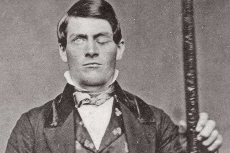
Phineas Gage. (Wikimedia Commons)
In a time when neuroscience was still in its infancy, doctors had to treat the very fine-looking Phineas Gage, the miracle man who lived for 13 years with a hole in his skull. This wasn’t a birth defect, but an injury that struck Gage.
The accident

A diagram of Phineas Gage’s skull after the accident. (John M. Harlow, M.D. / Wikimedia Commons)
At the mere age of 25, Gage was wounded by an iron rod induced by detonated power while he was working with the crew that was constructing railroads. This wasn’t any common injury; the 43-inch long rod with a diameter of 1.25 inch penetrated into Gage’s left cheek, pierced into his skull and flew 80 feet away from the back of his head. The miracle- he remained conscious to narrate the accident to the doctor. According to an article published in the Smithsonian Magazine, Gage’s exact words to the doctor were “Here is business enough for you”. This accident that occurred way back in 1848 and its repercussions documented made Phineas Gage one of the most legendary patients in medical history.
His story, which is also called the “American Crowbar Case” was studied by a number of doctors which assisted them in finding the connection between the brain and human behaviour. Initial studies suggested severe damage to the Frontal Lobe region of the brain. Sadly, in spite of the best efforts pooled in by Dr John Harlow to make sure nothing went wrong, an infection found victory. This took Gage into a semi-comatose state.

Multiple views of the skull of Phineas Gage. (J.B.S. Jackson, MD / Wikimedia Commons)
Effects on his mental health
That did not stop Phineas Gage from a complete physical recovery. He got back on his toes to find new work with just his right eye in treasure. He lost his left eye to this traumatic accident. Things seemed okay until people around Gage found an uncanny change in his behaviour. Dr Marlow made a note of his case study under the title “mental manifestations” which state Gage’s changed behaviour as, ‘fitful, irreverent, indulging at times in the grossest profanity… capricious and vacillating’ and being ‘radically changed’. The extent of this alteration in his mental attitude was so much that people around him were forced by the circumstance to say that he was, “no longer Gage”.
It was around these personality disturbances that the study about the brain and its link with social behaviour found profuse ignition. Today, neuroscientists have confirmed the frontal cortex to act as a catalyst in social cognition and decision making. Record has it that the case of Phineas Gage was the first evidence that kick-started the study on frontal cortex and its influence on a human’s personality and behaviour.
David Ferrier, a Scottish researcher in the field at that time used the Gage’s case to back up his study on animals that showed no change in physical health, but a beyond definite change in the behaviour after damage to the frontal cortex. He delivered a lecture on the same in the year 1878 at Royal College.
What happened to Phineas Gage?
The man who walked about confidently despite the hole in his skull and a whole new mental alteration continued to work on odd jobs until the age of 36 when he finally succumbed to on-going seizures in the year 1860. Even though the world lost this miracle man, he left behind a whole new scope for neuroscience studies.

Phineas Gage with the iron rod that pierced his skull. (Photo: Jack and Beverly Wilgus / Warren Anatomical Museum)
Major breakthrough studies
The year 1994 was an instrumental one, for his injury was reconstructed to engage in a deeper study of the brain using neuroimaging techniques. Their finding was a feather in the cap in the study of the human brain as it indicated damage to the left and right cortices of the brain, the part responsible for rational decision making and emotional responses.

In the year 2004, a 3D reconstruct of Gage’s skull and the injury concluded that the injury was confined to the left frontal lobe region of the brain. (Van Horn JD, Irimia A, Torgerson CM, Chambers MC, Kikinis R, et al.)
A further study in the year 2012 disclosed that the iron rod caused irreparable damage to 11% of the white matter in his frontal lobe and 4% of the cerebral cortex. Reports about Gage’s transformed uncontrolled behaviour were testified by the reasons suggested in the same study which confirmed the link between the frontal cortex and the limbic system, the master that regulates all emotions.
It is only because of this unfortunate accident, that the field of psychology was able to thrive in the study of the frontal lobe and its role in social cognition, reasoning and language, the significant factors of social behaviour.
Gage’s case has been so monumental that his body was exhumed seven years after his death so that his skull could be sent to Dr Harlow for further edification on this subject matter. The iron rod that caused this historical study and the skull with the hole has now been preserved in the Warren Anatomical Museum at the Harvard University of School of Medicine.
Enjoyed this article? Also, check out “William Beaumont: A Voyageur’s Open Wound That Revolutionised Gastric Physiology“.
Fact Analysis:
STSTW Media strives to deliver accurate information through careful research. However, things can go wrong. If you find the above article inaccurate or biased, please let us know at [email protected].
RELATED
- August 3, 2018 Charles Osborne Had Hiccups For 68 Years and It Only Stopped Just Before He Died
- October 12, 2019 Trepanation: Unusual Medical Procedure of Drilling Hole in the Skull
- May 11, 2019 Iron Lung: The History of the Present Day Breathing Machines
- May 29, 2019 The Rise and Fall of the Victorian Era Creepy Therapeutic Treatment Called Electric Bath
The post Phineas Gage: The Miracle Man with a Hole in his Skull who became a Major Breakthrough for Neuroscience appeared first on .
]]>The post Pontcysyllte Aqueduct: A High-Rise Canal-Connect Made of Cast Iron, an Engineering Marvel appeared first on .
]]>
Pontcysyllte Aqueduct at Froncysyllte, Wrexham, Wales. (DeFacto / Wikimedia Commons)
The Industrial Revolution of the 18th century was spearheaded by Great Britain, and this is best reflected in Pontcysyllte Aqueduct. Pronounced as ‘Pont-ker-suk-tay’, it is a landmark waterway, situated in North Eastern Wales. It is made of a cast-iron trough supported on 18 stone towers, 127 feet (39 meters) tall and each tower separated by a distance of 53 feet.
The trough rests on cast-iron arches which connect the towers on the top end. The brainchild of prodigal engineers Thomas Telford and William Jessop, it is tallest and the longest water channel made of iron. Also called ‘stream in the sky‘, it stands in a league with historical monuments like Taj Mahal, the Pyramids and The Great Wall of China. Literally, Pontcysyllte means the bridge that connects the river. Coupled with 11 miles of Llangollen canal, it is a designated UNESCO world heritage site, and a listed grade I building.

Pontcysyllte Aqueduct. (Akke Monasso / Wikimedia Commons)
The construction of Pontcysyllte Aqueduct
The story of this aqueduct, Pont y Cysyllte (Bridge of Cysyllte), begins in 1770 when the idea of the Ellesmere canal was conceived. This canal would link the city of Chester with the River Mersey in the north-west of England. William Jessop (1745-1814) was the technical supervisor of the project starting in 1795. The project faced a major problem. The canal must pass through river Ceiriog (in North-East Wales) and river Dee (passing through Wales and England), both having prominent valleys.
Thomas Telford (1757-1834), an engineer and architect of eminence, was roped in to meet this challenge. Telford was renowned for a string of path-breaking cast-iron bridges. Jessop -Telford duo had constructed an aqueduct over the river Ceiriog at Chirk – a small town in Wales, in 1795. This aqueduct was done in the stone structure which deemed unfit for this particular challenge. Because, the valley of River Dee was too deep and wide to permit a conservative stone- aqueduct. As the cast-iron bridges had proved their worth by this time, Telford proposed cast-iron bridge. His proposal was approved, and work began in right earnest with the approach way of canal done up by 1805. Then Pontcysyllte happened, and the rest is history.
A show of astute planning and daring technique
Officially opened for ships/boats on 25th November 1805, the aqueduct was admired worldwide for its unique design and utility. The design was unique as it forged iron into mason work. And utility was evident in ships sailing across the waterway held 126 feet above the river Dee on arched metallic ribs fused with masonry pillars. The top ends of the pillars were kept hollow to minimize load on the lower portion. A bizarre ingredient, ox blood, was mixed in a lime mortar to enhanced stickiness which would keep the stone pillars in good shape.
The approved design for aqueduct was hammered into shape by the dedicated team of professionals at Ellesmere Canal Company. Plas Kynaston Foundry was set up at close by to ensure speedy availability of cast iron parts for the construction of the aqueduct. Supporting arches and the water trough were bolted together and fixed atop the mason pillars. The trough was made airtight with Welsh flannel mixed in a blend of lead, iron, and sugar.
Only one fatality in 10 years of the construction period testifies to the astute dedication and commitment of Thomas Telford to this project. No wonder the project was a thumping success and Telford was nominated the president of the Institution of Civil Engineers in 1820. Memento marking the grand occasion had a picture of Telford in the background of Pontcysyllte Aqueduct.
A tourist destination par excellence
The stream in the sky is as good for navigation as for a walk or cycling on towpath built aside. For the walkers, there are no railings on the side of the water body, but the outer edge of the duct has a protective railing to check accidental fall. The trough is flush cleaned every 5 years by closing the flow and draining water through an outlet.

A boat crossing the aqueduct. (August Schwerdfeger / Wikimedia Commons)
A popular tourist destination, the aqueduct provides a breath-taking view of Britain’s gorgeous countryside. On the flip side, visitors are warned of the potential dangers of reckless revelry. A ‘Ponty Safety’ drive launched by `The Canal and River Trust Charity’ in Wales forbade visitors to use floating boards in stand-up position. As channel has no railings on one side, a stand-up reveller could tip over to a fatal fall. Even the side protected by railings may not help a brazen cyclist on a narrow towpath. Such accidents may happen as the microclimate around aqueduct is unpredictable. Gust of wind can ruffle a tourist any time with disastrous consequences.
Challenges
Ellesmere canal clubbed with Pontcysyllte aqueduct, had a profound impact on the economy of the region. When the local heavy industry wound up and cargo transport dwindled towards the fag end of the 19th century, the canal tourism thrived well. The economic crisis of 1930 and the World War II were a setback for the canal. An Act of Parliament in 1944 decommissioning Ellesmere canal was another blow. Nevertheless, the western branch of the canal was conserved as ‘Llangollen Canal’, for supplying water in the region. Yet, no ship sailed across the aqueduct till 1950 when a group of enthusiastic individuals rooted for tourism to preserve the industrial heritage of the canal. Tourism upped in 1960, and the canal was back in business. The British Waterways, since 1954, is serving as the navigational authority for the Ellesmere canal.
A prime relic of the Industrial Revolution
Strength and durability of the Pontcysyllte aqueduct merit description. Leaving aside re-laying of cast iron plates of the walkway in 1879, no change or repairs were made in it till the end of 19th century. Thus, it remained a prime relic of the industrial revolution. The collapse of fill embankment did happen in 1945, 1960,1982 and 1985, necessitating repairs in some areas of the duct. Further to this, the aqueduct was thoroughly repaired and renovated thoroughly in bicentenary celebrations of the year 2003-4.
A calculated risk which paid off
As a classic creation of Thomas Telford and William Jessop teamwork, a scheduled ancient monument and a world heritage site, Pontcysyllte Aqueduct stands today as majestic and functional as when launched more than 2 centuries back to ferry ‘Llangollen canal’ across the valley of river Dee. To this day, the joints of the aqueduct are sealed using the same old mixture of flannel with the iron-lead-sugar combo. Boating in the aqueduct and strolling on the towpath, one gets a feeling of being suspended in the air. What was generally viewed as a high risk off the beat idea at the time of its conception, has proved to be an earthy reality which has withstood the test of time, and will remain viable for long in the future.
Enjoyed this article? Also, check out “Golden Bridge: The Connect to the Past and the Future of Vietnam“.
Fact Analysis:
STSTW Media strives to deliver accurate information through careful research. However, things can go wrong. If you find the above article inaccurate or biased, please let us know at [email protected].
RELATED
- August 31, 2020 Ennedi Plateau and Aloba Arch: Home to Exquisite Natural Formations and ‘Extinct’ Animals
- October 22, 2019 Golden Bridge: The Connect to the Past and the Future of Vietnam
- April 1, 2019 Atlantropa: The Ambitious Idea of Uniting Europe and Africa by Draining the Mediterranean
- August 18, 2019 The Trans-Alaska Pipeline System – An Engineering Marvel of the 20th Century
The post Pontcysyllte Aqueduct: A High-Rise Canal-Connect Made of Cast Iron, an Engineering Marvel appeared first on .
]]>The post 2006 Mumbai Sweet Seawater Incident: When the Seawater had Miraculously Turned Sweet appeared first on .
]]>
2006 Mumbai Sweet Seawater Incident took place at Mahim Creek. (Nicholas / Wikimedia Commons)
They say curiosity leads man to do certain things that he had never done before. And in a strange case in the financial capital of India, a bizarre incident had led people into doing such extraordinary things that it became a hot topic of discussion for a very long time. Back in the year 2006, the usually salty seawater at Arabian Sea creek had inexplicably turned sweet and people residing by the water body thronged the shores to collect the sweet water, thinking it was some kind of divine intervention.
2006 Mumbai sweet seawater incident
It all started early in the morning of August 19, 2006. The water surrounding Mahimi dargah, situated near the Mahim creek had turned sweet all on its own. When local fishermen began their routine and went out to the sea, they noticed the difference and reported the incident. News then spread like wildfire in the vicinity and by afternoon, Mahim beach was suddenly crowded with people, who wanted to witness the strange incident all by themselves.
One man was seen bathing a child on the Mahim beach, a suburban area in Maharashtra’s capital city of Mumbai. It wasn’t an unusual sight to behold, until people came out in large numbers with utensils, plastic bags and bottles to carry the seawater back home for drinking and cooking purposes. Several others began taking a dip in the Arabian Sea, the western coastline of India, to rid themselves of diseases, thinking the water had, in fact, gained some kind of healing properties. Soon enough, news of the rare occurrence began floating in the entire neighbourhood and authorities had to jump in to intervene.
Reports of a similar incident of seawater turning sweet had also started coming in from Teethal, which is a coastal area in the Valsad District of Gujarat. Unbeknownst to the repercussions of drinking the impure, toxic and polluted water, people from Mahim carried the sweetly-saline seawater home, despite authorities warning them against it. Religious fervour caught up amongst superstitious people and by nightfall, Mahim became a holy site, where believers from nearby areas like Dadar and faraway suburbs turned up to test the rather odd phenomenon. A lot of Hindus, as well as Muslim devotees, claimed that the seawater turning sweet was nothing but the revered Sufi saint Makhdoom Ali Mahimi’s doing and that the seawater was now holy. People in Valsad even worshipped it for possessing extraordinary powers.
What had actually happened?
As soon as news channels reported of the mad rush near Mahim Bay, police officials sprang into action. Geologists at the Indian Institute of Technology – Bombay (IIT-B) called it a natural phenomenon while scientists at the National Institute of Oceanography (NIO) in Versova, said that the phenomenon was not unusual. Researchers said that in the months of monsoon, Mumbai had received heavy rainfall, which had caused rainwater to deposit in underground rocks, which in turn, released the fresh water into the creek. As the density of rainwater is lesser than seawater it floats on the surface of the saline water, mixing with it in the course of time.
Also, due to the continuous rainfall that the city had received, the overflowing Virar Lake emptied its fresh water content into the Mithi River, which mixes in the sea, thus making the water in the Arabian Sea sweeter and less salty in the process. Heavy rainfall and low tide could also have played a role in this phenomenon.
As the authorities from the Municipal Corporation of Greater Mumbai (MCGM), also known as Brihanmumbai Municipal Corporation (BMC), along with the Mumbai police, did their best in keeping everyone away from the strange happening, people did not give up. They drank the seawater, bathed in it, collected it in containers for future use and engaged in all such activities well after midnight. The police kept a strict vigil on the nearby hospitals and medical institutions, hoping to avert any kind of water-related epidemic if the need arose. But no news of an outbreak of water-borne diseases came by till the dawn of next day and no concrete report of what could have caused the water to turn sweet returned.
What did the reports say?
Despite Mahim Bay being an area of excess pollution, the water had changed in taste. A lot of industrial waste as well as raw sewage flow into the water every day, making it unfit for drinking. The Maharashtra Pollution Control board collected samples and sent it for study and also got in touch with the NIO in Goa, which too, confirmed that it was only because of the upsurge of rainwater inside rocks that had caused such an event. BMC health department’s tests conducted on the water samples showed that the salinity was as low as 600 particles per million as compared to the usual 10,000.
Enjoyed this article? Also, check out “Old Man of the Lake: The ‘Stumping’ Story of a Century-Old Log, Bobbing Inexplicably in Oregon’s Crater Lake“.
Fact Analysis:
STSTW Media strives to deliver accurate information through careful research. However, things can go wrong. If you find the above article inaccurate or biased, please let us know at [email protected].
RELATED
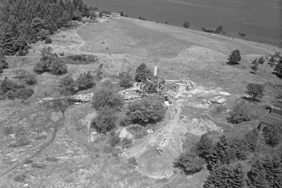 February 12, 2019 The Baffling Oak Island Treasure Trove Mystery
- May 9, 2020 Elephant Beach: The Dazzling Sandy Beach in Andaman and Nicobar Islands Perfect for an Exotic Vacation
- July 18, 2019 The Philadelphia Experiment: When an American Navy ship Supposedly Teleported
- February 2, 2019 The Ghost Blimp L-8 and the Unexplained Disappearance of the Two US Navy Pilots
The post 2006 Mumbai Sweet Seawater Incident: When the Seawater had Miraculously Turned Sweet appeared first on .
]]>The post The Ryugyong Hotel of North Korea: The Tallest Unoccupied Building in the World appeared first on .
]]>
Ryugyong Hotel. (Roman Harak / Flickr)
With 105 stories and a height of 1080 feet, the Ryugyong Hotel in Pyongyang in North Korea is the 63rd tallest edifice ever built as of 2019. At present, it also happens to be the world’s tallest, unoccupied building. This status may change with a shift in political winds and with an inflow of new foreign investment into North Korea.
The world’s tallest hotel

Portrait of Kim Il-Sung. (Gilad Rom / Wikimedia Commons)
In 1987, on the instruction of the then President of North Korea, Kim Il-Sung, the North Koreans commenced building what was to be the tallest hotel in the world. The plan was to surpass the very tall Westin Stamford Hotel that the South Korean company SsangYong Group had built in Singapore in 1986.
The North Koreans also wanted to outshine the international limelight that would come South Korea’s way for hosting the 1988 Seoul Olympics. It would be a great worldwide sensation if they opened the Ryugyong Hotel with the commencement ceremonies of the 13th World Festival of Youth and Students that they were hosting in June 1989.
Along with publicizing the achievements of the North Koreans, the world’s tallest hotel would, hopefully, also bring in direct foreign investment by attracting tourists and foreign investors. Hoping to bring in at least $230 million in foreign investment, the North Korean government set up the Ryugyong Hotel Investment and Management company. They promised many concessions to would-be foreign investors, including the right to operate nightclubs, lounges, and casinos in the towering hotel.

Ryugyong Hotel in 2012. (Jen Morgan / Flickr)
Building the Ryugyong Hotel
Baikdoosan Architects & Engineers, a North Korean construction firm, come up with a unique pyramidical design for the new hotel and began construction work on it in 1987.
They built a three-winged building with all the wings converging together into a pinnacle. Each of these wings has a length of 330 feet, a width of 59 feet, and a sloping angle of 75 degrees. There are 3000 or 7665 rooms for guests. At the top of the building, there is a short cone that has a width of 130 feet, eight revolving floors, and six stationery floors above these.
Until 2009, when Dubai’s Rose Tower raised its spire over its already 984 feet height and thereby surpassed the Ryugyong Hotel’s height, the latter had the distinction of being the world’s tallest hotel building.
Financial problems
Building material shortage and work delays prevented the scheduled opening of the Ryugyong Hotel during the opening of the 13th World Festival of Youth and Students in June 1989
If they had been able to finish the work on schedule, the Ryugyong Hotel would have become the world’s seventh highest building, surpassing the Westin Stamford Hotel’s 741 feet; the latter, at the time, was the highest hotel in the world.
With the dissolution of the USSR in the 1990s, North Korea lost its most important backer and funder. It was no longer financially sustainable for the country to continue the construction work at Ryugyong Hotel. They had already spent around two percent of the country’s GDP, an estimated $750 million, on the hotel and now they had simply run out of ready money for further work.
By the time the work stopped, the builders had finished constructing the full size of the building. The incomplete structure loomed against the sky as it was, without fixtures and fittings, for the next 16 years. The builders had left a construction crane at the very top of the structure and it rusted there, poignantly reminding everyone of “the totalitarian state’s thwarted ambition,” at least according to the UK’s propaganda arm, the BBC. Other Western mainstream media outlets took the lead in dubbing the unfinished building as “The Hotel of Doom,” “The Phantom Hotel,” and “The Worst Building in the World.”
In North Korea, where the government had commemorated the hotel by printing its image on their national stamps, the media took care to make no further mention of the hotel. Although the building remained prominent on the city skyline, the government directed that its presence be excised from the map of Pyongyang and from official photographs of the city.
Construction issues
According to some sources, the concrete used to build the hotel was of inferior quality and this means that the construction is unsound. There have also been rumours that the lift shafts are not correctly aligned.
Resuming the construction of Ryugyong Hotel
In April 2008, the Egyptian company, Orascom Group, stepped in to help with continuing the hotel’s construction. They added a telecommunications antenna and the glass cladding over the entire exterior of the building that gave it the current shiny appearance.

Ryugyong Hotel without the cladding. (Chris Price / Flickr)
According to Khaled Bichara, the Chief Operating Officer of the Orascom Group, the Ryugyong is no longer to be only a hotel, but a building for mixed-use purposes. It will have restaurants, hotel accommodation, apartments, and business facilities. He also stated that the building did not have “too many problems” on the structural front, at least nothing that the Orascom Group couldn’t resolve.
By July 2011, the Orascom Group finished the hotel exterior. The following year, in September of 2012, Koryo Tours released photographs of the partially finished interior.
The Kempinski Hotels Group, in November 2012, announced their intention to run the hotel after its expectant opening in 2013. This opening plan fell through and the Kempinski Hotels Group backtracked on their earlier statement, saying they hadn’t signed a definitive agreement to run the hotel. It is possible that the ongoing hostility of the United States and other Western countries towards North Korea had something to do with in this backtracking decision.
Current status of the Ryugyong Hotel
After a hiatus of a couple of years, the Orascom Group resumed work on the Ryugyong Hotel in 2016 and are reportedly still working on it. They built access roads to the hotel in 2018 and added LED display features on the building exterior. The building now lights up every night with a light display featuring the North Korean flag and encouraging slogans.
In early 2019, the Ryugyong Hotel still stands vacant and retains its Guinness World Records title of being the tallest, unoccupied building in the world. This may change in the future, once the Orascom Group finishes their work.
Enjoyed this article? Also, check out “Varosha: The Abandoned Luxury Retreat in the Mediterranean“.
Fact Analysis:
STSTW Media strives to deliver accurate information through careful research. However, things can go wrong. If you find the above article inaccurate or biased, please let us know at [email protected].
RELATED
- May 2, 2019 What Happens to the Olympic Venues in the Host Countries After the Olympic Games End?
- December 12, 2018 Dhanushkodi: Where a Cyclone Ripped Apart an Entire South Indian Town, Rendering it Uninhabited
- March 26, 2019 The Disappearing Aral Sea and its Abandoned Ships
- July 23, 2018 Nauru: An 8 Square Mile Island That was Once the World’s Richest Country
The post The Ryugyong Hotel of North Korea: The Tallest Unoccupied Building in the World appeared first on .
]]>The post The Catacombs of Paris: A City of the Dead Under the City of Love appeared first on .
]]>
Catacombs of Paris. (Rijin / Wikimedia Commons)
Back in the 17th century, at a time when Paris blossomed into the European hub, the city of love faced a dire issue – there were not enough graves for the dead. Graveyards overflowed with overstuffed graves until corpses could hardly rest in peace.
Not only did it make for an unpleasant view, but it was a health hazard for the citizens who were yet to book their spots at a graveyard. So the Paris authorities decided to bury their dead a little below the usual six feet. Tombe-lssoire quarries, under the plain of Montrouge was the site they chose to reallocate these corpses.
At that time, the site was located outside the Capital. The quarries that lay underneath were a part of a labyrinth extending up to 800 hectares under the city. The quarries were in use until at least the 15th century before they were abandoned. It was only in 1785 that the quarries were used again for bone transfer. The preparation of the site was headed by Charles Axel Guillaumot, an Inspector of the General Quarry Inspection. The first cemetery to be evacuated was Saints-Innocents. From 1785 to 1787, bones were collected from tombs, graves and charnel houses and transferred to the quarry at night, as the Parisians slept oblivious to the act.
The bones were first dumped in two quarries and later distributed into piles by the quarry workers. The transfers began once again in 1814, right after the French Revolution. As the parochial cemeteries of Paris like the Saint-Eustache, Saint-Nicholas-des-Champs and the Bernardins Convent were suppressed, countless skeletons made their way to add to the remains of 6 million people in the quarries, 20 meters underground. Catacombs, as they are called in reference to the ancient Roman Catacombs, were operational yet again during the renovation by Louise-Phillipe in 1840 and then again during the Haussmannian reconfiguration of Paris during 1859.

Inside the Catacombs of Paris. (Shadowgate / Flickr)
Inside the Catacombs of Paris
The Catacombs of Paris were made open to the public in 1809. The quarries saw a footfall of both French and foreign visitors who would leave their remarks of the state-initiated welfare of old human bones, aesthetically stacked along the walls of the quarries. Remarks and impressions could be written on a register placed at the end of the circuit. Soon, Catacomb visits became the favorite means of recreation for the French and foreigners. Its visitors included Napoleon Bonaparte who descended the Catacombs with his son in 1814. Back in the 19th century, the visiting arrangements were irregular. Today, it’s open to everyone and it sees a footfall of about 550,000 yearly.
The Catacombs are now a destination for a retreat for families. One of the world largest homestay holiday companies, Airbnb came up with a one of a kind Halloween offer that offered a night at the Catacombs for couples and families wIho wouldn’t mind sharing their bedroom with 6 million dead Parisians. A perfect package including a private concert, dinner, breakfast, and a storyteller who would tell fascinating tales of the Catacombs before bedtime. The offer came for the first time in 2015 with a strict warning – “Respect the Catacombs as you would your own grave.”

Catacombes de Paris. (Wikimedia Commons)
Illegal visitors
Today, only a part of the 200-mile-long maze is accessible to the public. But that doesn’t stop people from sneaking into parts of the galleries restricted since 1955. Notorious among the illegal explorers are school children and partygoers who are believed to have found secret passages through the maze. The quarries fascinate the young Cataphiles, as they’re known, who want to see more than what the government would let them. Some even are reported to have film screenings inside the Catacombs of Paris.
Incidents
Quite often, curious teenagers are lost in the maze and a search party is needed to rescue them. On June 14, 2017, two teenagers, aged 16 and 17, were found by a search party with rescue dogs from the quarry. They were later taken to a hospital to be treated for hypothermia. The tunnels are pitch black when artificial lights are out. If the flashlight battery runs out, and no search party comes looking, it won’t be long before a strangled explorer adds up to the number of remains in the quarries.
The cataphiles, however, are not the only people the authorities have to worry about. Since most of the Catacombs are left deserted, anti-social elements of society are making the best of it. Very recently, a bunch of ingenious thieves smuggled more than 300 bottles of vintage wine worth €250,000 through the underground network.

An Alley inside the Catacombs. (Rijin / Wikimedia Commons)
The skeleton story
Presently, an exhibition known as the “Skeleton Story” is being held at the Catacombs ossuary. It had started in 2017 and will continue until the end of 2019. The exhibition is organized in collaboration with the National Institute of Preventive Archeological Preventive Research (INRAP) and the DRAC of Ile-de-France. It presents the excavations carried down by INRAP at the former Hospital de la Trinite cemetery. The exhibition points out the links of the bones from the Catacombs to the ones excavated by INRAP. The study provides a better understanding of the 15th to 17th century Parisians. Their food habits, their age and sex, the diseases they suffered from, and the epidemics that affected them are some of the factors the exhibition addresses.
The dead don’t pay taxes, or do they?
In conclusion, back in the 17th century, the dead in Paris was too much of a burden for the authorities and general people. It is believed by many that the lack of money, resource and to some extent will, led to the reluctance for a proper burial for the dead. Come to think of it, the pre-revolution working class of Paris wasn’t really what you’d call well off. To spend money on proper burial rituals was inconvenient. The cemeteries didn’t put much effort to cover the bodies either considering the fact that the dead don’t pay taxes. However, years after their death, the dead of Paris are now a grand source of tax for the government thanks to the tourism they attract.
Enjoyed this article? Also, check out “Church of the Dead: Home to the Peculiar Mummies of Provincial Italy“.
Fact Analysis:
STSTW Media strives to deliver accurate information through careful research. However, things can go wrong. If you find the above article inaccurate or biased, please let us know at [email protected].
RELATED
 August 25, 2018 Martin and Anna Haining Bates: Couple Who’s Love Story Finds a Place in Guinness Book
- December 3, 2018 Terracotta Army: An Army to Protect the Dead in Their Afterlife
- June 6, 2019 Spaghetti Tree Hoax: When BBC Convinced a Million Viewers That Spaghetti Came from Trees
- March 18, 2019 The Extraordinary Conjoined Twins: Lazarus and Joannes Baptista Colloredo
The post The Catacombs of Paris: A City of the Dead Under the City of Love appeared first on .
]]>The post Devils Hole: The Only Wild Habitat in the World Where the Endangered Devils Hole Pupfish Are Found appeared first on .
]]>
Devils Hole in Nye County, Nevada. (NPS photo)
Devils Hole in Nye County, Nevada, is home to one of the most extraordinary species of fish known as the Devils Hole Pupfish or the Cyprinodondiabolis. Measuring about an inch to three inches in length, these fish exist only in this particular habitat in the wild. They are also the only fish found in the Devils Hole geothermal pool. At present, they are on the verge of extinction and the Nevada Department of Wildlife is taking strong measures to conserve their population and extend it by captive breeding.

Devils Hole pupfish. (NPS photo)
The Devils Hole geothermal pool
Fed by aquifers and with a water temperature of 33-degree C, the Devils Hole geothermal pool in the Mojave Desert doesn’t appear to be a likely place to sustain life. It is found in the Mojave Desert in the 40-acre Death Valley National Park in the Ash Meadows National Wildlife Refuge in Nye County, Nevada in the United States. Formed in a fissure in the Cambrian carbonate rock, it lies around 49.21 feet below the surface. Its position ensures that it receives very little direct sunlight and it is dim inside the limestone cavern.
The surface area of the pool is around 11.48 feet by 72 feet. There is a shallow rocky shelf at one end that measures 16 feet by 11.48 feet and has a depth of 9.84 feet. From this shelf, the pool’s depth plunges down to 436 feet. It could be even more, but the caverns haven’t been fully mapped so far.

Devils hole. (Pacific Southwest Region USFWS / Flickr)
Seismic activities in far off places have a decided effect on the pool. When there are earthquakes in Mexico, El Salvador, Chile, and even Japan and Indonesia, they apparently cause underground tsunamis in the Devils Hole pool. The pool water recedes and then rushes back in forcefully.
The Devils Hole pupfish
The shallow rocky shelf in the pool is home to the tiny and short-lived Devils Hole Pupfish; they have a lifespan of only one year. The fish mainly live near the surface on the rocky shelf, at a depth of 1.14 feet, and feed on the Spirogyra and Plectonemaalgae that grow on the rocky sides of the pool, but scuba divers have also observed them at a depth of 60 feet in the pool’s deeper section.
The male fish have an iridescent bluish tinge and the females have an olive-green tinge. They got the name ‘Pupfish’ on account of their tendency to frolic in the water. The fish lay eggs and spawn throughout the year, but the population follows a seasonal cycle, with a higher number of fishes seen between April to June than in November.

Devils Hole pupfish. (Pacific Southwest Region USFWS / Flickr)
Nobody knows exactly how these tiny fish came to be in the Devils Hole pool, but the assumption is that they may have come some 10,000 years ago when the water level was up to the surface lip and there were streams flowing into the pool. At the end of the Ice Age, the ice retreated, the surface streams dried up, and the fish found themselves isolated in the pool, with no way out.
Over the centuries, the fish have adapted and thrived in the high temperature, high salinity, and low oxygen content of the water in the Devils Hole pool.
In recent years, however, the once thriving population has gone into a serious decline and if that trend continues, they might very well become extinct.
Reasons for the Devils Hole pupfish decline
There may be a variety of reasons for this drastic decline in the Devils Hole Pupfish population. The inbreeding factor is one reason. Since the end of the Ice Age, the trapped Pupfish population could only breed with one another and that may have led to defective DNA in later generations.
Another possible cause may be the rise in water temperatures which makes it difficult for the fish eggs to survive and which also adversely affects the growth of the algae on which the fish feed.
The tsunami-causing earthquakes also cause a decline as the waves they generate sweep away fish eggs and larvae from the shallow rocky shelf.
The Devils Hole pupfish declared endangered
In 1967, the Devils Hole pupfish joined the Endangered List. This came about thanks to the lobbying of the ichthyologist, Carl Hubbs, who convinced President Trumanin 1952 that they had to save both the Devils Hole Pupfish and their unique habitat. Earlier, in November 1954, the National Speleological Society sent scuba divers into the pool to carry out the first ever count of the Pupfish and they counted around 300 individuals.
Given that there were only a few hundred of them in the pool and as this was their only habitat – the smallest, by the way, of any known vertebrate animal on Earth – the possibility of their extinction was very real. In the 1970s, the US government formed the Pupfish Task Force and the Desert Fishes Council to protect the fish, and the US Supreme Court ruled that private companies could not pump out groundwater from the area as that led to a fall in the level of the Devils Hole pool water and affected the well-being of the fish.
Conservation efforts to save the Devils Hole pupfish
Saving the Devils Hole Pupfish is a tricky proposition as there are very few remaining individual fish and they have adapted over thousands of years to exist only in this unique habitat.
For conservation purposes, the Park Service researchers have been removing some of the eggs, larvae, and adult Pupfish to a specially prepared aquarium at the Ash Meadows Fish Conservation Facility where the conditions of the original habitat have been recreated as closely as possible. They first moved the eggs to the facility in April 2013 and these have since successfully hatched, and the researchers reported in November 2013 that the larvae were feeding and growing.

Devils Hole pupfish in a specially prepared aquarium. (Pacific Southwest Region USFWS / Flickr)
They remove no more than six adult fish in a year as harvesting more than that has shown to have a deleterious effect on the overall population.
Under the assumption that changes in the temperature of the pool water may have reduced the natural food of the Devils Hole Pupfish, the Nevada Wildlife Department’s National Park Service has been feeding them to sustain them and, hopefully, halt their population decline.
They have installed natural as well as artificial hideouts on the shallow shelf on which most of the Pupfish live to increase the survival chances of the Pupfish eggs and larvae, and they check on these at two-weekly intervals.

Devils Hole pupfish breeding facility. (Pacific Southwest Region USFWS / Flickr)
The researchers intend to replenish the Devils Hole Pupfish population with the captive-bred fish and to establish refuge populations in other locales to prevent their extinction. Raising the fish for too long or in entirety in captive conditions is not ideal as they become domesticated and lose the behavioural traits that allow them to be self-sufficient enough to survive in the wild.
Enjoyed this article? Also, check out “Devils Tower in Wyoming: A National Monument and a Geological Wonder“.
Fact Analysis:
STSTW Media strives to deliver accurate information through careful research. However, things can go wrong. If you find the above article inaccurate or biased, please let us know at [email protected].
RELATED
- June 3, 2018 Dasht-e Lut: A Martian Terrain and the Hottest Place on Earth
- September 19, 2018 Fairy Circles: The Systematic and Symmetrical Circular Arid Grass Formations
- May 1, 2019 Devils Tower in Wyoming: A National Monument and a Geological Wonder
- July 10, 2018 Solving the Mystery Behind the ‘Sailing Stones’ of Racetrack Playa
The post Devils Hole: The Only Wild Habitat in the World Where the Endangered Devils Hole Pupfish Are Found appeared first on .
]]>The post NASA’s Deep Space Network: How We Communicate with Space Probes Billions of Miles from Earth appeared first on .
]]>
Deep Space Network: An antenna at Goldstone Deep Space Communications Complex. (NASA / JPL-Caltech)
The Deep Space Network or DSN is a network of radio antennae, owned by American Space Agency NASA and in particular, a division of theirs called the Jet Propulsion Laboratory (JPL). Spread across three continents, the DSN antennas act as middlemen to transfer data between spacecraft from Outer Space interplanetary missions as well as other satellites which orbit Earth.
History of Deep Space Network
1963 brought about the launch of the DSN under the JPL which was originally an institution of the U.S Army. They used it for mapping and reconnaissance. NASA saw great value in the program and had it transferred when the opportunity arose, knowing that an isolated hub for communications would be more effective than each craft or mission having to create its own. The Californian location was made headquarters, with Canberra joining the program in 1965 and Madrid later in the same year. At this time it serviced only three crafts yet just half a century later the number had increased to thirty-three. This includes vessels from organisations outside NASA including the European Space Agency, Japanese Space Agency and their Indian counterpart.
The sites of DSN
At any given DSN site there are four antennas. Each site sits 120 degrees apart in longitude, in Canberra (Australia), Madrid, (Spain) and in Goldstone, (California). They are evenly spaced meaning that the rotation of Earth will not affect signals as it disappears under the horizon. In this regard, one might say that the sun never sets on NASA’s empire.

Deep Space Communications Complex in Canberra, Australia. (NASA / JPL-Caltech)
They are situated on Earth as a means of space saving. They are too large and too heavy to be usefully implemented on spacecraft which traditionally only have small devices. They also deliver weak signals back to Earth but it is a secure delivery. The strength of signal the antennas receive is ridiculously low,
“…20 billion times weaker than the power level in a modern digital wristwatch battery.”
It is still effective in receiving data none-the-less. Once the DSN centers receive the data they send it to the Operations Facility at the JPL, In Pasadena, California. Then the data is processed and the pictures come to life.

1993 photo of Deep Space Network Operations Center at JPL in Pasadena, California. (NASA / JPL-Caltech)
Deep Space Network antenna
According to the DSN website, they are “…the largest and most sensitive scientific telecommunications system in the world.” Their goal is to “…improve our understanding of the solar system and the larger universe.” They provide the crucial connection for commanding our spacecraft and receiving their never before seen images and scientific information on Earth, propelling our understanding of the universe, our solar system and ultimately, our place within it.
Most correspondence is among the Voyager missions. Both set off in 1977 to monitor planets inside our solar system with Voyager II launching 16 days before Voyager I. At the time of writing, both have made it outside of the solar system – monumentally the only two crafts in history to do so. Exactly what this means,
“For the second time in history, a human-made object has reached the space between the stars. NASA’s Voyager 2 probe now has exited the heliosphere – the protective bubble of particles and magnetic fields created by the Sun.”
To give a glimpse of the important of DSN, here are some of their accomplishments. They provided the images of Neil Armstrong’s moonwalk, helped in the rescue of the Apollo 13 astronauts when they couldn’t access the main communications sector of NASA. 1965 brought the first close up images of Mars, 1974 – Mercury and in later years: Jupiter, Saturn, Neptune as well as their rings and moons. And of course the Voyager missions, which have documented their maiden move into interstellar space.
Amazing facts about Voyager
“Launch: Voyager 2 launched on August 20, 1977, from Cape Canaveral, Florida aboard a Titan-Centaur rocket. On September 5, Voyager 1 launched, also from Cape Canaveral aboard a Titan-Centaur rocket.
Between them, Voyager 1 and 2 explored all the giant planets of our outer solar system, Jupiter, Saturn, Uranus and Neptune; 48 of their moons; and the unique system of rings and magnetic fields those planets possess.”
Both Voyagers carry The Golden Record which we have spoken about before.
Problems with Deep Space Network
Alas, not all is sweetness and star-light with DSL. There have been mistakes made which it would seem are inevitable in such a complicated type of environment and distance. However, a prestigious organisation such as NASA strives to make sure that errors do not happen as the cost can be extreme as well as time-consuming to find and bring a replacement.
One example is of Cassini, a spacecraft which was orbiting Saturn’s equator and planned to move into the atmosphere after thirteen years dancing around the rings. When the time came, the uplink from DSL failed and so Cassini was unable to make the plunge which had to be done in a certain moment for favorable conditions. The dive was made a day later but it showed a chink in the seemingly impenetrable armour of DSL.
It is not the first fault made by DSL and while some criticisms have been admonished it retains support from many major players in the astronomy game. For example, astronomer Brad Peterson states, “As NASA launches increasingly complex and data-hungry missions… the need for DSN is only going to increase.”
Upgrades have been made to keep the technology ticking over and eliminate errors yet it is said that the recent blips actually occurred because of the newest antenna installed. None-the-less, DSL have never dropped below “…95% of both outbound and incoming signals, its minimum goal.” This is according to Pete Vrotsos, program manager at NASA’s Space Communications and Navigation office. And moreover, this is with reported annual budget cuts from NASA. Similar initiatives seem to be having more investment in European missions: Rosetta, Gaia and Mars from the ESA are receiving consistent support.
They are furthermore trying to implement updated techniques such as laser systems opposed to radio transmissions but this comes with its own problems. They are lighter and more energy efficient than older style systems which would help proceedings in the long run.
The future of DSN
Investing money in ventures like this is a controversial topic. Many will say why not invest in our planet instead of planning wild goose chases into the dark unknown. The counter of that would be to reprise the famous Oscar Wilde quote,
“We are all in the gutter but some of us are looking to the stars.”
Millions of years of nomadic culture mean that the human race is destined to explore and so space missions will forever be part of the fabric of life. Outward thinking and exploring space is an unexplainable necessity. We believe that Outer Space has the key to solving many problems on Earth but we just don’t know where to look. For this reason, NASA’s DSL program is a much-needed commodity, one which can hopefully get through this apparent time of austerity and conquer the test of time.
Enjoyed this article? Also, check out “Did Man Really Land on Moon? The Dilemma of Apollo 11’s Missing Tapes“.
Official Website:
Real-time status of communications with NASA’s deep space explorers
Fact Analysis:
STSTW Media strives to deliver accurate information through careful research. However, things can go wrong. If you find the above article inaccurate or biased, please let us know at [email protected].
RELATED
- July 4, 2019 Jack Parsons: The Sex Occultist Who Was Key in Sending America to Space
- September 27, 2018 Truth Behind The Black Knight Satellite Conspiracy Theory
- December 28, 2019 Stanford Torus & Bernal Sphere: Model Space Colonies for Mankind to Set up Base in Space
- March 3, 2019 Space Debris: The Growing Hazard of Man-Made Debris in Space
The post NASA’s Deep Space Network: How We Communicate with Space Probes Billions of Miles from Earth appeared first on .
]]>The post Kolmanskop: From Being the Richest Town to Now Being Devoured by the Desert appeared first on .
]]>
Inside an abandoned house in Kolmanskop. (Michiel Van Balen / Flickr)
Kolmanskop is the name of a railway station in Namibia (Southern Africa). It lies 850 km south-west from Windhoek – the capital city of Namibia, and 10 km from a secluded seaside town called Lüderitz. The station is named after a man called Johnny Coleman. This man, a transport driver, was stranded in a severe sand storm along with his ox wagon and died of extreme thirst in the hot desert. In his memory, the station was named Kolmaskop. `Coleman’s hill’ in Afrikaans is called Kolmanskop, hence the name. It is called ‘Kolmannskuppe’ in the German language. The station, in course of time, became the hub of a diamond industry of world fame.

Kolmannskuppe signboard. (Zairon / Wikimedia Commons)
Discovering diamonds in Kolmanskop, Namibia
Circa 1908, following official orders to keep the Kolmanskop railway line clean, a railway worker picks up a sparkling stone from the track and takes it to his boss. August Stauch, the boss, a mineralogist by hobby, was impressed with the finding. It surely wasn’t an ordinary stone. He showed it to Sonke Nissen, his friend and a Mining Engineer. It was a diamond. Great news indeed, but they must keep it to themselves, to make the most of it. They do just that and keep the finding a closely guarded secret. They quit their jobs and acquire 75 acres of land at Kolmanskop, between Luderitz and Keematshoop. With fond dreams of digging diamonds, and living happily ever after, they settle down in their new venture.
Diamond transformed a sleepy habitation into a rich township
A secret as precious as a diamond, obviously, couldn’t hold for long. Soon, it was out in the public domain and the diamond seekers swarmed the area. In a matter of 23 years, the place got transformed into a vibrant township, the world’s richest. With a population of just 400 people, the town, in 1911, boasted of electric power, school, hospital and casino. It also had a theatre, sports hall, ballroom and swimming pool. An ice factory was set up to supply ice for the fridge in households. The town had a functioning post office, bakery and shops for all kinds of provisions. The hospital, notably, had an x-ray machine, the first ever to be installed in South Africa. Apart from medical use, the machine helped to fix workers who tried stealing diamonds by swallowing them.
The government taking notice of the diamond business
In time, the state administration woke up to the diamond loot and banned possession of land in Kolmanskop for private use. The Railway Station was declared a restricted diamond area. A well-organized industry came up in the region, to separate diamond from sand. Cape Town was unlucky to have missed this industry all because of a bad decision. The desert region of kolmanskop was offered to Cape Town administration in 1885, but the Cape government, then, had declined the offer.
World War came as a spoiler for the diamond industry
The diligence that went into separating diamonds from the sand was enormous. This can be gauged from the fact that processing 10 tons of sand yielded just one or two carats of diamonds. Yet, up to 1914, a massive amount, 1 ton of diamond, was extracted. As world war broke out the same year, the diamond industry came to a grinding halt. The Germans, having a major engagement with the diamond industry, fled the area. Thereafter, Kolmanskop came under the direct administrative control of South Africa.

Kolmanskop, Namibia. (Johan Jönsson / Wikimedia Commons)
Intensive mining exhausted one resource, forcing search for another
With the depletion of diamond reserves around the Railway Station, the mining activity had to be moved to the contiguous distant areas. Prospective mining areas were found in the south of Luderitz, and up to Oranjemund town at the mouth of river Oranje, near the South African border. In a decade’s time, the diamond industry shifted completely to the South and the 1914 setup was trashed. With all inhabitants quitting Kolmanskop by 1960, the only vacant building remained, to be dishevelled and engulfed by the surrounding desert.
The evacuation of the town was hastened by the discovery of upscale diamond deposits in 1928. These deposits were on beach terraces close to the river ‘Oranje’. People rushed 270 km south of Kolmanskop to grab the precious bounty. In the process, all settlements in the region were uprooted. For some time, Kolmanskop served as a supply depot for the mining operations at the far-away diamond deposits. But subsequently the supplies got sourced from South Africa and connections with Kolmanskop were severed for good.
As the diamond industry shifted base, ruins of Kolmanskop became a tourist hub
The shift of the diamond industry to Luderitz brought immense riches to this town. At the same time curiosity about Kolmanskop, the Railway Station where the story began in 1908, increased by the day. Some tourists went to the deserted township of the diamond industry and explored the derelict buildings lying in sand mounds.

A house engulfed by sand dune. (Sonse / Wikimedia Commons)
The abandoned homes and buildings were dug out, repaired and renovated. These were typical German architecture with large windows and curtailed roofs. The curiosity soon became business and Kolmanskop came back to life in a new avatar – a tourist destination. The risen-from-sands township is now an organized vacationer, guiding visitors in multiple languages: English, German and Afrikaans. Tours operate twice daily from Monday to Saturday. On Sundays, only one tour is conducted.

Aerial photo of Kolmanskop. (SkyPixels / Wikimedia Commons)
Déjà vu Kolmanskop
The desert sand blows through the day and only scant vegetation grow in Kolmanskop region. Yet in its heydays, gardens with eucalyptus trees, lawns and flowers were kept and maintained by the township. Freshwater was brought in through railway tankers and stored for irrigation as well as human consumption. The harsh desert conditions discouraged keeping of pets. But the story of one pet ostrich is very much on record. The bird was generally hostile to people but drew cheers on Christmas Eve when it pulled at celebratory sledge on sand mounds.

Kolmanskop. (calliopejen1 / Flickr)
Like diamonds are forever, Kolmanskop remains in the reckoning even in doom.
Enjoyed this article? Also, check out “Hashima Island: A Once Bustling Japanese Metropolis That Now Reminisces Its Hauntingly Tragic Past“.
Fact Analysis:
STSTW Media strives to deliver accurate information through careful research. However, things can go wrong. If you find the above article inaccurate or biased, please let us know at [email protected].
RELATED
- July 2, 2019 Varosha: The Abandoned Luxury Retreat in the Mediterranean
- January 25, 2019 Pripyat, Ukraine: The Thriving Soviet Nuclear City That the Chernobyl Disaster Turned into a Ghost Town Overnight
- February 13, 2020 Hashima Island: A Once Bustling Japanese Metropolis That Now Reminisces Its Hauntingly Tragic Past
- December 25, 2018 Jack the Baboon Once Served as a Railway Employee for 9 Years and Didn’t Commit a Single Mistake
The post Kolmanskop: From Being the Richest Town to Now Being Devoured by the Desert appeared first on .
]]>The post Children of Llullaillaco: Where Young Children Were Sacrificed to the Gods appeared first on .
]]>
The extremely well-preserved body of La Doncella and her ornaments. (Photo: Dr. Johan Reinhard / Used With Permission)
The continent of South America is home to one of the greatest indigenous civilizations in human history. The Incas of Peru, who gave the modern world one of the new seven wonders – Machu Picchu – have perhaps been the most inexplicable people to ever walk the earth. Their ways of living, their age-old practices and the monuments they built during their reign, have all been subjects of great intrigue among commoners. And as archaeologists and researchers keep delving deeper into the olden civilization, which existed between the 1200s and 1500s, the more mysteries keep tumbling out of their closets as days pass. One such oddity was the religious sacrifices of children that were carried out during the Inca Empire.

La Doncella or “The Maiden” being examined by researchers after her discovery. (Grooverpedro / Flickr)
Discovering the mummies of children
In a startling discovery made in 1999, Dr. Johan Reinhard and his team of archaeologists stumbled upon ancient, well-preserved mummified bodies of three children, which dated back to more than five centuries ago. At the peak of Mount Llullaillaco, a dormant volcano bordering Chile and Argentina, inside a tomb-like structure, the mummies of Children of Llullaillaco, as they have been named, were found, thus bringing a spine-chilling Inca ritual to the fore.

Left: Dr Johan and his team (in the background) after discovering the Mummies of Llullaillaco, 1999. (Johan Reinhard / Wikimedia Commons) Right: The site where the mummies were found. (Christian Glass / Wikimedia Commons)
As per the disturbing religious custom, commonly known as capacocha, young individuals from Cuzco, the capital city of the Incan Empire, were chosen as gifts for the Sun God Inti. Little girls and boys, probably the best among the lot, in terms of looks, statuses and health were handpicked, well-fed and taken good care of, weeks or even years before it was time for them to ascend the volcano hundreds of kilometers away, where superior priests made the supreme sacrifice.
As the chosen day drew closer, the children, as young as six years of age and a maximum of 16, were dressed in their best attires, adorned in fine jewellery and along with a hundred other offerings like gold, silver and various miscellaneous items, left near the summit of the titular volcano to be sacrificed. This ritual was undertaken during ceremonies like the passing away of the emperor or with a purpose to curb natural calamities or even please the gods.
As per Incan beliefs, it was an act of great honour to be chosen for the sacrifice, where after the children died; they would join their ancestors in the afterlife and look over the village as angels, keeping their kin from harm. Surprisingly, the sacrifices were ordered by the Emperor himself. Before the children began their journey towards their extreme end, they were presented before the monarch, who held a feast in their honour, as the chosen ones would be given up to the gods.
How were the dead bodies preserved?
Owing to the freezing conditions near the summit of the Llullaillaco volcano, the three excavated mummies of the children in question have been found very well-preserved. Not just their bodies, but their internal organs, too, were found to have been well-conserved, along with frozen blood in their hearts and lungs. With their hair intact and still braided and dresses as good as new, complete with fancy feathered headgears, their slightly shrivelled skin, which showed signs of some deterioration, were brought out for more scientific study and for a peep inside the Inca customs. The three mummies were named – La Doncella or The Maiden, El Nino or The Boy and La Nina or The Lightning Girl.

El Nino also known as “the boy” among the three children discovered. (Joseph Castro / Wikimedia Commons)
Children of Llullaillaco: Research and findings
As the study progressed further, scientists found telling evidence. The presence of alcohol and leaves of coca (from which cocaine is derived) in the mummies proved that the children were drugged before they were left out to die in the freezing temperatures near the summit of the volcano, while it also served as a substance that put them in a stupor, as they met their unsettling end. Researchers working on The Maiden used radiological data, X-Rays and CT scans, which revealed more information about the diet during the children’s final days.
During their last few months before the deadly ritual was executed, the children’s diet was slightly modified. A more high-fibre and protein-rich diet was fed to them, which consisted of vegetables and llama meat along with cobs of corn. This fattened them up, which helped them ascend the high altitude of the volcanic mountain without getting exhausted. Alcohol in the form of maize-beer was also given to them, which put them in a dazed state so that they lost consciousness during their last moments. Researchers also believe that some children were murdered by force if they resisted the sacrifice, as evident from traces of blood on El Nino’s clothes and his bundled up state. As per the scientists, there were no special efforts undertaken to preserve the bodies; the cold, thin and dry air near the volcanic peak worked its way on the three children.

Summit of Llullaillaco Volcano. (Lion Hirth / Wikimedia Commons)
While the eldest child among the three named La Doncella was 15-years old at the time of sacrifice, it appears that she froze to death while still in her sleep and her mummified body remains to tell her tale. Sitting cross-legged with a tightly-wrapped shawl around her coffee brown dress and striped sandals, the Maiden’s hair were woven into countless braids when she was found. In a new research in 2012, The Maiden was found to have contracted a virus, which caused a rare lung disorder in her. This fascinating discovery will also lead the scientists to study more about ancient diseases and extinct pathogens that caused illnesses among people that once lived. As per Dr. Reinhard, The Maiden’s body has been the best-preserved mummy, which is now put on public display at The High Country Archaeological Museum in Salta, Argentina. Researches and analyses are still being conducted on the other two mummies of the younger ones.

La doncella (the maiden) on display at Museum of High Altitude Archaeology. (Grooverpedro / Flickr)
While an agreement has been made between researchers and the local tribals to not dig up any more graves, as many as 40 ancient burial sites were discovered in various regions, which could otherwise have given a deeper insight into the fantasy world of the Incan Empire, where religious sacrificing of children was more an honour than anything else.
More Photos: Llullaillaco Mummies by Dr Johan Reinhard
Enjoyed this article? Also, check out “Rosalia Lombardo: The 8,000 Skeletons, 1,252 Mummies and a Fallen Angel Who Rest Within the Catacombs of Capuchin“.
Recommended Read:
Inca Rituals and Sacred Mountains: A Study of the World’s Highest Archaeological Sites (Monographs) | By Maria Constanza Ceruti & Johan Reinhard
Recommended Visit:
Museum of High Altitude Archaeology | Argentina
Fact Analysis:
STSTW Media strives to deliver accurate information through careful research. However, things can go wrong. If you find the above article inaccurate or biased, please let us know at [email protected].
RELATED
- June 11, 2019 Raëlism: The UFO Religion That Believes in Extra-Terrestrial Beings Called Elohim
- July 24, 2019 Ancient Pyramids of Sudan from the Nubian Empire
- November 20, 2018 The Incredible Geoglyphs of Peru, the Nazca Lines
- August 28, 2019 Hoatzin Reptile Bird: A Dinosaur-Like Bird with the Digestive System of a Cow
The post Children of Llullaillaco: Where Young Children Were Sacrificed to the Gods appeared first on .
]]>The post The Baffling Oak Island Treasure Trove Mystery appeared first on .
]]>
Aerial photo of an excavation site in Oak Island. (Richard McCully / McCully Nova Scotia Archives)
The story of the Oak Island is replete with elements of mystery, enchantment and even tragedies. However, it’s not the island in its actuality that people are inquisitive about. It increasingly centres on the inexplicable treasure and unexplained objects that are seemingly stockpiled and concealed somewhere inside the island.
Be that as it may, does the conundrum allude as to why no one has figured out how to discover this hidden treasure trove, or whether the fortune even exists by any stretch of an imagination?
Oak Island is an expansive plot of land sprawling over 140 acres is situated along Canada’s Atlantic drift off the shores of Nova Scotia. Treasure hunters intrigued by the enigmatic island are lured to what has been famously dubbed as the “money pit.”
Oak Island Treasure: Anecdote on the hidden fortune
These confident fortune seekers were also beady-eyed about the Nolan’s Cross which is presumably a gigantic cross that pinpoints to the place of the secret treasure that supposedly consisted of artefacts like Marie Antoinette’s jewels and gems, Shakespearean manuscripts and other religious artworks. It’s an enormous and distinct cross formed of huge boulders that brought forth hordes of speculations and theories about its inception and what it reflects.
The razzmatazz over the likelihood of wealth enshrouded in the Oak Island is relatable to the “Golden Age of Piracy” of theft and piracy which happened between 1690 and 1730. Many European settlements did not exist in Nova Scotia at the time.
Pirate Kidd’s treasure trove
This made the Oak Island a favoured destination stop-over for freebooters who arrived from the Boston frontiers because of the island’s plenitude of unexplored landmass and natural resources. Also, in light of the fact that the zone was far away and secluded, it was considered an ideal location to reserve their booties.

Painting of Captain Kidd. (James Thornhill / Wikimedia Commons)
According to early theories, the pit accommodated a pirate treasure that was interred by Captain Kidd, a rover who reportedly hatched a conspiracy with Henry Avery and made Oak Island their community bank.
Early settlers recounted an account of a moribund sailor Gordon Chase from Captain Kidd’s crew who claimed that a fortune worth £2 million was buried in the island. However, his attempts to unravel the riches ended abruptly after he was assaulted and wounded by a different treasure stalker, Micheal J Whynot.
Early accounts of Daniel McGinnis
Most of the accounts exhibit concurrence that the first suspicion about the treasure was conjectured in 1795. According to a widely-known story, a young boy named Daniel McGinnis observed flashing lights from a far-off island in Nova Scotia.
When he visited the island to conduct some exploration at the sight, he discovered an extensive circular depression on the ground. The island was densely forested. However, in the zone around the depression, it was evident that a few oak trees had been felled.
As the legend goes, McGinnis convinced and recruited some friends identified as John Smith and Anthony Vaughn to start excavating the land. After burrowing, McGinnis and his mates ran over massive oak timber platforms at every 10 feet, trenching down no less than 30 feet. They noticed specific and ambiguous “marks” at each of these intervals.
They could surmise that something of paramount significance was buried. Yet they left the spot as there a requirement of a bigger and better-financed campaign to reveal whatever was hidden underneath.
The very next year they returned, yet they could never go deep beyond 108 feet. For, at whatever point they touched that mark, water mysteriously used to inundate the pit.
200 years after that first expedition, innumerable treasure hunters have dared to venture into the Oak Island. From adventurists to businessmen to explorers, irrespective of all the past endeavours that fizzled out and still undeterred, came to the island, being convinced that they would be able to uncover the hidden valuables. Strange peculiarities found en route, just added fuel to the fire to disentangle the mystery and temptation to explore the Oak Island.
Onslow and Truro dig ups

Ongoing excavation during the 19th century. (www.unmuseum.org)
Around eight years after the failed McGinnis dig, Onslow Company cruised to the Oak Island from the central Nova Scotia. They proceeded with the excavation work down to a depth of 90 feet and discovered charcoal layers, coconut fibres and a large stone engraved with symbols. The excavation project was later discontinued without any fruitful end-result, when the pit was flooded with water and safeguarding became inadequate.
In 1849, the Truro Company was formed by investors who started the excavation work again. They could drill to a depth of 98 feet when the pit was flooded again. At the end of their pursuit, they could drill to hit oak layers, a spruce layer and few metal pieces yet, without any substantial outcome.
First casualty
In 1861, the first incident of death and tragedy struck the island when a man was fatally wounded and later succumbed to the injuries after a boiler was detonated and blown up.
Oak Island Association
In the same year, a newly formed company, Oak Island Association, comprising of hopeful treasure trove hunters, attempted new ways to secure the treasure but in vain. Water surged into their digging up and the “money pit” plunged further to a depth of more than 15 feet.
Various other techniques were attempted consistently to discover the Oak Island treasure that included efforts to block the water flow and separate drilling activities in different parts of the island.
Old gold salvage and Roosevelt’s endeavours
Even Franklin Delano Roosevelt needed to partake in the action and monitored the island’s activity closely. In 1909, he enrolled for affiliations to the Oak Island Association and Old Gold Salvage, another fortune chasing group. In spite of the fact that the groups departed from the island that same year, Roosevelt pursued to keep tabs on the Oak Island news during his entire presidency tenure.

Photograph of Franklin D. Roosevelt and his associates at Oak Island in 1909. (National Archives and Records Administration)
Excavation by American Industrialist
Between 1928 and 1939 William Chappell and Gilbert Hedden undertook exhaustive excavation projects none of which were successful. At a depth of 127 feet, William Chappell could unearth a few artefacts that included a fluke anchor, an axe, and a pick. Other than that, there was no trace of any worthwhile treasure.
Discoveries by Erwin Hamilton
Alongside the mishaps and disappointments, revelations were also made that sustained the Oak Island treasure chase and kept it alive. In 1939, amid drilling, gravels and rocks were chanced upon by Erwin Hamilton.
He professed that they were very much unfamiliar to the area which hinted at the possibility of some foreign encroachment. He likewise asserted that he came across a layer of natural limestone deep down at 176 feet, beyond which he found wood.
Death of Robert Restall and his son
On August 17 1965, disaster struck once more. Robert Restall, his accomplice Karle Graeser and his 18-year-old son were excavating the island when Restall was grossly dazed by noxious hydrogen sulfide fumes and succumbed to death.
Restall’s son, who followed him alongside Graeser and two other workers, Andy DeMont and Cyril Hiltz, eventually lost consciousness. None of them, except DeMont, survived the spurious fumes and returned alive at the end of that fateful day.
Indications of the existence of a treasure
Those looking for the treasure have had their reasons to believe that it does exist with the ample indications and findings of the ruffled surfaces of the earth and sand, oddly carved stone plaques and wood and the hypothesis that the inevitable flooding is an intricate booby trap.
Cynics, beside the conspicuous fact, that no treasure had ever existed in the island also claim that the artificial “flood tunnels” which every time obstructed the uncovering of the treasure too have no proven evidence. They likewise state that the Oak Island is bestrewn with natural sinkholes.
Treasure finally uncovered?
Ultimately, the treasure has been unearthed from the cursed Oak Island. It’s a brooch that is believed to be a morsel from the lost whopping treasures of Marie Antoinette, who was the last Queen of France. The brooch contained a 500-year-old multi-faceted and uneven red-coloured rhodolite garnet gemstone.
The breakthrough discovery was carried out by brothers Rick Lagina and Marty Lagina along with metal-detecting expert Gary Drayton, all of who forefront the treasure hunt down in Oak Island. The brooch’s uncovering came minutes after Gary Drayton and Rick Lagina also discovered an ancient military cuff button that could have dated back somewhere between 1780 and 1820.
Apart from the gemstone, other worthwhile discoveries made by the Lagina brothers include a Roman sword and Portuguese carvings which have lineage to the Aztecs. In 2010 the Oak Island Treasure Act was passed prohibiting any further attempts to hunt for the treasure.
Enjoyed this article? Also, check out “The Fascinating Tale of the Lost Treasure of the Beale Ciphers“.
Fact Analysis:
STSTW Media strives to deliver accurate information through careful research. However, things can go wrong. If you find the above article inaccurate or biased, please let us know at [email protected].
RELATED
- March 29, 2019 The Unsolved Mystery Behind the Devil’s Tramping Ground in North Carolina
 February 19, 2019 2006 Mumbai Sweet Seawater Incident: When the Seawater had Miraculously Turned Sweet
- December 20, 2018 The Fascinating Tale of the Lost Treasure of the Beale Ciphers
- September 7, 2019 The Disappearance of Michael Rockefeller: One of the Most Enduring Unsolved Modern Mysteries
The post The Baffling Oak Island Treasure Trove Mystery appeared first on .
]]>The post Kola Superdeep Borehole: The Deepest Borehole in the World That the Soviets Drilled in the Kola Peninsula appeared first on .
]]>
Kola Superdeep Borehole superstructure. (Andre Belozeroff / Wikimedia Commons)
Have you ever wondered what would happen if you kept digging into the Earth? How far down could you go? Could you dig right to the Earth’s core? What would happen if you did? The United States and the former Soviet Union separately attempted to find out from the 1960s to the 1990s. The result, on the Soviet side, was the Kola Superdeep Borehole that, at 40,230 feet (12,262 meters), remains the deepest artificially-made hole in the world.
The subterranean superpower race
The Earth has a rocky crust that goes down to around 50 km from the surface while the Earth’s core is at least 6730 km from the surface. Geologists from both the United States and the Soviet Union were eager to understand the geological composition of this crust and the Earth’s core beyond that, and, as in the case of the Space program, they embarked on a race to be the first to discover the mysteries that lay underneath.

CUSS I drillship used by the US for underwater drilling. (US Gov)
The United States took the lead in 1960 by starting Project Mohole under the sea off the Pacific Coast of Mexico. As compared to the crust on the Earth’s surface, the crust on the seafloor is thinner and the US Americans thought it would be easier to drill down from there. They began by sinking six large buoys underwater to a depth of 200 feet and positioning them into a circle. Then, using a sonar, they moved a Navy barge directly over the buoy circle and fixed an enormous rig in the centre of the circle.
Once the rig was in place, they began digging at 11,700 feet on the sea floor and dug under the crust until they reached a depth of 601 feet. At the point, in 1966, the US Americans ran out of funding and had to give up on the project.
On the Soviet side, they began their drilling project later in 1965, but they had the good fortune of having the project planned at least five years in advance. The Ministry of Geology of the USSR established the Interdepartmental Scientific Council for the Study of the Earth’s Interior and Superdeep Drilling for this specific purpose. Their detailed planning ensured that the project didn’t run out of funds at any time in the course of its duration and that they were able to carry out the drilling in the most feasible area.
The Council spent a long while in surveying various areas until they decided upon the site in the Pechengsky District in the Murmansk Oblast on the Kola Peninsula as the most appropriate one. They then took their time in constructing a proper rig for the drilling and building a protective rig enclosure; this enclosure was 200 feet tall, incidentally. They also prepared the right drilling machinery and invented new devices to facilitate deep drilling.
Regular deep-drilling rigs make use of a rotating shaft drill, but the Soviets perceived that this wouldn’t work as well at the very great depths they expected to go down to. Instead, they came up with a drill in which the shaft remained steady and only the drill bit at its end rotated. The Soviets designed the shaft to allow the pumping of drilling mud down its length and this mud put pressure on the drill bit and made it rotate and drill into the crust.
The Soviets called their borehole the Kola Superdeep Borehole and worked on it until 1994.
The Kola Superdeep Borehole
The drilling on the Kola Superdeep Borehole began on 24 May 1970. Rather than one borehole, the Kola Superdeep Borehole consisted of one main hole with several others branching off from it. The Soviets were to use two drilling rigs in the course of the project, the Uralmash-4E and the Uralmash-15000. They planned to dig through the Baltic Shield continental crust down to a depth of 49,000 feet.
By 1983, the drillers had dug down to 39,000 feet. They then stopped drilling until 1984 and, in the fallow period, Soviet scientists and politicians visited the site and there was much nationwide publicity about the borehole. Ordinary Soviet citizens followed news about the borehole and were proud that their country had succeeded where the United States had failed.
Resuming drilling in 1984, the drillers went down to 39,587 feet. At this point, on 27 September 1984, a drill string section fell off at 16,000 feet. They stopped the drilling and then restarted it at 23,000 feet.
In 1989, the deepest borehole, SG-3, went down to 40,230 feet. The SG-3, by the way, is only nine inches in diameter. The drillers then, perforce, had to stop drilling as the temperatures at that depth were incredibly high and adversely affected the drilling. By their calculations, the drillers had expected to encounter a 100 °C temperature, but, instead, it turned out to be 180 °C.
This very high temperature rendered the rock at that depth into a porous, permeable, and plastic-like state. This made drilling almost impossible as every time the drillers withdrew the drill bit for replacement, the plasticky rock flowed over and closed the drilled hole. The researchers attempted to get around the heat issue by pumping down ice-cold drilling mud, but that didn’t have the required effect.
With no solution apparent around this problem, the drillers had no other alternative than to stop further drilling. They were still 9,000 feet away from their early stated goal of reaching 49,000 feet.
Geological discoveries from the Kola Superdeep Borehole
In the course of the drilling, the Soviets were able to collect an enormous amount of geological data that shed an illuminating light on what we know about the Earth. Geologists had to abandon many previously held theories in face of the new factual data.
Before delving deep into the Earth’s crust, geologists collected necessary information from studies and surveys on the Earth’s surface and by recording seismic activities. From previous data, they noticed that the speed of seismic waves became faster at three to six kilometres below the Earth surface. The geologists assumed that this was on account of a change in the rocky crust, with the upper granite changing into a layer of basalt rock.
They called this presumed rock transition the Conrad discontinuity and discovered that it occurred beneath all the continents. At the Kola Superdeep Borehole, however, the drill failed to encounter it and they found that the granite rock extended down to 12 km and more. The geologists then came to the realization that the rock underwent metamorphic changes from the great heat and pressure at that depth and these changes were what caused the seismic-reflection results they had obtained. In short, the granite rock remained granite but underwent a structural change due to heat and pressure.
Plankton in the Kola Superdeep Borehole
On reaching the depth of six km, to the amazement of the Soviet geologists, they found microscopic fossils of planktons in the samples they extracted. There were 24 plankton species and test results pointed out that the fossils were at least two billion years old. Nitrogen and oxygen layers encased the fossils. It was incredible that they survived unscathed in the tremendous heat at that depth.
Underground water in the Kola Superdeep Borehole
Another incredible find at the Kola Superdeep Borehole was the discovering of water at the depth of 7 km. It seeped in the cracks of the granite rock. Where had the water come from though? The geologists surmised that mineral interaction probably produced it and that it remained there underground since it could not pass through the impermeable rock surface overhead.
The geologists also found hydrogen gas in the mud that they extracted from the borehole.
End of the Kola Superdeep Borehole
After drilling halted in 1989, the workers left and never returned to resume the work. The Soviet Union disintegrated in 1995, but the authorities took until 2005 to officially announce the scrapping of the project. In 2008, they dismantled the rig and buildings and fitted a steel cap over SG-3.

A photo of Kola Superdeep Borehole site from 2012. (Bigest / Wikimedia Commons)
The borehole, as of 2018, is the deepest artificially-made hole on Earth. To understand how deep it goes, compare it to the 10.91 km of the Challenger Deep in the Mariana Trench, the deepest natural point on Earth, and the 8.9 km high Mount Everest. The measurement of SG-3’s depth exceeds the Challenger Deep’s depth and Mount Everest’s height.
If you want to see samples extracted from the Kola Superdeep Borehole, you can see them in Zapolyarny, a town located some 10 km from the site and known for its nickel mines. It is in the Pechengsky District of Murmansk Oblast, Russia. You can also visit the site of the borehole itself and see the building ruins.
Enjoyed this article? Also, check out “Bingham Canyon Mine: The Largest Copper Producing Mine in the United States“.
Fact Analysis:
STSTW Media strives to deliver accurate information through careful research. However, things can go wrong. If you find the above article inaccurate or biased, please let us know at [email protected].
RELATED
- August 15, 2019 Demon Core: The Deadly Plutonium Core That Killed Two Physicists at Los Alamos National Laboratory
- May 27, 2020 Bartini Beriev VVA-14: The Cold War Scramble for Arms Gave Birth to an Amphibian Aircraft in Russia
- September 18, 2019 Understanding Day Length Fluctuations – What They Are and What Causes Them
- September 13, 2018 The Ghost Ship, the Flying Dutchman: A Parable or an Illusion, Fata Morgana?
The post Kola Superdeep Borehole: The Deepest Borehole in the World That the Soviets Drilled in the Kola Peninsula appeared first on .
]]>The post Ladakh Beckons You for a Riveting Tour of Nubra Valley appeared first on .
]]>
Nubra Valley in Ladakh, India. (Navaneeth Kishor / Flickr)
Ladakh is a part of India’s border state of Jammu and Kashmir. It is a mountainous cum desert region lying between two mountain ranges, Kun Lun in the north and Himalayas in the south. Its population is a mix of Tibetan Buddhists (39.7%), Hindus (12.1%) and Muslims (46.4%). A fulsome feel and exciting interface with its Indo Aryan and Tibetan descent, cultural diversity, and natural bounties can be experienced at the Khardung La Pass, Diskit Monastery, Maitreya Buddha Statue, Hundur Monastery, Yarab Tso Lake, Panamik village, and the Samstanling Monastery. A trip to the Nubra Valley situated 10,000 feet above the sea level in the northeast of Ladakh is your passport to visit all these places and much more.
Nubra Valley, Ladakh
At a distance of 150 Kms north from Leh, Nubra Valley is a tri-armed (Y-shaped) valley, formed by the river Shyok (a tributary of the Indus) and Nubra (also called Siachin River). Surrounded by snow-capped Himalayan range, it looks like a backdrop of the moon in winter. Hence the valley is also referred to as “Broken Moon Land’.

Nubra Valley. (alex hanoko / Flickr)
Sandwiched between Tibet and Kashmir, Nubra valley is an ideal tourist destination and trekking hotspot. You can reach this beautiful valley through Khardung La pass, which many believe to be the highest motorable road in the world. Others contest this argument and say the highest is Dungri La (Mana Pass) at 18,406 feet, Khardung being just 17,582 feet. The debate revolves around nuances of what constitutes a motorable road, or what accurately defines a motorable road. Khardung La pass is strategically important in the context of highly sensitive Indo-China relations. It is also a gateway to Siachin glacier – the northernmost corner of Ladakh. The glacier was a bone of contention between India and Pakistan in the year 1984. Since then, both the countries have fought intermittently for the territorial claim over this region. Hence, Siachen is also called highest battlefield in the world. As of now, India has control over the entire Siachen glacier.

Khardung La Pass, Ladakh. (Samson Joseph / Wikimedia Commons)
Maitreya Buddha, an architectural marvel
Khalsar and Diskit are the two prime villages located in the Nubra valley. Khalsar is a small village with 98 inhabitants in 22 houses on 114.5-hectare land area. Diskit, situated at 10,310 feet above sea level, is administrative hub of Nubra valley. Maitreya Buddha, also called Jampa Buddha, a 32-meter statue facing Shyok river is located close to Diskit monastery. The statue, an iconic piece of architecture is made of gold donated by the neighbouring monasteries. Local inhabitants too had contributed their bit in the making of this statue. Apart from Buddha statue, ace paintings, drums, the colour-patterned Tibetan silk is also a cynosure of the 350 years’ old Diskit Monastery.

The 110 Ft tall Maitreya Buddha. (Atishayphotography / Wikimedia Commons)
Lachung temple, located close to the Diskit Monastery, is dedicated to Tsong-kha-pa, the Tibetan Lama who founded the Yellow-Hat sect of Tibetan Buddhism as a separate from the older Red-Hat sect. The main attraction of this temple is a statue with a yellow coloured Gelugpa hat which represents Tibetan Buddhism associated with His Holiness – the Dalai Lama. The Temple is renowned for its religious beliefs and distinctive architecture.
The hidden lake
Yarab Tso Lake is located near the Sumur village and at the entrance of Panamik village, 15 Km from Diskit. Extremely scenic and serene, it is also called the hidden lake, owing to its discreet location. To reach it, one must tread uphill for about 15-20 minutes. The water of the lake is crystal clear. As it is considered holy, visitors are not allowed to swim in it. An oasis in the desert land, Sumur village is famous for 250 years old Ensa Gompa, situated on top of a rock. Panamik village has hot sulphur springs, located 3,183 meters above the sea level. Tourists from all over the world come here to take a dip in hot sulphur water for health reasons.
Monasteries keep the torch of Buddhism burning
Another attraction of Sumur village is Samstanling Monastery, founded around 140 years back by Lama Tsultrim. It lies 124 KMs north of Leh and is home to 50 resident monks. The monastery falls on way to Panamik, in a thinly populated area. It is clearly visible from a distance owing to its traditional hues of gold, red, ochre and white. Stairways to the monastery are painted red and flanked with decorations of religious prayer. Fruit-laden berries line the way to the monastery’s entrance. The interiors of the monastery are decked up with murals of Buddha and his teachings. The guesthouse and the residence of the Monastery Head are located on the other side of the monastery. Residence in the monastery is also home to the reincarnation of Bakul Rinpoche, the 7-year-old prodigy, who greets and blesses the devotees.
Alchi Monastery of village Alchi, 64 Kms from Leh, is one of the oldest monasteries of Ladakh. It is famous for wall paintings dating thousands of years back. Thiksey, a 15th-century Monastery, is located at a distance of 19 km from Leh on the bank of river Indus. It belongs to the Yellow sect of Buddhism and has a 15-meter-high Buddha at the entrance of a new temple.

Alchi Monastery. (Steve Hicks / Flickr)

Thiksey Monastery. (Angshuman Chatterjee / Wikimedia Commons)
Sand dunes and Bactrian camels
Hundar, another village in Nubra Tehsil, is located on the bank of Shayok River and is known for sand dunes and Bactrian camel. The ruins of the King’s palace and other buildings of old times, when Hundar used to be the capital of Nubra kingdom, are now the region’s archaeological assets. Hundar has a hilltop fort called Gula and two Buddhist temples: White Temple (Lhakhang Karpo) and Red Temple (Lakhang Marpo).

Nubra sand dunes. (Raghavan V / Wikimedia Commons)
Bactrian camel of Hundar is the two-humped, truly wild camel that exists on earth. It has the ability to shut close its nostrils to stop sandy air from entering into the lungs. It can survive long periods of travel without food and water, thanks to the fat stored in its humps which are converted to water and energy. On a refill, a thirsty Bactrian can gulp down 30 gallons of water in 13 minutes. Herds of this camel thrive in Gobi deserts of Mongolia and China but are a critically endangered species with their overall number being just about 400.

Bactrian camel. (Jasmeet23289 / Wikimedia Commons)
Border village has a stamp of multiculturalism
Turtuk village, close to the line of control (beyond which lies Gilgit-Baltistan, the area under Pakistan control), is a place of scenic beauty. It became a part of the Indian land only after the 1971 Indo-Pak War. Earlier, it was in Pakistan’s control. Hence, it is also referred to as the village divided by the border. Inhabitants of the village speak in a mix of Persian and old Tibetan language called Balti. Turtuk, in fact, is a Muslim village in a Buddhist land. Mixed ancestry of this village gives a feel of 3 nations: India, Pakistan and China. The locals are extremely friendly for tourists who come here from all over the world. This northernmost Indian village is also the largest apricot producing village of Ladakh. Most local cuisines are prepared with a generous dose of apricots. Walnuts too grow abundantly in this area.

Turtuk village. (Rajnish71 / Wikimedia Commons)
Ladakh is a leaf out of ancient, as well as modern, history
Historically, Ladakh had a unique distinction of being the hub of cross border trade. When China closed borders with Tibet and Central Asia routes in 1960, trade routes have closed for international business, except for tourism. Ladakh was the gateway of the Silk Route, the trade route of the ancient world between 130 BCE – 1453 CE. Actually, it was not one route, but multiple – routes, hence the term ‘Silk Routes’ is more appropriate. Marco Polo (1254 – 13243) travelled on these routes and described them in his writings. The name Silk Road (Silk routes) though, was given by German Geographer and Traveler, Ferdinand Von Richthofen in 1877.
Ladakh was divided into two districts in 1979: 1. Leh (the capital of Ladakh as well as the largest town of Ladakh) and 2. Kargil (second largest town of Ladakh). During the 1999 Kargil War, Pakistani troops infiltrated into parts of western Ladakh i.e. Kargil, Drass, Mushkoh, Batalik and Corbata; the key locations on Srinagar-Leh highway.
Ladakh is verily a piece of history, of distant past as well as recent times.
Enjoyed this article? Also, check out “Kumbhalgarh Fort: Not Only China But India Too Has Its Own ‘Great Wall’ Built Centuries Ago“.
Fact Analysis:
STSTW Media strives to deliver accurate information through careful research. However, things can go wrong. If you find the above article inaccurate or biased, please let us know at [email protected].
RELATED
- August 2, 2019 Vast Oil Reserves Buried Under Rub’ al Khali the Largest Sand Desert in the World
- February 5, 2019 White Sands National Monument: Ace Military Testing Area and an Astounding Tourist Destination
- January 12, 2019 Kumbhalgarh Fort: Not Only China But India Too Has Its Own ‘Great Wall’ Built Centuries Ago
- October 31, 2018 Statue of Unity: India Unveils the Tallest Statue in the World
The post Ladakh Beckons You for a Riveting Tour of Nubra Valley appeared first on .
]]>The post Dancing Plague of 1518: When People Nearly Danced to Their Deaths appeared first on .
]]>
Reproduced illustration of dancing plague by Pieter Brueghel, who witnessed the event. (Pieter Bruegel d. Ä / Das gesamte graphische Werk)
The beautiful historic city of Strasbourg is the capital of the Alsace region in France. Located on the eastern border of France with Germany, it is the second most popular tourist destination in France. Unfortunately, there was a time when dancing proved to be fatal in Strasbourg. In 1518 the city of Strasbourg was crippled with the dancing plague which ended up taking the lives of many.
How did it begin?
It all started on July 14, 1518, a woman named, Frau Troffea (German for Mrs. Troffea), came out of her home onto the street of Strasbourg and started dancing silently. There was no music to be heard and no performers on the street. She seemed to be dancing and swaying to some internal melody. Despite her husband’s repeated pleas to stop, she continued dancing till she finally collapsed of exhaustion. She managed to sleep for a few hours only to wake up and start dancing again. Her feet were swollen but that did not seem to deter her. By the third day, Frau Troffea’s feet had started to bleed but she showed no signs of stopping.
By that time she was not only gawked at but also joined by others who danced with her in the blazing summer sun in a trance. She danced for six days, nonstop, after which she was sent away to the shrine of St. Vitus near Saverne. At that time, it was believed that she had been cursed by the saint and could only be cured at his place of worship. However, she died, presumably from exhaustion or heat stroke.
Nonetheless, within a week of commencement of Frau Troffea’s madness, more than 30 people had started dancing in a similar maniacal manner. The hysteria spread and by the end of the month, as many as 400 people were exhibiting the dancing psychosis akin to the woman who started it all. Perplexed with the ongoing dancing frenzy, the town officials consulted physicians who attributed the actions to ‘overheated blood’ in the brain. It was officially decided to ‘treat’ them with more dancing till they cooled down.
Treatment
Guild halls and grain markets were cleared to contain the dancers. Musicians, pipers and drummers were hired to maintain the tempo until the sickness wore off. However, the plan of dancing it off did not work and slowly people started dying. Exhaustion, heat stroke and even heart attacks due to exertion became the cause of deaths. It seemed that this sickness affected women more. Though there are no records of the number of deaths, based on hearsay, it is speculated that the epidemic took 15 lives a day. Not getting the desired result, the music was called off. Dancing and music were banned in Strasbourg during that period of time.
Finally, priests and officials came to the conclusion that the people had been cursed by St. Vitus who died as a martyr during the persecution of Christians. They were sent to the shrine near Saverne to be cured, much like Frau Troffea. At the shrine, the priests put the dancers under the statue of St. Vitus and placed the holy cross in their hands. Red shoes painted with consecrated oil were sprinkled with holy water and put on their feet. The ritual was observed with the chanting of Latin verses and burning of incense. Curiously, this seemed to placate the agitated dancers and helped in curbing their incessant actions. As word spread, more and more people were sent to the shrine for treatment and by early September, the dancing plague had diminished.
What caused the dancing plague of 1518?
John Waller, an associate professor of the Department of History of Medicine at Michigan State University, hypothesised about the cause of the dancing plague. In his book ‘A Time to Dance, A Time to Die’, Waller has put forth the argument that the series of events were the results of extreme anxiety and fear of the divine. Since the dancers seemed to be dancing in a state of trance, it could have been brought upon by extreme psychological distress. According to him, people under stress tend to go into a trance and combined with the belief in spirits, it led to the conclusion of being possessed or cursed. It was a time when people were suffering from poverty, famine and diseases. It seemed appropriate that they were disillusioned with life and in depression, causing their irrational behaviour.
According to Swiss physician and alchemist Paracelsus, this antic of Frau Troffea’s was basically to antagonise her husband. As the other women saw her successful attempt in annoying her husband, they too joined in. However, this does sound a little over the top in today’s times. There have been theories of ergot poisoning at that time also. Modern historians believe that this mould growing on damp rye could have been accidentally ingested which is known to cause hallucinations and twitching of muscles. This condition is also known as Saint Anthony’s Fire.
Similar events in the year 1374 & 1491
However, centuries before the ‘Dancing Plague of 1518’, a similar frenzy had been recorded in the valley of river Rhine in 1374. People from the medieval towns along the valley were gripped by dance frenzy. This went on for several months till the epidemic ended as mysteriously and abruptly as it had begun. The nuns of the Augustinian convent at Quesnoy le Conte in Cambrai displayed bizarre signs of mass hysteria during Easter in 1491. They behaved like cats and their eyes rolled in the sockets. This kind of unexplained conduct was repeatedly reported from convents for the next few centuries.
These phenomena remain unsolved and only lead us to marvel at the complexity of the human brain. With the progress of science, it has become possible to study the brain but even today, there are areas that remain unexplored and unexplained.
Enjoyed this article? Also, check out “The Black Death: When Tens of Millions of Europe’s Population Was Killed by the Bubonic Plague“.
Recommended Read:
A Time to Dance, A Time to Die: The Extraordinary Story of the Dancing Plague of 1518 | By John Waller
Fact Analysis:
STSTW Media strives to deliver accurate information through careful research. However, things can go wrong. If you find the above article inaccurate or biased, please let us know at [email protected].
RELATED
- April 8, 2020 Mary Ann Bevan- Story of the World’s “Ugliest Woman” and Her Life with Acromegaly
- February 6, 2020 Sleep Paralysis: A Reality Check on the Sleep Induced Immobility
- March 18, 2019 The Extraordinary Conjoined Twins: Lazarus and Joannes Baptista Colloredo
- October 12, 2019 Trepanation: Unusual Medical Procedure of Drilling Hole in the Skull
The post Dancing Plague of 1518: When People Nearly Danced to Their Deaths appeared first on .
]]>The post Al ’Ula Town: A Once-Flourishing Oasis That Now Lies in Dust, Hidden from the World appeared first on .
]]>
Al `Ula, Kingdom of Saudi Arabia. (Pteropus conspicillatus / Wikimedia Commons)
Nestled quietly in the western part of the Kingdom of Saudi Arabia, the ruins of Al ’Ula seem to come straight out of an ancient civilization. With mud, brick and stone houses, closely arranged together against the blue skies, flanked by mountains on one side and effects of modernisation on the other, Al ’Ula is one lost town that the world has conveniently forgotten. Located approximately 400 kilometres north of the holy city of Medina, the town of Al ’Ula was once a flourishing city that presented a perfect picture of fine Arab architecture. Founded in the sixth century BC, the two-thousand-year-old town is located on the historic Incense Route, which facilitated trade of spices, fragrances, silk and other items of luxury between Saudi Arabia, India, Egypt and the Mediterranean regions.
History of the town of Al ’Ula
An oasis right in the middle of the desert, Al ’Ula had plenty of water and arable land back in time, where humans first started to settle down during the Bronze Age. The Arabian Peninsula is close to a million years old and with Al ’Ula’s regular supply of water, human habitation may have been constant in the valley through the eras. Ancient human carvings and murals dating back to the Bronze Age that flourished in the third and second millennia BCE prove that the old town existed when nothing else did. But unlike other historical sites including Rajajil and Shuwaymis, which were abandoned immediately after continuous periods of draughts set in, Al ’Ula managed to thrive in the harshest of temperatures. A regular supply of underground water system helped the population in the city to prosper for a very long time until the last family is said to have moved out of the town in the year 1983.

Abandoned mud houses of Al ’Ula. (Sammy Six / Flickr)
The religious significance of Al ’Ula
In the year 630 CE, when rumours spread across the world that there would be a Byzantine invasion (also known as the spread of the Roman Empire) in Arabia, the Islamic prophet Mohammed led a military campaign against the western rule. With as many as thirty thousand forces, he travelled towards modern-day Tabuk in northwest Saudi Arabia to face the Roman army. He, along with his forces, passed through the old town of Al ’Ula, where they are said to have halted for three full days and upon seeing no sign of the approaching Roman army, retreated to Medina, thus giving the city a religious connotation.
Al ’Ula as an ancient pilgrimage city
Cashing in on from the water supply of the oasis, the city quickly became a commercial centre and merchants, travellers and caravans started halting for trade in the town. The valley of Al ’Ula, also mentioned as Wadi Al-Qura in Islamic texts, soon became a place of Muslim occupation. On their route to the holy city of Mecca from the Syrian capital of Damascus, pilgrims stopped by in the town of Al ’Ula to buy provisions for their long journey ahead. Later, some of them also started leaving behind their possessions at Al ’Ula, which they would retrieve once they got back. Syrian businessmen are also said to have travelled all the way from their home town to Wadi Al-Qura to sell their supplies to pilgrims, en route Mecca.

Al ’Ula today. (Sammy Six / Flickr)
Life in Al ’Ula back in time
A fortified area, Al ’Ula is still packed with mud and stone houses and was once a capital of the Lihyan Kingdom that ruled over Arabia for a very long time. Apart from the ancient kingdom of Lihyan, the Arab Nabataeans and more recently, the Ottoman Turks ruled over the old city, thus marking its significance in the course of human history. Greeks and Romans, too, are said to have passed through this old town, leaving their mark on people’s lifestyle, as also on the few odd buildings that still stand tall, while on their way to conquer the world. Dotted with mud houses, the narrow alleyways of Al ’Ula always bustled with people and a whole lot of colours back in the day. The houses were tightly packed like mazes in a honeycomb. Farmers sold their produce on donkey backs in the small plazas and life in the old town was always busy.
With more and more civilizations coming in, a lot changed in Al ’Ula over the centuries. The Ottomans built a railway network, linking it to Damascus and more recently, town centres were established during the turn of the modern century. Slowly, people started deserting the old by lanes of Al ’Ula for a better life in the city and the town of Al ’Ula lay all alone in shambles with nothing but muddy houses that could blow away with a strong gust of wind and some stone structures that speak of the ancient people’s architectural expertise.
World Heritage Site in Al ’Ula
As human settlements came and went in the old town of Al ’Ula, one that left an indelible mark, bringing fame to the Islamic country is Madain Saleh, which is also Saudi Arabia’s first ever UNESCO World Heritage Site (named in 2008). Also known as Al-Hijr, it is spread across a sprawling 52 hectare of land and is made up of well-conserved, colossal tombs that are more than a hundred and twenty in number. The intricate and complex facades cut out of solid rocks belonging to the Nabataean period, make it a place of historical, religious, cultural as well as archaeological importance.

Madain Saleh. (Richard.hargas / Wikimedia Commons)
The government of Saudi Arabia has initiated to undertake efforts to bring the old town back to life to boost tourism in the region; but the ghost town of Al ’Ula will remain in secrecy, waiting till the dust finally lifts off from a bygone era, thousands of years old.
Enjoyed this article? Also, check out “Hashima Island: A Once Bustling Japanese Metropolis That Now Reminisces Its Hauntingly Tragic Past“.
Fact Analysis:
STSTW Media strives to deliver accurate information through careful research. However, things can go wrong. If you find the above article inaccurate or biased, please let us know at [email protected].
RELATED
- August 2, 2019 Vast Oil Reserves Buried Under Rub’ al Khali the Largest Sand Desert in the World
- February 18, 2019 The Ryugyong Hotel of North Korea: The Tallest Unoccupied Building in the World
- November 9, 2020 Six Flags New Orleans: The Theme Park That Was Abandoned after Hurricane Katrina
- July 2, 2019 Varosha: The Abandoned Luxury Retreat in the Mediterranean
The post Al ’Ula Town: A Once-Flourishing Oasis That Now Lies in Dust, Hidden from the World appeared first on .
]]>The post Body Worlds Exhibits by Gunther von Hagens: An Exhibition for the Better Understanding of the Human Anatomy appeared first on .
]]>
A gymnast at Body Worlds Exhibits. (Nick Webb / Wikimedia Commons)
The Body Worlds exhibits by Dr. Gunther von Hagens is a famously controversial exhibition that straddles art and anatomy. If you have ever wondered what the human body looks like from the inside and how the different bones, muscles, arteries, and inner organs look in different positions, this is the exhibition that will enlighten you. The exhibition features over 200 real bodies that include human babies, young people, middle-aged people, elderly people, and also animals.
These bodies have been stripped of their skin to reveal the interior parts in stark detail and the bodies have been preserved in a lifelike state by a complicated, lengthy, and expensive procedure called plastination. Most of us are not accustomed to seeing dead human bodies and so this exhibition can come as a shock to many visitors. People have reportedly fainted while visiting. People holding certain moral, religious, and political views have criticized the exhibition as being disrespectful and demeaning to human life.
Dr. von Hagens doesn’t appear to be fazed too much by these controversies; he has successfully defended his stance and his exhibits in court on several occasions. He shrugs off the controversies and states that the purpose of the Body Worlds exhibits is to display for visitors the entire spectrum of the cycle of life. He also hopes that by seeing the exhibition people will become better informed about the workings of their bodies and that they will then take better care of themselves and live in a healthier way.
Dr. Gunther von Hagens
Formerly a Professor of Anatomy at Heidelberg University, Dr. Gunther von Hagens has a doctorate in Anesthetics and Emergency Medicine. He teaches at Dalian’s School of Medicine in China and also holds the Directorial position at the Bishkek State Medical Academy’s Plastination Center in Kyrgyzstan.
In 2002, Dr. von Hagens performed an autopsy on the corpse of a 72 years old man and the autopsy was telecast live on Channel 4. An estimated 1.4 million people watched the live broadcast. This was the first publicly performed autopsy in the UK in 170 years.

Gunther von Hagens. (Nick Webb / Flickr)
Dr. von Hagens thinks there should be more of these in the line of the public body dissections that were once performed in Padua and Leiden in the 16th century and which inspired the dissection artworks of Leonardo da Vinci, Albrecht Dürer, and Rembrandt. He calls it the democratization of the human body. People should know more about their own bodies, rather than this knowledge being kept the strict preserve of the medical fraternity.
The Body Worlds exhibits
The first Body Worlds exhibition took place in 1995 in Tokyo, Japan. Ever since then, Dr. Gunther von Hagens has taken the show to 47 cities in various countries in North America, Europe, and Asia, and over 37 million visitors have seen the exhibition.
All the bodies in the exhibits have been donated by people before their death and Dr. von Hagens maintains strict records and documentation regarding this. That said, the exhibition does not inform visitors about who exactly these people were and what motivated them to donate their bodies for the purpose of the exhibition.
The exhibition is arranged in an order from comparatively fewer shocking exhibits to more shocking exhibits to acclimatize visitors to what some people have described as the overall ‘gory spectacle’. That said, nothing in the exhibition is presented simply for the shock value. The bodies are arranged in various poses, both for artistic effect as well to show how the bones, muscles, inner organs, and other interior parts operate.
Visitors can avail of written matter as well as audio guides as they walk around the exhibits. The detailed anatomical information provided in these include how muscles, tendons, and bones work to move fingers and other body parts, how the heart works, how the nerves, arteries, and veins work, and so on.

Body Worlds A male ballet dancer. (Nick / Flickr)
You can see how smoking and drinking affect your lungs and your liver, respectively. The exhibit has diseased or damaged lungs and livers placed next to healthy organs, so you can clearly see the difference. Many visitors find this more unsettling than any of the other exhibits.
The plastination technique
Dr. Gunther von Hagens developed the plastination technique more than 25 years ago and patented it. The first body he plastinated took over 1500 hours to complete and cost around 25000 pounds. Human bodies have 30 percent solid matter and 70 percent liquid matter. In the plastination technique, the bodily liquids and fats are replaced by first acetone and then a combination of epoxy resins, polyester, and silicone rubber material.

A man cut in half at the exhibit. (Pexels)
The result is a lifelike body with an intact-looking interior and no odour. Given the method of preservation and barring any destructive accidents, these bodies are likely to remain intact forever.
Quite a few people are attracted by the idea of preserving their bodies for eternity and Dr. von Hagens regularly receives donation offers and has over 3000 names on his roster. He has often spoken of his intention to have his own body plastinated after his death. While his reason to do so is to help advance the boundaries of human knowledge about anatomy and to foster better health care, the other folks have more prosaic reasons for wanting to join the exhibit. It is preferable to be exhibited, some of them feel, rather than to be buried or burnt.
Famous displays
Some of the famous displays of skinned human and animal bodies at the Body Worlds Exhibits include:
• A chess player pondering over a chessboard, with his brain visible in his cranium.
• A horse-rider, who holds his brain in one hand a whip in another, as he sits astride a leaping horse.
• An eight-month pregnant woman and the foetus in her womb.
• A cyclist hunched over his racing cycle.
• A pole vaulter with a pole in mid-jump.
The educational aspect of the exhibition
Many people have told Dr. von Hagens that visiting the exhibition gave them a better understanding of their body and heightened respect for it. According to Dr. von Hagen, a girl who had twice attempted suicide told him that she would never again do so. Knowing what is inside the body and what makes it work seems to fill people with the desire to treat their own bodies better.
The exhibition offers catalogues, posters, videos, and other teaching materials free of charge to schools for the edification of their students. An understanding of the human anatomy and the working of the human body is particularly important and essential for young and old people in the current world where certain parties with agendas have been busy encouraging the mutilation of healthy bodies as something socially acceptable for their own nefarious ends.

A man holding his brain while riding a horse. (Immanuel Giel / Wikimedia Commons)
Controversies & criticism
In 2004, according to a report by Der Spiegel, Dr. von Hagens obtained some bodies from Chinese and Kyrgyz authorities and these bodies were those of executed Chinese prisoners and dead patients from Kyrgyz hospitals. Dr. von Hagens returned some of these bodies, saying he did not know their origin and got an injunction against Der Spiegel for what according to him is a spurious claim.
Since Dr. von Hagens maintains strict control of the copyright of his exhibition and the plastination technique, he has taken legal action against competitors with similar exhibitions. According to the competitions, which include Bodies Revealed and Body Exploration, there are no grounds for a legal suit against them. They maintain that nobody has the right to copyright the poses of the human body.
The Body Worlds Exhibits have been widely criticized by religious and political figures as well as the self-appointed moral guardians of society
In 2009, a French judge ordered the closure of a Chinese Body exhibition and the seizure and burial of all the bodies and body parts displayed in it. In the UK, the Parliament enacted the Human Tissue Act in 2004 by which all exhibits of bodies and body parts must first obtain a license from the Human Tissue Authority. In Scotland, such exhibits are required to obtain a license from the Scottish Ministry. The Bishop of Manchester opposed a Body Worlds Exhibition in 2007, claiming such exhibitions meant less available organs for making organ donations for medical purposes.
Many countries have enacted legislation either to make it difficult to obtain bodies and body parts for such exhibits or to ban such exhibits altogether as violating the sanctity of human life and showing disrespect to the dead. It is interesting to note that, for all their desire to respect human life, many of these countries are yet to enact any legislation to make war illegal.
Enjoyed this article? Also, check out “The Unknown Fate of Einstein’s Stolen Brain“.
Fact Analysis:
STSTW Media strives to deliver accurate information through careful research. However, things can go wrong. If you find the above article inaccurate or biased, please let us know at [email protected].
RELATED
- April 28, 2018 Is the Story of ‘Zana’ the Ape-Woman who could Outrun a Horse True? or a Myth?
- May 30, 2020 The 19th Century Mechanical Toy—The Creeping Baby Doll
- January 10, 2020 Margaret Howe Lovatt: Strange Case of a Male Dolphin Falling in Love with a Young Lady
- August 21, 2019 Clever Hans: The Einstein Horse That Could do Math
The post Body Worlds Exhibits by Gunther von Hagens: An Exhibition for the Better Understanding of the Human Anatomy appeared first on .
]]>The post Tipu’s Tiger: Tipu Sultan’s Macabre 18th Century Mechanical Toy That Doubled Up As a Pipe Organ appeared first on .
]]>
Tipu’s Tiger at V&A Museum. (Victoria and Albert Museum / Wikimedia Commons)
No one would like to keep the memory of his sworn enemy in his living room. If one does, there must be a strong reason behind it. Tipu Sultan, the ruler of Mysore from 1782 to 1799 had a memento about his bitter enemy being ravaged by a life-size tiger. It was a mechanical toy called ‘Tipu’s Tiger’. After his death, the British, the enemy, took away this contraption and used it to their advantage. They displayed it to justify why they had to wage a war against Tipu and liquidate him.
‘Tipu’s Tiger’ says a lot about pre-colonial India and its general response to British imperialism.
Rivalry with the British came to Tipu as an inheritance
Battle of Plassey, 1757, gave British a foothold in Bengal to colonize India for the next 100 years. Tipu Sultan’s father, Haider Ali, defeated the British in 1st Anglo-Mysore war in 1767. The second Anglo-Mysore War (1780-84) was inconclusive, but the third (1792) gave the British a clear victory. Postwar negotiations demanded half of Mysore’s geographical territory and a big chunk of the state treasury. To ensure transfer of the negotiated bounty, two sons of Tipu Sultan, Prince Abdul Khaliq (8 years) and Prince Muza-ud-din (5 years), were taken hostage by the British. The pawn though was shown as an act of British benevolence towards young-ones of the vanquished King. No wonder Tipu Sultan was deeply hurt with the double whammy of losing his kin and kingdom. What could soothe his frayed nerves?
The toy tiger
Tipu found solace in a mechanical contraption he got custom made to show his angst against the British duplicity. The tiger was his state-symbol. He ordered a life-size wooden tiger mounted on a supine British soldier. A metal frame was put in place to close and open a window on the tiger’s left flank. Putting tiger into play mode activated a music system fitted within. The sounds that came out of the system were an admixture of tiger growling and the victim moaning. At the same time, the soldier’s left hand moves like last minutes of a dying person.

Tipu’s Tiger front view. (Victoria and Albert Museum / Wikimedia Commons)
This indeed was an apt release of Tipu’s pent-up emotions. The British referred to him as the Tiger of Mysore and the Toy tiger became a euphuism for Tipu Sultan ravaging the British Imperialism represented by the prey, the white soldier. Tipu toiled hard to put ravaged Mysore back into shape. Adopting European technologies, reforming the military and strengthening foreign relations was part of his action plan. Nevertheless, the British juggernaut overwhelmed him.
Tipu met his nemesis
In the 4th Anglo-Mysore war in 1799, Tipu went down fighting valiantly. His capital city, Seringapatam, was taken over by the British. White soldiers ransacked and looted the vanquished property till the Duke of Willington intervened a few days later to restore law and order. State treasury, precious metals and jewellery looted from the king’s palace were distributed as rewards in the British army. Tipu’s golden throne was gifted to the East India Company Directors in London. His mental solace, the mechanical tiger, was also dispatched to Britain. It was displayed in East India Company’s New Indian Museum. When the museum closed, it was sent to South Kensington Museum in London, which was subsequently renamed as Victoria and Albert Museum.
Tipu’s Tiger became an emblem for both the British and colonial India to justify their animosity for each other in different ways
Needless to say, British Used Tipu’s mechanical tiger to demonstrate that Tipu was a cruel aggressor and they the poor sufferers like the mauled white soldier in the contraption. A press report on it said: “… a sufficient proof (if any were yet wanting) of the deep hatred of Tippoo Saib towards the English nation.”

The head of the automaton. (Victoria and Albert Museum / Wikimedia Commons)
Tipu’s toy became a symbol of the bitter rivalry between the British and the Indian rulers, with dual meanings. For the British, it indicated how cruel the Indian rulers were to them. To the Indians, it represented how India responded to the highhandedness of British Imperialism.
Enjoyed this article? Also, check out “Peacock Clock: An 18th Century Automaton Marvel“.
Recommended Visit:
Victoria and Albert Museum | London, UK
Fact Analysis:
STSTW Media strives to deliver accurate information through careful research. However, things can go wrong. If you find the above article inaccurate or biased, please let us know at [email protected].
RELATED
- January 9, 2019 Peacock Clock: An 18th Century Automaton Marvel
- April 27, 2020 Tipu Sultan: The Pioneer of Rocket Artillery
- August 21, 2020 Noor Inayat Khan: Britain’s First Muslim War Heroine
- October 11, 2019 Champawat Tiger: The Killer of 436 Humans is a Case of Animal-Need Pitted against Human-Greed
The post Tipu’s Tiger: Tipu Sultan’s Macabre 18th Century Mechanical Toy That Doubled Up As a Pipe Organ appeared first on .
]]>The post White Sands National Monument: Ace Military Testing Area and an Astounding Tourist Destination appeared first on .
]]>
White Sands National Monument. (Marshal Hedin / Flickr)
Sand, the all-pervading cover of dust on the earth surface, has always evoked sublime human emotions. It is revered and seen as a living example of nature’s compassion and infinite disposition. Technically it is defined as particles (granules) ranging in size from 1/16 to 2 mm. Depending on the composition, sand exhibits myriad colours like silvery, muddy, black, green and even pink. At one particular place, it is white. The place is White Sands National Monument at New Mexico.
White sand is composed entirely of gypsum
The composition of sand is decided by the nature of constituent granules which may be mineral particles, rock fragments or remnant of some life form. The major part of sand consists of a silicate mineral known as Quartz (SiO2). The rest of sand body is a mix of complex minerals (Sodium, Potassium, Calcium, Silica and Aluminium) called feldspars, with lithic (stone), biogenic and artificial (manmade) fragments.

Aerial photo of the desert. (Ybratcher / Wikimedia Commons)
The white sands expanse at New Mexico consists entirely of pure Gypsum, hence appears white in colour. Sand otherwise, and generally, is devoid of Gypsum (Calcium Sulphate Di-hydrate) because gypsum is soluble in water and anything which is soluble in water, can’t remain in the sand for long. The climate at New Mexico is generally dry, and water here from having no escape route to the sea, gypsum dissolved in rainwater stays put in the sand. As water evaporates in course of time, dissolved gypsum dissolved again precipitates in pure form and becomes part of undiminishing white sand. Repeated exposure to freezing and thawing disintegrates gypsum crystals into tiny grains, forming a wide stretch of gypsum dunes over about 715 square kilometres of south-central New Mexico.

Sunset at White Sands National Monument. (White Sands National Monument / Flickr)
The scenic beauty has an eerie nuclear holocaust connect
Extremely scenic and mesmerising, white sand gives a feeling of being in a different world. A major part of the expanse lying outside the boundaries of the national park/monument is notified military testing area for the US Army. Verily called White Sands Missile Range, world’s first atomic bomb was tested in this range, 65 miles north of the National Monument, on July 16, 1945. Weeks later, Hiroshima and Nagasaki were nuked.
Formation of white sand spread took millions of years
White sand formation in the area began some 250 million years ago when shallow Permian Sea pervaded the present day New Mexico. In time, the sea water receded and gypsum precipitated on the dry bed. Mounds of gypsum thus collected mingled with rocky mountain formations some 70 million years ago. Tectonic shifts in earth’s crust, about 30 million years ago, transformed the region into a depression called the Tularosa Basin. The Basin became a repository of gypsum washed off from the mountains around.
During the ice age, 12000 to 24000 years ago, South West America had greater rainfall than it has today. So, Tularosa Basin became a huge lake. The lake dried up with the passage of time leaving a huge amount of gypsum in the basin. Some 6,500 to 7,000 years ago, gypsum took the shape of white sand dunes. The body of white sand at National Monument is still expanding. Some sand dunes move up to 9 meters away in a year. So, only that vegetation can thrive in this region as can put up with constantly shifting and moving sandbanks.
Flora and fauna at White Sands National Monument

Apache pocket mouse. (White Sands National Monument / Flickr)
Harsh environmental conditions notwithstanding, the white sands ecosystem is home for myriad life forms. Among the animal species, there are pallid bats, subsisting on insects, lizards and rodents. The Apache pocket mouse, the endemic species of White Sand which can live without drinking water ever in its lifetime. All the water it needs for body functions is extracted from the ingested food. Kangaroo rat, the amazing survivor, with 8-inch tail in a total body stretch of 13 inches can jump up to 10 feet high in the air and fool predator with leg and tail work. Pocket gophers, the reddish, sandy brown to yellowish white rodents living close to sparse vegetation. Porcupine, the mammal with antibiotics in skin, inhabiting dense vegetation. The quick-footed Desert Cottontail, and the Black-Tailed Jackrabbit clocking terrific 20 mph and 40mph respectively. Kit fox, the largest nocturnal animal that lives solo, not in the pack. Badger, the short-legged omnivore living vegetation rich dune fields. Coyotes, the highly adaptable canine of white sands. Bobcat, larger than the domestic cat, scurrying over several miles of the White Sand. Over 220 species of birds and many species of insects and reptiles are also part of the White Sands eco-system.
Vegetation in white sand apart from having food and fuel value is used in several different ways. Rooting in perpetually shifting sand and thriving on salty and alkaline water, plants in this region are central to the life support system in the region. Creosote bush, the perennial 3 to 5-foot vegetation, at times reaching up to 10 feet, having a flexible stem, is the most characteristic flora. It has a pungent smell. The yellow, velvety flowers turn into fluffy white fruits. A resinous coating on its green leaves reflects sunlight to guard the plant against extreme heat. The bush is fodder for livestock. It is also used as firewood and medicine. Dyes, insecticide, fish poison and glue material are also prepared out of this vegetation.
Notable among other plants of the region are the following. Desert Willow, the 15-40-foot shrub with funnel-shaped pink and purple flowers, used in medicine and basketry. Fourwing Saltbush, with seeds surrounded by four winged capsules, hence the name ‘fourwing’. Its foliage has a salty taste. Hoary Rosemary Mint, the three feet tall aromatic shrub with silvery hair. It was used by the American Indians for seasoning of foods. Honey Mesquite, a food flavouring agent and a slow-burning smokeless fuel is used in medicine, beverage and stimulant broth. Mormon Tea or Longleaf Jointfir, a bamboo-like plant containing traces of ephedrine, a stimulant and decongestant. It is also used as dye material for wool. Rio Grande Cottonwood, with much of its trunk buried in the sand, is shelter for many bird species. Buds and flowers of this tree are edible and bark is also used as medicine. Rubber Rabbitbrush, the greyish green shrub with golden flowers is used for making a yellow dye. Skunkbush sumac, also called lemonade bush, produces red and orange berries and is used for making a lemonade-like beverage.
Popular tourist destination in spite of inherent risks
Tourists are attracted to white sands for the out-of-this-world feeling which they instantly get. The Sand appears cool even when the sun is at its scorching blast because gypsum is a natural insulator having low thermal conductivity. On the flip side, potable water is available only at the visitor centre. That’s a great disadvantage but has failed to deter visitors. A tragedy happened when and a couple and their 9-year-old son went on a hike without a sufficient stock of drinking water with them. The couple died of thirst on the Alkali Flat Trail. Their son, however, survived.

Hikers at White Sands National Monument. (White Sands National Monument / Flickr)
As the monument is adjacent to white sands missile range, it is kept out of bound for visitors during missile testing and other military exercises. Yet accidents happen. Like an unmanned drone aircraft from Holloman crashing in the park and contaminating it with jet fuel and scattered debris. The accident happened 3 years back, but the contaminated area is still not spruced up to allow tourists in.

Tourist picnic area. (Tomošius / Flickr)
Inherent dangers notwithstanding, the White Sands national monument remains a keenly sought tourist destination.
Enjoyed this article? Also, check out “Clear Water Lagoons and Pristine White Sand Dunes of Lençóis Maranhenses National Park“.
Fact Analysis:
STSTW Media strives to deliver accurate information through careful research. However, things can go wrong. If you find the above article inaccurate or biased, please let us know at [email protected].
RELATED
- August 31, 2020 Ennedi Plateau and Aloba Arch: Home to Exquisite Natural Formations and ‘Extinct’ Animals
- August 2, 2019 Vast Oil Reserves Buried Under Rub’ al Khali the Largest Sand Desert in the World
- February 10, 2019 Ladakh Beckons You for a Riveting Tour of Nubra Valley
- August 20, 2019 Reynisfjara: The Black Sand Beach that Looks Straight out of a Gothic Novel
The post White Sands National Monument: Ace Military Testing Area and an Astounding Tourist Destination appeared first on .
]]>The post Edinburgh’s Miniature Coffins – The Mysterious Lilliputian Coffins, Discovered in Scotland appeared first on .
]]>
Edinburgh’s Miniature Coffins. (Kim Traynor / Wikimedia Commons)
The past was a mysteriously eerie place in so many ways, especially to look back on now from those fortunate enough to do so from the comfort of their own homes. Every day, items are found pertaining to these shadowy times and while the purpose of most can be explained they provide an intriguing reminder of times gone by and how our ancestors used to live. There are also those discoveries however with no indication of where it came from and why. They confuse even the most educated of archaeologists and historians. And therein lies the mystery.
This is a story from Edinburgh, Scotland, at the time known as Auld Reekie in Scots because of the smoke from coal fire and factory chimneys as well as the stench from a nearby Loch, were bodies among other things were dumped. On Arthur’s Seat –the biggest peak on a formation of hills around the Scottish capital – a set of miniature figures were discovered. Disturbingly, they were all included inside coffins. It is a mystery which has been ongoing for almost two centuries, deeply perplexing those to study it. Their purpose and origin are still completely unknown although as with every good mystery many theories have arose.

Arthur’s Seat in Edinburgh, Scotland. (David Monniaux / Wikimedia Commons)
Discovery of Edinburgh’s Miniature Coffins
In 1836 a group of boys were hunting rabbits on a famous hill to the east of Edinburgh. It is famous for hill-walking, climbing and in those days hunting. Yet the youngsters found a particularly more important prize, even if they did not know so themselves. They were on Arthur’s Seat, an elevated spot suspected to be named after the legendary King Arthur but the more likely etymology is from a strategic point for archers as opposed to Arthur. Inside a small cave-like opening and behind three slabs of slate were seventeen wooden models of figures inside coffins. They are expertly carved, effigies of humans, only four inches long at maximum, all dressed with different fabrics and painted black boots. It is found that the models were deposited at different times as some had already showed signs of ageing and decay. The top coffins were very new at the time of unearthing for example.
Several newspapers reported the story including the Scotsman naming this part of the article A Strange Discovery, published on July 16, 1836.
“…Lilliputian coffins… Evident that the depositions must have been made singly, and at considerable intervals—facts indicated by the rotten and decayed state of the first tier of coffins and their wooden mummies [… while] the coffin last placed, and its shrouded tenant, are as clean and fresh as if only a few days had elapsed since their entombment.”
This is important because it means there was not just one random drop or stash. Someone systematically looked out the spot at various intervals, even spanning years after the initial deposit in 1800, with the last in the 1830’s. These findings were presented by former president of the Royal Scottish Society of Arts – Allen Simpson among others.
What happened to them?
It is told that many were lost by the boys on the day of the finding. They were throwing them at each other in means of play-fighting oblivious to their age, fragility and importance. A jeweller called Robert Frazier fortunately managed to get his hands on the surviving figures, adding them to his private collection. After his retirement in 1845 he auctioned off what became known as the celebrated Lilliputian coffins found on Arthur’s Seat, 1836, and they reached four pounds (about 500 pounds now. In 1901 they passed to their final resting stop of the National Museum of Scotland – eight of which still remain today.
Possible theories
Theories have of course arisen with many of which attributing the figures to witchcraft as well as superstition. This is to do with the prevalent history of witches in those times and especially within Scotland. In terms of witches, Arthur’s Seat has historically been a site of witchcraft and other illicit practices. One such name for the ancient volcano is the Windy Gowl where more witches were burned and hanged there in the 16th Century than anywhere in Scotland. In terms of superstition, it is thought even that sailors created them as a charm to keep safe at sea. (Edinburgh sits on the banks of the North Sea) Another theory came from the Evening Post. They noted that an ancient customer from Saxony, Germany explained that it is an ancient tradition to bury a miniature coffin as a remembrance to a friend or family member who had died in a distant land.
Others surmise that the figures are to do with a duo of serial killers who murdered in Edinburgh – William Burke and William Hare. The main reason is that they killed seventeen victims, and only ten years before the cache was located. A popular trade in the 19th Century was that of cadavers. This was for medical students who usually only had a limited supply of recently executed convicts. Hare rented a boarding house and came up with the idea when one of his guests died whilst still owing some money. They used his body as collateral, turning to a life of crime and selling the corpse to a doctor called Robert Knox. After amassing a small fortune they were discovered and convicted. Hare actually testified against Burke who was hanged dissected and his skin made into a book cover. It is said that Burke would have had the intricate ability as he was a shoemaker.
This was later strengthened as a solution when in 2014 an anonymous box was delivered to the National History Museum. It was a replica of the models with a note stating ‘XVIII?’ which had quotes from a Robert Louis Stevenson story called The Body Snatchers (1884), a shot piece based on the Burke and Hare murders. It was addressed as a ‘gift’ to the museum ‘for caring for our nation’s treasures.’ However, this has also been doubted as a theory because the figures are all dressed in men’s clothes whereas the victims were mostly woman. Also, the eyes are open on the models.
The figures are not known the world over but they have become a small, mysterious symbol of Scotland’s capital which very much suits the style of the models. Famous crime writer Ian Rankin even wrote about them, giving them a mention in his Inspector Rebus novel The Falls. While we do not know their true origin perhaps as technology improves more will be revealed.
Enjoyed this article? Also, check out “Tana Toraja in Indonesia: The Celebratory Funeral Ceremonies and the Tree of Baby Graves“.
Fact Analysis:
STSTW Media strives to deliver accurate information through careful research. However, things can go wrong. If you find the above article inaccurate or biased, please let us know at [email protected].
RELATED
- September 20, 2018 Overtoun Bridge: A Mysterious Site from Where Dogs Leap to Their Deaths
- September 7, 2019 The Disappearance of Michael Rockefeller: One of the Most Enduring Unsolved Modern Mysteries
- February 25, 2020 Leh Magnetic Hill: A Stretch of Road Where Laws of Gravity Work Peculiarly
- August 27, 2018 Solway Firth Spaceman: Did Someone Accidentally Film an Alien on Camera?
The post Edinburgh’s Miniature Coffins – The Mysterious Lilliputian Coffins, Discovered in Scotland appeared first on .
]]>The post The Ghost Blimp L-8 and the Unexplained Disappearance of the Two US Navy Pilots appeared first on .
]]>
Ghost Blimp: U.S. Navy L-8. (National Archives)
Many strange events occurred during the Second World War and many of them remain unexplained till date. This is the case with the US Navy Blimp L-8, whose two-man crew disappeared without a trace in 1942. Despite a widespread search and a thorough investigation, the US naval authorities could not come up with any plausible and adequate explanation of why, when, and how the crew had abandoned the blimp and what had happened to them.
The mystery of the Ghost Blimp L-8
On 16 August 1942, at 6:03 a.m., US Navy Blimp L-8 took off from Moffett Field on Treasure Island in the San Francisco Bay on a routine mission. It was a clear day, with a calm sea, and you wouldn’t have known there was anything amiss with the world.
The Second World War was raging in Europe, Asia, and Africa, and the United States. After the Japanese attack on Pearl Harbour, United States was paranoid about being on the receiving end of Japanese attacks on the West Coast mainland. The L-8 was instructed to patrol the coast and look for Japanese submarines that might be lurking in the Pacific Ocean. The two-man crew was equipped with a .30 calibre machine gun and 300 rounds and two Mark 17 depth charges. If they spotted the enemy’s submarines, they were to make every effort to destroy them.
The L-8 flight was to last for four hours, after which the pilots were to return to Treasure Island to refuel and then go back on another patrol. At 7:38 a.m., the crew radioed their base to report that they had spotted an oil slick in the water four miles to the east of the Farallon Islands. They said they were going to investigate the area for possible submarine presence. That was the last radio contact the men made, but a Liberty ship, Albert Gallatin, and a fishing trawler, Daisy Grey, saw them after this time. The blimp had dropped two smoke-producing Mark IV float-lights or flares at 7:42 a.m. to aid them in better scrutinizing the area. The personnel on the ship and the trawler later informed the naval authorities that the blimp had patrolled the area for about an hour and they had seen the L-8 descend to 30 feet above the water surface at one point. The fishing trawler hurriedly pulled up its fishing nets, fearing that they would be ruined if the blimp unleashed one of its depth charges against a lurking Japanese submarine. Nothing alarming happened, however. No Japanese submarine appeared and, after the flares, the L-8 did not drop anything else into the ocean. The blimp and its crew looked perfectly alright to the watchers on the Albert Gallatin and the Daisy Grey. There was no indication of any kind of trouble.
Sometime after 9 a.m., the L-8 dumped ballast, rose back up in the air, and began its return journey to Treasure Island. Many eyewitnesses saw it on this return journey. None of them thought there was anything wrong with the blimp, although a few did notice it sagging in the middle.
There was no further radio contact, however, and the attempts of the naval base to establish contact came to nothing. They were not much alarmed since it was common for radio connections to fail on occasion. In addition, the pilots were experienced and had enough fuel to return to base. Even so, at 8:50 a.m., when they still hadn’t heard from the L-8, they sent two Vought OS2U Kingfisher floatplanes to conduct a search and informed other planes in the area to report to them if they saw the blimp.
A few reports soon trickled in. The pilot of a Pan Am Clipper called at 10:49 a.m. to say he had seen the L-8 over the Golden Gate Bridge. Then, at 11 a.m., one of the Kingfisher floatplanes reported they had seen the blimp ascend to 2000 feet three miles to the west from Salada Beach. Later, the pilot of an Army P-38 saw the blimp near Mile Rock. In all these sightings, the L-8 appeared to be in fine fettle.
The next person to see the blimp was Richard Quam, a Navy seaman who was off-duty and was driving along the coastal highway to spend the day on the beach. He thought something didn’t seem quite right with the blimp. There was a noticeable bend in its middle. He took a photograph out of sheer curiosity. The naval authorities later confiscated his camera film.

Ghost Blimp L-8 sagging in the middle. (National Archives)
When the blimp came inland, it was eight miles off course to the south of San Francisco. After nearly touching down on the Ocean Beach near Fort Funston, it continued onward and crashed into a nearby cliff. There was only one bather on the beach at the time and he reported later that the impact against the cliff dislodged a 325-pound depth charge that rolled out of sight down the hill. The impact also bent the starboard engine’s propellers. Considerably lightened by the unloading of the depth charge and although with a V-shaped sag in its middle, the blimp rose up into the air and continued onward.
The blimp passed over the Olympic Club golf course, astonishing a crowd of golfers. One of the golfers looked at the blimp through binoculars and told the naval authorities later that he had seen two men in the gondola. After passing over Lake Merced, the L-8 went over the Daly City BART station and Mission Street. By now, hundreds of people had spotted the blimp and, as it was now visibly deflating and appeared to be in trouble, they had begun running after it.
Soon the L-8 began losing height and, after scraping over rooftops and nearly getting entangled in telephone lines, it crashed into a house in Daly City and then landed in the middle of a street. The now deflated gas bag of the blimp draped over a car – the owner had been cleaning it just minutes before the blimp’s descent and had fled for his life when he saw it coming down on him – and the upturned gondola touched down gently and drew up against a telephone pole. When the onlookers rushed to it, they discovered there was no one on board. The door had swung open, with no sign of the safety bar, and two of the three life jackets were missing; since it was mandatory for the crewmen to wear life jackets at all times while on board, the life jackets had obviously disappeared along with the men that were wearing them. One of the crewmen’s hats was still there though, dangling on the controls, and a briefcase that contained secret codes was still locked in place. Also, on board were the rubber life raft and the three parachutes – putting into doubt the claim of one eyewitness that he had seen a parachute drop out of the blimp earlier; nobody was found in the reported area, despite a thorough search.
L-8 – The Ghost Blimp
The L-8 was manufactured by the Goodyear Tire & Rubber Company for promotional purposes. It was 150-foot-long and had a 47-foot diameter. It could hold around 123,000 cubic feet of helium and could attain a speed of 43 knots. It was powered by twin 145 horsepower Warner Super Scarab Type 5 engines.
When the United States entered the Second World War, the Goodyear company bowed to the US Navy’s requisition order and presented the L-8 and four other blimps to the US Navy to help with the war effort. The navy refurbished the L-8 and made it a part of the lighter-than-air Airship Patrol Squadron 32. They used the L-8 for sending supplies to offshore ships and to patrol the coast. The blimp and its gondola were in excellent condition. The blimp had made 1,092 trips without encountering any problem, and, moreover, it had undergone a thorough inspection prior to the flight.

L-8 blimp being used to deliver supplies to the USS Hornet. (U.S. Navy)
On that fateful day, the L-8 had been ordered to fly to the Farallon Islands, turn northward to Point Reyes, turn southward to Montara, and then turn back over the Golden Gate Bridge to Treasure Island.
The L-8 crew
The two-man crew were Lieutenant Ernest DeWitt Cody, 27, and Ensign Charles E. Adams, 35. They were both married, were experienced pilots, and had impeccable career records. They were both described as level-headed and competent.
Lieutenant Cody had graduated from Annapolis in 1938 and was not as experienced as Adams in piloting lighter-than-air flights. He had logged only 756 hours of such flights. Adams, on the other hand, had 20 years of experience in manning lighter-than-air flights and had logged 2,281 hours.
However, what he lacked in experience, Lieutenant Cody made up in determination and skill. Earlier in the year, in April 1942, he had delivered a 300-pound cargo of plane spare parts for the B-25 bombers to the USS Hornet; the vessel was carrying the bombers to Japan to carry out bombing raids over Tokyo. To deliver the cargo successfully, Lieutenant Cody had to hover over the ship, keeping the blimp steady, quite a piloting feat. He received a promotion for this successful cargo delivery.
Search for the missing L-8 crew
A widescale search was launched on air, land, and sea to find the missing crewmen, but they were never found. The naval authorities, under Commander Francis Connell, investigated the incident, and, in their seven-day-long inquiry, questioned civilians as well as naval personnel about what they had seen of the blimp on the day that its crew disappeared. Despite all the eyewitness testimonies, they could not come up with a reasonable explanation about what had happened. There was no sign that the blimp had been shot down or caught fire anywhere. Nor were there any sign that it had touched down at sea since its underside was completely dry and was dusty as well. There were also no signs of a fight or any other misconduct by the crew or a stowaway within the gondola.
A year later, with now new findings coming to light, the Navy closed the investigation, marking it as a 100% unknown and undetermined case, and then they legally declared the two missing men to be dead.
Theories about what happened to the L-8 crew
No one knows conclusively what happened to the two crewmen. Their bodies were never found, and nobody heard anything about them. How could they have disappeared without a trace in a busy city like San Francisco, and, moreover, right under official and public scrutiny? If anything had gone wrong, why hadn’t they radioed to inform the base? The radio, after all, was in perfect working order. There was no way they could have lost radio contact. Which meant they had either chosen not to make radio contact or they hadn’t been in the position to use the radio.
Over the years, people tried to come up with various explanations for their mysterious disappearance. According to one theory, it is likely that they climbed out of the gondola to carry out some repair work and fell to their deaths. Another theory is that perhaps the gondola door wasn’t barred as it should have been, and it swung open in mid-flight and they fell out. Perhaps the two men had a disagreement over flying the L-8 or over a woman they both like, and things grew violent and out of control and, in shoving one another, they ended up falling together out of the gondola.
Naval authorities dismiss these theories as nonsense. Cody and Adams were professional navy men and knew how to conduct themselves on a mission. Also, according to the code of operational technique, the airship crew was not supposed to bail out from the blimp when everything was working perfectly. Also, if they had fallen and died, the search teams ought to have found their bodies. Certainly, they couldn’t have fallen into the ocean, since many eyewitnesses reported seeing two men in the gondola as the blimp moved over San Francisco.
So, what could have happened to the airmen? Maybe they decided they wanted no part of the killing theatre that was the Second World War and went AWOL. Perhaps they were spying for Japan and escaped on a Japanese submarine. That again goes against the eyewitness testimonies.
Or, maybe, the Japanese submarine they were looking for, found them instead and forced them to jump at gunpoint. The Japanese then put their own men in the gondola and these were the men that onlookers saw from the ground below as the blimp coasted over San Francisco. What happened to the Japanese usurpers then? Perhaps they bailed out before the L-8 crashed and then they melted away into the city crowds to begin a spying operation against the United States. Well, that sounds exciting but not as exciting as the claim that it may have been Extra-Terrestrial Aliens that abducted the two men. Or that a shark jumped out of the water when they descended to look at the oil slick and grabbed them both.
Another theory put forward by researcher Otto Gross, is that, rather than looking for submarines, the L-8 was, in fact, conducting radar tests. Cody and Adams were knocked unconscious by the microwave radiation and, as the gondola door was improperly fastened, they probably fell out of the gondola. The US navy and army were conducting several top-secret research programs at this time, so there may be something to this theory. Given the secretive nature of the program, the bodies of the two men may have been retrieved and disposed off without informing the public.
What happened to the Ghost Blimp L-8 afterwards
The L-8, after being repaired, was returned to active service shortly after the disappearance of the crewmen. After the war ended, the Navy returned it to Goodyear, who refurbished it and began using it for promotional purposes once again. They renamed it America and it was in operation until 1982. The gondola of the L-8 is now on display in the Naval Aviation Museum in Pensacola in the Florida Panhandle.
Enjoyed this article? Also, check out “Hindenburg: The Tragic Death of World’s Biggest Commercial Airships“.
Recommended Visit:
Naval Aviation Museum | Pensacola, USA
Fact Analysis:
STSTW Media strives to deliver accurate information through careful research. However, things can go wrong. If you find the above article inaccurate or biased, please let us know at [email protected].
RELATED
- May 21, 2019 Hindenburg: The Tragic Death of World’s Biggest Commercial Airships
 October 12, 2018 Battle of Los Angeles: When the City Fought a Bizarre Battle with Nobody
- July 29, 2018 SS Baychimo: The Phantom Ship That Haunts the Arctic Waters
- May 10, 2018 Bloop: Large Mysterious Animal of the Deep Sea? or Ice quakes?
The post The Ghost Blimp L-8 and the Unexplained Disappearance of the Two US Navy Pilots appeared first on .
]]>The post Agbogbloshie: Africa’s Largest Ground for Dumping of Electronic Waste from World Over appeared first on .
]]>
Agbogbloshie. (Marlenenapoli / Wikimedia Commons)
It is common knowledge that waste matter must be disposed of in an eco-friendly manner. The same holds true for electronic waste. What if e-waste is collected, processed and sold at market in the form of utility products, bypassing the statutory and the environmental concerns? This is the story of electronic garbage piled up at Agbogbloshie, a slum area of Accra, the capital city of Ghana in West Africa.
In Agbogbloshie, e-waste is pooled up surreptitiously, processed and resold
The whole affair is a saga of cheating and circumventing rules and regulations. The damaged/dysfunctional electronic goods are pooled up clandestinely and dumped in open land. The impoverished inhabitants over there rummage through it to take away whatever is marketable. Garbage is a mix of electronic parts from automobiles, computer, and communication devices. Cables are singed to remove their core metal. The damaged but reusable items are refurbished and repaired into a functional package and sold in the market. Copper mixed with other metals is sent to recycling firms in Europe, China, India and the Middle East. A good amount of the catch from debris is sold off in Ghana’s domestic market.

Motorcycle scrap in Agbogbloshie. (Agbogbloshie Makerspace Platform / Flickr)

Piles of photocopy machines. (Agbogbloshie Makerspace Platform / Flickr)
Processing of waste produces toxins and pollutes the environment
The ham procedures adopted for mining the waste are harmful for workers as well as the ecosystem of the area. Toxins produced at site find a way into the food chain, posing serious threat to flora and fauna. The air in Agbogbloshie is laden with metals and PCN (polychlorinated naphthalene). Heavy metals and flame retardants (chemicals added to finished industrial products to make them fire resistant) are detected in blood samples of garbage handlers. Neuro developmental, reproductive and fetal disorders are in noted in these workers. The land and water in the area are contaminated by toxic waste. Once a vibrant wetland replete with small wildlife, it now stinks so bad that one can smell the rot from a long distance.

Workers recovering copper after burning wires in Agbogbloshie. (Jcaravanos / Wikimedia Commons)
Waste is sourced from industrial countries and government departments
About 80 tons of smuggled e-waste arrives here every month from industrial countries like USA, UK, EU, and Austria. Famous international brands of electronic goods, retired digital appliances from government departments and a vast range of e-accessories can be seen lying in the stretch of plastic waste at the dumping ground.
The major quantity of the garbage reaches Agbogbloshire via Durban (South Africa), Tunisia via Bizerte, and Nigeria via Lagos. Consignment is carefully labelled and deceptively worded to circumvent the Basel and Bamako Conventions (a treaty of African nations prohibiting the import of any hazardous waste). Once the shipment reaches Ghana, it is ushered to any one of the several dumping grounds, one being at Agbogbloshie.
Waste business is hazardous for health and the environment
Is the Ghana Government oblivious to the extreme danger thriving in the heart of its capital city? Not really. Demolition of scrap work at Agbogbloshie was mooted several times. Cogent action in this direction was taken in June 2015. But it transpired that such action would only serve to shift business to some other discrete location, and the real problem would remain unsolved. Widespread unemployment in Ghana is the prime reason behind the illegal processing of e-waste. Scrap provides employment to about 6000 workers directly and 1500 indirectly. Migrant workers and young children scavenge the rubble to earn a living.
Soil at ground zero contains high-level toxic lead; 100 times higher than the contiguous land areas at a distance. Little vegetation grows in four and a half kilometer range of the dump. Air laden with toxic fumes has decimated the bird number; however, swarms of flies can be seen hovering over the vast stretch of dirt. With the rains, toxins of the waste seep into underground water. River in the locality is flush with stinking black and green waste.

Contaminated water near the dumping site. (Lionel Scheepmans / Wikimedia Commons)
State concern is obvious, but the solution will take time
The Government of Germany announced a 25-million-euro garbage processing project for this wasteland in the year 2017. The project would facilitate buying the scrap and selling repaired, extracted and re-made products/by-products from e-waste. Nevertheless, the harm done to the host environment would take longer to go. That would require a great deal of rehabilitation, detoxification and bio-degradation work, which, as of now, seems like a distant dream.
Enjoyed this article? Also, check out “Akodessawa Fetish Market: The Creepiest Voodoo Market in the World“.
Fact Analysis:
STSTW Media strives to deliver accurate information through careful research. However, things can go wrong. If you find the above article inaccurate or biased, please let us know at [email protected].
RELATED
- June 18, 2019 Bingham Canyon Mine: The Largest Copper Producing Mine in the United States
- July 22, 2019 Akodessawa Fetish Market: The Creepiest Voodoo Market in the World
- August 29, 2018 1999: Jeanne Menjoulet’s Journey to the Dunes of Dasht-e Kavir
- October 10, 2019 Colossus Computer: A WWII Era Cipher Machine was the First-Ever Programmable Computer
The post Agbogbloshie: Africa’s Largest Ground for Dumping of Electronic Waste from World Over appeared first on .
]]>The post The Lonely House on Ellidaey Island, Where Nobody is Sure of its Residents appeared first on .
]]>
The lonely house at Ellidaey Island. (Diego Delso / Wikimedia Commons)
The sparsely-populated European country of Iceland seems to come straight out of fictional stories. It is one of those rare places on earth, which has a lot to offer in terms of its breathtakingly-beautiful vistas. Quite unlike its name, Iceland is mostly covered in lush, green fields. It has blue lagoons, natural geysers, hot springs, huge glaciers, a long list of volcanoes and acres of acres of lava fields. But what sets this island nation apart from the rest of the world is its Ellidaey Island in the Vestmannaejyar archipelago. Anglicized as Westman Island, the Ellidaey Island in the chain, laying in the south of Iceland, is one of the largest groups of islands, which is home to a mysterious mansion that most of us do not know about.
Ellidaey Island and the lonely house
Rising straight out of the ocean, Ellidaey Island is spread across 110 acres. The unoccupied island is situated in the northeast of the nearest inhabited island of Heimaey. It juts out of the ocean towards its far east and is sloped at its western edge. At this slope lies a mansion that has been shrouded in mystery ever since it came into the public eye. As per local stories that float in the area, the isolated house on Ellidaey Island once belonged to a family, followed by five more families that lived there in the vicinity for over a period of three hundred years. These families hunted for seafowl, mostly puffins, raised cattle in the neighbourhood and fished in the open ocean. But it is said that the impractical life far away from civilization in the middle of the ocean was too difficult to sustain and these families left behind nothing but desertion by the 1930s. Ellidaey Island was soon abandoned and lay there ever since.

Ellidaey Island. (Diego Delso / Wikimedia Commons)
As decades passed, people who had heard accounts of puffin hunting at Ellidaey wanted to return. And since Ellidaey Island was the best place to hunt for puffins, a lodge was built on the island for the purpose. Stories were abounding that this cabin served as a temporary residence to hunters that visited the island during hunting seasons. Some locals also believed that the lonely house was actually a secret hiding place of a mysterious billionaire, who would frequent the mansion to be away from the limelight. But none of the stories could be confirmed until news came out in the year 2000 that the government of Iceland was planning to gift the mansion on Ellidaey Island to iconic Icelandic singer Bjork, who put the country on the world map with her four-decade-long service.
Bjork’s mansion on Ellidaey Island
Currently not available online, a piece published in The Independent reported that the Icelandic government had actually given away the island and the house to Bjork for her contribution towards the country. The article also quoted that the then Prime Minister of Iceland, David Oddsson (also the longest-serving) saying that he considered gifting the island to Bjork for bringing laurels to their country. But people’s strong reaction led him to rethink his decision and he denied any such generosity later. It turned out that since Iceland has two Ellidaey Islands, Bjork had expressed her desire to build a home on the other Ellidaey Island, which too, couldn’t materialize due to all the confusion.
Lodge of the Ellidaey Hunting Association
After the Bjork fallacy, the lonely house on Ellidaey Island quickly caught the Internet’s fancy and pretty pictures on the quaint island started doing the rounds on a lot of websites. While many people came to believe that the house was photoshopped in the images, many others believed that it belonged to the Ellidaey Hunting Association. In the early 1950s, members of the hunting association built a cabin on the island, where they could stay as hunting season began and also during puffins’ egg-laying season in spring. Easily accessible by boat from the mainland, a zip line, meant strictly for the hunters of the group, takes them to the cabin on the slope. The house, without electricity and running water, is used by the members of the hunting group as a place to stay and rest during hunting season.
Surrounded by a fence to keep a few cattle inside when the cabin is not in use, the lonely house on Ellidaey Island still manages to capture everyone’s fancy. While not much is completely known about the purpose of building the house so remotely on the island, the house still sits on the Ellidaey Island in isolation fuelling a lot of stories in abundance.
Enjoyed this article? Also, check out “The Famous Pollepel Island of Hudson River: Home to a Castle of a Bygone Era“.
Fact Analysis:
STSTW Media strives to deliver accurate information through careful research. However, things can go wrong. If you find the above article inaccurate or biased, please let us know at [email protected].
RELATED
- March 30, 2019 Thilafushi: The Good, Bad and Ugly of the Garbage Island of Maldives
- May 15, 2020 Assateague Island and Its Feral Horses
- October 16, 2018 Clear Water Lagoons and Pristine White Sand Dunes of Lençóis Maranhenses National Park
- December 20, 2018 Tana Toraja in Indonesia: The Celebratory Funeral Ceremonies and the Tree of Baby Graves
The post The Lonely House on Ellidaey Island, Where Nobody is Sure of its Residents appeared first on .
]]>The post Mt Etna: The Highest Active Volcano in Europe, A Popular Tourist Destination appeared first on .
]]>
Mt Etna as seen from Catania. (BenAveling / Wikimedia Commons)
The word volcano comes from the Italian volcanic island Vulcano, named after the god of fire in Roman mythology, Vulcan. An erupting volcano spews hot lava, gases and ashes high into the air, often causing severe damage to places wherever it lands. However, Mt Etna is a safe volcano and an extremely popular tourist site. It is located near the city of Catania which lies on the east coast of the island of Sicily. The rich volcanic soil on Etna’s slopes is responsible for high agricultural productivity. Not only is it the highest mountain south of the Alps, but is also the highest active volcano in Europe attracting tourists from all over the world.
Mt Etna is 3,320 metres high, covering a total area of 1,600 square kilometres with a base circumference of 150 kilometres. The geological indicators of the volcano suggest that it has been active for over 2.6 million years. The first recorded eruption of Mt Etna is of 475 B.C. mentioned by Greek poet Pindar in “The Pythian Odes I – For Hieron of Aetna”. Rising impressively 11,000 feet above sea level, Etna is a beauty to behold, visible from nearly all of Sicily.
Smoking rings produced by Mt Etna
The spectacular eruptions of smoke rings and fiery lava have fascinated many a tourist. Smoke rings are formed when a stream of steam and gas is expelled from the crater of an active volcano, creating perfect rings in the air. These are also technically known as vortex rings. Though a rare phenomenon, Etna has pleased spectators time and again with puffs of smoke rings.

Smoke rings produced by Mount Etna. (Angelosalemi / Wikimedia Commons)
During times of high activity, the volcano thrusts out steam and gas in quick succession. The build-up of immense pressure and being pushed out from a small round opening, the mouth of the crater, often results in the formation of the rings. The smoke rings sailing across the Sicilian blue skies can sometimes traverse a distance of one kilometre. These angelic halos against a pristine blue backdrop can measure up to 50 metres across and last for several minutes.
This Italian volcano has also drawn the attention of scientists all over the world. Etna boasts of three observatories dedicatedly monitoring its volcanic activities. These are based in Catania, Casa Etnea and Cantoniera. The wondrous volcano gave rise to the Etna National Park established in 1987, stretching over 581 square kilometres. Etna was declared a UNESCO World Heritage Site in the year 2013.
It is not only Sicily’s most beautiful natural attraction but also a very important revenue generator. The slopes of the volcano, with rich fertile soil, have given rise to terrace cultivation. Etna has three different ecological zones, each with its own typical plant life. The lowest slope till about 3,000 feet in height is covered with vineyards, citrus plantations, orchards of apples and olives. The zone above is covered with groves of chestnut, hazelnut, almonds, pistachios, oak, pine, birch etc. Above the height of 6,500 feet, the mountain sustains a few plants and flowers like the Etna violet, Etna camomile and Etna ragwort. The most characteristic plant in this zone is the Astragalus aetnensis, locally known as the ‘spinosanto’ (holy spine).
Visiting the craters
The volcanic lava flowing down the mountain over the years has carved out more than 200 natural caves. These are now used as wine cellars or cold food storage. The most outstanding feature of the volcano is the natural horseshoe-shaped caldera on the eastern slope, Valle del Bove or the Bove Valley. The volcano has 4 distinct active craters at the summit. Bocca Nuova (BN) and Voragine (VOR), two craters that are a part of the oldest original Central Crater. The other two are fairly new craters; the North East Crater (NEC) which formed in 1911, and the South East Crater (SEC) having formed in 1971.
The most popularly visited is the extinct ‘crateri silvestri‘ which happens to lie on the southern side of the Etna, near the village of Nicolosi. The radiant lava can be seen from here during Strombolian eruptions. A sight to behold is the glowing lava at night, looking like the red flood, visible from a safe distance from the villages around Etna. Closer to the summit, it is possible to visit the active side craters. Tourist guides will take you close enough to witness the steaming craters where you can feel the warmth of the rocks around, due to volcanic activity. In the months of winter, Etna also has a cover of snow at the top. These natural phenomenons make for a unique experience of skiing on the slopes with an astounding view of the Ionian Sea.
The Etna National Park also offers hikes and nature walks through the park leading to the higher altitudes of the volcano. The walks take you through the vineyards, the orchards and the wood forests, displaying the amazing biodiversity of the legendary mountain. One can witness the mesmerising lunar landscape near the craters, visit the lava caves, and the active fumaroles which emit steam and fumes from time to time.
The constant erratic eruptions
Mt Etna has been known to be active for several centuries now with Strombolian eruptions spewing ash, glowing cinder and lava fountains to a few metres high. These relatively mild blasts are the most attractive feature of Etna, almost like a fireworks display on a large scale. The most recent activity of Etna took place from October 15 to October 21, 2018. According to a report by Sezione di Catania – Osservatorio Etneo (INGV), there were gas emissions from the craters at the summit with intermittent Strombolian activity.

Photo of Mount Etna from International Space Station during an eruption. (NASA)
Scottish traveller and author Patrick Brydone described the beauty of Mt Etna in his immensely popular travel book ‘A Tour through Sicily and Malta, in a series of letters to William Beckford Esq. of Somerley in Suffolk’, published in 1806. He very aptly said, “….. if Mount Etna inside looks like hell, we can rightly say that, outside, it is the nearest thing to Paradise”.
Enjoyed this article? Also, check out “Danxia Landform: China’s Rainbow Mountains“.
Fact Analysis:
STSTW Media strives to deliver accurate information through careful research. However, things can go wrong. If you find the above article inaccurate or biased, please let us know at [email protected].
RELATED
- January 31, 2019 The Lonely House on Ellidaey Island, Where Nobody is Sure of its Residents
- June 1, 2020 The Clermont-Ferrand Cathedral: A Beautiful Gothic Structure Made of Black Lava Stone
- March 17, 2020 Transylvania: Home to Dracula, the Barbarians and the Path Breaking Architecture
- May 5, 2019 Tristan da Cunha: The Remotest Inhabited Island in the World
The post Mt Etna: The Highest Active Volcano in Europe, A Popular Tourist Destination appeared first on .
]]>The post The Egyptian Vultures of Tamil Nadu’s Vedagiriswarar Temple appeared first on .
]]>
A priest feasting the sacred Egyptian Vultures. (Edgar Thurston / Madras Government, India)
Some of India’s temples are famous not only for their architectural finesse, their beautiful surroundings, and the piety they invoke in believers but also for certain quite inexplicable happenings that continue to baffle onlookers. The Vedagiriswarar Temple is a fine example of this. For several centuries, the temple was famous for hosting a remarkable pair of birds that appeared exactly at noon to accept prasad from the temple’s priest.
The birds of Vedagiriswarar Temple
Nobody knows exactly when the birds started arriving at the upper temple, but they came regularly for many centuries. They alighted on a rock near the temple at noon on the dot and then the priest would feed them a prasad of ghee, sugar, rice, and wheat. If on occasion, the Egyptian Vultures did not show up, it was on account of the presence of sinners amongst the crowd (or) onlookers.
The Temple authorities and the devotees do not consider the Eagle Vultures to be ordinary birds, but there are differing folklores about what they actually are.
According to one version, the Eagle Vultures are the eight sages or Asthavasus who once displeased Lord Shiva and the quick-tempered God then cursed them to live as birds until they had performed penance. Lord Shiva ordered them to visit his temple in Vedagiriswarar to pray to him and receive prasad from the temple priests. The birds lived for three yugas or epochs, with six of the sages getting mukti (emancipation) and the last two surviving to the present epoch.
By another version, the Eagle Vultures are Sage Poosha and Sage Vruddha. They once prayed long and hard to Lord Shiva in order to obtain the elevated Sharoopa status. Lord Shiva, however, was willing to grant them only the Sayujya status at that time and said that he would consider granting them the Sharoopa status later perhaps when he thought they were worthier of it. Instead of accepting what Lord Shiva offered them, the two Sages argued with him and insisted on being given the Sharoopa status right then and there.
Angered by their insistence, Lord Shiva cursed them and turned them into Eagle Vultures and informed them that they would remain birds until the end of the Kali Yuga. In the meantime, they were to worship him at the Vedagiriswarar Temple. For generations, the birds followed his diktat and appeared at the temple. In the Thretha Yuga, they went by the names Sandan and Prasandan. In the Kritha Yuga, they called themselves Sambathi and Jadayu. In the Dhawapara Yuga, they called themselves as Sambhukthan and Mukundan. Now, in the Kali Yuga, they are Pusha and Vidhadha.
The local lore tells us that the birds daily fly across a distance of some 3218 km from Varanasi to Thirukazhukundram to feed at Vedagiriswarar Temple at noon and then first fly southward to Rameswaram and then northward to Chidambaram to spend the night there for some much-needed rest. The next morning, they fly to bathe in the Ganges in Varanasi and the return again by noon to Vedagiriswarar Temple.
Perplexing bird behaviour
Egyptian Vultures are birds that normally congregate in flocks and feed on carcasses. For only a pair to appear on a regular basis at Vedagiriswarar Temple and that too to feed on food that is not the natural food of Vultures is odd behaviour, if you consider the matter from a scientific point of view. Some bird researchers think that if the birds have been coming to the temple for centuries it is on account of learned behaviour that the parent birds have passed down to their progeny or from bird relatives to other birds.
The Egyptian vultures stop visiting Vedagiriswarar Temple
Since 1998, the Egyptians Vultures have stopped showing up at Vedagiriswarar Temple. It may be because there are too many sinners flocking in the area. Or it may be that the last pair of Ashthavasus has finally attained moksha. Or, more prosaically, the last pair of Egyptian Vultures failed to either raise a new generation or failed to point them in the direction of the temple or failed to cultivate in them a taste for the temple prasad.
No one knows what the reason is exactly, but the priests at Vedagiriswarar Temple continue to scan the skies and keep vigil in the expectation that the birds may one day return as they did in past centuries.
Vedagiriswarar temple
Dedicated to Lord Shiva and located in the town of Tirukalukundram, also called Thirukazhukundram, in Tamil Nadu, the Kings of the Pallava Dynasty built the temple and it displays some of the best elements of ancient Dravidian architecture.

Vedagiriswarar temple. (Simply CVR / Flickr)
Vedagiriswarar Temple is actually a temple complex that has two temples. One of the temples is at the foot of the hill and the other one is at the top of the hill. You must climb over 500 steps to reach the upper temple.
Lord Shiva resides in the upper temple and his consort, Parvati, resides in the lower temple. Vedagiriswarar is one of Lord Shiva’s many names and Parvati, in this instance, goes by the name of Thiripurasundari Amman.
Her temple, the Bakthavatchalaeswarar Temple, covers a large area of around 10 acres and has exquisite architectural features that include four gopurams, curved mandapams, and a high compound wall. The architectural style is similar to that of the Annamalaiyar Temple. There is also a huge water tank called Sangu Theertham that looks almost like a lake. The water contains minerals that confer it with health-giving properties and the priests use it to perform the abhishek rites on the temple deities. Devotees can drink this water.
Another remarkable thing about the Sangu Theertham is that every 12 years a Sangu or Couch Shell emerges from the depths and floats on the water surface. The priests have collected these Couch Shells and made them available for public viewing.
According to Hindu Mythology, Vedagiriswarar Temple sits on top of the tallest of the four Vedic hills – hence the name Vedagiri or mountain of the Veda – that Lord Shiva created to fulfil Sage Bharadhwaja’s wish to master the four Vedas. The Sage wanted to live for a very long time, so he would be able to learn everything in the Vedas.
Shiva granted him his wish but informed him that learning was a never-ending process and no matter how long one lived one could never know everything there was to know in the Vedas. Spending years learning the verses in the Vedas, therefore, wasn’t the proper way to attain to salvation. For true salvation, one needed genuine devotion or Bhakti.
In addition to being called Vedagiriswarar, devotees also call the temple Kazhugo Koil, which means an Eagle Temple, and they call the surrounding town Pakshi Theertham or a Pilgrimage Place of Birds. Interesting, the official name of the town, Thirukazhukundram, also pertains to birds in the Tamil language. Thiru means respectful, Kazhu means an Eagle or a Vulture, and Kundram means mount. So Thirukazhukundram means Respectful Mount of the Eagle or Vulture.
Thirukazhukundram is a very famous pilgrimage destination for Hindus and is about 15 km away from Mahabalipuram and 15 km away from Chengalpattu.
Enjoyed this article? Also, check out “Dhanushkodi: Where a Cyclone Ripped Apart an Entire South Indian Town, Rendering it Uninhabited“.
Fact Analysis:
STSTW Media strives to deliver accurate information through careful research. However, things can go wrong. If you find the above article inaccurate or biased, please let us know at [email protected].
RELATED
- December 12, 2018 Dhanushkodi: Where a Cyclone Ripped Apart an Entire South Indian Town, Rendering it Uninhabited
- January 17, 2019 Pamban Bridge: A Historic Indian Sea Bridge That Was Built on Modern Principles
- July 11, 2019 The Jewel of Manipur: The Loktak Lake is the Only Floating Lake in the World
- February 25, 2020 Leh Magnetic Hill: A Stretch of Road Where Laws of Gravity Work Peculiarly
The post The Egyptian Vultures of Tamil Nadu’s Vedagiriswarar Temple appeared first on .
]]>The post Whipping Boy: When Young Slave Boys Took a Beating for the Mistakes their Masters Had Committed appeared first on .
]]>
An illustration of a whipping boy. (Walter S. Stacey / Wikimedia Commons)
What can be the best way of showing loyalty and commitment to one’s master? Maybe to give one’s life in the line of duty. But could it also be taking the punishment for the fault of Master? That too not as a matter of exigency, but as a consistent and bounden duty? Seems strange and even disgusting. But that was the way of the Royal families of England during the 16th and 17th Century. The whipping boy’s story is that of a slave who suffered punishment on behalf of his master.
Proxy boys were close friends of the children in the royal family
The Tudor and Stuart Monarchs of England had a custom of keeping ‘whipping boy’, who, as the name suggests, took the beating if the Crown Prince committed any mistake. Whipping boys were no innocents picked up for this seeming injustice. They were buddies of the Royal Princes who lived with them and shared their noble privileges. As for punishing them on behalf of the Prince, the explanation given was that the Prince would suffer mental agony in the knowledge that his friend suffered for his (Prince’s) mistake. This searing thought would mend the Prince for future and reform his behaviour.
Proxy punishment was not tentative and baseless
What lay at the root of such indirect punishment? It was of the assumption that kings were the agents of God on the Earth. This was said in clear terms by James I in his Parliamentary speech in 1609. Hence, royal blood couldn’t be punished by ordinary mortals. The only person who could punish the Prince was the King himself but he was generally too busy to attend to family.
Who all patronized ‘whipping boy’?
The practice probably originated in the 16th century when Edward VI became king at the age of 10 years. The corporal punishment to the King was unthinkable even if he was an immature growing lad. So the practice may have begun as a safety valve for a boy monarch who couldn’t be punished but nevertheless had to be trained and sensitised to his mistakes. King Edward is said to have had two whipping boys. One Barnaby Fitzpatrick, an Irish. Another English boy named Edward Browne. But the contemporary information in support of this claim is lacking. William Murray is said to have served as whipping boy for Charles I in the 16th century and was profusely rewarded for his services. Louis XV of France too had a whipping boy in his childhood.
Conrad, King of Jerusalem and later of Italy (1228-1254), says history, was extremely mindful of his conduct as a growing child. Reason being he had a pack of 12 companions (whipping boys) who would suffer bodily punishment for any demeanour unbecoming of him. Richard Croke, mentor for Henry Fitz, 1st Duke of Richmond and Somerset (1519-1536) had complained against another tutor, George Cotton. The complaint, made in 1527, was that Cotton had withdrawn whipping boys engaged for the royal kid, saying it was inappropriate for Croke to punish them in Henry’s presence.
Idea of proxy physical punishment finds a place in literature too. The play ‘When You See Me You Know Me’ by Samuel Rowley describes the pain of a proxy of the future Edward VI. In one of his sermons, in 1628, John Donne preached that proxy punishment was good, but a sick or ailing proxy shouldn’t be punished. Malagrowther, a fictional character in Walter Scott’s Fortunes of Nigel (1822) is shown as the whipping boy of James VI of Scotland.
English origin of the custom doubted
David Norman Beach (1943-1999), the English historian was chary of accepting that such a custom ever existed. He wondered if it was a canard cooked up in Queen Victoria’s time (1837 to 1901) to defame their ancestors. He felt that the idea came from Stuart dynasty which succeeded Tudor dynasty (one of the best known in history) and thrived from 1603 to 1714 amid lots of tumult and turmoil. It is also likely that the idea of whipping boy (or something similar) came from dictatorial eastern monarchies (Persia, China, Egypt etc.) in ancient or medieval times. There are stories about children of pharaohs watching their playmate fed to crocodiles. The prince had not done his homework, hence his ‘whipping boy’ was thrown to crocodiles as a punishment.
The idea has a parallel in Bible stories
The 1530 Bible translated by William Tyndale talks of the Day of Atonement. On this day a goat was chosen to carry symbolic sin-load of the people. The priest laid his hands on the head of the goat and then it was let loose into the wilderness. It was believed that the sins of people got cast away along with the goat that walked into the wilderness. The word ‘scapegoat’ has originated from this background.
Idea ticks in spite of inadequate evidence
There is no clinching evidence to suggest that ‘whipping boys of the early English Period’ were an accepted and established norm. Yet, scattered references to it, or something similar, pop up in history and mythology. And these references are hard to ignore.
Enjoyed this article? Also, check out “Ota Benga: Tragic Story of the Last Known Human Exhibit at the New York Zoo“.
Fact Analysis:
STSTW Media strives to deliver accurate information through careful research. However, things can go wrong. If you find the above article inaccurate or biased, please let us know at [email protected].
RELATED
 June 24, 2019 Life of Ishi: The Last Surviving Member of the Yahi Tribe
- June 19, 2019 Hyderabad State: When Nizams Held Control of an Indian Kingdom During Its Golden Period
- July 28, 2019 Iftikhar Ali Khan Pataudi – The Only Cricketer Who Played for Both England and India
- July 13, 2018 Hanns Scharff: The Extraordinary Interrogation Technique of a Nazi Interrogator
The post Whipping Boy: When Young Slave Boys Took a Beating for the Mistakes their Masters Had Committed appeared first on .
]]>The post Madagascar Hissing Cockroach: An Unusual Wild Insect That Has Now Replaced Popular House Pets appeared first on .
]]>
Madagascar hissing cockroach. (Totodu74 / Wikimedia Commons)
Ever since man journeyed from the Stone Age into modern times, he has tamed a variety of animals that have accompanied him as pets. Right from dogs and cats to some even keeping fish and lizards as their animal companions, humans have tried all sorts of creatures to keep them entertained. But have you heard of the Madagascar Hissing Cockroaches that have gained immense popularity as pets? Humans have accepted these tiny insects as pets that live with them in the confines of their homes.
General characteristics of the Madagascar hissing cockroach
Commonly called the Madagascar Hissing Cockroach, it goes by the scientific name Gromphadorhina portentosa. It belongs to the invertebrate type and class insecta. As its name suggests, it is native to the island nation of Madagascar, off the coast of the African continent. It is one of the largest species of cockroaches and can grow up to a size of two to three inches at maturity. In the wild, the hissing cockroaches can live for two to five years on an average. They are oval in shape, have a single pair of hairy antennae (typical of males, while females have smooth antennae) and look like any other ordinary cockroach, with a shiny, reddish-brown back and black-coloured head, except that they do not have a pair of wings. They are excellent climbers and can even scale smooth surfaces. One peculiarity that separates the males from females is that the male cockroaches possess horns, which serve a dual purpose. These are used to intimidate its rivals and also impress probable partners.
The horns of the male hissing cockroaches are also used in a similar way a deer uses its antlers. During a mating competition, when two male cockroaches battle it out for female attention, the two warring males can stand up on their hind feet, while their horns are interlocked, pushing and shoving each other with their bellies to win a female’s affection. These unusual horns at the back of their heads make them more impressive from a female’s perspective. The unique action of ramming into rivals is generally uncommon in insects of this order.

Madagascar hissing cockroach. (Airman st Class Teresa Cleveland / Released)
The female giant Madagascar hissing cockroach is very different from the other cockroach species in the sense that it is ovoviviparous. It lays eggs and also gives birth to live offspring (although it is not a placental birthing). The female carries the eggs inside her body in a special casing called ootheca, which roughly after a 60-days gestation period, are born as live young ones. A female hissing cockroach can give birth to at least 20 to 60 young ones at a time. A young hissing cockroach, also called a nymph, can reach maturity within a short span of seven months.
How does the Hissing cockroach hiss?
An insect rubs its feet against its wings to produce a sound, which helps it fend off its predators and also attract its mates. But since the hissing cockroaches do not possess a pair of wings, they have a pair of specially-modified breathing pores at the abdomen, which forms a part of their respiratory system. The Madagascar cockroaches forcibly expel air through these pores, also called spiracles, to produce sounds, which are audible to the human ears. As per entomologists, the hissing of these roaches sounds similar to a snake’s and it helps the giant cockroach keep its hunters at bay.
The hissing is also louder during their courtship interactions and can be more audible when a male has won a competition. Entomologists also confirm that a size of a male Madagascar roach can be judged by its sound. The louder the hiss, the bigger the insect is. Surprisingly, each cockroach can distinguish between sounds of a familiar cockroach and a stranger’s. Also, a cockroach’s hissing can be of three types: one that is used as a mating call, the other that it makes during a fight and the third one to scare away predators or when it is disturbed.
Habitat, dwelling and diet
The Madagascar hissing cockroach is mostly found in the wild regions, hidden in rotting pieces of wood or detritus. They function in warm climates and are mostly nocturnal, although some might wander in the forests in search of food during the day. Typically scavengers of the insect kingdom, they are detritivores, meaning they feed on rotting leaf and fruit remnants fallen on the forest floor, along with decaying animal carcasses. They derive their nourishment from high protein foods, which are readily available in the wild.
Hissing Madagascar cockroaches as pets
The giant roaches can also be kept as exotic pets due to their adaptability and the trend has caught on in the recent years. Although some countries require a permit to allow this activity, most states freely let these insects to be kept indoors. They are low-maintenance and do not need large spaces to thrive. They do not bite or sting and can even survive on dog food or fresh vegetables and fruits as domesticated creatures. They are not pests and do not disturb until bothered. They generally do not pose problems to humans, except that some people may be allergic to the species or during times when the exposure to these insects is prolonged.

Madagascar hissing cockroaches in Kimball Natural History Museum. (BrokenSphere / Wikimedia Commons)
Hazards to human health
The pet Madagascar Hissing Cockroaches do not pose any serious health threats to their human masters but recent research has found out that mould on the body of the insect can be a potent allergen. Also, a buildup of their faeces, in the absence of regular cleaning of their enclosures, can be a breeding ground for harmful microorganisms that can cause allergies in humans. The regular shedding of their shells can also give rise to microbial activity, which in turn, can cause nasal allergies and other infections in humans.
While the IUCN Red List terms them as a matter of least concern, the rare Madagascar Hissing Cockroach continues to live freely in the wild in all parts of the world today. Not really a pretty sight at first, these giant cockroaches still make great pets and keep their masters entertained.
Enjoyed this article? Also, check out “Insects from Hell: Mecoptera, the Fly with a Scorpion Tail“.
Fact Analysis:
STSTW Media strives to deliver accurate information through careful research. However, things can go wrong. If you find the above article inaccurate or biased, please let us know at [email protected].
RELATED
- June 28, 2019 Rain of Animals: A Rare Scientific Phenomenon Where Animals Seem to Fall from the Sky Inexplicably
- October 28, 2019 Victor of Aveyron – The Feral Boy from France
- May 15, 2020 Assateague Island and Its Feral Horses
- February 22, 2020 The Acoustic Kitty Project: Weird Feline Spies of the ’60s
The post Madagascar Hissing Cockroach: An Unusual Wild Insect That Has Now Replaced Popular House Pets appeared first on .
]]>The post Astana: An Ultra Modern Capital City Right in the Middle of Vast Empty Grasslands appeared first on .
]]>
Baiterek Tower, Astana, Kazakhstan. (Torekhan Sarmanov / Flickr)
Kazakhstan is literally translated as the ‘Land of the Wanderers’. This perfectly illustrates the nomadic history of a central Asian territory which has been inhabited by humans for over a million years, with modern Homo Sapiens starting to evolve around 40,000 years ago from today. In this time a great number of nomadic tribes such as the Scythians, Mongols and Persians have vied for power on the seemingly endless, golden steppes. Now, with the centralization of power, industrialization and the convenience of city life, these wandering ways of the past are being replaced by city-dwelling.
Many capitals of the world are based on links to bygone eras whereas the Kazakh capital is unique in the sense that it is not the most historical setting but rather the most strategic for modern expansionism. If successful perhaps this will become the new standard for choosing a principal city. Little is known around the world of the city called Astana – the capital for little over twenty years. But this is changing very quickly.

Opera house, Astana. (inga / Flickr)
Astana, Kazakhstan
Astana was announced to the world as the new Kazakh capital in 1998 and is now one of the most economically modern cities in not just Central Asia but on the planet. It is a planned city, very distinctive, in the case that it changed shape even after becoming capital, a feat spearheaded by Japanese architect Kisho Kurokawa. This began in 1998 when the Kazakh government organised a design competition, calling for urban planners from all corners of the globe to send their ideas of a new image for Kazakhstan. Kurokawa won with a truly inspirational and economical view of modernism as well as metabolism, along with integrating the old city.

Astana downtown. (Ben Dalton / Flickr)
History of Kazakhstan
Nomadism started to dwindle in 1830 and what is now called Astana started to take form when a Siberian branch of Cossacks – the legendary soldiers – built a defensive formation. This was when Kazakhstan, like many other central Asian nations, moved under the sphere of influence of Imperial Russia. Before this, it was initially a settlement of Akmoly (suspected to mean White Grave in Kazakh) a small agricultural town which later became Akmolinsk. During the Soviet era, Astana would have a further rise of standing, helped (or hindered depending on one’s viewpoint) due to its location, relatively close to the Russian border.
During the World Wars, many factories had to be abandoned in the west of Soviet Russia and were relocated to Kazakhstan for protection. Eventually, it would become Tselinograd to further illustrate the governance of Russia and progress of the Virgin Lands Campaign – a method of imperialising new lands for agriculture. This came from the Russian ruler of the time Nikita Khrushchev with Tselinograd implemented as the administrative seat of said operation. This is where many Soviet-style buildings were developed and imprinted themselves on the land – the famous Mnogo-Etazhkis (many-floors) high-rise residential blocks which still remain today. After the dissolution of the USSR, cities like Astana began to regain their Kazakh status. The president made an announced that the former Tselinograd would become the new capital – taking over from Almaty in the south – as early as 1994 in a move that would shock many.
A journalist, visiting in 2008 for UK publication Telegraph Travel, James Mackintosh, experienced that the former-Soviet satellite city retains several Russian qualities, or rather, ghosts of the past from another viewpoint. This includes a German diaspora whose ancestors were exiled to Central Asia during Stalin’s rule.

Palace of Peace and Reconciliation in Astana. (Ninaras / Wikipedia Commons)
A modern capital
Kazakhstan became independent from the USSR in 1991 and has retained the same president ever since. This is Nursultan Nazarbayev – the leader of the Kazakh Communist Party even before the split – a man who once received 97.7% of the vote. The nation has become richer and richer in recent years fueled by vast discoveries of oil and gas. Although a huge realm – the largest landlocked country in the world – its population is only around 16 million. So with money to burn, the government demanded that many extravagant features were to be created, to propel Kazakhstan into the world of tomorrow.It was deemed a strange move to make Astana the chief city because it lies in the middle of nowhere.Many favour the style and tradition of the old capital Almaty but a threat of earthquakes meant that Astana would be the site for new developments. Another factor is the large Russian community living there as well as being relatively closer to the Chinese superpower to the east. A more psychological reason is explained or perhaps alibied by a local architect. According to Serik Rustambekov, the intention of these projects matches the Kazakhpsyche.

Hazrat Sultan Mosque in Astana. It is also the largest mosque in Central Asia. (Alex J. Butler / Flickr)

The entrance of Hazrat Sultan Mosque. (Ninara / Flickr)

Interior of Hazrat Sultan Mosque. (U.S. Department of State / Flickr)
“You need to understand the Kazakh background to get a better picture of our worldview. We’re a nomadic civilization that developed over thousands of years in the vast expanse of Eurasia. Free space is more impressive to the Kazakh mindset than the type of congestion found in many European centers.”
A major symbol of the prosperity and pomp comes in the form of a shopping center. But it is no normal mall. Khan Shatyr claims to be the largest in the world at 127,000 square meters. An artificial beach with a constant temperature of 35 degrees is located within, on the top floor of a 150m high marquee. It requires a heat-absorbent material and must require a ridiculous amount of energy consumption, with exotic sand imported from the Maldives. This is just one example of many. Its main attractions all have the quality of state of the art design and architecture like the National Museum which houses the ‘Hall of Gold’ with artifacts from ancient history. Baiterek tower – an observation tower 97 meters high– mimics a Kazakh folktale about a mythical bird and tree. Again, they exemplify the mix of new and old cultures.

Khan Shatyr Entertainment Center. (Albert Bergonzo / Wikimedia Commons)

The indoor beach in Khan Shatyr Entertainment Center. (upyernoz / Flickr)
James Mackintosh talks again, regarding how he found the remarkable city on the cusp of change and gives an artistic view of everyday life.
An economic powerhouse
It is obvious to see the sheer amount of development thrust into Kazakhstan. The government knew that relying on oil was not an option for the future (over 60% of the economy in 2016 came from oil).
Sites like Bloomberg and Forbes show the multitude of investments and the effect it is having,
“Today, 9,000 foreign companies are reported to be operating in Kazakhstan… has invested $30 billion over the last 10 years in its transport and logistics infrastructure, according to government figures, and plans to spend an additional $8.4 billion to revive the ancient Silk Road route. The 2,700 km Kazakh portion of the new 7,000 km Western Europe— Western China Highway has been built, and expanding northern and southern rail routes have already dramatically increased shipping volume and capacity.”
Moreover, this is apparent in the socioeconomic aspect if such figures can be trusted.
“In terms of on the ground impacts, Kazakhstan’s poverty rate has fallen from 47% in 2001 to just 3% in 2013.”

Concert hall in Astana. (Ninaras / Wikimedia Commons)
The future
With these figures it is clear the Astana is moving in the right direction, although how long can it last. The transition from natural resources as the main economic driving force was certainly something that needed to be done but a venture into tourism seems an extremely ambitious proposal. Needless to say, the realm of Kazakhstan has an endless supply of natural beauty so if Astana can grow into a necessary hub for tourists then it could be a very viable system. Time will tell.
Enjoyed this article? Also, check out “Replica Constructions of World-Famous Cities and Towns in China: Tianducheng, Thames Town, and Hallstatt“.
Fact Analysis:
STSTW Media strives to deliver accurate information through careful research. However, things can go wrong. If you find the above article inaccurate or biased, please let us know at [email protected].
RELATED
 October 28, 2018 The Lost Bamiyan Buddhas of Central Afghanistan
- March 30, 2019 Thilafushi: The Good, Bad and Ugly of the Garbage Island of Maldives
- August 29, 2018 1999: Jeanne Menjoulet’s Journey to the Dunes of Dasht-e Kavir
- November 30, 2018 Replica Constructions of World-Famous Cities and Towns in China: Tianducheng, Thames Town, and Hallstatt
The post Astana: An Ultra Modern Capital City Right in the Middle of Vast Empty Grasslands appeared first on .
]]>The post Pripyat, Ukraine: The Thriving Soviet Nuclear City That the Chernobyl Disaster Turned into a Ghost Town Overnight appeared first on .
]]>
Pripyat, Ukraine. (Jorge Franganillo / Flickr)
Well-known as the city that evacuated the day after the Chernobyl Disaster, Pripyat is now a ghost town in northern Ukraine, near the Belarus border. It is a place where nobody lives anymore, and which nature is slowly but surely taking over. One day soon, all its buildings might collapse, and the forest may grow over the remains.
The City of Pripyat, Ukraine
The Soviet government founded Pripyat on 4 February 1970 to house the workers and the scientists that arrived to work at the Chernobyl Nuclear Power Plant some 180 km from Kiev. Pripyat, which got its name from the nearby Pripyat river, was billed as the Soviet Union’s ninth nuclear city or atomograd and, by 1979, it was home to over 49,000 people of 27 nationalities. Demographic–wise, it was a young city, with most of its residents being in their early to mid-twenties.

Pripyat welcome sign. (Jorge Franganillo / Flickr)
It was a beautiful and vibrant city too, with over a hundred buildings and residences. There were several schools, playgrounds, stores, malls, restaurants, cafes, a cinema, a cultural centre, and a park. The city had stadiums, swimming pools, and gyms. There were factories, a railway station, a bus station, a car park, and a river pier.

A public pool. (Jorge Franganillo / Flickr)
If some people thought that the city was too close to the nuclear plant, it didn’t spread too much concern or alarm amongst the city folks. At the time, everyone considered the nuclear plant to be perfectly safe, a great feat of Soviet engineering that was using nuclear power to generate electricity only for the good and betterment of mankind.

An abandoned amusement park in Pripyat. (Clay Gilliland / Flickr)
The Chernobyl explosion
The very curious thing about the Chernobyl explosion is that it occurred not because of a lack of implementation of essential safety methods, but, quite the contrary, on account of a safety test taken too far.
During the midnight shift on 26 April 1986, the Chernobyl plant was shut down for scheduled maintenance and the nuclear plant’s employees used this opportunity to test the grid systems that kept the core of the reactor cool. They wanted to find out how the grid system would fare if the power went out and the emergency cooling system became inoperable. Would they still have enough electricity for the unit to continue working? Would the reactor still receive enough cooling water? To find out, they turned off the cooling system. If the test went as planned, inertia-generated electricity from the plant’s electric turbines was to have worked the cooling water pumps for about 45 seconds before the three backup diesel generators kicked in and gained the power required to operate the main pump.
As we know, the test did not go as planned. There was an appalling lack of communication between the operators conducting this test. The operators who were going off shift did not adequately brief the operators replacing them, possibly expecting deputy chief engineer Anatoli Dyatlov to have a firm grasp on things as was his wont. The new operators, in turn, were too much in awe of him to express the quibbles they experienced regarding the plant’s reaction as they continued with the test.

Chernobyl Nuclear Power Plant. (Vadim Mouchkin / IAEA)
As the turbines slowed, the cooling water pumps slowed the water flow and steam bubbles formed in the core. These caused the RBMK reactor to embark on a positive feedback loop. The steam bubbles prevented the coolant from absorbing neutrons and this increased the reactor’s output, producing more steam and more power. To counteract this and limit the power, the automatic control system began inserting control rods into the reactor core.
Then someone pressed the AZ-5 button to initiate an emergency shutdown of the reactor. There is no record of why they did this, but once done, it fully inserted all control rods into the reactor core. It was the worst thing to happen in that situation. The graphite-tipped control rods were supposed to slow the reaction by inserting neutron-absorbing material, but as the design of the control rods was flawed, they displaced the coolant instead and speeded up the rate of reaction.
This built up towards a power surge that overheated the core and caused the first explosion. A few seconds later, there was a second, more powerful nuclear explosion.
This explosion in the plant’s reactor no. 4 at about 1:23 a.m. sent the roof of the nuclear plant flying into the air and released several hundred tons of toxic material into the surrounding areas.
Effect of the Chernobyl Explosion
According to nuclear experts, the strength of the explosion was over 100 times of that of the bomb that exploded in Hiroshima. The toxic radioactivity spread across the entire vicinity of the plant and, aided by the winds, crossed borders to contaminate areas of Belarus, Ukraine, Russia, and even Poland.
Of course, the public in these regions did not immediately realize what had taken place, since the Soviet government maintained a tight-lipped silence about the disaster in its immediate aftermath and for a quite a long while thereafter, but, in the months and years to follow, many were to die from radiation-related illnesses and many continue to suffer and die. It is common in these areas to hear cases of thyroid cancers and of babies being born with physical deformities, all attributed to the long-term effects of the radiation.
Meanwhile, fire raged at the Chernobyl nuclear power plant and thousands of rescue workers and volunteers attempted in vain to douse it out with water. It took much stronger methods and several months of strenuous efforts before the fires were finally extinguished and, in the process, many brave individuals lost their lives and many others their health.
The evacuation of Pripyat
The morning after the Chernobyl explosion, on 27 April 1986, the residents of Pripyat realized something was very wrong from the smoke that was streaming out into the sky from the direction of the nuclear plant. The authorities then swung into action and ordered an immediate evacuation of the city. People grabbed what they could of their belongings and boarded buses that were waiting to remove them from the compromised city.
As they left, very few imagined that they might never see their homes again, but that’s exactly how things turned out. Instead, they found themselves rehomed six months later in the new city of Slavutych, 30 miles away from the Chernobyl nuclear power plant.
The current status of Pripyat
The Ministry of Emergencies in the Kiev Oblast is responsible for Pripyat and the entire Chernobyl zone and closely monitors the areas with the highest radioactive contaminations. The government continues to do as much as possible to tackle and reduce the contamination levels, including building a special steel shelter over reactor no. 4.
The city remains uninhabited, however, and is likely to remain so for nine centuries still. That is how long it will take to get rid it of its radioactivity. It is safe, however, to pass through its roads and spend a few hours looking around abandoned city and many curiosity-filled folks come on regulated, guided tours, well-equipped with Geiger counters, to the Zone of Exclusion to get a feel of life after a disaster; the Zone of Exclusion, by the way, is the large swath of area around the nuclear power plant that has the misfortune of having the highest amount of radioactive contamination.

Pripyat being consumed by nature. (Jorge Franganillo / Flickr)
This isn’t a place where a great many tourists flock to though, mainly because of concerns of radioactive contamination as well as the acute discomfort brought on by the absolute silence of the place. You can never forget that people lived here once and, due to a disaster of immense proportions, now they don’t.
At the same time, it is as if the place remains stuck in a time-wrap. You get an eerie feeling of being back in the old Soviet days and any moment soon, the people might emerge from the various buildings and get on with their daily lives. Perhaps you will hear children laughing as they run home from the Pripyat School, as they play in the once-popular Pripyat Park, or as they splash about in the Pripyat Swimming Pool. Perhaps you will see the much-photographed and never used Ferris Wheel turn in the Pripyat Amusement Park; this Park was on the verge of its inauguration at the time of the disaster.

Pripyat school. (Aliaksandr Palanetski / Flickr)
During the city’s evacuation, the residents had to leave all their belongings behind and these remain here still. If, after nine centuries, the city gets new inhabitants, they will find these relics of historical interest. Right now, nature is busy taking over as much of the city as possible. The buildings are decaying with water damage and have moss growing on their walls. Bushes, grasses, and weeds have taken over the sidewalks.

Inside Pripyat school. (Jennifer Boyer / Flickr)

A classroom inside Pripyat school. (Shanomag / Wikimedia Commons)
On the outskirts of Chernobyl, the feeling of abandonment grows stronger. The Soviet army’s immense assembly of tanks, trucks, all-terrain vehicles, and helicopters lay rusting in neat lines. As they have been contaminated with the radiation, nobody can ever again use them, not even for scrap metal.
The Resurgence of the Wildlife in Pripyat
Immediately after the nuclear explosion, a large section of a forest of scotch pines died from exposure to the radioactive dust and turned into a rusty orange colour. In its attempts to reduce radiation levels, the Soviet government bulldozed the dead trees and buried their remains. Other trees in the area, however, appear to have escaped similar damage, although the soil still shows very high radiation concentration.
Researchers are still studying the effects of the nuclear explosion on the animals and birds in the Chernobyl region. There are some reports of mutations and smaller-than-normal brains in birds and smaller animals, but larger animals don’t seem to exhibit as much or any side-effects of radiation contaminations. In fact, they seem to be thriving in the absence of humans. Researchers report seeing dogs, wolves, lynxes, deer, bears, bison, moose, wild horses, badgers, weasels, beavers, and wild boars in the area as well as birds like egrets, owls, swans, storks, eagles, kestrels, and harriers.
If you ever wondered what would happen to the earth in the event humans disappeared, this ought to give you an inkling. The planet will do just fine without us.
Enjoyed this article? Also, check out “Varosha: The Abandoned Luxury Retreat in the Mediterranean“.
Special thanks to Jorge Franganillo on Flickr for releasing photos under Creative Commons.
Optional Visit (Caution):
Pripyat | Ukraine
Fact Analysis:
STSTW Media strives to deliver accurate information through careful research. However, things can go wrong. If you find the above article inaccurate or biased, please let us know at [email protected].
RELATED
- February 14, 2019 Kolmanskop: From Being the Richest Town to Now Being Devoured by the Desert
- March 17, 2019 Duga Radar: Unravelling of the Mystery Behind the Soviet Woodpecker
- July 2, 2019 Varosha: The Abandoned Luxury Retreat in the Mediterranean
- March 26, 2019 The Disappearing Aral Sea and its Abandoned Ships
The post Pripyat, Ukraine: The Thriving Soviet Nuclear City That the Chernobyl Disaster Turned into a Ghost Town Overnight appeared first on .
]]>The post Georgia Guidestones: A Conspiracy Theorist’s Haven appeared first on .
]]>
Georgia Guidestones. (Dina Eric / Flickr)
Georgia Guidestones is a monument made of granite, and they lie in a land site situated in Georgia, USA. Built in 1980, it is approximately 19’ 3” tall. It is also generally dubbed as the ‘American Stonehenge’. The arrangement of the Guidestones is such that they could function as a compass, calendar, and clock in the event humanity had to be restarted from scratch. It would also explain why the structure is built so sturdily if it is meant to endure the end of the world. There is one slab in the centre with 4 more around it, and a capstone tablet lies on top of all the 5 slabs. Engraved on each of the 5 standing slabs, there are a set of messages that contain 10 guidelines in eight languages of the modern world.
The story of how the structure came to be is a little mystifying. In June of 1979, a man approached a granite memorial manufacturing company and ordered for the construction of the structure. The man, who was using a pseudonym, called himself Robert C. Christian and stated that he had come “on behalf of a small group of loyal Americans”. Wanting to remain anonymous even while making the payment, he explained that the group of Americans he was representing had been planning the structure for over 20 years.

Georgia Guidestones from a different angle. (Jason Horne / Flickr)
Georgia guidestones text
The 5 slabs have the same 10 guidelines written on it in 8 different languages; going clockwise around the structure the languages are English, Spanish, Swahili, Hindi, Hebrew, Arabic, Chinese, and Russian. The 10 guidelines are supposed to express a New Age ideology and they are as follows verbatim in English:
• Maintain humanity under 500,000,000 in perpetual balance with nature.
• Guide reproduction wisely — improving fitness and diversity.
• Unite humanity with a living new language.
• Rule passion — faith — tradition — and all things with tempered reason.
• Protect people and nations with fair laws and just courts.
• Let all nations rule internally resolving external disputes in a world court.
• Avoid petty laws and useless officials.
• Balance personal rights with social duties.
• Prize truth — beauty — love — seeking harmony with the infinite.
• Be not a cancer on the earth — Leave room for nature — Leave room for nature.
The only other thing that provides some clue to this mysterious structure is an additional tablet standing a little away from it that provides historical background and purpose of the structure. This tablet contains information directly related to the structure itself such as the size and weight of the tablets, the languages that are used, and the date of inauguration of the structure. It also contains a brief list of the astronomical features and the sponsors for the structure. The text on this capstone is also suggestive to the existence of a time capsule buried under it. A section specially reserved for filling out dates when the time capsule is buried and removed are not filled out. This might suggest that the capsule may not have been put in there, to begin with.
The structure is very interesting in that, not only does it provide guidelines for humanity to rebuild itself but it also provides astronomical precision to function as a clock, calendar, and compass. The structure is oriented to track the Sun’s progression from East to West throughout the year. The North Star is also visible to stargazers through a hole on one of the slabs. In order to indicate the day of the year, a slim beam of sunlight is focused on the centre slab at exactly 12 pm by drilling a hole through the capstone tablet.

The hole in the Guidestone from where North Star is always visible. (Dina Eric / Flickr)
Doubts and controversies
As baffling as these guidelines are, the only commonly agreed upon perception is that they describe how to rebuild human civilization in the event of complete devastation. This perception also agrees with the fact that the structure was meant to withhold any kind of devastation or natural disaster. Also given the structure’s astronomical precision, the perception of rebuilding a new human civilization is quite convincing.
The structure was vandalized in 2008 with spray paint and graffiti with slogans like “Death to the New World Order” and “I am Isis, Goddess of Love”. Since the vandalism was the first serious act against the structure, the maintenance department of the construction company called in the FBI to investigate. Supporters of the guidelines, such as followers of Yoko Ono, have called the guidelines a “stirring call to rational thinking”. On the other hand, some people have called them the Ten Commandments of the Antichrist and suggested that structure has a deep Satanic origin.
Enjoyed this article? Also, check out “The Tjentiste War Memorial: A Commemoration of Those That Died in the Battle of Sutjeska“.
Fact Analysis:
STSTW Media strives to deliver accurate information through careful research. However, things can go wrong. If you find the above article inaccurate or biased, please let us know at [email protected].
RELATED
- December 17, 2019 Lost Cosmonauts of USSR: Did the Soviet Union Cover up its Secret Cosmonaut Casualties?
- April 28, 2018 Is the Story of ‘Zana’ the Ape-Woman who could Outrun a Horse True? or a Myth?
- October 12, 2019 Trepanation: Unusual Medical Procedure of Drilling Hole in the Skull
- March 13, 2019 ‘Ape Woman’ Julia Pastrana: The Sad and Short Life of the Ugliest Woman in the World
The post Georgia Guidestones: A Conspiracy Theorist’s Haven appeared first on .
]]>The post The Extraordinary Case of Wang the Human Unicorn appeared first on .
]]>
Wang the human unicorn. (Unknown)
The earliest case of a horned human on record is of Wang, a Chinese man. He had a 13-inch horn on the back of his head. A Russian banker who spotted him in 1930 sent a photograph of him to Robert Ripley (1890-1949), the creator of ‘Ripley’s Believe it or Not’. Ripley tried to meet Wang and even announced a reward for anyone who could arrange their meeting, but failed. However, Wang’s status was confirmed by other unicorns (mythical one-horned animal, used here as an allusion to horned humans) whom Ripley met in his travels. In the course of his research, he found many other Unicorns. A French woman, Madame Dimanche had a 9.8-inch horn on her forehead and another tiny growth at the wrist. Ripley also wrote about a 16th Century man named Francis Trovillou, called Horned Man of Mezieres. Madam Dimanche had her 10-inch horn removed surgically.
Liang Xiuzhen, an 87-year-old Chinese is another such case reported as recently as 2015. She had a five-inch horn growing on top of her head. For 8 years, it persisted as a black mole which gave way to horn formation in 2013. The horn soon fell off and was replaced by another faster-growing horn. The new growth was made entirely of keratin (material which makes up the outer layer of human skin and hair). Doctors feared to remove it thinking it was a cancerous growth. In 2010, a Chinese grandmother Zhang Ruifang, 101-years-old, had 2 horns sprouting from her forehead. One was two and a half inch while other just a speck. She was happy having them and refused to have them surgically removed.
What are horns?

A horn protruding from the ear lobe in an elderly person. (Jojo / Wikimedia Commons)
Composed largely of keratin, horns in humans are called cutaneous or skin outgrowths, and not without any reason. Keratin is the same substance which constitutes the hair and nails and is produced by specialized cells present in the outer layer of skin. These outgrowths are generally harmless, but in 20% of cases, these become cancerous. Horn formation may be triggered by exposure to radiation from sunlight, Human Papilloma Virus (HPV) or scars resulting from freak/unhealed injury. A case of genetic predisposition is also reported, in which both father and son were unicorns. Surgical removal is the only viable treatment. But some horns, especially the malignant types, regrow.
Lucid accounts available in the medical literature
According to the ‘Book of Wonderful Characters: Memoirs and Anecdotes of Remarkable and Eccentric Persons in All Ages and Countries’, by Henry Wilson and James Caulfield describes a man named Trovillou having a horn as large as a sheep’s. ‘Anomalies and Curiosities of Medicine’ by George Goud, MD., and Walter Pyle, MD., mentions a peculiar case of Paul Rodrigues, a Mexican porter. The horn on his head was 14 inches in circumference and divided into 3 shafts.
The human horns are not just confined to head the region. Even sexual organ, the penis, is reported to host horn growths. One man had a history of circumcision gone awry. The skin flap ended up showing a small marble sized horn.
Fewer cases now, but the cases still keep coming
Before 1900 A.D., there were more than a hundred documented cases of the horned human being. This condition occurred more commonly in elderly females. Thanks to the medical interventions, very few cases of horned humans have been recorded in the past hundred years. But occasional cases keep coming up for the simple reason that human skin does have the potential to grow into a horn-like structure.
Enjoyed this article? Also, check out “Pasqual Pinon: The Aberration of Multiple Heads“.
Recommended Read:
1. Book of Wonderful Characters: Memoirs and Anecdotes of Remarkable and Eccentric Persons in All Ages and Countries | by Henry Wilson and James Caulfield
2. Anomalies and Curiosities of Medicine | by George Goud, MD., and Walter Pyle, MD
Fact Analysis:
STSTW Media strives to deliver accurate information through careful research. However, things can go wrong. If you find the above article inaccurate or biased, please let us know at [email protected].
RELATED
- October 14, 2018 Pasqual Pinon: The Aberration of Multiple Heads
- December 14, 2018 Vadoma: Tribe Famous for their Ostrich Foot Syndrome
- April 2, 2020 Infections Caused by COVID-19 Causing Virus Family—Coronaviridae
- November 17, 2018 Xenotransplantation: Transplanting Vital Organs from Animals into Humans
The post The Extraordinary Case of Wang the Human Unicorn appeared first on .
]]>The post Ämari Pilots’ Cemetery: Where Aircraft Tail Fins Adorn Soviet Pilots’ Tombstones appeared first on .
]]>
Ämari Pilots’ Cemetery, Estonia. (Modris Putns / Panoramio)
As one walks past the village in the forest, on the road leading up to the Amari Air Base in Estonia, one is very likely to notice an obscure graveyard. One quick look towards the cemetery gives a feeling that a few decorated shark-like fins are jutting out of the ground for no reason. But the secret that this strange-looking Soviet-era burial ground holds is no less than a mystery that common people cannot easily understand.
The basics before the main story
During World War II, the Soviet Union entered into a secret, non-aggression pact with Nazi-led Germany in August 1939. Also known as the Molotov-Ribbentrop Pact, it was signed in Moscow between the then Foreign Affairs Ministers Vyacheslav Molotov and Joachim von Ribbentrop of the Soviet Union and Nazi-Germany respectively. Under this Pact, the Soviet Union began occupying the three Baltic States – namely Estonia, Latvia and Lithuania – claiming these ethnic nations as their own territory, although still identifying them as constituent republics.
Ämari Pilots’ Cemetery: The Estonian graveyard of Soviet pilots

Ämari Pilots’ Cemetery up close. (Modris Putns / Panoramio)
Located in Amari town in the Harju County in Northern Estonia, this odd graveyard is the final resting place of the many pilots that died in the line of duty, during the Soviet occupation of Estonia (mentioned above). The Amari Pilots Cemetery was built as a means to pay tribute to the brave Soviet airmen that fought till their last breath and got killed serving their motherland. But that is simply not all. Unlike the regular concrete tombstones we find on graves, the ones on these burial sites are adorned with the tail fins of Russian-made fighter jets, complete with a red star in the centre. It is believed that these tailpieces are most likely the actual parts of the combat aircraft, which carried pilots when they came down crashing with it.
But this was not the ground where the Amari Pilots Graveyard first rested. The Soviet Military Cemetery first served as the burial grounds for casualties of war. It is believed that this air force graveyard was situated few kilometers adjacent to the cemetery in Amari Manor, a large seventeenth-century estate belonging to the noble von Tritthoff family. Probably after the year 1945, when WW-II ended, the graves were shifted to where they are now, a little closer to the Amari Air Base, which during the Soviet times was known as Suurkula Aerodrome. After the manor lay in ruins as Estonia gained freedom, the grounds were leveled off, including the one where the cemetery was, as housing societies took its place. The graves are said to have been removed and shifted closer to the air base, where one can see them today in all their glory.
Lingering doubts over the cemetery
Divided opinions still fly abound regarding these tail fin markers at the cemetery. While some argue that the remains of the pilots that died on duty were returned to their homeland and mere memorials were erected at the cemetery, others say that the graves are not empty and are the actual final resting sites of the aviators. Doubts have also been raised over the death of the Soviet pilots, which many experts believe were due to the accidents on the ground during training sessions and not while they were in action during the war. Also, there is no recorded evidence that could confirm whether the tail fins, which serve as the headstones for the graves, are actual parts of the ill-fated fighter planes.
Whatever the case, the Amari Air Force Cemetery remains a one-of-its-kind graveyard in the world. Surrounded by lush green trees and in a very well-maintained condition, this extraordinary burial site actually evokes a sense of respect for the Soviet martyrs that died fighting for their country in a foreign land.
Enjoyed this article? Also, check out “Highgate Cemetery: Cemetery Turned Nature Reserve“.
Fact Analysis:
STSTW Media strives to deliver accurate information through careful research. However, things can go wrong. If you find the above article inaccurate or biased, please let us know at [email protected].
RELATED
- September 8, 2018 Baltic Way: When Two Million People Formed a Human Chain, Demanding Freedom
- November 14, 2018 Highgate Cemetery: Cemetery Turned Nature Reserve
- April 7, 2019 Pere Lachaise Cemetery: Celebrated Parisian Cemetery, Where Millions Visit to Pay Homage
 September 5, 2020 Market Theater Gum Wall: The Sticky Story of a Wall Decorated in Chewing Gum
The post Ämari Pilots’ Cemetery: Where Aircraft Tail Fins Adorn Soviet Pilots’ Tombstones appeared first on .
]]>The post The Pando Tree of Utah – The World’s Largest and Oldest Living Organism appeared first on .
]]>
Pando tree, quaking aspen. (J Zapell / Wikimedia Commons)
In Latin, the word Pando means ‘I spread out’. This is an apt name for the world’s most famous Quaking Aspen tree that is over a million years old and which, through its shoots, covers an area of around 106 acres at an elevation of 8,848 feet in the Fishlake National Forest’s River Ranger District in Utah, United States.
The ‘Pando’ quaking aspen tree
Burton V Barnes, a botanical researcher, came across the Pando tree in 1968 and was the first researcher to discover that it wasn’t a grove of different trees but, in fact, a single tree with all the stems displaying the same morphological characteristics. The tree received its name ‘Pando’ from the University of Colorado’s researcher, Michael Grant, who, in 1992, called it the world’s largest living organism. It is also the world heaviest known living organism with an estimated weight of 6,000,0000 kilograms.
How the Pando tree grew to be so extensive
The Pando tree developed from seed over a million years ago when the Earth’s climate was vastly different from what it is at present. It thrived and survived over the centuries, but around 10,000 years ago, the Earth’s climate began to change. The region, which once had heavy rainfall and a humid climate, transformed into a semi-arid landscape. This affected the Pando and all the other aspens in the region and curtailed their ability to flower and then produce seeds.
According to researchers, the Pando tree hasn’t produced flowers and seeds ever since and has reproduced through the suckering method. This involves sending up erect clone stems through its lateral root system. The root system spread across a vast area and the new stems thus sprang up at a considerable distance from the main tree. Since the other aspens weren’t seeding and producing new aspens and the Pando appears to have been particularly aggressive in its spread, it had little or no competition from other aspens in the extensive growth.

A trunk from the Pando aspen grove. (Scott Catron / Wikimedia Commons)
The frequency of forest fires in the area also assisted the extensive spread of the Pando tree. These fires prevented the abundant growth of the conifers that would otherwise have competed for space and nutrients with the Pando. The fires, incidentally, had little or no effect on the Pando or its underground root system and the tree was able to keep on proliferating.
At present, the Aspen has over 47,000 stems that look like individual trees and the average age of these stems is 130 years. Known collectively as the Ramel, these stems have all sprung from a root system that is at least 80,000 or more years old. It is not possible to date the root system precisely, so it may very well be even older.
Is Pando tree dying?
After centuries of prolific growth, the Pando tree may now be in a decline. According to a study that researchers published in October 2018, it appears that the tree’s growth slowed down some 40 years ago and this may be an indication that it is dying.
Sections of the grove have thinned as many of the stems have died and toppled over. While it is natural for the stems to die and fall, the problem is that they are not being replaced by new stems at the same rate as the die-offs.
The tree can only live on if it continues to send out new stems, in much the same manner as a human town or country will only continue to thrive if it has young people to take the places of the old. If there are no young people, there will be no one to replace the old when they die, and the town will fall into ruins. Without a regular growth of new stems to replace the old, it is likely that Pando’s future too will be bleak.

A male mule deer. (Yathin S Krishnappa / Wikimedia Commons)
Climate and environmental factors aside, the principal danger to the Pando tree is from grazing cattle and mule deer. These animals graze in the aspen grove and either eat or trample on young aspen shoots before they have the chance to develop and grow. As the population of mule deer has grown rapidly in recent times, with no predators like wolves to cull it down naturally, they pose a very big threat to the Pando and the other aspens.
Other threats to the Pando tree include root rot and bark beetle.
Conservation efforts to save the Pando tree
To prevent the decline and to help the tree live on, conservationists are checking all possible causes for the tree’s decline and taking steps to mitigate these.
The Utah State University’s S.J. & Jessie E. Quinney College of Natural Resources has established a research group called the Western Aspen Alliance. They are studying the Pando grove to find a way to save the tree. The United States Forest Service is carrying out several conservation experiments in five acres of the Pando aspen grove to find the most practical ways to save it. They have succeeded to an extent in promoting the growth of new stems and, to protect these, they have fenced off the grove sections to keep out of the mule deer.
However, the attempt to fence off sections of the groves to keep out the mule deer has not worked. The deer have still managed to get across and damage the growing aspen shoots.
There are two things that the authorities can do to save the Pando, first reintroduce wolves in the region to keep the deer population down and, second, issue more licenses in the hunting season.
It may also help to relocate the camping ground that is currently too close to the aspen grove. The mule deer have been congregating around this camping ground for the food they can find here and because there are no hunters in this area. By law, hunters cannot shoot near human habitations to prevent accidents and injuries, and the mule deer, being smart creatures, have come to realize that they will be safer in such areas. So, they hang around the camping grounds and then graze in the aspen grove and, as mentioned, destroy the chances of the new growth.
Culling the mule deer seems a cruel practice, but it is to be either that or to somehow move them en masse from the area. That is the only way the Pando tree will have a chance to continue surviving for a million years more.
Enjoyed this article? Also, check out “Greenland Shark: The Longest Living Vertebrates to Swim The Arctic Ocean“.
Fact Analysis:
STSTW Media strives to deliver accurate information through careful research. However, things can go wrong. If you find the above article inaccurate or biased, please let us know at [email protected].
RELATED
- August 30, 2018 Saving the Kakapo – The World’s Strangest Parrot
- January 8, 2019 Proboscis Monkey: The Rare Borneo Monkey Species with an Unusually Long Nose to Lure Its Females
- April 12, 2019 The Wave in Arizona: A Geological Wonder
- June 19, 2020 Tree of 40 Fruits: A Patchwork Canopy of Myriad Fruits
The post The Pando Tree of Utah – The World’s Largest and Oldest Living Organism appeared first on .
]]>The post Thomas Midgley Jr. – The Scientist Who Almost Destroyed the Planet without Knowing appeared first on .
]]>
Dr. Thomas Midgley Jr. (Library of Congress)
When we think of people who have done great harm to the world we inevitably think of tyrannical dictators who led merciless regimes and gave the orders of mass genocide. But what about the inventors of the world, scientists who contributed to devastating developments that killed, kills, and will kill, for generations to come. In this sense – like dictators – they are ultimately killing from beyond the grave with the death tolls from other causes etc. pale in comparison.
Of course, this is excusable if the inventor did not know the evils their patents could cause but in some cases they did. Arguably, one such inventor is named Thomas Midgley Jr. While many consider him a great scientist, others believe he is one of the worst for the chaos his creations brought about. Midgley is most known for four main developments: Tetraethyl lead for automobile fuel improvements, the extraction of Bromine from water, adapting fluorine to refrigerators and advancements in rubber-making.
The early life of Thomas Midgley Jr.
Brought up in a nice part of the world called Beaver Falls, Pennsylvania, Thomas studied machinery under the tutelage of his father who was an inventor and – as common for the time – general handyman. Inventions ran in the family, not just with his father but his mother was the daughter of James Emerson who most famously invented the inserted-tooth saw.
It is claimed that Midgley’s ancestor was an important employee of James Watt also (the Scotsman who improved the steam engine). His talent as an inventor shone through early while playing one of his hobbies – baseball. Although only a teenager he implemented the balls to have more curve by using the slippery bark of an Elm tree. This practice became commonplace throughout association baseball in later years.
Modern gasoline
The prodigy would graduate in 1911 with a degree in mechanical engineering from the prestigious Cornell University. Inventions were not just part of his family but part of his state’s blueprint as he worked at the National Cash Register Company where Charles F. Kettering designed the first electric register. Kettering saw more than enough aptitude in Thomas Midgley Jr.– an unyielding determinism and confidence – to keep him on at the Dayton Engineering Laboratories Company. It would become a branch of an automobile company called General Motors.
Kettering’s confidence and the natural talent of Thomas Midgley Jr. soon came to the fore when he started working on a solution to stop engine-knocking. This is a sort of improper combustion when the engine sparks. Instead of the spark combusting, a pocket of combined air and fuel will ignite. It can damage the engine and produce nasty sounds. This can be combatted by high octane fuels for example and there was actually already a solution in place before Midgley – adding ethanol to gasoline. However, because this is natural, companies could not make money from it.
His research was postponed during World War I when his country called upon him to develop an aerial torpedo as well as airplane fuel. It took another six years to finalise his solution, systematically testing different elements and compounds. He found success with a substance Ethyl lead but it was not the only thing needed, with Bromine imperative to the solution, in terms of eliminating lead-oxide formed deposits. Bromide needed to be found in large amount and when they found extraction from seawater was possible, that was a game-changer. Ethylene Bromide became the compound causing the lead to expel through the exhaust. This leaded alternative – the type we all know today – had various benefits but also pitfalls. It became a standard in almost every gasoline in the world.
The dangers of gasoline
The discovery was not met with widespread satisfaction. Reports spread across the United States of problems with the mixture, including workers dying in various GM factories.
“Controversy erupted in October 1924, when workers in a Standard refinery in Bayway, New Jersey, went violently insane after making leaded gasoline. Seven men died and 33 were hospitalized there; meanwhile, ten more were killed at a DuPont facility, and at least two died and 40 were hospitalized in Dayton, Ohio…”
This was not a new notion but as is the case with human nature, occupational hazards are easily forgotten if it means making money and potentially advancing the human race. For even Midgley was no different. Despite coming down with lead poisoning – he argued that it would not cause damage to public health in small amounts.
“In addition to the private warnings, an official letter from the U.S. Public Health Service asked whether leaded gasoline might not be a “serious menace to public health.” Midgley responded that the problem “has been given very serious consideration . . . although no actual experimental data has been taken.”
Author and PhD Bill Kovarik speaks in great length about the dangers of lead.
“…Lead poisoning is one of the most frequently observed causes of occupational disease. From Roman antiquity through the industrial revolution, the cumulative effects of lead had become well known through painful experience. Roman engineer Vitruvius noted that lead fumes “rob the limbs of the virtues of the blood.”…. Bernardo Ramazzini, one of the first physicians to study occupational health, said around 1700 that: “The skin [of lead workers] is apt to bear the same color of the metal. . . . Demons and ghosts are often found to disturb the miners.”…. Charles Dickens wrote about the terrifying effects of lead poisoning on London workers who could find no other employment…”
More deaths followed in the 1920’s,
“Seven workers died between September 1923 and the fall of 1924 in GM’s Dayton, Ohio and DuPont’s southern New Jersey factories, but no one outside the Ethyl partnership understood the significance of these apparently disconnected industrial accidents… Then, as Standard Oil started up a new and even more hazardous TEL refining operation in northern New Jersey five workers died in one week from lead poisoning so severe that it was not initially recognized by occupational health experts…”
As most people know now but few knew then, Lead is extremely poisonous, especially for children. Less transparency, communication and media coverage back then can be the only explanation for more not being done to ban it. It is only relatively recently that leaded solutions have been banned worldwide.
Destroying the ozone layer
Dangerous chemical production didn’t stop there for the American. General Motors asked Thomas Midgley Jr. to create a coolant for refrigerators. One which was non-flammable, non-toxic and odor-free. Author Bill Bryson writes:
“Refrigerators in the 1920s were often appallingly risky because they used dangerous gases that sometimes leaked. One leak from a refrigerator at a hospital in Cleveland, Ohio, in 1929 killed more than a hundred people. Midley set out to create a gas that was stable, nonflammable, noncorrosive and safe to breathe.”
Midgley thought he was developing a beneficial solution but again it was more dangerous than the predecessor. He settled on a mix of Chlorine, Flourine and Methane – a type of Chlorofluorocarbon (CFC) – which is extremely harmful to the environment and cannot be broken down. For Freon is a CFC and when released, they are impossible to break down by any natural process. In the atmosphere, once cosmic rays hit these molecules they destroy the O-Zone layer. As the O-Zone contains the Oxygen we need to breath – this is a potentially life threatening practice to increase. Without it, UV light will react harmfully with our soil, killing the bacteria we need to survive.
Alas, it is probable that Midgley had no idea of this. Afterall, at an American Chemical Society meeting in 1930, he inhaled some of the gas, then blew out a candle flame to demonstrate its properties.
With his increasing success, Thomas Midgley Jr. became vice president of the Ethyl Gasoline Corp. in 1923 as well as the vice president of the Ethyl-Dow Chemical Company. He petitioned that both lead and bromine were safe enough to use, however, that he would strive to make safer solutions also He received many accolades for his work, including four medals from the American Chemical Society and being instilled into the National Academy of Sciences. Again, he gave service to his nation in World War II, honoured as the head of the National Defense Research Committee concentrating on rubber production, greatly developing vulcanization which hardens the material. Thomas Midgley Jr. also gave outstanding service to chemistry through the American Chemical Society, in which he was active as a member of the Board of Directors for twenty-five years.
Later life
The dangerous discoveries would eventually catch up with the inventor when in 1940 lead poisoning contributed to him being diagnosed with Polio. Losing his legs, the patient was forced to invent a pulley device to help him in and out of bed. Alas, it would eventually strangle him on one fateful eve.
Thomas Midgley Jr. was possibly too blinded by success, or by thinking he was helping the world too much to notice the devastation he was causing. There is a fine line between how much harm should be done to benefit mankind. How many lives are worth the sacrifice for something that will save many more?
In Midgley’s case however, it seems his inventions did more harm than good. One silver lining may be that he finally made the world realize how destructive those chemicals are. Just in time for us to make a difference.
Fact Analysis:
STSTW Media strives to deliver accurate information through careful research. However, things can go wrong. If you find the above article inaccurate or biased, please let us know at [email protected].
RELATED
- July 4, 2018 Dr. Robert E. Cornish’s Controversial Experiments to Revive a Dog’s Decapitated Head
 October 26, 2018 The Amazing HeroRATs and their Keenness to Detect Landmines and Tuberculosis
- October 3, 2018 Suspended Animation: Where Bodily Functions Cease, But an Individual Continues to Live
- May 30, 2020 The 19th Century Mechanical Toy—The Creeping Baby Doll
The post Thomas Midgley Jr. – The Scientist Who Almost Destroyed the Planet without Knowing appeared first on .
]]>The post The Seven Wonders of the Ancient World and the History Behind It appeared first on .
]]>The list was debatable and at least one of the listed place (Hanging Gardens of Babylon) was deemed imaginary and non-existent. The envy of man and fury of nature decimated all these ancient wonders except one – the Great Pyramid of Giza, Egypt.
In 20th century A.D., Swiss entrepreneurs Bernard proposed updating the ‘Seven Wonders’. With a hundred million votes gathered from the world over, the ‘Wonders’, announced on 7th July 2007 superseded the list of the ‘Seven Wonders of the Ancient World’ with the new official ‘Seven Wonders of the World’. Described below are the places/monuments included under these 2 headings respectively.
SEVEN WONDERS OF THE ANCIENT WORLD
The Great Pyramid of Giza
Great Pyramid of Giza. (Nina Aldin Thune / Wikimedia Commons)
The only existing monument from the ancient wonders, it was built between 2700 BC and 2500 BC. Actually, there are 3 pyramids located in Giza. These are: Khufu (Cheops), Khafra (Chephren) and Menkaura (Mycerimus). Khufu is the most colossal and magnificent of the three. It is made of 2 million stone blocks, each weighing 2 to 30 tons. Khufu was also deemed to be the tallest building of the world until the 19th century. The symmetry of the monument is astonishing considering archaic tools of those times. Log rollers and sledges were used to move massive stones.
Pyramids were tombs built for the royalty. Pharos and their queens used to be buried here along with provisions. It was believed that they would need those provisions in the after-life. Great hidden treasures have been unearthed by archaeologists from these pyramids. Most of this concealed wealth was also stolen and looted in course of time.
Hanging Gardens of Babylon

Hanging Gardens of Babylon. (Maarten van Heemskerck / Wikimedia Commons)
Ancient Greek poets described it as terrace plantation done by the Babylonian king Nebuchadnezzar II in 600 BC so that his lover Amytis doesn’t miss her home in Media (present day Iran). There being no first-hand account of it in Greek and Roman literature, the story missing in the written script of that time and no cogent explanation on how these gardens could be irrigated at such height put a question mark existence of hanging gardens. Most scholars believe that the Hanging Gardens were figments of poetic imagination and didn’t exist in the real world.
Statue of Zeus at Olympia

Statue of Zeus at Olympia. (Quatremère de Quincy / Wikimedia Commons)
Built by Athenian sculpture Phidis, this statue was installed in the temple of Zeus at Olympia (the ancient Olympic site) in 5th century BC. Richly embellished with gold and ivory, it shows god of thunder seated on a wooden throne. On his sides are sphinxes, the mythical creatures with head and chest of a woman, body of lion and wings of a bird. At forty feet tall, the statue nearly touched the temple roof. It remained in shape for more than eight centuries. In 4th century AD, Christian priests got it shifted to a temple in Constantinople, where it was destroyed in a fire in the 5th century A.D.
Temple of Artemis at Ephesus

Replica of Temple of Artemis at Miniatürk Park, Istanbul, Turkey. (Zee Prime / Wikimedia Commons)
Artemis was worshipped as the goddess of the hunt, wilderness, wild animals and chastity in ancient Greece. A chain of alters and temples were built and rebuilt on her name at Ephesus (present-day Turkey). Two marble temples, first built in 550 B.C. and second in 350 B.C. were the best of the lot. The first temple caught fire on July 21, 356 B.C. It is believed the fire was coincident with the birth of Alexander the Great. The ravaged temple was replaced with new, only to be destroyed yet again by Ostrogoths in 262 A.D.
Mausoleum at Halicarnassus

Mausoleum at Halicarnassus. (Ferdinand Knab / Wikimedia Commons)
It was built by Artemisia, the Greek queen, for her husband Mausolus – who died in 353 B.C. Mausolus was also her brother. The grief-stricken queen is said to have drunk his ashes mixed with water and ordered the construction of the Mausoleum (grave). Made in pure white marble, it was a mixture of Lycian, Greek and Egyptian architecture. The grave, believed to be 135 feet high, was destroyed in a 13th-Century earthquake. The 1846 collection of the mausoleum ruins is kept on display in London’s British Museum.
Colossus of Rhodes

Colossus of Rhodes. (Nathan Hughes Hamilton / Flickr)
Built in the 3rd century B.C, it was a towering bronze statue of the Sun god Helios built by the inhabitants of Rhodes – a Greek Island. It took more than 12 years in the making and was erected in 280 B.C. For 60 years it stood as the tallest 100 feet effigy before an earthquake razed it to ground. A century later Arabs invaded Rhodes and sold off the remains of the ravaged statue.
Lighthouse of Alexandria

Lighthouse of Alexandria. (Emad Victor SHENOUDA / Wikimedia Commons)
About 380 feet high, this lighthouse guided ships in the Nile River. Built in 270 B.C., it was situated at Pharos Island close to the city of Alexandria in Egypt. The building, as reflected in pictures of it on ancient coins, had 3 tiers. It was square at bottom, octagonal in middle and cylindrical at the top. The top of building carried a 16-foot statue of Ptolemy II or perhaps Alexander the Great. Some remains of this lighthouse have been discovered at the bottom of the river Nile.
NEW OFFICIAL SEVEN WONDERS OF THE WORLD
The Pyramid at Chichén Itzá Yucatan Peninsula, Mexico

Chichen Itza. (Daniel Schwen / Wikimedia Commons)
It is a remnant of the Maya Civilization (1800 B.C. to 900 B.C.). The name Chichen Itza implies a large sinkhole or sacred cavern into which offerings ranging from precious stones and metals to human lives were dropped as an appeasement to God. Also called Temple of Kukulcan (warriors), it also served as an astronomical observatory, the temple of the serpent God, playing field (in which the loser was beheaded) and much more. Built between 9th and 12th century over base measuring 181 ft. across, the monument is 99 ft. high. As sunlight shifts during the day, the shadows depict a snake in motion. Imageries on monument reveal expertise of Mayans in agriculture, pottery, hieroglyph writing, calendar-making and mathematics. Numeral zero was being used and their calendar had 365 days in a year. The number of steps had a total count of 91 in each staircase on 4 sides of the structure. Thus the total number of steps added to 364. To this, if we add the step to the topmost podium, it becomes 365, the total number of days in a calendar year.
Christ the Redeemer (1931) Rio de Janeiro, Brazil

Christ the Redeemer. (Nico Kaiser / Flickr)
Located in the National Forest of Tijuca Park on top of Corcovado Mountain, the statue is the largest art deco (architectural style of applied decoration) in the world. It took French Sculptor Paul Landowski 5 years to make this 38 metres statue of Jesus Christ overlooking the city of Rio de Janeiro. Inaugurated on 12th October 1931, it symbolises compassion of the Brazilians. Open arms of Jesus are a welcome gesture for all the visitors coming to Brazil.
The Roman Colosseum, Rome, Italy

Colosseum. (Diliff / Wikimedia Commons)
Emperor Nero is said to have played the fiddle while Rome burnt. But after the great fire of Rome died down, he decided to build a huge villa in the area destroyed by fire. The same area, 8 years later came alive with an engineering and architectural marvel, the Roman Colosseum. It was an elliptical Amphitheatre built by Flavius (the family name of the emperor and his sons who built this monument). 88 meters long and 156 metres wide, the Amphitheatre could accommodate 55,000 spectators. The seating arrangement was based on the social standing of spectators and some cadres and classes were not permitted to enter the Colosseum.
Starting with 1st century A.D., Colosseum hosted gladiator and wild animal fights, executions, dramas and exhibitions. It remained a nodal centre of mass entertainment for as long as 523 A.D. In the early 16th century it served as castle, cemetery and workshop before being taken over by the Catholic Church. Today the monument is principal tourist attraction of Rome.
The Taj Mahal (1630 A.D.) Agra, India

Taj Mahal. (Yann / Wikimedia Commons)
A mausoleum, Taj Mahal was built by the Mughal Emperor Shah Jahan in the memory of Mumtaz Mahal, his beloved wife who died in A.D.1630. The construction of the monument began in 1632 and completed in 1648. A new settlement, named Mumtazabad (present-day Taj Ganj) was created for the huge workforce of 20 thousand labours working on site. Designed by the Persian architect, Ustad Isa, domed by Ismail Khan Afridi of Turkey, calligraphed by Amanat Khan Shirzi, versed by Poet Ghiyasuddin, and imbued with the immense love of a king for his queen, Taj Mahal was destined to be a symbol of eternal love all over the world.
Mumtaz, in 19 years of her wedded life, bore 14 children to Shah Jahan. The birth of her last baby, a daughter, claimed her life. Honouring the last wish of dying Mumtaz, for creating a monument to immortalize their love, Shah Jahan went all out to redeem it. Ravindra Nath Tagore has rightly described Taj as a teardrop on the cheek of time.
Situated on banks of river Yamuna, Taj Mahal is sheer poetry in marble. It looks all the more enticing when seen in full moonlight. To the left and right of Taj are 2 mosques for offering prayers. The exterior of Taj has 4 minarets, 41.6 meters high and slanting outwards lest they fall on the tomb in the event of an earthquake. The main gate, 30 meters high, leads to a 300×300 meters garden (Chargbagh) on both sides of the pathway.
Interior of Taj carries tombstone of the Royal couple. One signage pays homage to Shah Jahan, and another to Mumtaz Mahal. Graves are studded with precious stones and surrounded by latticework in marble. A vintage lamp burns non-stop above the tombs, a verisimilitude of the undying love that the couple shared.
The Great Wall of China (220 B.C and 1368-1644 A.D)

Great Wall of China. (Severin.stalder / Wikimedia Commons)
The period, 476 to 221 BCE in Chinese history is described as the ‘Warring States Period’. During this period different regions of China fought with each other to impose their overall supremacy. The state of Quin (pronounced as ‘Chin’ and hence the name ‘China’) won this battle. The victorious General Quin Shi Huangdi demolished border wall of all vanquished states and commandeered construction of a great single wall along the northern border to guard against nomadic Xiongnu of Mongolia. Significant additions were made to the wall in Ming Dynasty (1368-1664).
The Great Wall of China is actually a merger of numerous walls built over a period of 2000 year across Northern China and southern Mongolia. Many walls run parallel to each other. The best part of it runs for some 8,850 kms. About one-fourth of the wall is in the form of natural barriers like river and mountain ridges. Rest of the wall, nearly 70% of entire length, is the actually constructed wall. Ditches and moats too constitute some stretch of the wall.
It was not until 1980 A.D. that Chinese govt. made a dedicated attempt to project the great wall as a tourist attraction. In 1987, the wall was declared a UNESCO World Heritage Site.
Over 4 million people visiting the Great Wall every year testifies to the curiosity this 21,196 km long wall commands world over.
Machu Picchu (1460-1470), Peru

Machu Picchu. (Martin St-Amant / Wikimedia Commons)
A city of Inca Empire (pre-Columbian America), Machu Pichchu (meaning Old Mountain) is a historical Latin American site located 8000 feet above sea level. Built on a mountain top in the 15th century, it remained unknown to the outside world till 1911. It is also called the `lost city’ as it wasn’t seen even by the Spanish who conquered Inca in the 16th century. The city had thrived hardly for 100 years when an outbreak of smallpox forced people to flee it.
Machu Picchu was first discovered by an American Professor, Hiram Bingham. It is spread in an area of 32,500 hectares with cliffs on 3 sides, a high mountain on fourth and a river flowing 1400 feet down below. Buildings are made of stones without any cementing material between them. Yet the walls are impenetrable and earthquake resistant. The little flexibility that un-cemented stones permit enables the wall to withstand tremors and remain in shape.
The site is notable for 3 structures. One, the temple of the 3 windows with great architecture. Second, the temple of the sun and third, a hilltop stone which was probably used as a calendar or an astronomical clock.
Petra (9 B.C. – 40 A.D), Jordan

Petra. (Maxpixel)
Discovered by a Swiss explorer, Johann Ludwig Burckhardt in 1812, Petra was the capital city of Nabataeans (Arab people who inhabited Northern Arabia and south-east of Palestine). Surrounded by mountains, and sandstone hills, the approach to Petra isn’t easy. This is why it was chosen as the capital of Nabateans. It is also called rose city because of rose coloured sandstone hills. Multi-coloured stones create an awesome colour spectacle at sunrise and sunset which are the best times for tourists to visit this place.
Word Petra means ‘rock’. Caves and monument are carved out of rocks. The main entrance of Petra is 200 meters high. A total of 800 structures including buildings, toms, baths, funeral corridors, temples, theatres, pharaoh’s treasure mausoleum, gateways and leeways through sandstone bear testimony to technical and artistic acumen of the Nabataeans. To reach Petra, one must cross a 1 km long deep gorge.
The ground at the site is extremely uneven hence, automobiles are not permitted. Draught animals are the only means of transport at Petra is extremely scenic and geographically protected. No wonder Smithson Magazine selected it as one of the 28 places one must see before it’s time to die.
Fact Analysis:
STSTW Media strives to deliver accurate information through careful research. However, things can go wrong. If you find the above article inaccurate or biased, please let us know at [email protected].
RELATED
- July 24, 2019 Ancient Pyramids of Sudan from the Nubian Empire
- March 12, 2019 Important New Discovery May Provide Insights into the Construction of the Pyramid of Giza
- April 17, 2020 The Ancient Multistory Underground Cities of Turkey Housed Thousands of People
- March 24, 2019 Watkin’s Tower: London’s Failed Eiffel Tower
The post The Seven Wonders of the Ancient World and the History Behind It appeared first on .
]]>The post Thich Quang Duc’s Self Immolation – The Vietnamese Buddhist Monk Who Set Himself on Fire appeared first on .
]]>
Thích Quảng Đức after setting himself on fire (Colourised). (Malcolm Browne / AP)
Even if you are not very familiar with Vietnam’s history, you may have come across the famous photograph of a Buddhist monk seated on a Saigon street, engulfed in flames. It is one of those shocking images that, once seen, is hard to erase from the memory. You might wonder what the person taking the photograph was thinking at the time and what the person undergoing the unbearable act of self immolation was feeling. The monk was Thích Quảng Đức, a Vietnamese monk of the Mahayana Buddhist sect, and his self-immolation on 11 June 1963 on a busy street intersection in Saigon was a planned public protest against the anti-Buddhist policies and persecution of Vietnam’s Roman Catholic President Ngo Dinh Diệm.
The photograph was taken by an American journalist named Malcolm Browne and he later received the Pulitzer Prize for capturing the monk’s last moments.
Persecution of the Buddhists in Vietnam
To understand how a Roman Catholic minority could persecute a nearly 80 percent Buddhist majority, we will need to go back to Vietnam’s colonial past. The French ruled over the country from 1884 to 1954 and one of their ‘civilizing’ policies was to enforce their Roman Catholic faith on to the traditionally Buddhist Vietnamese people.
They showed more favour towards the Vietnamese that knuckled under and converted to Roman Catholicism than to the Vietnamese that resisted all “civilizing” attempts and clung stubbornly to their ancient faith.
If you wanted to advance in your career, especially in a government post under the colonial rulers, you would have higher chances of managing it if you renounced Buddhism and became a Roman Catholic. Many Vietnamese took the practical point of view and switched their religions. It is entirely possible, of course, that some of them may have been genuinely convinced that along with the financial windfall, it would bring them a spiritual bonanza as well.
In any case, so by the time the nationalists ousted the French and Ngo Dinh Diệm became the President, there was a Roman Catholic elite in the government and the years of colonial rule had sufficiently bamboozled them into imagining that religion mattered more than a common shared ancestry and cultural heritage. They continued the French policy of assuming a superior attitude and looking down on the nation’s Buddhist population.
If you were a Buddhist in Vietnam at the time, you would face difficulty in securing a government job, and, once you did, you would find yourself being passed over for promotion. It was the same story if you were in the Vietnamese army. In the rural areas, the government could force you to leave your village and move to a less favourable location. They could prevent you from receiving the aid that the US Americans sent to the Vietnamese people.
They could refuse to give you the arms and ammunition that they distributed to Roman Catholic village militias for self-defence purposes, and they would not interfere when these latter militias harassed you, looted your wealth, shelled your homes, demolished your Buddhist shrines, and tried to force you to convert to their religion. The government would also force you to perform the corvée labour which you didn’t have to do if you were a Roman Catholic.
There were instances of people converting en masse to avoid these and various other persecutions.
The Vietnamese government also retained the old French diktat of making Buddhism a private religion. This meant that you could only worship the Buddha in private and it was illegal to perform any public Buddhist rituals or even fly the Buddhist religious flag in public, even in a Buddhist religious shrine. Meanwhile, the Roman Catholics could take over the streets with their religious parades if they wanted and fly the Vatican flag at will whenever and wherever they wanted.

President Ngo Dinh Diem. (Department of Defense / National Archives)
To home in the point further, President Ngo Dinh Diệm paid homage to the Virgin Mary on his nation’s behalf in 1959. According to him, even though Buddhism was the religion of the majority, it had no place in his vision of modern Vietnam.
The Buddhist monks of Vietnam took the lead in protesting against such discrimination and began demanding an equal treatment for all citizens.
They reacted to the ban on the Buddhist flag by marching with a huge crowd to the government broadcasting station on Gautam Buddha’s birthday, Huế on Vesak, in early May, defiantly holding forth their Buddhist flags. The government responded by firing on them, killing several of the protestors. The brutal response shocked the nation, but President Ngo Dinh Diệm was unapologetic and remained determined to crush all Buddhist opposition.
Far from being cowed, the Buddhists gathered reinforcements and heightened their anti-governmental agitation. International onlookers like the US Americans took notice and began pressuring the government to meet the demands of the Buddhists. President Ngo Dinh Diệm hedged around the issue and did exactly nothing.
Thích Quảng Đức
The senior Buddhist monk, Thích Quảng Đức, now made his appearance on the stage of world events.
Born in 1897 as Lâm Văn Túc, Thích Quảng Đức came from a rural family of modest circumstances and began studying Buddhist precepts at an early age from his maternal uncle. Becoming a monk when he was 20, he took on the Dharma moniker of Thích Quảng Đức and embarked on a lifelong mission of spreading the Buddha’s message throughout Vietnam.
Over the years, he built himself a solid reputation as a capable individual with strong principles.
The self-immolation of Thích Quảng Đức
Convinced that a drastic action was necessary to force the government’s hand, Thích Quảng Đức decided that there was no other course than self-immolation.
Vietnam had a long history of monks immolating themselves to protest against governmental policies.
The main difference between the previous incidences and this one was that members of the Western Press had not had the opportunity to capture those instances.
On this occasion, the Buddhist monks informed the Western journalists in advance that something major was going to happen and they should come to the predetermined location at the set hour. Interestingly, most of the journalists took no notice and did not bother to turn up. Buddhists protesting against governmental iniquities had become all too common and more or less old news and they didn’t think there would be anything of note to report.
Only a handful of reporters came, Malcolm Browne of the Associated Press amongst them.

The car Thích Quảng Đức arrived in. (RG72 / Wikimedia Commons)
As many of the journalists recollected later, the Buddhists came in a car procession and stopped at the intersection. Thích Quảng Đức emerged from the car in yellow robes and sat down in the middle of the street, assuming the lotus position. Another monk took a can of gasoline from the car and proceeded to pour it down the seated monk’s shaven head. Thích Quảng Đức remained composed and serene. When the monk finished pouring the gasoline and stepped back, Thích Quảng Đức calmly lit a match and dropped it down in his lap. His body instantly caught fire.

A monk assisting Thich by pouring gasoline on him. (AP Photo)
The watching public and the journalists shouted out in horror, but the ablaze monk remained seated, not moving a muscle, his expression retaining its tranquillity.
In about ten minutes, the fire burned him to a black mass and then the other monks approached and carefully draped a cloth over him and placed his body into a prepared coffin.
They gave him a religious cremation later and discovered in its aftermath that the flames failed to burn his heart and it remained intact.
Reactions to Thích Quảng Đức’s Self-Immolation
The immediate public reactions of disbelief and horror found a 100-fold echo when newspapers around the world published and republished Malcolm Browne’s iconic and disturbing photographs. Foreign governments and especially the US government, under President John F. Kennedy, were quick to condemn President Ngo Dinh Diệm and his government and hold them responsible for the monk’s gruesome death.

Malcolm Browne (right), the photographer of the controversial photo interviewing Quang Lien (left), the spokesman for the Xa Loi Buddhist pagoda. (AP Photo)
President Ngo Dinh Diệm attempted to carry out damage control by addressing the nation in a radio broadcast later that night and informing the listeners that he was about as much disturbed by the self-immolation as everyone else in the country. He promised to investigate the issues the Buddhists were protesting and to make any necessary reforms.
He had no intention to follow through on this public promise and very few of the public believed he would. His sister-in-law Trần Lệ Xuân, the wife of Ngo Dinh Nhu, his younger brother and right-hand man, was openly scathing about the monk’s self-immolation. She announced she would clap her hands at another spectacle of a “monk barbecue.”
A few days later, the government’s ARVN Special Forces began raiding, looting, and damaging Buddhist shrines around the country. During one of these raids, they seized Thích Quảng Đức’s heart, which his associates had carefully safeguarded since his cremation. The government proclaimed that the monk was probably a CIA asset that the CIA had drugged and forced to commit suicide. If not that, perhaps Malcolm Browne had paid him to immolate himself just to get an attention-grabbing photograph.
The Times of Vietnam, which was the government mouthpiece, accused the monks and the journalists of colluding to destroy the Vietnamese government, with the monks paying the journalists for their libellous reports with the services of young Vietnamese girls.
The aftermath of Thích Quảng Đức’s self-immolation
The Buddhists stepped up their protests in the coming weeks and months and still more monks followed in Thích Quảng Đức’s footsteps and burned themselves.
While their self-sacrifice did cause more consternation with the general public and with foreign governments, it is doubtful that it would have had much of an effect if a timely, CIA-approved army coup by Vietnamese army officers in November 1963 hadn’t dislodged President Ngo Dinh Diệm from office. He and his brother Ngo Dinh Nhu were then summarily shot.
Of course, the CIA cared little or nothing for Thích Quảng Đức’s martyrdom. Their objective, as ever, was regime change to benefit US interests.
Trần Lệ Xuân, who was then in California and who would go in lifelong exile in France, decried the deaths of her husband and brother-in-law with the statement – “No coup can erupt without American incitement and backing”.
They would pay for this “indelible stigma”, she declared. This would be just the start of their troubles in Vietnam and, thanks to them, the country would have a dreary future.
The outbreak of the Vietnam War just a few years down the line proved her right.
Recommended Read:
The Vietnam War: An Intimate History | By Geoffrey C Ward & Ken Burns
Fact Analysis:
STSTW Media strives to deliver accurate information through careful research. However, things can go wrong. If you find the above article inaccurate or biased, please let us know at [email protected].
RELATED
 May 18, 2019 Animal Suicide: Do Animals, Like Humans Resort to Ending their Own Lives?
- August 1, 2019 Tiger Temple: A Clandestine Tiger-Breeding Facility Run by Monks
- March 27, 2020 The Insidious Practice of Bear Bile Farming
- December 10, 2019 Loung Pordaeng: The Bespectacled Monk Mummy of Wat Khunaram
The post Thich Quang Duc’s Self Immolation – The Vietnamese Buddhist Monk Who Set Himself on Fire appeared first on .
]]>The post Pamban Bridge: A Historic Indian Sea Bridge That Was Built on Modern Principles appeared first on .
]]>
Pamban Bridge. (Ashwin Kumar / Flickr)
India is a culturally rich country and South India, in particular, is very different from the rest of the nation. Lined by the blue waters of the ocean and dotted by palm trees, the southern part of India has diverse climatic conditions as compared to the whole of India. Falling on the eastern coast of the country, the southernmost state of Tamil Nadu has a unique and first-of-its-kind bridge in India, which till date, not just inspires but also fills every Indian with a sense of pride. The approximately 2.3-kilometre-long Pamban Bridge is the first ever Indian sea bridge, connecting the port town of Rameswaram on Pamban Island to Mandapam on the Indian mainland in Tamil Nadu.

Overview of Pamban Bridge. (Shubham Gupta / Wikimedia Commons)
Basics of the Pamban Bridge
Way back in the 1870s, when the colonial British wanted to open trade with Sri Lanka (then known as Ceylon), they came up with the idea of a bridge for transport purposes. However, the plan was only put in motion in the year 1911 and the first ever Indian part-cantilever-part-conventional bridge was opened in the year 1914. More than a hundred years old now, the Pamban Bridge was the only way of getting to Rameswaram, until a parallel road bridge was constructed in 1988, easing transport further. Designed as per the specifications patented by German-origin American engineer William Donald Scherzer, the movable drawbridge or double-leaf bascule bridge can be rolled up vertically to allow movement of ships underneath. Six men on each side manually roll up the two spans to clear sea traffic below. This bascule feature was one of the firsts for any Indian bridge constructed during the British times.

The movable drawbridge on Pamban Bridge. ([email protected] / Wikimedia Commons)
The Pamban Bridge has as many as 143 fixed spans in total and one pair of navigation spans, on which the concrete railway overpass rests, supporting train movement day in and day out. Sitting on an artificial reef, it required nearly 5,000 tonnes of cement, 2,600 tonnes of steel and 98,000 cubic feet of rocks and crushed stones to construct the bridge. Standing on the Palk Strait between the countries of India and Sri Lanka, The Pamban Bridge is located in one of the most corrosive environments in the world. It is also the location of high-velocity winds, which the historic bridge has withstood for over a century. This corrosion-causing climate, along with the windy weather, poses a great threat to the structure every now and then, making its maintenance a little too difficult.
Mythological significance of the Pamban Bridge
Experts argue that Ramayana, which is the epic tale of victory of Lord Rama over the demon king Ravana, has Pamban Bridge’s mention in it. As per the Ramayana, it is nothing but Rama Setu, which the future king of Ayodhya had built. It is said that Rama Setu was manually constructed by Lord Rama, employing Lord Hanuman’s Vanar Sena and many other animals to get to Lanka, where Ravana had held his wife Sita captive. It is also said that the ghost town of Dhanushkodi, situated in south-eastern Pamban, is where the Rama Setu originates and can be seen from space.

Pamban bridge (on the right) next to the Annai Indira Gandhi Road Bridge (on the left). (ShakthiSritharan / Wikimedia Commons)
Accidents on and off the Pamban Bridge
Completed in a span of fourteen years, the Pamban Bridge once fell into the eye of a storm literally during the 1964 Rameswaram Cyclone. The powerful typhoon not only overturned a train carrying 150 passengers, killing all of them and breaking a part of the bridge too; but it also ripped apart Dhanushkodi, which till date remains in shambles and uninhabited ever since. In the year 2013, a barge belonging to the Indian Navy collided with the Pamban Bridge, but thankfully, the damage it had caused was very little. Repair and maintenance works had briefly halted railway services to Rameswaram from Tamil Nadu.
Initially functioning as a meter-gauge railway line, the bridge only got a major facelift in 2007, when a broad-gauge line was introduced, allowing even goods trains to ply between the two towns. As recently as 2016, the Indian Ministry of Railways has sanctioned approximately 3.5 million US dollars to replace the heavy manually-operated Scherzer spans by a mechanically-operating one. The engineering marvel has become a tourist attraction of late, which initially was only used by the railways to ply pilgrims to and fro from the holy Hindu town of Rameswaram.
Considered one of the scariest yet most beautiful train travels in the world, made with limited technology available back then, the historical Pamban Bridge is now vying for a UNESCO world heritage tag, which it rightly deserves so.
Enjoyed this article? Also, check out “Puente Nuevo: The Bridge That Spans Across a Gaping Canyon to Join the City of Ronda“.
Fact Analysis:
STSTW Media strives to deliver accurate information through careful research. However, things can go wrong. If you find the above article inaccurate or biased, please let us know at [email protected].
RELATED
- December 12, 2019 Rakotzbrücke: ‘The Devil’s Bridge’ which Looks Straight Out of a Fairytale
- December 12, 2018 Dhanushkodi: Where a Cyclone Ripped Apart an Entire South Indian Town, Rendering it Uninhabited
- January 29, 2019 The Egyptian Vultures of Tamil Nadu’s Vedagiriswarar Temple
- November 25, 2018 North Sentinel Island: Home to an Uncontacted, Hostile and Primitive Tribe
The post Pamban Bridge: A Historic Indian Sea Bridge That Was Built on Modern Principles appeared first on .
]]>The post Sex in Space – Is It Possible? and Why It is Important appeared first on .
]]>
Astronaut Jan Davis and Mark Lee, the only married couple to have travelled together in outer space. (The U.S. National Archives)
Sex of course, needs no introduction. A fundamental building block of life and evolution as well as a popular past-time would be extreme understatements. It is inherent in the human genus and more and more everyday plays a large role in all aspects in the fabric of life – advertising, movies, and nightlife etc. For this reason, we assume that people are having sex everywhere: houses, hotels, colleges, beaches, farms, roller coasters, boats and hot-air balloons. One would expect in spaceships and stations also, but it turns out that it’s not so easy to have Outer Space intercourse.
According to NASA,
“Former and current astronauts don’t like to talk about space-shuttle sex, and NASA says that if it’s ever happened, the agency doesn’t know anything about it. (NASA has never conducted official experiments on animal reproduction in space, says a spokesman.)”
This was back in 2007 but explains the lack of practice or even consideration before that year. It is more and more becoming a necessary topic to discuss as plans to colonise other planets and space has entered the goals of the human race. NASA officially began preparatory missions in 2009 but presumably had feelers out way before then along with other organisations and personnel.
Many would agree, that NASA is simply reserved about making information like this public. For example scientific writer Pierre Kohler,
“The issue of sex in space is a serious one… The experiments carried out so far relate to missions planned for married couples on the future International Space Station, the successor to Mir. Scientists need to know how far sexual relations are possible without gravity.”
The problem with Sex in Space
The primary problem with intercourse in space arises from weightlessness and factors from Newton’s Third Law which means an easy process on Earth is much more difficult in space. For every reaction, there is an equal and opposite reaction but not when something is connected.
This is universal law so it remains the same anywhere in the universe. It means that if the couple remain attached they will not be able to exert force upon one another and unless there is another object to counter, their velocity cannot change. Along with this, anti-gravity prohibits any real movement, however slight. All our evolution has all taken place under Earth’s atmosphere and conditions, in space means a completely new environment for our bodies to process. Gravity has a hand in a number of our functions from the basic principles of cells and organs so we cannot just use a device which creates gravity. Beyond that, pregnancy and birth could cause problems in other environments so difficulty with conception initially may not be a bad thing – like a warning from nature. Scientists have already tried it with rats and while they were able to breed, the litter were unable to survive long.
Lack of gravity can cause a lot of problems if a person is expending too much energy, extreme perspiration and nausea can occur. Muscles and bones can become extremely brittle and risk injury with the slightest mishap or accident. Circulation changes also, a pulse rate which can swell your heart and slow down circulation.
Things we take for granted in 1G – our gravitational atmosphere. Human behaviour is greatly affected also, with astronauts reporting extreme changes in mood which could cause complications in highly charged emotional situations.
Attempts
There has been nothing official from NASA and their counterparts but here are some examples of individual parties looking to complete the task. Multimillionaire astronaut Dennis Tito owns a foundation who announced a two-person crew would flyby Mars and back to Earth. The Inspiration Mars Foundation was set for a 501 day trip but it has yet to be completed.
Porn site Pornhub even plans to make a pornographic film in space – which would be the first. A crowdfunding campaign which relies on donations is called Sexploration. Richard Branson’s Virgin Galactic was said to reject a $1 million offer to shoot a film, and while the company was not named it could possibly be the streaming website.

Testing 2suit in a reduced-gravity aircraft during a parabolic flight. (Steve Boxall / Wikimedia Commons)
Solutions
There have been creations to solve the problem including an invention called 2suit. A type of apparel designed by a famous astronaut and novelist Vanna Bonta which generated much publicity and discussion. A documentary described how a couple tested the suit in a zero-gravity airport yet even kissing proved a challenge and more time was reportedly needed.
The future
With more and more talk about colonising other planets, sex in space is an important topic as it is the fundamental operation needed to do so. And reaching hospitable, goldilocks planets could take generations which is why it is not just sex, but sex in the confines of a space-saving spacecraft that has to be negotiated. It is an exciting experiment for the future in terms of the logistics. That is without taking into consideration whether it is something mankind should or should not do.
From a science fiction standpoint, it is a subject which has been covered many times over. From many male perspectives, there is one scenario which could be appealing. Apollo 11 astronaut Michael Collins wrote a tongue-in-cheek possibility in his autobiography. Time magazine posted it,
“Imagine a spacecraft of the future, with a crew of a thousand ladies, off for Alpha Centauri, with 2,000 breasts bobbing beautifully and quivering delightfully in response to every weightless movement … and I am the commander of the craft, and it is Saturday morning and time for inspection, naturally.”
[It should be noted that author Arthur.C Clarke informed the editor of Time that he was first to write this in his novel Rendezvous with Rama (1983)]
The human race has achieved so much that sex in space will without a doubt become a mainstay, it is just a question of when.
Recommended Read:
An Astronaut’s Guide to Life on Earth | By Chris Hadfield
Fact Analysis:
STSTW Media strives to deliver accurate information through careful research. However, things can go wrong. If you find the above article inaccurate or biased, please let us know at [email protected].
RELATED
- December 28, 2019 Stanford Torus & Bernal Sphere: Model Space Colonies for Mankind to Set up Base in Space
- July 4, 2019 Jack Parsons: The Sex Occultist Who Was Key in Sending America to Space
- October 21, 2018 Did Man Really Land on Moon? The Dilemma of Apollo 11’s Missing Tapes
- February 15, 2019 NASA’s Deep Space Network: How We Communicate with Space Probes Billions of Miles from Earth
The post Sex in Space – Is It Possible? and Why It is Important appeared first on .
]]>The post Pink Lakes: Where Rose-Tinted Lakes Surrounded By Lush Greenery Are Truly a Sight to Behold appeared first on .
]]>
Lake Hillier, Australia. (Kurioziteti123 / Wikimedia Commons)
Oceans, rivers, and lakes, as a rule, contain salt amongst other minerals with oceans having the highest content of salt since they contain waters from rivers and lakes combined. Rainwater renews the water in rivers; hence the salt is most diluted in them. Lakes, on the other hand, can be both freshwater and salty. When a lake contains an excessive amount of salt, it starts to produce a type of algae that has a reddish-pink hue to it. The lakes with this type of algae are colloquially known as pink lakes due to their colour.
Saline lakes generally have a higher concentration of salt and chemicals than most lakes. Lakes become saline when there isn’t enough water flowing into them or the water flowing into it is unable to drain into the sea, the remaining water then goes through the natural evaporation cycle thus increasing the concentration of salt. When lakes reach saturation or near saturation point of salt, they are termed as brine lakes. Brine lakes have extremely high salt concentrations of 40%, which is even higher than the ocean. They exist due to very high evaporation rates in dry climates. Saline and brine lakes have a very unique flora and fauna that can only survive in such high salt concentrations.
Pink lakes in Australia
In Australia, there are 3 pink lakes existing due to this condition. Hutt Lagoon lies north of the Hutt River in Western Australia. There are tourism road trips that take you from Port Gregory to Kalbarri, on which you can view the Hutt Lagoon. It can also be seen from flights. It is an excellent place for salt production. The salt and gypsum produced here have received commendable recognition.

Hutt Lagoon. (Dan Nevill / Flickr)
Spencer Lake lies in the Goldfields-Esperance region of Western Australia. It had not been pink for a decade until 2017, and it is speculated the reason for this was due to the construction of a railway and a highway. Lake Hillier also lies in the Goldfields-Esperance region and is often confused with Spencer Lake. It is noted that the lake appears a bright bubble-gum pink from flights, but up close near the shoreline it only has a light pink hue.

Bird’s eye view of lake Hillier. (Aussie Oc / Wikimedia Commons)
Pink lake in Senegal
In Senegal, Africa, the Lake Retba also exist under similar conditions of high salinity and a pink hue. Although, due to seasonal variation, the pink hue is majorly visible during the summer season and not as much during the monsoons. The flora and fauna here are different than in the Australian lakes, however; the fish here have evolved to live in saline waters but are much smaller than average due to dwarfism.

Lake Retba. (Antonin Rémond / Flickr)
Other pink lakes around the world
Apart from these, there are other pink lakes that exist due to similar conditions. There’s another one in Australia called Quairading Pink Lake and a Field of Lakes which has multiple pools of pink water with varying shades of pink. There is also the Salina de Torrevieja in Spain and the Masazirgol in Azerbaijan. Although, the Dusty Rose lake in Canada is pink not because of high salinity but because of the rock flour that pours into the lake from surrounding glaciers.

Salina de Torrevieja, Spain. (Alberto Casanova / Flickr)
The speciality of Lake Retba in Senegal
Considered a high-ranking contender in the list of UNESCO World Heritage Site since 2005, the pink-coloured Lac Rose or Lake Retba in Senegal is a bit different from most of the other pink lakes in the world. Its high salt content makes it almost impossible for living creatures to drown in it, thus making it a lot like the infamous Dead Sea of Jordan. People can float in it but there are a host of activities that a tourist needs to undertake just to have a dip in the pink lake.
The Senegalese lake is also known for its salt collection activity, which in itself is an interesting task. Fishermen, armed with spades, make use of narrow canoes to bring back huge chunks of salt from under the water body. They position themselves in the middle of the lake and start digging for salt, which they then collect in large baskets and bring them back to their boats. The women folk then wade through the shallow waters to collect these chunks from the canoes to bring them ashore. Here the salt is later treated with iodine and processed further before it is sent out into the West African markets.

A worker harvesting salt from Lake Retba. (Anthea Spivey / Wikimedia Commons)
One thing that sets the salt collecting activity in Lake Retba apart from the regular ones is the use of shea butter. Fishermen and women both apply shea butter on their exposed skin parts to protect themselves from the dangerous effects of the high salt content. In the absence of shea butter, the salt in the lake has the potential to cut open the skin or make wounds to the exposed areas.

Thieboudienne. (T.K. Naliaka / Wikimedia Commons)
But if there is one thing that people really love about Lake Retba, it is a traditional delicacy prepared from local fish. Called thieboudienne, it is a dish prepared with a mix of rice, tomato sauce and fish, which Senegalese fishermen preserve using salt, obtained especially from Lake Retba. The stew is a very popular dish in the country and Lake Retba provides for the continuous supply of salt for the particular food item.
The science behind the colour
The science behind the pink coloured lakes is actually quite complex. The salt content of the lakes has to be higher than that of the sea, and the temperature has to be high enough, and perfect light conditions have to be met. The high content of salt in the lakes makes it a breeding ground for a beta-carotene producing algae, also scientifically called Dunaliella Salina, that thrives in salty environments.
Beta-carotene is the same chemical that is found in carrots, and that gives it its orange colour The chemical is actually a reddish-pink colour, but the combination of it being mixed with water and the right light conditions give the lakes a pink hue. Carrots only contain 0.3% of beta-carotene, whereas these algae contain up to 14% of it. This chemical also coats the chlorophyll that is found in the algae, thus protecting it from the extreme heat conditions in these arid regions.
The environmental conditions are so vital to the colour of the lake that any external changes can affect it. One such example is Spencer Lake; since the construction of the Southcoast highway, the lake lost its connections with Lake Warden which supplied the lake with salty water. Once the connection was lost, the algae began to perish, thus making the lake lose its pink hue.

Salt ponds at South Bay, San Francisco. (Doc Searls / Flickr)
Importance of salt lakes
Salt lakes prove to be an excellent place for salt production and help manufacture table salt which is an important constituent of our diets. Even the climate that is created by the evaporation cycle around these lakes is supposed to be one of the healthiest. In fact, the microclimate that surrounds the lake in Spain is considered to be the healthiest in all of Europe by the World Health Organization (WHO). Many of these lakes are also rich in minerals with healing properties for skin and lung disease patients. These salt lakes are also heavily laden with brine shrimp, which are used by fish farmers as feed for the fish and in the aquarium fish market.
Most importantly, these lakes also help bring in tourism trade due to their uniqueness. The elaborate conditions for the lake’s existence are not easy to replicate elsewhere, and hence draw tourists from all over the world. There are special road trip tours as well as flight tours that help you see these mythical-looking natural wonders.
Enjoyed this article? Also, check out “The Lonar Lake: An Astronomical Marvel“.
Recommended Visit:
1. Lake Hillier | Western Australia
2. Lake Retba | Senegal, West Africa
3. Salina de Torrevieja | Spain
4. Masazirgol | Azerbaijan
Fact Analysis:
STSTW Media strives to deliver accurate information through careful research. However, things can go wrong. If you find the above article inaccurate or biased, please let us know at [email protected].
RELATED
- March 2, 2019 Wave Rock: Where a Massive Prehistoric Wave, Just About to Break, is Etched Permanently in Stone
- January 5, 2020 Australian Bushfires: Deadly Yet an Inextricable Part of the Australian Ecosystem
- February 21, 2019 Lake Baikal: The World’s Deepest Lake That Holds 22-23% of the World’s Freshwater
- April 20, 2019 Forest Fire: Birds Deliberately Setting Forests on Fire to Flush Out Prey
The post Pink Lakes: Where Rose-Tinted Lakes Surrounded By Lush Greenery Are Truly a Sight to Behold appeared first on .
]]>The post The Soyuz 11 Tragedy – The Death of Three Soviet Cosmonauts in Space appeared first on .
]]>
Photo of Soyuz 11 crew. (USSR Post / Wikimedia Commons)
Travelling to where no man has ever gone before sounds glamorous in theory, but comes fraught with all manners of dangers and even fatalities in practice. In space travel, where we are confronting the unknown, it can be difficult and even downright impossible to predict how things are going to turn out, despite the most stringent preparations. The Soyuz 11 tragedy is an example of this, and the very first instance of humans dying in space.
Soyuz 11 and the first space station in earth’s history
The Salyut 1, which the Soviet Union launched into the earth’s lower orbit on 19 April 1971, became the first space station in our planet’s history. Now all that remained was to get people on this space station. The Soviets succeeded with this as well on 7 June 1971, when the Soyuz 7k-OKS, a spacecraft designed for space station flights, docked the Soyuz 11 capsule at the space station. An earlier space mission, Soyuz 10, had docked but failed to properly latch on and the cosmonauts had therefore been unable to enter the space station.
There were three cosmonauts onboard Soyuz 11: The Commander, Georgy Dobrovolsky, the Flight Engineer, Vladislav Volkov, and the Test Engineer, Viktor Patsayev. It was a first space flight for Georgy Dobrovolsky and Viktor Patsayev, and the second for Vladislav Volkov. As it turned out, unfortunately, it was also to be the last flight for all three.
Record-setting stay at the Salyut 1 space station
Nobody had ever stayed in space on a space station, so it was a very big event when the Soyuz 11 crew not only docked successfully but also managed to latch on and enter it. They did encounter an immediate problem of a smoky interior due to a faulty ventilation system, but they soon fixed that problem. They had to retreat to their capsule and wait until the air cleared, but they were able to go into the space station and remain there after that. They stayed at the station for almost 23 days and, during this period, a large percentage of the public in the Soviet Union assiduously watched the televised broadcasts that the cosmonauts made. There was great curiosity about what it was like to live in a space station and the cheerful cosmonauts helped their audience experience it second-hand. In addition, the Pravda newspaper, the official newspaper of the Communist Party, published regular updates of the cosmonauts. They became very popular with the general public.
There were some problems at the space station, but the crew managed to deal with these. They put out a fire on the eleventh day of their stay and allayed the fears of the ground crew that they might have to abandon the station. The crew discovered that station vibrated from end to end when they used their treadmills. They postponed the launch of an N1 rocket. They remained healthy and in good spirits till the end of their stay and set the very first record for human endurance in space.
Soyuz 11’s return to earth
After what seemed to have been a very successful and illuminating space mission, everyone eagerly awaited the return of the cosmonauts. The Soyuz 11 capsule re-entered the earth’s atmosphere on 30 June 1971 and made a good landing on a flat, uninhabited plain in Kazakhstan.
The recovery team approached the capsule, which had landed on its side, and found it to be remarkably undamaged on the outside, without even a dent anywhere. They knocked on the capsule exterior, but there was no answering knock from within. Filled with foreboding, they forced open the hatch and found themselves confronting an unexpected and horrifying sight. The three cosmonauts were lying on their couches, seemingly unconscious, with blood streaming from their noses and ears and vivid blue marks on their faces. Commander Dobrovolsky’s body was still warm, which gave the rescuers some hope. They hurriedly removed all three from the capsule and performed CPR to try and revive them. It was to no avail. The three cosmonauts were already dead.
Death on the Soyuz 11
The ground crew had become concerned after losing audio contact with the cosmonauts as the Soyuz 11 capsule re-entered the earth’s atmosphere. They had come prepared for emergencies, but finding the crew dead in this manner was a shock. It seemed inexplicable too, given that the capsule was undamaged.
According to the doctors who performed the CPR, the crew had died from asphyxiation. Later, pathologists at the Burdenko Military Hospital carried out autopsies on the bodies and discovered that the cosmonauts had died from blood vessel haemorrhaging that occurred mainly in the brain, but also to an extent in the nose, ears, and skin. The haemorrhaging resulted from a sudden drop in pressure in the capsule’s interior; the blood vessels ruptured when the nitrogen and oxygen in the bloodstream bubbled from the pressure drop. The pathologists also found inordinately high amounts of lactic acid in the blood, signalling extreme stress before death occurred.
Data from the biomedical sensors on one of the cosmonauts showed that the cosmonaut had a cardiac arrest within 40 seconds of the pressure drop. The capsule’s interior pressure had dropped to zero within 15 minutes of the retrofire.
What had caused the pressure to drop though?
Cause of the decompression on the Soyuz 11
Investigators examined the capsule thoroughly to discover the cause of the decompression and finally found that it was due to the inadvertent opening of a breathing ventilation valve.
These ventilation valves were between the orbital module and descent module and the spacecraft engineers had designed them to shut automatically during descent. Alexei Leonov, the Commander of the original crew, had expressed doubts about this automatic shutting of the valves. He had advised the Soyuz 11 crew to not trust the automatic function and, instead, to close the valves manually. They had, unfortunately, either forgotten or disregarded this advice.
He had been right, it turned out. The automatic closure failed when the explosive bolts holding the orbital and descent modules fired simultaneously, instead of, as expected, firing sequentially. With the force of the simultaneous firing, the valve seal loosened and opened the valve when the capsule was at an altitude of 168 kilometres. The pressure inside the capsule dropped instantaneously. Since the position of the valve was in between the seats, the cosmonauts were unable to find and block it to prevent the air escaping from the capsule.
During the examination of the capsule after the tragic flight, Leonov tried closing the valve manually and discovered it took him up to a minute to do that. In an emergency situation, such as the one that the Soyuz 11 crew had encountered, a minute was too long.
If the cosmonauts had worn space suits, they might have survived. After the Soyuz 11 tragedy, the Soviets redesigned the Soyuz aircraft to hold only two crew members with space suits. A later redesign in 1981 allowed space for three crew members with space suits.
The funeral of the Soyuz 11 crew
The mood of the nation turned from expectant joy to sombre grieving. Nobody had expected the events to take such a tragic turn. The Soviet government organized a massive state funeral for the three cosmonauts and the burial took place in the Kremlin Wall Necropolis in the Red Square in Moscow. They later received posthumous medals as Heroes of the Soviet Union.

Soyuz 11 Memorial in Kazakhstan, built exactly where the module had been found. (Vikkom0203 / Wikimapia)
The Soviet state media did not announce the cause of their deaths until almost two years later.
The Soyuz 11 tragedy alarmed the US Americans who were preparing for their Skylab program. They assumed that the Soviet cosmonauts had died from their extended stay in a zero-gravity environment, and, of course, they did not want to risk the same thing happening to their astronauts. Charles Berry, a NASA doctor, discounted this theory. It was more likely, he said, that the cosmonauts had died from toxic inhalation. The space program authorities found this explanation more to their liking and continued with the space program.
Enjoyed this article? Also, check out “Lost Cosmonauts of USSR: Did the Soviet Union Cover up its Secret Cosmonaut Casualties?“.
Optional Visit:
Soyuz 11 Memorial | Kazakhstan
Fact Analysis:
STSTW Media strives to deliver accurate information through careful research. However, things can go wrong. If you find the above article inaccurate or biased, please let us know at [email protected].
RELATED
- December 17, 2019 Lost Cosmonauts of USSR: Did the Soviet Union Cover up its Secret Cosmonaut Casualties?
- August 7, 2019 Ham – The Chimpanzee that Paved Way for Launch of Manned Spacecrafts
- June 25, 2018 Laika the Canine Cosmonaut – From the Streets to the Stars
- July 3, 2018 Space Burial: Making Skies Our Cemetery
The post The Soyuz 11 Tragedy – The Death of Three Soviet Cosmonauts in Space appeared first on .
]]>The post Bohemian Grove: A Club for the Rich and Powerful or an All-Male Secret Society? appeared first on .
]]>
Harvey Hancock (standing) speaking in the presence of California Governor Ronald W. Reagan, Former US Vice President Richard M. Nixon and other unidentified men at the Bohemian Avenue. Circa 1967. (Lawrence Berkeley National Laboratories Image Library)
Quietly nestled in one of the highly restricted areas on Bohemian Avenue in California, USA, this gentlemen’s club is one of the most secretive places in the world, which comes to life in mid-July every year. Known as the Bohemian Grove, this all-male club has very limited access to outsiders and nobody knows what goes on inside this vast property. The huge main gates are shut tight for two weeks with guests inside, isolated from the outside world. Rumours of human sacrifices and the place being haunted are some of the stories that make the club more mysterious than any such club in the world.
Bohemian Grove
The 2700-acre property hosts members like heads of the state including a few former US Presidents, business leaders, military officials, political figures, and artists from various fields, media barons and people in power since the time of its establishment. The bohemian-styled club came into form as a summer getaway of sorts for men in 1872 in San Francisco, but after British artist Henry Edwards announced his relocation to New York City in 1878, members of the camp gathered at the present-day Bohemian Grove for his send-off party and made merry all night long, which became an annual practice ever since.
Located amidst a lush forest and surrounded with over 1000-year-old tall redwood trees, Bohemian Grove boasts of an artificial lake inside the property, where high-ranking officials deliver lectures on immediate public issues every once in a while. The club’s motto comes straight out of William Shakespeare’s ‘A Midsummer Night’s Dream’ – “Weaving spiders, come not here!”, which explains that all worldly occupation and business deals need to be kept outside the club and dealt with later, while men bond over topics of art and leisure inside.

The artificial lake inside the property. (Aarkwilde / Wikimedia Commons)
Guests and visitors
Bohemian Grove sometimes allows guests, which could be a premium member’s family or friends that are allowed to stay inside only until dark, after which they are sent back. The membership of the elite club is also not easy to come by. One might need to wait for as long as 30 years to get one and an initiation amount of 25,000 USD, only after which he can become a part of the somewhat-secret society. Many known names such as Richard Nixon, Ronald Reagan, Calvin Coolidge, Will Irwin, Henry Kissinger, Gerald Ford, Herbert Hoover, Theodore Roosevelt, George H W Bush and Nelson Rockefeller have once been a part of the private club.
Divided into as many as 127 smaller camps, Bohemian Grove has its own kitchen, which serves scrumptious lamb, steaks and salmon delicacies each night, bars that offer some of the best wines, spacious dining areas, bathrooms, luxurious sleeping facilities and spaces reserved for relaxing right in the middle of the private property. Activities like golfing, canoeing, swimming, music and arts are reserved for bohemians, who catch up with each other in the strictly guarded campsite.
Until now it all seems like the club is like any other across the world, only that its members are some of the richest and most powerful people in the world. But what sets it apart are the ‘other activities’ that are carried out inside the grove. Phillip Weiss, a journalist working for Spy Magazine founded by Vanity Fair editor Graydon Carter, was once sent to gain access into the secret club to get to know more about its activities in 1989 when he came back with reports of some bizarre practices.
What happens inside Bohemian Grove?
Weiss reported that a peculiar opening ceremony at the man-made lake was carried out under the club’s mascot – an owl – symbolising worldly wisdom, which is a 40-foot moss-covered structure made of stone and steel. Known as Cremation of Care, the ceremony started off with burning an effigy of a wooden skeleton inside a coffin, which eased and relaxed the members as outwardly stress and care burnt right in front of them and also as a mark of respecting the forest. High priests dressed in bright red robes then sang songs with undertones of homosexuality. Another Texas-based filmmaker Alex Jones, who had found his way inside, vouched for the same and even claimed to have filmed the entire bizarre ceremony.
But that’s not all. If rumours are to be believed, Bohemian Grove is said to be a place where once a child was murdered in 1984. Several people who have only heard the stories claim the place is haunted by the child’s ghost. While there were no official reports of womenfolk entering the private club, many claimed that sex workers were secretly sent inside for entertaining their influential guests. After there were complaints of discrimination, the once all-male Bohemian Grove was ordered to begin hiring women and employ them accordingly.
As per reports in newspapers, in the September of 1942, Earnest Lawrence, the S-1 Committee and Robert Oppenheimer, which later became the Manhattan Project, met at Bohemian Grove that later changed the future of the world. In the wake of the bombing of Pearl Harbor in 1941, the S-1 Committee is said to have discussed and strategize the building of a nuclear bomb right inside the premises of the privately-owned grove a year later.
After a number of intruders tried to sneak inside Bohemian Grove over all the years, the security became tighter than ever before and reports of activities carried out inside the elite club have only been few and far between. Whatever shady businesses or proceedings go on inside the privileged club, it is but obvious that nothing worthwhile regarding one of the most secretive clubs in the world will ever come out from behind the closed gates.
Enjoyed this article? Also, check out “The Disappearance of Michael Rockefeller: One of the Most Enduring Unsolved Modern Mysteries“.
Fact Analysis:
STSTW Media strives to deliver accurate information through careful research. However, things can go wrong. If you find the above article inaccurate or bias, please let us know at [email protected]
RELATED
- October 24, 2019 Why Were the Apollo 11 Astronauts Quarantined after Returning from the Moon?
- April 20, 2020 The Mysterious Crooked Forest of Poland
 March 15, 2019 The Hands Resist Him: A Haunted Painting that Spooked the Virtual World for Decades
- August 12, 2019 An Unsolved Historical Mystery – The Lost Roanoke Colony of America
The post Bohemian Grove: A Club for the Rich and Powerful or an All-Male Secret Society? appeared first on .
]]>The post Kumbhalgarh Fort: Not Only China But India Too Has Its Own ‘Great Wall’ Built Centuries Ago appeared first on .
]]>
Kumbhalgarh Fort and its boundary wall. (Sujay25 / Wikimedia Commons)
Kumbhalgarh Fort was built by Rana Kumbha in the 15th century. It is located 82 kms northwest of Udaipur, in Rajsamand town of Rajasthan in India. Close on heels of Chittorgarh Fort, it is the 2nd largest fort in Rajasthan. Surrounded by a huge serpentine wall, called the Great Wall of India, the fort was declared one of the UNESCO World Heritage Sites of Rajasthan in 2013.
Two historical icons of Rajasthan, father and son duo, had a fateful bonding with this place. Maharana Udai Singh II was 14 years old when he was running for his life and found shelter at this place. Subsequently, he became king of Mewar in 1540, right at this place and his eldest son, Maharana Pratap, the legendary hero of the battle of Haldighati, was born here.
An architectural marvel
The first fort of the Kumbhalgarh complex is believed to have been built by Samprati, a descendant of King Ashok in 2nd century BC. The subsequent additions till 15th century took the number to 84 forts. Among these, 32 were designed by Rana Kumbha and Kumbhalgarh fort is most outstanding of his creations.
Situated 3600 ft. above the sea level on a hilltop, Kumbhalgarh is surrounded by an uninterrupted 36 Km wall which is second only to the Great Wall of China in continuous fortification. Though 700 years old, it stands firm and strong as ever. Running like a snake in hilly terrain, the wall is thin at some places and exorbitantly thick at other sites. It is 15 to 25 feet wide and folklores say that 8 horses could run side by side on top of it. Construction of the wall took more than a hundred years and it was enlarged in the 19th century. Huge lamps lit on wall emitted enough light for the farmers of the valley to work at night time. Kumbhalgarh Fort separated Mewar (It extended from Ranthambore to Gwalior, including the vast area of the present day Rajasthan and Madhya Pradesh) from Marwar (Jodhpur region, Southwestern Rajasthan lying partly in Thar desert) and served as a refuge for the kings of Mewar in difficult times.
Fort has 7 imposing gates named, Aret Pole, Halla pole, Hanuman Pole, Ram Pole, Vijay Pole, Nimboo Pole and Bhairon Pole. While there are many gates in the fort, Ram Pol is said to be a piece of architectural wonder as almost every building inside is visible from there.

Ram Pol, the most prominent gate of Kumbhalgarh Fort. (Aryarakshak / Wikimedia Commons)
Surrounded by 13 mountain peaks, it is home to temples of Hindu and Jain faiths, numbering 60 and 300 respectively. The palace top gives bird’s eye view of the surrounding Aravalli hills where, from walls, one can have a clear view of Thar Desert. A notable structure is Lakhola tank built by Rana Lakha in 1382-1421 CE. It is 5 km long, 200 meters wide and 60 ft. deep. Another water tank, Badshahi Bavdi, equipped with staircase, was built by Akbar in 1578.

One of the temples inside the fort. (Uncle Alf / Wikimedia Commons)
Kumbhalgarh Fort: The tumultuous past
The Fort was attacked by Ahmad Shah I, the ruler of Gujarat in 1457. The attack was a failure but the temple of Banmata deity was destroyed. It was believed that the deity protected the fort from invaders. Conceived and built as hidden-fort for safety and battle advantage, it is visible only on a close approach.
Again in 1535, Bahadur Shah, from Gujarat, attacked and ransacked Chittor. Post this attack, efforts were made to put Chittor back on rails. Prince Udai Singh being too young for the crown, Banvir, a distant cousin was made interim ruler in 1536. But Banvir wanted to rule Chittor for long and hence, decided to kill Udai Singh. Panna Dai, the nursemaid of prince got an intimation of it and shifted Udai to a different location. When furious Banvir came searching for young Udai, she pointed to her own son sleeping on bed, his face covered. Her son, Chandan, was of the same age as Udai. Banvir killed the boy assuming it was Prince. Panna then left Chittor searching for a safe haven. Banvir was widely feared; hence none dared to help Panna and her charge, Prince Udai. In the long last she found shelter in Kumbhalgarh, several kilometres west of Chittor.
The saga of sacrifice, valour and carnivals
By sacrificing her son to save Udai Singh, Panna Dai saved the future of Mewar. Young Udai Singh became Maharana Udai Singh II of Mewar and went on to establish a township, named after him, Udaipur. His son, Maharana Pratap became a legend in his lifetime for his valour and patriotism.
A 3-day festival is organized every year by The Tourism Department of Rajasthan to highlight Maharana Kumbha’s passion for art and architecture. The festival is marked with concerts, dances, fort walk, turban tying, tug-of war, use of mehendi and many events of popular interest.
Rich cultural heritage, glorious history, marvellous architecture and scenic beauty of Aravalli hills make Kumbhalgarh a unique tourist destination in India.
Enjoyed this article? Also, check out “Fort Montgomery: When North America Made a ‘Monumental’ Mistake on the Other Side of the Border“.
Fact Analysis:
STSTW Media strives to deliver accurate information through careful research. However, things can go wrong. If you find the above article inaccurate or biased, please let us know at [email protected].
RELATED
- March 28, 2019 Fort Montgomery: When North America Made a ‘Monumental’ Mistake on the Other Side of the Border
- October 31, 2018 Statue of Unity: India Unveils the Tallest Statue in the World
- February 10, 2019 Ladakh Beckons You for a Riveting Tour of Nubra Valley
- May 31, 2019 Chand Baori: A Quaint Remnant of the Past
The post Kumbhalgarh Fort: Not Only China But India Too Has Its Own ‘Great Wall’ Built Centuries Ago appeared first on .
]]>The post The Curious Disappearance of the Baghdad Battery: A Parthian Period Relic, An Oopart appeared first on .
]]>
Components of Baghdad battery. (Unknown)
The interest in ancient civilisations heightened after the end of World War I, especially in Iraq. Evidence of human settlements goes back to several decades ago in Mesopotamia, also known as the ‘Cradle of civilisation‘. Archaeologists from Europe and the United States were executing excavations all over Iraq, in an effort to understand the beginning of civilisation. It was during this period that a German archaeologist rediscovered a puzzling artefact in a museum’s collectibles in 1936. Consisting of three parts, this was named the Parthian Battery or the Baghdad Battery.
What is Baghdad Battery?
The Baghdad battery is an unassuming looking earthen jar of 10 to 14 centimetres in height, with a copper cylinder inside. The copper cylinder further has a vertical iron rod. The battery is believed to have been used as an electric battery. It has been categorised as an oopart, an out of place artefact, due to the advanced level of technological knowledge it represents. An oopart is an ancient relic showing some skilled work from a period when it does not seem possible for people to have had that kind of knowledge.
Several of these batteries were rediscovered by Dr. Wilhelm König, stored in the Iraq museum. Upon inspecting it closely, he discovered that the iron and the copper were insulated from each other with an asphalt stopper. This led him to theorise that it was probably used as a battery for electroplating. If the vessel was filled with an electrolytic solution, a small current could be generated due to the voltage difference between the two metals. Putting out the idea that ancient civilisations were probably able to generate some form of electricity, centuries before human knowledge and technology could achieve it.
How was Baghdad Battery discovered?
Back in 1922, an archaeologist, Gertrude Margaret Lowthian Bell of Great Britain, started to store all dug up collectables in a government building in Baghdad. The government decided to move these priceless artefacts to another building and established it as the Baghdad Archaeological Museum, with Bell as the museum director. It was officially opened in June 1926, a little before Bell’s death on July 12, 1926.
More than a decade later, a German archaeologist, Dr. Wilhelm König was appointed as the Assistant Director of the Baghdad Antiquities’ Administration. He went on to take over as Director of the Baghdad Museum Laboratory in 1934 and subsequently discovered this battery. Later, he went on to publish a paper on it. By 1966 the museum had been further moved to a bigger two-story building and renamed National Museum of Iraq. What followed were the various experiments to determine the authentic use of the battery and its strange disappearance.
The experiments to prove the functioning of the battery
An engineer, Willard F.M. Gray came across Dr. König’s paper in 1940 and was fascinated by the concept of the Baghdad Battery. He was working at the General Electric High Voltage Laboratory in Pittsfield, Massachusetts at that time and decided to make a model of the battery. Studying the drawings and other details given by renowned rocket scientist Willy Key of German origin, Gray was able to recreate the battery. When he filled it with copper sulfate solution, he discovered that it could generate a small amount of electricity of 0.5 volts.
A fascinating fact was aired on the episode ‘Ancient Wisdom‘ of the British television series, Arthur C. Clarke’s Mysterious World on September 16, 1980. In this episode, German Archaeologist, Dr. Arne Eggebrecht said that after filling the battery container with grape juice, he was able to record a current of 0.87 volts. This led to the speculation that batteries were invented long before their known invention in 1799 by Alessandro Volta, further leading to the assumption that the batteries were probably also used during Egyptian civilisations where electroplated metals have been found.
Assumptions have been rife about the various uses of the battery. Ancient Greeks were known to treat pain with an electric eel, leading to the possibility of the batteries being used to treat pain. Some have suggested that the containers were merely holders for paper scrolls, with the paper wrapped around the iron rod and preserved by the copper jar. Theories of the battery being used inside idols of worship to inject a small current into those who dared to touch the Gods also did rounds.
The disappearance of the battery
A little prior to the invasion of Iraq on March 20 in 2003, the museum closed its doors to the public. Nearly 8,366 small items were hidden away at a storage location, sworn not to be revealed to anyone, by a few members of the staff. The larger ones that could not be moved and a few other items were covered with foam and rubber for protection. On April 10 in 2003, the museum was plundered and more than 10,000 items were stolen. One of those was the Baghdad Battery. An assessment of losses incurred and an investigation report was submitted by US Marine Colonel Matthew Bogdanos, who made an extensive list of the number of stolen artefacts. Bogdanos was convinced that the stealing had taken place in 3 parts in different instances.
Due to a local amnesty programme, and through seizures, around 3,037 items were recovered by January 2004. A year later, by January 2005, the museum had received another 2,307 items that had been stolen. On January 30 in 2012, 45 missing relics were returned to Iraq by Germany. However, according to the general director of the museum, Amira Eidan, nearly 10,000 antique national treasures were still missing at that time. The National Museum of Iraq officially reopened to the public in February 2015. One of the rare artefact that is still missing is the Baghdad Battery.
The purpose and the current location of the Baghdad Battery, both remain a mystery till date. The Baghdad Battery is just one of the many unexplained ancient phenomena that have been encountered by modern man.
Enjoyed this article? Also, check out “Yakhchal: The Indigenous Fridge of Middle-East“.
Recommended Visit:
National Museum of Iraq | Baghdad, Iraq
Fact Analysis:
STSTW Media strives to deliver accurate information through careful research. However, things can go wrong. If you find the above article inaccurate or biased, please let us know at [email protected].
RELATED
- September 16, 2018 Yakhchal: The Indigenous Fridge of Middle-East
- June 4, 2019 Man-lifting Kites: Ancient China to Modern Adventure Sports
- December 29, 2018 Vaimanika Shastra – Treatise on Ancient Indian Flying Machines or Pseudoscience?
- April 18, 2019 Optical Telegraph: Communication Before the Internet
The post The Curious Disappearance of the Baghdad Battery: A Parthian Period Relic, An Oopart appeared first on .
]]>The post AMARG: The US Plane Graveyard Where Aircraft are Stored, Stripped, Repaired, and Restored appeared first on .
]]>
Aerial Photo of retired military planes at 309th Aerospace Maintenance and Regeneration Group. (U.S. Navy photo)
The 309th Aerospace Maintenance and Regeneration Group (AMARG) holds a special fascination for aviation enthusiasts. Located at the Davis-Monthan Air Force Base in Tucson, Arizona, AMARG stores and maintains various types of aircraft and missiles on its 2,600-acre facility. Since quite a few of these aircraft fall in the vintage or out-of-service category, a popular nickname for AMARG is The Boneyard. It is certainly a veritable graveyard for planes.
The plane graveyard
After the wholesale destruction and senseless mayhem of the Second World War ended, the United States emerged as a mostly unscathed, powerful nation with a surplus of aircraft. It was necessary to store these aircraft somewhere for later use or to strip them for spare parts. In 1946, the US government established a new base for the 4105th Army Air Force Unit in Tucson in Arizona for this purpose.

Satellite photo of The Boneyard. (USGS)
While the purpose of the facility remains the same to the present day, the name of the facility has undergone several changes over the years. It became the newly independent United States Air Force’s 3040th Aircraft Storage Depot in 1946. The government dubbed it the Military Aircraft Storage and Disposition Centre (MASDC) in 1965. Later, in the 1980s, it became the Aerospace Maintenance and Regeneration Centre (AMARC). The 309th Maintenance Wing took over command of AMARC in May 2007, and the centre now became the 309th Aerospace Maintenance and Regeneration Group (AMARG).
The dry climate of the area is conducive for storing aircraft since low humidity means less rust and corrosion. It also helps that the hard soil makes moving the planes around easier.
Planes and missiles at the facility
The US government stored the bomber aircraft, Boeing B-29 Superfortress and the military transport aircraft, Douglas C-47 Skytrain, at the base after the Second World War.
In the 1960s, the US armed forces sent their out-of-service aircraft to this base. The Navy initially had their own plane graveyard at Naval Air Station Litchfield Park in Goodyear in Arizona, where they sent all the coast guard, navy, and marine planes. But, in 1965, they moved 500 of these to the Davis-Monthan Air Force Base. Three years later, in 1968, they closed Litchfield Park.
In addition to processing aircraft, the facility at the Davis-Monthan Air Force Base began dismantling intercontinental ballistic missiles in the 1980s. These missiles are also reused for launching satellites.
On 31 July 1991, the United States and the Soviet Union signed a bilateral treaty to reduce and limit strategic offensive arms, and this treaty came into force on 5 December 1994. To comply with this treaty, AMARC began dismantling 365 B-52 bombers. The Soviets could view this dismantling via satellite and by on-site inspection at the facility. AMARC initially used a 13,000-pound, crane-supported, steel-cable guillotine to chop the B-52s to pieces. Later they used K-12 rescue saws. The latter made it possible for AMARC to gather more salvageable spare parts.

Retired B-52 bombers. (JOC Lon Cabot / National Archives and Records Administration)
Storage and processing at AMARG
AMARG stores aircraft in an intact state for long-term use and for shorter stays. The aircraft technicians repair some aircraft for the Department of Defence’s reuse. In the case of aircraft that they cannot repair for reuse, they take them apart completely and salvage spare parts from them.
Before putting any aircraft into storage, AMARG processes it carefully. The technicians remove the plane’s classified hardware and the charges under the ejection seat. They wash the plane thoroughly with clean water to remove dust and residue. They drain the fuel system, refill it with lightweight oil, run the engines, and then drain the oil. Doing so coats the fuel system plumbing and engines with a protective oil layer.
To protect the aircraft from dust, heat and light exposure, the technicians spray the aircraft with two coats of protective plastic compounds. Spraylat is one such vinyl plastic compound and its application includes a black coat to seal the aircraft and a white coat to keep the temperature down. The sprayed aircraft can then safely remain in its designated spot for a good while without incurring any long-term damage.
Every year, AMARG receives several hundred aircraft for storing and several hundred aircraft for reprocessing. Out of 300 aircraft, they may repair around 100 to send them to provide a flying service with the US military, the US coast guard, the US forest service, and NASA. The US government may sell the repaired planes to foreign governments. There is a special Foreign Military Sales program for this purpose. On the processing front, the facility strips around 200 aircraft for spare parts and manages to salvage parts worth $500 million. The US government and military are the main customers for these spare parts. The US government requires permission from the US Congress to make any other sales.
Around 500 civil servants from the Department of Defence and 200 contractors work at AMARG.
Some famous aircraft at AMARG
Boeing Vertol CH-46 Sea Knight
After the North Vietnamese defeated them in the Vietnam war in 1975, the United States used this helicopter to airlift the last remaining Marines from the rooftop of the US Embassy in Saigon.
Boeing NASA’s KC-135A Stratotanker
In its heyday, this aircraft had two well-deserved nicknames, the Weightless Wonder and the Vomit Comet. NASA used it for zero-gravity flight training for astronauts and the training wasn’t kind on the stomach.

KC-135A Stratotanker. (Alan Wilson / Flickr)
Lockheed LC-130
Used by the U.S. Navy, this aircraft was sent to Antarctica on a resupply mission and crashed there in 1971.
Lockheed C-5 Galaxy
The US Air Force has been using these cargo jets from 1969 to the present day. These are huge planes, with heights of around 65 feet and wingspans of 222 feet.

Lockheed C-5 Galaxy. (Tech. Sgt. Frank Oliver / U.S. Air Force photo)
Visiting AMARG
Regular access to AMARG is strictly limited to Department of Defence employees and people with the proper governmental permission and security clearance. However, the general public can visit the facility on the bus tour that the Pima Air & Space Museum conducts from Monday to Friday. You must make your reservations 10 days in advance and get a security clearance from the Davis-Monthan Air Force Base. In both cases, they will ask you for ID proof like a driver’s license for US citizens and a passport for Non-US visitors. The tour is accessible for handicapped people, but you must inform the museum in advance as they may need to make extra preparations.
The general public can also participate in annual running or walking sports events organized at the base. Or they can see it in various films and TV programs; AMARG is popular as a filming site.
Explore the area on Google Maps.
Enjoyed this article? Also, check out “The Disappearing Aral Sea and its Abandoned Ships“.
Fact Analysis:
STSTW Media strives to deliver accurate information through careful research. However, things can go wrong. If you find the above article inaccurate or biased, please let us know at [email protected].
RELATED
- July 23, 2018 Nauru: An 8 Square Mile Island That was Once the World’s Richest Country
- March 26, 2019 The Disappearing Aral Sea and its Abandoned Ships
- May 2, 2019 What Happens to the Olympic Venues in the Host Countries After the Olympic Games End?
- February 18, 2019 The Ryugyong Hotel of North Korea: The Tallest Unoccupied Building in the World
The post AMARG: The US Plane Graveyard Where Aircraft are Stored, Stripped, Repaired, and Restored appeared first on .
]]>The post Peacock Clock: An 18th Century Automaton Marvel appeared first on .
]]>
Peacock clock at Hermitage Museum. (Antonio Zugaldia / Flickr)
The Hermitage Museum of Saint Petersburg, Russia is not only the second-largest art museum in the world but it also houses the only last 18th Century automaton in a fully functioning condition. The museum was founded in 1764 when Catherine the Great, the Empress of Russia, purchased enough paintings from a Berlin merchant to open a gallery.
One of the pieces, the Peacock Clock designed by James Cox, is a magnificent work of 18th century automaton art in this museum. The clock features 3 life-sized mechanical birds that move and act like real birds. There’s a peacock, a cockerel, and an owl inside a cage that are most prominent among other forest animals and elements like a squirrel, tree branches, and mushrooms.

The peacock clock from the front. (Michael Shilyaev / Wikimedia Commons)
How does the peacock clock work?
The designer of the Peacock Clock, James Cox, was a jeweller and goldsmith in the second half of the 18th century who created so many automatons of birds and animals that he eventually opened up his own museum called Spring Gardens (in London). To fund pieces for the museum, Cox organized lotteries in Dublin and London. The peacock that he created for his museum was slightly different; it was perched on an oak stump that had 2 snakes entwined on it.
Around the same time, Catherine the Great’s Hermitage (Museum) was collecting exhibits for the museum. When James Cox’s creations were brought to her attention, she was smitten. She commissioned a gigantic automaton clock for the Hermitage Museum. In order to make the piece in the quickest time frame using the least amount of finances possible, Cox modified the existing peacock structure from his earlier lottery. The clock is used to represent the end of night and start of a day and hence puts up a very dramatic show. The owl in the cage turns its head to some eerie chime music, after which the peacock moves its tail very gracefully to display its gilded fan of feathers. Finally, the cockerel crows to signify the end of the show. The dial of the clock is displayed covertly on the head of a mushroom. Cox used the assistance of a German craft smith who manufactured the clock in London. It was them shipped to Russia in pieces and set to work by a Russian mechanic called Ivan Kuliblin.

Peacock clock up close. (Michael Shilyaev / Wikimedia Commons)
The Hermitage Museum
Apart from the Peacock Clock, the Hermitage museum also contains other noteworthy pieces of art and culture. Even though the museum was founded in 1764, it was only opened to the public after more than 80 years in 1852. The museum now showcases only a fraction of more than 3 million pieces that it has, and is world-renowned for its largest collection of paintings. The collection is spread over 6 buildings, out of which only 5 are open to the public: the Winter Palace, the Small Hermitage, the Old Hermitage, the New Hermitage, and the Hermitage Theatre.
The work here was purchased by Catherine the Great from a Berlin merchant who organized paintings from notable painters like Rembrandt, Peter Rubens, Jacob Jordaens, Anthony Van Dyk, and Raphael among others. A majority of the paintings from the original collection are still intact and are at display at the Hermitage. Interestingly, in 1991 it was revealed that the Hermitage held paintings that were looted by the Red Army in Germany. It was only 3 years later that they revealed a collection of Impressionist and Post-Impressionist paintings including those by Van Gogh, Degas, and Renoir.
Enjoyed this article? Also, check out “Leonardo’s Robot: Leonardo da Vinci’s Mechanical Knight and Other Robots“.
Recommended Visit:
Hermitage Museum | Saint Petersburg, Russia
Fact Analysis:
STSTW Media strives to deliver accurate information through careful research. However, things can go wrong. If you find the above article inaccurate or biased, please let us know at [email protected].
RELATED
- February 6, 2019 Tipu’s Tiger: Tipu Sultan’s Macabre 18th Century Mechanical Toy That Doubled Up As a Pipe Organ
- May 30, 2019 Leonardo’s Robot: Leonardo da Vinci’s Mechanical Knight and Other Robots
- June 11, 2020 This is the World’s First Apple Computer and It Was Released in 1976
- January 3, 2019 Deep Blue – The IBM Chess Computer That Beat Chess Grand Master Garry Kasparov in 1997
The post Peacock Clock: An 18th Century Automaton Marvel appeared first on .
]]>The post Proboscis Monkey: The Rare Borneo Monkey Species with an Unusually Long Nose to Lure Its Females appeared first on .
]]>
Proboscis monkey. (Charles J Sharp / Wikimedia Commons)
Nature has gifted all animals with a distinct trait that distinguishes them from the rest of the animals in the world. But there is something very different about the proboscis monkey that sets it apart from all the simians. A long, pendulous nose that hangs down till its mouth, giving it an unattractive appearance at the first sight itself is what the monkeys are mostly known for. Endemic to the jungles of Borneo, an island in Southeast Asia, shared by Malaysia, Indonesia and Brunei, these proboscis monkeys are found in large groups along the banks of rivers or living on trees.
Characteristics of the Proboscis Monkey
Commonly known as the Proboscis monkey, its scientific name is Nasalis larvatus, which belongs to the class of mammals. They are named after their peculiar nose, which as per the animal experts, are used as organs to attract mates. The Indonesians call the Proboscis monkey the ‘Dutchman’ since they believe that the early Dutch colonizers had large, pot bellies and unusually long noses similar to these primates. All adult proboscis monkeys are generally brown in colour, with reddish-brown fur on their heads and shoulders. Their arms, legs and long tails are usually grey in colour unlike their entire coat of brown. The female gives birth to a single infant at any time of the year and her gestation period lasts for only six months. The babies are mostly born with bluish faces, which change as they start to mature.

A male proboscis monkey. (pen_ash / Pixabay)
The proboscis monkeys are omnivores; they can stand tall between 24 and 28 inches in height on an average and can weigh anywhere between 22 to 25 kilograms. The females weigh half of what the males weigh and are smaller in size as compared to the male primates. Only the male proboscis monkeys have these long, fleshy noses, while females and infants do not possess any such unique feature. Also, the one characteristic that tells them apart is their ability to swim. The proboscis monkeys have a lifespan of roughly twenty years on an average.

A female proboscis monkey with her child. (Max Pixel)
The proboscis monkey is an arboreal species like its other cousin primates and dwells on trees, and sometimes gets on land in search of food. It lives mostly on trees, near coastal areas like swamps, marshes and mangroves. Its greatest predator is the crocodile that lurks deep in the river waters beneath, attacking the monkey, once it gets in the water. Jaguars and leopards also prey on these monkeys for food. The proboscis monkeys live in harems, which are large groups of females, where a single dominating male takes on more than a dozen females, along with their offspring. Mature, young male monkeys live in separate groups and are usually led by an older male.
Diet of the Proboscis Monkey
The proboscis monkey is an omnivore and can eat anything that it can lay its hands on. But most commonly, the primate’s diet consists of seeds, leaves, fruits and occasionally insects. The monkey eats only unripe fruits and regurgitates its food from the stomach like ruminant animals, to swallow it again for a second digestion. It is the only surviving monkey species in the wild that eats its food twice. It shares a symbiotic relationship with special bacteria in its tummy, which help it re-digest its food in the complex, cow-like chambered stomach.

A male Proboscis monkey eating. (Agoes Suwondo / Wikimedia Commons)
Swimming ability of the proboscis monkey
The proboscis monkey is an agile swimmer, quite unlike its other counterparts and has evolved over the years, possessing partially-webbed feet, a lot like ducks, for a faster swim. This helps it escape its predators in the rivers. The webbed toes help the monkey to swim for a longer period of time and cover longer distances. The monkeys wade across the rivers in an upright position and are bipedal in nature.
The unusual noes of proboscis monkey
As per joint studies in Kyoto University, Cardiff University and Sabah Wildlife Department in Malaysia, biologists say that the elongated noses of the proboscis male monkeys are ornamental tools to attract a female. The odd-shaped noses that hang down their mouths also serve as attractive features, which a female monkey takes very seriously and for which, she can even change her group. The enlarged nose is also used as a horn to threaten other dominant males, who try to lure away their potential mates. Scientists believe that the proboscis monkeys use their peculiar noses to honk and roar so as to intimidate other males, while their nasal cavity also helps in amplifying their mating calls, which largely impress females.
Habitat and endangered status
Although the proboscis monkey species are protected under the Sabah Wildlife Department, they are endangered and their population is fast declining. Their habitats are slowly depleting. The extensive clearing of vegetation in the rain forests of Borneo for logging, unchecked human settlements, poaching and illegal trade of these unique monkey species and other such activities have pushed the monkeys to the brink. Even natives in the forests that hunt the proboscis monkey for its flesh, which they consider an exceptional delicacy, has put the monkey population in jeopardy. Declining by almost fifty per cent in the last forty years, these monkeys are also used in medicinal preparations in China, which has put them at a greater risk.
The palm-oil planters that are mostly active near the riverbanks and mangroves are posing the greatest threats to the unique Borneo monkey. The palm plantations are eating into the proboscis monkey habitat, which has brought down their population very sharply. The IUCN Red List has declared the proboscis monkey an endangered species and conservations have now come up with plans to save their populations.
Although the rare proboscis monkey has achieved an iconic status in the world and is quite popular among tourists like the orangutan from the same region, its survival is at risk. But there’s still hope for the primates, which not only give a strange feeling at their first sight but also make us marvel at the hidden gems nature has in store for all of us.
Enjoyed this article? Also, check out “The Silky Anteater: The Nocturnal Dweller of the Tropical Rainforests“.
Fact Analysis:
STSTW Media strives to deliver accurate information through careful research. However, things can go wrong. If you find the above article inaccurate or biased, please let us know at [email protected].
RELATED
- December 1, 2018 Mapogo Lions: The Six Legendary Lions That Meant ‘Bloody’ Business in Their Quest for Dominance
- March 6, 2019 The Silky Anteater: The Nocturnal Dweller of the Tropical Rainforests
- December 25, 2018 Jack the Baboon Once Served as a Railway Employee for 9 Years and Didn’t Commit a Single Mistake
 November 15, 2018 Rat King: The Horrendous Wheel of Animal Suffering
The post Proboscis Monkey: The Rare Borneo Monkey Species with an Unusually Long Nose to Lure Its Females appeared first on .
]]>The post Was Canada’s VZ-9 Avrocar Flying Saucer the UFOs That Were Seen on Earth? appeared first on .
]]>
Avro Canada VZ-9 Avrocar. (U.S. Air Force photo)
Aliens landing on earth in a flying saucer and then zooming off is one idea which is part of science fiction as well as informed debates. Is there some truth in the stories of the flying saucers, also called Unidentified Flying Objects (UFOs)? Or, is it just human imagination, a pure fiction? Or, could it have something to do with defence research carried out by America in utmost secrecy? Avro Canada VZ-9 Avrocar, Canada’s Flying Saucer, gives us a sneak-peek into these questions.
Avro Canada VZ-9 Avrocar manufacturing begins

John Carver Meadows Frost, the designer of Avro Canada VZ-9 Avrocar in his lab. (Bzuk / Wikimedia Commons)
The idea of a supersonic aircraft with a circular wing in the periphery of a saucer-like main body was conceived by Avro Aircraft Canada in 1952. The aircraft was designed to land and take off vertically with the help of a circular Turborotor powered by turbojet engines. Canadian Defence Research funded this project to the tune of $400,000 (₹2.8 crore). The air thrust generated by jet engines propelled the aircraft. Directing the thrust downwards create ‘ground effect’ which make it float in the air at low altitude. Directing thrust to the rear made saucer travel forward. Jack Frost, the team leader of the project, was convinced that Canada’s Flying Saucer would qualify for Short Take Off and Landing (STOL) as well as to supersonic speed.
America steps in to collaborate with Canada
But the road ahead was difficult. Just 2 years into the project, the Canadian Government abandoned it, saying it was too expensive to be sustained. Fortunately, by then the United States Air Force (USAF) came to know about the project and found it promising for their specific requirements. Those were the days of the Cold War, and the US was ambitious regarding Vertical Take Off and Landing (VTOL) aircraft for its Air Bases. Hence, in 1955, USAF signed a contract for $750,000 (₹5.25 crore) to revive this project. The project progressed well and more than $250,000 (₹1.75 crore) were ploughed into it till March 1957. This entire exercise was kept a closely guarded secret till July 1960.

VZ-9 Avrocar during flight test. (U.S. Air Force photo)
Avrocar project fails to meet American expectations

The first Avrocar at Avro factory. (Bzuk / Wikimedia Commons)
US Army and Air Force had different expectations from the prospective aircraft. The Army wanted a subsonic, all-terrain, transport and reconnaissance plane. Air Force, on the other hand, wanted a VTOL jet, which could dodge enemy radar by flying at low altitude and then run away at supersonic speed. The twin objectives were sought to be achieved by application of the Coanda Effect based on the principle that when a moving fluid, such as air or water, comes into contact with a curved surface, it will try to follow that surface. A saucer-shaped main body with a circular wing could exploit the Coanda Effect to the hilt. Small shutters on the edge of flying saucer could direct the direction of the aerial journey. On this premise, 2 small test vehicles, named VZ-9AV (experimental vertical flight for the 9th concept proposal from Avro) were built in the year 1958. Unfortunately, these test vehicles failed the flying test. Supersonic speed couldn’t be reached. A few feet into the air and the saucer wobbled uncontrollably (Hubcapping). A maximum altitude of 3 feet and a speed of 35mph was all the test vehicles could achieve.
US Army and Airforce then undertook to develop the air vehicle in a top secret black project.

Labelled drawing of the major components of the Avro Canada VZ-9 Avrocar. (U.S. Air Force photo)
Avrocar project was closed, but the research yielded collateral gains
The Project was wound up in 1961 when problems observed in test conditions couldn’t be eliminated. However, leads from the project found application in diverse fields of research and development.’Ground effect’ produced at take-off and landing was used by Bell Aerospace in 1963 for ‘Advanced Cardiac Life Support’. Prototypes of Boeing YC-14 and McDonnell Douglas YC-15 (both are short take-off and landing tactical military aircraft) were also based on Avrocar studies.
Was America hiding something?
Of the two Avrocar models manufactured and tested, one is kept at the US Army Transportation Museum in Virginia and another at the National Museum of the United States Air Force in Dayton, Ohio. But this, surely, is not the end of the story.

Avro Canada VZ-9 Avrocar at the National Museum of the United States Air Force. (U.S. Air Force photo)
There are indications that the US Air Force, in collaboration with Avro Canada had already built a supersonic flying saucer in 1956. One declassified memo talks about a flying saucer which could travel 2,300-3,000 mph over a height of 1 lakh feet and cover a distance of 1850 Km.
The US government, it appears, was secretly working on a flying saucer project since 1940. This is proved by ‘Roswell UFO Incident’ which happened in the summer of 1947. An unidentified debris was found in Roswell, New Mexico, which the local Air force base dismissed as a crashed weather balloon. But people weren’t convinced. The debris was widely described as a crashed flying disc and the official version to the contrary was seen as a cover up exercise. Officials of the nearby Roswell Army whisking away the crashed fuselage promptly and surreptitiously was also viewed as a cover up.
Unidentified flying object (UFOs) may well have been the secret trials of Avrocars by America
A series of flying disc accidents reported in the fifties further reinforced the perception that it was some kind of a secret American Experiment. When the story of the mysterious UFOs broke some 50 years later, US military explained it as part of top-secret atomic espionage project called Project Mogul. But the explanation was too little and too late. America’s ‘top secret black project’, or something like it, probably existed even before the idea of flying saucers was conceived by Avro Aircraft Canada. The US collaborating with Canada, it seems, was a carefully thought out American agenda. The US, ostensibly, was already in the making of such flying machine and partnered Canada for business. Hence it is difficult to believe the official version that the Avrocar project closed down as a failure.
Enjoyed this article? Also, check out “Convair NB-36H: The only American Aircraft to Carry an Operational Nuclear Reactor“.
Recommended Visit:
1. US Army Transportation Museum | Virginia, USA
2. National Museum of the United States Air Force | Ohio, USA
Fact Analysis:
STSTW Media strives to deliver accurate information through careful research. However, things can go wrong. If you find the above article inaccurate or biased, please let us know at [email protected].
RELATED
- June 11, 2019 Raëlism: The UFO Religion That Believes in Extra-Terrestrial Beings Called Elohim
- May 7, 2020 The US Department of Defense Has Released a Footage of UFOs but What Is It Actually?
- November 27, 2018 Area 51: Is America Really Building UFO’s?
- July 20, 2019 Convair NB-36H: The only American Aircraft to Carry an Operational Nuclear Reactor
The post Was Canada’s VZ-9 Avrocar Flying Saucer the UFOs That Were Seen on Earth? appeared first on .
]]>The post Lake Crescent: Washington State’s Beautiful, Deadly Lake and its History of Chilling, Notable Incidents appeared first on .
]]>
Lake Crescent, Washington, United States. (Elwhajeff / Wikimedia Commons)
Lake Crescent is one of the deepest lakes in the United States. It was formed by the melting of ice-age glaciers and is in the Olympic National Park in Washington State. An area of stunning natural beauty, it is popular with hikers, kayakers, sightseers, and fishermen. There is, unfortunately, also a dark side to the lake. Its icy waters have claimed many victims and, given its great depth, some of them were never found. As for the ones that did get found, it was only after many years had elapsed that the lake let up its secrets.
Lake Crescent
The first thing visitors notice about Lake Crescent is its pristine, blue waters. There is a high nitrogen content in the water, which prevents the growth of algae and that is the reason for the extreme clarity of the water. The lake, when seen from above, forms a rough crescent shape. It didn’t get its name for its shape though, but from the Port Crescent Improvement Company which was trying to set up a new town called Port Crescent in Clallam County in the late 1800s. As part of their efforts to attract prospective investors and townspeople to the new town, they started a local newspaper, the Port Crescent Leader, and described the natural environment around the town site. In this promotion, the lake, which earlier discoverers had named Lake Everett, became Lake Crescent and that is what it has been called ever since.

Outline of Lake Crescent. (Eian Ray / Wikimedia Commons)
Apart from the ice-cold waters, the lake has treacherous depths with silt beds and tiers of craggy cliffs. According to the National Park Service, the official depth of the lake is 624 feet. A depth of 1000 feet has also been recorded, however. In 2014, surveyors discovered that the previous depth measurements were in error and the deepest point of the lake measured 650 feet. The lake is spread across 5,127 acres and is 19 kilometres long. It is home to a variety of fish, notably the Beardslee trout and the cutthroat trout. These fish were once anadromous or migratory, but about 1000 years ago, a tremendous earthquake caused a landslide that dammed up the lake. The local Klallam tribe’s mythology describes this event, although they claim that the Mount Storm King caused the landslide to punish the Klallam and the Quileute tribes for fighting one another and disturbing the peace.

People kayaking at a distant in Lake Crescent. (Jonathan Miske / Flickr)
The Olympic Mountains stand guard around Lake Crescent. On clear days, there is an exceptional serenity to the environment that charms all visitors. You would not associate such a beauteous lake with any unpleasant undertones. There have, however, been several strange and notable events associated with the lake that cannot be ignored. They have given the lake a rather sinister reputation and you might very well believe it if you happen to see the lake in stormy weather, with the wind howling and the waves crashing wildly. It is almost as though it is lashing about in frustration, waiting for its victims to show up and be swallowed up in its deep, freezing waters.
Let’s look at some of the notable incidents that happened on Lake Crescent:
1929: The Warren Couple and their 1927 Chevrolet
On 3 July 1929, Russell Warren, 35, and his wife Blanch Warren, 33, were driving back to their home in a logging camp on the Bogachiel River from Port Angeles. The route they took was the narrow, dirt road skirting along Lake Crescent. Blanch Warren had been hospitalized for some unknown ailment in Port Angeles and Russell had driven there to fetch her back. Along with picking up his wife, Russell Warren paid a $100 outstanding grocery bill, made the latest instalment payment on his car, and bought a washing machine that he put in the back of the car. The couple was looking forward to celebrating the US Independence Day on 4 July the following day. They had made plans to visit the Sol Duc Hot Springs with their two boys, Charles and Frank, aged 11 and 13 respectively. The boys were home alone, with only $35 for any emergencies that might crop up while their parents were away.
The Warrens never reached home. They and their 1927 Chevrolet vanished without a trace. Two weeks later, on 16 July 1929, the Port Angeles Evening News reported that the couple was missing, and the local sheriff conducted a two-month-long investigation. They found car skid marks, broken glass, and a cap that belonged to Russell Warren at Madrona Point near the lake; it was called Madrona Point because a Madrona tree in the nearby hills was visible from the location. The investigators dredged up Lake Crescent and sent divers to search the depths of the icy waters, but with the diving equipment that was available at the time, the divers could only go down to a depth of 78 feet. They were unable to find anything trace of the missing couple. An eyewitness stepped up to say that he had seen a car crash into the lake, but it turned out, that accident had happened two weeks after the Warrens disappeared.
After an extensive search that produced no results, people began to doubt that there might have been an accident. Perhaps the couple had just abandoned their children and taken off somewhere. Friends and family of the Warrens dismissed this as unlikely. They were not the type of people to do such a thing. The doubts lingered on though and their own sons were affected by the rumours.
For the next 73 years, the whereabouts of the Warrens remained a mystery. Their sudden and unexplained disappearance devastated their sons and scarred them for the rest of their lives. They were sent to live with their maternal grandmother in Montana, but that did not work out. Frank soon ran away, and Charles left too shortly afterwards. They did not get along with each other and went their separate ways and did not keep in touch for many years. Both came to tragic ends. The elder son, Frank, became an alcoholic and died of pulmonary congestion and oedema at the age of 57 in Maple Valley in 1972. The younger son, Charles, disappeared on 14 June 1964 when his fishing boat, a 35-foot Mildred G, collided with another vessel in a fog and sank off the coast of Northern California in 1964. He was 47 years old when he vanished. Their surviving families believed what they and everyone did for a long time, that their callous and uncaring parents had left them to fend for themselves.
Then, in 2002, volunteer divers and a search team from the National Park Service discovered their 1927 Chevrolet at a depth of 166 feet at the west end of Lake Crescent. They found the vehicle to be in intact condition. It was lying on its left side, on a steep slope, some 60 feet away from the lake shore near Ambulance Point on U.S. Route 101. The bodies of the couple were not found. It is assumed that they lost control of the car and hurtled off the dirt road and fell into the lake. The road, incidentally, is now higher than it was in 1929 and has been fitted with safety guard rails.
The Warrens’ great-granddaughter, Kristine Coachman, 32, thanked the divers and the search team for clearing up this disturbing part of their family history. The search efforts were conducted over a period of 11 months by district ranger Dan Pontbriand. The overseer of the 144,000-acre Olympic National Park, became intrigued with the case after he heard the story from Bob Caso, a local man. Since it seemed more likely to him that the Warrens had met with a bad end in Lake Crescent rather than have left their sons in such an abrupt manner, Pontbriand decided to investigate the matter. The search team was aided by Gene Ralston who used a side scan sonar to search in the lake. This tool is attached to the back of a boat and dragged in the water. The sound waves it emits bounce off objects in the lake’s depths and their locations are marked so that they can be examined later. The searchers found several cars, some of which were Ford Model A vehicles, in the lake. It was puzzling. Had there been so many car accidents in the lake? Then they heard that a carjacking gang had been stripping and dumping cars in the lake in the 1930s and, more probably than not, these cars were their handiwork.
After pinpointing the car’s location, the team sent in divers and they finally found the car.
The relieved Warren family and their relatives requested the car to be left in the lake as a fitting resting place for the couple.
1940: Hallie Illingworth – Lady of the lake
In June 1940, a woman’s body was discovered floating in the lake. The body had a rather strange white colouration and the face was no longer identifiable and the skin on the fingertips had worn away. Other than that, the freezing lake waters had preserved it in near perfect condition. The loss of the facial features and fingerprints clearly pointed to the body’s having been submerged in Lake Crescent for a very long time. The woman had once been tethered to weights that had kept her underwater, but the ropes had frayed away over time. The body had then been pushed up to the lake surface. The whiteness of the body, it turned out, was the result of saponification. The chemicals in the lake waters had reacted with the woman’s body fat to turn her skin into soap.
A further examination of the body revealed the woman had been strangled to death. There were also bruise marks on the body.
At first, nobody knew who the woman was, and, since forensic science wasn’t as advanced then as it is now, there seemed little way of finding out. The only clue was a dental plate that was found on the corpse. Deciding to see where that lead, Hollis B. Fultz, the criminal investigator on the case, published photographs of the dental plate in several dental magazines and asked if anyone had any information about it. A dentist from South Dakota saw the photographs and recognized the dental plate as one that he had himself made a few years earlier. A look through his records came up with her name. She was Hallie Latham Illingworth, originally from Kentucky, and she had moved to Washington for better work and life prospects. Here, she had worked as a waitress at a local tavern, had married for the third time, and had then abruptly gone missing in December 1937. When her family had inquired about her whereabouts, her third husband, Montgomery Illingworth, had informed them that she had eloped to Alaska with a new lover, a sailor. He had filed for a divorce five months afterwards and had remarried and moved to California.
Now that the body was conclusively identified as hers, the police contacted her ex-husband Montgomery Illingworth, a former beer truck driver, who denied it was his wife. Their neighbours and friends, however, identified the clothes as hers. They also informed the police that the couple had been prone to having frequent wild and violent fights and that Hallie Latham Illingworth had often sported bruises from being beaten up by him. On several occasions, the neighbours had to summon the police to intervene and stop the fights. A search through the husband’s place led the researchers to find a rope whose strands matched those of the rope that had been used to bind the dead woman. It became clear that the husband had murdered his wife during one of their fights and had chosen to dispose of her body in Lake Crescent.
The police arrested Montgomery Illingworth and he was put on a jury trial in Port Angeles. He continued to first deny that it was his wife and then deny any involvement with his wife’s death, but the evidence against him was too strong. The jury pronounced him guilty of second-degree murder in 1942 and he was sentenced to life imprisonment. He served nine years at the Washington State Penitentiary in Walla Walla until he was paroled in 1951. He died in 1974 in California.
1956 & 1960: Ambulance Point on Lake Crescent
This location on the lake got its name after an ambulance swerved off the road and hurtled into the water on 27 August 1956. The ambulance was from a hospital in Port Angeles and was returning after picking up an injured lumberjack in Forks. The lumberjack, a man named Ernest Monroe Dahlgren, had broken his leg and was strapped on to the gurney to protect him on the journey to Port Angeles. Unfortunately, this turned out to be a fatal aspect for him. Since he was tied down in this manner, he was unable to escape the ambulance after it crashed into the water. He went down into the lake depths with it. The two medics accompanying him were able to get out in time.
There was another incident at Ambulance Point on 24 January 1960, when a Dodge sedan skidded on the icy road and plunged into Lake Crescent. The car belonged to a man named Dan Steele and he had three other people with him in the car. They all managed to escape the would-be watery grave and swam safely to the shore. One of them, Beverley Sherman, when she heard about the discovery of the Warrens’ car in 2002, contacted the divers and asked if they could also find the Steele car. If they could, she said, she wanted her suitcase back. The divers located the car and got her suitcase from the car’s trunk. After over 40 years, Beverley Sherman was reunited with her lost possessions.
2007: Israel Keyes – a serial killer
A former US army soldier, Israel Keyes, moved to live in Neah Bay in Washington state after leaving the army. According to the testimony he gave to the FBI, he was driven to commit his first murder here because the town was ‘boring’. He later moved to Anchorage in Alaska and turned into a full-fledged serial killer, planning each murder with meticulous care. His murderous spree lasted from 2007 to 2012, when he was finally caught and charged with the murder of a 17-year-old girl. His other crimes were revealed during his interrogation and the investigators learned that he had dumped one of his victims in Lake Crescent. Keyes later committed suicide at the Anchorage Correctional Complex.
Enjoyed this article? Also, check out “Pink Lakes: Where Rose-Tinted Lakes Surrounded By Lush Greenery Are Truly a Sight to Behold“.
Fact Analysis:
STSTW Media strives to deliver accurate information through careful research. However, things can go wrong. If you find the above article inaccurate or biased, please let us know at [email protected].
RELATED
- October 16, 2018 Clear Water Lagoons and Pristine White Sand Dunes of Lençóis Maranhenses National Park
- May 9, 2020 Elephant Beach: The Dazzling Sandy Beach in Andaman and Nicobar Islands Perfect for an Exotic Vacation
- June 18, 2019 Bingham Canyon Mine: The Largest Copper Producing Mine in the United States
- January 15, 2019 Pink Lakes: Where Rose-Tinted Lakes Surrounded By Lush Greenery Are Truly a Sight to Behold
The post Lake Crescent: Washington State’s Beautiful, Deadly Lake and its History of Chilling, Notable Incidents appeared first on .
]]>The post Marlboro Man: When Marlboro’s Ad Campaign for Cigarettes Ironically Got its Lead Models Killed appeared first on .
]]>
A Marlboro Man billboard in Warsaw, Poland. Circa 2000. (Cezary p / Wikimedia Commons)
The Marlboro cigarettes have long been associated with the ‘Marlboro Man’, the macho cowboy who endorsed the brand and convincingly stamped it as a man’s cigarette. However, very few are aware of the fact that the brand also earned an unpopular nickname ‘Cowboy killers’.

Philip Morris. (Wikimedia Commons)
The humble beginnings of the brand can be traced back to a shop in London in 1847. The shop was owned and operated by a retailer of tobacco products, Philip Morris on Bond Street. His brother Leopold Morris established ‘Philip Morris & Company and Grunebaum, Ltd’ with Joseph Grunebaum in 1881. Dissolving the partnership in 1885, the company ‘ Philip Morris & Co., Ltd’ came into existence. After changing hands in 1894, Marlboro was launched as a lady’s cigarette by Philip Morris & Co., Ltd. in 1924, the company’s most famous brand till date. Marlboro went on to become the number-one-selling cigarette by 1972.

A poster advertisement of Philip Morris. (Linley Sambourne / Picture Posters by Charles Hiatt)
In 1924, Philip Morris & Co., Ltd. who launched a filtered cigarette, Marlboro for women with the slogan ‘Mild as May‘, boasted of red cellulose around the filter to hide lipstick stains.
Cigarette smoking was on the rise due to aggressive marketing, which arose from increased production through automatic rolling machines. Filtered cigarettes were a small 0.6% of the cigarettes manufactured and were considered feminine. However, scientific evidence started linking smoking cigarette to respiratory and heart ailments.
By the mid-twentieth century, public awareness campaigns were propagating the adverse health effects of the use of tobacco. This led to a changeover in the design of cigarettes which to date is the most popular one marketed worldwide. More and more cigarettes were using filters to reduce tar and nicotine intake by a smoker.
From a lady’s cigarette to the macho man
Philip Morris & Co. tried desperately to market the filtered cigarettes of Marlboro as the better choice for men and women but failed to hit the mark with men. Their advertising emphasised on the ‘healthier’ choice in cigarettes by adding a tagline “play safe with your throat”, in 1941. They used strong powerful looking men in their campaigns. Nevertheless, men were averse to endorsing a brand that was associated with women. The filtered Marlboros were unable to dominate market sales and were only occupying a meagre 1% of the 51% share of market sales of filtered cigarettes. As a last resort to revive Marlboro as a better choice, Philip Morris & Co. agreed to take on the services of adman Leo Burnett, who had recently started his own agency.

Marlboro Ad in a magazine, 1972. (Anton Raath / Flickr)
Burnett suggested repackaging Marlboro completely to position it as the rugged macho man’s choice. His first ad for Marlboro was inspired by the cover of Life magazine in 1949. Shot by famed photojournalist of Life magazine Leonard McCombe, it featured a cowboy in a stubble smoking a cigarette. McCombe did a photo essay on the life of a cowboy. It documented Clarence Hailey Long, Jr. at the JA ranch in Texas. Subsequently, Burnett started using the cowboy theme for Marlboro ads. It featured models and actors, enacting a cowboy’s life. The response to the new ad campaigns was an increase in sales of Marlboro and finally on 15 November 1954, Leo Burnett was officially appointed as the advertising agency for Marlboro cigarettes. In 1955, the Marlboro Man campaign was launched and the sales saw a 3000% increase from the previous year generating revenue of $5 billion. In 1957, Marlboro sales generated revenue of $20 billion.
The Marlboro Man
The Marlboro Man till date is known as the most iconic ad campaign and Burnett’s most famous creation. However, Leo Burnett was not convinced by the actors playing cowboys and was on the lookout for a real cowboy who exuded the aura of raw machismo. Burnett came across Darrell Winfield who worked as a ranch hand in the town of Pinedale, Wyoming in Texas and was completely floored by his persona. In Burnett’s own words, “I had seen cowboys, but I had never seen one that just really, like, he sort of scared the hell out of me”. Winfield went on to play the legendary Marlboro Man from 1968 to 1989, epitomising the quintessential rugged American cowboy. Marlboro had arrived! The filter cigarettes became the most sought-after masculine accessory.
However, a few years later, they were labelled ‘Cowboy killers’ or ‘Killer Reds’ when reports came out of 5 Marlboro men dying due to smoking-related illnesses. David Millar was one of the first Marlboro Man in a TV ad campaign. Millar was petrified of horses and had to be lifted on to one for the shooting of the ad film. He died of emphysema at the age of 81 in October 1987. Stuntman Wayne McLaren was the first Marlboro Man to actively participate in anti-smoking campaigns. Two years before his death in 1992, he started working as an anti-smoking activist. He died of lung cancer. David McLean was an actor who played cowboy in TV westerns. He was also the Marlboro Man in the 60s. He died of lung cancer in 1995. Richard Hammer was a fire-fighter who turned into an actor and also played the Marlboro Man, ultimately died because of lung cancer in 1999. Eric Lawson was the Marlboro Man in the late 70s. He was the fifth Marlboro Man to die of a smoking-related illness. He passed away on 10 January 2014 at the age of 72.
The Marlboro Man was forced to retire in 1999 when the Tobacco Master Settlement Agreement came into existence, banning public cigarette billboards in the US.
Enjoyed this article? Also, check out “The Secret Behind the Centennial Light that Continues to Defy Planned Obsolescence“.
F act Analysis:
STSTW Media strives to deliver accurate information through careful research. However, things can go wrong. If you find the above article inaccurate or biased, please let us know at [email protected].
RELATED
- May 21, 2019 Hindenburg: The Tragic Death of World’s Biggest Commercial Airships
- January 1, 2019 The Head Crusher – A Renaissance Torture Device for Slow and Incrementally Agonising Punishment
- April 26, 2019 The Story of the Ingenious and Daring Escape from the Alcatraz
- February 28, 2020 Humanzee: Was Oliver the Chimp a Missing Link Between Humans and Apes?
The post Marlboro Man: When Marlboro’s Ad Campaign for Cigarettes Ironically Got its Lead Models Killed appeared first on .
]]>The post Ultima Thule: A Snowman-Shaped Celestial Body That is the Farthest Object a Space Probe Has Ever Captured appeared first on .
]]>
Ultima Thule. (NASA / Johns Hopkins Applied Physics Laboratory / Southwest Research Institute, National Optical Astronomy Observatory)
Space is no longer a figment of humans’ imagination. With so many new aspects being unfolded each day by space explorers and government agencies, there is hardly any scope for denial now. Space is real. And the knowledge of events and occurrences that take place millions of kilometers away from our planet are nothing but man’s tireless endeavours to find out new things that lie in darkness, well beyond our solar system. One such discovery that has come across as yet another major achievement in the field of space research is the recent photographs of ‘Ultima Thule’. A first of its kind finding, Ultima Thule is considered to be the most distant object in space to have been captured on camera by a space probe.
The New Horizons mission
The US space agency’s New Horizons Mission in accordance with John Hopkins University Applied Physics Laboratory, was launched in the year 2006 with a view to perform the primary operation of a flyby (where a probe is sent in outer space to only fly past a planet so that it can be studied in detail) to Pluto. In a bid to research and learn more about the dwarf planet of our solar system, the probe performed its task successfully in the year 2015. The interplanetary spacecraft New Horizons was also assigned another task, which was to fly by and gather more scientific information about objects in the Kuiper Belt, farther away from the minor planet Pluto. And ringing in the New Year, the probe did send back good news after all.

New Horizons in 2005. (NASA)
What is the Kuiper Belt?
An area that belongs to our solar system, which is believed to be very frigid, lying beyond the orbit of planet Neptune, where hundreds of thousands of dwarf planets, comets, asteroids and many other small celestial bodies are contained is the Kuiper Belt. The Kuiper Belt is the icy band where the dwarf planet of Pluto was first discovered in the year 1930. Initially given the status of a planet in 1992, Pluto’s standing came under the scanner when other objects of similar sizes were discovered floating in the Kuiper Belt. Pluto’s status was then stripped of and it came to be termed as a dwarf planet ever since. Similarly, many more objects in the Kuiper Belt known as KBOs (Kuiper Belt Objects), including Ultima Thule, have been discovered in the icy ring consisting of dwarf bodies, among which the discovery of Ultima Thule is of prime importance.

Our solar system representation with the asteroid belt and Kuiper belt. (Rursus / Wikimedia Commons)
What is Ultima Thule?
Long before New Horizons space probe made a flyby beyond Kuiper Belt’s gatekeeper Pluto, it had sent over a picture of a hazy, single dot that was named 2014 MU69. But tired of using the official designation every time, scientists immediately gave it the nickname Ultima Thule, for two reasons. Firstly, it was the ultimate discovery that a manmade spacecraft had ever come across (which explains Ultima) and secondly, during the fourth century Europe, an icy cold, mythological, distant land, lying far away in the north was termed Thule, which also stuck with the nickname of NASA’s newest finding. Out of the thirty-six names that were compiled and posted online, Ultima Thule gathered the most votes and so by majority, in 2014 MU69 came to be known as Ultima Thule.
Ultima Thule is also considered a fossil celestial body that holds the secret to the birth of our solar system. It is a trans-Neptunian object in the Kuiper Belt, which is a contact binary body, approximately 32 by 16 kilometres in dimension. It is composed of two distinctly separate objects fused together, also called lobes, which explain its contact binary nature. The two lobes of the almost spherical body might have been moving towards each other over several years until they touched and together came to be known as Ultima Thule. The larger body was named Ultima, while the smaller one was termed Thule. Scientists are also looking into the possibility that the two objects could be orbiting each other.

Formation of Ultima Thule. (NASA / JHUAPL / SwRI / James Tuttle Keane)
As per NASA’s data, the picture of Ultima Thule resembles a huge snowman adrift in space; of which, the duration of rotation period is yet to be ascertained correctly. The larger body is three times the size of the smaller body and its brightness did not change as it made a rotation. Ultima Thule spins end to end like a propeller and its axis was found to be pointing outwards. Like most other dwarf planets and regular ones, Ultima Thule has been found to be moderately cratered. The newly found celestial object is considered to be an icy world that is some 6.5 billion kilometers away from the Earth. It is believed to be a building block of planets and its study might offer clues into how the Earth, its neighbouring planets and the solar system formed in the first place.

Artistic impression of a non-contact version of Ultima Thule. (NASA)
As per a statement issued by the lead scientist of the mission Dr. Alan Stern, the probe will travel behind the Sun, the outer surface of which will interfere with the transmission of photographs back to the Earth. It takes around six hours one way for data to be sent back to the Earth, which is why more information can only be relayed back on January 10, once the link to the spacecraft is restored.
First discovered by astronomers through the Hubble Space Telescope on June 26, 2014, Ultima Thule became clearer as New Horizons spacecraft made a flyby beyond Neptune in the solar system and then went further past Pluto into the Kuiper Belt on January 1, 2019.
Now scientists are keeping a close watch on this newly-discovered object in space and waiting for more information to be transmitted from the New Horizons spacecraft in a bid to find out more not just about the happy snowman Ultima Thule but also about the formation of planets inside the solar system and outside ones contained within the Kuiper Belt. It is only a matter of time before we get to know more about the farthest object in space that man has ever literally laid his eyes on.
Enjoyed this article? Also, check out “HP Enterprise Creates History as Cloud Computing Experience Reaches Space“.
Fact Analysis:
STSTW Media strives to deliver accurate information through careful research. However, things can go wrong. If you find the above article inaccurate or biased, please let us know at [email protected].
RELATED
- November 2, 2018 HP Enterprise Creates History as Cloud Computing Experience Reaches Space
- September 1, 2018 Gliese 581g: A Habitable Exoplanet or Just Another Celestial Object Orbiting a Star?
- August 25, 2019 Supervoid: A Giant Empty Region of ‘Nothingness’ in the Midst of Our Universe
- February 26, 2019 Skylab: The Space Station that Failed in Spite of Brilliant Conception and Brave Execution
The post Ultima Thule: A Snowman-Shaped Celestial Body That is the Farthest Object a Space Probe Has Ever Captured appeared first on .
]]>The post Vomit Comet: Zero Gravity Aircraft That Makes Astronauts Sick appeared first on .
]]>
Vomit Comet: Astronauts experiencing weightlessness on a reduced-gravity aircraft. (NASA)
A Vomit Comet is a type of airplane that helps astronauts experience weightlessness for a short period of time to help them train for their journey into deep space. These planes are generally known as reduced-gravity aircraft and are sometimes also used while making science-fiction movie shots. Although, the reason they are most commonly known as Vomit Comets is due to the experiences of the astronauts during the flight.
These airplanes were first introduced by German engineers Fritz Haber and Heinz Haber, who were brought to the US after the Second World War, as a way to simulate weightlessness as part of Operation Paperclip. Operation Paperclip existed to hire German scientists to give American’s an advantage in the Cold War that followed. Humans have been the most common fliers of the Vomit Comet, but the planes have also been used to experiment on other animals such as cats and pigeons.
How do they work?
The way these planes work is by giving the fliers a sense of feeling in a zero-gravity environment. Although these environments aren’t always zero gravity, they are just micro-gravity where the force of gravity is not zero, but just so small that it’s almost undetectable. An actual micro-gravity environment would require an extensive journey into deep space that is far away enough that the force of gravity is reduced to almost negligible. This journey isn’t impossible but inadvisable, because the few probes that have achieved this have never returned back to Earth.

Inside a zero-gravity aircraft. (Alex Beltyukov collection)
Since it is an expensive and almost impractical event to fly into deep space for testing purposes, scientists have found ways to recreate the same environment on Earth. The NASA Reduced Gravity Program in Houston, Texas provides a weightless environment for space flight testing and training purposes through a reasonable reimbursement funding process. The flight of the plane follows a projectile trajectory, called a parabolic path that is relative to the centre of our planet. On this path, the plane is at free fall at certain points and does not have exertion from any force originating from the ground. This absence of ground reaction force causes the feeling the weightlessness.

The trajectory of zero gravity flight to achieve weightlessness. (NASA)
To go more in detail about the exact science, the precise moment of weightlessness occurs after the plane has climbed the parabolic path, reaches a neutral or ‘zero-lift’ state, before falling back down into its trajectory. During its zero-lift state, the thrust of the plane is reduced and its tip is lowered, causing a 25-second experience of zero gravity during one parabolic flight. In one astronaut training session, they fly anywhere between 40-60 parabolic paths consecutively during which about 60% of the fliers vomit due to airsickness. This common event during weightlessness experiences has earned the plane its notorious nickname of Vomit Comet.
According to research, anxiety is the most important cause of airsickness. Their body realizes a sense of panic which makes it (them) feel ill and hence, they end up (with) projectile vomiting.

NASA’s KC-135A during the reduced-gravity flight. (NASA)
What happened to the Vomit Comet?
After a decade-long journey starting in 1994, the Vomit Comet was retired for use on October 31, 2004. The Vomit Comet has flown more than 140,000 flights in over 8 planes over the Gulf of Mexico. According to the lead test director of NASA’s Reduced Gravity Research Program, even though the plane provided a unique environment to give astronauts the most realistic training, it was getting increasingly harder to maintain the plane and its costs.
The plane was very useful for astronauts-in-training, engineers and scientists to do various testing and research on board. Currently, there are educational programs that let college students participate in the weightlessness experience, and more than 2000 students have flown these flights. This is a great initiative as it helps to prepare the next generation of space explorers.
Enjoyed this article? Also, check out “Sex in Space – Is It Possible? and Why It is Important“.
Register:
Zero-G Weightlessness Classroom
Fact Analysis:
STSTW Media strives to deliver accurate information through careful research. However, things can go wrong. If you find the above article inaccurate or biased, please let us know at [email protected].
RELATED
- January 16, 2019 Sex in Space – Is It Possible? and Why It is Important
- March 3, 2019 Space Debris: The Growing Hazard of Man-Made Debris in Space
- February 15, 2019 NASA’s Deep Space Network: How We Communicate with Space Probes Billions of Miles from Earth
- December 28, 2019 Stanford Torus & Bernal Sphere: Model Space Colonies for Mankind to Set up Base in Space
The post Vomit Comet: Zero Gravity Aircraft That Makes Astronauts Sick appeared first on .
]]>The post Deep Blue – The IBM Chess Computer That Beat Chess Grand Master Garry Kasparov in 1997 appeared first on .
]]>
Garry Kasparov playing chess with multiple opponents, 1985. (GFHund / Wikimedia Commons)
Deep Blue was a chess-playing computer that IBM developed which became famous for playing a game against the reigning chess champion, Garry Kasparov, in 1996, and winning a match against him in 1997.
Origins of Deep Blue

An identical version of the Deep Blue at Computer History Museum, California. (Jim Gardner / Flickr)
In 1985, three computer science students at Carnegie Mellon University, Feng-hsiung Hsu, Thomas Anantharaman and Murray Campbell, built the chess-playing computer ChipTest. From this computer came a more improved version, Deep Thought. The project caught the attention of IBM and, after Feng-hsiung Hsu and Murray Campbell graduated, the company hired them to develop the Deep Thought project further. Thomas Anantharaman joined the company sometime later, but, after a short stint, left IBM to go work on Wall Street. IBM then roped in another programmer, Arthur Joseph Hoane, and their long-time employee, Jerry Brody, to join the team. Chess players Nick DeFirmian, Miguel Illescas Cordoba, and John Fedorowicz worked on the computer’s chess game. Randy Moulic and Chung Jen Tan were the team managers.
From Deep Thought, they developed Deep Blue, using the C programming language and the AIX operating system. IBM had a contest to come up with a suitable name for their chess computer and the name Deep Blue was the winner.
Deep Blue vs Garry Kasparov
On 10 February 1996, the reigning chess world champion, Garry Kasparov, won a chess match against Deep Blue. It was big news. Everyone thought it remarkable that a computer could play chess with anyone, never mind with a reigning world champion. The computer won one game in a six-game match. Of the remaining five games, Garry Kasparov won two and three ended in draws. Kasparov won the match as a result.
Nobody was surprised that the reigning world champion won. Not in the least the Grand Master himself. He had already announced to the world that there wasn’t a machine around that could beat him.
After the defeat, IBM took their computer back for a serious upgrade, contracted a chess player, Grandmaster Joel Benjamin, to help them refine Deep Blue’s opening book, and then contacted Garry Kasparov for a rematch the following year.
This time around, in May 1997, Deep Blue won the six-game encounter with a 3.5-2.5 win. Whether it won the match fair and square is another matter and a subject of controversy. Garry Kasparov didn’t think it had and accused Deep Blue and IBM of cheating.
According to Kasparov, the computer showed such unexpectedly creative and sophisticated moves in the second game that it was probable that, in violation of the rules, human chess players had dipped their oars into the chess game. IBM denied it had cheated and maintained that its computer program developers had only modified the program, which the game rules allowed them to do. The company refused to let Kasparov see their computer logs, however, and also turned down his demand for a rematch. Instead, they retired and dismantled their digital champion.
Deep Blue versus human intelligence
IBM continued to claim though that it was a historic man versus machine match that the machine ultimately won. Everyone doesn’t agree with this view. Several chess masters, who have studied the match, feel that Garry Kasparov wasn’t at his very best during the match and made a few regrettable opening mistakes. Also, he was placed at a disadvantage with the machine. Deep Blue’s programmers had studied his past games and strategies and had altered their program algorithms to adapt to his style. They also tweaked and modified the program in between games. Kasparov, on the other hand, had no inkling of the computer’s game and the modification in between the games further put him at sea.
Deep Blue was capable of thinking six to eight moves ahead, sometimes even twenty or more moves ahead, while, according to Kasparov, he was accustomed to thinking three or five moves ahead. Also, unlike humans, Deep Blue stood in no danger of tiring from an entire day of chess playing and making mistakes due to fatigue, frustration, and anxiety.
Even so, if you consider that the computer was programmed to gauge 200 million positions in one second, Kasparov comes out looking very good in comparison.
Interestingly, what Kasparov claimed to be a sophisticated move on part of Deep Blue was nothing of the sort, according to the computer’s programmers. Fifteen years after the famous chess match, they told reporters that what Kasparov had taken to be intelligent human intervention was actually nothing more than a bug in the coding.
Deep Blue was followed by Fritz, a German chess program. Garry Kasparov played a match against Fritz in 2003 that ended in a draw.
Today, a chess-playing computer is no longer unique. It has become too ubiquitous. However, difficult chess programs remain in wide demand as chess masters used them to improve and refine their games.
Deep Blue and artificial intelligence
IBM’s real purpose in developing Deep Blue wasn’t to humiliate Chess Grand Masters but to tout the cause of artificial intelligence. We hear of artificial intelligence all the time nowadays. Back then it was a novelty, and, with its chess computer, IBM wanted to give the public a glimpse of the immense possibilities of artificial intelligence. If it could play a chess game so well, just imagine how useful it would be in running the world and ridding us of human-created errors.
What these purveyors of artificial intelligence rarely mention – and what is actually glaringly obvious – is that if artificial intelligence ever comes to reign over us, it will be as in the actual reality of democracy, the reign of a few over the mass of the public. The few that will code the program for artificial intelligence will get to decide how the rest of us are to live and exist. It is not at all a comforting scenario. Imagine having your entire life at the mercy of an unknown computer programmer. If they are magnanimous, broadminded people with a talent for writing errorless code, you will have nothing to complain about. If they are not, you might end up having nowhere to complain to.
Enjoyed this article? Also, check out “The Turk: The 18th Century Automaton Chess Player was a Fore-Runner of Computer Age“.
Recommended Visit:
Computer History Museum | California, United States
Fact Analysis:
STSTW Media strives to deliver accurate information through careful research. However, things can go wrong. If you find the above article inaccurate or biased, please let us know at [email protected].
RELATED
- November 4, 2018 The Turk: 18th Century Automaton Chess Player was a Forerunner of Computer Age
- April 10, 2019 Euphonia: The Sad Story of Joseph Faber and His Creepy Machine That Made Ghostly Sounds
- February 22, 2019 The Summoning of Demons: The Dangers of Artificial Intelligence
- August 23, 2019 Laszlo Polgar – The Hungarian Psychologist and Educator Who Raised Three Chess Prodigies
The post Deep Blue – The IBM Chess Computer That Beat Chess Grand Master Garry Kasparov in 1997 appeared first on .
]]>The post Gardens by the Bay: Where a Colossal Nature Park Gives New Lease of Life to Urban Singapore appeared first on .
]]>
Supertree Grove in the Gardens by the Bay. (Jan / Flickr)
Singapore is an island nation in Southeast Asia, which largely depends on tourism for its economy. It is a global entertainment and tourism hub, where people from all across the globe visit each year to unwind. And the country too offers various destinations where tourists can rejuvenate themselves from their daily, fast-paced life. One such destination in Singapore, which is a must on every traveller’s itinerary, is the Supertree Grove in the Gardens by the Bay. The Gardens by the Bay is not just a botanical garden but also the biggest glass greenhouse, spread over a sprawling 250 acres of land, with Supertree Grove as one of its main attractions.

Aerial photo of Gardens by the Bay. (Hari Krishna / Flickr)
In 2005, Singapore Prime Minister Lee Hsien Loong (who is also the current PM) announced that a garden destination be planned in their country, which would raise the standard of living of the locals and quality of living of foreign visitors. This spacious park, planned adjacent to the Marina Reservoir, would double up as a nature park, where people could visit for outdoor recreation and also get an unhindered view of the vast city skyline.
Work on building a city inside a garden began in 2007 and by November 2011, visitors were let in to soak in the scenic beauty and the fresh, clean air in an experimental tour. From the year 2012, the Gardens by the Bay became fully functional, with as many as 6.5 million tourists visiting the place in 2014 alone.
Gardens by the Bay, Singapore
Botanist Dr. Kiat W. Tan came up with the idea of the design of the world-class garden on reclaimed land, which has now become home to a million plants and trees from all parts of the world, excluding Antarctica. With diligent and consistent men at work, a dream to build a nature park materialized and a barren, sandy piece of land magically transformed into a stunning, lush green space called the Gardens by the Bay.
The two main attractions of these huge funnel-shaped glass awnings are the conservatories called Cloud Forest and Supertree Grove. The Gardens by the Bay are made up of tall column-less, steel branch-like structures and glazed glass panels that trap sunlight for the cultivation of plants and trees from foreign lands. Temperatures maintained in the domes range between 23 and 25 degrees centigrade, making it easier for plants like cherry blossoms, tulips and dahlias to bloom inside comfortably in their ‘close-to-natural’ surroundings.

Cloud forest, Gardens by the Bay. (Allie_Caulfield / Flickr)
The Supertree Grove
The main tourist attraction to visit inside the Gardens by the Bay is the Supertree Grove. It is an artificial, solar-powered mechanical jungle, with as many as eighteen supertrees that generate solar power and also act as a vertical garden. These man-made trees operate as venting ducts to eliminate harmful gases from inside, collect rainwater and also convert sunlight into energy, providing for the conservatories below, while also acting as sheltered walks for visitors underneath. Rising to scaling heights of 25 to 50 metres (80 to 150 feet), the larger-than-life tree-like structures have tropical flowers, trees, ferns and vines, climbing upwards on steel frames, which also double up as natural canopies.

Supertree Grove at night. (Romain Pontida / Flickr)
Inspired partly by nature and partly by fiction, this climate-controlled Supertree Grove has a 128-metre-long interconnecting bridge high above at 22 feet, known as the OCBC Skyway that links the tree structures together. These skywalks offer visitors a panoramic view of the gardens below, while also helping ease movement of thousands of tourists that visit at once. This interconnecting aerial walkway also presents photo opportunities to visitors as they get to see the Supertree structures with rare flora and fauna from up close.
The super-tall vertical gardens, which are home to exotic flowers like orchids, are fitted with photovoltaic cells to harness solar energy, mimicking plants’ own process of photosynthesis. This energy is then used to light up Supertree structures and also provide for the coordinated light and sound music show that brings this gigantic complex alive in the night time. Every month the theme of the music show changes for more added effect. Food stalls atop the Supertree help tourists refuel after a long day’s tiring sightseeing session. The Supertree Grove also forms a part of pop culture, making its appearance in several movies and video games. The Flower Dome inside the stunning Gardens by the Bay has earned a prestigious place in the Guinness Book of World Records in 2015 for being the largest glass greenhouse in the world.
A horticultural marvel, the Supertree Grove not just provides respite from the tropical Singaporean heat to people but it is also an engineering wonder that gives the island nation a new rank in the list of developed countries, with an eco-tourism destination to boast of. The multi-million dollar project stands true to the government’s strategy of building a city inside a garden, fulfilling the promise of a greener standard of living.
Enjoyed this article? Also, check out “Amazon Spheres: An Unexpected Rainforest in the Amazon HQ at Seattle“.
Fact Analysis:
STSTW Media strives to deliver accurate information through careful research. However, things can go wrong. If you find the above article inaccurate or biased, please let us know at [email protected].
RELATED
- November 25, 2018 North Sentinel Island: Home to an Uncontacted, Hostile and Primitive Tribe
 April 25, 2019 The Wallace Line: The Invisible Line of Bio-Diversity in the Indian Ocean
 January 21, 2019 The Pando Tree of Utah – The World’s Largest and Oldest Living Organism
- January 16, 2019 Sex in Space – Is It Possible? and Why It is Important
The post Gardens by the Bay: Where a Colossal Nature Park Gives New Lease of Life to Urban Singapore appeared first on .
]]>The post The Head Crusher – A Renaissance Torture Device for Slow and Incrementally Agonising Punishment appeared first on .
]]>
Head Crusher. (Unknown)
Medieval period or the Middle Age lasted from 5th century AD to 15th century AD. During this period mankind had a protracted transition from orthodoxy to logical thinking. However, a deterrent punishment carried out in full public view, remained a thumb rule for maintaining law and order during this time. Of all sentences, like exile, confiscation of property, fines, death by hanging, beheading, exposure to elements and mutilation, Head Crusher was most horrendous and spine-chilling. Objective, as for any other form of torture was: to force convict into the desired confession, derive sadistic pleasure from the process, send out a message to people what breaking the law can lead to an agonising death for a condemned person.
Head Crusher: The simplicity of device defied sinister task it was put to
Head crusher was a mechanical device where culprit’s head could be fixed immovably and subjected to calibrated pressure through a metallic cap. Chin resting on the bottom, the head was put under a helmet like dome attached to a screwed iron bar above. Rotating screw bar pushed the helmet down on the skull which got pressured in the same measure as rotations of the screw bar.
The first effect was excruciating pain in the whole body
Imagine a gradual thrust on scalp of a person. First to be pinched hard are sensory areas of the head below the skin surface. This generates excruciating pain in head, neck and facial region. Executioner may hold at a particular level to force convict into a confession and then unwind to release him to a new lease of life or wind the bar a little more for greater harm.
Since pressure on the head, courtesy the dome-shaped metal cap is diffused over its upper surface area, rather concentrated on a fraction of this area, the brain is spared extreme damage in the initial stage. But concussion irritates nerves running from the brain to all parts of the human body. Thus, excruciating pain is felt all over. The agony of the subject can only be imagined, all the more so because the man’s mouth remains shut and he can’t even groan in pain.
Jawbones were crushed in the second step
A few more turns and the jawbones feel the crunch. The joint that makes jaws move and the act of chewing food possible is smashed. Upper and lower teeth lines press hard against each other till teeth are splintered and fall apart. This obviously tips life to a point of no return even if the procedure is stopped at this stage. Further to this step, the distance to death is shortened by every passing minute.
Eyeballs fell out as more rotations followed
The cavities of the eyes are next to fall to incremental pressure generated by the executioner. The front of the eyeballs being open space, pressure building up on skull bones finds escape in dislodging eyes from their sockets. So, eyes protrude and fall out. Some contraptions had receptacles in place to catch popped out eyeballs.
Finally, the brain flowed out like water
The brain is the last organ to be mutilated, thanks to its extremely protective casing and no free space in proximity. But the final bursts of screw batter the soft and spongy brain tissue into a pulp which must find a way out. It does so through the ear canal and the pulverized the brain literally flows out through the ear canals. Needless to say, the condemned man is dead by now.
A legacy of the Medieval period, punishment by torture continued well into renaissance period, till the latter’s philosophy of humanism prevailed. Thanks to it, the present day capital punishment subscribes to a dignified and least painful death. Convicts are neither made into a spectacle nor subjected to pronged agony, as done in past.
Enjoyed this article? Also, check out “The Five Punishments for Chinese Slaves“.
Fact Analysis:
STSTW Media strives to deliver accurate information through careful research. However, things can go wrong. If you find the above article inaccurate or biased, please let us know at [email protected].
RELATED
 July 21, 2018 The Five Punishments for Chinese Slaves
- November 29, 2018 The Morbid History of Death Masks
- April 23, 2019 In Tsarist Russia Members of the Secret Skoptsy Sect Believed in Self-Castration
 January 5, 2019 Marlboro Man: When Marlboro’s Ad Campaign for Cigarettes Ironically Got its Lead Models Killed
The post The Head Crusher – A Renaissance Torture Device for Slow and Incrementally Agonising Punishment appeared first on .
]]>The post Juana Maria: The Isolated Woman of the Remote San Nicolas Island appeared first on .
]]>
Juana Maria. (Edwin J. Hayward and Henry W. Muzzall / Southwest Museum of the American Indian)
The Channel Islands of California are a cluster of eight islands found in the Pacific Ocean near California. A long time ago, the Native American tribes of Chumash and Tongva were once the inhabitants of these islands. They were later displaced by European settlers who started fishing and agriculture on the islands. The US Military now uses these islands for testing their weapons.
The remotest of these Channel Islands is San Nicolas, which is 98 kilometres from the nearest point on the coast, towards the west of Los Angeles. The island was once inhabited by the Native American tribe, Nicoleño. There is a famous children’s novel about a Native American girl stranded on an island in the Pacific written by renowned American author Scott O’Dell. The book, ‘Island of the Blue Dolphins’ is inspired by a Nicoleño woman Juana Maria, popularly known as the ‘Lone Woman of San Nicolas Island’. She was the last surviving Nicoleño who lived a solitary life on the island for nearly two decades.
The origins and eventual evacuation

San Nicolas Island. (US Navy)
It has been hypothesised that the Southern Channel Islands of Santa Catalina, San Clemente and San Nicolas had settlements of Native Americans for nearly 10,000 years. In 1811, a Russian-American company started doing business off the coast of California. Their business was to hunt otters and seal for their skin, which was in great demand. The company employed Alaskan sea otter hunters and Russians. These people arrived on the San Nicolas Island in 1814 and a conflict started between them and the Nicoleño tribe. The hunters brutally killed off the Nicoleño men and made the women their slaves.
In 1815, the Spanish authorities tried to take charge of the hunting of the sea otter and arrested a Russian, Boris Tasarov for the hunting expeditions. By then, not only had the sea otter population dwindled but it was also discovered that there were hardly any surviving members of the Nicoleño tribe.
Catholic missionaries soon began visiting the island and convincing the tribal people to relocate under the Catholic Church. In 1835, the Santa Barbara Mission got wind of the fact that a handful of Nicoleño people still existed on the San Nicolas Island. They dispatched a small ship called ‘Peor es Nada’, meaning ‘Better than Nothing’ to the island in an effort to get the Native Americans on shore. The events that followed though ambiguous are what led to the existence of the woman we know as Juana Maria. While the people of the island willingly climbed aboard to be relocated, it is said that a woman and a child got left behind. The captain of the ship, Charles Hubbard was in a hurry to reach Santa Barbara as a storm was brewing. The other version of hearsay is that the woman on realising that a child (either her’s or her brother’s) got left behind, jumped from the ship and swam to the island. The captain considered it was better to come back for them after the storm had passed. Later, several trips to the island were in vain, as that woman and child could not be found again.
The discovery of Juana Maria
Over the years, sailors claimed to have seen a woman on the island while passing and the legend grew. However, in 1850, an otter hunter went to San Nicolas and stated that he had come across a hut on the island. Soon after, the Mission Santa Barbara sent a local to look for her on the island, but in vain. Piqued by the legend of the lone woman of San Nicolas Island, American sailor, George Nidever decided to visit the island in 1853 determined to find her. He embarked on a mission to the island to look for her while hunting for otters also. Unfortunately, he failed to locate her in his first two trips. On the third attempt, a member of Nidever’s team, Carl Dittman came across human footprints and crude tools along the beach. Shortly afterwards, Nidever and his men found her nearby and tried to initiate a conversation with her, fruitlessly. With the inability to understand her language, they started calling her ‘Better than nothing’, after the ship that she had missed 18 years ago.
She keenly showed the men around the island and helped them find freshwater for drinking. Their stay with her revealed her way of living alone and surviving for all those years on the island. According to George Nidever, she explained by gestures that the child she had gone back for had been killed several years ago by wild dogs. She had survived on seafood and seals which she killed with the crude tools that she had made herself. She showed them her various hiding sites, caves and canyons, where she kept herself safe from invaders. Finally, when Nidever decided to head back to Santa Barbara, she willingly accompanied the crew back home.
The spectacle of Santa Barbara
Back in Santa Barbara, she was taken care of by Nidever’s wife, Sinforosa Sanchez Nidever. No one was able to understand her language, which resulted in no knowledge about her tale of 18 years as a lone survivor on the island. She soon became famous and tourists thronged to see her. The newspapers frequently wrote about her adjustment with a civilised lifestyle. The people of the mission tried to get Native Americans to listen to her songs in an effort to find someone who knew the language and could help with the true identity and 18-year-old story of the woman, but to no avail.
She did not seem to mind the attention that she got from the people around or those visiting. She graciously accepted gifts that were given to her and generously distributed them among George Nidever’s children. Linguists were unable to determine her dialect and wondered if the language that she spoke in, was one that she herself had invented. Soon, the Santa Barbara Mission decided to name her in order to give her an identity. Unfortunately, she fell ill with dysentery and passed away seven weeks from arriving at the mainland on October 19 in 1853. She was baptised the same day as Juana Maria.
Enjoyed this article? Also, check out “Vesna Vulovic: The Woman who Plummeted from 33,000 Feet and Survived“.
Recommended Read:
Island of the Blue Dolphins | By Scott O’Dell
Fact Analysis:
STSTW Media strives to deliver accurate information through careful research. However, things can go wrong. If you find the above article inaccurate or biased, please let us know at [email protected].
RELATED
- May 27, 2018 1972 Andes Plane Crash- The Descent to Cannibalism
 July 5, 2018 Vesna Vulovic: The Woman who Plummeted from 33,000 Feet and Survived
 March 6, 2020 Ada Blackjack: The Woman Who Survived Against All Odds in a Freezing Arctic Island
- September 21, 2018 The Tragedy of the Unsinkable Ship – MV Joyita
The post Juana Maria: The Isolated Woman of the Remote San Nicolas Island appeared first on .
]]>The post Lake Reschen: Italy’s Submerged Lake Reschen appeared first on .
]]>
Church Bell Tower at Lake Reschen. (Sander van der Wel / Flickr)
Lake Reschen, an artificial lake in South Tyrol, Italy, is known for carrying a submerged town at its bed. The only visible part of the submerged town is a steeple of a 14th-century church peeping out above the surface. The steeple can actually be walked towards during winter when the water freezes. The lake is considered the largest in the province due to its capacity of 120 million cubic meters, and its surface area of 6.6 sq. km. makes it the largest in the Alps.

Church Bell Tower during winter. (Sascha Erni / 500px)
Planning for a smaller artificial lake started back in 1920, but in 1939 a new plan for a much bigger and deeper lake was introduced. The newer plan would merge two natural lakes, but it would mean submerging multiple villages. Construction for the newer lake began in 1940 but due to resistance from the locals and the development of Second World War, it was not completed for another decade until 1950.
Construction of Lake Reschen
In July 1939, the Edison Energia Company came up with a better plan for an artificial lake than the one in 1920. This newer plan aimed at a depth of 22 meters, and would merge two existing natural lakes – Reschensee and Mittersee. The plan would allow construction of a dam by creating this artificial lake for supplying electricity in the region. However, this would, unfortunately, submerge multiple existing villages which would include those of Graun, Reschen, Arlung, Piz, and Stockerhofe. Almost a decade later, after intense resistance from the villagers, the company received funding for construction of a dam that would help create the lake.
For the construction of this lake, over 150 homes were destroyed and over 1200 acres of land had to be submerged. An entire village and town with roads, shops, and schools are sitting at the bottom of the lake. At the time, church bell towers were the tallest structures because as a symbol they were supposed to be closest to heaven than any of the structures in the village. The lake was also not made so deep as to submerge the church steeple as well and hence is the only structure still visible over the surface.
Legends and tourism
The lake has attracted a lot of tourists, thanks to its unique focal point. The fact that the steeple is visible from an arm’s length distance during the winter when the lake freezes over is just an added bonus. The lake may have started to receive attention initially due to the church steeple that pokes out, but the area itself is now renowned over the world for activities that take place around it. Tourism agencies have tried to monetize on the lake’s uniqueness by providing fishing, ice-skating, snow-kiting, kite surfing, walking and cycling tours in or around the lake.

Church Bell Tower. (Zairon / Wikimedia Commons)
There are multiple creepy legends about the church bell tower still floating among the locals which get through to the tourists sometimes. The most popular one is the one where the church bells are heard ringing during winters. It is said that these bells are heard during the darkest of hours and the coldest of winters. This is creepy because the very bells of the tower were removed almost 70 years ago when construction for the lake began.
Enjoyed this article? Also, check out “Roopkund Lake: What are Hundreds of Bones Doing Around a Lake in Uttarakhand?“.
Fact Analysis:
STSTW Media strives to deliver accurate information through careful research. However, things can go wrong. If you find the above article inaccurate or biased, please let us know at [email protected].
RELATED
- June 16, 2019 Church of the Dead: Home to the Peculiar Mummies of Provincial Italy
- April 5, 2019 Sedlec Ossuary: The Famous Bone Church of Kutná Hora in the Czech Republic
- March 26, 2019 The Disappearing Aral Sea and its Abandoned Ships
- March 22, 2019 Sagrada Familia: An Unfinished, Colossal Spanish Basilica, Under Construction for More than 136 Years
The post Lake Reschen: Italy’s Submerged Lake Reschen appeared first on .
]]>The post Vaimanika Shastra – Treatise on Ancient Indian Flying Machines or Pseudoscience? appeared first on .
]]>
The Vaimanika Shastra is a Sanskrit text about ancient Indian flying machines or vimanas. While many ancient Indian scriptures mention vimanas and give elaborate descriptions of their workings, this is a more recent text that describes the ancient flying machines in detail. Yes, the Vaimānika Shāstra is not an ancient text. Or, at least, it is supposed to be by an ancient author, but comes to us through a modern medium. An Indian mystic Pandit Subbaraya Shastry claimed he had received the book as a divinity from the ancient sage Maharshi Bharadwaja and he then dictated it to his associate Shri G. Venkatachala Sharma. The dictation and transcription of the book lasted from 1918 to 1922. It was translated into Hindi in 1959 and into English in 1973.
The Vaimanika Shastra
Vaimanika Shastra means the science of aeronautics. To understand aeronautics, we need to understand aerodynamics, propulsive devices, materials, and metallurgy. In Vaimanika Shastra, there is much about propulsive devices, but next to nothing about aerodynamics.
The book’s focus is on the vimanas that were mentioned in many ancient epics like the Rigveda, Mahabharata, Ramayana, and others. According to the Vaimanika Shastra, these vimanas were not flights of fantasy of the ancient authors, but actual and aerodynamically viable flying machines. The ancient Indians not only knew how to fly, they also flew in highly sophisticated machines with many capabilities. Using mercury vortex engines, these vimanas could become motionless in mid-air and could make themselves invisible. When used in war, they could render the enemy forces unconscious and spy into the insides of enemy crafts.
The text includes information about piloting these vimanas and the aerial routes that could be taken. It mentions the food that could be eaten and the clothes that could be worn aboard the vimanas. It states the metals that were used to manufacture the vimanas and explains how these metals were produced. It describes mirrors fitted on the vimanas and their use in wars. It talks about different airplane machineries as well as different plant categories like mantrik, tantrik, and kritak. It also lists four planes – Shakuna, Sundara, Rukma, and Tripura – from the kritak category.
Origins of the Vaimanika Shastra
According to Pandit Subbaraya Shastry, Maharshi Bharadwaja is the real author of the work; it is indeed written as such. Apparently, Panditji was only the conduit for presenting the book to humankind. The verses would come to him in sudden flashes of inspiration and his associate Shri G. Venkatachala Sharma would then immediately transcribe them. This continued over a long period until the entire book was written. Sometime between 1900 and 1919, Panditji asked Ellappa, a draughtsman from an engineering college, to illustrate the manuscript with technical drawings of the vimanas.
Shri Shivkar Bapuji Talpade, who was a technical instructor at the J.J. School of Art in Bombay, became acquainted with Pandiji and created models of the planes with Panditji’s direction. He was unable to make them fly, however. Incidentally, Talpade was first modern Indian to build a flying machine that he named Marutsakha and flew on the Chowpatty beach in Bombay in 1895.
Panditji’s son, Shri Venkatrama Shastry, kept the original, illustrated manuscript after his father’s death in 1941, but Panditji’s followers distributed copies of the book amongst themselves and their circles. An Indian air force officer, Air Commander Goel, first read it in 1944, and apparently gave it to the Baroda University Library.
In 1951, a certain Shri Josyer founded the International Academy of Sanskrit Research and organized an exhibition of rare Sanskrit manuscripts at its inaugural event. Shri M.C. Krishnaswamy Iyengar, who knew Panditji, provided a copy of the Vaimanika Shastra for this exhibition and it generated a good deal of interest. Shri Josyer then contacted Shri Venkatrama Shastry and acquired the original manuscript. He translated it into English and made it available to the wider public.
Pandit Subbaraya Shastry
Pandit Subbaraya Shastry was born in Hosur taluka in Madras District in an impoverished family. He was married by the age of eight, as was the custom in those times, and several years afterwards, his parents died and the responsibility of supporting his many siblings fell upon his young shoulders. The only way he could do this was by begging. For a brief while, his father-in-law took in the family, but then they had to leave and fend for themselves once again. In these dire circumstances, they contracted smallpox and Panditji lost his sisters and one of his brothers to this disease. He himself became gravely ill and his surviving brothers abandoned him.
He would probably have died if he hadn’t been rescued and treated by a certain Guruji Maharaj near Kolar in Karnataka. Under the Guruji’s care, he recovered from the illness and took his first steps in the realms of spiritualism and mysticism. He never received any formal schooling, but learned to read and write Telugu and Kannada while he was with Guruji.
When he had completed recovered, he went to Anekal and lived there with his wife and the son they adopted some years later.
It should be mentioned that Panditji was an individual with an unassuming and unpretentious disposition. Over the years, he developed a wide circle of acquaintances, including the Indian scientist Jagdish Chandra Bose, and none of these people ever cast a doubt on his intrinsic sincerity.
He never took personal credit for the Vaimanika Shastra but insisted all the while that the real author was Maharshi Bharadwaja. He did not claim to understand the shlokas that he was divinely inspired to quote, nor did he claim to understand the practicalities of the flying machines in the Vaimanika Shastra.
The problems with the Vaimanika Shastra
While it would be a stretch to call Panditji a trickster or a charlatan – since he never showed any such traits in his entire life and the people who knew him appear to have regarded him with nothing but respect – there are several problems with the Vaimanika Shastra that cannot be disregarded. In the first place, if it had really been an ancient text, it would have used ancient Sanskrit. The text, however, is in modern Sanskrit with a sprinkling of ancient terms.
According to many aeronautic experts, there are several practical problems with the planes depicted in the Vaimanika Shastra. Let us look at some of the planes:
Shakuna Vimana

A reproduced page from Vaimanika Shastra of Shakuna Vahana. (T.K. Ellappa / Wikimedia Commons)
It is shaped like a bird and is made up of a floor board, a hollow mast, three hinges, four heaters, air suction pipes, heat engine, cylinder, piston gear, pumps, two wings, and one tail portion. The latter is apparently essential for lift-off. It is made of ‘raja loha’, an alloy made of several different materials, and has an 80-foot height and 56-foot length. The exact principles of operation are not mentioned, but the height and width dimensions of the vimana are likely to make it unstable.
Sundara Vimana

Section of Sundara Vimana. (T.K.Ellappa / Wikimedia Commons)
This is a cylindrical cone, three-tier vimana possessing a ground plate and an outer cover. It has a heater, an electricity generator, and five gas engines. There is also a metal pipe wind blower.
The electricity generator produces electricity by means of friction, heat, solar power, and water power; the text also mentions 16 ‘drona’ of donkey urine for electricity generation. The electricity vaporises oil. The vimana also generates steam. The steam and the oil vapor mix to produce 500 ‘kaksha’ heat which passes through a ‘shundala’ or elephant trunk pipe and creates propulsion forces.
The plane is supposed to lift off by sucking hot air from the bottom and releasing it from pipes at the top, which contradicts Newton’s Laws of Motion. If it manages to fly, however, it can, according to the text, cover 400 yojanas in one ghatika.
Rukma Vimana

Vertical section of Rukma Vimana. (T.K.Ellappa / Wikimedia Commons)
A five-tier vimana, with passenger facilities on the third tier, the Rukma vimana comes in a cylinder cone shape, with a 100 or 1000-foot base dimension, a 20-foot height, and an 80-foot cone height. It is made of raja loha and various other materials and has electrical tube wheels and lifting fans. Its power generator operates on solar power. It can attain a speed of 105 krosha per ghatika.
Tripura Vimana

Vertical section of Tripura Vimana. (T.K.Ellappa / Wikimedia Commons)
Along with flying in the air, the Tripura vimana can move on land and water. It has wheels for land travel and these wheels are retracted when it moves in the water. The text does not provide its exact operational principles, but its power generator utilizes solar energy. It is an oval-shaped vimana, with a 100-foot length, 24-foot width, and 30-foot height. It is made of a light, fire resistant alloy.
So, can the Vimanas fly?
The researchers from the Indian Institute of Science in Bangalore, who carried out a study of the Vaimanika Shastra in 1974, expressed scepticism about the flying abilities of these planes. According to them, the geometries and the propulsion principles of the planes are too bizarre to make flying a possibility. At least, not by any currently known flying methods. Who knows, maybe the ancient Indians had advanced methods that we haven’t yet discovered. It is a pity that these weren’t clearly delineated in the text of the Vaimanika Shastra.
The Vaimanika Shastra in popular culture
In 1878, Dayananda Saraswati wrote a commentary on the Rigveda, which was published in 1929 as “Rigveda Bhashya Bhumika”. In this, he describes how flying machines operate and these descriptions are more in line with Newton’s Law of Motions.
In January 2015, the Vaimanika Shastra was mentioned in presentations made by a pilot Anand J. Bodas and Ameya Jadhav, a researcher with an M.Tech and an M.A. in Sanskrit at the 102nd Indian Science Congress at the Mumbai University. Shri Bodas informed the news media that, in Vedic times, huge-sized vimanas could fly in a variety of modes from country to country as well from planet to planet. This declaration riled the NASA scientist, Ram Prasad Gandhiraman, and he started an online petition to throw out this ‘pseudo-science’ presentation.
The Vaimanika Shastra is mentioned in ‘Prapaatha’, a 2015 Kannada film, and in ‘Hawaizaada’, a 2015 Hindi film.
Enrico Baccarini, an Italian journalist, has written several articles and books on ancient Indian vimanas.
Enjoyed this article? Also, check out “The Curious Disappearance of the Baghdad Battery: A Parthian Period Relic, An Oopart“.
Fact Analysis:
STSTW Media strives to deliver accurate information through careful research. However, things can go wrong. If you find the above article inaccurate or biased, please let us know at [email protected].
RELATED
- December 22, 2019 After the Discovery of X-Rays Came N-Rays – But Do They Actually Exist?
- June 4, 2019 Man-lifting Kites: Ancient China to Modern Adventure Sports
- January 11, 2019 The Curious Disappearance of the Baghdad Battery: A Parthian Period Relic, An Oopart
- September 16, 2018 Yakhchal: The Indigenous Fridge of Middle-East
The post Vaimanika Shastra – Treatise on Ancient Indian Flying Machines or Pseudoscience? appeared first on .
]]>The post Hakan Sukur – The Superstar Striker Exiled by Erdogan appeared first on .
]]>
Hakan Sukur. (Vulkahn / Wikimedia Commons)
In the world of football, no-one in Turkey could handle the man who became known as the ‘Bull of the Bosporus’, a powerful, fast and instinctive footballer who broke records in both the domestic and international game. His influence skyrocketed and before long he had negotiated big-money moves abroad and started rubbing necks with the Turkish elite. He attempted to wield his status in the political world but when the bullish frontman went against the dominant politician of his country a power-struggled ensued and a player who was once hailed the hero of his nation transformed into a disgraced figure. This is the story of Hakan Sukur– a player who realised that the move from sport to politics is not for the faint-hearted.
For the most part, professional footballers lead amazing lives: earning substantial amounts of money, travelling around the world and experiencing the high-class lifestyle of different countries – all from playing their favourite sport. This is even more so the case for those who are considered star players, as they are no longer footballers but heroes among their communities. In turn, they experience extraordinary lives but not always in a positive manner due to the intense pressure it carries. With the weight of the nation thrust upon their shoulders some find it hard to stand tall.
Early career
One such case was a child prodigy born in Adapazari, within the northern Maramas region of Turkey. However, he expresses that his roots are Albanian, with his mother and father both emigrating from the former Yugoslavia. In a country extremely impassioned with football but left wanting on the world stage his rise was met with enhanced reverence. At 21 years old he joined one of the biggest teams in Turkey and well-known worldwide – Istanbul based Galatasaray SK – immediately becoming a fan’s favourite for his strike rate. He was gifted the name ‘Kral’ denoting King as he broke the scoring records of both Galatasaray and the Turkish national team. His other moniker being ‘Bull of the Bosporus’, illustrated his playing style. Turkey and Hakan went to the 2002 World Cup in Japan & South Korea as underdogs but with more than a hint of optimism. They finished 3rd which was branded a massive success. Despite Hakan Sukur being a periphery figure he was able to score the fastest goal in world cup history – after 10.8 seconds – in the third place playoff. It is a stat which illustrated his turbulent career; leaving his mark in the history books and further endearing himself to the Turks.
Life abroad
The reason the previous stat is illustrative of the Turk’s career is that he could only ever dominate on Turkish soil. Every time he went abroad he struggled immensely but always found a way to remain in the hearts of the Gala and Turkish faithful. The problems started in this aspect for Hakan Sukur when big money moves came calling for the marksman and with it only natural to want to play in one of the best leagues in the world (the Italian Seria A) his head was turned. Although many say that the powers that be – the football federation and politicians – forced him to leave to promote Turkish football. He ventured to Torino FC in a move that seemed to fit. (Even their nickname is Il Toro – The Bull). Alas, as the story goes, he became homesick in Turin and so everything he craved from Turkey was accommodated to cure this – even, a wife.
His wedding day

Tansu Çiller. (Ministry of the Presidency / Government of Spain)
This dalliance is severely clouded in terms of the actual facts but it is said when Hakan used to annually summer holiday with his family he met a girl called Esra Elbirlik. In Turin, Hakan stated he missed spending time with her and offered his hand in marriage which was rejected by the girl’s parents as she was only 19 years old and still at university. They would not refuse a second time. This is where a strange aspect of Hakan’s life began to reveal. His talent in the game brought him very close with a powerful individual, the then prime minister of Turkey, Tansu Çiller. She helped Hakan’s cause and persuaded the family to accept, all in order to keep her golden child and ambassador of the country – Sukur – content abroad. Another of the footballer’s new friends was named Recep Erdoğan, the now President of Turkey. Below is a picture of the wedding in which Erdoğan – who at the time was Mayor of Istanbul – and his right hand man, an influential Imam (similar to a cleric) Fethullah Gülen sit. The three powerful people supposedly made sure the wedding went ahead.

Recep Tayyip Erdoğan. (US Department of State)
Their now celebrity wedding was televised in a splendorous ceremony, performed by Erdoğan and Gülen, the latter who would act as Sukur’s best man. Yet, back in Italy, the strained relationship lasted only four months and Esra returned home. She was branded a thief by Sukur who accused her of stealing his jewellery. The last we heard of the girl was in 1999. She died in the Izmit Earthquake which took the lives of 17,000 people in and around Istanbul, aged only 24. Her parent’s lives were also claimed.
Later career
After only 1 goal, Hakan Sukur returned to Turkey within the year. Who knows what must have been going through his head but this failure abroad would be a common trend. After dominating again in the Turkish Süper Lig he was again tempted by another Italian Club – Milanese giants Inter Milan. Again, he would flop, struggling to oust rival strikers Christian Vieri and the Brazilian Ronaldo. He would try England as his last foray to foreign lands being signed by former Galatasaray manager Graeme Souness but scored just two times following a leg break. Every time he came back to Istanbul he continued where he left off scoring for fun, eventually winning 14 titles with Gala including their maiden European success – the 1999 UEFA Cup. With the Turkish national team, he retired with 51 goals in 112 games.
Life in politics

Fethullah Gülen. (VOA / Wikimedia Commons)
After his retirement he turned to politics, working for the AK Party (Justice and Development Party) – the one which Erdoğan still represents. To understand what happened we must understand the conflict between Erdoğan and Gülen – which is far from easy. At the time of Sukur’s employment, the Cleric Gülen was also a member of the AK Party, with hopes of turning Turkey back into a more Islamist state. Erdoğan and Gülen had a close and potent partnership. While the former worked his way up the political ladder, Gülen had amassed a wealth of power after privatisation, notably with many media companies. A schism came to a head in 2016 when a coup d’état was staged. Among it came a corruption scandal in which the AK Party themselves were accused of corruption – the President’s family also. Gülen – who was and remains based in the US – was deemed the figure behind it – a terrorist organisation called FETO. He was accused of trying to oust out his former ally Erdoğan. Gülen fervently denies this but many of his followers were arrested and his thought-schools shut down across the country. Hakan Sukur did not agree with this accusation and when asked to renounce Gülen, he refused. He was also quoted as calling himself Albanian and not Turkish which lost him support in an increasingly nationalist movement. He resigned from the AKP to start work as an independent MP.
Where is Hakan Sukur now?
Because of his actions, a warrant was put out for Hakan Sukur’s arrest. He escaped but his father Selmet did not get so lucky and was imprisoned. There are reports he has since died inside. Sukur was able to emigrate to the USA and has bizarrely opened a bakery in Palo Alto, California. Judging by the pictures of his lifestyle he has been more than able to retain some of his assets, staying in a 3 million dollar home with his current wife and 3 kids. There are also plans to make his bakery into a chain. It is fortunate for him, as a return to Turkey is simply not possible in this climate.
Final Note
There are many stories of people falling from grace in the history of the world. Sometimes it is deserved and sometimes not. This story certainly ranks high in terms of a fallen star but it is impossible to comment on whether it is justified. In a political sense, no person should be punished for their views the way Hakan was. In a human sense his relationship with Esra looks to be extremely badly-judged but only they will know the truth of what transpired. If we go by the many mantras of forgiveness, with a new family and new business to oversee we can only hope Hakan Sukur finds solace in the rest of his life, helped with a wonderful career to look back on.
Writer’s Note
The relationship between Hakan and Esra is extremely clouded with not many sources. Perhaps there are some Turkish readers who can tell us more, please let us know in the comments if so. Also, regarding Erdogan and the Gulen movement, it is a very delicate and complicated situation so we apologise if we have anything incorrect or biased.
Enjoyed this article? Also, check out “The Deadly Premonition of Sugar Ray Robinson that came True, 1947“.
Fact Analysis:
STSTW Media strives to deliver accurate information through careful research. However, things can go wrong. If you find the above article inaccurate or biased, please let us know at [email protected].
RELATED
- April 17, 2020 The Ancient Multistory Underground Cities of Turkey Housed Thousands of People
- July 2, 2019 Varosha: The Abandoned Luxury Retreat in the Mediterranean
- July 28, 2019 Iftikhar Ali Khan Pataudi – The Only Cricketer Who Played for Both England and India
- April 18, 2018 The Deadly Premonition of Sugar Ray Robinson that came True, 1947
The post Hakan Sukur – The Superstar Striker Exiled by Erdogan appeared first on .
]]>The post Tarrare: The Man Who Ate Too Much Yet Stopped at Nothing appeared first on .
]]>
Portrait of Jacques de Falaise. (Gallica Digital Library)
In the late 1700s, there lived a man named Tarrare, who had such an insatiable appetite that he couldn’t go without eating anything after he just had a fill. People who knew this mysterious man from the past identified him as a glutton, but when his medical tests came out, there was more to his bizarre eating habits than just voracious hunger.
Story of Tarrare’s early days
Born in 1772 or 73 in Lyon, France, Tarrare was born in a humble household. During his childhood years, he ate a lot of food and had an unusual appetite for a child his age. When he became a teenager, his insatiable hunger forced his parents to abandon him due to their deprived living conditions. Tarrare toured the country with bandits and started stealing food to satisfy his unending hunger. He later worked as a showman at a travelling carnival, demonstrating his eating skills and wowing his audiences. His food included not just fruits and meat, but also live animals, stones, corks, flint and other items not considered fit for human consumption. In the year 1788, Tarrare shifted base to the French capital of Paris and began street performing, putting his unusual eating habit on display, gaining a lot of notoriety.
Tarrare’s life in the military
When the War of the First Coalition broke out, where European countries fought against French monarchy between 1792 and 1797, Tarrare joined the French Revolutionary Army. But there again, he did not receive enough ration to satisfy his huge hunger and so he began trading for supplies from his fellow soldiers. On one occasion he was admitted to a hospital due to extreme exhaustion, where Tarrare is said to have eaten the pharmacist’s herbal medicinal preparations. To test his desire to eat nonstop, doctors placed an undisturbed meal for fifteen people, which Tarrare consumed within minutes. He is also said to have been experimented upon for eating live animals, which he consumed successfully, swallowing a cat, an eel, snakes, puppies and even lizards on several different occasions.
Some months later, Tarrare returned to service in the army and was employed as a courier. His task was to carry secret military documents and papers tightly tucked inside his stomach by way of ingestion and later retrieval by means of excretion. But after he was caught transporting confidential information and spying, he was severely beaten up by the German forces. He then returned to Paris for good, quit his military profession and sought Dr. Baron Percy’s help to rid him of his abnormal eating condition.
Tarrare’s medical examination
As is evident from his example, Tarrare suffered from a strange case of polyphagia. Some doctors and surgeons even argued that he had hyperthyroidism, which caused patients to eat in very large quantities. It also caused patients to lose weight rapidly, have intolerance to hot temperatures and sweat profusely, which were evident in Tarrare’s case. But since there was no explanation as to why he ate things, unfit for human consumption, the possibility of him suffering from hyperthyroidism was ruled out. Others speculated that one of Tarrare’s amygdala in his brain was damaged. But that did not hold true either, since he showed no signs of mental illness, thus proving again that his brain was healthy like normal people.
Tarrare never threw up his ingested ‘food’ and despite eating all the while, he never gained weight. He did not weigh more than 45 to 50 kilograms, though his skin sagged in the absence of food and appeared stretched out when he had too many things to eat. Tarrare would become sluggish after he had a stomach full to eat, with doctors even admitting to have seen thin vapours rising out of his body and his stomach swelling up like a balloon. He sweated a lot and had a fetid body odour. Tarrare also suffered from chronic diarrhoea. But all these problems did not stop the oddball from eating to his stomach’s content.
Final years of the living glutton
When Tarrare was in the hospital, while his condition was constantly monitored, he is said to have snuck out in the dark alleys looking for food to satisfy his craving many a times. He was under heavy medication and was given a strict diet to follow, yet he ate things out garbage bins, kitchen refuse, sometimes even viscera of dead animals and carrions during the afterhours. On one occasion, he is said to have been caught trying to eat the flesh of corpses in the morgue and on another instance, he was even suspected to have eaten a toddler. This incident got him expelled from the hospital, after which he never returned to Paris.
During his final days, when Tarrare was only 26-years-old, he contracted tuberculosis and his health constantly deteriorated. Within a month after this, he developed exudative diarrhoea, where his body was filled with pus and stomach was lined with ulcers. After he died, his body decayed very quickly, unlike regular dead bodies and gave out an overpoweringly intense stench. Nothing concrete ever came out of what had given rise to such gluttony that Tarrare was faced with in his youth, and the mystery of his creepy and strange eating habits died with him in 1798 in Versailles. Chief surgeon Baron Percy’s original paper on Tarrare’s strange medical condition ‘Memoire sur la Polyphagie’ was published and republished many times before, but nobody till date could explain what caused him to eat in such huge quantities and things that no man can attempt to consume.
Tarrare vs Jacques de Falaise
Like Tarrare the bizarre glutton, there lived another Frenchman named Jacques de Falaise, who was born in 1754. He too had an unusual capacity for ingesting anything and everything. In the year 1816, he was first hired by the celebrated Parisian magician and ventriloquist Louis Christian Emmanuel Comte to perform this ‘odd exercise’ at his exhibition. Nothing much is known about the sixty years of Jacques’ life, until he came into the limelight with his weird eating habits. Working in a quarry initially, he later started performing in public, putting his extraordinary talent on display. Jacques de Falaise would also swallow live animals like mice, birds, eels, lobsters and other non-consumable items like a rose flower with its stem and thorns, corks, furnace pipes and even cards rolled together. For his performance, Falaise even swallowed a steel sword, about thirteen to fourteen inches long, though never ingesting it completely.

Artwork of Jacques de Falaise performing. (Gallica Digital Library)
But there was something that set Jacques de Falaise and Tarrare apart. While Tarrare ate to satisfy his unending hunger, Jacques de Falaise was a performer, who ingested items unfit for eating to earn money. Unlike Tarrare, after every solid intake, Jacques de Falaise would consume a specially-prepared wine mixture, the formula of which remained a secret. Experts say this mix helped him with digestion and that this habit of polyphagia was a result of deliberate and habitual practice. A life marked with several accidents during displays, Jacques de Falaise had enough to showcase and in March 1825, he committed suicide by hanging himself in the basement where he worked.
A lithograph depicting Jacques de Falaise in action was designed by the French artist Louis-Marie Lante, engraved by Georges-Jacques Gatine and published by Pierre-Antoine Leboux. The painting titled ‘Jacques de Falaise le Polyphage’ is on display at the Victoria and Albert Museum in London.
“Truth is stranger than fiction,” Mark Twain once noted. But we could never imagine in our wildest dreams that Tarrare’s tale, which seems to come straight out of a horror story, could only be so bizarre.
Enjoyed this article? Also, check out “Pasqual Pinon: The Aberration of Multiple Heads“.
Fact Analysis:
STSTW Media strives to deliver accurate information through careful research. However, things can go wrong. If you find the above article inaccurate or biased, please let us know at [email protected].
RELATED
- November 11, 2018 1896 Olympics – Taking a Trip Down The Memory Lane
- October 14, 2018 Pasqual Pinon: The Aberration of Multiple Heads
- September 29, 2019 Chang and Eng Bunker: The Famous Congenitally Fused Twins That Brought the Term ‘Siamese Twins’ in Vogue
- September 8, 2019 Leonard Trask: The Man Who Conquered Disability
The post Tarrare: The Man Who Ate Too Much Yet Stopped at Nothing appeared first on .
]]>The post Moscow State University: An Architectural Marvel appeared first on .
]]>
Moscow State University, Russia. (I.s.kopytov / Wikimedia Commons)
Of the 3 towers making up Moscow State University, the one in the centre is the tallest. This tower is the main building of the university and the tallest educational building in the world. The tower was inaugurated on 1 September 1953 and has served as the headquarters for the university since then. It has a gigantic height of 240 meters which is more than twice the height of the Statue of Liberty. Atop the tower sits a spire which in itself is 57 meters high and the spire is topped with a five-pointed star weighing 12 tons.

Moscow State University finishing spire. (Nickolas Titkov / Wikimedia Commons)
This tower is also the highest of the Seven Sisters, which is a nickname given to the 7 tallest Stalinist buildings in Russia. They are noteworthy because the buildings are designed in accordance with Russian Baroque and Gothic styles of architecture combined with the technology of American skyscrapers. The other 6 towers are Hotel Ukraina, Kotelnicheskaya Embankment Apartments, Kudrinskaya Square Building, Hilton Moscow Leningradskaya, the Ministry of Foreign Affairs, and the Red Gates Administrative Building.
The Moscow State University tower is to Russians what the Empire State Building is to the Americans. It is a building of immense commendation for them. The university is adorned with statues of notable people, some of them are of students that went to MSU and the one that stands out is the statue of Mikhail Lomonosov, the founder of the university. The main tower of MSU remained the 7th tallest building in the world and the tallest in Europe since its inauguration until 30 years later in 1988 when it got superceded by the MesseTurm tower in Germany. It is also the oldest university in Russia and has inspired designs for many other buildings including the Palace of Science and Culture in Warsaw, Poland.

Radisson Royal Hotel (Hotel Ukraina), one of the seven sisters. (Kirill Vinokurov / Flickr)
The designer of Moscow State University
The entire building was designed by an architect called Lev Rudnev, and it was one of his finest works. He was awarded the Stalin Prize in 1949 for the project. Rudnev was a great practitioner of Stalinist Architecture. This is the type of architecture that was practised in the Soviet Union during the leadership of Joseph Stalin till Nikita Khrushchev declared the end of it.
Rudnev had been earning awards for his creations since he was 26 years old, and finally went on to get his certification for architecture when he was about 30. One of his most notable awards after the Stalin Prize was for a monument called Victims of the Revolution that stands on graves of the victims of the February Revolution in the Field of Mars in Saint-Petersburg. After the Second World War, he also actively took part in reconstructing destroyed cities of Russia. He passed away in 1956, three years after the MSU tower was completed.

Moscow State University at night. (Eldar Vagapov / Flickr)
The premises
The campus life on MSU seems to be quite interesting. The building itself contains over 5000 rooms and has 4 huge towers reserved only for student and faculty housing. The students and faculty are entitled to a theater, museum, swimming pool, salon, and cafeteria in addition to the basics such as a library, police station, post office, laundry, canteen, ATM’s and a bomb shelter. Although, their main library wouldn’t be considered just basic since it’s the largest in Russia with over 5 million books.

Library in the Moscow State University, circa 20th century. (Thomas Taylor Hammond / Wikimedia Commons)
As of the latest update, the university has 39 faculties with a few new ones having been added recently like the Faculty of Physics and Chemistry and the Faculty of Higher School of Television. There are an impressive number of students, staff and faculty at the university. Its 15 research centers are used by 5000 researchers, and there are more than 40,000 undergraduates and 15,000 staff members. The university also hosts 2000 students and researchers once a year. Given these statistics it’s would be of no surprise that the Moscow State University is one of Russia’s most prestigious institutions.

Moscow State University auditorium. (Thomas Taylor Hammond / Wikimedia Commons)
There are few legends surrounding the building as well. It is said that the material needed for construction of the building was prepared by Hitler but was later stolen back to Russia by the Red Army. Another story also mentions that German war prisoners were used for constructing the building and at the end, many of them were walled alive inside the buildings. While we probably won’t find out the authenticity of these legends, we can definitely marvel at its architectural ingenuity.
Enjoyed this article? Also, check out “Nakagin Capsule Tower: A Futuristic Building from the Past, Which Might Just Not See the Future“.
Fact Analysis:
STSTW Media strives to deliver accurate information through careful research. However, things can go wrong. If you find the above article inaccurate or biased, please let us know at [email protected].
RELATED
- December 10, 2018 Nakagin Capsule Tower: A Futuristic Building from the Past, Which Might Just Not See the Future
 April 23, 2018 Rasputin, Faith Healer? Or Lustful Charlatan?
- September 10, 2019 Amazon Spheres: An Unexpected Rainforest in the Amazon HQ at Seattle
- June 10, 2019 DC Towers: The Project That Revolutionised the Cityscape Of Vienna
The post Moscow State University: An Architectural Marvel appeared first on .
]]>The post Jack the Baboon Once Served as a Railway Employee for 9 Years and Didn’t Commit a Single Mistake appeared first on .
]]>
James Wide and his pet assistant Jack the baboon. (Unknown / Wikimedia Commons)
In 1890, Nature science illustrated weekly science journal published an article about a recently deceased chacma baboon named Jack. Chacma baboons are native to South Africa, Angola, Zambia, Namibia, and Mozambique, and are social animals with dog-like faces and high levels of intelligence. Jack the baboon displayed every evidence of this, and, in his nine years of service with the Cape Government Railways, remained an exemplary employee.
James Wide, the guard turned signalman
Our story begins with James Wide, who, for 10 years, worked as a guard with the Cape Government Railways. He earned his nickname ‘Jumper’ because of his penchant for jumping on and off moving trains. It was a risky habit and it was bound to land him into trouble sooner or later, and so it did. In 1877, he failed to gauge his jump correctly and slipped on a coach canvas covering and fell onto the rail tracks. The 80-ton coach that was following went over his legs, severing them just below the knees. The railway workers rescued James Wide and he survived, but with the loss of both his legs. He was a resilient fellow, however, and decided to make the best of a bad situation. After he had recuperated, he made himself a pair of wooden pegs and learned to walk on those.
He then pleaded with the Cape Government Railways to give him some other employment that would allow him to continue working with them. Being sympathetic to his plight, they gave him a post as a signalman with the Uitenhage railway station. Being a signalman entailed conveying track information to the train drivers and operating levers to change tracks to accommodate the passing trains. It was work he could do from a chair, but he did often have to get up and go out to give train drivers the key to unlock the points that allowed the train drivers to reach the coal shed. For this, the driver usually blasted four whistles as a signal, and then waited for James Wide to hobble over to him.
Aside from this, James Wide also had to travel back and forth from the cottage that the company had provided for him to live in. It was about half a mile away from the signal station hut. To save travelling time and his own energy, James Wide had devised a trolley that he could operate to take him to work every morning and back from work later in the evening.
This regimen worked for a while, but then he began to find it tiring. There was a somewhat steep hill between the cottage and the signal station hut. It was hard work using levers to pull the trolley both ways.
James Wide began to see the necessity for having an assistant.
Jack, the Chacma Baboon

Chacma baboon (Papio ursinus) are Old World Monkeys and are native to South Africa. (Bernard DUPONT / Flickr)
In 1881, on a visit to the local Uitenhage market, where hunters, merchants, and transport drivers regularly gathered for commerce, James Wide saw an unusual sight that made him pause in his tracks. An oxen wagon passed him and leading the oxen team as the voorlooper or oxen leader was a chacma baboon. The animal radiated calm confidence and seemed to know what he was doing. Amazed, James Wide sought out the oxen-cart owner and inquired about his extraordinary baboon. The owner told him that he called the baboon Jack and he was indeed an extraordinary creature. He had taught him several basic commands and Jack had quickly learned to handle the oxen wagon. With his great physical strength, he was also tremendously useful in pulling and pushing heavy loads.
Wide immediately knew that he had found his future assistant. He asked the man to let him have Jack, and the man, either moved by Wide’s disability or the high price he offered, let him take Jack with him. In parting, he told Wide to give Jack a shot of Cape Brandy at bedtime every night. Without the nightcap, he said, Jack was liable to grow morose and ill-tempered and would refuse to work the following day.
How Jack the Baboon became a railway signalman
To begin with, Wide taught Jack the baboon to push his trolley from his home to the signal station hut and back from there. Jack was happy to do the pushing and was particularly happy about the trolley trundling speedily down the incline. He liked to jump onto the trolley at this juncture and enjoy a fast ride downhill. In addition to manoeuvring the trolley, he learned to take it off the tracks when necessary and then put it back as well.

Jack pushing the trolley. (Unknown)
Through their regular interaction, James Wide realized that Jack was much more intelligent than he had first thought. Jack watched his actions carefully and began emulating them. He noticed that on hearing the four signal whistles from the train engines, Wide would go out to hand the train driver the key that opened the points that led to the coal shed. One day, when a train driver blasted the four whistles to let Wide know he wanted to load the coal, Jack seized the key before Wide could and ran over to hand it to the train driver. It must have startled the train driver no end, but Wide discovered that there was one more task he could entrust to Jack.
Soon after this, since Jack was showing such a great interest in the signalling work, Wide began training him to operate the signal levers according to the different whistles from the train drivers. These levers controlled certain sections of the railway tracks and had to be pulled in a correct order. Jack the baboon proved to be a very quick learner and was soon able to operate the levers on his own. Wide tested him a few times and Jack responded correctly to the signal whistles and changed the right tracks every time. He did not err even once in this task and he showed a tendency to recheck his work and to look at Wide to be assured that he was doing everything right.
At the station, the train drivers and the other railway employees soon became accustomed to seeing Wide and Jack working together to operate the signals. Amused passengers threw food at Jack as their train chugged along.
A lady complains about Jack
Jack the baboon settled down to his work, but everyone wasn’t amused by the sight of a baboon working the railway signals. A high society lady, who happened to be travelling to Port Elizabeth, saw Jack working at the Uitenhage station and grew indignant that a baboon could oversee matters that might affect her personal safety. She complained vociferously to the railway authorities in Cape Town. They hadn’t received intimation about their baboon employee and they refused to believe her at first. Nevertheless, to check up on things, they dispatched a system manager and an inspector to Uitenhage station.
How Jack became an official railway employee
When they saw that matters indeed stood as the lady had said, their first reaction was to fire Wide and tell him to take his baboon with him. Wide, however, pleaded with them to reconsider and his fellow employees voiced their support for both him and Jack. The baboon was the best employee the railway had, they claimed.
The manager was, of course, very sceptical, but since he had come all this way and he found the whole scenario amusing, he decided to indulge Wide and his supporters and see Jack’s skills for himself. With the assistance of a train driver issue the signal whistles, he put Jack through several stringent tests. Jack passed all the tests with impeccable results and the railway manager was won over by his competence.
He reported the matter to the railway authorities and they reinstituted both Wide and Jack back to their former positions.
Jack became the first baboon to be ever officially employed by a railway in the entire world. He received a daily wage salary of 20 cents and daily rations, and, on Saturdays, he got a bonus of half-bottle of beer and snacks. It became a common sight on Saturdays to see him seated near the cottage door sipping his beer with a great deal of pleasure.
He remained employed with the Cape Government Railways for the next nine years and, reportedly, never made a single mistake in his entire career.
He also became the railway company’s major star attraction, and tourists came from far off places just to see him operate the signal levers.

Jack the baboon, operating the lever. (Cape Archives)
Jack showed himself to be a great believer in the sanctity of work. He not only did his signalling work well, but he also volunteered for other jobs. He worked in the station garden when he could, gathered discarded railway sleepers for firewood, swept the kitchen floor in the cottage, and took out the rubbish. He was also a dedicated guard and did not allow anybody to trespass on the railway premises.
Jack’s death
In 1890, he contracted tuberculosis and died shortly afterwards. James Wide was devastated at this loss. They had lived together for nine years and he had grown very accustomed to Jack’s presence and relied on him both as a co-worker and as a companion.
The news of Jack’s death spread and his story, when published in Nature magazine, garnered a great deal of interest. Jack the baboon was gone, but not forgotten and, thanks to his fame, even some of his remains remained. You can see his preserved skull in Grahamstown’s Albany Museum.
Enjoyed this article? Also, check out “Bobbie the Wonder Dog: Uplifting Story of a Separated Dog that Travelled 2500 Miles to Return Home“.
Recommended Visit:
Albany Museum | Grahamstown, South Africa
Fact Analysis:
STSTW Media strives to deliver accurate information through careful research. However, things can go wrong. If you find the above article inaccurate or biased, please let us know at [email protected].
RELATED
- November 15, 2018 Rat King: The Horrendous Wheel of Animal Suffering
- December 1, 2018 Mapogo Lions: The Six Legendary Lions That Meant ‘Bloody’ Business in Their Quest for Dominance
- March 6, 2019 The Silky Anteater: The Nocturnal Dweller of the Tropical Rainforests
- January 8, 2019 Proboscis Monkey: The Rare Borneo Monkey Species with an Unusually Long Nose to Lure Its Females
The post Jack the Baboon Once Served as a Railway Employee for 9 Years and Didn’t Commit a Single Mistake appeared first on .
]]>The post What are Minor Planets and Dwarf Planets? appeared first on .
]]>
Ceres, dwarf planet. (Justin Cowart / Ceres – RC3 – Haulani Crater)
All through a major portion in the elaborate and intricate realms of history, astronomers, stargazers and celestial object experts have put their extensive focus on the principal stellar bodies like the Sun, Moon, Planets and Comets. They happened to be the extraterrestrial objects located in the easy nearness to Earth and were effortlessly spotted in the sky.
With gradual advancements in technology and research, other intriguing objects hovering around the solar system came into the limelight. They were anything but planets, comets or moons. They were small and compact objects orbiting in a plain-sailing manner amid the cosmos. They came to be known as “minor planets”.
What is a minor planet?
A minor planet is a celestial object that revolves around the Sun and does not fall into the category of either a planet or a comet. The origin of the term minor planet dates back to the 1800s. Several other nomenclatures like asteroids and planetoids have been used in a perplexing blend with minor planets.
The International Astronomical Union (IAU) committee made this situation even more complicated when they came up with another round of classification with the inclusion of more celestial bodies like “dwarf planets” and “small solar system bodies”. Simultaneously the IAU redefined the planet with amendments and Pluto was demoted to the rank of a dwarf planet.
The scientists from IAU assert that it is hydrostatic equilibrium which measures the capacity of a heavenly object to maintain a nearly spherical shape. It is also this distinctive feature that differentiates dwarf planets from the asymmetrically outlined small solar system bodies.
The labelling adds to further confusion as the IAU still maintains to recognise and use the term minor planet. Thus to be branded as a dwarf planet, the heavenly object should have enough mass to mould itself into a spherical form through a gravitational pull.
How are minor planets grouped?
Minor planets can be classified into several major categories namely asteroids, Trans-Neptunian objects, Trojans and centaurs. The asteroids reside within the asteroid belt which is the spatial territory between Mars and Jupiter. Astronomical bodies which are found to be orbiting beyond Neptune fall into the Trans-Neptunian class. Trojan is also a minor planet that ideally co-orbits with a planet or a moon and keeps up a stable and steady axial position at a definite place in relation to the larger object. And finally, centaurs are stellar objects that rotate in unsteady orbits between Jupiter and Neptune.
Minor planets are commonly prevalent orbiting at their own pace within the boundless expanse of the solar system. As of 2018, nearly 757626 minor planets have been identified and registered, 516386 have been officially numbered and 21264 minor planets have formal names.
Ceres – the smallest dwarf planet
Ceres is one of the dwarf planets and is the only celestial body of its kind to be situated within the innermost ranges of the solar system. The other siblings of Ceres are located on the exterior peripheries inside the Kuiper Belt (the extraterrestrial region beyond the orbit of Neptune). Although Ceres is considered to be the smallest of all the discovered dwarf planets, it is the biggest entity within the asteroid belt. Ceres is devoid of any resident moons.
Our solar system representation with the asteroid belt and Kuiper belt. (Rursus / Wikimedia Commons)
Discovery and early history of Ceres
Sometime in the latter half of the 18th century, some astronomers predicted the mere existence of a tiny planet between Mars and Jupiter through mathematical computations. On 1st January 1801, Giuseppe Piazzi, a Sicilian astronomer stumbled on what was then used to be appraised as a planet. It was named Ceres after the Roman deity of corn cultivation and harvests.
Although Ceres was downgraded to an asteroid years later because of its minuscule size and unworthy gravitational features, in 2006, Ceres was again promoted and it attained the ranking of a dwarf planet. It could not touch the full planetary status as it failed in clearing its surrounding debris through gravitational effects. However, it is oftentimes categorised as an asteroid as well.
Being the largest asteroid and the smallest dwarf planet, the expanse of Ceres is a paltry 590 miles. The radius of Ceres is 296 miles. The duration of a typical day in Ceres is 9 Earth-hours. The planet takes 1,682 Earth-days or 4.6 Earth-years to complete one revolution around the sun.
The marked nearness and tiny mass have prompted a few scientists to recommend Ceres as a prospective serving site for operated landings and a launch pad for the profound utilization of space missions.

What is a Dwarf Planet? (Jelly / NASA / JPL-Caltech)
Ceres is an oblate spheroid just like Earth
Ceres has the distinctive shape of an oblate spheroid unlike most of the different rocky objects existing in the asteroid belt. Ceres also has a convoluted protrusion all over its equator. Researchers profess that Ceres also has a lodged ocean and an intrinsic wafer-thin atmosphere primarily formed of water vapour.
The water vapour supposedly gets generated either by ice volcanoes or by ice in the vicinity of the sublimating surface when a conversion from solid to gaseous form takes place. The latest findings have uncovered some of the underlying facts about Ceres. However, many other secrets still lie unravelled.
All about luminous spots and lonesome mountains
A total number of 130 identical spots of wavering brilliance were found on the planet’s surface. Ceres has an inherent reflective surface that reminds of layers of fresh asphalt. The luminance of the spots varied from anything between the dull and dreary to the sparkle and shine. The most irradiant portion, called the Occator Crater, having a width of almost 56 miles, houses the most prominent and stunning assembly of beaming spots on the celestial surface.

Occator Crater on Ceres. (NASA / JPL-Caltech / UCLA / MPS / DLR / IDA / PSI)
Initial conjectures centering on the spots hinted at the probability of the existence of ice volcanoes covering large-scale portions of the dwarf planet. However, Dawn’s probe unearthed a solitary and lonely mountain shooting directly upwards from the surface. The mountain takes the contour of a pyramid and has an altitude of 6,437 metres. The mountain surprisingly exhibits no sign of any volcanic or geological activity that could at least offer some clues about its origin.
Ceres is found to contain hydrated minerals carrying ammonia, carbonates, water, ice and the recently revealed organic specimens. Therefore, this fresh finding suggests that Ceres has all the indispensable components to generate and preserve life.
Enjoyed this article? Also, check out “Gliese 581g: A Habitable Exoplanet or Just Another Celestial Object Orbiting a Star?“.
Fact Analysis:
STSTW Media strives to deliver accurate information through careful research. However, things can go wrong. If you find the above article inaccurate or biased, please let us know at [email protected].
RELATED
- July 23, 2019 Pale Blue Dot: The Iconic Photograph Showing How Microscopic But Brilliant Earth Is
- March 3, 2019 Space Debris: The Growing Hazard of Man-Made Debris in Space
- August 23, 2018 What Would Happen if Solar Storm of 1859 Occurred Today?
- September 1, 2018 Gliese 581g: A Habitable Exoplanet or Just Another Celestial Object Orbiting a Star?
The post What are Minor Planets and Dwarf Planets? appeared first on .
]]>The post Greenbrier Ghost: When Trial Court was Forced to Record a Testimony from a Ghost appeared first on .
]]>
Unverified photo of Zona and her husband Trout Shue. (Unknown)
Greenbrier Crime Case is the only legal case in the world which admitted evidence purportedly coming from the ghost of a dead woman. This is the story of a housewife in Greenbrier County, West Virginia, United States, which transpired in 1897.
A woman dies in mysterious circumstances and is cremated without much ado. But days later, there was a re-evaluation on her death case. Her mother was seized of the matter, who blames foul play and reopened the case. The woman’s dead body is dug up from the grave and post-mortem is conducted.
The story
Elva Zona Heaster, aged 22 years and an unmarried mother of a child meets a man named Edward Stribbling Trout Shue in 1896. The man had moved to Greenbrier in search of work and started working as a blacksmith. The two fell in love and got married without the approval of Zona’s mother. Her mother instinctively disliked Shue and didn’t want her daughter to marry him.
Come January 24, 1897, Zona got buried in Soule Chapel Methodist Cemetery after her dead body was discovered at home, stretched on the floor a day earlier. Her mother had immediately called for a local doctor and a coroner (an official who confirms the identity of the dead within his jurisdiction).
In the pre-funeral mourning at home, the body language of Shue defied sobriety of the occasion. Expressing high pitch grief, he didn’t allow anyone close into the face of the dead body. Giving support of a pillow and a rolled-sheet to ‘head’ he explained that arrangement would help his wife rest easy. Tearful Shue also put a scarf around her neck saying it was her favourite wear. However, when the body was moved to the cemetery, many noticed that head of the corpse wobbled as if it was free of the neck.
Suspicion

Mary Jane Heaster. (Wikimedia Commons)
After the mourning ceremony, Mary Jane Heaster, the mother of the deceased removed the spreadsheet of the coffin and gave it to Shue who refused to keep it. So she kept the sheet to herself and noted that it smelt bad. She soaked it in water and saw that water turned red. It had blood stains which couldn’t be cleaned by washing. This convinced her that her daughter was murdered. A religious lady, she immersed herself in prayers beseeching her daughter’s spirit to manifest and reveal her side of the story. Her prayer was heard. Zona appeared in her dream and her spirit said that she was killed by her husband following an altercation at the dinner table. She turned around to enable mother to have a fulsome look at her broken neck.
Mother shouts foul
Crestfallen and charged, Jane met John Alfred Preston, the legal representative, and forced him to reopen Zona’s case. Preston already had inputs pointing to foul play in the matter. He promptly contacted Dr. Knapp who had inspected Zona’s dead body. Dr. Knapp confessed that the dead body wasn’t thoroughly examined. He had arrived on the scene an hour late and by then Shue had dressed up the corpse himself. The body wore stiff collared high-neck dress, face covered with a veil. Shue wailing bitterly holding Zona’s head made medical examination difficult. Dr. Knapp did see some injury marks on the neck but the manner of grieving husband prevented a closer examination.
Dead body dugout
Following doctor’s submission, authorities dug out Zona’s body from the grave. A 3-hour autopsy on February 22, 1897 revealed the neck and windpipe broken and ligaments torn. Shue had to be present during the post-mortem. He was livid throughout and asserted that no one could prove him guilty in the court of law. On the basis of the autopsy findings, Shue was arrested and jailed at Lewisburg. Reports of his shady past poured in suggesting he was married twice before he met Zona. The first wife divorced him for being cruel and second died mysteriously within a year of marriage. Even in jail, Shue joked about his ambition to marry 7 women. He was sure of going scot-free in trial saying that the evidence against him was negligible.
Trail & the Greenbrier Ghost
The trial of the case began on June 22, 1897. Coroner, John Alfred Preston presented Zona’s mother, Mary Jane Heaster, as a key witness. He limited himself to the observed facts of the case and avoided referring the ghost sighted by Zona’s mother. Shue’s lawyer though pointedly questioned the lady about her interface with the ghost, hoping to find holes in her statement. Undaunted by hassling, Heaster was consistent in her submission. The judge was forced to acknowledge ghost angle to the case as it was pushed by the defence lawyer. Finally, Shue was held guilty of murder and sentenced to life imprisonment. A lynch mob tried dragging Shue out of jail and kill him, but was dispersed by timely intervention.
Justice
Shue was shifted to West Virginia State Penitentiary in Moundsville. He remained incarcerated for 3 years and died in an unknown epidemic on 13th March 1900. Historical marker erected by the state of West Virginia near Zona’s grave says: “the only known case in which testimony from a ghost helped convict a murderer.”
Enjoyed this article? Also, check out “Burke and Hare: Two Body Snatching Serial Killers Who Sold Corpses for Anatomical Science“.
Fact Analysis:
STSTW Media strives to deliver accurate information through careful research. However, things can go wrong. If you find the above article inaccurate or biased, please let us know at [email protected].
RELATED
- October 2, 2019 Remembering the Bone-Chilling Story of the Missing Sodder Children
- February 19, 2020 Bonnie and Clyde: The Infamous Criminal Duo That Terrorised the Midwest in the 1900s
- November 25, 2019 Carl Panzram: The Serial Killer Who Epitomized Evil
- August 9, 2019 Indian Serial Killers and the First Woman to Receive the Death Penalty in Karnataka
The post Greenbrier Ghost: When Trial Court was Forced to Record a Testimony from a Ghost appeared first on .
]]>The post Tana Toraja in Indonesia: The Celebratory Funeral Ceremonies and the Tree of Baby Graves appeared first on .
]]>
Tree burial by Tana Toraja. (Michael Gunther / Wikimedia Commons)
The South Sulawesi Province in Indonesia is home to the Tana Toraja Regency comprising of the native mountain tribe, Toraja. The Toraja people mostly follow the philosophy that all natural things have souls, also known as Aluk (the way). Their animistic belief has been given recognition by the Indonesian government as ‘Aluk To Dolo’ (way of the ancestors). The term Toraja comes from the Indonesian language Buginese word ‘to riaja’, which means ‘people of the uplands’.
In Torajan society, each village is an extended family named after the most important member’s tongkonan, a traditional house. The name of the tongkonan becomes the name of the village and also the primary place for conducting all social events. The distinct feature of a tongkonan is the boat-shaped roof, much like a sweeping arc. Torojans have become famous all over the world, attracting tourists every year, for their detailed memorial services.
The celebration of life and afterlife

Children of Toraja ethnic group during a family funeral. (Arian Zwegers / Flickr)
In Toraja social norms, the ritual of a funeral, known as ‘Rambu Solo‘ is the most important and elaborate event. A Toraja memorial service lasts for quite a few days and is typically attended by several people. The extent of the service is in accordance with the social status of the deceased.
The Aluk religion states that only the upper class can have an extensive feast along with the memorial service. It involves the preparation of a ceremonial site known as ‘rante’ with shelters for the people participating and other things needed for the last rites.
The belief of the Torajans is that death is not abrupt, but an ongoing process towards ‘Puya’, the land of souls. Death hence becomes more of a celebration of life for them and the rituals are performed as a farewell party over days. The body of the deceased is covered with multiple layers of cloth to be kept beneath the tongkonan.
The soul is said to hang around the village till all the rituals are complete and then embark on its journey towards Puya. Till the final ceremony starts, the deceased is laid down on his bed with his head in the west. This is so that whenever the sleeping person wakes up, it sees the rising sun. Family members also visit the sleeping person every day with food and drinks and sometimes sit there to chat.
Tana Toraja baby tree: The cradle graves of babies
After a long drawn out funeral ceremony, comes the elaborate burials of the Torajans. The coffin is often put in a cave, in a grave carved in stone, or hung from a cliff. The deceased are adorned with their favourite ornaments and any other possessions that they may require in Puya.
Once the burial is complete, a wooden effigy known as Tau tau is placed outside the cave. Tau taus are placed looking over the land of the village as they are known to protect the village.

Tat tau outside the stone burial site. (Kars Alfrink / Flickr)

Graves inside a large stone. (Kars Alfrink / Flickr)
The coffin of a child is hung from a cliff and babies are buried inside hollow trees. This is the smallest burial ground of the Torajan custom. If a baby dies who has not started teething, then its body is placed inside a tree.
A small space inside the trunk of a tree is hollowed out to place the body. The baby is then wrapped in cloth and placed in it. As their belief goes that all natural things have souls, so they believe that the baby becomes a part of the tree.
As the tree heals, the baby is absorbed into the tree and the soul is guided by the winds in the tree to the afterlife. The opening of the baby’s grave is covered with a door made of palm fibre. Several babies can be buried inside one tree.
The 3-year corpse fest, Ma’Nene
Every 3 years, the Torajans exhume the dead bodies of their loved ones to wash them, dress them up in new clothes and display them proudly. This is known as the Ma’Nene festival which honours the dead and shows the fact that the dead have not been forgotten. This is their way of showing respect to the dead. Another important ritual during this festival is to repair or replace the coffins for the bodies. This festival has been celebrated every 3 years for centuries now.
The unusual customs and rituals of the Toraja tribe have led to widespread intrigue over their culture. The exhaustive funeral service and other ceremonies pertaining to death have attracted hordes of tourists every year. Anthropologists have shown an increased interest in the practices of the Torajans. Since 1984, the Indonesian Ministry of Tourism has named Tana Toraja the second tourist destination after Bali in Indonesia.
Enjoyed this article? Also, check out “The Island of the Dolls: Nothing Childlike About It“.
Fact Analysis:
STSTW Media strives to deliver accurate information through careful research. However, things can go wrong. If you find the above article inaccurate or biased, please let us know at [email protected].
RELATED
- January 31, 2019 The Lonely House on Ellidaey Island, Where Nobody is Sure of its Residents
- December 25, 2018 Jack the Baboon Once Served as a Railway Employee for 9 Years and Didn’t Commit a Single Mistake
- May 30, 2020 The 19th Century Mechanical Toy—The Creeping Baby Doll
- June 27, 2019 Traditional Yaodong, Shaanxi Province: The Cave Dwellings in Which Many Chinese People Still Live
The post Tana Toraja in Indonesia: The Celebratory Funeral Ceremonies and the Tree of Baby Graves appeared first on .
]]>The post The Fascinating Tale of the Lost Treasure of the Beale Ciphers appeared first on .
]]>
Beale Papers. (Wikimedia Commons)
If the Beale Ciphers are to be believed, it is prime time to rewrite American history. The Beale Papers narrate a captivating story that has become an integral part of the Virginia legend. A thrilling tale of adventure, lost treasure trove, early bonanza and secret codes that significantly remain obfuscated till current times.
Discovery of the vast treasure trove
In the year 1817, Thomas Jefferson Beale, who was a Virginian native, along with the comradeship of thirty other adventurous companions set out for hunting buffaloes and grizzlies in the western part of America.
Quite by an accident, in the following year, Beale’s party unearthed a fabulous and massive treasure of silver, gold and jewels about 300 miles north of Santa Fe. This discovery happened thirty years prior to the great gold strike in California. The buried treasure is estimated to be worth more than US $54 million as of currency value in January 2018.
Beale and his compatriots decided to work together and distribute the treasure equally. With the thought of protecting the huge reserve of wealth and ensuring their own safety, they chalked out a comprehensive plan to hide the treasure.
The concealment strategy comprised of three ciphertexts. The first ciphertext described the location of the treasure. The second one contained information about the constituents of the treasure. The third ciphertext tabulated the treasure owners’ names and details about their next of kin.
The fortune was then transported by wagons in two episodes to Virginia. It was then concealed and fortified in a rock-made vault dug up in the ground.
Sequence of events
The decision to hand over the documents to a confidante
Beale’s comrades were worried that if they would meet with an accident and die, the secret treasure would never find its way to their loved ones.
Therefore, they urged Beale to solicit the service of a reliable person who could be entrusted to fulfil their wishes in the eventuality of their unforeseen death. And for Beale, Morris was the only chosen one.
Handing over the box to Robert Morris
Beale secured the ciphertexts of three encoded letters and a few other confidential papers inside an iron box. In the spring of 1822, he handed over the box to a certain Mr. Robert Morris, who was a Lynchburg innkeeper.
Beale vouchsafed the locked box and categorically informed to Morris that the box contained documents of immense value and significance.
Morris safeguarded the box dutifully and waited for Beale to return and collect it. But the saturnine mysterious man did not come back to Lynchburg. He vanished leaving no trace and never returned again.
Promise to send the key to crack the cryptograms
Beale had instructed Morris not to unbolt the box. He informed that he or one of the group members would return from the voyage within 10 years. A few months later Beale wrote a letter to Morris from St. Louis.
Beale apprised and promised Morris that his friend would dispatch the key to disentangle the cryptograms. But the friend never made any appearance.
Opening of the box in 1845
When Beale did not return even after 23 years, Morris’s inquisitiveness overshot to the roof. He assumed that Beale by then might have been dead. His unrelenting curiosity got the better of him and he broke open the locked iron box.
He was astounded and exhilarated by the box’s content. There was an inscription in plain English written by Beale and three sheets replete with numbers. The note elaborately described Beale’s several adventures and escapades and the discovery of the mammoth quantity of the valuables.
Morris’s attempt to decode the ciphers
Morris began to decrypt the three ciphers right away. Unfortunately, even after decades of painstaking attempts, Morris had no luck in solving the mystery.
In 1862, when Morris realized that his days were numbered, he discerned the urgency to pass on the conundrum of the Beale ciphers.
At the age of 84, Morris died, but not before giving the box and its top-secret contents to an unidentified friend. The friend also put in decades working on the deciphering of the messages.
Progress in the deciphering of the messages
Utilizing a version of the United States Declaration of Independence as a potent means, Morris’s anonymous trusted young friend could manage to decrypt successfully the second of the three ciphertexts components.
It provided a depiction of the huge reserve of the buried wealth. However, he was unable to comprehend the interpretation of the remaining two texts, including the most important one that incorporated the cipher offering information about the location of the treasure.
The friend eventually made the story about the Beale ciphers public in a pamphlet named “The Beale Papers” that was published by another friend, James B. Ward, in the year 1885. It has created an enormous level of controversy ever since. And the press has been agog in reporting innumerable claims of the codes being deciphered and made intelligible, often with some head-twisting outcomes.
Information about Morris’s friend
Only a couple of simple and straightforward information could be gathered about Morris’s friend. Firstly, he published The Beale Papers pamphlet, where he chronicled the entire account of Beale including the Beale ciphers. It also enclosed the narrative of Morris’s efforts and events to find an answer to the undisclosed mystery. Secondly, the unnamed pamphleteer made the first headway in decoding one of Beale’s encrypted papers.
Unknown identity of the author of The Beale Papers
Who actually wrote The Beale Papers still continues to be a topic of hot debate and dispute. The introductory piece of the pamphlet offers a prelude of Ward sharing anecdotes about how the author became an indispensable part of the baffling Beale Papers. It also included the reasons as to why he resolved to divulge all the details of whatever he could comprehend through the pamphlet.
It is speculated how the author took over the mantle of unearthing the veiled ciphertexts from Morris and writing plain and explicit accounts in the form of The Beale Papers. From that time onwards, he frequently engaged in solving the puzzle of the Beale ciphers that eventually led to his financial and emotional demise.
Vague identity of James B. Ward and the Masonic aspect
Although very little is known, James. B Ward was believed to be a Freemason – a member of an international order developed to foster mutual help and comradeship and which holds intricate unofficial ceremonies.
The Beale Papers are surmised to have used a few Masonic descriptions or figurative languages and terms. Conjectures specify that the text required to decode and use the 1st and the 3rd Beale Papers could be a quintessential Masonic Text.
This is assumed to be one of the reasons why the text could not be discovered, as Masonic Texts are confidentially held. Therefore, it is often suggested that the successful decryption of the Beale Papers might not result in finding a physical treasure but one that is truly spiritual, somewhat similar to exploring the Lost Word in Masonic Lodges.
Are the Beale ciphers real or just a hoax?
The absence of any progress or a hint of success could imply that the Beale papers are an elaborate and convoluted scam. Cynics have hunt down flaws and inconsistencies in the Beale story.
For instance, the letter of Beale that was ensconced inside the box along with the ciphers was assumed to be written in 1822. Surprisingly the letter contained the word “stampede” that was unavailable in print until 1844.
In any case, it is quite conceivable that the word could have been commonly used in western America from a much earlier time which Beale might have come across during his expeditions.
There also have been shreds of evidence in favour of the veracity of the ciphers. These originate from the historical records which can be utilized to corroborate the tale of Thomas Beale.
A local historian named Peter Viemeister, extensively looked for sufficient documentation to evince that Thomas Beale existed. He used the census of 1790 and other anecdotes to identify numerous Thomas Beales born in that era in Virginia. Some of their backgrounds are in sync with a few familiar facts gathered so far.
The points of interest we have about Beale is his talks about his journey to Santa Fe. And there is sound proof to substantiate his uncovering of the gold booty.
For instance, Jacob Fowler, who was an explorer between 1821 and 1822 mentions in his chronicles, about the existence of the Pawnee and Crowe tribes who were believed to be in friendly terms with around 35 number of White men, a group size that was similar to Beale’s gang.
Also, a Cheyenne legend that dates back to the 1820s recounts the incident of gold and silver being transported from the western part and interred somewhere in the eastern mountains.
Also to an extent, the Masonic perspective hints at the purpose and meaning of the treasure as not being one like a physical monetary stash of gold, but the precious esteem that lies within, or a clandestine and esoteric understanding of wisdom that would be unfolded through the solution of the last two codes.
Treasure hunters. Codebreakers. Cryptanalysts.
Countless people who have ardently believed that there is a considerable fragment of truth and authenticity in the Beale Treasure story address the issue primarily in two major ways.
They either embark on a physical exploration of the fortune subsequent to probing and analyzing with however much as could reasonably be expected from what is provided. Or, they spend their endeavours in attempting to unknot the codes. Throughout the years many people have physically hunted down for the treasure but met with no success.
Until the point when more confirmation and evidence can be found to either prove or disprove the incredibly legendary Beale Treasure, the search for these lost valuables will proceed on. The allure, fame and popularity garnered by the person who accomplishes this hugely complicated task and acquires the wealth alongside are sufficient to keep people inquiring about. It is a paradox that beckons the daring and the intrepid to accept the challenge.
Research Material: NSA Declassified Documents
Enjoyed this article? Also, check out “The Baffling Oak Island Treasure Trove Mystery“.
Fact Analysis:
STSTW Media strives to deliver accurate information through careful research. However, things can go wrong. If you find the above article inaccurate or biased, please let us know at [email protected].
RELATED
- December 26, 2019 The Superstition Mountains and the Legend of the Lost Dutchman’s Gold Mine
- February 12, 2019 The Baffling Oak Island Treasure Trove Mystery
- October 2, 2019 Remembering the Bone-Chilling Story of the Missing Sodder Children
- July 6, 2018 1959: What Really Happened at Dyatlov Pass?
The post The Fascinating Tale of the Lost Treasure of the Beale Ciphers appeared first on .
]]>The post Gentle Giants Facing Extinction – Giraffes Are Now on the Critically Endangered List of Animals appeared first on .
]]>
A giraffe at Queen Elizabeth Park in Uganda. (Rod Waddington / Flickr)
Giraffes, with their long necks, horns, and unique markings, are one of the most recognizable of all the mammals that live on the African continent. Along with remaining in the public eye constantly through their presence in zoos around the world and through their image replications in toys, books, clothes, and other products, giraffes have always been the staple of all safaris. Go on a safari in Africa and you are bound to see these majestic animals lurching around the grasslands and turning their long necks to give you a long-lashed stare of frank curiosity.
Yet, now we are told, the future of giraffes may be in jeopardy. Once thought to be an animal of ‘Least Concern’, as regards to its place on the animal extinction chart, it has now moved upward to join the Endangered list. If we don’t step up conservation efforts, according to the International Union for Conservation of Nature (IUCN), the giraffe population numbers will continue to drop, and the animals may soon become extinct.
The various species of giraffes
Giraffes are found across the sub-Saharan region on the African continent. They were once thought to be a single species, with mere differences in markings, but research on the animals has shown that there are four giraffe species in East, Central, and West Africa – Masai Giraffe, Southern giraffe, Northern giraffe, and Reticulated giraffe.

Masai Giraffe. (Esin Üstün / Flickr)
Of these, the Southern giraffe (Giraffa giraffa) has two subspecies, Angolan giraffe (G. g. angolensis) and South African giraffe (G. g. giraffa).
The Northern giraffe (Giraffa camelopardalis) has three subspecies, Kordofan giraffe (G. c. antiquorum), Nubian giraffe (G. c. camelopardalis), and West African giraffe (G. c. peralta).

Kordofan giraffe in captivity. (Melvin Toul / Wikimedia Commons)
The Reticulated giraffe, whose range is in Kenya, Ethopia, and Somalia, is on the Endangered list, while the Kordofan giraffe and the Nubian giraffe are on the Critically Endangered list. The Kordofan giraffe is found in Chad, Central African Republic, Cameroon, Democratic Republic of Congo, and South Sudan, and the Nubian giraffe is found in South Sudan, Ethiopia, Uganda, and Kenya.
On the other hand, the West African giraffe, spread from Nigeria to Senegal, and the Rothschild’s giraffe, in Sudan, Kenya, and Ethiopia, are doing better in comparison.
So, is the giraffe really becoming extinct?
In December 2016, the IUCN reported that only 97,500 giraffes remained in the countries in sub-Saharan Africa. This is a lower figure than the number of elephants on the African continent. It is also a 40 percent drop in the giraffe population since 1985.
This report came as a shock to conservationists and the general public alike as giraffes had previously never figured on the radar as regards to requiring conservation efforts.
Various media outlets have dubbed the issue as a silent extinction as it started to happen without the usual fanfare.
Assuming the IUCN’s report is 100 percent correct, the giraffe certainly needs all the conservation help it can get. Since humans created the problem, it is up to humans to come up with a viable solution. It is important though to not give in to alarmist thinking and propaganda as happened in the case of polar bears.
Reasons for giraffes becoming endangered
Loss of habitat, warfare, disease, and hunting are some of the prominent reasons for the giraffes becoming endangered.
Giraffes, given their size, require a good amount of open space to thrive in. Their natural habitat, however, is shrinking from the growing invasions of grazing cattle and the steady encroachment and appropriation of land for habitation and agriculture by humans. Largescale mining and drilling for oil on the African continent has also led to a drastic reduction in the giraffe habitat.
In addition, the recurrent civil unrest and warfare in countries like Somalia, Uganda, Ethiopia, South Sudan, Eritrea, Tanzania, Rwanda, Namibia, and Kenya have contributed to giraffe deaths. The animals are either killed in crossfire or are slaughtered for bushmeat by armed gangs. Giraffes are easy prey as they are very curious about humans and approach them without too much fear and their large bodies make them convenient targets.
Giraffes are also knocked over by speeding vehicles.
The giraffe population has also plummeted due to the spread of a skin disease that causes lesions all over the giraffe’s body. The giraffes either die from this disease or become weak and therefore vulnerable to predators.
Another growing problem is the hunting of giraffes by poachers and the so-called big game hunters.
Poachers slaughter giraffes, as they do elephants and rhinos, for their body parts that are sold as trophies, as medicine ingredients to African and Chinese traditional medicine practitioners, and as bushmeat to a hungry population.
The big game hunters kill giraffes and other animals for the sheer thrill of it. These people pay huge amounts of money to kill animals and we are told that these high-priced murders help with ‘saving’ the species and their habitats. The money that comes in from killing one individual animal goes into saving ten other animals. Or so we are told.
In 2017, five environmental groups filed a legal petition in the United States, asking the US Fish and Wildlife Service to add giraffes on the endangered species protection list. While this won’t prevent hunters from continuing their murderous sprees in Africa, it will at least prevent them from bringing the ‘trophies’ back home.
Fact Analysis:
STSTW Media strives to deliver accurate information through careful research. However, things can go wrong. If you find the above article inaccurate or biased, please let us know at [email protected].
RELATED
- September 9, 2018 Human Greed for Power was Responsible for the Near Extinction of Bison during 19th Century
- May 30, 2020 How Trump’s Phony War with Twitter is Going to Affect the Internet
- May 21, 2020 Cyclone Amphan Leaves a Trail of Destruction in West Bengal and Odisha
- May 14, 2020 Twitter Allows Employees to Work from Home Permanently
The post Gentle Giants Facing Extinction – Giraffes Are Now on the Critically Endangered List of Animals appeared first on .
]]>The post Battle of Saragarhi: When 21 Valiant Indian Soldiers Held Their Ground, Fiercely Fighting Against Thousands of Afghans appeared first on .
]]>
Battle of Saragarhi: Members of the 11th Sikh Regiment of the British Indian Army. (Profitoftruth85 / Wikimedia Commons)
India is an independent nation and also the largest democracy in the world. But before she became a sovereign state, a lot of battles have been fought on her soil to achieve freedom. One such heroic saga of undaunted bravery and unmatched courage dates back to the year 1897. The Battle of Saragarhi, named after the village of Saragarhi, was an epic act of valour in the history of India that fills every Indian with a deep sense of veneration and great pride.
When Afridis rose in rebellion at Tirah Campaign
Between the years 1897-1898, India was under the British rule and Pakistan had yet to become a separate state. The government of British India had given the Afridi tribe (of Pakistan) subsidy to safeguard the Khyber Pass – a mountainous pass, which borders between Pakistan and Afghanistan. The government had also assigned the local Afridis occupation of the Pass to defend the nation when the time came. However, as misfortune had it, they rose in rebellion together with their tribesmen, along with the Pashtun Orakzais (basically from Afghanistan) and intruded Tirah Expedition. But the bloodbath at the Battle of Saragarhi was only the precursor to the Tirah Campaign, fought at the North-West Frontier Province, which is now officially occupied by tribal Pakistanis.

Afridi tribe, 1866. (Library of Congress)
Saragarhi and the 36th Sikhs of the British Indian Army
Just a month before the Afridis and Orakzais infiltrated the Tirah Campaign, in September, 1897, the Pashtun Orakzais waged war with the British Indian Army, leaving a bloody trail in its wake. In the North-West Frontier Province, modern-day Pakistani Province, more than 10,000 Afghani tribesmen fought with only twenty-one Sikh soldiers, who did not leave the battlefield, despite knowing that their fates were already sealed. The 36th Regiment of the British Indian Army, also known as the 36th Sikhs (now known as the 4th Battalion of Sikh Regiment of the Indian Army), were posted at Saragarhi, who did not know what destiny had in store for them, early in the morning of September 12.
Part of British India back then, Saragarhi was an outpost located between Fort Lockhart and Fort Cavagnari. It acted as a communication outpost that relayed messages between the two British forts by means of heliography. On 12th of September, Havildar Ishar Singh and Gurmukh Singh observed that the Pashtun Orakzai tribesmen were heading towards Saragarhi in the thousands, to make way ahead to Fort Lockhart. Gurmukh Singh, who was the signalman, immediately sent a message to the commanding officer Lieutenant Colonel John Haughton at Lockhart. Not prepared for a siege, they expected help to come in from all corners. But Lt. Col. Haughton requested them to hold their positions until reinforcement could be summoned. Havildar Ishar Singh and his men complied with the orders and prepared for what lay ahead.
The Battle of Saragarhi
As the Pathans marched forward towards Saragarhi, the twenty-one men at the outpost, who only acted as messengers, knew the time had come for them to rise to the occasion. They held the ground and tried to delay the enemy from infiltrating further towards the next outpost, but it was obvious they had been clearly outnumbered. The enemy came in the thousands. Not sure exactly how many Pashtun Orakzais were in the enemy camp, but records state there could have been approximately between ten to fourteen to even twenty thousands of them. And these Afghani men were challenged by only a handful of gallant Sikh soldiers of the British Indian Army.
By now it was clear that one Sikh soldier had to take on at least 500 Afghanis, but there was another hitch. Each soldier had 400 rounds of ammo for their 4.5 kg Martini-Henry, which meant they couldn’t just rely on firepower alone. They tried to fight off the over ten thousand Afghani enemies for hours but were heavily under assault. As the Orakzais attacked, they received stiff competition from the 36th Sikhs and as many as sixty of their men were killed. They launched a second attack, but it was thwarted again by the Sikh soldiers. By noon, one British Indian soldier had died fighting and another left wounded. Gurmukh Singh forwarded the message to the Lockhart Fort but Lt. Col. Haughton’s back up had yet to come.
Defeated the second round too, the Pathans then set the nearby bushes ablaze hoping to ambush the Sikh soldiers inside, by camouflaging themselves, but the defenders had not admitted defeat yet. Another Sikh soldier was charred to death, trying to protect the guard door. It was only when the enemy had begun getting inside that Havildar Ishar Singh decided to engage in a hand-to-hand combat instead of wasting precious ammunition. But then it had been too late.
The Pathans had breached the Saragarhi outpost and there was very little that Havildar Ishar Singh or anybody else could do. Gurmukh Singh, who had requested to get into action instead of only relaying messages, also died fighting. Ishar Singh fought till the very end, mortally wounded at that time. However, the twenty-one brave Sikh soldiers did not let down their lives for nothing. Despite no backup in sight, they decided to take on the enemy in the thousands and heroically took down more than six hundred of them. Historians are still of the opinion that Havildar Ishar Singh’s brave act of heroic courage in the face of adversity, is one of history’s most supreme military last-stands.
The delay tactic had worked in the martyrs’ favour and Lt. Col. Haughton could buy enough time to muster reinforcement in the next two days, which finally worked at Lockhart. All the 21 brave soldiers with unprecedented courage were posthumously awarded the Indian Order of Merit, which in today’s times, is equivalent to the Param Vir Chakra. Also, September 12 is observed as Saragarhi Day in memory of the bravehearts with unflinching guts who stood their ground.
Not part of folklore or fiction, the Battle of Saragarhi was truly an act of valiance that 21 mighty Sikh soldiers put up in defence And to pay homage, literary works and pop culture have narrations of this gallantry in great detail. Karan Johar’s Dharma Productions is all set to produce an upcoming movie titled ‘Kesari’, which will be directed by Anurag Singh. Featuring Akshay Kumar in the lead as Havildar Ishar Singh, the movie will be a fictionalized account of the factual Battle of Saragarhi, which is truly the greatest example of rare Indian heroism.
Enjoyed this article? Also, check out “The Tragedy of Jallianwala Bagh“.
Fact Analysis:
STSTW Media strives to deliver accurate information through careful research. However, things can go wrong. If you find the above article inaccurate or biased, please let us know at [email protected].
RELATED
- July 3, 2019 The Bengal Famine of 1943: The Man-Made Famine That Killed Around 3 Million Indians
- July 28, 2019 Iftikhar Ali Khan Pataudi – The Only Cricketer Who Played for Both England and India
- March 11, 2019 The Tragedy of Jallianwala Bagh
- June 19, 2019 Hyderabad State: When Nizams Held Control of an Indian Kingdom During Its Golden Period
The post Battle of Saragarhi: When 21 Valiant Indian Soldiers Held Their Ground, Fiercely Fighting Against Thousands of Afghans appeared first on .
]]>The post The Unusual Glass Beaches of California and Hawaii appeared first on .
]]>
Glass Beach at Fort Bragg, California. (Lisa Nottingham / Flickr)
Sea glass is nature’s way of churning garbage into stunning pieces of beauty. The formation of sea glass occurs from normal glassware that has been discarded on beaches or in saltwater. Broken pieces of glass tossed away in the sea, sometimes even from shipwrecks, go through a process of being broken down further and smoothed by being hurled around in the water. A product of the combined efforts of man and nature, it takes several years for beautiful sea glass to form. A high-quality piece of sea glass is one that is well frosted and has smooth edges.

Close up of sea glass. (Moximox / Wikimedia Commons)
The discarded glass is broken down by the roughness of the sand and also gets smoothed as it rolls around. Typically, the abrasive action of the sand is like that of sandpaper used on rough surfaces for a refined, finished look. The pits formed in the glass due to hydration, lend a softer feel to it. Hydration is when the soda and lime that goes into the process of making glass, leaks out, leaving pits. These two elements play an important part in the formation of sea glass. As they trickle out of glass objects, these elements sometimes react with minerals in the seawater, leading to the formation of new mineral deposits on the glass. These deposits are responsible for the glittery appearance of sea glass, putting it in the same category of quality as gemstones.
Glass Beaches: How sea glass came into existence?
The existence of sea glass started around the time man started making glass. In the olden days, the legend goes that each time a sailor died at sea, the Mermaids would weep for him. Their tears would crystallize as they fell into the water, creating sea glass in the process. Hence the popular name, ‘Mermaid Tears’.
Glass Beach in California
Sea glass can be found near water bodies that have had a dumping ground nearby. Earlier, it was a common practice to discard waste in water to be carried away by the current. Fort Bragg in California is one such place which was a common dumping ground for the town till 1967.
In 1906, a water body behind a lumber company was established as the official dumping ground for the town’s waste, known as Site 1. When this started filling up in 1943, another site was assigned for the dump, known as Site 2. However, the dumping ground was again moved in 1949 to the area which today, is known as ‘Glass Beach’.
Beaches in the neighbourhood of old ship dockyards like the Chesapeake Bay also have sea glass washed ashore from time to time. Ships often discarded their waste into the water when they docked at a port. Another famous Glass Beach is in Eleele near Kauai in Hawaii. The beach is in the Hanapepe Bay, easily identified by the large gasoline tankers that are common in the area of Port Allen Harbour. Similarly, a dumping site of the Soviet era has now turned into a mesmerising Glass Beach on Ussuri Bay in Russia.

Kauai glass beach, Hawaii. (Barb Ignatius / Flickr)
The best time to look for sea glass is during low tide or when a storm has passed, due to which the strong water currents will wash sea glass ashore or probably expose old buried sea glass.
The variety of this ‘reverse gem’
Natural gems are made by nature and given finishing touches by man. Sea glass is also referred to as ‘reverse gem’ for the simple reason that it is made by man and finessed by nature. The value of sea glass often depends on the colour of the glass.
The sapphire sea glass comes from discarded medicine bottles that were made from cobalt blue glass. The rare ruby glass comes from old discarded taillights, lanterns or traffic lights. It could also be from old discarded beer bottles of a famous beer of the 1950s sold in a royal ruby red coloured bottle. The purples, pinks, lime greens and other rare colours were often used in making perfume bottles or artwork which, when discarded, turned into similar hues of sea glass. A lot of lavender and pink sea glass could also be the result of clear glass reacting with magnesium to create a lavender coloured glass, or selenium reacting to give a pink coloured sea glass. A whole lot of beer bottles, coloured glass shampoo bottles, and bottles of bleach could be the reason behind sea glass in greens, browns and aqua colours.

Glass Beach, Hawaii. (Eric Lin / Flickr)
Whatever the colour, this gem of the sea has become rare with the advent and use of plastics. So, whenever you come across one, make sure you spend the time to admire the work of nature.
Enjoyed this article? Also, check out “Reynisfjara: The Black Sand Beach that Looks Straight out of a Gothic Novel“.
Recommended Visit:
1. Fort Bragg Glass Beach | California
2. Eleele Glass Beach | Hawaii
Fact Analysis:
STSTW Media strives to deliver accurate information through careful research. However, things can go wrong. If you find the above article inaccurate or biased, please let us know at [email protected].
RELATED
- May 9, 2020 Elephant Beach: The Dazzling Sandy Beach in Andaman and Nicobar Islands Perfect for an Exotic Vacation
- July 6, 2019 Playa de Gulpiyuri: The Tiny Beach in the Principality of Asturias in Spain
- May 19, 2019 Tavira Island in Portugal and the Anchor Graveyard That is a Memorial for a Lost Way of Life
- November 1, 2018 Vardzia: The Mesmerising Cave Monastery that Protected Georgians for Decades
The post The Unusual Glass Beaches of California and Hawaii appeared first on .
]]>The post Nemi Ships, the Floating Palace, and the Lynching of Fanatic Dictators appeared first on .
]]>
The larger Nemi ship. (Unknown)
Nemi ships are the first ever luxury cruise ships built by a debauch Roman emperor, Caligula, in 1st century AD. The ships sank in the lake in the 1st century AD and were salvaged to a museum in the 19th century, interestingly by another eccentric ruler, Mussolini.
Dimensions and layout

Decoration on Nemi ship. (Historical photographic archive of the L. da Vinci Museum of science and technology)
The ships, two in number, were made of cedar wood. Measuring 230 feet x 66 feet and 240 feet x 79 feet, these covered a large area of the Lake Nemi’s water surface (1.67 square Kilometres). With plush interiors and classy built, these ships were clearly ahead of their time in terms of architecture and engineering. The larger ship was called ‘Floating Palace’ while the other smaller ship was a temple dedicated to goddess Diana.
The front portion of the ships (barges) was studded with jewels. Doors and windows were made of bronze. Ball bearing of lead was used to minimise friction in furniture and fixtures. The floor was made of glass and marble. Symmetrically arranged bronze sculptures and upholstery of precious metal gave royal ambience to the living space. Hot and cold water ran through the lead pipes inscribed with the emperor’s full name, Gaius Caesar Augustus Germanicus. Piston pumps ensured the flow of water in pipes. Hot water was used for bath and cold for drinking and running of fountains. Barges built by Hellenistic (323BC-31BC) rulers of Syracuse, Sicily, and Ptolemaic rulers of Egypt seem to have inspired Caligula to make Nemi ships. He, it seems, went all out to prove that Rome could make better ships compared to those made in Sicily and Egypt.

Recovered Nemi Ship supported by iron cart. (Historical photographic archive of the L. da Vinci Museum of science and technology.)
The man behind Nemi Ships
Caligula, the delinquent third emperor of Rome spent lavishly on the construction projects. Not content with living in land villas, as Roman kings did, he went in for villas on water, the floating palace, the Nemi ships. These were rudderless ships and could move on water only by pulling of chains tied across the lake. Sails, made of purple silk, were just ornamental. Their splendour and novelty attracted a large number of visitors from Rome as well as from outside.
According to Historians, these luxury boats were used by the depraved ruler, Caligula for sinister and salacious objectives. That was in tune with his maverick and errant character. He punished high ranking senators for no rhyme or reason, womanised recklessly and was in an incestuous relationship with his sisters. He was so whimsical that once he proposed enrolment of his favourite horse as a member of the Senate.

Hull of the second Nemi Ship. (Historical photographic archive of the L. da Vinci Museum of science and technology)
Thin and sickly with unkempt overgrown hair, he lived like there was no tomorrow. Far from moderating his ugly looks, he accentuated it all the more by villainy in facial expressions and wearing weird clothes. He called himself God and made a game of torturing his enemies to death. Floating palaces were an ideal hideout for Caligula to indulge in vile activities of all shades and description.
A benign view on subject holds that the smaller of the two ships was the temple of Diana – the goddess of the hunt, the moon and nature in Roman mythology. Nemi is Latin word for ‘grove’. Surrounded by Alban Hills, the lake is a great scenic beauty. The ancient name for the lake area was Speculum Dianae or ‘the mirror of Diana’. According to Roman author and administrator, Pliny the young, lake Nemi was a sacred lake and Roman law prohibited any ship sailing in its water. An exception though was made for Caligula to launch Nemi ships.

The first Nemi Ship with people in foreground. (Unknown)
Why were the two floating palaces allowed to sink?
One view is that they sank following a severe storm or an earthquake. The other is that these were forcibly drowned by the emperor himself in one of his drunken orgies. Recovery of Nemi ships without loss of architectural details even after 1900 years of burial in the lake is historically significant as it sheds light on architecture and construction techniques of that period. Plumbing technology of Nemi ships isn’t seen anywhere else in that time period. It is only much later on, in the middle ages (5th to 15th century), that the art and craft of plumbing were rediscovered.
Interestingly, the fact of Nemi ships’ burial in lake water was known since the very beginning. Some attempts were made to dig them out too, damaging their body structure. In 1446, leaders Cardinal Prospero Colonna and Leon Battitsa Alberti tried to pull ships out of lake water with ropes but failed. In 1827, Annesio Fusconi built a floating platform for same, but couldn’t succeed. Finally, it was left to the Fascist government of Benito Mussolini to excavate the ships from their watery grave in 5 years of dedicated attempt (Oct 1928 to Oct 1932). Siding with Germans in World War II, Mussolini was deposed in 1944 as the tide of the war turned in favour of allies. On May 31, 1944, Lake Nemi Museum was hit by shells fired by the allied forces and the remains of Nemi ships preserved there were charred to ashes.
Caligula sat on the throne in 37 AD and was assassinated in AD 41 by his own bodyguards. Dictator Mussolini too died violently, killed by his own countrymen in 1945. The man who conceived the idea of Nemi ships and the man, who excavated them for public view, both met a grisly end.
Enjoyed this article? Also, check out “MS The World: Life on Board the World’s Largest Residential Cruise Ship“.
Fact Analysis:
STSTW Media strives to deliver accurate information through careful research. However, things can go wrong. If you find the above article inaccurate or biased, please let us know at [email protected].
RELATED
- April 27, 2020 Tipu Sultan: The Pioneer of Rocket Artillery
- May 30, 2019 Leonardo’s Robot: Leonardo da Vinci’s Mechanical Knight and Other Robots
- June 3, 2019 MS The World: Life on Board the World’s Largest Residential Cruise Ship
- May 4, 2020 An Interior Design Masterpiece That Bears Testimony to an Artist’s Strife for Perfection
The post Nemi Ships, the Floating Palace, and the Lynching of Fanatic Dictators appeared first on .
]]>The post Starfish Prime Nuclear Test – How the United States Detonated Nuclear Weapons at High Altitudes appeared first on .
]]>
Before, during and after the high-altitude nuclear test. (Wikimedia Commons)
From 1958 to 1962, the USA conducted a series of high-altitude nuclear tests over the South Atlantic Ocean, the Pacific Ocean, and the Nevada National Security Site. The purpose was both to understand the effects of high-altitude nuclear explosions and to counter Soviet nuclear testing. Previously, both the USA and the Soviet Union had agreed to stop conducting nuclear tests, but, after a hiatus of three years, the Soviets resumed their testing. The USA, in retaliation, carried out a series of nuclear test operations codenamed Hardtack I, Argus, Hardtack II, Nougat, Sunbeam, and Dominic.
The entire program took place in cooperation between the Defense Atomic Support Agency and the US Atomic Energy Commission. Experts from the Explorer 4 Space Mission and the Lockheed Aircraft Corporation also participated in the operations.
Starfish Prime
Operation Dominic carried out 31 nuclear tests and included amongst these were five nuclear tests collectively grouped under the codename Operation Fishbowl. The Starfish Prime high-altitude nuclear test was one of these.
There were only three tests planned, to begin with – Bluegill, Starfish, and Urraca. The first test, Bluegill, failed and so they tried it unsuccessfully on two more occasions, renaming it Bluegill Prime and Bluegill Double Prime. The first Starfish trial also failed, so the researchers set up another attempt and called it the Starfish Prime nuclear test. If that had failed as well, they would have named the third attempt Starfish Double Prime.
These failures, by the way, were not without consequences. The resulting debris and radioactive materials from the warheads caused widespread contamination in the area that persists after so many years.
The Starfish Prime test came next and it worked. The Thor Missile launcher successfully dispatched the nuclear warhead into the sky on 9 July 1962 from Johnston Island in the Pacific Ocean. The war detonated at an altitude of 400 kilometres to the southwest of Johnston Island. From the data collected in the aftermath of this detonation, US American researchers were able to compile a pretty clear and grim picture of the outcome of using nuclear weapons.
The outcome of the Starfish Prime test
The two immediate outcomes of the Starfish Prime were the generation of an immense electromagnetic pulse (EMP) and the appearance of spectacular auroras both in the northern hemisphere where the detonation happened and across the equator in the region around the Samoan Islands in the southern hemisphere.
Another outcome, which the researchers discovered afterwards, was the formation of artificial radiation belts around the earth.

The sky after the Starfish Prime high-altitude nuclear test. (US Gov)
The electromagnetic pulse (EMP)
The resulting electromagnetic pulse (EMP) from the Starfish Prime detonation caused damage in the environs of Johnston Island and proved to be so far-reaching that it even affected areas several thousand kilometres away in Hawaii. The EMP knocked out streetlights, made electronic instruments unusable, caused electronic equipment to malfunction, and damaged a telephone microwave link, severing phone connections in Hawaii.
Bright auroras
The Starfish Prime nuclear detonation did not produce any audible sound, but, instead, lit up the sky in the northern and southern hemispheres with a spectacular light show. The sky glowed with bright orange, red, yellow, and white auroras, and the light was so intense that it, apparently, even provided sufficient illumination for the New Zealand Airforce to conduct the anti-submarine manoeuvres that they were at the time carrying out. The auroras remained visible in the evenings for several days.

Photo of the aurora taken from an aircraft after the test. (U.S. Air Force)
The researchers had expected this phenomenon to occur, going by the results of the previous high-altitude nuclear tests that they had carried out, and the word had leaked out to the public in advance. Many hotels in the area had already opportunistically advertised ‘rainbow bomb rooftop parties’ in the local papers to lure in guests to come to view the sky show.
What exactly caused these auroras though?
When the detonation happened, it released high-energy beta particles and heavier debris ions that scattered in all directions. The charged beta particles and ions encountered hydrogen and oxygen atoms in the earth’s atmosphere, and they transferred their charges to these atoms, causing the now-charged atoms to glow in a variety of colours and give rise to the aurora phenomenon. The red light of the auroras came from charged beta particles encountering a high concentration of oxygen atoms, altering to a green light as the oxygen atoms disperse. Encounters with high concentrations of nitrogen atoms produced blue light.
Some of the charged beta particles travelled at high velocities along the earth’s magnetic field lines, following the arched trajectory of these lines to reach the southern hemisphere. Due to this, the auroras were visible in both the northern and the southern hemisphere at around the same time. The debris ions were comparatively slow travelling along the magnetic lines and led to delayed auroras.
Naturally occurring aurora borealis, incidentally, occur due to the effects of solar wind radiations.
Artificial radiation belts
Some of the high-energy beta particles and debris ions remained trapped in the atmosphere along the earth’s magnetic lines and gave rise to artificial radiation belts around the earth. This radiation persisted in the atmosphere for a long time and, in the months following the detonation, caused the destruction of several communication satellites belonging to the United State, the United Kingdom, and the Soviet Union.
Aftermath
The Starfish Prime detonation produced a detonation yield of around 1.45 megatons. This was a hundred times greater than the detonation yield of the Hiroshima bomb; that was a mere 13 kilotons. The testers assumed that the debris from the detonation would remain in space for a few months, but, as a matter of fact, it lasted for several years.
Purpose of the testing
The main purpose of the US nuclear tests was to counter Soviet testing and stay ahead in the nuclear armaments race between the two countries. Another purpose was to see if, by using nuclear warheads, the US military could disrupt the Van Allen belts. These are strong radiation belts that occur naturally in the inner region of the earth’s magnetosphere. They protect the earth from buffeting solar winds that would otherwise decimate all life on the planet. The US American scientist, James Van Allen, discovered these natural radiation belts in 1958.
Soon after this discovery, the Greek scientist, Nicholas Christofilos, came up with the idea of conducting high-altitude nuclear tests to create artificial radiation belts that, like the Van Allen belts, would surround the earth. This experiment wasn’t out of mere curiosity, but to find out if, by such high-altitude nuclear detonations, it would be possible to direct and deploy both the natural radiation of the Van Allen belts and the artificial radiation against any country on earth that the USA considered a threat to their hegemony. It was a barmy idea, but both the US military and James Van Allen endorsed it with great enthusiasm and, of course, no regard for any potential damage to the environment and human life. When it comes to cooking up Mad Hatter schemes of destruction and annihilation, the US military’s thinkers and planners and their supporters are second to none. James Van Allen called it the “greatest geophysical experiment” in the history of humankind.
Enjoyed this article? Also, check out “The Manhattan Project: The Making of the First Atomic Bomb“.
Fact Analysis:
STSTW Media strives to deliver accurate information through careful research. However, things can go wrong. If you find the above article inaccurate or biased, please let us know at [email protected].
RELATED
 October 15, 2018 Dole Air Race: The Daring and Pioneering Conquest Across the Pacific Ending in a Tragedy
- February 23, 2019 Project Riese: Hitler’s Shadowy Incomplete Underground Complex that Remains a Mystery
- July 7, 2019 Commonwealth of Nations Comprises One-Fourth of the World’s Population
- September 26, 2018 When Default Becomes De facto: Island of California, the Cartographic Mistake Which Became the Gospel Truth
The post Starfish Prime Nuclear Test – How the United States Detonated Nuclear Weapons at High Altitudes appeared first on .
]]>The post Ota Benga: Tragic Story of the Last Known Human Exhibit at the New York Zoo appeared first on .
]]>
Undated photo of Ota Benga with a baby chimpanzee. (Library of Congress)
An establishment that collects different animals for conservation purposes, along with their study and public edutainment is called a zoo. As nature conservationists today are of the opinion that animals in their natural habitats are better than those in cages; zoos are slowly losing their charm somehow. But surprisingly, there have been zoos in the past that had unique exhibits, which one can never imagine seeing in glass enclosures today.
In human zoos of the bygone eras, ethnic humans and people from indigenous populations were put up on display as ‘missing links’ so that the others could see the racial differences and learn about human cultures. One such last of the ethnic humans, reduced to being an ‘artifact’ in an ethnographic museum was Ota Benga, whose life was nothing short of a rollercoaster ride.
Who was Ota Benga?

Samuel Phillips Werner. (theguardian.com / Wikimedia Commons)
Born in the year 1833 in the Mbuti tribe of Congolese pygmies, Ota Benga mostly grew up in the equatorial forests of Central Africa. Once when his entire tribe, including his wife and child, was attacked and killed by colonial Belgian militia – Force Publique – he managed to escape unhurt. But unfortunately he was captured by slave traders a little later. It is unclear whether those were slave traders or cannibalistic tribesmen, but Ota Benga traversed the forests with them for quite a while.
American businessman and anthropologist Samuel Phillips Verner while on a tour in Africa to ‘collect’ an assortment of pygmies for the Louisiana Purchase Exposition, spotted the only 4 feet and 8 inches tall Ota Benga and traded for his freedom from the slavers. Then on, Benga accompanied Verner to Missouri, USA, along with four other men from different African tribes, unaware of what lay ahead of him.
Ota Benga’s early life in the USA

Ota Benga at the exhibit in 1904. (Jessie Tarbox Beals / Wikimedia Commons)
Shortly after the five African men arrived in Missouri on June 1904, they became popular exhibits at the controversial St. Louis World’s Fair. The white-skinned people were eager to see these short, Black men from a different part of the world, put on display for their entertainment. The American people specifically loved Ota Benga’s outgoing personality and he, in turn, had come to love the admiration he received. Verner realized the five men had been forced to entertain people and so he took them back to where they belonged – Congo, Africa. However, the young man loved the new life in America and returned with Verner to New York City, where at the American Museum of Natural History, he was allotted a separate room to stay, with a promised employment.
However, things did not work in Verner’s favour and he had to leave Ota Benga there for a while, before shifting him permanently to the Bronx Zoo in the same city. Although Ota Benga dutifully entertained his patrons, the Black man had begun to show signs of aggression and loneliness. Benga longed to be with his own people and wanted a shot at freedom, which he did by trying to escape on more than two occasions. Verner finally took the 23-year-old African pygmy to the Bronx Zoo, where he could roam freely, clean animal cages and tend to the wild beasts at the establishment.
Ota Benga’s life at the Bronx Zoo
After visitors at the zoo noticed how affectionately Ota Benga bonded and played with an orangutan named Dohong – another exhibit at the zoo – they wanted to see more of this ‘foreign’ man’s antics. And so the zoo authorities, taking advantage of the situation, allowed an ignorant Ota Benga to be a part of the Monkey House display. There the young African man unknowingly entertained his guests by playing tricks with Dohong and shooting his bow and arrow at targets and sleeping in his hammock. Bustling and full of life and exuding an ethnic appeal, Ota Benga had quickly become a sensation like no other, although silently in his heart, he longed to go back home.

Ota Benga with a monkey (second from left) and his fellow countrymen at the Louisiana Purchase Exposition. (S.C. in The Pygmy in the Zoo)
Over a period of time, visitors became hostile, jeering and hurling racial abuses at him, but the bushman, not sure of what the white-skinned men and women said, only smiled and displayed his sharp, pointed teeth, which had been filed as a result of an ancient African ritualistic decoration. Dressed scantily, he was even laughed at by people, who had come to believe that the pygmy was the missing link between man and monkeys. Things slowly started taking an ugly turn, when the usually cheerful Ota Benga was subjected to humiliation and torment by the white people day in and day out. It was in late 1906, when after a lot of protests from human rights activists, religious leaders and commoners alike that Benga was being exploited and inhumanely treated, he was placed in the custody of Reverend James Gordon.

Portrait photo of Ota Benga. (American Museum of Natural History)
Later life and tragic death
Reverend Gordon took Ota Benga to the Howard Colored Orphan Asylum in Brooklyn, where he was well taken care of. But frenzied media attention led Reverend Gordon to shift him to Lynchburg in Virginia in 1910, where Ota Benga learnt the ways of civilized life. His filed teeth were capped; he was schooled in English and taught how to wear American-styled clothes. His life started to turn around considerably after he was employed at a tobacco factory, where he proved his worth. With the money he earned, Benga planned to return to his homeland, which unfortunately never materialized for him.

Reverend James Gordon. (theguardian.com / Wikimedia Commons)
In the year, 1914, World War I broke out and all passenger ships stopped ferrying people across the globe. Ota Benga’s hopes to return home dashed and he fell into depression subsequently. Dejected and down in despair, 32-year-old Ota Benga shot himself in the heart in 1916 and ended his miserable life, which was already shattered, ever since his tribe was exterminated.
Having lived a life of disgrace and forgotten after his death, Ota Benga still remains immortal as the man, who brought racism to its knees and who sacrificed his life for the entertainment of others. Ota Benga has documentaries filmed on him, books written on him, markers built in his honour and a lot of movies inspired by his life, but the life he was subject to in his prime was nothing short of a tragic tale of torment that no man should ever have to endure.
Enjoyed this article? Also, check out “Mowgli was Real: Dina Sanichar, the Indian Boy Raised by Wolves“.
Recommended Read:
Ota Benga: The Pygmy in the Zoo | By Phillips Verner Bradford
Fact Analysis:
STSTW Media strives to deliver accurate information through careful research. However, things can go wrong. If you find the above article inaccurate or biased, please let us know at [email protected].
RELATED
- March 27, 2020 The Insidious Practice of Bear Bile Farming
- May 30, 2020 The 19th Century Mechanical Toy—The Creeping Baby Doll
- November 2, 2018 The Tale of Topsy the Elephant That was Electrocuted, Poisoned and Strangulated
- October 11, 2019 Champawat Tiger: The Killer of 436 Humans is a Case of Animal-Need Pitted against Human-Greed
The post Ota Benga: Tragic Story of the Last Known Human Exhibit at the New York Zoo appeared first on .
]]>The post Vadoma: Tribe Famous for their Ostrich Foot Syndrome appeared first on .
]]>
A family belonging to the Vadoma tribe displaying their feet. (Thfk / Wikimedia Commons)
The vaDoma people, also known as the Bantwana tribe, live in the Kanyemba region of Northern Zimbabwe. The region is located around the basin of the Mwazamutunda River. They speak in the Dema language, which is very similar to another dominant language of the region and hence easily discernable.
The tribe is very famous for their ostrich-foot syndrome, which is more scientifically known as ectrodactyly. It’s a genetic defect in which the middle 3 toes of a person are absent, and the remaining two toes at the outer edges are turned in. This condition allows them to walk but with some difficulty, whereas it’s extremely difficult for them to run. The condition, however, helps them to climb trees. This is especially useful since they follow a traditional hunter-gatherer way of living, similar to the San People living in Tsholotsho Area in Zimbabwe. They also can’t wear shoes on their feet.
The ostrich foot syndrome

A member of the Vadoma tribe. (Thfk / Wikimedia Commons)
The vaDoma are the only traditional hunter-gatherers who still have ectrodactyly existing among the tribe through genetic inheritance. Since they mostly remain isolated and are only allowed to marry within their community, the condition exists only within a small portion of their community. However, it is noticed that the ectrodactyly people within vaDoma community are not looked down on, and are not handicapped. They are accepted by members of their community and remain well-integrated into the tribe.
The vaDoma people live under the chieftainship of Chief Chapoto, who lives in the mountains surviving primarily on a nomadic lifestyle of hunting, fishing, honey hunting, and gathering wild fruits and roots. Even though they may call their lifestyle that of hunting, recent change of definitions means that their lifestyle actually consists of poaching and not hunting since they don’t have a license to hunt. Due to this, the vaDoma people have been threatened and largely criticized. They also have little access to fertile land because of their own resistance, and they are now Zimbabwe’s only non-agricultural society, with stereotypes naming them ‘stone age cave-dwellers’. Due to this, a lot in the community have abandoned their hunter-gatherer lifestyle.
VaDoma people are quite shy by nature; while talking they don’t look you straight in the eye, and instead, stare at the ground. They are also often harassed by game rangers and hence run away from people. They also don’t like wearing textile fabrics; in fact, children as young as 10 years old don’t wear any clothing. They have kept little contact with the rest of their community, and have changed their lifestyle to semi-foragers. To protect themselves from the weather and predators, they have built houses on wooden platforms and have shelters with thatching.
Future of the vaDoma
There are also many folk tales that exist among the tribe regarding their ostrich feet. One such mythology says that their ancestors emerged from a Baobab tree, and as soon as they emerged they were walking upright and immediately moved on to their routine of hunting and gathering fruits of the land. The elders of the community also believe that their ancestors were like birds that came from the stars. Apparently, they mixed their DNA with women on Earth and the resulting offspring were the vaDoma people. There are also some persistent rumors that the vaDoma people are capable of disappearing in the forest and performing magic.

Vadoma people. (Thfk / Wikimedia Commons)
There is a primary and secondary school, and a clinic provided for the Doma, but their intense trust in their own ways of life has prevented from using these facilities. In fact, the land that they live on is also very rich and can be used for farming, but only if they learnt to use the right skills and equipment. Due to their dislike for change, their future seems bleak.
Enjoyed this article? Also, check out “The Extraordinary Case of Wang the Human Unicorn“.
Fact Analysis:
STSTW Media strives to deliver accurate information through careful research. However, things can go wrong. If you find the above article inaccurate or biased, please let us know at [email protected].
RELATED
- October 14, 2018 Pasqual Pinon: The Aberration of Multiple Heads
- August 19, 2019 The Bedouin People: A Desert-Dwelling Tribe That Has Preserved Its Age-Old Traditions for Many Centuries
 January 23, 2019 The Extraordinary Case of Wang the Human Unicorn
- September 28, 2018 Stone Man Syndrome: Rare Disease, Fibrodysplasia Ossificans Progressiva that Immobilises Your Body
The post Vadoma: Tribe Famous for their Ostrich Foot Syndrome appeared first on .
]]>The post Captain Jack Bonavita: The One-armed Lion Whisperer appeared first on .
]]>
Captain Jack Bonavita with his pride. (Internet Archive Book Images / Flickr)
Dreamland was an amusement park that opened at Coney Island in Brooklyn, New York on May 15, 1904. It was counted as one of the three most iconic amusement parks built on Coney Island. Famous animal trainer and owner of his own circus, Frank Bostock was hired by the park management to stage his circus acts in an indoor arena. Several animal trainers, each with their own acts, were associated with Bostock’s circus. One of the major attractions of the circus was the renowned lion tamer, Captain Jack Bonavita. He was known to be the only man to appear in the arena with as many as 27 lions. His control over the big cats drew crowds to the park.
Unfortunately, in 1904, Bonavita had to have his right arm amputated, which got infected after a lion named Baltimore clawed him in an adverse encounter. Baltimore was an untrained wild beast. The captain was trying to train him and get him to perform his first stunt. It is said that the cat attacked Bonavita when he took his eyes off the beast briefly. Bonavita resisted amputation for eight months after which, following further deterioration, he agreed to it in February 1905. However, as a one-armed lion tamer, he attracted more and more people to his performances with the cats.

Dreamland amusement park at Coney Island, New York City (1904-1911). (Detroit Publishing Company photograph collection / Library of Congress)
Captain Jack Bonavita: The man, the legend
The real name of Captain Jack Bonavita was Johann Friedrich Gentner. He was born on December 15, 1866, and brought up in Philadelphia, Pennsylvania in the USA. He started his career as a circus acrobat but went on to become a world-famous animal trainer. Bonavita was known over the world as the lion whisperer, simply due to the fact that the cats obeyed his commands. What led to his fame was his majestic demeanour. Always dressed in military apparel and boots, his muscular frame attracted many female admirers. To add to this was his complete fearlessness while working with the big jungle cats.
His most famous act was called ‘The Arm-Chair’ which had Bonavita sitting on a chair surrounded by 13 calm and composed lions. The captain made his debut at Moulin Rouge in Paris on July 31 in 1904 wherein his opening act he was attacked by the lion, Baltimore. Also, the Princess of Montglyon, Rosalie F. Mercy d’Argenteau had come to see the act of the great American lion tamer with his beasts. It is said that not only did she rush to the stage when the incident took place but also went with Bonavita in the ambulance, to the hospital. She stayed with him throughout his recovery and they finally got married on April 26, 1905, in Paris. However, two years later, the two parted ways and were divorced.

The arm-chair act by Captain Jack Bonavita. (thecircusblog.com)
The film career and the end
The amusement park, Dreamland was completely ruined in an accidental fire in May 1911. On May 27 in 1911 at about 1.30 am a fire broke out due to an electrical malfunction, which consumed everything that came in its way, turning the park into ashes. Bonavita rushed to save the animals but 60 perished in the fire. One of the lions, Black Prince ran out on the road and was shot dead by policemen. Dreamland was lost forever.
Bonavita went on to pursue films from 1913 to 1917. He worked as a stuntman, an actor, and a director. His first film as an actor, a silent black and white movie ‘The Wizard of the Jungle‘, released on April 5, 1913. He directed and acted in another silent black and white film ‘The Woman, the Lion and the Man‘ which released on September 23, 1915. Another famous film that he directed and acted in, ‘The Winning of Jess‘, released on December 23, 1915. His films always featured wild animals and also some of the trainers that he had worked with. Bonavita also continued his stints with Bostock’s Circus, training animals at Frank Bostock’s farm in Los Angeles, California.
On March 19 in 1917, Bonavita was training a polar bear, while going through a routine, the animal unexpectedly attacked him. A policeman nearby shot six bullets into the bear, killing it. Bonavita, on the other hand, had been mauled aggressively, suffered a fractured jaw and multiple deep lacerations. Unable to recover from the attack, Captain Jack Bonavita succumbed to his injuries, later that night.
Enjoyed this article? You would also love “The Time When Men Fought Bears“.
Fact Analysis:
STSTW Media strives to deliver accurate information through careful research. However, things can go wrong. If you find the above article inaccurate or biased, please let us know at [email protected].
RELATED
- November 2, 2018 The Tale of Topsy the Elephant That was Electrocuted, Poisoned and Strangulated
 May 10, 2020 Remembering Scarlett the Valiant Cat Who Became a Symbol of Heroism
- December 1, 2018 Mapogo Lions: The Six Legendary Lions That Meant ‘Bloody’ Business in Their Quest for Dominance
 June 27, 2018 The ‘Immortal’ cells of Henrietta Lacks that Revolutionised Medical Research
The post Captain Jack Bonavita: The One-armed Lion Whisperer appeared first on .
]]>The post Dhanushkodi: Where a Cyclone Ripped Apart an Entire South Indian Town, Rendering it Uninhabited appeared first on .
]]>
Church ruin at Dhanushkodi. (Clt13 / Wikimedia Commons)
The people who were in Dhanushkodi on the night of 22 December 1964 would never forget it as long as they live. On this night, a sudden cyclone from the South Andaman Sea, blown in by tremendous winds of velocities of 250 kilometres per hour and accompanied by 23 feet high tidal waves smashed into the town and destroyed it.
In one night, the entire town was wiped out and parts of it submerged as the sea rushed three kilometres inland. Over 1,800 people perished in the cyclone and the town was never rebuilt. The government of Madras declared it a ghost town; that is, a place not fit to live in.
Dhanushkodi: The town that was never rebuilt
Dhanushkodi is located on the south-eastern tip of Pamban Island in Tamil Nadu (state of India), about 20 km from Rameswaram (town). Its pristine beaches overlook the narrow Palk Strait that separates India and Sri Lanka – Sri Lanka is only about 30 km away – and it shares the only land border between the two nations. The town also watches over the confluence of the Indian Ocean and the Bay of Bengal. If you stand on the beach and look seawards, you can clearly see the green turbulent waters of the Indian Ocean on the right and the calm, blue waters of the Bay of Bengal on the left. It is almost as though this were an indication of the town itself, a place with a turbulent past and an almost eerily calm present.
The history of Dhanushkodi goes back to mythological times. The name Dhanushkodi can be broken up into two words: Dhanush, which means bow, and Kodi, which means end. So, Dhanushkodi means bow’s end. Whose bow though? Well, Lord Rama’s bow of the Hindu Epic, Ramayana. He pointed his bow end at Dhanushkodi twice. Once to indicate that this was where he, his brother Lakshmana, and their allies, Vibhishana, Hanuman, and the Vanar Sena were going to start building the Ram Sethu from, connecting Bharatvarsha to Lanka to rescue his abducted wife, Sita, from the clutches of the Rakshasa King Ravana. The second time was on his victorious return from Lanka, when, on Vibhishana’s urging, he used his bow end to destroy the bridge that they had just crossed on the journey back.
The nearby Kothandaramar temple, which is surrounded by the sea on three sides, also has a relation to Lord Rama. It was here that Lord Rama, having killed Ravana, crowned his younger brother Vibhishana as the next King of the Rakshasas.
Due to these associations with the Ramayana, the Hindus of India consider Dhanushkodi a holy town and frequent it on pilgrimages.
The Ram Sethu, incidentally, is also called Adam’s Bridge. It is clearly visible in the aerial view, remote sensing photographs that NASA astronauts took from space, and, according to NASA, it is a formation of naturally occurring sandbanks and not the mythological manmade bridge of floating stones. It is not unique, there are many such sandbank formations around the world. The public sentiment in India, however, is not going to be swayed anytime soon by NASA’s rebuttal. For centuries, we have called it the Ram Sethu bridge and we will continue to call it the Ram Sethu bridge. According to the local fishermen of Dhanushkodi, what remained of the Ram Sethu after Lord Rama destroyed it, was swept away by a cyclone in the 15th century. Like Dhanushkodi, it was never rebuilt.
Dhanushkodi in the British Raj
Dhanushkodi was quite a prosperous town during the British Raj. It was an important port town and the British used it to ship tea, spices, and other goods from India and Sri Lanka, then called Ceylon, to Europe. There was a regular ferry service between the town and Talaimannar on Mannar island in Sri Lanka. Dhanushkodi was also connected by railway to various parts of India. The Boat Mail train regularly came to Dhanuskkodi from Madras Egmore to let off passengers on Dhanushkodi’s southeastern side, from where many of them took the steamer to Sri Lanka. The town had a hospital, a school, a post office, a church, a railway station, customs and port (or post) offices, hotels and dharmshalas, textile shops, and all the other amenities that a flourishing town has.

Dhanushkodi old railway station. (D Kartikeyan / Wikimedia Commons)
The night of the cyclone
The cyclone had been brewing for a while. It began with a depression in the South Andaman Sea on 17 December 1964 and it gathered force and moved landwards. The people of Dhanushkodi were caught unawares.
On the night of 22 December 1964, as the cyclone was about to strike Dhanushkodi, the Pamban-Dhanushkodi Passenger, a six-coach train that provided a daily commuter service between Pamban and Dhanushkodi, was nearing Dhanushkodi railway station. It was the last train of the day and there were 110 passengers on board this train, along with five railway staff members. As it approached Dhanushkodi, the driver did not see the expected signal in the pitch darkness of the night, and he blew a long, piercing whistle. At that juncture, the cyclone struck. An enormous tidal wave crashed into the train and flung it as if it were a toy into the roiling sea and destroyed the Pamban bridge. There were no survivors on the train.
Dhanushkodi itself was devastated, with heavy loss of human life and a near complete destruction of all the town buildings. Parts of the town went under water and those that remained above water level were isolated from one another.

Buildings devastated during 1964 cyclone. (Shubham Gupta / Wikimedia Commons)
The storm continued unabated until the evening of 25 December 1964. The outside world remained unaware of what had happened in Dhanushkodi as it was impossible to establish any kind of contact until the storm had blown over.
The aftermath of the cyclone
After the devastation wrought by the cyclone, the coastguard evacuated the survivors and what remained of the town was abandoned. As mentioned earlier, the Madras government declared the town to be a ghost town and, except for some fishermen whose livelihood depended on the sea and who therefore stayed put, the rest of the surviving inhabitants of the town left and did not ever return. The parts of the town that the sea had claimed remained submerged underwater. According to the locals, these submerged parts were briefly revealed in the 2004 tsunami when the sea receded some 1,600 feet before rushing back in and reclaiming the town.
The railway links to Dhanushkodi, which once had railway connections to different parts of the country, were entirely destroyed and never restored. Since the town was now abandoned, the government cut off the electricity and water supply as well.
Dhanuskodi today
Apart from the ruins of the town’s stone buildings, there are no other buildings in Dhanushkodi. The fishermen and their families, numbering around 500, who remained put, live in ramshackle with no electricity and running water. The fishermen eke out a meagre livelihood with their fishing and their wives collect water from springs that they claim came into being after Lord Ram shot an arrow into the ground.

Tourist at Dhanushkodi. (D Kartikeyan / Wikimedia Commons)
Until 2017, Dhanushkodi remained an isolated, nearly forgotten place. It was frequented mainly by tourists looking for a back of beyond destination and determined religious pilgrims. The main reason for this isolation was the difficulty in reaching the town. The railway connection was gone and there was no bus service. If you wanted to get to the town, you had to take a bus from Rameswaram to a village some 4 km away and then hire a van there for a rather pricey sum to take you the remainder of the way to the site.
When you reached the erstwhile town, there was nothing to do at Dhanushkodi. You might walk about amidst the stone ruins of the church, the post office, the medical college, the railway station, the hospital, the water tank, the school, and the other still-standing structures. Or you might gaze wide-eyed at the surpassing beauty of the pristine beaches, the green-blue sea, and the deep-blue sky.

Ruins of post office and hospital. (Mike Prince / Wikimedia Commons)
After a few hours, the waiting van would summon you for the return journey. Nobody can remain in Dhanushkodi after 6 p.m.
In 2014, the Indian government decided to connect Dhanushkodi to Rameswaram with a tar road. This was ostensibly done to improve a lot of the impoverished fishermen. The road connection was completed in 2017 and now you can drive right up to the former town.
Even so, the place retains its almost otherworldly charm. If you can, visit Dhanushkodi early in the morning and spend an entire day on the beach. If you are lucky, you will get an entire isolated stretch of beach to yourself. Wade into the shallows and watch a breathtakingly beautiful sunrise. Walk on the soft sand until you are tired and then lay back to gaze up at the sky and listen to the music of the rolling waves. You will feel completely unconnected from the world and completely at peace.
What one gets from Dhanushkodi is a story of human resilience and a warning to not underestimate the might of nature. We remain at the mercy of natural forces like all living creatures on this planet. With one sweep, we could lose everything.
Enjoyed this article? Also, check out “The Disappearing Aral Sea and its Abandoned Ships“.
Fact Analysis:
STSTW Media strives to deliver accurate information through careful research. However, things can go wrong. If you find the above article inaccurate or biased, please let us know at [email protected].
RELATED
- January 29, 2019 The Egyptian Vultures of Tamil Nadu’s Vedagiriswarar Temple
- January 17, 2019 Pamban Bridge: A Historic Indian Sea Bridge That Was Built on Modern Principles
- March 26, 2019 The Disappearing Aral Sea and its Abandoned Ships
- May 2, 2019 What Happens to the Olympic Venues in the Host Countries After the Olympic Games End?
The post Dhanushkodi: Where a Cyclone Ripped Apart an Entire South Indian Town, Rendering it Uninhabited appeared first on .
]]>The post Green Boots: Dead Climbers Not Brought Back from Mount Everest Now Serve as Milestones appeared first on .
]]>
The body of a dead Mount Everest climber, which is now referred to as Green Boots. (Maxwelljo40 / Wikimedia Commons)
The fascination that Mount Everest offers to climbers comes at a price. There is always a lurking danger of one falling to eerie depths, dying from lack of oxygen or a fatal hit by boulders falling. There is also a possibility that dead bodies may not be brought back for last rites in view of harsh weather. Yet Mountaineering goes on with unabated fervour and enthusiasm. Dead bodies that stay put where they fall become beacon lights to guide climbers. The mortal remains become milestones telling climbers the altitude on their way to Mount Everest. Some 200 such bodies stay put on the Himalayas and act as a guidepost for the intrepid mountaineers of future.
The story of Green Boots
‘Green Boots’ used to be a popular milestone on the way to the summit. These were green coloured shoes purportedly worn by an Indian climber named Tsewang Paljor. He was part of an expedition in 1996 which had only one survivor, Harbhajan Singh. Sensing imminent danger, Singh had urged his three colleagues, including Paljor, to give up and turn back to camp. But the team ignored him and reached the summit. However, on return, they fell to blizzard and zero visibility. Paljor’s body lay frozen near a cave, his green shoes being most conspicuous of all remains. Hence the name, Green Boots. In 2014, Green Boots, like many other fallen climbers, were reverentially dropped on the lee side of the mountain.
Upon passing Green Boots, mountaineers enter ‘death zone’, the top end of the Himalayas, almost 26,000 feet above the sea level. It has only one-third of oxygen compared to plains. This, coupled with high atmospheric pressure makes the death zone extremely hard for climbers. They feel numb, tired, disoriented and can barely thrive beyond two days. No wonder, the mountaineering protocol prescribes leaving the dead on ground zero rather than risk more lives in rescue and recovery. Where survival of self is a grim challenge in itself, saving others would naturally be a second priority.
The tragic death of David Sharp
Another mountaineer, David Sharp had joined Green Boots at the same cave. Making a solo attempt against peer advice did him in. He sat at cave distressed and frostbitten and died with head resting on his bent knees. Unlike Green Boots, he was lucky enough to be seen alive by at least 40 people, but none helped. Sharp’s death triggered a wide-ranging debate on whether mountaineering was all about reaching the summit and neglecting comrades in danger. Sir Edmund Hillary, the first man to summit Everest criticized climbers for ignoring David Sharp. Calling such an apathy ‘horrifying’, he emphasised that a colleague must be helped even if it meant cancelling expedition. The mad rush to reach to the top (summit fever) regardless of the wellbeing of fellow climber was widely condemned. On the flip side though there were salvos saying climbers may have confused David for Green Boots. And that, some mountaineers did indeed try to help him but gave up on finding that his condition was too precarious to be restored to normal.

Aerial photo of Mount Everest. (shrimpo1967 / Flickr)
Death of other prominent climbers
With nearly 200 deaths, and many bodies still lying in the mountain range, Himalaya has acquired a dubious distinction of being the world’s largest open-air graveyard. After first ever conquest of Everest by Edmund Hillary and Tenzing Norgay in 1953, over 4000 mountaineers have tried to scale the mountain, braving harsh climate and daunting terrain of death zone; all for tasting the glory of reaching world’s highest summit. Some of them never came back and became part of the mountain body, preserved in ice.
Hannelore Schmatz’s story is another one of this trail. She reached the peak in 1979 but died on her way down. The first woman and the first German citizen to scale Mount Everest, she was warned by her Sherpa not to set up camp in the death zone. But she did and braved snowstorm during the night. However, just 330 feet short of base camp, she fell down exhausted, never to get up again. Her body remained well preserved in sub-zero temperatures on the southern route. Resting against withered backpack, eyes open and hair blowing in wind, the corpse was subsequently pushed off the mountain by strong winds.
Why are the dead bodies not retrieved?
Horrendous weather conditions on Everest, especially in the death zone, make it almost impossible to retrieve a dead body. Lack of oxygen and treacherous terrains make the task all the more formidable. Bodies when found, are seen inextricably merged with the frozen ground. The same factors which kill mountaineers, make it difficult for the rescue team to help the needy. Rescue operations may, in fact, add to the overall tragedy. Two rescuers died while trying to recover Hannelore Schmatz’s body, the lady mountaineer from Germany. Many lives were lost in the process of helping out distressed climbers. Like Sergei trying to save his wife Francys Arsentiev, and both losing their lives in 1998. Their team tried hard to save the lady but gave up on realising it was impossible. Her husband Sergei though persisted with the ominous result. Marker role of Francys Arsentiev on snowy terrain ended in 2007 as her mortal remains were reverently shoved to a lower face of the mountain.
As long as the mountains are there, to paraphrase George Mallory differently, Mountaineers will keep climbing them regardless of dangers to their life. The show, as they say, must go on.
Enjoyed this article? Also, check out “Roopkund Lake: What are Hundreds of Bones Doing Around a Lake in Uttarakhand?“.
Optional Visit:
Mount Everest | Mountain in Asia
Fact Analysis:
STSTW Media strives to deliver accurate information through careful research. However, things can go wrong. If you find the above article inaccurate or biased, please let us know at [email protected].
RELATED
- April 24, 2018 The Greatest Survivor, Hugh Glass
- October 11, 2019 Champawat Tiger: The Killer of 436 Humans is a Case of Animal-Need Pitted against Human-Greed
- July 3, 2019 The Bengal Famine of 1943: The Man-Made Famine That Killed Around 3 Million Indians
- May 17, 2019 The History of Breast Tax and the Revolt of Lower Cast Women in 19th Century Travancore
The post Green Boots: Dead Climbers Not Brought Back from Mount Everest Now Serve as Milestones appeared first on .
]]>The post Nakagin Capsule Tower: A Futuristic Building from the Past, Which Might Just Not See the Future appeared first on .
]]>
Nakagin Capsule Tower. (scarletgreen / Flickr)
A walk in the classy Ginza district of the Japanese capital of Tokyo can bring a visitor to one of the rare architectural marvels of the world that is now in a very sorry state. Once a wonder and one of the firsts to achieve a specific tag, the Nakagin Capsule Tower, today cries for attention. Designed and built between the years 1970 and 1972 by Kisho Kurokawa Architect and Associates, the tower in Tokyo, was the world’s first structure to be made in a capsule format, serving a dual function. The Nakagin Capsule Tower was made in such a way that it not just utilized compact areas but also served practical living purposes in the littlest of spaces.

The exterior of the Nakagin Capsule Tower. (Jordy Meow / Wikimedia Commons)
Construction of the Nakagin Capsule Tower
Using steel and reinforced concrete, the Nakagin Capsule Tower has only two central interconnected cores, both of which have eleven and thirteen floors respectively. It was built to occupy a total floor area of 3091.23 square metres, including a basement floor, plus preassembled modular capsules rising above it. Only four high-tension bolts are attached to each of the pods on either ends, which make it easier for the capsule to be assembled into the mainframe or detached from it as and when required. The capsule tower was built mainly to serve travelling businessmen, who would stop for the night and prefer places meant for a single person’s use. The futuristic pods could also be converted into a home for a family by connecting single units together, depending on the number of persons living in it.

Nakagin Capsule Tower during construction. (Forgemind ArchiMedia / Flickr)
Each capsule is preassembled with inbuilt kitchen spaces, complete with a sink, compact refrigerator and pantry cupboards. It also has a convertible bed, which can be used as a seating space when not in use for sleeping. And not just that; each capsule, out of the total 140 in the tower, is complete with home and kitchen appliances, including a television set, a telephone, audio system and an alarm clock. The minimalistic interiors have foldable cupboards that can be used as writing spaces or headboards or can be kept closed when not in use.

Inside a capsule of Nakagin Capsule Tower. (Ken OHYAMA / Flickr)
A single unit measures 8.2 feet by 13.1 feet and has a single circular window, measuring approximately 1.5 metres in diameter. The welded, light-weight concrete boxes also have a separate toilet unit attached inside, the size of an airplane lavatory, which has a bath tub, a commode and a sink. Appearing as cubes neatly and tightly stacked inside a frame, this unique structure was completed in a short span of only thirty days.

Interior of a room inside the Nakagin Capsule Tower. (Chris 73 / Wikimedia Commons)
A masterpiece of metabolist architecture
Developed in Japan in the 1960s post World War II, metabolism architecture followed the principle of cells in the body or DNA strands, which make up an entire organism. The new concept of adaptability sprung up as a result of changing lifestyles post the war and need for more and more spaces to build homes. As a result of these, modular megastructures started coming up, where a single unit could be added to or removed from the main building framework as per the requirement.

A detached capsule of Nakagin Capsule Tower. (Ken OHYAMA / Flickr)
The social experiment quickly started picking up the pace as designers and architects began focusing on flexible, futuristic pods in place of urban living spaces. The Japanese were the first to build such compact homes and particularly Kisho Kurokawa’s Nakagin Capsule Tower came to be known as the first ever in the world to follow the capsule-like metabolist architecture.
Limitations and problems
Although the chief designer and architect Kurosawa claimed that a pre-assembled single unit was flexible and could be detached and attached to the main framework when necessary, it was not practically possible. Adding on to the already stacked pile and removing cubicles from it was an expensive task and involved a lot of money. Since the capsules were very small, permanent occupants with families even complained that it felt cramped inside and the feeling of novelty had begun to wane off quickly. Concrete had started to fall off and drainage became a constant issue with the residents in the tower.
Falling on hard times
Although the world-renowned architect Kisho Kurokawa hoped his pet project – the Nakagin Capsule Tower – would herald a new era in the field of permanent, futuristic residency, the tower fell into disrepair after its founding father passed away in 2007. Maintenance costs didn’t come by easily as no developer came forward for its renovation purpose. The structure slowly began to go from bad to worse as concrete crumbled and pipes began leaking, causing drainage issues. The few handfuls of residents that had occupied the capsules in the Nakagin Tower called for its demolition after Kurokawa’s death, with a plan to build a new conventional-styled apartment in its place.

Close up of Nakagin Capsule Tower. (urbz / Flickr)
But the plan thankfully never materialized as the world economy crashed in 2008, serving as a temporary relief to Nakagin Capsule Tower’s legacy. While some residents moved out to better places, some still use it as rooms for office spaces, mostly to store their possessions. The abandoned and deteriorating building only has as many as thirty residents left in the tower that now look forward to preserving one of the rarest Japanese heritages. The upcoming Summer Olympics, set to be held in Japan in the year 2020, has given these residents and countless other Japanese people some hope of seeing the world’s first ever advanced living structure on the road to revival.
Although it is unsure yet whether The Nakagin Capsule Tower will live in the future to tell its tale; but one thing is for certain that Japanese were the first to materialize the idea of floating cities, where an entire world fitted into tiny spaces.
Enjoyed this article? Also, check out “DC Towers: The Project That Revolutionised the Cityscape Of Vienna“.
Fact Analysis:
STSTW Media strives to deliver accurate information through careful research. However, things can go wrong. If you find the above article inaccurate or biased, please let us know at [email protected].
RELATED
- June 10, 2019 DC Towers: The Project That Revolutionised the Cityscape Of Vienna
- September 10, 2019 Amazon Spheres: An Unexpected Rainforest in the Amazon HQ at Seattle
- March 22, 2019 Sagrada Familia: An Unfinished, Colossal Spanish Basilica, Under Construction for More than 136 Years
- December 26, 2018 Moscow State University: An Architectural Marvel
The post Nakagin Capsule Tower: A Futuristic Building from the Past, Which Might Just Not See the Future appeared first on .
]]>The post CSCL Globe: The Largest Container Vessel in the World, Until MSC Oscar Usurped its Ranking appeared first on .
]]>
CSCL Globe at Port of Felixstowe, UK. (Keith / Flickr)
A container ship called MV CSCL Globe had the privilege of holding the record for the largest container ship in the world but only for a short number of days. It was manufactured by a South Korean company called Hyundai Heavy Industries and operated by a company in China called China Shipping Container Lines (CSCL) which was later taken over by COSCO Shipping Development Company. The home port of this ship is in Hong Kong.
The CSCL Globe was the first of five identical ships that were created for Asia-Europe trade routes. It cost CSCL USD 700 million to make all 5 of them.

CSCL Globe in Hamburg, Germany. (Walter Rademacher / Wikimedia Commons)
CSCL Globe: Route of the ship
Considering dimensions, this ship is more than 400 meters long, 58.6 meters wide and 73 meters tall. The length of this ship can be equated to a little more than 4 football pitches. The ship also weighs more than 186,000 tonnes. The engine of the ship, which is over 17 meters high, has also broken a world record of being the largest engine ever built. Just for clarity, this record is in terms of size and not power.
The CSCL Globe started her journey in Qingdao, China on 3rd December 2014. Her first stop was a port in England called Felixstowe. On her route, she also stopped at ports in Singapore, Malaysia, Egypt, UK, Germany, and Belgium. Her last stop was back at Ningbo in China on February 25, 2015. It is interesting to note that only 28 people work aboard the ship. They usually spend most of their time in the sauna or the gym, sometimes going up to the crates to make sure everything is alright. It takes about 1 day to load and unload the cargo, and thankfully the crew can leave the task up to the port duty.

CSCL Globe. (Frank Schwichtenberg / Wikimedia Commons)
The capacity of the CSCL Globe
Construction of the ship started in May 2014; by October the ship had completed its sea tests and was ready to launch in November 2014. At the time of its launch, it was certainly the largest container ship in the world that could hold 19,100 standard containers of 20 ft length. The CSCL Globe was able to hold this record only for the next two months till January 2015 when the MSC Oscar container ship was launched. It could hold 19,224 containers. It is important to note that the CSCL Globe itself had superceded the Triple – E which could carry only 18,200 containers.

MSC Oscar container ship. (Frans Berkelaar / Wikimedia Commons)
However, if we compare the numbers from 18 years ago in 1996 which is when the first container ship was launched, we’d be surprised to see a jump of almost triple the capacity. The ship in 1996 could only carry 6000 containers. Although, there is an ongoing debate about the growth in capacity of these ships. The shipping lanes in Europe and Asia are the only ones that can accommodate container ships with a capacity of 18,000 to 20,000 containers. The lanes in America can’t handle these yet. Ships beyond 22,000 containers will definitely create a problem for both Europe and America. It’s important to ask the question, when is the largest shipping container going to be large enough to meet all our growing needs.
Enjoyed this article? Also, check out “Seawise Giant: The Enormous Vessel That Remains the Biggest Man-Made Ship Ever Built“.
Fact Analysis:
STSTW Media strives to deliver accurate information through careful research. However, things can go wrong. If you find the above article inaccurate or biased, please let us know at [email protected].
RELATED
- June 3, 2019 MS The World: Life on Board the World’s Largest Residential Cruise Ship
- July 6, 2018 Seawise Giant: The Enormous Vessel That Remains the Biggest Man-Made Ship Ever Built
- April 6, 2020 USNS Comfort: A Ship of Hope Amidst Corona Crisis
- September 19, 2019 Sea Shadow (IX-529): The Story of Surreal Stealth Ships Which Defy the Enemy’s Stranglehold and Strike
The post CSCL Globe: The Largest Container Vessel in the World, Until MSC Oscar Usurped its Ranking appeared first on .
]]>The post The Superconducting Super Collider: How the USA Abandoned Its Most Expensive Science Project appeared first on .
]]>
Superconducting Super Collider (SSC) site. (Nick Russell / Light & Noise, Inc. / Used With Permission)
The Superconducting Super Collider was a gargantuan ring particle accelerator to facilitate high-energy proton collisions that the US government undertook to build in a massive underground complex in Waxahachie, Texas. If political and public opinions hadn’t forced the project to fold up midway, it would have been the largest accelerator in the world with the unsurpassed energy capacity of 20 trillion electron volts per proton. It is likely that, with the Superconducting Super Collider, the US scientists would have discovered the much-vaunted Higgs boson particle long before the European scientists did.
The Superconducting Super Collider
To understand what a ring particle accelerator is, we must take a look at particle physics which uses what the physicists call the Standard Model to explain the constitution of the universe. According to the Standard Model, leptons and quarks make up the observable matter in the universe and these particles act on each other due to gravitational force, electromagnetic force, strong force, and weak force. The physicists developed the idea of the Higgs boson to explain a major theoretical problem in this Standard Model about how the massless leptons came to acquire mass.
To observe these particles in action, it is necessary to have them collide with one another at high speeds. Such collisions can only take place in a high energy accelerator using superconducting magnets.

Cyclotron, the world’s first particle accelerator invented by Ernest O. Lawrence at the University of California in 1930. (Department of Energy. Office of Public Affairs / NAID)
Building the Superconducting Super Collider
The idea of building the Superconducting Super Collider came when the USA was still at the height of its economic power and taking on the biggest, best, and most ambitious projects was a matter of national pride. The Soviet Union had disintegrated, the Cold War was over, and the USA remained as the World’s self-described sole superpower. The Reagan administration greenlighted the accelerator project in 1987 – design on the project had already begun earlier in 1983 – and encouraged the scientists and administrators involved in it to ‘be greedy’. That is, to spare no pains and costs in spending the taxpayers’ money on this massive undertaking.
The US government and the scientists all hoped that building the biggest accelerator in the world would aid them in discovering the yet undiscovered mysteries of the universe. The theory of the Higgs particle had been put forward. The physicists assumed that building the Superconducting Super Collider would lead the way in its actual discovery. It would propel the USA and US scientist to the forefront of physics, and cement the USA’s place as the most scientifically advanced nations in the world.
The Accelerator Project Start
The project began with gusto under President Ronald Reagan. Once the government and the scientists had agreed that it was to be the biggest project ever, cost no bar, the organisers looked around the country for a suitable location and zeroed on to Waxahachie in Texas. It was a charming, small town of a few thousand inhabitants, and it had the perfect geology for digging tunnels. This was a very important criterion for an underground accelerator. Another plus point was that Waxahachie also had a stable climate with no danger of any natural disasters.

Drawing of the SSC campus area. (U.S. Department of Energy / Flickr)
Cost Escalations
Several foreign countries had initially agreed to help finance the project, but that was under the assumption that it would be a joint international venture. The tendency of the US Americans to speak about the project as a wholly US American enterprise that would benefit US interests in the main started to put off the would-be investors. Also, the Europeans already had the CERN laboratory in Switzerland – which had helped them discover the W and Z bosons in 1983 – and they were planning to build a new accelerator, the Large Hadron Collider, and it didn’t make sense for them to invest in the US American project instead of in their own.
In the end, none of the countries contributed anything. The USA tried to rope Japan in, but that plan collapsed after a trade dispute with Japan regarding selling its automobiles in the USA.
The US Department of Energy and the Texas state ended up shouldering most of the financial burden.
The initial financial estimates for the Superconducting Super Collider project amounted to $4.4 billion. According to a report that the Department of Energy published four years after the project’s shelving, this estimate failed to include several crucial costs, such as the financing required for purchasing the land for the project, for the project management, and for many other requirements. After the project was underway, the scientists decided that the ring magnet design needed an overhaul, with the addition of 10,000 magnets, and this ended up hiking costs further. In total, the project was going to need $12 billion for its completion.

Superconducting Super Collider magnets at National Museum of American History. (Ryan Somma / Flickr)
In 1992, the US House of Representatives voted against continuing the project, but, with the US Senate’s intervention, the project continued, albeit with a $100 million funding cut that had a serious impact on its construction. Costs continued to increase.
Project Abandoned
Bill Clinton, who followed George W. Bush as the President of the United States, was not particularly interested in continuing with the project. Also, the project found itself competing for funds with NASA’s space programs. Public opinion favoured space exploration over atomic exploration. The country was in a recession, moreover, and the public wasn’t enthusiastic about approving an unlimited governmental budget for science projects that didn’t offer any tangible results.
After the United States had spent $1.6 billion, with the state of Texas adding $279 million, on constructing the Superconducting Super Collider project and drilled several kilometres of tunnels and erected several buildings, constituting about 20% of the entire project, the axe fell. The US Congress decided it was no longer feasible to pour more money into the project, and the work came to a halt in October 1993.

Superconducting Super Collider tunnel under construction. (US Department of Energy)
The project had engaged around 2,000 people at its building stage and the management had planned on hiring more than 13,000 people on project completion. With the ignominious end of the project, the hired personnel all departed and the new jobs, of course, never materialized. The management abandoned the buildings and the tunnels.

A poster of the tunnel during construction. (Nick Russell / Light & Noise, Inc. / Used With Permission)
Aftermath
A millionaire from Arkansas, Johnnie Bryan Hunt, bought the abandoned site in 2006 for $.6.5 million and planned to build a data storage centre there. Six months later, however, he died in an accident, and his family was not interested in continuing with the project.

Inside the abandoned SSC facility. (Nick Russell / Light & Noise, Inc. / Used With Permission)
Then Magnablend, a chemical manufacturer, stepped in. They had a chemical factory in the area, and when a fire destroyed this factory, the company needed urgently to move to a new site. They bought the land from the Hunt family for $5 million and set up their new factory there. They had to face protests from the local farmers who were not happy to have a chemical factory smack bang in the centre of their farming community.
The main things that stand out with the abandonment of this project are the incredible mismanagement of taxpayers’ money, the lack of adequate project planning, and the ego-driven, politicized conflicts between the scientists, the US Department of Energy, and the politicians.
Instead of joining hands to build the biggest scientific marvel of our times, they ended up creating the most expensive hole in history. It was also a turning point for the USA’s scientific hegemony. With the new Large Hadron Collider at CERN, the Europeans beat them to discovering the Higgs particle on 4 July 2012.
Enjoyed this article? Also, check out “Duga Radar: Unravelling of the Mystery Behind the Soviet Woodpecker“.
Recommended Visit:
National Museum of American History | Washington, D.C., USA
Fact Analysis:
STSTW Media strives to deliver accurate information through careful research. However, things can go wrong. If you find the above article inaccurate or biased, please let us know at [email protected].
RELATED
 August 13, 2018 Why Does ‘Antimatter’ the Costliest Material to Produce Matters So Much?
- November 8, 2019 Tim Berners-Lee, the Inventor of World Wide Web: A Leader in the Face of a Revolution
- February 18, 2019 The Ryugyong Hotel of North Korea: The Tallest Unoccupied Building in the World
- May 13, 2019 Radar Technology’s Early Detection System Revolutionised the World and Made it a Better Place to Live in
The post The Superconducting Super Collider: How the USA Abandoned Its Most Expensive Science Project appeared first on .
]]>The post Blue Fugates: The Blue Family of Kentucky appeared first on .
]]>
The blue family of Kentucky, also known as the “Blue Fugates”. (Unknown)
The Fugate family lived in Kentucky, USA during the nineteenth century and were famous for their blue toned skin. They suffered from a rare genetic disorder of the blood known as methemoglobinemia. The red blood cells in the human body have haemoglobin which releases oxygen into the blood. Methemoglobin is a type of haemoglobin that carries oxygen but does not release it into the blood tissues, resulting in less oxygen in the human body. This gives rise to methemoglobinemia, leading to blue coloured skin due to lack of adequate oxygen.
Blue Fugates of Kentucky
Born in France in 1783, Martin Pettis Fugate was an orphan who married and settled down in the Hazard area of Perry County in Kentucky sometime in the beginning of the nineteenth century. Martin and his wife Elizabeth Smith both suffered from methemoglobinemia. Though Martin was visibly blue, Elizabeth was described to having pale skin. They went on to have seven children, out of which, four were blue like Martin. What they were not aware of at that time was, that the presence of the disorder in both parents, posed an increased chance of getting passed on to the children as well.
Living in the remote settlement of Troublesome Creek led to a high level of marriage between the few families that settled there. Sometimes, first cousins ended up marrying each other. This eventually led to the passing of the defect to several generations for almost 150 years before it could be medically diagnosed.

Transmission of Methemoglobinemia (gene defect) from parents to children. (Cburnett / Wikimedia Commons)
The last blue Fugate
One of the couple’s sons Levy married Mahal Ritchie from a neighbouring family. They went on to have eight children out of which, one was blue. Their daughter Luna was the bluest and the first of the Fugates to move away from Kentucky. She was also the first to break away from the gene pool and settle down in matrimony with a man not related to the community, John E. Stacy. Together they had thirteen children, none of whom were blue. Thereafter, the blue people were not remembered much, until the birth of Luna’s great-grandson Benjamin Stacy in 1975.
When Benjamin was born, the doctors panicked at his blue skin tone. He was immediately rushed in an ambulance from the maternity hospital to a multi-speciality hospital for treatment. After a series of tests that revealed no illness, the doctors thought it was wise to have a blood transfusion for the newborn. It was then that Benjamin’s grandmother informed of being a blue Fugate and the colour could conclusively be attributed to the genetic disorder. Benjamin grew into a healthy adult. However, his lips and fingernails would turn a shade of blue whenever he felt cold or angry.
Treatment
Meanwhile, much earlier in 1960, the stories of the blue people of Troublesome Creek caught the attention of a young haematologist Dr. Madison Cawein. Cawein had just started work at the University of Kentucky’s Lexington medical clinic. He made frequent trips to Hazard in the hope of finding some blue people. At the American Heart Association clinic in Hazard, he came across nurse Ruth Pendergrass who had interacted with a blue woman at the clinic. Ever since Ruth had met the woman, she had been trying to draw medical attention to their peculiar condition. The dark blued woman had come to the clinic for a blood test. When Ruth panicked on seeing her colour, she had assured Ruth that she came from a lineage of blue coloured people.
Ruth and Cawein started walking around the hilly area in search of the elusive blue people. One such day, while Cawein was at the clinic, siblings Rachel and Patrick Ritchie walked in. They came seeking treatment for their unusual colouring. Once Cawein ruled out heart and lung diseases, he inquired about their family history. They turned out to be Fugate descendants. Upon further research, he came across a report in the Journal of Clinical Investigation (vol. 39, 1960). It had been written by E.M. Scott, a physician at the Public Health Service in Alaska based on similar case studies he had come across in the city of Anchorage. In a study of Eskimo families who suffered from congenital methemoglobinemia, Scott concluded that the hereditary absence of the enzyme diaphorase was responsible for increased methemoglobin in the blood. Hence, the term, ‘methemoglobinemia’ or ‘hereditary diaphorase deficiency’.
Cawein proposed using methylene blue as an antidote for converting methemoglobin back to normal haemoglobin. Cawein had read in earlier studies that the body could be activated to do the needful by adding an ‘electron donor’, and methylene blue had been used successfully in such cases. He and Ruth paid a visit to the Ritchie siblings and injected each with 100 milligrams of methylene blue. In a couple of minutes, their colour returned to normal. Ruth is known to have said, “They changed colours! It was really something exciting to see.”
Tablets of methylene blue were given to all members of the blue families, to be taken daily. Cawein went on to publish his research along with his colleagues on hereditary diaphorase deficiency, in April 1964 in the Archives of Internal Medicine. The last known blue Fugate, Benjamin had Fugate blood from his mother’s and father’s side but was assumed to have inherited only one gene for his condition. In such cases, the diaphorase enzyme gradually comes up to normal or near-normal levels as the child grow older, which was also what happened in Benjamin Stacy’s case.
Enjoyed this article? Also, check out “Stone Man Syndrome: Rare Disease, Fibrodysplasia Ossificans Progressiva that Immobilises Your Body“.
Fact Analysis:
STSTW Media strives to deliver accurate information through careful research. However, things can go wrong. If you find the above article inaccurate or biased, please let us know at [email protected].
RELATED
- September 28, 2018 Stone Man Syndrome: Rare Disease, Fibrodysplasia Ossificans Progressiva that Immobilises Your Body
- April 2, 2020 Infections Caused by COVID-19 Causing Virus Family—Coronaviridae
- October 20, 2018 Secretariat Horse: Legendary Equine with Large Heart Gene that Thundered Down the Race Track
 August 26, 2018 No Immunity from Loneliness – The Soul-Stirring Story of David Vetter “The Bubble Boy”
The post Blue Fugates: The Blue Family of Kentucky appeared first on .
]]>The post Cancun Underwater Museum: A Sunken Museum Dedicated to Conserving Marine Life appeared first on .
]]>
Cancun Underwater Museum, Isla Mujeres. (Ratha Grimes / Flickr)
The Cancun Underwater Museum is home to life-sized sculptures, which are devoted to the art of marine conservation. Known as MUSA or Museo Subacuatico de Arte in Spanish, the one-of-its-kind underwater museum is a non-profit organization located in Mexico’s southeastern coastal city of Cancun. The idea to start an underwater museum cropped up in 2008 when Jaime Gonzalez Canto noticed that the corals in Manchones Reef were being greatly damaged by tourist activities in the region. The director of the Marine Park in Isla Mujeres, which is an island in the Gulf of Mexico, then thought to seek Jason deCaires Taylor’s help to lure tourists away from the natural reefs. Jason deCaires Taylor stepped in to help. An award-winning Guyanan-British sculptor, certified scuba-diving instructor, underwater photographer and a marine conservationist, Taylor is also the founder of the world’s first underwater sculpture park in West Indies.
Jason deCaires Taylor and Gonzalez Canto started materializing their idea of the underwater park and their work began slowly in 2009. By November of the same year, Taylor submerged four of his concrete sculptures into the ocean, out of the initial five hundred planned in total. Later the next year, most of Taylor’s sculptures were placed three to six metres on the ocean floor, along with some more by local Mexican sculptors. By the year 2013, four hundred and eighty-seven of Taylor’s life-sized statues were added to the museum, which had officially opened to the public in the year 2010. Along with Taylor’s artwork titled ‘The Silent Evolution’, Mexican artists have also contributed to the museum, where more than a hundred million tourists visit in a single year.
The speciality of the Cancun Underwater Museum
Growing up in Malaysia and observing how nature reclaimed abandoned human environments, Jason deCaires Taylor worked on the idea of populating marine life, where humans had created the most destruction. He started making special, pH-neutral marine cement-based statues, which were ten times harder than the normal cement mix. Transforming this mixture of sand, micro silica, fibre glass and live coral into human forms, his sculptures were installed under the water, which would work as natural habitats for marine life, specifically coral reefs. Initially, artificial corals were placed on the sculptures, which soon began to lure in aquatic creatures and eventually, coral reefs began to flourish.

Cancun Underwater Museum. (Andy Blackledge / Flickr)
With a previous experience in building an underwater museum in Grenada, West Indies, Taylor’s new self-sustaining ecosystems in the form of human sculptures, took shape and some of his initial works started attracting a variety of tiny aquatic creatures. ‘The Silent Evolution’ also served a dual purpose. It eased the pressures off the natural coral reefs that were being affected by tourist activities like snorkelling and scuba diving and secondly, the visually-striking, porous, life-like statues were helping corals colonize the area quickly in a short span of time.
The underwater museum
Working with people from all sections of the society in Mexico, Jason deCaires Taylor took live casts of local people, with diverse features and expressions, sculpting them into statues, which now adorn the underwater museum. Going around Mexican cities looking for people to pose for his exhibition, Taylor picked up individuals – some carpenters, some accountants, a nun, a three-year-old boy, an acrobat – with extraordinary features to be his inspirations. He made use of giant cranes that transported these statues to the bottom of the ocean floor without either getting damaged themselves or harming nature in any way. Placed in two different galleries, one in Manchones Reef and the other in Punta Nizuc, these vivid human concrete sculptures are on display for snorkelers and scuba divers, who can view these large statues face-to-face. Tourists can also enjoy the view below of corals thriving on human-like figures in glass-bottomed boats.

A diver taking a selfie with an underwater sculpture. (Ratha Grimes / Flickr)
Statues at the Cancun Underwater Museum
Taylor’s stunning statues illustrate the human life and their association with nature. The first one to be submerged was the ‘La Jardinera de la Esperanza’ or the ‘Gardener of Hope’, which depicted a young girl lying in a garden amidst potted plants. Another amazing sculpture is titled ‘Sarah’, which is the only statue to have a pair of artificial lungs, fashioned after an English professor. Snorkelers can blow in bubbles or air from their tanks into the lungs, which later escapes from the open mouth of the sculpture, making it a rare sight to behold. Some statues are seen lost in conversation with each other, while others depict people deep in thought. Some individuals are seen grooming themselves while many others seem looking to the surface amid nothingness as if wanting freedom.

Underwater museum, Isla Mujeres. (Ratha Grimes / Flickr)
Planned initially at 350, 000 US dollars, the unique museum is made in such a way that it withstands frequent hurricanes, global warming and also hostile human activities. Turning eight this year, the spectacular statues are not only attracting marine animals and helping corals grow but also boosting tourism in the region, thus maintaining a symbiotic relationship between man and nature.
Enjoyed this article? Also, check out “Neptune Memorial Reef: An Eco-Friendly Underwater Graveyard Off the Florida Coast“.
Fact Analysis:
STSTW Media strives to deliver accurate information through careful research. However, things can go wrong. If you find the above article inaccurate or biased, please let us know at [email protected].
RELATED
- May 9, 2020 Elephant Beach: The Dazzling Sandy Beach in Andaman and Nicobar Islands Perfect for an Exotic Vacation
- May 26, 2019 Neptune Memorial Reef: An Eco-Friendly Underwater Graveyard Off the Florida Coast
- November 25, 2018 North Sentinel Island: Home to an Uncontacted, Hostile and Primitive Tribe
- July 21, 2019 The Tjentiste War Memorial: A Commemoration of Those That Died in the Battle of Sutjeska
The post Cancun Underwater Museum: A Sunken Museum Dedicated to Conserving Marine Life appeared first on .
]]>The post Decapitation and Consciousness: How Long Can a Decapitated Head Remain Conscious? appeared first on .
]]>
A man about to be executed by beheading. (Australian War Memorial)
The question of what constitutes consciousness and for how long a decapitated head remains consciousness is something that has long interested researchers and regular folks alike. Stories abound of decapitated heads showing eye movements and emotive facial expressions, but are they true or apocryphal? Exact verification of such instances is, of course, impossible.
Decapitation as a capital punishment
“Off with their heads!” cried the Red Queen in Alice in Wonderland, whenever someone displeased her. She was a fictional character, of course, but many real-life characters in the past shared her passion for separating people from their heads for actual crimes, perceived crimes, alleged crimes, and political crimes.
Beheading was a common form of capital punishment in the past centuries, and it is still practised in some countries, such as Saudi Arabia, Yemen, Iran, and Qatar. Executions often took place in public squares and huge crowds gathered to view these grisly spectacles, jeering, screaming, and even applauding the unfortunate fates of their fellow human beings. Sometimes, with hawkers calling out their wares and stalls set up to cater to the public, these events even took on a rather festive garb, and people even brought their children along. There are many stories of people knitting, eating, and gossiping as people were being guillotined during the French Revolution.
Around 40,000 people lost their lives to the guillotine in this period, and the bloodbath gives us some of the most gruesome anecdotes about the consciousness capacity of decapitated heads.
Notable incidents of decapitated retaining its consciousness
A famous example is of Charlotte Corday, the woman who assassinated Marat. After her execution, the executioner lifted her head up for public display and then proceeded to win some public acclaim for himself by insulting the dead woman with a couple of slaps. Onlookers claimed that, upon this, her cheeks flushed red and a look of anger crossed over her features.
In another instance, two members of the Committee for Public Safety, who had no liking for each other, got a taste of the guillotine blade one after the other. When the people assigned to clean-up checked the basket later, they found that the two enemies had not made peace with each other in death. Far from it, one of the heads had bitten the other and so severely that it wasn’t possible to separate them and they, perforce, went to the grave together.
The French scientist, Antoine Lavoisier, faced the guillotine in 1794 and apparently, he retained his scientific spirit to the last, informing his assistant to keep a close watch, he would try to wink at him, and then the world would know if a decapitated head really did retain its consciousness. In the end, though, he lost his head and forgot to wink. Of course, nobody knows if this story is true.
In 1905, a certain Dr. Beaurieux recounted his personal experience after the execution of a criminal named Henri Languille. The doctor called out to the executed man and Languille opened his eyes and looked straight at the doctor. This happened not once, but twice, and for around 30 seconds after decapitation, and the doctor claims that, in these few moments, Languille seemed perfectly conscious of what had happened to him.
Another hair-raising story involves a US marine, who was driving with a friend when they had an accident and the car overturned. The friend’s head decapitated right away in the crash. The marine saw his friend open his eyes and look towards his body and back at his friend with an expression of anguish and grief before he died.
In the case of animals, people have reported chicken heads remaining conscious for a few seconds after being decapitated.
The decapitation of Baba Deep Singh
A famous case of decapitation from India is that of Baba Deep Singh, who lived from 1682 to 1757. He was the leader of the Shaheedan Misl Tarna Dal, a Khalsa military unit that was part of 12 Misls that the Sikh Confederacy formed to counter the Mughals and protect the Sikh faith.
In 1757, the Sikhs clashed with the Afghan invader Ahmad Shah Durrani during his fourth invasion of the Indian subcontinent. Baba Deep Singh and the Misl Shaheedan attacked the Afghan army near Kurukshetra as they were returning to Kabul with prisoners and plundered loot from Northern India. The Sikhs successfully freed the prisoners and appropriated the loot. Enraged, Ahmad Shah Durrani ordered his forces to destroy the Harmandir Sahib in retaliation. They demolished the temple and polluted its holy water tank with slaughtered animals.

Portrait of Baba Deep Singh. (Wikimedia Commons)
Baba Deep Singh took it upon himself to avenge this desecration even if he fell at the Darbar Sahib, as he declared to the congregation at the Damdama Sabib. He started out with an army of 500 men and by the time they reached Amritsar the army had grown to over 5000 well-armed Sikhs.
In the fierce battle that ensued with the Afghans, Baba Deep Singh was decapitated. There are two accounts regarding this. In one, he was completely decapitated, but he didn’t let that stop him. Buoyed on by the shouted reminder from a fellow Sikh that he had pledged to reach the Harmandir Sahib shrine, he held his decapitated head in one hand and continued slaying the enemy with the sword in the other hand. He continued thus right up to the Harmandir Sahib and died when he reached there. In the second account, he was partially decapitated and, holding his head with one hand, continued battling until he reached the temple. As he had pledged, it was here that he let his head fall.
How credible are these decapitation accounts?
Many scientists scoff at and dismiss these stories as unreliable or as outright fabrications. They argue that it isn’t the last dying gasp of consciousness that produces the observed or claimed reactions, but the last reflexes of the dying brain.
But this too is an extraordinary claim to make given the lack of exact evidence and no real way to prove it. Facts are the cornerstones of science, or so we always hear, but we don’t know what the real facts are here. There is much about the brain and human consciousness that we have still to discover.
What happens after decapitation?
It is necessary to understand a bit about how the brain works to get a handle on this whole matter. What we know as brain activity is due to the electrical activity of the neurotransmitter chemicals in our brains that help neurons to communicate with each other and form neural networks. Everything we think about and feel is due to the pathways and activities of our neural networks.
The brain requires a constant supply of blood and oxygen to remain functional and keep the neural networks working. If these supplies are cut off, the brain will die. Decapitation severs the blood and oxygen supplies to the brain, and the inevitable happens. The person dies. The question is, how soon does death occur? Immediately? After a few seconds or after a few minutes? And, if it is after some seconds or minutes, does the brain retain its ability to think and feel in this time? Does the person experience grief and pain?
Electroencephalogram (EEG) test on mice
In 2011, four Dutch scientists carried out an experiment on lab mice to see how long they retained consciousness after being decapitated. They attached electroencephalography (EEG) wires to the brains of the mice and monitored the electrical activity in their brains. They discovered that the brains of the mice show electric activity in the range of 13–100 Hz for about 4 seconds after being decapitated. This is the frequency range for cognitive activity. The scientists observed a further wave activity 50 to 80 seconds after decapitation. The 13-100 Hz ranges come within what we recognize as consciousness, and this might signify that the mice experienced some form of consciousness after decapitation.
This is quite an extraordinary finding. Since labs use mice to test issues that are compatible with humans, we might surmise that it might be a similar case for humans.
It is certainly a difficult matter to verify. Beheadings are not as in vogue as they once were and not even the most scientific-minded purist is going to volunteer himself or herself for the sake of enlightening the world on this matter. In the end, we are not likely to find what the verifiable truth is in this matter.
Enjoyed this article? Also, check out “21 Grams Experiment by Duncan: A Glorious Attempt to Measure Human Soul“.
Fact Analysis:
STSTW Media strives to deliver accurate information through careful research. However, things can go wrong. If you find the above article inaccurate or biased, please let us know at [email protected].
RELATED
- August 2, 2019 Vast Oil Reserves Buried Under Rub’ al Khali the Largest Sand Desert in the World
- September 2, 2020 Sana’a, Yemen: The Cradle of Arabian Ancestry
 February 3, 2020 Sergei Krikalev: The Time Travelling Cosmonaut
- December 8, 2018 The Superconducting Super Collider: How the USA Abandoned Its Most Expensive Science Project
The post Decapitation and Consciousness: How Long Can a Decapitated Head Remain Conscious? appeared first on .
]]>The post The Strange Case of Emperor Norton, the Self-Anointed Monarch of the United States appeared first on .
]]>
His Imperial Majesty Emperor Norton I. (Wikimedia Commons)
Some men seize the crown, some have it thrust upon them, and some crown themselves. Emperor Norton I of the United States was of the latter category. He acquired his royal stature by peaceful personal effort, and, if you think about it, this is no small achievement. It’s difficult to become royalty unless you have thuggish ancestors who steal other people’s lands and properties and call it legitimate conquest, or unless you marry someone with the thuggish ancestors.
Emperor Norton I of the United States

Portrait of Edward Norton. (Wikimedia Commons)
The citizens of the United States first heard they had a self-declared emperor when he published his first decree through the medium of the San Francisco Bulletin on 17 September 1859. He announced that he was proclaiming himself Emperor Norton I and he was going to alter the country’s laws to rid them of all their current evils.
It is incredible that the San Francisco Bulletin printed this decree, especially given that the new emperor had no riches to pay them for the publication. Newspaper spaces must have either a monetary or a newsworthy value, and so the Bulletin’s pro bono acceptance of an eccentric vagrant’s decree remains an odd thing. There were, however, more odd things to come.
The citizens of San Francisco, far from laughing off the pretender, endorsed him wholeheartedly. The general attitude was, if he wants to be an emperor, let him be an emperor. For the next twenty plus years, the farce continued.
The uniformed Emperor Norton I took daily strolls around ‘his’ city to inspect sidewalks, public properties, and public servants, and make sure everything was fine. He read in libraries and played chess. His citizens greeted him with salutes, free meals, free theatre tickets, free train tickets, free ferry tickets, and much more.

Emperor Norton posing in his uniform. (Wikimedia Commons)
They listened to his impromptu philosophical lectures and some of them even paid him a voluntary tax, so he could live in relative comfort in a rented apartment. A few army men presented him with a new uniform, in striking blue with gold epaulettes, when they saw that his old one was getting tattered. He added a beaver hat with a feather and a cane to make himself regaler. The San Francisco Board of Supervisors scooped into public funds to pay the city dressmakers to make more new uniforms for him. When he decided he wanted to issue his own currency, the city printers even printed it for free. And, of course, the city newspapers continued publishing his numerous decrees.

Currency issued by the Imperial Government of Norton I. (Wells Fargo History Museum)
Emperor Norton I became one of the most well-known personalities in San Francisco. Tourists asked to take photographs with him in his imperial uniform and bought his imperial currency for souvenirs. The tourist shops sold Emperor Norton I dolls and some of the local restaurants drew in visitors by prominently displaying the imperial seal of approval: “By Appointment to His Imperial Majesty, Norton I.”
The man who became emperor of the United States
Emperor Norton I was born as Joshua Abraham Norton in humble circumstances in the United Kingdom in 1819. When he was one or two years old, his family moved to South Africa, and his father started a machine repair shop in Algoa Bay, Cape of Good Hope. The family appears to have done quite well for a while. In his early twenties, Joshua Norton started a business, failed, and returned to the family fold to work for his father. Shortly afterwards, tragedy struck and he lost his parents and brothers and was left alone with the $40,000 he inherited from his father’s estate. Deciding to make a new start, he set sail for the United States in 1849 to try his luck in the San Francisco Gold Rush.
In the United States, he prospered at the onset. The businesses he invested in did well and he became a millionaire and was well-known and well-respected in San Francisco. Then things went south.
In 1853, anticipating a rice shortage in San Francisco, he invested in Peruvian rice. With no other rice shipments coming in, he hoped to sell the rice at a high price and make a fortune. It turned out though that he had been duped. There was not going to be any rice shortage. Ships bearing Peruvian rice docked at San Francisco the very next day and with an abundance of rice in the market, the price of rice plummeted. Far from making a killing, Joshua Norton discovered that he was going to have to kill himself to repay the debts he had incurred with this transaction. He went to court and spent two years in fruitless litigation and ended up losing his entire new-found wealth. Ruined, he declared bankruptcy and then disappeared from San Francisco and was not seen for quite a while.
When he turned up next in September 1859, it was with the grand delusion of being Norton I, the Emperor of the United States. Had he really lost his mind? Or was this simply a clever ploy to become San Francisco’s most famous welfare-recipient? It’s hard to say, but he certainly managed to keep up his end royally.
The Reign of Emperor Norton I
Emperor Norton I showed himself to be a benevolent and prescient ruler. He called for women’s emancipation (liberation) and stood his ground once to protect Chinese workers from rioters.
His 1870s decrees called for building a bridge from San Francisco to Oakland and also an underwater tunnel. These projects were later built, but, despite an intensive lobbying by the fans of Emperor Norton I, the Bay Bridge, built in 1936, hasn’t been renamed in his honour.
To get rid of fraud and corruption in the public sphere, he called first for the abolishment of the US Congress on 12 October 1859 and then ordered General Winfield Scott to head for Washington to arrest the legislators. During the US American Civil War, he informed the concerned public that he had dissolved the US Congress and they could now look forward to him managing the country’s affair from his imperial helm. To reassure the Mexicans when the French attacked them, he declared himself as Protector of Mexico.

Emperor Norton riding a cycle. (Wikimedia Commons)
In 1872, he said he was going to fine people $25 if they dared to mar San Francisco’s beautiful name with shortened version ‘Frisco’. That, according to him, was an intolerable abomination.
When Emperor Pedro II of Brazil visited San Francisco, the citizens made sure he had a meeting with their Emperor Norton I. The two royals had tea together, but their conversation doesn’t appear to have been recorded for posterity.
He was a familiar sight on the streets of San Francisco, resplendent in his uniform, accompanied by two stray dogs, Bummer and Lazarus. A local cartoonist, Edward Jump, caricatured the Emperor and his dogs and tall tales sprang up about the animals. Contrary to what everyone grew to believe, Emperor Norton I did not own these dogs. He simply fed them when he ate at the free meal counters.

Illustration by Edward Jump of Emperor Norton I with Bummer and Lazarus. (Edward Jump / sfgate.com)
In 1867, Armand Barbier, a private security guard with a local auxiliary force, had the temerity to arrest Emperor Norton I for vagrancy and wanted to dispatch him to a mental institution. The public reacted with outrage and the newspapers mirrored this. The Daily Alta declared that there was no cause to arrest him, since he had not unlike some of the public figures, harmed anybody. He was quickly released and showed himself magnanimous enough to issue a royal pardon for Armand Barbier. Thereafter, the city’s policemen left him unmolested and even saluted when they met him in the streets.
Emperor Norton I also came to the notice of the leading literary figures of the day, Mark Twain and Robert Louis Stevenson, and they both immortalized him as characters in their novels ‘The Adventures of Huckleberry Finn’ and ‘The Wrecker,’ respectively.
Death of Emperor Norton I
On 8 January 1880, while on his way to lecture at the California Academy of Sciences, Emperor Norton I suffered a heart attack and collapsed on the street. A policeman came to his aid and summoned a carriage to take him to the hospital. It was too late to save him, however. He was pronounced dead at the hospital.
His death made headline news in many US American newspapers. The San Francisco Chronicle declared ‘Le Roi Est Mort’ and all the newspapers agreed that he would be deeply missed.
Upon his death, the many rumours that had circulated over the years about his being an eccentric and secretly wealthy man were laid to rest. It was discovered that he had, in fact, been very impoverished and did not have much by way of personal belongings. There was not even enough money to pay for his funeral. He would have had a pauper’s burial, except for the businessmen of San Francisco’s Pacific Club, who contributed money for a funeral befitting an emperor. Large numbers of the city’s residents turned up to pay their last respects to Emperor Norton I and he was buried in San Francisco’s Masonic Cemetery.

Grave of his Imperial Majesty Emperor Norton I. (Kai Schreiber / Flickr)
It was a fine testament to the kindness and generosity of the people of San Francisco.
Enjoyed this article? Also, check out “Mansa Musa: The ‘Golden’ Emperor of Mali Who Was Reputedly the Richest Man Ever“.
Fact Analysis:
STSTW Media strives to deliver accurate information through careful research. However, things can go wrong. If you find the above article inaccurate or biased, please let us know at [email protected].
RELATED
- September 2, 2019 Mansa Musa: The ‘Golden’ Emperor of Mali Who Was Reputedly the Richest Man Ever
- July 3, 2018 Kowloon Walled City: A Rare Insight of the Once Most Cramped Place on Earth
- April 2, 2019 Yellow Concrete Arrows Are the Last Reminders of Transcontinental Airway System
- August 17, 2018 The Bizarre Yet Wonderful History of San Francisco’s Cliff House
The post The Strange Case of Emperor Norton, the Self-Anointed Monarch of the United States appeared first on .
]]>The post Terracotta Army: An Army to Protect the Dead in Their Afterlife appeared first on .
]]>
The Terracotta army. (Xiquinho Silva / Flickr)
Over 40 years ago, in March 1974, a group of farmers in China discovered a set of life-size statues made out of earthenware called the Terracotta army, which represented the army of Qin Shi Huang, the First Emperor of China. The statues were discovered by the farmers in Xi’an city of Shaanxi province when they were digging a water well close to the Emperor’s tomb at Mount Li. It is said that the First Emperor had chosen Mount Li as his favored location to be buried at. He believed the location had good terrain as it was brimming with jade and gold mines.
Why the Terracotta army was built?
Similar to the Egyptians, the Chinese too have a belief that once someone dies their tomb is filled with gifts and items they would need for their journey and life after death. This Terracotta army was buried with the first emperor for a similar reason of protecting him in his afterlife.

Terracotta warriors. (Peter Griffin / publicdomainpictures.net)
Terracotta Army in China
When the discovery of the farmers was made public, a group of Chinese archaeologists became increasingly interested in the site. Their investigation revealed the largest group of pottery statues ever found. The set of statues that were found were just the tip of the iceberg. The entire underground area supposedly measures 98 sq. kms. It is also estimated that there were 3 pits that held these statues and have more than 8000 soldiers, a combined 650 chariots and horses. The statues there have been constructed in accordance with their role in the army. For instance, generals were the tallest whereas lower-ranking officials were shorter.

Park Geun-hye, former president of South Korea looking at the Terracotta Warriors. (Republic of Korea / Flickr)
Construction of the army
The earthenware statues were made to replicate the original army. The statues included those of chariots, horses, archers, soldiers and their different ranks like armored soldiers, unarmored infantry, cavalry men, drivers of chariots, spear-carrying charioteers, and kneeling archers amongst many more. It is interesting to note that these army figures were manufactured in workshops using the good old assembly line method. Specific parts of the body like the head, arms, legs, and torso were created separately and then assembled. The tough work of the laborers and local craftsmen is visible in the splendor that they created. They used at least 10 different molds to create the faces, upon which clay was added to make each face unique.

A terracotta soldier with his horse. (shankar s. / Flickr)
A lot of effort was taken to not only make the statues but also place them in the tomb. The statues weren’t just placed haphazardly instead they were placed in the precise military formation in accordance with rank and duty as a real army. In fact, the statues wore real armor and held real weapons to give them a more realistic feel. Unfortunately, a lot of these weapons were looted a little after the army was created. Other weapons seem to have decayed, even though they were coated with a chemical before burial that would protect them from ruin. Some weapons also have engravings on them displaying their date of usage before burial. The army had also been brightly painted to add to the realism. Just like the weapons, the paint too had faded away and just hints of it remain today.

A group of terracotta soldiers. (Robin Chen / Wikimedia Commons)
Attractions linked to the army
Multiple museums, consisting of an enclosed roof structure, have been constructed over the pits of the soldiers. The museum over Pit 1 is over 14260 square meters and was opened to the public in 1979. Whereas the newer museum over Pit 2 is 6,000 sq meters and was opened to the public in 1994. Recently a mini version of the Terracotta army was unearthed from a 2100-year-old pit in China. Statues in this set are as small as 20 cm and aren’t comparable to the original Terracotta army. It is believed to have been built as a toy set for a young prince and has around 500 pieces in its set. Impressively though, the statues in the mini set are arranged just as precisely as the original one.
Enjoyed this article? Also, check out “Traditional Yaodong, Shaanxi Province: The Cave Dwellings in Which Many Chinese People Still Live“.
Fact Analysis:
STSTW Media strives to deliver accurate information through careful research. However, things can go wrong. If you find the above article inaccurate or biased, please let us know at [email protected].
RELATED
- June 27, 2019 Traditional Yaodong, Shaanxi Province: The Cave Dwellings in Which Many Chinese People Still Live
- November 30, 2018 Replica Constructions of World-Famous Cities and Towns in China: Tianducheng, Thames Town, and Hallstatt
- April 6, 2018 Kangbashi, Ordos – Ghost City? Economic Ingenuity? Or Both?
- June 22, 2019 Rape of Nanking is One of the Most Brutal and Forgotten Genocides of 20th Century
The post Terracotta Army: An Army to Protect the Dead in Their Afterlife appeared first on .
]]>The post Mapogo Lions: The Six Legendary Lions That Meant ‘Bloody’ Business in Their Quest for Dominance appeared first on .
]]>
Mapogo lions looking at a herd of buffalo, circa 2011. (Mike’s Birds / Flickr)
A lion is not called the King of the Jungle for nothing. These large animals belonging to the cat family are not just exotic, magnificent beasts but also one of the most formidable hunters of the wild. Living in groups called prides, there was once a legendary union of six male lions that invoked terror in the lands during their prime. The Mapogo Lions of Sabi Sand Reserve in South Africa was a terrorizing group that kept other lions in the region away from their territory. And to keep competition off, these animals killed as many as hundred lions to stay on the top.
The early story of the Mapogo Lions
Born over a period of time in the Sparta Pride in Sabi Sand Reserve, adjacent to the Kruger National Park, five young lions had a playful youth like their other counterparts. As per written records, these lions came into their own in March of 2006, when their reign of terror had just begun. Animal observers named these Mapogo lions after their distinct characteristics. Kinky Tail was named so because he had a tightly curled tail. Satan or Mr. T, the violent of the lot, had a mane groomed in a natural Mohawk style. Pretty Boy was named so because he was obviously more pretty-looking than his brothers. Rasta and Dreadlocks were named after their specifically-styled abundant manes. After the pride lost a young male cub, Makulu (meaning big in Zulu) – a four-year-old – joined in without resistance from the others.
It is said that this band of six brothers stayed close to their pride as cubs, but when they reached their youth, they were abolished so that they could begin a life of their own. But the fact that surprised many biologists was that these young lions did not leave each other’s company at all, rather they hunted together, lived together and reigned terror during their prime.
The Mapogo Lions’ terror-inducing times
After the six lions formed a coalition, they began hunting to feed themselves. A wild buffalo was their first kill and they slowly graduated to killing giraffes, which is supposedly not an easy catch even for the mighty lions. But what set this coalition of brothers apart was their cannibalism, which baffled researchers and animal behaviourists. In their quest for dominance, they did not leave behind any living lion, lioness or cub, who could possibly take over their supremacy. Divided into two groups, these Mapogo Lions dominated the northern and southern territories of the Sabi Sands, keeping away competition from their fellow lions. Rasta, Dreadlocks, Makulu and Pretty Boy formed one band, guarding the southern sides, while Mr. T and Kinky Tail, the inseparable duo, watched out for the north.
The beginning of cannibalistic behaviour
During their reign, not a single lion from other prides could enter their territory and if any beast tried to intrude, it was killed instantaneously. Labelled as sadistic and ruthless, these six coldblooded lions were a formidable force that wiped out entire prides only to stamp their supremacy in the region. What came across as unnatural behaviour was when field guides and rangers saw that these lions killed their own cubs to eliminate future competition. But that was not the end of their brutal behaviour. These lions fed on the flesh of their dead cubs too! And that was just the beginning of their vicious activities.
Once a young male lion from Manjigilane pride tried to show his dominance, but Mr. T and Kinky Tail, in an act of defiance, tore apart the young lion, shattering his pelvic bones and then ate away the soft flesh of its underbelly. Wounded and tired the two dreadful brothers continued their cannibalistic behaviour and same was the case with the other four lions that guarded the southern territory. In just a year, these six brutal brothers took down a hundred others of their own kin, including females and young ones to prove their power in the land.
End of an era
It was in the year 2010 when a new pride of Manjigilane lions had tried to take control of the Sabi Sands, when the death of Kinky Tail was recorded for the world to witness. In a battle that lasted for hours, Kinky Tail was taken down in the same way; he and his ferocious brother Mr. T hunted all their lives. The young lions tore Kinky Tail’s body apart and left him to die, leaving Mr. T almost orphaned. The lone lion then moved towards the south to be with his four other brothers, who by now, had prides of their own.
In the next few months, these five lions managed to keep off competition, mate and take over new prides, but their reign had eventually started to come to an end. Rasta was the first to be killed in July 2010 by a young Manjigilane coalition in an intense fight. Dreadlocks went missing in the same year after he did not return from a night stroll. Some believe that poachers could have killed him or he was taken down by another coalition of lions. Mr. T was killed by the Selati pride in March 2012 in the same way as Kinky Tail was killed by a group of young males – ambushed and subdued. Makulu died during a confrontation with males of the Kruger pride in January 2013. Nobody knows for sure what happened to Pretty Boy or how he died, but rangers speculate that when he was last sighted, he looked thin and weak and could have died of starvation.
Ruling with an iron paw between the years 2006 and 2012, this extremely rare coalition of six cannibalistic lions, reigned terror and wiped out prides that posed a threat to them. Despite the area ruled by eight other prides during their time, none stood a chance at dominance for they were dealing with an aggressive and brutal lot of lions that was never seen before in the wild, killing and eating their own kith and kin. This band of five brothers and one half-brother has an entire documentary filmed on them titled ‘Brothers in Blood: The Lions of Sabi Sand Mapogo’, which proves how these legendary majestic beasts once ruled the wild.
Enjoyed this article? Also, check out “Tsavo Man-Eaters: A Pair of Rogue Lions That Killed Nearly 135 People“.
Fact Analysis:
STSTW Media strives to deliver accurate information through careful research. However, things can go wrong. If you find the above article inaccurate or biased, please let us know at [email protected].
RELATED
- December 25, 2018 Jack the Baboon Once Served as a Railway Employee for 9 Years and Didn’t Commit a Single Mistake
- March 6, 2019 The Silky Anteater: The Nocturnal Dweller of the Tropical Rainforests
- January 8, 2019 Proboscis Monkey: The Rare Borneo Monkey Species with an Unusually Long Nose to Lure Its Females
- November 15, 2018 Rat King: The Horrendous Wheel of Animal Suffering
The post Mapogo Lions: The Six Legendary Lions That Meant ‘Bloody’ Business in Their Quest for Dominance appeared first on .
]]>The post Replica Constructions of World-Famous Cities and Towns in China: Tianducheng, Thames Town, and Hallstatt appeared first on .
]]>
Replica of Eiffel Tower in Tianducheng, China. (MNXANL / Wikimedia Commons)
The Chinese, historically, considered their country to be the centre of the world and now you can sample the world without straying out of China. Always wanted to visit Paris? England? Hallstatt? That’s alright, China has the almost similar versions of these cities and you are welcome to come and visit.
Replica city and town construction in China
We won’t go into the tired, old cliché about how the Chinese copy everything. You copied too when you learned to read and write. It is a learning process. By building these more or less exact replicas, Chinese construction companies are showing off their chops. They have some of the best talents in the world and are capable of building anything they want. That is more than what people who mock them can do.
The idea of building cities to resemble Western ones came about in 2001. The Shanghai Planning Commission decided to spruce up their city’s ungainly outskirts with nine new municipal suburbs under the ‘One City, Nine Towns’ scheme. They thought that if they built beautiful replicas of Western cities and offered the public the charming lifestyle that came with these cities, the local people would be more than willing to move from overcrowded Shanghai to these brand-new suburbs.
Tianducheng
Tianducheng, which translates to “Sky Capital City,” was once a rural area comprising of rice paddies. It is located in the coastal Zhejiang province, not too far from the provincial capital Hangzhou, and, while you can still see the rice paddies, the area has acquired a French flavour. One of the first things you will notice is the Eiffel Tower. At 354 feet, it is much smaller than the real one in Paris, but it is still tall enough to be eye-catching.

Bird’s-eye view of Tianducheng. (Forgemind ArchiMedia / Flickr)
A meticulously landscaped, residential area, built in the style of the Parisian architect Haussmann and including a version of the Champs Elysées, stretches outward from around the Eiffel Tower. You will find here a very fine reproduction of the famous Bassin de Latone fountain from the Versailles gardens.

Replica of Bassin de Latone fountain. (Forgemind ArchiMedia / Flickr)
The Zhejiang Guangsha Co. Ltd conceived the idea of building Tianducheng as a faux Parisian town in 2007, and they designed it to fit in over 100,000 residents. So far, according to news sources, only about 2000 people have move in to live in Tianducheng. The town, however, gets plenty of domestic and foreign visitors, including newlyweds on their honeymoon. The latter flock here to experience second-hand the original Paris’s overdone reputation as a romantic destination. That they end up having a good time here shows how you don’t have to go far away to experience romance. You can have it in your own country.

Tiandu Park. (MNXANL / Wikimedia Commons)
Thames Town
The original English town has brick houses and cobblestone streets. China’s Thames Town is in the Songjiang District, about a 40-minute drive to the southwest of Shanghai. The faux Edwardian houses sit amidst real manicured privet hedges and the high street is lined with white Victorian terraces. Visit the Gothic Christ Church in the town square. If you take your dog along, keep him or her leashed and away from the lampposts. They are genuine British items and were imported from Great Britain. If you are hungry, stop by a fish-and-chip shop or walk into a Tudor pub. Want to tell your family about this great town? Put your mobile away and step into an iconic British red phone box. The town planners designed it to fit 10,000 people. There are nine universities in the region and the planners hoped that they would provide the much-needed residents for their new town, along with the middle-class from Shanghai.

Brick house in Thames Town, Songjiang District. (Huai-Chun Hsu/Flickr)
The houses in Thames Town are pricey, however, and out of the reach of most middle-class Chinese. It seems that most of the real estate was snapped up by wealthy Chinese buyers as second homes or as investments. Few of them live in Thames Town year around. There are fewer than 1000 permanent residents and the town appear so empty, it feels like walking through a set that is still waiting for its actors. Thames Town is becoming a ghost town.

Town square, Thames Town. (Huai-Chun Hsu / Flickr)
The builders spent $330 million over a three-year period and the Shanghai Planning Commission, well-pleased with the results, declared that the boundary between China and Europe had now become ephemeral. To be exact, they said: “Visitors will soon be unable to tell where Europe ends and China begins.”
Hallstatt
The original alpine town of Hallstatt is located on the banks of Lake Hallstatt, with tall mountains looming in the background. It is a tiny town, fitted on a narrow strip of land, and with a population of about 900 residents; you could walk through the entire place in 10 minutes. It had salt mines in ancient times, now it depends on its draw as a tourist spot. Its enchanting and picturesque gingerbread houses and the skiing possibilities in the mountains have made it famous enough to draw over 80,000 visitors every year and grant it status as a UNESCO World Heritage site.
Chinese builders, after they had sent their architects to study the real village in great detail, spent $940 million to build a replica of Hallstatt in Huizhou in Guangdong province in southern China. The state-owned, Beijing-based China Minmetals Corporation financed the project and announced they were building it in June 2011. It was at this time that the natives of the real Hallstatt first heard that their tourist village was going to have a doppelganger in China that would also, most likely, draw visitors. Some of the residents were outraged, but the mayor of Hallstatt, Alexander Scheutz, took a more pragmatic view of the matter. The Chinese Hallstatt was almost half built at this time and the Chinese were by no means going to stop their construction work to assuage the hurt feeling of the real Hallstatt dwellers. So why not make the best of the situation? Herr Scheutz reached out to the Chinese, attended the new Hallstatt’s opening ceremony in 2012, and signed a mutually beneficial agreement on cultural exchange to boost tourism at both places. If you visit the website of the real Hallstatt, it mentions the Hallstatt in China. The copywriter was still smarting about the duplication though, it seems, because there is a pointed allusion that only in their town can you experience their truly unique culture.

Hallstatt, China. (Hanno Böck / Wikimedia Commons)
Unlike the real Hallstatt, the Chinese Hallstatt is a high-end residential project, but it is attracting tourists as much as the real place. Not residents on the same scale though. As with the other replica towns, the residences here have gone to mainly wealthy Chinese buyers. As few of them appear to have plans to live here on a permanent basis, the new town lies empty most of the time and has become yet another Chinese ghost town.
The future of the Chinese replica towns
If you scour the Western mainstream media, you will come across an almost general gloating over the fact that these towns currently remain mostly unpopulated. Aside from the fact that gloating over other people’s seeming misfortune is not a very nice thing to do, it is far too soon to gloat. From the way China has been developing economically in recent years, it is quite possible that its real estate market will pick up once again. The replica towns will then find more buyers and the Chinese middle-class will have beautiful environs to raise their children in.
In parting though, Chinese builders ought to consider building reproductions of ancient Chinese towns with the marvellous Chinese architecture we see so often in Chinese historical dramas. They are more suited to the landscape and the climate.
Enjoyed this article? Also, check out “Monowi, Nebraska: A Village in Boyd County, United States with a Population of One“.
Fact Analysis:
STSTW Media strives to deliver accurate information through careful research. However, things can go wrong. If you find the above article inaccurate or biased, please let us know at [email protected].
RELATED
- April 6, 2018 Kangbashi, Ordos – Ghost City? Economic Ingenuity? Or Both?
- December 3, 2018 Terracotta Army: An Army to Protect the Dead in Their Afterlife
- June 22, 2019 Rape of Nanking is One of the Most Brutal and Forgotten Genocides of 20th Century
- May 22, 2019 The South China Mall: Why Did the Largest Mall in the World Fail?
The post Replica Constructions of World-Famous Cities and Towns in China: Tianducheng, Thames Town, and Hallstatt appeared first on .
]]>The post The Morbid History of Death Masks appeared first on .
]]>
Death mask of Napoleone Bonaparte. (Rama / Wikimedia Commons)
A resemblance of a person’s face, made either from a wax or a plaster cast, subsequent to death and directly from the dead body is essentially what a “death mask” is all about. Death masks have been used in large-scale as an effective means to consign the dead individual to an ever-lasting memory.
Death masks have found a prominent niche either as keepsakes of the dead or for the making of portraits. Sometimes, during the course of the making of the masks, the eyes were slightly tweaked to infuse a hint of aliveness on the subject. To retain the natural humanly elements, these casts brought the actual features out into the open by doing away with any kind of perfections.

Two men in the process of making a death mask. (Bain News Service)
Origin and history of Death Masks

Mask of Tutankhamun. (tdittmar75 / Pixabay)
The tradition of creating a replica of the visage of a dead person is primarily an ancient practice that dates back to the times of the Egyptian Pharaohs and Roman kings.
The death masks were originally used by the Egyptians and Africans to perform some spiritual rituals. The Egyptians used to create the death masks as they had a firm faith that it was imperative to do an appropriate preservation of the dead body as the soul needed to find a refuge to live on, post the demise. Preservation was performed through embalming and mummification.
The most well-known mask belongs to Tutankhamun, the celebrated Pharaoh. His mask was positioned on the body to strengthen the escaping spirit and stand guard over the soul against any evil as a pivotal element in the mummification rite.
The ancient death masks were prepared from wood. Later the Egyptians made use of cartonnage; a special type of material derived from papyrus doused in plaster and finally moulded it on a wooden cast. Royal death masks had engravings of precious metals like gold and bronze.
Most of the death masks were created with marginally enlarged eyes and an imperceptible smile. They displayed the in-vogue fashion with apt relevance in makeup and jewellery. These death masks were afterwards opened out as full body human-shaped coffins with identical decorations and adornments.
Why did people need death masks?
Since the beginning of the Medieval Ages, death masks were put to use as memorials dedicated to the dead. Among a few tribes, death masks found use in ceremonies to offer homage to the departed. These rituals primarily solemnized the creation of the universe and the upheld concept of death as an eternal truth. In others, where there was a sacred connection with the ancestors, they facilitated the transition from the dead to the next ascendant of the family.
Death masks were also used as an instrument to help the soul of the deceased pass effortlessly to the other world. The respect of the burial service customs of mask dancing was also speculated as a means of protection from a likely retaliation from the dead, thereby fending off the risk of a meandering soul.

Death mask of Isaac Newton. (The Public Domain Review / Flickr)
In a few cultures, especially in African and Native American societies and among the Oceanic tribes, death masks were looked upon as vital components of religious and social life. They used to believe that death masks opened the door for a medium of communication between the departed and the living in funerary rituals.
Even before photography was invented, death masks found their useful applicability by law enforcement agencies to register the traits of unclaimed bodies with expectations to identify them. Furthermore, death masks came to the aid and abet of the scientific studies of physiognomy.
The procedure of preparing a death mask
It is imperative to complete making the death mask within a few hours after the passing away of a person. This is necessary so as to evade the bloating of the body which in all probability distorts the body characteristics.
The first step involves applying grease on the facial surface to maintain the unscathed nature of the face and easily remove the cast. In the second step, the doctor wraps the face of the deceased with a double layered plaster bandage.

Death mask of Abraham Lincoln. (Internet Archive Book Images / Flickr)
The primary layer would define the subtle elements of the face. The secondary layer would reinforce and make the cast strong. The plaster covering requires a couple of hours to be put down and settle. After removing the plaster, the cast would often be infused with wax or metallic substances to create the illusion of a three-dimensional portrayal.
How Madame Tussaud perfected the art?
It calls for no astonishment to discover that Madame Tussaud was one of the most renowned death mask artists of all times. She made her debut in this art by creating masks of people who perished in the course of the French Revolution.
Nevertheless, later on, she gravitated (although not by her own keenness) to the business of mask creation for executed aristocrats. This implies that most of her subjects were decapitated. Even Marie Antoinette became the model for Madame Tussaud shortly after her passing away.
Bernard Tussaud the Great-grandson of Madame Tussaud finishing up the wax figures of Duke of Gloucester and Lady Alice Scott in 1935. (Derzsi Elekes Andor / Metapolisz Images)
Death masks of 7 famous personalities that are on display at various museums
Death masks were made to conserve the visages of the illustrious and historically noteworthy people, from kings, rulers and conquerors to authors, artists, composers and poets.
• Napoleon Bonaparte: Emperor, military and political leader
• John Keats: Poet
• Mary Queen of Scots: Queen of England, Scotland and France (briefly)
• Dante Alighieri: Poet and philosopher
• William Blake: Poet and artist
• Ludwig van Beethoven: Music composer and pianist
• L’Inconnue de la Seine: An unidentified young woman who supposedly committed suicide in the Seine River.
Conclusion
The prevalence and popularity of the death masks have significantly receded in the present times. Nonetheless, people still outstretch considerable efforts to safeguard the memories of their late loved ones with tombstones and custom celebrations.
In spite of the fact that death masks are mostly for the reminiscence of the bygone days, the ritual commemoration of the deceased individuals will live forever beyond any shadow of a doubt.
Recommended Visit:
Madame Tussauds | Museum in London
Fact Analysis:
STSTW Media strives to deliver accurate information through careful research. However, things can go wrong. If you find the above article inaccurate or biased, please let us know at [email protected].
RELATED
- August 9, 2018 Unknown Woman of the Seine or L’Inconnue de la Seine: Timeless Model of the CPR Doll
- May 17, 2019 The History of Breast Tax and the Revolt of Lower Cast Women in 19th Century Travancore
- April 23, 2019 In Tsarist Russia Members of the Secret Skoptsy Sect Believed in Self-Castration
- January 1, 2019 The Head Crusher – A Renaissance Torture Device for Slow and Incrementally Agonising Punishment
The post The Morbid History of Death Masks appeared first on .
]]>The post Fedor Jeftichew: Jo-Jo the Dog-Faced Human Prodigy appeared first on .
]]>
Photo of Fedor Jeftichew. (Charles Eisenmann / kingdomofstyle)
Fedor Jeftichew was born in the year 1868 in St. Petersburg, Russia. He suffered from hypertrichosis, a medical condition that leads to abnormal growth of hair on the body. His father, Adrian Jeftichew suffered from the same condition and became famous all over Europe in 1873 as the wolf man. Adrian appeared in many exhibitions as the ‘Wild Man from Kostroma Forest‘, accompanied by Fedor, who was his illegitimate son.

Fedor Jeftichew with his father Adrien Jeftichew. (Claude-Antoine Lumière / la.callas)
Adrian was advertised as the result of a Russian village girl’s affair with a bear. The horrific thought of such a mating piqued the curiosity of people who thronged to see the duo.
Though Adrian repulsed people with his dishevelled looks and crude behaviour, Fedor captured their hearts with his lively nature. Fedor picked up many languages by interacting with the audience in their native tongue. Later that year, Adrian died due to alcoholism.
Discovery of the talent
In 1884, a talent agent of Phineas Taylor Barnum saw Fedor exhibited in Liverpool in North West England and decided to approach him for joining Barnum’s human freak shows. Fedor joined the show that same year in America, as it paid better. P.T. Barnum had started a travelling show in 1835 featuring unique humans. From Siamese twins to giants and dwarfs, Barnum labelled his show a freak show. In 1841, he expanded and opened at the American Museum in Manhattan.
He turned it into a bigger show on April 10 in 1871 when he opened ‘P.T. Barnum’s Grand Travelling Museum, Menagerie, Caravan, and Circus‘ in Brooklyn. This went on to become ‘Barnum & Bailey Greatest Show On Earth‘ in 1887 featuring Fedor and other unusual people.
Barnum had created a striking story around the discovery of Jo-Jo. The story spread was, that a hunter in the forest of Kostroma had come across Fedor and his beast-like father. He managed to track down the duo to their cave. The father had been a savage, impossible to turn into a cultured human being and was killed by the hunter. The child, Fedor was gentle and was captured.

A poster for Fedor Jeftichew’s sideshow. (Wikimedia Commons)
Barnum went on to be known as the ‘Greatest Showman on Earth’. His sideshow performers were well looked after, heavily promoted and earned a good amount. Some of them became well known and were rolling in money. Barnum died in 1891 and the performers protested in 1898 for being called ‘freaks’, with Fedor Jeftichew in the lead. The same year, Fedor and a group of other experienced sideshow performers were granted the legal right to be publicised as ‘prodigies’.
The journey of Fedor Jeftichew: The dog-faced man
When Fedor Jeftichew joined P.T Barnum, he was renamed Jo-Jo ‘The Dog-Faced Man’. He always wore a Russian cavalry uniform which sharply contrasted with his animalistic looks. He was received well by the curious audience, mostly because of his friendly amicable behaviour. Fedor was kind, gentle and dignified. People of the press came close and tugged on his facial hair to verify his appearance.

Fedor Jeftichew in his Russian cavalry uniform. (Charles Eisenmann / Syracuse University Digital Library)
Barnum stressed on Fedor’s likeness to a dog to the extent of proclaiming that he barked and growled when agitated. Though Fedor obliged Barnum by displaying certain dog traits when asked to, Jo-Jo was described by the New York Herald as playful as a pup in his interactions with the audience and “the most absorbingly interesting curiosity to ever reach these shores”.
He worked with Barnum till 1901, and then went on to tour and performed all over the world. He was one of the highest paid performers of ‘Barnum & Bailey Greatest Show on Earth’ that time, earning USD 500 a week in 1886. During his stint with P.T. Barnum, Jo-Jo was advertised as “The most prodigious paragon of all prodigies secured by P. T. Barnum in over 50 years”.
Fedor fell sick with pneumonia during a tour in Greece in 1904. Unable to recover, he passed away on January 31, 1904, in Salonica, Greece. His death was sorely mourned by sideshow performers and show enthusiasts, all over. As for the Barnum & Bailey Show, it was sold to the Ringling Brothers on July 8, 1907, and renamed the ‘Ringling Bros. and Barnum & Bailey Circus‘ in 1919. The circus performed its last shows in May 2017, bringing an end to an era.
Enjoyed this article? Also, check out “‘Ape Woman’ Julia Pastrana: The Sad and Short Life of the Ugliest Woman in the World“.
Fact Analysis:
STSTW Media strives to deliver accurate information through careful research. However, things can go wrong. If you find the above article inaccurate or biased, please let us know at [email protected].
RELATED
- March 13, 2019 ‘Ape Woman’ Julia Pastrana: The Sad and Short Life of the Ugliest Woman in the World
- September 29, 2019 Chang and Eng Bunker: The Famous Congenitally Fused Twins That Brought the Term ‘Siamese Twins’ in Vogue
- October 3, 2019 Martin Laurello: The Astounding ‘Human Owl’ Who Could Turn His Head Around By 180 Degrees
- March 23, 2020 Coronavirus and Other Deadly Outbreaks of the Past
The post Fedor Jeftichew: Jo-Jo the Dog-Faced Human Prodigy appeared first on .
]]>The post Area 51: Is America Really Building UFO’s? appeared first on .
]]>
A warning sign near Area 51. (X51 / Flickr)
About 80 miles from Las Vegas, on the outskirts of Nevada is a top-secret United States Air Force military base, dubbed as Area 51 that has been active since the Second World War. During the war, the ground was used for training and testing machine guns. A decade after the war saw President Eisenhower approving a secret area of land meant to develop and test stealth aeroplanes as part of a defence system in light of the events at Pearl Harbor.
The territory has been managed by the Edwards Air Force base in California. At the centre of the base sits a large military airfield. This airfield had to later be expanded as technologically advanced aeroplanes were being built. It wasn’t until 2013 that the United States government officially acknowledged the area’s existence in an almost completely unredacted version of an older CIA report from 1994.
Security measures at Area 51

Satellite photo of Area 51. (NASA WorldWind)
Since the territory had been sanctioned by the US Government to carry out top-secret missions, it is of no surprise that the security measures here would be top-notch. In fact, not only are the security measures tight, they have actually gone out of their way to keep the area inaccessible to the common people.
For starters, the entrance is protected by a boom gate, which is a bar that moves horizontally to prevent entry and can only be accessed from a single point of control. There is no fencing around the property, but there are signs that say trespassers will be fined and that photography isn’t allowed. The security guard has been given the freedom to use deadly measures with persistent trespassers. Right above the boom gate are multiple security cameras that keep a lookout from all angles 24 hours a day. There are also motion detectors around the perimeter of the area that can discern even the slightest movement.

Boom gate to area 51. (Simon Johansson / Wikimedia Commons)
They have tight security not just at the ground level of the base, but also in the airspace above it. Pilots who accidentally fly into the buffer zone of restricted airspace are subjected to punishment from their commanders, although the punishment is quite lenient. Whereas, the punishment for pilots who knowingly fly through the restricted airspace is much harsher. They can be summoned in the court, face a dishonourable discharge from their position, subjected to time in prison, or even a combination of these. Helicopters also help keep a lookout on trespassers every now and then.
Area 51: Experiments and theories
One of the plausible reasons people thought they saw UFOs could be because some of the aircraft being tested by the US military were way beyond their time. For example, Commercial grade aeroplanes were only capable of flying up to 20,000 ft and it was believed back then that aeroplanes couldn’t go above 40,000 feet.

Lockheed U-2. (Sgt. Rose Reynolds / U.S. Air Force)
Despite the US government’s efforts to keep the development and testing of new aeroplanes a secret, some projects were inevitably known to the public. The U-2 Lockheed Reconnaissance Aircraft was one the secret projects started back in the 1950s. It was capable of flying at heights of 20,000 meters and also flew 160 km per hour faster than other aeroplanes As the Soviet Union’s missile technology began improving, there emerged a need for better aeroplanes than the U-2. The U-2 was succeeded by the Suntan which could fly at a whopping 3,200 km per hour. The only issue with this plane was the type of fuel the government needed to procure. It used liquid hydrogen and would have been too expensive for long-term use.

A-12 Oxcart. (U.S.Air Force)
The A-12 Oxcart was the world’s first titanium plane before it got discontinued in 1968. It flew at a speed of 3,700 km per hour and heights of 25,000 meters. Because of its speed, the aeroplane would appear in and out of clouds rather quickly and at much higher altitudes than commercial airlines. This quick disappearance act made commercial airline pilots think they were looking at a UFO. This plane was also kept out of speed competitions since it had to be kept a secret. Since the aircraft flew at such high speeds, it was bound to get heated up quickly. Hence, the plane used a special kind of fuel (called JP-7) that could withstand very high temperatures; in fact, it doesn’t burn even when you throw a lit matchstick into it. This fuel also helped act as an internal coolant.
The Oxcart was then succeeded by the SR-71 Blackbird. This was one of the fastest air-breathing manned aircraft until it retired in 1998. It flew at speeds similar to the Oxcart but could attain a massive altitude of 27,400 meters. Other aeroplanes like the Tacit Blue, Have Blue and the Bird of Prey were some of the first attempts at stealth aircraft. The Bird of Prey was actually an experimental aircraft that was made with one single piece of structure put together using 3D technology.
Area 51: Tourist attraction
The Area used to be called by various names before the name Area 51 was chosen for it. Of the many different names it was given over time, Paradise Ranch stands out. This name was chosen on purpose at the time to attract people to work there. Other given names were Groom Lake, Water Town, and Dream Land. Giving the territory an enticing name like Paradise Ranch was important because initially the only entertainment available for workers there was a tennis court and a bowling alley. The tv and radio signals were strictly controlled in a way that only radio signals could make it through the mountains in the evening.
There is also a small town called Rachel, with an approximate population of 54 people, that lies off the course of Area 51 in Nevada and it is a haven for tourists inquisitive about the area and also alien fanatics. There are other interesting items to lure tourists, such as an Alien Research Centre, and an inn by the name of Little A’Le’Inn surrounding the town of Rachel. The highway that goes through the town was also renamed to the Extraterrestrial Highway in 1996.

Signboard at Highway 375, popularly known as Extraterrestrial Highway. (Cooper / Wikimedia Commons)

A display outside Little A’lee’inn. (Tim1337 / Wikimedia Commons)
It is certain that as much as we try to speculate, guess, and research on the subject, at some point we will have comfort ourselves with the fact that happenings with the area are going to remain confidential for a long period of time. As much as we want to satiate our curious nature, some questions remain unanswered.
Enjoyed this article? Also, check out “Was Canada’s VZ-9 Avrocar Flying Saucer the UFOs That Were Seen on Earth?“.
Recommended Visit:
1. Alien Research Center | Tourist Attraction, Nevada, USA
2. Little A’Le’Inn | Hotel, Nevada, USA
Fact Analysis:
STSTW Media strives to deliver accurate information through careful research. However, things can go wrong. If you find the above article inaccurate or biased, please let us know at [email protected].
RELATED
- May 7, 2020 The US Department of Defense Has Released a Footage of UFOs but What Is It Actually?
- January 7, 2019 Was Canada’s VZ-9 Avrocar Flying Saucer the UFOs That Were Seen on Earth?
- June 11, 2019 Raëlism: The UFO Religion That Believes in Extra-Terrestrial Beings Called Elohim
- February 2, 2019 The Ghost Blimp L-8 and the Unexplained Disappearance of the Two US Navy Pilots
The post Area 51: Is America Really Building UFO’s? appeared first on .
]]>The post Penitentes – The Remarkable Ice Pillars of the Atacama Desert appeared first on .
]]>
Penitentes at Atacama desert. (ESO/B. Tafreshi / twanight.org)
High in the Andes, in the Atacama Desert, an astonishing sight greets visitors. In certain areas, entire fields of ice and snow pillars stretch up towards the sun. Some of the pillars are small, measuring only about a few centimetres, but others can tower up to 20 or 30 feet. The pillars occur in a very close together spaced formations, making it difficult and sometimes even impossible to pass through their midst, and they are broad at the base and narrow progressively to form elongated, conical points at the top. Seen together, they look remarkably like a crowd of white-garbed, hooded priests bent in prayers, and it is this resemblance that gave them their name.

Procession of Penance in Malaga, Spain. (Pedro J Pacheco / Wikimedia Commons)
Penitente is the Spanish word for a remorseful person, and during the Holy Week in Spain, there is a Procession of Penance in which priests with pointed white hoods participate to perform religious penances.
Penitentes of the Atacama Desert
A cold, dry wind blows through the arid Atacama Desert that stretches across part of Chile’s northern region and Peru’s southern region. According to local belief, it is this wind that gives rise to the ice and snow pillars that we know as penitentes.
In the Chajnantor plain in the Atacama, which is 4000 feet above sea-level, the penitentes occur year-round in open areas that get plenty of sustained sunlight. You would think that the ice and snow would melt into puddles under the hot sun, but instead of melting, the snow transforms into vapour. This process of ice and snow turning directly into water vapour is known as sublimation. As the water-vapour moves in the upward direction towards the sun, it causes shifts and changes in the ice and snow and that leads to the formation of the pointy penitents.

Penitentes in the Chajnantor Plateau. (Penitentes in the Chajnantor Plateau / Flickr)
Charles Darwin and the Penitentes
On 22 March 1835, Charles Darwin, the famous British biologist, was on his way to Mendoza city in Argentina from Santiago de Chile, and he happened to make his way through the Piuquenes Pass in the Andes mountains. He described the region as having “bold conical hills of red granite” and “several broad fields of perpetual snow”. It was here that he first encountered an entire field of tall penitentes and while he marvelled at this fascinating phenomenon, they turned out to be quite a nuisance nevertheless. Close-set as they were, they formed a formidable barricade and his cargo mules, he wrote, had a difficult time picking their way through them. Darwin also noticed a dead, frozen horse sticking up high in the air, impaled on the penitentes, with its hind legs pointed to the sky. In his notes, Darwin surmised that the horse had probably fallen head first into a hole and, later, as the penitentes formed and grew taller and ever taller, the dead animal was pushed out to the surface and thence skyward.
Darwin was the first Western scientist to write about the penitentes, and his observations sparked a great deal of interest in these natural ice sculptures and led other researchers to try and discover how they were formed.

Penitentes can be ranging from a few centimetres tall up to 10 meters. (Daniel P. Gauer / Flickr)
Theories about the formation of Penitentes
For quite a while, researchers subscribed to the view shared by Darwin and the local people that it was the Andean wind that caused the penitentes to take shape. Many researchers have since challenged this view and have attempted to find other explanations, backed by experimental recreations of penitentes in the laboratory.
Meredith Betterton and the water-vapour sublimation process
A biophysicist at the University of Colorado, Meredith Betterton was sufficiently intrigued with penitents to recreate them in the laboratory and formulate a predictive mathematical model to explain their formation process.
According to Betterton, sublimation was the main cause of penitente formation. Sublimation, as mentioned before, is the process of ice or snow turning directly into water vapour without melting into water first. When the sun shines down on the ice or snow, its heat causes some areas to turn into vapour faster than the others and this creates shallow troughs or depressions in the formerly smooth surface. Under sustained sunlight, the heat and any melted water cut more into the troughs and deepen them further, while the walls remain relatively unaffected. What you get as a result are tall spikes of ice or snow, and as the process keeps repeating, an entire icy forest of penitents can spring up.

Penitentes. (ESO)
Philippe Claudin and the water-vapour diffusion process
The scientific community accepted Betterton’s explanation for the formation of penitentes, but a group of French researchers from the Institute of Industrial Physics and Chemistry in Paris wasn’t entirely satisfied with it. This group, which included researcher Philippe Claudin, pointed out that Betterton’s model was incomplete since it failed to explain why there was the fixed spacing between the penitentes. If the penitentes were indeed formed by ice vaporizing at different speeds, there shouldn’t have been such equal spacing. There ought to have been more diversity in the spacing values.
In the course of their work, the French researchers discovered that penitentes weren’t formed only due to sublimation after all, but from a combination of water vapour diffusion and heat transport. They found that when sunlight penetrates the snow or ice, the sunlight is absorbed and trapped inside the snow or ice and this makes the inside warmer than the outside. The inner trapped heat increases the process of sublimation occurring on the upper layer of the ice or snow. The speed of the sublimation process depends on the thickness and steepness of the ice or snow and also on how fast the formed water vapour disperses away from the ice or snow surface. If the ice or snow is thin and not steeply inclined and the water vapour moves away faster, sublimation will be faster. If the ice or snow is thick and steeply inclined and the water vapour remains saturated at the surface, sublimation will be slower.
The troughs formed in the ice or snow do not have steep inclines and have relatively thin surfaces and the water vapour diffuses from them more quickly, so sublimation occurs fast and the troughs deepen. The rate of water vapour diffusion in the troughs also determines the spacing between the penitentes. The faster the diffusion, the faster the sublimation, and the wider the spaces. On the other hand, the steep and thick surfaces of the penitente spikes and the higher saturation of water vapour in the air around them slows down the sublimation process; if the surrounding air has a high content of water vapour, more water vapour cannot escape from the ice or snow.
Vance Bergson and Penitentes in the lab
French researcher Vance Bergson and his colleagues at Paris’s Ecole Normale Supérieure recreated penitentes in their laboratory with a block of ice in a freezer. Along with controlling the temperature and humidity in the freezer, they kept a light shining continuously on the ice block. Within a few hours, they observed formations of small penitentes on the ice block. In this experiment, their findings turned out to be different from those of Claudin and his group of researchers. According to Bergson and his team, the humidity in the freezer did not appear to affect the growth outcome of the penitentes very much, at least not until the humidity level in the freezer reached 70%. The penitente growth, however, did slow down when the researchers increased the freezer temperature to above -4 degrees Celsius. This indicates that a rise in overall global temperatures is not likely to be good news for the continued existence of penitentes.
If permanent penitente formations disappear, it is likely that glaciers are going to experience an adverse effect of their absence. Tall penitente icy forests cast shadows on the plain surfaces of glaziers and slow down the natural sublimation processes and keep the glaciers from melting away. Bergson and his team discovered that adding a layer of black carbon powder over snow or ice can help shade the surface from light and inhibits sublimation and speeds up the growth of penitentes.

Penitentes like formation on an iceberg. (Pxhere)
Guilleminot and Olea and the dew point theory
According to Pablo Guilleminot and Rodrigo Olea of the Universidad Andrés Bello, the formation of penitentes is a “purely radiation-driven phenomenon”. The sunlight enters the ice or snow surface at a certain angle and this influences the growth of the penitentes and causes the distinctive tilt towards the sun. For penitentes to form, the ice or snow must have a below freezing point dew point. Which means the surface ice loss rate by the sublimation process must be greater than the rate at which the surface absorbs vapour from the surroundings. If instead of undergoing sublimation, the ice melted into water, the water would smooth away irregularities and prevent the formation of penitentes.
What all the researchers appear to agree on is that more research is necessary to get a better understanding of penitentes and glaciers.
Penitentes on Europa and Pluto
Penitentes occur mainly in the Andes and in the Himalayas on earth, but they may also occur on other planets and planetary moons. Recent NASA findings point to their occurrence on Pluto and on Europa.
The science-fiction writer, Arthur J. Clarke, was way ahead of NASA when he wrote in his 1982 novel “2010: Odyssey Two” – “All these worlds are yours – except Europa. Attempt no landings there.”
Because landing on Europa would be a dangerous enterprise, and, apparently, this is indeed the case.
Europa is one of planet Jupiter’s four moons and is apparently an ice-covered world with an extensive salt-water sea underneath the ice. The Arecibo Observatory in Puerto Rico sent radar signals to map Europa and the data they collected pointed towards an uneven landscape of deep ridges and crevices. When NASA sent their New Horizons spacecraft to Europa in 2015, they discovered what they call a ‘bladed terrain’. According to computer simulations created by NASA scientists, the icy equator, which receives the strongest sunlight on Europa and has temperatures as low as -200 degrees Celsius, is studded with jagged spires of penitentes that occur at intervals of 7.5 metres and are much bigger and taller than the penitentes on earth. Europa’s penitentes may very well scale heights of 50 feet. That is almost as tall as some five storey buildings. Imagine an entire icy forest of such tall penitentes.
Not at all the sort of surface that anyone with a sound mind will want to attempt a landing on, given the impossibility of finding space for setting down a spacecraft. NASA is sending a Europa Clipper mission to Europa in 2022-2025 and that will likely provide more details of the moon and its penitentes.
Enjoyed this article? Also, check out “Salar de Uyuni: The Incredible Salt Flats of Bolivia“.
Recommended Visit:
Chajnantor Plateau | Atacama Desert, Chile
Fact Analysis:
STSTW Media strives to deliver accurate information through careful research. However, things can go wrong. If you find the above article inaccurate or biased, please let us know at [email protected].
RELATED
- April 23, 2020 Changing the Skull’s Shape to Adhere to the Community’s Beauty Standards
 October 22, 2018 Salar de Uyuni: The Incredible Salt Flats of Bolivia
- November 20, 2019 Solifugae: Unique Creatures That Are Neither True Scorpions Nor True Spiders
- August 20, 2018 Noctilucent Clouds: Shining in the Summer Twilight Sky
The post Penitentes – The Remarkable Ice Pillars of the Atacama Desert appeared first on .
]]>The post North Sentinel Island: Home to an Uncontacted, Hostile and Primitive Tribe appeared first on .
]]>
Sentinelese people catching sea turtles, 1903. (Smithsonian Institution / National Anthropological Archives: NM 40922 04421302)
The North Sentinel Island in the Andamans is currently in the news for all the wrong reasons. Located in the Indian Ocean, this island is where the Sentinelese tribe resides, which is an ethnic group of the last uncontacted people to ever live in the world. Not wanting to establish any contact with the outside world, this secluded tribe wishes to be left alone. But what is so special about these islanders, which has suddenly put them under the spotlight, making waves across the globe?
History of the Sentinelese tribe and North Sentinel Island
Situated in the Andaman Islands, a part of the Indian union territory of Andaman and Nicobar, the North Sentinel Island lies far off in southeastern Bay of Bengal. It is roughly a small, square-shaped remote island, which is covered with dense forests and flanked by coral reefs in abundance. It is said that the Sentinelese tribe has been living on this island for more than 60,000 years, without attempting to contact the outside world ever since. Speaking their own Sentinelese language, these indigenous people are said to have descended from the Negrito race, which though are closely related to the African tribes, are quite distinct in their genetic makeup. Standing approximately five feet, five inches tall, these dark-skinned aborigines could possibly have been the first Africans to set foot on the North Sentinel Island thousands of years ago.

Aerial photo of North Sentinel Island. (Medici82 / Wikimedia Commons)
As per the Indian Government Census, the Sentinelese tribesmen are said to be an off-shoot of the more forthcoming Jarawa-Onge tribe (also from the Andaman Islands), but their self-imposed isolation over all these years indicates that they could be an ethnic group in themselves, with their own special ways and means to communicate with each other. The natives often turn hostile and turn away people, who try to make their way inside their protected land, hoping to interact with them. Still using bows and arrows to hunt and kill, it is believed that these Stone Age hunter-gatherers might surprisingly not be able to make fire till date.
The way of life of Sentinelese people
They rely heavily on fish and coconuts for food and as per government bodies that keep an eye out on them, no case of consuming human flesh has ever been reported on the island so far, implying that the Sentinelese do not practice cannibalism. They fish in the shallow waters in narrow canoes and live in houses, sizes of which depend on the number of family members. The Sentinelese make use of metals washed ashore from shipwrecks in order to make spears and tips of arrows for hunting. The women tie strings of fibre around their waist, neck and head, while men wear thicker waist belts, along with necklaces and sometimes headgears. They are even said to apply a yellow paste all over their bodies.

The Jangli hut at Rutland Island, a very similar structure to that used by the Sentinelese people. (Maurice Vidal Portman / Wikimedia Commons)
Having cut themselves off from any form of foreign contact for all these years, the aboriginals are susceptible to several common viruses, including fever, cough and cold and the slightest contact from an outsider could wipe off their entire population. Since they do not allow foreigners to step on their tiny island, reacting with resentment to any possibility, the exact number of tribals actually living on the island is unclear. However, as per the Indian Census of 2011, the population of Sentinelese could be anywhere between 50 and 150.
Indian Government rules, regulations and laws regarding the Sentinelese
In the year 1967, with the help of Indian anthropologist Trilok N. Pandit, the Government of India tried to initiate contact with the Sentinelese people, offering a hand of friendship and leaving gifts for them. But they were turned away with humiliation. In 1970, an attempt to contact them was thwarted again, this time, with much hostility and embarrassment from the tribal women.
The last known contact with these indigenous people was back in 1996, after which the government left them as is. Despite being let down previously, the Government of India tried to assess their situation post the Indian Ocean tsunami of 2004 from afar, but the Coast Guards’ helicopters were shot with a volley of arrows and spears and were driven away forcefully. In 2006, two fishermen, who had inadvertently drifted too far away towards the North Sentinel Island, were killed mercilessly at the hands of this primeval ethnic tribe.
A Sentinel shooting an arrow at the helicopter. (Mr Minton / Flickr)
The Government of India has since been very particular about the Sentinelese, leaving them the way they are. The tribe is protected under the Indian law and it is a criminal offence to enter within a 5 kilometre radius of the island. The government only monitors the activities of the primitive islanders from a distance, never going too close to the island. The strict laws even necessitate a ban on tourists trying to venture far off into the North Sentinel Island, while the tribal people are never prosecuted for killing non-Sentinelese people. Under the Section 8 of The Andaman and Nicobar (Protection of Aboriginal Tribes) Regulation of 1956, and Amendment of 2012, provisions for stringent punishment, including a jail term of up to 3 and 7 years and fine have been made for exploitation of tribal communities in the Andaman and Nicobar Islands.

Communal huts made by Andamanese people, people of a similar indigenous ethnic group and living in the close proximity of the Sentinelese people, ca. 1886. (Edward Horace Man / Wikimedia Commons)
The recent event at the North Sentinel Island
While there have been several previous misfortunes occurring at the North Sentinel Island, with the Sentinelese tribesmen executing those trying to intrude, one incident has particularly rocked the world recently. A 26-year-old American evangelist, John Allen Chau, who wished to spread the word of God and convert the Sentinelese, visited the island thrice before he was killed with arrows, meeting a tragic end. Having visited the island before in 2015 and 2016, the interloper missionary, who was also an adventurer and international soccer coach, illegally travelled to the island, with the help of local fishermen and ventured inside, recording his entire journey, eventually getting killed by the unreceptive Sentinelese on November 22, 2018.

Distribution of indigenous and no-indigenous settlements at Andaman islands. (CJLL Wright / Wikimedia Commons)
Other uncontacted tribes in the world
An NGO – Survival International – a global human rights organization formed in 1969, campaigns for the rights of the uncontacted and indigenous tribes all over the world. As per its survey, there are as many as 100 uncontacted ethnic tribes in the world, out of which 77 live in Brazil alone. A tribe from Rondonia, Brazil, has only a lone man left, who has resisted contact from the outside world. He is popularly known as the ‘Last of his Tribe’. Another uncontacted tribe is the Awa in Brazil, which is the most endangered tribe in the world due to settlers returning to colonize their land. The members of this group remain hidden most of the time during the day and hunt monkeys at night.
The few dozen people of Kawahiva make up another tribe, the members of which are constantly on the run, for fear of losing their land to deforestation and lumbering activities in their region. The native people of the Mashco-Piro tribe are hunter-gatherers who have actively shunned outside contact and live deep inside the Amazon rainforest. The tribal people from Brazil’s Acre rainforest area are nomadic people, who face severe threat of extinction due to the illegal logging businesses and the diseases the lumberjacks bring in with them. Apart from these Brazilian tribes, there are the ethnic groups of New Guinea, living in the dense jungles. Indonesia is also home to some 40 odd indigenous groups, along with some more in Congo, Botswana, and some in Peru too.

2009: Sightings of isolated people in Acre, Brazil. (Gleilson Miranda / Secretaria de Comunicação do Estado do Acre)
Even though the Sentinelese continue to make news headlines every day after the death of the Christian missionary, they have managed to remain untouched from the impact of modernization in the 21st century. Their seclusion and constant prehistoric ways of living baffles us and they remain a mystery and subject of great intrigue, answering our pressing questions that there still exists a world where civilizations live in ways, man left behind millenniums ago.
Enjoyed this article? Also, check out “Juana Maria: The Isolated Woman of the Remote San Nicolas Island“.
Recommended Watch:
A Blank in the Map | A BBC Documentary presented by Sir David Attenborough
Fact Analysis:
STSTW Media strives to deliver accurate information through careful research. However, things can go wrong. If you find the above article inaccurate or biased, please let us know at [email protected].
RELATED
- January 17, 2019 Pamban Bridge: A Historic Indian Sea Bridge That Was Built on Modern Principles
- July 3, 2019 The Bengal Famine of 1943: The Man-Made Famine That Killed Around 3 Million Indians
- July 15, 2019 Adalaj Stepwell: A 500-Year-Old Architectural Masterpiece With a Tragic Tale of Unrequited Love, Sacrifice And Loss
- May 21, 2020 Cyclone Amphan Leaves a Trail of Destruction in West Bengal and Odisha
The post North Sentinel Island: Home to an Uncontacted, Hostile and Primitive Tribe appeared first on .
]]>The post A Tale of Resilience: Poon Lim, the Chinese Sailor who Survived 133 Days Castaway in the Atlantic Ocean appeared first on .
]]>
Photo of Poon Lim and his raft. (U.S. Navy)
There have been countless remarkable stories of people getting lost at sea. While some of these stories are mere works of fiction, others are tales of real people going adrift in the open waters, surviving only on bare necessities available to them. One such real-life, awe-inspiring story is that of a Chinese sailor named Poon Lim, who worked on board an armed British trading vessel that was sunk by a German military submarine in the year 1942.
As the German submarine struck the British merchant ship during World War II, Poon Lim, who worked as a steward, jumped into the South Atlantic Ocean with nothing but a life jacket. He drifted in the open ocean on a life raft for a hundred and thirteen days until a Brazilian fishing boat eventually found him and rescued him.
The escape from China
In 1932, the Imperial Japanese Army was advancing towards China in an effort to capture certain provinces of China under the Japanese Empire. Young Chinese boys were getting inducted into the army to fight the enemy. Lim’s father being worried sent him to his brother who was working on a British passenger ship. Lim enrolled with the British Merchant Navy and started working as a cabin boy.
Life at sea wasn’t easy for young Lim, who had to constantly deal with sea sickness and racial discrimination. The British were known to ill-treat those they thought were beneath their stature. Unfortunately, the Chinese crew members were not only ragged and subjected to bigotry by the British officers, but also put up in congested living quarters. Tired of the agonising treatment, Lim quit in 1937 and went to Hong Kong to pursue studies in mechanics.
Life wasn’t easy there either, with the threat of Japanese attack impending. By the time World War II broke out, the British were faced with a manpower shortage aboard their ships. The conditions by then were much better, especially for the Chinese workers, and an increased pay was now being handed out to them. Just as the Japanese were on the brink of attacking Hong Kong in 1941, Lim secured himself a job as a second mess steward on a British merchant navy ship, the SS Benlomond.
The marine misadventure
History has stated the use of cruise liners as camouflaged warships during World War I and II, these merchant ships were armed with guns, torpedoes and other weapons of combat. As a defence mechanism, the British shipping companies had been asked to design fast moving steamers with the provision for loading artillery. At the outbreak of World War II, SS Ben Lomond was sailing as an armed British merchant ship. On November 10, the ship set sail from Cape Town in South Africa, towards Paramaribo in Suriname along the northeastern coast of South America 1942. The norm during the war for ships was to sail in a fleet with an armed forces escort to enable better defence during a surprise attack. Unfortunately, SS Benlomond was sailing unaccompanied with a crew of 54, which included the master of the ship Capt. John Maul, 8 gunmen, Lim Poon, and 44 other crewmen.
13 days later, the armed merchantman was attacked by a German undersea boat (submarine) U-172 which was under the command of Kpt.Lt. (Capt. Lt.) Carl Emmermann. SS Ben Lomond was hit by two torpedoes on November 10, 1942, and vanished under water within minutes. The ship at that time was 6 days away from its destination, approximately 1200 km east of the Amazon river. Poon Lim managed to get hold of a life jacket and jumped off the ship just as the explosion in the engine room occurred.
Poon Lim’s survival at sea
Lim floated in the ocean for a rough two hours till he came across a wooden raft. He climbed aboard the 8 by 8 inches raft, which later turned out to be a Carley raft (life raft). The Carley raft was a small, square, floating platform commonly used by warships. He found some provisions on the raft which included a forty litre jug of water, tins of biscuits and crackers, some pemmican which is like a beef jerky, a bagful of sugar lumps, tablets of malted milk, lime juice, some chocolate, a couple of signal flares, two smoke signal pots and a flashlight.
By now, Lim was not sure if there had been any other survivors as he could not see anyone around. He hoped that the docking port would set out in search of the missing ship but soon realised it may not be possible in the present war-like situation. The initial days went by conveniently with the water and ration found on board. But soon after the supplies depleted, and Lim had to think innovatively to stay alive. He used the covering of his life jacket to catch rainwater for drinking and resourcefully turned a wire from the flashlight into a fishing hook. He used the hemp rope available as a fishing line, having made a sturdier hook for bigger fish out of a nail in the wooden raft. Lim was not a good swimmer so he always kept himself tied to the raft with a rope around his wrist. He managed to make a knife out of a tin container of biscuits, which he used to cut and clean the fish he caught. He often dried the leftover fish for later use.
At one point of time, after being hit by a storm, Lim was left with no drinking water, dried fish or food supply. He then caught a seagull, killed it with his crude knife and drank its blood to quench his thirst. If this was not harrowing enough, Lim noticed several sharks circling the raft time and again. Determined to survive, he decided to take on a smaller shark, to deter the others away and also because it would supply him with food for a couple of days. A feeble Lim was soon losing the strength to hunt for fish or seagulls every day. Using the remains of a seagull as bait, he managed to hook in a small shark. Once aboard, he struggled to completely kill it. After a little fight, he managed to restrain the shark enough to cut it open. Not only was he able to satiate his thirst but also had ample food for the next couple of days. He was also creative enough to clean the fins and hang them on a rope in the sun for making the popular Hainan delicacy, dried shark fins.
Passersby, sightings, and rescue
Poon Lim was apparently, sighted adrift a number of times but to no avail. The first time he was sighted, was by a ship where the crew saw him but ignored his presence. Lim concluded that it was, perhaps due to his likeness to the Japanese that he was avoided. The second time, he was spotted by US Navy patrol planes and one even dropped a buoy next to him as a marker. But Lim’s bad luck had still not run out. A storm moved Lim’s raft far away from the marker buoy and he couldn’t be traced. Sometime later, he was spotted by a German U-boat but was left to his fate. He kept a count of days by tying knots in a rope initially, but soon gave that up and resorted to counting full moons for keeping score of the number of days passed.
Lim knew a few days before his rescue that he was nearing land as the colour of the water had changed. On April 5, 1943, the raft was in a river inlet when he was spotted by three fishermen, 16 km off the coast of Brazil. They rescued him off the raft and took him into their boat. Due to the language barrier, neither party could form a comprehensive conversation. Lim was fed on the boat and taken to Belem in Brazil, arriving three days later. Though he had lost nearly 9 kg at sea, he walked out of the boat without any assistance. He was able to narrate his ordeal in Belem and was admitted in the local hospital for four weeks. He was treated for dehydration and severe sunburn. Lim Poon had been adrift for 133 days till the day he was rescued by the fishermen.
The homecoming
His return to London was organised by the British Consul in Brazil via Miami and New York. He had become a celebrity by now and people thronged to him to hear about his adventure. When he was told that he had created a record of surviving on a raft, he said, “I hope no one will ever have to break that record“. He returned to London where King George VI conferred upon him the British Empire Medal (BEM) for his courage. His experience was catalogued by the Royal Navy in survival manuals for inspiration and practical purposes.

Poon Lim with the US Navy being presented with tempered glass signaling mirror as part of rescue equipment. (National Museum of the U.S. Navy / Flickr)
Poon Lim eventually settled in the United States, where Washington Senator Warren Grant Magnuson granted him citizenship under special consideration. Poon Lim breathed his last on January 4, 1991, in Brooklyn.
Enjoyed this article? Also, check out “1972 Andes Plane Crash – The Descent to Cannibalism“.
Recommended Read:
Sole Survivor: The True Account of 133 Days Adrift | By Ruthanne Lum McCunn
Fact Analysis:
STSTW Media strives to deliver accurate information through careful research. However, things can go wrong. If you find the above article inaccurate or biased, please let us know at [email protected].
RELATED
- July 31, 2018 Seppuku: The Japanese Suicide Ritual, Where Death is Better Than Disgrace
- July 14, 2019 Unit 731: Gruesome Human-Experimentation To Test Biological And Chemical Warfare In Japan During WWII
- May 27, 2018 1972 Andes Plane Crash- The Descent to Cannibalism
- June 22, 2019 Rape of Nanking is One of the Most Brutal and Forgotten Genocides of 20th Century
The post A Tale of Resilience: Poon Lim, the Chinese Sailor who Survived 133 Days Castaway in the Atlantic Ocean appeared first on .
]]>The post Cardiff Giant: The Colossus That Charmed and Mislead America appeared first on .
]]>
Cardiff Giant, shortly after being exhumed. (Wikimedia Commons)
The Cardiff Giant, an enormous ten-foot tall stone man-made an astonishing and newsworthy emergence out of the ground on October 16, 1869. The structure was excavated with the aid of a few workers while digging a well at the back of the barn of a farmer named William “Stub” Newell in Cardiff, New York.
Formation of the Cardiff Giant
The Cardiff Giant was the brainchild of George Hull, a dynamic and resourceful tobacconist and get-rich-quick con artist. To reap huge financial gains, the idea of the Cardiff Giant, its subsequent burial and eventually a much sensational exhumation bloomed in his mind during the course of a business trip to Iowa.
In 1867, amid a business trip, Hull got embroiled in an argument with a Methodist revivalist preacher Reverend Turk while venting opinions on a theological debate focusing on a biblical passage. Hull, being a resolute atheist, was thoroughly asserted that the Holy Bible should not be taken seriously.
On the contrary, the revivalist minister believed that the literary significance of the Bible is undeniable. He went on insisting Hull that even the phrase which says “there were giants in the earth in those days” should be thought about as nothing but factual.
This incident sparked off Hull’s vivid imagination. He conjured up the figure of a gigantic stone-made human in his mind which he could pass off in the garb of a petrified man. If executed right, he pondered, the rip-off might permit him to strike a blow against religion. He realized that he could not just use the dummy mammoth to scoff at the Biblical literalists, but make immense wealth out of the undertaking as well.
Making of the behemoth

Cardiff Giant. (Wikimedia Commons)
In the subsequent two years, Hull expended almost $3,000 to bring the mock-up into being. He started out in 1868 by visiting Fort Dodge, Iowa, wherein he secured a massive five-ton block of gypsum by way of claiming that it would be used for a statue of the late Abraham Lincoln.
Hull then transported the block by ship to a Chicago marble supplier and stonecutter who had agreed to assist with the scheme in barter for a chunk of the earnings. He created the giant statue after being sworn to maintain secrecy.
Hull posed as the model while a couple of sculptors spent the late summer of 1868 fabricating the gypsum slab into a bogus anthropological marvel. The statue evolved into a naked man lying on his lower back with his right arm clasping his stomach. His one leg intersected the other and face flaunted a puzzling half-smile.
The workers covered the exterior of the sham with sulfuric acid to give an aged, rugged look. Hull even inserted pins into the frame to give the impression of skin pores. When completed, the pseudo giant stood over 10 feet tall and weighed almost 3,000 pounds.
The giant’s faux graveyard
The figure was then shipped to the village of Cardiff in New York through a secret mission. It was positioned in a pit and blanketed with soil. The property belonged to William “Stub” Newell, a farmer and distant relative of Hull.
On 16th October 1869, Newell, who too was tightlipped in an outright greed of the imminent riches, employed two unsuspecting workmen to dig a well. He ordered them to dig the ground closely at the spot wherein the giant was buried, and the workers thus made their startling discovery.
Discovery of the interred giant and subsequent euphoria
As the news of this discovery spread, hundreds of spectacle-watchers and amateur archaeologists started rushing to the discovery site to seek a glimpse of the giant and understand what the confusion was all about.
And despite the fact that the giant was downright a poorly finished creation, people were wonderstruck with sheer amazement by a way of the probability that it was real. Throughout the entire social prism ranging from farmers to the pre-eminent truth seeker like Ralph Waldo Emerson (American philosopher), everyone expressed admiration and astonishment while looking at the huge stone sculpture.
Controversy and exchange of views on the giant’s veracity
Archaeological surmised that the superhuman bust was a complete faux. A few geologists even discerned that they could not gather any appropriate and exact motive to attempt in digging a well precisely at that specific spot from where the giant was uncovered. Some of the theologians and preachers, on the contrary, vindicated its authenticity.
In Syracuse, the monstrosity was subject to a careful and focused scrutiny. Othniel C. Marsh, a palaeontologist from Yale, called on the statue and declared it an inept and phoney object. He further mentioned that the chisel marks were still visible on it. These should have eroded if the giant had been cloistered within the ground for a considerable length of time. However, the public appeared to care little about the fact that it was, in reality, a fake. They continued coming in numbers to witness it anyway.
Replica of the Cardiff Giant
The mammoth structure was auctioned off to a team of businessmen headed by David Hannum for $23,000. From then onwards, the giant embarked on an expeditious tour around Syracuse in New York. Soon, the ever-burgeoning popularity of Cardiff caught the attention of famous circus stage manager and showman P.T. Barnum. He engaged in many rounds of discussions and negotiations with the businessmen to purchase the gypsum-made cash cow for $50,000. But eventually, the deal did not happen. Barnum mustered up the courage to fabricate a replica of Cardiff Giant.
He commissioned a sculptor and started showing it off to the general public at a Manhattan museum as the bonafide piece. He amassed deep fortunes in the arrangement. He claimed that the actual Cardiff Giant owned by the syndicate was a counterfeit entity.
Cardiff Giant resting in peace at the Farmers’ Museum

Cardiff Giant at the Farmers’ Museum. (Martin Lewison / Flickr)
The Cardiff Giant was put on display at the Pan-American Exposition held in the year 1901. However, it attracted very little attention and the response was much less impressive than expected.
Later, Gardner Cowles, Jr., an American businessman bought the statue to enhance his recreational room. In 1947, he sold the structure to the Farmers’ Museum in Cooperstown, New York.
Therefore, after spending nearly 79 years rambling through the United States like a vagrant, the Cardiff Giant finally returned to its roots on 18th May 1948 and was redeemed as a museum showpiece. The ‘petrified man’ is currently on permanent display at the Farmers’ Museum following its acquisition by the New York State Historical Association for $30,000 and the Barnum’s replica is an exhibit at the Marvin’s Marvelous Mechanical Museum in Farmington Hills, Michigan.
Enjoyed this article? Also, check out “Spaghetti Tree Hoax: When BBC Convinced a Million Viewers That Spaghetti Came from Trees“.
Recommended Visit:
1. The Farmers’ Museum | Cooperstown, New York, USA
2. Marvin’s Marvelous Mechanical Museum | Farmington Hills, Michigan, USA
Fact Analysis:
STSTW Media strives to deliver accurate information through careful research. However, things can go wrong. If you find the above article inaccurate or biased, please let us know at [email protected].
RELATED
- June 6, 2019 Spaghetti Tree Hoax: When BBC Convinced a Million Viewers That Spaghetti Came from Trees
- February 9, 2020 P. T. Barnum: The Colourful Life of the ‘Greatest Showman’ to Have Lived
- November 6, 2018 The Haunting Visage of the Belmez Faces: An Anecdote of Lost Souls or Purported Skullduggery?
- September 30, 2018 Codex Gigas: The Dark Medieval Manuscript Dubbed as “The Devil’s Bible”
The post Cardiff Giant: The Colossus That Charmed and Mislead America appeared first on .
]]>The post 33 Thomas Street: Windowless Skyscraper in the Midst of Bustling New York City appeared first on .
]]>
33 Thomas Street. (Billie Grace Ward / Flickr)
On Lower Manhattan in New York City, USA proudly stands the 170 meters tall 33 Thomas Street formerly the AT&T Long Lines Building. The building was designed by John Carl Warnecke and was completed after 5 years in 1974. The building was originally meant to be a telephone exchange & server center and was headquartered by AT&T. The Brutalist architecture style of the building does not attempt to hide the raw cement finish of the building by using decorative materials. The building was meant to hold electronic equipment and machinery. And because it was situated in a booming metropolitan city, the building could only grow vertically and not horizontally. The massive structure could have accommodated at least 60 residential floors, but since each floor is double-height at 20 feet each there are only 30 floors.
Since the sole purpose of the building was to hold machinery and not humans, the building has no windows. The windowless building helps keep a stable temperature of the room which is important while storing machinery. The machines would get wrecked as direct exposure to sunlight can affect their working. Sunlight from the windows would have further heated up the machines resulting in a short circuit or worse, caused a fire. Additionally, the windows would be useless to machines and an added advantage was that the building would be less susceptible to terrorist attacks as well as natural calamities.

The former AT&T Long Lines Building from a distant. (Dave Keeshan / Flickr)
33 Thomas Street: Design of the building
It is also important to note that the architect of the building, late John Warnecke, was a talented architect that the United States government had an immense amount of trust in. He has designed the US Naval Academy and the Hart Senate Office Building. He also helped in the reconstruction of a new embassy for the Soviet Union in Washington, D.C. Thanks to his father-in-law who had been a Director at an AT&T subsidiary; he was also trusted by telecommunications companies. His previous high-profile government projects and ties to the telecommunications company finally helped him get the project at 33 Thomas Street for AT&T.

1962: John Carl Warnecke discussing plans for Lafayette Square with First Lady Jacqueline Kennedy. (John F. Kennedy Presidential Library / National Archives)
The building is also designed to withhold nuclear fallout. It can hold up to 1500 people inside it including an emergency supply of food and water that can help them survive for 2 weeks. It also has about 200,000 gallons of fuel that would help power generators in case of a power outage. This project was initially codenamed, Project X.
Purpose of the building: NSA’s spy hub?
At one time, the building used to have the world’s largest long-distance phone call processing center. It used to provide approximately 170 calls in a day. The building now exists for a different purpose since AT&T shifted its headquarters a few blocks down the lane. Now it exists as a security data center and a surveillance site, codenamed TitanPointe, for the National Security Agency.

Long Lines Building up close. (Beyond My Ken / Wikimedia Commons)
A couple of classified NSA documents sourced by The Intercept lead us to believe the relationship between Titan Pointe and 33 Thomas Street. The document mentions that Titan Pointe is located in New York City and that Lithium is the main source of contact for Titan Pointe. According to investigations carried out by The Intercept and information they received from former AT&T employees, it is clear that the codename Titan Pointe refers to the Long Lines Building and the codename Lithium refers to AT&T as a company.
It is highly likely that AT&T partners with the NSA to provide them with data only gained by tapping into phone calls between the United States and other countries. The opposite is also true in that there are documentaries that suggest that NSA equipment has been introduced within AT&T’s network to gain access to their data. Titan Pointe is also a part of another sub-project called Skidrowe that intercepts satellite signals.
It is only when investigations unearth information regarding government activity, do we begin to understand exactly how our privacy is being compromised. Until that happens, we breach the subject of confidentiality and privacy very lightly. Although government bodies may argue that violating the privacy of civilians is helpful for a bigger cause of national security. Some food for thought – where would you draw the line between privacy violation and securing the nation?
Recommended Visit:
AT&T Long Lines Building | New York, USA
Recommended Watch:
1. Citizen Four | A documentary on Edward Snowden and spying scandal involving the NSA.
2. Project X | Short film
Enjoyed this article? Also, check out “Nakagin Capsule Tower: A Futuristic Building from the Past, Which Might Just Not See the Future“.
Fact Analysis:
STSTW Media strives to deliver accurate information through careful research. However, things can go wrong. If you find the above article inaccurate or biased, please let us know at [email protected].
RELATED
- June 10, 2019 DC Towers: The Project That Revolutionised the Cityscape Of Vienna
- June 1, 2020 The Clermont-Ferrand Cathedral: A Beautiful Gothic Structure Made of Black Lava Stone
- September 10, 2019 Amazon Spheres: An Unexpected Rainforest in the Amazon HQ at Seattle
- November 15, 2019 Digital Beijing Building: The Landmark of 2008 Beijing Olympics is Now a Virtual Museum and Exhibition Centre
The post 33 Thomas Street: Windowless Skyscraper in the Midst of Bustling New York City appeared first on .
]]>The post Futurama – Unveiling the City of the Future at the 1939 New York World’s Fair appeared first on .
]]>
General Motors building at 1939 NY World’s fair. (Richard / Flickr)
The 1939 New York World’s Fair was an event in which many countries and corporations participated to display their cultural and trade specialities. The main purpose of the Fair was to increase international trade relations between the participants and to boost US business worldwide. Amongst the Fair’s many exhibits, was General Motors’ Futurama, a diorama showing a utopian city of the future.
The 1939 New York World’s Fair
While most of the western world was still in the grip of the Great Depression and more troubles lay ahead, the New York World’s Fair opened to the public with exhibits on the promising theme of ‘The World of Tomorrow’. To lend the New York World’s Fair a certain gravitas, it opened on 30 April 1939, which was the 150th anniversary of George Washington’s first term inaugural as US President. Over 200,000 people attended to hear the then-current President Roosevelt’s speech at the Fair’s grand opening ceremony.
President Roosevelt’s high-minded rhetoric was in line with the World’s Fair’s mission to cast a shining light on US American economic accomplishments and to set the USA up as an example of an enlightened, democratic land that rewarded anyone willing to work hard to get ahead. He also made the usual sounds about peaceful trade and co-existence between the different nations of the world, and the public dutifully applauded. Whether they really believed him is another matter. The nations of Europe, at that point, were already on the brink of the coming conflict, and Germany, significantly, had not participated in the World’s Fair because of the volatile situation on the European continent, although they cited budget issues as the main reason.
The New York’s World Fair remained open for 19 months, and several million people attended it in this duration, including King George VI and his wife Elizabeth of the United Kingdom. The Fair that had begun with such gusto began its second year with the yet more laudatory theme of ‘For Peace and Freedom’, but, as war had already broken out in war, the public wasn’t in the mood anymore for innovative fun and redundant platitudes and the show fizzled out on 27 October 1940.

H.M. King George VI and Queen Elizabeth meeting visitors at the NY World’s fair, 1939. (FDR Presidential Library & Museum / Flickr)
Flushing Meadows, Corona Park, Queens
The venue of the Fair was Flushing Meadows, Corona Park, Queens. This area was formerly a large ash and garbage dump that, in the months prior to the Fair, had received a rigorous clearing and levelling to prepare the ground for the upcoming Fair exhibits. Teams of workers toiled round the clock in shifts to get the work completed on time, and their accomplishment – turning a waste dump into a beautiful 1,202 acres park – was the first, not greatly acknowledged success story for the utopian vision of the future.
World’s Fair participants
Sixty countries participated in the 1939 New York World’s Fair and set up pavilions at the venue. The focus was on displaying their cultural prowess for the enlightenment of the US American public, and most of them succeeded very well in this. The displays that really stood out were by the Italians, the Japanese, the Greeks, the Poles, and the Russians.
The Italians erected a 200-foot waterfall to give the public a taste of Roman splendour, the Greeks aired their ever-popular ancient history with murals and collages, and the Poles didn’t stint in displaying a surfeit of Polish artworks, furniture, costumes, weaponry, and even King Casimir IV’s carpet. The Japanese showcased a Shinto shrine with a traditional Japanese garden and, best of all, a mural that sought ‘eternal peace and friendship’ with the USA. The USSR, on the other hand, was more intent on promoting the mighty projects that they had undertaken and achieved back home, and they were very successful in that. The Soviet designer, Alexey Dushkin, won the New York World’s Fair’s Grand Prize for his brilliant, life-sized recreation of Moscow’s Mayakovskaya metro station.

Postcard photo of the Italian Pavilion at the fair. (Joe Haupt / Flickr)

Moscow’s Mayakovskaya metro station. (Hadi Karimi / Wikimedia Commons)
Futurama, the city of the future
The most popular exhibit at the World’s Fair turned out to be General Motors’ Futurama, the model city of 1960 with skyscrapers and flyovers; it drew well over 25 million visitors. Norman Bel Geddes, who was a theatrical and industrial designer, came up with the concept, and when General Motors heard it, they ditched the plans they were formerly going with and gave him the green signal and their wholehearted support.

General Motors’ Futurama model. (Norman Bell Geddes / Wikimedia Commons)
They had a vested interest, of course, in promoting a future city in which there would be wide highways and flyovers to manage increased levels of traffic. An increase in traffic pointed to more people owning cars and, hopefully, cars that came from General Motors’ manufacturing line-up.
Geddes, on the other hand, had a hardcore utopian view of the future. He imagined that with proper city planning everything else would fall in place and public life would move along smoothly and conflicts would become a thing of the past. Idealistic planners always seem to leave the sheer unpredictability and perverseness of human nature out of their calculations. They seem to assume that if all conditions are right, human beings will behave in an expected fashion and this will lead to expected results. They fail to consider that some human beings may have an aversion towards getting herded into skyscrapers, nor may they want to be limited to driving within lanes.
Far from being utopian, such city planning has a rather authoritarian feel to it, forcing people to abide by plans in which they have had no say at all. It can only lead to festering resentment and discontent and further problems down the highway, excuse the pun.
In any case, we have skyscrapers and flyovers in the present age, and even helipads on top of buildings, so Geddes’s vision has come true to a point. The part about reducing conflict, as expected, remains unfulfilled.
The Futurama diorama
Apart from being the most popular exhibit and one that left Ford, General Motor’s main rival, biting the dust, the Futurama diorama was also the largest one in the New York World’s Fair. Located in the Transportation Zone, it spread across seven acres and showed a futuristic city with skyscrapers for the city population, highways and flyovers for the overwhelming traffic, sky walkways for pedestrians to go directly from one skyscraper to another, and landing pads for the flying vehicles of the future. The highways and flyovers had multiple lanes to allow for more traffic.

Skyscrapers and roads diorama. (Richard Garrison / Wikimedia Commons)
Geddes and his team spared no pains in designing the smallest details of the futuristic city, and their creation entranced the public. They lined up to get into moving chairs that would take them through the exhibit to give them a personal feel of what it would be like to live in such a city, and most of them gave it a high approval rating. They didn’t see it as a city that would limit their movements and keep them well-monitored, but rather as a place that was, well, utopian. Well, that is what limited knowledge and belief in government authorities and corporations do to you.

Aerial photo of 1964 New York’s World Fair. (Joe Haupt / Flickr)
In 1964, New York had the good fortune to host a second World’s Fair at the same, and General Motors attempted to reclaim their popularity with a Futurama II diorama. The fine colours of utopia had run off by now, as had subtlety and restraint. General Motors revealed their grand ambition to populate the entire planet with their cars. They meant to ‘develop’ every part of the earth for this purpose. They were not going to leave anything undeveloped, not the oceans, not the rain-forests, not the regular forests, not the deserts, not the Arctic and the Antarctic regions. And leading the development would be a machine, powered by atomic energy, that would charge through all barriers and fell trees left and right with laser beams. A factory machine would follow it and grind up all the tree remains and lay a four-lane highway in its wake. Humans, claimed General Motors, no longer needed to constrain themselves in their home choice by terrain or the terrain’s distance from major urban hubs.

GM displaying their futuristic concept car at 1964 NY World’s Fair. (Don O’Brien / Flickr)
Even in 1964, when the public wasn’t half as environmentally aware as our current generation, this picture of the future must have rung some alarm bells. It did not quite enjoy the same popularity as the first Futurama.
More photos: By Richard
Enjoyed this article? Also, check out “The Fascinating ‘Amber Room’: The Fabled ‘Eighth Wonder’ of the World“.
Fact Analysis:
STSTW Media strives to deliver accurate information through careful research. However, things can go wrong. If you find the above article inaccurate or biased, please let us know at [email protected].
RELATED
 April 3, 2019 From Textiles to Mercedes, Tata Motors Have Come a Long Way
- August 29, 2019 The Manhattan Project: The Making of the First Atomic Bomb
- August 21, 2020 Noor Inayat Khan: Britain’s First Muslim War Heroine
- April 2, 2019 Yellow Concrete Arrows Are the Last Reminders of Transcontinental Airway System
The post Futurama – Unveiling the City of the Future at the 1939 New York World’s Fair appeared first on .
]]>The post The Incredible Geoglyphs of Peru, the Nazca Lines appeared first on .
]]>
Nazca Lines: Aerial photo of “The Hummingbird” geoglyph in the Nazca Desert. (monikawl999 / Pixabay)
In Peru, there is an arid stretch of a desert valley known as Pampa Colorada, in between the towns of Nazca and Palpa where a collection of geoglyphs can be found, called the Nazca lines. These lines form figures and symbols on such a large scale that they are visible from the sky, they were classified as World Heritage Site by UNESCO in 1994.
These ancient geoglyphs are said to be over 2,000 years old and have been studied by archaeologists and historians for more than 80 years. The first mention of these lines was in 1553 by a Spanish explorer Pedro Cieza de León in his book “Crónicas del Perú” describing the discovery and history of Peru. Though, Pedro mistook them to be trail markers that were used by ancient civilisations to mark the way for guidance during travels.
The origination of the geoglyphs
According to anthropologists, these geoglyphs were created by the Nazca people of South America, hence also called Nazca lines. The lines are of three kinds; straight, geometrical, and biomorphs depicting animals, birds etc. There are over 800 straight lines in the area, some that are nearly 48 km long. The biomorphs are nearly 70 pictorial representations of plants, animals and birds, nearing 1200 feet in length. The region where the lines appear is dry with hardly any wind and almost no rainfall favouring the survival of the Nazca lines over the years.

Owlman also popularly known as “The Astronaut”. (nwhitford / Flickr)
The designs have been made by removing the rust coloured gravel that covers a parched whitish cream coloured land, whereas in some cases, shallow trenches of 10-15 cm form the basis of these lines. There are several lines of varying widths and lengths created in this manner to form figures, shapes, plants, animals, birds, and even human forms. There is also a pictograph of, what seems to be, an “owlman”. The mystery surrounding the Nazca lines still remains with no explicit explanation of what they represent. The longest straight line in this region goes on for 9 miles.
The various explanations to the Nazca lines
Toribio Mejia Xesspe, a Peruvian archaeologist spotted the lines rather by chance on an adventure hike through the foothills, in 1927. He described these as ceremonial roads of religious importance at the XXVII International Congress of Americanists in Lima, in 1939. Paul Kosok, a professor at Long Island University in Brooklyn, New York was quite intrigued by the topic and decided to study the lines to understand their meaning. He was soon joined by his assistant, mathematician and archaeologist Maria Reiche.
On June 22 in 1941, Paul observed that a set of lines came together at a particular point which marked the winter solstice in the Southern Hemisphere. He also discovered the same pattern to mark the summer solstice. This clearly stated that the lines were drawn to mark the changes in the sun’s position in a year. Paul came to the conclusion that these lines might be a record of some sort of an astronomical calendar. He referred to this stretch of approximately 310 square miles as “the largest astronomy book in the world.”
After Paul’s return to the US, Maria Reiche continued the research on Nazca lines. She discovered 18 more figures, of animals and birds. She found that some of the figures were actually representations of constellations in the sky. According to her, the geoglyph of a monkey is actually the illustration of the cluster Ursa Major, while the spider represents Orion.

The monkey geoglyph. (Diego Delso / Wikimedia Commons)
She published her theories in her book “The Mystery on the Desert” in 1949. Though her explanations were debated by many, her work along with Paul Kosok led to a growing interest in the Nazca lines. Such was Maria Reiche’s obsession with the Nazca valley that she had asked to be buried there. She passed away in 1998 at the age of 95, and now rests in peace in the same valley she had devoted her life to.
The evolving interest and theories
The most famous theory that circulated was that of aliens interacting with ancient human settlers. One of the geoglyphs resembles an airstrip which was conjectured to have been used for spaceships to land and take off. The theory was, of course, debunked as no concrete proof has ever been established of alien life.
Boston University astronomer, Professor Gerald Hawkins and his team studied the Nazca lines in 1973 to establish Maria Reiche’s theory of astronomical calendar. After studying 186 lines with a computerised programme, he came to the conclusion that there was only a 20% chance of any likeness to the orientation of stars or clusters.
German archaeologist Markus Reindel conducted a scientific study of the lines in 1997, along with Peruvian archaeologist Johny Isla. They decided to commence their study from an area which was further away from the Nazca Valley. Their observation concluded that the lines led or pointed to actual areas. They were convinced that the lines were directions to areas of settlement and sources of water. The trapezoids were drawn to show the width of water streams and their course.
Recent discoveries
As of April 2018, more than 50 new Nazca lines have been discovered in Peru between the towns of Palpa and Nazca. However, these appear to be several centuries older than the first geoglyphs discovered in the Nazca Valley. The researchers, using lightweight drones to scan the area, discovered these new lines.
These are believed to have been created by the people of the ancient Topará and Paracas settlements. Johny Isla of the Peruvian Ministry of Culture, also in charge of the restoration work and safeguarding of the lines, is of the belief that this changes the previous theories about the geoglyphs.
The Nazca lines have intrigued researchers and many archaeologists for decades now. It can only be hoped that one day we will have answers to their existence.
Enjoyed this article? Also, check out “The Classic Whodunit Mystery of the Marree Man of Outback Australia“.
Recommended Read:
Mystery on the desert: A study of the ancient figures and strange delineated surfaces seen from the air near Nazca, Peru – 1949 | By Maria Reiche
Recommended Visit:
Nazca Lines | Peru
Fact Analysis:
STSTW Media strives to deliver accurate information through careful research. However, things can go wrong. If you find the above article inaccurate or biased, please let us know at [email protected].
RELATED
- September 14, 2018 The Classic Whodunit Mystery of the Marree Man of Outback Australia
 July 6, 2020 Mapimi Silent Zone: A Patch in the Mexican Desert where Radio Signals are Inaccessible
- May 20, 2019 Min Min Light: The Elusive Phantom-Lights of the Australian Outbacks
- March 1, 2019 Ushuaia: The World’s Southernmost City, Where End is the Beginning
The post The Incredible Geoglyphs of Peru, the Nazca Lines appeared first on .
]]>The post The Island of the Dolls: Nothing Childlike About It appeared first on .
]]>
Dolls hanging from the tree at the Island of the Dolls in Mexico. (Esparta Palma / Flickr)
The story relates to the mid-20th century Mexico. Don Julian Santara Barrera, an eccentric man, had parted way with his wife and daughter to live alone, a recluse, on an island on Teshuilo Lake in the Xochimilco canals of Mexico (also called the Venice of Mexico).
In the year 1950, he saw the corpse of a young girl floating in the canal. ‘I could have saved her, he mused, ‘had I intervened timely’. The girl’s death was not his fault but still, he grew remorseful.
Finding a doll floating at the same place as the corpse and taking it to be a manifestation of her spirit, he took the doll out of the water and hung it on a tree. That was the beginning.
Soon the island would be teeming with thousands of such dolls, pooled up by him as well as by the visitors. Barrera’s belief that dolls carried the spirit of drowned girl found resonance in tourists who flocked to see dolls even as the spectre was sans joie de vivre of a typical picnic spot. The jaded, wasted and mutilated dolls, exposed as these were to the elements of nature without any care or maintenance, were anything but a pleasant sight.
Mexico fell to the pull of weird, ugly, sullied and corrupted dolls. Many said they heard the dolls wail, whisper, brawl and giggle at Isla de las Munecas or the island of the Dolls.

Isla de las Munecas. (Cordelia Persen / Flickr)

Isla de las Munecas. (Derek Simeone / Flickr)
Island of the Dolls in Mexico
Doll’s island at Xochimilco canals is an hour of boat journey from Embarcadero (eastern waterfront and roadway of the port of San Francisco, California). The Island is the best-known Chinampas (raised agriculture fields between canals for farming in swampy areas) or floating garden in Xochimilco.
The name floating garden is a misnomer as the land mass is rooted to the lake bed by the root system of willow trees planted in the periphery. For a guided tour to the site, brightly coloured flat-bottom boats called ‘trajineras’ are available. Passing through scenic lagoons, floating restaurants and musical entertainment on way, these boats reach to the final sombre destination-the island of dolls.
Death of Don Julian and accounts of tourists
Don Julian was found dead in waters similarly as the corpse of girl that he believed he should have saved. His grisly death added to the overall mystery of the island and reinforced the myth of the island being a haunted place. Locals dismiss ghost theory and say that the place is ‘charmed’ and not inimical to anyone in any way.
Professional photographer Cindy Vaskos visited the island in 2015 and opined that it was the creepiest place she had ever seen. Way to the site, she said, was all greenery and avian chirps till you see dolls hanging from trees, and then there is ominous silence and seriousness.

Close up photos of the dolls. (Kevin / Flickr)
After Don Julian, the new caretaker on the island is Anastasio, his cousin. The spirit of the ‘little girl’, he says, resided in the collection of dolls. Dolls come alive at night, he affirms, moving their heads and whispering. Mutilated dolls though, infested with moulds, insects and spider webs, have turned floating garden into a graveyard of dolls.

More dolls. (Zen Skillicorn / Flickr)
An alternate opinion on the story holds that the death of the girl in question never happened. That, they say, was the hallucination of a recluse living away from mainstream society. Whatever be the real reason behind the doll-story, dolls attract tourists from the world over.
Majority of people believe in spirits, and in the afterlife. On seeing these dolls, it seems, their innate belief becomes part of their overall observation. When they see dolls, they also see the image of their own thought process.
Enjoyed this article? Also, check out “The Crooked Forest of Poland“.
Fact Analysis:
STSTW Media strives to deliver accurate information through careful research. However, things can go wrong. If you find the above article inaccurate or biased, please let us know at [email protected].
RELATED
- August 22, 2019 La Pascualita: An Extremely Well-Preserved Corpse, or an Eerily Life-like Mannequin?
- December 30, 2018 Lake Reschen: Italy’s Submerged Lake Reschen
- July 6, 2019 Playa de Gulpiyuri: The Tiny Beach in the Principality of Asturias in Spain
- January 6, 2019 Lake Crescent: Washington State’s Beautiful, Deadly Lake and its History of Chilling, Notable Incidents
The post The Island of the Dolls: Nothing Childlike About It appeared first on .
]]>The post Kerguelen Islands: The Remotest Place on Earth appeared first on .
]]>
Kerguelen Islands: Aerial photo of Îles du Prince de Monaco, Kerguelen Archipelago. (Armand Patoir / Wikimedia Commons)
There are a lot of places that are untouched by human civilization and have still remained unknown to the rest of the world. From islands far off in the oceans to certain tribes that the modern society know nothing about, the world has something new for us each day. One such place that remained unknown until the dawn of the seventeenth century is the Kerguelen Islands in the southern Indian Ocean. Also known as Desolation Islands, the archipelago is one of the remotest places and most isolated landmasses on the Earth.
Discovery of the Kerguelen Islands and its brief history
In February 1772, a navigator and a lieutenant in the French naval service named Yves-Joseph de Kerguelen-Tremarec officially discovered the landmass in the southern Indian Ocean while on a voyage. He couldn’t bring his ships to anchor at the coasts, so the captain of his accompanying ship claimed the islands for the French crown on their first visit.

Portrait of Captain James Cook. (Nathaniel Dance-Holland / National Maritime Museum)
Hoping that the newly-discovered piece of land would be suitable for agriculture and rich in minerals and natural resources, Kerguelen-Tremarec reported of the island to King Louis XV of France. The royal then sent the sailor back to the island the following year to bring back more news of his newly-claimed territory. But when the explorer couldn’t land on the islet a second time, he deemed it unfavourable for habitation and called it useless and sterile.
Then in December of 1776, British explorer Captain James Cook, on his third voyage, anchored his ship on the island, which comprised of some 300 smaller islands and islets covering roughly 7,215 square kilometres. Although Captain Cook landed on the island during Christmas time and called the place Christmas Harbor, he let the original name stay, honouring the French discoverer.
Due to its remoteness from the mainland and harsh landscape, Captain Cook instead coined another name, calling the entire landmass the Desolation Islands.

Satellite photo of Kerguelen Islands. (NASA Earth Observatory)
After the early discovery of this remotest place on earth, Kerguelen Islands became a hotspot for whalers and sealers. They began hunting on the islands, almost driving elephant seals, fur seals and whales to the brink of extinction, killing them for their fur and meat. Another English voyager John Nunn, became shipwrecked on the islands in the year 1825 and lived there with his crew for two long years, surviving on bird eggs and seal meat, until help arrived eventually.
Modern discovery of Kerguelen Islands
Almost three decades ago, scientists on the research vessel Joides Resolution were drilling in the Indian Ocean, when they found something extraordinary. While extracting samples from beneath the ocean bed, they found that the Kerguelen Plateau had sunk almost 20 million years ago under the surface of the ocean. They thus concluded that the plateau was a lost continent on the surface of the planet, which could have been a tropical zone once, where dinosaurs and lush green trees could have existed millions of years ago.
Huge volcanic eruptions could have given rise to the Kerguelen Islands that rose out of the plateau from beneath the ocean surface, making it the remotest place on earth. As per NASA, the archipelago is nothing but the highest points of land on the surface of an underwater plateau.
Researchers are also of the opinion that studying more about the islands in the tundra region is likely to give them an insight into how the countries of India, Australia and Antarctica broke apart during the drifting of the Pangaea. The separation of the supercontinent billions of years ago, gave rise to the Kerguelen Islands in the plateau region, cutting them off and making them isolated from the rest of the world.

Meanders at the Kerguelen Islands. (Armand Patoir / Wikimedia Commons)
Nearest neighbour
The Kerguelen Islands are so far off in the Indian Ocean that the nearest populated location is Madagascar, roughly over 3,300 kilometres away. Due to the Island’s rocky nature, there is no way in which air travel can be made possible to the Islands and hence ships bring in visitors. The French scientists are sometimes dropped off or picked up from their base by a helicopter.

Golden penguins of Kerguelen Islands. (Channer / Wikimedia Commons)
Although the Kerguelen Islands are part of the French territory now, they are comparatively closer to the Antarctic region than to Europe. Apart from the penguin, whale and seal populations, there is absolutely zero human population on the island. The harsh winters and the dry weathers are unsuitable for human habitation, yet French scientists visit the island for research purposes. Setting up base at the Port-aux-Français, scientists study geology, weather and climatic conditions, bodies of ice and environmental sciences related to the islands.

Kerguelen island cabbages. (B.navez / Wikimedia Commons)
Devoid of the human population, a few visitors, along with support staff and research assistants at the French outpost, come over to explore global interconnection, animal encounters, daily routine and past human activities on the Desolation Island every once in a while. Due to the absence of modern development and the mountainous terrain, visitors take the waterways to travel to the place.
Weather, flora and fauna
With a polar climate, the temperatures in the Kerguelen Islands always range below ten degrees centigrade during the summer months too. Grasses, lichens, planktons and mosses, along with special Kerguelen cabbage form the flora at the Desolation Island, while wild cats, feral rabbits, reindeer and wild sheep are the main fauna in the region.

Cliff in the Kerguelen Islands during winter. (Benoit Gineste / Wikimedia Commons)
Despite being a part of pop culture, where noted writers like Edgar Allen Poe and Jules Verne have mentioned this remotest landmass in their literary works, Desolation Island or the Kerguelen Islands still remain a mystery for the rest of the world.
Enjoyed this article? Also, check out “Tristan da Cunha: The Remotest Inhabited Island in the World“.
For more unusual stories & intriguing news follow STSTW Media on Instagram and Facebook. Also, join our live chat discussion on Twitter.
We welcome your contribution at [email protected]. Please include your name, city, state, and country.
Fact Analysis:
STSTW Media strives to deliver accurate information through careful research. However, things can go wrong. If you find the above article inaccurate or biased, please let us know at [email protected].
RELATED
 October 1, 2018 Institut Le Rosey: The World’s Most Expensive Boarding School Par Excellence
- April 16, 2020 Katas Raj Temples- The Oldest Hindu Temple in Pakistan
- September 6, 2018 Exploring the Enchanting Mont Saint Michel
- July 6, 2019 Playa de Gulpiyuri: The Tiny Beach in the Principality of Asturias in Spain
The post Kerguelen Islands: The Remotest Place on Earth appeared first on .
]]>The post Xenotransplantation: Transplanting Vital Organs from Animals into Humans appeared first on .
]]>
Xenotransplantation: A newspaper item of the first goat gland transplantation to a human baby. (Arizona Republican)
The medical procedure of transplanting organs from animals to humans is called xenotransplantation. While it is not yet a commonplace surgical procedure, it has been carried out on several occasions to save and extend human lives when the necessary and compatible human organs were unavailable for donation. Primates are most commonly used in xenotransplantation, because, being our closest relatives in the animal kingdom, their body physiologies are very similar to our own.
Xenotransplantation is not a new concept. The idea of attaching animal parts to human bodies, not so much to replace organs, but to give human extraordinary powers had occurred to our ancestors and world mythologies abound with various stories about humans with wings, tails, hooves, animal heads, and so on. Much later, with advancements in medical surgical procedures, surgeons considered organ transplantation from animals into humans. Actual attempts at such surgical transplantations were carried out in the early 1900s and did not meet with any success. The patients either died on the operation table itself or shortly thereafter, but their survival, even if for a brief duration, bolstered the hope that, with further medical advancement, such procedures might have the distinct chance of working.
In the 1960s, pioneering US American transplant surgeons like Keith Reemtsma, James Hardy, and Tom Starzl carried out xenograft surgeries and, while their efforts did not meet with long-term success either, the medical fraternity doesn’t seem to have given up on xenotransplantation.
Reasons for carrying out xenotransplantation
The principal reason for carrying out xenotransplantation, as mentioned earlier, is to transfer primate organs into humans to replace diseased or dysfunctional human organs. The number of patients requiring organ transplants is steadily growing, as various lifestyle diseases take their toll on our society, and there are simply not enough human organs to go around. Also, if human organs are available, they must be quickly removed and transferred from the body of the donor to that of the patient in a very short amount of time. This can limit their availability to only patients in the close-by area.
Without getting an organ transplant, many affected patients are not likely to survive. Their only hope then is to try xenotransplantation.
It is a risky procedure though and patients are made aware of this from the onset.
Risks of xenotransplantation
Even though primates are our closest relatives and our physiological functioning is similar, it is not the same. While a kidney taken from a chimpanzee could be transferred with a degree of success into a human being, that kidney is not going to function in exactly the same fashion as a human kidney would and there are likely to be medical complications owing to this.
Another issue is the matter of organ rejection. To explain this in a very simple way, our body knows the difference between something that is part of our body and something that is not. When an organ, whether from a primate or from another human, is transplanted into the body, the first reaction of the body’s immune system is to reject it. This was not known in the earlier years of organ transplant surgery and many patients died because their body rejected the newly transplanted organs. Now, doctors give immunosuppressant drugs to patients so that their body is tricked into accepting the transplanted organ. The patient can then have a reasonably normal post-operation existence. The only downside of this is that the patient must continue to take the immunosuppressant drugs for the entire course of their life.
There is also a veritable risk of transmission of viral and bacterial infections from primates to humans from the organ transfer. Diseases that were hitherto confined to primates could end up affecting humans as well. The patient will not be the only person at risk in such a scenario, but everyone else in his or her vicinity could also potentially end up getting affected. Both doctors and patients must weigh this issue very carefully or they could find themselves opening a Pandora’s Box of troubles. While all manners of precautions, tests, and checks are carried out before an organ transplant, infection transmissions cannot still be ruled out a hundred percent.
1905-1923: Early attempts at xenotransplantation
The first attempts at xenotransplantation were carried out in the early 1900s and the procedure was then called heterotransplantation. In one of the first recorded instances, in 1905, a French surgeon named Princeteau operated on a child with kidney disease and transferred part of a rabbit’s kidney into the child. At first, the operation appeared to be a success. The child’s symptoms of vomiting ceased, and the child began to pass a normal amount of urine. The patient survived for 16 days and then died from pulmonary problems.
In 1906, another Frenchman, Mathieu Jaboulay, attempted to transfer kidney sections from a pig and a goat into two female human patients. The transplantations did not work. According to Dr.Jaboulay, vascular thrombosis was the cause of the failure.
Four years later, in 1910, the German surgeon Ernst Unger transplanted primate kidneys into a young girl with renal failure, but that experiment failed as well. The patient died from venous thromboses some 32 hours after the operation.
The American surgeon, Neuhof, transplanted a lamb kidney into a human patient in 1923, and, although the patient lived only for nine days after the operation, Neuhof took an optimistic view of the procedure. According to him, it was a good sign that the patient did not contract gangrene, did not haemorrhage, and did not show signs of thrombosis. That indicated that xenotransplantation could indeed become a medically viable procedure in the future.
It seemed that xenotransplantation was going to take the medical world by storm, but as the working of the body’s immune system became more scientifically clear, the strong possibilities of organ rejection after transplantation deterred surgeons from attempting this surgery and the medical community backed away and turned to look for other possible solutions for the organ transfer issue. It wasn’t until the introduction of immunosuppressant drugs that the spotlight was shed again on the medical possibilities of xenotransplantation.
1960s: Keith Reemtsma’s pioneering surgery in primate kidney xenografts
In the 1960s, Keith Reemtsma was a professor of surgery at Tulane University in New Orleans, Louisiana. He had a great deal of interest in innovative medical procedures and he was, therefore, open to attempting xenotransplantation when Tulane University’s hospital encountered difficulties in obtaining human organs for transplantation. Dr.Reemtsma and his team decided to acquire chimpanzee kidneys from a nearby primate centre and use them in place of human kidneys.
There were several reasons for choosing chimpanzee kidneys in lieu of human ones. First, in addition to being available, they were similar in size to human kidneys and, given the similarity between chimpanzee and human bodies, it was likely they would function in the latter. Also, chimpanzees have A and O blood groups, which are the same as those of humans. The doctors assumed that given these similarities, and with the availability of immunosuppressant drugs, there was a fair chance that the transplantation could be successfully carried out.
They discussed the operation with six patients that were currently admitted in the hospital and with their families, highlighting the uncertainty and risks involved in the procedure. If the patients didn’t wish to have a xenograft, they could continue with supportive treatment for as long as was possible. Or, they could get a human kidney transplant, either from a recently deceased donor or from a relative of theirs, when and as that became possible. Given the unavailability of human organs and the fact that these patients were at a critical stage of kidney disease, requiring daily dialysis, with no other treatment options possible, they consented to the operation.
The doctors at the primate centre removed both kidneys from six chimpanzees and sent them over to the Tulane University hospital where Dr.Reemtsma and his team transplanted them into the six patients. Each patient thus received a pair of chimpanzee kidneys and all of them were afterwards given anti-rejection drugs. Five of the six patients, however, faced organ rejection and infection soon afterwards and lived only between one week to two months after the operation. Only one, a school teacher, survived longer.
1964: The case of the school teacher
The school teacher had coped with kidney disease since the age of 14 and now, at the age of 23, she was admitted to the hospital at Tulane University with a case of chronic glomerulonephritis as well as progressive uremia. At the hospital, her condition took a turn for the worse and she had to be put on dialysis.
On 13 January 1964, she underwent surgery to receive the chimpanzee kidney transplant, and, like the other patients, she was put on immunosuppressant drugs. She also showed symptoms of organ rejection soon after the operation, but her condition stabilized, and her new kidneys began to show normal functionality, except for the fact that she needed to urinate more frequently, and the urine volume was greater than the pre-operation volume. After the doctors were assured that she was stable, she returned home, and she even went back to her teaching job. For nine months, she appeared to be doing well, and then, suddenly, she died. Her death, it transpired, was the result of the frequent and high-volume urination which caused an electrolyte imbalance and led to a cardiac arrest. It is very likely that the excessive urination was due to differences in the workings of chimpanzee and human kidneys that the surgeons had not accounted for. The autopsy showed that the kidneys themselves were undamaged.
1984: The case of Baby Fae
Baby Fae was born with a defective heart; the left side of the heart was undeveloped. The only way for her to survive was to get a heart transplant. Since a human heart was not available for the infant, Dr. Leonard Bailey and his surgical team decided to transplant a baboon heart. After the operation was carried out, Baby Faye was put on the immunosuppressive drug cyclosporine to increase her survival chances. She lived for 20 days before her body rejected the new heart. A possible reason for this rejection may have been the incompatibility of the baboon’s ABO blood type with that of Baby Faye.
Other cases
Several other surgeons carried out xenotransplantation surgeries in the years that followed. Two notable cases were by Dr. James Hardy and Dr. Thomas E. Starzl.
Dr. James Hardy, who was the first surgeon in the world to perform a human lung transplantation in 1963, was impressed with Dr.Reemtsma’s work and attempted, in 1964, to transplant a chimpanzee heart into apatient with a very advanced atheromatous vascular disease. It turned out that the chimpanzee heart was not large enough to support human circulation and the patient died within a few hours.
In 1963-1964, Dr. Thomas E. Starzl, who was then a transplant surgeon with the University of Colorado, carried out baboon kidney xenografts in six human patients; baboons were used, since, given the endangered nature of chimpanzees in the wild, they were no longer considered expendable. The baboon kidneys were found to be slightly more compatible than chimpanzee kidneys, but, ultimately, they failed as well and all six of the patients died, and the program was not continued with other patients. Later, in the 1990s at the University of Pittsburg, Dr.Starzl and his team transplanted a baboon liver into a 35-year old man with hepatitis ands HIV. He died 70 days after the operation from biliary stasis.
John R. Brinkley – Pioneer in goat gland xenotransplantation
A self-made and popular Kansas doctor with an incomplete medical school training and no medical degree, John R. Brinkley shot to national fame for transplanting goat glands into humans. He hit on this concept around 1918 after he was asked to treat a sexually impotent man and jokingly told the patient that the issue would be resolved if he was fitted with buck goat glands. According to Brinkley, the patient then begged him to perform the operation. The patient’s son gives a different version of the story to The Kansas City Star. Brinkley offered his father a sizable sum of money for becoming a test patient for the operation. Whatever the true story, Brinkley charged a $150 fee for the operation. It proved to be a success and the patient went on to have a son with his wife in 1920. Brinkley, who was a shrewd advertiser of himself and his medical practice, seized this opportunity for more self-publicity.

Dr. John R. Brinkley. (The Goat-Gland Transplantation)
His claims to restore male virility and fertility through the goat glands operation brought him many patients and he began charging them $750 for the procedure. This was a sizable sum in those days and he soon made himself a fortune. As time went by, he grew careless, arrogant, and delusional. He did not take basic sterilization procedures with his operating tools and was often drunk while performing operations, and this resulted in post-operation infections and even deaths. Undaunted, Brinkley continued to promote himself, hiring an advertising agent to churn out advertising copy that promised to turn every man into a ram. Going further, he informed the public that his goat gland operation could cure them of dementia, emphysema, flatulence, and 24 other ailments. He even attempted to cure a spinal cord tumour by giving the female patient goat ovaries. The American Medical Association (AMA) put him on their watch list and Morris Fishbein, the editor of the Journal of AMA, became a sworn enemy. Eventually, he was stripped of his license to practice medicine in many US states, including Kansas.
Before that happened, however, he also got himself some Hollywood limelight with the assistance of the Los Angeles Times’ owner, Harry Chandler. The latter invited him to do the goat glands operation on one of the newspaper’s editor. For this, Chandler even acquired a 30-day medical permit for Brinkley, who did not have the license to practice in California. The media showed up to watch the operation and declared it a success. Brinkley received a huge amount of publicity and droves of new patients, but the California Medical Board did not join the adulators and refused to grant him a permanent license to practise in the state.
Brinkley’s fame and his many public service work in his hometown, Milford, made him a very popular and respected figure in Kansas. He made so much money for the state that when Californian law agents came to arrest him for having a fake medical degree, the Governor of Kansas turned down their extradition request. Later, Brinkley travelled to Italy and managed to get an honorary degree from the University of Pavia in Pavia in Lombardy. When he heard about it, Morris Fishbein wrote the Italian government a blistering letter and that got Mussolini’s attention. He personally rescinded the degree, but it remained Brinkley’s prized possession and he continued telling people that he had an Italian medical degree.
For many years, Brinkley’s success continued unabated. In addition to his medical practice, he had a radio show and many other businesses. Morris Fishbein, however, continued to rile him on the side-lines. After he included him in his article about medical charlatans, Brinkley thought he had gone too far and made the mistake of suing him for libel. The 1939 trial went in Fishbein’s favour and Brinkley then found himself inundated with malpractice lawsuits from former patients. He was sued for more than $3 million and was forced to declare bankruptcy in 1941. His health deteriorated, and he died penniless in 1942.
Ethical issues and xenotransplantation
While the success rates for xenotransplantation may go up in the future, the ethics of doing so remain questionable.
When people talk about the success possibilities of xenotransplantation, it is always from the angle of how good it will be for humans, without sparing too much, if any, thought about the animals that will be used as donors; the word ‘donor’ is actually inappropriate here, since none of these animals will be willingly volunteering their organs; the urge to live is as strong in them as it is in us.
Many of these animals are ‘lab animals’; that is, animals kept in often horrendous conditions in laboratories and subjected to the most inhumane and cruel experiments, and all, of course, for the greater good of humankind. Or they are animals that are specially raised to ‘donate’ their organs and after they have done so, their life purpose, as far as humans are concerned, is over.
People have become so accustomed to ‘keeping’ animals for food that they don’t seem to realize or care enough that these are not creatures put on earth for our convenience. They are fellow living creatures and they have as much right to live safe and happy lives as we do, and considering their existences to be of trifling importance only highlights our ethical and moral bankruptcy.
How does it become alright for human beings to extract organs from other living creatures and condemn them to die in a painful manner? Why is one life more important than another?
These are questions that cannot be lightly brushed aside, but, on the other hand, understandably, when people are facing the very real possibility of their own death or that of a loved one, they may not be in the frame of mind to weigh in any ethical considerations.
Enjoyed this article? Also, check out “Trepanation: Unusual Medical Procedure of Drilling Hole in the Skull“.
Fact Analysis:
STSTW Media strives to deliver accurate information through careful research. However, things can go wrong. If you find the above article inaccurate or biased, please let us know at [email protected].
RELATED
- January 15, 2020 Lithopedion: The Extremely Rare Medical Condition of Having a ‘Stone Baby’
- May 29, 2019 The Rise and Fall of the Victorian Era Creepy Therapeutic Treatment Called Electric Bath
- September 29, 2019 Chang and Eng Bunker: The Famous Congenitally Fused Twins That Brought the Term ‘Siamese Twins’ in Vogue
- October 12, 2019 Trepanation: Unusual Medical Procedure of Drilling Hole in the Skull
The post Xenotransplantation: Transplanting Vital Organs from Animals into Humans appeared first on .
]]>The post Water Wives of India: Denganmal in Maharashtra, Where Men Have Multiple Wives to Fetch Water appeared first on .
]]>
An Indian women carrying water taken from a well. (Dylan Walters / Flickr)
Water is a basic necessity and one of the most important elements present on Earth. However, every continent today is facing water scarcity in some form or other during a certain period each year.
Many people all over the world do not have access to clean drinking water and sometimes, even water. This situation is seen, year after year, in drought-hit areas of India. Maharashtra is one of the states in the country where several districts experience drought, every year. One village came up with an unusual solution to the shortage of water – indulging in polygamy. Having more than one wife to procure water, termed as the ‘water wives’.
The tradition of ‘water wives’
A small village in the western province of Maharashtra, Denganmal, is a parched land surrounded by rocky terrain. With a population of roughly 500, the village has no water pipeline connections. Add to it the fact that it lies in the region which experiences drought in the hot summer months.
Cut off from other villages, the only source of water available to the villagers is the Bhatsa dam on a river or a well. Both are situated so far away that, a to-and-fro journey takes nearly 12 hours. Not only is the trip arduous and long, but also time-consuming, leaving little or no time for other chores.
Most men of this village, are farmers or farm hands. With the men away from home the entire day, all household chores fall upon the woman. Taking care of children, cleaning, cooking, and other everyday jobs become impossible to attend to by the women if fetching water takes up most of their day. Moreover, the women and children are also expected to help out in the farms during the cropping season, July to October. This led to the most convenient solution at hand, marrying another woman whose sole responsibility is to fetch water for the entire family. Hence the term, ‘water wives’ or, as they are more commonly referred to, ‘paani bai’.
The exigent life of a ‘paani bai’: boon or bane?
As per the government’s estimate, more than 19,000 villages in Maharashtra did not have any access to water in 2014. Each year, the situation only gets worse. In 2018, Maharashtra Chief Minister Devendra Fadnavis in his Independence Day speech claimed that the state government had successfully made 16,000 villages drought free out of 25,000 villages. Having achieved this under the Jalyukt Shivar Abhiyaan (farm full of water scheme), Maharashtra will be drought-free by 2019, according to him.
Meanwhile, people of this small village have chosen the ‘paani bais’ to resolve their problem of water scarcity. The water wives leave at sunrise, trudging through the rocky terrain, through the hills, to the river or well; all this in the smouldering heat of summer. Each vessel holds 15 litres of water and each woman carries 2 to 3 such vessels.
The first wife is the lady of the house who shoulders the responsibility of bearing children, taking care of their needs, other household chores and duties. Whereas, the water wife is often, either a widow or, an unmarried woman whose dowry could not be afforded by her family. These women lead an ostracized life in the Indian society, discriminated and not allowed to participate in social norms. By becoming water wives, they regain their marital status and are accepted as a part of the society, again. Whether it is a boon for them or not, is something that does not cross their minds, as long as they are provided for and accepted in the family.
A tale of three wives
The largest family in the village is of Sakharam Bhagat. Along with his first wife Tuki, he has six children, three sons and three daughters. Quite evidently, it became increasingly difficult for Tuki to manage the water procurement with a growing family. Being away from home and children for 12 hours a day was definitely not feasible.
Sakharam approached Sakhri, who had been deserted by her husband. The arrangement being that in lieu of a respectful marital status and her needs taken care of, Sakhri would fetch water for the family.
Sakhri would diligently traverse the distance to ensure there was sufficient water every day, for the household. Being a part of a large family of 9 people, there were days when she was getting nearly 100 litres of water in one day. Unfortunately, age began to take its toll on Sakhri and she gradually found it difficult to execute her daily water task. Sakharam decided to take in a third wife, a young widow of 26, Bhaagi, became a part of the household as a water wife, and Sakhri started helping out on the farm.
The village panchayat saw no reason to object as it meant the start of a normal respectful life for the two women who had otherwise been cut off from society. Moreover, Sakharam was not the only man to have more than one wife. There were others in the village who were known to indulge in the practice of a ‘paani bai’. Though she is looked after by the husband and his family, she has no share in his property.
The one thing that keeps an unusual family like this, together, is water.
Enjoyed this article? Also, check out “The History of Breast Tax and the Revolt of Lower Cast Women in 19th Century Travancore“.
Fact Analysis:
STSTW Media strives to deliver accurate information through careful research. However, things can go wrong. If you find the above article inaccurate or biased, please let us know at [email protected].
RELATED
- August 30, 2018 Mowgli was Real: Dina Sanichar, the Indian Boy Raised by Wolves
- May 31, 2019 Chand Baori: A Quaint Remnant of the Past
- July 17, 2019 The Lonar Lake: An Astronomical Marvel
- July 15, 2019 Adalaj Stepwell: A 500-Year-Old Architectural Masterpiece With a Tragic Tale of Unrequited Love, Sacrifice And Loss
The post Water Wives of India: Denganmal in Maharashtra, Where Men Have Multiple Wives to Fetch Water appeared first on .
]]>The post Rat King: The Horrendous Wheel of Animal Suffering appeared first on .
]]>
Preserved rat king from 1895 Dellfeld, Germany. (Edelseider / Wikimedia Commons)
A visit to the Mauritianum Museum in Altenburg, Germany might give you an absolute shudder of fear and revulsion at the spectacle of a mummified assembly of 32 rats conjoined at their tails and forming a large entanglement of a gargantuan turbo-rat.
The phenomenon popularly coined as the “rat king” survives in its malformed and outrageous intermixing until being killed or devoured by a predator. Surely rat kings are not like the cute and lovable pet rats in a go-as-you-like contest. In actuality, whatever we are aware of rat kings is the stuff that all bad dreams are made of.
Initial sightings
The earliest sightings of a rat king (25 rats) happened in the year 1564 and predominantly from Europe in countries like France, Netherlands, Poland and Belgium. Germany though was a specific hotspot, for no good reason. The disparaging German term “Rattenkonig” was plentifully used all through the next couple of centuries to denigrate people who were looked upon to be parasites.
Back in those days, rats were vilified as the harbingers of plague. They had been condemned for the devastating Black Death that originated in Medieval England and killed nearly 1.5 million people.
The occurrences might have plummeted with the displacement of the black rats (R. rattus) by the brown rats (Rattus norvegicus) sometime in the 18th century. Most existent specimens of rat kings are found to be formed from black rats or ship rats. Moreover, the happenings of black rats forming rat kings are widely documented all over the world. The only other small mammal species to have exhibited a kindred phenomenon are the squirrels.
Samples corroborating the existence of rat king
Rodent experts refuse to acknowledge the theory of the rat king, claiming it to be only a myth. However, there is a possibility that a huddle of ace and clasping tails could get themselves entwined. With the presence of a binding substance like sebum, which is oily and sticky and gets secreted from the skin of the rats, the knot might become inseparable. Even urine or faecal matter could have aggravated this fusion.
A rat king is on display at New Zealand’s Otago Museum. It was discovered in the 1930s by some clerks at a shipping facility when a mass fell onto them from the overhead roof beams. One clerk struck the twitching mass with a fork and killed it. The dead specimen eventually made its way into the museum where it is safeguarded in a big jar that contains the eight rats floating in a yellowish preserving liquid.
Another rat king is on display at Mauritianum Museum, Altenburg, Germany. The demonstration has an embalmed assembly of 32 intertwined rats. The specimen was reportedly discovered close to a miller’s fireplace sometime in 1828 in Buchheim, Germany.

Rat king on display at Mauritianum Museum. (Naturkundliches Museum Mauritianum Altenburg / Wikimedia Commons)
Recent Sightings
In a more recent sighting, a rat king consisting of 16 rats was allegedly discovered on 16th January 2005 by an Estonian farmer inside a pit. By the time he located the twisted interlacing, half of the rats were already dead.
Discovery of a squirrel-king
In 2013, in a similar discovery, a “squirrel king” comprising of a dray of six squirrels generated a lot of hullabaloo in Saskatchewan, Canada. This time researchers blamed the pine tree sap juice as the fixative. The squirrels were unravelled by veterinary doctors. In 2018, five squirrels that were chanced on connected by their tails in Wisconsin were successfully separated by veterinarians.
How do rat kings form?
If conjectures about the real existence of the rat kings are to be trusted, rats simply conjoin together while getting confined in a little space like a burrow or congested dwelling quarters. Another theory surmises on the rodent cohorts attempting to keep themselves warm during the winter season and thronging together thereby yielding the union.

Rat king at Natural History Museum of Nantes., France. (Selbymay / Wikimedia Commons)
Although the sightings of rat kings are debatable to a certain measure, the notion that the tails of an army of rats could get adjoined and entangled is true. As mentioned earlier, the sebaceous glands ooze a glutinous binding agent to keep their skin moisturised. The substance also enables their steady and fast movement amid the tight confines by greasing up the surfaces. The tails remain equally hydrated and ultimately become shackles for the rats thriving in the close vicinage.
Sometimes dirt, blood, urine or faeces are also believed to jointly bind the tails. Also, black rats can climb up and hence their tails have enhanced grasping ability which engenders a strong collaborative hold inside their nests.
Enjoyed this article? Also, check out “Goblin Shark: The Alien Shark of the Deep Sea, with a Slingshot Mouth“.
Recommended Visit:
Mauritianum Museum | Altenburg, Germany
Otago Museum | Dunedin, New Zealand
Natural History Museum of Nantes | France
Fact Analysis:
STSTW Media strives to deliver accurate information through careful research. However, things can go wrong. If you find the above article inaccurate or biased, please let us know at [email protected].
RELATED
- December 25, 2018 Jack the Baboon Once Served as a Railway Employee for 9 Years and Didn’t Commit a Single Mistake
- December 1, 2018 Mapogo Lions: The Six Legendary Lions That Meant ‘Bloody’ Business in Their Quest for Dominance
- January 8, 2019 Proboscis Monkey: The Rare Borneo Monkey Species with an Unusually Long Nose to Lure Its Females
- March 6, 2019 The Silky Anteater: The Nocturnal Dweller of the Tropical Rainforests
The post Rat King: The Horrendous Wheel of Animal Suffering appeared first on .
]]>The post Highgate Cemetery: Cemetery Turned Nature Reserve appeared first on .
]]>
Highgate Cemetery, England. (Panyd / Wikimedia Commons)
Highgate cemetery situated in North London, England is also a nature reserve. It came into existence in 1839 as London saw a massive boom in population during that time. It was one of the seven cemeteries, known as Magnificent Seven, to come into existence to bury the dead from the First and Second World Wars and is considered to be one of the most fashionable cemeteries.
As the number of deaths reduced after the Second World War, the cemetery fell into a ruin. During it’s time being neglected, the cemetery became a sanctuary for birds and animals. It became home to over 40 species of birds, 20 species of butterflies, and certain forest creatures like spiders, foxes, badgers, and bats. Nature took over; ferns, mosses, and wildflowers were seen all over the place.
The cemetery has two sections, East & West side, West being the older of the two. The West side requires a tour guide and isn’t freely accessible to the public. It contains at least 70 popular gothic architecture including the Circle of Lebanon, Egyptian Avenue, and Terrace Catacomb. A lot of the architecture and trees have existed from well before the 19th century, for instance, a certain redwood tree has been there since the cemetery was initially designed.

Circle of Lebanon, Highgate Cemetery West. (Scott Wylie / Flickr)

Egyptian Avenue, Highgate Cemetery West. (JohnArmagh / Wikimedia Commons)
The newer East side is easily accessible to the public; people can request burials here and it is also open for self-guided tours. It has a gothic aesthetic with little paths that you can explore, weathered tombs, overhanging canopies of trees, and ivy-covered memorials. The cemetery began with a decent 17 acres, of which 2 acres were reserved for the burial of Non-Anglicans. The cemetery later became so popular that the property was extended by 20 acres on the East side.
Historic England
Eventually, in 1975, the cemetery went bankrupt. In the same year, a non-profit organization called The Friends of Highgate Cemetery was born to protect and preserve the blooming flora and fauna of the cemetery. After about a decade of the organization’s efforts to restore and conserve the cemetery, the cemetery was listed as Grade I under the Historic England Register of Parks and Gardens of Special Historic Interest.
The Register lists all kinds of places like battlefields, monuments, buildings, parks, and burial grounds. Listing is done to preserve and protect sites to create awareness of spaces, their value and preservation. All sites included in the Register are protected legally, and to be included in the list it is mandatory to register with them. They also usually only list sites of particular importance to protect them. They pick sites such as gardens, grounds, and town squares, but sometimes even cemeteries and pumping stations are included if their landscaped designs are deemed protectable.
Notable burials at Highgate Cemetery
The grave of Karl Marx, a German philosopher and revolutionary, used to be one of the most visited graves in London. He was initially buried in the East part of the cemetery but in the 1950s his grave was moved to the Westside. The tomb is made up of a bronze bust of Karl Marx set up on a marble pedestal, on it you can read the last few words of the Communist Manifesto written by the deceased. The cemetery not only acted as a makeshift shrine for Karl Marx for the longest time but also became a suitable spot for haters to attack via bombing like the attack that took place in 1970.

Grave of Karl Marx. (© nick macneill / geograph.org.uk)
The grave of Karl Marx was the most visited graves until recently when George Michael, an English singer and songwriter, was decided to be buried here next to his mother. Michael Faraday – electromagnetism scientist, George Eliot – Victorian novelist, Douglas Adams – science fiction author, and Rowland Hill – inventor of the postal system are some other notable people buried here.
The first person, Elizabeth Jackson of Little Windmill Street, was buried here on 26 May 1839. The cemetery is still functional and at least 30 plots are sold each year. Only people who are at least 80 years old and those that are terminally ill can request plots beforehand, for the rest of the people plots are only available for immediate use.
Enjoyed this article? Also, check out “Ämari Pilots’ Cemetery: Where Aircraft Tail Fins Adorn Soviet Pilots’ Tombstones“.
Fact Analysis:
STSTW Media strives to deliver accurate information through careful research. However, things can go wrong. If you find the above article inaccurate or biased, please let us know at [email protected].
RELATED
- April 7, 2019 Pere Lachaise Cemetery: Celebrated Parisian Cemetery, Where Millions Visit to Pay Homage
- January 22, 2019 Ämari Pilots’ Cemetery: Where Aircraft Tail Fins Adorn Soviet Pilots’ Tombstones
- May 26, 2019 Neptune Memorial Reef: An Eco-Friendly Underwater Graveyard Off the Florida Coast
- June 5, 2019 Wadi-us-Salaam: The World’s Biggest Necropolis that Houses More than Five Million Graves
The post Highgate Cemetery: Cemetery Turned Nature Reserve appeared first on .
]]>The post Luigi Galvani: The Man Who Fuelled the Idea of Re-Animating Human Corpses appeared first on .
]]>
Luigi Galvani: A galvanised corpse art. (Henry Robinson / N.Y. ; Washington, D.C)
Death is inevitable. And no living organism – whether big or small – can escape it. After a human being dies, rigor mortis sets in and the dead body starts to stiffen, as all physiological functions start to shut down one by one. But once a person passes away and his bodily functions stop, does the corpse have the capability to move on its own or by applying an external force to it?
Luigi Galvani was one such physician and biologist, who through his experiments on animal corpses reached the conclusion that when electricity is passed through a dead body, it twitches, thus giving rise to the term bioelectromagnetics.

Painting of Luigi Galvani with frog legs. (Wikimedia Commons)
Born in Italy to a physician father in 1737, it was but natural for young Luigi Galvani to have an inclination towards medicine. He obtained his degree of medicine in 1759 from the University of Bologna, Italy, where he also started delivering lectures in the field of anatomy. He was also appointed as a professor of obstetrics at the Institute of Arts and Science.
In the year 1762, Galvani married Lucia, daughter of his mentor Professor Gusmano Galeazzi, where post the death of his father-in-law, he carried forward the former’s research works. Galvani had developed a keen interest in animal anatomy while delivering lectures at college, which led him to start his investigative work in the same field.
Luigi Galvani’s experiments on dead animals
If legends are anything to go by, Lucia is once said to have developed tuberculosis in 1780. With her condition deteriorating, she asked her cooks to prepare frog soup, which would cure her of the disease soon.
While the servants struggled to find a place to start preparing soup in a large quantity for her, Lucia ordered them to keep the frogs and other ingredients in her husband’s lab. One servant placed a skinned frog close to an electrical machine and Lucia, who was supervising her cooks, witnessed something out of the ordinary.
When the cook picked up a knife, a spark flew from the electrical machine and touched it. And when the knife touched the frog in turn, the dead animal’s legs twitched and that is how Luigi Galvani is said to have come across the phenomenon. Social scientists argue that it was Lucia Galvani, who deserves to be credited with the theory of bioelectromagnetics, for her desire to have frog soup, but loyalists think otherwise.
Although the frog soup theory is debated, the twitching of a dead frog’s legs, however, is part of the original experiment that Galvani carried out in his laboratory. Facing tough competition from his contemporaries like Alessandro Volta and Benjamin Franklin, Galvani became the first scientist to discover that electricity had the capability to alter physiological actions in a dead body.
He observed that muscles and tissues in animal corpses contained bioelectric forces and they contracted when electricity touched them with a metal conductor. His ten years of extensive research in the field eventually led him into a controversy with his competitors, even though they admired him for his work.
Galvani’s experiments on dead animals led common people to believe that the biologist had come to know the hidden meaning of life and that he had received the extraordinary power to bring the dead back to life. Although nothing of that sort happened, his subsequent invention of the galvanometer and the entire process known as Galvanism has now become a part of the modern science curriculum all over the world. Also, the modern techniques of application of electric shocks to cure an array of medical conditions like paralysis and rheumatism, stemmed from Luigi Galvani’s experiments back in the 1700s.

Luigi Galvani’s experiment on stimulation of muscle in a dead frog. (ITU Pictures / Flickr)
Frankenstein; or, the Modern Prometheus by Mary Wollstonecraft
Renowned English novelist Mary Shelley, who wrote the cult classic Frankenstein, Or The Modern Prometheus is said to have been inspired by Luigi Galvani’s experiments and written the spooky story of the famous re-animated corpse. While on a holiday in Geneva, the process of galvanism gave her the idea to write her most famous book in 1818. It told the story of a mad scientist, Dr. Victor Frankenstein, who creates a grotesque monster by joining together parts of a dead human body and passing an electric current through it to bring it back to life.
Shelley is also said to have acknowledged her source of inspiration and written about the term Galvanism in one of the paragraphs of her bestselling novel.
How his works influenced others
After Volta coined the term galvanism in his honour, Galvani went on to carry out research work in the field of bioelectromagnetics for a long time, while also working on his experiments simultaneously. But in the year 1790, Luigi Galvani’s health began to decline post his wife’s death due to TB. This came as a setback to him and his work began getting affected too. In 1796, Napoleon invaded Bologna, which forced the biologist to quit working finally. Galvani moved into his ancestral home with his brother, where he breathed his last, two years later in 1798, leaving behind a legacy that is more than two centuries old.
After Galvani died, his nephew decided to carry forward his legacy and so in the year 1803, Giovanni Aldini pioneered the art of reanimation of human corpses. In London, a twenty-six-year-old George Forster was executed for murdering his wife and child and the freshly decapitated body of the criminal was brought to Aldini, who was on a Europe tour, demonstrating his skills.
Aldini attached copper and zinc batteries to the dead body and passed current through it. Bystanders saw that the cadaver’s jaw and facial muscles began twitching and one eye opened due to the quivering. A little while later, when Aldini reattached the poles of the battery to other parts of the body, the entire corpse began to move as if dancing in a reanimated form, leaving audiences spellbound as well as spooked out. He carried out his experimental shows in different parts of the continent and also began working on carcasses publically.
Luigi Galvani dedicated his entire life to studying the effects of electricity on dead animals after discovering it by chance at his lab, but the need to feed people’s curiosity to know more in the field gave his nephew a grisly opportunity to work on human cadavers. Common people might not understand what galvanism or a galvanometer would mean, but Mary Shelley’s story of Frankenstein surely gives them a peek into his fruitful and rich heritage.
Enjoyed this article? Also, check out “Dr. Robert E. Cornish’s Controversial Experiments to Revive a Dog’s Decapitated Head“.
Recommended Read:
An Account of the Late Improvements in Galvanism: With a Series of Curious and Interesting Experiments Performed Before the Commissioners of the French National Institute, and Repeated Lately in the Anatomical Theatres of London | By Giovanni Aldini, Hooper Robert 1773-1835
Fact Analysis:
STSTW Media strives to deliver accurate information through careful research. However, things can go wrong. If you find the above article inaccurate or biased, please let us know at [email protected].
RELATED
- November 18, 2019 Can a Spider Spin Webs on Acid and Other Drugs?
- May 11, 2020 A Doctor’s Glorious Attempt to Weight Human Soul
- February 28, 2019 Under the Sea: Do Fishes Dream?
 August 13, 2019 Everything You Need to Know About Spontaneous Human Combustion
The post Luigi Galvani: The Man Who Fuelled the Idea of Re-Animating Human Corpses appeared first on .
]]>The post 1896 Olympics – Taking a Trip Down The Memory Lane appeared first on .
]]>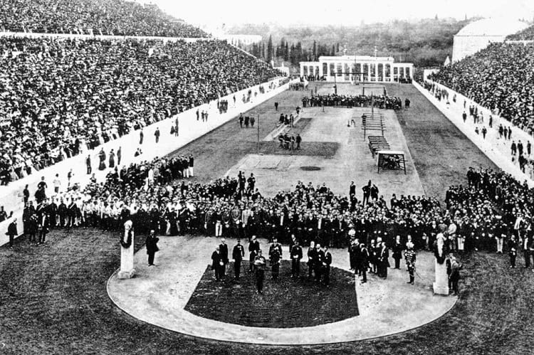
1896 Summer Olympic opening ceremony. (Wikimedia Commons)
The first Olympics, the quintessential sports and athletics carnival was held between 6th April and 15th April in Athens, Greece, in the year 1896.

Pierre de Coubertin, also known as the father of modern Olympics. (Dutch National Archives / Wikimedia Commons)
The extravagant event was organised by the International Olympic Committee (IOC), whose founder was Pierre de Coubertin. Although the first Olympic event was a pretty modest affair, today the events are all but multibillion-dollar propositions that entail years of meticulous planning and shrewd politicking.
As many as 241 male athletes from 14 nations participated in the inaugural games. Some of the biggest delegations came from Greece, France, Germany and Great Britain. There were in all 43 events that encompassed sports such as track and field athletics, swimming, cycling, wrestling, weightlifting, tennis, shooting, gymnastics and fencing. Amid an all-pervasive celebratory and high-spirited ambience, the foreign athletes were ushered in with numerous parades and banquet parties.
Earlier anecdotes about Olympics
A high-level meeting was held in Paris by the IOC where they zeroed in on Athens as the venue for the modern and maiden Olympiad. The genesis of the Olympics dates back to 776 B.C. where a place called Olympia in Greece hosted the ancient games at the Panathenaic Stadium. It was built originally sometime around 330 BCE. In this time-honoured spectacle, the athletes participated in only one event and that was a foot race.
With the passage of time, other playdowns like chariot racing, wrestling, boxing and pentathlon were included in the Games programme. All the participants were young men in good physical shape with well-developed muscles from various cities and colonies of Greece who regularly fought it out as a means to salute the human body. The winners of each competition were awarded olive branches. The final ancient Olympics are conjectured to have occurred in A.D. 393.
The revival of the modern Olympic Games in 1896
During the 1800s, many European nations used to host a good number of festivals that were coined after the Olympics and upheld the legacy of the Games. After some time, the organizers of these festivals teamed up with an aim to take the lead in creating a unified platform for various games influenced by the same sense of honour as the archetypal Ancient Olympics. They envisaged a forum comprising of several nations that would federate and compete. In this way, the panel laid the foundation of the IOC and the subsequent inception of the 1896 Summer Olympics.

Dr William Penny Brookes. (Wikimedia Commons)
Sometime in the 1850s, Wenlock, a nondescript village in Shropshire took to presenting its own local Olympics annually. The concept which was formulated by a native doctor William Penny Brookes is even hosted in the current times. It was Coubertin who paid a visit to the town during the flow of the event in 1890 and was immensely motivated while looking at the enthusiasm of the townspeople who were participating in the Games. This inspirational discovery persuaded him to form the IOC and contribute towards conceiving a novel form of the Olympic Games at gaps of every four years.
How were the date and the city chosen?
Pierre de Coubertin assembled a group of sports enthusiasts on 18th June 1894 at Sorbonne, in Paris. His prime intent was to illuminate his plans to the sports society representatives from 11 countries. Once his comprehensive proposal was accepted by the conglomerate, a date for the commencement of the first modern Olympic Games was required to be fixed.
Coubertin wanted the Games to converge with the Universal Exposition of Paris slated in 1900. However, the members instead pitched on 1896 apprehending the possibility of a rapid dwindling of public interest with a six-year gap.
Once the date was frozen, the debate then turned to select the host city. Since the ancient Olympics had its birth in Greece, Athens became the most favoured choice to host the inaugural modern Games. Demetrius Vikelas a Greek businessman was the maiden president of the newly formed IOC.

The International Olympic Committee of 1896 summer Olympic with Vikelas seated in the centre. (Albert Meyer / Bulgarian Archives State Agency)
The opening ceremony
A massive crowd of more than 80000 spectators were present in the opening ceremony of the Athens Olympiad that was held at the Panathenaic Stadium. The royal family of Greece, King George I, his wife Olga, their sons and other associated members played a significant part in organizing and managing the Games. In addition, they were regular attendees at various gatherings over the 10-day span of the Olympics.
The majority of the contenders were grouped by their respective nations and aligned in a well-ordered array on the infield. Following an introductory speech by the president of IOC, Crown Prince Constantine officially announced the beginning of the Olympic Games with a proclamation spoken in Greek words.

The first day of the 1896 Summer Olympic. (History of the Greek Nation)
Later, a group of musicians comprising of 150 choir singers and nine bands performed by belting out an Olympic Hymn that was composed by Spyridon Samaras with lyrics by poet Kostis Palamas.
From there on, an assortment of melodious renditions offered the inaugurations for each of the Opening Ceremonies until 1960. Since then the composition of Samaras and Palamas has turned into the official Olympic Anthem, a decision brought into existence by the IOC in the year 1958.
Only Hungary could put together a national team. Most of the non-native athletes were either college students from affluent and well-to-do families or members from sundry athletic clubs who were enamoured by the newness and the creativity which the Olympics had set forth.
Panathenaic Stadium
The track-and-field competitions for both athletics and cycling had taken place at the Panathenaic Stadium. The primaeval stadium that was originally put up in 330 BCE had been dug out. Yet it was not reconstructed for the once proposed 1870 Greek Olympics.
It lay untouched until the 1896 Olympics when the renovation work with marble was completed under the supervision and capital funding by a wealthy Egyptian Greek Georgios Averoff. The old track was exceptionally elongated with very sharp turns which often were deterrents to the runners as they had to appreciably slow down to stay around in their lanes.

Men’s high jump at the 1896 Summer Olympic. (Wikimedia Commons)
The track-and-field events were completely overpowered by the athletes from the United States. Out of the 12 contests, they won 9. The Bay of Zea hosted the swimming competition. Out of the four swimming races, ace Hungarian swimmer Alfréd Hajos won the silver in the 100m and 1200m events.

Alfréd Hajós won medals in two categories; sport and art competitions. (Wikimedia Commons)
The longer swimming races were conducted by transporting the swimmers out to the mid sea by boat and allowing them to swim back the earmarked distance to the shore. French cyclist Paul Masson bagged the silver for three cycling races. On the opening day itself, James Connolly from the United States won the triple jump and created a record of sorts over the past 1500 years. He performed exceedingly well earning the second and third in other high jump and long jump events respectively.
The countries that boasted of the largest number of teams were Greece, Germany, France and Great Britain. Nonetheless, it was the United States that came to the forefront by picking off the highest number of first-place finishes with 11 medallions. Greece with 10 medallions and Germany with 6 medallions finished off in the second and third places respectively.

100-meter race. (Benaki Museum of Greek Civilization)
The first marathon
One of the major highlights of the 1896 Olympics was the first marathon. The then unique race was the brainchild of a Frenchman Michel Bréal. The marathon followed the mythical unending route of Pheidippides. As the legend prevails, an adept runner, who was sent as a messenger from the Marathon plains to Athens, Pheidippides declared the vanquishment of a Persian army who attempted to invade Greece in 490 BCE.
Because of its incredible historical significance, the race garnered the prominence of being the most outstanding feature of the first Olympic Games. Spyridon Louis, a Greek triumphed in the race by a lead of over 7 minutes which gained him an ever-lasting adulation among the nationals. He was also awarded a commemorative cup by Michel Bréal for his tour de force.
The medals
Unlike the present times, there was no concept of gold medals. The winners of the first-place were awarded silver medals, an olive branch and a diploma. The winners of the second-place received copper medals, a twig of laurel and a diploma.

1896 Olympic medal. (Wikimedia Commons)
The front side of the medal had the engraving of the face of Zeus with his hand clasping a globe having a winged triumph emblem on it, with an inscription in Greek that read “Olympia”. The back side featured the miniature view of the Acropolis site with the inscription in Greek that read “Worldwide Olympic Games in Athens in 1896.”
1896 Olympicsclosing ceremony
On 12th April 1896, a banquet was arranged for the officials and athletes by King George. He was categorical in his address speech about his intent to hold the Olympic Games permanently in Athens. The official closing ceremony was held on 15th April. The royal family was in full attendance.
A short time later, the king gave away the prizes to the winners. A procession by all the medal holders was also orchestrated, spearheaded by Spyridon Louis much to the ecstasy of the hometown crowd. The king officially announced the culmination of the first Olympiad amid the playing of the Olympic Hymn as the crowd cheered in sheer revelry.
The elaborate and spectacular extravaganza drew to a close with Greece’s national anthem being played followed by a lyrical poem composed in classical Greek by a British scholar and athlete George S. Robertson.

Panathenaic stadium today. (bk / Flickr)
Enjoyed this article? Also, check out “What Happens to the Olympic Venues in the Host Countries After the Olympic Games End?“.
Recommended Visit:
Panathenaic Stadium | Athens, Greece
Fact Analysis:
STSTW Media strives to deliver accurate information through careful research. However, things can go wrong. If you find the above article inaccurate or biased, please let us know at [email protected].
RELATED
- May 2, 2019 What Happens to the Olympic Venues in the Host Countries After the Olympic Games End?
- October 17, 2019 Brief History of Cricket: From a Suburban Pastime to a Gentleman’s Game
 December 27, 2018 Tarrare: The Man Who Ate Too Much Yet Stopped at Nothing
- June 4, 2019 Man-lifting Kites: Ancient China to Modern Adventure Sports
The post 1896 Olympics – Taking a Trip Down The Memory Lane appeared first on .
]]>The post Chained Libraries: Confining Books or Readers? appeared first on .
]]>
Wimborne Chained Library. (ReflectedSerendipity / Flickr)
With the advent of e-readers, many in our generation are unaware of libraries. The concept of libraries was uncommon during the Middle Ages, circa 5th to 15th century. Back then books were chained to shelves in European libraries; to them, the concept of freely accessing books was just unusual. During that period, books were kept in book chests called almeries. These chests were kept in rooms that included valuables and hence, the rooms were always locked. The room wasn’t actually considered a library as we know it today, and visitors were not allowed to freely walk in and read the books.
As the demand for books increased during the beginning of the Renaissance period, institutions started using separate rooms to store books. One room would be used for books in common use, similar to a reference section in modern times, and another room for books in daily use. Institutions in that period had a loan system that allowed scholars to borrow books from them for a year at a time. This proved to be ineffective because other interested scholars would have to wait a whole year before they could read the book. In order to make books easily accessible to students, scholars, and commoners without any waiting period, institutions started chaining some valuable books and placing them in community libraries.
History of chained libraries
Sorbonne Library in France seems to be one of the first libraries in the late 13th century to have started the process of chaining books. Libraries determined the value of books on the basis of educational worth and not financial worth. It would have been ironic to chain financially valuable books because the process of chaining them was quite expensive. There were even some educationally valuable books that were kept under a triple key system so that readers would have to get permission from three separate officials.
Eventually, books were also chained to avoid books being stolen since books were very expensive to print back then. Once the printing press was introduced in 1450, the number of prints available of the same book increased significantly. This meant the value of books dropped drastically and made them less special, this eradicated the need for chaining books to the shelves.

Undated photo of Hereford Cathedral Chained Library. (pellethepoet / Flickr)
The process of chaining books
As for the process of chaining itself, the chains were not attached to the spine of the book but instead were attached either to the corner or the cover of the book. Attaching to the spine would cause unnecessary wear and tear while removing the book from the shelf.

Chained Bible at Hornby Library. (Rodhullandemu / Wikimedia Commons)
Due to this way of chaining, books were generally displayed the ‘wrong way’ with their spines not visible to the reader which would otherwise cause tangling of the chain. These chains would be long enough so that the readers could take the books to a table, but they were short enough so that the books would stay within the library itself.
In some libraries, there were benches available just below the shelves for readers to sit and read. In others, there were rows of seated lecterns. If a book ever needs to be removed from the chain, the librarian would use a key to remove the chain.
Some notable chained libraries
These days many libraries have given up chaining books, the few books that remain chained are done so for more of a vintage value than functional. However, off late, there seems to be a growing interest in restructuring chained libraries. There are a few chained libraries that are known to have survived with their original security systems still in place.
Hereford Cathedral Library is the largest chained library that is still in existence from the 17th century with its chains, rods, and locks still intact. Some old books are kept as manuscripts, and some of them contain ancient handwriting and illustrations in gold and colour. Some notable books here are the Hereford Gospels that were written in the 8th century and the Hereford Antiphonary written in the 13th century.

Hereford Cathedral Library. (Matthew Hartley / Wikimedia Commons)
The chained library in Wimborne Minster built in 1686 is the 2nd largest chained library in the UK that is still in existence. Another library is in the Church of Saint Walburga built in the 15th century. This library is now home to a museum that lets visitors look at the library’s original books and chains. Malatestiana Library in existence since the Italian Renaissance has undergone a significant amount of work to rebuild and preserve itself.
Contrary to what it might seem, libraries were trying to make books widely available to students and commoners by chaining them and not trying to restrict access. Chained libraries might have been in reducing printing cost and making sure books were available to more people at a time, but they were not very enjoyable. These libraries were often overcrowded and readers would be forced to sit very close to each other causing awkwardness. Many time readers would clump together to share one book. In these situations, it seemed like the readers were confined in one place and not the books.
Enjoyed this article? Also, check out “The Fascinating ‘Amber Room’: The Fabled ‘Eighth Wonder’ of the World“.
Recommended Visit:
1. Sorbonne Library | France
2. Hereford Cathedral | England
3. Wimborne Minister Chained Library | England
Fact Analysis:
STSTW Media strives to deliver accurate information through careful research. However, things can go wrong. If you find the above article inaccurate or biased, please let us know at [email protected].
RELATED
- October 1, 2018 Institut Le Rosey: The World’s Most Expensive Boarding School Par Excellence
- January 26, 2019 Astana: An Ultra Modern Capital City Right in the Middle of Vast Empty Grasslands
- August 11, 2018 Masada in Israel: Did 967 Rebellious Jews Really Commit Mass Suicide Here?
- May 31, 2019 Chand Baori: A Quaint Remnant of the Past
The post Chained Libraries: Confining Books or Readers? appeared first on .
]]>The post The Accidental Prime Minister: Controversial Biopic on Dr. Manmohan Singh appeared first on .
]]>
Manmohan Singh. (Obama White House / Flickr)
Produced by Sunil Bohra and directed by Vijay Ratnakar Gutte, ‘The Accidental Prime Minister’ is an upcoming political drama, based on the life of ace economist Dr. Manmohan Singh, who served two terms as the Prime Minister of India from 2004 to 2014.
Films are a medium of edutainment and especially in a country like India, cinema holds a great importance. More than fifteen hundred movies are made in one year in the country and as many as two dozen films releases on a single Friday. Biopic, in general, is one genre of movies, which Indian viewers take a special interest in. Getting to see their fellow Indians’ stories being highlighted to the world, biopics hold a special place amongst cinephiles. And moviemakers have taken advantage of this particular aspect and made interesting films on sportspersons, businesspersons, film personalities, politicians, people in the field of education etc.
About the movie The Accidental Prime Minister

Anupam Kher. (Kris Iyer / Wikimedia Commons)
Written by Hansal Mehta, the film stars two-time National Film Award winner and veteran actor Anupam Kher in the lead role as the former PM. Kher, who has conquered the audiences with his performances in more than five hundred films, in a career spanning three decades, has stepped into the shoes of Dr. Manmohan Singh and looks like a spitting image of Dr. Singh.
The actor had shared his first pictures in Dr. Singh’s avatar on a photo-sharing networking website and fans had gone into a tizzy, seeing the actor getting the politician’s dressing sense and mannerisms perfectly right. Ever since the film had been in production, several pictures from the sets had been doing the rounds on the Internet, and that piqued audiences’ interest in the latest docu-drama.

German actress Suzanne Bernert will be playing the role of Sonia Gandhi in the upcoming biopic. (Lens Naayak / Wikimedia Commons)
German-born actress Suzanne Bernert has been roped in to play former Indian National Congress party President Sonia Gandhi. Ahana Kumra will be seen in the role of Priyanka Gandhi, while Arjun Mathur will be playing current Congress Party President Rahul Gandhi. Akshaye Khanna is all set to portray Sanjaya Baru, who has written the tell-all memoir, on which the film is based.
Who is Sanjaya Baru?
‘The Accidental Prime Minister’ is based on Sanjaya Baru’s eponymous book ‘The Accidental Prime Minister: The Making and Unmaking of Manmohan Singh’, which he had written during his time at the Prime Minister’s Office. Sanjaya Baru, who is a policy analyst and a political journalist and commentator, had previously been the official spokesperson and media advisor to Dr. Manmohan Singh and he also served as the Secretary General of the Federation of Indian Chambers of Commerce and Industry (FICCI). He was the Director for Geo-Economics and Strategy at the International Institute of Strategic Studies.
Serving in various capacities, Sanjaya Baru had been a Professor at the Indian Council for Research on International Economic Relations and the Chief Editor of the financial newspaper The Business Standard. Writing extensively on the economic and strategic policy in India, he has also been the Associate Editor of Economic Times and Times of India. Sanjaya Baru also served as the Member of India’s National Security Advisory Board in the PMO. It was during his time at the PMO that he got to know the former PM closely, which egged him on to write about several aspects of the politician’s professional life after he was sworn in as the Prime Minister.
The controversy surrounding the book and the movie
From the time the movie was announced, it went into hot waters for bringing to the fore a political topic that was not just sensitive but also a bit controversial in nature. ‘The Accidental Prime Minister’ based on the book was also talked about most for its debatable story, which otherwise the PMO had deemed as fictitious when it was published in 2014.
A man of few words, Dr. Manmohan Singh’s capability as the Prime Minister came under the scanner when the then Congress President Sonia Gandhi, declined the position of the Prime Minister of the country in the year 2004 and instead recommended Dr. Singh for the highest post. As per Baru’s book, he alleged that Dr. Singh had been subservient to Sonia Gandhi, who did not hold any government position, yet had the power to pull the strings and control the political scenario of the country as well as Prime Minister Dr. Manmohan Singh. Baru also alleged in his memoir that Dr. Singh wasn’t quite prepared for the role of the PM yet was given the responsibility, who later failed to assert himself or his power while still being the all-powerful man in the country.

Dr. Manmohan Singh besides Sonia Gandhi during President Clinton’s visit in India, 2000. (U.S. Embassy New Delhi / Flickr)
Top news agency Reuters published Baru’s opinion which said during Dr. Manmohan Singh’s second term “the politically fatal combination of responsibility without power and governance without authority meant Dr. Singh was unable, even when he was aware, of checking corruption in his ministry without disturbing the political arrangement over which he nominally presided”.
Dr. Manmohan Singh, who has been the Indian Minister of Finance, studied Economics at his graduation level and went on to pursue Economics at Cambridge University. He later did his D.Phil from the University of Oxford and presented his doctoral papers on India’s Export Performance. He then worked for United Nations Conference on Trade and Development (UNCTAD). Dr. Singh held various prestigious positions at the national political level, some including Director and Governor of Reserve Bank of India (RBI), Deputy Chairman of the Planning Commission and also the Chairman of the Union Grants Commission (UGC).
NOC for the film
Former Censor Board of Film Certification (CBFC) chief and moviemaker Pahlaj Nihalani had issued a statement that the makers of the movie, based on Dr. Manmohan Singh’s life after he assumed office as the PM of India, would require a No Objection Certificate from Dr. Singh and former Congress President Sonia Gandhi ahead of the film’s release. He also mentioned that as per the guidelines of the Censor Board, the producers will also have to obtain a NOC from all real-life persons that have been portrayed in the movie, as has been the rule till date. Without an NOC, the film might not see the light of day. All films based on real-life personalities abide by these rules and there are no exceptions.
Now when the biopic is under post-production and is nearing completion, it would be interesting to see what controversy and drama unfold on the big screen, and whether ‘The Accidental Prime Minister’ wins hearts once again in reel life, when it hits screens on December 7, 2018.
Enjoyed this article? Also, check out “Battle of Saragarhi: When 21 Valiant Indian Soldiers Held Their Ground, Fiercely Fighting Against Thousands of Afghans“.
Recommended Read:
The Accidental Prime Minister | By Sanjaya Baru
Fact Analysis:
STSTW Media strives to deliver accurate information through careful research. However, things can go wrong. If you find the above article inaccurate or biased, please let us know at [email protected].
RELATED
- February 18, 2020 Newly Released In-Depth Biography of the Queen of Indian Cinema- Sridevi
- April 14, 2020 The Lone Empress— The Untold Story of Jayalalithaa, Iron Lady of Indian Politics by Vaasanthi
- February 5, 2019 White Sands National Monument: Ace Military Testing Area and an Astounding Tourist Destination
- December 8, 2019 National Highway 44: The Longest National Highway of India from Srinagar to Kanyakumari
The post The Accidental Prime Minister: Controversial Biopic on Dr. Manmohan Singh appeared first on .
]]>The post Voynich Manuscript: An Enduring, Undecipherable Mystery of the Literary World appeared first on .
]]>
A page from the Voynich manuscript. (Beinecke Rare Book & Manuscript Library / Yale University)
The Voynich Manuscript is one of the mysteries of the world that continues to baffle everyone. Written sometime in the 15th century – carbon dating carried out in 2009 points to a period between 1404 and 1438 – it is perhaps one of the most well-known books in the world that nobody has ever read. For the simple reason that nobody has so far been able to make head or tail of its strange, written script.
It is a script like no other and does not match anything in any of the multiple languages that human beings around the world once used and still use. Several high-profile and highly-qualified linguists and cryptologists have tried to decipher the script over the years and all of them have, so far, failed in their attempts. In more recent times, researchers have tried to crack the code using artificial intelligence, but that hasn’t produced anything convincing either.
Origins of the Voynich Manuscript
The truth of the matter is that nobody even knows who wrote the book in the first place. Some sources attribute its authorship to Roger Bacon, the multifaceted genius of Elizabethan England, who seemed to know something about much of the available knowledge of the period. Moreover, he was a dab hand at codes and cryptology. There is, however, no definite evidence pointing to him.
In any case, somebody wrote the Voynich Manuscript and in quite a beautiful hand too, with a quill pen, with seemingly no errors or mistakes in the transcription. This indicates that the person probably copied it entirely from another written manuscript and the copier was an expert scribe, who understood the script he was writing.
Over the ages, the book has passed through several ownerships.

Some pages open up to reveal elaborate diagrams. (Beinecke Rare Book & Manuscript Library / Yale University)
According to one of the stories circulating about this book, King Rudolf II of Bohemia once owned the Voynich Manuscript. In 1639, the book was in the hands of a certain Georgius Barchius of Prague. Since he was unable to read the script, he wrote to Athanasius Kircher, a Jesuit in Rome and one of the leading cryptologists of the period, and apparently sent him some facsimiles of the pages, while refusing to part with the actual volume.
After Barchius’s death, his friend Johannes Marcus Marci, a physician and scientist from Prague, inherited the book and he eventually sent it to Athanasius Kircher, with whom he had corresponded for 25 years. Kircher, however, had no luck with deciphering the manuscript either.

Wilfrid Voynich. (Wikimedia Commons)
In 1912, Wilfrid Voynich, a Polish book dealer, bought the book along with several other antique books, and, since he made it publicly prominent, we now know of the book as the Voynich Manuscript. It was, he said, an oddly plain volume that stood out in a collection of illuminated manuscripts that he discovered in ancient chests in a Southern European castle. The cipher script, the calligraphy, and the illustrations intrigued Voynich, and he assumed it was a ‘natural encyclopaedia.’ He took it with him first to the UK and then to the USA. To have the script deciphered, he had many experts examine it.
There was a stir in 1919 when William Romaine Newbold declared he had managed to translate part of the text, but, in 1931, John M. Manly debunked this claim, and further attempts in the 1940s and the 1960s came to naught. The mystery of the Voynich Manuscript remained a mystery.
P. Kraus, an antiquarian, bought the book for $24,500 in 1961, hoping to sell it for a profit. Not finding any buyers, however, he donated it to Yale University’s Beinecke Rare Book and Manuscript Library. Here it remains to this present day.
Features of the manuscript
The Voynich Manuscript is around 6.5 by 9 inches in size and has 235 pages and some 38,000 words.
The text runs from left to right and has several sections and paragraphs dividing it. These have pen and ink and watercolour illustrations interspersing them. Some of the pages are text only, while others have text and illustrations. Some of the pages fold double. The pages are of calfskin vellum, some with differing thicknesses, and were new when first written upon. The goatskin cover, which binds the pages, has a much later date and is a later addition. The cover is blank, without any title or author inscription.
Since the text is indecipherable, researchers have tried to come up with tentative ideas about the content from the illustrations. Since illustrations of a similar kind appear together in sections, researchers give the sections as herbal/botanical, astronomical, cosmological, biological, pharmaceutical, and culinary/recipes.
The illustrations are in ink and painted with watercolour. There are illustrations of plants, cell structures, gadgets, alchemy equipment, nude women seated in pipe-connected pools and containers, zodiac signs, astrology, comets, galaxies, and even dragons.
Researchers have been able to identify only a few of the plants in the botanical drawings. Some, they claim, are from the New World. Some plant drawings look like combinations of different plants, using the roots of one, the stems of another, and the leaves of yet another. In brief, made-plants that don’t actually exist.

A page from the manuscript appears to be showing various types of unidentified plants. (Beinecke Rare Book & Manuscript Library / Yale University)
The images of women wearing crowns and seated in pools and containers are also puzzling.
Real or an elaborate hoax?
From the illustrations, it seems it could be a medieval medical text, but, given the oddness of some the illustrations, one can’t be hundred percent certain about this.
One researcher claimed that the writing wasn’t so much code as abbreviation and abbreviation of medical terminology at that. The book was about gynaecology and women’s health and its author plagiarised much of it from other medical texts of the period. This version sounds plausible, but other scholars have found inconsistencies and errors with it.
Other hypotheses:
It is a complicated code that, unfortunately, does not have a key or a clue to solving it.
It is an artificial, contrived language.
It is a meaningless hoax, created to gull people for money.
It is a message from the Martians. This may seem far-out, but, in 1896, there was a woman named Helene Smith, who called herself and claimed to have had telepathic conversations with Martians and even wrote down their strange Martian script. Of course, nobody knows how true this is and the Martians don’t appear to have contacted anybody else ever since.
Researchers have tried to use linguistic rules from various languages to make some sense of the Voynich script, but that, again, has not worked out.
The Voynich manuscript continues to defy all decryption.
Since the Berenich Collection has completely digitized the Voynich manuscript, people around the world can now visit their website and view it in its entirety. The efforts to crack the code continue.
View the complete book at archive.org.
Enjoyed this article? Also, check out “Codex Gigas: The Dark Medieval Manuscript Dubbed as “The Devil’s Bible”“.
Fact Analysis:
STSTW Media strives to deliver accurate information through careful research. However, things can go wrong. If you find the above article inaccurate or biased, please let us know at [email protected].
RELATED
- September 7, 2019 The Disappearance of Michael Rockefeller: One of the Most Enduring Unsolved Modern Mysteries
- April 6, 2019 The Hum: The Mystery Behind a Humming Noise that Can Be Heard Worldwide
- April 20, 2020 The Mysterious Crooked Forest of Poland
- July 31, 2018 The Curse Of The ‘Crying Boy Painting’ That Haunted People During the 80s and Killed Many
The post Voynich Manuscript: An Enduring, Undecipherable Mystery of the Literary World appeared first on .
]]>The post Safety Coffin: The Ingenious Ways to Avoid and Remediate Premature Burials appeared first on .
]]>
Safety coffin: Oil painting of hurried burial. (Antoine Joseph / Wiertz Museum)
Born on October 22, 1830, in Manchester, William Tebb was a British businessman and a social reformer. Tebb was famous for his research and concern about premature burial. Along with Gloucester general practitioner, Walter Robert Hadwen, he co-founded the London Association for the Prevention of Premature Burial in 1896.

William Tebb. (Wikimedia Commons)
Premature burial was widespread in those days due to mistakenly being declared dead. In 1905, Tebb researched premature burials and found 219 cases where people were on the verge of being buried alive, 149 cases of people having been buried alive, and 2 cases of people having woken up during the process of embalming.
This resulted in a fear of being buried alive amongst people. It also led to a psychological disorder, taphophobia or ‘fear of graves’. William Tebb and Walter Robert Hadwen along with doctor Edward Perry Vollum (who had a near-buried-alive experience), published a book, Premature Burial: How It May Be Prevented, in 1905. The book dealt with accounts of live burials and how they could be prevented.
The creative ways to rectify premature burial
The fear of premature burial was on the rise during the outbreak of cholera in the 18th and 19th centuries. However, there have been reports of people being buried alive much before the 18th century.
A general practice started to develop, to have a waiting period before burial to confirm the death. When Dr. Robert Robinson, an English Dissenter minister of the Protestant Christian community died in 1791, he had given instructions to prevent his accidental premature burial. He was buried with a movable glass pane on his coffin and a mausoleum with a door, to be checked from time to time by a watchman to confirm his death. He even left instructions with his relatives to check in on his grave.
The advent of the safety coffin
The first safety coffin was designed by Duke Ferdinand of Brunswick-Wolfenbüttel, who suffered from taphophobia. Before his death on July 3 in 1792, he got his coffin constructed with a window for some light and a tube for the supply of fresh air. The lid of the coffin was not to be nailed in. Instead, it was fitted with a lock, the key to which was kept in a pocket of his shroud. His shroud also had the key for the lock on the tomb door.
German priest, P.G. Pessler suggested in 1798 that all coffins should have a cord attached to the church bells so that upon tugging the cord, someone or the other was sure to hear the church bells ringing. This idea led to the various designs of safety coffins with a system to signal life. Pastor Beck, a colleague of P.G. Pessler went so far to suggest a trumpet-shaped tube attached to the coffin to be checked for decaying odours by the local priest on a daily basis. In case of no odour, the grave could be dug up to rescue the not-dead person.

Count Karnice-Karnicki’s safety coffin with a lever to raise the flag. (Wellcome Collection)
Several decades later, in 1822, Dr. Adolf Gutsmuth voluntarily allowed himself to be buried alive to exhibit the efficacy of his safety coffin design. He stayed buried for a long stretch of time, all this while having food transported by his assistant to him inside the coffin through a feeding tube. He effectively consumed a meal of soup, sauerkraut, sausages, spätzle and beer. He finished his antics off with a cake, all delivered through the feeding tube of the coffin.
In 1829, Dr. Johann Gottfried Taberger created a system with strings attached to the person’s hands, feet and head. These strings were attached to a bell above the grave, weatherproofed in a small structure. If the bell rang, the watchman would insert a second tube providing fresh air to the person till the coffin could be dug out.
The ideas for safety coffin started developing to enable the buried person to signal the world that they were alive. The most common was a cord placed in the hand of the buried person, attached outside to a bell. There were sensor detection contraptions developed which would light a candle on top of the grave to signal life. Some safety coffins had an inbuilt telephone.

A premature burial vault prototype. (“Popular Mechanics” Magazine 1921)
Safety coffins were a rage from the late 1800s to early 1900s with several companies having patented their designs. In Germany alone, nearly 30 or more safety coffin patents were registered during the late 1800s whereas America had 22 patents registered from 1868 to 1925.
Franz Vester developed the ‘Burial Case‘ in 1868. This safety coffin had a wide tube through which the face of the buried person could be viewed from time to time for any signs of life. The safety coffin patented in 1995 by Fabrizio Caselli incorporated an emergency alarm, an intercom, torch, breathing apparatus, along with a heart monitor and stimulator. Such inventions went on till the late 1990s, though there hasn’t been any proof of anyone benefitting from them.
The grave with a view in Vermont
Probably the eeriest of safety coffins is the one of Dr. Timothy Clark Smith at the Evergreen Cemetery in New Haven, Vermont in the United States. With a severe case of taphophobia, Dr. Smith designed his own grave.
He had a glass pane put on the surface of his grave directly above the place where his head would rest in the coffin. This would allow people to check on him from time to time for signs of breathing. He is said to have been buried with a breathing tube, a bell and tools to enable his getaway in case he was buried alive. He also got stairs constructed leading to an opening in the ground, just next to his grave, which is covered with a removable slab.
Enjoyed this article? Also, check out “Edinburgh’s Miniature Coffins – The Mysterious Lilliputian Coffins, Discovered in Scotland“.
Fact Analysis:
STSTW Media strives to deliver accurate information through careful research. However, things can go wrong. If you find the above article inaccurate or biased, please let us know at [email protected].
RELATED
- May 30, 2020 The 19th Century Mechanical Toy—The Creeping Baby Doll
- July 30, 2019 Robert Wadlow: Trials and Tribulations of the World’s Tallest Man
- March 12, 2020 The Quirky Palate and Gourmet Adventures of Charles Darwin
- November 23, 2018 Cardiff Giant: The Colossus That Charmed and Mislead America
The post Safety Coffin: The Ingenious Ways to Avoid and Remediate Premature Burials appeared first on .
]]>The post The Haunting Visage of the Belmez Faces: An Anecdote of Lost Souls or Purported Skullduggery? appeared first on .
]]>
Belmez Faces: A blurred face on the wall inside the house of María Gómez. (Cesar Tort / Wikimedia Commons)
The first sighting of the Belmez Faces is reported to have occurred on 23rd August 1971. It is believed that María Gómez a Bélmez resident observed the emergence of an uncommon stain in a spur-of-the-moment on the concrete floor of her kitchen. The stain assumed the shape of a human face and began appearing at different locations.
Petrified by this eerie and paranormal happening, María tried to get rid of the ominous formation by vigorously scrubbing and cleaning the floor. But all her efforts were in vain. Even her husband Juan Pereira and son Miguel attempted to destroy the image with the help of a pick-axe and later replacing the concrete floor.
But, as the legend goes, new faces started reinforcing on the floor a week later and the occurrences showed no sign of abatement. As the news of the strange appearances started gaining ground among the local people of the small town, numerous visitors began thronging the place to watch this inexplicable phenomenon. The canards about the “house of faces” did the customary rounds in every household.
The family informed the matter to the mayor of Bélmez who in turn disallowed the destruction of the newly formed faces. Instead, a specimen of the floor was taken for study. Parapsychology experts from the world over went hotfoot in paying visits to the house. Nevertheless, they were unable to detect and reveal the exact cause of this peculiar experience.
Discovery of skeletons
The family approached the local council to seek support in unearthing this mystery. When the surveyors visited to inspect the property, they decided to excavate the floor of the kitchen area. At that moment, this was the only option which the councillors found worthwhile and potentially insightful. Thankfully, it did not take too long for the workers to identify a probable hint supporting the evil exposition of the Belmez Faces.
Eventually, the narrative recounts the horrific discovery of skeletons nearly 10 feet underneath the property when it was quarried during the course of the examination. Some of the skeletons were even devoid of their skulls. They were surmised to be over 700 years old.
After the findings, the dug pit was refilled and a new concrete floor was cast. This time everybody expected the appearances to vanish into obscurity. However, much to everyone’s disbelief, another face, dissimilar from the previous ones resurfaced.
Intermittent visitations of the Belmez Faces

The most notorious Belmez Faces “la Pava” protected behind a glass pane. (Degeefe / Wikimedia Commons)
This time around, the episodes were distinctive. Rather than a solitary face becoming visible and declining to subside, a multitude of faces came into existence on the floor. One facial expression would come into a conspicuous exhibition only to be substituted by another in a cyclic fashion.
Now and then these appearances would crop up through the span of a few hours. Some of the displayed Belmez Faces belonged to women and children. On the off chance that the local council board had done anything for the Pereiras, it actually worsened the situation for them.
The hue and cry about these occurrences spread like wildfire across national and international stretches. Well-known paranormal investigator Dr. Hans Bender from Germany announced the Belmez Faces as an instance of paramount significance and the biggest supernatural event of the 20th century.
All that the Pereiras wanted was to liberate themselves from the clutches of the spirits that had assumed total control over their lives and the town. And now, they were compelled to persevere through another trepidation which was the overflowing curiosity among the general public that almost engulfed their privacy. The surge of visitors in the form of researchers, priests, students, journalists, police officers and doubters kept on burgeoning with every passing day.
Laboratory tests and media coverage
With the rumour mills running overtime about how the family had deliberately engaged in creating faces to win everlasting fame and money, the need for a clear and sound testing method became imperative. A large-scale investigation was initiated. The concrete samples were sent for a thorough study to the Instituto de Ceramica y Vidrio (ICV).
Much to the sceptics’ disappointment, the ICV could not collect any notable evidence of any paint or dye and subsequently ruled out the possibility of a fraud. The remaining floor was shot in fragments and enveloped with a jacket sealed at the borders. Ultimately the door and the windows were all occluded with wax.
A television crew from a German media company photographed every such precautionary measure amid the attendance of the local dignitaries. This time the team expressed satisfaction over making their effort completely foolproof. They were convinced and dismissed a possible tampering of the scene without any clear-cut detection.
The kitchen was sealed for three months. The grand revelation, three months later, spotlighted yet another marked upshot. Once the kitchen door was unbolted the Belmez Faces were indeed still there but had shifted and evolved.
Was the Pereira family a group of imposters?

House of María Gómez. (Degeefe / Wikimedia Commons)
It was believed that the Pereira family perpetrated the humbug to amass sizeable financial gains. A few tests that were performed remained indecisive. Others suggested the absence of any trace of paint material on the floor surface.
Research on the facial expression of the faces asserted that a large number of the features were comparable to the face of María. Another intimation that went against her hovered on the fact that the faces would only manifest amid the presence of María. The visitations would dwindle when María was away.
Sceptics also speculate that María’s son played a part with a ruthless joke on her. Whereas others were firm of the opinion that there was indeed a supernatural activity that could never be fathomed or expounded. Even today, the mugs allegedly, still continue to come into sight in her Bélmez home in Spain.
The aspect of thoughtography
One of the key contributors to the investigation involved a method known as Thoughtography. This defines a psychokinetic ability that capacitates a person to demonstrate images onto a surface either purposefully or coincidentally. Thus, for all these idiosyncrasies to be swallowed, María Pereira would make a bonafide suspect.
The ill-fame of the Belmez Faces gathered momentum
María’s house started earning an unprecedented amount of good coverage and noticeability in Bélmez among the tourists. It came to be widely recognised as La Casa de las Caras which meant The House of the Faces. From 1972 onwards, María’s home turned into a veritable crowd-puller.
Over the next 30 years or so, the Pereiras continued with their claim to have come across a consistent apparition of faces, both male and female, in diverse shapes, sizes and expressions. Unfortunately, in 2004, María Gómez Cámara passed away at the age of 85.
Yet the bizarre splattered trails still continued to spring upon the bare stone floor, probably with even more distortions.
Enjoyed this article? Also, check out “Paranormal Sightings in England: The Brown Lady of Raynham Hall“.
Fact Analysis:
STSTW Media strives to deliver accurate information through careful research. However, things can go wrong. If you find the above article inaccurate or biased, please let us know at [email protected].
RELATED
- July 11, 2018 Helen Duncan: The Last Witch of Scotland
- March 15, 2019 The Hands Resist Him: A Haunted Painting that Spooked the Virtual World for Decades
- February 9, 2020 P. T. Barnum: The Colourful Life of the ‘Greatest Showman’ to Have Lived
- June 6, 2019 Spaghetti Tree Hoax: When BBC Convinced a Million Viewers That Spaghetti Came from Trees
The post The Haunting Visage of the Belmez Faces: An Anecdote of Lost Souls or Purported Skullduggery? appeared first on .
]]>The post 2004 Indian Ocean Earthquake & Tsunami: Remembering the 230,000 People Killed in Its Wake appeared first on .
]]>
Aftermath of 2014 tsunami disaster in Sumatra, Indonesia. (Michael L. Bak / U.S. military)
On December 26, 2004, one of the most fatal natural disasters ever recorded in the 21st century, shook the core of our planet. An earthquake took place in the middle of the Indian Ocean which caused numerous tsunamis to hit the coastline of the ocean. The quake measured a powerful 9.3 on the Moment Magnitude Scale and a terrifying IX on the Mercalli intensity scale where XII means total destruction.
It caused a colossal amount of destruction and loss of life. 14 countries including Indonesia, Sri Lanka, India, and Thailand were affected, of which Banda Aceh, a city in Indonesia, was the most affected with more than 200,000 deaths. Smaller tremors were also felt in Bangladesh, Malaysia, Myanmar, and the Maldives. Contrary to what one might expect, not just the areas closest to the earthquake were affected. Tremors of the quake were felt in remote areas as far as Alaska which is over 10,000 km away from the epicentre.
The science behind the events
Seismologists were quite shocked at the unusualness of this earthquake. It took place just three days after a magnitude 8.1 earthquake rocked an uninhabited area between New Zealand and Australia. Earthquakes higher than 7 on a moment magnitude scale are known to occur only once per year. The impact of this earthquake was so intense that it is said to have vibrated our entire planet by as much as 1 cm. The quake also changed the speed of Earth’s rotation, causing a trivial shortage of 2.68 microseconds. The effects of the quake were reportedly felt for more than 4 months after it occurred.
This earthquake is termed as a ‘megathrust’ quake because they occur in subduction zones where one tectonic plate is forced below the other. These quakes are some of the most impactful ones where reaching a minimum of 9.0 on the moment magnitude scale is considered quite normal. This megathrust earthquake took place just below the sea causing the topmost layer of land in the deep sea to slide below the topmost layer of land in the shallow sea. The movement of tectonic plates was mostly vertical, however, some lateral movement of the plates was also detected. Due to this, some coastal areas have moved below sea level after the quake.

(Coinmanj / Wikimedia Commons)
Due to a massive amount of water being displaced during earthquakes, tsunamis are an expected part of the package. In this particular case, it was a shocker. Firstly, tsunamis are extremely rare in the Indian Ocean, despite the fact that earthquakes occur quite frequently in this subduction zone. Secondly, there are no warning systems that exist in the Indian Ocean since tsunamis occur more often in the Ring of Fire region of the Pacific Ocean. Although, it was quite lucky that two NASA satellites that were out on an oceanographic mission just happened to pass over the Indian Ocean and they have radars that help them measure and detect inconsistencies in the height of water waves. And lastly, there was a significant amount of time delay between the earthquake and tsunami. It took about 7 hours to reach the coastlines.
On another note, it is generally quite hard to detect tsunamis in deep water. The waves of a tsunami in deep water are barely noticeable and are just broad, shallow humps of water. These broad, shallow humps travel quite fast between approximately 500-1000 kmph. The behaviour of tsunami waves in shallow water changes; they reach great destructive heights but travel at much slower speeds of 90 kmph. The highest tsunami wave triggered during this event was recorded to be at a gigantic 30 m in shallow water but only 50 cm in deep water.
Aftermath of 2004 Tsunami

Aerial photo of a village near the coast of Sumatra after the tsunami. (Philip A. McDaniel / U.S. Navy)
This earthquake is listed as one of the deadliest natural disasters to ever take place. This quake triggered the largest humanitarian response with people across the world donating more than USD 14 billion to the affected countries. The only other earthquakes that have been recorded larger than this on the Moment Magnitude Scale were the Alaskan Earthquake in 1964 with a magnitude of 9.2 and the Chilean Earthquake in 1960 with a magnitude of 9.6, although the number of casualties was nowhere close to the one in 2004.
There are accounts of saviours who recognized the events taking place and warned people in coastal areas to evacuate as soon as possible. One such account was of a 10-year-old girl who had learnt about tsunamis just 10 days earlier in school. She alerted her parents, who understood the gravity of the situation and quickly alerted coastal guards.
It is during such events that we truly understand the importance of just being alive. It is certainly frightening to imagine how nature is capable of near-complete destruction in a matter of seconds. In the blink of an eye, the planet lost 230,000 precious human lives on that day.
Enjoyed this article? Also, check out “Krakatoa Volcano: An Earth-Shattering Explosion That Ruptured the Eardrums of Many“.
Fact Analysis:
STSTW Media strives to deliver accurate information through careful research. However, things can go wrong. If you find the above article inaccurate or biased, please let us know at [email protected].
RELATED
- August 18, 2018 Krakatoa Volcano: An Earth-Shattering Explosion That Ruptured the Eardrums of Many
- May 21, 2020 Cyclone Amphan Leaves a Trail of Destruction in West Bengal and Odisha
- January 17, 2019 Pamban Bridge: A Historic Indian Sea Bridge That Was Built on Modern Principles
- December 12, 2018 Dhanushkodi: Where a Cyclone Ripped Apart an Entire South Indian Town, Rendering it Uninhabited
The post 2004 Indian Ocean Earthquake & Tsunami: Remembering the 230,000 People Killed in Its Wake appeared first on .
]]>The post The Turk: 18th Century Automaton Chess Player was a Forerunner of Computer Age appeared first on .
]]>
The Mechanical Turk and its inner working. (© Jan Braun / Heinz Nixdorf MuseumsForum / Used With Permission)
Man’s fascination for machines and gizmos predates industrial revolution when machines were replacing manual labour, draught power, and even entertainment in a big way. Then a path-breaking feat happened in the 18th century. A machine arrived on the scene not to replace horsepower, but cerebral power. It was a replacement for man’s ability to think critically. A machine could play chess against a man, and more often than not, beating him in the game.
The machine, the Turk was a mannequin of a sorcerer like, a wide-eyed, turbaned and moustachioed man sitting behind three and a half feet long, two feet wide and two and a half feet high wooden cabinet studded with Chess Board. Automaton Chess Player or the Robotic Chess Player were other names for The Turk. The machine was conceived, created and designed by Viennese Engineer Wolfgang von Kempelen in 1770.
Projected as chess playing contraption, the machine remained in vogue, though intermittently, for 84 years, giving tough time to whosoever sat on the rival’s seat. It defeated best of chess masters and became a rage. How the machine really worked, would take time to become public. In those days of the industrial revolution, machines of all shades and description evoked immense awe and surprise for their physical output. And here was one doing mental work of tall order. People hooked to magic shows for entertainment in those days couldn’t have asked for more.

The reconstructed version of The Turk at the Heinz Nixdorf Museum, Germany. (Marcin Wichary / Flickr)
Theories about the working of the Automaton Chess Player
The inaugural show of the Robotic Chess Player was held in Habsburg court in Vienna. Maria Theresa, the Queen of Hungary and Bohemia, was deeply impressed. After the inaugural show, the Turk went into a hiatus till after Maria’s death, her son Joseph II would revive it. In a 1783 Paris show, Benjamin Franklin played with the machine and lost.
In the following years, it toured England and Germany and came on the radar of sceptics. People started doubting the Turk. British author Philip Thicknesse said an automation couldn’t be passed as a chess player. He rejected the possibility of chessboard being manipulated from distance, magnetically or otherwise, as many believed. However, he proposed that the cabinet concealed a child of 10, 12 or 14 years, who was exceptionally talented in the game of chess.

The Turk. (Carafe / Wikimedia Commons)
Just as a magician shows his empty hands to crowds before performing tricks, Von Kemplen showed innards of the cabinet, revealing largely empty space, and an ensemble of cogwheels as if those were the brain of the Robot machine. Hand movement of Turk was precise, man-like, in placing chess pieces on board. The other player was chosen from the crowd.
Compared to the-then prevalent shows of animal and human dummies, the Turk provided a far superior option for mass entertainment. It was a dummy not only moving head and hands but also expressing anxiety and indignation like Chess wizard. When Napoleon Bonaparte, the iconic opponent of Turk, tried to cheat, the angered Robot uprooted all chess pieces, amusing Napoleon to no end.
So how did the Mechanical Turk work?
The maverick machine had to put up with some-one-is-hiding-inside-the-cabinet theory for decades. The cabinet was big enough to house an individual, child or an adult, who could execute chess moves directly or by some kind of remote control. The concealed person hid in the bottom drawer as the cabinet was opened for the perusal of the audience in candlelight. The hidden person being a fugitive amputee and good-at-chess Polish soldier, Worousky, who Von Kempelen met in Russia, was also mooted.

Illustration from a book trying to explain the workings of the Mechanical Turk. (Joseph Racknitz / Wikimedia Commons)
Hearsays and rumours added to the mystique of the Chess machine but the truth was plain and simple. There indeed was a skilled operator inside the cabinet, trained and groomed for the game.
The mystique of the chess playing Turk grew by the day. Robert Willis, English Academic and Mechanical Engineer, 1821, wondered what more could these humanoid machines accomplish in times to come. Charles Babbage, the English Polymath, was so impressed he got down to work for a machine which could automatically calculate and tabulate mathematical functions, a harbinger of present-day Artificial Intelligence. Tom Standage wrote “…… (A machine like Turk) raised the possibility that machines might eventually be capable of replacing mental activity too.”
What made The Turk so impressive?
The explanation lies in the surprise element which it was able to generate. The game began with the mannequin moving head sideways to survey the chessboard. The grim expression on the wooden face, moving eyes, the gentle tapping on board in a manner of brainstorming, moustaches and headgear of an oriental magician; all these combined to overawe, if not unnerve, the rival player. And then there were instances when machine threw tantrums over perceived cheating by the opponent.
With the death of Kampelene in 1804, Turk came in the custody of Bavarian showman Johann Nepomuk Maelzel who organized shows in the USA in the 1820s and 30s. In 1830s Maelzel, as well as the hidden operator of Turk, died of yellow fever in Cuba.
Noted American writer Edgar Allan Poe, published an essay in 1836 to prove that Turk was assisted by a hidden human. By 1850, hysteria generated by Turk was on the wane. Left as antique in a Chinese museum in Philadelphia, it was destroyed in a fire breakout in 1854. The final nail in the coffin of The Turk came from Dr. Silas Mitchell in 1860. He elaborately revealed secrets of the Automaton Chess Machine in his magazine named ‘Chess Monthly’.
Yet, it would be an understatement to call Turk just a hoax or a clever deceit. The frenzy that it generated in heydays impacted laymen and elite alike. Father of the present day Computer, Charles Baggage, was defeated twice by the automaton. The machine and magic combo – Turk verily foreshadowed Artificial Intelligence of today. And that’s no ordinary gift of the Turk to the posterity.
Enjoyed this article? Also, check out “Euphonia: The Sad Story of Joseph Faber and His Creepy Machine That Made Ghostly Sounds“.
Recommended Visit:
Heinz Nixdorf Museum | Paderborn, Germany
Fact Analysis:
STSTW Media strives to deliver accurate information through careful research. However, things can go wrong. If you find the above article inaccurate or biased, please let us know at [email protected].
RELATED
- January 3, 2019 Deep Blue – The IBM Chess Computer That Beat Chess Grand Master Garry Kasparov in 1997
- April 10, 2019 Euphonia: The Sad Story of Joseph Faber and His Creepy Machine That Made Ghostly Sounds
- February 22, 2019 The Summoning of Demons: The Dangers of Artificial Intelligence
- June 11, 2020 This is the World’s First Apple Computer and It Was Released in 1976
The post The Turk: 18th Century Automaton Chess Player was a Forerunner of Computer Age appeared first on .
]]>The post Capilano Suspension Bridge: A 129 Year Old Bridge that Continues to Draw Intrigued Visitors appeared first on .
]]>
Capilano Suspension Bridge Park. (GoToVan / Flickr)
In British Columbia, Canada, there is a 140 metres long bridge, suspended 70 metres above the Capilano River known as the Capilano Suspension Bridge. Built in 1889, this private facility charges an admission fee and catches the fancy of over 8 lakh visitors every year.
Presently, it has become a hotspot for tourists with adventure sports, walkways along the river, footbridges constructed for a better view of the valley and the recently opened sit down restaurant paying homage to the history of the place.
The construction of the Capilano Suspension Bridge
In the year 1888, a civil engineer and land developer of Scottish descent, by the name of George Grant Mackay bought 6,000 acres of forest land on both sides of the Capilano River and designed 25 acres of the land for his personal use as a summer home.
He built a cabin on the edge of the valley and decided to construct a walkway from one side of the river to his property on the other side. He consulted a Native Indian and the Squamish Chief, August Jack (Khatsahlano, Xats’alanexw), a logger who built canoes, totem poles etc. in the area.
In 1889, with the help of Jack and his brother Willie, a footbridge was constructed from hemp rope and cedar planks to cover the breadth of the canyon above the river. Jack used his horses to swim through the river and secure the ropes of the footbridge on the other side with enormous buried cedar logs. It was often referred to as the ‘Laughing Bridge’ due to the sound it emitted on a windy day.
Though Mackay had no intention of making it a tourist attraction, nonetheless, people were soon drawn to the fascinating suspended bridge. The adventurous ones, who made it to the other side, ended up ‘tramping’ around Mackay’s cabin, giving rise to the popular term, ‘Capilano Tramps’. Disturbed by this constant trespassing, Mackay sold it to Bruno Stelzer in 1892.
The start of the oldest tourist attraction
Bruno immediately realised the commercial potential of the place and started charging visitors 10 cents, which makes the bridge the oldest tourist destination in Vancouver. In 1903, Bruno asked engineer Harry Burgess to draw plans to replace the rope footbridge with wire cables. Finally, W.T. Farrell was given the contract to construct a sturdy bridge strong enough to support a strain of 60 tonnes.
Irishman Edward Mahon came to Vancouver in 1888 and started his mining business. In 1910, he fell in love with his deceased friend’s 19-year-old-daughter, Lilette. In order to be able to woo her, he decided to put Lilette’s mother Elizabeth in charge of his recently purchased Capilano Bridge property. He married Lilette the next year and also built the Tea House at the bridge property in a constant endeavour to improve its commercial value. He also refurbished the bridge with more cables in 1914.

Capilano bridge in 1919. (UBC Library Digital Collections)
Elizabeth, in the meantime, had met a forest ranger, much younger in years to her, ‘Mac’ Archibald Dunerick MacEachran, and the two had fallen in love. They got married in 1921 and Mac started actively promoting the property to visitors. In 1934, Mac decided to reveal to Elizabeth the existence of his 19-year-old-daughter, Irene, whom he now wished to call to Capilano to stay with them. Constructions were underway for a new, bigger house across the street from the bridge, when, unfortunately, Elizabeth passed away in 1934, a year before Mac bought the property from Mahon. The new house today has become the Bridge House Restaurant.
As a part of his promotional activities, Mac started inviting the local Native Indians to place their totem poles in the park displaying their art, adding a native theme to it. The Capilano Park till today is known to contain the largest private collection of Story Telling Poles that have ever existed, with varied styles of pole carving.
Mac finally sold the property to Henri Louis Isidore Aubeneau in 1945 and went away to settle down in California. Though Henri and his wife, Marie Moran bought the property and operated it as a tourist attraction, they refrained from making any major alterations to it. The Capilano Suspension Bridge Park again changed hands, when Henri sold it to Douglas McRae ‘Rae’ Mitchell in 1953.
The Rae and Nancy entrepreneurship
Unsure of the strength of a bridge so old, Rae completely replaced it in 1956 with a new sturdier bridge constructed in only 5 days. Designed by an engineer, Art Williams, the bridge was held together by steel cables held down on each side by 13 tonnes of concrete. The new bridge designed with the strength to hold over 1300 people, was tied to the old one using a pulley system across the huge gap.

Capilano suspension bridge. (Pixabay)
Rae developed trails along the bridge and converted the teahouse into a gift shop. The current owner, Nancy Stibbard bought off the Capilano Suspension Bridge from her father Rae, in 1983, with the goal to promote tourism in the area. She turned it into a tourist destination adding nature walks, performances by Native Indians, a series of trails like the Treetop Adventures and Cliff Walk.
Over the years, the popularity of the bridge has grown tremendously resulting in Nancy’s induction into the Canadian Tourism Hall of Fame at the turn of the century in 2000.
The most recent addition to the property is the Cliff House Restaurant in March 2018, the design of which is a tribute to the house of the original owner, George Grant Mackay.
Nancy’s son, John has joined the Capilano business and today the park boasts of over 2000 visitors in a day. The Story Centre in the park has archives from the past in terms of photographs, antiques and murals that have been specially put together to tell tales of the past. Under the ownership of Nancy Stibbard, the Capilano Suspension Bridge Park has become a hot-spot tourist destination with nature walks at breathtaking heights.
It is also home to one of the tallest living Christmas trees, the 152 feet tall Douglas fir. During the holiday season, in December, the entire valley below the bridge transforms into an enchanted forest with thousands of glittering lights around the Douglas fir and throughout the valley.
Enjoyed this article? Also, check out “Golden Bridge: The Connect to the Past and the Future of Vietnam“.
Fact Analysis:
STSTW Media strives to deliver accurate information through careful research. However, things can go wrong. If you find the above article inaccurate or biased, please let us know at [email protected].
RELATED
 August 24, 2019 Dinner in the Sky: The Thrill of Partying in a Crane Lift
- May 9, 2020 Elephant Beach: The Dazzling Sandy Beach in Andaman and Nicobar Islands Perfect for an Exotic Vacation
- December 12, 2019 Rakotzbrücke: ‘The Devil’s Bridge’ which Looks Straight Out of a Fairytale
- July 28, 2018 Las Lajas Sanctuary: A Church with a Mysterious Mural Nobody Can Explain
The post Capilano Suspension Bridge: A 129 Year Old Bridge that Continues to Draw Intrigued Visitors appeared first on .
]]>The post HP Enterprise Creates History as Cloud Computing Experience Reaches Space appeared first on .
]]>
The International Space Station. (NASA / Crew of STS-132)
Everyone is aware of a vast, limitless zone, several hundred kilometers outside the Earth’s atmosphere, where celestial objects orbit around giant stars and many unknown astronomical events take place. This boundless zone, known as space, is intriguing and there have been a host of government bodies and individual agencies that have spent billions in research and exploration of this area of nothingness. And to add to it all, there’s one major recent feat in the field of computing that a private info-tech company has achieved, which will change the way astronauts transmit their data back to the Earth. But before we get there, here are a few basics we must know of first.
What is the International Space Station?
In simple terms, the International Space Station (ISS) is a home away from home. It is a huge spacecraft orbiting the Earth, where astronauts live and carry out scientific researches for specific periods of time. Launched in the year 1998 by a Russian rocket, the International Space Station was built by a group of nations, where the first crew, comprising of astronauts from different countries of the world, arrived in the year 2000. Over a period of time, more nations added their own modules to the space station, finally making the ISS as big as an entire football field, as we know it today.
Weighing approximately half a million kilograms, the ISS is huge enough to accommodate six astronauts at a time, with all necessary living facilities, which also includes a gymnasium. With research labs from countries like Japan, USA, Russia as well as some European nations including Germany, France and The Netherlands; the ISS is where space research and exploration is carried out, which otherwise could not have been done on the Earth.
What is Cloud Computing?
We all know that a computer is a device that receives information, processes it; stores it and recalls it as and when instructions are fed into it. A remote server is a computing term, which is a device that is not attached to the client’s keyboard but it can be accessed from any part of the world from anywhere over a shared network. And cloud computing is a term, which means the delivery of a host of Internet services like databases, applications, networking, analytics and storage to a client on demand in any part of the world. In short, cloud computing means a shared pool of computer resources and services, which can be accessed remotely over the Internet by a lot of clients.
Cloud Computing and International Space Station
In the year 2017, when a space cargo capsule called SpaceX Dragon was sent into orbit to deliver cargo to the astronauts at ISS, little did the space researchers know that they were in for a pleasant surprise. Developed by tech giant Hewlett Packard Enterprise (HPE), a supercomputer known as Spaceborne Computer was delivered to the International Space Station after it was thoroughly tested for over a year to check if it would sustain in outer space. The supercomputer (a network of computers working together) was examined to see if it could withstand the harsh space atmospheres, radiation flares, frequent power outages, zero gravity and vacuum; and only then it was delivered to its destination aboard the ISS in August.
Basically, the idea behind delivering this supercomputer to the ISS was to cut down on time that the astronauts required to send research data to and fro from space. HP Enterprise developed cloud computing techniques in Spaceborne Computer and made it easier for the experimenters in orbit to store their own data and use it when necessary. Till now, astronauts transmitted data back to the Earth first to get it checked, while waiting for results to come back. Now, researchers can directly run their analyses in space instead of sending it back for insight. And so, with the help of cloud computing, communication between Earth and space can become a lot quicker, more real-time and much more efficient.
How cloud computing could ease challenges at the ISS
The connection and bandwidth between space and Earth is slow and intermittent and there could be problems regarding communication for a few minutes. With cloud computing, the unreliability can be done away with and there can be no chances of data loss, while it is being sent back to the Earth, as opposed to before. Testing supercomputers in space can make way for more research studies on an advanced level in the future, where astronauts are eyeing other planets for habitation such as Mars. The Spaceborne Computer will also help scientists to carry out their research work without making use of bulky, overly expensive and time-consuming computing devices.
As the one-of-a-kind, first-ever cloud experience, which is set to make communication between Earth and space easier, makes its way into the International Space Station; it gives us one more reason to rejoice, as mankind takes another giant leap in the field of space communication.
Enjoyed this article? Also, check out “NASA’s Deep Space Network: How We Communicate with Space Probes Billions of Miles from Earth“.
Fact Analysis:
STSTW Media strives to deliver accurate information through careful research. However, things can go wrong. If you find the above article inaccurate or biased, please let us know at [email protected].
RELATED
- March 3, 2019 Space Debris: The Growing Hazard of Man-Made Debris in Space
- July 30, 2018 Zinnia, The Prodigal Flower of Bonhomie Between Life in Space and Life on Earth
- January 4, 2019 Ultima Thule: A Snowman-Shaped Celestial Body That is the Farthest Object a Space Probe Has Ever Captured
- January 14, 2019 The Soyuz 11 Tragedy – The Death of Three Soviet Cosmonauts in Space
The post HP Enterprise Creates History as Cloud Computing Experience Reaches Space appeared first on .
]]>The post The Tale of Topsy the Elephant That was Electrocuted, Poisoned and Strangulated appeared first on .
]]>
Topsy the elephant being electrocuted in Luna Park. (www.timetoast.com / Wikimedia Commons)
Topsy was an elephant that belonged to the herd of performers in the Forepaugh Circus for a major part of her life. The tragic story of Topsy began sometimes around 1875. The elephant traders in Southeast Asia seized the baby elephant weighing 200 pounds. She was later smuggled into America by Adam Forepaugh, the owner of Forepaugh and Sells Circus, who dishonestly used to bill her as the first elephant born in America.
Historical accounts of Topsy’s errant behaviour
In those days, like other circus animals, Topsy was a victim of human-inflicted brutality and abuse. She used to be tormented no ends during the course of her training and performances. It was because of this stocked up pain and agony she became infamous as a rogue elephant.
She had developed a penchant for rampaging circus resources, frequently going berserk and smacking against people, especially the cruel circus handlers when they tried to hurt or cage her up.
As indicated by different sources, she supposedly killed by trampling two circus workers in Texas. In 1902, she killed James Fielding Blount, a spectator from Brooklyn, in utter anguish, who instigated to extremely trouble her by throwing a lit cigar into her mouth.
After this much-hyped incident, Topsy was disposed of Coney Island’s Sea Lion Park. A year later, when the park was distressed with bankruptcy, its proprietor Paul Boyton leased it out to Frederic Thompson and Elmer Dundy who were then developing the Luna Park. Naturally, Topsy was turned over to her new owners.
Life became worse for Topsy after her entry to Luna Park. For whatever was left of her short-lived and pitiful life, she continued pulling massive building materials for construction and development. Frederic and Elmer termed it as her atonement pursuit for being so audacious and belligerent.
Topsy the elephant, here as well, was embroiled in several widely reported error incidents, mainly attributed to the inhuman actions meted out by either her unruly drunken handler or the park’s public attention-grabbing owners.
Topsy the elephant’s electrocution
Luna Park originally had plans to hang Topsy for her disruptive behaviour. However, the Society for the Prevention of Cruelty to Animals (SPCA) stepped in and quickly squashed that idea citing reasons that hanging was unpardonably spiteful.
Based on information from prior instances of electrocutions of animals using alternating current, Luna Park officials decided on electrocution as the preferred and more humane alternative to killing Topsy the elephant.
On December 13, 1902, a press release from Luna Park issued a statement in newspapers that Topsy would be euthanized within a few days through electrocution.

Topsy being escorted to cross the bridge for her execution. (Louis Republic article / Wikimedia Commons)
Finally, the elephant was executed on January 4, 1903, at the Luna Park construction area in Coney Island. Since such an incident of electrocution of an elephant was never attempted before, a sizeable crowd drew in to watch the event at the recently opened park.
As the electrocution of an elephant was hitherto unknown, Topsy’s executioners made sure to complete the act successfully through a technique that combined all; electrocution, poisoning and strangulation. Topsy was fed poisoned carrots with her feet being strapped into copper sandals to apply the electric shock.
Dead Topsy. (www.metrolic.com / Wikimedia Commons)
Hugh Thomas, who was the chief electrician of Luna Park, performed the electrocution. It sent shivers of 6,600 volts through Topsy’s body. The current application was switched off after 10 seconds.
There was a huge blaze of fire and stench of burning flesh. Her body violently underwent a tremor before tumbling to the ground. And, if she was really a ferocious, unmanageable beast, Topsy unquestionably didn’t demonstrate it on her last day.
The Thomas Edison angle behind Topsy’s death
Many people trust that Topsy was a casualty of the purported “War of the Currents” the scientific battle that was fought between Thomas Edison and Nikola Tesla over the concepts and viability of alternating and direct currents.
Fred and Elmer swung into action with Thomas Edison. He was then in strong contention with the alternating current strategy of Nikola Tesla. He was trying hard to uphold the direct current theory in the United States as the ideal standard of electricity provision.
In his endeavours to prevent and dissuade the general public from using AC owing to its increased potential dangers, Edison had been orchestrating numerous public demonstrations by electrocuting stray animals. Apparently, he couldn’t forgo the opportunity to electrocute Topsy and prove the heightened perils of AC once more.
The identity of a certain individual who apparently filmed the electrocution and consequent death of Topsy the elephant could not be revealed. The SPCA and Edison Electric Co. are surmised to have both contributed towards the planning and execution of the electrocution method. According to a rumour, an entire part of the persistent propaganda to devalue AC and foster Edison’s own predilection, direct current.
Numerous reports and sites allege that Thomas Edison not only recorded the entire event but also masterminded the killing. Sources like Rutgers University are of the impression that a film crew which represented the Edison Electric Illuminating Co shot the video in all likelihood.
The film was believed to be an opportunity for Edison to bespeak the pernicious nature of the abhorrent alternate current on a mammoth animal. It was a great man’s frustration and wrath at being confronted with getting an upper hand over and showing off his real worth as the true boss. But it hardly made any impact. Edison eventually lost the War of the Currents to his opponent Nikola Tesla.
Lack of evidence in Thomas Edison’s involvement
However, there is a lack of corroboration in this matter and contemporary historians have put this information away as a grossly fallacious one. According to them, Edison’s involvement is mostly dubious with newspaper accounts having no mention of it. There is also no evidence that Thomas Edison was in attendance during the course of the action.
The fact that any of the extant correspondence of Edison doesn’t mention about Topsy or an electrocution incident of an elephant at Luna Park is also worth noting.
Some people deviate, stating that Topsy, in many ways, was doomed to die. Edison’s electrocution was simply observed as a conducive and compassionate way to accomplish her death. And even, the War of the Currents drew to a close in the 1890s, while Topsy’s execution came much later. It has been conjectured that Topsy the elephant was not a pawn of the war of the currents, but of the “elephant wars” among the circus proprietors.
And for Topsy, who was a member of a species with profound intelligence and emotions, kept in bondage for such an extended period of her life, the feud between Edison and Tesla couldn’t have made much of a difference.
A few assessments report that nearly 1,500 onlookers and 100 photographers attended Topsy’s electrocution. Around then, an occasion like this generated a lot of buzz and curiosity among the general public. The execution, since then has been the subject matter of various books, articles and television documentaries.
Topsy’s electrocution being a massive disservice to animal welfare
Today, in any case, people introspect and consider this event as an absolutely deplorable and unforgivable moment that went down the chronicles as an extreme act of heinous crime and outrage against animal well-being.
With American society becoming increasingly sensitive to the affliction towards animals, Topsy’s execution has been portrayed as a quintessential example of indescribable cruelty to animals.
Topsy’s passing away ended up being stale news decently not long after the episode, however, on the grounds that a video documentation of her demise still exists today, she has returned into the public appearance as an exemplary image of how to show care and respect to animals.
A century later, at the Coney Island Museum, a memorial was unveiled, not only to commemorate the life and death of Topsy the elephant but also pay heartfelt tribute to a soul that contributed significantly to the scientific advancements in that period.
Enjoyed this article? Also, check out “Anti Tank Dog: The Soviet ‘Masterplan’ that Backfired to Disastrous Effects“.
Fact Analysis:
STSTW Media strives to deliver accurate information through careful research. However, things can go wrong. If you find the above article inaccurate or biased, please let us know at [email protected].
RELATED
- October 7, 2019 Anti Tank Dog: The Soviet ‘Masterplan’ that Backfired to Disastrous Effects
- December 13, 2018 Captain Jack Bonavita: The One-armed Lion Whisperer
- December 15, 2018 Ota Benga: Tragic Story of the Last Known Human Exhibit at the New York Zoo
- April 21, 2019 Eugen Sandow: The Child Who Became the Father of Bodybuilding
The post The Tale of Topsy the Elephant That was Electrocuted, Poisoned and Strangulated appeared first on .
]]>The post Vardzia: The Mesmerising Cave Monastery that Protected Georgians for Decades appeared first on .
]]>
Vardzia, Georgia. (Arian Zwegers / Flickr)
Georgia is located where Asia ends and Europe starts. It is flanked on three sides by Russia, Azerbaijan and Armenia, with the Black Sea forming its west coast. The country is known for the Black Sea beaches, the Caucasus Mountain range and the outstanding Vardzia Monastery.
Steeped in rich culture and history, the 12th century saw the rise of the Georgian empire, and what came to be known as the golden age of Georgia. With the gradual expansion of the Mongol empire in the early 12th century, the Georgian kingdom was preparing itself against an imminent attack.
Georgia’s golden era under King Tamar
King Georgi III started work on a hidden cave fortress in 1156, as a safe haven for the Georgian people in case of an attack. Legend has it that the King’s daughter, Tamara (Tamar) often accompanied him to the site of construction. One such day, Tamara slipped away from the watchful eye of her Uncle. On being called out for, she shouted back, “Ak var, dzia” which in Georgian means, “I am here, Uncle.” Apparently, her last two words echoed throughout the cave and were heard by her father, King Georgi III who decided to name the fortress just that! Vardzia.

The caves of Vardzia. (I kynitsky / Wikimedia Commons)
Tamara took over the kingdom in 1184, upon her father’s death. However, she had co-ruled with him for six years before his demise. Though Tamara was the first female ruler of Georgia, she was crowned ‘king’. She soon became famous as Tamar the Great, addressed as King Tamar.
She ensured the continuation of work on the cave fortress, and in 1185, she had it consecrated. Digging was underway on the side of the Erusheli Mountain. Tamar oversaw the finish of the expansive fortress and established within it places of meditation and prayer. The finished underground structure became a township of 13 levels with nearly 6000 cave living quarters.
The emergence of a holy city

Vardzia cave mural. (Doron/Wikimedia Commons)
The Vardzia was adorned with fresco work, paintings and pieces of religious significance. The access to this hidden town was through a concealed tunnel that had its entry near the banks of the river, Mtkvari. Making full utilisation of the extremely rich fertile soil of the Erusheli Mountain, the slopes were converted into terraces for farming.
This cave town boasted of 15 chapels adorned with murals and right in the heart of the town stood the magnificent Church of the Assumption with an enormous bell tower.
Slowly it started transforming into a holy city, housing as many as 2000 monks and gaining popularity as the Vardzia monastery. The monks designed an intricate irrigation system to ensure the supply of clean drinking water into the city and to irrigate the land.
This cave city also holds 28 wine cellars. There was a throne room and a huge reception area. Vardzia was the safest structure that could have been designed, considering it was completely hidden from view, inside caves. This was not only a formidable defence but also made the city impossible to be attacked. The Georgians were safe under the mountain, inside this secret city.

A passage inside the cave. (Soviet Life, 1969-02 / Wikimedia Commons)
Vardzia, the resilient cave monastery
The cave monastery ensured that the Mongols could not attack Georgia but sadly, it could not protect the people from a natural calamity.
Nearly a century after its existence, a devastating earthquake in 1283 destroyed more than half of the monastery. The Erusheli mountain had been ripped apart in places, exposing the hidden city. Notwithstanding the upheaval, a community of monks continued to live there for centuries.
In 1551, the Persian Shah Tahmasp I attacked and plundered the monastery. The monks were killed and treasures that represented the rich culture of the Georgians was stolen. This beautiful monastery that protected its people for centuries finally lay desolate.

Inside Vardzia cave monastery. (anjči / Wikimedia Commons)
1861 saw the resettling of monks in Vardzia, though it continued bearing onslaughts of ransacking and stealing. Today, it is home to a group of monks who zealously maintain living conditions in the caves. Spread over 500 metres, it is a testimony of the Georgian culture and religion.
Located in the 1995 formed historic region of Samtskhe-Javakheti, it continues to enthral people with its art and architecture. Known as the ‘Honour of Georgians’, the cave has been a part of the Vardzia Historical-Architectural Museum-Reserve, since 1985. It was included in the UNESCO World Heritage List as a Cultural Site in 1999, and then in 2007, as a Cultural and Natural Site.
Restoration works
In 2012, restoration work started on the Georgian Orthodox Church of the Dormition, also known as the Church of the Assumption. Two arches of exceptional architecture lead into the portico of the church which is house to the famous bell tower.
Inside, the walls of the church are full of frescoes portraying scenes from the New Testament. The north wall has a mural of Tamara holding the model of the church, standing next to her father, King Georgi III. The sheer grandeur of the place is proof of the knowledge of construction, architecture and planning that the people of Georgia had, centuries ago.
The resilient Vardzia not only survived the force of time and nature but is recognised today as the most impressive, rich cultural heritage structure of the country. King Tamar’s favourite residence until her death in 1213 is now her legacy and a fond memory of Georgia’s greatest ruler.
Enjoyed this article? Also, check out “Traditional Yaodong, Shaanxi Province: The Cave Dwellings in Which Many Chinese People Still Live“.
Fact Analysis:
STSTW Media strives to deliver accurate information through careful research. However, things can go wrong. If you find the above article inaccurate or biased, please let us know at [email protected].
RELATED
 September 25, 2019 Nemo 33: Swimming Pool with Oceanic and Underwater Cave Simulations
- May 9, 2020 Elephant Beach: The Dazzling Sandy Beach in Andaman and Nicobar Islands Perfect for an Exotic Vacation
- July 6, 2019 Playa de Gulpiyuri: The Tiny Beach in the Principality of Asturias in Spain
- December 18, 2018 The Unusual Glass Beaches of California and Hawaii
The post Vardzia: The Mesmerising Cave Monastery that Protected Georgians for Decades appeared first on .
]]>The post Statue of Unity: India Unveils the Tallest Statue in the World appeared first on .
]]>
Height comparison of Statue of Unity with other notable statues. (Jdcollins13 / Wikimedia Commons)
Vallabhbhai Patel was one iconic person, who played a key role in the Indian Freedom Struggle Movement, freeing the country from the British rule. He was also the architect of modern India, who was responsible for bringing together the country as one independent sovereign state.

Sardar Vallabhbhai Patel, 1949. (Government of India work)
Vallabhbhai Patel is popularly known as ‘Sardar’ (Hindi for leader), for his administrative skills and leadership qualities even to this day. He was the first Home Minister of Free India and was also the Deputy Prime Minister after India attained freedom. Since he persuaded all the 562 princely states of the country to agree and integrate as a united nation; Sardar Vallabhbhai Patel came to be known as the Iron Man of India.
In honour of the founding father of the Republic Of India, a statue dedicated to him will be inaugurated by the Prime Minister of India on October 31, 2018, which also happens to be the great freedom fighter’s 143rd birth anniversary. So, just when India is about to unveil the tallest manmade structure in the world – the Statue of Unity – here’s a sneak peek into the monument that is all set to make the world go green with envy.

The Statue of Unity early this year. (Vijayakumarblathur / Wikimedia Commons)
Specifications of the Statue of Unity
At a height of 182 metres, the Statue of Unity will now be the tallest statue in the world, replacing the ‘Spring Temple Buddha’ statue in China, which is approximately 153 metres tall. The Statue of Unity is double the height of one of the world’s most popular statues – USA’s Statue of Liberty (93m) – and will be taller than some of the highest statues in the world, including Japan’s ‘Ushiku Daibutsu’ (120m), Russia’s ‘The Motherland Calls’ (85m) and Brazil’s ‘Christ The Redeemer’ (38m). The monument is built in such a way that it can withstand high-velocity winds, as high as 60 m/sec and also hold out during major earthquakes, as powerful as 6.5 on the Richter Scale.
A three-month-long nationwide campaign called ‘Loha’ was initiated in 2013, where Indian farmers and villagers were urged to donate their work-out iron tools and implements and scrap metals, which were to be used in building the tall iron structure. Eventually, as much as 6,500 metric tonnes of structural steel, 18,500 metric tonnes of reinforcement steel and 1,700 tonnes of bronze, along with 210,000 cubic metres of concrete were used to build the Statue of Unity. To overcome rusting issues during monsoons, the statue is clad with bronze panels and comprises of two semi-joined concrete cylindrical cores, which are surrounded by steel bars.
Key Features of the Statue of Unity

The nearly completed statue on unity. (Rahul 71144 / Wikimedia Commons)
In the year 2010, the current Prime Minister of India Narendra Modi, who was the Chief Minister of the state of Gujarat then, launched a special purpose vehicle called Sardar Vallabhbhai Patel Rashtriya Ekta Trust, which was to undertake the construction work of the statue. In 2013 he laid the foundation stone of the project. Engineering and construction company Larsen & Toubro took up the designing, construction and maintenance initiatives of the statue, which was set to be completed by October 2018. Built on an island called Sadhu Bet or Sadhu Hill near the Rajpipla city of Gujarat, the statue is precisely located in the Kevadiya Village, facing the Sardar Sarovar Dam.
A 3.5 kilometer-long highway is built to link the Statue of Unity to Kevadiya Village, which will be open to visitors after the statue is unveiled. A 5-km long boat ride will ferry visitors to and fro from the monument in the days to come. Occupying around 20,000 square metres of land, the Statue of Unity is surrounded by a 12 square kilometer artificial lake. The tallest statue in the world overlooks the Narmada Dam and the viewing gallery or observation deck, built at 500 feet high above the sea bed (approximately near the statue’s chest area), will allow tourists to soak in the panoramic beauty of the neighbouring Vindhyachal and Satpura mountain ranges. It will also allow viewing the 212 km-long reservoir of the Sardar Sarovar Dam.
The free-standing structure, which has a total height of 240 metres, including the star-shaped 58-metre base, accurately depicts Sardar Patel wearing his trademark dhoti, kurta and a shawl over his shoulders. Once open to visitors, the statue will start its services for its patrons, thus bringing a boost in tourism. A plaza for shops, food stalls, retail outlets, souvenir shops and other amenities will start functioning for public a little after the unveiling ceremony. Two high-speed elevators will help in quick and easy public transit. The statue would be able to accommodate approximately 15, 000 tourists in a day and the observation deck could have room enough for 200 visitors at once, without overcrowding.

Birdseye view of the statue. (Abhinay6597 / Wikimedia Commons)
The three-tiered base of the statue (up to the shin) will have a large museum depicting the life and times of Sardar Vallabhbhai Patel and the contributions made by the Iron Man of India towards the nation. A mezzanine will form its second base, while a memorial garden on the roof will serve as a visitors’ centre. The statue will have a 3-star hotel, conference centre, research hub and an administrative complex in the premises. The second zone will cover the statue’s thighs and Zone three will house the observation deck. Zone four and five, up to the shoulders and head of the statue respectively, will be out of public reach, and it will function as the maintenance area. The lobby area at the base will also have an audio-visual gallery, complete with depictions of tribal Gujarati culture.
Public reaction and criticism
Designed by renowned Noida-based sculptor Ram Vanji Sutar, the idea of constructing an expensive structure in an artificial lake, initially received a lot of flak from the public and mixed reviews from the world media. The tribals residing in the nearby area said that the project robbed them of their land and the expenditure at which the statue is being built could have been otherwise used for raising the standards of living of the tribal people. Constructed within 42 months at a cost of approximately INR 2,989 crores, farmers and locals were also of the opinion that the extravagant budget of the statue could have been cut down and used towards improving the agricultural land.
Many foreign media outlets had mixed reactions while the Statue of Unity was under construction. Washington Post reported that the statue, weighing 67,000 tonnes, would showcase India’s growing prosperity and rising status as a global power; while other media houses stated that apart from serving as the ruling Indian political party’s fitting homage to the statesman, the Statue of Unity would serve no other purpose.
Whether the towering statue will elevate India’s status in the world economy or not, it will be left for us to see if the tallest structure in the world, aptly named Statue of Unity, would be able to do any justice to its name.
Enjoyed this article? Also, check out “The Seven Wonders of the Ancient World and the History Behind It“.
Fact Analysis:
STSTW Media strives to deliver accurate information through careful research. However, things can go wrong. If you find the above article inaccurate or biased, please let us know at [email protected].
RELATED
 April 6, 2020 Someone Put Up The Statue of Unity for Sale on OLX for ₹30,000 cr to Meet Govt’s Covid-19 Expenses
- January 12, 2019 Kumbhalgarh Fort: Not Only China But India Too Has Its Own ‘Great Wall’ Built Centuries Ago
- February 10, 2019 Ladakh Beckons You for a Riveting Tour of Nubra Valley
- October 18, 2018 Allahabad to Prayagraj: A Journey of a Historical City into the Modern Times
The post Statue of Unity: India Unveils the Tallest Statue in the World appeared first on .
]]>The post Tunguska Event and the Vulnerability of Our Universe appeared first on .
]]>
Fallen trees, aftermath of the Tunguska event.
We live in a Galaxy replete with millions of stars, the sun being just one of them. And billions of such Galaxies constitute Universe or Cosmos. Some galaxies are so far away from earth that light must travel for billions of years to cover this distance. Hence we never know their ‘present’ status. All we know is how they appeared billion-years-back when the earth was a ball of fire with no life existing on it.
Now imagine a huge cosmic body from the universe hitting a part of the earth and exploding. The blast happened at 7.15 AM on June 30, 1908, and is known as Tunguska Event.
What was the Tunguska Event?
Location was Podokamennaya Tunguska River, Siberia, Russia. No wonder, even 110 years later, our knowledge about ‘why’ and ‘how’ of the blast is inconclusive. All we know is that this explosion was a thousand times more devastating than the atomic bomb that was dropped on Hiroshima, Japan, in 1945. Yet, surprisingly, no human casualty was officially reported (at the Tunguska Event). International Newspapers reported the event as volcanic eruption based on similarities with 1883 volcanic eruption of Krakatoa.
Russian Revolution happened in 1905 and repeated in 1917. The year 1914 saw World War-1. Partly because of these volatile times and partly because of the extremely inhospitable climate of the Tunguska region, a dedicated investigation of Tunguska Event couldn’t be carried out for well over a decade.
What caused the Tunguska Event?
Various theories have done rounds to explain the event. The absence of an impact crater, no evidence of extra-terrestrial material (later investigations though claimed to have found them) and eyewitness accounts varying widely lead to the conclusion that Tunguska Event was caused by a comet hitting the earth.
The comet, largely made of ice, vaporized completely before the hit. But doubts were raised on how an ice body can penetrate so deep into earth’s atmosphere. A nuclear explosion by some alien species was too farfetched to hold ground.
Black hole colliding with earth, causing matter-antimatter reaction leaving no debris, was also mooted. The anger of Gods and alien spaceship crashing while searching for water were other outlandish views.
Lucas Gasperini from the University of Bologna argued that a small lake, Cheko was created by the Tunguska explosion. The lake is unusually deep, he said, whereas all surrounding water bodies are shallow. Also, the lake finds no mention in official records prior to 1908, he contended. Wolfgang Kundt, an Astrophysicist, said the explosion was caused by 10 million tons of natural gas released from earth crust.
None of the above theories succeeded in quelling all doubts. The only thing known for sure was that what fell on earth was a cosmic body. Another theory of a large meteoroid of 50 to 100 meters diameter colliding with the earth seems most plausible. Such meteoroid collisions happen once in a few hundred years.
Russian team led by Leonid Kulik made a trip to the explosion site in 1927 and found eighty million burnt and splintered trees lying scattered across 820 square miles area. A 50Km spread of singed vegetation lay in the butterfly shape. The ground was so deeply scorched that little vegetation grew there even as two decades passed. The manner in which the mutilated trees were sprawled around the epicentre of blast supports the asteroid theory. The energy of the explosion is estimated to have been 10-15 megatons of TNT (trinitrotoluene) and the asteroid exploded some 3-6 miles above ground.
Regarding why no extra-terrestrial material was found at ground zero, it was argued that swampy earth may have swallowed it deep down. Subsequently impact related minerals, like Nano-diamonds, metallic and silicate spherules were found and these were linked to the crashing meteoroid body.
Eyewitnesses saw blasts from as far as 800 Kilometres, strong hot winds shook buildings and shoved materials, seismic waves were recorded in the Western Europe; these point to a cosmic body crash. Impact crater did not form because the meteoroid vaporised completely in the air itself (friction in earth’s atmosphere causes this vaporisation producing bright light which flashed across Siberian and European skies at night).
The caveat in asteroid theory is that the impact related minerals found at the site may have been cosmic dust from small meteorites which keep disintegrating in earth’s atmosphere every day. Further, it is inconsistent with some eyewitnesses saying that explosions lasted more than 10 minutes. A meteoroid fall couldn’t have generated multiple explosions for 10 minutes.
Tunguska event is more than a scientific curiosity. It shows our extreme vulnerability to cosmic events which happen every 100 to 1000 years. Scientists estimate that if the fall of Tunguska cosmic body was delayed by just 4 hours, its target would have been St. Petersburg, the capital of Imperial Russia and not the sparsely inhabited marshy range of Siberia. Should such event happen in today’s world, the extent of damage can only be imagined. Our interface with the Universe is as mysterious as the Universe itself.
Enjoyed this article? Also, check out “The Hum: The Mystery Behind a Humming Noise that Can Be Heard Worldwide“.
Fact Analysis:
STSTW Media strives to deliver accurate information through careful research. However, things can go wrong. If you find the above article inaccurate or biased, please let us know at [email protected].
RELATED
 September 20, 2019 ʻOumuamua: A Mysterious Interstellar Rock Discovered in Our Solar System
- July 23, 2019 Pale Blue Dot: The Iconic Photograph Showing How Microscopic But Brilliant Earth Is
- May 20, 2019 Min Min Light: The Elusive Phantom-Lights of the Australian Outbacks
- April 6, 2019 The Hum: The Mystery Behind a Humming Noise that Can Be Heard Worldwide
The post Tunguska Event and the Vulnerability of Our Universe appeared first on .
]]>The post Jose Delgado, the Pioneer of Electric Brain Stimulation Tamed a Raging Bull with Radio Control appeared first on .
]]>
Photo of bullfighting used for illustration. (pxhere)
Jose Manuel Rodríguez Delgado also known as “the pioneer of electric brain stimulation” was born on August 8, 1915 in Ronda, Spain. He was a physiology professor at the prestigious Ivy League Yale University in New Haven, Connecticut.
Delgado was prominently known for his tests administering electric stimuli to the brain to control the mind. His renowned experiment in 1964 with a bull in Cordoba, Spain earned him the phrase – “The man who fought a bull with mind control“.
Jose Delgado’s obsession with the brain
Jose Delgado wanted to follow his ophthalmologist father’s footsteps and proceeded to study medicine and physiology at the University of Madrid in 1933. Whilst studying medicine, he became greatly intrigued by the ‘Father of Neuroscience’ Santiago Ramon y Cajal (1906 Nobel Laureate).

Santiago Ramón y Cajal. (Clark University)
With the onset of the Spanish War in 1936, Delgado still a medical student, served the Republicans as a medical corpsman. Unfortunately, the war ended in March 1939 with the defeat of the Republicans, and Delgado was put in a concentration camp for five months which compelled him to think about the neurons that lead to violent behaviour.
After being released, he went back to complete his medical studies and earn a PhD in physiology from the Ramón y Cajal Institute in Madrid.
Jose Delgado was captivated in particular, by the experiments that the Swiss physiologist Walter Rudolf Hess was conducting. Hess had established that electrodes could be effectively used to stimulate a particular part of the brain in order to extract responses. His tests had proved that an element of the brain, the hypothalamus, could be stimulated to bring out various reactions.
Hess went on to win the Nobel Prize in Physiology or Medicine, in 1949 for his work. Meanwhile, in 1946, Delgado won a fellowship for a year at Yale. He later went on to accept a position in the physiology department at the same university, headed by Dr John Farquhar Fulton, in 1950.

John Farquhar Fulton. (Wellcome Collection)
Fulton was a Sterling Professor of Physiology at Yale since 1929, having been appointed at the young age of 30. It is a premier university rank at Yale, given to a tenured faculty member who is considered the best in their field. Fulton was a pioneer in psychiatry.
The era of lobotomy
Fulton and his colleague Dr Carlyle Ferdinand Jacobsen presented a paper on the brain experiments they had conducted on chimpanzees at an international forum. These experiments described at the Second International Neurological Congress in London, held in July 1935, gave the idea of psychosurgery to Portuguese neurologist, Dr Antonio Egas Moniz.
Fulton and Jacobsen removed a part of the frontal lobe of chimpanzees. Though there was no change in the level of intelligence, the chimpanzees had become aggressive. They then proceeded to completely remove the prefrontal lobe and again saw a change in the temperament. The chimps had become docile and submissive. Thus, implying the significance of the frontal lobe in determining temperament or behaviour.
Moniz thought of performing a similar surgery on patients with mental illnesses. Inspired by Fulton’s paper, Moniz directed the first prefrontal leucotomy on a human being, performed by his associate Almeida Lima at the Hospital Santa Marta in Lisbon on November 12, 1935. This was the beginning of leucotomies on patients with psychosis, which Moniz asserted, gave the desired results.
Fulton was initially upset that a test conducted on chimpanzees had lead to surgeries on humans. Moniz was constantly in touch with him to refine the procedure and later on, Fulton became a sceptical supporter. Moniz also received the Nobel Prize in Physiology or Medicine, in 1949 for his leucotomy procedure. Walter Jackson Freeman II and James Winston Watts modified the procedure in the United States. It was made less invasive and renamed, lobotomy.
By 1951, United States alone reported of the maximum number of lobotomies performed, but by mid-1950s, lobotomy was renounced with the development of successful psychiatric medicines.
The groundbreaking invention

1902: Early attempts to use the brain for receiving radio waves by US radio engineer Archie Frederick Collins. (Archie Frederick Collins “The effect of electric waves on the human brain“)
Jose Delgado was horrified at the idea of lobotomy and completely against the thought of obliterating a section of the brain. His ideas were more in accordance with the experiments of Walter Rudolph Hess. Delgado was well known as someone who would improve technology for getting the desired result with minimum or no damages. So much so, that he came to be known as a “technological wizard“.
He believed in electrical implants in the brain that would pass small currents to control the behaviour of the patient. His primitive experiments consisted of implanted electrodes with wires connecting to electronic devices. This, unfortunately was a risky procedure as it curtailed the movements of the subject, and left the brain susceptible to infections.
Delgado went on to design the stimoceiver, a small implanted electrode that was radio controlled to send electric impulses into the specific area of treatment. Delgado wanted to completely eliminate the butchering of the brain with this invention. After experimenting on animals, he extended his research to patients of schizophrenia and epilepsy, and implanted electrodes in nearly 25 such patients.
Delgado co-authored his first ever peer-reviewed paper in 1952 on the effects of electrode implantation in humans. He further designed the chemitrode, an implant that would administer a precise amount of drug straight into the desired portion of the brain. He is also credited for developing the early version of the cardiac pacemaker.
Taming bulls and other animals
Dr Jose Manuel Rodríguez Delgado’s most prominent experiment is with a Spanish fighter bull, Lucero in 1964 in Cordoba, Spain on the La Alamirilla ranch owned by Don Ramón Sánchez. Lucero had been sedated and implanted with electrodes that were remote-controlled by Delgado. In the bullfighting ring, with the red cape in his right hand and the wireless control in his left, Delgado turned the stimulation on as soon as Lucero was a couple of metres away from him.
The result was an aggressively charging bull coming to a screeching halt. The animal lowered its tail and seemed to have lost its violence. However, when Delgado stopped the stimulus after exiting the ring, the bull went on to ram the enclosure. On May 17 in 1965, the New York Times published his experiment on the front page with the headline “Matador With a Radio Stops Wired Bull“.
Even though this event created a lot of interest in Delgado’s work, he was of the belief that his experiments with simians and apes were of more significance. In a trial with a female chimpanzee, Paddy, Delgado fitted a stimoceiver in the chimp’s amygdala and hooked it up to a computer. Every time a signal was detected from that part of her brain, the computer generated a punishing stimulus to her central gray area.
As this went on, Paddy’s amygdala produced fewer signals over the hours, thus making her quieter and less aggressive. Jose Delgado conjectured that this method could probably be used in humans to stop seizures and other disorders generated by signals within the brain.
Jose Delgado was obsessed with that portion of the brain which was responsible for aggression and the area that held back the aggression. In an effort to study this, Delgado implanted a stimoceiver in a monkey that was prone to bullying. The electrode was to generate a stimulus in the caudate nucleus of the brain, which controls voluntary movements. This would send an electrical impulse to pacify the animal. The lever that would pacify the bully, was installed in the same cage in which the monkeys were. A female monkey realised the power of the lever that controlled the stimoceiver and every time she was threatened by the belligerent bully, she would press the lever.
Comparing the monkey’s traits to humans, Jose Delgado wrote: “The old dream of an individual overpowering the strength of a dictator by remote control has been fulfilled, at least in our monkey colonies“.
The end of an era and of a pioneer
Jose Manuel Rodríguez Delgado wrote a134 scientific papers that were published between 1950 to 1970 on the electrical stimulations he performed in cats, monkeys and humans. In his book “Physical Control of the Mind: Toward a Psychocivilised Society“, Delgado talks about the taming and civilisation of the inner being. Not only was the book shrouded in controversy but so was Delgado’s work.
He was blamed for trying to control the minds of his patients. During this time, he was requested by Villar Palasi, the Education Minister of Spain to help in the setting up of a medical school at the Autonomous University of Madrid. Delgado accepted the offer and, moved to Spain with his family, in 1974. Delgado and Caroline, daughter of a Yale administrator, married in 1965.
They had two children, and Caroline often assisted Jose Delgado in his trials and study. Delgado became the world’s most renowned and controversial scientist. It was his vision to rid humanity of psychological turmoil and hostile behaviour. His cutting-edge work on brain stimulation remains unrecognised and unappreciated.
In 2005, they moved from Spain to San Diego in California in order to be close to their children who were settled in the United States. He passed away on September 15 2011, at the age of 96. After decades of research, the human brain is still an enigma. Though much is known now than before, research on electrical implants has restarted in an effort to treat patients with a crippling neurological disorder.
Enjoyed this article? Also, check out “Project MKUltra: CIA’s Cold War Conspiracy to Secretly Control Human Mind Goes Wrong“.
Fact Analysis:
STSTW Media strives to deliver accurate information through careful research. However, things can go wrong. If you find the above article inaccurate or biased, please let us know at [email protected].
RELATED
- July 4, 2018 Dr. Robert E. Cornish’s Controversial Experiments to Revive a Dog’s Decapitated Head
- April 28, 2019 Project MKUltra: CIA’s Cold War Conspiracy to Secretly Control Human Mind Goes Wrong
- February 28, 2019 Under the Sea: Do Fishes Dream?
- October 3, 2018 Suspended Animation: Where Bodily Functions Cease, But an Individual Continues to Live
The post Jose Delgado, the Pioneer of Electric Brain Stimulation Tamed a Raging Bull with Radio Control appeared first on .
]]>The post The Lost Bamiyan Buddhas of Central Afghanistan appeared first on .
]]>
Bamiyan Buddhas: Women passing by the huge cavity where once the ancient statue of Buddha stood. (DVIDSHUB / Flickr)
Ancient relics are pieces of work that have been handed down by our predecessors for us to take great pride in what humans could once achieve without the help of modern technology. The two colossal Buddha statues in Bamiyan, Central Afghanistan were living examples of just that – very well-preserved part of history – yet a rule of extremism in one of India’s neighbouring countries bombed out a treasured heritage that once stood towering above all else. Although the statues of Buddhas at Bamiyan have been lost forever, the legacy of the gigantic statues still continues to linger on.
History of the Buddhas at Bamiyan
Considered to be the largest statues of Lord Buddha in a standing position ever to be built during that period, the massive Buddhas at Bamiyan were nothing less than a site of great archaeological importance as well as traditional value. Some two hundred and fifty kilometers north of Kabul, in the capital city of Afghanistan, is the Bamiyan valley in the Hazarajat region, where two enormous statues of Gautam Buddha were carved out in the Koh-i-Baba Mountains between the third and sixth century BCE.
Standing at an elevation of approximately eight thousand feet, these two statues were carved in the mountainside, out of which the smaller statue was completed sometime in 507 CE and the larger one in around 554 CE. The smaller one of the two statues stood at a towering height of 125 feet while the larger one measured a whopping 180 feet in height.

One of the Buddhas before being destroyed. (Wikimedia Commons)
Blending together the Greco-Buddhist art form called Gandhara art; the Bamiyan statues depicted Gautam Buddha in a human form, as per the Buddhist philosophy but strongly reminded of the Classical Greek stone artwork, as was evident in the clinging and draping of monarchial robes on the two statues. Between the conquests of Alexander the Great and Islamic conquests of Asia, thousands of years ago, Greco-Buddhist art greatly flourished in the regions of modern-day India, Pakistan and Afghanistan, thus giving rise to the Gandhara art form, which was visibly the predominant style in the construction of the Bamiyan Buddhas.
Description of the Buddhas at Bamiyan
Hewn into the mountain itself, the two Buddha statues stood in a concavity with the back still attached to the wall till where the robe ended into the niche of the mountain. The legs and feet of the sculptures stood freely, as they provided for easy circumambulation around the statues to pilgrims that came visiting the Bamiyan Buddhas. The bodies of the statues were made by chiselling the sandstone of the mountain, while the details in the robes were carved using clay. Other intricacies like the facial expressions were designed using stucco (a type of plaster) and mud mixed with straw. This mixture was then painted on the statues to enhance their quality.

The smaller Buddha statue from the top. (Phecda109 / Wikimedia Commons)
The smaller statue, which was colloquially called Shamama in Afghanistan, was said to be multi-coloured, while the larger one, known locally as Salsal, was painted a bright red, particularly in hues of carmine. Pilgrims’ records also suggest that the smaller statue was decorated with gemstones and also had a plating of bronze over it. While the faces of the two statues were said to be made out of wooden or clay casts of that time, the arms and head of the huge stone figures were supported by wooden scaffoldings. A lot of wooden pegs were also used to hold the stucco together in place, which was visible in the form of multiple holes that were dug into the stone statues at different places. The bright colours of the giant figures faded with time and nothing much remained by the turn of the new millennium. Also, minor acts of vandalism over the years and continuous erosion over the centuries rendered the appearance of the Bamiyan Buddhas unsettling.
Destruction of the Bamiyan Buddhas in history
While the military organization of Taliban in Afghanistan were primarily responsible for the destruction of the huge stone statues of Bamiyan, several rulers preceding them had made futile attempts to bring down the massive stone Buddha figures. Genghis Khan invaded the Bamiyan valley back in the year 1221 but he did not bring any harm to the revered Buddha statues. Even the Mughal rulers, who made their way into India through the Bamiyan valley, paid little heed to the giant stone figures, except Aurangzeb, who is said to have used artillery to try to destroy the magnificent idols. Persian ruler Nader Afshar, too, tried his best to blow up the enormous statues but failed miserably. During the Shia Rebellion in the region in 1847, Afghani Emperor Abdur Rahman Khan ordered the destruction of the face of the larger stone Buddha idol and succeeded in the effort, although the rest of the huge statue remained as was.
Despite idolatry strictly not being a part of Islamic teachings, the Muslim country of Afghanistan never planned to destroy the two gigantic statues, stating that there was no form of worship at the site. However, in the March of year 2001, when the radical Islamic military outfit of Taliban took over the country, the militiamen active in Afghanistan and funded by the Al Qaeda, another multi-national Islamic organization, brought down the two idols by detonating bombs at their base and shoulders, ripping apart the glorious statues that once stood the test of time. This act not only received negative criticism from across the globe, but native Afghanis also mourned the felling of the two monumental statues that formed a major part of their lives, apart from also bringing in revenue as priceless heritage treasures.
In spite of multiple international pleas to save the timeless pieces of architecture, and several appeals from UNESCO, the Taliban did not budge. Instead, they set heavy explosives and launched rockets to bring down the Bamiyan Buddhas, which were listed in UNESCO’s World Heritage Sites.
Restoration efforts of the Bamiyan Buddha
Although nothing much could be done out of the rubble that was left after Taliban bombed the statues, a lot of individuals as well as different organizations, along with the Afghanistan government (post-Taliban rule) and UNESCO, came forward to pledge the restoration of the Buddha statues. It was hoped that with international funding and recovery of the fragments, partial anastylosis (procedure of rebuilding a monument from the original fallen parts) of the Bamiyan Buddhas was possible. But in 2006, after scaffoldings were constructed on the site where the smaller statue stood, serious safety issues cropped up and the plan was put in the backburner again. With little hope left and many problems that kept plaguing the restoration process, it was finally decided that the world’s wonders would return to their niches in the mountain, though only in the form of a 3D light projection.
Further Discoveries at the heritage site
After the world’s tallest Buddha statues were turned to dust, a team of international researchers and archaeologists returned to the site to dig deeper into the area. Several caves were found in the mountain range, which upon analyzing further, opened up a treasure trove. When Buddhism was at its peak in the region, many monks found shelter inside the small, domed caves alongside the foot of the mountain range, in which the statues stood tall. Many brightly-coloured, oil-painted frescos and ceiling art, which illustrated the teachings of life of Gautam Buddha, were discovered inside the caves, which is said to be the work of the hermits and monks that resided inside the caves. Apart from the two colossal structures of the Buddha, several smaller statues of the lord, in a seated position were also found carved into the cliffs nearby.

Paintings inside the caves which are now destroyed. (JERRYE & ROY KLOTZ MD / Wikimedia Commons)
Oil paintings dating back between the 5th and 9th centuries were also discovered inside. Apart from these paintings, which were made using natural pigments, coins and ceramics from that era were also unearthed during the excavation. But the surprising find that the archaeologists came across was a damaged sculpture of Gautam Buddha in a reclining position, which was almost 62 feet in length. Although the sculpture was badly damaged, it raised hopes for many other such enormous finds.
But even as the treasures of the lost world came to light from the caves in the Bamiyan valley, the gigantic Buddha statues, which the world once took great pride in, had to quietly settle in the dark forever.
Enjoyed this article? Also, check out “Naqsh-e Rustam: The Incredible Tombs and Rockface Reliefs of the Sassanian Kings“.
Fact Analysis:
STSTW Media strives to deliver accurate information through careful research. However, things can go wrong. If you find the above article inaccurate or biased, please let us know at [email protected]
RELATED
- September 21, 2019 Batu Caves of Malayasia – The Largest Shrine to Lord Murugan Outside India
- January 26, 2019 Astana: An Ultra Modern Capital City Right in the Middle of Vast Empty Grasslands
- May 9, 2019 Naqsh-e Rustam: The Incredible Tombs and Rockface Reliefs of the Sassanian Kings
- August 11, 2018 Masada in Israel: Did 967 Rebellious Jews Really Commit Mass Suicide Here?
The post The Lost Bamiyan Buddhas of Central Afghanistan appeared first on .
]]>The post NASA’s Rectangular Antarctic Icebergs and the Data Scandal of Global Warming appeared first on .
]]>
A perfectly rectangle shaped iceberg spotted on NASA IceBridge flight. (NASA /Jeremy Harbeck)
On 16 October 2018, Jeremy Harbeck, a senior support scientist with NASA’s Operation IceBridge, encountered a peculiar phenomenon in Antarctica that has generated a great deal of interest around the world. While carrying out an aerial survey to record changes in the heights of the glaciers in the Larsen A, B and C embayments in the northern Antarctic Peninsula, the scientist came across two recently detached, rectangular icebergs near the Larsen C glacier, with one of them having sharp angles and straight edges. Almost as though someone might have used a chainsaw to make them so perfect.
NASA, however, assures us that it is all Mother Nature’s doing.
Rectangular icebergs are nothing new, they tell us. In fact, they even have a name for these regularly occurring icebergs. They are called tabular icebergs, and they occur when a section of a glacier or of a larger iceberg cracks and breaks off from the edge. Their sharp lines come from the nature of the ice crystal structure, and the sharper the lines, the more recent the break. NASA uses the phrase ‘freshly calved’ for newly detached icebergs. As with many icebergs, only a fraction of the total mass of tabular icebergs is visible above water, while the greater portion remains out of sight underwater.
That is likely the case too with the recently spotted rectangular icebergs and the many other trapezoid-shaped icebergs that the NASA aerial photos show floating in the area.
None of these other icebergs, however, have quite the sharp-lined silhouette like that of the iceberg that amazed the NASA scientist. It is a pity that the NASA crew didn’t think of sending a drone to give us a close-up capture of those perfectly straight edges.

Full image edited together of the rectangle shaped iceberg. (NASA /Jeremy Harbeck)
Operation IceBridge
Operation IceBridge is the codename for NASA’s program to survey and document the state of the ice in both the polar regions, in Greenland as well as in Antarctica, capturing changes in the ice in spring in the first and in autumn in the latter.
NASA, originally, began their survey of polar icecaps in 2003 with the launch of their Ice, Cloud and Land Elevation Satellite (ICESat). This satellite deorbited in 2010 and NASA sent out a second, ICESat 2, on 15 September 2018. There has been a considerable gap in the collection of data between the operations of these two satellites, and Operation IceBridge is meant to narrow the difference. In addition to monitoring the ice, the ICESat mission also collects cloud, weather, land, and vegetation data. For the recent survey, Harbeck and his crew flew to Antarctica from Chile’s Punta Arena.
Rectangular icebergs, though? really?
It’s not even the first of April and there are many strange occurrences in nature, so, yes, maybe there could be an iceberg with perfectly rectangular sides. Why not? Besides, we have seen the NASA photographs, and so what if there are diehards that always doubt NASA’s photographic evidence?
Jan Lieser, who works with the Antarctic Climate & Ecosystems Cooperative Research Center as a marine glaciologist, endorses NASA’s claim that ice sheets with straight edges and sharp corners are nothing out of the ordinary. He has personally seen plenty of such icebergs in the course of his work in Antarctica.
That may very well be the case.
But, on the other hand, we mustn’t completely abandon the scientific mindset and scientific scepticism.
The real point of the hullabaloo doesn’t seem to be so much about a rectangular iceberg as about highlighting the fact that chunks of icebergs are falling off the ice shelf.
And why?
Because of global warming, of course.
A survey of mainstream media news outlets featuring this story shows a majority of them repeating this mantra. We hear yet again that the polar ice caps are melting, and the sea ice is disappearing, and the sea-levels are rising. We shall all soon experience global warming first-hand if we haven’t done so yet.

A second rectangle shaped iceberg was also discovered nearby. (NASA /Jeremy Harbeck)
Global warming
Global warming is the term used to describe the phenomenon of the earth becoming progressively warmer, largely due to the nefarious activities of mankind.
It is a popular topic, not just amongst climatologists, but also with the general public, and to such an extent that it has even had many Hollywood actors and actresses shilling for it. The actor Leonardo DiCaprio – he of the Titanic fame, the film, you know, about the unsinkable ship that an iceberg sank in two hours and 40 minutes – is one of the more well-known faces. He is passionate about global warming. So passionate, in fact, that he used his Oscar spotlight to deliver a speech about how manmade activities are driving up global warming and how all of us should be held accountable for the sacrilege to Mother Earth. If he didn’t hold himself accountable for the extra CO2 that Mother Earth gets when he travels around the world on his personal jet, it may have been out of the courtesy of not taking up the stage time of the luminaries following him.
We have yet to hear from him or any other over-lionized public figure about how certain countries of the world are accelerating global warming with the after-effects of the many bombs they drop on other countries.
Remembering the crop circles
While certain manmade, non-war activities can certainly be destructive to our overall well-being and ought to be curtailed as much as possible, it is important to remain rational and avoid all forms of hysteria. Sensationalizing issues is something that the mainstream media has long been adept at. Now we have rectangular icebergs, a while back there were the mysterious crop circles. That had to be proof that there were aliens on earth. No, it only highlighted that there are pranksters on this planet.
Fudging climate data
Many scientists and researchers, including former scientists from NASA itself, have gone on record accusing NASA and other governmental agencies of fudging climate data over a very long period. Why would these agencies do this? Perhaps because fighting global warming is a politically-motivated billion dollar industry.
Before warning the world about the perils of global warming became their popular pastime, NASA, NOAA, and others of their ilk were banging the drum about the coming Ice Age.
They should have continued with it as it appears that the Arctic and Antarctic sea ice is at record high levels in 2018.
Fact Analysis:
STSTW Media strives to deliver accurate information through careful research. However, things can go wrong. If you find the above article inaccurate or biased, please let us know at [email protected].
RELATED
- October 23, 2018 Halley Research Station: The First Floating, Relocatable Research Facility in the World
- July 20, 2018 Iceberg B-15: The Largest Floating Object
- October 31, 2018 Statue of Unity: India Unveils the Tallest Statue in the World
- November 2, 2018 HP Enterprise Creates History as Cloud Computing Experience Reaches Space
The post NASA’s Rectangular Antarctic Icebergs and the Data Scandal of Global Warming appeared first on .
]]>The post Invasion of Normandy: Largest Amphibious Invasion That Probably Changed the Course of History appeared first on .
]]>
US troops wading through the Omaha Beach. (Robert F. Sargent / National Archives and Records Administration)
The invasion of Normandy is a significant event that changed the course of World War II. It was the first time the Allied countries were able to threaten Germany’s control. For Europe, this would mean freedom from Nazi control, whereas for Hitler this would mean the beginning of the end of the Third Reich. This invasion was, and also impressively, still is the largest seaborne invasion in history.
The goal of the invasion was to liberate France and the rest of Western Europe from the German captors. Majority of the troops were from USA, UK and Canada and there were some troops from Poland, Belgium, Czechoslovakia, Greece, and the Netherlands. The invasion was being considered since America entered the war in 1942, and finally started being planned in August 1943 during the Tehran Conference in Iran.
Through eyes of the allies

Commander Dwight D. Eisenhower. (U.S. Army)
The invasion of Normandy, codenamed Operation Overlord, is the perfect exhibit of impeccable and thoughtful planning. The Allied countries, led by Supreme Allied Commander Dwight D. Eisenhower, did not leave even the smallest detail unplanned.
They planned the day of their invasion in accordance with the phases of the moon; full moon would provide illumination during the night for aircraft and gliders, and it would also provide for the maximum tidal force during spring tides to reveal obstacles that the Germans would have placed for them.
The perfect day came on 6 June 1944, even though the weather on the days prior to it made it seem like the attack would have to be cancelled. The weather was in such a terrible state that many of the German troops and senior officers, including Field Marshal Erwin Rommel, were on leave because they believed that an attack would be impossible in these conditions.
Apart from planning the real invasion, Eisenhower also planned numerous deception tactics. Operation Fortitude was a deception strategy to convince German High Commander that the attack on Normandy was going to be purely diversionary by creating an appearance of attacks in different locations like Pas de Calais. Double cross agents were also employed to persuade the German High Commander of deceptive plans, and also to gather information from the inside. The work of these agents coupled with Operation Fortitude was very effective for their upcoming invasion.
Eisenhower also planned a rehearsal of the invasion, called Excercise Tiger, so that his troops could adjust their sight, smell, and sound to the naval bombardment. Due to a miscommunication regarding the timing of assault, at least 700 American men were sacrificed in friendly fire. Though this rehearsal did help solidify the mock plans and word of the agents. Another innovative deception they carried out was dropping dummies from aircraft that actually contained explosives. The meticulousness does not stop there, Eisenhower also made the troops practice blowing up professionally engineered replicas of defence items for months before the real invasion; all the intricate details of which they knew about from their cross agents.
The plan for the real invasion was to attack five of Normandy’s beaches. They were codenamed and assigned to a country for sea landings – Utah and Omaha assigned to USA, Sword and Gold assigned to the UK, and Juno assigned to Canada. The total number of troops that landed on D-day by air and sea combined were more than 150,000, this number increased to over 850,000 as the invasion continued. Thanks to the deceptive strategy played by the Allies, they faced very little defence on most of these beaches. Though, Omaha was a different story. The defence at Omaha was cruel; many of the soldiers didn’t even make it out of the boats because the Nazis line of attack was aimed at the front of the ship. Due to this type of aim, many of the soldiers in the front were hit as soon as the doors opened.

Aerial photo of Omaha beach during the invasion with American Liberty ships providing cover for the vessels unloading on the beach. (US National Archives)
Despite their meticulous planning the English Channel ended up being an obstacle for the troops due to which they had to tow in 2 fake harbours codenamed Operation Mulberry. They needed these ports to protect ships from the weather and to have a ready opportunity for ground transport. These harbours were built by more than 20,000 British workers working at full capacity. Even though the creation of these harbours proved to be a maritime challenge, they were built within 7 months.

Cargo being unloaded at Omaha beach on the first day of the assault. (United States Coast Guard)
Mistakes committed by Nazis

Erwin Rommel. (German Federal Archive)
Hitler was aware that there was a threat of invasion by the Allied countries, but he didn’t know where exactly they would strike. He put Field Marshal Erwin Rommel in-charge of defence systems. It is said that Rommel felt Germany should surrender as he believed they did not stand a chance against the Allies. He said that once the Allies had secured a beachhead, the war would be in their favour and hence wanted to stop the invasion at the beaches.
As part of their defence system, Rommel ordered the building of a 630 km Atlantic Wall all the way from Norway to the Spanish border. The series of fortifications kept at the Wall would have been quite effective had they not focused on building such a thick defence only at Pas de Calais, which they supposed was the focus of attack.
For the longest time, they believed that Normandy attacks were just a diversion and kept waiting for the attack to begin at Pas de Calais. It is true that the invasion details were kept a secret for the longest time because of which the Nazis were very underprepared; however, the Nazi troops among themselves were a disorganized mess too. The German commanders failed to react to the assault in a timely fashion and were a victim of miscommunication within themselves. Some German leaders were also bullied and had their decisions interfered by OKW, which is basically the High Command under Hitler. Their troop mostly comprised of prisoners who surrendered at the first available window.

The Atlantic Wall equipped with coastal guns. (German Federal Archives)
Invasion of Normandy aftermath
The invasion of Normandy was the first successful landing by the Allies in over 8 centuries, and also the largest defeat inflicted over Germans. The invasion successfully ended on 25 August 1944 with Germans surrendering to the Allies, without which the outcome of the War could have been different. There are multiple memorials that are built to preserve the memory of men lost in the battlefield. These beaches hold some of the largest British, American, Canadian, Polish, and German war memorials.
There are also remains from during the invasion that stands testament to the significance of this day. The beaches in Normandy are still referred to by their war code names, as are the streets near the beaches. Mulberry harbours, the fake harbours that were built by the Allies, are still present and functional too. A dummy paratrooper that was used by the Allies during mock rehearsals still hangs from a church spire. The Atlantic wall still stands mostly intact, and a lot of French History enthusiasts are focused on restoring it. The end of this invasion also marked the death of Adolf Hitler who committed suicide upon realizing that the war was lost for the Nazis.
Enjoyed this article? Also, check out “Schwerer Gustav: Why the Largest Artillery Gun Turned Out to Be a Flop During World War II?“.
Fact Analysis:
STSTW Media strives to deliver accurate information through careful research. However, things can go wrong. If you find the above article inaccurate or biased, please let us know at [email protected].
RELATED
- August 16, 2019 Schwerer Gustav: Why the Largest Artillery Gun Turned Out to Be a Flop During World War II?
- August 15, 2019 Demon Core: The Deadly Plutonium Core That Killed Two Physicists at Los Alamos National Laboratory
- November 15, 2018 Rat King: The Horrendous Wheel of Animal Suffering
- June 28, 2018 Simo Hayha: World’s Deadliest Sniper with 505 Confirmed Kills
The post Invasion of Normandy: Largest Amphibious Invasion That Probably Changed the Course of History appeared first on .
]]>The post The Amazing HeroRATs and their Keenness to Detect Landmines and Tuberculosis appeared first on .
]]>
HeroRATs: Rats trained by APOPO on field detecting landmines. (© APOPO)
APOPO which stands for “Anti-Personnel Landmines Removal Product Development” is a world-renowned non-governmental organisation founded by Bart Weetjens, a Belgian rat-enthusiast. The Tanzanian based NGO is involved in several humanitarian pursuits; one of the most noteworthy being the training offered by them to giant-sized pouched rats (Cricetomys gambianus) to detect spots of landmines and outbreak of tuberculosis (TB). These are the two primary menaces that have plagued the African landscape since long.
There are more than 60 countries where gruesome disasters and accidents take place because of life-threatening landmines and other explosives in war-torn areas. These occurrences impede the nation’s progress and development besides precipitating untold casualties and injuries.
On an absolutely different spectrum, inaccurate and time-consuming methods to detect tuberculosis make it one of the world’s most infectious and lethal diseases. Statistics show an average annual TB contraction of 10 million people out of which around 1.8 million succumb to the disease whereas approximately 3 million cases remain undiagnosed.
The APOPO rats which are extremely sensitive to smell have earned the much-deserving byname ‘HeroRATs’. These rats give back a safe and secure land to the communities congenial for growth and development.
The inception of APOPO
Founder Bart Weetjens stood firm in looking for an all-encompassing resolution of a local problem with the help of locally generated resources. His prime objective was to fix on an agreeable and affordable solution which communities could put to use rather than taking recourse to expensive techniques with integrated foreign technology.
According to Weetjens, the principal advantage of using rodents lies in the fact that they can be trained and procured aplenty in a cost-effective manner.
Each sniffing Apopo rat comes at an average price of $7,600, inclusive of administrative and operating expenses. On the contrary, a sniffer dog might cost more than three times as much only to train.
Advantages of employing the southern giant pouched rat

HeroRats undergoing field training. (© APOPO)
Feather-weight to tread on the landmines: The pouched rats have an average lifespan of 8 years. So they turn up as a pretty good investment. Furthermore, the critters are excessively lightweight to walk over the landmines without triggering them. They apply their nasal hunch to find out the precise location of the explosive. As of date, Apopo has amassed the goodwill of zero casualties.
Rapid detection of landmines: On the counter, one giant pouched rat can forage an area of more 2000 square feet in a time span of 20 minutes. A similar human action would take up to four days to accomplish.
Attuned to climatic variations: The rats are native species of the Sub-Saharan tropical zone of Africa. They are accustomed to the prevailing weather and resilient to pandemic diseases. Minimal resources are required to train and raise a rat to its adulthood.
Lightning fast pace to check Tuberculosis (TB) bacteria: In the case of detecting TB, the major advantage is the speed at which the rats execute the task. Standard examining procedures at public clinics involve the use of a microscope to detect TB, which is slow and sometimes incorrect. As per records set by APOPO, a trained rat can assess 40 samples in 7 minutes.
Training the rats
Training the rats to detect landmines is not an easy process. Firstly, the rodents, just at their infancy, need to pick up the learning acumen to be in the vicinage of humans. Secondly, these gnawing animals do not possess the ability to fling back to verbal instructions. Hence, the trainers uniquely teach them with a clicking sound which implies their earnings in the form of food rewards (usually peanuts or bananas). Finally, the rats are trained to cling on to trappings and harnesses and walk over tight ropes suspended between two handlers across the fields.
Rats intended for mine-detection are initially shifted to a sandbox where they are made accustomed with the scent of explosives by sniffing out TNT-suffused tea balls. Ultimately, they are drilled on a test field that accommodates both active and inactive mines.
At the time of discovering a potential landmine, the trained skilful rats break off and scratch the TNT-scented location. The human de-miners then put a mark on the spot and later return to excavate the area. If they discover a landmine underneath the spot, they detonate it immediately.
The overall training takes nearly nine months for each rat. Since the animals live for only eight years, it becomes burdensome for an animal with a fairly short lifetime to receive this elaborate training and perform to the finest standards of excellence.
It is to be noted that rats only form a component of an integrated demining operation. Pieces of equipment like metal detectors and mechanical demining gears still remain indispensable. Till 2016, the HeroRATs surveyed over 270 square miles of farmlands in Mozambique. The rodents’ uncovered 13,826 mines, discovered 29,031 small-sized ammunitions and 39,601 unexploded ammunition.
Training rats to diagnose tuberculosis

HeroRats undergoing training to detect TB. (© APOPO)
In this scenario also, the rats undergo nine months of training. The rats are given lessons to recognise the odour of typical molecules that indicate the existence of the tuberculosis germs. Sputum samples that are already examined through conventional tests are rechecked by the rats. They sniff through a series of holes in an enclosed glass chamber that houses the sputum samples. When a rat becomes aware of TB, it signals by brushing its nose against the particular sample aperture or scratching on the floor of the cage.
Future prospects of HeroRATs
At the present time, the United States is analyzing the usage of the rats to curb unlawful trafficking of wildlife. Detection of commonly occurring cancer ailments and other degenerative neurological maladies such as Alzheimer’s and Parkinson’s can be accomplished with the help of these smart rodents. In disaster-struck zones, HeroRATs can serve to locate and save victims buried under the rubble.
Enjoyed this article? Also, check out “Insects from Hell: Mecoptera, the Fly with a Scorpion Tail“.
Fact Analysis:
STSTW Media strives to deliver accurate information through careful research. However, things can go wrong. If you find the above article inaccurate or biased, please let us know at [email protected].
RELATED
 January 20, 2019 Thomas Midgley Jr. – The Scientist Who Almost Destroyed the Planet without Knowing
 January 4, 2019 Vomit Comet: Zero Gravity Aircraft That Makes Astronauts Sick
- October 3, 2018 Suspended Animation: Where Bodily Functions Cease, But an Individual Continues to Live
 February 27, 2019 History of Pinewood Hospital: The Sanatorium for Treating Tuberculosis in the United Kingdom
The post The Amazing HeroRATs and their Keenness to Detect Landmines and Tuberculosis appeared first on .
]]>The post Thylacine: Meet the Extinct Tasmanian Tiger appeared first on .
]]>
A pair of Thylacine in National Zoological Park, Washington, D.C. (Baker; E.J. Keller / Smithsonian Institution)
The thylacine was a queer-looking wolf-like animal with stripes on the back like a tiger. It is said to be the largest carnivorous animal that was marsupial to have ever existed.
A marsupial is a species of mammals with a pouch, known as a marsupium, in which the newborn stays till old enough to leave. This extraordinary species has been presumed extinct after the last known of its kind died in a zoo in 1936.
Getting to know the thylacine
Though the thylacine was as slender as a fox, and the size of a wolf, its skull was shaped like a dog. Due to its origin in the Australian state of Tasmania, it was often referred to as the Tasmanian wolf or Tasmanian tiger.
Thylacines were known to be ambush hunters, attacking their prey with the agility of cats. A nocturnal animal by nature, it restricted to hunting small birds, animals like quokka and other wallabies.
A typical thylacine was approximately 100 to 130 cm long, with an average weight of 25 to 30 kg. It sported yellowish brown fur with dark stripes on the back. It’s tail was 20 to 25 cms long, and rather stiff, pointed away from the body like a kangaroo’s.
The jaws had an impressive colossal gape of nearly 90 degrees. Being marsupial, the female of the species had a pouch on the belly with the opening towards the rear, in between the hind legs. Partially developed, the young thylacines had well-built muscles in their forearms to climb into the marsupium.

1909: Mother thylacine with her three cubs. (Wikimedia Commons)
The female sometimes carried up to 4 young thylacines in her pouch and the young suckled within till they became old enough.
The first appearance and extinction
The fossils of the oldest thylacine, the Nimbacinus dicksoni or Dickson’s thylacine, suggest its existence all the way back to 23 million years ago. This was a much smaller species than the modern thylacine. Incidentally, the modern thylacine is said to have appeared approximately 4 million years ago.
The Tasmanian tiger, though extinct for many years in most parts of Australia, seemed to have survived well into the early 20th century in Tasmania. During the era of the European settlements in Tasmania in the 17th century, they were held responsible for the predation of sheep and other farm animals.
The Van Diemen’s Land Company started by British merchants, put a bounty on the thylacine in 1830. By 1888, the government of Tasmania, convinced of the killings, were offering £1 for killing an adult thylacine and 10 shillings for a pup.

1930: The last wild thylacine hunted by a farmer. (Wikimedia Commons)
By late 1920s, the Tasmanian tiger was rarely spotted in the region. Probably the result of killings by bounty hunters, and farmers themselves in order to protect their animals.
Though the popular belief was that the thylacine was responsible for the killings of farm animals, the ‘Tasmanian Advisory Committee for Native Fauna‘ started zeroing on natural reserves as a suitable habitat for protecting the already endangered species.
Apparently, the last thylacine that was killed, was in 1930. Rumoured to have been a male, it was shot by a farmer, Wilf Batty in the small town of Mawbanna in Tasmania.
The absolute last thylacine was considered to be one which had been trapped in the Florentine Valley by a timber cutter named Elias Churchill in 1933. Elias sent it to the Beaumaris Zoo in Hobart, Tasmania. Unfortunately ‘Benjamin‘, as the Tasmanian tiger came to be known as, died on September 7, 1936.
Benjamin’s death was also the end of the last known thylacine. The thylacine was eventually proclaimed to be extinct in 1982 by the International Union for Conservation of Nature and subsequently in 1986 by the Tasmanian government). The fact that Benjamin was a male could only be determined in 2011 after a detailed study of a small motion film footage taken by Zoologist David Fleay in 1933 was done. The day of death of the last thylacine is observed as the “National Threatened Species Day” in Australia since 1996.
Thylacine sightings: A glimmer of hope?
There have been several alleged sightings of the Tasmanian tiger since its extinction in 1936. In 1973, a South Australian couple Liz and Gary Doyle claimed to have captured a 10 second footage of the marsupial on camera. However, it could not be established that the footage was of a thylacine because of the poor quality of the film.

Numbat, native to South Australia is the closest living relative of the thylacine. (Martybugs / Wikimedia Commons)
Later in 1982, wildlife biologist Hans Naarding came face to face with the animal which darted away before Hans could take a picture. Kevin Cameron who worked with the Agricultural Protection Board, took 5 photographs of the thylacine in the wild. He spotted the animal in 1985, intently digging behind a tree stump with only the rear portion of the body visible.
Distinguished Research Professor at James Cook University in Australia, William F. Laurance, kick-started a search for the elusive animal in 2017. The same year, a trio who call themselves the Booth Richardson Tiger Team (BRTT) claimed to have video footage of the Tassie tiger. The recordings were not conclusive when assessed by wildlife experts.
Whether it is really extinct or not, is a mystery yet to be solved. One thing that can be concluded for sure, is the fact that the Australians are determined to find their beloved Tasmanian tiger if it still exists, one way or another.
Enjoyed this article? Also, check out “Maned Wolf: The Existential Crisis of Chrysocyon – the Golden Dog That Looks Like a Fox“.
Fact Analysis:
STSTW Media strives to deliver accurate information through careful research. However, things can go wrong. If you find the above article inaccurate or biased, please let us know at [email protected].
RELATED
- September 16, 2019 Maned Wolf: The Existential Crisis of Chrysocyon – the Golden Dog That Looks Like a Fox
- December 1, 2018 Mapogo Lions: The Six Legendary Lions That Meant ‘Bloody’ Business in Their Quest for Dominance
- October 11, 2019 Champawat Tiger: The Killer of 436 Humans is a Case of Animal-Need Pitted against Human-Greed
- June 28, 2019 Rain of Animals: A Rare Scientific Phenomenon Where Animals Seem to Fall from the Sky Inexplicably
The post Thylacine: Meet the Extinct Tasmanian Tiger appeared first on .
]]>The post Halley Research Station: The First Floating, Relocatable Research Facility in the World appeared first on .
]]>
Halley research station. (Forgemind ArchiMedia / Flickr)
Antarctica is an amazing and distinct continent. As per the records, this windiest, coldest, driest and harshest place is the last one to have been discovered on our planet. The average temperatures in this continent in the southern hemisphere can sometimes dip to as low as minus 90 degrees Celsius. But that does not make it so peculiar. One of the world’s first floating research facilities on this continent is what makes it even more unusual.
The British Antarctic Survey’s scientific research centre called Halley Research Station is one of the several peculiarities in Antarctica, which is nothing short of a wonder. The construction work of Halley Research Station began in the year 1956 and it was built on the 150 metre-thick Brunt Ice Shelf, which is a large floating sheet of ice attached to the mainland.
Over all these years, the one-of-a-kind research station, now called Halley VI, has become a mix of several facilities all rolled into one. It monitors the ozone activity, studies the Earth’s atmosphere; it houses a meteorological centre and also has its own space weather observatory. But what is so fascinating about this research centre is that it is built on a floating sheet of ice and can be relocated as separate modules or as a single unit during times of crisis.
The facility

Portrait of Emond Halley. (Richard Phillips / Wikimedia Commons)
The research station was named after English astronomer and mathematician Edmond Halley. In the year 1957, after construction work of the station was completed, the research centre underwent quite a few changes and came to be officially known as ‘Halley VI’ in February 2013.
Halley VI was the first research centre that discovered the ozone layer way back in 1985. The colourful structure, built on hydraulic skis is also the world’s first ground research station that can be completely relocated from time to time. The futuristic facility is fully equipped with state-of-the-art housing areas and modern labs, where scientists brainstorm on issues related to global climate change and rising sea levels.
Out of the total eight interlinked, relocatable modules, the central unit is for socializing, while the other pods house laboratories, offices and dwelling spaces. The research station also has its own magnetometer, weather balloons, mechanical workshops and radars.

Weather balloons being released near the Halley Research Center. (NASA)
A GPS receiver constantly monitors the movement of the ice shelf on which the research facility sits, for fear of it floating away from the main landmass. There are dangers of the ice sheet calving off as a drifting iceberg into the ocean but the tracker can quickly notify before disaster strikes.
Halley VI roughly accommodates 70 scientists and staff members in Antarctic summer, which lasts from January to March. On the contrary, there are approximately only 15 to 16 scientists to carry on with the research work during the harsh winter months on the continent.
The staff members include cooks, doctors that monitor health during the extreme conditions, engineers to look after the logistics of the facility and scientists that are all experts in their respective fields. Being one of the most isolated places on the earth, the inhabitants of Halley VI only have each other for company, with a few Antarctic animals outside the pod.
Although residing inside a module for scientific studies can be a tough day in and day out, the best part of staying during winter months for scientists is the Aurora Australis that is on display at nights. With prolonged darkness for a period of over 105 days together, the natural display of colours keeps the inhabitants going.

One of the modules of Halley VI Research Station with aurora australis in the background. (Richard Burt / Flickr)
Apart from studying ozone depletion and producing accurate weather forecasts, Halley VI doubles up as a natural lab, which provides an exceptional environment to look into human behaviour on test flights. In collaboration with the European Space Agency, Halley VI is also equipped with a cockpit simulator, similar to Russia’s Soyuz spacecraft, which helps in testing human behaviour on manned international space flights on lunar missions or future manned missions to Mars.
Life at Halley Research Station

Emperor penguin. (Christopher Michel / Flickr)
A typical week at Halley VI consists of scientists engaging in research work related to the changing climate, rising sea levels and atmospheric weather mapping by day. Apart from hectic schedules, they also take part in relaxation activities like playing games, building igloos, throwing parties, celebrating Christmas, watching the Milky Way on a clear night and spotting colonies of Emperor penguins that keep them entertained.
The RRS Ernest Shackleton – a transport ship – visits the research station every once in a year in December to supply cargo and ferry research passengers to and fro from the base. Stopping by for almost a week, the vessel equipped with its own small research facility, loads and unloads necessary goods and commodities at the station.
Researchers at the unit are also provided with heavy snowmobiles called Sno-Cats and light snow vehicles like Challenger 756B that speed up ferrying work from the coast towards the facility in the thick snow.

Halley research station. (Forgemind ArchiMedia / Flickr)
In cases of emergencies, inhabitants are taken to safer places, the weather labs keep functioning automatically inside, collecting data from the pre-installed solar batteries. But during extremely harsh winter weather, all experiments are suspended and Halley VI comes to a standstill.
Recently in December 2017, satellite images showed a 17-km-deep fissure in the north and east side of the ice sheet. Since it was spotted on October 31, it came to be known as “Halloween Crack“. Because of this developing fissure in the ice sheet, the 200-tonne hi-tech pods were immediately shifted and staff members were sent away. The heavy glacial activity also suspended work on the station. The relocation to the new site was successful but the deteriorating weather and snow storms only forced the shutdown of the systems. The facility is expected to begin work in November 2018, which will be the onset of summer in Antarctica.
Despite all the hurdles, Halley VI has overcome all obstacles and has relentlessly worked in the environmental and space research fields for over six decades, and has given us many new insights into the Earth’s southernmost polar region.
Enjoyed this article? Also, check out “McMurdo Station: The Largest Research Centre in the Antarctic“.
Fact Analysis:
STSTW Media strives to deliver accurate information through careful research. However, things can go wrong. If you find the above article inaccurate or biased, please let us know at [email protected].
RELATED
 October 27, 2018 NASA’s Rectangular Antarctic Icebergs and the Data Scandal of Global Warming
 July 13, 2019 McMurdo Station: The Largest Research Centre in the Antarctic
- July 20, 2018 Iceberg B-15: The Largest Floating Object
- June 23, 2019 Submarine Communications Cables: All That It Takes to Keep the Internet Up and Running
The post Halley Research Station: The First Floating, Relocatable Research Facility in the World appeared first on .
]]>The post Salar de Uyuni: The Incredible Salt Flats of Bolivia appeared first on .
]]>
Piles of salt at Salar de Uyuni. (Luca Galuzzi / www.galuzzi.it)
The Salar de Uyuni is one of the peculiar marvels of the natural world. It is the largest salt flats in the world, extending across an area of 10,582 square kilometres and situated at an altitude of 3,656 meters, in southwestern Bolivia’s Potosi and Oruro departments. Surrounded by the snow-covered Andes mountains, it is a remote region with a remarkably scenic landscape. There is little to do in the Salar de Uyuni, but there is plenty to see and experience.
Salar de Uyuni
The Spanish name translates to ‘the salt pans of Uyuni’. The salt flats get their name from the sparsely populated Uyuni town, located some 25 kilometres from them.

Truck collecting salt for processing. (Ricampelo / Wikimedia Commons)
Salt is the main feature of the Salar de Uyuni. There is an estimated 11 billion tons of it and, as the bright sunlight ensures a continuous production, the region is not likely to run out of it any time soon. The salt-processing factory in Colchani, a small village 20 kilometres from Uyuni, refines over 25000 tons of salt annually and exports it all over Bolivia and to Brazil.
Aside from salt, the Salar de Uyuni has rich lithium deposits. They account for almost 70% of the world’s lithium deposits and could mean a huge fortune for Bolivia, but the prospect isn’t exciting everybody. There is a raging controversy in the region about how extracting lithium in great amounts could negatively impact the salt pans and the environment.
Formation of Salar de Uyuni salt flats
The white, salty plains of Salar de Uyuni came into existence after the gigantic Lake Minchin dried up and disappeared over 40,000 years ago. Several smaller prehistoric lakes replaced it and evaporated as well, leaving behind salty strata.
That is the scientific explanation. The mythologists have a different take. There are two dominant myths about how the Salar de Uyuni formed, and both involve women.
In the first story, the salt flats resulted from a domestic saga. A man named Cuzco cheated on his wife, Thunupa, and left her for a younger woman, Cosuna. The wife wept tears of grief and her salty tears flooded the ground and created the salt pans.
The second story involves a woman and her two lovers. When she became pregnant, her two lovers fought with each other over whose child it was. The distressed woman sent her child away and tried to stop the fighting. But then she realized she had to feed her child and she released her breast milk in that direction. The milk flooded the plains, and these later became the salt flats.

View of Salar de Uyuni from space. (NASA)
In any case, the salt flats are so extensive that they are apparently visible from space and NASA uses them for satellite position. NASA also conducts experiments for their Mars missions on the nearby Lincancabur volcano. The atmosphere here, according to NASA, is like what Mars might have had many billions of years ago.
Natural features of the Salar de Uyuni
Apart from the salt strata, the most remarkable aspect of the Salar de Uyuni is its flatness. It is not completely flat as once thought – there are minor undulations – but flat enough to lend itself to some amazing trick photography opportunities and tourists make the most of it.
During the rainy season, from December to April, rainwater floods the salt pans and transforms them into a gigantic mirror reflecting the surroundings and the sky. It is an incredible spectacle and another attraction factor for tourists. To avoid getting mired in the resulting mud though, visitors can safely access only certain areas of the salt flats during this period. In the dry season, from May to November, people can trek across the entirety of the flats.

The salt flats during the rainy season. (Ezequiel Cabrera / Wikimedia Commons)
There are four lakes in the area – Laguna Blanca, Laguna Verde, Laguna Colorada, and Laguna Hedionda. Located at the foot of the Licancabur volcano and situated adjacent to one another, Laguna Blanca and Laguna Verde have waters that are, respectively, white and turquoise from the mineral particles in them. Laguna Colorada appears red from the minerals and algae present in its waters, and the flamingos that flock here get their feathers dyed pink in colour from eating the red algae. In contrast, the flamingos in Laguna Hedionda are white because the algae are not present in that lake. There are, incidentally, three species of flamingos in the region, including the endangered James’ Flamingo. There are also many other bird species, local as well as migratory.

Andean Flamingos at Laguna Colorada. (Luca Galuzzi / Wikimedia Commons)
Visitors can see natural geysers and bubbling hot mud stretches in the Sol de Mañana geothermal area and immerse themselves in outdoor hot-water pools at the Polques Hot Springs. It can be quite an experience to sit in hot water on a chilly evening and look up at clear night sky lit with a million stars. Since there is no pollution here, the night skies are very vivid and beautiful.

Polques hot springs. (© Florent Mechain / TravelMag.com)
Hundred-year-old cacti and other plants grow on Isla Incahuasi and Isla del Pescado, two islands in the middle of the Salar de Uyuni. In the olden days, when travelling across the salt flats, people made journey breaks on these islands. These islands and the areas around the lakes are the only places with plant life in the Salar de Uyuni.

Isla del Pescado. (Pavel Špindler / Panoramio)
Other sights near the Salar de Uyuni
In the 19th century, there was an ambitious plan to build a railway network connecting Uyuni to other parts of South America. The plan fell through, however, after the mining industry collapsed, and as it would have been too expensive to transport the train carriages away, they were left where they were. Over the years, with constant exposure to the elements, they have mostly rusted and fallen apart. Some have also been vandalized for scrap iron. Even so, the train graveyard, as it is called, is a popular tourist destination.

Train cemetery of Salar de Uyuni. (Max Pixel)
Also, on the must-see list are the ghost towns of San Antonio de Lipez, abandoned after the silver mines folded, and San Cristobal de Lipezare, abandoned after silver was discovered underneath it. The journey to these towns can be pretty taxing and part of the adventure is reaching them safely.
There are wind-eroded stone formations near the Eduardo Avaroa Andean Fauna National Reserve, the most famous one being the Arbol de Piedra (stone tree). Made of quartz and standing five meters in height, it looks like a surrealistic tree sculpture. Being subject to the continual corrosive effects of the wind, this famous natural monument is already crumbling and may topple down soon.

Arbol de Piedra or the stone tree. (Justin Vidamo / Flickr)
Palacio de Sal
While Uyuni has inexpensive lodges and guesthouses, visitors may want to splurge for an inimitable experience at the Palacio de Sal, Bolivia’s renowned salt hotel.
The first Palacio de Sal was built entirely of salt blocks in 1993-1995 and, although it attracted widespread attention for its unusual building materials, it soon ran into sanitation problems. There was no proper way to dispose-off the waste and the entire enterprise began to turn into an environmental disaster. In 2002, the government ordered the hotel to shut down and it was dismantled.
The current Palacio de Sal was constructed on a different site in 2007, using over a million 14-inch salt blocks and better plumbing. Apart from some wooden fittings, everything in the hotel – the floors, walls, ceiling, columns, furniture, and sculptures – is made from salt. The hotel has 42 igloo-shaped rooms, categorized into Standard VIP, and Suite, and all have attached bathrooms. The hotel has a saltwater pool, whirlpools, and a sauna, and offers buffet-style meals. There is a golf course nearby where visitors can practice teeing-off on the white.
The hotel has one strict rule for all its guests – they cannot lick the hotel walls. Salt block hotels have a limited lifespan as it is – only about 15 years maximum – and licking the walls could potentially reduce it. The hotel staff keeps busy refurbishing the walls on a regular basis.
There is no bus service from Uyuni to the Palacio de Sal. Visitors must hire a taxi to reach it and arrange for one to pick them up when departing from the hotel.
Visiting Salar de Uyuni
There is no best time to visit the Salar de Uyuni. Since the weather pretty much remains stable throughout the year, any time is good to visit. Many people prefer the rainy season though for the mirror effect brought on by the rain-flooded flats.
The most common way to reach the Salar de Uyuni is by taking an overnight bus from La Paz to Uyuni, although there are also bus services from other Bolivian cities and from Chile, Peru, and Argentina. Visitors can also fly to Uyuni or take a train. From Uyuni, visitors can sign up for a guided tour or hire a car to go to the Salar de Uyuni.
Bring along warm clothing, sunglasses, hat, water-bottle, and good walking shoes; visitors can hire boots for walking in the water-flooded salt pans. Visitors may experience altitude sickness when they first arrive in Uyuni, so it will help to take time to get acclimatised and not engage in too many strenuous physical activities.
Enjoyed this article? Also, check out “The Socotra Island of Yemen“.
Recommended Visit:
Salar de Uyuni | Bolivia
Fact Analysis:
STSTW Media strives to deliver accurate information through careful research. However, things can go wrong. If you find the above article inaccurate or biased, please let us know at [email protected].
RELATED
 July 8, 2018 Ever Heard About the Darvaza Gas Crater That has Been Burning in Flames for the Last 50 years?
- June 25, 2018 Tsingy de Bemaraha National Park: Natural Beauty of Stone Forest in Madagascar
- January 15, 2019 Pink Lakes: Where Rose-Tinted Lakes Surrounded By Lush Greenery Are Truly a Sight to Behold
- October 11, 2018 Socotra Island of Yemen: The Most Alien-Looking Place on Earth
The post Salar de Uyuni: The Incredible Salt Flats of Bolivia appeared first on .
]]>The post Did Man Really Land on Moon? The Dilemma of Apollo 11’s Missing Tapes appeared first on .
]]>
Apollo 11 slow scan television photo. (NASA)
When the first human, Neil Armstrong, walked on the moon on 21st July 1969, America as a nation was facing multiple challenges on several fronts. With more than 15 thousand soldiers killed, over a lakh wounded, and 5 lakh soldiers deserting US army till 1973, anti-Vietnam-war sentiments were at a peak. Credibility, as well as the Economy of American state, was in bad shape.
A domino effect, NASA began to dismantle ALSEP’s (Apollo Lunar Surface Experiments Package) network of Scientists and Engineers in 1974. By 1977 there was a total shutdown of stations receiving radio data from lunar instruments put on the moon by Apollo missions. But an exploration of the moon was too significant to be stalled abruptly. The body of knowledge it created required refining and updating for space research.
Apollo 11’s missing tapes
Dr. Marcus. G. Langseth, Scientist at Columbia University had studied the flow of heat through Earth’s upper layer between 1966 and 1975. Seiichi Nagihara, a geophysicist at Texas Tech University wanted to analyse Langseth’s data with upscale analytical techniques which were not available in Langseth’s time. But he was shocked to find that half of the ALSEP data was lost following project shut down. Search for the missing files being a top priority; two dozen scientists joined him and formed ‘ALSEP Data Recovery Focus Group’ in 2010. The Group, funded and supported by NASA, recovered 450 tapes at National Records Centre in Maryland. But 4550 archival tapes, which would go bad in a decade’s time, remained untraced giving agonists fodder for calling the moon missions a hoax.
Impact of the missing tapes
Rumour Mills worked overtime, right since the day Neil Armstrong walked on the moon, to say that no man ever landed on the moon. What was flashed on television worldwide, they said, was a film made in a studio. Those who couldn’t send even a chimp into space in 1961, argued wags, now claim 2 men have landed on the moon; how come? Where has the huge $25 billion Apollo budget gone? Bickering found a base in a book “We never went to the moon: America’s $30 billion swindles” self-published in 1974.
Author, Bill Kaysing said Apollo program was a subterfuge for the secret militarization of space by America and that moonwalk was stage show passed as space odyssey. Author’s association with Atlas V (a rocket used for interplanetary missions and military payloads to International Space Station) gave him some credibility but the book had little in the name of scientific approach and investigative journalism.
Another sceptic, Bart Winfield Sibrel asked Buzz Aldrin, the Astronaut on Apollo 11, to swear on Bible that he walked on the moon. Enraged Aldrin hit him on the face. Time and tide being against the American government, naysayers had a field day and remained in news. Vietnam War and Watergate scandal had seriously eroded people’s faith in State Administration which appeared on the back foot in defending the veracity of Apollo expeditions.
Apollo 11, as a matter of fact, is easy to understand. Let’s begin with the missing tapes. Though only 450 tapes could be found and 4550 remained untraced, bona fides of NASA and the American government can’t be doubted. For, if there were a mala fide attempt at destroying them, even 450 wouldn’t have been found, and the state wouldn’t have supported team searching for the missing tapes.
Is moon landing just a hoax?
Why no stars were visible in lunar photos? Well, just as they are not visible on earth in daytime. How did Astronauts survive radiations of Van Allen Belts? Simple, they took care to avoid hotspots of this belt and navigated through a safe zone. That apart, Apollo 11 was fairly insulated against radiations.
Videotapes of men walking on the moon are fuzzy and indistinct; why? The answer is the underdeveloped technology of that time. Cameras captured images on a slow scan format so that space on Broadcast Spectrum could be saved for important communications. Sceptics laughed saying shadows in photographs were bizarre. That, they said, indicated shifting of arc lights for on-stage photo-shoot. Scientists explained that objects photographed on snow-covered hills, rough and uneven surfaces are bound to have shadows of varying dimensions.
How did flag flutter when no wind blew on moon surface? Well, flag fabric was supported with metallic wire to keep it spread, in flying shape. Astronauts jumped in the air supported by thin wires, said, sceptics. The scientists argued that this was impossible calling attention to dust that rose with movement. Were it earth, rising dust would mingle in atmospheric air, creating a dusty cloud. But that being moon, the dust didn’t rise, but fell back on the moon surface.
The cameraman was nowhere seen in footages, how was the videography done then? Actually, the Astronauts had cameras tucked in their suite. The moon lander vehicle too was equipped with the camera. With the passage of time, problems faced by America were sorted out, the credibility of state restored and Apollo rumours petered out in face of consistent and logical rebuttal from state agencies.
Presently Lunar Reconnaissance Orbiter (LRO) is circling around the moon, collecting images and scientific data, and collating it with findings of Apollo Mission. This project of NASA has put to rest many misgivings about man’s landing on the moon. Though doubts are still raised off and on, general opinion favours the stand of the scientific community. Man, doubtless, landed on the moon, claims to the contrary notwithstanding.
Enjoyed this article? Also, check out “Lost Cosmonauts of USSR: Did the Soviet Union Cover up its Secret Cosmonaut Casualties?“.
Fact Analysis:
STSTW Media strives to deliver accurate information through careful research. However, things can go wrong. If you find the above article inaccurate or biased, please let us know at [email protected].
RELATED
- February 15, 2019 NASA’s Deep Space Network: How We Communicate with Space Probes Billions of Miles from Earth
- September 27, 2018 Truth Behind The Black Knight Satellite Conspiracy Theory
- December 28, 2019 Stanford Torus & Bernal Sphere: Model Space Colonies for Mankind to Set up Base in Space
- January 16, 2019 Sex in Space – Is It Possible? and Why It is Important
The post Did Man Really Land on Moon? The Dilemma of Apollo 11’s Missing Tapes appeared first on .
]]>The post Secretariat Horse: Legendary Equine with Large Heart Gene that Thundered Down the Race Track appeared first on .
]]>
Historic photo of Secretariat at 1973 Belmont Stakes. (© Bob Coglianese / Used With Permission)
Fondly known as Big Red, Secretariat was the fastest and the greatest thoroughbreds that American racing history ever produced. A stalwart in speed and agility the champion rose to national fame when he won the Horse of the Year award as a two-year-old colt in 1972 followed by a thumping victory as Triple Crown winner (Kentucky Derby, Preakness Stakes and Belmont Stakes – in the first two new track records were set and in the latter a new world record), in the year 1973.
So, what’s the secret of a stalwart stallion? What made the world-famous horse a champion of champions?
The X-factor

Secretariat, fondly known as Big Red. (James Wood / Flickr)
Born on March 30, 1970, his distinctive features were his three white socks and a big white blaze on his face. Secretariat had a Big Heart (two and a half time larger than a regular horse) – due to a rare genetic mutation. This particular gene is often dubbed as X-factor because the gene is located on the X-chromosome. Genetically, he was well-disposed.
His parents were Bold Ruler (his sire) and Somethingroyal (his dam), daughter to Princequillo (a thoroughbred Ireland born horse known for his successful stints in long-distance races and his ability to sire many strong successors). Since the gene sits on X-chromosome, Somethingroyal who foaled the champion passed on the genetic trait to her son.
More than anything else, the big heart gene link can be traced back to the 1830’s. It is said that 1837 born Pocahontas had been the prime source of large heart gene that passed on to her progeny; for the last 180 years, this gene has been the secret behind equine genetics and all the champion racers of today.
Heart of Secretariat horse

Bold Ruler (Secretariat’s sire) at Belmont Park after his victory in 1956 Futurity. (Internet Archive Book Images / Flickr)
The heart of Secretariat was two and a half times the size of a regular horse. It weighed a massive 22 lbs (Approx.10 kg). A large heart has the capacity to increase strength and stamina.
Secretariat’s stamina was due to a tremendous cardiovascular system; as if 4 big engines pumped together to win the race. Many other physical factors contributed to his victory (like his muscular built) but the big heart catapulted the agile movements of an equine athlete.
Immense track record
Till date, no other racehorse could match Secretariat’s track record. The legend started with a fourth spot but good performances sat easy on him. He debuted on the 4th of July in 1972. The same year he won seven of the nine races, earning him the most coveted Horse of the Year award. The path-breaking Triple Crown win that turned him into a legend was finished in less than two minutes, thereby setting an all-time high Derby record (he clocked a Derby time of 1:59:40).
He beat Twice A Prince (horse) by an astounding 31 lengths in the 1973 Belmont Stakes. Even his loss at Champagne Stakes was actually a win, disqualified to the second spot for interference. He turned into an instant sensation and till date, he is remembered and admired by many.
Apart from Triple Crown wins, the thunderous horse leapt to several memorable wins in the span of 16 months racing career:
• Sanford Stakes
• Hopeful Stakes
• Belmont Futurity
• Laurel Futurity
• Garden State Stakes
• Bay Shore Stakes
• Stakes
• Arlington Invitational
• Marlboro Cup
• Man O’ War Stakes
• Canadian International
His track record of producing race winners has been impressive – out of the 653 sired, 57 went on to earn the reputation as the Stakes winners.
Accounts of people with Big Heart
Secretariat, the handsome chestnut racehorse was close to a few privileged people. Two names of repute include Penny Chenery – the breeder and the owner and Ron Turcotte – his jockey.
Penny Chenery bred Secretariat at her family-owned Meadow Stable in the American state of Virginia. Her father Christopher Chenery’s death led her to take on the reins of the business and she went on to create history with the birth of a racing legend. Chenery had an aptitude for business. With all heart put in, she revived the Meadow Stable – her famous words quoted in a 2015 interview – “I love horses and I loved my dad” – justify once more why she could take effective decisions towards breeding and training an American racehorse legend.
The chestnut horse had a huge fan following and remained in the spotlight by appearing on the covers of newspapers like Time, Newsweek and Sports Illustrated. Chenery had once written to The New York times that Secretariat was the answer for whole-hearted fun and admiration for people in America who were passing through state emotional downturn due to Nixon and Watergate scandal in the first of the 70’s.
Ron Turcotte is the man who rode Secretariat. He was the jockey who guided the Big Red to historical win and Horse of the Year award at a tender age. This feat was followed by the invincible Triple Crown win. They both earned a name in history and became legendary figures.
The summer of 1973 gave Ron an out-of-the-world experience when he rode a powerful, relentless horse determined to win. He remembered how he could sense the rhythmic beating of the heart of the ‘big’ horse and the feeling of floating on air.
The tale remains incomplete without naming Lucien Laurin, the trainer of the thoroughbred. Laurin was a fine jockey and a master trainer who saddled Secretariat and Sweat, the groomer who understood the temperament and need of the record making colt.

Monument of Secretariat at Kentucky horse park. (Ken Mist / Flickr)
Death of a Titan
It was indeed a sad day for horse lovers when Secretariat, who symbolized brilliance with beauty, breathed his last on October 4, 1989, at the bluegrass nursery. He died of laminitis a painful hoof disease.
He was not just a horse; he was a hero who brought sensation at the race track for endless horse lovers.
Enjoyed this article? Also, check out “Diving Horse: Act of the Twentieth Century that Baffled the Audience“.
Fact Analysis:
STSTW Media strives to deliver accurate information through careful research. However, things can go wrong. If you find the above article inaccurate or biased, please let us know at [email protected].
RELATED
 December 7, 2018 Blue Fugates: The Blue Family of Kentucky
 August 11, 2019 Zebroid: Strange Equine Hybrids That Make Their Parentage Shine
- April 2, 2020 Infections Caused by COVID-19 Causing Virus Family—Coronaviridae
- September 8, 2019 Leonard Trask: The Man Who Conquered Disability
The post Secretariat Horse: Legendary Equine with Large Heart Gene that Thundered Down the Race Track appeared first on .
]]>The post The Mysterious Wow! Signal: Aliens? A Comet? Or Just a Glitch? appeared first on .
]]>
Scanned copy of the original document that detected the Wow! signal. (Big Ear Radio Observatory and North American AstroPhysical Observatory (NAAPO))
Volunteer astronomer Jerry R. Ehman was going through the recorded data of the Ohio State University‘s radio telescope, Big Ear and discovered a 72-second irregularity in the charts. Big Ear was being used to detect possible signals from intelligent life in outer space, and on August 15, 1977, it received a very strong signal from outer space, that lasted for a good 72 seconds.
Ehman was startled at this discovery and wrote “Wow!” in red on the printout, after encircling the reading. Pretty much the first word that any of us would say after knowing that there is probable proof of intelligent life beyond Earth. Needless to say, the signal since then has been called the Wow! Signal.
Evidence
Big Ear observatory relied on the Earth’s rotation to scan the skies. Estimations were made keeping in mind the speed of rotation of the Earth and the spatial width of the telescope, Big Ear was able to observe a given point for 72 seconds only.
Any constant extraterrestrial signal in such a case could be recorded for not more than 72 seconds, with the signal increasing gradually for 36 seconds as the telescope approached the point. The intensity would be at its peak, marking the centre of the observation window and then, start dropping as the telescope moved away from the point.
That is exactly what was depicted in the recording of the Wow! Signal. The signal was a narrowband continuous radio signal with no break in modulation and had supporting data to prove that it indeed came from interstellar space. The source of the signal was narrowed down to a space in the constellation Sagittarius, south of the 3-star cluster called Chi Sagittarii.
Search for Extraterrestrial Intelligence (SETI)
SETI was established in the early 1900s for collective scientific study and search for extraterrestrial intelligent life in outer space. It was conducted by examining the electromagnetic radiations from other planets and stars for any signs of communication.
With the arrival of radio, it was believed that the radio could be used to contact Martians after Guglielmo Marconi declared that his radio had been able to detect signals from Mars which could be a possible message.
August 21 to 23 in 1924, Mars was closest to Earth and visible almost all night. During those 3 days, the United States embarked on a programme to detect and decode any potential Martian communication.
In March 1995, American physicist, John Daniel Kraus explained an idea of how the universe could be searched for any emitted radio signals. This was published in the issue of a popular American science magazine, Scientific American.
According to Kraus, this could be achieved by using a flat-plane radio telescope with a parabolic reflector. His concept was approved within 2 years and went underway with construction by the Ohio State University on a 20-acre plot in Delaware, Ohio. This Ohio State University radio observatory telescope named ‘Big Ear‘ started operating by 1963 and on August 15, 1977, was instrumental in the major breakthrough by Ehman.
Waiting for the recurrence of the signal
Ehman and several other astronomers tried to search for another emission from the same location using Big Ear but were unsuccessful in doing so.
The curiosity of the scientists in the Soviet was piqued during 1960s leading to innumerable searches for picking up radio signals from space. In 1962, a ground-breaking book on SETI, ‘Universe, Life, Intelligence’, by Iosif Shklovsky, a Soviet astronomer formed the basis for an expanded explanation in American astronomer Carl Sagan’s book, ‘Intelligent Life in the Universe‘ in 1966.
American astronomer Robert H. Gray tried to look for the Wow! Signal with the META array of Oak Ridge Observatory in 1987 and 1989, but was unable to find it.
In July 1995, American scientist and SETI League Executive Director H. Paul Shuch scanned the coordinates which were the origin of the Wow! Signal, with a 12-metre radio telescope in Green Bank, West Virginia, but to no avail. Robert H. Gray attempted yet again to search for the signal in 1995 and 1996, using the radically sensitive Very Large Array. The Wow! Signal or anything like it could not be found again.

Very Large Array observatory in New Mexico. (John Fowler / Flickr)
Wow! Signal: An alien communication or miscommunication by the Big Ear
Astronomer Professor Antonio Paris of St. Petersburg College in Florida, was taken in by the Wow! Signal phenomena and wanted to come to a conclusion. The more he thought about the source of the signal, the more it came to him that probably the signal was emitted from a comet or an asteroid. He started going through the archives to find all possible comets that had not been discovered in 1977 but may have been in the surrounding area of the constellation Sagittarius.
He published his findings in January 2016 in the Journal of the Washington Academy of Sciences. According to him, Comet 266P/Christensen that was discovered in 2006 and Comet P/2008 Y Gibbs discovered in 2008, were somewhere within the constellation Sagittarius in August 1977. Paris stated that comets, sometimes, give out radio waves from the gases surrounding them.
Paris used a radio telescope to check the radio signals emitted from comets and found these to be at 1,420 MHz frequency, the frequency of the Wow! Signal.
On 25 January 2017, radio telescopes were positioned towards the area of the sky where the Wow! Signal had come from, as Comet 266P/Christensen was to pass through the area again. The comet however, went above the Wow! Signal location by 2 degrees.
Enjoyed this article? Also, check out “Bloop: Large Mysterious Animal of the Deep Sea? or Ice quakes?“.
Fact Analysis:
STSTW Media strives to deliver accurate information through careful research. However, things can go wrong. If you find the above article inaccurate or biased, please let us know at [email protected].
RELATED
- August 23, 2018 What Would Happen if Solar Storm of 1859 Occurred Today?
- February 15, 2019 NASA’s Deep Space Network: How We Communicate with Space Probes Billions of Miles from Earth
- March 3, 2019 Space Debris: The Growing Hazard of Man-Made Debris in Space
- December 24, 2018 What are Minor Planets and Dwarf Planets?
The post The Mysterious Wow! Signal: Aliens? A Comet? Or Just a Glitch? appeared first on .
]]>The post Allahabad to Prayagraj: A Journey of a Historical City into the Modern Times appeared first on .
]]>
Allahabad Junction railway station. (Superfast1111 / Wikimedia Commons)
The Greek philosopher Heraclitus once said that – nothing is permanent except change – and that is the absolute reality of the universe. Change is the way of life and that is how living individuals grow and develop. Humans make changes in and around them, in their surroundings, in nature and in every little thing they come across.
Without change, there is no future and had there been no change in the past, there would have been no present. Speaking of which, in recent times, the one thing that has kept most Indians talking is the renaming of the historic city of Allahabad in the Indian state of Uttar Pradesh, which will now officially become Prayagraj.
A brief history of Allahabad
As per the verbal folklore in Bundelkhand region, Allahabad derives its name from the ballads of a twelfth-century brave general called Alha, who served in King Parmal’s army. Alha fought against Rajput king Prithviraj Chauhan, the stories of which went on to be popularized as poetic narrations that spoke of his great valour. This led people into believing that the ancient city got its name from the Hindi ballads of Alha named Alha-Khand and that subsequently led to the city’s name – Allahabad
Some others believe that the city was initially named Kaushambi by Hastinapur rulers during 1200 to 900 BCE, until the Mughals invaded the country and changed the city’s name. Emperor Akbar in his chronicles – Akbarnamah – mentions the naming of the city in 1583. It is said that the Mughal Emperor first visited the city in the sixteenth century and was so greatly impressed by its location that he named it Allahabad or Alahabas, which literally translates to ‘Residence of God’. He built a fort named Ilahabad on the banks of the confluence of three rivers Ganga, Yamuna and Saraswati, which were and still are collectively known as Prayag. It was only when his grandson Shah Jahan took the throne, he renamed the city from Ilahabad of Allahabad, which until a few days ago, stuck with its identity.

Allahabad Fort. (Vyomtripathi / Wikimedia Commons)
History of the name ‘Prayag’
As per the Hindu mythology and scriptures, when Lord Brahma created the universe, it was at this specific place in the country that he offered his supreme sacrifice, which came to be known as prayag or ‘‘place of offering’. It is also said as per the Vedas, that when the three sacred rivers Ganga, Yamuna and Saraswati met at a point, that particular place came to be known as Triveni Sangam. And hence the place came to be known as prayag, which can also mean a ‘place of confluence’. Whatever the story, the name Prayag remained in the end.
The man behind the new name
A Hindu cleric named Ajay Mohan Bisht, who is popularly known as Yogi Adityanath in India, was sworn in as the Chief Minister of the northern Indian state of Uttar Pradesh. Renouncing his family life and home when he was only 21 years of age, Yogi Adityanath became a disciple of Mahant Avaidyanath, from whom he also received a few tips in Indian politics. Becoming a Member of Parliament at the young age of 26, Yogi Adityanath slowly rose in the political scenario of the country, finally landing the prestigious CM seat of Uttar Pradesh in March 2017.
Yogi Adityanath is the person who has been instrumental in changing the name of the historical city of Allahabad, on the request of his cabinet members in 2018, which currently awaits confirmation. His cabinet ministers had tried to forward a renaming proposal to the Centre on two occasions, once during CM Kalyan Singh’s reign between 1991 and 1992 and the other during current Home Minister Rajnath Singh’s tenure as CM of Uttar Pradesh between the years 2000 and 2002. Prior to the proposal of renaming Allahabad came into force, Yogi Adityanath was also instrumental in renaming another place in Uttar Pradesh. Weeks before Prayagraj was conceptualized, Yogi Adityanath, along with his cabinet ministers, forwarded the suggestion of rechristening Mughalsarai Railway Station as Deen Dayal Upadhyay Junction, naming it after the titular RSS ideologist. The official renaming ceremony of Mughalsarai station was held in August 2018, with a long list of BJP leaders present at the occasion.
The process of changing a city’s name
After the end of the British Rule in India in 1947, several Indian cities were renamed in due course of time, since people believed the names were more anglicized and sounded English. Procedures of changing an Indian city’s official name differ from state to state and it is the duty of the State Legislators to look into it. First, an MLA would raise a request in the form of a resolution, which has the proposal of changing a city’s name. The proposal is then carefully thought upon and finally when the resolution is deliberated and cleared from the State and Centre, the State Legislation makes necessary changes and gives a new name to the city, finally making it public.
Public reaction and after-effects
A lot of flak was received from all corners of the country, once the Yogi Adityanath-led UP government decided to finalize on a new name for the city of Allahabad. Scholars and politicians alike were of the opinion that changing the names of cities randomly do no good and that change was unnecessary and uncalled for. Not only would it affect the Allahabad University, Allahabad Bank or other prestigious institutions bearing the city’s name, but it would also add to the woes in the name of the Allahabad High Court. It would add an extra financial burden on the state government to rename the educational or financial institutions in accordance to the new name of the city. And that in turn, would pinch the pockets of the taxpayers in the state.
Historically the city has its own importance with places of great interest. The Triveni Sangam has its own cultural and religious significance, where the Kumbh Mela is held every twelve years. It is also the site where various national leaders’ ashes after their cremation have been immersed. Allahabad is also the site where the aftereffects of the Sepoy Mutiny of 1857 during the British Rule had taken place, with the massacre of countless Indians. The Allahabad Museum, which is one of the four national museums in the country, holds its own importance with rare collections of unique artworks, prehistoric paintings, and archaeological finds put up on display, talking of the city’s historical prosperity.
The city of Allahabad with its biodiversity of flora, fauna and culturally-different people thriving together in the same region, along with a national prominence is also a historically wealthy place, which has migrated towards a modern world, with its heart still in the right place.
Fact Analysis:
STSTW Media strives to deliver accurate information through careful research. However, things can go wrong. If you find the above article inaccurate or biased, please let us know at [email protected].
RELATED
- October 31, 2018 Statue of Unity: India Unveils the Tallest Statue in the World
- April 4, 2019 Maharajas’ Express: An Ultra-Luxury Indian Train That Redefines the Experience of Travelling
- June 14, 2019 Padmanabhaswamy Temple: The Richest Temple in the World with Gold Worth $22 Billion in Six Vaults
- July 3, 2019 The Bengal Famine of 1943: The Man-Made Famine That Killed Around 3 Million Indians
The post Allahabad to Prayagraj: A Journey of a Historical City into the Modern Times appeared first on .
]]>The post The Horrors of Hiroshima Bombing: Human Shadow Permanently Etched in Stone appeared first on .
]]>
Shadow of a man on the steps of Sumitomo Bank in Hiroshima. (U.S. Army)
The bombings of Hiroshima not only left the city in shambles but also left the shadow of victims that were burnt without leaving their traces behind. When Enola Gay dropped bombs on two Japanese cities during the War, little did people, who survived them, know what they had endured.
During the year 1945, when the Second World War was almost nearing its end, the United States of America dropped two nuclear bombs on the Japanese cities of Hiroshima and Nagasaki. The cities were instantly reduced to a pile of dust within minutes but that was only the beginning of larger problems that Japan was about to face.
The after effects of the atomic bomb dropped on Hiroshima are still visible in some form or the other in the generations of people that lived the traumatic times.
The main event
On the morning of August 6th 1945, at approximately 8:15 AM Japanese time, the first ever nuclear bomb used in warfare – Little Boy – came crashing down on Hiroshima, destroying everything in its wake. It was a day of usual business at the Sumitomo Bank in Kamiya-Cho, when the employees were making their way towards their workplace. At the entrance of the bank – approximately 250 metres away from ground zero – a person sat on its stoned steps, waiting for the bank to start its operations for the day.
As soon as the bomb went off on touchdown, within seconds, the said person, supposedly a 40-year-old woman, was incinerated in such a way that only the outline of her body or her shadow remained on the steps. The eerie silhouette was so vivid that one could also guess the way she sat on those stoned stairs before the bomb disintegrated her body completely. More than eighty thousand people in the entire city lost their lives at the same time as a result of the massive blast.
With temperatures from the bomb flare reaching approximately 1000 to 5000 degrees centigrade, it was very obvious that anything the heat touched would have either melted or turned to ash leaving no trace. The fireball that spread over three kilometers created a mega heat and firestorm that is said to have lasted more than six hours.
Everything in its path was completely destroyed, including humans that were surprisingly wiped off from the surface of the earth within a fraction of seconds. Tens of thousands of lives were lost during one of the worst crimes against humanity in 1945 and the “Human Shadow of Death” still reminds people of the greatest tragedy.

Photograph from Australian War Memorial. (Yoshito, Matsugige Matsushige Mio)
The Human Shadow of Death also known as Human Shadow Etched in Stone is a living example of the level of destruction the two American bombs had done during WW-II. They claimed innocent lives, rendering millions homeless with radiation-exposure disorders that continue to haunt the Japanese to this day.
Other similar distressing shadows left due to the bombings were that of a bicycle on the floor, a permanent whitish shadow of a bridge on the tarred roads, which had melted down, a figure with a walking stick and an outline of a person holding a ladder to name a few.
Though most of the others have faded out with time, the Human Shadow of Death remains more than intact. Years after the War, wind and sun began working their way on the “shadow”, which is dubbed Hito Kage No Ishii in Japanese. Authorities tried to preserve it by placing it in a glass case, fencing it entirely, but that did not work. And so the part of the stone bearing the shadow is now cut off and enclosed in a glass case, well preserved by the Hiroshima Peace Memorial Museum.
The debate over the shadows of Hiroshima
Years after the shadow was discovered at its site, scientists argued that the woman, who they thought could have been a certain Mitsuno Ochi, was vapourised, since nothing but her outline was left behind. They disputed that is not normal for a human body to vanish into the air without leaving its trace or at least remains, even if the bomb had the potential to raze an entire city.
Renowned radiologist at the Hiroshima University, Professor Masaharu Hoshi, has been studying the effects of radiation on atomic bomb survivors for thirty years now. He stressed that complete vapourisation of a human body, when exposed directly to such high temperatures, in the absence of any barrier between the two, is possible. Medical experts brushed aside his evaporation theory, stating that despite ground temperatures exceeding more than 1000 degrees centigrade, bone fragments or carbonized organ remains could be left behind. The heat did not have the capability of evaporating an entire individual and leaving nothing but shadows.
Although his theory has now been shot down, a long list of questions remains as to what could have happened to the person, who left behind such a haunting image that the world just couldn’t find answers to even after seventy-three years of the catastrophe.
Enjoyed this article? Also, check out “Unit 731: Gruesome Human-Experimentation To Test Biological And Chemical Warfare In Japan During WWII“.
Fact Analysis:
STSTW Media strives to deliver accurate information through careful research. However, things can go wrong. If you find the above article inaccurate or biased, please let us know at [email protected].
RELATED
- July 31, 2018 Seppuku: The Japanese Suicide Ritual, Where Death is Better Than Disgrace
- July 14, 2019 Unit 731: Gruesome Human-Experimentation To Test Biological And Chemical Warfare In Japan During WWII
- October 30, 2019 Japanese Kamikaze Pilots: Transcending Life and Death for their Country
- March 10, 2020 World War 2– Direct and Indirect Intervention in World War Two by the United States of America
The post The Horrors of Hiroshima Bombing: Human Shadow Permanently Etched in Stone appeared first on .
]]>The post Clear Water Lagoons and Pristine White Sand Dunes of Lençóis Maranhenses National Park appeared first on .
]]>The uniqueness of the park lies in its unbelievable landscape. The vast spread of white sand dunes with intermittent lagoons of green and blue water, give the park an ethereal appearance. The effect of white (sand dunes) over this immense expanse of land is responsible for the name of the park. Lençóis Maranhenses literally translates to “bed sheets of Maranhão“, in Portuguese.

Lençóis Maranhenses National Park dunes and freshwater lagoons. (Julius Dadalti / Wikimedia Commons)
The sheets of white
Located along the eastern coast of Maranhão, the park includes a 70 km coastal stretch along the Atlantic Ocean, which extends 50 km inland. The vast stretch of white sand with the dunes and bleak empty scenery gives the impression of a desert. But, with 47 inches of rainfall that the park receives each year, it cannot be labelled a desert.

White dunes of Lençóis Maranhenses. (Ver abaixo / Wikimedia Commons)
Away from the coastline, towards the inside, the park is situated on the banks of the Preguiças river. It is further surrounded by the Parnaíba River, the São José Basin; rivers Itapecuru, Munim, and Periá. These water bodies around are responsible for the natural phenomenon at the park.
The sand deposits along the 44-mile long shoreline of the park are brought in by the rivers, Parnaíba and Preguiças. The winds during the dry season, especially in October and November, further carry the sand up to 48 km inside the park creating sand dunes as high as 130 feet.
The park is at its best from July to September, just after the rains have ended and before the dry spell begins. In the dry months, the strong equatorial heat starts evaporating the water in the lagoons. The water levels are said to go down by as much as 3 feet/month during that period. That is also the time when due to the strong winds, the sand is swept around, wiping out the older dunes and forming new ones. Hence, the phenomenon of the shifting dunes.
The Lençóis Maranhenses National Park gets 70% of its annual rainfall in the months of January to June. This rainwater collects in between the sand dunes forming freshwater lagoons, approximately 300 feet long and 10 feet deep.
The lagoons cover almost 41% of the park’s area. The rainwater gets filtered as it rolls down the sand dunes, creating the crystal clear water lagoons. The lagoons are present but, for only a few months every year. The water bodies around the park like the Rio Negro, the tributary of the Amazon River, connect with these lagoons flooding them with aquatic life.

Freshwater lagoons. (Vitor 1234 / Wikimedia Commons)
The flora and fauna of the Lençóis Maranhenses National Park
Due to the high level of local biodiversity, the Lençóis Maranhenses National Park was declared as a protected area on June 2, 1981. It is now a federal-protected area managed by the Chico Mendes Institute of Biodiversity Conservation (ICMBio). The ecosystem of the park, apart from the mesmerizing sand dunes and lagoons, also consists of mangroves and restingas. Restingas are coastal oases formed on sandy soil which is low in nutrients.
The restingas of the park have small trees and shrubs, similar to the ones found in the Amazon rainforest. The park consists of two restingas, Queimada dos Britos spreading over 2,700 acres and Baixa Grande which is spread over 2,100 acres.

Scarlet ibis. (J. Patrick Fischer / Wikimedia Commons)
It is also home to 4 endangered species as specified in the International Union for Conservation of Nature (IUCN) Red List. They are; the scarlet ibis, the neotropical otter, the northern tiger cat – oncilla, and the aquatic mammal – West Indian manatee. One of the fascinating creatures found in the park is the wolf fish. It spends the dry season buried under the sand in dampness, emerging in the water at the occurrence of lagoons. The Lençóis Maranhenses National Park boasts of roughly 133 species of plants, 112 species of birds and around 42 species of reptiles.
Though the sand dunes are a constant in the park, the landscape is ever changing. The dunes are erased and recreated over and over again by the winds. The Lençóis Maranhenses National Park is not only a sight for sore eyes but an ecosystem that is fast gaining popularity as an untouched, undisturbed, natural tourist spot. A popular Hollywood movie, Avengers: Infinity War (2018) had scenes shot in this very park.
Enjoyed this article? Also, check out “White Sands National Monument: Ace Military Testing Area and an Astounding Tourist Destination“.
Recommended Visit:
Parque Nacional dos Lençóis Maranhenses | National Park
Fact Analysis:
STSTW Media strives to deliver accurate information through careful research. However, things can go wrong. If you find the above article inaccurate or biased, please let us know at [email protected].
RELATED
- February 5, 2019 White Sands National Monument: Ace Military Testing Area and an Astounding Tourist Destination
- January 31, 2019 The Lonely House on Ellidaey Island, Where Nobody is Sure of its Residents
- May 19, 2019 Tavira Island in Portugal and the Anchor Graveyard That is a Memorial for a Lost Way of Life
- August 20, 2019 Reynisfjara: The Black Sand Beach that Looks Straight out of a Gothic Novel
The post Clear Water Lagoons and Pristine White Sand Dunes of Lençóis Maranhenses National Park appeared first on .
]]>The post Dole Air Race: The Daring and Pioneering Conquest Across the Pacific Ending in a Tragedy appeared first on .
]]>
NX913 Lockheed Vega 1 flying at Dole Air Race. (SDASM Archives / Flickr)
1927: In their quest for US$35,000 prize money and some chunk of popularity, fifteen single-engine aeroplanes registered for a chance to be the champion of flying from Oakland to Hawaii. That too, only a couple of months after Charles Lindbergh’s successful flight from New York to Paris. Eleven contenders qualified for the final race. And then the spate of direful mishaps broke loose as planes started crashing in rapid succession.
Eventually, eight out of the eleven qualified aeroplanes participated in the race. Two crashed during take-off and two went missing. Another developed snags and returned for a repair. It later again took off to search for the untraceable flights only to never come back again. Only two could ultimately touch the finishing point.

Line-up of aircraft before the race. (SDASM Archives / Flickr)
The Dole Air Race or the Dole Derby, a flight competition across the Pacific Ocean was mired in unfathomable tragedy and misfortune. The inspiring feat of a successful trans-Atlantic flight by Charles Lindbergh motivated pineapple business tycoon James D. Dole to announce the race to fly 3,870 kilometres from Oakland to Hawaii.
He offered cash prizes of US$25,000 and US$10,000 for the first and the second winning teams. The air race transpired on the 16th of August in 1927.
Obviously, flying a plane in 1927 called for a certain flavour of insanity. The sundry planes that assembled to participate in the race were progressively a testament of the grit and mettle of the flight crews than the front line innovation. Shocking as it may sound, the planes, in those days were bereft of any real safety gear and lacked efficient navigational equipment.
Pre-race disasters
The race was tangled up in mishaps even before it started. Firstly, it was Lieutenants Covell and Waggener, who in their pursuit to win money, fame and reshape history embarked on the journey from San Diego to Oakland for participating in the race. Fifteen minutes after they took off, their plane veered into dense fog and slammed over a cliff by the ocean.

Crash site of Tremaine Humming Bird flown by Lieutenants Covell and Waggener. (SDASM Archives / Flickr)
The second tragedy struck when pilot Captain Arthur Rogers undertook a test endeavour. While landing, the aircraft plunged from a height of 125 feet and crashed resulting in his death. The reason for the crash is still unknown.
In a third disaster, another Dole participant crashed en route to the racing point and tumbled 100 feet into the water. Surprisingly both the pilot and the navigator survived.
Thus, by the time the Dole Race did not even commence, three lives were already claimed.
The motley assemblage of the final eight participating planes
• Pabco Flyer – a monoplane flown by Livingston Gilson Irving
• Woolaroc – a customized Travel Air 5000 led by Arthur Goebel and navigated by William Davis
• Oklahoma – a modified Travel Air 5000 with Bennett Griffin and Al Henley as the crew
• Aloha – a monoplane piloted by Martin Jensen and manoeuvred by Paul Schluter
• El Encanto – a monoplane with Norman Goddard and Kenneth Hawkins as the crew
• Golden Eagle – a prototype monoplane with Jack Frost as the pilot and Gordon Scott as the navigator
• Miss Doran – a civil utility aircraft that had Auggy Pedlar as the pilot, Vilas Knope as the navigator and Mildred Doran as a passenger.
• Dallas Spirit – a monoplane that was flown by William Erwin and steered by Alvin Eichwaldt
The Dole Air Race
The epoch-making day of 16th August 1927 sprang up with a foggy morning. An estimated 100,000 onlookers had gathered at the Oakland Airport to watch the much-plugged race.
The initial departures were nothing but highly disruptive and troublesome. First, it was Oklahoma that took off around 11 AM. The crew, however, aborted the flight 45 minutes following the take-off. They suspected an overheated engine problem and returned empty handed.
Then it was El Encanto’s turn. The aircraft could not clear the runway. Because of fuel overloading, it swerved, crashed and had to abandon the race.
Pabco Flyer flew only for a few moments and then crashed around 7000 feet away from the airport runway. It had no other option but to withdraw from the field. Fortunately, the crew came out unhurt.
Golden Eagle had a smooth take-off and disappeared into the air. The aircraft along with the crew were misplaced amid the sea and could never be found.
Miss Doran had a successful take-off only to come back after ten minutes with its engine emitting splitting sounds. On its second attempt, it flew out of sight, went lost in the sea, and sank without a trace.

Mildred Doran posing with her aircraft before the race. (SDASM Archives / Flickr)
Dallas Spirit had a failed trip and flew back to Oakland with a damaged fuselage. It was only Aloha and Woolaroc, which took off without any glitch and finally could realize the impossible mission.
In retrospect, it proves beyond doubt that all the aircraft were badly prepared for the dangerous intersection. The crew had minimal knowledge of the flying route and the climate at higher altitudes.
With only four aircraft having a radio transmission equipment and the crew with no survival gear, it was a tribute to all those who attempted this unthinkable and perilous feat, their fearlessness and a lot of good luck.
The finale and winners
Aloha and the Woolaroc were the only two planes that could reach their final destination. Woolaroc flew at an altitude of more than 4000 feet and traversed a great-circle flight path. Davis, who was the navigator, leveraged with smoke bombs and sextants for calculating the course and the wind drift.
When the plane reached Hawaii, the team was warmly greeted and escorted out of Wheeler Field by a Boeing PW-9. Goebel and Davis arrived in a period of in 26 hours and 17 minutes and won the race and the cash prize of US$25,000. The aircraft is currently on display at the Woolaroc Museum located in Oklahoma.

Aloha and the Woolaroc. (SDASM Archives / Flickr)
Aloha, which took 28 hours to clock, came in second and earned Jensen and Schluter, the prize money of US$10,000. Martin Jensen, who was the pilot kept all the money with him. He gave Paul Schluter, his navigator, a paltry amount of $25 much to the latter’s shock and anger.
At long last, only two planes, of the total 15 that registered in the first instance, could make it to Hawaii. By that time, already six planes were totally decimated and the casualty figure rose to 10. Going by these circumstances, the Dole Air Race was found to be less of a competition and more of a horrific event in Chicago.
The two untraceable planes
Nothing was ever heard about Golden Eagle and Miss Doran. An extensive search supported by three submarines USS S-46, USS S-42 and USS R-8 was soon arranged by the US Army and US Navy.
Martin Jensen flew around Hawaii in Aloha to look for the two missing planes. Simultaneously an Army plane crashed resulting in the casualty of two crew members.
Once the repair work of the faulty tail assembly of Dallas Spirit was finished, Alvin Eichwaldt and Bill Erwin also took off in their plane from Oakland for Honolulu in the dig endeavour. Both of them never returned. The last radio message from Dallas Spirit indicated that the flight was under the spell of a vigorous gyration.
The ill-fated Dole Derby ended up taking 12 lives. A sensible introspection of this hefty cost the encounter paid for, triggered widespread reservations on the idiosyncrasy of the wisdom that tried to achieve this gargantuan feat of bridging the oceans by air. In an embittered state of affairs, Charles Dole, the race’s chief sponsor, died on November 27, 1927.

The fate of all participants of 1927 Dole Air Race. (FlugKerl2 / Wikimedia Commons)
The turning point in November 1935
The concluding analysis of the Dole Race demonstrated the very fact that operating transoceanic flights was a critical activity. It needed well-ordered functional arrangements, genuine expertise, sufficient and comprehensive training, robust equipment in equivalence to the magnitude of the undertaking and last but not the least, with the reverence towards the boundless expanse of the ocean, it must be absolutely equipped with the ability to conquer the challenges.
Furthermore, it was not very long before others responded to the transoceanic dare. In the following year, Charles Kingsford-Smith from Australia flew from the same Oakland air terminal and jetted the distance back with stopovers at Hawaii and Fiji. After seven years a massive flight of the U.S. Navy patrol aircraft accomplished the trip.
Be that as it may, the real defining moment finally arrived in November 1935. Equipped with the aggregate involvement and experience of the individuals who had set the scene before, coupled with their expertise in acing the operations of transoceanic journeys, Pan American Airways, at last, addressed the concern revolving around flying over the Pacific Ocean as a feasible and consistent proposition. This year will mark their eighty-third anniversary and since then, they have never looked back.
More photos by SDASM Archives
Enjoyed this article? Also, check out “Andrée’s Arctic Balloon Expedition of 1897: A Peek into the Doomed North Pole Flight“.
Recommended Read:
Race to Hawaii: The 1927 Dole Air Derby and the Thrilling First Flights That Opened the Pacific | by Jason Ryan
Fact Analysis:
STSTW Media strives to deliver accurate information through careful research. However, things can go wrong. If you find the above article inaccurate or biased, please let us know at [email protected].
RELATED
- December 16, 2018 Starfish Prime Nuclear Test – How the United States Detonated Nuclear Weapons at High Altitudes
- November 27, 2018 Area 51: Is America Really Building UFO’s?
- March 24, 2019 Watkin’s Tower: London’s Failed Eiffel Tower
- March 21, 2019 Andrée’s Arctic Balloon Expedition of 1897: A Peek into the Doomed North Pole Flight
The post Dole Air Race: The Daring and Pioneering Conquest Across the Pacific Ending in a Tragedy appeared first on .
]]>The post Pasqual Pinon: The Aberration of Multiple Heads appeared first on .
]]>
Portrait of Pasqual Pinon. (Freaks: Collectie Akimitsu Naruya)
Albert Einstein said God does not play dice. Even if some creations of nature seem odd and dicey. Call it congenital abnormality, or a freak of nature, it happens in all life forms, plants and animals. It may vary from six fingers in human beings to as extreme as two full bodies joined together to varying extents. Having two heads also falls in this category even as chances of this happening are just about 5 in 10 million.
Pasqual Pinon, the two headed-Mexican was born in the year 1889. He was a railroad worker from Texas. Technically speaking, he did not have two biological heads. It wasn’t a case of Craniopagus Parasiticus, the genetic `two-heads’. What seemed like a second head on top of the ‘main’ was actually a cancerous growth, a tumour.
The promoter of a circus show saw opportunity in Pinon’s bizarre look and inducted him into his circus team in the year 1917. An artificially created face (from silver as per some reports) was surgically planted on the overhead tumour for a realistic two- heads appearance. This configuration served well for mass entertainment in Sells-Floto circus. Pasqual Pinon performed in the circus for several years before returning to Texas once again to retire.
Popular cases of people with two heads
Another case of the two-head syndrome was born in a poor family of village Mundul Gait in Bengal state of India in May 1783. So horrified was the midwife on seeing the freak arrival that she flung it into burning fire. Scalded baby though was rescued by his parents who thought child’s malevolent look could earn them a living. They were right. The child was a crowd puller in Calcutta. His fame spread far and wide. But he died of a snake bite when he was just 4 years old. His skull is displayed in Hunterian Museum of Royal College of Surgeons of London.
The twin heads of the Bengal boy shared little functional similarities though structurally they were similar and situated one above the other. Second head had ill-developed eyes and ears, and a stump in place of a scalp. Emotions of the first face didn’t reflect on second but the two shared a gastronomic relationship. When the main head was eating, the second showed signs of being ready to receive food. Their sleep cycles were different. When the boy slept, the second head was awake.
A recent case of two-headed man was from China, Chang Tzu Ping. He was noticed worldwide when he moved to the US to have his other face removed. In this case, the auxiliary face was situated on the right chin and showed lip sync with a primary face.
How does this occur?
Organisms with twin heads are called bicephalic or dicephalic. Three-headed and multi-headed forms are also found in nature. This condition, in general, is called Polycephaly.
Duplication of an organ is a phenomenon with improper reading or execution of gene codes. Genes are the rulebook that describes how the new life ought to be constructed at the embryonic stage. The rulebook is ‘read’ by the Transcription Factors (TF’s) of the embryonic cells and instructions therein are carried out for building up of specific proteins.
TF’s are of 2 types: Activators and Repressors. The coordinated and opposite activity of these 2 ensures that gene instructions are followed with absolute precision. In a situation of TFs not collating and coordinating ideally, an order for one organ may get corrupted for multiple organs (activator unchecked by repressor), leading to two or more heads in newborn.
Einstein’s dictum can’t be negated. God indeed never plays dice. It is just that things go cogently wrong somewhere in the intricate and highly complex web of life. Otherwise, nature is forever working for the ultimate welfare of life and environment.
Enjoyed this article? Also, check out “The Extraordinary Case of Wang the Human Unicorn“.
Fact Analysis:
STSTW Media strives to deliver accurate information through careful research. However, things can go wrong. If you find the above article inaccurate or biased, please let us know at [email protected].
RELATED
- December 14, 2018 Vadoma: Tribe Famous for their Ostrich Foot Syndrome
- January 23, 2019 The Extraordinary Case of Wang the Human Unicorn
- March 13, 2019 ‘Ape Woman’ Julia Pastrana: The Sad and Short Life of the Ugliest Woman in the World
- August 26, 2018 No Immunity from Loneliness – The Soul-Stirring Story of David Vetter “The Bubble Boy”
The post Pasqual Pinon: The Aberration of Multiple Heads appeared first on .
]]>The post Now Forgotten Medical Histories of Railway Surgery appeared first on .
]]>
Railway surgery in progress. (Clinton B. Herrick, Railway Surgery, New York)
In the 19th century, with the advent of the railway in various part of the world, a special branch of medical practice sprang up that became known as railway surgery. The purpose of railway surgery was to tend to the injuries and other health concerns that inevitably occurred amongst railway workers and railway passengers. It wasn’t an altruistic enterprise, but one that arose out of hard-nosed necessity.
Development of railway surgery
Railways in the 19th century and even into the 20th century were as dangerous as they were useful. They connected large tracts of land and made travel more feasible, particularly across the huge land mass of the United States, but, at the same time, they were notorious for collisions, derailments, and explosions. These accidents took a massive toll on workers and passengers, many of whom died as a result or suffered amputations, crushed limbs and fingers, fractures, burns, and other serious injuries.
While filing for injury claims was not as common back then as it is now, nor were these claims always paid, they did create a sufficient amount of stir to make the railway companies take notice, become concerned about reparations, and take measures to ameliorate the problems and install preventive measures. Railway companies appointed medical surgeons to treat the injured and the sick, set up hospitals along the railway tracks in remote locations, and organized hospital vans to ferry patients from accident sites.
Railway surgery soon developed as a special medical branch and the railway surgeons became very skilled at performing quick surgeries in the aftermath of accidents.
The AMA (American Medical Association), however, refused to recognize railways surgeons and accept them as members, since the organization felt that there was an ethical conflict of interest between serving as medical men and serving the railway company. In event of disputes with workers and passengers, the railway companies often summoned the railway surgeons to give evidence on company behalf. The AMA felt that, given that the railway company was paying the railway surgeons, it was not possible for them to take an objective stance in such conflicts and that this contravened medical ethics. There were certainly several cases where railway surgeons proudly boasted about how their testimony in court had saved the railway company from paying the high monetary compensation they would otherwise have had to pay to railway victims.
On the whole, though, the railway surgeons insisted they could remain objective and there were certainly many high-minded men amongst them that put medicine first. Even so, they never got the respect and recognition they desired from the AMA.
The railway surgeons then formed their own professional organizations and published their medical papers in their own medical journals, most of which make for fascinating if not gruesome reading about the surgical procedures they performed. Railway surgeons had to perform all kinds of surgeries and often in the direst circumstances and surroundings and they quickly came up with many innovative methods to make the best of their situations and save as many lives as possible. They were the first trauma surgeons in the medical world.

Operation room inside the train. (Clinton B. Herrick, Railway Surgery, New York)
It is commonplace nowadays for many companies to have their own medical facilities in which their workers can receive first treatment before being moved to a larger hospital. In the 19th century, the railway companies and some mining companies were possibly the only employers that provided this service. As mentioned though, it wasn’t altruistic. It wasn’t so much for the benefit of the workers as it was to stave off potential financial troubles for the companies.
As it was, the companies did have to confront a good deal of trouble even with the railway surgeries in place. There was no shortage of tricksters, shysters, and fraudsters in the 19th century than there is in the present age. People came up with all sorts of made-up medical claims to extort money from the railway companies.
Railway spine
One of the most well-known and most decried medical claims against the railways was a condition that became known as the Railway Spine. This condition laid a good many people prostrate and they all claimed that travelling in trains was what had brought on their suffering. The problem was that the condition didn’t manifest into any physically observable symptoms.
Careful examinations revealed no injuries, external or internal. Medical practitioners and journalists wrote reams about the Railway Spine, and many railway surgeons voiced their opinions that the sufferers either had psychological issues or were outright frauds. The Railway Spine hysteria vanished around the turn of the century as, with the march towards the First World War, people encountered more real and more serious troubles.
Before that happened though, newly minted compensation laws forced railway companies in the USA, the UK, and Europe to pay several million in compensation to the folks suffering from Railway Spine.
Railway surgeries in the USA
It was in the USA that railway surgeries really grew into prominence. American railways were the most dangerous railways of that time period. In their haste to connect the entire country with railways and as inexpensively as possible, the railway companies often compromised on materials as well as on construction. They did not take adequate care with securing railway tracks on the ground and set up very few railway signals. There was no fencing either to keep people and animals from the railway tracks. Crashes and collisions were extremely commonplace. Injuries and deaths amongst railway workers were very high.
Newspapers of the time regularly reported on workers getting crushed between railway wagons, getting run over by trains as they worked on the tracks, getting burned in fires, getting their fingers crushed while coupling or decoupling wagons, getting injured when trains collided with people and animals crossing the tracks, and so on. Yet, despite the many amputations and life-threatening injuries, the railways never lacked for workers and some of the injured workers even went right back to work after being treated. There are news stories about workers returning to work after getting their kneecaps replaced or after getting wooden peg legs fitted.
Railway surgeries in the UK and Europe
British and European railways employed medical personnel too, but the local infrastructure was far more well-developed in these countries and there was never a concern about where to take the injured in the event of accidents. There were train derailments and other accidents, of course, but not on the same scale as in the USA.
The railway tracks in the UK and in Europe were more precisely installed and the companies did not cut corners to keep the railway budget down. They didn’t have to save on materials in order to bring more land under the railway track. This meant there were comparatively fewer accidents due to railway negligence.
Railway surgeries in India
In India, the development of the railway was somewhat similar to that in the USA. The railway connected far off places and more often than not there were no proper facilities of any kind in between. When accidents occurred, there were no hospitals or treatment centres to take the injured to, and people often died from not being treated on time. As in the USA, railway companies began appointing surgeons on the railways and began establishing medical facilities along the railway lines. Indian railways still maintain their own hospitals and doctors.
The legacy of railway surgeries
In addition to treating accident injuries, railway surgeons also engaged in vaccinating people, in treating infectious and non-infectious diseases, carrying out blood tests, in taking measures to prevent malaria, overseeing proper sanitation, checking that the water supply was clean, and in educating the general public on important health issues.
Railway surgeons also had to screen prospective railway employees to make sure they were healthy, were able to hear properly, were not colour-blind (as it was extremely important for railway employees to be able to discern the colours of railway signals), and did not have any pre-existing health issues that they might later blame the company for.
Making First Aid kits available on trains and training railway personnel in First Aid was one of the many progressive steps taken by the railway companies. Charles Dickson, a Canadian of the St. John Ambulance Association, was the principal force behind this change. There was some amount of consternation regarding this development amongst the railway surgeons, as some of them felt that it would undermine their profession. It turned out to the contrary. Having First Aid kits and trained first responders in railways made treating people easier for the railway surgeons. The percentage of lives saved went up.
As railway safety standards grew, incidents of railway accidents decreased and it became unnecessary to have a separate railway industry specific medical branch. Railway surgeries soon merged into the newer discipline of trauma care.
The New York Academy of Medicine has a collection of railway surgery journals and interested parties can access and read these here or at various online sources. These journals offer a fascinating insight into the complex and, quite frankly, terrifying medical situations that the railway surgeons had to cope with. That they rose magnificently to the challenges and introduced innovations that advanced medical science is one of their most enduring and under-appreciated legacies.
Enjoyed this article? Also, check out “Old Penn Station: A Colossal Railway Terminal That Was Once a Crown Jewel of New York’s Heritage“.
Fact Analysis:
STSTW Media strives to deliver accurate information through careful research. However, things can go wrong. If you find the above article inaccurate or biased, please let us know at [email protected].
RELATED
- March 28, 2019 Fort Montgomery: When North America Made a ‘Monumental’ Mistake on the Other Side of the Border
 May 15, 2019 Old Penn Station: A Colossal Railway Terminal That Was Once a Crown Jewel of New York’s Heritage
- March 4, 2019 Ugly Law: When the US Banned Unsightly Individuals from Coming Out in Public
- March 3, 2020 The Magnificent Diwan- Life Story of the Most Powerful Indian Statesman of the 19th Century by Bakhtiyar K. Dadabhoy
The post Now Forgotten Medical Histories of Railway Surgery appeared first on .
]]>The post Battle of Los Angeles: When the City Fought a Bizarre Battle with Nobody appeared first on .
]]>
Battle of Los Angeles: Searchlights directed towards an unidentified object seen in the sky on 24 February 1942. (Los Angeles Times / Wikimedia Commons)
In true Hollywood style, Los Angeles once fought a battle that never was. It is a well-known fact that the participation of the United States in World War II was instigated by the Japanese. The Imperial Japanese launched a surprise attack against the United States, on Pearl Harbour in Hawaii in the early morning hours of December 7, 1941. What followed then is history. It saw the involvement of the United States in World War II as one of the formidable Allied forces.
The events that led to the battle of Los Angeles
Needless to say, after the military strike on Pearl Harbour, the Americans were wary of an impending enemy attack. The hyperactive nervous tension amongst the armed forces was causing a frenzy at the slightest hint of an attack.
December 9, 1941, set invasion tremors in New York following a misleading, unconfirmed information of an approaching aircraft. Moreover, there were reports from the West Coast of the country of suspicious overactive young pilots and radar men mistaking anything in the waters for an enemy attack.
Apparently, they were mistrustful of everything they saw; fishing boats, floating logs, and sometimes even whales were erroneously assumed to be Japanese submarines.
An increase in Japanese activity off the West Coast had added to the public’s fears and confirmed the reality of the Japanese threat. By December 17 in 1941, the Japanese Sixth Fleet had nine submarines stationed near the West Coast.
Henry Lewis Stimson. (Harris & Ewing / LOC)
In addition, an announcement by the U.S. Secretary of War, Henry Lewis Stimson, made matters even worse. Germans had attacked the island of Aruba on February 16, 1942, causing damage to the oil refineries and disrupting the fuel supply to the Allied forces. A few days later, on February 19, Stimson announced that the public should be prepared for “occasional blows” since the Army could not be dispersed everywhere.
One of the submarines, the 1-17 surfaced at Goleta, near Santa Barbara in California February 23rd 1942, and fired 13 rounds into the Ellwood Oil Field. Fortunately, it was unable to inflict severe damage. Even though the attack did not cause any casualties, it marked the first bombing of mainland United States. The defence mechanism of the country was having an overload of attack jitters.
Los Angeles air raid
On February 24, 1942, the US Naval intelligence issued the warning of a probable attack within the next 10 hours. That same evening, following reports of flares and blinking lights in the sky, an alert was sounded at 7.18 pm via air raid sirens.
However, the alert was lifted at 10.23 pm when nothing untowardly could be detected during that time period. The defence forces, on the other hand, continued a vigilant lookout for enemy attacks. A few hours later, in the early morning hours of February 25 at around 2.15 am, the radars picked up an object flying 190 km off the coast of Los Angeles.
A realisation dawned on the American soldiers that a war was imminent. Troops were put on “Green Alert“, in a ready to fire position and the searchlights lit up the sky. By 2.21 am it was confirmed that the object was closing in on the city and a city blackout was initiated to prevent identification of targets by the enemy.
Reports of enemy planes over the city started pouring in, though the object approaching seemed to have dropped off the radars and vanished. A 78th Coast Artillery Regiment located in Long Beach reported of enemy planes over the Douglas Aircraft plant. A coast artillery colonel saw 25 planes flying at 12,000 feet towards Los Angeles.
Just a little after 3 am, antiaircraft guns started firing at an object seen above Santa Monica and the Battle of Los Angeles began, continuing over the next 1 hour. Whatever it was that was spotted in the sky, it showed no signs of attacking and neither was it destroyed. The gunners fired 1,440 three-inch shells of antiaircraft guns into the sky without any sign of enemy aircraft fragments or any other enemy damage. By 4 am, it was obvious that there was no enemy threat but the alert was only lifted by 7.21 am.
During the firing, as the shells lit up the sky above the city with explosions, the raining shrapnel caused damage to homes and other building structures. The residents of the city watched the unfolding drama standing on rooftops and hills along the 40-mile arc of the coastline. There were few civilian casualties reported due to the shrapnel and unexploded ammunition that fell. A couple of people were reported to have died of a heart attack due to the tension of an invasion. After the “all clear” was issued; various theories, speculations and explanations followed.
Investigations & aftermath
The official reports that came in from the various regiments stationed along the coast confirmed that enemy planes were definitely flying over the city between 3 am and 4 am. The commanding general of the Southern California Sector in Fort MacArthur stated in his report that a detachment in Santa Fe had sighted 14 planes flying south at 2.35 am. He went on to confirm this by corroborating information received at 3.28 am from Artesia that 14 or 15 planes had been spotted flying west. His report concluded that the presence of unknown planes over Los Angeles from 2.30 am to 4.30 am had been established.
After receiving all the reports and compiling the information, the Army authorities decided on an official count of 15 enemy planes over Los Angeles. California congressman William Johnson made an official statement of 15 planes sighted “flying at slow speed from 9,000 to 18,000 feet“. Later that day the Secretary of War, Henry Lewis Stimson also issued a statement confirming 15 planes, though he made sure that his statement was ambiguous enough to get out of. He mentioned that the planes might have been enemy operated commercial flights flown in numbers to terrorise the Americans or to detect strategic antiaircraft units.
Soon afterwards, the Naval Secretary William Franklin “Frank” Knox announced at a press conference that the air raid had been a false alarm and probably the result of “jittery nerves“. The Air Force and the Navy confirmed that there was no conclusive proof of enemy planes flying over the city on February 25, 1949. The fact that no aircraft carrier could be located in the vicinity dismissed the possibility of an aerial attack. After World War II ended, the Japanese confirmed that they had not partaken any such activity on that fateful day.
Eventually, news started trickling in that the panicking soldiers could have been firing at a floating meteorological balloon. Balloons of 4 feet in diameter were often released by the regiments stationed around Los Angeles.

Weather balloon being prepared for launch. (NOAA Photo Library)
This was to stay updated with the wind directions to make necessary changes in firing of the antiaircraft guns, accordingly. Two regiments had released meteorological balloons in that time frame, that had been carried along the coast with the wind. The balloons were tied to a glass ball with a candle inside to enable tracking at night. However absurd or hilarious the accounts of that day maybe, they do not take away from the dreadful threat of an enemy attack.
Enjoyed this article? Also, check out “Area 51: Is America Really Building UFO’s?“.
Fact Analysis:
STSTW Media strives to deliver accurate information through careful research. However, things can go wrong. If you find the above article inaccurate or biased, please let us know at [email protected].
RELATED
- February 2, 2019 The Ghost Blimp L-8 and the Unexplained Disappearance of the Two US Navy Pilots
- September 21, 2018 The Tragedy of the Unsinkable Ship – MV Joyita
- November 27, 2018 Area 51: Is America Really Building UFO’s?
- May 10, 2018 Bloop: Large Mysterious Animal of the Deep Sea? or Ice quakes?
The post Battle of Los Angeles: When the City Fought a Bizarre Battle with Nobody appeared first on .
]]>The post Socotra Island of Yemen: The Most Alien-Looking Place on Earth appeared first on .
]]>
Socotra dragon tree, native to Socotra Island. (Rod Waddington / Flickr)
Socotra is a small and compact archipelago in Yemen with an area of approximately 1,400 square miles. It is comprised of four islands and islets, off the coastal Horn of Africa in the Indian Ocean. It is situated around 350 km on the southern part of the Arabian Peninsula.
The island is replete with more than 800 unique species of flora and fauna of which almost one-third are believed to be endemic. There are unquestionably numerous plant species that still need to be discovered. The most prominent of them are the mythical dragon’s blood trees that resemble flying saucers roosted on the tree trunks.
Geographical characteristics
The archipelago is characterised by narrow and confined coastal plans, pristine wide beaches, limestone plateaus and caves and the towering Hajhir mountain range that rises as high as 1,500 meters above the sea level.

Hawk cave in Socotra island. (Wikimedia Commons)
Socotra is flanked by its three siblings and relatively smaller islands of Samḥah, Darzah Al-Ikhwān, and Abd Al-Kūrī. Much akin to the Galapagos Islands, Socotra is famous for its boundless natural fortunes and endowments.

Hajhir mountain range. (Rod Waddington / Flickr)
Climate
The climate here is harsh and temperate with average temperature reaching 25°C with hardly any rainfall. Despite the hostile climate, the island is home to some of the most stunning and marvellous forms of vegetation and untamed life.
History
The name Socotra has a correlation with the Sanskrit term “dvipa-sakhadara” which means paradise or the abode of bliss. The island finds note-worthy mentions in different legends. The indigenous population were originally Christians. However, the 17th century was a marked spectator to the disappearance of the religion.
For several years, the Mahra sultans of Yemen reigned over the island. Their rule was disrupted after the Portuguese invasion and occupation of the island from 1507 to 1511.
In 1834, the British tried to buy the island but failed in their pursuit. However, sometime around the 1880s, the sultan took refuge under the British defence and dominance. The sultanate culminated in 1967 with Socotra becoming a part of the sovereign and unified Yemen. The island had also enchanted the likes of the swashbuckling Alexander the Great, Marco Polo, and the legendary Sinbad.
The foliage of the island
A standout amongst the island’s most astonishing plants is the “Dragon’s Blood Tree” (genetic name Dracaena Cinnabar). It is an unusual looking tree having the shape of umbrellas. As the legend goes, the purple-hued resins of the tree are nothing but the dragon’s blood. They are trusted to have therapeutic properties. In the medieval times, these resins found use in making violins. Nowadays, the locals use the resin to manufacture paints and varnishes.

Close up of dragon blood tree. (Rod Waddington / Flickr)
Another remarkable plant is the purported “Desert Rose Tree” (genetic name Adenium Obesium). The tree has a captivating shape like elephants’ legs that are trying to make inroads into the rocky soil.

Desert rose tree. (Rod Waddington / Flickr)
The tree also delivers wonderful and colossal pink blooms in April. The succulent trunks of the trees are precious water reservoirs in the arid desert climate. The tree grows up to a height of five meters and a diameter of three meters.
Other endemic plants of Socotra include the monstrous and succulent Dorstenia Gigas, the cucumber tree Dendrosicyos Socotranus, Moraceae, the Socotran pomegranate tree Punica Protopunica, Boswellia Socotrana, and Aloe Perryi.
Diverse fauna
The Socotra island chain also owns numerous distinctive fauna that includes bird species like starling, Sunbird, bunting, Cisticola, sparrow, Egyptian vulture, golden-winged grosbeak, and warbler. Some of these species are endangered because of predatory actions by foreign dogs and feral cats.

Egyptian vulture. (Rod Waddington / Flickr)
The reptiles include strange species of legless lizards, skinks and a unique chameleon, Chamaeleo Monachus. The island is home to the tarantula spider, Monocentropus Balfouri. It also enjoys the presence of the unique butterfly variety Bicyclus Anynana.
Socotra also enjoys a divergent marine life with over 250 species of reef-creating corals, more than 700 species of coastal fishes and around 300 species of crabs, lobsters, and shrimps. Like other isolated islands, the only native mammals of Socotra are bats.
Inhabitants
In contrast to the Galapagos Islands, Socotra is largely inhabited and currently boasts of a populace of over 50,000 people. The sedentary natives of Socotra are engaged in small-scale agriculture, fishing, animal husbandry, and pearl diving as their main sources of income.

Socotra starling. (Rod Waddington / Flickr)
Much interior, nomads occupy themselves in keeping cattle and growing a few crops. The island’s principal exports are fish, ghee or clarified butter and frankincense.
Hadīboh is the capital and largest town situated on the northern drift. In acknowledgement of its unmistakable plant and wildlife, the archipelago was designated as a UNESCO World Heritage site in 2008.
UAE’s attempt to seize the heritage island
The United Arab Emirates has positioned vast military troops in Socotra and captured its key location areas. The UAE has sought to transform the bizarre island into a holiday resort and a permanent military outpost.
This has engendered in widespread public outrage. Socotra, being a UNESCO world heritage site, is recognized as a Yemeni territory. The inhabitants are opposed to the idea of the island becoming an object of conflict.
Abd-Rabbu Mansour Hadi, who is the President of the current Yemeni government, is vexed at the recent developments. He is reported to have informed sources about his initial unawareness of the UAE’s action of military deployment and plans of plausible annexation.
Cyclonic storm Mekunu affects Socotra Island
A ferocious cyclonic storm Mekunu hit the Arabian Peninsula during the last week of May 2018 that affected several parts of Saudi Arabia, Yemen, and Oman.
It ravaged the Socotra Island extensively, sinking ships and watercraft which they usually used to carry food and essential supplies that the island primarily relies on.
The island stricken by the savage tempest is coming up against a huge shortage of food and basic necessities. This is also attributed to the major military deadlock between the local Yemen government and the UAE.
The impasse has delayed the reconstruction of the island because of the presence of the Emirati army. The UAE claims this endeavour to be humanitarian. On the contrary, the natives believe it to be part of the UAE’s strategy to overpower the country’s existing government and usurp the island.
Russian discovery of the supposed Garden of Eden
A Russian archaeological team, in the year 2010, discovered the relics of an archaic city in the island. It is expected to date back to the 2nd century. Socotra is also surmised to be the original location of the Garden of Eden.
Because of its isolated placement, large-scale biological diversity, and the way that it is situated on the ridge of Yemen’s Gulf of Aden, many associate Socotra with the ancient Sumerian stories of the kingdom of heaven called Dilmun.
Enjoyed this article? Also, check out “Yemen’s Ancient Town of Shibam is Also Known As ‘Chicago of the Desert’“.
Recommended Visit:
Socotra Island | Yemen
Fact Analysis:
STSTW Media strives to deliver accurate information through careful research. However, things can go wrong. If you find the above article inaccurate or biased, please let us know at [email protected].
RELATED
- June 2, 2019 Yemen’s Ancient Town of Shibam is Also Known As ‘Chicago of the Desert’
- September 2, 2020 Sana’a, Yemen: The Cradle of Arabian Ancestry
- April 14, 2019 Fingal’s Cave: The Musical Geometry of Nature’s Domain
- January 31, 2020 Angel Oak: The Magnificent Giant Live Oak of Charleston
The post Socotra Island of Yemen: The Most Alien-Looking Place on Earth appeared first on .
]]>The post Resolute Desk: The US Presidential Office Desk Was Made From an Abandoned Ship appeared first on .
]]>
Obama behind the Resolute desk in the oval office, 2009. (Obama White House / Pete Souza / Flickr)
The White House is one of the most iconic buildings of the world and it is also where the President of The United States resides as well as holds office from. Right from former president William Taft to the current Donald J. Trump, the first men of the country have been holding office right here inside the White House.
And what makes the Oval Office even more special is the large Resolute Desk that forms the main piece of furniture in one of the most powerful offices of the world. But did you know that this centrepiece in the US President’s office is nothing but a ‘tragic’ gift from the British royals? The desk that the US president uses for official purposes comes straight out of an abandoned British ship that had gone to explore the Arctic in the mid-1800s?
History of HMS Resolute
In the year 1810 Thomas Smith Jr. and William Smith, along with their father Thomas Smith Sr., started a shipbuilding business in Newcastle, England. There the Smiths built the HMS Resolute by 1848, which initially went by the name Refuge and was later known as Ptarmigan.

Portrait of Sir John Franklin. (William Derby / Library and Archives Canada)
During this time, not enough territory in the Arctic Circle was explored. By the turn of the nineteenth century, British Royal Navy officer Sir John Franklin left on a voyage in 1845 to explore the Canadian-Arctic passage, also known as the Northwest Passage. But he was never heard from again, nor did his crew members ever return home.
Concerned of their whereabouts, three years later, Her Majesty’s Government sent six ships out to sea to bring back Sir Franklin or any news regarding his location. Out of these six ships, the HMS Resolute, which the British purchased from the Smiths in 1850, was also sent out for Sir Franklin’s rescue.
After the deal went through, HMS Resolute – a barque (meaning it had three or more masts) sailing ship – was remodelled in London and fitted with strong English oak wood, a polar bear figurehead and a central internal heating system to keep the ship warm in the icy Arctic weather. On its maiden voyage, under the flagship of Captain Horatio Thomas Austin, Resolute found Franklin’s winter camp near Beechey Island in the Canadian-Arctic archipelago in 1851.
She returned home bearing Sir Franklin’s tragic news in 1852 and was then placed under the command of Admiral Sir Edward Belcher. She journeyed across the oceans with Sir Edward and it was also with him that the Resolute went on her last trip to the Arctic.
What was the Franklin search expedition?
Sir Edward Belcher was handed over with the dual responsibility of the Arctic Expedition and also the impossible task of finding Sir Franklin and his missing ships. Sir John Franklin had gone to explore the Northwest Passage, but along with his crew, he had starved to death after their ship became icebound in 1846.
After Sir Belcher’s thorough scouring of the seas in the east, west and north did not bear fruit, he turned south, where through the discovery of Sir Franklin’s definitive traces and expedition records, proved that the entire crew had perished. Post this incident, Sir Edward Belcher went on many expeditions of the Arctic, exploring the Northwest Passage, making significant discoveries in the course of time.
Last voyage of HMS Resolute
While on their ocean journey in 1854, Sir Belcher and his crew experienced a very harsh winter, which made living conditions in the Arctic almost inhospitable for humans. Supplies and fuel were quickly running out and ice floes had begun floating closer into the seas. The crew members started suffering from illnesses and were incapable of going farther any longer. It was then that Admiral Edward Belcher took the tough decision to abandon some of his ships, which had slowly started to become icebound. After HMS Resolute got locked in the floe, Sir Belcher ordered his crew to get on board HMS North Star and return safely to England with two relief vessels, abandoning HMS Resolute in the rough Arctic weather.
A year later in 1855, after the thawing of the Arctic floes, HMS Resolute drifted some 1900 kilometres into Baffin Island in Canada, where an American whale-catching vessel named George Henry found her in an abandoned condition. She was taken to Connecticut, where she was refitted and restructured to repair all the damages to its wooden body.
Resolute then sailed to England to be presented to Queen Victoria as a gift of respect and harmony in the year 1856. HMS Resolute later served in the Royal British Navy for twenty long years, never once leaving her home territory. It was finally in the year 1879 that she was no longer of service and was torn apart for her fine oak wood.
The Resolute desk
After the salvage work came through, the Queen ordered that the timbers of the Resolute be used to make three desks – one of which was to be presented to the American President as a token of appreciation. Came to be known as The Resolute Desk then on, it was gifted by Queen Victoria to the nineteenth US President Rutherford B. Hayes in 1880.

Caroline and & Kerry Kennedy hiding inside the Resolute desk. (Harold Sellers / www.jfklibrary.org)
A message was inscribed on the plaque of the desk, along with the Presidential Seal, which adorn the heavy piece of furniture. The Resolute Desk has since then been a part of the White House, serving in various rooms of US presidents. One of its usual places remains the Oval Office, where it serves as the main desk of the US president, from where he carries out most of his official duties. President George H. W. Bush had moved the Resolute Desk in his private study during his tenure once, while President Lyndon Johnson had sent the desk to Boston as an exhibit at the Kennedy Presidential Library.
President Jimmy Carter brought it back into the Oval Office in 1977, where it permanently sat thereafter. Apart from former presidents Franklin Roosevelt, John F. Kennedy, Ronald Reagan, Bill Clinton, George W. Bush and Barack Obama, current US President Donald Trump has been using the presidential desk, which was made from a ship that once travelled to the Arctic for relief and rescue operation.

Close up shot of the Resolute desk. (Obama White House / Pete Souza / Flickr)
A lot of replicas of the Resolute Desk have come to be a part of pop culture recently. But the one in the Oval Office, which in its long and fruitful time was only modified twice to suit the needs of one of the most influential persons in the world, has become one of the most recognized pieces of furniture across the globe.
Enjoyed this article? Also, check out “HMS Terror: A British Warship That Was Lost for Over 170 Years“.
Fact Analysis:
STSTW Media strives to deliver accurate information through careful research. However, things can go wrong. If you find the above article inaccurate or biased, please let us know at [email protected].
RELATED
- September 26, 2019 HMS Terror: A British Warship That Was Lost for Over 170 Years
- November 23, 2018 Cardiff Giant: The Colossus That Charmed and Mislead America
 November 7, 2018 Safety Coffin: The Ingenious Ways to Avoid and Remediate Premature Burials
- August 21, 2019 Clever Hans: The Einstein Horse That Could do Math
The post Resolute Desk: The US Presidential Office Desk Was Made From an Abandoned Ship appeared first on .
]]>The post Llanfairpwllgwyngyll: A Mindless Tongue Twister or a Place in UK? appeared first on .
]]>
Llanfairpwllgwyngyllgogerychwyrndrobwllllantysiliogogogoch railway station sign. (G1MFG / Wikimedia Commons)
Did you know that there exists a place in Wales in the United Kingdom, which has such an unusually long name that it is as good as a tongue twister? Commonly known as Llanfairpwllgwyngyll, this quaint Welsh village, in fact, goes by the name Llanfairpwllgwyngyllgogerychwyrndrobwllllantysiliogogogoch, which is shortened to Llanfairpwll or simply known as Llanfair PG. Colloquially pronounced “Llan-vire-pooll”, there is an interesting story that is associated with the naming of the village.
With a total of fifty-eight characters in one name itself, Llanfairpwllgwyngyll ranks second in the list of long-named places in the world after New Zealand’s Taumatawhakatangihangakoauauotamateaturipukakapikimaungahoronukupokaiwhenuakitanatahu. The Welsh word Llanfairpwllgwyngyll, in English translates to ‘Saint Mary’s Church in a hollow of white hazel near the rapid whirlpool of the church of Saint Tysilio with a red cave’. This translation, in a way, roughly gives away the village’s exact location to newcomers. Not many people, except locals, knew of this place until a weatherman pronounced it right on live television in 2015, grabbing eyeballs from all across the globe. The long name got people interested and (started) talking about a sleepy settlement that is now connected to some of the major cities in the country.
The story behind Llanfairpwllgwyngyll
Locals on the island of Anglesey in Wales believe that an unknown cobbler could have been the person, to give the village its unique name way back in the 1800s. And a tailor corroborated the fact. Llanfairpwllgwyngyll was one of the villages in the United Kingdom, where development first started to spread its wings. Cities were getting connected by railways and roadways and Llanfairpwll was the place where craftsmen moved in to stay and work. During the 1850’s, when railroads were being built across the country to facilitate travel, a committee was put together to help bring in more visitors to the village. These people would in turn, encourage travellers to halt at this place so that it gave a major impetus to their tourism and brought in more revenue. A publicity gimmick worked in favour of the village and the name became its identity.
A railway crossing at Britannia Bridge and the agricultural lands near Llanedwen and Penmynydd made Llanfairpwll a major commercial centre. This quick growth in development brought in more and more settlers to this village back in the day. It was then that the forgotten shoemaker invented the complex name Llanfairpwllgwyngyllgogerychwyrndrobwllllantysiliogogogoch, which stuck around to this day.
Popularity in modern times
A total of approximately 3,100 citizens living in the village are of the opinion that their village should retain its original name, for their Welsh language is slowly dying out. The retaining of the name would give others a chance to learn their tongue, which easily stands out with its too many syllables and consonants. Although people’s efforts to add the name into the Guinness Book of World Records did not bear fruits, the word has somehow found a place in the prestigious book. In 2002, Llanfairpwll was listed in the Guinness Book of Records and was awarded for being the longest valid domain name in the world.
Other than being a part of pop culture, with celebrities spending a part of their childhood in Llanfairpwllgwyngyll, the Welsh village also boasts of a square on the popular board game of Monopoly. With the royal wedding of Prince William and Kate Middleton in 2011, the island of Anglesey became a more popular destination as the couple moved into their home in the islands. As a result, the village of Llanfairpwllgwyngyll in Anglesey soon started to appear on tourist maps and on Welsh board games too. Also, the train station retains the long form of Llanfairpwll, which makes it the longest named railway station in the whole of UK.
With a rare name that is fifty-eight characters long, Llanfairpwllgwyngyllgogerychwyrndrobwllllantysiliogogogoch is surely quite a mouthful.
Enjoyed this article? Also, check out “Las Lajas Sanctuary: A Church with a Mysterious Mural Nobody Can Explain“.
Recommended Visit:
Llanfairpwllgwyngyll | Wales, United Kingdom
Fact Analysis:
STSTW Media strives to deliver accurate information through careful research. However, things can go wrong. If you find the above article inaccurate or biased, please let us know at [email protected].
RELATED
- July 28, 2018 Las Lajas Sanctuary: A Church with a Mysterious Mural Nobody Can Explain
 October 22, 2020 From Local to International Calls-Evolution of Telephone Codes
- March 5, 2019 Saint Pierre and Miquelon: A French Territory in North America and the Last Bastillion of New France
- September 6, 2018 Exploring the Enchanting Mont Saint Michel
The post Llanfairpwllgwyngyll: A Mindless Tongue Twister or a Place in UK? appeared first on .
]]>The post Dark Sky Reserve: A Protected Area Free From Artificial Light appeared first on .
]]>
The Paranal Observatory in Chile is protected with the dark-sky preserve status. (European Southern Observatory / Flickr)
An unconventional natural resource that we never considered preserving has been on the radar of a few organizations for some time. While we were busy protecting the land, air and water we started to lose focus on the sky. Luckily, someone recognized the need to preserve our night sky from light pollution, the International Dark-Sky Association (IDA).
The IDA is a not-for-profit organization started in the year 1988 with the express mission to protect and preserve areas of nocturnal skies to allow for uninterrupted astronomical observations. At least 700 sq. km. of land, called Dark-Sky Reserves, surrounding scientific observatories are preserved for this purpose.
Reserves are generally formed through long-term planning and a mutual agreement between landowners who understand the purpose of dark sky preservation. The purposes of the IDA are to reduce light pollution, encourage astro-tourism, and make a comfortable environment for nocturnal plants and animals.
What causes light pollution?
Light pollution usually occurs in metro cities because of the notion that brightly lit areas may have significantly lesser crime rates than dark areas. The Guardian reports that there is no such correlation between the two. There are different types of crimes, certain violent acts occur during dark hours whereas thefts and property acts also occur during the day. In fact, even the opposite might be true where studies have concluded that brighter areas are more prone to acts of vandalism and graffiti.
Another reason for light pollution is the fact that humans, as a species, are diurnal animals. Our visibility at night is significantly less than during the day, even though our ancestors lived their lives just fine with the available starlight. We use artificial light to help us drive cars, ride bicycles and carry on other nightly activities. To enable us to see better, we created brighter lights.
How does light pollution harm us?
It is true that the pollution caused by the misuse of artificial light can be reversed, however, its effects are not so. Light pollution causes an irrevocable damage to the ecosystem. It affects the circadian rhythm in humans, which is the biological clock that tells us when to sleep, when to wake up, and controls our mood and physical strength. Our body produces melatonin when we are asleep at night, and this hormone helps improve our immunity system. With a weaker immune system, we are more susceptible to diseases.
Humans responding to the circadian rhythm are called photobiology because we respond to light (and the lack of it). There are some plants that respond similarly to darkness (and the lack of it) and this response is called scotobiology. Since plants are affected by the colour and the duration of lighting, it affects their natural growth and just like humans, become more susceptible to diseases and infestations.
It becomes a bit more dangerous when light pollution also affects wildlife behaviour. Nocturnal animals usually use moonlight as a source of light while foraging for food, but now they are getting used to artificial light that is almost as bright as daylight. Their behaviours such as hunting prey, finding shadows to hide from predators, and carrying food back to their shelter instead of eating it in fields are affected by it. Neither finding a lot of prey than usual nor escaping from predators a lot more than usual is going to help the circle of life.
Other living things like insects are also affected by changing light patterns. There are certain insects that are attracted to light and the increased sources of artificial light distract them, thus affecting their mating and hunting activities.
Notable Dark-Sky Reserves
Stargazing in a city flashing with bright lights is next to impossible. Light pollution has limited the number of stars we can see with our naked eye to about a few hundred. Compare this to the many thousands that our ancestors used to look at to create astrological charts. But now, thanks to the efforts taken by the IDA and landowners, we now have 12 dark sky reserves worldwide where we can go to stargaze in a clear sky.
Covering an impressive area of 1300 sq. km., the Westhavelland reserve in Germany is one of the most notable ones. It’s big enough to be a tiny populated city. It’s fascinating because not only can you stargaze here, but you can also view other astronomical events like Aurora Borealis, zodiacal light – which is sunlight scattered by dust in space, and gegenschein – which is a zodiacal light seen at midnight.
Another reserve to note is the Kerry Dark Sky Reserve in Ireland. One of the most interesting features of this reserve is that it’s by the sea; you can listen to the sound of waves while you’re stargazing. Kerry reserve is also the first to be recognized under IDA’s Gold Tier status, which is a status reserved only for the darkest of skies.
Pic du Midi in France situated at a majestic 2877 meters above ground is a mountain in the French Pyrenees Range. The air up here is at its purest, and stars look so much closer than from the ground.
While light pollution may have degraded the sky quality in metro cities, it has helped us realize the value of the nocturnal sky, its components and the flora and fauna that survive due to it. Now when we stargaze, we’ll do it with an added realization that there are people who’ve never even seen the Milky Way.
Enjoyed this article? Also, check out “Ultima Thule: A Snowman-Shaped Celestial Body That is the Farthest Object a Space Probe Has Ever Captured“.
Recommended Visit:
Paranal Observatory | Chile
Fact Analysis:
STSTW Media strives to deliver accurate information through careful research. However, things can go wrong. If you find the above article inaccurate or biased, please let us know at [email protected].
RELATED
- August 24, 2019 Dinner in the Sky: The Thrill of Partying in a Crane Lift
- January 6, 2019 Lake Crescent: Washington State’s Beautiful, Deadly Lake and its History of Chilling, Notable Incidents
- March 30, 2019 Thilafushi: The Good, Bad and Ugly of the Garbage Island of Maldives
- December 30, 2018 Lake Reschen: Italy’s Submerged Lake Reschen
The post Dark Sky Reserve: A Protected Area Free From Artificial Light appeared first on .
]]>The post Great Stink of 1858: When London Crumbled Under an Obsolete Sewage System appeared first on .
]]>
Print of horrified woman after discovering microbes in her tea made from river Thames. (William Heath / Wellcome Collection)
London came to a complete halt in the summer of 1858 due to the infamous Great Stink. As surprising as it may sound, the city of London once suffered from the problem of an inefficient sewer system.
London boasted of brick sewers that had existed since the dawn of the 17th century. The 18th century saw the evolution of the sewage system in London when over 100 sewers were constructed.
The city had approximately 2,00,000 underground sealed tanks for a temporary collection of sewage and 360 sewers. It wasn’t until the early 19th century that the city’s water supply underwent repairs. By 1858, the age-old in-use wooden water pipes started getting replaced with iron pipes.
By this time, urbanisation had set in with the rich adapting to a flush toilet. The population of the city was on a rise, increasing to 3 million from a little below 1 million. The result was the increase of flushed water and effluent into the sewers.
With the increase of industrialisation, the sewage system of the city was under strain, trying to grapple with the heavy influx of waste from all areas. The antique sewage system of the city was designed to be emptied into the river Thames which led to its over contamination. This unhygienic river was also a source of drinking water.
As London grew in strength, so did the amount of human, animal and industrial waste. All the sewage was drained or overflowed into the river Thames. In the 17th century, it was realised that the primary water source of the city was getting polluted. Due to the lack of an understanding to mend the state of affairs, the river continued to stew in waste.
The cholera outbreak
Meanwhile, in the 19th century, there was a pandemic of deadly Cholera in Europe. Cholera, an infectious disease was on the rise and in 1831; London had its first fatal Cholera epidemic with 6,536 victims.
The second outbreak in 1848-49 claimed 14,137 victims. During this outbreak, London physician, John Snow, studied those areas, where drinking water was supplied from the Thames. Based on his extensive study and concentrated reports on his research on cholera, Snow published a book, ‘On the Mode of Communication of Cholera‘ in 1849 in London. The book hypothesized the theory that cholera was a water-borne disease, contrary to the belief that it resulted from the foul air emitted from the Thames.

Dr. John Snow, British physician (Rsabbatini / Wikimedia Commons)
August 31st, 1854, saw a severe outbreak of cholera in the Soho District of the City of Westminster in London concurrent with the eruption of the disease everywhere. The next 3 days saw the death of 127 people in the Broad Street area of Soho District. 500 people were dead by September 10.
John Snow narrowed down on a public water pump on Broad Street and could convince the authorities of the St. James parish to disable the well pump for use by the public. The handle of the pump was removed to prevent the usage and the mortality rate came down soon after.
Much later, it was discovered that the water of the well had been contaminated by a leaking sewer nearby. Snow published the second edition to his previous publication in 1885, with detailed study and proof of the effect of contaminated water. Snow’s research that impure water contributed to the rapid spread of cholera helped to understand epidemics and their prevention. Today, he is considered “Father of modern epidemiology”.
Surmounting the after effects
Pathologist John Simon was the appointed Medical Officer of Health for London in 1848. Fearing the spread of cholera through foul sewage air, Simon had instructed for the sewers to be flushed on a regular basis. Unaware of the actual problem, this only led to further contamination of the Thames.

Pathologist John Simon. (G. Jerrard / Wikimedia Commons)
Meanwhile, in August 1849, civil engineer Joseph William Bazalgette was appointed as the assistant surveyor in the Metropolitan Commission of Sewers. Along with the Chief Engineer Frank Foster, Bazalgette started to design an effective plan for the city’s sewage system.
Following Foster’s death in 1852, Bazalgette was promoted to his position. He continued to modify his plans based on rejections and suggestions of Sir Benjamin Hall, the First Commissioner of Works and Public Buildings.
In July 1855, the deplorable condition of the Thames compelled eminent scientist Michael Faraday to write to the British daily, The Times, stating, “Near the bridges, the feculence rolled up in clouds so dense that they were visible at the surface..” and that the nauseating smell from the river was the same that emanated from the sewers in the city. According to Faraday, the Thames had turned into a big sewer.
In December 1856, Hall discussed Bazalgette’s plans with a group of consultant engineers who proposed changes that increased the cost of implementation by more than £3 million. In 1857, the stench from the river was so appalling that the government arranged for chalk lime, chloride of lime and carbolic acid to be poured into the waterways to mitigate the disgusting odour.
The Great Stink of 1858
February 1858 saw a change of government and the coming months only led to further deterioration of the Thames. Charles Dickens, in his novel ‘Little Dorrit’ which was published in serial form between 1855 and 1857, described that the Thames as, “a deadly sewer … in the place of a fine, fresh river“.

Chief engineer Joseph Bazalgette. (Lock & Whitfield / National Portrait Gallery)
By June 1858, London summer reported a rise in temperature to 48°C. The dry hot weather resulted in receding water levels of the Thames, leaving the sewage on the banks to rot in the heat. The media started calling this “The Great Stink“. The magazine, The Illustrated London News talked about how Great Britain could build colonies, conquering nations etc but was incapable of cleaning the river Thames.
The stench from the river disrupted the functioning of the Parliament. The curtains were being treated with lime chloride to overpower the smell from the Thames. In peak summer, nearly 200 to 250 tonnes of lime were poured into sewers to get rid of the smell, but to no avail.
On June 15, a bill was proposed in the Parliament to clean the Thames. The terms of the bill drawn turned out to be in favour of Bazalgette’s original plans, overruling Hall’s objections. The bill, debated in late July, became a law on August 2. Bazalgette’s plan to construct a network of underground main sewers 82 miles long and a network of street sewers 1100 miles long; was finally underway.
The man, the saviour, Joseph William Bazalgette
Bazalgette constructed a modern sewer system that to date operates in the city of London with a growing population of over 8 million. He ensured that effluent was not dumped into the Thames, bringing an end to the outbreak of cholera.
English novelist Peter Ackroyd in his books on London and The Great Sink talks about Bazalgette’s contribution to a beautiful, glorious modern day London. He goes on to say that Bazalgette should be considered a hero in a league of his own for his efforts, particularly for constructing the Victoria and Albert Embankment on the north and south of the Thames, respectively.
When Joseph William Bazalgette passed away in March 1891, his obituary in The Illustrated London News said that Bazalgette’s “two great titles to fame are that he beautified London and drained it“.
Civil Engineer Sir John Coode, president of Institution of Civil Engineers at that time, said that Bazalgette’s work “will ever remain as monuments to his skill and professional ability“. The Sir Joseph Bazalgette Memorial, a monument in his memory, was opened on the Victoria Embankment in 1901.

Memorial of Joseph Bazalgette at Thames embankment. (Prioryman / Wikimedia Commons)
Recommended Read:
The Great Stink of London | By Stephen Halliday
Recommended Visit:
River Thames | England
Fact Analysis:
STSTW Media strives to deliver accurate information through careful research. However, things can go wrong. If you find the above article inaccurate or biased, please let us know at [email protected].
RELATED
- May 28, 2020 A Ballad Of Remittent Fever: Story of early 20th Century Calcutta Tackling a Pandemic
- September 5, 2019 The Great Fire of London: The Blaze That Destroyed 80% of England’s Capital
- June 7, 2019 Sewers of Paris: The Massive Underground Sewers That Keep Paris Clean
- June 9, 2019 Ayahs’ Home In London: Where Abandoned Indian Nannies Were Sent to Live Out the Rest of Their Days
The post Great Stink of 1858: When London Crumbled Under an Obsolete Sewage System appeared first on .
]]>The post Tesla Tower: The Tragic Story of Nikola Tesla’s Wardenclyffe Wireless Station appeared first on .
]]>
Tesla Tower in 1904. (Marc Seifer Archives)
Wardenclyffe Tower (1901– 1917), otherwise called the Tesla Tower, was an ancient but novel exploratory remote transmission station that was envisioned and established by Nikola Tesla in New York between 1901 and 1902.
Tesla’s prime intent was to put on the air telephony, messages and facsimile images to England across the Atlantic Ocean and to ships adrift. This was in the light of his speculations to conduct signals utilizing the Earth.
The genesis of Tesla Tower or Wardenclyffe tower

Nikola Tesla. (Napoleon Sarony / Wikimedia Commons)
Nikola Tesla made a dramatic and triumphant entry in the twentieth century, at the zenith of his career. Through his sojourn, still, at his acme, he aspired to bring to fruition, the Tesla Tower, the behemoth of all his historic inventions.
The tower promised to be a cutting-edge universal telecommunication system. His avant-garde theory was eventually shown the go-ahead in 1901. Yet in under a year’s time, the project ran into gloom and doldrums that ultimately wrecked Tesla both scientifically and economically. What really transpired during the year?
Financing of Tesla Tower
The splendid inventions of Tesla between 1856 and 1943 had ushered in the technology of alternating current. It made supplying power and illuminating big cities conceivable.
His experimental nerve centre at the high altitudes in Colorado Springs bears testimony to his countless entrancing achievements, which he had the privilege and resources to accomplish.
Tesla returned to New York in January 1900. There, he made several rounds trying to woo investors at the Waldorf-Astoria’s Palm Garden (where he then was put up), The Players Club and Delmonico’s whilst wining and dining with them.
He initially approached friend George Westinghouse who declined to put money into the project as he had a remarkable mind for business. He, however, lent Tesla $6,000. Westinghouse advised Tesla to pursue some wealthy venture capitalists.
Tesla consequently engaged in multiple talkfests with rich investors like Thomas Fortune Ryan, John Jacob Astor, and Henry Havemeyer. However, nothing worthwhile fructified.

American banker J.P. Morgan. (Pach Brothers / LOC)
In November 1900, Tesla picked up the attention of financing mogul J. P. Morgan. Tesla seduced him to sign a contract valued at $150,000 to build and develop the wireless station of the mammoth, futuristic and stupefying Tesla Tower in March 1901.
Morgan was actually fascinated by the grand slam of Guglielmo Marconi, Tesla’s rival that sent reports from America’s Cup yacht at Long Island to New York City by dint of wireless radio. Morgan had early doubts about the viability and patent priority of Tesla’s plan.
However, through several rounds of conversations, Tesla assured and convinced Morgan about the superiority of his proposed plan and how it superseded the patent of Marconi. He asserted that his wireless project would far outsmart Marconi’s.
Construction of Tesla Tower
After acquiring Morgan’s investment, Tesla began his work immediately. He purchased a 200-acre plot in Long Island. Large electrical transformers and generators were commissioned as was needed by the Westinghouse Electric Company.
Tesla promptly employed the prominent architect Stanford White who too was taken with Tesla’s idea. Both of them took to designing a gigantic wooden tower with a height of 187 feet and a metal hemispherical dome (known as cupola) of 68 feet diameter.

Nikola Tesla’s Wardenclyffe wireless station. (Arthur B. Reeve / Tesla and his Wireless Age)
The architecture of the telecommunication station, inspired by the Italian Renaissance, housed the main premise, research laboratories and several other facilities.
In July 1901, Tesla briefed Morgan on some more prospective modifications in the project to generate an enhanced, awe-inspiring plan, a virtual quantum leap ahead of his competitors to garner significant profits. This was primarily to pick up a high ground over Marconi.
He professed that he would be able to dispatch Morse code messages transatlantic alongside simultaneously transmitting long-distance wireless electricity.
With Tesla essentially inviting a breach of contract, Morgan, point blank denied lending surplus funds. He rather demanded an explanation for the capital already expended.
Regardless of Morgan doling out no extra funds, Tesla proceeded with the venture. He broached upon the idea to build numerous smaller towers or a tower with a height range of 300 feet to 600 feet.
This would have transmitted the low-frequency waves which Tesla believed were necessary for resonance in the Earth. Then, White estimated that the proposed revamp of 600 feet would cost $450,000. The plan instantly was written off.
In September 1901, Tesla needed to commence the tower construction remaining consistent with the original plan. After two months, the project suffered another major setback.
Marconi by then had figured out how to send the alphabet “S” in Morse code over the ocean between England and Newfoundland in Canada. Tesla protested against the Italian’s alleged utilization of 17 of Tesla’s licenses.
However, finally, the prosecution supported Marconi and by that time the commercial damage was already rendered. In those times of financial vulnerability, funders preferred investing in the Marconi system, which being less resourceful had made notable progress.
Dereliction of Tesla Tower
In 1906, Tesla suffered a series of nervous breakdowns because of the mounting financial problems. He was exhibiting signs of obsessive-compulsive disorder and later became a potential high-functioning autistic.
Tesla’s chief manager, who supervised Wardenclyffe, left the job to find other employment opportunities. The neighbours around the tower found it to be deserted without any intimation.
In 1904, Tesla put the Wardenclyffe property on mortgage, for covering his staying expenses to George C. Boldt, the owner of Waldorf-Astoria Hotel. In 1908, Tesla secured another mortgage to further meet his expenses.
Around 1911, the facility was partially forsaken and the structure of the tower started disintegrating. From 1912 to 1915, Tesla’s financing details were disentangled. Much to their dismay and displeasure, when the financers enquired about the ways to recover their investments, Tesla was not able to give acceptable answers.
Demolition of Tesla Tower
Tesla’s total cumulative debt to Waldorf-Astoria was close to $20,000 by mid-1915. Because of severe negligence and financial setbacks, Tesla became completely incapacitated to make repayments for the mortgages.
It was Boldt who then decided to foreclose the Wardenclyffe property. Boldt found the property totally useless and ultimately made up his mind to demolish the tower and sell it as scraps. It was the Smiley Steel Company who began dismantling the tower by dynamite explosions on July 4, 1917.
The work was completed in the month of September and the razed tower was sold off as scrap at an estimated value of $1750. The main facility was breached and vandalized. It turned out to be a manufactory of photographic material, down to AGFA closing it in 1992.
Malicious rumour of German spies
However, in course of the World War I, a vicious rumour spread like a wildfire in most newspapers and different publications. It was conjectured that Wardenclyffe was decimated after receiving orders from the then US government.
The officials had apprehensions that German undercover agents were putting the tower to work as an observation post, a radio transmitter or as a marker for German submarines.
Tesla was highly dejected when he learnt about this rumour that questioned his layers of patriotism. But he avoided speaking out to the press and revealing the genuine reason for the demolition. This was because he kept his association with Boldt and the related accounts about the mortgage off from the public.
What happened after the dismantling?
Between 1980 and 2000, the hazardous wastes from the photographic age were cleaned up. The site was disposed of and green-lighted for a new development.
IndieGogo, a grassroots campaign by two Russian physicists, managed to succeed in purchasing and saving the property with the sole aim to build a museum in the memory of Nikola Tesla. In 2018, was site was registered as a heritage spot in the National Register of Historic Places.
Resurrection of Wardenclyffe
As per last reports from Reuters available in the records, in 2014, two Russian physicist brothers Leonid and Sergey Plekhanov started to raise funds for the revival of Tesla’s progressive project.
Subsequent to investigating Tesla’s journals and plans, the Plekhanovs believed that with the help of ultra-modern solar panels, lighter building construction materials and $800,000, they can reconstruct the Tesla Tower.
The Plekhanovs have conducted basic research and analysis, executed the computational models and composed every part of the test. They trusted that with the proposed architecture in place, they have the ability to transmit energy and measure the results.
The Plekhanovs’ exploration appraises that around 38,000 square miles construction of solar panels amid a desert close to the equator could produce adequate power to supply the world’s electricity requirements.
Tesla’s pinnacle could deliver electricity to the consumers, but the only means to accomplish this concept is to rebuild it and discover. As of the latest publication, they have successfully raised assets worth over $40,000 through crowdfunding, for the venture through the IndieGoGo kick starter campaign.
End of the line
Tesla’s ultimate wish was to generate electricity from the gigantic resources of the Power Plant adjoining the Niagara Falls and distribute all over the world. The project was sheer magnificence. But, sadly it never saw the light of the day.
Pioneering concepts of telegraph and telephone communications were spearheaded by Tesla at Long Island. They are still considered to be the bedrock of the present day’s rapidly developing advancements in the domain of wireless communications across nations and continents alike.
Had the Tesla Tower been completely constructed without any interruption, Tesla might have managed to change the pathway of history once again.
The facets of instant availability of information, power, pilfered phonograph cylinders and lascivious photographs of floozies with bare ankles might have inundated the “TeslaNet” ushering in the Information Age nearly a century ahead of its schedule.
It definitely would have made the world, in the present times, a different place to live in. Now is the time to appreciate the future that Tesla had envisaged, albeit somewhat behind the calendar.
Enjoyed this article? Also, check out “Optical Telegraph: Communication Before the Internet“.
Fact Analysis:
STSTW Media strives to deliver accurate information through careful research. However, things can go wrong. If you find the above article inaccurate or biased, please let us know at [email protected].
RELATED
- August 10, 2019 Eigengrau is the Dark Gray Colour That Most People See in the Absence of Light
- June 29, 2018 The Dvorak Technique: The System to Estimate the Intensity of Tropical Cyclones
- September 27, 2019 With Alternative Systems in the Pipeline, Global Positioning System, GPS is Here to Stay
- September 27, 2018 Truth Behind The Black Knight Satellite Conspiracy Theory
The post Tesla Tower: The Tragic Story of Nikola Tesla’s Wardenclyffe Wireless Station appeared first on .
]]>The post Tiger Farms: Where a Shady ‘Tiger Conservation Business’ Puts the Entire Feline Population at a Greater Risk appeared first on .
]]>
Caged tiger. Image used for illustration. (Akbedu / Pixabay)
There is a natural order to this world that we have been hell bent on destroying. Humans take pride in their ability to be able to change the course of history and the shape of our planet. We, as a species have taken over this planet and it won’t be totally false to say that most other species survive here at our mercy. Though, we are not doing a very good job as the custodians of planet Earth.
The population of wild tigers in China went down drastically during the 1980s thanks to systematic poaching to fulfil the demands of the traditional medicine market. The Chinese government saw a business opportunity with huge guaranteed profits and hence funded large-scale farms to breed and slaughter tigers for their body parts. In 1986, 8 tigers from American zoos were brought to China under the pretext of starting a program to breed tigers for the conservation of the endangered species. This has since turned into one of the dirtiest businesses in the world, the commercial tiger farming.
A video of some tigers chasing a drone around one such tiger farm in China went viral last year giving people a better look at China’s commercial tiger farms. It has become very clear that they are not running these farms with the intention of conserving the endangered species. Even though they formally agreed to ban any trade of tiger body parts after they had signed the international treaty at the Convention on International Trade in Endangered Species of Flora and Fauna (CITES) in 1981. It was their own State Forestry Administration (SFA) that approved the opening of the first tiger farm.
Tiger Farms in China
The main purpose of these tiger farms is breeding tigers for profit, primarily, to feed the Chinese traditional medicine market which relies heavily on tiger bones. These farms supply not only the tiger bones but hides, claws and, teeth to anyone who is willing to spend a good amount of money.
The wildlife tracking NGO traffic revealed the sale of tiger bone at US$257 for 500ml. On the other hand, the International Fund for Animal Welfare (IFAW) recovered 1.2 million litres from one farm that estimates to US $617M. Tiger meat was priced at US$100 per dish and teeth at US$660 each. The whole skin was up for US$22,000 and wine from marinated tiger penis being the most expensive of all, at a price of US $490 per 500ml.

Photo of vendor selling body parts of various animals including tiger claws and tooth at Laomeng market, China. (Alpha / Flickr)
Response from the Chinese government
The worldwide population of wild tigers is less than 4000 today. While now, three decades later, there are more than 200 facilities that house 5000-6000 tigers across China. Some like Siberian Tiger Park in Harbin and Guilin’s Tiger Mountain Village hold more than 1000 captive tigers each. Here they are placed in gruesome conditions within extremely confined concrete enclosures. Their physical conditions have caused them to suffer from severe mental and physical distress. Many show signs of genetic deformities caused by serious inbreeding. Some are obese from overfeeding, while some are weak and starving. They are occasionally even used as props for photo-ops by tourists. These animals are not capable of adjusting to the wild. They can be a huge danger to humans and other species if released. And they are also a danger to other wild tigers.
When questioned about this, the Chinese government has taken the stand that if America can breed and slaughter cows to fulfil the feeding demands of their people, so can they. But what the Chinese government does not understand is that by creating a demand for tiger body parts, they indirectly promote the poaching of wild tigers. Who’s to know which parts come from a wild tiger or a tiger in captivity?
People across the globe are rightly asking for the ban of these farms to ensure the well-being of the tigers.
Enjoyed this article? Also, check out “Tiger Temple: A Clandestine Tiger-Breeding Facility Run by Monks“.
Fact Analysis:
STSTW Media strives to deliver accurate information through careful research. However, things can go wrong. If you find the above article inaccurate or biased, please let us know at [email protected].
RELATED
- April 6, 2018 Kangbashi, Ordos – Ghost City? Economic Ingenuity? Or Both?
- March 27, 2020 The Insidious Practice of Bear Bile Farming
- July 19, 2019 Amelia Dyer: The Nurse Who Killed Babies for Business
- April 18, 2019 The Devil Behind Dawood Ibrahim
The post Tiger Farms: Where a Shady ‘Tiger Conservation Business’ Puts the Entire Feline Population at a Greater Risk appeared first on .
]]>The post Aerial Refuelling: The Inspiring Account of the KC-135 Stratotanker Military Aircraft appeared first on .
]]>
KC-135 Stratotanker refuelling F-15 A Eagle fighter aircraft. (TSGT Curt Eddings / The U.S. National Archives)
The Boeing KC-135 Stratotanker is a pioneering military aircraft that has the primary function of aerial refuelling. The aircraft was developed from the prototype of Boeing 367-80.
From 1957 to 1965, Boeing created nearly 732 KC-135 Stratotankers customized for use by the US Air Force. Initially, they were purposefully exploited to refuel strategic bombers.
The aircraft was widely used during the Vietnam War. Much later, it found its application in the Operation Desert Storm of the Gulf war. It was utilized to increase the range and resilience of the US fighter planes and tactical bombers.
Aerial refuelling strategies of the KC-135 Stratotanker
The tanker’s flying boom is the aircraft’s fuel transfer entry point. There is a fuel inflow operator situated at the backside of the fuselage. US Air Force have mainly used a boom and receptacle fuel refilling method.

Fuel operator in KC-135. (John E. Lasky / United States Air Force)
In addition, behind the boom, you can find a shuttlecock drogue as a trailing object. The drogue comes to play for refuelling aircraft that are fitted with probes. Aircraft equipped with drogue cannot be used for refuelling the boom and receptacle variety.
There are around forty-five KC-135R Stratotankers that are integrated with wingtip hose and drogue components or pods for air refuelling. They are used for refuelling aircraft for Navy and NATO. They do not use the boom and receptacle technique. When the receptor aircraft need a refuelling, it approaches the tanker of the donor KC-135. The probe of the tanker connects with a hose that reels out from the trailing end of the tanker thereby supplying the fuel.
Service history
Sometime close to the 1957s, the KC-135 was first purchased by the Strategic Air Command (SAC) to support their bomber aircraft. Between 1957 and 1992, the Stratotanker continued its service with SAC, primarily with its constituent units Air National Guard and the Air Force Reserve.

KC-135 Stratotanker preparing to refuel Boeing B-52D strategic bomber. (US. Government)
In 1992, in the wake of a major US Air Force restructuring that saw the cessation of SAC, most of the KC-135s being reallocated to the just recently formed body Air Mobility Command (AMC).
As of May 2014, AMC operates and manages 414 numbers of KC-135 Stratotankers out of which 247 aircraft is flown by ANG and AFRC as part of AMC’s mission and strategy.
Application to research
The KC-135, in addition to its chief function as an aircraft refueller, was also used in various research programs. It was designated as NKC-135. It has assisted NASA at their Dryden Flight Research Centre, California.

Super Stallion heavy-lift helicopter approaching the refuelling pod for aerial refuelling. (DVIDSHUB / Helicopter Air Refuelling Mission)
From 1979 to 1980, the aircraft’s service was utilized to design and develop winglets. Winglets are tiny and upright fins that are positioned at the tips of the aircraft wings. With the incorporation of winglets, the range of the aircraft was significantly increased. They also resulted in a drastic reduction in the drag.
Various KC-135 aircraft were also used by NASA without the tanker to serve as their eminent gravity-defying simulator Vomit Comet aircraft.
Modernisation with full-glass cockpit
The US Air Force authorized Rockwell Collins to spearhead and conduct the modernisation program of the KC-135 avionics system. The project was named KC-135 Pacer CRAG that included revamps of the Compass, Radar, and the Global Positioning System (CRAG).
In 2017, an upgraded version with Block 45 standard of KC-135R was launched. In this upgraded configuration, the tanker has cockpits completely made up of glass. It also consolidates a large and precise centrally placed digital display, reconditioned altimeters, digitally controlled flight directors, autopilots, and different customized computer units.
The Block 45 redesign depends tremendously on economically available frameworks to both lessen the cost and aggrandize the modification procedure. The adjustments make the aircraft more secure and reliable. In addition, they simply offer a decent opportunity to supplant outdated gear.
In particular, the enhanced KC-135s can associate flawlessly with civil navigation and aviation traffic control arrangements all across the world. Safely and seamlessly, it enables them to fly through civilian and military airspace alike with no undue danger of mishaps. The digital computer modules permit the ground crew to effortlessly introduce software updates to make the systems stay up with the latest, as well.
Over and above, the newness in the system allows the aircraft to assume control over a portion of the manual work that the KC-135 crews used to perform. The overhauled equipment likewise gives more precise maintenance alerts and information, accelerating the repair procedure if some fault is reported.
Performance
The KC-135 Stratotanker can propel at a climbing rate of 1,490 metres per minute. The maximum speed is 933km per hour and the cruise speed is 852km per hour. The maximum range of the aircraft is 2,419km. As part of its cargo handling capacity, the aircraft can carry passengers and freight weighing close to 37,650kg. The aircraft weighs an approximate 44,663kg.
Accounts of use during major wars
The Vietnam War that continued for nine years saw the use of KC-135s making 813,000 numbers of on-air refuelling of the combat aircraft. Also during the course of the Persian Gulf War, the tankers were reported to have made an approximate 18,700 number of hook-ups and a transfer of nearly 126 million kilograms of fuel.

Royal Air Force Tornado GR4 aerial refuelling in progress at the rate of 500 litres/minute. (Cpl Graham Taylor RAF / MOD)
Replacement of the KC-135 aircraft
According to reports from the US Air Force, the E and R variants of KC-135 have a maximum flying lifetime of 36,000 and 39,000 hours respectively. It was predicted that by 2040, only a few aircraft would clock these limits.
By that time, these aircraft are anticipated to be almost 80 years old. Currently, both the models have only 33% of flying lifetime remaining in them. From 1993 to 2003, the maintenance cost and the renovation cost doubled and trebled proportionately in that order.
In 2009, the US Air Force took the final decision to replace the fleet of their KC-135. In February 2011, Boeing officially announced receiving a contract from the U.S. Air Force to build the KC-46, the next-generation refuelling aircraft that were likely to replace 179 numbers of the aggregate of 400 tankers of KC-135 aircraft.

Aerial refuelling compatibility tests of the new Boeing KC-46. (Christopher Okula / U.S. Air Force)
Variants of KC-135 Stratotanker
The numerous models of KC-135 Stratotanker are listed below.
1. KC-135A – The original version equipped with Pratt & Whitney J57S turbojet engines.
2. NKC-135A – Test variant of KC-135A
3. KC-135B – Fitted with turbofan engines, this aircraft is primarily an airborne command post variant. EC-135C is the redesignated version of KC-135B
4. KC-135D – Similar to the KC-135A, but, only with the difference that they are powered by Pratt & Whitney TF33 engines and with a modified flight engineer’s position on the deck.
5. KC-135E – They are designed with Pratt & Whitney TF-33-PW-102 engines. They were operated by the Air Force Reserve and Air National Guard. They retired from their service in September 2009
6. NKC-135E – Test model of KC-135E
7.VKC-135Q – Reconditioned version of KC-135A designed in compatibility to carrying JP-7 fuel that powered SR-71 Blackbird aircraft.
8. KC-135R–Original KC-135R version produced in 1960. They were fitted with Pratt & Whitney J57 turbojet engines and redesigned from the KC-135As. They were used for reconnaissance and assessment of on-ground nuclear tests. Later some KC-135As KC-135Es were renovated with CFM-56 engines. The approximate number of conversions is 361.
9. KC-135R (RT) – Variant of KC-135R endowed with receiver capability.
10. KC-135T – Modified version of KC-135Q integrated with CFM-56 engines.
11. KC-135Y – Equipped with Pratt & Whitney TF-33-PW-102 turbofan engines. Modified in 1984, it served as an airborne command post. Currently, it has retired.
Enjoyed this article? Also, check out “Convair NB-36H: The only American Aircraft to Carry an Operational Nuclear Reactor“.
Fact Analysis:
STSTW Media strives to deliver accurate information through careful research. However, things can go wrong. If you find the above article inaccurate or biased, please let us know at [email protected].
RELATED
- January 8, 2020 Why NASA Loves the Super Guppy Aircraft
- December 2, 2019 Bell Boeing V-22 Osprey: Two-in-One of Helicopter and Airplane
- July 20, 2019 Convair NB-36H: The only American Aircraft to Carry an Operational Nuclear Reactor
- February 27, 2019 IAF Mirage 2000: The French-Made Fighter Aircraft that Answers India’s Call of Duty
The post Aerial Refuelling: The Inspiring Account of the KC-135 Stratotanker Military Aircraft appeared first on .
]]>The post Suspended Animation: Where Bodily Functions Cease, But an Individual Continues to Live appeared first on .
]]>
A still from American television series “Lost in Space” where people are placed in suspended animation before spaceflight. (CBS Television / Wikimedia Commons)
Between life and death, there are shades of morbid existence recognizable as disease and disability of body and mind. These intermediary stages, in their most serious forms, may not allow sufficient time for a dedicated medical care. Is there a way out to buy more time for intensive care?
Yes, we can buy more time by putting an organism/man into a state suspended animation, a life-friendly freeze. The organism is shifted into zones of calibrated cooling where life just ticks, and death just remains at arm’s length, and critical care gets full play at saving the life.
Imagine a person ridden with bullets, breathing heavily, probably his last. He is rushed to hospital in-time and medical intervention begins. There are 2 challenges before doctors in this case. First, to keep the blood circulating in the body for the continuous supply of oxygen and nutrients to all organs. (The brain is the most vulnerable, it can’t remain without oxygen for more than 4 to 5 minutes.)
Second, speedy surgery within the golden period (a critical period in which life can be saved). The second challenge is manageable/controllable with a team of expert doctors and top end equipment kept in absolute readiness.
However, the first challenge, till date, is not under human control and needs to be made manageable. Reasons are as follows. Loss of huge quantity of blood deprives the patient’s body of oxygen. Doctors try to maintain the supply of oxygen, especially to the brain, by infusing cold saline solution. But all of the oxygen required for trillions of body cells can’t be supplied in this manner. If the need of living cells of (food and) oxygen can’t be met this way, logical alternative would be to somehow reduce the demand for oxygen (and nutrients) to a level which can be met with therapeutic infusions. Then, and then only, the patient’s life can be kept ticking during emergency operation (the golden period).
How can the cellular demand for oxygen and nutrition be reduced to a safe and manageable level?
This is possible by lowering the temperature of cells to a threshold, i.e. 15°C or 10°Celsius, in 15 minutes, by way of cold intravenous infusions. This will put the patient into a state of Suspended Animation (SA), wherefrom it can be warmed back to normal (37°C or 99°F) after the emergency operation. This procedure is currently being experimented on animals for its final application on human beings.

American toad. (Jarek Tuszyński / Wikimedia Commons)
The idea of SA is inspired from hibernating animals as well as instances of humans surviving cold conditions. Hibernation of toads in winters and their prop in monsoon is a good example of suspended animation during unfavourable weather (the equivalent of the golden period for a human patient). Toad is a cold-blooded animal whose body temperature varies directly as the temperature of its environment, i.e. body temperature rises with the rise and falls with fall of the ambient temperature.
Obviously, winters can kill this arthropod by dangerously lowering its body temperature. Hibernation obviates this possibility. Toad draws on falling ambient temperature to slow down its own life activities to a minimum, a verisimilitude of Suspended Animation which Scientists would like to create on human subjects.
With the rise of the ambient temperature, toad’s bio-system reverts to normal, and toad comes out of its hiding. Scientists would want the same for man: to be able to return to normal function from the state of suspended animation.

Bulked up hazel mouse hibernating. (Internet Archive Book Images / Flickr)
Chill induced dormancy is also seen in some hot-blooded animals (whose body temperature, unlike the toad, is independent of environmental temperature) as well. This is encouraging, as man himself is ‘hot-blooded’. Arctic ground squirrel and lovelock hamsters slip into dormancy to tide over the harsh weather.
One species of Madagascar Lemur, a primate, hibernate at regular intervals. Humans share 98% of their genes with Lemur. This indicates a strong possibility for humans too, to hibernate (be in suspended animation) at will.
Real-life incidents
Apart from inspirations from animals, real-life incidents of humans healing better in cold conditions support the idea of hypothermia (low temperature) in preserving and nurturing life.
A Russian survived winter famine with abstemious eating and forced sleep/inaction. A lady survived 80 minutes of an icy grave with careful warming. Indeed icy temperatures tend to preserve life for ‘some time’ beyond which the harm sets in. That ‘sometime’ can be tapped to the advantage of the living organism.
What happens to your body during Suspended Animation?
Physiological changes associated with SA/hibernation include the disappearance of blood platelets – the cells responsible for clotting of blood. The absence of platelets is good for dormant life because if clot forms in quiescent blood, death will follow.
Platelets reappear in blood as soon as the organism thaws back to normal, as then the fast-flowing bloodstream needs to check and balance clotting cells. White blood cells (WBCs) also disappear from the bloodstream as the organism slips into hibernation. WBCs are responsible for neutralizing disease-causing agents and situations. These too reappear in blood after the quiescence period (where the threat of disease was negligible), to guard and protect the newly awakened life.
The absence of WBCs in blood during hibernation leaves some organisms vulnerable to fungal infections. For example ‘white-nose syndrome’ in American Bats. To counter this problem bat interrupts hibernation with periodical rewarming. But that strains the flying mammal and proves fatal to it in the long run.
How Suspended Animation can benefit the human race?
Experiments are being conducted to study cell behaviour in cryogenic (extreme cold) conditions and how the knowledge could be used for the welfare of non-hibernating organisms.
Researchers have found that an enzyme Cystathionine Beta Synthase (CBS) helps in cryopreservation of life. This enzyme catalyses the production of various amino acids (building blocks of proteins) including cysteine and methionine. If secretion of CBS is inhibited, the subject fails to cryopreserve/hibernate and thaw back to normal thereafter.
Another compound which aids freezing of cells is Rokepie. It enables cells to survive refrigeration. Thus, cells which demand 37°C temperature for viability, can remain in cold chain for fairly long, all thanks to Rokepie.
Applications of a hypothermic state are numerous. A life lulled to cool stupor can be minded as desired and then switched safely to a ‘better’ or ‘as-before’ status. An astronaut may be put into sleep/dormancy during space travel and woken up at the destination. Vital functions of space traveller will tick in suspended animation till ‘station arrives’. Not a farfetched idea considering rapid strides being made in cryopreservation.
The bullet-ridden patient described in the beginning would be cryopreserved, operated upon, sutured and then thawed back to normal life with the infusion of blood at 37°C temperature. Reaching this landmark would indeed be a giant leap for medical science. It would be of immense use in medicine, in ensuring longevity and improving the quality of life.
Enjoyed this article? Also, check out “A Glimpse into the Exciting World of Space Tourism“.
Recommended Watch:
1. Lost in Space (1965) | Television Series
2. Passengers (2016) | Film
Fact Analysis:
STSTW Media strives to deliver accurate information through careful research. However, things can go wrong. If you find the above article inaccurate or biased, please let us know at [email protected].
RELATED
- February 28, 2019 Under the Sea: Do Fishes Dream?
 May 17, 2020 Opinion: Muslim Women Have Been Critised for their Face Veils for Years. Now, We’re All Niqabis
- May 18, 2019 Animal Suicide: Do Animals, Like Humans Resort to Ending their Own Lives?
- August 15, 2019 Demon Core: The Deadly Plutonium Core That Killed Two Physicists at Los Alamos National Laboratory
The post Suspended Animation: Where Bodily Functions Cease, But an Individual Continues to Live appeared first on .
]]>The post The US Navy Helicopter 66: The Most Iconic Helicopter in History appeared first on .
]]>
Helicopter 66. (NASA / S-69-21723)
The US Navy Sikorsky SH-3D Sea King with the Bureau Number 152711 is a legend by itself. The helicopter was inducted into the US Navy on March 4, 1967, and given to the Helicopter Anti-Submarine Squadron 4 (HS-4) of the Navy in 1968, with the original tail number NT-66/2711.
The Commanding Officer of HS-4, Donald S. Jones, had been handed over the task of developing an astronaut recovery programme by NASA for Project Apollo. The big anti-submarine warfare Helicopter 66, with a twin-engine was spacious and powerful. It seemed to be the perfect safe choice to fly at night and in all weather with versatility.
Helicopter 66 was incorporated with a watertight hull that gave it the advantage of also being able to take off and land on water. It also gave the aircraft the ability to hover over water or float for a long period of time with airbags that were fitted into the sponsons.
Sponsons are short subsidiary wings that help in stabilising a seaplane or in this case, a rotorcraft. The helicopter also had wheels fitted in the sponsons for customary land operations. The twin engines facilitated the heavy, large body of the helicopter and ensured uninterrupted flight in case of a single engine failure.
The Helicopter 66 or Helo 66 as it was commonly called had the ability to accommodate 22 individuals in a search and rescue with 9 stretchers plus ample room for 2 medics. This made it the ideal bird for an astronaut recovery.
The Apollo recoveries
HS-4 by now had become the designated astronaut recovery squadron. Apollo 8 was the first manned flight to orbit the moon and return. When the spacecraft hit the North Pacific Ocean, Helo 66 piloted by Donald S. Jones embarked on the recovery mission. Helo 66 remained involved as the recovery helicopter for the next 4 Apollo missions.
With the Navy adopting a 3 digit number for squadrons, Helo became 740 from 66 very briefly. The number 66 was painted again on Helo due to the popularity it was gaining in the public as Helicopter 66. With all the television footage of the astronauts getting down from the helicopter and several such photographs in the print media, the rotorcraft was nothing short of a celebrity. American space historian Dwayne Allen Day said of Helo 66, that it had attained the status of “one of the most famous, or at least most iconic, helicopters in history“.
Donald S. Jones again piloted Helicopter 66 for the recovery of the astronauts of Apollo 11, who became the first men to land on the moon. To commemorate this success, “Hail, Columbia” was inscribed on the underside of the helicopter. Helo spent all its active years with the HS-4 as the primary astronaut recovery chopper for Apollo 8, 10, 11, 12 and 13 and proudly carried all the five spacecraft symbols on either side of the nose.

Apollo 8 astronauts leaving the aircraft after successful rescue. (NASA)
The modifications for SAR missions
Helo 66 underwent slight modifications to adjust to its new role, Search and Rescue (SAR) of astronauts. The SONAR equipment had to be removed in order to free up space in the cabin for the astronauts and the NASA surgeon. It also provided necessary free space required for any additional medical equipment that was needed for assessing and monitoring the vitals of the astronauts.
During the SAR of Apollo 10, the chopper was loaded with a sling made of half inch thick nylon line attached to the helicopter’s weapons shackle for an upright manoeuvre. This involved overturning of a spacecraft that landed at sea in an upside down position.
Just below the cabin door, a special greeting was inscribed on the belly of Helo 66, welcoming home the astronauts. As the Command Module call sign was Charlie Brown and that of the Lunar Module, Snoopy; the greeting was a big pair of Snoopy eyes with the words, “Hello Dere Charlie Brown” visible to the Apollo 10 astronauts as they looked up after a splashdown.

Helicopter 66 above Apollo 11 capsule. (NASA / S-69-21723)
There was a 35mm still camera and two 70mm motion picture cameras on a mount behind the starboard side. Another camera was pointed down so as to be able to click images of the recovery operation underway.
In 1970, during the SAR of Apollo 13, the cameras on the recovery chopper were capable of a live feed and a live television relay was conducted during the operation.
The last years of Helo 66
By 1973, HS-4 was deployed on USS Kitty Hawk as part of the Carrier Air Wing 11 to help develop the aircraft carrier concept which incorporated the Anti-Submarine Air Group and the Attack Carrier Air Wing into a newly formed Carrier Air Wing. That year, Helicopter 66 was responsible for transporting the Shah of Iran, Mohammad Reza Pahlavi to USS Kitty Hawk for a visit.
On June 4, 1975, Helicopter 66 left the Naval Air Landing Field at Imperial Beach near San Diego, California, at 1900 hours for a scheduled anti-submarine sonar training exercise at the offshore training area, with Lieutenant Leo S. Rolek piloting, co-pilot Lieutenant (Junior Grade) Charles D. Neville, and 2 sonar operators. Reporting their progress every half-hour, the crew continued practising their sonar hover approaches until 21:33.
The helicopter’s hover became unstable with the sonar dome below the water’s surface which started pulling the helicopter into the water. The crew managed to escape as Helo 66 sank underwater. They were rescued by Coast Guard and taken to the San Diego Naval Hospital from where they were discharged in a few days except the pilot who had a ruptured spleen and three weeks later, succumbed to his injuries.
Helicopter 66 had completed 3,245.2 service hours and flown 183.6 hours since it was last serviced.
Tribute to Helicopter 66
The artist Tom O’Hara was commissioned in 1969 to make a painting of Helicopter 66 that was a part of the NASA art initiative. The painting is on display at the National Air and Space Museum of the Smithsonian Institution in Washington, D.C.
The same year, German singer Manuela released a love song referred to as “Helicopter US Navy 66” which starts with the sounds of the helicopter’s engine and blades whirring. In the song, Manuela sings of being rescued from the sea by a man who comes in Helicopter 66. The song went on to become a huge success and was often heard in dance clubs in the 1970s.
In the early 1970s, Dinky Toys paid their tribute to Helicopter 66 by releasing an exact die-cast toy version of the helicopter, complete with a hoisting sling to lift a plastic command module.
Today the legacy of Helicopter 66 can be seen in the replicas of the legend painted in Helicopter 66 colours on display at the USS Hornet Museum, USS Midway Museum and the National Museum of Naval Aviation.

Replica of Helicopter 66 at Evergreen Aviation and Space Museum in McMinnville, Oregon. (Clemens Vasters / Flickr)
Enjoyed this article? Also, check out “Why Were the Apollo 11 Astronauts Quarantined after Returning from the Moon?“.
Recommended Visit:
Evergreen Aviation and Space Museum in McMinnville | McMinnville, Oregon, USA
Fact Analysis:
STSTW Media strives to deliver accurate information through careful research. However, things can go wrong. If you find the above article inaccurate or biased, please let us know at [email protected].
RELATED
- February 17, 2020 Sailing Ships: A Brief History Into the Beginning and End of Plain Sailing of the Ancient Boats
- June 25, 2020 Why the Apollo 11 Astronauts Went through Customs & Immigration after Entering Earth?
- October 24, 2019 Why Were the Apollo 11 Astronauts Quarantined after Returning from the Moon?
- February 26, 2019 Skylab: The Space Station that Failed in Spite of Brilliant Conception and Brave Execution
The post The US Navy Helicopter 66: The Most Iconic Helicopter in History appeared first on .
]]>The post Institut Le Rosey: The World’s Most Expensive Boarding School Par Excellence appeared first on .
]]>
Crown Prince Mohammad Reza Pahlavi on the left and his friends from Institut Le Rosey, circa 1931. (Wikimedia Commons)
Institut Le Rosey is famous as the world’s most expensive boarding school. Founded in 1880, it is located in Rolle, a town that is halfway between Geneva and Lausanne in Switzerland.
The institute boasts two campuses in different locations Rolle and Gstaad spread over a sprawling and splendid estate park of 28 hectares. This extraordinary ambience is home to the best-in-class educational, artistic, and sporting facilities.
The institute is regarded as the oldest international boarding school in Switzerland. The tuition fee per year costs around $175,000 (₹1,27,47,875 / A$,2,42,578). This, of course, excludes school excursions and trips. However, the student’s pocket money stipulated by the administration is included in the fee. The pocket money varies with the age of the student.
Prominent alumni
The preeminent alumni of Le Rosey include King Albert II of Belgium, Prince Rainier of Monaco, the Shah of Iran, New York rock band frontman Julian Casablancas, erstwhile CIA director Richard Helms, and King Farouk of Egypt.
Here the families send their children with the sole aim to continue their family’s legacy and unmatchable reputation. The institute enjoys the patronage and association of 5,000-strong alumni worldwide
Campus schedules
Spring-Summer campus
The Spring-Summer campus is situated in Rolle’s beautiful Château du Rosey that dates back to the 14th century. This is the location where the fall, spring, and summer terms are conducted. The playing grounds and the landscape look absolutely breath-taking and gorgeous.
The locale has indoor and outdoor swimming pools. It resembles almost a destination for a family holiday rather than a school. It is during the month of September that students start arriving at the campus. They get breaks for two consecutive months from October to December.
Winter campus
The winter campus is organised in chalets located in a well-known ski resort in the quaint town of Gstaad. It is only after Christmas that students go there for the commencement of the winter session. This tradition is being followed since 1916.
According to the school authorities, the winter term is quite a hectic one. Here the students spend two and a half months amid the cold and chilly climate of the Swiss Alps. Students have the option to ski four times per week. To compensate for this, the students attend extra Saturday morning classes.
The students return to the main campus in April after getting a break in March. The term continues until June beyond which they go for the summer vacation.
Student demography
There are presently 400 students at Institut Le Rosey with ages ranging from 8 to 18. They belong to 67 nations and the school exhibits the ideal gender split. The students are expected to be conversant and fluent in two languages.
At a time, they can study a maximum of four languages that include either Dzongkha or Swahili. They can choose either English or French as their preferred language for having the tuitions.
In spite of the exorbitant tuition fee, Institut Le Rosey attracts nearly four applications for each of its available vacancies. They usually settle on children who are academically brilliant, compelling and demonstrate exemplary growth potentials.
The overall education curriculum is divided into four levels. They are namely juniors, cadets, jeunes seniors, and seniors. The degree, which the high school offers, is either an International Baccalaureate diploma or Baccalauréat Français. The incredibly expansive library owns books in more than 20 different languages.
Accommodation facility
There is in total, 179 bedrooms (1 to 3 beds), and the majority of them have integrated ensuite bathrooms. Two students share a dormitory. They are allowed to change their roommates thrice per year. During their final year, students get to have individual rooms. The students are also permitted to decorate their own room to suit their needs and preference.
The views from some of the rooms are spellbinding. The girl students have their own separated campus that is situated in exquisite parkland. The school is co-educational. Nevertheless, the hostels render an easy-going intimacy and seclusion.
The faculty strength is 150. Around 90 teachers stay with the students. The junior students reside and study in the main campus. The families of the teachers reside with them. They give a lending hand to the day-to-day problems of the students, supervise discipline, maintain cleanliness and well-ordered administration, and track the student’s study time.
A student’s daily life at Institut Le Rosey
The average day of a student at the main campus starts with them being woken up at 7 AM. After cleaning up their rooms and taking a bath, they go straight to have a buffet breakfast.
Classes are conducted between 8 AM and 12:20 PM after which the students take their lunch. Classes resume at 1:30 PM and continue until 3:30 PM. With 150 teachers, the average strength of each class is even less than 10 students. The time between 4 PM and 6 PM is earmarked for arts and sports.
The school’s prime art and learning centre is the Paul and Henri Carnal hall. It comprises of orchestras, choirs, theatre groups, photography studios, and art and dance workshops.
More than 60% of the students engage in creative activities like singing, playing an instrument, and performing as rock bands. The Rosey concert hall has a maximum seating capacity of 600 people. The students are also encouraged to do gardening.
Students do a short study after 6 PM. At 7:30 PM, dinner is served. In-house chefs prepare the meals. The students work as waiters on a rotational basis. The time after dinner is assigned for another study session and homework. Many cultural events, debates, lectures are also performed during this time. Bedtime is between 9 PM and 11 PM. The weekends for students are also scheduled.
Uniform and dress code
During the course of the academic block, students wear the right and comfortable clothing essentials. Shirts should be properly tucked into pants. The girls are instructed to wear dresses that properly cover their shoulders and midriffs or the ones that have a reasonable length. Wearing denim, leather jackets, revealing clothes, high heels are strictly prohibited. Beyond academics and the formal dinner, casual clothes are allowed.
The uniform for boys consists of a blue or white shirt, grey trousers, a navy-blue blazer, black shoes, and a Rosey badge. Girls wear a white dress, scarf, navy-blue blazer, sandals, and a Rosey brooch. Not just amid the school timings, the students also wear the same dress for all formal school activities like parties, conferences etc.
Sports and recreation
Sports play an important and integral part in shaping up the life of every student at Institut Le Rosey. Every year, the school offers more than 25 sports. The campus boasts of some of the best football grounds, rugby pitches, basketball and tennis courts, athletics track, beach volleyball arena, golf course, and two fitness centres.
The school has a private equestrian centre that accommodates around 30 horses. The school also has a nautical hub on the Lake Geneva. It has facilities for sailing, rowing and water-skiing. There is also a spa for the students to relax and unwind. The spa, housing an indoor swimming pool and a sauna room, can be availed by students and teachers alike on Sundays.
Students can indulge in recreational and entertainment activities like going to watch movies, shopping in Geneva, bowling, go-karting when accompanied by their teachers.
Smoking and alcohol restrictions
Students are not permitted to consume alcohol inside the campus or during expeditions. However, wine tasting sessions are allowed in parties especially the ones organised under the supervision of teachers. Smoking is strictly disallowed on and off campus.
Safety and security
The students are extended absolute peace of mind while they study at the two serene campuses. They are protected by comprehensive surveillance mechanisms and security guards who meticulously patrol the premises. Those unlucky in hurting themselves have round-the-clock access to an experienced and expert team of medical professionals.
Charity work
The Swiss school is also involved in various charity and humanitarian pursuits that allow them to work during their holidays to build orphanages or pay donations, visit homes for the aged, hospitals, and other philanthropic undertakings.
The pupils from Le Rosey come from affluent backgrounds. But, the school has always upheld the cause of helping the underprivileged and giving the students an opportunity to have a normal life and upbringing.
Conclusion
It is plain and simple that Institut Le Rosey is substantially more than being just a school. It is the ultimate destination for learning where children become competent to bring to fruition their family’s expectations and responsibilities. There is an element of subtlety in this matter.
In addition, the school teaches its students the art and process of becoming rich, mindful, and independent in an unfair and prejudiced world. In order to achieve that, the students, in essence, are encouraged to believe that they are the creators of their own universe.
Enjoyed this article? Also, check out “Moscow State University: An Architectural Marvel“.
Fact Analysis:
STSTW Media strives to deliver accurate information through careful research. However, things can go wrong. If you find the above article inaccurate or biased, please let us know at [email protected].
RELATED
- November 18, 2018 Kerguelen Islands: The Remotest Place on Earth
- May 9, 2019 Naqsh-e Rustam: The Incredible Tombs and Rockface Reliefs of the Sassanian Kings
- April 7, 2019 Pere Lachaise Cemetery: Celebrated Parisian Cemetery, Where Millions Visit to Pay Homage
 November 19, 2018 The Island of the Dolls: Nothing Childlike About It
The post Institut Le Rosey: The World’s Most Expensive Boarding School Par Excellence appeared first on .
]]>The post Codex Gigas: The Dark Medieval Manuscript Dubbed as “The Devil’s Bible” appeared first on .
]]>
Life size replica of Codex Gigas. (Michal Maňas / Wikimedia Commons)
While there are many things in history that have the potential to completely captivate our imaginations, and drive our sense of amazement, there are very few happenings that leave us feeling entirely perplexed, and in consequence, in complete awe. The story of the Codex Gigas is one such happening. For over 700 years, this book has fascinated scholars all across the globe, with time only adding more questions than answers.
In literal terms, the Codex Gigas translates to “Giant Book” in Latin. Apart from being famous for being the largest book to exist from medieval times, it also gained immense recognition for its contents. Some scholars believed that the book was written by the Devil himself, and have hence, dubbed it “The Devils Bible”. The manuscript measures about 3 feet tall, a foot and a half wide, and about 8.7 inches thick. Additionally, it weighs a staggering 165 pounds.

Photo of the actual “Codex Gigas” taken from a stereoscopic camera. (National Library Of Sweden)
The origin of this book still remains unknown. In this regard, the only indication of its age, and where it comes from, is thanks to a note tucked into the pages of the manuscript. According to this note, it is said to have been written at the Monastery of Benedictine in Bohemia (present-day Czech Republic) in the year 1295.
Eventually, the book found its way to another monastery in the town of Brevnov, near Prague. From here, it only reappears in scriptures some 300 years later, when Rudolf II, the Emperor of Rome took the book to be studied by his court to his castle in Prague. This is where it remained for about half a century, until July 1648.
During what would be the final clashes of the famous Thirty Years’ War, the Swedish army plundered the city of Prague, and stole the book, among many other treasures, bringing it back with them to Stockholm. Here, it became part of Queen Christina’s personal collection, until being relocated to at the National Library of Sweden in Stockholm in the eighteenth century.
Codex Gigas: The contents of the book
As mentioned previously, apart from the peculiar nature of its origins and size, scholars across the globe have been rather enthralled by the contents of the book. Aside from containing the entire Latin Bible, the book also contains some other popular writings of the time, including other religious writings, some reference books, and medical texts.
Basically, the book appears to try and capture all the world’s knowledge at the time, in it. In addition, the Codex Gigas also gets its name from a rather strange, full-page image of Lucifer, the fallen angel. The image has the devil sitting in a crouching position, as if ready to jump out of the page at the reader. He has been portrayed with a green face, piercing red eyes, the characteristic red horns, and two red tongues.

The infamous photo of Lucifer from the manuscript. (Per B. Adolphson / Wikimedia Commons)
But why does this picture exist in the first place?
Well, according to the legend, a monk from the Benedictine monastery was to be walled up alive (a common punishment at the time) for breaking his vows, and bringing shame to the monastery. To make up for his sins, the monk decides to create a book that contained all human knowledge at the time, in an effort to bring glory to the cloister he disgraced. The monk promises to complete the book within the night, however, as time progressed, he realizes that the task is pretty much impossible.
The story goes, the monk seeks the help of the devil to help him accomplish the task. The devil gives the monk the power to create the book from start to finish in one night, and from his help, the monk created an image of the devil as a homage. Some believe that the devil wrote it all by himself and signed it with his portrait.
Despite how the book came to be, it really is a remarkable literary and visual feat. To this day, everyone who comes to see it is completely enchanted by the sheer volume of the words, and extant beauty of the imagery.
Enjoyed this article? Also, check out “The Unsolved Mystery Behind the Devil’s Tramping Ground in North Carolina“.
Recommended Visit:
National Library of Sweden | Sweden
Fact Analysis:
STSTW Media strives to deliver accurate information through careful research. However, things can go wrong. If you find the above article inaccurate or biased, please let us know at [email protected].
RELATED
- March 27, 2019 Monowi, Nebraska: A Village in Boyd County, United States with a Population of One
- November 23, 2018 Cardiff Giant: The Colossus That Charmed and Mislead America
- April 28, 2018 Is the Story of ‘Zana’ the Ape-Woman who could Outrun a Horse True? or a Myth?
- August 25, 2018 Martin and Anna Haining Bates: Couple Who’s Love Story Finds a Place in Guinness Book
The post Codex Gigas: The Dark Medieval Manuscript Dubbed as “The Devil’s Bible” appeared first on .
]]>The post Dvorak Simplified Keyboard: Is It an Easy Alternative to Speed Typing? appeared first on .
]]>
Artwork of QWERTY keyboard inventor Christopher Latham Sholes. (Fine Art America)
Long before new technology dawned upon us over a century ago, the handwritten material had slowly started to take a backseat. Typewriters, keyboards, keypads all became way too important by the turn of the new century, thus making us dependent on gadgets for doing the writing work for us. But did we ever consider why the keys on our laptops or typewriters were arranged so randomly and unsystematically? Or for that matter, did we even know that there is another keyboard other than the popular QWERTY that claims to simplify the way we type?
Dvorak Simplified Keyboard
An American academician and psychologist Dr. August Dvorak created the layout for a simplified keyboard, along with his brother-in-law William Dealey in the 1930s. Together they patented it under the name “Dvorak Keyboard” in 1936 and claimed that the new interface was easier to use, more efficient and less painful as compared to the standard QWERTY keyboard.
Dr. August was of the opinion that the popular QWERTY layout which a lot of modern operating systems provide in their typing devices today had a lot of issues that needed resolving and hence he came up with his own layout. As per Dr. August, his keyboard layout is a comparatively simpler one, where alphabets are so placed that a user is comfortable typing the most frequently used words on the three rows of the keyboard.

Dvorak Simplified Keyboard. (Wikimedia Commons)
Did he succeed?
Over a period of years, Dr. August began to observe a lot of problems in the standard keyboard, which had come into being way back in the 1870s. He thought that the alphabets were too patchily placed on the layout and were not easy to type into a word. A user would put in enough time and effort to type a common English sentence on a standard layout as compared to his Dvorak keyboard.
He pointed out the flaws in a QWERTY keyboard. He said that the placement of alphabets on a standard keyboard is such that most commonly used words require typing with the left hand only. This made it difficult for right-handed users to get their brain tuned to the standard placement when they first began to learn typewriting.
With his extensive research in language, Dr. August also said that words in the English language needed typing with both hands on a Dvorak layout, thus reducing the pain of using the left hand for most common words. This would automatically reduce the effort and increase the typing speed of an individual, with lesser errors in the process.
In Dvorak Simplified Keyboard the left side of the middle row contains all the vowels, while the right-hand side has common consonants grouped together. The lesser used consonants are on the bottom row and commonly used consonants on the top row, along with mostly used special characters.
A user could also rest his fingers on the middle row, which is not the case with the QWERTY keyboard. This in turn, would be more ergonomically convenient. Dr. August claimed his layout was far superior to the QWERTY layout as it was much easier to learn too. He said it balanced the load between both hands and reduced finger fatigue. He also claimed that the special alphabet placement on his keyboard did not require users to make excess finger and hand movements. The alternate strokes on his layout gave a user’s fingers enough space to play around. Finger movements became more comfortable, making his layout a lot easier to operate. Considering all the advantages of the Dvorak keyboard, Dr. August deemed the QWERTY keyboard a total failure.
The QWERTY layout
The most popular QWERTY keyboard, which was standardized by American National Standards Institute (ANSI) in 1873, was designed and patented by Christopher Latham Sholes, an editor with a Milwaukee newspaper.

Christopher Latham Sholes. (Iles, George (1912). Leading American Inventors. H. Holt and company)
Sholes, who was also a printer and a senator for quite some time, invented the commercially successful typewriter in the year 1868. His first prototype had keys in alphabetical order, which kept jamming on each press, for each word typed. It slowed down the process of typing due to mechanical limitations and so Sholes upgraded his layout and designed the new interface, where keys had a QWERTY arrangement.
This got rid of mechanical constraints and users’ brains became wired to the new layout. But experts in the field argue that Sholes purposely came up with the new arrangement to slow down the typing speed, in order to save the frequent hard taps on the machines. Others counter-argue that to make the machine more efficient, a different typing alternative in the form of QWERTY had to be sought out.
However, in all the QWERTY-versus-Dvorak war, there is no hard evidence, which proves that the latter is a comparatively superior layout. Experts in ergonomics did not find any significant advantage in the Dvorak layout, thus shooting down all of Dr. August’s tall claims. Although the Dvorak layout reduced finger fatigue, it is not easier to learn, since QWERTY had already gained market popularity, quickly making it a hot favourite.
A lot of devices today, allow users to switch between QWERTY and Dvorak, but had Dr. August Dvorak been a bit quick, his simplified layout may have been in use today instead of the favourite QWERTY.
Enjoyed this article? Also, check out “Colossus Computer: A WWII Era Cipher Machine was the First-Ever Programmable Computer“.
Fact Analysis:
STSTW Media strives to deliver accurate information through careful research. However, things can go wrong. If you find the above article inaccurate or biased, please let us know at [email protected].
RELATED
- March 30, 2020 Dr. William Chester Minor: A Learned Lexicographer or a Meritorious Madman?
- October 8, 2018 Great Stink of 1858: When London Crumbled Under an Obsolete Sewage System
- July 13, 2018 Hanns Scharff: The Extraordinary Interrogation Technique of a Nazi Interrogator
- March 13, 2020 Anabel Loyd’s New Book ‘Bahawalpur’ Documents the ‘Rise and Fall of a Glorious British India Princely State
The post Dvorak Simplified Keyboard: Is It an Easy Alternative to Speed Typing? appeared first on .
]]>The post Stone Man Syndrome: Rare Disease, Fibrodysplasia Ossificans Progressiva that Immobilises Your Body appeared first on .
]]>
Fibrodysplasia ossificans progressiva. (Joh-co / Wikimedia Commons)
Most cases of Fibrodysplasia Ossificans Progressiva (FOP) are caused by a mutation in the Activin Receptor Type I, ACVR1 gene. It is a genetic condition and can be passed even if one parent has a dormant abnormal gene. The ACVR1 gene is responsible for controlling the growth and development of bones and muscles in the human body.
In this acutely disabling disorder, skeletal muscle, tendon, ligament, and other connective tissue starts getting replaced by bony tissue or a bone due to ossification. This leads to a gradual formation of bones outside the skeleton, like a cage, eventually restricting movement. It can be detected during early childhood on the neck and shoulder before moving down into the limbs.
There are also several cases with new mutations in the gene, without any history of the genetic disorder in their family. In cases of FOP, surgical removal of the extra bone growth or a fall or injury is dangerous because the body’s repair mechanism repairs the affected area with the formation of a bone. Even a viral illness may set off an episode of swelling resulting in permanent bone growth.
Though FOP is not fatal, the development of new bones all over the body can lead to various scenarios responsible for the death of the patient. Bones around the rib cage make breathing impossible causing death due to suffocation, whereas stiffening of the jaws can freeze the mouth shut leading to death due to starvation.
Early cases of FOP
In 1736, an English surgeon, John Freke, who practised surgery at St Bartholomew’s Hospital from 1729 to 1755 had taken over as the Governor of the hospital. He was presented with the queer case of a young boy with strange swellings all over his body. Little did Freke know that he was witnessing a rare condition now known as Fibrodysplasia Ossificans Progressiva (FOP).
John Freke was a renowned English surgeon who apprenticed with eminent London surgeon, Richard Blundell, at the age of 17 years. In 1726, he was appointed as an assistant surgeon at St. Bartholomew’s Hospital, known as Barts. A year later he was supervising the anatomical and surgical preparations.
He became the world’s first ophthalmic surgeon in 1727 when the Governors of Barts felt the need for surgeons to specialise in various medical fields. Freke was an elected Fellow of the Royal Society, which is the oldest national scientific institution in the world in 1729 and the Governor of Barts from 1736 to 1756.
On April 14, 1736, John Freke wrote to the Royal Society in the hope of getting some clue about the abnormality of his patient. According to Freke, the boy, who seemed to be around 14 years of age, had come to Barts for diagnosis and cure for several large swellings on his back that had been growing for the past 3 years. Freke described the condition in detail, observing that the swellings seemed to originate from the neck vertebrae going down all the way to the sacrum above the tailbone.

Portrait of Gui Patin. (US NLM)
He also illustrated the fact that such swellings were prevalent around his ribs, in a way as to be joining the ribs to the vertebrae in the back. It was as if, the young boy was enclosed in some sort of a bodice of these hard swellings. His letter ended with the diagnosis that the boy “had no other Symptom of Rickets on any Joint of his Limbs.” Though this was the first time that the condition was described in great detail by John Freke, it is speculated that French physician, Gui Patin may have come across this disorder earlier, in the 17th century.
Gui Patin was a French doctor and an intellectual scholar well known for his extensive letters that have been classified as important documents by historians of medicine. He wrote to a colleague in one such letter that he “saw a woman today who finally became hard as wood all over”. This was probably the first documented FOP case.
Detection of the abnormality
Diagnosis of this rare genetic disorder has not been easy for doctors. Considering the uncommon nature of the occurrence of the disease, it was often misdiagnosed as cancer. Unfortunately, the procedure often aggravated the swollen area leading to the formation of a bone.
One way of early detection of FOP can be the presence of deformed toes or thumbs and on further investigation, checking the concentration of bone-specific alkaline phosphate in the bloodstream. The early signs are swellings around the neck and shoulders which in time result in immobilisation of the areas due to the growth of a bone.
There have been 800 cases of FOP confirmed from all over the world till 2017, making it an extremely rare disease with 1 person in 2 million, affected by it.
The Stone Man Syndrome, Harry Raymond Eastlack
Harry Raymond Eastlack, Jr. who was born in 1933, he fractured his leg while playing with his sister when he was 5 years old. Shortly afterwards his hip and knee joints froze and he developed bone growths on his thigh. In the coming years, it spread to other parts of his body and by the time he was in his mid-20s, growth around his vertebrae rendered him immobilised.
As time went by the ossification accelerated and he was only able to move his lips when he died in 1973, just six days before his 40th birthday. Harry gave FOP the name ‘Stone Man Syndrome’ and donated his body to the Mütter collection for medical research on his condition. Today his skeleton is on display at the Mütter Museum in Philadelphia.
Not many scientists wanted to go into the medical study of such a rare disorder and it wasn’t until 1989, that a lab was set-up for dedicated research on FOP. Inspired by a young patient’s suffering from FOP, Dr Frederick Kaplan, the Chief of the Division of Molecular Orthopaedic Medicine at the University of Pennsylvania School of Medicine, established the lab at the University of Pennsylvania along with a co-worker, Dr. Eileen Shore. The FOP gene was finally discovered in April 2006 after 15 years of dedicated study and extensive investigation.
The International Fibrodysplasia Ossificans Progressiva Association (IFOPA)

Jeannie L Peeper. (Jeannie L Peeper / Wikimedia Commons)
On June 8, 1988, the International FOP Association was founded by Jeanie Peeper, who served as the President until retirement in 2013. An FOP patient herself, Jeanie felt the need for a community connecting all those affected by this crippling disorder.
The creation of IFOPA ended the isolated life of a patient by connecting all those suffering on one common platform. The association not only extended emotional support to the patients, their families but also started raising funds to be put into research for a better understanding of FOP.
Several clinical trials are underway for testing the drug for treating FOP. The Clementia Pharmaceutical Trials started in July 2014 have successfully completed Phase 1 and 2. Hope and respite for FOP patients does not seem far away.
Enjoyed this article? Also, check out “No Immunity from Loneliness – The Soul-Stirring Story of David Vetter “The Bubble Boy”“.
Official Website:
International FOP Association
Fact Analysis:
STSTW Media strives to deliver accurate information through careful research. However, things can go wrong. If you find the above article inaccurate or biased, please let us know at [email protected].
RELATED
- September 8, 2019 Leonard Trask: The Man Who Conquered Disability
- April 2, 2020 Infections Caused by COVID-19 Causing Virus Family—Coronaviridae
- August 26, 2018 No Immunity from Loneliness – The Soul-Stirring Story of David Vetter “The Bubble Boy”
- December 14, 2018 Vadoma: Tribe Famous for their Ostrich Foot Syndrome
The post Stone Man Syndrome: Rare Disease, Fibrodysplasia Ossificans Progressiva that Immobilises Your Body appeared first on .
]]>The post Truth Behind The Black Knight Satellite Conspiracy Theory appeared first on .
]]>1998 photo of an unidentified object by NASA taken during Space Shuttle mission STS-88. (NASA / STS088-724-66)
Developed in the year 1899, the Black Knight Conspiracy theory is something that has taken everyone aback with its mystery game. If the alien technologies and source materials are to be believed, this theory stands perfectly true.
Discovered by Tesla, the Black Knight satellite is an unidentified object captured on camera by NASA astronauts. The theory states that the satellite is around 13000 years old and is orbiting the earth surface in the adjacent polar orbit. The first instance of its origin can be dated back to 1899 when Nikola Tesla performed some radio experiments.
However, in 1954, once again a UFO researcher named Donald Keyhoe reported that two satellites have been traced to be revolving around the earth’s surface (the first man-made satellite was launched only in 1957). In 1998, a space debris was photographed by NASA which appeared to be the same unidentified satellite. With so many speculations being rife about this conspiracy theory, you certainly might be curious to reach the truth. Here are all the facts we know about this theory.
Discovery of black knight debris
In the year 1901, Nikola Tesla talked about his experiments with electric current. He stated that while carrying out those experiments, he encountered some interferences in electric signals. He further concluded that these disturbances could be from an extraterrestrial source for establishing a communication.
After this incident, again a radio operator from Norway named Jorgen Hals detected long delayed echoes. However, the radio operator was unsure about the cause and reason of these echoes. If some theories are to be believed, these echoes were the same as discovered by Tesla.
Clyde Tombaugh’s ambiguous claim
During the Black Satellite appearance, the discoverer of Pluto, Clyde Tombaugh was at the University of New Mexico along with Lincoln Lapaz. Both of them were doing research on few unexplained phenomena and credibility of alien satellites. Though the discoverer denied any reports of seeing the Black Knight Satellite, his statement was reportedly quite cryptic.
Was it a Bracewell probe?
Both Tesla and Hals talked about signals which were supposedly coming from an intelligent source in space. In the year 1960, another theory was bought into the picture by Ronald Bracewell. Bracewell said that in order to establish a communication with earth, other life would likely feed a satellite with all the necessary information and then launch it into space.
Such probes should be capable of covering larger distances and hence can reach the planet it has been trying to communicate. If the facts are linked to each other, these transmissions could be the same as that discovered by Tesla and Hals.
The heated speculations
In February 1960, newspapers and magazines got flooded with yet another report of an anonymous satellite which was detected by the US military troop with unknown origin.
The popular TIME magazine came up with a news that the object was merely a retrorocket from a previously launched satellite. The year 1963 started with new claims about the satellite, astronaut Gordon Cooper saw a UFO cross the sky while he was orbiting Earth. Later, such reports continued to entangle the mystery of Black Knight satellite.
In the year 1974, Duncan Lunan, a Scottish science fiction writer claimed that LDE (long-delayed echoes) heard by Hals was from a star system Epsilon Boots. However, the only issue with this claim was that one of the stars from the Bootes constellation was said to be in the wrong place. He further claimed that the probe was nearly 13,000 years old.
STS-88 encounter-recent evidence
Though most of the evidence of black Knight Satellite has been dated back to the early 90’s. There has been a recent evidence from 1998 where the crew members of space shuttle named Endeavour captured an unusual object moving along the lower orbit of the earth.
These snapshots are considered as the most valid proof of the satellite presence. However, on the closer observation, the structure also bears an uncanny resemblance with space debris.
When the mission was conducted by Colonel Ross and Dr James Newman, they attempted to install some thermal blankets for storing the energy. However, as the blankets were linked to the spacesuit, one among them was gone. In actual, these objects are most supposedly a thermal blanket that got lost.

Close up photo of the space debris. (NASA)
Conclusion
Even after numerous claims about the Black Knight Satellite, there has been a major lack of evidence that can connect the LDE’s discovered by Tesla to the other discoveries made in 50’s and 60’s. However, it has become quite common for the conspiracy theorists to relate any unidentified object to the popular Black Knight satellite.
While some reports claim that the STS-88 sightings and UFO bear a striking resemblance with each other. Some other reports negate this claim and call it a mix of different reports about the Black Knight.
These myths about Black Knight Satellite is so confusing that it is now regarded merely a collection of random tales.
Enjoyed this article? Also, check out “Did Man Really Land on Moon? The Dilemma of Apollo 11’s Missing Tapes“.
Fact Analysis:
STSTW Media strives to deliver accurate information through careful research. However, things can go wrong. If you find the above article inaccurate or biased, please let us know at [email protected].
RELATED
- February 15, 2019 NASA’s Deep Space Network: How We Communicate with Space Probes Billions of Miles from Earth
- December 28, 2019 Stanford Torus & Bernal Sphere: Model Space Colonies for Mankind to Set up Base in Space
- October 21, 2018 Did Man Really Land on Moon? The Dilemma of Apollo 11’s Missing Tapes
- September 20, 2019 ʻOumuamua: A Mysterious Interstellar Rock Discovered in Our Solar System
The post Truth Behind The Black Knight Satellite Conspiracy Theory appeared first on .
]]>The post When Default Becomes De facto: Island of California, the Cartographic Mistake Which Became the Gospel Truth appeared first on .
]]>
Outdated map representing California as an island. (Johannes Vingboons / Library of Congress)
If a map shows the names as of a river, mountain, desert, city, state or nation; it’s taken at face value. After all, maps are created by professionals and regulatory bodies; no question of doubting their veracity. But what if what is shown on the map is a mismatch with ground reality? What is shown as an island is, in fact, a peninsula? And people go on accepting the mistake as truth, for hundred years, even as there are interjections for course correction time and again. This happened with the state of California, in the Pacific region of the United States.
There is an Urdu couplet which says: moments faulted, and centuries suffered. This almost says how, for so long, Baja California existed on the world map as an island (which it is not), separate from the continent of America. The fault can be attributed to the Spanish novel, `The Adventures of Esplandian’ published in 1510 cast on its readership.
The novel described an imaginary island ‘California’, ruled by a queen named Calafia. So when the novel’s die-hard readers, the Spaniards, explored (today’s) Mexican peninsula of Baja California, they thought it could be no place other than ‘California’, the place they read about in the novel. It could only be an `island’, as narrated by the Author Rodríguezin de Montalvo. Author’s fascinating imagery, so it seems, overwhelmed their judgement. If the author deemed it an Island, it couldn’t be anything else. It couldn’t be peninsula even if the evidence on the ground said so.
A case of literature flowing into real life?
If real life can invade literature, the converse can also happen. And then, as they say: to err is human. Cartographers are humans and can make mistakes. California mapped as Island was a mistake, albeit it lasted long- for more than a century.
Mistakes happen for various reasons. In fact, the working of the human mind is such that what is ‘within’ the mind interacts with what is ‘without’. The result of this interaction decides the status of on-ground facts. Sometimes ‘within’ is so strong that ‘without’ is simply overlooked.
Mistaking a bush for ghost in human form and hearing voices in a silent zone prove that mind within can ignore the mind without, a process called delusion. For long, masses remained in a delusion that California couldn’t be different from its account in ‘The Adventures of Esplandian’. Thus delusion forces mind within on mind without. Next to delusion is another situation called illusion, which, simply speaking, is an error of judgement. A far off cloud on the horizon may look like an island. A village may look like a city. Third error of perception is ‘confusion’. Likewise, a cartographer may position a lake differently than where it actually exists on the ground. A bay may be confused with strait. Collected pieces of evidence seen in the wrong perspective can also lead to confusion.
But why should cartographic errors persist longer than these should?
‘Once geographic myths find a place on the map’, says Henry R. Wagner, ‘these are hard to trash even when hard evidence says these are nothing but imaginary’. It seems that people tend to believe maps blindly and scarcely think these could be wrong or misleading.

Satellite photo of Baja Peninsula. (NASA)
Surprisingly, the earliest North American maps of the 16th century show California as a peninsula. This was based on observation of Francisco de Ulloa who explored Bay of California in 1539. This got corrupted in the early 17th century with Father Antoneo de la Ascession quoting voyage of Sebastian Vizcaino (1602) and claiming that California got separated from the American continent by the ‘Mediterranean sea of California’. This passed California as an island on the world map in 1622.
The myth was carried forward by Abraham Goos’ in 1624 and Henry Brigg’s in 1625. The notion almost became universal till questioned by some Dutch Publishers. They were surprised that in spite of Father Kino proving California’s peninsular status in 1705, it continued to be shown as an island for over 100 years.
Beginning with Desiele’s map of America in 1722, the peninsular status of California was back on maps though many Cartographers continued to persist with its island image. Finally, it would need a state to dictate in 1747 to stop showing California as an island in diagrammatic representations.
According to Paul Kohen, the domino effect of California’s mythical island image began with a double-page map by Henry Briggs (London, 1625). A footnote by Briggs on the lower left corner of this map indicates that the myth of California being an Island originated in Spain. A Spanish ship carrying a map to this effect was captured by the Dutch. When the ship was moved to Amsterdam, European cartographers copied it ‘as such’ and became unwitting conduits to the charade that California was an island.
Myth persisted notwithstanding 16th-century edict to the contrary; call it mental inertia or the influence of a popular story. Only a royal decree passed by Ferdinand VII, the king of Spain would finally put it to rest in 1747.
Fact Analysis:
STSTW Media strives to deliver accurate information through careful research. However, things can go wrong. If you find the above article inaccurate or biased, please let us know at [email protected].
RELATED
- June 21, 2019 Phantom Island: The Islands that Might Have Existed Only in the Imagination
- May 15, 2019 Old Penn Station: A Colossal Railway Terminal That Was Once a Crown Jewel of New York’s Heritage
- March 10, 2020 World War 2– Direct and Indirect Intervention in World War Two by the United States of America
- March 28, 2019 Fort Montgomery: When North America Made a ‘Monumental’ Mistake on the Other Side of the Border
The post When Default Becomes De facto: Island of California, the Cartographic Mistake Which Became the Gospel Truth appeared first on .
]]>The post Manfred von Richthofen: The Flying Ace with the Most Combat Victories appeared first on .
]]>
Manfred von Richthofen’s combat aircraft. (Wikimedia Commons)
Wars have never given the world anything positive to harp on. They have only brought out disastrous results with millions of people losing their lives, their countries and their loved ones. But there was something good about WW-I that the world still happens to remember.
The First World War was technologically advanced and employed machines for the first time, with their operators going down in the annals of history. WW-I introduced submarines that could manoeuvre under the sea, tanks that could tread any ground and aircraft that gave a better view from the skies. Amid all this, there’s one name that stands out – Polish-born legendary fighter pilot Manfred von Richthofen, who went on to become the flying ace to have shot down as many as 80 enemy warplanes in his short career.
Born in a Polish noble family in 1892, the male members of Manfred’s family were termed barons, which also gave him the nickname “Red Baron” later in his professional life. Interested in athletics, gymnastics and hunting since the age of four, Richthofen was sent to train in the military when he was only eleven, after which he joined the Polish cavalry, where he began his military career. Richthofen gradually climbed up the professional ladder and became a lieutenant but his heart lay elsewhere.
In 1914, when the First World War broke out, a 22-year-old Richthofen was serving in an obsolete cavalry unit, working with trench men, where he worked as a dispatch bearer for some time. The unit was soon disbanded and the cadets were assigned to carry out odd tasks. Boredom quickly crept in and Richthofen requested to be transferred to the flying squad, which was relatively newer but was one of the most happening warfare groups at that time. He was assigned task under the bomber unit, but Richthofen didn’t want to stop at that.
Off to a ‘flying’ start
At that time, Germany’s national hero, Oswald Boelcke was mentoring new cadets on flying practices and that was when Richthofen requested to be transferred to his unit, where he would eventually learn to fly a military aircraft and become not just the only flying ace during WW-I but also the deadliest aviator and the most ‘colourful’ of them all.
Once on a train journey, Richthofen impressed Oswald with his eagerness to learn flying and a conversation led the latter to invite the young cadet to join his unit – “Jasta 2” – in 1915. Richthofen had a rough start to his flying career. He struggled at the controls and was a substandard pilot, crashing his aircraft once while learning. But he was a quick learner and under Boelcke’s tutelage, Richthofen flew for two months and stuck to the tactics and manoeuvres his mentor had taught him.

Manfred von Richthofen aka Red Baron. (CJ von Dühren / Nicola Perscheid / Wikimedia Commons)
In April 1916, Richthofen drew first blood over Verdun shooting down a French warplane, which unfortunately did not go in his credits. Post Boelcke’s death in October 1916, which Richthofen was witness to, he was on his own and was even more determined to bring laurels to his guide and dear friend. It was later in September the same year when he shot down a British aircraft near Cambrai in France that got his name etched in the records.
In less than a month, the aviator had successfully registered five victories and qualified as an ace. Richthofen wasn’t a great pilot, but his knowledge of manoeuvres and aerial tactics led him to become one of the greatest aviators of all time.
Although he was more commonly associated with his Fokker Triplane, Richthofen had his majority victories in his Albatross biplane. By early 1917, The Red Baron had completed sixteen kills and was awarded the highest military recognition for flying aces known as the “Pour le Merite” or more informally as “The Blue Max” from the German government.
In the months to follow, he was allowed to start his own unit – “Jasta 11” – and by April 1917, Richthofen had downed more than twenty enemy aircraft, setting an unbreakable record. The numbers only kept going up and by the time May arrived, he was credited with shooting down 52 planes.
Red Baron’s flying circus
The autumn of 1917 was also the first time when he started painting a scarlet-vermillion hue to his aircraft – the Albatross D.III. The term “Red Baron” also originated from the red colour of his fighter plane, which was easy to identify against a bluish-grey sky.
Richthofen was given the task of commanding a larger unit called “Jagdgeschwader 1” or JG1, with four smaller units, which came to be known as the “Flying Circus”, because of the spectacularly bright-coloured fighter planes and their versatility. Their vibrantly-coloured tents and caravans soon became associated with their unit’s name too.
Injury and return
It was in June 1917 that Red Baron’s flying manoeuvres came to a halt when a bullet grazed his skull during warfare. He was sent home where he received a hero’s welcome, with several young women craving for his attention. But soon enough, while in recuperation, Richthofen resumed duty in late October 1917, only to combat nausea and headaches more frequently on the job along with enemy warplanes.
Manfred von Richthofen death
On April 21, 1918, while Red Baron was chasing down a novice Canadian pilot, they drifted into the Allied territory in the village of Vaux-sur-Somme in France, when Canadian Captain Roy Brown shot a .303 bullet, striking Richthofen directly in his chest, puncturing his lungs. He breathed his last while bringing his beloved Fokker to a rough landing.

Military funeral honors of Manfred von Richthofen. (сержант John Alexander)
At the age of 25, Manfred von Richthofen, the flying ace and a national hero, was not only one of the youngest and most respected warfare experts, who stared death in the face, but was also one of the most disciplined leaders the world had ever seen.
His death was greatly mourned across Germany, as the Allied officers lay him to rest in Bertangles amidst full military funeral rites and rifle salutes.
Enjoyed this article? Also, check out “Simo Hayha: World’s Deadliest Sniper with 505 Confirmed Kills“.
Fact Analysis:
STSTW Media strives to deliver accurate information through careful research. However, things can go wrong. If you find the above article inaccurate or biased, please let us know at [email protected].
RELATED
- January 3, 2020 Dazzle Camouflage: The Wonder That Worked in World War I
- October 7, 2019 Anti Tank Dog: The Soviet ‘Masterplan’ that Backfired to Disastrous Effects
- September 7, 2018 Ghost Army of 23rd Headquarters Special Troops Dodged Enemy by Fooling and Scooting
- March 10, 2020 World War 2– Direct and Indirect Intervention in World War Two by the United States of America
The post Manfred von Richthofen: The Flying Ace with the Most Combat Victories appeared first on .
]]>The post Cassadaga in Florida: Home to the Largest Psychic Community in the World appeared first on .
]]>
Cassadaga Spiritualist Camp signboard. (Ebyabe / Wikimedia Commons)
In Florida, United States, there is a small town by the name of Cassadaga which is known as the ‘Psychic Capital of the World’. The people of this town claim to specialise in communicating with the dead.
The religious movement of spiritualism has its roots in the belief that souls never cease to exist. Spritualism preaches that the spirits of those who have died, exist and with the right medium, can communicate with the living.
The medium, in this case, is a living being who can contact spirits and receive communication from them. ‘Mediums’ bring messages from the dead to their loved ones or sometimes predict somebody’s future with the help of spirits. Spiritualists or Mediums believe that spirits are ever evolving; hence, able to morally and ethically guide human beings according to God’s will.
The psychics of Cassadaga, Florida
Cassadaga is a town built with people who command respect for their sacred values. It boasts of having the highest number of psychics, mediums, and clairvoyants. They believe that Cassadaga is in the centre of some kind of spiritual energy where the Divine and the Earth come together to create an ethereal whirlpool powerful enough to heal the broken spirits and hearts of human beings.
Apparently, Cassadaga gets millions of visitors every year. People come to this queer town sometimes, out of sheer curiosity and sometimes, to meditate and find meaning in their lives. The mysterious aura of the place ensures an out-of-the-world experience teamed with psychic readings, spiritual direction and communicating with spirits. The history of the town is as surreal as the town itself. It started with the birth of George P. Colby in 1848 and his interaction later in life with a Seneca Indian spirit.
The life of psychic George P. Colby
George P. Colby was born in Pike, New York in 1848, to Elmira Abigail (Lewis) Colby and James Lysander Colby. The Colbys, Baptists by religion, moved to Minnesota 8 years after George’s birth to live on a 160 acre farm in Forestville Township. George had two brothers and two sisters but he lost both his sisters at a young age.

George P. Colby (Wikimedia Commons)
George was baptised in 1860 and supposedly, the baptism seemed to have triggered his psychic abilities. A little while after that George alleged that the spirit of his dead uncle had come to him. The spirit told him of his psychic prowess and predicted that he would go on to start a spiritual community in the Southern United States. George started doing spiritual readings and healing people as a clairvoyant.
By 1867, he started travelling to other parts of the country as a Medium and gained popularity. He was acclaimed for his ability to communicate with deceased relatives of clients and was often referred to as the ‘seer of spiritualism’.
During his travels in Iowa in 1875, George was visited in a séance in Lake Mills by a “Seneca Indian spirit guide” and asked to get in touch with another psychic, T.D. Giddings in Eau Claire, Wisconsin. The instructions were to hold a séance together, in which the spirit guide would then lead them to their destiny.
In the séances that George and Giddings held, they were told that the spirit guides had decided on a spiritualist centre to be established east of Blue Springs in Florida. The exact location revealed to them was a spot near the pine tree covered hills of Volusia County overlooking several lakes.
George and Giddings found the exact spot and made plans of a farmhouse there. In 1880, George filed for a grant for the farmhouse and received 145 acres of the land in 1884. That area was later named Cassadaga which means ‘water beneath the rocks’ in Seneca Indian. Not only was this area near a lake but also had a miracle spring nearby which George claimed, cured his tuberculosis.
With the rise of Spiritualism in the United States, several spiritualists came together to form the National Spiritualist Association in 1893 setting up centre in Lily Dale near Lake Cassadaga in New York. George signed a deed for 55 acres of land for the formation of the Cassadaga Spiritualist Camp Meeting Association. As a tribute to the mediums and psychics of Lily Dale who helped George, he named the area Cassadaga after the lake near Lily Dale.
Cassadaga Spiritualist Camp Meeting Association
On December 18, 1894, the agreement was signed for the formation of the Southern Cassadaga Spiritualist Camp with the help of E.W. Bond and Marion Skidmore of the Lily Dale spiritual camp. While Bond helped with the materials required to build the camp, Skidmore came to be known as the ‘Mother of the Camp’.
George started travelling all over the country again, as a medium and spiritualist guru. He settled down in Cassadaga in 1933 due to deteriorating health and breathed his last on July 27, 1933, with the camp members tending to his needs.
Now, a non-profit organisation managed by a board of trustees, the camp is the largest spiritualist community in the southern United States. Classes on meditation and spiritualism are conducted here on a regular basis. Séances and psychic readings are also held here. Apart from the camp, the town also houses, mostly psychics and mediums.
In the early 1920s, magicians refused to believe in clairvoyance and tried to prove that they could also do what mediums claimed to be doing. The great magician Harry Houdini was one of them but, he turned to a medium after his mother’s death, to commune with her spirit but soon realised he often met frauds.
The Southern Cassadaga Spiritualist Camp Meeting Association is famous for being the oldest active religious community in the southern United States and, was also designated a Historic District on the National Register of Historic Places in 1991.
Though sceptics refuse to believe in spirits, the residents of Cassadaga live with the conviction that not only do spirits exist but can also talk to you and guide you through the right Medium or Psychic.
Enjoyed this article? Also, check out “Netflix’s Wild Wild Country: The Rough and Tumble of Rajneesh Movement“.
Fact Analysis:
STSTW Media strives to deliver accurate information through careful research. However, things can go wrong. If you find the above article inaccurate or biased, please let us know at [email protected].
RELATED
- July 15, 2019 Adalaj Stepwell: A 500-Year-Old Architectural Masterpiece With a Tragic Tale of Unrequited Love, Sacrifice And Loss
- March 20, 2019 Tower of Silence: Where Zoroastrians Leave their Dead to be Excarnated by Scavenging Birds
- June 16, 2019 Church of the Dead: Home to the Peculiar Mummies of Provincial Italy
- March 17, 2020 Transylvania: Home to Dracula, the Barbarians and the Path Breaking Architecture
The post Cassadaga in Florida: Home to the Largest Psychic Community in the World appeared first on .
]]>The post William Beaumont: A Voyageur’s Open Wound That Revolutionised Gastric Physiology appeared first on .
]]>
A physician attempting to cure a patients stomach ailment. (Wellcome Collection)
The history of medicine is anything but pleasant. It is brimming with frightful and gruesome mischances, ambiguous ethics and inhuman behaviour. The chronicle of Alexis St. Martin and Dr. William Beaumont hits those low focal points to their nadir.
Irrespective of all the deplorable demerits, it radically altered the manner in which medicine is practised in modern times. A man whose gunfire wound created an opening into his stomach empowered scientists to comprehend the process of digestion.
On June 6, 1822, Alexis St. Martin, a healthy and strong 19-year-old who worked for the American Fur Company was shot in the stomach by accident. This incident happened on Mackinac Island, which is in present-day Michigan. In 1822, a stomach wound was virtually a death sentence. However, Alexis St. Martin did not die, yet his life was irrevocably changed.
The subsequent story of Alexis St. Martin, the youthful trapper and William Beaumont, a surgeon and physiologist, who was posted at the Fort Niagara in New York, represents a standout amongst the most exceptional episodes in the historical backdrop of American medicine.
The grisly wound
Martin was injured grievously in his ribs and stomach, by a sudden discharge from a shotgun. Dr Beaumont, who was treating his wound, expected Martin to succumb to his injuries.
Quite amazingly, Beaumont executed numerous surgeries, sometimes, even without the administration of antiseptics and anaesthesia over several months on St. Martin who eventually recovered. In spite of Beaumont’s woeful prediction, Martin survived with a tearing hole or fistula, right inside his stomach.
The stomach’s bizarre window
By then, St. Martin was completely exasperated with the series of surgeries inflicted on him. The bizarre window that formed in his digestive system never fully healed. Alexis Martin could also not continue with his job for the American Fur Company because of his permanent disability.
When Martin lost his job, he urged for community support. However, as Martin was not a Mackinac Island local, he was adjudged a pauper and commanded to return to his home province Quebec which was around 2000 miles away.
1825: Beaumont’s chain of experiments
Portrait of Dr. William Beaumont. (U.S. National Library of Medicine)
Apprehending the possibility that St. Martin would not be able to survive the venture, Beaumont predicted an unusual scientific opportunity to study and observe his digestive processes.
Beaumont relocated to Fort Niagara in New York, by August 1825, and Martin came along with him. He took St. Martin to his home and hired him as his handyman. He was made to work as a house servant during the day and a guinea pig for Beaumont’s experiments at night.
Dr. Beaumont started using the stomach of Martin to perform experiments related to digestion. His experiments focused on a piece of food, tied to a string that was inserted through the fistular window of the stomach.
At regular intervals, Beaumont used to remove the food from the stomach and examine the level of digestion. He also extricated samples of gastric acid from Martin’s stomach for analysis purpose. The two, thus, got engaged in an extensive and peculiar relationship as the “medicine’s oddest couple”.
In September, the same year, Alexis St. Martin fled from the clutches of Dr. Beaumont and shifted to Canada. Beaumont, who was left in the lurch, started focusing on his obligations as an armed force specialist.
But he caught hold of St. Martin again and resumed his experiments on him. Beaumont utilized the samples of gastric secretions which prompted a significant discovery.
Next nine years
Amid 1826 and 1827, Dr Beaumont was posted at Fort Howard in Wisconsin’s Green Bay. In 1828, he was issued a transfer order to St. Louis in Missouri. Beaumont, during his service tenures at three different forts, relentlessly pursued the fur companies trying to know the whereabouts of St. Martin.
Eventually, in 1829, he could locate the truant in Canada. While on the way to St. Louis, Beaumont met Alexis St. Martin. As luck would have it, Martin was ordered to put the stopper on at Fort Crawford, Wisconsin, to fill in as Dr Beaumont’s proverbial “jack of all trades” once again
In mid-1831, Dr Beaumont performed another series of experiments on Martin’s stomach. These included monitoring the basic perceptible impacts which temperature, exercise and emotions have on the digestive process.
By that time, St. Martin was already married and father of two children. Beaumont transferred the entire family at his own expenses to Fort Crawford. Thus, after a gap of a few years, another round of experiments followed. This continued until the spring of 1831.
Martin and his family returned to Canada, assuring Beaumont of his availability in future whenever necessary. St. Martin came back, a year and a half later, on Beaumont’s request for the umpteenth time.
Beaumont was stationed at Washington, DC, at that time. Early in 1834, St. Martin, much to Beaumont’s dismay, asked for an exorbitant sum of money from Beaumont for another bout of experiment and the duo parted ways. He went back home to Quebec for the last time, where he lived till the age of 83.
William Beaumont’s observations on the human digestive system

Alexis St. Martin. (Jesse Shire Myer / Life and Letters of Dr. William Beaumont)
Beaumont asserted that the stomach performs squashing, pounding and squeezing with the help of its inherent juice. He also discovered how the gastric fluids could also digest the food and disintegrate it into minute pieces of nutrients suitable for the stomach to help the body assimilate.
In this way, Beaumont proved that digestion was basically a chemical process rather than being a mechanical one. Besides, he was a pioneer in observing the digestive system and its processes in real time.
Beaumont was also the first one to profess the striking link between the digestive processes and the presence of a resident disease in the body. He noticed a marked slowdown in St. Martin’s assimilation process when he was particularly sick or feverish.
The draconian approach to medical science
Led over a 9-year time span, with these intermittent experiments and investigations, Beaumont created the most crucial contributions at any point made in the field of gastric physiology.
Worth mentioning, at this juncture, is the fact that Beaumont was bereft of any formal education in medicine or the strategies for experimentation. The discoveries through his apprenticeship made ready for modern physiology, where perceptions directed the conclusions and not the other way round.
The investigations likewise ushered in a few controlled animal experiments and tests by physiologists who registered that they could make quicker headway by conducting several fistula operations in animals.
For example, Beaumont’s tests roused the well-known Russian physiologist Ivan Pavlov to perform fistula operations in dogs. The window into assimilation inspired Pavlov to proclaim his widely acclaimed conclusion that classical conditioning could lead to dogs salivating on cues.
In December 1833 Beaumont officially published his observations in a book titled Experiments and Observations on the Gastric Juice and the Physiology of Digestion. The book primarily covered areas related to the physiology of digestion and a comprehensive portrayal of the experiments. Although Beaumont’s book could never become a best-seller, it earned him a great deal of prominence, which interpreted into a busy practice.
The origin of the Holey Cow
The experiments on St. Martin’s fistula led to the occurrence of a large-scale practice of observing the digestive methods in living animals. This has continued over the past century. One such articulation led to the genesis of the cannulated cow or the fistulated cow, also colloquially called the “Holey Cow”.
The fistulated cows bear a permanent surgically created hole in their rumen (the biggest part of the stomach). The hole allows the insertion of the hand of a person to access the cow’s stomach and understand the extent of digestion of the food.
The fistulation procedure involves desensitisation of the animal with local anaesthesia and surgical creation of the fistula. Once the surgery is completed, the cow can resume normal activity. The artificial hole does not affect the day-to-day living or the lifespan of the cow.

Fistulated cow. (US EPA)
The Holey Cow plays a crucial part in the aspects of research and regular herd management. They enable researchers and scientists to examine the edibility of the different feeds and find out sustenance for cattle that diminish environmental effects. They additionally come to the aid of other sick animals through a procedure known as “rumen transfaunation.”
Rumen transfaunation allows the scientists to directly extricate the healthy gut bacteria and microorganisms from the rumen of the cow. The microbes are then transferred to the sick cows to kick-start their digestive tract and revive normal digestion.
The moral standpoint
There have been numerous debates centering on the ethical viability of this two-man relationship. Although Beaumont promised to seal the man’s stomach in due course, he actually never did it. How much diligent and conscientious was he and how painstakingly he worked to close the gastric fistula?
It was quite evident that although his experiments and findings led to an unmatched scientific opportunity, it also adversely affected Martin’s quality of life. Was the doctor really pretending a propaganda of mere intentions of philanthropy? Could he not simply have arranged for the man’s return back home once his condition normalized?
Notwithstanding, all the pain and discomforts associated with the experiments, for what reason did St. Martin sacrifice his stomach? Actually, he was extremely impoverished and the constant cash inflow helped him.
This was despite the fact that his mandatory presence for Beaumont’s experiments shielded him from seeking his vocation as a voyager or farmer. But more fundamentally, Martin most likely might have felt an obligation towards the doctor who saved his life.
Death of William Beaumont and Alexis St. Martin
In 1853, Beaumont died in St. Louis, Missouri, after an accidental slip while stepping on ice-covered steps. He was interred at the Bellefontaine Cemetery.
Alexis St-Martin died in 1880 at Saint-Thomas in Quebec. His family had to defer his internment in order to prevent the realization of the theory of his probable “resurrection” by doctors. Some of them even went to the extent of suggesting at autopsy. Martin was finally consigned to the grave at the Saint Thomas Parish Cemetery.
Enjoyed this article? Also, check out “The ‘Immortal’ cells of Henrietta Lacks that Revolutionised Medical Research“.
Recommended Read:
Life and Letters of Dr. William Beaumont: Including Hitherto Unpublished Data Concerning the Case of Alexis St. Martin | By Jesse S. Myer
Fact Analysis:
STSTW Media strives to deliver accurate information through careful research. However, things can go wrong. If you find the above article inaccurate or biased, please let us know at [email protected].
RELATED
- December 7, 2018 Blue Fugates: The Blue Family of Kentucky
- November 28, 2018 Fedor Jeftichew: Jo-Jo the Dog-Faced Human Prodigy
- June 27, 2018 The ‘Immortal’ cells of Henrietta Lacks that Revolutionised Medical Research
- May 11, 2019 Iron Lung: The History of the Present Day Breathing Machines
The post William Beaumont: A Voyageur’s Open Wound That Revolutionised Gastric Physiology appeared first on .
]]>The post The Tragedy of the Unsinkable Ship – MV Joyita appeared first on .
]]>
Partially sunk MV Joyita. (Xinhua News Agency)
Built in Los Angeles as Luxury Yacht for movie director Ronald West, MV Joyita, the merchant ship, is now a story laced with mystery. It was sold and resold, pushed into myriad jobs and remained in vogue even after the mishap that killed 25 people on board.
Just before the Japanese attack on Pearl Harbour, Joyita served as Yard Petrol boat, YB 108, with US Navy. Damaged heavily in 1943, it was repaired and made operational for sails. When one of its buyer, Louis Brothers, added cork lining to its hull it became ‘unsinkable’, its trademark identity for future.
MV Joyita goes missing
Countdown to ship’s mysterious tragedy begins on October 3, 1955, 5.00AM, as it leaves for Tokelau Islands, some 430 KMs away from the starting point of Apia harbour in the state of Samoa. The sail was scheduled to begin on 2nd October but was postponed as port engine clutch didn’t work. Clutch wasn’t repaired, but the ship sailed off on 3rd with just one engine working. This propped surmise that captain of the ship, Dusty Miller, had some ulterior motive, else why would he venture out without repairing the dead engine?
The ship didn’t reach Tokelau Islands on October 5th as expected, nor did it send any SOS (distress signal) message. This triggered emergency search operations from 6th to 12th October. Air sorties by New Zealand Airforce over lakh square miles of sea surface failed to locate Joyita or any of its dead or surviving passengers.

MV Joyita after being discovered. (Wikimedia Commons)
On November 10th, floating Joyita was sighted by the captain of a merchant ship – Tuvalu. It was in a dishevelled state, partially submerged in water. Four tons of loaded Cargo and 25 passengers were missing. Radio was found tuned to distress channel. Signs of wasting and destruction were evident on Vessel. Life jackets provided on the ship were fewer in number and couldn’t have sufficed for all on board. Three life rafts and a rescue boat were found missing. The starboard (right side) engine was covered with mattress, either to check a leak or to save electric wiring from water splash.
An effort seemed to have been made to operate the water pump, to flush out water flooding into the ship perhaps… Radio set was found disconnected with aerial; hence distress signals couldn’t reach the right place. Navigation lights were switched on and the clock read 10:25; an indication that incident happened at night time.
Ship’s logbook, navigational equipment and firearms were also found missing from the boat (indicating a dedicated attempt at leaving the ship and sail out to safety with the help of survival equipment/rescue boat). A doctor’s bag, stethoscope, scalpel and blood-soaked bandages indicated that Doctor on board attended to an injured. Experts opine that ship may have travelled a distance of 391 KM (just 80 KM short of Tokelau). Failure of engine’s cooling system following corrosion of the metallic pipes was a significant finding.
What really went wrong?
When cargo cruiser Joyita was unsinkable by design, inmates should have stayed on the ship rather than flee. Why did they flee? This question baffled investigators and gave birth to a host of hypothesis.
One view is Dusty Miller; Captain of the ship, either died or got grievously injured creating panic among crew and passengers. A more likely scenario though is fist-fight between Captain Miller and Chuck Simpson (the co-captain and his bête noire) leading to incapacitation or death of one or both.
According to the daily telegraph, some Japanese forces from World War 2 were holding up in scattered island bases and they attacked the ship in vengeance. Cold war between America and Russia being concurrent then, Soviet Submarine kidnapping the occupants of the ship is yet another possibility.
Insurance fraud hypothesis on the subject says Dusty Miller, the Captain, was under huge debt following the failure of his fishing trips on Joyita. But Miller was engaged in a profitable state business which could have easily taken care of his debt burden.
Mutiny hypothesis of Robin Maugham is noteworthy. Crumbling of engine’s cooling pipes and failure of pumps (because of wrongly fitted valves, as would come to light much later on in 1959) led to engine’s flywheel splashing water over the electrical switchboard. Mattresses were flung over switchboard to check damage to electrical fittings with splashed water. This crisis led to a mutiny situation. Miller was desperate to reach a destination (just 80 KMs away from that spot) to save his business. But Chuck Simpson felt that the ship was seriously damaged and couldn’t be trusted to complete the remaining journey. In the brawl that followed Miller was severely injured. Simpson then sailed out with safety equipment/rescue boat, carrying navigation instruments, the crew, the passengers and injured Miller along to the safety of a perceived reef or island nearby. But the group couldn’t reach there because of bad weather and fell to shark attacks or other dangers on the high seas including sea pirates.
In one of the subsequent voyages in 1959, MV Joyita got flooded with water. Exhaust pump, instead of flushing the water out, was found to be filling more water into the hull. Obviously, the pump valves were wrongly fitted. This could have contributed to the ship’s tragedy on 4th October 1955. The crew must have tried to clear vessel of the flooded water but ended up pooling more water into the boat.
Enjoyed this article? Also, check out “The Ghost Blimp L-8 and the Unexplained Disappearance of the Two US Navy Pilots“.
Fact Analysis:
STSTW Media strives to deliver accurate information through careful research. However, things can go wrong. If you find the above article inaccurate or biased, please let us know at [email protected].
RELATED
- October 12, 2018 Battle of Los Angeles: When the City Fought a Bizarre Battle with Nobody
- February 2, 2019 The Ghost Blimp L-8 and the Unexplained Disappearance of the Two US Navy Pilots
- May 10, 2018 Bloop: Large Mysterious Animal of the Deep Sea? or Ice quakes?
- February 17, 2020 Sailing Ships: A Brief History Into the Beginning and End of Plain Sailing of the Ancient Boats
The post The Tragedy of the Unsinkable Ship – MV Joyita appeared first on .
]]>The post Overtoun Bridge: A Mysterious Site from Where Dogs Leap to Their Deaths appeared first on .
]]>
Overtoun bridge during sunset. (© Joe Son of the Rock / Flickr)
Scotland is one nation, which is not just rich in natural beauty and resources but also has a unique identity of its own. Right from the traditional clothes the Scottish people wear to the food they eat, one can never find this kind of exclusivity anywhere in the world. But apart from the many strange things that have become a part of pop culture originating in this country, there is one bizarre happening that has puzzled people worldwide. Not many people know but a bridge in this mysterious country lures dogs to jump to their deaths.
History of Overtoun bridge
Located in Milton in Dumbarton, Scotland, the Overtoun Bridge was built in 1895 by H. E. Milner – one of the most successful landscape architects and civil engineers of the 19th century- at the behest of John Campbell White, also known as Lord Overtoun. A Category B-listed structure, the ornate yet heavy granite Overtoun Bridge was constructed over the Overtoun Burn creek as an approach road to Overtoun House – the property owned by the Baron.
As the businessman-turned-political-figure bought nearby lands to expand his estate in the late 1890s, he hired Milner’s services to construct a bridge that would make travelling to and fro from his mansion a lot easier.

The mansion across the bridge. (Rosser1954 / Wikimedia Commons)
Incidents on the bridge
But ever since the bridge was constructed, news quickly spread that it was haunted and locals started to believe that it was a hub of paranormal activity. In 1994, a man named Kevin Moy threw his 15-day-old son from the bridge, stating that the child was the Devil incarnate and hence needed to be killed before it could inflict humankind.
The 32-year-old new father also tried to commit suicide by jumping off the bridge but his attempt was thwarted by his wife. When he was taken to the Overtoun House, Moy tried to end his life by slashing his wrists and failed yet again. Though his infant died in a hospital the very next day, he was presented before the court, where the jury acquitted him in the case for being clinically insane and ordered him to be detained in the state hospital. But that was not where the problems began.

Overtoun bridge from below. (© Lairich Rig / geograph.org.uk)
Back in the 1950s and 60s, a bizarre phenomenon rocked the West Dunbartonshire County, as dogs started leaping to their deaths from the top of the Overtoun Bridge. After as many as 50 dogs jumped off the bridge, canine psychologists and animal behavior experts started to look into the matter with deep concern.
One animal behavioral specialist came up with an explanation. Stan Rawlinson said that canines or animals in general, could become depressed but they have no sense of decision-making, hence dogs committing suicide was totally out of the question. He was also of the opinion that since dogs are colour blind, they see the bridge (and every other thing) in a pastel shade, which blends with its surroundings. As a result, dogs cannot gauge where the edge of the bridge is, which could also be one of the reasons for canine casualties. Rawlinson however, stressed on the fact that dogs can sense the occult and that could be one possibility, which led them to take such a drastic step.
Investigations
Local expert Stan Rawlinson’s vague explanations did not suffice other animal behaviorists and they stepped forward to dig deeper into the matter. What came out of their extensive investigations was baffling. Researchers found that dogs were jumping off the bridge on a clear day from the exact same spot and all the dogs belonged to the dolichocephalic breed, meaning they were all long-snouted (like German Shepherd, Scottish Terrier, Doberman).
Dog behavioral consultants summarized that there’s science behind it all. Noted animal behaviorist, Dr. David Sands, offered his insight into the curious case. He said small animals like squirrels, minks and mice that nested under the bridge were letting off a peculiar smell, which stimulated the dogs’ olfactory nerves. As a result, these long-nosed canines, with a strong sense of smell, were lured into hurling themselves off in pursuit of the smaller animals.
He also added that dogs are naturally inquisitive like any other animal, and wanting to peer down the bridge is one of the most logical reasons why they tried to get closer to the edge, resulting in their fall.
But when locals convinced them that minks were never found in the area, they had to start looking for newer angles again. As of now, approximately 600 canines have tried to leap to their tragic end from the century-old Overtoun Bridge, hitting hard 50 feet on the rocky surface below. Eyewitnesses also say that if a dog fails in its first attempt, it returns to the edge to jump for the second time.
The Scottish Society for Prevention of Cruelty to Animals (SPCA) is continuously working towards finding the trigger that has led so many canines to meet such a fate, but it has only come to a naught each time. Meanwhile, it has also alerted citizens to keep a strict watch over their pet pooches while crossing the obscure bridge.
Enjoyed this article? Also, check out “Animal Suicide: Do Animals, Like Humans Resort to Ending their Own Lives?“.
Optional Visit:
Overtoun Bridge | West Dunbartonshire, Scotland
Fact Analysis:
STSTW Media strives to deliver accurate information through careful research. However, things can go wrong. If you find the above article inaccurate or biased, please let us know at [email protected].
RELATED
- May 18, 2019 Animal Suicide: Do Animals, Like Humans Resort to Ending their Own Lives?
 February 3, 2019 Edinburgh’s Miniature Coffins – The Mysterious Lilliputian Coffins, Discovered in Scotland
 March 7, 2019 The Curious Case of Charles Coghlan’s Coffin
- July 11, 2018 Helen Duncan: The Last Witch of Scotland
The post Overtoun Bridge: A Mysterious Site from Where Dogs Leap to Their Deaths appeared first on .
]]>The post Fairy Circles: The Systematic and Symmetrical Circular Arid Grass Formations appeared first on .
]]>
Fairy circles in Marienfluss valley, Namibia. (Thorsten Becker / Wikimedia Commons)
A strange phenomenon called fairy circles prevails the coastal desert of southern Africa also known as the Namib Desert. The desert is covered with innumerable circular patches of red coloured land, 2 to 15 metres in diameter, encircled with grass.
The entire region looks like a vast pockmarked land. This occurrence is a rare case only seen in the dry grassy area of the Namib desert, more commonly towards Namibia.
In 2014, similar circular formations were seen 15 kilometres outside the town of Newman in the native region of Pilbara in Western Australia. These rings of grassy vegetation are mainly found in dry parched areas that have a scarcity of water.
Scientists and researchers have debated over the cause of this phenomenon and various reasons have been suggested to satiate the curiosity of the mind.
Home of the fairy circles, the Namib desert
The Namib desert stretches for more than 2000 kilometres along the coast facing the Atlantic ocean in southern Africa. The word Namib in native Nama language literally means ‘vast place’.

Namib desert. (Santiago Medem / Flickr)
Having had desert-like conditions for approximately 55 to 80 million years, it may possibly be the oldest desert in the world.
The climate here is mostly hot and dry with an annual rainfall of less than 10 mm. Due to the prevalent conditions of the desert, vegetation is sparse. Occasional shrubs or grass are found from time to time, apart from certain plants that have adapted to the Namib weather.
In such an area, imagine coming across unending patches of circular grass. Not only was this phenomenon never seen elsewhere until 2014, but it has also intrigued botanists and researchers to the existence of the flora in such a systematic manner.
The occurrence of these circular patches spans a surface area of around 2400 kilometres. The fairy circles have been present for several years with the first mention in the technical literature of the 1920s. It wasn’t until the last 25 years of the 20th century when the fairy circles began getting observed for research work and study.
Millions in number, the fairy circles are found in the interiors of the desert, from southern Angola to the northern part of South Africa and strangely, no plant grow within these circles.

Aerial view of fairy circles in Namib desert. (Olga Ernst & Hp.Baumeler / Wikimedia Commons)
The fables associated with it
The fairy circles have very interesting stories related to their existence. The native tribal Himba people believe that these are the footprints of God or other divine beings.

Himba people, indigenous to Namibia. (Rempros / Wikimedia Commons)
They make maximum use of the fairy circles, by using the grassy areas for pasturage and also for keeping young cattle safe. Wooden fences are constructed around the circular growth of grass where young cattle can be enclosed for their protection.
Another legend told by the native guides is that of a dragon living inside the earth. The fire that the dragon exhales prevents the growth of any vegetation on the land, and its breath causes circular patches.
The study, theory, and explanation over the years
After having studied the fairy circles for a long, long time, various explanations surfaced. Some of these were debunked by other scientists, whereas some were accepted due to lack of other concrete evidence.
One of the theories that surfaced in 1971 was by South African ecologist Ken Tinley. Tinley proposed in a scientific literature that termites are responsible for these circular formations. Research suggested that the massive stretch of fairy circles could not be termites as they are unlikely to spread so far.
Gretel van Rooyen, a Botany professor at the University of Pretoria in South Africa debunked this theory in 2004. According to van Rooyen, her team studied the fairy circles by digging them up for signs of termites or their nests. In spite of digging up to 2 metres deep, no termites or any evidence of their presence could be found.

Fairy circle up-close. (Thorsten Becker / Wikimedia Commons)
The other two theories were radioactive soil and the remnants of a poisonous milk bush plant. Rooyen and her team found no truth to the other two theories as well. They sent samples of the soil to the South African Bureau of Standards, the results of which, were negative.
To test the milk bush plant theory, her team collected soil from under the plant and also from areas where the milk bush plant had died. These were tested by growing desert plants in them and were found to be fertile, leaving the barren patches of fairy circles unexplained.
Researchers created a mathematical model in 2008 that pinned the probability of the pattern to the availability of water.

Fairy circles. (Stephan Getzin / Wikimedia Commons)
South African scientist, Eugene Moll started his study of fairy circles in 1989 and in 2012 stated that a certain species of the termite family was responsible for this formation. This theory was seconded by University of Hamburg Biologist, Norbert Juergens in 2013.
However, Florida State University Biologist, Walter R. Tschinkel who is also extensively involved in the study of fairy circles, disagrees. As per Tschinkel, termites may live under the circular patches but could not be determined as the cause of these formations. The question about the soil in the centre of the circles inhibiting plant growth again went unanswered.
Towards the end of 2013, University of Cape Town Biologist Michael Cramer teamed up with a colleague Nichole Barger from the University of Colorado Boulder for further study. They examined the occurrence, size, and density of the fairy circles. Their research and study were conclusive of the water availability theory.
According to them, grassy patches in deserts are formed due to the underground competition for resources between the plants. The barren patches are the result of surviving vegetation. Water and nutrients in the soil are used by the grass on the periphery, hence preventing any growth in between the patch. Also, the fact that this kind of a pattern is only possible in an area of limited water resource like the Namib Desert, where rains are scanty.
The first international fairy circle symposium
With theories galore about the fairy circles but none being conclusive, the need to gather and discuss on a larger platform arose. The first International Fairy Circle Symposium was held on February 27 & 28, 2015 at Wolwedans on the NamibRand Nature Reserve in southern Namibia. Though questions are still unanswered, people haven’t given up, yet.
There were 35 internationally renowned scientists and enthusiasts who attended the symposium to share their ideas and form some conclusive explanation. Unfortunately, there was no consensus on any one definitive theory. The Fairy Circles of the Namib Desert is still a mystery.
Enjoyed this article? Also, check out “Dallol, Ethiopia: Alien World on Earth“.
Recommended Visit:
Namib Desert | Namibia
Fact Analysis:
STSTW Media strives to deliver accurate information through careful research. However, things can go wrong. If you find the above article inaccurate or biased, please let us know at [email protected].
RELATED
- March 2, 2019 Wave Rock: Where a Massive Prehistoric Wave, Just About to Break, is Etched Permanently in Stone
- December 4, 2019 Great Blue Hole: Largest Underwater Sea Hole off the coast of Belize is a Diver’s Paradise
 February 16, 2019 Devils Hole: The Only Wild Habitat in the World Where the Endangered Devils Hole Pupfish Are Found
- June 15, 2019 Sarcastic Fringehead: Most Quarrelsome Fish That Has a Big Mouth
The post Fairy Circles: The Systematic and Symmetrical Circular Arid Grass Formations appeared first on .
]]>The post The Uplifting Story About the Life of Paul Anderson – The World’s Strongest Man appeared first on .
]]>
Paul Anderson squatting with a cart wheel. (Andrea787878 / Vecchio giornale di body bulding)
He was there for the country when it needed him. A man with a gifted possession of not just the physical greatness, but also the valiant calibre and constitution of gentleness, kindness and good common sense.
When he appeared, standing tall at five feet ten and weighing around three hundred and seventy-five pounds, it was in the finest heroic tradition. The unmistakable Paul Anderson, an American strongman and weightlifter, barged into the scene virtually overnight. He played a pivotal role in recognizing powerlifting as a combative sport.
Early times
Paul Anderson, who was the only son of Robert Anderson and Ethel Bennett, was born on October 17, 1932, in Toccoa, Georgia. He started his weight training, early in his life, when he was just 14 years old. His uncle was the one who introduced him to weights. The family home’s backyard served as his weight training ground.
Paul had an upbringing that was not particularly noteworthy. He used to play football and displayed striking agility and speed. He took up his exercise regime with the sole intention to build his size and strength to play for the Toccoa High School football team. There he used to play in the back position.
He used to lift homemade weights which his father had made out of concrete and wood. Anderson exhibited exceptional skills as an athlete in high school. Later he attended the Furman University in South Carolina, on a football scholarship for one year.
The family shifted to Elizabethton, Tennessee afterwards. Gradually, Anderson started gravitating towards a group of individuals who also used to enjoy weight training. His mates later introduced Anderson to world-renowned lifter Bob Peeples. He used to write for the standout Iron Game magazine.
He was the one who greatly encouraged and inspired Anderson and introduced him into the then weightlifting arenas. The first reported citation of Paul’s exceptional strength came in the Iron Man magazine’s February 1952 edition where Bob Peeples prefaced Anderson and spoke about him.
Unusual as it may sound, Paul was short of having access to traditional weights at times. He created his own equipment which included drums loaded with concrete and iron wheels. He also put himself through a purposefully planned natural diet that boosted his strength and girth very much.
Paul used to believe that the squat was the foremost strength builder. He formulated his own training techniques and that included squats to a large extent. Methods like Anderson Squats, named after him have now become a regular practice.
Career and achievements
All through his twenties, Paul finished his preliminary strength competitions that included squatting of 605, 635, and 650lbs. he officially quashed a 30-year-old world record in squatting. He went on turning out to be one of America’s topmost competitors in weightlifting.
In 1955, when the Cold War between America and the Soviet Union was at its peak, Anderson travelled to Moscow for an international weightlifting competition. That time, he was the reigning title-holder at the USA’s National Amateur Athletic Union Weightlifting Championship.
There, Anderson performed a 402.5 lb (182.6 kg) press. He eventually broke the previous Olympic record of Alexey Medvedev, the Soviet champion who had earlier created history by lifting a 330.5 lb (149.9 kg) press.
At that juncture when Americans were thoroughly occupied in the Cold War with the Soviet Union, Anderson’s unbelievable power, his extraordinary tank-like image became a relationship revival call to all.
In October 1955, during the World Weightlifting Championships in Munich, Germany, Anderson went ahead clinching two more world records for 407.7 lb (184.9 kg) press. The victory in his weight category proclaimed him the world champion.
When he came back to the United States after winning the titles, he was received and applauded by the then Vice-President Richard Nixon for being such a phenomenal ambassador for amity and goodwill.
In 1956, Anderson picked up another gold medal in a lengthy, tough fight in the Melbourne Australia Olympic Games against Humberto Selvetti from Argentina in the super-heavyweight class.

Paul Anderson displaying his strength by lifting girl scouts in 1957. (Associated Press)
People in his hometown Georgia were too excited and ready to commemorate Anderson’s stupendous accomplishments. The then governor of Georgia declared 5tg July as “Paul Anderson Day”.
Anderson also garnered sundry notable mentions in the US Congress. The U.S. Government favourably deemed his commendable achievements as propaganda of America’s efforts to combat communism.
Paul had stated on a number of occasions as to how on his third and final try at Melbourne, he pulled the record weight up to his chest and realized all of a sudden that he could not lift it any higher. Alone. He told his audience in what way within a split second, he gave his voice to a lifetime affirmation to God.
Anderson could not be made eligible for the 1960 Olympics because he was no longer an amateur and was a declared professional weightlifter. By then, he had been accepting money every year with speaking sessions and strength exhibitions for numerous social services. All this, notwithstanding a persistent congenital kidney ailment he had that ultimately killed him.
His appearances offered him an opportunity to stimulate the audience to engage more in community services and embrace Jesus Christ. Time and again he would end his performance by reciting self-composed spiritual and patriotic poems.
He would execute magnificent stunts like hammering a nail with his bare thumb. He would also raise a platform carrying eight men on his back.
The Guinness Book of World Records in its 1985 edition listed his incredible deed of pulling up 6,270 pounds (2,850 kg) on his back “the greatest weight ever raised by a human being”. This comes to be the foundation for his unsurpassed eminence as the “World’s Strongest Man”.
Paul Anderson Memorial Park
The Paul Anderson Park, located in Toccoa is a chronicled and rousing tribute to the world’s strongest man. It is likewise homage to the humanitarian works he did for the society during his lifetime.
The only time when you do not get to see some blooming plants is during the winter when the fountain in the park remains frozen and assumes the form of a frigid and motionless blooming flower.

Paul Anderson Monument in Toccoa, Georgia. (Alex Cheek / Flickr)
The house of Paul Anderson is situated nearby and a monument stands in front of the yard. The recreation park is a brilliant spot for photo shoots, relaxation and an overall enjoyment site amid the peace-loving community of Toccoa.
Death, funeral, contribution and remembrance
Paul died at the age of 61 on August 15, 1994, because of complications arising from his chronic nephritis. He was a devout Christian and a teetotaler. Paul Anderson’s funeral was an intensely remarkable and unforgettable experience.
It may sound ironical, that the world’s strongest man had lived a life of only sixty-one years. The crowds who thronged his funeral came over not to recollect his Olympic performances or his feats that exhibited his enormous human strength. They came solely to speak about how the big man had changed the lives of several young individuals.
In the wake of attaining an exemplary level of non-professional success, Paul turned professional with an aim to exploit his talents and skills for raising funds to lend a helping hand to the troubled youth of the country.
In exchange of paid performances, he relinquished his amateur position and founded the Paul Anderson Youth Home in 1961 at Vidalia, Georgia along with his wife Glenda.
This decision was especially note-worthy keeping in mind the fact that Anderson could not qualify for the 1960 Olympics as an amateur status was mandatory in those times.
Anderson had also urged the country over to make generous donations for his Youth Home that offered shelter to thousands of distressed and dismayed teenage boys. By the time they left the house most of them had realized Anderson’s true source of power that motivated them to pick up the broken pieces of life and forge ahead.
The Youth Home still exists today and carries on with its mission of coming to the aid and succour of unsettled young men who might otherwise be incarcerated.
Enjoyed this article? Also, check out “Eugen Sandow: The Child Who Became the Father of Bodybuilding“.
Fact Analysis:
STSTW Media strives to deliver accurate information through careful research. However, things can go wrong. If you find the above article inaccurate or biased, please let us know at [email protected].
RELATED
 July 11, 2018 Sir Adrian Carton de Wiart: The One-Eyed Invincible Soldier
- November 2, 2018 The Tale of Topsy the Elephant That was Electrocuted, Poisoned and Strangulated
- December 19, 2018 Battle of Saragarhi: When 21 Valiant Indian Soldiers Held Their Ground, Fiercely Fighting Against Thousands of Afghans
- May 10, 2019 The Great Emu War: When Thousands of Emus Evaded Australian Armed Forces and Won the War
The post The Uplifting Story About the Life of Paul Anderson – The World’s Strongest Man appeared first on .
]]>The post Netflix’s Wild Wild Country: The Rough and Tumble of Rajneesh Movement appeared first on .
]]>
1977: Acharya Rajneesh with his disciples. (Redheylin / Wikimedia Commons)
Historians view the decade of 1970 as the ‘pivot of change’. Social taboos worldwide were crumbling. The success of green revolution (of the sixties) in India saw more and more villagers settle in cities, dismantling the age-old joint family system. Time was ripe for a neo-religion, a new thought wave, where the restless souls of economic upsurge, social churning and new awakening would find succour, real or illusive, at a price. Time was ripe for Rajneesh movement.
Early life of Acharya Rajneesh
Indian mystic Bhagwan Shree Rajneesh was born as Chandra Mohan Jain in 1931. He worked as a lecturer of philosophy at Jabalpur University for some time and attracted countrywide attention for his lucid criticism of Mahatma Gandhi, the father of Indian nation.
Rajneesh scoffed at the idea of marriage and suggested ventilating suppressed desires, especially sexual desire, for lasting peace and tranquillity. He also suggested, much against tenets of most religions, that material wealth was no hindrance to spiritual bliss, rather, riches could actually facilitate a transition to enlightenment.

Acharya Rajneesh. (Somprakashmlaobra / Wikimedia Commons)
Was he saying something that the man of seventies had a dormant desire to hear?
Answer in the hindsight seems to be ‘yes’. Rajneesh read the mood of times and turned man’s eternal search for spirituality into a mega business worldwide. He added a dab of glamour to spiritualism and made it look like a cake walk. But the way movement petered out after peak only proves that commerce and spirituality can’t be mixed. And that compromising with sexual discipline, the time-tested the premise of spiritual bliss, could prove to be catastrophic.
Rajneesh not only advocated free love sans marriage but also supported contraception and abortion. No wonder his ideas hit home in a generally insipid environment of spirituality in other faiths. By early seventies, he had an impressive following of 4000 devotees, the sannyasins (Neo-Sannyasins/Modern Recluses/Rajneeshees) in a vibrant ashram (commune) name after him in the city of Pune (then Poona).
Expanding to Antelope, Oregon
Buoyed by his frenzied following in India, Rajneesh planned to expand globally. In 1981 he purchased a big piece of land in 63000 acres of ranch property in Antelope, Oregon (USA), named it as Rajneeshpuram, and set up his business empire under the umbrella of Rajneesh Services International Ltd. That incidentally was also the beginning of his journey downhill.

House of Rajneesh in Rajneeshpuram a commune established in Wasco County, Oregon. (© 2003 Samvado Gunnar Kossatz)
Business at Rajneeshpuram generated millions of dollars every year through overt and covert operations and a fleet of Rolls Royces was a testimony to the wealth that commune was generating. Rajneesh justified mixing wealth with spirituality thus: ‘while sitting in a bullock cart, it is very difficult to be meditative; a Rolls Royce is the best for spiritual growth.’

Rajneesh driving his Rolls Royce to Rajneeshpuram in Wasco County, Oregon. (© 2003 Samvado Gunnar Kossatz)

Devotees of Rajneesh movement welcoming Rajneesh. (© 2003 Samvado Gunnar Kossatz)
Bioterrorism by the Rajneeshees
In 1984, his disciples locked horns with the locals of Dalles, Oregon. Flashpoint was an imminent election which commune wanted its own candidate to win so that it could have a say in state administration. Desperate to win the election by hook or by crook, Rajneeshees resorted to bioterrorism.
They poisoned local eateries with salmonella culture to indispose the local population and thereby cut votes of opposition candidates. Poisoning led to the hospitalization of 45 people, though none was killed.
An alerted state administration came down heavily on the commune. Irate locals too turned up to vote in huge numbers in order to defeat the commune candidates. Rattled Rajneesh ran away to North Carolina where he was arrested. He wasn’t charged for bioterrorism attack but was convicted of a slew of crimes related to an immigration violation, and was deported.
Return to India
Denied entry by more than 20 countries, haggard Rajneesh (now called Osho) returned to Pune in 1987. He explained his failing health saying he was poisoned by American authorities while he was in jail over there. This, said Osho, was an ostensible revenge of Americans for the incident of bioterrorism at Dalles. Rajneesh died of cardiac arrest at his Pune Ashram in January 1990.
Rajneesh/Osho leaves behind a legacy mired in controversy. In a way, his doctrine was a pick and choose from myriad streams of learning and esoteric philosophies. His opus ‘From Sex to Superconsciousness‘ annoyed many religious and spiritual masters, and gave him the epithet of ‘sex guru’. Religion, he said, is an art that teaches how to enjoy life. A sharp contrast to a life of austerity and self-abnegation which most religions mandate and prescribe for spiritual seekers.
Rajneesh Ashram in Pune, as of now, is a mellowed version of firebrand Osho communes of the past. Sex for pleasure is a big ‘no’ and only genuine spiritual seekers are allowed admission. A general refrain of Rajneeshees today is that their Master’s discourse on sex was misinterpreted and misunderstood. Osho International Meditation Resort in Pune describes itself as “a place where mind body and soul can play harmoniously together than pulling in different directions!” It is now a tourist destination with a handle on the internet.

Osho International. Pune, India. (Mahshidr / Flickr)
Osho living in programs of 30 days duration is a major attraction. Feedback from beneficiaries of these programs can be seen on its website as live and lucid as of those who didn’t like the resort for whatever reason. Response from functionaries of the resort to those talking ill of it is dignified and gentlemanly. Rajneesh movement has come full circle, from a humble beginning to humble end.
Humility, after all, is a hallmark of all paths leading to spiritual awakening.
Enjoyed this article? Also, check out “Raëlism: The UFO Religion That Believes in Extra-Terrestrial Beings Called Elohim“.
Recommended Watch:
Wild Wild Country | Netflix
Fact Analysis:
STSTW Media strives to deliver accurate information through careful research. However, things can go wrong. If you find the above article inaccurate or biased, please let us know at [email protected].
RELATED
- September 24, 2019 The Mahabat Maqbara and the Extraordinary Tomb of Bahar-ud-din Bhar
- April 13, 2020 The Deviant Spiritualism of an Indian Tribe That Practices Cannibalism And Necrophilia
- March 11, 2019 The Tragedy of Jallianwala Bagh
- April 16, 2020 Katas Raj Temples- The Oldest Hindu Temple in Pakistan
The post Netflix’s Wild Wild Country: The Rough and Tumble of Rajneesh Movement appeared first on .
]]>The post Yakhchal: The Indigenous Fridge of Middle-East appeared first on .
]]>Yakhchal in a desert, Iran. (Jeanne Menjoulet / Flickr)
Around 400 BC, Persians had invented a cooler that enabled them to store ice year-round. This cooler goes by the name of yakhchāl, which is a Persian word comprising of two words, ‘yakh’ meaning ice, and ‘chāl’ meaning pit.
The structure of yakhchāl is divided into two parts, one above the surface and one below. Above the surface, the yakhchāls could rise up to a height of 18 meters. From a distance, Yakhchal looks like a mud-brick, domed-shaped structure. The storage space is situated beneath the surface.
As far as the volume is concerned, the yakhchāl provided an ample storage space of about 5000 cubic meters. People used this for storing ice, water, and even perishable items including vegetables and fruits. Once the water was added to the yakhchāl, it froze due to the low temperature inside.
How does yakhchāl work?

Inside yakhchal. (Jeanne Menjoulet / Flickr)
The main reason why yakhchāl worked so effectively lies in its design, which is based on aerodynamics. The yakhchāl is designed to be conical in structure with a hole at the top. This hole allows the cold air to enter the yakhchāl and pave its path all the way down to the bottom. The conical architecture of the yakhchāl allows the hot air to rise up to the top and exit, maintaining a cooler environment inside.
The materials used for the construction of yakhchāl also plays a major role. The walls of the ‘desert cooler’ were made up of insulating materials. A traditional mortar called sarooj, prominently used in Iranian construction, was used in these coolers. Sarooj is made by mixing clay, sand, lime, egg whites, ash and goat hair in a fixed proportion. This special mortar provided ultimate insulation to the cooler.
In some cases, a wind catching towers were used to direct the wind inside the desert fridge. Moreover, the storage space was surrounded by walls as thick as two meters and was cleverly located below the surface.

Wind catching tower. (Diego Delso / Wikimedia Commons)
During winter, people gathered snow from the nearby mountains and bought them to the yakhchāl. In case this was not a feasible option, water was directed to it through nearby groundwater pools or springs via ‘qanāts‘.
Qanāt refers to a system of transporting water from underground water sources through a gradually sloped channel.
The inventors of this marvel understood the importance of water. As a consequence, trenches were made at the bottom to capture the ice that might have melted into the water during the day. At night, this captured water froze again due to the drop in temperature. This created a cycle that maximised efficiency while minimising the environmental impact.
But, perhaps, the most distinctive feature of the yakhchāl doesn’t lie in its capabilities, but, in its accessibility. It is said that the desert fridge didn’t only cater to the needs and luxuries of royals but was accessible to everyone.
While most of the yakhchāl have not been able to withstand the ravages of time, some of them are still very well preserved and can be found across middle-eastern countries.
Enjoyed this article? Also, check out “Ice House: Here’s How Our Ancestors Stored Ice“.
Fact Analysis:
STSTW Media strives to deliver accurate information through careful research. However, things can go wrong. If you find the above article inaccurate or biased, please let us know at [email protected].
RELATED
 September 1, 2019 Ice House: Here’s How Our Ancestors Stored Ice
- January 11, 2019 The Curious Disappearance of the Baghdad Battery: A Parthian Period Relic, An Oopart
- June 4, 2019 Man-lifting Kites: Ancient China to Modern Adventure Sports
- December 29, 2018 Vaimanika Shastra – Treatise on Ancient Indian Flying Machines or Pseudoscience?
The post Yakhchal: The Indigenous Fridge of Middle-East appeared first on .
]]>The post Potash Ponds: Where the Vibrant Blue Pools are Quite a Sight in the Red Desert appeared first on .
]]>
Potash pond near Moab, Utah. (Doc Searls / Flickr)
The Earth is a natural treasure trove. It is replete with resources and it never fails to amaze us. One such gem, hidden in plain sight is the blue potash ponds in the state of Utah in the USA.
At first one wouldn’t notice the odd pond in the red desert, but a quick satellite view on Google Maps will quickly give a hint of the place and why it holds enough importance. It is here in Moab, Utah, that the remarkable cobalt-coloured ponds in the middle of the arid desert give respite to sore eyes and much more.
1963 mine incident
Back in 1963, Texas Sulfur Company first built a plant near Paradox Basin that collected potassium from below the Earth’s surface. An explosion in the underground mines, later in the same year, led to the entrapment of twenty-five miners, out of which eighteen had died.
Eventually, USA’s largest potash-producing company, Intrepid Potash Inc., took over the management of the area and completely replaced the task of manually mining for the naturally-occurring element. The potassium-containing salt or potash was and still is used as a farm fertilizer all over the world.
Potash Ponds: What makes the pool so vibrant?
At the Intrepid mines, which are spread along the Colorado River, potash is pumped to ground levels from underground mines with the help of drilling wells. Hot water from the wells is drained underground, dissolving the potassium, which is then fed to the numerous potash pools above.
Here the highly concentrated potassium-containing salt water or brine is artificially dyed with a striking blue colour so that the sun evaporates it much quicker than it actually does, leaving behind salt crystals and other byproducts. The entire process roughly takes some 300 days to complete, which without the dying process could take a bit longer.

Aerial photo of potash pond next to Colorado river. (Doc Searls / Flickr)
The Paradox Basin has been the biggest source of potassium for over 300 million years now and the 3000-feet deep mines have been dug up for decades to obtain potash. The vibrant shades of blue in the vast solar pools are indicators of the amount of water that has evaporated, separating the potash crystals from its component.
Many other companies have now come up with their own ways to separate the crystalline salt from potassium, but none has the extraordinary azure colour that is seen in the ponds at Moab.
With technological advancement, humans have tried to explore every resource available, resulting in its depletion and potassium is no different. Yet the contrast in the colours of the desert land in Utah and the potash ponds serve as a treat to the eyes, which might stay on for 125 more years to come.
Enjoyed this article? Also, check out “Pamukkale: The Cotton Castle in a Mess of Limestone and Healing Waters“.
Fact Analysis:
STSTW Media strives to deliver accurate information through careful research. However, things can go wrong. If you find the above article inaccurate or biased, please let us know at [email protected].
RELATED
- June 18, 2019 Bingham Canyon Mine: The Largest Copper Producing Mine in the United States
- July 21, 2018 Photos: Underground Town of Australia, Coober Pedy
- January 6, 2019 Lake Crescent: Washington State’s Beautiful, Deadly Lake and its History of Chilling, Notable Incidents
 December 29, 2019 Light Pillars, an Insight into Nature’s Spectacular Optical Phenomenon
The post Potash Ponds: Where the Vibrant Blue Pools are Quite a Sight in the Red Desert appeared first on .
]]>The post The Classic Whodunit Mystery of the Marree Man of Outback Australia appeared first on .
]]>
Aerial photo of the Marree Man from 1998. (Peter Campbell / Wikimedia Commons)
Twenty years have passed since a pilot first spotted The Marree Man — a bewildering colossal artwork whittled into the desert sands in a dim and distant town of Marree in parts of southern Australia, nearby to the far-reaching military Woomera Prohibited Zone. Its origin and the people behind its formation are still nameless. It is extensively recognized as the second largest geoglyph (an enormous design etched on the ground) in the world.
Initial sighting of Marree Man
A charter flight was travelling over South Australia on June 26, 1998, between Marree and Coober Pedy, a town known for its opal mining. Its pilot Trevor Wright was the first person to spot the towering figure of an indigenous tall and naked man spread over 2.6-miles along the desert sand. His left arm was raised, ready to strike prey with a woomera (a hunting stick) or a boomerang.
The carving was coined the Marree Man after the non-descript outback town of Marree in whose vicinity it was discovered.

Satellite photo of Marree Man from 28 June, 1998. (Diceman / Wikimedia Commons)
The widely incised borderlines gouged out by 10 inches below the ground, could be visible only from the air above. However, despite the exact planning, precision and absolute intensity invested in making it, nobody approached to profess the geoglyph’s authorship and seemingly even no eye-witness was traced to corroborate its creation.
Unidentified press releases
Shortly after its revelation, between July and August 1998, the media and local businesses received sundry press releases from an unidentified source. Specific features of the writing highlighted the guesstimate of it being the handiwork of a foreign author and that the Marree Man was the creation of the natives from the United States.
To start with, the letter had measurements being cited in units of miles, yards, and inches. It was a strange drift from the metric system used in Australia. The releases further mentioned names and phrases like “your State of SA”, “local Indigenous Territories” and “Queensland Barrier Reef” that were queer terms hitherto not being used by Australians.

Outline of Marree Man. (Lisathurston / Wikimedia Commons)
The press release also had a reference to the Great Serpent Mound in Ohio, something which hardly had any cognition outside the US. There were widespread conjectures about these press releases being more of red herrings placed tactfully by an audacious eccentric to render the impression of an American authorship.
Discovery of a plaque and strange items
Adding to the puzzle, were a bunch of peculiar items discovered from a freshly dug out trough at the site. They comprised of a small glass jar that contained a tiny flag of the United States, a photo of Marree Man clicked from a satellite and a note which had remarks about the Branch Davidians, a Texas-based cult group that had its cult leader David Koresh and 82 other followers killed following a raid in 1993.
In January 1999, after receiving a fax message, officials surrendered to their curiosity, dug up the area and unearthed a dedicated plaque buried in close proximity to the figure’s nose.
The plaque was essentially the American flag with an engraving of the Sydney Olympic rings and bore the statement “In honour of the land they once knew. His attainments in these pursuits are extraordinary; a constant source of wonderment and admiration” which had its origin from a book titled “The Red Centre” written by Hedley H. Finlayson in 1946.
The quote was lifted from a page narrating about the poaching of wallabies with throwing sticks and included the photos of aboriginal hunters short of loin clothes that resembled very much the Marree Man.
It may be mentioned here that the book deals with the existence of the Pitjantjatjara tribal hunters. Investigators attempted to connect the dots with these weird accumulations of clues but all their efforts were in vain.
Conjectures about the creation
Rumours were running amok around the tiny hamlet of Marree. Some expressed their opinions about the geoglyph being the brainchild of an inhabitant flight operator, who pulled off this stunt to amass huge profits from the deluge of tourists who started visiting the place post its discovery.
Surely, the local charter flights were found to be plying overtime in meeting the burgeoning demand for joy rides to have a look at the amazeballs spectacle the ground below.
Different odd hypotheses that began doing the whirlwind rounds indicated at Marree Man being the creation of extraterrestrials who descended with an intent to throw caution to a politician named Pauline Hanson against his despicable racist remarks about Australian Aborigines.
Surveyors theorize that a bulldozer might have been used to sculpt the figure and taken a long time to finish, yet nobody could sense a hint of suspicion about seeing or hearing a thing or two. Just a single track was used as an entry and exit point from the site, however, no discernible footprints or tyre marks could be detected. Even a thorough-going police examination came up with nothing substantial.
Most suggested creator
Then there came Bardius Goldberg, who was an Australian craftsman and had expressed enthusiasm for creating a masterly work that could be visible from space. Goldberg, however, showed an inherent proneness towards being provoked. He also had a knack to concoct aboriginal dot paintings in the neighbourhood of the desert town of Alice Springs.
He incidentally got entangled in a hostile dispute with Herman Malbunka, a local landowner. He threatened Malbunka with dire consequences and borrowed a tractor along with a GPS to transmit him a vile notification containing the Marree Man’s silhouette. It had been reported by few of his friends that Goldberg was paid a hefty sum of $10000 to create the figurine.
When Goldberg was confronted about it, he neither affirmed nor denied the rumours on Marree Man’s creation. Unfortunately, Goldberg passed away in 2002 before this theory could even be totally investigated.
Others anecdotes have apprehended that Australian Army members or American soldiers who were positioned in Woomera had designed and fabricated Marree Man.
Revival initiatives of the abraded geoglyph
The monumental geoglyph of Marree Man quickly became an icon and made the township a largely popular tourist spot. But the famous carving was gradually fading into oblivion because of natural erosion by shifting sands and forceful desert winds and could gradually be seldom seen. It seemed only a matter of time before the prodigious illustration would cease to be visible evermore, confiscating the secrets of its creation alongside.
In 2013, through a landmark initiative, some passionate natives submitted a public plea, spearheaded by Phil Turner, a pub owner in Marree to plough back the outline into the sands and revive the geoglyph. According to Turner, it had everything to do with reinforcing the mystery and the myth.
Turner in a bid to strengthen the tourism business embarked upon the project costing half-a-million dollars along with the Arabana Aboriginal Corporation to enliven the artwork after its considerable dissipation into the sand.
The latest technological advancements made it convenient for them to locate the eroded Marree Man in 2016, with the support from a zealous and prolific restoration team and redefine the geoglyph using imaging data, a grader, GPS and satellite images.
Enjoyed this article? Also, check out “The Incredible Geoglyphs of Peru, the Nazca Lines“.
Recommended Visit:
Marree Man Historical landmark | Australia
Fact Analysis:
STSTW Media strives to deliver accurate information through careful research. However, things can go wrong. If you find the above article inaccurate or biased, please let us know at [email protected].
RELATED
- November 20, 2018 The Incredible Geoglyphs of Peru, the Nazca Lines
- May 20, 2019 Min Min Light: The Elusive Phantom-Lights of the Australian Outbacks
- July 21, 2018 Photos: Underground Town of Australia, Coober Pedy
- May 24, 2020 Hints from the 1919 Spanish flu might give us a clue on the development of Coronavirus in Australia
The post The Classic Whodunit Mystery of the Marree Man of Outback Australia appeared first on .
]]>The post The Ghost Ship, the Flying Dutchman: A Parable or an Illusion, Fata Morgana? appeared first on .
]]>
Artistic work of Charles Temple depicting the Flying Dutchman. (Wikimedia Commons)
The Flying Dutchman refers to a ghost ship that sails the oceans and has been sighted by many sailors throughout history. Legend has it that the ship was cursed to never be able to reach land and sail endlessly in the oceans.
The vast oceans that surround us are deep, dark and mysterious; much like the superstitions and myths attached to marine travels. There are many unexplained phenomena while traversing the waters that have led to false notions and weird beliefs being fostered. The Flying Dutchman is one such story, so strongly believed in, that it is said to be an omen of disaster for those who sight it.
Another theory states that the captain and the crew of the ship were involved in devious and reprehensible activities onboard, for which they did not ever come out of the storm and were cursed to sail indefinitely.
Sailors have reported of these sightings for years claiming to see the creepy apparition of the ship which sometimes forces other ships astray or leading them to a collision. Others have spoken of tales of being contacted by Captain Hendrick Van der Decken upon nearing his ship, to send letters or messages to people on land who are long dead.
The man, the myth
According to folklore, the ghost ship belonged to Captain Hendrick van der Decken, which sank in 1641. The Dutch captain had embarked upon a dangerous voyage from Holland to East Asia for procurement of exotic spices and other profitable goods. After acquiring the merchandise to his heart’s desire, he set course to Amsterdam. As the ship approached Africa, the captain thought of docking near the Cape of Good Hope and establishes an outpost for his employers, the Dutch East India Company, to break journey during their oceanic travels.
The ship encountered a dreadful windstorm as it rounded the Cape which was infamous for oceanic storms and perilous rock formations. The strong winds lashed at the ship ominously with the threat of overturning it. The fear of drowning at sea compelled the sailors to implore with their captain to turn around.
Based on hearsay, the captain was an adamant man full of arrogance. That night, he was either drunk or in his idiocy paid no heed to the pleas of his crew and ordered them to stay on course. As the water got into the ship and with a disaster looming, the terrified crew rebelled. The undeterred Captain Van der Decken killed the man in charge of the uprising and threw his body into the turbulent waters.
It is said that as soon as the mutineer’s body hit the water, the ship asked the captain if he wished to end up at the bottom of the ocean as well. Some say that it was the voice of the Devil that spoke to the captain that night. Van der Decken however, answered that he would be damned if he ended up there and was willing to ride the tempest till the end of the world.
The result of which was the captain being cursed to sail the oceans till the end of time with a crew of dead men becoming the harbinger of doom to all those who sight the ship. The captain unflinchingly cried, “Amen to that!” Since then, the captain has been sighted sailing his phantom ship with a dead crew and given the moniker, the Flying Dutchman.
Coining of the term, Fata Morgana
Legendary King Arthur’s half-sister, was a sorceress, renowned for causing trouble by creating illusions on water, especially in the Strait of Messina between Reggio di Calabria in Italy and Messina in Sicily. She would confuse sailors and sea travellers by creating multifaceted mirages over water bodies and was popularly known as Morgan Le Fey in Italian, meaning Morgan, the Fairy. As a result, the name Fata Morgana was given to optical illusions over water and is sometimes also used to describe a mirage.
A Fata Morgana can throw up the inverted image of an object, or project an upright image hanging in the air from a distance. The Fata Morgana can be of a ship, water, islands or sometimes even the coastline. Sometimes, the image seems to be floating in the sky.

An example of Fata Morgana: A ship appears to be floating. (Timpaananen / Wikimedia Commons)
The science behind it
Fata Morgana is a scientific phenomenon which is the result of ‘Refraction of Light’. The laws of refraction state that when light passes through a matter of different densities, it refracts or bends as per the characteristics of that layer. Refraction of light causes optical illusions known as an ‘Inferior Mirage’ or a ‘Superior Mirage’. An inferior mirage is one where the illusion is created under the actual object.

Misleading illustration of mirage from the 19th century. (Frank R. Stockton / Round-about Rambles in Lands of Fact and Fancy)
It is what is known as a mirage in the desert, where there seems to be a body of water which is actually the reflection of the sky creating a false impression of a blue coloured water body. A highway mirage is another example of an inferior mirage, when light from the sky is refracted by the hot air above a road, giving the false notion of a puddle of water.
A superior mirage is what is referred to as a Fata Morgana, experienced in a condition of thermal inversion when there is a layer of warm air on top of cold air. It is common in cold air zones and is the deduced possibility of the Titanic disaster.
During calm weathers at sea, the different layers of air above the waters recreate the formation of an object far away, floating above the line of the horizon. It can cause the image of a ship to be floating inside the waves or hanging upside down above the real ship.
Another famous Fata Morgana was near Greenland, where a ghost island was first spotted in 1907. After several failed attempts to find this island, it led to the conclusion of a Fata Morgana of the Tobias island, just north of the Nioghalvfjerd Fjord in Greenland.
Enjoyed this article? Also, check out “HMS Terror: A British Warship That Was Lost for Over 170 Years“.
Fact Analysis:
STSTW Media strives to deliver accurate information through careful research. However, things can go wrong. If you find the above article inaccurate or biased, please let us know at [email protected].
RELATED
- February 11, 2019 Kola Superdeep Borehole: The Deepest Borehole in the World That the Soviets Drilled in the Kola Peninsula
- December 26, 2019 The Superstition Mountains and the Legend of the Lost Dutchman’s Gold Mine
- February 28, 2019 Under the Sea: Do Fishes Dream?
- February 17, 2020 Sailing Ships: A Brief History Into the Beginning and End of Plain Sailing of the Ancient Boats
The post The Ghost Ship, the Flying Dutchman: A Parable or an Illusion, Fata Morgana? appeared first on .
]]>The post F-82 Twin Mustang Aircraft – The Dual Cockpit Fighter of the Forties appeared first on .
]]>
North American XP-82 Twin Mustang prototype during a test flight over Sierra Nevada. (U.S. Air Force)
The entry of America in World War II happened by default, and at a late stage, but the continent went whole hog into it. Its military preparedness went much ahead of the war itself. A fleet of P-82 Twin Mustang Aircraft (later called F-82 Twin Mustang) was still in the process of manufacturing as curtains came down on World War II, the very event for which this fleet of fighter aircraft was being made.
That’s in line with the ethos of military preparedness; better be over-prepared than less. F-82 indeed is a chapter on how to gear up for war. North American F-82 Twin Mustang was designed in 1943 for back up support to bomber aircraft. It could fly 2,574 km fully loaded, even more, when equipped with auxiliary fuel tanks (drop tanks).
Construction and production of F-82 Twin Mustang
Its massive frame looked like two P-51 airplanes joined with a common wing, and tails connected with a horizontal plate. It was designed to give multi-layered protection to fighter planes while on a deep strike mission. First twenty rollouts of this aircraft had two cockpits for two pilots who could alternate controls on ultra-long-range missions to overcome fatigue.

Front view of the Twin Mustang. (U.S. Air Force photo)
The cockpit on the left side controlled flight and engine power, and cockpit on the right side controlled relief and emergency work. Aircrafts manufactured subsequently carried only one cockpit. The other cockpit was replaced by a dedicated radar operator.
Its jumbo size notwithstanding, F-82 was agile enough to dodge and dogfight the enemy fighter planes. Power of Rolls Royce Merlin engines gave it a top speed of 750Km/hour. Six machine guns of 0.50 calibre mounted on the central wing, and ability to carry an additional load of 25 air to ground rockets or up to 4,000 pounds (approx 1800 kg) of bombs on the hardpoints in outer wings, made it a real scare with the epithet ‘Double Trouble’.

XF-82 Twin Mustang preparing for a test flight. (Rodney Grubbs / NASA)
Application after the Second World War
World War II ended well before the launch of P-82. But as the cold war between America and Russia was very much rife, this fighter plane remained relevant even after the World War. Transition to jet engines would still take time and there had to be a time gap arrangement for wartime exigencies. So the Pentagon placed the order for P-82 Twin Mustang, the last of Piston-Engine aircraft.
It was re-designated as F-82 and commissioned into SAC (Strategic Air Command) as a fighter escort for long-range strikes. The radar edition of it safeguarded US coasts from the Russian bombers like Tu-4 Bull.

Colour photo of North American Twin Mustang. (U.S. Air Force photo)
Twin Mustangs were the first Allied warplanes to counter the Communist invasion of South Korea in 1950. Within hours of the North Korean invasion, F-82s were flying over the Korean borders. They not only drove enemy aircraft out but also destroyed three of them clinching first air-to-air victory. Combat missions of F-82 continued in Korea for the following two years.
By 1951 jet engines arrived on scene and piston engines were pushed to the margin. Some variants of F- 82 continued flying till November 1953. As of now, only five of these, from a total of 272 manufactured units remain conserved in museums and warehouse.
Death and restoration of Twin Mustang
The most innovative product in the series of P-51 and Mustang, P-82/F-82 finally bowed out to jet-engine technology. To counter fatigue during long flights the cockpit was modified and a tilt-adjustable seat was introduced. A versatile flyer, fighter, long-range escort, attack bomber, night fighter, long-range reconnaissance aircraft, rocket fighter and interceptor, F-82 Twin Mustang is now history.
This history though is revved up by Tom Reilly, the famed for the restorer of trashed aircraft. He procured a prototype for Twin Mustang and went about resurrecting F-82 in its pristine form through his intensive ‘restoration’ project. The prototype was of early P-82 with dual control (two cockpits and two pilots).
Reilly’s dedicated search led him to a crashed F-82 in Alaska. Next breakthrough was finding a brand new Merlin engine in Mexico City. With help pooled in from myriad sources, Tom and his crew have sculpted XP-82, a reborn F-82. Now, one can hope not only to see and feel the history but, very possibly, fly in it as well.
Enjoyed this article? Also, check out “Why NASA Loves the Super Guppy Aircraft?“.
Recommended Visit:
National Museum of the United States Air Force | Ohio, USA
Fact Analysis:
STSTW Media strives to deliver accurate information through careful research. However, things can go wrong. If you find the above article inaccurate or biased, please let us know at [email protected].
RELATED
- February 27, 2019 IAF Mirage 2000: The French-Made Fighter Aircraft that Answers India’s Call of Duty
- December 2, 2019 Bell Boeing V-22 Osprey: Two-in-One of Helicopter and Airplane
- July 20, 2019 Convair NB-36H: The only American Aircraft to Carry an Operational Nuclear Reactor
- October 4, 2018 Aerial Refuelling: The Inspiring Account of the KC-135 Stratotanker Military Aircraft
The post F-82 Twin Mustang Aircraft – The Dual Cockpit Fighter of the Forties appeared first on .
]]>The post Cave of the Crystals: A Geological Wonder with Giant Shimmering Crystals appeared first on .
]]>
Cave of the Crystals. (Alexander Van Driessche / Wikimedia Commons)
Cueva de los Cristales, known as the Giant Crystal Cave or Cave of the Crystals in English, is a true testimony of how beautiful our mother nature can be. Located just below the Naica Mine, Chihuahua, Mexico, this cave is literally ‘full’ of gigantic natural crystals that can easily overshadow anything that is about the size of a human.
To be more precise, this hidden cave is present at a depth of 300 meters measured from the surface and produces selenite-gypsum-crystals that can get as big as 12 meters in height. Scientists have estimated the biggest crystal to weight a massive 55 tonnes!
The cave was accidentally discovered by two miners in 2000 who were trying to excavate ‘a new tunnel for a commercial lead and silver mine’ for a Naica based mining company called Industrias Peñoles.

Researchers exploring the cave. (La Venta – Geographical explorations)
Earlier in 1910, miners working in the mine managed to discover a cavern. It was above the recently discovered ‘Cave of the Crystals’ and relatively closer to the ground at a depth of about 120 meters. It harbors smaller crystals but has its wall full of dagger sized crystals, hence the name, ‘Cave of Swords’.
Life inside the cave of the crystals
While the ‘Cueva de los Cristales’ offers a stunning spectacle of numerous giant translucent crystals, the stay inside the cave might not be equally pleasant. The cave boasts a rare (yet stable) environment that is hostile to the humans.
The temperature inside the cave is steaming high and can go as high as 59 degree Celsius (136 degrees Fahrenheit). This extreme temperature is accompanied by a high level of humidity varying from 90 to 99 percent. Moreover, the air is acidic in nature and there is no way for sunlight to reach down here.
As a consequence, without proper equipment, a person cannot survive here for more than 15 minutes. Even with the special cooling suit that is worn by the visitors, the time limit inside the cave has been set to about 45 minutes.
How do the crystals form?
While these extreme weather conditions are very unsympathetic to humans, they provide an ideal environment for the crystals to grow. Around 26 million years ago, a Volcanic activity created the Naica mountain. This filled the mountain with “high-temperature anhydrite, which is the anhydrous—lacking water—form of gypsum.”
As the mountain got cooler, researchers believe that the cave was flooded with calcium sulphate enriched water, which reacted with the anhydrite, leading to the formation of these selenite-gypsum crystals.
Over the period of time, these crystals grew to abnormal sizes, thanks to the rare cave environment that has been stable for more than 10,000 years.
Why is the cave so hot?
The reason lies beneath the cave. The Naica Mine happens to be situated on a ‘set of false lines’. There is a magma chamber around 2.4 kilometers below the cave which heats it to such ‘scorching’ levels.
Opening a new horizon for science
The researchers and scientists have been actively studying the cave since 2001. Uranium dating technique has been used to determine the age of the crystals and the largest crystal in the cave is reported to be as old as 500,000 years.

Collecting samples for further study. (La Venta – Geographical explorations)
While the cave appears inhabitable, there is a lot of activity going on at microbial level. Microbial life forms that survive off sulphur, iron and several other chemical compounds have been found here. These microbes find no place in our existing database and are ‘alien’ to the scientists.
NASA’s Astrobiology Institute director, Penelope Boston, said that these ‘organisms are genetically distinct from anything known on Earth’. Most of these microbes have slowed their metabolism to extreme levels or are in a dormant state. “If the researchers who found them are correct, the organisms are still active,” says National Geography’s report on the microbial life found in the cave.
These organisms at a minimum are about 10,000 years old. However, researchers claim that these microbes could be five times (i.e. 50,000 years) as older. Further studies about these microbes will help scientists learn about new places and harsher environments where life can exist. It widens the prospect of the environments that scientists consider to be habitable.
This can help NASA scientists to study the conditions on other planets and the subsequent possibility of life there.
Current Situation
The cave was re-flooded in 2017 allowing the crystals to return to their natural cycle and grow even further. During the 17 years of exploration, the cave was accessible to the researchers only due to the efficient pumping operations of the mining company that kept it clear of the water.
While the cave is flooded, one can enjoy the stunning photographs clicked by National Geographic photographers or can visit the ‘Astro Gallery’ in New York City, which has a thirty-two-inch long selenite crystal from the mine on display.
Enjoyed this article? Also, check out “Fingal’s Cave: The Musical Geometry of Nature’s Domain“.
Fact Analysis:
STSTW Media strives to deliver accurate information through careful research. However, things can go wrong. If you find the above article inaccurate or biased, please let us know at [email protected].
RELATED
- April 14, 2019 Fingal’s Cave: The Musical Geometry of Nature’s Domain
- July 5, 2019 Rainbow Eucalyptus: A Stunning Demonstration of Nature’s Vibrant Art
 January 31, 2021 Coconut Crab: The Monstrous Predator that Might Have Killed Amelia Earhart
- March 2, 2019 Wave Rock: Where a Massive Prehistoric Wave, Just About to Break, is Etched Permanently in Stone
The post Cave of the Crystals: A Geological Wonder with Giant Shimmering Crystals appeared first on .
]]>The post Orfield Laboratories: The World’s Quietest Place, Quiet Enough to Hear Your Blood Flowing appeared first on .
]]>
Product testing in an anechoic chamber. (Consumer Reports)
Everyone seemingly looks for a quiet, little place now and then to get some solace and respite from the clamour of the crowded and bustling world around us. Being in a quiet place for a while can almost seem like achieving Nirvana.
It is somewhat balmy for our jangled nerves. However, even such a sensible thought sometimes can immeasurably go awry. Orfield Laboratories in Minnesota is dubbed to be the quietest place on earth as per the Guinness World Records.
It has reported 99.9% sound absorption factor and decibel readings below -2.5. It is a nondescript concrete building, a 15-minute ride from Minneapolis. It is so unusually quiet that the maximum time a person can endure it is 45 minutes.
The characteristic uneasiness of the anechoic room
The room inside is uncannily silent with background noise measurements reaching average negative decibels of ~9.4 dBA. The founder of the laboratory is Steven Orfield.
He has, on multiple occasions challenged people to ensconce themselves in the dark anechoic chamber and try-out their degree of adaptability to quietude. Only a reporter is claimed to have sustained in the room for 45 minutes.
When a place is quiet, the ears adjust accordingly. The more the room is bereft of sound, the more one can start hearing things around. Precisely, in an anechoic chamber, the person becomes the sound.
The sound of different bodily functions like heartbeats, lungs calling out, blood rushing through the veins, the stomach babbling loudly, sounds of friction between your knees and elbows, bones brushing against one another – all of these can be heard.
Unexpectedly, far from being serene and peaceful a great many people find its ideal quietness very annoying. Being denied of the regular comforting ambient sounds can actuate fear. This explains why sensory deprivation is tortuous.
Industrial use of Orfield for sound testing
In any case, the room is meant not just for tormenting people. Many companies carry out the testing of their products to evaluate the loudness metric. These include testing of heart valves, the sound of a cell phone, the sound of a switch used on a car dashboard.
Motorcycle manufacturing giant Harley Davidson uses the lab to fabricate bikes that bear all the same voice like a Harley but quiet to a slight extent. Even products like LED displays are also tried and tested to ensure less loud volumes.

F-16 Fighting Falcon electronic systems being tested inside an anechoic chamber before being tested in open air. (Samuel King Jr. / U.S. Air Force)
Whirlpool, the incredibly reputed washing-machine maker uses the Labs to create metaphors like “for what sound should actually sound like”. Even NASA has utilized this space as a simulation platform to acclimatize their astronauts to the soundlessness of the outer space.
Encounters of bodily misalignments
Even the room is surmised to be a highly disorienting place and people often have problems to align themselves, stand straight or even walk. As the anechoic chamber is devoid of any signal it becomes burdensome to maintain balance and manoeuvre.
Cues are plucked off, consciousness becomes distorted, and your equilibrium and motion becomes nearly an unthinkable feat. Plonking oneself on a chair is the only way you can keep up inside this eerily silent space for as much the little time you bear to stay inside it.
Being confined in the anechoic chamber for more than 15 minutes is believed to engender outrageous symptoms like claustrophobia, nausea, aural hallucinations and panic attacks.
A violinist once attempted to wait inside the room. But, he started pounding the door after a couple of moments requesting to be let out of the place as he was so aggravated by its quietness. His perception of noiselessness was impaired by a scintilla of desperation.
Structure of the anechoic chamber
It is hugely insulated and its ultra-quietness is attained with double-walled layers of concrete and steel. It also has in-built 3.3-foot-thick crosshatched fibreglass acoustic wedges of buffers that suck out all the sound.
The floor, formed with a suspended meshwork of hand-pulled and hand-tightened airplane cables is designed to arrest the resonance of footfalls. Underneath the cable web is a hollowed bottom stuffed with additional fibreglass taperings.

Close-up of an anechoic chamber wall in Dwingeloo. (© Bryan Tong Minh)
This fortifies all the six sides of the room to exclusively absorb all the sound waves. Basically, there is a room inside a room, inside a room and which is why the place is extraordinarily quiet.
The anechoic chamber is reported to have degrees of quietness that is 1/16th part of even the softest whisper measuring 20 decibels.
The former Sound 80 studio
Prior to the coming up of the Orfield Laboratories, the site was Sound 80 Studios. It was the place where Bob Dylan had recorded Blood on the Tracks. And perhaps, more worth mentioning is Lipps Inc putting “Funkytown” on wax.
Sound 80 was an erstwhile client of Orfield. When the Labs assumed the control and took charge over the building, they additionally put 3500 square feet of office space meant primarily for carrying out acoustic research.
This facility set-up then included this anechoic chamber and three other resonation chambers. There are two more fully functional recording studios in this historic building. These are currently put into service for standardized jury testing of sounds and sound quality.
The labs’ philanthropic benefaction
Orfield Laboratories, as a federally certified acoustic lab, is essentially involved with product development, architecture and office research. They have well-defined aims to improve the living and working conditions of the general mankind especially for the elderly, disabled and autistic spectrum.
Orfield Labs has spent almost a decade doing research in close association with Autism Speaks and The Autism Society of America for the elderly and people with limited sensitivity and augmented sensory complications.
They also have valued contribution in the therapeutic silence treatment of people suffering from PTSD, hypersensitivity and other mental ailments.
Tour of the Orfield Laboratories
The anechoic chamber is accessible to anyone who wants to take a tour and feel the silence themselves. It has been made open to visitors with the numbers of curious travellers gradually expanding over time.
They come to explore and experience what bona fide silence truly implies. According to the Steven Orfield, the facility runs two tours per week.
The visitors are mostly outsiders and not from Minnesota. It can be a little gathering of up to ten individuals or a solitary person. The tours are charged according to the number of visitors.
Think about all the sound that consistently infuses into your body. Noise is an inevitable perpetuity that frequently overshadows any peace and quietude.
Although the lab’s maddening quietness is good for business, it is terrible for sanity. At Orfield, it appears that the best diversion of all is not the clamour but actually the silence.
Enjoyed this article? Also, check out “Vantablack: A Manmade Substance that is Blacker than the Blackest of Black“.
Fact Analysis:
STSTW Media strives to deliver accurate information through careful research. However, things can go wrong. If you find the above article inaccurate or biased, please let us know at [email protected].
RELATED
- August 11, 2018 Masada in Israel: Did 967 Rebellious Jews Really Commit Mass Suicide Here?
- May 31, 2019 Chand Baori: A Quaint Remnant of the Past
- November 29, 2018 The Morbid History of Death Masks
- April 15, 2019 Vantablack: A Manmade Substance that is Blacker than the Blackest of Black
The post Orfield Laboratories: The World’s Quietest Place, Quiet Enough to Hear Your Blood Flowing appeared first on .
]]>The post Human Greed for Power was Responsible for the Near Extinction of Bison during 19th Century appeared first on .
]]>
Pile of Bison skull, circa 1892. (Burton Historical Collection, Detroit Public Library)
The first species of the Bison was believed to be the Bison Priscus that existed more than a million years ago. It was found in the mammoth steppe which was a vast region spread across all continents.
The mammoth steppe was dominated by the bison, horse and woolly mammoth. North America boasted a population of 25 to 30 million bison in the 19th century, but sadly, there were less than a hundred by the end of the century. Apparently, the bison was hunted not only for meat but also for the revenue returns that the skin and bones generated, especially from the European market.
The Native American diet
Bison are social animals and are known to move about in herds and often, all gather around a dying one. This behaviour made their hunting easier than any other animal. The fact that the meat from one Bison could feed an entire tribe also made it the preferred source of food.
Bison hunting was primarily, an activity that the Native American tribes engaged in, mainly for food and economy. A herd of Bison would be held in a crude animal enclosure and then forced into a stampede over cliffs, known as Buffalo jumps. Hunting of this method required help and was often a communal activity. The herd would be driven into channels made out of rocks towards a cliff wherein the commotion; the buffalos would run off the cliffs. Tribesmen at the end of the cliff would then kill the ones not dead, with spears and arrows.
The tribes believed in killing an entire herd due to the notion that if one survived, buffalos would then adapt and learn to avoid humans. Such sites have a very important historical value as they help in understanding the life of Native American tribes or Native Indians, as they were more commonly called.
Buffalo jump sites are easily recognised by the pathways made of rocks leading to a cliff. They are an indication of a tribal camp nearby, which are then studied by archaeologists by collecting evidence from the abandoned camps.

American natives hunting for bison by camouflaging themselves with bison hide. (Remington, F., Detroit Publishing Co / LOC)
As mentioned earlier, the bison was an integral part of survival for Indian tribes, each and every part was utilised. The hide was not only used for selling but also for clothing and shelter. The bones were sold and also used for making tools.
Similarly, the sinews were turned into laces and bowstrings, the grinding of hooves formed a glue-like substance, the brains were instrumental in turning the skin into leather, and the preserved fat known as pemmican was an essential part of Native American food.
Kill a bison to get rid of an Indian
In 1830, the Indian Removal Act was passed, which led to the forced removal of Native Indians away from the European American populated areas. The US Army, under the influence of the government, is said to have been instrumental in the extensive slaughter of bison herds.
The main objective of such heinous acts was to deprive the Native Indians of their main source of food and income, thus weakening them into submission. The biggest supporter of this strategy was General William Tecumseh Sherman who, according to an article published on June 26, 1869, in the Army-Navy Journal had mentioned in a conversation, the idea to send soldiers out to the Indian settlements to shoot buffalos till there were none left.

General William Tecumseh Sherman. (Mathew Brady / National Archives)
In 1867, Col. R.I. Dodge, the officer commanding Fort McPherson in Nebraska and responsible for forcing the Indians into settlements is said to have told a British hunter, Sir W.F. Butler to, “Kill every buffalo you can. Every buffalo dead is an Indian gone.” In 1870, General Phil Sheridan went one step ahead when he tried to coax the state legislature in Texas to recognise American buffalo hunters with a medal of honour. He went on to even suggest the design of the medal in bronze with, “a dead buffalo on one side and a discouraged Indian on the other.”
It was quite evident that the over killing of bison was purely to subjugate the Native Indians, and the greed for power was another cause for the near extinction of this species.
Efforts to protect and revive the American bison
An American zoologist and the first director of the New York Zoological Park, William Temple Hornaday, had written “The Extermination of the American Bison” in 1887, predicting the extinction of the bison in 20 years.

American conservationist William Temple Hornaday with a bison calf. (Smithsonian Institution Archives / Image Number 74-12338)
In 1905, the 26th President of the United States, Theodore Roosevelt Jr. supported Hornaday in founding the American Bison Society, for the resurgence of the bison. By 2015, after 110 years of its inception, the society had managed to restore bison in the wild in large parts of Canada and America with an ongoing survey for restoring ecological conditions for the bison in North America.

1902: The last herd of buffaloes, Canada. (Steele and Company / British Library)
American rancher and South Dakota politician James “Scotty” Philip is often remembered as the “Man who saved the Buffalo” due to his efforts to prevent the extinction of bison. In 1901, Philip set up a pasture near the Missouri River, for his herd of 74 bison that he had acquired over time from people who had rescued bison calves. By the time Philip passed away, his herd had grown to nearly a thousand.
Newspapers wrote that as his funeral procession moved towards the family cemetery near the buffalo pasture, some of the bison came down the hills to watch it pass by, “showing their respects to the man who had saved them.”
Fact Analysis:
STSTW Media strives to deliver accurate information through careful research. However, things can go wrong. If you find the above article inaccurate or biased, please let us know at [email protected].
RELATED
 December 19, 2018 Gentle Giants Facing Extinction – Giraffes Are Now on the Critically Endangered List of Animals
- June 24, 2019 Life of Ishi: The Last Surviving Member of the Yahi Tribe
- September 6, 2019 Development of the Eugenics Movement in the United States
- April 28, 2018 Is the Story of ‘Zana’ the Ape-Woman who could Outrun a Horse True? or a Myth?
The post Human Greed for Power was Responsible for the Near Extinction of Bison during 19th Century appeared first on .
]]>The post Baltic Way: When Two Million People Formed a Human Chain, Demanding Freedom appeared first on .
]]>
Baltic Way: Baltic chain demonstration in Lithuania. (Rimantas Lazdynas / Wikimedia Commons)
Freedom is a relative term. For some it could mean release from oppression; for some it could mean to live their life on their own terms or free will. For many others it could mean freedom from the laws laid down by their country. The latter is precisely the term that led three Baltic countries, namely Estonia, Latvia and Lithuania, which were occupied by the Soviet Union, to rise against the rule and stand as one.
On August 23, 1939, the Soviet Union entered into a secret, non-aggression pact with Nazi-led Germany. Also known as the Molotov-Ribbentrop Pact, it was signed in Moscow between Foreign Affairs Ministers Vyacheslav Molotov and Joachim von Ribbentrop of the Soviet Union and Nazi-Germany respectively.
During World War II, as per the highly secret Pact, countries in Eastern and Northern Europe were to be divided between the Soviet Union and Nazi-Germany. Both the powerful nations hoped for territorial and political rearrangements of the smaller countries.
The Soviets began occupying areas that lay close to the Baltic Sea and kept denying the protocols of the existing secret Pact. Till the mid-80s, the Soviet Union was in denial of the covert Nazi-Soviet Pact and continued to occupy the three Baltic States, asserting that they had joined voluntarily.
The Baltic Way
On the 50th anniversary of the Pact, on August 23, 1989, the three Baltic nations decided to call it quits. Having had enough of the secrecy and the Soviet occupation of their areas, people of Latvia, Estonia and Lithuania demanded the Soviet Union to go public and come clean on the confidentiality of the Molotov-Ribbentrop Treaty.
They also demanded restitution and independence from the Soviet rule. And so, at around 7 p.m. local time, as a mark of protest, as many as two million people from Estonia, Latvia and Lithuania joined hands together to form a human chain that spanned approximately 670 kilometers.
The citizens of the three Balkan nations came together for a peaceful political demonstration that began in Tallinn – the capital city of Estonia – and made their way through Riga in Latvia to Vilnius, the capital of Lithuania.

Baltic way peaceful demonstration. (Kusurija / Wikimedia Commons)
Known as The Baltic Way or The Chain of Freedom, the peaceful protest was a unique method of expressing public dissent. It united people from three different nations that wanted freedom from one Soviet rule.
Organised by the national movements of the three countries – Latvian Popular Front of Latvia, Rahvarinne of Estonia and the Sajudis of Lithuania – the living chain was a message to the USSR that its five-decade-long illegal occupation in their nations was about to come to an end.
Not only men but women and children, too, from every nook and cranny of the three countries made their way towards the epicenter of the protest in opposition of the Soviet annexure of their states. Exiled Latvians, Estonians and Lithuanians in the cities of Berlin, Melbourne, Stockholm, Toronto, Leningrad and Moscow also stood in solidarity with the two million people that had formed a chain in the capital cities of the three Baltic countries.

Protest in Šiauliai on the same day, with three coffins decorated with national flags placed under Soviet and Nazi flags. (Rimantas Lazdynas / Wikimedia Commons)
The after-effect
The peaceful display of disagreement by such a large number of people from different countries made international news and also gave rise to the term “Singing Revolution”. It was where people of the three Baltic countries (started by the Estonians) held hands and sang patriotic songs all night long in objection.
This unlikely unity pieced together a chain of events that led to the total independence of the three Baltic States in the year 1991. The Chain of Freedom later also helped in Moscow owning up their crimes and rendering the Nazi-Soviet Pact invalid. This helped in freeing the three countries from the Soviet rule two years later. The Baltic Way also served as a precursor to the fall of the Berlin Wall on November 9, 1989, uniting Germany as one.

Aerial photo of the Baltic chain. (National Museum of Lithuania)
Today, one does not get to see such peace and harmony among different nations of the world that come together and stand up for a common cause. The Baltic Way was one such rare example of non-violent political demonstration (another oddity in today’s times), which gave the people of Estonia, Latvia and Lithuania the freedom they deserved from the Communist Soviet Union.
Enjoyed this article? Also, check out “Rejected for Paris, Project Plan Voisin is Accepted Part of World Architecture“.
Fact Analysis:
STSTW Media strives to deliver accurate information through careful research. However, things can go wrong. If you find the above article inaccurate or biased, please let us know at [email protected].
RELATED
- January 22, 2019 Ämari Pilots’ Cemetery: Where Aircraft Tail Fins Adorn Soviet Pilots’ Tombstones
- October 7, 2019 Anti Tank Dog: The Soviet ‘Masterplan’ that Backfired to Disastrous Effects
- July 7, 2019 Commonwealth of Nations Comprises One-Fourth of the World’s Population
- February 21, 2020 Horrors of 1971 Bangladesh Genocide Chronicled by Anam Zakaria Through a More Personal Lens
The post Baltic Way: When Two Million People Formed a Human Chain, Demanding Freedom appeared first on .
]]>The post Ghost Army of 23rd Headquarters Special Troops Dodged Enemy by Fooling and Scooting appeared first on .
]]>
Inflatable dummy Sherman tank. (H 42531 / Imperial War Museums)
Seeing is believing. A ‘fake’ seen from distance may appear as true. That’s camouflage, a potent of warfare tactic. What appears as a tree from distance may actually be a gun-toting soldier with a finger pressed against the trigger. Vehicles painted with mud may appear as earth’s landscape to the enemy’s reconnaissance aircraft. The side that fools the opponent, wins.
The US Army used this strategy during the Second World War by way of 23rd Headquarters Special Troops (Ghost army). It was camouflage on a mega scale. The objective was to appear jumbo and jarring on the surface and being quick-footed at the same time. They accomplished this by using inflatable phantom paraphernalia.
Ghost army origin

Ghost army insignia. (Wikimedia Commons)
The Ghost Army tactical deception unit was activated in June 1944, it consisted of civilians drawn from mainstream society. They planned and executed fake army drills and manoeuvres to trick the enemy into attacking them and then disappear in the nick of time. Even camouflage would be thoughtfully exposed so that the enemy could mark them and boast of finding a kill.
Ghost soldiers were outstanding intellectuals selected from art schools, advertising agencies and diverse academic and professional fields. They channelized their talent to hoodwink enemy ranks and thereby assist their mainstream defence forces. By their antics they made the enemy vulnerable in more ways than one and gave the killing edge to friendly-side.
Read more: Camouflaging warships during World War I
Sample this. Weather is stormy and a rumble is heard of a chain of tanks closing in on enemy line. Rattled enemy encircles it and rains bullets only to find that tanks were made of inflatable rubber and the sound that came was pre-recorded track; recorded in similar weather conditions. Weather specific sounds tracks for infantry and artillery units were also played to fox the enemy as per the demand of time and space.
Though Ghost Army was not a part of the United States Army Security Agency (ASA), its operations were similar to those performed by the ASA. The ghost army carried out 21 missions with diverse deceptions techniques. Many iconic personalities of that era, like Ellsworth Kelly, the Painter; Olin Dows, Artist and a personal friend of US president; Harold Laynor, Artist; Bill Blass, the fashion designer; Douglas Fairbanks Jr., the movie star; Hilton Howell Railey, the journalist and public relations officer; George Diestel, the Hollywood set designer and Art Kane, the fashion photographer, were part of this iconoclastic army.
Deception tactics and success
If deception became a military tactic with Greeks planting wooden (Trojan Horse) into the city Troy, it peaked to perfection with Ghost Army. Though generally effective, tricks of Ghost Army getting exposed wasn’t uncommon. Like strong winds pushing rubber cannons to point in the direction of friendly force, rather than towards enemy line. Likewise, dummy aeroplanes wilting to the heat of the sun, gun barrels limping as filled in air expanded to the heat of the sun and punctured toy wall. In spite of such caveats and give away, ghost soldiers did a remarkable job.
The radio counterintelligence was executed to perfection. A troop commander had moved out of the area along with his entire unit but a mimicry artist of the Ghost Army who mimicked his voice, along with rattle of fake weaponry and equipment, fooled the enemy into believing that the commander was still present.
Theatrics are performed of a drunken brawl between quarrelling soldiers which enemy interprets as actionable intelligence, became a clever booby trap on German Army. Using luminescent canisters as cannon fires, arranging bonfires, hanging clothesline in stretch devoid of manpower, leaving customized wheel marks on the ground to suggest the movement of vehicles or tanks even as no such movement actually happened, erecting sham buildings as a military base and dropping dummy parachute to distract attention from real ones were some of the notable activities of these beguiling forces.
Operation Brest
Operation Brest of 23rd Headquarters Special Troops, conducted outside the French Port City in August 1944 is worthy of mention. The objective of the operation was to fool Germans into surrendering their port city. The visible strength of American tank unit was upped many times over the actual by use of artificial light and sound effect.
Dummy weaponry, fake radio stations and a host of misleading makeovers were brought into play. A sham of artillery was created by firing flash canisters. Real armament was also displayed to add substance to show. The Ghost Army made thrust up to 500 yards of enemy line on three consecutive nights. Custom made sounds of approach and retreat of a well-armed infantry unit were played full blare.
This unnerved German troops, and pleasantly surprised friendly troops camping a mile away. Gibberish on loudspeakers was a cocktail of orders, counter orders and frenzied cuss words. Exasperated Germans repeatedly fired at lights flashed by batteries. Herman B. Von Ramcke, the German Commander at Brest, admitted he was almost taken for a ride.
Nevertheless, he stood his ground and refused to be tricked by the Ghost Army. But leading a force of 38 thousand men against a fake assault was no valour either. No wonder, by mid-September, Brest fell to Allied forces.
Ghost Army was disbanded in September 1945, without publicly acknowledging the service it rendered. Reason being that Ghost Army was classified as ‘top secret’ undercover operation. Nevertheless, the 23rd Headquarters Special Troops is a glorious chapter in the history of the US Military. A chapter exemplary innovation and devotion of a unique force that served Allied forces during World War II.
Enjoyed this article? Also, check out “Anti Tank Dog: The Soviet ‘Masterplan’ that Backfired to Disastrous Effects“.
Fact Analysis:
STSTW Media strives to deliver accurate information through careful research. However, things can go wrong. If you find the above article inaccurate or biased, please let us know at [email protected].
RELATED
- October 7, 2019 Anti Tank Dog: The Soviet ‘Masterplan’ that Backfired to Disastrous Effects
- January 3, 2020 Dazzle Camouflage: The Wonder That Worked in World War I
- September 25, 2018 Manfred von Richthofen: The Flying Ace with the Most Combat Victories
- July 24, 2018 Mine Flail: Triggering Mines to Ensure Safety
The post Ghost Army of 23rd Headquarters Special Troops Dodged Enemy by Fooling and Scooting appeared first on .
]]>The post Exploring the Enchanting Mont Saint Michel appeared first on .
]]>
Mont Saint Michel. (David Iliff / Wikimedia Commons)
The world is full of several architectural beauties which will leave you amused by their intricate art and fine carvings. One such architecture stands tall in Normandy and has emerged as one of the major tourist sites in the world. This architectural grandeur is none other than Mont Saint Michel which got classified as a historical monument in the year 1874. In addition to this, it is also regarded as a UNESCO world heritage site since the year 1979.
Known as one of the best middle-age creation, Mont Saint Michel is an epitome of monastic architecture. It is situated 41 miles away from Rennes and 32 miles away from Saint-Malo. On the base of the monument, you can also find medieval towers and walls displaying the old style architecture.
A tiny tidy island perched on the north-western coast of France, this place witnesses the highest tides. It is also known for its quicksand and steep rocks. The water surrounding the coast can go 20 Km deep and 18 Km away. Initially, this fortress was called Mont Tombe. This was when Mont Saint Michel was not considered as an island. It was merely covered by dense forests which later got washed away due to ocean water.

Aerial view of Mont Saint Michel during low tide. (Fabos / Wikimedia Commons)
Experiencing Mont Saint Michel
This island is named after Archangel Michael. In the year 708, Archangel Michael asked the bishop of Avranches to construct a sanctuary on the rocky islet. But Bishop was not sure about the idea of building this sanctuary. After Archangel pushed the bishop to follow his orders, he built the sanctuary.
This place is popular for its Mont Saint Michel Abbey which is around 1000 years old. On your visit to Mont Saint Michel, you can’t miss out on the popular Carolingian church that was constructed during 966 by the Benedictine monks.
Apart from the abbey, you can also explore the vertical grounds in the mountain or enjoy the serene view and shop something from the souvenir store. If you are a foodie, you will love their scrumptious omelettes which are found in La Mere Poulard. The restaurant also provides other French delicacies at a very reasonable rate. Normandy is famous for the apple orchards. So, once you are here, don’t forget to taste the cider.
History of Mont Saint Michel before the revolution
Mont Saint Michel is circular shaped and comprises a granite outcrop which rises heavily out of the bay. It is normally surrounded by huge sandbanks which get converted into the island during high tides. A 300-feet causeway links the island to land. However, before its construction, it was tough to find a way because of the fast-tides and quicksand.
The prolonged history of Mont Saint Michel started in 708 after Bishop Aubert built a sanctuary as a tribute to Archangel. In 966. Benedictine monks took the responsibility of building a new monastery. In no time, Abbey became a prominent pilgrimage canter in the Christian West. In addition to this, it also got a name for storing a trunkful of manuscripts. Due to this, it was also being called as “City Of Books”.
Situated on the borderline of Brittany and Normandy, Mont Saint Michel became a passage, as well as, a fortress. In the 14th century, the conflicts between England and France took a major turn and hence, there was a need for power fortification.
In the year 1421, the church’s chancel collapsed and its reconstructions went on for the next 100 years. Uptil 18th century, the Mount already lost its significance in religious, as well as, military terms. In 1622, a new religious order was being established at the Abbey which led to the redevelopment of the site.
Story after the revolution
During the war period of 100 years, Mont Saint Michel again turned into a fortress. Along with the inner wall, an outer wall was also added for the defence of the abbey. Both Valois and Plantagenets were claiming the French throne.
With the 1517 reformation, this site also lost its pilgrims. With the reduction in the number of pilgrims, the monks too disappeared. During the 1789 French Revolution outbreak, there were just a few monks in the residence and the Abbey turned into a prison. In the initial stage, it was home to clerics but later, they were replaced by political prisoners.
Visiting the island
To preserve the beauty of Mont Saint Michel, the car parking has been relocated to some other place. This new parking is situated 1.5 miles away from this island. After parking, people head for shuttle buses named Passeurs. These buses will take you to your destination, i.e, Mount. The Passeurs operate on a regular basis between 7:30 Am to 12:00 AM. Mont Saint Michel can be reached by car, as well as, tour or bus.
However there is no direct connectivity of train from Mont Saint Michel to Paris, but you can avail train service till Pontorson and use the bus for the rest of your journey. Many people also reach the place by bicycle. Parking for this ride is free of cost and one can easily cover the distance between Pontorson to Mount without facing any major difficulty.
Fall and spring seasons are comparatively less crowded and the weather also supports an outdoor trip. However, if you wish to see the castle’s reflection in the water, check the schedule of the tides and visit the place during the time of highest tide.

Mont-Saint-Michel during high tide. (Mathias Neveling / Wikimedia Commons)
Accommodating in the Island Destination
Mont Saint Michel comprises numerous small hotels which are perched on the island. In addition to this, there are several hotels opposite to the island too. A shuttle bus which runs till midnight links the island to these hotels. You can also find some decent hotels in the town near Pontorson. However, most of the visitors prefer to day trip as this island can easily be covered in just a few hours. The car park also allows the motorhomes for an overnight stay and charge it in the form of standing parking cost.
Mont-Saint-Michel is the most popular island in the world. Being the most unmissable site in Europe, this place witnesses a flock of tourist throughout the year. The place is a perfect blend of rich medieval history, opulent architecture, and serene surroundings.
The island is set in a splendid bay and it has captured the hearts of umpteen travellers. So, if you are planning a trip to Europe, don’t forget to include this miraculous site in your travel itinerary.
Enjoyed this article? Also, check out “Neuschwanstein Castle: The Story Behind the Iconic Bavarian Castle That Inspired the Disney Castle“.
Recommended Visit:
Mont-Saint-Michel | France
Fact Analysis:
STSTW Media strives to deliver accurate information through careful research. However, things can go wrong. If you find the above article inaccurate or biased, please let us know at [email protected].
RELATED
- March 5, 2019 Saint Pierre and Miquelon: A French Territory in North America and the Last Bastillion of New France
- June 1, 2020 The Clermont-Ferrand Cathedral: A Beautiful Gothic Structure Made of Black Lava Stone
- December 26, 2018 Moscow State University: An Architectural Marvel
- June 2, 2019 Yemen’s Ancient Town of Shibam is Also Known As ‘Chicago of the Desert’
The post Exploring the Enchanting Mont Saint Michel appeared first on .
]]>The post Insects from Hell: Mecoptera, the Fly with a Scorpion Tail appeared first on .
]]>
Common scorpionfly. (Gailhampshire / Flickr)
The Mecopterans, more commonly known as scorpionflies, are a very interesting species. Technically insects, they are called Scorpionflies because of the enlarged genitals of the male Panorpidae that resemble the stinger of scorpions. The distinct feature that sets them apart from other insects is due to the presence of a rostrum or a beak-like structure on their face.
Even though Scorpionflies have a tail that looks like a stinger, they do not sting or bite and, are quite harmless. The name Mecoptera is Greek for ‘long wings’. ‘Meco’ is Greek for ‘long’ while ‘ptera’ means ‘wings’. They were named by the eminent American Zoologist and Palaeontologist Alpheus Hall and, American entomologist Jennie Maria Arms in 1891. The name might include ‘fly’ but they do not belong to the family of flies.
The Mecopterans undergo a complete metamorphosis and are considered predecessors of other insects who go through a similar life cycle. The egg of the Mecoptera is said to expand as the embryo grows. This process can either take 5 to 10 days or, several months. The larva then grows in a damp area. It feeds on dead animals or sometimes on smaller insects. They approximately take 32 days to be fully grown, after which the larva digs a hole in the ground to pupate.
In the Pupa stage, it can move about in the shell or cocoon as the body is not attached to the shell. The fully developed adult leaves the shell after 10 to 15 days of completion of the metamorphosis. Though the adults are mainly carnivorous, they are also known to feed on petals, leaves, fruit, nectar, pollen, and in the case of the Snow Scorpionflies, even moss.
There are nearly 300 species of Mecoptera and nine families, though, some families are now extinct. They are commonly found in humid temperate and subtropical areas. The Scorpionflies do not exist in a large enough quantity to have any environmental impact and hence, are not classified under pests. There are three main families or types of Mecopterans.
The Panorpidae or the common scorpionflies
Being the largest family of Mecoptera, it is also the only family that has the scorpion-like stinger-tail in the males. The insects of this family are dirty-yellowish brown in colour with speckled wings. They feed on dead insects and male Panorpidae attract the females by vibrating their wings and offering a dead insect to the females to feed on.

A male scorpionfly. (Luc Viatour / www.lucnix.be)
The Boreidae, also known as snow scorpionflies
The only family of Mecoptera that is flightless and thrives in cold climates, so much so that they can die from the warmth of the human hand. They can be commonly found in snowy areas, cold mountains, and high altitude regions.
Dark brown or black in colour, they have long antennae but the wings are much smaller, sometimes reduced to bristles. Male Boreidae attract females by waving their antennae or bristles. They jump on the female and stay attached for up to 12 hours, to mate.

Female snow scorpionfly. (Gilles San Martin / Flickr)
Bittacidae or hanging flies
This particular species is so called as the insects are often found hanging from the undersides of leaves to catch prey. They are the only insects to use their clawed hind legs to catch their prey which are smaller insects. They have long wings and long legs. Male Bittacidae attract the females with pheromones and a prey to feast on. They are found on low bushes in moist areas.

Hangingfly. (Cody Hough / Wikimedia Commons)
The Importance of Mecoptera
It is said that before the evolution of bees and other insects that help in pollination, Mecoptera may have had an important role to play in pollinating plants. In the current era, however, Mecopteran adults feed on dead organisms. They are often, the first insects to arrive on a corpse which interestingly, leads to their importance in forensic entomology.
Forensic entomology entails the study of insects or anthropods in a post-mortem. It is a study of the age of the eggs or larvae deposited on the dead body and the time onwards of insect activity. Studying the insects or larvae and their developed stages help in determining the Post Mortem Index (PMI), the change in the decomposition of the body and sometimes also the cause of death.
Forensic entomology is a very important aspect of the criminal investigation and is said to be dated back to 13th century China, the mention of which is in Sung Tzu’s book, ‘The Washing Away of Wrongs‘. Incidentally, Sung Tzu is thought of as the ‘Founding Father of Forensic Science in China’.
Enjoyed this article? Also, check out “Madagascar Hissing Cockroach: An Unusual Wild Insect That Has Now Replaced Popular House Pets“.
Fact Analysis:
STSTW Media strives to deliver accurate information through careful research. However, things can go wrong. If you find the above article inaccurate or biased, please let us know at [email protected].
RELATED
- July 29, 2019 Hoosier Cavefish: The Blind Cavefish from Indiana Named after Their NCAA Basketball League
- November 20, 2019 Solifugae: Unique Creatures That Are Neither True Scorpions Nor True Spiders
- August 11, 2019 Zebroid: Strange Equine Hybrids That Make Their Parentage Shine
- November 17, 2018 Xenotransplantation: Transplanting Vital Organs from Animals into Humans
The post Insects from Hell: Mecoptera, the Fly with a Scorpion Tail appeared first on .
]]>The post The Amusing Tale of Sinbad – The Sailor Dog appeared first on .
]]>
Sinbad with his crew on Campbell. (USCG Historian’s Office)
As children, we were often told the stories of Sinbad the Sailor. No matter how amusing they were or are, we all know that they are mere fiction. But there is another story of a ‘real’ Sinbad who also happens to be a sailor full of valour. But this time it’s an incredible tale of a ‘dog’.
Sinbad was the name of a mix breed dog that rose to fame when he became the mascot of the US Coast Guard. Sinbad served an 11-year long period service at the USCGC Campbell, which patrolled the Atlantic waters and helped the Allied army in the Second World War. During his valuable service period at USCGC Campbell, he frequently shuffled between promotion and demotion.

USCGC Campbell. (U.S. Coast Guard)
How did a dog become a sailor?
Sinbad’s journey as a sailor began unintentionally. In 1937, one of the USCGC Campbell’s crew members, A.A. “Blackie” Roth, bought a puppy as a ‘goodbye’ gift for his girlfriend. What he forgot was that his girlfriend’s landlord had a ‘No Pets’ policy so she could do nothing but refuse. After denial from his girlfriend’s side, Roth smuggled the puppy onto the ship in his duffel bag around 8 PM that night. The night passed silently, no one, except few of his mates got to know that there was a puppy onboard.
However, the next morning, while the captain was briefing his crew about the responsibility they had on their shoulders, the puppy managed to make his presence known by barking at the captain. The crew instantly developed a bond with the puppy and pleaded with the captain to let him stay. The captain allowed the puppy to stay onboard, given that he was the responsibility of the crew and would learn the necessary etiquettes.
How did the sailor dog fit in?
The dog was to be named, after intense discussion, everyone settled for ‘Sinbad’, the name was perfect for a sailor. Soon he was formally enlisted with his paw impression. Sinbad was now an official part of the Campbell. He was given his own uniform, bunk, service record and IDs (including Red Cross.)

K9C Sinbad. (US Coast Guard)
Eventually, Sinbad learned the daily routine of the ship. He would wander around in the gallery at the time of mess, aware of the fact that food is on the way. He would often share racks with other sailors, occasionally taking a lick of their coffee.
How important was he to the sailors of Campbell?
He was considered a valuable member of the Campbell during the Second World War as it was commonly believed that the ship was ‘unsinkable’ as long as Sinbad was on board. In February 1943, Campbell was part of the ‘48-ship Convoy ON-166.’
The convoy was attacked by U-boats. Campbell fought with the U-boats but was eventually stranded for 9 days until rescue came. Repairs were required, as a result only necessary personnel were ordered to remain onboard. Sinbad, being the lucky charm, stayed on board.
However, during warfare, Sinbad would hide below a sailor’s bunk, with his paws on his ears to avoid the loud gunfire. But, as soon as peace restored, Sinbad would rush to the deck to celebrate and motivate the fellow sailors.

Sinbad keeping an eye from USCGC Campbell. (26-G-1979 / U.S. Navy)
The Greenlandic controversy
Also, Sinbad almost created an international controversy in 1940. With Nazi occupation of Denmark, USCGC Campbell was sent to Greenland (a Danish territory then) to negotiate and develop diplomatic ties. Being fond of land, Sinbad enjoyed the wide open spaces. However, he was more interested in chasing the sheep that happen to graze there.
Greenland is a country with very limited resources, and as a consequence, herding is an important activity to sustain life. Sinbad’s ‘fun’ game of chase and run with the sheep had a severe impact on sheep. A few sheep died due to exhaustion, others were reluctant to go out grazing.
Locals were really unhappy with this; they demanded the captain to kill Sinbad after he was traced to USCGC Campbell. The captain issued an order banning him from Greenland.
Life away from the sea
After the war ended, Sinbad was promoted to the rank of K9C-Chief Dog for 6 years of remarkable service at the sea. But just a few weeks after he earned the title, he lost it for insubordination. In fact, Sinbad was promoted and demoted several times throughout his career.
Sinbad was awarded a total of five battle stars and six campaign ribbons during his service period. After he retired as Chief Dog (he regained the post) in 1948, he went on live a peaceful life at Barnegat Light Coast Guard station, New Jersey.
Sinbad died on 30 December 1951, at the age of 14. He rests near the flagpole of the light station. The spot is marked by a monument. He is one of two dogs “to be classified as non-commissioned officers rather than property by the US military”.
Enjoyed this article? Also, check out “Pep The Dog, Who Was Sentenced to Life in Prison for a Murder He Didn’t Commit“.
Fact Analysis:
STSTW Media strives to deliver accurate information through careful research. However, things can go wrong. If you find the above article inaccurate or biased, please let us know at [email protected].
RELATED
- August 15, 2018 Pep The Dog, Who Was Sentenced to Life in Prison for a Murder He Didn’t Commit
- March 28, 2019 Fort Montgomery: When North America Made a ‘Monumental’ Mistake on the Other Side of the Border
- October 7, 2019 Anti Tank Dog: The Soviet ‘Masterplan’ that Backfired to Disastrous Effects
- December 19, 2018 Battle of Saragarhi: When 21 Valiant Indian Soldiers Held Their Ground, Fiercely Fighting Against Thousands of Afghans
The post The Amusing Tale of Sinbad – The Sailor Dog appeared first on .
]]>The post Gliese 581g: A Habitable Exoplanet or Just Another Celestial Object Orbiting a Star? appeared first on .
]]>
Artistic rendering of Gliese 581c discovered before Gliese 581g which was also regarded as a potentially habitable planet in 2007. (Kobol / Celestia)
Recently, a probe has been sent in space that will, for the first time, get a closer look at the Sun’s surface and bring back information related to the massive ball of fire. Anything space-related immediately becomes a hot topic of discussion back on our planet, yet it happens to be one of the most intriguing subjects.
After space explorers discovered the presence of water beneath the surface of Mars a couple of weeks ago, this was not the first time humans found a potential source of life on another planet outside our solar system. However, newer claims could not be completely confirmed and the more-than-a-decade-old discussion of a habitable extrasolar planet might only be a case of wishful thinking.
Ten years ago in 2008, a group of researchers and astrophysicists at the University of California and Carnegie Institution of Washington together came up with an astonishing discovery outside our planetary system. Weighing about three times more than the Earth and falling into a habitable zone, a planet was located approximately 20 light-years away that could possibly sustain life just like the Earth can.
Orbiting a dim red dwarf star, the planet was named “Gliese 581g” or Zarmina (named after the lead discoverer’s wife) by the researchers. The solar system named Gliese 581 is made up of a lesser hot (as compared to the Sun) star, around which four or more planets, including Gliese 581g circle in a gravitationally-locked position.
The lead astronomer Dr. Steven Scott Vogt and co-researcher R. Paul Butler theorized the presence of habitable conditions on Zarmina for more than a decade, which came as good news to many. By the year 2012, more researches confirmed its existing status, but observations and reanalysis put its existence in jeopardy once again in 2014. Now, as recently as 2015, when Dr. Steven Vogt presented some more substantial findings, a consensus was reached that the new planet could still exist in another solar system.
About Gliese 581g
Lying right in the middle of its planetary system, Zarmina has a rocky surface, beneath which there could be the presence of streams of water. It has a dense atmosphere, which could make it possible for life to sustain in hospitable conditions. As per Dr. Vogt’s research findings, the idea of human habitation on Zarmina is too far-fetched for now, but if the planet is potentially habitable, liquid water could possibly be the source of supporting life on its surface.

Comparison between our solar system and Gliese 581 planetary system. Where g indicates Gliese 581g. (Zina Deretsky / National Science Foundation Press Release 10-172)
Gliese 581g has temperatures ranging between minus 24 degrees Celsius to 10 degrees Celsius, which is not too hot and not too cold as far as harbouring life matters. The exoplanet orbits its star in a nearly-circular motion in around 37 days and is in a gravitationally-locked position with its parent star. It can be best described as people seeing only one side of the Moon from Earth from any part of the world, while the far side always remains in the dark.
Its surface gravity is 1.1g as compared to the Earth’s, which is 1.7g. Since its parent star is a lot cooler than our Sun, the planets in Gliese 581 are clustered closely together to obtain energy and warmth, so that water can be maintained in its liquid state on its surface.
Doubts over its existence
While researchers from Washington and California were quite positive about their results, which they had gathered from the HIRES or High-Resolution Echelle Spectrometer – an astronomical observatory in Hawaii; research team led by Dr. Michael Mayor of Geneva Observatory maintained that their extensive study did not detect any such exoplanet and thus cast a long shadow of doubt on Gliese 581g’s existence.
Another astronomer Francesco Pepe, who worked on The HARPS or High Accuracy Radial velocity Planet Searcher situated in Chile, came up with 6 years of research, which contradicted with Dr. Vogt’s findings, thus questioning his claims of a potentially hospitable extrasolar planet in the already long list. Also, Dr. Mayor suggested that they could only collect data material on planets Gliese 581a, b, c, d and e on their systems, and the proof of Gliese 581g’s existence could never be gathered, thus brushing aside his discovery.
The number of Dr. Vogt’s non-supporters only kept increasing, with many of them presenting their own facts, opposing the lead scientist. A former student of Dr. Vogt, Artie P. Hatzes, currently associated with Thuringia State Observatory in Germany, challenged his mentor’s research, yet had his own doubts. He stated that based on his own findings, there may or may not be a Gliese 581g in the first place, which makes the theory of its habitability almost uncertain.
Another researcher, Rene Andrea from the Max Planck Institute of Astronomy in Germany, also raised questions over Dr. Vogt’s study, stating that when his team ran simulations, they found that Dr. Vogt’s team had incorrectly drawn conclusions regarding Gliese 581g’s circular orbit.
Philip Gregory from the University of British Columbia submitted his papers that hinted at the new solar system having only four planets and ruled out Gliese 581g’s existence altogether. His team also wound up their research mentioning that Gliese 581g may not be a real planet after all.
A postdoctoral research student at Penn State University, Paul Robertson also disregarded Dr. Vogt’s study stating that the presence of Gliese 581g was based on the orbital activity of 581d. He also stated that sunspots sometimes act like planetary signals and that could have altered Dr. Vogt’s findings.
While Dr. Steven Vogt kept defending his celestial investigation, with media and other researchers holding on to the hopes highly, the fate of Gliese 581g, gaining status of a habitable world, is yet to be sealed.
Researchers are keeping a close watch on the skies as more information keeps coming in regarding the newly-found planet, the existence of which has become a matter of dispute. There is still so much to explore in the deep outer space and it is only a matter of time before we get to know whether Gliese 581g makes the cut in the hospitable exoplanet list or not.
Enjoyed this article? Also, check out “ʻOumuamua: A Mysterious Interstellar Rock Discovered in Our Solar System“.
Fact Analysis:
STSTW Media strives to deliver accurate information through careful research. However, things can go wrong. If you find the above article inaccurate or biased, please let us know at [email protected].
RELATED
- August 25, 2019 Supervoid: A Giant Empty Region of ‘Nothingness’ in the Midst of Our Universe
- December 24, 2018 What are Minor Planets and Dwarf Planets?
- September 20, 2019 ʻOumuamua: A Mysterious Interstellar Rock Discovered in Our Solar System
- January 4, 2019 Ultima Thule: A Snowman-Shaped Celestial Body That is the Farthest Object a Space Probe Has Ever Captured
The post Gliese 581g: A Habitable Exoplanet or Just Another Celestial Object Orbiting a Star? appeared first on .
]]>The post Mowgli was Real: Dina Sanichar, the Indian Boy Raised by Wolves appeared first on .
]]>
Dina Sanichar photo from a newspaper. (Coll. Serge Aroles / Wikimedia Commons)
Mark Twain once said, “Truth is stranger than fiction“! It is also the belief that fiction has its roots in reality and often one has influenced the other. Do the words “man-cub” sound familiar? These words were used to describe the famous character, Mowgli of Rudyard Kipling’s The Jungle Book written in 1894. It was all about a boy or “man-cub” who was raised by wolves in a forest in India.
Discovering the Dina Sanichar, the feral child
Rewind to 1867. Location: A forest in the Bulandshahr district of Uttar Pradesh in India. A group of hunters froze in their tracks, unable to comprehend the vision in front of their eyes. A pack of wolves running in the forest had amongst them an extraordinary being. A part of the pack was a 6-year-old-boy walking on all fours. The wolves had adopted and raised the boy.
There have been several incidents in the history of infants raised by animals in the wild. Such children are known as feral children. The term feral child technically is for a human child who has lived in the wild or cut off from civilization. Some are locked up by another human being with no human contact. And some grow up in the wild, probably raised by animals. These children not only lack basic social skills but also have trouble walking upright.
The hunters saw this unnatural family go into a den and decided to extract the feral child from there and take him back to civilization. They smoked the cave and had to kill the female wolf to capture the boy, whom they took to the Sikandra Mission Orphanage near Agra in India. He was baptized at the orphanage, run by Father Erhardt, a missionary living in India, and since it was a Saturday, he was thus named Dina Sanichar, Hindi for Saturday. It has been documented Father Erhardt observed, “He cannot talk, and though undoubtedly pagal (imbecile or idiotic), still shows sign of reason, and sometimes actual shrewdness”
What do we know about feral children?
Eminent child psychologist, Wayne Dennis noted in his paper, The Significance of Feral Man, in the 1941 American Journal of Psychology, several characteristics of a feral child/man derived from studies. According to Dennis, feral children (man) were untidy and uncivilized in their habits of eating. He also considered them incapable of forming bonds with humans and fairly oblivious to temperature changes. Though this was true for most feral children, Dina Sanichar established a close relationship with another feral child brought to the orphanage on March 5, 1872. Father Erhardt observed, “A strange bond of sympathy attached these two boys together, and the elder one first taught the younger to drink out of a cup.”
Sanichar was not the only wolf child to be rescued. There were cases of four other wolf children found in various parts of India around that time, and many more cases of feral children surfaced in the years to come. In fact, the discovery of feral children all over the world has been a significant topic of study and discussion.
When a feral child was found in Aveyron, France in 1800, a young physician, Jean-Marc Gaspard Itard named the boy Victor and observed him for five years, developing innovative ways to teach him speech. Victor became the subject around whom eminent scholars and psychologists debated and tried to decipher the differences between civilized man and wild animals.
Many people noticed that Victor’s behaviour was uncivilized and more in tandem with the behaviour of wild animals. It was, similarly, observed in many feral children that they displayed behavioural likeness with wild animals as opposed to people of a civilized society.
Sanichar, in the same way, growled and grunted like a wolf, walked on all fours, ate raw meat, sharpened his teeth by gnawing on bones like an animal and detested wearing clothes. People of the orphanage tried to work patiently with him to rid him of his wilderness, and with the passing of time, he became more open to eating cooked food and wearing clothes but showed no progress in speech. Though he wasn’t mute, he only made animal noises.
Studies have shown that feral children cannot incorporate the norm of the society, thus continue to live in a black hole between civilization and wilderness. They say the bridge between the two is language. It was later analyzed and concluded by researchers that apparently, there is a “critical period” for learning a language. If during that period, there’s no form of communication, it is almost impossible to grasp words or comprehend speech.

Dina Sanichar. (Photos of the Past / Flickr)
Avram Noam Chomsky, known as “the father of modern linguistics“, in his 1957 publication Syntactic Structures, wrote that it is a language which enables human experience. According to Chomsky, if people knowing no language are deserted on an island, they would generate a language of their own in a couple of generations.
In his book, Wolf Children and the Problem of Human Nature, philosopher Lucien Malson wrote that Sanichar had put together “cruder, less specifically human” forms of communication. Like many other feral children, he was prone to barking, growling, howling and attacking; probably picked up from the actions of the animals he lived with.
Death of Dina Sanichar
Dina Sanichar lived a short life, dying at the young age of 34. He lived in the orphanage his entire life, showing very little improvement. He could stand erect and walk, dress with a little difficulty, and could monitor his cup and plate. And he had also learned to eat from a plate but would always sniff his food before putting it in his mouth and steered clear of anything that was not meat. Sanichar eagerly took up one human habit, smoking, and turned into a chain smoker. It is speculated that he died of tuberculosis in 1895.
Do you think Rudyard Kipling’s Mowgli could have been inspired by Dina Sanichar?
Enjoyed this article? Also, check out “Victor of Aveyron – The Feral Boy from France“.
Recommended Read:
Wolf Children and the Problem of Human Nature | By Lucien Malson
Fact Analysis:
STSTW Media strives to deliver accurate information through careful research. However, things can go wrong. If you find the above article inaccurate or biased, please let us know at [email protected].
RELATED
- November 16, 2018 Water Wives of India: Denganmal in Maharashtra, Where Men Have Multiple Wives to Fetch Water
- April 16, 2019 How Air India Carried Out the World’s Largest Civilian Evacuation in 1990
- October 28, 2019 Victor of Aveyron – The Feral Boy from France
- October 11, 2019 Champawat Tiger: The Killer of 436 Humans is a Case of Animal-Need Pitted against Human-Greed
The post Mowgli was Real: Dina Sanichar, the Indian Boy Raised by Wolves appeared first on .
]]>The post Saving the Kakapo – The World’s Strangest Parrot appeared first on .
]]>
Kakapo parrot in Anchor Island, New Zealand. (Kimberley Collins / Flickr)
The Kakapo, is a unique species of gigantic, flightless, nocturnal and ground-dwelling parrot, endemic to New Zealand, might just be the world’s most enigmatic bird. It has got an owlish face contour that lives up to its widely proclaimed epithet “the night parrot”.
The flamboyant Kakapos emerge every night dashingly from their shrouded daytime roosts, trudging over the fern-laced timberland floor, flexing their robust feet to climb up the tree canopy looking for fruits, flowers, seeds, shoots, leaves and tubers.
During the austral summer (from December to February), the male Kakapos throng at the display sites called leks to go after mates, and their rumbling screams can be discerned resounding through the backwoods for miles around.
Those buoyant calls, which today are rarely being heard, might have been silenced completely, had it not been for the persistent and painstaking efforts of a trickle of scientists and volunteers frantically trying to save the species from the threats of dire extinction.
Near extinction
Similar to various other unique birds in New Zealand, the downright obliteration of Kakapo is attributed to huge destruction of natural habitats and reckless entry of predators.
Likewise, its slow-moving reproduction pace and elaborate mating process which most likely filled in as an effective and normal populace control when predators were non-existent, have only accelerated its extermination.
The ground-nesting bird, which was at one time, spotted frequently in New Zealand, has now been almost wiped out because of loss in their habitat and invasive animals and rodents like cats, stoats, possums, weasels and rats that were brought in primarily by the European and Polynesian settlers to New Zealand and made easily accessible meals of both birds and eggs.
The new entrants thus turned out to be a very big menace to the flightless Kakapo, which already had its evolution in a land that was devoid of mammalian predators. This also made them thoroughly long-lived, with the oldest Kakapo almost reaching 120 years.
Another factor that is closely related to the near extinction of the Kakapo is the fact that they breed very infrequently. This is due to the reason that the rearing of the chicks is largely contingent on the fruits of the native trees like rimu and pink pine that come to fruition every 2 to 6 years and Kakapos breed only during these occasions.
As for the lean times, the Kakapo’s normal eating regimen comprises of grasses, herbs and coarse leaves which unfortunately lack the sufficient nutrients essential for the nurturing of the chicks and therefore, a big number perishes.
The species nearly vanished from the scene by the end of the 1980s.
Conservation and extinction redressal approaches
The New Zealand Department of Conservation which is solely responsible for the management of national parks and other protected reserves had unveiled the ambitious Kakapo Recovery Program in 1989, basically to drive a colossal effort in boosting the Kakapo numbers to a healthy and stable level.
The project monitors and bands together for Kakapo care and safekeeping in three specific offshore islands namely Anchor, Codfish, and Little Barrier Island, the only possible places on this planet where Kakapo are currently known to remain in existence.
Until recently, there was a dearth of human settlements in these isolated islands. Even snakes, mammals or other predators were completely missing to devour these native birds or their eggs.
New Zealand adopted an extensive migration and security enhancement project as a means to come to the rescue of the imperilled Kakapo. The birds which were found to be thriving on inhabited islands of New Zealand were strategically and meticulously trapped and moved to the secure and sheltered islands where all the predators like feral cats and rats had been stamped out.
Only caretakers were allowed to dwell on these islands and human encroachment was strictly regulated. Even boats were prohibited from landing fearing ingress of rats.

Kakapo parrot being relocated. (Department of Conservation / Flickr)
Environmental and Evolutionary Biologists from the University of Glasgow, who are currently working with New Zealand’s Department of Conservation, produced a special dietary supplement keeping in mind the principal aim to augment egg production of the remaining few Kakapo.
From 1995 onwards, workers associated with the Kakapo Recovery Program have been keeping a conscientious and vigilant monitoring of the population levels, providing nourishment and care to the birds with supplementary feed and herbage, safeguarding the Kakapo inhabited islands from the onslaught of invasive predatory creatures and on many occasions lending a helping hand towards the treatment and recovery of chicks that are underweight, malnourished or sick.

Hand-feeding kakapo parrot. (Kimberley Collins / Flickr)
The distinctive nature of Kakapo and the restricted geographical ambit of these island species, by and large, had made them extremely unfortified to extinction. The program, therefore, placed a greater emphasis on the safeguarding of habitats, instead of captive breeding alternatives.
The breeding of Kakapo observed an impressive out-turn with the plans and initiatives formulated and put in place by the Kakapo Recovery Program.
To start with, Kakapo birds breed only when the pink pine and rimu trees in New Zealand yield an abundance of fruits whose berries are enriched with calcium and Vitamin D which are the vital nutrients for the settling birds and chicks.
The breeding was conducted on all the three islands simultaneously. Many Kakapos bred for the first time. All these factors helped in an appreciable increase in the total number of laid eggs.
Owing to the fact that the birds are vulnerable and fragile during the initial few months of their life, the Kakapo Recovery Program usually waits for round about six months since the hatching of the last chick to formally announce the number of surviving chicks to the aggregate populace.
Around 40 Kakapos have so far been rescued and 37 new chicks born, bringing the total number of surviving Kakapos to a relatively stable and sizeable 153, if not ideal as in 2018, spreading across the three predator-uninhabited islands.

Stephen Bragg with a clutch of young kakapo parrots. (Department of Conservation / Flickr)
Decades later, officials now confident with an immensely productive recovery program profess that this new baby boom is perhaps the most successful population flare-up since the beginning of the program.
The wildlife officials assert that improvised technology such as remote nest monitoring and smart transmitters has also enabled them to keep tabs on the behavioural patterns of the birds without impeding their natural bearings and movement with hands-on contact.
However, the highly complicated reproduction system still continues to be a humongous challenge to control Kakapo’s sustainability and survival.
The latest technological innovations have substantially helped the team to increasingly look after Kakapo in a perfectly non-invasive manner, and as their population flourish, these distinct tools and their contribution will be crucial.
Awareness buildup for kakapo parrot
The great uplifting news about the Kakapo does not stop there. The birds have invited a fair share of additional support and recognition, thanks to some Imgur users who have put on show a lot of love and fascination for the Kakapo birds.
They have taken to populating the website’s opening page with umpteen numbers of Kakapo GIFs in a bid to spread awareness and adoration for the endangered species.
The torrent of Kakapo GIFs and the tagged links to the donation page of the Kakapo Recovery Program have given rise to donations crossing over 3000 New Zealand Dollars in a very short span of time.
Numerous books and publications describing the plight of the endangered Kakapo have been brought out in the recent past.
And now the charismatic birds on the rebound have caught the general public attention all across New Zealand and beyond. Not long after a Kakapo named Sirocco was gotten on camera trying to befriend a BBC photographer.
The bird spontaneously had a Twitter account of its own generated, attracting a massive following of 15,000 fans, which is an unforeseen but a welcome slice of publicity towards the efforts being delivered to salvage the bird from the brink of extinction.
Enjoyed this article? Also, check out “Himalayan Monal: The Nine-Coloured Bird of the Himalayas“.
Fact Analysis:
STSTW Media strives to deliver accurate information through careful research. However, things can go wrong. If you find the above article inaccurate or biased, please let us know at [email protected].
RELATED
- April 8, 2019 The Manchineel Tree: One of the Most Toxic and Dangerous Tree in the World
 December 16, 2019 Vulturine Parrot: Preserving the Plumes of Pesquet’s Parrots
- March 6, 2019 The Silky Anteater: The Nocturnal Dweller of the Tropical Rainforests
- June 19, 2020 Tree of 40 Fruits: A Patchwork Canopy of Myriad Fruits
The post Saving the Kakapo – The World’s Strangest Parrot appeared first on .
]]>The post 1999: Jeanne Menjoulet’s Journey to the Dunes of Dasht-e Kavir appeared first on .
]]>
Dasht-e Kavir. (Jeanne Menjoulet / Flickr)
Landscape has changed considerably since modern humans (Homo Sapiens) first entered the world in what scientists believe was around 300,000 years ago. For instance, the Sahara desert became habitable (not just along the Nile Valley) most recently c.10,500 years ago when a burst of monsoons created a wealth of water.
Archaeological evidence in a now submerged area called Jebel Sahaba goes some way to illustrate this. Climate has also changed drastically in the Middle East, an area which these days is dominated by dry, arid regions.
In the past much of it was part of the Fertile Crescent AKA one of the infamous cradles of civilization. There have supposedly been many wet periods since then allowing civilization to flourish and pass through it onto new horizons. Many believe it was conditions like this which allowed early humans to first leave the continent of Africa around 60,000 years ago.
Dasht-e Kavir or Salty Plains
A testimony to these changing times lies 200 miles east of the capital city of Tehran, Iran. A great desert with a surface area of roughly 30,000 square miles, almost 2/3 the size of France. Its name is Dasht-e Kavir, part of a protected zone called the Kavir National Park. It is one of two vast deserts in this area, the other being Dasht-e Lut to the south.
The name ‘Dasht-e Kavir’ means ‘Low or Salty Plains’ in Classical Persian to illustrate how long it has dominated the landscape. It also highlights that there are many great salt lakes in Dasht-e Kavir, simply put, lakes which have a higher concentration of salt and dissolved minerals. The two largest are known as Kavir Buzurg and Namak Lake.
These salt-rich lakes have been created via rising temperatures meaning layers of salt remained, as much as 6-7 kilometers thick and 40 meters high. The salt has been there for millions of years and despite being covered at times by mixtures such as mud, the low-density of the salt means it will rise over most terrain. Much of the desert contains salt plates in a seemingly mad-made pattern but it is totally natural.

Salt lake in Dasht-e Kavir. (Jeanne Menjoulet / Flickr)
Wildlife and biodiversity
Wildlife and humans survive in the various terrains of the desert. Some plants at the high points and migratory birds searching for sustenance. Animals such as gazelle roam the earth as well as sheep, camels and goats. Becoming more and more endangered are beautiful creatures such as the Persian Leopard and Asiatic Cheetah.
In the night, wild cats, wolves, lizards and snakes favor the cooler temperatures. Few villages remain but those which do take their main sources of living from camel and sheep breeding. Settlements have to be located near springs and oases, water wells having been created underground for thousands of years are a necessity of life.
There is evidence from another archaeological site called Tepe Sialk which has inscriptions detailing a Queen’s journey on the lake, sailing to visit the ruler of a town within. It has evidence of inhabitation as far back as the 6th Century BCE, showing remains of mud huts, flint tools and skeletons. Ruins of a Ziggurat have been uncovered as well. The area is now almost completely uninhabited however, apart from a few isolated communities.
Rigg-e Jenn
Legends tell of a historic section in the center known as the Devil Dunes – Rigg-e Jenn – which are said to be haunted. (Jenn being an evil spirit in Iranian culture.) This stems from the fact that many people have gone missing there due to its size and unpredictability– areas of sinkholes and quicksand included. Villagers speak of the wind howling eerily through the night.
Iran in 1999: Photographer shares her experience
While the big cities and towns have of course been modernized, the villages within the desert are the complete opposite. Both are extremely difficult places to have a concept of through pictures only and for that reason, at STSTW Media we got in contact with an adventurer and photographer called Jeanne Menjoulet who travelled to Iran in 1999.
Jeanne states about photography,“We can’t stop this elusive thing, time. I think that’s why I like photographs. Because it captures and freezes pictures of this fleeting time.”
We were so captivated by her documenting of Dasht-e Kavir as well as other places in Iran that we asked for an interview which she thankfully agreed to. We will share her pictures of modern cities such as the capital Tehran as well as the desert communities. Here are the questions we posed to her and more of her pictures.
STSTW Media: Tell us about yourself and about your passion for photography
Jeanne: “I am an amateur photographer. As for my professional activity, it deals with images too (I make videos about research into social history), But I prefer to devote my hobbies to capturing still images. The photographs fascinate me by their ability to make a moment everlasting. They also make it possible to observe life differently and to return to it … especially 20 years later.”

Near Isfahan. (Jeanne Menjoulet / Flickr)
STSTW Media: Tell us about your experience (i.e the culture and hospitality of the region)
Jeanne: “I visited quite a lot of countries in different parts of the world (Europe, Africa, Asia, North and central America…), but I must say that Iran (in 1999) is the country where I felt people were the most welcoming. I mean, many of the people in Iran were curious and interested in an exchange with Westerners (we were repeatedly invited to tea in very different places, by people we didn’t know, we just met in the street) and I also felt this interest and hospitality in the discussions with the Iranians who spoke French. They were both curious about our culture and proud to show the Iranian culture and way of life. Unlike some foreign countries, this welcoming attitude was not motivated by money.”

Tea and cucumbers invitation, Iranian aperitif. (Jeanne Menjoulet / Flickr)
STSTW Media: Did you fear going to Iran in 1999? Would you fear going there now? (In regards to Islamophobia in Europe)
Jeanne: “I didn’t fear going to Iran in1999 (although I had a small aspect of adventure, before the departure) I wouldn’t fear at all going there now. Many people in France (well, all the people I know) are quite impervious to Islamophobic speech. For many of us – I think – it is the war in Syria that is dreadful for people, and Iran is associated with this war.”

Isfahan at night – tea-house and hookah. (Jeanne Menjoulet / Flickr)
STSTW Media: How was communication? Did many people speak French or English?
Jeanne: “The communication with Iranian people was easier of course with people who spoke French or English. In the big cities I visited (Isfahan, Tehran…), many people spoke a bit of English at least. But the communication was also possible without language (with smiles, signs…). Even if it is always better to speak. But I remember a moment in an Iranian house (in a small village in the desert) which was very nice even we couldn’t understand our host and his family. I remember also two young women offering me a rose in a street of Isfahan, we couldn’t understand each other, but their smile was so friendly, I regret not having my camera in hand at that moment, for a “souvenir photo!” Generally, I took a lot of pictures of people in the streets or shops. And they smiled at me (perhaps because I smiled at them too), even If we couldn’t understand each other.”

Curious children. (Jeanne Menjoulet / Flickr)
STSTW Media: Did you keep in touch with any Iranians you met?
Jeanne: “I didn’t keep in touch with Iranian people I met; I went there just before the spreading of the World Wide Web… One or two years later, I think I might have kept in touch by emails for instance, it is much easier than postal letters.”
STSTW Media: Which is your favourite photograph and why?
Jeanne: “It was in a small town (I can’t remember which one) near Isfahan. It was very funny, we took the cameras out of our bags exactly at the same time, and took the picture of each other at the same time. This reverses the country’s tourist/inhabitant relationship. Interesting!”

Iranian girl taking a picture of a foreign traveller. (Jeanne Menjoulet / Flickr)
STSTW Media: What is your most memorable moment from the trip?
Jeanne: “My most memorable moment from the trip was visiting Machad during Muharram [First and holiest month of the Islamic Calendar] celebrations. It was incredible to see all the people in the streets, all in black. The processions were quite impressive, but there was a nice mood all around, a festive atmosphere, with smiles, once again”

Machad during Muharram. (Jeanne Menjoulet / Flickr)

Women in processions during Muharram. (Jeanne Menjoulet / Flickr)
Some of Jeanne’s photography outside of the cities, and into the desert of Dasht-e Kavir.

Villagers in the desert. (Jeanne Menjoulet / Flickr)

Women near a fountain. (Jeanne Menjoulet / Flickr)

Children near old houses. (Jeanne Menjoulet / Flickr)

Dyehouse near the village. (Jeanne Menjoulet / Flickr)
Thanks to Jeanne!
The troubles in many parts of the Middle East are well-documented and there is no doubt that climate change has contributed to that. The communities that remain in regions like Dasht-e Kavir are an inspirational testament to human nature. As photographer Jeanne Menjoulet says herself,
“An amazing insight into a world that has been completely transformed yet where life goes on. And a possible premonition into the future of many other regions.”
Our lands won’t stay green forever.
More Photos: Iran in 1999 by Jeanne Menjoulet
Optional Visit:
Dasht-e Kavir | Desert in Iran
Fact Analysis:
STSTW Media strives to deliver accurate information through careful research. However, things can go wrong. If you find the above article inaccurate or biased, please let us know at [email protected].
RELATED
- April 16, 2020 Katas Raj Temples- The Oldest Hindu Temple in Pakistan
- June 2, 2019 Yemen’s Ancient Town of Shibam is Also Known As ‘Chicago of the Desert’
- January 26, 2019 Astana: An Ultra Modern Capital City Right in the Middle of Vast Empty Grasslands
- September 2, 2020 Sana’a, Yemen: The Cradle of Arabian Ancestry
The post 1999: Jeanne Menjoulet’s Journey to the Dunes of Dasht-e Kavir appeared first on .
]]>The post Can There Be a Better Closure to Old Age than Exile of Ubasute? appeared first on .
]]>Ubasute: Folklore
There was a king, says a Japanese folk story, who hated the old and mandated that all above 70 men and women be left to die on a hilltop in a thick forest range. This set into motion the practice of Ubasut. One minister, who loved his mother immensely, secretly trespassed this dictate. He hid his mother underground in the house instead of deserting her to the killing hilltop. The King then faced a critical challenge from a hostile neighbour to solve a riddle failing which he would be attacked and enslaved.
The petrified King sought help of the minister. The riddle/challenge was to inspect a pair of horses and tell offspring from the parent. Both horses looked alike and it was hard to say who was the father and who was the son. The minister apprised his aged-underground mother with the problem and sought her advice in finding a solution.
Mother suggested: Lay green fodder between 2 of them, one that steps back to let the other eat is the father. The man conveyed the solution to the King and he acted accordingly, resulting in the identification of the horses as demanded of him. King felt grateful as the cerebral exercise saved his kingdom. But at the same time he suspected that his minister couldn’t have solved the puzzle on his own. There seems to be some other brain behind the solution, said the King.
The minister confessed that it was her aged mother and that he was guilty of trespassing on the practice of Ubasute. King was so impressed that he banned the practice of Ubasute outrightly. And realization dawned on everyone that the elders have a reliable intellect and hence they shouldn’t be gotten rid of in spite of their sick and weak physical frame.
Ubasute: Outside Japan
Not just in Japan, problems of the elderly, as reflected in folklores worldwide, are the same everywhere. Moral of the stories is also the same, that the elders must be loved and cared for. In an altered version of the above story, riddles asked to be solved are different.
Surprisingly, the origin of these folklores is India. It is believed that the Buddhist monks were instrumental in spreading of these stories to the outside world. Of many such stories popular in Indian households, one is about a lovelorn youth. His lady love charged him to bring his mother’s heart as a gift for her. Then and then only would she marry him.
Blinded in her love, the youth kills his mother and removes her heart as a trophy to be presented to his sweetheart. On way, the boy stumbles over a pothole and falls down. Mother’s heart is flung aside and as the boy moves to pick it up, it comes to life and says: Son, I hope you aren’t hurt. The message obviously hits home poignantly for the protagonist of the story as well as the masses who heard these ballads from generations to generations.
In another Japanese story, a man returns from hill top after dumping his old mother but the sun has set and he loses his way down. Just then his glances at the spread of broken twigs and leaves on way. He recalls that on way up his mother was consistently snatching at foliage overhead and scattering it on the way he trudged. By connecting with the green spread on way he could work out the lost path and that rang a bell: I took my mother on way to death, even then she took care to ensure my safe return to home. Overcome with emotion, the boy ran back to his mother, picked her up and brought her home.

Painting of a man carrying an old woman on top of the hill to be abandoned. (Yoshitoshi / Wikimedia Commons)
The larger perspective of ubasute, it seems, is dedicated care for the elderly. Does it lie in putting them on way to speedy death? Many choose death (even assisted suicide) to prangs of debilitating old age even today indicates that ubasute may have been in vogue in distant past when life was comparatively much more exigent than the present times.
Objectives then may have ranged from saving available resources for the younger members of the family to honouring expressed desire of death in the old and the ailing. And stories were spun around Hobson’s choice between death and painful existence for the senile seniors. Tales carry a message of filial piety while acknowledging that filial apathy, especially in respect of doddering olds, has marked the march of Human Civilization since the Stone Age.
Hindu way of living chronicles 4 phases of human life: Brahmacharya (student life, celibacy), Grahasth (marriage and family life), Vanprasth (gradual detachment from worldly affairs) and Sanyas (renouncing the world and moving to jungles to lead a wanderer’s life till death). Ubasute being a corrupted version of Sanyas, can’t be ruled out.
Respect for the Aged day
Each year, third Monday of every September is celebrated as ‘Respect for the aged day’. It is a national holiday in Japan. In the US, Grand Parent’s day is celebrated on first Sunday falling after Labor Day in the month of September. In India, we celebrate the international day of older persons on October 1st. United Nations has declared June 15 as World Elder Abuse Awareness Day (WEAAD) for an appraisal of physical, emotional and financial abuse of elders.
An antithesis of ubasute; is it? Indeed, no one now talks of ‘abandoning a parent’. World salutes the elderly and accepts them as a productive unit of human society to the last day of their life. Negatives of social mores too have a positive message for the humanity. Like positives tell us what we must do, negatives tell us what needs to be eschewed and discarded.
Enjoyed this article? Also, check out “Japan’s Declining Population: A Wonderful Country with a Problematic Future“.
Fact Analysis:
STSTW Media strives to deliver accurate information through careful research. However, things can go wrong. If you find the above article inaccurate or biased, please let us know at [email protected].
RELATED
- October 30, 2019 Japanese Kamikaze Pilots: Transcending Life and Death for their Country
- May 1, 2020 Mental Health in Times of COVID-19
- January 10, 2020 Margaret Howe Lovatt: Strange Case of a Male Dolphin Falling in Love with a Young Lady
- November 16, 2018 Water Wives of India: Denganmal in Maharashtra, Where Men Have Multiple Wives to Fetch Water
The post Can There Be a Better Closure to Old Age than Exile of Ubasute? appeared first on .
]]>The post Solway Firth Spaceman: Did Someone Accidentally Film an Alien on Camera? appeared first on .
]]>
Solway Firth Spaceman: The unidentified figure behind five-year-old Elizabeth. (Jim Templeton / Wikimedia Commons)
A photograph is the proof of a memory that a person would want to hold on to forever. It is something that would take him back in time and remind him of the good things that were captured on film at that time. But there was one Englishman, who did not know that a regular photograph he had clicked way back in the 60s, would become one of the most talked about mysteries of the world even after all these decades.
In the summer of 1964, on a bright, sunny morning in May, a Carlisle firefighter named Jim Templeton was out on a picnic trip with his family near the lush green Burgh Marsh, which overlooks Solway Firth, separating England from Scotland in Cumbria. Templeton was a local historian and also had a flair for photography, which he showed off occasionally on his brand new Kodak camera he had bought back then.
While lazing around, he decided to capture a few candid pictures of his five-year-old daughter Elizabeth, who was playing in the grass in the distance. He held up his camera and took photos of his girl wearing a new dress and the family came back home, all happy about the day trip. Little did the Templetons know that when the negatives of the pictures would come back from the photography lab, one of those would have a very mysterious story to tell the world.
The photograph
Jim Templeton went to the lab to get his developed pictures and was taken aback by the technician’s comment on the said photograph. The photo had his daughter Elizabeth sitting in a relaxed pose, flaunting her new dress, while an image of an unidentified figure dressed in a spacesuit, jutted out of her head in the background. It was a clear picture of an obscure figure dressed in a white spacesuit, complete with a white helmet covered with a dark brown visor.
Conspiracy theorists immediately got down to work, floating stories of the presence of UFOs and aliens around us, while researchers began looking for logical answers. The photograph was published in many newspapers of the world, making headlines and it came to be known as the “Solway Spaceman”.
Jim Templeton took the picture to the local police that rubbished his spaceman claims and did not find the photo extraordinary. Kodak Film Company also came forward offering a reward to those who had an explanation, proving the picture was fake; but nobody could ever prove it otherwise. Solway Spaceman became one of the hottest topics of worldwide discussions, which garnered a lot of public interest.
Conspiracy theorists believed that sightings of UFOs were real and that we are surrounded by aliens, invisible to the eye, which Jim Templeton had managed to capture on film accidentally. The fireman appeared on several television shows after the Solway Spaceman image spread quickly across the globe, presenting his side of the story.
Theories behind the Solway Firth Spaceman
In an interview with the BBC, he said that apart from two old men sitting in their car, his daughter Elizabeth and his wife Annie, there was nobody else that could have managed to sneak in the frame, without him noticing. Templeton also stated that during that time, a British medium-range ballistic missile called “Blue Streak” was supposed to be launched from Australia’s Woomera Test Range, which later had to be aborted due to the sighting of two strange-looking men that technicians claimed were similar to the description of the Solway Spaceman in his image.
Locals also asserted that they had sighted a UFO recently. He also told the media house that two government agents had paid him a visit wanting to know about the exact location in the photograph, but later declared that it could have been a practical joke played on him. While none could confirm that his stories were true, experts could also not completely dismiss them as false and the Solway Spaceman debate only kept heating up.
Dr David Clarke, who is an investigative journalist as well as an expert UFO author, stepped forward in 2014 to explain the Solway Spaceman image, giving logical reasons, which professionals agree could have been the only possible and plausible answer to the frequently-asked question bothering the world since 1964.
According to Dr Clarke, Templeton couldn’t have seen his wife walking into the frame because the viewfinder of that particular camera was able to capture only 70% of the actual shot, thus finding her in the photo only after the negative developed. Also, since it was a bright and sunny day, Templeton’s dark-haired wife, who was wearing a pale blue dress on that particular day, was overexposed in the film and appeared to be wearing a white dress, thus making her the Solway Spaceman, everybody talked about for all these years.
Whether the spaceman had actually come from another world and had gate crashed into his family photograph or his stories regarding his meeting with the men from the ministry could never be proved; Jim Templeton’s genuine Solway Spaceman picture proves that some memories truly do live forever.
Enjoyed this article? Also, check out “Everything You Need to Know About Spontaneous Human Combustion“.
Fact Analysis:
STSTW Media strives to deliver accurate information through careful research. However, things can go wrong. If you find the above article inaccurate or biased, please let us know at [email protected].
RELATED
- August 13, 2019 Everything You Need to Know About Spontaneous Human Combustion
- May 7, 2020 The US Department of Defense Has Released a Footage of UFOs but What Is It Actually?
- August 12, 2019 An Unsolved Historical Mystery – The Lost Roanoke Colony of America
- February 3, 2019 Edinburgh’s Miniature Coffins – The Mysterious Lilliputian Coffins, Discovered in Scotland
The post Solway Firth Spaceman: Did Someone Accidentally Film an Alien on Camera? appeared first on .
]]>The post No Immunity from Loneliness – The Soul-Stirring Story of David Vetter “The Bubble Boy” appeared first on .
]]>
David Vetter wearing a protective space suit at NASA Johnson Space Center. (NASA)
Never was there a child quite like David Vetter. He is remembered to the world as “the boy in the bubble”. David was the son of Joseph Vetter and Carol Ann Vetter. He was younger to his sister Katherine. David had a genetic disorder called Severe Combined Immunodeficiency (SCID).
Birth and early life
Since birth, his immune system was completely dysfunctional. This meant that any stray germ he came in contact with either through breathing normal air or touching another person could prove lethal. The epithet “David, the bubble boy” gained prominence in reference to the complicated containment system that was used to control his genetic abnormality and protect him from potentially fatal attacks.
In those days when David was born on September 21, 1971, at the Texas Children’s Hospital in Houston, this disease was a virtual capital punishment. A year sooner, another Vetter kid with SCID died at the age of only 7 months. The two boys had the commonest variant of the malady characterized by a deadly X chromosome defect that used to plague only boys (although girls could carry the gene as well).
Vetter’s parents were thoroughly advised and cautioned by the doctors that any male child they might give birth in future would have half a chance to inherit the ailment. The only administration that was available for babies stricken with SCID, at that time, was to quarantine in an aseptic environment until the execution of a successful bone marrow transplant.
However, the Vetters, being devoutly Catholic, ruled out an abortion and decided to go ahead with another pregnancy even though having a daughter already, with the sole notion of a sibling accompanying their girl.
Failed attempt of a bone marrow transplant
They relied upon the then developing bone marrow transplant technology and the likelihood that it would progress enough to develop a healthy and stable immune system in a child who lacked one. Katherine, his sister was the expected donor.
Moments after David drew in his first breath, he was incubated inside a sterile bubble. Blood tests were conducted for two long weeks immediately after David’s birth. The Vetter family anticipated and supplicated wishing that he would be among the safe 50 percent.
But sadly, the test outcomes revealed that David indeed had inherited SCID. Although it devastated the family, the silver lining was that the extraordinary precautions which Carol along with the medical team had taken, offered David a lease of life.
The expectation, as the events started unfolding more like an unanswered prayer, was it being an interim workaround until the transplant was performed. Unfortunately, Katherine’s blood was found to be not an ideal match.
Life cloistered in a bubble and custom-made gear
As the boy started to grow older and bigger, and as doctors kept hunting down a fix, David’s life became perpetually sequestered in the bubble. Water, food, air, clothes and diapers used to be sterilized prior to the entry into the sterile bubble. He could be touched only by neoprene gloves.
In 1977, scientists from NASA developed a special suit for David, with their experience in the manufacture of space suits. It helped Vetter to escape from the claustrophobia of the bubble and venture into the outside world without any potential danger of contamination.

David in his space suit. (NASA)
Initially, Vetter resisted to wearing the suit. But later he was game. However, he sported it only in seven instances. Gradually he outgrew the suit and never used the substitute given to him later by NASA.
David’s parents and the medical team headed by Dr. John Montgomery tried to render him a normal life. This included a formal education, a television and a playroom within the bounds of the sterile chamber.

Dr. John Monotgomery interacting with David Vetter. (Jeremy112233 / Wikimedia Commons)
David’s return to the family home from the hospital
During the first few years of his life, David lived mainly at the Texas Children’s Hospital in Houston. When David was three years old, the treatment team had an additional sterile cocoon and transport chamber built for him at his parent’s home in Conroe, Texas.
During his week-long stays at home, David had his sister and other friends for company. A friend had arranged for him a special screening of Return of the Jedi at a local theatre.
With growing age David started living increasingly at home with his parents and sister. At the same time, David’s public persona captivated the general public.
He adored the “Star Wars” movies. His favourite colour was purple. He used to be taught through the telephone. Amusingly, he also played pranks by hiding his pencils as a ploy to bunk school. He started growing into a very handsome and well-behaved boy, endowed with great expressive eyes and tangled dark hair.
However, behind the scenes, it was frequently a different story. A clinician who assisted and counselled him, narrated about the uncontrollable anger he used to exhibit at times, realizing his ominous fate. At a certain point, he whined that he “had been put into a cage and treated like a wild animal.”
During David’s times, the only alternatives for SCID inflicted children were either to be cloistered within the sterile environment or die quickly from the infection.
Psychological and moral aspects
The case brought up various moral issues, on whether parents having a half shot of SCID induced genetic traits should bear children and whether the information generated by such research defended encouraging or permitting parents to have children subject to this hazard.
Late 1983, David gradually began to lose hope that he would ever be able to free up from the bubble’s prison. Doctors informed the Vetters about an optimistic new technique of bone marrow transplant that used not as many perfect matches and that her sister could be the donor.
Successful but disconsolate bone marrow transplant
At first, the transplant apparently worked well. However, from January 1984 onwards, David started to show signs of illness, an infectious mononucleosis fever that adversely impacted him because of an unknown Epstein-Barr virus attack inside the bone marrow which could not be detected during the pre-transplant screening process.
Death of David Vetter
He died on February 22, 1984, 15 days after he was admitted back into the hospital, at the age of 12 from Burkitt’s lymphoma. David was interred on February 25, 1984, at the Conroe Memorial Park, in Texas. His mother could kiss him for the first and the last time when he finally made his way out of the bubble only to die.
The sorrowful and heart-rending story of David Vetter is a mnemonic that must prompt doctors to not dismiss the general consequences that such patients endure and suffer from, just for the sake of saving a life.
Future medical headways in identical genetic disorders
Undoubtedly, David’s experience brought in a number of breakthroughs in the field of medical science. Dr. William Shearer, who was David’s doctor in the later years, asserted that his case provided the initial proofs that viruses can lead to cancer.
His unique DNA aided in the identification of the particular gene that originates immune deficiencies, leading to the introduction of a practice to perform a compulsory test in newborns for this condition.
David’s contribution to a superior comprehension of clinical immunology was significantly enormous. With a better understanding, doctors could come out with improved treatments for diseases related to the immune system which in turn helped them in treating other infants with SCID.
Nowadays, bone marrow transplants, even the most imperfectly suited ones, show positive results 90 percent of the time if conducted within a period of three months from birth.
Commemorations
If there is anything that appears to be certain, it is the fact that David will be remembered forever. He has been glorified and commemorated in music, movies and sculpture. An elementary school in Woodlands was named after Vetter as David Elementary and so also a centre at Texas Children’s.
Furthermore, according to historian Jones, the locution “bubble” has become synonymous with an everlasting slice of the language, shorthand to express both the perils of confinement and the aspect a few guardians wish they could keep their children in to secure them from any harm or suffering.
The finest excellence of his memory might be the epitaph on David’s tombstone that says “He never touched the world, but the world was touched by him.”
Enjoyed this article? Also, check out “Blue Fugates: The Blue Family of Kentucky“.
Fact Analysis:
STSTW Media strives to deliver accurate information through careful research. However, things can go wrong. If you find the above article inaccurate or biased, please let us know at [email protected].
RELATED
- September 28, 2018 Stone Man Syndrome: Rare Disease, Fibrodysplasia Ossificans Progressiva that Immobilises Your Body
- December 7, 2018 Blue Fugates: The Blue Family of Kentucky
- March 13, 2019 ‘Ape Woman’ Julia Pastrana: The Sad and Short Life of the Ugliest Woman in the World
- October 14, 2018 Pasqual Pinon: The Aberration of Multiple Heads
The post No Immunity from Loneliness – The Soul-Stirring Story of David Vetter “The Bubble Boy” appeared first on .
]]>The post Martin and Anna Haining Bates: Couple Who’s Love Story Finds a Place in Guinness Book appeared first on .
]]>
Wood engraving of Captain Martin and Buren Anna Swan getting married. (Wellcome Library no. 2744i)
They say that love comes in all shapes and size. What about a couple whose combined height is about 15 feet and 8 inches tall? For us, even the idea of 8 feet tall ‘giant’ couple sounds completely weird and strange.
Martin Bates and Anna Haining Bates were declared to be the world’s ‘Tallest Married Couple’ by Guinness World Record when the couple got married on 17 June 1871 in St. Martin-in-the-Fields Church, Trafalgar Square in London. This is the love story of the two giants who happened to be the world’s tallest married couple.
Early life of Martin Bates
Martin Van Buren Bates, better known as the “Kentucky Giant’ was born on 9 November 1837 into a family of people with standard height living in Letcher County, Kentucky. At birth, Martin was an average sized infant. After he became six years old, he began a monumental growth spurt. By the time he was somewhere between twelve and thirteen years old, he was already over 1.82 meters (that’s 6 feet) tall and weighed approximately 136 kilograms. According to oral testimonies, he was a whopping 7 feet 11 inches tall. However, Guinness Book of World Records lists him two inches shorter.

Martin Van Buren. (Wikimedia Commons)
Martin started his professional career as a school teacher. But when the Civil War broke out, he joined the Confederate Army as a private. With his legendary figure, he rose to the post of Captain in a relatively short duration of time. The way he imposed his ‘boldness’ in battle made Union soldiers recite the tales of “Confederate giant who’s as big as five men and fights like fifty.” Surprisingly, he was once captured during the war but somehow managed to escape.
How did the giant couple meet?
After the war ended, he moved to Cincinnati and joined a Circus, making money by showing-off his enormous figure. While the circus was on a tour in Canada, a 7 feet 11 inches tall lady, Anna Haining Swan happened to visit the Circus. Impressed by the height of the lady, the promoter hired her immediately. The couple was meant to create a huge buzz as the ‘Giant Couple.’
Just like Martin, Anna too was born into a family of average sized people living in Nova Scotia. She had 12 siblings; all of them were average sized, except her. Anna was said to be a very bright kid. She was fond of literature and music and excelled at them.

Anna Haining Bates. (Houghton Library)
Martin and Anna started to work together. Soon, they got close and eventually fell in love with each other. The couple decided to get married while the Circus was on a ‘Europe Tour.’ Soon, they got married in London. Their marriage attracted a multitude of a crowd from across London. Queen Victoria herself gifted the couple ‘saucer-sized’ gold watches embedded with diamonds. Accounts also report that the Queen helped them with their booking at the St. Martin. After the glorious wedding, the couple moved to Seville, Ohio in 1872 to live a peaceful life.

The giant couple. (Library and Archives Canada / PA-51546)
Anna gave birth to two children. Unfortunately, none of them survived more than a day. The first child was born in May 1874 and weighed 8.2 kg, traumatically stillborn. The couple was filled with grief and took a trip to Europe to recover from the trauma. After they returned, the couple bought a piece of land and built a ‘giant’ house adapted to their size.
To divert their minds, they did a few seasons with the W.W Cole Circus. These seasons with the circus during the period of 1877-1880 were very successful and helped the couple make a comeback to the limelight and help them regain their lost stardom.
In 1878, Anna was again pregnant. On the 19th of January, 1879, Anna gave birth to a boy. The labor had lasted for an exhausting 36 hours. The boy weighed 9.98 kg. Unfortunately, the boy lived only for 11 hours. Their ‘dead child’ broke the record of the heaviest child born.
This incident had a tremendous impact on Anna’s health. Anna died on 5th August 1888, just a day short of her 42nd birthday. Heart failure was reported to be the cause of Anna’s death. Martin paid tribute to her beloved wife by ordering a statue of her. The statue was imported from Europe and marks Anna’s grave till date.
Following Anna’s death, Martin sold his customized ‘giant’ house and moved to a town. After he recovered from the trauma of his wife’s death, he remarried to an average-sized woman in 1897. After that, he led a very unremarkable life until his death in 1919. Martin, Anna, and their children rest peacefully in Mound Hill Cemetery, Seville in Ohio.
Fact Analysis:
STSTW Media strives to deliver accurate information through careful research. However, things can go wrong. If you find the above article inaccurate or biased, please let us know at [email protected].
RELATED
- September 30, 2018 Codex Gigas: The Dark Medieval Manuscript Dubbed as “The Devil’s Bible”
 August 2, 2018 The Count of Morbid Love: Carl Tanzler and the Dead Maria Elena
- February 17, 2019 The Catacombs of Paris: A City of the Dead Under the City of Love
- October 3, 2019 Martin Laurello: The Astounding ‘Human Owl’ Who Could Turn His Head Around By 180 Degrees
The post Martin and Anna Haining Bates: Couple Who’s Love Story Finds a Place in Guinness Book appeared first on .
]]>The post What Would Happen if Solar Storm of 1859 Occurred Today? appeared first on .
]]>Artist rendering of Solar Storm striking earth’s magnetic field. (NASA)
Sun, the furiously spinning fireball in cosmos is central to the survival of planet earth. It is made up of plasma, the fourth state of matter, formed when atoms get broken down to protons and electrons. These charged particles make plasma an extremely good conductor of electricity and sun, on the whole, a warehouse of electromagnetic radiations. Corona, the least dense and outermost layer of Sun has a temperature of 500,000°C. Imagine this hot ring spinning off (coronal mass ejection or solar flare or solar storm) and hitting a part of planet earth. This happened on September 1, 1859; on May 23, 1967 and can happen again any time in future.
Solar Storm of 1859
Foreshadow of 1859 electromagnetic whiplash (sun strike) was caught by English Astronomer Richard Carrington on his telescopes on September 1, morning time. He saw 2 bright white blobs emerge from sunspots and disappear in 5 minutes. By night time the impending calamity manifested physically with a strange play of bright lights, of various colours, sequencing one after the other in the sky. This blaze of light was beguiling, weird and frightening.
That night, telegraphic communications went bust. Sparks flew from operating machines, burning paper loads. Sky illuminated so brightly, it looked like sunrise. Many started their morning chores thinking it was dawn. Others thought the world was coming to an end. Birds started chirping as they do when the day begins. It was on-earth manifestation of billions of tons of electromagnetic particles hitting earth, foreshadow of which Richard Carrington had seen through his telescope in his private observatory near London. It was a solar storm, backed by the power of 10 billion atomic bombs; electrified gas and subatomic particles bombarding earth. Aptly named ‘Carrington Event’, this is the largest such event recorded in the history of astronomy. Information systems of those days may be archaic compared to today’s internet era, nonetheless, damage caused to them was sanguine, significant and shocking.
Trailing the above ‘Carrington Event (CE)’ were the 2 solar storms hitting America on the night of 28th August. Recalling event, E.W.Culgan, telegraph manager in Pittsburgh said that current in wires was so high that it could melt platinum joints in the communication system. Ground circuits spewed fire relentlessly. In Washington, a telegraph operator singed his forehead from sparks flying off the cable.

The solar eruption which leads to coronal mass ejection. (NASA Goddard Space Flight Center)
CE continued well into 2nd September 1857. At 8 AM employees of American Telegraph Company found it hard to send or receive messages. On the flip side, some messages (to Portland, Maine) could be transmitted intermittently even as circuit batteries were turned off, all thanks to currents produced when charged particles from sun interacted with particulate matter in earth. It wasn’t before 10 AM that disturbances subsided and the batteries were again switched on.
People in France to Australia saw flashes of crimson red, bright enough to turn night into daytime. Many thought that blazing fire somewhere near had caused it. Northern lights (Aurora Borealis-green electric flashes that generally seen in the northern hemisphere) showed an unusual shift to the equator and became visible in Cuba and Jamaica. In Abbeville, South Carolina, construction workers got up from the bed and began working thinking it was sunrise, but went back to sleep realizing light in night time was freak of nature. In Bealeton, Virginia, birds chirped and fluttered at 1 AM. People across America came out on street to watch the brightly lit sky. In Boston, people were seen reading newspaper in the burst of unusual light.
What if such an event was to occur today?
Investigations have revealed that Carrington Event was twice the magnitude of any other solar storm happening in the past 500 years. If such an event happens now in today’s internet age, consequences are bound to be several times more devastating. In fact, it would be a complete disruption of communication systems and services leading to a long-lasting disorder and chaos worldwide. GPS systems, Satellite Communications and power grids would be smothered by waves of plasma waves surging from sun surface.
In terms of money total loss world over maybe to the tune of 2 trillion. Quebec blackout of March 13 1989, makes a good case study for such possibility in future. Even though only one third as strong as CE of 1859, it smashed a power grid of 6 million consumers in just 2 minutes. Storm as powerful as CE can destroy an entire lot of transformers in power company godowns. This would mean a death knell for most civic and telecommunication facilities till new transformers manufactured and pushed into service.
Confusion during Solar Storm
As for solar storm of 1967, it almost became a flashpoint of nuclear war between America and Russia. On May 23, 1967, US military’s Ballistic Missile Early Warning System (BMEWS), meant to detect incoming Soviet missiles, was disrupted by a solar storm. Those were the days of cold war between these 2 super powers and US aircrafts routinely carried out sorties with aircrafts loaded with nuclear weapons.
Glitch in the system, caused by Coronal Mass Ejection was tentatively viewed as wanton sabotage by Russia Forces. By implication, it was an act of war and prompted American air force to deploy more of nuclear weapon aircrafts in ‘ready to strike’ mode.
Thankfully, North American Aerospace Defence Command (NORAD) detected the problem timely and informed all concerned that the BMEWS disruption caused was caused by solar storm, and not the Russian forces. But for this information conveyed to Air Force Commanders in the nick of time, US nuclear aircrafts would have taken off for hit and it would have been very difficult to communicate with them mid-air because of solar flare.
A counter from Russia would have inevitably followed throwing the world into nuclear war with wide-ranging tragic consequences. This geomagnetic storm began 40 hours after solar bursts and played havoc with U.S. radio communications for one entire week. Rated top-notch geomagnetic disturbance in record books, it is still no match to CE 1859 that failed telegraph communication in entire North America and Europe and stretched the reach of Northern Lights right up to the Caribbean.
Enjoyed this article? Also, check out “Pale Blue Dot: The Iconic Photograph Showing How Microscopic But Brilliant Earth Is“.
Fact Analysis:
STSTW Media strives to deliver accurate information through careful research. However, things can go wrong. If you find the above article inaccurate or biased, please let us know at [email protected].
RELATED
- July 23, 2019 Pale Blue Dot: The Iconic Photograph Showing How Microscopic But Brilliant Earth Is
- December 24, 2018 What are Minor Planets and Dwarf Planets?
- October 19, 2018 The Mysterious Wow! Signal: Aliens? A Comet? Or Just a Glitch?
- April 28, 2020 Trump Gives Green-Light for Moon-Mining: How Does it Affect Outer Space Politics?
The post What Would Happen if Solar Storm of 1859 Occurred Today? appeared first on .
]]>The post Collar Bomb Heist: A Nightmarish Idea That Happens to Find a Page in History appeared first on .
]]>
Collar Bomb Heist: Photo from CCTV camera of Brian Wells leaving the bank after the heist. (Source: Erie Bureau of Police)
28 August 2003: It was a normal day for the people of PNC bank in Pennsylvania (US) until a pizza delivery man named Brian Douglas Wells walked in without any pizza boxes in hand. Passing a note to the teller, which read “Gather employees with access codes to vault and work fast to fill the bag with $250,000”, Wells pulled his shirt up to reveal what seemed like a big box like device strapped from his neck to confirm that this was no joke.
The teller told Wells that the vault was inaccessible at the moment and hastily filled the bag with cash little less than $9000 and instantly handed it over. Wells walked out and drove away in his car. About 15 minutes later, Wells was caught by the police in a parking lot quite near to the bank. The police handcuffed him and push him onto his knees on the ground.

Brian Wells after being surrounded by law enforcement. (Source: www.thewrap.com)
Wells accused three blank men of forcing him of robbing the bank by chaining a collar bomb to his neck. He yelled to the policemen around him, “It’s gonna go off.” The police didn’t seem to buy it, still, the bomb squad was called and policemen took place behind their cars with weapons drawn. Wells asked a couple of times, “Why isn’t anybody trying to get this thing off me?” reports CNN. News cameramen arrived and started to film the event. Wells stayed stationary on the sidewalk for hard 25 minutes, hopeless waiting to be helped. Soon, the bomb started to beep and then it exploded, piercing a 5-inch wide hole in Wells’ chest, he grasped for his last breath and finally collapsed. The bomb also blew away any doubts that the authorities had with its authenticity. Three minutes post Wells’ dead, the bomb squad arrived.
Collar Bomb Heist: The investigation
The police started looking for physical shreds of evidence to find a tail to the story. Inside Wells’ car, they found a homemade shotgun which was cleverly disguised ‘as a cane’. The collar bomb itself was a remarkable piece of craftsmanship. Upon examination, it was clear that the bomb was made by a professional using professional tools. It was made in such a way that any attempt to take it out would trigger it. It was filled with several wires leading to nowhere and deceptive warnings to slow down the defuser.

The cane gun found in Brian’s vehicle. (FBI)
But perhaps, the most intriguing piece of evidence was that the police managed to get its hands on was a set of handwritten instructions meant for the “Bomb Hostage.” Wells was instructed to first, rob the bank and then follow a set of instructions to drive through Erie (a city in Pennsylvania), searching for different passcodes, keys, and combinations to save his life. Initially, it appeared that he might have been able to free himself from the certain death that was ticking around his neck, had he done as he was instructed. It was like a treasure hunt in which the prize was none other than his life.
The police began to follow the instructions and complete the hunt themselves. The first instruction was quite simple; it read “Exit the bank with the money and go to the McDonald’s restaurant. Get out of the car and go to the small sign reading drive-thru/open 24 hr in the flower bed. By the sign, there is a rock with a note taped to the bottom. It has your next instructions.”
Wells was able to retrieve this clue but was promptly caught by the police. However, the cops went forward with the next clue which instructed them to go to an area covered with woods several miles up the Peach Street. There they were supposed to find the next clue in a container with an orange tape, which they did. This clue instructed them to go about 2 miles south to find a glass jar with the next set of the instructions. They did find the jar, however, it was empty, ending the hunt instantly. The bizarre case made it to the international headlines and set in motion, a series of investigations, interviews, trails and revelations in an attempt of tracking and hunting down the “Collar Bomber.”

The collar that was strapped around Brian’s neck. (FBI)
The investigation began at Wells’ place of work, Mama Mia’s Pizza-Ria. The cops got to know that Wells delivered his last order to a remote place in the suburbs. When the cops reached the location, they found Wells’ and his car’s prints on the dirt track. However, the location which was TV transmission tower site yielded no other evidence.
The next day, the newspersons managed to get an eye on Bill Rothstein, an unmarried fifty-nine years old handyman who lived in a house adjacent to the cordoned area. He cooperated with the authorities and seemed like a peaceful man who happened to have nothing with the case. However, on 20th September, Bill was arrested by the police. Bill had called 911 to inform them about a dead body that he has been keeping frozen in a freezer in his garage.
The dead man was identified as James Roden, the boyfriend of Marjorie Diehl-Armstrong, Bill’s ex-girlfriend. After the investigation, it was stated that Marjorie had shot James with a shotgun after the couple had an argument over money. The police arrested Marjorie and she was sentenced to 20 years in prison after she pleaded guilty.
Bill confessed to feeling guilty and depressed. He said that he even went on to write a suicide note. The note started with a very strange line, “It has nothing to do with the Wells case.” Bills passed away in July 2004 due to lymphatic cancer. In April 2005, Marjorie gave the case a new direction. The feds had been paying little to no attention to the murder of James. She said that it had ‘everything to do with the case.’ In subsequent interviews with the feds, she confessed that she was the one who supplied kitchen timers for the bombs. Also, she said that she watched the whole incident unfurl with her own eyes. She reported that Wells was also a part of the plan until the bomb was fake, and alleged Bill to be the mastermind of the whole incident.
While Marjorie blamed Bill, the officers firmly believed that she was the one who engineered the whole crime. Marjorie was already one of the most infamous figures in Erie due to her dark history of dead lovers. Another development took place a few months after Marjorie’s interrogation. This brings another character into the scene, Kenneth Barnes. Barnes was former television repairman but was completing his sentence in jail due to some unconnected drug charges. He offered to cooperate in return for a reduced sentence.
Barnes made some shocking revelations, he ensured the interrogators that Marjorie was the mastermind of the crime as she needed money to get her father assassinated, who, she believed, had been wasting the money she had to inherit. Eventually, the feds had several rounds of talks with Marjorie who surprisingly continued to reveal details of her involvement formerly unknown. She didn’t realize how much to say and had revealed details enough to bring an indictment against her.
Trial and charges
In July of 2007, the then US Attorney for the state of Pennsylvania, Mary Beth Buchanan declared the investigation to be over. Charges were pressed against Marjorie and Barnes, both convicted of planning the crime. The unwilling participant, Brain Wells and the handyman, Bill Rothstein was also charged.
The trials were held. On trail’s fifth day, Barnes took the stand. He confessed the things the federals and the public had always believed in. He accused Marjorie of planning the whole crime. He informed the court that she persuaded Bill and Brian with the assurance of payday and both men in need of money, joined in. Subsequently, Marjorie took the stand, she did nothing more than shouting, crying and mocking the lawyers.
However, it seemed like the court had already decided that who was guilty and who was not. After 11 hours of deliberation, the jury declared the accused, guilty of all three charges- conspiracy, using a destructive device in a crime of violence and an armed bank robbery. The case had come to an end. The things were settled now, but that’s not how Jim Fisher, a retired FBI criminal agent saw them. He investigated and believed that Marjorie, given her mental condition, in no possible way could have planned such a horrendous and elaborate crime. The crime had multiple motives.
Bill Rothstein, the handyman, he thought, was the guy that had the required skills to craft such a bomb. Moreover, during his lifetime, he couldn’t achieve anything big in life and therefore, Fisher thought that he wanted to leave a legacy of his intelligence. This crime of his had been a big success, it managed to trouble the authorities for years and had gathered international attention. ‘He died with all of the secrets. He gets the last laugh in that sense. He left us with these idiots and a bunch of questions’ says Fisher.
What was the true motive of the heist? Who planned it? Who all were involved? These are some of the questions that we shall never find answers to.
Enjoyed this article? Also, check out “FBI’s Long Haul of Ted Kaczynski, the Schizophrenic Unabomber“.
Recommended Read:
Pizza Bomber: The Untold Story of America’s Most Shocking Bank Robbery | By Jerry Clark & Palattella
Recommended Watch:
Evil Genius: the True Story of America’s Most Diabolical Bank Heist | Netflix
Fact Analysis:
STSTW Media strives to deliver accurate information through careful research. However, things can go wrong. If you find the above article inaccurate or biased, please let us know at [email protected].
RELATED
- August 6, 2019 The Coimbatore Kidnapping – The Abduction and Murder of Mukta and Ritesh Jain
- April 26, 2019 The Story of the Ingenious and Daring Escape from the Alcatraz
- June 24, 2018 Pretty Boy Floyd: Brief History of the American Bank Robber
- July 7, 2018 Doomsday Vault: A Colossal Gene Bank with Over 1 Million Seed Varieties
The post Collar Bomb Heist: A Nightmarish Idea That Happens to Find a Page in History appeared first on .
]]>The post Naga Fireball: Glowing Orbs that Enlighten the Mekong River in Thailand appeared first on .
]]>
Naga Fireball launching from the Mekong river. (Thailand Tourism)
The Naga Fireball is a phenomenon in which bright glowing orbs emerge across a considerably wide stretch of Mekong River near the province of Nong Khai in Thailand. Every year, thousands of these ‘fireballs’ varying from the size of a fist to a basketball emerge from the river waters and rise up quickly as they burn, just to form a beautiful spectacle for the thousands of tourists who flock there every year to witness it. While there is no accurate estimate of ‘what heights’ these fireballs rise to, people have reported seeing them rise as high as 800 meters up in the sky.
The strange-but-beautiful phenomenon occurs during late October. While the reason behind the fireballs is certainly not clear, both science and spirituality have taken two different stances.
What does the legend say about it?
According to the folklore, this is the time for the ‘Phayanak’ festival. This festival marks the return of the Buddha at the end of the Buddhist Lent. According to the common mythology, a powerful yet benevolent river serpent, ‘Naga’ wakes up every year this time to welcome Lord Buddha. As a result, people say, these fireballs are nothing more than the breath of the Naga. Nagas are giant snakes, quite commonly mentioned in several mythological texts throughout the all of South-East Asia including the Indian sub-continent. The ‘Phayanak’ is the king of Nagas.
The festival of Phayanak is held on “15th day of the 11th Lunar month, which is a full moon that usually falls in October, the Phayanak festival is held” reports Skeptoid. The locals are more than willing to tell about their childhood stories when they managed to see the ‘Naga’ swimming through the river waters.
A photo of 30 US soldiers holding a long sea creature that looks like a giant snake is in circulation in Nong Khai, minting a handsome amount of money to the locals. This photograph is often posited as the evidence of the ‘Phayanak’ or the ‘Naga’. The photograph is titled ‘Nang Phayanak’ and its caption reads, “The Queen of the Nagas seized by American Army at Mekong River, Laos Military Base on June 27, 1973, with the length of 7.30 meters.”

The famous photo that circulates claiming it to be ‘Naga’. (Wm. Leo Smith / U.S. Navy)
How do scientists explain this phenomenon?
While this folklore sounds really enchanting, it isn’t really that convincing. After all, we live in the 21st century and science has backed several such phenomena with principled explanations based on reasoning. Science has tried to use the theory of ‘Swamp Gas’ to explain this phenomenon. According to this theory, the organic deposits on the riverbed of the Mekong river decompose, releasing ‘methane’ gas. Methane is volatile in nature. As a result, when it comes in contact with oxygen, it ignites, forming the ‘fireballs.’
Despite being a true theory, it requires a special and elaborate set of conditions to take place. There is a specific alignment of the sun, the moon and the earth that causes the oxygen levels near the surface of the river to rise up to abnormal levels, igniting the pockets of methane that are released. When these conditions are again met in the month of May, the fireballs can again be seen rising up. This is not a universal or official explanation, but a widely accepted one. This explanation is refuted by some claiming that the Mekong riverbed doesn’t offer ideal conditions for methane to rise up the surface.
There’s another similar explanation that insists that a gas rises up to the surface of the river and then ignites when it reaches (the) surface. However, in this case, the gas is phosphine, not methane. Phosphine is a gas similar to methane, just a bit more volatile and reacts similarly with oxygen. However, phosphine is not a naturally occurring gas. Theorists suggest that the bacterial decomposition of the phosphate deposits along the river produce this gas, they are not quite sure why, but, this argument still seems plausible.
Is the ‘Naga Fireball’ phenomenon just a hoax?
While all of the above theories create a buzz, none of them creates a controversy. Let’s talk about something more controversial. In 2002, an iTV documentary claimed that the fireball show was a ‘hoax’. The Mekong River also borders Laos. The team of the documentary named ‘Code Cracking’, silently travelled to the Laotian side of the river on the night of the festival. After crossing the river, they found that it was Laotian soldiers who were firing the tracer rounds in the sky. The fireballs were nothing but just fireworks whose sound was masked by the happily cheering crowd on the Thailandian side. The people who saw the clip also started to believe that the fireballs phenomenon was rigged and that there was nothing mystical or special about it. It was just a simple show of fireworks.
When the documentary was aired in 2002, it created controversy and faced severe criticism. Surprisingly, the subsequent year, Thailand witnessed a 166 per cent rise in tourism with 400,000 tourists flocking to see the ‘fireballs’ compared past year’s number of mere 150,000. This sudden burst of 250,000 people brought in revenue of 2.5 million dollars.
Going back to the photograph of the ‘Nang Phayanak’, it was clicked by Lt. DeeDee Van Wormer. The ‘giant snake’ we were talking about is a just a giant Oarfish that U.S Navy SEALs managed to come across during a beach run in Coronado, California. Oarfishes live in salty waters across the world. It is quite rare to spot one but several people have done so.
We don’t know which theory is true and should be believed. But interestingly, while this festival has ancient roots to it, we only find written records of Naga Fireballs as late as the 20th century; there is no written record prior to it.
Enjoyed this article? Also, check out “Tunguska Event and the Vulnerability of Our Universe“.
Fact Analysis:
STSTW Media strives to deliver accurate information through careful research. However, things can go wrong. If you find the above article inaccurate or biased, please let us know at [email protected].
RELATED
- July 30, 2018 Path to Blood and Insanity: Uncovering the Mystery of the Hope Diamond
- October 16, 2019 Old Man of the Lake: The ‘Stumping’ Story of a Century-Old Log, Bobbing Inexplicably in Oregon’s Crater Lake
- September 29, 2019 Chang and Eng Bunker: The Famous Congenitally Fused Twins That Brought the Term ‘Siamese Twins’ in Vogue
- May 19, 2020 The Unknown Fate of Grand Duchess Anastasia of Russia
The post Naga Fireball: Glowing Orbs that Enlighten the Mekong River in Thailand appeared first on .
]]>The post Enriqueta Martí: The Vampiress of El Raval appeared first on .
]]>
Enriqueta Marti. (Wikimedia Commons)
Serial Killing is an absolutely horrifying subject. To the point that horrifying is too meek a word to describe it, although other synonyms have the same effect. Needless to say, the following article has some adult material. It is an important subject none-the-less, important in the hope that understanding it may lead to abolishing it. Alas, as long as humans survive then there will surely be more. It is important and also thought-provoking because the more we read, the more correlations we discover.
Take the fact that three out of the four most prolific serial killers ever recorded were born in Colombia. Their murders ranging from 90-300. Does this say something about the socioeconomic demographics of the country? It would appear to be a massive co-incidence if not. And then take a seemingly safe country like Spain who does not have a large history of serial killers, with the most prolific convicted of sixteen. *Would the obvious historical factors come into play here or is it something far beneath the surface?
Let us take a look at one of Spain’s serial killers – the Vampiress of El Raval – to see if that helps us discover more…
There is a metropolitan area in Barcelona called El Raval which even today has an enchanting yet eerie quality about its narrow, odorful streets. Raval is famous for its never-ending nightlife which unfortunately brings about illegal prostitution as well as crime. It now houses around 50,000 people and retains a bohemian yet illicit reputation – I know because I used to live there.
Transport back one hundred years ago and these notions of eeriness and enchanting would heighten considerably. As would the element of fear which no doubt increased considerably during 1912 when a wave of Catalan children went missing. This was amid rumors of a vampire escalating through the port-side barrio.
By the early 1900’s the population of Barcelona was skyrocketing. Raval, also known as El Chino (Chinatown) became home to many immigrants as well as war veterans and deserters, seeking solace from the Spanish-American War – fought on Moroccan soil. There was a week of protests in 1909 known as the Tragic Week in which there were strikes leading to riots then eventual occupation by the National army.
Barcelona was becoming a famous port town known to many as the ‘Pearl of the Mediterranean’ meaning hotels and brothels were flourishing. El Raval became the Red Light district where prostitution was rife. Often, prostitutes were transported and sold in other developing cities such as New York and Rio de Janeiro. The streets were full of orphans and thieves, many children were sold by their parents due to economic struggles, ending up in sweatshops.
This way of life created a desperate situation in Ravalito. People would have been terrified for themselves and for their families. Fresh on the minds of the populace was Spain’s first documented serial killer- Manuel Blanco Romasanta – who killed twelve people north of the Portuguese border. He claimed to be a werewolf to which Queen Isabella II allowed him to be examined. Soon after was Juan Diaz de Garayo. He strangled five women and one girl in the northern Basque region of Spain. His nickname was Sacamantecas and he became a boogeyman figure along with ‘Hombre del Saco’ who had the myth of eating children.
Needless to say, the mindset was different back then in terms of belief of the supernatural. Other stories such as Jack the Ripper from across the sea in England would also be widely publicized. From 1982 onwards a larger number of children went missing in Barcelona. Many of which to the aforementioned brothels. The police raided one in Carrer Minerva in 1909 and this is where Enriqueta Martí i Ripollés would first become known to the authorities of Barcelona. She got arrested but was released with a lack of evidence. Some said her connections with the elite of Barcelona got her off the hook. Children continued to go missing.
History of Enriqueta Martí
Martí did not have a strange upbringing or childhood, reports would suggest. Born in Sant Feliu de Llobregat, on the outskirts of Barcelona in 1868 she moved to the city in her 20’s to become a maid and nanny but turned to prostitution thereafter. In 1895 she began a failed marriage with painter Juan Pujaló who stated that she had a strange character as well as affairs with other men.
Her most lucrative work consisted of working as a procurer for the rich and famous of Barcelona. She was prepared to get them anything and this disregard for humanity gave her a unique position. It highlighted her to people with perverted desires and such desires drive a hard price. Martí was prepared to do anything including kidnapping children to sell to such people. She gained access to the high life and was able to operate in famous places like the El Liceu theatre and the now abandoned casino on the hills of Barcelona called the Casino de la Arrabassada. There were rumors that she was a practicing witch doctor also, using the remains of her captives to make potions and elixirs.
Martí did her work very stealthily and it was not until 1912 when she was caught out. A feeling in the community that the police were not doing enough to find the captured children meant there was a public effort to find a girl called Teresita Guitart Congost. She was part of a popular local family and had been missing for two weeks. A neighbor of Enriqueta Martí called Claudia Elias believed her to be involved with many suspicious activities so had been watching her movements. One day Elias saw a girl peering out the window of Martí’s apartment but she had never seen kids in there before. Martí denied the claims when asked by Elias which arose even more suspicion. It was reported to the police who then launched an investigation and found the accused at a local park. They took her willingly to the flat and there indeed was Teresita Congost as well as another girl called Angelita. This is where the crimes of Enriqueta started to come to the fore.
The Rescue of Teresita Guitart Congost
Let it be known that the following testimonies come from the police and because of the times were not recorded. For that reason, the claims cannot be verified and some have even disputed them. Martí said she found the young girl Teresita lost and hungry so decided to care for her. However, Teresita told the police that Martí cut her hair after forcing her to the flat, telling her that her new name was Felicidad and that her parents were gone.
Martí claimed the other girl Angelita was hers but her ex-husband Juan Pujaló would later disclaim this. The girls told the police that their captor would only feed them potatoes and bread. She would pinch them if they misbehaved such as going to the windows, balconies or other rooms. Those other rooms told a story even darker than kidnapping. The girls were first to explore them in their bored isolation beforehand and so guided the police inside. There they found bloody clothes and a myriad of evidence to incarcerate the supposed vampiress. Thirty small bones, many of which exposed to fire was one such proof. There were many jars with strange remains, blood, bones and hair. There were clothes covered in blood, knives and bones. Angelita also spoke of a young boy called Pepito who she witnessed being killed by a knife on the kitchen table by Martí.
Enriqueta Martí had been apprehended by the law several times before but her association with her elite clients allowed her to escape unpunished. This time alas she would be sent to the infamous Reina Amalia prison. During which she tried to commit suicide by cutting her wrists but was stopped by the guards. More of her secrets were unraveled within the jail.
She gave locations of her previous abodes bringing about more evidence: Carrer dels Tallers, Carrer Picalques and Jocs Florals –all of which she rented with fake names. They were all composed of false walls with condemning features behind: Human remains, bones, books with recipes and potions in beautiful calligraphy, coded letters and a list of famous names. People believed it to be a list of her clients who would buy children or potions. However, the authorities did not act on this for fear of crowd retribution. They said instead, it was people that Martí tried to swindle.

Photo of the two rescued children Teresita Guitart and Angelita with Enriqueta Martí in the background. (Antoni Esplugas / Mundo Gráfico)
The prisoner began to tell the truth probably knowing she had no reprieve. She first claimed she studied anatomy but then indeed confessed to use the remains of children to make potions for the elite. Tuberculosis was a big killer and many believed that drinking young blood could cure it. She told police where to find everything she had. She did not name any of her clients however and never admitted to killing anyone. More witnesses came forward once Martí was ousted. A woman from the region of Aragon said Martí kidnapped her son six years ago after befriending her in Barcelona. The woman never saw her son again.
Death and aftermath
After 15 months in jail, it was proven that the Vampiress was far from immortal as her life was ended prematurely. She was killed in the prison grounds on May 12 1913, at the beating of her cellmates. This meant all of her secrets could not be revealed. Her body was buried in the Cemetery del Sudoeste on the mountain of Montjuic albeit secretly marked.
There are many works of people which dispute the claims of the police. For example, Elsa Plaza’s El Cielo Bajo Los Pies (The Sky Underfoot) is one such work with argues the Vampire’s innocence, or at least that she was not responsible for the murders. Many who have scrutinized the story closer believed that the police used Enriqueta Martí as a scapegoat for all the crimes sweeping through El Raval which they could not solve. Recent research has demonstrated that the only thing that can be proved about Martí is her kidnapping of the young girl, Teresita Guitart.
Plaza states Martí was never formally charged nor were any actual corpses found in her flats. She argues the blood on the clothes could have been Martís as she was suffering from uterine cancer and that the bones were most likely animals. Police closed many brothels around this time including one in Carrer Botella which used children.
Martí confessed to prostituting a girl of seventeen years on Carrer Sabadell as well as performing abortions but claimed to never have killed anyone. Plaza goes as far to say the trial was staged to wrap up the murders. Some have this view that so many children were sold by families needing money, that it was not a serial killer but economic hardship behind the missing children. More recent works points to Martí being a scapegoat, a strange character immersed in the dark arts but not a killer.
“She is a female killer, which is very unusual because 99 percent of serial killers are men.”
–Says Marc Pastor, a CSI agent who worked to imprison a serial killer called Remedios Sanchez in 2006
It is extremely doubtful that Enriqueta Martí will ever be concluded as a serial killer. She was however, without a doubt involved in the horrific events involving the many young kids of El Raval.
Enjoyed this article? Also, check out “H. H. Holmes: Life of America’s First Known Deadliest Serial Killer“.
Fact Analysis:
STSTW Media strives to deliver accurate information through careful research. However, things can go wrong. If you find the above article inaccurate or biased, please let us know at [email protected]
RELATED
- August 9, 2019 Indian Serial Killers and the First Woman to Receive the Death Penalty in Karnataka
- April 17, 2019 H. H. Holmes: Life of America’s First Known Deadliest Serial Killer
- February 19, 2020 Bonnie and Clyde: The Infamous Criminal Duo That Terrorised the Midwest in the 1900s
 May 4, 2018 D.B. Cooper: The Man Who Hijacked a Plane and Got Away
The post Enriqueta Martí: The Vampiress of El Raval appeared first on .
]]>The post Noctilucent Clouds: Shining in the Summer Twilight Sky appeared first on .
]]>
Formation of Noctilucent clouds over Stockholm, Sweden during sunset. (Kevin Cho / Wikimedia Commons)
Noctilucent clouds also called the “night-shining clouds” are slight and indistinct occurrences which are observed in the uppermost atmospheric layers of the Earth. They comprise of tiny and delicate ice crystals and dust particles of extraterrestrial meteor smoke that return to the skies during an astronomical twilight. Noctilucent is a Latin word which more or less means “night-shining”.
The phenomenon can be observed only during the polar summer months at latitudes between 55 and 65 degrees in the northern and southern parts of the Equator. The clouds are visible when the sun while setting shines on them. They are formed at an altitude of 80-85 km (50-53 miles) below the mesosphere. The Mesosphere is known to be the coldest part of the atmosphere with temperatures hitting as low as −140°C.
The clouds often display a tenuous and meandering pattern that signifies the presence of forceful wind currents at that high altitude.
Initial sighting
The first sighting of noctilucent clouds was reported in the year 1885 when separate instances of observation happened in Russia and Germany. The event was sighted two years following the volcanic Krakatoa eruptions in the straits of Java.
Over the recent decades, both satellite and ground observations have suggested that noctilucent clouds manifest enhanced brightness. They are also found to have descended to lower altitudes and are now being observed at ever-increasing frequency intervals.

Noctilucent clouds, Sweden. (Gofororbit / Wikimedia Commons)
Theories revolving around the origin of noctilucent clouds
At first, the formation of noctilucent clouds was assumed to be caused by the distribution of the volcanic detritus of Krakatoa. This resulted in numerous picturesque sunsets. It had many alert observers watching and discovering the noctilucent clouds at these points in time. They were actually trying to make thorough studies and researches on the summer twilight sky. Scientists surmised that the volcanic ash had been beautifully revealed. This occurrence was observed after the water vapour and tropospheric dust was injected into the cold and dry upper mesospheric layer. The clouds persisted even after the volcanic embers settled down.
The observations that followed later pinpointed that the volcanic activity is not entirely related to the inception of the noctilucent clouds. Even now the claim of the volcanic link is found to be scientifically disputable. Alternatively, it has been conjectured that the emergence of the earliest evidence of noctilucent clouds is owing to anthropogenic climatic variations. Over the past 30 years, the observations hovering over north-west Europe show an increase in the number of such cloud formation in every summer season.
Competing for the anthropogenic explanation for these extensive occurrences of noctilucent clouds are opinions that centred on unrestrained greenhouse cooling happening in the middle atmospheric levels. It also hinted at the intensified origination of water vapour linked to the substantial release of methane and heightened mesosphere humidity. These were primarily associated with concentrated farming and agricultural activities.
However, scientists still don’t absolutely comprehend the composition of water ice crystals and how water can get that high in the atmosphere. They speculate the methane concentration that may be propelled higher into the mesospheric layer end up generating water and ice at such high altitudes. Furthermore, the fact that there is no evidence of sightings of the noctilucent clouds before 1885 adds to the mystery.
Before, the exhaust gases emanating from various Space Shuttles and rockets have likewise been observed in contributing to the arrangement of the noctilucent clouds.

Formation of noctilucent clouds 90 minutes after the launch of SpaceX’s Falcon 9. (Space Exploration Technologies Corporation / spaceweathergallery.com)
Positional and visibility aspects of the clouds
The best time to look for noctilucent clouds is late spring or early summer about 30 minutes after sunset towards the west. The clouds incandesce as shining white and pale blue tendrils across the dark twilight sky. This allows them to be distinguishable from the cirrus clouds that are visible only during the daytime as they don’t exhibit any luminescence.
noctilucent clouds happen in both the hemispheres on the two sides of the equator. They have been watched under a great many circumstances in the northern hemisphere. But surprisingly they were noticed for less than 100 times in the southern hemisphere. noctilucent clouds in the Southern hemisphere are more unclear with infrequent appearances. This is attributed to a lower populace and fewer land areas leading to a marked absence of eyewitnesses and fainter watching conditions.
Scientific research on noctilucent clouds
Scientists and researchers studying these clouds have incorporated the information collected from NASA’s AIM (Aeronomy of Ice in the Mesosphere) satellite. Launched in 2007, the AIM spacecraft was particularly designed to explore the noctilucent clouds. The satellite measured their methods of formation and probable connections to the global climatic changes.
The satellite has examined these clouds by utilizing different onboard instruments to gather data. This included elements like temperature, ice crystal size, atmospheric gases, the cloud’s changing patterns and the meteor dust that penetrates into the atmosphere.

Night-shining clouds In Northern Europe. (© Martin Koitmäe / Flickr)
Types of noctilucent Clouds
The clouds exhibit an eclectic variety of characteristic patterns and forms.
Type I – Veil: Exceptionally fragile and unstructured.
Type II – Bands: Elongated streaks, parallel or zigzag at little edges.
Type III – Waves: Firmly dispersed herring-bone structures bearing a resemblance to the sand ripples along a shoreline.
Type IV – Whirls: Wide-scale twisted or looped structures.
Type V – Amorphous: Sporadic, isolated and formless patches.
Striking features of noctilucent clouds
One of the most compelling visual aspects of the noctilucent clouds is their colour. This is essentially the end result of the vivid atmospheric effects engendered by the Sun’s strategic position below the horizon during the sunset.
On the horizon, where the base of the noctilucent clouds merges, one can experience red, yellow, orange, green and golden hues. In the higher layers the clouds sport amazing white and silver colours.
The top of the clouds has a stunning purple or electric blue canopy. The vibrant blueness is believed to be caused due to the absorption of sunlight by the stratospheric ozone layer. This amalgam of colours creates a delightful artwork against a sweeping canvas of stars.
Capturing the noctilucent clouds
Photos of noctilucent clouds can be effortlessly captured with the help of a digital camera tightly settled to a tripod; using 400 ISO provides great results or even a smartphone. An exposure from 3 to 6 seconds and a lens aperture configuration of f3.4 will typically get the job done.
Nonetheless, it is advisable to take a few shots of various exposures and choose the best one. When this is done an attempt can be made to create a breathtaking panorama by clicking some overlapping photographs.
Enjoyed this article? Also, check out “Light Pillars, an Insight into Nature’s Spectacular Optical Phenomenon“.
Fact Analysis:
STSTW Media strives to deliver accurate information through careful research. However, things can go wrong. If you find the above article inaccurate or bias, please let us know at [email protected]
RELATED
- November 22, 2019 Aurora Borealis & Aurora Australis: Nature’s Mesmerising Light-Show
- November 20, 2019 Solifugae: Unique Creatures That Are Neither True Scorpions Nor True Spiders
- July 17, 2019 The Lonar Lake: An Astronomical Marvel
- September 11, 2018 Cave of the Crystals: A Geological Wonder with Giant Shimmering Crystals
The post Noctilucent Clouds: Shining in the Summer Twilight Sky appeared first on .
]]>The post Krakatoa Volcano: An Earth-Shattering Explosion That Ruptured the Eardrums of Many appeared first on .
]]>
A lithograph of 1883 eruption of Krakatoa. (Parker & Coward, Britain / Royal Society)
We all know that a volcano is a devastating force of nature, which leaves nothing but a trail of destruction in its wake. But did you know that a 135-year-old volcanic eruption in modern-day Indonesia was so catastrophic that almost half the world heard it in dead silence while the other half was caught in its aftereffects? News of tragedy that accompanied the eruption of Krakatoa volcano spread far and wide, making it one of the world’s deadliest volcanic eruptions, with the loudest sound ever heard in human history.
In May 1883, captain of a German warship named Elizabeth reported seeing black ash clouds arising out of Krakatoa in the Sunda Strait, which lay between the islands of Java and Sumatra in Indonesia. In the days that followed, several other eyewitnesses on commercial and chartered vessels reported hearing loud explosions and seeing incandescent clouds over the island.
Locals are believed to have celebrated the natural spectacle of fireworks, until it all came to a halt on August 27, 1883, when Krakatoa entered into a paroxysmal phase and erupted, producing a boom so loud that it not just claimed around 36,000 lives, but also ruptured the eardrums of many that heard it thousands of kilometers away.
A day prior to the ill-fated date, Perbowatan, one of the three cones of the volcano on Krakatoa, began spewing out ash, pumice and steam, which started to develop vents between Danan and Rakata, the other two cones of the volcano. On August 27, the difference of pressure resulted in four huge blasts, expelling volcanic gas, hot magma and debris from inside and a loud explosion tore through the island, which was heard 4800 km away in Perth in southwest Australia and 4600 km away on Rodriguez Island in Mauritius in the Indian Ocean. The earth-shattering sent shockwaves around the world and the force of the blast was said to be 13000 times greater than the nuclear bomb – Little Boy – dropped on Hiroshima during WW-II.
The aftermath of the explosion
Following the explosion, mountainous tidal waves in the form of tsunamis, as high as 40 meters, began engulfing the 167 coastal villages, quickly killing people that had begun to run towards higher grounds after the volcanic eruption. Ships on voyages near the island were caught in the gigantic waves and eventually sunk to the bottom of the ocean killing many onboard. Thick, black ash clouds blocked out the sun for many weeks and the global temperatures temporarily began to lower as a result. This led to more reddish sunsets while green-blue hues in the sun were observed as far away as in New York.
The volcanic eruption threw ash as far away as 850 kilometers in Singapore and corpses of those that died as a result of tsunamis, floated in the ocean and were discovered as far away as in South Africa. For five days after the explosion, barographs recorded the passage of atmospheric pressure waves bouncing back and forth between Krakatoa and its antipodes as many as seven times. The worldwide devastation that Krakatoa had unleashed became one of the first reported global media events during that time.
Not many know but Norwegian painter Edvard Munch’s famous work of art of 1893 – “The Scream” – is also said to have been inspired by Krakatoa’s tragic events of 1883. Art enthusiasts have debated that the vividly glowing reddish-orange sky above the figure in the foreground describes the artist’s inner angst, astronomers blame it on Krakatoa.
People were largely affected by the volcano almost everywhere in the world, with many hearing its explosions, several others losing their lives and some more seeing its consequences across the globe. The reddish sky in Munch’s painting is also said to be a result of Krakatoa, which was experienced a decade later in Norway too.

Photo of Anak Krakatau taken a week after 2012 eruption. (Buitenzorger / Flickr)
As the islands in Indonesia lie above two tectonic plates, the island nation has witnessed the regular eruption of active volcanoes in the past, but none were as cataclysmic as Krakatoa or Krakatau as local people call it. Almost one-third of the island has been wiped out after the disastrous explosion of 1883 and two-thirds of the island collapsed beneath the sea into an empty magma chamber created after the volcanic activity subsided.
A new island of Anak Krakatoa (dubbed by locals as the Child of Krakatoa) sprung up in 1927 from the caldera that formed after the massive volcano died down, which is also the current site of an active volcano in Indonesia. Though Anak Krakatoa does not pose a threat to the surroundings, it still stands to this day, spewing ash and debris every now and then (last activity recorded in July 2018), reminding us of the horrific events that its predecessor had let loose more than a century ago.
Enjoyed this article? Also, check out “The Great Fire of London: The Blaze That Destroyed 80% of England’s Capital“.
Recommended Visit (caution):
Anak Krakatau | Lampung, Indonesia
Fact Analysis:
STSTW Media strives to deliver accurate information through careful research. However, things can go wrong. If you find the above article inaccurate or biased, please let us know at [email protected].
RELATED
- November 5, 2018 2004 Indian Ocean Earthquake & Tsunami: Remembering the 230,000 People Killed in Its Wake
- April 25, 2019 The Wallace Line: The Invisible Line of Bio-Diversity in the Indian Ocean
- August 12, 2019 An Unsolved Historical Mystery – The Lost Roanoke Colony of America
- November 4, 2020 Mammoth Camera: When George Lawrence Built an Enormous Camera for One Particular Picture
The post Krakatoa Volcano: An Earth-Shattering Explosion That Ruptured the Eardrums of Many appeared first on .
]]>The post The Bizarre Yet Wonderful History of San Francisco’s Cliff House appeared first on .
]]>The first San Francisco’s Cliff House
In the year 1863, Senator John Buckley and C. C. Butler built the first Cliff House. However, certain anecdotal evidence also speaks about Samuel Brannan, a wealthy American businessman as the original builder of Cliff house who constructed it in 1858. In the beginning, because of its disadvantageous location on the craggy, rock-strewn hills of the Lands End that opened out over the Pacific Ocean, it was becoming very expensive to reach there.

The first cliff house. (Lawrence & Houseworth, Publisher. The Cliff House – San Francisco. , 1866)
Owing to the difficult journey Cliff House was kept isolated for a long time. To address this problem a toll road “Point Lobos Avenue” was constructed till the Ocean Beach, which facilitated in bringing visitors from San Francisco with the help of a stagecoach.
Soon Cliff House became the regular exclusive haunt of the super-rich and the affluent like the Stanfords, the Hearsts and sundry well-to-do families who could afford to pay a round-trip fare of $1 and thoroughly enjoy the views, the oysters and the champagne.
After a decade of a prolific successful run amongst the rich and the famous, the resort started failing in business. To attract new patrons, the management permitted intake of alcohol and the practice of gambling. During this time, Golden Gate Park also opened and so did many public roads that lead straight to the beach.

Photo of the first cliff house from another angle, circa 1868. (Carleton E. Watkins / LACMA)
With the influx of new customers, a sizeable number of them being from the working class, the destination gradually started losing its calibre and upmarket lustre. By the end of the 1870s, the once decent and reputable Cliff House was considered to be no longer a respectable destination resort.
Adolph Sutro, a mining engineer and philanthropist, who eventually became the Mayor of San Francisco, bought the Cliff House resort in 1883. With a mission to reinstate its lost glory and admiration of being a family-oriented tourist trap, Sutro embarked upon an ambitious renovation project. He hired a lot of employees and sanctioned a new railroad pathway to augment accessibility.
Unfortunately, Sutro was unable to operate and manage the restaurant himself. Therefore, he leased it out to Sroufe and McCrum, a wholesale liquor company. It was later again rented out to J. M. Wilkins in 1885 with the sole target of bringing the families back.

The renovated and slightly expanded version of the first cliff house. (Ed Bierman / Flickr)
In 1887, the resort met with a severe calamity, when a schooner (sailing ship) called Parallel, loaded heavily with 40 tons of explosive underwent a massive head-on collision with the rocks underneath the restaurant structure which in turn exploded and the north wing of Cliff House was fully destroyed. The devastation was restored and Cliff House was rebuilt. It continued its operation until the Christmas day in 1894 when another cataclysmic chimney fire broke out and engulfed and annihilated the whole building in just 30 minutes.
The second Cliff House
In February 1896, the venue opened again to the public, this time as a replica of a Victorian French Chateau, after a colossal reconstruction work was carried out by Sutro that cost over $75,000. An added attraction, this time was the observation tower that was erected 200 feet above the sea level facing the Pacific Ocean.
The newly revamped resort was a seven-storeyed building hosting a number of restaurants, an art gallery, a studio, a gem exhibition centre, leased out reception rooms, countless exclusive dining rooms and bars. It was also called the “Gingerbread Palace”. The same year ushered in the construction of the famed Sutro Baths on the northern side of the restaurant.

The second Victorian styled cliff house. (U.S. National Archives and Records Administration, Publisher. Cliff House and Seal Rocks)
The widely popularized baths housed six giant indoor swimming pools, a skating rink, a museum and other recreation grounds. Cliff House, one more time, secured its erstwhile acclaimed footing and resumed patronizing the super elite class with the likes of Teddy Roosevelt and William McKinley.
In 1898, when Adolph Sutro died, Cliff House was once more leased to John Tait. Mercifully, Cliff House managed to survive the calamitous San Francisco earthquake in 1906. It was planned to recommence its operation in the September of 1907 when regrettably, it caught fire another time and was totally decimated.

Cliff house on fire, September 1907. (Historic American Buildings Survey / LOC)
The third Cliff House
The property was later taken over by Emma Sutro Merritt, Sutro’s daughter in 1908. She reconstructed the Cliff House with fireproof concrete material and steel. Although the new building was much smaller in size, it anyway intermingled with the neighbouring locale instead of counterpoising the view of the ocean. It opened again in 1909, nonetheless obliging to the wealthy and affluent.
The resort eventually downed its shutters once more in the year 1925, when during the Prohibition, its patronage plummeted sharply. It changed hands and became the property of George and Leo Whitney who then owned a neighbourhood amusement park named Playland-at-the-Beach. Cliff House for the umpteenth time was overhauled and reopened in 1938. It kept on with its steady operations until 1977 when the National Park Service took over its complete ownership rights and the resort became a part of the Golden Gate National Recreation Area.

The third cliff house, circa 1950. (Mike Roberts Color Production / Wikimedia Commons)
The National Park Service later signed a contract for the maintenance and management of the Cliff House with Dan and Mary Hountalas, as the deemed concessionaires. They have been managing and running the resort under the renewed contract name of Peanut Wagon over the past forty years. They were significantly instrumental in the completion of a comprehensive site restoration project in 2003 for the Cliff House when the building was reinstated to its foregoing 1909 appearance after removing a lot of Whitney’s modifications. Now, the official address of Cliff House is 1090 Point Lobos Avenue.
It is superbly designed with ultra-modern skylights. A new two-storeyed wing after the name of Adolph Sutro is also constructed overlooking the wreckage of the Sutro Baths that was completely gutted on June 26, 1966. The major offerings are a handful of party rooms, two major restaurants, a chic and stylish bistro meant for casual dining and the more traditional Sutro’s. The Terrace Room serves an as-much-as-you-can-eat-and-drink Sunday champagne brunch buffet. The Bistro always has a first-come-first-serve policy.

Cliff house photo, taken in 2010. (Brocken Inaglory / Wikimedia Commons)
In the present day, Cliff House has garnered unprecedented popularity among the local natives for countless wedding receptions and holiday parties. It also provides a soul-stirring getaway to relax and unwind by enjoying the breathtakingly beautiful scenery of the Pacific Ocean through the expansive floor-to-ceiling windows of the Sutro’s restaurant.

Cliff house today. (Justmerriam / Wikimedia Commons)
The building also accommodates a gift shop and the momentous “camera obscura” in the Land’s End area on a deck looking on to the ocean.

Camera obscura and holograph gallery at the cliff house. (Robert Bruce Livingston / Wikimedia Commons)
The jinx of the Cliff House and Sutro Baths
Over the years, there have been occurrences of a number of preposterous incidents surrounding the Cliff House and Sutro Baths that have the makings of a perfect horror flick. Mediums believe that the Cliff House area has always been overpowered by an uncanny energy. As the legend goes, a fidgety apparition that wanders tirelessly through the rocks adjoining the Cliff House belongs to Natalie Salina Harrison, who waited all her life, on the shore, for her fiancé to come back from the World War I. Her anticipation and expectation were all in vain and she died a broken-hearted tragic death. Since 1917, rumours of people having encountered her spirit started pouring in.
Even the ruins of the Sutro Baths are claimed to be haunted suggesting the prevalence of sporadic paranormal activities. The “ghosts” of a drowned old man and a woman are said to frequent the spot. Many people have also reported having seen phantoms of Victorian ladies sauntering along the beaches with parasols. It is known that the land around Cliff House used to be the Golden Gate Cemetery. This undeniably has not eased up the spectre of the weird form of energy from that area. These days, the potential risk of getting engulfed and surged over by an aberrant wave is the most critical concern for people visiting Cliff House.
But all these creepy stories of the world cannot deter the place’s burgeoning popularity among the locals and tourists, thanks to its spellbinding panorama and the captivating history. Maybe that is the reason why all those spirits here have stayed around too.
Recommended Visit:
1. Cliff House | San Francisco, USA
2. Sutro Baths (Historical Landmark) | San Francisco, USA
Fact Analysis:
STSTW Media strives to deliver accurate information through careful research. However, things can go wrong. If you find the above article inaccurate or biased, please let us know at [email protected].
RELATED
- April 26, 2019 The Story of the Ingenious and Daring Escape from the Alcatraz
- April 2, 2019 Yellow Concrete Arrows Are the Last Reminders of Transcontinental Airway System
- December 4, 2018 The Strange Case of Emperor Norton, the Self-Anointed Monarch of the United States
- September 2, 2019 Mansa Musa: The ‘Golden’ Emperor of Mali Who Was Reputedly the Richest Man Ever
The post The Bizarre Yet Wonderful History of San Francisco’s Cliff House appeared first on .
]]>The post The Famous Pollepel Island of Hudson River: Home to a Castle of a Bygone Era appeared first on .
]]>
Bannerman Castle on Pollepel Island. (Alec Perkins / Flickr)
Situated in the Hudson River in New York, is the 6.5-acre Pollepel Island. Locals attribute the name of the island to a legend about a young girl, Polly Pell who had been stranded on it. Unoccupied for a long time, the island, reachable only by boat, was rumoured to be haunted according to the locals.
Standing majestically tall on this island is an ancient surplus military equipment warehouse of yore, Bannerman’s Castle giving the island its present name, Bannerman Island. With the Hudson all around it in a natural moat design, there was a time when Bannerman Island was the most unsafe place in New York.
Pollepel Island: History of Bannerman family
Frank Bannerman’s son, David, discovered the island accidentally on a canoe trip on the Hudson and Frank went on to purchase it from the owners, Thomas and Mary family on December 5, 1900. Frank (Francis) Bannerman VI was born in Dundee, Scotland on March 24, 1851, and belonged to one of the few proud families of MacDonald who had survived the Massacre of Glencoe of February 13, 1692. Apparently, a Francis of the Macdonald clan rescued the clan banner during the Battle of Bannockburn and was given the family name, Bannerman, by the King of Scots, Robert the Bruce.
Frank’s family moved to the United States when Frank was only 3 years of age and settled in Brooklyn with Frank’s father selling marine scraps at Navy auctions. In 1861, Frank’s father joined the Union Army during the Civil War which led to 10-year-old Frank dropping out of school to support his family, financially.
Frank started working in a lawyer’s office for two dollars a week and spent a lot of his free time at the Brooklyn Navy Yard collecting scraps that were discarded to be sold at Navy auctions. He was quite successful at this and when his father returned, they turned it into a business, further opening a store with a warehouse at 18 Little Street.
The family continued in this manner until 1872, when Frank started buying war weapons and remnants from Army auctions. He decided to catalogue these and offer at a good price to collectors and war relic aficionados. Frank was on a business trip to Ireland that year and also went to visit his grandmother in Ulster. He met Helen Boyce there and they were married on June 8, 1872, in Ballymena. Frank and Helen had four children. Two of the sons, Francis Vll and David Boyce eventually joined him in his business. Another son, Walter went on to become a doctor and a daughter, Helen Grace in 1884 who unfortunately died in 1885.
With business booming, Frank opened stores in New York with one at 501 Broadway, Manhattan, that became a well-known Bannerman store address. It is from this address that he fixed supplies for many regiments of the war that America declared on Spain towards the end of 1898. The end of the three-month-long war, which was fought in Cuba and Philippines, saw a massive amount of surplus military equipment that had been captured and surrendered by the Spanish. Bannerman proceeded to purchase over 90% of all of this from the US government and in his eccentricity, also wrote to the US Navy to purchase the surrendered warships. By this time, he had acquired too much ammunition and too many pieces of equipment to legally store them in a warehouse in the city.
Construction of Bannerman’s Castle
After the purchase of the Pollepel Island in 1900, he began construction on his dream Scottish Castle which would not only be a safe storehouse but also the Bannerman family’s summer house. For the next 17 years, Frank personally saw to the construction of his Scottish Castle and the elaborate design of the island with garden walls, a Scottish moat, and a breakwater to protect the shores of the island, amongst other things.
By now, Bannerman was regarded as the largest dealer of military supplies and equipment in the world. Countries at war were getting supplies for their armies through Bannerman’s. He was accredited as the founder of this stream of business and was considered an authority on military supplies. Bannerman’s illustrated catalog which had more than 400 pages was regarded as the best book, by the collectors.
When the European War broke out in 1914, Bannerman sold supplies to the French, and in his loyalty, donated supplies to the British Army. In 1915, the storage building was ready and one side of the castle displayed in massive lettering, “Bannerman Island Arsenal“ that could be viewed from afar. All Bannerman equipment and supplies were shipped to the island for storage until sold.

Massive lettering, “Bannerman Island Arsenal“ on the castle. (Peter / Flickr)
An ardent church follower, Frank also actively participated in boy’s club church by taking them on trips to the island in the summers and spending one evening every week with them to study the Sunday school lesson. He was a member of the St. Andrews Society – an independent organization for people born in Scotland and their descendants, and a founder of the Caledonian Hospital in Brooklyn.
As a true patriot, Frank donated artillery, clothing, and blankets to the U.S. government when the First World War broke out. It was during that time when an Austrian immigrant employee of his was accused of spying, putting Frank Bannerman right in the centre of suspicion and rumours of treachery. The Bannermans were placed under house arrest on the island. Though the air was soon cleared, it took a toll on Frank’s health. He could not get over the grief and passed away on November 26, 1918, following a gallbladder surgery. The responsibilities of the business fell upon his wife and sons who renamed it “Francis Bannerman Sons“.
Destruction of the castle
On August 15, 1920, 200 pounds of black powder stored in the munitions exploded, thrusting a huge chunk of a wall across the New York Central tracks which were a quarter of a mile away. Thankfully Helen and two other people escaped with minor injuries. By 1957, the Bannerman warehouses had been sold, following the death of Helen Bannerman and both the sons. In 1967, Frank’s grandson, Charles Bannerman sold the island to the State of New York which placed it under the supervision of the Taconic State Park Commission.

Pollepel island and the Bannerman’s Castle from a distant. (Ahodges7 / Wikimedia Commons)
Experts were hired for safe removal of the arms and ammunition, and many items were sent to the Smithsonian Institution in Washington, DC, for public display. On August 8, 1969, a devastating fire broke out destroying most of the structure of the castle. The source and cause of the fire have never been established.

Bannerman’s Castle up-close. (H.L.I.T. / Flickr)
The Bannerman Castle Trust, a charitable organization was set up in 1992, along with the Taconic State Park Commission, is now responsible for restoring the island to some of its original glory and magnificence. Guided tours to the island are also organized. The resilience of Francis Bannerman VI can be seen in the Bannerman Castle which is still standing tall, defying nature or anybody who dares to bring it down! As Charles Bannerman rightly said:
“the little island will always have its place in history and in legend and will be forever a jewel in its Hudson Highland setting.”
Enjoyed this article? Also, check out “Hashima Island: A Once Bustling Japanese Metropolis That Now Reminisces Its Hauntingly Tragic Past“.
Recommended Visit:
Pollepel Island | New York, USA
Recommended Read:
Bannerman Castle (Images of America) | by
Fact Analysis:
STSTW Media strives to deliver accurate information through careful research. However, things can go wrong. If you find the above article inaccurate or biased, please let us know at [email protected].
RELATED
- March 26, 2019 The Disappearing Aral Sea and its Abandoned Ships
- January 25, 2019 Pripyat, Ukraine: The Thriving Soviet Nuclear City That the Chernobyl Disaster Turned into a Ghost Town Overnight
- May 15, 2019 Old Penn Station: A Colossal Railway Terminal That Was Once a Crown Jewel of New York’s Heritage
 August 5, 2018 Maunsell Sea Forts: The Forts That Tell the Tale of WWII
The post The Famous Pollepel Island of Hudson River: Home to a Castle of a Bygone Era appeared first on .
]]>The post Pep The Dog, Who Was Sentenced to Life in Prison for a Murder He Didn’t Commit appeared first on .
]]>
Mugshot photo (or remake) of Pep the dog after his arrest. (Courtesy: Eastern State Penitentiary)
Pep the dog has remained highly popular for a long time amongst the people of Pennsylvania and especially those residing in the Eastern State Penitentiary. The dog was punished for the murder of Gifford Pinchot’s (the Governor of Pennsylvania) cat. In the paragraphs below, you will read about the true story of Pep the dog and how he met a sad fate despite being not guilty.
It was in 1924 that Pep, the black Labrador was arrested and given a life imprisonment in the Eastern State Penitentiary. The prison was one of the firsts that rehabilitated their prisoners. However, Pep didn’t kill the cat, nor was he a prisoner. It was merely a concocted story. The newspapers at that time had published fiction more than the facts and one journalist, in particular, took his journalistic license too judiciously. A mugshot of Pep with inmate number C2559 hanging around the neck with puppy eyes and droopy ears did round in the newspaper. The only thing Pep was guilty of was being naughty. He used to chew the cushions on the sofa at Governor’s home.
Pep was a gift to the Governor from his wife’s (Cornelia Bryce Pinchot) nephew – whose relative bred Labrador Retrievers. Old Governor wanted to get rid of the dog because of his chewing habit and unruliness. And on one of his trips to the penitentiary in Maine, he came across the fact that dogs were used for the rehabilitation of the prison inmates. Seeing that, Pinchot thought Pep would be a perfect fit for the job. So he decided to send Pep to jail, not as an inmate but as a prison pet.
There, Pep was loved by one and all and became an indispensable asset. He gelled really well with the inmates. In 1929, after the construction of the new Graterford prison – 50 miles away from the penitentiary – Pep used to travel with the prison crew, back and forth.

Photo of Pep the dog from Boston Daily Globe newspaper.
He was a good dog and lived a nice, healthy life. But, later died of natural causes and was given a burial in the prison itself. According to an urban legend, it is believed that Pep’s ghost haunts the Eastern State. There have been claims by people of hearing dog’s howling and dog tags rattling in the prison. But there’s been no proof of it so far. The prison is now a museum.
The actual story of Pep, the real one and not the one that ran in the newspapers, came out much later in the Governor’s son papers. It was also rumoured that the story was made-up to taint the image of Republican Governor whose first term as governor lasted between 1923 and 1927. In an interview with New York Times much later, governor’s wife, Cornelia, told the actual story of how “he had never killed her cat and that the family bred Labradors and he was just a gift to the prisoners to boost morale.”
Enjoyed this article? Also, check out “The Amusing Tale of Sinbad – The Sailor Dog“.
Optional Visit:
Eastern State Penitentiary | Philadelphia, USA
Fact Analysis:
STSTW Media strives to deliver accurate information through careful research. However, things can go wrong. If you find the above article inaccurate or biased, please let us know at [email protected].
RELATED
- June 30, 2018 Moondyne Joe: The Story of the Uncontainable Prisoner
- June 28, 2019 Rain of Animals: A Rare Scientific Phenomenon Where Animals Seem to Fall from the Sky Inexplicably
- January 27, 2019 Madagascar Hissing Cockroach: An Unusual Wild Insect That Has Now Replaced Popular House Pets
 September 3, 2018 The Amusing Tale of Sinbad – The Sailor Dog
The post Pep The Dog, Who Was Sentenced to Life in Prison for a Murder He Didn’t Commit appeared first on .
]]>The post Why Does ‘Antimatter’ the Costliest Material to Produce Matters So Much? appeared first on .
]]>
Antielectron, the antimatter counterpart of the electron. (Anderson, Carl D. / The Positive Electron)
Unlike me, if you ever paid attention in your science class, you would probably remember your teacher stating that ‘everything around us is made up of matter’. It’s true; literally everything from me to your cars to pins to the dog barking across the street, everything no matter how seemingly simple or complex it is, is made up of matter. However, matter isn’t the only thing that makes our universe. There is also matter’s ‘evil’ twin known as antimatter. The existence of antimatter was first claimed in research papers published by Paul Dirac from 1928 onwards. On 2nd August 1930, Carl Anderson successfully discovered antielectron or ‘positron.’
What is antimatter?
Antimatter is quite similar to matter. It has the same mass and structure of the matter. However, differences arise when we look at its configuration. For example, a hydrogen atom has a proton with a negatively charged electron revolving around it whereas; an atom of antihydrogen has an antiproton with a positron revolving around it. When matter and antimatter meet, it’s not a joyous reunion, rather the two counterparts neutralize each other and release energy in the process called ‘annihilation’.
If a kilogram of antimatter annihilates with a kilogram of matter, the energy released will be equivalent to that of the massive Soviet thermonuclear bomb ‘Tsar Bomba’, which was 1500 times more powerful than the combined power of bombs dropped at Hiroshima and Nagasaki (fat man and little boy). According to the physicists, the big bang that created our universe should have created both matter and antimatter in equal amount.
What happened to all the antimatter and why all we see around is matter?
The Center for European Nuclear Research (CERN) has tried to explain this asymmetry by saying that one in a billion particle of matter somehow managed to survive. With all these vague theories and the way logic comes in the way, it is hard to believe if ‘antimatter’ really exists. But, be assured, scientists have been able to create, store and study antimatter.
Scientists at Center for European Nuclear Research (CERN) have been successful in producing Antimatter atom using the famous ‘Large Hadron Collider.’ More intriguing is the way these particles are stored. Any antimatter particles would annihilate as soon as it hits matter and as result, the scientists at CERN use a magnet based trap named ‘Penning-Malmberg trap’ to trap and study antimatter atoms. Magnets are used to create a magnetic field that acts as a bathtub for the antimatter particle. This ‘magnetic field bathtub’ ensures that the antimatter particles do not hit the walls of the trap and annihilate.

Large Hadron Collider at CERN where antimatter was produced in a controlled environment. (Maximilien Brice / Wikimedia Commons)
Use of Antimatter
Antimatter is an extremely useful material. The PET scan is just short for Positron Emission Tomography scan. Millions of people go through PET scans every year. With further knowledge, we could be one day able to efficiently cure cancer. It also offers the possibility of being used in the nuclear reactors or power plants. For all those science-fiction enthusiasts out there, antimatter could possibly fuel our space crafts as they do in ‘Star Trek.’
In late 2009, antimatter triggered the biggest explosion we have ever witnessed. According to DailyGalaxy, a star of size more than 200 times our own was annihilated due to ‘runaway thermonuclear reactions triggered by gamma ray-driven antimatter production.’ The result? A blast, that was visible for months, releasing radioactive content fifty times our ‘Sun.’
The cost to produce antimatter
It has been about 90 years since the discovery of antimatter; however, the research is still in its baby steps. Antimatter seems deadly, able to destroy anything composed of matter, even human beings. However, don’t be scared of being annihilated. It is by far, the most costly material to produce. In fact, CERN has only been able to produce 10 nanograms of antimatter in total. 10 nanograms of antimatter are not even capable of even boiling a cup of tea. In 1999, NASA estimated the cost of producing one gram of antihydrogen atoms to cost about 62.5 billion dollars. In 2006, NASA again estimated the cost of producing 10 milligrams of positron, the minimum amount required to power a mission to Mars, to be 250 million dollars. Money is not the only restriction; CERN has claimed that with current technology in use, making a gram of antimatter would take us 100 billion years!
So any possible use of antimatter in any significant field would require a major technological breakthrough. While we still don’t know a lot about antimatter itself, scientists have been reported to find about a particle that is both, antimatter and matter. Physics theory has been implying the existence of ‘Majorana particle’, however, we have not been able to find them till date.
The laws of the physics are said to have a different effect on antimatter. Some scientists believe that the study of it could help us know how it ‘all’ began. Some people bestow their faith in the theory that there is a parallel universe made up of antimatter. More research is needed. But ‘possibly’, there might be an ‘anti-you’ reading an article about ‘matter.’ Who knows?
Enjoyed this article? Also, check out “Nauru: An 8 Square Mile Island That was Once the World’s Richest Country“.
Recommended Read:
Physics of the Impossible | By Michio Kaku
Fact Analysis:
STSTW Media strives to deliver accurate information through careful research. However, things can go wrong. If you find the above article inaccurate or biased, please let us know at [email protected].
RELATED
- December 8, 2018 The Superconducting Super Collider: How the USA Abandoned Its Most Expensive Science Project
- November 8, 2019 Tim Berners-Lee, the Inventor of World Wide Web: A Leader in the Face of a Revolution
- August 15, 2019 Demon Core: The Deadly Plutonium Core That Killed Two Physicists at Los Alamos National Laboratory
- July 4, 2018 Dr. Robert E. Cornish’s Controversial Experiments to Revive a Dog’s Decapitated Head
The post Why Does ‘Antimatter’ the Costliest Material to Produce Matters So Much? appeared first on .
]]>The post Masada in Israel: Did 967 Rebellious Jews Really Commit Mass Suicide Here? appeared first on .
]]>
Aerial view of Masada, an ancient fortification on top of the mountain. (Andrew Shiva / Wikipedia)
Israel is one country that has always been in the news for whatever reasons. But did you know that long before this Middle Eastern nation appeared on the modern world map, it had a glorious past that has now become an important part of its rich traditional history? Israel is blessed with a long list of tourist attractions, but there’s one place in particular – a world heritage site – which pulls in people from all over the world so that they can get to know more about the site that was discovered as recently as 1838. Called Masada, this tourist spot is not just of great historical significance but is also revered by Jews, whose gallant ancestors are believed to have committed mass suicide here to escape being captured by the Roman troops.
Masada in Israel: Origin of the ancient fortification
Declared a UNESCO World Heritage Site in 2001, Masada is an ancient place, situated on top of a remote, rhombus-shaped, high table-mountain, which was converted into a defence stronghold by King Herod-I between 37 and 31 BCE. Masada lies between the Judean Desert and overlooks the Dead Sea, where Herod the Great built luxurious palaces with lavish facilities for himself and reigned for 37 long years on behalf of the Roman Empire. Standing about 1500 feet above the sea level and surrounded by desert land, the entry to the grand desert palace is quite tricky; yet the Romans are said to have breached the walls and gained access into the fortress 2000-years ago, which came to be known as the Siege of Masada.
The Siege of Masada has become an event of great historical value, which was supposedly marked by the mass suicide of Jewish Zealots, where as many as 967 men, women and children gave up their lives, for they believed they would only serve God and none else.
After the fall of the Jewish Temple in 70 CE, the First Jewish-Roman War broke out as a result of anti-taxation protests that lasted from 73 to 74 CE. Roman Emperor Nero ordered notable Jewish figures to be captured, which enraged the Jewish ethnic groups, who rose in rebellion against the crown. They plundered villages and massacred their own kin, who were ready to hold peace talks with the Romans, ultimately trying to prove a point that the land was theirs and those hoping to lay hands on it or those trying to resist, would meet the same fate. Unfortunately, the Romans did manage to besiege Masada eventually, where Zealots and Sicariis had forcefully settled down with their followers, keeping the former away from entering into the strong fortress.

Aerial view of Masada. (Andrew Shiva / Wikipedia)
It is mentioned that when the troops of the Roman Empire gained entry into the Judean province and held approximately 15,000 Jewish people hostage, Eleazar Ben-Yair, the commander of the Sicariis also known as dagger-wielding rebel Jewish groups, fled with his band of followers to Masada, which was considered highly impregnable.
Little did they realize that they had been outnumbered since the Zealots had sided with the Romans to capture the rebellious freedom fighters. When the end was near and the Roman troops had made their way inside Masada, Ben-Yair decided the only other way out was to kill themselves. Since suicide is prohibited in Judaism, he ordered ten men to execute the 967 men, women and children, who were ready to lay down their lives defending the fortress and their honour. The Sicariis set their belongings and storehouses ablaze and resorted to mass suicide instead of getting captured, enslaved or killed by the Romans.
But did they actually commit suicide?
While the people of Israel revere Masada a great deal, others are divided on the happenings and claim it to be a false account. Joseph ben-Matityahu or Josephus Flavius, a Jewish commander, who sided with the Romans later, chronicled the entire Siege of Masada, which historians argue had certain inaccuracies. Not only had he exaggerated about the construction of the fortress but had also misquoted the number of deaths as found at the excavations, carried out in 1963.
Items of daily use were found at the site, which proved there was human settlement in the fortification, but the absence of mortal remains, except for three skeletons inside the palace, pointed out that there was no mass suicide or a siege or a war at all; thus implying Flavius’ accounts were false. Despite the mention of 967 people inside Masada, only 28 bodies were discovered, with three inside the palace and the rest 25 inside a cave. Had there been a war, there should have been all 967 bodies plus or minus, given the weather conditions, wild animals and scavengers, or none at all if the Romans had discarded them or carried them away.
Scholars are also of the opinion that the bodies of men found inside the cave could have been of the Roman soldiers that had died trying to fight for the fortress. While there is not enough evidence of a mass suicide at Masada, the siege and its following events remain shrouded in mystery.

Western entrance inside Masada fortress. (Oren Rozen / Wikimedia)
Masada National Park
But whatever the case accounted in Jewish history, with outsiders refuting the occurrence of the events, Masada National Park, which includes a tour of the hilltop and Masada Museum remain two of the most visited destinations on tourists’ itineraries while on their travel to Israel. Mass suicide or not, Masada still stands tall to tell the tale of the splendid times it had once seen.
Enjoyed this article? Also, check out “Maunsell Forts: The Forts That Tell the Tale of WWII“.
Recommended Visit:
Masada National Park | Israel
Fact Analysis:
STSTW Media strives to deliver accurate information through careful research. However, things can go wrong. If you find the above article inaccurate or biased, please let us know at [email protected].
RELATED
- October 17, 2019 Brief History of Cricket: From a Suburban Pastime to a Gentleman’s Game
- October 28, 2018 The Lost Bamiyan Buddhas of Central Afghanistan
- May 31, 2019 Chand Baori: A Quaint Remnant of the Past
 September 10, 2018 Orfield Laboratories: The World’s Quietest Place, Quiet Enough to Hear Your Blood Flowing
The post Masada in Israel: Did 967 Rebellious Jews Really Commit Mass Suicide Here? appeared first on .
]]>The post Balut: A Filipino Delicacy Not Many Have the Stomach to Digest appeared first on .
]]>
Balut: Freshly cracked opened boiled egg with developing duck embryo. (Shankar s. / Flickr)
Over the centuries, people across the globe have come to develop their own particular delicacies and special street foods that make them different from the rest. Think of a pizza and one immediately knows it is Italian; talk of a baguette and France comes to mind, while a burrito reminds us of Mexican food. But here’s one delicacy called balut, originated in Philippines, which is a gastronome’s delight locally, but is resented by many in most parts of the world for various reasons.
Origin of balut egg
The Chinese are said to have introduced this delicacy in 1885 in the island nation of Philippines. Called maodan in the Chinese language, which roughly translates to ‘hairy egg’, the taste of balut quickly spread to other Southeast Asian countries like Cambodia, Vietnam and Thailand, which began preparing, eating and selling this midnight snack in very large numbers. Balut, which means ‘wrapped’, is generally prepared from duck’s eggs and is not only a healthy and nutritious item of food, but is also considered to be a great aphrodisiac by the locals. A quick look inside the shelled delicacy could be a bit revolting to many; but what is it that actually goes into its preparation that has placed balut on the list of one of the strangest and most disgusting food items in the world?
Preparation of the Filipino delicacy
To begin with, balut is prepared by boiling a partially-fertilized 14 to 21 week-old egg of a mated female mallard duck and served with spices or in soups, which give it a distinctive flavor. A hundred eggs are first placed in a bamboo basket, buried in sand directly under the sun for it to develop or are covered in heated rice husks, which ease in incubating the embryo evenly. Different countries follow different techniques, but the basic remains the same – apply heat. The incubated eggs are checked upon frequently to see if they are damaged in any way or have developed cracks, which can render them useless. After a span of 14 to 16 weeks, the well-preserved eggs are ready to be brought out from under the ground and led straight into the cooking pot.

Peeled boiled balut egg. (Foodienut / Wikimedia Commons)
Boiled with its shell intact, the egg is then served, which has to be eaten by breaking open the hard-boiled outer covering. Seasoning and spices, along with salt, are added to the cracked open balut and consumed the moment it is de-shelled. Sometimes, balut is also boiled and served in its own amniotic fluid, added with a mixture of seasoning and vinegar or chillies. The moment the shell is broken open, the unappealing sight of the fertilized embryo with its beak, claws and feathers in one piece, floating in its amniotic liquid, can easily put anyone off.
The lengthy incubation period and the careful preparation, which includes a combination of flavoured soup and soft meat of the bird, make an economical balut an exceptionally expensive street food in the world. Some properties of the fertilized embryo are also said to up a man’s libido, which makes it a hot favourite among local people. Also, balut is an excellent source of energy, proteins and calcium, which nourishes half of the Filipino population that falls below the poverty line.

Balut served in its amniotic fluid along with vinegar and some spices. (Sspitzer2 / Wikimedia Commons)
Views of locals and welfare organizations regarding it consumption
On the flipside, culturally, the idea of serving balut does not find many takers. As per Filipino-Christian folklore, an evil shape-shifting demon called Aswang, who feasts on unborn fetuses, is believed to resemble a balut. Also, the way the snack is eaten; it stands similar to aswang’s procedure of sucking babies out their mother’s womb, thus believing that consuming balut can turn a man into an aswang. As per Islamic customs too, an animal that has not been slaughtered correctly is forbidden to be eaten, thus striking balut out from the culinary list.
However, there are divided opinions on its consumption according to different cultural and religious beliefs. While the popular snack does have many connoisseurs, certain animal welfare organizations disregard the idea of eating a partially-fertilized duck embryo and consider the practice inhumane.
The humble balut might have gone unnoticed around the world for quite some time now, but the Center for Culinary Arts and Municipality of Pateros in The Philippines joined hands in April 2015 to prepare the world’s largest serving of balut and finally brought it into the limelight, getting an entry into the Guinness Book of World Records. The debate surrounding balut’s credibility as a food item might continue for a long while; but it is a given that putting health risks, superstitions and resentments aside, balut will be served as long as the mallard duck keeps laying her eggs.
Enjoyed this article? Also, check out “Madagascar Hissing Cockroach: An Unusual Wild Insect That Has Now Replaced Popular House Pets“.
Fact Analysis:
STSTW Media strives to deliver accurate information through careful research. However, things can go wrong. If you find the above article inaccurate or biased, please let us know at [email protected].
RELATED
- October 28, 2019 Victor of Aveyron – The Feral Boy from France
 May 22, 2020 Li Ching-Yuen: An Extraordinary Lifespan of 256 Years, or A Hoax?
- April 23, 2020 Changing the Skull’s Shape to Adhere to the Community’s Beauty Standards
- January 27, 2019 Madagascar Hissing Cockroach: An Unusual Wild Insect That Has Now Replaced Popular House Pets
The post Balut: A Filipino Delicacy Not Many Have the Stomach to Digest appeared first on .
]]>The post Unknown Woman of the Seine or L’Inconnue de la Seine: Timeless Model of the CPR Doll appeared first on .
]]>
The death mask of the unknown woman of the Seine. Circa 1900. (Gourami Watcher / Wikimedia)
The eternally celebrated woman who died a supposedly unnatural death in the Seine River surprisingly doesn’t have any identity at all. This may sound profoundly ironical. She is well-known as “L’Inconnue de la Seine” (English translation: The Unknown Woman of the Seine).
In the later part of the erstwhile 19th century and sometimes in the early 20th century, a piece of art that garnered extreme popularity in most of the modish and artistic French homes was the absolutely ominous death mask of L’Inconnue de la Seine. She was an anonymous young lady (somewhere around the age of sixteen) whose visage propelled the creation of a multitude of diverse literary and artworks. The mask is widely recognized as “La Belle Italienne” in the United States.
Making the death mask of the unknown woman of the Seine
As the regularly rehashed story goes, sometime in the 1870s or 1880s, the frigid body of this young woman was extricated from the Seine River in Paris at a place called Quai du Louvre. As her body was found to be bereft of any wounds or signs of violence, it was conjectured that she might have committed suicide. The story progresses with the entry of a pathologist at the morgue where her body was taken for the post-mortem. The pathologist was so entranced and charmed by her bewitching beauty that he decided to preserve her quiescent face by making a plaster casting, a death mask. He instantly called in a moulder and put him into the task.
In the following decades, the resultant original mask was reproduced abysmally on a large-scale and sold as a quintessential and inimitable artefact that graced the walls of countless private homes and art studios in France and later abroad, upholding the Parisian Bohemian culture. L’Inconnue de la Seine became so influential that she was being heralded as the archetypal muse for several poets, artists and writers like Pablo Picasso, Rainer Maria Rilke, Man Ray, Vladimir Nabokov and their ilk. Vladimir Nabokov composed an endless poem in 1934 titled “L’Inconnue de la Seine” where he kept pondering over the reason for her probable suicide.
Admirers of L’Inconnue de la Seine
Renowned French philosopher, author and journalist Albert Camus likened her to Mona Lisa, with her enigmatic smile winning the imagination of millions of admirers. Everyone began calling her the “drowned Mona Lisa.” The cast was also once called the “Bewitching Woman”, a sobriquet that anyway never became voguish.
Speculations were rife whether the expression on the face could ever resemble the one of a drowned and suffocated person. Many people started wondering what hints the frightfully cheerful demeanour on her face could reveal about her history and family background. Some reports contrarily suggested that the mask belonged to the face of the daughter of a German mask producer, who committed suicide in the Seine River after coming to know that she had given birth to a stillborn baby.
The notoriety of the figure is additionally important to the historical backdrop of the artistic media, identifying with its far-reaching replication. The original cast was believed to be photographed and new replicas were made thereafter from the negatives of the film.
L’Inconnue de la Seine still remains contemporary and vivacious in an off-the-beaten-path family-run workshop named L’Atelier Lorenzi that was established in 1871 at Arcueil in southern Paris and specializes in creating handmade plaster figurines, statues, busts and masks. The death mask is still a best seller at their workshop.
Description of the L’Inconnue de la Seine
L’Inconnue’s face evokes a feeling of tranquillity. She has a round face and an alabaster skin. Her eyelashes appear tangled thereby giving an impression that they are wet. She has a middle parting on her hair that is hauled back behind her neck. She looks youthful, yet you can’t call her a traditional delight or a beauty. But peculiarly, hordes of young girls attempted to imitate her frozen and stone-dead look in gay abandon.
Her half-grin infuses a mysterious haunt. Her lips exhibit no clarity, maybe the aftereffects of her body’s downturn. She appears to be exuberant in her death. What’s more, her eyes look as though they may open whenever.
Theories of her identity
Sceptics, however, have asserted that the lady portrayed in the mask couldn’t have been a drowning casualty since her facial features were just too perfect to be true. On the other hand, a few scholars attest that it was a regular practice to re-sculpture death masks at that time. L’Inconnue has been envisioned as a victim in literature. She is believed to have drowned herself in utter sorrow after a rendezvous with an English aristocrat who enticed and later abandoned her.
Furthermore, she has been depicted as a sorceress, who devastated and ravaged a young poet. She is also imagined to be a temptress who became a witness to a burglary and a killing at a clockmaker’s shop.
However, neither any record exists in the Paris police documents, nor was there any trace of her body.
Turning into CPR doll
In 1960, an Austrian doctor, Dr.Peter Safar was in the midst of constructing a new technique to effectuate cardiopulmonary resuscitation, commonly known as CPR. Safar approached a Norwegian toy maker, Asmund Laerdal, to create a dummy, essentially a woman’s face that would have nothing scary or startling about it.
Laerdal chanced upon the mask of L’Inconnue de la Seine at one of his relative’s place. The magnitude of serenity on her face reached Laerdal to his discovery of the ideal fit for the CPR dummy.
After a couple of little adjustments comprising of an unfenced mouth that perhaps awaited a life-saving breath and flared nostrils, Safar and Laerdal unfurled “Resusci Anne” the world’s first CPR dummy. In this way, a death mask became the face of life.

L’Inconnue de la Seine after being remodelled to CPR dummy. (Phil Parker / Resusci Anne)
You might have come across her face and even had those lips kissed. Resusci Anne is still manufactured by Laerdal Medical, which also incorporates the story of her Seine suicide, adding that, she now embodies a hallmark of life to a large number of people all through the world who have learnt and nurtured this life-giving procedure of modern resuscitation, and especially to those, whose precious lives she has saved from sudden and untoward death incidents.
Fact Analysis:
STSTW Media strives to deliver accurate information through careful research. However, things can go wrong. If you find the above article inaccurate or biased, please let us know at [email protected].
RELATED
- November 29, 2018 The Morbid History of Death Masks
- July 6, 2020 Mapimi Silent Zone: A Patch in the Mexican Desert where Radio Signals are Inaccessible
- August 7, 2018 Man in Iron Mask: The Identity of a French Prisoner Who Kept his Face Covered with Iron-Mask
- November 8, 2018 Voynich Manuscript: An Enduring, Undecipherable Mystery of the Literary World
The post Unknown Woman of the Seine or L’Inconnue de la Seine: Timeless Model of the CPR Doll appeared first on .
]]>The post Man in Iron Mask: The Identity of a French Prisoner Who Kept his Face Covered with Iron-Mask appeared first on .
]]>
Portrait of the Man in Iron Mask. (Library of Congress)
Circa 1669-1670, a man is arrested and incarcerated in a chain of French Prisons with his face covered. He dies in prison in 1703 as someone named ‘Marchioly’. His jail term passed in the custody of one and the same jailor, Saint Mars. For the life of him, he was directed not to reveal his identity to anyone. Who was this unusual prisoner with the iron mask? There are several theories.
Voltaire, the French Writer said (1771) that this prisoner was the elder brother of the reigning King Louis XIV. His surmise was based on his one-to-one with co-prisoners (Voltaire was imprisoned at Bastille for airing views against the government). He said that the chin of the metallic mask was made of steel springs which enabled chewing of food at mealtimes. Quoting oldest prisoners, Voltaire asserted that the condemned man was elite and treated like royalty. It’s hard to rule out though that this could be an imagery of the Writer Philosopher.
The relation between the jailor and the unidentified prisoner
After the death of Saint Mars, it transpired that the jailor was rude to the prisoner he gave company to for more than 3 decades. Money paid by the state for spending on prisoner’s welfare was pocketed by him for his personal use. This was evident from the fact that a prison cell had only one sleeping mat, no other facility.
Records of 1669 show a missive from Marquis de Louvois, a minister of King Louis XIV, to Saint Mars, the governor of the prisons of Pignerol (part of France then). It said that a prisoner named ‘Eustache Dauger’ would arrive in a month’s time and he must be provided top-end security. His cell must be made soundproof with multiple doors. Saint Mars should personally visit the prisoner once daily to inquire about his welfare. Prisoner’s basic needs, it said, would be minimal (since) he came from service class. Governor must also warn prisoner that if he dared reveal his identity, he would be shot dead.
Named ‘Eustache Dauger’ in above letter appeared to be an ‘afterthought’ as it was penned in a different handwriting. Looks like Louis, first of all, dictated the letter to someone and then ‘planted’ a different name in the finished text. Dauger was arrested in Calais bypassing the protocol of informing the local governor about his arrest.
The prison at Pignerol housed a minimum of selected criminals perceived as an irritant to state administration. Eustache Dauger was the most docile of all prisoners. This counters royal blood theory as one from a royal family must have the attitude. In 1681 Saint Mars was transferred to the prison of Exile Fort (presently in Italy). Dauger too moved with him to the same place. In May 1687 the jailor-prisoner duo moved to Sainte Marguerite, an island half a mile offshore from Cannes. It was this transfer which fuelled speculations about a strange prisoner-in-iron-mask. On 18th September 1698, Saint Mars again shifted, to Bastille prison in Paris. There too, Dauger accompanied him. A jail officer observed that the mask was black velvet, not iron.
After the death of the man in iron mask
Dauger, however, died on 19th Nov 1703 and was buried at Fort Royal, Lerin’s Islands, with a different name, Marchioly. All his possessions were carefully destroyed. Even the walls of his cell were scratched clean and repainted. A belated concern of princess Palatine, sister-in-law of King Louis, raked the already muddied waters. She said that two gunmen were constantly watching the prisoner, ready to kill him if he unmasked to reveal his identity. She described Dauger as a deeply religious individual who got VIP treatment in his lock-up. However there is no explanation for why she was silent when Dauger was alive and spoke only 8 years after his death, she wasn’t taken seriously.
According to a University Professor Mr Sonnino, the man-in-iron-mask was assistant to a treasurer in the service of Cardinal Mazarin the Chief Minister of France. In his book: The Search for the Man in the Iron Mask- a Historical Detective Story, he says that Mazarin amassed great wealth by cheating on the previous king and queen of England. Dauger, on a lighter note, spoke about Treasurer’s dishonesty. That infuriated Treasurer to arrest him and put behind the bars. Dauger was also warned that for the life of him he should remain forever incognito.
Why have the historians missed the link of the scheming treasurer?
Mr Sonnino replied that Historians look for a straightforward narrative whereas the truth is too complicated to fit into a simplistic dispensation. He dismissed the popular notion that prisoner always wore a face mask. He said the mask was put on occasionally (most likely during jail to jail transfers) and it was made of velvet (not iron). From 18th century onwards, the identity of the prisoner became a cocktail of facts and fiction. Stories were spun around him and the mystique of veiled face grew unchecked. Latest to harp on this mystique is Leonardo di Capri film ‘the Man in the Iron Mask’ released in 1998.
Hugh Ross Williamson has argued that the prisoner in question was the father of King Louis XIV. Old and physically weak Louis XIII was estranged from his wife Anne for 14 years, and it is likely that his wife conceived (the future King Louis XIV) from an arranged person. The proxy father of Louis XIV migrated to America but returned to France in 1660 and tried to blackmail the royal family over the illegitimacy of the reigning King. That triggered state action for his immediate arrest and incarceration under a fictitious name to keep the King’s honour intact. Various other theories have identified the prisoner as an English Nobleman, son of Louis XIV, a French General, a Government minister and an Italian diplomat.
The last word though is Dauger, his full name – Eustache Dauger de Cavoye. A maverick, Dauger was involved in illegitimate trading of Aphrodisiacs and Poisonous substances. Eventually, he got entangled in the affairs of the poisons, a huge scandal involving the sale of poisons, devil worship and infant sacrifice. Mistress of King Louis was also involved in the scandal. This forced the king to exercise utmost secrecy in prosecution proceedings of the case. The secrecy was also extended to the jail term of the convict producing the myth of the masked prisoner.
Enjoyed this article? Also, check out “Unknown Woman of the Seine or L’Inconnue de la Seine: Timeless Model of the CPR Doll“.
Recommended Read:
The Search for the Man in the Iron Mask: A Historical Detective Story | By Paul Sonnino
Fact Analysis:
STSTW Media strives to deliver accurate information through careful research. However, things can go wrong. If you find the above article inaccurate or biased, please let us know at [email protected].
RELATED
- July 6, 2020 Mapimi Silent Zone: A Patch in the Mexican Desert where Radio Signals are Inaccessible
- August 9, 2018 Unknown Woman of the Seine or L’Inconnue de la Seine: Timeless Model of the CPR Doll
- September 21, 2018 The Tragedy of the Unsinkable Ship – MV Joyita
- January 29, 2020 Roopkund Lake: What are Hundreds of Bones Doing Around a Lake in Uttarakhand?
The post Man in Iron Mask: The Identity of a French Prisoner Who Kept his Face Covered with Iron-Mask appeared first on .
]]>The post Story of Robert the Doll: The Alleged Haunted Doll That Receives Letters Everyday appeared first on .
]]>
Robert the doll, surrounded by the letters he receives. (Cayobo / Flickr)
Dolls are lovable, but things will take a creepy turn if I told you that a doll named Robert gets an average of one to three apology letters daily. This is the tale of Robert the doll. The story dates back to the year 1906. A little boy, Robert Eugene Otto, who lived with his family in Key West, Florida, received a gift. It was a very ordinary looking doll, made of cloth, straw, and wire. It was beige in colour and had human-like hair. The doll was dressed in a very unremarkable set of clothing which was quite similar to the uniform of that of an American Naval Officer.
The doll became a constant companion of Robert; he took the doll everywhere, from family gatherings to parks. He eventually named the doll after him. The family started to call the boy by his middle name Gene, Robert was now the doll’s name. But things started to take a strange turn when the family started to hear Gene talk to Robert late at night. They could hear the doll speak back in a croaky tone. Was it Gene who was mimicking the voice? Was it the imagination of the Otto’s? No one really knew.
Strange things started to happen in the residence. Plates and lamps would often fall off and break, things would disappear and reappear. Whenever Gene was confronted about any mishap, he would bluntly blame Robert by saying, “Robert did it”.
Gene relocated to Paris when he grew up, to study and pursue his career in art. When Gene moved back to his home in Florida, Robert was still there. Gene was now a married man, but his affection for the doll didn’t seem to diminish at all. He made arrangements for the doll in the topmost section of the house. His wife, Anne, disliked the doll and felt uncomfortable in its presence. On Anne’s recurring requests, he locked the doll in the attic. Later that day, Gene found the doll sitting on a chair in the same room he made for him. He locked Robert a couple of times, just to find him reappearing on his rocking chair by the window in his room. The neighbourhood children reported Robert mocking them from the window.
Gene Otto died in 1974 and Anne moved out. A new owner moved in, they had a ten-year-old daughter who found Robert in the attic and was soon attached to it. But soon, the doll became a nightmare for her too. The girl reported that the doll moved about in her room. At night, the family would be awakened by the shrieks of the girl who claimed that the doll tried to hurt her. Even the visitors would hear evil laughter and pacing footsteps from the attic. Soon, the doll was given away.
Was Robert the doll really a haunted?
Many people believed so. According to rumours, the Otto family didn’t treat their servants well. One of the servants grew extremely tired of this constant maltreatment and sought to take revenge. The servant (a Bahamian woman) is alleged to have cursed the doll with black magic and handed the doll to the boy as a parting gift when she left.
However, in reality, the things are not as such. Robert was given to Gene by his grandfather after he came back from a trip to Germany, this has also been validated by the East Martello Museum that has verified it to be manufactured by Steiff Company in Germany. Today, Robert rests in a glass cabin in Fort East Martello Museum, Key West, Florida. When he first arrived there, the authorities reported a shift of energy in the museum premises. His cabinet is filled with letters and notes from the visitors, scaringly, they are not fan-letters, but apology ones. Anyone who visits Robert has to make sure that he/she doesn’t disrespect or insult him in any way. Also, the staff of the museum advice visitors to take his permission before clicking photos.
However, none of the theories offers an explanation for the doll’s alleged ominous behaviour. The only thing that is apparent is the fact that Robert continues to send chills up the spines of the visitors.

One of the letters Robert received. (Cayobo / Flickr)
Enjoyed this article? Also, check out “La Pascualita: An Extremely Well-Preserved Corpse, or an Eerily Life-like Mannequin?“.
Recommended Read:
Robert the Doll: Key West’s Haunted Doll | By David Sloan
Recommended Visit:
East Martello Museum | Key West, Florida
Fact Analysis:
STSTW Media strives to deliver accurate information through careful research. However, things can go wrong. If you find the above article inaccurate or biased, please let us know at [email protected].
RELATED
- August 22, 2019 La Pascualita: An Extremely Well-Preserved Corpse, or an Eerily Life-like Mannequin?
- November 6, 2019 Paranormal Sightings in England: The Brown Lady of Raynham Hall
- November 6, 2018 The Haunting Visage of the Belmez Faces: An Anecdote of Lost Souls or Purported Skullduggery?
- July 11, 2018 Helen Duncan: The Last Witch of Scotland
The post Story of Robert the Doll: The Alleged Haunted Doll That Receives Letters Everyday appeared first on .
]]>The post Maunsell Sea Forts: The Forts That Tell the Tale of WWII appeared first on .
]]>
Abandoned Maunsell forts near the coast of Suffolk. (Russss / Wikimedia Commons)
With an original plan to build 49 sea forts on the Thames Estuary and 38 on the Mersey Estuary, Great Britain set into action to ward off intense air attacks from the Luftwaffe during the World War II. All three armed forces of Nazi Germany had united during WWII to form a formidable aerial warfare branch known as the Luftwaffe.
The Maunsell Sea Forts named after Guy Maunsell, the civil engineer who designed them, were built in 1942. Each 300-tonne tower was constructed on land, transported to sea and then sunk into position. These humongous monstrosities emerging from the Thames like alien transformers are a constant reminder of the ugliness of the war.
The forts, although referred to collectively, were mainly broken up into two categories. One set that was operated by the Royal Navy consisted of the naval forts – Rough Sands, Sunk Head, Tongue Sands and Knock John, built between February and June 1942. Each fort consisting of seven floors had Bofors guns, radar and 120 men living below the waterline.

Naval fort in use by the Royal Navy during World War 2. (Royal Navy Official Photographer / Imperial War Museums)
The second set, specially designed in 1943 for use by the Army in anti-aircraft defence, had the concept of six towers around a central control tower connected by metal walkways and was scattered over two locations. The Queens AA Towers, Formby AA Towers, and Burbo AA Towers were positioned in the Liverpool Bay. The Nore Fort, Red Sands Fort, and Shivering Sands Fort stood in the Thames Estuary.
The Thames Estuary is one of the largest inlets of Great Britain. Apart from being a major shipping route, it is also an important commercial shipping channel. One of the objectives of the Maunsell naval forts was to watch out for German air raids and put them off. The main objective was to thwart the attempts of the Germans to lay mines by aircrafts in this shipping channel. The most successful encounter was between the Tongue Sands Fort and 15 German fast attack crafts known as E-Boats. The encounter took place on the night of 22-23 January 1945, when the German E-Boats were fired upon from Tongue Sands Fort’s 3.7″ guns and unable to identify the origin of the attack, the Germans fled. These Naval and Army marine fortresses helped take down 22 enemy aircrafts and several German “retaliatory missiles”, V1s and V2s saving numerous lives.

British army watching the sky from Anti-aircraft defence fort. (Tanner (Lt), War Office Official Photographer / Imperial War Museum)
However, after the WWII ended, these forts were no longer of tactical significance and were withdrawn from active service. The Nore Army Fort does not exist anymore as it was demolished by 1960 following severe damage during the 50s. Tongue Fort collapsed in 1996 after a heavy storm. By the end of the 1950s, all these forts had been demilitarized and many were wrecked due to repeated collisions with civilian ships; but the Shivering Sands, Red Sands, and Fort Roughs stand tall and eerily peer from the waters to this day. In the early 70s, the forts’ designs acted as inspiration for offshore oil and gas rigs, they can be addressed as the predecessors of modern offshore drilling rigs.
Transforming Maunsell sea forts into a radio station
A preposterous fact is that, though some of these towers were dismantled and some could not withstand the sands of time, a few abandoned forts were taken over as pirate radio stations! Screaming Lord Sutch, an English musician founded a pirate radio called Radio Sutch in 1964 in a fishing boat and relocated to the Shivering Sands Fort in May, the same year. Some of the other pirate radios were Radio 390 on Redsands, Radio Essex on Knock John and Tower Radio on Sunk Head. With the Marine Broadcasting Act that was passed at midnight on Monday 14 August 1967, offshore pilot radios were declared illegal.

Guntower converted to a pirate radio station by Radio Sutch. (Colin Dale / Radio Sutch)
The result of the act was the launch of Radio 1 and Radio 2 by BBC in 1967. The absurdity didn’t end there, a nearby Navy fort of a different design; Roughs Tower has been occupied by the Principality of Sealand, a self-declared micronation since 1967. In a series of ludicrous events, Stephen Turner, an artist embarked on a strange project of living in isolation in one of the towers still standing, the Shivering Sands Fort in 2005. It seems the Maunsell Sea Forts are not only these strange looking outcasts on the sea but also by sheer stroke of luck, attracted some strange activities! Turner lived there for 36 days which was the tenure of duty of a WWII soldier. He posted updates during his stay and later authored a book on his experiment at sea.

The occupied naval fort is now a micronation, known as Principality of Sealand. (Ryan Lackey / Flickr)
In 2003, an organization named Project Redsands was formed with the sole purpose of restoring the Redsands Fort. The organization ensures safe public visits to the fort, gives information about the detailed history it and how far the organization has reached in its efforts of preserving this WWII relic.
Maunsell’s clever strategy of ‘take to the sea’ thwarted some serious attacks during WWII from the Luftwaffe. The forts helped the British to defend and attack from the middle of the sea, making it confusing and daunting for the attackers to cause significant damage. The forts proved their credibility by giving the soldiers the right platform to retaliate.
Enjoyed this article? Also, check out “Prora: Hitler’s Colossal Resort by the Beach That Never Served Its Purpose“.
Recommended Read:
Principality of Sealand: Holding the Fort | By Michael Bates
Recommended Visit:
Maunsell Forts | United Kingdom
Fact Analysis:
STSTW Media strives to deliver accurate information through careful research. However, things can go wrong. If you find the above article inaccurate or biased, please let us know at [email protected].
RELATED
- April 13, 2019 Prora: Hitler’s Colossal Resort by the Beach That Never Served Its Purpose
- September 26, 2019 HMS Terror: A British Warship That Was Lost for Over 170 Years
- August 16, 2019 Schwerer Gustav: Why the Largest Artillery Gun Turned Out to Be a Flop During World War II?
- July 2, 2019 Varosha: The Abandoned Luxury Retreat in the Mediterranean
The post Maunsell Sea Forts: The Forts That Tell the Tale of WWII appeared first on .
]]>The post Biosphere 2: A Self-Sustaining Artificial Ecological System appeared first on .
]]>
Biosphere 2 campus. (Martijn Nijenhuis / Flickr)
The Earth is one amazing planet that is home to a variety of animals, birds, plants and organisms, which live harmoniously with each other. Various natural habitats are spread across all the continents that have their own peculiarity; for example, Antarctica is covered in snow, while Africa is known for its hot deserts. South America stands out for its wet Amazonian rainforests, while Europe is famous for its ancient human history. Wouldn’t you be surprised if we told you that a place called Biosphere 2 housed part of almost every section just mentioned, all under one roof?
Biosphere 2, Arizona
Biosphere 2, also dubbed as “Planet in a bottle” – a huge research facility located in Tucson, Arizona in the United States – is spread across a sprawling 40-acre campus, with at least 7 acres reserved for state-of-the-art research labs, administrative offices, classrooms, housing centres and conference halls. Built between the years 1987 and 1991 and named after the natural biosphere of the Earth, Biosphere 2 was originally constructed as an artificial, enclosed ecological system, which is considered to be the largest, completely self-sufficient, man-made structure to have ever been built.
With its very own coral reef-lined ocean, complete with a variety of fish, a tropical rainforest that had a wide range of trees, savanna grassland, mangroves, a fog desert and an agricultural system, the fully-sealed structure was built as a forerunner to an enclosed space colonization program, which unfortunately did not succeed eventually.

Ocean and coral reef inside Biosphere 2. (Martijn Nijenhuis / Flickr)
During the first experiment that lasted two years from 1991 to 1993, eight volunteers, including founding members Taber MacCallum and Jane Poynter, medical doctor Roy Walford, ecologist Mark Nelson and researchers Sally Silverstone, Abigail Alling, Linda Leigh and Mark Van Thillo, entered Biosphere 2 to test if humans could run their very own world, which had all the facilities at their beck and call. But sadly, the self-sufficient controversial mini-world ran into hot water as soon as the program began.

Another view of the ocean inside the Biosphere 2. (Windell Oskay / Flickr)
The mega glass and steel spaceframe structure, which had an inbuilt oxygen supply in the form of natural ecosystems that were designed inside, it worked like an airtight container with no supply of oxygen from the outside world. The best breeds of livestock were brought in from various parts of the world, which would help the artificial biosphere function similarly to the real one. Trees, to continuously provide oxygen to living things were planted, which would keep the massive bio-dome running smoothly. Special planning and construction techniques took care of the heating and cooling systems of the facility, while accurate engineering went into making sure the enormous glass house functioned perfectly. Despite the best of everything that went into the making of this self-contained world, there came a point when Biosphere 2 had become almost inhabitable, with volunteers desperately wanting to make it outside.
But what had actually gotten wrong?
While some call it a multi-million dollar glorious debacle, Biosphere 2’s failure was a result of a lot of significant technical flaws. Some months inside the facility and volunteers began noticing that oxygen levels had started to dip sharply. Although trees in the savanna and rainforests were taking in all the carbon dioxide from humans and animals, tiny microbes present in the soil in the marshlands were metabolizing and using up oxygen at such a fast rate that hardly anything was left for those on top of the chain. As a result, carbon dioxide was released in high quantities, which the trees couldn’t exchange so quickly. Later with unethical practices, oxygen was pumped in from outside sources, which no longer made Biosphere 2 a miniature self-contained world in the first place.
Also, one of the major reasons for the facility’s failure was the psychological problems that started to creep up between the crew members as days and months passed in isolation. The members were not trained professionals in specific fields and had to make decisions based on consensus. Another major factor was that since they were completely alienated from the outside world, they couldn’t get the expert technical advice they needed to run the biosphere all by themselves. The crew members were not agronomists, who despite bringing in best crop seeds for plantation and food, generate enough to sustain for a long period of time. Some “Biospherians” (as the crew called themselves) were also accused of sneaking into the outside world, citing emergency family issues and bringing back outside items for use, that put the entire Biosphere 2 scheme under heavy scrutiny.

The rain-forest section inside Biosphere 2. (Jesuiseduardo / Wikimedia Commons)
After the first test group returned with little success, a second 10-month-long mission with seven members onboard begun and a lot of technical flaws were rectified, hoping for accomplishment the second time round in 1994. But merely two months into it and the company – Space Biospheres Ventures – which owned and managed Biosphere 2, was dissolved and the mission was abruptly aborted within six months. In December of 1995, Colombia University took up the management of Biosphere 2 and ran it successfully for research purposes for 8 years until 2003, when it ran into legal issues. In 2005, the new owners, Decisions Investments Corporation, put the site up for sale for housing and retail reasons, until Arizona University acquired its ownership, management and research rights in the year 2007.

The savanna grassland section. (Martijn Nijenhuis / Flickr)
Currently, Biosphere 2 pulls in as many as twenty thousand visitors each year and aims at advanced research and understanding of global scientific issues. It also aims at researching more about the Earth and its future by ways of technical and methodological progress. But what remains towards the end is a major technical fiasco, which was originally intended to be a self-sustaining miniature version of the earth, eventually turning into one of the thousands of research facilities that run across the world. Thankfully, Biosphere 2 still remains the biggest artificial vivarium man has ever created.
Enjoyed this article? Also, check out “Amazon Spheres: An Unexpected Rainforest in the Amazon HQ at Seattle“.
Recommended Read:
Dreaming the Biosphere: The Theater of All Possibilities | By Rebecca Reider
Recommended Visit:
Biosphere 2 (Science Museum) | Arizona, USA
Fact Analysis:
STSTW Media strives to deliver accurate information through careful research. However, things can go wrong. If you find the above article inaccurate or biased, please let us know at [email protected].
RELATED
- July 13, 2019 McMurdo Station: The Largest Research Centre in the Antarctic
- November 18, 2019 Can a Spider Spin Webs on Acid and Other Drugs?
- January 10, 2019 AMARG: The US Plane Graveyard Where Aircraft are Stored, Stripped, Repaired, and Restored
- February 11, 2019 Kola Superdeep Borehole: The Deepest Borehole in the World That the Soviets Drilled in the Kola Peninsula
The post Biosphere 2: A Self-Sustaining Artificial Ecological System appeared first on .
]]>The post Charles Osborne Had Hiccups For 68 Years and It Only Stopped Just Before He Died appeared first on .
]]>
Charles Osborne grave. (JMeister / www.findmygrave.com)
Some myths connote having a hiccup to someone remembering you. But, imagine hiccupping for an entire lifetime, constantly, without catching a break. A man did it for 68 years of his life. We are talking about Charles Osborne, who had the severe ‘chronic’ condition. He had hiccups from 1922 till June 5, 1990. He holds the Guinness World Record for the same. In an old interview with People magazine in the year 1982, Charles recalled how an accident resulted in a lifetime of involuntary reflex. He was 29 years old when it happened.
How did the hiccups begin?
He mentioned in the interview, “I was hanging a 350-pound hog for butchering. I picked it up and then I fell down. I felt nothing, but the doctor said later that I busted a blood vessel the size of a pin in my brain.” Apart from holding the world record, he also travelled for giving his appearances on shows like ‘Ripley’s Believe It or Not!’ He was also a part of a radio show which happened in the city of New York in the year 1936. Another show which got him some attention was ABC’s ‘That’s Incredible’ which ran during 1980. Charles was also a part of ‘The Tonight Show’ with Johnny Carson in the year 1983.
Charles Osborne is said to have hiccupped over 430 million times in his lifetime. While sleeping, the hiccups use to subside. He used to have 40 of them per minute, which usually reduced to 20 per minute during his wake time. That, too, because Osborne learned the art of breathing in between hiccups that would suppress the sound of it. The technique was taught to him at Mayo Clinic, in the fifties.
In the initial days, he had travelled to countries far and wide, seeking a permanent solution to his chronic condition. He had later given up due to the travelling costs and especially when none of the doctors came up with a definite solution. During 1987, a newspaper column written by Abigail Van Buren detailed Charles’s condition which further resulted in something extraordinary to the not-so-ordinary world record holder. Readers all over the United States called Charles and each of them claimed to have a cure. At times, Charles had mentioned how he got over 4,000 sympathy letters and recommendations for home remedies. Sadly, nothing worked.
Charles used to wake up around 8 in the morning and did his usual morning walk. He then used to resort to his afternoon game of cards with his friends. Once, his friend fired a shot from behind him. Though, it scared him very much, however, the Hiccups didn’t stop. Charles lived his life normally. He married twice and had contracted the condition while he was married to the first wife. Out of the two marriages, Charles had eight children. He even used to eat regular food and kept the normalcy of his life intact. It was only in the last decade of his life when he had to consume food in blended form. To sustain his livelihood, he used to sell farm machinery and also struggled as a livestock auctioneer.
But did the hiccups ever stop?
Actually, they did on a couple of occasions. Once, it was only for thirty-six hours, that too because it was part of an experimental hormonal therapy. But as soon as the therapy stopped, the hiccups were back. The second time they stopped, when he was 97 years old. He had a year free of them. But he soon died after that at the age of 98, in 1991.
There are many chronic cases of people with hiccups and Dr. Terence Anthoney was the one who had taken a keen interest in studying Osborne and many like him. Till date, no one has been able to surpass Osborne’s record. That involuntary spasm of the diaphragm can be really uncomfortable and we can’t even imagine how Charles Osborne managed it for 68 years.
Enjoyed this article? Also, check out “Phineas Gage: The Miracle Man with a Hole in his Skull who became a Major Breakthrough for Neuroscience“.
Fact Analysis:
STSTW Media strives to deliver accurate information through careful research. However, things can go wrong. If you find the above article inaccurate or biased, please let us know at [email protected].
RELATED
- February 20, 2019 Phineas Gage: The Miracle Man with a Hole in his Skull who became a Major Breakthrough for Neuroscience
- September 8, 2019 Leonard Trask: The Man Who Conquered Disability
- May 29, 2019 The Rise and Fall of the Victorian Era Creepy Therapeutic Treatment Called Electric Bath
- April 8, 2020 Mary Ann Bevan- Story of the World’s “Ugliest Woman” and Her Life with Acromegaly
The post Charles Osborne Had Hiccups For 68 Years and It Only Stopped Just Before He Died appeared first on .
]]>The post The Count of Morbid Love: Carl Tanzler and the Dead Maria Elena appeared first on .
]]>
Carl Tanzler outside his building. Circa 1940. (Dewolfe And Wood Collection In The Otto Hirzel Scrapbook / Wikimedia Commons)
Love stories inspire us and give us a reason to dream. Well, not all love stories. Some might end up giving you nightmares. One such bizarre love story is that of Carl Tanzler and the dead Maria Elena ‘Helen’ Milagro de Hoyos. Carl Tanzler, named Georg Karl Tänzler at birth was born on February 8, 1877, in Dresden, Germany.
Early life of Carl Tanzler
He kept moving between countries before finally settling in Australia around 1914. At that time he would boast of being a doctor and an engineer, claiming to have received 9 different professional degrees. Tanzler also alleged that when he was 10 years old, his dead ancestor Countess Anna Constantia von Cosel appeared to him in a dream and showed to him the face of a strikingly beautiful dark-haired woman who would be his true love.
He returned to Germany after the World War I ended in 1918, to be with his mother. He married in 1920 to Doris Anna Shafer and had two children with her, Ayesha Tanzler and Crystal Tanzler. Upon his mother’s insistence, he moved permanently to the United States from Rotterdam on February 6, 1926, to Havana, Cuba in order to provide for a better life for his family. He finally decided to settle down in Zephyrhills, Florida, where his sister was already living and later called for his family.
Tanzler meets the women of his dreams
In 1927 he secured a job at the U.S. Marine Hospital in Florida as a radiology technician and moved there with his family left behind in Zephyrhills. At that time he changed his name to Carl von Cosel after the late Countess Anna Constantia von Cosel. He often signed his hospital records as Count Carl Tanzler von Cosel or Dr. Carl von Cosel. While working at the U.S. Marine Hospital, on April 22, 1930, Carl Tanzler came face to face with the woman of his dreams. Maria Elena ‘Helen’ Milagro de Hoyos, a 20-year-old local Cuban American woman, was the same dark-haired woman Tanzler had visions of and who was to be his true love.

File photo of Carl Tanzler when he worked as a radiologist. (Florida Keys–Public Libraries / Flickr)
Elena, accompanied by her mother had come to the hospital for a medical examination and Tanzler’s heart skipped a beat upon seeing his dream woman alive, in front of him. Elena, the daughter of a local cigar maker Francisco ‘Pancho’ Hoyos, had been married to Luis Mesa since February 18, 1926. Even though Luis left Elena after she miscarried and moved to Miami, Elena was still legally married to him. A fact that did not seem to deter Carl Tanzler.

Elena Milagro Hoyos in 1926, the year she got married at the of 17. (Florida Keys–Public Libraries / Flickr)
Carl’s examination of Elena led to a diagnosis of tuberculosis, which at that time was a fatal disease with no sure cure. Carl Tanzler was not ready to see Elena succumb to her illness and with the permission of her family, started treating her on his own with the hope of miraculously curing her. With his self-professed knowledge of medical science, Tanzler started making concoctions and potions to cure Elena.
He poured all his money into medicines and possible treatments for Elena. At that time, he also became reckless and disrespectful towards hospital authorities. He would illegally transfer x-ray machines, electrical and medical equipment to the Hoyos’ house for Elena’s treatment. All this while, Tanzler showered Elena with exorbitant gifts, jewellery, perfumes, and clothing while proclaiming undying love to her but no evidence has ever been found that Elena reciprocated his feelings.
Death of Elena
In spite of Tanzler’s prodigious efforts, Elena gave in to complications from her disease and breathed her last on October 25, 1931. A distraught Tanzler was adamant about paying for her funeral and with the permission of her family, got an above ground expensive stone mausoleum constructed for Elena in the Key West Cemetery. The Hoyos were oblivious to the fact that Tanzler had the only key to the mausoleum and had an intercom fixed so he could talk to her from the outside. He visited the cemetery every night and also serenaded his dead Elena with her favourite Spanish song. On one such visit in April 1933, Tanzler carted Elena’s body from the mausoleum to his home in a toy wagon.

Stone mausoleum constructed for Elena after her death. (Florida Keys–Public Libraries / Flickr)
According to him, Elena’s ghost, who would come to him every night had asked him to take her away from the grave and marry her. A little after bringing Elena home, Tanzler called a friend and excitedly told him that his Elena had finally agreed to marry him. The friend knew of Elena’s passing away and thought Tanzler was joking. By this time, Elena’s body was fast decomposing and Tanzler got into the task of preserving her body.
He connected her bones with wire hangers to maintain her frame and replaced her eyes with glass eyes. He filled her abdominal cavity with rags and replaced her skin with silk covered with wax and plaster. He even covered her head with a wig made from her own hair that he had taken from her mother. He then dressed her up in a white dress and had a wedding ceremony for the two of them. He slept with Elena’s body every night and danced around the house with it. He sprayed the body regularly with disinfectants and perfumes to cover the foul decaying smell. He even went about buying expensive clothes and jewellery for Elena.

The plastered body of Elena. (Source: www.voltini.com)
Carl Tanzler gets exposed
By this time, people had started noticing his suspicious behaviour. His absence from Elena’s mausoleum, his constant shopping sprees of women’s clothing and other items got people talking. One day, a local boy peeking in from his window, saw him dancing with a giant doll and word spread that Tanzler had probably stolen Elena’s body from the cemetery and got it home.
Sometime in October 1940, rumours reached Elena’s sister, Florinda, who went to Tanzler’s house to confront him and to her horror discovered her sister’s corpse. She informed the authorities who arrested Tanzler and put him on trial for “wantonly and maliciously destroying a grave and removing a body without authorization.” The press coverage gained Tanzler a lot of support from women who found his actions wildly romantic.

Carl Tanzler being interrogated after his arrest. (Florida Keys–Public Libraries / Flickr)
With all the media attention to the case and people wanting to see the preserved corpse, Elena’s body was publically displayed at a local funeral home and people were charged for their visit. Subsequently, Elena was quietly reburied in an unmarked grave to protect her from further tampering. During his trial, Tanzler also said that he had been building a spaceship in which he could take Elena’s body to outer space where the radiation would jolt her back to life. After a preliminary hearing on October 9, 1940, Tanzler had to be released with the charges relating to the case dropped, as “the statute of limitations for the crime had expired“.

The airship Tanzler constructed to take Elena into space. (Florida Keys–Public Libraries / Flickr)

The body of Elena on display after being recovered. (Florida Keys–Public Libraries / Flickr)
His request to get Elena’s body back was denied and he returned to Zephyrhills in 1944 where he lived till he was found dead for 3 weeks in his home in July 1952. A full-size mannequin with Elena’s face constructed from a death mask was found in his home.
Enjoyed this article? Also, check out “In Tsarist Russia Members of the Secret Skoptsy Sect Believed in Self-Castration“.
Recommended Read:
Undying Love: The True Story of a Passion That Defied Death | By Ben Harrison
Fact Analysis:
STSTW Media strives to deliver accurate information through careful research. However, things can go wrong. If you find the above article inaccurate or biased, please let us know at [email protected].
RELATED
- August 25, 2018 Martin and Anna Haining Bates: Couple Who’s Love Story Finds a Place in Guinness Book
- February 21, 2020 Horrors of 1971 Bangladesh Genocide Chronicled by Anam Zakaria Through a More Personal Lens
- July 14, 2019 Unit 731: Gruesome Human-Experimentation To Test Biological And Chemical Warfare In Japan During WWII
- July 3, 2019 The Bengal Famine of 1943: The Man-Made Famine That Killed Around 3 Million Indians
The post The Count of Morbid Love: Carl Tanzler and the Dead Maria Elena appeared first on .
]]>The post Super-Trains of the Past: Trains with Jet Engine appeared first on .
]]>
Super-Trains: A train fitted with jet engines. (Tekhnika Molodezhi / Wikimedia Commons)
Humans have always been fascinated by speed. Since the invention of the wheel, we have been constantly trying to make it go as fast as it can. During the era of cold war, the two superpowers, the US and the USSR went head to head in building the best (i.e. the fastest) ‘Turbojet Train’. After the end of Second World War, US and USSR had been competing against each other to acquire the title of ‘superpower.’ This rivalry was expressed in terms of military superiority, political clout, economic power and technological advancement.
The inception of the super-trains
During the 1960s, the idea of powering a train with a jet engine came into the minds of scientists. This project offered wide possibilities for developing high-speed railway network in future. While there still is conflict about who invented the idea, the first train with turbojet engine A.K.A ‘Turbojet Train’ was made by ‘New York Central Railroad’ in 1966. Known as the ‘M-497’, the train was fitted with a jet pod from “Convair B-36 Peacemaker” bomber. The pod comprised of the two “J47-GE-19” jet engines. This pod was acquired from Davis-Monthan Air Force Base situated in Arizona for $5000. Initially, the turbojet engine was to be mounted in the rear of the railcar. Later, the design was changed to have it on the front.
A 111-kilometre section of straight, multiple tracks between Toledo, Ohio, and Indiana was used for the high-speed tests. An aeroplane flew ahead of the train to make sure that the track was clear and railroad ties were placed along the track in case the railcar derailed during the trail. The M-497 recorded a speed of 295.88 km/h. The M-497 was used for various purposes including snow clearing until 1977. It met its end in 1984 when it was scrapped.
Russian version of the super train
A similar development took place in USSR in 1970, when one of the ER22 head engines was modified by adding two turbojet engines. The objective of the railcar was to hit about 260 km/h. The tests were conducted on railroad terminal in Golutvin. In the first attempt, it touched a speed of about 186 kmph. In the second attempt, the engines were pushed to the maximum limit achieving a speed of 250 kmph. The Russian version of the turbojet train met a similar fate and now lies abandoned, rusting in back of a rail car factory in Doroshikha.
A model of this great piece of art and technology stands in a rail factory in Tver. These super-train projects, which could have been the means of transportation in the future, were dropped due to several reasons. First of all, these projects were not economically viable, they, in fact, consumed more fuel than the jets. Secondly, the jet engine could only move the train in the forward direction, this implied that several huge modifications had to be made. Thirdly, people were afraid of such projects, they considered the idea to be too unreliable and feared that even a minor defect in railway track would have disastrous consequences.
Enjoyed this article? Also, check out “The Idea Behind the Rotary Snowplow Train was Conceptualised by a Dentist“.
Fact Analysis:
STSTW Media strives to deliver accurate information through careful research. However, things can go wrong. If you find the above article inaccurate or biased, please let us know at [email protected].
RELATED
- June 29, 2018 The Idea Behind the Rotary Snowplow Train was Conceptualised by a Dentist
- April 4, 2019 Maharajas’ Express: An Ultra-Luxury Indian Train That Redefines the Experience of Travelling
- May 15, 2019 Old Penn Station: A Colossal Railway Terminal That Was Once a Crown Jewel of New York’s Heritage
- January 4, 2019 Vomit Comet: Zero Gravity Aircraft That Makes Astronauts Sick
The post Super-Trains of the Past: Trains with Jet Engine appeared first on .
]]>The post The Curse Of The ‘Crying Boy Painting’ That Haunted People During the 80s and Killed Many appeared first on .
]]>
Painting of crying girl by Giovanni Bragolin. (Andreas Faessler / Wikimedia Commons)
The Crying Boy was a series of paintings of tearful boys, painted by an Italian artist, Giovanni Bragolin who was also known as Bruno Amadi. It is alleged that various altered versions of The Crying Boy Painting were distributed during the 1950’s and the years that followed by. It is also believed that there is a jinx related to this painting.
According to an urban legend, the artist fled to Spain after the orphanage he painted was gutted in a mysterious fire. He worked in a post-second world war Venice and used to churn out paintings of crying boys for the tourists there. Amadio, under the name of Giovanni, painted as many as 65 children, boys with teary eyes, looking straight. These paintings highly influenced people and touched them.
The Crying Boy Painting curse
The year was 1985, when disturbing news related to the paintings, spread like fire. Daily newspaper The Sun had printed a piece on the painting titled, ‘Blazing Curse of the Crying Boy’. It was regarding a house fire in Rotherham (a town in England) of a couple, Ron and May Hall a town in England. The blazing fire brought down their house, which originated from an unattended frying pan catching fire.
Everything in the house was destroyed. But only one item survived, it was a painting of the crying boy that fell, face down, and was slightly charred. The report also talked about how in the area, this was not the first instance. In many of the fires in the neighbourhood, despite everything burning down, the only piece that survived in the household was a copy of this Crying Boy painting.
Things started getting weirder when the report suggested that the fire-fighters thought the painting to be cursed and The Sun’s wide audience agreeing to it. Alan Wilkinson, a fire station officer, had reportedly logged as many as 50 fires where the Crying Boy Painting was found. People started associating the fires with the curse of the Crying Boy painting.
Public panic became real. Finally, after another big fire that occurred at an Italian restaurant, the publication requested its readers to send in their Crying Boy paintings to the office. They organised a mass bonfire of the paintings, which at first were hard to burn but later succumbed to it. Another interesting story around the Crying Boy painting is that of the boy in the painting, itself. It is believed that his name was Don Bonillo, an orphan whom Amadio had adopted. But the child, who was mute, was believed to be cursed and was called the devil child as he had seen the death of his parents in a house fire which happened during the Second World War. The local priest had warned against adopting him, but Amadio didn’t listen. They lived happily together. But one day, his studio and apartment both caught fire. Amadio then blamed Don for it and threw him out of his house.

A newspaper article reporting on the painting’s bonfire. (Courtesy: Dr. David Clark)
Years later, during 1976, a report about a car crash and a burnt body caught attention. It is believed that the body had burnt beyond recognition. In the glove compartment of the car, the driver license – which was not destroyed in the car’s fire – read Don Bonillo. After the mass bonfires, the stories of the cursed fires started waning. But till date, the curse was neither proven nor denied.
Were the paintings really cursed?
Years later, Steve Punt a noted comedian and actor investigated the case of the crying boy painting and the curse related to it. The investigations were carried out on a show called Punt PI. Though the show had a comic outline, Punt certainly reached a conclusion which was followed by investigations at the Building Research Establishment. It was concluded that the prints were put through a fire retardant. It was further revealed that the painting would fall down with the face on the floor due to fact that the thread holding the painting, that would burn first in case of a fire. This would have thus protected the painting.
Enjoyed this article? Also, check out “The Hands Resist Him: A Haunted Painting that Spooked the Virtual World for Decades“.
Fact Analysis:
STSTW Media strives to deliver accurate information through careful research. However, things can go wrong. If you find the above article inaccurate or biased, please let us know at [email protected].
RELATED
- March 15, 2019 The Hands Resist Him: A Haunted Painting that Spooked the Virtual World for Decades
- April 20, 2020 The Mysterious Crooked Forest of Poland
- November 8, 2018 Voynich Manuscript: An Enduring, Undecipherable Mystery of the Literary World
- September 7, 2019 The Disappearance of Michael Rockefeller: One of the Most Enduring Unsolved Modern Mysteries
The post The Curse Of The ‘Crying Boy Painting’ That Haunted People During the 80s and Killed Many appeared first on .
]]>The post Seppuku: The Japanese Suicide Ritual, Where Death is Better Than Disgrace appeared first on .
]]>
Staged photo of Seppuku ritual being performed. (Rev. R. B. Peery / The Gist of Japan)
Taking one’s own life or attempting suicide is a criminal offence in many countries; but in the 12th century feudal Japan, in a highly ritualized ceremony, noble military warriors or samurais, as they are known, gave up their lives to protect their honour.
The samurais of Japan are known widely for their agility and their blade-wielding prowess and that is how they committed Seppuku, colloquially known as Hara-kiri – a deadly suicide ritual, which was practised in Japan during the 12th and 18th centuries before it was abolished.
The word Seppuku means cutting of the abdomen, which is borrowed from a mix of Chinese and Japanese terms – setsu and fuku. It was a traditional ritual where a samurai committed suicide by disembowelment.
Back in time, when a noble military man lost in war, he committed Seppuku to avoid the shame that came with the loss and also the torturous execution that could follow, lest he was captured by the enemy.
Honour and loyalty were above all else to Japanese warriors and for the atonement of his defeat, a samurai resorted to the suicide ritual. A warrior committing an act of Seppuku was considered highly honourable, even by warriors in the enemy camp.
The ritual of Seppuku
The fatal practice was carried out in great detail. On the day of the ritual, a samurai was bathed, dressed in spotless, white clothes to prepare for the ritual, before being given a last meal, consisting of his favourite delicacies. A small wooden stool was provided to him, which had a cup of ceremonial drink, some handmade sheaves of paper and writing equipment.
The warrior had to write a poem about death while a kaishakunin, or the assistant (or the wingman in general), prepared his blade to decapitate the samurai, as he embraced death slowly by disembowelling himself. The warrior would then take a sip of the drink and with the help of his sharp tanto (knife), cut his abdomen from left to right, while sitting on his heels with his knees bent. The kaishakunin would then sever the head of the samurai with a single blow of his sword, which would lead the samurai to bleed to death eventually.
It is sometimes said that Seppuku is actually carried out by the kaishakunin, but there have been no facts to corroborate the speculations.

Tanto knife which is used for stomach disembowelment. (Rama / Wikipedia Commons)
As per traditions, Seppuku was also carried out by wives of samurais, who brought disgrace to their kingdom. The women did not employ a kaishakunin; but they would rather tie their knees together and cut off their carotid arteries in a single stroke of a blade, which aided in a quick death and also helped them die way before the enemies came to capture them.
The last true samurai
Saigo Takamori is considered to be one of the greatest warriors in Japanese history and also the last samurai to have ever lived. In 1868, when political revolution dawned upon Japan post the Boshin War, Emperor Meiji took over the reins of the country and Saigo Takamori, despite being a samurai, became his key advisor.
After leading his nation to glory over the years, he settled as a military teacher, training future samurais, until the Battle of Shiroyama required him to fight for his country. With very little left to conquer in the war, Saigo Takamori was injured and that same day, he committed Seppuku, arguably the last true samurai to do so.

Portrait of Saigo Takamori, the last known true samurai. (Edoardo Chiossone / Kinsei Meishi Shashin Vol. 1)
The term Seppuku is also greatly associated with the “Ako Incident” or the suicide of 47 leaderless samurais, the stories of which have become a stuff of legends in Japan. In 1703, a feudal lord named Asano Naganori went to the castle on business. There was a heated argument between Naganori and a senior court official named Kira Yoshinaka over a trivial matter, which led the former to wound the latter in the palace – an act that was considered punishable.
Naganori committed Seppuku and in turn, he had to surrender his lands and at the same time was also deprived of his family. His loyal warriors became ronin or leaderless samurais. To avenge the death of their master and bring back their lost honour, forty-seven of them confronted Yoshinaka, who refused to commit Seppuku. And so, they decapitated him and then committed the ritualistic Seppuku, thus getting immortalized as the 47 ronin.
Although the customary act of Seppuku is completely done away with after feudal system died in Japan, one might still come across curious little incidents of Seppuku, where once in 1970, writer Yukio Mishima, known for his violent novels, performed Seppuku; while in 2001, national Judo gold medalist Isao Inokuma committed the ritualistic suicide after his company ran into major financial losses.
Enjoyed this article? Also, check out “Unit 731: Gruesome Human-Experimentation To Test Biological And Chemical Warfare In Japan During WWII“.
Recommended Read:
Seppuku: A History of Samurai Suicide | By Andrew Rankin
Fact Analysis:
STSTW Media strives to deliver accurate information through careful research. However, things can go wrong. If you find the above article inaccurate or biased, please let us know at [email protected].
RELATED
- October 30, 2019 Japanese Kamikaze Pilots: Transcending Life and Death for their Country
- October 17, 2018 The Horrors of Hiroshima Bombing: Human Shadow Permanently Etched in Stone
- July 14, 2019 Unit 731: Gruesome Human-Experimentation To Test Biological And Chemical Warfare In Japan During WWII
- September 13, 2019 Osamu Tezuka: The Walt Disney of Japan
The post Seppuku: The Japanese Suicide Ritual, Where Death is Better Than Disgrace appeared first on .
]]>The post Zinnia, The Prodigal Flower of Bonhomie Between Life in Space and Life on Earth appeared first on .
]]>Photo of the first Zinnia flower in space. (NASA / Wikimedia Commons)
Space outside of Earth’s gravitational field has been explored so intensively and extensively that now the next logical step is human habitation in space. That obviously can’t happen without plants; which are required fresh food, visual euphoria and life-sustaining oxygen pool in the environment. The International Space station (ISS) was launched in orbit in 1998 by National Aeronautic and Space Administration (NASA), USA for space exploration, scientific discovery and aeronautics research.
Soviet Salyut 7 space station, 1982, conducted the first successful experiment in growing plants in space up to flowering and was successful in harvesting next-gen seeds from seeds grown in space. By 2003 the Russian Cosmonauts were not only experimenting on space crops but also consuming them as food. Allan H Brown, had already proved in 1983 that growth in plants/seeds was innately controlled, not environmentally influenced/dictated.
Establishment of Vegetable Production System (Veggie) by ISS in 2012 was a milestone development. Veggie unit is a container with in-built mechanisms, plant pillows, to guide plant growth. Plant Pillows include bags of manure, dirt, nutrients and a water absorbing wick. Seeds are glued to wick in a way their roots grow towards the bottom of the bag and the stem upwards. LED lights above the arrangement provide energy for plant growth and the growing leaves are cushioned by the flexible and expandable walls of Veggie. This system has focussed on salad vegetables like lettuce, Swiss chard, radishes, Chinese cabbage and peas which could be easily plucked and eaten as-such by the Cosmonauts.
Plants growing in Veggie unit on ISS. (NASA / Wikimedia Commons)
On August 10th 2015, American Astronauts ate their self-grown Red Romaine Lettuce. Blooming of sunflower in 2012, and Zinnia in 2016 were landmark achievements. Zinnia’s success was significant as it paved way for long-duration and fruit-bearing crops like tomatoes, peppers, strawberries, beans and peanuts. Growth duration of 60-80 days and upscale sensitivity to the environment made space cultivation of Zinnia extremely challenging. Just 2 weeks into their growth, zinnias showed curling of leaves and droplets of water on leaf margins; typical stress symptoms. High-speed fans were used to control humidity that caused mold outbreak. Dedicated efforts of the crew, Scott Kally in particular, bailed plants out of the problem creating a milestone in space agricultural technology.
Observations and disproving Darvin’s hypothesis
Formation and orientation of plants in zero gravity situation was an interesting observation. Skewing root growth hypothesis of Charles Darwin held that gravity and environment decided plant growth on earth. With seeds showing skewing growth patterns in space as well, Darwin’s hypothesis was disproved. Studies finally concluded that plants changed their gene expression in the no-gravity situation. It is like plants can sense departure in their environment and adjust accordingly.
An extra-terrestrial environment can stress plants in many ways. Apart from temperature, light and available nutrients, plants are impacted by changes in gravity, radiations and gaseous exchange. These factors trigger reprogramming of gene expression to adjust to the hostile environment. An understanding of this genetic programming, courtesy Biological research in Canister (BRIC) is a giant step towards space agriculture as well as the life on earth.
How are earthlings benefiting from the research?
A related program of ISS, Lada Validating Vegetable Production Unit – Plants, Protocols, Procedures and requirements uses a chamber, like a greenhouse, with auto control for water and light. It is an on-earth research lab for assessing food value of space crops, identifying and controlling microorganisms that harm these crops, sanitization of crop produce post-harvest and optimization of plant production in space conditions. Interestingly research applies as well to life on earth as on space.
Air purification technology designed primarily for space stations is also being used to keep air in household clean and healthy. A leaf sensor developed for long-duration space missions is being used by farmers to conserve water, as it indicates the right time when plants are `thirsty’. A common problem both on earth and space is ethylene, a gas emanating from plants which speeds up the ripening of fruits and vegetables. Hastened ripening leads to faster decay. The solution lays in neutralizing ethylene and came by way of ethylene scrubbing technology.
But technology did much more than just destroy ethylene. It simultaneously destroyed many airborne bacteria, fungi, molds, mycotoxins, viruses and undesirable odours. Now, these scrubbers are being used widely in food preservation and processing plants, wineries, restaurants, refrigerators, and deodorants. Doubtless, research at NASA is not just for space exploration. Its importance for life and business on earth is as sanguine. Robotic surgery is a gift of space research. So also telemedicine and medical intervention through remote control.
Can breathe analysis be a way to detect dormant/insidious disease processes?
Yes, thanks to the technique of calibrating Nitric Oxide in air exhaled by Astronauts. Men in space and elderly on earth, both suffer from weakening of bones. Use of bisphosphonate, low sodium diet and exercise has proved useful for both. The study of plasma (charged gases which can permeate matter quickly and even spread evenly) has proved as effective in medical treatment as in plant growth. Studies on microgravity have given important leads for treatment of immunosuppression.
Development of microencapsulation for targeted treatment of cancerous growth and dry immersion technology for early diagnosis of neurological disorders, oedema, sports medicine and rehabilitation of premature babies are all thanks to space research. Study of cardiovascular system on space flight has guided us on how to examine health parameters of motor vehicle drivers and civil aviation pilots. Studies on motor disturbances in zero gravity is being used to treat patients with cerebral palsy, stroke, spinal cord injury and age-related motor disturbances.
With plants as company on the space mission, it is safe to assume that crew would feel more comfortable in staying for months, even years and wouldn’t tax their physical and mental health as is likely without such company. Space research in the meanwhile is extending a yeoman service to humankind, even before the dream of colonising space for human dwelling becomes a reality.
Enjoyed this article? Also, check out “Space Food: What Do Astronauts Eat Outside the Earth’s Atmosphere?“.
Fact Analysis:
STSTW Media strives to deliver accurate information through careful research. However, things can go wrong. If you find the above article inaccurate or biased, please let us know at [email protected].
RELATED
- November 2, 2018 HP Enterprise Creates History as Cloud Computing Experience Reaches Space
- February 15, 2019 NASA’s Deep Space Network: How We Communicate with Space Probes Billions of Miles from Earth
- March 9, 2019 Space Food: What Do Astronauts Eat Outside the Earth’s Atmosphere?
- February 26, 2019 Skylab: The Space Station that Failed in Spite of Brilliant Conception and Brave Execution
The post Zinnia, The Prodigal Flower of Bonhomie Between Life in Space and Life on Earth appeared first on .
]]>The post Path to Blood and Insanity: Uncovering the Mystery of the Hope Diamond appeared first on .
]]>
Hope diamond on display at the Smithsonian National Museum of Natural History. (Julian Fong / Flickr)
The Hope Diamond is believed to be one of the most precious gems in the world. The gem is characterized by a dazzling blue color and weighs almost 45 carats. Though mankind has always been fascinated by the existence of diamonds, the story of the Hope Diamond gained popularity over the last few centuries, due to all unusual reasons. Hope Diamond has not only remained a matter of pursuit to researchers but kings, priests, institutions, jewellers and merchants too.
People are not only attracted towards this magical gem because of its shine and appearance; there is something more to the story of the Hope Diamond. If history and folklores are to believed, it is said that the diamond is cursed. In the following paragraphs, we will explore how the curse of the hope diamond led to misfortunes and even took the lives of many.
Discovery of the Hope Diamond
There are many paradoxical stories about the origin of the Hope Diamond; it is believed that the diamond must have been most likely found in the now extinct Golconda mines, in the southern part of India. (It is known that many precious diamonds in the world have been found in these mines including the precious Koh-i-Noor). In his book titled ‘The Unexplained’, Karl Shuker mentions a few lines about the origin of the magical gem. He wrote, “It sparkled in the brow of an Indian temple idol — until it was impiously plucked out by a thieving Hindu priest, whose punishment for this unholy act was a slow and agonizing death.”
The curse, deaths, and misfortunes
As per Karl Shuker’s book, the diamond was later found in Europe during the 1790s. It existed with a French merchant named Jean Baptiste Tavernier, who apparently sold it to King Louis XIV and earned a huge profit. It is believed that the merchant died later and was attacked by a pack of wolves. For a long time, the diamond remained with the royal family of France (King Louis XIV and Marie Antoinette). At the time of the French Revolution, the diamond was stolen in 1792 and remained missing for the next few decades. The royals including King Louis XIV and Marie Antoinette were beheaded in 1793, and it is believed that their death happened due to the curse of the diamond.
Another incident followed with one of the close associates of the royals. Nicholas Fouquet, who used to work for King Louis XIV had once worn the diamond for a special occasion. The relationship between King Louis and Nicholas started turning bitter soon after that. Nicholas was later banished from France. He spent 15 years of his life inside the fortress of Pignerol. It is believed that Fouquet died inside the fortress and his remains were later moved to Paris. Not only this, Marie Antoinette’s close confidante Marie-Louise was killed by a mob. It is also believed that her head was put on a pike at Marie Antoinette’s prison window, after her death.
It is conjectured, that years later the diamond was cut into many smaller pieces by Wilhelm Fals shortly after which his son murdered him and later killed himself. Many unconfirmed reports revealed that the Hope Diamond was later found with Britain’s King George IV. The king’s debts were so high at the time of his death (1830); the blue diamond had to be sold in private to clear the dues.
In the year 1839, Henry Thomas Hope acquired the diamond’s possession. The diamond was thus named after him. After Hope, passed away, the gem remained in the custody of various different owners over the years.
A popular socialite in America – Evalyn Walsh McLean, got her hands on to the Hope Diamond in the year 1911. She believed that the diamond was supposed to bring good luck. She was often spotted wearing the diamond at parties. Unfortunately, even Evalyn couldn’t escape from the curse of the diamond. Her nine-year-old son Vinson was killed in a car accident in front of her estate. Later, Ned (her husband) eloped with another woman and was even declared insane. Evalyn McLean Reynolds (Evalyn’s daughter) died due to drug overdose at the young age of twenty-five. Evalyn was never able to recover completely from this loss and died of pneumonia. McLean’s jewellery collection was put up for buyers after her peaceful death in 1947. Later, Harry Winston acquired the Hope Diamond. He also raised funds through it, as the diamond became a part of ‘The Court of Jewels’ tour from 1949 to 1953.

Evalyn Walsh McLean, the last owner of Hope diamond. (Evalyn Walsh Mclean / Library of Congress)
At last, Harry Winston donated the diamond to the Smithsonian Institution in Washington DC. It is believed that since the diamond was donated for a good cause and with good intentions, not out of any greed, the curse finally came to an end. The Hope Diamond still exists in the Smithsonian Institution. Millions of viewers visit the Institution every year to see the shining jewel.
These stories of uncommon deaths, murders, thefts, and misfortunes will keep reminding us of the fact that even if the diamond was not cursed, it caused a ‘bad luck’ to those who owned it or were related to the owners.
Enjoyed this article? Also, check out “1959: What Really Happened at Dyatlov Pass?“.
Recommended Read:
1. Hope Diamond: The Legendary History of a Cursed Gem | By Richard Kurin
2. The Unexplained: An Illustrated Guide To The World’s Natural and Paranormal Mysteries | By Karl P. N. Shuker
Recommended Visit:
National Museum of Natural History | Washington, D.C., USA
Recommended Watch:
The Legendary Curse of the Hope Diamond (1975)
Fact Analysis:
STSTW Media strives to deliver accurate information through careful research. However, things can go wrong. If you find the above article inaccurate or biased, please let us know at [email protected].
RELATED
- October 18, 2018 Allahabad to Prayagraj: A Journey of a Historical City into the Modern Times
- February 25, 2020 Leh Magnetic Hill: A Stretch of Road Where Laws of Gravity Work Peculiarly
- July 6, 2018 1959: What Really Happened at Dyatlov Pass?
 August 22, 2018 Naga Fireball: Glowing Orbs that Enlighten the Mekong River in Thailand
The post Path to Blood and Insanity: Uncovering the Mystery of the Hope Diamond appeared first on .
]]>The post SS Baychimo: The Phantom Ship That Haunts the Arctic Waters appeared first on .
]]>
SS Baychimo. (Aldus Books London / Wikimedia Commons)
The seas and oceans of the world are replete with wonders, mysteries and many other instances which are just plain and simple strange manifestations. Bizarre as it may sound thoroughly are the occasional appearances of phantom ships or ghost vessels, drifting and wandering aimlessly amidst the sea in the absence of any visible living crew. Haunting tales of ghost ships spread through the legends of the seas and oceans over centuries and these genuinely inexplicable occurrences have turned into a talking point of many discussion forums in present times.
Background of SS Baychimo
SS Baychimo was a steel-hulled ship that was built in Sweden in the year 1914. Its original name was Ångermanelfven. The ship was initially used by a German shipping company along the trading routes between Sweden and Hamburg. After the World War I, the Hudson Bay Company of the United Kingdom took over the ownership of this steam-powered cargo ship in 1921, following Germany’s war restitution for the shipping losses that they incurred to the British shipping corporation. Hudson Bay Company re-christened the ship SS Baychimo.
Based in Ardrossan in Scotland, the ship carried out countless successful voyages for Hudson’s, mostly transporting cargo by visiting different trading posts and collecting and ferrying various cargos like furs, pelts sugar, tea, tobacco, and weapons along the Canadian coast, to and from the Arctic region across the freezing, icy-cold waters of the Arctic Ocean. The ship was primarily used for the commerce and trading provisions for the Inuit settlements in Alaska. The ship likewise conducted several voyages carrying passengers and cargos to Alaska and British Columbia.
Abandoning SS Baychimo
On October 1, 1931, Baychimo was on the closing run of a routine transport voyage to Vancouver, filled with recently acquired valuable furs. However, the crew couldn’t account for the fact that winter had set in earlier than usual that year. During the course of the journey, the ship along with its crew proceeded, even after being hurled around by the frigid blasts of the wind and grasped by the bitterly cold and numbing temperatures, resolved to deliver their valuable payload.
Even as they progressed through the frightening weather and the menacingly turbulent waters, an unforeseen vicious blizzard emerged out of nowhere and descended on the ship. The blizzard gripped the ship in a cage of ice. As the vulnerable crew looked on, Baychimo was trapped in perpetual snow.
The ship’s captain Sydney Cornwell and the crew confined inside the ship had to wait for the storm to cease. Days and weeks passed by, but the storm showed no sign of abatement. The only city close by was Barrow in Alaska on the northernmost point of the United States. But it was too far to even sail through and reach there in the vigorously blowing snow and strong winds.
At a loss to proceed with their voyage, and apprehending a probable sinking ship, the captain commanded the crew to briefly abandon the ship and make headway to the town of Barrow by foot, which was around a mile of shifting, deceitful ice sheets away. They reached and took refuge in Barrow for a couple of days before coming back to check on the condition of the forsaken ship.
On their arrival, they were pretty surprised to discover that the vessel had broke free from its sub-zero prison in their absence and was drifting aimlessly about the area. The crew chose to wait until the time the ship could be retrieved and anchored. They made a temporary camp nearby and kept a watch on the ship. Unfortunately, the terrible weather didn’t come to a halt.
On October 8, the ship once again was tangled up in ice. This time, the ice was more stubborn and exhibited an immeasurable reluctance to a melt-down. The ship stayed around ensconced in its icy-cold, freezing lock-up with absolutely no hint of a reprieve anytime soon.
Till October 15, the ship remained immovable and snowed under. Just when the storm subsided a bit, the Hudson Bay Company took immediate action and sent a rescue operations team to evacuate the crew. 22 members were salvaged and airlifted to safety in Barrow. The captain and 14 other brave crew members stuck around refusing to leave their ship deserted with the cargo.
Thereafter, they disembarked the ship, built a makeshift camp and decided to remain camped out on the ice in the proximity of the stranded ship half a mile away on the beach despite the severe impact of the punishing storm. They received emergency provisions from the Hudson Bay Company and resolved to even wait the entire winter out there if at all it demanded so.
SS Baychimo going rogue
On November 24, another ferocious snow-storm hit and swept across the area and the snow was so dense and heavy that visibility was completely lost in their whirling clouds. The campers who had stayed behind entirely lost sight of the ship and once the storm weakened the following day, the worst fears they had dreaded came true. Baychimo could nowhere be seen. The ship had simply disappeared from the spot.
Assuming the severity of the tempest that had struck them so hard and the fact that Baychimo was untraceable in the vicinity, the captain and the team suspected that the ship definitely had wrecked apart and plunged into the Arctic. The despondent crew then decided to break their camp and make a beeline towards civilization.
However, much to the crew’s astonishment, a week later, a native Inuit seal hunter dismissed the idea of Baychimo’s sinking and informed the captain about noticing the ship drifting in the freezing-cold waters around 45 miles away from the place, from where it was trapped in ice and subsequently abandoned. The captain, to a certain degree, was hesitant to fight the snows to attempt and discover the ship again. But, he assembled his crew and in fact found Baychimo precisely in the area the hunter had portrayed.
By that time the ship had undergone massive damage. So the captain was afraid and surmised that it wouldn’t be navigable any longer and would disintegrate and sink anytime soon. Therefore, the crew frantically collected the cargo of furs and got everything (including the captain with his crew) airlifted out of the territory. The ship was left stranded to its inescapable providence.
Despite the Captain’s belief that the ship wasn’t any longer seaworthy, Baychimo was clearly much more robust. It did, in fact, survive the harsh and raging winter, defied all expectations and conjectures and was spotted 250 miles away, several months later. In this way, it went down into the chronicles of the sea legends as the “Ghost Ship of the Arctic”.
Sightings
People started reporting their experiences of getting to see the ship cruising along the chilly north Atlantic waters, absolutely intact and apparently unmanned. A dog sledger heading towards Nome in Alaska had the first glimpse of the ship, forlorn and close to the shore. The incidents of sightings of Baychimo started gaining ground from that time onwards.
The empty ship was claimed to be seen gliding silently across the Arctic Ocean. Baychimo was unusually and whimsically spotted numerous times, sometimes near to the shore, at other times far out in the sea. It was also distinctive in alternating between open water and ice trappings in ridiculously disparate locations. Multiple efforts were made to recover the ship but in vain.
Notwithstanding the sightings, there were people who even attempted to approach and board the ship, just for it to be uncannily elusive. A group of Inuit that once boarded the phantom ship in the year 1933 for shelter as it was stranded in ice, wound up being trapped inside its walls for 10 days as an abrupt, furious storm started seething outside.
In 1939, following another botched attempt to board the ship, Baychimo dissipated into the eternally frosty and frigid vastness of the Arctic for the next 23 years. It was suspected that the derelict vessel had, at last, come up short on whatever power that propped it up over these years and ultimately sunk.
Yet in March 1962, another group of Inuit saw the legendary SS Baychimo, the “Mysterious Ghost Ship” cruising along, adjoining the coastline of the Beaufort Sea in the Arctic belt. Much to everyone’s stupefaction, the ship had come back from wherever it had traversed to on an unmanned voyage. The perplexing ship was subsequently spotted for a number of times until 1969, 38 years after its abandonment, when it was seen jammed-up in an ice pack between the Icy Cape and Point Barrow in the Chukchi Sea. It would be perhaps the last time anyone would’ve encountered the ship. At the time when a rescue team arrived to explore and investigate the report of 1969, it had receded from the view by then. No one has seen the ship since then.
Attempts to recover SS Baychimo
In 2006, the Alaskan government commenced a project, formed a search team, and proposed an exhaustive hunt to unearth the mystery of “the Ghost Ship of the Arctic” and discover Baychimo back, whether still floating along or lying lifeless on the ocean floor. But all their efforts too went futile. A decade has passed, and in spite of many comprehensive and orchestrated all-out efforts, nothing was found.
The destiny of the Baychimo and the cargo, which still supposedly is in its clasp, immaculate and untouched, remains obscure. What exactly happened to the ship? Did the sea at long last claim it? Or was it recovered without anyone having a whiff of it? Or is it still out there slicing through the Arctic waters on its eerie odyssey with some indecipherable purpose of its own? Until it rises up from its hiding horizon to be sighted again or someone uncovers the wreckage, a definitive fate of this phantom ship of the Arctic will stay outside our ability to comprehend.
Enjoyed this article? Also, check out “HMS Terror: A British Warship That Was Lost for Over 170 Years“.
Recommended Read:
Baychimo: Arctic Ghost Ship | By Anthony Dalton
Fact Analysis:
STSTW Media strives to deliver accurate information through careful research. However, things can go wrong. If you find the above article inaccurate or biased, please let us know at [email protected].
RELATED
- September 26, 2019 HMS Terror: A British Warship That Was Lost for Over 170 Years
- February 2, 2019 The Ghost Blimp L-8 and the Unexplained Disappearance of the Two US Navy Pilots
- May 10, 2018 Bloop: Large Mysterious Animal of the Deep Sea? or Ice quakes?
- August 12, 2019 An Unsolved Historical Mystery – The Lost Roanoke Colony of America
The post SS Baychimo: The Phantom Ship That Haunts the Arctic Waters appeared first on .
]]>The post Las Lajas Sanctuary: A Church with a Mysterious Mural Nobody Can Explain appeared first on .
]]>
View of Las Lajas Sanctuary from the side. (Diego Delso / Wikimedia Commons)
Also known as the Sanctuary of Our Lady of The Rosary, Las Lajas is considered to be one of the most spectacular churches in all of Latin America. Constructed during the years 1916 and 1949 by staunch worshippers, it was funded by local churchgoers, the neo-Gothic-styled cathedral, built inside a canyon and dedicated to the Virgin Mary, is an astonishingly 330-feet-high structure, when measured from the bottom of the valley it stands on.
A 160-feet-long bridge connects the church to the other side of the canyon in the middle of the Guaitara River, which also serves as the entry point for pilgrims, who come from across the globe to catch a glimpse of the magical mural that still hasn’t lost its brilliance over the years.
Situated in the city of Ipiales in Narino, a district bordering between Colombia and Ecuador, the huge shale structure derives its name from the slate-like material, which was used to build the church with. Owing to the sedimentary rock used in building the cathedral, the sanctuary gets its Spanish name – Laja – from the English rock or huge, flat slab. Ever since the cathedral first came into being after its miraculous beginning, Las Lajas has become one of the most favourite tourist destinations in southern Colombia and also a revered place of pilgrimage for Roman Catholics around the world.

Front view of the church. (Diego Delso / Wikimedia Commons)
Local legend of Las Lajas Sanctuary
According to popular beliefs, in the year 1754, a local tribal woman named Maria Mueses de Quinones was passing through the canyon with her deaf-mute daughter Rosa, when the weather worsened. Caught in the middle of a huge storm, the mother-daughter duo decided to wait out the storm in the cave, when the unexpected happened. To the mother’s surprise, the young, mute girl exclaimed that The Virgin Mary was calling her, pointing to an illuminated vision at the top, inside of the cave.
Maria wanted to keep the holy sighting a deadly secret, until Rosa died of an illness a little later. She decided to take her dead child exactly to the same place where Rosa had first seen the image of Mother Mary to pray for her soul. And as luck had it, the Holy Virgin appeared again and revived Rosa, which was how people got wind of the mystifying place and began thronging it for a single glance.
But the image of Virgin Mary appearing to a human being and reviving her soul was only a part of a greater mystery that has never been unveiled to this day. Locals also believe that a blind man’s eyesight was inexplicably restored after he visited the church in the late 18th century. After Rosa came back from the dead, a shrine was built in honor of Jesus’ mother in the same place, which received canonical coronation (a permission granted or act carried out by the Pope to designate a halo or crown to a holy image of Jesus, Mary or Joseph) in 1952 and later identified by Pope Pius XII as a minor basilica in 1994.
Considering that the stories of Rosa sighting the Blessed Virgin are mere legends and part of folklore, how does one explain the image of the Holy Mother of Jesus behind the altar, holding Her Divine Son in Her arms, flanked by Saint Dominic and Saint Francis on either side, at the end of the church? No valid information is available as to who first drew the striking golden-blue regal illustration of Mary at the altar or whether Maria Mueses de Quinones and her daughter were only a figment of people’s imagination; no one could tell.
A few German geologists tried to look into the mysterious image painted on the wall by taking off some samples of the rock; and to their astonishment, there was no dye or colour or any sort of pigmentation that had gone into drawing the sacred painting; the colourful mural had occurred naturally. While it might take several hundred years to get to the bottom of the facts, The Las Lajas Sanctuary, which holds a secret that might never come to light, is a spectacle one must have on their places-to-visit list.

The ceiling of the central part of the church. (Diego Delso / Wikimedia Commons)
Enjoyed this article? Also, check out “Sagrada Familia: An Unfinished, Colossal Spanish Basilica, Under Construction for More than 136 Years“.
Recommended Visit:
Las Lajas Sanctuary | Colombia
Fact Analysis:
STSTW Media strives to deliver accurate information through careful research. However, things can go wrong. If you find the above article inaccurate or biased, please let us know at [email protected].
RELATED
- October 9, 2018 Llanfairpwllgwyngyll: A Mindless Tongue Twister or a Place in UK?
- March 31, 2019 The Cano Cristales: Colombia’s Extraordinary River of Five Colors
- November 3, 2018 Capilano Suspension Bridge: A 129 Year Old Bridge that Continues to Draw Intrigued Visitors
- July 26, 2019 The Rock of Gibraltar: Guardians of the Strait of Gibraltar
The post Las Lajas Sanctuary: A Church with a Mysterious Mural Nobody Can Explain appeared first on .
]]>The post Graham’s Number: A Finite Number That Cannot Be Contemplated appeared first on .
]]>Back to the topic, if each digit of Graham’s number occupied just one ‘Planck volume’, still, there would not be enough space in the observable universe to completely write it down. According to Brilliant.org, ‘Graham’s number is a tremendously large finite number that is a proven upper bound to the solution of a certain problem in Ramsey theory.’ It was discovered by Ronald Graham who was attempting to find a solution to the same problem. While Graham couldn’t find the solution, he proved that the solution to the problem was less than his number.
Graham’s Number is widely recognized as one of the biggest numbers which have been used in proving a mathematical concept. It made into the Guinness Book of World Record for the same in 1980. With all that being said, you might be wondering on how do we define this number, after all, it is a finite number. The Graham’s number is too big to be written in normal digit form. It is even too big to be written in the forms of exponents or power tower forms (for example 2 2 =4 ), something that most of us are quite familiar with. Fortunately, this seemingly huge number can be expressed with the help of what, in mathematics, is known as the Knuth’s Up-Arrow notation. Knuth’s Up-Arrow notation is just a fancy way of defining powers of the numbers, for example,

If we repeat this process and keep going till g 64 , we get Graham’s Number or G. Graham’s number is huge and has a very, very large amount of digits. The human brain is not efficient or capable enough of storing such a large amount of information and could cause the formation of a black hole in the brain if tried to do so. We might never be able to find out the first digit of Graham’s number, but we know that its last digit is 7. In fact, Graham’s number has been calculated backwards, we know around 400 to 500 of its last digits. While no matter how seemingly big or mind-boggling this number seems to be, it is still a zero to infinity.
Enjoyed this article? Also, check out “Infinite Monkey Theorem: Can Monkeys Type Up the Entire Works of Shakespeare?“.
Recommended Read:
The Colossal Book of Mathematics – Classic Puzzles, Paradoxes & Problems | By Martin Gardner
Fact Analysis:
STSTW Media strives to deliver accurate information through careful research. However, things can go wrong. If you find the above article inaccurate or biased, please let us know at [email protected].
RELATED
 August 27, 2019 Infinite Monkey Theorem: Can Monkeys Type Up the Entire Works of Shakespeare?
- August 25, 2019 Supervoid: A Giant Empty Region of ‘Nothingness’ in the Midst of Our Universe
- September 1, 2018 Gliese 581g: A Habitable Exoplanet or Just Another Celestial Object Orbiting a Star?
- January 11, 2021 Kardashev Scale: Measuring a Civilization’s Level of Technology and Its Potential to Advance
The post Graham’s Number: A Finite Number That Cannot Be Contemplated appeared first on .
]]>The post The Story of The Most Inspiring Football Match in History: Christmas Truce of World War I appeared first on .
]]>
British and German soldiers playing a friendly soccer match in “no man’s land”(reenactment). (Wikimedia Commons)
War is deadly. It brings destruction and despair. It maims the population, slaughters the army and crumbles the government. The New York Times has reported that “Of the past 3,400 years, humans have been entirely at peace for 268 of them, or just 8 percent of recorded history.” According to estimates, throughout the course of human history, war has taken a toll on the life of about 1 billion people. In fact, in the last century itself, a minimum of 108 million people lost their lives due to war.
When we visualise about a war scene, thoughts about bullets, blood, and hatred are the first set of things to enter our mind. But for a minute, imagine two rival armies coming out of their trenches to play football and celebrate Christmas together in the middle of the battlefield. This is the inspiring true story of the Christmas Truce of World War I.
The Christmas truce of World War I
During the winter of 1914, the war was in its early stages. During the war, trenches became the lifeline of the soldiers, they protected the soldiers from artillery and enemy fire. By the November of 1914, a very long network of trenches had been laid. On both sides, the armies took defensive positions. The war had evolved in a tedious manner and it was commonly believed that the war would come to an end by the Christmas and the soldiers would return home.
However, things turned out to be different. It was Christmas Eve and the soldiers were still stuck in muddy trenches, there was no news of a trip to ‘home’. As dusk fell, it started snowing. The sight was magical. The British headquarters received a baffling message around 8:30 P.M., “Germans have illuminated their trenches, are singing songs and wishing us a Happy Xmas. Compliments are being exchanged but am nevertheless taking all military precautions.” As the trenches were often closely located, one side could easily hear the other. Throughout the starry night, both sides continued to entertain each other with Christmas carols. The German “Silent Night” met with the melodious British “The First Noel.” Not a single shot was fired that night.
At the break of dawn, they exchanged greetings however, both sides were still sceptical of the each other. Expecting a treachery, men on both the sides kept their hands glued to their guns. However, eventually, the feeling of betrayal gave way to trust and officers from both sides emerged and crossed the parapet of barbed wires that had been separating them and met in no man’s land. Not sure of what to do, they started to shake hands and exchange greetings.
Soon enough, the area of few yards between the trenches was filled with hundreds of ‘alive’ soldiers shaking hands with the men they were sent to kill. They exchanged small gifts such as uniform buttons, caps and food items. Men from both sides brought mugs and started to drink rum and smoke tobacco, celebrating Christmas. Not only this, they made arrangements to mutually bury their deads. Someone from the British side had received a football as a Christmas gift, soon a match kicked off. It was far from a professional football match, it was more of a bunch of war veterans kicking the ball around.
Mr. Felstead, the last known survivor of the Christmas truce retrospects to tell The Economist, “There could have been 50 on each side for all I know. I played because I really liked football. I don’t know how long it lasted, probably half an hour.” Nevertheless, the Germans have been reported to beat the British by a score of 3-2 in the match that took place that day. The men were exhausted by the humid conditions, still, they played their hearts out. Perhaps they knew that most of them wouldn’t live to recall this beautiful moment. The men seemed to have found a moment of peace and tranquillity amidst of the war that they might not get out alive of.

A colourized photo of British and German troops meeting in the no man’s land. (Cassowary Colorizations / Flickr)
But, soon the harsh realities of war made them return to their trenches and fight the men that they befriend a few moments ago. However, the message of the truce was out and widespread. The authorities from both the sides took stringent measures to make sure that there is no truce. War went on for 3 more years just to claim lives of about 38 million innocent people and soldiers.
Regardless of the fact that the Christmas truce was a mass mobilized event, it was not uniform. The truce was something that took place “scattered along a fairly small area of the front line” says Taff Gillingham. It was not just a single event, rather a series of events along the front line. A few casualties were reported on that day. Soldiers were shot by their enemies who didn’t anticipate a truce. The most reliable record of this recreation is available for the Royal Warwickshire Regiment which was posted in Flanders, near to the French border.
The spot is marked by a wooden cross and makes a popular tourist location. Another ‘Christmas Truce’ memorial was inaugurated on 12 of December 2014 by the Duke of Cambridge. It has been named as the “Football Remembers Memorial.”

A wooden cross now stands in the zone where the Christmas truce took place. (Redvers / Wikimedia Commons)
No one knows everything about the Christmas truce and everything known is mostly from personal records such as diaries, letter, and oral testimonials and cannot be easily accepted without scrutiny. This blurred story continues to remind the world the tryst with peace between Germans and British soldiers during the dark hours of World War I.
Enjoyed this article? Also, check out “Sir Adrian Carton de Wiart: The One-Eyed Invincible Soldier“.
Recommended Read:
Silent Night: The Story of the World War l Christmas Truce | By Mary Higgins Clark
Optional Visit:
Memorial Christmas Truce 1914 | Belgium
Fact Analysis:
STSTW Media strives to deliver accurate information through careful research. However, things can go wrong. If you find the above article inaccurate or biased, please let us know at [email protected].
RELATED
- July 11, 2018 Sir Adrian Carton de Wiart: The One-Eyed Invincible Soldier
- January 3, 2020 Dazzle Camouflage: The Wonder That Worked in World War I
- March 10, 2020 World War 2– Direct and Indirect Intervention in World War Two by the United States of America
- October 7, 2019 Anti Tank Dog: The Soviet ‘Masterplan’ that Backfired to Disastrous Effects
The post The Story of The Most Inspiring Football Match in History: Christmas Truce of World War I appeared first on .
]]>The post FBI’s Long Haul of Ted Kaczynski, the Schizophrenic Unabomber appeared first on .
]]>
Sketch of Unabomber released by FBI during investigations.(FBI / Public Domain)
Anyone can whine over the rot that prevails in and around human society. One can take remedial measures at a personal level or suggest course correction for same. But one can’t ride roughshod over perceived injustice and go on a killing spree to neutralize perceived enemies. If one does it, it is déjà vu Ted Kaczynski, the Unabomber.
Welcome to the world of a Schizophrenic, the person, the patient, the mentally ill. He is the Judge, the Executioner and the Legislature, all rolled into one for a cause that he deems fit. He brooks no argument against his precept, not even if it is a question of life and death. He will prefer death rather than cede that he was wrong. Death penalty stared him in the face as he stood trial for domestic terror. A submission that he was insane or mentally ill was the best bet to spare him a death sentence. But Ted consistently maintained he was sane and in full control of his mental faculties. State, in its wisdom, spared him death, albeit he must spend rest of his life in jail.
Early life
Circa 1942, Ted is born to a Chicago family of Polish ancestry. His younger sibling, David, would in time get him arrested and be rewarded for same. Ted was reserved and a loner by temperament but academically brilliant right from school. At 16, he was accepted in Harvard University on full Scholarship even though he had skipped 11th class (after passing High School). He was consistently brilliant in studies, though chary of socializing or making friends. A surveillance study by psychologist Henry Murray scarred him for life.
The study was a sneak peek into the deep psyche and rubbed Ted the wrong way. He started believing that the world outside was conspiring against him; a cardinal symptom of Schizophrenia, the mental disorder in which a person lives in fantasy and delusion, far removed from ground realities of earthly existence.

Ted Kaczynski during his time at Harvard University. (Bergman, George M. / Wikimedia Commons)
Graduating in mathematics in 1962, Ted earned Master’s degree in 1964. He completed Doctorate (from the University of Michigan) in mathematics in 1967. The same year, at 25 years of age, Kaczynski was appointed Assistant Professor in University of California at Berkeley. Teaching geometry and calculus to undergraduate students, he was the youngest teaching faculty to have reached that rank. He held this post for 2 years and then resigned without any cogent reason; queer and unpredictable behaviour is a hallmark of a Schizophrenic.
Ted Kaczynski to Unabomber
After resigning from the University of California, for 2 years he lived with his parents at Illinois. In 1971 he shifted to woods outside Lincoln, Montana where he built a cabin with little housing amenities. That was his vision of a free life, close to nature and shorn of technology. The state of art in science and technology, he felt, was a bane for human society.
This idea defined his life and put him on a 17 years’ terror trail marked with mail bombs. He targeted academics, airline officials and whoever he thought was a harbinger of the machine age. His manner of insidious killing gave him the byname Unabomber (One who bombs University and Airports).

A reproduced model of bombs made by Unabomber. (Queerbubbles / Wikimedia Commons)
Ted’s anti-tech crusade began in the 1970s, leaving 3 dead and 23 injured. When the Federal Bureau of Investigation (FBI) finally closed in on him, it was the longest and most expensive manhunt as Ted Kaczynski was no ordinary criminal. He lived outside Lincoln, Montana, like a hermit, in a shanty with no electricity, running water and toilet. Partly financed by his parents, he thrived by Spartan living. He picked up odd jobs and subsisted on raw vegetation and flesh of stray animals.
A life sans industry, in his opinion, was paramount to leading a free and a happy life. Modernity was an antithesis of human welfare. It weaned man from his pristine ‘wild nature’ and made him a slave of Science. Technology, he averred, made man dependent on machine and gizmos and thus robbed him of his carefree existence. He wanted human society to eschew technology, return to nature and be free like birds and animals in wild. All scientific research and meddling with nature for advancement must stop. That alone will end human miseries and bring peace and happiness on earth, he asserted.

The cabin where Unabomber resided. (FBI / Public Domain)
Targets and crime spree
The year 1975 saw him deeply anguished over encroachment of real estate and industry on his Spartan camp. Influenced by French philosopher Jacques Ellul, he vandalized construction works in the vicinity of his ham home. But his angst didn’t stop with just this. He had more sinister plans up his sleeves. Beginning in 1978, he started sending explosive parcels through the US Postal service to people/institutions he felt were against the ethos of his own lifestyle.
His first target, Buckley Crist, Professor of Engineering, Northwestern University, luckily escaped unharmed. He raised alarm over a package that carried his return-address. He never mailed any such parcel, the intrigued professor raised alarm. A security guard opened the package to his peril. The bomb inside the parcel exploded, injuring guard’s hand.
For the next 7 years, Kaczynski mailed 9 crude bombs, self-prepared using metal pipes. Mails were addressed to American and United Airlines, and academic administrators, injuring many, some seriously. The first fatality happened in December 1985. The victim was Hugh Scrutton, the owner of Sacramento computers.
By this time notoriety of Ted, as Unabomber, had climaxed. FBI was on tenterhooks and completely ceased of the matter. Crime pattern indicated one person, or one group, behind explosions. Significant links with Chicago and the San Francisco Bay area were also established. Identification of Ted, the criminal, was then just a matter of time.
The Unabomber Manifesto
By now Unabomber was a buzzword in media. In 1995, an overconfident Ted writes a 35000-word treatise titled `Industrial Society and its future’. It was a lucid exposition of his viewpoint. The industrial revolution, he argued, was a big mistake. Trash all technology. Modernity is a curse. Live like animals as that’s what real freedom and real happiness is, etc, etc.
He commanded his treatise be published in mainstream media if America wanted him to stop his bombing spree. Federal Bureau of Investigation couldn’t let go of this opportunity to close in on their target. Even as it seemed like bending to whims of a criminal, state administration approved publishing of the maverick treatise.
The public at large was finally reading a Schizophrenic masquerading as the mentor. One of the readers was the wife of his younger brother. She, in past, had perused through some letters of Ted with a similar message. She spoke to her husband that the mysterious bomber seemed like his elder brother. David, her husband, couldn’t agree more. He reported the matter to FBI.
Things moved at a fast pace. On April 3, 1996, Ted Kaczynski was arrested from his rural cabin, busy with his unfinished bombs and related tools.

Mugshot of Ted Kaczynski after his arrest. (FBI / Public Domain)

The interior of Ted Kaczynski’s cabin. (Queerbubbles / Wikimedia Commons)
Generally despised for domestic terror, Ted nevertheless touches a chord with many who, for good reasons, are chary of technology overload. Many thinkers and philosophers have voiced on similar lines as Ted. What makes him different is that he could change time and tide with his terror tactic.
But then what more can be expected of a Schizophrenic? A beautiful mind was neutralized by a gory action plan.
Enjoyed this article? Also, check out “D.B. Cooper: The Man Who Hijacked a Plane and Got Away“.
Recommended Read:
Every Last Tie: The Story of the Unabomber and His Family | By David Kaczynski
Recommended Watch:
Manhunt: Unabomber | Netflix
Recommended Visit:
Newseum | Museum in Washington, D.C., USA
Fact Analysis:
STSTW Media strives to deliver accurate information through careful research. However, things can go wrong. If you find the above article inaccurate or biased, please let us know at [email protected].
RELATED
- May 4, 2018 D.B. Cooper: The Man Who Hijacked a Plane and Got Away
- July 19, 2019 Amelia Dyer: The Nurse Who Killed Babies for Business
- September 22, 2019 Leonarda Cianciulli: The Ill-fated Correggio Killer who Made Soap and Cookies of Her Victims
- August 9, 2019 Indian Serial Killers and the First Woman to Receive the Death Penalty in Karnataka
The post FBI’s Long Haul of Ted Kaczynski, the Schizophrenic Unabomber appeared first on .
]]>The post Mine Flail: Triggering Mines to Ensure Safety appeared first on .
]]>
A mine flail mounted Sherman Crab Mk II in action. (Mapham J (Sgt) / Imperial War Museums)
When we talk about wars and terrorism, we focus on guns, bombs and tanks. We tend to forget the roguish killer that has claimed millions of lives and can be made for a mere price of three dollars – Landmines. Landmine is an explosive that is triggered by pressure or by remote. Throughout the course of history, landmines have been used by countries all around the world to attain military goals.
It is estimated that there are 110 million landmines buried in the ground right now. Landmines can stay active for more than 50 years and therefore pose a real threat to the people. Moreover, minesweeping and neutralizing operations are expensive, costing anywhere between 300 to 1000 US dollars per mine. The rate tends to be higher for developing countries.
History of mine flail
Various demining techniques have been developed since the first world war, but ‘mine flailing’ remains the most eccentric one. In this technique, a device named ‘mine flail’ is attached to the vehicle. The device consists of a rotor to which heavy chains with flails (small steel balls) are attached. The attachment helps mine clearance by intentionally triggering and detonating them. The rotor is mounted in front of the vehicle with the help of two metal arms. The rotor rotates rapidly and swings the flails into the ground generating forces similar to that of footsteps.
This triggers and neutralizes the mines while doing a minimum level of damage to the vehicle. In ideal conditions, mine flailing can successfully demine the land to an extent of 100 percent. This approach to mine clearance was first adopted by the British during the second world war. The British came across the problem of landmines twice. For the first time when Hitler threatened to invade the United Kingdom. As a precautionary measure, Britain had buried over 350,000 landmines across the beaches to prevent Nazi invasion. When Hitler changed his mind, these mines had to be removed.
They faced the same problem for the second time when the allied forces were advancing towards Germany. During the war, mines, specifically, landmines formed the backbone of the German offence and defence. Germans used landmines to block paths, divert and slow down advancing allied troops. But if the troops somehow managed to cross the deadly minefields without any casualties, they could easily flank the enemy.

Mine flail mounted on valentine (tank). (UK Gov / Wikimedia Commons)
Other prototypes
As a result, the development of mine flails took place. In 1942, ‘Matilda Scorpion’ was developed. This was a modified Matilda tank fitted with a mine flail. The flails were powered by a secondary V8 Ford engine. Twenty-five of such Scorpions helped the Allied forces to cross the fields near El Alamein (referred as the ‘Devil’s Garden’) which had almost 3 million landmines.
The process was quite tedious and slow. The tank had to clear mines under the fire of German gunners. However, the flails managed to create a screen of dust that obstructed the German line of sight. The crew had to wear a gas mask in order to breath. The performance of the tank was not on par with the expectations, the flails broke down and the engine failed occasionally. However, the tank managed to do the work.

Close up of modified Matilda scorpion tank in operation. (No 2 Army Film & Photographic Unit, Whicker (Lt) / Imperial War Museums)
After the battle of El Alamein, the technology was further developed and several flail tanks were made, the most notable one being “the Crab” which was a modified Sherman tank. Several innovative developments were made in this flail tank. It had chains modified to cut barbed wires and used chalk to mark the lane swept clear of mines.
Also, the flails were powered by the tank’s engine itself. However, the process of mine clearing was still very slow as ‘The Crab’ could move at a speed of only 2 kmph while flailing. Also, the tank could not fire at the enemy as the main turret had to point backwards while flailing. Sherman Crabs, today, are displayed in museums across the globe, including Canada, Netherlands, India, and England.
Mine flails are still in use. They are used in third world countries where major landmass is affected by landmines buried years ago. However, the purpose of operation has changed entirely from war to humanitarian purpose. The vehicles are unarmed and yield only the amour necessary to withstand the blast.
Now, ‘Mine flails’ are not exclusive to the tanks, they are also mounted to trucks and remote-controlled armoured cabs. It still is the most rapid mine clearing method but, really expensive to operate. Also, it doesn’t yield a 100 percent success rate every time. UN has set the safety criteria as 99.4%, but mine flails sometimes clear only 50-60 percent of the mines.
Recommended Visit:
Base Borden Military Museum | Canada
Fact Analysis:
STSTW Media strives to deliver accurate information through careful research. However, things can go wrong. If you find the above article inaccurate or biased, please let us know at [email protected].
RELATED
- June 29, 2018 Armoured Vehicle-Launched Bridge: A Bridge Over Troubled Water and a Real Life Transformers
- September 7, 2018 Ghost Army of 23rd Headquarters Special Troops Dodged Enemy by Fooling and Scooting
 May 28, 2019 American Dream Limo: A Long, Luxury Car That Was Once a Rare Sight to Behold
- August 16, 2019 Schwerer Gustav: Why the Largest Artillery Gun Turned Out to Be a Flop During World War II?
The post Mine Flail: Triggering Mines to Ensure Safety appeared first on .
]]>The post Nauru: An 8 Square Mile Island That was Once the World’s Richest Country appeared first on .
]]>
Bird’s eye view of Nauru. (ARM / U.S. Department of Energy)
It was the poor villager who got rich off the hen that laid golden eggs, and it was the people of Nauru who got rich off the bird poop. This is the tale of people of Nauru. Two thousand and ninety-nine miles off Gold Coast, you will stumble upon the world’s smallest island nation – Nauru. Nauru has a total landmass of mere 8 square miles, making it even smaller than the Brisbane Airport.
History of Nauru Island

A Nauruan warrior. (CdaMVvWgS / Wikimedia Commons)
This small coral island in the middle of the Pacific Ocean is home to about 10,000 people. Initially, Nauru was inhabited by 12 indigenous tribes or clans but, now the ethnic composition stands at Nauruans- 58%, other Pacific Islanders – 26%, Chinese- 8% and Europeans- 8%. The majority of the population is Christian. Nauruan is the official language of the nation, however, being a former British colony, English is also widely understood and spoken.
Nauru drew international attention in 1980 when it was reported the wealthiest country on the planet. Nauru recorded the highest per capita income worldwide and instantly became the envy of several developed European countries.
How Nauru became the richest country?
The interesting thing about this story is that the country owed its wealth to the business of selling calcified bird excreta or phosphate. Before the arrival of humans, the island had been the rest stop for the seagulls for 4 million years. Over time, the guano (bird poop) calcified, enriching the island with huge reserves of valuable phosphate.

The calcified bird excreta or phosphate field of Nauru. (CdaMVvWgS / Wikimedia Commons)
Phosphate has been an important component in the production of fertilizers and other commodities. As a result, when Phosphate reserves were discovered in the early 1900s, Nauru became an ideal colony for the superpowers of the world. It was colonized three times, initially by Germans then by Aussies and finally by Japanese.

Ongoing phosphate mining, circa 1947-1994. (Trust Territory of the Pacific Islands)
It finally attained its independence in 1968. Throughout these years, phosphate trade was an important component of the imperial strategy. Even after attaining independence, it remained a profitable business minting millions of dollars to the Nauruans. In 1975, the country earned around 2.5 billion dollars, more than enough to satisfy the need of its population of 7000 people.

US Air Force bombing Japanese-colonised Nauru in 1943. (Philip A. Crowl and Edmund G. Love / US Military)
With this spike in daily income, every day turned into a party day for the Nauruans. They started to live a life of luxury, importing western food and sports cars. Some even gave up their jobs and went on lavish tours and vacations. In fact, “Dollars notes were even used as toilet paper” a local tells BBC. This unhealthy change of lifestyle had disastrous consequences for the Nauruans in the long term.
Downfall of Nauru
The current life expectancy rate is just 55 years for men and 57 years for women. While the life expectancy rate has pegged itself to low levels, rates of diseases such as diabetes and several heart ailments have risen by exponential levels. In 2007, 94.5 percent of the population was declared overweight by the WHO (World Health Organisation).
Nauru records the highest rates of Type II diabetes accounting to a level of 31 percent of the adults being affected by it. Things turned worse for the Nauruans when the phosphate reserves dried out in the early 1980s. With no secondary source of income, the Nauruan economy collapsed.
The government and its people tried several methods of generating money. Meanwhile, one of the country’s financial advisers, Duke Minks, managed to convince the Nauruan president to fund a queer piece of musical theatre dubbed as “Leonardo the Musical: A Portrait of Love.” The show was a huge failure and was closed shortly after its inception in June 1993. It further increased the burden on the people of the island nation by 7 million dollars in terms of today’s currency.

Abandoned phosphate loading station. (David / Flickr)
Present-day
With no alternative in sight, many people yearned for the life as it was before the discovery of the phosphate reserves. But it was too late now, exploitive levels of mining had rendered 75 percent of the land inhabitable. Since the 2000s, Nauru has become the dump yard for the refugees heading towards Australia. The Australian government provides financial aid to the Nauruan government in lieu of habilitation services and Nauruan government has become heavily depended upon it.
The refugee camp at Nauru was overcrowded and lacked basic facilities such as drinking water and as a result, it was shut for the same reason in 2007. As the problem of immigration grew a hotter issue for Australia, it invested billions of dollars in redeveloping and improving the Nauruan camps. In 2012, the camps were reopened despite the conditions still being pathetic.
The prevailing conditions have led detainees to depression and develop suicidal tendencies. Australian and Nauruan government have kept the injustice covered by charging an exorbitant visa fee of 8000 dollars for media persons. Moreover, in 2015, Australia passed a law that has made speaking about the detention center a punishable offense. Nauru was reported in the world’s five poorest countries by Business Tech in 2017.

Satellite photo of Nauru. (U.S. Department of Energy’s Atmospheric Radiation Measurement Program)
Today, Nauru records one of the highest unemployment rates in the world with 90% of its people jobless. There are only two hotels on the island and a single supermarket. The island is connected via the Nauru International Airport, whose main airstrip was built during the Japanese occupation.
There is no daily newspaper in Nauru. “State-owned Radio Nauru (88.8 FM) carries programming from Radio Australia and the BBC, and Nauru TV carries programmes from Australia and New Zealand as well as local output” reports BBC. The country has no capital, however, some consider Yaren as the capital city. Such is life on the island nation Nauru.
What was once called the “Paradise Island”, is now just an inhabitable piece of land, totally denuded of its former glory.
Enjoyed this article? Also, check out “Hashima Island: A Once Bustling Japanese Metropolis That Now Reminisces Its Hauntingly Tragic Past“.
Optional Visit:
Nauru | Country in Oceania
Fact Analysis:
STSTW Media strives to deliver accurate information through careful research. However, things can go wrong. If you find the above article inaccurate or biased, please let us know at [email protected].
RELATED
- January 10, 2019 AMARG: The US Plane Graveyard Where Aircraft are Stored, Stripped, Repaired, and Restored
- February 18, 2019 The Ryugyong Hotel of North Korea: The Tallest Unoccupied Building in the World
- March 26, 2019 The Disappearing Aral Sea and its Abandoned Ships
- May 2, 2019 What Happens to the Olympic Venues in the Host Countries After the Olympic Games End?
The post Nauru: An 8 Square Mile Island That was Once the World’s Richest Country appeared first on .
]]>The post The Five Punishments for Chinese Slaves appeared first on .
]]>
Five Punishments: A Chinese man with hands tied and forced to kneel in public. Circa 1900. (Hawley C. White / Library of Congress)
The journey of mankind has been filled with joy, discovery and wonder. Unfortunately, it has done so alongside pain, evil and shame. To begin the Chinese theme, this connection of opposing sides is symbolic to the famous Chinese philosophy of Yin and Yang, illustrating that conflicting factors are complementary, even dependant on one another. Perhaps the same can be said for crime and punishment, that they are a necessary entity of everyday life.
In much of the world today, forms of torture are frowned upon and even for criminals, alternative forms are encouraged in most countries. It is an attitude that feels right; to save a population from desensitising and returning to a barbaric system of justice. It also inhibits the famous eye for an eye principle which uses a take from me and I take from you legal philosophy.
Anything from money, land or ultimately, an eye. This idiom was first mentioned in the Book of Hammurabi from ancient Mesopotamia – a functioning civilisation which harboured torturous punishments also. Much of the world has changed so much since that time making it hard to imagine that torture was once a mainstay. Commonly practised and an accepted form of punishment in every corner of the world, even within governments. One such place was and is the great land of China.
Punishments for slaves in Old China
This is best proved by the fact that the death sentence is still passed in China today, illustrating that corporal punishment is not designated to the past, and perhaps has a place in the future. There are also the numerous reports that torture techniques are still in practice, for example in secret prisons. China is one of the cradles of civilisation, as one of the oldest continuous cultures in the world.
The first written history comes from a period known as Dynastic China when the Xia Dynasty ruled from 2070 BCE. It is in the centuries before this period when a series of horrifying penalties known as The Five Punishments were written to keep slaves under control and maintain social order. Slavery was a massive cog in the Chinese economic system during this time.
People were born, sold or captured into slavery and their main duties – within a tough life – would be farming. Some slaves would also work with the dynastic families themselves. Around the centuries before the inception of the Xia, these punishments were created although their exact origins are unknown. They seem to have originated from an indigenous people known as the Hmong (Miao) however, a group from the south of China.
The reason for this is that a famed warrior known as Chiyou is heavily involved. His specific clan was unknown but many link it to the Hmong or their allies. For instance, the Sanmiao or the Nine Li. He is regarded as a mythical king and a great warrior. The Xia dynasty adopted these punishments and made them known to their people. They were for men only as women had their own separate punishments which will be listed later.
Five Punishments in Dynastic China
- Face tattooed with permanent ink.
- Nose cut off without anaesthetic
- Removal of foot/feet or kneecap without anaesthetic
- Removal of reproductive organs without anaesthetic
- Death in various forms (including quartering (cutting the body into four pieces), decapitation, drawn out by chariots, strangulation/asphyxiation, slicing by thousands of small cuts.)
In 221 BCE, a ruler called Qin Shi Huang brought about a time known as the Imperial Era. He conquered the dynastic states and made himself Emperor of the collective land known as Qin, later to be called China. During this imperial era his reforms made the punishments less barbaric but none the less still torturous. The improvement of standards is attributed to the teachings of famous philosopher Confucius and his views on human life. The Imperial penalties were as follows,
- Bamboo lashes to the buttocks (the number of lashes depended on the nature of the crime)
- Stick lashes to the back, buttocks or legs
- Penal service (ranging from 1-3 years)
- Exile – (this would be to a remote location such as the island of Hainan to the south, the distance depended on the crime)
- Death (strangulation, slicing or decapitation)

A lawbreaker being whipped while two men restraint him. (Ralph Repo / Flickr)
It must be said that slaves could also pay their way out of these brutal punishments but the prices were extortionate meaning that very few could do so.
For females the punishments were different. There are no concrete reasons why at this point it is simply thought that because China was a patriarchal society in which woman were not held responsible for their crimes. And that they could not suffer as much as male serfs. As follows,
- Forced to grind grain
- Fingers squeezed between sticks
- Beaten with wooden sticks
- Forced suicide
- Solitary confinement (time dependant on crime) or Sequestration (losing assets).
As mentioned, although torture was inherently part of life in all corners of the world, in Chinese culture it seems incredibly more brutal, especially to be so intertwined with government and society, somewhat uniquely. Perhaps the extreme scale of the land and the amount of warring factions gave a higher rise for the need to control. China is such a different world – as are many – for outsiders to comprehend.
There are many works which try to associate the mindset, for example to why their laws arose and why many still continue. Skipping over the nature which brought about torture in the first place (as that would require a tome to even attempt to fathom why) we will look instead at the change from Dynastic to Imperial. When punishments looked to improve after people started becoming enlightened.
This possibly began when the teacher and philosopher Confucius resided and taught. Born in 551 BC his teachings spread more after his life ended and influenced many of his countrymen. The work Crime and Punishment in Ancient China and its Relevance Today explains more,
“Confucianism was designed to maintain civility in the absence of central authority by persuading leaders to create a harmonious society based on the limited use of raw power and punishment.”
Helping Confucianism was the cosmological tradition which was established after his death, around 330 BC during the Warring States Era. This was where many dynasties vied with each other to create an Empire. Like the five punishments, this tradition is based on the five major planets and the elements they represent: Venus (metal), Jupiter (wood), Mercury (water), Mars (fire) and Saturn (Earth). The people used this to monitor agriculture, climate, politics and warfare. In 170 BC a document was found relating these five entities to each other. It is called the Five Star Oracle. Confucianism, as well as the cosmological tradition helped people in this aspect by introducing more moralistic behaviour and by trying to attain a balance among nature. Punishments were not just required for social order but to balance complex natural phenomena. Deborah Cao explains more,
“The cosmologists believed that without an appropriate effort to remedy the social harm caused by a crime, the disturbance of the human order would affect the larger cosmic order of things. Through negative natural phenomena, such as… floods, disturbances of the cosmos would in terms have a negative impact on the human world.”
Although this period certainly lessened torture techniques, the death penalty continued was implemented and advocated by Shang Yang (390 BCE). He founded Chinese Legalism which promoted a strict system. Crime and Punishment in Ancient China and its Relevance Today again explains more.
“The Legalist tradition restored harsh punishment as a way to impose order upon a fragmented society in which local despots had been carrying out arbitrary judgments. But Legalism carried the seeds of its own destruction and required Confucianism to balance it in creating a durable system of governance and justice.”
It looks as though each system – Confucianism and Legalism – worked alongside each other, again like an interconnected Yin and Yang. This was perhaps one of the first documented times that legality and severe punishment went hand-in-hand with socialism. With it, more thought was put into social problems.
Cangue Punishment
Punishment of course continued in other forms. Here is an example of a torture used even until the 20th century, a technique called a Cangue board used in many parts of Asia. It was implemented in other parts of the world also such as England where it was known as a Pillory. The Pillory device, however, would be fixed to the ground while the Cangue could be moved by the recipient if needed. It obviously restricted movements even to the point where people could not feed themselves, resulting in starvation in many cases unless they had friends and family to help them, otherwise strangers. The prisoner would be in the Cangue for as long as the punishment merited, it was mostly the sentence for thieves.

A man being punished by cangue. (John Thomson / Wellcome Images)
These methods continued until China became a Republic in 1912. Then it became westernised and more socialism brought about changes in punishment techniques, making them less brutal. Although as shown with the death penalty, the older traditions remain in China, whereas in other countries the death penalty has been outlawed completely. China, according to Amnesty International accounts for the majority of capital punishments on Earth.
Like many countries, China developed a culture of punishment and torture. However, unlink many countries such as in Western Europe they have kept aspects of it such as the death penalty. There are also many reports regarding punishments similar to the Five going on in secret prisons known as ‘Black Prisons’. The famous bamboo shoot and water torture are a few of the methods practiced.
European installations like the Council of Europe make banning capital punishment a mainstay if a country wishes to join. This is to do with the miscarriage of justice which can occur. More is explained in a deep study by the Economist. It is not just a sentimental gesture, however. Another reason is for keeping political contests fair, as many reports of killing political opponents this way have been reported none more so in China.
“For many emerging democracies, abolishing the death penalty has also been a way to make a decisive break with an authoritarian past, when governments used capital punishment not just to punish criminals but to get rid of political opponents, as China currently seems to be doing in Xinjiang against the province’s Muslims.”
This will long be a contentious element between nations on whether the death penalty is just. For the reasons above it seems a valid argument to abolish it yet oppositely, for serial killers and crowded prisons it becomes more apt. But just where can the line be drawn or known between the two.

Rebels undergoing a slow painful death inside a cage. (Jeff Lea / Wikimedia Commons)
A clearer point can be with torture. It seems simpler in that there is now a consensus flowing through the world that any form of torture is wrong, whatever the crime. It still goes on, that goes without saying but soon hopefully it will be completely resigned to the past. Even reading about these torture techniques is absolutely harrowing, to think of what some people went through, some no doubt innocent. May they rest in peace and be eternally remembered so that the practice of torture is ceased, once and for all.
Enjoyed this article? Also, check out “The Head Crusher – A Renaissance Torture Device for Slow and Incrementally Agonising Punishment“.
Recommended Read:
1. Chinese Language in Law: Code Red | By Deborah Cao
2. Crime and Punishment in Ancient China | By R. H. Van Gulik
Fact Analysis:
STSTW Media strives to deliver accurate information through careful research. However, things can go wrong. If you find the above article inaccurate or biased, please let us know at [email protected].
RELATED
- January 1, 2019 The Head Crusher – A Renaissance Torture Device for Slow and Incrementally Agonising Punishment
- June 22, 2019 Rape of Nanking is One of the Most Brutal and Forgotten Genocides of 20th Century
- December 3, 2018 Terracotta Army: An Army to Protect the Dead in Their Afterlife
- May 22, 2019 The South China Mall: Why Did the Largest Mall in the World Fail?
The post The Five Punishments for Chinese Slaves appeared first on .
]]>The post Photos: Underground Town of Australia, Coober Pedy appeared first on .
]]>
Signboard with a mining truck, Coober Peddy. (Graeme Churchard / Flickr)
Man must go wherever his work takes him. Work is also central to his settlement. So, when Willie Hutchison, in 1915, discovered opal- the precious stone, in the desert of northern South Australia, a stage was set for mining as well as the habitation of the area 846 KM north of Adelaide. In time the area became a township named Coober Pedy with most inhabitants living underground.
History of Coober Pedy’s underground homes
The logic behind underground homes is simple: a buffer against extreme variations of ambient temperature. At Coober Pedy, the average annual temperature ranges from 14 degree Celsius to 28-degree centigrade, and in peak summers it may touch up to 47 degrees Celsius. Inhabitants realized that ambience below-ground was more agreeable than above-ground. Miners working deep inside earth felt easy living deep down than living on the surface of the earth. If deep mines were so comfortable to work in, why couldn’t they have similar homes to live in? The Idea culminated in cave-like subterranean homes.

The interior of the underground Serbian church in Coober Pedy. (Peter Myers / Flickr)
Earth-sheltered or earth-bermed home is advantageous in many ways except for being flood-prone. If heavy rainfall or waterlogging is not a problem, earth homes are fun and best for living.
Apart from underground enthusiast group, even the U.S Department of Energy has endorsed dug homes where conservation of energy is a big advantage. The human settlement doesn’t stand out as odd protrusions on topsoil, and extremes of weather like strong winds, hailstorms, hurricanes and tornados do not ruffle the home dwellers. Earthquake and fire are no more significant threats and homes are surprisingly soundproof. Subsoil homes are also immune to manmade disasters like explosions, thefts and break-ins. In fact, privacy is served best in these earth embraced houses.

An underground room in Coober Pedy. (Peter Myers / Flickr)

Hotel in Coober Pedy. (Steve Collis / Flickr)
Underground dwellings in other parts of the world
Coober Pedy is neither alone nor the very first to subscribe to subterranean living. There are references to it in Scythian and German literature. Excavations have revealed the presence of dug homes in Switzerland, Mecklenburg and Southern Bavaria. Caves in mountains, as well as plain areas, have served humans as convenient living abode since pre-historic times.
Replace natural caves with designed and dug out cave houses and we get underground homes, buildings, cities and much more. Apart from Coober Pedy, dug homes are scattered all over the world. Sassi di Matera of Italy, Yaodong in China, Nok and Mamproug Cave Dwellings in Tongo and Africa are examples of famous deep dug buildings.
Earth bermed houses have one wall or one portion of house peeping out on the ground surface. Rammed earth homes, like traditional brick constructions, are not underground in a real sense but are tightly hugged around by mud on the ground surface. Free from the binding quotient of cement, rammed homes are adequately insulated against vagaries of the environment.
Another variety of earth home is cut-and-cover type or culvert structures. These are precast homes. The entire architecture is frame-casted, assembled, and then lowered down the hole. Subways and basement buildings are so common these days that we scarce think of them as underground structures. Yet the fact remains that these are underground abodes. Tunnels too are a way of living underground. Taisei Corporation’s proposed Alice City in Tokyo is going to be a milestone of this genre. It would be a massive shaft carrying various levels of office, residential and multipurpose living spaces deep inside Earth.
Life in Coober Pedy
Geologically, Coober Pedy is situated on 30 meters deep bed of sand and siltstone topped with a treeless desert. It is home to a population of 3500, 45 nationalities 60% of which are Europeans. It is a popular tourist destination since 1987. Annual rainfall is lowest in Australia, making it an ideal place for underground houses. Aerial view of the area is plain desert except for scattered chimneys, the ventilation outlets, jutting out on earth surface from the living spaces below the earth surface.

An underground Jewellery shop. (Lodo27 / Wikimedia Commons)
A barren topography though hasn’t robbed natives of sports and recreation. Daytime being too hot for a game, golf is played at night with a glowing ball. Australian Rules football club organizes football in a professional way. The scenic beauty of the town has attracted filmmakers and many films like Opal dream, Wim Wenders and Until the End of the world.
On the flip side, the cost of constructing an earth-sheltered house is comparatively higher. However, options to build are as diverse as in building over ground houses. With global warming touching a new high with the passage of time, it may not be surprising that earth houses become more of a rule than an exception.
Enjoyed this article? Also, check out “Project Riese: Hitler’s Shadowy Incomplete Underground Complex that Remains a Mystery“.
Recommended Visit:
Coober Pedy | Town in South Australia
Fact Analysis:
STSTW Media strives to deliver accurate information through careful research. However, things can go wrong. If you find the above article inaccurate or biased, please let us know at [email protected].
RELATED
- September 14, 2018 The Classic Whodunit Mystery of the Marree Man of Outback Australia
- March 2, 2019 Wave Rock: Where a Massive Prehistoric Wave, Just About to Break, is Etched Permanently in Stone
- May 20, 2019 Min Min Light: The Elusive Phantom-Lights of the Australian Outbacks
- May 10, 2019 The Great Emu War: When Thousands of Emus Evaded Australian Armed Forces and Won the War
The post Photos: Underground Town of Australia, Coober Pedy appeared first on .
]]>The post Iceberg B-15: The Largest Floating Object appeared first on .
]]>
2002: The edge of Iceberg B-15A, Antarctica. (NSF / Josh Landis)
In the month of March 2000, the routine process of glacier calving at Ross Ice Shelf gave birth to the biggest iceberg of all times, Iceberg B-15. The B-15 was of a gigantic size. It was 295 km long and was 40 km wide, accounting equal to a total surface area of 10,915 square kilometers, larger than the island of Jamaica. The Chicago Tribune reported that “Scientists estimated that the new iceberg contains an amount of freshwater equivalent to the average annual rainfall on the entire land surface of Earth”. Earlier in 1964, before the era of satellite photography, an iceberg having a length of 333 km and a width of 100 km was reported to be floating in the Antarctic but estimates have been termed as unreliable due lack of any hard proof.
Researchers have been backing a study that claims that long-term natural cycle gives birth to these gigantic icebergs once every century or so. But they also fear the hand of the rapidly warming globe in putting the process of glacier calving on a fast-track. The Antarctic usually harbours bigger icebergs than the Arctic as it offers vast spans of uninterrupted oceans water, but, of course, an iceberg of this size was an object of fascination to the world and the scientist alike.
Tracking iceberg B-15
Scientists had been tracking the cracks Iceberg of B-15 for a long time and were expecting it to break away anytime. Overtime (2000,2002 and 2003), the Iceberg split into many daughter Icebergs, B-15A being the biggest one. An Iceberg of this size offered huge possibilities. Icebergs help scientist to study and understand the ocean currents.
As a result, on 29 January 2001, GPS and weather instruments were installed on B-15 A to monitor the nature of the giant iceberg as it made its way through the Antarctic waters. This was the first time an iceberg was being observed this way. Icebergs could survive for 25 years if they keep themselves harboured at their birthplace, in the frigid waters of Antarctica. However, if they move northwards, they are attacked by warm waters from all sides, shrinking their life.

Researchers installing GPS on Iceberg B-15A to track its movement. (NSF/Josh Landis / Antarctic Photo Library, U.S.)
Challenges from large icebergs
No matter how peaceful these floating pieces of ice might seem, remember that it was an iceberg that sank the Titanic. The iceberg B-15 posed several threats since its inception. Perhaps the most significant one was to the cartographers of Antarctic. The daughter iceberg, B-15A, collided with the fragile Drygalski Ice Tongue on 10th April 2005, causing fracture and breaking off an 8 square-kilometer portion of the tongue’s mass. As a result, maps of Antarctic had to be redrawn.
Also, it made lives hard for the Adélie Penguins by blocking the pathway to open sea forcing them to travel a lot of distance to get back to their chicks and feed them. The result of this was catastrophic for the penguin population. The massive berg also blocked the route of supply ships, which supplied three research bases.
But, perhaps the most dangerous consequence that the iceberg poses is that it blocks the sunlight from reaching water, severely decreasing the production of phytoplankton. Also known as the microalgae, phytoplankton is the food producer of the marine food chain.
The fate of iceberg B-15
A study report of 2010 backs the fact that repeated grounding with the bathymetry near Cape Adare led to breaking up of the iceberg. Today, the might and grandeur of the B-15 has come to an end. Like any other iceberg, it met its fate. The iceberg split into daughter icebergs. Initially, only the major ones were tracked but still, the names of daughter icebergs went up till at least B-15 X.
But soon these daughter icebergs also started splitting, giving birth to smaller icebergs. The largest surviving fragment is the B-15T, accounting equal to a length of 52 km and width of 13 km. It was recently spotted by the NASA’s Operational Land Imager. 8 chunks from the original are claimed to be around the US National Ice Center (NIC). The agencies do not track icebergs smaller than 19 km and as a result, there might be thousands of pieces of B-15 floating around today.
Enjoyed this article? Also, check out “NASA’s Rectangular Antarctic Icebergs and the Data Scandal of Global Warming“.
Fact Analysis:
STSTW Media strives to deliver accurate information through careful research. However, things can go wrong. If you find the above article inaccurate or biased, please let us know at [email protected].
RELATED
- October 27, 2018 NASA’s Rectangular Antarctic Icebergs and the Data Scandal of Global Warming
- October 23, 2018 Halley Research Station: The First Floating, Relocatable Research Facility in the World
- July 13, 2019 McMurdo Station: The Largest Research Centre in the Antarctic
- January 31, 2020 Angel Oak: The Magnificent Giant Live Oak of Charleston
The post Iceberg B-15: The Largest Floating Object appeared first on .
]]>The post Hughes H-4 Hercules | The Largest Flying Boat That Flew for Only 26 Seconds appeared first on .
]]>
Hughes H-4 Hercules during the test flight. (Federal Aviation Administration / Wikimedia Commons)
Deemed as the world’s biggest flying boat that has ever been made, Hughes H-4 Hercules now stands for display inside the Evergreen Aviation & Space Museum in McMinnville, Oregon, United States. Also known as Spruce Goose – the strategic cargo flying boat only flew once in its lifetime.
It was at the time of World War II that US government had commissioned to have a flying boat built that would facilitate the transportation of war material and personnel to Britain. Allied ships were attacked by Germans and hence, they needed an aircraft to make their way across the Atlantic Ocean, without being raided by German soldiers.
The flying ship was the brainchild of a shipbuilder, Henry J Kaiser. But since he was a ship manufacturer and had no knowledge of how to build an aircraft, he approached Howard Hughes, of Hughes Aircraft Company.
Development of Hughes H-4 Hercules
In 1942, the order to have three such aircrafts developed within two years was placed by the government and Kaiser. Soon, Hughes and his designer Glenn Odekirk began working on it. Since it was wartime, strategic material like aluminium was not available, so the aircraft was made entirely out of birch wood with its rudder and elevator made out of fabric.
The development moved at a slow pace, partly because of limitations in availability of metal and partly because of Hughes’s perfectionist attitude. The very first HK-1’s construction took about 16 months, which irked Kaiser and he withdrew himself from the project.

Aerial view of H4-Hercules during construction. (Robert G. Swan / U.S.Gov)
After Kaiser’s exit, Hughes continued the project and titled it, H-4 Hercules. This time the government signed on completion of a single unit. The work pace was still slow and the cargo flying aircraft was only completed much after the war was over, hence not serving the purpose for which it was built in the first place.
Hughes completed his work on the aircraft at Hughes Airport (that is now popular as Playa Vista, Los Angeles, California). He made use of the Duramold process. This process makes use of a unique technology for the construction of wood; the technology was much advanced when compared to the techniques used in those days.
The plane’s design was chosen to be a behemoth, which was zeroed upon after as many as seven configurations. It was supposed to carry around 150,000 pounds, together with 750 fully equipped troops.
Assemblage, flight test and outcome
Hughes H-4 Hercules was transported to Long Beach (California) by a house moving company. Since the size was gigantic, it had to be moved in three huge sections namely, the fuselage, and each wing of the aircraft. There was another shipment, smaller in comparison to others, which had a tail and smaller assembly parts. The aircraft was assembled by Hughes Aircraft. After that, there was an erected hanger near the boat and a constructed ramp to initiate the aircraft into the harbour.
In 1947, Hughes had to appear before the investigating committee of the Senate War to explain the time delays and how the government funds were being put to use. Hughes, who now had to prove to people, took the machine for a run on November 2, 1947, that’s when the taxi tests began with him at the controls. The flight crew included co-pilot, Dave Grant, two other flight engineers, Don Smith and Joe Petrali, 16 talented mechanics, including two more flight crew members.
Apart from this, H-4 also had a few invited guests. These eminent guests were invited from the press corps. They were also accompanied by various representatives from the industry. When counted, a good number of 36 people were on the flight.
Things took a different turn on the most important day when the test run was conducted. Just before the final test run, four reporters left to file stories and the remaining were flight-bound on Hughes’s masterpiece. The Spruce Goose did take off and was in air for almost 26 seconds at a height of 70 feet above the sea for about a mile at the speed of almost 135 miles per hour (1.6 km at 217 km/h). A historic moment was thus created.
The aircraft met its unusual fate. It never flew again. After Hughes died in 1976, the dispute over ownership of Spruce Goose began and ultimately the largest aircraft that was ever built ended up being displayed at Evergreen Aviation & Space Museum.
Enjoyed this article? Also, check out “Hindenburg: The Tragic Death of World’s Biggest Commercial Airships“.
Recommended Read:
Howard Hughes And His Flying Boat | By Charles Barton
Recommended Visit:
Evergreen Aviation & Space Museum | Oregon, US State
Fact Analysis:
STSTW Media strives to deliver accurate information through careful research. However, things can go wrong. If you find the above article inaccurate or biased, please let us know at [email protected].
RELATED
- February 27, 2019 IAF Mirage 2000: The French-Made Fighter Aircraft that Answers India’s Call of Duty
- March 25, 2019 Lockheed Martin F-22 Raptor: A Fifth-Generation Monster in the Sky
- May 27, 2020 Bartini Beriev VVA-14: The Cold War Scramble for Arms Gave Birth to an Amphibian Aircraft in Russia
- September 12, 2018 F-82 Twin Mustang Aircraft – The Dual Cockpit Fighter of the Forties
The post Hughes H-4 Hercules | The Largest Flying Boat That Flew for Only 26 Seconds appeared first on .
]]>The post Diving Horse: Act of the Twentieth Century that Baffled the Audience appeared first on .
]]>
Diving Horse: A horse diving from a custom-made platform, while spectators watch. (Skeeze / Pixabay)
During the early twentieth century, a show called “The Great Carver Show” became center of attraction at the Atlantic City’s Steel Pier. This queer and bizarre show involved a horse with a young lady in a swimsuit on its back, jumping from a high platform into a pool of water below. The platforms were set as high as 60 ft and the horse had to jump into a tank just 12 ft deep. Just for comparison, professional divers competing in Olympics and other World Championships, dive from a height of 32.8 ft into a 16 feet deep pool.
The show was dangerous yet extremely popular, attracting a multitude of crowd. Perhaps this is ‘what’ was considered entertainment in those days. The act of the show was simple, the horse would walk up a platform raising to a height varying from 30-60 feet. The rider would mount the horse and then the duo will take the leap of faith and dive into a pool of water below.
The inception of the diving horse
The idea of the show was developed by William Doc Carver. He claims that this idea came into being due to a mishap. Carver was once crossing a bridge over Plate River in Nebraska and suddenly, the bridge collapsed. His horse jumped into the water instantaneously. By the time, the horse was paddling towards the shore, Carver used his experience to develop the idea of the act of “Diving Horse” as a means of entertainment.
While Carver had a detailed blueprint of the “Diving Horse” as a commercial show in his mind, he knew that he had no future as a performer. As a result, he convinced his daughter, Lorena, to take up the practice with the horses.
The horses were trained to dive three to four times on performance days. Each horse was unique and had its own style of diving. One of the horse, would stand and watch seagulls pass by and then dive. While there was another horse who would simply rush up to the platform and jump without stopping or waiting for the diver. Once he went too fast and out-jumped the pool, he was retired thereafter.
Rise to popularity
Carver took the show to several tourist cities, where people longed for entertainment.“The Great Carver Show” frequently visited big cities like San Antonio, where people were willing to pay more than 50 cents to watch horse taking a leap from a height of 3 story building. Soon, the show became a sensation. In 1927, when William Carver died and his son Albert promptly took over the administration of the show. The next year, the show took up a permanent spot at Atlantic City’s Steel Pier.

A horse diving at Hanlan’s Point Amusement Park. Circa 1907. (William James / City of Toronto Archives)
Accidents
While the sport was really dangerous for the duo, surprisingly, no casualty was ever reported on the account of the horse. But the riders occasionally suffered from impact and other types of injuries. There were several broken bones and bruises around the year. In fact, on 17th February 1907, a young rider, Oscar Smith lost his life in a dive in San Antonio. Despite the several risks and fatalities involved in the sport, the divers were exceptionally passionate about it.
One such example is Sonora Webster who joined Carver’s show in 1924. At the time of joining, Sonora was 20 years old. She was fascinated by an advertisement in the newspaper for “a girl who could swim, dive and was willing to travel.” She dived for 18 years, 11 of them sightless.
“In 1931, Sonora Carver went blind from detached retinas suffered after one of the horses, Red Lips, went into a steep nosedive during her performance, sending Carver face-first into the water” reports the Los Angeles Times. But, her sightlessness didn’t seem to lower her morale and she went on to set an example by performing with her horse ‘Red Lips’ for 11 more years till 1942. Her inspirational story has been featured in Disney movie “Wild Hearts Can’t Be Broken” which is based on her autobiography “A Girl and Five Brave Horses.”
Animal rights and welfare
The show came to an end in 1978. It had been a very controversial act and had invited severe criticism and protests from the public and the animal rights and welfare groups since the 1970s. The people claimed that the horses were forced to jump using electrical jolts and were ill-treated.

The horses were trained to dive three to four times on performance days. (John Boyd / Archives Of Ontario)
Arnette, sister of Sonora Webster, claimed during an interview that “Wherever we went, the S.P.C.A. (Society for the Prevention of Cruelty to Animals) was always snooping around, trying to find if we were doing anything that was cruel to animals. They never found anything because those horses lived the life of Riley”. When the show was closed, the last two diving horses were acquired by ‘The Funds For Animal. In 2012 an attempt was made to revive the nostalgic times, but it was soon halted after 55,000 people signed an online petition opposing the idea.
The last diving horse
A horse named Lightning still dives in Magic Forest, New York. However, he dives into a 14 feet deep and 30 feet wide pool from a height of safe 9 feet. He dives twice a day during his two-month long season to entertain his audience. He is the world’s only diving horse.

The last diving horse ‘Lightning’ about take a plunge in the pool at Magic Forest amusement park. (Source: thedivinghorse.com)
Enjoyed this article? Also, check out “Clever Hans: The Einstein Horse That Could do Math“.
Recommended Read:
A Girl and Five Brave Horses | By Sonora Carver & Elizabeth Land
Recommended Visit:
Magic Forest | Amusement park in Lake George, New York
Recommended Watch:
Wild Hearts Can’t Be Broken (1991)
Fact Analysis:
STSTW Media strives to deliver accurate information through careful research. However, things can go wrong. If you find the above article inaccurate or biased, please let us know at [email protected].
RELATED
- January 27, 2019 Madagascar Hissing Cockroach: An Unusual Wild Insect That Has Now Replaced Popular House Pets
- December 3, 2018 Terracotta Army: An Army to Protect the Dead in Their Afterlife
- August 21, 2019 Clever Hans: The Einstein Horse That Could do Math
- April 28, 2018 Is the Story of ‘Zana’ the Ape-Woman who could Outrun a Horse True? or a Myth?
The post Diving Horse: Act of the Twentieth Century that Baffled the Audience appeared first on .
]]>The post Hanns Scharff: The Extraordinary Interrogation Technique of a Nazi Interrogator appeared first on .
]]>
Hanns Scharff. (German Federal Archive)
When thinking of master interrogators, cruel individuals come to mind. Individuals who are able to inflict a great deal of physical or emotional pain on another without feeling empathy. A completely inhuman occupation but in the realms of society, it has always been an essential commodity, especially during times of war.
The same thought applies when thinking about the NAZIs, an idea of evil individuals. While this is untrue for the majority who were simply following a regime, others – many of those at the head of the party – took pride in their policies and practices. So when the two are combined – a NAZI interrogator – the phrase has a very dark connotation.
This particular interrogator worked his way up the ranks and by World War II oversaw prisoner camps known as Dulag Lufts. When enemies of the state were captured they were brought to the attention of the specialist known as Hanns Scharff. Fluent in English he quoted himself as “…the spider sitting on its web…”
From salesperson to interrogator
Scharff was born in 1907, in the East Prussian Empire. He grew up in the town of Leipzig where he studied art and learned the family’s textile business. On reaching adulthood he was sent to South Africa which made him fluent in English. He excelled in the sales division of a company, handling clients who considered him to be a gentleman to do business with.
Hanns married an English lady called Margaret Stokes who happened to be the daughter of a legendary RAF (Royal Air Force) Captain named Claud Stokes. This information would be a coincidence to some extent later in the story. The newly-wed Hanns and Margaret went on holiday to Germany one summer but it would turn into a longer stay than first hoped.
World War II broke out and still a German citizen, Scharff was sent to the Wehrmacht division for military training, destined for the Russian front. He was persistent to stay in Germany however and used his fluency in English to be promoted, becoming a Lance Corporal. The German ended up in Oberursel near Frankfurt, at an Intelligence and Evaluation Center operated by the notorious Luftwaffe Air Force. Their facility was where captured Allied pilots (excluding Soviets) were interrogated. Scharff became an Interrogation Officer.
The new officer was quick to enforce his own methods as he was far from impressed by current techniques. In the Dulag Luft, the captives would mostly come from downed British airplanes whose pilots would have been terrified about being captured by the Nazi regime. Rumours already circulated about the secret police called the Gestapo who were said to administer horrifying torture techniques.
Despite the guidelines of the Geneva Convention, illegal torture persisted. When some US Army pilots were captured, Scharff got his first opportunity. The work started before the meeting as he obtained every piece of information possible about them. He declined to wear a uniform; casual clothes were all he needed to extrapolate information.
I was like the spider sitting on its web, with all the elements I could use at hand, except the brutality.” -Hanns Scharff
Scharff’s interrogating technique
The prisoners would not find a spider but a gentleman. And this is why Hanns Scharff is so special. He was both a Nazi and an interrogator but chose not to do what was expected of him. The history of interrogation has always involved torture but he was brave enough to condemn it. No doubt at first the prisoners and his colleagues alike would have presumed it to be a trick but Scharff was highly successful in using psychology, and never force.
The fact he spoke perfect English meant he gained their trust. He created the illusion that he knew more than he knew, making the pilots feel that any details they gave were already common knowledge. Some even volunteered it due to being treated so well: They were taken on excursions to forests and the zoo with Scharff as their guide. They received medical care and a generous supply of food. Their good experience and treatment is reflected in the camp’s guestbook where the prisoners described the hospitality of the place.
The only devious aspect – a great weapon for the interrogator – was letting the prisoners know that he would give them to the infamous Gestapo if they did not cooperate or try to escape. But in honesty, he never did. Because for the one prisoner who said nothing – famous pilot ‘Gabby’ Gabreski – Hanns did not punish him. Even though Gabby never helped him they stayed friends and met again after the war was over.
Hanns knew that while these captives were his enemy by name, they were humans who did not start the war. He would be remembered and revered for never inflicting pain on another soul despite being expected to.
Influence on FBI and becoming a US citizen
Long after World War II finished, Scharff eventually settled in various countries – but never his – enemy, the US. The Pentagon was aware and persuaded him to work for them. Newspapers and magazines began to publish his methods. He reported for the US air force and would be an influence for many including former FBI agent Ali Soufan who was involved in investigating 9/11 and at Guantanamo Bay.
In retirement, Hanns would become a US citizen and followed his first love – art; designing mosaics at famous monuments such as Cinderella’s Castle at Disneyland. Hanns is an amazing example of standing up for what is right which is extremely heroic considering what took place in Nazi Germany.
He believed that people are people no matter where they are from and he treated the allies with the same respect he did the axis. Even when wars are taking place there are still shining lights like Hanns Scharff who are not just intelligent but brave enough to put it into practice.
Enjoyed this article? Also, check out “Sir Adrian Carton de Wiart: The One-Eyed Invincible Soldier“.
Recommended Read:
The Interrogator: The Story of Hanns Joachim Scharff, Master Interrogator of the Luftwaffe | By Raymond F. Toliver
Fact Analysis:
STSTW Media strives to deliver accurate information through careful research. However, things can go wrong. If you find the above article inaccurate or biased, please let us know at [email protected].
RELATED
- September 11, 2019 Maginot Line: The Mark of French Tenacity and Resilience
- August 16, 2019 Schwerer Gustav: Why the Largest Artillery Gun Turned Out to Be a Flop During World War II?
- June 22, 2019 Rape of Nanking is One of the Most Brutal and Forgotten Genocides of 20th Century
- May 21, 2019 Hindenburg: The Tragic Death of World’s Biggest Commercial Airships
The post Hanns Scharff: The Extraordinary Interrogation Technique of a Nazi Interrogator appeared first on .
]]>The post Tollund Man: Story of a ‘Bog Body’ That Gave us Much Information About the Iron Age appeared first on .
]]>
The incredibly well-preserved head of bog body Tollund Man. (Sven Rosborn / Wikimedia Commons)
It was in 1950 when John along with his family, discovered the corpse of a mummified man. John later explained that his mother witnessed something unusual inside a peat. On further investigation, the body was finally discovered, and the local authorities were informed about it. At first, it was assumed that the body was of a murdered victim. Since a schoolboy in the nearby area had gone missing.
However, as time passed by, the tale of the mummified man became a popular folklore. The corpse has since then been named the Tollund Man. However, there was something very striking about the corpse that attracted the attention of a large number of researchers. This was not a normal looking corpse.

The undisturbed body of Tollund man shortly after being discovered. (Nationalmuseet / Wikimedia Commons)
Researchers have revealed that the man lived around 4th century BC, a period which is now known to be the Pre-Roman Iron Age, particularly in Scandinavia. The Tollund Man was discovered in a peat bog where he was buried, hence also referred as the bog body. Strikingly, his body didn’t turn into a skeleton. It was in fact very well naturally preserved.
The bog body was naked and only had a leather belt tied to his waist. The belt was made using Oxhide and one of the ends of the belt was marked with a cut. Through this cut, the remaining belt end had been tied in the form of a loop.
Astonishingly, a different bog body named Elling Woman was discovered 12 years earlier. She was dressed in a cloak that was made up of pelt and was believed to be a victim of human sacrifice. Both the bodies were discovered from the same wetlands.
Over the years, hundreds of bog bodies have since been discovered. Those bodies were either dressed or were found naked, with clothes placed by their side. Pieces of sheep or ox leather were the most commonly found cloth material in these bod bodies. Details about the Tollund Man’s clothes are not known since most of his clothes had rotten away.

Well preserved hair of Elling Woman. (Lennart Larsen / National Museum Collections)
Scientifically, the clothes might have consisted of vegetable fibre including flax and nettle, as such materials would have got wasted away with time. The man who gave the name Tollund Man to the bog body was P. V. Glob a Danish archaeologist, however, this is just another theory. The name Tollund would have been derived from the village of Tollund, where the bodies were found.
Enjoyed this article? Also, check out “Children of Llullaillaco: Where Young Children Were Sacrificed to the Gods“.
Recommended Read:
The Bog People: Iron Age Man Preserved | By P.V. Glob, Elizabeth Wayland Barber & Paul Barber
Recommended Visit:
National Museum of Ireland – Archaeology | Dublin, Ireland
Recommended Watch:
Timewatch – The Bog Bodies
Fact Analysis:
STSTW Media strives to deliver accurate information through careful research. However, things can go wrong. If you find the above article inaccurate or biased, please let us know at [email protected].
RELATED
- August 15, 2018 Pep The Dog, Who Was Sentenced to Life in Prison for a Murder He Didn’t Commit
 July 12, 2019 The Story of the Last Tree of Ténéré is Short and Sad
- June 28, 2019 Rain of Animals: A Rare Scientific Phenomenon Where Animals Seem to Fall from the Sky Inexplicably
- August 28, 2018 Can There Be a Better Closure to Old Age than Exile of Ubasute?
The post Tollund Man: Story of a ‘Bog Body’ That Gave us Much Information About the Iron Age appeared first on .
]]>The post Helen Duncan: The Last Witch of Scotland appeared first on .
]]>
Both the above photos show ectoplasm poking out of Helen’s nostrils. (Harry Price / National Laboratory Of Psychical Research)
Witches have a popular place in history throughout all corners of the world. It was a convenient way to explain peculiar events and in some cases, to blame and punish individuals. This was especially true when events were unable to be explained as easily as today. Or at least, as easily as we think. The UK was no different, where many people were tried as witches for wrong-doings which brought about the Witchcraft Act of 1735.
The last person to be punished by this act was as recent as 1942 when a Scottish woman called Helen Duncan was arrested. Her crime was summoning a dead sailor from a sunken warship.
Background of Helen Duncan
Victoria Helen MacFarlane was born in Callander, Scotland in 1897. There was nothing extraordinary about her family and surroundings however it was reported that at school she began to exhibit outlandish behaviour. She became a nurse and married a war veteran called Henry Duncan. It was during this time where her supernatural abilities would flourish and people believed her to be a psychic. She gained the nickname of Hellish Nell.
Helen Duncan would organise séances in which she acted as a medium – a middleman between the deceased and those wishing to speak to them. White, ghostly material would appear from her mouth which would amaze and confound her audience. This continued with photographs showing the substance known as ectoplasm and other ghostly apparitions such as figures and faces emerging from the darkness.
Duncan began to get more famous but also began to be more scrutinized. Director Harry Price of the National Laboratory of Psychical Research examined her. He deemed her ‘ectoplasms’ to be made of cheese and eggs which she would regurgitate up. Price was less than impressed by what he felt was a show woman, exploiting people for money.
“Could anything be more infantile than a group of grown-up men wasting time, money, and energy on the antics of a fat female crook.”

Portrait of Helen Duncan. (Harry Price / Wikimedia Commons)
Running out of luck
Things went downhill for Duncan when she moved to Portsmouth. Initially, it brought relative wealth as she gained access to a wider audience. Then rumours escalated regarding a ship sinking off the coast of Egypt during World War II. Apparently, 861 men died on the HMS Barham but the news was not officially released except to the families of the victims.
Duncan claimed a spirit from the ship called Sid came to visit her which alerted authorities to her so-called visions. Two senior members of the navy challenged her decisions, ultimately calling her a fraud – she was later arrested. Duncan was adjudged to have infracted on many laws including public mischief. Eventually, she was tried under the Witchcraft Act and put in prison for nine months. She agreed to never hold séances again alas died shortly after.
Her imprisonment was met with condemnation from some. Many thought the arrest was aberrant, that the paranoia of wartime contributed greatly, thinking she would give away military secrets. Prime Minister Winston Churchill thought it a ridiculous sentence also. The Act was swiftly repelled in 1951, with spirituality becoming more an accepted practice within society.
A bust was made of Helen Duncan and awarded to her town of Callander but after protests from those with strong religious views, those who did not accept spiritualism, it was removed and given to a museum for safekeeping.

Fake ectoplasm appearing from Helen Duncan’s noes, made with the help of hangers and cheesecloth. (Harvey Metcalfe / Harry Price. Leaves from a Psychist’s Case-Book)
Duncan’s family and supporters maintain a website and online petition where they continue to campaign for her pardon. They say she offered people a service and that the Witchcraft Act was an outdated legislation – even then – which should never have been used at the time.
The Scottish Parliament has already once rejected a pardon. It sounds like Duncan was a charlatan however only she will know for sure if she truly believed herself to be psychic. Her use of fake ectoplasms would seem to signal no and that her exploits were rightfully punished.
Enjoyed this article? Also, check out “Church of the Dead: Home to the Peculiar Mummies of Provincial Italy“.
Recommended Read:
1. The Strange Case of Hellish Nell: The Story of Helen Duncan and the Witch Trial of World War ll | By Nina Shandler
2. Regurgitation and the Duncan Mediumship (Bulletin of the National Laboratory of Psychical Research) – 1931 | Harry Price
Recommended Listen:
The Last Witch Trial by Melissa Murray | BBC Radio 4
Fact Analysis:
STSTW Media strives to deliver accurate information through careful research. However, things can go wrong. If you find the above article inaccurate or biased, please let us know at [email protected].
RELATED
- November 6, 2018 The Haunting Visage of the Belmez Faces: An Anecdote of Lost Souls or Purported Skullduggery?
- March 15, 2019 The Hands Resist Him: A Haunted Painting that Spooked the Virtual World for Decades
- November 6, 2019 Paranormal Sightings in England: The Brown Lady of Raynham Hall
- August 22, 2019 La Pascualita: An Extremely Well-Preserved Corpse, or an Eerily Life-like Mannequin?
The post Helen Duncan: The Last Witch of Scotland appeared first on .
]]>The post Life Inside Oymyakon, Where Eyelashes Freeze appeared first on .
]]>
Magadan Oblast, 1000 km from Oymyakon in Russia. (Maarten Takens / Flickr)
Oymyakon is a small village, with a population of about 500. It is located deep in Siberia in Oymyakonsky District of the Russian province of Sakha Republic. This region is also known as “Stalin’s Death Ring”. It is historically the coldest place in the world that is permanently inhabited. It boasts of the lowest recorded temperature outside of Antarctica i.e. -71.2° C.
Oymayakon derives its name from the nearby Oymyakon River. The name of the river is believed to have come from two different words of the even language, both with almost opposite meanings. The first word is “kheium” which translates to “an unfrozen patch of water; a place where fish spend the winter” and the other being “heyum” meaning “frozen lake/water.” The first definition can be found in the “Geographical Names of The World: The Toponymic Dictionary” by E.M. Pospelov.

Frozen river in Oymyakon. (Maarten Takens / Flickr)
Topography and living conditions of Oymyakon
The extremely low winter temperatures in Oymyakon are not just a consequence of it being located in the sub-arctic region. The topography of the region plays a critical role too. Oymyakon is situated in a valley, surrounded by an elevated terrain. This causes the frigid air to accumulate in the valley. Reports of International Glaciological Survey suggest that there is an increase in temperature by as much as 10° C when we travel to higher altitudes in the region. This causes Oymyakon to endure temperatures much lower than other settlements in the region.
Oymyakon undoubtedly is a remarkable place. Before the broken thermometer, the frozen eyelashes of Anastasia Gruzdeva, a Ukrainian tourist visiting Oymyakon, had already given the village a ‘viral’ status on the internet. You might want to move here for the sheer peculiarity of the place. But it’s a place your kids clearly wouldn’t want to migrate to if they love staying home from school on their snow days. You cannot skip school unless the temperature falls below -52ºC.
The people who decide this figure live in a place where the average winter temperature is below -30° C. Like parents everywhere they want their children to study, probably so they can leave Oymyakon.

Oymyakon during sunset. (Maarten Takens / Flickr)
It is already apparent that living in a place like Oymyakon won’t always be smooth sailing. But residents of Oymyakon get by or admittedly enjoy their lives in the village. They attribute it to plenty of fresh air and water to enjoy. They seem to live long disease-free lives eating dairy products, reindeer meat, horse meat and fish.
Some go on to live as long as 117 years. But dying there would seem equally daunting especially during winters. Burying their dead requires a long fight with Mother Nature. The always-frozen (also called permafrost) ground is impossible to dig. Small fires are ignited over several days to soften the ground. Then only any digging can occur. Digging a big enough hole to bury a coffin typically takes days.

A Yakut horse, native to Yakutia region. It is known to be capable of enduring the extreme climatic conditions of the region. (Maarten Takens / Flickr)
Being in the subarctic region, the sub-zero temperatures are not the uniquely unusual thing about Oymyakon. The summer days here are 21 hours long while the winters have only 3 hour long days. The summers are quite pleasant and not as cold as you would expect. Some days in July and August the daytime temperatures can go as high as 30° C.
And hence Oymyakon is claimed to be one of the only three places in the world with temperature range greater than 100° C. Broken thermometers and frozen eyelashes are not all that you get in Oymyakon. If you can make it through the harsh winters, there is always a balmy summer waiting for you. Isn’t that what life is all about?
Enjoyed this article? Also, check out “Verkhoyansk: Sitting on Permafrost with a Temperature Range of 105 Degrees Celsius“.
Recommended Visit:
Oymyakon | Sakha Republic, Russia
Recommended Watch:
The pole of cold: Punishing road race to world’s coldest place in Yakutia | RT Documentary
Fact Analysis:
STSTW Media strives to deliver accurate information through careful research. However, things can go wrong. If you find the above article inaccurate or biased, please let us know at [email protected].
RELATED
- April 9, 2019 Verkhoyansk: Sitting on Permafrost with a Temperature Range of 105 Degrees Celsius
- December 30, 2018 Lake Reschen: Italy’s Submerged Lake Reschen
- July 6, 2019 Playa de Gulpiyuri: The Tiny Beach in the Principality of Asturias in Spain
- November 19, 2018 The Island of the Dolls: Nothing Childlike About It
The post Life Inside Oymyakon, Where Eyelashes Freeze appeared first on .
]]>The post Sir Adrian Carton de Wiart: The One-Eyed Invincible Soldier appeared first on .
]]>
An impressive painting of Sir Adrian Carton de Wiart by Sir William Orpen, 1919. (National Portrait Gallery / Wikimedia Commons)
If you were born into a Belgian aristocratic family how would you spend your life? Would you spend it fighting in three different wars over the span of 50 years, or live a life of luxury? For most of us, the answer to that question would be a life of luxury, unless you are Adrian Carton de Wiart. Sir Adrian Paul Ghislain Carton de Wiart VC, KBE, CB, CMG, DSO was one of the most decorated British Army officers, telling of whose war exploits would require the greats like Tarantino, Scorsese, and Nolan to come together to do any justice to his biopic.
The man had sustained serious injuries a total of 11 times over his military career, losing an arm and an eye in the process. And that doesn’t even start to scratch the surface of his adventurous life.
Joining the army
Born in 1880 in Brussels, to a Belgian father and an Irish mother, Sir Adrian spent most of his youth at a Catholic boarding school in England. He then enrolled at Balliol College, Oxford. For most people war is a way of resolving disputes or just a display of power, but for some it is recreation. Sir Adrian was one of those people. At the age of 19, Sir Adrian joined the army by lying about his age and his name. He claimed to be a 25-year-old drifter named ‘Trooper Carton‘.
Starting his professional life as a soldier in the Second Boer War, he injured his stomach and groin very early on, while fighting in South Africa. Because of his injuries, he was invalided home where he was met by his infuriated father, who was still unaware of his son leaving college to join the army. Sticking to doing what he loved, Sir Adrian went back to South Africa once his wounds had healed.
He was very concerned about his physical fitness, and therefore he regularly ran, jogged and played sports. Among his peers, he was known to be charming, delightful but a foul-mouthed man.
A very well-connected man in Europe, Sir Adrian spent his time away from work travelling extensively. He made friends with quite a few people in high places. Till the beginning of the First World War, like most army officers of imperial England, he was stationed at a number of places including India.
Role during World War
During WWI, he was assigned to the Camel Corps in British Somaliland to establish his control over the followers of Mohammed bin Abdullah. He lost his left eye after being shot in the face when they attacked an enemy fort. But losing an eye did not dampen his spirits because he probably liked how he looked with an eyepatch. He was then given the chance to lead his own infantry battalion into battle in the bloody trenches of the Western Front. Here he lost his left arm after taking some shrapnel. When doctors refused to amputate some infected fingers, he did the deed himself.
Then he was shot in the skull for the second time in the Battle of Somme along with his ankle. But his gallantry there was awarded in the form of the Victoria’s Cross – the highest military honour in England. He was wounded 8 times during the First World War, and six times he injured himself serious enough to be granted mentions in dispatches. While for most of us this feels like a horror of the third kind, he later wrote in his autobiography Happy Odyssey: “Frankly, I enjoyed the war; it had given me many bad moments, lots of good ones, plenty of excitement and with everything found for us”.

Photo of Sir Adrian, when he was lieutenant colonel during the Great War. (Henry Walter Barnett / IWM)
After the First World War, he was sent to Poland as a representative of the British Government. Poland gave him an estate near the borders where he spent most of his time hunting. After the Nazi invasion of Poland, he had to return to England. Even at the age of 60, he led an operation to halt the advancing Nazi invasion of the Norwegian city of Trondheim.
Possibly the most interesting part of his story is when his plane crashed off the coast of Italian-colonized Libya. He swam to the coast where he was captured by the Italian army and sent to a prisoner camp in Italy. He tried to escape the camp five times, once evading and being captured for eight days disguising as a local despite his eyepatch and lack of any knowledge of the Italian language. He was released in 1943 and sent to England with the message of Italian surrender.
Winston Churchill, the prime minister of Britain, had fought beside him and also wrote the foreword to his Autobiography. Churchill sent him to China as a special representative where he befriended Chiang Kai-Shek and helped him fight the Japanese. It is also said that at a dinner party in China he had been very rude to Mao Tse-Tung. He retired from the Army in 1947, after fighting in 3 wars and injuring himself 11 times. He lived on till he was 83 years old, passing away in 1963.

Sir Adrian (at the back row) and other participants of Cairo conference in 1943. (U.S. Government)

1943: Sir Adrian Carton smoking a tobacco pipe in Cairo, Egypt. (Oulds D C (Lt), Royal Navy Official Photographer / Imperial War Museums)
We have talked a lot about his adventurous life as a soldier, but his personal life was not ordinary either. He was married to an Austrian Countess, Countess Friederike Maria Karoline Henriette Rosa Sabina Franziska Fugger von Babenhausen for 41 years, and she didn’t even get a mention in his autobiography. We cannot blame him considering how interesting his life had been, one could easily forget about his Countess wife of 41 years.
Having an unkillable soldier like Sir Adrian on your team would really help an army win a war. We cannot give him the whole credit of winning the World Wars, but a man like him deserves more than just a few medals.
Enjoyed this article? Also, check out “Simo Hayha: World’s Deadliest Sniper with 505 Confirmed Kills“.
Recommended Book:
Happy Odyssey | By Adrian Carton de Wiart
Fact Analysis:
STSTW Media strives to deliver accurate information through careful research. However, things can go wrong. If you find the above article inaccurate or biased, please let us know at [email protected].
RELATED
- July 26, 2018 The Story of The Most Inspiring Football Match in History: Christmas Truce of World War I
- March 10, 2020 World War 2– Direct and Indirect Intervention in World War Two by the United States of America
- October 7, 2019 Anti Tank Dog: The Soviet ‘Masterplan’ that Backfired to Disastrous Effects
- July 13, 2018 Hanns Scharff: The Extraordinary Interrogation Technique of a Nazi Interrogator
The post Sir Adrian Carton de Wiart: The One-Eyed Invincible Soldier appeared first on .
]]>The post Sky Burial: The Ritual of Feeding the Dead to the Vultures appeared first on .
]]>
Sky Burial: Vultures feeding on the deceased. (Babelstone / Wikimedia)
How would you like to be disposed of when you die? For many people in Asia, they will be left atop a mountain, to become food for vultures. This is a form of excarnation – common in many ancient societies – where the flesh and organs of the deceased are left for the birds and other carrion seeking animals. It is practiced in various Chinese provinces such as Inner Mongolia, the beautiful region of Sichuan and autonomous regions like Tibet and also, in some parts of India.
It comes from a long-serving tradition of Buddhism and in particular Vajrayana Buddhism which believes it to be a form of spiritual transmigration, the soul exiting the body. In other words, there is no need to preserve the body in any way because the soul has already left. This is only the case if undertook within a sacred Charnel ground.
Sky burials may sound barbaric to western ears but the fact is that it is a practical way of doing things. Releasing the body back to nature is a courtesy held in high regard in many of these cultures. The vultures that claim the flesh are known as Sky Dancers (‘Dakinis’) to many. They are seen as spirits, even forms of angels to many.

Vulture approaching during sky burial. (Chensiyuan / Wikimedia)
Evidence of age-old practice
The history of Sky Burials is estimated to date as far back as 11,000 years ago. However, the evidence is still not concrete on that. Archaeological findings from Göbekli Tepe in Turkey in the form of pillars seem to show the ritual. More concise findings take it before the inception of Buddhism which is between 6-4th Century BCE.
More recently, the first written mention of it comes from the 12th century – Book of the Dead – which includes procedures from a lama, a burial master charged with preparing the bodies and making the rituals. Towards modern times, however, Sky Burials are dropping in number. Many regions had the practice outlawed such as in communist times when the Chinese and Mongolian governments closed many temples. Communism is inherently atheist and considered it to be outdated. From 1960 to 1980 it was banned during the Chinese cultural revolution. This coincided with urban expansion causing the decline in vulture population also.
Sky Burial: The ritual
Although it sounds a harrowing end, the victims are treated with the utmost respect beforehand. As is the generous mantra of Buddhism the bodies are disposed of in such a grandiose manner in order to help as many others as possible. As mentioned the burials are practical: It is near impossible to dig holes in many of these arid regions. Also, it is not affordable to attain flammable materials to burn the dead.
The Burial Masters act as the undertaker and will keep the cadaver at the homestead of the deceased, covered in white cloth for 3-5 days before taken to the site of burials. They will burn items like Juniper incense to attract the vultures and some limbs may be divided for a cleaner kill if necessary. When only the bones are left they will be broken down by mallets and ground with Tsampa, a staple food for Tibetans, made of barley flour. Those remnants will become crow feed after the biggest birds depart. Otherwise, the bones will be buried.
In some cases, wild dogs will scavenge what the Dakinis leave. The birds play a big part in this ritual owning to the fact that if a lot of body remains untouched then the person has shamed in life or that the correct ritual conditions were not met.
Every Sky Burial is encouraged to be carried out in a jovial manner. Unlike many western cultures, it is not seen to be a sad occasion when someone dies. Based on the Buddhist doctrine of reincarnation – when the soul leaves the body at the point of death – the acceptance of our passing is to be met with an open mind and without fear.
A famous site which specializes in these practices is a Buddhist monastery called Drigung Thil in Tibet, 150 KM from the city of Lhasa. It became a touristic center with many visitors coming to experience a Sky Burial first hand. The monks later banned tourists as it is seen as bad karma for strangers to witness a burial.

Drigung monastery, overlooking the valley and sky burial site. (Antoine Taveneaux / Wikimedia)
It must be mentioned that Sky Burials are not the only way to dispose of the dead with cremation and water burials also carried out in these regions. Sky Burials, however, are certainly the most dramatic and fascinating.
Enjoyed this article? Also, check out “Tower of Silence: Where Zoroastrians Leave their Dead to be Excarnated by Scavenging Birds”.
Recommended Read:
Tibet, Tibet: A Personal History of a Lost Land | By Patrick French
Optional Visit:
Drigung Monastery | Maizhokunggar, China
Fact Analysis:
STSTW Media strives to deliver accurate information through careful research. However, things can go wrong. If you find the above article inaccurate or biased, please let us know at [email protected].
RELATED
- March 20, 2019 Tower of Silence: Where Zoroastrians Leave their Dead to be Excarnated by Scavenging Birds
- December 10, 2019 Loung Pordaeng: The Bespectacled Monk Mummy of Wat Khunaram
- April 13, 2020 The Deviant Spiritualism of an Indian Tribe That Practices Cannibalism And Necrophilia
- May 22, 2020 Li Ching-Yuen: An Extraordinary Lifespan of 256 Years, or A Hoax?
The post Sky Burial: The Ritual of Feeding the Dead to the Vultures appeared first on .
]]>The post Solving the Mystery Behind the ‘Sailing Stones’ of Racetrack Playa appeared first on .
]]>
A rock that has left its trail in Racetrack Playa. (Giuseppe Milo / Flickr)
Racetrack Playa is a dry lake bed situated in Death Valley National Park, in the state of California, USA. It is a home to a rare and distinctive phenomenon. The rocks situated on the dry lake bed are found with long trails behind them, suggesting that they moved from one place to another mostly by sliding.
The trails appear to point in the direction that the rocks move involuntarily. Usually, no tracks leading to, or away from, the rocks are found, which eliminates any animal or human influence. Rocks weighing as heavy as 600 pounds (272 Kgs) were found to have moved.
Topography and climate
The surface of the flat lake bed is made up of silt and clay, which gives rise to a large volume of mud cracks as the conditions in the area is mostly dry. It is situated in a region with an arid climate, with the average rainfall of barely two inches a year. The mountains surrounding the Playa produce runoff because of the rainfall, which is accumulated on the playa, making it a small and shallow lake. The floor of this lake, naturally, becomes very soft and contains slippery mud, providing the perfect conditions for the rocks to relocate.
This possibly involuntary movement of rocks stoked the flames of different kinds of speculation. Theories have suggested the involvement of hurricane-force winds, rocks being carried away because of ice, or, inevitably, supernatural elements.
Theories and findings of Sailing Stones
Movement because of hurricane-force winds was the most favoured explanation, which was assumed to be a culmination of a unique set of circumstances. However, that theory was debunked based on the fact that these heavy rocks were embedded into the lake bed and wind alone would not have been sufficient. No one had scientifically verified any of the above theories until Richard Norris, and his cousin James Norris managed to record the movement of the rocks in December 2013.

The stones are also known to change directions. (Jon Sullivan / Wikimedia Commons)
Geologists have studied these rocks since 1948. Eventually, it was proved that this movement of rocks is due to the development of ice on the lake, and several other factors. First, the playa must turn into a shallow lake due to rains in the parched climate. Then, temperatures must fall low enough to form a thin layer of ice on that lake. In the end, the wind should blow with enough strength such that this thin ice breaks into floes and subsequently slide the rock across the water underneath the layer.
The Norris brothers, however, subscribed to the hurricane-force winds theory. The theory of ice floes isn’t new. Prior to the research by Norris brothers, a researcher named Ralph Lorenz from the John Hopkins University has made attempts to investigate the phenomenon. He had placed time-lapse cameras in the area. These cameras, unfortunately, couldn’t obtain a conclusive proof regarding the theory.
Richard Norris, the elder of the Norris brothers, is a paleobiologist at the Scripps Institution of Oceanography, and James Norris is a research engineer. “Slithering Stones Initiative” was launched by the Norris brothers in 2011. A weather station in the region was installed by them over a period of two years and equipped 15 stones with GPS devices which enabled them to record their movement and velocity.
Witnessing the sliding stones
Owing to a genuine stroke of luck, they managed to watch the stones move in December 2013 when they had actually come to check the readings on these GPS embedded stones. They published their findings in a journal called “PLOS ONE.” James remarked that he was “amazed by the irony of it all” that “In a place where rainfall averages two inches a year, rocks are being shoved around by mechanisms typically seen in arctic climes”. The movement of the rocks was slow with the speed of the rocks being as low as 15 feet per minute.

The direction of the rocks is determined by the wind. Hence leading to paths intersecting each other. (Gregory “Slobirdr” Smith / Flickr)

Image captured by the Norris brothers of rocks sliding in thin ice in 2013. (Richard D. Norris, James M. Norris, Ralph D. Lorenz, Jib Ray, Brian Jackson / Plos One)
They concluded that the occurrence of the motion of the rocks is extremely rare and the weather conditions that are required for the phenomenon are highly specific. Hence, the mystery of sliding rocks stands resolved, thanks to the Norris brothers’ research in 2013.
Enjoyed this article? Also, check out “Danxia Landform: China’s Rainbow Mountains“.
Recommended Read:
The Secret of Death Valley: The Mystery of Racetrack Playa: Volume 4 (Florea & Holland Mysteries) | By Mark Stephen Taylor
Recommended Visit (Caution):
Racetrack Playa | California, USA
Fact Analysis:
STSTW Media strives to deliver accurate information through careful research. However, things can go wrong. If you find the above article inaccurate or biased, please let us know at [email protected].
RELATED
- March 2, 2019 Wave Rock: Where a Massive Prehistoric Wave, Just About to Break, is Etched Permanently in Stone
- February 5, 2019 White Sands National Monument: Ace Military Testing Area and an Astounding Tourist Destination
- June 25, 2018 Tsingy de Bemaraha National Park: Natural Beauty of Stone Forest in Madagascar
- May 23, 2018 Danxia Landform: China’s Rainbow Mountains
The post Solving the Mystery Behind the ‘Sailing Stones’ of Racetrack Playa appeared first on .
]]>The post Ever Heard About the Darvaza Gas Crater That has Been Burning in Flames for the Last 50 years? appeared first on .
]]>
Darvaza Gas Crater at night. (Tormod Sandtorv / Flickr)
There are only a few sites in the world, which make you stop and wonder. ‘Door to Hell’ or ‘Gate to Hell’, the Crater of Fire, the Darvaza Gas Crater is one site in the world where one can watch fire flames erupting in the center of a desert. The ‘Door to Hell’ is located almost 266km away from Ashgabat city (capital of Turkmenistan). The Karakum Desert is known to be the 13th largest desert on the planet. It spans an area of approximately 15,440 square miles. Throughout the year, the 69 meters broad and 30 meters deep sinkhole remains in flames 12 months a year.
Origin of the fire in Darvaza Gas Crater
Records about its inception are imprecise. There are two prominent but different versions of the story behind its burning. Turkmenistan is known for its abundance in natural gas. The site was initially discovered in 1971 by Soviet geologists and determined that it was suitable for further exploration. But shortly after they established their base and began drilling, the site collapsed into itself forming this crater which began spewing noxious gases.
The scientists deemed these gases harmful to the community around it. They set the crater alight thinking that it would burn itself out within a few days, in an attempt to minimize the damage. But, the crater has been burning for more than four decades now. In an alternate version of the story, it is believed that the site was discovered during the 1960s and that it was set alight two decades afterwards, deeming it extremely difficult to establish a credible timeline of the events.
National Geographic’s crater exploration
In 2013, a Canadian adventurer named George Kourounis became the first man to have made his way into the crater. He later described his expedition to the National Geographic as ‘a coliseum of fire’.
In a statement given to the National Geographic, he mentioned that one could clearly watch ‘fires burning in smaller portions’. The sound coming from the crater was similar to that of the jet engine. According to George, in particular, the sound was more like that of burning gas.
He further stated that the inside of the crater had no smoke. In fact, nothing blocked his view and he noticed everything with much clarity. His adventure didn’t go in vain, as he managed to discover bacteria living at the bottom, comfortable with the harsh conditions that existed there. These bacteria weren’t found in the surrounding soil of the crater, making them a part of a little micro-ecosystem at the bottom of the pit.

Darvaza gas crater during the day. (Stefan Krasowski / Flickr)
Becoming a popular tourist attraction
People come from various parts of the world to see the burning crater. However, the site only amazes those who are in search of something never seen before. Despite the danger that the crater poses, the area is not bound by any kind of fencing or barricading. People are allowed to stand right at the very edge of the crater and take a good view of the burning flames. The site has attracted more than 50,000 people over the past 10 years.

A couple enjoying the view of the crater. (Sunriseodyssey / Flickr)
Visitors camp for a few days near the site at the Karakum Desert. One can see the radiance of the burning crater from a quite a distant. Also, the smell of burnt sulphur can be identified while approaching the crater.

The crater from a distant. (Mike Moss / Flickr)
In the year 2010, Gurbanguly Berdimuhamedow, the president of the country gave orders for closure of the hole, (citing fears that it would threaten the country’s natural gas fields). However, the hole has not been closed to date.
Enjoyed this article? Also, check out “Dallol, Ethiopia: Alien World on Earth“.
Recommended Read:
Turkmenistan: Far Flung Places Travel Guide | By Simon Proudman
Recommended Visit:
Darvaza gas crater | Turkmenistan
Fact Analysis:
STSTW Media strives to deliver accurate information through careful research. However, things can go wrong. If you find the above article inaccurate or biased, please let us know at [email protected].
RELATED
- October 22, 2018 Salar de Uyuni: The Incredible Salt Flats of Bolivia
- December 4, 2019 Great Blue Hole: Largest Underwater Sea Hole off the coast of Belize is a Diver’s Paradise
- January 5, 2020 Australian Bushfires: Deadly Yet an Inextricable Part of the Australian Ecosystem
- July 11, 2019 The Jewel of Manipur: The Loktak Lake is the Only Floating Lake in the World
The post Ever Heard About the Darvaza Gas Crater That has Been Burning in Flames for the Last 50 years? appeared first on .
]]>The post Doomsday Vault: A Colossal Gene Bank with Over 1 Million Seed Varieties appeared first on .
]]>
Doomsday Vault or Svalbard Global Seed Vault during sunset. (Frode Bjorshol / Flickr)
The Svalbard Global Seed Vault, which is familiar by the name ‘Doomsday’ Vault, is situated on Spitsbergen, part of Svalbard archipelago of Norway. It is essentially the most secure gene bank with several varieties of agricultural and wild seeds which are stored at low temperatures. Not only does the vault serve its purpose, that is to offer protection to the seeds against the local threats the gene banks face around the world, but it also doubles up as a stock or a backup of seeds ready for use in the aftermath of a global catastrophe.
It houses millions of seeds belonging to more than 930,000 varieties of food crops. It began operating in February 2008 and is led by the Norwegian Government. Bente Naeverdal, the vault’s property manager and the supervisor of operations of the vault, says about the vault’s location that, “It is away from the places on earth where you have war and terror”. By being 130 meters deep into the ground and 130 meters above the sea level, the facility is immune to extreme conditions.
Structure and inside the Doomsday Vault
A structure protrudes out of the mountain which opens into an access tunnel. An artwork, “Perpetual Repercussion” by Dyveke Sanne enhances the aesthetic of the roof of the building and upper half of the façade at the entrance. At the end of the access tunnel that opens up from the entrance, there exist three vaults.

The entrance to the vault. (Ilri/Jean Hanson / Flickr)

Global seed bank from a different angle. (Christopher Michel / Flickr)
The door of the vault in use is covered in ice, suggesting the sub-zero temperatures inside the facility. The seeds are amassed at about 18 degrees below zero, in vacuum sealed packets and are tidily placed on floor-to-ceiling shelve racks. The vault is operated jointly by The Crop Trust, an international organization working to safeguard crop diversity, and the Norwegian Government, who had provided the funds for the construction of the vault, stood a reality following the United Nations negotiations to form an International Seed Treaty in 2001.
It is estimated that approximately 1700 gene banks exist across the world, and the main goal of the Svalbard Vault is to act as a backup storage division of all the varieties housed by this network of gene banks.
The damage done to the biodiversity resulting in its loss is a growing menace in the modern world and it sped up after the turn of 20th century. The Crop Trust hopes to maintain a record of the endangered assortments in order to deal with any complications that may arise in the future. The crop varieties stored in the vault may have genetical answers to a production shortage, or a deadly pest or disease, something that is required in a world dealing with climate change.

Seed storage area inside the doomsday vault. (Nordgen / Dag Terje Filip Endresen)
The first deposit withdrawal for restoration
The best example of this vault’s utility is the journey of the International Center for Agricultural Research in Dry Areas, ICARDA. Based in Syria, with headquarters in Aleppo, they were forced to abandon the research center when the civil war broke out, leaving behind their precious collection. They became the first party to withdraw their ‘deposit’ and managed to restore their entire collection. However, these gene banks, performing such important activities necessary for mankind’s survival, are underfunded. The Crop Trust also strives to raise funds for these gene banks around the world.
This hopeful exercise in international cooperation to uphold the food security is a much-needed move in a world torn by conflicts. Any organization belonging to any country can back up their collection in the vault, ensuring their safety. Hopefully, this repository may never be called into action. But, the vault will be equipped for such a calamity.
Enjoyed this article? Also, check out “Padmanabhaswamy Temple: The Richest Temple in the World with Gold Worth $22 Billion in Six Vaults“.
Recommended Read:
Seeds on Ice: Svalbard and the Global Seed Vault | By Cary Fowler
Recommended Watch:
Inside the Svalbard Seed Vault | YouTube
Recommended Visit:
Svalbard Global Seed Vault | Svalbard and Jan Mayen
Fact Analysis:
STSTW Media strives to deliver accurate information through careful research. However, things can go wrong. If you find the above article inaccurate or biased, please let us know at [email protected].
RELATED
- April 17, 2020 The Ancient Multistory Underground Cities of Turkey Housed Thousands of People
- April 16, 2020 Katas Raj Temples- The Oldest Hindu Temple in Pakistan
- June 16, 2019 Church of the Dead: Home to the Peculiar Mummies of Provincial Italy
- June 2, 2019 Yemen’s Ancient Town of Shibam is Also Known As ‘Chicago of the Desert’
The post Doomsday Vault: A Colossal Gene Bank with Over 1 Million Seed Varieties appeared first on .
]]>The post Seawise Giant: The Enormous Vessel That Remains the Biggest Man-Made Ship Ever Built appeared first on .
]]>
Seawise Giant leaving Dubai Drydocks. (Auke Visser / Used With Permission)
Ever wondered how huge a ship could be? Well, if a ship couldn’t navigate the English Channel or cross the Egyptian Suez Canal, it ought to be bigger than anything one can ever imagine. Such was the size of the colossal tanker – Seawise Giant – that it could put several other self-proclaimed massive passenger ships or even tankers to shame. It was the biggest man-made ship ever built in human history.
Engineering the biggest ship
As its story goes, construction work on the aptly-named Seawise Giant began in the Oppama shipyard in Kanagawa, Japan in 1974, where it was completed in the year 1979 after five years of hard labour. It is said that an unnamed Greek business tycoon wanted the supertanker built for himself, but when the work on the ship was done, he backed out of the deal.
The ship lay unclaimed for a while, until a Hong Kong-based logistics service provider and container shipping company, Orient Overseas Container Line bought it. It was here that Oppama was given the new name Seawise Giant, which ironically stuck with it forever.
Operation and mishap
The 1500-feet long, 225-feet wide, with a capacity to carry an enormous 564,763 tonnes of weight. Seawise Giant began ferrying huge quantities of crude oil (as much as 4 million barrels) between the Middle Eastern countries and the United States for seven years when tragedy struck her in 1988. Seawise Giant found herself in the midst of the heartbreaking Gulf War that broke out between neighbouring countries Iran and Iraq in the same year when the war was almost nearing its climax.
Anchored in Iran, Saddam Hussein’s Iraqi missiles brought down Seawise Giant and the supertanker, which was obviously carrying highly combustible liquid, and caught fire immediately. The massive balls of fire on the huge oil-carrier were difficult to contain and the ship sunk in the shallow waters off the Iranian coast. Unable to salvage the badly-damaged ship from the depths of the sea, it was soon written-off and lost to time.

Seawise Giant at sea. (Auke Visser / Used With Permission)
Restoration
While Seawise Giant lay in the ocean bed for a full year, rusting and wasting away, Norway’s Norman International conglomerate toiled hard to bring it afloat once again and give her a new lease of life. Renamed Happy Giant, she was sent to Singapore for repair works, where a whole lot of steel was used to fix her severely damaged body.
She was pressed into service again in 1991, when a Norwegian magnate Jorgen Jahre purchased her and rechristened her Jahre Viking. The gargantuan ship once again began shipping crude oil, working tirelessly for Norway for ten long years. At this point of time, she only had a 40-member crew on her vast deck with Captain Surinder Kumar Mohan at her wheel in command.
Huge in terms of her own weight and the amount of cargo she ferried, Seawise Giant was not an easy ship to steer. She consumed way too much fuel and it was soon becoming an arduous task to navigate her in various important ports, where it was necessary to deliver oil. And so like the proverbial white elephant, she, too, had become a challenge to maintain.
Retirement and dismantling of Seawise Giant
Soon in 2004, Seawise Giant was sold off to the Norwegian First Olsen Tankers company, for which she served as a stationary oil field at Qatar, now under the name Knock Nevis. Her splendid journeys on the ocean had ended and her career as a storage facility for others had only begun. And after six years as an oil field, supplying crude oil to other smaller tankers, in the year 2010, Seawise Giant was withdrawn from service.

Comparison of Seawise Giant (Knock Nevis) with large buildings and ships. (Fosnez / Wikimedia Commons)
It was time for the gigantic ship, which once cut huge waves of the ocean with her sharp bow, to live out the rest of her days off the course and retire. Here she was renamed one last time as Mont, before being transported to the world-renowned ship-breaking yard in Alang in the Indian state of Gujarat. Workers stripped the last part of her metal body and sold it off, thus ending her stellar 30-year-long service as the biggest ship in the whole world.
Though not many people know of Seawise Giant’s rollercoaster ride on the choppy oceans; her 36-tonne heavy anchor remains to narrate her illustrious tale. Touted as the largest anchor in the world, the last piece of evidence of the greatness of Seawise Giant is its anchor, which now finds itself inside the Hong Kong Maritime Museum, soon to become a centerpiece of the establishment, which will tell the stories of the Goliath ship, now down in the pages of history.
Enjoyed this article? Also, check out “CSCL Globe: The Largest Container Vessel in the World, Until MSC Oscar Usurped its Ranking“.
Recommended Visit:
Hong Kong Maritime Museum | Hong Kong
Fact Analysis:
STSTW Media strives to deliver accurate information through careful research. However, things can go wrong. If you find the above article inaccurate or biased, please let us know at [email protected].
RELATED
- December 9, 2018 CSCL Globe: The Largest Container Vessel in the World, Until MSC Oscar Usurped its Ranking
- September 19, 2019 Sea Shadow (IX-529): The Story of Surreal Stealth Ships Which Defy the Enemy’s Stranglehold and Strike
- June 3, 2019 MS The World: Life on Board the World’s Largest Residential Cruise Ship
- April 6, 2020 USNS Comfort: A Ship of Hope Amidst Corona Crisis
The post Seawise Giant: The Enormous Vessel That Remains the Biggest Man-Made Ship Ever Built appeared first on .
]]>The post 1959: What Really Happened at Dyatlov Pass? appeared first on .
]]>
Dyatlov Pass: The camp site of the hikers after being freshly discovered. (Soviet Investigators / Wikimedia Commons)
An adventure is expected to end in a thrilling climax which makes a good story and goes down in history as a milestone. But what if the climax proves to be tragic? and becomes a story, with multiple versions. This happened in the Dytlov Pass Incident.
The story begins with a skiing expedition across the northern Ural Mountains in the Soviet Union, circa 1959. A team of ten, eight men and 2 women, led by Igor Dyatlov. These students of engineering at Ural Polytechnic institute head for an expedition which, hopefully, would up their status from Grade 2 hikers to Grade 3. Upping of grade mandated scouting a distance of 300 Kilometers; hence the expedition to the mountain Otorten was undertaken.
But barely 10 Kilometers away from the target destination, the entire team (except for one member who abandoned the expedition due to health reasons in the initial stage of the expedition) met a fatal end in course of a grisly chain of events.
The journey
The team journeyed to Ivdel in the province of Sverdlovsk Oblast, by train, reaching there in the early morning of 25th January 1959. From there, they moved to the last village at north, Vizhai, by truck, and on 27th they began trekking towards Otorten. On the next day, one member, Yuri Yudin, suffered multiple ailments and left the expedition. Rest of the team moved on.
On 31st January the team geared up for the final climb to the top of mountain Otortem. The following day, inclement weather forced them to halt and they decided to camp before their final attempt. A camp was set up on the slope of Ural Mountain. Camping one and a half kilometer down in the forested area would have been a better choice.
Maybe Dyatlov wanted to experience camping on the mountain slope, or he was just chary of going in the reverse direction, nobody knows.

Igor Alekseievich Dyatlov and his team of nine members. (Russian National Archives / Public Domain)
Search and findings
The team was expected to return to the village Vizhai by February 12th. But they didn’t and it was not a cause to be alarmed, as delays on such missions were common. But the team was not heard from even till February 20th. Search groups were pressed into action. On 26th February, the searchers found half torn and dishevelled tent in Kholat Syakhl.
Covered by snow, tent contained most belongings of the trekkers, including shoes. Outside the tent, a trail of footmarks was visible up to a distance of 500 meters, leading towards the forest area. Close to the woods, under a pine tree, were seen leftovers of a small fire and two dead bodies, almost naked, clad only in undergarments. Obviously, the two hikers made a fire in an effort to warm up in extreme cold but failed. They, along with the other three seemingly left the tent in extreme hurry, hence ill-clad. The reason could have been fear of some imminent danger.
Broken lower branch of pine suggested that attempt was also made to climb the tree. Bodies of the other three members were found at a distance of 300, 500 and 600 meters from the pine tree in the direction of tent site. Ostensibly, the trio lost their lives trying to reach out to the base tent. Remains of the remaining four travellers were found more than two months later, on the 4th of May.
Their bodies lay buried in snow, 4 meters deep, 75 meters away from the pine tree, in the direction of the forest area. They were better clothed and seemed to have disrobed their predeceased colleagues in order to thrive in the conditions of extreme cold.
Dyatlov Pass incident: Theories and conclusion
Postmortem findings of the first five bodies indicated that they died of hypothermia. But autopsy findings of the remaining four were different, and that set in motion a slew of theories regarding what may have happened to the trekking expedition. Three of these bodies had fatal internal injuries, skull fracture and chest fractures, without any signs of external wound. A female member though had external wounds. Her eyes, lips (partially) and tongue, were found missing. The skin on her hand was macerated. A part of her facial tissues and skull bones was missing. This was caused by putrefaction as the body lay in face-down position in a sub-snow stream.
Gossip, nevertheless, had a field day churning out stories. Deaths were variously described as `mysterious circumstances’. Stories, novels and movie plots on event added to the confusion and the mystery. Unidentified Flying Objects (UFO) reportedly seen around the campsite on D-day, belligerent locals revolting to an encroachment of outsiders on their habitat, secret weapon trial of Soviet Union as part of cold war built up, radioactivity, abominable snowman- Yeti, etc; all these were projected as probable triggers for the tragedy.
Low and rounded hills at ground zero (campsite) could have conned anyone to believe that it was an avalanche-free zone. Dyatlov team too believed that it would be avalanche-free. A technical nuance, that slopes steeper than 15 degrees are prone to avalanches, got overlooked. Immediately above the tent area, the slope was 22-23 degrees, and it increased to 25-30 degrees at a height of 100 meters. So clearly the area where the camp was set up was avalanche prone and avalanche did happen.
Traces of radioactive material found on cadaver clothes, very likely, from mantles (fabric bag that burns as a wick to emit light) used in camp lanterns. Burnt mantles easily pulverize and blow with the wind. Gas mantles were made of Thorium- the radioactive element detected on clothes of the dead.
The trigger to tragedy, logically, was some queer sound at night which the first five members thought was a sign of an imminent avalanche (the other four in tents may not have taken it as a sign of danger). The panicked five, cut tent canvas from inside with a knife and came out immediately, wearing whatever they wore at that point of time, and ran for safety towards the forest area. In the dark of night, one may have fallen on a rock, breaking his skull.
With hypothermia hitting them hard, they frantically made a fire near the pine tree to warm up, yet, the two of them died. The remaining three cut and undid the clothes of their dead colleagues and wore or tied them on their own body for better protection against cold, and headed towards the tent. At different distances though, they fell and died, without reaching the tent.
The other four, who didn’t panic at queer sounds, dressed up and went out searching for their five colleagues who had deserted the camp in a panic. As they searched for them, the real avalanche came and did them in. The kind of traumatic end the four of them met is revealed by the post-mortem lesions found in their bodies.
Strange orange coloured hue (some recorded it as dark tan) noted in bodies of the first five is attributed to five days’ sunburn in extreme winters. Undertaker’s cosmetic correction on the corpse to make it presentable in an open casket funeral may also be a reason behind the abnormal colour.

Photo of the nine hikers on a headstone in Yekaterinburg. (Dmitry Nikishin / Wikimedia Commons)
Linking Unidentified flying objects to tragedy is an unsubstantiated correlation. Yeti (mysterious snow animal) theories fail to join dots in the story. Local inhabitants of the range may have ruffled the team, but doesn’t seem plausible. Likewise, number nine being inauspicious for the natives of the area doesn’t cut much ice.
What stands out clear and scientific is the avalanche theory, which though isn’t as popular and accepted as others related to occult and fiction.
Enjoyed this article? Also, check out “Roopkund Lake: What are Hundreds of Bones Doing Around a Lake in Uttarakhand?“.
Recommended Read:
Dead Mountain: The Untold True Story of the Dyatlov Pass Incident | By Donnie Eichar
Recommended Watch:
Russia’s Mystery Files: Episode 2 – The Dyatlov Pass Incident | National Geographic.
Not Recommended Visit:
Dyatlov Pass | Russia
Fact Analysis:
STSTW Media strives to deliver accurate information through careful research. However, things can go wrong. If you find the above article inaccurate or biased, please let us know at [email protected].
RELATED
- March 29, 2019 The Unsolved Mystery Behind the Devil’s Tramping Ground in North Carolina
- December 26, 2019 The Superstition Mountains and the Legend of the Lost Dutchman’s Gold Mine
- September 26, 2019 HMS Terror: A British Warship That Was Lost for Over 170 Years
- May 7, 2020 The US Department of Defense Has Released a Footage of UFOs but What Is It Actually?
The post 1959: What Really Happened at Dyatlov Pass? appeared first on .
]]>The post Bobbie the Wonder Dog: Uplifting Story of a Separated Dog that Travelled 2500 Miles to Return Home appeared first on .
]]>
Bobbie the Wonder Dog on the trunk of a touring vehicle in Silverton. (Courtesy: www.silvertonbobbie.com)
This is a rather remarkable story of a dog that got separated from his family and travelled over 2,500 miles through unforgiving terrain in the dead of winter to make it back home. The story begins on a warm August day in 1923 when the Brazier family decided to take a road trip to visit family in Indiana. With them, travelled their trusted companion, Bobbie, the dog. While filling gas at a local station in Indiana, Bobbie was jumped by three mongrels. In an effort to defend himself, he sprinted away with the mongrels in hot pursuit. That said, the family was not too worried. They knew that the two-year-old scotch-collie mix is well equipped to handle himself and that he’d be back sooner or later. With this thought in mind, the family returned to their local home in which they were staying.
However, Bobbie never returned. When this realisation dawned, panic-stricken, the Brazier family searched for Bobbie high and low. The family called his name around town and got some locals involved in the search; they even wrote up an advertisement in the local newspaper. But all their efforts were in vain. Bobbie could not be found.

Bobbie with his owner, Frank Brazier. (Courtesy: Vades Crockett)
Disheartened, the family gave up. They decided to carry on with the remainder of their trip, leaving instructions to take care of him, on the off chance that he reappeared. However, this was not to be. Even on their return to the town, Bobbie was still missing. The family had lost one of its members. Remorsefully, the Braziers decided to make their way back to Silverton, Oregon, leaving instructions to have Bobbie sent via rail if he ever managed to show up.
Six months later, the miracle that the family was hoping for was finally delivered. Bobbie, after a long absence, found himself at the foot of the place where the family conducted their business. The family was absolutely elated to see him. By the looks of it, Bobbie had walked all the way from Indiana! His coat was dirty and disease-ridden, he’d lost a lot of weight, and his feet had all but worn out to the bone. Upon investigation by officials at the Oregon Humane Society, the family’s unbelievable claim was confirmed as the truth. He did indeed walk all the way from Indiana crossing mountains and a desert, in the harsh winter, to reach his home.
The town of Silverton was overjoyed by the news. The local newspaper, the Silverton Appeal, published an article on their front page, and soon, the story was making headlines across the country. The Braziers received a ton of fan mail from people all over, addressed to Bobbie. His story became a sensation overnight. He was given jewel-studded collar, gifts, medals and was also presented with the keys to the city. Bobby even starred in his own silent movie in 1927.

People of Silverton overjoyed on seeing Bobbie. (Courtesy: Vades Crockett)
Unfortunately, Bobbie died young soon after at the age of six. He was buried in the town with honours from the Oregon Humane Society. Portland’s then mayor, George Baker, gave the eulogy, while many of his fans came to pay their respects. Even today, one can visit the town of Silverton, and visit Bobbie’s grave, where his legacy, undoubtedly, lives on.
Enjoyed this article? Also, check out “Pep The Dog, Who Was Sentenced to Life in Prison for a Murder He Didn’t Commit“.
Recommended Read:
Bobbie the Wonder Dog: A True Story | By Tricia Brown & Cary Porter
Recommended Visit:
1. Oregon Historical Society Museum | Portland, USA
2. Oregon Museum of Science and Industry | Portland, USA
Fact Analysis:
STSTW Media strives to deliver accurate information through careful research. However, things can go wrong. If you find the above article inaccurate or biased, please let us know at [email protected].
RELATED
- May 10, 2020 Remembering Scarlett the Valiant Cat Who Became a Symbol of Heroism
- April 13, 2020 The One-legged Runner Who Challenged Cancer: Terry Fox
- June 16, 2019 Church of the Dead: Home to the Peculiar Mummies of Provincial Italy
- June 27, 2019 Traditional Yaodong, Shaanxi Province: The Cave Dwellings in Which Many Chinese People Still Live
The post Bobbie the Wonder Dog: Uplifting Story of a Separated Dog that Travelled 2500 Miles to Return Home appeared first on .
]]>The post Vesna Vulovic: The Woman who Plummeted from 33,000 Feet and Survived appeared first on .
]]>
Vesna Vulovic, when she worked as a stewardess. (File Photo)
Verna Vulovic cheated death one fine day and lived to tell her horrific tale. She was a Serbian flight attendant, who came hurtling down towards the earth from 33,000 feet above and still survived the deadly fall. Vesna Vulovic was travelling in a plane, which crashed mid-air, killing all people on board, except her. In the year 1985, she was inducted into the Guinness Book Of World Records for uniquely holding the record for the highest fall survived without a parachute.
Born in Belgrade in 1950, the 22-year-old Vesna Vulovic, who was mistaken for another stewardess with the same name, was asked to report on duty on January 26, 1972. The Yugoslav Airlines Douglas DC-9 was flying from Stockholm to Belgrade, with stopovers at Copenhagen in Denmark and Zagreb in Croatia. Vesna, who was in Denmark at that time, got on the scheduled flight from Copenhagen and was the main stewardess onboard. The plane exploded mid-air while flying over Czechoslovakian airspace and came down like a ball of fire. All the people on board lost their lives on impact, except Vesna, who was later found alive in a snow-clad mountain screaming out for help.
The flight attendant was rushed to a hospital, where due to haemorrhage, she slipped into coma and later in a vegetative state. Apart from a broken skull, Vesna had also severely fractured several bones of her vertebral column, her ribs, both her legs and her pelvis. Her injuries were so grave that she was paralyzed below her waist and couldn’t move. She also suffered from memory loss. As months passed, she was flown down to a hospital in Prague, where she began responding to treatment and showed slow signs of recovery.
Cause of aircraft explosion
When investigations of the plane crash began, astounding evidence came to light. Safety investigators believed that a home-made briefcase bomb was the cause of the explosion, which had brought down the plane. It was believed to have been planted by extremists from Croatia, who had gone unnoticed when they carried out the procedure at Copenhagen. They also believed that Vesna was trapped between the catering cart towards the rear end of the fuselage, preventing her from being sucked out of the aircraft. Although the crash was suspected to be a bomb blast mid-air, there were no traces of suspects neither were any arrests made post the investigation.
Vesna Vulovic’s recovery and survivor syndrome
Vesna made a surprising full-recovery during her retreat in Montenegro, where she was constantly under medical care and her sixteen-month-long period of revival was not easy to come by. The flight attendant later took up a desk job with the same airline company and was never scared to board a plane despite the mishap.
When news agencies contacted her after she was back on her feet, albeit with a limp, which stuck with her till the end of her life; she only recalled waking up in a hospital bed. She admitted that she was struggling with survivor’s guilt and said in an interview that rather than turning to therapy, her interest in religion became more profound, which helped her come out of her shell. Despite having survived miraculously, while her fellow passengers died, she alienated herself from the rest of the world.
During her later years, Vesna actively campaigned for the Democrats and played a major part in getting her country entry into the European Union. She lived the last few years of her life alone after her marriage did not work. She was found dead in her apartment in December 2016, with no official report of the cause.
Enjoyed this article? Also, check out “Juana Maria: The Isolated Woman of the Remote San Nicolas Island“.
Fact Analysis:
STSTW Media strives to deliver accurate information through careful research. However, things can go wrong. If you find the above article inaccurate or biased, please let us know at [email protected].
RELATED
- May 27, 2018 1972 Andes Plane Crash- The Descent to Cannibalism
- December 31, 2018 Juana Maria: The Isolated Woman of the Remote San Nicolas Island
- April 24, 2018 The Greatest Survivor, Hugh Glass
- March 6, 2020 Ada Blackjack: The Woman Who Survived Against All Odds in a Freezing Arctic Island
The post Vesna Vulovic: The Woman who Plummeted from 33,000 Feet and Survived appeared first on .
]]>The post India’s Jharia Coalfield, a 100 Years of Simmering Greed appeared first on .
]]>
Open-cast mining in Jharia coalfield. (International Accountability Project / Flickr)
Earth began her celestial journey as a ball of fire. She still carries fire in her belly is aptly proved by volcanic eruption world over. What if this fire erupts in erratic, low to high-intensity outbursts of smoke and flame in a particular area? This is a daily sight in the coalfields of Jharia, 7 KMs from Dhanbad district in the state of Jharkhand; peril to inhabitants of the 450 Sq. km area can well be imagined.
The problem is over a hundred years old. Illegal mining, corruption in public life, and world treaty on global warming for minimising thermal energy (produced by burning coal) to check carbon emissions in the environment have made it all the more vexing for the Indian state.
Mining disaster at Jharia Coalfield
Mining was started in this area by the British in 1890. Subsequently, private players forayed into this business. Greed for profiteering made mine owners lax to safety measures and that in course of time made Jharia a burning field emitting greenhouse gases like carbon monoxide, sulphur dioxide and arsenic, polluting air, water and soils to no end.
Large underground mines were passé’ and the premium coke coal (Unique Selling Point of these mines) was increasingly dugout through a quicker and more cost-effective technique of surface blasts open-cast mining.
New shafts dug for quick reach to coal, connected the large underground mined spaces of past era to the air above the ground. This set in motion the spontaneous combustion of coal leading to a trail of infernos playing havoc with on ground flora and fauna, a phenomenon first noted in 1916 and continuing till date.
Fires are not only causing loss of coking coal by way of burning it but also by denying access to untapped reserves of good coal (an estimated total loss of about $ 220 billion). Cardinal railway link to Andra-Gomoh runs through this terrain and its snapping, if deemed inevitable in future, would be huge commercial set back to the state.
Notably, Dhanbad-Patherdih rail line was shut down following land subsidence in 2007, and Adra (West Bengal) Gomoh track was altered to a different route for safety reasons.

Children at work in the dangerous coal field of Jharia. (David Alexander Elder / Flickr)
Efforts from government
Nationalisation of mines in early nineteen seventies aught to have improved situation but didn’t. Large-scale opencast mining brought outside air directly in touch with residual coal inside which acquired a coating of inflammable minerals, causing auto combustion and chain of fire and smoke blitzkrieg.
Loss of life and property mounted by the day, and a need was felt to shift affected population to safer locations; 7 lakh people have already been shifted. The Government of India roped in services of DMT group of Germany to contain the fire but the group complained of poor cooperation from government officials and the task remained largely in limbo.
Coal meets 2/3rd of India’s energy needs, and most of it comes from Jharia coalfield. Unable to tap her own resources, India is forced to import coke coal from outside. Even as China and America are the biggest environmental polluters, global warming protocols mandate India to cut coal consumption to reduce carbon emission.
India must spend a whopping 400 crores per year to buy coke coal from outside to sustain her steel and iron industry. Amount of premium coke that gets burnt to ashes in fires, and the amount that remains undug because of perilous land conditions, is huge. If this is saved somehow, it can be a great boon for the Indian economy. But the situation on the ground is dismal.
Jharia Rehabilitation and Development Authority (JDRA) is engaged in the onerous task of shifting people from singing fields and give them safe base at a distance. Central Institute of Mining and Fuel Research has come up with ways to douse raging fires using nitrogen foam. Smoking ravines and billowing flames though tell a different story. Notwithstanding damage control measures, Jharia seems to be heading to ruin.
JCF (Jharia Coal Fields) may become safe for mining, environment and human habitation, but only if a century-old abuse of nature and natural resources is accounted for. This though is easier said than done.
More photos by Jhonny Haglund.
Enjoyed this article? Also, check out “Ever Heard About the Darvaza Gas Crater That has Been Burning in Flames for the Last 50 years?“.
Optional Visit:
Jharia | Jharkhand, India
Fact Analysis:
STSTW Media strives to deliver accurate information through careful research. However, things can go wrong. If you find the above article inaccurate or biased, please let us know at [email protected].
RELATED
 December 20, 2019 Bhopal Gas Tragedy: India’s Very Own Chernobyl That Affected Over Half a Million People
- June 14, 2019 Padmanabhaswamy Temple: The Richest Temple in the World with Gold Worth $22 Billion in Six Vaults
- January 12, 2019 Kumbhalgarh Fort: Not Only China But India Too Has Its Own ‘Great Wall’ Built Centuries Ago
- January 17, 2019 Pamban Bridge: A Historic Indian Sea Bridge That Was Built on Modern Principles
The post India’s Jharia Coalfield, a 100 Years of Simmering Greed appeared first on .
]]>The post Dr. Robert E. Cornish’s Controversial Experiments to Revive a Dog’s Decapitated Head appeared first on .
]]>
Dr. Robert Cornish with one of the Lazarus pups. (Source: www.madscientistblog.ca)
Tales of Mad Scientists have been in existence for centuries now. And while many are criticized for being wacky, inhumane and downright psychopathic many can also be celebrated for making breakthroughs within various scientific fields. This is none more so than within the field of medicine where procedures today have origins from millennia ago; in medieval times and before them in prehistory. One such tale with a more modern spin comes from the 1930s in Berkley, California where an American called Robert Cornish attempted to bring the dead back to life.
Background of Dr Robert Cornish
Cornish was a medical phenomenon, graduating at 18 from the University of California and gaining a Doctorate at 22. He was a handsome chap but his eccentricity was soon apparent as one of his invention concept was a pair of spectacles to allow the reading of newspapers underwater. This may illustrate his intelligence; however as to gain a patent in those times was considered very noteworthy and could propel a person to fame. Cornish worked at the Department of Experimental Biology at a University when he began to get notoriety for something of a darker nature than underwater specs.
Revivification experiments
Dog-lovers read no further. Cornish began an experiment to cure the undead but not permitted to use human beings he had to operate on dogs. The doctor organized a public demonstration which Time magazine witnessed. He named his patients – five fox terriers – Lazarus after the mythical figure brought back to life by Jesus.
Robert Cornish tried many different techniques before gaining moderate success with the following. He would suffocate the animals first with either Nitrogen or ether. He would wait no more than five minutes after the heart had stopped to try and resuscitate. To do this he found a way to keep the blood circulating by using a piece of wood called a teeterboard, a type of see-saw to rock the patient up and down to maintain the circulation of blood.
Before re-animation, he would inject the creature with a concoction of saline, oxygen, adrenaline, blood as well as anti-coagulants and coagulants. Oxygen would be blown into the mouth via a rubber tube. Bear in mind this was in the 1950s when CPR and techniques of the sort were in their infancy meaning his methods were extremely right-field.
Outcome, criticism and dismissal
The first three dogs were revived but showed little signs of life after. The best result was Lazarus II who was in a coma for eight hours before passing again. The fourth dog – Lazarus IV – came back to life albeit blind and brain-damaged, Cornish reported that she recovered to near full strength in a matter of months. Lazarus V was the same but returned to normality in shorter time. These are the words of Doctor Cornish only however and were not confirmed by Time or anyone else it appears. Despite these factors, Cornish hailed his experiments a success.
The mad-cap doctor was heavily criticized and eventually fired from the UCLA Laboratory when protestations about the canine killings reached their ears. He was forced to do his experiments in the confines of his own abode and with pigs rather than dogs.
Attempts to secure fund and human subjects
Requiring funding Robert Cornish tried to clear his name by convincing people that his work was vital. This was through a movie titled ‘Life Returns’. Cornish played himself as does one of the Lazarus dogs. It uses a familiar aspect to pull at the heartstrings of the audience, with the doctor attempting to resurrect his son’s dead dog. It was the only way his son would love him again after all. The film was far from a success and ergo did nothing to improve the reputation of the doctor.
His next plan was to find a human patient. He searched the jails and found a willing convict called Thomas McMonigle, an inmate of San Quentin prison, convicted of killing a fourteen-year-old girl. The government declined the request on compassionate grounds. There is another rumour however which seems to be justified by newspaper reports from the time. This relates to the courts fearing a ‘double jeopardy’ clause. Death by the gas chamber which would have released the convict from his conviction and therefore he would have been a free man.
The experiments of Cornish continued and certainly will continue but at least now with more humane conditions we can hope. For it is a persistent quest of mankind to be eternal and although a scary thought it is one which will be pursued until completion. This is looking ever more likely and sooner rather than later with such incredible advances in medical science.
While Doctor Robert Cornish committed some very cruel acts can it be said that experiments like this are necessary in order to advance? To benefit the world in the long term? Is it worth the life of an animal, or a human to potentially increase the lifespan of another?
Enjoyed this article? Also, check out “Jose Delgado, the Pioneer of Electric Brain Stimulation Tamed a Raging Bull with Radio Control“.
Not Recommended Watch:
Life Returns (1935)
Fact Analysis:
STSTW Media strives to deliver accurate information through careful research. However, things can go wrong. If you find the above article inaccurate or biased, please let us know at [email protected].
RELATED
- October 29, 2018 Jose Delgado, the Pioneer of Electric Brain Stimulation Tamed a Raging Bull with Radio Control
- January 20, 2019 Thomas Midgley Jr. – The Scientist Who Almost Destroyed the Planet without Knowing
- May 18, 2019 Animal Suicide: Do Animals, Like Humans Resort to Ending their Own Lives?
- August 13, 2018 Why Does ‘Antimatter’ the Costliest Material to Produce Matters So Much?
The post Dr. Robert E. Cornish’s Controversial Experiments to Revive a Dog’s Decapitated Head appeared first on .
]]>The post The Peculiar Tale of Hans Langseth and his Long Beard appeared first on .
]]>
A young girl about to attempt skipping from Hans Langseth’s Beard. (Wellcome Images / Flickr)
Born on July 14, 1846 in Norway, Hans Nilsen Langseth was the fourth of the five children born to Nils Olsen Langseth and Marthe Gulbrandsen Overholtet. He followed the footsteps of his three brothers and moved to the United States and settled in Kensett, Iowa, with his wife Anne. He raised a family of six children, all born on the American soil and worked as a farmer.
Growing the world’s longest beard
The most stunning feature of Hans was his beard, whose length set a world record. Langseth began nurturing his beard since the age of 19, as approximated by a physical and forensic anthropologist, Dr. David Hunt. He started to grow his beard in order to participate in a local beard-growing competition and continued to do so even after it. As a fact, beard hair can only grow four to five feet before dying and ceasing to grow.
But Langseth did not have that issue as he used to entangle the dead hair together to elongate his beard – making it stronger in the process, similar to the styling that can be observed in this modern era’s dreadlocks. His effort did not go in vain, as his beard continued growing and it still holds the world record for the longest beard on a male with an astonishing length of 17 feet 6 inches or 5.33 meters.
A notable feature of his beard, as remarked by Dr. Hunt, was that the beard represented a timeline of his life. The brown parts of his beard indicated his youthful hair colour and lifestyle, whereas the yellowed parts represent his older years. He lost his wife six months after his youngest child was born when he was 40-years-old. Langseth, then, moved with his children to Glyndon, Minnesota and eventually to Barney, North Dakota.
Fame and after death
In his older years, Langseth travelled around the country as a part of an exhibition showcasing his beard. He quit when he reportedly got tired of people pulling his beard to verify its authenticity. Langseth’s beard was declared to be the longest in the country in 1922 at a celebration, culminating a search conducted by a group known as the Whiskerinos.
He passed away in North Dakota in 1927, where he was buried before an eventual move to Kensett, beside his wife’s grave. His final wish was to have his beard cut off and stored. His son honoured his father’s wish but left a 12-inch beard on his dead body behind. After some decades, his other son Russell donated the beard to the Smithsonian, where it was displayed as a part of the museum’s physical anthropology exhibit from 1967 to 1991.
It was later moved into the archives, only to resurface whenever one of the descendants of Langseth wishes to examine their ancestor’s record-holding beard. According to Dr. Hunt, the Smithsonian kept Langseth’s beard for research purposes, like many other artefacts, analyzing them to find out about the life of a person, their dietary preferences or their illnesses. But his beard did not undergo such tests.

Hans Langseth and his long beard. (Jorgenson, Nils C. / Wikimedia Commons)
Confusion between Hans Langseth and Hans Steininger
However, the unclear documentation of his beard and his life did not prevent the confusion surrounding his identity. Hans Langseth is often confused with Hans Steininger, who was the mayor of a little town known as Braunau am Inn, Austria, around 1567. The town became popular later as the birthplace of Adolf Hitler.
But, the people of the town would rather consider Steininger be the famous person from their town since he, too, had a long beard – a four and a half-foot one at that. Steininger was a beloved Mayor and was well-known for his beard. It dangled from his face in one long tendril, complete with a forked tip at the end. Steininger would roll his beard up and put it in a leather pouch. The leather pouch was then neatly tucked into a pocket.
His story took a turn for the bizarre on one fateful day. On September 28, 1567, a fire broke out in the town Braunau am Inn. As it was the sixteenth century, the fire resistance measures weren’t as thorough as they are on this day. To quell the rising panic in the crowd, Steininger, being the person in command of the town, arrived at the spot himself.
During his efforts to control the situation, his beard came loose from the pocket and the pouch. He did not try to make any attempt to roll the beard back up and pushed it out of the way, making it dangle freely. That minor mistake had cost him his life. He stepped on his own beard and tumbled down from the top of a flight of stairs. The incident broke his neck instantly, resulting in his death.
However, there were conflicting reports regarding this story, as some claimed that he perished in the fire rather than tripping over his own beard. In either case, the cause of his death was not natural, as opposed to Hans Langseth.
The people of Braunau am Inn erected a monument memorizing their fallen mayor and collected his beard before he was buried and preserved it in the town’s historical museum. They took all steps necessary to ensure that his efforts to grow the beard did not go in vain. It has been preserved for more than 450 years taking help of chemical preservation techniques.
His beard attracts curious visitors to this little town in Austria. The confusion began when some individual started claiming Hans Langseth’s pictures as Hans Steininger, committing a grave error in the process. The first camera was not invented until much later than the mid-sixteenth century, eliminating the possibility of the existence of a photograph of Hans Steininger, the one who tripped on his own beard and died.
The photo, widely in circulation claiming to be that of Steininger, belongs to Hans Langseth, which was taken when he was 66-years-old.
Enjoyed this article? Also, check out “Martin Laurello: The Astounding ‘Human Owl’ Who Could Turn His Head Around By 180 Degrees“.
Recommended Visit:
Smithsonian Institution | Washington, D.C., United States of America
Fact Analysis:
STSTW Media strives to deliver accurate information through careful research. However, things can go wrong. If you find the above article inaccurate or biased, please let us know at [email protected].
RELATED
- October 3, 2019 Martin Laurello: The Astounding ‘Human Owl’ Who Could Turn His Head Around By 180 Degrees
- April 28, 2018 Is the Story of ‘Zana’ the Ape-Woman who could Outrun a Horse True? or a Myth?
- February 7, 2019 Body Worlds Exhibits by Gunther von Hagens: An Exhibition for the Better Understanding of the Human Anatomy
- August 21, 2019 Clever Hans: The Einstein Horse That Could do Math
The post The Peculiar Tale of Hans Langseth and his Long Beard appeared first on .
]]>The post Space Burial: Making Skies Our Cemetery appeared first on .
]]>
Space Burial: Photo of Earth from Space. (NASA)
As kids, most of us have thought of becoming an astronaut, floating in zero gravity, operating complex space shuttles and looking at our beautiful big blue planet from a distant. But most of us gave up on that thought as we grew up. While we can still take a trip to outer space to fulfill our dream, it will cost us a few million dollars. But, don’t lose hope yet, there are several companies that are willing to take you to space for as low as $1295, the only criteria is that you have to be dead.
Space burial or space funeral involves carrying of cremated ashes of a person to outer space. However, the ashes aren’t scattered in space, rather they are encapsulated into a specially designed capsule container which is integrated into a spacecraft taking them to space.
Space burial package and services
Amongst the private companies that offer the space burial service, two giants, Celestis and Elysium Space form a duopoly. They offer several packages to choose from. These packages start from $1295 for basic outer-space experiences providing five to six minutes of weightlessness and go as high as $12000 for an everlasting deep space experience. These packages also include a live broadcast of the rocket countdown and the service to effortlessly track the satellite while it orbits our planet.
Apart from the above experiences, people can choose two other experiences as well. These are the “Earth Orbit Service”- in which the remains of the deceased, orbit our planet for a limited duration before returning to earth as a shooting star and the “Luna Service”- in which the cremated remains are laid on the surface of our closest neighbour – the Moon.
People buried in space
Two Celestis mission satellites, “Celestis 03, The Ad Astra Flight” and “Celestis 04, The Millennial Flight” which were launched in 1998 and 1999 respectively are still in orbit and are expected to remain so for another 220 years. While there are several notable personalities including James Doohan (well-known for his role as Scotty in ‘Star Trek’) and Gene Roddenberry (creator of ‘Star Trek’) orbiting earth, there are only two people who have made it beyond the orbit.
The ashes of Dr. Eugene Shoemaker, a prominent astronomer, were carried by Celestis’s Luna Service 1 and rests on the surface of our natural satellite. The second person to make it beyond the orbit is Clyde Tombaugh, an American astronomer who discovered Pluto in 1930. His ashes are aboard the NASA’s “New Horizons” which passed Pluto in July 2015.
The history of space burial can be traced back to the early 1930s when the idea was first circulated in a novel by Neil Ronald Jones. In 1965 movie, ‘The Loved One’, this idea was commercially projected for the first time. While several developments were made in the 1980s, the first space funeral was conducted in 1992 when NASA’s space shuttle Columbia carried few portions of Gene Roddenberry’s ashes into space.
Celestis became the first company to conduct private space funeral in 1997. Named ‘Celestis’ Earthview: The Founders Flight’, the mission carried remains of twenty-four people including Gene Roddenberry, Timothy Leary, Gerard O’Neill, Krafft Ehricke in a ‘Pegasus’ rocket which orbited the earth for 5 years before returning to Earth.
Enjoyed this article? Also, check out “Neptune Memorial Reef: An Eco-Friendly Underwater Graveyard Off the Florida Coast“.
Official Websites:
1. Celestis: Memorial Spaceflights – Space Funeral Ashes Burial
2. Elysium Space | Ashes into Space | Memorial Spaceflights
Fact Analysis:
STSTW Media strives to deliver accurate information through careful research. However, things can go wrong. If you find the above article inaccurate or biased, please let us know at [email protected].
RELATED
- January 14, 2019 The Soyuz 11 Tragedy – The Death of Three Soviet Cosmonauts in Space
 March 19, 2019 Kármán Line: The Hypothetical Line That Delineates the Earth’s Atmosphere from Outer Space
- August 7, 2019 Ham – The Chimpanzee that Paved Way for Launch of Manned Spacecrafts
- April 30, 2019 A Glimpse into the Exciting World of Space Tourism
The post Space Burial: Making Skies Our Cemetery appeared first on .
]]>The post Kowloon Walled City: A Rare Insight of the Once Most Cramped Place on Earth appeared first on .
]]>
A bird’s-eye view of the Kowloon Walled City, 1989. (Ian Lambot / Wikimedia Commons)
Between two stools a man sits on the ground. Similar woe betides a piece of land falling between 2 states, both indifferent it. The land is Kowloon walled city. A 7 acre stretch of in Hong Kong’s coastal area, used and abused for over a thousand years, yet surviving with astonishing malignancy that has no parallel in the history of human civilization.
Imagine a population of 30,000 housed in 300 high rise buildings in 7-acre land space and you would know the construction couldn’t have been legal and civic. In fact, there was little in the name of law and order at this abominable habitat which began with Song Dynasty ( 960-1280) as an outpost for salt trade. Come 1810 and the place was mutated to a coastal fort.
History of Kowloon
In 1842 Dauguang, the emperor of Quing state ceded Hong Kong island, all sans this coastal fort to Britain. Wary of Britain’s colonial march into her sovereignty, the state of Quing used Kowloon, the coastal fort as a nerve centre to protect her independence. In 1898 some additional parts of Hong Kong were handed over to Britain on a 99-year lease. But Kowloon remained out of this deal. Between Britain on one hand and China on other, Kowloon ostensibly belonged to neither of the two.
China though had a token presence in area conditional to noninterference with the overarching rule of British Hong Kong. With the end of Qing dynasty in 1912, the Kowloon walled city fell into the British basket. But British were chary of accepting walled city as their baby and did little for it, that too by way of Church, not state.
During World War II, 1945, Japan invaded Hong Kong and demolished city’s wall to create space for Kai Tak airport for their wartime exigencies. With the surrender of Japan following Hiroshima and Nagasaki bombing China laid claim to this 7-acre human habitation. This period was marked by the civil war in China which led to thousands of Chinese fleeing to Kowloon for British protection.

Aerial photo of Kowloon Walled City. (Jidanni / Wikimedia Commons)
Leaving Kowloon to its fate
By 1947 the refugee influx swelled to 2000. British made half-hearted attempts to drive them out but relented midway and left Kowloon to its own fate and destiny. Long spells of no-rule and misrule made Kowloon a conundrum for Needy, deprived and homeless charting out their own way. Prostitutes, priests, social workers, drug addicts living in close proximity and yet indifferent to each other.
Children’s playground during the day doubled up for strip shows for the sexually hungry crowd at night time. Yet all was not evil. Sanguinely civil was a significant part of dwellers and they walked their way, choosing not to look at the orgy on their sides and behind their back. A lawless land of crime and drug, it got a semblance of civil society, in 1959 a murder was officially deemed as the jurisdiction of the Hong government.
Earlier the Hong Kong police kept a distance from or had only surface indulgence with the walled city which ran on the proxy rule of organised crime syndicates called triads. Mafia ruled the roost till 1973 when dedicated police raids in the area led to arrest of 2,500 goons and a cache of 1800 kg of drugs. Cooperation of law-abiding gentry in the area helped cops rein crime and establish rule of law in the walled city.

Food preparation in unhygienic condition and tight spaces was a common sight inside the city. (Forgemind Archimedia / Flickr)
But by then much had already gone horribly wrong. In the 1960s, 3000 high rise buildings with ham architecture had 30,000 inmates packed in them like sardines. By 1980 the city was bursting at seams and forced the state to put a cap on construction beyond 13 storeys, primarily to clear so airway to Kai Yak Airport.
Apart from serious noise pollution, residents lived in an eerie ambience deprived of sunlight and civic amenities. Unlicensed doctors and dentists operated with impunity, as also many factories and businesses.

A typical passageway in the city during the night. (Ian Lambot / Wikipedia Commons)
The fall of Kowloon Walled City
A persistent pain in the neck of Chinese administration for long, dedicated attempt was made in 1963 to prune the area of lackadaisical structures and up the status of roads and houses and sanitation. Two decades on state mooted radical surgery. On 14th Jan 1987, both Britain and China decided to demolish the area completely and replace it with a suave public park.

The Kowloon Walled City Park. (CPJoseph / Wikimedia Commons)
A massive compensation of US$350 million was cut out to evacuate people from the area to new locations. Actual demolition of it began in 1993 and concluded in 1994.
So, was Kowloon a bad dream destined to be trashed unsung?
Not really. It was sweet home to thousands who lived in the shadow of the underworld and yet made a life out of it. For outsiders, it remained a quintessential curiosity for a freedom unbridled by state watch and fear that lurked in serpentine lanes and bylanes that permeated the city like a jigsaw puzzle.
No wonder the slums and shanties turned high rise towers, the Kowloon walled city found a place in several Hollywood flicks. Martial arts tournament of ‘Blood Sport’ starring Van Damme was shot in precincts of the walled city. Camera shots of this locale in Jackie Chan starrer ‘Crime Story‘ include real scenes of demolition drive. Many other works of art and literature have given quality treatment to Kowloon walled city which now has a more humane face in the shape of Kowloon City Park.
Enjoyed this article? Also, check out “Kangbashi, Ordos – Ghost City? Economic Ingenuity? Or Both?“.
Recommended Visit:
Kowloon Walled City Park | Kowloon City, Hong Kong
Fact Analysis:
STSTW Media strives to deliver accurate information through careful research. However, things can go wrong. If you find the above article inaccurate or biased, please let us know at [email protected].
RELATED
- December 4, 2018 The Strange Case of Emperor Norton, the Self-Anointed Monarch of the United States
- April 21, 2020 Saibal Dasgupta on Chinese Art of Trade and What India Can Learn from its Neighbours
- May 6, 2019 China’s ‘One Belt, One Road’ – The Economic Project That Might Reshape the World
- December 3, 2018 Terracotta Army: An Army to Protect the Dead in Their Afterlife
The post Kowloon Walled City: A Rare Insight of the Once Most Cramped Place on Earth appeared first on .
]]>The post Moondyne Joe: The Story of the Uncontainable Prisoner appeared first on .
]]>
Joseph Bolitho Johns better known as Moondyne Joe. (Alfred Chopin / Fremantle Prison)
When people sit and talk about real-life escape artists that wowed the world, Harry Houdini is probably the only name that immediately comes to mind. An ace illusionist and professional stunt performer, he was known for his sensational escape acts across the globe. But a UK-born man named Moondyne Joe was neither a work of fiction nor was he a professional. He was perhaps one of the rare, peculiar person in the world, who without using any trick, managed to jailbreak as soon as he was put into one. He was one of those men, who could not be contained in a prison for a very long time.
The early life of Moondyne Joe
Moondance Joe was not always Moondyne Joe as we get to hear of him in popular culture today. He was born as Joseph Bolitho Johns sometime in the early 1800s in Cornwall, UK. He had a difficult childhood and lived in utter poverty when he decided to take things unlawfully to end his sufferings. And so in 1848, the legend was born, when a cop stopped a 20-something Johns and his friend William Cross in the dead of one night, taking a stroll on the deserted streets. When they couldn’t come up with answers for walking the streets at 2 in the night, the policeman checked them up and found that the men had in their possession some loaves of bread, a few pieces of cheese and enough bacon and mutton to last for two days. They were taken in for committing theft, when a couple of days later, the exact same amount of food items were reported stolen from a neighbouring house.
Johns was sent to several prisons in the UK, where he had to serve his four-year sentence before being transferred to Western Australia, which during the mid-1800s, was a British colony. Along with a long list of convicts, Johns arrived onboard the Pyrenees in Fremantle, Australia in 1853, where he was issued a conditional parole ticket for his good behaviour. Everyone thought Johns was a changed man, for he worked sincerely for people in the nearby colonies in the Darling Range, which in native tongue was called Moondyne.
Return to crime
It was only in 1861, when he worked as a horse trapper, that he was accused and convicted again for stealing the same horse he tried to trap. Johns was put behind bars, but during the same night, he broke free and rode away on the horse, which was taken in as an evidence of his felony. And not just the animal, he fled with the judge’s brand new saddle and bridle too.
Johns’ criminal escapades only kept piling up one after the other in the years that followed, with him getting in and out of prisons either owing to his good behaviour or his mastery in escaping while still in custody. But the one incident that gave Johns the nickname Moondyne Joe came in the year 1865, when he was accused and put on trial for killing an ox named Bright, for which he was sentenced to serve ten years in jail. Although he pleaded not guilty, he was imprisoned, but yet again, the master artist escaped, for he believed he was wrongfully accused in the case. And as bad luck had it, he was taken in again.
A year later in 1866, Joseph Bolitho Johns, who had now rechristened himself, Moondyne Joe, broke out of his cell and managed to go unnoticed for months with a host of other criminals until the thieving party stole some bedspreads, weapons, ammunition and heavy footwear from a store that got them back to where they belonged – in jail. And it was no ordinary cell this time; it was a concrete cell where air or sunlight could not reach and was an escape-proof prison, from where Moondyne did flee again miraculously.
It was in the same year when Moondyne Joe first appeared in print that people started to associate a face with an enigmatic name. In the years after it, Moondyne Joe was recaptured several times over after he kept breaking free from jails, where he was put in for several crimes, including escaping from legal custody and many other minor offences.

The ‘escape proof’ cell which Moondyne Joe escaped from. (Ghostieguide / Wikimedia Commons)
While out on parole, the man married a widow and decided to give life one last shot, but as they say, old habits die hard, Moondyne Joe was caught on the wrong side of the law once again after a good two decades. His perplexing story and his mysterious ways of escaping prison cells became stories of popular culture in Australia, while the rest of the world came to sit up and take notice of a man, who managed to baffle the law and lawmakers for several years together.
Although Moondyne Joe died of dementia in 1900 in his seventies, his puzzling tales refuse to die down even to this day. The more one gets to know of his accounts, the lesser it is. Many films have been made on the man, who couldn’t be locked up behind bars or in chains or in solitary confinement and the world is in awe of an escape artist, who despite any trick up his sleeve, like professionals, managed to run away from the long arms of the law, every time he was captured.
Enjoyed this article? Also, check out “A Cross-Dressing Explorer, Isabelle Eberhardt Crossed Geographic and Social Boundaries to Follow Her Heart“.
Recommended Read:
1. Moondyne Joe: The Man and the Myth | By Iam Elliot
2. The Ballad of Moondyne Joe | By John Kinsella & Niall Lucy
Recommended Visit:
Fremantle Prison (World Heritage Site) | Australia fact
Analysis:
STSTW Media strives to deliver accurate information through careful research. However, things can go wrong. If you find the above article inaccurate or biased, please let us know at [email protected].
RELATED
- August 15, 2018 Pep The Dog, Who Was Sentenced to Life in Prison for a Murder He Didn’t Commit
- January 10, 2020 Margaret Howe Lovatt: Strange Case of a Male Dolphin Falling in Love with a Young Lady
- November 16, 2018 Water Wives of India: Denganmal in Maharashtra, Where Men Have Multiple Wives to Fetch Water
- March 10, 2019 Barra Airport, Scotland: Where Planes Take Off and Land on a Beach
The post Moondyne Joe: The Story of the Uncontainable Prisoner appeared first on .
]]>The post The Near Endangered Honduran White Bat of Central America appeared first on .
]]>
The Honduran White Bat. (Geoff Gallice / Wikimedia Commons)
Found within many countries of Central America, the Honduran White Bat – like many animals in the world today – is at the fear of extinction albeit at the safer end of the IUCN spectrum. The creatures are considered ‘Near Threatened’ on the International Union for Conservation of Nature scale. This means their struggle has not yet been taken seriously in terms of a worldwide acknowledgement. That is on the basis that even ‘Critically Endangered’ animals do not get sufficient attention with many species already extinct.
There are many reasons why this particular bat is special but one, in particular, is potentially beneficial to the human race. If that is a justified reason then these creatures should certainly be saved. And that is just one attribute which has been discovered. There may be more found once the elusive mammals are studied further.
Species profile
First we will have a look at the animals which many view with horror owning to the fact that many of their brethren are bloodsuckers. The famous myth of the Vampire contributes to this. However, these Hondurans are frugivorous, surviving almost exclusively on the fruit called ‘Figs‘. The largest to have been found are only 4.7 cm tall, extremely small and extremely light – at most, 5.6 grams.
They have almost all-white fur which is actually very uncommon; only five species of bats have this make-up. The main difference is the yellow parts on their face. In particular their ears, nose and lips. This colouring is caused by a chemical called carotenoids. Discovered in 1892, they are the first and only member of the Genus called Ectophylla which if you are interested in Etymology comes from the Greek for Leaf and Out – referring to its leafed nose.
Another name for this species is the Caribbean White Tent-Making Bat which illustrates its lifestyle. They make a habitat for themselves by cutting the vein of a leaf to make it fall into a tent shape. Nocturnal, they will roost here during the day and at night they will leave to look for food using the famous sonar system otherwise known as Echolocation (a similar system to dolphins and whales).
This tent system is extremely beneficial, keeping them protected from predators – an extremely intricate example of evolution. They remain in small colonies, clinging to the roof of the leaf until it dies and disintegrates. Although they will have a green hue within the leaf because the leaf is not completely closed they will sometimes be spotted by predators. However, if their white furs are spotted, many predators will assume them to be a wasp’s nest and stay clear. These predators include monkeys, owls, snakes and raptors.
As many as twelve bats can stay in the same tent for as long as 45 days which includes giving birth and guarding the young until they are fit to fly (which takes no more than 5 weeks). This is a small amount of their lifespan as although an exact number is unknown, members of the same genus can live up to seven years. And other species up to seventeen. Scientists believe these tent-makers to be somewhere in between these two numbers.

Honduran White Bat roosting under the leaf of Heliconia latispatha. (Leyo / Wikimedia Commons)
Why is the Honduran White Bat important?
As mentioned, the most important fact about these mammals relates to human health. So far they are the only animals discovered to be able to generate a visible colour change. The yellow parts; ears, nose and lips come from a chemical called carotenoids. The Honduran White Bat can perform a mechanism which uses this chemical to change skin pigmentation. The conversion of it is said to protect their retinas and conserve eyesight.
As contrary to popular belief bats have fully functioning eyes, they are just more active at night. The phrase ‘Blind as a Bat’ being a popular misnomer. Lutein is the name of said carotenoid which is found in the fruit eaten by the bats. It has been found that the animals are able to covert that Lutein into an esterified version which has many beneficial properties. With human eyesight, another well-documented problem, finding out how the bats convert this Lutein could solve many problems among humans and other animals.
A problem here is that the bats are threatened due to human expansion. Deforestation of the rainforests in particular, with farmlands taking over much of the land. As their diet is so reliant on fig trees this makes it difficult for them to adapt. Without mentioning whether losing a species like this is unjust or not, as it the case with many plants and animals they have desirable traits which could benefit mankind. Alas, these are dwindling as their ecosystems change and every day more and more secrets are lost forever.
Enjoyed this article? Also, check out “Hoatzin Reptile Bird: A Dinosaur-Like Bird with the Digestive System of a Cow“.
Recommended Visit:
Tortuguero National Park | Costa Rica
Fact Analysis:
STSTW Media strives to deliver accurate information through careful research. However, things can go wrong. If you find the above article inaccurate or biased, please let us know at [email protected].
RELATED
 December 24, 2019 Scaly-foot Gastropod: A Snail with an Iron Armour That Lives Near the Hydrothermal Vents
- July 11, 2019 The Jewel of Manipur: The Loktak Lake is the Only Floating Lake in the World
- March 2, 2019 Wave Rock: Where a Massive Prehistoric Wave, Just About to Break, is Etched Permanently in Stone
- May 27, 2020 Bartini Beriev VVA-14: The Cold War Scramble for Arms Gave Birth to an Amphibian Aircraft in Russia
The post The Near Endangered Honduran White Bat of Central America appeared first on .
]]>The post Orbis Flying Eye Hospital – Flying to Save Sight Worldwide appeared first on .
]]>
Orbis Flying Eye Hospital departing from Kai Tai Airport, Hong Kong. (JetPix / Wikimedia Commons)
Whenever there is a medical casualty, we tend to rush to the hospital. But what if the hospital rushes to you? Sounds strange right? But that’s what ORBIS has been doing for last 36 years. ORBIS international falls under the category of international non-profit non-government organisation. As their official motto goes, ‘Saving Sight Worldwide’ they made their inception in 1982 with the objective of eradicating preventable blindness.
According to WHO estimates, 253 million people suffer from some kind of vision impairment worldwide. But what’s more disheartening is that 80% cases of these impairments are preventable. Also, the highest percentage of these problems occur in developing countries where most of the people suffering from one or more of these problems don’t have access to adequate eye care facilities.
As a result, when Dr. David Paton found out people cannot reach hospitals, he dreamed of hospital reaching them and he launched ‘Project ORBIS’. The project came to life when Eddie Carlson (Former Chairman, United Airlines) donated DC-8 for this noble cause in 1980. Since that day, ORBIS has been vigorously pursuing their dream with their one-of-it’s kind Flying Eye Hospital.
Objectives
The Flying Eye Hospital’s objectives are simple. Reach people having vision problems, provide eye care facilities and train local practitioners. They also try to establish permanent eye care centers in the places they visit.
In 1994, ORBIS shifted its hospital to a bigger and better DC-10. Currently, the ORBIS Flying Eye Hospital operates in an MD-10 which was donated by FedEx. The Flying Hospital is piloted by volunteer pilots who are happy to dedicate their time for the cause.
Facilities inside the aircraft
The aeroplane features a modular hospital suite which itself is unique. Its structure can be split into 9 modular compartments. The plane is fitted with operating theatres and laser rooms, where surgeries can be performed in a sterile environment and classrooms, where medical personnel of the locality can be trained by world-class practitioners.

Operating room inside Orbis Flying Eye Hospital. (Michael Fong / Wikimedia Commons)
They can watch live surgeries which are performed in the Flying Hospital. In fact, the surgery is also broadcasted to local hospitals where other medical personnel can observe the live surgery through the eyes of the surgeon. This has been made possible by 3-D filming techniques and broadcast technology.
The Flying Hospital is self-supporting, it generates its own oxygen for medical use, is capable of using jet’s fuel to run all the medical equipments and has its own plant for treating water. Apart from all the high-tech equipments, the Flying Hospital also carries a cargo of small teddy bears to comfort its patients after the surgeries.

Eye testing equipment. (Michael Fong / Wikimedia Commons)
Accomplishments
The Orbis Flying Eye Hospital targets developing countries which have no or poor public healthcare facilities. Currently, “We prevent and treat avoidable blindness in 18 countries worldwide” claims the official ORBIS website. The NGO raises funds from 8 fundraising offices located in Canada, United Kingdom, Hong Kong, Africa, Ireland, Singapore and New York. Also, people from other parts of the world can donate money to power the plane through their website.
The organisation claims “that over the past five years it has trained over 10,000 doctors, conducted more than 12.5 million eye exams and performed around 350,000 eye surgeries” reports CNBC. They have widened their reach with the help of their digital programme “Cybersight” which allows medical personnel in countries, out of reach of the ORBIS plans, to seek expert advice from ORBIS professionals in complex cases through digital means. This has helped ORBIS to reach the regions which were previously unreachable due to logistics, cost or security reasons.
ORBIS is also the co-founder of “VISION 2020: The Right to Sight” along with the World Health Organisation (WHO). Under this initiative, developed countries are asked to export technology to the developing countries at an economical rate. ORBIS has made life better for people living in 92 countries and is still going on.
Enjoyed this article? Also, check out “The Antonov An-225: The Longest and the Heaviest Aircraft Ever Built“.
Official Website:
Flying Eye Hospital – Orbis International
Fact Analysis:
STSTW Media strives to deliver accurate information through careful research. However, things can go wrong. If you find the above article inaccurate or biased, please let us know at [email protected].
RELATED
- May 9, 2018 The Antonov An-225: The Longest and the Heaviest Aircraft Ever Built
- May 27, 2020 Bartini Beriev VVA-14: The Cold War Scramble for Arms Gave Birth to an Amphibian Aircraft in Russia
- December 2, 2019 Bell Boeing V-22 Osprey: Two-in-One of Helicopter and Airplane
- July 20, 2019 Convair NB-36H: The only American Aircraft to Carry an Operational Nuclear Reactor
The post Orbis Flying Eye Hospital – Flying to Save Sight Worldwide appeared first on .
]]>The post The Dvorak Technique: The System to Estimate the Intensity of Tropical Cyclones appeared first on .
]]>
Dvorak Technique: A chart demonstrating Dvorak-assigned intensities on common development pattern observed during a tropical cyclone. (Vernon F. Dvorak / NOAA)
As a critical, forecasting tool, the Dvorak technique is useful for monitoring and estimating the intensity of tropical cyclones, typhoons, and hurricanes. To get a fairly accurate measurement, weather forecasters refer to visible and infrared satellite images.
The Dvorak technique and its evolution
Vernon Dvorak developed the Dvorak technique between 1969 and 1984, using polar orbital satellite images of tropical cyclones from the Atlantic and the northwest Pacific Ocean. Initially, the technique consisted of systematically matching patterns of cloud features with a development and decay model. Over the years, the technique has improved further.
In the Dvorak technique, the common procedure is to find the center of a developing cyclone and assign it a primary developmental pattern associated with tropical cyclones like a curved band, a shear, a central dense overcoat, a central cold cover, a banding eye, and an eye. The next step is measuring the cloud features from satellite imagery and established guidelines.
By using infrared satellite imagery, weather forecasters are able to evaluate the strength of tropical cyclones with eyes in a more objective manner. They measure the temperatures at the top of the clouds in the eyewall and also the temperatures within the cyclone eye. They can then contrast and compare the two temperature measurements.
Along with defining the intensity of tropical cyclones, the measurements are used to find out what the central pressure is in the low-pressure area of the tropical cyclone. Weather forecasters have had to modify the central pressures that were previously assigned to tropical cyclones. This is because their estimated measurements turned out to be inaccurate. They were 5-10 hPa (0.15-0.29 inHg) too low in the Atlantic and up to 20 hPa (0.59 inHg) too high in the northwest Pacific. To resolve this inaccuracy, Atkinson and Holliday devised and developed an independent wind-pressure relationship for the northwest Pacific in 1975 and 1977.

The above image shows the development of tropical cyclone in five days. (Vernon F. Dvorak / Wikimedia Commons)
The cyclone intensity estimates that come from the statistical system are known T-numbers, and they range from T1 to T8 on the Dvorak scale of measurement, with one representing cyclones of minimum intensity and eight representing cyclones of maximum intensity. After assigning a T-number, weather forecasters may modify it to maintain continuity with past estimates. The final value they arrive at is known as current intensity or CI. The T-number and CI value is same for all cyclones except those that are weakening. For these, the CI value is higher than the T-number.
Nowadays, weather forecasters use constraints on short term intensity change less frequently than they did in the 1970s and 1980s.
The main issue with the initial Dvorak technique was that the human analysts that used it were prone to subjective biases and that led to inaccuracies in measurements. To ensure more objective estimates, weather forecasters now use more powerful computers, specialized computer programs, and higher-resolution satellite imagery. The computer-automated techniques use an averaging period of six hours, which takes into account the natural fluctuations of the satellite patterns of tropical cyclones. It is, thus, possible to get a more reliable estimate of the tropical cyclone intensity.
Weather forecasters first used the objective Dvorak technique in 1998 and found it worked best for measuring the intensity of tropical cyclones with eyes. Of course, since it was still necessary to manually detect the centre of the cyclone using subjective analysis, the technique wasn’t entirely objective.
A more advanced and objective Dvorak technique came about in 2004. In this, the weather forecasters began using banding features to find out the centre of a tropical cyclone. They also use them for cyclones that are below hurricane intensity.
Using the Dvorak technique
Cyclones that are similar in intensity tend to have certain similar characteristic features. Also, as they gain in strength, they have a tendency to change their appearance in a foreseeable way. The Dvorak technique utilizes these facts when monitoring the intensity of a developing cyclone.
To determine if a tropical cyclone is weakening, maintaining its intensity, or gaining in strength, the weather forecasters track its structure and organization for over 24 hours. They make note of various central cloud and banding features and compare these with models created from compiled data from infrared satellite images of visual patterns and intensity of storms.
In the case of cyclones with visible eye patterns, the weather forecasters may make use of any available infrared satellite imagery. They will note the respective temperatures of the cyclone eye and the cloud tops around it. The cyclone eye usually has a warmer temperature than that of the cloud tops. The difference between the warm temperature of the cyclone eye and the cold temperature of the cloud tops determines the intensity of the cyclone. For instance, if the temperature of the cloud tops is colder, the tropical cyclone will be of higher intensity.
According to the National Hurricane Centre, the CI value for six hours gives a reasonably accurate measurement of the intensity of a weakening tropical cyclone. As per the Dvorak technique, a tropical cyclone can vary in strength only up to 2.5 T-numbers in 24 hours.
Benefits of the Dvorak technique
In certain areas and under certain weather conditions, it is not possible to use aircraft reconnaissance to observe a developing tropical cyclone. Instead, weather forecasters can use the Dvorak technique to measure and get a reasonably accurate estimate of the intensity of maximum sustained winds. The measurement taken using the Dvorak technique is in the close neighbourhood of the measurement taken from an aircraft, within an eight kilometres per hour estimate.
Disadvantages of the Dvorak technique
The intensity measurements of tropical cyclones with moderate and weak strengths are less reliable.
While the Dvorak technique allows only 2.5 T-numbers per day, all tropical cyclones don’t necessarily adhere to this rule. Given that cyclones tend to fluctuate in strength, some may easily exceed the allowed 2.5 T-numbers.
The Dvorak technique is only applicable to tropical cyclones and is not effective in determining the intensity of subtropical cyclones. It also underestimates the intensities of cyclones that are losing their thunderstorm activity and undergoing extratropical transition.
The leading weather agencies that use the Dvorak technique to record the intensity of tropical cyclones include the Air Force Weather Agency, the Tropical Analysis and Forecast Branch of the National Hurricane Centre and the Joint Typhoon Warning Centre at the Hawaiian-based Naval Meteorology and Oceanography Command. The NOAA/NESDIS Satellite Analysis Branch also utilizes the Dvorak technique.
By monitoring developing tropical cyclones, typhoons, and hurricanes and providing authorities with information to take advanced action, the Dvorak technique has helped to save scores of lives in vulnerable regions.
Enjoyed this article? Also, check out “Radar Technology’s Early Detection System Revolutionised the World and Made it a Better Place to Live in“.
Fact Analysis:
STSTW Media strives to deliver accurate information through careful research. However, things can go wrong. If you find the above article inaccurate or biased, please let us know at [email protected].
RELATED
- June 23, 2019 Submarine Communications Cables: All That It Takes to Keep the Internet Up and Running
- October 7, 2018 Tesla Tower: The Tragic Story of Nikola Tesla’s Wardenclyffe Wireless Station
- December 22, 2019 After the Discovery of X-Rays Came N-Rays – But Do They Actually Exist?
- November 4, 2019 Goblin Shark: The Alien Shark of the Deep Sea, with a Slingshot Mouth
The post The Dvorak Technique: The System to Estimate the Intensity of Tropical Cyclones appeared first on .
]]>The post Armoured Vehicle-Launched Bridge: A Bridge Over Troubled Water and a Real Life Transformers appeared first on .
]]>
M60A1 Armored Vehicle deploying its bridge over an unstable terrain. (Kevin Quihuis Jr. / USMC)
War has always been a lucrative business and now so more than ever. Weapons and vehicles designed for combat are among the mass manufactured items which are sold to the highest bidder. Knowing the spoils of war, these top bidders will pay an extortionate amount which is why vehicles like the AVLB (Armoured Vehicle-Launched Bridge) have been constructed and sought after.
When one thinks of a vehicle of war, ones boasting rockets and guns will automatically come to mind but the fact is that war requires brain as well as brawn, even more so during modern warfare. The AVLB vehicle follows this trend in supporting combat vehicles rather than entering combat itself. If ever an obstacle appears for example in the form of a canyon, river or trench it can create a literal bridge to the other side. It has the main body of a tank along with tank tracks underneath however the top section which is usually the weapons turret has been converted.
History of Armoured Vehicle-Launched Bridge
AVLBs are not a modern mechanism; their histories are rooted to almost a century ago during World War One when modern tank warfare was first implemented. It was common for battlegrounds to be in forest and farm regions, many of which would turn to trench fighting as the battlefield would turn to mud amidst constant bombardments and treacherous weather conditions.
An example is the Battle of the Somme in northern France during 1915, the first battle where modern tanks were used en masse. Tanks were designed to navigate harsh terrain in which would usually be a problem for some vehicles but still at times they would get held up, often via defensive tactics from the enemy. These early tanks would have implements called Fascines to help them overcome such territory – a series of wooden rods which could be rolled ahead to improve navigation. It was around this time that tanks began to carry bridges however with the technology still in its infancy the Fascines remained the preferred and trusted method.
By World War Two industrial advances meant even more tank production and upgrades were possible. The need for a bridge to secure crossings was also heightened with the war stretching across Europe and even into Asia and the deserts of Africa. One such tank became a frontrunner of bridge laying technology – the Cruiser Tank Mark V – commonly known as the Covenanter (after a religious sect) was employed into active service but had been at the training center since 1919.
The Covenanter series became a popular choice for the British Army despite early design flaws such as overheating. The first Covenanter Bridgelayer could roll to thirty feet and support 30 tons by 1944. Other creations including using the American Sherman tank body and the British Churchill chassis.
Popular models
On the side of the Axis, a Germany AVLB had the chassis of the famous Panzer series. It was named Bruckenlegen IV but was not deemed very effective by high command after it entered the war in 1940. This was during the tactics of Blitzkrieg, a tactic of rushing through your opponent’s territory which made success in battle ever tougher for heavy armour vehicles.

Bruckenleger IV German AVLB. (Courtesy: www.worldwarphotos.info)
Into more modern warfare the activity of the US army is well documented in the Gulf region. A popular AVLB is the M60 AVLB based on the M60 Patton Tank chassis. First deployed in 1987 and now designed in Alabama at the Anniston Army Depot, there are now around 400 of them in various parts of the globe used in both the Gulf and Iraq war. It has a bridge capacity of 60 feet deployed in a scissor formation. The bridge can be assembled in a matter of minutes and is even able to cross the bridge itself before reattaching. It is 13,000 KG and made mostly of aluminium.
The M104 Wolverine is now replacing the M60. Its bridge can reach 5 meters more and sets itself horizontally meaning it is better suited for covert operations. It can also support vehicles as heavy as 70 tons.

M60 AVLB deploying its bridge in scissor formation. (Tech. Sgt. Boyd Belcher / USFG)

The M104 Wolverine in an undeployed position. (20th Engineers Bn / USFG)
While maybe not the first item a war general would have on his shopping list, the importance of the Bridge laying device has certainly been shown. Many countries now have these vehicles in service showing their importance to battle and to various types of war campaigns. Famous examples include the SPRAT in France, the MT55, a Slovakian built vehicle manufacturing for armies within the Warsaw Pact like the Russian Federation. Also, the amphibious SYHK or ‘Samur’ which is Turkish for weasel.
Enjoyed this article? Also, check out “Mine Flail: Triggering Mines to Ensure Safety“.
Recommended Read:
Tank: The Definitive Visual History of Armored Vehicles | By DK
Recommended Visit:
The Tank Museum | England
Fact Analysis:
STSTW Media strives to deliver accurate information through careful research. However, things can go wrong. If you find the above article inaccurate or biased, please let us know at [email protected].
RELATED
- July 24, 2018 Mine Flail: Triggering Mines to Ensure Safety
- May 28, 2019 American Dream Limo: A Long, Luxury Car That Was Once a Rare Sight to Behold
- August 14, 2019 Puente Nuevo: The Bridge That Spans Across a Gaping Canyon to Join the City of Ronda
- November 3, 2018 Capilano Suspension Bridge: A 129 Year Old Bridge that Continues to Draw Intrigued Visitors
The post Armoured Vehicle-Launched Bridge: A Bridge Over Troubled Water and a Real Life Transformers appeared first on .
]]>The post The Unknown Fate of Einstein’s Stolen Brain appeared first on .
]]>
Segments of Einstein’s Brain in Mütter Museum. (The Mütter Museum Of The College Of Physicians Of Philadelphia)
Albert Einstein, the renowned scientist who formulated several theories that are crucial in the field of science perished on April 18, 1955, in Princeton Hospital. One would imagine the curiosity of scientists all across the world to have a closer look at the brain of a genius. However, one person named Thomas Harvey took this matter into his own hands. Thomas was the pathologist on duty the day Einstein expired. He took full advantage of his position and stole Einstein’s brain.
Whether or not Einstein wanted his brain to be studied after his death still remains a mystery. Regardless, Thomas Harvey preserved bits and pieces of his brain for several years and passed some on to his fellow pathologists. According to Brian Burrell, author of the book “Postcards from the Brain Museum” Thomas obtained a “retroactive and reluctant blessing” from his son Hans Albert. After he moved from Princeton Hospital to Philadelphia, Thomas preserved the 240 pieces of the brain which he carved out in celloidin, another form of cellulose and put these pieces into two jars and placed them in the basement of his house.
Thomas’s wife was not too pleased with someone’s brain being stored in their basement and pressurized him to discard it, which forced him to carry the pieces along with him to the Midwest. While he worked in Wichita, Kansas he placed the brain in a cider container and kept it beneath the beer cooler. His career tumbled and he moved to Missouri and lost his medical license following his failure in competency examinations in 1988. He finally settled in Lawrence, Kansas, where he worked in an assembly-line job in a factory of plastic-extrusion, all the while sending bits and pieces of Einstein’s brain to researchers all over the world.

Elbert Einstein in 1921. (Ferdinand Schmutzer / Wikimedia Commons)
Research and findings
True to Thomas’s intentions, researchers across the world worked on Einstein’s brain and published several papers. In 1985, Thomas, with his California collaborators, published a paper claiming that his brain had unusual amounts of two types of cell structures, namely neurons, and glia. Some other scientists refute those claims. That study was followed by five more similar studies, with one being published as recently as April 2014, which are considered to be flawed in a number of ways by a fraction of scientists.
Author Brian Burrell in his book studies the brains of famous personalities including Einstein, Lenin, and Walt Whitman. He remarked that nothing of scientific value came out from the study of Einstein’s brain, rather it became something that Einstein himself was terrified: a pop-culture icon. Thomas stole Einstein’s brain without his prior permission compromising Einstein’s dignity and did not follow what were said to be specific instructions given by Einstein about his remains; cremate them and scatter the ashes in secret.
It may be argued that Einstein wanted to discourage his idolaters with that move. Perhaps Thomas was inspired by Oskar Vogt’s study of Lenin’s brain, yet it must be noted that he had no expertise in understanding a brain. All his life after the incident had shades of a media circus.
The fate of Einstein’s brain
In 1997 Thomas embarked on a cross-country road trip with a freelance magazine writer called Michael Paterniti in a quest to meet Einstein’s granddaughter. They met her and intended to leave the brain with her. When she disclosed that she didn’t want it, they tried to leave the brain accidentally. Finally, the brain and the two men parted ways and the brain ended up in the lab where it all started some 40 years ago. Michael, however, published a book called “A drive with Mr. Albert”.
One of the largest collections of his brain is available at the Mutter Museum, Philadelphia to be seen by the public. But, Einstein’s brain isn’t the only organ that has been preserved. Dr. Henry Abrams, Einstein’s optometrist, is believed to have taken the possession of Einstein’s eyes from Dr. Thomas. It is considered that his eyes are sealed up in an NYC Safety Deposit case. Abrams asserts that the eyes will never be sold, whenever the talk of an auction gains mileage.
Enjoyed this article? Also, check out “Trepanation: Unusual Medical Procedure of Drilling Hole in the Skull“.
Recommended Read:
1. Einstein: His Life and Universe | By Walter Isaacson
2. Moonwalking with Einstein: The Art and Science of Remembering Everything | By Joshua Foer
Recommended Watch:
Inside Einstein’s Mind: The Enigma of Space and Time (2015) | BBC
Recommended Visit:
Mütter Museum | Philadelphia, USA
Fact Analysis:
STSTW Media strives to deliver accurate information through careful research. However, things can go wrong. If you find the above article inaccurate or biased, please let us know at [email protected].
RELATED
- December 29, 2018 Vaimanika Shastra – Treatise on Ancient Indian Flying Machines or Pseudoscience?
- February 28, 2019 Under the Sea: Do Fishes Dream?
- February 3, 2020 Sergei Krikalev: The Time Travelling Cosmonaut
- October 29, 2018 Jose Delgado, the Pioneer of Electric Brain Stimulation Tamed a Raging Bull with Radio Control
The post The Unknown Fate of Einstein’s Stolen Brain appeared first on .
]]>The post The Idea Behind the Rotary Snowplow Train was Conceptualised by a Dentist appeared first on .
]]>
Rotatory snowplow train. (SBB Historic / Wikimedia Commons)
Discovery of the wheel by the prehistoric man defined forward motion of material objects. More than that, in course of time, the circular motion would become a leitmotif of development in the field of mechanical engineering. Wheel, in a way, has come to stay. Rotary mechanics is ruling the roost in the present day 21st century now. Things were different in the 2nd half of 19th century.
The industrial revolution had climaxed and phased off. Cold countries were beset with the problem of blizzards and heaps of snow blocking railway tracks. Who would have thought that a dentist, who knows the power of drilling machine to make a hole in substance as hard as tooth enamel, would think of drilling hole into a problematic snow wall?
Conceptualization of the Rotary Snowplow train
So, it was left to a Canadian dentist J W Elliot, in the year 1850, to conceptualize a drilling machine that would demolish mounds of snow on the sheer strength of rotary motion. Orange Jull, another Canadian, in winter of 1883-1884, worked on Elliot’s concept, prepared a working model of Rotary Snow Plow, and tested its working efficiency on sand dunes. Jull then sold the design rights of this plow to Leslie Brothers who manufactured Rotary Steam Shovel on a commercial scale in 1883.
Before ‘Rotary’, wedge snowplows were in currency. They were disadvantaged with their limited capacity (failure against deep snow) to clear railway track of the accumulated snow. Even as it cleared the way, right and left flanks of rail track would be covered by the deflected snow, creating difficulties for the commuters to board and de-board the train and the track managing staff had difficulty in approaching the rails. Shoving had to be done in a way that flanks of track were not impinged upon and the deep and tenacious snow/ice on the main pathway was adequately demolished and removed.

Before the invention of rotary snowplows trains, wedge snowplows were in popular demand. (Cornell University Library / Flickr)
Rotary Snowplow train arrived on the scene as a fitting answer. An assembly of spinning fans running on the power of steam was the earliest model, which graduated to diesel variant in course of time. Since it couldn’t move on its own, it needed to be pushed or trailed in attachment with the chugging railway engine.
Once attached and moving, its rotating assembly digs into the snow and crushes it to a pulp. Smashed ice is then directed into a chamber at the back and from there it is thrown to a safe distance on the right or left flank (as desired) in a thick and fast stream that looks like a tornado. Behind the spinning vortex rotating fan sits an operator (and his team) who controls the working of plow depending on how deep and demanding the snow obstruction is.
The train cabin is designed to dovetail with all types of train locomotives (diesel, electrical etc). While at work, plow cab may be attached to the front or to the back of the train. Up to two cabs can go with one train, one in the front and another at the back. The double cab arrangement is suitable for extremely heavy snowfall conditions. Plow in front clears way on the journey to a destination, and the one at back helps during the return journey. The back cab then becomes frontal and operational while the other – non-operational, trails at the back.

Photo of rotating snowplow train in action, 1908. (Anders Beer Wilse / Norsk Folkemuseum)
Operation and maintenance
Plow train may have the power generating engine of its own, or operate on power borrowed from the host locomotive. In the former case, the engine may be powered by steam, diesel or electricity. Blades of the plow cut into snow much in the same way as blades of an aeroplane turbine cut into air mass. Cut snow mass is similarly directed to an exhaust pipe to be jettisoned outside as aeroplane does to the sucked in air. Sucked in snow mass is led to a chamber wherefrom it is thrown to the desired direction and desired distance. Both the machines, aeroplane turbines and snowplow work by creating a spinning vortex of air and snow respectively.

Rotary snowplow train. (Tourner And Thorpe / British Library)
Giant of a machine, the rotary snowplow is nicknamed `the war wagon’ seeing its ruthless onslaught in blizzards and extremely harsh snow conditions. A 16 feet high unit can bore through 12 feet high snow mound with felicity and precision. Its two fans juxtaposed one behind the other, run at a furious speed of 60-90 RPM (revolutions per minute) in opposite directions. The net result is that the 11-foot fan blades of cab stab deep into the snow bank and pulverize it before throwing it out of the main pathway.
Plow train can move at a slow linear speed of 4 to 8 miles per hour, a clear advantage over wedge plow which must necessarily be pushed at a faster speed by the host locomotive to generate a greater momentum for the wedge (which is already weighty and massive) to enable it to hit the snow pool hard. A fast mandatory speed of wedge makes it dangerous on bends as it may ram into peripheral installations if not lifted up in time. Hence, in spite of the huge cost of running and maintenance, rotary snowplow remains in reckoning even as other snow knocking machines and gizmos have arrived in the market as formidable competitors.
Significantly, rotary snowplow is lightweight as its working doesn’t depend on mass or weight quotient. Yet, prudence has forced many to resort to the low-cost machines, solo or in combinations (wedge plow in combination with a bulldozer for example). Rotary plow nevertheless still remains numero uno when it comes to beating the snow logjam hard and upfront. Rotary is virtually irreplaceable as work left unfinished by it can’t be completed by lesser machines.

Demonstration of rotary snowplow train at Lago Bianco, Switzerland. (Kabelleger/David Gubler / Wikimedia Commons)
Competitor snowplows like snow blowers and snow jets, and even scaled down versions of rotary (like those have only one rotating fan instead of two) may generally cater to snow blocks at a lower cost. But the master of the game, rotary snowplow, still remains the master. Like the aeroplane among all modes of transport, the otary snowplow is matchless among snowplows of all other shades, denominations and description.
Enjoyed this article? Also, check out “Super-Trains of the Past: Trains with Jet Engine“.
Recommended Read:
1. Train: The Definitive Visual History (Dk Smithsonian) | By Dk
2. The Great Railroad Revolution: The History of Trains in America | By Christian Wolmar
Recommended Visit:
California State Railroad Museum | California, U.S
Fact Analysis:
STSTW Media strives to deliver accurate information through careful research. However, things can go wrong. If you find the above article inaccurate or biased, please let us know at [email protected].
RELATED
- August 1, 2018 Super-Trains of the Past: Trains with Jet Engine
- April 4, 2019 Maharajas’ Express: An Ultra-Luxury Indian Train That Redefines the Experience of Travelling
- September 16, 2020 Betty Robinson: How a Plane Crash Survivor Became the Fastest Woman of Her Time
 September 18, 2018 The Uplifting Story About the Life of Paul Anderson – The World’s Strongest Man
The post The Idea Behind the Rotary Snowplow Train was Conceptualised by a Dentist appeared first on .
]]>The post Simo Hayha: World’s Deadliest Sniper with 505 Confirmed Kills appeared first on .
]]>
Simo Hayha posing with his honorary rifle. (Finnish Military Archives / Wikimedia Commons)
Simo Hayha, famously dubbed as “The White Death,” is regarded as one of the greatest marksmen in military history. The Finnish man from Karelia earned more than 500 kills while bravely defending Finland against the mighty Soviet invasion during World War II. His role in the war earned him many medals, and much respect, making him an immortalized national hero.
Simo was born on 17th December 1905, to a Lutheran family who lived in the Karelia region, which is now located in modern-day Russia. Simo was the second youngest among his eight siblings. At the age of 20, he enrolled in the Finnish voluntary militia, where he served for about a year. It was here that he acquired the training that would go on to make him one of the most revered snipers in history. Before the onset of the Winter War, Simo spent most of his day farming and hunting.
The Winter War
In 1938, Europe was in complete disarray. Hitler’s rise to power was greatly threatening the peace and stability of the region. And like most countries, the Soviet Union were extremely wary of this development. Worried about an invasion from the north, in April the same year, the Soviet Union sent representatives to speak with the Finnish government. Here, they expressed great concern over Nazi Germany and a probable invasion of Russia through parts of Finland. The Finnish government, at the time, were officially neutral. While they were not ready to launch an offensive, they assured the representatives that any Nazi incursion on its borders would be met with swift resistance. This didn’t go down well with the Soviets though.
About thirteen years prior, Hitler’s infamous manifesto, Mein Kampf, was published. In it, he clearly mentions the need for Germany to invade Russia. This and the political climate at the time convinced the Soviet Union that an attack was imminent. Rather than wait around for things to reach such a critical stage, the Soviets were determined to make the first move, and blatantly refused any promises from smaller countries. As negotiations began to break down, on November 30, 1939, the Soviet Red Army invaded Finland, marking the beginning of the 105-day long Winter War.

Dead Russian Soldier erected by Finish army as an intimidation to the Russian during the Winter War. (Фотокор / Wikimedia Commons)
Strategies used by Simo Hayha during the war
On hearing this development, Simo Hayha sprang into action. He packed himself some food, put on some plain white camouflage, picked up his rifle, and darted towards the front, which was not too far off from his home. He would make his way through the bush until he found himself a perfect vantage point. Once here, he would take the position and wait for a target. This wait could last anywhere from a few hours to a few days. One must remember that temperatures on the battlefield never rose above zero degrees. Despite the extreme cold, Simo would hideout in the wilderness, completely committed to the cause.
Soon, Simo realized that the Russians were using already established routes to move troops and supplies to the front. This made it easier for the sniper to find suitable spots to lay low. Simo would employ a variety of techniques to ensure that he was never detected. Apart from hiding himself meticulously, Simo, as mentioned previously, would wear a white camouflage that helped him blend into his surroundings. Additionally, he never used a scope on his rifle, fearing that the sun might reflect on the glass and give away his position. All his targets were eliminated from a great distance with unassisted vision. Further, Simo always kept some snow in his mouth to prevent his breath from steaming. Such methods ensured that the Soviets could never figure out his exact location.

Simo Hayha after facial reconstruction due to an exploding bullet that blew off half his jaw. (Finnish Military Archives / Wikipedia Commons)
As the war progressed, Simo continued to make a dent in the Soviet advance. On average, he was gaining 5.5 kills a day. His highest tally in a day was a remarkable 40 confirmed kills. However, just about a week before the end of the war, on March 1940, Simo was injured severely by an exploding bullet that shattered his jaw. After being admitted to the hospital, Simo was required to undergo facial reconstructive surgery and remained in a coma until the day the war ended on March 13, 1940.
After the end of the war, Simo humbly returned to his prior routine of hunting and farming. In 1970, the war hero moved to Rasila, Ruokolahti, where he lived in a one-bedroom apartment until 2001.

Grave of Simo Hayha now lies in Ruokolahti Church Graveyard, Finland. (Klokster / Wikimedia Commons)
In 2002, Simo breathed his last at a war veteran’s hospital in Hamina at the ripe old age of 96.
Enjoyed this article? Also, check out “Hanns Scharff: The Extraordinary Interrogation Technique of a Nazi Interrogator“.
Recommended Read:
A Frozen Hell: The Russo-Finnish Winter War of 1939-1940 | By William Trotter
Soviet Union vs Finland – The Winter War 1939 | YouTube
Fact Analysis:
STSTW Media strives to deliver accurate information through careful research. However, things can go wrong. If you find the above article inaccurate or biased, please let us know at [email protected].
RELATED
- October 7, 2019 Anti Tank Dog: The Soviet ‘Masterplan’ that Backfired to Disastrous Effects
- October 27, 2018 Invasion of Normandy: Largest Amphibious Invasion That Probably Changed the Course of History
- July 13, 2018 Hanns Scharff: The Extraordinary Interrogation Technique of a Nazi Interrogator
- March 10, 2020 World War 2– Direct and Indirect Intervention in World War Two by the United States of America
The post Simo Hayha: World’s Deadliest Sniper with 505 Confirmed Kills appeared first on .
]]>The post The ‘Immortal’ cells of Henrietta Lacks that Revolutionised Medical Research appeared first on .
]]>We have an incredible story about one such woman who has been dead for over 68 years but she continues to contribute towards saving the lives of millions. Her name was Henrietta Lacks, a mother of five. She succumbed to cancer at a young age of 31 on 4th of October 1951.
Who was Henrietta Lacks?
She was a homemaker of African-American descent who gave us something very remarkable that has made her immortal in the literal sense of the word. It was at the John Hopkins Hospital in Baltimore where she was detected with the cervical carcinoma, leaving behind first human immortalized cell line, famously known as HeLa cell line.

Photograph of newly divided HeLa cells through the microscope. (National Institutes of Health / Wikimedia Commons)
Henrietta had felt a knot in her womb before finding out she was pregnant with her fifth child and had forgotten about it until after she gave birth. This knot later turned out to be cancerous. A biopsy of the mass of Lack’s cervix was taken by Howard W Jones, her doctor at Johns Hopkins Hospital for laboratory testing. She was misdiagnosed with an epidermoid type of cervical carcinoma instead of being accurately diagnosed with adenocarcinoma, though thankfully the treatment for both was the same at that time. She was being treated using radium tube inserts, a standard treatment for cancer in the 50’s.
Discovering the ‘Immortal’ cells
The doctors at Johns Hopkins Hospital collected two samples of Lacks’ cervix without notifying her or taking her consent. These samples were given to several scientists for the purpose of research including cell biologist George Otto Gey. The researcher while studying Lacks’s carcinogenic cells discovered a unique quality about them. They could reproduce at an unusually rapid rate making it easier to keep them alive long enough to conduct an in-depth examination.
George Otto Gey had unsuccessfully tried to create an immortal cell line with every sample of cancerous cervix cells that had reached his lab. But the amazing HeLa cells were the first to continue living in a lab setting at Johns Hopkins and numerous other labs around the world, making them immortal in a way.
Jonas Salk utilized these same cells when he developed the vaccine for polio. Such application of HeLa cells in medical research has motivated mass production to meet the needs of research facilities around the world. These cells have aided their research in various medical pathologies like AIDS, carcinomas, gene mapping studies, and in studying the effects of toxic substances and radiations among various other scientific pursuits.

Henrietta Lacks passed away at the age of 31 on October 4, 1951. (Oregon State University / Flickr)
Controversies
The first human cells that were cloned also came from Henrietta. But this whole time members of Henrietta’s family were unaware of these developments. In the 1970s, when some HeLa cell cultures became contaminated, doctors and scientist started approaching members of Lacks’ family for blood samples. Henrietta and her family were never consented for using her cells for harvesting. This raised some legal questions when the family learned about how widely these cells were being used, and how most of the genetic information was available for anyone to see.
At the time of Henrietta’s death, it was not required to ask for consent or permission before doctors obtained samples from patients. The legal tussle had ultimately led to an agreement between the National Institutes of Health providing some control over the publication of genetic information that can be gathered from the HeLa cells.
Enjoyed this article? Also, check out “William Beaumont: A Voyageur’s Open Wound That Revolutionised Gastric Physiology“.
Recommended Read:
1. The Immortal Life of Henrietta Lacks | By Rebecca Skloot
2. Medical Apartheid: The Dark History of Medical Experimentation on Black Americans from Colonial Times to the Present | By Harriet A. Washington
Recommended Watch:
The Way of All Flesh | BBC
Fact Analysis:
STSTW Media strives to deliver accurate information through careful research. However, things can go wrong. If you find the above article inaccurate or biased, please let us know at [email protected].
RELATED
- March 23, 2020 Coronavirus and Other Deadly Outbreaks of the Past
- October 14, 2018 Pasqual Pinon: The Aberration of Multiple Heads
 September 22, 2018 William Beaumont: A Voyageur’s Open Wound That Revolutionised Gastric Physiology
- May 11, 2019 Iron Lung: The History of the Present Day Breathing Machines
The post The ‘Immortal’ cells of Henrietta Lacks that Revolutionised Medical Research appeared first on .
]]>The post Tsingy de Bemaraha National Park: Natural Beauty of Stone Forest in Madagascar appeared first on .
]]>
Karst limestone of Tsingy de Bemaraha National Park. (Rod Waddington / Flickr)
There is an interesting game of one-up-man-ship between man and nature. Man wants to win over nature forgetting he himself is a part of nature. Nature, on the other hand, is equally adamant and resolute in guarding her sovereignty. Titillated by harrow, Earth laughs with a harvest. Equally, ravaged by time and tide, Earth can bare her fangs, to protect her flora and fauna and her self. An example is Stone Forest in Madagascar, nature’s throwback to man’s burning of woods. `Come on! Burn this stone forest if you can’, says nature. Man is stumped, and badly at that.
Welcome to Tsingy de Bemaraha National Park Madagascar, a 666 square Kilometer area located in western Madagascar and a UNESCO World Heritage site. Former French overseas territory, and now a large island, about 500Km long off the coast of Mozambique, Madagascar is a biodiversity marvel. Ninety percent of the life forms found here can’t be seen at any other place on earth.
A safe haven for wildlife
When forest vegetation on this geographical area was razed down by man to grow rice, dislocated life forms, so it seems, found shelter in the Stone Forest. Tsingy de Barah sprung up as nature’s rebuttal to man’s abuse of natural resources.
Tsingy in Malagasy (the native language of Madagascar) means – (where) you can’t walk without shoes (protective gear) or ‘walking on tiptoes’. The moniker is a stark reality for any explorer or research scientist who has set his foot on this reserve can vouch for. Ragged multistoried rocks with razor sharp uneven surface, serrated limestone pillars shooting up to 100 meters in height, a mountainous terrain replete with sinkholes, fissures caves and spires are hallmarks of this National Park.
Winding, labyrinthine and spiky pathways in the bowels of forest are a nightmare for anyone out there to test his stamina and endurance in exploring the unknown and unchartered pathways. The park is extremely patronizing for the inmate plants, insects, birds and animals which may have perished but for the care and protection showered on them by Mother Nature, courtesy Tsingy de Bemaraha National Park. As man is clearly intimidated and overwhelmed, this area is sweet home to a wide diversity of life forms in high-density habitations.

The lethal Tsingy rock formation. (Rod Waddington / Flickr)
Formation
Limestone rocks in this part of Madagascar (4th largest island in the world) got invaded with the rising table of underground water, creating horizontal and longitudinal cuts in the deep interior of rock masses. A wet-dry tropical climate tempered this change, causing, in course of time, formation of deep fissures, caves, caverns, and pointed limestone projections shooting high into the skyline.
If Earth had a set of teeth, it must be these limestone needles radiating from a compact group of mountains (Massif). This geomorphic fencing protects many rare and endangered species of plants and animals living and thriving here. Maze of prickly pathways, steep heights, uncanny cliffs, slopes and the eerie feel of the area is enough to send a shiver down the spine of any first time visitor.
Flora and fauna at Tsingy de Bemaraha National Park
But for the guided tour of the area presently in vogue, it would be a no entry zone for humans; a fitting closure for mankind that destroyed 90% of the natural habitat of the region for pecuniary gains. Life forms uprooted from wild consequent upon the annihilation of forests for agriculture and logging could live and flourish in these multistoried rock formations – looking like a chain of cathedrals carved by nature.
This range of limestone jigsaw is home to a population of organisms 85% of which are just not found anywhere else in the world, and 47% are exclusive only to a particular area of the massif. Vegetation ranging from deciduous dry forest to vast grasslands, bushes and wooden climbers abound in myriad locations of Tsingy mountain range.
As for animals, their diversity and uniqueness is mindboggling. Close to 25000 species, many of these ‘endangered’, frolic and bloom in abominable innards of this stone forest. At the very top, we find 11 species of lemur, jumping from one calcareous pinnacle to another. A rare mongoose-like mammal, falanouc, a ring-tailed mongoose and myriad bats inhabit their specific zones in this magical land of Indian Ocean.
Another variant mongoose, Fossa, measures 6 feet from tail to nose, weighs 12 KG and looks more like a cat than a mongoose. It scurries through foliage using its tail as balance pole. Placed in the red list of threatened species by IUCN, stone forest is one and the only abode on earth for this mongoose with looks of a cat. Comet moth or Madagascan moon moth is an astonishing creature with a wingspan of 20 cm. It is one among the largest moths world over. Panther chameleon can change colour to a range and degree which no other lizard worldwide can match. Satanic leaf-tailed gecko, the wonder snake, is a camouflage icon. It blends so well with its environment that predators are easily conned. Brightly colored tomato frogs, nocturnal primates aye-aye, the bird Madagascar fody, Madagascar long-eared owl, lowland streaked tenrec – a hedgehog-like mammal with long pointed snout, painted mantella – the frog with green, black, yellow or orange colored skin; are some unique creatures living in the expanse of park’s largely unexplored hostile environment.

Lemurs of Tsingy National Park. (Stephan Waeber / Flickr)
How Tsingy evolved?
Apart from anthropological reasons, these organisms owe their distinctive characters to tectonic shifts because of which they evolved in relative isolation with rest of the world. Madagascar was part of Indian peninsula 88 million years ago when it broke away from Madagascar-Antartica-India landmass. Earlier to that, 200 million years ago, the region was limestone seabed which would pop out as the sea water receded, making it a terrestrial bed. Subsequently, it morphed into mountains of cathedral limestones, the natural reserve now called Tinsgy de Bemaraha.
It is located in Antsalova district of central-west Madagascar. Home to 80,000 hectares of dense, dry forest, the region is an ultimate marvel of karst (limestone) system. Its biological uniqueness has given it the epithet of `the eighth continent’.
Tsingy is a perfect example of how nature can go malignant following consistent exploitation by human hands and survive worst of geomorphologic upheavals. Realization world over to leave nature to herself hasn’t come a day too soon. Yet, late is better than never.
Enjoyed this article? Also, check out “The Jewel of Manipur: The Loktak Lake is the Only Floating Lake in the World“.
Recommended Read:
Madagascar, 10th: The Bradt Travel Guide | By Hilary Bradt
Recommended Visit:
Location: Tsingy De Bemaraha National Park, Madagascar
Recommended Watch:
Madagascar (TV series) | BBC
Fact Analysis:
STSTW Media strives to deliver accurate information through careful research. However, things can go wrong. If you find the above article inaccurate or biased, please let us know at [email protected].
RELATED
- July 11, 2019 The Jewel of Manipur: The Loktak Lake is the Only Floating Lake in the World
- October 22, 2018 Salar de Uyuni: The Incredible Salt Flats of Bolivia
- July 10, 2018 Solving the Mystery Behind the ‘Sailing Stones’ of Racetrack Playa
- March 31, 2019 The Cano Cristales: Colombia’s Extraordinary River of Five Colors
The post Tsingy de Bemaraha National Park: Natural Beauty of Stone Forest in Madagascar appeared first on .
]]>The post Laika the Canine Cosmonaut – From the Streets to the Stars appeared first on .
]]>
Laika training for her expedition. (NASA)
We all know the names Buzz Aldrin and Yuri Gagarin for being – conspiracies aside – some of the first people into outer space. Gagarin from Russia is considered the first man to orbit Earth in 1961 and in 1969 the Americans: Aldrin and co-pilot Neil Armstrong set foot on the moon. They paved the way for what is now a golden age for space travel with ideas hatching for passenger flights and plans to colonize other planets. But who paved the way for them?
Less is known about their counterparts, animal astronauts who have also voyaged – albeit forced – into the unknown, many in the name of the Space Race between the aforementioned countries. The most famous of these was a little Russian dog called Laika. In a time when conditions in space were unknown, Laika was chosen as a Guinea Pig before any human had made the jump. She was picked from the streets of Moscow to join the Russian space mission Sputnik II in 1961.
Why Laika?
According to the crew, Laika was around three years old, a mongrel female and unlike her name suggests [Barker] remained very quiet. Found in the Russian capital, her exact breed is unknown but almost certainly a cross between a terrier and some type of husky. Stray dogs were commonly used in previous preparatory missions because they can handle severely cold conditions and are ultimately less demanding.
The program picked a small female in terms of space-saving (for a spacecraft about the size of a washing machine, even leg-lifting was a factor). The good-natured mutt was quickly loved, birthing several Russian nicknames including Kudravka meaning Curly, Damka – Little Lady and Limonchik for Little Lemon. Muttnik would be her catchy handle in the English speaking world.
Read more: The story of the first primate in space that paved the way for manned spacecrafts.
The spacecraft Sputnik II would launch from the Baikonur Cosmodrome in modern-day Kazakhstan to test various cosmic conditions as well as the effects of space travel on an animal. The first Sputnik mission proved a success in orbiting the Earth and the second vowed to go further with a living creature in tow. Ultimately, Laika was a precursor to Yuri Gagarin, whose mission was already in the pipeline. Previous missions had also included dogs but they only reached suborbital conditions, this was to be a major step up. Veteran pups of those missions including a hound called Albina were to be backups. (Rumours say the crew got too attached)

Model of Sputnik 2 in which Laika travelled to space. (Laika ac / Flickr)
Preparation for launch
As launch day approached the darkness of the voyage soon began to sink in and there were protests around the world regarding the lack of humanity in proceedings. Such a mission today would cause an uproar, especially with the training which was brutal and by modern terms completely inhumane.
However, it was a different time back then, especially behind the Iron Curtain, with fewer objections aided by Cold War secrecy, Space Race obsession and a lack of Red Tape. Presumably, there would have been more protestation if people knew the truth. The truth that returning to Earth was never planned for Laika (a secret kept until 2002).
The crew have spoken more about this in recent times. They claim that the Soviet Union leader at the time, Nikita Khrushchev urged them to speed up the mission to coincide with the 40th anniversary of the Bolshevik revolution. It made several plans impossible to complete but Khrushchev was not a man to deny. In what was a cruel mission it is clear to see that the crew came to love the dog, whilst having to remain professional. They made a plan to euthanize her with a poisoned last meal if she suffered too much. They also made her a window. One scientist and trainer, Dr.Yazdovsky wrote that he took Laika home to play with his children on the night before launch.
“Laika was quiet and charming… I wanted to do something nice for her. She had so little time left to live.” he said.
Laika in space
The next morning was a Red Letter Day as the crew lamented and said their goodbyes. Sputnik II launched. Everything on board was monitored including Laika. At the start of the expedition, her heart understandably raced as the craft left Earth’s atmosphere but soon after, she started to calm. Her heart slowed and she continued to relax once reaching weightlessness. For the first time ever, a living being was orbiting Earth. She had made history. Within her harness, floating in Zero Gravity, Laika would have seen the blue and green of Planet Earth the way no-one had seen it before.
Perhaps she knew it was trees and water. Of course, the dog would be oblivious to the incredulity of events, and there is no doubt it was a traumatic experience but at least Laika felt some relief shown by her breathing. She even had some food before disaster finally struck. Her little heart started to race again and as temperatures rose, her panic took over. Eventually, there was no pulse detected and she was at peace.
The technicalities of her death are varied, it is simply claimed that overheating due to certain machine failures occurred approximately five hours into the flight. Laika’s death would have been a relief, also to many of the scientists once problems arose. The capsule became her coffin and after five months and over 2,000 orbits, they disintegrated upon reentry to Earth in 1958.
Later developments
Her death did not go unnoticed. Future space missions carrying animals were immediately made to be recovered after Laika’s death weighed heavy on the national conscience. As time went on more reforms took place and the callousness of the mission has forced many people to look back with regret none more so than the crew. Oleg Gazenko explains,
“Work with animals is a source of suffering to all of us. We treat them like babies who cannot speak. The more time passes, the more I’m sorry about it. We shouldn’t have done it … We did not learn enough from this mission to justify the death of the dog.”
Making such a difference for the greater good of the world would have been lost on Laika but she contributed more than most to the development of our world. Perhaps not in terms of aeronautics or space exploration but for animal rights and awareness, the little terrier became a martyr.

Laika on a Romanian stamp from 1959. (Wikimedia Commons)
She made the world remember that whatever we can achieve, we must do so humanely. She lives on in Star City, Russia, at the Russian Cosmonaut facility. There, a statue has been erected while all around the world Laika has been immortalized on items from posters to stamps.
Read more: Sex in space – is it possible? and why it is important
Recommended Read:
Soviet Space Dogs | Olesya Turkina
Recommended Watch:
Soviet Space Dog | BBC
Recommended Visit:
Science Museum | London
Fact Analysis:
STSTW Media strives to deliver accurate information through careful research. However, things can go wrong. If you find the above article inaccurate or biased, please let us know at [email protected].
RELATED
- August 7, 2019 Ham – The Chimpanzee that Paved Way for Launch of Manned Spacecrafts
- December 17, 2019 Lost Cosmonauts of USSR: Did the Soviet Union Cover up its Secret Cosmonaut Casualties?
- January 14, 2019 The Soyuz 11 Tragedy – The Death of Three Soviet Cosmonauts in Space
- June 25, 2020 Why the Apollo 11 Astronauts Went through Customs & Immigration after Entering Earth?
The post Laika the Canine Cosmonaut – From the Streets to the Stars appeared first on .
]]>The post Pretty Boy Floyd: Brief History of the American Bank Robber appeared first on .
]]>
File photo of Charles Arthur also known as Pretty Boy Floyd. (FBI)
Charles Arthur Floyd, affectionately known by Oklahoma locals as “The Robin Hood of the Cookson Hills,” was born in Adairsville, Georgia, on February 3, 1904. Soon after his birth, his family moved to Oklahoma, where they lived out a poor life. Scarcely assisted by a small farm in drought conditions during the late 1920s.
The poor conditions compelled him to try his hand at robbing banks which earned him a bad reputation and a nickname, “choc,” due to his affinity to Choctaw beer. In 1925, he was sentenced to four years imprisonment for robbing a Kroger store payroll delivery in St. Louis, Missouri. By then, he was already married to a woman named Ruby Hardgraves and the couple had a son who was born while Floyd was serving his sentence.
Floyd earned a parole in 1929. Soon he learned that his father was killed by a man named Jim Mills. Floyd allegedly tracked down Mills and killed him. He moved on to Kansas City’s criminal community, where he earned the nickname “Pretty Boy” from a local prostitute which he disliked. Along with some “friends” that he had made during his prison time, he started robbing banks along the stretch of Ohio River.
His crime spree resulted in a twofold increase in bank interest rates in Oklahoma. He was caught in Ohio and sentenced to 12-15 years in prison and during his prison transfer, Floyd jumped out of the speeding train and escaped.
His feisty antics did not deter him from being a popular person. He used to destroy mortgage papers at many of the banks he robbed, liberating debt-ridden public, which ultimately earned him the title “The Robin Hood of the Cookson Hills.” However, the destruction of the mortgage papers was never fully verified.
Kansas City Massacre
One of the substantial highlights of his criminal career was his apparent involvement in Kansas City Massacre. A runaway convict named Frank Nash was being returned to a federal penitentiary in an operation led by the federal agents and local police. As they were getting into a union car, unidentified men opened fire on the entourage using machine guns. Two local detectives, a police officer, and a federal agent were killed along with Frank Nash who was caught in the crossfire.
The authorities could not present any credible suspects responsible for the massacre until a stroke of luck ensured the arrest of another gangster who helped resolve the mystery. Frank Nash’s friends got in touch with a gangster named Verne C. Miller and enlisted his help to set Frank free. Miller, through some contacts, contacted Floyd and his companion Adam Richetti.
On the day of the incident, the trio manned the guns and fled the town. Floyd managed to find a safe house in Cookson Hills and used to retreat to that safe house whenever things heated up. Floyd’s involvement was asserted by the FBI and a nation-wide manhunt ensued. Information about Frank’s notoriety spread across the nation.
Soon, Oklahoma’s authorities declared a huge bounty for his capture, dead or alive. Less than 24 hours after FBI’s declaration of his involvement in Kansas City Massacre, he was flushed out of an Iowa farm. He showed the authorities he hadn’t lost his finesse, as he jumped into a runaway car with two companions and shot his way out using machine guns and automatic rifles.

Aftermath of Kansas City Massacre. (FBI)
Death of Pretty Boy Floyd
His encounter with the authorities drew a fiercer response from them, as bridges and highway junctions were barricaded and guarded. National Guard sent resources to help in the manhunt.
On October 22, 1934, Floyd was cornered in an East Liverpool cornfield and in a subsequent shootout, he was shot twice and killed. His last words, reportedly, were “I’m done for; you’ve hit me twice.”
His funeral drew thousands of mourners, and his saga lives on. Such was his popularity that, five years after his death, Woody Guthrie released an album with a song named “Pretty Boy Floyd,” memorializing him.
Enjoyed this article? Also, check out “Amelia Dyer: The Nurse Who Killed Babies for Business“.
Recommended Read:
Public Enemies: America’s Greatest Crime Wave and the Birth of the FBI | By Bryan Burough
Fact Analysis:
STSTW Media strives to deliver accurate information through careful research. However, things can go wrong. If you find the above article inaccurate or biased, please let us know at [email protected].
RELATED
- April 26, 2019 The Story of the Ingenious and Daring Escape from the Alcatraz
- August 22, 2018 Collar Bomb Heist: A Nightmarish Idea That Happens to Find a Page in History
- September 22, 2019 Leonarda Cianciulli: The Ill-fated Correggio Killer who Made Soap and Cookies of Her Victims
- August 9, 2019 Indian Serial Killers and the First Woman to Receive the Death Penalty in Karnataka
The post Pretty Boy Floyd: Brief History of the American Bank Robber appeared first on .
]]>The post Dasht-e Lut: A Martian Terrain and the Hottest Place on Earth appeared first on .
]]>
Dasht-e Lut desert in Kerman Province, Iran. (Erik Albers / Wikimedia Commons)
Alfons Gabriel, a Viennese physician and adventurer, found himself spellbound by Iran’s Lut desert during the 1920s and 1930s. He wasn’t the only one. Seven centuries ago, famed traveller Marco Polo made his journey through the desert on a camel’s back. Gabriel’s dreams of conquering the central Lut Desert saw light on March 1937. He barely made out alive from a place he later called “a confused mass of impassable tangled dunes.”
Weather and topography
The Lut Desert in the southeast Islamic Republic of Iran takes the crown of being the hottest place on Earth. Here the mercury rises up to 70 °C (159 °F) and it is hot enough to fry an egg. Also known as Dasht-e Lut, Persian for “Emptiness Plain,” the Lut Desert spans up to an area of 5,400 sq km and is bereft of wildlife and vegetation.
On July 17, 2016 UNESCO inscribed Dasht-e Lut in the World Heritage List. Despite its scorching temperature and abiotic living condition, the Lut desert is an arid beauty with rock formations, salt plains, and sand dunes inching upwards and standing tall at 300 meters. A wide variety of dunes are displayed here. These include linear, compound crescentic, star, and funnel-shaped dunes. A nebkha dune is also formed here when sands are trapped around plants.
Since the desert is an arid subtropical area with almost no vegetation the strong winds blowing between June and October creates some visually stunning aeolian yardang landforms. A yardang is similar to sand dunes but it is elongated and its steep side faces the wind direction. It’s a Swedish explorer Sven Anders Hendin who is credited with introducing the word yardang to the English language. The yardangs in the Lut desert are so large that its magnificence can be viewed from the space.

Yardang in Dasht-e Lut Desert. (Ninara / Flickr)
This desert is also known for its sinkholes, parallel ridges and furrows in contrast to the eastern part of the desert which is a low plateau with salt flats. With no one around to monitor the temperature in this parched area, maintaining a weather station is impractical.
However, Moderate Resolution Imaging Spectroradiometer (MODIS) on NASA’s Aqua satellite measured the temperature from 2003 to 2010, during which it was found to have the hottest surface on Earth. The highest temperature recorded was 159.3 degrees Fahrenheit (70.7 °C) officially recorded in 2005.
The hottest region in Dasht-e Lut
The hottest part of Dasht-e Lut is a 480 km² area called ‘Gandom Beryan’ which means scorched wheat in Persian. There is a local legend regarding the origin of the name. A caravan of camels carrying loads of wheat had an accident due to which they had to leave their wheat in the Gandom Beryan area. Few days later the abandoned wheat caught the attention of another caravan passing by. By then the wheat had scorched due to heat, the place got its name thereafter.
Although the region has in past been called a place of “no life,” one where even bacteria don’t form a culture, there exists flora and fauna adapted to survive these harsh conditions. A team of researchers found that beneath the bone-dry landscape lies a “hidden sea” a shallow layer of saltwater that may help sustain life.

Caravanserai, a resting place for travellers in Dasht-e-lut. (Erik Albers / Flickr)
Conservation and protection
Visiting Lut Desert is off limits during summer and come winter the temperature plummets below zero. Not being easily accessible to the major population centre coupled with its extreme weather conditions leaves much of Lut desert easily protected. Settlements are allowed only on the western part of the desert. Apart from that, the state owns a greater part of Lut desert. A buffer zone has been established with 15 villages and Shahad town with nearly 6000 dwellers.
The Forests, Range and Watershed Management Organization; the Iranian Department of Environment; and the Iran Cultural Heritage, Handicrafts and Tourism Organization (ICHHTO) are the three principal agencies sharing conservation and management responsibilities. ICHHTO has inscribed the Lut Desert on its national heritage list. The responsibility of preventing illegal exploitation of desert falls under the Forest, Range and Watershed Management Organization.
It’s been noted through findings from climate change module that as temperature rises, tracts of the uninhabitable area in the Middle East will expand.
Enjoyed this article? Also, check out “Vast Oil Reserves Buried Under Rub’ al Khali the Largest Sand Desert in the World“.
Not Recommended Visit:
Dasht-e Lut | Desert in Iran
Fact Analysis:
STSTW Media strives to deliver accurate information through careful research. However, things can go wrong. If you find the above article inaccurate or biased, please let us know at [email protected].
RELATED
- August 31, 2020 Ennedi Plateau and Aloba Arch: Home to Exquisite Natural Formations and ‘Extinct’ Animals
- February 16, 2019 Devils Hole: The Only Wild Habitat in the World Where the Endangered Devils Hole Pupfish Are Found
- September 3, 2019 Tomb of Bibi Jawindi: On Cross Roads of Islamic Ethos
- September 5, 2018 Insects from Hell: Mecoptera, the Fly with a Scorpion Tail
The post Dasht-e Lut: A Martian Terrain and the Hottest Place on Earth appeared first on .
]]>The post 1972 Andes Plane Crash- The Descent to Cannibalism appeared first on .
]]>
Replica of Uruguayan flight 571 used in the 1993 biographical film Alive. (Pedro Escobal / Wikimedia Commons)
Surviving a plane crash may seem like a lucky escape. But not crash-landing deep into the South American Andes, the longest mountain range on Earth. This was the story on October 13th, 1972, when a small aircraft went down between the border of Chile and Argentina. It left 27 Uruguayan survivors who found no civilization in sight, periods of up to fourteen hours of darkness and temperatures as low as -35 ºF.
An already hopeless situation, an avalanche would soon worsen matters and before long they had to resort to cannibalism. It would not be until three days before Christmas when the aircraft wreckage was finally found, but… how could it possibly contain any survivors?
The ill-fated flight
The reason for the journey was a rugby match. A small Fairchild plane was chartered from Uruguay to Chile; onboard were 45 players and supporters. Unknown was the poor safety records of the company and when the pilots believed they had already passed the Andes, disaster struck.
The passengers felt something was wrong as they could see the peaks of the mountains very close. After some strong turbulence, one of the wings clipped a peak creating an explosion. The plane plummeted dramatically and sent the cabin tobogganing down a mountain. When the survivors came to a mental discernment, they saw a gigantic landscape wrapped in a ferocious blizzard. Some commented that they felt like insects among it.
Survival after the crash
A detailed account of the experience comes from Roberto Canessa, at the time a 19-year-old medical student. He quotes himself as being dropped from a life of privilege to absolute chaos, something like a scene from a horror movie. The corpses of many of the 18 victims – families and friends included – strewn around them.
They had limited food, drink, and clothes, while they had to use the broken fuselage as cover from the elements. Another student, Fernando Parrado gives his version of events. This was after being presumed dead for three days. Doctors later said that because he was left outside the plane, the icy temperatures preserved his brain from further injury. These two would become the main protagonists within the group. (Especially after Rugby captain Marcelo Pérez passed away).
Instinctively they tried to help as many people as possible. Using tactics which included melting snow through metal sheets into bottles, rationing food and organizing hikes around the mountain. They found as many extra materials as possible to shield from the cold and used others to form a massive cross and SOS, hoping to be spotted from above. This was impossible mainly due to the aircraft exterior being white, even with a commercial flight path above them. Each passing plane teased them more than the last.
Resorting to cannibalism
Nine days after the crash, things would get even more extreme. More people began to die due to the cold and lack of food. Hunger pangs began to dominate. Eating parts of the aircraft such as the material in the seats did not sustain them. They would have to think of an inhuman thought. But after what felt so long outside of humanity, they were no-one longer be thinking like humans.
Everyone started probing the same idea once their food sources ran out but they were unable to follow through. So they turned to God. A devout religious group of Roman Catholics asked God for guidance. One of the members Javier recited a New Testament verse, relating to Holy Communion:
“He who eats of my flesh and drinks of my blood will have eternal life. Take and eat, this is my body.”
The deciding factor for many including Nando Parrado was that they would have offered themselves if the shoe was on the other foot. Nando stated that it should not be called cannibalism but rather Anthropophagy – the eating of flesh – as they were forced to do it. Four of the men used razor blades and broken glass to rip open the skin. They would survive for longer solely for that reason. Apart from one man who was too repulsed to continue.
The rescue
Six days later, when the Uruguayans thought it couldn’t get any worse a strange noise came from above. An avalanche rocked the mountain and swept through the group to create an even more desperate situation. More died and the remaining survivors were stuck in the buried cabin for three days.
On another expedition, Robert found the tail of the plane which had more clothes, drink, some sugar and a camera. Robert found his luggage which smell must have been the most bittersweet, nostalgic feeling. Perhaps it gave him more inspiration to try and see home again. Back at the aircraft, news came from the outside world. Their transistor radio gave the information that the rescue search had been called off. At this stage, they started going on deeper missions to try and find help however the air was so thin and the snow so deep that it was impossible to get far.
They were running out of flesh and time. Roberto, Nando and one other made the decision to find help. Nando’s main reason was that two of the untouched dead bodies left were of his mother and sister – who had both died on impact. As Christmas approached Nando Parrado and Roberto Canessa would be the two to venture out and never return until they found help, or die trying.
The last words of the dying co-pilot made them believe they were closer to Chile. They would only have to climb one peak before they reached green pastures. In actual fact, they were on the other side, in Argentina. So it would take ten days of intense travelling: over 15 KM, climbing peaks as much as 15,000 feet and in snowshoes made from plane seats as well as sleeping bags made from cabin insulation.
After countless hours of hardship, they started to see colours; some grass and flowing rivers. Eventually, they found a figure in the distance. An Arriero – transporters who ride mules – and told him their story. They were saved! The Arriero rode ten hours to the nearest town and organized helicopters to ascend the Andes. Because of the weather, it would take two trips to get everyone home. Rescue teams stayed with the second group.

Roberto and Parrado after being discovered in Chile. (Hector Maffuche / Wikimedia Commons)
After spending 72 days on the mountain in total, 16 survived. It became and remains one of the most famous and inspirational survival stories in human history. Those who left the mountain all led healthy lives after the torment and met every year on December 22nd to honour the dead and celebrate life.
Roberto Canessa and Nando Parrado – the ones who showed the most courage of all return to the site every year. There is a grave marked there for the victims including Nando’s mother and sister, he also named the highest peak after his father – Mount Seler. Both men return to the point where they were rescued also, keeping in touch with their saviour – the Arriero – Sergio Catalan, to reminisce about a truly heroic story.

Flight 571 crash site. (Boomerkc / Wikimedia Commons)
A story about how resolute humans can be. Why we are still alive on this planet today after thousands of years and will be for thousands of years to come. Even after hardships such as these.
Enjoyed this article? Also, check out “A Tale of Resilience: Poon Lim, the Chinese Sailor who Survived 133 Days Castaway in the Atlantic Ocean“.
Recommended Reads:
1. Miracle in the Andes: 72 Days on the Mountain My Long Trek Home | By Nando Parrado
2. I Had to Survive: How a Plane Crash in the Andes Inspired My Calling to Save Lives | By Dr. Roberto Canessa & Pablo Vierci
3. Alive: The Story of the Andes Survivors | By Piers Paul Read
Recommended Watch:
1. Alive (1993)
2. I Am Alive: Surviving the Andes Plane Crash (2010) | History Channel
Recommended Visit:
1. Andes Tragedy and Miracle (1972) Museum | Uruguay
Fact Analysis:
STSTW Media strives to deliver accurate information through careful research. However, things can go wrong. If you find the above article inaccurate or biased, please let us know at [email protected].
RELATED
- July 5, 2018 Vesna Vulovic: The Woman who Plummeted from 33,000 Feet and Survived
- April 13, 2020 The Deviant Spiritualism of an Indian Tribe That Practices Cannibalism And Necrophilia
- September 26, 2019 HMS Terror: A British Warship That Was Lost for Over 170 Years
- December 31, 2018 Juana Maria: The Isolated Woman of the Remote San Nicolas Island
The post 1972 Andes Plane Crash- The Descent to Cannibalism appeared first on .
]]>The post The Time When Men Fought Bears appeared first on .
]]>
A man and a bear wrestling. (R. H. Trueman / Library and Archives Canada)
Who in their right mind would like to fight a wrestler standing more than 7 feet and weighing 600lbs? No, I’m not talking about pro wrestlers like Big Show and Mark Henry. Though I’m quite sure nobody in their right mind would ever fight them either. But imagine, what if this wrestler was a grizzly bear? You would definitely run away from it. But to our amazement, there have been men who have fought actual bears in four-cornered rings, not out in the wild and not just for the sake of their survival. And this is not an isolated incident that we are talking about here, but actually, it was in fashion for quite a few decades, probably for more than a century.
The bears which were fought with would undergo gruesome physical modifications, they would be declawed, their teeth would be removed and their mouths would be sealed with a muzzle strap. In some cases, the bears had their leg and arm tendons severed to restrict their mobility. You can probably understand why it’s not a thing anymore. It was a gruesome practice that exploited wild animals for the purpose of entertainment of people.
Men have a history of trying to prove his superiority over other animals, especially the ones that most definitely would kill him out in the wild with absolute ease. This has led to his fighting with alligators, sharks, bears, kangaroos, octopi, and even lions (under conditions favourable to man).

A soldier from the Polish Second Corps play wrestling with a bear named Wojtek while other members of the troops can be seen spectating the event. (Imperial War Museum / Wikimedia Commons)
Let’s come to bears now. Bears are unique in a way. When it comes to boxing or wrestling they stand upright just like we do. When they wish to fight, even among themselves, they do it like “men”. There is a rich history of men fighting bears and its origins can be traced back to 1850s Europe. It eventually showed up in America in 1877. Soon they were everywhere, most circuses featured bears fighting bears or bears fighting men.
Reporters were writing about their performances, sometimes unimpressed by their lack of discipline or their lack of skill as boxers and wrestlers. In 1878 a female fighting bear named Lena killed a fighter by the name of Jean Francis Borne during a “match”. Contrary to what you would think that didn’t really deter people from taking part in this “sport”.
Numerous bears like Terrible Ted, Big Boy, and Gorgeous Gus enjoyed big fame as distinguished fighters. Another famous fighting bear called Battling Bruno was recognised for his achievements by Queen Victoria and was granted the title of knighthood. When he passed away he was stuffed and preserved on her request.
A bear named Victor, probably the most famous and successful fighting bear of all time, appeared on numerous TV shows and most famously he fought Chet Coppock, a sports director with CBS, during the halftime show of an ABA game on April 2, 1975.
Also, boxers like Chuck Wepner, the heavyweight boxer who inspired the character of the famous Rocky tried his hand at bear fighting at the zenith of this “sport” but public’s interest in this “sport” has since waned thanks to the rise of animal rights.
Though there have been reports of a few cases of bears fighting men for fun and entertainment from as late as 1995 when a club in Ohio came under fire for letting drunk college students fight a bear named Ceaser, it is thankfully a dead sport today.
It is different when you have to fight a bear out in the wild to save yourself from being killed. He has all the tools that nature has provided him with for his use and you have all yours. Fortunately, for us, the times are gone when men fought bears.
Fact Analysis:
STSTW Media strives to deliver accurate information through careful research. However, things can go wrong. If you find the above article inaccurate or biased, please let us know at [email protected].
RELATED
 August 17, 2020 Bathing Machine: Popular Beachside Devices from the 18th Century
- October 17, 2019 Brief History of Cricket: From a Suburban Pastime to a Gentleman’s Game
- November 11, 2018 1896 Olympics – Taking a Trip Down The Memory Lane
- June 24, 2019 Life of Ishi: The Last Surviving Member of the Yahi Tribe
The post The Time When Men Fought Bears appeared first on .
]]>The post Danxia Landform: China’s Rainbow Mountains appeared first on .
]]>
Danxia Landform: Zhangye National Geopark. (lwtt93 / Flickr)
Zhangye Danxia Landform Geological Park is located in the Gansu province of People’s Republic of China. Sprawling over an area of over 200 sq. miles, the park houses a rare geographical feature which draws attention worldwide. The colours on these mountain ranges appear as if they were painted. Danxia, which means ‘rosy cloud,’ is an appropriate name given to this landform seen in China. The Rainbow Mountains belong to Cretaceous era, much before the formation of Himalayan Mountains. The Cretaceous sandstone depositions present in China contained high concentrations of iron and trace minerals that formed the basis of these colours that appear today. About 55 million years ago, the Eurasian plate struck the Indian tectonic plate which led to the formation of the Himalayas and these Rainbow Mountains.
The layered arrangement and horizontal stratigraphy were disrupted by the collision that elevated these hidden sedimentary rocks from the bottom of the Earth. In due course of time, weathering and erosion removed the overlying layers of siliciclastic rocks and brought out the underlying, distinct formations with different mineralogy and chemical composition displaying the striking colour difference seen in the mountains today.

Zhangye National Geopark. (Lwtt93 / Flickr)
Natural coloring agents
The primary deposition found in the area is deep-red sandstone. The red pigmentation of the sandstone is because of iron oxide coating and cementation. Cementation refers to the process in which the pores present between the grains of a constituent are sealed due to a precipitate buildup, binding the grains together in that place. The iron oxide, also known as hematite, is lodged between the grains of the sandstone giving it a deep-red colour. The formation of this iron oxide can be attributed to weathering and a reaction due to exposure to moisture and oxygen, similar to rust. However, a minor change in the chemical composition may cause the variance from the characteristic deep-red colour of sandstone. For example, oxidized limonite or goethite results in yellow or brown staining in sandstones, whereas the presence of iron sulfide imparts metallic yellow colour and chlorite or iron silicate clays forms the green colour. Hence, the upliftment of mountains and formation of deposits of several other salts, coupled with weathering and erosion for millions of years led to the formation of this spectacular Rainbow Mountains that we see today. However, Rainbow mountains form only one part of the whole Danxia landform.
Other attractions at Danxia landform
The Danxia landform is unique to China that can be observed prominently in the sub-tropical region of south-east China, within a crescent-shaped arc that approximately extends to 1700 kilometres. It comprises six regions: Langshan, Danxiashan, Longhushan, Chishui, Taining, and Jianglangshan. The Danxia landform was listed as a World Heritage Site by the UNESCO in 2010. Structures such as peaks, towers, cliffs, valleys, and arches made of deep-red sandstone rock by natural factors is a unique characteristic of the Danxia Landform.

Mount Danxia. (Dunley / Wikimedia Commons)
Planning to visit?
The nearest airport to this natural wonder is in Zhangye City, facilitating the tourists interested in visiting the rainbow mountains or the other parts of Danxia landform. The view is at its best when the sun is fully out with no cloud cover, especially at sunset. Between 6:30 pm and 8:00 pm, the colours attain additional shine and contrast, due to a perfect mix of shadows and light. The officials of the national park provide a bus which moves from one viewpoint to another and tourists are advised to stick to these locations specified by the officials. The ideal time to visit would be summer, between the months July and September, as the best amount of sunlight strikes during this period.
Enjoyed this article? Also, check out “Wave Rock: Where a Massive Prehistoric Wave, Just About to Break, is Etched Permanently in Stone“.
Recommended Visit:
Danxia Landform Geological Park | China
Fact Analysis:
STSTW Media strives to deliver accurate information through careful research. However, things can go wrong. If you find the above article inaccurate or biased, please let us know at [email protected].
RELATED
- April 6, 2018 Kangbashi, Ordos – Ghost City? Economic Ingenuity? Or Both?
- June 27, 2019 Traditional Yaodong, Shaanxi Province: The Cave Dwellings in Which Many Chinese People Still Live
- November 11, 2019 Bristlecone Pine: The Oldest Trees of Our Planet
- July 10, 2018 Solving the Mystery Behind the ‘Sailing Stones’ of Racetrack Playa
The post Danxia Landform: China’s Rainbow Mountains appeared first on .
]]>The post Bloop: Large Mysterious Animal of the Deep Sea? or Ice quakes? appeared first on .
]]>
Spectrogram of Bloop. (NOAA)
Bloop is the nickname given to a sound widely heard in the Pacific Ocean in 1997. The sound was detected by hydrophones almost 5000 km apart and was a powerful low-frequency sound, which led to a wide range of speculation for several years.
The noise was first detected by National Oceanic and Atmospheric Administration (NOAA) of the United States Government, using a technology set up in the 1960s during the Cold War era. The US Navy installed an assemblage of underwater microphones, called Hydrophones, that are now used by civilian scientists following the end of the Cold War and the development of more sophisticated surveillance systems.
NOAA’s Acoustic Monitoring Project uses these Hydrophones to pick up sounds from the ocean, deep underwater. These sounds are usually of low-frequency and are audible only after a speed enhancement. Generally, these sounds can be attributed to man-made vessels like boats, submarines, geographical incidents like a volcanic eruption, an iceberg’s movement, or from marine life – like the calls of a whale.

A hydrophone being lowered into the sea. (Dave Mellinger/Oregon State University / Flickr)
Speculations
Hence, when the NOAA picked Bloop in 1997, it was naturally speculated that it belonged to some sort of geographical activity or that it originated from an animal. But the fact that it was heard by hydrophones 5000 km apart and the rapid variation in its frequency led to the speculation that it had a biological origin, which meant that the animal making these sounds should have been much larger than the largest underwater animal we know.
Any unknown military activity was subsequently ruled out, as confirmed by Christopher Fox, the director of NOAA’s Acoustic Monitoring Project in 2002. The other notable theory was that the sound had geographical origins, specifically from a Volcanic activity or Antarctic ice movement. The drifting of ice on the seabed or the mixing of hot lava with the sea were also a possibility as they produce sounds of a similar nature.
Conclusion
Hydrophones located at several points in the ocean continued to pick up sounds with similar spectrograms to that of Bloop. In 2008, the NOAA confirmed that Bloop’s pattern is consistent with Icequakes, which are generated by large icebergs as they crack and fracture. The NOAA received sufficient evidence as it tracked the icequakes from an iceberg named A53a as it disintegrated in early 2008. They revealed that the icequakes emitted sounds with very similar spectrograms to that of Bloop.
From these revelations, the origin of Bloop had been triangulated by the NOAA to be approximately between Bransfield Straits and the Ross Sea, which according to the NOAA is a well-known source of cryogenic signals. They revealed that icequakes of sufficient amplitude may even travel distances further than 5000 km as water is an excellent conductor of sound.
The mystery surrounding the sound stoked the flames of many myths, some involving a huge mysterious creature and some others involving supernatural activity. Robert Dziak, an NOAA and Oregon State University seismologist, explained that these sounds like the Bloop are heard in their sped-up forms by the general public. Bloop is distinguishable when it is sped up by a factor of sixteen, which according to him may have led to a misunderstanding that it is a sound with a biological origin.
The aquatic life and the deep waters are yet to be fully charted and explored by mankind. The mystery surrounding Bloop is one such example, where the lack of a scientific explanation for many years made it compelling.
Enjoyed this article? Also, check out “The Mysterious Wow! Signal: Aliens? A Comet? Or Just a Glitch?“.
Fact Analysis:
STSTW Media strives to deliver accurate information through careful research. However, things can go wrong. If you find the above article inaccurate or biased, please let us know at [email protected].
RELATED
- February 2, 2019 The Ghost Blimp L-8 and the Unexplained Disappearance of the Two US Navy Pilots
- November 27, 2018 Area 51: Is America Really Building UFO’s?
- February 22, 2020 The Acoustic Kitty Project: Weird Feline Spies of the ’60s
- July 18, 2019 The Philadelphia Experiment: When an American Navy ship Supposedly Teleported
The post Bloop: Large Mysterious Animal of the Deep Sea? or Ice quakes? appeared first on .
]]>The post The Antonov An-225: The Longest and the Heaviest Aircraft Ever Built appeared first on .
]]>
Antonov An-225 Mriya first public appearance at Gostomel Airport, Ukraine. (Oleg V. Belyakov / AirTeamImages)
The Soviet Union was known for its opulent grandeur, none more so than in the field of engineering. Antonov is the name of an aeronautical organization located in Gostomel Airport, Ukraine, famous for building behemoth vehicles. Between the years of 1984-88, they created an aeroplane which still remains as the biggest to ever be manufactured. It is called the Antonov An-225 or Mriya which means dream in Ukrainian. It has of course been heavily upgraded since those years when it was built to carry space shuttles and equipment from Moscow to Kazakhstan – where the Baikonur Cosmodrome lies. That was, unbelievably, the cheapest way of doing so.
Mriya is 84m long (almost as long as a professional football pitch) which is longer than the distance the Wright Brothers reached when they flew for the first time in 1903. It has a maximum speed of 528 MPH and a take-off weight of 640 tons meaning it is twice as heavy as the statue of liberty. The fact that constructs as heavy as Mriya can fly is truly phenomenal.

Antonov An-225 is equipped with three powerful D-18T engines on either side. (Dmitry A. Mottl / Wikimedia Commons)
When Mriya is expected thousands of people come to watch her land or take-off. Other features which impress aviation enthusiasts is the nose of the plane which can detach to allow cargo to be loaded and save weight. It also has a design called a twin tail for extra stability.
If you want to rent the Mriya, it is not cheap at $30,000 an hour. For this reason, it has not been used extensively only around once or twice a year but here are a few examples of its missions. In many of these, it has broken world records for its unique cargo hold capabilities. It was contracted to deliver 216,000 meals to the US military from Stuttgart, Germany to Oman.
In 2009, the heaviest ever single item was delivered to Armenia – a gas generator at an astonishing 189 tons. While the heaviest multiple cargoes was a series of pipelines weighing 253 tons. The longest cargo came one year later with two 42.1m wind turbine blades which came from China to Denmark. Then in 2016, the plane flexed its muscles even more by transporting a 130-ton cargo – another generator – from the Czech Republic (AKA Czechia), all the way to Perth, Australia.

Cargo being loaded in Antonov An-225 Mriya. (Robert Sullivan / Flickr)
Service during catastrophe
Projects like this can be criticized by many. People would ask where the humanity is and the reason for spending this amount of money but the fact is that Mriya can help people too. Humanitarian missions have included delivering generators to Samoa in order to fix electric stations damaged by the 2009 tsunami. The Japanese government also sent machinery to the island of Haiti by means of aid after the 2010 earthquake. Later the French government assisted the Japanese people during a similar catastrophe.
Mriya has recently caught the attention of a new buyer – AIC – the Airspace Industry of China. A private aerospace and defence company they have agreed to buy the An-255 program and within the next ten years, they hope to fill the sky with 1,000 planes. AIC is more interested in the newer version of the Mriya however. In terms of heavy lift – its transportation capacity is unmatched, even able to launch satellites into space at high enough altitudes.

The main landing gear of Antonov An-225. (Kārlis Dambrāns / Flickr)
The CEO of Antonov Airlines, Mikhail Karchenko is disappointed about losing the fleet but knows it is a necessary sacrifice. He stated:
“The Chinese want to buy from us this plane and there’s no harm in it, but of course no one wants to sell the aircraft. The Mriya is not separable from Ukraine, it’s like our child, and it’s something our children, and our grandchildren can always be proud of.”

Antonov An-225 in Sweden, 2012. (Larska / Wikimedia Commons)
Enjoyed this article? Also, check out “Why NASA Loves the Super Guppy Aircraft“.
Fact Analysis:
STSTW Media strives to deliver accurate information through careful research. However, things can go wrong. If you find the above article inaccurate or biased, please let us know at [email protected].
RELATED
 June 29, 2018 Orbis Flying Eye Hospital – Flying to Save Sight Worldwide
- May 27, 2020 Bartini Beriev VVA-14: The Cold War Scramble for Arms Gave Birth to an Amphibian Aircraft in Russia
- December 2, 2019 Bell Boeing V-22 Osprey: Two-in-One of Helicopter and Airplane
- March 26, 2019 The Disappearing Aral Sea and its Abandoned Ships
The post The Antonov An-225: The Longest and the Heaviest Aircraft Ever Built appeared first on .
]]>The post D.B. Cooper: The Man Who Hijacked a Plane and Got Away appeared first on .
]]>
Composite sketch of D. B. Cooper by FBI. (U.S. Federal Bureau of Investigation)
D.B. Cooper is a name referred to an unidentified man responsible for the hijacking of a Northwest Orient Airlines aircraft on 24th November 1971. The case turned cold after an extended period of thorough investigation and it is still regarded as an unsolved case, with the real identity of the culprit being an inconclusive mystery.
Cooper boarded the flight that was scheduled to travel between Seattle, Washington and Portland, Oregon, on the afternoon of November 24th, 1971. Unlike the other well-known hijacking cases, Cooper remained calm throughout the ordeal without raising suspicions among most of the passengers who travelled with him.
In a description obtained from the flight attendants, he was described as a person in his mid-40s, weighing approximately 170 to 190 pounds and a height around 5′ 10” to 6′. He wore a business suit with a black tie which was later retrieved. Cooper reportedly ordered a drink and then handed over a note to the stewardess who stated that he had a bomb in his possession and instructed her to sit with him.

Boeing 727. Identical to the aircraft that was involved in the hijack. (Richard Silagi / Wikimedia Commons)

Tie that D.B. Cooper wore during the hijack. (FBI)
She did as told, following which he opened his suitcase and showed her a mass of wires and red coloured sticks asking her to deliver a note to the captain of the plane. This note contained his ransom demands – $200,000 cash in $20 bills, and four parachutes. The flight reached Seattle safely and the passengers were free to leave. Cooper received his ransom demands.
He asked the remaining flight attendants to deliver a precise set of instructions to the pilots, showcasing his knowledge of aeronautics and the local conditions. Then the plane took off, with a course set to Mexico City as per his demands. Somewhere on this route, the hijacker certainly pulled off the unthinkable. Cooper managed to take a plunge into the cold, dark night during the flight with a parachute and the money in his grip. The flight later landed somewhere safely, but Cooper was never found.

Digital copy of the demands made by the hijacker from the FBI. (FBI)

Boeing 727 with open Airstair, the access used by D. B. Cooper to flee the aircraft during the flight. (R. W. Rynerson / Wikimedia Commons)
Efforts to identify D.B. Cooper
He purchased his ticket under the name Dan Cooper, as found by the FBI in the early stages of the exhausting and unsolved investigation. The moniker D. B. Cooper became famous because of a media mix-up. The FBI interviewed countless persons, considered hundreds of suspects, and followed several leads across the country.
The ransom money handed over to him was extensively documented, down to the serial numbers of each individual bill and their arrangement in the stack. The investigators presumed that Cooper wouldn’t have survived the jump as the conditions were averse. He jumped out of the plane at night, into a wooded area and with unsuitable clothing for such a jump.
Evidence and dead-end
Thus began an extensive manhunt by the FBI, who analyzed the situation in all possible ways to try and locate Cooper’s landing zone, or to find out where he spent the ransom money. The FBI found their first material evidence in 1980 when an eight-year-old boy named Brian Ingram found a bag containing the ransom money in the Colombia River. The bills were found in the exact arrangement as they were on the day of the hijacking but in a partially rotten state.
Many of the case details were disclosed when FBI Agent Larry Carr took over the case. He speculated that Cooper had prior experience with the Air Force and that he could’ve been in the European region, based on the fact that the name Dan Cooper refers to comic books describing adventures of a French-Canadian Air Force test pilot. In 2007, FBI revealed that they sought the help of Tom Kaye, who was a palaeontologist under the banner of Cooper Research Foundation and tried to extract more details from the evidence using technology which was previously unavailable.
Kaye examined the tie retrieved from the plane, from which DNA samples were extracted in 2001, in the aftermath with an electron microscope in the hope of finding a clue. In January of 2018, FBI formally closed its investigation into the Cooper case citing that he could have died of exposure in the woods. Since then, a team of private investigators of the cold case, led by Tom Colbert, have revealed that they may have identified D B Cooper to be a Vietnam War veteran Robert W. Rackstraw.
They based their revelations on five taunting notes that Cooper supposedly sent to the media houses, which had enough clues to link his identity and his connection.
Enjoyed this article? Also, check out “FBI’s Long Haul of Ted Kaczynski, the Schizophrenic Unabomber“.
Recommended Read:
The Last Master Outlaw: How He Outfoxed the FBI Six Times But Not A Cold Case Team | By Thomas J. Colbert & Tom Szollosi
Recommended Watch:
The Skyjacker That Got Away (2009)
Fact Analysis:
STSTW Media strives to deliver accurate information through careful research. However, things can go wrong. If you find the above article inaccurate or biased, please let us know at [email protected].
RELATED
 July 25, 2018 FBI’s Long Haul of Ted Kaczynski, the Schizophrenic Unabomber
- March 9, 2020 Newly Released Book The Panama Papers Unveil the Indian Side of the Biggest Global Corruption Scandal
- August 6, 2019 The Coimbatore Kidnapping – The Abduction and Murder of Mukta and Ritesh Jain
- December 22, 2018 Greenbrier Ghost: When Trial Court was Forced to Record a Testimony from a Ghost
The post D.B. Cooper: The Man Who Hijacked a Plane and Got Away appeared first on .
]]>The post Is the Story of ‘Zana’ the Ape-Woman who could Outrun a Horse True? or a Myth? appeared first on .
]]>
Artistic impressions of Zana (Left) and her daughter (Right).
In the latter half of the 19th century, the Ochamchiri region of Georgia in Russia, a group of local hunters found something beyond their expectations, which presented the world with an enigma for several years. They found a creature which looked like a human but didn’t appear to be one simultaneously. It gave the impression of a female human, but with ape-like features.
She had a terrifying face – a broad face with high cheekbones, a flat nose with turned out nostrils, muzzle-like jaws, broad mouth with large teeth, low forehead, and eyes with a reddish tinge. Her skin tone was dark greyish-black, and her whole body was covered with reddish-black hair. She had a very athletic body, with a tall, large build. She had muscular arms and legs, and fingers thicker than typical human fingers. Her expression was described to be purely animal. After the hunters captured her, she changed several hands and was finally bestowed upon a nobleman known as Edgi Genaba. She was taken to the village of Tkhina where his estate was located and sheltered her in a strong enclosure.
Taming the Zana Ape Woman
She was ferocious at first, as noticed by the villagers who were terrified of approaching her in her enclosure. Nobody ventured to give her food, it was thrown at her. Gradually, over a period of three years, they managed to tame her. She was then made free to wander about, but she never wandered too distant from the place where they regularly fed her.
The villagers started calling her Zana. She learned a few simple tasks from the villagers such as carrying wood or grinding corn. She obeyed her master, even when she was in a foul, angry mood. The villagers saw her incredible athletic capacity whenever she effortlessly lifted an 80 kg sack and carried to the village. It was said, that she could outrun a horse. She developed an affinity for grapes. She sometimes climbed trees to retrieve them.
She used to stray into the forest at night-time and rested in chilled pools of water on warmer days. Her aversion to heat meant that she preferred to walk naked, after tearing off any form of clothing meant to keep her warm, even during the harshest of winters. Perhaps the fascinating aspect of her life is the fact that she gave birth to descendants, which, as suggested by many, is a consequence of her wine addiction.
Giving birth
She would drink to unconsciousness and it appeared that few men took advantage of her situation. She would often give birth unassisted, and only after the death of a few babies did the villagers began taking care of the children as their own. Four of her children survived – two sons and two daughters. They grew up as humans and were completely normal except for a few physical features and mental traits. The youngest son, named Khwit, died in 1954.
Her offsprings were powerfully built and had quick temper. Zana herself is believed to have died in the 1890s. Several researchers have tried to find her remains in order to study them but unfortunately, they were never found. They have, however, succeeded to exhume the remains of her son, particularly his skull, from a well-indicated grave in the Tkhina village.
Scientific study and evidence
The results of a subsequent study were published in 1987 and said that the skull “exhibits an original combination of modern and ancient features,” and that it approaches closest to “the Neolithic Vovnigi II skulls of the fossil series.” In 2015, a professor at the Oxford University, Bryan Sykes, concluded the results of a DNA study on her living descendants and her son Khwit’s tooth that her DNA is “100 percent African” but did not resemble any known group.
He theorized that her predecessors migrated out of Africa 100,000 years ago and settled in the secluded Caucasus area for several generations. Conclusively, it can be said, that the story of Zana, the ape-woman who could outpace a horse, has greater substance than just a myth.
Enjoyed this article? Also, check out “‘Ape Woman’ Julia Pastrana: The Sad and Short Life of the Ugliest Woman in the World“.
Recommended Read:
The Nature of the Beast: The first genetic evidence on the survival of apemen, yeti, bigfoot and other mysterious creatures into modern times | By Bryan Sykes
Recommended Visit:
1. The Cryptozoology & Paranormal Museum | Mosby Ave, Littleton, USA
2. Bigfoot Discovery Museum | Felton, USA
3. Expedition Bigfoot (The Sasquatch Museum) | Cherry Log, USA
Fact Analysis:
STSTW Media strives to deliver accurate information through careful research. However, things can go wrong. If you find the above article inaccurate or biased, please let us know at [email protected].
RELATED
- February 7, 2019 Body Worlds Exhibits by Gunther von Hagens: An Exhibition for the Better Understanding of the Human Anatomy
- September 23, 2019 The Newby-McMahon Building: A Four-Storey Building That Is ‘the World’s Littlest Skyscraper’
- September 30, 2018 Codex Gigas: The Dark Medieval Manuscript Dubbed as “The Devil’s Bible”
- August 30, 2018 Mowgli was Real: Dina Sanichar, the Indian Boy Raised by Wolves
The post Is the Story of ‘Zana’ the Ape-Woman who could Outrun a Horse True? or a Myth? appeared first on .
]]>The post The Greatest Survivor, Hugh Glass appeared first on .
]]>
Hugh Glass: Illustration published in the newspaper at the time of the incident. (Wikimedia Commons)
Humans are all built from the same materials. While a few might have a golden tooth or two, we are all made up of flesh and bones. There is something in all of us that makes us equally similar and different from one another. Though, some of these qualities seem to be quite rare. Not everybody can weather the extreme conditions of the Himalayas to scale Mt. Everest, swim across the freezing cold English Channel, or survive a solo boat trip around the world. You can have all the necessary skills to achieve any of these feats but is that ever enough? These people are driven by a burning desire to etch their names in the pages of history. Their will to endure and survive whatever comes their way is unparalleled.
But not everybody does such extraordinary things just for the fame. Sometimes, making it out alive in a near-fatal situation is the only driving force for people to keep fighting. At least that was the case with the mountain man Hugh Glass, born in Pennsylvania in 1783, Hugh was an animal trapper and fur trader. He was left to die by the members of his group of explorers after being severely wounded by a grizzly bear.
For most people who have watched Leonardo di Caprio starrer The Revenant, Hugh Glass is a familiar name. The legendary explorer will be an inspiring story for generations to come.
A series of unfortunate events
This story of human spirit, unformidable will to live and sheer compassion began with an advertisement in Missouri Gazette and Public Advertiser by General William Henry Ashley. This advertisement invited a crowd consisting of 100 men to “ascend the river Missouri” for a fur-trading venture. This venture began in 1822, but Glass became a part of it in 1823 and the group of people later came to be known as “Ashley’s Hundred”.
When ascending the river Missouri in June 1823, this group was attacked by an Indian tribe called Arikara warriors during which Glass was shot in the leg. After this attack, the party decided to return to Fort Kiowa. The party then disbanded into several groups and headed west.
One of these groups, that Glass was a part of, was led by Andrew Henry and had set out to the Yellowstone River. When hunting for food for the expedition somewhere in present-day South Dakota, Glass accidentally ended up disturbing a grizzly bear with two cubs. The mother bear overcome with motherly instincts attacked Glass and wounded him badly, biting and lacerating his flesh.
Although Glass had managed to kill the bear with the help of his friends, the wounds left by the bear were severe enough for others in the group to believe that he will not make it back alive. Assuming Glass would die soon, Andrew Henry asked for two volunteers to stay back with Glass until he died and then conduct the last rituals and bury him. Two people, a young man called “Bridger” and a man by the name of John Fitzgerald, agreed to stay back as the party moved on. They had begun digging a grave for Glass, but citing an attack by Arikara, they both fled with the rifle, knife and other equipment belonging to Glass. They met with the rest of the party wrongly informing them of Glass’s death.

Another illustration of Hugh Glass being attacked by a bear from the Milwaukee Journal. (The Milwaukee Journal / Wikimedia Commons)
Against all odds
The gravely injured Glass lay there alive in his half-dug grave covered in the bear hide, eventually regaining consciousness only to find himself alone and abandoned without any weapons and equipment. His wounds had begun to fester, his ribs had been exposed due to the deep cuts on his back and he was rendered motionless by the fractures to his limbs. The nearest American settlement was 200 miles from where Glass lay dying.
Would you believe if you were told Glass made it out of there alive on his own? We wouldn’t be telling this story if he had not, but it is still shocking and surprising to hear that he did. He crawled back to Fort Kiowa, even built a rag-tag raft to float in the Cheyenne River. It took him a total of 6 weeks, surviving on wild berries and roots, to crawl to Fort Kiowa. He put maggots in his wounds to eat dead infected flesh to survive. The things he had to endure would have made most people just give up and accept their fate.
Upon his recovery, Glass set out to find the two men who left him to die and stole his rifle and equipment, Bridger and Fitzgerald, in order to avenge being left behind without his rifle. But interestingly, when he did find them, he decided to forgive them. He decided not to kill Bridges owing to his young age. Fitzgerald had gone on to join the army, Glass asked him to stay in the army or he would kill him. In the end, Glass did at least get his rifle back from Fitzgerald and a 300$ compensation.
Glass, presumably the greatest survivor on this planet, was eventually killed in an attack by Arikara during another expedition in 1833.
Enjoyed this article? Also, check out “Andrée’s Arctic Balloon Expedition of 1897: A Peek into the Doomed North Pole Flight“.
Recommended Read:
The Revenant: A Novel of Revenge | By Michael Punke
Recommended Watch:
The Revenant (2015)
Recommended Visit:
Museum of the Mountain Man | Pinedale, Wyoming (U.S)
Fact Analysis:
STSTW Media strives to deliver accurate information through careful research. However, things can go wrong. If you find the above article inaccurate or biased, please let us know at [email protected].
RELATED
- March 21, 2019 Andrée’s Arctic Balloon Expedition of 1897: A Peek into the Doomed North Pole Flight
- March 6, 2020 Ada Blackjack: The Woman Who Survived Against All Odds in a Freezing Arctic Island
- December 11, 2018 Green Boots: Dead Climbers Not Brought Back from Mount Everest Now Serve as Milestones
- July 5, 2018 Vesna Vulovic: The Woman who Plummeted from 33,000 Feet and Survived
The post The Greatest Survivor, Hugh Glass appeared first on .
]]>The post What is a Life Size Model of Noah’s Ark doing in Kentucky? appeared first on .
]]>
A view of Noah’s Ark in Ark Encounter, Kentucky. (Olinej / Pixabay)
Most of us know the Bible story of Noah’s Ark where a flood of epic proportions threatened to wipe-out mankind and every land animal. Noah built a large ship under the guidance of God which catered for his family as well as two animals from every species. According to the Bible, every animal alive today branches from those who sought refuge on the ark and every human being are descended from Noah’s family. While many people have since resigned this story to myth there is a still a large following of believers none more so than in America.
In what is known as America’s ‘Bible Belt’ a themed family center has been constructed illustrating the conditions of Noah’s work and voyage. It is called Ark Encounter, situated in Kentucky, a southern state of the US. The brainchild of Christian fundamentalist Ken Ham, the Ark was planned by a group called Answers in Genesis whom he founded.
They also run a Creation museum in the same state. Funding was an issue for the vastly ambitious project so they collaborated with a corporation called Ark Encounter LLC. to help raise funds. This was controversial as it required over $100 million dollars which included $62 million from the city of Williamstown as well as many private donations. Non-religious and religious people alike argued that the money could have been better spent. Construction began none the less with over 1,000 Amish builders employed using timber and ancient techniques. It became the largest timber frame structure in the US.

Outside exhibits of Creation Museum, Kentucky. (Jelson25 / Wikimedia Commons)
Launch and response
It opened on July 7th, 2016 to commemorate Genesis 7.7; the chapter of the Bible in which Noah and his wife entered the ark. As before its opening, protestations and criticisms remain. One such comes from a famous presenter and engineer Bill Nye (commonly known as Bill Nye the Science Guy due to a television program he hosted). He debated with the creator Ken Ham on an opening day with the exchange being filmed.
From a scientific standpoint, many feel it is wrong to teach children scrupulous information including that the Earth is only 6,000 years old. From a religious viewpoint, they maintain that it is wrong to teach children that we are animals, relating to the theory of evolution. There are also other criticisms out of history. These are regarding the tax breaks received by the center and rumours that their hiring policy only accepts individuals of Christian faith.
Whatever the viewpoint, the Ark gained 1 million visitors in its first fiscal year which was considered a great success.
Attractions at ark encounter
Ark Encounter is a full-scale model as described in Genesis. It is 510 x 85 x 51 feet, a truly ginormous exhibit, bigger than a football field. There are three decks mostly with models of animals, dioramas of cultural exhibits and public facilities. There is a gift shop, restaurant and a petting zoo among other attractions on site.
A main feature of the Arc is to dispel any word that deems the schematics of the story impossible. For example, we can now estimate that there is over 1 million animal species and rising. This is a modern critique as people will say how could this amount of creatures fitted inside. A spokesperson for the center states that at the time of the Bible the term species was different and that the concept of a ‘kind’ of an animal was used. Simply put, if an animal can breed with another, they are in the same kind. There would have been about 1,500 animals on board they estimate, at most 7,000 so believers ascertain there would have been ample room inside. And of course insects and fish were left to their own devices.
Promotional video of Ark Encounter. (Source: Ark Encounter / YouTube)
One disagreement between sides is dinosaurs. Scientific research has found that early humans first appeared 6 million years ago, while the dinosaurs went extinct 65 million years past. Christianity puts them both together and so models of young dinosaurs are exhibited inside Ham’s design. Techniques are explained on waste management, ventilation, and feed, all of which using ancient methods.
It is not just animals that are inside the Ark, however. There are scenes showing Noah, his wife, his sons and information about the lives they lived are depicted. Also, Noah’s grandfather, Methuselah, another famous Bible figure who lived to be 969 years is mentioned. Displays show the situation outside of the ark also, during the floods where people were punished for sinful behaviour, for instance, the worship of false gods.
The exterior of the arc is illuminated at night, another cause for controversy. The site explains, “The Ark is illuminated with rainbow colors in the evening as a testament to the true meaning of the rainbow. After the Flood, God designated the rainbow as the sign of His covenant to never again destroy the whole earth with water.”
People believe this is in reference to Gay Pride. A criticism alluded to earlier is that employers must be of a straight orientation – something the center denies. The Encounter continues to increase in popularity despite these accusations. Or perhaps under the adage of ‘all publicity is good publicity’, the bad press is helping.
Either way, the Ark will be around for many years to come. And while live and let live should always be preached, science and religion can both be taught, how far do we go in terms of teaching children far-fetched versions of history? The problem with that, however, is that for whatever side you are on, no-one can disprove the other. And that will be the same for a long time to come.
Enjoyed this article? Also, check out “Gereja Ayam: The ‘Chicken Church’ of Indonesia Was Meant to Serve As a Prayer House for All Religions“.
Recommended Visit:
Ark Encounter | USA
Fact Analysis:
STSTW Media strives to deliver accurate information through careful research. However, things can go wrong. If you find the above article inaccurate or biased, please let us know at [email protected].
RELATED
- May 12, 2019 Cambodia’s Magnificent Angkor Wat: One of the Largest Religious Monuments in the World
- September 17, 2019 Gereja Ayam: The ‘Chicken Church’ of Indonesia Was Meant to Serve As a Prayer House for All Religions
- August 7, 2019 Ham – The Chimpanzee that Paved Way for Launch of Manned Spacecrafts
- November 25, 2019 Carl Panzram: The Serial Killer Who Epitomized Evil
The post What is a Life Size Model of Noah’s Ark doing in Kentucky? appeared first on .
]]>The post Rasputin, Faith Healer? Or Lustful Charlatan? appeared first on .
]]>
Rasputin in the center surrounded by his admirers in St. Petersburg, 1914. (Karl Bulla / Wikimedia Commons)
It’s amazing how some parts of history are condensed into tiny, sometimes cryptic and many times wrong examples. Take for instance, Marie Antoinette. Many people will know nothing about her role in the French Revolution, they will only know the quote, “Let them eat cake.” And apparently, there is no record of her ever saying it (it is attributed to a Princess before her time). Even so, whilst untrue it still illustrates why Marie Antoinette is famous, citing the power struggle between peasants and the elite. Other examples include Van Gogh’s ear, Isaac Newton’s Apple, Napoleon’s height and Edison’s lightbulb. While all stories are untrue or exaggerated, they still show that the apple doesn’t fall far from the tree – well, except in Newton’s case where it didn’t fall at all.
Troubled childhood
Born circa 1869, near the town of Tyumen on the cusp of Siberia, Grigori Yefimovich Novykh grew up on a peasant farm. It was treacherous living, so much so that seven of his siblings did not survive through childhood. A theme begins in his early life which dominates throughout his entirety. It is that much of Grigori’s life is clouded with conjecture based on rumours and eye-witness accounts.
Another theme forged is that Grigori had a dark reputation. He was a notorious drinker, womanizer, and a thief but naturally charismatic and handsome, many saw him as a lovable rogue too. Religion and the supernatural were major beliefs back then and Grigori became involved in such mysticism. Villagers believed he could cure horses and speak to God. He married a village girl Prastkovya in 1887, they had four children, the most famous of which would be Maria.

A photo of Rasputin with his three children. (Wikimedia Commons)
Unholy preacher
At 28 he became obsessed with Religion. The belief of the land was Orthodox Christianity but Grigori delved into offshoots too. He embarked on several religious pilgrimages, even venturing as far as Greece on one occasion. His activities made him known among the Orthodox clergy and brought him many followers but also controversies.
Some of his teachings were said to be unholy and illicit. For instance, Grigori was accused of joining the Khlysty, a sect which seceded from Orthodoxy. They were said to indulge in ritualistic orgies and flagellation. It seems obvious that Grigori was involved in such practices as he requested to be renamed ‘Rasputin’ (‘Debauchee’ in Russian). It represented that he believed true salvation must be attained through sin. Despite these suspected indecencies, through various connections, he climbed the holy ladder. Grigori made it to St Petersburg, the then capital of Russia (2.500 KM from Tyumen) where the leader of Russia – Tsar (named for Caesar) Nicolas II – ruled and formed a close connection with the wanderer.
Mystical healer
Preaching Christianity would be a backstory as Rasputin’s rise was mainly due to curing the Tsarevich, the Tsar’s only son and future ruler. The boy Alexei suffered from haemophilia – meaning he was susceptible to abnormal bleeding. Rasputin drove away doctors and consistently improved the boy’s condition meaning his mother, the Tsarina, cried him a miracle healer. The Siberians influence grew, he was given a flat in the center of St. Petersburg and roles within the government.
Rasputin: The unkillable monk
Again, controversy followed Rasputin. Accounts say he was far from coy when taking in prostitutes or even female members of the aristocracy to his flat. He was denounced for devil worshipping, of using the Tsar as a political weapon and of having an affair with the Tsarina. It is said that others including the British accused both him and the German-born Tsarina of being German spies.
This is where Rasputin became infamous as the monk who couldn’t be killed. At this time in Russia, there were many devout Christians as well as political parties vying for power and someone took umbrage. He was first stabbed by a vagrant in the stomach but survived. That assassin’s motives are still unknown.

A photograph of Rasputin from 1916, the year he died. (Wikimedia Commons)
This attempt would be a prelude for when members of the nobility led by a rumoured cross-dresser named Felix Yuposov attempted an assassination. They believed Rasputin had too much power as the Tsar was out of Russia during the break of World War I.
Yuposuv invited him to dinner. He poisoned his cakes and wine, shot him three times including once in the head and finally rolled him in a carpet, throwing him out of the balcony into the sub-zero River Volga. Finally, the Siberian was deceased. His adopted family the Romanovs did not have time to mourn. A political coup meant that they fled east only to be butchered in the basement of a winter palace.

Dead Rasputin with a bullet in his head. (Wikimedia Commons)
His life and motives are impossible to fully comprehend but some light has been shed on his practices. Firstly, the world was a very different place then, where religion and the supernatural were considered truth. And even those who did not believe were forced to follow it for fear of castigation. Rasputin was an extremely charismatic man, mixed with extreme confidence and bravery which of course can get one very far. There are clips online which show famous hypnotists such as Derren Brown showing its power, many believe Rasputin was adept.
As for the healing, historians now have the idea that Grigori’s insistence for doctors to leave Alexei, did actually help. By denying him pain-killing medicines like Aspirin which is said to thin the blood. Then there are more outlandish claims. In the theme of sex sells, Rasputin’s weapon was believed to be below his belt. A thirteen-inch penis which is said to be on display at the Russian Museum of Erotica after being sold among various second parties. The madness didn’t stop even when Grigori died.
Aftermath
His daughter Maria fled Russia after her father’s death and became a lion tamer in the US. If sources are to be believed she named her dogs after the killer Yupusov. But that’s another story, as is that of the Romanov family who also proved extremely tough to kill. To learn more about Rasputin, there are many books available including accounts from his daughter Maria, and killer Felix Yuposov. There is a film starring Alan Rickman, an actor worthy of the role.
Also, the tale of Harbard in The History Channel’s Vikings is a mirror image of the Russian; a wanderer who heals Ivar the Boneless and then seduces his mother, the Princess Aslaug. Stories of holy wanderers are notorious in every religious circles and Rasputin was not the first and certainly won’t be the last.
But perhaps, he was the oddest.
Enjoyed this article? Also, check out “Ivan the Terrible: The First Tsar of Russia and His Reign of Terror“.
Recommended Reads:
1. Nicholas and Alexandra: The Classic Account of the Fall of the Romanov Dynasty | By Robert K. Massie
2. Grigori Rasputin: A life From Beginning to End | By Hourly History
Recommended Watch:
1. Agony (1981)
2. The Real Rasputin (Imperial Russia Documentary) | Timeline
Recommended Visit:
1. Moika Palace | Russia
Fact Analysis:
STSTW Media strives to deliver accurate information through careful research. However, things can go wrong. If you find the above article inaccurate or biased, please let us know at [email protected].
RELATED
- December 26, 2018 Moscow State University: An Architectural Marvel
- November 28, 2018 Fedor Jeftichew: Jo-Jo the Dog-Faced Human Prodigy
- May 19, 2020 The Unknown Fate of Grand Duchess Anastasia of Russia
- June 11, 2020 This is the World’s First Apple Computer and It Was Released in 1976
The post Rasputin, Faith Healer? Or Lustful Charlatan? appeared first on .
]]>The post The Deadly Premonition of Sugar Ray Robinson that came True, 1947 appeared first on .
]]>
Sugar Ray Robinson in the year 1947. (ACME / Wikimedia Commons)
Sugar Ray Robinson is known as the greatest pound-for-pound boxer of all time, he won the middleweight champion five-times during his twenty-five years career from 1940 to 1965. Born with the name Walker Smith Jr on 3rd May 1921, he grew up in Harlem, New York. He once borrowed the identification card of another youngster named Ray Robinson which earned him the nickname Sugar Ray Robinson. He never used his real name since the nickname Sugar Ray Robinson stuck.
He was enrolled in the army during the Second World War and was mainly seen boxing with the then heavyweight champion Joe Louis during exhibition tours at military bases. Until 1943 Robinson maintained a perfect record, which included 29 knockouts.
He earned his first middleweight title in 1951 but lost the title after five months. He regained his title two months later with a dramatic knockout of his opponent. After another loss, he made an entry in the entertainment industry as a tap dancer and remained there for nearly two years before regaining the title in 1955 and retaining it until 1960 after which he never earned back the title.
He announced his retirement in 1965, setting a record of 173 wins from 200 fights and merely 19 losses. He was elected to the Boxing Hall of Fame in 1967. However, an incident in his early years painted a grim picture of the world of boxing.
Sugar Ray Robinson vs. Jimmy Doyle
Robinson won the welterweight title in 1946 against Tommy Bell. In his first title defence, he was scheduled to fight Jimmy Doyle on June 25, 1947. In the fight, Robinson dominated his opponent in six out of the first seven rounds and was on the receiving end in the sixth round of the match. However, in the eighth round, a brutal left hook floored Doyle, resulting in Robinson’s win over him by TKO, a knockout.
Doyle was immediately rushed to the hospital on a stretcher and was soon operated to remove a clot. But his injuries proved to be fatal and was declared dead due to a cerebral haemorrhage sometime later.
Robinson’s nightmare
Robinson visited his opponent in the hospital and famously remarked that he had dreamt of the incident; during a candid conversation with the reporters assembled at the hospital. “Jeez, this is awful. For three days I’ve been afraid that something like this would happen,” he reportedly said and explained that he had been staying over at a friend’s place when he dreamt that Doyle would succumb to his injuries from the blows he received.
Robinson indicated his uneasiness by asserting that he had trouble coping with the sight of Doyle lying on the canvas in the dream which seemed so real that he had cold sweats on waking up. Various reports later suggested that Robinson had decided to pull out of the fight because of his dream. But, the fight promoters refused to let him back out from the fight and tried several methods to convince Robinson. Finally, a priest was tasked with convincing Robinson that he had a bad dream and he should continue with the fight. Robinson reluctantly agreed to continue.
Investigation and aftermath
Questions over the fitness of deceased boxer, Doyle, surfaced and were subsequently quashed by The Cleveland Boxing Commission, who issued a report stating that he had been fit. The coroner, Dr. Samuel J. Gerber, reported that the blows he received to the jaw were fatal, along with evidence suggesting prior brain damage and a concussion.
It was revealed that Doyle received injuries in a prior fight with Babe McCoy in 1946 and he was asked not to fight anymore by his close aides. This incident proved to be a defining moment in Robinson’s career and the sport of boxing, as told by Robinson himself during the coroner’s inquest. Upon being asked if he intended to get Doyle “in trouble,” Robinson replied, “Mister, it’s my business to get him in trouble.”
It was later reported that Robinson had tried to help Doyle’s family by donating some amount of money through a trust fund after learning of Doyle’s attempts to buy his mother a house, in tune with a description of him as “pound for pound, the best.”
Enjoyed this article? Also, check out “The Time When Men Fought Bears“.
Recommended Read:
Pound for Pound: A Biography of Sugar Ray Robinson | By Herb Boyd & Ray Robinson
Recommended Watch:
The Greatest Boxer Ever Pound For Pound! | YouTube
Fact Analysis:
STSTW Media strives to deliver accurate information through careful research. However, things can go wrong. If you find the above article inaccurate or biased, please let us know at [email protected]
RELATED
- September 16, 2020 Betty Robinson: How a Plane Crash Survivor Became the Fastest Woman of Her Time
- December 28, 2018 Hakan Sukur – The Superstar Striker Exiled by Erdogan
- July 28, 2019 Iftikhar Ali Khan Pataudi – The Only Cricketer Who Played for Both England and India
- July 31, 2018 Seppuku: The Japanese Suicide Ritual, Where Death is Better Than Disgrace
The post The Deadly Premonition of Sugar Ray Robinson that came True, 1947 appeared first on .
]]>The post Dallol, Ethiopia: Alien World on Earth appeared first on .
]]>
Dallol crater was formed when basaltic magma intruded into salt deposits and water causing a huge phreatic eruption. (Michael Meraner / Flickr)
When we talk of places to visit in Africa, Ethiopia hardly ever makes it to the top of the list of the sought after places. Let’s not forget that Ethiopia is the birthplace of the human race, that fact alone should make it, if not the most, then one of the most popular tourist destinations in the world. But even that does not come close to make Ethiopia the most interesting place in the world. There is something else out there, what looks like a piece of an alien planet right here on Earth. What’s surprising is that this place has gone unnoticed for so long.
Dallol, situated in the Northern Ethiopian rift valley called Dalanik Depression, is home to world’s most extraordinary topographical features created by volcanic eruptions over time, the latest being in 2011. Caused by volcanic explosions of a different kind, Dallol crater was formed when the basaltic magma meddled with salt deposits and water which caused a large phreatic eruption. A phreatic eruption is when rising magma makes contact with the groundwater and the magma being extremely hot, causes the water to evaporate immediately. This led to a huge explosion of rocks, ash, water and steam as well as volcanic bombs (the molten rock gets cooled and solidifies before hitting the ground).
This volcano is surrounded by mountains of Sulphur, salt pillars, small gas geysers along with acidic hot springs and pools of acid separated by salt ridges. Put all these together and you get one remote uninhabitable place with one of the most bizarre and colorful landscapes in the world. A great variety of dazzling colors are seen at the site. White yellow, green and red ocher because of sulphur, iron oxide, salt, and other minerals.

A great variety of dazzling colours are seen at the site because of acid, salt and minerals. (Hervé Sthioul / Wikimedia Commons)
A huge salt desert surrounds the volcano, the edges of which are covered with a swarm of fairy chimneys where gases have broken through. The hot springs of sulphur foam at boiling point. The salt from the Danakil Depression, which lies 410 feet below sea level, mixes with minerals like sulfur and iron, to create a terrain of extraterrestrial concretions. The site is embellished with geysers and chimneys throughout.
Extreme environment
While the list of reasons for visiting Dallol if not long is interesting and colorful enough, the reasons to stay away from are equally interesting. It is not just the alien backdrop and the name which literally translates to disintegrated, that keep people from living here, Dallol also holds the record for the highest average temperature ever recorded for an inhabitable location.
Starting from 1960 to 1966, Dallol had the average temperature of 45°C. The environment is hostile to humans because of the unbearable heat and the possibly toxic fumes that fill the air.

Other attractions include Lake Karum (salt lake). (Michael Meraner / Flickr)

4×4 is the preferred mode of transportation to reach the required destination. (Michael Meraner / Flickr)
Planning to visit?
The fall of Haile Selassie, former emperor of Ethiopia in 1974, was followed by political instability accompanied by coups, uprisings, drought and famine in the country for a next few decades, discouraging tourists from visiting Ethiopia. The tension between Ethiopia and Eritrea does no favours either for the tourism in this region.
The number of people visiting this region every year is limited to just a few hundred. Reaching there is no easy task in itself even if you do away with all the safety concerns. You can either get there by hitching a lift on one of the camel caravans which passes Dallol, or you can rent a 4-wheel-drive from Mekele, a nearby town, which is a one day drive.
Maybe it is the isolation that has been enjoyed by Dallol has helped preserve the landscape for this long.
Enjoyed this article? Also, check out “Fairy Circles: The Systematic and Symmetrical Circular Arid Grass Formations“.
Recommended Watch:
Danakil Desert: The Hottest Place On Earth | BBC
Not Recommended Visit:
Dallol | Ethiopia
Fact Analysis:
STSTW Media strives to deliver accurate information through careful research. However, things can go wrong. If you find the above article inaccurate or biased, please let us know at [email protected].
RELATED
- July 17, 2019 The Lonar Lake: An Astronomical Marvel
- February 21, 2019 Lake Baikal: The World’s Deepest Lake That Holds 22-23% of the World’s Freshwater
- January 15, 2019 Pink Lakes: Where Rose-Tinted Lakes Surrounded By Lush Greenery Are Truly a Sight to Behold
- October 22, 2018 Salar de Uyuni: The Incredible Salt Flats of Bolivia
The post Dallol, Ethiopia: Alien World on Earth appeared first on .
]]>The post Kangbashi, Ordos – Ghost City? Economic Ingenuity? Or Both? appeared first on .
]]>
Empty streets and buildings in Kangbashi District. (© Carla Hajjar / Used With Permission)
China is another world. That is the view of many outsiders when they think about the People’s Republic of China due to the sheer vastness of it. With so much land, masses of inhabitants and many different cultures, intricacies within are often unheard of. As a nation of over 1.379 billion people and 9,596,961 Km² getting your head around the numbers alone is a task enough.
One such intricacy is the emerging abundance of ‘Ghost Towns’; urban areas which resemble a post-apocalyptic movie or post-war zone. And while there are abandoned places on every continent, the sheer scale and increasing amount of these Chinese versions are drawing attention. While they seem to show something sinister or an economic failing, looking into the subject deeper gives another understanding. That they are not ghosts of the past but rather apparitions for the future.
Building a modern sector
In a region known as Inner Mongolia, covered by deserts there is a region called the Ordos with sprawling urban districts. It is home to many extravagant government projects encouraged by a large discovery of coal mines. One such project is called Kangbashi which was set to become the largest district, originally able to accommodate one million people. It was constructed to become the administrative center of Ordos, taking over from neighbouring district Dongsheng. Being closer to water reservoirs is the main reason why.

A quiet street of Kangbashi. (© Carla Hajjar / Used With Permission)
Minus the people, Kangbashi looks relatively ordinary in terms of a modern Chinese city. As it is a young urbanization the government has had to create a sense of history as well as artistry. Monuments have been erected to honour the Mongolian ruler Genghis Khan, a controversial figure who was said to unify the Chinese people.
There are also many statues such as horses relating to nomadic Mongolian traditions. Around them are parks, museums, and shopping malls. The curious case ends here, however. While it is exciting to portray the Chinese city as a mysterious haunt like Pripyat – the town near Chernobyl – Kangbashi is no more than government planning. And judging by China’s success in recent years, presumably clever planning at that.
Just as the old saying goes, “Rome wasn’t built in a day”, Xing Su, an official of Ordos answers the situation. And to look at another, the commonly wrongly quoted “Build it and they [he] will come.” from American baseball movie Field of Dreams seems more pertinent. Kangbashi was created only six years ago. Meaning the abandoned aspect at the moment is simply the transition between construction and inhabitation. Only 100,000 people live there currently (if figures are to be believed) but the government is not worried. Simply put, Kangbashi is not an accident, nor a failure. The Ordos is already a prefecture-level city and this new district is a common economic strategy. As it is cheaper to build a new rather than to refurbish, it will become the new administrative center without the need to change or destroy the old one.
Inhabitation
Officials report that the population is steadily increasing and will continue to do so with 80-90% of apartments having already been sold. This is again a common place in China for future investment, real estate still booming from the wealth created from coal veins.
There is still a problem at the moment, however. Because there is little population it lacks atmosphere and activities causing people to commute from Dongsheng which is the go-to place for shopping and entertainment.
Residents comment that Kangbashi is a car city, the size deeming it not sensible to walk anywhere, making people order online and live in their apartment complexes after work. This leaves the streets empty and while Kangbashi is beautiful, clean and fresh there is not much to do.

An empty mall in Kangbashi. (© Carla Hajjar / Used With Permission)
Government efforts
In effect, the government are looking for ways to improve the city and increase the flow of inhabitants. As the only economic interest is coal, other avenues are necessary to make it a truly functioning metropolis. Car manufacturing plants are being designed and many start-up companies are encouraged too. A national sports stadium has been built which can hold 35,000 spectators as well as a Formula One track in the shape of a horse.
The 2012 Miss World competition was also recently hosted. The ghastly nature of the city is starting to become an idea for adventure tourism with photographers and journalists flocking to the city. They can experience tours that run to the Mausoleum of Genghis Khan, less than 55km away and an area called Xingshawan which has expeditions to the nearby sand dunes. Chinese citizens are also offered many benefits to relocate and become part of the community.

An empty Great Kangbashi bridge. (Popolon / Wikimedia Commons)
Kangbashi has certainly been debunked as a traditional Ghost Town but still holds many of the said qualities. Despite that, it would appear the future is bright here and instead other, older districts such as Dongsheng have the greater danger of becoming abandoned. Alas how long until Kangbashi becomes the next Dongsheng.
Enjoyed this article? Also, check out “Replica Constructions of World-Famous Cities and Towns in China: Tianducheng, Thames Town, and Hallstatt“.
Recommended Visit:
Kangbashi District | China
Fact Analysis:
STSTW Media strives to deliver accurate information through careful research. However, things can go wrong. If you find the above article inaccurate or biased, please let us know at [email protected].
RELATED
- October 6, 2018 Tiger Farms: Where a Shady ‘Tiger Conservation Business’ Puts the Entire Feline Population at a Greater Risk
- November 30, 2018 Replica Constructions of World-Famous Cities and Towns in China: Tianducheng, Thames Town, and Hallstatt
- May 22, 2019 The South China Mall: Why Did the Largest Mall in the World Fail?
- June 27, 2019 Traditional Yaodong, Shaanxi Province: The Cave Dwellings in Which Many Chinese People Still Live
The post Kangbashi, Ordos – Ghost City? Economic Ingenuity? Or Both? appeared first on .
]]>