
The Dvorak Technique: The System to Estimate the Intensity of Tropical Cyclones
Share

Dvorak Technique: A chart demonstrating Dvorak-assigned intensities on common development pattern observed during a tropical cyclone. (Vernon F. Dvorak / NOAA)
As a critical, forecasting tool, the Dvorak technique is useful for monitoring and estimating the intensity of tropical cyclones, typhoons, and hurricanes. To get a fairly accurate measurement, weather forecasters refer to visible and infrared satellite images.
The Dvorak technique and its evolution
Vernon Dvorak developed the Dvorak technique between 1969 and 1984, using polar orbital satellite images of tropical cyclones from the Atlantic and the northwest Pacific Ocean. Initially, the technique consisted of systematically matching patterns of cloud features with a development and decay model. Over the years, the technique has improved further.
In the Dvorak technique, the common procedure is to find the center of a developing cyclone and assign it a primary developmental pattern associated with tropical cyclones like a curved band, a shear, a central dense overcoat, a central cold cover, a banding eye, and an eye. The next step is measuring the cloud features from satellite imagery and established guidelines.
By using infrared satellite imagery, weather forecasters are able to evaluate the strength of tropical cyclones with eyes in a more objective manner. They measure the temperatures at the top of the clouds in the eyewall and also the temperatures within the cyclone eye. They can then contrast and compare the two temperature measurements.
Along with defining the intensity of tropical cyclones, the measurements are used to find out what the central pressure is in the low-pressure area of the tropical cyclone. Weather forecasters have had to modify the central pressures that were previously assigned to tropical cyclones. This is because their estimated measurements turned out to be inaccurate. They were 5-10 hPa (0.15-0.29 inHg) too low in the Atlantic and up to 20 hPa (0.59 inHg) too high in the northwest Pacific. To resolve this inaccuracy, Atkinson and Holliday devised and developed an independent wind-pressure relationship for the northwest Pacific in 1975 and 1977.

The above image shows the development of tropical cyclone in five days. (Vernon F. Dvorak / Wikimedia Commons)
The cyclone intensity estimates that come from the statistical system are known T-numbers, and they range from T1 to T8 on the Dvorak scale of measurement, with one representing cyclones of minimum intensity and eight representing cyclones of maximum intensity. After assigning a T-number, weather forecasters may modify it to maintain continuity with past estimates. The final value they arrive at is known as current intensity or CI. The T-number and CI value is same for all cyclones except those that are weakening. For these, the CI value is higher than the T-number.
Nowadays, weather forecasters use constraints on short term intensity change less frequently than they did in the 1970s and 1980s.
The main issue with the initial Dvorak technique was that the human analysts that used it were prone to subjective biases and that led to inaccuracies in measurements. To ensure more objective estimates, weather forecasters now use more powerful computers, specialized computer programs, and higher-resolution satellite imagery. The computer-automated techniques use an averaging period of six hours, which takes into account the natural fluctuations of the satellite patterns of tropical cyclones. It is, thus, possible to get a more reliable estimate of the tropical cyclone intensity.
Weather forecasters first used the objective Dvorak technique in 1998 and found it worked best for measuring the intensity of tropical cyclones with eyes. Of course, since it was still necessary to manually detect the centre of the cyclone using subjective analysis, the technique wasn’t entirely objective.
A more advanced and objective Dvorak technique came about in 2004. In this, the weather forecasters began using banding features to find out the centre of a tropical cyclone. They also use them for cyclones that are below hurricane intensity.
Using the Dvorak technique
Cyclones that are similar in intensity tend to have certain similar characteristic features. Also, as they gain in strength, they have a tendency to change their appearance in a foreseeable way. The Dvorak technique utilizes these facts when monitoring the intensity of a developing cyclone.
To determine if a tropical cyclone is weakening, maintaining its intensity, or gaining in strength, the weather forecasters track its structure and organization for over 24 hours. They make note of various central cloud and banding features and compare these with models created from compiled data from infrared satellite images of visual patterns and intensity of storms.
In the case of cyclones with visible eye patterns, the weather forecasters may make use of any available infrared satellite imagery. They will note the respective temperatures of the cyclone eye and the cloud tops around it. The cyclone eye usually has a warmer temperature than that of the cloud tops. The difference between the warm temperature of the cyclone eye and the cold temperature of the cloud tops determines the intensity of the cyclone. For instance, if the temperature of the cloud tops is colder, the tropical cyclone will be of higher intensity.
According to the National Hurricane Centre, the CI value for six hours gives a reasonably accurate measurement of the intensity of a weakening tropical cyclone. As per the Dvorak technique, a tropical cyclone can vary in strength only up to 2.5 T-numbers in 24 hours.
Benefits of the Dvorak technique
In certain areas and under certain weather conditions, it is not possible to use aircraft reconnaissance to observe a developing tropical cyclone. Instead, weather forecasters can use the Dvorak technique to measure and get a reasonably accurate estimate of the intensity of maximum sustained winds. The measurement taken using the Dvorak technique is in the close neighbourhood of the measurement taken from an aircraft, within an eight kilometres per hour estimate.
Disadvantages of the Dvorak technique
The intensity measurements of tropical cyclones with moderate and weak strengths are less reliable.
While the Dvorak technique allows only 2.5 T-numbers per day, all tropical cyclones don’t necessarily adhere to this rule. Given that cyclones tend to fluctuate in strength, some may easily exceed the allowed 2.5 T-numbers.
The Dvorak technique is only applicable to tropical cyclones and is not effective in determining the intensity of subtropical cyclones. It also underestimates the intensities of cyclones that are losing their thunderstorm activity and undergoing extratropical transition.
The leading weather agencies that use the Dvorak technique to record the intensity of tropical cyclones include the Air Force Weather Agency, the Tropical Analysis and Forecast Branch of the National Hurricane Centre and the Joint Typhoon Warning Centre at the Hawaiian-based Naval Meteorology and Oceanography Command. The NOAA/NESDIS Satellite Analysis Branch also utilizes the Dvorak technique.
By monitoring developing tropical cyclones, typhoons, and hurricanes and providing authorities with information to take advanced action, the Dvorak technique has helped to save scores of lives in vulnerable regions.
Enjoyed this article? Also, check out “Radar Technology’s Early Detection System Revolutionised the World and Made it a Better Place to Live in“.
Fact Analysis:
STSTW Media strives to deliver accurate information through careful research. However, things can go wrong. If you find the above article inaccurate or biased, please let us know at [email protected]
RELATED
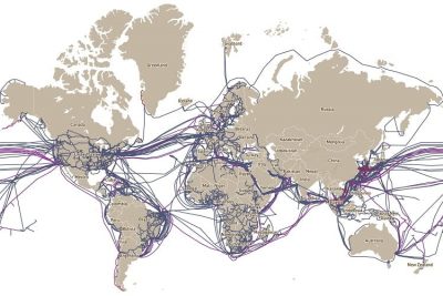 June 23, 2019 Submarine Communications Cables: All That It Takes to Keep the Internet Up and Running
 October 7, 2018 Tesla Tower: The Tragic Story of Nikola Tesla’s Wardenclyffe Wireless Station
 December 22, 2019 After the Discovery of X-Rays Came N-Rays – But Do They Actually Exist?
 November 4, 2019 Goblin Shark: The Alien Shark of the Deep Sea, with a Slingshot Mouth


