The post Market Theater Gum Wall: The Sticky Story of a Wall Decorated in Chewing Gum appeared first on .
]]>
Gum wall, Seattle. (Diego Delso, delso.photo, License CC-BY-SA)
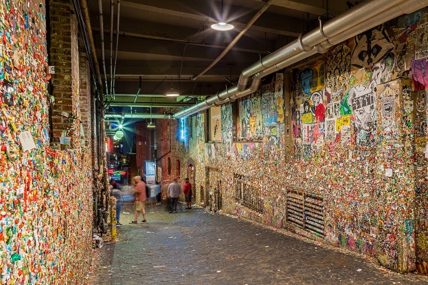
The Pike Place Market in Downtown Seattle, also known as the birthplace of Starbucks, is one of the oldest farmers’ markets in the USA. But today, this is not what brings more curious visitors to this already famous place in Seattle anymore. The Market Theatre Gum Wall has taken over the limelight, ever since impatient patrons started ‘decorating’ the walls with chewing gum thirty years ago. A tourist attraction, with a special marking for it in fold-out maps. This gum wall does not have a long story, unlike its actual length in real life.
Location of the Gum Wall and its origins
In Post Alley, Seattle between the Pike and Union streets, an inconspicuously narrow lane leads into the Market Theater – home to Unexpected Productions. A quirky, fruity fragrance hangs in the air; but even before one could recall the fragrance while looking for the source, a multi-coloured artwork hidden in plain sight, springs before the onlookers, leaving them much in awe and aversion.
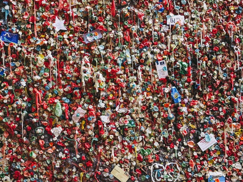
Gum Wall closeup. (Ben Curry/Unsplash)
The story of the Gum Wall dates back to 1993 when patrons would wait in line to get their tickets for the improv show and stick their gum blobs to the wall for holding on to their coins. Slowly, coins started disappearing overnight, but the practice of sticking chewed gums stayed on, thus leaving behind a remarkably striking legacy on the wall, coming right out of peoples’ mouths. The Gum Wall has only grown piece by piece ever since the first huge lot of chewing gums left the management and preservation department in a sticky situation. In 1999, it was decided to let the Gum Wall stay for more people to come and ‘stick’ their mark in stone forever.
Dimensions of the Gum Wall and attractions
Oddly satisfying, the colourful Gum Wall is now a tourist attraction, with local and international visitors flocking in the millions to see it in all its bright colours. The peculiar brick wall has become a fascinating piece of artwork, which stretches as wide as 55-feet on both sides of the passageway and is almost 8-feet-high, with each brick holding approximately 150 units of bubblegum on it. Apart from the regular gums, jabbed with finger marks in the centre to press it on, the wall also has self-proclaimed artists putting up their art on display. Right from spelling out names to making elaborate but small portraits, along with the heart-shaped love confessions, everything on the wall is left to the imagination.

The gum wall in post alley. (Calvin Hodgson/Flickr)

Gum wall window. (Ruth Hartnup/Flickr)
Cleaning procedures at the Gum Wall
Fearing that the sugar in the gum would erode the brick wall, authorities undertook a steam cleaning operation in November 2015 to wipe out the last bit of gum.

Cleaning crews taking down the famous gum wall. (Alberto Cruz/Flickr)
It took them 130 hours to remove a little more than 1000 kg of gum, but their efforts went in vain. Bubblegum started appearing again, along with visitors, who missed no opportunity to capture the collective artwork in their cameras.
Enjoyed this article? Also, check out “Sedlec Ossuary: The Famous Bone Church of Kutná Hora in the Czech Republic“.
For more unusual stories & intriguing news follow STSTW Media on Instagram and Facebook. Also, join our live chat discussion on Twitter.
We welcome your contribution at [email protected]. Please include your name, city, state, and country.
Fact Analysis:
STSTW Media strives to deliver accurate information through careful research. However, things can go wrong. If you find the above article inaccurate or biased, please let us know at [email protected].
RELATED
 January 22, 2019 Ämari Pilots’ Cemetery: Where Aircraft Tail Fins Adorn Soviet Pilots’ Tombstones
 November 25, 2018 North Sentinel Island: Home to an Uncontacted, Hostile and Primitive Tribe
 April 5, 2019 Sedlec Ossuary: The Famous Bone Church of Kutná Hora in the Czech Republic
 February 1, 2019 Agbogbloshie: Africa’s Largest Ground for Dumping of Electronic Waste from World Over
The post Market Theater Gum Wall: The Sticky Story of a Wall Decorated in Chewing Gum appeared first on .
]]>The post Sana’a, Yemen: The Cradle of Arabian Ancestry appeared first on .
]]>
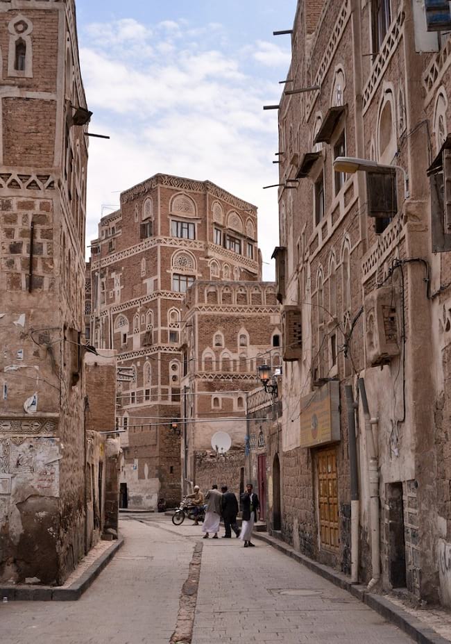
View of Sana’a, Yemen. (yeowatzup/Flickr)
The geographical region between Northeast Africa and Southwest Asia is called the Middle East. It is verily called ‘the cradle of human civilization’ as it is the birthplace of the world’s earliest known civilizations. Yemen, with its city of Sana’a, is part of this ‘cradle’.
From 9th century BC to 6th century AD, Yemen saw rise and fall of several civilized states like Sabaean (pre-Islamic south-western Arabia mentioned in the biblical story of King Solomon and Queen Sheba), Awsanian (South Arabia) and Minaean (the ancient Yemenis who lived along the present-day strip of desert called Ramlat Dehem). Thanks to the spice trade, the principal vocation of people, these states were rich and prosperous. No wonder the Romans called them ‘Arabia Felix (Happy Arabia)’.
Sana’a, Yemen

Old Sana’a, Yemen. (Rod Waddington/Flickr)
Excavations reveal that the earliest human settlements in Yemen happened around 5,000 BC. The city of Sana’a is located 2,200 meters above sea level, across the mountains of Yemen. It is the oldest Arabian city, which is consistently inhabited for over 2,500 years. Famed as the heartland of Arabs, its 6,000 residential houses (built before 11th century), 14 hammams (bathhouses) and 103 mosques reflect the ancient Arabic architecture. Well-built mud houses and high rise brick towers on a stone base are signature landmarks. Fired bricks and white gypsum are used in making decorative designs. The overall town planning is thoughtful. The brownish colour of structures merges into the colour of earth and the mountain range. A medley of tall minarets, beautiful gardens, and rest houses adds to the spender of the city.

Sana’a, Yemen. (Antti Salonen/Wikimedia Commons)
Himyarite Kingdom
Himyar kingdom, which lasted from 2nd century BC to 525 AD, was the last pre-Islamic statehood. Sana’a was granted the status of a ‘city’ in 2nd century BC. By 1st century AD, it was a key station on the terrestrial trading routes. From AD 525-75, it was ruled by Abyssinians (ancient Ethiopians) professing the Christian faith. The Christian influence on the city peaked from 527 to 565 AD in tandem with the reign of the Roman Emperor – Justinian.
The Great Mosque, planned & constructed in the lifetime of Prophet Mohammed, in 630 AD, contained several pre-Islamic relics. In the 7th Century, as Sana’a transformed into an Islamic state, the pre-Islamic relics were destroyed. Protection has been extended to the old city of Sana’a through Building law of 2002 and Antiquities Law of 1997. World heritage committee has suggested the building of a buffer zone around the old city.
Inside Sana’a, Yemen. (Rod Waddington/Flickr)
Ottoman Rule
With the occupation of Egypt in the 1st Century BC, Romans made the red sea their principal route for business and trade. This weakened Yemen regimes, which depended principally on the land route for trading. Consequently, the Christian Abyssinians took over Yemen in the 4th and 6th centuries. In the later 6th century, the Sassanids of Persia governed Yemen, and in the 7th century, Yemen was ruled by an Islamic state. Following the rapid spread of Islam from Mecca and Madina–where it originated, Yemen was quick to embrace Islam and spread it into other countries as a front-line soldier.
Ottoman rule, founded by the leader of Turkish tribes at the start of the 13th century, gave a new lease of life to Sana’a. Islamic architecture was revived. It reflected loud and clear in the technique of ‘organizing the spaces’. The city was expanded in a big way, and its scenic landscape was enhanced. The houses and buildings were constructed from the material locally available and ensured living comforts and protection during exigencies. That’s the hallmark of Islamic architecture.
From the mid-17th to mid-19th century, Yemen remained virtually isolated from the rest of the world. In the early 20th century, Yemen was split into two states, north for Ottomans and south for British. Ottomans were forced to flee from Yemen following defeat in World War 1 in 1918 and after a series of upheavals, Yemen Arab Republic was formed in 1962.
The civilizations of Bible and Koran mingle seamlessly in the old city of Sana’a. In 1893, Aden (a port city of Yemen) was occupied by the British. With the end of Ottoman rule in 1918, and British rule in 1967, Yemen became a republic in 1990.
Enjoyed this article? Also, check out “Byblos, Lebanon: A World Heritage Site and the Oldest Continuously Inhabited City in the World“.
For more unusual stories & intriguing news follow STSTW Media on Instagram and Facebook. Also, join our live chat discussion on Twitter.
Do you have a story/photo for us?
We welcome your contribution at [email protected]. Please include your name, city, state, and country.
Fact Analysis:
STSTW Media strives to deliver accurate information through careful research. However, things can go wrong. If you find the above article inaccurate or biased, please let us know at [email protected].
RELATED
 May 27, 2019 Byblos, Lebanon: A World Heritage Site and the Oldest Continuously Inhabited City in the World
 October 11, 2018 Socotra Island of Yemen: The Most Alien-Looking Place on Earth
 June 2, 2019 Yemen’s Ancient Town of Shibam is Also Known As ‘Chicago of the Desert’
 December 5, 2018 Decapitation and Consciousness: How Long Can a Decapitated Head Remain Conscious?
The post Sana’a, Yemen: The Cradle of Arabian Ancestry appeared first on .
]]>The post The Nasir al-Mulk Mosque Hosts a Kaleidoscopic Play of Lights Reflecting the Morning Sun appeared first on .
]]>
The interior of the Nasir-al-Mulk Mosque. (Diego Delso/License CC-BY-SA)
In Shiraz, Iran, the Nasir al-Mulk mosque is a testament of the extremely vibrant culture of this city, which happens to be one of the oldest in southern Iran. This beautiful piece of architecture, also known as the ‘Pink Mosque’, is visited by thousands of people from around the world every year.
The origin of the Nasir al-Mulk mosque
The Nasir al-Mulk Mosque was built between the years 1876 and 1888, under the rule of the Qajar dynasty of Iran. Construction started in the year 1876, under the orders of the Qajar ruler, Mirza Hasan Ali, also known as Nasir al-Mulk, after whom the mosque was named. The mosque was designed by two individuals; Mohammad Hasan-e- Memar and Mohammad Reza Kashi- Paz- e- Shirazi.

The courtyard of the mosque. (Matt Biddulph/Wikimedia Commons)
A mosque of many names
The Nasir al-Mulk is also known as the ‘Pink Mosque’ due to the pinkish rose-coloured tiles of the mosque. However, it is also known by various other names like ‘Rainbow Mosque’, ‘Mosque of Colours’, as well as ‘Kaleidoscope Mosque’, because of the plethora of colours that are reflected when the light hits the stained glass.
The architectural beauty of the mosque
The Nasir al-Mulk mosque has a mesmerising atmosphere that captivates onlookers. This famous mosque has breathtakingly beautiful stained glass windows, and the walls have colourful geometric tiles that are equally stunning. The door at the entrance of the Nasir al-Mulk mosque is embellished with seven colour tiles and is known as the “haft rang”.

The colourful tiles of Nasir al Mulk mosque. (Ninara/Flickr)
The tiles of the mosque are an unusual and dark shade of blue which adds to the exhilarating beauty of the mosque. The best time to visit the mosque is in the morning between 9 am and 11 am, when the light reflects the stained glass windows on the floor of the mosque. The light causes the windows to form beautiful and vibrant coloured patterns on the tiled floors. Other than the phenomenal stained glass windows, the ceiling of the mosque is covered in exotic tiles that are a pinkish rose in colour. There are Persian rugs that cover the floor of the mosque, and the inside of the mosque is polychromatic and visually brilliant to look at.

A panoramic view of the mosque’s interior. (Mohammad Reza Domiri Ganji/Wikimedia Commons)
Koach, who is a Japanese photographer, spoke about the mosque, and its enthralling beauty. He said,
“You can only see the light through the stained glass in the early morning. It was built to catch the morning sun, so that if you visit at noon it will be too late to catch the light.”
The mosque also has an outer portal, though it is rather small, where one can see some admirable muqarnas (a kind of ornamental vaulting structure, usually seen in Islamic architecture). It also consists of an Iwan in the north, which is a vaulted rectangular space and is covered in three sides. Within the mosque, there is a courtyard, with a rectangular pool built in the centre, and is surrounded by various kinds of beautiful flower bushes.
Read more: Mind-blowing photos of Iran from 1999

The vault at Nasir al Mulk. (dynamosquito/Flickr)
The Nair al-Mulk Mosque has two shabestans (an underground space), one on the east and one on the west. The eastern shabestan consists of an altar made up of beautiful tiles and is accompanied by twelve columns and several stained-glassed windows. This structure was typically used during the summers, as it had been built in a way that would keep the interiors cool during very hot days. The niches, or the mihrab of the mosque, have been beautifully adorned, along with the intricate arches that leave visitors stunned.
There is a consonance between the columns, the arches, the muqarnas, as well as the mihrab of the mosque which inspires awe among all visitors alike.
The Nasir al-Mulk mosque is, perhaps, one of the best examples of a blend between both traditional and modern Islamic heritage. The many traditional Islamic features of the mosque include the Panj kaseh-i (five concaves), faience, a central fountain, plaster works, as well as an iwan. However, stained glass windows are a rare occurrence when it comes to traditional mosques.
Nasir al-Mulk a heritage site
The Nasir al-Mulk Mosque, or the Pink Mosque, is one of Iran’s most prestigious heritage sites and most tourists who visit the country make it a point to visit this architectural marvel. The mosque makes for a source of inspiration for travellers, worshippers, and photographers alike. Despite being a huge tourist attraction, the mosque continues to be used for worship as well. It is now under the protection of Nasir al Mulk’s Endowment Foundation and is the pride and joy of Shiraz.
For more unusual stories & intriguing news follow STSTW Media on Instagram and Facebook. Also, join our live chat discussion on Twitter.
Do you have a story/photo for us?
We welcome your contribution at [email protected]. Please include your name, city, state, and country.
Fact Analysis:
STSTW Media strives to deliver accurate information through careful research. However, things can go wrong. If you find the above article inaccurate or biased, please let us know at [email protected].
RELATED
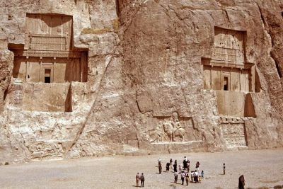 May 9, 2019 Naqsh-e Rustam: The Incredible Tombs and Rockface Reliefs of the Sassanian Kings
 June 20, 2019 Zoroastrianism: The Oldest Monotheistic Faith is Now on the Verge of Extinction
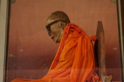 December 10, 2019 Loung Pordaeng: The Bespectacled Monk Mummy of Wat Khunaram
 April 13, 2020 The Deviant Spiritualism of an Indian Tribe That Practices Cannibalism And Necrophilia
The post The Nasir al-Mulk Mosque Hosts a Kaleidoscopic Play of Lights Reflecting the Morning Sun appeared first on .
]]>The post The Deadly Garden with Over a Hundred Different Varieties of Toxic Plants—The Poison Garden appeared first on .
]]>
The gate of The Poison Garden. (Amanda Slater/Flickr)
One might know the Alnwick Castle for the Harry Potter fame—was used as a location for the famous Hogwarts school in the first two movies. But that’s not the only interesting titbit of the castle in North England, adjacent to it is the Alnwick Garden. It is over 12 acres of land and attracts around 600,000 visitors annually. While in most of the gardens, visitors may be allowed to pluck flowers, here they are prohibited from tasting, touching or even smelling any plant or flower. One might wonder why? The reason lies beyond the iron gates; these gates lead to the Poison Garden, that houses around 100 intoxicating and narcotic plants. Although it is situated in the Alnwick Garden, Poison Garden is open for guided tours only.
The foundation and transformation of the Alnwick Garden

The cascade at the centre of The Alnwick Garden. (TSP/Wikimedia Commons)
The foundation for Alnwick garden was laid back in 1750 by the first Duke of Northumberland and was later developed by his successors until it was closed in 1950 due to the shabby mess it had grown to be. And it remained in those desperate conditions until the 12th Duke and Duchess of Northumberland moved into the castle and the Duchess, Jane Percy, took it upon herself to revamp and redevelop the Alnwick Garden in 1997. She hired Belgian landscape artists Jacques and Peter Wirtz to redo the garden. The garden went under direly needed transformation for four years and was opened to the public in 2001. The transformation took place in phases, and the Poison Garden was completed only in 2005.

The Poison Garden has around 100 toxic, intoxicating, and narcotic plants. (Graeme/Flickr)

Cannabis sativa. (madraban/Flickr)
The idea for the Poison Garden was inspired from the Duchess’ trip to the infamous Medici Poison Garden in Florence, Italy. And it was further cemented by her visit to the largest hospital in medieval Scotland wherein soporific sponges soaked in opium, hemlock and other plant herbs were used to anaesthetize amputees during 15th century surgeries. This reinforced the idea of a Poison Garden with a mission to attract children and to educate them on drug usage.
Plant varieties in the Poison Garden
The Poison Garden has over a hundred different varieties of toxic plants that have been collected from all over the world and replanted there. Strychnos Nux-vomica, a plant native to India, found its place in the garden. Strychnos is a source of alkaloid pesticide strychnine which results in muscular convulsion and even death. The pesticide is present in its bark, seeds and fruits.
Another plant that is exhibited in the garden is the Hemlock plant—Conium Maculatum. It contains coniine and other toxic alkaloids—found in seeds, roots and leaves, and may lead to death on inhalation of the contents. It was the contents of this plant that were used to make a poisonous beverage to kill Socrates.
Other varieties include Ricinus Communis, Foxglove, Atropa Belladonna, Brugmansia, Laburnum, etc. All these plants and trees, upon inhalation, result in intoxication-the least side effect, and visitors often faint while walking around the garden as they inhale the toxic fumes.

Ricinus communis (Castor oil plant). (Alvesgaspar/Wikimedia Commons)
Some of these cause delirium and hallucinations. The seemingly non-toxic of this bunch is the Laburnum, it is also known as a golden chain or golden rain because of the hanging yellow flowers that grow on this tree.

Laburnum or golden chain plant. (fallonrw/Pixabay)
It is predominantly seen in Europe and was grown as a common garden tree until children started falling sick by inhaling the toxic fumes from it. All parts of the tree are toxic and result in nausea, headache, vomiting, convulsions and even death through paralysis.
The Poison Garden, as infamous as it is, is a fascinating exhibit to look at and walkthrough, albeit cautiously. All the grandeur of the Alnwick Castle aside, this garden garners curiosity and interest like nothing else does.
For more unusual stories & intriguing news follow STSTW Media on Instagram and Facebook. Also, join our live chat discussion on Twitter.
Do you have a story/photo for us?
We welcome your contribution at [email protected]. Please include your name, city, state, and country.
Fact Analysis:
STSTW Media strives to deliver accurate information through careful research. However, things can go wrong. If you find the above article inaccurate or biased, please let us know at [email protected].
RELATED
 July 30, 2019 Robert Wadlow: Trials and Tribulations of the World’s Tallest Man
 July 15, 2019 Adalaj Stepwell: A 500-Year-Old Architectural Masterpiece With a Tragic Tale of Unrequited Love, Sacrifice And Loss
 April 8, 2019 The Manchineel Tree: One of the Most Toxic and Dangerous Tree in the World
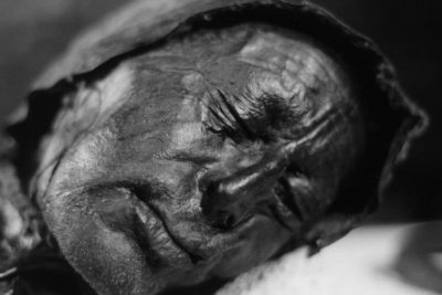 July 12, 2018 Tollund Man: Story of a ‘Bog Body’ That Gave us Much Information About the Iron Age
The post The Deadly Garden with Over a Hundred Different Varieties of Toxic Plants—The Poison Garden appeared first on .
]]>The post The Clermont-Ferrand Cathedral: A Beautiful Gothic Structure Made of Black Lava Stone appeared first on .
]]>
Clermont-Ferrand Cathedral. (Fabien1309/Wikimedia Commons)
The Clermont-Ferrand Cathedral, or the Cathédrale Notre-Dame-de-l’Assomption, looks like something out of a dark fairytale. The dark looming structure of this Gothic Cathedral, with its windows ablaze from the stunning medieval stained glass, stands atop a hill and cuts an iconic visage. Built through the 13th and 14th centuries, the Clermont-Ferrand Cathedral is the French National Monument and the seat of the Archbishops of Clermont.
Location
The Clermont-Ferrand Cathedral is located in the town of Clermont-Ferrand in the Auvergne, which is in the south-central region of France. Situated right at the heart of France’s volcanic region, the town of Clermont-Ferrand is surrounded by a chain of dormant volcanoes that is the largest in Europe.

At length it is in known as Cathedral of Our Lady of the Assumption of Clermont-Ferrand. (Fabien1309/Wikimedia Commons)
Built from black lava rocks
The Clermont-Ferrand Cathedral is built entirely using black lava stone and in the Gothic style of architecture. The Cathedral’s twin spires rise to an astounding height of 96.1 meters and overlook the largest dormant volcano of the surrounding range, the Puy-de-Dôme.
The ginormous steeples are perhaps the most dominating feature of not only the cathedral, but the entire town. The Clermont-Ferrand Cathedral also houses a 10th Century crypt, which is the oldest section of the cathedral. Besides the stunning medieval glass painting on the windows that depict the saints and their rise to martyrdom, the complex contains a vast number of Gothic wall paintings which are some best preserved medieval frescoes.

The main entrance of Clermont-Ferrand Cathedral. (Fabien1309/Wikimedia Commons)

Side view of the cathedral. (jean-louis Zimmermann/Flickr)
The nave of the Cathedral is surrounded by columns made of the same black lava stone, lending a sombre atmosphere within. The light through the stained windows pouring into the black cathedral interiors creates a mesmerising chiaroscuro effect. The black stone ceiling soars to 30 metres. An intricate 16th century clock housed within adds another point of interest. The clock chimes as the automatons of the two Roman gods Mars and Faunus beat the head of Saturn, the elderly Lord of Time.
The exterior facade of the Clermont-Ferrand Cathedral displays the quintessential Gargoyles which are integral to cathedral architecture. These Gargoyles help with drainage by pouring out accumulated water through their gaping mouths in case of heavy rain. Next to the Cathedral complex lies the Place de la Victoire, which exhibits the statue of Pope Urban II.
A long story
The Clermont-Ferrand Cathedral, interestingly, is not the only cathedral to have stood on the spot. The building was in fact built atop the remnants of two previous structures. The crypt housed within the Cathedral, as well as various other vestiges of the previous churches, has been seamlessly incorporated into the foundation and structure of the Cathedral. Constructions for the Clermont-Ferrand Cathedral began in 1248, but it was not officially completed until 1908. The Hundred Years’ War (1337-1453) and the French Revolution (1789-1799), and both their far-reaching repercussions hindered the construction process. The completion process could only begin as late as 1866.

The crypt inside Clermont-Ferrand Cathedral was discovered in 1885. (L.Falchero/Le Duc)
The construction of the existent facade of the Clermont-Ferrand Cathedral started in 1246, under the episcopacy of Bishop Hugues de la Tour. A friend of the contemporary monarch King Louis IX, Bishop Hagues was a man of eminence and affluence. The prominent Gothic style of cathedrals from northern France inspired the structure of the Cathedral. Designed by the architect Jean Deschamps, the impact of the cathedrals at Beauvais and Amiens are significant in the designs of the Clermont-Ferrand. Deschamps’ plans did not involve any bracing arches, and the windows were not to take up all the space between the supports. The ribs of the structure drove into the arches, while the flying buttresses projected into the aisles of the Cathedral’s nave. The pillars of the choir-rotunda ingeniously created an elliptical so the light could filter in through the apsidal windows into the sanctuary. Both the choir and the transept of the Clermont-Ferrand Cathedral were completed under the Deschamps’ supervision before the architect finally passed away in 1295.

The interior of Clermont-Ferrand Cathedral. (jean-louis Zimmermann/Flickr)
While its construction was deferred, the Cathedral complex was spared extensive damage during the French Revolution owing to the pleas of a very diplomatic clergyman, Benedictine Verdier-Latour, who argued that the building could serve the people as a gathering spot. He swayed public opinion and the basic structure of the Clermont-Ferrand Cathedral stood the test of time, although its altar, choir, rood screen, and furniture faced the ravages of the Revolution.
For more unusual stories & intriguing news follow STSTW Media on Instagram and Facebook. Also, join our live chat discussion on Twitter.
Do you have a story/photo for us?
We welcome your contribution at [email protected]. Please include your name, city, state, and country.
Fact Analysis:
STSTW Media strives to deliver accurate information through careful research. However, things can go wrong. If you find the above article inaccurate or biased, please let us know at [email protected].
RELATED
 September 24, 2019 The Mahabat Maqbara and the Extraordinary Tomb of Bahar-ud-din Bhar
 November 22, 2018 33 Thomas Street: Windowless Skyscraper in the Midst of Bustling New York City
 December 26, 2018 Moscow State University: An Architectural Marvel
 August 20, 2019 Reynisfjara: The Black Sand Beach that Looks Straight out of a Gothic Novel
The post The Clermont-Ferrand Cathedral: A Beautiful Gothic Structure Made of Black Lava Stone appeared first on .
]]>The post Assateague Island and Its Feral Horses appeared first on .
]]>
The feral horses of Assateague Island. (tramod / Flickr)
The horse is man’s second best friend after the dog. Its majestic looks, heady smell, terrific speed and amazing stamina are matchless. The scale ‘Horse Power’ testifies to the iconic status it holds as a power parameter. Its resilience too is mind-boggling. It can revert back to its pristine wild form (which existed before its domestication in 3000 BC), to become ‘feral’, if driven out from human care.
That’s what happened in the late 17th century. The increasing tax burden on domestic animals forced farmers to abandon their horses. Equine herds were driven to Assateague, a 60 km long barrier island, to live free.
Another view is that a Spanish ship ferrying a herd of horses wrecked at high sea. The horses which swam to safety became the ‘feral’ horses of Assateague Island.
Feral vs wild horse

Przewalski’s horse. (Claudia Feh / Wikimedia Commons)
It is important to note that ‘wild horse‘ is not the same as ‘feral horse’. There is only one truly wild horse in the world at present, it is Przewalski’s horse but recent research has suggested that they too might have been descended from domesticated horses. The rest of the so-called wild, are actually feral horses. Any domestic animal becomes feral when it lives freely in the wild away from the care and protection of human masters. Feral horses are a genre that was ‘pet’ in the past but became wild in the face of harsh circumstances. Interestingly, given a chance, they can switch to domestic use all over again.
The Assateague island
The feral horses of Assateague island are divided into two major groups. One, living on the Maryland side of the island, another on the Virginia side. Maryland herd is monitored by The National Park Services. The herd on the Virginia side is owned and cared for by the Chincoteague Volunteer Fire Department (hence the name Chincoteague ponies for the Virginia herd) who have a grazing permit to keep the horses on the Chincoteague National Wildlife Refuge. While the Refuge and The National Park Services may respond to an emergency in the first place, the call is finally taken by the Chincoteague Volunteer Fire Department. A major tourist attraction, the island is just 3 hour’s drive from Washington DC. It can also be reached from Baltimore, Annapolis, Southern Delaware and Northern Virginia. Its natural beauty, flora and fauna gives the island a place of pride in National Treasures of the United States.
Major tourist attraction
Where wild horses are a treat to watch, tourists are warned to remain at a safe distance. Touching or patting them may provoke them to bite or kick in self-defence. Even feeding the animals is prohibited as human food can make them sick. Hierarchized into groups of two to twelve individuals, called the band, Assateague’s horses roam free eating salty marsh grass that grows on the island. Their big belly and short stature is an adaptation to the retro environment. Ingestion of salty grass compels them to drink more water, hence the huge belly. The harsh environment of the island makes them petite like their distant ancestors. Clearly, a case of devolution, of reverting back in lineage – to their pristine wild forms. Yet, they have the wherewithal to become man’s companion once again, in changed circumstances. To keep their population in check, horses are sold off to private owners. ‘Misty of Chincoteague’, the children’s novel written by Marguerite Henry, describes a local festival called ‘Pony Penning’ wherein young foals of Virginia herd are sold by auction.

Feral horses grazing near the shore of the island. (Bonnie U. Gruenberg / Wikimedia Commons)
Horse population is regulated by the state
Resilient as these robust creatures are, they once again adapt to man’s proximity, when put into urbane conditions. Males are allowed only one breeding; then they are sterilized. This is done to avoid inbreeding and ensure diversity in future generations. The state monitoring restricts the size of the herd to 150 adults so that the natural resources of the island are not threatened. Wild must necessarily be hard on weak and the ailing. So, care is taken not to interfere with nature’s edict of the survival of the fittest. Only token veterinary aid/intervention is provided, like euthanasia for the terminally ill. Sick and weak are allowed to perish so that only the fit survive to live and procreate.

A mother horse with her foal grazing. (NPS photo)
The island is much more than just feral horses
On a positive note, horses are not the only attraction that the island offers to tourists. It is also an ideal destination for the bird watchers. Scenic beach, white sand, blue sea waves, safe campground are other bounties of tourist interest. Island’s neighbourhood offers good opportunities of the sighting of wildlife as well.
Enjoyed this article? Also, check out “Zebroid: Strange Equine Hybrids That Make Their Parentage Shine“.
Do you have a story for us?
We welcome your contribution at [email protected]. Please include your name, city, state, and country.
Fact Analysis:
STSTW Media strives to deliver accurate information through careful research. However, things can go wrong. If you find the above article inaccurate or biased, please let us know at [email protected].
RELATED
 March 30, 2019 Thilafushi: The Good, Bad and Ugly of the Garbage Island of Maldives
 January 31, 2019 The Lonely House on Ellidaey Island, Where Nobody is Sure of its Residents
 January 27, 2019 Madagascar Hissing Cockroach: An Unusual Wild Insect That Has Now Replaced Popular House Pets
 October 28, 2019 Victor of Aveyron – The Feral Boy from France
The post Assateague Island and Its Feral Horses appeared first on .
]]>The post Elephant Beach: The Dazzling Sandy Beach in Andaman and Nicobar Islands Perfect for an Exotic Vacation appeared first on .
]]>
Elephant Beach, Andaman and Nicobar Islands, India. (Senorhorst Jahnsen / Flickr)
Elephant Beach is one of the hottest spots on Havelock Island, in Andaman and Nicobar, India. The Elephant Beach is a public beach with bright coral reefs that spans up to a depth of one metre. It is one of the most popular beaches out there that attracts a ton of visitors every year. The sandy white beaches and clear blue-green water make for an ideal location for a variety of water sports. The region also houses mesmerising diverse marine creatures. Sea walking, swimming, snorkelling, kayaking, and bird-watching are some of the fun activities that the Elephant Beach offers its tourists.
Interestingly, the beach got its name as the elephants were the main means of transportation back in the day, and tourists arrived in that exotic manner.
Although there are no elephants to be seen on the island today, elephants are sometimes brought here to visit by a forest officer.
How to get to the Elephant Beach?
Elephant Beach is located very close to Havelock Island, takes about twenty minutes by boat from the docks. To reach Havelock Island, you must first reach Port Blair and then take a ferry boat to Havelock since it does not have an airport. The journey from Port Blair to Havelock Island on the ferry takes about one and a half hours, measuring to seventy kilometers. The journey from here to the Elephant beaches is the bat of an eyelid by boat.
You could also have an amazing therapeutic walk to the beach instead of riding a boat. The path is covered with lush green trees adding to one’s soothing and holistic experience. One can also use a public bus, hire a bike or take an auto to get to the Beach from Havelock today.
Spending a day amidst the white sands and sparkly water
Scuba diving is one of the most sought after activities here, a chance to live and experience the world underwater. When one has had enough of water, there are other beaches around the Elephant Beach to explore such as Kalapather Beach, Radhanagar Brach and Govindnagar Beach.
As much as the beach offers to feed one’s soul, feeding the body could prove to be a task owing to the lack of proper restaurants on the beach. There are a few shacks few and far in between, and small stalls for refreshments and some light snacks. However, though restaurants on Havelock island has a plethora of food options to devour. Tour agencies usually provide packages to tourists.
The last ferry from the beach leaves at around 3:30 pm and the Elephant Beach completely shut down at four ‘o clock. A carefully planned itinerary is essential to spend one whole afternoon to enjoy all the activities the beach has to offer.
When is the ideal time to visit the beach?
The Elephant Beach is blessed with tropical weather all year round. One can, as a result, drop by whenever in the mood for an exotic vacation by the sea. The ideal time to visit Elephant Beach, however, is sometime between November and February. During this time of the year, the sea remains absolutely calm and cool. To enjoy bright and sunny weather there, April and June are the months to visit.
Amenities available
Hospitals are not available on the beach. However, first aid kits are available all over the beach. If travelling through an agency, they will provide any emergency care need. Since the Andaman and Nicobar Islands are within the Indian Union Territory, most Indian networks work just fine. However, there could be a few signal issues as the beach is relatively isolated. Resorts are available in Havelock Island, which is just twenty minutes away from the Elephant Beach.
The cost of the boat ride is dependent on various service providers and the season but usually ranges between rupees 750 to 1250 Indian Rupees. It is crucial to keep in mind that the Elephant Beach is not open throughout the day. It is only open for day trips from around 7 am in the morning, and shuts down entirely by 4 pm.
Enjoyed this article? Also, check out “Barra Airport, Scotland: Where Planes Take Off and Land on a Beach“.
Fact Analysis:
STSTW Media strives to deliver accurate information through careful research. However, things can go wrong. If you find the above article inaccurate or biased, please let us know at [email protected].
RELATED
 July 6, 2019 Playa de Gulpiyuri: The Tiny Beach in the Principality of Asturias in Spain
 December 6, 2018 Cancun Underwater Museum: A Sunken Museum Dedicated to Conserving Marine Life
 May 26, 2019 Neptune Memorial Reef: An Eco-Friendly Underwater Graveyard Off the Florida Coast
- November 25, 2018 North Sentinel Island: Home to an Uncontacted, Hostile and Primitive Tribe
The post Elephant Beach: The Dazzling Sandy Beach in Andaman and Nicobar Islands Perfect for an Exotic Vacation appeared first on .
]]>The post Tipu Sultan: The Pioneer of Rocket Artillery appeared first on .
]]>
A painting of the battle of Guntur depicting the British confrontation with the Mysorean rockets. (Charles H. Hubbel / Wikimedia Commons)
The 18th Century ruler Tipu Sultan—the Tiger of Mysore or Sher e Mysore is known and admired for his bravery and heroic resistance against the British imperial forces.
The image of Tipu’s Tiger, a wooden toy tiger pinning down an English officer, comes to mind when one thinks of Tipu Sultan. Tiger epitomizes Tipu Sultan and his rule; his throne, weapons and armour were decorated and embellished with tiger figures, while live tigers guarded his palace.
Born in 1750 as Sultan Fateh Ali Sahab Tipu to Hyder Ali—the Sultan of Mysore, he succeeded his father in 1782. Both of them known for nearly bringing the East India Company to ruins made the British empire quaver with fear. Riding on his father’s legacy, and strongly opposing the involvement of foreign rule and rulers, Tipu Sultan arrested the influence of the colonizers in his state.
Along with being a fierce and valiant warrior, Tipu Sultan is also known for the technological and administrative reforms he brought to the Kingdom before and after ascending the throne. Of the many reforms is his expansion of Hyder Ali’s use of rocketry, this led to the invention of early Mysorean rockets, that served as templates for present-day rockets.
Transformation of traditional rockets
Rockets have been used for a long time in wars; the earliest records show the Chinese using rockets to fight the Mongol invaders in 1232 CE, followed by the Arabs, Mughals and even some European rulers. But these rockets were made of bamboos or cardboard and wood. The modernization of rockets was carried out by Hyder Ali and his son Tipu Sultan for fighting the colonial forces.
The Sultan of Mysore, Hyder Ali, innovated the gunpowder rockets to transform basic rockets into lethal weapons. This gunpowder gave the rockets a fierce bursting, a distinct odour and colour, and a terrifying noise.
These rockets were further enhanced by Tipu Sultan’s expertise and ingenuity and were encased in metal with the best mechanical structure. The deployment of rockets shook the British military and paralyzed them with fear in the Battle of Pollilur, during the First Anglo-Mysore War of 1780. Terrified and horrified British labelled the rockets “Flying Plagues”. We see a Mural depicting the victory scene of Mysore in the summer palace of Tipu Sultan at Darya Daulat Bagh in Srirangapatna.
Mysorean rockets were a major shift from Chinese rockets that used bamboos for support. These rockets were the first weaponised metal rockets to be used in war. The iron casing allowed greater compression to the rockets with higher thrust and a larger range of 2.4 km, the farthest at that time. They were then fastened onto swords or poles for stability and better accuracy. The rockets had twin side sharpened blades mounted on them, and when fired in a group, spun and wreaked significant damage against a large army.
Operating the Mysorean rockets
On the military ground were specially trained rocket men or jauk as they were known in the royal court. These rocket men were part of the military since Hyder Ali’s regime and their strength only increased in Tipu Sultan’s time, from 1500 to 5000.

A soldier of Tipu Sultan’s army using his rocket as a flagstaff. (Robert Home / Wikimedia Commons)
The presence of the rocket men in the troops is recorded in Tipu Sultan’s military manual—Fathul Mujahidin. Written under Tipu Sultan’s supervision it outlines the strategies to be employed in the war ground. One of the many important aspects covered in the manual is the usage of rockets in military campaigns. According to the manual, each regiment was to have 200 rocket men. They were assigned the task of operating and launching the rockets at an angle calculated from the diameter of the cylinder and the distance of the target.

Indian soldier of Tipu Sultan’s army igniting the rocket with one hand while lifting the head of it with the other. (Robert Home / Wikimedia Commons)
In addition to the rocketeers, wheeled rocket launchers capable of launching five to ten to rockets simultaneously were used also used.
To further enhance the rocket artillery, Tipu Sultan had set up research facilities—Taramandal Pet at Srirangapatna, Bangalore, Chitraguda and Bidanur. Here, men were trained in calculating the launching angles and distances and experiments were conducted to improve rocket technology.
From Mysore to England
After the defeat and death of Tipu Sultan in the last Anglo-Mysore war of 1799, the British took over his capital at Srirangapatna and seized their armoury. After seizing the armoury, the British studied the rockets and sent many rockets as samples to England. Two of these rockets now displayed in the Royal Museum of Artillery in London.
In England, William Congreve analysed these rockets and employing the techniques of reverse engineering, he studied the details of what made the Mysorean rockets deadly weapons. Studying the recoiling, launching and stability of the rockets, he made a few changes to them and released them as Congreve rockets. These rockets were then used by the British in the Napoleonic wars.
Rocket finds in Shimoga
In 2018, archaeologists excavated a dry well at Nagara Fort in Shimoga—part of the Kingdom of Mysore, to unearth about 1000 corroded rockets of 23-26 cm in size. Archaeologists believe these belong to the 18th Century and must have been stored there during Tipu Sultan’s rule. On digging up the dry wells, the excavators said, the mud smelled of dry ammunition and gunpowder. Each of the rockets and shells discovered was filled with potassium nitrate, charcoal, and magnesium powder said the State Archaeology Department Assistant Director R. Shejeshwara Nayaka.
While there may be contradictory views and debates on the nature of his rule and kingdom, one cannot deny Tipu Sultan the stature of being the pioneer of rocket artillery.
Enjoyed this article? Also, check out “Jack Parsons: The Sex Occultist Who Was Key in Sending America to Space“.
Fact Analysis:
STSTW Media strives to deliver accurate information through careful research. However, things can go wrong. If you find the above article inaccurate or biased, please let us know at [email protected].
RELATED
 February 6, 2019 Tipu’s Tiger: Tipu Sultan’s Macabre 18th Century Mechanical Toy That Doubled Up As a Pipe Organ
 June 4, 2020 Wan Hu- The First Astronaut Propelled Into Outer Space?
 June 19, 2019 Hyderabad State: When Nizams Held Control of an Indian Kingdom During Its Golden Period
 December 19, 2018 Battle of Saragarhi: When 21 Valiant Indian Soldiers Held Their Ground, Fiercely Fighting Against Thousands of Afghans
The post Tipu Sultan: The Pioneer of Rocket Artillery appeared first on .
]]>The post The Ancient Multistory Underground Cities of Turkey Housed Thousands of People appeared first on .
]]>
Derinkuyu Underground City in Cappadocia, Turkey. (Nevit Dilmen / Wikimedia Commons)
Located in the Nevşehir Province, in the Derinkuyu district of Turkey, exists one of the oldest underground cities in the world. Extending to a depth of approximately 200 ft, this ancient underground city is believed to have housed upwards of 20,000 people, along with their domestic animals and food storage. Derinkuyu also happens to be one of the largest excavated underground cities in Turkey, amongst the several other complexes that were found underground scattered throughout Cappadocia.
Location
Among the 36 cities that were discovered in Cappadocia, in Central Anatolia, the deepest city is Derinkuyu underground city, while the widest one discovered is the Kaymakli underground city. Derinkuyu is a troglodyte cave city and is located 40 km away from Goreme at an approximate depth of 85 metres. It is considered as one of the many subterranean cities that were carved out of ‘tuff’, a volcanic ash rock.

Kaymakli Underground City in Cappadocia, Turkey. (Nevit Dilmen / Wikimedia Commons)
Who built Derinkuyu?
While it is unanimously accepted that the Hittites were the predominant settlers of the Anatolia region from 1600 BCE to 1200 BCE, archaeologists could not verify precisely when Derinkuyu was built, and by whom. Over time, the Hittite group had scattered to form smaller groups due to several invasions and wars. As a result, the Phrygians were believed to have migrated into and settled in that area from the Balkans.
According to several scholars, if it were to be hypothesized that the Hittites built Derinkuyu, it must have been well before 1200 BCE. The other strand of research has led scholars to believe that the subterranean city of Derinkuyu was built by the Phrygians between 1200 BCE and 800 BCE. These are the only two conjectures to have stood the test of time. This is primarily because all the other groups who dwelled in Cappadocia, including the Persians, Greeks, Macedonians and Syrians, had migrated to the region much later than the estimated period of construction of the underground city. The tunnel system, along with the chapels and churches, may have undergone expansion in the hands of later settlers.
Considering the Cappadocians were a Christian minority, they often faced religious persecution alongside invasions, and had resorted to the underground-city as their haven. Later, during the Byzantine period, when the Arab-Byzantine wars occurred, Derinkuyu was popularly used by the Muslim Arabs for shelter.
One of the earliest written records of underground cities in Cappadocia belongs to a Greek soldier-historian named Xenophon, from 370 BCE. In his work, ‘Anabasis’, he says,
“The houses here were underground, with a mouth like that of a well, but spacious below; and while entrances were tunnelled down for the beasts of burden, the human inhabitants descended by a ladder. In the houses were goats, sheep, cattle, fowls, and their young; and all the animals were reared and took their fodder there in the houses.”
The stunning urban planning of the underground-city
While the underground cities were not built feasibly for long-term underground dwelling, they were capable of withstanding any kind of attack and could house a large number of citizens along with their livestock for a sufficiently long span of time.

Cross section of the underground city. (Wikimedia Commons)
The underground city of Derinkuyu is believed to have over 600 doors that lead into it, some of which have been found hidden within courtyards and residences on the surface. The area primarily comprises of the usual rooms that could be found in an underground city, such as refectories, churches, cellars, wineries, storage rooms and stables, among others. Apart from these typical rooms, the second floor is believed to have had a missionary school housed within a rather large room and had a “barrel vaulted ceiling”. To the left of this missionary school, the city probably had study rooms for the students.

School inside the underground city. (Martijn Munneke / Wikimedia Commons)
The descent from the third and fourth floors was by means of a vertical staircase, which ultimately led into a “cruciform plan church” which was housed on the lowest floor. The underground city also had a 55-metre deep ventilation shaft which perhaps also functioned as a well. In order to protect the city-dwellers from poisoning in case of a raid, not every floor was provided with a water well that went up all the way to the surface. Supposedly, Derinkuyu also has 15,000 other ventilation shafts that were used to provide fresh and clean air in the depths of the underground city.
The city-planning of Derinkuyu was urban in style, and quite possibly, very complex. They had a vast network of passages and tunnels, as well as stepped pits and inclined corridors, which were used to link family rooms and other communal spaces. People were believed to have gathered in these communal spaces to pray, socialise, and work. The underground city did not lack any necessity and had ample provisions for chimneys, wells, stables, water tanks, stores, as well as niches for oil lamps. In fact, the underground city even had isolated designated areas for the dead to be housed, until they could be buried properly according to the prevalent customs.
The underground city was very meticulously planned and had accurately balanced moving stones that looked like ordinary millstones, which were used to block corridors in case the settlement was under attack.

Stones were rolled over to close entrances in case of an attack. (Nevit Dilmen / Wikimedia Commons)
Derinkuyu rediscovered
For a very long time, the underground city of Derinkuyu has remained hidden under rubble. It is only recently, in 1963, when this astounding city was rediscovered and brought to light. During the renovations of his house in Cappadocia, a Turkish man decided to take out a wall in his basement. However, he was surprised to find a secret room behind it. On continuing his digging, he found what seemed to be a labyrinth of thousands of rooms. This led to the discovery of one of the largest underground cities in central Turkey.
Derinkuyu is a hotbed of tourism
Six years after the underground city of Derinkuyu was discovered, it was first opened to the public. Even though approximately only 10 per cent of the entire city is available for public viewing, it is definitely worth a visit.
While visiting Cappadocia, several tourists also take this opportunity to visit two of the largest open-air museums there, as well as the most renowned underground cities- the Goreme Open-Air Museum, the Zelve Open-Air Museum, as well as the Kaymakli underground city, the Ihlara Valley, and the Uchisar.

Steps inside Kaymakli underground city leading different level. (Nevit Dilmen / Wikimedia Commons)
Some of the other tourist attractions around Derinkuyu include Ortahisar, Avanos, Pasabag, Devrent, Hsibektas and Gulsehir. These places are primarily rock-cut castles, valleys, and settlements, whereas Avanos is believed to be the centre of pottery since the age of the Hittites. Cappadocia also has some ancient cave churches in the, as well as Caravanserais, which are 13th-century hotels on the silk road.
Özkonak Underground City: A Sister City
Derinkuyu, however, is not the sole underground city in the Cappadocia region. The Kaymakli and Özkonak are two other sister megalopolis’ that stretches through the depths of this area.
Özkonak Underground City is located under a small village by the same name near Avanos. Akin to Derinkuyu, the Özkonak too was hidden beneath the ravages of time until as recent as 1972, when a farmer accidentally chanced upon it. He was trying to find the cause behind the water for his crops draining underground too soon when he stumbled upon this megalopolis with ten underground levels. Similar to Derinkuyu and Kaymakli, Özkonak too has a labyrinth of underground chambers and an unusually well-engineered water system and network for ventilation. It even had a primitive communication system built across the levels. However, Özkonak differs from the other underground cities due to the ingenious addition of oil holes above all the city entrances. These holes functioned as a defence mechanism by allowing the city-dwellers to pour hot oil over invaders.
Though significantly smaller and less impressive as a structure than Derinkuyu or Kaymakli, Özkonak Underground City still has some amount of tourism centred around it sustained by the overall interest in the Cappadocia region and Derinkuyu.
Enjoyed this article? Also, check out “Photos: Underground Town of Australia, Coober Pedy“.
Fact Analysis:
STSTW Media strives to deliver accurate information through careful research. However, things can go wrong. If you find the above article inaccurate or biased, please let us know at [email protected].
RELATED
 December 28, 2018 Hakan Sukur – The Superstar Striker Exiled by Erdogan
 July 2, 2019 Varosha: The Abandoned Luxury Retreat in the Mediterranean
 July 7, 2018 Doomsday Vault: A Colossal Gene Bank with Over 1 Million Seed Varieties
 October 7, 2019 Anti Tank Dog: The Soviet ‘Masterplan’ that Backfired to Disastrous Effects
The post The Ancient Multistory Underground Cities of Turkey Housed Thousands of People appeared first on .
]]>The post Katas Raj Temples- The Oldest Hindu Temple in Pakistan appeared first on .
]]>
Katas Raj Temples in Katas, Pakistan. (© Mahmood saeed)
Indus valley civilization is one of the ancient civilizations of the world. It extended from present-day northeast Afghanistan to Pakistan and northwest India. Indus Valley civilization holds great importance in Hinduism; it was in this period that Hinduism found its footing and was adopted as the religion of the valley during 2300-1300 CE. Many of temples of the ancient age have been excavated at the civilization sites, of which many are present in Pakistan. Although Pakistan was founded as a predominantly Muslim country after partition, the map of the country is dotted with temples of all ages. One of these temples is the Katas Raj Temple, or Qila Katas as it is locally known.
Location
The town of Kallar Kahar in Chakwal district of Punjab province of Pakistan houses one of the holiest sanctuaries of Hinduism in the Indian subcontinent. The Katas Raj temple is a complex of seven or more temples, collectively known as Satgraha.

Ancient temples around Katas. (Teseum / Wikimedia Commons)
According to the first directorate general of Archaeological Survey of India, Alexander Cunningham, the temples are situated along the foothills of the Salt Range extending from the river Jhelum up till the Indus river.

Katas Raj Temples. (© Mahmood saeed)
Mythological importance
Katas Raj temple is highly revered by Hindus world over. It is believed the pond around which the Katas Temple is built is filled by Lord Shiva’s tears. He is believed to have lived here with his wife Sati, and upon her death, grief stricken Shiva couldn’t hold back his tears. These tears then led to the creation of the Katas Raj pond. This water body is thus said to symbolise his inconsolable and unfathomable grief. The name of the pond and the temple is also derived from a word that conveyed his grief, Alexander Cummingham traced back the origin of word Katas to Katasha, a Sanskrit word for “teary eyes”.

Visitors taking a dip in the pond. (Areesha khalid / Wikimedia Commons)
According to another legend, the Pandava brothers found refuge in the caves near the temple after the eldest Pandav Yudhishtra—King of Indraprastha lost his kingdom to their cousin Duryodhana. This incident is mentioned in the Hindu epic Mahabharata and it refers to Katas Raj as the place where the Pandava brothers settled during their 12 years of exile.
The caves are now restored and preserved by the archaeology department of Pakistan for their historical and religious importance.
Owing to these important stories of the faith, Hindus in large number from both the sides of the border congregate every year at different occasions to pay their respects, especially during Maha Shivratri. Although currently there are no idols placed in the temples, the pilgrims come here to commemorate the sacrifices of Pandava brothers and venerate Lord Shiva’s grief. The sacred lake is held in high regards and it is believed a dip/bath in it helps one attain salvation.

Inside Qila Katas. (Zhyusuf / Wikimedia Commons)

“Shiva lingam” in Katas Raj Temples. (Zhyusuf / Wikimedia Commons)
Historical importance
Besides these important temples, there are hundred other temples scattered around the ancient holy city of Katas. This includes Buddhist stupas, havelis and temples built about 900 years ago during the Buddhist rule and Hindu Shahi dynasty. Many of the small medieval temples have been constructed during the rule of Hindu Shahis— Hindu rulers from Afghanistan, that fled from their hometown and set their base here at Katas and ruled from 850-1026 BCE. Most of these temples are dedicated to Lord Shiva, and others to Lord Hanuman and Ram.
Within the complex are also remnants of an ancient Gurudwara where Guru Nanak took residence while he travelled across the world in the 19th Century.
Besides being a place of veneration, Katas Raj is also believed to be one of the ancient education centres. Recorded as per history in the 11th Century, Al-Biruni—Persian scholar and mathematician from the court of Mahmud Ghaznavi landed in Katas Raj to study Hinduism. He is believed to be the first Muslim scholar to carry out extensive research on Hindusim. To translate and understand the Hindu scripts he learnt Sanskrit at the linguistic university situated in the complex of the temple. And it was here during his stay that he studied the movements of planets and calculated the circumference of the earth. The Katas Raj temple finds a mention in his book Kitab ul Hind, Book of India.
Architecture of the complex
The construction and architecture of the complex reflects the Kashmiri design of Karkota and Varma dynasties. The temples are built on small square platforms and the cornices are formed where these platforms merge with the elevations of sub shrines situated in the complex.

Kashmiri architectural style Hindu temples in Katas. (Guilhem Vellut / Flickr)
The temple entrances are guarded by large wooden doors and some by open arches. The entrances are decorated with floral motifs atypical of Kashmiri style. And the defining characteristics of the temples here are the dentils, trefoil arches, fluted pillars and pointed roofs which are present in most of the temples that are found all along the Salt Range foothills.

Entrance of one of the temple at Katas. (Guilhem Vellut / Flickr)

Arches inside Qila Katas. (Guilhem Vellut / Flickr)
Conservation of the site
Although the complex was neglected in earlier years, the authorities of Punjab Archaeology Department have undertaken the task to preserve and restore the Katas Raj temple. Renovation of the site began in 2006, post L.K. Advani’s trip to the complex in 2005. And as a gesture of goodwill, Pakistan’s high commissioner Abdul Basit sent him a pitcher of water from the holy pond in 2015.
Some temples in the complex are under renovation while those that are well maintained serve as a destination of pilgrimage for Hindus. Katas Raj Temples is enlisted on the World Heritage Site tentative list of UNESCO.
The Katas Raj is a conglomeration of multi-religious and multi-cultural monuments and shrines, and serves as a reminder and testimony of the syncretic nature of Pakistan.
Enjoyed this article? Also, check out “Padmanabhaswamy Temple: The Richest Temple in the World with Gold Worth $22 Billion in Six Vaults“.
Fact Analysis:
STSTW Media strives to deliver accurate information through careful research. However, things can go wrong. If you find the above article inaccurate or biased, please let us know at [email protected].
RELATED
 August 24, 2020 Whale Temple: Where Vietnamese Worship Whales and Revere their Carcasses
 September 3, 2019 Tomb of Bibi Jawindi: On Cross Roads of Islamic Ethos
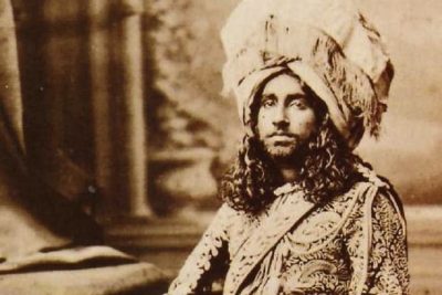 March 13, 2020 Anabel Loyd’s New Book ‘Bahawalpur’ Documents the ‘Rise and Fall of a Glorious British India Princely State
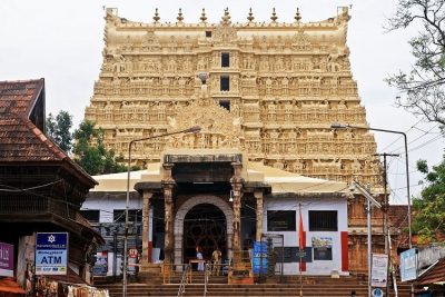 June 14, 2019 Padmanabhaswamy Temple: The Richest Temple in the World with Gold Worth $22 Billion in Six Vaults
The post Katas Raj Temples- The Oldest Hindu Temple in Pakistan appeared first on .
]]>The post Transylvania: Home to Dracula, the Barbarians and the Path Breaking Architecture appeared first on .
]]>
Transylvania, a historical region in Romania. (Antony Stanley / Flickr)
A geographical region in the Roman Empire (27 BC- 476 AD) was ruled by Hungarians, and the barbarian tribes of Huns (Asian origin) and Saxons (German origin) in the 11th century. It became part of Romania after the First World War, inspired ‘Dracula’ novel in 1897 and saw mutiny in 1989. Thanks to its cultural intermixing, medieval looks and spooky buildings, it’s now a popular tourist destination. We are talking about the Transylvania region of Romania in South-eastern Europe.
A bone of contention for long
Transylvania is surrounded by 3 mountains: Carpathian, Transylvanian Alps and Bihor. The Hungarians (Magyars) conquered it in 1003 AD. Thereafter, for many centuries, it thrived as an autonomous unit, until the invasion of Mongols in 1241. It became independent after Turks defeated Hungary in 1526. In 1566 Hungary was divided between Habsburg (Royal German family) and Turks. That brought Transylvania under Turkish suzerainty. Hungarian revolution of 1848 separated Transylvania from Hungary, but the two became one again in 1867. In World War I, following the defeat of Austria and Hungary, Transylvania got united with Romania. The allied forces recognized the union in 1920. In World War II, Hungary regained a part of Transylvania but ceded it to Romania in 1947. In 1989, they overthrew the communist rule in Romania.
A Christian Knight inspired the novel ‘Dracula’
Throughout these trials, Transylvania, in popular perception, remained a haunted place. A place where the spirits of the dead rose from their graves and sucked the blood of unsuspecting humans. Its creepy image reached a high with Bram Stoker’s novel ‘Dracula’ published in 1897. The novel blazed a trail of horror stories based on Transylvanian folklore.
The word Dracula is derived from ‘son of Dracul’. The phrase implied Vlad the Impaler (real name Vlad Tepes)–son of the 15th-century nobleman Vlad II Dracul. The word Dracul in Romanian means ‘the devil’, which contributed to Vlad’s reputation. Vlad Tepes was the king of Wallachia (now in Romania) and notorious for cruelty to his enemies. He would decapitate, eviscerate, impale and boil alive his enemies to give out a deterrent message. In 1462, when Ottoman (Turkish tribe) invaded Wallachia, he hoisted as many as 20,000 invaders on spear shafts; the stab passing through their body flesh, giving them a painful slow death. As the bodies writhed in pain, Vlad, the ‘son of Dracul’, wined and dined in their midst, even tasted their blood as part of his macabre revelry. This historical account inspired the character Dracula in Bram Stoker’s novel.
The astonishing showcase of medieval town planning
Apart from Vampire stories, Transylvania is known for its unique architecture. There are a good number of villages in Transylvania showcasing Saxon (a German tribe) architecture in full glory. Each village has a church that doubles up as military base (medieval forts of Europe).
Prejmer, a commune of three villages, is home to the most typical and largest fortified church in the region. It is fortified with 10 feet thick and 40 feet high walls. Interiors were designed to serve as food depots during peacetime, and shelter in war condition. Rooms inside were earmarked for every family home in the village, so that in an emergency, all knew which room to move into. People could stay put the church for several weeks, with children continuing with their studies in make-shift school in the same premises. Apart from this, the Saxon forts were also used as hubs of trade and industry in peaceful times. Bran Castle is another popular fort, famed for its creepy looks.

Bran castle. (Nicu hoandra / Wikimedia Commons)
Moving on roads in Transylvania gives you a feeling of travelling back in time. It is a 100-years-back spectacle of dirty roads, horse-driven carts and hoards of sheep being driven to pasture. Transfagarasan road though is an exception. Situated on the Fagaras Mountains, it is an amazing zigzag road, running over a valley, through a 900-meter tunnel, into the forests of Wallachia.

Transfagarasan road with hairpin turns. (Horia Varlan / Wikimedia Commons)
A UNESCO heritage site and architectural landmark
Seven Saxon villages find a place in the list of UNESCO World Heritage Site as milestones of gothic style architecture (13th to 16th century). Gothic architecture was a revolution of sorts as it created a multiple support system for the roof. Earlier, the entire weight of the roof rested on the 4 walls, which had to be commensurately thicker as the size of the building increased. Ribbed vault, flying buttresses and pointed arches were the support systems which took away much of the roof-load from the 4 walls of the building. Thus walls could be kept slim even as the area, and the height of the building increased.
Bermuda Triangle of Romania
Bram Stoker, the author of ‘Dracula’ had described Transylvania as ‘one of the wildest and least-known portions of Europe’. And not without a reason. Hoia-Baciu forest of Transylvania, called the ‘Bermuda Triangle of Romania’, is a weird jungle flush with strange woods.

Hoia Forest. (Cristian Bortes www.eyeem.com/bortescristian / Flickr)
Trees branch out weirdly into intimidating shapes. The tourists report of eerie silence interrupted by sounds of footfalls, with none in sight. Legends say that the forest is possessed by ghosts and evil spirits. A young girl was lost in the forest and returned after 5 years, but could not recall how she lived in the forest. Similarly, a shepherd and his flock of sheep went missing. Tourists have complained of headache and restlessness in Hoia-Baciu. Yet, the forest is a popular hangout for a picnic, adventure, and watching wildlife. Visitors can see wildlife through the hides, specially created for their safety and convenience. The Carpathian Mountains have a good population of wolves, lynx and brown bears. There are a good number of mineral springs where people go for health reasons.
Alcoholic drink is part of the staple diet
Description of Transylvania is incomplete without the mention of a popular drink called Palinka. It’s a brandy distilled from plumes, although drinks made from other fruits as well. It is gulped in one go before taking the main course of the meal. Apart from routine use, Palinca is also taken on special occasions of revelry and celebrations.
Enjoyed this article? Also, check out “Yemen’s Ancient Town of Shibam is Also Known As ‘Chicago of the Desert’“.
Fact Analysis:
STSTW Media strives to deliver accurate information through careful research. However, things can go wrong. If you find the above article inaccurate or biased, please let us know at [email protected].
RELATED
 January 30, 2019 Mt Etna: The Highest Active Volcano in Europe, A Popular Tourist Destination
 December 12, 2019 Rakotzbrücke: ‘The Devil’s Bridge’ which Looks Straight Out of a Fairytale
 October 8, 2019 Bibi ka Maqbara: The Taj of Deccan, Which Like the Original, Tells the Tale of Eternal Love
 September 24, 2018 Cassadaga in Florida: Home to the Largest Psychic Community in the World
The post Transylvania: Home to Dracula, the Barbarians and the Path Breaking Architecture appeared first on .
]]>The post The Fascinating ‘Amber Room’: The Fabled ‘Eighth Wonder’ of the World appeared first on .
]]>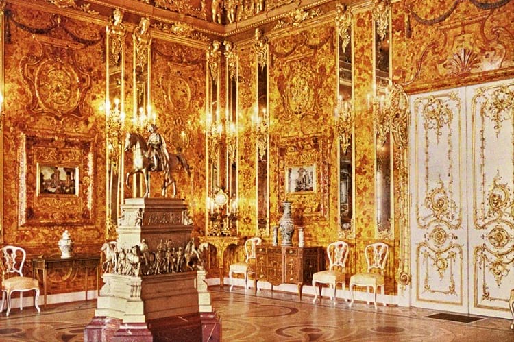
An autochrome of the original Amber room, 1917. (Andrey Andreevich Zest / Wikimedia Commons)
The famous Amber Room, or “Yantarnaya Komnata” as it is known in Russian, was an opulent room made of amber and gold leaf, embellished with mirror panels and semi-precious stones. Amber is a semi-transparent fossilised resin of the coniferous trees often found on the shores of the Baltic Sea. Due to its golden appearance, similar to gold, it was called the “Gold of the North” and was in high demand for making ornamental pieces. Such was the fascination for amber that the 18th century saw sculptors and craftsmen specialising in amber carvings and sculptor techniques. The original Amber Room was designed and constructed in the early 18th century for Frederick I, the first King of Prussia.
The history behind the Amber Room
The Amber Room was a tribute by Frederick I to his second wife, Sophie Charlotte, whom he adored. It is also possible that the very concept originated from Sophie Charlotte who was a connoisseur of arts or, from the chief architect of the court, German Andreas Schlüter, when he found a large collection of amber in the palace storage cellars.
Schlüter specialised in the baroque art of sculpting in which sculptures were elaborate designs of figurines with added elements like concealed lighting or water fountains. The baroque art of sculpting created an ethereal transformative experience for viewers. The Amber Room is, to date, considered the most famous work of architecture by Andreas Schlüter.
Schlüter started working on the detailed design of the room in the year 1701 with another amber specialist, craftsman Gottfried Wolfram of Danish descent from Copenhagen till 1707. Together, they made floor to ceiling panels in amber with gold leaf, mirrors, mosaic and intricate inlay work. They made carvings of nymphs, cupids and angels.
Wolfram constructed 46 enormous panels of fused amber, some 12 feet high. Work continued after that by amber masters Gottfried Turau and Ernst Schacht from the Polish town of Danzig. It was planned for the summer residence of Sophie Charlotte, the Charlottenburg Palace in Berlin, but unfortunately, Sophie passed away on January 21 1705, before the Amber Room could be completed.

A portion of the reconstructed Amber Room. (jeanyfan / Wikimedia Commons)
The completed panels were installed in a room in the Charlottenburg Palace which Frederick I used as his study. The room was also furnished with objects like candelabras, vases, snuff boxes etc. made of amber. It was described by those who saw it, as “standing inside an open jewel box“.
In February 1713, with work still underway on the Amber Room, King Frederick passed away. His son, Frederick William I, succeeded him and ordered for the Amber Room in its incomplete form to be stored in the arsenal in Berlin. He had no inclination of wasting any more time or resources on the humongous Amber Room project.
The amber gift to Russia
In 1716, the Russian Tsar, Peter the Great, visited Berlin and was keen to see the famous Amber Room. Seizing the opportunity to form a formidable alliance, King Frederick William I gifted the Amber Room to the Tsar. The panels were dismantled and packed in 18 large crates to be taken to the summer palace of the Tsar in St. Petersburg, Russia. Peter had planned to create an art chamber with the Amber Room. Sadly, the panels remained in storage as no artisan in Russia was able to put the pieces together to re-create the Amber Room.
After the death of Peter the Great in 1725, it took a while for his daughter Elizabeth to take over the Russian empire as the successor. Elizabeth succeeded the throne in 1741 as the Empress of Russia and in 1743 ordered for the installation of the Amber Room in her winter palace, under the guidance of the Italian court architect, Francesco Bartolomeo Rastrelli. Italian sculptor Alexander Martelli was appointed to work on restoring the amber detailing.
The room designated for the amber panels was not big enough according to the Empress, so she moved it to a hall so big that the original panels were spread out with new amber panels and mirrored pilasters in gilded frames, in between. The height of the walls in the hall was 7.5 metres whereas the amber panels were only 4.75 metres high. Rastrelli added mirrored pilasters to compensate for the height. He filled the spaces with imitation amber and decorated the upper tier with gilded woodcarving.
Maria Theresa Walburga Amalia Christina, the Holy Roman Empress, presented Empress Elizabeth with 4 panels of agate and jasper mosaic in Florentine stone by Guiseppe Dzokki, to illustrate the 5 senses of the human body. These were placed on the 4 largest boards of the room. The new Amber Room was completed by 1745 but, Empress Elizabeth was again, not happy and had it moved 3 more times before making it to the reception hall of foreign dignitaries.
However, due to all the moving around, the amber had started falling off the panels. In 1755, Elizabeth had it moved, yet again, to her mother’s summer home, the Catherine Palace in Tsarskoye Selo near the Baltic Sea. Here, the deteriorating amber panels were replaced with gold foil covered glass due to lack of finances for resourcing amber.
The magnum opus, turning into the ‘8th Wonder of the World’
In 1778, Catherine II also known as Catherine the Great became the Empress of Russia. Having been born in Stettin near the Baltic Sea, she was an expert judge of the precious ‘Gold of the North’. She ordered for 900 pounds of high-quality amber from East Prussia and also hired 4 Polish amber carvers from the Königsberg Guild of traders to make new panels as per the designs of the older ones.
She called upon the famous Italian craftsman, Guiseppe Dzokki to re-construct the 4 Florentine panels with amber mosaic. The panels, 1 for each wall portrayed, “Sight“, “Hearing“, “Taste“, and “Touch and Scent“. After more than 4 years of extensive restoration and change, the final Amber Room was a stunning work of art.
The room had huge floor to ceiling panels of skilfully carved amber, mirrored wall panels and the 4 amber mosaics by Giuseppe Dzokki. The final room had 1,00,000 sections of carved amber panelling arranged in 3 tiers covering a total space of 592 square feet. Pictures made out of semi-precious stones were enclosed in 4 amber panels. A table made out of amber stood proudly in one corner of the room.

The original Amber room hand-coloured photograph. (Branson DeCou / Courtesy Special Collections)
The Amber Room housed the greatest collection of art pieces in amber that could be dated back to the 17th century. The legendary room was referred to as, “The Eighth Wonder of the World“. Notable French poet and art critic, Théophile Gautier saw the room in 1886 and wrote, “Only in The Thousand and One Nights and in magic fairy tales, where the architecture of palaces is trusted to magicians, spirits and genies, one can read about rooms made of diamonds, rubies, jacinth and other jewels…“, aptly describing the magical grandeur of this mesmerizing room. The amber in the room glowed in shades ranging from a dark topaz to a light lemon yellow when seen in the light of 565 candles, reflected in 24 pilasters and 2 large wall mirrors.
The Nazi invasion and the disappearance of the Amber Room
When World War II broke out, valuable artworks and things of historic importance were being evacuated from Tsarskoye Selo to go underground, out of reach of the enemies. The Amber Room, however, was too massive and fragile to be moved. It was instead camouflaged with tapestry, to avoid drawing attention. By the time the Russians made arrangements to sneak the panels to underground storage cellars in Sverdlovsk, it was too late.
On June 22, 1941, German troops captured and cordoned off the city of St. Petersburg; and started plundering the places of importance. In Tsarskoye Selo, they were not deceived by the wallpapered Amber Room and the room was dismantled within 36 hours. Rittmeister Graf Solms-Laubach was in charge of shifting the Amber Room to Germany.
On October 14 in 1941, he sent the packed 27 crates of the Amber Room back to its home, Königsberg in Germany. The Amber Room was set up in the castle museum near the Baltic Sea and was on display there for 2 years. The daily newspaper Königsberger Allgemeine Zeitung reported the opening of an exhibition of the Amber Room on November 13, 1941.
It is alleged that towards the end of 1943, the Amber Room was again dismantled and stored in the cellars of the castle. In August 1944, Germany came under heavy aerial attack by the UK and the Königsberg castle was destroyed. The Soviets attacked Germany and occupied Königsberg on April 9, 1945. The Amber Room, however, could not be found.
Some say it was moved to Wechselburg in Saxony and buried there. Some claim to have seen it loaded onto trains to be taken to an unknown destination, whereas some believe that it was ruined in the bombing attacks of 1944. Then, there are dreamers who believe the legend that the Amber Room has been buried deep under the modern day Kaliningrad (Königsberg) Stadium in Germany. Another theory states that it could be at the bottom of the Baltic Sea where the ship carrying it perhaps sank during the attacks.
Replicating the opulent Amber Room
Whatever the explanation to the whereabouts of the Amber Room, it could never be found again. Though many people embarked on long journeys to search for the room and many alleged to have found proof of its storage, nothing concrete came out of it. In July 1979, the Council of Ministers of Soviet Russia came to a decision to start construction on a replica of the Amber Room.
Under the expert guidance of architect-restorer Alexander Kedrinsky, the replication plans were drawn. A special Tsarkoye Selo Amber Workshop was organised with experts who reconstructed the room from the original photographs available. Organisations that were formed to search for the original Amber Room, had found 2 original elements of the room in Germany, the “Touch and Scent” mosaic and an inlaid wooden commode. These were given to the Catherine Palace workshop in 2000. The cost of this rebuild was $11.35 million, out of which $3.5 million was provided by a German corporation as a symbol of support.
The reconstructed Amber Room was unveiled on May 31 2003, in a grand ceremony marking the 300th year celebrations of St. Petersburg. It was presided over by the Russian President, Vladimir Putin and the German Federal Chancellor, Gerhardt Schroder. The event was attended by several heads of states, including George W. Bush and Tony Blair among others.
Enjoyed this article? Also, check out “Project Riese: Hitler’s Shadowy Incomplete Underground Complex that Remains a Mystery“.
Recommended Visit:
Amber Room | Catherine Palace, Russia
Fact Analysis:
STSTW Media strives to deliver accurate information through careful research. However, things can go wrong. If you find the above article inaccurate or biased, please let us know at [email protected].
RELATED
 May 4, 2020 An Interior Design Masterpiece That Bears Testimony to an Artist’s Strife for Perfection
 March 2, 2020 Kintsukuroi: The Japanese Art of Fixing Pottery Reflects a Much Deeper Philosophy
- January 22, 2019 Ämari Pilots’ Cemetery: Where Aircraft Tail Fins Adorn Soviet Pilots’ Tombstones
- June 14, 2019 Padmanabhaswamy Temple: The Richest Temple in the World with Gold Worth $22 Billion in Six Vaults
The post The Fascinating ‘Amber Room’: The Fabled ‘Eighth Wonder’ of the World appeared first on .
]]>The post Leh Magnetic Hill: A Stretch of Road Where Laws of Gravity Work Peculiarly appeared first on .
]]>
Magnetic Hill in Ladakh. (Rohit Ganda / Flickr)
India is a country that boasts of natural wonders in abundance. One is likely to find an oddity in almost every nook and cranny of the nation. India’s northernmost and newly-formed Union Territory Ladakh is home to one such rare phenomenon. It has not only stumped visitors from all over the world but has also puzzled scientists alike. On average, tourists in thousands, visit The Magnetic Hill in Leh district all year round to experience this thrilling and unique occurrence themselves.
What is Magnetic Hill?
Magnetic hill is also known as Cyclops hill, although the origin of this term remains unknown. It is said to be derived from the eponymous Greek monster with a single, spherical, gigantic eye.
Nothing more than an optical illusion, the Magnetic Hill or Gravity Hill in Leh is a place where the gravitational pull of the Earth works differently as compared to the rest of the world.
Location of the Magnetic Hill
As the name suggests, the Magnetic Hill is a stretch of road in the mountainous Leh-Kargil-Batalik NH1. Located in a remote valley approximately thirty kilometres from Leh, it is positioned around 14,000 feet above sea level, where the gravitational pull of the Earth defies laws of physics.
The Magnetic Hill sits pretty between the longest mountain range in Asia and passes through the Trans-Himalayan region. And is flanked by the Sindhu River on its east making it look like a scene from a fairytale! A picturesque landscape, Magnetic Hill has become a pit-stop for travellers, to soak in the wonders of nature.

Magnetic hill signboard near Magnetic hill in Leh, Ladakh, India. (Ashwin Kumar / Flickr)
The Border Roads Organisation has put up a signboard to help tourists experience the magnetic pull of the region. A horizontal white box is painted in the middle of the road for travellers to park their vehicles in; where it tends to get pulled uphill, despite its ignition turned off. But there is more to this gravity hill than meets the eye. A lot of theories surround this phenomenon associated with the magnetic pull in the locale, leaving its visitors astounded.
Local legends associated with the Magnetic Hill
People living in and around the areas surrounding Ladakh believe this Hill to be the only stairway to heaven. According to local folklore, people who deserve to go to paradise are directly lifted towards the sky while on their way through the hill; and those that did not make it to the list, never get a chance to visit the place. Some even stir up stories of paranormal activity in the area. Tour guides also narrate these legends to pull in more and more crowds, making it an interesting trip.
Scientific Theory explaining the occurrence at Magnetic Hill
While legends are quite popular, one postulated and rational theory suggests a strong magnetic field exists in the particular patch of land, which pulls vehicles towards it. The magnetic energy emitted here affects the vehicles and complicates the navigational equipment of aircraft flying directly over the area. It is said that any aircraft flying over the region starts to experience jerks. In case an aircraft comes within the magnetic range, it is advised to fly at a certain speed and height to avoid accidents. Reportedly the Indian Air Force makes it a point to avoid getting within the vicinity altogether to prevent damages.
The Optical Illusion Theory
Although a great number of people across the globe believe in the magnetic field theory, a lot of other people are convinced Leh’s strange and inexplicable Magnetic Hill is nothing but the work of an optical illusion. Quite contrary to the magnetic field speculation, this theory has managed to find a lot more takers. Attributing to an obstructed horizon from the point of view of a traveller, the downhill slope appears to be uphill. In such a case, a vehicle in neutral gear inside the designated white box appears to move uphill. Although the topography of the surroundings is such that the vehicle actually moves slightly downhill.
Other Magnetic Hills in India and abroad
While the Magnetic Hill in Leh is quite popular, a lot of other places present a strikingly similar gravity-defying experience. The Kawardha Magnetic Hill and Ulta Paani Gravity Hill in Chhattisgarh, along with the Tulsishyam Anti-Gravity Hill and Kalo Dungar Magnetic Hill in Gujarat are places where vehicles seem to roll uphill. Apart from these places in India, the Morgan-Lewis Hill in Barbados, Anti-Gravity Hill in Australia, the Electric Brae in Scotland, Anti-Gravity Hill in Ariccia, Rome, Mt. Penteli in Greece, Mt. Halla in South Korea, Malveira da Serra in Portugal, Gravity Hill in Washington, USA and other magnetic hills in America are some of the places around the world, where gravity plays tricks with an observer’s mind.
In the year 2015, a team of research students from the Rajasthan Institute of Engineering & Technology performed a series of experiments at the Magnetic Hill to debunk the myths associated with it. Although they provided scientific data along with theories nothing came out of it. They tried to prove that there is nothing strange in the area; but in the end, the mystery of the Magnetic Hill and its gravity-defying pull has only deepened further.
Enjoyed this article? Also, check out “Roopkund Lake: What are Hundreds of Bones Doing Around a Lake in Uttarakhand?“
Fact Analysis:
STSTW Media strives to deliver accurate information through careful research. However, things can go wrong. If you find the above article inaccurate or biased, please let us know at [email protected].
RELATED
- November 25, 2018 North Sentinel Island: Home to an Uncontacted, Hostile and Primitive Tribe
 June 21, 2019 Phantom Island: The Islands that Might Have Existed Only in the Imagination
 January 29, 2019 The Egyptian Vultures of Tamil Nadu’s Vedagiriswarar Temple
 January 29, 2020 Roopkund Lake: What are Hundreds of Bones Doing Around a Lake in Uttarakhand?
The post Leh Magnetic Hill: A Stretch of Road Where Laws of Gravity Work Peculiarly appeared first on .
]]>The post Rakotzbrücke: ‘The Devil’s Bridge’ which Looks Straight Out of a Fairytale appeared first on .
]]>
Rakotzbrücke devil’s bridge. Kromlau, Germany. (A.Landgraf / Wikimedia Commons)
Located in Kromlauer Park, Gablenz, Saxony in Germany, the Rakotzbrücke is also known as the ‘Devil’s Bridge’. In medieval Europe, bridges that were built out of stone or masonry were known as ‘devil’s bridges’ as they had an unusual architectural design and incorporated newly developed technologies that fascinated the contemporary populace. There are many similar Devil’s bridges across Europe, and each of them having a folktale associated with their origin.
The majority of the Devil’s bridges can be found in France (numbering to 40), while the others can be found peppered all over Europe, including in Bulgaria, Switzerland, Estonia, Slovenia, Italy, Romania, United Kingdom, and Spain. The Rakotzbrücke in Germany, however, is one of the most beautiful Devil’s bridges to be found across all of Europe
Origin of the Rakotzbrücke
It is believed that the bridge was built in the year 1860, and was commissioned by a knight named Friedrich Herrmann, who belonged to the local town of Kromlau.
Nestled in the forest of Kromlauer Park, the Rakotzbrücke or the ‘Devil’s Bridge’ is believed to be a miraculous and dangerous marvel that was apparently, according to local folktales, built by Satan himself. The bridge was built using local stones, and completed by hand to form a perfect half-circle. When the water reflects the bridge, it is deceptive as it gives the illusion of a perfect circle upon the stagnant glassy water of the lake.

Rakotzbrücke. (Dirk Förster / Flickr)
According to local legends, the knight who built the bridge called upon the Devil for help. He is believed to have convinced the Devil to help him finish building the bridge, on the condition that the Devil would have the first living thing to cross the bridge for himself. The builders supposedly agreed to this condition and the Devil helped them finish building the bridge. However, they tricked the Devil by making a hen or a goat cross the bridge first, which angered the Devil. The Devil killed the animal before leaving, and the builders were saved. However, one of the legends say that the builder sacrificed himself to the Devil to save the community
Structure of the Rakotzbrücke
The Rakotzbrücke can be found within the Azalea and Rhododendron Park, which is approximately 3.73 miles away from the Germany – Poland border and is 35 metres long. The park is a perfect example of an English garden, containing several water bodies like lakes and ponds, and Gothic architecture. The park is accessible by the public, except for the bridge which is closed, and no one is allowed to cross it to preserve the ancient fragile structure.
Another interesting aspect of the bridge is that the bridge has thin rock spirals on either side, which look like the natural basalt columns that are quite commonly occurring in Germany. The bridge is a perfect mixture of fieldstone and basalt, and is an absolutely stunning and fairytale-esque sight.

Basalt columns on the sides of Rakotzbrücke. (svolks / Wikimedia Commons)
Tourism in Rakotzbrücke
According to most tourists, the best time to visit the Rakotzbrücke is during autumn, when nature is in all its colourful glory. The surrounding landscape has different hues and the view of the bridge is almost surreal.
Summer is not the ideal time to visit the Devil’s bridge, as it remains extremely crowded during this season. During the winters, the sun is not out for too long, and the lake remains frozen, which makes it difficult for people to see any reflections. However, when it begins to get a little warmer, the snow begins to melt and creates shimmering reflections of the bridge on the ice.

Rakotzbrücke without water. (Yvette0010 / Wikimedia Commons)
The popular way to reach the Kromlauer Park that houses the Rakotzbrücke Devil’s Bridge, is via car- amounting to a roughly two-hour drive from Berlin. It must be noted that other than this bridge, there is not much to see in Kromlauer Park. However, this does not typically deter tourists as the drive up to the park, with its spectacular rustic landscape, is worth the effort. However, as there is not much to see in the immediate vicinity other than the bridge itself, tourists typically visit the Rakotzbrücke Devil’s Bridge on their way to the next destination.
Key Destinations Near the Rakotzbrücke
The UNESCO World Heritage Site, the Muskau Park, is located on the border of Germany and Poland, and is another landscaped park. It is rather picturesque with its gardens and the castle, and not too far from there is the quaint town of Görlitz, where one of Wes Anderson’s brilliant movies, ‘The Grand Budapest Hotel’ was shot.

Muskau Park. (Hedwig Storch / Wikimedia Commons)
If one ventures further south, there is a wonderful adventure park called, Kulturinsel Einsiedel, which appeals to children and adults alike. The amusement park has numerous hidden hallways and secret passages, which are rather appealing to an adventurous soul.
Renovation of the Bridge in 2018
The bridge was under renovation through 2018, and according to the locals, it would take a year to complete the re-construction. The bridge, as well as the lake was fenced in for the very same reason. For people who only visit the bridge, it would always be considered to wise to check if it was available for public viewing or not.
Enjoyed this article? Also, check out “Overtoun Bridge: A Mysterious Site from Where Dogs Leap to Their Deaths“.
Fact Analysis:
STSTW Media strives to deliver accurate information through careful research. However, things can go wrong. If you find the above article inaccurate or biased, please let us know at [email protected].
RELATED
 January 17, 2019 Pamban Bridge: A Historic Indian Sea Bridge That Was Built on Modern Principles
 March 17, 2020 Transylvania: Home to Dracula, the Barbarians and the Path Breaking Architecture
- January 22, 2019 Ämari Pilots’ Cemetery: Where Aircraft Tail Fins Adorn Soviet Pilots’ Tombstones
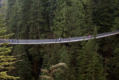 November 3, 2018 Capilano Suspension Bridge: A 129 Year Old Bridge that Continues to Draw Intrigued Visitors
The post Rakotzbrücke: ‘The Devil’s Bridge’ which Looks Straight Out of a Fairytale appeared first on .
]]>The post Golden Bridge: The Connect to the Past and the Future of Vietnam appeared first on .
]]>
Golden Bridge, Vietnam. (Trung Le / Flickr)
Tourism is crucial for the economy of all countries of the world. Vietnam, one of the fastest-growing economies, rides high on tourism which contributes 7.5 percent to its GDP. Golden Bridge in Da Nang city of Central Vietnam is a popular tourist attraction. The bridge got constructed in a record time of one year, and became an instant hit. Opened to the public on June 2018, it’s an architectural marvel, a slice on nature, an emerging national symbol, and a spiritual jaunt rolled into one.
A yellow fabric spread in the hands of God
The golden bridge is a 150 meters long overpass and derives its name from its golden-coloured silhouette. Grossly it looks like 2 hands of a damsel are holding yellow silk between them. The gigantic hand, representing mountain god, hold the bridge up in forested hills of Son village in Hoa Vang district of Da Nang. The bridge offers a fascinating view of mountains and greenery in the distance. Located 1414 meters above the sea level, it provides a breathtaking view of the mountain tops in British Columbia, Canada. Flush with Lobelia Chrysanthemum flowers along the way, the curved bridge is sheer magic to walk on.


The two hands of the golden bridge. (Xiquinho Silva / Flickr)
A favourite of writers, photographers and filmmakers
The golden bridge has received rave reviews from scribes and the travel bloggers. Media generally holds that the bridge may become a new symbol of Vietnam. The experience of crossing the bridge is described by many as crossing the paradise. A popular venue for excursions and events, a fashion shoot was also held on the bridge. The shoot was attended by the leading Vietnamese models. The versatile make and placement of the bridge make it a photographer’s dream place for an intensive and extensive photoshoot from myriad angles.
Prestigious part of Ba Na Hill resorts
The golden bridge is part of Ba Na Hill resorts. The Ba Na Hills used to be the holiday resort of the French rulers in the 20th century. The colonial rule was usurped in 1945, and thereafter, the resort, called French village, turned into ruins. As of now, a replica of the village is constructed in the area for tourist. The visitors can see the area in a cable car. Remnants of colonial time buildings/settlement can also be seen in Hill resort area.
Golden bridge ranks among the world’s top 100 tourist destinations
The Ba Na Hills in Da Nang was already a tourism hub even before the construction of the golden bridge. The bridge added to the popularity of this place. In the present day global trend of erecting uncanny bridges for tourism, the golden bridge has a pride of place. It ranks among the top 100 tourist destinations of the world. Designed by TA Landscape Architecture in Ho Chi Minh city, the bridge is a masterpiece of the genre. The principal architect, Vu Viet Anh, said the bridge was designed to give walkers a feel of ‘moving in the hands of god’.
Close to nature in make
Doubtless, blending with the environment without compromising with tensile strength, is the key feature of the golden bridge. The concrete ‘God Hands’ is built on an iron frame imitating skeleton the human hand. Fibreglass fills up for muscles and skin, and fingers are crafted to look natural fingers of a living human.
A way to sightseeing and excursions
The bridge, a $2 billion architectural marvel, is connecting a link to several seeable destinations. Like, Debay Wine Cellar, the wine store built by the French in 1923. Le Jardin D’Amour Flower Garden, a conglomerate of 9 gardens with exquisite flower varieties. French village, with a vintage of the colonial past. Fantasy Park, the amazing playground for multiple games. And much more.
Enjoyed this article? Also, check out “Capilano Suspension Bridge: A 129-Year-Old Bridge that Continues to Draw Intrigued Visitors“.
Fact Analysis:
STSTW Media strives to deliver accurate information through careful research. However, things can go wrong. If you find the above article inaccurate or biased, please let us know at [email protected]
RELATED
 February 19, 2019 Pontcysyllte Aqueduct: A High-Rise Canal-Connect Made of Cast Iron, an Engineering Marvel
 April 1, 2019 Atlantropa: The Ambitious Idea of Uniting Europe and Africa by Draining the Mediterranean
- December 12, 2019 Rakotzbrücke: ‘The Devil’s Bridge’ which Looks Straight Out of a Fairytale
- December 26, 2018 Moscow State University: An Architectural Marvel
The post Golden Bridge: The Connect to the Past and the Future of Vietnam appeared first on .
]]>The post Bibi ka Maqbara: The Taj of Deccan, Which Like the Original, Tells the Tale of Eternal Love appeared first on .
]]>
Bibi Ka Maqbara. (Abhideo21 / Wikimedia Commons)
Out of the seven wonders of the modern world, India proudly hosts and boasts of the Taj Mahal in the city of Agra. But did you know that there is another lesser-known monument in the country that is a spitting image of the world-famous Taj Mahal? The Bibi Ka Maqbara in Aurangabad bears a striking resemblance to the original ‘love memorial’ as far as its external appearance goes. Not only that, it also has a similar back story, involving a grief-stricken Mughal emperor and his deceased wife at the centre, which has now become a part of all the tales that tour guides narrate on a visit to this place.
Location of Bibi ka Maqbara
Bibi ka Maqbara is situated in Begumpura, just eight kilometres away from the culturally rich and historically important city of Aurangabad in Western Maharashtra. The magnificent doppelganger of the Taj Mahal in all its glory stands testimony to the fact that architecture played a vital role during the Mughal era. Although the city of Aurangabad is more famously known for its 2nd century BCE caves of Ajanta and Ellora, it is also slowly gaining more prominence as a tourist hub, owing to this 16th century Bibi ka Maqbara. Vacationers from all over the world gather at Begumpura to see this glorious memorial, which is also called the Taj Mahal of the Deccan.

Bibi Ka Maqbara Is also called the Dakkhani Taj due to its strong resemblance with Taj Mahal. (Ruqayya noorin / Wikimedia Commons)
History associated with Bibi ka Maqbara
Bibi ka Maqbara, which literally translates to ‘Tomb of the Lady’, was commissioned by the last effective Mughal ruler Aurangzeb in the year 1660. It was erected in fond memory of his first wife Dilras Banu Begum. Princess Dilras Banu was the daughter of Persian Safavid dynasty prince Mirza Badi-uz-Zaman Safavi, who was later named the viceroy of Gujarat. Dilras Banu married Mughal prince Mahi-ud-din, who upon his ascension to the throne became known as Emperor Aurangzeb. Their matrimonial union took place in the year 1637 on May 8, amid much fanfare and grand celebrations in Agra at the residence of Mirza Badi-uz-Zaman Safavi, also titled Shah Nawaz Khan. After the couple’s time in Agra, the imperials returned to Aurangabad in Deccan, where Dilras Banu, who had now become the chief consort of the emperor, bore him five children – three girls and two boys – after almost four-year-gap periods.
Princess Zeb-un-Nissa was the eldest royal daughter, followed by Princess Zinat-un-Nissa and later Princess Zubdat-un-Nissa. Two princes Muhammad Azam Shah and Sultan Muhammad Akbar were born later after the royal daughters. Since these five children were the issues of his first and most beloved wife Empress Dilras Banu, Aurangzeb favoured them more over his other children from other wives. However, on September 11, 1657, after delivering their last son Sultan Muhammad Akbar, Dilras Banu Begum developed infections, from which she never recovered. A month later, on October 8, she died due to the postpartum fever developed during the complicated childbirth. Shortly afterwards, the eldest daughter Princess Zeb-un-Nissa was given the responsibility of looking after the neonate.

Inside Bibi Ka Maqbara. (Dr Murali Mohan Gurram / Wikimedia Commons)
With the sudden demise of his favorite wife at just 35 years of age, the bereaved Aurangzeb set a chain reaction of grief in the family, greatly affecting the elder son Muhammad Azam Shah the most. Three years after Queen Dilras Banu’s demise, in the year 1660 Aurangzeb commissioned the construction of a burial chamber, which would be the final resting place of his wife. Although Aurangzeb is never credited with having built grand structures during his long reign, he made an exception and followed in the footsteps of his father Shah Jahan. In memory of Empress Dilras Banu Begum, who was posthumously given the title Rabia-ud-Daurani, Aurangzeb ordered a mausoleum to be built in Aurangabad, the city named after him. The memorial came to be known as Bibi ka Maqbara, which became the largest monument that Aurangzeb had ever built.
Specifications of Bibi Ka Maqbara
The work on the edifice started in the year 1661 and carried on until 1669, bearing a striking similarity to the famous Taj Mahal, built during Shah Jahan’s reign. Aurangzeb’s mother Empress Mumtaz Mahal had also died during childbirth, much like his wife Dilras Banu; so his father Shah Jahan had built the Taj Mahal as an ode to their love, as Mumtaz’s final resting place. Hoping to rival the Taj, Aurangzeb ordered work on Bibi ka Maqbara to begin just like its more famous and larger, original structure. Attaullah Rashidi, the son of Ustad Ahmad Lahori, the chief designer of the Taj Mahal was hired to work on Bibi ka Maqbara, while Hanspat Rai was the principal engineer, assisting Attaullah in the construction work.
One third in size as compared to the Taj Mahal, Bibi ka Maqbara cost the royal family approximately six hundred and seventy thousand rupees, with necessary construction material coming in from all parts of the country. French jewel merchant and traveler Jean-Baptiste Tavernier during his travels to India, mentioned extensively in his journals about his first-hand account of the material imported for constructing the maqbara. Marble for the monument came in from the mines of Rajasthan, while loads of basaltic rock, sand, limestone and cement (for stucco decorations) were also ordered for its construction.
Built as per the Islamic style of architecture, the construction of Bibi ka Maqbara is based on the Quranic mentions of the four gardens of Paradise. Known as charbagh, the main mausoleum stands at its centre within an area of fifteen thousand square feet in total. The centrally enclosed edifice measures approximately 458 m by 275 m, flanked by axial ponds on its sides. Like the original structure, the Deccani copy is built on a high, square podium, with four minarets on all the four corners surrounding the dome. The main structure can be reached by a flight of steps on three sides just like the Taj.
While Taj Mahal is completely made out of pure white marble, the Taj of the South only has its dome and dado-level walls covered in marble. The rest of the structure above has a fine plaster polish to give it a marble-like appearance. Bibi ka Maqbara, though is not as magnificent as the Taj Mahal, it still is an exquisite piece of Mughal architecture, with a hint of Deccani architecture into its construction. Paler in comparison, Bibi ka Maqbara is almost similar to its forbearer except for one major difference. While the four minarets of the Taj Mahal are shorter than the onion dome, the approximately 72 feet high minarets of Bibi ka Maqbara are taller than the main central dome.
The entire hexagonal complex has its outside walls with arched recesses and bastions, fashioned as per the refined Mughal architecture. The marble on the tomb has intricate lattice screens, while geometric patterns adorn the dome’s canopy on the inside. Floral motifs beautify the interior walls of the structure and foliage designs embellish the exterior part. Finely done brass doors serve as the gateways to the inside of the structure. The entrance is followed by a series of fountains and water channels that are placed alongside the twelve-doored pavilions or baarah daaris.

The interior design inside the tomb. (Abhideo21 / Wikimedia Commons)
Tomb of Queen Dilras Banu Begum
The mortal remains of the late empress of Aurangabad are placed in a grave below the ground level. It is a low-barricaded, simple, octagonal structure, which is enclosed in elaborately designed marble screens on all sides. Stucco paintings and inscriptional Arabic patterns decorate the surrounding of the cenotaph. The underground grave of the empress is covered with a silk cloth, which is open for the tourists to see during visiting hours at Bibi ka Maqbara.

Tomb of Dilras Banu Begum. (Abhideo21 / Wikimedia Commons)
Controversy over ownership of Bibi ka Maqbara
Although the board at the entrance of Bibi ka Maqbara today credits Aurangzeb’s son Muhammad Azam Shah as the builder of the edifice, it was actually Aurangzeb’s original idea. Muhammad Azam Shah would only have been eight years of age when work on the structure began, possibly not sure what all of it actually meant. Azam Shah was only put in charge of overseeing the construction of the monument and its repair work on his father’s instructions later on in his life. While the war for the ascension to the throne of Agra was on between the sons of Shah Jahan (with Aurangzeb winning it), Aurangzeb was mostly away from his seat in the Deccan, leaving the construction work to Azam Shah only for namesake.
Bibi ka Maqbara might not be a world-renowned mausoleum, or might be called the ‘poor man’s Taj’ or even a cheap copy of the monument dedicated to love, but the towering structure in Aurangabad, erected in memory of Aurangzeb’s wife, continues to carry forward a legacy that is left behind by the Mughals in the southern part of the country.
Enjoyed this article? Also, check out “The Mahabat Maqbara and the Extraordinary Tomb of Bahar-ud-din Bhar“.
Fact Analysis:
STSTW Media strives to deliver accurate information through careful research. However, things can go wrong. If you find the above article inaccurate or biased, please let us know at [email protected].
RELATED
- September 24, 2019 The Mahabat Maqbara and the Extraordinary Tomb of Bahar-ud-din Bhar
- July 15, 2019 Adalaj Stepwell: A 500-Year-Old Architectural Masterpiece With a Tragic Tale of Unrequited Love, Sacrifice And Loss
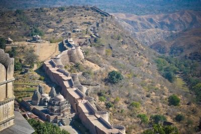 January 12, 2019 Kumbhalgarh Fort: Not Only China But India Too Has Its Own ‘Great Wall’ Built Centuries Ago
- June 14, 2019 Padmanabhaswamy Temple: The Richest Temple in the World with Gold Worth $22 Billion in Six Vaults
The post Bibi ka Maqbara: The Taj of Deccan, Which Like the Original, Tells the Tale of Eternal Love appeared first on .
]]>The post Nemo 33: Swimming Pool with Oceanic and Underwater Cave Simulations appeared first on .
]]>
Top view of the Nemo 33 swimming pool. (Sergey Markov / Wikimedia Commons)
Anyone who has ever gone deep sea diving knows how brilliant the experience really is. The chance to swim with unique wildlife, see a portion of the earth that not many have the chance of seeing, is definitely something to boast about. While many are captivated by the abundant wonders that lie beneath, there are many that are equally petrified at the thought of taking the leap. But what if I were to tell you that there is a place in the world, where one can go experience a dive without the need to jump into the middle of the ocean? Cue, Nemo 33.
Nestled in the hustle bustle of Brussels, Nemo 33, was designed and built by expert diver John Beernaerts in 2004. It held the record for the being the world’s deepest indoor pool, until being dethroned by the Y-40 in 2014. The construction of the colossal structure took about 7 years to complete, and cost over $3 million to build.
Primarily, the pool was built as a multi-purpose diving instruction complex, complete with all sorts of obstacles and simulations. That said, the pool has now become a popular tourist destination, with many flocking the area for recreational purposes. The pool has also been used multiple times in scores of film productions.

It held the record for the being the world’s deepest indoor pool, until being dethroned by the Y-40 in 2014. (John Greenwood / Wikimedia Commons)
As mentioned above, the core idea of building the pool was to give people an opportunity to experience a dive without actually jumping into the ocean. For this reason, the pool was customised with special areas that simulate being in the sea. At its deepest, the pool extends almost a whopping 34.5 meters into the Earth. In addition to this, the pool also has two large platforms that reach lighter depths of about 5 meters and 10 meters, with built-in cave simulations. Further, the pool has the capacity to hold over 2.5 million litres of filtered spring water.
While this may not be the “complete package” so to speak, it does give novice divers an opportunity to really experience a dive firsthand, especially in a landlocked country like Belgium. One can take the plunge here at very nominal rates, and bring home an experience of a lifetime.
Recommended Visit:
Nemo 33 | Belgium
Fact Analysis:
STSTW Media strives to deliver accurate information through careful research. However, things can go wrong. If you find the above article inaccurate or biased, please let us know at [email protected].
RELATED
 February 21, 2019 Lake Baikal: The World’s Deepest Lake That Holds 22-23% of the World’s Freshwater
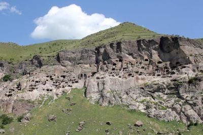 November 1, 2018 Vardzia: The Mesmerising Cave Monastery that Protected Georgians for Decades
- July 6, 2019 Playa de Gulpiyuri: The Tiny Beach in the Principality of Asturias in Spain
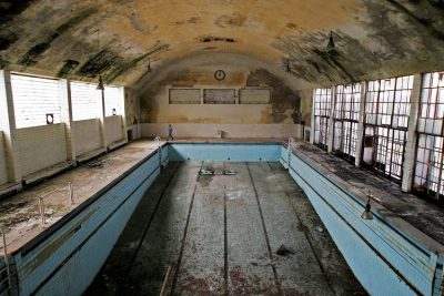 May 2, 2019 What Happens to the Olympic Venues in the Host Countries After the Olympic Games End?
The post Nemo 33: Swimming Pool with Oceanic and Underwater Cave Simulations appeared first on .
]]>The post Batu Caves of Malayasia – The Largest Shrine to Lord Murugan Outside India appeared first on .
]]>
Inside Batu Caves. (Allan Jay Quesada / Wikimedia Commons)
The Batu Caves are amongst the most famous natural attractions in Malaysia, composed entirely of limestone and being home to a diverse range of fauna. Additionally, they are renowned for housing the Batumalai Sri Subramaniar Swamy Devasthanam, a temple dedicated to Lord Murugan, within them. Every year, thousands of Hindu devotees from around Malaysia, India, and the rest of the world visit this temple and particularly during the famous Thaipusam festival in late January or early February.

Inside Batu Caves during Thaipusam. (Dennis Sylvester Hurd / Flickr)
The most famous limestone caves in Malaysia
The Batu Caves are located approximately 12 kilometres to the north of Kuala Lumpur in Gombak district in Selangor in Malaysia. They are over 400 million years old and get their name from the Sungai Batu or Batu River that flows past the hill. For centuries, the indigenous Besisi people used these caves as temporary shelters while they were out hunting in the region. At other times, the caves remained uninhabited and became home to a diverse range of fauna.
In the 1800s, many Chinese arrived to settle and work in Malaysia. Around 1860, some of these workers discovered that there were extensive guano deposits—bird and bat droppings—in the Batu Caves. They began frequenting the caves to collect the guano; they used it as fertilizer in the fields to grow vegetables.
In 1878, the American naturalist, William Temple Hornaday, came upon the Batu Caves while he was out hunting. He was drawn to them by the smell of the guano and, upon going into the caves, was very impressed. He likened the largest cave to a grand cathedral. Around this same time, the British Colonial Authorities also took note and officially recorded the caves.

Steps leading to the inside of the cave. (Jorge Láscar / Flickr)
The Batu Caves Complex
Rising to a height of nearly 100 metres above the ground, the Batu Caves Complex consists of three main caves and several smaller ones. The largest cave is known as Temple Cave and is at the top of the hill and you need to climb up 272 steps to reach it. The other two main caves, the Art Gallery Cave and the Valluvar Kottam Cave or the Museum Cave, are at the base of the hill. There is another cave, known as the Dark Cave, en route to Temple Cave. Then there is a cave known as the Ramayana Cave that lies to the extreme left of the hill’s sheer wall.
Near the cupolas of the Batu Cave Complex, there is an imposing, 140-feet tall statue of Lord Murugan. It is not only the tallest statue of a Hindu deity in Malaysia, but it is also the tallest statue of Lord Murugan in the entire world. It took three years to make and was erected on the site in January 2006.

On the left are the 272 steps leading to the Batu Caves and on the right is the statue of Lord Murugan. (Jorge Láscar / Flickr)
There is another impressive statue, that of Lord Hanuman, the Monkey God and aide of Lord Rama, in front of the Ramayana Cave. This statue is 50-feet tall, and the temple authorities installed it on November 2001.
The Temple Cave
As William Temple Hornaday noticed on his visit, the Temple Cave has a level floor and perpendicular walls and a soaring roof that is open to the sky. It is 50 feet wide and 60 feet high, with the higher point of the roof rising up to 100 feet.
Thambusamy Pillai, an Indian trader of Tamil origin in Malaysia, noticed the vel-like shape of the entrance of the Temple Cave and decided to dedicate a temple to Lord Murugan. In 1891, he installed the murti of Sri Murugan Swami in the Temple Cave. A year later, in 1892, the Thaipusam festival was first celebrated there.
The Temple Cave, also known as Batu Malai Śrī Subramaniar, now houses several ornate Hindu shrines and many of these depict how Lord Murugan’s defeated the demon Soorapadman. The Śrī Maha Mariamman Temple Devasthanam’s management committee handle the temple affairs.
When the Temple Cave was first opened to Hindu devotees, they had to reach it by scrambling up the rocks strewn on the hill. In 1920, the Temple Authorities had wooden steps constructed to make it easier for the pilgrims to reach the temple. Later, they replaced these wooden steps with concrete steps. You can reach this concrete stairway via a zigzag bridge. The stairway has many landings, both to give a breather to the weary and the elderly.
In August 2018, the Temple Authorities had the 272 steps painted in a range of different colours. The striking effect this produced proved popular with visitors, but the Malaysian National Heritage Department took exception as the Temple Authorities had breached the law by not applying for permission prior to renovating the heritage site.

The stunning paint job to the steps leading up to the Batu Caves. (Marco Verch / Flickr)
The Valluvar Kottam, the Art Gallery, and the Ramayana Cave
These caves are well-known for their spectacular murals showing scenes from the Hindu epics, the Ramayan and the Mahabharata. Some of the murals show scenes from the lives of ancient Tamil poets and reproduce their poetic couplets. The murals are lit up with many colorful lights, creating a somewhat psychedelic effect. There are also several statuary exhibits. In the courtyard outside, there is a statue of a five-legged bull that once lived with a herd of cows on the temple grounds.
The Dark Cave
En route to the Temple Cave, there is pristine cave known as the Dark Cave. It leads into a two-kilometre network of relatively untouched caverns that are filled with stalactites and stalagmites. Formed over 2000 years ago, these form intricate formations that make for a dramatic sight. To preserve the cave’s ecology, the Malaysian Nature Society limits the visits to a few guided tours.
Many of the undeveloped limestone caves are home to the Trapdoor or Liphistius batuensis spiders that are on the verge of extinction. Naturalists believe that the only thriving population of these spiders is in the Batu Caves. There are also cockroaches, Eonycteris bats, fruit bats, long-tailed macaques, butterflies, and other diverse fauna in the caves.
The Thaipusam festival
While thousands of people visit the Batu Caves daily, their numbers swell to millions during the Thaipusam festival in late January or early February. During the festival, devotees organize a procession that begins in the evening from the Sri Mariamman Temple in Kuala Lumpur and arrives at the Batu Caves at dawn the following day. Many of the devotees then take a bath in the Sungai Batu river. They carry kavadis filled with milk offerings for the god, and some of these kavadis are huge, weighing more than 100 kilograms.

A devotee carrying kavadi. (nasrul ekram / Flickr)
The kavadis are decorated with colourful flowers and peacock feathers, and the devotees carry them by balancing their ornate wood or steel frameworks on their shoulders. Many devotees pierce their skin, cheeks, and tongue with metal hooks and skewers that extend from these frameworks. They carry the kavadis in this manner all the way up the 272 steps to the Temple Cave. It is a way of showing their devotion to Lord Murugan. Additionally, devotees, who have had their wishes fulfilled by Lord Murugan, show their gratitude by shaving their heads and offering their hair to the god.
Enjoyed this article? You would also love “Cave of the Crystals: A Geological Wonder with Giant Shimmering Crystals“
Fact Analysis:
STSTW Media strives to deliver accurate information through careful research. However, things can go wrong. If you find the above article inaccurate or biased, please let us know at [email protected].
RELATED
- June 14, 2019 Padmanabhaswamy Temple: The Richest Temple in the World with Gold Worth $22 Billion in Six Vaults
 May 12, 2019 Cambodia’s Magnificent Angkor Wat: One of the Largest Religious Monuments in the World
 April 22, 2019 Incredible Ta Prohm: The Ancient Khmer Temple in Cambodia
 July 17, 2019 The Lonar Lake: An Astronomical Marvel
The post Batu Caves of Malayasia – The Largest Shrine to Lord Murugan Outside India appeared first on .
]]>The post Gereja Ayam: The ‘Chicken Church’ of Indonesia Was Meant to Serve As a Prayer House for All Religions appeared first on .
]]>
Gereja Ayam or Indonesia’s Chicken Church. (Matt Smith / Flickr)
Gereja Ayam is a church that had been constructed as a prayer house for all religions. Located in Magelang, in Central Java, Indonesia the structure of the church was essentially supposed to be in the shape of a dove. However, the structure oddly resembles that of a hen or a chicken instead, which led to it being commonly known as the “Chicken Church”.
The inspiration behind the Gereja Ayam
The construction of the building began in the 1990s, and the foundation was laid by Daniel Alamsjah. He claimed that he had been inspired by a dream that he had seen the year before, where he witnessed God, and was guided to build a prayer house. Despite being a Christian, the prayer house that Alamsjah was building was meant to be for people from all faiths to pray or meditate in.
Following his divine instructions, Alamsjah decided to build the church on a forested hill, called Rhema Hill, situated in Magelang. The structure of the church was quite possibly one of the largest buildings to resemble a bird- with a giant head, accompanied by opulent and embellished tail feathers.

Gereja Ayam from behind. (Matt Smith / Flickr)
The dispute-riddled construction of the Gereja Ayam
As soon as Alamsjah began the construction of the Gereja Ayam, he started to face a lot of resistance. The native residents of the area surrounding Magelang were Muslims. They did not try to understand Alamsjah’s vision, and neither did they care that the structure he was building was not just a church, but a common prayer house. The Gereja Ayam would have its doors open for all sects of people- essentially anyone willing to climb up the hill. However, unwilling to understand Alamsjah’s cause or his work, some local residents of the area filed complaints against the construction of the Church. This hampered Alamsjah’s work to a great extent and caused his progress to slow down exponentially.
As funds started to dwindle, by the year 2000, the construction of the prayer house was stopped completely. Since he did not have money at hand, Alamsjah could not even afford a caretaker for the building, and soon the unfinished prayer house began to crumble before the ravages of time.
Why ‘Chicken Church’?
The Gereja Ayam, is a huge towering structure atop a hill, occupying a vast area of land. The area where the prayer house was constructed was a 3,500 square yards plot of land, bought by Alamsjah for 2 million rupiah- approximating to $140.

The crown of Gereja Ayam. (Matt Smith / Flickr)
Alamsjah insisted that the final structure of the Church had to resemble the image he had seen in his prophetic dream as closely as possible. He had planned for the facade of the building to be akin to a dove, with a crown on its head to proclaim its holy nature. The exterior of the structure incorporates a red beak, a white head, and an enormously long and grey body. Unfortunately, the crown reminded people of the crest of a rooster, and not something that could denote the holiness of a dove. At the stage when the construction process was halted, the entire structure seemed to resemble a chicken- thus prompting its nickname, ‘Chicken Church’.
The structure in Alamsjah’s dream inspiration had two floors, with several side rooms that were to serve as private spaces for prayer. The lower floor was supposed to serve as a rehabilitation centre with a juvenile outreach program, among other charitable services. Alamsjah himself said,
“The rehabilitation that happened at this prayer house was for therapy for disabled children, drug addicts, crazy people and disturbed youth who wanted to fight.”
At least 30 local men were provided with employment during the construction of this building.
Gereja Ayam: A major tourist attraction
Magelang, Central Java, has evolved into one of the most popular tourist spots in the country of Indonesia, owing to the location of the famous Borobudur Temple there. The Borobudur Temple was built in the 9th century and now qualifies as a UNESCO World Heritage Site. The Gereja Ayum is just about three miles from this busy temple. In fact, despite being a crumbling structure, the “Chicken Church” of Gereja Ayum owes much of its popularity to its prominent location- allowing people to “accidentally” discover the interesting facade on their way out of the Borobudur Temple.
In 2016, there was a documentary called ‘Into the Inferno’ which had a prominent segment featuring the Gereja Ayam, thus propelling the structure further into the limelight.

Gereja Ayam from the front. (Matt Smith / Flickr)
Now that people have taken cognizance of the existence of the quirky structure and interesting history of the Gereja Ayum, it has become quite the hub for global tourism. As photographs began to go around, word of this interesting structure kept spreading further. Consequently, Alamsjah began to charge a nominal admission fee to allow entry into the church. Though measuring to under a dollar per person, Alamsjah began to amass quite a fortune from this entry fee, owing to the increased footfall at the location. Alamsjah planned to use these funds to re-start the process of building and renovating the Church. In recent years, the ‘Chicken Church’ has become a huge attraction not only amongst tourists, but also couples posing for wedding photographs, and even occasionally people who hope to get married at the Gereja Ayum.
Gereja Ayam today
In August 2019, Alamsjah, who is close to 70 years old now, was finally able to complete constructing certain aspects of the building. He completed the construction of the windows and was also successful in paving the roads.
The prayer rooms that were underground have been remodelled and the grounds that surround the church are being looked after. The place is now more visually stimulating as the inner walls of the rooms have been decorated with paintings and murals by local artists.
Enjoyed this article? You would also love “A Four-Storey Building That Is ‘the World’s Littlest Skyscraper“.
Fact Analysis:
STSTW Media strives to deliver accurate information through careful research. However, things can go wrong. If you find the above article inaccurate or biased, please let us know at [email protected].
RELATED
 September 23, 2019 The Newby-McMahon Building: A Four-Storey Building That Is ‘the World’s Littlest Skyscraper’
 March 22, 2019 Sagrada Familia: An Unfinished, Colossal Spanish Basilica, Under Construction for More than 136 Years
- May 12, 2019 Cambodia’s Magnificent Angkor Wat: One of the Largest Religious Monuments in the World
 April 24, 2018 What is a Life Size Model of Noah’s Ark doing in Kentucky?
The post Gereja Ayam: The ‘Chicken Church’ of Indonesia Was Meant to Serve As a Prayer House for All Religions appeared first on .
]]>The post Tomb of Bibi Jawindi: On Cross Roads of Islamic Ethos appeared first on .
]]>
Tomb of Bibi Jawindi in Uch Sharif, Punjab, Pakistan. (Usamashahid433 / Wikimedia Commons)
The Tomb of Bibi Jawindi is a 15th-century relic, which as of now lies in dilapidated condition. Title of UNESCO World Heritage Site has been sought for it as it symbolizes the Sufi sect as preached by the woman Saint – Bibi Jawindi.
Bibi Jawandi was the great-granddaughter of the famous Sufi saint Jahaniyan Jahangasht whose spiritual legacy she carried forward with panache. Jahaniyan Jahangasht literally means one who wanders worldwide. That was realistic too as he travelled widely and left a lasting impression on the South Asian Muslim Society. He implored people to follow Sunna (the prophet Muhammad’s way of life) in speech, conduct and action. To go on the Sufi path, he said, one must consume less meat, as that helped win over the man’s lower self. Prayer, he said, could change one’s destiny. Notably, he held the soil of Indian sub-continent in great esteem. The reason he gave was, that this soil had touched the feet of Adam. Grandfather’s ideology became Bibi’s command; she lived it fulsome.
Her tomb is an exquisite Islamic architecture
After Bibi Jawindi died in 1403, Prince Dilshad of Iran got a tomb built in her memory in the year 1493. It could verily be the first love (esoteric love) mausoleum predating the better known Taj Mahal of Agra in India. The tomb of Bibi is located in Uch, Punjab, in the Islamic Republic of Pakistan. Uch was founded as Alexandria by Alexander the Great in 325 BCE. It was a vibrant centre of Sufism during the 13th century Mughal Empire in India. Apart from the tomb of Bibi Jawindi, Uch is also known for the mausoleums of other two Islamic saints – Baha’al-Halim and Jalaluddin Bukhari. Located in close proximity, tombs are masterpieces of Islamic architecture.

Tomb of Bibi Jawindi next to the mausoleums of two saints – Jalaluddin Bukhari & Baha’al-Halim. (Abbrar / Wikimedia Commons)
The tomb of Bibi is eight-sided on the exterior but circular in the interior. Their three tier structure is flush with glazed ceramic ware. The top tier carries a dome. Islamic scriptures mark both the interior as well as the exterior of the mausoleums. Eight tapering towers mark each of the 8 corners of the base tier. White and blue tiles in the shrines are a visual treat. A stretch of common graveyard surrounds these historical shrines of the Sufi divas.

A close up photo of the tomb. (Usman.pg / Wikimedia Commons)
Tombs are in bad shape
The tombs have withered and disintegrated over time from the vagaries of nature. Repair works done till date are inadequate. Hence an appeal has been made to the world community for the conservation and upkeep of these illustrious monuments.

The backside of the tomb. (Kumail Hasan / Wikimedia Commons)
The disintegration of the tomb seems to mirror neglect of the Sufi sect of Islam in general
A small section of Sunni Population, Wahhabis denounce pilgrimage to shrines out-side-of Islamic faith. Professing to uphold puritan Islam, Wahhabis view such pilgrimage against the teachings of Mohammad. So averse are they to idol worship of any kind that they demolished the birthplaces of Prophet Mohammad, and his first wife Khadija. These places, they feared, could become shrines and objects of worship.
Is it possible that shrine of Bibi Jawindi – the diva of inclusive and all-embracing Islam, suffers neglect because of the ideological divide among the Muslims? Is the negligence a reflection of a general disregard for the Sufi cult of Islam? The answer needs a sincere soul searching.
Tomb of Bibi Jawindi: A heritage site status is well deserved
A Sunni Islamic fundamentalist movement, the Taliban, shouldn’t obliterate the memory of the woman Sufi Saint, Bibi Jawindi. The least that can be done in this direction is to restore her tomb to its pristine glory and spread her message into the public domain. It is hoped that tomb’s inclusion into the list of UNESCO world heritage sites would do this job.
Enjoyed this article? Also, check out “Naqsh-e Rustam: The Incredible Tombs and Rockface Reliefs of the Sassanian Kings“.
Fact Analysis:
STSTW Media strives to deliver accurate information through careful research. However, things can go wrong. If you find the above article inaccurate or biased, please let us know at [email protected].
RELATED
 April 16, 2020 Katas Raj Temples- The Oldest Hindu Temple in Pakistan
 June 5, 2019 Wadi-us-Salaam: The World’s Biggest Necropolis that Houses More than Five Million Graves
- March 13, 2020 Anabel Loyd’s New Book ‘Bahawalpur’ Documents the ‘Rise and Fall of a Glorious British India Princely State
 June 3, 2018 Dasht-e Lut: A Martian Terrain and the Hottest Place on Earth
The post Tomb of Bibi Jawindi: On Cross Roads of Islamic Ethos appeared first on .
]]>The post Dinner in the Sky: The Thrill of Partying in a Crane Lift appeared first on .
]]>
People enjoying dinner at Dinner in the Sky restaurant, Latvia. (Kārlis Dambrāns / Flickr)
Food was central to the existence of prehistoric man. From the central position, the food got increasingly marginalized as man became civilized. With the Industrial Revolution 200 years back, food became an industry, and food insecurity became a thing of past. Eating out (of home) became popular and trendy. Food got clubbed with fun, and in time, to adventure. Welcome to a heady combo of food, fun and adventure – Dinner in the Sky, a Belgian based Novelty restaurant.
A delightful mix of food with adventure
Rated as one among the top ten unusual restaurants worldwide, Dinner in the sky (DITS) is an open platform with canopy, offering fun time and dinner 150 feet above the ground. The platform is taken to this height by the arm of a crane machine to which it is suspended by ropes. Launched in 2006, DITS was a business deal between Hakuna Matata (a communications agency covering the food and beverages) and Fun Company (engaged in erecting amusement parks with the help of crane machines). This gave a platform to 22 restaurant owners of Europe to showcase their cooking skills. The extravaganza began in Belgium, but as of now, is franchised to 40 cities worldwide, including Bengaluru in India.

The novelty restaurant being hoisted by a crane. (Alastair Campbell / Flickr)
The joy ride is expensive and subscribes to laid down health parameters
For Eating-in-the-sky, the Enthusiasts must conform to a set of guidelines. They must be above 18 years of age, and in good health. Body height shouldn’t be less than 145 cm, and body weight shouldn’t exceed 150kg. Pregnant ladies, the faint-hearted and those afraid of heights should abstain from the ride. As for tariff, be ready to shell out a princely amount. Take the case of DITS Kuala Lumpur, Malaysia. It offers 3 classes for the aerial dining: economy, business and first-class. The price tags are 88, 136 and 231 USD respectively. For DITS Bengaluru a mocktail session costs 3,999 per person and the cost of dinner is a whopping 6,999 per person.
Seating capacity is limited, it’s only for 22

A worker preparing the table. (Kārlis Dambrāns / Flickr)
On-the-ground, DITS is a rectangular table, braced up for crane-lift. It has a seating arrangement for 22 people who all are strapped well before takeoff. A dedicated team of security staff and chefs accompanies the group. The seats are adjustable to individual needs. One can swivel left and right and relax on an adjustable backrest. To stretch out the legs, there is enough space in front of the seat. A customized footrest is also provided.
Food and drinks at Dinner in the Sky
Food isn’t prepared up in the air. It is prepared on the ground and taken up in ready- to- eat form. The party begins with an appetizer followed by the main dinner, and dessert at the end. After the platform is hoisted up in the air, the food is served to the customers by the on-board chefs. The dining lasts for an hour and 15 minutes, during which a 3-course meal is provided along with and fruit juices and water. There are other attractions too, like the display of fireworks. But most riveting is the swing and swagger of suspension and the all-round spectacle of space therefrom.

A chef preparing food for the diners. (Kārlis Dambrāns / Flickr)

Fine dining at the restaurant. (Kārlis Dambrāns / Flickr)
The revelry is well insured and perfectly safe
The sky event begins with the clients going through the registration process and safety briefing 45 minutes before the take-off. Participants are then secured in their seats with a 3-point safety belt. With safety checks scrupulously carried out, the platform is hoisted up in the air with crane machine. The process is perfectly safe, certified as it is with TUV Rhineland, Germany, the global provider of technical, safety, and certification services. Security on the platform remains in contact with ground staff by way of radio as well as hand signals. Once tied to the seat, safety belts can’t be opened without security help. Toilet facility is available all through the sky time. DITS is not just for dining in the sky, but also for social and business events. An appropriate insurance cover goes with each event and that makes it safe in every which way. Thus, every second of fun and feasting 150 feet above the ground, becomes magical and memorable.
Enjoyed this article? Also, check out “Maharajas’ Express: An Ultra-Luxury Indian Train That Redefines the Experience of Travelling“.
Special thanks to Kārlis Dambrāns for releasing photos of Dinner in the Sky under Creative Commons license.
Fact Analysis:
STSTW Media strives to deliver accurate information through careful research. However, things can go wrong. If you find the above article inaccurate or biased, please let us know at [email protected].
RELATED
 October 9, 2018 Dark Sky Reserve: A Protected Area Free From Artificial Light
- November 3, 2018 Capilano Suspension Bridge: A 129 Year Old Bridge that Continues to Draw Intrigued Visitors
- January 22, 2019 Ämari Pilots’ Cemetery: Where Aircraft Tail Fins Adorn Soviet Pilots’ Tombstones
 January 26, 2019 Astana: An Ultra Modern Capital City Right in the Middle of Vast Empty Grasslands
The post Dinner in the Sky: The Thrill of Partying in a Crane Lift appeared first on .
]]>The post Karni Mata Temple: Where Thousands of ‘Immortal’ Rodents Roam Free to Bless Visitors with Good Luck appeared first on .
]]>
Rats drinking milk at Karni Mata Temple. (Bhups77 / Wikimedia Commons)
Located in Deshnoke, Rajasthan, around 30 km from the city Bikaner, is the extraordinary Shri Manshapurna Temple, commonly known as the Karni Mata Temple. This temple is also famously known as the ‘Temple of Rats’. It is a Hindu temple dedicated to the Hindu goddess Karni Mata who is an incarnation of the Goddess Durga. The Karni Mata Temple houses thousands of rats, and pilgrims from all over the country visit Deshnoke to worship these rodents with exceptionally long tails. These ‘holy’ rats are also known as ‘kabbas’, and aside from pilgrims, this temple also attracts many curious tourists from all over the world.
The legend of Karni Mata
During the 14th century Karni Mata, who was a part of the indigenous Charin clan, lived and performed many miracles during her lifetime. It is believed that she lived till she was 150 years old, and locals believe after her death she metamorphosed into a rat. According to legend, Laxman, the son of Karni Mata, drowned while he was trying to drink water from the Kapil Sarovar in Kolayat Tehsil. Karni Mata implored Yama, the God of Death to bring him back to life. He refused initially, but later relented and said that Karni Mata, being an incarnation of Durga, could restore his life. She did this and also decreed that members of her family would not die. Instead, their dynasty would be reincarnated as rats. Thus, the entire Charin clan believes that when they die, they will be reborn as rats.
The rats inhabiting the Karni Mata temple are revered by the followers of Charin and are believed to be the descendants of Karni Mata and her dynasty. High honour and good karma is said to be bestowed upon those who eat the food that has been gnawed at by the holy rats. If any of the rats are killed, they are immediately replaced by another one made up of solid silver or solid gold.

A man picking prasāda (a religious offering to the deities which is consumed by the worshippers) from a utensil while the rats feed on them. (Schwiki / Wikimedia Commons)
The temple of rats: An architectural marvel
The Karni Mata Temple was completed in the early 20th century by Maharaja Ganga Singh of Bikaner, and is influenced by the Mughal style of architecture. The Temple has solid silver doors and a beautiful facade made of marble to the front of the temple. The temple is also adorned with marble carvings that add to the charm of the structure. The solid silver doors inside the temple were donated by Maharaja Gaj Singh after he visited this magnificent temple he had himself sanctioned.

The entrance of Karni Mata Temple. (Jean-Pierre Dalbéra / Flickr)

Inside the temple. (Jean-Pierre Dalbéra / Flickr)
Across the doorway, there are more silver doors that have panels which depict several legends about the legendary Karni Mata. The image of the goddess is housed within the inner sanctum, along with holy items placed at her feet. There is a 75 cm tall image holding a trident (Trishul) in one of her hands and is surrounded by rats.

The statue of Karni Mata inside the temple. (Jean-Pierre Dalbéra / Flickr)
Her image also has a crown on her head and a garland of flowers around her neck. On either side, images of her sisters are also placed. The temple was beautified further in 1999, under the patronage of Kundanlal Verma who was a part of the Karni Jewellers based in Hyderabad.
White rats: The holiest of the holy rats
Among the many thousands of rats within the temple, there are a few white rats that are considered to be especially auspicious. These white rats are believed to be manifestations of the goddess Karni Mata herself and her sons. The sighting of these white rats is considered to be a special blessing. Visitors compete amongst themselves to try and lure these rodents out of their burrows by offering them food and sweets.
Karni Mata Temple: Daily administration and the bi-annual fair
The Karni Mata Temple is opened up to the pilgrims and tourists in the early hours of the day, around 4 o’clock in the morning. The priests of the temple perform ‘Mangla-Ki-Aarti’ and offer special food known as ‘bhog’ during worship. The devotees that come to the temple make offerings to the holy rats that roam around all over the premises.
Two types of offerings are made, known as ‘dwar bhent’ and ‘kalash bhent’. ‘Dwar bhent’ is an offering that is made to the priests and the workers of the temple. The ‘kalash bhent’, on the other hand, is an offering that is reserved for the maintenance of the temple and its development.
The Karni Mata Fair is held twice a year at the temple and is a major event. The first fair of the year is the larger one and takes place from March to April, i.e., from ‘Chaitra Shukla Ekam’ to ‘Chaitra Shukla Dashmi’.
The second fair of the year in Deshnoke is held in September – October, that is, between the ‘Ashvin Shukla’ to ‘Ashvin Shukla Dashmi’. This time of the year is known as Navratri and is auspicious in the Hindu calendar. Thousands of people travel to the Karni Mata Temple by foot during this season.

Reliefs found on the facade of the temple. (Jean-Pierre Dalbéra / Flickr)
Fascinating facts about the Karni Mata Temple
It is believed that even during the worst of the plague outbreaks, the town of Deshnoke which houses the Karni Mata Temple, is not affected. In fact, several pilgrims that travel to the temple not only go to worship the rodent inhabitants but also to heal their ailments. Devotees believe that these holy rats are endowed with healing powers. Legend claims that the rats living in the temple are immortal and never leave the temple premises. Another strange belief – devotees actually claim that it brings good luck if one of the rats of the temple runs across their feet.
The deteriorating health of rats
While devotees routinely partake on food tasted by the rats, which are deemed holy, there have never been reports of visitors falling sick. On the other hand, news of the rats themselves having health issues is not unheard of. The rats are regularly with way too much human food, including milk and sweets, for their own good. The highly sugary food and drinks have led to the rats ending up with stomach ailments and diabetes. The cumulative effects of these issues eventually leads to a major epidemic among the rats every few years, thus resulting in a horrific number of dead rodents lying around the temple complex. The lowered population of the holy rats of Karni Mata Temple, however, do not stay that way for too long, with the rats multiplying exponentially to reach the original population in no time.
Tourism industry around the Karni Mata Temple
Rajasthan is home to several tourist attractions- populated with renowned heritage forts, several exquisite temples, and offering exotic experiences like camel rides. The Karni Mata Temple holds its own as a marvellous structure with a rich cultural heritage, amidst the overwhelming atmosphere and exotic idiosyncrasies that is characteristic of India.
The best time to visit the Karni Mata Temple is said to be in the March-April or September-October phases when the fairs and festivities are at their best. However, devotees visit the temple throughout the year in order to seek blessings of the goddess and offer ‘bhog’. Tourists, both from around the country and international, come to visit the temple out of curiosity for the strange USP of the Temple of Rats.
Enjoyed this article? Also, check out “The Padmanabhaswamy Temple: The Richest Temple in the World with Gold Worth $22 Billion in Six Vaults“.
Fact Analysis:
STSTW Media strives to deliver accurate information through careful research. However, things can go wrong. If you find the above article inaccurate or biased, please let us know at [email protected].
 Recommended Read:
Guns and Glories: Rajputana Chronicles | By Pratap Singh Mehta
Genre:
Non-fiction > History & Politics
RELATED
 May 31, 2019 Chand Baori: A Quaint Remnant of the Past
- June 14, 2019 Padmanabhaswamy Temple: The Richest Temple in the World with Gold Worth $22 Billion in Six Vaults
- July 15, 2019 Adalaj Stepwell: A 500-Year-Old Architectural Masterpiece With a Tragic Tale of Unrequited Love, Sacrifice And Loss
- April 16, 2020 Katas Raj Temples- The Oldest Hindu Temple in Pakistan
The post Karni Mata Temple: Where Thousands of ‘Immortal’ Rodents Roam Free to Bless Visitors with Good Luck appeared first on .
]]>The post The Rock of Gibraltar: Guardians of the Strait of Gibraltar appeared first on .
]]>
Rock of Gibraltar. (Olaf Tausch / Wikimedia Commons)
Throughout history, we have seen places where castles and forts have been built on raised masses of land and they are primarily called a promontory. One such monolithic limestone promontory is “The Rock of Gibraltar”. It is located in Gibraltar, a British Overseas Territory, near the south-western tip of Europe on the Iberian Peninsula. A nature reserve occupies most of the upper territory of the rock, which is home to approximately 300 Barbary Macaques, one of the best known Old-World monkey species.
What piques the interest of archaeologists is the age of the rock-Early Jurassic period but the underlying Dockyard Shale formation is of an unknown age which has kept geologists puzzled for decades. Standing tall at 426m, it also boasts of a cable car at the central peak called Signal Hill and several caves among which some are particularly well known such as St. Michael’s Cave.
Gibraltar’s land and economy
In a referendum in 2000, 98% of residents decided that the land of Gibraltar should remain British. While it is a big rock, it is crammed up in terms of living space and has a mere 30,000 population. 12% of the workforce is dedicated to the online gambling industry which is a booming business in Gibraltar. Moreover, to attract investors, the Chief Minister declared income tax policies that are unparalleled and provide a motive to the common businessman to move their business to Gibraltar.

Gibraltar Candytuft. (Toromedia / Wikimedia Commons)
The Rock is a series of inaccessible cliffs which face the sea and layers of houses occupy the western side of the rock that stretches up to 300 feet. There is a scarcity of water bodies, due to which catchment areas have been made with Sandy Bays that help in rainwater harvesting. The weather is volatile, consisting of hot and humid summers which are rainless and mild winters with steady rain. Strong easterly winds are a normal occurrence over the rock. The vegetation around the rock is unique and comprises of approximately 500 flowering plants. Among these, there is a plant that is indigenous to the rock called the Gibraltar Candytuft. A bird called the Barbary Partridge is indigenous to Gibraltar, among many other common migratory birds that are found in the area.
History of the Rock of Gibraltar and its people
In 711 AD, a Muslim Commander named Tariq Ibn Ziyad claimed the land of Gibraltar and its successive occupants held it as a fortress. In 1462, Muslim rule was forcefully removed by the Spanish and Isabella I annexed Gibraltar to Spain in 1501. During the War of Spanish Succession, the British managed to capture Gibraltar under the leadership of Sir George Rooke and the Spanish eventually surrendered the Rock under The Treaty of Utrecht in 1713. In 1830, it was declared a British Crown Colony after which in 1869, the Suez Canal opened up which was an important route for the British colonies in East Africa and Southern Asia.
Gibraltar was a point of tension between the British and Spanish colonies which came to an end in 2002 after a referendum was passed in which the people of Gibraltar voted for it to be a British sovereign state. Later in 2004, the creation of Trilateral Forum of Dialogue brought together representatives from Spain, Gibraltar and Britain which eased the history of tension between the three.

Aerial photo of the Rock of Gibraltar. (IamRender / Flickr)
People say, beauty always lies on the inside and it holds true for the Rock of Gibraltar. With a channel of tunnels that were used during World War II and what’s more, is that they were created during World War II itself using mere hand tools. About two centuries before the war, there was another network of tunnels called ‘The Great Siege Tunnels’ which were used by the French and Spanish as a stronghold. All of these attractions seem rudimentary when compared to St. Michael’s Cave. It is captivating at first glance and has been converted into an auditorium for tourists to see performances.

St. Michael’s Cave, Gibraltar. (Mike McBey / Flickr)
Pillar of Hercules
There are two pillars that stand tall and protect the entrance to the Strait of Gibraltar- the Abila Mons and the Calpe Mons. The southern pillar, Abila Mons bears acute resemblance to two other pillars around the world, namely, Monte Hacho in Ceuta and Jebel Musa in Morocco. The Northern one, Calpe Mons, stands tall as the unique and famed ‘Rock of Gibraltar’. According to legend, Hercules is said to have used the rocks as pillars to succeed in completing one of his twelve labours, particularly the tenth in which he was required to bring Cattle of Geryon from the far west to Eurystheus which was the extent of his journey to the west.
Beyond the pillar, lay the lost city of Atlantis and according to Renaissance tradition, the Rock had engraved “Ne Plus Ultra “ which meant nothing further beyond. Sailors took this as a warning to not sail beyond this point as they were terrified of the unknown. While being a strategically important landmark, the Rock of Gibraltar has always been associated as a pillar of strength during wars. People have always and will be in awe of the sheer dominating presence of the Rock.
Rock of Gibraltar: Home to ancient life
Neanderthals used to exist here up to 30,000 years ago, or so the scientists thought. According to some research conducted by a group of scientists, a cave located south-east of Gibraltar indicates that Neanderthals inhabited the place up to 24,000 years ago. Another interesting thing about the rock is the species of the monkeys that inhabit it – Barbary Macaques. They are small creatures, one of the Old-World monkey species that are very playful in nature.
The Gibraltar International Airport: Fifth-most ‘extreme’ airport
The Gibraltar International Airport is a unique structure- with a runway owned by the military, but almost exclusively used by civilians travelling to or from Southern Spain. The runway of the airport is intersected by a very prominent road, the Winston Churchill Avenue, which must be blocked off every time an aircraft is taking off or landing.

The runway of Gibraltar International Airport that intersects a busy 4-lane highway. (Mike McBey / Flickr)
The Gibraltar International Airport counts as one of the most dangerous airports in the world, ranked 5th amongst ‘Extreme Airports’ by History TV. The powerful crosswinds around the Rock of Gibraltar and across the Bay region makes landing at this airport extremely difficult, especially during the winters. The airport runway was developed during the Second World War from a pre-existing race-course. The runway was extended with the help of rocks blasted from the Rock itself, thus reclaiming fallow land in the Bay region.
Vacations on the Rock
Several famous actors and musicians have also visited the Rock for a holiday with their loved ones and had quite a run in with the Macaques. While Actor Jason Biggs and his wife were teased by the monkeys, Rolling Stones’ lead guitarist Brian Jones played a little music for the monkeys to which they started swaying. In March 1969, John Lennon and Yoko Ono exchanged vows and got married at Gibraltar under registrar Cecil Wheeler.
Enjoyed this article? Also, check out “Ushuaia: The World’s Southernmost City, Where End is the Beginning“.
Fact Analysis:
STSTW Media strives to deliver accurate information through careful research. However, things can go wrong. If you find the above article inaccurate or biased, please let us know at [email protected].
RELATED
 March 14, 2019 Hochosterwitz Castle: The Medieval Castle in Austria That Remained Impregnable from Enemy Attacks
 September 21, 2019 Batu Caves of Malayasia – The Largest Shrine to Lord Murugan Outside India
 July 28, 2018 Las Lajas Sanctuary: A Church with a Mysterious Mural Nobody Can Explain
 October 22, 2019 Golden Bridge: The Connect to the Past and the Future of Vietnam
The post The Rock of Gibraltar: Guardians of the Strait of Gibraltar appeared first on .
]]>The post The Tjentiste War Memorial: A Commemoration of Those That Died in the Battle of Sutjeska appeared first on .
]]>
Tjentiste War Memorial. (Arman Dzaferagic / Flickr)
If you visit the Sutjeska National Park in Bosnia and Herzegovina, you will come across a strange pair of craggy structure called Tjentiste War Memorial. While these structures meld in well with the surrounding mountainous landscape, they are clearly not organic to it. These manmade concrete sculptures were put in place on the mountainside in the 1970s to commemorate the Yugoslav fighters that died there during the Second World War.
The Tjentiste War Memorial
In the 1960s, 1970s, and 1980s, the socialist government of the former Yugoslavia built a number of war memorials to honour their citizens that had died fighting the German army. The Western media referred to these memorials as spomeniks. The Tjentište war memorial is one of the better known and most recognizable spomeniks.
It is located in the Valley of Heroes in the Sutjeska National Park, which is one of the oldest National Parks in Bosnia and Herzegovina. The Park gets its name from the river Sutjeska which runs through it.
The memorial consists of two huge abstract walls of white-grayish concrete that, from one angle, look like a pair of hands—or a pair of symmetrical wings—opening up towards the sky. You can walk along the path between the sculptures and emerge out to a grassy plateau. Here, there are stone tablets that are engraved with the names of the partisan units that took part in the Battle of Sutjeska in 1943.
Building the Tjentiste War Memorial
The Yugoslav designer, Miodrag Živković, came up with the design concept for the Tjentiste war memorial. The gigantic monument—which stands 19 metres high and is 25 metres wide— is supposed to be an abstract representation of the push the beleaguered Yugoslav partisans made to escape through the surrounding Axis forces.
Although mechanical options were available in the 1970s, Miodrag Živković chose to create the Tjentište war memorial almost entirely by hand. While it was being constructed, he received much support and encouragement from President Josip Broz Tito. As the latter had been personally involved in the Battle of Sutjeska and had seen many of his comrades die in the onslaught, he took a great interest in every aspect of the development of their memorial monument.

Front view of the Tjentište War Memorial. (Thierry Figini / Flickr)
If monetary issues hadn’t thrown a roadblock in the construction, it is possible that the monument would have been even larger than it is at present. Apparently, Miodrag Živković’s original design comprised of a monument that spanned the entire Heroes Valley.
The Tjentište war memorial was officially unveiled on 5 September 1971. At the time, it was only partially completed.
The vandalization of the Tjentiste War Memorial
While the monument we see in the present time is quite impressive, it was even grander when it was first built. There was a stone altar, a memorial house with frescoes, a museum containing the battle memorabilia, sculptures, and other exhibits, a pavilion, and a hotel. However, during the Bosnian War, the Bosnian Serb Army vandalized the memorial complex and destroyed everything except the large concrete monument. They might have destroyed that as well except they ran out of explosives to blow it up.
What the Tjentiste War Memorial commemorates
The Yugoslavian government built the Tjentište war memorial in remembrance of the partisans that died during Operation Fall Schwarz or Case Black, also known as the Battle of the Sutjeska and the Fifth Enemy Offensive. At this time, a huge Axis force made up of 1,27,000 soldiers and 300 aeroplanes, surrounded 18,000 partisans of the People’s Liberation Army near the Sutjeska river in south-eastern Bosnia. The plan was to wipe out the partisans completely. The Axis forces had been ordered to leave no stones unturned, to spare no one, and to let nothing get in the way of that plan.
The Yugoslavian partisans, however, put up a fierce fight and, despite their overwhelming force, the Axis armies failed to wipe them out.
Most of the partisans managed to escape and that helped turn the tide of the battle against Germany. In the process, though, over 7000 nurses, workers, officials, and other civilians lost their lives in the battle.
The Battle of Sutjeska
Not only were the partisans outmatched, but they also had other troubles to contend with. They were beset with typhoid and other medical issues. Furthermore, they were half-starved and were running out of both food and medical supplies.
They had no hope of winning the battle and it is a miracle that they even managed to escape.
Up to the battle of Sutjeska, the Allied governments had supported the Chetniks. That is, the Serbian soldiers that were loyal to the deposed Yugoslavian ruler. However, after seeing how the communists succeeded in evading and escaping from the Axis forces, the Allies switched over to supporting them instead. The surviving communists of the People’s Liberation Army regrouped to continue fighting against the Axis armies. As they now received aid from the Allies, their counteroffensives were now increasingly successful, and they helped put the Axis powers on the back foot. Later, in 1945, they renamed themselves as the Yugoslav People’s Army and carried out brutal reprisals against their fellow citizens.
Now all that remains of the famous battle of Sutjeska are fading memories and the magnificent Tjentište war memorial. It tells us about the people that died there, and its vandalism speaks of the many more that died during the Yugoslavian civil war in the 1990s.
Enjoyed this article? Also, check out “Ämari Pilots’ Cemetery: Where Aircraft Tail Fins Adorn Soviet Pilots’ Tombstones“.
Fact Analysis:
STSTW Media strives to deliver accurate information through careful research. However, things can go wrong. If you find the above article inaccurate or biased, please let us know at [email protected].
RELATED
 November 27, 2019 The Time Pyramid of Wemding: A Pyramid That is Scheduled for Completion in 3183
 July 27, 2019 Wind in the Willows: The Singing Ringing Tree
- December 6, 2018 Cancun Underwater Museum: A Sunken Museum Dedicated to Conserving Marine Life
 May 16, 2019 What is a Micronation? and Some of the Most Popular Micronations in the World
The post The Tjentiste War Memorial: A Commemoration of Those That Died in the Battle of Sutjeska appeared first on .
]]>The post Adalaj Stepwell: A 500-Year-Old Architectural Masterpiece With a Tragic Tale of Unrequited Love, Sacrifice And Loss appeared first on .
]]>
Adalaj Stepwell. (Henry / Flickr)
A stepwell has always held an important position in the history of Indian architecture, with the semi-arid states of Gujarat and Rajasthan occupying top spots, where one is likely to find these in the vicinity. A stepwell, which is also called a baoli or bawdi in Hindi language, formed an integral part of a city’s foundation, providing year-round access to basic water-related needs for locals in the nearby areas. The city of Ahmedabad in Gujarat is home to a renowned stepwell called Adalaj ni vav or Rudabai vav, which is not only an example of fine architecture but is also an ancient yet functional masterpiece in itself.
Adalaj Stepwell history
Initially known as Rudabai ni vav, the Adalaj stepwell came to be known by its current name owing to the quaint village it is situated in. The village of Adalaj is located approximately 20 kilometres on the outskirts of Ahmedabad in Gujarat, which gave the vav (in Gujarati language it means a well, which is accessed through a flight of stairs) its name. Construction work on the magnificent stepwell began during the late 1490s under the supervision of Rana Veer Singh of the Vaghela dynasty, who ruled over a kingdom in Gujarat called Dandai Desh during those times. His little empire was prone to frequent dry spells and insufficient rainwater was the only way in which Dandai Desh could meet the needs.
Rana Veer Singh ordered that a huge well be constructed on the lands nearby that would end their water-related problems once and for all. And so construction work on Adalaj stepwell began, with skilled masons and artisans employed to finish the job for the king.
No sooner did work start on the stepwell than tragedy struck their realm and a war with their neighbouring province broke out. Rana Veer Singh died in the battle, losing his land to a Muslim ruler – Mahmud Begarha, who later rose to prominence as the Sultan of Gujarat during the fifteenth century. After Rana Veer Singh’s passing, his wife, Queen Rudabai decided to complete the work on the stepwell in the fond memory of her late husband, but Dandai Desh’s and Rudabai’s problems had not ended there.
The tragic story associated with the Adalaj stepwell
Queen Rudabai had wanted to jump into her husband’s funeral pyre and commit Sati, but she held back and decided to finish work on the stepwell herself. When Mahmud Begarha, whose actual name was Abul Fateh Nasiruddin Mahmud Shah I, conquered Dandai Desh, he was totally smitten by the beauty of the queen and proposed marriage to her. Queen Rudabai laid out a condition that she would marry him if he allowed work on the stepwell to finish off first. And so under Rudabai’s supervision and on the orders of Mahmud Begarha, construction work on the Adalaj stepwell began again and was completed in the year 1498. The cost of building the vav was an estimated five hundred thousand rupees of that time.
When Mahmud Begarha reminded the queen of the promise she had made to him, she jumped into the waters of the stepwell thus ending her life. Mahmud Begarha did not want to demolish the architectural marvel that he had helped build and decided to keep it intact. It is believed that the six tombs, which one encounters on their way towards the stepwell, are those of the masons who had toiled hard to build the stepwell during Mahmud Begarha’s reign. Legends also state that the queen can be heard weeping at the base of the stepwell on a full moon night.
Specifications of the Adalaj stepwell
The Adalaj stepwell is a square piece of architecture towards the bottom that transforms into an octagonal structure towards the top. Hewn in sandstone and built in brick and mortar, in the Indo-Islamic style of architecture, a colonnade of pillars support the ornate octagonal edifice that descends five stories deep into the underground from top to bottom. Each floor is spacious enough to house a large group of people together at one time. More than five hundred years ago, women would come to fetch water at the stepwell, chat and catch up on their daily lives, along with travellers and pilgrims, who would find a way to rest overnight at the massive stepwell and pray. It doubled up as a resting and trading place and also served ritualistic and practical purposes. Today, tourists gather at the underground level of the Adalaj stepwell to soak in its beauty and splendour.

Inside Adalaj stepwell. (Nandini / Wikimedia Commons)
There are depictions of the day-to-day lives of people on the walls of the stepwell, along with carvings of Jain and Hindu iconography. Fused together with these on the walls are the floral motifs and geometric patterns from Islamic architecture that adorn the entire structure. The amalgamation of Hindu and Muslim designs together in one structure stems from the fact that Rana Veer Singh began work on the stepwell and Mahmud Begarha completed it; each adding his own cultural touch to it. The balconies of Adalaj ni vav are delicately detailed, the pillars or columns on which the structure rests are intricately designed and niches in walls house Hindu deities, which are aesthetically done, adding to the beauty of the already stunning stepwell.

A decorated stone panel of the stepwell. (Itsmalay~commonswiki / Wikimedia Commons)
The Ami Kumbhor, which is also known as the pot that holds the water of life and the Kalpavriksha or tree of life (two important symbols from Hindu mythology) are the main attractions at the Adalaj ni vav, which have been elaborately carved out of a single slab of sandstone in the wall recesses. A few verses in Sanskrit are inscribed on the walls of the first storey, which narrate the tale of Rudabai’s sacrifice and her love for her husband.
The speciality of Adalaj ni vav
Apart from the many special attributes that the water shrine possesses, Adalaj ni vav has the distinction of being the only stepwell in Gujarat, which has three entrance staircases that lead to a stepped corridor. These three entrances converge in the underground pavilion at the first square-shaped storey, which rests just above the circular water tank. The well is connected to an underground aquifer that yields groundwater to the tank regularly. Cross beams run along the entire length of the corridors and passageways to support the structure above. The roof of the corridors has vents that keep the edifice well-lit and properly aerated. Small rooms at each of the landings have oriel windows for proper ventilation. Direct sunlight does not cast on the stairway landings except for a brief period of time during the noon.

The upper storey of the stepwell. (Koshy Koshy / Flickr)
Built as a site where travellers could seek refuge from the harsh sun, Adalaj ni vav provides just that by blocking out the sunlight for the most part of the day. As one descends into the heart of the earth, the air starts to get cooler and the interiors of the stepwell always remain cool with approximately six degrees lesser than the outside temperature. Even though the spiral staircases are narrow and steep, giving a feeling of being confined in a tight space to some, at no point of time does it become darker inside so as to give rise to a problematic situation.
On the upper floors, scores of carved animals are on display, which forms a part of the Hindu mythology, but none looks similar to the other. The stepwell was carefully built more than five centuries ago, keeping in mind the utility that it would serve over a period of time. The artisans’ hard work, expertise and patience were at play while the Adalaj ni vav was under construction and the tragic tale of sacrifice and endless love associated with the stepwell only goes on to show that the country is replete with such masterpieces that are yet to come out of the dark.
Enjoyed this article? Also, check out “Chand Baori: A Quaint Remnant of the Past“.
Fact Analysis:
STSTW Media strives to deliver accurate information through careful research. However, things can go wrong. If you find the above article inaccurate or biased, please let us know at [email protected].
RELATED
- May 31, 2019 Chand Baori: A Quaint Remnant of the Past
- October 8, 2019 Bibi ka Maqbara: The Taj of Deccan, Which Like the Original, Tells the Tale of Eternal Love
- January 12, 2019 Kumbhalgarh Fort: Not Only China But India Too Has Its Own ‘Great Wall’ Built Centuries Ago
 August 5, 2019 Karni Mata Temple: Where Thousands of ‘Immortal’ Rodents Roam Free to Bless Visitors with Good Luck
The post Adalaj Stepwell: A 500-Year-Old Architectural Masterpiece With a Tragic Tale of Unrequited Love, Sacrifice And Loss appeared first on .
]]>The post Playa de Gulpiyuri: The Tiny Beach in the Principality of Asturias in Spain appeared first on .
]]>Playa de Gulpiyuri beach. (Franciaio / Wikimedia Commons)
There are many extraordinary natural wonders in the world, many of which can make you doubt your own eyes. The Playa de Gulpiyuri in the Principality of Asturias in Spain is one such marvel. To reach it, you must walk through a lush green meadow and then you will stumble upon the tiny, jewel of a beach, with its crystal clear waters and gentle waves. Yes, it is a real beach that experiences high and low tides. The only strange thing about it is that it lies inland, a good distance away from the ocean.
Playa de Gulpiyuri beach
When we think of a beach, what generally comes to mind is a long sandy stretch near an ocean, a lake, or a river. The Playa de Gulpiyuri, however, is different. It is the smallest beach in the world and also the only known inland beach. Moreover, it is unique in being located in the centre of a meadow.
The Cantabrian Sea lies 100 metres away from the shell-shaped, picturesque Playa de Gulpiyuri. Tall limestone cliffs rim the cove and an underground network of caves channel in the seawater from the Cantabrian Sea.
Due to its special geographic features, the Playa de Gulpiyuri is a part of Spain’s Regional Network of Protected Areas. Additionally, the tiny beach is also a designated National Natural Monument in Spain.
Read more: The Unusual Glass Beaches of California and Hawaii
Geographical features of the Playa de Gulpiyuri
In Spanish, Gulpiyuri means water circle. The name probably refers to the semi-circular shape of the flooded sinkhole. According to geologists, this natural sinkhole formed when a cave collapsed inwards. Crystal-clear and ice-cold sea water laps gently from this flooded sinkhole against the yellow sands of the 40 metres long beach. At high tide, the beach becomes visible and it disappears at low tide. It is the only beach of its kind in the world with a fully tidal nature.
The inland beach came into being after the salt from the seawater eroded its way through a limestone cliff. The gradual erosion led to the formation of a series of underground caves aeons ago during the Ice Age. These caves finally connected the Cantabrian Sea—also known as the Bay of Biscay— with the inland Playa de Gulpiyuri and, ever since then, the sea water has been forcing its way to the landlocked little cove.
The water is not deep enough to swim in, but most people will be able to wade in up to knee height. This may be easier said than done, however, as the water is ice-cold throughout the year after coming from the underground caves.
Visiting the Playa de Gulpiyuri
Along with being the smallest beach on the planet, the Playa de Gulpiyuri is also one of the less accessible ones. You’re not going to find this beach without some legwork on your part. However, this hasn’t hampered its popularity with tourists. For obvious reasons, it is on the must-see list of most people visiting the Principality of Asturias.
To reach the Playa de Gulpiyuri by car, you will have to drive along the A8 highway to the village of Naves. The beach is about one kilometre away from Naves. Since you cannot drive right up to the beach, you can either park your car in Naves or in a field located about 1000 metres from the beach. Then you can use your GPS to get to the beach, or, better yet, you can ask the locals for directions. The walk to the beach is rather scenic, so it probably won’t be tiring for most people.
Read more: The Black Sand Beach that Looks Straight out of a Gothic Novel
Information for visitors to the Playa de Gulpiyuri
The Playa de Gulpiyuri is a wonderful place to spend a day with your family and children. Since the water is shallow and the waves are quite gentle, your children can play in relative safety in the water.
Given the remote location of the beach and the lack of any shops or other amenities close by, you should come prepared. Pack and bring your own eatables and water. Also, wear a hat if you don’t want to catch too much sun. There are a few shade-giving spots in the area.
While most people visit the Playa de Gulpiyuri on foot after parking their vehicles close by, there is also another way to reach the beach. You can actually arrive there in a kayak, you will have to undertake the trip at high tide and paddle through the 100 metres of long caves that connect the beach with the Cantabrian Sea.
In addition to the caves at the Playa de Gulpiyuri, there are many other caves worth exploring in the region.
Remotely located and beautiful to behold, it is not surprising that this beach has been consistently voted as one of the best beaches in Spain.
Fact Analysis:
STSTW Media strives to deliver accurate information through careful research. However, things can go wrong. If you find the above article inaccurate or biased, please let us know at [email protected].
RELATED
- August 20, 2019 Reynisfjara: The Black Sand Beach that Looks Straight out of a Gothic Novel
 May 9, 2020 Elephant Beach: The Dazzling Sandy Beach in Andaman and Nicobar Islands Perfect for an Exotic Vacation
 January 15, 2019 Pink Lakes: Where Rose-Tinted Lakes Surrounded By Lush Greenery Are Truly a Sight to Behold
 December 18, 2018 The Unusual Glass Beaches of California and Hawaii
The post Playa de Gulpiyuri: The Tiny Beach in the Principality of Asturias in Spain appeared first on .
]]>The post Peter Jackson’s Hobbiton Movie Set Today – Still a Major Tourist Draw appeared first on .
]]>
Hobbiton Movie Set near Matamata, New Zealand. (Brian / Flickr)
Long after the release of Peter Jackson’s famous and massively successful ‘The Lord of the Rings’ and ‘The Hobbit’ trilogies, public interest in the movies remains high. As a result, the movie set location has become a tourist attraction. The Hobbiton movie set is situated on a family-owned sheep and cattle farm in New Zealand. Whether you are a fan of the movies or not, it is a very scenic place and one that you will probably find interesting to visit.
The Hobbiton Movie Set
Peter Jackson wanted his movie depictions to remain as true as possible to the descriptions in J.R. Tolkien’s epic ‘The Lord of the Rings’. He, therefore, sent out location scouts all around New Zealand to find an area with a decidedly old-world feel to it. He wanted a place with rolling green hills, magnificent trees, and lush pastures. In order to find just such a place, his location scouts even conducted aerial surveys of the countryside. On one of these aerial searches, they flew over the Alexander family’s land, and Peter Jackson had an immediate ‘A-Ha!’ moment. He knew he had found his Middle-Earth region. It closely resembled J.R. Tolkien’s portrayal of The Shire, and it was just what he had envisaged for his movies.

The middle earth. (David Broad / Panoramio)
The set location is on the vast 1250-acre sheep and cattle farm owned by the Alexander family. The farm is in the agricultural town of Matamata in the Waikato region and is surrounded by the grand spectacle of the towering Kaimai mountain ranges. The Alexanders have been farming in the area since 1978, and their farm includes several thousand sheep that they shear themselves and a few hundred Angus cattle. The main farm income comes from the wool, meat, and beef they sell.
The Alexanders allotted 12 acres of their farm for building the movie set. This area includes a magnificent pine tree, a wonderful lake, and a steep hillside. The towering pine tree became the Party Tree in the movie, and the hillside overlooking it accommodated Bag End. Aside from the scenic beauty of the area, what made it even more perfect for Peter Jackson was the fact that there are no power lines or any other signs of modern life marring the horizon. It is like going back to an unspoiled past era.
The Hobbiton movie set construction and filming
The movie crew began the set construction for ‘The Lord of the Rings’ in March 1999. The work took them nine months and required the assistance of the New Zealand army. Under very tight security and secrecy, the movie crew set up the 39 hobbit holes across the area. These were made using untreated timber and ply as well as polystyrene. Peter Jackson began the filming in December 1999 and wrapped it up three months later.

Hobbiton holes from a distant. (Jackie.lck / Flickr)
Then, in 2009, Peter Jackson and his crew returned to the area to film ‘The Hobbit’ trilogy and, at this time, they rebuilt the set anew. They refurbished the hobbit holes and added five more to bring the total number of hobbit holes to 44. They put in a lot of details this time around. The finished hobbit holes look cosy and lived-in and have charming gardens around their entrances.
The Hobbiton movie set becomes a tourist attraction
After the filming for ‘The Lord of the Rings’ ended in 1999, the crew demolished all but 17 hobbit holes. Even though only plywood frameworks of these remained, they were apparently enough to serve as a tourist attraction. The Hobbiton movie set began welcoming visitors as part of guided tours in 2002.

Hobbiton home. (David Broad / Panoramio)
After Peter Jackson’s crew renovated the set in 2009, it became even more of a tourist draw. Aside from the eye-catching hobbit holes, the Hobbiton movie set has a double arched bridge, a mill, and a Party Tree. Walking through the set can really make you feel like you have been transported right into the movies. The Green Dragon Inn opened in 2012 and soon became a popular venue to end the visit to the Hobbiton movie set.
Hobbiton movie set tour
To reach the town of Matamata, you have to undertake a two-hour drive from Auckland. If you are coming from Taupo or Waitomo, it is a one-and-a-half-hour drive. From Hamilton, Rotorua, and Tauranga, it is a 45-minute drive.
The set is open to visitors from 9 a.m. to 5 p.m. throughout the week. You will need to make a prior reservation, however, and buy tickets online from the Hobbiton movie set website.
You can choose to visit the Hobbiton movie set from Matamata, The Shires Rest, and Rotorua Hobbiton Shop. The Shires Rest at 501 Buckland Road in Matamata is recommended if you’re driving your own vehicle as they offer free parking for the tour duration. If, however, you are going to require transportation to the set and back, you can take a bus from 45 Broadway in Matamata and from the Rotorua Hobbiton Shop at 1235 Fenton Street in Rotorua.

Hobbit movie set sign. (Kigsz / Wikimedia Commons)
After you arrive on the set, an entertaining and knowledgeable guide will show you around the 12-acre area and fill you in on how the movies were made. You will walk past the hobbit holes and the mill and end the tour with a free drink at the atmospheric Green Dragon Inn. The menu at the Inn includes special dishes and beverages, and there is also a gift shop on the set.
You can also take the evening tour. This is highly recommended as it includes a free drink—handcrafted traditional ale, apple cider, and non-alcoholic ginger beer— in a fireside armchair or in the beer garden at the Green Dragon Inn and then a lavish banquet in the Inn’s dining room. Afterwards, you can walk through The Shire village along winding pathways, illuminated by lamps and handheld lanterns, and see the lanterns glowing warmly inside the hobbit holes and their chimneys emitting smoke from the fireplaces within. It leaves you with a very happy, all-is-well-with-the-world feeling.

Inside the Green Dragon Inn. (Pseudopanax / Wikipedia Commons)
You probably wouldn’t mind staying for a few days on the set, but, unfortunately, the management doesn’t allow it. You can only visit for the allotted time—two hours if you choose only the tour and three hours if you choose the tour and meal combination, although it can run to four and a half hours if you’re coming from Rotorua, and four hours for the evening tour. Private tours lasting for two hours for six visitors are also available.
The visit to the Hobbiton movie set may seem a bit pricey, considering the short duration of the visit, but many people consider it worthwhile to see the imaginative set and spend some time in one of New Zealand’s most breathtakingly beautiful regions. Also, the good news is that home-stays are available on many of the nearby farms and, so, you can enjoy more of the stupendous countryside at your own leisure.
Information for visitors to the Hobbiton Movie Set
• Dress appropriately according to the weather and wear comfortable and waterproof walking shoes. If it rains, the guides can provide you with umbrellas.
• Don’t forget to bring your camera along. There are so many photo opportunities here, you will find yourself clicking pictures the entire time.
• You can hire the Green Dragon Inn, the Party Marquee, and Yard Flat for private functions.
Enjoyed this article? Also, check out “Llanfairpwllgwyngyll: A Mindless Tongue Twister or a Place in UK?“
Fact Analysis:
STSTW Media strives to deliver accurate information through careful research. However, things can go wrong. If you find the above article inaccurate or biased, please let us know at [email protected].
RELATED
- September 21, 2019 Batu Caves of Malayasia – The Largest Shrine to Lord Murugan Outside India
- July 27, 2019 Wind in the Willows: The Singing Ringing Tree
 October 9, 2018 Llanfairpwllgwyngyll: A Mindless Tongue Twister or a Place in UK?
- June 14, 2019 Padmanabhaswamy Temple: The Richest Temple in the World with Gold Worth $22 Billion in Six Vaults
The post Peter Jackson’s Hobbiton Movie Set Today – Still a Major Tourist Draw appeared first on .
]]>The post Bingham Canyon Mine: The Largest Copper Producing Mine in the United States appeared first on .
]]>
Bingham Canyon Mine. (Doc Searls / Flickr)
The Bingham Canyon Mine is an open-pit copper mine in the Oquirrh Mountains to the west of Salt Lake City in Utah in the United States. It is two and a half miles wide and a three-fourths mile deep. These dimensions make it the most extensive man-made excavation in the world. It is so large, in fact, that you can even see it from space.

Bingham Canyon mine from space. (NASA / ISS015-E-29867)
The Bingham Canyon mine
The mine gets its name from two Mormon brothers, Sanford and Thomas Bingham, who grazed their cattle there. Stumbling upon some copper ore in 1848, they were the first to realize the possibilities of mining in the area. However, the Mormon leader, Brigham Young, dissuaded them from carrying out the venture as it was more important for their people to establish a community right then. Bowing to that, they moved on to settle in Weber County. The canyon continued to be known as Bingham Canyon, though.
Mining in the Bingham Canyon mine
Mining operations began in 1863, and, since then, copper, gold, and silver have been the principal metals extracted from the mine. It also yields molybdenum and various other minerals. Around 25% of the total copper produced in the USA comes from the Bingham Canyon Mine. The mine has produced more than 19 million tonnes of copper over the years.
In the 19th century, a number of mining companies staked their claims in the mine. Their ore extractions, however, were mostly small-scale. It wasn’t until 1906 that open-pit mining for large-scale ore extraction commenced.
A township of miners and their families sprung up around the mine along the canyon walls in the 1920s, but it dwindled as the mining operations began using more sophisticated machinery and methods. Moreover, as the mine expanded, it began swallowing up more and more of the surrounding land, including sections of the township. The intensive mining operations resulted in a gigantic pit that is around 970 metres deep, 4 kilometres wide and extending across 7.7 square kilometres.

Inside the mine. (Hermann Luyken / Wikimedia Commons)
Mining Companies in the Bingham Canyon mine
Between 1906 to 1923, some of the mining companies merged and sold their shares to larger mining corporations. For instance, the Utah Copper Company sold 75% of its interest to the Kennecott Copper Corporation.
By the 1970s, the Kennecott Copper Corporation and the Anaconda Minerals Company had acquired all the other mining operations. Sohio took over the Kennecott Copper Corporation in 1981 and stopped open-pit mining operations in 1985. They began mining for gold in Barney’s Canyon the following year. BP Minerals bought the mine assets from Sohio in 1987 and mining operations resumed. The Rio Tinto Group has owned the mine since 1989 and has since spent billions of dollars in modernizing the mine and cleaning up the polluted groundwater.
The landslide at Bingham Canyon mine
After a massive and disastrous landslide on the mine’s northeast wall on 10 April 2013, the mine management closed it to visitors for several years. They worked on reducing the mine’s eastern slope in a bid to prevent any more landslides. The situation is now reasonably under control to allow visitors once again.
Visiting the Bingham Canyon mine
You can visit the mine from 1 April to 31 October—as long as the weather holds up—but it is necessary to make prior reservations and purchase tickets online. The mine donates all the income derived from visitors to various charities and non-profit organizations.
The mine is about an hour’s drive away from Salt Lake City, and you can only enter it via the company’s shuttle bus. The bus takes you on a 15-minute ride up to the top of the mine. As you go up and come back down on the bus, you can watch two videos about the mine and its operations. The videos detail the mine’s history and explain how the miners extract ore from the rock.
From the two observation decks at the top, you can get a fantastic view of the open pit mine and its many ridges. Moreover, you can listen to an audio presentation—available in multiple languages— detailing what is going on down below. There are winding roads looping up along the mine’s perimeter, and slow-moving trucks are the only visible traffic on them.
Situated at an elevation of 6700 feet, the most incredible thing about the mine is its sheer size.
You will probably come away more amazed at its immensity. From a height, the trucks that bear away the extracted ores look quite minuscule. From a close-up view, they are gigantic and capable of carrying 240 to 320 tons of ore. They deliver this to the crusher in the open pit. The machine then pounds it into small pieces. These crushed pieces are then loaded on a conveyor belt that extends for five miles towards the Copperton Concentrator.
Visitors can look at the displayed mining equipment, which includes a truck tire that stands 12.5 feet high and a shovel scoop and a haul truck bed, both so large that you can walk into them. You can also browse through the gift shop at the mountain base and purchase copper jewellery and other items.
In conclusion
The Bingham Canyon mine is an interesting example of how manmade activities can affect the environment. Aside from the gnawing out of an enormous pit in the earth, the mining activities have polluted the groundwater to such an extent that it is likely to remain unusable for a long time to come. On the plus side, the mining activities appear to have discouraged hunting in the area, and that led to a proliferation of wildlife.
Enjoyed this article? Also, check out “Potash Ponds: Where the Vibrant Blue Pools are Quite a Sight in the Red Desert“.
Fact Analysis:
STSTW Media strives to deliver accurate information through careful research. However, things can go wrong. If you find the above article inaccurate or biased, please let us know at [email protected].
RELATED
- February 1, 2019 Agbogbloshie: Africa’s Largest Ground for Dumping of Electronic Waste from World Over
 March 27, 2019 Monowi, Nebraska: A Village in Boyd County, United States with a Population of One
 January 6, 2019 Lake Crescent: Washington State’s Beautiful, Deadly Lake and its History of Chilling, Notable Incidents
 September 15, 2018 Potash Ponds: Where the Vibrant Blue Pools are Quite a Sight in the Red Desert
The post Bingham Canyon Mine: The Largest Copper Producing Mine in the United States appeared first on .
]]>The post Church of the Dead: Home to the Peculiar Mummies of Provincial Italy appeared first on .
]]>
The mummies of the Church of the Dead in Urbania, Italy. (Nalcos980 / Wikimedia Commons)
Urbania, a lively little Italian town, houses one of the most fascinating churches in the world- the Chiesa dei Morti, or Church of the Dead. It looks to be a small nondescript medieval structure from outside. Stepping through the Baroque doorways and entering the chapel, however, reveals another story. Known as the Cemetery of Mummies, the chapel houses a display of eighteen naturally-mummified bodies dating back 400 years. The church is open for visitors to pay their respects at the altar. They can then take a tour of this macabre yet captivating monument.
Church of the Dead: Origin and history

The church from outside. (Diego Baglieri / Wikimedia Commons)
The town of Urbania, then known as Casteldurante, saw the founding of the Brotherhood of the Good Death, or Confraternita della Buona Morte. The noble purpose of this Brotherhood, established in 1567, was to provide an honourable burial to the poor. They provided every service that might be required- ferrying corpses, assisting the dying, paperwork and formalities, giving out alms to the moribund, and so on. The actual burials were conducted in a designated plot behind the church, then known as Cappella Cola.
The Edict of Saint-Cloud, issued by Napoleon Bonaparte in 1804, mandated that all cemeteries be housed outside the town limits due to health concerns. As the cemetery behind the church was being dug up, 18 bodies, all naturally mummified, were recovered intact from the grounds. A hundred skulls were also recovered while exhuming the bodies- though not mummified, but slightly mouldy. These 18 remarkable mummified corpses and the 100 skulls have been on display in a crypt behind the altar since 1833. The church has since been known as the Church of the Dead.
The science behind the phenomenon
The mummies housed within the Church of the Dead are remarkably well-preserved, as can be seen behind the glass displays. Not only are their skeletons intact, but also their skin and internal organs. In some exceptional cases even clothing, hair and genitals are prominently visible behind the display.

Mummies on display. (Ulrichulrich / Wikimedia Commons)
In the 1960s and 70s, anthropologists and biologists finally came to an explanation for this baffling natural phenomenon. Their experiments showed the presence of a special kind of mould in the soil that dried up the corpses. The combination of climatic conditions and these moulds led to all the fluids within the body to be sucked out. The structure remained preserved – thus mummifying the corpse. All the eighteen mummies have similar levels of preservation, and the same red tinge from the clay they were buried in. It is interesting to note, however, that the skulls housed within the same cemetery were not mummified. This is possibly due to the mould not growing adequately or uniformly on them.
This peculiar phenomenon is not exclusive to Urbania. Studies have shown that the region near the towns of Ferentillo and Venzone (both in Italy), also exhibit this phenomenon.
The dead and the tales they tell
The eighteen mummies all stand behind individual glass displays in the crypt, each with their unique and tragic stories to tell. Since the Brotherhood of the Good Death served the dying destitute, these mummies mostly belonged to social outcasts. They were sick and poor people and often died violent deaths. Marks of violence are still evident on their mummified bodies, revealing their causes of death and making each corpse distinct.
One of the mummies, for instance, belongs to a mother who died at childbirth. Her ventral was torn open in the clearly visible shape of a cross. The mummy of a young man, possibly stabbed in a vigil, sports holes where the blade had penetrated him. This particular mummy’s heart is displayed separately, showing the knife wound through it. In displays close by one can find the body of a man hanged to death, and another buried alive. One of the mummies sports signs of Down’s syndrome, while another died from heart failure.
These corpses had all been buried between the 14th and 19th centuries. One of the mummies is said to belong to an 18th century town-baker named Lunano. Another, to a 17th century writer and historian named Sebastiano Macci. A mummy on display even seems to have Mongoloid features. The central position of honour is taken by the mummy of Vincenzo Piccini (Prior of the Brotherhood of Good Death). He can be seen dressed in a white-and-black funeral garb. The mummies of his wife and son are also displayed near him.
Visitors are assigned tour guides who can run them through the stories of each of these eighteen mummies. Renowned for its unique displays, this peculiar but extraordinary monument has been the subject of many a documentary and press feature. All this attention from media has definitely boosted tourism in this small town, also famous for its ceramics and majolica. However, one cannot help but feel as though trespassing on a sacred and secret haven, when inside the church. The desolate Church of the Dead has housed these eighteen mummies and a hundred skulls within its chapel walls for centuries now. They have stood the test of time, privy to endless secrets and tales, waiting to tell those who stop by to pay their respects.
Enjoyed this article? Also, check out “Rosalia Lombardo: The 8,000 Skeletons, 1,252 Mummies and a Fallen Angel Who Rest Within the Catacombs of Capuchin“.
Fact Analysis:
STSTW Media strives to deliver accurate information through careful research. However, things can go wrong. If you find the above article inaccurate or biased, please let us know at [email protected].
RELATED
- April 5, 2019 Sedlec Ossuary: The Famous Bone Church of Kutná Hora in the Czech Republic
 December 30, 2018 Lake Reschen: Italy’s Submerged Lake Reschen
 July 9, 2019 Rosalia Lombardo: The 8,000 Skeletons, 1,252 Mummies and a Fallen Angel Who Rest Within the Catacombs of Capuchin
 August 22, 2019 La Pascualita: An Extremely Well-Preserved Corpse, or an Eerily Life-like Mannequin?
The post Church of the Dead: Home to the Peculiar Mummies of Provincial Italy appeared first on .
]]>The post Padmanabhaswamy Temple: The Richest Temple in the World with Gold Worth $22 Billion in Six Vaults appeared first on .
]]>
Padmanabhaswamy Temple in Kerala, India. (Pranav Yaddanapudi / Flickr)
Dedicated to Lord Vishnu — the Hindu God who is the Protector of the Universe — the Padmanabhaswamy temple is one of 108 main shrines where the Vaishnavities worship. It is also one of the richest temples in the world. The temple has an estimated wealth of over one lakh crore rupees ($22 billion). All the temple’s assets belong to Lord Padmanabhaswamy and a special trust, under the Travancore Royal Family’s chairmanship, manages these assets.
The Padmanabhaswamy Temple
In the temple, the deity is enshrined as Ananthashayi Vishnu. This literally means Vishnu lying in a supine position on the hooded serpent, Anantha Shesha Naga. And it is for this reason that the city in which the Padmanabhaswamy temple is located is called The Sacred Land of Anantha or Thiruvananthapuram. Also known as Trivandrum, the city is the capital of the Southern Indian state of Kerala.
The petition about the Padmanabhaswamy Temple’s wealth
In 2009, T. P. Sundararajan — a retired IPS of the 1964 cadre and, moreover, one who had been part of PM Indira Gandhi’s security staff — became concerned about the wealth of the temple after members of the Travancore Royal family claimed ownership of the temple. He was worried that the royal family would take all of the temple’s wealth into their own possession for their personal use.
As an ardent devotee of Padmanabhaswamy, T. P. Sundararajan took the matter to court. He filed a petition in the Kerala high court asking the state government to take over the management of the temple and its wealth. The royal family challenged this petition and the matter reached the Supreme Court.
In 2011, the Supreme Court stayed the petition to revoke control of the temple from the royal family. The Supreme court formed a seven-member team that included two former high court judges and a top state government official, authorities from the archaeology department and the fire services, and T. P. Sundararajan. The court directed the team to open the vaults where the wealth was stored and inventory it.
The vaults of Padmanabhaswamy Temple
Beneath the temple, there are six underground vaults and their antechambers. It is here that the temple’s management stores the temple’s hoard of gold. They have labelled the vaults A through F. Later, after the court appointed a team to check these vaults, they found that there were two more, previously unaccounted vaults. They labelled them as G and H.
The way to Vault A is through an opening in its granite floor. A granite floor slab must be moved first. There are stairs leading downward underneath. After going down these, the court appointed team found a chamber filled with gold coins, a variety of gold jewellery, and an assortment of precious gems. The treasures also included a diamond-studded gold throne, gold chairs, gem-encrusted gold crowns, gold chains, gold utensils, gold-threaded ceremonial attires, and more.
Nobody knows when Vault B was last opened, since the temple priests and the royal family refuse to say anything about it. The court appointed team encountered first a metal grille door and behind this, they came across a sturdy wooden door. Behind this wooden door, they found an iron door that was jammed shut. Before they could pry it open, the royal family got an injunction from the Supreme Court against opening vault B. Vaults G and H are also supposed to have remained closed for centuries.
Vaults C, D, E, and F are in the custody of two temple priests and they open the vaults at least eight times every year. They take out some of the gold for use on special ceremonial occasions such as temple festivals. Afterwards, they deposit it back into the vaults.
The priests and the Travancore Royal Family have not allowed a full inventory of the vaults so far.
The origins of the Padmanabhaswamy Temple treasures
Most of the temple’s treasures are believed to have been accumulated over a thousand or more years. Ever since the temple was built sometime before the 8th century, devotees have been donating gold and other valuables to the temple. Also, the Kings of the Chera, Pandya, Kolathiri, Pallava, Chola, and many other dynasties made generous gold offerings to the deity.
Furthermore, the Malabar region, known as Tamilakam in previous centuries, once had several major centres of trade and commerce, from Vizhinjam in the South to Mangaluru in the North. Traders from Mesopotamia, Rome, Greece, and other foreign locations regularly came and went. And they also made donations to the Padmanabhaswamy Temple.
Some of the temple’s treasures came from taxes collected by the Travancore Kings as well as from the bounty collected when they conquered other Kingdoms.
When Tipu Sultan invaded neighbouring Kingdoms, the royal families of those Kingdoms took refuge in Thiruvananthapuram. They also placed their wealth for safekeeping in the Padmanabhaswamy temple.
Between 1810 and 1813, Maharani Gowri Lakshmi Bai brought hundreds of temples that were mismanaged under the government control. Some of the wealth in these temples was transferred to the vaults of the Padmanabhaswamy temple.
The ownership of the treasures in the Padmanabhaswamy Temple
According to various Indian Acts and Laws, only the Central government has the right to manage any treasure of heritage value. This does not mean that the government can sell the treasure to make money. It has a constitutional obligation to preserve the treasure.
There are various suggestions floating about on what is to be done with the treasures in the Padmanabhaswamy temple. A scholar suggested that they should be placed in a museum near the temple for the public to view and historians to study. A former Supreme Court justice wants the treasure to be sold to raise money for social activities. Some conservation experts want to move the treasure from Kerala’s tropical climate and high humidity to a protected environment.
Hindu organizations say that the treasure belongs to the temple and should not be moved from its precincts.
Since there are documents that prove that most of the treasures were donated to the temple, neither the government nor the Royal family can lay claim to it. Everything belongs to the temple and to Lord Ananthashayi Vishnu.
Enjoyed this article? Also, check out “Batu Caves of Malayasia – The Largest Shrine to Lord Murugan Outside India“.
Fact Analysis:
STSTW Media strives to deliver accurate information through careful research. However, things can go wrong. If you find the above article inaccurate or biased, please let us know at [email protected].
RELATED
- September 21, 2019 Batu Caves of Malayasia – The Largest Shrine to Lord Murugan Outside India
- May 12, 2019 Cambodia’s Magnificent Angkor Wat: One of the Largest Religious Monuments in the World
- July 17, 2019 The Lonar Lake: An Astronomical Marvel
- April 22, 2019 Incredible Ta Prohm: The Ancient Khmer Temple in Cambodia
The post Padmanabhaswamy Temple: The Richest Temple in the World with Gold Worth $22 Billion in Six Vaults appeared first on .
]]>The post Pitcairn Island: Unsettling History of the Least Populated Nation on Earth appeared first on .
]]>
View of Pitcairn Island. (Balou46 / Wikimedia Commons)
A ship named HMS Bounty sets sail from England to Tahiti – the largest island of French Polynesia in the South Pacific Ocean. From here it must collect breadfruit saplings, and take them to West Indies for plantations. At Tahiti, they realize that mission is ill-timed and they must camp there for 6 months. Camping is eventful and 47-member crew is ripped with revolt. The captain is forced to leave with a bunch of his followers. Rebels find a hideout in an unpeopled landmass – Pitcairn Island – the present-day British Overseas Territory in the South Pacific and a nation of 40 odd citizens.
Easy and comfortable living at Tahiti Island instigated a revolt
The Royal Society of London had sponsored a small sailing boat named HMS Bounty for Tahiti. The objective was to collect breadfruit plants from Tahiti and take them to West Indies, where these would be grown for food for the slaves. All was well till the ship arrived at Tahiti. There it transpired that breadfruits were in a dormant phase where their transplantation was not possible. So they must wait for about 6-months. The place being idyllic and friendly, so the stay on the island was a blessing in disguise. It offered delicious edibles, liquor and women. Fletcher Christian fell to the charms of a native lady named Mauatua. When the waiting period was over, three members of the crew refused to leave the Island. High-handedness of Captain William Bligh was also a reason behind the revolt spearheaded by Fletcher Christian.
Captain of the ship was humiliated and forced to leave
Rebels refused to obey Captain William Bligh and in a brazen show of defiance, he was roughed up and pushed on a small 23-foot-long boat. Seventeen crewmen sympathetic to him were also forced on the same boat and freed into choppy sea waters. It was a virtual death sentence, as ration on the boat would barely suffice for 5 days. Displaying rare courage and professional acumen, Bligh and his men sailed 3600 miles to reach Timor, West Indies, on 14th June 1789. On March 15, 1790, Bligh was home, in England.
Some mutineers were arrested and 3 of hanged to death
On October 22, 1790, court-martial inquiry was ordered into the rebellion at Tahiti. William Bligh and his accomplice were acquitted of this charge. Bligh was promoted to the post of Captain (hitherto this was his honorary designation). On Nov 7, 1790, a ship – HMS Pandora, commanded by Captain Edward Edwards, was deputed to search for the mutineers and bring them to England. Fourteen rebels were arrested from Tahiti. Unfortunately, on 30th August 1791, the ship met with an accident and sank, killing 31 crew members and 4 prisoners. Court-martial proceedings of the surviving prisoners began on 18th September 1792. Three mutineers were sentenced to death. In the meanwhile, Bligh had sailed back to Tahiti all over again and delivered a consignment of breadfruit plants in West Indies.
Public sympathy for mutineers made waves
Surprisingly, many in public sympathized with mutineers – Christian and his fellow rebels. Arranging cheap food for slaves in the West Indies, they felt, was tantamount to promoting slavery. In those times, liberty was being flagged as more sacrosanct than loyalty to the state. Hence, Bligh was criticized as a blockhead who drove Christian to the brink. Yet, he may not have been so rude or uncaring. Maybe he just got pitted against a mentally weak, lovelorn, and shirker like Fletcher Christian. Despite ups and down in his eventful career, William Bligh made it to the rank of Vice-Admiral of the Blue in the year 1814.
Some rebels took shelter at Pitcairn Island to escape arrest
The rebel group of 16, led by Fletcher Christian had moved from place to place, searching for a safe haven. They knew they would be hounded by the state agencies. The group found refuge in the island of Tubuai, but the place wasn’t fit for colonising. Hence, they sailed back to Tahiti, where the fear of arrest by the British Authorities haunted them. So, Christian along with 8 crew members, 6 Tahitian (natives of Tahiti) men, 12 Tahitian women and a child, searched for a hideout in South Pacific. Sailing 1000 miles east of Tahiti, on 15th January 1790, they found Pitcairn Island. The finding was not entirely an accident. Christian learned about the island from a book, Voyages that lay in the cabin of his boss, Captain William Bligh. Situated between New Zealand and Panama Canal, Pitcairn Island had a rough and unfriendly coast. It indeed proved to be a safe haven for Christian and his group as the island remained out of British reach for long.
American ship spotted Pitcairn Island seeing the smoke of a cooking fire
In the year 1808, an American ship was attracted to Pitcairn Island, thanks to the sight of smoke billowing from cooking fire. Americans rushed in to find a group of women, children and an elderly man. The man was John Adams, the only surviving mutineer of the HMS Bounty. He informed that the ship was burnt down as it could reveal their presence on the island and lead to their arrest. Rest of the mutineers, he added, died of sickness and internal squabbles.

The natives of Pitcairn Island. (Wikimedia Commons)
The British came to the island and found one surviving rebel
A British ship sailed to the island in 1825 and granted state amnesty to John Adams. Women and children living on the island with Adams as the Headman continued living there. Adams died in 1829. The amazing history of the Pitcairn finds a place in several books and films. Mutiny on the Bounty, a 1962 Hollywood film, is classic of the genre.
The UK continues to make efforts to up the sparse population of the island
Presently, just about 40 people live on the Pitcairn Island, and some of them are descendants of the Bounty rebels. In 1855, its population went up to 200, forcing migration as 2 square mile land area of the island couldn’t take them all. The migration happened to Norfolk Island, 4000 miles away. Two years later some 20 people returned to Pitcairn. About half of the population of Norfolk (total population is about 2000) had descended from Fletcher Christian and his rebel colleagues.

A supply ship approaching Pitcairn Island. (Balou46 / Wikimedia Commons)
The Pitcairn Island seems jinxed as few want to settle here, even if the government provides free land for housing. A child abuse case happened here in 2004, in which a man of Fletcher Christian ancestry was involved. The 40 odd people living here depend on government aid for a living. There are no jobs to take up. New Zealand, the nearest business hub, is 3000-miles away. The island boasts of just one General Store, which opens only thrice a week. Availability of electricity, internet, pollution free environment, deep blue coloured drinking water should, hopefully, attract more inhabitants to this serene island.
Enjoyed this article? Also, check out “Tristan da Cunha: The Remotest Inhabited Island in the World“.
Fact Analysis:
STSTW Media strives to deliver accurate information through careful research. However, things can go wrong. If you find the above article inaccurate or biased, please let us know at [email protected].
RELATED
 May 5, 2019 Tristan da Cunha: The Remotest Inhabited Island in the World
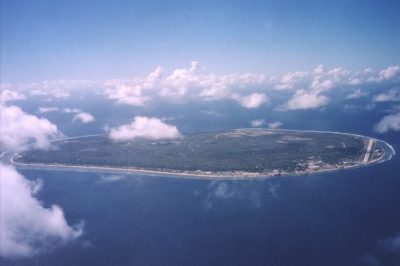 July 23, 2018 Nauru: An 8 Square Mile Island That was Once the World’s Richest Country
 November 14, 2018 Highgate Cemetery: Cemetery Turned Nature Reserve
- January 17, 2019 Pamban Bridge: A Historic Indian Sea Bridge That Was Built on Modern Principles
The post Pitcairn Island: Unsettling History of the Least Populated Nation on Earth appeared first on .
]]>The post Wadi-us-Salaam: The World’s Biggest Necropolis that Houses More than Five Million Graves appeared first on .
]]>
Aerial photo of Wadi-us-Salaam. (Sgt. Johnnie French / U.S. Department of Defense)
Situated approximately 180 kilometres in the south of the Iraqi capital of Baghdad, Wadi-us-Salaam, which also means Valley of Peace in Arabic, occupies around 1,500 acres of land in Najaf – considered the third most revered city in Islam. Contrary to the colourful metropolis that looms in the foreground, the mud and clay-built Wadi-us-Salaam has stood silently in the background since ages. The tombs, all tightly packed together in the vast necropolis resemble a crammed city bustling with activity from afar. But a closer look inside the graveyard only paints a gloomier picture, for the place is silent with the dead buried inside it since a very long time.
As per the Shia Muslim beliefs, Abraham (or Prophet Ibrahim in Islamic teachings) purchased land in Wadi-us-Salaam, and he believed that the land was part of paradise, a claim which Imam Ali, too, corroborated after him. Said to be active for more than 1,400 years, Wadi-us-Salaam has seen daily burials since the Parthian Empire, which lasted between 247 BCE and 224 CE. As many as five million dead people (and counting) are buried in the Valley of Peace, which also holds traditional significance to Muslims across the globe. The Shias are of the opinion that Wadi-us-Salaam would be the final destination of the souls of the faithful, no matter where the dead were originally laid to rest. They believe that being buried close to Imam Ali, the son-in-law and first cousin of Prophet Muhammad will lessen their sufferings in the afterlife and on the Day of Judgment, the dead shall be resurrected along with their most venerated religious leader.

Wadi-us-Salaam. (Abdolrahman Rafati / Tasnim News)
Traditions followed at Wadi-us-Salaam
The crypts stretch far and wide in the vast area and the dead population in the gravesite is believed to be more than that of a modern city comparatively. Each year the burial ground witnesses a surge in its number with the deceased buried in layers and layers beneath the earth. Right from honored Islamic prophets to priests, kings and Sultans and Islamic leaders from all walks of life are laid to rest at Wadi-us-Salaam. Since the cemetery is located close to the holy memorial of Imam Ali ibn Abi Talib, many Shia Muslims from all parts of the world request to be buried at the world’s largest burial site. People from far away countries like India, Pakistan, Southeast Asian nations and closer ones like Iran, the Middle Eastern countries and Lebanon to name a few, visit Wadi-us-Salaam to bury their dead there.
Description of graves at Wadi-us-Salaam
Wadi-us-Salaam is said to be the only burial place in the world, which has stuck to the interring customs followed from more than 1,400 years ago. The graves are built using plaster and baked bricks, standing at different heights. The wealthy build large, family-sized tombs that have domes on top, while the sepulchres from eight to nine decades ago can be seen high in the background with rounded off tops. Lower graves and tower-like graves can also be seen dotting the cemetery that stretches into the horizon in Najaf as far as the eyes can see. Some graves are placed in catacombs, buried deep inside the ground that can be accessed only by ladders. Each grave is said to hold as many as fifty bodies. The land on which Valley of Peace is built is so enormous that people sometimes have to use bikes to traverse the maze-like burial site to reach their loved ones buried in the graves. The crypts usually smell of rose water that relatives sprinkle on the tombs when visiting their dead relatives.

A shrine dedicated to Muhammad al-Mahdi among the graves. (Abdolrahman Rafati / Tasnim News)
Rituals followed at Wadi-us-Salaam before burial
The deceased are given a proper burial at the site conforming to the ancient Islamic traditions, which involve a number of rituals. Before a dead is finally laid to rest, the body of the deceased is given a ghusl, or in other words, the body is bathed one last time before it is wrapped in a qafan – the white shroud in which corpses are draped. Funeral prayers of the departed are conducted inside the shrine of Imam Ali, where the body is circumambulated thrice around the mausoleum. Verses from the Holy Quran are recited at the cemetery while lowering the body into the grave, which is said to ease the passing of the dead into the afterlife.

Wadi Al-Salam cemetery in Iraq. (Wurzelgnohm / Wikimedia Commons)
Problems plaguing Wadi-us-Salaam
While the neighbouring countries of Iran and Iraq fell into chaos, with the onset of war in the eighties, the number of deceased buried at Wadi-us-Salaam doubled up very quickly. As many as two hundred and fifty bodies were buried during the Iraq War in a single day. The gravesite was also the scene of severe clashes during the height of the Gulf War of the nineties. The rebels sought refuge in the crowded graveyard and the Iraqi army had to raze the tombs down to the ground to comb for insurgents. Hundreds and thousands of bodies were interred at the gravesite during that time. Now the burial place also has tombs of soldiers that die defending their country.
Also, with Iraq bogged down by conflict in the past decade, the demand in burial sites has considerably shot up. With burial plots now running out at Wadi-us-Salaam, many reported cases of stealing or illegal reselling of the plots have come to light. Also, with the ISIS conflict currently plaguing the country, burial sites for victims have become quite a problem. The prices of burial plots have also risen up in recent times, which haven’t deterred people from burying their dead at the Valley of Peace.
While Wadi-us-Salaam awaits a permanent mention in the list of UNESCO’s World Heritage Site, the ancient and biggest cemetery in the world hasn’t bowed down to the modern ways yet. It stands witness to traditional Islamic rituals that have been upheld since time immemorial and it continues to attract more and more deceased people from all over the world, along with their living relatives that visit in the millions every year.
Enjoyed this article? Also, check out “Pere Lachaise Cemetery: Celebrated Parisian Cemetery, Where Millions Visit to Pay Homage“.
Fact Analysis:
STSTW Media strives to deliver accurate information through careful research. However, things can go wrong. If you find the above article inaccurate or biased, please let us know at [email protected].
RELATED
 April 7, 2019 Pere Lachaise Cemetery: Celebrated Parisian Cemetery, Where Millions Visit to Pay Homage
- May 26, 2019 Neptune Memorial Reef: An Eco-Friendly Underwater Graveyard Off the Florida Coast
- November 14, 2018 Highgate Cemetery: Cemetery Turned Nature Reserve
- September 3, 2019 Tomb of Bibi Jawindi: On Cross Roads of Islamic Ethos
The post Wadi-us-Salaam: The World’s Biggest Necropolis that Houses More than Five Million Graves appeared first on .
]]>The post Yemen’s Ancient Town of Shibam is Also Known As ‘Chicago of the Desert’ appeared first on .
]]>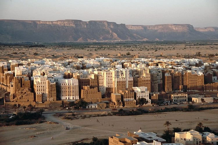
The high-rise buildings made of mud-bricks at Shibam. (Jialiang Gao)
Deep in Yemen’s desert valley, lying about 588 km from capital Sana’a, is the over 1700- years-old fortified town called Shibam. In the western world, the town is known as ‘Chicago of the Desert’ or even the ‘Manhattan of the desert’.
Shibam’s tall houses that are made of sun-baked mud bricks impressively raise up to seven storeys out of the edge of the cliff of Wadi Hadramaut. Surrounded by a wall, the 16th-century town is a very old example of a perfect urban planning thanks to its principle of vertical construction.

Shibam surrounded by a wall. (Dan / Flickr)

The mud skyscrapers of Shibam. (Dan / Flickr)
Key caravan halt on the incense and spice route
Shibam, which is an ancient town, is a key caravan halt on the incense and spice route in the southern Arabian plateau. The town, which has a rectangular grid plan of streets and squares, has been built on a rocky terrain above the Wadi bed.
Interestingly, beneath the town lies another settlement that got partially washed away by massive floods sometime in 1533. The original settlement at Shibam belongs to the 13th century. An unnamed castle that belongs to that era still exists in the walled town. There also exists a mosque, simply known as the Friday Mosque which dates back to the 9th to 10th centuries.

The Friday mosque, Shibam. (Dan / Flickr)
The ancient town has its origins in the pre-Islamic period. In 300 AD another city named Shabwa was located further west to Shibam along the wadi. It got destroyed in the floods. Later, when the local traders returned from the Asian markets, they moved the settlement to the present location, i.e. inside the walled town. Since then the new town developed and expanded onto the southern side of the wadi. At this stage, Shibam became the capital of the Hadramaut region.
Commune for warring families
Shibam originally started as a commune for warring families who were seeking prestige, power, and protection from thieves, mainly Bedouin. The idea of tall stacked housing was the architectural norm of the day that solved the problem of becoming weak from attack.
The stacked housing idea is a historical one. It is a fantastic piece of engineering. According to Salma Damluji, the use of sun-dried mud bricks is an important technique that withstands any type of natural climatic challenge. Salma Damluji is an expert on the traditional architecture of Arabia.
Sun-dried mud bricks slow the pace at which the room temperature within the building changes. They are also cheap to produce and are reusable. Interestingly, the mud brick architecture is found across West Asia. Egyptian architect and intellectual Hassan Fathy was one of mud brick architecture’s greatest champions.
Shibam a World Heritage site
Shibam has been designated a UNESCO World Heritage site.
In addition to the mud bricks, other unique features of Shibam include wooden windows. Apart from providing privacy, they also alter the course of Sun glare and provide improved air circulation.
Narrow streets in the town and its open plazas also improve air circulation. The architecture of Shibam, therefore, provides a complete and uniform approach to urban planning.

The narrow streets of Shibam. (Jialiang Gao)
During the 19th century, when spice traders used to return from Asia, the walled town of Shibam was getting regenerated and expanded to form a suburb named al-Sahil. Shibam town and the Wadi Hadramaut are a great example of how humans settled in the area with the help of exciting town planning and unique land use.
Arab’s traditional culture
The local Hadrami urban architecture of the town with its visual impact through design, materials and building techniques is a unique expression of the Arab’s traditional culture.
The land around the walled town is still used for agriculture and generation of mud for construction purpose. As such this is part of an integrated form of the economic process in the region.
The many multi-storeyed buildings in the town with hardly any windows at the ground level are a testimony to its defensive character. But of late, the social and economic changes witnessed the world over are threatening the homogenous society in the ancient town.
Urban planning highlights Hadrami history
Interestingly, the historic town’s exemplary urban planning highlights the important period of Hadrami history between the 16th and 19th centuries.
The town, which is located between two mountains close to the giant flood wadi, is basically isolated and far away from another urban settlement. Shibam, therefore, is preserving the last surviving evidence of a traditional society that is dependent on agriculture.
Threats to the town
The only distressing threat the town faces is the flood. It may happen at any time posing a threat to the authenticity and integrity of the walled old town. In October 2008, the town faced one such disastrous flood.
In order to protect and preserve Shibam’s cultural identity, Yemen has two strong laws, i.e. Antiquities Law (1997) and the building law (2002). Yemen has also come up with a new protection law in the guise of the Historical Cities Preservation Law.

Residents of Shibam playing in Wadi Hadhramaut. (Raphaël Fauveau)
Master Plan for the ancient town
Under the Urban Conservation Plan, Yemeni authorities also developed a city Master Plan for the ancient town. In 1990, established the General Organisation for the Preservation of Historic Cities in Yemen (GOPHCY) to manage and safeguard historic cities in the country.
Meanwhile, to improve Shibam’s overall economic, physical and social conditions a branch of GOPHCY is working with GIZ. The two organisations have managed to benefit local people under the housing rehabilitation programme.
As per a brief of the UNESCO, Shibam is the home of the world’s first multi-storied apartment buildings. It has also become a symbol for the rise, fall and rise of West Asian culture in the isolation of a desert environment.
Enjoyed this article? Also, check out “Kangbashi, Ordos – Ghost City? Economic Ingenuity? Or Both?“.
Fact Analysis:
STSTW Media strives to deliver accurate information through careful research. However, things can go wrong. If you find the above article inaccurate or biased, please let us know at [email protected].
RELATED
- October 11, 2018 Socotra Island of Yemen: The Most Alien-Looking Place on Earth
 September 2, 2020 Sana’a, Yemen: The Cradle of Arabian Ancestry
 April 6, 2018 Kangbashi, Ordos – Ghost City? Economic Ingenuity? Or Both?
 September 6, 2018 Exploring the Enchanting Mont Saint Michel
The post Yemen’s Ancient Town of Shibam is Also Known As ‘Chicago of the Desert’ appeared first on .
]]>The post Chand Baori: A Quaint Remnant of the Past appeared first on .
]]>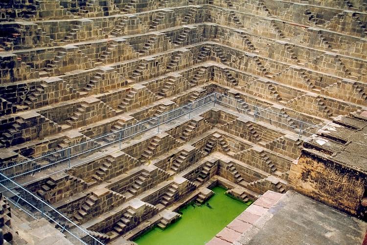
Chand Baori in Rajasthan, India. (Doron / Wikimedia Commons)
Located in the tiny village of Abhaneri in eastern Rajasthan, India, is the deepest stepwell in the world- the Chand Baori. This beautiful structure was built over a thousand years ago by King Chanda in the 9th century. Nobody is quite sure of its exact utility, apart from the obvious water-harvesting. Its location opposite the Harshat Mata Temple has led to the conjecture it might have had religious importance. Though the gigantic structure is not a functional well anymore, it has become a tourist attraction for its fascinating geometry. The stunning historical monument is under the protection of the Archaeological Survey of India (ASI).
What is baori?
The word ‘baori’ or ‘bawdi’ is used to refer to these unique stepwells found exclusively in this part of the world. Stepwells were a very popular method of water harvesting, along with the step-pond, back in the day. The stepwells usually have a very deep and well-rounded bottom to reach the low groundwater levels in the desert. Its narrow shaft is generally protected from direct sunlight by partial roof. A stepwell often developed into a mini-oasis with temples or shelters built into the complex.
The decline in the use of stepwells came about with the British Raj. The British colonists were appalled by the lack of sanitation. The same wells were used for bathing as well as to draw drinking water. Consequently, new stepwells were hardly built, and the existing ones were left to dry and decay. Soon, modern technology replaced the need for stepwells at all.

Inscription by the Archaeological Survey of India at Chand Baori. (Ajay Parikh 103 / Wikimedia Commons)
Structure of Chand Baori
The Chand Baori is a square structure, with each side measuring to 35 metres. From three sides, descend a series of 3,500 slender steps which go down 20 metres to the very bottom. This well has 13 levels and would have provided water year-round despite being located in an arid region. The mathematically precise geometrical structure of the baori is noteworthy, especially in that age. The symmetrically arranged steps create an intricate chiaroscuro effect that looks visually stunning. The stairs taper down to create an almost inverted pyramid shape. Interestingly, the temperature reduces as you go further down. The lower levels of the well are around 5 degrees cooler than the ones above.
The fourth side of the stepwell has a pavilion with a three-storeyed palace. It has intricately carved ‘jharokhas’ or hanging galleries, mounted on pillars, with two small balconies projecting out. This pavilion houses a lot of stunning sculptures as well. Incidentally, the rooms of this palace are inaccessible to tourists. The stairs have railings as well and visitors are not allowed to climb down beyond a point. The entire baori is housed within a rectangular complex, similar to a courtyard.

Chand Baori. (Mukamian98 / Wikimedia Commons)
The history behind Chand Baori
The stunning Chand Baori Complex was built by Raja Chanda of the Gujara Pratihara clan, whom it derives its name from. This clan claims to have descended from Lord Laksmana, the younger brother of Lord Rama. The Baori was built right at the cusp of the Golden era of this clan.
The adjacent Harshat Mata Temple, a shrine to the Goddess of Happiness, provides context to the stepwell’s construction. The baori facilitated the Hindu tradition of washing hands and feet prior to entering a place of worship. The temple itself was razed in the 10th century by Mahmud Ghazni. The ruins still provide an insight into the traditional architecture and sculpting techniques of Ancient India. A rebuilt temple within the complex is now dedicated to Goddess Durga. The complex had a lot of structural additions in the later periods by the Mughals. The compound wall around the baoli, galleries, and cusped arches in the palace on the pavilion are all Mughal structures. These provide a very stark contrast to the sculpting style and trabeated arches used by the Chauhan rulers.

The entrance to Chand Baori. (Mukamian98 / Wikimedia Commons)
Folklore behind Chand Baori stepwell
Apart from its stellar architectural and historical significance, the Chand Baori is also known for the folklore attached to it. Over the years, it has garnered quite the reputation as a haunted spot. The hundreds of shrieking bats inside the well’s shaft only add to the atmosphere. The famously haunted Bhangarh Fort is also on the route to the stepwell, just a few kilometres away. Thus, the Chand Baori has become a popular spot for horror enthusiasts and paranormal researchers. Legend has it that this monumental structure was built over the span of a single night- clearly inhuman feet. The locals put it down to the handiwork of a Djinn. Another lore says that a person going down the stairs cannot use the same steps to climb back up. Seemingly impossible, eyewitness accounts prove it is indeed impossible to climb back up using the same set of slender steps.
The interesting architecture of the Chand Baori has featured in popular movies such as Bhool Bhulaiya in Bollywood and The Dark Knight Rises in Hollywood. Its marvellous geometry has been a part of many notable accounts, such as that of Louis Rousselet, the famous French world traveller, and Morna Livingston, in her book Steps to Water: The Ancient Stepwells of India. Yet, it has hardly found a spot in the annals of history, for posterity to remember it by. The Chand Baori is definitely one of the hidden gems worth checking out in the historic city of Rajasthan, brimming with culture and heritage.
Enjoyed this article? Also, check out “Adalaj Stepwell: A 500-Year-Old Architectural Masterpiece With a Tragic Tale of Unrequited Love, Sacrifice And Loss“.
Fact Analysis:
STSTW Media strives to deliver accurate information through careful research. However, things can go wrong. If you find the above article inaccurate or biased, please let us know at [email protected].
RELATED
- July 15, 2019 Adalaj Stepwell: A 500-Year-Old Architectural Masterpiece With a Tragic Tale of Unrequited Love, Sacrifice And Loss
- August 5, 2019 Karni Mata Temple: Where Thousands of ‘Immortal’ Rodents Roam Free to Bless Visitors with Good Luck
- January 12, 2019 Kumbhalgarh Fort: Not Only China But India Too Has Its Own ‘Great Wall’ Built Centuries Ago
- June 14, 2019 Padmanabhaswamy Temple: The Richest Temple in the World with Gold Worth $22 Billion in Six Vaults
The post Chand Baori: A Quaint Remnant of the Past appeared first on .
]]>The post Neptune Memorial Reef: An Eco-Friendly Underwater Graveyard Off the Florida Coast appeared first on .
]]>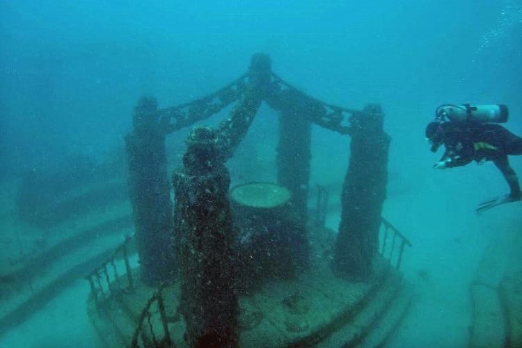
Neptune Memorial Reef. (Todd Murray / Flickr)
The Neptune Memorial Reef is both the largest artificial reef in the world and an underwater columbarium. It is a member of the Green Burial Council and provides an alternative to burials on land. Located at a distance of five kilometres from the coast of Key Biscayne in Florida, it is spread over 65,000 square meters and lies under 40 feet of water.
The reef’s inauguration took place in 2007 after it got clearances from various government bodies. As per these clearances, its construction can withstand most natural disasters, and it is not likely to pollute the marine environment of the Florida coast.
A coral reef
A reef is a natural underwater structure formed of sand, rocks, corals, sponges, and other marine materials. It occurs in relatively shallow waters near a landmass. The most common reefs are the handiworks of corals. These marine invertebrate animals live in colonies and secrete calcium carbonate to form exoskeletons. Over the years, as the corals propagate, their hard skeletons create the framework of the reef.
Coral reefs create a protective barrier for coasts, and they also provide food as well as shelter structures for some marine life. By living in the coral reefs, these creatures are better able to protect themselves from predators and bad weather. Furthermore, coral reefs are safe areas for spawning.
The Neptune Memorial Reef
Gary Levine, a diver, came up with the idea of creating an artificial reef to promote marine life and also to serve as a recreational area for divers. He joined the Neptune Society, one of the largest cremation companies in the US, to develop an underwater cremation memorial site.
Usually, people store cremated ashes in urns or spread them over a waterbody or under trees. An underwater cremation site was an unusual proposition. However, it did attract a segment of the population that had a fascination for the ocean and all things marine. They liked the idea of getting themselves memorialized by placing their ashes in a marine environment. Moreover, contributing to the formation of a coral reef in this manner was something they found appealing.

Inside the memorial reef. (Todd Murray / Flickr)
Their families also liked the idea of an eco-friendly memorial site, where, aside from remembering their loved ones, they would be able to observe the fish and other marine creatures on the reef. Some of the family members acquired scuba diving certifications solely for this purpose. Family members, who are unable to dive, can snorkel, swim, or boat over the memorial site to scatter flowers.
Design of the Neptune Memorial Reef
The artist Kim Brandell was given a free hand to conceptualize the Neptune memorial reef. He designed its first phase to look like a sunken city, akin to the Lost City of Atlantis but with a lot of modern design elements. Plans for other phases of the memorial reef, yet to be built, include dance and music themes, with sculptures of dancing figures and musical instruments.
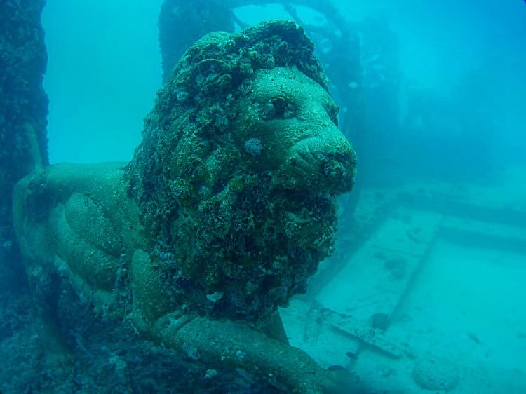
Lion sculpture at the artificial reef. (Todd Murray / Flickr)
The sunken city has two entrance gates made of brass and flanked by bronze lions. From these gates, several paths lead to a central plaza and then diverge from it. These paths pass under 25 feet high archways and have benches for divers on either side. Picket fences and columns, each weighing thousands of pounds and set on equally solid bases, line the pathways.
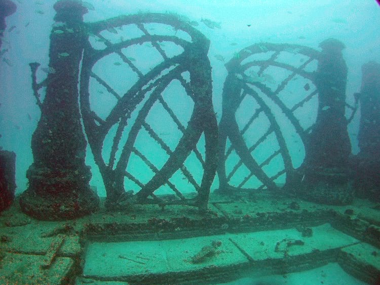
One of the gates of the underwater graveyard. (Elkman / Wikimedia Commons)
Throughout the area, there are globes and statues of sea creatures, and these are fixed to paver blocks on the ocean bed. Neptune Society plans to install a gigantic statue of the Roman sea god Neptune as well as other sculptures.
A starfish memorial. (Todd Murray / Flickr)
Construction of the Neptune Memorial Reef
All the structures on the site are constructed from brass, bronze, steel, and cement specially made for underwater use. The columns and archways are of concrete-encased steel rods. Installing these monumental structures with boat cranes was a difficult task for commercial divers.
Before the completion of the site, a Category 5 hurricane hit Florida. The storm destroyed some of the structures, and marine engineers had to go back to the drawing board to design even stronger structures.
The Memorials on the Neptune Memorial Reef
For a memorial on the reef, a cremated person’s ashes are mixed with concrete to form 10-pound blocks resembling natural objects and marine life. Family members can choose shapes like seashells, corals, starfish, stingrays, and turtles, and can place tokens of the deceased in the memorial blocks. The deceased individual’s name and details are inscribed on a copper plaque and attached to the concrete block. These blocks are then placed on pavers on the ocean bed or attached to the manmade structures of the reef.
Family members can participate in creating the blocks and placing them on the reef. Although the growing coral will eventually cover the memorial blocks, the reef management will ensure that the plaques will always be visible. Also, they will see to it that the families can visit the memorials without disturbing the marine life and destroying the evolving reef.
Marine Life on the Neptune Memorial Reef
Under advice from marine biologists, the Neptune Society shaped and textured the memorial reef to act as substrates on which coral can form and thrive. Eventually, the coral will create natural reef structures. The bases of the structures were designed to attract benthic animals. These are tiny organisms that survive in the sediments on the ocean bed. Holes and spaces in the structures provide habitats for fish.
The Neptune Memorial Reef has created a thriving marine ecosystem by attracting marine creatures that are indigenous to the Florida coast. The diverse fish species, which have made the reef their home, include Sergeant Majors, Rainbow Parrotfish, Angelfish, Bar Jacks, Atlantic Rays, and Bluehead Wrasse. The artificial reef surfaces have also attracted benthic animals like sponges and hydroids. Divers have also spotted Loggerhead Turtles, Lobsters, Crabs, and some Sea Urchins on the ocean bed. Additionally, they have seen various types of Moray Eels hiding in the crevices of the reef.
With over 14 species of coral now contributing to the building of the reef, the project has become successful in revitalizing the ecology near the Florida coast.
The Neptune Memorial Reef provides a beautiful and meditative environment for people to perform memorial rites for their loved ones. Also, its developing tropical ecosystem, which is now teeming with marine life, is of considerable interest to students, researchers, and scientists. The reef is also becoming a popular destination for tourists who like to scuba dive and explore underwater bioverses.
Enjoyed this article? Also, check out “Cancun Underwater Museum: A Sunken Museum Dedicated to Conserving Marine Life“.
Fact Analysis:
STSTW Media strives to deliver accurate information through careful research. However, things can go wrong. If you find the above article inaccurate or biased, please let us know at [email protected].
RELATED
- November 14, 2018 Highgate Cemetery: Cemetery Turned Nature Reserve
- June 5, 2019 Wadi-us-Salaam: The World’s Biggest Necropolis that Houses More than Five Million Graves
- April 7, 2019 Pere Lachaise Cemetery: Celebrated Parisian Cemetery, Where Millions Visit to Pay Homage
- May 9, 2020 Elephant Beach: The Dazzling Sandy Beach in Andaman and Nicobar Islands Perfect for an Exotic Vacation
The post Neptune Memorial Reef: An Eco-Friendly Underwater Graveyard Off the Florida Coast appeared first on .
]]>The post Tavira Island in Portugal and the Anchor Graveyard That is a Memorial for a Lost Way of Life appeared first on .
]]>
Anchor graveyard at Tavira Island. (Espen Nordenhaug / Flickr)
Tavira Island is located in the Algarve, the most southern region of Portugal, and it was once home to a tuna fishing community. If you take a walk along the Barril beach on the island, you will come across a poignant reminder of this community — rows of anchors neatly aligned on the sand dunes. This part of the beach is known as the anchor graveyard.
The island is famous for its beaches and is part of the 170 square kilometer Ria Formosa nature park. Just over 37 kilometers away to the west, near Faro, the existence of a couple of tuna fish farms is a reminder that the bluefin tuna once passed through the waters of the Algarve.
The Atlantic bluefin tuna
The tuna is considered a delicacy all over the world on account of its sweet and tender flesh. It is particularly favored for making sushi in Japan.
One of five species of tuna, the Atlantic bluefin tuna is the largest. It can grow to over 13 feet in length, can weigh around 900 kg, and can live for 10 years or more. Furthermore, it can dive to depths of 1600 feet in the ocean, and swim at speeds of 64 kilometers per hour. The Atlantic bluefin tuna prefer to eat pelagic fishes such as sardines and herrings, and invertebrates like squid which they swallow whole.

A freshly caught Atlantic bluefin tuna. (fishWatch)
These fish spend their adult lives in the cooler waters of the Atlantic Ocean and migrate annually to the warmer waters of the Gulf of Mexico and the Mediterranean Sea to spawn. Their migration route to and from the Mediterranean was once close to the coast of the Algarve.
The fishermen of Tavira island usually caught the tuna when it was heading into the Mediterranean since, at this time, its flesh contained more fat. The fat was essential for the tuna to stay warm in the Atlantic. Another reason for the increased fatty content was that the tuna was getting ready to spawn. On its return journey to the Atlantic, the tuna was comparatively thinner.
There are various fishing techniques for catching tuna – purse seining, longlining, pole and line, trolling, and handline. However, the technique that was most commonly used in the Algarve was called Almadraba.
The almadraba fishing technique
The Phoenicians, who settled in Portugal’s coastal areas around 1200 BCE, are believed to have invented the fishing technique called Almadraba to catch tunas and other large fish.
The technique involves laying a maze of wooden frames covered with netting in the path that the migrating tuna are likely to take. These wooden frames need to stand firm against the ocean currents as well as against the wild thrashing of the caught tunas. To accomplish this, the fishermen secure the frames with hundreds of anchors, cables, and buoys. The enclosed paths guide the tuna into a central area. Once the tuna are gathered there, the boats close in and block the paths. The largest fish are then caught by their tails and hauled onto the boats. Once the fishermen are satisfied with the catch, the fishing equipment is gathered up and the small fishes are set free.
Even three thousand years after its invention, the Almadraba still remained the most effective technique for catching fish by the fishermen on Barril Beach.
The fishing community on Barril beach
Between 1841 and 1967, Barril beach was home to around 80 families who depended on tuna fishing for their livelihood. They lived in small, whitewashed cottages during the tuna fishing season from April to September. Like their ancestors, they fished the tuna using the Almadraba fishing technique, employing lots of iron anchors. After catching the tuna and unloading them on the beach, they transported the tuna via the specially built one-kilometer long railway to the village of Pedras D’el Rei.
Unfortunately for the fisherfolk of Barril beach, in the mid-1960s, the tunas changed their migratory path to and from the Mediterranean Sea, moving further away from the Algarve coast. Fishing for tuna became unsustainable and the fishermen had no choice but to seek other means of livelihood. The fishermen never came back to Barril beach, abandoning their cottages and leaving all of their now useless fishing equipment, including the anchors, to rust and decay.

Anchors near the shore of Barril beach. (Pxhere)
The anchor graveyard on Barril beach
Sometime after 1966, people who came to Barril beach noticed that the rusting anchors that had once lain haphazardly all over the beach were now arranged in precise rows in one part of the beach. All the anchors are placed in the same way, on their sides with one hooked end embedded in the sand and the other one stretching above. It is assumed that some of the locals lined up the anchors in this manner, but no one knows who exactly it was and why they did so.
As there has not been any increase in the number of anchors on the beach, no one is transporting anchors from other areas to place them here. The graveyard contains only the two hundred odd anchors that the fishing community abandoned on the beach when they left the area.
While the arrangement of anchors is interesting, it is equally remarkable that no one has stolen them. As rusted and twisted the surfaces of the anchors may be, they are still solid iron and have a lot of value in the scrap metal market. The reason why they remain untouched may perhaps be that the anchor graveyard serves as a memorial to an old way of life to which the people in the area can never return to.
Tourism on Tavira Island
The decline of the traditional fishing industry in the Algarve region coincided with the rise of the tourism industry in the area. The beautiful white sand beaches and the clear sea waters attract a lot of foreign visitors to Tavira Island every year. The cottages of the fishermen have now been converted into shops, restaurants, and beach huts for the tourists who come to spend a leisurely day on the beach. The mini-train that once transported fish now transports visitors to the beach.
As Tavira Island has protected status on account of being part of the Rio Formosa Nature Park, the anchor graveyard is likely to remain preserved as a relic of the historic fishing heritage of the people of the Algarve.
Enjoyed this article? Also, check out “The Unusual Glass Beaches of California and Hawaii“.
Recommended Visit:
Tavira Island | Portugal
Fact Analysis:
STSTW Media strives to deliver accurate information through careful research. However, things can go wrong. If you find the above article inaccurate or biased, please let us know at [email protected].
RELATED
 October 16, 2018 Clear Water Lagoons and Pristine White Sand Dunes of Lençóis Maranhenses National Park
 March 10, 2019 Barra Airport, Scotland: Where Planes Take Off and Land on a Beach
- May 26, 2019 Neptune Memorial Reef: An Eco-Friendly Underwater Graveyard Off the Florida Coast
- December 18, 2018 The Unusual Glass Beaches of California and Hawaii
The post Tavira Island in Portugal and the Anchor Graveyard That is a Memorial for a Lost Way of Life appeared first on .
]]>The post What is a Micronation? and Some of the Most Popular Micronations in the World appeared first on .
]]>Micronations
A micronation is a small area whose owner or residents have declared it to be an independent nation. That is, independent from the existing country in which the area is located. There are over 400 such micronations across the world. They may have a single resident or many more. They may have their own government and laws. However, they are generally not recognized by any other world government or by any international organizations. That is how they are differentiated from microstates such as Bhutan and Luxembourg, which do have global recognition as independent countries.
There are various reasons why micronations come into existence. Some micronation founders declare themselves independent in protest against unfair government laws. Others may want to create a more just and even utopian society. Some micronations even have historical roots as independent entities. In some cases, the founders are simply acting upon a whimsical urge.
Let’s look at some of the well-known micronations from around the world:
The Republic of Minerva
This micronation was formed on land reclaimed from reefs in the Pacific Ocean. In 1972, the real estate mogul, Michael Oliver, came up with the idea of creating a libertarian society that would be free of all governmental interference. His group built a tower on the reclaimed land, created a flag and currency, and, on the 19th of January, declared the Republic of Minerva to be an independent nation.
It might have been the dawn of a bright new future, except Tonga laid claim over the territory and the libertarians showed no inclination to fight to keep their nation. Since then, various groups have unsuccessfully tried to occupy the reefs, the last time being in 1982. Now, the ocean is claiming back the reefs.
The Principality of Sealand
A pirate radio broadcaster, Paddy Roy Bates, wanted to bypass the British government’s draconian broadcasting restrictions, and, so, he decided to start his own micronation and set up a broadcasting station there. He selected the fort of Roughs Tower for this purpose. The British had built this fort during the Second World War, but they had been forced to abandon it afterwards since they had constructed it 11 kilometres off the UK’s eastern coast in international waters.

Principality of Sealand. (Ryan Lackey / Flickr)
Mr. Bates moved to the fort with his family and some friends in September 1967 and formed the Principality of Sealand. The Bates family, naturally, are the heredity rulers of the micronation. They have a flag, coins, postage stamps, and even issued passports. In 1982, the United Nations Convention on the Law of the Sea extended the limit of national waters to 22 km. This effectively brought Sealand into Britain’s sovereign territory. It is now managed by caretakers of the Bates family. In 2000, HavenCo, an Internet hosting facility, was established there. The micronation has a website and newspaper that keep the world informed of their activities.
The Principality of Seborga
To visit the Principality of Seborga, you will have to head to Liguria in north-western Italy. Unlike most other micronations, Seborga is not a new creation. It has a very interesting history that spans back to several thousands of years. The area once belonged to the Counts of Ventimiglia and then the Benedictine Monastery of Santo Onorato became the new owners. The Monastery’s Abbot had been proclaimed a Prince of the Holy Roman Empire in 1079. The Monastery controlled the area until 1729, which was when they sold it to the Savoy dynasty. The Italian territories were reorganized after the Napoleonic Wars of 1815 and later again after the unification of Italy in 1861. However, Seborga finds no mention in the list of these reorganized territories.
The frontier of Principality of Seborga. (Cnbrb / Wikimedia Commons)
In any case, it got into the limelight in the 1960s. This was when Giorgio Carbone, the head of the local flower growers’ cooperative, convinced the residents that since there were no ownership records for Seborga, they could consider it an independent nation. He was elected as its leader and assumed the title of Giorgio I, Prince of Seborga.
The citizens of Seborga elect a monarch and an advisory council every seven years as per their constitution. Its existence as a principality is a tourist attraction. For all practical purposes, this micronation is just another town in Italy.
The Principality of Hutt River
Spread over an area of 75 square kilometres in the state of Western Australia, this micronation is larger than many countries such as Ireland and Sri Lanka. The area is the Casley family’s farmland, where they primarily grow wheat. In 1970, the government introduced quotas for wheat production which had a negative impact on the Casley farm. So, Leonard Casley decided to secede his land from Australia and became His Royal Highness Prince Leonard I of Hutt.
The principality has a bill of rights, which describes the rights of citizens, and all the usual things that a nation has such as currency, stamps, businesses, taxation, vehicle registrations, and passports. Besides wheat, the micronation exports wildflowers and other produce.
Despite their declaration of independence, the Principality of Hutt River has no legal status as an actual independent entity. The Casley family continues to pay all the local government taxes as mandated in Australia. The attempt at being a micronation, however, brought fame to the Hutt River province, and over 40,000 tourists visit it, giving a boost to the area’s economy.
The Kingdom of Redonda
Located near the Caribbean island of Montserrat, the Kingdom of Redonda is an island kingdom that author Matthew Phipps Sheil established in 1929. It began as a publicity stunt for his horror and science fiction novels, but he claimed to be a descendant of the Kings of Ireland and took his new nation very seriously. He established the tradition of passing on the Kingship of Redonda only to published authors.
His successor, the poet John Gawsworth (Juan I) attempted to sell the title in England. After him came Jon Wynne-Tyson (Juan II), Bob Williamson (King Bob the Bald), and Michael Howorth who is called King Michael the Grey of Redonda. He is a sailor and a magazine writer, writing mainly about travelling, boating, and yachting. He ceremoniously received a gold painted pineapple and sugarcane as symbols of Kingship when he was crowned the King in 2009 by an Archbishop of Antigua.
There is no infrastructure remaining on the island after it was abandoned by the guano and phosphate miners during the First World War. The Government of Antigua and Barbuda indulges the whimsical Kingdom of Redonda to promote it as a sailing destination.
The word micronation was coined in the 1970s to give a name to the rising phenomenon of people proclaiming an area as independent from a ruling country. In recent years, the Internet has enabled many social groups from across the world to form micronations; most of them are virtual and also known as nomadic countries. Whatever form they have, micronations shed an interesting light on what it means to be a nation.
Enjoyed this article? Also, check out “Maunsell Forts: The Forts That Tell the Tale of WWII“.
Fact Analysis:
STSTW Media strives to deliver accurate information through careful research. However, things can go wrong. If you find the above article inaccurate or biased, please let us know at [email protected].
RELATED
- May 31, 2019 Chand Baori: A Quaint Remnant of the Past
 July 21, 2019 The Tjentiste War Memorial: A Commemoration of Those That Died in the Battle of Sutjeska
 August 11, 2018 Masada in Israel: Did 967 Rebellious Jews Really Commit Mass Suicide Here?
 May 20, 2020 Mehran Karimi Nasseri’s 18 Years Stay at the Airport
The post What is a Micronation? and Some of the Most Popular Micronations in the World appeared first on .
]]>The post Cambodia’s Magnificent Angkor Wat: One of the Largest Religious Monuments in the World appeared first on .
]]>The capital city, now known as Angkor, is in the northern province of Siem Reap in Cambodia. In the 14th century, as Buddhism caught on in the country, the original Hindu temple was gradually transformed into a Buddhist temple. It is the only temple in Angkor that was not abandoned in the 15th century when King Ponhea Yat moved the capital to Phnom Penh.

The front side of Angkor Wat temple. (Bjørn Christian Tørrissen / Wikimedia Commons)
The construction of Angkor Wat
It took King Suryavarma II 30 years to build the temple, and several thousands of labourers were engaged in working on it at the same time. They used laterite bricks as the base material for the construction of the foundations and the internal structural parts of the temple.
Laterite is a rocky soil that is rich in iron and aluminium. It is mined from areas that are below the water table, and so it is soft and moist in its composition. In such a state, the laterite can easily be cut into blocks. These later harden on exposure to air as this causes the moisture to evaporate, and once they have hardened, they are suitable for use in building work.
For constructing Angkor Wat, the workers laid the laterite bricks without using mortar. Instead, they fixed them together with mortise and tenon joints in some cases, while, in others, they used dovetails and gravity. They then clad the laterite walls with sandstone. Since this is a relatively soft stone, it was possible for the craftsmen to create intricate carvings on it. This Mesozoic sandstone comes from quarries in the Phnom Kulen hills, about 40 km away from the Angkor Wat temple, and the workers transported it to the temple site via canals.
The architecture of Angkor Wat
Spread across an area of around 500 acres, the temple faces towards the west, which is the cardinal direction associated with Lord Vishnu. The architecture of Angkor Wat displays the best of two Khmer styles, the Temple Mountain style and the Gallery style.
The Temple Mountain architectural style shows a representation of Mount Meru, the abode of the gods in Hinduism. The Angkor Wat temple is pyramidal in structure and is made up of several levels, with enclosures and a moat surrounding it; the enclosures represent a chain of mountains, and the moat represents the cosmic ocean. A gallery is a passage running along the walls of enclosures or the temple axes. The gallery may be open on one or both sides. In Angkor Wat, the structure of the temple was buttressed by adding half galleries on one side of the enclosures.

The beautiful architecture of the temple. (Pixabay)
Angkor Wat has three levels. The tower in the centre of the temple rises to 31 metres above the third level. It forms a quincunx with the towers that arise from the four corners of the temple’s second level. The designs of the tops of all the towers resemble lotus buds.
To reach the third level, which is known as Bakan Sanctuary, you have to climb a very steep set of steps.

Steep steps to reach the third level of the temple. (Billbeee / Wikimedia Commons)
Three enclosures of descending heights surround the square of the central temple. These enclosures form interlinked galleries and finally, the outer wall. The latter measures 1025 metres by 800 metres and has entrances on the eastern and western sides. The main entrance is on the western side, and it has a 235 metres wide porch decorated with carvings and sculptures.
There is moat beyond the outer wall, and it surrounds the temple complex in entirety. The moat has a width of 650 feet and is 1.5 kilometres in length and 1.3 kilometres in breadth. It has a depth of 13 feet.
A sandstone causeway, measuring 475 metres in length and 9.5 metres in width, crosses the moat and stretches from the main entrance to the central temple. Balustrades depicting Nagas line this causeway; Nagas are divine half-human, half-snake beings from Hindu mythology.
In the right-hand tower of the temple, there is a 3.25 metres high statue of Vishnu carved from a single block of sandstone. It might be the statue that King Suryavarman II originally installed in the central tower and which, under later rulers, was later shifted when the temple became Buddhist.

Aerial photo of Angkor Wat. (Mark Fischer / Flickr)
The bas reliefs at Angkor Wat
The walls of the temple are adorned with intricate bas reliefs that depict events from the life of King Suryavarman II as well as events from mythological stories from the Hindu epics, Ramayan and Mahabharata.
The scenes from the Ramayan depict the battle of Lanka and the monkey princes Vali and Sugriva. From the Mahabharat, we get scenes from the battle of Kurukshetra between the Pandavas and the Kauravas, and also scenes from the conflict between Lord Krishna and the Asura Bana. Some scenes show Yama, the god of death, and the battle between Vishnu and the Asuras. One of the finest bas relief narrates how the Devas and the Asuras churned the ocean of milk to produce the divine nectar of immortality; Lord Vishnu assumed the form of a gigantic turtle to assist them with the churning.
The bas reliefs in the south gallery show King Suryavarman II engaged in a variety of activities. In one, we see him wearing fine jewellery, seated on elaborately carved furniture in one relief. He is in a forest in another relief, in the company of his attendants, courtiers, noble ladies, and priests. A third relief shows the King is in armour, carrying a weapon, with his well-equipped army around him.
The most famous bas reliefs at Angkor Wat are those of the apsaras wearing elegant clothes and different hairstyles.
The conservation efforts at Angkor Wat
The École Françaised’Extrême-Orient (EFEO) established the Conservation d’ Angkor in 1908 to carry out restoration work at Angkor Wat. In the 1970s, the Cambodian Civil War halted the restoration work at Angkor, and the EFEO disbanded. The Archaeological Survey of India did some restoration work between 1986 and 1992.
After an appeal by King Norodom Sihanouk, UNESCO listed Angkor as a World Heritage site in 1992.
The Cambodian government created the Authority for the Protection of the Site and Management of the Region of Angkor (APSARA) in 1995 for managing and protecting the Angkor Archaeological Park. Since then, Germany, France, China, and Japan also have been involved in various Angkor Wat conservation projects.
Earlier restoration work that made use of cement and chemicals caused some damage to various sandstone surfaces in the temple complex. Some of the damage to the stones is also due to the filamentous cyanobacteria that are prevalent in the area. These cyanobacteria release organic acids that cause the stones to deteriorate. Unfortunately, the cyanobacteria are resistant to dehydration and radiation treatments. So, conservation of the Angkor Wat temple complex continues to be an on-going activity.
Enjoyed this article? Also, check out “Incredible Ta Prohm: The Ancient Khmer Temple in Cambodia“.
Fact Analysis:
STSTW Media strives to deliver accurate information through careful research. However, things can go wrong. If you find the above article inaccurate or biased, please let us know at [email protected].
RELATED
- April 22, 2019 Incredible Ta Prohm: The Ancient Khmer Temple in Cambodia
- June 14, 2019 Padmanabhaswamy Temple: The Richest Temple in the World with Gold Worth $22 Billion in Six Vaults
- September 21, 2019 Batu Caves of Malayasia – The Largest Shrine to Lord Murugan Outside India
- July 17, 2019 The Lonar Lake: An Astronomical Marvel
The post Cambodia’s Magnificent Angkor Wat: One of the Largest Religious Monuments in the World appeared first on .
]]>The post Naqsh-e Rustam: The Incredible Tombs and Rockface Reliefs of the Sassanian Kings appeared first on .
]]>
Naqsh-e Rustam in Fars Province, Iran. (Diego Delso / License CC-BY-SA)
The area now known as Naqsh-e Rustam has archaeological remains of Iran’s history from around 1000 BCE to 309 CE. Located in the Fars province of Iran, it lies around 12 km to the northwest of Persepolis, which was the capital of the Achaemenid Empire.

Ernst Herzfeld in Iran. (James Henry Breasted, Jr. / Wikimedia Commons)
In the 1930s, the Shah of Iran granted permission to the Oriental Institute at the University of Chicago to excavate the remains of Persepolis and the other areas near it. Ernst Herzfeld led this Persian Expedition and they were the first Westerners to document the major monuments at Naqsh-e Rustam.
Their greatest finds included the famous reliefs of the Sassanian Kings high up on the rockface. The locals had long assumed that one of the carved figures was that of Rustam, one of the heroes from Firdausi’s epic Shahnameh. Going by that, the site had long been known as Naqsh-e Rustam (the carvings of Rustam).
Some archaeologists believe that the use of colours on stone carvings originated with the Iranians. Many of the reliefs and inscriptions at Naqsh-e Rustam are covered with lapis lazuli.
Let’s look at some of the historical periods that covered the Naqsh-e Rustam region:
The Elamite Period
The oldest reliefs at Naqsh-e Rustam were most probably carved around 1000 BCE during the Elamite period. We have very meagre information about this ancient civilization, but we do know, from Mesopotamian accounts, that it existed between 2700 BCE and 539 BCE. When the Sassanians gained ascendency in the region, they destroyed most of the Elamite reliefs by carving right over them.
Only one Elamite carving remains, a figure of a standing man wearing a long ankle length garment and a forward pointing hat on his head. This is the figure that the locals took to be the epic hero Rustam.
The Achaemenid Period
Fire Altars
Before the Zoroastrians developed fire temples, they worshipped at open air fire altars. Two of such altars are located at the western end of Naqsh-e Rustam. The Achaemenians probably constructed these altars sometime between the 6th and 5th century BCE.

The two fire altars at Naqsh-e Rustam. (Arash Zeini / Wikimedia Commons)
Tombs
Of the four famous royal tombs carved high up in the rocky face at Naqshi-e Rustam, archaeologists have only definitively identified the first one as that of Darius I. Famous for extending his empire from Macedonia to the Indus Valley, he lived between 522 BCE and 486 BCE.

Paranomic photo of the four tombs at Naqsh-e Rustam. (Diego Delso / License CC-BY-SA)
While the common assumption is that the three other tombs are of Xerxes (486-465 BCE), Artaxerxes (465-424 BCE) and Darius II (423-404 BCE), there is no definite proof for this.
A fifth unfinished tomb might be either that of Artaxerxes III (425-338 BCE) or of Darius III (c. 336-330 BC), the last King of the Achaemenid Dynasty.
The outer facades of the tombs are shaped like a cross with the tomb entrance located at the centre of the cross. The large panels over the doorways are carved with the images of various incidents from the King’s life. The small chamber inside the tomb contained the sarcophagus in which the royal dead body was placed.

The tombs of Naqsh-e Rustam. (Ziegler175 / Wikimedia Commons)
The tomb of Darius I has the inscription “parsa parsahya puthra ariya ariyachitra.” This statement is a reference to his Zoroastrian ancestry. It informs us that he is a Parsi, he is the son of a Parsi, and that he is also an Aryan and a descendant of an Aryan family.
It is entirely possible that these tombs were filled with an array of expensive items to accompany the Kings into the afterlife. There are, however, no treasures inside these tombs anymore. All the tombs were desecrated and looted by Alexander’s Macedonian soldiers after they defeated the Achaemenians in 490 BCE.
Kaba-e Zartosht
In English, the Kaba-e Zartosht translates to Zarathustra’s Cube or Zarathustra’s Enclosure. As you might expect, it is a solidly square-shaped tower building. Nobody knows exactly who built it and for what purpose. It is possible that either Darius I, Artaxerxes II, or Artaxerxes III constructed it between 521 and 404 BCE. It is a copy of the several decades older Zendān-e Solaymān (Prison of Solomon) tower at Pasargadae, the nearby city which was the capital of King Cyrus.

Kaba-e_Zartosht (left). (Julia Maudlin / Flickr)
The builders used light-coloured limestone to construct the building and fixed the limestone blocks in place with iron clamps. They used darker coloured limestone to build fake, recessed windows in the sides of the building. The lower part of the tower is solid and there is a room in the upper part. A stone staircase leads to the door of the room which faces the cliff.

The front side of Kaba-e Zartosht. (Diego Delso / License CC-BY-SA)
The entire structure is 12.5 metres high and its base measures 7.25 metres on either side.
Nobody, so far, knows the exact purpose of this tower. There have been various theories, of course, putting forth that it might have been a fire temple, a repository of the Zoroastrian holy book Avesta, or a place to hold some royal paraphernalia. The fire temple theory is most likely not correct since the building’s windows are false and there is no outlet for the smoke that would arise from a constantly burning fire.
The Iranian archaeologist, Reza Moradi Ghiasabadi, believes that the Kaba-e Zartosht could have been used to observe the skies to maintain the Iranian calendar.
On the outer side of the building, there are four inscriptions in three languages, cataloguing Sassanid victories. There is a wall around the Kaba-e Zartosht. It appears to be from the Sassanid Period.
The Sassanid Period
Ardeshir I founded the Sassanian empire in 224 CE, and it lasted until the Arab Caliphate overthrew it in 651 CE. The Iranians consider the Sassanid period as one of the most advanced epochs of their long civilization. There are seven large reliefs from this era at Naqsh-e Rustam. They can be seen just above ground level below the Achaemenid tombs.
The first relief depicts Shapur I (241-272 CE) along with his high priest and the defeated Roman emperors Valerian and Philip the Arab.

Relief depicting Shapur I. (Diego Delso / License CC-BY-SA)
The second relief depicts Bahram II (276-293 CE) holding a large sword with the figures of three courtiers on the right and five figures on the left, three of whom are wearing diadems.
There are two reliefs next of Bahram II sitting astride on a horse. In one, he is battling a Roman enemy, who is also on a horse, and in the second, he is pushing another Roman enemy off his horse. The lower part of the second relief shows the King fighting with another enemy, who is on a horse and is wearing an animal-shaped headgear.
King Narseh (293-303 CE) is shown in the fifth relief being given the ring of Kingship by a female figure. This is probably the Goddess Aredvi Sura Anahita or Queen Shapurdukhtak of Sakastan.
The sixth relief depicts Hormizd II (303-309 CE) pushing an enemy off his horse. Above this relief, there is a damaged relief of Shapur II (c. 309-379) and his courtiers.
Naqsh-e Rustam today
Iran’s Cultural Heritage, Tourism and Hand-crafts Organization (CHTHO) opposed the construction of the Shiraz-Isfahan railroad at a distance of 350 metres from the site. Even though the railroad was eventually constructed 1 kilometre away, experts believe that the vibrations emanating from the railroad are responsible for the gradual sinking of the ground at Naqsh-i Rustam.
Enjoyed this article? Also, check out “Al ’Ula Town: A Once-Flourishing Oasis That Now Lies in Dust, Hidden from the World“.
Fact Analysis:
STSTW Media strives to deliver accurate information through careful research. However, things can go wrong. If you find the above article inaccurate or biased, please let us know at [email protected].
RELATED
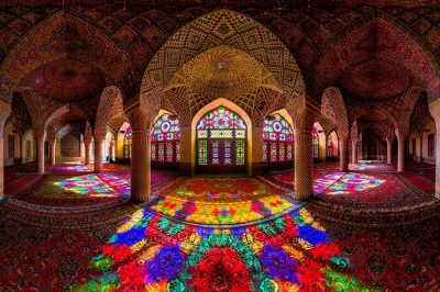 July 1, 2020 The Nasir al-Mulk Mosque Hosts a Kaleidoscopic Play of Lights Reflecting the Morning Sun
 September 7, 2019 The Disappearance of Michael Rockefeller: One of the Most Enduring Unsolved Modern Mysteries
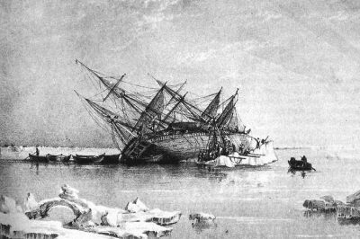 September 26, 2019 HMS Terror: A British Warship That Was Lost for Over 170 Years
 March 21, 2019 Andrée’s Arctic Balloon Expedition of 1897: A Peek into the Doomed North Pole Flight
The post Naqsh-e Rustam: The Incredible Tombs and Rockface Reliefs of the Sassanian Kings appeared first on .
]]>The post Tristan da Cunha: The Remotest Inhabited Island in the World appeared first on .
]]>
Tristan da Cunha. (Brian Gratwicke / Flickr)
There are some remarkable regions on earth that, despite our multi-connected world, remain more or less untouched. One such place is Tristan da Cunha. Located in the South Atlantic Ocean, it is one of the remotest inhabited islands in the world and belongs to a group of six volcanic islands that are collectively known as the Tristan da Cunha Islands.
The group consists of Tristan da Cunha, Gough Island, Inaccessible Island, Nightingale Island, Middle Island, and Stoltenhoff Island. Of these, only Tristan da Cunha is inhabited. It is 2,816 kilometres from Cape Town in South Africa, 3,360 kilometres from Buenos Aires in South America, and 2,430 kilometres from St. Helena, which governs the islands since they come under British Overseas Territories.
Tristan da Cunha

The approach to the island. (Brian Gratwicke / Flickr)
Ever wondered what it might be like to live far away from civilization as we know it in the middle of a vast ocean? The two hundred plus population of Tristan da Cunha would tell you that it can be tough, with few modern conveniences, but, even so, they would never swap their island life for anything else. They tried it once from 1961 to 1963 and discovered that the outer world cannot hold a candle to Tristan da Cunha.
Edmund Roberts, a 19th century visitor to Tristan da Cunha, on first sighting the island, described how its towering snow-clad mountains lit up in the morning sunlight. Add an emerald green landscape to the picture and you have one of the most beautiful islands on Earth.
Present-day visitors are left similarly awestruck. Even with the homes and structures that make up the island’s only settlement, the place still retains its air of pristine seclusion.
Tristan da Cunha, the principal and only inhabited island, has a main city known as the ‘Edinburgh of the Seven Seas’. It is named after Prince Albert, Duke of Edinburgh, and Queen Victoria’s second son, who visited the island in 1867. The island is more or less circular in shape, with a width of 6 miles, a land area of 38 square miles, and a coastline of 21 miles. There is an active volcano called Queen Mary’s Peak on the island. It was after its eruption in 1961 that the islanders were forced to abandon their homes and head for the United Kingdom. It hasn’t erupted since then.
Gough Island, which is 230 miles away from Tristan da Cunha, has a meteorological station and is otherwise, like the other islands, a haven for the wildlife. Inaccessible Island is 20 miles away, Nightingale Island is 12 miles away, and Middle Island and Stoltenhoff Island lie very close to Nightingale Island.
Discovery of Tristan da Cunha
The Portuguese shipman, Tristão da Cunha, first came upon the island in 1506 but was unable to set foot due to bad weather and accessibility difficulties. The island seems to have sufficiently impressed him to make him name it after himself, Ilha de Tristão da Cunha. It was later mentioned by this name in British Admiralty charts before being Anglicized to Tristan da Cunha.

The main settlements on the remote island. (The Official CTBTO Photostream / Flickr)
In 1520, the Portuguese vessel Lás Rafael, under Captain Ruy Vaz Pereira, stopped at Tristan da Cunha to replenish their water. This would make the Portuguese sailors the first men to set foot on the island. The account is, however, disputed, and a Dutch East India Company ship, the Heemstede, takes official credit for being the first to send men to the island.
On 7 February 1643, the Heemstede, captained by Claes Gerritsz Bierenbroodspot, landed her crew on Tristan da Cunha. The Dutch visited the island four more times for supplies in the next 25 years. They understood the lay of the archipelago from their visits and, in 1656, drew up a rough map of it.
A more thorough charting of the archipelago came about a hundred years later in 1757 when the Heure du Berger, a French corvette, sent its crew to survey the land. Another Frenchman, Louis-Marie Aubert du Petit-Thouars, was the first to study the natural environment of Tristan da Cunha in January 1793.
The first settlement at Tristan da Cunha
The first person to live permanently on the island was Jonathan Lambert of Salem, Massachusetts, United States. He and two other men moved to Tristan da Cunha in December 1810 to start a business selling supplies to passing ships. A third fellow joined them later. Declaring the islands to be his property, Lambert renamed them the Islands of Refreshment. The new name didn’t catch on and Lambert didn’t remain an island owner for too long. Just two years after their arrival, Lambert and two of the men died in a fishing accident. The fourth man, Tommaso Corri, remained alone on the island and wasn’t discovered until a ship stopped by several years afterwards. They offered to take him off the island, but he decided to remain and farm on the island. Facilities are mainly confined to the village and the settlement plain. The most recent additions have been street lighting and solar energy panels.

Residences at Tristan da Cunha. (Spixey / Flickr)
British annexation of Tristan da Cunha
In 1813, the United Kingdom claimed the islands as part of its empire and annexed them in 1816, making them a dependency of the Cape Colony in South Africa. They explained this as a measure to prevent the islands from being used as a base by French Nationalists who wanted to free Napoleon Bonaparte from his imprisonment on Saint Helena. The British occupation was also to prevent the United States from claiming the islands. The United States had used Trista da Cunha as a naval base during their 1812 war against the United Kingdom.
The British stationed a garrison of marines on the island and, soon, a civilian population settled there, numbering in 25 by 1824, with three women and 22 men. US American whalers began using the island as a base for their whaling ventures in the South Atlantic. By 1856, with the addition of drifters and shipwreck survivors, the island’s population grew to 71.
For a while it seemed that the islands might become fully inhabited, but, in 1857, the majority left the island to avoid starvation, leaving on 28 die-hard souls behind. Things deteriorated further in 1869. This was when the Suez Canal opened and, around the same time, coal-powered ships began replacing sailing ships. Seafarers no longer needed to take the long, slow route around the islands from Europe to East Asia or stop at Tristan da Cunha for supplies. As a result, the island soon slipped back into isolation.
When Captain Geroge Nares and his ship, HMS Challenger, visited Tristan da Cunha on a geographic survey mission in 1873, the island’s population consisted of 15 families.
As the islands no longer mattered as a strategic stopover, the UK withdrew its marines and asked the people to evacuate the island as well, warning them they would be on their own if they remained. The people decided to stay despite that. They were virtually cut off from the world from 1909 to 1919. In 1919, a ship stopped by to inform them about what had happened during World War I.
During World War II, there were RAF and Royal Navy posts on the island as a deterrence against German U-boats.
Life on Tristan da Cunha
Today, the entire population of Tristan da Cunha is under 300, and these people are descendants of the original settlers. They are a mix of Caucasian, African, and Asian descent, speak English and have only seven surnames.
The principal occupation is farming, with the locals working on communally-owned land and in settlement gardens. They grow potatoes and other crops and maintain cattle. The number of cattle is strictly regulated to prevent over-grazing and also so that some families don’t become wealthier than others. The community operates on the principles of equality as established by William Glass, the founder of the settlement.

Cows grazing on the island. Each family is restricted to keeping not more than two cows. (Brian Gratwicke / Flickr)
The island does not allow outsiders to buy land on it or to settle on it. Visitors can stay only for short durations. The local council governs the island. There four policemen in the community. The Islanders have one unofficial representative in Birmingham.
At present, the settlement has a school, a post office, a museum, churches of the Anglican and Roman Catholic denominations, and a crayfish canning factory. There is a hospital with one doctor. Other medical professionals visit a few times in a year and stay for a few weeks or months. For more in-depth medical consultations, the doctor consults other doctors over the internet. In emergencies, they ferry patients all the way over to Cape Town.

St Joseph’s Catholic church in Tristan da Cunha. (Brian Gratwicke / Flickr)

Inside St Joseph’s Catholic church. (Brian Gratwicke / Flickr)
They get their electricity from diesel generators and store the diesel in nine 200,000 litres tanks. There is one local bus and a few cars. The single main road that the locals call the MH1 goes from the settlement to the potato patches. The other ‘roads’ on the island are paths, some of them quite precarious ones.
Evacuation of Tristan da Cunha
The Islanders had to evacuate Tristan da Cunha after Queen Mary’s Peak erupted in 1961 and made the settlement inhabitable. The British government resettled the Islanders in England to a great deal of media attention. The island evacuees, however, didn’t like it in England and found it difficult to adjust to modern life, both from having a different dialect and a different way of living. They voted to return to Tristan da Cunha when it became safe to do so in 1963. Except for three people, everyone returned. They did this in two stages, the works returning first to assess the damage and make the repairs and the rest following afterwards. A few years later, 35 people left for Europe. For the most part though, the people of Tristan da Cunha love their island and have no intention of ever leaving. After they returned, they renamed a port Calshot Harbour after the village they had stayed in in the UK.
Wildlife on Tristan da Cunha islands
The Tristan da Cunha has two species of land birds and 13 species of seabirds. These include the Antarctic Terns, the Tristan Wandering albatross, the Yellow-nosed albatross, the sooty albatross, the Inaccessible Island flightless rail, and the Atlantic Petrel; the latter only breeds on these islands. There are also Northern rockhopper penguins and the Sub-Antarctic fur seals.

Inaccessible Island Rail (Atlantisia rogersi). (Brian Gratwicke / Flickr)

Spectacled petrel (Procellaria conspicillata). (Brian Gratwicke / Flickr)
Visiting Tristan da Cunha
You don’t require a visa for Tristan da Cunha, just prior permission from the island Administration and Council. You can get this by contacting them via email and informing them when you plan to visit, why you want to visit, and for how long you want to stay. They will issue you a landing stamp on your passport.
However, actually getting to the island can be difficult. Tristan da Cunha does not have an airstrip, so you can’t reach it by plane. The only way to go there is by boat or ship and that can take six days from Cape Town. However, regular ships head for Tristan da Cunha rather infrequently, about only five or six times a year. Cruise ships stopover in December. Fishing vessels may make more frequent trips.
Enjoyed this article? Also, check out “Kerguelen Islands: The Remotest Place on Earth“.
Special thanks to Brian Gratwicke for releasing all the photos of the island in creative commons.
Fact Analysis:
STSTW Media strives to deliver accurate information through careful research. However, things can go wrong. If you find the above article inaccurate or biased, please let us know at [email protected]
RELATED
 June 8, 2019 Pitcairn Island: Unsettling History of the Least Populated Nation on Earth
- January 30, 2019 Mt Etna: The Highest Active Volcano in Europe, A Popular Tourist Destination
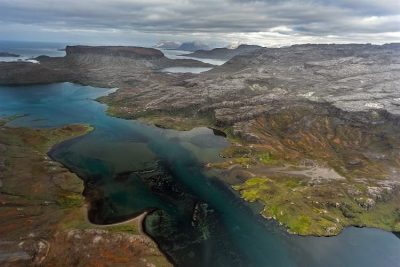 November 18, 2018 Kerguelen Islands: The Remotest Place on Earth
- July 23, 2018 Nauru: An 8 Square Mile Island That was Once the World’s Richest Country
The post Tristan da Cunha: The Remotest Inhabited Island in the World appeared first on .
]]>The post Neuschwanstein Castle: The Story Behind the Iconic Bavarian Castle That Inspired the Disney Castle appeared first on .
]]>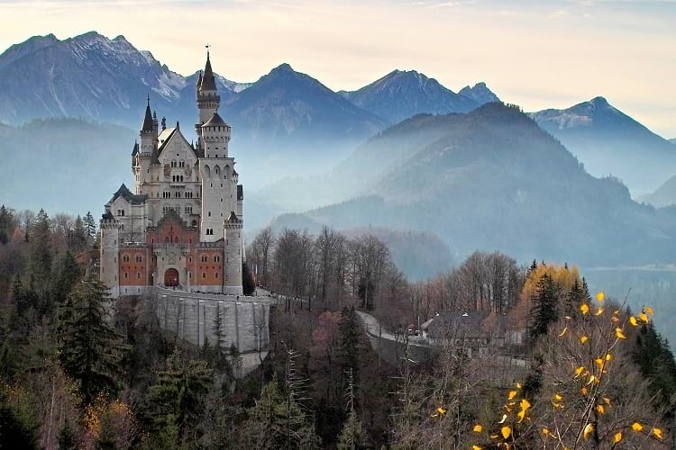
Neuschwanstein Castle. (Max Pixel)
An imposing Romanesque structure, Neuschwanstein Castle is one of Germany’s most well-known castles. It stands poised on a hill in the Alpine foothills in Bavaria, 120 kilometres to the south of Munich and above the small village of Hohenschwangau. Built as a private retreat in the 19th century by Ludwig II, the King of Bavaria, it looks like something straight out of a fairy tale. If you have seen Sleeping Beauty’s castle in the Walt Disney film, you will notice the similarity with Neuschwanstein Castle. It was the inspiration for the Disney version.
Ludwig II of Bavaria

Ludwig II of Bavaria. (Wikimedia Commons)
In the mainstream media, Ludwig II is often referred to as the Fairy King — for the fairy tale castle he built — and as the Mad King — a diagnosis made by a so-called doctor, who personally never examined him, and which is quite without merit and most certainly a political gambit on part of his opponents to dethrone him and seize power in Bavaria.
For someone who designed and built an enchanted castle, Ludwig II, unfortunately, did not live an enchanted life.
Growing up, he was not close to either of his parents. He was brought up almost entirely by servants and tutors, and it was a strict, even harsh upbringing. There was none of the personal freedom that most young boys of a similar age might take for granted. After all, he was the heir to the Bavarian throne, and he was never allowed to forget that.
In 1864, after the death of his father King Maximilian II, he ascended the throne of Bavaria. He was only 18 years old at the time, with a shy, reclusive personality that was entirely unsuited for the governing of a nation. He tried not to rock the boat by continuing his father’s policies, but he hated public gatherings and attending to court affairs. As much as possible, he took to avoiding these and began spending more and more of his time engaged in creative pursuits.
Four years after his coronation, in February 1868, Ludwig I died – that is, the new King’s grandfather and the former King of Bavaria, who had, years earlier, refused to become a constitutional monarch and had, therefore, stepped down in favour of his son. The former King’s death meant that the considerable sums of money that had, so far, been spent on his estate could now be diverted to other projects. Ludwig II decided to use the money to finance a private retreat that would exemplify the romantic Medieval architectural style.
Contrary to what some media sources reported, he never used public funds for Neuschwanstein Castle or any of his other building projects. Even so, his ministers were angered by his lavish spending on his personal projects and his lackadaisical participation in the country’s politics. He, however, remained popular with the Bavarian public.
The idea of Neuschwanstein castle
Ludwig II grew up in the family castle, Hohenschwangau Castle. Close by, higher up in the mountains, were the ruins of two medieval castles — Vorderhohenschwangau and Hinterhohenschwangau — that greatly fascinated the young Prince. He often went hiking to the ruins and made several sketches of them. The idea of building a castle here along the medieval lines came to him first during this time.
Later, after he became King, he was able to set this plan into motion.
In a letter to Richard Wagner – the great German musician whose magnificent operas Tannhauser and Lohengrin had also played a pivotal role in inspiring him to build the castle – the King expounded on the beautiful environs near Poliat Gorge. The natural scenery, he assured Wagner, possessed a grandeur that seemed straight out of the mythological realm of his operas.
Designing Neuschwanstein castle
Given his passion for Wagner’s operas, it wasn’t surprising that Ludwig II hired Christian Jank, a stage designer and scene painter, to come up with the designs for the proposed castle. He also hired Eduard Riedel, an architect, to render the architectural drawings. He himself remained involved in every step of designing Neuschwanstein Castle. He rejected designs inspired by the Nuremberg castle and asked that the designers look more toward the Wartburg Castle for inspiration. Furthermore, he demanded that the designers present him with detailed designs and insisted on approving every single design draft. His involvement and tight control on the design drafting process meant that it was eventually his own design that was finalized. The castle that was finally built was more his creation than that of the designers.

The front elevation of the castle. (Max Pixel)
The architecture of Neuschwanstein castle
Ludwig II strove for a medieval effect that was mixed with the latest technical innovations of the 19th century. The castle had flush toilets, advanced kitchen gadgets, and electricity.
While Neuschwanstein Castle is much admired for its combination of Romanesque, Gothic, and Byzantine architectural elements in present times, many of the leading Bavarian architects of the period looked upon it as kitsch.
The construction of Neuschwanstein castle
Neuschwanstein Castle took 14 years to build and, in this period, it provided steady employment to a large portion of the local population. The building work began in 1868 with the demolishment of the ruins of the two medieval castles. While Ludwig II had, earlier on, wanted to incorporate the two castle ruins into the new castle, it soon became clear that this could not be possible for structural reasons.
On 5 September 1869, the builders set the foundation stone and worked on finishing the castle cellar. It took them until 1872 to finish that and it was four years later, in 1876, when they completed the castle’s first floor and the gatehouse. While brick was used as the primary construction material, the castle façade was in rock, sandstone, and white limestone. In 1880, the builders held the castle’s topping out ceremony, and, two years afterwards, a portion of the castle was ready and furnished.

Neuschwanstein Castle during construction. (Johannes Bernhard)
Ludwig II moved into the furnished section of the castle in 1884 and kept an eye on the ongoing work. It wasn’t all a smooth progress. There were accidents in which workmen died and, also, the King had several differences with the builders and changed the overseer a couple of times. For instance, the work began under Eduard Riedel, but the King replaced him with Georg von Dollmann in 1874, and, later, he replaced Dollman with Julius Hoffman.
Interesting aspects of Neuschwanstein castle
At the time Ludwig II moved in, only 14 rooms in the castle were completed and furnished. These included his personal suite on the first floor, the Throne Room, the Singer’s Hall, and the Grotto. All these rooms are decorated with elements from Wagner’s operas.
The finished castle is an asymmetrical, elongated building with towers, balconies, turrets, gables, and roof cornices with pinnacles. The gate building facing the east has a red brick facade and the portions facing the court have yellow limestone facades. There is a moat as would befit a real German Knight’s castle, but the castle fortifications are mostly decorative. There was to be a massive keep in the upper courtyard, but only its foundation was built and the rest of it remained unbuilt upon the King’s death.

Neuschwanstein Castle from another angle. (Rob Faulkner / Flickr)
Death of Ludwig II
In 1886, Ludwig II was arrested in his bedroom at night and taken away forcibly in a carriage to Berg Castle. The next afternoon, he and Dr. Bernhard von Gudden, who had arrested him, went for a stroll on the shores of Lake Starnberg. When they didn’t return, the guards went to look for them and found both men dead in waist-deep water. They both appeared to have been strangled.
To this day, nobody knows exactly what happened, although there are many theories. The most popular one is that the King had arranged an escape with some royalist supporters and this, unfortunately, was foiled. The King’s cousin later reminisced about him and said he was eccentric, not mad, and he should not have been treated the way he was.
He was able to spend only 11 nights in his beloved castle.
Visiting Neuschwanstein castle
You can visit Neuschwanstein Castle throughout the year. In fact, you ought to see it in different seasons to get an idea of how beautiful it looks against the changing landscape. Plenty of people have the same idea, however, so expect a crowd when you visit.
Neuschwanstein Castle allows visitors only as part of a group, and you can choose if it is to be a small group or a large one. The guided tours start from Munich and generally last an entire day. In addition to seeing the grand interior of the castle, you can take in the picturesque landscape and the breath-taking panorama of the Alps.
Enjoyed this article? Also, check out “Hochosterwitz Castle: The Medieval Castle in Austria That Remained Impregnable from Enemy Attacks“.
Fact Analysis:
STSTW Media strives to deliver accurate information through careful research. However, things can go wrong. If you find the above article inaccurate or biased, please let us know at [email protected].
RELATED
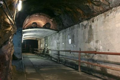 February 23, 2019 Project Riese: Hitler’s Shadowy Incomplete Underground Complex that Remains a Mystery
 September 13, 2019 Osamu Tezuka: The Walt Disney of Japan
- March 14, 2019 Hochosterwitz Castle: The Medieval Castle in Austria That Remained Impregnable from Enemy Attacks
 August 3, 2019 Ivan the Terrible: The First Tsar of Russia and His Reign of Terror
The post Neuschwanstein Castle: The Story Behind the Iconic Bavarian Castle That Inspired the Disney Castle appeared first on .
]]>The post Incredible Ta Prohm: The Ancient Khmer Temple in Cambodia appeared first on .
]]>
Temple in Ta Prohm. (© CEphoto, Uwe Aranas / CC-BY-SA-3.0)
One of the most iconic photographs to emerge from Cambodia is that of an ancient temple with huge tree roots draped over it. This is Ta Prohm. In the Khmer language, Ta Prohm means Ancestor Brahma or Eye of Brahma. Dedicated to the mother of the powerful Khmer king, Jayavarman VII, the Ta Prohm temple is in Angkor in the Siem Reap province of Cambodia.
Jayavarman VII, builder of the Ta Prohm temple
Around 1181 A.D., Jayavarman VII (1120-1218) ascended the throne of the Khmer Empire and soon established himself as the most powerful monarch of the dynasty. He ruled for 37 years and was a strict adherent of the Mahayana Buddhist faith. After successfully repulsing the attacks by the Vietnamese Chăm Pa Kingdom between 1171 and 1181, Jayavarman VII began rebuilding his war-ravaged capital Angkor. He embarked on an intensive construction program to erect public buildings and religious monuments that would benefit his subjects.
He built the walled city of Angkor Thom near the ruins of the ancient capital Yaśodharapura and included some of the extant buildings of the earlier period into his palace complex. Amongst the other buildings, he constructed was a Mahayana Buddhist monastery and university to the east of Angkor Thom. The temple of Ta Prohm was consecrated in 1186 and the temple of Preah Khan was consecrated in 1191 to honor his mother Queen Sri Jayarajacudamani and his father King Dharanindravarman II, respectively.

Ta Phrom, Angkor. (Diego Delso / CC-BY-SA-4.0)

Nature taking over the Temple in Ta Prohm. (Diego Delso / CC-BY-SA-4.0)
At this time, Ta Prohm was known as Rajavihara, meaning monastery of the king. For over three centuries, the Khmer rulers continuously added to and expanded the temple complex. The site was a lively cultural centre. Various steles inscribed with Sanskrit inscriptions provide information about life at Ta Prohm temple. Along the date of the temple’s consecration in 1186, the steles detail its inhabitants. Around 12,640 people lived in the temple, including 18 priests, 615 dancers, 2740 officials, and 2202 assistants. There was also a staff of 79,365 to maintain the temple complex.
Towards the end of the 15th century, the Khmer Empire collapsed from a combination of different factors such as internal discord, the rise of Shaivism and Theravada Buddhism, wars with the Thai kings of the Ayutthaya Kingdom, collapse of commerce, neglect of public works, ecological disasters such as flooding, and the plague. Angkor and its temples, except for Angkor Wat, were abandoned. The surrounding jungle soon reclaimed Ta Prohm. Green moss began to creep over the stone walls. Strangler fig, kapok or silk-cotton, banyan, and other trees extended their roots and spread their branches throughout the temple complex.

Roots of Tetrameles nudiflora around the entrance of the temple. (Diego Delso / CC-BY-SA-4.0)
Restoration of the Ta Prohm temple
Ta Prohm was not completely forgotten, of course. Curious locals and intrepid explorers continued visiting it. At the end of the 19th century, the French explorer and artist, Louis Delaporte, popularised Angkor with his illustrations of Khmer architecture and art. This inspired French archaeologists to attempt to restore the magnificent monuments of Angkor. At the beginning of the 20th century, the École Française d’Extrême-Orient led the efforts to conserve and restore the temples of Angkor. They found the intertwined stone and tree structures of Ta Prohm picturesque and decided to leave them as they were.
It was necessary, however, to carry out some restoration work to strengthen the foundations and stop further deterioration of the ruins. To protect the area from waterlogging, they also installed drains.
The Archaeological Survey of India, in partnership with APSARA (Authority for the Protection and Management of Angkor and the Region of Siem Reap), has reconstructed some parts of the temple complex. They cleared paths through the jungle to allow entry from the west side and exit from the east. Some areas of the temple are scattered with the remains of sculptures and balustrades and are impassable. Wooden walkways and platforms with roped railings were installed in the accessible areas to limit damage from visitors.

Ta Prohm, Cambodia. (Diego Delso / CC-BY-SA-4.0)
The architecture of the Ta Prohm temple
Ta Prohm’s architecture is in a flat Khmer style, and the entire temple was built without the use of any type of mortar. The temple complex is set closer to the western side of the enclosure wall and faces towards the east. All the low temple buildings stand on one level. The temple has a central sanctuary which contains the stone statue of the main deity, Prajnaparamita, the personification of wisdom. This deity was supposedly modelled after the king’s mother. The central sanctuary is surrounded by five enclosures that get progressively larger. The outermost enclosure has dimensions measuring 1,959 by 3,281 feet.
There are 260 lesser deities housed in sanctuaries surrounding the central one. The tower of the central sanctuary forms the centre of a quincunx with the corner towers of the first enclosure. The first, second, and third enclosures have galleries. In the third enclosure, there are two temples; the one in the northern side is dedicated to the king’s guru, Jayamangalartha, and, the one in the southern side, to the king’s elder brother. There were moats on both sides of the fourth enclosure. The fifth enclosure is said to have been the site of a town which housed thousands of people who managed and maintained the temple.
In the 13th century, the Khmer rulers enhanced the gopuras – that is, the ornate entrance towers at each of the four sides – with face towers like those at the Bayon temple. The gopuras of all the enclosures are connected by passages leading to the central sanctuary. Most of the buildings in the inner enclosures were later additions. These include dance halls and libraries.
Not many of the stone carvings and bas reliefs at Ta Prohm have survived to this day. The successors of Jayavarman VII did not share his belief in Mahayana Buddhism and had no interest in preserving the artwork at Ta Prohm. Jayavarman VIII, in particular, was notorious for destroying Buddhist relics created during the reign of his predecessors.
Some of the bas reliefs depicting scenes from Buddhist mythology can still be seen on the temple walls. One such scene shows Prince Siddhartha, who eventually became known as the Buddha, departing from his father’s palace to lead a life of asceticism. There are also some remains of stone carvings of female deities, meditating monks, temple guardians, and apsara dancers. Images of the Buddha can be seen in niches along the inner wall of the passage leading to the first enclosure.
The king ordered the construction of 566 clusters of stone houses, 286 brick houses, and 3,140 villages. The details of the temple’s wealth are also impressive. There were 500 kilograms of golden dishes, 35 diamonds, 40,620 pearls, 4,540 precious stones, 876 veils from China, 512 silk beds, and 523 parasols. Some people speculate that this information may have been vastly exaggerated to glorify the king.
The Stegosaurus of Ta Prohm
One rather intriguing thing at Ta Prohm is a wall carving of a Stegosaurus. At least, it looks very much like a Stegosaurus, and that has led quite a few people to conclude that perhaps the stone carver might have seen one alive in the 1180s or earlier. This is a strange logic, as there are also representations of mythical creatures on the temple walls and nobody has yet suggested that the stone carvers saw those live as well. In any case, the carving might very well be that of a rhinoceros or a chameleon.

Carving of an alleged dinosaur at Ta Prohm Temple. (Harald Hoyer / Flickr)
Ta Prohm, the World Heritage Site
UNESCO listed Ta Prohm as a World Heritage site in 1992. Ta Prohm remains one of the most popular temples in Angkor. Visitors are left mesmerised and awestruck by its serene beauty, especially in the early morning light. They are more fascinated by the sight of the majestic Spung trees that continue growing as one with the stone ruins, and this photogenic scenery is the main attraction of this temple.
Enjoyed this article? Also, check out “Batu Caves of Malayasia – The Largest Shrine to Lord Murugan Outside India“.
Fact Analysis:
STSTW Media strives to deliver accurate information through careful research. However, things can go wrong. If you find the above article inaccurate or biased, please let us know at [email protected].
RELATED
- May 12, 2019 Cambodia’s Magnificent Angkor Wat: One of the Largest Religious Monuments in the World
- September 21, 2019 Batu Caves of Malayasia – The Largest Shrine to Lord Murugan Outside India
- June 14, 2019 Padmanabhaswamy Temple: The Richest Temple in the World with Gold Worth $22 Billion in Six Vaults
- July 17, 2019 The Lonar Lake: An Astronomical Marvel
The post Incredible Ta Prohm: The Ancient Khmer Temple in Cambodia appeared first on .
]]>The post Verkhoyansk: Sitting on Permafrost with a Temperature Range of 105 Degrees Celsius appeared first on .
]]>
Verkhoyansk. (Becker0804 / Wikimedia Commons)
Mother Russia, as the nation is colloquially called, is known for its many extremes. Falling right under the Earth’s North Pole, with a majority of its northern areas in the Arctic Circle, Russia experiences extremely cold temperatures throughout the year. Two of the populated places ever to go on record as the coldest in the world are Oymyakon and Verkhoyansk, both in Russia, where bone-chilling winter temperatures make it almost unfit for human occupation. But what sets Verkhoyansk apart is the extreme temperature difference of 105 degrees Celsius that the town experiences between the summers and winter months.
Brief history of Verkhoyansk
Verkhoyansk was founded by the Cossacks or Ukrainian Kazaks (meaning adventurer in Slavic language), which were a group of travelling, Slavic-speaking people, who were the first ones to set foot in Siberia in the mid 1600s. In the year 1638, just a year prior to Russia’s Siberian occupation, the Cossacks built a small, wooden, military fort in the northern areas, a little further from Yakutsk, which was manned on several occasions. They named this fort “Verkhoyansky”, which in the Russian language meant “the town on Upper Yana”. They colonized most parts of northern Siberia and Russia and along with it, the parts of Verkhoyansk, as we know it today.
Later in 1937, when geologists found gold and other minerals buried deep in the frozen lands, it became a tactic to punish the enemies of the state. When Joseph Stalin’s governance was at its peak in the Soviet Union, many political prisoners were sent to forced-labour camps to extract precious minerals from frozen underground mines. These labour camps were (and still continue to be) known as gulag. Verkhoyansk was one of the major labour campsites, where political prisoners were exiled to bear the harsh weathers as part of their punishment.
Geographical location and topography of Verkhoyansk
Verkhoyansk belongs in the Sakha Republic of Russia and is a part of the Verkhoyansky District. It lies further north from Yakutsk, the capital of Sakha Republic. As its name suggests, it is situated on the upper reaches of the Yana River, which flows through this area. The town of Verkhoyansk falls in the Arctic Circle, which is an imaginary line, far northwards and parallel to the Earth’s Equator in the Arctic region.
In the Arctic Circle and also in the regions that fall in it, the sun doesn’t rise or set for one entire day in the months of December and June respectively. Verkhoyansk, being a part of this area, is subjected to the same kind of extremes. With a winter temperature recorded at minus 67 degrees Celsius and a summer temperature recorded at 38 degrees Celsius, Verkhoyansk is the only place in the world to ever have such a highest temperature range.

Verkhoyansk Range, Yakutia. (Ilya Varlamov / Wikimedia Commons)
A memorial called The Pole of Cold welcomes people into Verkhoyansk. Considered to be the coldest (along with Oymyakon), where the lowest temperatures have been recorded to date, Verkhoyansk twice had a record low temperature of 67 degrees Celsius below zero (although fluctuating between minus 60 and minus 67) in the years 1885 and 1892. Verkhoyansk is also a part of the Frigid Zone, where temperatures can abnormally fall below the regular range during the already harsh winter months. Scientists studying the area say that more than half of Russia sits on permafrost and some places in Siberia, including Verkhoyansk, can have frozen grounds as deep as 1500 metres below the surface. While Oymyakon fights it out with Verkhoyansk for being the coldest inhabited place in the world, Verkhoyansk has a special Guinness record to its credit.
Life of people in Verkhoyansk
With a handful of people living in the extreme weather, the 2010 Census recorded a population of approximately 1300 in Verkhoyansk. Descendents of political prisoners from the Soviet era, along with a few Yakut hunters, make up Verkhoyansk’s total population. Along with the town of Oymyakon, Verkhoyansk is one of the coldest places on earth to still remain inhabited despite being in a state of permafrost.
Modern technology is of no use in this harsh climate and so people rely on experience to beat the chills. At minus 67 degrees Celsius, there is absolutely no humidity in the air, which causes any water vapour particles to sublime into ice dust. This is also one of the reasons why there is continuous thirst in the region, causing coughs. Locals mostly suffer from pneumonia and bronchitis and other breathing-related disorders.
The temperatures are so low that metals can break easily and cables can become so frozen that they can snap on their own. Writing ink freezes the moment it oozes out of nibs, while dry cells do not last for more than a few minutes. Another major problem that people in Verkhoyansk face is a proper burial site for their dead. The frozen ground is difficult to dig and so fires are lit and coals are burnt in them, which in turn, melt the ground below them. The process, which may take roughly three days, is repeated until a grave is ready to bury a corpse.
A cellular tower dots the frosty landscape in the town, which allows people to access the Internet on a regular basis. Running water, supplied in pipelines at a very high speed to prevent the pipes from freezing solid, is not potable. As a result, drinking water is quite a rarity in the area. People cut huge blocks of ice from the rivers, which is later thawed and used for drinking. Many buildings lay abandoned, for people have moved to cities in search of a better future. Local people mainly commute on foot, wearing thick furs, obtained from Yakut horses that are commonly found in this area. Those that can afford motor cars, keep it running all day, for fear of vehicles breaking down until winter is over. People rely on the small Yakut horses for its meat and also eat fish from the frozen rivers.

The now abandoned old airport of Verkhoyansk. (Becker0804 / Wikimedia Commons)
Verkhoyansk has a small airport, which connects the main city of Yakutsk to this tiny, frozen and dry town. A river port brings in supplies for people as and when needed. Airline tickets in Verkhoyansk cost a bomb and many locals prefer to stay in the town itself, although the younger crop now has aspirations for a better city life.
Though life is not so good in the small town of Verkhoyansk, frozen at 67 degrees Celsius below zero during the winter; a hot summer day at 38 degrees Celsius is no relief either. Fighting an extreme temperature range that is nowhere experienced in the world, Verkhoyansk still continues to move on in the ice-covered land at a very, very sluggish pace.
Fact Analysis:
STSTW Media strives to deliver accurate information through careful research. However, things can go wrong. If you find the above article inaccurate or biased, please let us know at [email protected].
RELATED
 April 11, 2019 Znamya Satellite: Russia’s Space Mirror Deflects Sunlight to Light up Arctic Region for Brief Period
 July 11, 2018 Life Inside Oymyakon, Where Eyelashes Freeze
 June 28, 2018 Simo Hayha: World’s Deadliest Sniper with 505 Confirmed Kills
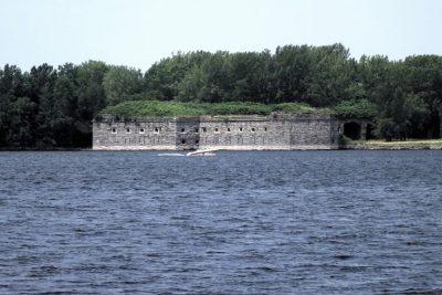 March 28, 2019 Fort Montgomery: When North America Made a ‘Monumental’ Mistake on the Other Side of the Border
The post Verkhoyansk: Sitting on Permafrost with a Temperature Range of 105 Degrees Celsius appeared first on .
]]>The post Pere Lachaise Cemetery: Celebrated Parisian Cemetery, Where Millions Visit to Pay Homage appeared first on .
]]>
Pere Lachaise Cemetery. (Pierre-Yves Beaudouin / Wikimedia Commons)
The French Military Leader and Emperor, Napoleon Bonaparte, was also a visionary and social reformer. By a decree: “every citizen has a right to be buried regardless of race or religion”, he overruled the law that forbade cemeteries in the town area. That made way for Pere Lachaise, the iconic burial ground in Paris. Though Napoleon himself was buried at a different place, this cemetery became a sought after site for the last-rites. Iconic personalities, including the noted writer Oscar Wilde, rest here in peace as people worldwide come here to pay their respect and revel in a memorable outing.

The main entrance of the cemetery. (Coyau / Wikimedia Commons)
A tourist destination of world fame
The Pere Lachaise Cemetery is now a tourist destination of world fame. Its name is derived from the confessor of Louise XIV, a Jesuit priest, called le Pere La Chaise (full name Father François de La Chaise d’Aix). The priest was in possession of this land (called Mont-Louise) in the 17th century. The land was acquired by the city of Paris in 1804.

Cemetery of le Pere Lachaise. (Jorge Royan / Wikimedia Commons)
The cemetery clearly had an eventful past, beginning with King Louis XIV (beheaded in French revolution in 1793). The king had passed orders for all cemeteries in France to be shifted out of the city. His Highness felt that graveyard released foul smell and hence shouldn’t exist in open ground. Following his orders, 4183 graves were dug out amid chanting of prayers by the Catholic Priests and shifted to an underground cemetery (Catacomb). Over 6 million dead bodies were laid to rest in the new arrangement of the catacomb system. The metaphor of corpse turning in their graves, literally, saw the light of the day.
French Revolution (1789-99) did upset the catacomb project, but it was back on rails in the reign of Napoleon Bonaparte. The first municipal cemetery of Paris, Pere Lachaise, opened to people of all faiths by a ruling of Napoleon Bonaparte in 1804. The ground is spread with greenery, with 4134 trees dotting the land. Wide-ranging Flora and fauna add to its natural beauty.

A memorial to the dead at Pere Lachaise Cemetery. (JLPC / Wikimedia Commons)
Shifting graves to a new location was a masterstroke
In the beginning, people were chary of using Pere Lachaise, accustomed as they were to the facility within the city. However, in a surprising state move, remains of the famous writer Jean de La Fontaine and the playwright Moliere were exhumed from catacomb and re-buried at Pere Lachaise. Along with them, the remains of the 12th-century lovers, Abelard and Heloise (Romeo and Juliet of France) were also re-interred. The strategy paid off. People not only flocked to visit the tombs of their idols but also bought plots there, for self and family.
Final repose for a million departed
Pere Lachaise is a 44-hectare cemetery where close to a million people rest-in-peace. The list includes the rich and the famous. The composer Chopin, the dancer Isadora Duncan, the painter Pissarro, the actor Simone Signoret, the writer Oscar Wild, the poet Apollinaire, the playwright Moliere and the list goes on and on. There is mass grave too, of insurgents done to death by the government forces, and buried en masse in May 1871.
Abuse of tombs by visitors at Pere Lachaise Cemetery
A visit to graves is not necessarily all solemn and serious affair. People get physical with it. Like a barrage of kisses leaving a lipstick mark on the grave of Oscar Wild. Graffiti is also made by the fans and admirers of the late prodigies. The grave of rock singer Jim Morrison (1943-71) became a spot for drug and sex revelry by the singer’s fans. Cemetery’s conservation office was forced to move in for damage control and issue warnings. Another case of besmirching involved tomb of a young journalist, Victor Noir (1848-70), shot dead by Pierre Bonaparte, the nephew of Napoleon Bonaparte. Legend has it that scratching the groin of Noir’s bronze statue ensured fulfilling sex and pregnancy. The idea took off to a level that threatened the shape and substance of the statue.
A place for mortal remains and urn ashes comes at a price
Famed world over as a privileged place for the last rites, acquiring a plot for burial in Pere Lachaise isn’t easy. You must be a domicile of Paris or own a plot there. Mortal remains can be dug up and moved to in-house godown (ossuary) if the lease time of the plot expires, or the plot gets decrepit. To obviate such a possibility, ‘perpetuity’ is the preferred option. Other options are for 10, 30 and 50-year lease. The prize of the plot depends on its size and the duration of the lease. A 2 square meters plot for perpetuity (eternity) costs a princely 16,000 Euros which is roughly 12.5 lakhs in Indian Rupees. The ashes of the diseased (funeral urns) are stored in the underground as well as overground ash-condo (Columbarium). This facility too comes at a price. Urns can be stored in a niche (vault in Columbarium) for 50 years at a price of 2,466 Euros, plus the taxes and administrative fees. A simpler arrangement of last rites is Memory Garden (Jardine de Souvenir), in the east of the cemetery. Here the cremated remains are ceremoniously scattered; eternal rest at low cost.

Père Lachaise Cemetery. (pxhere)
Outing mandates respect for the dead
The Pere Lachaise Cemetery is open to visitors all 365 days a year. Carrying of the pets and edibles are not permitted. As funerals are a daily routine, visitors are advised to show respect to the dead and empathise with their grieving relatives.
Fact Analysis:
STSTW Media strives to deliver accurate information through careful research. However, things can go wrong. If you find the above article inaccurate or biased, please let us know at [email protected].
RELATED
- November 14, 2018 Highgate Cemetery: Cemetery Turned Nature Reserve
- January 22, 2019 Ämari Pilots’ Cemetery: Where Aircraft Tail Fins Adorn Soviet Pilots’ Tombstones
- June 5, 2019 Wadi-us-Salaam: The World’s Biggest Necropolis that Houses More than Five Million Graves
- May 26, 2019 Neptune Memorial Reef: An Eco-Friendly Underwater Graveyard Off the Florida Coast
The post Pere Lachaise Cemetery: Celebrated Parisian Cemetery, Where Millions Visit to Pay Homage appeared first on .
]]>The post Sedlec Ossuary: The Famous Bone Church of Kutná Hora in the Czech Republic appeared first on .
]]>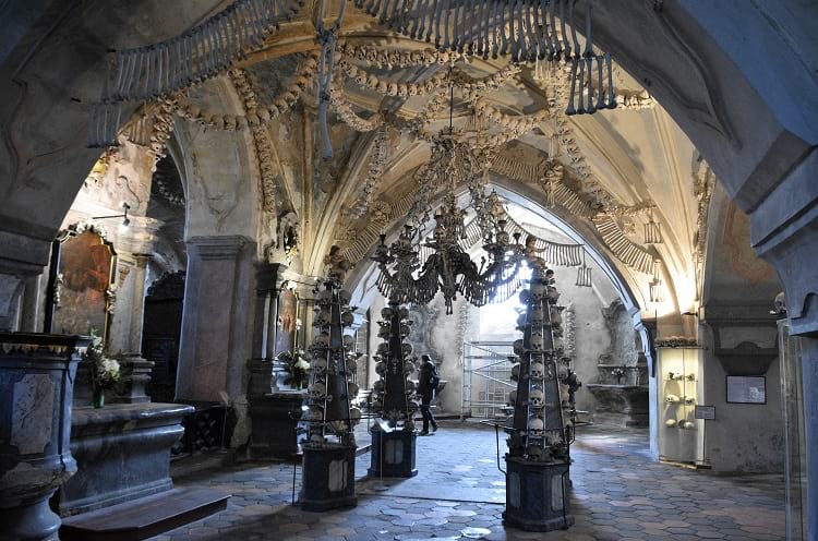
Inside Sedlec Ossuary. (Richard Mortel / Flickr)
Imagine walking into a Church and finding the interior decorated with human skulls and bones. It sounds like something right out of a horror film, but, actually, there is such a church in Kutná Hora in the Czech Republic. It is called the Bone Church, otherwise known as the Sedlec Ossuary. The Roman Catholic chapel contains bones from around 70,000 skeletons and these bones have been decoratively arranged for maximum aesthetic effect.
Is the result macabre? Strangely enough, no. Most visitors remark that the Sedlec Ossuary has a very tranquil atmosphere. It remains a holy place of worship and, even with the displayed human bones, visitors don’t generally appear to experience any feeling of unease.

Sedlec Ossuary. (Ray Schauweker / Flickr)
The Sedlec Ossuary
Sedlec is a suburb of the Czech town Kutná Hora, and it was once the site of the Sedlec Abbey. The Cemetery Church of All Saints was once part of this former Abbey. Underneath this Church is the Roman Catholic chapel that is widely known as the Sedlec Ossuary or the Bone Church. Constructed in a medieval High Gothic style, the Church has a vaulted roof and three towers. When you step into the chapel underneath, you realize what a really unique place it is.
The interior of the chapel is decorated in an artistic way with human bones. The two artworks that will immediately catch your eye are the Chandelier of Bones and the Schwarzenberg family’s Coat of Arms. Both are large and prominent and made entirely of bones. The Chandelier of Bone is supposed to contain every single bone that is present in the human body. This Chandelier hangs in the chapel’s center.
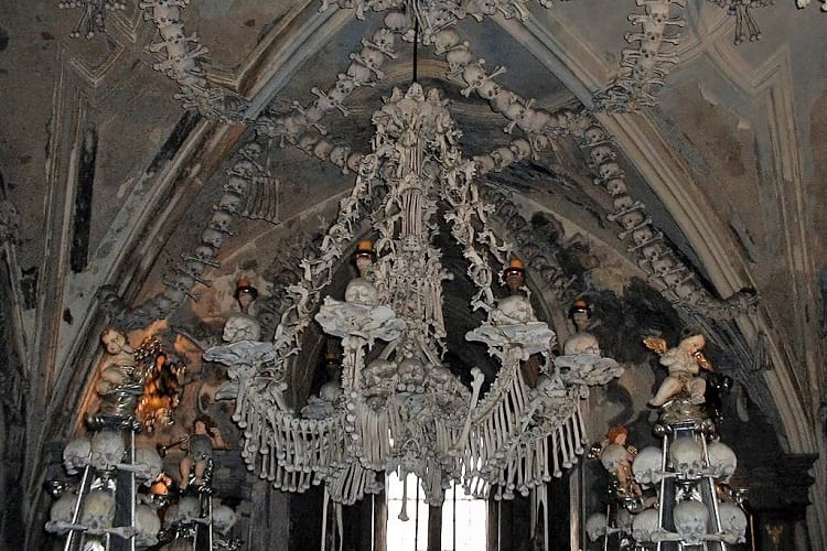
A chandelier made entirely of human bones at Sedlec Ossuary. (Ray Schauweker / Flickr)
How did the bones end up in the church?
In 1142, a Cistercian Monastery was established in Sedlec. The monks that came to reside in this Monastery undertook the work of maintaining and cultivating the lands around the Monastery. In 1278, Bohemia’s King Otakar II asked the Abbot of Sedlec, Henry, to go on a pilgrimage to Jerusalem in Palestine.
When the Abbot returned from his pilgrimage, he brought with him some of the holy earth from Golgotha, the site where Jesus Christ was crucified. The Abbot sprinkled some of this earth all over the cemetery of Sedlec Abbey to consecrate the ground.
As soon as the word of this act got around, people started arriving at the Abbey with their sick, dying, and dead relatives. They wanted them buried in the now consecrated ground. The cemetery of Sedlec Abbey suddenly became Central Europe’s most sought-after burial place.
Two catastrophic events sweeping through Europe – the Black Death of the mid-14th century and the Hussite Wars in the early 15th century – caused the Sedlec Abbey cemetery to receive thousands of bodies for burial and it became necessary to enlarge the cemetery.
According to historical records, at least 30,000 people died in Sedlec from the plague and were buried in the cemetery. Most of the people were buried in mass graves as, given the high death rates at the time and the necessity of disposing of the bodies quickly before they spread the dreaded disease further, it was not possible to dig individual graves for everyone.
Around 10,000 people died and were buried in the Sedlec cemetery during the Hussite Wars. Kutná Hora fell to the Hussite army in 1421, and the Hussites attacked the Sedlec Abbey, plundered the Cistercian Monastery, burned both the Monastery and the Cathedral, and despoiled the cemetery.
The Gothic Church, with an upper vaulted level and a chapel on the lower level, was built around 1400 in the central part of the cemetery. During the construction of this Church, many of the mass graves were disturbed. The bones that were unearthed in the process were collected and stored in the chapel. Later, when old graves were dug up and their contents removed to make way for new burials, the recovered bones were also stored in the chapel.
According to local lore, in the early 16th century, a half-blind monk was put in charge of exhuming bones and arranging them decoratively in the chapel, and, after completing the task, his vision was restored.

The decoration inside Sedlec Ossuary. (Deror_avi / Wikimedia Commons)
The Church of All Saints underwent some major renovation and rebuilding in the early part of the 18th century, with the architect Jan Blažej Santini-Aichel infusing a Baroque Gothic style into the completely rebuilt upper chapel.
In 1783, the Holy Roman Emperor, Joseph II, abolished the Sedlec Monastery. The Schwarzenberg family of Orlikthen bought the property and paid for the continued maintenance of the Sedlec Ossuary. In 1870, the Schwarzenberg family hired FrantišekRint, a woodcarver from Česká Skalice, to rearrange and redecorate the bones in the lower chapel. The great Chandelier of Bones, as well as the Coat of Arms, are both his handiworks. He signed his name on one of the bones and this bone can now be seen by visitors near the chapel’s entrance. No other information about him is available in any historical records.
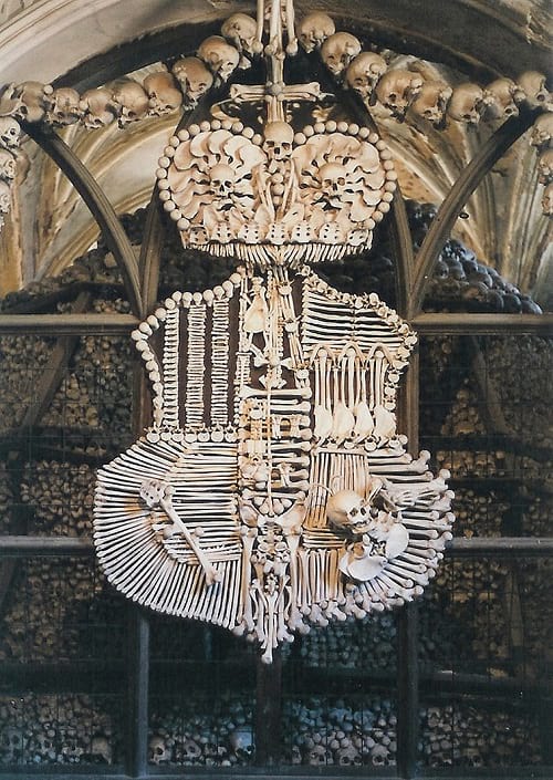
Coat of arms of Schwarzenberg family. (word_virus / Wikimedia Commons)
Visiting the Sedlec Ossuary
Kutná Hora is some 70 km from the Czech Republic’s capital Prague and about an hour away by train. It is a very small town now, but, in the medieval times, when it had working silver mines, it was well-populated and was considered the region’s second largest city.
From the train station, on your arrival from Prague, you can take a local train to Sedlec. You can also go by local bus, tourist bus, minivan, or taxi. If you walk from Kutná Hora town center, it takes about 45 minutes to reach Sedlec. Given the ready availability of local transport, however, you won’t need to walk all the way unless you absolutely need to.
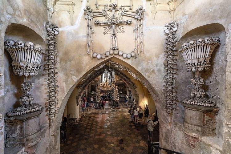
The entrance of Sedlec Ossuary. (Thomas Ledl / Wikimedia Commons)
The Sedlec Ossuary charges a small entry fee and has different opening hours throughout the year. You can visit between 8 a.m. to 6 p.m. from April to September and from 9 a.m. to 5 p.m. October through March. In winter, from November to February, visiting hours are 9 a.m. to 4 p.m. During Christmas, the Sedlec Ossuary remains closed for visitors.
If you want to take back a souvenir of your visit, the gift shop sells several interesting bone-related items, including a plaster human skull.
Enjoyed this article? Also, check out “Church of the Dead: Home to the Peculiar Mummies of Provincial Italy“.
Fact Analysis:
STSTW Media strives to deliver accurate information through careful research. However, things can go wrong. If you find the above article inaccurate or biased, please let us know at [email protected].
RELATED
 June 16, 2019 Church of the Dead: Home to the Peculiar Mummies of Provincial Italy
- March 22, 2019 Sagrada Familia: An Unfinished, Colossal Spanish Basilica, Under Construction for More than 136 Years
- December 30, 2018 Lake Reschen: Italy’s Submerged Lake Reschen
- January 22, 2019 Ämari Pilots’ Cemetery: Where Aircraft Tail Fins Adorn Soviet Pilots’ Tombstones
The post Sedlec Ossuary: The Famous Bone Church of Kutná Hora in the Czech Republic appeared first on .
]]>The post Thilafushi: The Good, Bad and Ugly of the Garbage Island of Maldives appeared first on .
]]>
Aerial photo of Thilafushi. (Ibrahim Asad / Panoramio)
Any short term solutions can create a gigantic problem later on. This happened with Maldives, seeking disposal of litter created by the visiting tourists. The trash was dumped on Thilafushi Island, a convenient riddance. This garbage dumping island of Maldives is also known as ‘The Rubbish Island’.
In time, the garbage mounted to 330 tons per day, and the island soon became the world’s largest rubbish dump. The blue lagoon of Thilafushi was reduced to stinking garbage. Burning/Processing of the waste polluted the ecosystem of an island renowned as ‘Tropical Paradise’.

A worker carrying rubbish inside the island. (Dying Regime / Flickr)
Began as garbage bin of the capital of Maldives
Thilafushi, the Trash Island, is a short distance from Male’, the capital city of Maldives. A creation of throwaways from the visiting tourists, a blemish on the scenic beauty of the island, it began as a dumping ground for Male’s municipal waste. Male’ has a lakh of people living in an about two square kilometre space, making it world’s topmost human-density. Hence, the waste output is in top order.
In spite of environmental pollution by junk, tourism thrives
The heaps of garbage are transported to Thilafushi by ship. Offloaded junk is first sorted manually. A part of it is burned away and part is buried in the ground. The electronic and hazardous wastes are a part of the garbage, much to the worry of environmentalists. Asbestos, lead and spent batteries contaminate water and thereby harm ecology and human health.

Dumping ground at Thilafushi. (Dying Regime / Flickr)
The tourists don’t seem to mind the junk. Empathising comments bear this out. Like, litter after all is contained and not dumped in the ocean, what else can a nation, barely 1% above sea level, do to parry junk? Many find the dump a creative way of waste disposal. The Maldives, therefore, continues to be a popular destination among the tourists.
Waste has jacked up usable land area
All waste from Kaafu atoll (the islands constituting the administrative block of Maldives) and resorts across the Maldives, is pooled up at Thilafushi. The plastic and metal from the junk is recycled. Waste from construction work is spread out in the shallow sea water to increase the land area of the island. Garbage thus converted to land is rented out to industries. That’s quite a gain as otherwise the industries would encroach on the meagre living space available to the local inhabitants.

Trash being offloaded at the island. (Shafiu Hussain / Flickr)
Tourism and trash are mutually reinforcing
A chain of factories, shelter for hundreds of Bangladeshi migrants who process junk to make a living and an unending stream of garbage; all these add up to increase the land area of Thilafushi by a square meter a day. Maldives reaps gold from tourism ($4,500 GDP per head), and every tourist generates 3.5 kg of junk per day. The wealth created by tourism though isn’t uniformly spent on public welfare. A big chunk of it is spent on huge quantities of edibles and petro diesel imported for the tourists. That incidentally augments the garbage load which, lately, is being shoved to India. The ships which bring vegetable from India, take junk material along on return journey. This junk is then processed and sold in India.
State government finally banned the use of Thilafushi as a dust bin
The Government of Maldives was sieged of the waste problem since long. The problem became all the more vexing in view of the climate change. Sea level is rising because of global warming and the Maldives faces a real threat of getting engulfed by the sea. The State finally ruled against the pooling of junk at Thilafushi. The illegal dumping of waste directly into the sea which was going on earlier also came to an end. Unfortunately, the trash now finds way to Indian shores.
The garbage island has inspired eco-friendly movement
On a positive note, the drive against junk is here to stay. Mohamed Nasheed, the President of Maldives, held an underwater meeting in 2009 to highlight the perceived threat of Global Warming. A contract was signed with Tatva Renewable Energy, India, to recycle garbage, and use it as a source of energy. The contract was cancelled following a political turmoil in the Maldives, but the baton was picked up by tourist resorts.
Kurumba Resort has reduced its garbage output by 70% with innovative waste management. The Reethi Rah resort has its own solar power and trash recycling system. The visitors to this resort enjoy a guided tour of the recycling facility. Club Med’s Finolhu resort is also solar-powered, and a zero-waste unit.
Enjoyed this article? Also, check out “The Lonely House on Ellidaey Island, Where Nobody is Sure of its Residents“.
Fact Analysis:
STSTW Media strives to deliver accurate information through careful research. However, things can go wrong. If you find the above article inaccurate or biased, please let us know at [email protected].
RELATED
- January 31, 2019 The Lonely House on Ellidaey Island, Where Nobody is Sure of its Residents
 May 15, 2020 Assateague Island and Its Feral Horses
- January 26, 2019 Astana: An Ultra Modern Capital City Right in the Middle of Vast Empty Grasslands
- July 23, 2018 Nauru: An 8 Square Mile Island That was Once the World’s Richest Country
The post Thilafushi: The Good, Bad and Ugly of the Garbage Island of Maldives appeared first on .
]]>The post Monowi, Nebraska: A Village in Boyd County, United States with a Population of One appeared first on .
]]>
Monowi sign (right) and Elsie Eiler the mayor of the village (right). (marco antonio torres / Flickr)
Imagine living in a village in which you are the sole inhabitant. That makes you the soul of your community. The life of the neighbourhood. You don’t have anyone to talk to, but that’s okay. You don’t have the time to be lonely, considering that you’re running everything in the village yourself.
While that may sound like a tall tale, there is actually such a person and such a village on this planet. To be precise, the village is in the US state of Nebraska and is called Monowi. It has a population of one.
Monowi, Nebraska
According to the 2010 census, Monowi village has the distinction of being the only incorporated municipality in the country to have only one resident. There are other places in the US where there is a population of one – PhinDeli Town Buford in Wyoming and Hibberts Gore in Maine – but they are unincorporated. In recent years, a population of one have been recorded in Rochefourchat in France, Jordan River in Canada, Villa Epecuen in Argentina, Tomioka in Japan, and Cass in New Zealand.
History of Monowi
Monowi is located between the Niobrara and Missouri rivers and occupies 0.54 square kilometres of land. In 1902, when the Fremont, Elkhorn, and Missouri Valley Railroad was being built through the area, the Pioneer Townsite Company drew up plans for a village and named it Monowi. The name came from the prairie flowers growing at the site which were called ‘monowi’ in the local Indian language.
In the 1930s, the village’s population count was 123, and this was its highest ever. It wasn’t to last. The main issue with Monowi was that the area was not very conducive to farming, and most of the folks who settled there wanted to attempt farming. Despite their determination and hard work, there wasn’t much they could do about the poor soil condition. Over the decades, finding farming too difficult of an endeavour, many of the residents began to migrate elsewhere in search of employment.
The 1955 census listed 99 residents in the village, and, by 1980, the population had dwindled to 18. As fewer people visited the village and traffic diminished, the railway authorities discontinued the railway to Monowi. Soon, the post office closed as well. Realizing that the village had no future, more residents moved away.
The village now has dozens of abandoned buildings, and the prairie is slowly reclaiming the land. The population census of 2000 recorded the population count of two, a married couple, Rudy and Elsie Eiler.

Monowi, Nebraska. (Bkell / Wikimedia Commons)
Elsie Eiler, a citizen of Monowi
Ever since her husband Rudy passed away in 2004, Elsie has been the only person living in Monowi. Some of her grown children live in nearby cities and visit her often.
Being a single citizen of Monowi, Elsie stays busy. She established a small library in memory of her husband and named it Rudy’s Library. Elsie acts as the librarian, taking care of around 5000 books which were part of Rudy’s private collection. Anyone wishing to borrow books and magazines to read can do so, or they can just browse through the library.

Rudy’s Library. (Bkell / Wikimedia Commons)
She is the proprietor and the bartender of the Monowi Tavern, which she and her husband opened in 1975 after they decided to settle in Monowi. She is, of course, the only full-time staff at the bar, serving burgers, hot dogs, salads, fries, steak, and the coldest beer in Monowi. The tavern is open to visitors all days of the week from 9 a.m. onwards, except on Mondays when Elsie takes the day off.
Occasionally, her children help her out, and she hires other staff when there are large gatherings planned at the tavern. Most days she enjoys spending time with the regular customers from neighbouring towns who consider the tavern a meeting place to talk about life and families and play card games. People passing through the village on their way to other towns often stop here for food and drinks.
As the only candidate and the only voter, Elsie gets elected as the Mayor of Monowi when such elections are held. After becoming the Mayor, she grants herself a liquor license to run the bar, pays taxes to herself, and, every year, produces a municipal road plan to get state funding to maintain the village’s four street lights and water supply. As there is no municipal staff in the village to provide services, Elsie relies on the kind and helpful farming community around Monowi for assistance, such as clearing snow from the street. Also, whenever she needs some help, anybody who is visiting the tavern lends her a hand.

Elsie Eiler in her bar restaurant Monowi Tavern. (marco antonio torres / Flickr)
Numerous TV shows, newspapers, and magazines have featured Elsie and Monowi for their unique status. That has brought them fame and curious visitors from all over the USA and from over 40 countries. After the host of a radio show announced that he was going to raise money for Elsie’s village by holding a hotdog roast event, over a thousand people turned up. The summer months attract some tourists to Monowi, even though the village is rather out of the way.

Monowi. (Andrew Filer / Flickr)
The future of Monowi
Quite a few people feel that places such as Monowi should be preserved. It is, however, an entirely different proposition to convince them to come and settle in the village. All over the Great Plains, which include Nebraska, the collapse of rural economies has led to the depopulation of the countryside over the past five decades. To remain in existence, many towns have come up with schemes like forming artist colonies and building business parks. Some have succeeded and some have failed.
For now, the 84-year-old Elsie Eiler continues to enjoy living alone in Monowi.
Enjoyed this article? Also, check out “Cassadaga in Florida: Home to the Largest Psychic Community in the World“.
Fact Analysis:
STSTW Media strives to deliver accurate information through careful research. However, things can go wrong. If you find the above article inaccurate or biased, please let us know at [email protected].
RELATED
 September 30, 2018 Codex Gigas: The Dark Medieval Manuscript Dubbed as “The Devil’s Bible”
 June 18, 2019 Bingham Canyon Mine: The Largest Copper Producing Mine in the United States
- July 15, 2019 Adalaj Stepwell: A 500-Year-Old Architectural Masterpiece With a Tragic Tale of Unrequited Love, Sacrifice And Loss
- May 31, 2019 Chand Baori: A Quaint Remnant of the Past
The post Monowi, Nebraska: A Village in Boyd County, United States with a Population of One appeared first on .
]]>The post Hochosterwitz Castle: The Medieval Castle in Austria That Remained Impregnable from Enemy Attacks appeared first on .
]]>
Aerial photo of Hochosterwitz Castle. (Arcomonte26 / Wikimedia Commons)
While there is no dearth of spectacular castles in Austria, Hochosterwitz Castle is perhaps one of the most outstanding strongholds from the Medieval Age. It is at an altitude of 2,178 feet above sea-level in the Austrian province of Carinthia and perched on top of a 564-feet high Dolomite rock, with the route to the castle curving around the rock. On clear days, you can see it from nearly 30 km away. From the castle itself, you have expansive views of the glorious countryside.
History of Hochosterwitz Castle
The Dolomite rock on which Hochosterwitz Castle sits has had human settlements since the Bronze Age. We first hear of the Castle in 860 A.D. when Louis the German, King of East Francia, mentions Asterwiza as one of his properties in a deed that listed the properties he was donating to the Archdiocese of Salzburg.
In the 11th century, Archbishop Gebhard of Salzburg gave the castle to the Sponheim family in return for their political support in the Investiture Controversy. This was a long-lasting power struggle between Henry IV, the Holy Roman Emperor, and Pope Gregory VII, each insisting they had more God-given right than the other to select and appoint the clergy.
At the time, the higher ranks of the clergy came from aristocratic families; the first-born son inherited the family title and of the remaining sons, those that didn’t go into the military, took ecclesiastical vows. Since the upper clergy had control over vast swathes of land and received enormous sums of money from the population, this was a very lucrative profession. By appointing the clergy, the King or the Pope could control the properties that came to them and thus exert more influence and gain more power.
By 1122, the Sponheims grew more powerful and when one of their own, Henry IV, became the Duke of Carinthia, they broke away from Salzburg. At this time, they gave Hochosterwitz Castle to the Osterwitz family and conferred on them the honour of being the hereditary cup-bearers of the Duke of Carinthia.
Hochosterwitz Castle remained with the Osterwitz family until 30 May 1478 when the last of the family, Hans Schenk von Osterwitz, before his death, repaid his debts to the Habsburg Emperor Frederick III by handing over the family castle, lock, stock, and barrel.
In 1541, the German Habsburg Emperor Ferdinand I presented Hochosterwitz Castle to Christof Khevenhüller, the Governor of the Carinthian province. Christof Khevenhüller apparently had no interest in maintaining the Castle himself and gave the lieu to his cousin Baron George Khevenhüller.

Hochosterwitz Castle from a different angle. (Johann Jaritz / Wikimedia Commons)
An impregnable fortress
To reach Hochosterwitz Castle, you must pass through 14 gated entrances before you can step foot on its grounds. Baron George Khevenhüller, the Castle’s aristocratic owner, devised these defences between 1571 and 1600 to protect the Castle from Turkish incursions, and they proved to be massively successful. The enemy was never able to get past the fourth Engelstorgate and the Castle remained impregnable.

Hochosterwitz Castle. (Rollroboter / Wikimedia Commons)
At another time, much before the time of our Baron, before the 14 gates existed, the Castle was still able to stave off enemies. It survived a famous siege by Margarethe Maultasch of Tyrol, but, of that, it is debatable whether the Castle survived on its own merit or on account of Margarethe’s gullibility.
The defenders, who were nearly down and out from starvation, summoned up their last bit of strength to butcher their last remaining ox, pull out its innards, and stuff its belly with their last remaining stock of corn. They then slung the carcass on their last remaining projectile machine and hurled it towards Margarethe and her enemy.
Margarethe ducked the dead ox and then over thought the matter.
“If they can throw oxen and corn at us,” she thought, “they must have plenty of supplies to last them a good long while. That means, we’ll be here forever if we continue with the siege.”
Since she couldn’t afford to continue the siege indefinitely, she took her army and withdrew.
Of course, we don’t know for sure if it was really the ox that made her withdraw, but it’s a good story and bears repeating.
Baron George Khevenhüller
The Baron was a man of vision and saw enormous potential in Castle Hochosterwitz. Not wanting it to be a Royal bequeath but his own personal property, he paid the Habsburg Emperor a good amount of money for its outright purchase in 1571.
Then, using his own money, he proceeded to fortify the Castle in every way possible. The 14 gates mentioned earlier were each equipped with different and deadly methods of tackling the oncoming enemy. If you didn’t get boulders dropped on you, there might be an outpouring of boiling oil in the offing. Or archers waiting around the next bend, ready to unleash their arrows at you. The Turks got a taste of it and retreated in haste.
Baron George Khevenhüller continued fortifying the Castle throughout his life and lived pretty much in peace and contentment there with his two wives and their offspring. In his will, he warned his descendants to never take the Castle’s security lightly. They clearly heeded his advice and never let the Castle slip from their grasp. It remains in the Khevenhüller family’s possession to this day.
They open certain sections of it for a fee to the public during the summer and get thousands of visitors. It is certainly good to have an astute ancestor whose wisdom is still paying off centuries later. If you happen to visit, check out the great collection of medieval weapons and armours.
When you see these, you realize how fearsome people used to be back in the old days. Not that human nature has changed drastically in the present age, but, probably, very few people would have the gumption to go into battle in creaking iron suits while dodging wild swings from sharp swords and spears.
Enjoyed this article? Also, check out “Neuschwanstein Castle: The Story Behind the Iconic Bavarian Castle That Inspired the Disney Castle“.
Fact Analysis:
STSTW Media strives to deliver accurate information through careful research. However, things can go wrong. If you find the above article inaccurate or biased, please let us know at [email protected].
RELATED
 July 26, 2019 The Rock of Gibraltar: Guardians of the Strait of Gibraltar
 April 27, 2019 Neuschwanstein Castle: The Story Behind the Iconic Bavarian Castle That Inspired the Disney Castle
 August 29, 2018 1999: Jeanne Menjoulet’s Journey to the Dunes of Dasht-e Kavir
 June 5, 2020 The Deadly Garden with Over a Hundred Different Varieties of Toxic Plants—The Poison Garden
The post Hochosterwitz Castle: The Medieval Castle in Austria That Remained Impregnable from Enemy Attacks appeared first on .
]]>The post Saint Pierre and Miquelon: A French Territory in North America and the Last Bastillion of New France appeared first on .
]]>
Saint Pierre and Miquelon, a French territory and France. (TUBS / Wikimedia Commons)
In the times of European colonization, France amassed a mighty empire and still some remnants of it remain around the world today. One of which is a set of four islands off the coast of Canada called Saint-Pierre and Miquelon. Despite its tiny size and supposed obscurity, Saint-Pierre has always been in the spotlight having historical links with Inuit, Native Americas, the Hundred Years War, the American Revolutionary War as well as World War Two.
Historical context
When European nations viewed for power in North America, the French colonized an enormous territory known as New France, covering an incredible distance, from the tip of Canada to the Gulf of New Mexico – stretching as west as modern day North and South Dakota in the US. Saint-Pierre and Miquelon – off the coast of Newfoundland and Labrador, Canada – is the last territory of New France which remains under French control however they are now self-governing.

Saint Pierre and Miquelon. (NASA / ISS015-E-9307)
The four island population stands with little over 6,000 people. Like many places of French Origin, Saint-Pierre (Saint Peter) gives the etymology to the islands from the patron saint of fisherman explaining their fishing culture. Miquelon is less clear but is believed to have come from a Basque sailor and refers to Michael however that person is not identified.

Aerial photo of Saint Pierre and Miquelon. (Doc Searls / Flickr)

Aerial photo of Saint-Pierre, the capital of Saint Pierre and Miquelon. (Doc Searls / Flickr)
The islands have been owned by France since 1536 and settled consistently by the end of the 1600s. It appears the main reason was the vast shoals of Cod in the area which was a main source of food in those periods. Under the Treaty of Paris (1763) – France gave up all of its North American territory except Saint-Pierre and Miquelon. Basically, the British won the Seven Years War meaning they were able to seize most of the French territory. This would begin a period of time in which the territory of Saint-Pierre yo-yoed between the two, during various occupations and wars. The American Revolutionary War brought about another treaty at the resolution – the Treaty of Paris (1814) – which gave Saint-Pierre back to France and despite more British unrest in the Hundred Days War it remained with the French.
It has been settled by many people in the history of human migration including Basque, Breton, Scottish, Irish and the Mi’kmaq indigenous tribe.
The economic situation
The economic rise of Saint-Pierre began and remained in fishing. Cod was in abundance and the facilities were excellent.
“The original fuss over St. Pierre was largely due to its natural harbor on the east side of the island—one of the finest deepwater docking areas in the entire region, which could handle large trawlers and fishing vessels without much manmade manipulation.”

St. Pierre and Miquelon. (Ian Gratton / Flickr)
This would change drastically during the 1900’s when the economy boomed not from cod but from smuggling alcohol during America’s infamous prohibition era. It was passed by the American government (in the Eighteenth Amendment) which meant the sale of alcohol was not allowed. They housed the biggest warehouse in North America which included massive caches of Canadian Whiskey and French wine.
“Canadian spirits, Caribbean rums and French wine were all siphoned through St. Pierre, making the archipelago such a crucial cog on the smuggling machine that fish factories quickly became storage facilities, and distilleries quickly opened—even Al Capone spent a bit of time in St. Pierre calling the still-open Hotel Robert home…. The movement of alcohol became so omnipresent in St. Pierre that most fishermen and shipbuilders gave up their maritime jobs for more lucrative opportunities working for American gangsters. And after a full decade of the Prohibition bonanza, the repeal of the Eighteenth Amendment in 1933 sunk the black market overnight, leaving the island on the brink of economic ruin.”
Further involvement in wars
It is always said that the Nazis did not set foot in North American soil and this is either technically true or untrue depending on how you judge the French Vichy Government. As Nazi Germany took over France, the southern region became their own government, working with the German hierarchy. This of course meant that Saint-Pierre came under Vichy rule and become a strategically important site. So much so that the defeated French government Free France, under the leadership of Charles De Gaulle stormed the island to make sure it did not fall into Vichy ergo Nazi hands. This was an example of the famous French Resistance and made headlines across the globe.
Tourist destination
When prohibition ended, the French government thought of a new outlay for their collectivity. Saint-Pierre is now seen as a way for North Americans to experience France a lot closer to home. Without (the) need of even crossing the Atlantic Ocean. For the culture is very much French, the majority of which identify as Roman Catholics, speak French and use the Euro even though their geographical position is far from the mainland. Even license plates are European.

Our Lady of Ardilliers Church in Saint Pierre and Miquelon. (Murzabov / Wikimedia Commons)
Food includes French delicacies and staples such as French Cheese like Brie, Baguettes and French Wine. There is a guillotine in the local museum, surviving since the only victim to be guillotined in North America – a murderer back in 1889. It has become somewhat of a tourist destination for these novelty reasons as well as the beauty in the landscape. There have been recent reports of oil being discovered not too far from the coast which again will shift the economic focus.
Activities include hiking and biking routes, scuba-diving in the Isthmus which has the remains of many sunken vessels from past wars. Flora and Fauna include horses and seals which are interspersed within a glorious landscape that is certainly more Canadian than French. There are museums telling the history of the small but important island colony, tours including of the prohibition days. Day trips to Sailor’s Island also, that was where fisherman lived, closer to their target area in an even more adverse environment. It did not have electricity until 1963 after all.
The other main island – Miquelon – is less densely populated than Saint-Pierre and has a more country than city feel.

Saint-Pierre et Miquelon. (Phillip Grondin / Flickr)
An issue with the tourism plan has been the problem for tourists to get there. However, this is being rectified by new and easier routes as well as a public airport.
“Jean-Hugues Detcheverry, director of tourism in St.-Pierre, explained that the bureau is working on getting air charters from Toronto and New England, which would cut down on the cost and hassle of traveling to the islands. (The new $56 million airport is already spiffy.) They’ve also focused on luring cruise ships to stop here: 14 will come this summer, including Silversea, Seabourn, and Clipper.”
The future of Saint Pierre and Miquelon
Saint-Pierre and Miquelon may take another drastic turn in regards to economics if the rumours of oil findings are verified. In regards to the island itself, the French culture is very much thriving and will remain for generations to come. In this aspect, there will always be a touristic element to the islands with an appealing destination and an incredible history.
Enjoyed this article? Also, check out “The Rock of Gibraltar: Guardians of the Strait of Gibraltar“.
Fact Analysis:
STSTW Media strives to deliver accurate information through careful research. However, things can go wrong. If you find the above article inaccurate or biased, please let us know at [email protected].
RELATED
 September 23, 2020 Nixon’s Pyramid: The $6 Billion Safeguard Program Which Lasted One Day
- September 6, 2018 Exploring the Enchanting Mont Saint Michel
 March 1, 2019 Ushuaia: The World’s Southernmost City, Where End is the Beginning
 March 10, 2020 World War 2– Direct and Indirect Intervention in World War Two by the United States of America
The post Saint Pierre and Miquelon: A French Territory in North America and the Last Bastillion of New France appeared first on .
]]>The post Ushuaia: The World’s Southernmost City, Where End is the Beginning appeared first on .
]]>
Ushuaia, Argentina. (Jerzy Strzelecki / Wikimedia Commons)
As the earth rotates on its own axis, at least two points on its rotational axis remain fixed, or relatively fixed. These are north and south. With a fixed ‘south’, the earth can verily have a ‘southernmost’ city. Welcome to Ushuaia, the world’s southernmost city. It is the capital city, as well as the port, of Tierra del Fuego (Land of Fire) Province, Argentina. Ushuaia, in Yamana lingo, means ‘deep bay’ or ‘bay to background’. Located on the southern tip of South America, it is a popular tourist destination with an easy approach to the sea, mountains and forests.

Ushuaia, Tierra del Fuego. (G20 Argentina / Flickr)
Establishment
Situated on the shoreline of the Beagle Channel, Ushuaia is surrounded by Martial Glacier and snow-covered Andes Mountains. It is an astounding mix of nature’s bounties. Adding to it is the thrill of being in a city at ‘the end of the world (fin del Mundo), and the excitement of visitors is easy to understand. Most tourists pose for photographs with a signboard saying ‘we have reached the end of the world’. Civilized settlement in this tribal, uncivilized area began with English missionary Waite H. Stirling in 1870. The Argentine Naval base was set up in 1884. The Tierra del Fuego island groups were divided between Argentina and Chile in 1993. The same year, Ushuaia was categorised as a city.

Ushuaia. (Deensel / Flickr)

Colourful houses in Ushuaia. (G20 Argentina / Flickr)
Economy & weather of Ushuaia
The economy of this southernmost city on earth is based on woodcutting, sheep rearing, fishing, and ecotourism. A roadside signage reads: ‘Ushuaia End of the World Beginning of Everything’. Indeed, for the locals of this region, Ushuaia is the beginning of the world, and not the end of it. The city, at the latitude of 55 degrees south, is closer to the south pole than to the north of Argentina and Bolivia. Here, even the summers are cool, as the temperature never exceeds 17°C. In a span of 24 hours, one can have a fulsome feel of all the four seasons: summer, winter, rain and spring.
A large area on the Argentina side of the Tierra del Fuego (Land of Fire) is occupied by Torre Del Paine National Park. The park can be reached with a 40-minute ride on Tren del Fin del Mundo (End of the World Train). The National Park offers an exciting interface with subpolar climate, resulting from the combined effect of waterfalls, lakes, glaciers, forests and mountain peaks. Patagonia, the place touching 3 oceans (Pacific, Atlantic and Southern Oceans) and shared by Argentina and Chile, is another attraction. Patagonia is a thinly populated area with a rich spread of the mountain range, desert, plains and grassland.

Torre Del Paine National Park. (mzagerp / Flickr)
See penguins and wildlife at the lighthouse
Another must-see is a lighthouse in the northeast of Les Eclaireurs Islands, called Light House at the End of the World (Les Eclaireurs). It is a 33-foot-high cone-shaped brick structure in red and white. Located at a distance of 5 nautical miles from Ushuaia, it was built in 1920. The solar-powered light flashes every 10 minutes from this tower, guiding ships in the area. Boats sailing in Beagle Channel halt at the lighthouse, so that travellers can see the penguins and the wildlife from a close distance.

Les Eclaireurs Lighthouse. (Nestor Galina / Flickr)

Penguins of Ushuaia. (Pilar F / Flickr)
Charles Darwin too went on an Antarctic cruise
Beagle Channel, the strait that separates Tierra del Fuego from other islands, is a navigable link between the Atlantic and the Pacific Oceans. Antarctic cruise via this channel offers a fascinating view of sea lions, penguins, and Peale’s dolphins. Albatross and many southern seabirds are also sighted. The channel is named after the Royal Navy Survey Ship – Beagle, which sailed into the channel for the first time. The second visit of the ship, Beagle, was historic as the famous scientist Charles Darwin was on board. A glacier-fall at one place could have sunk the ship, but timely action by Darwin and his colleagues saved it. Pleased at Darwin’s presence of mind, the ship’s captain named the place as Darwin Sound.
Prison, now a museum, was built to attract human settlement
The Ushuaia prison, built in 1896, is an important destination. For long, Ushuaia was used by the Argentina government as a penal colony. Criminals and state offenders were sent here to serve the jail sentence. The aim of setting up a prison on the island was to encourage human settlement. People managing the jail populated the area and it was expected that in time the population would rise. But it didn’t. Efforts to jack up the population were made again in the 1970s and 80s, by offering tax rebate. That did attract settlers to some extent. Government efforts continue even now, but inclement weather is a big drag for the newcomers, especially for the ageing and the older. As of now, the prison houses Museum of the Ex-Presidio showing prisoner’s stories written on walls. The prisoners lived in atrocious conditions. It was indeed ‘end of the world’ or even worse for them.

Museo Marítimo de Ushuaia, inside the historic prison turned museum. (Liam Quinn / Flickr)
Why the name ‘the land of fire’?
Ushuaia has come a long way from a tribal land where early European explorers saw heavy smoke billowing. Accordingly, they named the island the land of fire (Tierra del Fuego). The smoke emanated from fires lit by the tribes living there. These tribes, the Selk’nam, the Manek’enk, the Kawesquar and the Yamana are almost extinct now. A few Kawesquar though can be seen in Chilean villages.
Thanks to the flourishing tourism industry, Ushuaia is now a vibrant city famed all over the world for its scenic beauty and natural resources.
Enjoyed this article? Also, check out “North Sentinel Island: Home to an Uncontacted, Hostile and Primitive Tribe“.
Recommended Visit:
Museo Maritimo y del Presidio | Museum in Ushuaia, Argentina
Fact Analysis:
STSTW Media strives to deliver accurate information through careful research. However, things can go wrong. If you find the above article inaccurate or biased, please let us know at [email protected].
RELATED
 March 5, 2019 Saint Pierre and Miquelon: A French Territory in North America and the Last Bastillion of New France
- November 25, 2018 North Sentinel Island: Home to an Uncontacted, Hostile and Primitive Tribe
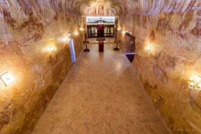 July 21, 2018 Photos: Underground Town of Australia, Coober Pedy
 November 20, 2018 The Incredible Geoglyphs of Peru, the Nazca Lines
The post Ushuaia: The World’s Southernmost City, Where End is the Beginning appeared first on .
]]>The post Agbogbloshie: Africa’s Largest Ground for Dumping of Electronic Waste from World Over appeared first on .
]]>
Agbogbloshie. (Marlenenapoli / Wikimedia Commons)
It is common knowledge that waste matter must be disposed of in an eco-friendly manner. The same holds true for electronic waste. What if e-waste is collected, processed and sold at market in the form of utility products, bypassing the statutory and the environmental concerns? This is the story of electronic garbage piled up at Agbogbloshie, a slum area of Accra, the capital city of Ghana in West Africa.
In Agbogbloshie, e-waste is pooled up surreptitiously, processed and resold
The whole affair is a saga of cheating and circumventing rules and regulations. The damaged/dysfunctional electronic goods are pooled up clandestinely and dumped in open land. The impoverished inhabitants over there rummage through it to take away whatever is marketable. Garbage is a mix of electronic parts from automobiles, computer, and communication devices. Cables are singed to remove their core metal. The damaged but reusable items are refurbished and repaired into a functional package and sold in the market. Copper mixed with other metals is sent to recycling firms in Europe, China, India and the Middle East. A good amount of the catch from debris is sold off in Ghana’s domestic market.

Motorcycle scrap in Agbogbloshie. (Agbogbloshie Makerspace Platform / Flickr)

Piles of photocopy machines. (Agbogbloshie Makerspace Platform / Flickr)
Processing of waste produces toxins and pollutes the environment
The ham procedures adopted for mining the waste are harmful for workers as well as the ecosystem of the area. Toxins produced at site find a way into the food chain, posing serious threat to flora and fauna. The air in Agbogbloshie is laden with metals and PCN (polychlorinated naphthalene). Heavy metals and flame retardants (chemicals added to finished industrial products to make them fire resistant) are detected in blood samples of garbage handlers. Neuro developmental, reproductive and fetal disorders are in noted in these workers. The land and water in the area are contaminated by toxic waste. Once a vibrant wetland replete with small wildlife, it now stinks so bad that one can smell the rot from a long distance.

Workers recovering copper after burning wires in Agbogbloshie. (Jcaravanos / Wikimedia Commons)
Waste is sourced from industrial countries and government departments
About 80 tons of smuggled e-waste arrives here every month from industrial countries like USA, UK, EU, and Austria. Famous international brands of electronic goods, retired digital appliances from government departments and a vast range of e-accessories can be seen lying in the stretch of plastic waste at the dumping ground.
The major quantity of the garbage reaches Agbogbloshire via Durban (South Africa), Tunisia via Bizerte, and Nigeria via Lagos. Consignment is carefully labelled and deceptively worded to circumvent the Basel and Bamako Conventions (a treaty of African nations prohibiting the import of any hazardous waste). Once the shipment reaches Ghana, it is ushered to any one of the several dumping grounds, one being at Agbogbloshie.
Waste business is hazardous for health and the environment
Is the Ghana Government oblivious to the extreme danger thriving in the heart of its capital city? Not really. Demolition of scrap work at Agbogbloshie was mooted several times. Cogent action in this direction was taken in June 2015. But it transpired that such action would only serve to shift business to some other discrete location, and the real problem would remain unsolved. Widespread unemployment in Ghana is the prime reason behind the illegal processing of e-waste. Scrap provides employment to about 6000 workers directly and 1500 indirectly. Migrant workers and young children scavenge the rubble to earn a living.
Soil at ground zero contains high-level toxic lead; 100 times higher than the contiguous land areas at a distance. Little vegetation grows in four and a half kilometer range of the dump. Air laden with toxic fumes has decimated the bird number; however, swarms of flies can be seen hovering over the vast stretch of dirt. With the rains, toxins of the waste seep into underground water. River in the locality is flush with stinking black and green waste.
Contaminated water near the dumping site. (Lionel Scheepmans / Wikimedia Commons)
State concern is obvious, but the solution will take time
The Government of Germany announced a 25-million-euro garbage processing project for this wasteland in the year 2017. The project would facilitate buying the scrap and selling repaired, extracted and re-made products/by-products from e-waste. Nevertheless, the harm done to the host environment would take longer to go. That would require a great deal of rehabilitation, detoxification and bio-degradation work, which, as of now, seems like a distant dream.
Enjoyed this article? Also, check out “Akodessawa Fetish Market: The Creepiest Voodoo Market in the World“.
Fact Analysis:
STSTW Media strives to deliver accurate information through careful research. However, things can go wrong. If you find the above article inaccurate or biased, please let us know at [email protected].
RELATED
- June 18, 2019 Bingham Canyon Mine: The Largest Copper Producing Mine in the United States
 July 22, 2019 Akodessawa Fetish Market: The Creepiest Voodoo Market in the World
- August 29, 2018 1999: Jeanne Menjoulet’s Journey to the Dunes of Dasht-e Kavir
 October 10, 2019 Colossus Computer: A WWII Era Cipher Machine was the First-Ever Programmable Computer
The post Agbogbloshie: Africa’s Largest Ground for Dumping of Electronic Waste from World Over appeared first on .
]]>The post Mt Etna: The Highest Active Volcano in Europe, A Popular Tourist Destination appeared first on .
]]>
Mt Etna as seen from Catania. (BenAveling / Wikimedia Commons)
The word volcano comes from the Italian volcanic island Vulcano, named after the god of fire in Roman mythology, Vulcan. An erupting volcano spews hot lava, gases and ashes high into the air, often causing severe damage to places wherever it lands. However, Mt Etna is a safe volcano and an extremely popular tourist site. It is located near the city of Catania which lies on the east coast of the island of Sicily. The rich volcanic soil on Etna’s slopes is responsible for high agricultural productivity. Not only is it the highest mountain south of the Alps, but is also the highest active volcano in Europe attracting tourists from all over the world.
Mt Etna is 3,320 metres high, covering a total area of 1,600 square kilometres with a base circumference of 150 kilometres. The geological indicators of the volcano suggest that it has been active for over 2.6 million years. The first recorded eruption of Mt Etna is of 475 B.C. mentioned by Greek poet Pindar in “The Pythian Odes I – For Hieron of Aetna”. Rising impressively 11,000 feet above sea level, Etna is a beauty to behold, visible from nearly all of Sicily.
Smoking rings produced by Mt Etna
The spectacular eruptions of smoke rings and fiery lava have fascinated many a tourist. Smoke rings are formed when a stream of steam and gas is expelled from the crater of an active volcano, creating perfect rings in the air. These are also technically known as vortex rings. Though a rare phenomenon, Etna has pleased spectators time and again with puffs of smoke rings.

Smoke rings produced by Mount Etna. (Angelosalemi / Wikimedia Commons)
During times of high activity, the volcano thrusts out steam and gas in quick succession. The build-up of immense pressure and being pushed out from a small round opening, the mouth of the crater, often results in the formation of the rings. The smoke rings sailing across the Sicilian blue skies can sometimes traverse a distance of one kilometre. These angelic halos against a pristine blue backdrop can measure up to 50 metres across and last for several minutes.
This Italian volcano has also drawn the attention of scientists all over the world. Etna boasts of three observatories dedicatedly monitoring its volcanic activities. These are based in Catania, Casa Etnea and Cantoniera. The wondrous volcano gave rise to the Etna National Park established in 1987, stretching over 581 square kilometres. Etna was declared a UNESCO World Heritage Site in the year 2013.
It is not only Sicily’s most beautiful natural attraction but also a very important revenue generator. The slopes of the volcano, with rich fertile soil, have given rise to terrace cultivation. Etna has three different ecological zones, each with its own typical plant life. The lowest slope till about 3,000 feet in height is covered with vineyards, citrus plantations, orchards of apples and olives. The zone above is covered with groves of chestnut, hazelnut, almonds, pistachios, oak, pine, birch etc. Above the height of 6,500 feet, the mountain sustains a few plants and flowers like the Etna violet, Etna camomile and Etna ragwort. The most characteristic plant in this zone is the Astragalus aetnensis, locally known as the ‘spinosanto’ (holy spine).
Visiting the craters
The volcanic lava flowing down the mountain over the years has carved out more than 200 natural caves. These are now used as wine cellars or cold food storage. The most outstanding feature of the volcano is the natural horseshoe-shaped caldera on the eastern slope, Valle del Bove or the Bove Valley. The volcano has 4 distinct active craters at the summit. Bocca Nuova (BN) and Voragine (VOR), two craters that are a part of the oldest original Central Crater. The other two are fairly new craters; the North East Crater (NEC) which formed in 1911, and the South East Crater (SEC) having formed in 1971.
The most popularly visited is the extinct ‘crateri silvestri‘ which happens to lie on the southern side of the Etna, near the village of Nicolosi. The radiant lava can be seen from here during Strombolian eruptions. A sight to behold is the glowing lava at night, looking like the red flood, visible from a safe distance from the villages around Etna. Closer to the summit, it is possible to visit the active side craters. Tourist guides will take you close enough to witness the steaming craters where you can feel the warmth of the rocks around, due to volcanic activity. In the months of winter, Etna also has a cover of snow at the top. These natural phenomenons make for a unique experience of skiing on the slopes with an astounding view of the Ionian Sea.
The Etna National Park also offers hikes and nature walks through the park leading to the higher altitudes of the volcano. The walks take you through the vineyards, the orchards and the wood forests, displaying the amazing biodiversity of the legendary mountain. One can witness the mesmerising lunar landscape near the craters, visit the lava caves, and the active fumaroles which emit steam and fumes from time to time.
The constant erratic eruptions
Mt Etna has been known to be active for several centuries now with Strombolian eruptions spewing ash, glowing cinder and lava fountains to a few metres high. These relatively mild blasts are the most attractive feature of Etna, almost like a fireworks display on a large scale. The most recent activity of Etna took place from October 15 to October 21, 2018. According to a report by Sezione di Catania – Osservatorio Etneo (INGV), there were gas emissions from the craters at the summit with intermittent Strombolian activity.

Photo of Mount Etna from International Space Station during an eruption. (NASA)
Scottish traveller and author Patrick Brydone described the beauty of Mt Etna in his immensely popular travel book ‘A Tour through Sicily and Malta, in a series of letters to William Beckford Esq. of Somerley in Suffolk’, published in 1806. He very aptly said, “….. if Mount Etna inside looks like hell, we can rightly say that, outside, it is the nearest thing to Paradise”.
Enjoyed this article? Also, check out “Danxia Landform: China’s Rainbow Mountains“.
Fact Analysis:
STSTW Media strives to deliver accurate information through careful research. However, things can go wrong. If you find the above article inaccurate or biased, please let us know at [email protected].
RELATED
- January 31, 2019 The Lonely House on Ellidaey Island, Where Nobody is Sure of its Residents
 June 1, 2020 The Clermont-Ferrand Cathedral: A Beautiful Gothic Structure Made of Black Lava Stone
- March 17, 2020 Transylvania: Home to Dracula, the Barbarians and the Path Breaking Architecture
- May 5, 2019 Tristan da Cunha: The Remotest Inhabited Island in the World
The post Mt Etna: The Highest Active Volcano in Europe, A Popular Tourist Destination appeared first on .
]]>The post Astana: An Ultra Modern Capital City Right in the Middle of Vast Empty Grasslands appeared first on .
]]>
Baiterek Tower, Astana, Kazakhstan. (Torekhan Sarmanov / Flickr)
Kazakhstan is literally translated as the ‘Land of the Wanderers’. This perfectly illustrates the nomadic history of a central Asian territory which has been inhabited by humans for over a million years, with modern Homo Sapiens starting to evolve around 40,000 years ago from today. In this time a great number of nomadic tribes such as the Scythians, Mongols and Persians have vied for power on the seemingly endless, golden steppes. Now, with the centralization of power, industrialization and the convenience of city life, these wandering ways of the past are being replaced by city-dwelling.
Many capitals of the world are based on links to bygone eras whereas the Kazakh capital is unique in the sense that it is not the most historical setting but rather the most strategic for modern expansionism. If successful perhaps this will become the new standard for choosing a principal city. Little is known around the world of the city called Astana – the capital for little over twenty years. But this is changing very quickly.
Opera house, Astana. (inga / Flickr)
Astana, Kazakhstan
Astana was announced to the world as the new Kazakh capital in 1998 and is now one of the most economically modern cities in not just Central Asia but on the planet. It is a planned city, very distinctive, in the case that it changed shape even after becoming capital, a feat spearheaded by Japanese architect Kisho Kurokawa. This began in 1998 when the Kazakh government organised a design competition, calling for urban planners from all corners of the globe to send their ideas of a new image for Kazakhstan. Kurokawa won with a truly inspirational and economical view of modernism as well as metabolism, along with integrating the old city.
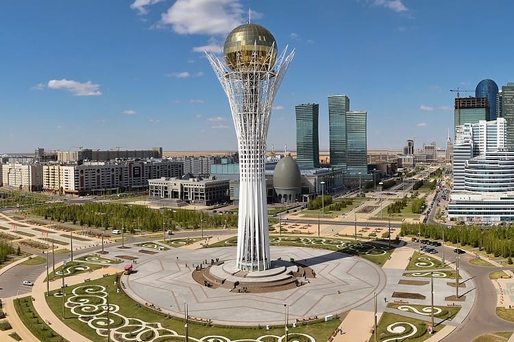
Astana downtown. (Ben Dalton / Flickr)
History of Kazakhstan
Nomadism started to dwindle in 1830 and what is now called Astana started to take form when a Siberian branch of Cossacks – the legendary soldiers – built a defensive formation. This was when Kazakhstan, like many other central Asian nations, moved under the sphere of influence of Imperial Russia. Before this, it was initially a settlement of Akmoly (suspected to mean White Grave in Kazakh) a small agricultural town which later became Akmolinsk. During the Soviet era, Astana would have a further rise of standing, helped (or hindered depending on one’s viewpoint) due to its location, relatively close to the Russian border.
During the World Wars, many factories had to be abandoned in the west of Soviet Russia and were relocated to Kazakhstan for protection. Eventually, it would become Tselinograd to further illustrate the governance of Russia and progress of the Virgin Lands Campaign – a method of imperialising new lands for agriculture. This came from the Russian ruler of the time Nikita Khrushchev with Tselinograd implemented as the administrative seat of said operation. This is where many Soviet-style buildings were developed and imprinted themselves on the land – the famous Mnogo-Etazhkis (many-floors) high-rise residential blocks which still remain today. After the dissolution of the USSR, cities like Astana began to regain their Kazakh status. The president made an announced that the former Tselinograd would become the new capital – taking over from Almaty in the south – as early as 1994 in a move that would shock many.
A journalist, visiting in 2008 for UK publication Telegraph Travel, James Mackintosh, experienced that the former-Soviet satellite city retains several Russian qualities, or rather, ghosts of the past from another viewpoint. This includes a German diaspora whose ancestors were exiled to Central Asia during Stalin’s rule.

Palace of Peace and Reconciliation in Astana. (Ninaras / Wikipedia Commons)
A modern capital
Kazakhstan became independent from the USSR in 1991 and has retained the same president ever since. This is Nursultan Nazarbayev – the leader of the Kazakh Communist Party even before the split – a man who once received 97.7% of the vote. The nation has become richer and richer in recent years fueled by vast discoveries of oil and gas. Although a huge realm – the largest landlocked country in the world – its population is only around 16 million. So with money to burn, the government demanded that many extravagant features were to be created, to propel Kazakhstan into the world of tomorrow.It was deemed a strange move to make Astana the chief city because it lies in the middle of nowhere.Many favour the style and tradition of the old capital Almaty but a threat of earthquakes meant that Astana would be the site for new developments. Another factor is the large Russian community living there as well as being relatively closer to the Chinese superpower to the east. A more psychological reason is explained or perhaps alibied by a local architect. According to Serik Rustambekov, the intention of these projects matches the Kazakhpsyche.

Hazrat Sultan Mosque in Astana. It is also the largest mosque in Central Asia. (Alex J. Butler / Flickr)

The entrance of Hazrat Sultan Mosque. (Ninara / Flickr)
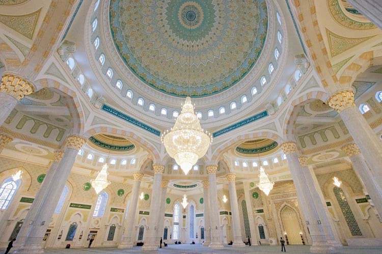
Interior of Hazrat Sultan Mosque. (U.S. Department of State / Flickr)
“You need to understand the Kazakh background to get a better picture of our worldview. We’re a nomadic civilization that developed over thousands of years in the vast expanse of Eurasia. Free space is more impressive to the Kazakh mindset than the type of congestion found in many European centers.”
A major symbol of the prosperity and pomp comes in the form of a shopping center. But it is no normal mall. Khan Shatyr claims to be the largest in the world at 127,000 square meters. An artificial beach with a constant temperature of 35 degrees is located within, on the top floor of a 150m high marquee. It requires a heat-absorbent material and must require a ridiculous amount of energy consumption, with exotic sand imported from the Maldives. This is just one example of many. Its main attractions all have the quality of state of the art design and architecture like the National Museum which houses the ‘Hall of Gold’ with artifacts from ancient history. Baiterek tower – an observation tower 97 meters high– mimics a Kazakh folktale about a mythical bird and tree. Again, they exemplify the mix of new and old cultures.
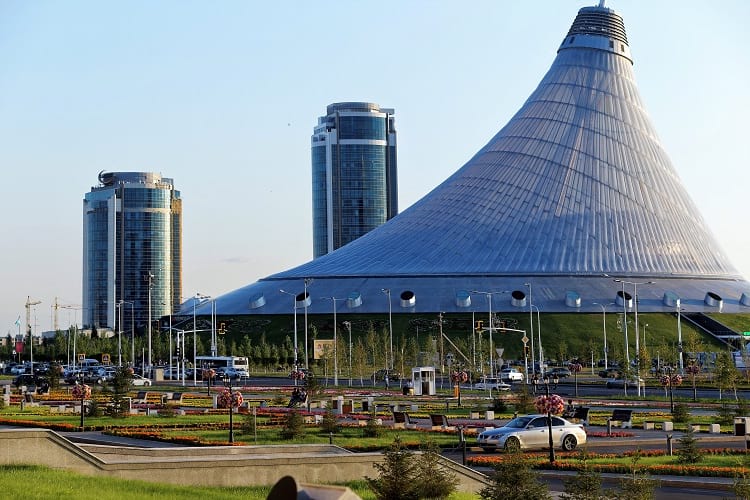
Khan Shatyr Entertainment Center. (Albert Bergonzo / Wikimedia Commons)
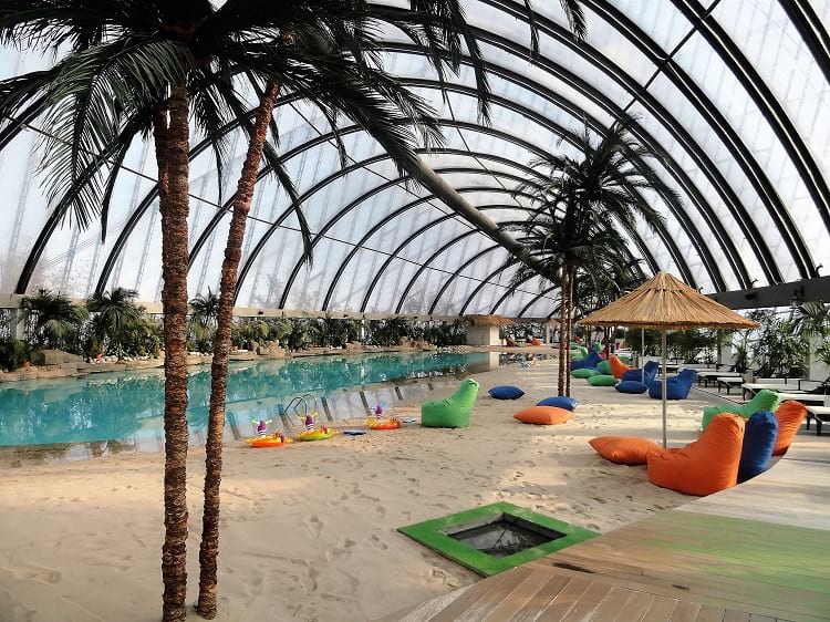
The indoor beach in Khan Shatyr Entertainment Center. (upyernoz / Flickr)
James Mackintosh talks again, regarding how he found the remarkable city on the cusp of change and gives an artistic view of everyday life.
An economic powerhouse
It is obvious to see the sheer amount of development thrust into Kazakhstan. The government knew that relying on oil was not an option for the future (over 60% of the economy in 2016 came from oil).
Sites like Bloomberg and Forbes show the multitude of investments and the effect it is having,
“Today, 9,000 foreign companies are reported to be operating in Kazakhstan… has invested $30 billion over the last 10 years in its transport and logistics infrastructure, according to government figures, and plans to spend an additional $8.4 billion to revive the ancient Silk Road route. The 2,700 km Kazakh portion of the new 7,000 km Western Europe— Western China Highway has been built, and expanding northern and southern rail routes have already dramatically increased shipping volume and capacity.”
Moreover, this is apparent in the socioeconomic aspect if such figures can be trusted.
“In terms of on the ground impacts, Kazakhstan’s poverty rate has fallen from 47% in 2001 to just 3% in 2013.”
Concert hall in Astana. (Ninaras / Wikimedia Commons)
The future
With these figures it is clear the Astana is moving in the right direction, although how long can it last. The transition from natural resources as the main economic driving force was certainly something that needed to be done but a venture into tourism seems an extremely ambitious proposal. Needless to say, the realm of Kazakhstan has an endless supply of natural beauty so if Astana can grow into a necessary hub for tourists then it could be a very viable system. Time will tell.
Enjoyed this article? Also, check out “Replica Constructions of World-Famous Cities and Towns in China: Tianducheng, Thames Town, and Hallstatt“.
Fact Analysis:
STSTW Media strives to deliver accurate information through careful research. However, things can go wrong. If you find the above article inaccurate or biased, please let us know at [email protected].
RELATED
 October 28, 2018 The Lost Bamiyan Buddhas of Central Afghanistan
- March 30, 2019 Thilafushi: The Good, Bad and Ugly of the Garbage Island of Maldives
- August 29, 2018 1999: Jeanne Menjoulet’s Journey to the Dunes of Dasht-e Kavir
 November 30, 2018 Replica Constructions of World-Famous Cities and Towns in China: Tianducheng, Thames Town, and Hallstatt
The post Astana: An Ultra Modern Capital City Right in the Middle of Vast Empty Grasslands appeared first on .
]]>The post Ämari Pilots’ Cemetery: Where Aircraft Tail Fins Adorn Soviet Pilots’ Tombstones appeared first on .
]]>
Ämari Pilots’ Cemetery, Estonia. (Modris Putns / Panoramio)
As one walks past the village in the forest, on the road leading up to the Amari Air Base in Estonia, one is very likely to notice an obscure graveyard. One quick look towards the cemetery gives a feeling that a few decorated shark-like fins are jutting out of the ground for no reason. But the secret that this strange-looking Soviet-era burial ground holds is no less than a mystery that common people cannot easily understand.
The basics before the main story
During World War II, the Soviet Union entered into a secret, non-aggression pact with Nazi-led Germany in August 1939. Also known as the Molotov-Ribbentrop Pact, it was signed in Moscow between the then Foreign Affairs Ministers Vyacheslav Molotov and Joachim von Ribbentrop of the Soviet Union and Nazi-Germany respectively. Under this Pact, the Soviet Union began occupying the three Baltic States – namely Estonia, Latvia and Lithuania – claiming these ethnic nations as their own territory, although still identifying them as constituent republics.
Ämari Pilots’ Cemetery: The Estonian graveyard of Soviet pilots

Ämari Pilots’ Cemetery up close. (Modris Putns / Panoramio)
Located in Amari town in the Harju County in Northern Estonia, this odd graveyard is the final resting place of the many pilots that died in the line of duty, during the Soviet occupation of Estonia (mentioned above). The Amari Pilots Cemetery was built as a means to pay tribute to the brave Soviet airmen that fought till their last breath and got killed serving their motherland. But that is simply not all. Unlike the regular concrete tombstones we find on graves, the ones on these burial sites are adorned with the tail fins of Russian-made fighter jets, complete with a red star in the centre. It is believed that these tailpieces are most likely the actual parts of the combat aircraft, which carried pilots when they came down crashing with it.
But this was not the ground where the Amari Pilots Graveyard first rested. The Soviet Military Cemetery first served as the burial grounds for casualties of war. It is believed that this air force graveyard was situated few kilometers adjacent to the cemetery in Amari Manor, a large seventeenth-century estate belonging to the noble von Tritthoff family. Probably after the year 1945, when WW-II ended, the graves were shifted to where they are now, a little closer to the Amari Air Base, which during the Soviet times was known as Suurkula Aerodrome. After the manor lay in ruins as Estonia gained freedom, the grounds were leveled off, including the one where the cemetery was, as housing societies took its place. The graves are said to have been removed and shifted closer to the air base, where one can see them today in all their glory.
Lingering doubts over the cemetery
Divided opinions still fly abound regarding these tail fin markers at the cemetery. While some argue that the remains of the pilots that died on duty were returned to their homeland and mere memorials were erected at the cemetery, others say that the graves are not empty and are the actual final resting sites of the aviators. Doubts have also been raised over the death of the Soviet pilots, which many experts believe were due to the accidents on the ground during training sessions and not while they were in action during the war. Also, there is no recorded evidence that could confirm whether the tail fins, which serve as the headstones for the graves, are actual parts of the ill-fated fighter planes.
Whatever the case, the Amari Air Force Cemetery remains a one-of-its-kind graveyard in the world. Surrounded by lush green trees and in a very well-maintained condition, this extraordinary burial site actually evokes a sense of respect for the Soviet martyrs that died fighting for their country in a foreign land.
Enjoyed this article? Also, check out “Highgate Cemetery: Cemetery Turned Nature Reserve“.
Fact Analysis:
STSTW Media strives to deliver accurate information through careful research. However, things can go wrong. If you find the above article inaccurate or biased, please let us know at [email protected].
RELATED
 September 8, 2018 Baltic Way: When Two Million People Formed a Human Chain, Demanding Freedom
- November 14, 2018 Highgate Cemetery: Cemetery Turned Nature Reserve
- April 7, 2019 Pere Lachaise Cemetery: Celebrated Parisian Cemetery, Where Millions Visit to Pay Homage
 September 5, 2020 Market Theater Gum Wall: The Sticky Story of a Wall Decorated in Chewing Gum
The post Ämari Pilots’ Cemetery: Where Aircraft Tail Fins Adorn Soviet Pilots’ Tombstones appeared first on .
]]>The post Pamban Bridge: A Historic Indian Sea Bridge That Was Built on Modern Principles appeared first on .
]]>
Pamban Bridge. (Ashwin Kumar / Flickr)
India is a culturally rich country and South India, in particular, is very different from the rest of the nation. Lined by the blue waters of the ocean and dotted by palm trees, the southern part of India has diverse climatic conditions as compared to the whole of India. Falling on the eastern coast of the country, the southernmost state of Tamil Nadu has a unique and first-of-its-kind bridge in India, which till date, not just inspires but also fills every Indian with a sense of pride. The approximately 2.3-kilometre-long Pamban Bridge is the first ever Indian sea bridge, connecting the port town of Rameswaram on Pamban Island to Mandapam on the Indian mainland in Tamil Nadu.

Overview of Pamban Bridge. (Shubham Gupta / Wikimedia Commons)
Basics of the Pamban Bridge
Way back in the 1870s, when the colonial British wanted to open trade with Sri Lanka (then known as Ceylon), they came up with the idea of a bridge for transport purposes. However, the plan was only put in motion in the year 1911 and the first ever Indian part-cantilever-part-conventional bridge was opened in the year 1914. More than a hundred years old now, the Pamban Bridge was the only way of getting to Rameswaram, until a parallel road bridge was constructed in 1988, easing transport further. Designed as per the specifications patented by German-origin American engineer William Donald Scherzer, the movable drawbridge or double-leaf bascule bridge can be rolled up vertically to allow movement of ships underneath. Six men on each side manually roll up the two spans to clear sea traffic below. This bascule feature was one of the firsts for any Indian bridge constructed during the British times.

The movable drawbridge on Pamban Bridge. ([email protected] / Wikimedia Commons)
The Pamban Bridge has as many as 143 fixed spans in total and one pair of navigation spans, on which the concrete railway overpass rests, supporting train movement day in and day out. Sitting on an artificial reef, it required nearly 5,000 tonnes of cement, 2,600 tonnes of steel and 98,000 cubic feet of rocks and crushed stones to construct the bridge. Standing on the Palk Strait between the countries of India and Sri Lanka, The Pamban Bridge is located in one of the most corrosive environments in the world. It is also the location of high-velocity winds, which the historic bridge has withstood for over a century. This corrosion-causing climate, along with the windy weather, poses a great threat to the structure every now and then, making its maintenance a little too difficult.
Mythological significance of the Pamban Bridge
Experts argue that Ramayana, which is the epic tale of victory of Lord Rama over the demon king Ravana, has Pamban Bridge’s mention in it. As per the Ramayana, it is nothing but Rama Setu, which the future king of Ayodhya had built. It is said that Rama Setu was manually constructed by Lord Rama, employing Lord Hanuman’s Vanar Sena and many other animals to get to Lanka, where Ravana had held his wife Sita captive. It is also said that the ghost town of Dhanushkodi, situated in south-eastern Pamban, is where the Rama Setu originates and can be seen from space.

Pamban bridge (on the right) next to the Annai Indira Gandhi Road Bridge (on the left). (ShakthiSritharan / Wikimedia Commons)
Accidents on and off the Pamban Bridge
Completed in a span of fourteen years, the Pamban Bridge once fell into the eye of a storm literally during the 1964 Rameswaram Cyclone. The powerful typhoon not only overturned a train carrying 150 passengers, killing all of them and breaking a part of the bridge too; but it also ripped apart Dhanushkodi, which till date remains in shambles and uninhabited ever since. In the year 2013, a barge belonging to the Indian Navy collided with the Pamban Bridge, but thankfully, the damage it had caused was very little. Repair and maintenance works had briefly halted railway services to Rameswaram from Tamil Nadu.
Initially functioning as a meter-gauge railway line, the bridge only got a major facelift in 2007, when a broad-gauge line was introduced, allowing even goods trains to ply between the two towns. As recently as 2016, the Indian Ministry of Railways has sanctioned approximately 3.5 million US dollars to replace the heavy manually-operated Scherzer spans by a mechanically-operating one. The engineering marvel has become a tourist attraction of late, which initially was only used by the railways to ply pilgrims to and fro from the holy Hindu town of Rameswaram.
Considered one of the scariest yet most beautiful train travels in the world, made with limited technology available back then, the historical Pamban Bridge is now vying for a UNESCO world heritage tag, which it rightly deserves so.
Enjoyed this article? Also, check out “Puente Nuevo: The Bridge That Spans Across a Gaping Canyon to Join the City of Ronda“.
Fact Analysis:
STSTW Media strives to deliver accurate information through careful research. However, things can go wrong. If you find the above article inaccurate or biased, please let us know at [email protected].
RELATED
- December 12, 2019 Rakotzbrücke: ‘The Devil’s Bridge’ which Looks Straight Out of a Fairytale
 December 12, 2018 Dhanushkodi: Where a Cyclone Ripped Apart an Entire South Indian Town, Rendering it Uninhabited
- January 29, 2019 The Egyptian Vultures of Tamil Nadu’s Vedagiriswarar Temple
- November 25, 2018 North Sentinel Island: Home to an Uncontacted, Hostile and Primitive Tribe
The post Pamban Bridge: A Historic Indian Sea Bridge That Was Built on Modern Principles appeared first on .
]]>The post Kumbhalgarh Fort: Not Only China But India Too Has Its Own ‘Great Wall’ Built Centuries Ago appeared first on .
]]>
Kumbhalgarh Fort and its boundary wall. (Sujay25 / Wikimedia Commons)
Kumbhalgarh Fort was built by Rana Kumbha in the 15th century. It is located 82 kms northwest of Udaipur, in Rajsamand town of Rajasthan in India. Close on heels of Chittorgarh Fort, it is the 2nd largest fort in Rajasthan. Surrounded by a huge serpentine wall, called the Great Wall of India, the fort was declared one of the UNESCO World Heritage Sites of Rajasthan in 2013.
Two historical icons of Rajasthan, father and son duo, had a fateful bonding with this place. Maharana Udai Singh II was 14 years old when he was running for his life and found shelter at this place. Subsequently, he became king of Mewar in 1540, right at this place and his eldest son, Maharana Pratap, the legendary hero of the battle of Haldighati, was born here.
An architectural marvel
The first fort of the Kumbhalgarh complex is believed to have been built by Samprati, a descendant of King Ashok in 2nd century BC. The subsequent additions till 15th century took the number to 84 forts. Among these, 32 were designed by Rana Kumbha and Kumbhalgarh fort is most outstanding of his creations.
Situated 3600 ft. above the sea level on a hilltop, Kumbhalgarh is surrounded by an uninterrupted 36 Km wall which is second only to the Great Wall of China in continuous fortification. Though 700 years old, it stands firm and strong as ever. Running like a snake in hilly terrain, the wall is thin at some places and exorbitantly thick at other sites. It is 15 to 25 feet wide and folklores say that 8 horses could run side by side on top of it. Construction of the wall took more than a hundred years and it was enlarged in the 19th century. Huge lamps lit on wall emitted enough light for the farmers of the valley to work at night time. Kumbhalgarh Fort separated Mewar (It extended from Ranthambore to Gwalior, including the vast area of the present day Rajasthan and Madhya Pradesh) from Marwar (Jodhpur region, Southwestern Rajasthan lying partly in Thar desert) and served as a refuge for the kings of Mewar in difficult times.
Fort has 7 imposing gates named, Aret Pole, Halla pole, Hanuman Pole, Ram Pole, Vijay Pole, Nimboo Pole and Bhairon Pole. While there are many gates in the fort, Ram Pol is said to be a piece of architectural wonder as almost every building inside is visible from there.

Ram Pol, the most prominent gate of Kumbhalgarh Fort. (Aryarakshak / Wikimedia Commons)
Surrounded by 13 mountain peaks, it is home to temples of Hindu and Jain faiths, numbering 60 and 300 respectively. The palace top gives bird’s eye view of the surrounding Aravalli hills where, from walls, one can have a clear view of Thar Desert. A notable structure is Lakhola tank built by Rana Lakha in 1382-1421 CE. It is 5 km long, 200 meters wide and 60 ft. deep. Another water tank, Badshahi Bavdi, equipped with staircase, was built by Akbar in 1578.

One of the temples inside the fort. (Uncle Alf / Wikimedia Commons)
Kumbhalgarh Fort: The tumultuous past
The Fort was attacked by Ahmad Shah I, the ruler of Gujarat in 1457. The attack was a failure but the temple of Banmata deity was destroyed. It was believed that the deity protected the fort from invaders. Conceived and built as hidden-fort for safety and battle advantage, it is visible only on a close approach.
Again in 1535, Bahadur Shah, from Gujarat, attacked and ransacked Chittor. Post this attack, efforts were made to put Chittor back on rails. Prince Udai Singh being too young for the crown, Banvir, a distant cousin was made interim ruler in 1536. But Banvir wanted to rule Chittor for long and hence, decided to kill Udai Singh. Panna Dai, the nursemaid of prince got an intimation of it and shifted Udai to a different location. When furious Banvir came searching for young Udai, she pointed to her own son sleeping on bed, his face covered. Her son, Chandan, was of the same age as Udai. Banvir killed the boy assuming it was Prince. Panna then left Chittor searching for a safe haven. Banvir was widely feared; hence none dared to help Panna and her charge, Prince Udai. In the long last she found shelter in Kumbhalgarh, several kilometres west of Chittor.
The saga of sacrifice, valour and carnivals
By sacrificing her son to save Udai Singh, Panna Dai saved the future of Mewar. Young Udai Singh became Maharana Udai Singh II of Mewar and went on to establish a township, named after him, Udaipur. His son, Maharana Pratap became a legend in his lifetime for his valour and patriotism.
A 3-day festival is organized every year by The Tourism Department of Rajasthan to highlight Maharana Kumbha’s passion for art and architecture. The festival is marked with concerts, dances, fort walk, turban tying, tug-of war, use of mehendi and many events of popular interest.
Rich cultural heritage, glorious history, marvellous architecture and scenic beauty of Aravalli hills make Kumbhalgarh a unique tourist destination in India.
Enjoyed this article? Also, check out “Fort Montgomery: When North America Made a ‘Monumental’ Mistake on the Other Side of the Border“.
Fact Analysis:
STSTW Media strives to deliver accurate information through careful research. However, things can go wrong. If you find the above article inaccurate or biased, please let us know at [email protected].
RELATED
- March 28, 2019 Fort Montgomery: When North America Made a ‘Monumental’ Mistake on the Other Side of the Border
 October 31, 2018 Statue of Unity: India Unveils the Tallest Statue in the World
 February 10, 2019 Ladakh Beckons You for a Riveting Tour of Nubra Valley
- May 31, 2019 Chand Baori: A Quaint Remnant of the Past
The post Kumbhalgarh Fort: Not Only China But India Too Has Its Own ‘Great Wall’ Built Centuries Ago appeared first on .
]]>The post AMARG: The US Plane Graveyard Where Aircraft are Stored, Stripped, Repaired, and Restored appeared first on .
]]>
Aerial Photo of retired military planes at 309th Aerospace Maintenance and Regeneration Group. (U.S. Navy photo)
The 309th Aerospace Maintenance and Regeneration Group (AMARG) holds a special fascination for aviation enthusiasts. Located at the Davis-Monthan Air Force Base in Tucson, Arizona, AMARG stores and maintains various types of aircraft and missiles on its 2,600-acre facility. Since quite a few of these aircraft fall in the vintage or out-of-service category, a popular nickname for AMARG is The Boneyard. It is certainly a veritable graveyard for planes.
The plane graveyard
After the wholesale destruction and senseless mayhem of the Second World War ended, the United States emerged as a mostly unscathed, powerful nation with a surplus of aircraft. It was necessary to store these aircraft somewhere for later use or to strip them for spare parts. In 1946, the US government established a new base for the 4105th Army Air Force Unit in Tucson in Arizona for this purpose.

Satellite photo of The Boneyard. (USGS)
While the purpose of the facility remains the same to the present day, the name of the facility has undergone several changes over the years. It became the newly independent United States Air Force’s 3040th Aircraft Storage Depot in 1946. The government dubbed it the Military Aircraft Storage and Disposition Centre (MASDC) in 1965. Later, in the 1980s, it became the Aerospace Maintenance and Regeneration Centre (AMARC). The 309th Maintenance Wing took over command of AMARC in May 2007, and the centre now became the 309th Aerospace Maintenance and Regeneration Group (AMARG).
The dry climate of the area is conducive for storing aircraft since low humidity means less rust and corrosion. It also helps that the hard soil makes moving the planes around easier.
Planes and missiles at the facility
The US government stored the bomber aircraft, Boeing B-29 Superfortress and the military transport aircraft, Douglas C-47 Skytrain, at the base after the Second World War.
In the 1960s, the US armed forces sent their out-of-service aircraft to this base. The Navy initially had their own plane graveyard at Naval Air Station Litchfield Park in Goodyear in Arizona, where they sent all the coast guard, navy, and marine planes. But, in 1965, they moved 500 of these to the Davis-Monthan Air Force Base. Three years later, in 1968, they closed Litchfield Park.
In addition to processing aircraft, the facility at the Davis-Monthan Air Force Base began dismantling intercontinental ballistic missiles in the 1980s. These missiles are also reused for launching satellites.
On 31 July 1991, the United States and the Soviet Union signed a bilateral treaty to reduce and limit strategic offensive arms, and this treaty came into force on 5 December 1994. To comply with this treaty, AMARC began dismantling 365 B-52 bombers. The Soviets could view this dismantling via satellite and by on-site inspection at the facility. AMARC initially used a 13,000-pound, crane-supported, steel-cable guillotine to chop the B-52s to pieces. Later they used K-12 rescue saws. The latter made it possible for AMARC to gather more salvageable spare parts.

Retired B-52 bombers. (JOC Lon Cabot / National Archives and Records Administration)
Storage and processing at AMARG
AMARG stores aircraft in an intact state for long-term use and for shorter stays. The aircraft technicians repair some aircraft for the Department of Defence’s reuse. In the case of aircraft that they cannot repair for reuse, they take them apart completely and salvage spare parts from them.
Before putting any aircraft into storage, AMARG processes it carefully. The technicians remove the plane’s classified hardware and the charges under the ejection seat. They wash the plane thoroughly with clean water to remove dust and residue. They drain the fuel system, refill it with lightweight oil, run the engines, and then drain the oil. Doing so coats the fuel system plumbing and engines with a protective oil layer.
To protect the aircraft from dust, heat and light exposure, the technicians spray the aircraft with two coats of protective plastic compounds. Spraylat is one such vinyl plastic compound and its application includes a black coat to seal the aircraft and a white coat to keep the temperature down. The sprayed aircraft can then safely remain in its designated spot for a good while without incurring any long-term damage.
Every year, AMARG receives several hundred aircraft for storing and several hundred aircraft for reprocessing. Out of 300 aircraft, they may repair around 100 to send them to provide a flying service with the US military, the US coast guard, the US forest service, and NASA. The US government may sell the repaired planes to foreign governments. There is a special Foreign Military Sales program for this purpose. On the processing front, the facility strips around 200 aircraft for spare parts and manages to salvage parts worth $500 million. The US government and military are the main customers for these spare parts. The US government requires permission from the US Congress to make any other sales.
Around 500 civil servants from the Department of Defence and 200 contractors work at AMARG.
Some famous aircraft at AMARG
Boeing Vertol CH-46 Sea Knight
After the North Vietnamese defeated them in the Vietnam war in 1975, the United States used this helicopter to airlift the last remaining Marines from the rooftop of the US Embassy in Saigon.
Boeing NASA’s KC-135A Stratotanker
In its heyday, this aircraft had two well-deserved nicknames, the Weightless Wonder and the Vomit Comet. NASA used it for zero-gravity flight training for astronauts and the training wasn’t kind on the stomach.

KC-135A Stratotanker. (Alan Wilson / Flickr)
Lockheed LC-130
Used by the U.S. Navy, this aircraft was sent to Antarctica on a resupply mission and crashed there in 1971.
Lockheed C-5 Galaxy
The US Air Force has been using these cargo jets from 1969 to the present day. These are huge planes, with heights of around 65 feet and wingspans of 222 feet.

Lockheed C-5 Galaxy. (Tech. Sgt. Frank Oliver / U.S. Air Force photo)
Visiting AMARG
Regular access to AMARG is strictly limited to Department of Defence employees and people with the proper governmental permission and security clearance. However, the general public can visit the facility on the bus tour that the Pima Air & Space Museum conducts from Monday to Friday. You must make your reservations 10 days in advance and get a security clearance from the Davis-Monthan Air Force Base. In both cases, they will ask you for ID proof like a driver’s license for US citizens and a passport for Non-US visitors. The tour is accessible for handicapped people, but you must inform the museum in advance as they may need to make extra preparations.
The general public can also participate in annual running or walking sports events organized at the base. Or they can see it in various films and TV programs; AMARG is popular as a filming site.
Explore the area on Google Maps.
Enjoyed this article? Also, check out “The Disappearing Aral Sea and its Abandoned Ships“.
Fact Analysis:
STSTW Media strives to deliver accurate information through careful research. However, things can go wrong. If you find the above article inaccurate or biased, please let us know at [email protected].
RELATED
- July 23, 2018 Nauru: An 8 Square Mile Island That was Once the World’s Richest Country
 March 26, 2019 The Disappearing Aral Sea and its Abandoned Ships
- May 2, 2019 What Happens to the Olympic Venues in the Host Countries After the Olympic Games End?
 February 18, 2019 The Ryugyong Hotel of North Korea: The Tallest Unoccupied Building in the World
The post AMARG: The US Plane Graveyard Where Aircraft are Stored, Stripped, Repaired, and Restored appeared first on .
]]>The post Lake Crescent: Washington State’s Beautiful, Deadly Lake and its History of Chilling, Notable Incidents appeared first on .
]]>
Lake Crescent, Washington, United States. (Elwhajeff / Wikimedia Commons)
Lake Crescent is one of the deepest lakes in the United States. It was formed by the melting of ice-age glaciers and is in the Olympic National Park in Washington State. An area of stunning natural beauty, it is popular with hikers, kayakers, sightseers, and fishermen. There is, unfortunately, also a dark side to the lake. Its icy waters have claimed many victims and, given its great depth, some of them were never found. As for the ones that did get found, it was only after many years had elapsed that the lake let up its secrets.
Lake Crescent
The first thing visitors notice about Lake Crescent is its pristine, blue waters. There is a high nitrogen content in the water, which prevents the growth of algae and that is the reason for the extreme clarity of the water. The lake, when seen from above, forms a rough crescent shape. It didn’t get its name for its shape though, but from the Port Crescent Improvement Company which was trying to set up a new town called Port Crescent in Clallam County in the late 1800s. As part of their efforts to attract prospective investors and townspeople to the new town, they started a local newspaper, the Port Crescent Leader, and described the natural environment around the town site. In this promotion, the lake, which earlier discoverers had named Lake Everett, became Lake Crescent and that is what it has been called ever since.

Outline of Lake Crescent. (Eian Ray / Wikimedia Commons)
Apart from the ice-cold waters, the lake has treacherous depths with silt beds and tiers of craggy cliffs. According to the National Park Service, the official depth of the lake is 624 feet. A depth of 1000 feet has also been recorded, however. In 2014, surveyors discovered that the previous depth measurements were in error and the deepest point of the lake measured 650 feet. The lake is spread across 5,127 acres and is 19 kilometres long. It is home to a variety of fish, notably the Beardslee trout and the cutthroat trout. These fish were once anadromous or migratory, but about 1000 years ago, a tremendous earthquake caused a landslide that dammed up the lake. The local Klallam tribe’s mythology describes this event, although they claim that the Mount Storm King caused the landslide to punish the Klallam and the Quileute tribes for fighting one another and disturbing the peace.
People kayaking at a distant in Lake Crescent. (Jonathan Miske / Flickr)
The Olympic Mountains stand guard around Lake Crescent. On clear days, there is an exceptional serenity to the environment that charms all visitors. You would not associate such a beauteous lake with any unpleasant undertones. There have, however, been several strange and notable events associated with the lake that cannot be ignored. They have given the lake a rather sinister reputation and you might very well believe it if you happen to see the lake in stormy weather, with the wind howling and the waves crashing wildly. It is almost as though it is lashing about in frustration, waiting for its victims to show up and be swallowed up in its deep, freezing waters.
Let’s look at some of the notable incidents that happened on Lake Crescent:
1929: The Warren Couple and their 1927 Chevrolet
On 3 July 1929, Russell Warren, 35, and his wife Blanch Warren, 33, were driving back to their home in a logging camp on the Bogachiel River from Port Angeles. The route they took was the narrow, dirt road skirting along Lake Crescent. Blanch Warren had been hospitalized for some unknown ailment in Port Angeles and Russell had driven there to fetch her back. Along with picking up his wife, Russell Warren paid a $100 outstanding grocery bill, made the latest instalment payment on his car, and bought a washing machine that he put in the back of the car. The couple was looking forward to celebrating the US Independence Day on 4 July the following day. They had made plans to visit the Sol Duc Hot Springs with their two boys, Charles and Frank, aged 11 and 13 respectively. The boys were home alone, with only $35 for any emergencies that might crop up while their parents were away.
The Warrens never reached home. They and their 1927 Chevrolet vanished without a trace. Two weeks later, on 16 July 1929, the Port Angeles Evening News reported that the couple was missing, and the local sheriff conducted a two-month-long investigation. They found car skid marks, broken glass, and a cap that belonged to Russell Warren at Madrona Point near the lake; it was called Madrona Point because a Madrona tree in the nearby hills was visible from the location. The investigators dredged up Lake Crescent and sent divers to search the depths of the icy waters, but with the diving equipment that was available at the time, the divers could only go down to a depth of 78 feet. They were unable to find anything trace of the missing couple. An eyewitness stepped up to say that he had seen a car crash into the lake, but it turned out, that accident had happened two weeks after the Warrens disappeared.
After an extensive search that produced no results, people began to doubt that there might have been an accident. Perhaps the couple had just abandoned their children and taken off somewhere. Friends and family of the Warrens dismissed this as unlikely. They were not the type of people to do such a thing. The doubts lingered on though and their own sons were affected by the rumours.
For the next 73 years, the whereabouts of the Warrens remained a mystery. Their sudden and unexplained disappearance devastated their sons and scarred them for the rest of their lives. They were sent to live with their maternal grandmother in Montana, but that did not work out. Frank soon ran away, and Charles left too shortly afterwards. They did not get along with each other and went their separate ways and did not keep in touch for many years. Both came to tragic ends. The elder son, Frank, became an alcoholic and died of pulmonary congestion and oedema at the age of 57 in Maple Valley in 1972. The younger son, Charles, disappeared on 14 June 1964 when his fishing boat, a 35-foot Mildred G, collided with another vessel in a fog and sank off the coast of Northern California in 1964. He was 47 years old when he vanished. Their surviving families believed what they and everyone did for a long time, that their callous and uncaring parents had left them to fend for themselves.
Then, in 2002, volunteer divers and a search team from the National Park Service discovered their 1927 Chevrolet at a depth of 166 feet at the west end of Lake Crescent. They found the vehicle to be in intact condition. It was lying on its left side, on a steep slope, some 60 feet away from the lake shore near Ambulance Point on U.S. Route 101. The bodies of the couple were not found. It is assumed that they lost control of the car and hurtled off the dirt road and fell into the lake. The road, incidentally, is now higher than it was in 1929 and has been fitted with safety guard rails.
The Warrens’ great-granddaughter, Kristine Coachman, 32, thanked the divers and the search team for clearing up this disturbing part of their family history. The search efforts were conducted over a period of 11 months by district ranger Dan Pontbriand. The overseer of the 144,000-acre Olympic National Park, became intrigued with the case after he heard the story from Bob Caso, a local man. Since it seemed more likely to him that the Warrens had met with a bad end in Lake Crescent rather than have left their sons in such an abrupt manner, Pontbriand decided to investigate the matter. The search team was aided by Gene Ralston who used a side scan sonar to search in the lake. This tool is attached to the back of a boat and dragged in the water. The sound waves it emits bounce off objects in the lake’s depths and their locations are marked so that they can be examined later. The searchers found several cars, some of which were Ford Model A vehicles, in the lake. It was puzzling. Had there been so many car accidents in the lake? Then they heard that a carjacking gang had been stripping and dumping cars in the lake in the 1930s and, more probably than not, these cars were their handiwork.
After pinpointing the car’s location, the team sent in divers and they finally found the car.
The relieved Warren family and their relatives requested the car to be left in the lake as a fitting resting place for the couple.
1940: Hallie Illingworth – Lady of the lake
In June 1940, a woman’s body was discovered floating in the lake. The body had a rather strange white colouration and the face was no longer identifiable and the skin on the fingertips had worn away. Other than that, the freezing lake waters had preserved it in near perfect condition. The loss of the facial features and fingerprints clearly pointed to the body’s having been submerged in Lake Crescent for a very long time. The woman had once been tethered to weights that had kept her underwater, but the ropes had frayed away over time. The body had then been pushed up to the lake surface. The whiteness of the body, it turned out, was the result of saponification. The chemicals in the lake waters had reacted with the woman’s body fat to turn her skin into soap.
A further examination of the body revealed the woman had been strangled to death. There were also bruise marks on the body.
At first, nobody knew who the woman was, and, since forensic science wasn’t as advanced then as it is now, there seemed little way of finding out. The only clue was a dental plate that was found on the corpse. Deciding to see where that lead, Hollis B. Fultz, the criminal investigator on the case, published photographs of the dental plate in several dental magazines and asked if anyone had any information about it. A dentist from South Dakota saw the photographs and recognized the dental plate as one that he had himself made a few years earlier. A look through his records came up with her name. She was Hallie Latham Illingworth, originally from Kentucky, and she had moved to Washington for better work and life prospects. Here, she had worked as a waitress at a local tavern, had married for the third time, and had then abruptly gone missing in December 1937. When her family had inquired about her whereabouts, her third husband, Montgomery Illingworth, had informed them that she had eloped to Alaska with a new lover, a sailor. He had filed for a divorce five months afterwards and had remarried and moved to California.
Now that the body was conclusively identified as hers, the police contacted her ex-husband Montgomery Illingworth, a former beer truck driver, who denied it was his wife. Their neighbours and friends, however, identified the clothes as hers. They also informed the police that the couple had been prone to having frequent wild and violent fights and that Hallie Latham Illingworth had often sported bruises from being beaten up by him. On several occasions, the neighbours had to summon the police to intervene and stop the fights. A search through the husband’s place led the researchers to find a rope whose strands matched those of the rope that had been used to bind the dead woman. It became clear that the husband had murdered his wife during one of their fights and had chosen to dispose of her body in Lake Crescent.
The police arrested Montgomery Illingworth and he was put on a jury trial in Port Angeles. He continued to first deny that it was his wife and then deny any involvement with his wife’s death, but the evidence against him was too strong. The jury pronounced him guilty of second-degree murder in 1942 and he was sentenced to life imprisonment. He served nine years at the Washington State Penitentiary in Walla Walla until he was paroled in 1951. He died in 1974 in California.
1956 & 1960: Ambulance Point on Lake Crescent
This location on the lake got its name after an ambulance swerved off the road and hurtled into the water on 27 August 1956. The ambulance was from a hospital in Port Angeles and was returning after picking up an injured lumberjack in Forks. The lumberjack, a man named Ernest Monroe Dahlgren, had broken his leg and was strapped on to the gurney to protect him on the journey to Port Angeles. Unfortunately, this turned out to be a fatal aspect for him. Since he was tied down in this manner, he was unable to escape the ambulance after it crashed into the water. He went down into the lake depths with it. The two medics accompanying him were able to get out in time.
There was another incident at Ambulance Point on 24 January 1960, when a Dodge sedan skidded on the icy road and plunged into Lake Crescent. The car belonged to a man named Dan Steele and he had three other people with him in the car. They all managed to escape the would-be watery grave and swam safely to the shore. One of them, Beverley Sherman, when she heard about the discovery of the Warrens’ car in 2002, contacted the divers and asked if they could also find the Steele car. If they could, she said, she wanted her suitcase back. The divers located the car and got her suitcase from the car’s trunk. After over 40 years, Beverley Sherman was reunited with her lost possessions.
2007: Israel Keyes – a serial killer
A former US army soldier, Israel Keyes, moved to live in Neah Bay in Washington state after leaving the army. According to the testimony he gave to the FBI, he was driven to commit his first murder here because the town was ‘boring’. He later moved to Anchorage in Alaska and turned into a full-fledged serial killer, planning each murder with meticulous care. His murderous spree lasted from 2007 to 2012, when he was finally caught and charged with the murder of a 17-year-old girl. His other crimes were revealed during his interrogation and the investigators learned that he had dumped one of his victims in Lake Crescent. Keyes later committed suicide at the Anchorage Correctional Complex.
Enjoyed this article? Also, check out “Pink Lakes: Where Rose-Tinted Lakes Surrounded By Lush Greenery Are Truly a Sight to Behold“.
Fact Analysis:
STSTW Media strives to deliver accurate information through careful research. However, things can go wrong. If you find the above article inaccurate or biased, please let us know at [email protected].
RELATED
- October 16, 2018 Clear Water Lagoons and Pristine White Sand Dunes of Lençóis Maranhenses National Park
- May 9, 2020 Elephant Beach: The Dazzling Sandy Beach in Andaman and Nicobar Islands Perfect for an Exotic Vacation
- June 18, 2019 Bingham Canyon Mine: The Largest Copper Producing Mine in the United States
- January 15, 2019 Pink Lakes: Where Rose-Tinted Lakes Surrounded By Lush Greenery Are Truly a Sight to Behold
The post Lake Crescent: Washington State’s Beautiful, Deadly Lake and its History of Chilling, Notable Incidents appeared first on .
]]>The post Gardens by the Bay: Where a Colossal Nature Park Gives New Lease of Life to Urban Singapore appeared first on .
]]>
Supertree Grove in the Gardens by the Bay. (Jan / Flickr)
Singapore is an island nation in Southeast Asia, which largely depends on tourism for its economy. It is a global entertainment and tourism hub, where people from all across the globe visit each year to unwind. And the country too offers various destinations where tourists can rejuvenate themselves from their daily, fast-paced life. One such destination in Singapore, which is a must on every traveller’s itinerary, is the Supertree Grove in the Gardens by the Bay. The Gardens by the Bay is not just a botanical garden but also the biggest glass greenhouse, spread over a sprawling 250 acres of land, with Supertree Grove as one of its main attractions.

Aerial photo of Gardens by the Bay. (Hari Krishna / Flickr)
In 2005, Singapore Prime Minister Lee Hsien Loong (who is also the current PM) announced that a garden destination be planned in their country, which would raise the standard of living of the locals and quality of living of foreign visitors. This spacious park, planned adjacent to the Marina Reservoir, would double up as a nature park, where people could visit for outdoor recreation and also get an unhindered view of the vast city skyline.
Work on building a city inside a garden began in 2007 and by November 2011, visitors were let in to soak in the scenic beauty and the fresh, clean air in an experimental tour. From the year 2012, the Gardens by the Bay became fully functional, with as many as 6.5 million tourists visiting the place in 2014 alone.
Gardens by the Bay, Singapore
Botanist Dr. Kiat W. Tan came up with the idea of the design of the world-class garden on reclaimed land, which has now become home to a million plants and trees from all parts of the world, excluding Antarctica. With diligent and consistent men at work, a dream to build a nature park materialized and a barren, sandy piece of land magically transformed into a stunning, lush green space called the Gardens by the Bay.
The two main attractions of these huge funnel-shaped glass awnings are the conservatories called Cloud Forest and Supertree Grove. The Gardens by the Bay are made up of tall column-less, steel branch-like structures and glazed glass panels that trap sunlight for the cultivation of plants and trees from foreign lands. Temperatures maintained in the domes range between 23 and 25 degrees centigrade, making it easier for plants like cherry blossoms, tulips and dahlias to bloom inside comfortably in their ‘close-to-natural’ surroundings.

Cloud forest, Gardens by the Bay. (Allie_Caulfield / Flickr)
The Supertree Grove
The main tourist attraction to visit inside the Gardens by the Bay is the Supertree Grove. It is an artificial, solar-powered mechanical jungle, with as many as eighteen supertrees that generate solar power and also act as a vertical garden. These man-made trees operate as venting ducts to eliminate harmful gases from inside, collect rainwater and also convert sunlight into energy, providing for the conservatories below, while also acting as sheltered walks for visitors underneath. Rising to scaling heights of 25 to 50 metres (80 to 150 feet), the larger-than-life tree-like structures have tropical flowers, trees, ferns and vines, climbing upwards on steel frames, which also double up as natural canopies.

Supertree Grove at night. (Romain Pontida / Flickr)
Inspired partly by nature and partly by fiction, this climate-controlled Supertree Grove has a 128-metre-long interconnecting bridge high above at 22 feet, known as the OCBC Skyway that links the tree structures together. These skywalks offer visitors a panoramic view of the gardens below, while also helping ease movement of thousands of tourists that visit at once. This interconnecting aerial walkway also presents photo opportunities to visitors as they get to see the Supertree structures with rare flora and fauna from up close.
The super-tall vertical gardens, which are home to exotic flowers like orchids, are fitted with photovoltaic cells to harness solar energy, mimicking plants’ own process of photosynthesis. This energy is then used to light up Supertree structures and also provide for the coordinated light and sound music show that brings this gigantic complex alive in the night time. Every month the theme of the music show changes for more added effect. Food stalls atop the Supertree help tourists refuel after a long day’s tiring sightseeing session. The Supertree Grove also forms a part of pop culture, making its appearance in several movies and video games. The Flower Dome inside the stunning Gardens by the Bay has earned a prestigious place in the Guinness Book of World Records in 2015 for being the largest glass greenhouse in the world.
A horticultural marvel, the Supertree Grove not just provides respite from the tropical Singaporean heat to people but it is also an engineering wonder that gives the island nation a new rank in the list of developed countries, with an eco-tourism destination to boast of. The multi-million dollar project stands true to the government’s strategy of building a city inside a garden, fulfilling the promise of a greener standard of living.
Enjoyed this article? Also, check out “Amazon Spheres: An Unexpected Rainforest in the Amazon HQ at Seattle“.
Fact Analysis:
STSTW Media strives to deliver accurate information through careful research. However, things can go wrong. If you find the above article inaccurate or biased, please let us know at [email protected].
RELATED
- November 25, 2018 North Sentinel Island: Home to an Uncontacted, Hostile and Primitive Tribe
 April 25, 2019 The Wallace Line: The Invisible Line of Bio-Diversity in the Indian Ocean
 January 21, 2019 The Pando Tree of Utah – The World’s Largest and Oldest Living Organism
 January 16, 2019 Sex in Space – Is It Possible? and Why It is Important
The post Gardens by the Bay: Where a Colossal Nature Park Gives New Lease of Life to Urban Singapore appeared first on .
]]>The post Lake Reschen: Italy’s Submerged Lake Reschen appeared first on .
]]>
Church Bell Tower at Lake Reschen. (Sander van der Wel / Flickr)
Lake Reschen, an artificial lake in South Tyrol, Italy, is known for carrying a submerged town at its bed. The only visible part of the submerged town is a steeple of a 14th-century church peeping out above the surface. The steeple can actually be walked towards during winter when the water freezes. The lake is considered the largest in the province due to its capacity of 120 million cubic meters, and its surface area of 6.6 sq. km. makes it the largest in the Alps.

Church Bell Tower during winter. (Sascha Erni / 500px)
Planning for a smaller artificial lake started back in 1920, but in 1939 a new plan for a much bigger and deeper lake was introduced. The newer plan would merge two natural lakes, but it would mean submerging multiple villages. Construction for the newer lake began in 1940 but due to resistance from the locals and the development of Second World War, it was not completed for another decade until 1950.
Construction of Lake Reschen
In July 1939, the Edison Energia Company came up with a better plan for an artificial lake than the one in 1920. This newer plan aimed at a depth of 22 meters, and would merge two existing natural lakes – Reschensee and Mittersee. The plan would allow construction of a dam by creating this artificial lake for supplying electricity in the region. However, this would, unfortunately, submerge multiple existing villages which would include those of Graun, Reschen, Arlung, Piz, and Stockerhofe. Almost a decade later, after intense resistance from the villagers, the company received funding for construction of a dam that would help create the lake.
For the construction of this lake, over 150 homes were destroyed and over 1200 acres of land had to be submerged. An entire village and town with roads, shops, and schools are sitting at the bottom of the lake. At the time, church bell towers were the tallest structures because as a symbol they were supposed to be closest to heaven than any of the structures in the village. The lake was also not made so deep as to submerge the church steeple as well and hence is the only structure still visible over the surface.
Legends and tourism
The lake has attracted a lot of tourists, thanks to its unique focal point. The fact that the steeple is visible from an arm’s length distance during the winter when the lake freezes over is just an added bonus. The lake may have started to receive attention initially due to the church steeple that pokes out, but the area itself is now renowned over the world for activities that take place around it. Tourism agencies have tried to monetize on the lake’s uniqueness by providing fishing, ice-skating, snow-kiting, kite surfing, walking and cycling tours in or around the lake.

Church Bell Tower. (Zairon / Wikimedia Commons)
There are multiple creepy legends about the church bell tower still floating among the locals which get through to the tourists sometimes. The most popular one is the one where the church bells are heard ringing during winters. It is said that these bells are heard during the darkest of hours and the coldest of winters. This is creepy because the very bells of the tower were removed almost 70 years ago when construction for the lake began.
Enjoyed this article? Also, check out “Roopkund Lake: What are Hundreds of Bones Doing Around a Lake in Uttarakhand?“.
Fact Analysis:
STSTW Media strives to deliver accurate information through careful research. However, things can go wrong. If you find the above article inaccurate or biased, please let us know at [email protected].
RELATED
- June 16, 2019 Church of the Dead: Home to the Peculiar Mummies of Provincial Italy
- April 5, 2019 Sedlec Ossuary: The Famous Bone Church of Kutná Hora in the Czech Republic
- March 26, 2019 The Disappearing Aral Sea and its Abandoned Ships
- March 22, 2019 Sagrada Familia: An Unfinished, Colossal Spanish Basilica, Under Construction for More than 136 Years
The post Lake Reschen: Italy’s Submerged Lake Reschen appeared first on .
]]>The post Moscow State University: An Architectural Marvel appeared first on .
]]>
Moscow State University, Russia. (I.s.kopytov / Wikimedia Commons)
Of the 3 towers making up Moscow State University, the one in the centre is the tallest. This tower is the main building of the university and the tallest educational building in the world. The tower was inaugurated on 1 September 1953 and has served as the headquarters for the university since then. It has a gigantic height of 240 meters which is more than twice the height of the Statue of Liberty. Atop the tower sits a spire which in itself is 57 meters high and the spire is topped with a five-pointed star weighing 12 tons.

Moscow State University finishing spire. (Nickolas Titkov / Wikimedia Commons)
This tower is also the highest of the Seven Sisters, which is a nickname given to the 7 tallest Stalinist buildings in Russia. They are noteworthy because the buildings are designed in accordance with Russian Baroque and Gothic styles of architecture combined with the technology of American skyscrapers. The other 6 towers are Hotel Ukraina, Kotelnicheskaya Embankment Apartments, Kudrinskaya Square Building, Hilton Moscow Leningradskaya, the Ministry of Foreign Affairs, and the Red Gates Administrative Building.
The Moscow State University tower is to Russians what the Empire State Building is to the Americans. It is a building of immense commendation for them. The university is adorned with statues of notable people, some of them are of students that went to MSU and the one that stands out is the statue of Mikhail Lomonosov, the founder of the university. The main tower of MSU remained the 7th tallest building in the world and the tallest in Europe since its inauguration until 30 years later in 1988 when it got superceded by the MesseTurm tower in Germany. It is also the oldest university in Russia and has inspired designs for many other buildings including the Palace of Science and Culture in Warsaw, Poland.
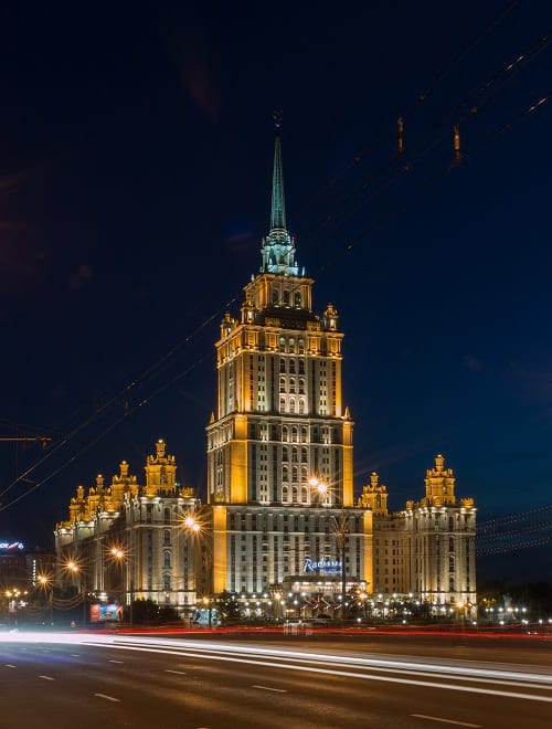
Radisson Royal Hotel (Hotel Ukraina), one of the seven sisters. (Kirill Vinokurov / Flickr)
The designer of Moscow State University
The entire building was designed by an architect called Lev Rudnev, and it was one of his finest works. He was awarded the Stalin Prize in 1949 for the project. Rudnev was a great practitioner of Stalinist Architecture. This is the type of architecture that was practised in the Soviet Union during the leadership of Joseph Stalin till Nikita Khrushchev declared the end of it.
Rudnev had been earning awards for his creations since he was 26 years old, and finally went on to get his certification for architecture when he was about 30. One of his most notable awards after the Stalin Prize was for a monument called Victims of the Revolution that stands on graves of the victims of the February Revolution in the Field of Mars in Saint-Petersburg. After the Second World War, he also actively took part in reconstructing destroyed cities of Russia. He passed away in 1956, three years after the MSU tower was completed.

Moscow State University at night. (Eldar Vagapov / Flickr)
The premises
The campus life on MSU seems to be quite interesting. The building itself contains over 5000 rooms and has 4 huge towers reserved only for student and faculty housing. The students and faculty are entitled to a theater, museum, swimming pool, salon, and cafeteria in addition to the basics such as a library, police station, post office, laundry, canteen, ATM’s and a bomb shelter. Although, their main library wouldn’t be considered just basic since it’s the largest in Russia with over 5 million books.

Library in the Moscow State University, circa 20th century. (Thomas Taylor Hammond / Wikimedia Commons)
As of the latest update, the university has 39 faculties with a few new ones having been added recently like the Faculty of Physics and Chemistry and the Faculty of Higher School of Television. There are an impressive number of students, staff and faculty at the university. Its 15 research centers are used by 5000 researchers, and there are more than 40,000 undergraduates and 15,000 staff members. The university also hosts 2000 students and researchers once a year. Given these statistics it’s would be of no surprise that the Moscow State University is one of Russia’s most prestigious institutions.

Moscow State University auditorium. (Thomas Taylor Hammond / Wikimedia Commons)
There are few legends surrounding the building as well. It is said that the material needed for construction of the building was prepared by Hitler but was later stolen back to Russia by the Red Army. Another story also mentions that German war prisoners were used for constructing the building and at the end, many of them were walled alive inside the buildings. While we probably won’t find out the authenticity of these legends, we can definitely marvel at its architectural ingenuity.
Enjoyed this article? Also, check out “Nakagin Capsule Tower: A Futuristic Building from the Past, Which Might Just Not See the Future“.
Fact Analysis:
STSTW Media strives to deliver accurate information through careful research. However, things can go wrong. If you find the above article inaccurate or biased, please let us know at [email protected].
RELATED
 December 10, 2018 Nakagin Capsule Tower: A Futuristic Building from the Past, Which Might Just Not See the Future
 April 23, 2018 Rasputin, Faith Healer? Or Lustful Charlatan?
 September 10, 2019 Amazon Spheres: An Unexpected Rainforest in the Amazon HQ at Seattle
 June 10, 2019 DC Towers: The Project That Revolutionised the Cityscape Of Vienna
The post Moscow State University: An Architectural Marvel appeared first on .
]]>The post The Unusual Glass Beaches of California and Hawaii appeared first on .
]]>
Glass Beach at Fort Bragg, California. (Lisa Nottingham / Flickr)
Sea glass is nature’s way of churning garbage into stunning pieces of beauty. The formation of sea glass occurs from normal glassware that has been discarded on beaches or in saltwater. Broken pieces of glass tossed away in the sea, sometimes even from shipwrecks, go through a process of being broken down further and smoothed by being hurled around in the water. A product of the combined efforts of man and nature, it takes several years for beautiful sea glass to form. A high-quality piece of sea glass is one that is well frosted and has smooth edges.

Close up of sea glass. (Moximox / Wikimedia Commons)
The discarded glass is broken down by the roughness of the sand and also gets smoothed as it rolls around. Typically, the abrasive action of the sand is like that of sandpaper used on rough surfaces for a refined, finished look. The pits formed in the glass due to hydration, lend a softer feel to it. Hydration is when the soda and lime that goes into the process of making glass, leaks out, leaving pits. These two elements play an important part in the formation of sea glass. As they trickle out of glass objects, these elements sometimes react with minerals in the seawater, leading to the formation of new mineral deposits on the glass. These deposits are responsible for the glittery appearance of sea glass, putting it in the same category of quality as gemstones.
Glass Beaches: How sea glass came into existence?
The existence of sea glass started around the time man started making glass. In the olden days, the legend goes that each time a sailor died at sea, the Mermaids would weep for him. Their tears would crystallize as they fell into the water, creating sea glass in the process. Hence the popular name, ‘Mermaid Tears’.
Glass Beach in California
Sea glass can be found near water bodies that have had a dumping ground nearby. Earlier, it was a common practice to discard waste in water to be carried away by the current. Fort Bragg in California is one such place which was a common dumping ground for the town till 1967.
In 1906, a water body behind a lumber company was established as the official dumping ground for the town’s waste, known as Site 1. When this started filling up in 1943, another site was assigned for the dump, known as Site 2. However, the dumping ground was again moved in 1949 to the area which today, is known as ‘Glass Beach’.
Beaches in the neighbourhood of old ship dockyards like the Chesapeake Bay also have sea glass washed ashore from time to time. Ships often discarded their waste into the water when they docked at a port. Another famous Glass Beach is in Eleele near Kauai in Hawaii. The beach is in the Hanapepe Bay, easily identified by the large gasoline tankers that are common in the area of Port Allen Harbour. Similarly, a dumping site of the Soviet era has now turned into a mesmerising Glass Beach on Ussuri Bay in Russia.
Kauai glass beach, Hawaii. (Barb Ignatius / Flickr)
The best time to look for sea glass is during low tide or when a storm has passed, due to which the strong water currents will wash sea glass ashore or probably expose old buried sea glass.
The variety of this ‘reverse gem’
Natural gems are made by nature and given finishing touches by man. Sea glass is also referred to as ‘reverse gem’ for the simple reason that it is made by man and finessed by nature. The value of sea glass often depends on the colour of the glass.
The sapphire sea glass comes from discarded medicine bottles that were made from cobalt blue glass. The rare ruby glass comes from old discarded taillights, lanterns or traffic lights. It could also be from old discarded beer bottles of a famous beer of the 1950s sold in a royal ruby red coloured bottle. The purples, pinks, lime greens and other rare colours were often used in making perfume bottles or artwork which, when discarded, turned into similar hues of sea glass. A lot of lavender and pink sea glass could also be the result of clear glass reacting with magnesium to create a lavender coloured glass, or selenium reacting to give a pink coloured sea glass. A whole lot of beer bottles, coloured glass shampoo bottles, and bottles of bleach could be the reason behind sea glass in greens, browns and aqua colours.

Glass Beach, Hawaii. (Eric Lin / Flickr)
Whatever the colour, this gem of the sea has become rare with the advent and use of plastics. So, whenever you come across one, make sure you spend the time to admire the work of nature.
Enjoyed this article? Also, check out “Reynisfjara: The Black Sand Beach that Looks Straight out of a Gothic Novel“.
Recommended Visit:
1. Fort Bragg Glass Beach | California
2. Eleele Glass Beach | Hawaii
Fact Analysis:
STSTW Media strives to deliver accurate information through careful research. However, things can go wrong. If you find the above article inaccurate or biased, please let us know at [email protected].
RELATED
- May 9, 2020 Elephant Beach: The Dazzling Sandy Beach in Andaman and Nicobar Islands Perfect for an Exotic Vacation
- July 6, 2019 Playa de Gulpiyuri: The Tiny Beach in the Principality of Asturias in Spain
 May 19, 2019 Tavira Island in Portugal and the Anchor Graveyard That is a Memorial for a Lost Way of Life
- November 1, 2018 Vardzia: The Mesmerising Cave Monastery that Protected Georgians for Decades
The post The Unusual Glass Beaches of California and Hawaii appeared first on .
]]>The post Cancun Underwater Museum: A Sunken Museum Dedicated to Conserving Marine Life appeared first on .
]]>
Cancun Underwater Museum, Isla Mujeres. (Ratha Grimes / Flickr)
The Cancun Underwater Museum is home to life-sized sculptures, which are devoted to the art of marine conservation. Known as MUSA or Museo Subacuatico de Arte in Spanish, the one-of-its-kind underwater museum is a non-profit organization located in Mexico’s southeastern coastal city of Cancun. The idea to start an underwater museum cropped up in 2008 when Jaime Gonzalez Canto noticed that the corals in Manchones Reef were being greatly damaged by tourist activities in the region. The director of the Marine Park in Isla Mujeres, which is an island in the Gulf of Mexico, then thought to seek Jason deCaires Taylor’s help to lure tourists away from the natural reefs. Jason deCaires Taylor stepped in to help. An award-winning Guyanan-British sculptor, certified scuba-diving instructor, underwater photographer and a marine conservationist, Taylor is also the founder of the world’s first underwater sculpture park in West Indies.
Jason deCaires Taylor and Gonzalez Canto started materializing their idea of the underwater park and their work began slowly in 2009. By November of the same year, Taylor submerged four of his concrete sculptures into the ocean, out of the initial five hundred planned in total. Later the next year, most of Taylor’s sculptures were placed three to six metres on the ocean floor, along with some more by local Mexican sculptors. By the year 2013, four hundred and eighty-seven of Taylor’s life-sized statues were added to the museum, which had officially opened to the public in the year 2010. Along with Taylor’s artwork titled ‘The Silent Evolution’, Mexican artists have also contributed to the museum, where more than a hundred million tourists visit in a single year.
The speciality of the Cancun Underwater Museum
Growing up in Malaysia and observing how nature reclaimed abandoned human environments, Jason deCaires Taylor worked on the idea of populating marine life, where humans had created the most destruction. He started making special, pH-neutral marine cement-based statues, which were ten times harder than the normal cement mix. Transforming this mixture of sand, micro silica, fibre glass and live coral into human forms, his sculptures were installed under the water, which would work as natural habitats for marine life, specifically coral reefs. Initially, artificial corals were placed on the sculptures, which soon began to lure in aquatic creatures and eventually, coral reefs began to flourish.

Cancun Underwater Museum. (Andy Blackledge / Flickr)
With a previous experience in building an underwater museum in Grenada, West Indies, Taylor’s new self-sustaining ecosystems in the form of human sculptures, took shape and some of his initial works started attracting a variety of tiny aquatic creatures. ‘The Silent Evolution’ also served a dual purpose. It eased the pressures off the natural coral reefs that were being affected by tourist activities like snorkelling and scuba diving and secondly, the visually-striking, porous, life-like statues were helping corals colonize the area quickly in a short span of time.
The underwater museum
Working with people from all sections of the society in Mexico, Jason deCaires Taylor took live casts of local people, with diverse features and expressions, sculpting them into statues, which now adorn the underwater museum. Going around Mexican cities looking for people to pose for his exhibition, Taylor picked up individuals – some carpenters, some accountants, a nun, a three-year-old boy, an acrobat – with extraordinary features to be his inspirations. He made use of giant cranes that transported these statues to the bottom of the ocean floor without either getting damaged themselves or harming nature in any way. Placed in two different galleries, one in Manchones Reef and the other in Punta Nizuc, these vivid human concrete sculptures are on display for snorkelers and scuba divers, who can view these large statues face-to-face. Tourists can also enjoy the view below of corals thriving on human-like figures in glass-bottomed boats.

A diver taking a selfie with an underwater sculpture. (Ratha Grimes / Flickr)
Statues at the Cancun Underwater Museum
Taylor’s stunning statues illustrate the human life and their association with nature. The first one to be submerged was the ‘La Jardinera de la Esperanza’ or the ‘Gardener of Hope’, which depicted a young girl lying in a garden amidst potted plants. Another amazing sculpture is titled ‘Sarah’, which is the only statue to have a pair of artificial lungs, fashioned after an English professor. Snorkelers can blow in bubbles or air from their tanks into the lungs, which later escapes from the open mouth of the sculpture, making it a rare sight to behold. Some statues are seen lost in conversation with each other, while others depict people deep in thought. Some individuals are seen grooming themselves while many others seem looking to the surface amid nothingness as if wanting freedom.

Underwater museum, Isla Mujeres. (Ratha Grimes / Flickr)
Planned initially at 350, 000 US dollars, the unique museum is made in such a way that it withstands frequent hurricanes, global warming and also hostile human activities. Turning eight this year, the spectacular statues are not only attracting marine animals and helping corals grow but also boosting tourism in the region, thus maintaining a symbiotic relationship between man and nature.
Enjoyed this article? Also, check out “Neptune Memorial Reef: An Eco-Friendly Underwater Graveyard Off the Florida Coast“.
Fact Analysis:
STSTW Media strives to deliver accurate information through careful research. However, things can go wrong. If you find the above article inaccurate or biased, please let us know at [email protected].
RELATED
- May 9, 2020 Elephant Beach: The Dazzling Sandy Beach in Andaman and Nicobar Islands Perfect for an Exotic Vacation
- May 26, 2019 Neptune Memorial Reef: An Eco-Friendly Underwater Graveyard Off the Florida Coast
- November 25, 2018 North Sentinel Island: Home to an Uncontacted, Hostile and Primitive Tribe
- July 21, 2019 The Tjentiste War Memorial: A Commemoration of Those That Died in the Battle of Sutjeska
The post Cancun Underwater Museum: A Sunken Museum Dedicated to Conserving Marine Life appeared first on .
]]>The post Replica Constructions of World-Famous Cities and Towns in China: Tianducheng, Thames Town, and Hallstatt appeared first on .
]]>
Replica of Eiffel Tower in Tianducheng, China. (MNXANL / Wikimedia Commons)
The Chinese, historically, considered their country to be the centre of the world and now you can sample the world without straying out of China. Always wanted to visit Paris? England? Hallstatt? That’s alright, China has the almost similar versions of these cities and you are welcome to come and visit.
Replica city and town construction in China
We won’t go into the tired, old cliché about how the Chinese copy everything. You copied too when you learned to read and write. It is a learning process. By building these more or less exact replicas, Chinese construction companies are showing off their chops. They have some of the best talents in the world and are capable of building anything they want. That is more than what people who mock them can do.
The idea of building cities to resemble Western ones came about in 2001. The Shanghai Planning Commission decided to spruce up their city’s ungainly outskirts with nine new municipal suburbs under the ‘One City, Nine Towns’ scheme. They thought that if they built beautiful replicas of Western cities and offered the public the charming lifestyle that came with these cities, the local people would be more than willing to move from overcrowded Shanghai to these brand-new suburbs.
Tianducheng
Tianducheng, which translates to “Sky Capital City,” was once a rural area comprising of rice paddies. It is located in the coastal Zhejiang province, not too far from the provincial capital Hangzhou, and, while you can still see the rice paddies, the area has acquired a French flavour. One of the first things you will notice is the Eiffel Tower. At 354 feet, it is much smaller than the real one in Paris, but it is still tall enough to be eye-catching.

Bird’s-eye view of Tianducheng. (Forgemind ArchiMedia / Flickr)
A meticulously landscaped, residential area, built in the style of the Parisian architect Haussmann and including a version of the Champs Elysées, stretches outward from around the Eiffel Tower. You will find here a very fine reproduction of the famous Bassin de Latone fountain from the Versailles gardens.

Replica of Bassin de Latone fountain. (Forgemind ArchiMedia / Flickr)
The Zhejiang Guangsha Co. Ltd conceived the idea of building Tianducheng as a faux Parisian town in 2007, and they designed it to fit in over 100,000 residents. So far, according to news sources, only about 2000 people have move in to live in Tianducheng. The town, however, gets plenty of domestic and foreign visitors, including newlyweds on their honeymoon. The latter flock here to experience second-hand the original Paris’s overdone reputation as a romantic destination. That they end up having a good time here shows how you don’t have to go far away to experience romance. You can have it in your own country.
Tiandu Park. (MNXANL / Wikimedia Commons)
Thames Town
The original English town has brick houses and cobblestone streets. China’s Thames Town is in the Songjiang District, about a 40-minute drive to the southwest of Shanghai. The faux Edwardian houses sit amidst real manicured privet hedges and the high street is lined with white Victorian terraces. Visit the Gothic Christ Church in the town square. If you take your dog along, keep him or her leashed and away from the lampposts. They are genuine British items and were imported from Great Britain. If you are hungry, stop by a fish-and-chip shop or walk into a Tudor pub. Want to tell your family about this great town? Put your mobile away and step into an iconic British red phone box. The town planners designed it to fit 10,000 people. There are nine universities in the region and the planners hoped that they would provide the much-needed residents for their new town, along with the middle-class from Shanghai.

Brick house in Thames Town, Songjiang District. (Huai-Chun Hsu/Flickr)
The houses in Thames Town are pricey, however, and out of the reach of most middle-class Chinese. It seems that most of the real estate was snapped up by wealthy Chinese buyers as second homes or as investments. Few of them live in Thames Town year around. There are fewer than 1000 permanent residents and the town appear so empty, it feels like walking through a set that is still waiting for its actors. Thames Town is becoming a ghost town.

Town square, Thames Town. (Huai-Chun Hsu / Flickr)
The builders spent $330 million over a three-year period and the Shanghai Planning Commission, well-pleased with the results, declared that the boundary between China and Europe had now become ephemeral. To be exact, they said: “Visitors will soon be unable to tell where Europe ends and China begins.”
Hallstatt
The original alpine town of Hallstatt is located on the banks of Lake Hallstatt, with tall mountains looming in the background. It is a tiny town, fitted on a narrow strip of land, and with a population of about 900 residents; you could walk through the entire place in 10 minutes. It had salt mines in ancient times, now it depends on its draw as a tourist spot. Its enchanting and picturesque gingerbread houses and the skiing possibilities in the mountains have made it famous enough to draw over 80,000 visitors every year and grant it status as a UNESCO World Heritage site.
Chinese builders, after they had sent their architects to study the real village in great detail, spent $940 million to build a replica of Hallstatt in Huizhou in Guangdong province in southern China. The state-owned, Beijing-based China Minmetals Corporation financed the project and announced they were building it in June 2011. It was at this time that the natives of the real Hallstatt first heard that their tourist village was going to have a doppelganger in China that would also, most likely, draw visitors. Some of the residents were outraged, but the mayor of Hallstatt, Alexander Scheutz, took a more pragmatic view of the matter. The Chinese Hallstatt was almost half built at this time and the Chinese were by no means going to stop their construction work to assuage the hurt feeling of the real Hallstatt dwellers. So why not make the best of the situation? Herr Scheutz reached out to the Chinese, attended the new Hallstatt’s opening ceremony in 2012, and signed a mutually beneficial agreement on cultural exchange to boost tourism at both places. If you visit the website of the real Hallstatt, it mentions the Hallstatt in China. The copywriter was still smarting about the duplication though, it seems, because there is a pointed allusion that only in their town can you experience their truly unique culture.
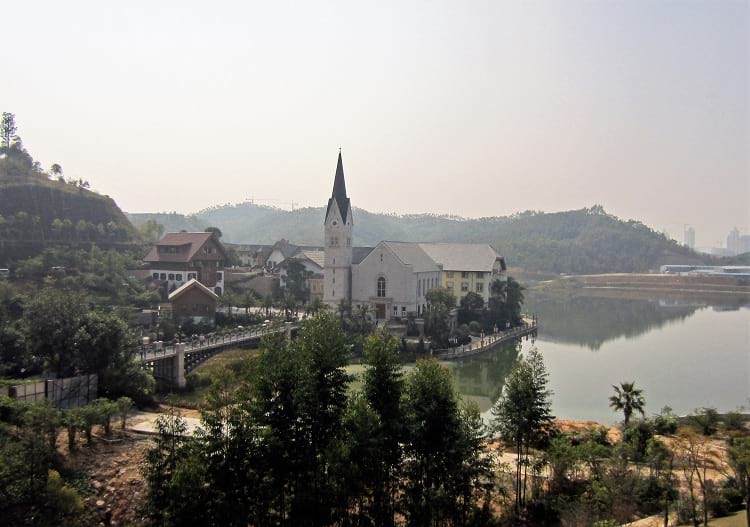
Hallstatt, China. (Hanno Böck / Wikimedia Commons)
Unlike the real Hallstatt, the Chinese Hallstatt is a high-end residential project, but it is attracting tourists as much as the real place. Not residents on the same scale though. As with the other replica towns, the residences here have gone to mainly wealthy Chinese buyers. As few of them appear to have plans to live here on a permanent basis, the new town lies empty most of the time and has become yet another Chinese ghost town.
The future of the Chinese replica towns
If you scour the Western mainstream media, you will come across an almost general gloating over the fact that these towns currently remain mostly unpopulated. Aside from the fact that gloating over other people’s seeming misfortune is not a very nice thing to do, it is far too soon to gloat. From the way China has been developing economically in recent years, it is quite possible that its real estate market will pick up once again. The replica towns will then find more buyers and the Chinese middle-class will have beautiful environs to raise their children in.
In parting though, Chinese builders ought to consider building reproductions of ancient Chinese towns with the marvellous Chinese architecture we see so often in Chinese historical dramas. They are more suited to the landscape and the climate.
Enjoyed this article? Also, check out “Monowi, Nebraska: A Village in Boyd County, United States with a Population of One“.
Fact Analysis:
STSTW Media strives to deliver accurate information through careful research. However, things can go wrong. If you find the above article inaccurate or biased, please let us know at [email protected].
RELATED
- April 6, 2018 Kangbashi, Ordos – Ghost City? Economic Ingenuity? Or Both?
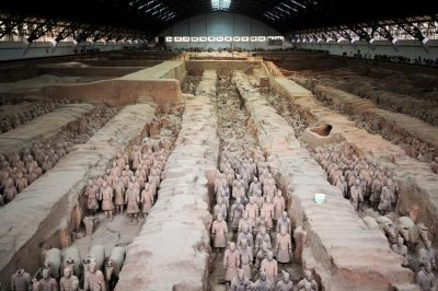 December 3, 2018 Terracotta Army: An Army to Protect the Dead in Their Afterlife
 June 22, 2019 Rape of Nanking is One of the Most Brutal and Forgotten Genocides of 20th Century
 May 22, 2019 The South China Mall: Why Did the Largest Mall in the World Fail?
The post Replica Constructions of World-Famous Cities and Towns in China: Tianducheng, Thames Town, and Hallstatt appeared first on .
]]>The post North Sentinel Island: Home to an Uncontacted, Hostile and Primitive Tribe appeared first on .
]]>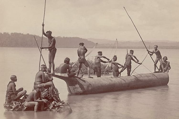
Sentinelese people catching sea turtles, 1903. (Smithsonian Institution / National Anthropological Archives: NM 40922 04421302)
The North Sentinel Island in the Andamans is currently in the news for all the wrong reasons. Located in the Indian Ocean, this island is where the Sentinelese tribe resides, which is an ethnic group of the last uncontacted people to ever live in the world. Not wanting to establish any contact with the outside world, this secluded tribe wishes to be left alone. But what is so special about these islanders, which has suddenly put them under the spotlight, making waves across the globe?
History of the Sentinelese tribe and North Sentinel Island
Situated in the Andaman Islands, a part of the Indian union territory of Andaman and Nicobar, the North Sentinel Island lies far off in southeastern Bay of Bengal. It is roughly a small, square-shaped remote island, which is covered with dense forests and flanked by coral reefs in abundance. It is said that the Sentinelese tribe has been living on this island for more than 60,000 years, without attempting to contact the outside world ever since. Speaking their own Sentinelese language, these indigenous people are said to have descended from the Negrito race, which though are closely related to the African tribes, are quite distinct in their genetic makeup. Standing approximately five feet, five inches tall, these dark-skinned aborigines could possibly have been the first Africans to set foot on the North Sentinel Island thousands of years ago.

Aerial photo of North Sentinel Island. (Medici82 / Wikimedia Commons)
As per the Indian Government Census, the Sentinelese tribesmen are said to be an off-shoot of the more forthcoming Jarawa-Onge tribe (also from the Andaman Islands), but their self-imposed isolation over all these years indicates that they could be an ethnic group in themselves, with their own special ways and means to communicate with each other. The natives often turn hostile and turn away people, who try to make their way inside their protected land, hoping to interact with them. Still using bows and arrows to hunt and kill, it is believed that these Stone Age hunter-gatherers might surprisingly not be able to make fire till date.
The way of life of Sentinelese people
They rely heavily on fish and coconuts for food and as per government bodies that keep an eye out on them, no case of consuming human flesh has ever been reported on the island so far, implying that the Sentinelese do not practice cannibalism. They fish in the shallow waters in narrow canoes and live in houses, sizes of which depend on the number of family members. The Sentinelese make use of metals washed ashore from shipwrecks in order to make spears and tips of arrows for hunting. The women tie strings of fibre around their waist, neck and head, while men wear thicker waist belts, along with necklaces and sometimes headgears. They are even said to apply a yellow paste all over their bodies.

The Jangli hut at Rutland Island, a very similar structure to that used by the Sentinelese people. (Maurice Vidal Portman / Wikimedia Commons)
Having cut themselves off from any form of foreign contact for all these years, the aboriginals are susceptible to several common viruses, including fever, cough and cold and the slightest contact from an outsider could wipe off their entire population. Since they do not allow foreigners to step on their tiny island, reacting with resentment to any possibility, the exact number of tribals actually living on the island is unclear. However, as per the Indian Census of 2011, the population of Sentinelese could be anywhere between 50 and 150.
Indian Government rules, regulations and laws regarding the Sentinelese
In the year 1967, with the help of Indian anthropologist Trilok N. Pandit, the Government of India tried to initiate contact with the Sentinelese people, offering a hand of friendship and leaving gifts for them. But they were turned away with humiliation. In 1970, an attempt to contact them was thwarted again, this time, with much hostility and embarrassment from the tribal women.
The last known contact with these indigenous people was back in 1996, after which the government left them as is. Despite being let down previously, the Government of India tried to assess their situation post the Indian Ocean tsunami of 2004 from afar, but the Coast Guards’ helicopters were shot with a volley of arrows and spears and were driven away forcefully. In 2006, two fishermen, who had inadvertently drifted too far away towards the North Sentinel Island, were killed mercilessly at the hands of this primeval ethnic tribe.
A Sentinel shooting an arrow at the helicopter. (Mr Minton / Flickr)
The Government of India has since been very particular about the Sentinelese, leaving them the way they are. The tribe is protected under the Indian law and it is a criminal offence to enter within a 5 kilometre radius of the island. The government only monitors the activities of the primitive islanders from a distance, never going too close to the island. The strict laws even necessitate a ban on tourists trying to venture far off into the North Sentinel Island, while the tribal people are never prosecuted for killing non-Sentinelese people. Under the Section 8 of The Andaman and Nicobar (Protection of Aboriginal Tribes) Regulation of 1956, and Amendment of 2012, provisions for stringent punishment, including a jail term of up to 3 and 7 years and fine have been made for exploitation of tribal communities in the Andaman and Nicobar Islands.

Communal huts made by Andamanese people, people of a similar indigenous ethnic group and living in the close proximity of the Sentinelese people, ca. 1886. (Edward Horace Man / Wikimedia Commons)
The recent event at the North Sentinel Island
While there have been several previous misfortunes occurring at the North Sentinel Island, with the Sentinelese tribesmen executing those trying to intrude, one incident has particularly rocked the world recently. A 26-year-old American evangelist, John Allen Chau, who wished to spread the word of God and convert the Sentinelese, visited the island thrice before he was killed with arrows, meeting a tragic end. Having visited the island before in 2015 and 2016, the interloper missionary, who was also an adventurer and international soccer coach, illegally travelled to the island, with the help of local fishermen and ventured inside, recording his entire journey, eventually getting killed by the unreceptive Sentinelese on November 22, 2018.

Distribution of indigenous and no-indigenous settlements at Andaman islands. (CJLL Wright / Wikimedia Commons)
Other uncontacted tribes in the world
An NGO – Survival International – a global human rights organization formed in 1969, campaigns for the rights of the uncontacted and indigenous tribes all over the world. As per its survey, there are as many as 100 uncontacted ethnic tribes in the world, out of which 77 live in Brazil alone. A tribe from Rondonia, Brazil, has only a lone man left, who has resisted contact from the outside world. He is popularly known as the ‘Last of his Tribe’. Another uncontacted tribe is the Awa in Brazil, which is the most endangered tribe in the world due to settlers returning to colonize their land. The members of this group remain hidden most of the time during the day and hunt monkeys at night.
The few dozen people of Kawahiva make up another tribe, the members of which are constantly on the run, for fear of losing their land to deforestation and lumbering activities in their region. The native people of the Mashco-Piro tribe are hunter-gatherers who have actively shunned outside contact and live deep inside the Amazon rainforest. The tribal people from Brazil’s Acre rainforest area are nomadic people, who face severe threat of extinction due to the illegal logging businesses and the diseases the lumberjacks bring in with them. Apart from these Brazilian tribes, there are the ethnic groups of New Guinea, living in the dense jungles. Indonesia is also home to some 40 odd indigenous groups, along with some more in Congo, Botswana, and some in Peru too.

2009: Sightings of isolated people in Acre, Brazil. (Gleilson Miranda / Secretaria de Comunicação do Estado do Acre)
Even though the Sentinelese continue to make news headlines every day after the death of the Christian missionary, they have managed to remain untouched from the impact of modernization in the 21st century. Their seclusion and constant prehistoric ways of living baffles us and they remain a mystery and subject of great intrigue, answering our pressing questions that there still exists a world where civilizations live in ways, man left behind millenniums ago.
Enjoyed this article? Also, check out “Juana Maria: The Isolated Woman of the Remote San Nicolas Island“.
Recommended Watch:
A Blank in the Map | A BBC Documentary presented by Sir David Attenborough
Fact Analysis:
STSTW Media strives to deliver accurate information through careful research. However, things can go wrong. If you find the above article inaccurate or biased, please let us know at [email protected].
RELATED
- January 17, 2019 Pamban Bridge: A Historic Indian Sea Bridge That Was Built on Modern Principles
 July 3, 2019 The Bengal Famine of 1943: The Man-Made Famine That Killed Around 3 Million Indians
- July 15, 2019 Adalaj Stepwell: A 500-Year-Old Architectural Masterpiece With a Tragic Tale of Unrequited Love, Sacrifice And Loss
 May 21, 2020 Cyclone Amphan Leaves a Trail of Destruction in West Bengal and Odisha
The post North Sentinel Island: Home to an Uncontacted, Hostile and Primitive Tribe appeared first on .
]]>The post The Island of the Dolls: Nothing Childlike About It appeared first on .
]]>
Dolls hanging from the tree at the Island of the Dolls in Mexico. (Esparta Palma / Flickr)
The story relates to the mid-20th century Mexico. Don Julian Santara Barrera, an eccentric man, had parted way with his wife and daughter to live alone, a recluse, on an island on Teshuilo Lake in the Xochimilco canals of Mexico (also called the Venice of Mexico).
In the year 1950, he saw the corpse of a young girl floating in the canal. ‘I could have saved her, he mused, ‘had I intervened timely’. The girl’s death was not his fault but still, he grew remorseful.
Finding a doll floating at the same place as the corpse and taking it to be a manifestation of her spirit, he took the doll out of the water and hung it on a tree. That was the beginning.
Soon the island would be teeming with thousands of such dolls, pooled up by him as well as by the visitors. Barrera’s belief that dolls carried the spirit of drowned girl found resonance in tourists who flocked to see dolls even as the spectre was sans joie de vivre of a typical picnic spot. The jaded, wasted and mutilated dolls, exposed as these were to the elements of nature without any care or maintenance, were anything but a pleasant sight.
Mexico fell to the pull of weird, ugly, sullied and corrupted dolls. Many said they heard the dolls wail, whisper, brawl and giggle at Isla de las Munecas or the island of the Dolls.

Isla de las Munecas. (Cordelia Persen / Flickr)

Isla de las Munecas. (Derek Simeone / Flickr)
Island of the Dolls in Mexico
Doll’s island at Xochimilco canals is an hour of boat journey from Embarcadero (eastern waterfront and roadway of the port of San Francisco, California). The Island is the best-known Chinampas (raised agriculture fields between canals for farming in swampy areas) or floating garden in Xochimilco.
The name floating garden is a misnomer as the land mass is rooted to the lake bed by the root system of willow trees planted in the periphery. For a guided tour to the site, brightly coloured flat-bottom boats called ‘trajineras’ are available. Passing through scenic lagoons, floating restaurants and musical entertainment on way, these boats reach to the final sombre destination-the island of dolls.
Death of Don Julian and accounts of tourists
Don Julian was found dead in waters similarly as the corpse of girl that he believed he should have saved. His grisly death added to the overall mystery of the island and reinforced the myth of the island being a haunted place. Locals dismiss ghost theory and say that the place is ‘charmed’ and not inimical to anyone in any way.
Professional photographer Cindy Vaskos visited the island in 2015 and opined that it was the creepiest place she had ever seen. Way to the site, she said, was all greenery and avian chirps till you see dolls hanging from trees, and then there is ominous silence and seriousness.

Close up photos of the dolls. (Kevin / Flickr)
After Don Julian, the new caretaker on the island is Anastasio, his cousin. The spirit of the ‘little girl’, he says, resided in the collection of dolls. Dolls come alive at night, he affirms, moving their heads and whispering. Mutilated dolls though, infested with moulds, insects and spider webs, have turned floating garden into a graveyard of dolls.

More dolls. (Zen Skillicorn / Flickr)
An alternate opinion on the story holds that the death of the girl in question never happened. That, they say, was the hallucination of a recluse living away from mainstream society. Whatever be the real reason behind the doll-story, dolls attract tourists from the world over.
Majority of people believe in spirits, and in the afterlife. On seeing these dolls, it seems, their innate belief becomes part of their overall observation. When they see dolls, they also see the image of their own thought process.
Enjoyed this article? Also, check out “The Crooked Forest of Poland“.
Fact Analysis:
STSTW Media strives to deliver accurate information through careful research. However, things can go wrong. If you find the above article inaccurate or biased, please let us know at [email protected].
RELATED
- August 22, 2019 La Pascualita: An Extremely Well-Preserved Corpse, or an Eerily Life-like Mannequin?
- December 30, 2018 Lake Reschen: Italy’s Submerged Lake Reschen
- July 6, 2019 Playa de Gulpiyuri: The Tiny Beach in the Principality of Asturias in Spain
- January 6, 2019 Lake Crescent: Washington State’s Beautiful, Deadly Lake and its History of Chilling, Notable Incidents
The post The Island of the Dolls: Nothing Childlike About It appeared first on .
]]>The post Kerguelen Islands: The Remotest Place on Earth appeared first on .
]]>
Kerguelen Islands: Aerial photo of Îles du Prince de Monaco, Kerguelen Archipelago. (Armand Patoir / Wikimedia Commons)
There are a lot of places that are untouched by human civilization and have still remained unknown to the rest of the world. From islands far off in the oceans to certain tribes that the modern society know nothing about, the world has something new for us each day. One such place that remained unknown until the dawn of the seventeenth century is the Kerguelen Islands in the southern Indian Ocean. Also known as Desolation Islands, the archipelago is one of the remotest places and most isolated landmasses on the Earth.
Discovery of the Kerguelen Islands and its brief history
In February 1772, a navigator and a lieutenant in the French naval service named Yves-Joseph de Kerguelen-Tremarec officially discovered the landmass in the southern Indian Ocean while on a voyage. He couldn’t bring his ships to anchor at the coasts, so the captain of his accompanying ship claimed the islands for the French crown on their first visit.

Portrait of Captain James Cook. (Nathaniel Dance-Holland / National Maritime Museum)
Hoping that the newly-discovered piece of land would be suitable for agriculture and rich in minerals and natural resources, Kerguelen-Tremarec reported of the island to King Louis XV of France. The royal then sent the sailor back to the island the following year to bring back more news of his newly-claimed territory. But when the explorer couldn’t land on the islet a second time, he deemed it unfavourable for habitation and called it useless and sterile.
Then in December of 1776, British explorer Captain James Cook, on his third voyage, anchored his ship on the island, which comprised of some 300 smaller islands and islets covering roughly 7,215 square kilometres. Although Captain Cook landed on the island during Christmas time and called the place Christmas Harbor, he let the original name stay, honouring the French discoverer.
Due to its remoteness from the mainland and harsh landscape, Captain Cook instead coined another name, calling the entire landmass the Desolation Islands.

Satellite photo of Kerguelen Islands. (NASA Earth Observatory)
After the early discovery of this remotest place on earth, Kerguelen Islands became a hotspot for whalers and sealers. They began hunting on the islands, almost driving elephant seals, fur seals and whales to the brink of extinction, killing them for their fur and meat. Another English voyager John Nunn, became shipwrecked on the islands in the year 1825 and lived there with his crew for two long years, surviving on bird eggs and seal meat, until help arrived eventually.
Modern discovery of Kerguelen Islands
Almost three decades ago, scientists on the research vessel Joides Resolution were drilling in the Indian Ocean, when they found something extraordinary. While extracting samples from beneath the ocean bed, they found that the Kerguelen Plateau had sunk almost 20 million years ago under the surface of the ocean. They thus concluded that the plateau was a lost continent on the surface of the planet, which could have been a tropical zone once, where dinosaurs and lush green trees could have existed millions of years ago.
Huge volcanic eruptions could have given rise to the Kerguelen Islands that rose out of the plateau from beneath the ocean surface, making it the remotest place on earth. As per NASA, the archipelago is nothing but the highest points of land on the surface of an underwater plateau.
Researchers are also of the opinion that studying more about the islands in the tundra region is likely to give them an insight into how the countries of India, Australia and Antarctica broke apart during the drifting of the Pangaea. The separation of the supercontinent billions of years ago, gave rise to the Kerguelen Islands in the plateau region, cutting them off and making them isolated from the rest of the world.

Meanders at the Kerguelen Islands. (Armand Patoir / Wikimedia Commons)
Nearest neighbour
The Kerguelen Islands are so far off in the Indian Ocean that the nearest populated location is Madagascar, roughly over 3,300 kilometres away. Due to the Island’s rocky nature, there is no way in which air travel can be made possible to the Islands and hence ships bring in visitors. The French scientists are sometimes dropped off or picked up from their base by a helicopter.

Golden penguins of Kerguelen Islands. (Channer / Wikimedia Commons)
Although the Kerguelen Islands are part of the French territory now, they are comparatively closer to the Antarctic region than to Europe. Apart from the penguin, whale and seal populations, there is absolutely zero human population on the island. The harsh winters and the dry weathers are unsuitable for human habitation, yet French scientists visit the island for research purposes. Setting up base at the Port-aux-Français, scientists study geology, weather and climatic conditions, bodies of ice and environmental sciences related to the islands.

Kerguelen island cabbages. (B.navez / Wikimedia Commons)
Devoid of the human population, a few visitors, along with support staff and research assistants at the French outpost, come over to explore global interconnection, animal encounters, daily routine and past human activities on the Desolation Island every once in a while. Due to the absence of modern development and the mountainous terrain, visitors take the waterways to travel to the place.
Weather, flora and fauna
With a polar climate, the temperatures in the Kerguelen Islands always range below ten degrees centigrade during the summer months too. Grasses, lichens, planktons and mosses, along with special Kerguelen cabbage form the flora at the Desolation Island, while wild cats, feral rabbits, reindeer and wild sheep are the main fauna in the region.

Cliff in the Kerguelen Islands during winter. (Benoit Gineste / Wikimedia Commons)
Despite being a part of pop culture, where noted writers like Edgar Allen Poe and Jules Verne have mentioned this remotest landmass in their literary works, Desolation Island or the Kerguelen Islands still remain a mystery for the rest of the world.
Enjoyed this article? Also, check out “Tristan da Cunha: The Remotest Inhabited Island in the World“.
For more unusual stories & intriguing news follow STSTW Media on Instagram and Facebook. Also, join our live chat discussion on Twitter.
We welcome your contribution at [email protected]. Please include your name, city, state, and country.
Fact Analysis:
STSTW Media strives to deliver accurate information through careful research. However, things can go wrong. If you find the above article inaccurate or biased, please let us know at [email protected].
RELATED
 October 1, 2018 Institut Le Rosey: The World’s Most Expensive Boarding School Par Excellence
- April 16, 2020 Katas Raj Temples- The Oldest Hindu Temple in Pakistan
- September 6, 2018 Exploring the Enchanting Mont Saint Michel
- July 6, 2019 Playa de Gulpiyuri: The Tiny Beach in the Principality of Asturias in Spain
The post Kerguelen Islands: The Remotest Place on Earth appeared first on .
]]>The post Highgate Cemetery: Cemetery Turned Nature Reserve appeared first on .
]]>
Highgate Cemetery, England. (Panyd / Wikimedia Commons)
Highgate cemetery situated in North London, England is also a nature reserve. It came into existence in 1839 as London saw a massive boom in population during that time. It was one of the seven cemeteries, known as Magnificent Seven, to come into existence to bury the dead from the First and Second World Wars and is considered to be one of the most fashionable cemeteries.
As the number of deaths reduced after the Second World War, the cemetery fell into a ruin. During it’s time being neglected, the cemetery became a sanctuary for birds and animals. It became home to over 40 species of birds, 20 species of butterflies, and certain forest creatures like spiders, foxes, badgers, and bats. Nature took over; ferns, mosses, and wildflowers were seen all over the place.
The cemetery has two sections, East & West side, West being the older of the two. The West side requires a tour guide and isn’t freely accessible to the public. It contains at least 70 popular gothic architecture including the Circle of Lebanon, Egyptian Avenue, and Terrace Catacomb. A lot of the architecture and trees have existed from well before the 19th century, for instance, a certain redwood tree has been there since the cemetery was initially designed.

Circle of Lebanon, Highgate Cemetery West. (Scott Wylie / Flickr)

Egyptian Avenue, Highgate Cemetery West. (JohnArmagh / Wikimedia Commons)
The newer East side is easily accessible to the public; people can request burials here and it is also open for self-guided tours. It has a gothic aesthetic with little paths that you can explore, weathered tombs, overhanging canopies of trees, and ivy-covered memorials. The cemetery began with a decent 17 acres, of which 2 acres were reserved for the burial of Non-Anglicans. The cemetery later became so popular that the property was extended by 20 acres on the East side.
Historic England
Eventually, in 1975, the cemetery went bankrupt. In the same year, a non-profit organization called The Friends of Highgate Cemetery was born to protect and preserve the blooming flora and fauna of the cemetery. After about a decade of the organization’s efforts to restore and conserve the cemetery, the cemetery was listed as Grade I under the Historic England Register of Parks and Gardens of Special Historic Interest.
The Register lists all kinds of places like battlefields, monuments, buildings, parks, and burial grounds. Listing is done to preserve and protect sites to create awareness of spaces, their value and preservation. All sites included in the Register are protected legally, and to be included in the list it is mandatory to register with them. They also usually only list sites of particular importance to protect them. They pick sites such as gardens, grounds, and town squares, but sometimes even cemeteries and pumping stations are included if their landscaped designs are deemed protectable.
Notable burials at Highgate Cemetery
The grave of Karl Marx, a German philosopher and revolutionary, used to be one of the most visited graves in London. He was initially buried in the East part of the cemetery but in the 1950s his grave was moved to the Westside. The tomb is made up of a bronze bust of Karl Marx set up on a marble pedestal, on it you can read the last few words of the Communist Manifesto written by the deceased. The cemetery not only acted as a makeshift shrine for Karl Marx for the longest time but also became a suitable spot for haters to attack via bombing like the attack that took place in 1970.

Grave of Karl Marx. (© nick macneill / geograph.org.uk)
The grave of Karl Marx was the most visited graves until recently when George Michael, an English singer and songwriter, was decided to be buried here next to his mother. Michael Faraday – electromagnetism scientist, George Eliot – Victorian novelist, Douglas Adams – science fiction author, and Rowland Hill – inventor of the postal system are some other notable people buried here.
The first person, Elizabeth Jackson of Little Windmill Street, was buried here on 26 May 1839. The cemetery is still functional and at least 30 plots are sold each year. Only people who are at least 80 years old and those that are terminally ill can request plots beforehand, for the rest of the people plots are only available for immediate use.
Enjoyed this article? Also, check out “Ämari Pilots’ Cemetery: Where Aircraft Tail Fins Adorn Soviet Pilots’ Tombstones“.
Fact Analysis:
STSTW Media strives to deliver accurate information through careful research. However, things can go wrong. If you find the above article inaccurate or biased, please let us know at [email protected].
RELATED
- April 7, 2019 Pere Lachaise Cemetery: Celebrated Parisian Cemetery, Where Millions Visit to Pay Homage
- January 22, 2019 Ämari Pilots’ Cemetery: Where Aircraft Tail Fins Adorn Soviet Pilots’ Tombstones
- May 26, 2019 Neptune Memorial Reef: An Eco-Friendly Underwater Graveyard Off the Florida Coast
- June 5, 2019 Wadi-us-Salaam: The World’s Biggest Necropolis that Houses More than Five Million Graves
The post Highgate Cemetery: Cemetery Turned Nature Reserve appeared first on .
]]>The post Chained Libraries: Confining Books or Readers? appeared first on .
]]>
Wimborne Chained Library. (ReflectedSerendipity / Flickr)
With the advent of e-readers, many in our generation are unaware of libraries. The concept of libraries was uncommon during the Middle Ages, circa 5th to 15th century. Back then books were chained to shelves in European libraries; to them, the concept of freely accessing books was just unusual. During that period, books were kept in book chests called almeries. These chests were kept in rooms that included valuables and hence, the rooms were always locked. The room wasn’t actually considered a library as we know it today, and visitors were not allowed to freely walk in and read the books.
As the demand for books increased during the beginning of the Renaissance period, institutions started using separate rooms to store books. One room would be used for books in common use, similar to a reference section in modern times, and another room for books in daily use. Institutions in that period had a loan system that allowed scholars to borrow books from them for a year at a time. This proved to be ineffective because other interested scholars would have to wait a whole year before they could read the book. In order to make books easily accessible to students, scholars, and commoners without any waiting period, institutions started chaining some valuable books and placing them in community libraries.
History of chained libraries
Sorbonne Library in France seems to be one of the first libraries in the late 13th century to have started the process of chaining books. Libraries determined the value of books on the basis of educational worth and not financial worth. It would have been ironic to chain financially valuable books because the process of chaining them was quite expensive. There were even some educationally valuable books that were kept under a triple key system so that readers would have to get permission from three separate officials.
Eventually, books were also chained to avoid books being stolen since books were very expensive to print back then. Once the printing press was introduced in 1450, the number of prints available of the same book increased significantly. This meant the value of books dropped drastically and made them less special, this eradicated the need for chaining books to the shelves.
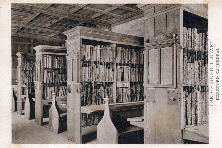
Undated photo of Hereford Cathedral Chained Library. (pellethepoet / Flickr)
The process of chaining books
As for the process of chaining itself, the chains were not attached to the spine of the book but instead were attached either to the corner or the cover of the book. Attaching to the spine would cause unnecessary wear and tear while removing the book from the shelf.

Chained Bible at Hornby Library. (Rodhullandemu / Wikimedia Commons)
Due to this way of chaining, books were generally displayed the ‘wrong way’ with their spines not visible to the reader which would otherwise cause tangling of the chain. These chains would be long enough so that the readers could take the books to a table, but they were short enough so that the books would stay within the library itself.
In some libraries, there were benches available just below the shelves for readers to sit and read. In others, there were rows of seated lecterns. If a book ever needs to be removed from the chain, the librarian would use a key to remove the chain.
Some notable chained libraries
These days many libraries have given up chaining books, the few books that remain chained are done so for more of a vintage value than functional. However, off late, there seems to be a growing interest in restructuring chained libraries. There are a few chained libraries that are known to have survived with their original security systems still in place.
Hereford Cathedral Library is the largest chained library that is still in existence from the 17th century with its chains, rods, and locks still intact. Some old books are kept as manuscripts, and some of them contain ancient handwriting and illustrations in gold and colour. Some notable books here are the Hereford Gospels that were written in the 8th century and the Hereford Antiphonary written in the 13th century.

Hereford Cathedral Library. (Matthew Hartley / Wikimedia Commons)
The chained library in Wimborne Minster built in 1686 is the 2nd largest chained library in the UK that is still in existence. Another library is in the Church of Saint Walburga built in the 15th century. This library is now home to a museum that lets visitors look at the library’s original books and chains. Malatestiana Library in existence since the Italian Renaissance has undergone a significant amount of work to rebuild and preserve itself.
Contrary to what it might seem, libraries were trying to make books widely available to students and commoners by chaining them and not trying to restrict access. Chained libraries might have been in reducing printing cost and making sure books were available to more people at a time, but they were not very enjoyable. These libraries were often overcrowded and readers would be forced to sit very close to each other causing awkwardness. Many time readers would clump together to share one book. In these situations, it seemed like the readers were confined in one place and not the books.
Enjoyed this article? Also, check out “The Fascinating ‘Amber Room’: The Fabled ‘Eighth Wonder’ of the World“.
Recommended Visit:
1. Sorbonne Library | France
2. Hereford Cathedral | England
3. Wimborne Minister Chained Library | England
Fact Analysis:
STSTW Media strives to deliver accurate information through careful research. However, things can go wrong. If you find the above article inaccurate or biased, please let us know at [email protected].
RELATED
- October 1, 2018 Institut Le Rosey: The World’s Most Expensive Boarding School Par Excellence
- January 26, 2019 Astana: An Ultra Modern Capital City Right in the Middle of Vast Empty Grasslands
- August 11, 2018 Masada in Israel: Did 967 Rebellious Jews Really Commit Mass Suicide Here?
- May 31, 2019 Chand Baori: A Quaint Remnant of the Past
The post Chained Libraries: Confining Books or Readers? appeared first on .
]]>The post Capilano Suspension Bridge: A 129 Year Old Bridge that Continues to Draw Intrigued Visitors appeared first on .
]]>
Capilano Suspension Bridge Park. (GoToVan / Flickr)
In British Columbia, Canada, there is a 140 metres long bridge, suspended 70 metres above the Capilano River known as the Capilano Suspension Bridge. Built in 1889, this private facility charges an admission fee and catches the fancy of over 8 lakh visitors every year.
Presently, it has become a hotspot for tourists with adventure sports, walkways along the river, footbridges constructed for a better view of the valley and the recently opened sit down restaurant paying homage to the history of the place.
The construction of the Capilano Suspension Bridge
In the year 1888, a civil engineer and land developer of Scottish descent, by the name of George Grant Mackay bought 6,000 acres of forest land on both sides of the Capilano River and designed 25 acres of the land for his personal use as a summer home.
He built a cabin on the edge of the valley and decided to construct a walkway from one side of the river to his property on the other side. He consulted a Native Indian and the Squamish Chief, August Jack (Khatsahlano, Xats’alanexw), a logger who built canoes, totem poles etc. in the area.
In 1889, with the help of Jack and his brother Willie, a footbridge was constructed from hemp rope and cedar planks to cover the breadth of the canyon above the river. Jack used his horses to swim through the river and secure the ropes of the footbridge on the other side with enormous buried cedar logs. It was often referred to as the ‘Laughing Bridge’ due to the sound it emitted on a windy day.
Though Mackay had no intention of making it a tourist attraction, nonetheless, people were soon drawn to the fascinating suspended bridge. The adventurous ones, who made it to the other side, ended up ‘tramping’ around Mackay’s cabin, giving rise to the popular term, ‘Capilano Tramps’. Disturbed by this constant trespassing, Mackay sold it to Bruno Stelzer in 1892.
The start of the oldest tourist attraction
Bruno immediately realised the commercial potential of the place and started charging visitors 10 cents, which makes the bridge the oldest tourist destination in Vancouver. In 1903, Bruno asked engineer Harry Burgess to draw plans to replace the rope footbridge with wire cables. Finally, W.T. Farrell was given the contract to construct a sturdy bridge strong enough to support a strain of 60 tonnes.
Irishman Edward Mahon came to Vancouver in 1888 and started his mining business. In 1910, he fell in love with his deceased friend’s 19-year-old-daughter, Lilette. In order to be able to woo her, he decided to put Lilette’s mother Elizabeth in charge of his recently purchased Capilano Bridge property. He married Lilette the next year and also built the Tea House at the bridge property in a constant endeavour to improve its commercial value. He also refurbished the bridge with more cables in 1914.

Capilano bridge in 1919. (UBC Library Digital Collections)
Elizabeth, in the meantime, had met a forest ranger, much younger in years to her, ‘Mac’ Archibald Dunerick MacEachran, and the two had fallen in love. They got married in 1921 and Mac started actively promoting the property to visitors. In 1934, Mac decided to reveal to Elizabeth the existence of his 19-year-old-daughter, Irene, whom he now wished to call to Capilano to stay with them. Constructions were underway for a new, bigger house across the street from the bridge, when, unfortunately, Elizabeth passed away in 1934, a year before Mac bought the property from Mahon. The new house today has become the Bridge House Restaurant.
As a part of his promotional activities, Mac started inviting the local Native Indians to place their totem poles in the park displaying their art, adding a native theme to it. The Capilano Park till today is known to contain the largest private collection of Story Telling Poles that have ever existed, with varied styles of pole carving.
Mac finally sold the property to Henri Louis Isidore Aubeneau in 1945 and went away to settle down in California. Though Henri and his wife, Marie Moran bought the property and operated it as a tourist attraction, they refrained from making any major alterations to it. The Capilano Suspension Bridge Park again changed hands, when Henri sold it to Douglas McRae ‘Rae’ Mitchell in 1953.
The Rae and Nancy entrepreneurship
Unsure of the strength of a bridge so old, Rae completely replaced it in 1956 with a new sturdier bridge constructed in only 5 days. Designed by an engineer, Art Williams, the bridge was held together by steel cables held down on each side by 13 tonnes of concrete. The new bridge designed with the strength to hold over 1300 people, was tied to the old one using a pulley system across the huge gap.

Capilano suspension bridge. (Pixabay)
Rae developed trails along the bridge and converted the teahouse into a gift shop. The current owner, Nancy Stibbard bought off the Capilano Suspension Bridge from her father Rae, in 1983, with the goal to promote tourism in the area. She turned it into a tourist destination adding nature walks, performances by Native Indians, a series of trails like the Treetop Adventures and Cliff Walk.
Over the years, the popularity of the bridge has grown tremendously resulting in Nancy’s induction into the Canadian Tourism Hall of Fame at the turn of the century in 2000.
The most recent addition to the property is the Cliff House Restaurant in March 2018, the design of which is a tribute to the house of the original owner, George Grant Mackay.
Nancy’s son, John has joined the Capilano business and today the park boasts of over 2000 visitors in a day. The Story Centre in the park has archives from the past in terms of photographs, antiques and murals that have been specially put together to tell tales of the past. Under the ownership of Nancy Stibbard, the Capilano Suspension Bridge Park has become a hot-spot tourist destination with nature walks at breathtaking heights.
It is also home to one of the tallest living Christmas trees, the 152 feet tall Douglas fir. During the holiday season, in December, the entire valley below the bridge transforms into an enchanted forest with thousands of glittering lights around the Douglas fir and throughout the valley.
Enjoyed this article? Also, check out “Golden Bridge: The Connect to the Past and the Future of Vietnam“.
Fact Analysis:
STSTW Media strives to deliver accurate information through careful research. However, things can go wrong. If you find the above article inaccurate or biased, please let us know at [email protected].
RELATED
 August 24, 2019 Dinner in the Sky: The Thrill of Partying in a Crane Lift
- May 9, 2020 Elephant Beach: The Dazzling Sandy Beach in Andaman and Nicobar Islands Perfect for an Exotic Vacation
- December 12, 2019 Rakotzbrücke: ‘The Devil’s Bridge’ which Looks Straight Out of a Fairytale
- July 28, 2018 Las Lajas Sanctuary: A Church with a Mysterious Mural Nobody Can Explain
The post Capilano Suspension Bridge: A 129 Year Old Bridge that Continues to Draw Intrigued Visitors appeared first on .
]]>The post Vardzia: The Mesmerising Cave Monastery that Protected Georgians for Decades appeared first on .
]]>
Vardzia, Georgia. (Arian Zwegers / Flickr)
Georgia is located where Asia ends and Europe starts. It is flanked on three sides by Russia, Azerbaijan and Armenia, with the Black Sea forming its west coast. The country is known for the Black Sea beaches, the Caucasus Mountain range and the outstanding Vardzia Monastery.
Steeped in rich culture and history, the 12th century saw the rise of the Georgian empire, and what came to be known as the golden age of Georgia. With the gradual expansion of the Mongol empire in the early 12th century, the Georgian kingdom was preparing itself against an imminent attack.
Georgia’s golden era under King Tamar
King Georgi III started work on a hidden cave fortress in 1156, as a safe haven for the Georgian people in case of an attack. Legend has it that the King’s daughter, Tamara (Tamar) often accompanied him to the site of construction. One such day, Tamara slipped away from the watchful eye of her Uncle. On being called out for, she shouted back, “Ak var, dzia” which in Georgian means, “I am here, Uncle.” Apparently, her last two words echoed throughout the cave and were heard by her father, King Georgi III who decided to name the fortress just that! Vardzia.

The caves of Vardzia. (I kynitsky / Wikimedia Commons)
Tamara took over the kingdom in 1184, upon her father’s death. However, she had co-ruled with him for six years before his demise. Though Tamara was the first female ruler of Georgia, she was crowned ‘king’. She soon became famous as Tamar the Great, addressed as King Tamar.
She ensured the continuation of work on the cave fortress, and in 1185, she had it consecrated. Digging was underway on the side of the Erusheli Mountain. Tamar oversaw the finish of the expansive fortress and established within it places of meditation and prayer. The finished underground structure became a township of 13 levels with nearly 6000 cave living quarters.
The emergence of a holy city

Vardzia cave mural. (Doron/Wikimedia Commons)
The Vardzia was adorned with fresco work, paintings and pieces of religious significance. The access to this hidden town was through a concealed tunnel that had its entry near the banks of the river, Mtkvari. Making full utilisation of the extremely rich fertile soil of the Erusheli Mountain, the slopes were converted into terraces for farming.
This cave town boasted of 15 chapels adorned with murals and right in the heart of the town stood the magnificent Church of the Assumption with an enormous bell tower.
Slowly it started transforming into a holy city, housing as many as 2000 monks and gaining popularity as the Vardzia monastery. The monks designed an intricate irrigation system to ensure the supply of clean drinking water into the city and to irrigate the land.
This cave city also holds 28 wine cellars. There was a throne room and a huge reception area. Vardzia was the safest structure that could have been designed, considering it was completely hidden from view, inside caves. This was not only a formidable defence but also made the city impossible to be attacked. The Georgians were safe under the mountain, inside this secret city.

A passage inside the cave. (Soviet Life, 1969-02 / Wikimedia Commons)
Vardzia, the resilient cave monastery
The cave monastery ensured that the Mongols could not attack Georgia but sadly, it could not protect the people from a natural calamity.
Nearly a century after its existence, a devastating earthquake in 1283 destroyed more than half of the monastery. The Erusheli mountain had been ripped apart in places, exposing the hidden city. Notwithstanding the upheaval, a community of monks continued to live there for centuries.
In 1551, the Persian Shah Tahmasp I attacked and plundered the monastery. The monks were killed and treasures that represented the rich culture of the Georgians was stolen. This beautiful monastery that protected its people for centuries finally lay desolate.

Inside Vardzia cave monastery. (anjči / Wikimedia Commons)
1861 saw the resettling of monks in Vardzia, though it continued bearing onslaughts of ransacking and stealing. Today, it is home to a group of monks who zealously maintain living conditions in the caves. Spread over 500 metres, it is a testimony of the Georgian culture and religion.
Located in the 1995 formed historic region of Samtskhe-Javakheti, it continues to enthral people with its art and architecture. Known as the ‘Honour of Georgians’, the cave has been a part of the Vardzia Historical-Architectural Museum-Reserve, since 1985. It was included in the UNESCO World Heritage List as a Cultural Site in 1999, and then in 2007, as a Cultural and Natural Site.
Restoration works
In 2012, restoration work started on the Georgian Orthodox Church of the Dormition, also known as the Church of the Assumption. Two arches of exceptional architecture lead into the portico of the church which is house to the famous bell tower.
Inside, the walls of the church are full of frescoes portraying scenes from the New Testament. The north wall has a mural of Tamara holding the model of the church, standing next to her father, King Georgi III. The sheer grandeur of the place is proof of the knowledge of construction, architecture and planning that the people of Georgia had, centuries ago.
The resilient Vardzia not only survived the force of time and nature but is recognised today as the most impressive, rich cultural heritage structure of the country. King Tamar’s favourite residence until her death in 1213 is now her legacy and a fond memory of Georgia’s greatest ruler.
Enjoyed this article? Also, check out “Traditional Yaodong, Shaanxi Province: The Cave Dwellings in Which Many Chinese People Still Live“.
Fact Analysis:
STSTW Media strives to deliver accurate information through careful research. However, things can go wrong. If you find the above article inaccurate or biased, please let us know at [email protected].
RELATED
 September 25, 2019 Nemo 33: Swimming Pool with Oceanic and Underwater Cave Simulations
- May 9, 2020 Elephant Beach: The Dazzling Sandy Beach in Andaman and Nicobar Islands Perfect for an Exotic Vacation
- July 6, 2019 Playa de Gulpiyuri: The Tiny Beach in the Principality of Asturias in Spain
- December 18, 2018 The Unusual Glass Beaches of California and Hawaii
The post Vardzia: The Mesmerising Cave Monastery that Protected Georgians for Decades appeared first on .
]]>The post The Lost Bamiyan Buddhas of Central Afghanistan appeared first on .
]]>
Bamiyan Buddhas: Women passing by the huge cavity where once the ancient statue of Buddha stood. (DVIDSHUB / Flickr)
Ancient relics are pieces of work that have been handed down by our predecessors for us to take great pride in what humans could once achieve without the help of modern technology. The two colossal Buddha statues in Bamiyan, Central Afghanistan were living examples of just that – very well-preserved part of history – yet a rule of extremism in one of India’s neighbouring countries bombed out a treasured heritage that once stood towering above all else. Although the statues of Buddhas at Bamiyan have been lost forever, the legacy of the gigantic statues still continues to linger on.
History of the Buddhas at Bamiyan
Considered to be the largest statues of Lord Buddha in a standing position ever to be built during that period, the massive Buddhas at Bamiyan were nothing less than a site of great archaeological importance as well as traditional value. Some two hundred and fifty kilometers north of Kabul, in the capital city of Afghanistan, is the Bamiyan valley in the Hazarajat region, where two enormous statues of Gautam Buddha were carved out in the Koh-i-Baba Mountains between the third and sixth century BCE.
Standing at an elevation of approximately eight thousand feet, these two statues were carved in the mountainside, out of which the smaller statue was completed sometime in 507 CE and the larger one in around 554 CE. The smaller one of the two statues stood at a towering height of 125 feet while the larger one measured a whopping 180 feet in height.

One of the Buddhas before being destroyed. (Wikimedia Commons)
Blending together the Greco-Buddhist art form called Gandhara art; the Bamiyan statues depicted Gautam Buddha in a human form, as per the Buddhist philosophy but strongly reminded of the Classical Greek stone artwork, as was evident in the clinging and draping of monarchial robes on the two statues. Between the conquests of Alexander the Great and Islamic conquests of Asia, thousands of years ago, Greco-Buddhist art greatly flourished in the regions of modern-day India, Pakistan and Afghanistan, thus giving rise to the Gandhara art form, which was visibly the predominant style in the construction of the Bamiyan Buddhas.
Description of the Buddhas at Bamiyan
Hewn into the mountain itself, the two Buddha statues stood in a concavity with the back still attached to the wall till where the robe ended into the niche of the mountain. The legs and feet of the sculptures stood freely, as they provided for easy circumambulation around the statues to pilgrims that came visiting the Bamiyan Buddhas. The bodies of the statues were made by chiselling the sandstone of the mountain, while the details in the robes were carved using clay. Other intricacies like the facial expressions were designed using stucco (a type of plaster) and mud mixed with straw. This mixture was then painted on the statues to enhance their quality.

The smaller Buddha statue from the top. (Phecda109 / Wikimedia Commons)
The smaller statue, which was colloquially called Shamama in Afghanistan, was said to be multi-coloured, while the larger one, known locally as Salsal, was painted a bright red, particularly in hues of carmine. Pilgrims’ records also suggest that the smaller statue was decorated with gemstones and also had a plating of bronze over it. While the faces of the two statues were said to be made out of wooden or clay casts of that time, the arms and head of the huge stone figures were supported by wooden scaffoldings. A lot of wooden pegs were also used to hold the stucco together in place, which was visible in the form of multiple holes that were dug into the stone statues at different places. The bright colours of the giant figures faded with time and nothing much remained by the turn of the new millennium. Also, minor acts of vandalism over the years and continuous erosion over the centuries rendered the appearance of the Bamiyan Buddhas unsettling.
Destruction of the Bamiyan Buddhas in history
While the military organization of Taliban in Afghanistan were primarily responsible for the destruction of the huge stone statues of Bamiyan, several rulers preceding them had made futile attempts to bring down the massive stone Buddha figures. Genghis Khan invaded the Bamiyan valley back in the year 1221 but he did not bring any harm to the revered Buddha statues. Even the Mughal rulers, who made their way into India through the Bamiyan valley, paid little heed to the giant stone figures, except Aurangzeb, who is said to have used artillery to try to destroy the magnificent idols. Persian ruler Nader Afshar, too, tried his best to blow up the enormous statues but failed miserably. During the Shia Rebellion in the region in 1847, Afghani Emperor Abdur Rahman Khan ordered the destruction of the face of the larger stone Buddha idol and succeeded in the effort, although the rest of the huge statue remained as was.
Despite idolatry strictly not being a part of Islamic teachings, the Muslim country of Afghanistan never planned to destroy the two gigantic statues, stating that there was no form of worship at the site. However, in the March of year 2001, when the radical Islamic military outfit of Taliban took over the country, the militiamen active in Afghanistan and funded by the Al Qaeda, another multi-national Islamic organization, brought down the two idols by detonating bombs at their base and shoulders, ripping apart the glorious statues that once stood the test of time. This act not only received negative criticism from across the globe, but native Afghanis also mourned the felling of the two monumental statues that formed a major part of their lives, apart from also bringing in revenue as priceless heritage treasures.
In spite of multiple international pleas to save the timeless pieces of architecture, and several appeals from UNESCO, the Taliban did not budge. Instead, they set heavy explosives and launched rockets to bring down the Bamiyan Buddhas, which were listed in UNESCO’s World Heritage Sites.
Restoration efforts of the Bamiyan Buddha
Although nothing much could be done out of the rubble that was left after Taliban bombed the statues, a lot of individuals as well as different organizations, along with the Afghanistan government (post-Taliban rule) and UNESCO, came forward to pledge the restoration of the Buddha statues. It was hoped that with international funding and recovery of the fragments, partial anastylosis (procedure of rebuilding a monument from the original fallen parts) of the Bamiyan Buddhas was possible. But in 2006, after scaffoldings were constructed on the site where the smaller statue stood, serious safety issues cropped up and the plan was put in the backburner again. With little hope left and many problems that kept plaguing the restoration process, it was finally decided that the world’s wonders would return to their niches in the mountain, though only in the form of a 3D light projection.
Further Discoveries at the heritage site
After the world’s tallest Buddha statues were turned to dust, a team of international researchers and archaeologists returned to the site to dig deeper into the area. Several caves were found in the mountain range, which upon analyzing further, opened up a treasure trove. When Buddhism was at its peak in the region, many monks found shelter inside the small, domed caves alongside the foot of the mountain range, in which the statues stood tall. Many brightly-coloured, oil-painted frescos and ceiling art, which illustrated the teachings of life of Gautam Buddha, were discovered inside the caves, which is said to be the work of the hermits and monks that resided inside the caves. Apart from the two colossal structures of the Buddha, several smaller statues of the lord, in a seated position were also found carved into the cliffs nearby.
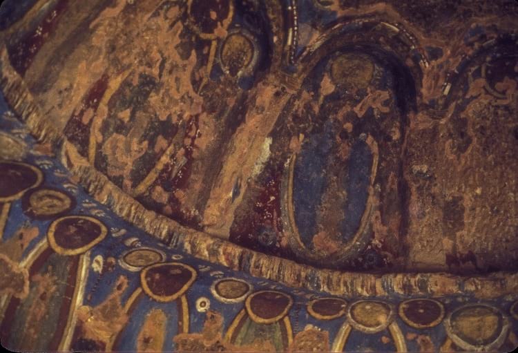
Paintings inside the caves which are now destroyed. (JERRYE & ROY KLOTZ MD / Wikimedia Commons)
Oil paintings dating back between the 5th and 9th centuries were also discovered inside. Apart from these paintings, which were made using natural pigments, coins and ceramics from that era were also unearthed during the excavation. But the surprising find that the archaeologists came across was a damaged sculpture of Gautam Buddha in a reclining position, which was almost 62 feet in length. Although the sculpture was badly damaged, it raised hopes for many other such enormous finds.
But even as the treasures of the lost world came to light from the caves in the Bamiyan valley, the gigantic Buddha statues, which the world once took great pride in, had to quietly settle in the dark forever.
Enjoyed this article? Also, check out “Naqsh-e Rustam: The Incredible Tombs and Rockface Reliefs of the Sassanian Kings“.
Fact Analysis:
STSTW Media strives to deliver accurate information through careful research. However, things can go wrong. If you find the above article inaccurate or biased, please let us know at [email protected]
RELATED
- September 21, 2019 Batu Caves of Malayasia – The Largest Shrine to Lord Murugan Outside India
- January 26, 2019 Astana: An Ultra Modern Capital City Right in the Middle of Vast Empty Grasslands
- May 9, 2019 Naqsh-e Rustam: The Incredible Tombs and Rockface Reliefs of the Sassanian Kings
- August 11, 2018 Masada in Israel: Did 967 Rebellious Jews Really Commit Mass Suicide Here?
The post The Lost Bamiyan Buddhas of Central Afghanistan appeared first on .
]]>The post Socotra Island of Yemen: The Most Alien-Looking Place on Earth appeared first on .
]]>
Socotra dragon tree, native to Socotra Island. (Rod Waddington / Flickr)
Socotra is a small and compact archipelago in Yemen with an area of approximately 1,400 square miles. It is comprised of four islands and islets, off the coastal Horn of Africa in the Indian Ocean. It is situated around 350 km on the southern part of the Arabian Peninsula.
The island is replete with more than 800 unique species of flora and fauna of which almost one-third are believed to be endemic. There are unquestionably numerous plant species that still need to be discovered. The most prominent of them are the mythical dragon’s blood trees that resemble flying saucers roosted on the tree trunks.
Geographical characteristics
The archipelago is characterised by narrow and confined coastal plans, pristine wide beaches, limestone plateaus and caves and the towering Hajhir mountain range that rises as high as 1,500 meters above the sea level.

Hawk cave in Socotra island. (Wikimedia Commons)
Socotra is flanked by its three siblings and relatively smaller islands of Samḥah, Darzah Al-Ikhwān, and Abd Al-Kūrī. Much akin to the Galapagos Islands, Socotra is famous for its boundless natural fortunes and endowments.

Hajhir mountain range. (Rod Waddington / Flickr)
Climate
The climate here is harsh and temperate with average temperature reaching 25°C with hardly any rainfall. Despite the hostile climate, the island is home to some of the most stunning and marvellous forms of vegetation and untamed life.
History
The name Socotra has a correlation with the Sanskrit term “dvipa-sakhadara” which means paradise or the abode of bliss. The island finds note-worthy mentions in different legends. The indigenous population were originally Christians. However, the 17th century was a marked spectator to the disappearance of the religion.
For several years, the Mahra sultans of Yemen reigned over the island. Their rule was disrupted after the Portuguese invasion and occupation of the island from 1507 to 1511.
In 1834, the British tried to buy the island but failed in their pursuit. However, sometime around the 1880s, the sultan took refuge under the British defence and dominance. The sultanate culminated in 1967 with Socotra becoming a part of the sovereign and unified Yemen. The island had also enchanted the likes of the swashbuckling Alexander the Great, Marco Polo, and the legendary Sinbad.
The foliage of the island
A standout amongst the island’s most astonishing plants is the “Dragon’s Blood Tree” (genetic name Dracaena Cinnabar). It is an unusual looking tree having the shape of umbrellas. As the legend goes, the purple-hued resins of the tree are nothing but the dragon’s blood. They are trusted to have therapeutic properties. In the medieval times, these resins found use in making violins. Nowadays, the locals use the resin to manufacture paints and varnishes.

Close up of dragon blood tree. (Rod Waddington / Flickr)
Another remarkable plant is the purported “Desert Rose Tree” (genetic name Adenium Obesium). The tree has a captivating shape like elephants’ legs that are trying to make inroads into the rocky soil.

Desert rose tree. (Rod Waddington / Flickr)
The tree also delivers wonderful and colossal pink blooms in April. The succulent trunks of the trees are precious water reservoirs in the arid desert climate. The tree grows up to a height of five meters and a diameter of three meters.
Other endemic plants of Socotra include the monstrous and succulent Dorstenia Gigas, the cucumber tree Dendrosicyos Socotranus, Moraceae, the Socotran pomegranate tree Punica Protopunica, Boswellia Socotrana, and Aloe Perryi.
Diverse fauna
The Socotra island chain also owns numerous distinctive fauna that includes bird species like starling, Sunbird, bunting, Cisticola, sparrow, Egyptian vulture, golden-winged grosbeak, and warbler. Some of these species are endangered because of predatory actions by foreign dogs and feral cats.

Egyptian vulture. (Rod Waddington / Flickr)
The reptiles include strange species of legless lizards, skinks and a unique chameleon, Chamaeleo Monachus. The island is home to the tarantula spider, Monocentropus Balfouri. It also enjoys the presence of the unique butterfly variety Bicyclus Anynana.
Socotra also enjoys a divergent marine life with over 250 species of reef-creating corals, more than 700 species of coastal fishes and around 300 species of crabs, lobsters, and shrimps. Like other isolated islands, the only native mammals of Socotra are bats.
Inhabitants
In contrast to the Galapagos Islands, Socotra is largely inhabited and currently boasts of a populace of over 50,000 people. The sedentary natives of Socotra are engaged in small-scale agriculture, fishing, animal husbandry, and pearl diving as their main sources of income.

Socotra starling. (Rod Waddington / Flickr)
Much interior, nomads occupy themselves in keeping cattle and growing a few crops. The island’s principal exports are fish, ghee or clarified butter and frankincense.
Hadīboh is the capital and largest town situated on the northern drift. In acknowledgement of its unmistakable plant and wildlife, the archipelago was designated as a UNESCO World Heritage site in 2008.
UAE’s attempt to seize the heritage island
The United Arab Emirates has positioned vast military troops in Socotra and captured its key location areas. The UAE has sought to transform the bizarre island into a holiday resort and a permanent military outpost.
This has engendered in widespread public outrage. Socotra, being a UNESCO world heritage site, is recognized as a Yemeni territory. The inhabitants are opposed to the idea of the island becoming an object of conflict.
Abd-Rabbu Mansour Hadi, who is the President of the current Yemeni government, is vexed at the recent developments. He is reported to have informed sources about his initial unawareness of the UAE’s action of military deployment and plans of plausible annexation.
Cyclonic storm Mekunu affects Socotra Island
A ferocious cyclonic storm Mekunu hit the Arabian Peninsula during the last week of May 2018 that affected several parts of Saudi Arabia, Yemen, and Oman.
It ravaged the Socotra Island extensively, sinking ships and watercraft which they usually used to carry food and essential supplies that the island primarily relies on.
The island stricken by the savage tempest is coming up against a huge shortage of food and basic necessities. This is also attributed to the major military deadlock between the local Yemen government and the UAE.
The impasse has delayed the reconstruction of the island because of the presence of the Emirati army. The UAE claims this endeavour to be humanitarian. On the contrary, the natives believe it to be part of the UAE’s strategy to overpower the country’s existing government and usurp the island.
Russian discovery of the supposed Garden of Eden
A Russian archaeological team, in the year 2010, discovered the relics of an archaic city in the island. It is expected to date back to the 2nd century. Socotra is also surmised to be the original location of the Garden of Eden.
Because of its isolated placement, large-scale biological diversity, and the way that it is situated on the ridge of Yemen’s Gulf of Aden, many associate Socotra with the ancient Sumerian stories of the kingdom of heaven called Dilmun.
Enjoyed this article? Also, check out “Yemen’s Ancient Town of Shibam is Also Known As ‘Chicago of the Desert’“.
Recommended Visit:
Socotra Island | Yemen
Fact Analysis:
STSTW Media strives to deliver accurate information through careful research. However, things can go wrong. If you find the above article inaccurate or biased, please let us know at [email protected].
RELATED
- June 2, 2019 Yemen’s Ancient Town of Shibam is Also Known As ‘Chicago of the Desert’
- September 2, 2020 Sana’a, Yemen: The Cradle of Arabian Ancestry
 April 14, 2019 Fingal’s Cave: The Musical Geometry of Nature’s Domain
 January 31, 2020 Angel Oak: The Magnificent Giant Live Oak of Charleston
The post Socotra Island of Yemen: The Most Alien-Looking Place on Earth appeared first on .
]]>The post Llanfairpwllgwyngyll: A Mindless Tongue Twister or a Place in UK? appeared first on .
]]>
Llanfairpwllgwyngyllgogerychwyrndrobwllllantysiliogogogoch railway station sign. (G1MFG / Wikimedia Commons)
Did you know that there exists a place in Wales in the United Kingdom, which has such an unusually long name that it is as good as a tongue twister? Commonly known as Llanfairpwllgwyngyll, this quaint Welsh village, in fact, goes by the name Llanfairpwllgwyngyllgogerychwyrndrobwllllantysiliogogogoch, which is shortened to Llanfairpwll or simply known as Llanfair PG. Colloquially pronounced “Llan-vire-pooll”, there is an interesting story that is associated with the naming of the village.
With a total of fifty-eight characters in one name itself, Llanfairpwllgwyngyll ranks second in the list of long-named places in the world after New Zealand’s Taumatawhakatangihangakoauauotamateaturipukakapikimaungahoronukupokaiwhenuakitanatahu. The Welsh word Llanfairpwllgwyngyll, in English translates to ‘Saint Mary’s Church in a hollow of white hazel near the rapid whirlpool of the church of Saint Tysilio with a red cave’. This translation, in a way, roughly gives away the village’s exact location to newcomers. Not many people, except locals, knew of this place until a weatherman pronounced it right on live television in 2015, grabbing eyeballs from all across the globe. The long name got people interested and (started) talking about a sleepy settlement that is now connected to some of the major cities in the country.
The story behind Llanfairpwllgwyngyll
Locals on the island of Anglesey in Wales believe that an unknown cobbler could have been the person, to give the village its unique name way back in the 1800s. And a tailor corroborated the fact. Llanfairpwllgwyngyll was one of the villages in the United Kingdom, where development first started to spread its wings. Cities were getting connected by railways and roadways and Llanfairpwll was the place where craftsmen moved in to stay and work. During the 1850’s, when railroads were being built across the country to facilitate travel, a committee was put together to help bring in more visitors to the village. These people would in turn, encourage travellers to halt at this place so that it gave a major impetus to their tourism and brought in more revenue. A publicity gimmick worked in favour of the village and the name became its identity.
A railway crossing at Britannia Bridge and the agricultural lands near Llanedwen and Penmynydd made Llanfairpwll a major commercial centre. This quick growth in development brought in more and more settlers to this village back in the day. It was then that the forgotten shoemaker invented the complex name Llanfairpwllgwyngyllgogerychwyrndrobwllllantysiliogogogoch, which stuck around to this day.
Popularity in modern times
A total of approximately 3,100 citizens living in the village are of the opinion that their village should retain its original name, for their Welsh language is slowly dying out. The retaining of the name would give others a chance to learn their tongue, which easily stands out with its too many syllables and consonants. Although people’s efforts to add the name into the Guinness Book of World Records did not bear fruits, the word has somehow found a place in the prestigious book. In 2002, Llanfairpwll was listed in the Guinness Book of Records and was awarded for being the longest valid domain name in the world.
Other than being a part of pop culture, with celebrities spending a part of their childhood in Llanfairpwllgwyngyll, the Welsh village also boasts of a square on the popular board game of Monopoly. With the royal wedding of Prince William and Kate Middleton in 2011, the island of Anglesey became a more popular destination as the couple moved into their home in the islands. As a result, the village of Llanfairpwllgwyngyll in Anglesey soon started to appear on tourist maps and on Welsh board games too. Also, the train station retains the long form of Llanfairpwll, which makes it the longest named railway station in the whole of UK.
With a rare name that is fifty-eight characters long, Llanfairpwllgwyngyllgogerychwyrndrobwllllantysiliogogogoch is surely quite a mouthful.
Enjoyed this article? Also, check out “Las Lajas Sanctuary: A Church with a Mysterious Mural Nobody Can Explain“.
Recommended Visit:
Llanfairpwllgwyngyll | Wales, United Kingdom
Fact Analysis:
STSTW Media strives to deliver accurate information through careful research. However, things can go wrong. If you find the above article inaccurate or biased, please let us know at [email protected].
RELATED
- July 28, 2018 Las Lajas Sanctuary: A Church with a Mysterious Mural Nobody Can Explain
 October 22, 2020 From Local to International Calls-Evolution of Telephone Codes
- March 5, 2019 Saint Pierre and Miquelon: A French Territory in North America and the Last Bastillion of New France
- September 6, 2018 Exploring the Enchanting Mont Saint Michel
The post Llanfairpwllgwyngyll: A Mindless Tongue Twister or a Place in UK? appeared first on .
]]>The post Dark Sky Reserve: A Protected Area Free From Artificial Light appeared first on .
]]>
The Paranal Observatory in Chile is protected with the dark-sky preserve status. (European Southern Observatory / Flickr)
An unconventional natural resource that we never considered preserving has been on the radar of a few organizations for some time. While we were busy protecting the land, air and water we started to lose focus on the sky. Luckily, someone recognized the need to preserve our night sky from light pollution, the International Dark-Sky Association (IDA).
The IDA is a not-for-profit organization started in the year 1988 with the express mission to protect and preserve areas of nocturnal skies to allow for uninterrupted astronomical observations. At least 700 sq. km. of land, called Dark-Sky Reserves, surrounding scientific observatories are preserved for this purpose.
Reserves are generally formed through long-term planning and a mutual agreement between landowners who understand the purpose of dark sky preservation. The purposes of the IDA are to reduce light pollution, encourage astro-tourism, and make a comfortable environment for nocturnal plants and animals.
What causes light pollution?
Light pollution usually occurs in metro cities because of the notion that brightly lit areas may have significantly lesser crime rates than dark areas. The Guardian reports that there is no such correlation between the two. There are different types of crimes, certain violent acts occur during dark hours whereas thefts and property acts also occur during the day. In fact, even the opposite might be true where studies have concluded that brighter areas are more prone to acts of vandalism and graffiti.
Another reason for light pollution is the fact that humans, as a species, are diurnal animals. Our visibility at night is significantly less than during the day, even though our ancestors lived their lives just fine with the available starlight. We use artificial light to help us drive cars, ride bicycles and carry on other nightly activities. To enable us to see better, we created brighter lights.
How does light pollution harm us?
It is true that the pollution caused by the misuse of artificial light can be reversed, however, its effects are not so. Light pollution causes an irrevocable damage to the ecosystem. It affects the circadian rhythm in humans, which is the biological clock that tells us when to sleep, when to wake up, and controls our mood and physical strength. Our body produces melatonin when we are asleep at night, and this hormone helps improve our immunity system. With a weaker immune system, we are more susceptible to diseases.
Humans responding to the circadian rhythm are called photobiology because we respond to light (and the lack of it). There are some plants that respond similarly to darkness (and the lack of it) and this response is called scotobiology. Since plants are affected by the colour and the duration of lighting, it affects their natural growth and just like humans, become more susceptible to diseases and infestations.
It becomes a bit more dangerous when light pollution also affects wildlife behaviour. Nocturnal animals usually use moonlight as a source of light while foraging for food, but now they are getting used to artificial light that is almost as bright as daylight. Their behaviours such as hunting prey, finding shadows to hide from predators, and carrying food back to their shelter instead of eating it in fields are affected by it. Neither finding a lot of prey than usual nor escaping from predators a lot more than usual is going to help the circle of life.
Other living things like insects are also affected by changing light patterns. There are certain insects that are attracted to light and the increased sources of artificial light distract them, thus affecting their mating and hunting activities.
Notable Dark-Sky Reserves
Stargazing in a city flashing with bright lights is next to impossible. Light pollution has limited the number of stars we can see with our naked eye to about a few hundred. Compare this to the many thousands that our ancestors used to look at to create astrological charts. But now, thanks to the efforts taken by the IDA and landowners, we now have 12 dark sky reserves worldwide where we can go to stargaze in a clear sky.
Covering an impressive area of 1300 sq. km., the Westhavelland reserve in Germany is one of the most notable ones. It’s big enough to be a tiny populated city. It’s fascinating because not only can you stargaze here, but you can also view other astronomical events like Aurora Borealis, zodiacal light – which is sunlight scattered by dust in space, and gegenschein – which is a zodiacal light seen at midnight.
Another reserve to note is the Kerry Dark Sky Reserve in Ireland. One of the most interesting features of this reserve is that it’s by the sea; you can listen to the sound of waves while you’re stargazing. Kerry reserve is also the first to be recognized under IDA’s Gold Tier status, which is a status reserved only for the darkest of skies.
Pic du Midi in France situated at a majestic 2877 meters above ground is a mountain in the French Pyrenees Range. The air up here is at its purest, and stars look so much closer than from the ground.
While light pollution may have degraded the sky quality in metro cities, it has helped us realize the value of the nocturnal sky, its components and the flora and fauna that survive due to it. Now when we stargaze, we’ll do it with an added realization that there are people who’ve never even seen the Milky Way.
Enjoyed this article? Also, check out “Ultima Thule: A Snowman-Shaped Celestial Body That is the Farthest Object a Space Probe Has Ever Captured“.
Recommended Visit:
Paranal Observatory | Chile
Fact Analysis:
STSTW Media strives to deliver accurate information through careful research. However, things can go wrong. If you find the above article inaccurate or biased, please let us know at [email protected].
RELATED
- August 24, 2019 Dinner in the Sky: The Thrill of Partying in a Crane Lift
- January 6, 2019 Lake Crescent: Washington State’s Beautiful, Deadly Lake and its History of Chilling, Notable Incidents
- March 30, 2019 Thilafushi: The Good, Bad and Ugly of the Garbage Island of Maldives
- December 30, 2018 Lake Reschen: Italy’s Submerged Lake Reschen
The post Dark Sky Reserve: A Protected Area Free From Artificial Light appeared first on .
]]>The post Institut Le Rosey: The World’s Most Expensive Boarding School Par Excellence appeared first on .
]]>
Crown Prince Mohammad Reza Pahlavi on the left and his friends from Institut Le Rosey, circa 1931. (Wikimedia Commons)
Institut Le Rosey is famous as the world’s most expensive boarding school. Founded in 1880, it is located in Rolle, a town that is halfway between Geneva and Lausanne in Switzerland.
The institute boasts two campuses in different locations Rolle and Gstaad spread over a sprawling and splendid estate park of 28 hectares. This extraordinary ambience is home to the best-in-class educational, artistic, and sporting facilities.
The institute is regarded as the oldest international boarding school in Switzerland. The tuition fee per year costs around $175,000 (₹1,27,47,875 / A$,2,42,578). This, of course, excludes school excursions and trips. However, the student’s pocket money stipulated by the administration is included in the fee. The pocket money varies with the age of the student.
Prominent alumni
The preeminent alumni of Le Rosey include King Albert II of Belgium, Prince Rainier of Monaco, the Shah of Iran, New York rock band frontman Julian Casablancas, erstwhile CIA director Richard Helms, and King Farouk of Egypt.
Here the families send their children with the sole aim to continue their family’s legacy and unmatchable reputation. The institute enjoys the patronage and association of 5,000-strong alumni worldwide
Campus schedules
Spring-Summer campus
The Spring-Summer campus is situated in Rolle’s beautiful Château du Rosey that dates back to the 14th century. This is the location where the fall, spring, and summer terms are conducted. The playing grounds and the landscape look absolutely breath-taking and gorgeous.
The locale has indoor and outdoor swimming pools. It resembles almost a destination for a family holiday rather than a school. It is during the month of September that students start arriving at the campus. They get breaks for two consecutive months from October to December.
Winter campus
The winter campus is organised in chalets located in a well-known ski resort in the quaint town of Gstaad. It is only after Christmas that students go there for the commencement of the winter session. This tradition is being followed since 1916.
According to the school authorities, the winter term is quite a hectic one. Here the students spend two and a half months amid the cold and chilly climate of the Swiss Alps. Students have the option to ski four times per week. To compensate for this, the students attend extra Saturday morning classes.
The students return to the main campus in April after getting a break in March. The term continues until June beyond which they go for the summer vacation.
Student demography
There are presently 400 students at Institut Le Rosey with ages ranging from 8 to 18. They belong to 67 nations and the school exhibits the ideal gender split. The students are expected to be conversant and fluent in two languages.
At a time, they can study a maximum of four languages that include either Dzongkha or Swahili. They can choose either English or French as their preferred language for having the tuitions.
In spite of the exorbitant tuition fee, Institut Le Rosey attracts nearly four applications for each of its available vacancies. They usually settle on children who are academically brilliant, compelling and demonstrate exemplary growth potentials.
The overall education curriculum is divided into four levels. They are namely juniors, cadets, jeunes seniors, and seniors. The degree, which the high school offers, is either an International Baccalaureate diploma or Baccalauréat Français. The incredibly expansive library owns books in more than 20 different languages.
Accommodation facility
There is in total, 179 bedrooms (1 to 3 beds), and the majority of them have integrated ensuite bathrooms. Two students share a dormitory. They are allowed to change their roommates thrice per year. During their final year, students get to have individual rooms. The students are also permitted to decorate their own room to suit their needs and preference.
The views from some of the rooms are spellbinding. The girl students have their own separated campus that is situated in exquisite parkland. The school is co-educational. Nevertheless, the hostels render an easy-going intimacy and seclusion.
The faculty strength is 150. Around 90 teachers stay with the students. The junior students reside and study in the main campus. The families of the teachers reside with them. They give a lending hand to the day-to-day problems of the students, supervise discipline, maintain cleanliness and well-ordered administration, and track the student’s study time.
A student’s daily life at Institut Le Rosey
The average day of a student at the main campus starts with them being woken up at 7 AM. After cleaning up their rooms and taking a bath, they go straight to have a buffet breakfast.
Classes are conducted between 8 AM and 12:20 PM after which the students take their lunch. Classes resume at 1:30 PM and continue until 3:30 PM. With 150 teachers, the average strength of each class is even less than 10 students. The time between 4 PM and 6 PM is earmarked for arts and sports.
The school’s prime art and learning centre is the Paul and Henri Carnal hall. It comprises of orchestras, choirs, theatre groups, photography studios, and art and dance workshops.
More than 60% of the students engage in creative activities like singing, playing an instrument, and performing as rock bands. The Rosey concert hall has a maximum seating capacity of 600 people. The students are also encouraged to do gardening.
Students do a short study after 6 PM. At 7:30 PM, dinner is served. In-house chefs prepare the meals. The students work as waiters on a rotational basis. The time after dinner is assigned for another study session and homework. Many cultural events, debates, lectures are also performed during this time. Bedtime is between 9 PM and 11 PM. The weekends for students are also scheduled.
Uniform and dress code
During the course of the academic block, students wear the right and comfortable clothing essentials. Shirts should be properly tucked into pants. The girls are instructed to wear dresses that properly cover their shoulders and midriffs or the ones that have a reasonable length. Wearing denim, leather jackets, revealing clothes, high heels are strictly prohibited. Beyond academics and the formal dinner, casual clothes are allowed.
The uniform for boys consists of a blue or white shirt, grey trousers, a navy-blue blazer, black shoes, and a Rosey badge. Girls wear a white dress, scarf, navy-blue blazer, sandals, and a Rosey brooch. Not just amid the school timings, the students also wear the same dress for all formal school activities like parties, conferences etc.
Sports and recreation
Sports play an important and integral part in shaping up the life of every student at Institut Le Rosey. Every year, the school offers more than 25 sports. The campus boasts of some of the best football grounds, rugby pitches, basketball and tennis courts, athletics track, beach volleyball arena, golf course, and two fitness centres.
The school has a private equestrian centre that accommodates around 30 horses. The school also has a nautical hub on the Lake Geneva. It has facilities for sailing, rowing and water-skiing. There is also a spa for the students to relax and unwind. The spa, housing an indoor swimming pool and a sauna room, can be availed by students and teachers alike on Sundays.
Students can indulge in recreational and entertainment activities like going to watch movies, shopping in Geneva, bowling, go-karting when accompanied by their teachers.
Smoking and alcohol restrictions
Students are not permitted to consume alcohol inside the campus or during expeditions. However, wine tasting sessions are allowed in parties especially the ones organised under the supervision of teachers. Smoking is strictly disallowed on and off campus.
Safety and security
The students are extended absolute peace of mind while they study at the two serene campuses. They are protected by comprehensive surveillance mechanisms and security guards who meticulously patrol the premises. Those unlucky in hurting themselves have round-the-clock access to an experienced and expert team of medical professionals.
Charity work
The Swiss school is also involved in various charity and humanitarian pursuits that allow them to work during their holidays to build orphanages or pay donations, visit homes for the aged, hospitals, and other philanthropic undertakings.
The pupils from Le Rosey come from affluent backgrounds. But, the school has always upheld the cause of helping the underprivileged and giving the students an opportunity to have a normal life and upbringing.
Conclusion
It is plain and simple that Institut Le Rosey is substantially more than being just a school. It is the ultimate destination for learning where children become competent to bring to fruition their family’s expectations and responsibilities. There is an element of subtlety in this matter.
In addition, the school teaches its students the art and process of becoming rich, mindful, and independent in an unfair and prejudiced world. In order to achieve that, the students, in essence, are encouraged to believe that they are the creators of their own universe.
Enjoyed this article? Also, check out “Moscow State University: An Architectural Marvel“.
Fact Analysis:
STSTW Media strives to deliver accurate information through careful research. However, things can go wrong. If you find the above article inaccurate or biased, please let us know at [email protected].
RELATED
- November 18, 2018 Kerguelen Islands: The Remotest Place on Earth
- May 9, 2019 Naqsh-e Rustam: The Incredible Tombs and Rockface Reliefs of the Sassanian Kings
- April 7, 2019 Pere Lachaise Cemetery: Celebrated Parisian Cemetery, Where Millions Visit to Pay Homage
 November 19, 2018 The Island of the Dolls: Nothing Childlike About It
The post Institut Le Rosey: The World’s Most Expensive Boarding School Par Excellence appeared first on .
]]>The post Cassadaga in Florida: Home to the Largest Psychic Community in the World appeared first on .
]]>
Cassadaga Spiritualist Camp signboard. (Ebyabe / Wikimedia Commons)
In Florida, United States, there is a small town by the name of Cassadaga which is known as the ‘Psychic Capital of the World’. The people of this town claim to specialise in communicating with the dead.
The religious movement of spiritualism has its roots in the belief that souls never cease to exist. Spritualism preaches that the spirits of those who have died, exist and with the right medium, can communicate with the living.
The medium, in this case, is a living being who can contact spirits and receive communication from them. ‘Mediums’ bring messages from the dead to their loved ones or sometimes predict somebody’s future with the help of spirits. Spiritualists or Mediums believe that spirits are ever evolving; hence, able to morally and ethically guide human beings according to God’s will.
The psychics of Cassadaga, Florida
Cassadaga is a town built with people who command respect for their sacred values. It boasts of having the highest number of psychics, mediums, and clairvoyants. They believe that Cassadaga is in the centre of some kind of spiritual energy where the Divine and the Earth come together to create an ethereal whirlpool powerful enough to heal the broken spirits and hearts of human beings.
Apparently, Cassadaga gets millions of visitors every year. People come to this queer town sometimes, out of sheer curiosity and sometimes, to meditate and find meaning in their lives. The mysterious aura of the place ensures an out-of-the-world experience teamed with psychic readings, spiritual direction and communicating with spirits. The history of the town is as surreal as the town itself. It started with the birth of George P. Colby in 1848 and his interaction later in life with a Seneca Indian spirit.
The life of psychic George P. Colby
George P. Colby was born in Pike, New York in 1848, to Elmira Abigail (Lewis) Colby and James Lysander Colby. The Colbys, Baptists by religion, moved to Minnesota 8 years after George’s birth to live on a 160 acre farm in Forestville Township. George had two brothers and two sisters but he lost both his sisters at a young age.

George P. Colby (Wikimedia Commons)
George was baptised in 1860 and supposedly, the baptism seemed to have triggered his psychic abilities. A little while after that George alleged that the spirit of his dead uncle had come to him. The spirit told him of his psychic prowess and predicted that he would go on to start a spiritual community in the Southern United States. George started doing spiritual readings and healing people as a clairvoyant.
By 1867, he started travelling to other parts of the country as a Medium and gained popularity. He was acclaimed for his ability to communicate with deceased relatives of clients and was often referred to as the ‘seer of spiritualism’.
During his travels in Iowa in 1875, George was visited in a séance in Lake Mills by a “Seneca Indian spirit guide” and asked to get in touch with another psychic, T.D. Giddings in Eau Claire, Wisconsin. The instructions were to hold a séance together, in which the spirit guide would then lead them to their destiny.
In the séances that George and Giddings held, they were told that the spirit guides had decided on a spiritualist centre to be established east of Blue Springs in Florida. The exact location revealed to them was a spot near the pine tree covered hills of Volusia County overlooking several lakes.
George and Giddings found the exact spot and made plans of a farmhouse there. In 1880, George filed for a grant for the farmhouse and received 145 acres of the land in 1884. That area was later named Cassadaga which means ‘water beneath the rocks’ in Seneca Indian. Not only was this area near a lake but also had a miracle spring nearby which George claimed, cured his tuberculosis.
With the rise of Spiritualism in the United States, several spiritualists came together to form the National Spiritualist Association in 1893 setting up centre in Lily Dale near Lake Cassadaga in New York. George signed a deed for 55 acres of land for the formation of the Cassadaga Spiritualist Camp Meeting Association. As a tribute to the mediums and psychics of Lily Dale who helped George, he named the area Cassadaga after the lake near Lily Dale.
Cassadaga Spiritualist Camp Meeting Association
On December 18, 1894, the agreement was signed for the formation of the Southern Cassadaga Spiritualist Camp with the help of E.W. Bond and Marion Skidmore of the Lily Dale spiritual camp. While Bond helped with the materials required to build the camp, Skidmore came to be known as the ‘Mother of the Camp’.
George started travelling all over the country again, as a medium and spiritualist guru. He settled down in Cassadaga in 1933 due to deteriorating health and breathed his last on July 27, 1933, with the camp members tending to his needs.
Now, a non-profit organisation managed by a board of trustees, the camp is the largest spiritualist community in the southern United States. Classes on meditation and spiritualism are conducted here on a regular basis. Séances and psychic readings are also held here. Apart from the camp, the town also houses, mostly psychics and mediums.
In the early 1920s, magicians refused to believe in clairvoyance and tried to prove that they could also do what mediums claimed to be doing. The great magician Harry Houdini was one of them but, he turned to a medium after his mother’s death, to commune with her spirit but soon realised he often met frauds.
The Southern Cassadaga Spiritualist Camp Meeting Association is famous for being the oldest active religious community in the southern United States and, was also designated a Historic District on the National Register of Historic Places in 1991.
Though sceptics refuse to believe in spirits, the residents of Cassadaga live with the conviction that not only do spirits exist but can also talk to you and guide you through the right Medium or Psychic.
Enjoyed this article? Also, check out “Netflix’s Wild Wild Country: The Rough and Tumble of Rajneesh Movement“.
Fact Analysis:
STSTW Media strives to deliver accurate information through careful research. However, things can go wrong. If you find the above article inaccurate or biased, please let us know at [email protected].
RELATED
- July 15, 2019 Adalaj Stepwell: A 500-Year-Old Architectural Masterpiece With a Tragic Tale of Unrequited Love, Sacrifice And Loss
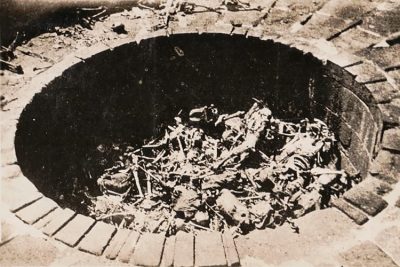 March 20, 2019 Tower of Silence: Where Zoroastrians Leave their Dead to be Excarnated by Scavenging Birds
- June 16, 2019 Church of the Dead: Home to the Peculiar Mummies of Provincial Italy
- March 17, 2020 Transylvania: Home to Dracula, the Barbarians and the Path Breaking Architecture
The post Cassadaga in Florida: Home to the Largest Psychic Community in the World appeared first on .
]]>The post Potash Ponds: Where the Vibrant Blue Pools are Quite a Sight in the Red Desert appeared first on .
]]>
Potash pond near Moab, Utah. (Doc Searls / Flickr)
The Earth is a natural treasure trove. It is replete with resources and it never fails to amaze us. One such gem, hidden in plain sight is the blue potash ponds in the state of Utah in the USA.
At first one wouldn’t notice the odd pond in the red desert, but a quick satellite view on Google Maps will quickly give a hint of the place and why it holds enough importance. It is here in Moab, Utah, that the remarkable cobalt-coloured ponds in the middle of the arid desert give respite to sore eyes and much more.
1963 mine incident
Back in 1963, Texas Sulfur Company first built a plant near Paradox Basin that collected potassium from below the Earth’s surface. An explosion in the underground mines, later in the same year, led to the entrapment of twenty-five miners, out of which eighteen had died.
Eventually, USA’s largest potash-producing company, Intrepid Potash Inc., took over the management of the area and completely replaced the task of manually mining for the naturally-occurring element. The potassium-containing salt or potash was and still is used as a farm fertilizer all over the world.
Potash Ponds: What makes the pool so vibrant?
At the Intrepid mines, which are spread along the Colorado River, potash is pumped to ground levels from underground mines with the help of drilling wells. Hot water from the wells is drained underground, dissolving the potassium, which is then fed to the numerous potash pools above.
Here the highly concentrated potassium-containing salt water or brine is artificially dyed with a striking blue colour so that the sun evaporates it much quicker than it actually does, leaving behind salt crystals and other byproducts. The entire process roughly takes some 300 days to complete, which without the dying process could take a bit longer.

Aerial photo of potash pond next to Colorado river. (Doc Searls / Flickr)
The Paradox Basin has been the biggest source of potassium for over 300 million years now and the 3000-feet deep mines have been dug up for decades to obtain potash. The vibrant shades of blue in the vast solar pools are indicators of the amount of water that has evaporated, separating the potash crystals from its component.
Many other companies have now come up with their own ways to separate the crystalline salt from potassium, but none has the extraordinary azure colour that is seen in the ponds at Moab.
With technological advancement, humans have tried to explore every resource available, resulting in its depletion and potassium is no different. Yet the contrast in the colours of the desert land in Utah and the potash ponds serve as a treat to the eyes, which might stay on for 125 more years to come.
Enjoyed this article? Also, check out “Pamukkale: The Cotton Castle in a Mess of Limestone and Healing Waters“.
Fact Analysis:
STSTW Media strives to deliver accurate information through careful research. However, things can go wrong. If you find the above article inaccurate or biased, please let us know at [email protected].
RELATED
- June 18, 2019 Bingham Canyon Mine: The Largest Copper Producing Mine in the United States
- July 21, 2018 Photos: Underground Town of Australia, Coober Pedy
- January 6, 2019 Lake Crescent: Washington State’s Beautiful, Deadly Lake and its History of Chilling, Notable Incidents
 December 29, 2019 Light Pillars, an Insight into Nature’s Spectacular Optical Phenomenon
The post Potash Ponds: Where the Vibrant Blue Pools are Quite a Sight in the Red Desert appeared first on .
]]>The post Orfield Laboratories: The World’s Quietest Place, Quiet Enough to Hear Your Blood Flowing appeared first on .
]]>
Product testing in an anechoic chamber. (Consumer Reports)
Everyone seemingly looks for a quiet, little place now and then to get some solace and respite from the clamour of the crowded and bustling world around us. Being in a quiet place for a while can almost seem like achieving Nirvana.
It is somewhat balmy for our jangled nerves. However, even such a sensible thought sometimes can immeasurably go awry. Orfield Laboratories in Minnesota is dubbed to be the quietest place on earth as per the Guinness World Records.
It has reported 99.9% sound absorption factor and decibel readings below -2.5. It is a nondescript concrete building, a 15-minute ride from Minneapolis. It is so unusually quiet that the maximum time a person can endure it is 45 minutes.
The characteristic uneasiness of the anechoic room
The room inside is uncannily silent with background noise measurements reaching average negative decibels of ~9.4 dBA. The founder of the laboratory is Steven Orfield.
He has, on multiple occasions challenged people to ensconce themselves in the dark anechoic chamber and try-out their degree of adaptability to quietude. Only a reporter is claimed to have sustained in the room for 45 minutes.
When a place is quiet, the ears adjust accordingly. The more the room is bereft of sound, the more one can start hearing things around. Precisely, in an anechoic chamber, the person becomes the sound.
The sound of different bodily functions like heartbeats, lungs calling out, blood rushing through the veins, the stomach babbling loudly, sounds of friction between your knees and elbows, bones brushing against one another – all of these can be heard.
Unexpectedly, far from being serene and peaceful a great many people find its ideal quietness very annoying. Being denied of the regular comforting ambient sounds can actuate fear. This explains why sensory deprivation is tortuous.
Industrial use of Orfield for sound testing
In any case, the room is meant not just for tormenting people. Many companies carry out the testing of their products to evaluate the loudness metric. These include testing of heart valves, the sound of a cell phone, the sound of a switch used on a car dashboard.
Motorcycle manufacturing giant Harley Davidson uses the lab to fabricate bikes that bear all the same voice like a Harley but quiet to a slight extent. Even products like LED displays are also tried and tested to ensure less loud volumes.

F-16 Fighting Falcon electronic systems being tested inside an anechoic chamber before being tested in open air. (Samuel King Jr. / U.S. Air Force)
Whirlpool, the incredibly reputed washing-machine maker uses the Labs to create metaphors like “for what sound should actually sound like”. Even NASA has utilized this space as a simulation platform to acclimatize their astronauts to the soundlessness of the outer space.
Encounters of bodily misalignments
Even the room is surmised to be a highly disorienting place and people often have problems to align themselves, stand straight or even walk. As the anechoic chamber is devoid of any signal it becomes burdensome to maintain balance and manoeuvre.
Cues are plucked off, consciousness becomes distorted, and your equilibrium and motion becomes nearly an unthinkable feat. Plonking oneself on a chair is the only way you can keep up inside this eerily silent space for as much the little time you bear to stay inside it.
Being confined in the anechoic chamber for more than 15 minutes is believed to engender outrageous symptoms like claustrophobia, nausea, aural hallucinations and panic attacks.
A violinist once attempted to wait inside the room. But, he started pounding the door after a couple of moments requesting to be let out of the place as he was so aggravated by its quietness. His perception of noiselessness was impaired by a scintilla of desperation.
Structure of the anechoic chamber
It is hugely insulated and its ultra-quietness is attained with double-walled layers of concrete and steel. It also has in-built 3.3-foot-thick crosshatched fibreglass acoustic wedges of buffers that suck out all the sound.
The floor, formed with a suspended meshwork of hand-pulled and hand-tightened airplane cables is designed to arrest the resonance of footfalls. Underneath the cable web is a hollowed bottom stuffed with additional fibreglass taperings.

Close-up of an anechoic chamber wall in Dwingeloo. (© Bryan Tong Minh)
This fortifies all the six sides of the room to exclusively absorb all the sound waves. Basically, there is a room inside a room, inside a room and which is why the place is extraordinarily quiet.
The anechoic chamber is reported to have degrees of quietness that is 1/16th part of even the softest whisper measuring 20 decibels.
The former Sound 80 studio
Prior to the coming up of the Orfield Laboratories, the site was Sound 80 Studios. It was the place where Bob Dylan had recorded Blood on the Tracks. And perhaps, more worth mentioning is Lipps Inc putting “Funkytown” on wax.
Sound 80 was an erstwhile client of Orfield. When the Labs assumed the control and took charge over the building, they additionally put 3500 square feet of office space meant primarily for carrying out acoustic research.
This facility set-up then included this anechoic chamber and three other resonation chambers. There are two more fully functional recording studios in this historic building. These are currently put into service for standardized jury testing of sounds and sound quality.
The labs’ philanthropic benefaction
Orfield Laboratories, as a federally certified acoustic lab, is essentially involved with product development, architecture and office research. They have well-defined aims to improve the living and working conditions of the general mankind especially for the elderly, disabled and autistic spectrum.
Orfield Labs has spent almost a decade doing research in close association with Autism Speaks and The Autism Society of America for the elderly and people with limited sensitivity and augmented sensory complications.
They also have valued contribution in the therapeutic silence treatment of people suffering from PTSD, hypersensitivity and other mental ailments.
Tour of the Orfield Laboratories
The anechoic chamber is accessible to anyone who wants to take a tour and feel the silence themselves. It has been made open to visitors with the numbers of curious travellers gradually expanding over time.
They come to explore and experience what bona fide silence truly implies. According to the Steven Orfield, the facility runs two tours per week.
The visitors are mostly outsiders and not from Minnesota. It can be a little gathering of up to ten individuals or a solitary person. The tours are charged according to the number of visitors.
Think about all the sound that consistently infuses into your body. Noise is an inevitable perpetuity that frequently overshadows any peace and quietude.
Although the lab’s maddening quietness is good for business, it is terrible for sanity. At Orfield, it appears that the best diversion of all is not the clamour but actually the silence.
Enjoyed this article? Also, check out “Vantablack: A Manmade Substance that is Blacker than the Blackest of Black“.
Fact Analysis:
STSTW Media strives to deliver accurate information through careful research. However, things can go wrong. If you find the above article inaccurate or biased, please let us know at [email protected].
RELATED
- August 11, 2018 Masada in Israel: Did 967 Rebellious Jews Really Commit Mass Suicide Here?
- May 31, 2019 Chand Baori: A Quaint Remnant of the Past
 November 29, 2018 The Morbid History of Death Masks
 April 15, 2019 Vantablack: A Manmade Substance that is Blacker than the Blackest of Black
The post Orfield Laboratories: The World’s Quietest Place, Quiet Enough to Hear Your Blood Flowing appeared first on .
]]>The post Exploring the Enchanting Mont Saint Michel appeared first on .
]]>
Mont Saint Michel. (David Iliff / Wikimedia Commons)
The world is full of several architectural beauties which will leave you amused by their intricate art and fine carvings. One such architecture stands tall in Normandy and has emerged as one of the major tourist sites in the world. This architectural grandeur is none other than Mont Saint Michel which got classified as a historical monument in the year 1874. In addition to this, it is also regarded as a UNESCO world heritage site since the year 1979.
Known as one of the best middle-age creation, Mont Saint Michel is an epitome of monastic architecture. It is situated 41 miles away from Rennes and 32 miles away from Saint-Malo. On the base of the monument, you can also find medieval towers and walls displaying the old style architecture.
A tiny tidy island perched on the north-western coast of France, this place witnesses the highest tides. It is also known for its quicksand and steep rocks. The water surrounding the coast can go 20 Km deep and 18 Km away. Initially, this fortress was called Mont Tombe. This was when Mont Saint Michel was not considered as an island. It was merely covered by dense forests which later got washed away due to ocean water.

Aerial view of Mont Saint Michel during low tide. (Fabos / Wikimedia Commons)
Experiencing Mont Saint Michel
This island is named after Archangel Michael. In the year 708, Archangel Michael asked the bishop of Avranches to construct a sanctuary on the rocky islet. But Bishop was not sure about the idea of building this sanctuary. After Archangel pushed the bishop to follow his orders, he built the sanctuary.
This place is popular for its Mont Saint Michel Abbey which is around 1000 years old. On your visit to Mont Saint Michel, you can’t miss out on the popular Carolingian church that was constructed during 966 by the Benedictine monks.
Apart from the abbey, you can also explore the vertical grounds in the mountain or enjoy the serene view and shop something from the souvenir store. If you are a foodie, you will love their scrumptious omelettes which are found in La Mere Poulard. The restaurant also provides other French delicacies at a very reasonable rate. Normandy is famous for the apple orchards. So, once you are here, don’t forget to taste the cider.
History of Mont Saint Michel before the revolution
Mont Saint Michel is circular shaped and comprises a granite outcrop which rises heavily out of the bay. It is normally surrounded by huge sandbanks which get converted into the island during high tides. A 300-feet causeway links the island to land. However, before its construction, it was tough to find a way because of the fast-tides and quicksand.
The prolonged history of Mont Saint Michel started in 708 after Bishop Aubert built a sanctuary as a tribute to Archangel. In 966. Benedictine monks took the responsibility of building a new monastery. In no time, Abbey became a prominent pilgrimage canter in the Christian West. In addition to this, it also got a name for storing a trunkful of manuscripts. Due to this, it was also being called as “City Of Books”.
Situated on the borderline of Brittany and Normandy, Mont Saint Michel became a passage, as well as, a fortress. In the 14th century, the conflicts between England and France took a major turn and hence, there was a need for power fortification.
In the year 1421, the church’s chancel collapsed and its reconstructions went on for the next 100 years. Uptil 18th century, the Mount already lost its significance in religious, as well as, military terms. In 1622, a new religious order was being established at the Abbey which led to the redevelopment of the site.
Story after the revolution
During the war period of 100 years, Mont Saint Michel again turned into a fortress. Along with the inner wall, an outer wall was also added for the defence of the abbey. Both Valois and Plantagenets were claiming the French throne.
With the 1517 reformation, this site also lost its pilgrims. With the reduction in the number of pilgrims, the monks too disappeared. During the 1789 French Revolution outbreak, there were just a few monks in the residence and the Abbey turned into a prison. In the initial stage, it was home to clerics but later, they were replaced by political prisoners.
Visiting the island
To preserve the beauty of Mont Saint Michel, the car parking has been relocated to some other place. This new parking is situated 1.5 miles away from this island. After parking, people head for shuttle buses named Passeurs. These buses will take you to your destination, i.e, Mount. The Passeurs operate on a regular basis between 7:30 Am to 12:00 AM. Mont Saint Michel can be reached by car, as well as, tour or bus.
However there is no direct connectivity of train from Mont Saint Michel to Paris, but you can avail train service till Pontorson and use the bus for the rest of your journey. Many people also reach the place by bicycle. Parking for this ride is free of cost and one can easily cover the distance between Pontorson to Mount without facing any major difficulty.
Fall and spring seasons are comparatively less crowded and the weather also supports an outdoor trip. However, if you wish to see the castle’s reflection in the water, check the schedule of the tides and visit the place during the time of highest tide.
Mont-Saint-Michel during high tide. (Mathias Neveling / Wikimedia Commons)
Accommodating in the Island Destination
Mont Saint Michel comprises numerous small hotels which are perched on the island. In addition to this, there are several hotels opposite to the island too. A shuttle bus which runs till midnight links the island to these hotels. You can also find some decent hotels in the town near Pontorson. However, most of the visitors prefer to day trip as this island can easily be covered in just a few hours. The car park also allows the motorhomes for an overnight stay and charge it in the form of standing parking cost.
Mont-Saint-Michel is the most popular island in the world. Being the most unmissable site in Europe, this place witnesses a flock of tourist throughout the year. The place is a perfect blend of rich medieval history, opulent architecture, and serene surroundings.
The island is set in a splendid bay and it has captured the hearts of umpteen travellers. So, if you are planning a trip to Europe, don’t forget to include this miraculous site in your travel itinerary.
Enjoyed this article? Also, check out “Neuschwanstein Castle: The Story Behind the Iconic Bavarian Castle That Inspired the Disney Castle“.
Recommended Visit:
Mont-Saint-Michel | France
Fact Analysis:
STSTW Media strives to deliver accurate information through careful research. However, things can go wrong. If you find the above article inaccurate or biased, please let us know at [email protected].
RELATED
- March 5, 2019 Saint Pierre and Miquelon: A French Territory in North America and the Last Bastillion of New France
- June 1, 2020 The Clermont-Ferrand Cathedral: A Beautiful Gothic Structure Made of Black Lava Stone
- December 26, 2018 Moscow State University: An Architectural Marvel
- June 2, 2019 Yemen’s Ancient Town of Shibam is Also Known As ‘Chicago of the Desert’
The post Exploring the Enchanting Mont Saint Michel appeared first on .
]]>The post 1999: Jeanne Menjoulet’s Journey to the Dunes of Dasht-e Kavir appeared first on .
]]>
Dasht-e Kavir. (Jeanne Menjoulet / Flickr)
Landscape has changed considerably since modern humans (Homo Sapiens) first entered the world in what scientists believe was around 300,000 years ago. For instance, the Sahara desert became habitable (not just along the Nile Valley) most recently c.10,500 years ago when a burst of monsoons created a wealth of water.
Archaeological evidence in a now submerged area called Jebel Sahaba goes some way to illustrate this. Climate has also changed drastically in the Middle East, an area which these days is dominated by dry, arid regions.
In the past much of it was part of the Fertile Crescent AKA one of the infamous cradles of civilization. There have supposedly been many wet periods since then allowing civilization to flourish and pass through it onto new horizons. Many believe it was conditions like this which allowed early humans to first leave the continent of Africa around 60,000 years ago.
Dasht-e Kavir or Salty Plains
A testimony to these changing times lies 200 miles east of the capital city of Tehran, Iran. A great desert with a surface area of roughly 30,000 square miles, almost 2/3 the size of France. Its name is Dasht-e Kavir, part of a protected zone called the Kavir National Park. It is one of two vast deserts in this area, the other being Dasht-e Lut to the south.
The name ‘Dasht-e Kavir’ means ‘Low or Salty Plains’ in Classical Persian to illustrate how long it has dominated the landscape. It also highlights that there are many great salt lakes in Dasht-e Kavir, simply put, lakes which have a higher concentration of salt and dissolved minerals. The two largest are known as Kavir Buzurg and Namak Lake.
These salt-rich lakes have been created via rising temperatures meaning layers of salt remained, as much as 6-7 kilometers thick and 40 meters high. The salt has been there for millions of years and despite being covered at times by mixtures such as mud, the low-density of the salt means it will rise over most terrain. Much of the desert contains salt plates in a seemingly mad-made pattern but it is totally natural.

Salt lake in Dasht-e Kavir. (Jeanne Menjoulet / Flickr)
Wildlife and biodiversity
Wildlife and humans survive in the various terrains of the desert. Some plants at the high points and migratory birds searching for sustenance. Animals such as gazelle roam the earth as well as sheep, camels and goats. Becoming more and more endangered are beautiful creatures such as the Persian Leopard and Asiatic Cheetah.
In the night, wild cats, wolves, lizards and snakes favor the cooler temperatures. Few villages remain but those which do take their main sources of living from camel and sheep breeding. Settlements have to be located near springs and oases, water wells having been created underground for thousands of years are a necessity of life.
There is evidence from another archaeological site called Tepe Sialk which has inscriptions detailing a Queen’s journey on the lake, sailing to visit the ruler of a town within. It has evidence of inhabitation as far back as the 6th Century BCE, showing remains of mud huts, flint tools and skeletons. Ruins of a Ziggurat have been uncovered as well. The area is now almost completely uninhabited however, apart from a few isolated communities.
Rigg-e Jenn
Legends tell of a historic section in the center known as the Devil Dunes – Rigg-e Jenn – which are said to be haunted. (Jenn being an evil spirit in Iranian culture.) This stems from the fact that many people have gone missing there due to its size and unpredictability– areas of sinkholes and quicksand included. Villagers speak of the wind howling eerily through the night.
Iran in 1999: Photographer shares her experience
While the big cities and towns have of course been modernized, the villages within the desert are the complete opposite. Both are extremely difficult places to have a concept of through pictures only and for that reason, at STSTW Media we got in contact with an adventurer and photographer called Jeanne Menjoulet who travelled to Iran in 1999.
Jeanne states about photography,“We can’t stop this elusive thing, time. I think that’s why I like photographs. Because it captures and freezes pictures of this fleeting time.”
We were so captivated by her documenting of Dasht-e Kavir as well as other places in Iran that we asked for an interview which she thankfully agreed to. We will share her pictures of modern cities such as the capital Tehran as well as the desert communities. Here are the questions we posed to her and more of her pictures.
STSTW Media: Tell us about yourself and about your passion for photography
Jeanne: “I am an amateur photographer. As for my professional activity, it deals with images too (I make videos about research into social history), But I prefer to devote my hobbies to capturing still images. The photographs fascinate me by their ability to make a moment everlasting. They also make it possible to observe life differently and to return to it … especially 20 years later.”

Near Isfahan. (Jeanne Menjoulet / Flickr)
STSTW Media: Tell us about your experience (i.e the culture and hospitality of the region)
Jeanne: “I visited quite a lot of countries in different parts of the world (Europe, Africa, Asia, North and central America…), but I must say that Iran (in 1999) is the country where I felt people were the most welcoming. I mean, many of the people in Iran were curious and interested in an exchange with Westerners (we were repeatedly invited to tea in very different places, by people we didn’t know, we just met in the street) and I also felt this interest and hospitality in the discussions with the Iranians who spoke French. They were both curious about our culture and proud to show the Iranian culture and way of life. Unlike some foreign countries, this welcoming attitude was not motivated by money.”

Tea and cucumbers invitation, Iranian aperitif. (Jeanne Menjoulet / Flickr)
STSTW Media: Did you fear going to Iran in 1999? Would you fear going there now? (In regards to Islamophobia in Europe)
Jeanne: “I didn’t fear going to Iran in1999 (although I had a small aspect of adventure, before the departure) I wouldn’t fear at all going there now. Many people in France (well, all the people I know) are quite impervious to Islamophobic speech. For many of us – I think – it is the war in Syria that is dreadful for people, and Iran is associated with this war.”

Isfahan at night – tea-house and hookah. (Jeanne Menjoulet / Flickr)
STSTW Media: How was communication? Did many people speak French or English?
Jeanne: “The communication with Iranian people was easier of course with people who spoke French or English. In the big cities I visited (Isfahan, Tehran…), many people spoke a bit of English at least. But the communication was also possible without language (with smiles, signs…). Even if it is always better to speak. But I remember a moment in an Iranian house (in a small village in the desert) which was very nice even we couldn’t understand our host and his family. I remember also two young women offering me a rose in a street of Isfahan, we couldn’t understand each other, but their smile was so friendly, I regret not having my camera in hand at that moment, for a “souvenir photo!” Generally, I took a lot of pictures of people in the streets or shops. And they smiled at me (perhaps because I smiled at them too), even If we couldn’t understand each other.”

Curious children. (Jeanne Menjoulet / Flickr)
STSTW Media: Did you keep in touch with any Iranians you met?
Jeanne: “I didn’t keep in touch with Iranian people I met; I went there just before the spreading of the World Wide Web… One or two years later, I think I might have kept in touch by emails for instance, it is much easier than postal letters.”
STSTW Media: Which is your favourite photograph and why?
Jeanne: “It was in a small town (I can’t remember which one) near Isfahan. It was very funny, we took the cameras out of our bags exactly at the same time, and took the picture of each other at the same time. This reverses the country’s tourist/inhabitant relationship. Interesting!”

Iranian girl taking a picture of a foreign traveller. (Jeanne Menjoulet / Flickr)
STSTW Media: What is your most memorable moment from the trip?
Jeanne: “My most memorable moment from the trip was visiting Machad during Muharram [First and holiest month of the Islamic Calendar] celebrations. It was incredible to see all the people in the streets, all in black. The processions were quite impressive, but there was a nice mood all around, a festive atmosphere, with smiles, once again”

Machad during Muharram. (Jeanne Menjoulet / Flickr)

Women in processions during Muharram. (Jeanne Menjoulet / Flickr)
Some of Jeanne’s photography outside of the cities, and into the desert of Dasht-e Kavir.

Villagers in the desert. (Jeanne Menjoulet / Flickr)

Women near a fountain. (Jeanne Menjoulet / Flickr)

Children near old houses. (Jeanne Menjoulet / Flickr)

Dyehouse near the village. (Jeanne Menjoulet / Flickr)
Thanks to Jeanne!
The troubles in many parts of the Middle East are well-documented and there is no doubt that climate change has contributed to that. The communities that remain in regions like Dasht-e Kavir are an inspirational testament to human nature. As photographer Jeanne Menjoulet says herself,
“An amazing insight into a world that has been completely transformed yet where life goes on. And a possible premonition into the future of many other regions.”
Our lands won’t stay green forever.
More Photos: Iran in 1999 by Jeanne Menjoulet
Optional Visit:
Dasht-e Kavir | Desert in Iran
Fact Analysis:
STSTW Media strives to deliver accurate information through careful research. However, things can go wrong. If you find the above article inaccurate or biased, please let us know at [email protected].
RELATED
- April 16, 2020 Katas Raj Temples- The Oldest Hindu Temple in Pakistan
- June 2, 2019 Yemen’s Ancient Town of Shibam is Also Known As ‘Chicago of the Desert’
- January 26, 2019 Astana: An Ultra Modern Capital City Right in the Middle of Vast Empty Grasslands
- September 2, 2020 Sana’a, Yemen: The Cradle of Arabian Ancestry
The post 1999: Jeanne Menjoulet’s Journey to the Dunes of Dasht-e Kavir appeared first on .
]]>The post Masada in Israel: Did 967 Rebellious Jews Really Commit Mass Suicide Here? appeared first on .
]]>
Aerial view of Masada, an ancient fortification on top of the mountain. (Andrew Shiva / Wikipedia)
Israel is one country that has always been in the news for whatever reasons. But did you know that long before this Middle Eastern nation appeared on the modern world map, it had a glorious past that has now become an important part of its rich traditional history? Israel is blessed with a long list of tourist attractions, but there’s one place in particular – a world heritage site – which pulls in people from all over the world so that they can get to know more about the site that was discovered as recently as 1838. Called Masada, this tourist spot is not just of great historical significance but is also revered by Jews, whose gallant ancestors are believed to have committed mass suicide here to escape being captured by the Roman troops.
Masada in Israel: Origin of the ancient fortification
Declared a UNESCO World Heritage Site in 2001, Masada is an ancient place, situated on top of a remote, rhombus-shaped, high table-mountain, which was converted into a defence stronghold by King Herod-I between 37 and 31 BCE. Masada lies between the Judean Desert and overlooks the Dead Sea, where Herod the Great built luxurious palaces with lavish facilities for himself and reigned for 37 long years on behalf of the Roman Empire. Standing about 1500 feet above the sea level and surrounded by desert land, the entry to the grand desert palace is quite tricky; yet the Romans are said to have breached the walls and gained access into the fortress 2000-years ago, which came to be known as the Siege of Masada.
The Siege of Masada has become an event of great historical value, which was supposedly marked by the mass suicide of Jewish Zealots, where as many as 967 men, women and children gave up their lives, for they believed they would only serve God and none else.
After the fall of the Jewish Temple in 70 CE, the First Jewish-Roman War broke out as a result of anti-taxation protests that lasted from 73 to 74 CE. Roman Emperor Nero ordered notable Jewish figures to be captured, which enraged the Jewish ethnic groups, who rose in rebellion against the crown. They plundered villages and massacred their own kin, who were ready to hold peace talks with the Romans, ultimately trying to prove a point that the land was theirs and those hoping to lay hands on it or those trying to resist, would meet the same fate. Unfortunately, the Romans did manage to besiege Masada eventually, where Zealots and Sicariis had forcefully settled down with their followers, keeping the former away from entering into the strong fortress.

Aerial view of Masada. (Andrew Shiva / Wikipedia)
It is mentioned that when the troops of the Roman Empire gained entry into the Judean province and held approximately 15,000 Jewish people hostage, Eleazar Ben-Yair, the commander of the Sicariis also known as dagger-wielding rebel Jewish groups, fled with his band of followers to Masada, which was considered highly impregnable.
Little did they realize that they had been outnumbered since the Zealots had sided with the Romans to capture the rebellious freedom fighters. When the end was near and the Roman troops had made their way inside Masada, Ben-Yair decided the only other way out was to kill themselves. Since suicide is prohibited in Judaism, he ordered ten men to execute the 967 men, women and children, who were ready to lay down their lives defending the fortress and their honour. The Sicariis set their belongings and storehouses ablaze and resorted to mass suicide instead of getting captured, enslaved or killed by the Romans.
But did they actually commit suicide?
While the people of Israel revere Masada a great deal, others are divided on the happenings and claim it to be a false account. Joseph ben-Matityahu or Josephus Flavius, a Jewish commander, who sided with the Romans later, chronicled the entire Siege of Masada, which historians argue had certain inaccuracies. Not only had he exaggerated about the construction of the fortress but had also misquoted the number of deaths as found at the excavations, carried out in 1963.
Items of daily use were found at the site, which proved there was human settlement in the fortification, but the absence of mortal remains, except for three skeletons inside the palace, pointed out that there was no mass suicide or a siege or a war at all; thus implying Flavius’ accounts were false. Despite the mention of 967 people inside Masada, only 28 bodies were discovered, with three inside the palace and the rest 25 inside a cave. Had there been a war, there should have been all 967 bodies plus or minus, given the weather conditions, wild animals and scavengers, or none at all if the Romans had discarded them or carried them away.
Scholars are also of the opinion that the bodies of men found inside the cave could have been of the Roman soldiers that had died trying to fight for the fortress. While there is not enough evidence of a mass suicide at Masada, the siege and its following events remain shrouded in mystery.

Western entrance inside Masada fortress. (Oren Rozen / Wikimedia)
Masada National Park
But whatever the case accounted in Jewish history, with outsiders refuting the occurrence of the events, Masada National Park, which includes a tour of the hilltop and Masada Museum remain two of the most visited destinations on tourists’ itineraries while on their travel to Israel. Mass suicide or not, Masada still stands tall to tell the tale of the splendid times it had once seen.
Enjoyed this article? Also, check out “Maunsell Forts: The Forts That Tell the Tale of WWII“.
Recommended Visit:
Masada National Park | Israel
Fact Analysis:
STSTW Media strives to deliver accurate information through careful research. However, things can go wrong. If you find the above article inaccurate or biased, please let us know at [email protected].
RELATED
 October 17, 2019 Brief History of Cricket: From a Suburban Pastime to a Gentleman’s Game
- October 28, 2018 The Lost Bamiyan Buddhas of Central Afghanistan
- May 31, 2019 Chand Baori: A Quaint Remnant of the Past
 September 10, 2018 Orfield Laboratories: The World’s Quietest Place, Quiet Enough to Hear Your Blood Flowing
The post Masada in Israel: Did 967 Rebellious Jews Really Commit Mass Suicide Here? appeared first on .
]]>The post Las Lajas Sanctuary: A Church with a Mysterious Mural Nobody Can Explain appeared first on .
]]>
View of Las Lajas Sanctuary from the side. (Diego Delso / Wikimedia Commons)
Also known as the Sanctuary of Our Lady of The Rosary, Las Lajas is considered to be one of the most spectacular churches in all of Latin America. Constructed during the years 1916 and 1949 by staunch worshippers, it was funded by local churchgoers, the neo-Gothic-styled cathedral, built inside a canyon and dedicated to the Virgin Mary, is an astonishingly 330-feet-high structure, when measured from the bottom of the valley it stands on.
A 160-feet-long bridge connects the church to the other side of the canyon in the middle of the Guaitara River, which also serves as the entry point for pilgrims, who come from across the globe to catch a glimpse of the magical mural that still hasn’t lost its brilliance over the years.
Situated in the city of Ipiales in Narino, a district bordering between Colombia and Ecuador, the huge shale structure derives its name from the slate-like material, which was used to build the church with. Owing to the sedimentary rock used in building the cathedral, the sanctuary gets its Spanish name – Laja – from the English rock or huge, flat slab. Ever since the cathedral first came into being after its miraculous beginning, Las Lajas has become one of the most favourite tourist destinations in southern Colombia and also a revered place of pilgrimage for Roman Catholics around the world.

Front view of the church. (Diego Delso / Wikimedia Commons)
Local legend of Las Lajas Sanctuary
According to popular beliefs, in the year 1754, a local tribal woman named Maria Mueses de Quinones was passing through the canyon with her deaf-mute daughter Rosa, when the weather worsened. Caught in the middle of a huge storm, the mother-daughter duo decided to wait out the storm in the cave, when the unexpected happened. To the mother’s surprise, the young, mute girl exclaimed that The Virgin Mary was calling her, pointing to an illuminated vision at the top, inside of the cave.
Maria wanted to keep the holy sighting a deadly secret, until Rosa died of an illness a little later. She decided to take her dead child exactly to the same place where Rosa had first seen the image of Mother Mary to pray for her soul. And as luck had it, the Holy Virgin appeared again and revived Rosa, which was how people got wind of the mystifying place and began thronging it for a single glance.
But the image of Virgin Mary appearing to a human being and reviving her soul was only a part of a greater mystery that has never been unveiled to this day. Locals also believe that a blind man’s eyesight was inexplicably restored after he visited the church in the late 18th century. After Rosa came back from the dead, a shrine was built in honor of Jesus’ mother in the same place, which received canonical coronation (a permission granted or act carried out by the Pope to designate a halo or crown to a holy image of Jesus, Mary or Joseph) in 1952 and later identified by Pope Pius XII as a minor basilica in 1994.
Considering that the stories of Rosa sighting the Blessed Virgin are mere legends and part of folklore, how does one explain the image of the Holy Mother of Jesus behind the altar, holding Her Divine Son in Her arms, flanked by Saint Dominic and Saint Francis on either side, at the end of the church? No valid information is available as to who first drew the striking golden-blue regal illustration of Mary at the altar or whether Maria Mueses de Quinones and her daughter were only a figment of people’s imagination; no one could tell.
A few German geologists tried to look into the mysterious image painted on the wall by taking off some samples of the rock; and to their astonishment, there was no dye or colour or any sort of pigmentation that had gone into drawing the sacred painting; the colourful mural had occurred naturally. While it might take several hundred years to get to the bottom of the facts, The Las Lajas Sanctuary, which holds a secret that might never come to light, is a spectacle one must have on their places-to-visit list.

The ceiling of the central part of the church. (Diego Delso / Wikimedia Commons)
Enjoyed this article? Also, check out “Sagrada Familia: An Unfinished, Colossal Spanish Basilica, Under Construction for More than 136 Years“.
Recommended Visit:
Las Lajas Sanctuary | Colombia
Fact Analysis:
STSTW Media strives to deliver accurate information through careful research. However, things can go wrong. If you find the above article inaccurate or biased, please let us know at [email protected].
RELATED
- October 9, 2018 Llanfairpwllgwyngyll: A Mindless Tongue Twister or a Place in UK?
 March 31, 2019 The Cano Cristales: Colombia’s Extraordinary River of Five Colors
- November 3, 2018 Capilano Suspension Bridge: A 129 Year Old Bridge that Continues to Draw Intrigued Visitors
- July 26, 2019 The Rock of Gibraltar: Guardians of the Strait of Gibraltar
The post Las Lajas Sanctuary: A Church with a Mysterious Mural Nobody Can Explain appeared first on .
]]>The post Nauru: An 8 Square Mile Island That was Once the World’s Richest Country appeared first on .
]]>
Bird’s eye view of Nauru. (ARM / U.S. Department of Energy)
It was the poor villager who got rich off the hen that laid golden eggs, and it was the people of Nauru who got rich off the bird poop. This is the tale of people of Nauru. Two thousand and ninety-nine miles off Gold Coast, you will stumble upon the world’s smallest island nation – Nauru. Nauru has a total landmass of mere 8 square miles, making it even smaller than the Brisbane Airport.
History of Nauru Island

A Nauruan warrior. (CdaMVvWgS / Wikimedia Commons)
This small coral island in the middle of the Pacific Ocean is home to about 10,000 people. Initially, Nauru was inhabited by 12 indigenous tribes or clans but, now the ethnic composition stands at Nauruans- 58%, other Pacific Islanders – 26%, Chinese- 8% and Europeans- 8%. The majority of the population is Christian. Nauruan is the official language of the nation, however, being a former British colony, English is also widely understood and spoken.
Nauru drew international attention in 1980 when it was reported the wealthiest country on the planet. Nauru recorded the highest per capita income worldwide and instantly became the envy of several developed European countries.
How Nauru became the richest country?
The interesting thing about this story is that the country owed its wealth to the business of selling calcified bird excreta or phosphate. Before the arrival of humans, the island had been the rest stop for the seagulls for 4 million years. Over time, the guano (bird poop) calcified, enriching the island with huge reserves of valuable phosphate.

The calcified bird excreta or phosphate field of Nauru. (CdaMVvWgS / Wikimedia Commons)
Phosphate has been an important component in the production of fertilizers and other commodities. As a result, when Phosphate reserves were discovered in the early 1900s, Nauru became an ideal colony for the superpowers of the world. It was colonized three times, initially by Germans then by Aussies and finally by Japanese.

Ongoing phosphate mining, circa 1947-1994. (Trust Territory of the Pacific Islands)
It finally attained its independence in 1968. Throughout these years, phosphate trade was an important component of the imperial strategy. Even after attaining independence, it remained a profitable business minting millions of dollars to the Nauruans. In 1975, the country earned around 2.5 billion dollars, more than enough to satisfy the need of its population of 7000 people.

US Air Force bombing Japanese-colonised Nauru in 1943. (Philip A. Crowl and Edmund G. Love / US Military)
With this spike in daily income, every day turned into a party day for the Nauruans. They started to live a life of luxury, importing western food and sports cars. Some even gave up their jobs and went on lavish tours and vacations. In fact, “Dollars notes were even used as toilet paper” a local tells BBC. This unhealthy change of lifestyle had disastrous consequences for the Nauruans in the long term.
Downfall of Nauru
The current life expectancy rate is just 55 years for men and 57 years for women. While the life expectancy rate has pegged itself to low levels, rates of diseases such as diabetes and several heart ailments have risen by exponential levels. In 2007, 94.5 percent of the population was declared overweight by the WHO (World Health Organisation).
Nauru records the highest rates of Type II diabetes accounting to a level of 31 percent of the adults being affected by it. Things turned worse for the Nauruans when the phosphate reserves dried out in the early 1980s. With no secondary source of income, the Nauruan economy collapsed.
The government and its people tried several methods of generating money. Meanwhile, one of the country’s financial advisers, Duke Minks, managed to convince the Nauruan president to fund a queer piece of musical theatre dubbed as “Leonardo the Musical: A Portrait of Love.” The show was a huge failure and was closed shortly after its inception in June 1993. It further increased the burden on the people of the island nation by 7 million dollars in terms of today’s currency.

Abandoned phosphate loading station. (David / Flickr)
Present-day
With no alternative in sight, many people yearned for the life as it was before the discovery of the phosphate reserves. But it was too late now, exploitive levels of mining had rendered 75 percent of the land inhabitable. Since the 2000s, Nauru has become the dump yard for the refugees heading towards Australia. The Australian government provides financial aid to the Nauruan government in lieu of habilitation services and Nauruan government has become heavily depended upon it.
The refugee camp at Nauru was overcrowded and lacked basic facilities such as drinking water and as a result, it was shut for the same reason in 2007. As the problem of immigration grew a hotter issue for Australia, it invested billions of dollars in redeveloping and improving the Nauruan camps. In 2012, the camps were reopened despite the conditions still being pathetic.
The prevailing conditions have led detainees to depression and develop suicidal tendencies. Australian and Nauruan government have kept the injustice covered by charging an exorbitant visa fee of 8000 dollars for media persons. Moreover, in 2015, Australia passed a law that has made speaking about the detention center a punishable offense. Nauru was reported in the world’s five poorest countries by Business Tech in 2017.

Satellite photo of Nauru. (U.S. Department of Energy’s Atmospheric Radiation Measurement Program)
Today, Nauru records one of the highest unemployment rates in the world with 90% of its people jobless. There are only two hotels on the island and a single supermarket. The island is connected via the Nauru International Airport, whose main airstrip was built during the Japanese occupation.
There is no daily newspaper in Nauru. “State-owned Radio Nauru (88.8 FM) carries programming from Radio Australia and the BBC, and Nauru TV carries programmes from Australia and New Zealand as well as local output” reports BBC. The country has no capital, however, some consider Yaren as the capital city. Such is life on the island nation Nauru.
What was once called the “Paradise Island”, is now just an inhabitable piece of land, totally denuded of its former glory.
Enjoyed this article? Also, check out “Hashima Island: A Once Bustling Japanese Metropolis That Now Reminisces Its Hauntingly Tragic Past“.
Optional Visit:
Nauru | Country in Oceania
Fact Analysis:
STSTW Media strives to deliver accurate information through careful research. However, things can go wrong. If you find the above article inaccurate or biased, please let us know at [email protected].
RELATED
 January 10, 2019 AMARG: The US Plane Graveyard Where Aircraft are Stored, Stripped, Repaired, and Restored
- February 18, 2019 The Ryugyong Hotel of North Korea: The Tallest Unoccupied Building in the World
- March 26, 2019 The Disappearing Aral Sea and its Abandoned Ships
- May 2, 2019 What Happens to the Olympic Venues in the Host Countries After the Olympic Games End?
The post Nauru: An 8 Square Mile Island That was Once the World’s Richest Country appeared first on .
]]>The post Photos: Underground Town of Australia, Coober Pedy appeared first on .
]]>
Signboard with a mining truck, Coober Peddy. (Graeme Churchard / Flickr)
Man must go wherever his work takes him. Work is also central to his settlement. So, when Willie Hutchison, in 1915, discovered opal- the precious stone, in the desert of northern South Australia, a stage was set for mining as well as the habitation of the area 846 KM north of Adelaide. In time the area became a township named Coober Pedy with most inhabitants living underground.
History of Coober Pedy’s underground homes
The logic behind underground homes is simple: a buffer against extreme variations of ambient temperature. At Coober Pedy, the average annual temperature ranges from 14 degree Celsius to 28-degree centigrade, and in peak summers it may touch up to 47 degrees Celsius. Inhabitants realized that ambience below-ground was more agreeable than above-ground. Miners working deep inside earth felt easy living deep down than living on the surface of the earth. If deep mines were so comfortable to work in, why couldn’t they have similar homes to live in? The Idea culminated in cave-like subterranean homes.
The interior of the underground Serbian church in Coober Pedy. (Peter Myers / Flickr)
Earth-sheltered or earth-bermed home is advantageous in many ways except for being flood-prone. If heavy rainfall or waterlogging is not a problem, earth homes are fun and best for living.
Apart from underground enthusiast group, even the U.S Department of Energy has endorsed dug homes where conservation of energy is a big advantage. The human settlement doesn’t stand out as odd protrusions on topsoil, and extremes of weather like strong winds, hailstorms, hurricanes and tornados do not ruffle the home dwellers. Earthquake and fire are no more significant threats and homes are surprisingly soundproof. Subsoil homes are also immune to manmade disasters like explosions, thefts and break-ins. In fact, privacy is served best in these earth embraced houses.
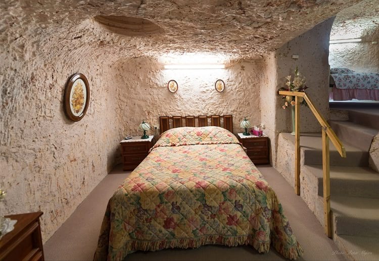
An underground room in Coober Pedy. (Peter Myers / Flickr)
Hotel in Coober Pedy. (Steve Collis / Flickr)
Underground dwellings in other parts of the world
Coober Pedy is neither alone nor the very first to subscribe to subterranean living. There are references to it in Scythian and German literature. Excavations have revealed the presence of dug homes in Switzerland, Mecklenburg and Southern Bavaria. Caves in mountains, as well as plain areas, have served humans as convenient living abode since pre-historic times.
Replace natural caves with designed and dug out cave houses and we get underground homes, buildings, cities and much more. Apart from Coober Pedy, dug homes are scattered all over the world. Sassi di Matera of Italy, Yaodong in China, Nok and Mamproug Cave Dwellings in Tongo and Africa are examples of famous deep dug buildings.
Earth bermed houses have one wall or one portion of house peeping out on the ground surface. Rammed earth homes, like traditional brick constructions, are not underground in a real sense but are tightly hugged around by mud on the ground surface. Free from the binding quotient of cement, rammed homes are adequately insulated against vagaries of the environment.
Another variety of earth home is cut-and-cover type or culvert structures. These are precast homes. The entire architecture is frame-casted, assembled, and then lowered down the hole. Subways and basement buildings are so common these days that we scarce think of them as underground structures. Yet the fact remains that these are underground abodes. Tunnels too are a way of living underground. Taisei Corporation’s proposed Alice City in Tokyo is going to be a milestone of this genre. It would be a massive shaft carrying various levels of office, residential and multipurpose living spaces deep inside Earth.
Life in Coober Pedy
Geologically, Coober Pedy is situated on 30 meters deep bed of sand and siltstone topped with a treeless desert. It is home to a population of 3500, 45 nationalities 60% of which are Europeans. It is a popular tourist destination since 1987. Annual rainfall is lowest in Australia, making it an ideal place for underground houses. Aerial view of the area is plain desert except for scattered chimneys, the ventilation outlets, jutting out on earth surface from the living spaces below the earth surface.
An underground Jewellery shop. (Lodo27 / Wikimedia Commons)
A barren topography though hasn’t robbed natives of sports and recreation. Daytime being too hot for a game, golf is played at night with a glowing ball. Australian Rules football club organizes football in a professional way. The scenic beauty of the town has attracted filmmakers and many films like Opal dream, Wim Wenders and Until the End of the world.
On the flip side, the cost of constructing an earth-sheltered house is comparatively higher. However, options to build are as diverse as in building over ground houses. With global warming touching a new high with the passage of time, it may not be surprising that earth houses become more of a rule than an exception.
Enjoyed this article? Also, check out “Project Riese: Hitler’s Shadowy Incomplete Underground Complex that Remains a Mystery“.
Recommended Visit:
Coober Pedy | Town in South Australia
Fact Analysis:
STSTW Media strives to deliver accurate information through careful research. However, things can go wrong. If you find the above article inaccurate or biased, please let us know at [email protected].
RELATED
 September 14, 2018 The Classic Whodunit Mystery of the Marree Man of Outback Australia
 March 2, 2019 Wave Rock: Where a Massive Prehistoric Wave, Just About to Break, is Etched Permanently in Stone
 May 20, 2019 Min Min Light: The Elusive Phantom-Lights of the Australian Outbacks
 May 10, 2019 The Great Emu War: When Thousands of Emus Evaded Australian Armed Forces and Won the War
The post Photos: Underground Town of Australia, Coober Pedy appeared first on .
]]>The post Life Inside Oymyakon, Where Eyelashes Freeze appeared first on .
]]>
Magadan Oblast, 1000 km from Oymyakon in Russia. (Maarten Takens / Flickr)
Oymyakon is a small village, with a population of about 500. It is located deep in Siberia in Oymyakonsky District of the Russian province of Sakha Republic. This region is also known as “Stalin’s Death Ring”. It is historically the coldest place in the world that is permanently inhabited. It boasts of the lowest recorded temperature outside of Antarctica i.e. -71.2° C.
Oymayakon derives its name from the nearby Oymyakon River. The name of the river is believed to have come from two different words of the even language, both with almost opposite meanings. The first word is “kheium” which translates to “an unfrozen patch of water; a place where fish spend the winter” and the other being “heyum” meaning “frozen lake/water.” The first definition can be found in the “Geographical Names of The World: The Toponymic Dictionary” by E.M. Pospelov.

Frozen river in Oymyakon. (Maarten Takens / Flickr)
Topography and living conditions of Oymyakon
The extremely low winter temperatures in Oymyakon are not just a consequence of it being located in the sub-arctic region. The topography of the region plays a critical role too. Oymyakon is situated in a valley, surrounded by an elevated terrain. This causes the frigid air to accumulate in the valley. Reports of International Glaciological Survey suggest that there is an increase in temperature by as much as 10° C when we travel to higher altitudes in the region. This causes Oymyakon to endure temperatures much lower than other settlements in the region.
Oymyakon undoubtedly is a remarkable place. Before the broken thermometer, the frozen eyelashes of Anastasia Gruzdeva, a Ukrainian tourist visiting Oymyakon, had already given the village a ‘viral’ status on the internet. You might want to move here for the sheer peculiarity of the place. But it’s a place your kids clearly wouldn’t want to migrate to if they love staying home from school on their snow days. You cannot skip school unless the temperature falls below -52ºC.
The people who decide this figure live in a place where the average winter temperature is below -30° C. Like parents everywhere they want their children to study, probably so they can leave Oymyakon.

Oymyakon during sunset. (Maarten Takens / Flickr)
It is already apparent that living in a place like Oymyakon won’t always be smooth sailing. But residents of Oymyakon get by or admittedly enjoy their lives in the village. They attribute it to plenty of fresh air and water to enjoy. They seem to live long disease-free lives eating dairy products, reindeer meat, horse meat and fish.
Some go on to live as long as 117 years. But dying there would seem equally daunting especially during winters. Burying their dead requires a long fight with Mother Nature. The always-frozen (also called permafrost) ground is impossible to dig. Small fires are ignited over several days to soften the ground. Then only any digging can occur. Digging a big enough hole to bury a coffin typically takes days.

A Yakut horse, native to Yakutia region. It is known to be capable of enduring the extreme climatic conditions of the region. (Maarten Takens / Flickr)
Being in the subarctic region, the sub-zero temperatures are not the uniquely unusual thing about Oymyakon. The summer days here are 21 hours long while the winters have only 3 hour long days. The summers are quite pleasant and not as cold as you would expect. Some days in July and August the daytime temperatures can go as high as 30° C.
And hence Oymyakon is claimed to be one of the only three places in the world with temperature range greater than 100° C. Broken thermometers and frozen eyelashes are not all that you get in Oymyakon. If you can make it through the harsh winters, there is always a balmy summer waiting for you. Isn’t that what life is all about?
Enjoyed this article? Also, check out “Verkhoyansk: Sitting on Permafrost with a Temperature Range of 105 Degrees Celsius“.
Recommended Visit:
Oymyakon | Sakha Republic, Russia
Recommended Watch:
The pole of cold: Punishing road race to world’s coldest place in Yakutia | RT Documentary
Fact Analysis:
STSTW Media strives to deliver accurate information through careful research. However, things can go wrong. If you find the above article inaccurate or biased, please let us know at [email protected].
RELATED
 April 9, 2019 Verkhoyansk: Sitting on Permafrost with a Temperature Range of 105 Degrees Celsius
- December 30, 2018 Lake Reschen: Italy’s Submerged Lake Reschen
- July 6, 2019 Playa de Gulpiyuri: The Tiny Beach in the Principality of Asturias in Spain
- November 19, 2018 The Island of the Dolls: Nothing Childlike About It
The post Life Inside Oymyakon, Where Eyelashes Freeze appeared first on .
]]>The post Doomsday Vault: A Colossal Gene Bank with Over 1 Million Seed Varieties appeared first on .
]]>
Doomsday Vault or Svalbard Global Seed Vault during sunset. (Frode Bjorshol / Flickr)
The Svalbard Global Seed Vault, which is familiar by the name ‘Doomsday’ Vault, is situated on Spitsbergen, part of Svalbard archipelago of Norway. It is essentially the most secure gene bank with several varieties of agricultural and wild seeds which are stored at low temperatures. Not only does the vault serve its purpose, that is to offer protection to the seeds against the local threats the gene banks face around the world, but it also doubles up as a stock or a backup of seeds ready for use in the aftermath of a global catastrophe.
It houses millions of seeds belonging to more than 930,000 varieties of food crops. It began operating in February 2008 and is led by the Norwegian Government. Bente Naeverdal, the vault’s property manager and the supervisor of operations of the vault, says about the vault’s location that, “It is away from the places on earth where you have war and terror”. By being 130 meters deep into the ground and 130 meters above the sea level, the facility is immune to extreme conditions.
Structure and inside the Doomsday Vault
A structure protrudes out of the mountain which opens into an access tunnel. An artwork, “Perpetual Repercussion” by Dyveke Sanne enhances the aesthetic of the roof of the building and upper half of the façade at the entrance. At the end of the access tunnel that opens up from the entrance, there exist three vaults.

The entrance to the vault. (Ilri/Jean Hanson / Flickr)

Global seed bank from a different angle. (Christopher Michel / Flickr)
The door of the vault in use is covered in ice, suggesting the sub-zero temperatures inside the facility. The seeds are amassed at about 18 degrees below zero, in vacuum sealed packets and are tidily placed on floor-to-ceiling shelve racks. The vault is operated jointly by The Crop Trust, an international organization working to safeguard crop diversity, and the Norwegian Government, who had provided the funds for the construction of the vault, stood a reality following the United Nations negotiations to form an International Seed Treaty in 2001.
It is estimated that approximately 1700 gene banks exist across the world, and the main goal of the Svalbard Vault is to act as a backup storage division of all the varieties housed by this network of gene banks.
The damage done to the biodiversity resulting in its loss is a growing menace in the modern world and it sped up after the turn of 20th century. The Crop Trust hopes to maintain a record of the endangered assortments in order to deal with any complications that may arise in the future. The crop varieties stored in the vault may have genetical answers to a production shortage, or a deadly pest or disease, something that is required in a world dealing with climate change.

Seed storage area inside the doomsday vault. (Nordgen / Dag Terje Filip Endresen)
The first deposit withdrawal for restoration
The best example of this vault’s utility is the journey of the International Center for Agricultural Research in Dry Areas, ICARDA. Based in Syria, with headquarters in Aleppo, they were forced to abandon the research center when the civil war broke out, leaving behind their precious collection. They became the first party to withdraw their ‘deposit’ and managed to restore their entire collection. However, these gene banks, performing such important activities necessary for mankind’s survival, are underfunded. The Crop Trust also strives to raise funds for these gene banks around the world.
This hopeful exercise in international cooperation to uphold the food security is a much-needed move in a world torn by conflicts. Any organization belonging to any country can back up their collection in the vault, ensuring their safety. Hopefully, this repository may never be called into action. But, the vault will be equipped for such a calamity.
Enjoyed this article? Also, check out “Padmanabhaswamy Temple: The Richest Temple in the World with Gold Worth $22 Billion in Six Vaults“.
Recommended Read:
Seeds on Ice: Svalbard and the Global Seed Vault | By Cary Fowler
Recommended Watch:
Inside the Svalbard Seed Vault | YouTube
Recommended Visit:
Svalbard Global Seed Vault | Svalbard and Jan Mayen
Fact Analysis:
STSTW Media strives to deliver accurate information through careful research. However, things can go wrong. If you find the above article inaccurate or biased, please let us know at [email protected].
RELATED
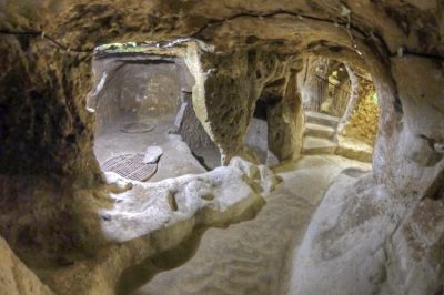 April 17, 2020 The Ancient Multistory Underground Cities of Turkey Housed Thousands of People
- April 16, 2020 Katas Raj Temples- The Oldest Hindu Temple in Pakistan
- June 16, 2019 Church of the Dead: Home to the Peculiar Mummies of Provincial Italy
- June 2, 2019 Yemen’s Ancient Town of Shibam is Also Known As ‘Chicago of the Desert’
The post Doomsday Vault: A Colossal Gene Bank with Over 1 Million Seed Varieties appeared first on .
]]>The post India’s Jharia Coalfield, a 100 Years of Simmering Greed appeared first on .
]]>
Open-cast mining in Jharia coalfield. (International Accountability Project / Flickr)
Earth began her celestial journey as a ball of fire. She still carries fire in her belly is aptly proved by volcanic eruption world over. What if this fire erupts in erratic, low to high-intensity outbursts of smoke and flame in a particular area? This is a daily sight in the coalfields of Jharia, 7 KMs from Dhanbad district in the state of Jharkhand; peril to inhabitants of the 450 Sq. km area can well be imagined.
The problem is over a hundred years old. Illegal mining, corruption in public life, and world treaty on global warming for minimising thermal energy (produced by burning coal) to check carbon emissions in the environment have made it all the more vexing for the Indian state.
Mining disaster at Jharia Coalfield
Mining was started in this area by the British in 1890. Subsequently, private players forayed into this business. Greed for profiteering made mine owners lax to safety measures and that in course of time made Jharia a burning field emitting greenhouse gases like carbon monoxide, sulphur dioxide and arsenic, polluting air, water and soils to no end.
Large underground mines were passé’ and the premium coke coal (Unique Selling Point of these mines) was increasingly dugout through a quicker and more cost-effective technique of surface blasts open-cast mining.
New shafts dug for quick reach to coal, connected the large underground mined spaces of past era to the air above the ground. This set in motion the spontaneous combustion of coal leading to a trail of infernos playing havoc with on ground flora and fauna, a phenomenon first noted in 1916 and continuing till date.
Fires are not only causing loss of coking coal by way of burning it but also by denying access to untapped reserves of good coal (an estimated total loss of about $ 220 billion). Cardinal railway link to Andra-Gomoh runs through this terrain and its snapping, if deemed inevitable in future, would be huge commercial set back to the state.
Notably, Dhanbad-Patherdih rail line was shut down following land subsidence in 2007, and Adra (West Bengal) Gomoh track was altered to a different route for safety reasons.

Children at work in the dangerous coal field of Jharia. (David Alexander Elder / Flickr)
Efforts from government
Nationalisation of mines in early nineteen seventies aught to have improved situation but didn’t. Large-scale opencast mining brought outside air directly in touch with residual coal inside which acquired a coating of inflammable minerals, causing auto combustion and chain of fire and smoke blitzkrieg.
Loss of life and property mounted by the day, and a need was felt to shift affected population to safer locations; 7 lakh people have already been shifted. The Government of India roped in services of DMT group of Germany to contain the fire but the group complained of poor cooperation from government officials and the task remained largely in limbo.
Coal meets 2/3rd of India’s energy needs, and most of it comes from Jharia coalfield. Unable to tap her own resources, India is forced to import coke coal from outside. Even as China and America are the biggest environmental polluters, global warming protocols mandate India to cut coal consumption to reduce carbon emission.
India must spend a whopping 400 crores per year to buy coke coal from outside to sustain her steel and iron industry. Amount of premium coke that gets burnt to ashes in fires, and the amount that remains undug because of perilous land conditions, is huge. If this is saved somehow, it can be a great boon for the Indian economy. But the situation on the ground is dismal.
Jharia Rehabilitation and Development Authority (JDRA) is engaged in the onerous task of shifting people from singing fields and give them safe base at a distance. Central Institute of Mining and Fuel Research has come up with ways to douse raging fires using nitrogen foam. Smoking ravines and billowing flames though tell a different story. Notwithstanding damage control measures, Jharia seems to be heading to ruin.
JCF (Jharia Coal Fields) may become safe for mining, environment and human habitation, but only if a century-old abuse of nature and natural resources is accounted for. This though is easier said than done.
More photos by Jhonny Haglund.
Enjoyed this article? Also, check out “Ever Heard About the Darvaza Gas Crater That has Been Burning in Flames for the Last 50 years?“.
Optional Visit:
Jharia | Jharkhand, India
Fact Analysis:
STSTW Media strives to deliver accurate information through careful research. However, things can go wrong. If you find the above article inaccurate or biased, please let us know at [email protected].
RELATED
 December 20, 2019 Bhopal Gas Tragedy: India’s Very Own Chernobyl That Affected Over Half a Million People
- June 14, 2019 Padmanabhaswamy Temple: The Richest Temple in the World with Gold Worth $22 Billion in Six Vaults
- January 12, 2019 Kumbhalgarh Fort: Not Only China But India Too Has Its Own ‘Great Wall’ Built Centuries Ago
- January 17, 2019 Pamban Bridge: A Historic Indian Sea Bridge That Was Built on Modern Principles
The post India’s Jharia Coalfield, a 100 Years of Simmering Greed appeared first on .
]]>The post What is a Life Size Model of Noah’s Ark doing in Kentucky? appeared first on .
]]>
A view of Noah’s Ark in Ark Encounter, Kentucky. (Olinej / Pixabay)
Most of us know the Bible story of Noah’s Ark where a flood of epic proportions threatened to wipe-out mankind and every land animal. Noah built a large ship under the guidance of God which catered for his family as well as two animals from every species. According to the Bible, every animal alive today branches from those who sought refuge on the ark and every human being are descended from Noah’s family. While many people have since resigned this story to myth there is a still a large following of believers none more so than in America.
In what is known as America’s ‘Bible Belt’ a themed family center has been constructed illustrating the conditions of Noah’s work and voyage. It is called Ark Encounter, situated in Kentucky, a southern state of the US. The brainchild of Christian fundamentalist Ken Ham, the Ark was planned by a group called Answers in Genesis whom he founded.
They also run a Creation museum in the same state. Funding was an issue for the vastly ambitious project so they collaborated with a corporation called Ark Encounter LLC. to help raise funds. This was controversial as it required over $100 million dollars which included $62 million from the city of Williamstown as well as many private donations. Non-religious and religious people alike argued that the money could have been better spent. Construction began none the less with over 1,000 Amish builders employed using timber and ancient techniques. It became the largest timber frame structure in the US.

Outside exhibits of Creation Museum, Kentucky. (Jelson25 / Wikimedia Commons)
Launch and response
It opened on July 7th, 2016 to commemorate Genesis 7.7; the chapter of the Bible in which Noah and his wife entered the ark. As before its opening, protestations and criticisms remain. One such comes from a famous presenter and engineer Bill Nye (commonly known as Bill Nye the Science Guy due to a television program he hosted). He debated with the creator Ken Ham on an opening day with the exchange being filmed.
From a scientific standpoint, many feel it is wrong to teach children scrupulous information including that the Earth is only 6,000 years old. From a religious viewpoint, they maintain that it is wrong to teach children that we are animals, relating to the theory of evolution. There are also other criticisms out of history. These are regarding the tax breaks received by the center and rumours that their hiring policy only accepts individuals of Christian faith.
Whatever the viewpoint, the Ark gained 1 million visitors in its first fiscal year which was considered a great success.
Attractions at ark encounter
Ark Encounter is a full-scale model as described in Genesis. It is 510 x 85 x 51 feet, a truly ginormous exhibit, bigger than a football field. There are three decks mostly with models of animals, dioramas of cultural exhibits and public facilities. There is a gift shop, restaurant and a petting zoo among other attractions on site.
A main feature of the Arc is to dispel any word that deems the schematics of the story impossible. For example, we can now estimate that there is over 1 million animal species and rising. This is a modern critique as people will say how could this amount of creatures fitted inside. A spokesperson for the center states that at the time of the Bible the term species was different and that the concept of a ‘kind’ of an animal was used. Simply put, if an animal can breed with another, they are in the same kind. There would have been about 1,500 animals on board they estimate, at most 7,000 so believers ascertain there would have been ample room inside. And of course insects and fish were left to their own devices.
Promotional video of Ark Encounter. (Source: Ark Encounter / YouTube)
One disagreement between sides is dinosaurs. Scientific research has found that early humans first appeared 6 million years ago, while the dinosaurs went extinct 65 million years past. Christianity puts them both together and so models of young dinosaurs are exhibited inside Ham’s design. Techniques are explained on waste management, ventilation, and feed, all of which using ancient methods.
It is not just animals that are inside the Ark, however. There are scenes showing Noah, his wife, his sons and information about the lives they lived are depicted. Also, Noah’s grandfather, Methuselah, another famous Bible figure who lived to be 969 years is mentioned. Displays show the situation outside of the ark also, during the floods where people were punished for sinful behaviour, for instance, the worship of false gods.
The exterior of the arc is illuminated at night, another cause for controversy. The site explains, “The Ark is illuminated with rainbow colors in the evening as a testament to the true meaning of the rainbow. After the Flood, God designated the rainbow as the sign of His covenant to never again destroy the whole earth with water.”
People believe this is in reference to Gay Pride. A criticism alluded to earlier is that employers must be of a straight orientation – something the center denies. The Encounter continues to increase in popularity despite these accusations. Or perhaps under the adage of ‘all publicity is good publicity’, the bad press is helping.
Either way, the Ark will be around for many years to come. And while live and let live should always be preached, science and religion can both be taught, how far do we go in terms of teaching children far-fetched versions of history? The problem with that, however, is that for whatever side you are on, no-one can disprove the other. And that will be the same for a long time to come.
Enjoyed this article? Also, check out “Gereja Ayam: The ‘Chicken Church’ of Indonesia Was Meant to Serve As a Prayer House for All Religions“.
Recommended Visit:
Ark Encounter | USA
Fact Analysis:
STSTW Media strives to deliver accurate information through careful research. However, things can go wrong. If you find the above article inaccurate or biased, please let us know at [email protected].
RELATED
- May 12, 2019 Cambodia’s Magnificent Angkor Wat: One of the Largest Religious Monuments in the World
 September 17, 2019 Gereja Ayam: The ‘Chicken Church’ of Indonesia Was Meant to Serve As a Prayer House for All Religions
 August 7, 2019 Ham – The Chimpanzee that Paved Way for Launch of Manned Spacecrafts
 November 25, 2019 Carl Panzram: The Serial Killer Who Epitomized Evil
The post What is a Life Size Model of Noah’s Ark doing in Kentucky? appeared first on .
]]>The post Kangbashi, Ordos – Ghost City? Economic Ingenuity? Or Both? appeared first on .
]]>
Empty streets and buildings in Kangbashi District. (© Carla Hajjar / Used With Permission)
China is another world. That is the view of many outsiders when they think about the People’s Republic of China due to the sheer vastness of it. With so much land, masses of inhabitants and many different cultures, intricacies within are often unheard of. As a nation of over 1.379 billion people and 9,596,961 Km² getting your head around the numbers alone is a task enough.
One such intricacy is the emerging abundance of ‘Ghost Towns’; urban areas which resemble a post-apocalyptic movie or post-war zone. And while there are abandoned places on every continent, the sheer scale and increasing amount of these Chinese versions are drawing attention. While they seem to show something sinister or an economic failing, looking into the subject deeper gives another understanding. That they are not ghosts of the past but rather apparitions for the future.
Building a modern sector
In a region known as Inner Mongolia, covered by deserts there is a region called the Ordos with sprawling urban districts. It is home to many extravagant government projects encouraged by a large discovery of coal mines. One such project is called Kangbashi which was set to become the largest district, originally able to accommodate one million people. It was constructed to become the administrative center of Ordos, taking over from neighbouring district Dongsheng. Being closer to water reservoirs is the main reason why.

A quiet street of Kangbashi. (© Carla Hajjar / Used With Permission)
Minus the people, Kangbashi looks relatively ordinary in terms of a modern Chinese city. As it is a young urbanization the government has had to create a sense of history as well as artistry. Monuments have been erected to honour the Mongolian ruler Genghis Khan, a controversial figure who was said to unify the Chinese people.
There are also many statues such as horses relating to nomadic Mongolian traditions. Around them are parks, museums, and shopping malls. The curious case ends here, however. While it is exciting to portray the Chinese city as a mysterious haunt like Pripyat – the town near Chernobyl – Kangbashi is no more than government planning. And judging by China’s success in recent years, presumably clever planning at that.
Just as the old saying goes, “Rome wasn’t built in a day”, Xing Su, an official of Ordos answers the situation. And to look at another, the commonly wrongly quoted “Build it and they [he] will come.” from American baseball movie Field of Dreams seems more pertinent. Kangbashi was created only six years ago. Meaning the abandoned aspect at the moment is simply the transition between construction and inhabitation. Only 100,000 people live there currently (if figures are to be believed) but the government is not worried. Simply put, Kangbashi is not an accident, nor a failure. The Ordos is already a prefecture-level city and this new district is a common economic strategy. As it is cheaper to build a new rather than to refurbish, it will become the new administrative center without the need to change or destroy the old one.
Inhabitation
Officials report that the population is steadily increasing and will continue to do so with 80-90% of apartments having already been sold. This is again a common place in China for future investment, real estate still booming from the wealth created from coal veins.
There is still a problem at the moment, however. Because there is little population it lacks atmosphere and activities causing people to commute from Dongsheng which is the go-to place for shopping and entertainment.
Residents comment that Kangbashi is a car city, the size deeming it not sensible to walk anywhere, making people order online and live in their apartment complexes after work. This leaves the streets empty and while Kangbashi is beautiful, clean and fresh there is not much to do.

An empty mall in Kangbashi. (© Carla Hajjar / Used With Permission)
Government efforts
In effect, the government are looking for ways to improve the city and increase the flow of inhabitants. As the only economic interest is coal, other avenues are necessary to make it a truly functioning metropolis. Car manufacturing plants are being designed and many start-up companies are encouraged too. A national sports stadium has been built which can hold 35,000 spectators as well as a Formula One track in the shape of a horse.
The 2012 Miss World competition was also recently hosted. The ghastly nature of the city is starting to become an idea for adventure tourism with photographers and journalists flocking to the city. They can experience tours that run to the Mausoleum of Genghis Khan, less than 55km away and an area called Xingshawan which has expeditions to the nearby sand dunes. Chinese citizens are also offered many benefits to relocate and become part of the community.

An empty Great Kangbashi bridge. (Popolon / Wikimedia Commons)
Kangbashi has certainly been debunked as a traditional Ghost Town but still holds many of the said qualities. Despite that, it would appear the future is bright here and instead other, older districts such as Dongsheng have the greater danger of becoming abandoned. Alas how long until Kangbashi becomes the next Dongsheng.
Enjoyed this article? Also, check out “Replica Constructions of World-Famous Cities and Towns in China: Tianducheng, Thames Town, and Hallstatt“.
Recommended Visit:
Kangbashi District | China
Fact Analysis:
STSTW Media strives to deliver accurate information through careful research. However, things can go wrong. If you find the above article inaccurate or biased, please let us know at [email protected].
RELATED
 October 6, 2018 Tiger Farms: Where a Shady ‘Tiger Conservation Business’ Puts the Entire Feline Population at a Greater Risk
- November 30, 2018 Replica Constructions of World-Famous Cities and Towns in China: Tianducheng, Thames Town, and Hallstatt
- May 22, 2019 The South China Mall: Why Did the Largest Mall in the World Fail?
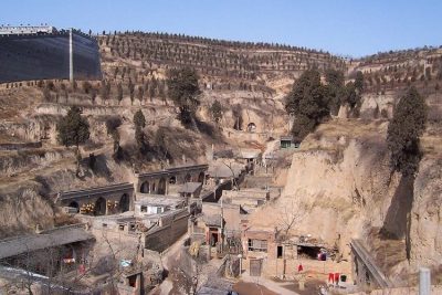 June 27, 2019 Traditional Yaodong, Shaanxi Province: The Cave Dwellings in Which Many Chinese People Still Live
The post Kangbashi, Ordos – Ghost City? Economic Ingenuity? Or Both? appeared first on .
]]>